

habitat suitability index models: northern pintail - USGS National ...
habitat suitability index models: northern pintail - USGS National ...
habitat suitability index models: northern pintail - USGS National ...
- No tags were found...

Create successful ePaper yourself
Turn your PDF publications into a flip-book with our unique Google optimized e-Paper software.
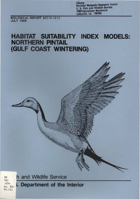
BIOLOGICAL REPORT 82(10.12 nJULY 1986a:'~~al Wetlands lteeearch CenterU. S. Fish and WlldUfe service7'fWJ'(:=atundome BoulevardLaf'ayette. La. 70586HABITAT SUITABILITY INDEX MODELS:NORTHERN PINTAIL(GULF COAST WINTERING)h and Wildlife ServiceSK361 :- ' ---------------------~~~482- >. Department of the Interior10.121
~t~~~'JJl Wetland Researc~.{CenterU S Fish and W11 Ufe ser nee700 ·Cajund.me Go levardLafayette, La. 70506This model is designed to be used by the Division of Ecological Services inconjunction with the Habitat Evaluation Procedures.
MODELEVALUATION FORMHabitat <strong>models</strong> are designed for a wide variety of planning applicationswhere <strong>habitat</strong> information is an important consideration in the decisionprocess. It is impossible, however, to develop a model that performs equallywell in all situations. Each model is published individually to facilitateupdating and reprinting as new information becomes available. Assistance fromusers and researchers is an important part of the model improvement process.Please complete this form following application or review of the model. Feelfree to inc1ude additiona1 i nformati on that may be of use to ei ther a modeldeveloper or model user. We also would appreciate information on modeltesting, modification, and application, as well as copies of modified <strong>models</strong> ortest results. Please return this form to:Thank you for your assistance.<strong>National</strong> Wetlands Research CenterU.S. Fish and Wildlife Service1010 Gause BoulevardSlidell, LA 70458SpeciesHabitat or Cover Type(s)_GeographicLocation '-----------------_Type of Application: Impact Analysis Management Action Analysis _Base1i ne Other _Variables Measured or Evaluated--------------------Was the species information useful and accurate? Yes NoIf not, what corrections or improvements are needed?___
Were the variables and curves clearly defined and useful? YesIf not, how were or could they be improved?-------------No 'Were the techniques suggested for collection of field data:Appropriate? Yes NoClearly defined? Yes NoEasily applied? Yes NoIf not, what other data collection techniques are needed?Were the model equations logical? Yes NoAppropriate? Yes NoHow were or could they be improved?Other suggestions for modification or improvement (attach curves,equations, graphs, or other appropriate information)Additional references or information that should be included in the model:Model Evaluator or ~eviewer Date _Agency __--'- --" ~Address_Telephone Number Comm: __ FTS _
Biological Report 82(10.121)July 1986HABITAT SUITABILITY INDEX MODELS: NORTHERN PINTAIL (GULF COAST WINTERING)byRebecca J. Howard<strong>National</strong> Wetlands Research CenterU.S. Fish and Wildlife Service1010 Gause BoulevardSlidell, LA 70458andHarold A. KantrudNorthern Prairie Wildlife Research CenterU.S. Fish and Wildlife ServiceJamestown, NO 58401Performed for<strong>National</strong> Wetlands Research CenterResearch and DevelopmentFish and Wildlife ServiceU.S. Department of the InteriorWashington, DC 20240
This report should be cited as:Howard, R.J., and H.A. Kantrud. 1986. Habitat <strong>suitability</strong> <strong>index</strong> <strong>models</strong>:<strong>northern</strong> <strong>pintail</strong> (gulf coast wintering). U.S. Fish Wild1. Servo 8io1. Rep.82(10.121). 16 pp.
PREFACEThis document is part of the <strong>habitat</strong> <strong>suitability</strong> <strong>index</strong> (HSI) model seriesand is designed for use with the U.S. Fish and Wildlife Service's (1980)<strong>habitat</strong> evaluation procedures in impact assessment and <strong>habitat</strong> managementactivities. The model was developed from a review and synthesis of existinginformation. It is scaled to produce an <strong>index</strong> of <strong>habitat</strong> <strong>suitability</strong> between 0(unsuitable <strong>habitat</strong>) and 1 (optimally suitable <strong>habitat</strong>). Model documentationand guide 1i nes for mode 1 app1ications. inc1udi ng methods for meas uri ng mode 1variables. are provided.Model documentation is provided for several reasons. First, it provides ameans of explaining the model's structure and its inherent assumptions. Second.the model-building process involves considerable judgment on the part ofthe model builder, and documentation provides the insights necessary to modifythe model when these judgments are inconsistent with local or new knowledge.Finally, the documentation should facilitate modification of the model to meetindividual study constraints on time and human resources.The model presented is a hypothesis of species-<strong>habitat</strong> relationships. nota statement of proven cause and effect. For this reason, users of the modelare encouraged to suggest improvements that may increase the utility andeffectiveness of this <strong>habitat</strong>-based approach to fish and wildlife management.Please send suggestions to the following address:Information Transfer Specialist<strong>National</strong> Wetlands Research CenterU.S. Fish and Wildlife Service1010 Gause BoulevardSlidell. LA 70458.iii
CONTENTSPagePREFACE...............................................................ACKNOWLEDGMENTSiiiviINTRODUCTION 1Populations and Seasonal Distribution 1Major Wi nteri ng Areas 1SPECIFIC HABITAT REQUIREMENTS 4Food and Foraging Habitat............................................ 4Water 6Cover 6Special Considerations.............................................. 6HABITAT SUITABILITY INDEX (HSI) MODEL................................. 7Mode 1 App1i cabi 1i ty 7Model Description................................................... 7Suitability Index (SI) Graphs for Model Variables 9HSI Determination................................................... 11Fie1d Use of the Mode 1 13Interpreti ng Model Outputs 13REFERENCES 15v
ACKNOWLEDGMENTSThe <strong>habitat</strong> <strong>suitability</strong> <strong>index</strong> model for wintering <strong>northern</strong> <strong>pintail</strong> wasreviewed and constructively criticized by Robert Chabreck, Louisiana State University,Baton Rouge, and Stuart Paulus, Louisiana Department of Wildlife andFisheries, Grand Chenier. Many other waterfowl biologists provided informationused in the development of the model; thei r names are noted in the report.Personnel of the U.S. Fish and Wildlife Service's <strong>National</strong> Wetlands ResearchCenter evaluated the model's structure and functional relationships. Otherreviewers of the model were FWS Ecological Services personnel from the followingoffices: Clear Lake, Texas; Corpus Christi, Texas; Daphne, Alabama; andLafayette, Loui s i ana. Model development and pub 1i cati on were funded by theFWS. Patrick J. Lynch illustrated the cover.vi
NORTHERNPINTAIL (Anas acuta)INTRODUCTIONPopulations and Seasonal DistributionThe <strong>northern</strong> <strong>pintail</strong> (Anas acuta), commonly called the <strong>pintail</strong>, is one ofthe three most abundant ducks in North America and is distributed over agreater proportion of the earth's surface than any other species of waterfowl(Bellrose 1976). Its North American breeding range covers most of thenonforested area northwest of a line from central California to Quebec.From their principal breeding grounds in the prairie and parkland potholeregion of south-central Canada and the north-central United States, <strong>pintail</strong>smigrate to their wintering grounds along two major corridors. These corridorsextend southwest to the Central Valley of Cal ifornia and south to the gulfcoast and Mexico. About 2.1 million <strong>pintail</strong>s wintered in the United Statesduring 1985-86 (Gamble 1986). Percentages of this population found in the fouradministrative waterfowl flyways (discussed in Glover 1964) were 61%, Pacific;16%, Central; 21%, Mississippi; and 2%, Atlantic. This report's <strong>habitat</strong><strong>suitability</strong> model is based on descriptions of <strong>pintail</strong> wintering <strong>habitat</strong> foundin the Central and Mississippi flyways.The <strong>northern</strong> <strong>pintail</strong> is a highly mobile and opportunistic species. Authoritieshave attributed long- and short-term shifts in the areas and types of<strong>habitat</strong>s used by <strong>pintail</strong>s to both normal and catastrophic weather events;changes in regional agricultural practices; construction, destruction, or degradationof wetlands; hunting pressure; competition for food; and enhancementof food supplies by humans. Temporal aspects of <strong>habitat</strong> use are especially difficuIt to ascertain because i nfl uxes of southbound bi rds classed as "l ate wi nter arri va1s" on the wi nteri ng grounds may be met by a vanguard of northbound"early migrants" (J. Lynch, Lafayette, Louisiana; pers. comm.).Few detailed studies of <strong>pintail</strong> winter <strong>habitat</strong> requirements have beenattempted on the Gulf of Mexico coast because of unpredictable populationmovements and behavior and the ill-defined patterns of <strong>habitat</strong> use on the winteringgrounds (J. Teer, Welder Wildlife Foundation, Sinton, Texas; pers.comm.)Major Wintering AreasWi nteri ng <strong>northern</strong> pi ntail use three major areas in the U. S. Gulf ofMexico coastal region and an additional three areas in inland Texas andLouisiana. Brief descriptions of these six wintering areas follow.1
limited food supplies and provide poor loafing <strong>habitat</strong> (S. Paulus. per-s .comm. ).Atchafalaya Delta Zone. This zone in the Deltaic Plain of southeasternLouisiana contains about 30.000 ha of open. shallow wetlands and mudflats thatrecently have become a wintering area for more than 100.000 <strong>pintail</strong>s (R.Chabreck. pers. comm.). If the <strong>pintail</strong> can be assumed to be a typical dabblingduck. the calculation of simple ratios of use to availability. based onPalmisano's (1972) figures for the Deltaic Plain. reveals that fresh marsheswere most heavily used (ratio of percentage of ducks observed to percentage offresh marshes in sample = 2..1). Use ratios for intermediate. brackish, andsaline wetlands were 1.0. 0.6. and 0.2. respectively.Playa Lake-Irrigated Corn Zone. Some 25.000 playas in a 52-county area ofthe Southern Great Plains annually collect 2.5 to 3.7 km 3 of water (Templer1978; Guthery et al. 1981). Most of these playas are in a 44-county area inthe Texas Panhandle; about half are less than 4 ha each (Guthery et al. 1981).This zone is the only major <strong>pintail</strong> wintering area where the birds forageon dry ground. Recent January surveys (1978-82) i ndicated that an average of14% of Texas <strong>pintail</strong>s wintered in this zone (Texas Parks and Wildlife Departmentfiles); an estimated 635,000 <strong>pintail</strong>s have been recorded in selected areas(Simpson et al. 1981).This zone averages about 1 unit area of wetland for every 10 unit areas ofcorn (E. Bolen. Texas Technical University. Lubbock; pers. comm.). Althoughthe natural playas are dry about 3 years in 5. <strong>pintail</strong> use of the zone does notdiminish because many playas have been modified to receive irrigation tailwateror have been deepened to serve as livestock ponds (E. Bolen. pers. comm.). Thelarger (>5 ha) playas are preferred by <strong>pintail</strong>s; those smaller than about 0.5ha receive little use.Catahoula Lake-Rice and Soybean Zone. This wintering area in centralLouisiana supports up to a quarter million <strong>pintail</strong>s (C. Smith. pers. comm.).Pri or to the i nsta11 ati on of water-control structures in 1973, the use ofCatahoula Lake by waterfowl varied greatly each year, depending on precipitationpatterns and seasonal river stages (Wycoff et al. 1971). Today withwater-level control. the lake consistently attracts large numbers of wintering<strong>pintail</strong>s.The 100-km 2 lake is managed to create concentric zones of annual emergentplants that are valuable waterfowl foods. The lake is drained in July. exceptfor a deep 20-km 2 central pool, to allow grasses and sedges to grow. In fallthe water level is raised to a depth of about 0.6 m to allow waterfowl accessto the food source. Emergent plants cover about 60% of the water surface whenthe birds arrive. Frost. wave action. and extensive use by birds and huntersbreak down the stands of vegetation. and by the end of the hunting season thelake is mostly open water. As hunting increases and water levels are raised.<strong>pintail</strong>s make extensive use of flooded rice, sorghum. and soybean fields within30 km of the lake (J. Emphinger. Louisiana Department of Wildlife and Fisheries;pers. comm.).3
fresh marshes 1ater in the season if stands of annual food plants that havedeveloped during a dry summer become flooded by fall or winter rains. Winterrains normally result in a large influx of <strong>pintail</strong>s inland, where rice fieldsare the favored <strong>habitat</strong>, followed by soybean fields, fallow rice fields, nativepasture, and planted pasture. Improved and unimproved fields attract <strong>pintail</strong>sequally if their water levels are similar (R. Chabreck, pers. comm.). Ifdisturbance is great, <strong>pintail</strong>s feed in the agricultural districts at night andreturn to the open, shallow marshes along the coast to preen and rest duri ngthe day (Tamisier 1976). If disturbance is slight, <strong>pintail</strong>s will lingerseveral weeks as far as 120 km inland (W. Hobaugh, Texas A&M University,College Station, pers. comm.; C. Smith, pers. comm.). Flights up to 80 km fromthe coastal marshes to the rice fields are common (R. Chabreck, pers. comm.).In the Atchafalaya Delta Zone, principal <strong>pintail</strong> foods include Sagittariaspp., Najas spp., Potamogeton spp., and annual grasses (R. Chabreck, pers.comm.). Agricultural land in this zone is mostly devoted to sugarcane and isof little or no value to <strong>pintail</strong>s.Waste corn from irrigated fields is the principal food of wintering<strong>pintail</strong>s in the Playa Lake-Irrigated Corn Zone (Moore 1980). Heavily usedfields are usually within 5 km of the playas occupied by <strong>pintail</strong>s, but <strong>pintail</strong>shave been observed to fly as far as 15 km from the playas (E. Bolen, pers.comm.). Pintails feed twice daily; the morning meal is usually consumed duringthe half hour before sunri se and the eveni ng meal begi ns about a half hourafter sunset and lasts about 40 min. Supplementary foods are plants of thegenera Potamogeton, Ruppia, Najas, Scirpus, Echinochloa, and Polygonum, and theabundant animals of the playas.In Catahoula Lake, <strong>pintail</strong>s feed on the seeds or tubers of chufa flatsedge(Cyperus esculentus), spikerushes (Eleocharis spp. ), coast barnyardgrass(Echinochloa walteri), and bearded sprangletop (Leptochloa fascicularis) (Wills1971; C. Smi th , pers. comm.). The deep central pool produces aquatic foodplants, including roundleaf waterhyssop (BaCO't rotundifolia), longleaf mudplantain (Heteranthera limosa), arrowheads Sagittaria spp.), and dwarfspikerush (Eleocharis parvula). When water levels rise in the lake, <strong>pintail</strong>sfeed on domestic rice, sorghum, and soybeans. Agricultural crops are the majorfood of <strong>pintail</strong>s wintering in the Upper Boeuf River-Bayou Macon Alluvial PlainsZone.No literature references indicated that food is a limiting factor for the<strong>pintail</strong> on its wintering grounds. In the southern Louisiana coastal wetlandsstudied by Chabreck (1971), most of the vegetation was composed of speciesrated as fair to excellent as waterfowl foods by Martin and Uhler (1951). Inareas where waste agricultural crops are extensively used by <strong>pintail</strong>, there isusually far more food available than birds to consume it (J. Emphinger, pers.comm.). In the Texas Panhandle, <strong>pintail</strong>s can fill their gullets with wastecorn in only 25 to 40 min (E. Bolen, pers. comm.). No authorities familiarwith current conditions considered food abundance and availability a problemfor pi ntailsin the Laguna Madre area of Texas. Indeed, the amount of foodavailable to wintering <strong>pintail</strong>s is continually increasing because of forestclearing and wetland drainage for rice and soybean culture and because of theencroachment of irrigated agriculture in areas formerly devoted to grazing.5
WaterAlthough obviously a critical life requisite, dietary water can be suppliedby flooded cropfields or almost any type of wetland. Pintails seem tohave little problem finding dietary freshwater in the Lagoon-Brushland PastureZone of Texas, even during drought, because some brackish or freshwaterwetlands are always present (W. Kiel, pers. comm.). Other postulated sourcesinclude morning dew accumulations on the birds themselves, the cellular waterin foods, and precipitation that may accumulate on the surface of hyperhalinewater before slowly mixing with it (J. Lynch, pers. comm.). In any event,<strong>pintail</strong>s do not fly daily or twice-daily to freshwater as do redheads (Aythyaamericana) wintering on coastal lagoons in this area (W. Kiel, pers. comm.; J.Lynch, pers. comm.).CoverThroughout the wi nteri ng grounds, pinta il s favor open shallow water forresting and preening; in many instances this condition occurs on the same areasused for feeding (J. Emphinger, W. Kiel, C. Smith, R. Yancey; pers. comm.). Incoastal Texas, use of wetlands by <strong>pintail</strong>s was high if relatively tall emergentgrowth covered less than 20% of the surface; ponds with greater than 60% coverageby tall emergent growth were used little (White and James 1978; G. Unland,pers. comm.). IIFeather edge ll shorelines where water depths range from 0 to 0.5m are considered optimal because they usually furnish a large variety of foodsas well as ideal resting and preening areas (Tamisier 1976; R. Chabreck, pers.comm.). On the Rockefeller Refuge in southwestern Louisiana <strong>pintail</strong>s use tidalmudflats for loafing during the day (S. Paulus, pers. comm.).Although <strong>pintail</strong>s are easily frightened by hunting, boating, fishing, andother human activities, disturbance does not limit the number of <strong>pintail</strong>s thatuse the major wintering areas (E. Bolen, R. Chabreck, W. Kiel, C. Smith, G.Unland; pers. comm.). In heavily hunted areas, the birds orient themselves inspace and time to avoid gunfire. Thousands of <strong>pintail</strong>s can often be seenquietly resting near hunters· blinds, about 300 m or more beyond gun range (J.Lynch, pers. comm.). In addition, the bi rds quickly 1earn to restrict thei rfeeding to periods during the day when hunting is not allowed. Other factorsthat mi t igate di sturbance in various wi nteri ng zones are 1arge 1andho 1di ngs,restricted access, large bodies of open water, and the numerous wildliferefuges in the U.S. portion of the wintering grounds.Special ConsiderationsThe availability of food, whether in wetlands or agricultural lands, islargely determined by weather. Heavy summer rains result in poor germinationof annual food plants in natural marshes. However, a dry summer followed bylate fall or winter rains and frost makes tremendous numbers of these plantsavailable to <strong>pintail</strong>s (R. Chabreck, pers.· comm.). Wind direction can affecttidal height, and several days of northerly winds attract large numbers ofbi rds to exposed stands of submerged aquatic plants in the shallow bays andlagoons (W. Kiel, pers. comm.). Southerly winds, however, will cause thebirds to move shoreward to coastal marshes, inland wetlands, or agriculturalland.6
Weather is also an important factor governing use of the inland rice andsoybean fields. They are most attractive to <strong>pintail</strong>s when shallowly flooded;the water to flood the fields may come from direct precipitation or from artificialreservoirs whose water supply is also largely rainfall-dependent. Thebi rds shi ft from one area to another in response to changi ng water 1eve1s tincreasing their vulnerability to hunters (R. Chabreck , pers. comm.). Theabi l i ty of the fields to hold standing water depends largely on soil type.Precipitation also determines the number of natural inland wetlands thatcontain water each year.Food availability is influenced by the distance the birds must fly toreach thei r feedi ng grounds. Thi s di stance is sometimes zero in the case ofhigh quality natural wetlands t but may be up to 120 km in the case of choiceflooded agricultural fields. (C. Smith t pers. comm.).Cover needs for pi ntai 1 may differ between day and night. Pintai 1shavebeen noted to use denser cover at night than is typically used during the dayin areas where food is abundant (S. Paulus t pers. comm.).HABITAT SUITABILITY INDEXModel Applicability(HSI) MODELGeographic area and cover types. The <strong>habitat</strong> <strong>suitability</strong> <strong>index</strong> model for<strong>northern</strong> <strong>pintail</strong>s was developed for use in wetlands along the Gulf of Mexicocoast in Texas and Louisiana. It can also be applied to the major inland winteringareas of Texas and Louisiana described in this report. Cover types wherethe model can be applied include lacustrine t palustrine t and estuarine wetlandsas defined by Cowardin et al. (1979). Only those wetlands or deepwater areaswith water 1ess than 3 m deep should be considered as potential <strong>habitat</strong> forwintering <strong>northern</strong> <strong>pintail</strong>s. Because <strong>pintail</strong>s are associated with relatively1arge water areastit is recommended that the model be app1i ed to areas thatexceed 4 ha. The model is not intended for evaluating the <strong>suitability</strong> of agriculturallands as <strong>pintail</strong> <strong>habitat</strong>. The model was designed to evaluatew"i nteri ng <strong>habitat</strong> t so it should be app1ied from October through February.Verification level. The following waterfowl biologists reviewed themodel: Robert Chabreck , Louisiana State Un iversi ty, Baton Rouqe , and StuartPaulus , Louisiana Department of Wildlife and Fisberies , Grand Chenier. Theircomments were incorporated when possible t but the authors are responsible forthe final version of the model. The model has not been field-tested.ModelDescriptionOverview. The model has five <strong>habitat</strong> variables affecting two liferequisites: cover and food. The cover component considers the value of a sitefor resting and preening birds. Both life-requisite components may be providedby a single location t but this situation is not required for application of themode1. The re 1ati onships between <strong>habitat</strong> vari ab1es t components t and the HSIvalue are illustrated in Figure 1. Open water is defined for this model aswater with less than 10% canopy coverage by emergent vegetation.7
Habitat variablesVI Water depth - _ComponentV 2V sVIAmount of persistentemergent vegetationStructure of emergentWater depthHSIV 4V sPercentage of wetlanddominated by food plan sSalinityFoodFigure 1. Relationship of <strong>habitat</strong> variables and life requisites to the HabitatSuitability Index (HSI) value for wintering <strong>habitat</strong> of <strong>northern</strong> <strong>pintail</strong>s.Cover component. The <strong>suitability</strong> of <strong>habitat</strong> for resting or preeningpinta;ls ;s assumed to be influenced by water depth and the amount and structureof emergent vegetation. Optimal depth conditions are represented in themodel as an area where 50% or more of the open water is less than 0.5 m deep(VI). Because <strong>pintail</strong>s prefer open shallow waters and mudflats when resting,persistent emergent vegetation is assumed to decrease <strong>habitat</strong> <strong>suitability</strong>;optimal <strong>habitat</strong>, then, is an area with less than 30% coverage by persistentemergent vegetation (V 2 ) . If persistent emergent vegetation is present,<strong>suitability</strong> of the <strong>habitat</strong> as cover for <strong>pintail</strong>s decreases as the percentage ofthe vegetation that is taller than 30 cm and has greater than 40% canopy coverincreases above 5% (Vs).Food component. The HSI model assumes that the quality of <strong>pintail</strong> feeding hab;tat 1s determi ned by three vari ab1es: depth of open water, the percentageof wetland covered by food plants, and sa 1i nity. Because pi ntailsfeed in shallow water, the percentage of open water less than 0.5 m deep (VI),influences the <strong>suitability</strong> of a site for feeding as well as resting. Optimalfeedi ng <strong>habitat</strong> has 50% or more of the wetland domi nated by submerged oremergent plants (or both) used as food by <strong>pintail</strong> (V 4 ) . Salinity alsoinfluences the quality of <strong>pintail</strong> feeding <strong>habitat</strong> along the gulf coast. Exceptin areas southwest of Corpus Christi, Texas, that are dominated by shoalgrassor widgeongrass, <strong>pintail</strong>s prefer vegetation that grows in freshwater toi ntermediate-sa1i ni ty wetlands over vegetation of higher sal i nity wetlands.Habitat <strong>suitability</strong> is assumed to decrease as salinity increases above 5 partsper thousand (ppt); salinity levels greater than 20 ppt have a low <strong>suitability</strong><strong>index</strong> of 0.2 (Vs).8
Suitability Index (SI) Graphs for Model VariablesThe relationships between the value of <strong>habitat</strong> variables and the qualityof palustrine (P), lacustrine (L) , and estuarine (E) coastal <strong>habitat</strong>s forwintering <strong>northern</strong> <strong>pintail</strong>s are demonstrated in the following graphs. Onlyareas with water less than 3 m deep should be considered <strong>pintail</strong> <strong>habitat</strong>. AnSI value of 1.0 indicates optimal conditions, while a value of 0 indicatesunsuitable conditions. Sources of the variables included in the model andassumptions involved in developing SI graphs are summarized in Table 1.Table 1. Variable sources and assumptions for <strong>northern</strong> plntai l <strong>suitability</strong>indices.Variable and sourceV l W. Kiel, pers. comm.G. Unland, pers. comm.V 2 ' 3 White and James 1978G. Unland, pers. comm.Harmon et al. 1960Glasgow and Bardwell 1962Bull er 1964Koenig 1969McMahan 1969Wi 11 s 1971White and James 1978Moore 1980Saunders and Saunders 1981R. Chabreck, pers. comm.J. Emphinger, pers. comm.W. Kiel, pers. comm.C. Smith, pers. comm.C. Stutzenbaker, pers. comm.G. Unland, pers. comm.R. Yancey, pers. comm.McMahan 1969Palmisano 1972R. Chabreck, pers. comm.W. Kiel, pers. comm.J. lynch, pers. comm.C. Stutzenbaker, pers. comm.AssumptionsAreas where wintering <strong>pintail</strong>s rest andfeed are usually large, open, and 30 cm abovethe water surface) emergents have less than40% canopy cover.Feeding areas are large, generally
Habitat Variable Suitability graph1.0P~L~E VI Percentage of open water«10% canopy coverage ofemergent vegetation) that )( 0.8CDis less than 0.5 m deep." C 0.6~:i.Q0.4as.1:::;,UJ 0.21.0P~L~E V 2 Percentage of area thatis covered by persistentemergent vegetation (~10%)( 0.8CDcanopy cover)."oS0.6~:c ==as 0.4:t:::;,CIJ 0.20.00 20 40 60 80 100%0.00 20 40 60 80 100%P~L~E V 3 Percentage of emergentvegetation that exceeds30 cm in hei ght above thewater surface and hasgreater than 40% canopycover. (Note: This variablecan be included in themodel only if some emergentvegetation is present).1.0)( 0.8CD" C 0.6~:5:cas 0.4:t:::;,UJ 0.20.00 20 40 60 80 100%10
HabitatVariablePercentage of study areadomi nated by (>50% canopycoverage) submerged oremergent food plants. (Seedi scuss ion in Food andForaging Habitat sectionfor descripti on of foodplants.))( 0.8Q)".5Suitability graph1.0-t-......""""'---I1"""",I,-;...............~0.40.20.0 ....--r-..,.....,.....,...~...............~o 20 40 60 80 100"E Vs Mean salinity during thegrowing season.)(Q)".5O.O~....-..............,.....,.-...,....,...,..o 10 20 30 40 50pptHSI DeterminationThe following equations are suggested for determining values of the coverand food component indices for a potential wintering area of <strong>northern</strong> <strong>pintail</strong>and for determining the overall HSI value for the site.11
ComponentCover (C)HabitatP,L,EEquationorFood (F)P,L,E S.5 pptE > 5 pptHSI = C or F, whichever is lower.Within components, the variables are assumed to interact in a compensatory mannerso that a high SI value for one can help offset a low SI value for othervariables. The relationship between components is limiting (i.e., the lowercomponent <strong>index</strong> determines the overall <strong>habitat</strong> value). Examples of model outputusing hypothetical data sets appear in Table 2.Table 2. Calculation of <strong>suitability</strong> indices (SI), component indices (CI) and<strong>habitat</strong> <strong>suitability</strong> indices (HSI) for the three sample study areas using <strong>habitat</strong>variable (V) measurements and <strong>northern</strong> <strong>pintail</strong> HSI model equations.Model Study area 1 (P) Study area 2 (E) Study area 3 (E)component Data SI Data SI Data SIVI 80% 1. 00 20% 0.46 65% 1. 00V2 0% 30% 1. 00 50% 0.71V3 50% 0.54 100% 0V4 65% 1. 00 30% 0.60 20% 0.40V5 15 ppt 0.43 20 ppt 0.20C 1. 00 0.59 0.60F 1. 00 0.49 0.43HSI 1. 00 0.49 0.4312
Field Use of the ModelIt may not be appropriate to apply the HSI model as it is structured insome situations. As previously noted, two distinct patterns of <strong>habitat</strong> use bywi nteri ng <strong>northern</strong> pi ntai 1s are found along the gulf coast. Wetlands may beused primarily as resting areas by birds that regularly feed in floodedcrop 1ands up to 80 km inland, or they may be used as both feedi ng and restingareas. If the former situation is likely to occur, the HSI value for the studyarea should be equal to the cover component value. Although the wetland mayhave some value as feeding <strong>habitat</strong>, it is not used as such by the birds, andlow feeding value in these cases should therefore not limit the <strong>habitat</strong> value.A second problem with applying the complete model will be encountered insome wetlands in southwestern Texas along the Laguna Madre. In this region,the negative effects of high salinity on feeding <strong>habitat</strong> <strong>suitability</strong> are offsetby the presence of the hi ghly favored shoal grass and wi dgeongrass. The meansalinity during the growing season (Vs) should be dropped from the HSI modelwhen it is applied in these hyperhaline lagoons.It is not appropriate to use this model when water quality has been degraded.The reduction in available <strong>habitat</strong> caused by environmental contaminantswill interfere with proper interpretation of model results.The level of detail used in a particular application of this model willdepend on time, money, and accuracy constraints. Detailed field sampling ofall variables will provide the most reliable and co~sistent HSI values. Any orall variables can be estimated to reduce the amount of time required to applythe model. Increased use of subjective estimates, however, decreases consistency.Estimates should be accompanied by appropriate documentation to insurethat decisionmakers understand both the method of HSI determination and thequality of data used in the HSI model.Visual estimates of water depths, areas of persistent emergent vegetation,and salinity levels (as judged by plant species composition) will greatly reducethe field hours necessary to compute the HSI. These are best estimated byinspection supplemented with aerial photographs. Investigators should be especiallycautious when estimating water depth. Deep water is not necessarilyi ndicated by the absence of emergent vegetation because hi gh turbidity, currents,and saline water can also account for the absence. Suggested field measurementtechniques are given in Table 3. Measurements in tidal areas shouldbe taken at mean low tide.Interpreting ModelOutputsA <strong>pintail</strong> HSI, determined by field application of this model, may notreflect the population density of <strong>pintail</strong>s in the study area because otherfactors may have significant influence in determining species abundance. Themodel should, however, yield HSI values that have positive correlations withlong-term abundance. This correlation has not been tested. The proper interpretationof the HSI is one of comparison. If different areas have differentHSI IS, then the area wi th a hi gher HSI shoul d be capable of supporting more<strong>pintail</strong>s than the area with a lower HSI.13
Table 3. Suggested methods for field measurement of variables used in the<strong>pintail</strong> HSI model.VariableMethodsField reconnaissance during winter; available depth contour mapssuperimposed on current aerial photographs.Field reconnaissance during winter; interviews with area gamemanagers familiar with <strong>pintail</strong> feeding patterns and cycles ofannual drawdown/reflooding hydrology.Field reconnaissance with personnel knowledgeable of the effectsof salinity on wetland plant communities; regional maps of salinityisopleths.14
REFERENCESBellrose. F.C. 1976.Books. Harrisburg, Pa.Ducks. geese and swans of North America.543 pp.StackpoleBuller. R.J. 1964. Central flyway. Pages 209-232 in J.P. Linduska, ed.Waterfowl tomorrow. U.S. Fish and Wildlife Service. Washington, D.C.Chabrack , R.H. 1971. Ponds and lakes of the Louisiana coastal marshes andtheir value to fish and wildlife. Proc. Annu. Conf. Southeast. Assoc. GameFish Comm. 25:206-215.Chabreck, R.H. 1972. Vegetation. water and soil characteristics of the Louisianacoastal region. La. Agric. Exp. Stn. Bull. 664.Cowardin. L.M.• V. Carter, F.C. Golet, and E.T. LaRoe. 1979. Classificationof wetlands and deepwater <strong>habitat</strong>s of the United States. U.S. Fish WildT.Servo Biol. Servo Program FWS/08S-79/31. 103 pp.Day, J.W., Jr., W.G. Smith, and C.S. Hopkinson, Jr. 1972. Some trophic relationshipsof marsh and estuarine areas. Pages 115-135 in R.H. Chabreck, ed.Proceedings: Second Coastal Marsh Estuary Management Symposium. LouisianaState University, Baton Rouge.Gamble, K. 1986. January 1986 waterfowl survey, Mississippi Flyway. U.S.Fish and Wildlife Service, Office of Migratory Bird Management, Columbia, Mo.Unpubl. rep. 5 pp.Glasgow, L.L., and J.L. Bardwell. 1962. Pintail and teal foods in south Louisiana.Proc. Annu. Conf. Southeast Assoc. Game Fish Comm. 16:175-184.Glover, F.A. 1964. Tundra to tropics. Pages 23-35 in J.P. Linduska, ed.Waterfowl tomorrow. U.S. Fish and Wildltfe Service, Washington, D.C.Guthery, F.S., F.C. Bryant, B. Kramer. A. Stoecker, and M. Droracek. 1981.Playa assessment study for U. S. Department of Interior. Water and PowerResources Service, Amarillo, Tex. 182 pp.Harmon, B.G., C.H. Thomas, and L.L. Glasgow. 1960. Waterfowl foods in Louisianaricefields. Trans. N. Am. Wildl. Nat. Resour. Conf. 25:153-162.Heit, W.S. 1948. Texas coastal waterfowl concentration areas and their1947-48 wintering population. Trans. N. Am. WildT. Nat. Resour. Conf.13:323-338.15
Koenig. R.L. 1969. A comparison of the winter food habits of three species ofwaterfowl from the Upper Laguna Madre of Texas. M.S. Thesis. Texas A&IUniversity. Kingsville. 59 pp.Martin. A.C.• and F.M. Uhler. 1951. Food and game ducks in the United Statesand Canada. U.S. Fish Wildl. Servo Res. Rep. 30. 308 pp.McMahan. C.A. 1969.as. M.S. Thesis.Food habits of ducks wintering on the Laguna Madre. TexUniversity of New Mexico State. Las Cruces. 37 pp.Moore. R.L. 1980. Aspects of the ecology and hunting economics of migratorywaterfowl on the Texas high plains. M.S. Thesis. Texas Tech. University.Lubbock. 80 pp.Palmisano. A.W. 1972. Habitat preference of waterfowl and fur animals in the<strong>northern</strong> gulf coast marshes. Pages 163-190 in R.H. Chahreck , ed. Proceedings:Second Coastal Marsh Estuary Management Symposium. Louisiana StateUniversity. Baton Rouge.Saunders. G.B.• and D.C. Saunders. 1981. Waterfowl and their winteringgrounds in Mexico. 1937-64. U.S. Fish Wildl. Servo Resour. Publ. 138.Simpson. C.D.• LG. Bolen. R.L. Moore. and F.A. Stormer. 1981. Significanceof playas to migratory wildlife. Pages 35-45 in Playa Lakes Symposium Proceedings.U.S. Fish Wildl. Servo FWS/OBS-81/07.--Tam i s ier, A. 1976. Diurnal activities of green-winged teal and <strong>pintail</strong> winteringin Louisiana. Wildfowl 27:19-32.Temp 1er , O.W.High Plains.1978. An analysis of playa 1ake water utili zati on on the TexasWater Resour. Bull. 14:454-465.U.S. Fish and Wildlife Service. 1980. Habitat evaluation procedures (HEP).ESM 102. Washington. D.C. n.p.Weems. T.A.• E.L Reynolds. LT. Allen. C.L Martin. and R.L. Venson. 1977.Soil survey of West Carroll Parish. Louisiana. U.S. Department ofAgriculture. Soil Conservation Service. 75 pp.White. D.H.• and D. James. 1978. Differential use of freshwater environmentsby wintering waterfowl of coastal Texas. Wilson Bull. 90:99-111.Wills. D. 1971. Food habit study of mallards and <strong>pintail</strong>s on Catahoula Lake.Louisiana. with notes of food habits of other species. Proc. Annu. Conf.Southeast Assoc. Game Fish Comm. 25:289-294.Wycoff. R.G.• D.W. Wills. and L.L. Glasgow. 1971. An evaluation of recoverydata from artificially seeded lead shot on Catahoula Lake. LaSalle Parish.Louisiana. Proc. Annu. Conf. Southeast Assoc. Game Fish Comm. 25:245-254.16
50272 -101REPORT DOCUMENTATION/1. REPORT NO.PAGE Biological Report 82(10.121) 12.•• Titl. end Subtltl.Habitat Suitability Index Models:7. Author(s)Rebecca J. Howard and Harold A.9. Pel1ormln. O,..nization N.m••nd Addr.ssU.S. Fish and Wildlife Service<strong>National</strong> Wetlands Research Center1010 Gause Blvd.Slidell, LA 7045812. Sponsorine O,..nlz.tlon Nam••nd Addr.ssU.S. Fish and Wildlife ServiceResearch and Development<strong>National</strong> Wetlands Research Center1010 Gause Blvd.Slidell, LA 70458Northern Pintail(Gulf Coast Wintering)KantrudU.S. Fish and Wildlife ServiceNorthern Prairie WildlifeResearch CenterJamestown, ND 584013. R.cipi.nt'. Acc•••ion No.5. R.port O.t.July 1986LP.l1ormin. O,..nlzatlon R.pt. No.10. ProiectlT..../Work Unit No.11. Contr.ctIC) or Gr.ntIG) No.(C)13. Type of R.port & P.riod CoveredI15. Suppl.m.nt• .., Not..11. Abstract (Umit: 200 _refs)A review and synthesis of existing information were used to develop a model forevaluating wintering <strong>habitat</strong> quality for <strong>northern</strong> <strong>pintail</strong> (Anas acuta) along the Gulfof 'Mexico coast. The model is scaled to produce an <strong>index</strong> between-o-{unsuitable<strong>habitat</strong>) and 1.0 (optimal <strong>habitat</strong>). Habitat <strong>suitability</strong> <strong>index</strong> <strong>models</strong> are designed foruse with the Habitat Evaluation Procedures previously developed by the U.S. Fish andWildlife Service. Guidelines for model application and techniques for measuring modelvariables are provided.17. Document An.lysi. •• D.scriptorsMathematical <strong>models</strong>BirdsWi ldl ifeb. Id.ntlr...../Open·End.d T.rmsHabitat Suitability IndexHabitatHabitat managementImpact assessmentNorthern pi ntailAnas acutac. COSATI Fi.ld/Group18. Av.i1.bllity St.t.m.ntS.. ANSI-Z3t.ll)Unlimited release19. Security CI... IThi. R.port)Unclassified20. Security CI••• (This P...)Unclassified21. No. of P••••1622. PriceOPTIONAL fO..1I 272 (4-77)(Formerly NTIS-IS)Dep.rtment of Commerce
••• ..__ .... J~.IJ - - - - ---6 1r--- - ~ -' .'· 0 ,,-Hawaiian Islands (>-(:( Headq uarters . Division of BiologicalServices, Wasnington, DCx Eastern Energy anO Land Use TeamLeetown , WV* Nationa l Coastal Ecosystems TeamSli dell, LA• Western Energy and Land Use TeamFt. Coll ins . CO• Locat ions of Regional Off icesL, JI : - ~- --I I1- - -'• IIl,_I 2 ,, -~- --_.J- ..~,.REGION 1Regional DirectorU,S. Fish and Wildlife ServiceLloyd Five Hundred Building, Suite 1692500 N.E. Multnomah StreetPortland , Oregon 97232REGION 2Regional DirectorU.S. Fish and Wildlife ServiceP.O. Box 1306Albuquerque, New Mexico 87 103REGION 3Regional DirectorU.S. Fish and WildlifeServiceFederal Building, Fort SnellingTwin Cities, Minnesota 551 J IREGION 4Regional DirectorU.S. Fish and Wildlife ServiceRichard B. Russell Building75 Spring Street , S.W.Atlanta, Georgia 30303REGION 5Regional DirectorU.S. Fish and Wildlife ServiceOne Gateway Cente rNewton Corner, Massachusetts 02158REGION 6Regional DirectorU.S. Fish and Wildli fe ServiceP.O. Box 25486Denver Federal CenterDenver, Colorado 8022 5REGION 7Regional DirectorU.S. Fish and Wildlife ServicelOll E. Tudor RoadAnchorage, Alaska 99503
DEPARTMENT OF THE INTERIORu.s.FISH..WILDLIFEf>ERVICEhi?]u.s.FISH ANDWILDLIFESERVICE ~"'-r rw T " "As the Nat ion's pri ncipal conservation agency, the Department of the Interior has responsibilityfor most of our ,nationally owned public lands and natural resources . This includesfostering the wisest use of our land and water resources, protecting our fish and wildlife,preserving th & environmental and cultural values of our national parks and historical places,and providing for the enjoyment of life through outdoor recreation. The Department assessesour energy and mineral resources and works to assure that t heir development is inthe best interests of all our people. The Department also has a major respons ibility forAmerican Indian reservation communit ies and for people who live in island territories underU.S. adm inist ration.


