Akeake Historic Reserve heritage assessment - Department of ...
Akeake Historic Reserve heritage assessment - Department of ...
Akeake Historic Reserve heritage assessment - Department of ...
Create successful ePaper yourself
Turn your PDF publications into a flip-book with our unique Google optimized e-Paper software.
Contents<br />
2<br />
Site Overview ......................................................................................................................................................................................... 3<br />
History Description ............................................................................................................................................................................ 5<br />
Fabric Description ............................................................................................................................................................................. 10<br />
Cultural Connections ...................................................................................................................................................................... 15<br />
National Context Sources ............................................................................................................................................................. 15<br />
<strong>Historic</strong> Significance ....................................................................................................................................................................... 15<br />
Fabric Significance ........................................................................................................................................................................... 15<br />
Cultural Significance ....................................................................................................................................................................... 21<br />
Management Recommendations ............................................................................................................................................. 21<br />
Management Chronology ............................................................................................................................................................ 22<br />
Management Documentation .................................................................................................................................................... 22<br />
Sources ..................................................................................................................................................................................................... 23<br />
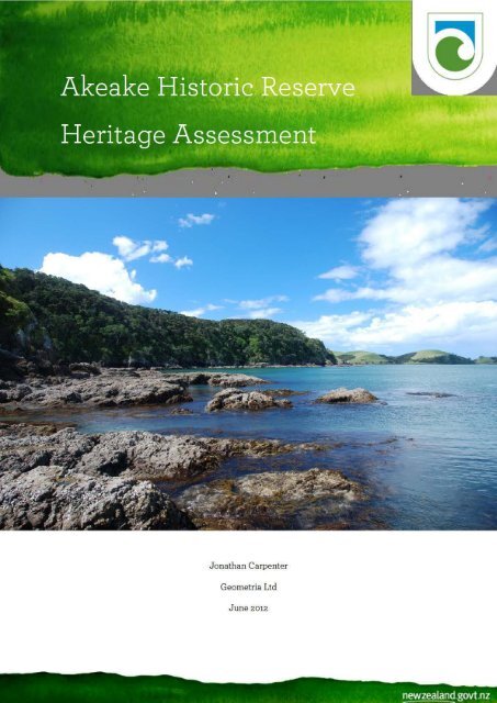
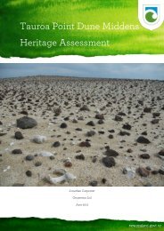
Cover Image: Tareha Point and <strong>Akeake</strong> Pa, from near Tikorangi Island.
Site Overview<br />
3<br />
The <strong>Akeake</strong> <strong>Historic</strong> <strong>Reserve</strong> is located at Tareha Point, between the Kerikeri and Te Puna inlets<br />
in the north-western Bay <strong>of</strong> Islands. The reserve is approximately nine kilometres east <strong>of</strong> Kerikeri<br />
and is accessible via Opito Bay Road.<br />
The <strong>Historic</strong> <strong>Reserve</strong> is 15.38ha in size and roughly triangular encompassing Tareha Point to the<br />
east, Tikorangi Island to the south, and another unnamed headland to the north. The Te Puna<br />
Marginal Strip No.4 runs west along the coastline from the north western corner <strong>of</strong> the reserve.<br />
<strong>Akeake</strong> <strong>Reserve</strong> is made up <strong>of</strong> Section 27, Part Section 28 and Section 29 Block VIII Kerikeri<br />
Survey District and Lot 1 DP 70065. Part Section 28 is the major part <strong>of</strong> the reserve, Section 29 is<br />
Tikorangi Island, and Section 27 and Lot 1 DO 70065 are two small parcels on the southern<br />
headland. The reserve is accessed from Opito Bay Road via Right <strong>of</strong> Ways on Lot 46 and Lot 47<br />
DP 47619.<br />
The main feature on the reserve is <strong>Akeake</strong> Pa itself, P05/439. A midden recorded as P05/1010 is<br />
located at the southern end <strong>of</strong> the reserve on the mainland opposite Tikorangi Island.<br />
A GPS-based map <strong>of</strong> archaeological features was produced by DOC staff in 2010. This has been<br />
overlaid with recent aerial imagery and other geographic data in a Geographic Information<br />
System to produce a map <strong>of</strong> the reserve and archaeological features in the context <strong>of</strong> the<br />
surrounding landscape (Figure 1).
Figure 1: <strong>Akeake</strong> <strong>Historic</strong> <strong>Reserve</strong>.<br />
4
History Description<br />
5<br />
Tareha Point is associated with the Ngati Rehia Chief Tareha (Tareha the Younger, also known<br />
as Kaiteke or Kemara), an ally <strong>of</strong> Hongi Hika and friend <strong>of</strong> the CMS missionaries at Te Puna, on<br />
the other side <strong>of</strong> the Te Puna Inlet, and Tareha <strong>of</strong> Te Tii. The Te Puna or Mangonui Inlet was<br />
known as Tareha’s river or Tareha’s bay to early European arrivals in the Bay <strong>of</strong> Islands.<br />
Tareha the Younger participated with Hongi in the Ngapuhi taua or war parties during the<br />
musket wars. In the missionary period he controlled the Te Puna and Kerikeri Inlets along with<br />
Kaingaroa, Hongi Hika’s brother and was the first to speak during the Chief’s debate over the<br />
Treaty <strong>of</strong> Waitangi. Tareha <strong>of</strong> Te Tii spoke later and declined to sign the Treaty <strong>of</strong> Waitangi<br />
stating “No Governor for me – for us – we are the chiefs – we won’t be ruled. What, you up, and I<br />
down – you high, and I Tareha, the great chief low? I am jealous <strong>of</strong> you, go back, you shan’t stay.<br />
No, no, I won’t assent …” (Waitangi Tribunal : 58).<br />
The area which included the land on the north side <strong>of</strong> the peninsula between the Kerikeri Inlet<br />
and the upper reaches <strong>of</strong> the Te Puna Inlet, between the central ridgeline and the coast was sold<br />
to Thomas Bateman by Kaitaka “or Kamera”, “Akida”, Hakero, and Tareha on 11 October 1839.<br />
The price for the land was a 10-ton schooner later valued at £140. The deed <strong>of</strong> sale states:<br />
“This Indenture made the Eleventh day <strong>of</strong> October in the year <strong>of</strong> our Lord one<br />
thousand eight hundred and thirty-nine Between Thomas Bateman <strong>of</strong> the one part and<br />
Kai ta Ka, Akida, Tarreah native chiefs <strong>of</strong> the Bay <strong>of</strong> Islands New Zealand <strong>of</strong> the other<br />
Witnesseth that for and in consideration <strong>of</strong> One sailing boat complete value one<br />
hundred and forty pounds sterling in hand well and truly paid by the said Thomas<br />
Bateman to the said Kia ta ha, Aikada, Tarreah at or before the sealing and delivery <strong>of</strong><br />
these presents the receipt where<strong>of</strong> and that the same is in full for the absolute purchase<br />
in fee simple <strong>of</strong> the land and premises hereinafter mentioned as also two cows they the<br />
said Kai ta Ka, Akida, and Tarreah do hereby acknowledge and there<strong>of</strong> and therefrom<br />
and from every part there<strong>of</strong> doth acquit release and discharge the said Thomas<br />
Bateman his heirs executors administrators and assigns by these presents they the<br />
said Kia ta ha Aikada and Tarreah have granted enfe<strong>of</strong>fed and confirmed and by<br />
these presents doth grant enfe<strong>of</strong>f and confirm unto the said Thomas Bateman his heirs<br />
and assigns that portion <strong>of</strong> land situated between Tarreah and Kiddy Kiddy river in<br />
the bay <strong>of</strong> Islands bounded to the West by Reid's land a creek dividing the boundaries<br />
to the Northward and on the opposite side <strong>of</strong> the river Tarreah Bookatoot running in a<br />
W S West direction to the first mark on the ridge <strong>of</strong> a Hill then running in a W S W to a<br />
second mark then due West to a third mark this last bearing is bounded by a Native<br />
footpath running in a west south west to a third mark then N West to a fourth mark<br />
then W S West to a fifth mark then West to the low point <strong>of</strong> the ridge <strong>of</strong> a hill this<br />
forming the extreme boundary on this side, To the South by land belonging to the<br />
church missionaries this southern boundary runs along the ridge <strong>of</strong> a hill in a South<br />
East and North West direction to a mark made by the said chief Kia ta ha the<br />
boundary then runs in an Easterly direction along the foot <strong>of</strong> a range <strong>of</strong> hills still<br />
bounded by the church missionaries, Wakadoa, and Mr. Small's lands to the bottom <strong>of</strong><br />
a swamp. A small beach on the Tarreah side <strong>of</strong> the river and bearing from Captain
6<br />
Leiche's House North East to be reserved for a native named —— as also a small<br />
portion <strong>of</strong> wood the boundary <strong>of</strong> which is marked by the said chief Kia ta ha. The<br />
boundary then runs North east to the top <strong>of</strong> a hill marked then in an Easterly direction<br />
to another mark then South bounded by a footpath dividing it from Mr. Small's land to<br />
a mark it then trends east along the ridge <strong>of</strong> a hill still bounded by a footpath Mr.<br />
Small's and Mr. Edmond's land to the top <strong>of</strong> a Hill marked, from this mark the<br />
boundary then runs in an East South Easterly direction along the Kiddy Kiddy river to<br />
Pai ta nui The said Paitanui being fronted by the Island <strong>of</strong> Mootaroa this forming the<br />
extreme boundary to the East turning this point it trends up the Tarreah river to a<br />
piece or portion <strong>of</strong> land situated on the said Tarreah river and said to belong to Mr.<br />
Thomas Hanson running from thence along the said Tarreah river to the first<br />
boundary line at Reid's land. The water frontage <strong>of</strong> the boundaries on both rivers<br />
extends to low water mark, and in addition to this piece <strong>of</strong> land two cows as aforesaid<br />
And all the estate right title interest property claim and demand whatsoever <strong>of</strong> them<br />
the said Kia ta ha, Aikada and Tarreah <strong>of</strong> in to or out <strong>of</strong> the same or any part there<strong>of</strong><br />
To Have and to Hold the said land and premises hereinbefore granted and enfe<strong>of</strong>fed<br />
or intended so to be with the appurtenances unto the said Thomas Bateman his heirs<br />
and assigns To the only proper use <strong>of</strong> the said Thomas Bateman his heirs and assigns<br />
for ever And the said Kia ta ha Aikada and Tarreah for themselves and their heirs the<br />
said land and premises hereby granted and enfe<strong>of</strong>fed or intended so to be with the<br />
appurtenances unto the said Thomas Bateman his heirs and assigns will for ever<br />
warrant and defend against all persons whomsoever In witness Where<strong>of</strong> we hereby<br />
affix our hand and seal.<br />
Thomas Bateman.<br />
Ki ta ka x his mark.<br />
Na te Hakiro.<br />
Na Te Pa.<br />
E Nata.<br />
Tareha x his mark.<br />
Witness—Etow x his mark.<br />
Witness—Wm. S. Grahame.<br />
Witness—John Macnee.<br />
Witness—Walter Brodie.<br />
Received on the day <strong>of</strong> the date <strong>of</strong> the within written Indenture one sailing boat<br />
complete value one hundred and forty pounds sterling being the consideration within<br />
expressed to be paid.<br />
Kia ta ka x his mark.<br />
Witness—Etow.<br />
Witness—Wm. S. Grahame.<br />
Witness—John Macnee.<br />
Witness—Walter Brodie.
7<br />
Be it remembered that on the day <strong>of</strong> the date <strong>of</strong> the within written Indenture full and<br />
peaceable possession and seizin <strong>of</strong> the land therein comprised with the appurtenances<br />
was given and delivered by the within named Kai ta ha Aikada and Tarreah in their<br />
proper persons To hold the same unto and to the use <strong>of</strong> him the said Thomas Bateman<br />
his heirs and assigns for ever according to the tenor and effect <strong>of</strong> the same Indenture in<br />
the presence <strong>of</strong> us.<br />
Wm. S. Grahame.”<br />
A small piece <strong>of</strong> land including a beach and wood within the block was reserved for an unnamed<br />
“native”.<br />
A narrative <strong>of</strong> the subsequent investigation <strong>of</strong> Bateman’s claim is provided in Berghan (2006: 38-<br />
1). On 5 November 1842 Bateman testified before the Land Claims Commission that although he<br />
never resided on the land, the sale had been un-contentious until approximately five or six<br />
months before his testimony. At that time Wiremu Hau (Te Whiu) <strong>of</strong> Ngaitawake protested the<br />
sale and stated his forefather had always been present on that land, but <strong>of</strong>fered to withdraw his<br />
claim in exchange for a consideration <strong>of</strong> £20-25. Bateman refused to pay and Hau acknowledged<br />
the claim and sought payment from Kaitaka. Bateman also stated he had been promised two<br />
cows as part <strong>of</strong> the purchase but had not sought to collect them from the Maori owners.<br />
Other members <strong>of</strong> Ngatiwai (Ngaitawake) also stated that their lands may have been included in<br />
the purchase without their consent. Tareha’s claim to the land was also on the basis <strong>of</strong> his<br />
forefather’s occupation although he had not lived there for 21 years. Hakiro also stated that<br />
Ngatahuhu lived on the land which he sold to Bateman and that the land <strong>of</strong> Wiremu Hau was<br />
excluded from the sale, although Bateman urged Hau to ask Tareha for compensation for the<br />
alienated land. The Waitangi Tribunal in its <strong>assessment</strong> <strong>of</strong> the old land claim described it as “a<br />
thicket <strong>of</strong> overlapping Maori rights” (ibid: 100).<br />
Following the signing <strong>of</strong> the Treaty and the re<strong>assessment</strong> <strong>of</strong> prior land purchases, Bateman’s<br />
claim was reduced to 382 acres and then increased by Busby to 1200 acres in 1844 for no apparent<br />
reason. Despite the Land Commissioner’s recommending reserving land for the Maori claimants,<br />
this did not happen. Bateman then sold the un-surveyed or floating grant to William Smellie<br />
Grahame in 1849. That deed states:<br />
“This Deed made the twenty-sixth day <strong>of</strong> December in the year <strong>of</strong> our Lord one<br />
thousand eight hundred and forty-nine Between Thomas Bateman <strong>of</strong> the Bay <strong>of</strong><br />
Islands in the territory <strong>of</strong> New Zealand Sub-Collector <strong>of</strong> Customs <strong>of</strong> the one part and<br />
William Smellie Grahame <strong>of</strong> Auckland in the said territory Merchant <strong>of</strong> the other part<br />
Whereas by deed <strong>of</strong> grant dated the twenty-fourth day <strong>of</strong> June in the year <strong>of</strong> our Lord<br />
one thousand eight hundred and forty-four under the hand <strong>of</strong> Robert FitzRoy Esquire<br />
Governor and Commander in Chief <strong>of</strong> the said territory and its dependencies and<br />
under the seal <strong>of</strong> the said territory Her Majesty Queen Victoria did grant unto the said<br />
Thomas Bateman his heirs and assigns all that allotment or parcel <strong>of</strong> land in the said<br />
territory said to contain one thousand two hundred acres more or less situated<br />
between the Tareha and Kiri Kiri rivers as the same is in said deed <strong>of</strong> grant and<br />
hereafter more fully set forth and described And whereas the said Receipt for £348 6s.<br />
William Smellie Grahame hath agreed with the said Thomas Bateman for the absolute
8<br />
purchase <strong>of</strong> the said allotment or parcel <strong>of</strong> land at or for the price or sum <strong>of</strong> three<br />
hundred and forty-eight pounds six shillings and hath requested a conveyance there<strong>of</strong><br />
Now this Deed Witnesseth that in consideration <strong>of</strong> the sum <strong>of</strong> three hundred and fortyeight<br />
pounds six shillings sterling paid by the said William Smellie Grahame to the<br />
said Thomas Bateman the receipt where<strong>of</strong> the said Thomas Bateman hereby<br />
acknowledges he the said Thomas Bateman doth hereby convey and assure unto the<br />
said William Smellie Grahame his heirs and assigns for ever all the aforesaid<br />
allotment or parcel <strong>of</strong> land in the said territory <strong>of</strong> New Zealand said to contain one<br />
thousand two hundred acres more or less situated between the Tareha and Kiri Kiri<br />
rivers and <strong>of</strong> which the boundaries <strong>of</strong> the entire quantity claimed are reported to be as<br />
Boundaries. [1,200 acres.]Certain lands excepted. follows, vizt., "Bounded on the West<br />
by Reed's land, On the South and East by land belonging to the Church Missionaries to<br />
Mr. Small and Mr. Edmonds and the river Kiri Kiri, and on the North by the river<br />
Tareha" excepting the twenty acres claimed by John Reed and all the portion claimed<br />
by Wiremu Hau and the part reserved for the Native (name unknown) which can be<br />
pointed out by the Chief Kamera with all the rights and appurtenances whatsoever<br />
thereto belonging To hold unto the said William Smellie Grahame his heirs and<br />
assigns for ever And the said William Smellie Grahame doth hereby declare that no<br />
widow whom he may have shall be entitled to dower out <strong>of</strong> the land hereby conveyed<br />
and assured or out <strong>of</strong> any part there<strong>of</strong>. In Witness where<strong>of</strong> the said parties have<br />
hereunto subscribed their names.<br />
Thomas Bateman.<br />
Signed by the above-named Thomas Bateman in the presence <strong>of</strong>—<br />
Wm. Climie, Agent, Russell, Bay <strong>of</strong> Islands. Samuel Stephenson, Merchant, Russell, Bay<br />
<strong>of</strong> Islands.<br />
Wm. S. Grahame.<br />
Signed by the above-named William Smellie Grahame in the presence <strong>of</strong>—<br />
Christopher Atwell Harris, Settler, Auckland. John Roberton, Gentleman, Auckland.”<br />
Grahame was a Scottish trader who arrived in Auckland in the 1840s and established major land<br />
holdings in Northland, Auckland and Waikato. Grahame had the land surveyed by William<br />
Tacey Clarke and Grahame paid an additional £50 to unnamed Maori to settle outstanding<br />
claims (perhaps those <strong>of</strong> Wiremu Hau). The total area surveyed was 1827 acres with 1157 acres<br />
granted to Grahame, and 128 acres designated surplus to the Crown. An additional 542 acres<br />
went to the Crown in 1858 under the terms <strong>of</strong> the Bay <strong>of</strong> Islands Settlement Act. Compensation <strong>of</strong><br />
£948 was paid to Grahame for the latter. The final grant was not issued by the Crown until 1864<br />
and no Maori reserves were ever established on the land. The name <strong>Akeake</strong> is shown on the<br />
point on Old Land Claim 16, “The <strong>Akeake</strong>” property <strong>of</strong> William Smellie Graham. <strong>Akeake</strong> is an<br />
expression made by Maori warriors when fighting or defending a position and means “Forever,<br />
forever”, and it is also the Maori name for the tree Dodonaea viscosa, the strong wood <strong>of</strong> which<br />
was used to make traditional weapons.
9<br />
The land remained in private hands until the 1960s when it was reserved following subdivision <strong>of</strong><br />
OLC 16. The 37 acre <strong>Akeake</strong> Scenic <strong>Reserve</strong> comprising Section 28 and 29 Block VIII Kerikeri SD<br />
and illustrated on SO 43133 was gazetted on 29 May 1962. Following an inspection by S. Bartlett<br />
on behalf <strong>of</strong> the Lands and Survey <strong>Department</strong> and the Bay <strong>of</strong> Islands <strong>Historic</strong> and Maritime<br />
Park Board in 1979, the reserve was reclassified historic in 1980 under the <strong>Reserve</strong>s Act 1977. The<br />
track network was formalised, and a barrier placed above the cliff at the eastern end <strong>of</strong> the pa in<br />
1986. Management <strong>of</strong> the reserve passed to the <strong>Department</strong> <strong>of</strong> Conservation upon its<br />
establishment in 1987 and since that time maintenance and upgrading <strong>of</strong> the visitor amenties has<br />
occurred in an ad-hoc fashion, with a link to Pukewhau Road created by local volunteers in 2000-<br />
2001, new interpretational signage (never erected due to miscommunications with and between<br />
Tangata Whenua), and a new viewing platform/safety barrier in 2009.<br />
Figure 2: Old Land Claim 16 (ca.1849).<br />
Figure 3: Tareha Point, Tikorangi Island and Opito Bay, 1973. Whites Aviation. ATL WA-71134-F.
Fabric Description<br />
10<br />
<strong>Akeake</strong> or Tareha Pa is a medium sized headland pa defended by a deep transverse ditch and<br />
bank earthwork. It was recorded as archaeological site P05/439 by S. Bartlett in 1979. He visited<br />
the site at the request <strong>of</strong> the Lands and Survey <strong>Department</strong> and the NZ <strong>Historic</strong> Places Trust and<br />
on behalf <strong>of</strong> the Bay <strong>of</strong> Islands <strong>Historic</strong> and Maritime Park Board which managed the reserve.<br />
The purpose <strong>of</strong> the visit was to assess whether the reserve should be gazetted as <strong>Historic</strong> or<br />
Scenic.<br />
He recorded the eastern and central part <strong>of</strong> the pa site, noting its well preserved ditch and bank<br />
defences cutting <strong>of</strong>f the headland, within which lay terraces with house sites and still-functioning<br />
drainage channels. He produced a sketch map <strong>of</strong> features he noted on the reserve including<br />
terraces on Tikorangi Island, midden along the track around the headland opposite Tikorangi,<br />
house sites outside the defences <strong>of</strong> the pa, and the pa itself. He also made a more detailed map <strong>of</strong><br />
the features <strong>of</strong> the pa noting at least six terraces divided by scarps and a reticulated network <strong>of</strong><br />
shallow drainage channels taking water <strong>of</strong>f the living areas. He also recorded a disturbed fire<br />
place.<br />
The terraces on Tikorangi Island, and midden on the headland opposite, below the track to the<br />
pa, have not been allocated their own site numbers or otherwise re-recorded.<br />
Bartlett provided a letter report to the Lands and Survey <strong>Department</strong> and noted that the<br />
established kanuka scrub and lack <strong>of</strong> topsoil development had made the site unappealing to<br />
stock leading to the good preservation <strong>of</strong> features. He noted that more features would be present<br />
to the west along the remaining part <strong>of</strong> the headland presently under dense scrub, and that other<br />
features probably existed on the slopes north <strong>of</strong> the pa. He also recommended that owing to the<br />
historic associations with Chief Tareha and the excellent preservation <strong>of</strong> the site (which he<br />
suggested meant it was a relatively late pa), that the property be gazetted as an historic reserve.<br />
Despite the preservation <strong>of</strong> the features suggesting a relatively recent origin, the site does not<br />
bear any <strong>of</strong> the hallmarks <strong>of</strong> a musket wars era gun-fighting pa, so its defensive works probably<br />
predate the general introduction <strong>of</strong> muskets in 1817. There is no documentary or archaeological<br />
evidence suggested the pa was still occupied into the missionary period and the site’s heyday<br />
may have been in the late 18 th and early 19 th century as Ngapuhi were expanding and<br />
consolidating their position in the Bay <strong>of</strong> Islands.<br />
The site was revisited by G. Nevin in 1984 as part <strong>of</strong> the Northland Harbour Board’s Bay <strong>of</strong><br />
Islands study, which included a historic and archaeological technical report (Nevin 1984). She<br />
recorded more features on the eastern end <strong>of</strong> the pa, which Bartlett had suggested were present.<br />
P05/432 is a terrace complex just west <strong>of</strong> the western boundary <strong>of</strong> the reserve, between the<br />
boundary and Pukewhau Road. The site was also recorded by G. Nevin during the Bay <strong>of</strong> Islands<br />
survey noted above. At that time the site consisted <strong>of</strong> a 10 x 8m tihi or platform on a high point<br />
with a smaller terrace 40cm below and the east measuring 7.5 x 6m. A house was built on the<br />
southern edge <strong>of</strong> the site. The site was located on the track between Tareha Pa and Pukewhau Pa<br />
to the east. The site has not been revisited.
11<br />
Pukewhau Pa, which is also on private land was the first site recorded in the area, in 1971. It was<br />
recorded by the R. Lawns as P05/22. At that time it was in good condition and covered in<br />
manuka, ferns and scrub. The site consisted <strong>of</strong> well-formed terraces with a raised rim around the<br />
tihi platform with excellent views up the Te Puna and Kerikeri Inlets. Dense vegetation<br />
prevented a detailed inspection at that time. By 1973 part <strong>of</strong> the site had been bulldozed as part <strong>of</strong><br />
the development <strong>of</strong> Opito Bay as a bach community, and the Bay <strong>of</strong> Islands County Council had<br />
not reserved the pa as part <strong>of</strong> the on-going subdivision. G. Nevin re-recorded the pa in 1984 and<br />
noted the summit was completely covered in sweet peas with peach trees and rose bushes at the<br />
southern end. She recorded a 50m long tihi with terraces down slope to the north and west with a<br />
large slip and midden between these and the bulldozed track below.<br />
Figure 4: Original location map by S. Bartlett, 1979. NZAA Site Record P05/439.
Figure 5: Original site map by S. Bartlett, 1979. NZAA Site Record P05/439.<br />
Figure 6: Site map by G. Nevin, 1984.<br />
12
Figure 7: Plan <strong>of</strong> pa by J, Robinson, n.d.<br />
Figure 8: Plan <strong>of</strong> drainage channels by J. Robinson, n.d.<br />
13
Figure 9: Interpretive illustration <strong>of</strong> pa by J. Robins, n.d.<br />
Figure 10: GPS map <strong>of</strong> features. A. Blandshard 2010.<br />
14
Cultural Connections<br />
15<br />
<strong>Akeake</strong> <strong>Historic</strong> <strong>Reserve</strong> and Tareha Point are in the rohe <strong>of</strong> Ngati Rehia and Ngaitawake and<br />
are associated with their ancestor Tareha.<br />
National Context Sources<br />
There is no national context source available in order to provide a comprehensive basis for<br />
assessing the national (representative) significance <strong>of</strong> <strong>Akeake</strong> as a pre or proto-historic Maori<br />
archaeological landscape. However general references for pa and kainga include Davidson (1982,<br />
1984) and area studies <strong>of</strong> pa in the upper North Island including Irwin (1985) and Sutton (1991,<br />
1993) and Sutton, Furey and Marshall (2003). Furey (n.d.) has also produced a Northland<br />
Archaeological Resource Statement which summarises the archaeology <strong>of</strong> the region, its values,<br />
and the threats that it faces. This report was prepared for the <strong>Department</strong> <strong>of</strong> Conservation and<br />
remains in draft form and limited circulation.<br />
<strong>Historic</strong> Significance<br />
<strong>Akeake</strong> Pa and associated sites are significant in part owing to their association with named<br />
ancestors and key events in the proto-historic period as Ngapuhi and then European<br />
missionaries established themselves in the Bay <strong>of</strong> Islands.<br />
Fabric Significance<br />
<strong>Akeake</strong> Pa and its associated sites are significant as a largely intact example <strong>of</strong> a pre- or<br />
protohistoric archaeological landscape that is typical <strong>of</strong> the east coast <strong>of</strong> the northern part <strong>of</strong> the<br />
North Island; a large central headland pa and dispersed undefended kainga nearby represented<br />
by terrace complexes. The collection <strong>of</strong> cockles and pipi from nearby muddy shore and estuarine<br />
environments, and inshore and <strong>of</strong>fshore fishing would have been key subsistence activities in the<br />
area. The small amount <strong>of</strong> midden around the reserve probably reflects the poor conditions for<br />
preservation is not reflective <strong>of</strong> the importance <strong>of</strong> coastal subsistence strategies.<br />
The pa site is in good condition although features have been modified by vegetation growth,<br />
visitor activity and natural erosion. Terrace scarps and defensive ditch and banks are obvious,<br />
and although drainage channels have been in-filled by duff they are also still visible. The<br />
preservation <strong>of</strong> the drainage channels around the terraces and their visibility on the surface is<br />
relatively rare, with Okuratope at Waimate North and Ngaungau Pa/Poor Hill at Ohaewai being<br />
two <strong>of</strong> the few other well-known examples <strong>of</strong> sites with such well-preserved drainage features.
Figure 11: Tareha Point looking north from Titoki Island.<br />
Figure 12: Viewing platform at end <strong>of</strong> Tareha Pa.<br />
16
Figure 13: Boardwalk over defensive ditch.<br />
Figure 14: Defensive ditch (1m scale).<br />
17
Figure 15: Looking along drainage channel towards bank and ditch (1m scale).<br />
18<br />
Figure 16: Scarp at rear <strong>of</strong> terrace, outside defences (1m scale).
Figure 17: Tikorangi Island from loop track.<br />
Figure 18: Tikorangi Island from Opito Bay.<br />
19
Figure 19: 2007 slip and archaeological material.<br />
Figure 20: Grey black cultural layer containing cockle shell, charcoal and fire cracked rock.<br />
20
Cultural Significance<br />
21<br />
The sites are significant due to their associations with named ancestors <strong>of</strong> Ngati Rehia and<br />
Ngaitawake. The land was acquired under dubious circumstances and despite recommendations<br />
no Maori reserve land was ever established. Pa sites are also generally considered wahi tapu.<br />
Management Recommendations<br />
<strong>Akeake</strong> does not require much in the way <strong>of</strong> active management. The features on the pa site are<br />
relatively stable and do not appear to be suffering to any great degree from natural or human<br />
induced erosion, with the exception <strong>of</strong> water running down the unformed walking track which<br />
provides access along the top <strong>of</strong> the ridgeline to the end <strong>of</strong> the point.<br />
Monitoring<br />
Quarterly monitoring should be undertaken with photo points established on the defensive<br />
earthworks, terraces with drainage channels, and a selection <strong>of</strong> other points.<br />
Vegetation Management<br />
The existing regime <strong>of</strong> vegetation management along the track network should be maintained by<br />
DOC staff. The vegetation immediately either side <strong>of</strong> the boardwalk over the defensive ditch<br />
should be removed to allow for views along this feature and consideration should be given to<br />
removing vegetation at the base <strong>of</strong> the ditch. The manuka on the pa is unlikely to get much<br />
larger or cause much damage by way <strong>of</strong> tree fall as dead trees tend to be caught by their<br />
neighbours and then rot down in place. It is possible that larger species on the edge <strong>of</strong> scarps<br />
may cause more damage and this should be monitored and specimens in these areas removed if<br />
they become a problem. Vegetation along the drainage channels should be removed as these<br />
small but important features are more sensitive to damage from root action.<br />
Interpretation<br />
The HAMS costed specification for remedial work and improvements at <strong>Akeake</strong> <strong>Historic</strong> <strong>Reserve</strong><br />
stated that high quality interpretation was the only component needed at the reserve to provide a<br />
high quality experience. Unfortunately interpretational signage was developed in 2005-6 but has<br />
never been erected owing to miscommunication with and between Tangata Whenua. A new<br />
approach should be made to Ngati Rehia and Ngaitawake about resurrecting the signage.<br />
There is no detailed information about <strong>Akeake</strong> available on the internet, apart from visitor<br />
information and a précis <strong>of</strong> the traditional history <strong>of</strong> the site. This Heritage Assessment and<br />
other public documents should be made available on the DOC website.<br />
Track<br />
The loop track to the pa and around the southern end <strong>of</strong> the reserve is not metalled; lacks water<br />
tables and culverts and becomes slick during rain. The <strong>Department</strong> intends to upgrade the track<br />
in the medium term.
Survey and Mapping<br />
22<br />
The reserve has not been intensively surveyed for other archaeological sites and features, and<br />
these are likely to exist. Tikorangi Island should be surveyed, along with the ridgeline running<br />
north from the southern headland, the slopes between the pa and the beach to the north, and the<br />
ridgeline running back to Pukewhau Road and P05/472.<br />
Although several plans <strong>of</strong> the drainage network on the pa exist, these are not particularly<br />
detailed having been produced by pace or tape and compass and plane table and alidade. There<br />
is a general indication <strong>of</strong> fall direction and length but given the rarity <strong>of</strong> such features and their<br />
fragility, an accurate and detailed topographic survey by theodolite is warranted, preceded by the<br />
clearing out <strong>of</strong> the features by hand.<br />
Management Chronology<br />
1839 Sold to Thomas Bateman.<br />
1849 Sold to WIlliame Grahame.<br />
1864 Crown grant confirmed.<br />
1962 Gazetted as <strong>Akeake</strong> Scenic <strong>Reserve</strong>.<br />
1978 Archaeological inspection recommends <strong>Historic</strong> <strong>Reserve</strong> status, following <strong>Reserve</strong>s Act<br />
1977.<br />
1980 Reclassified as <strong>Akeake</strong> <strong>Historic</strong> <strong>Reserve</strong>.<br />
1986 Barrier built at end <strong>of</strong> point.<br />
1995 Boardwalk and stairs over defences constructed.<br />
~2000 HAMS costed specifications developed.<br />
2001 Track to Pukewhau Road established by ratepayers group/volunteers.<br />
2006 New interpretation signage produced.<br />
2007 Major storms and slip opposite Tikorangi Island.<br />
2008 <strong>Historic</strong> Ranger inspects slip and notes archaeological material.<br />
2009 New viewing platform built to replace existing barrier under HPT Authority 2010-138.<br />
2010 Track from Opito Bay to ridge and down to beach upgraded.<br />
2011 B. Warren builds retaining wall in the esplanade reserve.<br />
Management Documentation<br />
The key document is the HAMS costed specification (2000).
Sources<br />
Not Consulted<br />
23<br />
Agency BBEE Series 1124 Box 901/a Record 32/0/998/11. Lands and Survey <strong>Reserve</strong>s - Plan N.11 -<br />
Marsden Cross, Manginangina, Kororipo Pa, Islands in Waipapa and Kerikeri Rivers,<br />
Puketi, Flagstaff Hill, Paihia, Paihia 2, <strong>Akeake</strong> 1935 – 1986. Archives New Zealand,<br />
Auckland.<br />
Agency BBEE Series 1124 Box 908/k Record 32/15A. <strong>Akeake</strong> Scenic <strong>Reserve</strong> 1970 – 1970. Archives<br />
New Zealand, Auckland.<br />
Consulted<br />
Aerial photograph <strong>of</strong> Opito Bay, Kerikeri Inlet, Bay <strong>of</strong> Islands, Northland. Whites Aviation, 1973.<br />
Alexander Turnbull Library, Wellington. ATL reference WA-71134-F.<br />
Berghan, P., 2006. Northland block research narratives, Volume II: Old Land Claims.<br />
Unpublished report for the Crown Forestry Rental Trust’s Northland Research Assistance<br />
Project. Walghan Partners Ltd, Upper Hutt.<br />
Binney, J. (ed.) 2007. Te Kerikeri: The Meeting Pool. Bridget Williams Books, Wellington and<br />
Craig Potton Publishing, Nelson.<br />
Cassels, R., 1982. Archaeology in the Bay <strong>of</strong> Islands <strong>Historic</strong> and Maritime Park. Unpublished<br />
report for the Bay <strong>of</strong> Islands Maritime and <strong>Historic</strong> Park Board. University <strong>of</strong> Auckland,<br />
Auckland.<br />
P05/1. NZAA Northland Site Record File, DOC Northland Conservancy Office.<br />
P05/439. NZAA Northland Site Record File, DOC Northland Conservancy Office.<br />
P05/472. NZAA Northland Site Record File, DOC Northland Conservancy Office.<br />
P05/1010. NZAA Northland Site Record File, DOC Northland Conservancy Office.<br />
PAR-01-06-10. DOC, Bay <strong>of</strong> Islands Area Office.<br />
<strong>Department</strong> <strong>of</strong> Conservation, 1997. Register <strong>of</strong> actively managed historic places; Northland<br />
Conservancy, Whangarei.<br />
<strong>Department</strong> <strong>of</strong> Conservation, 1999. <strong>Historic</strong> resources strategy for the Northland Conservancy.<br />
Northland Conservancy, Whangarei.<br />
<strong>Department</strong> <strong>of</strong> Conservation, 2000. <strong>Akeake</strong> Pa AMHP 23. HAMS Costed Remedial Specification.<br />
Northland Conservancy, Whangarei.<br />
King, M., 1992. A Most Noble Anchorage. A Story <strong>of</strong> Russell and the Bay <strong>of</strong> Islands. Northland<br />
<strong>Historic</strong>al Publications Society Inc, Kerikeri.<br />
Leahy, A., and W. Walsh, 1976. Archaeological site survey report. Bay <strong>of</strong> Islands and<br />
Kerikeri/Paihia Area. Unpublished report for the Northland Harbour Board.
Old Land Claim 16 (ca.1849).<br />
24<br />
Pickmere, N., 2008. Kerikeri. Heritage <strong>of</strong> Dreams (2 nd Ed.). Northland <strong>Historic</strong>al Publications<br />
Society Inc, Kerikeri.<br />
Nevin, G. E., 1984. Technical report on the archaeological and h<strong>Historic</strong>al aspects <strong>of</strong> the Bay <strong>of</strong><br />
Islands. Unpublished report for the Northland Harbour Board Bay <strong>of</strong> Islands Harbour<br />
Study.<br />
Nugent., D and J. Nugent, 1976. Report on site survey. Kerikeri, Bay <strong>of</strong> Islands. Unpublished<br />
report for the <strong>Historic</strong> Places Trust.<br />
Sissons, J., W. Wi Hongi and P. Hohepa,. 2001. Nga Puriri o Taiamai; A Political History <strong>of</strong><br />
Ngapuhi in the inland Bay <strong>of</strong> Islands. Reed Books, Auckland.


