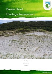
Akeake Historic Reserve heritage assessment - Department of ...
Akeake Historic Reserve heritage assessment - Department of ...
Akeake Historic Reserve heritage assessment - Department of ...
Create successful ePaper yourself
Turn your PDF publications into a flip-book with our unique Google optimized e-Paper software.
History Description<br />
5<br />
Tareha Point is associated with the Ngati Rehia Chief Tareha (Tareha the Younger, also known<br />
as Kaiteke or Kemara), an ally <strong>of</strong> Hongi Hika and friend <strong>of</strong> the CMS missionaries at Te Puna, on<br />
the other side <strong>of</strong> the Te Puna Inlet, and Tareha <strong>of</strong> Te Tii. The Te Puna or Mangonui Inlet was<br />
known as Tareha’s river or Tareha’s bay to early European arrivals in the Bay <strong>of</strong> Islands.<br />
Tareha the Younger participated with Hongi in the Ngapuhi taua or war parties during the<br />
musket wars. In the missionary period he controlled the Te Puna and Kerikeri Inlets along with<br />
Kaingaroa, Hongi Hika’s brother and was the first to speak during the Chief’s debate over the<br />
Treaty <strong>of</strong> Waitangi. Tareha <strong>of</strong> Te Tii spoke later and declined to sign the Treaty <strong>of</strong> Waitangi<br />
stating “No Governor for me – for us – we are the chiefs – we won’t be ruled. What, you up, and I<br />
down – you high, and I Tareha, the great chief low? I am jealous <strong>of</strong> you, go back, you shan’t stay.<br />
No, no, I won’t assent …” (Waitangi Tribunal : 58).<br />
The area which included the land on the north side <strong>of</strong> the peninsula between the Kerikeri Inlet<br />
and the upper reaches <strong>of</strong> the Te Puna Inlet, between the central ridgeline and the coast was sold<br />
to Thomas Bateman by Kaitaka “or Kamera”, “Akida”, Hakero, and Tareha on 11 October 1839.<br />
The price for the land was a 10-ton schooner later valued at £140. The deed <strong>of</strong> sale states:<br />
“This Indenture made the Eleventh day <strong>of</strong> October in the year <strong>of</strong> our Lord one<br />
thousand eight hundred and thirty-nine Between Thomas Bateman <strong>of</strong> the one part and<br />
Kai ta Ka, Akida, Tarreah native chiefs <strong>of</strong> the Bay <strong>of</strong> Islands New Zealand <strong>of</strong> the other<br />
Witnesseth that for and in consideration <strong>of</strong> One sailing boat complete value one<br />
hundred and forty pounds sterling in hand well and truly paid by the said Thomas<br />
Bateman to the said Kia ta ha, Aikada, Tarreah at or before the sealing and delivery <strong>of</strong><br />
these presents the receipt where<strong>of</strong> and that the same is in full for the absolute purchase<br />
in fee simple <strong>of</strong> the land and premises hereinafter mentioned as also two cows they the<br />
said Kai ta Ka, Akida, and Tarreah do hereby acknowledge and there<strong>of</strong> and therefrom<br />
and from every part there<strong>of</strong> doth acquit release and discharge the said Thomas<br />
Bateman his heirs executors administrators and assigns by these presents they the<br />
said Kia ta ha Aikada and Tarreah have granted enfe<strong>of</strong>fed and confirmed and by<br />
these presents doth grant enfe<strong>of</strong>f and confirm unto the said Thomas Bateman his heirs<br />
and assigns that portion <strong>of</strong> land situated between Tarreah and Kiddy Kiddy river in<br />
the bay <strong>of</strong> Islands bounded to the West by Reid's land a creek dividing the boundaries<br />
to the Northward and on the opposite side <strong>of</strong> the river Tarreah Bookatoot running in a<br />
W S West direction to the first mark on the ridge <strong>of</strong> a Hill then running in a W S W to a<br />
second mark then due West to a third mark this last bearing is bounded by a Native<br />
footpath running in a west south west to a third mark then N West to a fourth mark<br />
then W S West to a fifth mark then West to the low point <strong>of</strong> the ridge <strong>of</strong> a hill this<br />
forming the extreme boundary on this side, To the South by land belonging to the<br />
church missionaries this southern boundary runs along the ridge <strong>of</strong> a hill in a South<br />
East and North West direction to a mark made by the said chief Kia ta ha the<br />
boundary then runs in an Easterly direction along the foot <strong>of</strong> a range <strong>of</strong> hills still<br />
bounded by the church missionaries, Wakadoa, and Mr. Small's lands to the bottom <strong>of</strong><br />
a swamp. A small beach on the Tarreah side <strong>of</strong> the river and bearing from Captain


