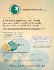
Full page photo - The Canadian Association of Geographers
Full page photo - The Canadian Association of Geographers
Full page photo - The Canadian Association of Geographers
- No tags were found...

Create successful ePaper yourself
Turn your PDF publications into a flip-book with our unique Google optimized e-Paper software.
STATISTICS CANADA – GEOGRAPHY DIVISION / STATISTIQUE CANADA – DIVISION DE LA GÉOGRAPHIE 215Geographer / Géographe : E-mail Address / Adresse électronique :Jennifer WongJennifer.Wong@statcan.gc.caFunctions and Services / Fonctions et servicesSpatial data infrastructure to support the censuses, other surveys and administrativedata programs / Infrastructure des données spatiales pour appuyer lesrecensements, autres enquêtes et les programmes de données administrativesDevelop and maintain geographic areas / Développer et supporter les unitésgéographiquesResearch and methodology / Recherche et méthodologieGIS techniques and applications / Techniques et applications des SIGProduction <strong>of</strong> standard and custom geographic products / Réalisation de produitsgéographiques standards et personnalisésMarketing and client support for geographic products and services / Commercialisationet soutien à la clientèle en ce qui a trait aux produits et services géographiquesParticipation in national and international committees / Participation à des comitésnationaux et internationauxCurrent Research / Projets de recherche en coursUpdating the national digital database – comprising an addressed road network,administrative and statistical boundaries, other geographic reference layers (e.g.hydrography, railroads) and geographic attributes / Mise à jour d’une base dedonnées numérique nationale – incluant un réseau routier avec lescoordonnées, des limites administratives et statistiques, d’autres couchesgéographiques de référence (par ex. hydrographie, chemins de fer) et leursattributs géographiquesJoint Statistics Canada-Elections Canada project on the process <strong>of</strong> integrating the roadnetwork with GPS-compliant provincial road networks to facilitate economies <strong>of</strong>scale, data exchange, value-added products, etc. / Project commun deStatistique Canada et d’Élections Canada sur le processus d’intégrer le réseauroutier avec les réseaux provinciaux conformes au GPS pour favoriser deséconomies d’échelle, l’échange de données, des produits à valeur ajoutée, etc.Use <strong>of</strong> GIS and other technology to support survey design and operation / Utilisationdes SIG et d’autres types de technologie pour la conception et l’organisation desenquêtesApplication <strong>of</strong> the Generalized Area Delineation System (GArDS) for statistical areas /Application d’un Système automatisé de regroupement de territoires (SARTe)pour les unités statistiquesMapping applications on the Internet and Intranet / Applications cartographiques surInternet et IntranetStrategic review <strong>of</strong> geographic areas / Revue stratégique des régions géographiquesConsultation on the geographic content for the 2011 Census / Consultation au sujet ducontenu géographique du Recensement de 2011Participation in the <strong>Canadian</strong> Council on Geomatics (CCOG) / Participation au Conseilcanadien de géomatique (COCG)