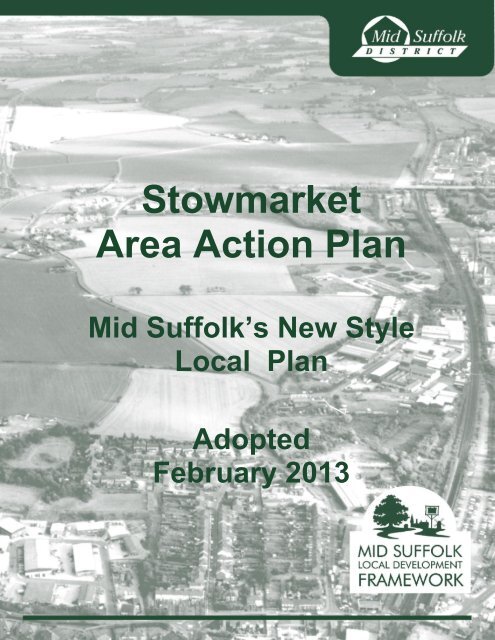
Adopted Stowmarket Area Action Plan - Mid Suffolk District Council
Adopted Stowmarket Area Action Plan - Mid Suffolk District Council
Adopted Stowmarket Area Action Plan - Mid Suffolk District Council
- No tags were found...

You also want an ePaper? Increase the reach of your titles
YUMPU automatically turns print PDFs into web optimized ePapers that Google loves.
<strong>Stowmarket</strong><strong>Area</strong> <strong>Action</strong> <strong>Plan</strong><strong>Mid</strong> <strong>Suffolk</strong>’s New StyleLocal <strong>Plan</strong><strong>Adopted</strong>February 20131
Welcome Witamy SveikiIf you would like this document in another language or format, or if you requirethe services of an interpreter, please contact us.Jeeli chcieliby Pastwo otrzyma ten document w innym jzyku lub w innymFormacie albo jeeli potrzebna jest pomoc tumacza, to prosimy o kontakt z nami.Jei pageidaujate gauti š dokument kita kalba ar kitu formatu, arba jei jumsReikia vertjo paslaug, kreipkits mus. 0845 6 066 067
<strong>Stowmarket</strong> <strong>Area</strong> <strong>Action</strong> <strong>Plan</strong>Relationship to the <strong>Stowmarket</strong> Masterplan1.10 The <strong>Stowmarket</strong> <strong>Area</strong> <strong>Action</strong> <strong>Plan</strong> establishes the planning policy framework for<strong>Stowmarket</strong> and the identified surrounding villages. The <strong>Stowmarket</strong> Masterplan is anon-statutory planning document that concentrates on <strong>Stowmarket</strong> and establishes keyissues and possible areas for future growth of the town.1.11 The <strong>Stowmarket</strong> Masterplan built upon work started for the Local <strong>Plan</strong> Review in2002. The process has involved the residents, businesses and visitors to the town. It hashelped identify areas of opportunity for making positive changes or conserving valuablesocial and environmental assets, while increasing awareness of, and understanding, theplanning issues. This arrangement, by which the Masterplan has informed the <strong>Area</strong> <strong>Action</strong><strong>Plan</strong> has satisfied the public participation requirements under the regulations.1.12 The <strong>Stowmarket</strong> Masterplan remains an integral piece of evidence to the <strong>Stowmarket</strong><strong>Area</strong> <strong>Action</strong> <strong>Plan</strong>. The <strong>Stowmarket</strong> Masterplan has made a significant contribution to the<strong>Stowmarket</strong> <strong>Area</strong> <strong>Action</strong> <strong>Plan</strong> by identifying issues in advance thereby producing a robustand credible document.Core Strategy as amended by the Core Strategy Focused Review1.13 In accordance with the Core Strategy Focused Review <strong>Mid</strong> <strong>Suffolk</strong> <strong>District</strong> <strong>Council</strong>proposes that <strong>Stowmarket</strong> provides for a minimum of 1,925 new dwellings. The <strong>Stowmarket</strong><strong>Area</strong> <strong>Action</strong> <strong>Plan</strong> must allocate enough land to accommodate this number of new dwellings.Sustainability Appraisal1.14 All local plan documents must contribute to the delivery of sustainable development.The economic, environmental and social effects of emerging policies and potentialdevelopment sites have been assessed during the preparation of the SAAP. A finalsustainability appraisal report including how it has influenced the SAAP is available fromthe <strong>Council</strong>'s website (www.midsuffolk.gov.uk).Strategic Environmental Assessment1.15 The Sustainability Appraisal also meets the requirements of the StrategicEnvironmental Assessments (SEA) required by the European Directive EC/2001/42. TheSEA is an environmental assessment of plans and programmes prepared by LocalAuthorities that are likely to have significant effects upon the environment.Habitats Regulations Assessment1.16 A Habitats Regulations Appraisal (HRA) is required to determine whether a planor project affects a Natura (European) site. The HRA refers to the whole process, includingthe appropriate assessment step which is only necessary when a plan or project has beendetermined as affecting a Natura site. After assessing the <strong>Stowmarket</strong> <strong>Area</strong> <strong>Action</strong> <strong>Plan</strong>it was not considered necessary to conduct an Appropriate Assessment because it wasnot considered that the plan will have a significant effect on the integrity of any Special<strong>Area</strong> of Conservation, Special Protection <strong>Area</strong> or Ramsar site (Natura Sites) anddevelopment will be resisted that does not conform to Core Strategy Policy CS6 and<strong>Stowmarket</strong> <strong>Area</strong> <strong>Action</strong> <strong>Plan</strong> SAAP Policy 9.1.4<strong>Mid</strong> <strong>Suffolk</strong> <strong>Stowmarket</strong> <strong>Area</strong> <strong>Action</strong> <strong>Plan</strong> (February 2013)
<strong>Stowmarket</strong> <strong>Area</strong> <strong>Action</strong> <strong>Plan</strong>1.17 The HRA process to reach this conclusion involved assessing the additional growth,hydrological connectivity, distance from Natura Sites and potential for visitor numberincrease resulting. Natural England were involved from the onset of the HRA. Thisapproach and the findings received full support from Natural England.<strong>Mid</strong> <strong>Suffolk</strong>'s intentions for the plan area1.18 The aim of the <strong>Stowmarket</strong> <strong>Area</strong> <strong>Action</strong> <strong>Plan</strong> has been to prioritise and select whichsites should be made available, and produce a phased programme of development toensure the delivery of infrastructure in a timely fashion. Future reviews of this documentwill consider infrastructure requirements and allocations as part of the required monitoringprocess.1.19 An allocation identifies that a site is deemed acceptable for its allocated use havingbeen assessed by the policy making process. However, sites which are allocated will stillneed to obtain planning permission. Allocation will assist with the progress of any futureapplication, and this approach conforms with the <strong>Council</strong>'s moves towards 'DevelopmentManagement' rather than Development Control.<strong>Mid</strong> <strong>Suffolk</strong> <strong>Stowmarket</strong> <strong>Area</strong> <strong>Action</strong> <strong>Plan</strong> (February 2013)5
<strong>Stowmarket</strong> <strong>Area</strong> <strong>Action</strong> <strong>Plan</strong>2 <strong>Stowmarket</strong> and Surrounding <strong>Area</strong> - Past and Present2.1 <strong>Stowmarket</strong> is located in a rural area dominated by agriculture in the County of<strong>Suffolk</strong>. It is heavily influenced by large centres of population, and lies to the south of theA14, mid-distance between Ipswich and Bury St Edmunds. <strong>Stowmarket</strong> is the largesttown in <strong>Mid</strong> <strong>Suffolk</strong>, and is located at the confluence of the Rivers Gipping and Rattlesdenand is on the mainline railway to London and Norwich.2.2 <strong>Stowmarket</strong> will continue to be the focus of further housing growth in the <strong>District</strong>, asthe town has the majority of services and facilities. Further development contributions willassist with providing more community infrastructure, services and facilities to meetrequirements to support additional housing development. <strong>Stowmarket</strong> has approximately8,000 households with an estimated population of 19,000. The population is projected torise to 20,520 by the year 2020.Historical Development2.3 <strong>Stowmarket</strong> is surrounded by the boulder clays of 'High <strong>Suffolk</strong>' and the town is builton alluvial deposits over the underlying strata of chalk and Pleistocene crags exposed bythe river Gipping's action since the ice ages. The town has developed between the tworiver valleys and originally arose around a junction, where the old route from Ipswich toBury St Edmunds has been crossed by roads from Finborough in the west and Stowuplandin the east.2.4 <strong>Stowmarket</strong> is thought to date back to Anglo-Saxon times, the name Stow meaning‘principal place’. The town was listed in Domesday as ‘Torria’, a royal manor later knownas Thorney Hall. It grew in importance in the medieval period thriving on the wool tradeand was granted market charter in 1347. Today the central core of the town retains muchof its medieval character and the street pattern and market place are reinforced bynumerous listed buildings including the church of St Peter and St Mary dating back to the14th century and the medieval timber framed tithe barn at Abbots Hall.2.5 The town saw considerable industrial growth beyond its medieval core in the 18thand 19th centuries with the opening of the canal to Ipswich in 1793 (Ipswich to <strong>Stowmarket</strong>Navigation), and later the railway (1846). These transport routes enabled business andtrade to grow. Consequently, an industrial area to the east of the town centre grew alongthe Gipping river corridor and included warehouses and maltings, remnants of which stillremain today. Significant events in <strong>Stowmarket</strong> during this period included the 1868 BuryStreet Fire and the 1871 Prentice Gun Cotton factory explosions, both destroying a numberof buildings in the town. Nevertheless, the structure of the town has remained largelyunaltered - the historic routes intact, and the urban extent of the town contained well withinthe river valleys.2.6 Although the navigation of the river ceased in 1932 the industrial use of this area ofthe town has continued, albeit with changing industries. Associated with this industrialgrowth the number of people living in the town has increased. <strong>Area</strong>s of Victorian terracedhousing and streets around Pickerel Bridge, south of the town centre and around VioletHill Road, became the first residential suburbs of the town. Between the Victorian periodand the 1950’s the town remained relatively compact focusing on the growth of the historicmedieval core and the Victorian suburbs. At the same time there was also moderate6<strong>Mid</strong> <strong>Suffolk</strong> <strong>Stowmarket</strong> <strong>Area</strong> <strong>Action</strong> <strong>Plan</strong> (February 2013)
<strong>Stowmarket</strong> <strong>Area</strong> <strong>Action</strong> <strong>Plan</strong>growth of the industrial areas within the River Gipping Valley, and some limited housingexpansion to the northwest and south. There was also infill development in some of theolder Victorian town house plots to the south of the town centre.2.7 In the 1960s and 1970s a significant phase of change occurred with the growth ofsubstantial suburbs to the south and north of the town, as well as the growth andconsolidation of industry and employment along the River Gipping floodplain. Formerhalls and rural farming estates were brought into the urban fabric of the town, such asChilton Hall and Chilton Hall Farm. Perhaps the most significant alteration to the settingof the town was the construction of the A14, which skirts to the north and east and broughtwith it a new access road (A1120) to the south east of the town. Recent highwaysimprovement to the A14 around the town have been the ' A14 Haughley New Street to<strong>Stowmarket</strong>' improvements.2.8 In the 1980s and 1990s the town continued to grow, particularly to the northwest.It was in this period that the town expanded onto the higher plateau landscape above theriver valleys. The Gipping Way relief road was also constructed between the town centreand the River Gipping to relieve congestion through the town centre. More recently, theimplementation of the Strategic Development <strong>Area</strong> at Cedar’s Park has broughtconsiderable change and residential growth to the east between the river and the A14.Previously, <strong>Stowmarket</strong> was relatively narrow, the centre of the town remaining close torural countryside. However, the development of Cedar’s Park has broadened the townand has increased the importance of the remaining green corridors which continue topenetrate the urban structure. The population of <strong>Stowmarket</strong> has expanded rapidly in thelast 20 years, and has been increasing a rate of four times above the national average.The Villages within the <strong>Stowmarket</strong> <strong>Area</strong> <strong>Action</strong> <strong>Plan</strong>2.9 Villages which surround <strong>Stowmarket</strong> comprise small rural settlements located onelevated land above the river valleys. These settlements include: Badley (population 79);Combs (population 966); Creeting St Peter (population 245); Great Finborough (population755); Harleston (population 150); Haughley (population 1,710); Onehouse (population947); Old Newton (population 995); and Stowupland (population 1,962). All contain historicbuildings which reflect the local vernacular of <strong>Suffolk</strong>, however, the larger villages alsocontain notable areas of more recent housing. All of these settlements have their ownindividual identity.2.10 Haughley is three miles north of <strong>Stowmarket</strong> and eleven miles east of Bury StEdmunds. It is situated on the claylands of High <strong>Suffolk</strong>, which are soils that help to makeEast Anglia the 'granary of Britain'. Haughley is classified as a Key Service Centre within<strong>Mid</strong> <strong>Suffolk</strong>'s Core Strategy. The village centre is situated away from the river and railwayconnections, and essentially has north-south and east-west road connections that centrearound the village green. It also has a church and a castle at its western end.2.11 Stowupland is also a Key Service Centre containing similar services to Haughley,except it does not have a GP surgery. It is located on higher plateau land to the northeastof <strong>Stowmarket</strong>, and is separated from the town by the A14. It comprises two village greensarranged at right angles to each other, with a number of listed buildings around them.This arrangement reflects the early origins of the village as a ‘dispersed’ pattern ofbuildings. In the 1960s and 1970s the village witnessed considerable growth with the<strong>Mid</strong> <strong>Suffolk</strong> <strong>Stowmarket</strong> <strong>Area</strong> <strong>Action</strong> <strong>Plan</strong> (February 2013)7
<strong>Stowmarket</strong> <strong>Area</strong> <strong>Action</strong> <strong>Plan</strong>introduction of the A14 and development of housing estates to the south and north. Thesedevelopments have significantly altered the character of the village, the nature of the lanenetwork connecting the village to <strong>Stowmarket</strong>, and the village’s setting.2.12 Great Finborough is 3 miles south-west of <strong>Stowmarket</strong>, and Old Newton is 5miles north of <strong>Stowmarket</strong>, they are both classified as a Primary village within <strong>Mid</strong> <strong>Suffolk</strong>'sadopted Core Strategy (2008), as they contain fewer services and a smaller populationthan Haughley and Stowupland. They are therefore capable of limited growth where localneed has been established.2.13 Combs and Onehouse are classified as Secondary villages within <strong>Mid</strong> <strong>Suffolk</strong>'sadopted Core Strategy and are unsuitable for growth, but capable of taking appropriateresidential infill and development for local needs only. Although Combs has a largepopulation, it has relatively few services and facilities for a village of this size and this isthe justification of its Secondary Village classification. Onehouse is a small village locatedon higher plateau land to the north west of <strong>Stowmarket</strong>. Historically, it comprised of justa few scattered houses associated with a number of farm estates including OnehouseHall and Lodge. This settlement form was altered in the 1970’s with the construction ofhousing estates, including the Northfield Estate, which changed the once dispersedcharacter of the settlement. Despite this change the rural context of the village - narrowtree lined lanes, lime avenues and Northfield Wood (managed by the Woodland Trust),remain intact and characteristic of the village setting.2.14 Harleston, Badley, and Creeting St Peter are identified as Countryside Villagesin <strong>Mid</strong> <strong>Suffolk</strong>'s <strong>Adopted</strong> Core Strategy (2008) because of their small populations andlimited services and facilities provision. Only specified types of development will bepermitted in accordance with <strong>Adopted</strong> Core Strategy (2008) Policy CS2 which include:affordable housing on exception sites; agricultural workers dwellings; possible conversionof rural buildings; replacement dwellings; and sites for Gypsies and Travellers and travellingshow people.8<strong>Mid</strong> <strong>Suffolk</strong> <strong>Stowmarket</strong> <strong>Area</strong> <strong>Action</strong> <strong>Plan</strong> (February 2013)
<strong>Stowmarket</strong> <strong>Area</strong> <strong>Action</strong> <strong>Plan</strong>3 Vision and Spatial Strategy3.1 The Vision for the <strong>Stowmarket</strong> <strong>Area</strong> <strong>Action</strong> <strong>Plan</strong> provides the overall focus for thepolicies and objectives contained in this document. It has been derived from the previousvisions put forward in the <strong>Stowmarket</strong> Report by the Civic Trust 2002 and then the<strong>Stowmarket</strong> Masterplan 2008, with the emphasis now concentrating on “those who live,work, visit, and study in the town”.3.2 The Vision for the <strong>Stowmarket</strong> <strong>Area</strong> <strong>Action</strong> <strong>Plan</strong> is:<strong>Stowmarket</strong> <strong>Area</strong> <strong>Action</strong> <strong>Plan</strong> Vision“<strong>Stowmarket</strong> will strive to achieve its full potential as the leading market townwithin the <strong>District</strong> by: encouraging economic prosperity; improving transportand accessibility; mitigating and adapting to climate change; protecting andenhancing its heritage and biodiversity; and encouraging healthy living for thosewho live, work visit, and study in the town and its rural hinterland.”<strong>Mid</strong> <strong>Suffolk</strong> <strong>Stowmarket</strong> <strong>Area</strong> <strong>Action</strong> <strong>Plan</strong> (February 2013)9
<strong>Stowmarket</strong> <strong>Area</strong> <strong>Action</strong> <strong>Plan</strong>3.3 The table below sets out the key factors that are influencing the future of <strong>Stowmarket</strong>.It contains a brief analysis of the town's strengths, weaknesses, opportunities and threats(SWOT).StrengthsGood location along A14 / rail corridorAttractive areas and featuresSolid retail base on which to build, with goodanchor storesStrong manufacturing and employment baseThe town benefits from the maturity of itstrees that are interspersed amongst theurban fabric of the townWeaknessesLack of sports facilitiesLimited use of the Museum of East AnglianLifePhysical barriers to accessibility e.g. theGipping WayLack of comparison goods e.g. clothes,footwear, electricalLimited vacancy levels to offer areas forimprovementBuildings in the town centre of averagequalityPoor evening economyOpportunitiesGood communication / transport links onwhich to buildImproved pedestrianisation and accessibilityMore larger retailers in the town centrePositive and balanced communityEnhancement of existing visitor attractions,including the Museum of East Anglian Lifeneeds an upgraded setting based on qualityin urban design and the public realmTraffic congestionThreatsLack of footfall in the town centrePedestrian accessibility along Ipswich StreetLack of connectivity across town and to thesurrounding villagesCompetition from other centres andout-of-town retail storesLack of varied floorplate sized buildings forretailAnti-social behaviour connected with theevening economyTable 3.1 SWOT Analysis of <strong>Stowmarket</strong> (Strengths, Weaknesses, Opportunities and Threats)Strategic Objectives:3.4 Following extended and ongoing consultation, the Strategic Objectives below providethe basis and direction for the more detailed policies that feature within subsequent chaptersof the <strong>Stowmarket</strong> <strong>Area</strong> <strong>Action</strong> <strong>Plan</strong>.10<strong>Mid</strong> <strong>Suffolk</strong> <strong>Stowmarket</strong> <strong>Area</strong> <strong>Action</strong> <strong>Plan</strong> (February 2013)
<strong>Stowmarket</strong> <strong>Area</strong> <strong>Action</strong> <strong>Plan</strong>Strategic Objective 1Town Centre enhancementTo protect, encourage and promote an appropriate mix of land uses to support thevitality and viability of the day and night time economy of the town centre.The <strong>Council</strong> will seek to improve the shops available in the town centre and encouragecomplementary mixed uses including: offices, cafes, bars and restaurants, openspaces, museums, cinemas, places of worship interspersed with residentialaccommodation. This will protect and support the vitality of the day and night timeeconomy of the town centre. The public realm and street scene will also need to beenhanced to create an attractive shopping environment that will draw people to thetown centre.Strategic Objective 2Priority to town centre activity and viabilityTo protect, encourage and promote an appropriate mix of land uses for the edge ofthe town centre, which are complementary to town centre uses and contribute to thevitality of the town centre.The sensitive interconnection between the town centre and the edge of town centreshould be managed to maintain a vital town centre whilst allowing complementaryuses that are mutually beneficial to the town. Direct competition for town centre activitywill be discouraged but an appropriate complementary mix of land uses for the edgeof the town centre, that contribute to the vitality of the town centre in particular andthe town as a whole will be supported.Strategic Objective 3Enhancing the River ValleysTo protect and enhance <strong>Stowmarket</strong>’s two main river valleys, the Rivers Rattlesdenand Gipping, by maintaining and enhancing their biodiversity, landscape, andaccessibility to the public.The protection of the river valleys safeguarding and improving the habitats they containwill encourage wildlife and support and extend important ecological green corridors.Improving public access where this does not conflict with biodiversity gives opportunitiesto improve the quality of life and foster the health and well-being of residents andvisitors. Protection of the River Valleys includes improving the river frontages andthe widening the riverside footpaths and cycle ways including the <strong>Mid</strong> <strong>Suffolk</strong> LongDistance Route.<strong>Mid</strong> <strong>Suffolk</strong> <strong>Stowmarket</strong> <strong>Area</strong> <strong>Action</strong> <strong>Plan</strong> (February 2013)11
<strong>Stowmarket</strong> <strong>Area</strong> <strong>Action</strong> <strong>Plan</strong>Strategic Objective 4A broad stock of quality homes, jobs, recreation and other facilitiesTo achieve a successful and appropriate mix of high quality residential, employmentand leisure uses that are complementary and contribute towards the success of thetown.The <strong>Council</strong> will promote a complementary mix of residential, employment and leisureuses that contribute towards the success of the town and discourage the townbecoming a dormitory for other places. The mix of uses will contribute to increasedtourism, the delivery of improved recreation and leisure facilities and enhance thebiodiversity potential of the River Gipping Valley and the safety and quality of life andof new and existing neighbourhoods.Strategic Objective 5A "green" town transport systemTo provide a transport system worthy of a "green" town in the 21st Century that willimprove accessibility and connectivity by a variety of means into and out of the towncentre and between <strong>Stowmarket</strong> and it’s surrounding villages.An early upgrade of the public transport, walking and cycling provision will make itsafer and easier for people to access jobs, shopping and leisure facilities without theneed to travel by car. It will improve access within the town centre and its linkagesto the railway station, reduce local journey trips on the A14 trunk road and reduce theimpact of the town's growth on the free flow of traffic on the A14.Strategic Objective 6Protecting and enhancing the environmental heritageTo protect, manage and where possible enhance <strong>Stowmarket</strong>’s natural and builtenvironment and ensure its continued contribution to the town’s heritage, culture,environment and economy.The environment is valued as an attractive setting for the settlements, its contributionto quality of life and sense of well-being and indirectly the economy of the town. Thehistoric, natural and built environment in particular will continue to act as a draw andthe action plan will ensure a continued contribution to the <strong>District</strong>'s culture, environment,and economy. Protection and enhancement will be supported through designationof important areas, features and structures, planning policies and required quality ofdesign.12<strong>Mid</strong> <strong>Suffolk</strong> <strong>Stowmarket</strong> <strong>Area</strong> <strong>Action</strong> <strong>Plan</strong> (February 2013)
<strong>Stowmarket</strong> <strong>Area</strong> <strong>Action</strong> <strong>Plan</strong>Strategic Objective 7Providing improved employment opportunitiesTo ensure the success of existing employment areas and to propose new sites tomaintain a balance between new homes and work opportunities.An innovative approach to the delivery of employment opportunities will be sought toachieve a better balance of new homes and jobs than currently exists in the Local<strong>Plan</strong> <strong>Area</strong>. Schemes for employment or enterprise must offer direct linkages with thetown centre and new and existing residential areas to help businesses locating in thetown to create "Green Travel <strong>Plan</strong>s" that have a positive impact on traffic and travelin the area.<strong>Mid</strong> <strong>Suffolk</strong> <strong>Stowmarket</strong> <strong>Area</strong> <strong>Action</strong> <strong>Plan</strong> (February 2013)13
<strong>Stowmarket</strong> <strong>Area</strong> <strong>Action</strong> <strong>Plan</strong>GENERAL DEVELOPMENT PRINCIPLES4.2 The NPPF contains 12 core principles that are supportive of the vision, objectivesand policies of the <strong>Stowmarket</strong> <strong>Area</strong> <strong>Action</strong> <strong>Plan</strong>. This approach to sustainabledevelopment is underpinned by the Model Policy below:SAAP Policy 4.1Presumption in Favour of Sustainable DevelopmentWhen considering development proposals the <strong>Council</strong> will take a positive approachthat reflects the presumption in favour of sustainable development contained in theNational <strong>Plan</strong>ning Policy Framework. It will always work proactively with applicantsjointly to find solutions which mean that proposals can be approved wherever possible,and to secure development that improves the economic, social and environmentalconditions in the area.<strong>Plan</strong>ning applications that accord with the policies in this Local <strong>Plan</strong> (and, whererelevant, with policies in neighbourhood plans) will be approved without delay, unlessmaterial considerations indicate otherwise.Where there are no policies relevant to the application or relevant policies are out ofdate at the time of making the decision then the <strong>Council</strong> will grant permission unlessmaterial considerations indicate otherwise – taking into account whether:Any adverse impacts of granting permission would significantly and demonstrablyoutweigh the benefits, when assessed against the policies in the National <strong>Plan</strong>ningPolicy Framework taken as a whole; orSpecific policies in that Framework indicate that development should be restricted.Best Use of a Development Opportunity4.3 The <strong>Council</strong> will ensure that development proposals represent the 'best use of adevelopment opportunity'. This will include a review of relevant national, regional andlocal policies and pre-application discussions, in order to deliver high quality developmentand design. Development briefs and Masterplans will help to determine the best use ofa site. The <strong>Council</strong> will consider alternative uses of sites that would contribute more fullyto meeting the strategic objctives of the SAAP, which may sometimes protect sites fortheir optimum use.Development Briefs4.4 The <strong>Council</strong> will require a 'Development Brief' to be produced, before an applicationis submitted, for SAAP allocations and other proposals in the SAAP area that havesignificance beyond their site boundary. The purpose of the development brief is to aidthe coordinated delivery of infrastructure and provide a framework for the evaluation of<strong>Mid</strong> <strong>Suffolk</strong> <strong>Stowmarket</strong> <strong>Area</strong> <strong>Action</strong> <strong>Plan</strong> (February 2013)15
<strong>Stowmarket</strong> <strong>Area</strong> <strong>Action</strong> <strong>Plan</strong>future planning applications for all phases of development to ensure the overall vision anddevelopment objectives, and associated infrastructure requirements for the site, aredelivered comprehensively.4.5 The <strong>Stowmarket</strong> Masterplan was adopted by the <strong>Council</strong> in June 2008. This,alongside current and future work on the <strong>Stowmarket</strong> Masterplan phase 2 and the illustrativelayouts and policies in the SAAP should be considered before producing a DevelopmentBrief (Note: The illustrative layouts are taken from the documents listed under ‘ConceptStatements’ in Appendix E Glossary).4.6 NPPF paragraph 189 encourages developers to engage with the local communitybefore submitting applications. The <strong>Council</strong> considers that the preparation of aDevelopment Brief (in consultation with the local community and other stakeholders) offersthe best means of meeting the NPPF requirements for strategic sites.4.7 The process for preparation of development briefs is set out below:Development briefs will be prepared by the developer(s) for the entire site. Prior tocommencing work on a development brief, developers or landowners should ask foragreement in writing from the <strong>Council</strong> about the form, content and level of detailrequired in the development brief;Developers will be responsible for undertaking an agreed form of public consultationwhich should be in accordance with the <strong>Council</strong>’s Statement of Community Involvementand the requirements set out in the Town and Country <strong>Plan</strong>ning (Local <strong>Plan</strong>ning)(England) Regulations 2012, Part 5 - Supplementary <strong>Plan</strong>ning Documents and othersections where applicable;Developers will respond to the representations received which will form the basis fora Consultation Statement to be submitted to the <strong>Council</strong>. Officers will then assesswhether the Development Brief has responded adequately to consultation responses,including those of the <strong>Council</strong>. If not the document will require further amendmentand consultation, to be led by the developer;The <strong>Council</strong> will then recommend the document for adoption as SPD or materialconsideration for Development Management purposes as appropriate.4.8 The required Development Briefs should take account of the following:the adopted <strong>Stowmarket</strong> Masterplan (2008) where it is pertinent;the objectives and policies of the SAAP including illustrative layouts; andthe previously produced concept statements (see glossary) which are available fromthe <strong>Council</strong>'s website (http://www.midsuffolk.gov.uk).Phasing of housing development4.9 In larger housing developments (10 or more dwellings), phasing may need to besubject to agreement between the <strong>Council</strong> and developer to ensure that the appropriateinfrastructure can be provided at an agreed stage in the development.Compulsory Purchase Orders16<strong>Mid</strong> <strong>Suffolk</strong> <strong>Stowmarket</strong> <strong>Area</strong> <strong>Action</strong> <strong>Plan</strong> (February 2013)
<strong>Stowmarket</strong> <strong>Area</strong> <strong>Action</strong> <strong>Plan</strong>4.10 Where it is felt necessary the <strong>Council</strong> will consider the use of Compulsory PurchaseOrders (CPOs) towards meeting the objectives of the <strong>Stowmarket</strong> <strong>Area</strong> <strong>Action</strong> <strong>Plan</strong>.Sustainable Development4.11 There is a clear framework throughout national and regional policy for inclusion ofcarbon dioxide reduction targets, renewable energy targets, and energy and carbonperformance standards that are higher than existing Building Regulations requirements.Higher renewable energy targets and sustainable construction standards are further justifiedby announcements such as the Climate Change Act, the Energy Act and the UK's shareof the EU Renewable Energy target.4.12 <strong>Suffolk</strong>'s Community Strategy, "Transforming <strong>Suffolk</strong>", aims to make <strong>Suffolk</strong> anexemplar in tackling climate change and sets out an aspiration that <strong>Suffolk</strong> should becomethe county with the greatest reduction in carbon emissions - a reduction of 60% by 2025from a 2004 baseline. The Strategy encourages the development of higher level sustainableconstruction policies in local development documents.4.13 Changes to Building Regulations in 2010, 2013 and 2016 are expected to bring intough carbon dioxide emission reduction targets for dwellings and renewable energytargets for both residential and commercial development. However the planning systemneeds to go beyond the traditional policies on dwelling emissions rate and proportions ofrenewable energy if it is to meet EU, national, regional and local targets to reduce allemissions including transport emissions.4.14 <strong>Mid</strong> <strong>Suffolk</strong> <strong>District</strong> <strong>Council</strong> believes that it has a particular responsibility to offermeasures to counter balance the excessive levels of emissions which are caused by highlevels of car ownership of the resident population and to address future water scarcity towhich <strong>Mid</strong> <strong>Suffolk</strong> may have a particular vulnerability. The <strong>Council</strong> will welcome andpropose initiatives that enhance opportunities for the use of hybrid and electric poweredvehicles.Specific Sustainable Design Issues for <strong>Stowmarket</strong>Enhancing the wider Green Infrastructure Network4.15 Consequently, development proposals should be assessed for their potential toprovide opportunities to enhance or extend the wider green infrastructure network andthereby maximising the conservation and enhancement of biodiversity, while increasingthe accessibility and community value of the network.Landmarks and the Skyline4.16 Landmark buildings or features will be sought for developments in appropriatelocations across <strong>Stowmarket</strong>, including street corners, entrances and historic and urbangateways to the town (identified in the <strong>Stowmarket</strong> Environmental Assessment (2008)).4.17 The location of <strong>Stowmarket</strong> lies within two river valleys, which will have an impacton acceptable building heights within different locations across the town. <strong>Stowmarket</strong>’sskyline will be protected to ensure that the views in, out and across the town identified inthe <strong>Stowmarket</strong> Environmental Assessment (2008) are not harmed. The onus will be on<strong>Mid</strong> <strong>Suffolk</strong> <strong>Stowmarket</strong> <strong>Area</strong> <strong>Action</strong> <strong>Plan</strong> (February 2013)17
<strong>Stowmarket</strong> <strong>Area</strong> <strong>Action</strong> <strong>Plan</strong>a developer to demonstrate that the built form and massing of development proposed willenhance the setting of <strong>Stowmarket</strong> and maintain the distance views across the valley tothe town ridge line.Advance Landscape <strong>Plan</strong>ting4.18 It has been recognised for a long time that in larger scale developments, landscapeplanting made, protected and maintained prior to the commencement of the maindevelopment has many advantages. It allows early establishment of planting, lessens theimpact of development on neighbouring landscape, environment and users, reducesvandalism, enhances the setting of buildings and increases their subsequent value.4.19 It is accepted that it may not always be feasible or viable to put landscape in placeprior to other parts of the development but this will be sought where failure to do so wouldhave significant negative impacts on the environment, biodiversity, landscape, amenity oreconomic health of neighbouring uses and the town in general.Protecting Visually Important Open Space (VIOS)4.20 Visually Important Open Spaces were identified in the <strong>Mid</strong> <strong>Suffolk</strong> Local <strong>Plan</strong>(1998). Those relevant to <strong>Stowmarket</strong> are indicated on Map 6.1 and the Proposals Map(Appendix F) for the <strong>Area</strong> <strong>Action</strong> <strong>Plan</strong> and may include garden land, allotments, recreationareas, amenity open space and features such as ponds, wooded areas, and hedges.They will continue to be protected from development for their visual or amenity value andtheir contribution to local character and distinctiveness. This protection is extended toencompass detrimental impacts from development on neighbouring sites. Three newVisually Important Open Spaces are proposed below.4.21 Social and economic factors require the Visually Important Open Space aroundChilton Fields to be redefined (Please see SAAP Policies 6.5 to 6.12). A new area hasbeen added to include the Paupers Graves to provide an appropriate gap betweenOnehouse and <strong>Stowmarket</strong>. A second Visually Important Open Space will protect thetributary of the River Rattlesden at Combs Lane. A third Visually Important Open Spaceis identified on land adjoining the Church Meadows development. These VIOS are identifiedon Map 6.1 and the Proposals Map in Appendix F.18<strong>Mid</strong> <strong>Suffolk</strong> <strong>Stowmarket</strong> <strong>Area</strong> <strong>Action</strong> <strong>Plan</strong> (February 2013)
<strong>Stowmarket</strong> <strong>Area</strong> <strong>Action</strong> <strong>Plan</strong>SAAP Policy 4.2Providing a Landscape Setting for <strong>Stowmarket</strong>The <strong>Council</strong> will require that:1). Where appropriate, development proposals extend and enhance the qualityof the wider green infrastructure network to maximise the conservation andenhancement of its biodiversity and increase its accessibility and communityvalue.2). Proposals for sites in key locations that would benefit from landmark buildingsor features incorporate designs appropriate for the site.3). New development that may impact on the existing skyline and on viewsthroughout <strong>Stowmarket</strong> takes the skyline into account. Developers mustdemonstrate that the built form proposed will enhance the setting of the townand maintain the views across the valley to the town ridge line.4). Where feasible and practicable key elements of proposed landscapeimprovements are put in place prior to the commencement of building works.Determination of required landscape improvements for development will includeconsideration of the environment, biodiversity, landscape, amenity or economichealth of neighbouring uses and the town.Advanced planting will be particularly relevant for developments that may impacton:i. views in, out, and across <strong>Stowmarket</strong>;ii.iii.the 'gateway' role of an area;buffer areas between industrial and residential areas and around 'nuisanceneighbours', such as sewage works.5). The <strong>Council</strong> will resist development that would have a harmful effect on thevalue of a Visually Important Open Space and will require developments thatmay have a detrimental effect on the quality of a Visually Important Open Spaceto be sensitively designed to minimise these effects.<strong>Mid</strong> <strong>Suffolk</strong> <strong>Stowmarket</strong> <strong>Area</strong> <strong>Action</strong> <strong>Plan</strong> (February 2013)19
<strong>Stowmarket</strong> <strong>Area</strong> <strong>Action</strong> <strong>Plan</strong>5 Shopping and Town CentreContext5.1 <strong>Suffolk</strong> has a low population density with a limited number of large scale shoppingcentres and many more smaller 'local shopping centres'. <strong>Stowmarket</strong> provides anintermediate level of shopping for <strong>Mid</strong> <strong>Suffolk</strong> and its surrounding rural area. Anyimprovements to <strong>Stowmarket</strong>'s retail offer should complement, but not look to compete,with the existing larger retail centres at Ipswich and Bury St. Edmunds.5.2 <strong>Stowmarket</strong> has the largest number of shops in <strong>Mid</strong> <strong>Suffolk</strong> and provides the mainshopping centre for the district. The current retail floorspace within the town centre isapproximately 28,000 sqm, comprising 173 units. The predominant use is A1 'shops'with almost 15,000 sqm, making up approximately 46% of the total floorspace (<strong>Mid</strong> <strong>Suffolk</strong>Retail Survey August 2009). The catchment population for the town is set to increase by12% by 2021, and as a consequence the town centre and adjoining non-central areasshould look to accommodate an increase in both convenience and comparison goods.There is a need and capacity for additional retail floorspace in the town centre, and thereis a forecast potential for additional comparison and convenience floorspace. Changeswill continue to be monitored through <strong>Mid</strong> <strong>Suffolk</strong>'s annual Retail Survey.5.3 The health and vitality of <strong>Stowmarket</strong>'s town centre is considered a good indicatorof the condition of the local economy, and evidence indicates that <strong>Stowmarket</strong> is tradingat a reasonable level for a market town with a low vacancy rate, although this could stillbe improved. The town has some good points on which to build upon, but lacks a sufficientcritical mass of comparison goods shops (non-food items, e.g. clothes, furniture or electricalitems). It requires a full variety of shop sizes in order to attract the full range of retailers,including national as well as local retailers. As a result, an increase in town centrefloorspace is being promoted by the <strong>Council</strong>, although no single store should be allowedto threaten the remainder of the town centre.5.4 The increasing challenge from out-of-centre shopping, and the potential threat fromwebsite shopping, has focused attention on the need to enhance all characteristics of<strong>Stowmarket</strong>’s town centre. A complete range of appropriately sized and located activitiesmust be provided in order to enhance the town centre's retail offer and prominence. <strong>Mid</strong><strong>Suffolk</strong> <strong>District</strong> <strong>Council</strong> will continue to follow the national sequential and 'town centre first'approach to retail development within <strong>Stowmarket</strong> <strong>Area</strong> <strong>Action</strong> <strong>Plan</strong> boundary. The <strong>Council</strong>remains opposed to the subdivision of retail units, particularly within the town centre, andthis can now be controlled through planning conditions.5.5 The policies set out in this chapter are specific to the <strong>Stowmarket</strong> <strong>Area</strong> <strong>Action</strong> <strong>Plan</strong>,and current national, regional and other local policy will continue to provide the policy basisfor all retail issues that are not specifically set out below, for example in relation toedge-of-town centre or out-of-town centre retail.5.6 An overall 'Town Centre Management Strategy' is currently emerging through the<strong>Council</strong>, which along with any future funding that may become available for the town centre,could influence future reviews of the <strong>Stowmarket</strong> <strong>Area</strong> <strong>Action</strong> <strong>Plan</strong> and in particular the20<strong>Mid</strong> <strong>Suffolk</strong> <strong>Stowmarket</strong> <strong>Area</strong> <strong>Action</strong> <strong>Plan</strong> (February 2013)
<strong>Stowmarket</strong> <strong>Area</strong> <strong>Action</strong> <strong>Plan</strong>town centre. Advertising remains a sensitive issue for the <strong>Council</strong>, and particularly thetown centre, and will also be explored further in the 'Town Centre management Strategy'and other future <strong>Council</strong> documents.5.7 Map 5.1 currently shows the 'Town Centre Boundary', 'Principal Shopping <strong>Area</strong>' andboth the 'Primary and Secondary Shopping Frontages'. The 'Town Centre Boundary' iscentred around the locations where retail should be concentrated. It has also been drawnto include the Museum of East Anglian Life, while taking account of the natural barrier ofthe existing Gipping Way. To the north-east the railway station and the River Gipping areboth recognised as being important to the diversity and vitality of the town centre and couldbe incorporated into any future reviews of 'Town Centre Boundary' in subsequent years.5.8 For the purpose of this document, the term "shopping frontage” refers to all of thesides of the building where a defined area is applicable, either the Primary or SecondaryShopping Frontage. Any gaps in the building line will also be covered by the definedfrontage area in question, therefore any future building will also fall within this definedfrontage.<strong>Mid</strong> <strong>Suffolk</strong> <strong>Stowmarket</strong> <strong>Area</strong> <strong>Action</strong> <strong>Plan</strong> (February 2013)21
<strong>Stowmarket</strong> <strong>Area</strong> <strong>Action</strong> <strong>Plan</strong>SAAP Policy 5.1General Retail Policies for all of the <strong>Stowmarket</strong> <strong>Area</strong> <strong>Action</strong> <strong>Plan</strong>1). The <strong>Council</strong> will maintain and when possible increase the number of shops (A1)within the Principal Shopping <strong>Area</strong>, provided that the increase is not based on thesub-division of property that will reduce the availability of larger retail shops in thetown centre. (Note: Permission for all new retail units, including retail warehousesoutside the principal shopping area will be subject to conditions that will preventsub-division and where appropriate to protect the town centre planning conditionsmay restrict the goods to be sold or the hours of operation).2). The vitality and viability of <strong>Stowmarket</strong>'s town centre will depend on therefurbishment and / or redevelopment of Ipswich Street. Any proposals for newdevelopment or redevelopment in <strong>Stowmarket</strong>'s town centre will be required tocontribute towards public realm improvements, including the provision of new signsto assist and inform visitors with movement through the town.3). There must be no unacceptable levels of traffic, or other activity, generated by thedevelopment within close proximity of the site to the detriment of highway safety orlocal amenities.4). All retail proposals inside and outside the town centre must be readily accessibleby public transport, cycle or on foot, and by disabled people.5). High quality, appropriate and inclusive design must be achieved for all new retailrelated development. This must include appropriate provision for utilities, such as:i. refuse storage;ii. servicing storage;iii. adequate servicing access, and the associated hours used;iv. air conditioning, including extractors for cooking;v. sound insulation, where there are recognised un-neighbourly use6). Amusement arcades will not be permitted:i. in <strong>Stowmarket</strong>'s Principal Shopping <strong>Area</strong>;ii. close to housing, schools, churches, hospitals or hotels;iii. where they would harm visual amenity, cause noise or disturbance;iv. where they would harm the character, appearance and/or setting of Conservation<strong>Area</strong>s, listed buildings or buildings of local importance.7). The <strong>Council</strong> will support changes of use from residential to A1-A3 uses within thetown centre, in appropriate locations. New residential development will not beencouraged in the town centre where it could compromise any future retaildevelopment.22<strong>Mid</strong> <strong>Suffolk</strong> <strong>Stowmarket</strong> <strong>Area</strong> <strong>Action</strong> <strong>Plan</strong> (February 2013)
<strong>Stowmarket</strong> <strong>Area</strong> <strong>Action</strong> <strong>Plan</strong>8). The vitality and viability of the town centre will be assisted by promotingappropriately located complementary uses, such as offices, residential, and leisureuses, which can increase the towns day and evening economy and activity, and canmake it more attractive to residents, businesses and visitors. In some areas it mayalso be appropriate to allow extended hours of operation through approved conditionsin order to stimulate <strong>Stowmarket</strong>'s evening economy, although this will be subject toadvice from the Police and other relevant bodies. Ultimately, a balance of shops andother complementary uses in a safe and attractive environment is sought for<strong>Stowmarket</strong>.<strong>Mid</strong> <strong>Suffolk</strong> <strong>Stowmarket</strong> <strong>Area</strong> <strong>Action</strong> <strong>Plan</strong> (February 2013)23
<strong>Stowmarket</strong> <strong>Area</strong> <strong>Action</strong> <strong>Plan</strong>SAAP Policy 5.2Principal Shopping <strong>Area</strong> (Primary and Secondary Shopping Frontages)1). Additional retail floorspace will only be permitted if the proposal demonstrates itdoes not harm the vitality and viability of the existing Principal Shopping Centre.2). The change of use or redevelopment from a ground floor retail use (A1-A5) tonon-retail uses will not be permitted within the Principal Shopping <strong>Area</strong>. Mixed-useredevelopments will be allowed, subject to other policies, where the level of retailfloorspace is maintained, and where retail uses are proposed on the ground floor.The permanent loss of retail floorspace at ground floor level to non-retail uses withinthe Principal Shopping <strong>Area</strong> will be resisted.3). To increase the amount of floorspace for non-bulky comparison goods in thePrincipal Shopping <strong>Area</strong> by a target of at least an additional 6,650 sqm net by 2021(as per Core Strategy / <strong>Stowmarket</strong> Retail Study).4). To increase the amount of convenience floorspace in the Principal Shopping <strong>Area</strong>by a target of at least an additional 650 sqm by 2021 (as per Core Strategy /<strong>Stowmarket</strong> Retail Study).5). In order to improve the visible appearance of the town centre no refuse bins,residential or trade, will be permitted to be stored on shopping frontages or publichighways, except for designated collection times.Primary Shopping Frontages (parts of: Ipswich Street / Market Place / BuryStreet / Wilkes Way / Tavern Street)6). In order to promote a busy and vibrant shopping town centre, the <strong>Council</strong> will seekto protect, where practicable, the extent of the Primary Shopping Frontage forpredominantly A1 retail use at ground floor level. Within the extent of the wholePrimary Shopping Frontage a target of 75% A1 retail use is sought at ground floorlevel (This target relates to the total ground floor retail floor space for the PrimaryShopping Frontage).7.) Groupings of non A1 retail uses will require careful consideration. Proposals fornon A1 retail uses will be resisted in Primary Shopping Frontages were the proposalwould result in a collective detrimental impact away from the desired A1 frontage 75%target.Secondary Shopping Frontages (parts of: Ipswich Street / Market Place / CroweStreet / Bury Street / Tavern Street / Station Road West)8). Within the whole extent of the Secondary Shopping Frontages only A1-A5 usesand appropriate D1 uses will be considered for ground floor use. B1, D2 and SuiGeneris uses may be acceptable where they can demonstrate they will not underminethe vitality and viability of the locality or adversely impact on surrounding amenities.24<strong>Mid</strong> <strong>Suffolk</strong> <strong>Stowmarket</strong> <strong>Area</strong> <strong>Action</strong> <strong>Plan</strong> (February 2013)
<strong>Stowmarket</strong> <strong>Area</strong> <strong>Action</strong> <strong>Plan</strong>9). The permanent loss of A1 retail use within the Secondary Shopping Frontages willbe resisted.10). For the purposes of development, within the defined town centre any retail frontage(A1-A5) that is not within the Primary Shopping Frontage will be considered as beingwithin a Secondary Shopping Frontage.<strong>Mid</strong> <strong>Suffolk</strong> <strong>Stowmarket</strong> <strong>Area</strong> <strong>Action</strong> <strong>Plan</strong> (February 2013)25
<strong>Stowmarket</strong> <strong>Area</strong> <strong>Action</strong> <strong>Plan</strong>Map 5.1 Town Centre26<strong>Mid</strong> <strong>Suffolk</strong> <strong>Stowmarket</strong> <strong>Area</strong> <strong>Action</strong> <strong>Plan</strong> (February 2013)
<strong>Stowmarket</strong> <strong>Area</strong> <strong>Action</strong> <strong>Plan</strong>SAAP Policy 5.3Ipswich StreetThe <strong>Council</strong> will actively support and encourage appropriate sustainable regeneration,notably for retail, along Ipswich Street in order to provide a vibrant and distinctive focalpoint for the town centre, in accordance with other local, regional and national policies.Following any significant regeneration improvements along Ipswich Street, subsequentservicing and access will look to be restricted on market days between the hours of10.00am and 4.00pm, except for public transport (including buses and taxis) anddisabled badge holders. This situation will be monitored and could be extended toother periods. The overall aim is to gradually discourage vehicular traffic within thetown centre, and particularly along Ipswich Street. The idea of pedestrianisation willbe considered at subsequent reviews of the <strong>Stowmarket</strong> <strong>Area</strong> <strong>Action</strong> <strong>Plan</strong>.Any development along Ipswich Street must have regard for the wider aspirations ofthe town centre.<strong>Mid</strong> <strong>Suffolk</strong> <strong>Stowmarket</strong> <strong>Area</strong> <strong>Action</strong> <strong>Plan</strong> (February 2013)27
<strong>Stowmarket</strong> <strong>Area</strong> <strong>Action</strong> <strong>Plan</strong>SAAP Policy 5.4Complementary UsesMarkets1). The <strong>Council</strong> will continue to promote and support the market(s) at appropriatelocations within the town centre. The <strong>Council</strong> will consider the impact of trafficmovements in the Principal Shopping <strong>Area</strong> and the requirements of SAAP Policy 5.3when considering any changes or extension to the existing market(s).Restaurants and Cafes (A3)2). Restaurants and cafes (A3 uses only) will be encouraged in the town centre wherethis does not conflict with the objectives of SAAP Policies 5.1, 5.2 and 5.3. Outsidetables and chairs serving restaurants and cafes will also be encouraged where thisdoes not prejudice highway safety, the movement of all pedestrians, emergencyvehicles, or residential amenity. Appropriate non-permanent planting and screeningmay also be considered.Drinking establishments (A4) and nightclubs (sui generis)3). In order to protect the sensitive areas of the town centre, the <strong>Council</strong> will generallyonly permit proposals for new establishments within Use Class A4 (drinkingestablishments) and nightclubs (Class sui generis), in Secondary Shopping Frontagesor the Station Quarter. These uses may replace existing facilities within the sameUse Class in the Primary Shopping Frontage, where there is no adverse impact onresidential amenity, highway safety, or the character of an area. Proposals for A4drinking establishments will be permitted where this can be justified by evidence todemonstrate that the proposed development will not conflict with or compromise theobjectives of SAAP Policies 5.1, 5.2 and 5.3, and other policies of the developmentplan.Hot food takeways (A5)4). In order to protect the sensitive areas of the town centre, the <strong>Council</strong> will onlypermit proposals for new A5 uses (hot food takeaways) within the town centre inSecondary Shopping Frontages.5). Applications for new A5 uses (hot food takeaways) which fall outside the towncentre boundary will be resisted where the proposal falls within 400m of the boundaryof an existing school or leisure and recreational facility.28<strong>Mid</strong> <strong>Suffolk</strong> <strong>Stowmarket</strong> <strong>Area</strong> <strong>Action</strong> <strong>Plan</strong> (February 2013)
<strong>Stowmarket</strong> <strong>Area</strong> <strong>Action</strong> <strong>Plan</strong>SAAP Policy 5.5Retail in the Surrounding Villages and Local Shopping Centres1). Within the surrounding villages and 'local centres' of <strong>Stowmarket</strong>, retail, post offices,public houses, garages and other service facilities will continue to be protected andencouraged where it is appropriate and viable. The loss of these facilities and servicesin these areas will be resisted.2). Applications for change of use from retail facilities (A1-A5) to other uses within thevillages or 'local centres' will only be approved where it can be demonstrated :i. that the local need for the existing use no longer exists; andii. that the proposal will not have a detrimental impact on the vitality and viability ofthe village or 'local centre'.3). New retail development, including the change of use to retail, in surrounding villagesor 'local centres' will be approved where:i. the proposal meets local need; andii. falls with Use Classes A1 - A5.4). The <strong>Council</strong> will safeguard and improve the viability of village and local facilities,and ensure a mix of retail to serve the local needs that must complement and notcompete with the retail offer in <strong>Stowmarket</strong>.Allocation for Mixed Use Development - The Station QuarterThe Station Quarter5.9 The 'Station Quarter' is the area of land located in front of <strong>Stowmarket</strong>'s railwaystation, identified to the north-east of the town centre as shown on Map 5.1. The followingpolicies apply directly to the Station Quarter site and its immediate area. Map 5.2 showsan indicative layout plan for the Station Quarter taken from the <strong>Stowmarket</strong> Masterplan(May 2008) highlighting how some of the key issues with this site could be overcome.The area affected by flood risk must be of a compatible use with page 6 of the TechnicalGuidance to the NPPF.<strong>Mid</strong> <strong>Suffolk</strong> <strong>Stowmarket</strong> <strong>Area</strong> <strong>Action</strong> <strong>Plan</strong> (February 2013)29
<strong>Stowmarket</strong> <strong>Area</strong> <strong>Action</strong> <strong>Plan</strong>SAAP Policy 5.6AllocationThe Station Quarter has been specifically identified for transport improvements, notablythe need for a bus/rail interchange and linkages to the town centre. At the same timethe area has also been allocated for mixed use purposes, which must includeappropriately located and proportional: residential, retail and employment uses. Openspace, car parking provision and hotel use must also be fully and properly explored.Any proposed development within the area affected by flood risk must comply withthe sequential and exception tests in the Technical Guidance to the National <strong>Plan</strong>ningPolicy FrameworkSAAP Policy 5.7Guidelines and PrinciplesAny future development within this identified area must consider the following criteria:1. the adopted <strong>Stowmarket</strong> Masterplan (June 2008) where it is pertinent;2. the <strong>Stowmarket</strong> Masterplan Phase 2 - Station Quarter Concept Statement (MSDC,2009);3. providing a bus/rail interchange, including potential access considerations;4. any proposed development within the area affected by flood risk must complywith the sequential and exception tests in the Technical Guidance to the National<strong>Plan</strong>ning Policy Framework;5. the areas ability to contribute to <strong>Stowmarket</strong>'s evening economy;6. integrating and improving the River Gipping, (including contributions towardsRiver Gipping shared cycle and footpath);7. improving pedestrian and cycle linkages, including signage, from the station tothe town centre;8. reducing the amount of private car parking provision, through schemes such as'Controlled Parking Zones'; and9. any outstanding planning permission(s).SAAP Policy 5.8Wider SettingAny development within or directly adjoining the Station Quarter must have regard forthe wider aspirations of the whole of the Station Quarter site.30<strong>Mid</strong> <strong>Suffolk</strong> <strong>Stowmarket</strong> <strong>Area</strong> <strong>Action</strong> <strong>Plan</strong> (February 2013)
<strong>Stowmarket</strong> <strong>Area</strong> <strong>Action</strong> <strong>Plan</strong>5.10 There will be the possibility of incorporating the Station Quarter area within thetown centre boundary (as in Map 5.1) through future reviews of the <strong>Stowmarket</strong> <strong>Area</strong><strong>Action</strong> <strong>Plan</strong>.<strong>Mid</strong> <strong>Suffolk</strong> <strong>Stowmarket</strong> <strong>Area</strong> <strong>Action</strong> <strong>Plan</strong> (February 2013)31
<strong>Stowmarket</strong> <strong>Area</strong> <strong>Action</strong> <strong>Plan</strong>Map 5.2 Illustrative layout for the Station Quarter (extract from <strong>Stowmarket</strong> Masterplan Phase 2 - StationQuarter Concept Statement - see glossary for details)32<strong>Mid</strong> <strong>Suffolk</strong> <strong>Stowmarket</strong> <strong>Area</strong> <strong>Action</strong> <strong>Plan</strong> (February 2013)
<strong>Stowmarket</strong> <strong>Area</strong> <strong>Action</strong> <strong>Plan</strong>6 HousingContext6.1 <strong>Stowmarket</strong> is the largest town in <strong>Mid</strong> <strong>Suffolk</strong> and is the main centre for housingdevelopment, employment and shopping in the district. This role will continue in line withnational and regional planning policies for sustainable development, providing new housingin places with a good range of services and local employment and reducing the need totravel.6.2 There will be some opportunities to make use of previously-developed or 'brownfield' sites in the centre of <strong>Stowmarket</strong> but there will also be a need to allocate furtherareas of green field land on the fringe of the town in order to meet future housingrequirements.6.3 The NPPF (paragraph 37) anticipates that a proper balance between new homesand jobs will be created through the planning process. This <strong>Area</strong> <strong>Action</strong> <strong>Plan</strong> tries toachieve such a balance, whilst creating a network of transport and social facilities thatenhance the future "sustainability" of the town.6.4 The <strong>Mid</strong> <strong>Suffolk</strong> Core Strategy has established minimum housing requirements andthe broad locations for the main housing allocations.6.5 The <strong>Mid</strong> <strong>Suffolk</strong> Core Strategy identifies a need to allocate green field sites for atleast 1,525 homes at <strong>Stowmarket</strong>. The Core Strategy represents a "floor" or starting pointfor this process, rather than an upper limit or "ceiling" to the actual number of homes thatcan be agreed through the <strong>Stowmarket</strong> <strong>Area</strong> <strong>Action</strong> <strong>Plan</strong>.Proposed Housing Site Allocations6.6 The broad locations for the main housing allocations, on green field land, wereestablished in the adopted Core Strategy (2008) and are areas to the north and the northwest of <strong>Stowmarket</strong>. The Core Strategy Inspector, in his report, emphasised that theseare not the only possible locations for future development. The <strong>Stowmarket</strong> <strong>Area</strong> <strong>Action</strong><strong>Plan</strong> proposes three allocation sites, in order to meet the needs in different areas of thetown, to provide housing near to existing services and employment and to provide anelement of choice in the housing market.6.7 The proposed site allocations are:North West <strong>Stowmarket</strong> - Chilton Leys Estimated capacity for 1000 homes duringthe plan period. There is estimated capacity at Union Road / Finborough Road for afurther 200 homes which may be considered at the first review of the SAAP.North <strong>Stowmarket</strong> - The Ashes, between Newton Road and Stowupland Road.Estimated total capacity for 400 homesAn additional, smaller housing allocation is proposed on the south side of <strong>Stowmarket</strong>,off Farriers Road, where there is the opportunity to meet local housing needs, includingthe needs of elderly and disabled people, and to meet needs for additional publicopen space. The estimated capacity of this site is 125 houses, taking account of the<strong>Mid</strong> <strong>Suffolk</strong> <strong>Stowmarket</strong> <strong>Area</strong> <strong>Action</strong> <strong>Plan</strong> (February 2013)33
<strong>Stowmarket</strong> <strong>Area</strong> <strong>Action</strong> <strong>Plan</strong>lower density of the proposed type of development, including bungalows, plus provisionof sheltered housing.6.8 These sites, when developed to their full extent, could provide 1,725 houses. Byphasing the North West location to 1000 houses within the 15-year <strong>Plan</strong> period and 200beyond, the allocations during the <strong>Plan</strong> period would provide for 1,525 houses.6.9 Most of the allocated green field sites are open arable fields which have limitedbiodiversity value. However, there will be opportunities for new development to contributenew habitats through the introduction of new hedgerows and other landscape featuressuch as the community woodland and strategic planting proposed in the <strong>Plan</strong>.6.10 Table 6.1 below shows the estimated overall housing capacity of the allocated sitesand indicates possible phasing over three five-year periods.SITEYEARS1-5YEARS5-10YEARS10-15TOTALAFTERYEAR 15ASHES FARM200100100400CHILTON LEYS4003003001000200FARRIERS ROAD125125Total green fieldhousing allocations6005254001,525Previously-developedland3001000400TOTAL9006254001,925200Table 6.1 Proposed Housing Site Allocations6.11 The arrangements for managing the release of housing land will take account ofmarket considerations and input from the development industry through the StrategicHousing Market Assessment and the Strategic Housing Land Availability Assessment. Itis proposed that this should be arranged by phasing development into 5 year periods.6.12 These phases will also help govern delivery of the Infrastructure DeliveryProgramme. For example, planning agreements may set "trigger points" for developersto provide agreed facilities or funding contributions after a certain number of houses havebeen built.34<strong>Mid</strong> <strong>Suffolk</strong> <strong>Stowmarket</strong> <strong>Area</strong> <strong>Action</strong> <strong>Plan</strong> (February 2013)
<strong>Stowmarket</strong> <strong>Area</strong> <strong>Action</strong> <strong>Plan</strong>6.13 The housing proposals are part of an integrated approach, to also provide foremployment growth, reduce the need for out-commuting, provide improved services andinfrastructure and encourage enhanced shopping and town centre facilities to cater for agrowing local catchment population.6.14 The Core Strategy includes provision for housing allocations in key service centresand primary villages. The <strong>Stowmarket</strong> <strong>Area</strong> <strong>Action</strong> <strong>Plan</strong> does not propose any allocationsin its villages, because they are close to <strong>Stowmarket</strong>, which is the most sustainable locationin relation to local employment and services.6.15 There will be scope for smaller scale housing development in some of the adjoiningvillages which have local services. These smaller scale development opportunities willbe expected to share a fair proportion of the infrastructure delivery cost and theInfrastructure Delivery Programme (IDP) set out in Chapter 11 and Appendix A will explainhow and what contributions will be sought from all developments.Viability and Deliverability6.16 The proposed housing allocations in the <strong>Stowmarket</strong> <strong>Area</strong> <strong>Action</strong> <strong>Plan</strong> have beenderived from “land bid” sites put forward by landowners and developers as being availableand suitable for development and the broad locations identified in the Core Strategy asthe most suitable areas for the main housing allocations. Further work has been carriedout with potential developers to assess the housing capacity of the sites, the infrastructurerequired, viability and deliverability, and to prepare development briefs.6.17 Developers have indicated that the potential rate of house building on individuallarge sites, that could be built and sold under normal market conditions, would be in therange of 50 to 100 houses per year, per site. Table 6.1 has lower estimated annual ratesto allow for two or three sites being under construction over the same period.6.18 The recent rates of housing development achieved in <strong>Stowmarket</strong> have been anaverage of 94 houses built per year between 1991 and 2001 and 172 houses per yearbetween 2001 and 2011. Based on a past rates of development the total number of housesthat could be built over the 15 year plan period would be about 2,000. There are existing(2011) planning permissions for 460 houses in <strong>Stowmarket</strong>, for 87 houses in the adjoiningvillages and remaining Local <strong>Plan</strong> (1998) allocations for a further estimated 306 housesin <strong>Stowmarket</strong>.Brownfield Development6.19 There are some opportunities for brownfield in <strong>Stowmarket</strong> . The <strong>Mid</strong> <strong>Suffolk</strong> CoreStrategy allowed for at least 400 homes to be provided on brown field (previouslydeveloped) sites. Particular sites were identified in the <strong>Mid</strong> <strong>Suffolk</strong> Urban Housing CapacityStudy in 2006, which has been updated and superseded as part of the Strategic HousingLand Availability Assessment. The <strong>Stowmarket</strong> Masterplan (2008) has highlightedopportunities for regeneration of brown field sites in <strong>Stowmarket</strong>, near the river and railwaystation, for mixed uses including housing.<strong>Mid</strong> <strong>Suffolk</strong> <strong>Stowmarket</strong> <strong>Area</strong> <strong>Action</strong> <strong>Plan</strong> (February 2013)35
<strong>Stowmarket</strong> <strong>Area</strong> <strong>Action</strong> <strong>Plan</strong>6.20 The sites are within the existing settlement boundary for <strong>Stowmarket</strong> (establishedin the <strong>Mid</strong> <strong>Suffolk</strong> Local <strong>Plan</strong>, 1998), so could be brought forward for redevelopment byplanning applications, without the need for specific allocations. The estimates of potentialhousing capacity take account of flood risk constraints on parts of some sites.6.21 Depending on the outcome of the County <strong>Council</strong>'s School Organisation Reviewfurther sites could come forward if schools are found to be surplus to the needs ofeducation, following consultations in the autumn 2012.6.22 The <strong>Stowmarket</strong> <strong>Area</strong> <strong>Action</strong> <strong>Plan</strong> proposals for the Station Quarter area are formixed uses, including some housing development on previously developed land, such asflats above ground level commercial uses. It is hoped that proposals for this area andcompletion of the B1115 relief road and bridge will encourage development of other brownfield sites in central <strong>Stowmarket</strong>.6.23 The Core Strategy has a general policy to make best use of land by achievingaverage densities of at least 30 dwellings per hectare, unless there are special localcircumstances that require a different treatment. Higher densities of at least 40 dwellingsper hectare may be achieved in more sustainable locations in towns, close to a good rangeof services and facilities. This would apply to some central areas of <strong>Stowmarket</strong>. Designpolicies will control the height of buildings, such as flats, to take account of the surroundingtownscape and the provision of space for waste and recycling facilities. It is intended thatthis flexible approach to housing density can be responsive to market requirements andthe distinctive character of an area or settlement, including community views set out invillage or town design statements.Housing Evidence6.24 Evidence of local housing needs is provided by Strategic Housing MarketAssessment (SHMA), Housing Needs Surveys, Parish <strong>Plan</strong>s, Village Appraisals and VillageDesign Statements. Population and household projections indicate an increasing needfor housing suitable for older residents.6.25 A Strategic Housing Market Assessment (SHMA) and a Strategic Housing LandAvailability Assessment (SHLAA) are required by Government policy to be part of theevidence base. They provide information on the need and demand for housing and theopportunities that exist to meet it.6.26 A Strategic Housing Market Assessment (November 2008) has been prepared byconsultants as a joint assessment for <strong>Mid</strong> <strong>Suffolk</strong>, Ipswich Borough, Babergh <strong>District</strong> and<strong>Suffolk</strong> Coastal <strong>District</strong>. . An update of the SHMA has been carried out by <strong>Suffolk</strong> County<strong>Council</strong> in late 2009.6.27 A Strategic Housing Land Availability Assessment has been prepared jointly by<strong>Mid</strong> <strong>Suffolk</strong>, Babergh, Forest Heath and St Edmundsbury councils, with a panel ofstakeholders, including house builders, developers and agents.6.28 Housing Need Surveys for <strong>Mid</strong> <strong>Suffolk</strong> have indicated a substantial need foraffordable housing in the <strong>District</strong>. The Core Strategy retains the target of 35% affordablehousing in new housing developments as set out in the Local <strong>Plan</strong> Alteration adopted in2006. It also takes account of RSS policy and evidence of market viability, provided by36<strong>Mid</strong> <strong>Suffolk</strong> <strong>Stowmarket</strong> <strong>Area</strong> <strong>Action</strong> <strong>Plan</strong> (February 2013)
<strong>Stowmarket</strong> <strong>Area</strong> <strong>Action</strong> <strong>Plan</strong>the Strategic Housing Market Assessment and the Strategic Housing Land AvailabilityAssessment. Sustainability appraisals have been carried out to provide evidence forselecting the most suitable locations for development. The <strong>Mid</strong> <strong>Suffolk</strong> Urban HousingCapacity Study, 2006, assessed the scope for housing on previously-developed land, andthis has now been updated and superseded by the Strategic Housing Land AvailabilityAssessment.Affordable Housing6.29 Provision of more affordable housing remains a high priority for the <strong>District</strong> <strong>Council</strong>.<strong>Plan</strong>ning policies for affordable housing in <strong>Mid</strong> <strong>Suffolk</strong> were updated by an Alteration tothe <strong>Mid</strong> <strong>Suffolk</strong> Local <strong>Plan</strong> adopted in July 2006 (Policies H4 and H5). Continued use ofthese policies was supported by the Inspector at the Core Strategy Examination and willcontinue to be applied through the saved <strong>Mid</strong> <strong>Suffolk</strong> Local <strong>Plan</strong> policies, taking accountof viability considerations.SAAP Policy 6.1Housing and Waste Storage1) All new dwellings (houses) should include within the design an area sufficient toaccommodate three x 240 litre wheeled bins. Bin siting on frontage will beunacceptable where the proposed site would be highly visible, in a small garden, orwhere there is a change in levels from street to frontage. Bins should be sited to theside or rear of a property so that the bins do not have an impact on visual amenityand should be located so that waste does not need to be taken through a building.2) Where groups and/or clusters of new dwellings are proposed provision of communalwaste storage areas, in addition to facilities required by each individual dwelling formingpart of the group or cluster, should be considered.3) For most flats and apartments storage areas will need to be provided in groupedform to allow sufficient space for waste storage close to a communal waste collectionpoint.Gypsy and Traveller Provision6.30 The Core Strategy requires <strong>Mid</strong> <strong>Suffolk</strong> to deliver a total of 111 pitches by 2011and then an increase of 3% per annum (compounded) to 2016, which is approximately129 pitches. The <strong>Suffolk</strong> Gypsy and Traveller Accommodation Assessment 2006 (GTAA)credits <strong>Mid</strong> <strong>Suffolk</strong> with 69 pitches in 2006 and therefore the district is tasked with providingan additional 42 pitches by 2011. <strong>Mid</strong> <strong>Suffolk</strong> has made good progress so far throughpermitting the extension of existing sites and a previously unauthorised site so that thecurrent shortfall for the district to the 2011 target is now 14 pitches. Analysis of<strong>Mid</strong> <strong>Suffolk</strong> <strong>Stowmarket</strong> <strong>Area</strong> <strong>Action</strong> <strong>Plan</strong> (February 2013)37
<strong>Stowmarket</strong> <strong>Area</strong> <strong>Action</strong> <strong>Plan</strong>unauthorised encampments and developments shows that the majority are in the north-westand north-east of the district, and this is where the <strong>Council</strong> is concentrating its search fornew sites rather the <strong>Stowmarket</strong> area.6.31 The largest existing site in the district is in the <strong>Stowmarket</strong> area at The Forge,Combs Lane. This has permission for 19 pitches, but in recent times occupation levelshave fallen sufficiently to question its continuation as part of the <strong>Mid</strong> <strong>Suffolk</strong> provision.The current owner has indicated that they would prefer alternative uses on the site.However, the <strong>Council</strong>'s position is that it is unwilling to lose the site from the <strong>Mid</strong> <strong>Suffolk</strong>provision and that the permitted use as a Gypsy and Traveller site should be safeguardedin line with Core Strategy Policy CS10. The <strong>Council</strong> will also seek to refuse planningpermission for the site for uses other than as a permanent Gypsy and Traveller site. Someredevelopment of the site is essential if it is to fulfil its potential and this can only be ensuredif the <strong>Council</strong> holds a controlling interest. Consequently, the <strong>Council</strong> will seek to safeguardits future initially by negotiation but potentially through compulsory purchase of the land,if required. The <strong>Council</strong> will seek the redevelopment of the site in line with the Homesand Communities Agency guidelines for grant-aiding such projects., including the necessarypartnership working, management systems, consultation processes, design and subsequenttenure options.Existing Residential <strong>Area</strong>sContext6.32 The overall objectives for considering planning policies and proposals for existingresidential areas are to protect, encourage and promote an appropriate mix of land usesand to maintain the quality of life and safety of the existing neighbourhoods.6.33 <strong>Plan</strong>ning policies are needed to provide guidance and to inform decision makingon development proposals such as extensions, change of use or redevelopment. Theyare intended to protect the character and appearance of existing residential areas and toprotect residential amenity and avoid nuisance from noise, traffic and pollution and toprotect important open spaces.6.34 The <strong>Stowmarket</strong> <strong>Area</strong> <strong>Action</strong> <strong>Plan</strong> includes proposals to improve facilities in existingresidential areas, such as cycle routes and footpaths, improvements to public transport,links to open space, 'green corridors' and the countryside. Some small businesses canoperate successfully in residential areas without harming residential amenity and canenable people to live closer to their workplace.Urban Fringe - New Communities6.35 <strong>Stowmarket</strong> has been identified previously as the intended location of developmentland for both industrial/commercial and residential development. Land bids put forwardby land owners have been assessed in terms of their impact on the town's environmentand transport networks. Proposals on the western and southern edges of the town arefurthest away from the town centre, while sites to the north and north-west relate betterto the town centre, its shops and other amenities.38<strong>Mid</strong> <strong>Suffolk</strong> <strong>Stowmarket</strong> <strong>Area</strong> <strong>Action</strong> <strong>Plan</strong> (February 2013)
<strong>Stowmarket</strong> <strong>Area</strong> <strong>Action</strong> <strong>Plan</strong>6.36 Up to 50% of these new homes will be delivered on previously used land acrossthe <strong>District</strong>. The remainder will need to be put forward on green field locations some ofwhich will need to be located around the edge of <strong>Stowmarket</strong>. The Highways Agency hasexpressed some concern that the town's new growth should not give rise to unacceptablegrowth of traffic between the town's two junctions on the A14 trunk road. The <strong>Council</strong>believes that for this situation to be avoided, development should be connected with apackage of public transport, cycling and walking schemes. These schemes should ideallyextend to the villages beyond as and when the situation allows. The <strong>Council</strong> is thereforeproposing residential development to the North-East, North-West and South-West, witha major allocation of employment to the East, linked via a series of hubs in eachdevelopment and at the town's railway station.6.37 Careful controls need to be placed on these development areas if they are tobecome sustainable communities in their own right and for them to relate properly to theexisting core of the town. The <strong>Council</strong> also recognises that the number of green field sitesbeing made available at any one time may influence the ability to deliver the redevelopmentof other brown field sites in the town. The <strong>Council</strong> will therefore monitor progress with theprogramme of development to ensure that the council's commitment to brown field sitesis maintained and that the impact on the A14 is to be minimised.6.38 The <strong>Council</strong> will require an acceptable level of separation from the surroundingvillages, whose character and appearance should be safeguarded through the applicationof good design and landscape design principles. The <strong>Council</strong> notes that the villageappraisals for both Stowupland and Onehouse recognise the important contribution madeto the character of their villages by the open farmland between them and the existingedges of <strong>Stowmarket</strong>.Development in the Urban Fringe and Design Principles6.39 Each of the larger sites suggested for development can offer a different contributionto the town's stock of homes and house types. They will also be expected to makeappropriate contributions to the town's infrastructure and services, to help integration withthe social and transport networks that are already present in the town. The developerswill also be expected to help establish good travel patterns and practices as new residents(and employers in the case of industrial development) come to the town. This will, in turn,help to show that the changes to the transport network in <strong>Stowmarket</strong> are taken seriouslyand the <strong>Council</strong> is committed to reducing the impact of town growth on the A14.6.40 Urban fringe green field sites are likely to be easier to develop than brown fieldsites that may require clearance and decontamination. In order to meet the targets forPreviously Developed Land the <strong>Council</strong> therefore proposes a phased approach to thedevelopment of green field sites during the plan period and monitor progress being madewith the remaining brown field sites in the town.6.41 An enhanced commitment to strategic planting will be needed to ensure the naturalsoftening of developments on the edge of town and visual integration with their ruralsetting. Secondly, the density of development proposed must achieve the minimum of 30homes per hectare in all cases. Some sites are capable of achieving higher densities butthese should not be delivered at the expense of designs that respects their edge of townlocation. Here, the rural setting naturally suggests a reducing density appropriate to the<strong>Mid</strong> <strong>Suffolk</strong> <strong>Stowmarket</strong> <strong>Area</strong> <strong>Action</strong> <strong>Plan</strong> (February 2013)39
<strong>Stowmarket</strong> <strong>Area</strong> <strong>Action</strong> <strong>Plan</strong>merging of town with its surrounding countryside. Wherever possible the design and layoutshould utilise natural measures, such as the planting of local native species to enhancethe softened edge of the urban area.6.42 The larger sites around the existing settlement of <strong>Stowmarket</strong> have been the subjectof environmental assessment and their character and relative importance to the town'slandscape setting has been considered. Village appraisals have been undertaken forStowupland, Onehouse, and Haughley and an Urban Housing Capacity Study and themore recent Strategic Housing Land Availability Assessment have been undertaken toidentify the opportunities that exist within the town for the redevelopment of brown fieldsites. This work, coupled with Sustainability Appraisal, shows that the following key issuesneed to be addressed if development is to prove acceptable:The character and feeling of openness between <strong>Stowmarket</strong> and Needham Marketis important to prevent the two towns from gradually merging.Gaps between Onehouse and <strong>Stowmarket</strong> should be reinforced, while allowing publicaccess via linked cycle and footpath networks through open space, communitywoodlands and strategic planting schemes.The River Rattlesden valley needs protection to ensure its attractive character ismaintained.Further opportunities for open space exist to the south of the A14 around Ashes Farmand for amenity land to the west of Newton Road.Recreation space will be sought for formal and informal play proposals between<strong>Stowmarket</strong> and Stowupland, Combs and Poplar Hill, <strong>Stowmarket</strong> and in the AshesFarm development area.Additional public cycling and walkways will be required as part of a programmedapproach to the delivery of new services and facilities to complement enhanced busservices which link new allocated sites with existing residential development and thetown centre.In fringe areas not identified above, the existing land uses will be maintained and thecountryside setting of the town protected.The importance of maintaining the separate identity of Stowupland and <strong>Stowmarket</strong>.Connecting new communities6.43 An important aspect of development in the fringes of the town must be to establishexcellent public transport and cycling / walking connections with the town centre toencourage new residents moving into the town to live, work and shop locally, thereforereducing the need to travel. The town centre must also offer an interesting mix of shoppingand other facilities in an attractive environment and this plan proposes new initiativeselsewhere. The <strong>Council</strong> will make provision of the new transport infrastructure a priorityin its Infrastructure Delivery Programme (IDP). The IDP will include funding for publicityand an awareness campaign that encourages the take-up of new 'greener' transportfacilities.6.44 The design and layout of the new communities also need to provide good accessto local services and facilities. In appropriate circumstances the principles of 'home zones'may be applied in new community design, especially where links to bus and cycle routescan be achieved. New housing development will be expected to provide pedestrian and40<strong>Mid</strong> <strong>Suffolk</strong> <strong>Stowmarket</strong> <strong>Area</strong> <strong>Action</strong> <strong>Plan</strong> (February 2013)
<strong>Stowmarket</strong> <strong>Area</strong> <strong>Action</strong> <strong>Plan</strong>cycle routes and allow space for bus services in the form of bus stops and shelters whilecontributing to the infrastructure package which delivers passenger support services suchas real time information systems (Real Time Passenger Information, RTPI). This will becontrolled via the Infrastructure Delivery Programme set out in Chapter 11 and AppendixA, while the network and extent of the new transport arrangements are explained furtherin Chapter 8 on Transport and Connectivity.<strong>Mid</strong> <strong>Suffolk</strong> <strong>Stowmarket</strong> <strong>Area</strong> <strong>Action</strong> <strong>Plan</strong> (February 2013)41
<strong>Stowmarket</strong> <strong>Area</strong> <strong>Action</strong> <strong>Plan</strong>KEYSettlement boundariesTownKey service centrePrimary villageSecondary villageCountryside villageVisually important open spaceProposed visually importantopen space05001000 metresReproduced by permission of Ordnance Survey on behalf of HMSO. © Crown copyright and database as right 2012 2.Ordnance Survey Licence number 100017810Map 6.1 Visually Important Open Spaces42<strong>Mid</strong> <strong>Suffolk</strong> <strong>Stowmarket</strong> <strong>Area</strong> <strong>Action</strong> <strong>Plan</strong> (February 2013)
<strong>Stowmarket</strong> <strong>Area</strong> <strong>Action</strong> <strong>Plan</strong>NORTH / WEST STOWMARKETDevelopment around Chilton Leys, <strong>Stowmarket</strong>6.45 The land bounded by Onehouse Road, the village of Onehouse and the land knownas Chilton Fields and Gallows Fields to the south east of the A14, (see Map 6.2), iscomprised of open arable farmland with occasional hedgerows interspersed with individualmature and semi-mature trees. The <strong>Stowmarket</strong> <strong>Area</strong> <strong>Action</strong> <strong>Plan</strong> proposes the use ofthis land for the development of a series of linked communities in the section 'Sites pursuedfor housing', that can be found later in this chapter. The development of this area willprovide excellent bus cycle and footpath links with the town centre. Each part of thedevelopment area will also offer complimentary social and community facilities which willencourage people to take advantage of local facilities.6.46 The design and layout of the development area will provide for public open space,space for formal and informal recreation and other structural tree planting to enhanceexisting woodland for community use in the area around the Paupers Graves, off OnehouseRoad. This will provide a framework of open space that will help to preserve the separationand character of Onehouse. Similar techniques will be used to safeguard the spacesleading out to Harleston and Haughley. The northernmost boundary of the area abuttingthe A14 will need to include properly landscaped sound attenuation barriers to maintainthe rural character of the area when viewed from the North.SAAP Policy 6.2Land Adjoining Paupers Graves, Union Road, <strong>Stowmarket</strong>The <strong>Stowmarket</strong> <strong>Area</strong> <strong>Action</strong> <strong>Plan</strong> will help to maintain the important character of thisattractive stand of trees and open space by designating space for additional treeplanting around The Paupers Graves site. This will emphasise the contribution madeby the area to the gap between <strong>Stowmarket</strong> and Onehouse. Agreements will besought with affected landowners to bring about the proposed land use and fundingmade available for land acquisition (if required) and tree planting from the InfrastructureDelivery Programme.EAST STOWMARKETMaintaining a gap between <strong>Stowmarket</strong> and Needham Market6.47 Representations have expressed concern that the River Gipping valley sides andthe valley floor should be protected from development. There would be significant impactson the Special Landscape <strong>Area</strong> in the area below the weir and the village of Creeting StPeter should be kept as a separate rural village. The <strong>Council</strong> must therefore reconcile itswish to maintain its commitment to preserving a gap between <strong>Stowmarket</strong> and NeedhamMarket and allowing both economic growth and improved access to the countryside aroundthe town.<strong>Mid</strong> <strong>Suffolk</strong> <strong>Stowmarket</strong> <strong>Area</strong> <strong>Action</strong> <strong>Plan</strong> (February 2013)43
<strong>Stowmarket</strong> <strong>Area</strong> <strong>Action</strong> <strong>Plan</strong>6.48 Some development has occurred in the gap between the settlements identified inthe <strong>Mid</strong> <strong>Suffolk</strong> Local <strong>Plan</strong>, following redevelopment at Ernest Nunn Drive. The <strong>Council</strong>also wishes to support improved access to the Countryside and River Gipping walks, whilefacilitating economic growth with an industrial / commercial allocation in the land boundedby the A14, the A1120 Cedars link road and the railway to the South, (see Map 7.2). Thisimportant gap will be emphasised by strong landscaping proposals being built into theemerging development proposals for land to the East of <strong>Stowmarket</strong>.SOUTH STOWMARKETCombs Wood6.49 Combs Wood to the south of the town is ancient woodland that is alreadysafeguarded as a Site of Special Scientific Interest (SSSI). The area of land leading Westand North from the wood and towards Combs Church, Poplar Hill and Church Road isdesignated as a Special Landscape <strong>Area</strong> and is characterised by its field patterns,hedgerows and the feeling of enclosure offered by Combs Wood. The <strong>Council</strong> will alsoseek to offer a supplementary planting scheme in the vicinity of Church Meadows to offercommunity access to alternative woodlands and thus reduce potential pressure fromencroachment in the SSSI, under section 37 of the Countryside Act 1968.SAAP Policy 6.3Land adjoining Church Meadows, <strong>Stowmarket</strong>The <strong>Stowmarket</strong> <strong>Area</strong> <strong>Action</strong> <strong>Plan</strong> will help to maintain the important character ofCombs Wood and its setting by designating it as Visually Important Open Space andby creating alternative "community" woodlands on land adjoining the existing settlementboundary to the South of the town. Agreements will be sought with affected landownersto bring about the proposed land use and funding made available for land acquisition(if required) and tree planting from the Infrastructure Delivery Programme.Maintaining a gap between Combs and <strong>Stowmarket</strong>6.50 Development proposed between Poplar Hill and Farrier's Road, (see Maps 6.7 and6.8), will provide benefits to the mix of housing and transport services in the town, but itsvisual effect must be mitigated by an appropriate planting scheme. The feeling of opennessand long distance views from the top of Poplar Hill looking South and West will need tobe maintained. Suggested open space provision will help in this process.Surrounding Villages6.51 With only three designated towns in the <strong>District</strong> (<strong>Stowmarket</strong>, Needham Marketand Eye), the majority of <strong>Mid</strong> <strong>Suffolk</strong>'s population live in villages. These villages are anessential part of our rural way of life and their unique character and local distinctivenessneeds to be maintained and protected. This is especially the case for the villagessurrounding <strong>Stowmarket</strong> where the future growth of the town may require the use of land.44<strong>Mid</strong> <strong>Suffolk</strong> <strong>Stowmarket</strong> <strong>Area</strong> <strong>Action</strong> <strong>Plan</strong> (February 2013)
<strong>Stowmarket</strong> <strong>Area</strong> <strong>Action</strong> <strong>Plan</strong>6.52 There are nine villages identified within the plan area and the individual needs andrequirements of the villages must be taken into consideration. Evidence, including the<strong>Stowmarket</strong> Environmental Assessment and the <strong>Mid</strong> <strong>Suffolk</strong> Parish Profile has helped tohighlight important issues that must be addressed. Several village appraisals have identifiedconcern for the effects of encroachment from <strong>Stowmarket</strong>, the need for housing, retentionof community facilities and services, the conservation of historic cores and the need forimproving linkages between the villages and <strong>Stowmarket</strong>.6.53 The Core Strategy provides for 800 homes to be provided in the villages throughoutthe district. In the plan area Haughley and Stowupland have been identified as Key ServiceCentres wherein some allocations for development may be considered acceptable. Theremaining villages are either primary or secondary villages where more limited forms ofgrowth are anticipated.6.54 In response to the consultation received the <strong>Council</strong> has accepted that at this timethere is no need for any planned growth of the Key Service Centres as both villages havealready accepted growth in recent years. Subject to funding being made available,affordable housing schemes are capable of being delivered via the existing policy structurein each of the nine villages. Accordingly, for the first five-year period of the plan, noallocations will be made for residential development in the villages of the plan area.6.55 The <strong>Council</strong> will therefore expect to determine any planning applications submittedin accordance with the Development Management Policies document, which will apply tovillage and countryside development. (The saved <strong>Mid</strong> <strong>Suffolk</strong> Local <strong>Plan</strong> [1998] policieswill apply for the interim period until this Development <strong>Plan</strong> Document is produced). Tocomplete the interpretation of policy the <strong>Council</strong> will maintain the existing SettlementBoundaries previously approved for the purposes of Development Management, on theProposals Map set out in Appendix F.Village facilities and amenities6.56 The <strong>Council</strong> will maintain its commitment to the protection of the existing facilitiesand amenities in the villages of the plan area. The <strong>Council</strong> will also continue to make thevillages more sustainable by encouraging new and innovative approaches to the use ofexisting / future village facilities, the protection of local employment and the delivery ofimproved transport links to <strong>Stowmarket</strong> by a variety of means, including public transport,cycling and walking.6.57 In support of these objectives, the <strong>Council</strong> will identify specific initiatives in theInfrastructure Delivery Programme as part of an ongoing programme that will be fundedby all development that occurs during the plan period.<strong>Mid</strong> <strong>Suffolk</strong> <strong>Stowmarket</strong> <strong>Area</strong> <strong>Action</strong> <strong>Plan</strong> (February 2013)45
<strong>Stowmarket</strong> <strong>Area</strong> <strong>Action</strong> <strong>Plan</strong>SAAP Policy 6.4Development in the Villages<strong>Plan</strong>ning applications for residential development within or abutting the villagesettlement boundaries of the <strong>Action</strong> <strong>Plan</strong> <strong>Area</strong> will conform to existing Development<strong>Plan</strong> policies. Approved development will be expected to contribute to the InfrastructureDelivery Programme (IDP). The IDP requirements are set out in Chapter 11 andAppendix A.Allocations for HousingSTOWMARKET NORTH AND NORTH-WEST - development around Chilton Leys6.58 The large area identified on Map 6.2 is in several land ownerships, but for thepurposes of the <strong>Stowmarket</strong> <strong>Area</strong> <strong>Action</strong> <strong>Plan</strong> and for future planning it has been identifiedas a single area and is collectively known as 'land around Chilton Leys'. It is located tothe west of <strong>Stowmarket</strong>, and encompasses land from Finborough Road, Union Road andup to the A14. It is bounded by Onehouse Road and the village of Onehouse, StarhouseLane, and also includes the existing sports pitches and <strong>Stowmarket</strong> High School site, withmuch of the area being comprised of open arable farmland with occasional hedgerowsinterspersed with individual mature and semi-mature trees. Map 6.2 indicates land betweenUnion Road and Finborough Road which will be considered for future development at thefirst review of the SAAP.6.59 This area has been identified in <strong>Mid</strong> <strong>Suffolk</strong>'s adopted Core Strategy (September2008) as a 'broad location' for housing allocations. Through the <strong>Stowmarket</strong> <strong>Area</strong> <strong>Action</strong><strong>Plan</strong> this area has been specifically identified for mixed use development, includingresidential, employment and open space. The <strong>Council</strong> proposes the use of this area forthe development of a series of linked communities that will provide excellent bus, cycleand footpath links with the town centre. Each part of the development area will also offercomplementary social and community facilities which will encourage people to takeadvantage of their local facilities and town centre, from the time that new residents firstmove in. These measures are designed to encourage the revitalising of the existing towncentre and the self containment of home to work and leisure trips within the town.6.60 The development proposals will have a major effect on the character andappearance of the land to the North and North-West of the town. Although this land mayhave less landscape constraints than the River Gipping and Rattlesden valleys and thedesignated Special Landscape <strong>Area</strong>s elsewhere its character remains important. Publicaccess for this area would be achieved via linked cycle and footpath networks aroundwoodlands, other natural recreation such as 'green gym' activities and open spaces.6.61 The <strong>Council</strong> has always accepted the concern expressed by Haughley andOnehouse for their gradual loss of identity and their need for continued separation from<strong>Stowmarket</strong> which has again been emphasised in the recent consultation. Sensitive designand careful layout will be needed to maximise the benefit of the identified gaps between46<strong>Mid</strong> <strong>Suffolk</strong> <strong>Stowmarket</strong> <strong>Area</strong> <strong>Action</strong> <strong>Plan</strong> (February 2013)
<strong>Stowmarket</strong> <strong>Area</strong> <strong>Action</strong> <strong>Plan</strong>the settlements and allow for their realistic long term protection. The gap betweenOnehouse and <strong>Stowmarket</strong> should be properly managed and reinforced with strategic treebelts and/or community access woodlands and open space secured for futuregenerations. This is why it is considered especially important to protect the PaupersGraves.6.62 It was previously anticipated that development in the area around Chilton Leyswould require the inclusion of a link road for traffic travelling from the villages to the westof <strong>Stowmarket</strong> to the A14 (Junction 49a) for Bury St Edmunds and Ipswich. While sucha link road would allow access to the A14 without traffic entering the town centre roadnetwork, the Highways Agency has indicated concern that this should not cause disruptionto the working of the A14 following the completion of the Haughley Bends Improvements.The recent improvement scheme has created an indirect connection between the A14and <strong>Stowmarket</strong> via an existing residential area distributor road and mini roundabout.This connection in conjunction with the sustainable transport measures (referred to inChapter 8 and the IDP in Appendix A), may provide sufficient capacity in the town so thata direct link is no longer required. This matter will be kept under review.6.63 The "Luck" <strong>Plan</strong>ning appeal decision (see glossary) provided for restraint ondevelopment near Union Road. The protection this offered the town centre road networkwill be maintained until the alternative transport arrangements, discussed in chapter 8,have been properly implemented. The last thing that an emerging and improved publictransport system needs is to operate in unnecessarily congested streets. The land betweenUnion Road and Finborough Road is currently used for arable farming and parts of thesite provide a rich habitat. Due to local topography there are important views through thesite which contribute to the character and appearance of the river valley. The topographicalissues can be addressed through strategic planting and transport issues can be addressedfollowing the implementation of the sustainable transport measures for the town. Proposalsfor Union Road will be held over until a review has confirmed that development isacceptable.6.64 As part of any road improvements associated with the development of this area of<strong>Stowmarket</strong>, Starhouse Lane offers the opportunity to be upgraded and made safer forpedestrians and cyclists, while maintaining its essential rural and visually attractive 'sunkenlane' character. This will be a matter for review.6.65 The implications of brownfield schemes and the Schools Organisational Revieware difficult to predict, but will be monitored to ensure the opportunities they represent arefully realised in relation to the objectives of the <strong>Stowmarket</strong> <strong>Area</strong> <strong>Action</strong> <strong>Plan</strong>.6.66 The Infrastructure Delivery Programme will provide for the early funding and deliveryof key infrastructure elements which will be important to the successful implementation ofdevelopment of this large site and strategically important site. The current SchoolsOrganisation Review (SOR) must remain an important consideration, as the possibleoutcome may lead to a relocation of playing pitches, open spaces, areas for residentialdevelopment, or the relocation of a larger school. Therefore, the phasing of this area mustnot be allowed to compromise the future decision of the Schools Organisation Review, orany possible relocation of the existing leisure centre in the future. The existing sportsfacilities on Chilton Fields may become subject of development proposals. If the designof the new development requires their removal, alternative facilities will be made available.<strong>Mid</strong> <strong>Suffolk</strong> <strong>Stowmarket</strong> <strong>Area</strong> <strong>Action</strong> <strong>Plan</strong> (February 2013)47
<strong>Stowmarket</strong> <strong>Area</strong> <strong>Action</strong> <strong>Plan</strong>6.67 It is estimated that this collective area could yield up to 1,000 dwellings during theplan period with the potential for 200 additional dwellings at Union Road which is subjectto the first review of the SAAP.6.68 The area for allocation is shown on Map 6.2. Maps 6.3 and 6.4 show illustrativelayouts for potential development that could take place both with and without a relocationof the <strong>Stowmarket</strong> High School and the <strong>Stowmarket</strong> Leisure Centre, which is taken fromthe "<strong>Stowmarket</strong> North and North-West - Land at Chilton Leys Option B, ConceptStatement" (Taylor Wimpey, 2010). The uncertainty with the Schools Organisation Reviewhas necessitated that two options are produced at this stage, which must be consideredwith any phasing for this site although the exact disposition of land could be subject tochange.6.69 The <strong>Council</strong> anticipates that it may approve housing development of the ChiltonFields playing field in part or comprehensively at a point during the <strong>Plan</strong> period. The landis currently designated VIOS for its recreational value. If the development is to take placethen saved policies RT2 and RT3 of the <strong>Mid</strong> <strong>Suffolk</strong> Local <strong>Plan</strong> will apply. They providefor the replacement of the recreational facilities “of equivalent community benefit” on thebasis of obligation or S106 agreement. In these circumstances the VIOS designation willbecome the subservient material consideration. This matter is set out in Policies 6.5 –6.11.SAAP Policy 6.5AllocationThe site shown in Map 6.2 (and illustrated in maps 6.3 and 6.4) is allocated for mixeduse, including residential, employment and open space.SAAP Policy 6.6Development BriefsA development brief will be produced before an application for planning permissionis submitted. This development brief should follow the principles set out in paragraphs4.4 - 4.8 and take into account the <strong>Stowmarket</strong> Masterplan (where it is pertinent), theobjectives and policies of the SAAP and other policies of the development plan.SAAP Policy 6.7Paupers GravesThe Paupers Graves will be protected as Visually Important Open Space, (see Map6.1 and Proposals Map).48<strong>Mid</strong> <strong>Suffolk</strong> <strong>Stowmarket</strong> <strong>Area</strong> <strong>Action</strong> <strong>Plan</strong> (February 2013)
<strong>Stowmarket</strong> <strong>Area</strong> <strong>Action</strong> <strong>Plan</strong>SAAP Policy 6.8Link to the A14The <strong>Council</strong> is pursuing sustainable transport measures to improve transport in andaround the town of <strong>Stowmarket</strong>. The need for a link road to the A14 (junction 49a)will only be reviewed after transport improvements (such as the B1115 link road andbridge), and the proposed sustainable transport package (including improvements forbuses, cycling and walking) have been given sufficient time to become establishedand used.SAAP Policy 6.9Transport - buses / cycle / walkingThe development of this site must include:1. The appropriate provision for new bus services. This must include two TownEdge Bus Stops and standard bus stops each with Real Time PassengerInformation (RTPI), that link with existing residential areas, the town centre andplaces of employment and where possible the outlying villages in the plan area.2. The early delivery of footpath and cycle routes to and from the town centre,including contributions for improvements: between Onehouse and Chilton Leys;Chilton Way through to the town centre; a shared path along Chilton Way fromA1308/Bury Road; and footway widening on Bury Road south of roundabout withA1308 to A14 link road.These will be required through the earliest phases of the development, as set out inthe Infrastructure Delivery Programme.SAAP Policy 6.10<strong>Stowmarket</strong> High School / relocation of the Leisure CentreAny development in this area must consider the possible relocation of <strong>Stowmarket</strong>High School with the Leisure Centre. The high school and leisure centre currentlyoffer a very successful and mutually supporting relationship. The leisure centre isdue for redevelopment and is likely to be relocated within the <strong>Plan</strong> Period, and theHigh School could be relocated depending on the outcome of the Schools OrganisationReview. Appropriate phasing of development in this area would allow for the thesetwo facilities being relocated together as shown in Map 6.4.<strong>Mid</strong> <strong>Suffolk</strong> <strong>Stowmarket</strong> <strong>Area</strong> <strong>Action</strong> <strong>Plan</strong> (February 2013)49
<strong>Stowmarket</strong> <strong>Area</strong> <strong>Action</strong> <strong>Plan</strong>SAAP Policy 6.11Other site issuesAny future development within this area must consider:1. noise attenuation from the A14;2. the possible need to divert or underground existing overhead electricity cables;3. the <strong>Council</strong>’s requirement to seek to secure support for, Police and other socialinfrastructure for the future residents of the area;4. opportunities for the allocation of employment land;5. provision of a Primary School;6. the <strong>Council</strong>’s requirement for healthcare infrastructure and related funding; and7. alternative recreation provision prior to development of the Chilton Leys playingfields in line with Local <strong>Plan</strong> Policies RT2 and RT3.SAAP Policy 6.12Infrastructure Delivery Programme (IDP)All development within this area will be expected to contribute to the appropriatespecific on-site and/or general requirements of the IDP (set out in Appendix A) asnecessary.50<strong>Mid</strong> <strong>Suffolk</strong> <strong>Stowmarket</strong> <strong>Area</strong> <strong>Action</strong> <strong>Plan</strong> (February 2013)
LHSAAEPathDRALLKE TT SPL IINKIUESTHTK E SICLPBNLEI'N<strong>Stowmarket</strong> <strong>Area</strong> <strong>Action</strong> <strong>Plan</strong>DrainDrainFen AcreSP IKESLAWindwardDrain50mWoodsideFarmEdenTrackNurseries35mDrainDrain40mTrackWoodPathSHEPHERDSLANEAppletreeFBTkSHEPHERDSLANEHaughley CPA14DrainA14CottagePathPathOnehouse CPTrackShepherd'sFarmS HAALN GF ORDC LBrookfieldChiltonM ASEFIELDRKGDAE AR EROACOAlIssLeysR ODWALTH F IDE LDROAR TN OPathDE LH F IDRPathSinksPathChilton LeysPathPathChilton FieldsSports GroundPavPathTH ECT H AEB E CKL IERO TA YGR OVEWA YRUSKINLN W OEWB L ARROYOADWA YYW ORSDPPUSRO RWCEE N C ET R N E RUR DLRHL R O A D OLWA YA L LDA R OChiltonHall<strong>Stowmarket</strong> CPHOLBRS TTIDELMUNT EE ASCDA V EN U ETS T E DI P PM UNETTA V EMARGARETDD S R O AAllotGdnsGOWLE ROAPathPathStar HouseFarmBurialGroundChiltonMeadows(Nursing Home)U N I O NR O D A60mAmbStaPathWood LeyCommunityPrimary SchoolThe KingsfieldCentre<strong>Stowmarket</strong>LeisureCentreGASRN B OOUGHR O ADST MA R Y ' SKINGSMEAD RDSILVERDALE AVEChiltonCommunityPrimary SchoolWOLSEY RLYDGATE RDPathDepHigh School(Secondary)R O ADK E N T RL O W E R R O A Dden RiverPathPHWeirBurfordBridgeB1115STARHOUSE LANERed WillowsTrading EstateOakCottagesTheRookeryUnion RoadBoytonLodgeFordWNPathDrainF INBO RWhiteCottageFarmOUG R EGDrainBECM AA YWSDRAKE CW AH R O A DDrainNCT RE E V IEKEYWD O W NSIRPathIDED GEWAYTHR LMERB OLTEEWWRONI NCAV EE H O U SC H E SD R I V ESVIDrainWEA YWNDI HE R O AT E RWOOD SSTrackRDSTPEEATE R ' S R O AU MST PETER'S CRYDAL CN T W ADO YD RM EW I N EAR E R O DMR DTOWN GNB1115C H I LMTO N A V EDAPAN U EDC U R WSite to be considered for allocation atthe first review of the SAAP0AllocationParish boundaryWard boundary400 metresReproduced by permission of Ordnance Survey on behalf of HMSO. © Crown copyright and database right 2012ForgeCaravan SiteOrdnance Survey Licence number 100017810100200300AGE 'SB1115N ESECR EO U R N E S TCN U EN RLCE AR40mCTO AI ONTL O SA VEDENMap 6.2 <strong>Stowmarket</strong> North and North-West<strong>Mid</strong> <strong>Suffolk</strong> <strong>Stowmarket</strong> <strong>Area</strong> <strong>Action</strong> <strong>Plan</strong> (February 2013)51
<strong>Stowmarket</strong> <strong>Area</strong> <strong>Action</strong> <strong>Plan</strong>Map 6.3 Illustrative layout for Chilton Leys Option A (extract from <strong>Stowmarket</strong> North and North-West - Land at Chilton LeysOption A, Concept Statement (Taylor Wimpey, 2010) - see glossary for details).52<strong>Mid</strong> <strong>Suffolk</strong> <strong>Stowmarket</strong> <strong>Area</strong> <strong>Action</strong> <strong>Plan</strong> (February 2013)
<strong>Stowmarket</strong> <strong>Area</strong> <strong>Action</strong> <strong>Plan</strong>Map 6.4 Illustrative layout for Chilton Leys Option B including the high school land (extract from <strong>Stowmarket</strong> Northand North-West - Land at Chilton Leys Option B, Concept Statement (Taylor Wimpey, 2010) - see glossary for details)<strong>Mid</strong> <strong>Suffolk</strong> <strong>Stowmarket</strong> <strong>Area</strong> <strong>Action</strong> <strong>Plan</strong> (February 2013)53
<strong>Stowmarket</strong> <strong>Area</strong> <strong>Action</strong> <strong>Plan</strong>STOWMARKET NORTH - The Ashes6.70 The area identified on Maps 6.5 and 6.6 as 'The Ashes' is located to the north of<strong>Stowmarket</strong>, on land bounded by Stowupland Road to the east, Newton Road to the west,and the A14 to the north. The area is in several land ownerships, but for the purposes ofthe <strong>Stowmarket</strong> <strong>Area</strong> <strong>Action</strong> <strong>Plan</strong> and for future planning it has been identified as a singlearea. This area has also been previously identified as a 'broad location' for housingallocations in <strong>Mid</strong> <strong>Suffolk</strong>'s adopted Core Strategy (September 2008). The <strong>Stowmarket</strong><strong>Area</strong> <strong>Action</strong> <strong>Plan</strong> now identifies this area for a mix of residential and open space.6.71 Due to the prominence of the site and its steep sloping nature, generally on therising valley sides to the River Gipping, the land for this area is highly visible in appearance.Landscaping and treatment of these visual issues will therefore be of paramount importancefor any development of this site, and significant strategic tree planting belts and/orcommunity access woodlands and open space will be required at the heart of the area.There is a significant need to provide suitable screening between Stowupland and<strong>Stowmarket</strong> - this will run generally East to West. The site's location is also consideredto be a 'gateway' to <strong>Stowmarket</strong>. This will act as a back-drop for the development whenviewed from the town but to soften it further and recreate the special character foundelsewhere in the town, solid planting will be required in strong belts within the site. A 55mcontour line has been identified through <strong>Stowmarket</strong> Masterplan Phase 2 - ConceptStatement Ashes Farm (MSDC, 2009), and this will be taken as the general starting pointfor future discussions about how far development should extend up the site. Due to thissensitive ridge line there may be the need to 'cut-and-fill' some development in order tobreak up the harmful visual effects of roof lines on the skyline.6.72 The top part of the site will be designated for 'open space', which will include eitherformal or informal recreation space. This will help to retain separation between <strong>Stowmarket</strong>and Stowupland. The land furthest west at the bottom of the site, bounded by NewtonRoad and Spring Row, could be used for further open space, and could possiblyaccommodate either new allotments or a wetland habitat centre. At the same time the<strong>Council</strong> will also seek to secure support for health and other social infrastructure for thefuture residents of the area. There is also the possibility of improving the provision of theexisting farm shop.6.73 Appropriate transport linkages to the town must be developed and the proximityto the A14 considered. Any development should include an internal distributor from theB1115, with appropriate access to the area along both Newton Road and StowuplandRoad. Public access would be achieved via linked cycle and footpath networks, both toexisting and proposed networks.6.74 It is estimated that this area could yield up to 400 homes during the plan period,provided that the appropriate screening, open space, affordable housing and otherinfrastructure requirements are met and provided.6.75 Map 6.6, below, shows an illustrative layout for potential development that couldtake place, which is taken from the "<strong>Stowmarket</strong> North - Ashes Farm Concept Statement"(Peecock Short, 2010).54<strong>Mid</strong> <strong>Suffolk</strong> <strong>Stowmarket</strong> <strong>Area</strong> <strong>Action</strong> <strong>Plan</strong> (February 2013)
<strong>Stowmarket</strong> <strong>Area</strong> <strong>Action</strong> <strong>Plan</strong>SAAP Policy 6.13AllocationThe site shown in Maps 6.5 and 6.6 is allocated for residential and open space.SAAP Policy 6.14Development BriefsA development brief will be produced before an application for planning permissionis submitted. This development brief should follow the principles set out in paragraph4.4 - 4.8 and take into account the <strong>Stowmarket</strong> Masterplan (where it is pertinent), theobjectives and policies of the SAAP and other policies of the development plan.SAAP Policy 6.15Landscaping, setting and viewsAny future development on this site must address the:1. important visual nature of the area, and retain distant views to and from the site;2. need for appropriate structural landscaping and screening across the site;3. need to protect, or as a minimum soften, the impact of development on the skyline;4. provision of open space to the top of the site;5. land to the far west of the site, bounded by Newton Road, Spring Row and theA14, which is designated for open space uses;6. retention of existing hedgerows and mature trees;7. 'gateway' to <strong>Stowmarket</strong> on the Stowupland Road;8. part of the site within Flood Zone 3b;9. areas affected by flood risk must be of a use compatible with the NPPF TechnicalGuidance (page 6); and10. presence of Biodiversity <strong>Action</strong> <strong>Plan</strong> (BAP) habitats and species.<strong>Mid</strong> <strong>Suffolk</strong> <strong>Stowmarket</strong> <strong>Area</strong> <strong>Action</strong> <strong>Plan</strong> (February 2013)55
<strong>Stowmarket</strong> <strong>Area</strong> <strong>Action</strong> <strong>Plan</strong>SAAP Policy 6.16Transport - buses / cycle / walkingThe development of this site must include:1. Improved transport linkages between the site and the town.2. Appropriate and agreed access to the area from both the Stowupland Road andNewton Road.3. The appropriate provision for new bus services, including a new Town Edge BusStop with Real TIme Passenger Information.4. The need for cycle and footpath improvements, both on site and linked to otherexisting networks. Contributions will be sought for improvements alongStowupland Road and Newton Road.These will be required through the earliest phases of the development, as set out inthe Infrastructure Delivery Programme.SAAP Policy 6.17AllotmentsDevelopment will be resisted on the existing allotments on the corner of Newton Roadand Stowupland Road.SAAP Policy 6.18Other site issuesAny future development must consider:1. noise attenuation from the A14;2. the possible need to divert or underground existing overhead electricity cables;3. the <strong>Council</strong>’s requirement for healthcare infrastructure and related funding.56<strong>Mid</strong> <strong>Suffolk</strong> <strong>Stowmarket</strong> <strong>Area</strong> <strong>Action</strong> <strong>Plan</strong> (February 2013)
RLOWIIBWDAWTEASDAOREE TGDR<strong>Stowmarket</strong> <strong>Area</strong> <strong>Action</strong> <strong>Plan</strong>SAAP Policy 6.19Infrastructure Delivery Programme (IDP)All development within this area will be expected to contribute to the appropriatespecific on-site and/or general requirements of the IDP (set out in Appendix A) asnecessary.FarmPathA14A14RiverA14GippingB1113Issue(New Cut)AshesFarmhouseB1113Drain50mSIE R SDrainsGNIRR OPoultryHousesSANDP IPE RCARDINALLS RPSR OG R EE N FIN CHCR O ADFIRECEP ODepotU N D LA N EHAMILTON WC R O W NST R E E TLCO NTN EAllotGdnsB1113STOWU P50mLAN DThe CharlesInd EstHillFarmROADSTrackT A R L IN GWAYHill TopFarmESL OCHAFTkFIN C HWIsO NTA13D S T RE ETES T R ETB1115V I C TYEONIXWAYPE RE GRI N EJAYRD IVEL LI H08E NO R IAYAPHRK WL DY B U RPWGP PN GUNWAPWUNION ST EGR EWUOTSPickerelBridgeLCA S TStaROADILEZ A B E T HAWPA R TRIDGEC LLASKYGUILLLEMOTCMKIO R TTTI MIWEREA KDR O ACOURTYI OP LsUHTS TR E ENSWA N DTATINOPRDepotROVEGOOST A V ERNCS TTSTATOINR OAA1308B1115DSW E S TPWLibyB1115A1308LibyCE N NT IERWeirO A DTomoIndustrialEstateKEYDrainSANDER RDAllocated sitesLAPWING GPWPOFB0100200 mFIE LR D SAbbot'sHallK ENPWS INGTONIM I L TP SO NCarParkMastsm of Eastan LifeROADWI C H SReproduced by PW permission of Ordnance Survey on behalf of HMSO. © Crown copyright and database right 2012StricklandsOrdnance Survey Licence number 100017810UNITY RT RMastMap 6.5 <strong>Stowmarket</strong> North and Central6.76 Policies for the Station Quarter can be found in Chapter 5, Shopping and TownCentre.<strong>Mid</strong> <strong>Suffolk</strong> <strong>Stowmarket</strong> <strong>Area</strong> <strong>Action</strong> <strong>Plan</strong> (February 2013)57
<strong>Stowmarket</strong> <strong>Area</strong> <strong>Action</strong> <strong>Plan</strong>Map 6.6 Illustrative layout for Ashes Farm (Extract from <strong>Stowmarket</strong> North - Ashes Farm Concept Statement (Peecock Short,2010) - see glossary for details).58<strong>Mid</strong> <strong>Suffolk</strong> <strong>Stowmarket</strong> <strong>Area</strong> <strong>Action</strong> <strong>Plan</strong> (February 2013)
<strong>Stowmarket</strong> <strong>Area</strong> <strong>Action</strong> <strong>Plan</strong>STOWMARKET SOUTH - land off Farriers Road and Poplar Hill6.77 The site on the southern edge of <strong>Stowmarket</strong> has been identified on Maps 6.7 and6.8, and described as 'land off Farriers Road and Poplar Hill'. The site has been allocatedfor residential and open space.6.78 These green field sites offer a favourable opportunity to meet the need for additionalhousing and open space on the southern side of <strong>Stowmarket</strong>. Other opportunities on thisside of <strong>Stowmarket</strong> are more severely limited by landscape and other constraints, suchas areas designated as Special Landscape <strong>Area</strong>s and a Site of Special Scientific Interest,such as Combs Wood.6.79 In this location there is a specific need to protect the landscape and to maintainthe separation between <strong>Stowmarket</strong> and Combs. This can be achieved through carefuladvanced planting and structural landscaping. The need to control the visual impact ofany development in this area will remain paramount, and development must limit anyimpact on the visual appearance on the skyline and respect its very rural setting. This areaoffers the opportunity to explore the possibility of providing different types of housing tofit in with the environment, such as sheltered housing, care homes or bungalows for olderpeople, which are also likely to generate less traffic than general housing development.6.80 Transport and access issues must be carefully considered and addressed. Anydevelopment will be subject to a programme of off site works that help the road system inthe Combs Ford area to cope with any additional traffic arising from new housingdevelopment. This will require contributions to off-site road and transport improvements.It is likely access will be explored via Edgecombe Road and Farriers Road, and a simplepriority junction on Poplar Hill. New links will be expected to the emerging and existingcycle, footpath and bus routes, set out in the Infrastructure Delivery Programme. Thereare currently two proposed cycle enhancement schemes that development in this areawould be expected to contribute towards, Combs Ford Meadow and Combs to Poplar Hill,<strong>Stowmarket</strong>. These sites will also be expected to deliver contributions to and form townedge bus stops, complete with Real Time Passenger Information systems.6.81 It is estimated that this area could collectively yield up to 125 homes, a 40-60 unitsheltered housing scheme, and a significant amount of open space. This would be subjectto meeting the requirements for affordable housing, appropriate landscaping, transportimprovements and linkages, to conform with the Infrastructure Delivery Programme setout in Chapter 11 and also in Appendix A.SAAP Policy 6.20AllocationThis site shown on Maps 6.7 and 6.8 is allocated for residential development and asheltered housing scheme on the western side of Poplar Hill, and for public openspace on the eastern side of Poplar Hill.<strong>Mid</strong> <strong>Suffolk</strong> <strong>Stowmarket</strong> <strong>Area</strong> <strong>Action</strong> <strong>Plan</strong> (February 2013)59
<strong>Stowmarket</strong> <strong>Area</strong> <strong>Action</strong> <strong>Plan</strong>SAAP Policy 6.21Development BriefsA development brief will be produced before an application for planning permissionis submitted. This development brief should follow the principles set out in paragraph4.4 - 4.8 and take into account the <strong>Stowmarket</strong> Masterplan (where it is pertinent), theobjectives and policies of the SAAP and other policies of the development plan.SAAP Policy 6.22Landscaping, setting and viewsAny future development on this site must address:1. The need to protect the landscape and maintain the separation between<strong>Stowmarket</strong> and Combs, including provision of strategic advanced planting andstructural landscaping.2. The need to protect the impact on the skyline of any development that takes placeon the ridgeline along Poplar Hill.3. The protection of the River Rattlesden tributary as Visually Important Open Space.4. The need to retain the existing mature trees and hedgerows in the area.5. The need to explore the possibility for screening the impact of the existing housingon the side of Poplar Hill on long distance views.6. The provision for on-site public open space.60<strong>Mid</strong> <strong>Suffolk</strong> <strong>Stowmarket</strong> <strong>Area</strong> <strong>Action</strong> <strong>Plan</strong> (February 2013)
<strong>Stowmarket</strong> <strong>Area</strong> <strong>Action</strong> <strong>Plan</strong>SAAP Policy 6.23Transport - buses / cycle / walkingThe development of this site must include:1. Improved transport linkages between the site and the local facilities at CombsFord and the town centre.2. Appropriate and agreed access to the area from both the Farriers Road andPoplar Hill.3. The appropriate provision for new bus services, including a new Town Edge BusStop with Real Time Passenger Information.4. Footpath and cycle improvements: the Combs Ford Meadow; and Combs toPoplar Hill <strong>Stowmarket</strong> scheme.5. The need to address the capacity of the road system in the Combs Ford area tocope with any additional traffic arising from new development, which must beagreed with the appropriate bodies. This may require contributions to off-siteroad and transport improvements.These will be required through the earliest phases of the development, as set out inthe Infrastructure Delivery Programme.SAAP Policy 6.24Other site issuesAny future development must consider:1. the possible need to divert or underground existing overhead electricity cables;2. the <strong>Council</strong>’s requirement for healthcare infrastructure and related funding.SAAP Policy 6.25Infrastructure Delivery Programme (IDP)All development within this <strong>Plan</strong> area will be expected to contribute to the appropriatespecific on-site and/or general requirements of the IDP (set out in Appendix A) asnecessary.<strong>Mid</strong> <strong>Suffolk</strong> <strong>Stowmarket</strong> <strong>Area</strong> <strong>Action</strong> <strong>Plan</strong> (February 2013)61
BANSEA<strong>Stowmarket</strong> <strong>Area</strong> <strong>Action</strong> <strong>Plan</strong>R OR W E L LLD W I NR O A DA VN U EEIDLACAMPION CRESCENTE D G E C OM BO AR DJ U BILETYLERSWAYSIDE CLE D GA R AF A R R IAMNDYCLSMILLERSERSSE RVW EAR O ADU ENO REIREL A VH ILLESOU ILEV E R NHU N TCHallPP O LARH I L LG H TW R IL CHILO O DDC O M B SWTrackC HURHC R O ADKEYAllocated sitesPath0100200 mTrackIssuesPathReproduced by permission of Ordnance Survey Model Farmon behalf of HMSO. © Crown copyright and database right 2012Ordnance n Survey Licencenumber 100017810Map 6.7 <strong>Stowmarket</strong> South62<strong>Mid</strong> <strong>Suffolk</strong> <strong>Stowmarket</strong> <strong>Area</strong> <strong>Action</strong> <strong>Plan</strong> (February 2013)
<strong>Stowmarket</strong> <strong>Area</strong> <strong>Action</strong> <strong>Plan</strong>Map 6.8 Illustrative layout for Farriers Road / Poplar Hill (extract from <strong>Stowmarket</strong> South– Land off Farriers Road and Poplar Hill Concept Statement (Pegasus Urban Design forConstruct Reason and E W Durrant and Son, 2010) - see glossary for details).<strong>Mid</strong> <strong>Suffolk</strong> <strong>Stowmarket</strong> <strong>Area</strong> <strong>Action</strong> <strong>Plan</strong> (February 2013)63
<strong>Stowmarket</strong> <strong>Area</strong> <strong>Action</strong> <strong>Plan</strong>7 EmploymentContext7.1 This section establishes the background to employment allocations in the <strong>Stowmarket</strong>area and provides a framework for the policies.7.2 Following the revocation of the East of England <strong>Plan</strong> in January 2013 it is for the<strong>Council</strong> to define the approach to development in both the district and the town in its Local<strong>Plan</strong>s.7.3 <strong>Mid</strong> <strong>Suffolk</strong> <strong>District</strong> <strong>Council</strong>'s Core Strategy (2008) Policy CS11 sets out the <strong>Council</strong>'sproposals to provide a supply of good quality employment land and the additional jobs inindustry and commerce. The policy allows for the incorporation of the findings of theWestern <strong>Suffolk</strong> Employment Land Review (ELR). The outcome of this ELR is nowavailable and those parts relevant to <strong>Stowmarket</strong> are summarised below.7.4 Other employment issues considered in the Core Strategy include the rural economy,farm diversification and tourism. Core Strategy (2008) Policy CS2 specifically accepts theneed for small scale employment sites in the countryside subject to operational justificationand the satisfactory control of consequential impacts.Economic background7.5 Although <strong>Mid</strong> <strong>Suffolk</strong> generally has high levels of employment and low levels ofdeprivation, it is noted that the most deprived wards in <strong>Mid</strong> <strong>Suffolk</strong> are within <strong>Stowmarket</strong>.There is concern that current high levels of employment in the <strong>District</strong> may be reliant onout-commuting from the <strong>District</strong> to higher wage areas in Ipswich and Bury St Edmunds.7.6 <strong>Stowmarket</strong> has a sound employment base of larger employers clustered along theGipping Valley, founded on agricultural related industries, food processing, traditionalmanufacturing and goods distribution. These local industries have stood up well to globalcompetition, which indicates that <strong>Stowmarket</strong> offers these industries some locationaladvantage and the <strong>District</strong> <strong>Council</strong> is committed to retaining this type of employment inthe town. As elsewhere, employment in agriculture has declined, but this may reversewith increasing world food prices.7.7 <strong>Stowmarket</strong> lies close to the A14 trunk road that links the Port of Felixstowe toIpswich, Cambridge and the motorway network beyond. It is generally well located inrelation to transport infrastructure and even more so since the revision of the A14 toeliminate the 'Haughley Bends' and create a new east/west junction (Junction 49) justnorth of <strong>Stowmarket</strong>. This provides potential for the inclusion of some employment withinthe proposed new development sites to the North and North West of the town withoutencouraging additional employment related traffic through the central town areas. Whilethis potential for delivering jobs close to housing on the northern side of town is welcomed,it is recognised by the Highways Agency and Western <strong>Suffolk</strong> Employment Land Review(ELR) that sites on the other side of <strong>Stowmarket</strong> close to the junction of the A14 and A1120(Junction 50) are better located for strategic employment allocations.64<strong>Mid</strong> <strong>Suffolk</strong> <strong>Stowmarket</strong> <strong>Area</strong> <strong>Action</strong> <strong>Plan</strong> (February 2013)
<strong>Stowmarket</strong> <strong>Area</strong> <strong>Action</strong> <strong>Plan</strong>West <strong>Suffolk</strong> Employment Land Review7.8 The Western <strong>Suffolk</strong> ELR was commissioned jointly by <strong>Mid</strong> <strong>Suffolk</strong>, St. Edmundsburyand Forest Heath <strong>District</strong> <strong>Council</strong>s in response to the East of England <strong>Plan</strong> (May 2008)and covers the period to 2026. The Western <strong>Suffolk</strong> ELR is the key background evidencedocument for employment policy although it should be noted that it covers the whole districtrather than just <strong>Stowmarket</strong>, and only considers jobs in the 'B Use-Classes', which usuallyrepresent about half of all jobs in an area.7.9 The Western <strong>Suffolk</strong> ELR notes the locational advantage in <strong>Mid</strong> <strong>Suffolk</strong> foragriculture/forestry, manufacturing, food processing and transport related industries. Itthen goes on to consider current trends, potential drivers of growth and the most likelygrowth sectors. While there is likely to be growth in the areas of the economy in which<strong>Mid</strong> <strong>Suffolk</strong> (and <strong>Stowmarket</strong>) excel, growth in job numbers in 'B' Use-Classes in <strong>Mid</strong><strong>Suffolk</strong> is expected to be most closely linked to growth of the 'Haven Ports', particularlyFelixstowe.7.10 The Western <strong>Suffolk</strong> ELR sets out a base case ("business as usual") analysis andthen projects future need for employment land across the district according to 2 growthscenarios for the port: 1) a lower level of growth requiring approximately 14.7ha of additionalland; and 2) a higher level of growth requiring approximately 57.5ha of additional land.These projected employment land requirements are not targets, but indicative of the marketpressures for employment land to which the <strong>Council</strong> should respond through annualmonitoring and the allocation of land to meet future port-related growth.7.11 This port related growth is most likely to be on sites adjacent to and readilyaccessible from the A14, which in <strong>Mid</strong> <strong>Suffolk</strong> means employment centres in the IpswichPolicy <strong>Area</strong> and at <strong>Stowmarket</strong>. The Western <strong>Suffolk</strong> ELR expects that in general sitescloser to Felixstowe will be preferred over those more distant so that the full influence fromthe Port may not be apparent in <strong>Stowmarket</strong> until later in the plan period.7.12 However the employment situation in the Ipswich Policy <strong>Area</strong> is complicated bypressures from the growth and aspirations of Ipswich as well as the permitted proposalfor a very large leisure facility ('Snoasis') that has the potential to make nearby areas moreattractive for higher value, (non-B8) employment uses. The Western <strong>Suffolk</strong> ELR proposesthat the policy for the Ipswich Policy <strong>Area</strong> should be determined in discussion with IpswichBorough <strong>Council</strong> and other interested parties.7.13 Other major employment centres in <strong>Mid</strong> <strong>Suffolk</strong> at Needham Market, Woolpit,Mendlesham and Eye are seen as serving more local markets and do not compete to anysignificant extent with <strong>Stowmarket</strong> for the same business. Expansion at <strong>Stowmarket</strong> istherefore unlikely to prejudice future growth at these other locations in the district.7.14 Chapter 7 of the Western <strong>Suffolk</strong> ELR contains the relevant recommendationstogether with the explanatory text. Those relevant to <strong>Mid</strong> <strong>Suffolk</strong> and <strong>Stowmarket</strong> include:R7 - ensure the delivery of employment land keeps pace with housing land;R16 - the existing employment allocations should be retained to provide sufficientland for growth (in the short term);<strong>Mid</strong> <strong>Suffolk</strong> <strong>Stowmarket</strong> <strong>Area</strong> <strong>Action</strong> <strong>Plan</strong> (February 2013)65
<strong>Stowmarket</strong> <strong>Area</strong> <strong>Action</strong> <strong>Plan</strong>R19 - the existing allocation site at Cedars Park is strategically well placed and shouldremain the main focus for employment growth in the town;R13/14 - <strong>Mid</strong> <strong>Suffolk</strong> should look to allocate more land at sites in <strong>Stowmarket</strong> and/orthe Ipswich Fringe to meet future port-related growth;R11 - the council provides high quality mixed use business parks with a range of sizesand uses, to provide greater choice and higher grade units.7.15 While the anticipated growth of the ports may require large parcels of land forwarehousing and distribution along the A14 corridor it will also provide opportunities foradditional jobs in many other sectors and Use Classes such as offices, financial and otherservices. <strong>Mid</strong> <strong>Suffolk</strong> is receptive to development proposals of all types in support of thegrowth of the Port of Felixstowe, providing they are strategically sound having dulyconsidered alternative sites and premises inside and outside of <strong>Mid</strong> <strong>Suffolk</strong> andoperationally justified having taken account of their impact on the objectives of the<strong>Stowmarket</strong> <strong>Area</strong> <strong>Action</strong> <strong>Plan</strong>.7.16 The <strong>Suffolk</strong> Haven Gateway Employment Land Review (2009) covering IpswichBorough, Babergh and <strong>Suffolk</strong> Coastal <strong>District</strong> <strong>Council</strong> areas has provided further usefulinformation regarding the availability of the sites outside of <strong>Mid</strong> <strong>Suffolk</strong> and the influenceslikely to arise from the future growth of the port and from Ipswich.7.17 The findings of the Western <strong>Suffolk</strong> and the <strong>Suffolk</strong> Haven Gateway ELRs areconsidered in more detail in the Employment Topic Paper.Tourism and growth in other non-industrial employment7.18 Jobs in non 'B' Classes, such as the retail, finance, media, information and tourismsectors, are likely to receive an additional boost from the regeneration of the town centre,which will make <strong>Stowmarket</strong> more attractive as a tourist destination and as a location formodern high quality employment sectors. The town's growing population will increaseopportunities for jobs in health services, education and the leisure and recreation industriesand the <strong>Council</strong> will support growth in employment in all sectors of the town's economyand all sizes of business.7.19 The Core Strategy notes the relatively small contribution that tourism makes to thedistrict economy compared to areas with a coastline or other holiday attraction. However,<strong>Stowmarket</strong> is better located than many areas of <strong>Mid</strong> <strong>Suffolk</strong> to increase employmentlevels in the tourism sector. The regeneration of the town centre, and the presence of theMuseum of East Anglian Life (MEAL) will improve the town's attractiveness as a destination,while its readily accessible central location within <strong>Suffolk</strong> makes it a convenient base fortrips to attractive countryside and other attractions in the county and beyond.7.20 The Museum of East Anglian Life is considered to be the major tourism asset withinthe town. Consultation has indicated that this asset would be more effective as a focaltourist attraction if it had greater visibility and accessibility within the town. There is aspecific policy for the MEAL below, (SAAP 7.4).66<strong>Mid</strong> <strong>Suffolk</strong> <strong>Stowmarket</strong> <strong>Area</strong> <strong>Action</strong> <strong>Plan</strong> (February 2013)
<strong>Stowmarket</strong> <strong>Area</strong> <strong>Action</strong> <strong>Plan</strong>7.21 <strong>Stowmarket</strong> is currently lacking in the good quality, short-stay accommodationnecessary for a tourist destination, both at the hotel and B&B ends of the spectrum. The<strong>Council</strong> will support appropriate extensions to existing short-stay facilities that will benefitthe town's economy and will encourage and support the provision of new servicedaccommodation near the town centre, particularly in sustainable locations close to rail andother public transport.7.22 The high quality of the landscape and environment of <strong>Suffolk</strong> is a major touristattraction and it is important that growth in tourism should not be detrimental to theenvironment, landscape or other tourism assets nor to the amenity of residents. Growthin tourism related development should protect and enhance the character of the town, thesurrounding villages and the landscape, environment and biodiversity in a way that benefitsboth visitors and the local population.7.23 The Core Strategy supports appropriate tourism related development in rural areaswhere it will benefit the rural economy. It is equally important for the sustainability ofvillages that they retain sources of local employment and that they are open to opportunitiesfor new types of employment. Employment in rural areas will be targeted to the betterserviced, more sustainable 'Key Service Centre' villages. However, Core Strategy policypermits businesses of an appropriate scale and size to be located in smaller villages andin the countryside where there is operational need and where this need cannot be met inmore sustainable locations.7.24 The Taylor Review on the Rural Economy and Affordable Housing (July 2008)forecasts that in rural areas 'home-working' will be of increased importance over time.Similarly the provision of 'live-work' units may benefit both the local economy and housing.A revitalised <strong>Stowmarket</strong> will contribute to the attractiveness of the wider area for bothhome-working and live-work units.Employment Overview for <strong>Stowmarket</strong>7.25 <strong>Stowmarket</strong> is identified as the major centre for growth in the <strong>District</strong> and it isimportant for sustainability and the reduction in out commuting that a better alignment ofjobs and houses is provided in the town and particularly jobs in sectors that have a soundfuture. The long-term objective for the <strong>Stowmarket</strong> <strong>Area</strong> is to retain and support growthin existing employment sectors and to create opportunities for many new jobs in both theindustrial and non-industrial sectors. The traditional approach to plan allocation has notresulted in the expected number of jobs and a more innovative solution which offers arange of sites that are geared to the delivery of attractive places to work will be provided.7.26 Availability of sites for employment use will be considered against existingDevelopment <strong>Plan</strong> Documents. This will include:The <strong>Council</strong> will ensure that a range of good quality sites and premises is madeavailable for employment to meet the future needs of business in the <strong>Stowmarket</strong><strong>Area</strong> through a variety of means, including:protection of existing business premises and employment sites from loss to otheruses where this would be detrimental to the delivery of the objectives of the <strong>Stowmarket</strong><strong>Area</strong> <strong>Action</strong> <strong>Plan</strong> or the regeneration of the town;<strong>Mid</strong> <strong>Suffolk</strong> <strong>Stowmarket</strong> <strong>Area</strong> <strong>Action</strong> <strong>Plan</strong> (February 2013)67
<strong>Stowmarket</strong> <strong>Area</strong> <strong>Action</strong> <strong>Plan</strong>allocation of existing employment sites where the Western <strong>Suffolk</strong> ELR shows thatthe site continues to meet the future needs of business;allocation of new sites to increase choice and achieve a better balance betweenhousing and employment for each settlement;support the updating of existing sites where this facilitates the retention of an equivalentnumber of full-time jobs on site;support and encourage a mix of uses on vacant employment land where this mix ofuses supports the regeneration of <strong>Stowmarket</strong>, the objectives of the <strong>Stowmarket</strong><strong>Area</strong> <strong>Action</strong> <strong>Plan</strong>;retention of outstanding employment allocations promoted in the <strong>Mid</strong> <strong>Suffolk</strong> Local<strong>Plan</strong> will be kept under review;refusing permission for proposals for other types of development within or adjacentto existing areas with significant industrial / business uses, where the proposal wouldbe likely to prejudice the continuation of these areas for industrial or commercial useseither in whole or in part.SAAP Policy 7.1Sustainable Employment SitesThe <strong>Council</strong> will encourage and support the sustainability of new and up-ratedemployment sites. Subject to meeting the requirements of other policies of thedevelopment plan, the <strong>Council</strong> will:1. support the location of new employment sites on brownfield land in preferenceto greenfield land where this is practicable and viable;2. support development in locations that balance good access (including by walking,cycling and public transport) with economic viability and operational efficiency;3. support development in locations that allow adequate control of impacts on localtransport, landscape, environment, biodiversity and residential and public amenity;4. support and promote types of employment that are identified as having potentialfor growth locally;5. require the provision of affordable starter and grow-on units for new and expandingbusinesses wherever practicable and viable;6. require site layouts and building designs that are capable of adaptation to meetfuture needs;7. require sustainable methods of construction and incorporation of renewableenergy technology, with high standards in regard to energy consumption, lighting,water use and waste disposal;8. require the provision of adequate bin space and recycling facilities.68<strong>Mid</strong> <strong>Suffolk</strong> <strong>Stowmarket</strong> <strong>Area</strong> <strong>Action</strong> <strong>Plan</strong> (February 2013)
<strong>Stowmarket</strong> <strong>Area</strong> <strong>Action</strong> <strong>Plan</strong>SAAP Policy 7.2Employment on Mixed Use SitesWhere a development proposal for housing requires a development brief, thedevelopment brief should consider what area of the site should be given over toemployment uses if the proposal is to represent the 'best use of a developmentopportunity'.<strong>Mid</strong> <strong>Suffolk</strong> <strong>Stowmarket</strong> <strong>Area</strong> <strong>Action</strong> <strong>Plan</strong> (February 2013)69
<strong>Stowmarket</strong> <strong>Area</strong> <strong>Action</strong> <strong>Plan</strong>SAAP Policy 7.3Tourism1). The <strong>Council</strong> will seek to increase the contribution of tourism to the local economyand the levels of employment within the industry where this is compatible with theother policies of the development plan and the objectives of the <strong>Stowmarket</strong> <strong>Area</strong><strong>Action</strong> <strong>Plan</strong>.2). The <strong>Council</strong> will support and promote development proposals that will increasethe attractiveness of the area for tourism, such as those that:i. protect and enhance the area's natural and historic assets, the character of thetown and surrounding villages, the area's landscape, environment and biodiversity;ii. improve accessibility and connectivity within and around the town for pedestriansand cyclists;iii. extend existing and/or provide new short-stay accommodation, particularly inlocations accessible to the town centre by pedestrians, cyclists or public transport.3). Development proposals for tourism should be accessible and appropriate for useby the local community and should not be detrimental to the amenity of the localpopulation.SAAP Policy 7.4Museum of East Anglian Life (MEAL)1). Initiatives to increase the ‘visibility’ of MEAL within the town centre will be supportedand encouraged, such as improved signage and linkages, and improving the viewfrom Crowe Street towards Abbot's Hall. Where possible and practicable, the <strong>Council</strong>will seek to remove ‘visible and physical barriers’ between the museum and the restof the town centre.2). The improvement of the car parking and entrance arrangements to MEAL is apriority for the area. These should be incorporated as part of any redevelopmentproposals to the Meadow Centre / Wilkes Way.3). Improvements will be sought to enhance cycle and pedestrian access routesbetween the museum and town centre.70<strong>Mid</strong> <strong>Suffolk</strong> <strong>Stowmarket</strong> <strong>Area</strong> <strong>Action</strong> <strong>Plan</strong> (February 2013)
<strong>Stowmarket</strong> <strong>Area</strong> <strong>Action</strong> <strong>Plan</strong>Industrial Commercial CorridorContext7.27 This section applies to the area identified as the 'Industrial Commercial Corridor',as set out in Map 7.1. This important area is made up of 3 sub-areas: 1) <strong>Area</strong> of significantestablished employers and industrial estates of the Gipping Valley; 2) Narrow mixed usecorridor adjacent to the River Gipping Valley Floodplain; and 3) Allocated employmentsite at Cedars Park under the <strong>Stowmarket</strong> Development <strong>Area</strong>. This section identifiespolicies relevant to each of these sub-areas with a particular focus on employment policies.7.28 <strong>Stowmarket</strong> is the largest town in <strong>Mid</strong> <strong>Suffolk</strong> with the largest retail centre, andconsequently regeneration of the town centre has the potential for making a positive impacton both small businesses and jobs outside of the B Use-Classes such as in shops, financialservices, food and drink establishments and hotels. Similarly, a growing population willincrease the opportunities for jobs in health services, education and the leisure andrecreation industries. This section will consider employment in all types and sizes ofbusiness and therefore goes beyond the scope of the Western <strong>Suffolk</strong> ELR, which onlyconsiders B Class employment and sites in excess of 2ha.7.29 The Industrial Commercial Corridor includes important 'gateways' to the town,identified in the <strong>Stowmarket</strong> Environmental Assessment as locations that need to beenhanced so that the entrance to the town can be made more welcoming. This in turnwill improve the vitality of the town, its attractiveness to visitors and tourists, and itsdesirability as a destination for the relocation of business. The Gipping Way and theStation Quarter are such areas within the Industrial Commercial Corridor, and policies inthis section include consideration of their gateway role.<strong>Mid</strong> <strong>Suffolk</strong> <strong>Stowmarket</strong> <strong>Area</strong> <strong>Action</strong> <strong>Plan</strong> (February 2013)71
<strong>Stowmarket</strong> <strong>Area</strong> <strong>Action</strong> <strong>Plan</strong>KEYEstablished employersMixed use corridor<strong>Stowmarket</strong>development areaemployment0 5001000 mReproduced by permission of Ordnance Survey on behalf of HMSO© Crown copyright and database right 2012.Ordnance Survey Licence number 100017810Map 7.1 Industrial and Commercial Corridor<strong>Area</strong> of Significant Established Employers and industrial estates7.30 Major employment uses in <strong>Stowmarket</strong> have been derived from an historic baseof agriculturally related industries that expanded with the navigation of the River Gippingand the railway system. This attracted other industrial uses to locate along the floor ofthe river valley, and is identified on Map 7.1 as 'Established Employers'. These traditional72<strong>Mid</strong> <strong>Suffolk</strong> <strong>Stowmarket</strong> <strong>Area</strong> <strong>Action</strong> <strong>Plan</strong> (February 2013)
<strong>Stowmarket</strong> <strong>Area</strong> <strong>Action</strong> <strong>Plan</strong>industries have evolved with changes in the agricultural production, food processing anddistribution industries and more recently the pressures from the global economy. Manyare internationally significant employers, and make a major contribution to employmentnot only in the town, but also in the <strong>District</strong> and beyond.7.31 The ever increasing need for efficiency has resulted in some of these employersrelocating to a smaller footprint on the same site, which has released land for development.In this sub-area the <strong>Council</strong> will seek to:Protect large scale industrial / commercial types of employment from loss to otheruses;Maintain a flexible approach to meet the needs of employers, facilitating their evolutionwithin the national and regional aspirations and their competitiveness in the globaleconomy;Ensure that any development of land released through company reorganisation makesthe 'best use of the opportunity' created, in line with the policies and objectives of the<strong>Stowmarket</strong> <strong>Area</strong> <strong>Action</strong> <strong>Plan</strong>.SAAP Policy 7.5Established Employers and Industrial EstatesThe <strong>Council</strong> will seek to protect employment uses within this area, identified on Map7.1. Development proposals in this area for 'mixed-use' and 'non-B Class' uses willbe permitted where they represent the best use of a development opportunity havingregard to the requirements, policies, and objectives of the <strong>Stowmarket</strong> <strong>Area</strong> <strong>Action</strong><strong>Plan</strong> and other policies in the development plan.Narrow Mixed Use Corridor adjacent to the River Gipping Floodplain7.32 The area identified on Map 7.1 as 'Mixed Use Corridor', stretches for almost 4kilometres from <strong>Stowmarket</strong> Football Club in the north to the former TXU electricity sitein the south. It lies either side of the Bury Road/Gipping Way/Needham Road corridorthat connects the town to the A14 at either end. This area has a complex pattern ofdevelopment, which is bounded in different places by various established uses such aslarge scale employment, the town centre, the railway and in other places by residentialuse, agriculture, and the River Gipping and its floodplain.7.33 Almost every 'Use Class' is represented within this narrow corridor, however notevery use is considered to be equally appropriate in every part of the area. The <strong>Stowmarket</strong>Masterplan and the Environmental Assessment have helped to establish the differentobjectives and priorities in different parts of the corridor, so that they may make an importantcontribution to the vitality of the town, the Station Quarter area and identified 'gateway'areas.7.34 In broad terms the mixed use corridor can be considered in 3 parts:<strong>Mid</strong> <strong>Suffolk</strong> <strong>Stowmarket</strong> <strong>Area</strong> <strong>Action</strong> <strong>Plan</strong> (February 2013)73
<strong>Stowmarket</strong> <strong>Area</strong> <strong>Action</strong> <strong>Plan</strong>1. The northern section adjacent to Bury Road has some residential, employment,institutional, amenity and leisure uses and retail of a type appropriate 'close to butnot in' the town centre. In some areas it is compromised by the River Gippingfloodplain.2. The central section along the Gipping Way is close to the town centre and presentsan opportunity to provide closer links between the town centre and the railway stationwhile creating recreational opportunities alongside the River Gipping. It is also animportant 'Gateway' to the town for rail passengers and those approaching via theGipping Way.3. The southern section adjacent to Needham Road and the B1113 has some residentialuses, agriculture, and both large and small scale industrial uses. The open aspectof this area makes consideration of landscape impacts particularly important,irrespective of any 'gateway' role.7.35 The <strong>Stowmarket</strong> Masterplan Phase 2 - Station Quarter Concept Statement (MSDC,2009) identifies the key role that the 'Station Quarter' plays in the regeneration of the townand the potential for a mix of uses that will make the best use of this developmentopportunity (Chapter 5 - Allocation for Mixed Use Development - The Station Quarter).7.36 Policies for this area will seek to ensure that best use is made of opportunities thatarise, so that future development contributes to the town centre regeneration whileremaining compatible with its neighbours.SAAP Policy 7.6Narrow Mixed Use Corridor1). Development proposals in the area defined as the 'Station Quarter' will bedetermined according to the policies applicable to that area as identified in Chapter5 and elsewhere in the document.2). A development proposal for any other area within the mixed use corridor will bepermitted if it:i. takes account of existing town centre uses;ii. is compatible with neighbouring land uses in terms of design, layout and operation;iii. will advance pedestrian and cycling facilities within the plan area;iv. will make a positive contribution to the objectives of the <strong>Stowmarket</strong> <strong>Area</strong> <strong>Action</strong><strong>Plan</strong>; andv. It is consistent with other policies of the development plan.74<strong>Mid</strong> <strong>Suffolk</strong> <strong>Stowmarket</strong> <strong>Area</strong> <strong>Action</strong> <strong>Plan</strong> (February 2013)
<strong>Stowmarket</strong> <strong>Area</strong> <strong>Action</strong> <strong>Plan</strong>Allocations for EmploymentCedars Park7.37 The employment site at Cedars Park (see Map 7.1 under '<strong>Stowmarket</strong> Development<strong>Area</strong> Employment') was allocated in the <strong>Mid</strong> <strong>Suffolk</strong> Local <strong>Plan</strong> (1998) for B-class industrial/ commercial uses to balance the increase in housing with additional jobs. There is acommitment through a planning permission for 1.7 hectares of trade counters and smallunits, which so far has not been implemented. The rest of the site is available foremployment related development.7.38 As an existing allocation, the Cedars Park employment site is within the scope ofthe Western <strong>Suffolk</strong> ELR, which identifies it as an attractive location for both office andindustrial uses, having good strategic transport links and being close to existing employmentclusters. The Western <strong>Suffolk</strong> ELR notes that this allocated site has a difficult topographythat should be addressed to make it more attractive for development. Despite thisqualification, recommendation R19 of the Western <strong>Suffolk</strong> ELR states that this allocatedsite should be the main focus for employment development in the <strong>Stowmarket</strong> area.7.39 The lack of development on the Cedars Park site has allowed colonisation by avariety of rare and valuable species of flora and fauna including pyramid orchids, lizardsand slow worms. In March 2010 the County Wildlife Site panel, having established thatthe site meets the necessary criteria, designated 3.1 hectares at the eastern end as a‘County Wildlife Site’. The location is indicated on the Proposals Map attached to thisdocument.7.40 This new constraint had not been identified at the time that the Western <strong>Suffolk</strong>ELR was produced and is not included in the considerations for the site. It is also notedthat the Western <strong>Suffolk</strong> ELR does not include consideration of unallocated employmentsites to avoid prejudicing the outcome of the Local <strong>Plan</strong>s process.7.41 The issues relating to realising the full potential at the Cedars Park employmentsite are set out in SAAP Policy 7.8 below.SAAP Policy 7.7Local <strong>Plan</strong> Employment AllocationsExisting employment allocations at Cedars Park, set out in the <strong>Mid</strong> <strong>Suffolk</strong> Local <strong>Plan</strong>(saved policy SDA 6) will be retained to allow for the employment market to returnand the allocations to be taken up. The situation will be monitored and once theemployment market has returned the future use of the Cedars Park employmentallocations will be reviewed.<strong>Mid</strong> <strong>Suffolk</strong> <strong>Stowmarket</strong> <strong>Area</strong> <strong>Action</strong> <strong>Plan</strong> (February 2013)75
<strong>Stowmarket</strong> <strong>Area</strong> <strong>Action</strong> <strong>Plan</strong>SAAP Policy 7.8Cedars Park Employment Site1. The <strong>Council</strong> will actively promote and encourage development in appropriateuse classes on the allocated employment land at Cedars Park, where this is:i. likely to meet the future needs of business in the district;ii. consistent with other policies of the development plan; andiii. where proposals will make a positive contribution to relevant objectives of the<strong>Stowmarket</strong> <strong>Area</strong> <strong>Action</strong> <strong>Plan</strong>.2. Development proposals in this area will also be determined according to anyother policies applicable to the defined area. The Cedars Park site should bereallocated for employment uses on a transitional basis (see SAAP Policy 7.7). As akey development opportunity future development proposals for the Cedars Park sitewill require a development brief that must address in particular:i. its role as a 'cordon sanitaire' separating the sewage treatment works from theresidential areas;ii. the need to screen the employment use from nearby residents;iii. the contribution to views in, out and across <strong>Stowmarket</strong>;iv. the compatibility of proposed uses with the amenity of nearby residential use;v. the need to incorporate high standards for sustainable development;vi. the need to provide flexible design for employment spaces; andvii. the retention and appropriate management of biodiversity, habitat and protectedareas and species.<strong>Stowmarket</strong> Business and Enterprise Park7.42 This site came forward through various stages of consultation into a combinedsite capable of allocation and delivering primarily employment, but also a wider range ofimprovements for the town as governed by the Infrastructure Delivery Progamme, (seeChapter 11 and Appendix A). This proposed allocation is made in SAAP Policy 7.9.7.43 Maps 7.2 and 7.3 show the location of the site on the east side of the A1120 (MillLane) between the A14 to the north and the railway line to the south, it extends west intoopen countryside to the limits of the various landowners interests. The total area isapproximately 79 hectares, with about half of this (39.5 Hectares) for employment andthe rest proposed for other non-employment uses such as public open space, screeningand a 13 hectares wetland centre.7.44 It is noted that the proposed entrance to this site lies directly opposite the accessto the Cedars Park site, from the roundabout on the A1120 adjoining the Tesco store, andthat it shares similar strategic advantages to the Cedars Park employment land for ease76<strong>Mid</strong> <strong>Suffolk</strong> <strong>Stowmarket</strong> <strong>Area</strong> <strong>Action</strong> <strong>Plan</strong> (February 2013)
<strong>Stowmarket</strong> <strong>Area</strong> <strong>Action</strong> <strong>Plan</strong>of access to the A14 from Junction 50. Unlike the Cedars Park site, this proposal wouldrequire a break into open countryside and issues related to this have been included inSAAP Policies 7.9 - 7.14 below.7.45 The Mill Lane site presents opportunities to deliver a wider range and number ofemployment opportunities than the Cedars Park allocation, more in keeping with thehousing growth in the town. The site is better situated to relocate inappropriately sitedlocal businesses (freeing up brownfield land for redevelopment) and the port related growthscenarios anticipated by the Western <strong>Suffolk</strong> ELR within the plan period.7.46 In addition to its advantages for employment, the land occupies a strategic locationabutting the Tesco roundabout which can offer the opportunity to provide a direct link fromCreeting Road to the A1120 and then the A14. This will allow the closure of the currentunsatisfactory Creeting Road access to the A1120 across a slip road of the A14. The<strong>Council</strong> believes that the site warrants allocation provided this is coupled to additionalsocial, cultural and recreational benefits that are designed into a development brief andthat the site is linked to the town's residential areas by the proposed new public transportsystem.7.47 A development brief for future development of the site will require the provision ofa Town Edge Bus Stop with 'Real Time Passenger Information' (RTPI) as part of a businesscommunity centre. Enhanced cycling and walking facilities through the site linked to CedarsPark and the emerging residential areas across the rest of the town will help to deliver thesustainable transport objectives of the <strong>Stowmarket</strong> <strong>Area</strong> <strong>Action</strong> <strong>Plan</strong>.7.48 The site presents a wide variety of concerns both in its open countryside locationand in the potential for impact on traffic flows, landscape, visual amenity, the residentialamenity of near neighbours and noise and light pollution along the Gipping valley affectingthe wider town. There have also been long-standing concerns expressed by the Town<strong>Council</strong> and others regarding the infrastructure provision for the town as a whole and forthe adjacent Cedars Park residential development in particular. Any developmentopportunity on the east side of the A1120 should be designed to help to resolve theseexisting issues rather than add to the problems.<strong>Mid</strong> <strong>Suffolk</strong> <strong>Stowmarket</strong> <strong>Area</strong> <strong>Action</strong> <strong>Plan</strong> (February 2013)77
<strong>Stowmarket</strong> <strong>Area</strong> <strong>Action</strong> <strong>Plan</strong>SAAP Policy 7.9AllocationThe site alongside the A1120 shown as the '<strong>Stowmarket</strong> Business and EnterprisePark' in Map 7.2 and 7.3, is allocated for employment use (expected to bepredominantly port related as indicated below), and open space, leisure and recreation.Total <strong>Area</strong>in Hectares(Ha)TotalEmployment<strong>Area</strong> (Ha)<strong>Area</strong> of B1Offices(Ha)<strong>Area</strong> ofOtherBusinessUnits (Ha)<strong>Area</strong> ofWarehouses(Ha)Phase 15829.02.06.021.0Phase 22110.52.04.54.0Total7939.54.010.525.0Table 7.1 Indicative Land UsesOther uses including Sui Generis Use and those within Use Class D commonly foundon business parks will be considered.SAAP Policy 7.10Development BriefsA development brief will be produced before an application for planning permissionis submitted. This development brief should follow the principles set out in paragraph4.4 - 4.8 and take into account the <strong>Stowmarket</strong> Masterplan (where it is pertinent), theobjectives and policies of the SAAP and other policies of the development plan.78<strong>Mid</strong> <strong>Suffolk</strong> <strong>Stowmarket</strong> <strong>Area</strong> <strong>Action</strong> <strong>Plan</strong> (February 2013)
<strong>Stowmarket</strong> <strong>Area</strong> <strong>Action</strong> <strong>Plan</strong>SAAP Policy 7.11Landscaping and settingDevelopment of this site must address the following:1. The need for both formal and informal public open space, including formal playingpitches to the north of the site, and a designated ecological wetland area to thesouth-east of the site.2. Public access to the countryside and to the Gipping Valley path in particular, andcontributions to the River Gipping improvements.3. <strong>Area</strong>s affected for flood risk must be of a use compatible with the NPPF TechnicalGuidance.4. Landscape proposals must satisfactorily address:i. the 'urban gateway' role of the site;ii. limiting its visual intrusion into the open countryside, including a minimum of40m of structural landscaping along the length of Cedars Link A1120 foreach phase of development;iii. views in, out, and across the site;iv. the important 'edge of town' setting;v. potential light pollution issues;vi. the needs of the NPPF Technical Guidance; andvii. a designated wetland area to the south-east and provision of a plantingscheme to the north-east of the site (phase 2).<strong>Mid</strong> <strong>Suffolk</strong> <strong>Stowmarket</strong> <strong>Area</strong> <strong>Action</strong> <strong>Plan</strong> (February 2013)79
<strong>Stowmarket</strong> <strong>Area</strong> <strong>Action</strong> <strong>Plan</strong>SAAP Policy 7.12Transport - buses / cycle / walking1. The development of this site must include:i. improvements to the local road system.ii.iii.iv.appropriate and agreed access improvements to the site, including from theA1120 roundabout.the appropriate provision for new bus services. This must include a Town EdgeBus Stop with Real Time Passenger Information at the heart of the park, thatlinks with existing residential areas, the town centre and places of employmentand where possible the outlying villages in the plan area.access to the site for pedestrians, cyclists and by public transport links to thetown centre, including cycle link improvements between Creeting Road and MillLane, and a link between Tescos (Cedars Park) to Mill Lane.These will be required through the earliest phases of the development, as set out inthe Infrastructure Delivery Programme.SAAP Policy 7.13Other site issuesAny future development within this area must consider:1. possible environmental mitigation measures required, including air quality, waterquality and noise attenuation measures;2. the possible need to divert or place underground the existing overhead electricitycables;3. the <strong>Council</strong>’s requirement to seek to secure support for Police and other socialinfrastructure for the future residents and employees of the area; and4. Off-site road improvements including to the A14 (junction 50) phased inaccordance with Highways Agency requirements.80<strong>Mid</strong> <strong>Suffolk</strong> <strong>Stowmarket</strong> <strong>Area</strong> <strong>Action</strong> <strong>Plan</strong> (February 2013)
AHainEET TO SCHLCA YN EEDD HESETLIMROOCNORSCSETIVEE25mDrainRGIIKIHSFIGYA<strong>Stowmarket</strong> <strong>Area</strong> <strong>Action</strong> <strong>Plan</strong>SAAP Policy 7.14Infrastructure Delivery Programme (IDP)All development within this area will be expected to contribute to the appropriatespecific on-site and/or general requirements of the IDP (set out in Appendix A) asnecessary.SANDER RDLAPWINAVOCET GD RNARSHEERW ICREETINGROAD EASTRoseCottageMILLSTREETPathBraHTWATFA1120Drain02FIE LDFA RECERWB LAC KBIR DD RS EL OCD OV EGA14A14A11LOE NA RBR AMB INWSWALLN SD EMastsMastNGCLLIN N ELOT DCR KL ADUNH TN G AC LL EKES TR ERLDOWDR IVENNNOCH CLERWA1120A1120RI VOSESewageWorksCycle PathSuperstorePathSewagePpg StCedarsParkFBPathDrainB RI TD GESWeirWorksPathA1308A1120WorksP OL STClampFarmA1308E A DYW AMEL FA M R O ADHotelHoweFarmG D N SR TESTLO R DONR AE HEDFactoryA M RHAMGDN SO ADA1120A1308SlE S SLA VE NHA MWCombs<strong>Mid</strong>dle SchoolAYSHECLLLYKEYB1113WorksAllocated sitesPathDrainDrain25m0100200 mE E H A RDMOADDrainNeedhamRoad (East)IndustrialDrainPathDrainDrainEstateDrainDrainPathBadleyReproduced by permission of Ordnance Survey on behalf of HMSO. © Crown copyright and database right 2012MillFarmOrdnance Survey Licence cnumber 1000178100 ERNEST NUNNNRO ADIssMillFarmTheWeirDrainDraMap 7.2 <strong>Stowmarket</strong> East<strong>Mid</strong> <strong>Suffolk</strong> <strong>Stowmarket</strong> <strong>Area</strong> <strong>Action</strong> <strong>Plan</strong> (February 2013)81
<strong>Stowmarket</strong> <strong>Area</strong> <strong>Action</strong> <strong>Plan</strong>Map 7.3 Illustrative layout for land off Mill Lane (extract taken from <strong>Stowmarket</strong> East - Land off Mill Lane Concept Statement(<strong>Stowmarket</strong> Mill Lane Development Ltd, 2010) - see glossary for details).82<strong>Mid</strong> <strong>Suffolk</strong> <strong>Stowmarket</strong> <strong>Area</strong> <strong>Action</strong> <strong>Plan</strong> (February 2013)
<strong>Stowmarket</strong> <strong>Area</strong> <strong>Action</strong> <strong>Plan</strong>Land to the North and North West of <strong>Stowmarket</strong>7.49 As part of the <strong>Council</strong>'s initiative to secure a broadened jobs base for the town andto create the opportunity for people to take advantage of public transport, cycling andwalking links, the <strong>Council</strong> will promote the inclusion of 2.14 hectares of land for industrial/ commercial activity in the major allocation around Chilton Leys (also see Chapter 6,"Allocations for Residential" in particular SAAP Policies 6.5 to 6.12 and maps 6.3 and 6.4).<strong>Mid</strong> <strong>Suffolk</strong> <strong>Stowmarket</strong> <strong>Area</strong> <strong>Action</strong> <strong>Plan</strong> (February 2013)83
<strong>Stowmarket</strong> <strong>Area</strong> <strong>Action</strong> <strong>Plan</strong>8 Transport and ConnectivityContext8.1 The Stern Review: The Economics of Climate Change (2006) found overwhelmingscientific evidence that climate change is a serious global threat that demands an urgentresponse to reduce greenhouse gas emissions. The findings have influenced nationalplanning and transport policies, to be implemented through Local <strong>Plan</strong>s. However,Government guidance acknowledges that the car will continue to have an important partto play and for some journeys, particularly in rural areas, it will remain the only real optionfor travel.8.2 The Government's Carbon Reduction Strategy for Transport (July 2009) anticipatesthat by 2022 emissions from new cars will be reduced dramatically and there will be greatertake up of alternative fuels, including electric vehicles.8.3 The <strong>Mid</strong> <strong>Suffolk</strong> Core Strategy accepted that action must be taken locally to adaptto climate change and to reduce the <strong>District</strong>’s contribution to the problem. This will includecoordinating policies for development and transport, to help reduce the need to travel andencourage alternatives to car use and so reduce the unwanted impacts of transport andtraffic.8.4 The <strong>Mid</strong> <strong>Suffolk</strong> Core Strategy also states that "the <strong>Council</strong> will help to reduce theneed to travel, reduce journey distances and make it safer and easier for people to accessjobs, shopping, leisure facilities and services by public transport, walking and cycling".Particular issues identified in the Core Strategy include rural accessibility and the capacityof the A14 road and rail corridor to cope with future development and the growing freighttraffic between the port of Felixstowe and the <strong>Mid</strong>lands.8.5 Transport infrastructure will need to be improved to cater for the developments inhousing, employment, shopping and leisure facilities envisaged in the Core Strategy. The<strong>Stowmarket</strong> <strong>Area</strong> <strong>Action</strong> <strong>Plan</strong> will help to reduce some of the need for travel by ensuringthat new housing is close to work places, schools, shops and other services and byencouraging alternatives to car use.8.6 <strong>Stowmarket</strong> is well served by road and rail transport, with the A14 trunk road andinter-city rail services on the London - Ipswich - Norwich line and cross country rail servicesto Cambridge and Peterborough.8.7 Within the town the B1115 relief road and bridge links the Cedars Park developmentwith the town centre and relieves traffic congestion at the level crossing. Improvedpedestrian and cycle routes to serve schools, employment areas and shopping centresand to connect with the adjoining villages, such as Stowupland, Combs, Onehouse andHaughley, have been identified. There is a frequent bus service between <strong>Stowmarket</strong>,Needham Market and Ipswich, but improvements are needed to serve new housing areasand outlying villages.84<strong>Mid</strong> <strong>Suffolk</strong> <strong>Stowmarket</strong> <strong>Area</strong> <strong>Action</strong> <strong>Plan</strong> (February 2013)
<strong>Stowmarket</strong> <strong>Area</strong> <strong>Action</strong> <strong>Plan</strong><strong>Stowmarket</strong>'s Transport Priorities8.8 A <strong>Stowmarket</strong> Transport Strategy was produced in 2002 as part of the <strong>Suffolk</strong> LocalTransport <strong>Plan</strong>, assessing the whole of the transport network for <strong>Stowmarket</strong> against theneed for the B1115 relief road. The findings of the 2002 transport strategy have sincebeen updated by further work and consultation for the <strong>Stowmarket</strong> Masterplan, and variousstudies of the A14 road corridor and rail links. The <strong>Stowmarket</strong> <strong>Area</strong> <strong>Action</strong> <strong>Plan</strong> has alsotaken account of the Regional Transport Strategy (East of England <strong>Plan</strong>, 2008), <strong>Suffolk</strong>Local Transport <strong>Plan</strong>, <strong>Mid</strong> <strong>Suffolk</strong> Transport Strategy (2006), <strong>Mid</strong> <strong>Suffolk</strong> Cycling Strategy(1999), <strong>Mid</strong> <strong>Suffolk</strong> Core Strategy (2008) and <strong>Stowmarket</strong> Masterplan (2008). A transportplan for <strong>Stowmarket</strong> is included in the <strong>Suffolk</strong> Local Transport <strong>Plan</strong> (LTP) 2011-2031.8.9 It has emerged through consultation that sustainable transport is seen as the mainpriority for <strong>Stowmarket</strong>, rather than major road schemes, especially in the first five yearsof the plan period. There is support for improved pedestrian and cycling facilities and forbetter bus services within <strong>Stowmarket</strong> as well as direct links between villages and townsand a better bus/rail interchange. Transport linkages to the town centre are important tomaintain and enhance the vitality and viability of the shopping area and other facilities.Further details can be found in the <strong>Stowmarket</strong> Transport Strategy 2010 which has beenproduced jointly by the County and <strong>District</strong> <strong>Council</strong>s, and in the <strong>Suffolk</strong> LTP 2011-2031.8.10 The <strong>Stowmarket</strong> Masterplan has identified opportunities for transport improvementsat the railway station, known as the 'Station Quarter'. This includes: an improved transportinterchange (rail / bus / taxi); new and improved pedestrian and cycle links between thestation and town centre; a new civic space in front of the listed station buildings; a multi-levelstation car park with wrap-around mixed use / hotel development; and secure cycle parking.Proposals for the Station Quarter are set out in Chapter 5 on Shopping and Town Centre.Improvements are also needed for bus passenger facilities in the town centre, such asshelters, seats and real-time passenger information (RTPI).Delivering Transport Infrastructure8.11 Deliverability is a key consideration and a number of costed transport schemesare set out in the Infrastructure Delivery Programme (IDP) with the <strong>Stowmarket</strong> <strong>Area</strong> <strong>Action</strong><strong>Plan</strong>, (see Appendix A). With limited public funding for transport infrastructure, there willbe a need for new development to contribute to the necessary transport improvements.Small-scale transport schemes are likely to be more deliverable, at least in the short term,under current difficult market conditions.8.12 New development will need to contribute to provision of an overall network ofimproved cycle, pedestrian and public transport routes as proposed in the <strong>Area</strong> <strong>Action</strong><strong>Plan</strong> and detailed in the Infrastructure Delivery Programme and shown on Maps 8.1 and8.2. Individual sites at the outer edge of town will be expected to deliver "Town Edge BusStops" that will act as termini for a new bus system, until they are brought into furtherconnections with the surrounding villages.8.13 The <strong>Council</strong> will seek to ensure that new developments will have an acceptableimpact on, and relationship to, existing transport infrastructure, and that suitable additionalinfrastructure is provided where necessary.<strong>Mid</strong> <strong>Suffolk</strong> <strong>Stowmarket</strong> <strong>Area</strong> <strong>Action</strong> <strong>Plan</strong> (February 2013)85
<strong>Stowmarket</strong> <strong>Area</strong> <strong>Action</strong> <strong>Plan</strong>8.14 While it is not the role of the <strong>Plan</strong> or IDP to "pay for" the repair or making good ofpre-existing problems in the transport network, the <strong>Council</strong> must attempt to create sufficientcapacity in the local road network to allow the free flow of existing and future cross-towntraffic.SAAP Policy 8.1Developer Contributions to a Sustainable Transport Network1). Development and transport within the <strong>Stowmarket</strong> <strong>Area</strong> <strong>Action</strong> <strong>Plan</strong> will be plannedin order to reduce the need to travel and encourage the use of sustainable transportmodes, in particular walking, cycling and public transport. New development willneed to contribute to the provision of an overall network of transport infrastructure,including improved cycle, pedestrian and public transport routes as detailed in theInfrastructure Delivery Programme and shown on Maps 8.1 and 8.2.2). Development proposals will be assessed in terms of impact on the road network,traffic capacity, highway safety, environmental impact of traffic generated, pedestrianand cycle accessibility and availability and access to public transport. The <strong>Council</strong>will require mitigating measures to be provided to the satisfaction of the highwayauthority where necessary.3). Developers will either make direct provision of the necessary transport infrastructurerelating to their site or will contribute to an overall fund for provision of identifiedtransport improvements in the <strong>Stowmarket</strong> <strong>Area</strong> <strong>Action</strong> <strong>Plan</strong> area. A mixture of thetwo approaches may also be acceptable.4). Contributions will be negotiated between the developer and the <strong>Council</strong>, takingaccount of viability of development at the time.86<strong>Mid</strong> <strong>Suffolk</strong> <strong>Stowmarket</strong> <strong>Area</strong> <strong>Action</strong> <strong>Plan</strong> (February 2013)
<strong>Stowmarket</strong> <strong>Area</strong> <strong>Action</strong> <strong>Plan</strong>KEYSettlement boundariesTownKey service centrePrimary villageSecondary villageProposed cycle routesCycle links for proposednew development areas(Indicative )Cycle and footpath enhancementsHealth centreLeisure centreRailway stationSchoolMuseum of East Anglian Life05001000 metresReproduced by permission of Ordnance Survey on behalf of HMSO. © Crown copyright and database right 2012.Ordnance Survey Licence number 100017810Map 8.1 Proposed Cycle Routes and Cycle and Footpath Route Improvements<strong>Mid</strong> <strong>Suffolk</strong> <strong>Stowmarket</strong> <strong>Area</strong> <strong>Action</strong> <strong>Plan</strong> (February 2013)87
<strong>Stowmarket</strong> <strong>Area</strong> <strong>Action</strong> <strong>Plan</strong>Table 8.1 <strong>Stowmarket</strong> Cycle and Footpath Route Improvements (also see Map 8.1)<strong>Suffolk</strong> County <strong>Council</strong> schemes included in Infrastructure Delivery Programme12345678910111213Eastern (closed) end NeedhamRoadMelford Road to A1308Bridge Street and riverside path torail stationPykes Meadow, Combs FordCamping LandsDevon Road to Thorney GreenCommon, StowuplandSouthern end Stowupland RoadBury Road south of roundaboutImprove crossing of Bury Roadsouth of roundaboutProvide shared use path alongA1308 from Bury Road roundaboutto Chilton RoadFinborough Road - Iliffe Way toRecreation GroundCedars Park, Tesco (MSDC amenitysite)Chilton WayCycle lanes both sidesCycle track (3m wide) and Toucan crossing2m most likely width available beside riverConvert footway to shared use along NeedhamRoad and construct path across meadowlandsProvide shared use path (3m) between CroweStreet and Kensington RoadOn-road signed route on Devon Road withoff-road facilities to and across CommonConstruct crossing point and widen footway.Convert to shared useContinue shared use path towards town centreby widening footwayMinor improvementsWiden footpath to 3mNarrow carriageway and widen footway toprovide shared use path on south side andconvert Pelican to Toucan crossingProvide short link to existing crossing onadjacent roadWiden footway and convert to shared usebetween Bury Road and Lowry WayTable 8.188<strong>Mid</strong> <strong>Suffolk</strong> <strong>Stowmarket</strong> <strong>Area</strong> <strong>Action</strong> <strong>Plan</strong> (February 2013)
<strong>Stowmarket</strong> <strong>Area</strong> <strong>Action</strong> <strong>Plan</strong>Allocated siteto be served by busRail toDiss, Norwich, Elmswell,Thurston, Bury St Edmunds,Cambridge, Peterborough etcBus toOld Newton, Mendlesham,Eye, Diss, Haughley, Woolpitand Bury St Edmunds,Allocated siteto be served by busBus toBury St Edmunds,Bus toGreat Finborough,Bildeston12Allocated siteto be served by busAllocateted siteto beserved by bus12Bus toCombs, HadleighRail and bus toNeedham Market, IpswichReproduced by permission of Ordnance Survey on behalf of HMSO. © Crown copyright and database right 2012.Ordnance Survey Licence number 100017810Allocated siteto beserved by busKEYSettlement boundariesTownKey service centrePrimary villageSecondary villageCountryside village<strong>Stowmarket</strong> <strong>Area</strong> <strong>Action</strong> <strong>Plan</strong> sitesSettlement boundaryExisting public transportProposed public transportProposed town centre improvementsfor bus passengersImproved bus/rail interchange05001000 metresMap 8.2 Public Transport Existing and Proposed<strong>Mid</strong> <strong>Suffolk</strong> <strong>Stowmarket</strong> <strong>Area</strong> <strong>Action</strong> <strong>Plan</strong> (February 2013)89
<strong>Stowmarket</strong> <strong>Area</strong> <strong>Action</strong> <strong>Plan</strong>Transport Assessments and Travel <strong>Plan</strong>sWhere a new development is likely to have significant transport implications, a TransportAssessment should be prepared and submitted by the developer with a planning applicationfor the development. It will then be used to determine whether the impact of thedevelopment on transport is acceptable. The Transport Assessment should set outtransport issues relating to a proposed development. It identifies what measures will betaken to deal with the anticipated transport impacts of the scheme and to improveaccessibility and safety for all modes of travel, particularly for alternatives to the car suchas walking, cycling, and public transport.8.15 Workplace and school travel plans are intended to promote more sustainabletransport choices for journeys to work or school, for example by walking, cycling, publictransport, car sharing, pool cars or home working. <strong>Suffolk</strong> County <strong>Council</strong> is promotingtravel planning for schools and major employers.8.16 The <strong>District</strong> <strong>Council</strong> will encourage the use of Travel <strong>Plan</strong>s to ensure that genuinetravel choices are available to and from proposed major developments in <strong>Stowmarket</strong>.Conditions may be attached to planning permissions requiring occupiers to implementTravel <strong>Plan</strong>s with agreed targets. Preparation of these plans will be required for allnon-residential developments over the thresholds for Transport Assessments.Links to the A148.17 The A14 trunk road is an important route for freight traffic between the port ofFelixstowe and the <strong>Mid</strong>lands. The Highways Agency recognises the need for growth in<strong>Suffolk</strong>, including the housing requirements for the <strong>Stowmarket</strong> area. The Agency wishesto manage the impact of new development on the A14 and its slip roads, for example byencouraging sustainable transport options within <strong>Stowmarket</strong> rather than generating localtraffic movements or “junction hopping” around the town onto the A14, which could leadto congestion in the future.8.18 Consultants AECOM, in conjunction with the Highways Agency, <strong>Suffolk</strong> County<strong>Council</strong>, and <strong>Mid</strong> <strong>Suffolk</strong>, have considered how new development can be brought forwardin <strong>Stowmarket</strong> in accordance with the Core Strategy, in such a way as to avoid “junctionhopping” on the A14 or excessive traffic through the town centre and Combs Ford areas.Combinations of sustainable transport measures and a possible new link road to connectthe north west side of <strong>Stowmarket</strong> to the new A14 junction between <strong>Stowmarket</strong> andHaughley have been assessed. The consultants have also considered the potential forthe internalisation of trips within the town and the opportunity to reduce the share of tripstaken by car in the town. The general conclusion is that it is preferable to concentrateshort to medium term investment on sustainable transport and monitor its effectivenessbefore deciding whether there is a case for investment in a new link road to the A14 in thelonger-term. (Please also see SAAP policy 6.8 and para 6.62)90<strong>Mid</strong> <strong>Suffolk</strong> <strong>Stowmarket</strong> <strong>Area</strong> <strong>Action</strong> <strong>Plan</strong> (February 2013)
<strong>Stowmarket</strong> <strong>Area</strong> <strong>Action</strong> <strong>Plan</strong>SAAP Policy 8.2A14 Trunk RoadThe <strong>Council</strong> will work with the Highways Agency and <strong>Suffolk</strong> County <strong>Council</strong> tocoordinate future development and transport in the <strong>Stowmarket</strong> <strong>Area</strong> <strong>Action</strong> <strong>Plan</strong> areawith the requirement to minimise the effect of the planned growth in <strong>Stowmarket</strong> andensure efficient use of the A14 trunk road.<strong>Mid</strong> <strong>Suffolk</strong> <strong>Stowmarket</strong> <strong>Area</strong> <strong>Action</strong> <strong>Plan</strong> (February 2013)91
<strong>Stowmarket</strong> <strong>Area</strong> <strong>Action</strong> <strong>Plan</strong>9 Natural Environment, Biodiversity and the HistoricEnvironmentNatural Environment and BiodiversityContext9.1 Local <strong>Plan</strong>ning Authorities protect existing designated sites ranging from internationalto local sites through control of development. Over recent years there has been a growingrecognition that conserving biodiversity extends beyond this network of designated sites.A range of wildlife and habitats are found throughout the countryside and urban areas of<strong>Mid</strong> <strong>Suffolk</strong>, which is essential to the maintenance of <strong>Mid</strong> <strong>Suffolk</strong>'s biodiversity.9.2 The protection of biodiversity assets must have a broader focus than rare habitatsand species alone. The educational, health, economic and quality of life benefits that comefrom regular contact with nature needs to be recognised and planning for the naturalenvironment should enable these benefits to be realised. Protecting and enhancing spacesof biodiversity value within the <strong>Stowmarket</strong> <strong>Area</strong> <strong>Action</strong> <strong>Plan</strong> Boundary is a key elementof the Spatial Development Strategy.9.3 <strong>Stowmarket</strong>’s biodiversity continues to be threatened by inappropriate landmanagement, habitat fragmentation and development pressures as well as climate changeimplications. <strong>Stowmarket</strong> needs to protect its biodiversity as part of the urban renewalprocess by enhancing existing assets and reinstating biodiversity that has previously beenlost to development.9.4 The <strong>Suffolk</strong> Biodiversity <strong>Action</strong> <strong>Plan</strong> (SBAP) identifies what steps need to be takenin order to protect threatened species and habitats. Developments within the <strong>Stowmarket</strong>area must demonstrate how they contribute to the SBAP targets, to ensure thatdevelopment does not harm the existing biodiversity value of the area.Natural connections9.5 Ecological corridors link habitats together and provide routes or 'stepping stones'for the migration, dispersal, and genetic exchange of species in the wider environment.It is important that such corridors in <strong>Stowmarket</strong> are protected and enhanced in accordancewith the NPPF (paragraph 114).9.6 Key Biodiversity <strong>Area</strong>s have been identified on the Strategic Biodiversity <strong>Area</strong>s, Map9.1, to assist in demonstrating the need for natural connections through <strong>Stowmarket</strong>. ‘KeyBiodiversity <strong>Area</strong>s’ are areas with a historical biodiversity value, and include key woodlands,ponds and areas of grassland within <strong>Stowmarket</strong>. There may be other areas in <strong>Stowmarket</strong>not identified on the map that also have biodiversity value, so development proposalsshould be subject to an ecological survey to determine what impact they will have onprotected species and habitats.92<strong>Mid</strong> <strong>Suffolk</strong> <strong>Stowmarket</strong> <strong>Area</strong> <strong>Action</strong> <strong>Plan</strong> (February 2013)
<strong>Stowmarket</strong> <strong>Area</strong> <strong>Action</strong> <strong>Plan</strong>SAAP Policy 9.1Biodiversity Measures1). Protect, manage and enhance <strong>Stowmarket</strong>’s biodiversity and geodiversity basedon existing policies and Map 9.1.2). Conversions of barns and timber framed buildings within the <strong>Stowmarket</strong> <strong>Area</strong><strong>Action</strong> <strong>Plan</strong> boundary will be required to include mitigating measures, such as bat andowl boxes.3). All development proposals must:i. integrate development to help form, and where present repair and strengthen,ecological corridors;ii. not cause fragmentation or isolation of habitats;iii. provide ecological surveys to determine what impact the proposed developmentwill have on the existing habitats and protected species in particular, andimplement mitigation / compensation measures ahead of commencement of anydevelopment where possible. If mitigation is not possible, a precautionaryapproach will be adopted in most cases;iv. demonstrate how they will contribute, in full, to the <strong>Suffolk</strong> Biodiversity <strong>Action</strong><strong>Plan</strong> targets;v. demonstrate how the integrating biodiversity recommendations (contained inbiodiversity survey supporting documents) for <strong>Stowmarket</strong> <strong>Area</strong> <strong>Action</strong> <strong>Plan</strong> sitesare addressed;vi. retain mature trees, woodlands, linear natural features, species rich grassland,areas identified as ‘Key Biodiversity <strong>Area</strong>s’ (as displayed on the StrategicBiodiversity <strong>Area</strong>s map 9.1) and any other protected habitats;vii. ensure linkages within and to the Town Centre are retained as well as links tothe Countryside through combined footpaths and cycleways which will also assistin creating strong ecological networks;viii. implement appropriate mitigation and compensation measures, such as theongoing maintenance of enhanced sites, to ensure that there is no net loss inbiodiversity in the <strong>Stowmarket</strong> area, such as the ongoing maintenance of enhancedsites;ix. plant treebelts where the site borders open countryside;x. provide advance landscape planting to ensure the visual impact of futuredevelopment is mitigated.<strong>Mid</strong> <strong>Suffolk</strong> <strong>Stowmarket</strong> <strong>Area</strong> <strong>Action</strong> <strong>Plan</strong> (February 2013)93
<strong>Stowmarket</strong> <strong>Area</strong> <strong>Action</strong> <strong>Plan</strong>KEYSettlement boundariesTownKey service centrePrimary villageSecondary villageVisually important open spaceSpecial landscape areaSite of Special Scientific InterestRiver Valley corridorCounty wildlife siteBiodiversity <strong>Action</strong> <strong>Plan</strong>Species/HabitatFootpathsVegetated urban edgeKey biodiversity area05001000 metresReproduced by permission of Ordnance Survey on behalf of HMSO. © Crown copyright and database right 2012.Ordnance Survey Licence number 100017810Biodiversity data reproduced by permission of <strong>Suffolk</strong> Biological Records CentreMap 9.1 Strategic Biodiversity <strong>Area</strong>sRiver ValleysContext9.7 Within the town the river valleys provide: varied habitats and species; sites withbiodiversity and geodiversity conservation interests; and a sense of tranquility and naturalspace. The Strategic <strong>Area</strong> for the river valleys is set out in Map 9.1. The historical influenceof the River Gipping for navigation has the potential to become a renewed feature bycreating safe walking and cycling routes, whilst the quiet solitude of the River Rattlesdenprovides a wildlife haven. The two rivers were once key approach routes to the town, but94<strong>Mid</strong> <strong>Suffolk</strong> <strong>Stowmarket</strong> <strong>Area</strong> <strong>Action</strong> <strong>Plan</strong> (February 2013)
<strong>Stowmarket</strong> <strong>Area</strong> <strong>Action</strong> <strong>Plan</strong>now the valleys provide important views in and out of the town, provide character, and actas key gateways to the town. The river valleys are strategic biodiversity corridors andform part of a continuous recreation and wildlife corridor linking habitats together.SAAP Policy 9.2River Valleys1). The environment within the river valleys, including the landscape, waterenvironment, and wildlife habitats will be conserved and enhanced. Where possibleprovision will be made for increased public access for walking, cycling and horseriding, and will include:i. where practicable, widening of the eastern riverbank of the Gipping riverside walkto 5 metres so that there is sufficient space for a combined footpath and cycleway from Green’s Meadow to Munton and Fisons;ii. where practicable, incorporating permanent set-aside 5m strips beside bothbranches of River Gipping on farmland adjacent to Cardinals Road;iii. seeking opportunities to upgrade the riverpath between Pickerel Bridge and BridgeStreet to improve accessibility including disabled access;iv. managing the River Gipping banks to encourage wildlife by increasing native treeand hedgerow planting where appropriate to support the ecological corridors.2). <strong>Plan</strong>ning permission will not be granted where the proposed development orassociated mitigation measures would have an unacceptable adverse impact on:i. flooding and flood risk;ii. quality of ground or surface water;iii. biodiversity;iv. public access.3). Non-conforming uses will be deterred from the river valleys.<strong>Mid</strong> <strong>Suffolk</strong> <strong>Stowmarket</strong> <strong>Area</strong> <strong>Action</strong> <strong>Plan</strong> (February 2013)95
<strong>Stowmarket</strong> <strong>Area</strong> <strong>Action</strong> <strong>Plan</strong>SAAP Policy 9.3River Rattlesden1). Within the valley of the River Rattlesden, development proposals must makeappropriate provision to accommodate the flood plain, protect biodiversity, and waterquality. Development should be of an appropriate scale and form to integrate with theriverside environment. The <strong>Council</strong> will expect:high quality design and enhancement to the public realm; andimproved pedestrian and cycle access in areas where this will not prejudicebiodiversity.2). The existing <strong>Mid</strong> <strong>Suffolk</strong> Local <strong>Plan</strong> has identified the flood plain and the river valleyof the River Rattlesden as Special Landscape <strong>Area</strong> from the Combs Ford Allotmentswestwards to Wash Lane and beyond. In this area an extension to the Museum ofEast Anglian Life was anticipated. Although a new approach to landscape characterprotection may be expected across the County of <strong>Suffolk</strong>, development should beprevented unless it relates to the needs of the Museum.SAAP Policy 9.4River Gipping1). Development proposals adjoining the River Gipping must make appropriateprovision to accommodate the flood plain, protect biodiversity and water quality, whilstsatisfying the following requirements:a well designed frontage adjoining all streets, gateways and other public spaces;provision of a clear definition, but seamless character between public and privatespace through the location of doors and entrances, principal windows, shop fronts,balconies or other features and;unrestricted public access to the waterside through the provision of pedestrianand cycle links and enhancements to the public realm where this is compatiblewith protecting biodiversity; anddesigns for the public realm including public art and furniture that are consistentin style with the town centre helping to integrate the town to river valley andattracting visitors.2). There are also aspirations to make the River Gipping navigable for leisure purposesincluding lock preservation. The <strong>Council</strong> would support these aspirations where theyare practicable.96<strong>Mid</strong> <strong>Suffolk</strong> <strong>Stowmarket</strong> <strong>Area</strong> <strong>Action</strong> <strong>Plan</strong> (February 2013)
<strong>Stowmarket</strong> <strong>Area</strong> <strong>Action</strong> <strong>Plan</strong>Historic EnvironmentContext9.8 <strong>Stowmarket</strong> has a conservation area and contains a number of listed buildings.This presents both challenges and opportunities in bringing forward new developmentthrough intensification and redevelopment that respects the built heritage of the town andenhances the appearance and character of the area.9.9 The <strong>District</strong> is characterised by a gently rolling plateau of boulder clay dissected byundulating river valleys, with a predominantly arable random field pattern and some pastureland located on the valley floors. The historical landscape types predominantly includeboundary losses from random and long co-axial fields. It is common in <strong>Mid</strong> <strong>Suffolk</strong> to seewoodlands dominated by Oak and Ash and field boundaries, and road sides lined withhedgerows and verges. This provides a haven for wildlife, thriving in all areas of the districtand along with other features, like settlement patterns, ancient woodlands and fieldenclosures, gives a unique landscape character to the area.9.10 Considerable evidence of Prehistoric and Roman settlements has been recoveredduring excavations in the environs of <strong>Stowmarket</strong> over the past two decades. The existingtown has a likely origin in the 9th or 10th century as an important Saxon settlement andadministrative centre situated on a vital communications corridor linking S.E. and N.W.<strong>Suffolk</strong>. Then known as Thorney, this royally-owned settlement had a market by 1086 andfurther developed as a town through the <strong>Mid</strong>dles Ages. In more modern times its growthas an industrial centre was aided by the opening of the turnpike road in 1711, the GippingNavigation in 1793 and the railway in 1846. Considerable medieval sites are knownthroughout the town and extensive archaeological deposits are thought to exist beneaththe current town.9.11 There are two Conservation <strong>Area</strong>s relating to <strong>Stowmarket</strong> and its surroundingsetting, namely <strong>Stowmarket</strong> (historic centre) and Badley Church Green (to the southeast)of the town. The more historic areas of towns tend to be highly valued as they can makea large contribution to the character of an area. <strong>Stowmarket</strong>'s heritage is mainly evidentin the heart of <strong>Stowmarket</strong> where there are 38 listed buildings within <strong>Stowmarket</strong>'sConservation <strong>Area</strong>. <strong>Stowmarket</strong>'s Conservation <strong>Area</strong> appraisal was implemented in1997. It is due to be reappraised in 2010 and will be used as an evidence document forthe <strong>Stowmarket</strong> <strong>Area</strong> <strong>Action</strong> <strong>Plan</strong>, including a review of both locally important buildingsand, if necessary, boundary adjustment. Detailed Development Control Policies relatingto development in Conservation <strong>Area</strong>s, and the alteration / development of a Listed Buildingand / or effecting the setting of a Listed Building will be set out in other Development <strong>Plan</strong>Documents.9.12 The townscape assessment undertaken within the <strong>Stowmarket</strong> EnvironmentalAssessment (2008) divided the town into townscape character types and areas and includesthe river valleys where they form part of the urban fabric. 'Townscape Character Types'are generic and may repeat across a town, and broadly contain similar building types andstreet patterns. In contrast, 'Townscape Character <strong>Area</strong>s' are geographically specific partsof the town, with their own individual character. Eight townscape character types and 21townscape character areas have been identified for <strong>Stowmarket</strong> including: Historic Centres;Edwardian / Victorian Suburbs; 1920's/1950's housing; 1960's - 1990's suburbs. Town<strong>Mid</strong> <strong>Suffolk</strong> <strong>Stowmarket</strong> <strong>Area</strong> <strong>Action</strong> <strong>Plan</strong> (February 2013)97
<strong>Stowmarket</strong> <strong>Area</strong> <strong>Action</strong> <strong>Plan</strong>character areas include: schools; institutions; public facilities; post 2000 development;valley floor and sides; mixed corridor development; and employment / industrial townscapetypes. The townscape analysis also identifies historic and modern Approach Routes andGateways to the town that warrant a more careful approach to the design of developmentproposals.SAAP Policy 9.5Historic EnvironmentDevelopment proposals should protect the historic landscape including natural andman-made landmarks and archeological features and safeguard our built heritageensuring that the district’s historic buildings are protected.1). The <strong>Council</strong> will continue to protect its Listed Buildings and their settings, andConservation <strong>Area</strong>s in accordance with Government guidance. Other categories oflandscape or built features requiring protection may be designated by Supplementary<strong>Plan</strong>ning Documents. The <strong>Council</strong> will also take into account the historical dimensionof the landscape as a whole rather than concentrating solely on selected areas,protecting the <strong>District</strong>s most important components and encourage development thatis consistent with maintaining its overall historic character.2). The <strong>Council</strong> will ensure that all future development will:i. enhance the attractiveness of <strong>Stowmarket</strong>'s Conservation <strong>Area</strong> including protectingthe character and appearance of all buildings of architectural or historic interest.Opportunities include improvements to buildings and spaces in Ipswich Street,Crowe Street, the Station Quarter and re-emphasising the towns historicassociations with the river and navigation. In Ipswich Street in addition to themasterplan proposal the <strong>Council</strong> will retain historic and reinstate traditional shopfronts including improving the small historic shops on the north side of IpswichStreet, for instance numbers 5, 7, 29 and 31;ii.iii.protect the Historic Natural Environment including the Museum of East AnglianLife (See SAAP Policy 7.4) , the Historic Landscape including the Gipping Valleyand Regionally Important Geological / Geodiversity Sites;protect the historic environment of <strong>Stowmarket</strong> and surrounding villages includingarchaeological sites, historic buildings and landscapes. <strong>Plan</strong>ning applicationsaffecting historic environment assets will only be acceptable if accompanied bysufficient information as set out in the NPPF (Chapter 12).98<strong>Mid</strong> <strong>Suffolk</strong> <strong>Stowmarket</strong> <strong>Area</strong> <strong>Action</strong> <strong>Plan</strong> (February 2013)
<strong>Stowmarket</strong> <strong>Area</strong> <strong>Action</strong> <strong>Plan</strong>10 Leisure, Recreation, Community Infrastructure and GreenOpen SpacesContext10.1 National and Regional guidance identifies culture and leisure as key to developingthe economy and social fabric of our communities and lies at the heart of sustainablegrowth and regeneration. Like good quality housing, these facilities can provide gains forour personal well being for the benefits they bring to our mental and physical health.10.2 Leisure, recreation, and community facilities are part of the <strong>Council</strong>'s culturalagenda, which also includes heritage, libraries, conservation, design, community building,visual and performing arts.10.3 Buildings and facilities for formal recreational functions, such as the sports centre,cinema, Museum of East Anglian Life (MEAL), church and village halls, parks, playgrounds,allotments and sports pitches will often require substantial resources to build, manageand maintain them. <strong>Plan</strong>ning policies are required to control location, use and impactson transport, environment, landscape and the amenity of adjacent properties.10.4 The need and demand for these facilities will continue to be identified through the<strong>Council</strong>'s monitoring systems, Parish Profiles, and other evidence gathering exercises.Once 'need' is established the <strong>Council</strong> will work with local communities and theirrepresentatives to search for sites, opportunities for funding, and the means ofimplementation, including the means of providing for the long-term management andmaintenance costs that are essential to sustainable solutions.10.5 The recent growth of <strong>Stowmarket</strong> is causing concern for the capacity of existingfacilities of all kinds and the need to deliver increased capacity and improved quality inaccessible locations. In the absence of significant external funding it will be important toprovide adequate, improved facilities alongside new development in the plan area. Futuredevelopment briefs will include consideration of these needs, and developer contributionswill be sought for this purpose as identified in the Infrastructure Delivery Programme inChapter 11 and Appendix A.10.6 As well as this structured approach, leisure, recreation and community infrastructureopportunities may arise from the use or adaptation of spaces for a wider variety of leisureand recreation purposes than those originally intended, such as the 'after-hours' use ofschools for a wide range of activities. Similarly, community hubs such as pubs, shops,post offices provide opportunities for social interaction that enhances community cohesionand vitality.10.7 The value of access to green open spaces is recognised by Natural England andthe <strong>Council</strong> will follow the recommended guidelines for 'Accessible NaturalGreenspace Model' (ANGSt), which seek to ensure that every home is within a specifieddistance of accessible green spaces of various sizes. Sustainable access to these openspaces is dependant on the provision of a network of footpaths and cycleways.<strong>Mid</strong> <strong>Suffolk</strong> <strong>Stowmarket</strong> <strong>Area</strong> <strong>Action</strong> <strong>Plan</strong> (February 2013)99
<strong>Stowmarket</strong> <strong>Area</strong> <strong>Action</strong> <strong>Plan</strong>10.8 The public realm network of streets, footpaths, bridle paths, and cycleways thatlink the town centre to residential areas, green open spaces, woodlands and the countrysidebeyond provides convenient, low-cost opportunities for leisure, recreation and socialmixing. This network provides opportunities for improved health and well-being and alsocreates links between elements of the wider green infrastructure making a significantcontribution to biodiversity in and around the town.10.9 In <strong>Stowmarket</strong> where there are few suitable buildings for large scale events, thisnetwork of the public realm is an invaluable resource for leisure and recreation and forcommunity-building events. Where feasible, the <strong>Council</strong> will expect the design ofdevelopment that impinges on the public realm to contribute to the provision of sufficientflexible space for these activities to take place.10.10 <strong>Plan</strong>ning policy for the delivery of infrastructure for leisure, recreation andcommunity opportunities in the network of the public realm will seek to:protect and enhance the existing resource where this is appropriate and feasible;ensure that sufficient flexible space for these opportunities is designed into(re)development proposals from the outset;promote integrated design of the public realm that increases sustainability through,respecting the natural environment, retaining local character, increasing accessibility,integrating areas visually, making possible the multiple use of spaces and encouragingtheir use;support activities such as public art that are potentially attractive to tourists with allthe associated economic benefits.10.11 Developer contributions towards spaces for leisure and recreation will be soughtfrom relevant development as set out in Chapter 11 'Implementation and Monitoring', andAppendix A.100<strong>Mid</strong> <strong>Suffolk</strong> <strong>Stowmarket</strong> <strong>Area</strong> <strong>Action</strong> <strong>Plan</strong> (February 2013)
<strong>Stowmarket</strong> <strong>Area</strong> <strong>Action</strong> <strong>Plan</strong>SAAP Policy 10.1Protection and Enhancement of Cultural Facilities1). The <strong>Council</strong> will monitor the provision of cultural facilities throughout the areacovered by the <strong>Stowmarket</strong> <strong>Area</strong> <strong>Action</strong> <strong>Plan</strong> and seek to achieve a zero net loss ofthe quantity, quality and range of cultural facilities by a variety of means.Cultural facilities include:leisure, recreation and sports facilities;arts and entertainment and museum facilities;village halls and other community venues;open space for amenity, recreation, sport, play areas and allotments;streets, footpaths, bridleways and picnic areas;visually important open spaces (VIOS).2). Where there is need and demand for the existing cultural facilities, the <strong>Council</strong> willprotect these facilities from loss to other uses. Where this is not practicable the <strong>Council</strong>will require replacement facilities to be provided that will be able to meet deficienciesin the current and anticipated future need.3). Where existing facilities will not be able to meet current or anticipated future needin terms of quantity, quality or range of provision, the <strong>Council</strong> will seek to meet thisneed through:i. supporting the enhancement of existing facilities; and/orii.iii.supporting the provision of new facilities;seeking developer contributions towards spaces for leisure and recreation fromrelevant development, as set out in Chapter 11 and Appendix A.4). New facilities should be sited in the most sustainable location having regard tosuch considerations as meeting the identified need, accessibility by a variety of means,deliverability, long term viability, implications for provision elsewhere and impacts onthe neighbouring area, residential amenity, the environment, landscape andbiodiversity.<strong>Mid</strong> <strong>Suffolk</strong> <strong>Stowmarket</strong> <strong>Area</strong> <strong>Action</strong> <strong>Plan</strong> (February 2013)101
<strong>Stowmarket</strong> <strong>Area</strong> <strong>Action</strong> <strong>Plan</strong>SAAP Policy 10.2Provision of Accessible Natural Green SpaceThe <strong>Council</strong> will follow the recommendations of the Natural England guidelines for'Accessible Natural Greenspace Model' (ANGSt) and seek to ensure that every homeis within 300 metres of at least one accessible green space of 2 hectares area andwithin the distances outlined below for green spaces of each stated size:Distance300m2km5km10km<strong>Area</strong> of Green Space- 2 ha- 20 ha- 100 ha- 500 haSAAP Policy 10.3Improving the Quality of Open Spaces1). The <strong>Council</strong> will support, and where appropriate require, development to increasethe provision, accessibility, connectivity, and quality of the open spaces of the builtand natural environment where this is appropriate to the location and consistent withthe objectives of the <strong>Stowmarket</strong> <strong>Area</strong> <strong>Action</strong> <strong>Plan</strong> and other policies of thedevelopment plan.2). In particular the <strong>Council</strong> will seek to provide:i. improvements to the network of green open spaces and the footpaths, cycleroutes, bridleways and that link the town centre to the surrounding countryside.ii.improvements to the public realm that provides for a variety of cultural uses.These uses may include for example leisure, recreation, community activities,economic activity, public art or any other uses, or mixture of uses.3). Provision may be sought through a variety of means such as development briefs,design and layout of development proposals, planning conditions and planningobligations.102<strong>Mid</strong> <strong>Suffolk</strong> <strong>Stowmarket</strong> <strong>Area</strong> <strong>Action</strong> <strong>Plan</strong> (February 2013)
<strong>Stowmarket</strong> <strong>Area</strong> <strong>Action</strong> <strong>Plan</strong>11 Implementation and MonitoringContext to the Infrastructure Delivery Programme11.1 The policies and proposals of the <strong>Stowmarket</strong> <strong>Area</strong> <strong>Action</strong> <strong>Plan</strong> (SAAP) must beunderpinned by sound delivery mechanisms. The <strong>Council</strong> has therefore set down itsexpectations, priorities and timetable for the delivery of key infrastructure in theInfrastructure Delivery Programme (IDP), which is set out in detail in Appendix A. TheIDP shows how the effective implementation of the plan's main objectives can be achievedand sets out the expected times of delivery to ensure that infrastructure delivery keepspace with the introduction of new homes, residents and businesses to the town. The IDPalso stipulates particular requirements that contribute to making development moresustainable.11.2 In supporting this work, <strong>Suffolk</strong>’s public service providers have worked togetherto produce the Section 106 Developers Guide to Infrastructure Contributions in <strong>Suffolk</strong>(2012) which informs landowners, developers and members of the public with informationon the type and scale of contributions, and other obligations, which the authorities mayseek for defined types and scales of development.11.3 The IDP provides the opportunity for a number of agencies to work in partnershipto deliver shared goals. Partner Agencies have been informed about the progress andproduction of the IDP and provided input. The IDP (set out in Appendix A) represents thecurrent understanding of the main proposals identified by those agencies through previousconsultation. However, as new priorities are identified the IDP may need to be adjustedand therefore must be seen as a 'living document' that is capable of changing to meet the<strong>Council</strong>'s responsibilities for joint working.Partner Agencies11.4 Include:<strong>Suffolk</strong> Local Enterprise PartnershipHaven Gateway Partnership<strong>Suffolk</strong> County <strong>Council</strong><strong>Stowmarket</strong> Town <strong>Council</strong>Parish <strong>Council</strong>s<strong>Suffolk</strong> ConstabularyFire ServicesNetwork Rail and Transport OperatorsSport EnglandOther Governmental Organisations<strong>Mid</strong> <strong>Suffolk</strong> <strong>Stowmarket</strong> <strong>Area</strong> <strong>Action</strong> <strong>Plan</strong> (February 2013)103
<strong>Stowmarket</strong> <strong>Area</strong> <strong>Action</strong> <strong>Plan</strong>Primary Care TrustHeritage Lottery FundExisting businesses and business organisationsLandowners and potential developers and InvestorsLocal resident organisationsDelivery Mechanisms11.5 The <strong>Council</strong> has already begun to develop relationships and work with several ofthese partners for the provision of allocated site concept statements and an InfrastructureDelivery Programme to ensure delivery of the <strong>Stowmarket</strong> <strong>Area</strong> <strong>Action</strong> <strong>Plan</strong>.11.6 The <strong>Council</strong> will expect to maximise the benefits from development through on-siteprovision and financial contributions to meet the emerging communities' needs. Wherenew development adds to the demand on existing services, IDP funding may be used toenhance those services to prevent any harmful effect on the quality of life for those wholive, work or shop in the town. The <strong>Council</strong> will monitor progress against the targets setfor delivery in the IDP to establish whether its aims for climate change, social andcommunity improvements and sustainable development are being achieved. A review ofthe progress of the IDP will be made annually as described in the monitoring section ofthis chapter.11.7 To ensure that the infrastructure required in relation to development proposals isdelivered through the planning process, the <strong>Council</strong> will apply relevant conditions toplanning permissions and developers will make direct delivery of infrastructure or enterinto agreements for contributions towards the objectives of the <strong>Stowmarket</strong> <strong>Area</strong> <strong>Action</strong><strong>Plan</strong>, as set out in SAAP Policy 11.1 below. The <strong>Council</strong> will also implement anymechanism of infrastructure delivery that may become available in the future, such as theCommunity Infrastructure Levy, and the costings set out in SAAP Policy 11.1 below andthe tables of Appendix A will be relevant.11.8 The <strong>Council</strong> will continue to support and encourage discussions and negotiationswith key stakeholders in developing and delivering the objectives of the <strong>Stowmarket</strong> <strong>Area</strong><strong>Action</strong> <strong>Plan</strong> and will seek to work in partnership wherever possible. However, where theregeneration of <strong>Stowmarket</strong> and/or the delivery of the objectives of the <strong>Area</strong> <strong>Action</strong> <strong>Plan</strong>are significantly compromised and consideration of alternative courses of action haveproved unsuccessful, the <strong>Council</strong> will seek to use Compulsory Purchase Orders (CPOs)to bring forward any identified sites.104<strong>Mid</strong> <strong>Suffolk</strong> <strong>Stowmarket</strong> <strong>Area</strong> <strong>Action</strong> <strong>Plan</strong> (February 2013)
<strong>Stowmarket</strong> <strong>Area</strong> <strong>Action</strong> <strong>Plan</strong>SAAP Policy 11.1Developer Contributions to Infrastructure Delivery1). All developments* within the <strong>Stowmarket</strong> <strong>Area</strong> <strong>Action</strong> <strong>Plan</strong> will be required toprovide for the supporting infrastructure they necessitate. The Infrastructure DeliveryProgramme, as set out in this Implementation and Monitoring chapter and AppendixA provides a list of the infrastructure likely to be needed to support the delivery of the<strong>Area</strong> <strong>Action</strong> <strong>Plan</strong>. The specific schemes to which any given development will contributewill be determined upon the receipt of planning applications, having regard to theanticipated impacts of the development and, where relevant, viability. The tests ofrelevance for planning obligations are set out in the National <strong>Plan</strong>ning Policy Framework(paragraph 204).2). The infrastructure to be delivered through planning obligations will be agreed aftermarket viability appraisals have been prepared. Developers will be required tounderwrite the cost of market viability appraisals and enter into agreements to coverthe cost of compliance monitoring throughout the lifetime of the obligation. Whereviability is a proven issue, the respective infrastructure providers will work together toensure that any development still delivers the critical infrastructure at the appropriatetime. Development phasing and claw back mechanisms are two available tools.3). In advance of a Community Infrastructure Levy (CIL), developers within the AAParea should demonstrate that the relevant infrastructure that is needed to support andservice their proposed development(s) (an indicative list is set out in the IDP table inAppendix A), have either been incorporated into proposed schemes or is providedthrough other appropriate means. In line with Core Strategy Policy CS6 developerswill need to demonstrate, to the satisfaction of the Local <strong>Plan</strong>ning Authority, thatadequate capacity either exists or that provision will be made to meet the necessaryinfrastructure requirements within an appropriate timescale. On adoption of a CIL,developers will be required to pay the CIL, though flexibility remains to use Section106 agreements as well, where it is appropriate to do so.* "All developments" excludes the third sector, such as charities, and householderextensions. This policy is specifically aimed at those developments that will be derivinga benefit and economic gain from developing within the <strong>Stowmarket</strong> area, and thatwill use and take advantage of local infrastructure, and should therefore be contributingtowards this cost.Infrastructure Delivery Programme (IDP):11.9 The principle for the approach that Local Development Documents, subsequentto the Core Strategy, contain IDPs was established through the examination process forthe Core Strategy and is anticipated in Policy CS6 of that document. The needs of aparticular development are set out in a detailed delivery programme of works to ensurethese requirements are carried out at an appropriate time to ensure sound land use planningprinciples are observed. The IDP for the <strong>Stowmarket</strong> <strong>Area</strong> <strong>Action</strong> <strong>Plan</strong> will include:<strong>Mid</strong> <strong>Suffolk</strong> <strong>Stowmarket</strong> <strong>Area</strong> <strong>Action</strong> <strong>Plan</strong> (February 2013)105
<strong>Stowmarket</strong> <strong>Area</strong> <strong>Action</strong> <strong>Plan</strong>Transport Initiatives - priorities for public transport, cycling / bus-rail interchange /footways;Town Centre enhancement package;Strategic Landscaping - 'advance' and on site planting schemes including newcommunity woodland;Recreation - open space for formal and informal play, sporting and cultural facilities;Other needs that accord with the site specific requirements set out in site allocationProposals and future development briefs;Healthcare – developers will be expected to contribute towards the provision ofhealthcare infrastructure and funding in accordance with the requirements set out inthe Infrastructure Delivery Programme.DEVELOPMENT SITEPOLICYNos.TIMEFRAMEIN YEARSShort-term=0-5Medium-term= 5-10Long-term =10-15POTENTIALFUNDINGSOURCESLEADERSHIP&KEYSTAKEHOLDERS<strong>Stowmarket</strong> North andNorth-West -development aroundChilton Leys6.9 -6.180-15 yearsPrivate Sector /possible education,highways, sportfundingLand owners /MSDC / SCC / HA<strong>Stowmarket</strong> North - TheAshes6.19 -6.250-5 yearsPrivate SectorLand owners /MSDC<strong>Stowmarket</strong> South -Land off Farriers Roadand Poplar Hill6.26 -6.315-10 yearsPrivate Sector /possible HCAfundingLand owners /MSDC / SCC<strong>Stowmarket</strong> East -<strong>Stowmarket</strong> Business& Enterprise Park7.9 -7.140-14 yearsPrivate SectorLand owners /MSDCCedars ParkEmployment Site7.80-3 yearsPrivate SectorLand ownersStation Quarter5.6 -5.80-10 yearsPrivate Sector /Network RailLand owners /Network Rail /MSDC / SCCIpswich Street5.30-5 yearsPrivate Sector /MSDCLand owners /MSDCTable 11.1 Potential Phasing of Allocated Sites and the Town CentreMonitoring Framework106<strong>Mid</strong> <strong>Suffolk</strong> <strong>Stowmarket</strong> <strong>Area</strong> <strong>Action</strong> <strong>Plan</strong> (February 2013)
<strong>Stowmarket</strong> <strong>Area</strong> <strong>Action</strong> <strong>Plan</strong>11.10 Monitoring progress will be undertaken in two categories: (i) monitoring theapplication of policies and proposals; and (ii) monitoring implementation on allocated sitesand areas (IDP).11.11 A key component of the monitoring process is the Authority's Monitoring Reports(AMR), which is prepared annually based on the period 1 April to 31 March. The AMR isrequired to assess the implementation of the Local Development Scheme (LDS) and theextent to which policies in the Local <strong>Plan</strong>s are being successfully implemented. The AMRwill therefore be extended to assess performance of the delivery mechanisms set out inthe Infrastructure Delivery Programme. The AMR provides the flexible mechanism toupdate components of the Local <strong>Plan</strong>s and the IDP to reflect changing circumstances.11.12 The detail for monitoring the <strong>Stowmarket</strong> <strong>Area</strong> <strong>Action</strong> <strong>Plan</strong> will be set out in thefirst AMR after adoption of the SAAP.Strategic Monitoring Objectives1. To protect, encourage and promote an appropriate mix of land uses to supportthe vitality of the day and night time economy of the town centre.2. To protect, encourage and promote an appropriate mix of land uses for the edgeof the town centre, which are complementary to town centre uses and contributeto the vitality of the town centre.3. To protect and enhance <strong>Stowmarket</strong>’s two main river valleys, the Rivers Rattlesdenand Gipping, by maintaining and enhancing their biodiversity, landscape, andaccessibility to the public.4. To achieve a successful and appropriate mix of residential, employment andleisure uses that are complementary and contribute towards the success of thetown.5. To provide a transport system worthy of a "green" town in the 21st Century thatwill improve accessibility and connectivity by a variety of means into and out ofthe town centre, and between <strong>Stowmarket</strong> and it’s surrounding villages.6. To protect, manage and where possible enhance <strong>Stowmarket</strong>’s natural and builtenvironment and ensure its continued contribution to the town’s heritage, culture,environment and economy.7. To ensure the success of existing employment areas and to propose new sitesto maintain a balance between new homes and work opportunities.<strong>Mid</strong> <strong>Suffolk</strong> <strong>Stowmarket</strong> <strong>Area</strong> <strong>Action</strong> <strong>Plan</strong> (February 2013)107
<strong>Stowmarket</strong> <strong>Area</strong> <strong>Action</strong> <strong>Plan</strong>12 Appendix A - Infrastructure Delivery ProgrammeThe Infrastructure Delivery Programme12.1 The Infrastructure Delivery Programme or 'IDP' is a package of proposals that willcontribute to the quality of life and the fundamental well being of existing and futureresidents of <strong>Stowmarket</strong> and its surrounding area. It itemises and rationalises the needfor certain larger items of planned expenditure and proposes a timetable for their delivery.12.2 This timetable will become the basis for monitoring progress toward the deliveryof the tasks set by the programme.12.3 Completion of tasks will be anticipated within periods of development to ensurethe aims of the plan are achieved in a timely fashion. The periods indicated will be:First Period - year 1 to 5 from 1st April 2012 to 2017Second Period - year 5 to 10 from 1st April 2017 to 2022Third Period - year 10 onwards from 1st April 202212.4 The information provided in the IDP is correct as at July 2012. This informationwill be index linked and will be updated annually.TASK<strong>Stowmarket</strong> <strong>Area</strong> <strong>Action</strong> <strong>Plan</strong> - Transport <strong>Plan</strong>Bus ProvisionsCycle Enhancement and walkingUrban Traffic Management Control (UTMC)Table 12.1PRICE £3,200,0001,223,500300,0004,723,500WHEN REQUIREDFirst PeriodAncillary Improvements (Specified)Violet Hill Road package (Health Centre related)Village connections – cycling and electric hook upGreen InfrastructureAccess to the countryside incl. PROWRiver Gipping footpath enhancementPickerel Project100,000150,000600,000750,000500,0002,100,000First periodOngoing200,000 eachperiod250,000 eachperiodSecond periodTable 12.2108<strong>Mid</strong> <strong>Suffolk</strong> <strong>Stowmarket</strong> <strong>Area</strong> <strong>Action</strong> <strong>Plan</strong> (February 2013)
<strong>Stowmarket</strong> <strong>Area</strong> <strong>Action</strong> <strong>Plan</strong>Other GI and environmental improvement provisionsInformal Play ProvisionAdvanced Structural <strong>Plan</strong>ting schemes - GeneralSupportAdvanced <strong>Plan</strong>ting Mill Lane Enterprise ParkCombs edge community woodland (Land and trees)Poplar Hill Extension (trees only)Paupers Graves (trees only)Allotments provision - land acquisitionDog Waste and Waste binsTown green enhancements1,460,00050,00050,00040,0006,0006,00050,00035,00040,0001,737,000c500,000 eachperiodEarly first periodEarly first period<strong>Mid</strong> first periodLate first periodLate first period<strong>Mid</strong> second periodOngoing<strong>Mid</strong> second periodTable 12.3Sports FormalFootball<strong>Stowmarket</strong> - general need x 2 seniorStowupland x 1 seniorJunior and miniCricket<strong>Stowmarket</strong> - general need 2 pitches(*sum to include ancillary facilities)RugbySenior pitches x 2 (in conjunction with existing club)Additional changing facilitiesSports generalFloodlit synthetic turf pitch (to include Hockey) x 1Multi Use Games <strong>Area</strong> (MUGA) with floodlights x2Six Lane athletics trackFloodlit tennis courts x2Bowling green improvements695,000335,000635,000*230,000235,000825,000230,0001,090,000160,000110,000<strong>Mid</strong> second period<strong>Mid</strong> second period<strong>Mid</strong> second period<strong>Mid</strong> first periodLate first period<strong>Mid</strong> first period<strong>Mid</strong> first periodLate second periodSecond PeriodLate second periodLate second periodLate second period<strong>Mid</strong> <strong>Suffolk</strong> <strong>Stowmarket</strong> <strong>Area</strong> <strong>Action</strong> <strong>Plan</strong> (February 2013)109
<strong>Stowmarket</strong> <strong>Area</strong> <strong>Action</strong> <strong>Plan</strong>Sports Centre(existing) refurbishment5,000,0009,545,000Second PeriodTable 12.4Art and cultural facilitiesRegal CinemaCommunity Centres x2Library Service ImprovementsArt and streetscape enhancement to match fund (yrs1-4)Art and streetscape enhancement to match fund (yrs5-8)Art in development (including benches)Improved Arts provision - including Corn Exchange ArtsCentreElderly persons facilities (including Combs Centre)Play and youth facilitiesDitto - Reprovision during plan period1,300,0001,088,000500,000250,000150,00070,000500,000200,000755,000755,0005,568,000<strong>Mid</strong> first period<strong>Mid</strong> second PeriodThird PeriodEarly first periodSecond periodOngoing from firstperiodEarly third period<strong>Mid</strong> first periodTable 12.5Special Residential and other provisionsSpecialist Housing - Very Sheltered Housing - Revenueand fundingSpecialist housing - "Move-on" housing schemePolicing facility, Chilton Fields development500,000500,000250,0001,250,000<strong>Mid</strong> second period<strong>Mid</strong> second period<strong>Mid</strong> second periodTable 12.6Other InfrastructureStowhealth Centre improvement packageStreet Market infrastructureAdditional CCTV coverage860,00060,00060,000Ongoing from midfirst periodEarly first periodLate first period110<strong>Mid</strong> <strong>Suffolk</strong> <strong>Stowmarket</strong> <strong>Area</strong> <strong>Action</strong> <strong>Plan</strong> (February 2013)
<strong>Stowmarket</strong> <strong>Area</strong> <strong>Action</strong> <strong>Plan</strong>Green Infrastructure match funding incl.River Rat / Gipping confluenceCountryside access zones, Chilton leysHaughley picnic areaRiver Gipping Country ParkHousehold waste recycling siteA14 connection to junction 49(a) <strong>Stowmarket</strong> West,(see SAAP Policy 6.8)600,000450,0001,000,0003,030,000<strong>Mid</strong> second period<strong>Mid</strong> second periodTo be agreed - midfirst periodTable 12.7Total (excluding education)Table 12.8Education and Other infrastructure27,953,50012.5 Education contributions are included on the basis of existing arrangements beingmaintained until the Schools Organisation Review (SOR) can be completed for<strong>Stowmarket</strong>. Apart from the new school to accompany the Chilton Fields development,prices shown relate to the maximum figure anticipated as necessary for the levels ofdevelopment envisaged. The established multiplier will be used in the usual way expectedby current arrangements until the Schools Organisation Review findings are known. Moneycollected during the intervening period will be audited for possible offset against futurecontributions to prevent double accounting issues.EducationChilton Leys Primary School site and build costNursery school places (dependant on growth)Primary school places (dependant on growth up to)<strong>Mid</strong>dle school places (dependant on growth up to)Upper school places (dependant on growth up to)Sixth form school places (dependant on growth up to)Table 12.97,000,000858,000930,0003,200,0002,900,000500,000<strong>Mid</strong> second periodOngoing from firstperiodOngoing from firstperiodOngoing from firstperiodOngoing from firstperiodOngoing from firstperiod<strong>Mid</strong> <strong>Suffolk</strong> <strong>Stowmarket</strong> <strong>Area</strong> <strong>Action</strong> <strong>Plan</strong> (February 2013)111
<strong>Stowmarket</strong> <strong>Area</strong> <strong>Action</strong> <strong>Plan</strong>Other Infrastructure for ongoingconsiderationRelocation of Police Station1,200,000<strong>Mid</strong> to third periodTable 12.1012.6 Other Infrastructure requirements will continue to be the subject of ongoingconsideration with partner agencies and stake holders. These include the possible relocationof Police and Fire services, improved civic centre facilities for <strong>Stowmarket</strong> and the needfor a crematorium. As these proposals are costed and agreed they will be introduced intothe IDP through the review process.112<strong>Mid</strong> <strong>Suffolk</strong> <strong>Stowmarket</strong> <strong>Area</strong> <strong>Action</strong> <strong>Plan</strong> (February 2013)
<strong>Stowmarket</strong> <strong>Area</strong> <strong>Action</strong> <strong>Plan</strong>13 Appendix B - <strong>Mid</strong> <strong>Suffolk</strong> Local <strong>Plan</strong> policies superseded bythe <strong>Stowmarket</strong> <strong>Area</strong> <strong>Action</strong> <strong>Plan</strong>Superseded Policies13.1 The policies contained in the <strong>Stowmarket</strong> <strong>Area</strong> <strong>Action</strong> <strong>Plan</strong> apply only to the areaidentified in extent of the <strong>Stowmarket</strong> <strong>Area</strong> <strong>Action</strong> <strong>Plan</strong> Boundary (Map 4.1). As the policiesin this document are detailed and specific to <strong>Stowmarket</strong> they have no relevance beyondthe plan area, where existing saved Local <strong>Plan</strong> policies and Core Strategy policies willapply. The polices that are superseded are set out in Table B.1 below.Table B.1: <strong>Mid</strong> <strong>Suffolk</strong> Local <strong>Plan</strong> Policies superseded by the <strong>Stowmarket</strong> <strong>Area</strong><strong>Action</strong> <strong>Plan</strong>Local<strong>Plan</strong>RefPolicy Subject<strong>Stowmarket</strong> <strong>Area</strong><strong>Action</strong> <strong>Plan</strong> RefPolicy TitleProposal12Non-food retail warehousingat Prentice RoadSAAP Policy 5.6 - 5.8Station QuarterProposal14Environmental Enhancementsalong the River Gipping(Pickerel Bridge and BridgeStreet)SAAP Policy 9.2SAAP Policy 9.4River ValleysRiver GippingTable 13.1<strong>Mid</strong> <strong>Suffolk</strong> <strong>Stowmarket</strong> <strong>Area</strong> <strong>Action</strong> <strong>Plan</strong> (February 2013)113
<strong>Stowmarket</strong> <strong>Area</strong> <strong>Action</strong> <strong>Plan</strong>14 Appendix C - List of <strong>Stowmarket</strong> <strong>Area</strong> <strong>Action</strong> <strong>Plan</strong> policiesLIST OF POLICIESPOLICYNo.4.14.25.15.25.35.45.55.6 - 5.86.16.26.36.46.5 - 6.126.13 -6.196.20 -6.257.17.27.37.47.57.67.7POLICY TITLEPRESUMPTION IN FAVOUR OF SUSTAINABLE DEVELOPMENTPROVIDING A LANDSCAPE SETTING FOR STOWMARKETGENERAL RETAIL POLICIES FOR ALL OF THE STOWMARKET AREAACTION PLANPRINCIPAL SHOPPING AREA (PRIMARY AND SECONDARY SHOPPINGFRONTAGES)IPSWICH STREETCOMPLEMENTARY USESRETAIL IN THE SURROUNDING VILLAGES AND LOCAL SHOPPINGCENTRESALLOCATION FOR MIXED USE DEVELOPMENT - THE STATIONQUARTERHOUSING AND WASTE STORAGELAND ADJOINING PAUPERS GRAVES, UNION ROAD, STOWMARKETLAND ADJOINING CHURCH MEADOWS, STOWMARKETDEVELOPMENT IN THE VILLAGESSTOWMARKET NORTH AND NORTH-WEST - DEVELOPMENT AROUNDCHILTON LEYSSTOWMARKET NORTH - THE ASHESSTOWMARKET SOUTH - LAND OFF FARRIERS ROAD / POPLAR HILLSUSTAINABLE EMPLOYMENT SITESEMPLOYMENT ON MIXED USE SITESTOURISMMUSEUM OF EAST ANGLIAN LIFE (MEAL)ESTABLISHED EMPLOYERS AND INDUSTRIAL ESTATESNARROW MIXED USE CORRIDORLOCAL PLAN EMPLOYMENT ALLOCATIONS114<strong>Mid</strong> <strong>Suffolk</strong> <strong>Stowmarket</strong> <strong>Area</strong> <strong>Action</strong> <strong>Plan</strong> (February 2013)
<strong>Stowmarket</strong> <strong>Area</strong> <strong>Action</strong> <strong>Plan</strong>7.87.9 - 7.148.18.29.19.29.39.49.510.110.210.311.1CEDARS PARK EMPLOYMENT SITESTOWMARKET BUSINESS AND ENTERPRISE PARKDEVELOPER CONTRIBUTIONS TO A SUSTAINABLE TRANSPORTNETWORKA14 TRUNK ROADBIODIVERSITY MEASURESRIVER VALLEYSRIVER RATTLESDENRIVER GIPPINGHISTORIC ENVIRONMENTPROTECTION AND ENHANCEMENT OF CULTURAL FACILITIESPROVISION OF ACCESSIBLE NATURAL GREEN SPACEIMPROVING THE QUALITY OF OPEN SPACESDEVELOPER CONTRIBUTIONS TO INFRASTRUCTURE DELIVERYTable 14.1<strong>Mid</strong> <strong>Suffolk</strong> <strong>Stowmarket</strong> <strong>Area</strong> <strong>Action</strong> <strong>Plan</strong> (February 2013)115
<strong>Stowmarket</strong> <strong>Area</strong> <strong>Action</strong> <strong>Plan</strong>15 Appendix D - Background Evidence15.1 This is the 'evidence base' that has been used to inform the <strong>Stowmarket</strong> <strong>Area</strong><strong>Action</strong> <strong>Plan</strong>. It comprises planning or relevant documents that have either been producedby national or regional government, directly by <strong>Mid</strong> <strong>Suffolk</strong> <strong>District</strong> <strong>Council</strong>, or by otherorganisations or interested parties. It is not meant to be an exhaustive list. Many of thesecan be accessed through <strong>Mid</strong> <strong>Suffolk</strong>'s website: www.midsuffolk.gov.uk15.2 National:National <strong>Plan</strong>ning Policy Framework (2012)Building a Greener Future; policy statement - DCLG (July 2007)Healthy Weight, Healthy Life: Commissioning weight management services for childrenand young people – Department of Health (Nov 2008)15.3 Regional / Local:East of England <strong>Plan</strong> - Government Office for the East of England (May 2008)<strong>Suffolk</strong> Population ProjectionsThe A14 Trunk Road (Haughley New Street to <strong>Stowmarket</strong> Improvement andDetrunking) Order – Highways Agency (April 2007)A14 Haughley New Street to <strong>Stowmarket</strong> Improvement Preferred Route – HighwaysAgency<strong>Suffolk</strong> Local Transport <strong>Plan</strong> 2006 – 2011<strong>Suffolk</strong> Local Transport <strong>Plan</strong> 2001– 2006 - Summary<strong>Suffolk</strong> Local Transport <strong>Plan</strong> 2011 - 2031<strong>Suffolk</strong> Cross-Boundary Gypsy and Traveller Accommodation Assessment (May2007)<strong>Suffolk</strong>’s Community Strategy (2004)<strong>Suffolk</strong> Structure <strong>Plan</strong> (2001)<strong>Suffolk</strong>’s Environment:Five-year Review (Dec 2002)Monitoring Report for 2003/4 – summaryMonitoring report for 2004/5 – summaryMonitoring report for 2005/6 – summaryTowards Sustainable Development (2006)Employment land reviews – guidance manual. EEDA / EERA / GOEast (March 2008)East of England Biodiversity Mapping Project (2005)Regional Cultural Strategies: Living East, A Better Life (2006)<strong>Mid</strong> <strong>Suffolk</strong> <strong>District</strong> <strong>Council</strong> <strong>Adopted</strong> Core Strategy Development <strong>Plan</strong> Document (Sep2008)<strong>Mid</strong> <strong>Suffolk</strong> <strong>District</strong> <strong>Council</strong> Statement of Community Involvement (July 2006)<strong>Mid</strong> <strong>Suffolk</strong> <strong>District</strong> <strong>Council</strong> Annual Monitoring Report (Dec 2006)<strong>Mid</strong> <strong>Suffolk</strong> <strong>District</strong> <strong>Council</strong> Annual Monitoring Report (Dec 2007)<strong>Mid</strong> <strong>Suffolk</strong> <strong>District</strong> <strong>Council</strong> Local Development Scheme (Covering the period 2006to 2009) (April 2006)116<strong>Mid</strong> <strong>Suffolk</strong> <strong>Stowmarket</strong> <strong>Area</strong> <strong>Action</strong> <strong>Plan</strong> (February 2013)
<strong>Stowmarket</strong> <strong>Area</strong> <strong>Action</strong> <strong>Plan</strong><strong>Mid</strong> <strong>Suffolk</strong> <strong>District</strong> <strong>Council</strong> Social Infrastructure Including Open Space, Sport andRecreation SPD (Oct 2006<strong>Mid</strong> <strong>Suffolk</strong> Local <strong>Plan</strong> (Sept 1998)Sustainability Appraisal Report Atkins (2010)<strong>Stowmarket</strong> Masterplan (June 2008)<strong>Stowmarket</strong> Environmental Assessment - Alison Farmer Associates (July 2008)<strong>Stowmarket</strong> Retail Study - Donaldsons LLP (May 2007)<strong>Stowmarket</strong> Retail <strong>Plan</strong>ning Strategy, Policy Position Statement (Jan 2008)<strong>Stowmarket</strong> Report – The Civic Trust (March 2002)<strong>Stowmarket</strong> Employment Sites Survey (2006)<strong>Stowmarket</strong> Local Transport <strong>Action</strong> <strong>Plan</strong> - SCC and MSDC (Nov 2002)Emerging Strategic Housing Market Assessment (2008)Pickerel Project, Beyond the Bridge - SCC<strong>Suffolk</strong> Design Guide - SCC (2003)<strong>Stowmarket</strong> 10 minute contour mapDraft <strong>Stowmarket</strong> Capacity Study - Alison Farmer (Sept 2007)Topic Papers on Housing, Infrastructure and Employment<strong>Mid</strong> <strong>Suffolk</strong> Parish Profile (Sept 2007)Housing Land Availability Report (Sept 2007)Urban Housing Capacity Study and Appendix 1 (March 2006)Housing Needs Assessments (2003); (update 2005); (2007)Core Strategy Housing Policies Evidence Base Document (Oct 2007)Housing Market Information for <strong>Mid</strong> <strong>Suffolk</strong> LDF (Oct 2007)Affordable Housing Alteration to Local <strong>Plan</strong> (July 2006)Inspector’s Report, Affordable Housing Policies Inquiry (June 2006)<strong>Mid</strong> <strong>Suffolk</strong> Retail Monitoring Report (2007)Strategic Flood Risk Assessment - Scott Wilson (March 2008)<strong>Mid</strong> <strong>Suffolk</strong> Employment Land Study (Nov 2006)Haven Gateway Employment Land Study (Dec 2005)Secured By DesignRegeneration Strategy 2005 – 2009Infrastructure Capacity and Constraints Evidence Base (Oct 2007)<strong>Mid</strong> <strong>Suffolk</strong> Community Strategy (2004)<strong>Mid</strong> <strong>Suffolk</strong> Corporate <strong>Plan</strong> (2004 – 2009)<strong>Mid</strong> <strong>Suffolk</strong> Strategic <strong>Plan</strong> (2007)<strong>Mid</strong> <strong>Suffolk</strong> Cycling Strategy (1999)<strong>Mid</strong> <strong>Suffolk</strong> Transport Strategy (2006)Transport Evidence for <strong>Mid</strong> <strong>Suffolk</strong> Core Strategy, Faber Maunsell / HA (2008)Haven Gateway Ipswich A14 Corridor Study, Atkins (2007)Felixstowe Port Logistics Study, GHK (2008)Greater Anglia Route Utilisation Strategy, Network Rail (2007)<strong>Suffolk</strong> Rail Strategy, SCC (2007)SnOasis Position StatementMSDC Position Statement on MonitoringMSDC Statement on Employment Take-Up<strong>Mid</strong> <strong>Suffolk</strong> <strong>Stowmarket</strong> <strong>Area</strong> <strong>Action</strong> <strong>Plan</strong> (February 2013)117
<strong>Stowmarket</strong> <strong>Area</strong> <strong>Action</strong> <strong>Plan</strong>MSDC Position Statement on Climate ChangeMSDC Housing Topic Paper (2010)MSDC Employment Topic Paper (2010)MSDC Draft Employment Land Study (2010)Western <strong>Suffolk</strong> Employment Land Review (2009)<strong>Suffolk</strong> Haven Gateway Employment Land Review (2009)118<strong>Mid</strong> <strong>Suffolk</strong> <strong>Stowmarket</strong> <strong>Area</strong> <strong>Action</strong> <strong>Plan</strong> (February 2013)
<strong>Stowmarket</strong> <strong>Area</strong> <strong>Action</strong> <strong>Plan</strong>16 Appendix E - <strong>Mid</strong> <strong>Suffolk</strong> <strong>District</strong> <strong>Council</strong>'s Glossary of TermsAccessibility: The ability of people to move around an area and reach places and facilities,including elderly and disabled people, those with young children and those encumberedwith luggage or shopping.Accessible Natural Greenspace Model (ANGST): Natural England’s model used toidentify levels of provision, distribution, and composition of accessible natural greenspace.Affordable Housing: Housing accessible to households who cannot afford to rent or buyhomes generally available on the open market. It includes social rented housing andintermediate housing. Intermediate housing is housing at prices or rents above those ofsocial rent but below market prices or rents.Amenity: A positive element or elements that contribute to the overall character orenjoyment of an area. For example, open land, trees, historic buildings and theinter-relationship between them, or less tangible factors such as tranquillity.<strong>Area</strong> <strong>Action</strong> <strong>Plan</strong> (AAP): Used to provide a planning framework for areas of change andareas of conservation. <strong>Adopted</strong> <strong>Area</strong> <strong>Action</strong> <strong>Plan</strong>s will become part of the Development<strong>Plan</strong> for <strong>Mid</strong> <strong>Suffolk</strong>.Authority's Monitoring Reports (AMR): Part of the Local <strong>Plan</strong>s process, the Authority'sMonitoring Reports will assess the implementation of the Local Development Scheme andthe extent to which policies Local <strong>Plan</strong>s are being successfully implemented.Biodiversity: Biodiversity encompasses the whole variety of life on Earth. It includes allspecies of plants and animals, but also their genetic variation, and the complex ecosystemsof which they are part. It is not restricted to rare or threatened species but includes thewhole of the natural world from the commonplace to the critically endangered.Biodiversity <strong>Action</strong> <strong>Plan</strong> (BAP): A strategy prepared for a local area aimed at conservingand enhancing biological diversity.Brownfield: See Previously Developed Land (PDL).BREEAM: It is an Environmental Assessment Method (EAM) that is a voluntarymeasurement rating for green buildings. It was established in the UK by the BritishResearch Establishment (BRE), hence, BREEAM.'Building for Life': This is the national standard for well-designed homes andneighbourhoods. The 20 Building for Life criteria are used to evaluate the quality ofschemes at both the pre-planning and post-construction phases.Code for Sustainable Homes: This is an environmental impact rating system for housingin England, setting new standards for energy efficiency (above those in current buildingregulations) and sustainability, which are not mandatory under current building regulationsbut represent important developments towards limiting the environmental impact of housing.<strong>Mid</strong> <strong>Suffolk</strong> <strong>Stowmarket</strong> <strong>Area</strong> <strong>Action</strong> <strong>Plan</strong> (February 2013)119
<strong>Stowmarket</strong> <strong>Area</strong> <strong>Action</strong> <strong>Plan</strong>Community Infrastructure Levy (CIL): The Government's preferred approach to a levysystem, which will ensure that all development makes a contribution to general infrastructurerequirements, such as highways, education, and social facilities.Community Strategy: This sets out a local authorities aims for improving the social,environmental and economic well being of their area. Through the Community Strategy,authorities are expected to co-ordinate the actions of local public, private, voluntary andcommunity sectors. Responsibility for producing Community Strategies may be passedto Local Strategic Partnerships, which include local authority representatives.Comparison Goods: Goods that are required on an infrequent basis, such as clothes,footwear, furniture and electrical equipment.Concept Statement: Concept statements are a clear expression of the kind of place thatdevelopment should be creating, not in technical terms but in simple, everyday languagethat anyone can understand. The product of a meaningful debate between the community,developer and the local authority, they are a brief explanation of how development shouldcontribute to the SAAP. Initial SAAP concept statements were available at the <strong>Plan</strong>ningfor <strong>Stowmarket</strong> Day (June 2009) upon which they were reviewed and published on the<strong>Council</strong>'s website in June 2010. SAAP concept statements have not been adopted by the<strong>Council</strong> but provide the background to development possibilities and considerations. TheSAAP concept statements are available from www.midsuffolk.gov.ukConcept Statements referred to in the SAAP are listed below:<strong>Stowmarket</strong> Masterplan Phase 1 (MSDC, 2008);<strong>Stowmarket</strong> Masterplan Phase 2 - Concept Statement Ashes Farm (MSDC, 2009).Previously known as "<strong>Stowmarket</strong> Masterplan (Phase 2): Ashes Farm DevelopmentBrief" (May 2009).<strong>Stowmarket</strong> Masterplan Phase 2 - Concept Statement Chilton Fields (MSDC, 2009).Previously known as “<strong>Stowmarket</strong> Masterplan (Phase 2): Chilton Leys FarmDevelopment Brief" (May 2009).<strong>Stowmarket</strong> Masterplan Phase 2 - Concept Statement Station Quarter (MSDC, 2009).Previously known as “<strong>Stowmarket</strong> Masterplan (Phase 2): Station Quarter Developmentbrief”.<strong>Stowmarket</strong> North and North-West - Land at Chilton Leys Options A, ConceptStatement (Taylor Wimpey, 2010). Previously known as "Land at Chilton Leys,<strong>Stowmarket</strong> Development Brief" (March 2010).<strong>Stowmarket</strong> North and North-West - Land at Chilton Leys Options B, ConceptStatement (Taylor Wimpey, 2010). Previously known as "Land at Chilton Leys,<strong>Stowmarket</strong> Development Brief" (March 2010).<strong>Stowmarket</strong> North - Ashes Farm, Concept Statement (Peecock Short, 2010).Previously known as "The Ashes - Development Brief" (March 2010).120<strong>Mid</strong> <strong>Suffolk</strong> <strong>Stowmarket</strong> <strong>Area</strong> <strong>Action</strong> <strong>Plan</strong> (February 2013)
<strong>Stowmarket</strong> <strong>Area</strong> <strong>Action</strong> <strong>Plan</strong><strong>Stowmarket</strong> South - Land off Farriers Road and Poplar Hill, Concept Statement(Pegasus Urban Design for Construct Reason and E W Durrant and Son, 2010).Previously known as “<strong>Stowmarket</strong> South Development Brief” (March 2010).<strong>Stowmarket</strong> North - Land off Mill Lane, Concept Statement (<strong>Stowmarket</strong> Mill LaneDevelopment Ltd, 2010). Previously known as “<strong>Stowmarket</strong> Mill Lane DevelopmentBrief” (March 2010).Conservation <strong>Area</strong>: An area of special architectural and/or historical interest, the characteror appearance of which it is desirable to preserve or enhance. It is a recognition of thevalue of a group of buildings and their surroundings and the need to protect not justindividual buildings but the character of the area as a whole.Contaminated Land: Land that may have been polluted or harmed in some way makingit unfit for safe development and usage unless cleaned.Controlled Parking Zones: This is an area where on-street parking is controlled. Parkingis only permitted is designated parking bays for certain periods of time, and the remainedof the kerbside space can be controlled subject to restrictions. The main aim is todiscourage commuter and long-stay parking by people from outside an area.Convenience Goods: Retail stores selling everyday essential items, such as food andnewspapers.Cordon Sanitaire: Protected / buffer zone e.g. to keep residential areas away fromnuisances such as noise, fumes, smells from industrial or commercial premises.Core Strategy for <strong>Mid</strong> <strong>Suffolk</strong>: Part of <strong>Mid</strong> <strong>Suffolk</strong>'s Development <strong>Plan</strong>, which sets outthe vision and strategic spatial objectives for the development of the <strong>District</strong>. The CoreStrategy was adopted on 4th September 2008 after it was found 'sound' by an independentInspector appointed by the Secretary of State.County Wildlife Site (CWS): CWS designation is non-statutory but is recognition of asite's high value for wildlife with many sites being of county and often regional or nationalimportance for wildlife.Countryside Villages: These are villages identified in <strong>Mid</strong> <strong>Suffolk</strong>'s Core Strategy (2008)where only types of development specified in Policy CS2 may take place.Cultural Facilities: These include building or structures where a wide range of culturallyrelated activities can be held on one-off or a regular basis. These include: leisure,recreation and sports facilities; arts and entertainment and museum facilities; village hallsand other community venues; open space for amenity, recreation, sport, play areas andallotments; streets, footpaths, bridleways and picnic areas; visually important open space.Curtilage: The area of land surrounding a building that is within the property's boundaries.<strong>Mid</strong> <strong>Suffolk</strong> <strong>Stowmarket</strong> <strong>Area</strong> <strong>Action</strong> <strong>Plan</strong> (February 2013)121
<strong>Stowmarket</strong> <strong>Area</strong> <strong>Action</strong> <strong>Plan</strong>Development Brief: The purpose of the development brief is to aid the coordinated deliveryof infrastructure and provide a framework for the evaluation of future planning applicationsfor all phases of development to ensure the overall vision and development objectives,and associated infrastructure requirements for the site, are delivered comprehensively.The format of development briefs is set out in paragraphs 4.4 - 4.8.Development <strong>Plan</strong>: Includes adopted Local <strong>Plan</strong>s and Neighbourhood <strong>Plan</strong>s and isdefined in section 38 of the <strong>Plan</strong>ning and Compulsory Purchase Act 2004.East of England <strong>Plan</strong>: Was revoked in January 2013.Employment Land: That which is in use for the following purposes – office, industrialand warehousing.Employment Land Review (ELR): An assessment of the demand for and supply of landfor employment purposes. The suitability of sites for employment development areassessed to safeguard the best sites in the face of competition from other higher valueuses and help identify those which are no longer suitable for employment developmentwhich should be made available for other uses.Energy Hierarchy: The Government's energy hierarchy, in order of preference, is: 1)Energy Conservation; 2) Energy Efficiency; 3) Renewable, Sustainable Energy Supplies;4) Other Low Carbon Energy Supplies; and 5) Conventional Energy Supplies.Environmental Impact Assessment (EIA): A process by which information about theenvironmental effects of a project is collected, whether by the developer or others, andtaken into account by the local planning authority in determining planning applications.Project types which should be subjected to EIA, are listed in the Town and Country <strong>Plan</strong>ning(Environmental Impact Assessment) Regulations 1999.Evidence Base: The information and data gathered by local authorities to justify the"soundness" of the policy approach set out in Local <strong>Plan</strong>s, including physical, economic,and social characteristics of an area.Examination in Public: An Inspector is appointed by the Secretary of State to test the'soundness' of Local <strong>Plan</strong>s through an Examination in Public.Gateways: These refer to the important entrances to <strong>Stowmarket</strong> that have been identifiedthrough the <strong>Stowmarket</strong> Environmental Assessment (February 2008), which indicate animportant change of character such as that between urban and countryside environmentand may include historic or urban gateways.Geodiversity: The variety of rocks, fossils, minerals, landforms and soils along with thenatural processes that shape the landscape.Greenfield: Land which has not been developed before. Applies to most sites outsidebuilt-up area boundaries but also includes residential gardens.Green Gym: Provides people with a way to enhance their fitness and health while takingaction to improve the outdoor environment.122<strong>Mid</strong> <strong>Suffolk</strong> <strong>Stowmarket</strong> <strong>Area</strong> <strong>Action</strong> <strong>Plan</strong> (February 2013)
<strong>Stowmarket</strong> <strong>Area</strong> <strong>Action</strong> <strong>Plan</strong>Haven Gateway Partnership (HGP): Comprises the boroughs of Ipswich and Colchesterand the districts of Tendring, east Babergh, the southern half of <strong>Suffolk</strong> Coastal and asmall part of <strong>Mid</strong> <strong>Suffolk</strong>. The Haven Gateway area has recently been awarded GrowthPoint status, and over the coming years there will be a focus on employment, housing andsustainable growth linked to the ports, logistics and shipping and construction sectors.Hectare: A unit of land area equivalent to 10,000 square metres or 0.01 of a squarekilometre. One Hectare is approximately equal to 2.5 acres.Heritage Asset: A building, monument, site, place, area or landscape identified as havinga degree of significance meriting consideration in planning decisions because of its heritageinterest. Heritage asset includes designated heritage assets and assets identified by thelocal planning authority (including local listing).Home-working: Where people have the opportunity to work from home instead of acentralised office.Home Zones: Residential areas where traffic calming measures are provided to reducetraffic speeds and improve safety for children, pedestrians, and cyclists.Housing Needs Assessment: An assessment of the housing needs in the local area inparticular in the need for affordable housing. This assessment plays a crucial role inunderpinning the planning policies relating to affordable housing. In addition, the informationon local needs is required to determine the location of such housing and guide newinvestment.Illustrative Layout: An illustration displaying the proposed layout of development whichmay include: the development proposal boundary, proposed land uses, access, mainvehicular routes, landscape planting, pedestrian and cycleways. (see also entry for‘Concept Statement’)Infrastructure: A collective term for services such as roads, electricity, sewerage, water,children’s services, health facilities and recycling and refuse facilities.Infrastructure Delivery Programme (IDP): A list of infrastructure requirements neededfor a specific area, and the needs of a particular development are then set out in a detaileddelivery programme of works to ensure these requirements are carried out to an appropriatetimescale. The principle of this was established with the <strong>Plan</strong>ning Inspector at <strong>Mid</strong> <strong>Suffolk</strong>'sCore Strategy Examination in Public. This should not be confused with the IntegratedDevelopment Programme which have been established through the Haven GatewayPartnership in order to allow the associated partners to plan and manage for growth andany subsequent funding across different areas in a co-ordinated approach.Inset Maps: These are individual maps that show specific information from the ProposalsMap (Appendix F) in a more clear and detailed manner.Ipswich Policy <strong>Area</strong> (IPA): Ipswich Policy <strong>Area</strong> originated in the <strong>Suffolk</strong> County Structure<strong>Plan</strong> as a means of planning for possible future growth in and around Ipswich. It coversthe Borough of Ipswich and parts of the surrounding <strong>District</strong>s of Babergh, <strong>Mid</strong> <strong>Suffolk</strong> and<strong>Suffolk</strong> Coastal. This includes six parishes in <strong>Mid</strong> <strong>Suffolk</strong>: Akenham, Barham, Bramford,Claydon, Great Blakenham and Whitton. Ipswich Policy <strong>Area</strong> continues to be used in<strong>Mid</strong> <strong>Suffolk</strong> <strong>Stowmarket</strong> <strong>Area</strong> <strong>Action</strong> <strong>Plan</strong> (February 2013)123
<strong>Stowmarket</strong> <strong>Area</strong> <strong>Action</strong> <strong>Plan</strong>regional and sub-regional planning as part of the Haven Gateway sub-region and officersand members meet regularly to coordinate development proposals and other strategicplanning issues.Issues and Options: Produced during the early production stage of the preparation ofLocal <strong>Plan</strong>s and may be issued for consultation.Key Biodiversity <strong>Area</strong>s: Locally identified areas of mature trees, woodlands, linearnatural features and species rich grassland, which form natural connections for biodiversity.Key Development Opportunities: These are sites or areas that have been identifiedthrough evidence at a strategic level that are key to the delivery of development that wouldbe beneficial to <strong>Mid</strong> <strong>Suffolk</strong> and not solely to the <strong>Area</strong> <strong>Action</strong> <strong>Plan</strong>.Key Service Centres: These places are identified as the main focus for growth outside<strong>Mid</strong> <strong>Suffolk</strong>'s towns and often contain: a permanent food shop; school; surgery; post office;5 days a week public transport; recreational facilities; and a hall/meeting place.Land Bids: The term used by <strong>Mid</strong> <strong>Suffolk</strong> to describe sites submitted for possible futureallocation. See Site Specific Allocations.Landscape Character Assessment: A national method of assessment to identify differentlandscape areas which have a distinct character based on a recognisable pattern ofelements, including combinations of geology, landform, soils, vegetation, land use andhuman settlement.'Lifetime Homes, Lifetime Neighbourhoods': This is a national strategy with standardsfor housing in an ageing society from the Department for Communities and LocalGovernment that will be made a mandatory part of the Code for Sustainable Homes toencourage progressively increased take-up in new build projects. These Lifetime HomesStandards will be mandatory for all public sector funded housing from 2011 and aresupported and encouraged in the private sector.Live-work: Accommodation that is specifically designed to enable both residential andbusiness use, often with work accommodation on the ground floor and living accommodationabove. This differs from ordinary home working in its nature, and particularly in the higherintensity of business use that may be involved.Listed Building: A building of special architectural or historic interest as designated byEnglish Heritage on behalf of the Department for Culture, Media and Sport.Local Development Scheme (LDS): Sets out the programme (timetable) for preparingLocal Development Documents. All authorities must submit a Scheme to the Secretaryof State for approval within six months of commencement of the Act.Local Distinctiveness: The particular positive features of a locality that contribute to itsspecial character and sense of place. Distinguishes one local area from another.Local Enterprise Partnership (LEP): A body, designated by the Secretary of State forCommunities and Local Government, established for the purpose of creating or improvingthe conditions for economic growth in an area.124<strong>Mid</strong> <strong>Suffolk</strong> <strong>Stowmarket</strong> <strong>Area</strong> <strong>Action</strong> <strong>Plan</strong> (February 2013)
<strong>Stowmarket</strong> <strong>Area</strong> <strong>Action</strong> <strong>Plan</strong>Local Nature Reserve (LNR): Wildlife or geological features that are of special interestlocally.Local Needs: Includes employment, amenity and community facilities, as well assmall-scale infill housing and “rural exception” sites for affordable housing. Local needsmay be identified through annual monitoring or in locally generated documents such asParish <strong>Plan</strong>s or Local Needs Surveys.Local <strong>Plan</strong>: <strong>Mid</strong> <strong>Suffolk</strong>'s Local <strong>Plan</strong> was adopted in 1998 and will be replaced by <strong>Mid</strong><strong>Suffolk</strong>'s Local Development Framework.Local <strong>Plan</strong>s (new style): The NPPF now uses the term 'local plans' to describe the plansfor the future development of the local area, drawn up by the Local <strong>Plan</strong>ning Authority inconsultation with the community. In law this is described as the development plandocuments adopted under the <strong>Plan</strong>ning and Compulsory Purchase Act 2004. Currentcore strategies or other planning policies, which under the regulations would be consideredto be development plan documents, form part of the Local <strong>Plan</strong>. The term includes oldpolicies which have been saved under the 2004 Act.Local Strategic Partnership (LSP): Partnerships of stakeholders who develop ways ofinvolving local people in shaping the future of their neighbourhood in how services areprovided. They are often single non-statutory, multi-agency bodies which aim to bringtogether locally the public, private, community and voluntary sectors.Local Transport <strong>Plan</strong> (LTP): Strategy prepared by each local transport authority for thedevelopment of local, integrated transport, supported by a programme of transportimprovements. It is used to bid to Government for funding transport improvements.The "Luck Decision": This is a previous appeal decision dating from the 1980s. Itstipulated that there should be no development on land between Union Road andFinborough Road on the west side of <strong>Stowmarket</strong> to prevent unacceptable congestion atthe market square and Gipping Way junctions. This traffic situation will need to be keptunder review.'Manual for Streets': This is a document produced by the Department for Transport thataims to establish a common reference point for all those involved in the design of residentialneighbourhoods and to give clear guidance on how to achieve well-designed streets andspaces that serve all members of the community in a range of ways.Material Consideration: A matter that should be taken into account in deciding a planningapplication or on an appeal against a planning decision.Masterplan: See <strong>Stowmarket</strong> Masterplan.Mitigation Measures: These measures are required in relation to a planning applicationin order to make the development acceptable.<strong>Mid</strong> <strong>Suffolk</strong> <strong>Stowmarket</strong> <strong>Area</strong> <strong>Action</strong> <strong>Plan</strong> (February 2013)125
<strong>Stowmarket</strong> <strong>Area</strong> <strong>Action</strong> <strong>Plan</strong>National <strong>Plan</strong>ning Policy Framework: The NPPF was published on 27 March 2012 andreplaces <strong>Plan</strong>ning Policy Statements and <strong>Plan</strong>ning Policy Guidance as well as a numberof ministerial circulars. It is a key part of the Government's reforms to make the planningsystem less complex and more accessible, to protect the environment and to promotesustainable growth.Open Space: All open space of public value, including not just land but also areas ofwater (such as rivers, canals, lakes and reservoirs), which offer important opportunitiesfor sport and recreation and can act as a visual amenity.Parish <strong>Plan</strong>s: A Parish <strong>Plan</strong> is a statement of how the local community sees itselfdeveloping over the next few years, often based on a Village Appraisal. They shouldreflect the views of all sections of the community, identify character and features whichlocal people feel are important. Local problems, opportunities and priorities are identifiedand the residents explain how they want the community to develop. An <strong>Action</strong> <strong>Plan</strong> isusually prepared following this exercise. A number of parishes in the <strong>District</strong> haveproduced, or are producing Parish <strong>Plan</strong>s/<strong>Action</strong> <strong>Plan</strong>s.<strong>Plan</strong>ning Obligation: A legally enforceable obligation entered into under Section 106 ofthe Town and Country <strong>Plan</strong>ning Act 1990 to mitigate the impacts of a development proposal.Previously Developed Land (PDL): Land which is or was occupied by a permanentstructure, including the curtilage of the developed land (although it should not be assumedthat the whole of the curtilage should be developed) and any associated fixed surfaceinfrastructure. This excludes: land that is or has been occupied by agricultural or forestrybuildings; land that has been developed for minerals extraction or waste disposal by landfillpurposes where provision for restoration has been made through development controlprocedures; land in built-up areas such as private residential gardens, parks, recreationgrounds and allotments; and land that was previously-developed but where the remainsof the permanent structure or fixed surface structure have blended into the landscape inthe process of time.Primary Shopping Frontages: Shopping frontages include the main shopping streetsof a town centre that will be mainly reserved for retail use (especially those uses in ClassA1 of the Use Classes Order). For this purpose the 'frontage' is described as the wholefront elevation of a building as at ground floor level, including any sides of the building thatmay go around a corner.Primary Villages: These are villages considered capable of limited growth where localneed has been established. These are villages that have basic local services, includinga primary school and food shop.Principal Shopping <strong>Area</strong>: A compact area designated within each town, where shopsare expected to locate, allowing a more economic provision of supporting facilities likeshort stay car parking.Proposals Map: An adopted proposals map illustrates on a base map (reproduced from,or based upon a map base to a registered scale) all the policies contained in <strong>Mid</strong> <strong>Suffolk</strong>'sDevelopment <strong>Plan</strong>. It must be revised as each new Local <strong>Plan</strong> is adopted, and it shouldalways reflect the up-to-date planning strategy for the area. Proposals for changes to the126<strong>Mid</strong> <strong>Suffolk</strong> <strong>Stowmarket</strong> <strong>Area</strong> <strong>Action</strong> <strong>Plan</strong> (February 2013)
<strong>Stowmarket</strong> <strong>Area</strong> <strong>Action</strong> <strong>Plan</strong>adopted proposals map are set out in Appendix F. The current <strong>Mid</strong> <strong>Suffolk</strong> Local <strong>Plan</strong>1998 Proposals Map will be updated once the <strong>Stowmarket</strong> <strong>Area</strong> <strong>Action</strong> <strong>Plan</strong> has beenadopted.Public Art: Works of art in any media that have been planned and executed with thespecific intention of being sited or staged in the public realm.Real Time Passenger Information (RTPI): Electronic information displays at railwaystations or bus stops to give current information about services, delays, and anticipatedrunning times.Regional Spatial Strategy (RSS): See East of England <strong>Plan</strong>.The Regulations: These include the Town and Country <strong>Plan</strong>ning (Local Development)(England) Regulations 2004 and subsequent updates, and the Town and Country <strong>Plan</strong>ning(Local <strong>Plan</strong>ning) (England) Regulations 2012.Regionally Important Geological / Geomorphological Sites (RIGS): RIGS are in thecategory of Local Sites (as defined by DEFRA), and resemble County Wildlife Sites intheir status. (See 'Local Sites: Guidance on their Identification, Selection and Management'(DEFRA 2006).Rural Diversification: A term relating to improving and sustaining the quality, range andoccupational mix of employment in rural areas in order to provide wide and varied workopportunities for rural people, including those formerly or currently employed in agricultureand related sectors.Rural Exception Site: Small sites used for affordable housing in perpetuity where siteswould not normally be used for housing. Rural exception sites seek to address the needsof the local community by accommodating households who are either current residentsor have an existing family or employment connection. Small numbers of market homesmay be allowed at the local authority’s discretion, for example where essential to enablethe delivery of affordable units without grant funding.Saved Policies or <strong>Plan</strong>s: The majority of MSDC Local <strong>Plan</strong> policies have been savedand will continue to be used within development control until they are replaced by 'newstyle' Local <strong>Plan</strong>s.Scheduled Ancient Monument (SAM): A building or structure above or below groundwhose preservation is of national importance, in a schedule compiled by the Secretary ofState for Culture, Sports and Recreation.Secondary Villages: These are villages that are unsuitable for growth, but capable oftaking appropriate residential infill and development for local needs.Secondary Shopping Frontages: Shopping frontages adjoining the Primary ShoppingFrontages. Restrictions on use still apply, but these are much more flexible than thoseapplied to Primary Shopping Frontages, such as non-retail uses wishing to locate withinthe town centre.Section 106 Agreement: See <strong>Plan</strong>ning Obligation.<strong>Mid</strong> <strong>Suffolk</strong> <strong>Stowmarket</strong> <strong>Area</strong> <strong>Action</strong> <strong>Plan</strong> (February 2013)127
<strong>Stowmarket</strong> <strong>Area</strong> <strong>Action</strong> <strong>Plan</strong>Sequential Approach: A planning principle that seeks to identify, allocate or developcertain types or locations of land before others. For example, brownfield sites beforegreenfield sites, or town centre retail sites before out-of-centre sites. In terms ofemployment a sequential approach would favour an employment use over mixed use andmixed use over non-employment uses.Settlement Hierarchy: Settlements are categorised in a hierarchy, based on the servicesand facilities in the settlement. See <strong>Mid</strong> <strong>Suffolk</strong>'s Core Strategy (2008) for further details.Shopping Frontages: Refers to all of the sides of the building where a defined area isapplicable, either the Primary or Secondary Shopping Frontage. This includes the mainfrontages for units that are contained within the middle of a parade of shops, and all of theexposed frontages for units that are on corner plots of parades of shops, or double-frontageunits. Any gaps in the building line will also be covered by the defined frontage area inquestion, therefore any future building will also fall within this defined frontage.Site Specific Allocations: Allocations of sites for specific or mixed uses or developmentto be contained in Local <strong>Plan</strong>s. Policies will identify any specific requirements for individualproposals.Sites of Special Scientific Interest (SSSI): Sites of Special Scientific Interest (SSSI)are the best examples of our natural heritage of wildlife habitats, geological features andlandforms. An SSSI is an area that has been notified as being of special interest underthe Wildlife and Countryside Act 1981.Small-Scale Development: To meet local needs provision in ‘Secondary’ Villages.SnOasis: A major recreational and indoor ski facility proposal, including hotel, residentialmain line rail station situated in Great Blakenham and has been subject of a 2006 PublicInquiry.Special Landscape <strong>Area</strong> (SLA): Local areas of land specifically identified for its speciallandscape qualities that do not have national recognition but are still worthy of protection.These include river valleys, areas of heathland, historic parklands and gardens, and otherareas of countryside where the topography and natural vegetation produce an area ofspecial landscape quality.Stakeholders: Groups, individuals or organisations which may be affected by or have akey interest in a development proposal or planning policy. They may often be experts intheir field or represent the views of many people.Statement of Community Involvement (SCI): Sets out the standards which authoritieswill achieve with regard to involving local communities in the preparation of localdevelopment documents and development control decisions. The Statement of CommunityInvolvement is not a development plan document but is subject to independent examination.<strong>Stowmarket</strong> Masterplan: The <strong>Stowmarket</strong> Masterplan was adopted in June 2008following extensive consultation, to provide (where it is pertinent) an outline for the use ofland and the design and layout of development proposals.128<strong>Mid</strong> <strong>Suffolk</strong> <strong>Stowmarket</strong> <strong>Area</strong> <strong>Action</strong> <strong>Plan</strong> (February 2013)
<strong>Stowmarket</strong> <strong>Area</strong> <strong>Action</strong> <strong>Plan</strong>Strategic Environmental Assessment (SEA): A generic term used to describeenvironmental assessment as applied to policies, plans and programmes. The European'SEA Directive' (2001/42/EC) requires a formal 'environmental assessment of certain plansand programmes, including those in the field of planning and land use'.Strategic Flood Risk Assessment (SFRA): An assessment of the likelihood of floodingin a particular area so that development needs and mitigation measures can be carefullyconsidered.Strategic Housing Land Availability Assessment (SHLAA): Evidence document thatprovides a list of potential housing sites that may be suitable and available for housingdevelopment over a 15 year period.Strategic Housing Market Assessment (SHMA): A study of housing needs and demandacross a market area, both affordable and market housing, which reflects the strength ofthe housing market in an area.<strong>Suffolk</strong>'s Sustainability Appraisal Group (SSAG): This is a partnership project involvingeight local planning authorities and other relevant organisations (such as the <strong>Suffolk</strong> WildlifeTrust and the Environment Agency). The partnership monitors a range of social, economicand environmental indicators, which enables them to assess <strong>Suffolk</strong>'s progress towardsustainable development (producing the annual <strong>Suffolk</strong>'s Environment ... towardssustainable development document).Sui Generis: In a category of its own, land use not covered by a planning Use Class.Supplementary <strong>Plan</strong>ning Documents (SPD): Provide supplementary information inrespect of the policies in Development <strong>Plan</strong> Documents. They do not form part of theDevelopment <strong>Plan</strong> and are not subject to independent examination.Sustainable Drainage Systems (SuDS): Sustainable drainage systems offer an alternativeapproach to traditional drainage. SUDS employ a whole suite of techniques to effectivelymanage drainage at source including dry ditches (swales), detention/attenuation ponds,and integrated constructed wetlands, all of which aim to detain run-off and release it slowlyinto watercourses or to ground.Sustainability Appraisal (SA): Tool for appraising policies to ensure they reflectsustainable development objectives (i.e. social, environmental and economic factors) andrequired in the Act to be undertaken for all Local <strong>Plan</strong>s.Test of Soundness: To be sound, <strong>Mid</strong> <strong>Suffolk</strong>'s <strong>Stowmarket</strong> <strong>Area</strong> <strong>Action</strong> <strong>Plan</strong> must passthe 'Tests of Soundness' defined by the National <strong>Plan</strong>ning Policy Framework (paragraph182).Townscape Character Types: These refer to the similar building 'types' and street patternsfound across a town, such as 'Victorian suburbs' or '1930's housing'.Townscape Character <strong>Area</strong>: These are geographical 'areas', or specific parts, of a townwith their own individual character, such as 'valley floors' or 'employment corridors'.<strong>Mid</strong> <strong>Suffolk</strong> <strong>Stowmarket</strong> <strong>Area</strong> <strong>Action</strong> <strong>Plan</strong> (February 2013)129
<strong>Stowmarket</strong> <strong>Area</strong> <strong>Action</strong> <strong>Plan</strong>Transport Assessment: A comprehensive and systematic process that sets out transportissues relating to a proposed development. It identifies what measures will be required toimprove accessibility and safety for all modes of travel, particularly for alternatives to thecar such as walking, cycling and public transport and what measures will need to be takento deal with the anticipated transport impacts of the development.Transport User Hierarchy: This sets out the a preference for more sustainable forms oftransport when considering development proposals. The hierarchy is: Pedestrians; Cyclists;Public Transport Users; Specialist Service Vehicles; other Motor Users.Use Classes Order: The Town and Country <strong>Plan</strong>ning Use Classes Order, define variousclasses of use for buildings or land. Changes of use within a specified class do not requireplanning permission but changes between classes normally require planning permission.There are however, exceptions to this general rule.Visually Important Open Space: <strong>Area</strong>s designated for protection in the <strong>Mid</strong> <strong>Suffolk</strong> Local<strong>Plan</strong> (1998) because of their importance to the local community for their visual or amenityvalue, may include village greens, garden land, playing fields or allotments. Theirundeveloped form, which may be characterised by 'openness' as grassed areas, villagegreens or gardens or the presence of natural features such as trees, hedges, shrubs orponds, make them an important part of the local scene. A saved Local <strong>Plan</strong> (1998) proposalwhich is compliant with the NPPF (paragraph 77).Waste Management Hierarchy: This sets out an accepted approach towards wastemanagement, with in preferential order: Reduction; Re-Use; Recycle & Composting; EnergyRecovery; Disposal.Windfall Site: Sites which have not been specifically identified as available in the Local<strong>Plan</strong> process. They normally comprise previously-developed sites that have unexpectedlybecome available.130<strong>Mid</strong> <strong>Suffolk</strong> <strong>Stowmarket</strong> <strong>Area</strong> <strong>Action</strong> <strong>Plan</strong> (February 2013)
<strong>Stowmarket</strong> <strong>Area</strong> <strong>Action</strong> <strong>Plan</strong>17 Appendix F - <strong>Stowmarket</strong> <strong>Area</strong> <strong>Action</strong> <strong>Plan</strong> Proposals Map17.1 The overall Proposals Map, sets out diagrammatically the policies and specificareas for the <strong>Stowmarket</strong> <strong>Area</strong> <strong>Action</strong> <strong>Plan</strong> in a single map. Reference is made on theProposals Map to specific inset maps (e.g. "See Map 7.1") that identify specific sites orareas, which can be found in different chapters of this document.17.2 In line with the required regulations, once adopted, the revisions made through the<strong>Stowmarket</strong> <strong>Area</strong> <strong>Action</strong> <strong>Plan</strong> will be incorporated and updated onto the previous <strong>Mid</strong><strong>Suffolk</strong> Local <strong>Plan</strong> 1998 Proposals Map.Important Note: There is a considerable amount of detail contained on this map and itmay be necessary to view this document separately. Please see the <strong>Mid</strong> <strong>Suffolk</strong> websiteto view the Proposals Map separately: www.midsuffolk.gov.uk<strong>Mid</strong> <strong>Suffolk</strong> <strong>Stowmarket</strong> <strong>Area</strong> <strong>Action</strong> <strong>Plan</strong> (February 2013)131
<strong>Stowmarket</strong> <strong>Area</strong> <strong>Action</strong> <strong>Plan</strong>KEYSettlement boundariesTownKey service centrePrimary villageSecondary villageCountryside village0 100 200 300 400 500mConservation area<strong>Stowmarket</strong> <strong>Area</strong> <strong>Action</strong> <strong>Plan</strong> allocated sitesCounty wildlife sitesAncient monument<strong>Stowmarket</strong> <strong>Area</strong> <strong>Action</strong> <strong>Plan</strong> boundary Removed <strong>Mid</strong> <strong>Suffolk</strong> Local <strong>Plan</strong> 1998 ProposalVisually important open spaceHousing developments in villagesProposed visually important open space Sites with existing planningSpecial landscape areapermission for housingSite of Special Scientific InterestLand for schools for villagesReproduced by permission of Ordnance Survey on behalf of HMSO. © Crown copyright and database right 2012.Ordnance Survey Licence number 100017810Biodiversity data reproduced by permission of <strong>Suffolk</strong> Biological Records CentreMap 17.1 <strong>Stowmarket</strong> <strong>Area</strong> <strong>Action</strong> <strong>Plan</strong> Proposals Map132<strong>Mid</strong> <strong>Suffolk</strong> <strong>Stowmarket</strong> <strong>Area</strong> <strong>Action</strong> <strong>Plan</strong> (February 2013)