Finningham - Mid Suffolk District Council
Finningham - Mid Suffolk District Council
Finningham - Mid Suffolk District Council

You also want an ePaper? Increase the reach of your titles
YUMPU automatically turns print PDFs into web optimized ePapers that Google loves.
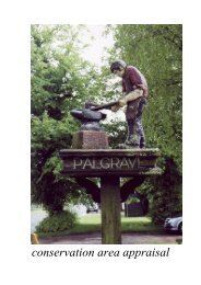
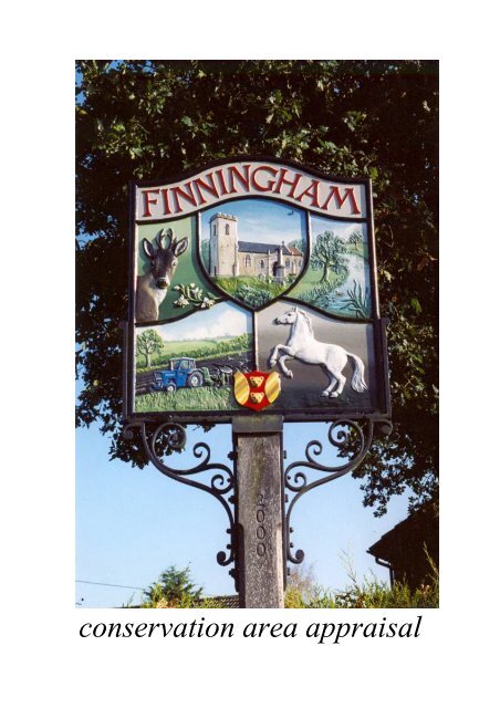
conservation area appraisal
© Crown copyright All rights reserved <strong>Mid</strong> <strong>Suffolk</strong> D C Licence no 100017810 2006
IntroductionThe conservation area in <strong>Finningham</strong>was originally designated by East <strong>Suffolk</strong>County <strong>Council</strong> in 1973, and inherited by<strong>Mid</strong> <strong>Suffolk</strong> <strong>District</strong> <strong>Council</strong> at itsinception in 1974.The <strong>Council</strong> has a duty to review itsconservation area designations from timeto time, and this appraisal examines<strong>Finningham</strong> under a number of differentheadings as set out in English Heritage’snew ‘Guidance on Conservation AreaAppraisals’ (2006).As such it is a straightforward appraisalof <strong>Finningham</strong>’s built environment inconservation terms.This document is neither prescriptive noroverly descriptive, but more ademonstration of ‘quality of place’,sufficient for the briefing of the PlanningOfficer when assessing proposed worksin the area. The photographs and mapsare thus intended to contribute as muchas the text itself.As the English Heritage guidelines pointout, the appraisal is to be read as ageneral overview, rather than as acomprehensive listing, and the omissionof any particular building, feature orspace does not imply that it is of nointerest in conservation terms.Text, photographs and map overlays byPatrick Taylor, Conservation Architect,<strong>Mid</strong> <strong>Suffolk</strong> <strong>District</strong> <strong>Council</strong> 2008.
© Crown copyright All rights reserved <strong>Mid</strong> <strong>Suffolk</strong> D C Licence no 100017810 2006
Topographical FrameworkThe village of <strong>Finningham</strong> is about sevenmiles north of the market town ofStowmarket and a similar distance southof Diss, thus lying near the centre of <strong>Mid</strong><strong>Suffolk</strong> <strong>District</strong>.It sits in a slight valley either side of atributary of the River Dove that flowsnorth-eastwards via Eye to join the riverWaveney at the Norfolk border.The village is situated on the ‘High<strong>Suffolk</strong>’ claylands, deposited in the IceAges over the chalk that underlies mostof <strong>Suffolk</strong>. The area is thus good forarable farming.The village is about three miles west ofthe main A140 road from Ipswich,formerly controlled by the Ipswich toScole Turnpike Trust of 1711, whichcontinues from Scole onwards toNorwich.Since 1849 the Ipswich to Norwichrailway line has passed just to the east ofthe village on its route northwards fromStowmarket to Diss, the now disused<strong>Finningham</strong> Station lying in Bactonparish a short distance to the south.
© Crown copyright All rights reserved <strong>Mid</strong> <strong>Suffolk</strong> D C Licence no 100017810 2006
Archaeological SignificanceThe <strong>Suffolk</strong> County Sites and MonumentsRecord lists over a dozen finds ofarchaeological interest from variousperiods in the parish of <strong>Finningham</strong>.In 1993 near Church Farm, a sewertrench yielded a Neolithic polished flintaxe along with a quantity of Medievalpottery, a coin and a pilgrim’s badge.At Yew Tree House, just north of theChurch, there had been a similar mixedfind comprising a Bronze Age flintarrowhead along with Roman and PostMedieval coins.Just south of the centre near the Bactonroad, a metal detector helped find ascatter of Saxon bronze objects includingbrooches.A Medieval jug was found at GreenFarm, a third site within a stones throwof the Church. The Medieval sitesinclude the parish church itself and itsgraveyard along with a moated site at<strong>Finningham</strong> Hall, north-west of thevillage centre.<strong>Finningham</strong> has two main entries listedin the Domesday survey of 1086. Themain manor was held by Robert Malet,having been held before the conquest byLeofric and Wulfeva . This holdingincluded woodland for 16 pigs and 5acres of meadow.The other holding by St Edmund’sincluded the church with 26 acres ofland, along with woodland for 8 pigs and4 acres of meadow.
© Crown copyright All rights reserved <strong>Mid</strong> <strong>Suffolk</strong> D C Licence no 100017810 2006
© Crown copyright All rights reserved <strong>Mid</strong> <strong>Suffolk</strong> D C Licence no 100017810 2006
Traditional Building MaterialsA first glance around the older buildingsnear the Church would seem to indicatean abundance of rendered buildings in<strong>Finningham</strong>.However the local red brick features onmany chimney stacks and some cottages,along with more modern red bricks onsome of the recent infill buildings.A single terrace of cottages at thebeginning of Gislingham Road, northeastof the Church, appears to be the soleexample of ‘<strong>Suffolk</strong> White’ bricks, someexhibiting the chequer-work pattern ofFlemish Bond.Flint only occurs on the Church, a fewoutbuildings and a good boundary wallat Driver’s Farm.A number of barns, some now converted,are in black weatherboarding withpantile or plaintile roofs.The prevalent roofing material wasthatch on the older listed buildings, butmany are now pantile (natural red orblack glazed), plaintile or slatereplacements. Slate can also be found onmost of the Victorian cottages.Modern infill buildings generally respectthe local vernacular using render andred brick, although some of the housesuse rather dull modern bricks, not to verygood effect. Most of the infill hasplaintile or pantile roofs, although someof the latter are concrete.
© Crown copyright All rights reserved <strong>Mid</strong> <strong>Suffolk</strong> D C Licence no 100017810 2006
Hierarchy of SpacesThe conservation area in <strong>Finningham</strong> iscentred on the church, which sits withina rectangle of roads generally at least aplot distant. The conservation areaboundary follows these roads and is thusalso roughly rectangular in shape, withthe river running through parallel to theroad along the northern side.The south-western corner forms a crossroadswith roads heading off west toWesthorpe and south to Bacton. Thesouth-eastern corner has a road offeastwards to Wickham Skeith, the northeasterncorner a road off north-east toGislingham and the north-west corner aroad off north-west to Rickinghall andWalsham le Willows.Surrounded by houses set within abackdrop of trees, the churchyardprovides a hidden oasis within the largermore open <strong>Suffolk</strong> countryside. There islittle in the way of views out of the area,but many short intimate views across thearea within.Another slightly larger green spacecalled Church Green lies to the southwestof the churchyard, bounded to thewest by one of the roads.
© Crown copyright All rights reserved <strong>Mid</strong> <strong>Suffolk</strong> D C Licence no 100017810 2006
Trees & PlantingThe first impression given by this part of<strong>Finningham</strong> is that of a luxuriant oasis ofmature trees set in a more opencountryside.Around the churchyard in the centrethere are Lime, Acacia, Birch and Ashtrees. Further south around ChurchGreen there is more Lime and Ashtogether with Oak, Alder, Beech, HorseChestnut and a row of large TurkeyOaks.In general the trees are dominant, butnot overpowering, with large areas ofopen space between them. The housesaround the Church are thus mostly setwithin a backdrop of trees.<strong>Finningham</strong>’s trees are important butappear not to have been under any threatsignificant enough to warrant a TreePreservation Order until very recently.In 2002 TPO no. 295 was made toprotect a group of Yew and Oak treesaround the Old Rectory, adjoining theConservation Area. Further north twoOaks and a Lime were in 2005 protectedby TPO no. 337 at the Old School onWalsham Road. Most recently in 2007an Ash and a Lime were given theprotection of TPO no. 368 on anothersite adjoining the Conservation Area,The Beeches on Gislingham Road.
© Crown copyright All rights reserved <strong>Mid</strong> <strong>Suffolk</strong> D C Licence no 100017810 2006
Relationship to Open CountrysideAway from the main road that passes tothe west, the settlement pattern in<strong>Finningham</strong> with houses clusteredaround the Church, and along some ofthe approach roads is mostly one plotdeep. This means that, although rarelyvisible, the countryside is never far away.The central core of the conservation areais well served with footpaths, no. 15passing north to south through thechurchyard and no. 13 across ChurchGreen continuing as no. 14 south of thechurchyard across to Church Farm inthe east.Beyond the rectangle of roads encirclingthe conservation area, there are footpathlinks out into the wider countryside. Tothe south footpath no. 16 continuessouthwards towards Cotton from the endof no. 15.Footpaths nos. 24 and 22 continue theline of the road across the northern sideof the rectangle to the west and eastrespectively, both staying on the northbank of the river. The flood plainimmediately to the west of theconservation area has no footpaths andprovides an area of wet meadowlandimportant for wildlife.
© Crown copyright All rights reserved <strong>Mid</strong> <strong>Suffolk</strong> D C Licence no 100017810 2006
Prevailing & Former Usage<strong>Finningham</strong> has its origins as anagricultural community partly involvedin the growing of hemp.Some distance from the large linenmarket in Diss, it lies on the periphery ofthe Waveney valley where this was theprimary local industry. A single linenweaver, a tailor and a worsted weaver(wool) were recorded in the village in the17 th Century.There are three farmsteads rangedaround the central church: StanwellFarm to the north, Church Farm to theeast and Green Farm to the south. Eachof these has left the landscape withranges of outbuildings, in a variety ofconditions, and a number of ponds.In the mid 19 th Century, directories forthe village list a wheelwright/blacksmith,a victualler, a miller, two grocers, threeshoemakers and 12 farmers.This general agricultural picture is notborne out in detail by field names in theTithe Map Apportionment of 1839, asmost holdings were simply listed as‘Field’ or ‘Meadow’, although oneappears as ‘Hempland’.There is a tithe entry for ‘Malting’, onefor ‘Claypit’ and one for ‘Mill & Yard’.The post mill site was shown on a map in1783, but demolished in 1877.
Losses & Possible GainsGenerally in the centre of <strong>Finningham</strong>there has not been too much modernintrusion. Some of the outbuildings atGreen Farm have corrugated sheetroofing, which although not original candevelop its own pleasing patina in time.The few infill houses dotted around theperimeter road have for the most partrespected the local vernacular using redbrick or render with clay plaintile orpantile roofs. Some have perhaps notquite the right colour brick, too fleet aroof pitch or use concrete tiles, allinappropriate in a conservation area.There are still a few possible infill sitesaround the area, which should be treatedwith great care if developed, as thepresent balance of old and new couldeasily be upset.The end of the terrace of white brickcottages in Gislingham Road hasunfortunately had a render finish appliedand modern windows inserted, thusdestroying the visual unity of the block.<strong>Finningham</strong> suffers from a surfeit ofoverhead wiring carrying the village’stelephone and electricity supplies. Thisis intrusive in places and the undergroundingof these utility supply lineswould greatly improve the appearance.Within most of the conservation areamotor vehicles are not a problem in<strong>Finningham</strong>, other than where somedriveway accesses have created largeopen spaces off the road withoutadequate visual boundaries. Traffic ishowever a problem on the B1113 on thewest side, where a pavement mightimprove pedestrian safety.
References & Further ReadingChatwin, C P 1961 East Anglia and Adjoining Areas British Regional GeologyHMSOD.o.E. & D.o.N.H. 1994 Planning Policy Guidance: Planning & the HistoricEnvironment (PPG 15) HMSOD.o.E. 1988 List of Buildings of Special Architectural or Historical Interest: <strong>District</strong>of <strong>Mid</strong> <strong>Suffolk</strong>: Parish of <strong>Finningham</strong>Domesday Book 1986 <strong>Suffolk</strong> PhillimoreDymond, D & Martin, E (eds.) 1988 An Historical Atlas of <strong>Suffolk</strong> <strong>Suffolk</strong> County<strong>Council</strong>English Heritage 1995 Conservation Area Practice HMSOEnglish Heritage 2006 Guidance on Conservation Area Appraisals HMSOGoult, W 1990 A Survey of <strong>Suffolk</strong> Parish History <strong>Suffolk</strong> County <strong>Council</strong>Pevsner, N 1976 The Buildings of England: <strong>Suffolk</strong> Penguin<strong>Suffolk</strong> County <strong>Council</strong> 2007 Sites and Monuments RecordTithe Map & Apportionment 1839 <strong>Finningham</strong> <strong>Suffolk</strong> Records OfficeThe maps in this document are based upon Ordnance Survey material with thepermission of Ordnance Survey on behalf of the Controller of Her Majesty’sStationery Office. Unauthorised reproduction infringes Crown copyright and maylead to prosecution or civil proceedings. M S D C Licence no 100017810 2006This Appraisal adopted asSupplementary Planning Guidanceby <strong>Mid</strong> <strong>Suffolk</strong> <strong>District</strong> <strong>Council</strong>Environment Policy Panel3 February 2009