Cartographic Expressions: Design Principles and ... - Geography
Cartographic Expressions: Design Principles and ... - Geography
Cartographic Expressions: Design Principles and ... - Geography
- No tags were found...

Create successful ePaper yourself
Turn your PDF publications into a flip-book with our unique Google optimized e-Paper software.
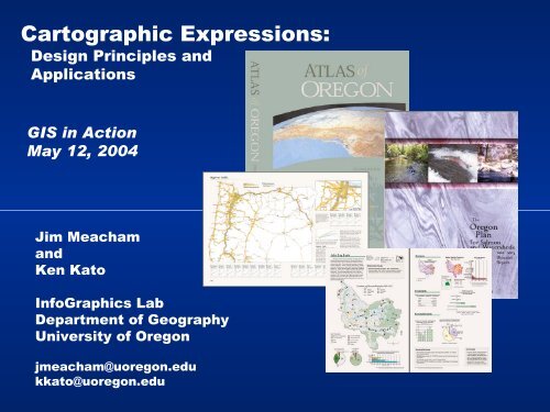
<strong>Cartographic</strong> <strong>Expressions</strong>:<strong>Design</strong> <strong>Principles</strong> <strong>and</strong>ApplicationsGIS in ActionMay 12, 2004Jim Meacham<strong>and</strong>Ken KatoInfoGraphics LabDepartment of <strong>Geography</strong>University of Oregonjmeacham@uoregon.edukkato@uoregon.edu
<strong>Cartographic</strong> <strong>Expressions</strong>:<strong>Design</strong> <strong>Principles</strong> <strong>and</strong>Applications- 9 Selected Map <strong>and</strong> Graphic <strong>Design</strong> <strong>Principles</strong><strong>and</strong> their application
9 Selected Map <strong>and</strong> Graphic <strong>Design</strong> <strong>Principles</strong>1) Proximity2) Alignment3) Repetition4) Contrast5) Use of Color6) Data Richness7) Using Multiple Maps8) Spatial <strong>and</strong> temporal context9) Authoritative reference – experts <strong>and</strong> knowing the subject
9 Selected Map <strong>and</strong> Graphic <strong>Design</strong> <strong>Principles</strong>References:The Non-<strong>Design</strong>er’s <strong>Design</strong> BookRobin Williams, 2004The Visual Displayof Quantitative InformationEdward R. Tufte, 1983ColorBrewer WebsiteC. Brewer, PSU 2004Mapping the World as it Really IsS. Allan, 1999State Atlas <strong>Design</strong>J. Meacham <strong>and</strong> S. Allan, 2003Atlas of Oregon, Second EditionLoy, Allan, Buckley, Meacham 2001
1) ProximityGrouping related items close to one another• Proximity or closeness implies a relationship• Creates cohesive groupsDevelops organization• Reduces clutterHelps communication• Grouping aids creation of hierarchy (starting point)• Which information is most <strong>and</strong> least important• Information that is intellectually connected should be visually connectedCreates <strong>and</strong> organizes white space• More appealing organized page (gives the reader a rest)What to avoid• Too many separate elements• Don’t put items in the corners or the middle• Avoid confusion of headline’s relationship to related material• Keep unrelated elements apart
Timber: 1) Proximity
Farml<strong>and</strong>s: 1) Proximity
2) AlignmentCreates visual connections• Elements should have a visual connection with something else on the page• Nothing should be place arbitrarily• Creates stronger cohesive units• Creates relationship even when related items are not in close proximity• Elements are connected by invisible lines or boundariesUnifies <strong>and</strong> organizes the page• Use consistent text <strong>and</strong> element alignments• Create strong linesWhat to avoid• Avoid using more than one text alignment on the page• Avoid centered alignments as a default– unless you consciously choose it
Timber: 2) Alignment
Farml<strong>and</strong>s: 2) Alignment
3) RepetitionRepeat visual items• Repeat some aspect of the design throughout the page• Creates consistencyDevelops organization• Headlines help develop visual organization <strong>and</strong> hierarchyStrengthens unity• Creates consistency• Common elements in multi-page pages unifies entire publication (page numberlocation, use of a rule, etc..)• Ties together otherwise separate parts.Adds visual interestWhat to avoid• Avoid repeating the element so much it becomes annoying
Farml<strong>and</strong>s: 3) Repetition
ALIGNMENT
ALIGNMENT
4) ContrastMake elements look different• Type size, face, font• Line weight, color, value, texture, styleCreates organizational visual hierarchy <strong>and</strong> figure-ground• Emphasis on what the reader is supposed to focus onSpeeds communication <strong>and</strong> adds clarity• Reduces (eliminates reader confusion)Makes page more interesting• Adds depthWhat to avoid• Avoid not creating enough contrast to cause confusion between element categories
Ice Age Lakes: 4) Contrast
Crops <strong>and</strong> Wine: 4) Contrast
9 Selected Map <strong>and</strong> Graphic <strong>Design</strong> <strong>Principles</strong>1) Proximity2) Alignment3) Repetition4) Contrast5) Use of Color6) Data Richness7) Using Multiple Maps8) Spatial <strong>and</strong> temporal context9) Authoritative reference – experts <strong>and</strong> knowing the subject
5) Color in Map <strong>Design</strong>Resources <strong>and</strong> GuidelinesUse of Color: DataProfessor Cynthia Brewer, PSUhttp://www.personal.psu.edu/faculty/c/a/cab38/Color Use Guidelines for Mapping <strong>and</strong> Visualizationhttp://www.personal.psu.edu/faculty/c/a/cab38/ColorSch/Schemes.htmlColorBrewer: web tool for selecting map color schemeshttp://www.personal.psu.edu/faculty/c/a/cab38/ColorBrewerBeta.htmlCMYK color specifications for atlas mapsMapping Census 2000: The <strong>Geography</strong> of U.S. DiversityUse of Color: Harmony – the Color Wheelwww.color-wheel-pro.com
Color Wheelwww.color-wheel-pro.com
9 Selected Map <strong>and</strong> Graphic <strong>Design</strong> <strong>Principles</strong>1) Proximity2) Alignment3) Repetition4) Contrast5) Use of Color6) Data Richness7) Using Multiple Maps8) Spatial <strong>and</strong> temporal context9) Authoritative reference – experts <strong>and</strong> knowing the subject
Highway Flow6) data rich, lots of labeling, Integration of elements
Highway Flow6) Maps <strong>and</strong> graphics are data driven – data rich
L<strong>and</strong> Ownership6) data rich, lots of labeling, Integration of elements
9 Selected Map <strong>and</strong> Graphic <strong>Design</strong> <strong>Principles</strong>1) Proximity2) Alignment3) Repetition4) Contrast5) Use of Color6) Data Richness7) Using Multiple Maps8) Spatial <strong>and</strong> temporal context9) Authoritative reference – experts <strong>and</strong> knowing the subject
L<strong>and</strong> Ownership7) Multiple Maps – everything doesn’t have to go on one map
Labor Force7) Multiple Maps – everything doesn’t have to go on one map
9 Selected Map <strong>and</strong> Graphic <strong>Design</strong> <strong>Principles</strong>1) Proximity2) Alignment3) Repetition4) Contrast5) Use of Color6) Data Richness7) Using Multiple Maps8) Spatial <strong>and</strong> temporal context9) Authoritative reference – experts <strong>and</strong> knowing the subject
Energy Sources –8) Put maps <strong>and</strong> graphs in spatial <strong>and</strong> temporal context
Yellowstone Atlas, Rivers – 8) Spatial contextErik Str<strong>and</strong>hagen, Graduate Researcher
9 Selected Map <strong>and</strong> Graphic <strong>Design</strong> <strong>Principles</strong>1) Proximity2) Alignment3) Repetition4) Contrast5) Use of Color6) Data Richness7) Using Multiple Maps8) Spatial <strong>and</strong> temporal context9) Authoritative reference – experts <strong>and</strong> knowing the subject
9) Serves as an authoritative reference - because of expertparticipation, <strong>and</strong> graphical integrity
L<strong>and</strong> Ownership –9) Serves as an authoritative reference - because of expertparticipation, <strong>and</strong> graphical integrity
USGS Southwest Office Cartographers –
Allan Cartography in Medford –
9 Selected Map <strong>and</strong> Graphic <strong>Design</strong> <strong>Principles</strong>1) Proximity2) Alignment3) Repetition4) Contrast5) Use of Color6) Data Richness7) Using Multiple Maps8) Spatial <strong>and</strong> temporal context9) Authoritative reference – experts <strong>and</strong> knowing the subject
<strong>Cartographic</strong> <strong>Expressions</strong>:<strong>Design</strong> <strong>Principles</strong> <strong>and</strong>ApplicationsThank youJim Meacham<strong>and</strong>Ken KatoInfoGraphics LabDepartment of <strong>Geography</strong>University of Oregonjmeacham@uoregon.edukkato@uoregon.edu