CURRICULUM VITAE James E. Meacham - Geography - University ...
CURRICULUM VITAE James E. Meacham - Geography - University ...
CURRICULUM VITAE James E. Meacham - Geography - University ...

Create successful ePaper yourself
Turn your PDF publications into a flip-book with our unique Google optimized e-Paper software.
<strong>CURRICULUM</strong> <strong>VITAE</strong><br />
<strong>James</strong> E. <strong>Meacham</strong><br />
Department of <strong>Geography</strong>, 1251 <strong>University</strong> of Oregon, Eugene, OR, USA 97403-1251<br />
email: jmeacham@uoregon.edu<br />
http://geography.uoregon.edu/infographics/<br />
voice: 541 346-5788 Fax: 541 346-2067<br />
EDUCATION<br />
M.A., <strong>Geography</strong>, <strong>University</strong> of Oregon, Eugene, 1992.<br />
B.S., <strong>Geography</strong> with honors, <strong>University</strong> of Oregon, 1984.<br />
CERTIFICATION<br />
ASPRS Certified Mapping Scientist, GIS/LIS (GS 151), 1998.<br />
RESEARCH and TEACHING INTERESTS<br />
- Map and Atlas Design and Production Research.<br />
- Geographic Information Systems (GIS) Planning and Management applications.<br />
- GIS/Cartography applications in Archaeology.<br />
- Cartographic Design and Production Instruction.<br />
APPOINTMENTS<br />
2004 – present: Senior Research Associate, Administrative and Research Director, InfoGraphics Lab,<br />
Department of <strong>Geography</strong>, <strong>University</strong> of Oregon.<br />
1997 - 2004: Research Associate, Administrative and Research Director, InfoGraphics Lab, Department of<br />
<strong>Geography</strong>, <strong>University</strong> of Oregon.<br />
1992 - 1997: Research Assistant, Lab Manager, InfoGraphics Lab, UO Department of <strong>Geography</strong>.<br />
1988 - 1992: Graduate Teaching Fellow, Managed Lab, InfoGraphics Lab, UO Department of <strong>Geography</strong>.<br />
1986 - 1988: Cartographer, Oregon Department of Transportation.<br />
1985 – 1986: Parks Planner, Oregon State Parks.<br />
1984: Hydrology Research Intern, Willamette National Forest.<br />
COURSES TAUGHT<br />
Advanced Cartography, GEOG 411/511<br />
Introduction to Geographic Information Systems, GEOG 416/516<br />
Advanced Geographic Information Systems, GEOG 476/576<br />
FIELD EXPERIENCE<br />
Cartographer/Field Geographer, Joint Mongolian-American-Russian Altai Expedition, northwest Mongolia,<br />
2006, 2004, and 1997 field seasons.<br />
Engineering Aide, Oregon Parks and Recreation Department, 1985.<br />
Survey Aide, Bureau of Land Management, Burns, OR, 1984 field season.<br />
PROFESSIONAL SERVICE<br />
American Society of Photogrammetry and Remote Sensing (ASPRS)<br />
President, 2006 Vice President, 2005, Columbia River Region.<br />
North American Cartographic Information Society (NACIS), member since 1989.<br />
Past President, 2002-03, President, 2001-02, Vice President, 2000-01.<br />
Program Chair, NACIS XXI Annual Meeting, Portland, 2001.<br />
Board of Directors, 1997-99.<br />
Cartographic Perspectives Journal, Cartographic Techniques Editor, 1997-2000.
UO GIS Advisory Committee, Co-Chair: 2004-05, Chair: 1998-2004 (Founding member since 1992).<br />
UO Safety Advisory Committee (member 2001-2002).<br />
Oregon Geographic Names Board (member).<br />
Oregon Department of Transportation GIS Leadership Advisory Group (outside member).<br />
Oregon Geographic Information Council, (OUS Representative).<br />
MEMBERSHIPS<br />
American Society of Photogrammetry and Remote Sensing<br />
Association of American Geographers (AAG)<br />
AAG Cartography and GIS Specialty Groups.<br />
North American Cartographic Information Society<br />
Cartography and Geographic Information Society<br />
AWARDS AND HONORS<br />
2003, International Cartographic Association, “Award for Excellence in Cartography”, 21 st International<br />
Cartographic Conference, Durban, South Africa. (Atlas of Oregon, CD-ROM, with Erik Steiner)<br />
2003, American Congress on Surveying and Mapping (ACSM), "Best in Show” and “Best of Category:<br />
Book and Atlas Division” (Atlas of Oregon, CD-ROM, with Erik Steiner).<br />
2002, Officer of Administration Recognition Award, <strong>University</strong> of Oregon.<br />
2002, American Congress on Surveying and Mapping (ACSM), "Best in Show” and “Best of Category:<br />
Book and Atlas Division” (Atlas of Oregon, 2 nd Edition, with W. Loy, S. Allan, and A. Buckley).<br />
2002, Benjamin Franklin Award, Category: Education/Teaching/Academic. Publishers Marketing<br />
Association. ” (Atlas of Oregon, 2 nd Edition, with William Loy, Stuart Allan, and Aileen Buckley).<br />
2001 Northwest ESRI Users Conference, Sun Valley, ID. First Prize - Poster Presentation: Oregon<br />
Department of Transportation County GIS Mapping Pilot Project: Wasco County, (with Mike Engelmann<br />
and Eugene Carpentier).<br />
1999, Environmental Systems Research Institute (ESRI) International Users Conference Awards: "Best of<br />
Show" and "Best Software Integration". Mapping the <strong>University</strong> of Oregon Campus: Integration of GIS,<br />
Map Publishing, Facilities Mapping, and Architectural Design, (with Andrea Ball).<br />
PUBLICATIONS<br />
Books, Digital Atlases, and Chapters<br />
Jacobson-Tepfer, Esther and <strong>James</strong> E. <strong>Meacham</strong>. Gary Tepfer (Photographer), (in progress), Cultural Atlas<br />
of the Ancient Mongolian Altai. ESRI Press, Redlands, CA.<br />
Marcus, Andrew, <strong>James</strong> E. <strong>Meacham</strong>, Ann Rodman (editors), (in progress), Atlas of Yellowstone.<br />
<strong>University</strong> of Oregon Press, Eugene.<br />
Hardwick, Susan W., and <strong>James</strong> E. <strong>Meacham</strong>, (in progress) ‘Placing’ the Refugee Diaspora to Portland,<br />
Oregon: Suburban Expansion and Densification in a Re-Emerging Gateway Chapter in Audrey Singer,<br />
Caroline Brettell and Susan Hardwick, eds., Suburban Immigrant Gateways: Immigration and<br />
Incorporation in New U.S. Metropolitan Destinations. Brookings Institution Press.<br />
Lobben, Kathleen Amy, and <strong>James</strong> E. <strong>Meacham</strong>, (in progress) "Cartographic Textbooks in the Twentieth<br />
Century (working title)." Chapter in Mark Monmonier, editor, The History of Cartography Volume Six:<br />
Cartography in the Twentieth Century. The <strong>University</strong> of Chicago Press.
Oregon Watershed Enhancement Board, The Oregon Plan for Salmon and Watersheds, 2001-2003 and<br />
2003-2005 Biennial Report, 2003 and 2005. (Cartography and GIS Director, with Ken Kato, Project<br />
Manager) State of Oregon, Salem.<br />
<strong>Meacham</strong>, <strong>James</strong> E. and Erik B. Steiner (editors), Atlas of Oregon, CD-ROM Version, Eugene: <strong>University</strong><br />
of Oregon Press, 2002.<br />
Loy, William G., Stuart Allan, Aileen R. Buckley and <strong>James</strong> E. <strong>Meacham</strong>, Atlas of Oregon. Second<br />
Edition, Eugene: <strong>University</strong> of Oregon Press, 2001.<br />
E. Jacobson and J. <strong>Meacham</strong>. 2001. “Methodological Considerations.” Chapter in , Répertoire des<br />
pétroglyphes d'Asie Central. Mongolie du Nord-Ouest: Tsagaan Salaa/Baga Oigor. Mémoires de la<br />
Mission Archéologique Française en Asie Centrale. E. Jacobson, V. D. Kubarev, D. Tseveendorj. Paris,<br />
2001.<br />
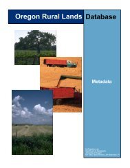
Kato, Kenneth, Blake Andrew and <strong>James</strong> E. <strong>Meacham</strong> (Principle Investigator). The Oregon Rural Lands<br />
Database. [36-CDROM set with manual]. Oregon Department of Conservation and Development, Salem<br />
and <strong>University</strong> of Oregon, Eugene, 2001.<br />
<strong>Meacham</strong>, <strong>James</strong> E. "Web-based Atlas of Lane County, Oregon," 1999, Department of <strong>Geography</strong>,<br />
<strong>University</strong> of Oregon, [on-line] http://geography.uoregon.edu/infographics/lcweb/lcindex.htm.<br />
Loy, William, G., Michael Holcomb, <strong>James</strong> E. <strong>Meacham</strong>, Gary Searl, ExplOregon: A Geographic Tour of<br />
Oregon, [CD-ROM], 1995, <strong>University</strong> of Oregon, Eugene.<br />
May, Mande, George Beltran, and <strong>James</strong> E. <strong>Meacham</strong> (Cartographer), <strong>University</strong> of Oregon Atlas of Trees,<br />
1996, <strong>University</strong> of Oregon Books, Eugene, 126 pp.<br />
<strong>Meacham</strong>, <strong>James</strong> E., The Technological Transition to Electronic Map Publication, 1992, Unpublished<br />
Master's Thesis, Department of <strong>Geography</strong>, <strong>University</strong> of Oregon.<br />
<strong>Meacham</strong>, <strong>James</strong> E. (Director), Atlas of Lane County, Oregon, 1990, Lane County, Eugene. 78 pp.<br />
Articles/Reviews<br />
Hardwick, Susan W., <strong>James</strong> E. <strong>Meacham</strong>, “Heterolocalism, Networks of Ethnicity, and Refugee<br />
Communities in the Pacific Northwest: The Portland Story”, Professional Geographer, 57(4) 2005, pp. 539-<br />
557.<br />
<strong>Meacham</strong>, <strong>James</strong> E. and Stuart Allan,. “State Atlas Design”, Cartographic Perspectives, Number 44, Winter<br />
2003, pp. 44-52.<br />
Buckley, Aileen R., <strong>James</strong> E. <strong>Meacham</strong>, and Erik B. Steiner, 2003.. “Creating a State Atlas as an Integrated<br />
set of Resources: Book, CD-ROM and Website”, ICC Proceedings, Durban, South Africa<br />
<strong>Meacham</strong>, <strong>James</strong> E., "Rediscovering Cartography" Cartographic Perspectives, Number 40, Fall 2001.<br />
<strong>Meacham</strong>, <strong>James</strong> E., and Andrea Ball, "UO Campus Mapping Program: Integrating CAD, GIS, and Map<br />
Publishing" Cartographic Perspectives, with, Number 34, Fall 1999.<br />
<strong>Meacham</strong>, <strong>James</strong> E., "<strong>University</strong> Cartography Labs", note," The State of Academic Cartography" Brewer<br />
and McMaster, (editors), 1999 U.S. National Report to the International Cartographic Association.<br />
Cartography and Geographic Information Science, Vol. 26, No. 3, July 1999.<br />
Jacobson, Esther and <strong>James</strong> E. <strong>Meacham</strong>, "When Stones Speak: Mapping and Mongolian Surface<br />
Archaeology," with, GeoInfo Systems, February 1998, pp. 15-22.
<strong>Meacham</strong>, <strong>James</strong> E., (Book Review) Atlas of Oregon Wildlife: Distribution, Habitat, and Natural History,<br />
Csuti, Blair, et. al., 1998 Cartographic Perspectives, Number 29, Winter 1998.<br />
<strong>Meacham</strong>, <strong>James</strong> E., "Automated Large-format Geological Map Production," Cartographic Perspectives,<br />
Number 20, Winter 1995.<br />
Jacobson, Esther, <strong>James</strong> E. <strong>Meacham</strong> and David Cutting, "Applying GIS to the Archaeology of the Altay<br />
Mountains,"1994, GeoInfo Systems, March 1994, pp. 32-45.<br />
<strong>Meacham</strong>, <strong>James</strong> E., "Using GNIS at the Oregon Department of Transportation," (with others) 1988,<br />
American Congress on Surveying and Mapping Technical Papers, (ACSM-ASPRS Fall Convention).<br />
Washington:ACSM, pp. 4-12.<br />
Selected Maps/Map Series<br />
<strong>Meacham</strong>, <strong>James</strong> E. and John Davenport, Official Oregon State Highway Map, 1990-2002, Oregon<br />
Department of Transportation.<br />
<strong>Meacham</strong>, <strong>James</strong> E., (Cartographic Editor), <strong>University</strong> of Oregon Map Series: Parking and<br />
Transportation, Accessing the Campus, Emergency Call Boxes, and Bicycle Guide Map. <strong>University</strong> of<br />
Oregon Department of Public Safety, 1993-2002.<br />
<strong>Meacham</strong>, <strong>James</strong> E., David Cutting, and Nancy Leeper (Cartographers), "Geology and Mineral Resources<br />
Map of the Elbow Quadrangle, Malheur County, Oregon," 1992, Oregon Department of Geology and<br />
Mineral Industries, GMS-62, Geological Map Series.<br />
<strong>Meacham</strong>, <strong>James</strong> E., Columbia County Map Series, Oregon Department of Transportation, 1987.<br />
Selected Professional Papers and Reports<br />
<strong>Meacham</strong>, <strong>James</strong> E., Alethea Y. Steingisser, W. Andrew Marcus, and Ann Rodman, 2006, “From Glaciers<br />
to Geysers: The Creation of the Atlas of Yellowstone” Presentation, 26th Annual Meeting of the North<br />
American Cartographic Information Society, Madison, Wisconsin.<br />
<strong>Meacham</strong>, <strong>James</strong> E. and Esther Jacobson-Tepfer, Cartographic and Geographic Visualization Techniques<br />
in the Study of Prehistory in the Mongolian Altai Mountains. 2005, Association of American Geographers<br />
101th Annual Meeting Abstract Volume. Washington.<br />
Jacobson-Tepfer, Esther and <strong>James</strong> E. <strong>Meacham</strong>. Mapping as an Analytical Tool in the Study of Mongolian<br />
Altai Prehistory. 2005. Society for American Archaeology 70 th Annual Meeting, Salt Lake City, UT.<br />
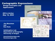
<strong>Meacham</strong>, <strong>James</strong> E. and Kato, Kenneth, “Cartographic Expression.” (invited presentation) 2004, GIS-in-<br />
Action Conference. ASPRS and Urban and Regional Information Systems Association (URISA),<br />
Portland, Oregon.<br />
Kato, Kenneth, and <strong>James</strong> E. <strong>Meacham</strong> “Using Atlas Techniques to Present the Oregon Salmon Recovery<br />
Effort.” 2003, Association of American Geographers 99th Annual Meeting Abstract Volume. Washington.<br />
Theodoropoulos, Christine, and <strong>Meacham</strong>, <strong>James</strong> E., et. al, "Using Rapid Screening Methods and GIS<br />
Models to Identify Seismic Hazards and Risk on a <strong>University</strong> Campus" 2001. Poster presentation at the<br />
2001 Earthquake Engineering Research Institute Annual Meeting, "Dealing with Issues of Acceptable<br />
Risk," Monterey, California.<br />
<strong>Meacham</strong>, <strong>James</strong> E., "Atlas of Oregon 2001: Atlas Design and Production" (Invited Paper), 2000<br />
Northwest ESRI Conference, Skamania, WA.
Engelmann, Michael, Eugene Carpentier and <strong>James</strong> E. <strong>Meacham</strong> (Principle Investigator), Oregon<br />
Department of Transportation County GIS Mapping Pilot Project: Wasco County, Report to ODOT and<br />
Oregon Transportation Framework Committee, June 2001.<br />
<strong>Meacham</strong>, <strong>James</strong> E., "Cartography and Qualitative Research Methodology for Mongolian Altay Rock Art<br />
Study." 20th Annual Meeting of the North American Cartographic Information Society Program,<br />
Knoxville, TN, 2000.<br />
<strong>Meacham</strong>, <strong>James</strong> E., and Esther Jacobson, "Understanding the Past in the Mongolian Altay: Prehistory and<br />
Geographic Analysis and Visualization", 2000, Association of American Geographers 96th Annual<br />
Meeting Abstract Volume. Washington: 481.<br />
Kato, Kenneth, and <strong>James</strong> E. <strong>Meacham</strong>, "Cartography/GIS Serves Regional Land Use Planning and the<br />
Public Participation Process; Clatsop Plains, Oregon," 2000, Association of American Geographers 96th<br />
Annual Meeting Abstract Volume. Washington: 372.<br />
<strong>Meacham</strong>, <strong>James</strong> E., "Lane County Atlas: Publication and Web Delivery of GIS Database", 1999,<br />
Presentation, Association of American Geographers 95th Annual Meeting Abstracts. Washington.<br />
<strong>Meacham</strong>, <strong>James</strong> E.,"1999 Atlas of Lane County, Oregon: A Student Created Project for Print and Web<br />
Publication.", 1998, Poster Presentation, Eighteenth Annual Meeting of the North American Cartographic<br />
Information Society, Milwaukee, Wisconsin.<br />
<strong>Meacham</strong>, <strong>James</strong> E., "Mapping the Ancient Altay, northwest Mongolia", 1998, Association of American<br />
Geographers 94th Annual Meeting Abstracts. Washington.<br />
<strong>Meacham</strong>, <strong>James</strong> E., "The UO InfoGraphics Lab Experiment: An organic approach to cartographic research<br />
facility development ", 1997, Presentation, Sevententh Annual Meeting of the North American<br />
Cartographic Information Society, Lexington, Kentucky.<br />
<strong>Meacham</strong>, <strong>James</strong> E., "ExplOregon: A Multimedia Product for Geographic Instruction," 1996, Association<br />
of American Geographers 92nd Annual Meeting Abstracts. Washington:1996.<br />
<strong>Meacham</strong>, <strong>James</strong> E., "Mapping the Campus", 1996, Presentation, Sixteenth Annual Meeting of the North<br />
American Cartographic Information Society, San Antonio, Texas.<br />
<strong>Meacham</strong>, <strong>James</strong> E., "Using MicroStation to Solve Large-Format Map Publication Problems", 1995,<br />
Association of American Geographers 91st Annual Meeting Abstracts. Washington:205.<br />
<strong>Meacham</strong>, <strong>James</strong> E., "Modernizing the Official Highway Map of Oregon," 1993, American Congress on<br />
Surveying and Mapping Technical Papers. Washington:ACSM, pp. 302-13.<br />
<strong>Meacham</strong>, <strong>James</strong> E., "The Electronic Publication of the Official Highway Map of Oregon," 1993,<br />
Association of American Geographers 89th Annual Meeting Abstracts. Washington:160.<br />
<strong>Meacham</strong>, <strong>James</strong> E., "Geographic Names Information System Application in State Highway Map<br />
Production," 1992, Association of American Geographers 88th Annual Meeting Abstracts.<br />
Washington:158.<br />
<strong>Meacham</strong>, <strong>James</strong> E., "The Development of an Automated County Base Mapping Procedure at the Oregon<br />
Department of Transportation," 1989, Proceedings of the Oregon Academy of Science.<br />
SELECTED GRANTS/CONTRACTS<br />
1993-2007, Oregon Department of Transportation, grant for research work on the Restructure and Redesign<br />
of City Transportation Maps, and GIS Framework Development, $24,750, $49,500, $100,000, $98,000,<br />
$169,670, $185,000, $185,000 and $300,000.
2004, “Oregon North Coast ESU Salmon Recovery Plan 2004 Report Development”, Oregon Watershed<br />
Enhancement Board. $65,000.<br />
2002, “Oregon Salmon Recovery Plan 2002 Report Development”, Oregon Watershed Enhancement<br />
Board. $56,475.<br />
2002 –2004, Refugee and Immigration Nodes and Networks in Western Oregon” the National Science<br />
Foundation, (with Susan Hardwick, PI)<br />
2002, Atlas of Oregon, Second Edition CD-ROM Project, <strong>University</strong> of Oregon Press. (with William G.<br />
Loy and Aileen R. Buckley) $125,000.<br />
2002-03, “Visualizing, Analyzing and Exploring Our Environment Using Digital files from the Atlas of<br />
Oregon” (with Aileen R. Buckley, Susan Hardwick, and Cathleen Leue) $25,000.<br />
2001, Oregon Department of Transportation, research work on the development of Transportation GIS<br />
Framework Data for Wasco County, Oregon. $24,000<br />
1999 – 2001, Atlas of Oregon, Second Edition Project, <strong>University</strong> of Oregon Foundation. (with William G.<br />
Loy, Stuart Allan, and Aileen R. Buckley) $250,000.<br />
1999-2001, Oregon DLCD: Development of a Rural Lands Database, $140,000.<br />
1993-01, Jacobson, Esther, UO Department, Center for Asian and Pacific Studies, Applying GIS to the<br />
Archaeology of the Altay Mountains, $33,400.<br />
1999, Department of Land Conservation and Development: Preliminary Assessment of the Feasibility and<br />
Costs to Establish a Rural Lands Database, $10,000.<br />
1999, Oregon Department of Transportation, research on GIS Web site development, $24,000.<br />
1998-99, McKenzie River Watershed Council, GIS Analysis and Mapping Support.<br />
1998-99, Department of Land Conservation and Development: Regional Problem Solving: Clatsop County,<br />
Clatsop Plains GIS Map Development, $17,000 and $10,000.<br />
1998, Coquille Indian Tribe, GIS and Aerial Photo Mapping Project.<br />
1998, Oregon Governor's Task Force on Growth/ECONorthwest, Final Report Mapping, $5,000.<br />
1998, Oregon Department of Parks and Recreation/State Historical Preservation Office,<br />
Standard Site Form and State Cultural Resource GIS Database Implementation Plan, $21,000.<br />
1997, American Association of Geographers, Otto Geppert Fund General Research Grant, Altay Mapping<br />
Project, $1,000.<br />
1997-98, Oregon Department of Forestry, GIS Fire Protection Mapping research, $7,000.<br />
1995, Connolly, Thomas J., State Museum of Anthropology, <strong>University</strong> of Oregon, “Documenting the<br />
Mosier Mounds Feature Complex, Wasco County, Oregon.” $ 6,600.<br />
1993-94, Oregon Parks and Recreation Department, grant for "Sumpter Valley Placer Mining Interpretive<br />
Route: Site Inventory and Mapping," $2,875.
1992, State of Oregon Department of Geology and Mineral Industries, Automated Large-format Geological<br />
Map Production Development, $5,500.<br />
1991, American Association of Geographers Cartography Specialty Group Master's Research Grant.<br />
1991-1992, Oregon Department of Transportation, grant for continued research work on the Official<br />
Oregon State Highway Map, $14,684.<br />
1989-1991, Oregon Department of Transportation, grant for the research and development of digital maps<br />
for production of the Official Oregon State Highway Map, $34,053.<br />
PROVIDED MAPPING/GIS RESEARCH SUPPORT<br />
Ayres, William S., 1993, “Nan Madol Archaeological Fieldwork: Final Report.” Pohpei, Federated States<br />
of Micronesia, 107 pp.<br />
Connolly, T., M. Tveskov, 1995, “Documenting the Mosier Mounds Feature Complex, Wasco County,<br />
Oregon.” State Museum of Anthropology, <strong>University</strong> of Oregon, Report 95-7.<br />
Connolly, Thomas J., Mark A. Tveskov, Howard A. Gard, and David Cutting, n.d. “Mapping the Mosier<br />
Mounds: The Significance of Rock Feature Complexes on the Southern Columbia Plateau.” Journal of<br />
Archaeological Science.<br />
Jacobson, Esther, D. Tseveendorj, and Vladimar D. Kubarev, 1995, “Report on the Archaeological and Art<br />
Historical Research in Bayan- Ölgiy Aimay, Mongolia.” <strong>University</strong> of Oregon.<br />
Jacobson, Esther, D. Tseveendorj, and Vladimar D. Kubarev, 1994, “Report on the Archaeological and Art<br />
Historical Research in Bayan-Ölgiy and Uvs Aimays, Mongolia.” <strong>University</strong> of Oregon.<br />
OTHER RELATED EXPERIENCE<br />
ESRI Courses (Olympia, WA): Introduction to Arc/Info, Spring 1994, and Advanced Arc/Info, Winter<br />
1995, Advanced ArcView, Fall 1998 and ArcGIS, Winter 2001.<br />
GIS INTERN, US Geological Survey, Water Resources Division, Fall 1988. Worked on a ground water<br />
project using ESRI Arc/Info Geographic Information System.<br />
INTERGRAPH TRAINING, Huntsville, Alabama, 1987. Coursework in WMS and Map Feature Coding.<br />
October 2006