St. Lucie County Hurricane Evacuation Zones
St. Lucie County Hurricane Evacuation Zones
St. Lucie County Hurricane Evacuation Zones

You also want an ePaper? Increase the reach of your titles
YUMPU automatically turns print PDFs into web optimized ePapers that Google loves.
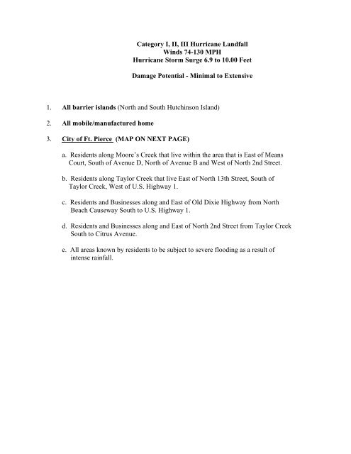
Category I, II, III <strong>Hurricane</strong> LandfallWinds 74-130 MPH<strong>Hurricane</strong> <strong>St</strong>orm Surge 6.9 to 10.00 FeetDamage Potential - Minimal to Extensive1. All barrier islands (North and South Hutchinson Island)2. All mobile/manufactured home3. City of Ft. Pierce (MAP ON NEXT PAGE)a. Residents along Moore’s Creek that live within the area that is East of MeansCourt, South of Avenue D, North of Avenue B and West of North 2nd <strong>St</strong>reet.b. Residents along Taylor Creek that live East of North 13th <strong>St</strong>reet, South ofTaylor Creek, West of U.S. Highway 1.c. Residents and Businesses along and East of Old Dixie Highway from NorthBeach Causeway South to U.S. Highway 1.d. Residents and Businesses along and East of North 2nd <strong>St</strong>reet from Taylor CreekSouth to Citrus Avenue.e. All areas known by residents to be subject to severe flooding as a result ofintense rainfall.
Category I, II, III <strong>Hurricane</strong> LandfallWinds 74-130 MPH<strong>Hurricane</strong> <strong>St</strong>orm Surge 6.9 to 10.00 FeetDamage Potential - Minimal to Extensive5. Unincorporated Areas of <strong>St</strong>. <strong>Lucie</strong> <strong>County</strong> (MAPS STARTTING ON NEXT PAGE)a. Residents along and East of Old Dixie Highway from the <strong>St</strong>. <strong>Lucie</strong>/Indian River<strong>County</strong> line to North Beach Causeway.b. Residents along the North fork of the <strong>St</strong>. <strong>Lucie</strong> River that live:1) South of Bell Avenue, West of Sunrise Blvd., North of Midway Road.2) Along French Creek, West of Oleander Blvd.3) South of Midway Road, West of Citrus Avenue; including RiverHammock and Canoe Creekc. All residents along and West of South Indian River Drive from Eden Plantation,South, to the <strong>St</strong>. <strong>Lucie</strong>/Martin <strong>County</strong> line.d. All residents of Bay <strong>St</strong>. <strong>Lucie</strong> and Beau Rivage.e. All areas known by residents to be subject to severe flooding as a result of intenserainfall.
Category IV or V <strong>Hurricane</strong>s, LandfallWinds 131 to above 155 MPH<strong>Hurricane</strong> <strong>St</strong>orm Surge 7.0 to 14.4 FeetDamage Potential - Extreme to Catastrophic1. All Barrier Islands (North and South Hutchinson Island)2. All mobile/manufactured homes3. City of Ft. Pierce (MAP ON NEXT PAGE)a. Residents living North of Orange Avenue within an area starting at: OrangeAvenue and North 13th <strong>St</strong>reet to Avenue E, East to North 2nd <strong>St</strong>reet, South toOrange Avenue and West to North 13th <strong>St</strong>reet.b. Residents living South of Orange Avenue within an area starting at: OrangeAvenue and South 10th <strong>St</strong>reet to Delaware Avenue, East to South 6th <strong>St</strong>reet,North to Orange Avenue.c. Residents along Taylor Creek that live in an area: East of North 13th <strong>St</strong>reet,South of Taylor, West of U.S. Highway #1, North of Avenue M.d. Residents and businesses along and East of Old Dixie Highway from NorthBeach Causeway, South to U.S. Highway #1.e. Residents and businesses along and East of North 2nd <strong>St</strong>reet from Taylor CreekSouth to Citrus Avenue.f. All areas known by residents to be subject to severe flooding as a result ofintense rainfall.
Category IV or V <strong>Hurricane</strong>s, LandfallWinds 131 to above 155 MPH<strong>Hurricane</strong> <strong>St</strong>orm Surge 7.0 to 14.4 FeetDamage Potential - Extreme to Catastrophic4. City of Port <strong>St</strong>. <strong>Lucie</strong> (MAPS ON FOLLOWING PAGE)a. Residents living West and South of Westmoreland Blvd from Port <strong>St</strong>. <strong>Lucie</strong>Blvd to the <strong>St</strong>. <strong>Lucie</strong>/Martin <strong>County</strong> line.b. Residents living West of Midport Road from Port <strong>St</strong>. <strong>Lucie</strong> Blvd to U.S.Highway #1.c. All Residents living East of Floresta Blvd, South of West Virginia Blvd, North of Port<strong>St</strong>. <strong>Lucie</strong> Blvd.d. Residents East of Floresta Blvd, South of Port <strong>St</strong>. <strong>Lucie</strong> Blvd to and includingViking’s Landing.e. All residents living South of C-23 Canal, East of Florida Turnpike, and North ofBecker Road.f. All residents whose home fronts the West bank of the North Fork of the <strong>St</strong>.<strong>St</strong>. <strong>Lucie</strong> River.g. All areas known by residents to be subject to severe flooding due to intenserainfall.
Category IV or V <strong>Hurricane</strong>s, LandfallWinds 131 to above 155 MPH<strong>Hurricane</strong> <strong>St</strong>orm Surge 7.0 to 14.4 FeetDamage Potential - Extreme to Catastrophic5. Unincorporated Areas of <strong>St</strong>. <strong>Lucie</strong> <strong>County</strong> (MAPS ON FOLLOWING PAGE)a. Residents along and East of Old Dixie Highway from the <strong>St</strong>. <strong>Lucie</strong>/Indian River<strong>County</strong> line to North Beach Causeway.b. Residents along the North Fork of the <strong>St</strong>. <strong>Lucie</strong> River that live:1) South of Bell Avenue, West of Sunrise Blvd., North of Midway Road.2) Along French Creek, West of Oleander Blvd3) South of Midway Road, West of Citrus Avenue; including River Hammockand Canoe Creek.4) West of Oleander South of Gopher Ridge Rd and North of Beach Ct.5) All residents of Holly Ave and Olive Ln.6) Residents in La Buena Vita within 500 feet of the River7) East of Soldida Cir, all of Camelot, Armory, Electra and Cornwallc. All residents along, and West of South Indian River Drive from: EdenPlantation, South of the <strong>St</strong>. <strong>Lucie</strong>/Martin <strong>County</strong> line.d. All residents of Bay <strong>St</strong>. <strong>Lucie</strong>, Harbor Ridge, Beau Rivage and Wide Waters.e. All areas known by residents to be subject to severe flooding as a result ofintense rainfall.