Leica Cyclone 6.0 Technical Specifications - Turning Point Systems ...
Leica Cyclone 6.0 Technical Specifications - Turning Point Systems ...
Leica Cyclone 6.0 Technical Specifications - Turning Point Systems ...

You also want an ePaper? Increase the reach of your titles
YUMPU automatically turns print PDFs into web optimized ePapers that Google loves.
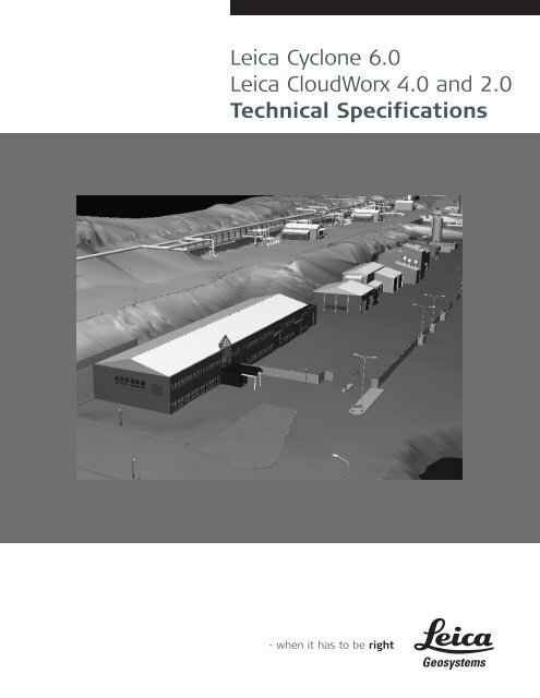
<strong>Leica</strong> <strong>Cyclone</strong> <strong>6.0</strong><strong>Leica</strong> CloudWorx 4.0 and 2.0<strong>Technical</strong> <strong>Specifications</strong>
<strong>Leica</strong> <strong>Cyclone</strong> <strong>6.0</strong> <strong>Technical</strong> <strong>Specifications</strong>HDS Scanner Control and OperationSCANHDS2500SCANHDS3000SCANScan-StationSCANScan-Station 2SCANHDS4500SCANHDS6000REGISTER MODEL SURVEY PUBLISHER FreeVIEWERVIEWERProAcquire and display image ◆ ◆ ◆ ◆ ◆ 1 ◆ 1Acquire image at specified resolution ◆ ◆ ◆ ◆ 1 ◆ 1(high, medium, low)Panoramic viewing of multiple images ◆ ◆ ◆ ◆ 1 ◆ 1Panoramic viewing of point clouds ◆ ◆ ◆ ◆ ◆ ◆ 1 ◆ 1User-customizable latitude/longitude grid lines ◆ ◆ ◆ ◆ ◆ ◆ 1 ◆ 1Remote operation ◆ ◆ ◆ ◆ ◆ ◆ 1 ◆ 1Selection of area to be scanned via scribed:Rectangle ◆ ◆ ◆ ◆ ◆ ◆ ◆ 1 ◆ 1Polygon ◆ ◆ 1 ◆ 1Independent vertical and horizontal ◆ ◆ ◆ ◆ ◆ 1 ◆ 1selection of scan densityScan filters (rectangular target area, range, ◆ ◆ ◆ ◆ ◆ ◆ ◆ 1 ◆ 1return intensity)Realtime, 3D navigation, even while scanning ◆ ◆ ◆ ◆ ◆ 1 ◆ 1Script management for automatic sequencing of scans ◆ ◆ ◆ ◆ ◆ ◆ ◆ 1 ◆ 1Automated rechecking (re-acquisition) of targets ◆ ◆ ◆ ◆ ◆ ◆ ◆ 1 ◆ 1Automated rechecking (re-acquisition) of targets ◆ ◆ ◆ ◆ ◆ ◆ ◆ 1 ◆ 1via ScriptingAutomated rechecking (re-acquisition) of targets ◆ ◆ ◆ ◆ 1 ◆ 1via TraverseAutomated rechecking (re-acquisition) of targets ◆ ◆ ◆ ◆ 1 ◆ 1via Field SetupFind Black and White Targets from picks ◆ ◆ ◆ ◆ ◆ ◆ ◆ 1 ◆ 1Semi-automatic target acquisition ◆ ◆ ◆ ◆ ◆ ◆ ◆ 1 ◆ 1Target identification via available Target IDs ◆ ◆ ◆ ◆ ◆ ◆ ◆ 1 ◆ 1Set target height for use in Registration ◆ ◆ ◆ ◆ ◆ ◆ ◆ 1 ◆ 1Approximate geo-referencing to coordinate system ◆ ◆ ◆ ◆ ◆ 1 ◆ 1Automatic linking of scans & images with scanner ◆ ◆ ◆ ◆ ◆ 1 ◆ 1Color scanned points from images ◆ ◆ ◆ ◆ ◆ 1 ◆ 1Set atmospheric correction parameters ◆ ◆ ◆ ◆ ◆ 1 ◆ 1Check Calibration ◆ ◆ ◆ 1 ◆ 1Add/replace known coordinates ◆ ◆ ◆ ◆ 1 ◆ 1Check/re-level scanner ◆ ◆ ◆ ◆ 1 ◆ 1Enable dual-axis compensator ◆ ◆ ◆ 1 ◆ 1Enable tilt sensor ◆ ◆ 1 ◆ 1Field Setup (Known Backsight, Known Azimuth, ◆ ◆ ◆ ◆ 1 ◆ 1Resection)Import known coordinates ◆ ◆ ◆ ◆ 1 ◆ 1Pause/resume scan ◆ ◆ ◆ ◆ 1 ◆ 1Traverse ◆ ◆ ◆ ◆ 1 ◆ 1Traverse report ◆ ◆ ◆ ◆ 1 ◆ 1Toggle ScanWorld Leveled◆Self-test ◆ ◆ 1 ◆ 1Selective scan import by region ◆ ◆ ◆ ◆ 1 ◆ 1Stakeout ◆ ◆ ◆ ◆ 1 ◆ 1Set sphere target diameter ◆ ◆ ◆ ◆ ◆ ◆ ◆ 1 ◆ 1Acquire target within fence ◆ ◆ ◆ ◆ ◆ ◆ ◆ 1 ◆ 1<strong>Point</strong> laser at specific coordinate location ◆ ◆ 1 ◆ 11Enabled when connected to HDS system.Visualization, Modeling & Query Tools,and RegistrationSCANHDS2500SCANHDS3000SCANScan-StationSCANScan-Station 2SCANHDS4500SCANHDS6000REGISTER MODEL SURVEY PUBLISHER FreeVIEWER3D navigation of point clouds, meshes and 3D models ◆ ◆ ◆ ◆ ◆ ◆ ◆ ◆ ◆ ◆ ◆ ◆Panoramic view mode ◆ ◆ ◆ ◆ ◆ ◆ ◆ ◆ ◆ ◆ ◆ ◆VIEWERPro
<strong>Leica</strong> <strong>Cyclone</strong> <strong>6.0</strong> <strong>Technical</strong> <strong>Specifications</strong>Visualization, Modeling & Query Tools,and Registration (cont’d)SCANHDS2500SCANHDS3000SCANScan-StationSCANScan-Station 2SCANHDS4500SCANHDS6000REGISTER MODEL SURVEY PUBLISHER FreeVIEWERIn ModelSpace, display scanner location icons ◆ ◆ ◆ ◆ ◆ ◆ ◆ ◆ ◆ ◆ ◆ ◆and switch to view from selected icon/location<strong>Point</strong> cloud Level of Detail (LOD) for fast visualization ◆ ◆ ◆ ◆ ◆ ◆ ◆ ◆ ◆ ◆ ◆ ◆3D model Level of Detail (LOD) for fast visualization ◆ ◆ ◆ ◆ ◆ ◆ ◆ ◆ ◆ ◆ ◆ ◆Decimation of point clouds (every nth point) ◆ ◆ ◆ ◆ ◆ ◆ ◆ ◆ ◆Selectable levels of point cloud density ◆ ◆ ◆ ◆ ◆ ◆Quickly show/hide point clouds ◆ ◆ ◆ ◆ ◆ ◆View point clouds with intensity mapping, image ◆ ◆ ◆ ◆ ◆ ◆ ◆ ◆ ◆ ◆ ◆* ◆color mapping, elevation based color mappingMap external digital photo to point clouds ◆ ◆ ◆ ◆ ◆ ◆ ◆ ◆(Texture map)Create Multi-image from cube-mapped images ◆ ◆ ◆ ◆ ◆ ◆ ◆ ◆View texture mapped colors on point clouds ◆ ◆ ◆ ◆ ◆ ◆ ◆ ◆ ◆ ◆ ◆* ◆Limit Box for efficient viewing and interaction ◆ ◆ ◆ ◆ ◆ ◆ ◆ ◆ ◆ ◆ ◆* ◆of selected regionsLimit Box Manager to organize multiple limit boxes ◆ ◆ ◆ ◆ ◆ ◆ ◆ ◆ ◆ ◆ ◆ ◆Set Limit Box by fence ◆ ◆ ◆ ◆ ◆Global registration of multiple scans◆Geo-referencing ◆ ◆ ◆ ◆Cloud-to-cloud registration◆Automated registration using HDS targets◆Automated registration using point clouds◆Editing Target labels/names ◆ ◆ ◆ ◆ ◆ ◆ ◆View scanner locations ◆ ◆ ◆ ◆ ◆ ◆ ◆ ◆ ◆ ◆ ◆* ◆Unify point clouds ◆ ◆ ◆ ◆ ◆ ◆ ◆ ◆ ◆ ◆Basic conceptual design & 2D drawing tools ◆ ◆Insertion of objects◆Replication and editing of objects ◆ ◆Planar patch editingMake Square or Rectangular ◆ ◆Create/Fill Hole◆User-defined quality-of-fit checks ◆ ◆ ◆Region growingPlane ◆ ◆ ◆Cylinder ◆ ◆ ◆Sphere ◆ ◆Smooth surface to segment extraneous data ◆ ◆ ◆Automated Pipe Run with elbows◆Virtual Surveyor to assign survey feature ◆ ◆codes to pointsMeshCreation (basic, complex, TIN) ◆ ◆Intelligent decimation ◆ ◆Decimation based on user-specified grid spacing ◆ ◆Polyline and breakline support ◆ ◆Delete and add faces ◆ ◆Fill in holes ◆ ◆Generate contours from meshes ◆ ◆Surface DeviationCut/fill contours ◆ ◆Table output on user-specified grid ◆ ◆<strong>Point</strong>s on user-specified grid ◆ ◆VIEWERPro
<strong>Leica</strong> <strong>Cyclone</strong> <strong>6.0</strong> <strong>Technical</strong> <strong>Specifications</strong>Visualization, Modeling & Query Tools,and Registration (cont’d)SCANHDS2500SCANHDS3000SCANScan-StationSCANScan-Station 2SCANHDS4500SCANHDS6000REGISTER MODEL SURVEY PUBLISHER FreeVIEWERGenerate cross-sections through point clouds alongan alignmentSections Manager ◆ ◆Create Lines at Station ◆ ◆Create profiles, plans and sections ◆ ◆Station Notation display relative to an alignment ◆ ◆ ◆ ◆ ◆ ◆ ◆ ◆ ◆ ◆ ◆* ◆Fit edge template for curve extraction ◆ ◆(e.g. curbs, flowlines)Measure & dimension point clouds and modelsSlope distance ◆ ◆ ◆ ◆ ◆ ◆ ◆ ◆ ◆ ◆ΔX, ΔY, ΔZ distances ◆ ◆ ◆ ◆ ◆ ◆ ◆ ◆ ◆ ◆Geometric Object Volume ◆ ◆ ◆Surface area ◆ ◆ ◆Horizontal and Vertical Clearances ◆ ◆Angle to Horizontal ◆ ◆ ◆ ◆Angle to Vertical ◆ ◆ ◆ ◆Back angle ◆ ◆ ◆ ◆Cut/fill volume ◆ ◆ ◆Piping takeoff query◆Automated visual interference checking◆Fit cylinders, structural steel from catalogs◆Insert piping components from catalogs◆(reducer, elbow, branch, flange, valve)Piping Mode to add insulation thickness, Line ID,◆specification, Symbol Key (SKEY)Set object creation parameters ◆ ◆ ◆ ◆ ◆ ◆ ◆ ◆ ◆Create and manage object annotation ◆ ◆ ◆ ◆ ◆ ◆ ◆ ◆ ◆Output feature codes and annotated vertices, ◆ ◆ ◆spheres, to ASCIIGenerate 2D drawings from 3D models ◆ ◆3D redlining ◆ ◆ ◆Scanner simulation ◆ ◆ ◆ ◆Multiple coordinate system support ◆ ◆ ◆ ◆Assign colors & materials to objects ◆ ◆ ◆ ◆ ◆ ◆ ◆ ◆ ◆ ◆Create and manage layers ◆ ◆ ◆ ◆ ◆ ◆ ◆ ◆ ◆ ◆**Save/restore viewpoints ◆ ◆ ◆ ◆ ◆ ◆ ◆ ◆ ◆ ◆ ◆Save screen image as image file ◆ ◆ ◆ ◆ ◆ ◆ ◆ ◆ ◆ ◆ ◆Object Grouping ◆ ◆Geometry types that can be created:HDS flat targets ◆ ◆ ◆ ◆ ◆HDS spherical targets 2 ◆ ◆ ◆ ◆ ◆ ◆ ◆Black/White targets ◆ ◆ ◆ ◆ ◆ ◆ ◆Patch (plane) 2 ◆ ◆Extruded patchBox 23Corner 2 ◆ ◆ ◆Steel shape 2 3 (e.g. I-beam) ◆ ◆Cylinder 23 ◆ ◆ ◆Sphere 23 ◆ ◆Vertex ◆ ◆ ◆Line ◆ ◆ ◆Elbow 2 3 , Reducing Elbow 3Cone 23Torus 3Reducer (Eccentric, Concentric) 3◆◆◆◆◆◆VIEWERPro
<strong>Leica</strong> <strong>Cyclone</strong> <strong>6.0</strong> <strong>Technical</strong> <strong>Specifications</strong>Visualization, Modeling & Query Tools (cont’d)Flange(Blind, Weld-Neck) 3PipeTee 3Valve 3SCANHDS2500SCANHDS3000SCANScan-StationSCANScan-Station 2SCANHDS4500SCANHDS6000REGISTER MODEL SURVEY PUBLISHER FreeVIEWERPolyline, Polygon ◆ ◆Rectangle, Square ◆ ◆Arc, Circle ◆ ◆Ellipse ◆ ◆Cubic spline ◆ ◆<strong>Point</strong>-of-view camera ◆ ◆ ◆<strong>Point</strong>ed (Ballistic) cone ◆ ◆Environmental lighting ◆ ◆ ◆Create fly-throughs and output sequence of image ◆ ◆files or .AVI (Audio Video Interleave) fileElevation check ◆ ◆ ◆ ◆ ◆ ◆ ◆ ◆ ◆Pipe Modeling user interfacePublish Sitemap and TruView Panoramic File SetsOrtho Image output ◆ ◆ ◆ ◆ ◆ ◆ ◆ ◆ ◆ ◆2These types can be created using best-fit methods. * As delivered in database, cannot modify3These types can use catalog tables. **On and Off only, no layer creation◆◆◆◆◆VIEWERProTruSpace\KeyplanSCANHDS2500SCANHDS2500SCANHDS2500SCANHDS3000SCANHDS3000SCANHDS3000SCANScan-StationSCANScan-StationSCANScan-StationSCANScan-Station 2SCANScan-Station 2SCANScan-Station 2SCANHDS4500SCANHDS4500SCANHDS4500SCANHDS6000SCANHDS6000SCANHDS6000REGISTER MODEL SURVEY PUBLISHER FreeVIEWEROpen\View KeyPlan ◆ ◆ ◆ ◆ ◆Create KeyPlan ◆ ◆ ◆ ◆Edit KeyPlan ◆ ◆ ◆ ◆Open TruSpace ◆ ◆ ◆ ◆Extract targets in TruSpace ◆ ◆ ◆Measurements in TruSpace ◆ ◆ ◆ ◆View Multi-Image in TruSpace ◆ ◆ ◆ ◆Change Color Mapping ◆ ◆ ◆ ◆Open ModelSpace view from TruSpace ◆ ◆ ◆ ◆Publish TruView from KeyPlanSync view- TruSpace to ModelSpace ◆ ◆ ◆ ◆Quick Limit box from TruSpace to ModelSpace ◆ ◆ ◆ ◆In TruSpace, connect to other TruSpaces via ◆ ◆ ◆ ◆displayed scanner location iconsData ImportREGISTER MODEL SURVEY PUBLISHER FreeVIEWERASCII (XYZ, SVY, PTS, PTX, TXT, Customized format) ◆ ◆ ◆ ◆** ◆RIEGL .3DD ◆ ◆ ◆ ◆<strong>Cyclone</strong> Object Exchange (COE) format ◆ ◆ ◆ ◆(from AutoCAD, MicroStation, via COE Data Transfer)CGP ◆ ◆ ◆ ◆ZFS, SCAN, SC2 ◆ ◆ ◆ ◆ ◆ ◆ ◆ZFS, ZFC ◆ ◆ ◆ ◆BMP, TIFF, JPEG, PNG ◆ ◆ ◆ ◆LandXML ◆ ◆ ◆ ◆SIMA ◆ ◆ ◆◆** Enabled if licensed copy of CloudWorx is installed on the same machineData ExportREGISTER MODEL SURVEY PUBLISHER FreeVIEWERAutoCAD DXF R12 ◆ ◆ ◆ ◆ ◆ ◆ ◆ ◆ ◆ ◆<strong>Cyclone</strong> Object Exchange (COE) format (to AutoCAD, ◆ ◆ ◆ ◆ ◆ ◆ ◆ ◆ ◆ ◆MicroStation via COE Data Transfer)ASCII (XYZ, SVY, PTS, PTX, TXT, Customized format) ◆ ◆ ◆ ◆ ◆ ◆ ◆ ◆ ◆ ◆◆VIEWERProVIEWERProVIEWERPro
<strong>Leica</strong> <strong>Cyclone</strong> <strong>6.0</strong> <strong>Technical</strong> <strong>Specifications</strong>Data ExportBinary <strong>Point</strong> Cloud (PTZ)SCANHDS2500SCANHDS3000SCANScan-StationSCANScan-Station 2SCANHDS4500SCANHDS6000REGISTER MODEL SURVEY PUBLISHER FreeVIEWERBMP, TIFF, JPEG, PNG ◆ ◆ ◆ ◆ ◆ ◆ ◆ ◆ ◆ ◆ ◆Ortho Image, GeoTIFF, TWF (World File) ◆ ◆ ◆ ◆ ◆ ◆ ◆ ◆ ◆ ◆ ◆Sitemap, TruViewSDNF 3.0 (Intergraph Steel Detailing Neutral File)PCF (Alias Piping Component File)<strong>Leica</strong> System 1200 ◆ ◆ ◆LandXML ◆ ◆ ◆<strong>Cyclone</strong> II TOPO *.cwf & *.pci ◆ ◆ ◆ ◆ ◆ ◆ ◆ ◆ ◆ ◆ ◆ ◆Automatic 5-day trial license periodOther general <strong>Cyclone</strong> FeaturesMetric or imperial units of measureDecimal Degrees or Degrees, Minutes, Seconds angular units of measureBearing unit of measure for Azimuth of ResectionSimultaneous view of video image and scanned data imageCustomizable, exchangeable user interface: hotkeys, toolbars64-bit large number support64-bit graphics supportContinuous auto-saveUndo/Redo◆Client/server object database foundationMulti-threading to take advantage of multiple processorsHierarchical project layoutFlexible license supportTerminal Services supportMulti-user profile configuration managementIncremental, intelligent loading of 3D modelsParametric objectsOnline help◆◆◆VIEWERPro◆
<strong>Leica</strong> CloudWorx 4.0 and 2.0<strong>Technical</strong> <strong>Specifications</strong>Visualization, Modeling & Query ToolsCW AutoCADBasic 4.0CW AutoCADPro 4.0CW Microstation 4.0 CW PDMS 2.0 CW SmartPlantReview 2.0Large <strong>Point</strong> Cloud Support ◆ ◆ ◆ ◆ ◆Level of Detail (LOD) graphics ◆ ◆ ◆ ◆ ◆Intensity mapping and True color ◆ ◆ ◆ ◆ ◆Limit Box Manager ◆ ◆ ◆ ◆ ◆Cutplane Manager (sections, slices) ◆ ◆ ◆ ◆ ◆Hide Regions Manager (fences) ◆ ◆ ◆ ◆ ◆Layers in <strong>Cyclone</strong> database ◆ ◆ ◆ ◆ ◆Tracing ◆ ◆ ◆ ◆Measure: 3D point coordinate ◆ ◆ ◆ ◆ ◆Measure <strong>Point</strong>-to-point ◆ ◆ ◆ ◆ ◆Measure <strong>Point</strong>-to-design entity ◆ ◆ ◆ ◆ ◆Limit box ◆ ◆ ◆ ◆ ◆Design <strong>Point</strong> Placement: Pipe Center D-<strong>Point</strong>, D-<strong>Point</strong> at pickFlange Tie-<strong>Point</strong> Location Tool: Place flange D-<strong>Point</strong> from point cloudInterference Checking ◆ ◆ ◆ ◆Flange Tie-<strong>Point</strong> Location Tool ◆ ◆Modeling (Least-Squares fitting)Pipes ◆ ◆Planar Patch ◆ ◆2D lines,Polylines arcs ◆ ◆Advanced clash management database system ◆ ◆Open KeyPlan ◆ ◆Open TruSpace ◆ ◆Sync TruSpace viewer to Viewport or Viewer in CAD system ◆ ◆Sync CAD Drawing tools to TruSpace ◆ ◆Quick Limit Box from TruSpace ◆ ◆In TruSpace window, display scanner location icons and switch ◆ ◆to view from selected icon/location.◆◆
Whether you’re designing a modification to a complex refinery pipingsystem, fully checking the clearance of a new tunnel or meticulouslyrehabilitating a historic building, you need reliable measurements.The specialized 3D laser scanning systems and software by<strong>Leica</strong> Geosystems provide you with exact data of what’s there.When your as-built information has to be right, rely on <strong>Leica</strong>Geosystems, the company that professionals trust for their scanningsolutions. <strong>Leica</strong> Geosystems is best known for pioneering scanningtechnology with trustworthy, total solutions: versatile, accurate laserscanners, industry standard point cloud software, and a full complementof accessories, training and support.Precision, quality and service from <strong>Leica</strong> Geosystems.When it has to be right.Cyrax and HDS are registeredtrademarks and <strong>Cyclone</strong> andCloudWorx are trademarks of<strong>Leica</strong> Geosystems LLC. All othertrademarks or registered trademarksare property of their respectiveowners.Illustrations, descriptions and technical specifications are not binding and may change.Printed in Switzerland – Copyright <strong>Leica</strong> Geosystems AG, 2008.752368enUS – VIII.08 – RDV<strong>Leica</strong> Geosystems AGHeerbrugg, Switzerlandwww.leica-geosystems.com/hds