Duffins Creek - Toronto and Region Conservation Authority
Duffins Creek - Toronto and Region Conservation Authority
Duffins Creek - Toronto and Region Conservation Authority

You also want an ePaper? Increase the reach of your titles
YUMPU automatically turns print PDFs into web optimized ePapers that Google loves.
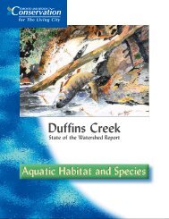
4CurrentConditionsThe <strong>Duffins</strong> <strong>Creek</strong> watershed, shown in Figure 2,is 283 km 2 in size <strong>and</strong> is located east of <strong>Toronto</strong>within the <strong>Region</strong>al Municipalities of York <strong>and</strong>Durham. Local municipalities include the City ofPickering, Town of Ajax, Town of Whitchurch-Stouffville, Township of Uxbridge <strong>and</strong> Town ofMarkham.In 1991, The <strong>Toronto</strong> <strong>and</strong> <strong>Region</strong> <strong>Conservation</strong><strong>Authority</strong> (TRCA) retained Aquafor-BeechEngineering Limited to undertake a hydrologystudy. This study is currently being updated byAquafor-Beech Engineering.Physical CharacteristicsThe <strong>Duffins</strong> <strong>Creek</strong> watershed can be divided intofour physiographic regions with distinct topography,soil conditions <strong>and</strong> range of l<strong>and</strong> surface elevations.These four physiographic regions include:• the Oak Ridges Moraine• the Halton Till Plain• the Lake Iroquois Shoreline• the Lake Iroquois PlainThe Oak Ridges Moraine is located in thenorthern third of the watershed. This region isthe headwaters of the <strong>Duffins</strong> <strong>Creek</strong> watershed,<strong>and</strong> is a distinctive area of high ridges <strong>and</strong>s<strong>and</strong>/gravel hills.The Halton Till Plain is centrally located in thewatershed. Topography is predominantly gentlyrolling, low-relief hills with the largest reliefproduced by the incised major stream valleys.Sometimes refered to as the south slope of themoraine, the Halton Till Plan contains a varietyof soils, some of which have proven to be excellentthrough more than a century of agricultural use.Several large areas with surficial clay deposits arelocated between Whitchurch-Stouffville <strong>and</strong>Claremont. The southern limit of the till plain ismarked by steep topographic gradients, whichdefine the former shoreline of Lake Iroquois.The Lake Iroquois Shoreline is located near the5th Concession Road which cuts across Pickering<strong>and</strong> serves as the northern boundary where Ajaxmeets Pickering. Approximately 12,800 yearsago, glacial Lake Iroquois occupied the LakeOntario basin at a time when the Wisconsinanglacier blocked the St. Lawrence outlet <strong>and</strong>water drained to the south-west. The glacialmeltwaters overflowed the banks of this basin, sothat the waters filled what is now the lower thirdof the <strong>Duffins</strong> watershed. The Lake IroquoisShoreline appears today as an irregular linebroken by strongly developed features such asembayments <strong>and</strong> river mouths, remnants of theonce coastal environment. The wave action fromthe waters of this glacial lake deposited boulderpavement or beach gravels along the shoreline(Chapman <strong>and</strong> Putnum, 1984).The Lake Iroquois Plain is located in the bottomthird of the watershed <strong>and</strong> consists primarily of agently rolling till plain. Soils in this region consistof a mixture of clay, silt <strong>and</strong> s<strong>and</strong> deposits, overlayingthe Halton Till. These stone-free lacustrine(lake-bottom) soils are fertile <strong>and</strong> suitable forhorticulture <strong>and</strong> have typically fared well fororchard crops. The largest relief is provided bythe deeply incised valleys of <strong>Duffins</strong> <strong>Creek</strong>.<strong>Duffins</strong> <strong>Creek</strong> has two major branches which joinapproximately one kilometre upstream ofHighway 2. The west branch originates northeastof Whitchurch-Stouffville <strong>and</strong> drains an area ofapproximately 135 km 2 . The east branch originatesnortheast of Claremont in the Oak Ridges Moraine<strong>and</strong> drains an area of approximately 143 km 2 .Both the east <strong>and</strong> west branches have a numberof tributaries including the following:West <strong>Duffins</strong> <strong>Creek</strong>• Stouffville <strong>Creek</strong>• Reesor <strong>Creek</strong>• Wixon <strong>Creek</strong>