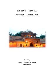
District Disaster Management Plan- 2012 District Faridabad
District Disaster Management Plan- 2012 District Faridabad
District Disaster Management Plan- 2012 District Faridabad

Create successful ePaper yourself
Turn your PDF publications into a flip-book with our unique Google optimized e-Paper software.
Chapter II<strong>District</strong> ProfileII.1 Administrative Structure: <strong>Faridabad</strong> was the twelfth district created out of the state ofHaryana on 2 nd August, 1979. On 04 th April, 2005, Hathin tehsil from <strong>Faridabad</strong> was merged intothe newly created district of Mewat (Nuh) and further on 13 th August, 2008, Palwal was crafted outof <strong>Faridabad</strong> as a new district. Currently the administrative structure of the district constitutes thefollowing:-Table No 02. Administrative Structure <strong>Faridabad</strong><strong>District</strong> Sub Division Tehsil Sub-Tehsil Block Villages<strong>Faridabad</strong> <strong>Faridabad</strong> <strong>Faridabad</strong> Mohna <strong>Faridabad</strong> 100Ballabhgarh Ballabhgarh Ballabhgarh 92II.2 Location: <strong>Faridabad</strong> is situated between 28 25’ 16” N latitude and 77 18’ 28” E longitude.It is surrounded by Delhi in the north, Gurgaon in the south, Uttar Pradesh in the east and Rajasthanin the west.II.3. Geographical Characteristics:3(i) Topography: The district has predominantly plain topography and is located 205 mts abovesea level. It has North-East to South-West gradient.3(ii) Climate and Rainfall: The district falls under hot semi-arid zone, where about 280 days in ayear are dry. Maximum rainfall is concentrated between July and August. Five years averagerainfall in the district from 2004 to 2008 was 491.20 mm. Average rainfall pattern in the districtfrom the year 1996 to 2010 is shown as under:-Table No 03, Average Rainfall in <strong>Faridabad</strong> from 1996-2010Months J F M A M J J A S O N D<strong>Faridabad</strong> 10.38 15.22 7.63 7.50 30.31 44.02 137.15 200.88 90.06 16.94 2.38 7.13Ballabhgarh 10.28 15.31 7.00 8.44 26.69 44.13 130.63 180.64 97.19 10.69 1.13 6.31Chhainsa 2.13 7.75 3.66 5.06 11.13 22.22 79.96 140.97 67.66 13.56 1.75 4.813(iii) Ground Water: Ground water level in <strong>Faridabad</strong> is 30 mts to 50 mts below ground level.Ground water level is comparatively higher in the eastern boundary of the district and in areasaround the Badkhal and the Surajkund Lakes. In last 26 years, it has consistently declined at anannual average rate of 0.50 mts.3(iv) Rivers and Lakes: River Yamuna is the only main river that flows through the easternboundary of the district. Surajkund and Badkhal lakes are two major tourist attractions in thedistrict.3(v) Soil: Soil in <strong>Faridabad</strong> can be broadly categorized into (a) Khadar Soil and (b) Bangar Soil.Khadar soil is found near the Yamuna flood plain. Rest of the area in the district has Bangar soil. Ithas low organic content of 0.2 to 0.4 percent. The average ph of the soil is between 6.5 and 8.7.II .4. Demography:23