20 Southwest M<strong>on</strong>so<strong>on</strong>Fig. 2.11(b) Upper winds (missing)
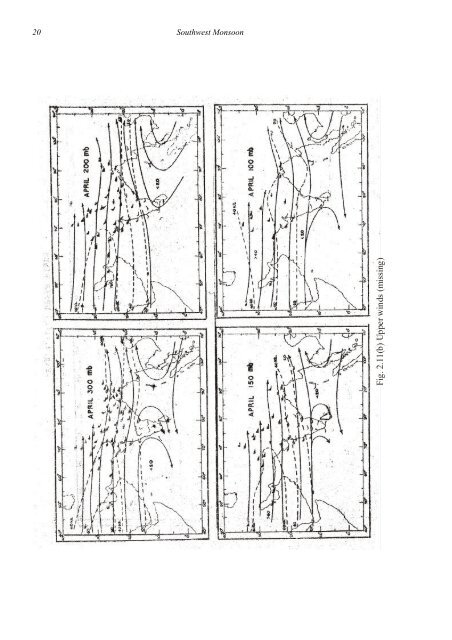
<str<strong>on</strong>g>Met</str<strong>on</strong>g>eorological <str<strong>on</strong>g>M<strong>on</strong>ograph</str<strong>on</strong>g> : Synoptic <str<strong>on</strong>g>Met</str<strong>on</strong>g>eorology No. 1/1976 212.7.3 In May, a trough line runs from Gorakhpur to Kanyakumari at 900 mb A weaker troughalso runs from Multan to Badin. Winds all over the country are from some westerly directi<strong>on</strong>. At850 mb, the <strong>on</strong>ly troughs are <strong>on</strong>e over northeast India al<strong>on</strong>g 87° E and another roughly al<strong>on</strong>g12° N in the Bay and the Peninsula. The latter trough persists upto 500 mb. The sub–tropical ridgefrom Arabia extends into the Indian Peninsula at 850 mb and persists upto 500 mb at about thesame positi<strong>on</strong>. Aloft, this ridge line shifts southwards reaching 14 o N at 200 mb, but is againdisplaced northwards to near 20 o N at 100 mb. Aloft of 200 mb, the ridge over the Peninsula is anextensi<strong>on</strong> from the east rather than the west. The westerlies over northern India are str<strong>on</strong>gestbetween 200 and 150 mb, reaching 50 kt at 200 and 150 mb near 30 o N. Speed decreases aloft.Easterlies over the Peninsula are not over 20 kt.2.7.4 In June, by the end of which the m<strong>on</strong>so<strong>on</strong> is established over practically the whole ofthe country, winds are westerlies at 900 mb. The m<strong>on</strong>so<strong>on</strong> trough over northern India betweenwesterlies to the south and easterlies to the north is established <strong>on</strong>ly towards the end of the m<strong>on</strong>th.A trough is present ,over Pakistan and adjoining Iran which persists upto 800 mb. Between 850 mband 500 mb, a trough line exists over the northeast India between 85 o and 90 o E. The sub tropicalridge from the west begins extending into Rajasthan at 700 mb and reaches. Gujarat at 500 mb.Weak easterlies appear at 300 mb south of the ridge line al<strong>on</strong>g (22 N). The anticycl<strong>on</strong>e from the eastextends to 85° E at 300 mb and 70 o E by 150 mb. 'The ridge line is at 25 o N at 150 mb and near 28 oN at 100 mb. Easterlies well to the south of this ridge line strengthen with height and reach 50 ktin some belt over the Peninsula at 100 mb.2.7.5 In July (Fig. 2.12 a and b) , the m<strong>on</strong>so<strong>on</strong> trough runs from Delhi to Calcutta at 900 mb.Westsouthwesterly to westnorthwesterly winds prevail to the south of it and southeasterly winds t<strong>on</strong>orth. A weak trough is also present over Pakistan and neighbourhood. Westerly winds over thePeninsula increase with height from ground and reach a maximum between 900 and 800 mb. Thislevel is near 900 mb al<strong>on</strong>g the west coast and increases to 800 mb in the eastern Peninsula,Maximum speeds are between 20 and 25 kt. A similar wind maximum near 900 mb has also beenfound in the Arabian Sea south of 20 o N, particularly in the western porti<strong>on</strong>s. The m<strong>on</strong>so<strong>on</strong> troughshifts south with height and is near about 23° N at 700 mb but becomes diffuse above 500 mb overthe Peninsula. The trough over Pakistan is not present at 700 mb; instead the sub–tropical highfrom the west extends into northwest India. Thus the warm surface low over Pakistan andneighbourhood is replaced by the subtropical high at 700 mb. At 500 mb, this ridge, the easterliesover northern India and a trough from east central Arabian Sea to Orissa are the chief features.Winds at this level are weak. .At 300 mb, apart from the western ridge al<strong>on</strong>g 30 o N over northwestIndia and Pakistan, winds are easterly over the whole country. Between 200 mb and 100 mb,another ridge from the east develops to the east of l<strong>on</strong>gitude 75 o E (with ridge line at 30° N).Easterly winds strengthen with height from 200 mb reaching a maximum at 100 mb. Speeds arebetween 60 and 80 kt over the Peninsula between 150 and 100 mb. Upper tropospheric easterliesare seen in Gauhati <strong>on</strong>ly in mid–m<strong>on</strong>so<strong>on</strong>. The strengthening of easterlies with height in UttarPradesh and Bihar is less than in central parts and the Peninsula where thermal gradients arestr<strong>on</strong>ger.2.7.6 While the pattern remains the same in August, winds are slightly weaker between 850and 500 mb. In September, winds are weaker at 900 mb also. The anticycl<strong>on</strong>e from west nowextends at 700 mb upto 20° N, 80° E. A cycl<strong>on</strong>ic circulati<strong>on</strong> also covers the north and adjoiningcentral Bay, instead of the trough near 20 o N in earlier m<strong>on</strong>ths. At 500 mb, the ridge has shifted 3°to 4° southwards and middle–latitude westerlies are spreading upto 27 o N,2.7.7 Joseph and Raman (1966) find that the lower tropospheric westerlies over the Peninsulamay develop into low level jet stream <strong>on</strong> many days in July, with a core at about 1.5 km andspeeds of 40–60 kt in the core. The jet appears between 8 o and 18 o N. The wind shear below thecore is more than above (Fig. 2.13).
- Page 1: VMETEOROLOGICAL MONOGRAPH SYNOPTICM
- Page 5 and 6: VMETEOROLOGICAL MONOGRAPH SYNOPTICM
- Page 7 and 8: VP R E F A C EThe Southwest Monsoon
- Page 9 and 10: VM O N S O O N A S I A A N D T H E
- Page 11 and 12: VCONTENTSFrontispiece : Mean Wind F
- Page 13 and 14: Meteorological <st
- Page 15 and 16: Meteorological <st
- Page 17 and 18: Meteorological <st
- Page 19 and 20: Meteorological <st
- Page 21 and 22: Meteorological <st
- Page 23 and 24: Meteorological <st
- Page 25 and 26: Meteorological <st
- Page 27 and 28: Meteorological <st
- Page 29 and 30: Meteorological <st
- Page 31: Meteorological <st
- Page 35 and 36: Meteorological <st
- Page 37 and 38: Meteorological <st
- Page 39 and 40: Meteorological <st
- Page 41 and 42: Meteorological <st
- Page 43 and 44: Meteorological <st
- Page 45 and 46: Meteorological <st
- Page 47 and 48: CHAPTER 3ONSET AND WITHDRAWAL OF TH
- Page 49 and 50: Meteorological <st
- Page 51 and 52: Meteorological <st
- Page 53 and 54: Meteorological <st
- Page 55 and 56: Meteorological <st
- Page 57 and 58: Meteorological <st
- Page 59 and 60: Meteorological <st
- Page 61 and 62: Meteorological <st
- Page 63 and 64: Meteorological <st
- Page 65 and 66: Meteorological <st
- Page 67 and 68: Meteorological <st
- Page 69 and 70: Meteorological <st
- Page 71 and 72: Meteorological <st
- Page 73 and 74: Meteorological <st
- Page 75 and 76: Meteorological <st
- Page 77 and 78: Meteorological <st
- Page 79 and 80: Meteorological <st
- Page 81 and 82: Meteorological <st
- Page 83 and 84:
Meteorological <st
- Page 85 and 86:
Meteorological <st
- Page 87 and 88:
Meteorological <st
- Page 89 and 90:
Meteorological <st
- Page 91 and 92:
Meteorological <st
- Page 93 and 94:
Meteorological <st
- Page 95 and 96:
Meteorological <st
- Page 97 and 98:
Meteorological <st
- Page 99 and 100:
Meteorological <st
- Page 101 and 102:
Meteorological <st
- Page 103 and 104:
Meteorological <st
- Page 105 and 106:
Meteorological <st
- Page 107 and 108:
Meteorological <st
- Page 109 and 110:
Meteorological <st
- Page 111 and 112:
Meteorological <st
- Page 113 and 114:
Meteorological <st
- Page 115 and 116:
Meteorological <st
- Page 117 and 118:
Meteorological <st
- Page 119 and 120:
Meteorological <st
- Page 121 and 122:
Meteorological <st
- Page 123 and 124:
Meteorological <st
- Page 125 and 126:
Meteorological <st
- Page 127 and 128:
Meteorological <st
- Page 129 and 130:
Meteorological <st
- Page 131 and 132:
Meteorological <st
- Page 133 and 134:
Meteorological <st
- Page 135 and 136:
Meteorological <st
- Page 137 and 138:
Meteorological <st
- Page 139 and 140:
Meteorological <st
- Page 141 and 142:
Meteorological <st
- Page 143 and 144:
Meteorological <st
- Page 145 and 146:
Meteorological <st
- Page 147 and 148:
Meteorological <st
- Page 149 and 150:
Meteorological <st
- Page 151 and 152:
Meteorological <st
- Page 153 and 154:
Meteorological <st
- Page 155 and 156:
Meteorological <st
- Page 157 and 158:
Meteorological <st
- Page 159 and 160:
Meteorological <st
- Page 161 and 162:
Meteorological <st
- Page 163 and 164:
Meteorological <st
- Page 165 and 166:
Meteorological <st
- Page 167 and 168:
Meteorological <st
- Page 169 and 170:
Meteorological <st
- Page 171 and 172:
Meteorological <st
- Page 173 and 174:
Meteorological <st
- Page 175 and 176:
Meteorological <st
- Page 177 and 178:
Meteorological <st
- Page 179 and 180:
Meteorological <st
- Page 181 and 182:
Meteorological <st
- Page 183 and 184:
Meteorological <st
- Page 185 and 186:
Meteorological <st
- Page 187 and 188:
Meteorological <st
- Page 189 and 190:
Meteorological <st
- Page 191 and 192:
Meteorological <st
- Page 193 and 194:
Meteorological <st
- Page 195 and 196:
Meteorological <st
- Page 197 and 198:
Meteorological <st
- Page 199 and 200:
Meteorological <st
- Page 201 and 202:
Meteorological <st
- Page 203 and 204:
Meteorological <st
- Page 205 and 206:
Meteorological <st
- Page 207 and 208:
Meteorological <st
- Page 209 and 210:
Meteorological <st
- Page 211 and 212:
Meteorological <st
- Page 213 and 214:
CHAPTER 9OTHER SYNOPTIC SYSTEMS9.1
- Page 215 and 216:
Meteorological <st
- Page 217 and 218:
Meteorological <st
- Page 219 and 220:
Meteorological <st
- Page 221 and 222:
Meteorological <st
- Page 223 and 224:
Meteorological <st
- Page 225 and 226:
Meteorological <st
- Page 227 and 228:
Meteorological <st
- Page 229 and 230:
Meteorological <st
- Page 231 and 232:
Meteorological <st
- Page 233 and 234:
Meteorological <st
- Page 235 and 236:
Meteorological <st
- Page 237 and 238:
Meteorological <st
- Page 239 and 240:
Meteorological <st
- Page 241 and 242:
Meteorological <st
- Page 243 and 244:
Meteorological <st
- Page 245 and 246:
Meteorological <st
- Page 247 and 248:
Meteorological <st
- Page 249 and 250:
Meteorological <st
- Page 251 and 252:
Meteorological <st
- Page 253 and 254:
Meteorological <st
- Page 255 and 256:
Meteorological <st
- Page 257 and 258:
Meteorological <st
- Page 259 and 260:
Meteorological <st
- Page 261 and 262:
Meteorological <st
- Page 263 and 264:
Meteorological <st
- Page 265 and 266:
Meteorological <st
- Page 267 and 268:
Meteorological <st
- Page 269 and 270:
Meteorological <st
- Page 271 and 272:
Meteorological <st
- Page 273 and 274:
Meteorological <st
- Page 275 and 276:
Meteorological <st
- Page 277 and 278:
Meteorological <st
- Page 279 and 280:
Meteorological <st
- Page 281 and 282:
Meteorological <st
- Page 283 and 284:
Meteorological <st
- Page 285 and 286:
Meteorological <st
- Page 287 and 288:
Meteorological <st
- Page 289 and 290:
Meteorological <st
- Page 291 and 292:
Meteorological <st
- Page 293 and 294:
Meteorological <st
- Page 295 and 296:
CHAPTER 10OROGRAPHIC EFFECTS10.1 Or
- Page 297 and 298:
Meteorological <st
- Page 299 and 300:
Meteorological <st
- Page 301 and 302:
Meteorological <st
- Page 303 and 304:
Meteorological <st
- Page 305 and 306:
Meteorological <st
- Page 307 and 308:
Meteorological <st
- Page 309 and 310:
Lat.PositionLong.Met</stron
- Page 311 and 312:
Meteorological <st
- Page 313 and 314:
Meteorological <st
- Page 315 and 316:
Meteorological <st
- Page 317 and 318:
Meteorological <st
- Page 319 and 320:
Meteorological <st
- Page 321 and 322:
CHAPTER 12CLOUD AND RAINFALL CHARAC
- Page 323 and 324:
Meteorological <st
- Page 325 and 326:
Meteorological <st
- Page 327 and 328:
Meteorological <st
- Page 329 and 330:
Meteorological <st
- Page 331 and 332:
Meteorological <st
- Page 333 and 334:
Meteorological <st
- Page 335 and 336:
Meteorological <st
- Page 337 and 338:
Meteorological <st
- Page 339 and 340:
CHAPTER 13BALANCE OF MASS, RADIATIO
- Page 341 and 342:
Meteorological <st
- Page 343 and 344:
13.3 RadiationMete
- Page 345 and 346:
Meteorological <st
- Page 347 and 348:
Meteorological <st
- Page 349 and 350:
Meteorological <st
- Page 351 and 352:
where K=½becomesMet</stron
- Page 353 and 354:
Meteorological <st
- Page 355 and 356:
Meteorological <st
- Page 357 and 358:
Meteorological <st
- Page 359 and 360:
Meteorological <st
- Page 361 and 362:
Meteorological <st
- Page 363 and 364:
Meteorological <st
- Page 365 and 366:
Meteorological <st
- Page 367 and 368:
Meteorological <st
- Page 369 and 370:
Meteorological <st
- Page 371 and 372:
Meteorological <st
- Page 373 and 374:
Meteorological <st
- Page 375 and 376:
Meteorological <st
- Page 377 and 378:
Meteorological <st
- Page 379:
Meteorological <st