Field Book for Describing and Sampling Soils - FTP Directory Listing
Field Book for Describing and Sampling Soils - FTP Directory Listing
Field Book for Describing and Sampling Soils - FTP Directory Listing

Create successful ePaper yourself
Turn your PDF publications into a flip-book with our unique Google optimized e-Paper software.
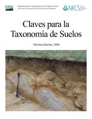
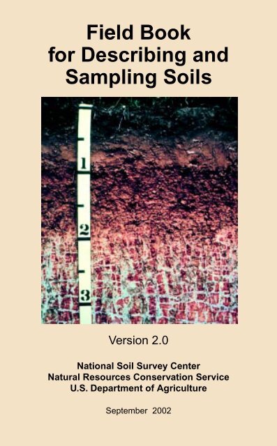
<strong>Field</strong> <strong>Book</strong><strong>for</strong> <strong>Describing</strong> <strong>and</strong><strong>Sampling</strong> <strong>Soils</strong>Version 2.0National Soil Survey CenterNatural Resources Conservation ServiceU.S. Department of AgricultureSeptember 2002
ACKNOWLEDGMENTSThe science <strong>and</strong> knowledge in this document are distilled from the collectiveexperience of thous<strong>and</strong>s of dedicated Soil Scientists during the more than100 years of the National Cooperative Soil Survey Program. A special thanks isdue to these largely unknown stewards of the natural resources of this nation.This book was written, compiled, <strong>and</strong> edited by Philip J. Schoeneberger,Douglas A. Wysocki, Ellis C. Benham, NRCS, Lincoln, NE; <strong>and</strong> William D.Broderson, NRCS, Salt Lake City, UT.Special thanks <strong>and</strong> recognition are extended to those who contributedextensively to the preparation <strong>and</strong> production of this book: the 75 soil scientistsfrom the NRCS along with NCSS cooperators who reviewed <strong>and</strong> improved it;Tammy Nepple <strong>for</strong> document preparation <strong>and</strong> graphics; Howard Camp <strong>for</strong>graphics; Jim Culver <strong>for</strong> sponsoring it; <strong>and</strong> the NRCS Soil Survey Division <strong>for</strong>funding it.Proper citation <strong>for</strong> this document is:Schoeneberger, P.J., Wysocki, D.A., Benham, E.C., <strong>and</strong> Broderson, W.D.(editors), 2002. <strong>Field</strong> book <strong>for</strong> describing <strong>and</strong> sampling soils, Version 2.0.Natural Resources Conservation Service, National Soil Survey Center,Lincoln, NE.Cover Photo: Soil profile of a Segno fine s<strong>and</strong>y loam (Plinthic Paleudalf)showing reticulate masses or blocks of plinthite at 30 inches (profile tape is infeet). Courtesy of Frankie F. Wheeler (retired), NRCS, Temple TX; <strong>and</strong>Larry Ratliff (retired), National Soil Survey Center, Lincoln, NE.Use of trade or firm names is <strong>for</strong> reader in<strong>for</strong>mation only, <strong>and</strong> does not constituteendorsement or recommended use by the U.S. Department of Agriculture of anycommercial product or service.The U.S. Department of Agriculture (USDA) prohibits discrimination in all its programs <strong>and</strong>activities on the basis of race, color, national origin, sex, religion, age, disability, politicalbeliefs, sexual orientation, or marital or family status. (Not all prohibited bases apply to allprograms.) Persons with disabilities who require alternative means <strong>for</strong> communication ofprogram in<strong>for</strong>mation (Braille, large print, audiotape, etc.) should contact USDA’s TARGETCenter at (202) 720-2600 (voice <strong>and</strong> TDD).To file a complaint of discrimination, write USDA, Director, Office of Civil Rights, Room 326-W, Whitten Building, 1400 Independence Avenue, SW, Washington, D.C. 20250-9410 orcall (202) 720-5964 (voice <strong>and</strong> TDD). USDA is an equal opportunity provider <strong>and</strong> employer.USDA-NRCS i September 2002
FOREWORDPurpose: The following instructions, definitions, concepts, <strong>and</strong> codes are afield guide <strong>for</strong> making or reading soil descriptions <strong>and</strong> sampling soils aspresently practiced in the USA.Background: The methodology of soil descriptions was developed by soilscientists during the entire course of the Soil Survey Program. The USDApublished small booklets of Instructions to <strong>Field</strong> Parties, including soildescriptions, in 1902-1904, 1906, <strong>and</strong> 1914. The first USDA guide <strong>for</strong>identification <strong>and</strong> description <strong>for</strong> soil horizons was released in 1937(Bureau of Chemistry <strong>and</strong> <strong>Soils</strong>, 1937). Roy Simonson <strong>and</strong> others latersummarized <strong>and</strong> revised this in<strong>for</strong>mation (Soil Survey Staff, 1951; SoilSurvey Staff, 1962). Very brief, color book inserts with shorth<strong>and</strong> notationwere released by the Soil Conservation Service (e.g., Spartanburg, SC,1961; Western Technical Center, Portl<strong>and</strong>, OR, 1974). This document isan exp<strong>and</strong>ed, <strong>and</strong> updated version of earlier guides that summarizes thepresent knowledge base. This version (2.0) includes minor corrections <strong>and</strong>recent updates to the original 1998 release (ver. 1.1; Schoeneberger, etal., 1998) <strong>and</strong> updates in source documents.St<strong>and</strong>ards: This book summarizes <strong>and</strong> updates the current National CooperativeSoil Survey conventions <strong>for</strong> describing soils (SSM, 1993; NSSH,2001; PDP 3.6, 1996; NASIS (5.0)). Much of the content is an abbreviationof the primary sources.Regarding PEDON (PDP 3.5 / 3.6): This document is intended to be bothcurrent <strong>and</strong> usable by the entire soil science community. It is not a guideon “How to use PDP or NASIS.” At this time, PDP is the most dated <strong>and</strong>there<strong>for</strong>e the least compatible NRCS document relative to the Soil SurveyManual, National Soil Survey H<strong>and</strong>book, Soil Taxonomy, <strong>and</strong> NASIS.Differences <strong>and</strong> linkages between PDP 3.6 <strong>and</strong> NASIS are shown, wherereasonable to do so, as an aid to interpreting <strong>and</strong> converting historicaldata.St<strong>and</strong>ard procedures <strong>and</strong> terms <strong>for</strong> describing soils have changed <strong>and</strong>increased in recent years (e.g., redoximorphic features). Coincident withthese changes has been the development <strong>and</strong> use of computer databasesto store soil descriptions <strong>and</strong> in<strong>for</strong>mation. The nature of databases, <strong>for</strong>better or worse, requires consistent <strong>and</strong> “correct” use of terms.Sources: This <strong>Field</strong> <strong>Book</strong> draws from several primary sources: The SoilSurvey Manual (Soil Survey Staff, 1993); the PEDON Description Program(PDP) Version 4 Design Documents (Soil Survey Staff, 1996); <strong>and</strong> theUSDA-NRCS ii September 2002
National Soil Survey H<strong>and</strong>book (NSSH) — Parts 618 <strong>and</strong> 629 (Soil SurveyStaff, 2001). Other less pervasive sources are footnoted throughout the<strong>Field</strong> <strong>Book</strong> to encourage access to original in<strong>for</strong>mation.Brevity: In a field book, brevity is efficiency. Despite this book’s apparentlength, the criteria, definitions, <strong>and</strong> concepts presented here arecondensed. We urge users to review the more comprehensive in<strong>for</strong>mationin the original sources to avoid errors due to our brevity.Units: It is critical to specify <strong>and</strong> consistently use units <strong>for</strong> describing a soil.Metric units are preferred. NASIS requires metric units. (In PDP, you canchoose Metric or English units.)Format: The “Site Description Section” <strong>and</strong> “Profile Description Section” in thisbook generally follow conventional profile description <strong>for</strong>mat <strong>and</strong>sequence (e.g., SCS-Form 232, December 1984). Some data elements(descriptors) are rearranged in this document into a sequence that is morecompatible with the description process in the field (e.g., HorizonBoundary is next to Horizon Depth, rather than at the very end). Thissequence is somewhat different from <strong>and</strong> does not supersede theconventions followed in writing <strong>for</strong>mal soil descriptions <strong>for</strong> Soil SurveyReports or Official Soil Series Descriptions (i.e., National Soil SurveyH<strong>and</strong>book, Part 614; Soil Survey Staff, 2001).Codes: Short-h<strong>and</strong> notation is listed in the Code column <strong>for</strong> each descriptor.Long-st<strong>and</strong>ing, conventional codes are retained because of theirwidespread recognition. Some codes of recent origin have been changedto make them more logical. Some data elements have different codes invarious systems [e.g., conventional (Conv.) vs. NASIS vs. PEDONDescription Program codes (PDP)] <strong>and</strong> several columns may be shown tofacilitate conversions. The preferred st<strong>and</strong>ard code column is shownbold. If only 1 untitled code column is shown, it can be assumed that theconventional, NASIS, <strong>and</strong> PDP codes are all the same.St<strong>and</strong>ard Terms vs. Creativity: Describe <strong>and</strong> record what you observe.Choice lists in this document are a minimal set of descriptors. Useadditional descriptors, notes, <strong>and</strong> sketches to record pertinent in<strong>for</strong>mation<strong>and</strong>/or features <strong>for</strong> which no data element exists. Record such in<strong>for</strong>mationas free-h<strong>and</strong> notes under Miscellaneous <strong>Field</strong> Notes (or User DefinedEntries in PDP).Changes: Soil Science is an evolving field. Changes to this <strong>Field</strong> <strong>Book</strong> should<strong>and</strong> will occur. Please send comments or suggestions to the Director,National Soil Survey Center, USDA-NRCS; 100 Centennial Mall North,Rm. 152; Lincoln, NE 68508-3866.USDA-NRCS iii September 2002
TABLE OF CONTENTSACKNOWLEDGMENTS ................................................................. iFOREWORD ...................................................................................... iiSITE DESCRIPTION .................................................................... 1–1Describer(s) Name ......................................................................... 1–1Date ................................................................................................ 1–1Climate .............................................................................................. 1–1Weather Conditions ................................................................... 1–1Air Temperature.......................................................................... 1–1Soil Temperature........................................................................ 1–1[Soil Temperature, Soil Temperature Depth]Location............................................................................................ 1–2[Latitude, Longitude, Datum Name]Topographic Quadrangle ............................................................. 1–2Soil Survey Site Identification Number................................... 1–2County FIPS Code ......................................................................... 1–3MLRA ................................................................................................ 1–3Transects ......................................................................................... 1–3[Transect ID, Stop Number, Interval]Series Name .................................................................................... 1–4Geomorphic In<strong>for</strong>mation ............................................................. 1–4Physiographic Location ............................................................ 1–4[Physiographic Division, Physiographic Province,Physiographic Section, State Physiographic Area,Local Physiographic/Geographic Name]Geomorphic Description ........................................................... 1–4[L<strong>and</strong>scape, L<strong>and</strong><strong>for</strong>m, Microfeature, AnthropogenicFeature]Surface Morphometry................................................................ 1–4[Elevation, Slope Aspect, Slope Gradient, SlopeComplexity, Slope Shape, Hillslope - Profile Position,Geomorphic Component (Hills, Terraces <strong>and</strong> SteppedL<strong>and</strong><strong>for</strong>ms, Mountains, Flat Plains), Microrelief]Water Status .................................................................................. 1–10Drainage .................................................................................... 1–10Flooding ..................................................................................... 1–11[Frequency, Duration, Months]Ponding...................................................................................... 1–12[Frequency, Depth, Duration]USDA-NRCS iv September 2002
(Soil) Water State .................................................................... 1–13Depth To Water Table.............................................................. 1–14(Seasonal) High Water Table - Kind ............................... 1–14Vegetation / L<strong>and</strong> Cover ............................................................ 1–15[Earth Cover - Kind, Plant Symbol, Plant Common Name,Plant Scientific Name]Parent Material ............................................................................. 1–17Bedrock ......................................................................................... 1–20[Kind, Fracture Interval Class, Bedrock Hardness,Weathering Class, Depth]Erosion ........................................................................................... 1–23[Kind, Degree, Class]Runoff ............................................................................................. 1–24Surface Runoff ......................................................................... 1–24The Index (Of) Surface Runoff Class................................... 1–25Surface Fragments (Formerly Surface Stoniness) ............ 1–25Diagnostic Horizons Or Properties ........................................ 1–26[Kind, Depth]References..................................................................................... 1–27PROFILE / PEDON DESCRIPTION ....................................... 2–1Observation Method...................................................................... 2–1[Kind, Relative Size]Taxonomic Classification ............................................................ 2–2Horizon Nomenclature ................................................................. 2–2Master, Transitional, <strong>and</strong> Common Horizon Combinations 2–2Horizon Suffixes......................................................................... 2–3Other Horizon Modifiers ........................................................... 2–4[Numerical Prefixes, Numerical Suffixes, The Prime]Diagnostic Horizons .................................................................. 2–4Horizon Depth ............................................................................ 2–4Horizon Thickness ..................................................................... 2–5Horizon Boundary ...................................................................... 2–5[Distinctness, Topography]Soil Color ......................................................................................... 2–7Decision Flowchart For <strong>Describing</strong> Soil Colors ................... 2–7(Soil) Matrix Color ..................................................................... 2–7[(Soil) Color, Moisture State, Location Or Condition]Mottles ......................................................................................... 2–9[Quantity, Size, Contrast, Color, Moisture State, Shape]Tabular List <strong>for</strong> Determination of Color Contrast .............. 2–12USDA-NRCS v September 2002
Redoximorphic Features - RMF (Discussion) ..................... 2–14Redoximorphic Features ........................................................... 2–15[Kind, Quantity, Size, Contrast, Color, Moisture State,Shape, Location, Hardness, Boundary]Concentrations (Discussion) ................................................... 2–18Concentrations ............................................................................. 2–19[Kind, Quantity (Percent Of Area Covered), Size,Contrast, Color, Moisture State, Shape, Location,Hardness, Boundary]Ped <strong>and</strong> Void Surface Features ............................................... 2–25[Kind, Amount, Continuity, Distinctness, Location, Color](Soil) Texture ................................................................................ 2–29Texture Class............................................................................ 2–29Texture Triangle (Fine Earth) ................................................ 2–30Texture Modifiers ..................................................................... 2–30[% by Volume; Size & Quantity; Compositional]Terms Used In Lieu Of Texture ............................................. 2–34Comparison of Particle Size Class Systems (table) ......... 2–35Rock <strong>and</strong> Other Fragments.......................................................... 2–37[Kind, Volume Percent, Roundness, Size Classes,<strong>and</strong> Descriptive Terms](Soil) Structure............................................................................... 2–41[Type, Grade, Size]Consistence .................................................................................. 2–49Rupture Resistance ................................................................. 2–49[Blocks, Peds, <strong>and</strong> Clods, Surface Crust <strong>and</strong> Plates]Cementing Agents ................................................................... 2–51Manner Of Failure.................................................................... 2–52Stickiness .................................................................................. 2–53Plasticity .................................................................................... 2–53Penetration Resistance .......................................................... 2–54Excavation Difficulty................................................................ 2–55Roots .............................................................................................. 2–56[Quantity, Size, Quantity (graphic), Location]Pores (Discussion) ...................................................................... 2–59Pores .............................................................................................. 2–59[Quantity, Size, Shape, Vertical Continuity]Cracks ............................................................................................. 2–61[Kind, Depth, Relative Frequency]Soil Crusts (Discussion) ........................................................... 2–64Soil Crusts ..................................................................................... 2–65Special Features .......................................................................... 2–67[Kind, Area (%) Occupied]USDA-NRCS vi September 2002
SITEPermeability / Saturated Hydraulic Conductivity ............... 2–68(Discussion)Permeability .................................................................................. 2–69Saturated Hydraulic Conductivity (K sat ) ............................... 2–69Chemical Response .................................................................... 2–70Reaction (pH) ........................................................................... 2–70Effervescence ........................................................................... 2–71[Class, Location, Chemical Agent]Reduced Conditions ................................................................ 2–72Salinity ....................................................................................... 2–72Sodium Adsorption Ratio (SAR)............................................ 2–73Odor .............................................................................................. 2–73Miscellaneous <strong>Field</strong> Notes ........................................................ 2–73Minimum Data Set (For A Soil Description) ......................... 2–73Profile Description Data Sheet ................................................ 2–74Profile Description Example..................................................... 2–74Profile Description Report Example ...................................... 2–74(For Soil Survey Reports)Pedon Description Data Sheet (blank) ...................................... 2–75Profile Description Example (completed)............................. 2–77References..................................................................................... 2–79GEOMORPHIC DESCRIPTION ............................................... 3–1Geomorphic Description System ............................................. 3–1Part I: Physiographic Location ............................................... 3–2Part II: Geomorphic Description (Outline) ......................... 3–10Part II: Geomorphic Description .......................................... 3–11Part III: Surface Morphometry.............................................. 3–37References..................................................................................... 3–44SOIL TAXONOMY .......................................................... 4–1Introduction.................................................................................... 4–1Horizon Nomenclature ................................................................. 4–1Master And Transitional Horizons........................................... 4–1Horizon Suffixes......................................................................... 4–3Horizon Nomenclature Conversion Charts ........................... 4–5Texture Triangle: Soil Texture Family Classes.................... 4–7Combined Texture Triangles: Fine Earth Texture Classes<strong>and</strong> Soil Texture Family Classes ............................................ 4–8References....................................................................................... 4–9GEOLOGY ....................................................................................... 5–1Introduction..................................................................................... 5–1Bedrock–Kind ................................................................................. 5–1USDA-NRCS vii September 2002
SITERock Charts..................................................................................... 5–3Igneous Rocks Chart................................................................. 5–4Metamorphic Rocks Chart........................................................ 5–5Sedimentary And Volcaniclastic Rocks ................................. 5–6Mass Movement (Mass Wasting) Types For Soil Survey.... 5–7North American Geologic Time Scale..................................... 5–8Till Terms ......................................................................................... 5–9Pyroclastic Terms ........................................................................ 5–10Hierarchical Rank of Lithostratigraphic Units .................... 5–11References..................................................................................... 5–13LOCATION ...................................................................................... 6–1Public L<strong>and</strong> Survey ....................................................................... 6–1Townships <strong>and</strong> Ranges ............................................................. 6–1Sections ....................................................................................... 6–2Sub-Divisions.............................................................................. 6–3State Plane Coordinate System................................................. 6–4Universal Transverse Mercator (UTM) RectangularCoordinate System .................................................................. 6–4References....................................................................................... 6–5MISCELLANEOUS .............................................................................. 7–1Examples Of Percent Of Area Covered ................................... 7–1Measurement Equivalents & Conversions ............................. 7–2Metric To English ....................................................................... 7–2English To Metric ....................................................................... 7–3Common Conversion Factors .................................................. 7–4Guide To Map Scales And Minimum-Size Delineations ...... 7–7Common Soil Map Symbols (Traditional) ............................... 7–8FIELD SAMPLING ........................................................................ 8–1Introduction..................................................................................... 8–1Soil <strong>Sampling</strong>.................................................................................. 8–1Soil Sample Kinds ..................................................................... 8–1Reference Samples ............................................................. 8–1Characterization Samples .................................................. 8–1<strong>Sampling</strong> Strategies .................................................................. 8–1<strong>Field</strong> Equipment Checklist .......................................................... 8–2Examples Of Common <strong>Field</strong> <strong>Sampling</strong> Equipment .............. 8–3References....................................................................................... 8–4INDEX ................................................................................................. 9-1USDA-NRCS viii September 2002
SITE DESCRIPTIONCompiled by: P.J. Schoeneberger, D.A. Wysocki, E.C. Benham, NRCS,Lincoln, NE; W. D. Broderson, NRCS, Salt Lake City, UT.DESCRIBER(S) NAMENAME (or initials) - Record the observer(s) who makes the description;e.g., Erling E. Gamble or EEG.DATEMONTH / DAY / YEAR - Record the date of the observations. Use numericnotation (MM, DD, YYYY); e.g., 05/21/2002 (<strong>for</strong> May 21, 2002).CLIMATEDocument the prevailing, general weather conditions at the time ofobservation. (Not a data element in PDP; a site-condition which affectssome field methods; e.g., K sat ). Record the dominant Weather Conditions<strong>and</strong> Air Temperature; e.g., Rain, 27 ° C.Weather Conditionssunny / clearpartly cloudyovercastrainsleetsnowCodeSUPCOVRASLSNAIR TEMPERATURE - The ambient air temperature at approximately chestheight (in degrees, Celsius or Fahrenheit); e.g., 27 °C.SOIL TEMPERATURE - Record the ambient Soil Temperature <strong>and</strong> theDepth at which it is determined; e.g., 22 °C, 50 cm. (NOTE: Soil Taxonomygenerally requires a depth of 50 cm.) Soil temperature should only bedetermined from a freshly excavated surface that reflects the ambient soilconditions. Avoid surfaces equilibrated with air temperatures.Soil Temperature - Record the soil temperature (in °C or °F).Soil Temperature Depth - Record the depth at which the ambient soiltemperature is measured; e.g., 50 cm.USDA-NRCS 1-1 September 2002
LOCATIONRecord the geographical location of the point / area of interest as preciselyas possible. Latitude <strong>and</strong> longitude are preferred [record in degrees,minutes, seconds (decimal seconds), direction, <strong>and</strong> associated datum].LATITUDE - e.g., 46 ° 10' 19.38" N. Lat.LONGITUDE - e.g., 95 ° 23' 47.16" W. Long.NOTE: Latitude <strong>and</strong> Longitude are required in NASIS. For other locationdescriptors (e.g., Public L<strong>and</strong> Survey, UTM, Metes <strong>and</strong> Bounds, State PlaneCoordinates, etc.), see the “Location Section.”DATUM NAME (called Horizontal_datum_name in NASIS)- Critical:Record the reference datum <strong>for</strong> latitude <strong>and</strong> longitude from either topographicmap or GPS configuration used; e.g., NAD 1983 (North AmericaDatum, 1983) <strong>for</strong> most of USA.TOPOGRAPHIC QUADRANGLERecord the appropriate topographic map name (i.e., Quadrangle Name)covering the observation site (commonly a USGS topographic map). Includethe scale (or map “series”) <strong>and</strong> the year printed; e.g., Pollard Creek - NW;TX; 1:24,000; 1972.SOIL SURVEY SITE IDENTIFICATION NUMBERAn identification number must be assigned if samples are collected <strong>for</strong>analyses at the National Soil Survey Laboratory (Soil Survey Staff, 1995).This identifier consists of four required <strong>and</strong> one optional part. These are:1) The letter S (<strong>for</strong> “soil characterization sample”) <strong>and</strong> the four-digit(<strong>for</strong>merly 2-digit) calendar year; e.g., S2001 (<strong>for</strong> 2001).2) The two-character state abbreviation; e.g., OK (<strong>for</strong> Oklahoma).For non-USA samples, use the abbreviation FN.3) The three-digit county FIPS code; e.g., 061 (<strong>for</strong> Haskell County,OK). For non-USA samples, use the appropriate three-digit GSAworld-wide geographical location code (Public Building Service,1996).4) A three-digit, sequential code to identify the individual pedonssampled within the county or other survey area during any givencalendar year; e.g., 005. (NOTE: This sequential code startsover with 001 each January 1.)USDA-NRCS 1-2 September 2002
5) (Optional) A one-character sub-sample code. This is generallyused to indicate some relationship (such as satellite samples)between sampling sites; e.g., A.A complete example is S2001OK061005A. [Translation: A pedon sampled<strong>for</strong> soil characterization during 2001 (S2001), from Oklahoma (OK), inHaskell County (061), the fifth pedon (005) sampled in that county during2001, <strong>and</strong> it is a satellite sample (A) related to the primary pedon.]COUNTY FIPS CODEThis is the three-digit FIPS code <strong>for</strong> the county (National Institute ofSt<strong>and</strong>ards <strong>and</strong> Technology, 1990) in a U.S. state in which the pedon or siteis located. It is usually an odd number; e.g., 061 (<strong>for</strong> Haskell County, OK).For non-USA samples, enter FN followed by the appropriate three-digit GSAworld-wide geographical location code (Public Building Service, 1996); e.g.,FN260 (<strong>for</strong> Canada).Geomorph.MLRAThis is the one- to three-digit (<strong>and</strong> one-character sub-unit, if applicable)Major L<strong>and</strong> Resource Area identifier (SCS, 1981); e.g., 58C (<strong>for</strong> NorthernRolling High Plains - Northeastern Part).TRANSECTSIf the soil description is a point along a transect, record appropriate transectin<strong>for</strong>mation: Transect ID, Stop Number, Interval. In NASIS, additionalin<strong>for</strong>mation can be recorded: Transect Kind [r<strong>and</strong>om point (–R), regularinterval (–I)], Transect Section Method [biased (–B), r<strong>and</strong>om, (–R)],Delineation Size (acres), Transect Direction [compass heading; ( ° )].TRANSECT ID - This is a four- to five-digit number that identifies thetransect; e.g., 0029 (the 29th transect within the survey area).STOP NUMBER - If the sample/pedon is part of a transect, enter the twodigitstop number along the transect; e.g., 07. (NOTE: NASIS allows up to13 characters.)INTERVAL - Record distances between observation points, compassbearings, <strong>and</strong> GPS coordinates; or draw a route map in the <strong>Field</strong> Notes(“User Defined Section”). In PDP, if the observation is part of a transect,enter the distance (in feet or meters) between points; e.g., 30 m.USDA-NRCS 1-3 September 2002
SERIES NAMEThis is the assumed Soil Series name at the time of the description; e.g.,Cecil. If unknown, enter SND <strong>for</strong> “Series Not Designated”. [In NASIS, “SND”is not used; use an appropriate Soil Taxonomic taxa; e.g. Udorthents.]NOTE: The field-assigned series name may ultimately change afteradditional data collection <strong>and</strong> lab analyses.Geomorph.GEOMORPHIC INFORMATIONSee the “Geomorphology Section” <strong>for</strong> complete choice lists. Codes areshown following each example. Conventional “codes” traditionally consist ofthe entire name; e.g., mountains.PART 1: PHYSIOGRAPHIC LOCATIONPhysiographic Division - e.g., Interior Plains or INPhysiographic Province - e.g., Central Lowl<strong>and</strong> or CLPhysiographic Section - e.g., Wisconsin Driftless Section or WDSState Physiographic Area (Opt.) - e.g., Wisconsin DellsLocal Physiographic / Geographic Name (Opt.) - e.g., Bob’s RidgePART 2: GEOMORPHIC DESCRIPTIONL<strong>and</strong>scape - e.g., Foothills or FHL<strong>and</strong><strong>for</strong>m - e.g., Ridge or RIMicrofeature - e.g., Mound or MAnthropogenic Feature - e.g., Midden or HPART 3: SURFACE MORPHOMETRYElevation - The height of a point on the earth’s surface, relative tomean sea level (MSL). Use specific units; e.g., 106 m or 348 ft.Recommended methods: Interpolation from topographic map contours;altimeter reading tied to a known datum. NOTE: At present,elevational determination by a sole Global Positioning System (GPS)unit is considered unacceptably inaccurate.USDA-NRCS 1-4 September 2002
Slope Aspect - The compass direction (in degrees <strong>and</strong> accounting <strong>for</strong>declination) that a slope faces, looking downslope; e.g., 287°.293°338°315°WNWNWNNW0°NORTHNNE23°NE45°ENE68°270° WESTEAST90°248°WSW225°SWSSW203°SOUTH180°SSESEESE135°158°113°Slope Gradient - The angle of the ground surface (in percent) throughthe site <strong>and</strong> in the direction that overl<strong>and</strong> water would flow. Commonlycalled “slope.” Make observations facing downslope to avoid errorsassociated with some br<strong>and</strong>s of clinometers; e.g., 18%.Slope Complexity - Describe the relative uni<strong>for</strong>mity (smooth linear orcurvilinear = simple or S) or irregularity (complex or C) of the groundsurface leading downslope through the point of interest; e.g.,simple or S.Simple vs. Complex(adapted from Wysocki, et al., 2000)USDA-NRCS 1-5 September 2002
Slope Shape - Slope shape is described in two directions: up-<strong>and</strong>-downslope (perpendicular to the contour), <strong>and</strong> across slope (along thehorizontal contour); e.g., Linear, Convex or LV.LLLVLCVLVVVCCLCVCC(adapted from Wysocki,et al., 2000)L = LinearV = ConvexC = ConcaveSurface flowpathwayHillslope - Profile Position (Hillslope Position in PDP) - Two-dimensionaldescriptors of parts of line segments (i.e., slope position) along atransect that runs up <strong>and</strong> down the slope; e.g., backslope or BS. This isbest applied to transects or points, not areas.PositionsummitshoulderbackslopefootslopetoeslopeCodeSUSHBSFSTSSUSHSHSUBSFSTSChannelTSFSBS(adapted from Ruhe, 1975)AlluviumUSDA-NRCS 1-6 September 2002
Geomorphic Component - Three-dimensional descriptors of parts ofl<strong>and</strong><strong>for</strong>ms or microfeatures that are best applied to areas. Uniquedescriptors are available <strong>for</strong> Hills, Terraces, Mountains, <strong>and</strong> Flat Plains;e.g., (<strong>for</strong> Hills) nose slope or NS.Hills CodePDP NASISinterfluve IF IFcrest — CThead slope HS HSnose slope NS NSside slope SS SSfree face — FFbase slope — BSfree facecrestheadslopeinterfluvesideslopebase slopeAlluvialfillColluvium<strong>and</strong> slope alluviumnoseslopebase slopeLower order streamHigher orderstream(adapted from Wysocki, et al., 2000)Terraces, Stepped L<strong>and</strong><strong>for</strong>msrisertreadCodeRITRUpl<strong>and</strong>s Terraces Flood-Plain StepsAnnualFloodPlain100 yr Flood ZoneTREADRISER(adapted from Wysocki; et al., 2000)USDA-NRCS 1-7 September 2002
Mountainsmountaintopmountainflankupper third - mountainflankcenter third - mountainflanklower third - mountainflankfree facemountainbaseCodeMTMFUTCTLTFFMB• bare rock• residuum• short-transportcolluviummountaintopfree facemountainflank(crest, summit)(mountain sideslopes)(colluvial apron)• colluvium mantledslopes• complex slopes• long slopes• rock outcrops(free faces)• structural benches• thick colluvium(flood plain)mountainbasecolluviumalluvium(adapted from Wysocki, et al., 2000)USDA-NRCS 1-8 September 2002
Flat PlainsdiprisetalfCodeDPRITFriserisedipWATERtalfWATER(adapted from Wysocki, et al., 2000)• very low gradients (e.g. slope 0–1%)• deranged, non-integrated, or incipient drainage network• “high areas” are broad <strong>and</strong> low (e.g. slope 1–3%)• Sediments commonly lacustrine, alluvial, eolian, or tillWaterMicrorelief - Small, relative differences in elevation between adjacent areason the earth’s surface; e.g., micro-high or MH; or micro-low or ML.microhighmicrolowMHMLDrainage Pattern – The arrangement of drainage channels on the l<strong>and</strong> surface;also called drainage network. (See graphics p. 3–42).Drainage PatternCodeannular —artificial —centripetal —dendritic —deranged —karst —parallel —pinnate —radial —rectangular —thermokarst —trellis —USDA-NRCS 1-9 September 2002
WATER STATUSDRAINAGE - An estimate of the natural drainage class (i.e., the prevailingwetness conditions) of a soil; e.g., somewhat poorly drained or SP.Drainage ClassCodePDP CONV.Very Poorly Drained VP VPPoorly Drained P PDSomewhat Poorly Drained SP SPModerately Well Drained MW MWWell Drained W WDSomewhat Excessively Drained SE SEExcessively Drained E EDWaterThe following definitions are from the traditional, national criteria <strong>for</strong> NaturalSoil Drainage Classes (Soil Survey Staff, 1993). More specific, regionaldefinitions <strong>and</strong> criteria vary. (Contact an NRCS State Office <strong>for</strong> specific, localcriteria.)Very Poorly Drained - Water is at or near the soil surface during muchof the growing season. Internal free-water is very shallow <strong>and</strong> persistentor permanent. Unless the soil is artificially drained, most mesophyticcrops cannot be grown. Commonly, the soil occupies a depressionor is level. If rainfall is persistent or high, the soil can be sloping.Poorly Drained - The soil is wet at shallow depths periodically duringthe growing season or remains wet <strong>for</strong> long periods. Internal free-wateris shallow or very shallow <strong>and</strong> common or persistent. Unless the soil isartificially drained, most mesophytic crops cannot be grown. The soil,however, is not continuously wet directly below plow depth. The watertable is commonly the result of low or very low saturated hydraulicconductivity class or persistent rainfall, or a combination of both factors.Somewhat Poorly Drained - The soil is wet at a shallow depth <strong>for</strong>significant periods during the growing season. Internal free-water iscommonly shallow to moderately deep <strong>and</strong> transitory to permanent.Unless the soil is artificially drained, the growth of most mesophyticplants is markedly restricted. The soil commonly has a low or very lowsaturated hydraulic conductivity class, or a high water table, or receiveswater from lateral flow, or persistent rainfall, or some combination ofthese factors.Moderately Well Drained - Water is removed from the soil somewhatslowly during some periods of the year. Internal free water commonly ismoderately deep <strong>and</strong> may be transitory or permanent. The soil is wet <strong>for</strong>USDA-NRCS 1-10 September 2002
only a short time within the rooting depth during the growing season, butlong enough that most mesophytic crops are affected. The soilcommonly has a moderately low, or lower, saturated hydraulic conductivityclass within 1 meter of the surface, or periodically receives highrainfall, or both.Well Drained - Water is removed from the soil readily, but not rapidly.Internal free-water commonly is deep or very deep; annual duration isnot specified. Water is available to plants in humid regions during muchof the growing season. Wetness does not inhibit growth of roots <strong>for</strong>significant periods during most growing seasons.Somewhat Excessively Drained - Water is removed from the soilrapidly. Internal free water commonly is very rare or very deep. Thesoils are commonly coarse-textured, <strong>and</strong> have high saturated hydraulicconductivity, or are very shallow.Excessively Drained - Water is removed from the soil very rapidly.Internal free water commonly is very rare or very deep. The soils arecommonly coarse-textured, <strong>and</strong> have very high saturated hydraulicconductivity class or are very shallow.FLOODING - Estimate the Frequency, Duration, <strong>and</strong> Months that floodingis expected; e.g., rare, brief, Jan. - March.Frequency - Estimate how often, typically, that it floods.Frequency Code Criteria: estimated,Classaverage number of floodPDP NASIS events per time span 1None NO No reasonable chance(e.g., < 1 time in 500 years)Very RareNO 2VR ≥ 1 time in 500 years, but< 1 time in 100 yearsRare RA RA 1 to 5 times in 100 yearsOccasional 3 OC OC > 5 to 50 times in 100 yearsFrequent 3, 4 FR FR > 50 times in 100 yearsVery Frequent 4,5 — VF > 50% of all months in year1 Flooding Frequency is an estimate of the current condition, whethernatural or human-influenced (such as by dams or levees).2 In PDP, None class (< 1 time in 100 years) spans both None <strong>and</strong>Very Rare NASIS classes.3 Historically, Occasional <strong>and</strong> Frequent classes could be combined<strong>and</strong> called Common; not recommended.4 Very Frequent class takes precedence over Frequent, if applicable.5 The Very Frequent class is intended <strong>for</strong> tidal flooding.USDA-NRCS 1-11 September 2002
Duration - Estimate how long, typically, it stays flooded.Duration Code Criteria:Classestimated averageConv. PDP NASIS duration per flood eventExtremely Brief EB BE EB 0.1 to < 4 hoursVery Brief VB BV VB 4 to < 48 hoursBrief BR B B 2 to < 7 daysLong LO L L 7 to < 30 daysVery Long VL LV VL ≥ 30 daysMonths - Estimate the beginning <strong>and</strong> ending month(s) of the year thatflooding generally occurs; e.g., Dec. - Feb.PONDING - Estimate or monitor the Frequency, Depth, <strong>and</strong> Duration ofst<strong>and</strong>ing water. In PDP, also note the months ponding generally occurs. Acomplete example is: occasional, 50 cm, brief, Feb - Apr.Frequency - Estimate how often, typically, it ponds.Frequency Code Criteria: estimatedClassaverage # of ponding eventsper time spanNone NO < 1 time in 100 yearsRare RA 1 to 5 times in 100 yearsOccasional OC > 5 to 50 times in 100 yearsFrequent FR > 50 times in 100 yearsDepth - Estimate the average, representative depth of ponded water atthe observation site <strong>and</strong> specify units; e.g., 1 ft or 30 cm.Duration - Estimate how long, typically, it stays ponded.Duration Code Criteria:Classestimated average time perConv. PDP NASIS ponding eventVery Brief VB BV VB < 2 daysBrief BR B B 2 to < 7 daysLong LO L L 7 to < 30 daysVery Long VL LV VL ≥ 30 daysUSDA-NRCS 1-12 September 2002
(SOIL) WATER STATE - ( Called Observed Soil Moisture Status in NASIS.)Estimate the water state of the soil at the time of observation; e.g., wet,satiated. Soil temperature must be above 0 °C. To record conditions withtemperatures < 0 °C (frozen water); <strong>for</strong> permanently frozen conditions, seeTexture Modifiers or Terms Used in Lieu of Texture in the “ProfileDescription Section.” NOTE: Criteria have changed.Water State Code Criteria: Traditional Criteria:Class Conv. NASIS tension tension <strong>and</strong> fieldDry 1 D D > 1500 kPa > 15 bars of tension 2(= 1500 kPa)Moist 1 M ≤ 1500 kPa to> 1.0 kPaFormer Usage: > 1/3 to15 bars of tension(or > 0.5 kPa 3 ) (33 to 1500 kPa) (fieldcapacity to wilting point)Wet W M 4 ≤ 1.0 kPa 0 - 1/3 bars tension(or < 0.5 kPa 3 ) (< 33 kPa)(field capacity or wetter)Wet: WN > 0.01 <strong>and</strong> No Free Water:Non- ≤ 1.0 kPa Water films are visible;satiated 5 (or < 0.5 kPa 3 ) s<strong>and</strong> grains <strong>and</strong> pedsglisten, but no free wateris presentWet: WS W ≤ 0.01 kPa Free Water:Satiated 5Free water easily visible1 Additional subclasses of water state can be recognized <strong>for</strong> Dry <strong>and</strong> Moistclasses, if desired (Soil Survey Staff, 1993; p. 91).2 Convention assumes 15 bars of tension as the wilting point <strong>for</strong> mostannual, agricultural row-crops. Caution: Various perennials, shrubs, trees,<strong>and</strong> other native vegetation have wilting points up to 66 bars tension (=6600 kPa) or more.3 Use the 1 kPa limit <strong>for</strong> all textures, except those coarser than loamy fines<strong>and</strong> (which use 0.5 kPa limit; Soil Survey Staff, 1993; p. 90).4 NASIS uses the same 3 class names (Dry, Moist, Wet) but lumps the “wetnon-satiated”sub-class with the Moist class.5 Satiation vs. Saturation: Satiation implies minor amounts of entrappedair in the smallest pores. True saturation implies no entrapped air.Satiation, <strong>for</strong> practical purposes, is ≈ saturation. Temporal monitoring of awater table by piezometer or other accepted methods may be needed toverify saturation. Related terms used <strong>for</strong> classifying soils (i.e., SoilTaxonomy) include: Endosaturation is saturation in all layers to > 200 cm(80 inches). Episaturation requires saturated layers that overlie unsaturatedlayers within the upper 2 m (80 inches). Anthric saturation, a variantof episaturation, is saturation due to management-induced flooding (e.g.,<strong>for</strong> rice or cranberry production).USDA-NRCS 1-13 September 2002Veg.
DEPTH TO WATER TABLE - Measure or estimate the depth from theground surface to the stabilized contact with free-st<strong>and</strong>ing water in an openbore-hole or well. Historically, record Seasonal High Water Table - Kind,<strong>and</strong> Frequency (duration, beginning month, <strong>and</strong> days); specify units (e.g.,cm, ft). If seasonally variable water is absent at time of observation, it iscommon practice to estimate prevailing water table conditions based uponsoil morphology (e.g., presence of Redoximorphic Features of chroma ≤ 2)in lieu of water table monitoring data.NOTE: Within NRCS’s PDP <strong>and</strong> NASIS databases the traditionaldesignation of Seasonal High Water Table - Kind <strong>and</strong> Frequency arereplaced. In PDP (PEDON), all water table in<strong>for</strong>mation is recorded in atemporal table. Record Depth to Stabilized Free Water <strong>and</strong> Date ofObservation. In NASIS, all water table in<strong>for</strong>mation is replaced by(Soil) Water State (dry, moist or wet), <strong>for</strong> each layer, at time ofobservation; e.g., layer A is moist, layer B is wet, layer C is dry. Formap unit component descriptions, soil water state is recorded, bylayer, on a monthly basis in NASIS.(Seasonal) High Water Table - Kind - Traditional types of intermittent(e.g., seasonal) high water tables (Soil Survey Staff, 1983); obsolete inNASIS.Veg.Kind Code Criteria:PDPapparent A Level of stabilized water in a fresh,unlined borehole.artesian — The final level within a cased boreholeto which the water rises above animpermeable layer due to a positivehydrostatic head.perched P A water table that lies above anunsaturated zone. The water tablewill fall if the borehole is extended.ponding 1 — St<strong>and</strong>ing water in a closed depressionon top of the soil.1 A kind of intermittent water table, but not a seasonal high watertable (Soil Survey Staff, 1983).USDA-NRCS 1-14 September 2002
VEGETATION / LAND COVEREARTH COVER - KIND - Record the dominant l<strong>and</strong> cover at the site; e.g.,intermixed hardwoods <strong>and</strong> conifers. (Similar to L<strong>and</strong>use in PDP.)Kind 1 Code Kind 1 CodeARTIFICIAL COVER (A) - Nonvegetative cover; due to human activity.rural transportation - roads, ARU urban <strong>and</strong> built-up - cities, AURrailroadsfarmsteads, industryBARREN LAND (B) - < 5% vegetative cover naturallyor from construction.culturally induced - saline BCI other barren - salt flats, BOBseeps, mines, quarries,mudflats, slickspots,<strong>and</strong> oil-waste areasbadl<strong>and</strong>spermanent snow or ice BPS rock BRKs<strong>and</strong> or gravelCROP COVER (C) - includes entire cropping cycle (l<strong>and</strong> prep, crop, or cropresidue) <strong>for</strong> annual or perennial herbaceous plants.BSGclose-grown crop - wheat, CCG row crop - corn, cotton, CRCrice, oats, <strong>and</strong> rye;soybeans, tomatoes, <strong>and</strong>small grainsother truck crops, tulipsGRASS / HERBACEOUS COVER (G) - > 50% grass, grass-like (sedge/rushes),or <strong>for</strong>b cover, mosses, lichens, ferns; non-woody.hayl<strong>and</strong> - alfalfa, fescue, GHL rangel<strong>and</strong>, savanna - GRSbromegrass, timothy10 to 20% tree covermarshl<strong>and</strong> - grasses <strong>and</strong> GML rangel<strong>and</strong>, shrubby - GRHgrass-like plants20 to 50% shrub coverpasturel<strong>and</strong>, tame - fescues, GPL rangel<strong>and</strong>, tundra GRTbromegrass, timothy, <strong>and</strong>lespedezarangel<strong>and</strong>, grassl<strong>and</strong>; GRG other grass <strong>and</strong> herbaceous GOH< 10% trees, < 20% shrubs; coverrangel<strong>and</strong> used <strong>for</strong> hayl<strong>and</strong>SHRUB COVER (S) - > 50% shrub or vine canopy cover.crop shrubs - filberts, SCS native shrubs - shrub live SNSblueberry, ornamentaloak, mesquite, sage-brush,nursery stockcreosote bush; rangel<strong>and</strong>> 50% shrub covercrop vines - grapes, SCV other shrub cover SOSblackberries, raspberriesP.M./Geol.USDA-NRCS 1-15 September 2002
TREE COVER (T) - > 25% canopy cover by woody plants,natural or planted.conifers - spruce, pine, fir TCO swamp - trees, shrubs TSWcrop, trees - nuts, fruit, TCR tropical - mangrove <strong>and</strong> TTRnursery, Christmas treesroyal palmshardwoods - oak, hickory, THW other tree cover TOCelm, aspenintermixed hardwoods <strong>and</strong> TIMconifers - oak-pine mixWATER (W) - water at the soil surface; includes seasonally frozen water.1 L<strong>and</strong> Cover Kinds are presented at two levels of detail: Bolded tablesubheadings are the “NASIS - Level 1” choices (NSSH, Part 622.16; SoilSurvey Staff, 2001b). Individual choices under the subheadings are the“NASIS - Level 2” choices.PLANT SYMBOL - Record the codes (scientific plant name abbreviations)<strong>for</strong> the major plant species found at the site (NRCS, 2001b, 2001c); e.g.,ANGE (Andropogon gerardii or big bluestem). NOTE: This is the primaryplant data element in NASIS.PLANT COMMON NAME - Record the common names of the major plantspecies found at the site [NRCS, 2001c (electronic file)]; e.g., cottonwood,big bluestem. This item may be recorded as a secondary data element toaugment the Plant Symbol. CAUTION: Multiple common names exist <strong>for</strong>some plants; not all common names <strong>for</strong> a given plant are in the nationalPLANTS database.P.M./Geol.PLANT SCIENTIFIC NAME - Record the scientific plant name along with orin lieu of common names; e.g., Acer rubrum (Red Maple). [NOTE: Althoughused in the past, scientific names of plants (Natural Resources ConservationService, 1995) are not presently recorded by the NRCS; e.g., PDP has nodata element <strong>for</strong> <strong>and</strong> does not recognize scientific plant names.] (NOTE:NASIS codes <strong>for</strong> common plant names are derived from the scientificnames.)USDA-NRCS 1-16 September 2002
PARENT MATERIALRecord the Kind(s) <strong>and</strong> Lithostratigraphic Unit(s) of unconsolidated material(regolith) from which the soil is derived. [Note: Lithostratigraphic Units: e.g.Formation, Member, etc.; see p. 5-11; Proposed in NASIS – currently recordedunder Misc. <strong>Field</strong> Notes.] If the soil is derived directly from the underlyingbedrock (e.g., granite), identify the Parent Material as either grus, saprolite, orresiduum <strong>and</strong> then record the appropriate Bedrock - Kind choice. Multipleparent materials, if present, should be denoted; e.g., loess, over colluvium, overresiduum. Use numerical prefixes in the Horizon designations to denote differentparent materials (lithologic discontinuities); e.g., A, BE, 2Bt, 2BC, 3C; PeoriaLoess, or Calvert Formation.KIND - e.g., saprolite, loess, colluvium.Kind 1 Code Kind 1 CodePDP NASISPDP NASISEOLIAN DEPOSITS (non-volcanic)eolian deposit E EOD loess, calcareous — CLOeolian s<strong>and</strong>s S EOS loess, noncalcareous — NLOloess W LOE parna — PARGLACIAL DEPOSITSdrift D GDR till, basal — BTIglaciofluvial deposit — GFD till, flow — FTIglaciolacustrine deposit — GLD till, lodgement — LTIglaciomarine deposit — GMD till, melt-out — MTIoutwash G OTW till, subglacial — GTIsupraglacial debris-flow — SGF till, supraglacial — UTItill T TIL till, supraglacial meltout — PTItill, ablation — ATIIN-PLACE DEPOSITS (non-transported)grus 2 — GRU saprolite 2 — SAPresiduum 2 X RESMASS MOVEMENT DEPOSITS 3 (See Mass Movement Types tables, p. 5-7)MISCELLANEOUS MASS MOVEMENT DEPOSITScolluvium V COL slump block — SLBscree — SCR talus — TALMASS MOVEMENT DEPOSIT (Unspecified L<strong>and</strong>slide) — MMDUSDA-NRCS 1-17 September 2002
MASS MOVEMENT DEPOSITS (continued)COMPLEX LANDSLIDE DEPOSITS — CLDFALL DEPOSITS — FADdebris fall deposit — DLD soil fall deposit (=earth fall ) — SFDrock fall deposit — RFDFLOW DEPOSITS — FLDearthflow deposit — EFD debris avalanche deposit — DADcreep deposit — CRP debris flow deposit — DFDmudflow deposit — MFD lahar — LAHs<strong>and</strong> flow deposit — RWD rockfall avalanche deposit — RADsolifluction deposit — SODSLIDE DEPOSITS — SRotational Slide deposit — RLD Translational Slide dep. — TSDrotational debris — RDD translational debris — TDDslide depositslide depositrotational earth — RED translational earth — TEDslide depositslide depositrotational rock — RRD translational rock — TRDslide depositslide depositblock glide deposit — BGDSPREAD DEPOSITS (=lateral spread) — LSDdebris spread deposit — DPD rock spread deposit — RSDearth spread deposit — ESDTOPPLE DEPOSITS — TODdebris topple deposit — DTD rock topple deposit — RTDearth topple(=soil topple) — ETDMISCELLANEOUS DEPOSITScryoturbate — CRY mine spoil or earthy fill F MSEdiamicton — DIMORGANIC DEPOSITS 4coprogenic materials — COM organic, grassy materials — OGMdiatomaceous earth — DIE organic, herbaceous mat. — OHMmarl — MAR organic, mossy materials — OMMorganic materials O ORM organic, woody materials — OWMUSDA-NRCS 1-18 September 2002
VOLCANIC DEPOSITS (unconsolidated; eolian <strong>and</strong> mass movement)ash (< 2 mm) H ASH cinders (2-64 mm) — CINash, acidic — ASA lahar — LAH(volcaniclastic mudflow)ash, <strong>and</strong>esitic — ASN lapilli — LAP(2-64 mm, > 2.0 sg) 5ash, basaltic — ASB pyroclastic flow — PYFash, basic — ASC pyroclastic surge — PYSash flow (pyroclastic) — ASF pumice (< 1.0 sg) 5 — PUMbombs (> 64 mm) — BOM scoria (> 2.0 sg) 5 — SCOtephra (all ejecta) — TEPWATER LAID or TRANSPORTED DEPOSITSalluvium A ALL lacustrine deposit L LADbackswamp deposit — BSD marine deposit M MADbeach s<strong>and</strong> — BES overbank deposit — OBDestuarine deposit Z ESD pedisediment — PEDfluviomarine deposit — — slope alluvium — SALgreens<strong>and</strong>s — — valley side alluvium — VSA1 Parent material definitions are found in the “Glossary of L<strong>and</strong><strong>for</strong>ms <strong>and</strong>Geologic Terms”, NSSH - Part 629 (Soil Survey Staff, 2001), or the“Glossary of Geology” (Jackson, 1997).2 Use the most precise term <strong>for</strong> the in situ material. Residuum is the mostgeneric term.3 Cruden <strong>and</strong> Varnes, 1996.4 These generic terms refer to the dominant origin of the organic materialsor deposits from which the organic soil has <strong>for</strong>med (i.e. parent material)(Soil Survey Staff, 1993). These terms partially overlap with thoserecognized in Soil Taxonomy (terms which refer primarily to what theorganic material presently is); see the “Diagnostic Horizons” or “Properties”table.5 sg = specific gravity = the ratio of a material’s density to that of water[weight in air / (weight in air - weight in water)].USDA-NRCS 1-19 September 2002
BEDROCKDescribe the nature of the continuous hard rock underlying the soil. Specifythe Kind, Fracture Interval, Hardness, <strong>and</strong> Weathering Class. Also recordLithostratigraphic unit(s) if possible (e.g. Formation, Member, etc.; — see p. 5–11); e.g. Dakota Formation. Proposed in NASIS; currently recorded under Misc.<strong>Field</strong> Notes.KIND - e.g., limestone.Kind 1 Code Kind 1 CodePDP NASIS PDP NASISIGNEOUS - INTRUSIVEanorthosite — ANO pyroxenite — PYXdiabase — DIA quartz-diorite — QZDdiorite — DIO quartz-monzonite — QZMgabbro — GAB syenite — SYEgranite I4 GRA syenodiorite — SYDgranodiorite — GRD tachylite — TACmonzonite — MON tonalite — TONperidotite — PER ultramafic rock 2 — UMUIGNEOUS - EXTRUSIVEa’a lava P8 AAL pahoehoe lava P9 PAH<strong>and</strong>esite I7 AND pillow lava — PILbasalt I6 BAS pumice (flow, coherent) E6 PUMblock lava — BLL rhyolite — RHYdacite — DAC scoria (coherent mass) E7 SCOlatite — LAT trachyte — TRAobsidian — OBSIGNEOUS - PYROCLASTICignimbrite — IGN tuff, welded — TFWpyroclastics P0 PYR tuff breccia P7 TBR(consolidated)pyroclastc flow — PYF volcanic breccia P4 VBRpyroclastic surge — PYS volcanic breccia, acidic P5 AVBtuff P1 TUF volcanic breccia, basic P6 BVBtuff, acidic P2 ATU volcanic s<strong>and</strong>stone — VSTtuff, basic P3 BTUUSDA-NRCS 1-20 September 2002
METAMORPHICamphibolite — AMP metavolcanics — MVOgneiss M1 GNE mica schist — MSHgranofels — GRF migmatite — MIGgranulite — GRL mylonite — MYLgreenstone — GRE phyllite — PHYhornfels — HOR schist M5 SCHmarble L2 MAR serpentinite M4 SERmetaconglomerate — MCN slate M8 SLAmetaquartzite M9 MQT soapstone (talc) — SPSmetasedimentary rocks 2 — MSRSEDIMENTARY - CLASTICSarenite — ARE mudstone — MUDargillite — ARG orthoquartzite — OQTarkose A2 ARK porcellanite — PORbreccia, non-volcanic — NBR s<strong>and</strong>stone A0 SST(angular fragments)breccia, non-volcanic, — ANB s<strong>and</strong>stone, calcareous A4 CSSacidicbreccia, non-volcanic, — BNB shale H0 SHAbasicclaystone — CST shale, acid — ASHconglomerate C0 CON(rounded fragments) shale, calcareous H2 CSHconglomerate, calcareous C2 CCN shale, clayey H3 YSHfanglomerate — FCN siltstone T0 SISglauconitic s<strong>and</strong>stone — — siltstone, calcareous T2 CSIgraywacke — GRYEVAPORITES, ORGANICS, AND PRECIPITATESchalk L1 CHA limestone, arenaceous L5 ALSchert — CHE limestone, argillaceous L6 RLScoal — COA limestone, cherty L7 CLSdolomite (dolostone) L3 DOL limestone, phosphatic L4 PLSgypsum — GYP travertine — TRVlimestone L0 LST tufa — TUAUSDA-NRCS 1-21 September 2002
INTERBEDDED (alternating layers of different sedimentary lithologies)limestone-s<strong>and</strong>st.-shale B1 LSS s<strong>and</strong>stone-shale B5 SSHlimestone-s<strong>and</strong>stone B2 LSA s<strong>and</strong>stone-siltstone B6 SSIlimestone-shale B3 LSH shale-siltstone B7 SHSlimestone-siltstone B4 LSI1 Definitions <strong>for</strong> kinds of bedrock are found in the “Glossary of L<strong>and</strong><strong>for</strong>ms <strong>and</strong>Geologic Terms”, NSSH - Part 629 (Soil Survey Staff, 2001), or in the“Glossary of Geology” (Jackson, 1997).2 Generic term; use only with regional or reconnaissance surveys(Order 3, 4).FRACTURE INTERVAL CLASS - Describe the dominant (average) horizontalspacing between vertical joints (geogenic cracks or seams) in the bedrocklayer.Average Distance CodeBetween Fractures< 10 cm 110 to < 45 cm 245 to < 100 cm 3100 to < 200 cm 4≥ 200 cm 5BEDROCK HARDNESS (Obsolete — used in PDP. NASIS now usesRupture Resistence-Cementation classes <strong>and</strong> criteria.)Hardness Class Code Criteria 1Hard H Lithic contact criteriaSoft S Paralithic contact criteria1 See Soil Taxonomy (Soil Survey Staff, 1975).WEATHERING CLASS - The relative extent to which a bedrock hasweathered as compared to its presumed, non-weathered state.Class Code CriteriaSlight SLModerate MO [Not Available]Strong STDEPTH (TO BEDROCK) - Record the depth (cm) from the ground surface tothe contact with coherent (continuous) bedrock.USDA-NRCS 1-22 September 2002
EROSIONEstimate the dominant kind <strong>and</strong> magnitude of accelerated erosion at the site.Specify the Kind <strong>and</strong> Degree.KIND -Kind Code Criteria 1PDP NASISwind I I Deflation by windwater : W --- Removal by running watersheet --- S Even soil loss, no channelsrill --- R Small channels 2gully --- G Big channels 3tunnel --- T Subsurface voids within soil thatenlarge by running water(i.e. piping)1 Soil Survey Staff, 1993, p. 82.2 Small, runoff channels that can be obliterated by conventional tillage.3 Large, runoff channels that cannot be obliterated by conventional tillage.DEGREE CLASS -Class Code Criteria: Estimated % loss of the originalA & E horizons or, the estimated loss ofthe upper 20 cm (if original, combinedA & E horizons were < 20 cm thick). 1None 0 0 %1 1 > 0 up to 25%2 2 25 up to 75%3 3 75 up to 100%4 4 >75 % <strong>and</strong> total removal of A1 Soil Survey Staff; 1993, pp 86-89.USDA-NRCS 1-23 September 2002
RUNOFFSURFACE RUNOFF - Surface runoff (Hortonian flow, overl<strong>and</strong> flow) is theflow of water from an area that occurs over the surface of the soil. Surfacerunoff differs from internal flow or throughflow that results when infiltratedwater moves laterally or vertically within a soil, above the water table. “TheIndex (of) Surface Runoff Classes” are relative estimates of surface runoffbased on slope gradient <strong>and</strong> saturated hydraulic conductivity (K sat ). Thisindex is specific to the following conditions (Soil Survey Staff, 1993).• The soil surface is assumed to be bare.• The soil is free of ice.• Retention of water by ground surface irregularities is negligible or low.• Infiltration is assumed to be at the steady ponded infiltration stage.• Water is added to the soil by precipitation or snowmelt that yields 50 mmin 24 hours with no more than 25 mm in any 1-hour period.• Antecedent soil water state is assumed to be very moist or wet to: a)the base of the solum; b) a depth of 1/2 m; or c) through the horizon thathas the minimum K sat within the top 1 meter; whichever is the leastdepth.Use the following table <strong>and</strong> the above conditions to estimate “The Index (of)Surface Runoff Class” <strong>for</strong> the site. If seasonal or permanent, internal freewateroccurs a depth of ≤ 50 cm (very shallow <strong>and</strong> shallow Internal Freewaterclasses), use a K sat of Very Low. If seasonal or permanent, internalfree-water is deeper than 50 cm, use the appropriate K sat from the table.In PDP, if estimating runoff from vegetated areas, define <strong>and</strong> record underUser Defined Property.Index (of) Surface Runoff ClassesSaturated Hydraulic Conductivity (K sat ) Class 1Very High High Mod. High Mod. Low Low Very Low- - - - - - - - - - - - - - - - cm / hour - - - - - - - - - - - - - - - - - -Slope ≥ 36 3.6 0.36 0.036 0.0036 < 0.0036Gradient to to to toPercent < 36 < 3.6 < 0.36 < 0.036Concave N N N N N N< 1 N N N L M H1 to < 5 N VL L M H VH5 to < 10 VL L M H VH VH10 to < 20 VL L M H VH VH≥ 20 L M H VH VH VH1 This table is based on the minimum K sat occurring within 1/2 m of thesoil surface. If the minimum K sat <strong>for</strong> the soil occurs between 1/2 to 1 m,USDA-NRCS 1-24 September 2002
the runoff estimate should be reduced by one class (e.g., Medium toLow). If the minimum K sat <strong>for</strong> the soil occurs below 1 meter, use thelowest K sat class that occurs within 1 m of the surface.Index (of) Surface RunoffClass NamesNegligibleVery LowLowMediumHighVery HighCodeNVLLMHVHSURFACE FRAGMENTS (<strong>for</strong>merly Surface Stoniness)Record the amount of surface fragment 1 cover (either as a class or as anumerical percent), as determined by either a “point count” or “lineintercept”method. In NASIS, additional details can be recorded: SurfaceFragment Kind, (use “Rock Fragment - Kind Table”), Mean DistanceBetween Fragments (edge to edge), Shape (FL-flat or NF-nonflat), Size,Roundness (use classes <strong>and</strong> criteria found in “Rock Fragment - RoundnessTable”), <strong>and</strong> Rock Fragment - Rupture Resistance.Surface Fragment Class 1 Code Criteria:Conv 2 NASIS Percentage ofsurface coveredStony or Bouldery 1 % 0.01 to < 0.1Very Stony or Very Bouldery 2 % 0.1 to < 3Extremely Stony or Ext. Bouldery 3 % 3 to < 15Rubbly 4 % 15 to < 50Very Rubbly 5 % ≥ 501 This data element is also used to record large wood fragments (e.g.,tree trunks) on organic soils, if the fragments are a managementconcern <strong>and</strong> appear to be relatively permanent.2 Historically called Surface Stoniness classes (now Surface Fragmentclasses). Use as a map-unit phase modifier is restricted to stone-sizedfragments, or larger (> 250 mm; Soil Survey Staff, 1951).USDA-NRCS 1-25 September 2002
DIAGNOSTIC HORIZONS or PROPERTIESIdentify the Kind <strong>and</strong> Upper <strong>and</strong> Lower Depths of occurrence of SoilTaxonomic diagnostic horizons <strong>and</strong> properties; e.g., mollic epipedon; 0 -45 cm. Multiple features per horizon can be recorded. (Called DiagnosticFeature-Kind in PDP.) In NASIS (Diagnostic Horizon/Feature) recordKind; Thickness, Representative Value (RV – high, low) can also berecorded.KIND - (see definitions in current Keys to Soil Taxonomy)Kind Code Kind CodePDP NASIS PDP NASISEPIPEDONS (Diagnostic Surface Horizons)anthropic A AN mollic M MOfolistic — FO ochric O OChistic H HI plaggen P PLmelanic ME ME umbric U UMDIAGNOSTIC SUBSURFACE HORIZONSagric R AG natric N NAalbic Q AL ortstein — ORargillic T AR oxic X OXcalcic C CA petrocalcic E PEcambic B CM petrogypsic J PGduripan Z DU placic K PAfragipan F FR salic Y SAglossic TO GL sombric I SOgypsic G GY spodic S SPk<strong>and</strong>ic KA KA sulfuric V SU(continued)USDA-NRCS 1-26 September 2002
DIAGNOSTIC PROPERTIES - MINERAL SOILSabrupt textural change AC AC gelic materials 2 — GMalbic materials — AM glacic layer 2 — GLalbic materials, IF AI lamella / lamellae — LAinterfingering<strong>and</strong>ic soil properties AN AP lithic contact 2 L LCanhydrous conditions — AH paralithic contact 2 W PCaquic conditions 2 — AQ paralithic materials 2 — PMcarbonates, LI SC permafrost 2 PF PFsecondary 1cryoturbation 2 — CR petroferric contact PC TCdensic contact 2 — DC plinthite PL PIdensic materials 2 — DM slickensides SL SSdurinodes D DN sulfidic materials 2 SU SMfragic soil properties — FPDIAGNOSTIC PROPERTIES - ORGANIC SOILS (also see 2 ’ s above)fibric soil materials FI FM limnic materials : LM LMhemic soil materials HE HM coprogenous earth CO COhumilluvic materials HU UM diatomaceous earth DI DIsapric soil materials SA RM marl MA MA1 Secondary carbonates, replaces “soft, powdery lime”. NOTE: Gilgai (GIin PDP) is no longer a diagnostic feature in Soil Taxonomy.2 Diagnostic Properties, materials, or conditions that can occur in eithermineral or organic soils.DEPTH - Document the zone of occurrence <strong>for</strong> a diagnostic horizon orproperty, as observed, by recording the upper <strong>and</strong> lower depth <strong>and</strong> specifyunits; e.g., 22 - 39 cm. Record Top Depth <strong>and</strong> Bottom Depth.REFERENCESReferences <strong>for</strong> this “Site Description Section” are combined with those at theend of the “Profile / Pedon Description Section” 2-79.PROFILEUSDA-NRCS 1-27 September 2002
PROFILE
HorizonPROFILE / PEDON DESCRIPTIONCompiled by: D.A. Wysocki, P.J. Schoeneberger, E.C. Benham, NRCS,Lincoln, NE; W. D. Broderson, NRCS, Salt Lake City, UT.OBSERVATION METHODFor each layer, indicate the type <strong>and</strong> relative extent of the exposure upon whichthe primary observations are made. (Examples of common sampling devicesare included in the “<strong>Field</strong> <strong>Sampling</strong> Section.”) Describe Kind, Relative Size.KIND -Kind Code Criteria: Types(common size or ranges)“Disturbed” Samplesbucket auger BA e.g., open, closed, s<strong>and</strong>, mud buckets(5-12 cm diam.)screw auger SA e.g., external thread h<strong>and</strong> augers,power (flight) auger (2-30 cm diam.)“Undisturbed” Samplespush tube PT e.g., h<strong>and</strong>held, hydraulic, hollow stem(2-10 cm diam.)shovel “slice” 1 SS e.g., undisturbed block extracted with ashovel (sharpshooter: 20 x 40 cm)WALL / FLOOR - “Undisturbed” Area or Exposuresmall pit SP e.g., h<strong>and</strong> dug (< 1 m x 2 m)trench TR e.g., backhoe, pipeline (> 1 m x 2 m)beveled cut BC e.g., roadcuts graded to < 60% slopecut CU e.g., roadcut, streambank, mediumsizedborrow pit wall > 60% slope(e.g., > 4 m, < 33 m)large open pit or quarry LP large borrow pit or quarry with large orirregular banks (e.g., > 33 m)1 <strong>Field</strong> method used <strong>for</strong> hydric soil investigations.RELATIVE SIZE (of exposure) - Record the approximate size of the exposureobserved. Use cm <strong>for</strong> “Drill Cores” <strong>and</strong> m <strong>for</strong> “Wall/Floor” observations; e.g.,bucket auger, 3 cm; trench wall, 3 m. (NOTE: Common size range <strong>for</strong> eachmethod is indicated in the “Criteria” column of the “Observation Method - KindTable.” These dimensions are approximate; not intended to be precise.)USDA-NRCS 2-1 September 2002
TAXONOMIC CLASSIFICATION - After completely describing the soil, classifythe pedon as thoroughly as possible (to the lowest level). See most currentversion of Soil Taxonomy, Keys to Soil Taxonomy or NASIS <strong>for</strong> complete choicelist; e.g., fine, mixed, active, mesic, Typic Haplohumult.HORIZON NOMENCLATUREUse capital letters to identify master horizons; e.g., A, B. Use suffixes(lowercase letters) to denote additional horizon characteristics or features;e.g., Ap, Btk. [For more detailed criteria, see the “Soil Taxonomy Section;”<strong>for</strong> complete definitions see Soil Taxonomy (Soil Survey Staff, 1998, 1999)].Label a horizon only after all morphology is recorded.HorizonMASTER, TRANSITIONAL AND COMMON HORIZON COMBINATIONS 1 -HorizonCriteria(exp<strong>and</strong>ed details listed in Soil Taxonomy Section)O Organic soil materials (not limnic)A Mineral; organic matter (humus) accumulation, loss ofFe, Al, clayAB (or AE) Dominantly A horizon characteristics but also containssome characteristics of the B (or E) horizonA/B (or A/E) Discrete, intermingled bodies of A <strong>and</strong> B (or E, or C)(or A/C) material; majority of horizon is A materialAC Dominantly A horizon characteristics but also containssome characteristics of C horizonE Mineral; loss of Fe, Al, clay, or organic matterEA (or EB) Dominantly E horizon characteristics but also containssome attributes of the A (or B) horizonE/A (or E/B) Discrete, intermingled bodies of E <strong>and</strong> A horizon(or E <strong>and</strong> B) material; majority of horizon is E materialE <strong>and</strong> Bt Thin lamellae (Bt) within a dominantly E horizon (or thin(or B <strong>and</strong> E) E within dominantly B horizon)BA (or BE) Dominantly B characteristics but also contains someattributes of A (or E) horizonB/A (or B/E) Discrete, intermingled bodies of B <strong>and</strong> A (or E) material;majority of horizon is B materialB Subsurface accumulation of clay, Fe, Al, Si, humus,CaCO 3 , CaSO 4 ; or loss of CaCO 3 ; or accumulation ofsesquioxides; or subsurface soil structureBC Dominantly B horizon characteristics but also containssome characteristics of the C horizonB/C Discrete, intermingled bodies of B <strong>and</strong> C material;majority of horizon is B materialUSDA-NRCS 2-2 September 2002
CB (or CA) Dominantly C horizon characteristics but also containssome characteristics of the B (or A) horizonC/B (or C/A) Discrete, intermingled bodies of C <strong>and</strong> B (or A) material;majority of horizon is C materialC Little or no pedogenic alteration, unconsolidated earthymaterial, soft bedrockL Limnic soil materials 2R Bedrock, Strongly Cemented to InduratedW A layer of liquid water (W) or permanently frozen water(Wf) within the soil (excludes water/ice above soil)1 Refer to the “Soil Taxonomy Section” <strong>for</strong> older horizon nomenclature.2 NRCS Soil Classification Staff, 1999; personal communication.HORIZON SUFFIXES - Historically referred to as “Horizon Subscripts,” <strong>and</strong>more recently as “Subordinate Distinctions.” 1 (Historical nomenclature <strong>and</strong>conversions are shown in the “Soil Taxonomy Section.”)HorizonCriteriaSuffix 1 (exp<strong>and</strong>ed details listed in Soil Taxonomy Section)a Highly decomposed organic matterb Buried genetic horizon (not used with C horizons)c Concretions or nodulesco Coprogenous earth (Used only with L) 2d Densic layer (physically root restrictive)di Diatomaceous earth (Used only with L) 2e Moderately decomposed organic matterf Permanently frozen soil or ice (permafrost); continuous, subsurfaceice; not seasonal iceff Permanently frozen soil (“Dry” permafrost); no continuous ice;not seasonal iceg Strong gleyh Illuvial organic matter accumulationi Slightly decomposed organic matterj Jarosite accumulationjj Evidence of cryoturbationk Pedogenic carbonate accumulationm Strong cementation (pedogenic, massive)ma Marl (Used only with L) 2n Pedogenic, exchangeable sodium accumulationUSDA-NRCS 2-3 September 2002
o Residual sesquioxide accumulation (pedogenic)p Plow layer or other artificial disturbanceq Secondary (pedogenic) silica accumulationr Weathered or soft bedrocks Illuvial sesquioxide accumulationss Slickensidest Illuvial accumulation of silicate clayv Plinthitew Weak color or structure within B (used only with B)x Fragipan characteristicsy Pedogenic accumulation of gypsumz Pedogenic accumulation of salt more soluble than gypsum1 Keys to Soil Taxonomy, 8th Ed., (Soil Survey Staff, 1998).2 NRCS Soil Classification Staff, 1999; personal communication.OTHER HORIZON MODIFIERS -Numerical Prefixes (2, 3, etc.) - Used to denote lithologic discontinuities.By convention, 1 is understood but is not shown; e.g., A, E, Bt1, 2Bt2,2BC, 3C1, 3C2.Numerical Suffixes - Used to denote subdivisions within a masterhorizon; e.g., A1, A2, E, Bt1, Bt2, Bt3, Bs1, Bs2.The Prime ( ´ ) - Used to indicate the second occurrence of an identicalhorizon descriptor(s) in a profile or pedon; e.g., A, E, Bt, E´ Btx, C. Theprime does not indicate either buried horizons (which are denoted by alower case “b”; e.g., Btb), or lithologic discontinuities (denoted bynumerical prefixes). Double <strong>and</strong> triple primes are used to denotesubsequent occurrences of horizon descriptors in a pedon; e.g., A, E, Bt,E´, Btx, E˝, Cd.DIAGNOSTIC HORIZONS - See the “Diagnostic Horizons Table” or “PropertiesTable”, in the “Site Description Section”.HORIZON DEPTH - Record the depths of both the upper <strong>and</strong> lower boundary<strong>for</strong> each horizon; specify units (centimeters preferred); e.g., 15-24 cm. Begin(zero datum) at the ground surface 1 , which is not necessarily the mineralsurface. (NOTE: Prior to 1993, the zero datum was at the top of the mineralsurface, except <strong>for</strong> thick organic layers such as a peat or muck. Organichorizons were recorded as above <strong>and</strong> mineral horizons recorded as below,relative to the mineral surface.)USDA-NRCS 2-4 September 2002
ColorExample: Zero Datum <strong>for</strong> the same horizonsAt Present: Oe 0 - 5 cm, A 5 - 15 cm, E 15 - 24 cmBe<strong>for</strong>e 1993: Oe 5 - 0 cm, A 0 - 10 cm, E 10 - 19 cm1 Conventionally, the “soil surface” is considered to be the top boundary of thefirst layer that can support plant / root growth. This equates to:a) (<strong>for</strong> bare mineral soil) the air/fine earth interface;b) (<strong>for</strong> vegetated mineral soil) the upper boundary of the first layer that cansupport root growth;c) (<strong>for</strong> organic mantles) the same as b) but excludes freshly fallen plantlitter, <strong>and</strong> includes litter that has compacted <strong>and</strong> begun to decompose;e.g., Oi horizon;d) (<strong>for</strong> submerged soil) the same as b) but refers to the water/soil contact<strong>and</strong> extends out from shore to the limit of emergent, rooted plants;e) (<strong>for</strong> rock mulches; e.g., desert pavement, scree) the same as a) unlessthe areal percentage of surface rock coverage is greater than 80%, thetop of the soil is the mean height of the top of the rocks.HORIZON THICKNESS - Record the average thickness <strong>and</strong> range in thicknessof horizon; e.g., 15 cm (12 - 21 cm).HORIZON BOUNDARY - Record Distinctness <strong>and</strong> Topography of horizonboundary. (In NASIS, Distinctness in called Boundary Distinctness). Distinctnessis the distance through which one horizon grades into another. Topographyis the lateral undulation <strong>and</strong> continuity of the boundary between horizons.A complete example is: clear, wavy, or C,W.DistinctnessDistinctness Code Criteria:Class PDP NASIS thicknessVery Abrupt — V < 0.5 cmAbrupt A A 0.5 to < 2 cmClear C C 2 to < 5 cmGradual G G 5 to < 15 cmDiffuse D D ≥ 15 cmTopography - Cross-sectional shape of the contact between horizons.Topography Code CriteriaSmooth S Planar with few or no irregularitiesWavy W Width of undulation is > than depthIrregular I Depth of undulation is > than widthBroken B Discontinuous horizons; discrete butintermingled, or irregular pocketsUSDA-NRCS 2-5 September 2002
ColorSmoothWavyAABBIrregularBrokenAAEBBtBUSDA-NRCS 2-6 September 2002
MottlesSOIL COLORDECISION FLOWCHART FOR DESCRIBING SOIL COLORS - Use thefollowing chart to decide how <strong>and</strong> with which data elements the color patternsof a soil or soil feature should be described.Matrix colorNoColorIs the colora matrix color?Yes(list in sequence,dominant first) orMixed / intermingled(i.e., discrete, mixed, ortransitional horizons suchas B / A)Othercolors(non-matrix colors)Is the color associated witha coat/stain film,concentration, ordepletion?NoMottle(lithochromic color, e.g.,10 YR 8/1 gibbsite; grayshales)YesIs the feature <strong>for</strong>medby the processes ofoxidation <strong>and</strong>reduction?YesNoNon-redoximorphicfeatureConcentration orsurface feature, e.g.,carbonate mass, clayfilm, or organic coatRedoximorphic featureConcentration, depletion, or reducedmatrix colorNOTE: Reduced Matrix color is described as a Matrix Color <strong>and</strong> in theassociated “(Soil Color) - Location or Condition Described Table.”(SOIL) MATRIX COLOR - Record Color(s), (Soil Color) Moisture State,Location or Condition. (In PDP, also record Percent of Horizon, if more thanone matrix color is described.)USDA-NRCS 2-7 September 2002
(Soil) Matrix Color - (Soil) Color - Identify the color(s) of the soil matrixwith Munsell ® notation (Hue, Value, Chroma); e.g., 10YR 3/2. ForNeutral colors, chroma is zero but not shown; e.g, N 4/ . Other Gleycolors use appropriate notation (see Munsell® Gley pages; e.g., 5GY 6/1).For narrative descriptions (Soil Survey Reports, Official Series Descriptions)both the verbal name <strong>and</strong> the Munsell® notation are given; e.g.,dark brown, 10YR 3/3.Mottles(Soil) Matrix Color - Moisture State - Record the moisture condition ofthe soil described; e.g., moist. (Not to be confused with Soil Water State.)Moisture StateDryMoistCodeDM(Soil) Matrix Color - Location or Condition - Record pertinent circumstancesof the color described (called Color Physical State in NASIS).Color Location or Condition CodePDP NASISCOLOR LOCATIONinterior (within ped) 1 INexterior (ped surface) 2 EXCOLOR, MECHANICAL CONDITIONbroken Face 8 BFcrushed 3 CRrubbed (used only with Organic Matter) 9 RUCOLOR, REDOXIMORPHIC CONDITIONoxidized 1 5 OXreduced 2 — RECOLOR, INTRICATE MULTICOLORED PATTERNvariegated 3 — VA1 Soil that is reduced in situ, but oxidizes (changes color) afterextraction <strong>and</strong> exposure to air. A mineral example is vivianite.NOTE: Not used <strong>for</strong> soil that’s normally oxidized in place. Forindicators of reduction see Redoximorphic Features.2 Color immediately after extraction from a reduced environment,prior to oxidation; e.g., FeS. Also used to record Reduced Matrix.3 Color pattern is too intricate (b<strong>and</strong>ed or patchy) with numerous,diverse colors to credibly identify dominant matrix colors.USDA-NRCS 2-8 September 2002
MOTTLES - Describe mottles (areas of color that differ from the matrix color).These colors are commonly lithochromic or lithomorphic (attributes retainedfrom the geologic source rather than from pedogenesis; e.g., gray shale).Mottles exclude: Redoximorphic Features (RMF) <strong>and</strong> Ped <strong>and</strong> Void SurfaceFeatures (e.g., clay films). Record Quantity Class (in NASIS/PDP, estimate anumerical value “Percent of Horizon Area Covered”), Size, Contrast, Color,<strong>and</strong> Moisture State (D or M). Shape is an optional descriptor. A completeexample is: few, medium, distinct, reddish yellow, moist, irregular mottles or f,2, d, 7.5 YR 7/8, m, z, mottles.Mottles - Quantity (Percent of Area Covered)Quantity Code Criteria:Class Conv. NASIS range in percentFew f % < 2% of surface areaCommon c % 2 to < 20% of surface areaMany m % ≥ 20% of surface area2% 20%Mottles - Size - Record mottle size class. Use length if it’s greater than 2times the width; use width if the length is less than two times the width.Length is the greater of the two dimensions. (New size classes to beconsistent with the new RMF size classes.)Size Class Code CriteriaFine 1 < 2 mmMedium 2 2 to < 5 mmCoarse 3 5 to < 20 mmVery Coarse 4 20 to < 76 mmExtremely Coarse 5 ≥ 76 mmUSDA-NRCS 2-9 September 2002
Fine(
Mottles - Contrast - Record the color difference between the mottle <strong>and</strong>the dominant matrix color. Use this table or the following chart to expressthe difference. [ 1st table: Obsolete —shown here <strong>for</strong> historical purposes]Contrast Code Difference in ColorClassBetween Matrix <strong>and</strong> MottleHue 1 Value ChromaFaint 2 F same page 0 to ≤ 2 <strong>and</strong> ≤ 1Distinct D same page > 2 to < 4 <strong>and</strong> < 4or< 4 <strong>and</strong> > 1 to < 41 page ≤ 2 <strong>and</strong> ≤ 1OBSOLETEas of1999Prominent P same page ≥ 4 or ≥ 41 page > 2 or > 1≥ 2 pages ≤ 0 or ≥ 01 One Munsell® Color <strong>Book</strong> page = 2.5 hue units. Table contentscompiled from material in or intended by the Soil Survey Manual(Soil Survey Staff, 1993).Contrast Code Difference in ColorClassBetween Matrix <strong>and</strong> Mottle(∆ means “difference between”)Hue (h) Value (v) Chroma (c)Faint 1 F ∆h = 0; ∆v ≤ 2 <strong>and</strong> ∆c ≤ 1∆h = 1; ∆v ≤ 1 <strong>and</strong> ∆c ≤ 1∆h = 2; ∆v = 0 <strong>and</strong> ∆c = 0∆h = 0; ∆v ≤ 2 <strong>and</strong> ∆c > 1 to < 4Distinct 1 D or ∆v > 2 to < 4 <strong>and</strong> ∆c < 4∆h = 1; ∆v ≤1 <strong>and</strong> ∆c > 1 to < 3or ∆v > 1 to < 3 <strong>and</strong> ∆c < 3∆h = 2; ∆v = 0 <strong>and</strong> ∆c > 0 to < 2or ∆v > 0 to < 2 <strong>and</strong> ∆c < 2∆h = 0; ∆ ≥ 4 or ∆c ≥ 4Prominent 1 P ∆h = 1; ∆ ≥ 3 or ∆c ≥ 3∆h = 2; ∆ ≥ 2 or ∆c ≥ 2∆h ≥ 3;1If compared colors have both a Value ≤ 3 <strong>and</strong> a Chroma of ≤ 2, thecontrast is Faint, regardless of Hue differences.USDA-NRCS 2-11 September 2002
Tabular List <strong>for</strong> Determination of Color ContrastHues differ by 1 (∆ h = 1) 1Hues differ by 2 (∆ h = 2) 1∆ Value ∆ Chroma Contrast0 ≤ 1 Faint0 2 Distinct0 ≥ 3 Prominent1 ≤ 1 Faint1 2 Distinct1 ≥ 3 Prominent2 ≤ 1 Distinct2 2 Distinct2 ≥ 3 Prominent≥ 3 — Prominent∆ Value ∆ Chroma Contrast0 0 Faint0 1 Distinct0 ≥ 2 Prominent1 ≤ 1 Distinct1 ≥ 2 Prominent≥ 2 — ProminentHues differ by 3 or more (∆ h ≥ 3) 1∆ Value ∆ Chroma ContrastColor contrast is ProminentProminent, except <strong>for</strong>low Chroma <strong>and</strong> Value 11Exception: If both colors have a Value ≤ 3 <strong>and</strong> a Chroma ≤ 2,the Color Contrast is Faint, regardless of Hue differences.Hues are the same (∆ h = 0) 1∆ Value ∆ Chroma Contrast0 ≤ 1 Faint0 2 Distinct0 3 Distinct0 ≥ 4 Prominent1 ≤ 1 Faint1 2 Distinct1 3 Distinct1 ≥ 4 Prominent≤ 2 ≤ 1 Faint≤ 2 2 Distinct≤ 2 3 Distinct≤ 2 ≥ 4 Prominent3 ≤ 1 Distinct3 2 Distinct3 3 Distinct3 ≥ 4 Prominent≥ 4 — ProminentUSDA-NRCS 2-12 September 2002
Mottles - Color - Use st<strong>and</strong>ard Munsell® notation of hue, value, chroma;e.g., 5 YR 4/4 (<strong>for</strong> reddish brown).Mottles - Moisture State - Record the moisture condition of the mottle(not to be confused with soil water state); e.g., moist.Moisture StateDryMoistCodeDMMottles - Shape (optional) - Use “Concentrations - Shape” table; e.g.,irregular.NOTE: In PDP, Location (use “Concentrations - Location” table), <strong>and</strong>Hardness (use “Rupture Resistance —Blocks, Peds, <strong>and</strong> Clods—Cementation” column) can be described (optional).RMFUSDA-NRCS 2-13 September 2002
REDOXIMORPHIC FEATURES - RMF (DISCUSSION)Redoximorphic Features (RMF) are a color pattern in a soil due to loss (depletion)or gain (concentration) of pigment compared to the matrix color, <strong>for</strong>med byoxidation/ reduction of Fe <strong>and</strong>/or Mn coupled with their removal, translocation, oraccrual; or a soil matrix color controlled by the presence of Fe +2 . The composition<strong>and</strong> process of <strong>for</strong>mation <strong>for</strong> a soil color or color pattern must be known or inferredbe<strong>for</strong>e describing it as a RMF. Because of this inference, RMF are describedseparately from other mottles, concentrations; e.g., salts; or compositional features;e.g., clay films. RMF generally occur in one or more of these settings:a. In the soil matrix, unrelated to surfaces of peds or pores.b. On or beneath the surfaces of peds.c. As filled pores, linings of pores, or beneath the surfaces of pores.RMFs include the following:RMF1. Redox Concentrations - Localized zones of enhanced pigmentation due to anaccrual of, or a phase change in, the Fe-Mn minerals; or are physicalaccumulations of Fe-Mn minerals. NOTE: Iron concentrations may be eitherFe +3 or Fe +2 . Types of redox concentrations are:a. Masses - Noncemented bodies of enhanced pigmentation that have aredder or blacker color than the adjacent matrix.b. Nodules or Concretions - Cemented bodies of Fe-Mn oxides.2. Redox Depletions - Localized zones of “decreased” pigmentation that are grayer,lighter, or less red than the adjacent matrix. Redox depletions include, but are notlimited to, what were previously called “low chroma mottles” (chroma ≤ 2).Depletions with chroma ≤ 2 are used to define aquic conditions in Soil Taxonomy<strong>and</strong> are used extensively in the field to infer occurrence <strong>and</strong> depth of saturation insoils. Types of redox depletions are:a. Iron Depletions - Localized zones that have one or more of the following: ayellower, greener, or bluer hue; a higher value; or a lower chroma than thematrix color. Color value is normally ≥ 4. Loss of pigmentation results from theloss of Fe <strong>and</strong>/or Mn. Clay content equals that in the matrix.b. Clay Depletions - Localized zones that have either a yellower, greener, or bluerhue, a higher value, or a lower chroma than the matrix color. Color value isnormally ≥ 4. Loss of pigmentation results from a loss of Fe <strong>and</strong>/or Mn <strong>and</strong>clay. Silt coats or skeletans commonly <strong>for</strong>m as depletions but can be non-redoxconcentrations, if deposited as flow material in pores or along faces of peds.3. Reduced Matrix - A soil horizon that has an in situ matrix chroma ≤ 2 due to thepresence of Fe +2 . Color of a sample becomes redder or brighter (oxidizes) whenexposed to air. The color change usually occurs within 30 minutes. A 0.2% solutionof α, α’- dipyridyl dissolved in 1N ammonium acetate (NH 4 OAc) pH 7 can verify thepresence of Fe +2 in the field (Childs, 1981).USDA-NRCS 2-14 September 2002
NOTE: Use of RMF alters the traditional sequence <strong>for</strong> describing soil color (see the“Decision Flowchart <strong>for</strong> <strong>Describing</strong> Colors <strong>for</strong> Soil Matrix <strong>and</strong> Soil Features”). RMFare described separately from other color variations or concentrations. Mottles(color variations not due to loss or accrual of Fe-Mn oxides; e.g., variegatedweathered rock) are still described under Soil Color. A Reduced Matrix is recordedas a RMF <strong>and</strong> as “reduced” in Soil Color - Location or Condition Described.REDOXIMORPHIC FEATURESRecord Kind, Quantity (percent of area covered), Size, Contrast, Color, MoistureState, Shape, Location, Hardness, <strong>and</strong> Boundary. A complete example is:common, medium, prominent, black Iron-Manganese nodules, moist, spherical, Inthe matrix, weakly cemented, sharp or c, 2, p, 5 YR 2.5/1, FMM, M, S, MAT, w, s. Atpresent, relict RMF’s, as supported by geomorphic setting, water table data, etc.,are recorded as ”relict RMF’s” (include horizons <strong>and</strong> depths) under Miscellaneous<strong>Field</strong> Notes.REDOXIMORPHIC FEATURES - KIND -Kind Code Kind CodePDP NASIS PDP NASISREDUCED MATRIX (chroma ≤ 2 primarily from Fe +2 )reduced matrix — RMXREDOX DEPLETIONS (loss of pigment or material)clay depletions A3 CLD iron depletions F5 FEDREDOX CONCENTRATIONS (accumulated pigment, material)Masses 1 (noncemented)iron (Fe +3 ) 3, 4, 5 F2 F3M iron-manganese 3, 4, 5 M2 FMMiron (Fe +2 ) 2 — F2M manganese 4, 5 M8 MNMNodules 1 (cemented; no layers, crystals not visible at 10X)ironstone F4 FSN iron-manganese 4 M5 FMNplinthite F1 PLNConcretions 1 (cemented; distinct layers, crystals not visible)iron-manganese 4 M3 FMCSurface Coats / Films or Hypocoatsmanganese (mangans: black, very thin, exterior films) M 6 MNFferriargillans (Fe +3 stained clay film) I 6 FEF1 See discussion under Concentrations <strong>for</strong> definitions.2 A concentration of reduced iron Fe +2 ; e.g., FeS.USDA-NRCS 2-15 September 2002
3 A concentration of oxidized iron Fe +3 ; e.g., hematite, (<strong>for</strong>merly described asreddish mottles).4 Iron <strong>and</strong> Mn commonly occur in combination <strong>and</strong> field identification of distinctphases is difficult. Use Mn masses only <strong>for</strong> those that are at least SlightlyEffervescent with H 2 O 2 . Describe nodules <strong>and</strong> concretions as Iron-Manganese unless colors are unambiguous.5 Suggested, color guidelines <strong>for</strong> field description of Fe vs. Mn Masses:Color of Concentration Dominant CompositionValueChroma≤ 2 ≤ 2 Mn> 2 <strong>and</strong> ≤ 4 > 2 <strong>and</strong> ≤ 4 Fe <strong>and</strong> Mn> 4 > 4 Fe6 In PDP, these features (codes) were recorded under Coat - Kind.REDOXIMORPHIC FEATURES - QUANTITY (Percent of Area Covered) -Class Code Criteria: Percent ofConv. NASIS Surface Area CoveredFew f # < 2Common c # 2 to < 20Many m # ≥ 202% 20%USDA-NRCS 2-16 September 2002
Conc.REDOXIMORPHIC FEATURES - SIZE - See size class graphic under eitherMottles or Concentrations.Size Class Code CriteriaFine 1 < 2 mmMedium 2 2 to < 5 mmCoarse 3 5 to < 20 mmVery Coarse 4 20 to < 76 mmExtremely Coarse 5 ≥ 76 mmREDOXIMORPHIC FEATURES - CONTRAST - Use “Mottle - Contrast Table” or“Mottle - Contrasts Chart;” e.g., Prominent or p.REDOXIMORPHIC FEATURES - COLOR - Use st<strong>and</strong>ard Munsell® notationfrom the “Soil Color Section;” e.g., light brownish gray or 2.5Y 6/2.REDOXIMORPHIC FEATURES - MOISTURE STATE - Describe the moisturecondition of the Redoximorphic Feature (use “Soil Color - Moisture StateTable”); e.g., Moist (M) or Dry (D).REDOXIMORPHIC FEATURES - SHAPE - Describe the shape of theredoximorphic feature (use “Concentrations - Shape Table”); e.g., Spherical (S).REDOXIMORPHIC FEATURES - LOCATION - Describe the location(s) of theRedoximorphic Feature within the horizon (use “Concentrations - LocationTable”); e.g., In the matrix around depletions (MAD).REDOXIMORPHIC FEATURES - HARDNESS - Describe the relative <strong>for</strong>cerequired to crush the Redoximorphic Feature (use the same classes <strong>and</strong> criteriaas the “Rupture Resistance <strong>for</strong> Blocks / Peds / Clods-Cementation” column);e.g., Strongly Cemented (ST).REDOXIMORPHIC FEATURES - BOUNDARY - The gradation between theRedoximorphic Feature <strong>and</strong> the adjacent matrix (use “Concentrations -Boundary Table”); e.g., Sharp (S).USDA-NRCS 2-17 September 2002
CONCENTRATIONS (DISCUSSION)Concentrations are soil features that <strong>for</strong>m by accumulation of material duringpedogenesis. Dominant processes involved are chemical dissolution/precipitation; oxidation <strong>and</strong> reduction; <strong>and</strong> physical <strong>and</strong>/or biological removal,transport, <strong>and</strong> accrual. Types of concentrations (modified from Soil SurveyStaff, 1993) include the following:1. Finely Disseminated Materials are physically small precipitates (e.g.,salts, carbonates) dispersed throughout the matrix of a horizon. Thematerials cannot be readily seen (10X lens), but can be detected by achemical reaction (e.g., effervescence of CaCO 3 by HCl) or other proxyindicators.2. Masses are noncemented (“Rupture Resistance-Cementation Class” ofExtremely Weakly Cemented or less) bodies of accumulation of variousshapes that cannot be removed as discrete units, <strong>and</strong> do not have acrystal structure that is readily discernible in the field (10X h<strong>and</strong> lens).This includes finely crystalline salts <strong>and</strong> Redox Concentrations that do notqualify as nodules or concretions.Conc.3. Nodules are cemented (Very Weakly Cemented or greater) bodies ofvarious shapes (commonly spherical or tubular) that can be removed asdiscrete units from soil. Crystal structure is not discernible with a 10Xh<strong>and</strong> lens.4. Concretions are cemented bodies (Very Weakly Cemented or greater)similar to nodules, except <strong>for</strong> the presence of visible, concentric layers ofmaterial around a point, line, or plane. The terms “nodule” <strong>and</strong> “concretion”are not interchangeable.5. Crystals are macro-crystalline <strong>for</strong>ms of relatively soluble salts (e.g., halite,gypsum, carbonates) that <strong>for</strong>m in situ by precipitation from soil solution.The crystalline shape <strong>and</strong> structure is readily discernible in the field with a10X h<strong>and</strong> lens.6. Biological Concentrations are discrete bodies accumulated by abiological process (e.g., fecal pellets), or pseudomorphs of biota orbiological processes (e.g., insect casts) <strong>for</strong>med or deposited in soil.7. Inherited Minerals are field-observable particles (e.g. mica flakes) oraggregates (e.g. glauconite pellets) that impart distinctive soil characteristics<strong>and</strong> <strong>for</strong>med by geologic processes in the original Parent Material <strong>and</strong>subsequently inherited by the soil rather than <strong>for</strong>med or concentrated bypedogenic processes. Included here due to historical conventions; not allConcentrations descriptors may apply (e.g. shape, color).USDA-NRCS 2-18 September 2002
General conventions <strong>for</strong> documenting various types of Concentrations:Type of Distribution Documentation ExamplesFinely Disseminated Horizon Suffix, Carbonates (none)(discrete bodies not visible) Concentrations Salts (Bz, Bn)Masses, Nodules, Redoximorphic Features, Mn nodulesConcretions, Crystals, or Concentrations Fe concretionsBiological FeaturesInsect castsContinuous Cementation Terms in Lieu of Texture DuripanPetrocalcicFinely disseminated(not visible; reaction)Masses(< very weakly cemented)Nodules(≥ very weakly cemented)(no concentric layers)Concretions(≥ very weakly cemented)(Concentric layers)CrystalscrosssectionalviewCONCENTRATIONSRecord Kind, Quantity (percent of area covered), Size, Contrast, Color,Moisture State, Shape, Location, Hardness, <strong>and</strong> Boundary. A completeexample is: many, fine, prominent, white, moist, cylindrical, carbonate nodulesin the matrix, moderately cemented, clear or m, 1, p, 10YR 8/1, M, c, CAN,MAT, M, c.CONCENTRATIONS - KIND - Identify the composition <strong>and</strong> the physical state ofthe concentration in the soil. NOTE: Table sub-headings (e.g., Masses) are aguide to various physical states of materials. Materials with similar or identicalchemical compositions may occur in multiple physical states (under severalsub-headings); e.g., salt masses <strong>and</strong> salt crystals.USDA-NRCS 2-19 September 2002
CONCENTRATIONS (NON-REDOX) (accumulations of material)Kind Code Kind CodePDP NASIS PDP NASISFINELY DISSEMINATED (bodies not visible by unaided eye; proposed)Finely Dissem. — FDC Finely Disseminated — FDScarbonatessaltsMASSES (noncemented; crystals not visible with 10X h<strong>and</strong> lens)barite (BaSO 4 ) B2 BAM gypsum (CaSO 4 · 2H 2 O) G2 GYMcarbonates K2 CAM salt H2 SAM(Ca, Mg, NaCO 3 )(NaCl, Na-Mg sulfates)clay bodies A2 CBM silica S2 SIMgypsum (nests) G3 GNMNODULES (cemented; non-crystalline at 10X, no layers)carbonates 1 C4 CAN gibbsite (Al 2 O 3 ) E4 GBNdurinodes (SiO 2 ) S4 DNN opal S1 OPNCONCRETIONS (cemented; non-crystalline at 10X, distinct layers)carbonates 1 C3 CAC silica S3 SICgibbsite E3 GBC titanium oxide — TICCRYSTALS (crystals visible with 10X h<strong>and</strong> lens)barite (BaSO 4 ) B1 BAX gypsum (CaSO 4 · 2H 2 0) G1 GYXcalcite (CaCO 3 ) C1 CAX salt H1 SAX(NaCl, Na-Mg sulfates)BIOLOGICAL CONCENTRATIONS (byproducts or pseudomorphs)diatoms 2 — DIB root sheaths — RSBfecal pellets — FPB shell fragments — SFB(terrestrial or aquatic)insect casts 3 T3 ICB sponge spicules 2 — SSB(e.g. Cicada mold)plant phytoliths 2 — PPB worm casts 3 T2 WCB(plant opal)INHERITED MINERALS (geogenic) 4glauconite — GLI mica flakes — MICpellets1 For example: loess doll (aka loess kindchen, loess puppies, etc.).2 Commonly requires magnification > 10X to be observed.3 Worm casts are ovoid, fecal pellets excreted by earthworms. Insectcasts are cemented (e.g., CaCO 3 ) molds of insect bodies or burrows.4 Minerals inherited from parent material rather than <strong>for</strong>med in soil.USDA-NRCS 2-20 September 2002
CONCENTRATIONS - QUANTITY (PERCENT OF AREA COVERED) -Class Code Criteria: % ofConv. NASIS Surface Area CoveredFew f # < 2Common c # 2 to
Fine(
CONCENTRATIONS - SHAPE (also used <strong>for</strong> Mottles, Redoximorphic Features)Shape Code CriteriaPDP NASIScylindrical C C tubular <strong>and</strong> elongated bodies; e.g., filledwormholes <strong>and</strong> insect burrowsdendritic D D tubular, elongated, branched bodies; e.g.,pipestems (root pseudomorphs)irregular Z I bodies of non-repeating spacing or shapeplaty P P relatively thin, tabular sheets, lenses; e.g.,lamellaereticulate — R crudely interlocking bodies with similar spacing;e.g., plinthitespherical 1 O S well-rounded to crudely spherical bodies; e.g.,Fe / Mn “shot”threads T T thin (e.g., < 1 mm diam.) elongated filaments;generally not dendritic; e.g., very fine CaCO 3stringers1 Called Rounded in PDP.Examples of Mottles, Concentrations, <strong>and</strong> RMF Shapescylindrical(e.g. filledworm holes)irregularspherical(e.g. Fe/Mnshot)dendritic(e.g. branched rootpseudomorphs)platy(e.g. lamellae)threads(e.g. very fineCaCO 3 stringers)P & V Surfacereticulate(e.g. plinthite)CONCENTRATIONS - LOCATION - Describe the location(s) of the concentration(or depletion <strong>for</strong> RMF’s) within the horizon. Historically called Concentrations- Distribution.USDA-NRCS 2-23 September 2002
P & V SurfaceLocation CodePDP NASISMATRIX (in soil matrix; not associated with ped faces or pores)In the matrix (not associated with peds/pores) — MATIn matrix around depletions — MADIn matrix around concentrations — MACThroughout (e.g., finely disseminated carbonates) T TOTPEDS (on or associated with faces of peds)Between peds P BPFInfused into the matrix along faces of peds (hypocoats) 1 — MPFOn faces of peds (all orientations) — APFOn horizontal faces of peds — HPFOn vertical faces of peds — VPFPORES (in pores, or associated with surfaces along pores)On surfaces along pores — SPOOn surfaces along root channels (proposed) — RPOInfused into the matrix adjacent to pores (hypocoats) 1 — MPOLining pores (see graphic p. 2-26) — LPOOTHERIn cracks C CRKAt top of horizon M TOHAround rock fragments S ARFOn bottom of rock fragments (e.g., pendants) — BRFOn slickensides — SSSAlong lamina or strata surfaces (proposed) — ALSCONCENTRATIONS - HARDNESS - Describe the relative <strong>for</strong>ce required tocrush the concentration body (use the same criteria <strong>and</strong> classes as the“Rupture Resistance <strong>for</strong> Blocks, Peds, <strong>and</strong> Clods — Cementation” column; e.g.,Moderately Cemented (exclude the Non-Cemented class). NOTE: PDP doesn’trecognize the Moderately Hard class, dry nor moist (= Very Weakly Cemented).CONCENTRATIONS - BOUNDARY - The gradation between feature <strong>and</strong> matrix.Class Code CriteriaSharp S Color changes in < 0.1 mm; changeis abrupt even under a 10X h<strong>and</strong> lens.Clear C Color changes within 0.1 to < 2 mm; gradationis visible without 10X lens.Diffuse D Color changes in ≥ 2 mm; gradation is easilyvisible without 10X h<strong>and</strong> lens.USDA-NRCS 2-24 September 2002
PED <strong>and</strong> VOID SURFACE FEATURESThese features are coats/films, hypocoats, or stress features <strong>for</strong>med bytranslocation <strong>and</strong> deposition, or shrink-swell processes on or along surfaces.Describe Kind, Amount Class (percent in NASIS <strong>and</strong> PDP), Distinctness,Location, <strong>and</strong> Color (dry or moist). An example is: many, faint, brown 10YR4/6 (Moist), clay films on all faces of peds or m, f, 10YR 4/6 (M), CLF, PF.PED <strong>and</strong> VOID SURFACE FEATURES - KIND (non-redoximorphic)Kind Code <strong>Field</strong> CriteriaPDP NASISCOATS, FILMS (exterior, adhered to surface)carbonate coats K CAF off-white, effervescent with HClsilica (silans, opal) — SIF off-white, noneffervesent with HClclay films (argillans) T CLF waxy, exterior coatsclay bridging D BRF “wax” between s<strong>and</strong> grainsferriargillans see Fe +3 stained clay filmdescribed as RMF - Kind RMFsgibbsite coats (sesquan) G GBF AlOH 3 , off-white, noneffervescentwith HClmanganese (mangans) see black, thin films effervescent withdescribed as RMF - Kind RMFs H 2 O 2organic stains — OSF dark organic filmsorganoargillans O OAF dark, organic stained clay filmss<strong>and</strong> coats Z SNF separate grains visible with 10Xsilt coats 1 R SLF separate grains not visible at 10Xskeletans 2 (s<strong>and</strong> or silt) S SKF clean s<strong>and</strong> or silt grains as coatsskeletans on argillans A SAF clean s<strong>and</strong> or silt over clay coatsHYPOCOATS 3 (A stain infused beneath a surface )STRESS FEATURES (exterior face)pressure faces P PRF look like clay films; s<strong>and</strong> grains(i.e. stress cutans)uncoatedslickensides K SS shrink-swell shear features (e.g.(pedogenic)grooves, striations, glossy surface)on pedo-structure surfaces; (e.g.wedges, bowls);slickensides — SSG vertical / oblique, roughly planar(geogenic)shear face from external stress(e.g. faults; mass movement);striations, groovesUSDA-NRCS 2-25 September 2002
1 Individual silt grains are not discernible with a 10X lens. Silt coats occur asa fine, off-white, noneffervescent, “grainy” coat on surfaces.2 Skeletans are (pigment) stripped grains > 2 µm <strong>and</strong> < 2 mm (Brewer,1976). Preferably describe either silt coats (grains not discernible with 10Xlens), or s<strong>and</strong> coats (grains discernible with 10X lens).3 Hypocoats, as used here, are field-scale features commonly expressed onlyas Redoximorphic Features. Micromorphological hypocoats include nonredoxfeatures (Bullock, et al., 1985).Coats/FilmsPedsGeneralOnsurfacePoresargillans(s<strong>and</strong> grains “waxed” over)skeletansclay(bridging)s<strong>and</strong>grains<strong>and</strong>grainHypocoatsBelowsurfacepressure faceslickensidesStressFeatures(s<strong>and</strong> grains st<strong>and</strong> clear)(striations, grooves,glossy sheen)USDA-NRCS 2-26 September 2002
TexturePED <strong>and</strong> VOID SURFACE FEATURES - AMOUNT - Estimate the relativepercent of the visible surface area that a ped-surface feature occupies in ahorizon. (See graphic below). In PDP & NASIS, record the estimate as anumeric percent; e.g., 20%.Amount Code Criteria:Class Conv. NASIS percent of surface areaVery Few vf % < 5 percentFew f % 5 to < 25 percentCommon c % 25 to < 50 percentMany m % 50 to < 90 percentVery Many vm % ≥ 90 percent5%25%50%90%PED <strong>and</strong> VOID SURFACE FEATURES - CONTINUITY (Obsolete in NRCS) -Replaced by Ped <strong>and</strong> Void Surface Feature - Amount in PDP.Continuity Class Code (Conv.) Criteria: Features Occur AsContinuous C Entire Surface CoverDiscontinuous D Partial Surface CoverPatchy P Isolated Surface CoverUSDA-NRCS 2-27 September 2002
PED <strong>and</strong> VOID SURFACE FEATURES - DISTINCTNESS - The relative extentto which a ped surface feature visually st<strong>and</strong>s out from adjacent material.Distinctness CodeCriteria:ClassFaint F Visible with magnification only (10X h<strong>and</strong>lens); little contrast between materials.Distinct D Visible without magnification; significantcontrast between materials.Prominent P Markedly visible without magnification; sharpvisual contrast between materials.PED <strong>and</strong> VOID SURFACE FEATURES - LOCATION - Specify where pedsurfacefeatures occur within a horizon; e.g., Between s<strong>and</strong> grains.TextureLocationCodePDP NASISPEDSOn bottom faces of peds L 1 BFOn top faces of peds U 1 TFOn vertical faces of peds V VFOn all faces of peds (vertical & horizontal) P PFOn tops of soil columns C TCOTHER (NON-PED)Between s<strong>and</strong> grains (bridging) B BGOn surfaces along pores I 1 SPOn surfaces along root channels I 1 SCOn concretions O CCOn nodules N NOOn rock fragments R RFOn top surfaces of rock fragments U 1 TROn bottom surfaces of rock fragments L 1 BROn slickensides — SS1 Codes are repeated because these choices are combined in PDP.PED <strong>and</strong> VOID SURFACE FEATURES - COLOR - Use st<strong>and</strong>ard Munsell®notation (hue, value, chroma) to record feature color. Indicate whether the coloris Moist (M) or Dry (D).USDA-NRCS 2-28 September 2002
(SOIL) TEXTUREThis is the numerical proportion (percent by weight) of s<strong>and</strong>, silt, <strong>and</strong> clay in asoil. S<strong>and</strong>, silt, <strong>and</strong> clay content is estimated in the field by h<strong>and</strong> (or quantitativelymeasured in the office/lab by hydrometer or pipette) <strong>and</strong> then placed withinthe texture triangle to determine Texture Class. Estimate the Texture Class;e.g., s<strong>and</strong>y loam; or Subclass; e.g., fine s<strong>and</strong>y loam of the fine earth(≤ 2 mm) fraction, or choose a Term in Lieu of Texture; e.g., gravel. Ifappropriate, use a Textural Class Modifier; e.g., gravelly silt loam.NOTE: Soil Texture encompasses only the fine earth fraction (≤ 2 mm).Particle Size Distribution (PSD) encompasses the whole soil, including both thefine earth fraction (≤ 2 mm; weight %) <strong>and</strong> rock fragments (> 2 mm; volume %).TEXTURE CLASSCodeTexture Class or Subclass Conv. NASISCoarse S<strong>and</strong> cos COSS<strong>and</strong> s SFine S<strong>and</strong> fs FSVery Fine S<strong>and</strong> vfs VFSLoamy Coarse S<strong>and</strong> lcos LCOSLoamy S<strong>and</strong> ls LSLoamy Fine S<strong>and</strong> lfs LFSLoamy Very Fine S<strong>and</strong> lvfs LVFSCoarse S<strong>and</strong>y Loam cosl COSLS<strong>and</strong>y Loam sl SLFine S<strong>and</strong>y Loam fsl FSLVery Fine S<strong>and</strong>y Loam vfsl VFSLLoam l LSilt Loam sil SILSilt si SIS<strong>and</strong>y Clay Loam scl SCLClay Loam cl CLSilty Clay Loam sicl SICLS<strong>and</strong>y Clay sc SCSilty Clay sic SICClay c CUSDA-NRCS 2-29 September 2002
Texture Triangle:Fine Earth Texture Classes ( )Clay separate ( %)s<strong>and</strong>yclayclaysilty claySilt separate ( %)s<strong>and</strong>y clayloamclay loamsilty clayloamloamys<strong>and</strong>s<strong>and</strong>s<strong>and</strong>y loamloamsilt loamsiltS<strong>and</strong> separate ( %)TEXTURE MODIFIERS - Conventions <strong>for</strong> using “Rock Fragment TextureModifiers” <strong>and</strong> <strong>for</strong> using textural adjectives that convey the “% volume” ranges<strong>for</strong> Rock Fragments - Size <strong>and</strong> Quantity.Fragment Content Rock Fragment Modifier Usage% By Volume< 15 No texture adjective is used (noun only; e.g., loam).15 to < 35 Use adjective <strong>for</strong> appropriate size; e.g., gravelly.35 to < 60 Use “very” with the appropriate size adjective; e.g.,very gravelly.60 to < 90 Use “extremely” with the appropriate size adjective; e.g.,extremely gravelly.≥ 90 No adjective or modifier. If ≤ 10% fine earth, use theappropriate noun <strong>for</strong> the dominant size class; e.g., gravel.Use Terms in Lieu of Texture.USDA-NRCS 2-30 September 2002
TEXTURE MODIFIERS - (adjectives)ROCK Code Criteria: Percent (By Volume)FRAGMENTS: PDP/ of Total Rock Fragments <strong>and</strong>Size & Quantity 1 Conv. NASIS Dominated By (name size): 1ROCK FRAGMENTS (> 2 mm; ≥ Strongly Cemented)Gravelly GR GR ≥ 15% but < 35% gravelFine Gravelly FGR GRF ≥15% but < 35% fine gravelMedium Gravelly MGR GRM ≥15% but < 35% med. gravelCoarse Gravelly CGR GRC ≥ 15% but < 35% coarse gravelVery Gravelly VGR GRV ≥ 35% but < 60% gravelExtremely Gravelly XGR GRX ≥ 60% but < 90% gravelCobbly CB CB ≥ 15% but < 35% cobblesVery Cobbly VCB CBV ≥ 35% but < 60% cobblesExtremely Cobbly XCB CBX ≥ 60% but < 90% cobblesStony ST ST ≥ 15% but < 35% stonesVery Stony VST STV ≥ 35% but < 60% stonesExtremely Stony XST STX ≥ 60% but < 90% stonesBouldery BY BY ≥ 15% but < 35% bouldersVery Bouldery VBY BYV ≥ 35% but < 60% bouldersExtremely Bouldery XBY BYX ≥ 60% but < 90% bouldersChannery CN CN ≥ 15% but < 35% channersVery Channery VCN CNV ≥ 35% but < 60% channersExtremely Channery XCN CNX ≥ 60% but < 90% channersFlaggy FL FL ≥ 15% but < 35% flagstonesVery Flaggy VFL FLV ≥ 35% but < 60% flagstonesExtremely Flaggy XFL FLX ≥ 60% but < 90% flagstonesPARAROCK FRAGMENTS (> 2 mm; < Strongly Cemented) 2, 3Parabouldery PBY PBY (same criteria as bouldery)Very Parabouldery VPBY PBYV (same criteria as very bouldery)Extr. Parabouldery XPBY PBYX (same criteria as ext. bouldery)etc. etc. etc. (same criteria as non-para)1 The “Quantity” modifier (e.g., very) is based on the total rock fragment content.The “Size” modifier (e.g., cobbly) is independently based on the largest,dominant fragment size. For a mixture of sizes (e.g., gravel <strong>and</strong> stones), asmaller size–class is named only if its quantity (%) sufficiently exceeds that of alarger size–class. For field texture determination, a smaller size-class mustexceed 2 times the quantity (vol. %) of a larger size class be<strong>for</strong>e it is named(e.g., 30% gravel <strong>and</strong> 14% stones = very gravelly, but 20% gravel <strong>and</strong> 14%stones = stony). For more explicit naming criteria see NSSH-Part 618, Exhibit618.11(Soil Survey Staff, 2001b).USDA-NRCS 2-31 September 2002
2 Use “Para” prefix if the rock fragments are soft (i.e., meet criteria <strong>for</strong> “para”).[Rupture Resistance - Cementation Class is < Strongly Cemented, <strong>and</strong> do notslake (slake test: ≈3cm (1 inch) diam. block, air dried, then submerged in water<strong>for</strong> ≥ 1 hour; collapse / disaggregation = “slaking”).]3 For “Para” codes, add “P” to “Size” <strong>and</strong> “Quantity” code terms. Precedes nouncodes <strong>and</strong> follows quantity adjectives, e.g., paragravelly = PGR; veryparagravelly = VPGR.COMPOSITIONAL TEXTURE MODIFIERS 1 - (adjectives)Types Code Criteria:PDP NASISVOLCANICAshy — ASHY Neither hydrous nor medial <strong>and</strong> ≥ 30% of the< 2 mm fraction is 0.02 to 2.00 mm in size ofwhich ≥ 5% is volcanic glassHydrous — HYDR Andic properties, <strong>and</strong> with field moist 15 barwater content ≥ 100% of the dry weightMedial — MEDL Andic properties, <strong>and</strong> with field moist 15 barwater content ≥ 30% to < 100% of the dryweight, or ≥12% water content <strong>for</strong> air-driedsamplesORGANIC SOILS (Histosols, Histels, <strong>and</strong> histic epipdons)Grassy — GS OM > 15% (vol.) grassy fibersHerbaceous — HB OM > 15% (vol.) herbaceous fibersMossy — MS OM > 15% (vol.) moss fibersMucky 2 MK MK Used with peat (i.e. “mucky peat” <strong>for</strong> hemicmaterials — Soil Taxonomy). 2Woody — WD OM ≥ 15% (vol.) wood pieces or fibersORGANIC MATERIALS IN MINERAL SOILSMucky 2 MK MK Mineral soil > 10% OM <strong>and</strong> < 17% fibersPeaty PT PT Mineral soil > 10% OM <strong>and</strong> > 17% fibersLIMNIC MATERIALSCoprogenous — COPDiatomaceous — DIAMarly — MROTHERCemented — CEMGypsiferous — GYP ≥ 15% (weight) gypsumPermanently PF PF e.g., PermafrostFrozenUSDA-NRCS 2-32 September 2002
Fragments1Compositional Texture Modifiers can be used with the Soil TextureName (e.g., gravelly ashy loam) or with Terms in Lieu of Texture (e.g.mossy peat). For definitions <strong>and</strong> usage of Compositional TextureModifiers, see the National Soil Survey H<strong>and</strong>book - Part 618.67 (SoilSurvey Staff, 2001).2Mucky can be used either with organic soils (e.g. mucky peat) or mineralsoils (e.g., mucky s<strong>and</strong>) but its definition changes; Soil Taxonomy (SoilSurvey Staff, 1999).USDA-NRCS 2-33 September 2002
TERMS USED IN LIEU OF TEXTURE - (nouns)Terms Used in LieuCodeof Texture PDP NASISSIZE (ROCK FRAGMENTS) ≥ Strongly CementedGravel G GCobbles CB CBStones ST STBoulders B BYChanners — CNFlagstones — FLSIZE (PARAROCK FRAGMENTS) < Strongly CementedParagravel — PGParacobbles — PCBParastones — PSTParaboulders — PBYParachanners — PCNParaflagstones — PFLCOMPOSITIONCemented / Consolidated:Bedrock — BRUnweathered Bedrock (unaltered) UWB —Weathered Bedrock (altered; e.g., some Cr horizons) WB —Organics:Highly Decomposed Plant Material (Oa) 1 — HPMModerately Decomposed Plant Material (Oe) 1 — MPMSlightly Decomposed Plant Material (Oi) 1 — SPMMuck 2 (≈Oa) — MUCKMucky Peat 2 (≈Oe) — MPTPeat 2 (≈Oi) — PEATOther:Ice (permanently frozen) 3, 4 — —Material 5 — MATWater (permanent) 3, 4 — WFragments1 Use only with organic soil layers of mineral soils.2 Use only with Histosols or histic epipedons.3 Use only <strong>for</strong> layers found below the soil surface.4 In NASIS, use “Permanently Frozen” Water to convey permanent, subsurface ice.5 “Material” is only used in combination with Compositional TextureModifiers (p. 2-32); e.g. woody material; medial material. In NASIS,“Cemented Material” denotes any cemented soil material ( i.e. duripan,ortstein, petrocalcic, petroferric, petrogypsic).USDA-NRCS 2-34 September 2002
USDA 1 fine co.millimeters: 0.0002U.S. St<strong>and</strong>ardSieve No. (opening):Clay 2 Silt S<strong>and</strong> Gravel CobblesInternational4millimeters:U.S. St<strong>and</strong>ardSieve No. (opening):Unified 5millimeters:U.S. St<strong>and</strong>ardSieve No. (opening):AASHTO 6,7millimeters:U.S. St<strong>and</strong>ardSieve No.:phi #:Comparison of Particle Size Classes in Different SystemsClay SiltClay.002 mmSilt or Clay.005 mmFINE EARTH ROCK FRAGMENTSfine co. v.fi..002 mm .02 .05 .1Silt.02S<strong>and</strong>12 10 9 8 7 6 5 4 3 2 1fi.300 3 140 60.2med..25 .535co.fine coarse01v.co.18 10fine2 mm 5Gravel2 mm20 mm10 (3/4")S<strong>and</strong> GravelStones BouldersStonesCobbles Boulders.074 .42 2 mm 4.8 19 76 300 mm200 40 10 4 (3/4") (3")S<strong>and</strong> Gravel or Stones Broken Rock (angular),or Boulders (rounded).074 .42 2 mm 9.5 25 75 mm200 40 10 (3/8") (1") (3")4mediumchanners20(3/4")coarsefine medium co. fine coarsefine coarse fine med. co.0 -1 -2 -3 -4 -5 -6 -7 -8 -9 -10 -1276150 380flagst.250stones600 mm600 mm(3") (10") (25")bouldersclaysilts<strong>and</strong>pebblesboulderscobblesModifiedWentworth 8millimeters:U.S. St<strong>and</strong>ardSieve No.:.002.004.008.016.031.062230.125120.2560.5351182 mm10581632642564092 mmUSDA-NRCS 2-35 September 2002
References <strong>for</strong> Table Comparing Particle Size Systems1 Soil Survey Staff. 1995. Soil survey laboratory in<strong>for</strong>mation manual. USDA,Natural Resources Conservation Service, Soil Survey Investigations ReportNo. 45, Version 1.0, National Soil Survey Center, Lincoln, NE. 305 p.2 Soil Survey Staff. 1995. Soil Survey Lab in<strong>for</strong>mation manual. USDA-NRCS,Soil Survey Investigation Report #45, version 1.0, National Soil SurveyCenter, Lincoln, NE. Note: Mineralogy studies may subdivide clay intothree size ranges: fine (< 0.08 µm), medium (0.08 – 0.2 µm), <strong>and</strong> coarse(0.2 – 2 µm); Jackson, 1969.3 The Soil Survey Lab (Lincoln, NE) uses a no. 300 sieve (0.047 mmopening) <strong>for</strong> the USDA – s<strong>and</strong> / silt measurement. A no. 270 sieve (0.053mm opening) is more readily available <strong>and</strong> widely used.4 International Soil Science Society. 1951. In: Soil Survey Manual. SoilSurvey Staff, USDA - Soil Conservation Service, Agricultural H<strong>and</strong>book No.18, U.S. Gov. Print. Office, Washington, D.C. 214 p.5 ASTM. 1993. St<strong>and</strong>ard classification of soils <strong>for</strong> engineering purposes(Unified Soil Classification System). ASTM designation D2487-92. In: Soil<strong>and</strong> rock; dimension stone; geosynthetics. Annual book of ASTM st<strong>and</strong>ards- Vol. 04.08.6 AASHTO. 1986a. Recommended practice <strong>for</strong> the classification of soils <strong>and</strong>soil-aggregate mixtures <strong>for</strong> highway construction purposes. AASHTOdesignation M145-82. In: St<strong>and</strong>ard specifications <strong>for</strong> transportationmaterials <strong>and</strong> methods of sampling <strong>and</strong> testing; Part 1: Specifications(14th ed.). American Association of State Highway <strong>and</strong> TransportationOfficials, Washington, D.C.7 AASHTO. 1986b. St<strong>and</strong>ard definitions of terms relating to subgrade, soilaggregate,<strong>and</strong> fill materials. AASHTO designation M146-70 (1980). In:St<strong>and</strong>ard specifications <strong>for</strong> transportation materials <strong>and</strong> methods ofsampling <strong>and</strong> testing; Part 1: Specifications (14th ed.). AmericanAssociation of State Highway <strong>and</strong> Transportation Officials,Washington, D.C.8 Ingram, R.L. 1982. Modified Wentworth scale. In: Grain-size scales. AGIData Sheet 29.1. In: Dutro, J.T., Dietrich, R.V., <strong>and</strong> Foose, R.M. 1989.AGI data sheets <strong>for</strong> geology in the field, laboratory, <strong>and</strong> office, 3rd edition.American Geological Institute, Washington, D.C.USDA-NRCS 2-36 September 2002
ROCK <strong>and</strong> OTHER FRAGMENTSThese are discrete, water-stable particles > 2 mm. Hard fragments (e.g., rock,wood) have a Rupture Resistance - Cementation Class ≥ Strongly Cemented.Softer fragments (e.g., para rock) are less strongly cemented. Describe Kind,Volume Percent (classes given below), Roundness or Shape, <strong>and</strong> Size (mm).ROCK <strong>and</strong> OTHER FRAGMENTS - KIND - (Called FRAGMENTS in NASIS)Use the choice list given <strong>for</strong> Bedrock - Kind <strong>and</strong> the additional choices in thetable below. NOTE: Interbedded rocks from the “Bedrock - Kind Table” are notappropriate choices or terminology <strong>for</strong> rock fragments.Kind Code Kind CodePDP NASIS PDP NASISIncludes all choices in Bedrock - Kind (except Interbedded), plus:calcrete (caliche) 1 — CA metamorphic — MMRrocks 2carbonate — CAC mixed rocks 3 — MSRconcretionscarbonate nodules — CAN ortstein — ORFfragmentscarbonate rocks 2 — CAR petrocalcic — PEFfragmentscharcoal — CH petroferric — TCFfragmentscinders E5 CI petrogypsic — PGFfragmentsdurinodes — DNN plinthite — PLNnodulesduripan fragments — DUF quartz — QUAfoliated meta- — FMR quartzite — QZTmorphic rocks 2gibbsite concretions — GBC scoria — SCOgibbsite nodules — GBN sedimentary — SEDrocks 2igneous rocks 2 — IGR shell — SHFfragmentsiron-manganese — FMC silica — SICconcretionsconcretionsiron-manganese — FMN volcanic bombs — VBnodulesironstone nodules — FSN volcanic rocks 2 — VOLlapilli — LA wood — WOUSDA-NRCS 2-37 September 2002
1 Fragments strongly cemented by carbonate; may include fragmentsderived from petrocalcic horizons.2 Generic rock names may be appropriate <strong>for</strong> identifying fragments (e.g.a cobble) but are too general <strong>and</strong> should not be used to name Bedrock-Kinds.3 Numerous, unspecified fragment lithologies are present, as in till oralluvium; not <strong>for</strong> use with residuum.ROCK <strong>and</strong> OTHER FRAGMENTS - VOLUME PERCENT - Estimate thequantity on a volume percent basis. NOTE: For proper use of TextureModifiers, refer to the “Percent Volume Table” found under Texture.ROCK <strong>and</strong> OTHER FRAGMENTS - ROUNDNESS - Estimate the relativeroundness of rock fragments; use the following classes. (Called FragmentRoundness in PDP.)Roundness Code Criteria: visual estimate 1Class PDP NASISVery Angular — VAAngular 1 AN [ Use RoundnessSubangular 2 SA graphic on next page ]Subrounded 3 SRRounded 4 ROWell Rounded 5 WR1 The criteria consist of a visual estimation; use the following graphic.USDA-NRCS 2-38 September 2002
StructureEstimate the relative rounding of rock fragments. (Ideally, use the averageroundness based on 50 or more fragments.) The conventional geologic <strong>and</strong>engineering approach is presented in the following graphic. NOTE: NRCSdoes not quantify Sphericity. It is included here <strong>for</strong> completeness <strong>and</strong> to showthe range in Fragment Roundness.VeryAngular0.5Angular1.5Roundness 1, 2Sub- Sub-Angular Rounded2.5 3.5Rounded4.5WellRounded5.5Prismoidal4.5Sub-Prismoidal3.5SphericitySpherical2.5Sub-Discoidal1.5Discoidal0.51 After Powers, 1953.2 Numerical values below Roundness <strong>and</strong> Sphericity headings are classmidpoints (median rho values) (Folk, 1955) used in statistical analysis.USDA-NRCS 2-39 September 2002
StructureROCK <strong>and</strong> OTHER FRAGMENTS - SIZE CLASSES AND DESCRIPTIVETERMS -Size 1 Noun Adjective 2SHAPE - SPHERICAL or CUBELIKE(discoidal, subdiscoidal, or spherical)> 2 - 75 mm diameter gravel gravelly> 2 - 5 mm diameter fine gravel fine gravelly> 5 - 20 mm diameter medium gravel medium gravelly> 20 - 75 mm diameter coarse gravel coarse gravelly> 75 - 250 mm diameter cobbles cobbly> 250 - 600 mm diameter stones stony> 600 mm diameter boulders boulderySHAPE - FLAT (prismoidal or subprismoidal)> 2 - 150 mm long channers channery> 150 - 380 mm long flagstones flaggy> 380 - 600 mm long stones stony> 600 mm long boulders bouldery1 Fragment sizes measured by sieves; class limits have a > lower limit.2 For a mixture of sizes (e.g., gravels <strong>and</strong> stones present), the largest sizeclass(most mechanically restrictive) is named. A smaller size-class isnamed only if its quantity (%) sufficiently exceeds that of a larger sizeclass. For field texture determination, a smaller size-class must exceed2 times the quantity (vol.%) of a larger size-class in order to be named(e.g., 30% gravel <strong>and</strong> 14% stones = very gravelly; but 20% gravel <strong>and</strong>14% stones = stony). For more explicit naming criteria see NSSH-Part618, Exhibit 618.11USDA-NRCS 2-40 September 2002
(SOIL) STRUCTURE(Soil) Structure is the naturally occurring arrangement of soil particles intoaggregates that results from pedogenic processes. Record Grade, Size, <strong>and</strong>Type. For compound structure, list each Size <strong>and</strong> Type; e.g., medium <strong>and</strong>coarse SBK parting to fine GR. Lack of structure (structureless) has two endmembers: massive (MA) or single grain (SG). A complete example is: weak,fine, subangular blocky or 1, f, sbk.(SOIL) STRUCTURE - TYPE (<strong>for</strong>merly Shape) -Type Code Criteria:Conv. NASIS (definition)NATURAL SOIL STRUCTURAL UNITS (pedogenic structure)Granular gr GR Small polyhedrals, with curved or veryirregular faces.Angular abk ABK Polyhedrals with faces that intersect at sharpBlockyangles (planes).Subangular sbk SBK Polyhedrals with sub-rounded <strong>and</strong> planarBlockyfaces, lack sharp angles.Platy pl PL Flat <strong>and</strong> tabular-like units.Wedge — WEG Elliptical, interlocking lenses that terminate inacute angles, bounded by slickensides; notlimited to vertic materials.Prismatic pr PR Vertically elongated units with flat tops.Columnar cpr COL Vertically elongated units with rounded topswhich commonly are “bleached”.STRUCTURELESSSingle Grain sg SGR No structural units; entirely noncoherent;e.g., loose s<strong>and</strong>.Massive m MA No structural units; material is a coherentmass (not necessarily cemented).ARTIFICIAL EARTHY FRAGMENTS OR CLODS 1(non-pedogenic structure)Cloddy 1 — CDY Irregular blocks created by artificial disturbance; e.g., tillage or compaction.1 Used only to describe oversized, “artificial” earthy units that are notpedogenically derived soil structural units; e.g., the direct result ofmechanical alteration; use Blocky Structure Size criteria.USDA-NRCS 2-41 September 2002
Examples of Soil Structure TypesGranularBlocky(Subangular)(Angular)(Soil aggregates)PlatyPrismaticColumnarWedgeSingle GrainMassive(Mineral/rock grains)(Continuous, unconsolidated mass)Example of Wedge Structure, Gilgai Microfeatures, &Microrelief3mmicro-lowCaCO 3micro-high2mHalf-wedge(mergingslickensides)ParallelepipedBowlWedged-shaped pedMaster slickensides(modified from: Lynn <strong>and</strong> Williams, 1992)USDA-NRCS 2-42 September 2002
(SOIL) STRUCTURE - GRADEGrade Code CriteriaStructureless 0 No discrete units observable in place or inh<strong>and</strong> sample.Weak 1 Units are barely observable in place or in ah<strong>and</strong> sample.Moderate 2 Units well-<strong>for</strong>med <strong>and</strong> evident in place or in ah<strong>and</strong> sample.Strong 3 Units are distinct in place (undisturbed soil),<strong>and</strong> separate cleanly when disturbed.(SOIL) STRUCTURE - SIZESize Code Criteria:Class Conv. NASIS structural unit size 1 (mm)Granular Columnar, Angular &Platy 2 Prismatic, SubangularThickness Wedge 3 BlockyVery Fine vf VF < 1 < 10 < 5(Very Thin)2 (vn) (VN)Fine f F 1 to < 2 10 to < 20 5 to < 10(Thin) 2 (tn) (TN)Medium m M 2 to < 5 20 to < 50 10 to < 20Coarse co CO 5 to < 10 50 to < 100 20 to < 50(Thick) 2 (tk) (TK)Very Coarse vc VC ≥ 10 100 to < 500 ≥ 50(Very Thick) 2 (vk) (VK)Extr. Coarse ec EC — ≥ 500 —-1 Size limits always denote the smallest dimension of the structural units.2 For platy structure only, substitute thin <strong>for</strong> fine <strong>and</strong> thick <strong>for</strong> coarse in thesize class names.3 Wedge structure is generally associated with Vertisols (<strong>for</strong> which it is arequirement) or related soils with high amounts of smectitic clays.USDA-NRCS 2-43 September 2002
GranularCodesVery Fine(
PlatyCodesVery Thin(
Angular & SubangularBlockyCodesVery Fine(
ConsistencePrismatic <strong>and</strong> ColumnarCodesVery Fine(
WedgeCodesConsistenceVery Fine(
CONSISTENCEConsistence is the degree <strong>and</strong> kind of cohesion <strong>and</strong> adhesion that soil exhibits,<strong>and</strong>/or the resistance of soil to de<strong>for</strong>mation or rupture under an applied stress.Soil-water state strongly influences consistence. <strong>Field</strong> evaluations of consistenceinclude: Rupture Resistance (Blocks, Peds, <strong>and</strong> Clods; or SurfaceCrusts <strong>and</strong> Plates), Resistance to Penetration, Plasticity, Stickiness, <strong>and</strong>Manner of Failure. Historically, consistence applied to dry, moist, or wet soil asobserved in the field. Wet consistence evaluated Stickiness <strong>and</strong> Plasticity.Rupture Resistance now applies to dry soils <strong>and</strong> to soils in a water state frommoist through wet. Stickiness <strong>and</strong> Plasticity of soil are independentevaluations.RUPTURE RESISTANCE - A measure of the strength of soil to withst<strong>and</strong> anapplied stress. Separate estimates of Rupture Resistance are made <strong>for</strong>Blocks/Peds/Clods <strong>and</strong> <strong>for</strong> Surface Crusts <strong>and</strong> Plates of soil. Block-shapedspecimens should be approximately 2.8 cm across. If 2.8 cm cubes (e.g., ≈ 2.5- 3.1 cm, or 1 inch) are not obtainable, use the following equation <strong>and</strong> the tablebelow to calculate the stress at failure: [(2.8 cm / cube length cm) 2 X estimatedstress (N) at failure)]; e.g., <strong>for</strong> a 5.6 cm cube [(2.8/5.6) 2 X 20 N] = 5 N ⇒ SoftClass. Plate-shaped specimens (surface crusts or platy structure) should beapproximately 1.0 - 1.5 cm long by 0.5 cm thick (or the thickness of occurrence,if < 0.5 cm thick).Blocks/Peds≈ 3 cmCrusts/Plates≈ 1.0 – 1.5 cmUSDA-NRCS 2-49 September 2002
RUPTURE RESISTANCE FOR:Blocks, Peds, <strong>and</strong> Clods - Estimate the class by the <strong>for</strong>ce required to rupture(break) a soil unit. Select the column <strong>for</strong> the appropriate soil water state (dryvs. moist) <strong>and</strong>/or the Cementation column, if applicable.Dry 1 Moist 1 Cementation 2 SpecimenClass Code 3 Class Code 3 Class Code 3 Fails UnderLoose L Loose L Intact specimen[ Not Applicable ] not obtainabled(lo) m(lo)Soft S Very VFR Non- NC Very slight <strong>for</strong>ceFriable Cemented between fingers.d(so) m(vfr)
Soil Moisture Status (Consistence) (OBSOLETE) - Historical classes(Soil Survey Staff, 1951).(d) 1 Dry Soil (m) 1 Moist Soil CementationClass 2 Code Class Code Class CodeLoose (d) lo Loose (m) lo Weakly Cemented (c) wSoft (d) so Very Friable (m) vfrSlightly Hard (d) sh Friable (m) fr Strongly Cemented (c) sHard 2 (d) h Firm (m) fiVery Hard (d) vh Very Firm (m) vfi Indurated (c) IExtr. Hard (d) eh Extr. Firm (m) efi1 Historically, consistence prefixes (d <strong>for</strong> dry, m <strong>for</strong> moist) were commonlyomitted, leaving only the root code; e.g., vfr instead of mvfr.2 Hard Class (Dry) was later split into Moderately Hard <strong>and</strong> Hard (SoilSurvey Staff, 1993).Surface Crust <strong>and</strong> PlatesClass Code Force 1(air dried)(Newtons)Extremely Weak EW Not ObtainableVery Weak VW Removable, < 1NWeak W 1 to < 3NModerate M 3 to < 8NModerately Strong MS 8 to < 20NStrong S 20 to < 40NVery Strong VS 40 to < 80NExtremely Strong ES ≥ 80N1 For operational criteria [field estimates of <strong>for</strong>ce (N)] use the Fails Undercolumn, in the “Rupture Resistance <strong>for</strong> Blocks, Peds, Clods” table.CEMENTING AGENTS - Record kind of cementing agent, if present.Kind Code 1carbonates KgypsumGhumusHironIsilica (SiO 2 ) S1 Conventional codes traditionally consist of the entire material name or itschemical symbols; e.g., silica or SiO 2 . Consequently, the Conv. codecolumn would be redundant <strong>and</strong> is not shown in this table.USDA-NRCS 2-51 September 2002
MANNER OF FAILURE - The rate of change <strong>and</strong> the physical condition soilattains when subjected to compression. Samples are moist or wetter.Failure Class Code Criteria:PDP NASIS Related <strong>Field</strong> OperationBRITTLENESSUse a 3 cm block.(Press between thumb & <strong>for</strong>efinger.)Brittle B BR Ruptures abruptly (“pops” or shatters).Semi-De<strong>for</strong>mable SD SD Rupture occurs be<strong>for</strong>e compression to< 1/2 original thickness.De<strong>for</strong>mable D DF Rupture occurs after compression to≥ 1/2 original thickness.FLUIDITYUse a palmful of soil.(Squeeze in h<strong>and</strong>.)Nonfluid NF NF No soil flows through fingers with fullcompression.Slightly Fluid SF SF Some soil flows through fingers, mostremains in the palm, after full pressure.Moderately Fluid MF MF Most soil flows through fingers, someremains in palm, after full pressure.Very Fluid VF VF Most soil flows through fingers, very littleremains in palm, after gentle pressure.SMEARINESSUse a 3 cm block.(Press between thumb & <strong>for</strong>efinger.)Non-Smeary 1 NS NS At failure, the sample does not changeabruptly to fluid, fingers do not skid, nosmearing occurs.Weakly Smeary 1 WS WS At failure, the sample changes abruptlyto fluid, fingers skid, soil smears, little orno water remains on fingers.Moderately Smeary 1 MS MS At failure, the sample changes abruptlyto fluid, fingers skid, soil smears, somewater remains on fingers.Strongly Smeary 1 SM SM At failure, the sample abruptly changesto fluid, fingers skid, soil smears <strong>and</strong> isslippery, water easily seen on fingers.1 Smeariness failure classes are used dominantly with Andic materials, butmay also be used with some spodic materials.USDA-NRCS 2-52 September 2002
STICKINESS - The capacity of soil to adhere to other objects. Stickiness isestimated at the moisture content that displays the greatest adherence whenpressed between thumb <strong>and</strong> <strong>for</strong>efinger.Stickiness Code Criteria: Work moistened soilClass Conv PDP NASIS between thumb <strong>and</strong> <strong>for</strong>efingerNon-Sticky (w) so SO SO Little or no soil adheres to fingers, afterrelease of pressure.Slightly Sticky (w) ss SS SS Soil adheres to both fingers, after releaseof pressure. Soil stretches little onseparation of fingers.Moderately (w) s S MS Soil adheres to both fingers, after releaseSticky1of pressure. Soil stretches some onseparation of fingers.Very Sticky (w) vs VS VS Soil adheres firmly to both fingers, afterpressure release. Soil stretches greatlyupon separation of fingers.1 Historically, the Moderately Sticky class was simply called Sticky.PLASTICITY - The degree to which “puddled” or reworked soil can bepermanently de<strong>for</strong>med without rupturing. The evaluation is made by <strong>for</strong>ming aroll (wire) of soil at a water content where the maximum plasticity is expressed.Plasticity Code Criteria:Class Conv PDP NASIS Make a roll of soil 4 cm longNon-Plastic (w) po PO PO Will not <strong>for</strong>m a 6 mm diameter roll, or if<strong>for</strong>med, can’t support itself if held on end.Slightly (w) ps SP SP 6 mm diameter roll supports itself; 4 mmPlasticdiameter roll does not.Moderately (w) p P MP 4 mm diameter roll supports itself,Plastic 12 mm diameter roll does not.Very Plastic (w) vp VP VP 2 mm diameter roll supports its weight.1 Historically, the Moderately Plastic class was simply called Plastic.2 mm 4 mm 6 mm 4 cmUSDA-NRCS 2-53 September 2002
PENETRATION RESISTANCE - The ability of soil in a confined (field) state toresist penetration by a rigid object of specified size. A pocket penetrometer(Soil-Test Model CL-700) with a rod diameter of 6.4 mm (area 20.10 mm 2 ) <strong>and</strong>insertion distance of 6.4 mm (note line on rod) is used <strong>for</strong> the determination. Anaverage of five or more measurements should be used to obtain a value <strong>for</strong>penetration resistance. In PDP, record the Penetration Resistance value inmegapascals (MPa), Orientation of the rod (vertical (V) or horizontal (H)), <strong>and</strong>Water State of the soil.NOTE: The pocket penetrometer has a scale of 0.25 to 4.5 tons/ft 2(tons/ft 2 ≈ kg/cm 2 ). The penetrometer does not directly measure penetrationresistance. The penetrometer scale is correlated to, <strong>and</strong> gives a field estimateof unconfined compressive strength of soil as measured with a Tri-Axial Sheardevice. The table below converts the scale reading on the pocket penetrometerto penetration resistance in MPa. Penetrometer readings are dependent on thespring type used. Springs of varying strength are needed to span the range ofpenetration resistance found in soil.Penetrometer Spring Type 1, 2, 3Scale Readingtons/ft 2 Original Lee Jones 11 Jones 323MPa MPa MPa MPa0.25 0.32 L 0.06 VL 1.00 M 3.15 H0.75 0.60 0.13 L 1.76 4.201.00 0.74 0.17 2.14 H 4.731.50 1.02 M 0.24 2.90 5.782.75 1.72 0.42 4.80 8.40 EH3.50 2.14 H 0.53 — —-1 On wet or “soft” soils, a larger “foot” may be used (Soil Survey Staff, 1993).2 Each bolded value highlights the <strong>for</strong>ce associated with a rounded value on thepenetrometer scale that is closest to a Penetration Resistance Classboundary. The bolded letter represents the Penetration Resistance Class fromthe following table (e.g., M indicates the Moderate class).3 Each spring type spans only a part of the range of penetration resistancepossible in soils; various springs are needed to span all PenetrationResistance Classes.USDA-NRCS 2-54 September 2002
Roots / PoresPenetration Resistance Code Criteria:ClassPenetration Resistance (MPa)Extremely Low EL < 0.01Very Low VL 0.01 to < 0.1Low L 0.1 to < 1Moderate M 1 to < 2High H 2 to < 4Very High VH 4 to < 8Extremely High EH ≥ 8EXCAVATION DIFFICULTY - The relative <strong>for</strong>ce or energy required to dig soilout of place. Describe the Excavation Difficulty Class <strong>and</strong> the moisturecondition (moist or dry, but not wet); use the “(Soil) Water State Table”; e.g.,moderate, moist or M, M. Estimates can be made <strong>for</strong> either the most limitinglayer or <strong>for</strong> each horizon.Class Code CriteriaLow L Excavation by tile spade requires arm pressure only;impact energy or foot pressure is not needed.Moderate M Excavation by tile spade requires impact energy or footpressure; arm pressure is insufficient.High H Excavation by tile spade is difficult, but easily done bypick using over-the-head swing.Very High VH Excavation by pick with over-the-head swing ismoderately to markedly difficult. Backhoe excavationby a 50-80 hp tractor can be made in a moderate time.Extremely EH Excavation via pick is nearly impossible. BackhoeHighexcavation by a 50-80 hp tractor cannot be made in areasonable time.USDA-NRCS 2-55 September 2002
ROOTSRecord the Quantity, Size, <strong>and</strong> Location of roots in each horizon.NOTE: Describe Pores using the same Quantity <strong>and</strong> Size classes <strong>and</strong> criteriaas Roots (use the combined tables). A complete example <strong>for</strong> roots is: Many,fine, roots In Mat at Top of Horizon or 3, f (roots), M.Roots / PoresROOTS (<strong>and</strong> PORES) – QUANTITY (Roots <strong>and</strong> Pores) - Describe the quantity(number) of roots <strong>for</strong> each size class in a horizontal plane. (NOTE: Typically, thisis done across a vertical plane, such as a pit face.) Record the average quantityfrom 3 to 5 representative unit areas. CAUTION: The unit area that is evaluatedvaries with the Size Class of the roots being considered. Use the appropriate unitarea stated in the Soil Area Assessed column of the “Size (Roots <strong>and</strong> Pores)”table. In NASIS <strong>and</strong> PDP, record the actual number of roots/unit area (whichoutputs the appropriate class). Use class names in narrative description.Quantity Class 1 Code Average Count 2Conv. NASIS (per assessed area)Few 1 # < 1 per areaVery Few 1 — # < 0.2 per areaModerately Few 1 — # 0.2 to < 1 per areaCommon 2 # 1 to < 5 per areaMany 3 # ≥ 5 per area1 The Very Few <strong>and</strong> Moderately Few sub-classes can be described <strong>for</strong> roots(optional) but do not apply to pores.2 The applicable area <strong>for</strong> appraisal varies with the size of roots or pores.Use the appropriate area stated in the Soil Area Assessed column of the“Size (Roots <strong>and</strong> Pores) Table” or use the following graphic.ROOTS (<strong>and</strong> PORES) – SIZE - See the following graphic <strong>for</strong> size.Size Class Code Diameter Soil AreaConv. NASIS Assessed 1Very Fine vf VF < 1 mm 1 cm 2Fine f F 1 to < 2 mm 1 cm2Medium m M 2 to < 5 mm 1 dm2Coarse co C 5 to < 10 mm 1 dm2Very Coarse vc VC ≥ 10 mm 1 m21 One dm2 = a square that is 10 cm on a side, or 100 cm2.USDA-NRCS 2-56 September 2002
ROOTS (<strong>and</strong> PORES) - QUANTITY - Soil area to be assessed.For : Very Fine (VF) assess<strong>and</strong> Fine (F)VFF1 cm 2 (1 x 1 cm)1 cm1 cm1 mm2 mmFor : Medium (M) assess<strong>and</strong> Coarse (C)1 dm 2 (10 x 10 cm)10 cmMC2 mm5 mm10 mm10 cmFor : Very Coarse (VC) assess 1 m 2 (100 x 100 cm)(box not shown)>VC10 mmUSDA-NRCS 2-57 September 2002
Root <strong>and</strong> Pore Size ClassesVery Fine(
PORES (DISCUSSION)Pores are the air or water filled voids in soil. Historically, description of soil pores,called “nonmatrix” pores in the Soil Survey Manual (Soil Survey Staff, 1993),excluded inter-structural voids, cracks, <strong>and</strong> in some schemes, interstitial pores.Inter-structural voids (i.e., the sub-planar fractures between peds; also calledinterpedal or structural faces/planes), which can be inferred from soil structuredescriptions, are not recorded directly. Cracks can be assessed independently (SoilSurvey Staff, 1993). Interstitial pores (i.e. visible, primary packing voids) may bevisually estimated, especially <strong>for</strong> fragmental soils, or can be inferred from soilporosity, bulk density, <strong>and</strong> particle size distribution. Clearly, one cannot assess thesmallest interstitial pores (e.g., < 0.05 mm) in the field. <strong>Field</strong> observations arelimited to those that can be seen through a 10X h<strong>and</strong>s lens, or larger. <strong>Field</strong>estimates of interstitial pores are considered to be somewhat tenuous, but useful.PORESRecord Quantity <strong>and</strong> Size of pores <strong>for</strong> each horizon. Description of soil poreShape <strong>and</strong> Vertical Continuity is optional. A complete example <strong>for</strong> pores is:common, medium, tubular pores, throughout or c, m, TU (pores), T.PORES - QUANTITY - See <strong>and</strong> use Quantity (Roots <strong>and</strong> Pores).PORES - SIZE - See <strong>and</strong> use Size (Roots <strong>and</strong> Pores).PORES - SHAPE (or Type) - Record the dominant <strong>for</strong>m (or “type”) of poresdiscernible with a 10X h<strong>and</strong> lens <strong>and</strong> by the unaided eye. [See following graphic.]Description Code CriteriaPDP NASISSOIL PORES 1Dendritic TE DT Cylindrical, elongated, branching voids; e.g.,Tubularempty root channels.Irregular — IG Non-connected cavities, chambers; e.g., vughs;various shapes.Tubular TU TU Cylindrical <strong>and</strong> elongated voids; e.g., wormtunnels.Vesicular VS VE Ovoid to spherical voids; e.g., solidifiedpseudomorphs of entrapped, gas bubblesconcentrated below a crust; most common in aridto semi-arid environments.PRIMARY PACKING VOIDS 2Interstitial IR IR Voids between s<strong>and</strong> grains or rock fragments.USDA-NRCS 2-59 September 2002
1 Called “Nonmatrix Pores” in the Soil Survey Manual (Soil Survey Staff, 1993).2 Primary Packing Voids include a continuum of sizes. As used here, they havea minimum size that is defined as pores that are visible with a 10X h<strong>and</strong> lens.Primary Packing Voids are called “Matrix Pores” in the Soil Survey Manual(Soil Survey Staff, 1993).Tubular(e.g. small worm tunnels)Vesicular(e.g. isolated, spherical-ovoid cavities)Dendritic Tubular(e.g. ab<strong>and</strong>oned root channels)Irregular(e.g.,\ vughs)Interstitial(e.g., primary packing voids)Rock fragmentsS<strong>and</strong>Fine earthUSDA-NRCS 2-60 September 2002
PORES - VERTICAL CONTINUITY - The average vertical distance throughwhich the minimum pore diameter exceeds 0.5 mm. Soil must be moist orwetter.Class Code Criteria:Conv. NASIS vertical distanceLow — L < 1 cmModerate — M 1 to < 10 cmHigh — H ≥ 10 cmCRACKSCracks (also called “Extra-Structural Cracks”; Soil Survey Staff, 1993) arefissures other than those attributed to soil structure. Cracks are commonlyvertical, sub-planar, polygonal, <strong>and</strong> are the result of desiccation, dewatering, orconsolidation of earthy material. Cracks are much longer <strong>and</strong> can be muchwider than planes that surround soil structural units such as prisms, columns,etc. Cracks are key to preferential flow, also called “bypass flow” (Bouma, etal., 1982) <strong>and</strong> are a primary cause of temporal (transient) changes in pondedinfiltration <strong>and</strong> hydraulic conductivity in soils (Soil Survey Staff, 1993). Cracksare primarily associated with, but not restricted to, clayey soils <strong>and</strong> are mostpronounced in high shrink-swell soils (high COLE value). Record the RelativeFrequency (estimated average number per m 2 ), Depth (average) <strong>and</strong> Kind. Acomplete example is: 3, 25 cm deep, reversible trans-horizon cracks.Crust-relatedcracksCrustTrans-horizoncracksApSoil structure(sub-planar,inter-pedvoids)BUSDA-NRCS 2-61 September 2002
CRACKS - KIND - Identify the dominant types of fissures.Kind Code 1 General DescriptionCRUST-RELATED CRACKS 2 (shallow, vertical cracks related to crusts;derived from raindrop-splash <strong>and</strong> soil puddling, followed bydewatering / consolidation <strong>and</strong> desiccation)Reversible RCR Very shallow (e.g., 0.1 - 0.5 cm); very transientCrust-Related(generally persist less than a few weeks); <strong>for</strong>medCracks 3by drying from surface down; minimal, seasonalinfluence on ponded infiltration (e.g., rain–dropcrust cracks).Irreversible ICR Shallow (e.g., 0.5 - 2 cm); seasonally transient (notCrust-RelatedCracks 4present year-round nor every year); minor influenceon ponded infiltration (e.g., freeze-thaw crust <strong>and</strong>associated cracks).TRANS-HORIZON CRACKS 5 (deep, vertical cracks that commonlyextend across more than one horizon <strong>and</strong> may extend to the surface;derived from wetting <strong>and</strong> drying or original dewatering <strong>and</strong>consolidation of parent material)Reversible RTH Transient (commonly seasonal; close whenTrans-Horizonrewetted); large influence on ponded infiltration <strong>and</strong>Cracks 6K sat ; <strong>for</strong>med by wetting <strong>and</strong> drying of soil;(e.g.Vertisols, vertic subgroups).Irreversible ITH Permanent (persist year-round; see Soil Taxonomy),Trans-HorizonCracks 7large influence on ponded infiltration <strong>and</strong> K sat (e.g.,extremely coarse subsurface fissures within glacialtill; drained polder cracks).1 No conventional codes, use entire term; NASIS codes are shown.2 Called “Surface-Initiated Cracks” (Soil Survey Staff, 1993).3 Called “Surface-Initiated Reversible Cracks” (Soil Survey Staff, 1993).4 Called “Surface-Initiated Irreversible Cracks” (Soil Survey Staff, 1993).5 Also called “Subsurface-Initiated Cracks” (Soil Survey Staff, 1993).6 Called “Subsurface-Initiated Reversible Cracks” (Soil Survey Staff, 1993).7 Called “Subsurface-Initiated Irreversible Cracks” (Soil Survey Staff, 1993).USDA-NRCS 2-62 September 2002
Crust-related CracksTrans-horizon CracksReversibleIrreversibleReversibleIrreversible0.1-0.5 cmsoilstructure0.5 - 2 cmsoilstructures<strong>and</strong>CRACKS - DEPTH - Record the Average, Apparent Depth (also called a“depth index value” in the Soil Survey Manual), measured from the surface, asdetermined by the wire-insertion method (≅ 2 mm diameter wire). NOTE: Thismethod commonly gives a st<strong>and</strong>ard but conservative measure of the actualfracture depth. Do not record this data element <strong>for</strong> cracks that are not open tothe surface. Depth (<strong>and</strong> apparent vertical length) of subsurface cracks can beinferred from the Horizon Depth column of layers exhibiting subsurface cracks.CRACKS - RELATIVE FREQUENCY - Record the Average Number ofCracks, per meter, across the surface or Lateral Frequency across a soilprofile as determined with a line-intercept method. This data element cannot beassessed from cores or push tube samples.USDA-NRCS 2-63 September 2002
SOIL CRUSTS (DISCUSSION)C. Franks, R. Grossman, <strong>and</strong> P. Schoeneberger, NRCS, Lincoln, NEA soil crust is a thin (e.g.
Specialb). Depositional Crust – (also called a “fluventic zone”; Soil Survey Staff,1993) is a surface layer, commonly laminated <strong>and</strong> of variable thickness,consisting of small aggregates of primary mineral grains deposited byshort-range runoff, <strong>and</strong> subsequently dried (Singer <strong>and</strong> Warrington,1992).c). Freeze – Thaw Crust – (Soil Survey Staff, 1993). A seasonal, 1 – 5 cmthick surface sediment layer occurring on bare ground that has beendisaggregated or puddled by radiant heating <strong>and</strong> cooling to producefreeze / thaw cycles while Very Moist or Wet. Commonly, the layer iscomposed of interlocking, 5-20 cm diameter polygonal plates, separatedby 1-2 cm wide cracks which extend to the base of the crust <strong>and</strong> do notcompletely close upon wetting; Dry Rupture Resistance is ≤ Moderate.d). Vesicular Crust – a surface soil layer or zone characterized by 0.5 - 2mm diameter, spherical or ovoid, discontinuous pores that are visible tothe naked eye, <strong>and</strong> comprise a substantial portion of the matrix volume(i.e. ≥ 20 % cross-sectional area). These vesicles are believed to <strong>for</strong>mwhen the pores between clay particles in platy soil structure aresubjected to repeated wetting <strong>and</strong> drying. If soil aggregates becomeparticularly unstable when they become saturated, air pressure may <strong>for</strong>msmall round voids (e.g. “bubbles”) that remain when the soil dries(Blackburn, et al., 1975). Vesicular crusts occur primarily in arid <strong>and</strong>semi-arid areas.SOIL CRUSTSSoil Crusts – Record the presence of any surface crust. In NASIS, record underSpecial Features (proposed as a separate NASIS data element). Noentry implies that no crust is present.Description: Soil crusts can be identified <strong>and</strong> recorded by Kind. Additionalsuggested descriptions may include: Rupture Resistance (SurfaceCrusts <strong>and</strong> Plates), Porosity (Kind), Size, Diameter, Thickness,Amount (Cross-sectional ground coverage), <strong>and</strong> Color.USDA-NRCS 2-65 September 2002
SOIL CRUSTS - KIND :KindCriteria:SpecialBIOLOGICAL CRUSTSMINERAL CRUSTS( biotically dominated surface “mat” of algae,lichens, mosses, etc.; also called biotic,cryptogamic, microbiotic or microphytic crusts;slightly flexible when moist )( reversibly bonded primary, secondarymineral grains; not biotically dominated; rigidwhen moist or dry )Chemical Crusts ( evaporite crystals, e.g. NaCl )Physical Crusts ( reorganized, reconstituted )raindrop impact crust ( dispersed, puddled, dried )depositional crust (sediments of variable thickness )freeze – thaw crust ( bare ground, small polygons )vesicular crust / zone( substantial discontinuous, spherical or ovoidpores; e.g., 0.5 – 4 mm diameter )USDA-NRCS 2-66 September 2002
SPECIAL FEATURESRecord the Kind <strong>and</strong> Area (%) Occupied. Describe the special soil feature bykind, <strong>and</strong> estimate the cross sectional area (%) of the horizon that the featureoccupies. In PDP, three items are grouped in this data element: 1) SpecialFeatures - both Kind (e.g., krotovinas <strong>and</strong> tongues) <strong>and</strong> the Percent (%) ofArea Covered (the area a feature occupies within a horizon); 2) Percent ofProfile - estimate the area of the profile an individual horizon comprises; <strong>and</strong> 3)Percent (Volume) of Pedon occupied; e.g. lamellae, 15%.SPECIAL FEATURES - KIND [ Called Horizon Feature Kind in NASIS]Identify the kind of special soil feature.Kind Code 1 Criteriadesert DP A natural, concentration of closely packed <strong>and</strong> polishedpavementstones at the soil surface in a desert (may or may notbe an erosional lag).hydrophobic HL Either a surface or subsurface layer that repels waterlayer(e.g. dry organic materials; scorch layers inchaparral, etc.).ice wedge cast IC A vertical, often trans-horizon, wedge-shaped orirregular <strong>for</strong>m caused by infilling of a cavity as an icewedge melts, commonly stratified.krotovinas KR Filled faunal burrows.lamellae 2 LA Thin (e.g., > 0.5 cm), pedogenically <strong>for</strong>med plates orintermittent layers.lamina LN Thin (e.g., < 1 cm), geogenically deposited strata orlayers of alternating texture (e.g., silt <strong>and</strong> fine s<strong>and</strong> orsilt <strong>and</strong> clay).microbiotic crust MC Thin, biotically dominated ground or surface crusts;e.g., cryptogamic crust (algae, lichen, mosses, orcyanobacteria), biological or microphytic.stone line SL A natural concentration of rock fragments caused bywater erosion or transport erosional lag (i.e.carpedolith).tongues of E Small areas or lobes of albic material that dip downalbic material(interfinger) more than 5 cm into non-albic material.tongues of B Small areas or lobes of argillic material that dip downargillic material(interfinger) more than 5 cm into non-argillic material.1 Conventional codes consist of the entire name; e.g., Tongues of Albic Material.Consequently, no Conv. code is shown.2 In NASIS, described under Diagnostic Horizon or Property-KindK sat / Perm.SPECIAL FEATURES - AREA (%) OCCUPIED - Estimate the cross sectionalarea (%) of the horizon that the feature occupies.USDA-NRCS 2-67 September 2002
PERMEABILITY / SATURATED HYDRAULICCONDUCTIVITY (DISCUSSION)Permeability — The NRCS concept of permeability was originally derived fromthe “permeability coefficient” as used by engineers (Soil Survey Staff, 1951).Specifically, the permeability coefficient represents the ability of a porousmedium to transmit fluids or gases. It is a unitless coefficient totally independentof the working fluid (e.g., water, air, hydrocarbons, molasses) or interactionbetween the fluid <strong>and</strong> the medium it passes through.Permeability (as traditionally used by NRCS) considers only water, at fieldsaturation, as the working fluid. This results in units of length / time; (e.g.,inches / hour, cm / hr, micrometers / sec, etc.) <strong>and</strong> values that can’t beextrapolated to other fluids (e.g., hydrocarbons). Furthermore, permeability (asused by NRCS) has changed through time. The original work (O’Neal, 1952)conducted under constant head, but not at unity, measured a “percolation rate”<strong>for</strong> a limited number of soil cores <strong>and</strong> referred to the permeability coefficient.Over time, the term “coefficient” was dropped <strong>and</strong> the percolation rates becamethe basis <strong>for</strong> SCS (NRCS) percolation classes. Extrapolation <strong>and</strong> inferencefrom the original, modest “percolation rate” data set resulted in widespreadestimations of the ability of other soils to internally transmit water. Hence,permeability (as used by NRCS) is now a qualitative estimate whose “values”(i.e., classes) are inferred from soil texture or other proxies instead of actualmeasurements (Exhibit 618-9, NSSH; Soil Survey Staff, 2001). It is a soilquality, as is soil tilth, which can be estimated but not directly quantified.There<strong>for</strong>e, permeability <strong>and</strong> permeability classes are not K sat .K sat / Perm.Hydraulic Conductivity (K) — is a seemingly similar, yet different parameter<strong>for</strong> measuring a soil’s ability to transmit water. Hydraulic conductivity quantifiesa material’s ability to transmit water under st<strong>and</strong>ard conditions <strong>and</strong> units(pressure, length, cross-sectional area). Hydraulic conductivity is a numericalvariable in an equation that can be either measured or estimated. It is one ofthe terms in Darcy’s law: Q = K A i, [where “Q” is outflow (volume), “K” is thehydraulic conductivity of the material, “A” is the area through which the fluidmoves per unit time, <strong>and</strong> “i” is the pressure gradient (∆ Head / ∆ Length);(Amoozegar <strong>and</strong> Warrick, 1986; Bouma, et al., 1982)].Hydraulic conductivity under saturated conditions is called Saturated HydraulicConductivity (K sat ) <strong>and</strong> is the easiest condition to assess. It is also themost common reference datum used to compare water movement in differentsoils, layers, or materials <strong>and</strong> has become the current “industry st<strong>and</strong>ard”.Permeability is a qualitative estimate of the relative ease with which soiltransmits water. Hydraulic conductivity is a specific mathematical coefficient(quantitative) that relates the rate of water movement to the hydraulic gradient.USDA-NRCS 2-68 September 2002
Chem. Resp.Direct measurement of saturated hydraulic conductivity (K sat ) is stronglyrecommended rather than an estimation of permeability inferred from other soilproperties. NOTE: It’s highly recommended to determine the K sat of a soillayer by averaging at least three determinations (≈ replications); more reps(e.g., ≥ 5) are preferred. K sat is notoriously variable due to unequal distributionof soil pores <strong>and</strong> temporal changes in some soil voids (e.g., cracks, bio-pores,etc.). Replications help to capture the natural variation of K sat within soils <strong>and</strong>to reduce the influence of data population outliers.NOTE: Permeability <strong>and</strong> K sat are not synonyms <strong>and</strong> should not be treated assuch.PERMEABILITYEstimate the Permeability Class <strong>for</strong> each horizon. Guidelines <strong>for</strong> estimatingpermeability are found in Exhibit 618-9, NSSH (Soil Survey Staff, 2001).Permeability Code Criteria:Class PDP NASIS estimated in / hr 1, 2Impermeable IM IM < 0.0015Very Slow VS VS 0.0015 to < 0.06Slow S SL 0.06 to < 0.2Moderately Slow MS MS 0.2 to < 0.6Moderate M MO 0.6 to < 2.0Moderately Rapid MR MR 2.0 to < 6.0Rapid RA RA 6.0 to < 20Very Rapid VR VR ≥ 201 These class breaks were originally defined in English units <strong>and</strong> areretained here, as no convenient metric equivalents are available.2 To convert µm / sec (NASIS Permeability, Ksat units) to in / hr, multiplyµm / sec by 0.1417; e.g. (100 µm / sec) x (0.1417) = 14.17 in / hr.To convert in / hr to µm / sec multiply by 7.0572.SATURATED HYDRAULIC CONDUCTIVITY (K sat )Saturated Hydraulic Conductivity is used to convey the rate of water movementthrough soil under (field) saturated conditions. Record the Average K sat (X),St<strong>and</strong>ard Deviation (s), <strong>and</strong> Number of Replications (n) of each major layer/horizon as measured with a constant-head method (e.g., Amoozemeter, GuelphPermeameter, etc.). NOTE: This data element should be measured rather thanestimated <strong>and</strong> subsequently placed into classes. Estimates of water movementbased on texture or other proxies must use the preceding “Permeability ClassTable.”USDA-NRCS 2-69 September 2002
K sat Code 1 Criteria 2Class PDP NASIS cm / hr in / hrVery Low 1 # < 0.0036 < 0.001417Low 2 # 0.00360 to < 0.036 0.001417 to < 0.01417Mod. Low 3 # 0.0360 to < 0.360 0.01417 to < 0.1417Mod. High 4 # 0.360 to < 3.60 0.1417 to < 1.417High 5 # 3.60 to < 36.0 1.417 to < 14.17Very High 6 # ≥ 36.0 ≥ 14.171 There are no “codes” <strong>for</strong> K sat ; record the average of measured K sat values(#) which can then be assigned to the appropriate class.2 For alternative units commonly used <strong>for</strong> these class boundaries [e.g.,St<strong>and</strong>ard International Units (Kg s / m 3 )], see the Soil Survey Manual (SoilSurvey Staff, 1993; p 107).CHEMICAL RESPONSEChemical response is the response of a soil sample to an applied chemicalsolution or a measured chemical value. Responses are used to identify thepresence or absence of certain materials; to obtain a rough assessment of theamount present; to measure the intensity of a chemical parameter (e.g., pH.); orto identify the presence of chemical species (e.g. Fe +2 ) in the soil.REACTION (pH) - (Called <strong>Field</strong> pH in NASIS) Record pH <strong>and</strong> Method; recordthe pH value to the precision limit of the method (e.g. to the nearest tenth). Thepreferred method is pH meter <strong>for</strong> 1:1 (water:soil). In PDP <strong>and</strong> NASIS, recordpH <strong>and</strong> the method used (e.g., 1:1 water:soil, CaCl 2 , Lamotte, etc.).Chem. Resp.Descriptive Term Code 1 Criteria: pH rangeUltra Acid # < 3.5Extremely Acid # 3.5 to 4.4Very Strongly Acid # 4.5 to 5.0Strongly Acid # 5.1 to 5.5Moderately Acid # 5.6 to 6.0Slightly Acid # 6.1 to 6.5Neutral # 6.6 to 7.3Slightly Alkaline # 7.4 to 7.8Moderately Alkaline # 7.9 to 8.4Strongly Alkaline # 8.5 to 9.0Very Strongly Alkaline # > 9.01 No “codes”; enter the measured value.USDA-NRCS 2-70 September 2002
EFFERVESCENCE - The gaseous response (seen as bubbles) of soil toapplied HCl (carbonate test), H 2 O 2 (MnO 2 test), or other chemicals. Commonly,≈1 N HCL is used. Apply the chemical to the soil matrix (<strong>for</strong> HCL,Effervescence Class refers only to the matrix; do not include carbonate masses,which are described separately as “Concentrations”). Record the observedresponse (Effervescence Class) <strong>and</strong> the Chemical Agent used. A completeexample is: strongly effervescent with 1N-HCL or 2, I. In PDP, record percentof carbonate (measured with a carbonate field kit) as a <strong>Field</strong> MeasuredProperty.Effervescence - ClassEffervescence Class Code CriteriaPDP NASISNoneffervescent 4 NE No bubbles <strong>for</strong>m.Very Slightly Effervescent 0 VS Few bubbles <strong>for</strong>m.Slightly Effervescent 1 SL Numerous bubbles <strong>for</strong>m.Strongly Effervescent 2 ST Bubbles <strong>for</strong>m a low foam.Violently Effervescent 3 VE Bubbles <strong>for</strong>m a thick foam.Effervescence - Location - [obsolete in NASIS] Use locations <strong>and</strong> codesfrom (Ped <strong>and</strong> Void) Surface Features - Location. NOTE: Therequirement to apply chemical agents (e.g., HCL acid) to the soil matrixmakes many Location choices invalid.Effervescence - Chemical AgentEffervescence Agent Code CriteriaPDP NASISHCl (unspecified) 1 H H1 Hydrochloric Acid:Concentration UnknownHCl (1N) 1, 2 I H2 Hydrochloric Acid:Concentration = 1 NormalHCl (3N) 1, 3 J H3 Hydrochloric Acid:Concentration = 3 NormalHCl (6N) 1, 4 — H4 Hydrochloric Acid:Concentration = 6 NormalH 2 O 2 (unspecified) 5, 6 P P1 Hydrogen Peroxide:Concentration UnknownH 2 O 5, 6 2 O P2 Hydrogen Peroxide:Concentration 3-4%1 Positive reaction indicates presence of carbonates (e.g., CaCO 3 ).USDA-NRCS 2-71 September 2002
2 Concentration of acid preferred <strong>for</strong> the Effervescence field test.NOTE: A (1N HCl) solution is made by combining 1 part concentrated(37%) HCl (which is widely available) with 11 parts distilled H 2 O.3 This concentration is not used <strong>for</strong> determining Effervescence Class, butis required <strong>for</strong> the Calcium Carbonate Equivalent test (CO 2 evolution,rather than “effervescence”). An approximately 3N HCl solution (actually10% HCl or 2.87N) is made by combining 6 parts concentrated (37%)HCl (which is widely available) with 19 parts distilled H 2 O.4 This concentration is not used <strong>for</strong> determining Effervescence Class <strong>for</strong>soil carbonates (see footnote 2). A 6N HCl solution is used to distinguishbetween calcium carbonates <strong>and</strong> dolomitic carbonates. A 6N HClsolution is made by combining 1 part concentrated (37%) HCl (which iswidely available) with 1 part distilled H 2 O. Soil sample should besaturated in a spot plate <strong>and</strong> allowed to react <strong>for</strong> 1-2 minutes; froth =positive response. Reaction is slower <strong>and</strong> less robust than CaCO 3effervescence.5 Rapid, positive reaction indicates presence of manganese oxides (e.g.,MnO 2 ).6 Some <strong>for</strong>ms of organic matter will react slowly with (3-4%) H 2 O 2 ,whereas Mn–oxides reacts rapidly.REDUCED CONDITIONS -(called Reaction to alpha-dipyridl in NASIS)Chemical Code CriteriaAgentα, α ‘-dipyridyl 1 P (= positive) red or pink color develops( 0.2% conc. 2 ) N (= negative) no color develops1 Positive reaction indicates presence of Fe +2 (i.e., reduced conditions).2 Childs, 1981SALINITY - The concentration of dissolved salts (more soluble than gypsum;e.g., NaCl) in a saturated paste extract. Estimate the Salinity Class. If theelectrical conductivity is measured, record the actual value <strong>and</strong> method used.Salinity Class Code Criteria: 1(Electrical Conductivity)dS/m (mmhos/cm)Non-Saline 0 < 2Very Slightly Saline 1 2 to < 4Slightly Saline 2 4 to < 8Moderately Saline 3 8 to < 16Strongly Saline 4 ≥ 161 As determined by Saturated Paste Extract method.USDA-NRCS 2-72 September 2002
SODIUM ADSORPTION RATIO (SAR) - An estimate of the equilibrium betweensodium (Na) in solution <strong>and</strong> exchangeable Na adsorbed on the soil (Soil SurveyStaff, 1995). It is applied to soil solution extracts <strong>and</strong> irrigation waters. TheSAR is expressed as a ratio. It is calculated as: SAR = [Na + ] / [([Ca +2 ] +[Mg +2 ]) / 2] 0.5 , where the cation concentration in milliequivalents per liter. As afield method, it is commonly determined with soil paste <strong>and</strong> an electronic w<strong>and</strong>.ODORRecord the presence of any strong smell, by horizon. No entry implies no odor.Odor - Kind Code CriteriaNone N No odor detectedPetrochemical P Presence of gaseous or liquid gasoline, oil,creosote, etc.Sulphurous S Presence of H 2 S (hydrogen sulfide); “rotten eggs”;commonly associated with strongly reduced soilcontaining sulfur compounds.MISCELLANEOUS FIELD NOTESUse additional adjectives, descriptors, <strong>and</strong> sketches to capture <strong>and</strong> conveypertinent in<strong>for</strong>mation <strong>and</strong> any features <strong>for</strong> which there is no pre-existing dataelement or code. Record such additional in<strong>for</strong>mation as free-h<strong>and</strong> notes under<strong>Field</strong> Notes (“User Defined Entries” in PDP).MINIMUM DATA SET (<strong>for</strong> a soil description)Purpose, field logistics, habits, <strong>and</strong> soil materials all influence the specificproperties necessary to “adequately” describe a given soil. However, some soilproperties or features are so universally essential <strong>for</strong> interpretations or behaviorprediction that they should always be recorded. These include: Location,Horizon, Horizon Depth, Horizon Boundary, Color, RedoximorphicFeatures, Texture, Structure, <strong>and</strong> Consistence.USDA-NRCS 2-73 September 2002
PROFILE DESCRIPTION DATA SHEETOver the decades, field data <strong>for</strong> soils have been documented in various ways.For many years soil descriptions were made on small blue cards (SCS-SOI-232<strong>for</strong>m: USDA-SCS; various versions, dates, <strong>and</strong> locations of issuance). In recentyears much data was entered into multi-page PEDON (PDP) data sheets (SCS-SOI-232; 3/87). Since NRCS reorganization in 1995, many MLRA Soil SurveyRegion Offices (MO’s) <strong>and</strong> other groups have generated in<strong>for</strong>mal, locally-tailoreddata sheets.The following data sheet is provided as an option to record basic soil descriptionin<strong>for</strong>mation. It was developed from a 5/97 draft produced at the NRCS-MO6office (Lakewood, CO). This revised data sheet contains the most widely usedsoil descriptors (e.g. Depth, Color, etc.). Other descriptors (called data elementsin NASIS) should be added as needed in blank boxes or in the Miscellaneous<strong>Field</strong> Notes box.p. 2–75PROFILE DESCRIPTION EXAMPLEA completed profile description data sheet is included to demonstrate recordingsoil in<strong>for</strong>mation in the field.Most field descriptions will likely be entered into an electronic database by thedescriber or must be deciphered by other scientists. There<strong>for</strong>e, descriptionsshould use reasonably pneumonic abbreviations, st<strong>and</strong>ard codes, a combinationof these, or be written in “longh<strong>and</strong>” (using complete words). The example usesall of these notations.Soil descriptions in Soil Survey Reports or other NRCS products should followproscribed <strong>for</strong>mats <strong>and</strong> descriptor sequences (i.e. NSSH – Part 614; Soil SurveyStaff, 2001b).p. 2–77PROFILE DESCRIPTION REPORT EXAMPLE(<strong>for</strong> Soil Survey Reports)[ To be developed. ]USDA-NRCS 2-74 September 2002
USDA-NRCS PEDON DESCRIPTIONPEDON ID #:DRAFT 3/2002Series or Component Name:Map Unit Symbol: Photo #: Classification: Soil Moist. Regime (Tax.):Describer(s):Date:Weather:Temp.: Air:Latitude:°'" N Datum:Location:UTM: Zone : mE: mN: Topo Quad:L<strong>and</strong>scape: L<strong>and</strong><strong>for</strong>m: Microfeature: Anthro:Soil:Site ID:Elevation:Depth: Longitude: ° ' " WSec. T. R.Yr: State: County: Pedon #: Soil Survey Area: MLRA / LRU: Transect: ID:Stop #: Interval:Aspect: Slope (%): Slope Complexity: Slope Shape: ( Up & Dn / Across )Hillslope Profile Position:Geom. Component:Microrelief:Physio. Division:Physio. Province:Physio. Section:State Physio. Area:Local Physio. Area:Drainage:Flooding:Ponding:Soil Moisture Status:Permeability:L<strong>and</strong> Cover / Use:K sat :Parent Material:Bedrock:Kind:Fract.:Hard.:Depth:Lithostrat. Units:Group:Formation:Member:Erosion: Kind: Degree:Runoff:Surface Frag %:GR: CB: ST: BD: CN: FL:Diagnostic Horz. / Prop.:Kind:Depth:Kind:P. S. Control Section : Ave. Clay %: Ave. Rock Frag %:Depth Range:SYMBOLVEGETATION : MISCELLANEOUS FIELD NOTES / SKETCH :COMMON NAME% GD COVERUSDA-NRCS 2-75 September 2002
1Obser.MethodComponent Name:Map Unit Symbol:Date:Depth Horizon Bnd Matrix Color Texture Rock Frags StructureConsistence Mottles(in) (cm) Dry Moist Knd % Rnd Sz Grade Sz Type Dry Mst Stk Pls % Sz Cn Col Mst Sp Loc2345678910Redoximorphic FeaturesConcentrationsPed / V. Surface Features Roots Pores pH Effer Clay% Sz Cn Hd Sp Kd Loc Bd Col % Sz Cn Hd Sp Kd Loc Bd Col % Dst Cont Kd Loc Col Qty Sz Loc Qty Sz Shp (meth) (agent) %1CCENotes2345678910USDA-NRCS 2-76 September 2002
USDA-NRCS PEDON DESCRIPTIONPEDON ID #:DRAFT 3/2002Series or Component Name:Describer(s):UTM:L<strong>and</strong>scape:Hillslope Profile Position:Drainage:Parent Material:L<strong>and</strong><strong>for</strong>m:Erosion: Kind: Degree:Date:Microfeature:Geom. Component:Map Unit Symbol: Photo #: Classification: Soil Moist. Regime (Tax.):Caveat Emptor CaC 127A fine, smectitic, mesic, Typic Argiudoll Udic (≈ 27" annual)Weather:PJS & DAW 10/12/2000 sunnyZone : mE: mN: Topo Quad: Emerald, NE7.5 topo 1978upl<strong>and</strong> low hill ———Anthro:P. S. Control Section : Ave. Clay %: Ave. Rock Frag %:Depth Range:SYMBOLfurrowTemp.: Air: 78 °FLatitude:40 ° 49 ' 10.0 " N Datum: Location:NE 1/4, SW 1/4Soil: Depth: Longitude: 96 ° 46 ' 06.1 " W NAD '83 Sec. 20 T. 10N R. 6ESite ID: Yr: State: County: Pedon #: Soil Survey Area: MLRA / LRU: Transect: ID: 2S 2002 NE - 109 - 006 Lancaster, Co 106 Stop #: 6 Interval: 10mElevation: Aspect: Slope (%): Slope Complexity: Slope Shape: ( Up & Dn / Across )1240 ' 34 °E 6% simple V V ( convex, convex )Microrelief: Physio. Division: Physio. Province: Physio. Section: State Physio. Area: Local Physio. Area:Plain————Ponding: Soil Moisture Status:Permeability: slow (est.)L<strong>and</strong> Cover / Use:low (ave.= 0.011 cm/hr;K sat : n=3; depth: 35–50 cm)Soybeans (CRC)Kind: Fract.: Hard.: Depth:Lithostrat. Units:Group: Formation: Member:shoulder nose slope micro-low Interior Plains Central Lowl<strong>and</strong> Dissected TillMiddle Creek BasinWDFlooding:(Well Drained) none none moistloess, over Bedrock:pedisediment, over till S<strong>and</strong>stone (in adjacent gully) > 15 m Peoria Loess, Gillman Canyon, unnamed pedisediment,unnamed tillRunoff:Surface Frag %: GR: CB: ST: BD: CN: FL: Diagnostic Horz. / Prop.:Kind: Depth:RVH1(Very High) Kind: – 0 –mollic 0 – 30 cm(Rill)GLYCIDIGIT230 – 80 cm 37% < 1%VEGETATION : MISCELLANEOUS FIELD NOTES / SKETCH :COMMON NAME% GD COVER deep polygonal joints in till:M cm0 0Soybean stubble 1% ≈ 30° angle; 10 - 20 cm diam.loess ApCrabgrass 5%white, CaCO 3 PeoriaA 3020lined seams LoessBt 160(1-4 cm diam.)colluvial loess Bt 2with scattered gr.in center901bounded by brown / black Gillman Canyon colluvial loess 2 Bt 3Fe / Mn zone which is pedisediment130bounded byred paleosol 3B 145yellow / br.weathered, ,4Bt 1oxidizedFe (goethite)4Bt 2 160leached 2halo atPre-Illinoian tillmottled, unoxidized, 2104 BC250 cmleached230depth.mottled, unoxidized, 4Cunleached 260+Soil Topple debris20argillic30 – 90 cmblacksilgray br.silbrownloamdark br.loamgravelsred clbrownclgrayishbrowngrayishbrownUSDA-NRCS 2-77 September 2002
12345678910Obser.Method345678910LPLPLPLPLPLPLPLPLPSPComponent Name:Map Unit Symbol:Depth Horizon Bnd Matrix Color Texture Rock Frags StructureConsistence Mottles(in) (cm) Dry Moist Knd % Rnd Sz Grade Sz Type Dry Mst Stk Pls % Sz Cn Col Mst Sp Loc0 – 2020 – 3030 – 6060 – 9090 – 130130 – 145145 – 160160 – 210210 – 230230 – 260+Redoximorphic Featurescommon, med., distinct 10 YR6/3 iron depletions in matrixApABt12Bt22Bt33B4Bt14BT24BC4CAbruptSmoothCWGW 2.5 Y 6/2GWAWAW 7.5YR 5/47.5YR 4/6GWDWDI—10YR 6/310YR 4/47.5YR 5/6 7.5YR 4/67.5YR 4/4 7.5YR 4/42.5YR 7/2 2.5YR 5/22.5YR 7/2 2.5YR 5/2Concentrations10YR 3/110YR 3/110YR 5/370% 10YR 4/330% 10YR 5/340% 7.5YR 4/360% 7.5YR 3/3silt loam(sil)silsiclsiclsilxgrsclclclcc— 0 —— 0 —— 0 —2% scatteredf,m rounded gr.2% scatteredf,m rounded gr.85% f, m, co.rounded gravelsmixed lithology10% f, roundedgr., mixed lithology1% f,m roundedgr., mixed lithology1% f,m roundedgr., mixed lithology1% f,m roundedgr., mixed lithologyPed / V. Surface Features40%, D, discont. (D), CLFon PF27%, D, patchy (P), CLF onped <strong>and</strong> void faces (PVF)c, vco, P, white, , CaCO 3 nodules 7%, P, discont., pressure facesalong joints (CRK) & in matrix (MAT) (PRF) on pf throughoutRoots2 vf1 f1 vf1 fcommon, fine &med. granular3 f,m abk.2 m,c sbk2 m pr ⇒2 m sbk1 m, co. pr ⇒2 m sbk0 sg2 m sbk ⇒3 vf,f sbk3 co., vco pr ⇒3 f, m sbk3 co, vco pr ⇒2 m sbk3 co, vco pr ⇒3 f,m abk% Sz Cn Hd Sp Kd Loc Bd Col % Sz Cn Hd Sp Kd Loc Bd Col % Dst Cont Kd Loc Col Qty Sz Loc Qty Sz Shp (meth) (agent)1None1 mNone NoneT few, very fine,2 vf, f T dendr. tubular 5.0 *21 m T2 vf,f T 2 vf TE 6.0f, 3, P, 10 YR 2/1, MNF, APEc, 4, P, 2.5 / N, MNF, onprism faces (APF)10YR 4/210YR 4/220%, prominent, discontinuousclay films on rock fragments85%, P, cont. (C), clay films(CLF) on all ped faces (PF)NoneTTTTfew, very fine,between pedsPores2 vf,f TE2 vf,f TE2 vf TE3 vf,f IR2 vf,f TE2 vf TE1 f TE2 vf TE1 vf,f IGSlightlyHardMHHHMHLVHEHEHRpH6.76.97.27.17.17.6FriableFIVFIVFIFILEFSRRREfferSOSSSSSSSOMSMSVSVSClay%NE, H2NE, H2NE, H2NE, H2NE, H2NE, H2NE, H2NE, H27.7 SL, H28.2SL, H2nonstickynonplastic(nodules VE)CCEDate:15% coarse, faint, 10 YR 4/3mottles, M, irregular, on ped facesNotesgravel pavement withscattered, small gully fillstill joint ghosts remain;truncated paleosol; strongargillans & pedo. structuretill joints ghost <strong>and</strong> fadeupwards to top at 45°; clay &Fe/Mn coated prismspolygonal till joints ghost &tip 30° to North (downslope)till joints tip 30° toNorth (down slope)USDA-NRCS 2-78 September 2002POMPMPSPSOMPMPVPVPNoneNoneNone(* pH by pocket pH meter,1:1 soil to water)
REFERENCESAmoozegar, A. <strong>and</strong> A.W. Warrick. 1986. Hydraulic conductivity of saturatedsoils: field methods. In: Klute, A. (ed). 1986. Methods of soil analysis:Part 1, Physical <strong>and</strong> mineralogical methods, 2nd ed. American Society ofAgronomy, Agronomy Monograph No. 9, Madison, WI.AASHTO. 1986a. Recommended practice <strong>for</strong> the classification of soils <strong>and</strong>soil-aggregate mixtures <strong>for</strong> highway construction purposes. AASHTODesignation: M145-82. In: St<strong>and</strong>ard specifications <strong>for</strong> transportationmaterials <strong>and</strong> methods of sampling <strong>and</strong> testing; Part 1 - Specifications(14th ed.). American Association of State Highway <strong>and</strong> TransportationOfficials, Washington, D.C.AASHTO. 1986b. St<strong>and</strong>ard definitions of terms relating to subgrade, soilaggregate,<strong>and</strong> fill materials. AASHTO Designation: M146-70 (1980). In:St<strong>and</strong>ard specifications <strong>for</strong> transportation materials <strong>and</strong> methods ofsampling <strong>and</strong> testing; Part 1 - Specifications (14th ed.). AmericanAssociation of State Highway <strong>and</strong> Transportation Officials, Washington,D.C.ASTM. 1993. St<strong>and</strong>ard classification of soils <strong>for</strong> engineering purposes (UnifiedSoil Classification System). ASTM designation: D2487-92. In: Soil <strong>and</strong>rock; dimension stone; geosynthetics. Annual book of ASTM st<strong>and</strong>ards -Vol. 04.08.Blackburn, W.H., R.E. Eckert, Jr., M.K. Wood, <strong>and</strong> F.F. Peterson. 1975.Influence of vesicular horizons on watershed management. In: Proceedingsof ASCE Watershed Management Symposium. Logan UT, ASAE,August 11-13, 1975, ASAE, New York. pp. 494-515.Bouma, J., R.F. Paetzold, <strong>and</strong> R.B. Grossman, 1982. Measuring hydraulicconductivity <strong>for</strong> use in soil survey. Soil Survey Investigations Report No.38. USDA - Soil Conservation Service, U.S. Gov. Print. Office, Washington,D.C. 14 pp.Brewer, R. 1976. Fabric <strong>and</strong> mineral analysis of soils. Krieger Publishing Co.,Huntington, NY. 482 pp.Bullock, P., N. Fedoroff, A. Jongerius, G. Stoops, T. Tursina, 1985. H<strong>and</strong>book<strong>for</strong> soil thin section description. Waine Research Publications,Wolverhampton, Engl<strong>and</strong>. 152 pp.Bureau of Chemistry <strong>and</strong> <strong>Soils</strong>. 1937. Soil Survey Manual. USDA MiscellaneousPublication No. 274, Washington D.C. 136 pp.USDA-NRCS 2-79 September 2002
Childs, C.W. 1981. <strong>Field</strong> tests <strong>for</strong> ferrous iron <strong>and</strong> ferric-organic complexes (onexchange sites or in water-soluble <strong>for</strong>ms) in soils. Australian Journal ofSoil Research. 19:175-180.Cruden, D.M., <strong>and</strong> D.J. Varnes, 1996. L<strong>and</strong>slide types <strong>and</strong> processes. In:Turner, A.K., <strong>and</strong> R.L. Schuster, eds. L<strong>and</strong>slides investigation <strong>and</strong>mitigation. Special Report 247, Transportation Research Board, NationalResearch Council, National Academy Press, Washington, D.C. 675 pp.Doner, H.E., <strong>and</strong> W.C. Lynn, 1989. Carbonate, halide, sulfate, <strong>and</strong> sulfideminerals. In: Dixon, J.B., <strong>and</strong> Weed, S.B., (eds). 1989. Minerals in thesoil environment, 2 nd ed. Soil Science Society of America <strong>Book</strong> Series,No. 1, Soil Science Society America, Madison, WI. 1244p.Folk, R.L. 1955. Student operator error in determination of roundness,sphericity <strong>and</strong> grain size. Journal of Sedimentary Petrology. 25:297-301.Guthrie, R.L. <strong>and</strong> J.E. Witty, 1982. New designations <strong>for</strong> soil horizons <strong>and</strong>layers <strong>and</strong> the new Soil Survey Manual. Soil Science Society AmericaJournal. 46:443-444.Ingram, R.L. 1982. Modified Wentworth scale. In: Grain-size scales. AGIData Sheet 29.1. In: J.T. Dutro, R.V. Dietrich, <strong>and</strong> R.M. Foose, 1989.AGI data sheets <strong>for</strong> geology in the field, laboratory, <strong>and</strong> office, 3rd edition.American Geological Institute, Washington, D.C.International Soil Science Society. 1951. In: Soil Survey Manual. 1951. SoilSurvey Staff, USDA - Soil Conservation Service, Agricultural H<strong>and</strong>bookNo. 18, U.S. Gov. Print. Office, Washington, D.C. 214 pp.Jackson, J.A. (eds). 1997. Glossary of Geology, 4th Ed. American GeologicalInstitute, Alex<strong>and</strong>ria, VA. 769 pp.Jackson, M.L. 1969. Soil Chemical Analysis-Advanced Course. Madison, WILynn, W., <strong>and</strong> D. Williams. 1992. The making of a Vertisol. Soil SurveyHorizons. 33:23-52.National Institute of St<strong>and</strong>ards <strong>and</strong> Technology. 1990. Counties <strong>and</strong> equivalententities of the United States, its possessions <strong>and</strong> associated areas. U.S.Dept. Commerce, Federal In<strong>for</strong>mation Processing St<strong>and</strong>ards Publication(FIPS PUB 6-4).Natural Resource Conservation Service. 1997. Introduction to microbioticcrusts. USDA-NRCS, Soil Quality Institute <strong>and</strong> Grazing L<strong>and</strong>s TechnologyInstitute, Fort Worth, Texas.USDA-NRCS 2-80 September 2002
Natural Resource Conservation Service. 2001a. Physical <strong>and</strong> biological soilcrusts. USDA-NRCS, Soil Quality Institute, <strong>and</strong> National Soil SurveyCenter; Soil Quality In<strong>for</strong>mation Sheet - Rangel<strong>and</strong> In<strong>for</strong>mation Sheet #7,Lincoln NE.Natural Resources Conservation Service. 2001b. Scientific Plant Names List.(unpublished internal document), National Soil Survey Center,Lincoln, NE.Natural Resources Conservation Service. 2001c (or most current date;electronic file). The national PLANTS database. USDA - National PlantData Center, Baton Rouge, LA. (http://plants.usda.gov).O’Neal, A.M. 1952. A key <strong>for</strong> evaluating soil permeability by means of certainfield clues. Soil Science Society America Proceedings. 16:312-315.Peterson, F.F. 1981. L<strong>and</strong><strong>for</strong>ms of the basin <strong>and</strong> range province: Defined <strong>for</strong>soil survey. Nevada Agricultural Experiment Station Technical Bulletin 28,University of Nevada - Reno, Reno, NV. 52 pp.Powers, M.C. 1953. A new roundness scale <strong>for</strong> sedimentary particles. JournalSedimentary Petrology. 23: 117 - 119Public Building Service. Sept. 1996. Worldwide geographic location codes.U.S. General Services Administration, Washington, D.C.Ruhe, R.V. 1975. Geomorphology: geomorphic processes <strong>and</strong> surficialgeology. Houghton-Mifflin Co., Boston, MA. 246 pp.Schoeneberger, P.J., D.A. Wysocki, E.C. Benham, <strong>and</strong> W.D. Broderson. 1998.<strong>Field</strong> book <strong>for</strong> describing <strong>and</strong> sampling soils, (ver. 1.1). Natural ResourcesConservation Service, USDA, National Soil Survey Center, Lincoln, NE.Singer, M.J. <strong>and</strong> D.N. Warrington. 1992. Crusting in the western United States.In: Sumner, M.E., <strong>and</strong> B.A. Stewart (eds.) Soil Crusting - chemical <strong>and</strong>physical processes. Advances in Soil Science, Lewis Publishers, BocaRaton, Florida.Soil Conservation Service. 1981. L<strong>and</strong> Resource Regions <strong>and</strong> Major L<strong>and</strong>Resource Areas of the United States. USDA Agricultural H<strong>and</strong>book 296.U.S. Gov. Print. Office, Washington, D.C.Soil Survey Staff. 1951. Soil Survey Manual. USDA, Soil ConservationService, Agricultural H<strong>and</strong>book No. 18, U.S. Gov. Print. Office,Washington, D.C. 437 pp.USDA-NRCS 2-81 September 2002
Soil Survey Staff. 1962. Identification <strong>and</strong> nomenclature of soil horizons.Supplement to Agricultural H<strong>and</strong>book No.18, Soil Survey Manual(replacing pages 173-188). USDA, Soil Conservation Service, U.S. Gov.Print. Office, Washington. D.C.Soil Survey Staff. 1983. National Soil Survey H<strong>and</strong>book, Part 603, p.45.USDA, Soil Conservation Service, U.S. Gov. Print. Office,Washington, D.C.Soil Survey Staff. 1993. Soil Survey Manual. USDA, Soil ConservationService, Agricultural H<strong>and</strong>book No. 18, U.S. Gov. Print. Office, Washington,D.C. 503 pp.Soil Survey Staff. 1995. Soil survey laboratory in<strong>for</strong>mation manual. USDA,Natural Resources Conservation Service, Soil Survey InvestigationsReport No. 45, Version 1.0, National Soil Survey Center, Lincoln, NE. 305pp.Soil Survey Staff. 1996. Pedon Description Program, version 4 designdocuments. National Soil Survey Center, Lincoln, NE. (unpublished)Soil Survey Staff. 1998. Keys to Soil Taxonomy, 8th ed. USDA, NaturalResources Conservation Service, U.S. Gov. Print. Office, Washington,D.C. 326 pp.Soil Survey Staff. 1999. Soil Taxonomy, 2nd ed. USDA, Natural ResourcesConservation Service, Agricultural H<strong>and</strong>book No. 436, U.S. Gov. PrintingOffice, Washington, D.C. 869 pp.Soil Survey Staff. 2001a. Data Dictionary. In: National <strong>Soils</strong> In<strong>for</strong>mationSystem (NASIS), Release 5.0. USDA, Natural Resource ConservationService, National Soil Survey Center, Lincoln, NE.Soil Survey Staff. 2001b. National Soil Survey H<strong>and</strong>book (electronic file).USDA, Natural Resources Conservation Service, National Soil SurveyCenter, Lincoln, NE. (http://soils.usda.gov/procedures/h<strong>and</strong>book/main.htm).Sumner, M.E. <strong>and</strong> B.A. Stewart (eds.). 1992. Soil crusting - chemical <strong>and</strong>physical processes. Advances in Soil Science, Lewis Publishers, BocaRaton, Florida.Wysocki, D.A., P.J. Schoeneberger, H.E. La Garry. 2000. Geomorphology ofsoil l<strong>and</strong>scapes. In: Sumner, M.E. (ed.). H<strong>and</strong>book of Soil Science. CRCPress LLC, Boca Raton, FL. ISBN: 0-8493-3136-6USDA-NRCS 2-82 September 2002
GEOMORPH.Vepraskas, M.J. 1992. Redoximorphic features <strong>for</strong> identifying aquic conditions.North Carolina Agricultural Research Service Technical Bulletin 301, NorthCarolina State University, Raleigh, NC. 33 pp.USDA-NRCS 2-83 September 2002
GEOMORPH.
PhysiographyGEOMORPHIC DESCRIPTIONGEOMORPHIC DESCRIPTION SYSTEM(Version 3.1 - 04/24/2002)P.J. Schoeneberger, D.A. Wysocki, NRCS, Lincoln, NEPART I: PHYSIOGRAPHIC LOCATIONA) Physiographic DivisionB) Physiographic ProvinceC) Physiographic SectionD) State Physiographic AreaE) Local Physiographic / Geographic NamePART II: GEOMORPHIC DESCRIPTIONA) L<strong>and</strong>scapeB) L<strong>and</strong><strong>for</strong>mC) MicrofeatureD) Anthropogenic FeaturesPART III: SURFACE MORPHOMETRYA) ElevationB) Slope AspectC) Slope GradientD) Slope ComplexityE) Slope ShapeF) Hillslope - Profile PositionG) Geomorphic Component1. Hills2. Terraces, Stepped L<strong>and</strong><strong>for</strong>ms3. Mountains4. Flat PlainsH) MicroreliefI ) Drainage PatternNOTE: Italicized NASIS short-codes, if available, follow each choice.USDA-NRCS 3-1 September 2002
PhysiographyPART I: PHYSIOGRAPHIC LOCATIONReference <strong>for</strong> items A, B, & C: Physiographic Divisions of the U.S.(Fenneman,1946), <strong>and</strong> Alaskan Physiographic Areas (Wahrhaftig, 1965).PHYSIOGRAPHIC DIVISIONS (A)PHYSIOGRAPHIC PROVINCES (B)PHYSIOGRAPHIC SECTIONS (C)Laurentian Upl<strong>and</strong> LU 1. Superior Upl<strong>and</strong> SUAtlantic Plain AP 2. Continental Shelf CS3. Coastal Plain CPa. Embayed section EMSb. Sea Isl<strong>and</strong> section SISc. Floridian section FLSd. East Gulf Coastal plain EGCe. Mississippi alluvial valley MAVf. West Gulf Coastal plain WGCAppalachian AH 4. Piedmont Province PPHighl<strong>and</strong>s a. Piedmont upl<strong>and</strong> PIUb. Piedmont lowl<strong>and</strong>s PIL5. Blue Ridge Province BRa. Northern section NOSb. Southern section SOS6. Valley <strong>and</strong> Ridge Province VRa. Tennessee section TNSb. Middle section MISc. Hudson Valley HUV7. St. Lawrence Valley SLa. Champlain section CHSb. St. Lawrence Valley,- northern section NRS8. Appalachian Plateau APa. Mohawk section MOSb. Catskill section CASc. Southern New York sect. SNYd. Allegheny Mountain sect. AMSe. Kanawaha section KASf. Cumberl<strong>and</strong> Plateau sect. CPSg. Cumberl<strong>and</strong> Mountain sect. CMSUSDA-NRCS 3-2 September 2002
9. New Engl<strong>and</strong> Province NEa. Seaboard lowl<strong>and</strong> sect. SLSb. New Engl<strong>and</strong> upl<strong>and</strong> sect. NEUc. White Mountain section WMSd. Green Mountain section GMSe. Taconic section TAS10. Adirondack Province ADInterior Plains IN 11. Interior Low Plateaus ILa. Highl<strong>and</strong> rim section HRSb. Lexington lowl<strong>and</strong> LELc. Nashville basin NABd. Possible western section WES(not delimited on map)12. Central Lowl<strong>and</strong> Province CLa. Eastern lake section ELSb. Western lake section WLSc. Wisconsin driftless section WDSd. Till plains TIPe. Dissected till plains DTPf. Osage plain OSP13. Great Plains Province GPa. Missouri plateau, glaciated MPGb. Missouri plateau, unglaciated MPUc. Black Hills BLHd. High Plains HIPe. Plains Border PLBf. Colorado Piedmont COPg. Raton section RASh. Pecos valley PEVi. Edwards Plateau EDPk. Central Texas section CTSThis division includes portions of Alaska(see “Alaskan Physiographic Areas”)Interior Highl<strong>and</strong>s IH 14. Ozark Plateau OPa. Springfield-Salem plateaus SSPb. Boston “Mountains” BOM15. Ouachita Province OUa. Arkansas Valley ARVb. Ouachita Mountains OUMUSDA-NRCS 3-3 September 2002
Rocky Mountain RM 16. Southern Rocky Mountains SRSystem17. Wyoming Basin WB18. Middle Rocky Mountains MR19. Northern Rocky Mountains NRThis division includes portions of Alaska(see “Alaskan Physiographic Areas”)Intermontane IP 20. Columbia Plateau CRPlateaus a. Walla Walla Plateau WWPb. Blue Mountain section BMSc. Payette section PASd. Snake River Plain SRPe. Harney section HAS21. Colorado Plateau COa. High Plateaus of Utah HPUb. Uinta Basin UIBc. Canyon L<strong>and</strong>s CALd. Navajo section NASe. Gr<strong>and</strong> Canyon section GCSf. Datil section DAS22. Basin <strong>and</strong> Range Province BPa. Great Basin GRBb. Sonoran Desert SODc. Salton Trough SATd. Mexican Highl<strong>and</strong> MEHe. Sacramento section SASThis division includes portions of Alaska(see “Alaskan Physiographic Areas”)USDA-NRCS 3-4 September 2002
Pacific Mountain PM 23. Cascade-Sierra Mountains CMa. Northern Cascade Mtns. NCMb. Middle Cascade Mtns. MCMc. Southern Cascade Mtns. SCMd. Sierra Nevada SIN24. Pacific Border Province PBa. Puget Trough PUTb. Olympic Mountains OLMc. Oregon Coast Range OCRd. Klamath Mountains KLMe. Cali<strong>for</strong>nia Trough CATf. Cali<strong>for</strong>nia Coast Ranges CCRg. Los Angeles Ranges LAR25. Lower Cali<strong>for</strong>nia Province LCThis division includes portions of Alaska(see “Alaskan Physiographic Areas”)Alaskan Physiographic Areas (Warhaftig, 1965)The following Alaskan-Peninsula physiographic areas are extensions of thepreceding North American Physiographic Divisions (e.g., Rocky MountainSystem). These Alaskan extensions are presented separately, rather thanintermingled with the previous Division / Province lists because they:a) constitute a geographically coherent package (Wahrhaftig, 1965); b) theseextensions were not contained within Fennman’s original work which dealt onlywith the conterminous U.S. (Fenneman, 1931; 1938; & 1946); <strong>and</strong> c)Wahrhaftig’s map-unit numbers are independent of, <strong>and</strong> inconsistent withFenneman’s. Wahrhaftig’s original map unit scheme <strong>and</strong> numbers are retainedhere <strong>for</strong> simplicity in using his map of the Alaskan peninsula. CAUTION:Wahrhaftig’s map unit numbers should not be confused with similar map unitnumbers from Fenneman’s map <strong>for</strong> the conterminous U.S.Interior Plains IN 1. Arctic Coastal Plain Province —a. Teshekpuk Hills section —b. White Hills section —2. Arctic Foothills Province AFa. Northern Section —b. Southern Section —USDA-NRCS 3-5 September 2002
Rocky Mountains RM Arctic Mountains Province AMSystem 3. Delong Mountains section —4. Noatak Lowl<strong>and</strong>s section —5. Baird Mountains section —6. Central & E. Brooks Range sect. —7. Ambler-Ch<strong>and</strong>alar Ridge &Lowl<strong>and</strong> sect. —NOTE: The map-unit numbering sequence shown here is from Wahrhaftig(1965), <strong>and</strong> is independent of, <strong>and</strong> not consistent with, that of Fenneman.Intermontane IP Northern Plateaus Province —Plateaus 8. Porcupine Plateau section —a. Thazzik Mountain9. Old Crow Plain section —(noted but not described)10. Olgivie Mountains section —11. Tintina Valley (Eagle Trough) sect. —12. Yukon-Tanana Upl<strong>and</strong> section —a. Western Partb. Eastern Part13. Northway - Tanacross Lowl<strong>and</strong> sect. —14. Yukon Flats section —15. Rampart Trough section —16. Kokrine - Hodzana Highl<strong>and</strong>s sect. —a. Ray Mountainsb. Kokrine MountainsWestern Alaska Province —17. Kanuti Flats section —18. Tozitna - Melozitna Lowl<strong>and</strong> sect. —19. Indian River Upl<strong>and</strong> section —20. Pah River Section —a. Lockwood Hillsb. Pah River Flatsc. Zane Hillsd. Purcell Mountains21. Koyukuk Flats section —22. Kobuk-Selawik Lowl<strong>and</strong> section —a. Waring Mountains23. Selawik Hills section —24. Buckl<strong>and</strong> River Lowl<strong>and</strong> section —25. Nulato Hills section —26. Tanana - Kuskowin Lowl<strong>and</strong> sect. —27. Nowitna Lowl<strong>and</strong> section —28. Kuskokwim Mountains section —29. Innoko Lowl<strong>and</strong>s section —30. Nushagak - Big River Hills section —31. Holitna Lowl<strong>and</strong> section —USDA-NRCS 3-6 September 2002
32. Nushagak-Bristol Bay Lowl<strong>and</strong> sect. —33. Seward Peninsula Province SEPa. Bendeleben Mountainsb. Kigluaik Mountainsc. York MountainsBering Shelf ProvinceBES34. Yukon- Kuskokwim CoastalLowl<strong>and</strong> sect. —a. Norton Bay Lowl<strong>and</strong>35. Bering Plat<strong>for</strong>m section —a. St. Lawrence Isl<strong>and</strong>b. Pribilof Isl<strong>and</strong>c. St. Matthew Isl<strong>and</strong>d. Nunivak Isl<strong>and</strong>36. Ahklun Mountains Province —NOTE: The map-unit numbering sequence shown here is from Wahrhaftig(1965), <strong>and</strong> is independent of, <strong>and</strong> not consistent with, that of Fenneman.Pacific Mountain PM Alaska - Aleutian Province AACSystem 37. Aleutian Isl<strong>and</strong>s section —38. Aleutian Range section —39. Alaska Range (Southern Part) sect.—40. Alaska Range (Central &Eastern Parts) section —a. Mentasta - Nutzotin Mtn. segment41. Northern Foothills of the AlaskaRange section —Coastal Trough Province —42. Cook Inlet - Susitna Lowl<strong>and</strong> sect. —43. Broad Pass Depression section —44. Talkeetna Mountains section —a. Chulitna Mountainsb. Fog Lakes Upl<strong>and</strong>c. Central Talkeetna Mountainsd. Clarence Lake Upl<strong>and</strong>e. Southeastern Talkeetna Mountains45. Upper Matanuska Valley section —46. Clearwater Mountains section —47. Gulkana Upl<strong>and</strong> section —48. Copper River Lowl<strong>and</strong> section —a. Eastern Partb. Western Part: Lake Louis Plateau49. Wrangell Mountains section —50. Duke Depression (not described)51. Chatham Trough section —52. Kupreanof Lowl<strong>and</strong> section —USDA-NRCS 3-7 September 2002
Pacific Border Ranges Province PBS53. Kodiak Mountains section —54. Kenai - Chugach Mountains sect. —55. St Elias Mountains section —a. Fairweather Range subsection56. Gulf of Alaska Coastal section —57. Chilkat - Baranof Mountains sect. —a. Alsek Ranges subsectionb. Glacier Bay subsectionc. Chichagof Highl<strong>and</strong> subsectiond. Baranof Mountains subsection58. Prince of Whales Mountains sect. —Coast Mountains Province COM59. Boundary Pass section —60. Coastal Foothills section —Other Physiographic Areas(not addressed by Fenneman, 1946; or Wahrhaftig, 1965)Pacific Rim PR Pacific Isl<strong>and</strong>s Province PIa. Hawaiian Isl<strong>and</strong>s HAIb. Guam GUMc. Trust Territories * TRT(e.g., Commonwealth of theNorthern Mariana Isl<strong>and</strong>s,Federated States ofMicronesia, Palau, Republicof Marshall Isl<strong>and</strong>s, AmericanSamoa, etc.)d. Other* Most of the <strong>for</strong>mer U.S. Trust Territories of the Pacific are now independentnations. This designation is used here solely <strong>for</strong> brevity <strong>and</strong> to aid inaccessing archived, historical data.Caribbean Basin CB Caribbean Isl<strong>and</strong>s Province CIa. Greater Antilles (Puerto Rico,Cuba, Hispaniola, Jamaica) GRAb. Lesser Antilles (U.S. Virgin Is.,Barbados, Grenada,Martinique, etc.)LEAc. OtherUndesignated UN Other OT(reserved <strong>for</strong> temporary, or international designations)USDA-NRCS 3-8 September 2002
Geom. Descr.STATE PHYSIOGRAPHIC AREA (D)e.g. Des Moines Lobe (IA).(OPTIONAL)(Entries presently undefined; to be developedin conjunction with each State GeologicalSurvey; target scale is approximately1:100,000).LOCAL PHYSIOGRAPHIC / GEOGRAPHIC NAME (E)e.g. Pilot’s Knob (IA).(OPTIONAL)(Entries presently undefined; to be developedin conjunction with each State GeologicalSurvey; may include area names found onUSGS 7.5 & 15 minute topographic maps;target scale is approximately 1:24,000.)USDA-NRCS 3-9 September 2002
PART II: GEOMORPHIC DESCRIPTION (OUTLINE)I )COMPREHENSIVE LISTS:A) LANDSCAPESGeom. Descr.B) LANDFORMSC) MICROFEATURESD) ANTHROPOGENIC FEATURESII ) GEOMORPHIC ENVIRONMENTS <strong>and</strong> OTHER GROUPINGS:L<strong>and</strong>scape, L<strong>and</strong><strong>for</strong>m, <strong>and</strong> Microfeature Terms grouped by GeomorphicProcess (e.g. Fluvial) or by common settings (e.g. Water Bodies). These listsare not mutually exclusive; some features occur in more than one environmentor setting (e.g. hill).1. Coastal Marine <strong>and</strong> Estuarine2. Lacustrine3. Fluvial4. Solution5. Eolian6. Glacial7. Periglacial8. Mass Movement9. Volcanic <strong>and</strong> Hydrothermal10. Tectonic <strong>and</strong> Structural11. Slope12. Erosional13. Depressional14. Wetl<strong>and</strong>s15. Water BodiesGEOMORPHICENVIRONMENTSOTHERGROUPINGSUSDA-NRCS 3-10 September 2002
PART II: GEOMORPHIC DESCRIPTIONCodes: Conventionally, the entire l<strong>and</strong>-feature term is used (e.g. dune field ).Some data storage programs (e.g. PEDON, NASIS) may have shorth<strong>and</strong> codesdeveloped <strong>for</strong> some terms. An italicized code follows each term, if available (e.g.me<strong>and</strong>er belt MB); shown <strong>for</strong> historical purposes.I) COMPREHENSIVE LISTS:A) LANDSCAPES (broad assemblages or unique groups ofnatural, spatially associated features). (LF = L<strong>and</strong><strong>for</strong>m)alluvial plain —alluvial plain remnant —badl<strong>and</strong>sBAbajada (also LF)BJbarrier isl<strong>and</strong> (also LF) —basinBSbatholith —bolsonBObreaksBKcanyonl<strong>and</strong>s —coastal plain (also LF) CPcockpit karst —continental glacier —delta plain (also LF) —drumlin field —dune field —fan piedmont (also LF) FPfluviokarst —fluviomarine terrace (also LF) —foothillsFHhills (singular = LF) HIice-margin complex —intermontane basin (also LF) IBisl<strong>and</strong> (also LF) —karstKPkegel karst —lake plain (also LF) —lava field (also LF) —lava plain (also LF) —lava plateau (also LF) LLlowl<strong>and</strong> —marine terrace (also LF) —me<strong>and</strong>er beltMBmountain range —mountains (singular = LF) MOmountain system —outwash plain (also LF) —peninsula —piedmontPIpiedmont slope —plains (also LF)PLplateau (also LF)PTrift valley —river valley (also LF) RVs<strong>and</strong>hillsSHs<strong>and</strong> plain —scabl<strong>and</strong>SCsemi-bolsonSBshore complex —sinkhole karst —tablel<strong>and</strong>TBthermokarstTKtill plain (also LF)TPupl<strong>and</strong>UPvalley (also LF)VAvolcanic field (also LF) —USDA-NRCS 3-11 September 2002
B) LANDFORMS (discrete, natural, individual earth-surface featuresmappable at common survey scales). (LS = L<strong>and</strong>scape; Micro =Microfeature; w = water body. Italicized NASIS code follows each term.)a’a lava flow —alasAAalluvial cone —alluvial fanAFalluvial flatAPalpine glacier —anticlineANareteARarroyoAYash flowASatollATavalanche chuteALaxial stream —backshoreAZbackswampBSbajada (also LS)BJballenaBLballonBVbar BRbarchan duneBQbarrier beachBBbarrier flatBPbarrier isl<strong>and</strong> (also LS) BIbasin floorBCbasin-floor remnant BDbay [coast] (w)WBbay [geom.] —bayou (w)WCbeachBEbeach plainBPbeach ridgeBGbeach terraceBTbermBMbeveled base —blind valleyVBblock fieldBWblock glide —block lava flow —block streamBXblowoutBYbluffBNbogBObox canyon —braided streamBZbroad interstream divide —butteBUcalderaCDcanyonCAcanyon bench —Carolina BayCBchannel (also Micro) CCchenierCGchenier plainCHcinder coneCIcirqueCQcirque floor —cirque headwall —cirque plat<strong>for</strong>m —cliffCJclimbing dune —closed depression —(also Micro)coastal plain (also LS) CPcockpit —colCLcollapsed ice-floored CKlakebedcollapsed ice-walled CNlakebedcollapsed lake plain CScollapsed outwash plain CTcollapsed sinkhole —complex l<strong>and</strong>slide —couleeCEcove [coast] (w) —cove [geom.]COcraig <strong>and</strong> tail —crater (volcanic)CRcrevasse fillingCFcuestaCUcuesta valley —USDA-NRCS 3-12 September 2002
cutoffCVdebris avalancheDAdebris fall —debris flowDFdebris slide —debris spread —debris topple —deflation basinDBdeltaDEdelta plain (also LS) DCdepressionDPdiapirDDdikeDKdipslopeDLdisintegration moraine DMdivideDNdomeDOdrainagewayDQdrawDWdrumlinDRdrumlinoid ridge —duneDUdune lake (w) —dune slack (also Micro) —earth flowEFearth spread —earth topple —end moraineEMephemeral stream —(also Micro)eroded fan remnant —eroded fan-remnant —side slopeerosion remnantERescarpmentESeskerEKestuary (w)WDfaceted spurFSfallFBfalling dune —fanFCfan apronFAfan collar —fanhead trenchFFfan piedmont (also LS) FGfan remnantFHfan skirtFIfault-line scarpFKfault zone —fenFNfissure vent —fjord (w)FJflatFLflood plainFPflood-plain playaFYflood-plain splayFMflood-plain stepFOflow —flute (also Micro)FUfluviomarine terrace (also LS) —foldFQ<strong>for</strong>eduneFDfosseFVfree faceFWgapGAgeyser —geyser basin —geyser cone —giant rippleGCglacial drainage channel GDglacial lake (w)WEglacial lake (relict)GLglacial-valley floor —glacial-valley wall —glacier —gorgeGOgrabenGRground moraineGMgulchGTgulf [coast]; (w) —gut (stream); (w)WHgut (valley)GVhanging valleyHVheadl<strong>and</strong>HEhead-of-outwash —headwallHWhigh hill —highmoor bogHBhillHIhillslope —hogbackHOhornHRUSDA-NRCS 3-13 September 2002
horstHThot spring —ice-contact slope —ice-marginal stream —ice-pushed ridge —inselbergINinset fanIFinterdrumlin —interdune (also Micro) IDinterfluve (also Geom.Component - Hills) IVinterior valley —intermittent stream —(also Micro)intermontane basin IB(also LS)isl<strong>and</strong> (also LS) —kameKAkame moraineKMkame terraceKTkarst cone —karst tower —karst valley —kettleKEkipuka —knobKNknollKLlagoon (w)WIlaharLAlake (w)WJlakebed (relict)LBlake plain (also LS) LPlakeshoreLFlake terraceLTl<strong>and</strong>slideLKlateral moraineLMlateral spread —lava field (also LS) —lava flowLClava flow unit (also Micro) —lava plain (also LS) LNlava plateau (also LS) LLlava trench (also Micro) —lava tube —ledgeLElevee [stream]LVloess bluffLOloess hillLQlongitudnal dune —longshore bar [relict] LRlouderbackLUlow hill —lowmoor bogLXmaar —main scarp (also Micro) —marine terrace (also LS) MTmarshMAmawae —me<strong>and</strong>erMBme<strong>and</strong>ering channel MCme<strong>and</strong>er scarMSme<strong>and</strong>er scrollMGmedial moraineMHmesaMEmeteorite crater —mogote —monadnockMDmonoclineMJmoraineMUmountain (plural = LS) MMmountain slopeMNmountain valleyMVmud flatMFmudflowMWmud pot —muskegMXnatural leveeNLneck [volcanic] —notchNOnunatakNUocean —open depression (also Micro) —outwash delta —outwash fanOFoutwash plain (also LS) OPoutwash terraceOToverflow stream (channel) —oxbowOXoxbow lake (w)WKoxbow lake (ephemeral) OLpahaPApahoehoe lava flow —USDA-NRCS 3-14 September 2002
paleoterrace —parabolic dunePBparna dunePDpartial ballenaPFpatterned groundPGpavement karst —peakPKpeat plateauPJpedimentPEperennial stream (w) —pillow lava flow —pinnacle —pingoPIpitted outwash plain PMpitted outwash terrace —plain (also LS)PNplateau (also LS)PTplayaPLplaya dune (also Micro) —playa floor (also Micro) —playa lake (w)WLplaya rim (also Micro) —playa slope (also Micro) —playa step (also Micro) —plug [volcanic] —plug domePPpluvial lake (w)WMpluvial lake (relict) PQpocosinPOpoint barPRpothole (also Micro) PHpothole lake (w)WNpressure ridge [ice] —pressure ridge [volc] PUproglacial lake (w) WOproglacial lake (relict) —pyroclastic flow —pyroclastic surge —raised beachRAraised bogRBravineRVrecessional moraine RMreefRFreworked lake plain —ribbed fenRGridgeRIrimRJrise —river (w) —river valley (also LS) —roche moutonnee (also Micro)RNrock fall (also Micro) —rock fall avalanche —rock glacierROrock pediment —rock spread —rock topple —rotational debris slide —rotational earth slide —rotational rock slide —rotational slideRPsaddleSAsag (also Micro) —sag pond (w; also Micro) —salt marshSMsalt pond (w; also Micro) WQs<strong>and</strong> flowRWs<strong>and</strong> ramp —s<strong>and</strong> sheetRXscarpRYscarp slopeRSscree slope —sea (w) —sea cliffRZseif duneSDshield volcano —shoal (w)WRshoal (relict)SEshore —sillRTsinkholeSHslackwater (w)WSslideSJslot canyon —slough (ephemeral water) SLslough (permanent water) WUslumpSKslump blockSNsnowfield —soil fall —solution sinkhole —sound (w) —USDA-NRCS 3-15 September 2002
spit SPspurSQstack [coast] —stack [geom.]SRstar dune —steptoeSTstock —stoss <strong>and</strong> lee —strait (w) —str<strong>and</strong> plainSSstrath terraceSUstratovolcanoSVstream (w) —stream terraceSXstrike valley —string bogSYstructural benchSBsubmerged–upl<strong>and</strong> tidal —marshswale (also Micro)SCswallow holeTBswampSWsynclineSZtalus cone —talus slope —tarn (w; also Micro) —terminal moraineTAterraceTEthermokarst depression TKthermokarst lake (w) WVtidal flatTFtidal marsh —till-floored lake plain —till plain (also LS)TPtoe [mass move.]; —(also Micro)tomboloTOtopple —torTQtranslational debris slide —translational earth slide —translational rock slide —translational slideTStransverse duneTDtroughTRtunnel valleyTVtunnel-valley lake (w) —underfit stream —U-shaped valleyUVvalleyVAvalley border surfaces —valley flatVFvalley floorVLvalley sideVSvalley trainVTvolcanic coneVCvolcanic domeVDvolcanic field (also LS) —volcanoVOV-shaped valleyVVwashWAwashover fanWFwave-built terraceWTwave-cut plat<strong>for</strong>m WPwind gapWGyardang (also Micro) —yardang trough (also Micro) —USDA-NRCS 3-16 September 2002
C) MICROFEATURES (discrete, natural earth-surface featurestypically too small to delineate at common survey scales).bar —channel (also LF) —closed depression (also LF) —corda —cutter —dune slack (also LF) —earth pillar —ephemeral stream (also LF) —finger ridge —flute (also LF) —frost boil —groove —gully —hillock —hoodoo —interdune (also LF) —intermittent stream —(w; also LF)karren —lava flow unit (also LF) —lava trench (also LF) —main scarp (also Micro) —minor scarp —moundMnivation hollow —open depression (also LF) —patterned ground microfeatures(see below; used inassociation with the l<strong>and</strong><strong>for</strong>m“patterned ground ”(PG))a) Periglacial “patterned ground” Microfeatures:circle —earth hummocks —high-center polygons —ice wedge polygons —low-center polygons —non-sorted circles —palsa, palsen —(= peat hummocks)polygons —sorted circles —stripes—turf hummocks —b) Other “patterned ground” Microfeatures:bar <strong>and</strong> channel —circular gilgai —elliptical gilgai —gilgaiGhummocks —linear gilgai —mima mounds —pimple mounds —perennial stream (also LF) —pinnacle —playa dune (also LF) —playa floor (also LF) —playa rim (also LF) —playa slope (also LF) —playa step (also LF) —pond (w) —pool (w) —pothole (also LF) —pressure ridge [volc.] —rib —(continued)USDA-NRCS 3-17 September 2002
MICROFEATURES (continued)rill —ripple mark —rouche moutonnee —(also LF)sag (also LF) —sag pond (w; also LF) —salt pond (w; also LF) —s<strong>and</strong> boil —scour (mark) —shoreline —shrub-coppice dune SGslip face —solifluction lobe —solifluction sheet —solifluction terrace —solution corridor —solution fissure —spatter cone —spiracle —str<strong>and</strong>line —swale (also LF) —swash zone —tank (w) —tarn (w; also LF) —terracettesTtoe [mass move.] (also LF) —tree-tip mound —tree-tip pit —truncated soil —tumulus (tumuli; = pl) —vernal pool (seasonal —water)yardang (also LF) —yardang trough (also LF) —zibar —USDA-NRCS 3-18 September 2002
D) ANTHROPOGENIC FEATURES [discrete, artificial (humanmade),earth-surface features].artificial collapsed depression Gartificial leveeAbeveled cut —borrow pit —burial moundBcut (road, railroad) —cutbank —ditch —dump —fill —floodway —gravel pit —impact crater —l<strong>and</strong>fill (see sanitary l<strong>and</strong>fill) —leveled l<strong>and</strong> —log l<strong>and</strong>ing —middenHopenpit mine —pond (human-made) —quarry —railroad bedDreclaimed l<strong>and</strong> —rice paddyEroad bedIs<strong>and</strong> pit —sanitary l<strong>and</strong>fill —scalped area —sewage lagoon —skid trail —spoil bank —spoil pile —surface mine —tillage / management Ffeatures(see below <strong>for</strong> specific types)Tillage / management features (common types):conservation terrace —(modern)double-bedding mound —(i.e., bedding moundused <strong>for</strong> timber; lowerCoastal Plain)drainage ditch —furrow —hillslope terrace —(e.g., archeologicalfeatures; China, Peru)inter-furrow —truncated soil —urban l<strong>and</strong> —USDA-NRCS 3-19 September 2002
II)GEOMORPHIC ENVIRONMENTS or OTHERGROUPINGS(L<strong>and</strong>scape, L<strong>and</strong><strong>for</strong>m, <strong>and</strong> Microfeature terms grouped by geomorphicprocess (e.g. Fluvial) or by common setting (e.g. Water Body).LS = L<strong>and</strong>scape; LF = L<strong>and</strong><strong>for</strong>m; Micro = Microfeature1. COASTAL MARINE <strong>and</strong> ESTUARINEL<strong>and</strong>scapes:barrier isl<strong>and</strong> (also LF) —coastal plain (also LF) CPfluviomarine terrace —(also LF)isl<strong>and</strong> (also LF) —lowl<strong>and</strong> —marine terrace (also LF) —peninsula —shore complex —L<strong>and</strong><strong>for</strong>ms:atollATbackshoreAZbarBRbarrier beachBBbarrier flatBFbarrier isl<strong>and</strong> (also LS) BIbeachBEbeach plainBPbeach ridgeBGbeach terraceBTbermBMbluffBNchenierCGchenier plainCHcoastal plainCPdeltaDEdelta plain (also LS) DCflatFL<strong>for</strong>eduneFDfluviomarine terrace —(also LS)headl<strong>and</strong>HEMicrofeatures:ripple mark —shoreline —isl<strong>and</strong> (also LS) —lagoon [relict]WIlongshore bar [relict] LRmarine terrace (also LS) MTmud flatMFraised beachRAreefRFsalt marshSMsea cliffRZshoal (relict)SEshore —spitSPstack [coast] —str<strong>and</strong> plainSSsubmerged–upl<strong>and</strong> tidal —marshtidal flatTFtidal marsh —tomboloTOwashover fanWFwave-built terraceWTwave-cut plat<strong>for</strong>m WPswash zone —USDA-NRCS 3-20 September 2002
2. LACUSTRINE (related to inl<strong>and</strong> water bodies).L<strong>and</strong>scapes:isl<strong>and</strong> (also LF) —lake plain (also LF) —peninsula —shore complex —L<strong>and</strong><strong>for</strong>ms:backshoreAZbarBRbarrier beachBBbarrier flatBFbarrier isl<strong>and</strong>BIbeachBEbeach plainBPbeach ridgeBGbeach terraceBTbermBMbluffBNdeltaDEdelta plain (also LS) DCflatFLflood-plain playaFY<strong>for</strong>eduneFDheadl<strong>and</strong>HEisl<strong>and</strong> (also LS) —lagoon [relict]WIlakebed [relict]LBlakebed (water body) LBlake plain (also LS) LPlake terraceLTlongshore bar [relict] LRmud flatMFoxbow lake (ephemeral) OLplayaPLplaya floor (also Micro) —playa rim (also Micro) —playa slope (also Micro) —playa step (also Micro) —pluvial lake (relict) PQraised beachRAreworked lake plain —salt marshSMshoal (relict)SEshore —spitSPstack [coast] —str<strong>and</strong> plainSStill-floored lake plain —tomboloTOwave-built terraceWTwave-cut plat<strong>for</strong>m WPMicrofeatures:bar —playa floor (also LF) —playa rim (also LF) —playa slope (also LF) —playa step (also LF) —ripple mark —shoreline —str<strong>and</strong>line —swash zone —vernal pool —USDA-NRCS 3-21 September 2002
3. FLUVIAL (Dominantly related to concentrated water flow (channelflow); includes both erosional <strong>and</strong> depositional features, but excludingglaciofluvial l<strong>and</strong><strong>for</strong>ms (see Glacial), <strong>and</strong> permanent water features (e.g.,river; see Water Bodies).L<strong>and</strong>scapes:alluvial plain —alluvial plain remnant —badl<strong>and</strong>sBAbajadaBJbreaksBKcanyonl<strong>and</strong>s —delta plain —fan piedmontFPme<strong>and</strong>er beltMPriver valley —scabl<strong>and</strong>SCL<strong>and</strong><strong>for</strong>ms:alluvial cone —alluvial fanAFalluvial flatAParroyoAYaxial stream (w) —backswampBSbajadaBJbarBRbasin-floor remnant BDblock streamBXbox canyon —braided streamBZcanyonCAchannelCCcouleeCEcutoffCVdeltaDEdelta plain (also LS) DCdrainagewayDQdrawDWephemeral stream —(also Micro)fan apron —fan collar —fanhead trenchFFfan remnant —fan skirtFIflood plainFPflood-plain playaFYflood-plain splayFMflood-plain stepFOgiant rippleGCgorgeGOgulchGTgut (valley)GVinset fanIFintermittent stream —(also Micro)levee [stream]LVme<strong>and</strong>er scarMSme<strong>and</strong>er scrollMGnatural leveeNLoverflow stream channel —oxbowOXoxbow lake (ephemeral) OLpaleoterrace —point barPRravineRVriver valley (also LS) —slot canyon —strath terraceSUstream terraceSXvalley border surfaces —valley flatVFwashWAwind gapWGUSDA-NRCS 3-22 September 2002
FLUVIAL (continued)Microfeatures:bar —bar <strong>and</strong> channel —channel —ephemeral stream (also LF) —groove —gully —intermittent stream (also LF) —ripple mark —swash zone —USDA-NRCS 3-23 September 2002
4. SOLUTION (dominated by dissolution, <strong>and</strong> commonly,subsurface drainage).L<strong>and</strong>scapes:cockpit karst —fluviokarst —karst —kegel karst —sinkhole karst —thermokarstTKL<strong>and</strong><strong>for</strong>ms:blind valleyVBcockpit —collapse sinkhole —interior valley —karst cone —karst tower —karst valley —mogote —pavement karst —pinnacle —sinkholeSHsolution sinkhole —swallow holeTBthermokarst depression TK(also Micro)yardang (also Micro) —yardang trough (also Micro) —Microfeatures:cutter —karren —solution corridor —solution fissure —thermokarst depression —(also LF)yardang (also LF) —yardang trough (also LF) —USDA-NRCS 3-24 September 2002
5. EOLIAN (dominantly wind related, erosion or deposition).L<strong>and</strong>scapes:dune field —s<strong>and</strong> hillsSHs<strong>and</strong> plain —L<strong>and</strong><strong>for</strong>ms:barchan duneBQblowoutBYclimbing dune —deflation basinDBduneDUdune lake (w) —dune slack (also Micro) —falling dune —<strong>for</strong>eduneFDinterduneIDloess bluffLOloess hillLQlongitudinal dune —pahaPAparabolic dunePBparna dunePDplaya dune (also Micro) —s<strong>and</strong> ramp —s<strong>and</strong> sheetRXseif duneSDstar dune —transverse duneTDyardang (also Micro) —yardang trough (also Micro)Microfeatures:dune slack (also LF) —interdune (also LF) —playa dune (also LF) —shrub-coppice dune (also LF) —slip face (also LF) —yardang (also LF) —yardang trough (also LF) —zibar —USDA-NRCS 3-25 September 2002
6. GLACIAL (directly related to glaciers; includes glaciofluvialglaciolacustrine, glaciomarine <strong>and</strong> outwash features)L<strong>and</strong>scapes:continental glacier —drumlin field —hillsHIice-margin complex —outwash plain (also LF) —till plain (also LF) —L<strong>and</strong><strong>for</strong>ms:alpine glacier —areteARcirqueCQcirque floor —cirque headwall —cirque plat<strong>for</strong>m —colCLcollapsed ice-floored lakebedCKcollapsed ice-walled lakebed CNcollapsed lake plain CScollapsed outwash plain CTcrag <strong>and</strong> tail —crevasse fillingCFdisintegration moraine DMdrumlinDRdrumlinoid ridge —end moraineEMeskerEKfjord (w)FJflute (also Micro)FUfosseFVgiant rippleGCglacial drainage channel GDglacial lake (relict)GLglacial lake (w) —glacial-valley floor —glacial-valley wall —glacier —ground moraineGMhanging valleyHV(continued)head-of-outwash —ice-contact slope —ice-marginal stream (w) —ice-pushed ridge —interdrumlin —kameKAkame moraineKMkame terraceKTkettleKElateral moraineLMmedial moraineMHmoraineMUnunatakNUoutwash delta —outwash fanOFoutwash plain (also LS) OPoutwash terraceOTpahaPApitted outwash plain PMpitted outwash terrace —pothole (also Micro) —pressure ridge [ice] —proglacial lake [relict] —proglacial lake (w) —recessional moraine RMreworked lake plain —roche moutonnee (also Micro)RNrock glacierROsnowfield —stoss <strong>and</strong> lee —USDA-NRCS 3-26 September 2002
GLACIAL (continued)tarn (w; also Micro) —terminal moraineTAtill-flooded lake plain —till plain (also LS)TPtunnel valleyTVtunnel-valley lake (w) —underfit stream —U - shaped valleyUVvalley trainVTMicrofeatures:flute (also LF) —nivation hollow —pothole (also LF) —rouche moutonnee (also LF) —swale (also LF) —tarn (w; also LF) —USDA-NRCS 3-27 September 2002
7. PERIGLACIAL [related to non-glacial, cold climate (modern, orrelict), including periglacial <strong>for</strong>ms of patterned ground)]. Note: Consider“patterned ground” as a L<strong>and</strong><strong>for</strong>m, but treat specific types of patternedground (singular or plural), as Microfeatures.L<strong>and</strong>scapes:coastal plainhillsCPHIplainsthermokarstPLTKL<strong>and</strong><strong>for</strong>ms:alasblock fieldmuskegpatterned ground(see Microfeaturesbelow <strong>for</strong> types)AABWMXPGpeat plateauPJpingoPIrock glacierROstring bogSYthermokarst depression TKthermokarst lake (w) —Microfeatures:circle —earth hummock —frost boil —high-center polygon —ice-wedge —low-center polygon —nivation hollow —non-sorted circle —palsa (palsen = plural; —= peat hummock)polygon —solifluction lobe —solifluction sheet —solifluction terrace —sorted stripes —stripes —turf hummocks —USDA-NRCS 3-28 September 2002
8. MASS MOVEMENT (= MASS WASTING) (dominated bygravity; including creep <strong>for</strong>ms; also see Mass Movement Types table,p. 5-7)L<strong>and</strong>scapes: These generic L<strong>and</strong>scapes are not Mass Movement features persay, but are commonly modified by, <strong>and</strong> include localized areas of MassMovement.foothillshillsFHHImountain range —mountainsMOL<strong>and</strong><strong>for</strong>ms:avalanche chuteALblock glide —block streamBXcomplex l<strong>and</strong>slide —debris avalancheDAdebris fall —debris flowDFdebris slide —debris spread —debris topple —earth flowEFearth spread —earth topple —fallFBflow —laharLAl<strong>and</strong>slideLKlateral spread —main scarp (also Micro) —mudflowMWrock fall (also Micro) —rockfall avalanche —rock glacierROrock spread —rock topple —rotational debris slide —rotational earth slide —rotational rock slide —rotational slideRPsag (also Micro) —sag pond (w; also Micro) —s<strong>and</strong> flowRWscree slope —slideSJslumpSKslump blockSNsoil fall —talus cone —talus slope —topple —translational debris slide —translational earth slide —translational rock slide —translational slideTSMicrofeatures:main scarp (also LF) —minor scarp —rock fall (also LF) —sag (also LF) —sag pond (also LF) —s<strong>and</strong> boil —solifluction lobe —solifluction sheet —solifluction terrace —terracettesTtoe [mass move.] (also LF) —USDA-NRCS 3-29 September 2002
9. VOLCANIC <strong>and</strong> HYDROTHERMALL<strong>and</strong>scapes:foothillsFHhillsHIlava field (also LF) —lava plain (also LF) —lava plateau (also LF) —mountainsMOvolcanic field (also LF) —L<strong>and</strong><strong>for</strong>ms:a’a lava flow —ash flowASblock lava flow —calderaCDcinder coneCIcrater [volcanic]CRfissure vent —geyser —geyser basin —geyser cone —hot spring —kipuka —laharLAlava field (also LS) —lava flow unit (also Micro) —lava flowLClava plain (also LS) LNlava plateau (also LS) LLlava trench (also Micro) —lava tube —louderbackLVmaar —mawae —mud pot —neck [volc.] —pahoehoe lava flow —pillow lava flow —plug [volc.] —plug domePPpressure ridge [volc.] PU(also Micro)pyroclastic flow —pyroclastic surge —shield volcano —step toe —stratovolcanoSVvolcanic coneVCvolcanic domeVDvolcanic field (also LS) —Microfeatures:corda —lava flow unit (also LF) —lava trench (also LF) —pressure ridge [volc.] —(also LF)spatter cone —spiracle —tumulus (tumuli: = plural) —USDA-NRCS 3-30 September 2002
10. TECTONIC <strong>and</strong> STRUCTURAL ( related to regional orlocal bedrock structures or crustal movement; recognized only ifexpressed at or near the l<strong>and</strong> surface).L<strong>and</strong>scapes:batholith —bolsonBOfoothillsFHhillsHIintermontane basin IBmountain range —mountainsMOmountain system —plateauPTrift valley —semi-bolsonSBtablel<strong>and</strong>TBvalleyVAL<strong>and</strong><strong>for</strong>ms:anticlineANcanyon bench —cuestaCUcuesta valley —diapirDDdikeDKdipslopeDLdomeDOfault-line scarpFKfault zone —foldFQgrabenGRhogbackHOhorstHTlouderbackLUmeteorite crater —monoclineMJscarp slopeRSsillRTstrike valley —structural benchSBsynclineSZMicrofeatures:s<strong>and</strong> boil —USDA-NRCS 3-31 September 2002
11. SLOPE (Terms that tend to be generic <strong>and</strong> that emphasize their<strong>for</strong>m rather than any particular genesis or process).L<strong>and</strong>scapes:badl<strong>and</strong>sBAbreaksBKcanyonl<strong>and</strong>s —foothillsFHhillsHImountain range —mountainsMOmountain system —piedmontPIpiedmont slope —plateau (also LF)PTtablel<strong>and</strong>TBupl<strong>and</strong>UPL<strong>and</strong><strong>for</strong>ms:beveled base —block streamBXbluffBNbroad interstream divide —butteBUcanyon bench —cliffCJcuestaCUdomeDOescarpmentESfaceted spurFSfault-line scarpFKfree faceFW(also Geom. Component-Hills, Mountains)gapGAheadwallHWhigh hill —hill (plural = LS)HIhillslope —hogbackHOinterfluve (also Geom. IVComponent - Hills)knobKNknollKLledgeLElow hill —mesaMEmountain (plural = LS) MMmountain slopeMNmountain valleyMVnotchNOpahaPApeakPKpedimentPEplain (plural = LS)PNplateau (also LS)PTridgeRIrimRJrock pediment —scarpRYscarp slopeRSscree slope —spurSQstack [geom.] —structural benchSBtalus cone —talus slope —torTQvalleyVAwind gapWGMicrofeatures:finger ridge —moundMrib —rill —USDA-NRCS 3-32 September 2002
12. EROSIONAL (Related dominantly to water erosion but excludingperennial channel flow (i.e. fluvial, glaciofluvial), or eolian erosion).L<strong>and</strong>scapes:badl<strong>and</strong>sBAbreaksBKcanyonl<strong>and</strong>s —foothillsFHhillsHImountain range —mountainsMOpiedmontPIpiedmont slope —plateau (also LF)PTtablel<strong>and</strong>TBL<strong>and</strong><strong>for</strong>ms:ballenaBLballonBVbasin floor remnant BDbeveled base —canyon bench —colCLcuestaCUcuesta valley —eroded fan remnant —eroded fan-remnant —sideslopeerosion remnantERfree face (also Geom. FWComponent-Hills,Mountains)gapGAhogbackHOinselbergINmonadnockMDnotchNOpahaPApartial ballenaPFpeakPKpedimentPEplateau (also LS)PTrock pediment —saddleSAscarp slopeRSstack [geom.]SRstrike valley —structural benchSBtorTQvalley border surfaces —wind gapWGMicrofeatures:earth pillar —finger ridge —groove —gully —hoodoo —pinnacle —rib —rill —swale —USDA-NRCS 3-33 September 2002
13. DEPRESSIONAL (low area or declivity features, excludingpermanent water bodies).L<strong>and</strong>scapes:basinbolsonBSBOsemi-bolsonvalleySBVAL<strong>and</strong><strong>for</strong>ms:alluvial flatAPbasin floorBCbasin floor remnant BDbox canyon —canyonCACarolina BayCBclosed depression —colCLcouleeCEcove [geom.]COcuesta valley —depressionDPdrainagewayDQgapGAgorgeGOgulchGTgut (valley)GVintermontane basin IBkettleKEmountain valleyMVopen depression —playaPLplaya floor (also Micro) —playa rim (also Micro) —playa slope (also Micro) —playa step (also Micro) —pothole (also Micro) PHravineRVsaddleSAsag (also Micro) —slot canyon —strike valley —swale (also Micro)SCtroughTRU-shaped valleyUVvalleyVAvalley floorVLV-shaped valleyVVMicrofeatures:closed depression (also LF) —open depression (also LF) —playa floor (also LF) —playa rim (also LF) —playa slope (also LF) —playa step (also LF) —pothole (also LF) —sag (also LF) —swale (also LF) —tree-tip pit —USDA-NRCS 3-34 September 2002
Surface Morph.14. WETLANDS [Related to vegetated <strong>and</strong>/or shallow water areas,<strong>and</strong> wet soils. (Provisional list: conventional, geologic definitions; notlegalistic or regulatory usage)]L<strong>and</strong>scapes:(no entries)L<strong>and</strong><strong>for</strong>ms:alasAAbackswampBSbogBOCarolina BayCBdune slack (also Micro) —ephemeral stream —(also Micro)estuaryWDfenFNflood-plain playaFYhighmoor bogHBintermittent stream —(also Micro)lowmoor bogLXmarshMAmud flatMFmuskegMXoxbow lake (ephemeral) OLpeat plateauPJplaya (intermittent water) PLpocosinPOpothole (intermittent water; PHalso Micro)raised bogRBribbed fenRGsalt marshSMslough (intermittent water) SLstring bogSYswampSWtidal flatTFtidal marsh —Microfeatures:dune slack (also LF) —ephemeral stream (also LF) —intermittent stream (also LF) —pothole (also LF) —vernal pool —(seasonal water)USDA-NRCS 3-35 September 2002
15. WATER BODIES [Discrete “surface water” features; primarilypermanent open water, which in Soil Survey Reports are commonlytreated as the generic map unit “water” (e.g., lake), or as a spot / linesymbol (e.g., perennial)].L<strong>and</strong>scapes:(no entries)L<strong>and</strong><strong>for</strong>ms:Surface Morph.axial stream —bay [coast]WBbayouWCcove [coast] —dune lake —estuaryWDfjordFJglacial lakeWEgulf [coast] —gut (stream)WHice-marginal stream —lagoonWIlakeWJocean —oxbow lakeWKperennial stream —(also Micro)playa lakeWLpluvial lakeWMpothole (lake; also Micro) WNproglacial lakeWOriver —sag pond (also Micro) —salt pond (also Micro) WQshoalWRslackwaterWSslough (permanent water) WUsound —strait —stream —tarn (also Micro) —thermokarst lakeWVtunnel-valley lake —Microfeatures:channel —perennial stream (also LF) —pond —pool —pothole (permanent water; —also LF)sag pond (also LF) —salt pond (also LF) —tank —tarn (also LF) —USDA-NRCS 3-36 September 2002
PART III: SURFACE MORPHOMETRYA) Elevation: The height of a point on the Earth’s surface, relative to meansea level (msl); indicate units; e.g., 106 m or 348 ft.B) Slope Aspect: The compass bearing (in degrees, corrected <strong>for</strong> declination)that a slope faces, looking downslope. e.g., 287°C) Slope Gradient: The angle of the ground surface (in percent) through thesite <strong>and</strong> in the direction that overl<strong>and</strong> water would flow. (Commonlyreferred to as slope.) e.g., 18%D) Slope Complexity: Describe the relative uni<strong>for</strong>mity (smooth linear orcurvilinear = simple or S) or irregularity (complex or C) of the groundsurface leading downslope through the point of interest; e.g., simple or S.Simple vs. Complex(adapted from Wysocki, et al., 2000)E) Slope Shape: Slope shape is described in two directions: 1) up <strong>and</strong> downslope (perpendicular (normal) to the contour); <strong>and</strong> 2) across slope (alongthe horizontal contour). In PDP, this data element is split into twosequential parts (Slope Across <strong>and</strong> Slope Up & Down ); e.g., Linear,Convex, or LV.USDA-NRCS 3-37 September 2002
Down Slope Across Slope Code(Vertical) (Horizontal) PDP 3.5 NASISconcave concave CC, CC CCconcave convex CC, CV CVconcave linear CC, LL CLconvex concave CV, CC VCconvex convex CV, CV VVconvex linear CV, LL VLlinear concave LL, CC LClinear convex LL, CV LVlinear linear LL, LL LLLLLVLCVLVVVCCLCVCC(adapted from Wysocki,et al., 2000)L = LinearV = ConvexC = ConcaveSurface flowpathway(F)Hillslope - Profile Position (Hillslope Position in PDP): Two-dimensionaldescriptors of parts of line segments (i.e., slope position) along a transectthat runs up <strong>and</strong> down the slope; e.g., backslope or BS. This set of termsis best applied to transects or points, not areas.PositionsummitshoulderbackslopefootslopetoeslopeCodeSUSHBSFSTSUSDA-NRCS 3-38 September 2002
Simple SlopesComplex SlopessummitshoulderSUSHbackslopeBSfootslopeFS toeslopeTS(adapted from Wysocki, et al., 2000)DetailedScaleTSFSSHFSFSSHBSBSSHBSSH FSBSSHSHSUSUGeneralScaleG) Geomorphic Component (Geomorphic Position in PDP): Threedimensionaldescriptors of parts of l<strong>and</strong><strong>for</strong>ms or microfeatures that arebest applied to areas. Unique descriptors are available <strong>for</strong> Hills, Terraces,Mountains, <strong>and</strong> Flat Plains; e.g., (<strong>for</strong> Hills) nose slope or NS.1) Hills CodePDP NASISinterfluve IF IFcrest CT CThead slope HS HSnose slope NS NSside slope SS SSfree face — FFbase slope — BSfree facecrestheadslopeinterfluvesideslopebase slopeAlluvialfillColluvium<strong>and</strong> slope alluviumnoseslopebase slopeLower order streamHigher orderstream(adapted from Wysocki, et al., 2000)USDA-NRCS 3-39 September 2002
2) Terraces, Stepped L<strong>and</strong><strong>for</strong>ms CoderiserRItreadTRUpl<strong>and</strong>s Terraces Flood-Plain StepsAnnualFloodPlain100 yr Flood ZoneTREADRISER(adapted from Wysocki; et al., 2000)3) Mountains CodemountaintopMTmountainflankMFupper third - mountainflank UTcenter third - mountainflank CTlower third - mountainflank LTfree faceFFmountainbaseMB• bare rock• residuum• short-transportcolluviummountaintopfree facemountainflank(crest, summit)(mountain sideslopes)(colluvial apron)• colluvium mantledslopes• complex slopes• long slopes• rock outcrops(free faces)• structural benches• thick colluvium(flood plain)mountainbasecolluviumalluvium(adapted from Wysocki, et al., 2000)USDA-NRCS 3-40 September 2002
4) Flat Plains CodedipDPriseRItalfTFriserisedipWATERtalfWATER(adapted from Wysocki, et al., 2000)• very low gradients (e.g. slope 0–1%)• deranged, non-integrated, or incipient drainage network• “high areas” are broad <strong>and</strong> low (e.g. slope 1–3%)• Sediments commonly lacustrine, alluvial, eolian, or tillH) Microrelief: Small, relative differences in elevation between adjacentareas on the earth’s surface; e.g., micro-high or MH; or micro-low or ML.NOTE: Microrelief Kind <strong>and</strong> Pattern have been deleted from PDP(obsolete); these phenomena <strong>and</strong> terms are now indirectly captured withinthe data element “Microfeature”.I) Drainage Pattern: The arrangement of drainage channels on the l<strong>and</strong>surface; also called drainage network.Drainage Pattern Codesannular —artificial —centripetal —dendritic —deranged —karst —parallel —pinnate —radial —rectangular —thermokarst —trellis —USDA-NRCS 3-41 September 2002
Common Drainage Patterns:AnnularCentripetalbasin,lakebedDendriticDeranged(non-integrated)localdepressionParallelPinnateRadialRectangularUSDA-NRCS 3-42 September 2002
SOIL TAX.Common Drainage Patterns: (continued)ThermokarstTrellisUSDA-NRCS 3-43 September 2002
REFERENCESFenneman, N.M. 1931. Physiography of the western United States. Mcgraw-Hill Co., New York, NY. 534 p.Fenneman, N.M. 1938. Physiography of the eastern United States. Mcgraw-Hill Co., New York, NY. 714 p.Fenneman, N.M. 1946 (reprinted 1957). Physical divisions of the UnitedStates. U.S. Geological Survey, U.S. Gov. Print. Office, Washington, D.C.1 sheet; 1:7,000,000.Ruhe, R.V. 1975. Geomorphology: Geomorphic processes <strong>and</strong> surficialgeology. Houghton-Mifflin, Boston, MA. 246 p.Schoeneberger, P.J. <strong>and</strong> D.A. Wysocki, 1996. Geomorphic descriptors <strong>for</strong>l<strong>and</strong><strong>for</strong>ms <strong>and</strong> geomorphic components: effective models <strong>and</strong> weaknesses.In: Agronomy abstracts, American Society of Agronomy, Madison,WI. 273 p.SOIL TAX.Soil Survey Staff. 2002. Glossary of l<strong>and</strong><strong>for</strong>ms <strong>and</strong> geologic materials. Part629, National Soil Survey H<strong>and</strong>book, USDA, Natural ResourcesConservation Service, National Soil Survey Center, Lincoln, NE.Wahrhaftig, C. 1965. Physiographic divisions of Alaska. U.S. Geological SurveyProfessional Paper 482; 52p.Wysocki, D.A., P.J. Schoeneberger, <strong>and</strong> H.E. La Garry. 2000. Geomorphologyof Soil L<strong>and</strong>scapes. In: Sumner, M.E. (ed.). 2000. H<strong>and</strong>book of SoilScience. CRC Press LLC, Boca Raton, FL. ISBN:0-8493-3136-6USDA-NRCS 3-44 September 2002
SOIL TAXONOMYINTRODUCTIONThe purpose of this section is to exp<strong>and</strong> upon <strong>and</strong> augment the abbreviated soiltaxonomic contents of the “Soil Profile Description Section.”HORIZON NOMENCLATUREMASTER AND TRANSITIONAL HORIZONS -Horizon Criteria 1O Organic soil materials other than limnic materials. Themineral fraction is commonly a small percent by volume <strong>and</strong>is less than 80% by weight.A Mineral soil, <strong>for</strong>med at surface or below O, little remnant rockstructure, <strong>and</strong> both or either: 1) accumulation of humifiedorganic matter but dominated by mineral matter, <strong>and</strong> not E orB; or 2) cultivation properties. Excludes recent eolian oralluvial deposits that retain stratification.AB (or AE) Dominantly A horizon characteristics but also has somerecognizable characteristics of B (or E) horizon.A/B (or A/E) Discrete, intermingled bodies of two horizons: A <strong>and</strong> B(or A/C) (or E,or C) material; majority of layer is A material.AC Dominantly A horizon characteristics but also has somerecognizable characteristics of C horizon.E Mineral soil, loss of clay, iron, aluminum, <strong>and</strong>/or organicmatter leaving a net concentration of s<strong>and</strong> <strong>and</strong> silt; littleremnant rock structure; typically lighter color (higher value,chroma) <strong>and</strong> coarser texture than A.EA Dominantly E horizon characteristics but also has some(or EB, or EC) recognizable characteristics of A (or B, or C) horizon.E/A Discrete, intermingled bodies of two horizons: E <strong>and</strong> A(or E/B) ( or E <strong>and</strong> B) material; majority of layer is E horizon material.E <strong>and</strong> Bt Presence of thin, heavier textured lamellae (Bt) within a(or B <strong>and</strong> E) predominantly E horizon with less clay (or thin E layerswithin a predominantly B horizon).BA (or BE) Dominantly B characteristics but also has some recognizableattributes of A (or E) horizon.USDA-NRCS 4-1 September 2002
B/A (or B/E)BBCB/CCB (or CA)C/B (or C/A)CLWRDiscrete, intermingled bodies of two horizons, majority ofhorizon is B (or E) material.Mineral soil, typically <strong>for</strong>med below O, A, or E; little or norock structure; <strong>and</strong> one or more of the following:1) illuvial accumulation of silicate clay, Fe, Al, humus,carbonate, gypsum, silica, or salt more soluble thangypsum (one or more);2) removal of carbonates, gypsum or more soluble salts;3) residual accumulation of sesquioxides;4) sesquioxide coatings;5) alterations that <strong>for</strong>m silicate clays or liberates oxides <strong>and</strong><strong>for</strong>ms pedogenic structure;6) Strong gleying in the presence of aquic conditions (orartificial drainage); Layers with gleying, but no otherpedogenic change are not B horizons. Most B horizonsare or were subsurface horizons.Some <strong>for</strong>med at the surface by accumulation of evaporites.Cemented <strong>and</strong> brittle layers that have other evidence ofpedogenesis are included as B horizons.Dominantly B horizon characteristics but also has somerecognizable characteristics of the C horizon.Discrete, intermingled bodies of two horizons; majority ofhorizon is B material.Dominantly C horizon characteristics but also has somerecognizable characteristics of the B ( or A) horizon.Discrete, intermingled bodies of two horizons; majority ofhorizon is C material.Mineral soil, soft bedrock (excluding Strongly Cemented toIndurated bedrock unless highly cracked); layer little affectedby pedogenesis <strong>and</strong> lack properties of O, A, E, or B horizons.May or may not be related to parent material of the solum.Limnic soil materials 2 . Sediments deposited in a body ofwater (subaqueous) <strong>and</strong> dominated by organic materials(aquatic plant <strong>and</strong> animal fragments <strong>and</strong> fecal material) <strong>and</strong>lesser amounts of clay.A layer of liquid water (W) or permanently frozen ice (Wf)within the soil (excludes water / ice above soil). 2Hard bedrock (continuous, coherent Strongly Cemented toIndurated Cementation Classes).1 Soil Survey Staff, 1998.2 NRCS Soil Classification Staff, 1999; (Soil Survey Staff, 2001)USDA-NRCS 4-2 September 2002
HORIZON SUFFIXES -Horizon Criteria 1Suffixesa Highly decomposed organic matter (OM); rubbed fiber content< 17% (by vol.); see e, i.b Buried genetic horizon (not used with organic materials or toseparate organic from mineral materials.c Concretions or nodules; significant accumulation of cementedbodies, enriched with Fe, Al, Mn, Ti [cement not specifiedexcept excludes silica (see q)]; not used <strong>for</strong> calcite, dolomite, orsoluble salts (see z).co 2 Coprogenous earth (used only with L); organic materialsdeposited under water <strong>and</strong> dominated by fecal material fromaquatic animals.d Physical root restriction due to high bulk density (natural orhuman-made materials / conditions; e.g., lodgement till, plowpans etc.di 2 Diatomaceous earth (used only with L); materials depositedunder water <strong>and</strong> dominated by the siliceous remains of diatoms.e Moderately (intermediately) decomposed organic matter; rubbedfiber content 17-40% (by vol.); see a, i.f Permafrost (permanently frozen soil or ice); excludes seasonallyfrozen ice; continuous subsurface ice.ff Dry permafrost [permanently frozen soil; not used <strong>for</strong> seasonallyfrozen; no continuous ice bodies (see f )].g Strong gley (Fe reduced <strong>and</strong> pedogenically removed); typically≤ 2 chroma; may have other redoximorphic (RMF) features; notused <strong>for</strong> geogenic gray colors.h Illuvial organic matter (OM) accumulation (with B: accumulationof illuvial, amorphous OM–sesquioxide complexes); coats s<strong>and</strong><strong>and</strong> silt particles <strong>and</strong> may fill pores; use Bhs if significantaccumulation of sesquioxides <strong>and</strong> moist chroma <strong>and</strong> value ≤ 3.i Slightly decomposed organic matter; rubbed fiber content > 40%(by vol.); see a, e.j Jarosite accumulation; e.g., acid sulfate soils.jj Evidence of cryoturbation; e.g., irregular or broken boundaries,sorted rock fragments (patterned ground), or O.M. in lowerboundary between active layer <strong>and</strong> permafrost layer.USDA-NRCS 4-3 September 2002
k Pedogenic accumulation of carbonates; e.g. CaCO 3 .m Strong pedogenic cementation or induration (> 90% cemented,even if fractured); physically root restrictive; you can indicatecement type by using letter combinations; e.g., km - carbonates,qm - silica, kqm - carbonates <strong>and</strong> silica; sm - iron, ym - gypsum;zm - salts more soluble than gypsum.ma 2 Marl (used only with L); materials deposited under water <strong>and</strong>dominated by a mixture of clay <strong>and</strong> CaCO 3; typically gray.n Pedogenic, exchangeable sodium accumulation.o Residual accumulation of sesquioxides.p Tillage or other disturbance of surface layer (pasture, plow, etc.).Designate Op <strong>for</strong> disturbed organic surface; Ap <strong>for</strong> mineralsurface even if the layer clearly was originally an E, B, C, etc.q Accumulation of secondary (pedogenic) silica.r Used with C to indicate weathered or soft bedrock (rootrestrictive saprolite or soft bedrock; partially consolidateds<strong>and</strong>stone, siltstone, or shale; Excavation Difficulty classes areLow to High).s Significant illuvial accumulation of amorphous, dispersible,sesquioxides <strong>and</strong> organic matter complexes <strong>and</strong> moist colorvalue or chroma ≥ 4. Used with B horizon; used with h as Bhs ifmoist color value <strong>and</strong> chroma is ≤ 3.ss Slickensides; e.g., oblique shear faces 20 - 60 ° off horizontal;due to shrink-swell clay action; wedge-shaped peds <strong>and</strong>seasonal surface cracks are also commonly present.t Illuvial accumulation of silicate clays (clayskins, lamellae, or claybridging in some part of the horizon).v Plinthite (high Fe, low OM, reddish contents; firm to very firmmoist consistence; irreversible hardening with repeated wetting<strong>and</strong> drying).w Incipient color or pedogenic structure development; minimalilluvial accumulations (excluded from use with transitionhorizons).x Fragipan characteristics (brittleness, firmness, bleached prisms).y Pedogenic accumulation of gypsum (CaSO 4 • 2 H 2 O).z Pedogenic accumulation of salts more soluble than gypsum;e.g., NaCl, etc.1Soil Survey Staff, 19982NRCS Soil Classification Staff, 1999; Soil Survey Staff, 2001.USDA-NRCS 4-4 September 2002
HORIZON NOMENCLATURE CONVERSION CHARTS -Master Horizons <strong>and</strong> Combinations1951 1 1962 2, 1975 3 1981 4 1998 5— O O OAoo — (see Oi ) (see Oi )Ao O1 Oi <strong>and</strong> / or Oe Oi <strong>and</strong> / or Oe— O2 Oe <strong>and</strong> / or Oa Oe <strong>and</strong> / or Oa— — Oi Oi— — Oe Oe— — Oa OaA A A AA1 A1 A AA2 A2 E EA3 A3 AB or EB AB or EBAB AB —— ——A&B A&B A / B or E / B A / B or E / BAC AC AC AC— — E <strong>and</strong> Bt E <strong>and</strong> BtB B B BB1 B1 BA or BE BA or BEB&A B&A B / A or B / E B / A or B / EB2 B2 B or Bw B or BwG — — —B3 B3 BC or CB BC or CB— — B / C, C / B, C / A B / C, C / B, C / AC C C CCca — — —Ccs — — —D — — —Dr R R R— L 3 — L 3, 6 (1999)— — — W1 Soil Survey Staff, 1951.Soil Survey Staff, 1962; (same content used in Soil Taxonomy (Soil Survey Staff,1975) except <strong>for</strong> addition of Limnic (L) horizon 3 .3 Soil Survey Staff, 1975. Limnic (L) horizon was adopted 1975, omitted 1981 4 ,<strong>for</strong>mally dropped 1985 (National Soil Taxonomy H<strong>and</strong>book item 615.30), <strong>and</strong>resurrected in 1999 6 .4 Guthrie <strong>and</strong> Witty, 1982. Additional changes to lithologic discontinuities.5 Soil Survey Staff, 19986 NRCS Soil Classification Staff, 1999; personal communication.USDA-NRCS 4-5 September 2002
Horizon Suffixes(also called “Horizon Subscripts,” <strong>and</strong> “Subordinate Distinctions”)1951 1 1962 2, 1975 2 1981 3 1998 4 1999 5— — a a ab b b b bca ca ( see k ) ( see k ) ( see k )cn cn c c c— co 6 — — co 6cs cs ( see y ) ( see y ) ( see y )— di 6 — — di 6— — e e ef f f f f— — — ff ffg g g g gh h h h hir ir ( see s ) ( see s ) ( see s )— — i i i— — — j j— — — jj jj(see ca) (see ca) k k km m 7 m m m— ma 6 — — ma 6— — n n n— — o o op p p p p(see si) (see si ) q q qr 8 — r r r(see ir) (see ir ) s s s— si (see q ) (see q ) (see q )sa sa (see n) (see n) (see n)— — — ss (1991) sst t t t tu — — — —— — v v v— — w w w— x x x x(see cs) (see cs) y y ysa sa z z z1 Soil Survey Staff, 1951.2 Soil Survey Staff, 1962; same content also used in Soil Taxonomy(Soil Survey Staff, 1975)3 Guthrie <strong>and</strong> Witty, 1982.4 Soil Survey Staff, 19985 NRCS Soil Classification Staff, 1999; personal communication.USDA-NRCS 4-6 September 2002
6 Soil Survey Staff, 1975. Limnic materials (co, di, ma) were adopted in 1975, omitted in1981 3 , <strong>for</strong>mally dropped in 1985 (National Soil Taxonomy H<strong>and</strong>book item 615.30),<strong>and</strong> resurrected in 1999 5 .7 The definition is changed to no longer include fragipans (which become “x”).8 Definition of r (1951; dropped 1962 2 ) is not the same as used since 1981 3.Texture TriangleSoil textural family classes ( )Clay Separate ( %)clayey(very fine)clayey(fine)Silt Separate ( %)fine loamy 1finesilty 1s<strong>and</strong>ycoarse loamy 1coarsesilty 1S<strong>and</strong> Separate ( %)1 Very fine s<strong>and</strong> fraction (0.05 – 0.1 mm) is treated as silt <strong>for</strong> Soil Taxonomyfamily groupings; coarse fragments are considered the equivalent of coarses<strong>and</strong> in the boundary between silty <strong>and</strong> loamy classes.USDA-NRCS 4-7 September 2002
Combined Texture TrianglesFine earth texture classes ( )Soil textural family classes ( )clayey(very fine)clayClay ( %)s<strong>and</strong>yclayclayey(fine)clay loams<strong>and</strong>y clayloamfine loamy 1silty clayloams<strong>and</strong>y loamsilt loamloamys<strong>and</strong>s<strong>and</strong> s<strong>and</strong>y coarse loamy 1Silt ( %)silty clayloamfinesilty 1coarsesilty 1siltS<strong>and</strong> ( %)1 Very fine s<strong>and</strong> fraction (0.05 – 0.1 mm) is treated as silt <strong>for</strong> Soil Taxonomyfamily groupings; coarse fragments are considered the equivalent of coarses<strong>and</strong> in the boundary between silty <strong>and</strong> loamy classes.USDA-NRCS 4-8 September 2002
GEOLOGYREFERENCESGuthrie, R.L. <strong>and</strong> J.E. Witty, 1982. New designations <strong>for</strong> soil horizons <strong>and</strong>layers <strong>and</strong> the new Soil Survey Manual. Soil Science Society AmericaJournal, vol. 46. p.443-444.NRCS–Soil Classification Staff. 1999. Personal communication. USDA,National Soil Survey Center, Lincoln, NE.Soil Survey Staff. 1951. Soil Survey Manual. USDA, Soil ConservationService, Agricultural H<strong>and</strong>book No. 18, U.S. Gov. Print. Office,Washington, D.C. 437 pp.Soil Survey Staff. 1962. Identification <strong>and</strong> nomenclature of soil horizons.Supplement to Agricultural H<strong>and</strong>book No.18, Soil Survey Manual(replacing pages 173-188). USDA, Soil Conservation Service, U.S.Gov. Print. Office, Washington, D.C.Soil Survey Staff. 1975. Soil Taxonomy, 1 st Ed. USDA, Soil ConservationService, Agricultural H<strong>and</strong>book No. 436, U.S. Gov. Printing Office,Washington, D.C. 754 pp.Soil Survey Staff. 1993. Soil Survey Manual. USDA, Soil ConservationService, Agricultural H<strong>and</strong>book No. 18, U.S. Gov. Print. Office,Washington, D.C. 503 pp.Soil Survey Staff. 1998. Keys to Soil Taxonomy, 8th ed. USDA, SoilConservation Service, U.S. Gov. Print. Office, Washington, D C.644 pp.Soil Survey Staff. 1999. Soil Taxonomy, 2 nd ed. USDA, Natural ResourcesConservation Service, Agricultural H<strong>and</strong>book No. 436,U.S. Gov. Print. Office, Washington, D C. 869 pp.Soil Survey Staff. 2001. National Soil Survey H<strong>and</strong>book (electronic file).USDA, Natural Resources Conservation Service, National Soil SurveyCenter, Lincoln, NE. (http://soils.usda.gov/procedures/h<strong>and</strong>book/main.htm).USDA-NRCS 4-9 September 2002
GEOLOGY
RocksGEOLOGYCompiled by: P.J. Schoeneberger, D.A. Wysocki, E.C. Benham,NRCS, Lincoln, NE.INTRODUCTIONThe purpose of this section is to exp<strong>and</strong> <strong>and</strong> augment the geologic in<strong>for</strong>mationfound or needed in the “Site Description Section” <strong>and</strong> “Soil Profile DescriptionSection”.BEDROCK - KINDThis table is repeated here from the “Site Selection Section” <strong>for</strong> convenience inusing the following rock charts.Kind 1 Code Kind 1 CodePDP NASIS PDP NASISIGNEOUS - INTRUSIVEanorthosite — ANO pyroxenite — PYXdiabase — DIA quartz-diorite — QZDdiorite — DIO quartz-monzonite — QZMgabbro — GAB syenite — SYEgranite I4 GRA syenodiorite — SYDgranodiorite — GRD tachylite — TACmonzonite — MON tonalite — TONperidotite — PER ultramafic rock 2 — UMIGNEOUS - EXTRUSIVEa’a lava P8 AAL pahoehoe lava P9 PAH<strong>and</strong>esite I7 AND pillow lava — PILbasalt I6 BAS pumice (flow, coherent) E6 PUMblock lava — BLL rhyolite — RHYdacite — DAC scoria (coherent mass) E7 SCOlatite — LAT trachyte — TRAobsidian — OBSUSDA-NRCS 5-1 September 2002
RocksKind 1 Code Kind 1 CodePDP NASIS PDP NASISIGNEOUS - PYROCLASTICignimbrite — IGN tuff, welded — TFWpyroclastics P0 PYR tuff breccia P7 TBR(consolidated)pyroclastc flow — PYF volcanic breccia P4 VBRpyroclastic surge — PYS volcanic breccia, acidic P5 AVBtuff P1 TUF volcanic breccia, basic P6 BVBtuff, acidic P2 ATU volcanic s<strong>and</strong>stone — VSTtuff, basic P3 BTUMETAMORPHICamphibolite — AMP metavolcanics — MVOgneiss M1 GNE mica schist — MSHgranofels — GRF migmatite — MIGgranulite — GRL mylonite — MYLgreenstone — GRE phyllite — PHYhornfels — HOR schist M5 SCHmarble L2 MAR serpentinite M4 SERmetaconglomerate — MCN slate M8 SLAmetaquartzite M9 MQT soapstone (talc) — SPSmetasedimentary rocks 2 — MSRSEDIMENTARY - CLASTICSarenite — ARE mudstone — MUDargillite — ARG orthoquartzite — OQTarkose A2 ARK porcellanite — PORbreccia, non-volcanic — NBR s<strong>and</strong>stone A0 SST(angular fragments)breccia, non-volcanic, — ANB s<strong>and</strong>stone, calcareous A4 CSSacidicbreccia, non-volcanic, — BNB shale H0 SHAbasicclaystone — CST shale, acid — ASHconglomerate C0 CON(rounded fragments) shale, calcareous H2 CSHconglomerate, calcareous C2 CCN shale, clayey H3 YSHfanglomerate — FCN siltstone T0 SISglauconitic s<strong>and</strong>stone — — siltstone, calcareous T2 CSIgraywacke — GRYUSDA-NRCS 5-2 September 2002
Kind 1 Code Kind 1 CodePDP NASIS PDP NASISEVAPORITES, ORGANICS, AND PRECIPITATESchalk L1 CHA limestone, arenaceous L5 ALSchert — CHE limestone, argillaceous L6 RLScoal — COA limestone, cherty L7 CLSdolomite (dolostone) L3 DOL limestone, phosphatic L4 PLSgypsum — GYP travertine — TRVlimestone L0 LST tufa — TUAINTERBEDDED (alternating layers of different sedimentary lithologies)limestone-s<strong>and</strong>st.-shale B1 LSS s<strong>and</strong>stone-shale B5 SSHlimestone-s<strong>and</strong>stone B2 LSA s<strong>and</strong>stone-siltstone B6 SSIlimestone-shale B3 LSH shale-siltstone B7 SHSlimestone-siltstone B4 LSI1 Definitions <strong>for</strong> kinds of bedrock are found in the “Glossary of L<strong>and</strong><strong>for</strong>ms <strong>and</strong>Geologic Terms”, NSSH - Part 629 (Soil Survey Staff, 2001), or in the“Glossary of Geology” (Jackson, 1997).2 Generic term; use only with regional or reconnaissance surveys(e.g., Order 3, 4, 5; see Guide to Map Scales <strong>and</strong> Minimum—Size Delineations—p.7-7).ROCK CHARTSThe following rock charts (Igneous, Metamorphic, <strong>and</strong> Sedimentary <strong>and</strong>Volcaniclastic) summarize grain size, composition, or genetic differencesbetween related rock types. NOTE: 1) Most, but not all, of the rocks in thesetables are found in the NASIS (<strong>and</strong> PDP) choice lists. Those not in NASISare uncommon in the pedosphere but are included in the charts <strong>for</strong>completeness <strong>and</strong> to aid in the use of geologic literature. 2) Most, but not all ofthe rocks presented in these tables can be definitively identified in the field;some may require additional laboratory analyses; e.g., grain counts, thinsection analyses, etc.USDA-NRCS 5-3 September 2002
Acidic(≈felsic)Potassium (K) Feldspar> 2/3 of totalFeldspar contentQuartzgranitepegmatiteNo Quartzsyenitepegmatitegranite syenitegraniteporphyryrhyoliteporphyrysyeniteporphyrytrachyteporphyryIGNEOUS ROCKS CHARTKEY MINERIAL COMPOSITIONIntermediate(---)Potassium (K) Feldspar <strong>and</strong>Plagioclase (Na, Ca) Feldsparin about equal proportionsQuartz No Quartzquartzmonzonitequartzmonzoniteporphyryquartz-latiteporphyrymonzonitemonzoniteporphyrylatiteporphyrySodic (Na)PlagioclaseQuartz No QuartzquartzdioritegranodioritequartzdioriteporphyrydaciteporphyryBasic(≈mafic)Plagioclase (Na, Ca) Feldspar> 2/3 of totalfeldspar contentmonzonitepegmatitedioritepegmatitedioritedioriteporphyry<strong>and</strong>esiteporphyryCalcic (Ca)PlagioclasegabbropegmatitegabbrodiabaseporphyrybasaltUltrabasic(≈ultramafic)Pyroxene<strong>and</strong>olivineperidotite(mostly olivine)pyoxenite(mostlypyroxene)rhyolite trachytequartzlatitelatitedacite <strong>and</strong>esitebasalt lava 3obsidian (<strong>and</strong> its varieties: perlite,pitchstone, pumice , <strong>and</strong> scoria)pyroclastics are shown on the Sedimentary<strong>and</strong> Volcaniclastic Rocks chart.1 Microcrystalline – crystals visible with ordinarymagnification (h<strong>and</strong> lens, simple microscope).2 Cryptocrystalline – crystals only visible with SEM3 Lava – generic name <strong>for</strong> extrusive flows ofnon-clastic, aphanitic rocks (rhyolite, <strong>and</strong>esite, <strong>and</strong> basalt)Schoeneberger <strong>and</strong> Wysocki, 1998CRYSTALLINETEXTUREPEGMATITIC(very coarse, unevensizedcrystal grains)PHANERITIC(crystals visible <strong>and</strong>of nearly equal size)PORPHYRITIC(relatively few visiblecrystals within a finegrainedmatrix)APHANITIC(crystals visible onlywith magnification)micro 1 crypto 2GLASSY(amorphous: nocrystalline structure)USDA-NRCS 5-4 September 2002
METAMORPHIC ROCKS CHARTNONFOLIATED STRUCTURE CRUDE ALIGNMENT FOLIATED STRUCTURE (e.g. b<strong>and</strong>ed, etc.)LowGradeCONTACTMETAMORPHISMMediumGradegranofelshornfelsmarblemetaquartziteserpentinitesoapstone (talc)HighGradeMECHANICALMETAMORPHISMVery Low Gradecrush brecciamylonitemetaconglomeratemetavolcanicsLowGradeslate phyllitegreenstoneREGIONALMETAMORPHISMMediumGradeschistamphiboliteHighGradePLUTONICMETAMROPHISMExtremeGradegneissgranulite migmatite* Not all rock types listed here can be definitively identified in the field (e.g. may require grain counts)** Not all rock types shown here are available on Bedrock-Kind choice list. They are included here<strong>for</strong> completeness <strong>and</strong> as aids to using geoligic literature.Schoeneberger <strong>and</strong> Wysocki, 1998USDA-NRCS 5-5 September 2002
Very FineFine(Argillaceous)2.0; slightly to moderately vesicular)Chemical Biochemical OrganicEvaporates Precipitates Accretionates Reduzatesanhydrite(CaSO 4 )gypsum(CaSO 4 •2H 2 O)halite(NaCI)CARBONATE ROCKSchemical typescalichetravertinetufaLimestones (Is)(>50% calcite)(altered types):accretionary typesbiostromal lsorganic reefpelagic Is(chalk)bio-clastic typescoquinaoolitic Islithographic Isdolomite(>50% calcite + dolomite)phosphatic limestoneOTHER NONCLASTIC ROCKSSiliceous rocks (SiO 2 dominated):chert (jasper, chalcedony, opal)diatomiterock phosphateiron bearing rocks (Fe-SiO 2 dominated)black shale(organics <strong>and</strong>fine sediments)bituminous lsbog iron orescoalSchoeneberger <strong>and</strong> Wysocki, 2000.USDA-NRCS 5-6 September 2002
Mass Movement (Mass Wasting) Types For Soil Survey(L<strong>and</strong><strong>for</strong>ms, processes, <strong>and</strong> sediments)LANDSLIDEFALL TOPPLE SLIDE * SPREAD FLOW(Free fall,bouncing,or rolling)(Forward rotationover a point.)rock fall rock toppledebris fallearth fall(= soil fall)debristoppleearth topple(= soil topple)(Net lateral displacement along a slip face.)RotationalSlide(Lateral displacementalong a concave slipface with backwardrotation.)rotationalrock slide(e.g. Toreva block)rotationaldebris sliderotationalearth slideCompound SlideTranslationalSlide(Lateral displacement,along a planar slipface; no rotation.)(Intermediate between rotational <strong>and</strong>translational; e.g. a compound rock slidedebris slidetranslationalrock slide(=planar slide)(e.g. block glide)translationaldebris slidetranslationalearth slide(* Slides, especially rotational slides, arecommonly <strong>and</strong> imprecisely called “slumps”.)(A wet layer becomes“plastic”, squeezesup <strong>and</strong> out <strong>and</strong> dragsalong intact blocks orbeds; e.g. extrusion,liquefaction.)(= Lateral Spread)(The entire mass,wet or dry, movesas a viscousliquid.)rock spread rock fragment flowblock spreaddebris spreadearth spread(e.g. s<strong>and</strong> boil)(e.g. rockfallavalanche=sturzstrom)debris avalanche(drier, steep slope)debris flow (wetter)(e.g. lahar)earth flow(e.g. creep, loess flow,mudflow,s<strong>and</strong>flow, solifluction)COMPLEXLANDSLIDE[ Combination ofmultiple(2 or more)types ofmovement. ][ no uniquesub-types arerecognized here,many possible. ]Option: name themain movementtypes (e.g. aComplex RockSpread - DebrisFlow L<strong>and</strong>slide).Schoeneberger & Wysocki, 2000 (developed from Cruden <strong>and</strong> Varnes, 1996)MovementTypes :DominantMaterialConsolidated :(Bedrock)(Bedrock massesdominant.)Unconsolidated :Coarser(Coarse fragmentsdominant.)Finer(Fine earthparticlesdominant.)USDA-NRCS 5-7 September 2002
NORTH AMERICAN GEOLOGIC TIME SCALE 1Geologic Period Geologic Sub-Division Oxygen YearsEpoch Isotope (BP)StageHolocene (1) 0 to 10-12 ka*Late (2) 10-12 to 28 kaWisconsinMiddle (3, 4) 28 to 71 kaWisconsinLate Early (5a - 5d) 71 to 115 kaPleistocene WisconsinLateSangamonQUATERNARY Sangamon (5e) 115 to128 kaLate Middle (6 - 8) 128 to 300 kaPleistocene Pleistocene(Illinoian)Middle Middle Middle (9 - 15) 300 to 620 kaPleistocene PleistoceneEarly Middle (16 - 19) 620 to 770 kaPleistoceneEarly770 ka toPleistocene1.64 Ma**Pliocene1.64 to 5.2 MaMiocene5.2 to 23.3 MaTERTIARY Oligocene 23.3 to 35.4 MaEocene35.4 to 56.5 MaPaleocene56.5 to 65.0 MaCRETACEOUS Late Cretaceous 65.0 to 97.0 MaEarly Cretaceous97.0 to 145.6 MaJURASSIC145.6 to 208.8 MaTRIASSICPERMIAN208.8 to ≈ 243.0 Ma≈ 243.0 to 290.0 MaPENNSYLVANIAN 290.0 Ma to 322.8 MaMISSISSIPPIANDEVONIANSILURIANORDIVICIAN.........................................................................................................................................................................................................................................................................322.8 to 362.5 Ma362.5 to 408.5 Ma408.5 to 439.0 Ma439.0 to 510.0 MaCAMBRIAN 510.0 to ≈ 570.0 MaPRE-CAMBRIAN > ≈ 570.0 Ma* ka = x 1,000 **Ma = x 1,000,000 ( ≈ = approximately)1Modified from Morrison, 1991; Sibrava, et al., 1986; <strong>and</strong> Harl<strong>and</strong>, et al., 1990.USDA-NRCS 5-8 September 2002
TILL TERMSGenetic classification <strong>and</strong> relationships of till terms commonly used in soil survey.(Schoeneberger <strong>and</strong> Wysocki, 2000; adapted from Goldthwaite <strong>and</strong> Matsch, 1988.)Location(Facies of tills Till Typesgrouped byposition at time Terrestrial Waterlaidof deposition)Proglacial Till proglacial flow till waterlaid flow till(at the front of,or in front ofglacier)Supraglacial Till supraglacial flow till 1, 3 ———————supraglacial melt-out till 1(on top of, or (ablation till - NP) 1within upper part (lowered till - NP) 2of glacier) (sublimation till - NP) 2Subglacial Till lodgement till 1 waterlaid melt-out tillsubglacial melt-out till waterlaid flow till(within the lower subglacial flow till iceberg tillpart of, or beneath (= “squeeze till” 2, 3) ( = “ice-rafted”)glacier)(basal till - NP) 1(de<strong>for</strong>mation till - NP) 2(gravity flow till - NP) 21 Ablation till <strong>and</strong> basal till are generic terms that only describe “relative position” ofdeposition <strong>and</strong> have been widely replaced by more specific terms that convey bothrelative position <strong>and</strong> process. Ablation till (any comparatively permeable debrisdeposited within or above stagnant ice) is replaced by supraglacial melt-out till,supraglacial flow till, etc. Basal till (any dense, non-sorted subglacial till) is replaced bylodgement till, subglacial melt-out till, subglacial flow till, etc.2 Additional (proposed) till terms that are outdated or have not gained wide acceptance,<strong>and</strong> considered to be Not Preferred, <strong>and</strong> should not be used .3 Also called gravity flow till (not preferred).USDA-NRCS 5-9 September 2002
PYROCLASTIC TERMS(Schoeneberger <strong>and</strong> Wysocki, 2002)Pyroclasts <strong>and</strong> Pyroclastic Deposits (Unconsolidated)SizeScale: 0.062 mm 1 2 mm 64 mm 1(all ejecta) (specific gravity (fluid-shapedfine ash 1 coarse ash 1 > 1.0 & < 2.0) coarse fragments) (specific gravity (angular-shaped> 2.0) coarse fragments)(slightly to moderately vesicular;specific gravity > 2.0) pumiceous (highly vesicular; specific gravity < 1.0)ash 3Associated Lithified (Consolidated) Rock Types 2.0) breccia -----> (rounded, volcanic coarse fragments) (consolidated ash flows <strong>and</strong> (angular, volcanic coarse fragments)nuee ardentes)1 These size breaks are taken from geologic literature (Fisher, 1989) <strong>and</strong> based on themodified Wentworth scale. The 0.062 mm break is very close to the USDA’s 0.05 mmbreak between coarse silt <strong>and</strong> very fine s<strong>and</strong> (Soil Survey Staff, 1993). The 64 mmbreak is relatively close to the USDA’s 76 mm break between coarse gravel <strong>and</strong>cobbles. (See “Comparison of Particle Size Classes in Different Systems” in the“Profile / Pedon Description Section,” under “Soil Texture”.)2 A lower size limit of 2 mm is required in Soil Taxonomy (Soil Survey Staff, 1994;p. 54), but is not required in geologic usage (Fisher, 1989).3 The descriptor <strong>for</strong> pumice particles < 2 mm, as used in Soil Taxonomy (Soil SurveyStaff, 1999). Geologic usage does not recognize any size restrictions <strong>for</strong> pumice.USDA-NRCS 5-10 September 2002
HIERARCHICAL RANK OFLITHOSTRATIGRAPHIC UNITS1, 2, 3Supergroup – The broadest lithostratigraphic unit. A supergroup is anassemblage of related, superposed groups, or groups <strong>and</strong> <strong>for</strong>mations.Supergroups are most useful in regional or broad scale synthesis.Group – The lithostratigraphic unit next in rank below a supergroup. Agroup is a named assemblage of related superposed <strong>for</strong>mations,which may include unnamed <strong>for</strong>mations. Groups are useful <strong>for</strong> smallscale(broad) mapping <strong>and</strong> regional stratigraphic analysis.Formation – (Called Geologic Formation in NASIS) The basiclithostratigraphic unit used to describe, delimit, <strong>and</strong> interpretsedimentary, extrusive igneous, metavolcanic, <strong>and</strong>metasedimentary rock bodies (excludes metamorphic <strong>and</strong>intrusive igneous rocks) based on lithic characteristics <strong>and</strong>stratigraphic position. A <strong>for</strong>mation is commonly, but notnecessarily, tabular <strong>and</strong> stratified <strong>and</strong> is of sufficient extent to bemappable at the Earth’s surface or traceable in the subsurface atconventional map scales.[ Formations can be, but are not necessarily, combined to <strong>for</strong>mhigher rank units (groups <strong>and</strong> supergroups), or subdivided intolower rank units (members or beds). ]Member – The <strong>for</strong>mal lithostratigraphic unit next in rank below a<strong>for</strong>mation <strong>and</strong> always part of a <strong>for</strong>mation. A <strong>for</strong>mationneed not be divided selectively or entirely into members. Amember may extend laterally from one <strong>for</strong>mation toanother.Specifically defined types of Members:Lens (or Lentil): A geographically restricted member thatterminates on all sides within a <strong>for</strong>mation.(continued)USDA-NRCS 5-11 September 2002
LITHOSTRATIGRAPHIC UNITS (continued)Tongue : A wedge-shaped member that extendsbeyond the main <strong>for</strong>mation boundary or thatwedges or pinches out within another <strong>for</strong>mation.Bed – The smallest <strong>for</strong>mal lithostratigraphic unit ofsedimentary rock. A bed is a subdivision of amember based upon distinctive characteristics <strong>and</strong>/or economic value (e.g. coal bed). Members neednot be divided selectively or entirely into beds.Flow – The smallest <strong>for</strong>mal lithostratigraphic unit ofvolcanic rock. A flow is a discrete, extrusive,volcanic body distinguishable by texture, composition,superposition, <strong>and</strong> other criteria.1 Lithostratigraphic units are mappable rock or sediment bodies thatcon<strong>for</strong>m to the Law of Superposition (Article 2, Section A).2 Proposed as separate data element in NASIS.3 Adapted from: North American Stratigraphic Code.(North American Commission on Stratigraphic Nomenclature, 1983)USDA-NRCS 5-12 September 2002
REFERENCESCruden, D.M. <strong>and</strong> Varnes, D.J. 1996. L<strong>and</strong>slide Types <strong>and</strong> Processes. In:Turner, A.K. <strong>and</strong> R.L. Schuster, (eds.). 1996. L<strong>and</strong>slides: investigations<strong>and</strong> mitigation. National Research Council, Transportation ResearchBoard Special Report No. 247; National Academy Press, Washington D.C.Fisher, R.V. 1989. Pyroclastic sediments <strong>and</strong> rocks. AGI Data Sheet 25.2. In:Dutro, J.T., R.V. Dietrich, <strong>and</strong> R.M. Foose, 1989. AGI data sheets <strong>for</strong>geology in the field, laboratory, <strong>and</strong> office, 3rd edition. AmericanGeological Institute, Washington, D.C.Goldthwaite, R.P. <strong>and</strong> C.L. Matsch, (eds.). 1988. Genetic classification ofglacigenic deposits: final report of the commission on genesis <strong>and</strong>lithology of glacial quaternary deposits of the International Union <strong>for</strong>Quaternary Research (INQUA). A.A. Balkema, Rotterdam. 294 pp.Harl<strong>and</strong>, W.B., R.L. Armstrong, L.E. Craig, A.G. Smith, <strong>and</strong> D.G. Smith. 1990.A geologic time scale. Press Syndicate of University of Cambridge,Cambridge, UK. 1 sheet.Jackson, J.A. (ed.). 1997. Glossary of geology, 4th Ed. American GeologicalInstitute, Alex<strong>and</strong>ria, VA. 769 pp.Morrison, R.B. (ed.). 1991. Quaternary nonglacial geology: conterminousUnited States. Geological Society of America, Decade of North AmericanGeology, Geology of North America, Vol. K-2. 672 pp.North American Commission on Stratigraphic Nomenclature. 1983. NorthAmerican Stratigraphic Code: American Association Petroleum Geologists,Bulletin 67:841–875.Schoeneberger, P.J., <strong>and</strong> D.A. Wysocki, 1998. Personal communication. USDA-NRCS, National Soil Survey Center, Lincoln, NE.Schoeneberger, P.J., <strong>and</strong> D.A. Wysocki, 2000. Personal communication. USDA-NRCS, National Soil Survey Center, Lincoln, NE.Schoeneberger, P.J., <strong>and</strong> D.A. Wysocki, 2002. Personal communication. USDA-NRCS, National Soil Survey Center, Lincoln, NE.Sibrava, V., D.Q. Bowen, <strong>and</strong> D.Q. Richmond (eds.). 1986. Quaternaryglaciations in the Northern Hemisphere: final report of the InternationalGeological Correlation Programme, Project 24. Quaternary ScienceReviews, Vol. 5, Pergamon Press, Ox<strong>for</strong>d. 514 pp.LOCATIONUSDA-NRCS 5-13 September 2002
LOCATIONSoil Survey Staff. 1993. Soil Survey Manual. USDA, Soil Conservation Service,Agricultural H<strong>and</strong>book No. 18, U.S. Gov. Print. Office, Washington, D.C.503 pp.Soil Survey Staff. 1994. Keys to Soil Taxonomy, 6th Ed. USDA, Soil ConservationService, Pocohantas Press, Inc., Blacksburg, VA. 524 pp.Soil Survey Staff. 1995. Soil survey laboratory in<strong>for</strong>mation manual. USDA -Natural Resources Conservation Service, Soil Survey InvestigationsReport No. 45, Version 1.0, National Soil Survey Center, Lincoln, NE.305 pp.Soil Survey Staff. 1999. Soil Taxonomy, 2 nd ed. USDA, Natural ResourcesConservation Service, Agricultural H<strong>and</strong>book No. 436,U.S. Gov. Print. Office, Washington, D C. 869 pp.Soil Survey Staff. 2001. Glossary of l<strong>and</strong><strong>for</strong>ms <strong>and</strong> geologic materials. Part629, National Soil Survey H<strong>and</strong>book. USDA, Natural ResourcesConservation Service, National Soil Survey Center, Lincoln, NE.Tennissen, A.C. 1974. Nature of earth materials. Prentice-Hall, Inc., NJ.USDA-NRCS 5-14 September 2002
LOCATIONCompiled by: P.J. Schoeneberger, W.C. Lynn, D.A. Wysocki, E.C. Benham,NRCS, Lincoln, NE.PUBLIC LAND SURVEYThe Public L<strong>and</strong> Survey is the most widely used scheme in the U.S. <strong>for</strong> l<strong>and</strong>surveying (legal location). Historically, many soil descriptions have beenlocated using this system. Some states are not part of the Public L<strong>and</strong> SurveySystem <strong>and</strong> use the State Plane Coordinate System. The states includeConnecticut, Delaware, Georgia, Kentucky, Maine, Maryl<strong>and</strong>, Massachusetts,New Hampshire, New Jersey, New York, North Carolina, Ohio (parts),Pennsylvania, Rhode Isl<strong>and</strong>, South Carolina, Tennessee, Texas, Vermont,Virginia, <strong>and</strong> West Virginia.The Public L<strong>and</strong> Survey System consists of a st<strong>and</strong>ard grid composed ofregularly spaced squares which are uniquely numbered in reference to northsouthPrincipal Meridians <strong>and</strong> to various, local, east-west Base lines. Thesesquares are shown on U.S. Geological Survey topographic maps.TOWNSHIPS <strong>and</strong> RANGES - The primary grid network consists of squares (6miles on a side) called townships. Each township can be uniquely identifiedusing two coordinates: 1) Township (the north-south coordinate relative to alocal, east-west base line); <strong>and</strong> 2) Range (the east-west coordinate relative to alocal north-south Principal Meridian). (The local base lines <strong>and</strong> PrincipalMeridians <strong>for</strong> the coterminous U.S. are shown on pp. 82-83, Thompson, 1987.)Commonly in soil survey, the local base line <strong>and</strong> the Principal Meridian are notrecorded. The name of the appropriate USGS topographic 7.5-minute or 15-minute quadrangle is recorded instead; e.g., Pleasant Dale, NE, 7.5 min. Quad.The Township numbers run in rows that parallel the local Base line. EachTownship row is sequentially numbered relative to the row’s distance from, <strong>and</strong>whether it’s north (N) or south (S) of the local Base line; e.g., T2N (<strong>for</strong> thesecond township row north of the local Base line). The Range numbers run inrows that parallel the local Principal Meridian. Range rows are sequentiallynumbered relative to the row’s distance from, <strong>and</strong> whether it’s east (E) or west(W) of the Principal Meridian e.g., R2E (<strong>for</strong> the second Range row east of thePrincipal Meridian in the area). The combined coordinates identify a uniquesquare in the area; e.g., T1S, R2E (<strong>for</strong> Township 1 South <strong>and</strong> Range 2 East).USDA-NRCS 6-1 September 2002
R2W R1W R1E R2E R3ET3NTownship 3 North,Range 2 West6 mi36 mi 2T3NT2NMeridianTownshiplines6 miT2NT1NT1SBaseLineLocal Pointof OriginPrincipal6 5 4 3 2 1Section= 1 mi 2 7 8 9 10 11 1218 17 16 15 14 1319 20 21 22 23 2430 29 28 27 26 2531 32 33 34 35 36T1NT1ST2STownship 2 South,Range 1 WestSection 34 ofT1S – R2ET2SR2WR1WR1ER2ER3EModified from Mozola, 1989.SECTIONS - Each township square is further subdivided into smaller squarescalled sections, which make up the secondary grid in this location system.sections are 1 mile on a side (<strong>for</strong> a total of 36 sections within each township).The section numbers begin in the northeast corner of a township <strong>and</strong> progresssequentially in east-west rows, wrapping back <strong>and</strong> <strong>for</strong>th to fill in the township;e.g., Section 34, T1S, R2E (<strong>for</strong> Section 34 of Township 1 South, Range 2 East).CAUTION: Due to the curvature of the earth (trying to fit a flat grid to a non-flatsurface), inaccessible areas (e.g., large swamps), or to joins to other surveyschemes (e.g., pre-existing Metes <strong>and</strong> Bounds), you will occasionally findirregularities in the grid system. Adjustments to the grid layout result in nonst<strong>and</strong>ardsized, partial sections <strong>and</strong>/or breaks in the usual numbering sequenceof sections. In some areas, Lots are appended to the northern-most tier ofsections in a township to enable the adjoining township to begin along the baseline.USDA-NRCS 6-2 September 2002
Section line40 chains = 2640 feet = 160 rodsSection cornerSection lineNW 1/4 (of)NW 1/4(of) Section 34,T1S, R2EN 1/2 ofNW 1/4 ofSW 1/4 of ...S 1/2 ofNW 1/4 ofSW 1/4 of...SW 1/4 ofSW 1/4 ofNW 1/4 ofSec 34NW1/4E 1/2 ofSW 1/4 ofNW 1/4 ofSec 341/4 postE 1/2, NW 1/4,Section 34, T1S, R2EEAST <strong>and</strong> WEST 1/4 lineCenter of section1/4 postSW1/4160 Acres40 chains34North <strong>and</strong> South 1/4 Line80 Acres1/8 th Line10 chains20 A20 chains20 chains 1,320 feetWSection cornerNE1/4NSE1/4S10 A40 rods330 ft 5 Chn5 A40 Acres10 chns660 ft5 chn 20 rd1/4 postESection line1 mile (5,280 ft)40 chains = 2,640 feet = 160 rodsModified from Mozola, 1989.SUB-DIVISIONS - The tertiary (lower) levels of this system consist of subdividingsections into smaller pieces that are halves or quarters of the Section. Thefraction (1/2, 1/4) that the area of l<strong>and</strong> represents of the section is combinedwith the compass quadrant that the area occupies within the section; e.g., SW1/4, Section 34, T1S, R2E (<strong>for</strong> the southwest quarter of Section 34, Township 1South, Range 2 East). Additional subdivisions, by quarters or halves, can becontinued to describe progressively smaller areas. The in<strong>for</strong>mation ispresented consecutively, beginning with the smallest subdivision; e.g., N 1/2,NW 1/4, SW 1/4, NW 1/4, of Section 34, T1S, R2E (<strong>for</strong> the north half of thenorthwest quarter of the southwest quarter of the northwest quarter of Section34, Township 1 South, Range 2 East).NOTE: Point locations (e.g., soil pits) are measured, traditionally in Englishunits, with reference to a specified section corner or quarter corner (1/4 post);e.g., 660 feet east <strong>and</strong> 1320 feet north of southwest corner post, Section 34,T1S, R2E.USDA-NRCS 6-3 September 2002
STATE PLANE COORDINATE SYSTEMThe State Plane Coordinate System is the second most widely used scheme inthe U.S. <strong>for</strong> l<strong>and</strong> surveying (legal location). Historically, many soil descriptionshave been located using this system. The states that have used this systemare: Connecticut, Delaware, Georgia, Kentucky, Maine, Maryl<strong>and</strong>, Massachusetts,New Hampshire, New Jersey, New York, North Carolina, Ohio (parts),Pennsylvania, Rhode Isl<strong>and</strong>, South Carolina, Tennessee, Texas, Vermont,Virginia, <strong>and</strong> West Virginia. The other states use the Public L<strong>and</strong> SurveySystem.The State Plane Coordinate System is based upon two Principal lines in thestate; a north-south line <strong>and</strong> an east-west line. Most USGS topographicquadrangle maps indicate the state grids by tick marks along the neatlines(outer-most border) on 7.5-minute topographic maps of states that use StatePlane Coordinates.Specific coordinates <strong>for</strong> a point are described by distance (commonly in meters)<strong>and</strong> primary compass direction [north (northing) / south (southing) <strong>and</strong> east(easting) / west (westing)] relative to the Principal lines; e.g., 10,240 m easting,<strong>and</strong> 1,234 m northing.Contact the local State NRCS Office or the Regional MO Office <strong>for</strong> statespecificdetails.UNIVERSAL TRANSVERSE MERCATOR (UTM)RECTANGULAR COORDINATE SYSTEMThe Universal Transverse Mercator (UTM) Rectangular Coordinate System iswidely available <strong>and</strong> has been advocated as the universal map coordinatest<strong>and</strong>ard by the USGS (Morrison, 1987). It is a metric-based system whoseprimary unit of measure is the meter. The dominant UTM grid circles the globe<strong>and</strong> spans latitudes from 80 °S through 84 °N (the extreme polar areas requirea different projection). The dominant grid is divided into 60 zones around theworld. Zones begin at the International Date Line Meridian in the Pacific <strong>and</strong>progress eastward around the world. Each zone extends from 80 °S through84 °N latitude <strong>and</strong> spans 6 degrees of longitude. The logic of the UTM grid issimilar to that of State Plane Coordinates. The UTM System uses 2 values <strong>and</strong>a zone letter to arrive at unique coordinates <strong>for</strong> any point on the earth’s surface:1) distance (<strong>and</strong> direction) away from the Equator called northing (orsouthing) to identify the hemisphere, <strong>and</strong> 2) distance away from the localzone’s meridian called an easting.USDA-NRCS 6-4 September 2002
Around the perimeter of 7.5-minute USGS topographic quadrangle maps areblue tic marks which intersect the map boundary at 1 km intervals. TheNorthing measures the distance from the Equator northward; e.g., 4, 771,651meters N (in the Southern Hemisphere the Southing measures the distancefrom the Equator southward). The easting measures the distance eastwardfrom the local Meridian (the same Easting designation is used in the SouthernHemisphere); e.g., 305, 904 meters E. A complete example: 305, 904 metersE; 4, 771,651 meters N; 16, N (<strong>for</strong> the location of the capitol dome in Madison,Wisconsin, which is located within zone 16).MISC.If the USGS topographic map has a complete kilometer grid (shown in blue),measure the distance (cm) from the point of interest to the closest north-southreference line (to the west of the point of interest). If the map scale is 1:24000,multiply the measured distance (cm) by 240 to calculate the actual grounddistance in meters. If the scale is 1:20000, multiply by 200, etc. Add this partialdistance to that of the chosen km reference line to obtain the easting to berecorded.If no kilometer grid is shown on the topographic map, locate the kilometer ticpoints along the east-west perimeters immediately south of the point of interest.Place a straight edge between the tic marks <strong>and</strong> draw a line segment south ofthe point of interest. Measure the distance (cm) from the point of interest to theeast-west line segment. Multiply this distance by the appropriate map scalefactor as mentioned above. Add this distance to that of the east-west base lineto obtain the Northing (distance from the Equator). The Northing must beidentified as N <strong>for</strong> sites north of the Equator <strong>and</strong> S <strong>for</strong> sites south of theEquator.Alternatively, a variety of clear UTM templates are commercially available whichcan be overlain upon the topographic map to facilitate determining distances<strong>and</strong> coordinates.REFERENCESMozola. A.J. 1989. U.S. Public L<strong>and</strong> Survey. In: Dutro, J.T., R.V. Dietrich,<strong>and</strong> R.M. Foose, AGI Data Sheets, 3rd Ed., American Geologic Institute,United <strong>Book</strong> Press, Inc.Thompson, M.M. 1987. Maps <strong>for</strong> America, 3rd Ed. U.S. Geological Survey,U.S. Dept. Interior, U.S. Gov. Print. Office, Washington, D.C.USDA-NRCS 6-5 September 2002
MISC.
ConversionsMISCELLANEOUSCompiled by: P.J. Schoeneberger, D.A. Wysocki, E.C. Benham, H.E. LaGarry,NRCS, Lincoln, NE.EXAMPLES OF PERCENT OF AREA COVEREDThe following graphic can be used <strong>for</strong> various data elements to convey“Amount” or “Quantity.” NOTE: Within any given box, each quadrant containsthe same total area covered, just different sized objects.2% 5%15%20% 25%35%50% 60% 90%USDA-NRCS 7-1 September 2002
MEASUREMENT EQUIVALENTS & CONVERSIONSMETRIC TO ENGLISHConversionsKnown Symbol Multiplier Product SymbolLENGTHmicrometers (microns) µm 3.9370 inches in or ˝(=10,000 Angstrom units) x 10 -5millimeters mm 0.03937 inches in or ˝centimeters cm 0.0328 feet ft or ´centimeters cm 0.3937 inches in or ˝meters m 3.2808 feet ft or ´meters m 1.0936 yards ydkilometers km 0.6214 miles (statute) miAREAsquare centimeters cm 2 0.1550 square inches in 2square meters m 2 10.7639 square feet ft 2square meters m 2 1.1960 square yards yd 2square kilometers km 2 0.3861 square miles mi 2hectares ha 2.471 acres acVOLUMEcubic centimeters cm 3 0.06102 cubic inches in 3cubic meters m 3 35.3146 cubic feet ft 3cubic meters m 3 1.3079 cubic yards yd 3cubic meters m 3 0.0008107 acre-feet acre-ft(= 43,560 ft 3 )cubic kilometers km 3 0.2399 cubic miles mi 3liters (=1000 cm≈) l 1.0567 quarts (U.S.) qtliters l 0.2642 gallons (U.S.) galmilliliter ml 0.0338 fluid ounces oz1 milliliter = 1 cm 3 = 1 gm (H 2 0, at 25°C)MASSgrams g 0.03527 ounces (avdp.) ozkilograms kg 2.2046 pounds (avdp.) lbmegagrams Mg 1.1023 short tons(= metric tons) (2000 lb)megagrams Mg 0.9842 long tons(2240 lb)USDA-NRCS 7-2 September 2002
ENGLISH TO METRICKnown Symbol Multiplier Product SymbolLENGTHinches in or ˝ 2.54 x 10 4 micrometers (microns) µm[= 10,000 Angstrom units (A)]inches in or ˝ 2.54 centimeters cmfeet ft or ´ 30.48 centimeters cmfeet ft or ´ 0.3048 meters myards yd 0.9144 meters mmiles (statute) mi 1.6093 kilometers kmAREAsquare inches in 2 6.4516 sq. centimeters cm 2square feet ft 2 0.0929 sq. meters m 2square yards yd 2 0.8361 sq. meters m 2square miles mi 2 2.5900 sq. kilometers km 2acres ac 0.405 hectares haVOLUMEacre-feet acre-ft 1233.5019 cubic meters m 3acre-furrow-slice afs = 6 in. thick layer that’s 1 acre in area≈ 2,000,000 lbs (assumes b.d. = 1.3 g/cm 3 )cubic inches in 3 16.3871 cubic centimeters cm 3cubic feet ft 3 0.02832 cubic meters m 3cubic yards yd 3 0.7646 cubic meters m 3cubic miles mi 3 4.1684 cubic kilometers km 3gallons (U.S. liquid) gal 3.7854 liters l(= 0.8327 Imperial gal)quarts (U.S. liquid) qt 0.9463 liters (= 1000 cm 3 ) lounces oz 29.57 milliliters ml1 milliliter = 1 cm 3 = 1 gm (H 2 0, at 25 °C)MASSounces (avdp.) oz 28.3495 grams gounces (avdp.) (1 troy oz. = 0.083 lb)pounds (avdp.) lb 0.4536 kilograms kgshort tons (2000 lb) 0.9072 megagrams Mg(= metric tons)long tons (2240 lb) 1.0160 megagrams MgUSDA-NRCS 7-3 September 2002
COMMON CONVERSION FACTORSKnown Symbol Multiplier Product Symbolacres ac 0.405 hectares haacre-feet acre-ft 1233.5019 cubic meters m 3acre-furrow-slice afs = 6 in. thick layer that’s 1 acre square≈ 2,000,000 lbs (assumes b.d. = 1.3 g/cm 3 )Angstrom units A 1x 10 -8 centimeters cmAngstrom units A 1x 10 -4 micrometers µmAtmospheres atm 1.0133 x 10 6 dynes/cm 2Atmospheres atm 760 mm of mercury (Hg)BTU (mean) BTU 777.98 foot-poundscentimeters cm 0.0328 feet ft or ´centimeters cm 0.3937 inches in or ˝centimeters/hour cm/hr 0.3937 inches/hour in/hrcentimeters/second cm/s 1.9685 feet/minute ft/mincentimeters/second cm/s 0.0224 miles/hour mphchain (US) 66 feet ftchain (US) 4 rodscubic centimeters cm 3 0.06102 cubic inches in 3cubic centimeters cm 3 2.6417 x 10 -4 gallons (U.S.) galcubic centimeters cm 3 0.999972 milliliters mlcubic centimeters cm 3 0.0338 ounces (US) ozcubic feet ft 3 0.02832 cubic meters m 3cubic feet ft 3 62.37 pounds lbs(H 2 O, 60 °F)cubic feet ft 3 0.03704 cubic yards yd 3cubic inches in 3 16.3871 cubic centimeters cm 3cubic kilometers km 3 0.2399 cubic miles mi 3cubic meters m 3 35.3146 cubic feet ft 3cubic meters m 3 1.3079 cubic yards yd 3cubic meters m 3 0.0008107 acre-feet acre-ft(= 43,560 ft 3 )cubic miles mi 3 4.1684 cubic kilometers km 3cubic yards yd 3 0.7646 cubic meters m 3degrees (angle) ° 0.0028 circumfrencesFaradays 96500 coulombs (abs)fathoms 6 feet ftfeet ft or ´ 30.4801 centimeters cmfeet ft or ´ 0.3048 meters mfeet ft or ´ 0.0152 chains (US)feet ft or ´ 0.0606 rods (US)USDA-NRCS 7-4 September 2002
Known Symbol Multiplier Product Symbolfoot pounds 0.0012854 BTU (mean) BTUgallons (US) gal 3.7854 liters lgallons (US) gal 0.8327 Imperial gallonsgallons (US) gal 0.1337 cubic feet ft 3gallons (US) gal 128 ounces (US) ozgrams g 0.03527 ounces (avdp.) ozhectares ha 2.471 acres achorsepower 2545.08 BTU (mean)/hourinches in or ˝ 2.54 x 10 4 micrometers (micron) µm[= 10,000 Angstrom units (A)]inches in or ˝ 2.5400 centimeters cminches/hour in/hr 2.5400 centimeters/hour cm/hrinches/hour in/hr 7.0572 micrometers/sec µm/seckilograms kg 2.2046 pounds (avdp.) lbkilometers km 0.6214 miles (statute) mijoules J 1 x 10 7 ergsliters l 0.2642 gallons (US) galliters l 33.8143 ounces ozliters (= 1000 cm 3 ) l 1.0567 quarts (US) qtlong tons (2240 lb) 1.0160 megagrams Mgmegagrams Mg 1.1023 short tons(= metric tons) (2000 lb)megagrams Mg 0.9842 long tons(2240 lb)meters m 3.2808 feet ft or ´meters m 39.37 inches inmicrometers (microns) µm 1.000 microns µmicrometers/second µm/sec 0.1417 inches/hour in/hrmicron µ 1 x 10 -4 centimeters cmmicrons µ 3.9370 inches in or ˝(=10,000 Angstrom units) x 10 -5micron µ 1.000 micrometer µmmiles (statute) mi 1.6093 kilometers kmmiles/hour mph 44.7041 cent./second cm/smiles/hour mph 1.4667 feet/second ft/smilliliter ml 0.0338 fluid ounces oz1 milliliter ≈ 1 cm 3 = 1 gm (H 2 O, at 25 °C)milliliter ml 1.000028 cubic centimeters cm 3millimeters mm 0.03937 inches in or ˝ounces oz 29.5729 milliliters ml1 milliliter ≈ 1 cm 3 = 1 gm (H 2 O, at 25 °C)USDA-NRCS 7-5 September 2002
Known Symbol Multiplier Product Symbolounces (avdp.) oz 28.3495 grams gounces (avdp.)1 troy oz. = 0.083 lbpints (US) pt 473.179 cubic centimeters cm 3or ccpints (US) pt 0.4732 liters lpounds (avdp.) lb 0.4536 kilograms kgquarts (US liquid) qt 0.9463 liters l(= 1000 cm 3 )rods (US) 0.25 chains (US) ftrods (US) 16.5 feet (US) ftshort tons 0.9072 megagrams Mg(2000 lb) (= metric tons)square centimeters cm 2 0.1550 square inches in 2square feet ft 2 0.0929 square meters m 2square inches in 2 6.4516 sq. centimeters cm 2square kilometers km 2 0.3861 square miles mi 2square meters m 2 10.7639 square feet ft 2square meters m 2 1.1960 square yards yd 2square miles mi 2 2.5900 square kilometers km 2square yards yd 2 0.8361 square meters m 2yards yd 0.9144 meters mUSDA-NRCS 7-6 September 2002
Guide to Map Scales <strong>and</strong> Minimum-Size Delineations 1Order of Map Scale Inches Minimum SizeSoil Per Mile Delineation 2Survey Acres Hectares1:500 126.7 0.0025 0.0011:1,000 63.4 0.100 0.004Order 1 1:2,000 31.7 0.040 0.0161:5,000 12.7 0.25 0.101:7,920 8.0 0.62 0.251:10,000 6.34 1.00 0.411:12,000 5.28 1.43 0.6Order 2 1:15,840 4.00 2.50 1.01:20,000 3.17 4.00 1.61:24,000 3 2.64 5.7 2.3Order 3 1:30,000 2.11 9.0 3.61:31,680 2.00 10.0 4.11:60,000 1.05 36 14.5Order 4 1:62,500 4 1.01 39 15.81:63,360 1.00 40 16.21:80,000 0.79 64 25.81:100,000 0.63 100 401:125,000 0.51 156 63Order 5 1:250,000 0.25 623 2521:500,000 0.127 2,500 1,0001:750,000 0.084 5,600 2,270Very 1:1,000,000 0.063 10,000 4,000General 1:7,500,000 0.0084 560,000 227,0001:15,000,000 0.0042 2,240,000 907,0001Modified from: Peterson, F.F. 1981. L<strong>and</strong><strong>for</strong>ms of the Basin <strong>and</strong> RangeProvince, defined <strong>for</strong> Soil Survey. Nevada Agricultural Experiment Station,Technical Bulletin No. 28, Reno, NV.2Traditionally, the minimum size delineation is assumed to be a 1/4 inchsquare, or a circle with an area of 1/16 inches 2 . Cartographically, this isabout the smallest area in which a conventional soil map symbol can belegibly printed. Smaller areas can, but rarely are, delineated <strong>and</strong> the symbol“lined in” from outside the delineation.3Corresponds to USGS 7.5-minute topographic quadrangle maps.4Corresponds to USGS 15-minute topographic quadrangle maps.USDA-NRCS 7-7 September 2002
COMMON SOIL MAP SYMBOLS (TRADITIONAL)(From the National Soil Survey H<strong>and</strong>book, Title 170, Part 601, 1990.) Thefollowing symbols are common on field sheets (original aerial photograph basedsoil maps) <strong>and</strong> in many soil surveys published prior to 1997. Current guidelines<strong>for</strong> map compilation symbols are in NSSH, Exhibit 627-5, 2001.FEATURELANDFORM FEATURESSOIL DELINEATIONS:ESCARPMENTS:BedrockOther than bedrockSHORT STEEP SLOPESYMBOLBaCMiA(Points down slope)(Points down slope)GULLYDEPRESSION, closedSINKHOLEProminent hill or peakEXCAVATIONS:Soil sample site(Type location, etc.)Borrow pitGravel pitMine or quarrySLANDFILLUSDA-NRCS 7-8 September 2002
FEATURESYMBOLMISC. SURFACE FEATURES:BlowoutClay spotGravelly spotLava flowMarsh or swampRock outcrop (includess<strong>and</strong>stone <strong>and</strong> shale)Saline spotS<strong>and</strong>y spotSeverely eroded spotSlide or slip (tips point upslope)Sodic spotSpoil areaStony spotVery stony spotWet spotUSDA-NRCS 7-9 September 2002
FEATURESYMBOLROAD EMBLEMS:Interstate7979345Federal410410224State5252347County, farm or ranch378CULTURAL FEATURES:RAILROADPOWER TRANSMISSION LINE(normally not shown)PIPELINE(normally not shown)FENCE(normally not shown)USDA-NRCS 7-10 September 2002
FEATURESYMBOLCULTURAL FEATURES (cont'd)LEVEES:Without roadWith roadWith railroadSingle side slope(showing actual feature location)DAMSMedium or smallWLargeUSDA-NRCS 7-11 September 2002
HYDROGRAPHIC FEATURES:STREAMS:Perennial, double line(large)Perennial, single line(small)IntermittentDrainage endor flow directionSMALL LAKES, PONDSAND RESERVOIRS:Perennial waterMiscellaneous waterFlood pool lineFLOODPOOLLINELake or pond(perennial)MISCELLANEOUSWATER FEATURES:SpringWell, artesianWell, irrigationUSDA-NRCS 7-12 September 2002
FIELD SAMPLEMISCELLANEOUS CULTURAL FEATURES:AirportCemeteryFarmstead, house(omit in urban areas)ChurchSchoolOther religion (label)Located object (label)Tank (label)MtCarmelRangerStationPetroleumLookout towerOil <strong>and</strong>/or Natural gas wellsWindmillLighthouseUSDA-NRCS 7-13 September 2002
FIELD SAMPLE
FIELD SAMPLINGCompiled by: P.J. Schoeneberger, D.A. Wysocki, E.C. Benham,NRCS, Lincoln, NE.INTRODUCTIONThis section contains a variety of miscellaneous in<strong>for</strong>mation pertinent to thesampling of soils in the field.Additional details of soil sampling <strong>for</strong> the National Soil Survey Laboratory(NRCS, Lincoln, NE) are provided in Soil Survey Investigations Report No. 42(Soil Survey Staff, 1996).SOIL SAMPLINGThe objective of the task determines the methodology <strong>and</strong> the location of thesoil material collected <strong>for</strong> analysis. <strong>Sampling</strong> <strong>for</strong> Taxonomic Classificationpurposes involves different strategies than sampling <strong>for</strong> soil fertility, stratigraphy,hydric conditions, etc. There are several general types of samples <strong>and</strong>sampling strategies that are commonplace in soil survey.SOIL SAMPLE KINDS -Reference Samples (also loosely referred to as “grab” samples) - This isapplied to any samples that are collected <strong>for</strong> very specific, limitedanalyses; e.g., only pH. Commonly, reference samples are not collected<strong>for</strong> all soil layers in a profile; e.g., only the top 10 cm; only the most rootrestrictive layer, etc.Characterization Samples - These samples include sufficient physical<strong>and</strong> chemical soil analyses, from virtually all layers, to fully characterize asoil profile <strong>for</strong> Soil Taxonomic <strong>and</strong> general interpretive purposes. Thespecific analyses required vary with the type of material; e.g., a Mollisolrequires some different analyses than does an Andisol. Nonetheless, awide compliment of data (i.e., pH, particle size analysis, Cation ExchangeCapacity, ECEC, Base Saturation, Organic Carbon content, etc.) aredetermined <strong>for</strong> all major soil layers.SAMPLING STRATEGIES - [To be developed.]USDA-NRCS 8-1 September 2002
<strong>Field</strong> Equipment ChecklistDigging Tools (commonly choose 1 or 2): see graphicBucket AugerSharp ShooterMontana Sharp Shooter (<strong>for</strong> rocky soils)Tile Spade (only <strong>for</strong> well cultivated or loose material)Spade (st<strong>and</strong>ard shovel)Push Probe (e.g., Backsaver®, Oakfield®, etc.) - include aclean-out toolPulaskiSoil DescriptionKnifeH<strong>and</strong> Lens (10X or combination lenses)Acid Bottle (1N - HCl)Water BottleColor <strong>Book</strong> (e.g., Munsell®, EarthColors®, etc.)Picture Tapes (“pit tape” - metric preferred)Tape Measure (metric or English <strong>and</strong> metric)(3) Ultra-Fine Point Permanent Marker PensPocket pH Kit or Electronic “W<strong>and</strong>”Pocket Soil ThermometerCameraSample bags (<strong>for</strong> grab samples)Soil Description Sheet (232 or PEDON description <strong>for</strong>m)Site Description<strong>Field</strong> Note <strong>Book</strong>GPS UnitAbney LevelClinometerCompassAltimeter (pocket-sized)<strong>Field</strong> References<strong>Field</strong> <strong>Book</strong> <strong>for</strong> <strong>Describing</strong> <strong>and</strong> <strong>Sampling</strong> <strong>Soils</strong>Aerial PhotographsTopographic Maps (1:24,000, 7.5 min; 1:100,000)Geology MapsSoil Surveys (county or area)AGI <strong>Field</strong> SheetsPersonal Protective GearSmall First Aid KitLeather GlovesSunglassesInsect RepellentSunscreenHatDrinking waterUSDA-NRCS 8-2 September 2002
INDEXEXAMPLES OF COMMON FIELD -SAMPLING EQUIPMENT(Use of trade or company names is <strong>for</strong> in<strong>for</strong>mational purposes only <strong>and</strong> doesnot constitute an endorsement.)Digging Tools / Shovel Types(all steel)PulaskiSt<strong>and</strong>ardshovel Tile spade Sharp-shooterMontanasharp-shooterPrimaryuse:MostmaterialsLoosematerialMostmaterialsRocky soilSoil ProbesHydraulic ProbesHingeddoorTile probeRegular (solid steelpush-tube rod)Peatsampler Giddings tube Bull probePrimaryUse:fineearthlocatinghardcontactorganicsoilsGeneraluse:(not effective inrocky materials)USDA-NRCS 8-3 September 2002
Bucket Auger TypesOpenClosedRegular auger(open teeth)Closed bucket(open teeth)S<strong>and</strong> auger(pinched teeth)Primaryuse: Clays, loams Loams Moist s<strong>and</strong>External Thread AugersINDEXPush tubeDutch auger(“mud”)Screw auger(external threads)Flight augerHollow stemaugerPrimaryuse:Organics,moist mudsRocky soilsRocky soils,deep holesUndisturbedsampleREFERENCESSoil Survey Staff. 1996. Soil survey laboratory methods manual. USDANatural Resources Conservation Service, Soil Survey Investigations ReportNo. 42, Version 3.0, National Soil Survey Center, Lincoln, NE. 693 pp.USDA-NRCS 8-4 September 2002
INDEXAAcross Slope • 1-6, 3-37, 3-38Air Temperature • 1-1Alpha-Alpha Dipyridl • 2-72Anthric Saturation • 1-13Anthropogenic Feature • 1-4, 3-1, 3-10, 3-19Area Covered (%) Example • 7-1Argillans • 2-25Aspect • See Slope AspectBBedrock • 1-20Depth to Bedrock • 1-22(Bedrock)-Fracture Interval Class • 1-22Hardness • 1-22Kind • 1-20, 5-1Weathering Class • 1-22Biological Concentrations • 2-18, 2-20Biological Crusts • 2-64, 2-65Boundary Distinctness. See Horizon Boundary Distinctness • 2-5Bridging (clay) • 2-25, 2-26Brittleness • 2-52Bypass Flow • 2-61CCalcium Carbonate Equivalent Test • 2-72Carpedolith • 2-67Cementing Agents • 2-51Cementation Classes (Rupture Resistance) • 2-50Characterization Samples • 8-1Chemical Agent • 2-71Chemical Crusts • 2-64Chemical Response • 2-70Clay Depletions • 2-14, 2-15Clay Films • 2-25Climate • 1-1Coastal Marine <strong>and</strong> Estuarine (Geomorphic Environments;L<strong>and</strong><strong>for</strong>ms) • 3-20Coats • 2-25USDA-NRCS 9-1 September 2002
Color Contrast • See Mottle ContrastColor Location • 2-8Color, Mechanical Condition • 2-8Color Physical State (NASIS) • See Soil Matrix Color – Location or ConditionColor, Redoximorphic Condition • 2-8Common Conversion Factors • 7-4Common <strong>Field</strong> <strong>Sampling</strong> Equipment (Examples) • 8-3Common Horizons • 2-2Common Soil Map Symbols (Traditional) • 7-8Comparison of Particle Size Classes in Different Systems (table) • 2-35Compositional Texture Modifiers • 2-32Concentrations • 2-19Boundary • 2-24Color • 2-21Contrast • 2-21Hardness • 2-24Kind • 2-19Location • 2-23Moisture State • 2-21Quantity • 2-21Shape • 2-23Size • 2-21Concentrations (Discussion) • 2-18Concretions • 2-14, 2-15, 2-18, 2-19, 2-20Consistence • 2-49Contrast of Soil Mottles • 2-11, 2-12Coprogenous Earth • 1-27, 2-32County FIPS Code • 1-2, 1-3Cracks • 2-61Depth • 2-63Kind • 2-62Relative Frequency • 2-63Crusts • See Soil CrustsCrust-Related Cracks • 2-61, 2-62Cryptogamic Crust • 2-67Crystals • 2-18, 2-19, 2-20Date • 1-1Datum Name • 1-2Decision Flowchart For <strong>Describing</strong> Soil Colors • 2-7Delineation Size (Transect) • 1-3Dendritic Tubular Pores • 2-59, 2-60Densic Contact • 1-27Densic Materials • 1-27USDA-NRCS 9-2 September 2002D
Depressional (L<strong>and</strong><strong>for</strong>ms) • 3-34Depositional Crust • 2-64Depth (To Bedrock) • 1-22Depth To Water Table • 1-14Describer(s) Name • 1-1Desert Pavement • 2-67Diagnostic Horizons • 1-26, 2-4Diagnostic Properties • 1-26Diagnostic Properties - Mineral <strong>Soils</strong> • 1-27Diagnostic Properties - Organic <strong>Soils</strong> • 1-27Diagnostic Subsurface Horizons • 1-26Diatomaceous Earth • 1-27, 2-32Down Slope • 1-6, 3-37, 3-38Drainage • 1-10Drainage Class • 1-10Drainage Network See Drainage PatternDrainage Pattern • 3-1, 3-41Durinode • 1-27, 2-20Duripan • 1-26, 2-34Duripan Fragments • 2-37EEarth Cover - Kind • 1-15Effervescence • 2-71Chemical Agent • 2-71Class • 2-71Electrical Conductivity • 2-72Elevation • 1-4, 3-1, 3-37Endosaturation • 1-13English To Metric (conversions) • 7-3Eolian Deposits • 1-17Eolian ( Geomorphic Environment; L<strong>and</strong><strong>for</strong>ms) • 3-25Epipedons • 1-26Episaturation • 1-13Erosion • 1-23Degree Class • 1-23Kind • 1-23Erosional Lag • 2-67Erosional (L<strong>and</strong><strong>for</strong>ms) • 3-33Estuarine (Geomorphic Environment; L<strong>and</strong><strong>for</strong>ms) • 3-20Evaporites • 1-21, 5-3, 5-6Excavation Difficulty • 2-55Excavation Difficulty Class • 2-55USDA-NRCS 9-3 September 2002
Extra-Structural Cracks • 2-61FFaunal Burrows • 2-67Fecal Pellets • 2-20Ferriargillans • 2-15, 2-25<strong>Field</strong> Equipment Checklist • 8-2<strong>Field</strong> Notes • 2-73<strong>Field</strong> pH (NASIS) • See Reaction-pH<strong>Field</strong> <strong>Sampling</strong> • 8-1Filaments • 2-23Films • 2-15, 2-25, 2-26Finely Disseminated Materials • 2-18, 2-19FIPS Code • 1-3Fissures • 2-61Flat Plains (Geomorphic Components of) • 1-9, 3-41Flooding • 1-11Duration • 1-12Frequency • 1-11Months • 1-12Fluidity • 2-52Fluvial (Geomorphic Environment; L<strong>and</strong><strong>for</strong>ms) • 3-22Formation (Lithostratigraphic Unit) • 5-12Fragipan • 1-26Fragments • See Rock <strong>and</strong> Other FragmentsFragment Roundness • See Rock And Other Fragments - RoundnessFreeze-thaw Crust • 2-65, 2-66GGeologic Formation (NASIS) • See FormationGeologic Time Scale • See North American Geologic Time ScaleGeology • 5-1References • 5-13Geomorphic Component • 1-7, 3-1, 3-39Flat Plains • 1-9, 3-1, 3-41Hills • 1-7, 3-1, 3-39Mountains • 1-8, 3-1, 3-40Terraces, Stepped L<strong>and</strong><strong>for</strong>ms • 1-7, 3-1, 3-40Geomorphic Description • 1-4, 3-1, 3-11References • 3-44Geomorphic Description (Outline) • 3-10Geomorphic Description System • 3-1Geomorphic In<strong>for</strong>mation • 1-4USDA-NRCS 9-4 September 2002
Geomorphology • 3-1References • 3-44Gilgai Microfeatures • 2-42Glacial Deposits • 1-17Glacial (Geomorphic Environment; L<strong>and</strong><strong>for</strong>ms) • 3-26Ground Surface • 2-4Group (Lithostratigraphic Unit) • 5-12Guide To Map Scales And Minimum-Size Delineations • 7-7Gully (Erosion) • 1-23Gully (microfeature) • 3-17, 3-23, 3-33HHard Rock Fragments • See Rock FragmentsHierarchical Rank of Lithostratigraphic Units • 5-11Hills (Geomorphic Components of) • 1-7, 3-39Hillslope - Profile Position • 1-6, 3-1, 3-38Hillslope Position • See Hillslope - Profile PositionHorizon Boundary • 2-5Distinctness • 2-5Topography • 2-5Horizon Depth • 2-4Horizon Feature Kind (NASIS) • See Special FeaturesHorizon Modifiers (Other) • 2-4Numerical Prefixes • 2-4Prime • 2-4Horizon Nomenclature • 2-2, 4-1Horizon Nomenclature Conversion Charts • 4-5Horizon Subscripts • See Horizon SuffixesHorizon Suffixes • 2-3, 4-3, 4-6Horizon Thickness • 2-5Hortonian Flow • 1-24Hydraulic Conductivity • 2-68Hydrophobic Layer • 2-67Hydrothermal See Volcanic <strong>and</strong> Hydrothermal (Geomorphic Environments;L<strong>and</strong><strong>for</strong>ms) • 3-30Hypocoats • 2-15, 2-25, 2-26IIce Wedge Cast • 2-67Igneous Rocks • 1-20, 5-1Igneous Rocks Chart • 5-4Index (of) Surface Runoff Classes • 1-24In-Place Deposits • 1-17Insect casts • 2-18, 2-19, 2-20USDA-NRCS 9-5 September 2002
Interbedded Rocks • 1-22, 5-3Internal Flow • 1-24Interstitial Pores • 2-59, 2-60Inter-Structural Voids • 2-59Interval (Transect) • 1-3Iron Depletions • 2-14Irregular Pores • 2-59, 2-60KKsat • See Saturated Hydraulic ConductivityKrotovinas • 2-67LLacustrine (Geomorphic Environment; L<strong>and</strong><strong>for</strong>ms) • 3-21Lamellae • 1-27, 2-23, 2-67Lamina • 2-67L<strong>and</strong><strong>for</strong>m • 1-4, 3-1, 3-10, 3-12L<strong>and</strong>scape • 1-4, 3-1, 3-10, 3-11L<strong>and</strong>slide • See Mass Movement (Geomorphic Environment; L<strong>and</strong><strong>for</strong>ms),Mass Movement Types <strong>for</strong> Soil SurveyL<strong>and</strong>use • See Earth Cover - KindLimnic Materials • 1-27, 2-32Lithic Contact • 1-27Lithostratigraphic Units • 1-17, 1-20, 5-11Local Physiographic / Geographic Name • 1-4, 3-1, 3-9Location • 1-2, 6-1References • 6-5Loess doll (Kindchen, puppy) • 2-20MMajor L<strong>and</strong> Resource Area • 1-3Mangans • 2-15, 2-25Manner of Failure • 2-52Marl • 1-27, 2-32Mass Movement Deposits • 1-17Mass Movement (Geomorphic Environment; L<strong>and</strong><strong>for</strong>ms) • 3-29Mass Movement Types <strong>for</strong> Soil Survey • 5-7Masses • 2-14, 2-15, 2-18, 2-20Mass Wasting • See Mass MovementMaster Horizons • 2-2, 4-1, 4-5Matrix Color • See Soil Matrix ColorMean Sea Level • 1-4, 3-37USDA-NRCS 9-6 September 2002
Measurement Equivalents & Conversions • 7-2Member (Lithostratigraphic Unit) • 5-12Metamorphic Rocks • 1-21, 5-2Metamorphic Rocks chart • 5-3Metric To English (conversions) • 7-2Microbiotic Crust • 2-64, 2-67Microfeature • 1-4, 3-1, 3-10, 3-17Microfeature (terms) • 3-17Microrelief • 1-9, 2-42, 3-1, 3-41Mineral Crusts • 2-64Minimum Data Set • 2-73Miscellaneous • 7-1Miscellaneous <strong>Field</strong> Notes • 2-73MLRA • 1-3Month / Day / Year • 1-1Mottles • 2-9Color • 2-13Contrast (also called Color Contrast) • 2-11Moisture State • 2-13Quantity • 2-9Shape • 2-13Size • 2-9Mountains (Geomorphic Components of ) • 1-8, 3-40Multicolored Pattern • 2-8NName • 1-1Nodules • 2-14, 2-15, 2-18, 2-19, 2-20North American Geologic Time Scale • 5-8OObservation Method • 2-1Kind • 2-1Relative Size • 2-1Observed Soil Moisture Status (NASIS) • See (Soil) Water State • 1-13Odor • 2-73Organic Deposits • 1-18Organics • 1-21, 5-3Ortstein • 1-26, 2-34Ortstein Fragments • 2-37Overl<strong>and</strong> Flow • 1-24Oxidation / Reduction • 2-14USDA-NRCS 9-7 September 2002
PParalithic Contact • 1-27Paralithic Materials • 1-27Pararock Fragments • 2-31Parent Material • 1-17Particle Size Distribution • 2-29Particle Size Classes • 2-35, 2-40Ped <strong>and</strong> Void Surface Features • 2-25Amount • 2-27Color • 2-28Continuity • 2-27Distinctness • 2-28Kind • 2-25Location • 2-28Pendant • 2-24Penetration Resistance • 2-54Penetration Resistance Class • 2-55Perched Water Table • 1-14Periglacial (Geomorphic Environment; L<strong>and</strong><strong>for</strong>ms) • 3-28Permeability • 2-68Permeability (Discussion) • 2-68Permeability Class • 2-69Permeability Coefficient • 2-68Petrocalcic Horizon • 1-26, 2-34Petroferric • 1-27, 2-34Petrogypsic Horizon • 1-26, 2-34pH • 2-70Physical Crusts • 2-64Physiographic Division • 1-4, 3-1, 3-2Physiographic Location • 1-4, 3-1, 3-2Physiographic Province • 1-4, 3-1, 3-2Physiographic Section • 1-4, 3-1, 3-2Phytoliths (plant) • 2-20Pipestems • 2-23Piping (Erosion) • 1-23Placic Horizon • 1-26Plant Common Name • 1-16Plant Opal • See PhytolithsPlant Scientific Name • 1-16Plant Symbol • 1-16Plasticity • 2-53Plasticity Class • 2-53Plinthite • (cover photo, i )1-27, 2-22USDA-NRCS 9-8 September 2002
Pocket Penetrometer • 2-54Ponding • 1-12Depth • 1-12Duration • 1-12Frequency • 1-12Pores • 2-59Quantity • 2-56Quantity Class • 2-56Shape • 2-59, 2-60Size • 2-56Size Classes • 2-56, 2-58Vertical Continuity • 2-61Pores (Discussion) • 2-59Precipitates • 1-21, 5-3, 5-6Preferential Flow • 2-61Pressure Faces • 2-25, 2-26Primary Packing Voids • 2-56, 2-60Profile / Pedon Description • 2-1References • 2-79Public L<strong>and</strong> Survey • 6-1Pyroclastic Terms • 5-10QQuadrangle Name • 1-2RRaindrop Impact Crust • 2-64Range (location) • 6-1Reaction (pH) • 2-70Reaction to Alpha-dipyridl (NASIS) • See Reduced ConditionsRedox Concentrations • 2-14, 2-15Redox Depletions • 2-14, 2-15Redoximorphic Features • 2-15Boundary • 2-17Color • 2-17Contrast • 2-17Hardness • 2-17Kind • 2-15Location • 2-17Moisture State • 2-17Quantity • 2-16Shape • 2-17USDA-NRCS 9-9 September 2002
Size • 2-17Redoximorphic Features-RMF (Discussion) • 2-14Reduced Conditions • 2-72Reduced Matrix • 2-14, 2-15Reference Samples • 8-1Relative Size (of Exposure) • 2-1Rill (Erosion) • 1-23Rill (Microfeature) • 3-17, 3-32, 3-33RMF Shapes • 2-23Rock <strong>and</strong> Other Fragments • 2-37Kind • 2-37Roundness • 2-38Size Classes <strong>and</strong> Descriptive Terms • 2-40Volume Percent • 2-38Rock Charts • 5-3Rock Fragments • 2-31, 2-34, 2-37Quantity • 2-31Size • 2-31Root channels • 2-59Root Pseudomorphs • 2-23Roots • 2-56Location • 2-58Quantity • 2-56Quantity Class • 2-56Size • 2-56Size Classes • 2-56, 2-58Roundness (Rock <strong>and</strong> Other Fragments) • 2-38, 2-39Runoff • 1-24Rupture Resistance • 2-49Blocks, Peds, And Clods • 2-50Surface Crust And Plates • 2-51SSalinity • 2-72Salinity Class • 2-72S<strong>and</strong> Coats • 2-25Satiation • 1-13Saturated Hydraulic Conductivity • 2-68, 2-69Saturated Hydraulic Conductivity Classes • 2-70Saturated Hydraulic Conductivity (Discussion) • 2-68Saturation • 1-13Scale (Topographic Quadrangle) • 1-2Scientific Plant Name • 1-16Seasonal High Water Table - Kind • 1-14Secondary Carbonates • 1-27Section (location) • 6-2USDA-NRCS 9-10 September 2002
Sedimentary Rocks • 1-21, 5-2Sedimentary <strong>and</strong> Volcaniclastic Rocks Chart • 5-6Series Name • 1-4Sheet (Erosion) • 1-23Shell Fragments • 2-20Shot • 2-23Silt Coats • 2-25Site Description • 1-1Skeletans • 2-25Slake test • 2-32Slickensides • 1-27, 2-25, 2-26Slope Aspect • 1-5, 3-1, 3-37Slope Complexity • 1-5, 3-1, 3-37Slope Gradient • 1-5, 3-1, 3-37Slope (L<strong>and</strong><strong>for</strong>ms) • 3-32Slope Shape • 1-6, 3-1, 3-37Smeariness • 2-52Sodium Adsorption Ratio (SAR) • 2-73Soft, Powdery Lime • See Secondary CarbonatesSoft Rock Fragments • See Pararock FragmentsSoil Color • 2-7Soil Crusts (Discussion) • 2-64Soil Crusts • 2-65Kind • 2-66Soil Matrix Color • 2-7, 2-8(Soil) Matrix Color —Location or Condition • 2-8Soil Moisture Status • See Soil Water StateSoil Moisture Status – Consistence (obsolete) • 2-50Soil Permeability • 2-68Soil Sample Kinds • 8-1Soil Series Name • 1-4Soil Structure • 2-41Grade • 2-43Size • 2-43Type • 2-41Soil Surface • 2-5Soil Survey Area Identification Number (SSID) • 1-2Soil Taxonomy • 4-1References • 4-9Soil Temperature • 1-1Soil Temperature Depth • 1-1Soil Texture • 2-29Soil Water State • 1-13Solution (Geomorphic Environment; L<strong>and</strong><strong>for</strong>ms) • 3-24Special Features • 2-67Sphericity • 2-39USDA-NRCS 9-11 September 2002
Sponge Spicules • 2-20State Abbreviation • 1-2State Physiographic Area • 1-4, 3-1, 3-8State Plane Coordinate System • 6-4Stickiness • 2-53Stickiness Class • 2-53Stone Line • 2-67Stop Number (Transect) • 1-3Stress Features • 2-25, 2-26Stringers • 2-23Structure • See Soil StructureStructure Shape • See Soil Structure - TypeSubordinate Distinctions • See Horizon SuffixesSurface Coats • 2-15Surface Crusts • See Soil Crusts, 2-64Surface Crust <strong>and</strong> Plates (Rupture Resistance) • 2-49Surface Crust <strong>and</strong> Plates Classes (Rupture Resistance) • 2-51Surface Fragments • 1-25Kind • 1-25Mean Distance Between Fragments • 1-25Shape • 1-25Size • 1-25Surface Morphometry • 1-4, 3-1, 3-37Surface Runoff • 1-24Surface Stoniness • 1-25TTable Comparing Particle Size Systems • 2-36Tabular List <strong>for</strong> Determination of Color Contrast • 2-12Taxonomic Classification • 2-2Tectonic <strong>and</strong> Structural (Geomorphic Environments; L<strong>and</strong><strong>for</strong>ms) • 3-31Terms Used In Lieu of Texture • 2-34Terraces, Stepped L<strong>and</strong><strong>for</strong>ms (Geomorphic Components of) • 1-7, 3-40Texture • See Soil TextureTexture Class • 2-29Texture Modifiers • 2-30, 2-31Texture Modifiers (Compositional) • 2-32Texture TriangleCombined Fine Earth Texture Classes <strong>and</strong>Soil Textural Family Classes • 4-8Fine Earth Texture Classes • 2-30Soil Texture Family Classes • 4-7Threads • 2-23USDA-NRCS 9-12 September 2002
Throughflow • 1-24Till Terms • 5-9Time Scale • See North American Geologic Time ScaleTongues • 2-67Topographic Map • 1-2Topographic Quadrangle • 1-2Townships (location) • 6-1Transects • 1-3Delineation Size • 1-3Kind • 1-3ID • 1-3Selection Method • 1-3Stop Method • 1-3Trans-Horizon Cracks • 2-62Transitional Horizons • 2-2, 4-1Transported Deposits • 1-19Tubular Pores • 2-59, 2-60Tunnel (Erosion) • 1-23UUnconfined Compressive Strength • 2-54Undulation • 2-5Universal Transverse Mercator (UTM) Rectangular Coordinate System • 6-4VVariegated (color) • 2-8Vegetation / L<strong>and</strong> Cover • 1-15Vesicular Crust •2-65Vesicular Pores • 2-59, 2-60Volcanic Deposits • 1-19Volcanic <strong>and</strong> Hydrothermal (Geomorphic Environment; L<strong>and</strong><strong>for</strong>ms) • 3-30Volcaniclastic Rock Terms • 5-6Vughs • 2-59, 2-60WWater Bodies (L<strong>and</strong><strong>for</strong>ms) • 3-36Water Laid Deposits • 1-19Water Status • 1-10Water Table • See Depth to Water Table, Seasonal High Water TableWedge Structure • 2-41Wetl<strong>and</strong> (L<strong>and</strong><strong>for</strong>ms) • 3-35USDA-NRCS 9-13 September 2002