Download - Delhi Heritage City
Download - Delhi Heritage City
Download - Delhi Heritage City

Create successful ePaper yourself
Turn your PDF publications into a flip-book with our unique Google optimized e-Paper software.
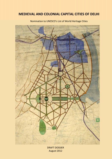
MEDIEVAL AND COLONIAL CAPITAL CITIES OF DELHINomination to UNESCO’s List of World <strong>Heritage</strong> CitiesDraft DossierAugust 2012Nodal Agency: <strong>Delhi</strong> Tourism and Transportation Development Corporation (DTTDC)Nomination prepared by INTACH, <strong>Delhi</strong> Chapter
ContentsExecutive Summary1. Identification of the Property1.a Country (and State Party if different)1.b State, Province or Region1.c Name of Property1.d Geographical coordinates to the nearest second1.e Maps and plans, showing the boundaries of the property and buffer zone1.f Area of nominated property (ha.) and proposed buffer zone (ha.)2. Description2.a Description of Property2.b History and Development3. Justification for Inscription3.a Criteria under which inscription is proposed3.b Proposed Statement of Outstanding Universal Value3.c Comparative analysis (including state of conservation of similar properties)3.d Integrity and/or Authenticity4. State of Conservation and factors affecting the Property4.a Present state of conservation4.b Factors affecting the property(i) Development Pressures (e.g., encroachment, adaptation)(ii) Environmental pressures (pollution, climate change, desertification)(iii) Natural disasters and risk preparedness (earthquakes, floods, fires, etc.)(iv) Visitor/ tourism pressures(v) Number of inhabitants within the property and the buffer zone5. Protection and Management of the Property5.a Ownership5.b Protective designation5.c Means of implementing protective measures.
5.d Existing plans related to municipality and region in which the proposed property is located(e.g., regional or local plan, conservation plan, tourism development plan)5.e Property management plan or other management system5.f Sources and levels of finance5.g Sources of expertise and training in conservation and management techniques5.h Visitor facilities and statistics5.i Policies and programmes related to the presentation and promotion of the property5.j Staffing levels (professional, technical, maintenance)6. Monitoring6.a Key indicators for measuring state of conservation6.b Administrative arrangements monitoring property6.c Results of previous reporting exercises7. Documentation7.a Photographs, slides, image inventory and authorization table and other audiovisualmaterials7.b Texts relating to protective designation, copies of property management plans ordocumented management systems and extracts of other plans relevant to the property7.c Form and date of most recent records or inventory of property .7.d Address where inventory, records and archives are held7.e Bibliography8. Contact Information of responsible authorities8.a Preparer8.b Official Local Institution/Agency8.c Other Local Institutions8.d Official Web address9. Signature on behalf of the State Party
1 a Country India1 b State Province or Region <strong>Delhi</strong>1 c Name of Property Medieval and Colonial Capital Cities of <strong>Delhi</strong>1 d Geographical Coordinatesto the nearest second.1 e Maps and plans, showing theboundaries of the nominatedproperty and buffer zone(i) Topographical Map - Drg No:- Scale : 1: 50,000(ii) Location Map - Drg No:- Scale : 1: 50,000No buffer zone has been designated for Shahjahanabad as thelayout is inward looking, not requiring a setting beyond the citywalls for it to retain its integrity.In Colonial New <strong>Delhi</strong>,o the central avenue is of great significance and the east –west view corridor from Rashtrapathi Bhavan to PuranaQila needs to be preserved. A buffer has therefore beendemarcated along this axis.o Another important view corridor is from India Gatetowards Safdarjung’s Tomb. A buffer has also beenprovided in this direction.o Towards the west of New <strong>Delhi</strong>, the diplomatic areaChanakyapuri, built after Independence, has also beenincluded as a buffer area to preserve the view corridorleading to the Vice regal building. The principal street ofChanakyapuri, Shanti Path, was oriented to provide a directview of the dome of the Viceregal building.1 f Area of the nominated property and proposed buffer zoneShahjahanabad:New <strong>Delhi</strong>:6.76 sq.km19.64 sq.kmArea of Buffer Zone:1) 7.20 sq.km2) 0.43 sq.km3) 0.20 sq.km
2 DESCRIPTION
Medieval And Colonial Capital Cities Of <strong>Delhi</strong>DESCRIPTION2 a Description of PropertyThe area proposed for nomination comprises of Shahjahanabad, and New <strong>Delhi</strong>. The former was founded as thecapital of the Mughal Empire, by the Emperor Shahjahan in the mid 17th century ( between 1639‐ 1648). New<strong>Delhi</strong> was the British colonial capital, designed by a Town Planning Committee headed by Edwin Lutyens and builtbetween 1912‐31, adjacent to the Mughal city. Both are outstanding examples of town planning of their times;and continue to function as iconic precincts of the capital of republican India and are symbolic of the city’sextraordinary historic antecedents.Shahjahanabad, although a medieval city, is today very much a living vibrant city. The size and shape of the city,its main streets and major landmarks, which were the product of Imperial planning, are still largely intact and stilldefine the character of the city. The city’s original urban morphology, along with the key buildings is still surviving,making it a supreme example of Mughal city planning. The city has a perimeter of 8 kilometers and encloses anarea of about 590 ha.Shahjahanabad’s townscape is characterised by a few key features. Within the imperial city, the focus is the Qilai‐Mubarak(or Red Fort as it is called today)—the imperial palace complex. It is the largest and grandest structurein the city, laid out in the north east corner of the city fronting the River Yamuna. Red Fort, with its elegantpalaces, symbolises a legacy of political power, which is why the Prime Minister’s address to the nation onIndependence Day is from the Red Fort.What was once the principal bazaar street along the east‐west axis, Chandni Chowk which starts at the LahoreGate of Red Fort and continues west till the chowk of Fatehpuri Masjid, is still the heart of the city. Chandnichowk is a fascinating melange of buildings from different eras of the city’s history, but with a throbbing pulse inthe present. It is a lively commercial hub, with many places of worship—mosques, Hindu and Jain temples,gurudwaras, churches. The northern section of Bahadur Shah Zafar Marg, which runs through Darya Ganj (it wasoriginally called Faiz Bazaar), is the north‐south axis of the city, starting from the <strong>Delhi</strong> Gate of the city till the<strong>Delhi</strong> Gate of the fort. This street then continues northwards as Netaji Subhash Marg till Kashmiri Gate. Thesewere the two principal axes of the city and continue to be major commercial spines.Besides the fort, the other important building in the city today is the Friday congregational mosque, the JamaMasjid, which was placed on a natural rise in the ground. Four roads radiate from Jama Masjid in four directions,towards Hauz Qazi Chowk, Daryagang, Red Fort and Chandni Chowk.A network of streets link different parts of the city like the fort, public squares, places of worship, city gates andthe residential areas. The hierarchy in the size and character of the streets: viz the bazaar streets, kuchas, galishas provided the city with a circulation network. Within this framework of streets, settlements have developed,giving the city its unique form. There is a distinct pattern that is still legible, the thanas(wards)and mohallas( areasor residential pockets). The original residential stock of intricately carved facades and doorways of havelis stillexist as do the green courtyards of traditionally laid out homes.Red Fort (Qila‐i‐Mubarak)The Red Fort was originally built along the banks of River Yamuna and the city was planned keeping the fort as thefocal point of development. Located in the centre of the eastern face of the city, the fort wall has 21 bastions, amoat and four gates‐Lahori gate, Akbarabadi gate, Salimgarh gate and Khizr gate. The Fort is an irregularoctagon in plan measuring 3100 ft X 1650 ft with a perimeter of 2.41 km, enclosing an area of 125 acres. The31‐07‐2012 INTACH, <strong>Delhi</strong> Chapter 2
Medieval And Colonial Capital Cities Of <strong>Delhi</strong>DESCRIPTIONheight of the fort wall varies from 60 ft to 75 ft and it is 45 ft to 30 ft in width. In keeping with the character of therest of the city, the high walls of the citadel are cased with dressed sandstone, though interspersed with posternsand bastions, suggesting privacy and grandeur rather than defence.The main entrance to the citadel is through the Lahore Gate, so named because it faces the city of Lahore and theother gate of the fort, <strong>Delhi</strong> Gate, faces what used to be the old city of <strong>Delhi</strong>, and further south, Agra. LahoreGate consists of three separate sections. The bridge before entering the fort was built for Emperor Akbar II (r.1806‐37). Shahjahan’s successor Aurangzeb added the 10.5m high barbican —the fortification enclosing theLahore Gate and making its approach less straightforward. Beyond the barbican, and at right angles to it, standsthe Lahore Gate itself, a three‐storeyed structure of red sandstone flanked on either side by half‐octagonalturrets topped by open pavilions. This central portion of the gateway is a style Shahjahan used commonly in hisgateways: a row of small chhatris, each topped by a white marble dome, and with a minaret at either end of therow.Some key heritage structures in the fort:o Chatta Chowk Just beyond Lahori gate is a covered market, chatta chowk , a long arcade with shops oneither side.o Naqar Khana Beyond chatta chowk lies the Naqar Khana (also called the Naubat Khana) Originally thedrum house of the Red Fort, this today houses the site office of the Archaeological Survey of India andwas the main entrance to the Diwan‐e‐Aam (the Hall of Public Audience) beyond.o Diwan‐e‐aam A striking, beautifully symmetrical palace with open sides and front, made of redsandstone. It stands on a high plinth, with a deep chhaja (overhang) projecting below the roof, which hassmall chhatris or pavilions at the north‐western and south‐western ends. Elegant cusped arches on flutedcolumns divide the Diwan‐e‐Aam into 27 square bays. The highlight of the hall is the magnificent whitemarble throne that stands in the centre of the eastern wall, exquisitely decorated, with a curvingBangalda or whaleback roof, and carvings of flowers, particularly daffodils, all along the lower front of thestructure. The wall behind the throne is especially beautiful, inlaid in very fine and extensive pietra durawork depicting trees, flowers and birds.The main palaces that used to be occupied by the royal family are situated along what was then the river front:o Mumtaz Mahal A relatively plain white building, the southernmost of the buildings fronting the river. Ithas been converted into an Archaeological museum displaying artefacts from the Mughal era. The hall isbuilt in white marble with six sections divided by five archways.o Rang Mahal Located behind the Diwan‐e‐aam, this palace building made of white marble and shellplaster, is also known as the Imtiyaz Mahal (the `palace of distinction’). The structure has anunderground chamber called tehkhana. The entrance of the structure is through five broad archways withcusped arches. The centre of the hall has a lotus shaped fountain. At the extreme end of the building aresmall chambers inlaid with fine mirror‐work, fine strips of silvery mirror forming arabesques andgeometrical patterns on the ceiling and upper walls.o Khaas Mahal Next to the Rang Mahal are four contiguous structures—the Khwabgah, Baithak, TasbihKhana and Musamman Burj—that together form the Khaas Mahal. The Tasbih Khana consists of threerooms facing the Diwan‐e‐Khaas (the Hall of Private Audience); behind the Tasbih Khana are the threerooms that form the Khwabgah, or the sleeping chambers. Adjacent to the Khwabgah is the Baithak orTosha Khana, and at the east end of the Khaas Mahal is the Musamman Burj, a semi‐octagonal tower withcarved marble jalis (screens) and a jharokha (oriel window) in the centre. The Khaas Mahal, and especiallythe Khwabgah, is extremely ornamental, with finely carved white marble throughout, particularly, the31‐07‐2012 INTACH, <strong>Delhi</strong> Chapter 3
Medieval And Colonial Capital Cities Of <strong>Delhi</strong>DESCRIPTIONexquisite jaali work and the depiction of the scales of justice on the northern side of the Khwabgah. Thenorthern side also has beautifully worked metal doors, carved all over in a pattern of flowers, withunusual doorknobs in the shape of elephants with mahawats sitting atop them.o Diwan‐e‐Khaas Beyond the Khaas Mahal, and separated from it by a courtyard paved with white marble,is what is by far the most ornate of the Red Fort’s many palaces: the Diwan‐e‐Khaas. Unlike the Diwan‐e‐Aam, this hall is made completely of white marble embellished with carving, gilt and fine pietra dura inlayon the lower part of the columns. The hall is rectangular in shape with several columns and arches onwhich rests the flat roof. The inscription over the interior of the central arches of the northern andsouthern walls: `Gar firdaus bar ru‐e‐zameen ast, hameen ast o hameen ast o hameen ast’ (‘If there be aparadise on earth, it is this, it is this’) is a couplet by the famous 13 th ‐14 th century poet, Amir Khusro. Theroof has chajjas on all sides and is topped with small chattris.o sawan and bhadon pavilions The sawan and bhadon pavilions along with the water channel known asthe Neher e Bihist is another striking feature of the complex. Both these pavilions are beautifully carvedwith small arched niches on the wall. The neher continues through the Diwan e Khas, Khas Mahal to theRang Mahal.o Burjs Another important structure of the Fort is the Shah Burj which lies along the wall to the far end ofthe complex, north of Hira Mahal. Like the Mussamman Burj and the Asad Burj, this was also one of theimportant towers overlooking the Yamuna River. The structure has an octagonal plan and formed thecentral hydraulic system feeding into the Neher e Bihisht which is no longer is in use. Adjoining the ShahBurj is a marble pavilion known as Burj‐i‐Shamli. Shah Burj consists of two distinct sections: the mainsection is a five‐arched pavilion of white marble supported on fluted columns and with low whalebackroofs. Attached to this, on the river‐facing side, is the actual burj, the tower.o Zafar Mahal Midway between the sawan and bhadon pavilion in the centre of the broad waterchannel that ran through the Hayat Baksh Bagh. Here lies the Zafar Mahal within a four sided tank built inred sandstone.o Hammam The hammam lies next to the Diwan e Khaas and Khaas Mahal. The structure has threechambers with intersecting corridors and a central basin for hot and cold baths. The interiors are made ofwhite marble having peitra dura inlays on the wall and floral carvings on the floor.o Hira Mahal Beyond the hammam is Hira Mahal, a small sparingly decorated four‐sided pavilion builtin white marble, with three cusped arches on each of its four sides, topped with a simple parapet above achhajja. The side facing the riverfront has arches partly closed off with slabs of marble and jalis along thelower half.o Moti Masjid also known as “pearl mosque” is near the hammam. It is built with white marble and hasthree small domes. It was used as a private chapel by the Mughal emperors and the ladies of theirhousehold. On the eastern side (the side facing the hamaam), is a wall pierced by an ornate door withleaves of copper decorated in a lovely floral design. On the northern side, its façade is inlaid with delicatefloral patterns in black marble and coloured semi‐precious stones, along with extensive carving.Chandni ChowkThis is an important street and a business sector of the city even today. The eastern end of Chandni Chowk startsat the Lahore Gate of the Red Fort complex and ends at the Fatehpuri Masjid located at the western end of thecity. Today this busy commercial street is very much the pulsing, throbbing centre of the city. The two kilometrelong street is flanked by shops on either side selling everything from household goods like utensils, furnishings,electronics, and consumer goods to clothes and books. The street is intercepted by iconic structures, mostlyreligious and institutional buildings, built from the period of the inception of Shahjahanabad till the early 20 th C.31‐07‐2012 INTACH, <strong>Delhi</strong> Chapter 4
Medieval And Colonial Capital Cities Of <strong>Delhi</strong>DESCRIPTIONThe very inclusive nature of the city is reflected in the fact that shrines of different religions coexist on the samestreet, imparting a strong cultural harmony. The street and its squares are also the setting for periodic religiousand other celebrations and processions, some going back to the days when the city was founded.The first stretch of this street is from the intersection of Netaji Subhash Marg and Chandni Chowk to what isknown as Phawwara Chowk. The eastern half of this section consists of development that has taken place afterthe demolitions of the mid‐19 th century. Thus Esplande Road, which runs southward off the main street, was aBritish creation. On the other hand certain older structures such as the Digambar Jain Lal Mandir, and thejewellers market called Dariba Kalan (a major street linking Chandni Chowk to Jama Masjid), have survived to thepresent day.Some key heritage structures in the area:o Digambar Jain Lal Mandir lies at the eastern end of Chandni Chowk. Though added to down thecenturies, the temple dates to the time of Shahjahan. The Jain temple is surrounded by several smallshops. Built in red sandstone with a shikhara and a finial on top, the temple includes several shrines ofwhich the main shrine is that of Lord Mahavira. The temple has intricately decorated interiors with floralmotifs, images of dancers, musicians and geometrical patterns. The charitable bird hospital lies withinthe complex of the Lal Mandir where injured and ill birds are brought in for treatmento Gauri Shankar Temple was founded in the 18 th C AD and rebuilt several times. The white marble andplaster temple is dedicated to Lord Shiva and his consort Parvati. It is surrounded by shops selling flowers,incense and clothes.o Gurudwara Sis Ganj with its beige sandstone building and golden domes and finials lies further west fromthe Digambar Jain Mandir. This gurudwara rectangular in plan, in sandstone and white marble has seenwas established in 1783 AD and marks the site where the ninth guru Teg Bahadur was beheaded by theMughal emperor Aurangzeb in 1675. The Gurudwara rectangular in plan, in sandstone and white marblehas seen considerable expansion over the last century.o Sunheri Masjid, also along this street, is located just beside the Gurudwara Sis Ganj. The mosque standson a high platform with shops on the lower floor. It is approached by a series of narrow steps leading uptothe court. The domes of the mosque are covered in gilded copper and form another landmark alongChandni Chowk.o The State Bank of India building, which originally housed the Imperial Bank, stands 70 feet tall with aPalladian façade spanning 120 feet close to the eastern end of Chandni Chowk. It is the most imposing ofthe several early 20th century bank buildings in Chandni Chowk. It is a three storeyed building with highceilings, colonial style gateposts and a verandah supported by Corinthian pillars on the first floor level.This building is constructed on the land which consisted of Begum Samru’s Palace and gardens in the early19 th century. Though no remains of the gardens can be seen, the original palace of Begum Samru, calledBhagirath Palace, still exists and is located north of the State Bank of India buildingo The Central Baptist Church, next to the State Bank of India building is one of the earliest churches of <strong>Delhi</strong>,having been built in 1858. It has a heavy circular colonnaded porch and the roof of the church is made instone supported on iron beams.o Phawwara Chowk, which is the first square on the main street, was in Mughal times known as KotwaliChowk. It is today called Bhai Mati Das Chowk, though it is popularly known after the fountain(phawwara) in its middle, built to commemorate the visit of the Governor General Lord Northbrook(1872‐76)31‐07‐2012 INTACH, <strong>Delhi</strong> Chapter 5
Medieval And Colonial Capital Cities Of <strong>Delhi</strong>DESCRIPTIONThe central segment of Chandni Chowk stretches between the two squares – Phawwara chowk and the Town Hallchowk. Leading immediately off it to the south are important commercial enclaves or katras – e.g Katra Ashrafi,Katra Shahanshah. The katras are most frequently self‐contained units communicating with the street outsidethrough gates that can be closed. Kinari Bazar, the major market street specializing in lace, tinsel, sequins andother decorative clothing accessories, stretches roughly parallel to Chandni Chowk, opening up in Dariba Kalan.The neighbourhoods of Dharampura and Maliwara lie slightly further south, where many old havelis still survive.The former contains the cul de sac known as Naughara, with its nine havelis with painted doorways, and its a Jaintemple.The central segment of Chandni Chowk ends in a square which was originally laid out by Jahanara Begum, thedaughter of Shahjahan in 1650 AD. Originally called Chandni Chowk (moonlight square), it has given its name tothe entire street, and is itself better known today after its major landmark, Town Hall. To the south of the squareruns a major road, Nai Sarak, which is a major commercial street.The Town Hall was built in 1860‐5, on the site previously occupied by the Begum ki Serai and Bagh, both ofwhich were destroyed after the Revolt of 1857. With its impressive Corinthian columns, mouldings and fineparapet, this elegant pale yellow and white building spreads out around a courtyard and is bounded byporches with arched entrances on all four sides of the building. To the north of Town Hall is a garden whichoccupies the space of Jahanara’s garden. What was originally Company Bagh but has today been renamedAzad Park is a fenced garden with Royal palm trees. The main landmark of the circular park is a large blackstatue of Mahatma Gandhi, which stands in the centre of the park, facing the Town Hall.The western part of Chandni Chowk stretches from the Town Hall chowk to the Fatehpuri Masjid. Off this sectionof Chandni Chowk are some important commercial streets such as Katra Neel (famous for its many small templesor Shivalayas) to the north and Katra Nawab to the south. Also to the south lies the historic residentialneighbourhood of Ballimaran, famous for being the home of hakims or practitioners of traditional Unanimedicine, and the home (now a memorial) of the famous 19 th century poet Ghalib. At the western extreme of thisstreet is Fatehpuri Masjid, surrounded by shops. North of Fatehpuri Masjid is Bazar Khari Baoli, Asia’s largestspecialist spice Market. South of Khari baoli too is an important commercial area with trading enclaves such asKatra Badiyan.Some key heritage structures in the area:o The road also has the Haveli of Lala Chunnamal. The two floor structure has an intricately designed castirongrilled balcony on the first floor and a verandah on the ground floor. Several windows also adorn thefaçade of the building. The interiors of the haveli include a huge courtyard. The rooms have intricate artwork and detailing.ooBuilt in 1650, by the wife of Shahjahan, Fatehpuri begam, Fatehpuri Masjid has a simple and symmetricrectangular plan with fluted dome and kalash finial on top. The two minarets flank the mosque on eitherside. The main prayer hall has seven arches with a pillared hall of multi‐lobed arches and columns. It isapproached through a courtyard once entered from the gate. The mosque resembles the Jama Masjid toa great extent.Along the southern side of this segment of the road are several architecturally significant bank buildingsdating from the early decades of the 20 th century.31‐07‐2012 INTACH, <strong>Delhi</strong> Chapter 6
Medieval And Colonial Capital Cities Of <strong>Delhi</strong>DESCRIPTIONDaryaganjThe street leading southwards from the <strong>Delhi</strong> gate of the Red Fort to the <strong>Delhi</strong> gate of the city is a thoroughfareand bazaar street equal in importance to Chandni Chowk. This was originally known as Faiz Bazaar, and along itseastern side lies the locality known as Daryaganj (literally, ‘mart by the river’). In contrast to the rest ofShahjahanabad, this area has a grid pattern street layout that took shape in the early decades of the twentiethcentury. Many commercial and residential buildings of that era, and some from earlier, still survive, giving theprecint a distinctive character.Some key heritage structures in the area:o The Zinat‐ul‐masajid is a mosque that dates from 1707, and was built by Zinaunnissa begam, thedaughter of Emperor Aurangzeb. It is one of the major mosques of the city, and similar in style to theJama Masjid, with its red sandstone and white marble ornamentation, twin minarets and three stripeddomes.o The Shroff Eye Hospital, dating from 1926 is a well preserved colonial building.o <strong>Delhi</strong> Gate marks the southern limit of the street, and is one of the four surviving gates of the city.o Segments of the <strong>City</strong> Wall are in a well‐preserved state along the southern edge of Daryaganj, and displayparticular features such as a British‐era Martello Tower.Jama MasjidLocated south‐west of the Red fort, the main congregational mosque of the city stands 10m above the ground ona natural outcrop known as Bhojla Pahari and is by far the most impressive structure in Shahjahanabad. It hasthree gates facing the east, north and south accessed by a series of steps. The façade of the mosque is amagnificent eleven‐arched front, with the central arch the largest. The arches are of red sandstone supported onfour‐sided columns of white marble; each arch is inlaid with delicate tendrils of white marble, and has highlightsand medallions in black marble inlaid on either side of the arch. Above the arches tower three domes of whitemarble, with fine strips of black marble inlaid in between. At either end of the façade rise two tapering minaretsin red sandstone and white marble. The sehan—the main courtyard of the mosque is a vast area, paved with redsandstone with a large marble tank in the centre meant for ablutions. On three sides, enclosing the sehan, arearched cloisters pierced by ornate stone gates. The north‐western corner of the sehan houses a small lockedroom with relics of the Prophet. The floor is white marble, inlaid with a simple pattern that resembles a mosalla (aprayer carpet). Inside, the decoration is restrained, consisting almost entirely of inlay work—white marblearabesques are inlaid all across the ceiling and arches of red sandstone. The mihrab (the closed arch that indicatesthe direction of prayer) inside the main archway of the mosque is very intricately carved, all in white marble; so isthe fine minbar—the pulpit—in front of the façade.Besides being an important place of worship, Jama Masjid is a major landmark in physical, cultural, culinary andcommercial terms. It is at the junction of important streets – Matya Mahal to the south, Dariba Kalan to the north,and Chawri Bazar to the west. The northern and western sides of the square around the mosque are lined withshops, hotels, and visitor amenities such as parking.The steps on the eastern side, which provide a visual connection with the southern gate of the Red Fort, havesince Shahjahan’s time been a place for the sale of wares by hawkers selling goods ranging from articles of areligious nature to exotic country medicines. They take advantage of the stream of visitors to the mosque andthe shrines of Sarmad Shahid and Hare Bhare Shah, located halfway up the steps.31‐07‐2012 INTACH, <strong>Delhi</strong> Chapter 7
Medieval And Colonial Capital Cities Of <strong>Delhi</strong>DESCRIPTIONAlong the southern edge of the square is a market known as Urdu Bazar. This has a number of bookshopsspecializing in Urdu language books. It also has a number of stalls and restaurants serving traditional street foodand more, which the Jama Masjid area has long been known for. The dense neighbourhood known as MatyaMahal lies to the south of this.North ShahjahanabadThe northern areas of the Shahjananbad, north of Chandni Chowk and the Red Fort, have transformed since thefounding of the city. Always much less populous than the area south of Chandni Chowk, a large part of the groundwas covered by gardens, and by the vast mansions belonging to the Mughal royalty and nobility. The latterparticularly occupied the eastern part of this area, the riverfront. When the British first moved into <strong>Delhi</strong> theyestablished this area as the centre of administrative power, building several new colonial structures, bothreligious and institutional or simply adding to or co‐opting older buildings.The area was also the scene of many a battles during the uprising of 1857, also known as the First War of IndianIndependence. Momentous changes came to the area after the revolt, when the British obliterated large parts ofJahanara’s gardens and established a railway line, aligned along the east‐west axis. ( Section 2b History anddevelopment describes these changes in greater detail) The eastern part, the Kashmiri Gate Area, still retains itswide roads, open spaces and grand buildings, now mostly put to institutional use. There are also handsomeresidential buildings along Nicholson Road.Some key heritage structures in the area:o Kashmiri Gate This was one of the fourteen original gates built by Shahjahan around his newly foundedcity facing towards Kashmir and hence named Kashmiri Gate. This two‐bay gate is built out of brickmasonry and covered with plaster.o Dara Shikoh's Library Dara Shikoh, Shahjahan’s favourite and heir apparent to the Mughal throneexhibited a keen interest in architecture just like his father. He is known to have constructed his mansionin a span of four years (1639 – 43) at the cost of 4,00,000 rupees at a site north of Red Fort near KashmiriGate. Although the current building is mostly the work of the British, many of its original Mughalelements can still be seen. It has a classical façade with 7.5 m ionic columns supporting a partly collapsedarchitrave. The original 3m high plinth and steps can be seen from the rear. Inside too, some elements ofthe original Mughal structure are still visible like a double row of blind arches leading to a central portal.The interior is simple concrete flooring and a concrete roof supported on wooden beams placed on irongirders. It is now part of the premises of the Guru Gobind Singh Indraprastha University and is used as amuseum under the department of Archaeology, Government of <strong>Delhi</strong>.o Fakhr‐ul‐masajid (Pride of the mosques) or Lal Masjid, was built in 1728‐29 by Kaniz‐i‐Fatima tocommemorate her deceased husband, Shujaat Khan, a high ranking noble under Aurangzeb. The redsandstone mosque, faced with white marble, is clearly modelled on major mosques in <strong>Delhi</strong> built duringthe reign of Shahjahan and Aurangzeb. In fact, it is one of the few stone mosques built in <strong>Delhi</strong> during theeighteenth and the nineteenth centuries. The mosque is raised on a 2.5m platform with shops at the base.Once you climb up to the raised courtyard, there are arcades on both the north and the south.o Northern Railway Building The building currently being used as an office by the Northern Railways,was formerly the mansion of Ali Mardan Khan, a senior general of Shahjahan who was associated withmany of his constructions, especially canals and gardens. As was common in the early days of the empire,the British did not feel the need to demolish the original building completely and therefore, the building31‐07‐2012 INTACH, <strong>Delhi</strong> Chapter 8
Medieval And Colonial Capital Cities Of <strong>Delhi</strong>DESCRIPTIONoooooostill has the remains of the Mughal taikhana, or underground chamber, underneath it. The main room ofthe building is domed and on all four sides of it there are semi‐octagonal turrets. On the north and southsides there are circular projecting rooms. On the rear is another circular room with a flat roof which hasprojecting rooms on either side, giving the building a bow shape.Kashmiri Gate Bazaar The building was commissioned by Lala Sultan Singh, a leading banker of his time,in the 1890s. This was a time of relative political stability that led to the rise of the merchant class in <strong>Delhi</strong>and many commercial and institutional buildings were constructed around this time. The building, about50m long, is made of brick and has shops on the ground floor and iron pillars supporting projecting upperfloor balconies that are constructed out of a combination of wood and wrought iron. The roof is gabledover alternate bays and has tin roof on top. In the topmost floors of the last few bays, are a fewresidences constructed in the same style.Bengali Club This building located right beside the Kashmiri Gate was constructed as a cultural centre forthe Bengali community. This is a double‐storeyed structure with shops on the ground floor. The first floorhas a balcony supported on iron columns and has gabled roofing and an elaborate wrought‐ ironbalustrade.St. James Church St. James' Church, also known as Skinner's Church, built in 1836 by Colonel JamesSkinner, is one of the oldest churches in <strong>Delhi</strong>. The building itself was designed by Major Robert Smith, aBritish army engineer. The basic design of the Renaissance style church is of a Greek cruciform plan, withthree porticoed porches, elaborate stained glass windows and a central octagonal dome similar to a domeof Florence Cathedral in Florence. Many late Mughal elements can also be noticed in the building. Thecopper ball and cross on the top, which are said to be replica of a church in Venice, were damagedduring the1857 revolt, and were later replaced. Colonel Skinner is buried here and north of the church liesthe Skinner family plot where many of his descendants are buried. The church is also known for two otherimportant graves; one belonging to William Fraser, and the other of Sir Thomas Metcalfe, who lived in<strong>Delhi</strong> for forty years from 1813 to 1853, during which time he served as Agent to Governor General ofIndia.Magazine Gateway This gateway is all that remains of the British gunpowder and armaments magazinethat was destroyed during the siege of 1857. The structure is now located in a small park in the middle ofa traffic island on the main Lothian Road near Kashmiri Gate. A low‐ vaulted building is attached to agateway that has openings facing both sides of the road. On the outer face there are semi‐octagonalprojections on both sides which lead to a vaulted gateway with two small rooms on either side. There isalso a small canon placed over the gateway. Adjacent to the ruins of the gateway is a smallcommemorative column in granite that was erected in 1901‐2 to honour the postal personnel who died in1857. The height of the column is about 5m and it sits on a square base and tapers towards the top.St. Mary’s Church The church was built in 1865 on the land cleared after the revolt of 1857. The buildingis built in the Italian Romanesque style, not very different from the St. Stephen’s Church near theFatehpuri Mosque and is finished in stucco plaster. The church is laid out on a cruciform plan and has asimple pitched roof made out of country tiles. The arms of the building are semi‐circular in plan. At theentrance on the west there are semi‐circular arched gateways and a bell tower. At the first‐floor levelthere is a blind arcade. The building features some interesting stained glass work on the inside.Post Office This white painted building was built in 1885 in classical European style. The building has fivebays with semi‐circular arches and tapering pilasters in between these doorways. The upper floor wasdesigned as a deep verandah but this has now been screened.The western sector of this part of Shahjahanabad, is the Lahori Gate area. Lahori Gate was one of the originalgates of the walled city of <strong>Delhi</strong>, built in 1651 along with the rest of the city. It was the city’s exit to the Grand31‐07‐2012 INTACH, <strong>Delhi</strong> Chapter 9
Medieval And Colonial Capital Cities Of <strong>Delhi</strong>DESCRIPTIONTrunk road, connecting <strong>Delhi</strong> to the north of the country, much before Shahjahanabad was founded. In the mid‐19 th century the railway added a new dimension to this connectivity, and led to the development of relatedinsfrastructure, such as hotels and dharamshalas, in this part of the city. Though the gate was destroyed after theRevolt of 1857 along with the sections of the wall leading from it, there are a number of interesting buildings inthe area, some that even pre‐date the founding of Shahjahanabad.o Old <strong>Delhi</strong> Railway Station Just off the busy S. P. Mukherjee Marg is one of the oldest railway stations builtby the British in India, constructed in 1867. A fairly substantial edifice, it has many gothic featuresincluding tower‐ like bastions that form the corners of the projecting porches, giving the building itsimposing façade. There are deep verandahs on both floors. The building is painted a brick red colour, withwhite paint used to highlight certain architectural features.o Sarhindi Masjid At the end of this street, just outside where the Lahori Gate must have been, stands theSarhindi Masjid, a small mosque built by Sarhindi Begum, one of Shahjahan’s wives. This is a three baymosque is topped by three bulbous domes that dominate the skyline as you approach it from outside.Although most of the mosque structure is original, the courtyard has been built over and is surrounded bymany new buildings.o St Stephen’s Church is an Anglican church built in 1867.South ShahjahanabadThis was prominent even centuries before the founding of Shahjahanabad; as is evident in the several olderstructures in this area. Even the street pattern follows a logic that is distinct from the two main north‐south andeast‐west streets of the city. Here, the major street connecting Turkman Gate and Lahori Gate, and the severalparallel streets, follow a diagonal orientation that originally formed a part of the Grand Trunk Road, the majortrade and communication artery connecting Punjab in the north to the Gangetic Plain in the South.The oldest structures of the city – the dargah of Shah Turkman, Kalan Masjid, the grave of Razia Sultan, HauzwaliMasjid and others lie on either side of the main diagonal street which is called Sitaram Bazar in its southernsection, and Lal Kuan Bazar in its northern part. At Hauz Qazi chowk it intersects with another important street,one that connects Jama Masjid to Ajmeri Gate. At its Jama Masjid end this street is known as Chawri bazar and ishome to the wholesale paper trade. After Hauz Qazi Chowk it is known simply as Ajmeri Gate bazar. These twostreets are important commercial spines, as is the Hauz Qazi chowk, which also has a metro station. Anotherstreet system that follows the diagonal pattern from north‐west to south‐east, consists of the streets known asNai Sarak, Ballimaran, and Churiwalan.There are several narrower lanes leading off from the broad streets, and usually designated ‘gali’ or ‘kucha’.These too often have shops as well as entrances to havelis. Bazar Sitaram and Kucha Pati Ram have particularlywell‐preserved havelis. There is a further network of very narrow lanes leading from these, which are usuallyresidential, though some have small workshops. Compared to the area north of Chandni Chowk, southShahjahanabad was spared the wholesale destruction of the city’s fabric after the revolt of 1857. It thereforeretains much of its original layout, with the exception of Nai Sarak, which was laid in the mid‐19 th century.Another important commercial street lies along the southern perimeter of the city. A continuous row of <strong>Delhi</strong>’searly Art Deco buildings on Aruna Asaf Ali Marg stand where the city wall was once located. Most of them arecommercial in nature.Some key heritage structures in the area:31‐07‐2012 INTACH, <strong>Delhi</strong> Chapter 10
Medieval And Colonial Capital Cities Of <strong>Delhi</strong>DESCRIPTIONo Hauzwali Masjid, located in Gali Batashan, is of rare architectural quality and is amongst the few survivingSuri‐period buildings in Shahjahanabad. The mosque built in AD 1540‐50, measures 21m north to southand about 8m east to west. The prayer chamber, which is one‐bay deep is divided into three large domedchambers. The arches are low and massive, with the springing point very close to the floor level.o Masjid Mubarak Begum is located a short walk from the Ajmeri Gate Metro Station (at Hauz Qazi)towards Kharibaoli. The raised mosque with shops below, is accessed by a narrow flight of stairs from thestreet. It was commissioned in 1822 by Mubarak Begum, who was the wife of Sir David Ochterlony, firstBritish Resident of <strong>Delhi</strong>, and was attached to her now‐demolished house. The tiny red sandstone mosqueis well‐proportioned and the scale of the mosque too, is quite intimate.o Two havelis, that of Kucha Pati Ram and Ram Kutiya lie opposite each other. These havelis are largelybuilt of Lakhori bricks with grand entrances of cusped arches and jharokhas and fluted sandstone columns.The haveli of Kucha pati Ram has two floors with intricately carved sandstone façade. Projected jharokhasare placed on sandstone columns. Carved columns, railings and ornamental doorways add to thecharacter of the building. The Haveli Ram Kutiya also has two floors with decorative archways and flutedsandstone columns and floral carvings. The ground floor has two bay windows with extensive carving onthe facade. Both the havelis are built around a central courtyard.o Kalan Masjid, built in 1387, was in existence for nearly 300 years before the city of Shahjahanabad wasestablished. This was possibly the principal mosque of Firoz Shah’s city of Firozabad and is one of theseven great mosques built by Firoz Shah Tuglaq’s Prime Minister, Khan Jahan Junan Shah during the midto late fourteenth century. The lower storey of the five‐bay mosque is now used for residential andcommercial purposes. The corner towers and outer walls of the mosque are all sloped inwards and thereare no minarets. The inside of the mosque consists of a courtyard surrounded on three sides by a singlearcade, borne by plain squared columns. The western prayer hall has three rows of columns. The ablutiontank is in the centre of the courtyard.o Holy Trinity Church Located a stone’s throw away from the Turkman Gate, the Byzantine style church wasbuilt in 1905, using local quartzite stone. It has a cross plan with a domed chapel and half‐domedprojecting bays. Buttresses have been used at the north end and all domes are topped with lanterns. Thefoundation stone was laid on 1 February 1904, in memory of Alexander Charles Maitland by his widowMary R. Maitland.o Ghaziuddin Madrasa, Mosque and Tomb Ghaziuddin, a powerful minister and nobleman in theimperial courts of Emperor Aurangzeb built a complex that included a madrasa, a large mosque, and hisgrave enclosure, sometime during AD 1692, as an institution of higher learning. The complex is locatedright outside the Ajmeri Gate and accessed through the gateway of what is now the Anglo Arabic School.The mosque is a finely proportioned building made out of red sandstone with white marble relief work.It’s a seven bay mosque where the central archway dominates the façade. The structure is topped withthree white bulbous domes. The tomb of Ghaziuddin, built during his lifetime, is made in ornate whitemarble surrounded by elaborately carved screens depicting typical floral patterns of Mughal architecture.There are other smaller graves surrounding the main tomb.o Ajmeri Gate is one of the original gates that was built around Shahjahanabad when it was founded in themid seventeenth century. Most of the gates and part of the city wall were demolished after the revolt of1857. As its name suggests, the gate faces the direction of Ajmer towards the south ‐west of the walledcity. It is a single arched gateway with semi octagonal turrets on the outside. It’s a relatively plainstructure built out of quartzite and red sandstone. Some typical decorative features include carvedmarble rosettes, carved sandstone panels, and on the inside, some fine painted plaster work.o Turkman Gate, one of the four surviving gates of Shahjahanabad, built in AD 1658 is located on Asaf AliRoad, very close to the Ramlila ground. It lies to the south‐western end of the walled city and is named31‐07‐2012 INTACH, <strong>Delhi</strong> Chapter 11
Medieval And Colonial Capital Cities Of <strong>Delhi</strong>DESCRIPTIONHavelis: The courtyard house is the basic residential unit in Shahjahanabad, and hundreds of historic havelis areto be found throughout the city. The basic structure comprises rooms constructed around one or morecourtyards. Most of the havelis were originally two storeys but have frequently more floors have been added.The haveli communicates with the street through a doorway set in an ornamental façade – most often of carvedsandstone. A balcony at the first floor level is also frequently provided. Terrace roofs provide additional usableopen space as well as communication with neighbouring havelis.Shops and workshops are located mostly located along the kuchas and galis but in some crowded areas like thataround Jama Masjid and Chawri bazaars, shops are located even within the mohallas. Typically shops occupy theground floor, while the first floor is reserved for residences. Shops and residences are not connected internally.The entrance to the residence at the ground level leads directly to a staircase while the shop has a completelyindependent access.Small factories and workshops are not located along the bazaar streets but within the mohallas and residentialblocks.eg: Gali Chitra Darwaza, behind Sita Ram Bazaar. There is a tendency for concentration of shops orworkshops of the same type.eg: opposite Jama Masjid‐shops selling second hand automobile parts; easternchawri Bazaar‐ paper and paper products( retail and wholesale shops along the bazaar and factories makingnotebooks, cards and business paper are behind the bazaar); western chawri Bazaar‐hardware, building material,etc.The streets connecting the city gates with major urban facilities are the major streets that are also the bazaarstreets. Viz: Chawri Bazaar, Sita Ram Bazaar, Matia Mahal Bazaar and Bazaar Chitli Qabar. While the primarystreets like Chandni Chowk and Darya Ganj have the important markets, the secondary streets which radiatetowards the Jama Masjid and the mohallas, are the smaller bazaar streets trading in items like meat, fish, luxurygoods etc.Each market specializes in a different trade.31‐07‐2012 INTACH, <strong>Delhi</strong> Chapter 13
Medieval And Colonial Capital Cities Of <strong>Delhi</strong>DESCRIPTIONNEW DELHIThe British Empire was at its zenith at the beginning of the 20 th century, when they built their colonial capital cityto the south‐west of the Mughal city of Shahjahanabad.The city of New <strong>Delhi</strong> extends to the walls of Shahjahanabad in the north, is bounded on the east by the RiverYamuna, the remains of Ferozshah Kotla and Purana Qila, and to the west by the ridge. The city deliberately formsseveral links with the older cities, most importantly, the central vista that is conceived as a landscaped stretchforming continuity between the ridge and the river. One of the avenues, the Parliament Street is linked to thesouthern side/edge of Shahjahanabad and visually to Jama Masjid, while the central vista, beginning at theRashtrapati Bhavan ends at the north gate of Purana Qila (the inner citadel of the city of Dinpanah that flourishedas the 6 th city of <strong>Delhi</strong>).Colonial New <strong>Delhi</strong>, designed on a radial plan by Edwin Lutyens and Herbert Baker is spread over 2,800 hectaresand makes up for about 1.8 per cent of the area of <strong>Delhi</strong> today. The site had a width of about 4.5 miles,narrowing as it approached Old <strong>Delhi</strong> to 2.5 miles. The city reflects the fusion of the two dominant themes ofearly twentieth century city planning – the <strong>City</strong> Beautiful (vistas) and the Garden <strong>City</strong> (verdure). The genius ofNew <strong>Delhi</strong> till today is in its integration of vista and verdure.The most notable feature of the city is Rajpath (the grand central axis, called the “Central Vista”) anchored by theRashtrapati Bhavan at its western end and the Sports Stadium at the eastern end. One of the major nodesconceived by Lutyens for the Central Vista was the hexagonal ring road with the ceremonial arch, India Gate, andthe canopy, within the hexagonal landscaped area and the Princes’ Park (palaces of princely states) surroundingit.The focus of the British Colonial capital is the formal centerpiece, Rajpath (originally called Kingsway) runningeast‐west, radiating from the Rashtrapati Bhawan on Raisina Hill, flanked by the secretariat buildings on eitherside passing the hexagon that has the war memorial, known as the India Gate, and the Princes’ Park and ending atthe National Stadium towards the east. The focus point, the Rashtrapati Bhavan is sited on Raisina Hill,commanding views of the new city on every side and is flanked by the large blocks of Secretariat buildings facingRajpath. The great open space at the base of Secretariat is known as Vijay Chowk and marks the beginning of theadministrative centre of the city. The chowk approximately as wide as 260 ft, forms a cross‐axis at the foot ofRaisina and is also where the 'Beating Retreat' ceremony takes place on 29th January ever year. From Vijaychowk, a road perpendicular to Rajpath, leads to the Parliament House towards the north. Approximately 30mwide water channels surrounded by parkways and trees along Rajpath, on either side, add to the central vista’sgrandeur and also facilitate activities like boating, especially in the months of Feb‐April and Oct‐Nov when the cityis neither too hot nor cold.The width of this ceremonial avenue is such that twelve rows of trees are planted across the street, providingshade, as mentioned above. An extension of the symmetry that characterised the principal buildings of New <strong>Delhi</strong>is seen in the tree planting. The disciplined setting and framing of the principal buildings like the RashtrapatiBhavan, the Secretariats and the Law Courts is a result of the matching tree species flanking the streets.At the eastern end, the central vista terminates in a large hexagon, that has the iconic India Gate and 100m fromthere, a chhatri (canopy) that stands in the middle of a large pool of water, placed right in the centre of thehexagon. The hexagon has landscaped greens and a children’s park. Radiating from the hexagon are avenues, aswide as, 70 ft.31‐07‐2012 INTACH, <strong>Delhi</strong> Chapter 14
Medieval And Colonial Capital Cities Of <strong>Delhi</strong>DESCRIPTIONThe outer periphery of the hexagon is known as the Princes’ Park, as it is surrounded by the palaces of the mostpowerful Indian Princes, who were allotted lands within this prime location. In all, three dozen lots (of about eightacres each) were leased out to the princes. The most powerful states – Hyderabad, Baroda, Bikaner, Patiala, andJaipur – were given lots forming a ring around the canopy on King’s Way. Lesser princes (including those ofJaisalmer, Travancore, Dholpur, and Faridkot) were given lots further out along the roads radiating from thecentral hexagon. Hyderabad House is the first palace to appear as one moves clockwise around the hexagonalround‐about from India Gate. Right next to it is another palace in buff sandstone, the Baroda House. Movingahead is Patiala House which lies between Tilak Marg and Purana Qila Road. Although part of the Princes’ Parkarea, the National Stadium, designed by R. T. Russell of the Public Works Department (PWD) falls next,approximately 400 ft away from the canopy which appears right opposite. The Dhyan Chand National Stadium,built in 1933 is used as a multipurpose stadium serving international and national events all along the year. Thissite along the eastern end also marks the culmination of the central vista, which radiates from the main entranceof the Rashtrapati Bhavan. Traversing along the outer hexagon, situated between Sher Shah Road and Dr ZakirHussain Marg is the Jaipur House, after which appears Bikaner house, located between Shahjahan Road andPandara Road.The main cross axis, Janpath was the Queensway of British New <strong>Delhi</strong>, and it runs from north to south connectingConnaught Place, the commercial hub in the north to a circle south of Rajpath, at the southern end of colonial,New <strong>Delhi</strong> (near Lodhi Garden). It is marked by the presence of two buildings viz. the National Archives and theNational Museum. On the roads leading out of Connaught Place are other equally important buildings, bothmodern as well as colonial. There are, for example, pre‐Independence buildings like the Eastern and WesternCourts; the Imperial Hotel, New <strong>Delhi</strong>’s first luxury hotel opened in 1931,and though nondescript on the outside,is home to one of the best collections of British art on India. The Eastern and Western Courts stand on either sideof the broad Janpath Road, south of Connaught Place.The road was often compared with the Champ Elyse's ofParis because of the beautiful buildings along it.A diagonal axes links Rajpath with the Parliament House. The Church of the Redemption is located on ChurchRoad, sandwiched between Parliament House on its west and the Jaipur Column on its north. North of this areaare largely institutional buildings with some government housing. The 'Cathedral of the Sacred Heart' also knownas the 'Sacred Heart Cathedral Church' is a Roman Catholic Church situated at 1 Ashok Place between SaintColumbus School and Convent of Jesus and Mary. Directly opposite the Sacred Heart Cathedral, standing in themiddle of a traffic circle, is the Gole Dak‐khana (literally, ‘round post office) General Post Office (GPO). Further afield, are other colonial buildings like the Gole Market.The area to the north of Rajpath, is filled with several institutional buildings and residential bungalows, built tohouse public servants of a lower rank. Some of these were designed by Herbert Baker and other by the PublicWorks Department. This area is wholly and completely of twentieth century vintage with a few exceptions.Scattered across it – and in an often unusual but pleasing juxtaposition of old and new – are older monuments:Agrasen ki Baoli which is a step‐well dating back to the fifteenth century and the impressive observatory known asJantar Mantar that was built in the eighteenth century. Though not as old as either the baoli or the observatory,are the Hanuman Mandir and Gurudwara Bangla Sahib, both medieval buildings that were already in existencewhen Connaught Place was built. Lutyens effortlessly integrated these structures into his plan for the new city.Lutyens' most important contribution was however not the buildings he designed but the layout of the city thatremains unchanged. His street plan for New <strong>Delhi</strong> has wide, tree‐lined avenues, with bungalows in large garden31‐07‐2012 INTACH, <strong>Delhi</strong> Chapter 15
Medieval And Colonial Capital Cities Of <strong>Delhi</strong>DESCRIPTIONplots, and wide areas of park between the public buildings, making <strong>Delhi</strong> one of the greenest cities in Asia. Arange of avenues from a modest 70 ft to 260 ft, fan out from Rajpath towards the south of the city giving accessto the bungalows. Rotaries and hexagons much like mini‐gardens with frangipani, Asoka trees, and bushes ofbougainvillea in myriad hues. Flowerbeds, seasonal flowering trees and bushes, shrubs and creepers bordered thelawns. Dense hedges that enclose the bungalow properties act not merely to keep away the dust and serve aswind‐breakers but also mellow the noise of the traffic from the street. The road system with its elaborateroadside planting is an important attribute of the planned city of New <strong>Delhi</strong> and is therefore a valuable part of<strong>Delhi</strong>’s heritage.The greenscape of the city is an expression of the much talked about ‘Garden <strong>City</strong> Concept’. An overwhelmingmajority of the trees species are evergreen or semi‐evergreen. The spacing of the trees along the avenuesprovides much needed shade to counter the extreme heat of north Indian summers. The decidedly Indianambience is because three‐quarters of the species are Indian natives, viz, jamun, tamarind, neem, fig, laburnum,gulmohar, jacaranda,etc.The largest trees, most significant in shape and densest of foliage are along the approaches to the city’s mostimportant buildings (the Jamun is along the central vista) while smaller tree species with lighter foliage and a lessdefined canopy are along roads considered less important.The visual impression of spaciousness that contributes to <strong>Delhi</strong>’s uniqueness is because a single species is plantedalong the entire length of a particular road . In one instance only, along Willingdon Crescent, there is a changewhere an alternate planting of two tree species is visible.A particular tree species is not confined to a single street but extends to a series of adjoining streets. A journeythrough them has the character of journeying through an integrated planting design. The Jamun trees along theRajpath is accompanied by a converging plantings of jamun trees along Raisina Road and Motilal Nehru Marg. Theview from India Gate up the Rajpath is accompanied by radiating views up Akbar Road and Ashoka Road withmatching plantations of Arjun trees and up Prithviraj Road and Curzon Road with matching plantations of NeemTrees. The planting of Arjun trees along the roads leading into Connaught Circus, continues in the planting ofArjun trees along the Janpath.The mature trees are internal green reserve within a vibrant, swiftly growing metropolis. Perhaps no other city inthe world boasts of such elaborate roadside planting!An integral feature of the city is the housing south of Rajpath for senior bureaucrats set within large treedominatedcompounds that create enduring symbols of power within the planned city. The bungalows arespread across the angled roads that are shaded by avenue plantation. In New <strong>Delhi</strong>, there was a strict hierarchyof accommodation according to rank or precedence of the British official. The bungalows of the senior officialshad upto seven bedrooms, and those for lesser ranks ranged from three to six bedrooms. What is visible today isa range of sizes and types.Each bungalow is sprawled in its plot of land, in some cases covering several acres. Each bungalow comprises of aseries of rooms and spaces with often little or no connection to the grounds outside. In contrary to the havelihouse form where the gardens and open spaces lay inside the shell of the building, for bungalows, the exactopposite is true.31‐07‐2012 INTACH, <strong>Delhi</strong> Chapter 16
Medieval And Colonial Capital Cities Of <strong>Delhi</strong>DESCRIPTIONThe bungalows are whitewashed and characterized by high ceilings, clerestory windows positioned high in thewalls, and shady verandas. They display some classical European (especially Palladian) touches, and someindigenous elements – like chhajjas (dripstones) and occasionally, internal courtyards‐ were included. Keeping inmind <strong>Delhi</strong>’s chilly winters, fireplaces are present in some of the main rooms, along with accompanying chimneysjutting out above the flat roof. A variation is where the verandahs and loggias are reduced or done away with.Servants’ quarters are separate buildings, away from the main dwelling.A description of the key buildings:Rashtrapati Bhavan or the 'President's House ( designed as the British Viceroy’s residence) is situated on RaisinaHill. Built of red and buff sandstone, it is generally acknowledged as the largest residential complex, ever built forthe head of any country. It has 340 well decorated rooms. The Durbar Hall or throne room which was designed tohost all official functions, is a grand hall directly underneath the main dome. Another important hall in theRashtrapati Bhavan is the Ashoka Hall, formerly the ballroom, with its walls and ceiling painted with scenes fromPersian poetry. Besides these two halls, is the State Dining Room (for formal banquets), a large number of guestsuites and the private apartments. Rashtrapthi Bhavan has the most exquisite chandeliers imported from Europe,furniture, Kashmiri carpets in Mughal designs.Jaipur Column, standing 145 ft high in front of Rashtrapati Bhavan, is made of buff sandstone, topped with abronze lotus and a glass star. Inspired largely by Trajan’s Column in Rome, it was designed by Lutyens anderected under the aegis of the Maharaja of Jaipur, to whom much of the land on which New <strong>Delhi</strong> was builtoriginally belonged. The plan of New <strong>Delhi</strong>, with its major axes marked out, is carved onto the plinth of the JaipurColumn.The Mughal Gardens, the setting for the majestic building, cover an area of 13 acres and are divided into threesections, one circular in shape, another rectangular and the third a long rectangle. As in the traditional Mughalgarden, there are water channels and pools, chhatris, parterres, and carved fountains using the same sandstoneas the palace, in the shape of lotus leafs' at every intersection of the four waterway canals and multi levelterraces with chhatris.North and South Blocks Designed by Herbert Baker, these two identical buildings facing each other acrossKing’s Way are situated on Raisina Hill, a little below Rashtrapati Bhawan. The North Block and South Block of theSecretariat house important ministries of the Government of India. The ministries of Finance and Home Affairsoccupy the North Block. Today, the South Block is home to the Prime Minister’s Office, and the ministries ofDefence and External Affairs.The blocks sit on a plinth about 30 ft above the ground and are connected by an underground passage (still inuse). This elevation of the buildings on raised platforms meant that the view of the Rashtrapati Bhawan wasblocked by the slope leading to these buildings. They are made of buff and red sandstone, with red sandstoneforming a broad ‘base’ for the outer walls. Between them, the four‐storied Secretariat buildings have about 4,000rooms. The premises include formal gardens with water fountains, pillars and porticos with vaulted ceilings.Classical in style, each block is crowned by an imposing central baroque dome.Outside each block are two sandstone columns – a total of four columns in the Secretariat. These, known as theColumns of Dominion, were ceremonial gifts to India from the colonies of Britain which had dominion status:Australia, Canada, New Zealand, and South Africa. Each column is topped by a bronze ship in sail (to symbolize31‐07‐2012 INTACH, <strong>Delhi</strong> Chapter 17
Medieval And Colonial Capital Cities Of <strong>Delhi</strong>DESCRIPTIONBritain’s maritime traditions). The ship rests on a replica of the Ashokan capital: a lotus blossoming above awheel, flanked by a horse on one side and a bull on the other. There are stone tablets fixed at the sandstonesbases of the buildings on which the names of the architects and builders are inscribed.The Secretariat Buildings are not only impressive and majestic from the outside but their interiors are equallyinteresting. Both blocks have original paintings decorating some walls and ceilings. The North Block containssome very well preserved paintings depicting various themes like justice, war and peace. The South Block too haspaintings of different cities of the country and the emblems of old kingdoms.Designed originally as cold‐season offices, the Secretariats were constructed without the continuous verandahswhich are normally used in India as sun shields. Instead, windows were kept small in proportion to wall area, andtheir glass was deep‐set in thick walls away from high rays of the sun. Teak jalousie shutters screened the low sunof morning and evening. Lighting of rooms could be better adjusted as a result, and offices were not as gloomy inwinter with verandahs.India Gate India Gate is arguably one of the most striking arched memorials of its kind, anywhere in theworld. Its relatively plain façade and clean lines stand in sharp contrast to the more ornate appearance of theSecretariat buildings or Rashtrapati Bhavan. Like these buildings, though, India Gate is also composed mainly ofbuff sandstone. Its wide columns rise from a low base of red sandstone. Between the narrower sides of thecolumns are two large sandstone pine cones, symbolizing eternal life.Topping the arch is a shallow dome with a bowl to be filled with burning oil on anniversaries to commemoratemartyrs. There is a similar structure under the arch, with an ‘eternal flame’, burning constantly in memory ofIndia’s dead soldiers. This is in the form of a plain square shrine of black marble, atop a stepped platform of redstone. From the centre of the black shrine rises an upturned bayonet supporting a helmet – a symbol of theunknown soldier. On each of the corners of the red stone platform is a constantly‐alight flame. The shrine isknown as the Amar Jawan Jyoti (literally, ‘flame of the immortal warrior’.Hyderabad House The most elaborate and biggest of all the princely estates is this majestic cream‐painted,buff sandstone building, the Hyderabad House, designed by Lutyens himself and built in 1926. The palace, like theneighbouring princely palaces, sits on a wedge‐shaped plot of land. To use this shape to its best advantage,Lutyens designed the Palace of the Nizam of Hyderabad (as Hyderabad House was initially known) in a butterflyshape. However, the building plan is as if the butterfly is ‘halved’, leaving it with two wings, one facing each of thetwo roads that flank the palace: Ashok Road on the left and Kasturba Gandhi Marg on the right. Hyderabad Houseis more clearly classical in origin than the other Imperial buildings, and is less ornate and yet more original as atypology. The entrance hall of the palace and a domed roof are the outstanding features of the building. Thecream‐painted, buff sandstone palace with 36 rooms were designed to inspire awe: it has broad, sweepingstaircases, marble fireplaces, and floors decorated with rich patterns. Archways, obelisks, large stone urns, grandstairways, marble fireplaces and exquisitely detailed patterned floors are some of the design elements which canbe found in the interior of Hyderabad House. Currently the palace is in use by the Government, specifically theministry of foreign affairs for press conferences, banquets, and meetings. Four of the rooms have now beenconverted into dining rooms.Baroda House This is a building in the Anglo‐Saxon style, with the dome echoing that of the Sanchi stupa. Thebuilding is of buff sandstone, and from above resembles a butterfly cut in two down the centre: one of its ‘spreadwings’ faces Kasturba Gandhi Marg, the other Copernicus Marg. It has large French windows with semi‐circular31‐07‐2012 INTACH, <strong>Delhi</strong> Chapter 18
Medieval And Colonial Capital Cities Of <strong>Delhi</strong>DESCRIPTIONarches; a portico; and unornamented Doric columns. The carved screens of the walls surrounding the terraces aremore European in style than the ornate jaali screens Indian stone‐carvers were used to making. Baroda Housetoday houses the headquarters of the Northern Railway.Patiala House Like Baroda House, Patiala House – built in 1938 for the Maharaja of Patiala – was designed byLutyens as a ‘butterfly house’, where the two wings of the building are joined together with a dome above. Thepalace is painted cream, with sections of buff sandstone left bare to highlight balconies, parapets, and carvedventilator screens. An interesting feature is the distinctly Indian touch provided by a square, domed pavilion onthe roof, with a chhajja and four smaller pavilions clustered around it.National Stadium Although part of the Princes’ Park area, the National Stadium was designed by R. T. Russell ofthe Public Works Department (PWD). It is named the Dhyan Chand National Stadium, in honour of Major DhyanChand Singh (1905‐1979), one of the world’s finest hockey players. The building has a main entrance consisting offive large arches. The rest of the building is a combination of western and Indian architectural styles. Prominentamong the Indian elements are the chhajjas and the chhatris that stand above the arches.Jaipur house Designed by Arthur Bloomfield in 1936 for the Maharaja of Jaipur, it remained true to Lutyens’svision of New <strong>Delhi</strong>. Like the Lutyens‐designed palaces in Princes’ Park, Jaipur House too is a ‘butterfly house’,with a dome atop the centre. Built mainly of buff sandstone, the building has architectural elements that run thegamut from Art Deco to traditional Indian. The dome resembles the one on Rashtrapati Bhavan; a chhajja of redsandstone runs continuously below the roof; there are multiple strips of red sandstone inlaid to form a patterneddado and Rajput columns form arched openings along the façade. Jaipur House is today the National Gallery ofModern Art (NGMA). After India’s independence, when the princely palaces around India Gate became thegovernment’s property, it was realized that the large rooms and high ceilings of Jaipur House would be theperfect exhibition space for a gallery of modern art.Bikaner House The building Lutyens designed for Ganga Singh, the Maharaja of Bikaner is the most understatedand least striking of the buildings of Princes’ Park. The palace has large verandahs along the front, a backyard andextensive gardens – all of which were typical features of the bungalows Lutyens designed in New <strong>Delhi</strong>. BikanerHouse is now the office of Rajasthan Tourism.Connaught Place Connaught Place, popularly known by it's initials as ‘C.P.’ has now been officially namedRajiv Chowk. It is the prime business and commercial centre of New <strong>Delhi</strong>. Inaugurated in 1935, as the mainshopping district of New <strong>Delhi</strong> , Connaught Place, characterized by Georgian buildings, was designed by RobertTor Russel (1888‐1977). Connaught place is a two‐storied structure with an open colonnade, in two concentriccircles, creating the Inner Circle, Middle Circle and the Outer Circle. The circle was designed with eight radialroads that stretch out of the inner circle of Connaught Place like wheel spokes and twelve radial roads stretch outof the outer circle of Connaught Place leading you out of this centre and connecting it to other parts of <strong>Delhi</strong>.The centre of the complex, the Inner Circle, comprises an underground market, Palika Bazaar, which spreads outall the way to the Outer Circle. Also an important part of Connaught Place is the aptly‐named Central Park, withan amphitheatre and water bodies serving as one of <strong>Delhi</strong>’s major venues for concerts and cultural events.The buildings that make up the outer and inner circles have spacious colonnaded verandahs, beyond which areshops and establishments of various types ranging from restaurants, coffee homes and confectioners, to cinematheatres and travel agents. First floor apartments are used as shops with only a few residents remaining. All the31‐07‐2012 INTACH, <strong>Delhi</strong> Chapter 19
Medieval And Colonial Capital Cities Of <strong>Delhi</strong>DESCRIPTIONblocks of Connaught Place and Janpath Market are connected by a system of underground pedestrian subways.Connaught Place is surrounded by major ‘Roads’ such as the Barakhamba Road, Baba Kharak Singh Marg,Kasturba Gandhi Marg and Panchkuian Marg.Eastern and Western court These are two striking buildings, both cream‐painted, with rows of tall columns,semi‐circular arches and deep verandahs forming a backdrop against lawns and trees. Both buildings weredesigned by R.T. Russell, and were built in the 1930s, around the same time as some of the other importantgovernmental buildings of New <strong>Delhi</strong> were built. Russell’s style was in keeping with the style adopted by Lutyensand Baker for the residential buildings and minor offices that were to be part of the new capital.The Western and Eastern Courts were originally planned to be used as hostels for legislators. The Western Courtstill serves a similar purpose: it is designated as a transit hostel for Members of Parliament. The Eastern Courthouses a post office and is also home to some offices of the Mahanagar Telephone Nigam Ltd (MTNL).Parliament BuildingParliament House stands north‐west of Vijay Chowk (at the foot of Raisina Hill)and was designed by Herbert Baker. It is a circular, four‐storeyed building, ringed on the outside by a colonnadedverandah. There are 144 columns made of sandstone, each measuring 27 feet in height. The edifice, mainly ofbuff sandstone, sits on a red sandstone platform and sprawls over six acres. It is 171 meters (560 ft) in diameter.The structure consists of a central hall topped by a dome and three semi‐circular chambers that are surroundedby garden courts. The boundary wall has blocks of sandstone carved in geometrical patterns that echo the Mughaljaalis of the type found at the Red Fort in <strong>Delhi</strong>. The three semi‐circular chambers housed the Chamber of Princes,the Council of State, and the Legislative Assembly. In present‐day India, the Rajya Sabha (the Upper House) holdsits sessions in one chamber, while the Lok Sabha (the House of the People) uses the other chamber. The Chamberof Princes, unlike the much simpler Council of State chamber, has carved screens to allow women members inpurdah to attend sessions, when the Supreme Court was housed in the Chamber of Princes.Church of Redemption The stunning architectural design of Henry Medd, took shape through Lord Irwin'ssupport and the structure was completed in 1931. The Church reflected the imprints of the Palladio Church inVenice and the Hampstead Church designed by Sir Lutyens. The church has a fine organ and a silver cross donatedby Lord Irwin, there is also a striking stained glass window which depicts a cross and was installed quite recently.Cathedral of the Sacred Heart The church designed by Henry Alexander Medd sits on a vast expanse of 14 acres.The Sacred Heart Cathedral’s cream‐and‐red painted façade is in distinct contrast to the somewhat staid buffsandstone monuments that dominate the landscape of Lutyens’s <strong>Delhi</strong>. This is an Italianate structure, with atriangular pediment supported on columns forming the central part above the entrance. On either side of thepediment rise two triple‐storied, arcaded towers. Inside, the cathedral has a vaulted ceiling and stone floors. Thealtar is made of pure Carrara Marble.St Columba’s School Standing adjacent to the Sacred Heart Cathedral, the boys‐only St Columba’sSchool was established in 1941 by the Indian province of the Congregation of Christian Brothers (an organizationfounded by an eighteenth‐century Irishman, Edmund Rice). The two‐storeyed red brick building, has archedcolonnades along the façades on both storeys. Semi‐circular arches highlighted in white, along with white twincolumns, form the main decorative elements of the structure. Newer buildings have been added, expanding theoriginal school, over the years.31‐07‐2012 INTACH, <strong>Delhi</strong> Chapter 20
Medieval And Colonial Capital Cities Of <strong>Delhi</strong>DESCRIPTIONGole Dak‐khana Gole Dak Khana which means round post office was designed by R.T. Russell, the postoffice was built in the 1930s. It was originally called Alexandra Place and was the office of the Central PublicWorks Department (CPWD) till the 1960s, after which it was converted into a post office – a function it still fulfils.The exterior of the Gole Dak‐khana is relatively plain, adorned with semi‐circular arches and columns at theentrance. It’s painted in a combination of white and buff, with a good deal of red – the official colour of India Post– at the entrance.Gole Market Literally, ‘the round market’, isn’t a technically correct description for this market, since it’s notreally circular. Built as part of the new city, Gole Market, its architect, G. Bloomfield, designed it as a twelve‐sidedring surrounding an open central courtyard. Six entrances, in the form of semi‐circular arched gateways, piercethe ring, leading into Gole Market. On the southern edge of the market are three circular colonnaded markets,built at the same time as the Gole Market.Nehru Memorial Museum and Library, 1930, formerly the Residence of the Commander‐in‐Chief (FlagstaffHouse) Originally known as Flagstaff House, it was built on the axis of one of the avenues radiating outwardsfrom Viceroy’s House and therefore, has a direct view of the dome of the Durbar Hall. The central section of theresidence of the Commander‐in‐Chief has an architectural motif that runs like a leitmotif through <strong>Delhi</strong>’s imperialarchitecture – an enormous verandah with pillars, enclosed with walls and set on a massive base. Its longsymmetrical mass, completed in 1930, has motives that have been used in the Viceregal palace, the HyderabadHouse and in the cluster of cultural edifices Lutyens designed for Rajpath. Recessed windows and deep arcadesimplie massive solidity. The restrained classicism of the palatial interior, exemplifies the serene and even severecornice and fireplace details of the barrel‐vaulted reception room.These two cities combined together, though originally a symbol of imperialism for the Indians, the ‘new city of<strong>Delhi</strong>‘, along with the historic Mughal city gives the city its primary identity, as the political capital of the nation.31‐07‐2012 INTACH, <strong>Delhi</strong> Chapter 21
Medieval And Colonial Capital Cities Of <strong>Delhi</strong>DESCRIPTION2 b History and DevelopmentEvolution of the city of <strong>Delhi</strong> – a historical reference<strong>Delhi</strong> was a centre of habitation right from the Stone‐age. As a site for settlements, <strong>Delhi</strong> was governed by somenatural advantages particular to its geographical location‐the presence of a perennial river; hills for the supply ofstones for construction; a buffer in times of war and a very rich agricultural hinterland to feed a colossal urbanpopulation, engaged in non‐agricultural pursuit. The wider regional importance of <strong>Delhi</strong> historically stemmedfrom its crucial geographical location on an important trade route, the Uttarapatha that ran along the Gangeticplain and linked up to the Silk Route. Over the years, various habitations came up on the triangular area formedby the River Yamuna and the Ridge. Many dynasties chose to build their cities in this strategic triangle of land dueto the advantages offered for trade and defence.Archaeological findings have revealed continuous cultural layers from 3 rd ‐4 th C BC to the Mughal Period, andpottery fragments that date from approximately 1000‐500 BC. Rulers of successive dynasties that conquered<strong>Delhi</strong>, developed parts of land in this region, each with their distinct walls, forts and supporting fabric—creatingover time its various cities. Rarely can there be found anywhere in the world, so many contiguous manifestationsof various dynasties—shaped by, and resulting in, a unique density of human interaction—as in <strong>Delhi</strong>. Thesecities—fragments of which we can still see today—respected the topography and ecology of the region andcoexisted with the earlier settlements even when they supplanted them.As early as the thirteenth century, the idea of <strong>Delhi</strong> was internalized by the citizens and poets, who referred to itas Hazrat‐i Dehli (revered <strong>Delhi</strong>) or the Shahr (the <strong>City</strong>). Lal Kot, the 1st city of <strong>Delhi</strong> was founded by the Tomardynasty in 1060 AD. The Chauhans replaced the Tomars in the mid‐12th C and enlarged Lal Kot to form Qila RaiPithora. There were Muslim rulers in <strong>Delhi</strong>, the Turks from Central Asia, from AD 1192. <strong>Delhi</strong> grew to be thecapital of an empire in the time of the <strong>Delhi</strong> Sultanate, with the establishment of Siri, the 2nd city of <strong>Delhi</strong>.Ghiasuddin Tughlaq (r. 1320‐24), the first of the Tughlaq kings who followed the Khaljis built Tughlaqabad, the3rd city of <strong>Delhi</strong>. Muhammad‐bin‐Tughlaq linked the older cities of Lal Kot and Siri with two walls, from AD 1326‐27, to build Jahanpanah, the 4th city of <strong>Delhi</strong>. Firoz Shah Tughlaq(1351‐1388) built Firozabad, the 5th city of<strong>Delhi</strong>, on the banks of the Yamuna. Unlike the several other dynasties who ruled from <strong>Delhi</strong>, the Sayyid (15th C)and Lodi Dynasties (mid 15th C) have not left behind any particular city. <strong>Delhi</strong> was then intermittently the capitalof the Mughal Empire (with a hiatus from the mid‐16th to mid‐17th centuries)The Mughal Empire in the Indian sub‐continent was started by Zahir‐ud‐din Muhammad Babur in 1526 AD. Hewas the direct descendant of Genghis Khan through his mother and Timur through his father. Though Babur wasof Mongol origin, he was highly influenced by the Persian culture and embraced the Persian lifestyle and theTurkic language. At an early age Babur became the ruler of Ferghana and Samarkand though he soon lost it andeventually established his kingdom in Lahore. He was also prevented from expansion towards Persia by the newSafavid dynasty and was therefore compelled to expand his empire within the Indian sub‐continent. In 1526 AD,the Battle of Panipat was fought between Babur and Ibrahim Lodi where the later was defeated. This led to thedecline of the Slave Dynasty and the rise of the Great Mughal Empire in India which reigned for 300years.After Babur had established his kingdom in <strong>Delhi</strong>, he went on to expand his empire and capture other greatcenters of Northern India like Gwalior, Kanauj, Jaunpur and Mewar. By 1529 AD the Mughal Empire had extendedto the Eastern part of India like Patna. Babur was succeeded by his son Humayun as the king with an Empirewhich included the territories of Afghanistan, Punjab, the entire stretch of Gangetic Plain and the forts along31‐07‐2012 INTACH, <strong>Delhi</strong> Chapter 22
Medieval And Colonial Capital Cities Of <strong>Delhi</strong>DESCRIPTIONCentral India. 1 Emperor Humayun, in AD 1533, built Dinpanah, the 6th city of <strong>Delhi</strong>. The architecture of <strong>Delhi</strong>under Humayun also underwent a transition where Persians influences were incorporated. Artisans from Persiawere brought to build monuments and gardens.Humayun very soon lost the empire to Sher Shah Suri in a battle at Kannauj in 1540 AD. Though he was banishedfrom the kingdom, over several years he gathered a stronger army and again advanced to <strong>Delhi</strong> to re‐capture hiskingdom. In 1555 AD, Humayun defeated Sher Shah Suri and re‐established the Mughal Empire and ruled it till1556 AD when he died and the Akbar became the emperor.Akbar made Agra his capital and built the Agra Fort. He further expanded the Mughal Empire by including theregion of Rajputana, Kashmir, Sind, Baluchistan and Qandahar in the northern and north–west province andregions like Ahmadnagar and Khandesh in the Deccan. The Mughal Empire developed extensively under the ruleof Akbar. Due to his tolerance towards other religions like Hinduism, art and architecture during this period alsodeveloped with a syncretism of both Persian and Indian principles. Fatehpur Sikri is an example of city planningwhere extensive use of Indian elements of design like the use of chajjas, chattris, lotus columns and motifs can beseen along with Islamic rendition of architecture like arches and domes.After the death of Akbar the Mughal empire was ruled by his son Jahangir (1605‐1627 AD) and later by Shahjahan(1627‐1658 AD). Shahjahan became one of the greatest Mughal emperors after Akbar and made severalcontributions in the architecture and city planning. The reign of Shah Jahan, the fifth emperor, was the golden ageof Mughal art, architecture and town planning. Three Islamic empires dominated the Asian world, the OttomanEmpire in Turkey, the Safavids in Persia and Mughals in India. Of these the Mughal Empire was the largest areaand commanded the greatest resources.Shahjahan made the decision in 1638 AD to move his court from Agra, mainly due to its increasing unsuitabilityand lack of space. Shahjahan chose <strong>Delhi</strong> as the site for his imperial capital city. The walled city ofShahjahanabad, the 7th city of <strong>Delhi</strong> was built. The urban morphology evolved due to inclusive cultural policiesof Emperor Shahjahan and the grand conceptualization of urban space visualised by the Persian architectsemployed by him to design the city. Shahjahanabad was the last in a long line of premodern capital cities. TheMughal capital was the crown jewel, the climax of the premodern urban process in the subcontinent.Shahjahanabad (<strong>Delhi</strong>) became the epitome of city planning and Taj Mahal (Agra) as an example of architectureduring his rule.The Mughal Empire reached the zenith of its territorial expansion during the reign of Aurangzeb. He expandedthe Mughal Empire further south and at its peak covered an area of more than 1.25 million square miles, rulingover more than 150 million subjects, nearly 1/4th of the world's population, with a combined GDP of over $90billion. By the mid‐18th century, the Marathas had ravaged Mughal provinces from the Deccan to Bengal due tothe weakness of the Mughal Empire's administrative and economic systems. In 1739, a weakened Mughal Empirewas defeated in the Battle of Karnal by the forces of Nader Shah.During its first century of operation, the English East India Company focused on trade with the Indiansubcontinent, as it was not in a position to challenge the powerful Mughal Empire, which had granted it tradingrights in 1617. The Battle of Plassey in 1757, which saw the British, defeat the Nawab of Bengal and1 http://www.columbia.edu, Muslim Civilization in India, by S. M. Ikram, edited by Ainslie T. Embree New York: ColumbiaUniversity Press, 1964 (presented here through the generous permission of Columbia University Press), Part Two: The MughalPeriod, 1526-1858, The Establishment of the Mughal Empire.31‐07‐2012 INTACH, <strong>Delhi</strong> Chapter 23
Medieval And Colonial Capital Cities Of <strong>Delhi</strong>DESCRIPTIONhis French allies. It left the British India Company in control of Bengal and as the major military and politicalpower in India. In the following decades it gradually increased the size of the territories under its control, eitherruling directly or via local rulers under the threat of force from the British Indian Army. British India eventuallygrew into the empire's most valuable possession, "the Jewel in the Crown"; covering a territory greater thanthat of the Roman Empire, it was the most important source of Britain's strength, defining its status as theworld's greatest power. By this time, Mughal power was severely limited. The last emperor, Bahadur Shah II hadauthority over only the city of Shahjahanabad. He supported the Indian Rebellion of 1857 and was overthrown bythe British, and the last remnants of the Mughal Empire were taken over by the British Raj.Thereafter, the British government assumed direct control over India. This was the 2 nd event in history thatshaped the Historic urbanscape of <strong>Delhi</strong> ‐ the high point of the British Rule. In the period known as the British Raj,where an appointed Governor‐General administered India and Queen Victoria was crowned the Empress of India.Calcutta was the capital of India until December 1911 during the British Raj. During the early 1900s, a proposalwas made to the British administration to shift the capital of the British Indian Empire (as it was officially called)from Calcutta to <strong>Delhi</strong>. Unlike Calcutta, which was located on the eastern coast of India, <strong>Delhi</strong> was located innorthern India and the Government of British India felt that it would be easier to administer India from <strong>Delhi</strong>rather than from Calcutta. On 12 December 1911, during the <strong>Delhi</strong> Durbar, George V, the then Emperor of India,along with Queen Mary, his Consort, made the announcement that the capital of the Raj was to be shiftedfrom Calcutta to <strong>Delhi</strong>. A new capital city was built adjoining Shahjahanabad, the Mughal Capital <strong>City</strong> and an olderDinapanah citadel, which was also considered the site of Indraprastha, the ancient region of <strong>Delhi</strong>. New <strong>Delhi</strong>,planned in 1912‐13, and inaugurated in 1931, as the capital of the erstwhile British Empire in India, is evidence ofthe extraordinary fusion of two dominant themes of the early twentieth century city planning‐ the <strong>City</strong>Beautiful (vistas) and the Garden city (verdure) Movements.31‐07‐2012 INTACH, <strong>Delhi</strong> Chapter 24
Medieval And Colonial Capital Cities Of <strong>Delhi</strong>DESCRIPTIONDESIGN OF THE MUGHAL IMPERIAL CITY, SHAHJAHANABADThe siteWhen the Mughal Emperor Shahjahan, chose the right bank of the River Yamuna in <strong>Delhi</strong> for his new city, he wasnot working on a clean slate. <strong>Delhi</strong>, even in the years when it was not the capital of the Mughals, had continuedto be one of the most important centres of trade in north India. Here, the overland trade from the northconverged with the riverine trade of the Gangetic plain further south. Two major arteries of that trade – the RiverYamuna, and the Grand Trunk road, converged in precisely this part of the city.Beside the river at this point, was an ancient landmark – Nigambodh Ghat. A site sacred to Hindus, this point hadsteps leading down to the water to enable bathing. Nearby was also the landing area for boats, and importantmarts such as Daryaganj – literally ‘the mart by the river’. In the mid‐sixteenth century, Islam Shah Sur, the thenemperor, had built the small fortress of Salimgarh beside the river at this point, no doubt to provide security andstrategic control over the all‐important trade route. The main highway from the north, the Grand Trunk Roadalso passed quite close to this area and beside it were some flourishing settlements, serviced by markets,manufacturing areas, wells, gardens, and places of worship.The planShahjahan had set his architect‐planners and astrologers to determining the site and plan of the new city, andtook a personal interest in the layout. Various theoretical and practical considerations went into the the planningof the city:Firstly, the plan of Shahjahanabad was influenced by ancient Hindu texts as well as medieval Persian traditions.The Manasara, one of the Hindu texts on architecture collectively called the Vastu Shastra, prescribes a bowshapedform for a city on a river, and this is the plan that Shahjahanabad roughly followed. The eastern wall ofthe city, parallel to the river, could be viewed as the string of the bow, and parallel to this ran the main northsouthstreet, linking the Kashmir gate in the north with the <strong>Delhi</strong> gate in the south. The other main street of thecity could be viewed as the arrow placed in the bow, running from the main entrance to the Red Fort (which waslocated approximately midway along the eastern wall of the city) westwards to the Fatehpuri Mosque. Thepalace complex therefore stood at the junction of the main north‐south and east‐west axes, where in the Hindutext a temple would have been located.In this arrangement the main congregational mosque of the city, the Jama Masjid, was located on a height (anatural rise called Bhojla Pahad) fairly close to the palace complex, but off‐centre with regard to the main streets.In terms of Persian texts such as the Rasa’il‐e‐Ikhwan‐us‐Safa, which viewed ideal city plans as mirroring theanatomy of man, the Jama Masjid would be the heart in relation to the Red Fort which was the head, and theeast‐west street which was the backbone. The plan of Shahjahanabad therefore clearly shows both Hindu andPersian Sufi influences, in keeping with the long <strong>Delhi</strong> tradition of synthesis, and the general Mughal policy ofliberality and inclusion vis a vis Hindu subjects.Another important consideration was the showcasing of imperial grandeur. The buildings, markets, mosques andstreets had to compete with the best in the Islamic world, particularly Iran, from which many of the standards forcultural excellence were drawn. Thus Shahjahan’s own chroniclers compared Shahjahanabad favourably toIsfahan. Imperial grandeur could be expressed in different ways. Monumental buildings were commissioned bythe emperor – the Red Fort and its palaces, the Jama Masjid or congregational mosque of the city. Three of hiswives – Fatehpuri begam, Sarhindi bagam, and Akbarabadi begam, built major mosques in prominent positions.The main streets leading from the emperor’s palace complex were broad avenues, well suited to the pomp andceremony of the emperor’s processions, as he went to the Jama Masjid to join in the prayers (along a broadceremonial way called Khas Bazar), or to the Eidgah west of the city on the major Islamic festivals, or as he leftthe city through one of the gates for a longer journey. The prosperity of the realm found expression in the rich31‐07‐2012 INTACH, <strong>Delhi</strong> Chapter 25
Medieval And Colonial Capital Cities Of <strong>Delhi</strong>DESCRIPTIONbazars of the imperial capital, particularly those that lined the main streets. These shops consisted of roomsunder arcades, with warehouses at the back, above which was the accomodation for the merchant and his family.The new city also had to connect to the outer world, as much as it had to be demarcated from it. To this end acity wall was built and it was pierced by several well placed gates. Through these the internal streets of the cityconnected up with roads leading out of the city. Their nomenclature, Kashmiri gate, Lahori Gate, Kabul gate,<strong>Delhi</strong> Gate, Ajmeri gate, emphasized their outward‐looking character, and established the centrality ofShahjahanabd as the capital of a far‐flung empire. An important continuity that was incorporated into the plan,was the preservation of the alignment of the Grand Trunk road, which stretched diagonally throughShahjahanabad, connecting the Turkman and Lahori gates. Several city gates gave access to the all importantriver, where the Hindus in particular bathed, and on the banks of which they cremated their dead.The city also had to provide a pleasant environment for its citizens. To this end trees were planted along thestreets, and large gardens were laid out, particularly in the northern part of the city, where the largest garden wasthe Begum ka Bagh, laid out by the emperor’s daughter, Jahanara. Gardens also surround the Red Fort. Water, animportant element in the gardens and buildings of the Mughals, was provided by the extension of an older canalwhich had been commissioned by the emperor Firoz Shah Tughlaq in the 14 th century to bring the water of theYamuna from Khizrabad to Safidun and had been later extended to Hansi and Hissar under Akbar. Ali MardanKhan, an important nobleman of the imperial court, was given the task of extending it to Shahjahanabad. InShahjahanabad its waters flowed in channels through the middle of the two main streets, thorugh the Begam kaBagh, and through the buildings and gardens of the Red Fort.Well designed public spaces became settings for a vibrant social and cultural life of the city. Among these was thesquare around the Jama Masjid and the steps leading up to the mosque on three sides. This area was throngedwith entertainers and those selling street food, exotic animals, and a variety of other goods. A spacious square infront of the western gate of the Red Fort was the site for imperial displays – parades of horses and inspection oftroops. Chowk Sa’adullah Khan, located in front of the southern gate of the fort, was a vibrant mix of performersand hawkers. Kotwali Chowk (now called Phawwara chowk), was the site of the city’s police administration – theKotwali. Probably the most impressive square was Chandni Chowk (now Town Hall Chowk), which was anoctagonal space, with a pool in the middle. To its north was the sarai(inn) for visiting merchants, built by princessJahanara. To its south were hammams, or public baths. Throughout the city were coffeehouses, which weremeeting places for the sophisticated.Private initiativeCentralized planning for the city was confined to the elements described above – the city wall with its gates; thepalace complex (Red Fort); the broad avenues; and the gardens, mosques and other buildings commissioned bymembers of the royal family. The bulk of the space was left over for the citizens to develop according to theirneeds.We are told by historians of that time that the royal princes and nobles received lands, and began work on theirmansions as the Fort itself was being constructed. High ranking among these had their mansions along the river,to the north and south of the Fort. These included the heir apparent, Dara Shikoh, and the nobleman Ali MardanKhan. Others who built mansions in less prime locations included Shahjahan’s astrologer Ghasi Ram, the masterbuilder of the Red Fort – Ustad Hamid, the noblemen Habsh Khan and Muzaffar Khan.The noblemen’s estates contained much more than grand mansions. Surrounded by a wall and entered throughan impressive gateway, they contained not only the house of the master and his family, but accomodation for hisvast retinue, stables, workshops for the production of many kinds of goods for the household’s consumption. Theopulent living quarters of the family were broadly divided into the semi‐public areas where the men lived andreceived their visitors; and the more strictly secluded mahal sarai or women’s quarters. The mansion was builtaround several courtyards and included pleasant gardens with pools and fountains. Approximately 25 percent ofthe area in the walled city was used for these internal courtyards. Where the climate was hot‐arid these31‐07‐2012 INTACH, <strong>Delhi</strong> Chapter 26
Medieval And Colonial Capital Cities Of <strong>Delhi</strong>DESCRIPTIONcourtyards were environmentally appropriate and acted as the main ventilation shaft. The courtyards, the roofsand the terraces served as the open spaces to the households, the roof terraces were suited for outdoor sleepingand also for such recreational activities like kite flying and pigeon baiting, both open areas provided at differentlevels of a house, and the children could play within the enclosure of the house in complete security.The less illustrious noblemen and rich merchants lived in somewhat smaller mansions. The mansions wereinvariably surrounded by the very modest homes of those who serviced the grand households but did not livewithin, and with small bazars that developed to cater to the thriving urban population. Formal bazars were oftenestablished by entrepreneurs such as the illustrious noblemen, who earned a rent from the shops. The noblesand rich merchants also often built places of worship in the vicinity of their estates. Thus the city developed as apatchwork of nighbourhoods centred on big mansions, surrounded by big and small houses, and commercial andreligious structures.ZoningShahjahanabad’s strategic location and defensive perimeter attracted residents from the older and less securesettlements to the south so that the quadrant bounded by Chandni Chowk, Faiz Bazaar, and the city wall quicklypacked together. The area north of Chandni Chowk remained as large private estates of the nobility, with theexclusion of the north‐west sector, where a spatial pattern similar to that south of Chandni Chowk prevailed.Shahjahanabad was divided into separate quarters for distinct social groups. This zoning was according tooccupations, industries and commerce. Badiwara, Daiwara, Naiwara, Dhobiwara and Maliwara were the quartersof the doctors, midwives, barbers, washer men and gardeners respectively.The area between the fort and Jama Masjid was dotted with the houses of the nobility, havelis or courtyardhouses of the emerging middle class (teachers, doctors, hakins, lawyers, astrologers, architects, engineers,poets, men of letters, men employed in various administrative departments, traders, merchants, bankers,etc.)Neighbourhood blocks showed a distinct distribution of religious communities. Nineteenth century maps ofShahjahanabad indicate that previously Hindu shrines and Muslim masjids were mixed within these residentialmohallas. Portions of the city near the walls remained fairly open providing space for fruit gardens, dairies andwork space for people following low caste operations (sweepers, potters and leather workers).The need for community open spaces was not as great as it is in the contemporary context; for these multiple useof space, vertically and horizontally, the requirement of total open spaces reduced considerably which in turncould make the walled city small in size. Consequently, it could be a pedestrian city. The community open spaceswere however available beyond the city wall.StreetscapeThe fabric of the city contained within it one ceremonial access (Chandni Chowk) and two other wide streets, FaizBazaar, and Khas Bazaar. These three grid radiations were used as processional ways by the ruler and hisentourage on certain occasions.Other streets radiated from the fort, Jama Masjid, and the city gates linking the city partially in a grid and partiallyin a semi circuitous and serpentine pattern culminating at times in other bazaars and were built as spines of majoractivity. These gradually became definite streets and finally important bazaars. There were other streets were of asignificantly lower hierarchy and these were built mainly as access roads to the residential areas. There was adistinct hierarchy of streets. Off the bazaar streets that were broad paved arcaded streets lined with shops weregalis (narrow lanes within residential areas). The galis too, often had shops on either side forming a local bazaar.The ‘gali’ was treated as an extension of activity spaces in addition to its function as a spaces in addition to itsfunction as a corridor of movement.The city had spacious chowks( open spaces, square or octagonal). The junction or crossing of two streetsautomatically formed into a ‘chowk’ often for a pause in movement and for better communication. In most cases,31‐07‐2012 INTACH, <strong>Delhi</strong> Chapter 27
Medieval And Colonial Capital Cities Of <strong>Delhi</strong>DESCRIPTIONthe access roads would not provide through routes, ensuring not only privacy and security but also controlling thevolume and movement of traffic. The network also created social areas, known as thanas, mohallas and katras,and these were homogenous units for many cultural as well as socio‐economic activities.Thanas/mohallas / katras and kuchas( dead‐ends or cul‐de‐sacs)Neighbouring, galis, katras and kuchas with the built fabric would form a mohalla (neighbourhood). Together, anumber of mohallas would form a thana(ward). The city was divided into 12 thanas( wards or police stations) andeach thana comprised of a network of mahallas (neighbourhoods). A thana was by and large an administrativeunit.A mahalla was sealed off from the others and had a single entry point. Gates were located at points along the gali,katra and kucha. They functioned as entrances and exits to the thanas and mohallas and were physical barriersthat provided security especially in an emergency. While gates would be located at all intersections of galis andkuchas in residential areas, fewer gates would be located along the bazaar streets and katras. Eachmohalla/kucha was named after either a celebrated resident or the trade of the occupants.A katra is essentially the narrow lane enclosed by a built form where the built form was normally for commercialuse. There were separate wings called ‘katras’ for each class of tradesmen and guilds of craftsmen. According to asurvey there are 999 katras in the walled city. Each katra is a space enclosure created by buildings used largely fora commercial use. Entry is usually through a gate from a street, which was built wide enough for the pedestrianmovement.Next in hierarchy is a lane of narrower width lateral to a street leading to a kucha which formed an enclosure ofbuildings used only for residential use. Thus these enclosures created a graded transition from public, semi‐publicto private uses organizing the relation of space and building. Neither in katra nor in kucha, was the vehiculartraffic allowed.A description of the bazaar streets, public chowks and buildings, as they existed before the arrival of the British isgiven below.<strong>City</strong> wall For the first time there was a wall to delimit the city boundary from the rest of the geographicalregion of <strong>Delhi</strong>. It was for defence, that the city was encompassed by a wall, strengthened with bastions andpierced by gates. There were no walls on the river side where the Yamuna served as the natural defence. Thewall was first built within four months, in 1650, using stone and mud mortar. However, it collapsed in themonsoons and was rebuilt using stone and lime mortar and completed in 1658. It was 6664 yards, incircumference( not including the riverside) 4 yards wide, 9 yards high. The wall had 27 burjs (bastions), 10yards in diameter were built at regular intervals along the wall. It did not have a moat but had a platform ofearth, four‐five feet wide on the external side of the wall. The wall was rebuilt and extended by the British,between 1803 and 1811. The defences beyond Salimgarh fort (as shown in the map in the British Library‐ Findthis map) were later additions.Gates The city wall was pierced a number of gates and entryways, both large and small. However it hadthree principal gates, which were also the larger gates that handled the bulk of the mounted vehicular andpedestrian traffic. The one leading to Lahore was called Lahori Gate, the one leading to Kashmir calledKashmiri Gate, and the one leading to Agra( Akbarabad) and consequently called Akbarabadi gate, alsoknown as <strong>Delhi</strong> gate because it lead to the old city of <strong>Delhi</strong>. There were also five smaller gates, named Mori,Kabuli, Farash Khana, Ajmeri and Turkmani gate. In addition to these gates and interspersed between themwere smaller gates that allowed pedestrians quick and easy passage, to and from the city. These were theZinat al‐Masajid gate on the Yamuna, the Farrashkhanah(wardrobe) gate and the gates of Ghazi al Din Khanand Ahmad Baksh Khan. The gate and the attached sections of the wall formed a polygonal public squaretowards the city, while outside it, there once used to be a deep moat which has disappeared in due course.The wall fronting the river had three gates‐ the Raja Ghat, Qila Ghat and Nigambhod Gates. These three gatesprovided the Hindus of the city access to the riverside ghats(platforms) on which they interred their dead.31‐07‐2012 INTACH, <strong>Delhi</strong> Chapter 28
Medieval And Colonial Capital Cities Of <strong>Delhi</strong>DESCRIPTIONQILA‐I‐MUBARAK(RED FORT)The fort dominated the cityscape on the eastern side of the River Yamuna. This auspicious fortified palace ofthe Emperor, with its distinct walled enclosure was a landmark between the river and the walledcity.Designed by the master‐builders Ustad Hamid and Ustad Ahmed, construction of this citadel began in1639 and it took nine years to build, though additions (like the Moti Masjid and the Zafar Tank) continued aslate as the 19th century. Qila‐i‐Mubarak(Red Fort), completed and inaugurated in 1648, was planned to houseboth the administrative offices of the imperial court and the residential quarters of the king and his harem.oooooooBazaar‐e‐Musakkaf (known as Chhatta Chowk today) In the 17 th century, when the MughalEmperor was in residence in this citadel, the shops along this covered, vaulted arcade sold exoticwares: midgets, eunuchs, jewellery, brocades, etc. Painted and incised plaster covered the wallsof Chhatta Chowk and at the centre of the arcade, was an octagonal open court that let insunlight.Past the Chhatta Chowk, the Naubat Khana, or Naqqar Khana, the drum house of the Red Fort,built in 1639‐48, originally housed the music gallery and was the main entrance to the Diwan‐e‐Aam (the Hall of Public Audience) beyond. There was originally a spacious walled square in frontof the Naubat Khana, with a tank in the middle and openings to a north‐south bazaar streetleading to the <strong>Delhi</strong> Gate on one side and to the north of the complex on the other. A channel ofwater ran down the entire length of this street. Visitors to the fort would alight in this square,leaving their carriages, palanquins, horses and elephants here. For this reason this was alsoknown as Hathia Pol or ‘Elephant Gate’.Beyond the Naubat Khana, a stone pathway leads to the Diwan‐e‐Aam, the Hall of PublicAudience, where the Mughal emperors would receive the general public and hear their petitionsand complaints. The Diwan‐e‐Aam too originally had a large square before it, surrounded byarcaded cloisters. The structure was originally covered with polished white shell lime plaster,with gilded ceiling and columns, and railings of gold and silver separating the rank and file fromthe nobility.Mumtaz Mahal was originally a part of the imperial seraglio, but has since been throughnumerous avatars; it was used after the revolt of 1857 as a prison, and later still as a sergeant’smess. The gilded chhatris that once topped each corner of the roof have long gone, and much ofthe present building is mostly the result of extensive renovations in 1911. Inside, some traces ofpaint and mirrorwork on the arches are still visible.Originally named for the paint work that decorated its walls (`rang’ means `colour’), as well asperhaps the colourful social life of its interior, the Rang Mahal is today a mere shadow of itsformer importance as the chief building of the imperial seraglio. In Shahjahan’s time it was ablazewith paint and mirrorwork, its length partitioned by heavy drapes. A wide, shallow water channelran through it, with a central marble basin carved into the floor. After 1857, the Rang Mahal wastaken over by the military, and served as the mess room for the regiment stationed at the fort.Earlier Rang Mahal had elaborate decorations throughout, today only a small section withexquisite mirror work forming geometric patterns and arabesques exist.Musamman Burj, though today with a white dome, was originally topped with a dome of gildedcopper—what you see today was put in by the British after 1857. The jharokha of the MusammanBurj was known as the jharokha‐e‐darshan, where the emperor would appear at sunrise daily toshow himself to his subjects.The Diwan‐e‐Khaas, or the ‘Hall of Private Audience’, is where the emperor met with his mostselect courtiers. In its heyday the Diwan‐e‐Khaas was carpeted, replete with mirrors and goldembroideredcurtains, and with a vast canopy of red cloth stretching across the front. Towardsthe back of the hall, on a marble platform, sat the legendary Takht‐e‐Taawus, the Peacock Throne,described by the French jeweller and traveller Jean‐Baptiste Tavernier as being surmounted by a`peacock with elevated tail made of Next to the Moti masjid lies a garden which was originallyknown as the Hayat Baksh Bagh and later destroyed by the British. The palace complex today hasseveral barracks built in the 19 th cen. AD after demolishing one section beside the chatta chowk.31‐07‐2012 INTACH, <strong>Delhi</strong> Chapter 29
Medieval And Colonial Capital Cities Of <strong>Delhi</strong>DESCRIPTIONooooHira Mahal was built in 1842, during the lean times when the last Mughal emperor, Bahadur ShahII survived on a pension given by the East India Company’s government in India. Hira Mahal wasone of three pavilions commissioned by Bahadur Shah inside the Red Fort; one of the pavilionswas destroyed after 1857; the other pavilion that still stands is Zafar Mahal, in a red sandstonetank in Hayat Baksh Bagh. Though the tank was part of the original construction of the fort, ZafarMahal was added later, along with a parapet to the tank. The pavilion consisted of a small centralroom surrounded by a series of small rooms; nothing of the central room remains except itswalls—the roof and floor have fallen in. A bridge originally connected the pavilion to the edge ofthe tank. British troops in the Red Fort used the tank as a military swimming bath for many years.Shah Burj lies just across from the older fort of Salimgarh that lay beyond a branch of the riverYamuna which flowed between the two forts. The stream of water that entered the fort throughan opening in the wall that formed the north‐western angle, was distributed throughout thepalace complex through the Shah Burj. The water flowed down a beautifully carved white marblecascade (which can still be seen), and then into the channel known as the Nahar‐i‐Bihisht, the`Stream of Paradise’, which flowed through the buildings and palaces of the fort. This wasoriginally a domed building, but the dome was destroyed in the aftermath of 1857. In fact, whatyou do see of Shah Burj today is almost totally just about a century old; the structure wasseriously damaged in an earthquake in 1904, as a result of which it had to be rebuilt almost fromscratch.Moti Masjid, was built not by Shahjahan but by his son and successor, Aurangzeb, in 1659‐60. Thedomes, are not quite original and were initially covered with gilded copper plates that were badlydamaged in 1857. Later repairs, in the wake of the revolt, did away with the copper and gilt, andalso ended up reducing the beauty of the domes.The largest of the gardens in the Red Fort, the Hayat Baksh Bagh (`bestower of life’ garden) waslaid out by Shahjahan when he built the fort in 1639‐48. The Hayat Baksh Bagh is divided intosquares, with causeways, water channels, and star‐shaped parterres rimmed in red sandstone.Old records from the days of the British Raj reveal that the flowers planted here were in shades ofblue, white and purple.o River front There was a sandy expanse of considerable length and breadth, between the fortand the river. It had a landing pier which the emperor used when he returned to Shahjahanabadby boat. A gateway below Musamman Burj allowed direct access into the fort. The emperorcould look onto this stretch of sandy expanse from the jharokha of the Musamman Burj or fromthe terrace between Diwan‐i‐Khas and Khwabgah( imperial sleeping chamber).It was here thatthe Rajas (kings) passed in review before the emperor and where the public gathered everymorning for their direct contact with the emperor. This sandy stretch also served as an arena forcombats of wild animals, like elephants, etc. Various marble jalied pavilions of the imperialzenana too, overlooked this arena.o Bridge of Boats The bend in the Yamuna gave the city a visual beauty while the river itselfprovided quick transportation and a bridge of boats could be thrown over it for crossing over tothe eastern bank of the River Yamuna. It was well protected, had an elegance and serviceflexibility of its own. The only other link, Puli‐Salimgarh built by Jehangir in 1621, that connectedSalimgarh with the mainland, served as a link between Salimgarh and the fort.Lahori Bazaar ( now called Chandni Chowk )The most important thoroughfare of the city was the street stretching from Lahori Gate of the fort to FatehpuriMasjid, from where it turned north in front of the masjid and and then turned west towards the Lahori Gate ofthe city. This two way street was bifurcated by the canal Nihar‐i‐Bihist, that flowed along the middle of the street,with shady trees on either side. The canal had fountains playng in it and bridges at intervals for people to get fromon e side to the other. The 40 yard wide and 1520 yard long street, was stone paved and had deep, stoned paveddrains on either side.The Emperor rode in state along Lahori Bazaar now called Chandni Chowk and thus the path became a ceremonialmall. Important public buildings were located along it among them the kotwali(main police station), Sunehri31‐07‐2012 INTACH, <strong>Delhi</strong> Chapter 30
Medieval And Colonial Capital Cities Of <strong>Delhi</strong>DESCRIPTIONMasjid and a caravanserai. The street was flanked on both sides by a flat roofed arcaded bazaar. The arcadeswere partitioned off into single rooms from where professionals plied their trade and merchants sold their wares.Each room connected to a warehouse at the back through a doorway, and above the warehouses were theresidences of the merchants. The houses had access to the flat terraces/ rooftops of the arcaded shops. Thesearcades were punctuated at intervals (especially towards the north) by arches leading to the mansions of notablecitizens, serrais, hammams, and to the Begum Bagh and Begam serai.The street was punctuated at 480 yard intervals by two chowks/chabutaras‐ the Kotwali chabutara and theoctagonal bazaar chowk built by Begum Jahanara in 1650, after which the street came to be known as ChandniChowk. Kotwali chabutara measured 640 sq. yards and housed on the southern side of the street, the Kotwali orthe Chief Magistrate’s or Police Commissioner’s Office that was the headquarters of the twelve thanas. Nihar‐i‐Bihist that ran at the centre of the street widened at this chabutara to form a square tank.o Urdu Bazaar The first 480 yards of the street from the great square in front of the Lahori gateof the fort to the Kotwali Chabutara was called ‘Urdu’ Bazaar. It stocked groceries of all kinds,fruits, flowers and had stalls selling food stuff and shops displaying beautiful and fine cloths, silkand other stuff striped with gold and silver and turbans embroidered with gold and brocades, etc.It was perhaps termed Urdu Bazaar, ‘urdu’ being a Mongol word meaning ‘military camp’ becauseit catered to the needs of the military.oAshrafi Bazaar From the Kotwali Chabutara to Chandni Chowk was another 480 yard long bazaar,called Ashrafi ( Money Changer’s) Bazaar. It was the banking sector of the city. It was also kown asJahuri Bazaar or Jeweller’s Bazaar as gems and jewellery were sold here.o Chandni Chowk The octagonal chowk, built by Begum Jehanara, measuring 100 yards oneach side. It had double storeyed red‐sandstone buildings, except on the east and the westthrough which passed the street with the Nihar‐i‐Bihist. The canal opened into a large octagonalpool, in the centre of this octagonal chowk. It is said that the moon reflected iin the clear water ofthe pool and the chowk came to be called Chandni Chowk ot Moonlit chowk. In the doublestoreyed market around the chowk, each shop had an inner room, fronted by a portico thatopened onto a covered gallery. This market stocked everything from gems( rubies, emeralds,pearls, and diamonds, jewellery, perfumes, expensive clothing, Chinese crockery, colourful andgilded glass huqqas, swords, daggers, etc. Merchandise was sold on the roads as well. There weremany Qahwa Khanas( coffee houses) that were the rendezvous of the intellectuals. The city had anumber of serais/inns which had all the requisite amenities available within the serai itself.literally means ‘moonlight square’ which was a reference to a large tank which reflected themoonlight.o Fatehpuri Bazaar Between Chandni Chowk and Fatehpuri Masjid was another 460 yardslong bazaar that was founded by Fatehpuri Begam and sold meat of various types, freshvegetables, provisions and cooked foods.Fatehpuri MasjidThe pride of place on Chandni Chowk was given to Fatehpuri Masjid. Although not as impressive as some of theother structures built during this era, this was the second feature and was located at a distance of one mile duewest of the palace’s Lahore gate. In addition to the mosque there were cloistered rooms on three sides of thecourtyard that housed scholars and religious teachers and clergy men. A serai for pilgrims was also built by theBegam on the western side of the Fatehpuri Masjid. The emperor has a direct view of this mosque when he saton his throne in Diwan‐i‐Am as there was originally no barbican in front of the Lahori gate of the fort.Begam Bagh and Begam Serai To the north of Lahori Street, beginning from from Fatehpuri Masjid and reachingalmost to the square in front of the Lahore Gate of the Fort was the property of Begum Jahanara, measuring 970yards in length and 240 yards in width, in which was laid the largest garden within the called city called BegamBagh. High walled surrounded the garden and it had the Begam’s palace and a serai with a hammam attached,built by her for foreign merchants and distinguished visitors to the city. The serai was a double storeyed edifice,with bastions at the four corners, around a square court. It had rooms on all the wings on all floors, fronted byarched porticoes. The porticoes were separated from each other by partitions and were connected by a gallery31‐07‐2012 INTACH, <strong>Delhi</strong> Chapter 31
Medieval And Colonial Capital Cities Of <strong>Delhi</strong>DESCRIPTIONthat ran around all the wings. All amenities like storerooms for goods, and belongings of the lodgers, stables fortheir horses, shops for provisions, separate rooms for ladies, for the comfort of the visitors, were provided withinthe serai itself. Reputed to be the most beautiful serai in Hindustan, the chambers were adorned with paintingsand it had a lovely garden with ornamental pools. It was connected to Chandni Chowk by one gate and the othergate led to the Begam Bagh. Symmetrically opposite the serai on the southern side of the octagonal ChandniChowk, was a public hammam, also built by the Begam.Akbarabadi BazaarMeasuring 1050 yards in length and 30 yards wide, this street between <strong>Delhi</strong> Gate (Akbarabadi Gate) of thepalace and <strong>Delhi</strong> Gate or (Akbarabadi Gate) of the city, was also a bazaar street and had the canal Nahr‐i‐Bihist orFaiz‐Nahr running through the centre. It was known as Akbarabadi after Begam Akbarabadi Mahal, the youngestof the three wives of Shahjahan who built it. It later came to be called Faiz Bazaar (bazaar of plenty) where localgoods were sold along with those from Europe, the Middle and the Far East. Just south of the Akbarabadi Gate (or<strong>Delhi</strong> Gate) of the fort, on the western side of the street was a mosque built by Begam Akbarabadi Mahal, thatwas known as Akbarabadi Masjid. Begam Akbarabadi Mahal also built a sarai near the mosque and across thestreet a hammam. The bazaar street in front of the mosque was widened to form an oblong chowk, admeasuring160 yards x 60 yards. The canal flowing through it too widened in the chowk to form an oblong tank that wasadorned with fountains. As with Chandni chowk, the stone paved canal along Faiz Bazaar was also bordered oneither side with shady trees and deep, stone paved drains. The street was lined with arcaded shops and grandhouses.When this street was blocked by Aurangazed, it then side stepped towards the west till it came to the chowk infront of the Lahore Gate of the fort and continued due north‐west till it reached Kasmere Gate. Canal Nahr‐i‐Bihist that ran along Chandni chowk continued to the southern part of Faiz Bazaar and the branch ran throughBegam Bagh and then the fort branched off to feed the northern part of Faiz Bazaar.The Kashmiri traders later settled near the bazaar and that part came to be known as ‘Kashmiri Katra’.Akbarabadi Masjid too was called ‘Masjid Kashmiri Katra’ It had a flower market known as the Phul ki Mandi. Anarray of flowers brought from several places was sold here by the traders.Akbarabadi Mosque A gateway with an inscription inlaid with black slate on white marble led to the mosquethat was also known as ‘Asat Panahi’( great Protection). The masjid had a seven arched façade. The prayer hallwas crowned by three domes of white marble, with the central dome larger than the ones flanking it on eitherside. It had a beautifully ornamented white marble mihrab. Attached to the front of the prayer hall was a raisedplatform (63 yards x 17 yards and 3 ½ yards high) enclosed by a arailing. The courtyard measuring 154 yards x 104yards had a red sandstone tank in the centre and cloistered rooms all around it.Chowk Sadullah Khan At the other end of the street, in front of Akbarabadi Gate of the Fort was chowk SadullahKhan. Through this square called ‘Peshgah’, nobles and the elite passed everyday on their way to the court andlarge crowds gathered to watch this spectacle, wandered down Khas Bazaar, window shopping or having theirfortune read by charlatans. The character of this street continued to be the same eighty years later and hascontinued to be so even today.Mansions and Courtyard housesAll these mansions, whether they belonged to Hindus or Muslimshad high arched gateways and doorways leading to spacious courtyards, to allow access to elephants. The mainentrance to the traditional house has always been treated as an important element of design. The emphasis ofentrance was created by an arched opening and the door panels were treated with rich decoration in metal andwood. The entrance invariably led to a central courtyard which ensured domestic privacy and activity patternwithin such a house was central to the courtyard.A noble man’s mansion would have a naqqar khana (drum‐house) above the gateway. The main courtyard wasflanked on either side by several courtyards, all laid out along the wall fronting the street. Arcaded rooms aroundthese courtyards housed the entire establishment of the noblemen, quarters for his subordinates, stables for31‐07‐2012 INTACH, <strong>Delhi</strong> Chapter 32
Medieval And Colonial Capital Cities Of <strong>Delhi</strong>DESCRIPTIONhorses, elephants and camels, store rooms for grains, perfumes, medicine, furniture, candles, palanquins, tents,guns, crockery, and utensils. The treasury and record office, the kitchen and bakery, all formed part of thisensemble.Each mansion also had its own khar‐khana (workshop) where articles of clothing, carpets, gold work andembroidery were produced. Boatmen and finely crafted boats also formed part of the establishment. From theinner court facing the naqqar‐khana gateway, another well guarded arched gateway led to the inner sanctum ofthe mansion. It led to the diwan‐khana or the baitak‐khana (drawing room) where guests were received andentertained. It was walled off from the private sections of the house, that were approached through a guardedgateway on the west. A gateway to the east would open up into a char‐bagh garden, with a barahdari (twelvearched/ pillared pavilion) set in the middle of the stone paved tank in which fountains played. Bridges led to thepavilion either from the east and west or form the north and south. In the more elaborate mansions, four stonepaved causeways with water channels running through the middle, divided the garden into four parts.The ladies’ wing had beautiful gardens, airy residential pavilions, shish mahals (rooms decorated with smallmirrors) and the khana (basement rooms) which provided refuge from the heat. The family mosque was usuallyto the west and the library was most often at a distance from the diwan‐khana.HavelisDotted across the city are havelis, which are more like town houses. Due to social norms ofa joint family system, large houses were built, introvert in character. These houses were built with high plinth andfor entry by a short flight of steps in order to ensure privacy. The height of the plinth increased as the width of theaccess lane narrowed down. The dictates of privacy were so strong that the roof lines of the buildings wereinvariably non‐uniform in silhouette. The degree of richness in detail and ornamentation could set the houseapart. The street picture was almost a terrace development, but maintaining distinctly separate identities.The first floor of most of the houses projected over streets, providing balconies with delicate semi‐transparentbalustrades. Sometimes the balconies of two opposing houses were connected to form enclosures of space alongvertical plane. Considerable homogeneity in the moldings of brackets and balustrades existed in a katra or kucha.It is possible that local craftsmanship ensured the continuity in tradition.31‐07‐2012 INTACH, <strong>Delhi</strong> Chapter 33
Medieval And Colonial Capital Cities Of <strong>Delhi</strong>DESCRIPTIONShahjahanabad – Process of Evolution and ChangeDevelopment and changeLess than a century after Shahjahanabad had been established, the Mughal empire was on the path of decline.Regional movements led to the breaking away of parts of the empire, weak rulers led to a prolonged tussle forpower between different factions at court, and taking advantage of this disorder, the Persian ruler Nadir Shahinvaded in 1739. All this meant a shrinkage of the resources of the established grandees, and departure of otherto regional centres such as Awadh and Hyderabad.Particularly in the second half of the 18 th century therefore, there was a mojor change in the fortunes of thosewho owned the biggest estates in the city. Their estates however were not entirely desolated for long. <strong>Delhi</strong> wasstill a city that thrived on its role as a centre of trade, so the erosion of political importance did not mean anunmitigated decline. The continued prosperity of the mercantile classes is evident in the fair number of mosquesand temples constructed even during the late eighteenth century. Where the large estates of the erstwhilegrandees had existed, the ground was built up more densely. The new construction consisted largely of smallerhavelis, many of which survive to this day. The decline of imperial authority had one major negative effect – theneglect of civic facilities. The water in the canal that supplied the city’s channels dried up, the broadthoroughfares were encroached upon, and the city wall crumbled.With the arrival of British administration in 1803, political stability further improved the city’s economic state.Population increased, there was a spurt in construction activity – creating new havelis, mosques and manytemples. Some civic infrastructure was restored – the city wall and roads were repaired, and water was restoredin the channels and pools supplied by the canal. The British left their stamp on the city – building some structuresin a European style, modifying Mughal buildings with facades, and triggering some experimentation among thelocal population. Thus Begam Samru built a mansion in a completely European style (now called BhagirathPalace). The St James’ Church and the Residency building – part of Dara Shikoh’s mansion with a classical façadeadded to it, were prominent buildings of this era.In 1857 a widespread revolt against British rule engulfed north India, and in which <strong>Delhi</strong> played a major role.When the city fell to the reconquering British force after enjoying independence for four months, an ere of farreachingchange was inaugurated. There were demolitions of a large number of buildings immediately aroundthe fort, and inside the fort itself. The buildings around the Chandni Chowk square – the sarai and the hammam,were also demolished. The were replaced by a building which would soon become the Town Hall, and a clocktower (which has since disappeared, having collapsed during an earthquake). New roads such as Esplanade Roadand Egerton Road (popularly called Nai Sarak) were created. The canal that ran through the city, had long been aunsatisfactory – drying up frequently. It was bricked over and in 1908 a tram line was laid which ran through thecentre of the city till the early 1960s.Another factor for significant change was the arrival of the railway in 1867. The line was laid in the north of thecity, and necessitated the demolition of some built up area and a large portion of the city’s largest garden, Begumka Bagh. On the other hand it strengthened the trading networks and infrastructure of the city. Where earlier theGrand Trunk route had connected with the city and sarais such as Jahanara’s sarai at Chandni Chowk had housedmerchants, new hotels and dharamshalas came up and still serve their original role.While the transfer of the capital of British India to <strong>Delhi</strong> brought boosted the city’s importance, the constructionof the new capital, New <strong>Delhi</strong> gave Shahjahanabad an altered role. While New <strong>Delhi</strong> was the political andadministrative capital, populated by the members of the administration from the Viceroy down to the Indian staff,Shahjahanabad, now designated ‘Old <strong>Delhi</strong>’ was still an important trading centre and home to much of thepopulation of the city.Today Shahjahanabad in some crucial ways represents the essence of the city Shahjahan established more thanthree and a half centuries ago. In its vibrant social life, its rich and colourful bazars, its courtyard houses, itsnumerous and diverse religious structures and practices.31‐07‐2012 INTACH, <strong>Delhi</strong> Chapter 34
Medieval And Colonial Capital Cities Of <strong>Delhi</strong>DESCRIPTIONThe Planning of the Colonial Capital – New <strong>Delhi</strong>The most important proclamation made by the British Emperor, King George V, at the third Imperial Durbar heldin <strong>Delhi</strong> in 1911 about the transfer of the capital from Calcutta to <strong>Delhi</strong>, catapulted the city into the global arenaall over again. His declaration paved the way for a new capital city that confirmed with/demonstrated Britishsupremacy and imperial vision. The British decided to build a capital city that would justly absorb the traditionsof the earlier ancient capitals in <strong>Delhi</strong>.The committee considered various options for the site. A site near the village of Malcha, to the south ofShahjahanabad was considered as its altitude, water table and its virgin soil had passed muster, in contrast to thearea along the banks of the river, where flooding would be a problem. Another option, the durbar site itself wasdisregarded because of the paucity of land for expansion, and other problems of drainage, sanitation, surfacealignment, and the price of limited land. Lord Hardinge appreciated the fact that the southern site allowed largetracts of under‐populated land to be acquired cheaper than that of the northern site. The southern area wasrelatively unencumbered with ruins of the past, relocation would not be a huge task there and it had ample spacefor the expansion of the capital. As seen, after much deliberation and considering the various ideas andsuggestions, the expert committee and its multi‐disciplinary advisers recommended the southern site (presentlocation) where the new imperial capital would dominate the landscape.Colonial New Deli was built commencing at the walls of Shahjahanabad, bounded on the east by the RiverYamuna, bordered on the southern side by the remains of Ferozshah Kotla and Indraprathsa, and Nizamuddin,with a western limit at the ridge. The land was mostly in agricultural use, and had been largely cleared of trees.Its agricultural yield indicated favourable conditions for avenue planting, parks and gardens. The ridge was to beafforested, which required irrigation, but would also provide a future water supply for the city.British architects Edwin Lutyens and Herbert Baker prepared the Master Plan for New <strong>Delhi</strong>. The brief given to thearchitects was to design, “A well‐planned city should stand complete at its birth and yet have the power ofreceiving additions without losing its character. There must be beauty combined with comfort. There must beconvenience – of arrangement as well as of communication. The main traffic routes must be parkways capable ofextension both in width and length. Communications both internal and external should be above reproach.Where possible there should be a preservation of natural beauties – hill, wood and water – and monuments ofantiquity and of the architectural splendours of modern times. Spaces needed for recreation of all classes. Theresult must be self‐contained yet possessing a latent elasticity for extension. The perfected whole must should beobtainable with due regard to economy.” The modern capital created by the duo, while having followed the briefand combinig two dominant town planning concepts of the time was indeed a masterpiece.Central Vista, which linked the capital complex marked by the Viceregal House on Raisina hill, revealsthe vision of the architects and the grand panorama they created. In keeping with the concept of animpressive central vista, Lutyens and Baker envisaged a massive memorial arch to form one of the structures ofthe main axis that is King’s Way. As the Champs Élysées in Paris culminates in the Arc du Triomphe, so Lutyensdecided to create an ‘All India War Memorial’, India Gate , which would be to Raj Path (King’s way) what the Arcdu Triomphe is to the Champs Élysées. This memorial designed by Lutyens, was completed in 1931 along with theIrwin ampi‐theatre (National Stadium) at the terminal point of Rajpath. Along the same axis is the canopy with abeautiful roof in red sandstone, designed by Lutyens, which originally housed the statue of the erstwhile BritishEmperor George V. The statue has been relocated from beneath the canopy to the Coronation Memorial Park inNorth <strong>Delhi</strong>. Rajpath is the site of one of India's most prominent displays of power and unity, the RepublicDay Parade held each year on 26th January which commemorates the date on which the Constitution ofIndia came into force. This 3.2 km long avenue also celebrates Republic Day parade every year, drawingmyriad of people across the country to cheer the celebration of India’s freedom with great splendor andpomp.The National Stadium – initially known as the Irwin Amphitheatre, after Lord Irwin( Viceroy of India from 1926‐31)– was constructed by the PWD as the culmination of the Central Vista to the east.. It was completed in 1933 and31‐07‐2012 INTACH, <strong>Delhi</strong> Chapter 35
Medieval And Colonial Capital Cities Of <strong>Delhi</strong>DESCRIPTIONwas used as a multipurpose stadium, the function it continues to serve even today. After Independence, and justbefore <strong>Delhi</strong> hosted the 1951 Asian Games, the Irwin Amphitheatre was renamed the National Stadium.The city includes some of the best examples of the city planners' use of an excellent mixture of Colonialand Indian architecture blended to create an ethereal and regal look. Rashtrapathi Bhavan is Lutyens' mostinspired example of Imperial architecture and it was made to be the residence of the Viceroy and GovernorGeneral of India during the British Rule and is now the residence of the President of India.The two vast Secretariat buildings are each three stories high and nearly a quarter of a mile long. Theirdominating hilltop position – a “sahib site” removed from ordinary traffic – was meant to impress Indians andindeed to inspire a sense of reverence in all who approached. Such a piazza sacra, Herbert Baker felt, reflectedthe spirit of Indian tradition as found at “all the palaces & big tombs & mosques,” which were raised upon anatural plateau or manmade plinth. North and South Block were originally used as offices by the administration ofthe British Empire and today they are still used as offices by the Government of India.Lutyens apart from building the Viceroys Lodge and Rajpath designed several other buildings in the area includingseveral palaces for the Princes of the Indian States. The need for residences in <strong>Delhi</strong> arose because the mostimportant traditional rulers (maharajas) of Indian states were inducted in 1919 into a Chamber of Princes and,therefore, had to come to <strong>Delhi</strong> to attend the Chambers meetings of the British Parliament. One condition wastagged on to the lease of these lots: the designs of the palaces would have to pass muster with the government,to ensure that the appearance remained in accordance with the rest of Lutyens’s <strong>Delhi</strong>. Lutyens' plan wasadapted from the 'butterfly' scheme he had already employed as far back as 1902, and he took care not to rivalthe splendor of the Viceroy's residence.Hyderabad House, which is located to the northwest of India Gate, it was built in 1926, and was earlier known asthe Palace of the Nizam of Hyderabad it was as the name suggests the former princely residence of Osman AliKhan, Nizam VII, Nizam of Hyderabad, who was perhaps at the time one of the richest men in India. An interestingfeature about the design was that the Nizam requested Lutyens to make a zenana or women's quarters to househis harem, which he brought with him to <strong>Delhi</strong>.After India’s independence, with the accession of the princely states to the Union of India, these palaces becamethe property of the Indian government. Most still remain part of the government – functioning as offices forgovernment departments, Hyderabad house was gifted to Indian Government by the then Nizam of Hyderabad. Itis currently used by the Government of India for banquets and meetings for visiting foreign dignitaries. It has alsobeen a venue for joint press conferences and major government events or (as in the case of Jaipur House, which istoday the National Gallery of Modern Art) as a centre for culture. Bikaner House was designed by Lutyens in 1939for the Maharaja of Bikaner, is now the office of Rajasthan Tourism.The parliament building does not occupy as prominent a position as the other buildings of Lutyens and Bakerbecause the legislature was originally supposed to be located in a semicircular extension on the north face of theViceroy's palace, since the body of representatives that acted as a council was then small enough to have itsmeetings in modest halls. However, with the Morley‐Minto reforms of 1919, Indian representation in theViceroy’s council suddenly rose. With it arose the need to construct a building large enough to accommodate thehundreds of members who would meet under one roof. What resulted was the Council House, today known asSansad Bhavan or Parliament House. The Parliament house has three semi circular structures which weredesigned for the Chamber of Princes, the Council of State and the Legislative Assembly. The Central Hall whichused to house the joint library for the three chambers is today used for joint sessions of the two houses.In 1989, an additional building was added next to Parliament House, to act as an extension of the ParliamentLibrary. This is the New Parliament Library building, or the Sansadiya Gyanpeeth.In the 1900s, Reverend T.R. Dixon felt the need to create a permanent structure where British Officers living in<strong>Delhi</strong> could meet their daily spiritual needs. Sir Edwin Lutyens proposed Site Number 110 as the venue forconstructing this church which was approved by the Church Committee. Many designs were presented by various31‐07‐2012 INTACH, <strong>Delhi</strong> Chapter 36
Medieval And Colonial Capital Cities Of <strong>Delhi</strong>DESCRIPTIONarchitects and the winning design of Henry Alexander Medd was selected and approved by Lutyens and theCommittee on 11th November 1925. The foundation stone was laid at the central point of the Church on 23rdFebruary 1927 by Viceroy Lord Irwin. It was officially opened to public on 18th January 1931.Plans to have a central business district as an interface between the two cities the Old and New <strong>Delhi</strong> were made,as the construction of the new capital of Imperial India started taking shape. Connaught Place is a prime businessand commercial centre of <strong>Delhi</strong> located at the centre of New <strong>Delhi</strong>. Parliament Street (Sansad Marg) was laid outalong the imaginary line connecting Jama Masjid and Parliament House (Sansad Bhawan) and where ParliamentStreet enters Connaught Place there is an open space where no shopping blocks are built. This space was meantto serve as a symbolic 'gateway' to British New <strong>Delhi</strong>. Mooted by W.H. Nicholls, the chief architect to theGovernment of India, who planned a central plaza based on the European Renaissance and Classical style it wasRobert Tor Russell, chief architect to the Public Works Department (PWD), Government of India who eventuallydesigned the plaza. Connaught Place's Georgian architecture was originally named after, the Duke of Connaughtwho visited <strong>Delhi</strong> in 1921. The British tradition of the round or oval shapes for plazas goes back via John Nash’sPark Crescent in London to John Wood’s Circus in Bath, built in 1754. The plan for Connaught Circus in New <strong>Delhi</strong>by Robert Tor Russel closely followed the models of the Circus in Bath and Park Crescent in London. It wasplanned to have commercial establishments on the ground floor with residential apartments on the first floor.The construction of Connaught Place finally work began in 1929 and was completed by 1934. The empty block ofthe Inner circle was filled up in the late 1970s with the construction of an underground market, a first in <strong>Delhi</strong>,Palika Bazaar at the junction point, stretching up to the Outer circle, it also came with an adjoining undergroundparking.Overlooking Central Park are the newer structures that have risen around the complex, mainly in the 1980s andafter. There is, for instance, the red sandstone‐and‐glass edifice of the Jeevan Bharati Building (the LIC building)designed by Charles Correa in 1986. On Janpath is the Jawahar Vyapar Bhavan, an architecturally interestingbuilding with cantilevers and octagonal windows built into its design. The Jawahar Vyapar Bhavan is home to thestate‐run Cottage Industries Emporium. Gradually other skyscrapers have mushroomed on the periphery of CP. Itis also the site of the Rajiv Chowk Metro Station which is the largest of all the Metro Stations and as it is the mainconnecting point for the <strong>Delhi</strong> Metro, it is one of the busiest and most crowded stations in the city.Eastern and Western Courts were designed by Robert Tor Russell. He is remembered for numerous buildings inNew <strong>Delhi</strong> in the two decades thereafter, continuing the well‐established stucco neo‐classical manner establishedby Lutyens and Baker for houses and minor buildings in the new capital.Gole Market was developed in 1918 as a subsidiary market to decongest Connaught Place. It was designed by G.Bloomfield, to be a neighborhood market and had Victorian lamp posts and other street furniture in the samestyle which unfortunately is no longer to be seen. Over the years insensitive additions and alterations havediluted the classical composition of this colonial market. The New <strong>Delhi</strong> Municipal Corporation (NDMC) hasundertaken a project of restoring and reinstating this heritage site.The Flagstaff House, the Commander‐in‐chief’s House ( and now the Nehru Memorial Museum or TeenMurti) closes another main vista, directly to the south from Rashtrapati Bhavan. Situated at a majornodal point, it was designed by Robert Tor Russell and completed in 1930. It is an elegant buildingfinished in stone and stucco in an austere classical style, carefully placed to reflect the military prowessof the Raj. In 1948 it was made the official residence of India’s first Prime Minister, Jawaharlal Nehru.Since his death in May 1964, it has been preserved as a memorial and research library.The avenue plantation in New <strong>Delhi</strong> was planned by William Robert Mustoe along with the principal architect SirEdwin Lutyens. The genius of the landscape designer, William Robert Mustoe lies in immense knowledge aboutIndia’s varying climate and soil. Except for Rajpath, the principal thoroughfare of the New <strong>City</strong>, the tree speciesfor which were chosen by Lutyens before Mustoe’s arrival, Lutyens and Mustoe jointly chose the trees for all ofthe other roads in the new city. In addition to choosing the appropriate species, careful thought was given to thespacing of the new trees along the principal avenues, and it is these strong principles of planting design used in31‐07‐2012 INTACH, <strong>Delhi</strong> Chapter 37
Medieval And Colonial Capital Cities Of <strong>Delhi</strong>DESCRIPTIONthe planning of the avenue planting that has resulted in the dramatic results that we see till today. The plantingwhich began in 1919/1820 was finally completed in 1925‐25.An unusual system of residential accommodation was built at the same time as Viceroy’s House (RashtrapatiBhavan). Packed together on the site plan recalling the geometry of English garden cities, lay the magnificentofficial villas. The architects of Colonial New <strong>Delhi</strong> collectively contributed to the unusually varied architecture ofthese official villas. Edwin Lutyens built the houses for senior officials in the neighbourhood directly west ofViceroy’s House, Herbert Baker designed a series of bungalows on King George’s Avenue (i.e. south of theSecretariats), and the Central Public Works Department under William Henry Nicholls and Robert Tor Russel builtmore than 500 bungalows for members of the government and senior officials in New <strong>Delhi</strong>.These bungalows were designed and assigned as befitted rank: from 3‐ 5 bedrooms to commodious bungalows,replete with spacious garden and servants’ compound, for principals in the Viceroy’s Secretariat. The potentialmonotony inherent in a range of white‐plastered bungalows and barracks was skilfully averted in both plan andelevation. Among the predominant quadrangular groupings Lutyens interspersed other basic geometric forms –circuses, crescents, and wedge‐shaped designs – at varying distances for common axes. Emphatic axiality, clearcutsymmetry, and focal terminal features gave vigorous expression to imperial preoccupation with order,conformity, and stability. Above a uniform cornice line and consistently flat roofs Lutyens set obelisks, urns, andlantern‐capped towers on a dozen and a half buildings to create a picturesque skyline. The residences in Imperial<strong>Delhi</strong> stand out through their surprisingly generous layouts, a characteristic previously only conceivable inEngland in the country houses of the affluent nobility.In some cases the designs reflects its location and setting. If the property is on one of the typical roundaboutswhere six roads converge, the architects of the Central Public Works Department designed a building with abutterfly plan, axially oriented on the roundabout. Where the residential property lay on the eastern side of anavenue running north‐south, the living rooms opened to the west for climatic reasons.Some parts of the city of New <strong>Delhi</strong> have been eroded by development, but remarkably large areas still appearmuch as the city would have been envisaged on the drawing board. Indeed, because of the slowness to maturityof some avenues of trees – an important component of the scheme – it has perhaps only recently reached thisstage of completion. Behind the trees lies a still remarkably intact arrangement of colonial bungalows, some ofwhich serve their original function as residences and some of which have been adapted to serve a wider function.31‐07‐2012 INTACH, <strong>Delhi</strong> Chapter 38
Medieval And Colonial Capital Cities Of <strong>Delhi</strong>JUSTIFICATION FOR INSCRIPTION3. Justification for Inscription31‐07‐2012 INTACH, <strong>Delhi</strong> Chapter 1
Medieval And Colonial Capital Cities Of <strong>Delhi</strong>JUSTIFICATION FOR INSCRIPTION3.1. Brief synthesis(i) summary of factual informationThe ‘<strong>Delhi</strong> triangle’, a 155 square kilometre area formed by a spur of the Aravalli Hills and the River Yamuna, hasbeen the pre‐eminent site for several capitals of North India for nearly a millennia (historians refer to at leasteight capital cites of <strong>Delhi</strong> built by different dynasties who ruled various parts of North India). The Mughal Empire(1526‐1739) was the last of the pre‐modern Indian empires. It was direct heir to the Mauryan and Gupta Empires,earlier states that had also aspired to sub continental dominance. The Mughals, however, supposed all other premodernIndian politics in the efficiency and extent of their rule and in the strength of the order which theyimposed. The Mughal Empire, perhaps the richest and most powerful empire of that time, extended fromAfghanistan in the west to Bengal in the east and from Kashmir in the north to the Deccan in the south. Shahjahan,the most prolific of the Mughal emperors, located his imperial capital city at a point of convergence of important landand riverine trade routes of the region, on the western bank of the River Yamuna. Shahjahanabad occupied a strategicposition in upper India, on the Uttarapatha linking the Gangetic plains to the Silk Route. The British followed theMughals and, for many imperial years, saw themselves as successors, attempting to rebuild the rotten imperialstructure which they had so easily toppled. They moved their capital from Calcutta to New <strong>Delhi</strong>, building a newcity adjoining the earlier Mughal Capital. The colonial city of New <strong>Delhi</strong> was designed by Lutyens to connectvisually and symbolically to the older Mughal city. This triangle of symbolic sight lines, from to Jami Masjid, alongParliament Street to its north and along the Central Vista to Purana Qila to its east, need to be preserved.Today <strong>Delhi</strong>’s historic landscape is littered with an extraordinary range of monuments and ruins, as remarkable intheir quantity and quality as anywhere in the world (1208 are officially listed, of which 174 are monuments ofnational importance, including three World <strong>Heritage</strong> Sites). While only individual buildings, some complexes and afew precincts remain as evidence of the earlier capital cities, the urban morphology of the last two cities,Shahjahanabad and New <strong>Delhi</strong> is intact till today.This remarkable historic landscape has, of course, changed since 1947 when India gained independence; for one,it is now part of the modern capital of the Indian Republic, designated the National Capital Territory of <strong>Delhi</strong>(NCTD), having an area of 1483 square kilometres; for another there has been a tremendous transformation inthe social, economic and demographic profile of the city. India is poised to become a global economicpowerhouse and New <strong>Delhi</strong>, its capital, is experiencing the tremendous pressures of development that isbeginning to threaten it priceless historic legacy. Remarkably however, two of its historic capital cities,Shajahanabad and Colonial New <strong>Delhi</strong> still palpably retain their historic integrity and authenticity.(ii) a summary of qualities<strong>Delhi</strong> has been in the making for over a thousand years. In the almost unbroken succession of urban settlementsin the <strong>Delhi</strong> area, Shahjahanabad was the crown jewel, the climax of the pre‐modern urban process in the Indiansubcontinent. Shahjahanabad, as a sovereign city in Mughal India, 1639‐1739 made an important contribution toMughal history and to the history of urban development in India. Globally too, it is the best example of thesovereign cities of contemporaneous Asian Empires.Although built as a sovereign capital city it developed as a trade centre. It was modelled on the Quranic conceptof ‘paradise’ and in its heyday as a newly laid out city, it was the pride of the Mughal Empire. Contemporariescompared it to Rome and Constantinople in grandeur.As Shahjahanabad was built as the capital of the Mughal Empire, one of the most powerful and largest Islamicdynasties, it makes Shahjahananabd the most pertinent case of city planning in the Islamic region.Almost 300 years later, at the apogee of the British Raj whose writ extended over almost all of present day India,Pakistan, Bangladesh, Burma (Myanmar) and Ceylon (Sri Lanka), the ‘jewel in the crown of the British Empire’ that31‐07‐2012 INTACH, <strong>Delhi</strong> Chapter 2
Medieval And Colonial Capital Cities Of <strong>Delhi</strong>JUSTIFICATION FOR INSCRIPTIONruled a quarter of the globe, Colonial New <strong>Delhi</strong> was built as the new political capital to symbolise its pomp andglory.Being an important urban centre for the different dynasties gave <strong>Delhi</strong> a special aura . This aura is mostsignificantly palpable in the last two of the historic cities of <strong>Delhi</strong>, Shahjahanabad and New <strong>Delhi</strong>. Both cities werenewly built capital cities, representing unique examples of town planning and architecture of their times. They areliving cities that continue to function as important precincts of the contemporary capital of India, imbuing it withmuch valued historic significance.3.1.bCriteria under which inscription is proposed (and justification for inscription under these criteria)Criterion (ii) exhibit an important interchange of human values, over a span of time or within a cultural area ofthe world, on developments in architecture or technology, monumental arts, town‐planning or landscape design;Shahjahanabad and New <strong>Delhi</strong> were built as capital cities to rule sub continental empires and this rolefacilitated the development of a cultural synthesis, which flowered into sophisticated and mature forms,representing unique advances in the contemporary ideas and ideologies of architecture of those times and inturn exerted an influence over a wide geographical area.Several factors were inherent in creating the city that we experience today as <strong>Delhi</strong>. The city’s composite cultureis a result of continuously evolving syncretic traditions on account of several centuries of coming together ofpeople of different regions of the Indian sub‐ continent, Arabia, Persia, Central Asia, Afghanistan etc, of differentreligions, sects, ethnicities, castes and professions, first within the walled city of Shahjahanabad, and later in whatwas the capital of the British empire In India. This coming together occurred through processes of assimilation,absorption, conflict, relativism and dialogue. <strong>Delhi</strong> became the refuge of a huge multi‐ethnic, multi‐religiouspopulace seeking security and lateral or vertical shifts in their politico‐ socio‐ economic positions.The Mughals had achieved a level of cultural grandeur that was the envy of the contemporary world at that time.In fact till today, the term “Mughal” has come to be a synonym for grandeur in any field and is used as sucharound the world. It is the power derived from such cultural grandeur that has invested Shahjahanabad with alegacy that has outlasted the duration of the empire and a few centuries since.Mughal architecture was the culmination of an evolving tradition of what is often known as Indo‐Islamicarchitecture. This had found its strongest expression in <strong>Delhi</strong> from the late 13 th century onwards, whenarchitectural forms and techniques brought by the Turk conquerors – arcuate forms, lime mortar and plasterconstruction, decorative use of calligraphy; combined with indigenous traditions of stone carving, and motifs suchas the kalash and the lotus to produce a composite building style. This style continued to develop under theMughals, with additional inputs, particularly from the Persian master builders and artists who formed andimportant part of the imperial entourage. In the time of Shahjahan this architecture reached an acme ofperfection.The buildings commissioned in Shahjahanabad by the imperial family – the emperor, his wives and offspring,prominently displayed this architectural style based on carved and inlaid sandstone and marble ornamentation,cusped arches, and layouts based on courtyards and arcades. This style was also emulated by others who builthomes and places of worship in the city, not only during the seventeenth century but until late in the nineteenthcentury. The style evolved subtly over time,for instance, with European decorative features such as Corinthianand Ionic capitals being incorporated into the carved sandstone facades of nineteenth century buildings. Presentday Shahjahanabad contains a large number of buildings displaying this particular Mughal style, with variantsdown the centuries.The layout and design of the city of Shahjahanabad too exhibits on the one hand a mixed legacy of Central/WestAsian and Indian forms (referred to in the section on the design and evolution of Shahjahanabad). On the other31‐07‐2012 INTACH, <strong>Delhi</strong> Chapter 3
Medieval And Colonial Capital Cities Of <strong>Delhi</strong>JUSTIFICATION FOR INSCRIPTIONhand it was the product of imperatives that ranged from expressions of Mughal imperial grandeur to the needsand aspirations of the population of a prosperous and vibrant trade centre. This aspect of the city’s development– the fact that it was not completely dependant on central planning and imperial control, was responsible for itssurvival beyond the decline of the Mughal empire. It has also given it features – such as the mixed scatter ofplaces of worship, that take it far beyond stereotypes of the ‘Islamic city’.Architecture of colonial New <strong>Delhi</strong>The architectural style of the colonial capital of New <strong>Delhi</strong> is an excellent example of a confident and eclectic styleof architecture that developed during the late nineteenth century fusing Indian and European features.Sir Edwin Lutyens, who was responsible for the design of the iconic buildings in the city, was influenced by the‘grand manner’ in a lot of his earlier work. In 1896, he sketched an architectural fantasy, dominated by a highdome, which is similar to the sketch design for the Viceroy’s House, made by him almost 20 years later.The sense of civic design prevalent in England in the late 17th century, influenced Sir E Lutyens’ designs for New<strong>Delhi</strong>. In the east of central London – an axial complex worked upon by Sir Christopher Wren, John Webb andNicholas Hawksmoor framed a vista towards the Queen’s House, designed by Inigo Jones in the 1630s. As a civicensemble this was a key influence.Classical Architecture has greatly influenced Lutyens work in <strong>Delhi</strong> and by his own admission, his idols in thisrespect were Palladio and Wren. Palladian details are visible in the design language of the Viceroy’s house.Lutyen’s appreciation for Italian Renaissance Civic Design and Roman ruins at first hand, including the wellpreservedPantheon, is obviously what influenced the Durbar Hall in Viceroy’s House.The architecture of Colonial New <strong>Delhi</strong> undoubtedly contained references to, and direct borrowings from, thearchitecture of the European Renaissance and the Classical canon. This eclecticism of the first two decades of thetwentieth century was not an indiscriminate combination of motifs, but a carefully wrought combination ofcherished mainstream ideals. Therefore, it is worthwhile pursuing the individual forms back to their presumedsources.European Classical elementso The obelisk made its appearance in the architecture of Lutyens during his search for appropriate symbolicforms for Hyderabad House and Baroda house. Of ancient Egyptian origin, the obelisk had already madeits entry into the imperial formal repertoire of ancient Rome as both a symbol of power and of the eternallife of the kings. The great number of obelisks, some genuine and some imitations, in the Europeanarchitecture of the Renaissance and classical eras was, for Lutyens, a reason to adopt this symbolpreviously not included in Viceroy’s House. In the case of Hyderabad House, obelisks adorn all theimportant corners of the building. In Baroda House obelisks flank the fireplaces.o Lutyens chose urns as adornment for the architecture of Baroda House for reasons no longerascertainable today. They are not to be confused with the Neo‐Classical vases already represented inPiranesi’s work, which Lutyens again produced on the roofs of Hyderabad House for festive flowerarrangements.o The lion, one of the heraldic animals of the British Royal Family, found its entry into the architecture ofImperial <strong>Delhi</strong> via Piranesi’s eighteenth century depiction of an ancient gymnasium. Edwin Lutyens, likethe Royal Family in London and the English administration in India, was deeply convinced of the humanisttask of his country towards its Indian subjects. He therefore adopted Piranesi’s allegory of strength andwisdom for the approach to Viceroy’s Court.o Round arches modelled after those of ancient Rome, the Renaissance, and later Classicism are objectsthat represent the political and cultural home of Imperial <strong>Delhi</strong>, and not just the palace of the BritishViceroy.31‐07‐2012 INTACH, <strong>Delhi</strong> Chapter 4
Medieval And Colonial Capital Cities Of <strong>Delhi</strong>JUSTIFICATION FOR INSCRIPTIONIndian symbolic Forms: In the architecture of the buildings in the colonial capital of New <strong>Delhi</strong>, Europeansymbolic forms appear in equal measure alongside Indian elements and motifs that drew inspiration fromBuddhist religious complexes and Mughal buildings. At one level the architecture of the buildings in colonial New<strong>Delhi</strong> are completely indebted to Palladio and the architectural elements of the Renaissance. On the other handSir Edward Lutyens used forms and symbols of the Indian subcontinent that are both Hindu and Islamic in origin.oooElephants: Edwin Lutyens placed elephants in various locations throughout Viceroy’s House. For the mostpart they serve to guard the entrances. Their significance extends far beyond their present‐day use as aworking animal, and Lutyens understood their significance in Indian mythology. As early as in Mohenjo‐Daro, elephants had been found on seals, appearing time and time again as working animals, as well asmythical creatures in Indian mythology. They are termed ‘the king’s clouds’ and they guarantee rain forhis people in the period of monsoon.” Thus, the stone elephants that Lutyens provided for the entrancesto Viceroy’s House presumably also held a double meaning for him. First, as relatives of the clouds, theyensured the fertility of the land, and secondly as caryatids of the universe they supported the rulingBritish Empire. In Imperial <strong>Delhi</strong>, elephants not only guard the palace, as symbols of strength but they arealso fixtures in all great processions in India whether religious or political. Even the military parade onRepublic Day, held annually on January 26, does not dispense with these important symbolic beasts.Naga (snake): Another mythical creature from Hindu mythology was given a particularly prominent placein the architecture of imperial British rule in India: In the South Court of Viceroy’s House, two Naga snakesset on high octagonal pillars spout water from a large basin. They are: “serpent kings personifying anddirecting terrestrial waters of the lakes and ponds, rivers and oceans. Vishnu’s shoulders and head aresurrounded by nine serpent heads with expanded hoods, he crouches on the mighty coils. Nagas inhabitsubaquatic paradises, dwelling at the bottoms of rivers, lakes and seas, in resplendent palaces studdedwith gems and pearls.” Unlike its place in western mythology, the snake as Naga is not the least bitthreatening, nor is it any adversary of goodness. As a divine guardian over the life‐giving element of water,it is more a symbol of incomparable and unquestioned power. Therefore, it is not depicted as slitheringalong the ground, as in western representations. Rather, standing upright, it dispenses precious water forthe fountains and waterways of the palace and its Mughal Garden.Lotus flower The symbol of the lotus flower also appears in Viceroy’s House. Once at the top of the Jaipurcolumn, where a star grows out of the flower, and again in the Mughal Garden where four symmetricallyarranged fountains each display a hexagonally shaped lotus flower. Lakshmi‐Shri or Padma is the Lotusgoddess and the consort of Vishnu. She represents Vishnu’s creative energy. Alongside the originalconnection of the goddess Lakshmi with Vishnu, the lotus flower also appeared later in Hinduism inassociation with Brahma as “the anthropomorphic symbol of Brahman, the essence of the universe, thecosmic, anonymous Self.” (Ibid, P. 180). The Buddha also is almost always depicted sitting on a lotusflower since the third century, and the lotus position has increasingly become a symbol of divine origin aswell as enlightenment.Indian architectural featureso Dome of the Durbar Hall, Viceroy’s House Stupa: Lutyens ascribed a especially prominent role to theBuddhist stupa at Sanchi, dating from the third century B.C.as an architectural form together with thestone railing that usually surrounds it. He chose the form of the fenced‐in burial mound (also a Buddhistreliquary and symbol of the axis mundi) for the fashioning of the dome above the Durbar Hall. It waspresumably the rare, well‐preserved stupa that was model for the hall. The shape of its stone surround(vedika) was not only adopted as the tambour for the dome, but also appeared again as the monumentalboundary for Prince Edward Place (now Great Place) at the foot of Raisina Hill.o Pillars of the portico of Viceroy’s House, Lutyens did not refer back to the three Neo‐Classical orders(Doric, Ionic, and Corinthian)but designed instead, an individual “<strong>Delhi</strong> Order”, as Latrobe had alreadydone for Washington, D.C. in the United States. Lutyens chose the Hindu motif of the temple bell for thecapital of the pillars of the portico of the Viceroy’s house. It is again a kind of synthesis – and one of theusual acanthus leaf type, but strained and restrained to a much greater abstraction while it is, at the sametime, touched with an Indian note in its angle bells.31‐07‐2012 INTACH, <strong>Delhi</strong> Chapter 5
Medieval And Colonial Capital Cities Of <strong>Delhi</strong>JUSTIFICATION FOR INSCRIPTIONo Mughal doorways The entrance motif adopted from Humayun’s Tomb by Herbert Baker was seen tobe comparable to details of the Classical style and the Renaissance. This grand gateway of Humayun’sTomb from the sixteenth century combined all the elements of Mughal architecture. Baker took over thismodel, but replaced the keel arch (that seemed inappropriate to him) with the western motif of theround arch. In Baker’s adaptation of the vaulted portal, a rectangular architrave enclosed a round‐headedarch of two or more stories. The result was a completely novel two‐storied dignified entrance that heused for the main entrance of the Secretariats.o Chattris is a domed pavilion commonly seen in buildings in Rajasthan, In this imperial architecturedetermined by large forms, the architects used stone pavilions as a stylistic element for the transition todetailed architectural shapes. Thus, chattris are not only found on the tambour of the dome above theDurbar Hall, but also on Baker’s dome on the Secretariats. The chattris mark every imaginable corner andaxis of the colonial city.oChajjas, the wide projecting shade‐giving stone slabs for a cornice were used in these buildings,projecting seven feet and even more from the walls, and this feature distinguishes all the buildingsdesigned in <strong>Delhi</strong> by the two architects. Chajjas as a feature not only protect the walls and windows fromthe blazing sun, but also from driving rain, and thus allowing the window to be kept open even when itrains.o Jaajis Another valuable feature, the pierced stone lattices or window screens called jaalis, on which theold Indian craftsman exhibited his skill in intricate geometrical, and sometimes floral, patterns were usedbecause they admited the air but not the sun into the rooms.The buildings that were designed by the architects are an impressive example of British eclecticism atthe turn of the century. Out of the construction set of ancient Rome and its contemporary Neo‐Classical variations,Edwin Lutyens put together impressive buildings having no direct model. Its elements, the round arches with insetpillars, the obelisks, the flower containers on the flat roofs, and the shapes of the windows though all familiar,have been used in a manner that was totally new.The ‘Viceroy’s House' speaks volumes of a classical design that cohesively blended western and Indian stylesshowcasing an architectural excellence that marked the identity of <strong>Delhi</strong>. The dome of the palace was inspired bythe dome at St. Paul's Cathedral in London and the great stupa at Sanchi. Lutyens added a few elements of Indianarchitecture, like the chattri, as decorative elements. Lutyens also upturned some of the chattris and made theminto fountain bowls that can be seen on the façade of the building. Other elements of Indian architecture thatwere used included some elements which were common in Mughal buildings such as chajjas and jaalis. He alsoused motifs and designs taken from the Red Fort on the railings of the entrance gate to the house. The design ofthe gardens for the Viceroy House was based on the gardens built by the Mughals, all over India.As in Rashtrapati Bhavan, the Secretariat too has a combination of European and indigenous architecturalelements. Like Lutyens, Herbert Baker too also at the mercy of the Viceroy’s constant desire to include Indianarchitectural forms and in this he too tried his best. Elephants support the roofs of his pavilions; Hinduoverhanging arches terminate many of his entrances, and Islamic stone lattice work separates external areas inthe style of that at Humayun’s Tomb in <strong>Delhi</strong> and Taj Mahal in Agra. However, the semi‐circular arches, theCorinthian columns, and the baroque dome are unmistakably western.As at Viceroy’s House, indigenous architectural forms in the Secretariats were a response to practical climaticneeds, as well as, to the requirements of political symbolism. Baker employed the characteristic Indian features ofthe open canopied chattris which crowned every wing; an ancient royal emblem; the widely overhanging stonechajja; and the intricately carved stone and marble jaali. The Secretariats represented the Grand Manner as Bakerdefined it: a careful avoidance of pilasters and engaged columns, with all surfaces kept simple, shadows deep, andlines fluid.These courts forcefully conjure visions of elegantly harmonious Renaissance palazzi. It is said that the design ofthe North and South Blocks is based on and are similar to the Union buildings in Pretoria in South Africa. ButMughal balustrades and the arches of the middle tier, broader than those below, inject a gentle dissonance of31‐07‐2012 INTACH, <strong>Delhi</strong> Chapter 6
Medieval And Colonial Capital Cities Of <strong>Delhi</strong>JUSTIFICATION FOR INSCRIPTIONculture and proportion. The deep, vaulted arcades of Tuscan columns and piers preclude the normal darkness oflong corridors. The other important architectural motifs on the buildings are the beautiful lotus motifs andelephants.In a nod to Mughal architecture, Baker designed the main entrances of both blocks to resemble a traditionalMughal gateway. If you’ve seen the Tomb of Humayun (near Nizamuddin, in <strong>Delhi</strong>), you’ll note the same detailshere: a small arched doorway, set into a much larger (also arched) gateway. As in Humayun’s Tomb, here toocircular medallions decorate the inner corners of the archway, and a small, ornate balcony projects above theinner door.Lutyens butterfly‐shaped plan for the palaces he designed around Princes’ Park was a variant of a design that hadbeen popular in Britain for more than three decades. Lutyens had already devised a three‐quarter butterfly in1902 at the aptly named Papillon Hall, following the example of Norman Shaw, B.E.S. Prior, and Detmar Blow. At<strong>Delhi</strong>, he halved the butterfly to two wings, to achieve an original orientation. Beneath the dome he set a pivotalentrance hall from which the symmetrical wings radiated to an angle of some fifty‐five degrees. In the design forthe palace of the Nizam of Hyderabad, the symmetrical blocks, however, did not reach forward like welcomingarms to contain the forecourt but were swept back, as if to shield the more private quarters from public view. Thedome above the circular salon is used as a symbol of domination visible from afar.Edwin Lutyens used the complete repertoire of his experiences in Rome. The driveway in front of the Hyderabadhouse is clearly reminiscent of the curving garden façade of the Villa Giula in Rome by the sixteenth‐centuryarchitects, Vasari, Vignola and Ammannati. The alternation of round arches and rectangular wall openings, eachwith inset pillars, is found in Palladio’s Teatro Olimpico in Vicenza, also from the sixteenth century. The windowfaçade in the upper storey undoubtedly refers to the Museo Nepoleonico in Rome, and, in the final analysis, likethe Durbar Hall, to the Pantheon built in the second century.Hyderabad house is an attractive blend of European and Indian architecture: the semi‐circular arches,unornamented columns, shallow urns and obelisks adorning the façade, are distinctly western. On the other hand,the dome – of the same shape as that on Rashtrapati Bhavan – was inspired by the stupa at Sanchi and the carvedsandstone jaalis of the façade are almost exact replicas of the jaalis at the Red Fort Jaipur house has architecturalelements that run the gamut from Art Deco to traditional Indian. While the dome of Baroda house echoes theSanchi stupa, the rest evidently reflects an Anglo‐Saxon influence.As in the case of the Secretariat, at Parliament House too Baker used a combination of western and Indianarchitectural forms. The dome, the semi‐circular arched windows, and the towering columns of the verandahssurrounding the three chambers on two floors, are European. On the other hand, the geometric patterns thatcomprise the jaalis of the boundary wall and the parapets echo Indo‐Islamic architecture. The capitals of thepillars supporting the portico roof are also very Indian.Lutyens, with all his condescension towards Indian architectural traditions and styles, was to recognize the virtuesof pink sandstone, which the Mughals had used so extensively, and the cream Dholpur sandstone, which hadbeen employed by the Rajputs. Both stand <strong>Delhi</strong>’s climate excellently. The pink sandstone undergoes subtlechanges of hue, from rose to rhubarb to deep brown depending on the intensity of the light. To the pink stoneconveying authority, the Dholpur stone, more light‐hearted, provides a fine contrast. The pink stone was used bythe architects for the high plinths, the chhajjas (the underside of which was boldly and beautifully decorated inMughal style) and the chattris on the roof. Dholpur stone was used for the walls and pillars and for the parapetabove the chhajjas.The overwhelming aesthetic within which these elements were deployed captured the spirit of syncretismevident in <strong>Delhi</strong> for many centuries. The resultant colonial architectural style grew from both westernclassicism and Hindu and Islamic forms. The nature and complexity of this style remains unparalleled till today.31‐07‐2012 INTACH, <strong>Delhi</strong> Chapter 7
Medieval And Colonial Capital Cities Of <strong>Delhi</strong>JUSTIFICATION FOR INSCRIPTIONCriterion (iv) be an outstanding example of a type of building, architectural or technological ensembleor landscape which illustrates (a) significant stage(s) in human history;<strong>Delhi</strong>’s Medieval and Colonial Capitals illustrate through their respective urban morphologies two significant stagesin human history:o Peak and glory of the Mughal Empireo Apogee of the British Colonial RuleThe Medieval and Colonial Capital Cities of <strong>Delhi</strong>, represent at a single site, two distinct planning principles that wereoutstanding examples in ideologies of town planning of their respective times.o Shahjahanabad is the largest planned Mughal city. It is an exemplar of the sovereign city model of premoderncities, conceived as axis mundi. It was contemporaneous to several other capital cities of Asianempires, like Istanbul, Isfahan, Edo (Tokyo) and Peking, but was distinguished from them as the product ofits distinct cultural milieu;o Colonial <strong>Delhi</strong> is the only fully planned and built modern city between the two World Wars combining inone city two dominant town planning principles of the time, the Garden <strong>City</strong> Concept and the <strong>City</strong>Beautiful Movement.Imperial Capital city of ShahjahanabadShahjahanabad was the first planned capital city of the Mughal Empire, laid out at a time when the monumentalarts had reached their apogee in India. It is therefore the supreme example of the Mughal city. Moreover, theconcept of the Mughal city implies not only a certain style of the decorative arts and architecture, but moreimportantly, it epitomises the essence of Mughal rule, which sought to incorporate a wide mix of religious,cultural and ethnic identities. Diverse cultural identities were given political space within the Mughal empire. Forinstance the Rajputs who formed an important part of the Mughal nobility and enjoyed considerableindependence within their homelands, and into whose families the Mughal emperors frequently married. Theywere given cultural space, not only through freedom to practice their own religions, but by the assimilation ofindigenous practices into Mughal court ritual – such as celebration of Hindu festivals by the royal family.Shahjahanabad, built at the height of the Mughal empire, is a supreme expression of the essentials of Mughal rule.Its centralized layout, broad avenues and monumental buildings represent the most sophisticated stage ofdevelopment of art and architecture under the Mughals, and of the empire’s pomp and splendour. On the otherhand the role of influential merchants and the nobility in determining land use at a local level, is in keeping withthe Mughal ethos of accommodation, created a city which must be understood on its own terms rather thanrestrictive concepts such as ‘Islamic city’In the mid 17 th century (1638‐ 1857). Shahjahan the Mughal Emperor, modelled the walled city he built in 1643,on the Quranic concept of Paradise. His other inspiration was the Islamic cities (what we know today as themiddle east). Representing the apogee of town‐ planning in medieval India, Shahjahanabad, reflects both Hinduand Islamic influences, i.e. influences from the Vastu Shastras (ancient Hindu texts) 1 and Persian traditions.Imperial planning of the city was restricted to the broad outlines and major landmarks. Shahjahan readilycombined the beautiful with the canonical and the auspicious.In his attempt at recreating the Islamic Paradise on earth he did not hesitate to include a sprinkling of the HinduVastu shastras thrown in for good luck. As with most of the Mughal emperors, Shahjahan too was highlyaccommodative and encouraged cultural integration and religious tolerance and was looked upon as a fatherfigure by both the Hindus and the Muslims.The Vastu Shastras contain directions for constructing buildings and for laying out settlements of different kinds.The location and siting of this imperial city was guided by the Vastu Shastras. The Manasara text of the VastuShastaras, dating to about AD 400‐600, the section specifying the plans of Towns and Forts states that, ‘A city withthe king(i.e. royal palace) in the centre and inhabited by numerous wealthy( lit meritorious) people should1 As described by Stephen Blake.31‐07‐2012 INTACH, <strong>Delhi</strong> Chapter 8
Medieval And Colonial Capital Cities Of <strong>Delhi</strong>JUSTIFICATION FOR INSCRIPTIONpreferably b laid out within the kingdom on the banks of a river, and its is always given by the learned the nameof Rajdhani (capital or metropolis) if there be (built) a temple of God (Visnu) at the entrance or in the centre of it’ 2 .The Manasara, advises that a semi‐elliptical shape called a karmuka or bow be used for a site fronting a river orseashore. This text seems to have influenced Shahjahan’s architects. The north‐south road that connectedAkbarabadi Gate of the city with the Kashmiri gate of the city and included Faiz bazaar, represents the bow string.The street running along the periphery of the city from south to north‐west and connecting Turkmani Gate andAjmeri gate with Lahore Gate and running further north east to connect Mori Gate and Kashmiri gate, representsthe curved shaft of the bow. Chandni Chowk which ran from the Lahori Gate of the Fort to the Lahori Gate of thecity represented the arm of the archer.Further, the street plan and siting of important buildings also seems to have followed a design from the sameancient Hindu texts on architecture, the vastu shastras ( rules for architecture) For in the Karmuka plan the mostauspicious spot is the junction of two main thoroughfares. In a Hindu settlement this pride of position would betaken up by a temple dedicated to Vishnu or Shiva. In Shhajahanabad the palace fortress is located near thejunction of the two main thoroughfares.The influence of Islamic ideas are also seen in the plan of Shahjahanabad. Perhaps the source for these ideas aswith all the other arts of the Indo‐Islamic style was Iran. In the architecture and town planning as with poetry,painting, music and dance, the Persian influence was predominant.Emperor Humayun spent twelve years in exile in Iran( 1543‐55) and was heavily exposed to Shi’ism and theSafavid court. In addition, the five Islamic kingdoms of the Deccan had all been Shi’I from the time of Akbar andmaintained close diplomatic and cultural ties with Iran right through the fifteenth and the sixteenth centuries.Their conquest by the Mughals in the seventeenth century, only served to increase the Persian Shi’I influence atcourt.For the rest of the Islamic world, Mughal India was a land of great wealth( it had two harvests a year) and theMughal court was the richest and most generous of the time. <strong>Delhi</strong> saw a steady influx of Iranis seeking to make afortune and gain fame. Iranis were the largest of the foreign contingents during the Mughal period. InShahjahanas court many of the great men were from Iran‐Shaista Khan, Asaf Khan, Jafar Khan, Makaramat Khanand most importantly Ali Mardhan Khanwho as commander of the fort of Khandahar, defected to the Mughalcourt in 1638.In addition to Safavid nobles, administrators and soldiers, there were also poets, painters, architects musicians,philosophers and physicians who immigrated to <strong>Delhi</strong> right through the 16 th , 17 th & 18 th centuries. Immigrantarchitects and engineers influenced the design of the palaces, mansions, mosques, tombs, and gardens inShahjahanabad . Abd‐al Rahim Khan‐i‐Khanan had in his household, an Iranian architect named Baruli who hadworked for the rulers before fleeing to India. He used the building technology and architectural styles that wereused in he buildings in Iran, Iraq and Khurasan.Iranian architects of Shahjahana’s court worked in the cosmological context of the Rasail(Epistles of the Ikhwanal‐Safa (Brothers of Purity). There are two cosmological principles central to the Rasail: the analogy between themicrocosm and the macrocosm (man and the universe and the great chain of being). These ideas are reflected inother Asian traditions as well: Sufi concept of the universal man is paralleled by the Hindu idea of the Purusha andthe Chinese notion of the Chen‐jen. This traditional relationship between man and the universe is the basis oftraditional Islamic architecture. Within the ordered world of traditional society, man moves between themacrocosmic conception of the universe and the microcosmic conception of self. The concept of city lies betweenthe two poles, incorporating the symbolic principles of both. Using numerological and cosmological principles, theauthors of the rasail drew fourteen parallels between man and the cosmos. As man and the universe weredefined so was the city.2 Taken from Chapter 10, The Towns and Forts, page 69, verses44-47.31‐07‐2012 INTACH, <strong>Delhi</strong> Chapter 9
Medieval And Colonial Capital Cities Of <strong>Delhi</strong>JUSTIFICATION FOR INSCRIPTIONAs a symbolic form, the city drew on the images of both man and the cosmos. Man lives best it was thought, in aphysical environment analogous to him. Thus the plan of the city was seen to emulate the anatomy of a man. Thecentral bazaar began at the palace (the head), grew towards the Jami Masjid( the heart) and continued to the citygate. The smaller streets inserted themselves into the body proper as ribs and the vital organs‐ bathhouses,schools, sarais, bakeries, water cisterns, teahouses and shops, developed in proximity to the skeletal center. Thecity walls and gates defined and protect the volume of he body.The emphasis on a central bazaar, the palace, the Friday Mosque and the very presence of other vital componentslike hammams (bath houses), schools, sarais, bakeries, water cisterns, tea houses, shops, etc. indicates thatShahjahanabad is a city modelled on Islamic ideals. Chandni chowk, the central bazaar and backbone, began atShahjahan’s palace‐fortress, the head, ran to Jami Masjid the heart and exited at Kashmiri Gate. The palacefortress faced west towards mecca, Chandni Chowk, the principal bazaar ranwest and so did Jami Masjid opentowards Mecca, the holy city. The eight large city gates( seven on the landward side and one on the river front)had symbolic significance: the city wall symbolised the cosmos and the eight gates, the four cardinal directionsplus the 4 gates of heaven. Islamic influences are therefore seen in the layout of Shahjahanabad.The word kucha( small public street and the neighbourhood around it) comes from the Persian and the termmohalla( neighbourhood) comes form the Arabic word mahalla. This indicates that the pattern of the urban tissuefrom Islamic regions was introduced into <strong>Delhi</strong>. While the words gali and the concept of a katra is very muchHindu and similar spatial organisation is seen in Ahmedabad in Gujarat and Jaipurin Rajasthan, reinforcing the factthat the urban tissue of Shahjahnabad is a blended fabric of Islamic patterns and indigenous patterns of northwestIndia.Colonial Capital ‐New <strong>Delhi</strong>New <strong>Delhi</strong> epitomized a highly mature state of colonial India through evolving stages of medieval Indian society,polity, economy and culture. This culture encompassed efforts at developing a new lingua franca, literature,music, dance, fine arts and a sophisticated and an inclusive urban morphology. ‘British architect Edwin Lutyensalong with Herbert Baker created the master plan of the new capital and designed the main administrative andpublic buildings. The resultant design, dominated by the central vista, redefines the architecture and urbanism of<strong>Delhi</strong> in the process of addressing contemporary imperatives. The layout and design reflects the fusion of the twodominant themes of early twentieth century city planning – the <strong>City</strong> Beautiful (vistas) and the Garden <strong>City</strong>(verdure), concepts that have world relevance in city planning through the early twentieth century.In their various ways, the iconic plan for New <strong>Delhi</strong> achieved a balance between the formal clear view centralvistas, and the more informal, and yet geometrically precise, residential neighbourhoods. This synthesis added averdant, picturesque quality forming the setting for the set‐piece central groupings of the ViceroysHouse( Rashtrapathi Bhavan, the secretariats etc), with visual interconnection between the central vista and theresidential neighbourhood adding value to both. Edwin Lutyens must have envisioned this was an appropriatebasis upon which to plan New <strong>Delhi</strong>, drawing upon his inherent appreciation of the significant themes in early20th century city planning outlined below.What was seen in <strong>Delhi</strong> was a high point in a synthesis, the origins of which can be seen in Heathcote, Ilkley, WestYorkshire (1906‐9) that integrated a Mannerist Italianate house, with a terraced garden. Commentators, includingthe German‐American Werner Hegemann (in the 1920s) and Allan Greenberg, one of the key American scholarsof the Lutyens revival of the 1970s/80s, have drawn a parallel between Lutyens’ building designs and Jekyll’sgarden designs, and the basis of his approach to city planning, integrating buildings and settings.It is worth noting here that Lutyens’ appointment in 1906 as consultant responsible for the Central Squares atHampstead Garden Suburb, alongside Raymond Unwin (1863‐1940), who had already master‐plannedLetchworth, the first Garden <strong>City</strong> in 1904, is the start of this synthesis. Lutye`ns framed the central Institutebuilding, with twin churches and placed the residential squares north and south of the central complex. The finaldesign that emerged in 1908, had a formal overlay on the geometrical layout of avenue‐planted residential roads.This we say was the beginning of a synthesis of the upcoming <strong>City</strong> Beautiful with the Garden Suburb concept ,31‐07‐2012 INTACH, <strong>Delhi</strong> Chapter 10
Medieval And Colonial Capital Cities Of <strong>Delhi</strong>JUSTIFICATION FOR INSCRIPTIONwhich was then further developed a few years later at New <strong>Delhi</strong>. The Hampstead Garden <strong>City</strong> experienceprompted Lutyens to adopt the concept of a garden city for the residential areas of the new administrative city ofNew <strong>Delhi</strong>.The clear, geometric layout of the town stems from Edwin Lutyens, and an examination of his various models ishelpful to recognize more clearly his intentions for the plan and its relation to contemporary town planning inother continents. Imperial Rome offered town planning and architectural models that imperial Britain wanted toappropriate. On the occasion of the World Exhibition in Rome in 1911, Lutyens designed and built an exhibitionhall for his country. More importantly, he became acquainted with the capital as a basic form for the seat ofgovernment and the Pantheon as the most sublime assembly space in history.Cities which most influenced the planning of New <strong>Delhi</strong> are perhaps Paris and Washington. In Paris, BaronHaussmann’s (1808‐91), grands boulevards and network of avenues was laid out on principles established by theEcole des Beaux Arts, with connections at ‘rond‐points’ (today’s traffic islands) which encouraged monumentalfocal architecture, such as the Arc de Triomphe. Justice is not done to the far‐sightedness of the alterations to theplan of Paris if they are regarded simply as a transfer of the radial avenues and streets from Versailles. Not onlywas the entire technical infrastructure – water, sewage, road transport, metro – raised to a technically exemplarystandard, but a new type of city was created whose essential features and elements were copied in manycountries around the world. The repeated emulation of this plan elevated Paris to the status of one of the mostbeautiful cities, and also as one of the most economically successful centres in the world.Lutyens visited the French capital several times around 1900s and commended the generosity of spirit of theboulevards in Paris. The Parisian example was clear to Edwin Lutyens when, in 1912, he and his colleagues in the<strong>Delhi</strong> Town Planning Committee worked out various new options for the British Viceroy of India to the town planfor a future Imperial <strong>Delhi</strong>. Lutyens was also aware of the restrictions in adopting one of the most successful citymodels of all times: in Paris the spending power of one of the richest nations in Europe was increasing. In Imperial<strong>Delhi</strong> on the other hand, the spending power of the British colonial government was so small by comparison, thatthere would be no shops, or dance‐halls and theatres lining the avenues, but a range of particularly large andquick growing native‐trees.Lutyens and his colleagues had such high consideration for the model of the Champs Elysees as an exemplary axisfor linking the palace, victory column and triumphal arch as indispensable to the plan – and incomparable in itssymbolic and formal perfection – that they did not shrink from building an imitation of the celebrated avenue inImperial <strong>Delhi</strong>. Both avenues – the Champs Elysees in Paris and the King’s Way in New <strong>Delhi</strong> – do justice to theirimperial status on their respective national holidays when their countries’ armed forces display the power and theglory of the homeland to the multitudes of curious onlookers. The axial vista of the Champs Elysees and the crossaxis from the River Seine to the Church of La Madeleine can be compared to what in <strong>Delhi</strong> was taken a notchhigher to give a grand sweep from the Viceroy’s House, past the Secretariats and the ‘Great Place’ square (VijayChowk) at the foot of the Raisina, along the Rajpath towards India Gate.Another key influence was the layout of the American capital Washington, created in 1789 by the French engineerPierre L’Enfant (1754‐1825). An examination of the town plan at Imperial <strong>Delhi</strong> with its hexagonal system of wideboulevards and the important historical or new buildings at the intersections inevitably recalls the similar plan ofthe American capital, Washington D.C.Following a convention of the American Institute of Architects, held in Washington in 1900, the planning of theFederal Capital was modified by Daniel Burnham and Frederick Law Olmsted Jr. The history of the founding ofWashington D.C. and the reasons behind its geometric ground plan were familiar to all those involved in thefounding of Imperial <strong>Delhi</strong>. It was a Freemasons’ city that embodied their concepts of geometry as beingillustrative of the notion of harmony in the universe. The town planners of Imperial <strong>Delhi</strong>, however, were not allFreemasons. Nevertheless, the Royal Family and London society as well were clearly influenced by Masonic ideals.While Lutyens himself did not visit Washington till 1925 it is believed that the exhibition hosted by the RoyalInstitute of British Architects at the International Town Planning Conference, showcased key examples from home31‐07‐2012 INTACH, <strong>Delhi</strong> Chapter 11
Medieval And Colonial Capital Cities Of <strong>Delhi</strong>JUSTIFICATION FOR INSCRIPTIONand abroad, with great emphasis on <strong>City</strong> Beautiful projects including Burnham’s plans, for the Washingtonimprovements. It is here that perhaps Lutyens drew inspiration from Washington’s planning for that of New <strong>Delhi</strong>.In Washington, the Mall, two miles long from the Capitol to the banks of the Potomac River has definitely had acertain influence on the New <strong>Delhi</strong> plan.The functional and visual advantages of a city designed according to themodel of the prosperous city of Washington D.C. were obvious apart from any geometric preferences. In addition,a detailed examination of the Mall clearly shows how closely Edwin Lutyens, in his plan of King’s Way (now the RajPath), adheres to the model in the United States. The parallels between Washington D.C. and Imperial <strong>Delhi</strong>become even more striking when we take into account the modifications of L’Enfant’s ideas suggested by theMcMillan Commission from 1901‐02. Lord Hardinge and his <strong>Delhi</strong> Town Planning Committee were also certainlyfamiliar with these new considerations. The McMillan Commission had essentially suggested:‐ Lengthening the Mall westwards to a Triumphal Arch.‐ Lengthening the axis running from the White House vertically to the Mall southwards.‐ For the sake of preserving symmetry throughout the layout, completing Pennsylvania Avenue with asymmetrically placed avenue south of the Mall.‐ Emphasizing the intersection of the two main axes situated perpendicularly to each other by theplacement of prominent buildings.Guidelines for the geometry of the town plan of the colonial capital, New <strong>Delhi</strong> were laid down accordingly. New<strong>Delhi</strong>’s reference to Washington, D.C. as a model was not confined to the layout of the town. Lutyens placed thecity in high regard for the plan of Viceroy’s House in <strong>Delhi</strong> (the palace of the British Viceroy of India). In Viceroy’sHouse, a mighty staircase leads to a high portico and behind the portico in the American Capital there is a centralrotunda, repeated in Viceroy’s House as the circular Durbar Hall. In both seats of government the central buildingis also flanked by wings and in both places, symmetrical halls with pillars mark off the front and the back.In the search for suitable models for the business centre of New <strong>Delhi</strong>, Tor Russel used a layout from Bath – theRound Circus that had already been copied often and successfully in England.The two planning principles <strong>City</strong> Beautiful (vistas) and the Garden <strong>City</strong> (verdure),for the first time, come togetherto present a city with a unique urban form that has no parallel in the world.31‐07‐2012 INTACH, <strong>Delhi</strong> Chapter 12
Medieval And Colonial Capital Cities Of <strong>Delhi</strong>JUSTIFICATION FOR INSCRIPTION3.3 Proposed Statement of Outstanding Universal ValueThe ‘<strong>Delhi</strong> triangle’, a 155 square kilometre area formed by a spur of the Aravalli Hills and the River Yamuna, hasbeen the site for several capitals of North India for nearly a millennia(historians refer to at least eight capital citesof <strong>Delhi</strong> built by different dynasties who ruled various parts of North India). Today this historic landscape islittered with an extraordinary range of monuments and ruins, as remarkable in their quantity and quality asanywhere in the world.This remarkable historic landscape has, of course, since 1947 seen a tremendous transformation in the social,economic and demographic profile of the city. Remarkably however, two of its historic capital cities, medievalShajahanabad and Colonial New <strong>Delhi</strong> still palpably retain their historic integrity and authenticity. Both theMedieval and Colonial capitals of <strong>Delhi</strong> are outstanding examples of innovative town planning of their times withiconic monumental buildings dominating their respective urbanscapes to showcase the imperial intent of therulers. Shahjahanabad, created in the full flow of Emperor Shahjahan’s building projects, became the pre‐eminentcapital city of the Mughal Empire, perhaps the richest and most powerful empire of that time, which extendedfrom Afghanistan in the west to Bengal in the east and from Kashmir in the north to the Deccan in the south.About 300 years later, at the apogee of the British Raj whose writ extended over almost all of present day India,Pakistan, Bangladesh, Burma (Myanmar) and Ceylon (Sri Lanka), the ‘jewel in the crown of the British Empire’ thatruled a quarter of the globe, Colonial New <strong>Delhi</strong> was built as the new political capital to symbolise the pomp andglory of the Raj. Both cities were newly built as capital cities, which are today functioning as important precinctsof the contemporary capital of India, imbuing it with extraordinary historic significance.Criterion (ii) <strong>Delhi</strong> has been in the making for over a thousand years. Several dynasties enriched thearchitectural heritage of the city, creating over time, the ‘aura’ of <strong>Delhi</strong> that imbued successive rulers withpolitical legitimacy they sought to rule India. Medieval <strong>Delhi</strong> was also an important trading city, which facilitatedcultural exchange characterized by the development of cultural synthesis, which flowered into sophisticated andmature forms of architecture that in turn exerted influences over the sub‐continent. The medieval architecture ofShahjahanabad was a product of this synthesis from Turkish, Timurid and Central Asian, and Persian sources,which mingled with the local traditions. In a similar manner, the builders of Colonial New <strong>Delhi</strong>, mutatis mutandis,also displayed the same egregious visions. The architecture of Sir Edwin Lutyens and Sir Herbert Baker wereinfluenced by high Classical European Architecture and their idols were Andrea Palladio and Sir Christopher Wren.In the detailing of the buildings of Colonial New <strong>Delhi</strong> buildings however, they eclectically picked up motifs andforms from the Mughal past and that of India’s ancient Buddhist sites, to produce a powerful architecture whichwas exported to other colonial cities of the empire. In its contemporary avatar, this eclectic architectural strategydominates the imagination of modern Indian architects as well.Criterion (iv) <strong>Delhi</strong>’s Medieval and Colonial Capitals illustrate through their respective innovative urbanmorphologies two significant stages in human history: peak and glory of the Mughal empire & the apogee of theBritish Colonial Rule. The Medieval and Colonial Capital Cities of <strong>Delhi</strong>, represent at a single site, two distinctplanning principles with similar intent: each an outstanding example of town planning.o Shahjahanabad, the largest planned Mughal city, is an exemplar of the sovereign city model of pre‐moderncities, conceived as axis mundi. It was contemporaneous to several other capital cities of Asian empires, likeIstanbul, Isfahan, Edo (Tokyo) and Peking, but was distinguished from them both in size and the product of itsdistinct cultural milieu;o Colonial <strong>Delhi</strong>, the only fully planned and built modern city between the two World Wars combining in onecity, two dominant town planning principles of the time, the Garden <strong>City</strong> Concept and the <strong>City</strong> BeautifulMovement.31‐07‐2012 INTACH, <strong>Delhi</strong> Chapter 13
Medieval And Colonial Capital Cities Of <strong>Delhi</strong>JUSTIFICATION FOR INSCRIPTIONIntegrity The whole city as designed by Shahjahan and the entire city as planned by Lutyens along with thecordon sanitaire proposed between the two entities is included in the area proposed for nomination. In terms ofscale, Shahjahanabad is the largest Mughal city and therefore is of adequate size to be a fair representation of aMughal city typology. The integrity of Shahjahanabad suffers due to the pressures of development. In the case ofColonial <strong>Delhi</strong>, the city is the largest of the planned garden cities. Its integrity is retained to a large extent. Initially,the absence of suitable building controls led to the construction of a few incongruous high‐rise buildings in themiddle of New <strong>Delhi</strong>’s low rise vistas and axial compositions, however, regulations as described in themanagement section of this document is in place to address these issues.Authenticity In terms of the urban morphology the form and design of the Medieval and Colonial Capital Citiesof <strong>Delhi</strong> has remained intact to a very high degree. The nodal features of the city still retain their authenticity. Incertain areas commercial land use has replaced the original residential land use within the same urban fabric.Monumental buildings of the Mughal period continue to dominate and define the authenticity of the medievalcapital, but as a living city, having experienced historic traumas in the past, the residential structures have beenrebuilt over the years on the original footprint. Shahjahanabad no longer remains an Imperial capital, but todaythe Prime Minister of India addresses the nation from the ramparts of the Red Fort, on the anniversary of India’sindependence, retaining the symbolic significance of what was once an imperial city. Colonial <strong>Delhi</strong> still functionsas a capital, albeit of an independent sovereign Republic.Requirements for Protection and Management The foundational management structure to protect the heritageof <strong>Delhi</strong> exists. Over 382 buildings with heritage value have already been notified for protection, of which 174 areprotected by ASI and …By the State Archaeology. The current update of the Master Plan of <strong>Delhi</strong> contains aspecific chapter on the protection and conservation of <strong>Delhi</strong>’s heritage. Shahjahanabad and Colonial New <strong>Delhi</strong>are among them thus conferring it legal status. In addition, the Central Government’s Ministry of UrbanDevelopment has constituted an apex heritage monitoring body, the <strong>Heritage</strong> Conservation Committee tomonitor the conservation issues of sites and precincts. The Government of the NCTD has also established theShahjahanabad Redevelopment Corporation (SRDC) to undertake the renewal and up gradation of heritageprecincts. The Central Government has in place since 1988, a general ban on all new construction in Colonial <strong>Delhi</strong>and specific projects for new construction are carefully screened by the <strong>Delhi</strong> Urban Art Commission and the<strong>Heritage</strong> Conservation Committee who are being sensitised to protecting the OUV of the nominated area. For thespecific protection of the Central Vista and its vicinity, the Central Public Works Department has constituted theCentral Vista Committee who scrutinise all intervention in this precinct. An additional system of governance tospecifically protect the OUV of the nominated area has already been initiated, on 12 June, 2012, when a NodalCommittee was set up under the Chief Secretary of GNCTD. It consists of officers of the various departments ofthe GNCTD and with the Principal Secretary (Tourism) as Member Secretary.31‐07‐2012 INTACH, <strong>Delhi</strong> Chapter 14
3 COMPARATIVE ANALYSIS
Medieval and Colonial Capital Cities of <strong>Delhi</strong>COMPARATIVE ANALYSIS3.2 COMPARATIVE ANALYSISThe Comparative analysis aims to highlight the distinctiveness of <strong>Delhi</strong> as compared to the various historic cities inits geo‐cultural region, Europe and Africa by examining the city planning, morphology, architecture and variousinfluences which contributed for the development of its architecture and city planning.<strong>Delhi</strong> had always been a capital city and the centre for seat of power for many centuries. Though several empireswere formed and rulers changed, the city never stopped growing. Over several centuries, the city has defined itsuniqueness in its ever evolving morphological and architectural styles as a result of its continuous amalgamationof cultures and exigencies of ideas and ideologies. Such exigencies and syncretism has left a distinct mark on itstangible footprint with the development of new vocabulary of architecture and city planning where form,function and symbolism played an important role.In the UNESCO World <strong>Heritage</strong> list; several cities have been nominated but only 14 cities are nominated withinthe geo‐cultural region (Asia‐Pacific) of India. The two medieval and capital cities of <strong>Delhi</strong> which exhibits uniquemorphological characteristics are highly influenced by the planning principles of Central Asia and European“Garden <strong>City</strong>” concept and are paramount examples developed through exigencies of ideas.<strong>Delhi</strong> has been compared to Central Asia like Lahore, Istanbul, Tel Aviv and Isfahan along with Agra in India;Colonial cities like Canberra from Australia and Saltaire in Europe; cities with a dual character like Edinburgh,Budapest and Rabat.The architectural style and the planning principles which are the features of the above mentioned cities exhibitsrich heritage and are comparable to <strong>Delhi</strong>. However <strong>Delhi</strong> stands unique as a culmination of various styles andamalgamation of different cultures resulting in a unique town planning principle.Note:Other than the many cities already mentioned earlier, <strong>Delhi</strong> will also be compared to the Timurid cities likeSamarkand and Bukhara which defined unique town planning concepts influencing <strong>Delhi</strong> greatly. Several othercities like San Cristóbal de La Laguna‐Spain as an example of dual city and Colonial Cities like Historic Centre of theTown of Diamantina‐Brazil, Historic Centre of the Town of Goiás‐Brazil, Urban Historic Centre of Cienfuegos‐Cuba,Historic Fortified Town of Campeche‐ Mexico, Medina of Essaouira (formerly Mogador)‐ Morocco, Portuguese <strong>City</strong>of Mazagan (El Jadida)‐ Morocco, Historic Town of Vigan‐Philippines, Island of Saint‐Louis‐Senegal, Historic Inner<strong>City</strong> of Paramaribo‐Suriname, Historic Centre of the Town of Olinda‐ Brazil, Historic <strong>City</strong> of Trogir‐Croatia. Thesecities shall also be compared to <strong>Delhi</strong> in terms of its Authenticity and Integrity and their State of Conservationrespectively.7/31/2012 INTACH, <strong>Delhi</strong> Chapter 1
Medieval and Colonial Capital Cities of <strong>Delhi</strong>COMPARATIVE ANALYSISDELHI AND AGRA, (Uttar Pradesh‐India)• Historical BackgroundThe historic city of Agra first finds its mention in Mahabharat as Agraven and later came to be known asAkbarabad during the reign of the Mughals. As per the legends, the history of the city goes back to 2500years. It became a prosperous and provincial city during the reign of the Mughals. Located along thebanks of River Yamuna, Agra is pre‐eminently a Mughal city and the first capital of Mughal Kings until itwas shifted to Lahore and <strong>Delhi</strong>.Map 01: Map of Agra from: 1777, Rennell Dury, Wall Map of <strong>Delhi</strong> and Agra, India Geographicus <strong>Delhi</strong> Agrah.Source: http://mapsof.net/map/city‐map‐of‐agraIn the 13 th century AD Agra was ruled by Raja Badal Singh who built his fort Badalgarh until the kingdomwas invaded by Mahmud of Ghazni. Later in the 16 th century AD it came within the reign of the <strong>Delhi</strong>Sultanate king Sikandar Lodi and Ibrahim Lodi until the empire was lost in the battle of Panipat to theMughal king Babur in 1526 AD. It was made the capital of the Mughal Empire and several gardens like theChini ka Rauza, Ram Bagh, Mehtab Bagh etc. were added to the city on the opposite bank of RiverYamuna. Agra along with <strong>Delhi</strong> and Lahore was one of the Mughal Empire’s capital cities and the court ofthe emperor shifted accordingly.After the capital of the Mughal Empire was shifted from Agra to <strong>Delhi</strong>, Mughal rule declined and the citybecame a provincial capital ruled by a governor of the Mughal army. With the new city Shahjahanabadbeing set by Shahjahan in the 18 th cen. AD, <strong>Delhi</strong> again became a seat of power and continues to remaintill date. <strong>Delhi</strong> continued to a capital city and an important urban centre due to which another city wasformed by the British in the 20 th cen. After the capital if India was shifted from Calcutta to New <strong>Delhi</strong>. Thisnew city was designed by Herbert Baker and Edward Lutyens as a new seat of power and anadministrative centre. The city planning was done by incorporating the concepts of two great westernmovements known as the ‘<strong>City</strong> Beautiful’ and ‘Garden <strong>City</strong>’. The architecture of the buildings includedboth Hindu and Western elements. The buildings became symbol of administration whose monumental7/31/2012 INTACH, <strong>Delhi</strong> Chapter 2
Medieval and Colonial Capital Cities of <strong>Delhi</strong>COMPARATIVE ANALYSISsize and character has been replicated since then. The buildings majorly incorporated Indian elements onthe exterior and Western planning system for the interior layout.Unlike <strong>Delhi</strong> and Lahore which continued to be important political centres even after the collapse of theMughal Empire, Agra was reverted as a provincial region until 19 th century AD when it became animportant administrative centre within the colonial government.• Status of nominationThe historic city of Agra is not nominated under the UNESCO’s list of World <strong>Heritage</strong> Cities.• Architectural componentsThe historic city of Agra comprises of three world heritage sites, the Agra Fort(1566‐1573 AD) (Nominatedin: 1983), Fatehpur Sikri (16 th cen. AD) (Nominated in: 1986) and Taj Mahal (1632‐1653 AD)(Nominatedin: 1983) each being rich examples of Islamic architecture bearing exceptional testimony of the Mughalcivilization.Pic 01: The Jami Masjid; Agra, 1858‐1860, By Beato, Felice,Source: Victoria and Albert MuseumPic 02: The Marble Tomb of Sheik Selim Chisti, 1865, ByBourne,Samuel, Source: Victoria and Albert MuseumThe Agra Fort built in 1565 AD by Akbar in red sandstone, encompasses within itself several monumentsand the imperial city of the Mughals. This ensemble stands testimony to the incomparable architecture,created by different architectural styles and techniques of Persia and India. The Red Fort of Agra, similarto the <strong>Delhi</strong> Red Fort symbolizes the power and grandeur of the Mughal Empire. Several additions weremade to the Agra Fort by Shahjahan like the Jahangir Palace, Khas Mahal, Moti Masjid, etc. until thecapital was shifted to <strong>Delhi</strong> by Shahjahan. Few architectural interventions were again carried out withinthe fort complex by Aurangzeb like the Nagina Masjid during his reign (1658‐1707 AD) after he usurpedthe throne from Shahjahan.Akbar also built the Fatehpur Sikri or the <strong>City</strong> of Victory in 1571 AD to shift the capital of the Mughalcourt, the city existed for a short period of 10 years and was later abandoned after the Mughal court wasshifted to Lahore. This city was built on the site where the birth of his son Jahangir was predicted by theSufi saint Sheikh Salim Chisti whose dargah was later incorporated within the complex of the JamaMasjid. The planning and layout of Fatehpur Sikri too incorporated styles of Hindu, Persian and Indo‐Muslim traditions forming an ensemble of homogeneous group of monuments. This form of planninginfluenced the evolution of Indian town planning which was later seen in Shahjahanabad.After the Mughal capital was shifted by Shahjahan to <strong>Delhi</strong>, Agra became a provincial capital until thecourt was again established by Aurangzeb in 1658 AD. The banks of the Yamuna again regained itsimportance. The universally acclaimed mausoleum, the Taj Mahal was built on the right bank of RiverYamuna in 1631‐1648 AD by Shahjahan within a Mughal char bagh.7/31/2012 INTACH, <strong>Delhi</strong> Chapter 3
Medieval and Colonial Capital Cities of <strong>Delhi</strong>COMPARATIVE ANALYSISThe city also incorporated within its urban layout several additions made by the British in the 19 th centuryAD. The cantonment with bungalows was added within the urban fabric as a residential area to the southof the city and the administrative area to the north. Several civic and administrative buildings likecolleges, civil courts, churches, etc. were built.Although the uniqueness of <strong>Delhi</strong> lies in the fact that it shows a distinct influence of the British power inIndia, the Indo British architecture of the 20 th century seen in the planning of the New <strong>Delhi</strong> with variousarchitectural elements like the use of chattris, dome, cupolas, etc. were incorporated to define a newvocabulary of architecture for administrative structures.The fusion and of several cultures also further reflected in the material and technological advancementwith its imprint being visible in the several havelis, mosques and tomb structures built over many periodsof rule by several empires. The large variance in the architectural style defines the uniqueness of <strong>Delhi</strong>’ssyncretic culture which gave the city its own vocabulary of material and technological creativity.• <strong>City</strong> planningPic 03: Panaromic view of the Fort, Agra, 1840 Painting, Source: Victoria and Albert MuseumBoth the historic cities of Agra and <strong>Delhi</strong> have beencentres of Mughal Empire from 16 th to 17 th centuryAD. Agra had been the capital city of Babur,Humayun and Akbar whose contributions to the cityplanning are unique. Similar to the Mughal city ofFatehpur Sikri built by Akbar in Agra, Shahjahanabadwas built by Shahjahan in <strong>Delhi</strong>, as an outstandingexample of architectural marvel. The cities of Agraand <strong>Delhi</strong> during the Mughal reign were designedbased on principles drawn from both Indian andPersian style of city planning. The layout of narrowstreets and mohulla with katra and kucha system ofplanning was introduced. Unlike the city ofShahjahanabad which was built as a walled city, Agrawas not designed to be a walled city. The Red Fort ofAgra has a wall running all round its perimeter with aKhizri Gate connecting the river to the fort and twoimportant and main gates, <strong>Delhi</strong> Gate which facedthe western side, Lahore Gate or Amar Singh Gatewhich was used as the royal gate through which thefamous hathi pol can be reached.The city grew along the banks of River Yamuna andwas not surrounded by a wall and neither as wellFORTCANTONMENTMap 02: Map of Agra showing the old city and cantonmentareas‐1893AD. Source: http://mapsof.net/map/city‐map‐of‐agra7/31/2012 INTACH, <strong>Delhi</strong> Chapter 4
Medieval and Colonial Capital Cities of <strong>Delhi</strong>COMPARATIVE ANALYSISplanned as Shahjahanabad. The city has four main streets which end at the four different gates. Thesestreets run parallel and perpendicular to the river. The city ran in a linear form on either side of the riverboth upstream and downstream where houses of important people like princes and amirs were located.These palaces also contributed to the cityscape other than the red fort, Taj Mahal and various othermonuments. The houses of soldiers, traders, shopkeepers and others were housed around the houses ofthese palaces of the princes and amirs. No definite planned structure was defined for Agra while inShahjahanabad the hierarchy of segregation of spaces was clearly distinct. Since the city of Agra was notenclosed within a wall, over several centuries the city grew eventually and the original fabric cannot beseen while in Shahjahanabad, though the walls have almost disappeared, the shape and size of the citywith its various street network and open spaces is still visible.DELHI AND LAHORE, (Pakistan)• Historical BackgroundLahore, the second largest city in Pakistan is considered to be the cultural capital of the once Punjabprovince. The city dates back to almost 2000 years, successively serving as the regional capital of severalempires. Lahore like <strong>Delhi</strong> is situated along the crossing of the Silk Route which has led to an interchangeof several cultures over many centuries. This interchange of ideas brought along itself new forms of art,craft, rituals, beliefs, architecture and technology.As <strong>Delhi</strong>, is believed to have been inhabited by the Pandavas and was known as Indrapath, Lahore isbelieved to have been founded by the son of Lord Rama, Lava and was known as Lavapuri. Lahore hadbeen mentioned by several travellers and restituted as a glorious city with a vibrant cultural legacy.Several invasions led to continuous desertion and re‐population of the city. As a consequence of the civilwars, Lahore had been deserted after the Hindu Kings and consequently repopulated by Sultan Mahmudof Ghazni and a garrison was established and the town slowly enlarged. It was during the reign of Akbarwho shifted his capital from Agra to Lahore that the palace, city walls and gates along with large marketswere established. Lahore became one of the finest trading cities. Lahore had been the centre of the royalseat for various rulers from the Ghaznavid to the British. After the Mughal rule the city was ruled by thePunjab kings of whom Raja Ranjit Singh had a profound impact on the development of today’s Lahore.After the decline of power of Ranjit Singh, Lahore was taken by the British in the year 1879 AD.Map 03: Map of Lahore showing the Mughal and Colonial urban fabric, Source: Google Earth Image 20117/31/2012 INTACH, <strong>Delhi</strong> Chapter 5
Medieval and Colonial Capital Cities of <strong>Delhi</strong>COMPARATIVE ANALYSISThe glory and the location of the city were first mentionedby Ptolemy in 2nd cen. AD and again by the Chinese travellerHieun Tsang in 7th cen. AD. The city is profusely marked byvarious architectural elements which mark its urban fabricdefining the character of the town and its planning. TheWalled city consisting of the fort built by Akbar and thecantonment area designed by the British are two of thedistinct characters of planning.• Status of nominationLahore is not nominated under the UNESCO’s list ofWorld <strong>Heritage</strong> Cities.• Architectural componentsPic 04: Marble pavilion and old entrance of theLahore fort, by Craddock, James, 1860‐1870,Source: Victoria and Albert MuseumThe architectural heritage of Lahore reflects highest degree of human intervention achieved during theMughal rule which continued to develop even after the decline of Mughal rule. The Lahore Fort and theShalamar Gardens are two such examples which define the achievements of exceptional architecturalcreativity in terms of usage of materials and monumental technology.The Fort and the Shalamar Garden has been inscribed in UNESCO’s list of world heritage sites in 1981under the criteria (i) (ii) and (iii).The inscribed property includes two distinct royal complexes, the Lahore Fort and the Shalimar Gardens,both located in the <strong>City</strong> of Lahore. The two complexes – onecharacterized by monumental structures and the other byextensive water gardens ‐ are outstanding examples ofMughal artistic expression at its height, as it evolved duringthe 16th and 17th centuries.The Lahore Fort, situated in the north‐west corner of theWalled <strong>City</strong> of Lahore, occupies a site which has beenPic 05: Badshahi Mosque, Source: Nominationoccupied for several millenia. Assuming its presentconfiguration during the 11th century, the Fort was destroyed and rebuilt several times by the earlyMughals during the 13th to the 15th centuries. The 21 monuments which survive within its boundariescomprise an outstanding repertory of the forms of Mughal architecture from the reign of Akbar (1542‐1605), characterized by standardized masonry of baked brick and red sandstone courses relieved byHindu motifs, through that of Shah Jahan (1627‐58), characterized by the use of luxurious marbles, inlaysof precious materials and mosaics, set within exuberant decorative motifs of Persian origins. Akbar’sefforts are exemplified in the Masjidi Gate flanked by two bastions and the Khana‐e‐Khas‐o‐Am (Publicand Private Audience Hall). Akbar’s successor, Jahangir, finished the large north court (1617‐18) begun byAkbar and, in 1624‐25, decorated the north and north‐west walls of the Fort. Shah Jahan added a fairytale‐like complex of buildings surrounding the Court of Shah Jahan (Diwan‐e‐Kas, Lal Burj, Khwabgah‐e‐Jahangiri, and the Shish Mahal, 1631‐32, one of the most beautiful palaces in the world, sparkling withmosaics of glass, gilt, semi‐precious stones and marble screening).The Shalimar Gardens, constructed by Shah Jahan in 1641‐2 isa Mughal garden, layering Persian influences over medievalIslamic garden traditions, and bearing witness to the apogeeof Mughal artistic expression. The Mughal garden ischaracterized by enclosing walls, a rectilinear layout of pathsand features, and large expanses of flowing water. TheShalimar Gardens cover 16 hectares, and is arranged in threeterraces descending from the south to the north. The regularplan, enclosed by a crenellated wall of red sandstone,disposes square beds on the upper and lower terraces andelongated blocks on the narrower, intermediate terrace;7/31/2012 INTACH, <strong>Delhi</strong> Chapter 6Pic 06: Art and Craft of Lahore‐Intangible <strong>Heritage</strong>Source: Victoria and Albert Museum
Medieval and Colonial Capital Cities of <strong>Delhi</strong>COMPARATIVE ANALYSISwithin, elegant pavilions balance harmoniously arranged poplarand cypress trees, reflected in the vast basins of water.• <strong>City</strong> PlanningThe historic city of Lahore reached its pinnacle during the ruleof Mughals. The city was built along the River Ravi in the formof a parallelogram surrounded by walls of 15feet high on allsides and covering an area of 258 hectares. During the reign ofAurangzeb a massive bund (embankment) was built along theriver as it almost approached the city walls which would haveled to destruction. The river later changed its course.The concept of town planning during Akbar’s reign had a layoutcomprising of the palace complex, residential quarters dividedinto mohallas, a unique street pattern with various hierarchy inthe streets, bazaars of various goods segregated in terms of itstrades and massive city gates were built which dictated thedesign of the urban fabric of the walled city. Today most of thecity does not exist in its original form. Except for the fewstructures much of it has disappeared along with the spatialform of the city.Pic 07: Painting showing the street seen in Lahore,by Carpenter, William, 1855‐1856,Source: Victoria and Albert MuseumThe Jami mosque built by Aurangzeb from 1671‐1673 ADcontinues forms the central core of the city. The markets arelocated around the mosque and at the fringes of the walledcity. Out of the thirteen gates, only six gates exist which areBhatti Gate, <strong>Delhi</strong> Gate, Kashmiri Gate, Lohari Gate, RoshnaiGate and Shairanwala Gate. The city of Lahore was also laidwith gardens of which the Mughal garden, also called as theShalimar Bagh highlights the creativity the Mughal rulerShahjahan.Both the walled cities were an ensemble of several activitiesand architectural components like the havelis, mohallas(residential quarters), bazaars (markets) markets, places ofworship and a hierarchy of street layout. While Lahore wasbuilt over other existing cities which were desolated, Shahjahanabadwas a planned city. Unlike any of the earlier Mughal cities, Shahjahanbuilt the Old <strong>City</strong> of <strong>Delhi</strong> through an extensive process of relevantsite selection, location of the fort, planning of the important streetsleading to the gates of the walled city and the allocation of spaces forthe construction of markets, public spaces, administrative structures,residential quarters into thanas, mohallas, kuchas and katras andgardens. A conscious effort was made to incorporate concepts ofHindu and Islamic town planning principles in the planning ofShahjahanabad. In the later years Lahore and <strong>Delhi</strong> both had showedmajor influence of Colonial architecture though the scale ofconstruction varied between both the places.Pic 08: Lahore from Wazeer, by Frith, Francis, 1850s to1870s, Source: Victoria and Albert MuseumLahore although located strategically in terms of trade, unlike <strong>Delhi</strong>did not have any natural barrier which allowed invasions andplunder, several times weakening the city and its growth. OnceQutub‐ud‐din Aibak was crowned as the ruler in Lahore he shifted to<strong>Delhi</strong> and built several structures which till today stand testimony tohis creativity and skill in building design. After Qutub‐ud‐din AibakPic 09: The Badashahi Masjid gateway, Lahore,by Craddock, James, 1860‐1870Source: Victoria and Albert Museum7/31/2012 INTACH, <strong>Delhi</strong> Chapter 7
Medieval and Colonial Capital Cities of <strong>Delhi</strong>COMPARATIVE ANALYSISseveral rulers came to India and made <strong>Delhi</strong> their ruling empire where <strong>Delhi</strong> became the seat of powerand Lahore a provincial capital.Unlike Lahore, <strong>Delhi</strong> continues to grow till date as a city of living culture and tradition. With the shifting ofMughal capital from Lahore to Agra and then to <strong>Delhi</strong> the historic city of Lahore lost its importance andstarted to dwindle until conquered by the Sikhs and later by the British.In terms of its urban planning, <strong>Delhi</strong> reached it pinnacle during the reign of Shahjahan and continues to behistorically and politically important till date. Though <strong>Delhi</strong> had been conquered and ruled by severalEmpires it never lost its charm and continued to grow till date. Several dynasties made <strong>Delhi</strong> its seat ofpower and contributed their culture.DELHI AND ISTANBUL, (Turkey)• Historical BackgroundIstanbul located in the Bosphorous peninsula at a strategic location between the Balkans and Antolia wasinhabited as early as 2000 BC. It is the meeting point of Europe and Asia. The city has been the capital ofthree different empires each contributed in influencing the architecture, lifestyle and planning of the city.Map 04: Map of Istanbul showing the Historic Areas, Source: Nomination Dossier, Historic Areas of Istanbul, 1985The Emperors and Sultans embellished the city with several structures like palaces, temples, churches,mosques and public buildings.7/31/2012 INTACH, <strong>Delhi</strong> Chapter 8
Medieval and Colonial Capital Cities of <strong>Delhi</strong>COMPARATIVE ANALYSISThe city was known as Constantinople (Around 300 AD) duringthe rule of Roman Emperor Constantine and was part of theEast Roman Empire. In the mid‐400s AD the city wasconquered by the Western Roman Empire and was called asthe Byzantine Empire. After 1453 AD the city was captured bythe Turks and became the capital of the Ottoman Empire tillthe early 20 th century AD when the Republic of Turkey wasmade and the capital shifted to Ankara. The city was named asIstanbul under the rule of the Ottoman Empire. The city hasundergone several changes throughout its development. Theold city of Istanbul has been the capital of three great Empires,the witness of three religious conversions and record ofarchitectural and artistic amalgamation of various civilizationsmaking it unique.Pic 10: Sulemaniye complex from Golden HornSource: Nomination Dossier, Historic Areas of Istanbul, 1985• Status of nominationHistoric Areas of Istanbul, Turkey, is nominated under the UNESCO’s list of World <strong>Heritage</strong> Cities in 1985under the criteria (i) (ii) (iii) and (iv).• Architectural componentsThe monuments in the Archaeological Park, St. Sophiaand Sultan Ahmet mosque represent the culminationof the classical periods of Byzantine and Ottomanreligious architecture. These monuments areexamples of masterpieces of unique and universalhuman creativity in architecture.Throughout, Istanbul has been a centre of religious,economical and political growth exerting influence onthe development of architecture, monumental artsand organization of space in Europe and Asia. TheByzantine churches and Ottoman mosques reveal theevolution of each type in the capital city of respectiveempires. Istanbul bears unique testimony to thePic 11: Traditional Architecture of the Zeyrek DistrictSource: Nomination Dossier, Historic Areas of Istanbul, 1985Byzantine and Ottoman civilizations, the capital of three great Empires and an amalgamation of threereligious conversions.Istanbul was built on the crossroads of two continents Europe and Asia and was capital of Eastern RomanEmpire, the Byzantium Empire and the Ottoman Empire. The city has been associated with major eventsin political history, religious history and art history influencing both Europe and Asia for over twentycenturies. The uniqueness of the historic city also lies with the architecture of the monumental buildingsand the traditional quarters of old wooden houses, a representation of unique human settlement, fragileby nature and is vulnerable under the constant impact of irreversible socio‐cultural and economicchanges. The city planning of the historic areas of Istanbul and the skyline also stands testimony to theoverlap and amalgamation of several layers of different Empires concised within the existing framework.7/31/2012 INTACH, <strong>Delhi</strong> Chapter 9
Medieval and Colonial Capital Cities of <strong>Delhi</strong>COMPARATIVE ANALYSISThe Selimiye mosque and its social complex is a square mosque having a single dome and four slenderminarets, dominates the skyline of the former Ottoman capital of Edirne. This mosque complex was builtbetween 1569‐1575 AD and is considered to be the masterpiece of Sinan’s architecture. The complexincludes madrasas (Islamic schools), a covered market, clock house and an outer courtyard. The dome ofthe mosque has a diameter of 31.5m over a prayer space of 45mx36m. The innovative structural designallowed numerous windows creating an extraordinary illuminated interior. The interior decoration usesIznik tiles from the peak period of their production testifies to an art form that remains unsurpassed inthis material.• <strong>City</strong> PlanningThe general planning of the city was organic following the topographical pattern of the landform. Duringthe rule of the Roman power, initial city planning was done and the main axis of the city was designed.This axis was the road to Rome and several forums like the St. Sophia, the Hippodrome and the entranceto the Great Palace were located along this path. The hierarchy of roads in Istanbul started with theconstruction of the main road the Messe and a secondary road forming a Y‐pattern. This became the mainspine of the city till today. The roads which led to the forums were built in a straight line for visualconnectivity. These main roads also served for parades and ceremonies held by the Imperial power. Thecity grew continuously until the 7th century AD when it reached its peak. During the 13 th cen. AD, the cityfell on hard times and growth stopped making the city was stagnant until 1453 when it was conquered byMehmed II and became the Ottoman Empire.During the 14 th to 19 th century the city doubled in size. The Ottoman Planning system was very differentfrom the earlier Roman and Byzantium planning principles. The city was developed as an Islamic city withan organic pattern having frequent change in orientations and widths. The topographical character of theland was incorporated for any kind of developments in terms of city planning.The city was developed as an Islamic city with an organic pattern having frequent change in orientationsand widths. The topographical character of the land was incorporated for any kind of developments interms of city planning. The Ottoman city comprised of a palace complex built overlooking the MaramaraSea at the Bosphorous covering an area of 163 acres, a defined division of areas into nahiyes (districts)and mohallas(areas) connecting through a complex network of streets and cul de sacs, ports and bazaars.The palace complex took the most convenient and strategic location along the sea. The complex wasdivided into 3courts with specific functions. The first court had the various miscellaneous householdfunctions, the second court housed the audience halls and administrative departments and the thirdcourt had the private quarters of the royal family along with the harem and personal servant quarters. Inthe similar pattern, the mansions were also built around courtyards usually into two courts segregated asprivate quarters like rooms for the family and other spaces like kitchen, baths, stables, shops, workshops,etc.The city was built around religious structures. The firstnahiye (district) built was around the Hagia Sofya (AyaSofya) also known as the Great Mosque. Several othernahiyes were planned around other jami orcongregational mosques built by the nobles or otheramirs. The mohallas were further built within thenahiyes around smaller mosques known as masjids.These areas were named after whoever built themosque.Pic 12: Constantinople, Istanbul, Turkey; by Frith, Francis,1850s to 1870s, Source: Victoria and Albert Museum7/31/2012 INTACH, <strong>Delhi</strong> Chapter 10
Medieval and Colonial Capital Cities of <strong>Delhi</strong>The two distinct features of Istanbul are the GreatMosque Hagia Sofya and the covered centralmarket known as bedestan. Unlike many Islamiccities, where the Friday Mosque has a centralmarket, Istanbul did not have any such centralmarket spines with any of its Friday mosques. In18 th century a covered bazaar was designed andconstructed as a representation of a central marketplace known as the Bayuk Bedestan. Istanbul hasbeen designed as a trading city where tradingactivities of all kinds were concentrated in a centrallocation. This market place became the economiccentre of the city. The structure was built withfifteen domes having shops for craftsmen andtraders and inns for the travellers who would cometo the city to visit, pray or trade goods.COMPARATIVE ANALYSISPic 13: Grand Gateway of New Palace, Constantinople, Turkey; byFrith, Francis, 1850s to 1870s, Source: Victoria and Albert MuseumThe urban structure underwent another change in its planning with streets being widened and cul de sacstransformed into thoroughfares. The height of the buildings also increased and the traditional organicstreet pattern was transformed into a more rigid and geometrical grid pattern.The pre Islamic and the Islamic elements of the city form an unique silhouette of the Muslim Capital withminarets and domes surrounded by the late Roman period city walls. This uniqueness in city planningjustifies the powerful manifestation and amalgamation of various cultures over a period of time.Similar to Istanbul, <strong>Delhi</strong> has also been a political and cultural centre. The city has been strategicallylocated along the crossing road of trade which resulted in amalgamation of various architectural stylesand technology. Reflection of such syncretism was depicted through its tangible forms in the form ofmonumental architecture.Both <strong>Delhi</strong> and Istanbul have been the capital city of several Empires and a political, cultural and religiousurban centre. The strategic location of both cities (Istanbul located at the meeting point of Europe andAsia along the Black Sea and Mediterranean Sea; and <strong>Delhi</strong> along the crossroads of the Silk Road) hasbeen the cause of enhanced trade from other regions, which contributed to its development.During the Roman and Byzantine rule, the city planning was done by having a primary road as the spine ofthe city along which ceremonies or parades and processions of the Imperial power could be takenthrough. Such a concept can also be seen in <strong>Delhi</strong> in Shahjahanabad, the Mughal city built in the 17thcentury AD where Chandni Chowk is designed to be the primary spine and the Rajpath for the Imperialcity built in 20th century AD.Similarities can also be drawn to the city planning during the Ottoman rule where the system of mohullas,kulliyes, nahiyes and cul de sacs as chowks are incorporated. Such elements of city planning principles canalso be seen in the 17th cen. AD Shahjahanabad. The Ottoman city was planned as a typical Islamic citywhile Shahjahanabad incorporated both Indian and Islamic principles. The 20th cen. city planning inIstanbul brought in a more rigid planning system for the city where the cul de sacs were made into openthoroughfares changing the original pattern of the medieval city planning. During this period, anothernew city was built in <strong>Delhi</strong> known as the New <strong>Delhi</strong>. The streets, boulevards and buildings were laid inaccordance with the planning principles of ‘<strong>City</strong> Beautiful’ and ‘Garden <strong>City</strong>’ movement.Traditional housing built in wood in Istanbul and of lime masonry construction in <strong>Delhi</strong> forms an integralcomponent representing unique human settlement which contributed to the urban fabric of the city.Architectural elements like domes, double storey height minarets, pendentives and stone inlay work areimmensely used after the onset of Ottoman Empire in Istanbul and with the coming of the Sultanate kingsin <strong>Delhi</strong>.In 1923 AD Istanbul was declared Republic and the capital was shifted to Ankara while <strong>Delhi</strong> continues tobe the capital city till present day.7/31/2012 INTACH, <strong>Delhi</strong> Chapter 11
Medieval and Colonial Capital Cities of <strong>Delhi</strong>COMPARATIVE ANALYSISDELHI AND ISFAHAN, (Iran)• Historical BackgroundThe historic city of Isfahan; located in the foothillsof Zagros Mountain is today the third largest city inIran. The city was located along the Great Silk Routeand gradually developed into a regional centre.Though the city reached its golden period duringthe Safavid period (14th cen. AD) its history datesback to 2500years when it formed the part of theGreat Achaemenid Empire.With the Arab conquest and coming of the Buyid,Seljuk and Il‐Khanid periods (652 AD‐1387 AD),Isfahan became a part of the expanding Muslimempire and Jujir mosque was built in 976 AD‐985AD as the Friday mosque dating from this period. During 11th cen. AD, Isfahan experienced its Goldenperiod with the subsequent rise of the Seljuks. In the 13th cen. AD like many Islamic cities, Timur alsoinvaded Isfahan and sacked it leaving the city in ruins for 200years.In 16th cen. AD (1597), Shah Abbas I decided to move his capital from Qazvin to Isfahan and Isfahanbecame the capital of the Safavid Empire. It was during his reign that town planning reached its epoch.Several structures like the Meidan Emam, Masjid‐e Jame, Portia of Qeyssariyeh, the Royal mosque, theMosque of Sheyx Lotfollah and Ali Qapu are few of the important structures built over a period of time.During the 18th cen. AD (1772) the Safavid dynasty declined and the Afghan rule was established.• Status of nominationPic 14: Meidan Emam , Source: Nomination Dossier, MeidanEmam, Esfahan, 1979The <strong>City</strong> of Isfahan is not nominated under the UNESCO’s list of World <strong>Heritage</strong> Cities though cultural siteslike Meidan Emam, Masjed‐e Jame feature in the world heritage list.The Royal Square, Meidan Emam was nominated in the UNESCO’s list of World heritage Sites in the year1979 under the criteria (i) (v) and (vi).The Masjed‐e Jame or the Friday Mosque was nominated in the UNESCO’s list of World heritage Sites inthe year 2012 under the criteria (ii).• Architectural componentsMeidan Emam: This Royal Square was built in the 17th cen. AD by Shah Abbas I. The square wassurrounded by four significant monumental buildings on each side linked by a series of two‐storiedarcades. The Portia of Qeyssariyeh built in 1602‐1619 lies to the north of the complex while to the southlies the Royal Mosque built in 1612‐1630 AD. The eastern and the western sides are flanked by structureslike the Mosque of Sheyx Lotfollah (1602‐1618 AD) and the pavilion of Ali Qapu (small Timurid palace) of15th cen. AD which was later, enlarged and decorated by the shah and his successors.Masjid‐e Jame: The Masjid‐e Jame also known as theFriday Mosque was built in 841 AD became theprototype for mosque architecture in Central Asia.The courtyard layout of the Sassanid palace complexwas incorporated in the Islamic religious structure.The mosque has double shelled ribbed domes whichinspired builders throughout the region of CentralAsia.Pic 15: Meidan Emam , Source: Nomination Dossier, Masjid‐eJame, Esfahan, 2012.7/31/2012 INTACH, <strong>Delhi</strong> Chapter 12
Medieval and Colonial Capital Cities of <strong>Delhi</strong>COMPARATIVE ANALYSIS• <strong>City</strong> planningPrior to the interventions made by Shah Abbas I in town planning, Isfahan was already a provincial centreand had been a capital city of several empires. When Isfahan was made the capital of the Safavid Empireby Shah Abbas I in 1597 AD, remains of the earlier capital city was found in the form of a walled oval citywith axial bazaar (market) streets dividing the city into quadrants and intersecting on the Maidan‐I Qadimwhich he remade into a new central square called as the Maidan‐I Shah maintaining the vaulted bazaarwhich existed between the maidan and the Friday mosque. This square became the core of the cityflanked on each of its four sides by four monumental buildings. The sublime gate to the west led to thepalace of the Shah known as the Ali Qapu which was conceived into a new architectural form as atransition between the Maidan‐I Shah and the palace gardens. The royal bazaar or the Qeyssariyeh wasbuilt to the north of the central square and linked the old city with the new. This bazaar was a coveredmarket built in an area of 11½ sq. miles. The royal mint and the audience hall known as the Chihil SutunPalace were built nearby. The earlier city was incorporated within the new planning concept by ShahAbbas I and the existing organization of the city in a quadripartite system became the guiding principle forall future development.The city was laid with avenues, administrative offices, palaces, mosques, bazaars, gardens and irrigationsystems. The Najafabad known as the market centre was built by Shah Abbas I fifteen miles away fromthe centre of the city.The Zayanda‐Rud River was incorporated in the town planning and became an important axis of the city.A broad avenue lined with trees bisected through an area of gardens into four squares known as theChahar Bagh along which mansions of several nobles and important people were constructed. This 2½mile long and 48metre wide axis became the main thoroughfare of the city. The palace complex waslocated between the Maida‐I Shah and Chahar Bagh. This complex consisted of residential quarters,gardens, pavilions and other mansions. Near to the palace lived the attendants, servants, soldiers andbodyguards; beyond which lived the artists and artisans, merchants, religious saints and specialists, etc.In the consecutive years, Shah Abbas I built two neighbourhoods Abbas‐Abad and Gabrian to decongestthe city from its continuous growing urban population. The Armenian population was shifted to a newquarter called as New Julfa linking it to the Chahar Bagh with the Allahverdi Khan Bridge built in 1602 AD.In 1722 AD Isfahan fell into despair with the increase of the maritime trade instead of the traditional landroute trade.(Further research to be done)DELHI AND EDINBURGH, (United Kingdom of Great Britain and Northern Ireland)• Historical BackgroundEdinburgh has been the Scottish capital since the15th century. It has two distinct areas: the OldTown, dominated by a medieval fortress; and theneoclassical New Town, whose development fromthe 18th century onwards had a far‐reachinginfluence on European urban planning. Theharmonious juxtaposition of these two contrastinghistoric areas, each with many important buildings,is what gives the city its unique character.• Status of nominationOld and New Towns of Edinburgh, United Kingdomis nominated under the UNESCO’s list of World<strong>Heritage</strong> Cities in 1995 under the criteria (ii) and(iv).Map 05: Map of the city centre, showing the Old Town (dark brown),New Town (mid brown), and the West End (orange), with the World<strong>Heritage</strong> Site indicated by the red line7/31/2012 INTACH, <strong>Delhi</strong> Chapter 13
Medieval and Colonial Capital Cities of <strong>Delhi</strong>COMPARATIVE ANALYSIS• <strong>City</strong> planningThe Old and New Towns of Edinburgh are a remarkable blend of the urban phenomena of organicmedieval growth and 18th‐ and 19th‐century town planning. The successive planned extensions of theNew Town and the high quality of the architecture set standards for Scotland and beyond.Edinburgh's origins as a settlement extend back into prehistory, when its castle rock was fortified, and itmay have served as a royal palace in the early historic period. The settlement that grew up was made aroyal burgh by King David I (who also founded the nearby Abbey of Holyrood) in around 1125. The OldTown grew along the wide main street stretching from the castle on its rock to the medieval abbey androyal palace of Holyrood. The town was walled from the 15th century onwards. lt suffered badly duringthe English invasion of 1544, and most of the earlier buildings date from the rebuilding after this event.However, the later 16th century saw a steady increase in trade; by the early 17th century much of thewealth of the nation had come into the hands of the Edinburgh merchant elite, which resulted inconsiderable new building. The nobility also built town houses, which also contributed to the high qualityof the domestic architecture of this period. From as early as the 16th century building control wasenforced. At the end of the 19th century there had been a withdrawal from the Old Town as a result ofthe growth of the New Town.Work on the New Town began in 1752 with the project of the architects John Adam and James Craig,consisting of a rectangular plan with a residential function and a commercial zone in Prince's Street. In1789, Robert Adam planned the Old College, the University of Edinburgh, which was completed byWilliam Playfair, and extended to an enlarged profile by Sir Rowand Anderson, in 1879. The town wassubsequently expanded to the north, when in 1822 Gillespie Graham harmonized the two contrastinghistoric areas, each with many important buildings, to give the city its unique character.Although the original idea was that the New Town should be a purely residential suburb, it rapidly provedto be attractive to business and government, and it rapidly drew this element of the city away from theOld Town. lt was to become the location for some of the finest public and commercial monuments of theneo‐classical revival in Europe. Monumentssymbolic of Scotland's past were groupedtogether on Calton Hill, in the aspiration tobuild the "Athens of the North."The Old and New Towns together form adramatic reflection of significant changes inEuropean urban planning, from the inwardlooking,defensive, wall medieval city of royalpalaces, abbeys, and organically developedsmall burgage plots in the Old Town, throughthe expansive format Enlightenment planningof the 18th and 19th centuries in the NewTown, to the 19th century rediscovery andrevival of the Old Town with its adaptation ofa distinctive Baronial style of architecture inan urban setting.(Further Research to be done….)DELHI AND BUDAPEST, (Hungary)• Historical BackgroundWithin the unified perspective of an immenseurban panorama the Danube is the dividingline between two cities, which were quiteseparate originally: Buda on the spur on theright bank, and Pest in the plain on the leftMap 06: Map of Budapest showing the nominated boundary,Source: Nomination Dossier7/31/2012 INTACH, <strong>Delhi</strong> Chapter 14
Medieval and Colonial Capital Cities of <strong>Delhi</strong>COMPARATIVE ANALYSISbank. Human occupation of both sites is extremely ancientas it can be traced back to the Palaeolithic period; Celticpopulations also established themselves here, attracted bythe abundance of thermal springs. But the historicimportance of the city is certainly prior to the medievalperiod, when the two urban developments received theirpresent names. It dates back to the foundation of Aquincumby the Romans, the capital of Lower Pannonia, one of theborder provinces of the Empire in the 2nd century AD.At the end of the 17th century a wall surrounded the city ofPic 16: Buda castle, Source: Nomination DossierPest and for the most part Germans lived along the banks ofthe Danube. The areas outside of the city were arable land with fruit orchards, but by 1699 craftsmen hadbegun to establish suburban communities. From 1730 they began to settle an area then calledPacsirtamezq. In 1777 it was renamed Terezvaros after Saint Theresa and in honour of Maria Theresa. Theparish church of Terezvaros was built in 1801‐09 and by 1805 the current street grid had taken shape.Most of the merchants in the area settled and established themselves along Kiraly Street. At thebeginning of the 20th century the areas of Erzsebetvaros and the <strong>City</strong> Park split off from this district. In1841 Lajos Kossuth took up the idea of a large‐scale promenade for Terezvaros. With the Union of Pestand Buda in 1873, Budapest truly became the nation's capital, developing at a faster rhythm than earlier;by the turn of the century it had become a modern metropolis.• Status of nominationBudapest, including the Banks of the Danube, the Buda Castle Quarter and Andrássy Avenue, Hungaryis nominated under the UNESCO’s list of World <strong>Heritage</strong> Cities in 1987 under the criteria (ii) and (iv).• <strong>City</strong> planningAquincum played an essential role in the diffusion of Roman architectural forms in Pannonia, then inDacia. Remains of Aquincum and of the camp Contra Aquincum have been revealed by archaeologicalexcavations on both sides of the river and can be seen today, together with a few arches of the aqueductwhich supplied the Roman colony, but the present city did not develop on the ruins of the ancient city.After the Hungarian invasion in the 9th century, Pest became the first medieval urban centre, only to bedevastated by the Mongol raids of 1241‐42. A few years later the castle of Buda was built on a rocky spuron the right bank by Bela IV and the inhabitants of Pest found shelter within its fortified outer walls. Thecastle is an architectural ensemble illustrating two significant periods of history separated by an intervalcorresponding to the Turkish invasion. Buda Castle played an essential role in the diffusion of Gothic art inthe Magyar region from the 14th century.After the city was ransacked by the Turks in 1526 and its final fall in 1541, the two original cities wererebuilt and led a semi‐lethargic existence until 1686. Recovery did not really begin again until the 18thcentury, when the Empress Maria Theresa and the Emperor Joseph II took an interest in the capital of theKingdom of Hungary: the city was then influenced by late Baroque architecture, soon to be supplanted bythe more sober lines of discreet neoclassicism.The symbol of this development is the radial Andrassy Avenue. There had been no attempts at organizedurban development since the Middle Ages, and the Hungarian capital needed to make up for this lack in asingle great leap in terms of public services, transportation, and city planning. To execute this great leapforward a special commission, the Capital Communal Labour Board, was established on the model of theLondon Metropolitan Board of Works. This commission planned and partially carried out construction ofthe avenue, as the modern city's stately promenade, along with the creation of essential infrastructure(transportation and utilities).The route of the avenue cut straight through an unregulated suburban area, thereby radicallytransforming its urban structure. Construction of the road began in 1872, the route was opened in 1876,and in one decade, by 1885, it was completed with 131 buildings. The Siemens and Halske companies7/31/2012 INTACH, <strong>Delhi</strong> Chapter 15
Medieval and Colonial Capital Cities of <strong>Delhi</strong>COMPARATIVE ANALYSISbuilt the first underground railway on the European continent there in 1893‐96. It starts in the heart ofthe city, near the banks of the Danube, and runs just beneath the surface for the length of AndrassyAvenue to the <strong>City</strong> Park. This led to the construction of a memorial on Heroes' Square (1894‐ 1906), thedevelopment and extension of the landscape garden, the development of the Szechenyi Baths as anestablishment for spa culture, and the Vajdahunyad Castle that displayed the different periods ofHungarian architecture.(Further Research to be done….)DELHI AND RABAT, (Morocco)• Historical BackgroundOn Atlantic coast in the northwest of the country, is theproduct of a fertile exchange between the Arabo‐Muslim past and Western modernism. Rabat bearswitness to a capital city conceived at the time of theProtectorate, at the beginning of the 20 th century. Itsuccessfully adapts modernist town planning andarchitectural values within the context of the Maghreb,whilst incorporating them into the framework of theancient city with its many historic and heritagecomponents. The result embodies the emergence of adistinctive architectural and decorative style which ischaracteristic of contemporary Morocco.• Status of nominationRabat, modern capital and historic city: a sharedPic 17: View of Rabat, Morocco, Source: Nomination Dossierheritage is nominated under the UNESCO’s list of World <strong>Heritage</strong> Cities in 2012 under the criteria (ii) and(iv).• <strong>City</strong> planningThe inscribed city encompasses the new town conceived and built under the French Protectorate from1912 to the 1930s, including royal and administrative areas, residential and commercial developmentsand the Jardins d’Essais botanical and pleasure gardens. It also encompasses older parts of the city datingback to the 12 th century. The new town is one of the largest and most ambitious modern urban projectsbuilt in Africa in the 20 th century and probably the most complete.The well‐conserved modern city has been rationally designed, and contains quarters and buildings withclearly defined functions and significant visual and architectural qualities. The modern city ischaracterised by the coherence of its public spaces and by the putting into practice of public health ideas(services, role of vegetation, etc.). The habitat is illustrated by quarters with clearly asserted identities:the Medina and the Kasbah, the residential quarters and the middle‐class housing of the modern city, andfinally the neo‐traditional quarter of Habous de Diour Jamaâ. The city includes a full range ofmonumental, architectural and decorative elements from the various earlier dynasties. The modern cityof Rabat tangibly expresses a pioneering approach to town‐planning, which has been careful to preservehistoric monuments and traditional housing. The re‐appropriation of the past and its influence on 20thcentury town planners and architects has resulted in a distinctive and refined urban, architectural anddecorative synthesis.Through its urban ensemble, its monuments and its public spaces, the modern city of Rabat showsrespect for, and draws inspiration from, the earlier Arabo‐Muslim heritage. It bears outstandingtestimony to the diffusion of European ideas in the early 20th century, their adaptation to the Maghreb,in return the influence of local, indigenous styles on architecture and decorative arts.(Further Research to be done….)7/31/2012 INTACH, <strong>Delhi</strong> Chapter 16
Medieval and Colonial Capital Cities of <strong>Delhi</strong>COMPARATIVE ANALYSISDELHI AND TEL AVIV, (Israel)• Historical BackgroundThe city of Tel Aviv was founded in 1909to the immediate north of the walledport city of Jaffa, on the hills along theeastern coast of the MediterraneanSea. During the era of British rule inPalestine (1917‐1948) it developed intoa thriving urban centre, becomingIsrael's foremost economic andmetropolitan nucleus.• Status of nominationThe White <strong>City</strong> of Tel Aviv is nominatedunder the UNESCO’s list of World<strong>Heritage</strong> Cities in 2003 under thecriteria (ii) and (iv).• <strong>City</strong> planningThe site has been nominated as a serialproperty consisting of three separatezones, the central White <strong>City</strong>, Lev Hairand Rothschild Avenue, and the BialikArea, surrounded by a common bufferzone. The White <strong>City</strong> of Tel Aviv can beseen as an outstanding example in alarge scale of the innovative townplanningideas of the first part of the20th century. The area of the White<strong>City</strong> forms its central part, and is basedon the urban master plan by Sir PatrickGeddes (1925‐27), one of the foremosttheorists in the early modern period.Tel Aviv is a large‐scale urbanrealization of Patrick Geddes, not a'garden city', but an urban entity ofphysical, economic, social and human needs based on an environmental approach. His scientific principlesin town planning was based on a new vision of a 'site' and 'region', influenced urban planning in the 20thcentury internationally.The White <strong>City</strong> is also an outstanding example of the implementation of of architecture which is asynthetic representation of some of the most significant trends of Modern Movement in architecture, asit developed in Europe. These trends took into account local cultural traditions and climatic conditions.The buildings were designed by a large number of architects, who had been trained and had practised invarious European countries. In their work in Tel Aviv, they represented the plurality of the creative trendsof modernism, but they also took into account the local, cultural quality of the site.(Further Research to be done….)Map 07: Inscribed Property of Tel Aviv,Source: Nomination Dossier of the white city of Tel Aviv, 20037/31/2012 INTACH, <strong>Delhi</strong> Chapter 17
Medieval and Colonial Capital Cities of <strong>Delhi</strong>COMPARATIVE ANALYSISDELHI AND SALTAIRE, (United Kingdom of Great Britainand Northern Ireland)• Historical BackgroundSaltaire is an outstanding and well preserved exampleof a mid‐19th century industrial town, the concept ofwhich was to exert a major influence on thedevelopment of the "garden city" movement. Thecreation of Saltaire was one of the first successfulsolutions to the problems of the unprecedented urbangrowth of industrialization. The planned modelsettlement, which was a complex and self‐containedsocio‐economic unit, represents an important stage inthe development of modern town planning.Pic 18: Painting showing the <strong>City</strong> of SaltaireThe worsted trade began in Bradford in the mid‐18th century but did not develop rapidly until the adventof steam power. The result was an urban population explosion: between 1780 and 1850 it rose from8,500 to about 104,000. The living conditions of the workforce were abysmal, and life expectancy for bothmen and women was little over 20 years, in a town recognized as one of the most polluted in England.Titus Salt, a wealthy and influential businessman, became Mayor of Bradford in 1848 and committedhimself to reducing Bradford's pollution problems. Land was acquired with access to a plentiful supply ofsoft water for washing the wool. The transportation links were excellent: the site lay equidistant fromLiverpool in the west and Hull in the east.Having selected the site for his new town to the north‐west of Bradford city centre, Salt commissionedthe leading Bradford architects Henry Lockwood and Richard Mawson to design and supervise therealization of his visionary plan. To ensure that the new mill would meet the highest standards ofcleanliness and safety, Salt enlisted the services of the celebrated engineer William Fairbairn. The Mill,work on which began in 1851 and which was opened in 1853, incorporated every recent structural andmechanical innovation in its equipment and design.Its philanthropic paternalism, had a profound influence on developments in industrial social welfare andurban planning in the United Kingdom and beyond• Status of nominationSaltaire is nominated under UNESCO’s list of World <strong>Heritage</strong> Cities in 2001 under the criteria (ii) and (iv).• <strong>City</strong> planningThe layout and architecture of Saltaire admirably reflect mid‐19th century philanthropic paternalism, aswell as the important role played by the textile industry in economic and social development. Thearchitectural and engineering quality of the complete ensemble, comprising the exceptionally large andunified Salt's Mill buildings and the New Mill; the hierarchical employees' housing, the Dining Room,Congregational Church, Almshouses, Hospital, School, Institute, and Roberts Park, make it outstanding.This village had 800 dwellings in wide streets.The houses, built between 1854 and 1868, are fine examples of 19th‐century hierarchical workers'homes. All are constructed of hammer‐dressed stone with slate roofs. Each was equipped with its ownwater and gas supply and an outside lavatory. They vary in size from 'two‐up two‐down' terraces to muchlarger houses with gardens, for the use of the managers. They are all 'through' terraces, allowing light andair to penetrate and rubbish to be evacuated without passing through the houses.Saltaire provided the model for similar developments, both in the United Kingdom and elsewhereincluding in the USA and at Crespi d'Adda in Italy.(Further Research to be done….)7/31/2012 INTACH, <strong>Delhi</strong> Chapter 18
nMedieval and Colonial Capital Cities of <strong>Delhi</strong>COMPARATIVE ANALYSISDELHI AND CANBERRA, (Australia)• Historical BackgroundThe city of Canberra dates back as early as the pre‐historic times inhabited by the indigenous Australiansof different tribes like the "Nganbra", "Pialligo", "Kamberra" and "Kgamberry". Archaeological findings likeinhabited rock shelters, rock paintings, camps burial and quarry sites suggests inhabitation of humans asearly as 21,000years. In 1820s the European exploration began in Canberra. All the four expeditions wereled through the Molonglo River which presently forms the site of Lake Burley Griffin. Over a period oftime several smaller settlements were built with the growth in the European population during the 19 thcen. AD. With the development of this area into homesteads the indigenous aboringal population slowlydwindled. In the 20 th cen. AD a transformation was undertaken from the district being rural to a federalcapital and a new Australian Capital Territory was formed.An international competition was held between 1911 and 1912 to design the new federal capital ofAustralia, Canberra. This became one of the earliest international contributions to urban planningpractice in Australia. Out of several entries, the design submitted by American architects Walter BurleyGriffin and Marion Mahoney was selected. This reflected the state of the art planning concept of aGarden <strong>City</strong>.• Status of nominationCanberra is not nominated under the UNESCO’s list of World <strong>Heritage</strong> Cities.Map 08: Final Plan of Canberra7/31/2012 INTACH, <strong>Delhi</strong> Chapter 19
Medieval and Colonial Capital Cities of <strong>Delhi</strong>COMPARATIVE ANALYSIS• <strong>City</strong> planningThe plan of Canberra features geometric patterns such as circles, hexagons and triangles centered aroundthe several axes in relation with the significant topographical landmarks within the Australian CapitalTerritory. These circles, hexagons and triangles have streets radiating from several radii in a wheel andspoke pattern rather than a grid. The design also incorporates significant areas of natural vegetation.The Lake Burley Griffin was also designed orientating it to the various topographical landmarks inCanberra. A perpendicular axis stretches from the Capital Hill where the Parliament house is located on amound on the southern side across the central basin to the war memorial on the northern bank. Thisperpendicular axis became the water axis. The axis parallel to the water axis along the northern sidebecame the municipal axis and this became the location of the Constitution Avenue linking the civiccentre to both the market centre and defence precinct. The area enclosed by the three avenues wasknown as the Parliamentary Triangle, and formed the focal point of Griffin's work. The urban areas ofCanberra are organised into a hierarchy of districts, town centres, group centres, local suburbs as well asother industrial areas and villages. There are seven residential districts, each of which is divided intosmaller suburbs, and most of which have a town centre which is the focus of commercial and socialactivities.(Further Research to be done….)CONCLUSION<strong>Delhi</strong> has been the seat of power and the capital city of several ruling empires. Succession to power by severalrulers and an active trade with other countries along the Silk Route brought in the city influences from severalcultures.Similar to the city planning concept of Islamic cities like Lahore, Istanbul, Isfahan; <strong>Delhi</strong> also had a unique streetlayout with the primary axis leading to a central place of worship flanked by shops on either side. The secondaryand tertiary roads were further segregated based on its functional need, Often the roads leading to the residentialquarters would end in a cul de sac.The city of Shahjahanabad built by Shahjahan in 17 th century AD was designed based on ideas and ideals ofPersian and Islamic city planning and the Indian text of Vastu Shastra. No segregation of the city was done basedon religion which makes no analogues anywhere else in town planning of an Islamic city. A similar idiom of townplanning was followed during the designing of 20 th century colonial city, New <strong>Delhi</strong> where not only Indianprinciples but also the concept of ‘Garden <strong>City</strong>’ and ‘<strong>City</strong> Beautiful’ was incorporated.7/31/2012 INTACH, <strong>Delhi</strong> Chapter 20
4 STATE OF CONSERVATION
4. STATE OF CONSERVATION AND FACTORS AFFECTING THE PROPERTYSTATE OF CONSERVATION ANDFACTORS AFFECTING THE PROPERTYThe two zones proposed for nomination are generally in a good state of conservation although there aresome exceptions. An increased awareness regarding <strong>Delhi</strong>’s heritage over the last few years has resulted inincreased levels of public and private investment in heritage conservation and restoration. TheArchaeological Survey of India (ASI), as an attached office under the Department of Culture, Ministry ofTourism and Culture and the premier organization for the protection of the cultural heritage of nationalimportance dispenses its duty of looking after sites along with its team of trained archaeologists,conservators, epigraphist, architects and scientists. The ASI acknowledges that the real challenge is to planthe necessary measures of conservation with a view to assure the survival of the built cultural heritage andunique symbols of our civilizations for centuries to come, with as little intervention as possible but withoutaltering or modifying in any way the authenticity of their original character. In order to ensure the stability aswell as proper conservation of the built heritage, it gives more thrust to scientific research, based onpreliminary investigations which includes the knowledge of constituent materials, architecturalcharacteristics, production techniques, state of decay) and of the factors which induce or could induced itsdecay. There has been significant and sustained investment in the repair, restoration and illumination ofheritage structures, specifically by the State Department of Archaeology over the last few years.Preparations for the Common wealth games that were held in <strong>Delhi</strong> in 2010 ensured that all parts of the citywere enhanced and heritage sites received its due share in terms of resources.Some of the restoration projects have been entirely privately funded by initiatives of organizations like theNational Culture Fund whose mandate is to find funding for a variety of activities relatable to the field ofculture including the preservation and conservation of both tangible and intangible cultural heritage. Therestoration of Lodi period monuments is one such project that was funded by the Steel Authority of IndiaLimited. This project was of particular significance because this was the first time that ASI was entrusting theconservation work of monuments under their protection to a private organization. It is also an example ofthe public-private partnership which the ASI has begun to promote. Later initiatives include the renovationand maintenance of Tughalqabad Fort by GAIL India Ltd., etc.The restoration of the Humayun’s Tomb gardens in 2004 funded by the Aga Khan Trust for Culture (AKTC)was the first privately funded restoration of a World <strong>Heritage</strong> Site in India. Perhaps the most catalytic of allprojects in the city have been those undertaken by the Aga Foundation in Nizamuddin, which combinecultural heritage projects with socio-economic initiatives. The recently commenced Humayun’s Tomb -Sunder Nursery - Hazrat Nizamuddin Basti Urban Renewal Project is a Public-Private Partnership thatinvolves the Archaeological Survey of India, the Central Public Works Department, the Municipal Corporationof <strong>Delhi</strong>, the Aga Khan Foundation and the Aga Khan Trust for Culture. The project will unify the three zonesinto an urban conservation area of considerable breadth and cultural significance while improving thequality of life for resident population. Dynamic projects of this nature aim to restore the intrinsic cultural,historical and spiritual significance of a heritage precinct.4.a PRESENT STATE OF CONSERVATIONoSHAHJAHANABADPhysical Condition & ThreatsToday, a great number of physical patterns, forms and functionssurvive enough to indicate the existence of Shahjahanabad as ahistoric city of the seventeenth to the early twentieth century.This holds true not only for the decisive aspects of its urbanfabric which include the street patterns, division intomohallahs, landmark buildings but also for its religiousinstitutions and organizations. Besides these predominantlyphysical aspects, functional differentiations in many parts of the7/31/2012 Medieval and Colonial Capital cities of <strong>Delhi</strong> 1
city also exist in much the same manner as they did in earliercenturies in the form of the bazaars with a high degree ofspecialisation, spatial concentration of certain branches of tradeand services and to a certain degree even a centre, peripheryorganization of residential quarters and the commercial areas inthe various pockets of the city.STATE OF CONSERVATION ANDFACTORS AFFECTING THE PROPERTYWhile the first <strong>Delhi</strong> Master Plan of 1962 termed the whole ofShahjahanabad as a slum, subsequent Master Plans have soughtto recognize and address the heritage potential of the city. In recent years there has been arenewed effort to conserve its urban fabric and form. Even as new buildings have come up in manyparts of the city, many of the old structures still survive.Many of the buildings notified as heritage structures by MCD can be said to be in a good state ofconservation, requiring merely ongoing cyclical maintenance, in accordance with good practice inconservation. The high number of ‘not at risk’ heritage buildings are evidence that the heritageassets of the nominated site are in most cases being properly cared for by their owners andcustodians.Also, there are a number of listed buildings that are inadequately maintained, inappropriatelymaintained and damaged due to unplanned urbanization and a neglect over decades before thelisting took place. These can be now said to be in a poorstate of conservation and therefore require major worksand investment.The fort, places of worship and public use, the bazaars forgeneral and exotic commodities, chowks along the courseof the central canal, gates of various hierarchies, institutionsforming a part of the supporting social infrastructure,localities, mansions and gardens formed importantfunctional places of the city. A network of roads within the <strong>Delhi</strong> Gatecity connected the various functional quarters and made itpossible for people to commute from one place to another. While the city lacked uniformity in thedivision of its space, there was a system evident. This system still survives and is clearlydistinguishable even today.For the purposes of <strong>Delhi</strong>’s nomination as a World <strong>Heritage</strong> <strong>City</strong>, the present state of conservation ofthe nominated site is considered under the key aspects and elements that help define the urbanstructure and help read its urban character as a historic city: city walls and city gates, thanas, wards,mohallas, streets, bazaars, chowks and gardens as open spaces, thefort, institutions, religious structures to include mosques, temples,churches and residential structures.o<strong>City</strong> Gates and <strong>City</strong> Wall: The wall and the gates were the keydefining elements of the boundary of the city. The city wasseparated from the surrounding land by a wall and a moat.While the moat has been filled up, the wall still survives inlarge stretches along the eastern edge. But even in theabsence of the city wall, the compact nature of the built fabriccontrasting with the adjoining relatively open development,helps define the boundaries of the walled city. The profile andtexture of the surviving wall is fully visible from the outside,7/31/2012 Medieval and Colonial Capital cities of <strong>Delhi</strong> 2
STATE OF CONSERVATION ANDFACTORS AFFECTING THE PROPERTYwhile from within the city it is obfuscated by the habitation that has encroached upon thewall.The city gates which punctuated the wall along its north, west and south face marked thepassage from one dominion to the other. Of the 11 monumental gateways only five stillsurvive. The surviving gates include Kashmiri gate, Mori gate, <strong>Delhi</strong> gate, Turkman gate andAjmeri gate. The gates are still visible in their entirety. The Mortello tower, which is a lonesurviving British period intervention in the wall in the Daryaganj area, is however on theverge of disappearing.oThanas, Wards, Mohallas: There was a very distinctive Mughal system of administering thecity which was more or less retained till 1857. The city was divided into twelve thanas(wards), defined by walls and gates, each under the control of a thanedar who policed thecity, controlled the bazaars and collected taxes and duties. Each thana was again subdividedinto several mohallahs or neighbourhoods.The spatial system of the city was based on an extensive hierarchical organisation whichallowed a heterogenous population to live together. The mohallas were sealed homogenousunits within the city. This spatial system was made legible through a hierarchy of gateswhich defined the thanas, mohallas and the various residential structures sitting within eachmohalla. The houses could only be reached by means of several gates. The alleys in themohallas were therefore semi-private space, while the courtyard houses were private spaceseparated once again from the outside world by agate. 18 of these gateways which define entriesinto the mohallas still survive which enable thereading of the spatial and social units that onceexisted. These include entrances to complexeslike havelis of Ghasi Ram, Haveli of Ustad Hamid,Phatak Habsh Khan, gateway to Katra Nawab,Gateway of Zinat mahal. Mohallahs were oftenreferred by the name of the individuals whosehaveli dominated them or of the vocation of thepeople who lived there. Many of the mohallahs Chandni Chowkare still identifiable through their names such asKucha Ghasi Ram, Kucha Pati Ram, Katra Ashrafi.oStreets: The streets provided the city of Shahjahanabad with a framework which helpedstructure the settlement and give it a unique form. There were two main thoroughfares inthe initial planning of the city, one being the road connecting the Lahori gate of the fort andthe Fatehpuri Masjid, along the east west axis, and the other connecting the Lahori gate ofthe fort and the Akbarabadi gate of the city along the north south axis. Access to the citywas through these two principal bazaar streets along the east-west, north-south axis. Thesetwo axes can still be read very clearly today as Chandni chowk and Netaji Subhash margrespectively and continue to be the majorcommercial spines of the city even today. Thefloorscape of Chandni chowk has however changed.Originally the canal Nahar e bahisht flowed throughthe centre of the bazaar and trees were planted onboth sides to provide shade and places of rest. Thestreet while retaining its physical scale and axialityhas transformed in character, mainly because of theintroduction of new modes of transport, changing anessentially pedestrian space into one choked withKatra Nil, for pedestriansvehicles.7/31/2012 Medieval and Colonial Capital cities of <strong>Delhi</strong> 3
STATE OF CONSERVATION ANDFACTORS AFFECTING THE PROPERTYThere was a hierarchy of streets beyond thetwo principal streets, linking different parts tothe fort, the squares, places of worship, majorthoroughfares and the city gates and theinternal streets within the purely residentialareas often ending in cul de sacs for safety andsecurity reasons. The street system is largelyintact and thus helps in increasing the legibilityHauz Qazi Chowkof the historic city. The hierarchy in the scale of the streets was also a reflection of themodes of transport permissible with a large part of the city being pedestrian in nature. Mostof the streets were not planned to take in the vehicular traffic. This is one of the biggestproblems in the city today and a traffic management plan needs to be prepared to managethe intensity and the many modes of transport. In recent times, with the Metro linking upthe city to the larger part of <strong>Delhi</strong>, the problem of accessing the city has substantially eased,leading to reduced traffic numbers. But with warehouses and activities such as packagingwhich have come up due to the close proximity of the railway station, this aspect needsspecial attention.oBazaars were an integral part of the city to facilitate trade. Besides the Chandni chowk, theprincipal bazaars in other parts of the city continue tothis day too. These include Lalkuan bazaar, Chawribazaar, Sita Ram bazaar, Katra Bariyan, Khari baoli.While the nature of trade has changed in someinstances in other instances the original trade, like inDariba kalan still exists. Markets radiated from the foursides of Jama masjid and while the nature of trade ininto the morphology of the historic city. The mainChaura bazaar to the west of Jama masjid continues toterminate at the crossing known as Qazi ka Haus. Garden at Town HallBazaar Lal Kuan culminates at Bazaar Khari baoli, whichwas a long straight bazaar between Fatehpuri masjidand Lahori darwaza of the city. From Qazi ka hauz crossing a road led to Ajmeri darwaza andanother to Turkman darwaza via bazaar Sita Ram. These are still the major spines of the city.The area to the east of Jama masjid has seen many changes in recent times. In 1975 manyadhoc shops were removed and a closed bazaar complex (Meena bazaar) came up.One major issue in all the streetscapes is the presence of overhead electrical wires whichmar the elevations and the experience of the historic facades of the structures lining thestreets. Signage is another aspect that causes visual clutter along the streets, especially thebazaars and tends to mask the heritage facades.oOpen Space Systems - Chowksand Gardens: The open spacesystem of the historic citycomprised of chowks andgardens. The major square wasthe Chandni chowk and the Jamamasjid. Next in hierarchy werespaces at the junction of streetssuch as Hauz Qazi. This hierarchyis still visible, even though thespatial form of Hauz Qazi hasRed Fort7/31/2012 Medieval and Colonial Capital cities of <strong>Delhi</strong> 4
changed because of the presence of the Metro station in itsproximity.STATE OF CONSERVATION ANDFACTORS AFFECTING THE PROPERTYGardens were an integral part of Mughal life and city planning.While most of the gardens of Shahjahanabad lay outside the city,there were a number of gardens attached to residences either ascourtyard gardens or river fronting gardens. One of the biggestgardens was Sahibabad, north of Chandni Chowk. Todayhowever all these gardens have disappeared, including the Bagh State Bank of India (SBI)e Sahibabad, which made way for the railway station in AD 1868.In fact this area has seen a major transformation with a completely new building and openspace footprint emerging in recent times. The river fronting gardens in the area ofDaryaganj have also disappeared, giving way to modern structures. A colonial period gardenin the form of a linear park, attached to the Town hall is the only historic garden surviving todate. It still has the original garden furniture in the form of stone railings, stone benchesand stone lamp posts.ooooThe Fort: The Quila-e-Mubarak or the Red Fort, which was the key structuring feature in theplanning of Shahjahanabad, is today a World <strong>Heritage</strong> Site. Located in the centre of theeastern face of the city it has a wall with 21 bastions and a moat, and four gates, Lahori gate,Akbarabadi gate, Salimgarh gate and Khizr gate defining it. The internal structuring of theRed Fort has been substantially altered from its Mughal origins largely due to the events of1857 when the British army moved in and subsequently when the Indian army moved in1947.Institutions and Infrastructure: There were a range of institutions as part of the physical andsocial infrastructure of the historic city. Many of the institutions like Banks, Hospitals, andschools still survive and are in a good state of conservation. The SBI building has recentlybeen restored by INTACH. Many dharamshalas and banks continue to function from theiroriginal premises. The Railway station built in 1868 is in a good condition and continues tofunction as a major rail transport node for north India.Religious Structures to Include Mosques, Temples &Churches: Three big mosques of thecity, Fatehpuri masjid, Akbarabadi masjid and Jama masjid dominated the skyline ofShahjahanabad and people gathered here for Friday prayers. Two of these mosques,Fatehpuri mosque and Jama masjid still survive and continue to be major landmarks in thecity even today and are functioning mosques in much the same way as they originally were.While the impetus for construction of large mosques came mainly from the royal family andthe ruling elite, smaller mosques were built by the people of the city within their mohallas orresidential areas. These mosques also survive and are being managed by the waqf board inmuch the same manner as originally intended.As part of the syncretic fabric of the historic city, temples and shivalayas coexisted withother religious structures. Also, churches were added in the colonial period of occupancy ofthe city and many still survive as evidence of that period. They are all in a good state ofexistence.Residential Structures : The mohallas or residential quarters had a range of housing, fromhavelis to bungalows to kothis. All these typologies still survive and are in good conditionand continue to contribute to the streetscapes of Shahjahanabad.7/31/2012 Medieval and Colonial Capital cities of <strong>Delhi</strong> 5
STATE OF CONSERVATION ANDFACTORS AFFECTING THE PROPERTYoConservation MeasuresINTACH (Indian National Trust for Art andCultural <strong>Heritage</strong>) in 2001 had identified 235heritage structures in Shahjahanabad andthere is a recent attempt to add another 700odd structures to that list. The list includesmajor gates leading into the city; gatesdefining the residential quarters; havelis andother typologies of residences; mosques,temples, churches and other religiousstructures; parts of the city wall andinstitutional buildings.St. James ChurchAlso, there has been significant and sustainedinvestment in the repair, restoration for individual buildings as well as conservation of the stillsurviving spatial systems within the proposed World <strong>Heritage</strong> <strong>City</strong>. Some of the restoration projectshave been entirely privately funded, mainly for privately owned havelis and residences, whereinresidents continue to maintain their residences like the Naughara quarter in Kinari bazaar area.Other restoration work has been the result of initiatives by a variety of public organisations such asMunicipal Corporation of <strong>Delhi</strong> (MCD), Shahjahanabad Redevelopment Corporation (SRDC), <strong>Delhi</strong>Development Authority (DDA), State Department of Archaeology (SDA) and the ArchaeologicalSurvey of India (ASI). Identifying the various heritage structures through a listing process by INTACHhas led to the protection by MCD of 22 Grade I structures, 143 Grade II structures and 38 Grade IIIstructures. One of the most catalytic and refurbishment schemes proposed is that pertaining to theChandni Chowk. This includes proposals in managing the traffic in and around Chandni Chowk. Inaddition there are proposals by the MCD to manage the traffic in the whole of Shahjahanabadthrough strategically placed parking lots. The Municipal Corporation of <strong>Delhi</strong> has prepared a schemeto partly pedestrianise the Chandni Chowk and restore partially the urban character and streetscapeexperience. The scheme envisages a traffic management plan, which restricts the vehicular trafficalong one lane and pedestrianises the other half. Also, SRDC has just launched a project inNovember 2011 to remove the visual chaos caused by the wires and overhead cables in the entirearea, by concealing them in subterranean ducts.<strong>Delhi</strong> gate and Ajmeri gate are protected structures under the ASI and are in a good state ofconservation with regular upkeep. Turkman gate is protected by the State Department ofArchaeology and has recently been restored by the <strong>Delhi</strong>Chapter INTACH in 2010. The Red Fort is protected by theASI and therefore in a good condition. Also, there is aComprehensive Conservation Management plan preparedby ASI in 2005 which is being implemented to conserve theRed Fort with all its layers of history. Many of thesetemples still survive and are protected by the templetrusts or the community collectively and as living templesthey are well maintained and restored periodically.Gurudwara Sis ganj as a memorial site to Guru TeghBahadur is also maintained by the SGPC. St. James Church Naughara Quarter, Kinari Bazaarhas also been restored by INTACH, <strong>Delhi</strong> Chapter.7/31/2012 Medieval and Colonial Capital cities of <strong>Delhi</strong> 6