Baldwins Bluff Nature Trail — 6 km return,takes 2 hr.The walk begins behind the toilet block in thefalls picnic area. A medium level <strong>of</strong> fitness isrequired, as a steep gravel track has to beovercome to reach the top <strong>of</strong> the bluff. Theascent <strong>of</strong> the hill sees the vegetation changefrom redgum <strong>forest</strong> to w<strong>and</strong>oo with a variety <strong>of</strong>bird life including twenty-eights, western king(red-capped) parrots <strong>and</strong> splendid fairy wrens.At the top <strong>of</strong> the hill, the path turns right pastgranite outcrops. At the summit, spectacularviews <strong>of</strong> the Serpentine Falls <strong>and</strong> a vast area <strong>of</strong>the park can be enjoyed.Christmas Tree WellThis is a shady picnic area, with large paperbarktrees <strong>and</strong> clumps <strong>of</strong> the Christmas tree (Nuytsiafloribunda), on the edge <strong>of</strong> w<strong>and</strong>oo country. TheChristmas tree is the largest member <strong>of</strong> theparasitic mistletoe family <strong>and</strong> obtains part <strong>of</strong> itsnourishment by latching onto the roots <strong>of</strong> otherplants. In December, the Christmas trees burstinto brilliant orange flowers.Where is it? 72 km from Perth. Take BrooktonHighway out <strong>of</strong> Kelmscott.Travelling time: 1 hr 15 min from Perth.Fees: Not applicable.What to do: Picnicking, bushwalking.Facilities: Wood barbecues (bring your own wood).Best seasons: Spring <strong>and</strong> early summer.GleneagleOriginally the Gleneagle settlement, this picnicarea has secluded <strong>and</strong> shaded spots <strong>of</strong>f thebitumen perimeter road. It is set in a woodedarea <strong>of</strong> pines, marri <strong>and</strong> jarrah. There is also asmall arboretum <strong>of</strong> non-local trees <strong>and</strong> shrubssuch as bluegums, sugar gums, rodanthus,acacias, tea-trees, figs <strong>and</strong> jacar<strong>and</strong>as. Many <strong>of</strong>these trees are from the gardens <strong>of</strong> the originalsettlement. The area is well populated by birds,including western king parrots.Where is it? 55 km south-east <strong>of</strong> Perth. TakeAlbany Highway out <strong>of</strong> Armadale.Travelling time: 1 hr 20 min from Perth.Fees: Not applicable.What to do: Picnicking, bushwalking.Facilities: Wood barbecues (bring your ownwood).Best seasons: All year.Langford ParkOnce the site <strong>of</strong> a bauxite-mining operation inthe early 1970s, Langford Park has beenextensively replanted <strong>and</strong> l<strong>and</strong>scaped for publicrecreation. An open grassed foreshore surroundsan artificial lake, <strong>and</strong> trees shade the picnic area.There are several trails in <strong>and</strong> around LangfordPark including bushwalking, mountain bikeriding<strong>and</strong> bridle trails.Where is it? 54 km from Perth. Travel 8.5 kmfrom Armadale on the South West Highway,turn left at Byford onto Nettleton Road, thenturn right at signs to Langford Park.Travelling time: 1 hr from Perth.Fees: Not applicable.What to do: Picnicking, bushwalking, horseriding, mountain bikeriding.Facilities: Wood barbecues (bring your ownwood), toilets.Best seasons: All year.Sullivan RockSullivan Rock, a granite outcrop withsurrounding laterite, was a regular stoppingplace for travellers by horse <strong>and</strong> cart. A well,originally established by convicts, can still beseen there. The numerous little rock pools foundon the rock itself contain many unusual waterplants, including extraordinary tiny ferns calledquillworts. The Bibbulmun Track passes throughthis area <strong>and</strong> Sullivan Rock is a popular drop<strong>of</strong>f/pick-upfor walkers on the track.Where is it? 65 km from Perth. Take AlbanyHighway out <strong>of</strong> Armadale.Travelling time: 90 min from Perth.Fees: Not applicable.What to do: Picnicking, bushwalking, wildlifeobservation.Facilities: Wood barbecues (bring your ownwood).Best seasons: Spring <strong>and</strong> early summer.Walktrails in the Jarrahdale areaThere are many walktrails in the Jarrahdale area,including the Blue Rock Walk Trail, the Wetl<strong>and</strong>Experience, the Mundlimup Timber Trail, <strong>and</strong> theBalmoral POW camp ruins <strong>and</strong> walk trail.For more information on these walks pick up abrochure at the Jarrahdale General Store.Dwellingup areaLane Poole ReserveSituated just 100 km from Perth nearDwellingup, the Lane Poole Reserve covers some55,000 ha <strong>of</strong> jarrah <strong>forest</strong>. The Murray Riverflows through the reserve, <strong>and</strong> <strong>of</strong>fers numerousrecreational activities from swimming <strong>and</strong>canoeing to white water rafting.The recreation sites <strong>of</strong> Baden Powell, Charlie’sFlat, Tony’s Bend, Yarragil, Chuditch, Nanga Mill,Stringers <strong>and</strong> Nanga Townsite are popular forcamping.Baden Powell (day-use <strong>and</strong> campground)Baden Powell <strong>of</strong>fers visitors the first view <strong>of</strong> theMurray River <strong>and</strong> consists <strong>of</strong> a day-use areawith an adjoining campground. It is very popularfor swimming <strong>and</strong> for picnics, as well as forcamping.Where is it? 9.5 km from Dwellingup alongNanga Road <strong>and</strong> 2 km from entry station onPark Road.Travelling time: 90 min from Perth.Fees: Camping fees apply. No fees for dayvisitors.What to do: Picnicking, swimming, canoeing,wildlife observation <strong>and</strong> camping in thecampground only (no camping in day-use area).Facilities: Wood barbecues (bring your ownfirewood), tables, toilets, bins, parking.Best seasons: All year.Chuditch campgroundChuditch campground was opened in September2004 <strong>and</strong> features numbered bays for individualgroup camping. It is named after WA’s largestmarsupial predator, the chuditch, which may beseen throughout the reserve (keep an eye out atnight as they are nocturnal). Otherwise referredto as the quoll, chuditch is the local Aboriginalname, which mimics the guttural call the animalmakes when disturbed.Where is it? 16 km from Dwellingup <strong>and</strong>8.5 km from entry on Park Road <strong>and</strong> over Bob’sCrossing. (During winter drive in via Nanga Millfrom Nanga Road).Travelling time: 2 hr from Perth.Fees: Camping fees apply.What to do: Camping, bushwalking, short walkor drive to river.Facilities: Individual camping bays, tables,toilets, enclosed camp kitchen with gasbarbecues (for campers <strong>and</strong> day visitors). Nowood fires are permitted at Chuditch. Pleasebring gas stove/cooker to use in camping bays.Best seasons: All year.Icy CreekSituated alongside the Lane Poole Reserve, IcyCreek <strong>Environment</strong>al Education Camp is a venuerequiring pre-booking for public access. It is verypopular with school groups <strong>and</strong> with peoplewho want to enjoy the peace <strong>and</strong> tranquility <strong>of</strong>a <strong>forest</strong> setting.Where is it? 14 km from Dwellingup alongNanga Road.Travelling time: 2 hr from Perth.Fees: Fees are applicableWhat to do: Camping, bushwalking, wildlifeobservation, photography.Facilities: Six cottages with eight beds eachwith mattress supplied. Hot showers, toilets,campground covered camp kitchen with fridge,gas burners <strong>and</strong> gas barbecue, tables, coveredrotunda with central fire place <strong>and</strong> grassed oval.Best seasons: All year.To book contact CALM’s Dwellingup <strong>of</strong>fice on9538 1078. A minimum <strong>of</strong> 20 people is requiredto book the venue exclusively.Nanga Mill <strong>and</strong> Nanga TownsiteThe popular recreation sites <strong>of</strong> Nanga Mill <strong>and</strong>Nanga Townsite have a strong link with thetimber milling days, when jarrah was harvestedin the area from as early as 1898. NangaTownsite came into existence in 1909, butduring the Dwellingup fire <strong>of</strong> 1961 thecountryside was devastated <strong>and</strong> the townsitewas incinerated <strong>and</strong> never rebuilt.6
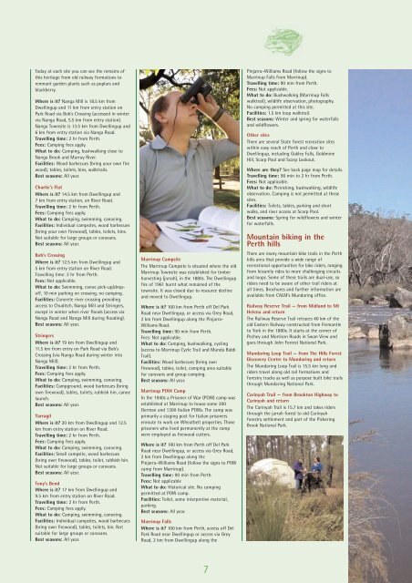
Today at each site you can see the remains <strong>of</strong>this heritage from old railway formations toremnant garden plants such as poplars <strong>and</strong>blackberry.Where is it? Nanga Mill is 18.5 km fromDwellingup <strong>and</strong> 11 km from entry station onPark Road via Bob’s Crossing (accessed in wintervia Nanga Road, 5.5 km from entry station).Nanga Townsite is 13.5 km from Dwellingup <strong>and</strong>6 km from entry station via Nanga Road.Travelling time: 2 hr from Perth.Fees: Camping fees apply.What to do: Camping, bushwalking close toNanga Brook <strong>and</strong> Murray River.Facilities: Wood barbecues (bring your own firewood), tables, toilets, bins, walktrails.Best seasons: All year.Charlie’s FlatWhere is it? 14.5 km from Dwellingup <strong>and</strong>7 km from entry station, on River Road.Travelling time: 2 hr from Perth.Fees: Camping fees apply.What to do: Camping, swimming, canoeing.Facilities: Individual campsites, wood barbecues(bring your own firewood), tables, toilets, bins.Not suitable for large groups or caravans.Best seasons: All year.Bob’s CrossingWhere is it? 12.5 km from Dwellingup <strong>and</strong>5 km from entry station on River Road.Travelling time: 2 hr from Perth.Fees: Not applicable.What to do: Swimming, canoe pick-up/drop<strong>of</strong>f,10 min parking on crossing, no camping.Facilities: Concrete river crossing providingaccess to Chuditch, Nanga Mill <strong>and</strong> Stringers,except in winter when river floods (access viaNanga Road <strong>and</strong> Nanga Mill during flooding).Best seasons: All year.StringersWhere is it? 19 km from Dwellingup <strong>and</strong>11.5 km from entry on Park Road via Bob’sCrossing (via Nanga Road during winter intoNanga Mill).Travelling time: 2 hr from Perth.Fees: Camping fees apply.What to do: Camping, swimming, canoeing.Facilities: Campground, wood barbecues (bringown firewood), tables, toilets, rubbish bin, canoelaunch.Best seasons: All year.YarragilWhere is it? 20 km from Dwellingup <strong>and</strong> 12.5km from entry station on River Road.Travelling time: 2 hr from Perth.Fees: Camping fees apply.What to do: Camping, swimming, canoeing.Facilities: Small campsite, wood barbecues(bring own firewood), tables, toilet, rubbish bin.Not suitable for large groups or caravans.Best seasons: All year.Tony’s BendWhere is it? 17 km from Dwellingup <strong>and</strong>9.5 km from entry station on River Road.Travelling time: 2 hr from Perth.Fees: Camping fees apply.What to do: Camping, swimming, canoeing.Facilities: Individual campsites, wood barbecues(bring own firewood), tables, toilets, bin. Notsuitable for large groups or caravans.Best seasons: All year.Marrinup CampsiteThe Marrinup Campsite is situated where the oldMarrinup Townsite was established for timberharvesting (jarrah), in the 1880s. The Dwellingupfire <strong>of</strong> 1961 burnt what remained <strong>of</strong> thetownsite. It was closed due to resource decline<strong>and</strong> moved to Dwellingup.Where is it? 100 km from Perth <strong>of</strong>f Del ParkRoad near Dwellingup, or access via Grey Road,2 km from Dwellingup along the Pinjarra-Williams Road.Travelling time: 90 min from Perth.Fees: Not applicable.What to do: Camping, bushwalking, cycling(access to Marrinup Cycle Trail <strong>and</strong> Munda BiddiTrail).Facilities: Wood barbecues (bring ownfirewood), tables, toilet, camping area suitablefor caravans <strong>and</strong> group camping.Best seasons: All year.Marrinup POW CampIn the 1940s a Prisoner <strong>of</strong> War (POW) camp wasestablished at Marrinup to house some 200German <strong>and</strong> 1300 Italian POWs. The camp wasprimarily a staging post for Italian prisonersenroute to work on Wheatbelt properties. Thoseprisoners who lived permanently at the campwere employed as firewood cutters.Where is it? 100 km from Perth <strong>of</strong>f Del ParkRoad near Dwellingup, or access via Grey Road,2 km from Dwellingup along thePinjarra–Williams Road (follow the signs to POWcamp from Marrinup).Travelling time: 90 min from Perth.Fees: Not applicableWhat to do: Historical site. No campingpermitted at POW camp.Facilities: Toilet, some interpretive material,parking.Best seasons: All year.Marrinup FallsWhere is it? 100 km from Perth, access <strong>of</strong>f DelPark Road near Dwellingup or access via GreyRoad, 2 km from Dwellingup along thePinjarra–Williams Road (follow the signs toMarrinup Falls from Marrinup).Travelling time: 90 min from Perth.Fees: Not applicable.What to do: Bushwalking (Marrinup Fallswalktrail), wildlife observation, photography.No camping permitted at this site.Facilities: 1.5 km loop walktrail.Best seasons: Winter <strong>and</strong> spring for waterfalls<strong>and</strong> wildflowers.Other sitesThere are several State <strong>forest</strong> recreation siteswithin easy reach <strong>of</strong> Perth <strong>and</strong> close toDwellingup, including Oakley Falls, GoldmineHill, Scarp Pool <strong>and</strong> Scarp Lookout.Where are they? See back page map for details.Travelling time: 90 min to 2 hr from Perth.Fees: Not applicable.What to do: Picnicking, bushwalking, wildlifeobservation. Camping is not permitted at thesesites.Facilities: Toilets, tables, parking <strong>and</strong> shortwalks, <strong>and</strong> river access at Scarp Pool.Best seasons: Spring for wildflowers <strong>and</strong> winterfor waterfalls.Mountain biking in thePerth <strong>hills</strong>There are many mountain bike trails in the Perth<strong>hills</strong> area that provide a wide range <strong>of</strong>recreational opportunities for bike riders, rangingfrom leisurely rides to more challenging circuits<strong>and</strong> loops. Some <strong>of</strong> these trails are dual-use, soriders need to be aware <strong>of</strong> other trail riders atall times. Brochures <strong>and</strong> further information areavailable from CALM’s Mundaring <strong>of</strong>fice.Railway Reserve Trail — from Midl<strong>and</strong> to MtHelena <strong>and</strong> returnThe Railway Reserve Trail retraces 40 km <strong>of</strong> theold Eastern Railway constructed from Fremantleto York in the 1880s. It starts at the corner <strong>of</strong>Pechey <strong>and</strong> Morrison Roads in Swan View <strong>and</strong>goes through John Forrest National Park.Mundaring Loop Trail — from The Hills ForestDiscovery Centre to Mundaring <strong>and</strong> returnThe Mundaring Loop Trail is 15.5 km long <strong>and</strong>riders travel along old rail formations <strong>and</strong><strong>forest</strong>ry tracks as well as purpose built bike trailsthrough Mundaring National Park.Carinyah Trail — from Brookton Highway toCarinyah <strong>and</strong> returnThe Carinyah Trail is 15.7 km <strong>and</strong> takes ridersthrough the jarrah <strong>forest</strong> to old Carinyah<strong>forest</strong>ry settlement <strong>and</strong> part <strong>of</strong> the PickeringBrook National Park.7