Free Executive Summary - Elmhurst College
Free Executive Summary - Elmhurst College
Free Executive Summary - Elmhurst College

You also want an ePaper? Increase the reach of your titles
YUMPU automatically turns print PDFs into web optimized ePapers that Google loves.
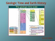
Learning to Think Spatially: GIS as a Support System in the K-12 Curriculum<br />
http://www.nap.edu/catalog/11019.html<br />
SPATIAL THINKING IN EVERYDAY LIFE, AT WORK, AND IN SCIENCE 69<br />
• visualizing a three-dimensional object or structure or process by examining observations<br />
collected in one or two dimensions;<br />
• describing the position and orientation of objects you encounter in the real world relative to<br />
a conceptual coordinate system anchored to Earth;<br />
• remembering the location and appearance of previously seen items;<br />
• envisioning the motion of objects or materials through space in three dimensions;<br />
• envisioning the processes by which objects change shape;<br />
• using spatial thinking to think about time; and<br />
• considering two-, three-, and four-dimensional systems where the axes are not distance.<br />
Describing the Shape of an Object, Rigorously and Unambiguously<br />
Untold person-lifetimes have been invested in the task of describing natural objects in a way<br />
that is rigorous and unambiguous, and attends to all of the important observable parameters. Faced<br />
with the huge range of objects found in nature, mineralogists, petrologists, geomorphologists,<br />
structural geologists, sedimentologists, zoologists, and botantists had to begin by agreeing upon<br />
words, measurements, and concepts with which to describe these natural objects.<br />
Given a collection of objects that intuitively seem related in some way, what should you<br />
observe, and what should you measure, in order to capture the shape of each object? After much<br />
spatial thinking, crystallographers decided that you should observe how many planes of symmetry<br />
the crystal has and whether or not the angles between those planes of symmetry are right angles.<br />
Size and color of the crystal are not so important (Figure 3.13). After much spatial thinking,<br />
structural geologists decided that you should describe a fold in a sedimentary layer by imagining a<br />
plane cutting through the axis of symmetry of the fold, and then measuring the dip and strike of this<br />
plane, and the plunge of the intersection between this axial plane and the fold itself (Figure 3.14).<br />
Although this descriptive style of geoscience and biology tends to be disparaged nowadays, the<br />
worldwide effort, in the eighteenth through twentieth centuries, to develop methodologies describing<br />
the objects of nature was crucial to the success of the discipline.<br />
The processes on the part of expert observers as they develop a new description methodology<br />
include (1) careful observation of the shape of a large number of objects; (2) integrating these<br />
observations into a mental model of what constitutes the common characteristics among this group<br />
of objects; (3) identifying ways in which individual objects can differ while still remaining within<br />
the group; and (4) developing a methodical, reproducible set of observation parameters that can<br />
describe the range of natural variability within the group, thus defining a class. Step (4) may include<br />
developing a lexicon or taxonomy of terms, developing measuring instruments, developing units of<br />
FIGURE 3.13 Describing the shapes of natural objects, rigorously and unambiguously: stereograms of crystals.<br />
SOURCE: Hurlbut, 1971. Copyright © 1971 by C. S. Hurlbut. Reproduced by permission of John Wiley<br />
& Sons, Inc.<br />
Copyright © National Academy of Sciences. All rights reserved.