Analytic Hierarchy Process for Evaluation Of Environmental ... - ijcer
Analytic Hierarchy Process for Evaluation Of Environmental ... - ijcer
Analytic Hierarchy Process for Evaluation Of Environmental ... - ijcer

You also want an ePaper? Increase the reach of your titles
YUMPU automatically turns print PDFs into web optimized ePapers that Google loves.
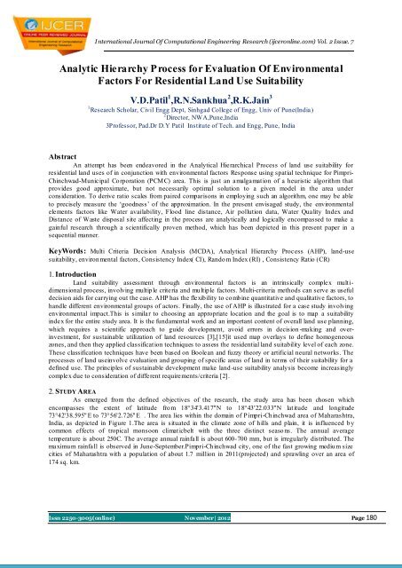
International Journal <strong>Of</strong> Computational Engineering Research (<strong>ijcer</strong>online.com) Vol. 2 Issue. 7Fig.1. Study area.3. EARLIER RESEARCHThe <strong>Analytic</strong> Hierarchical <strong>Process</strong> (AHP) is one of the methodological approaches that may be appliedto resolve highly complex decision making problems involving multiple scenarios, criteria and factors[14].Proposed in the 1970s by Thomas L. Saaty, it constructs a ratio scale associated with the priorities <strong>for</strong> thevarious items compared. In his initial <strong>for</strong>mulation, conventional AHP, Saaty proposed a four-step methodologycomprising modeling, valuation, prioritization and synthesis. At the modeling stage, a hierarchy representingrelevant aspects of the problem (criteria, sub-criteria, at]tributes and alternatives) is constructed. The goal ormission concerned in the problem is placed at the top of this hierarchy. Other relevant aspects (criteria, sub -criteria, attributes, etc.) areplaced in the remaining levels [1]. In the AHP method, obtaining the weights orpriority vector of the alternatives or the criteria is required. For this purpose Saaty (1980) has used anddeveloped the Comparison Method (PCM), which is explained in detail in next part of the work [5]. This studyfocuses on the utility of the AHP as a model <strong>for</strong> capturing expert knowledge on environmental systems wheredata may be lacking. The AHP method commonly used in multi-criteria decision making exercises was found tobe a useful method to determine the weights, compared with other methods used <strong>for</strong> determining weights. Whenapplying AHP, constraints are compared with each other to determine the relative importance of each variable inaccomplishing the overall goal.4. DATA USED AND METHODOLOGYAHP is a comprehensive intuitive method <strong>for</strong> <strong>for</strong>mulating and analyzing decisions. AHP has beenapplied to numerous practical problems in the last few decades [17]. Because of its intuitive appeal andflexibility, many corporations and governments routinely use AHP <strong>for</strong> making major policy decisions [3]. Abrief discussion of AHP <strong>for</strong> environmental evaluation is provided in this text. More detailed description of AHPand application issues can be found elsewhere [14].The Linear Imaging Self Scanner (LISS III) digital data ofhaving spatial resolution of 23.5 m <strong>for</strong> April, 2008 and May, 2008 have been taken in conju nction with AsterDigital Elevation Model (DEM) data of 30 m resolution downloaded from Aster GDEM website. Analog andother ancillary data were collected from Survey of India Toposheets47/F/14 and 47/F/10 of 1:50000 scales <strong>for</strong>Pimpri-Chinchwad-Municipal Corporation area and PCMC office.Application of AHP to a decision problem involves four steps:i. Structuring of the decision problem into a hierarchical model.ii. Making pair-wise comparisons and obtaining the judgmental matrix.iii. Local priorities and consistency of comparisons.iv. Aggregation of local prioritiesThe entire methodology of the present work is focused on theapplication of AHP and GIS <strong>for</strong> land usesuitability analysis <strong>for</strong> residential land use has been given below. The principal steps involved in themethodologyareas follows:‣ Raster map creation‣ Geo-referencing‣ Extraction of study areIssn 2250-3005(online) November| 2012 Page 181
International Journal <strong>Of</strong> Computational Engineering Research (<strong>ijcer</strong>online.com) Vol. 2 Issue. 7‣ Preparation of various raster layers‣ AHP and GIS analysisTABLE 1: NINE-PO INT WEIGHING SCALE FO R PAIR-WISE CO MPARISONDescriptions of preferenceScaleEqually 1Equally to moderately 2Moderately 3Moderately to strongly 4Strongly 5Strongly to very Strongly 6Very Strongly 7Very Strongly to extremely 8Extremely 9After standardization all criteria and sub criteria were weighted using pair wise comparison method. Anexample of main criteria weighing is given in Table 2.TABLE 2: WEIGHING MATRIX FO R MAIN CRITERIACriteria<strong>Environmental</strong>ElementsSub CriteriaWaterAvailabilityFlood LineDistanceAirPollutionDataWQIDistanceFromWasteDisposalSiteStandardsAdoptedWeight> 4000 93000 – 4000 62000 – 3000 31000 – 2000 20 – 1000 1> 400 9300 – 400 5200 – 300 2100 – 200 10 – 100Restricted1 92 53 34 25 1> 55.5 953.5 - 55.5 651.5 - 53.5 3< 51.5 2> 4000 93000 – 4000 52000 – 3000 31000 – 2000 1< 1000 1The three main AHP criteria such as selection, weighing and overly are described below.A. Selecting CriteriaIn this study criteria were selected using the literature reviews of internal and external references, interviewingthe stakeholders.Issn 2250-3005(online) November| 2012 Page 182
International Journal <strong>Of</strong> Computational Engineering Research (<strong>ijcer</strong>online.com) Vol. 2 Issue. 7B. Weighing of Criteria (Scale <strong>for</strong> pair wise comparison)For determining the relative importance of criteria the pair-wise comparison matrix using Saaty's nine-pointweighing scale were applied. In AHP, all identified factors are compared against each other in a pair wisecomparison matrix which is a measure of relative importance/preference among the factors.There<strong>for</strong>e, numericalvalues expressing the relative preference of a factor against another. Saaty (1977) notes that suggested a scale<strong>for</strong> comparison consisting of values ranging from 1 to 9 which describe the intensity of importance, by which avalue of 1 expresses equal importance and a value of 9 is given to those factors having an extreme importanceover another factor as shown in Table 1 [7]. Then by using the in<strong>for</strong>mation from table 1, the factors were p airwise compared.In order to compare criteria with each other, all values need to be trans<strong>for</strong>med to the same unit ofmeasurement scale (from 0 to 1), whereas the various input maps have different measurement units (e.g.distance maps, temperature etc.).TABLE 3 :WEIGHING MATRIX FO R SUB CRITERIA O F AIR PO LLUTIO NCriteriaAirPollutionSubCriteriaSOx( % )SPMNOxStandards WeightAdopted>70 963-70 555-63 347-55 2600 9472-600 5344-472 3216-344 267 961-67 555-61 349-55 1
International Journal <strong>Of</strong> Computational Engineering Research (<strong>ijcer</strong>online.com) Vol. 2 Issue. 7C.OverlyingAfter weighing of criteria regarding their importance <strong>for</strong> land suitability analysis, all criteria maps were overlaidusing suitability index.Suitability Index,Where,SI is the Suitability Index of each cells;N is the number of main criteria; RI,A1, RI, A2 …R N ,A N are the relativeimportance of the main criteria A1, A2 …A N , respectively; m, i and j are the number of sub criteria directlyconnected to the main criteria A1, A2 …A N , respectively.RIB, RIC and RID are the relative importance of subcriteria B, C and D directly connected to the main criteria A1, A2 …A N , respectively.RIKB,RIKC and RIKD arethe relative importance of indicators category k of sub criteria B, C and D and main criteria A1, A2 …A N ,respectively.D.Calculation of score value <strong>for</strong> each criterionThe suitability value <strong>for</strong> water availability, flood hazards, air pollution, water quality index, waste disposal inPimpri-Chinchwad area and the criterion <strong>for</strong> each land mapping unit is determined through the maximumlimitation method that affects the land use.The above five representative natural physical characteristics are usedin Environment response model and constitute the sub-criteria under Environment criteria. Be<strong>for</strong>e applyingweighted linear combination equation to calculated suitability index, these calculated scores are standardized tothe measured scale 9 (very high suitability), 7 (High), 5 (medium), and 1 (Low). All of the classifications andranking values in spatial analysis are obtained according to some studies of Al-Shalabi et al. (2006), Kordi(2008) and based on visiting the study area.E. Preparing of residential land suitability mapsAfter weighting the criteria, as regards the relative importance of each criterion as well as suitability index, allthe criterion maps were overlaid and final residential land suitability map was prepared.TABLE 5: SUITABILITY ACCORDING TO WATER AVAILABILITY (NO RMALIZED MATRIX)Class < 200200-400400-600600-800>800Sum PV Score 800 0.07 0.05 0.03 0.03 0.05 0.23 0.05 0.97TABLE 6: SUITABILITY ACCORDING TO FLOOD LINE DISTANCE(NO RMALIZED MATRIX)Class >400300-400200-300100-2000-100Sum PV Score>400 0.56 0.64 0.52 0.43 0.36 2.51 0.50 9.00300-400 0.19 0.21 0.31 0.31 0.28 1.30 0.26 4.66200-300 0.11 0.07 0.10 0.18 0.20 0.67 0.13 2.40100-200 0.08 0.04 0.03 0.06 0.12 0.34 0.07 1.210 –1000.06 0.03 0.02 0.02 0.04 0.17 0.03 0.62Suitability maps resulting from multi-criteria evaluation (MCE) and multi-objective land allocation have showndifferent classes <strong>for</strong> which the degree of sensitivity to accept new building <strong>for</strong> example residential estates andurban settlements vary from extremely prone areas to weakly prone. Based on relative weights of the suitabilityfactors <strong>for</strong> development, suitability ranges were identified as shown in Table 8. Figure 2 depicts the final mapIssn 2250-3005(online) November| 2012 Page 184
International Journal <strong>Of</strong> Computational Engineering Research (<strong>ijcer</strong>online.com) Vol. 2 Issue. 7(suitability map), which divided to 5 best areas in increasing order are : 1, 2, 3, 4 and 5 and are shown indifferent colours.TABLE7: SUITABILITY ACCORDING TO AIR PO LLUTIO N ZONE (NO RMALIZED MATRIX)Class 5 4 3 2 1Su Prioritym F FactorScore5 0.51 0.63 0.47 0.38 0.32 2.30 0.46 9.004 0.17 0.21 0.35 0.30 0.26 1.29 0.26 5.003 0.13 0.07 0.12 0.23 0.21 0.75 0.15 3.002 0.10 0.05 0.04 0.08 0.16 0.43 0.09 2.001 0.09 0.04 0.03 0.03 0.05 0.23 0.05 1.00TABLE 8: SUITABILITY ACCORDING TO WATER QUALITY INDEX – (NO RMALIZED MATRIX)Class >56.5 55.5- 54.75- 52.75 < Su56.5 55.75 -54.75PV52.75 m0.56 0.64 0.52 0.43 0.36 2.51 0.50>56.555.5-56.554.75-55.7552.75-54.75< 52.750.19 0.21 0.31 0.31 0.28 1.30 0.260.11 0.07 0.10 0.18 0.20 0.67 0.130.08 0.04 0.03 0.06 0.12 0.34 0.070.06 0.03 0.02 0.02 0.04 0.17 0.03Score9.005.003.001.001.00TABLE 9: SUITABILITY ACCORDING TO WASTE DISPOSAL (NO RMALIZED MATRIX)Class >4000 3000- 2000- 1000- 0 -4000 3000 2000 1000Sum PV Score> 4000 0.56 0.64 0.52 0.43 0.36 2.51 0.50 9.003000 -40000.19 0.21 0.31 0.31 0.28 1.30 0.26 4.662000 -30000.11 0.07 0.10 0.18 0.20 0.67 0.13 2.401000 -20000.08 0.04 0.03 0.06 0.12 0.34 0.07 1.210 - 1000 0.06 0.03 0.02 0.02 0.04 0.17 0.04 0.62TABLE 10: FINAL S UITABILITY ACCORDING TO ENVIRONMENTAL FACTORS (RECIPROCALMATRIX)Class W F A WQ WD SumWaterAvailPriorityVectorIssn 2250-3005(online) November| 2012 Page 185Score0.54 0.64 0.47 0.43 0.36 2.44 0.49 9.00Flood 0.18 0.21 0.35 0.31 0.28 1.33 0.27 4.91AirPollu.0.14 0.07 0.12 0.18 0.20 0.71 0.14 2.61WQI 0.08 0.04 0.04 0.06 0.12 0.34 0.07 1.26WasteDisp.0.06 0.03 0.02 0.02 0.04 0.17 0.03 0.64
International Journal <strong>Of</strong> Computational Engineering Research (<strong>ijcer</strong>online.com) Vol. 2 Issue. 7The following results emerged out of the present study:i. The area of interest has been classified in to nine using supervised algorithm and different suitability classesare obtained.ii. The criteria used are water availability, flood line distance, air pollution data, water quality index and distanceof waste disposal site (5classes each) and their combined effect map is shown in figure no 2 illustrating thesuitability of the area. These results are based on the data received and accordingly results are drawn .iii. AHP used hierarchical structures <strong>for</strong> nine scales with the <strong>Environmental</strong> criteria, and were devised <strong>for</strong> thedesignof AHP applicability <strong>for</strong> residential land use suitability .Fig.2 Final suitability mapThe AHP was devised <strong>for</strong> allthe sub criteria, evaluating their relative scores <strong>for</strong> attribute classes toget theenvironment response model and residential land use suitability <strong>for</strong>PCMC area.5. CONCLUSIONSThe analysis of this study mainly focused on highly suitable areas on as these areas have highest potential <strong>for</strong>construction purposes i.e. residential land use. We applied AHP model to land use suitability analysis based onfive criteria layers. The <strong>Analytic</strong> <strong>Hierarchy</strong> <strong>Process</strong> (AHP) method was found to be a useful method todetermine the weights, compared with other methods used <strong>for</strong> determining weights. The sensitivity utility of themodel helped to analyze the decision be<strong>for</strong>e making the final choice. The AHP method could deal withinconsistent judgments and provided a measure of the inconsistency of the judgment of the respondents, so it issuperior. This assessment is useful <strong>for</strong> land use decision-making and urban development of PCMC area. This isvery important <strong>for</strong> planners to decide whether land should be developed or conserved. This application can alsohelp to consider the strategic urban land development framework and the short-term land use policies can alsobe <strong>for</strong>mulated. The approach, there<strong>for</strong>e, would help to monitor urban land development <strong>for</strong> the planners andpolicy makers <strong>for</strong> <strong>for</strong>mulating urban growth policies and strategies of the city.REFERENCES[1] Altuzarra, A., María, J. & Jiménez, M. Salvador, M. (2007). A Bayesian priorization procedure <strong>for</strong> AHPgroupdecision making. EurJOper Res., v.182, No(1), pp. 367-382.[2] Duc, T.T. (2006). Using GIS and AHP technique <strong>for</strong> land-use suitability analysis. International Symposiumon Geoin<strong>for</strong>matics <strong>for</strong> Spatial Infrastructure Development in Earth and Allied Sciences.[3] Elkarni, F. and Mustafa, I. (1993). Increasing the utilization of solar energy technologies (SET) in Jordan:<strong>Analytic</strong> <strong>Hierarchy</strong> <strong>Process</strong>. Energy Policy 21,978–984.Issn 2250-3005(online) November| 2012 Page 186
International Journal <strong>Of</strong> Computational Engineering Research (<strong>ijcer</strong>online.com) Vol. 2 Issue. 7[4] Hall, G.B. Wang, F. Subaryono. (1992). Comparison of Boolean and fuzzy classification methods in landsuitability analysis by using geographical in<strong>for</strong>mation systems. J. Environ. Planning., V.4, No. 24, pp. 497–516.[5] J. Chen, Y. & Wu, J.P. (2009). Cellular automata and GIS based land use suitability simulation <strong>for</strong> irrigatedagriculture. 18th World IMACS / MODSIM Congress, Cairns, Australia 13.[6] Kordi, M. (2008). Comparison of fuzzy and crisp analytic hierarchy process (AHP) methods <strong>for</strong> spatialmulticriteria decision analysis in GIS. Master. Thesis, University of Gavle.[7] M. Bagheri, Z. Z. Ibrahim, W. N. A. Sulaiman and N. Vaghefi (2011) Integration of <strong>Analytic</strong>al <strong>Hierarchy</strong><strong>Process</strong> and Spatial Suitability Analysis <strong>for</strong> Land Use Planning in Coastal Area, published in,”Theproceedings of the first Iranian Students Scientific Conference in Malaysia.[8] Marinoni, O., (2004). Implementation of the analytical hierarchy process with VBA in ArcGIS, JComputGeosci, 30(6): 637–646[9] Saaty, T. L. (1980). The analytic hierarchy process. Polytechnic University of Hochiminh city, VietnamMcGraw-Hill, New York.[10] Saaty, T. L. (1988). Multi criteria Decision Making: The <strong>Analytic</strong>al <strong>Hierarchy</strong> <strong>Process</strong>. RWS Publications,Pittsburgh, PA.[11] Saaty, T. L. (1990). An exposition on the AHP in reply to the paper ‘remarks on the analytic hierarchyprocess. Manag. Sci., 36, 259–268,[12] Saaty, T. L. (1994). Highlights and critical points in the theory an application of the analytic hierarchyprocess. Eur. J. Oper. Res., 74, 426–447.[13] Saaty, T. L. (1995). Decision Making <strong>for</strong> Leaders: The <strong>Analytic</strong> <strong>Hierarchy</strong> <strong>Process</strong> <strong>for</strong> Decisions in aComplex World. 3d ed. RWS Publications, Pittsburgh, PA.[14] Saaty, T. L. (2000). Fundamentals of Decision Making and Priority Theory with the <strong>Analytic</strong> <strong>Hierarchy</strong><strong>Process</strong>. Pittsburg: RWS Publications.[15] Saaty, T.L., (1977). A scaling method <strong>for</strong> priorities in hierarchical structures. J. Math Psycho., 15: 231-281.[16] Saaty, T.L., (1980). The <strong>Analytic</strong> <strong>Hierarchy</strong> <strong>Process</strong>. McGraw-Hill, New York., pp. 20-25.[17] Shim, J. P. (1989). Bibliographical research on the analytic hierarchy process (AHP). Socio-EconomicPlanning Sciences 23, 161–167.[18] Wang, F. (1994). The use of artificial neural networks in a geographical in<strong>for</strong>mation system <strong>for</strong> agriculturalland-suitability assessment. Environment and planning A., No.26, pp. 265–284.Issn 2250-3005(online) November| 2012 Page 187