The Lizard - Neptune Coastline Campaign
The Lizard - Neptune Coastline Campaign
The Lizard - Neptune Coastline Campaign

You also want an ePaper? Increase the reach of your titles
YUMPU automatically turns print PDFs into web optimized ePapers that Google loves.
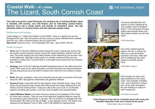
Coastal Walk – 4½ miles<strong>The</strong> <strong>Lizard</strong>, South Cornish CoastThis walk around the <strong>Lizard</strong> Peninsula, the southerly tip of mainland Britain, takesin dramatic cliff scenery, rare wild flowers and an interesting coastal history.Kynance Cove has a sandy beach and islands of serpentine stone. <strong>The</strong> bayattracted visitors in Victorian times and still captivates people today.Getting there and facilities<strong>Lizard</strong> village is 11 miles from Helston on the A3083. <strong>The</strong>re is a regular bus servicethroughout the year. WCs at Kynance and the <strong>Lizard</strong> car parks. Refreshments availablefrom the ‘eco’ café on Kynance beach and at <strong>Lizard</strong> Point.Start point: Kynance Cove – OS Landranger 203 map – grid ref SW 703125.Points of interest• Flora: lots of colourful wildflowers bloom along the coast in spring and summer likethe quirkily named dropwort, bloody crane’s-bill, ladies bedstraw, milkwort and selfheal.<strong>The</strong> exotic looking pink and yellow flowers of the hottentot fig can be seen nearto the lighthouse. Although it looks pretty it is actually a botanical bully and cansmother our native flora. Cornish heath is a rare plant which grows here but nowhereelse in Britain.• Geology: look out for the strikingly beautiful serpentine stone in the cliffs around the<strong>Lizard</strong>. With veins of red, white and green, and was formed by the extreme pressureof rocks being thrust up to the Earth’s surface from under the crust millions of yearsago.• Birds: Buzzard, peregrine, raven and stonechat may be seen at any time of the yearalong the cliffs. Spot gannet, shearwater and guillemot offshore.• Kynance Cove: a favourite spot for day-trippers since Victorian times, many of thecaves around Kynance have names from that era like the Ladies’ Bathing Pool, theParlour and the Drawing Room. Today the café at the cove is full of eco-friendlyfeatures including solar panels, a turf roof, wool insulation and compost toilets.• <strong>Lizard</strong> Wireless Station: two black huts have stood on the headland of Pen Olverfor more than a century. <strong>The</strong>y are one of the sites that Guglielmo Marconi used forhis pioneering radio experiments. In January 1901 he received a message here thathad travelled 186 miles to the Isle of Wight - a new distance record. <strong>The</strong> station wasrestored by the National Trust in 2000. Call 01326 290384 for opening times.Tennyson described the twintowers of <strong>Lizard</strong> Lighthouse as“the southern eyes of England”.Built in 1752, thousands of shipssafely pass through these rockfilledwaters thanks to its 26-milebeam.© NTPL/David NotonOne of the richest botanicalareas in the UK, in spring, thecliffs are a colourful picture,carpeted in the blue, white andpink of wildflowers like squill,campion and thrift (shownhere).© NTPL/Martin TrelawnyWild choughs are also onceagain breeding on the <strong>Lizard</strong>coast. This acrobatic red-billedcrow, with a distinctive ‘chiaow’call, can be seen throughoutthe year feeding on insects inshort coastal turf.© NT Nature Conservatiion“Catch Kynance at low tide for a fantastic beach with caves andbeautiful serpentine rocks worn smooth by the waves.”Rachel Holder, National Trust Warden
Route and directions1. Set out from Kynance Cove heading towards<strong>Lizard</strong> Point. Look for the Devil’s Letterbox on thenorth side of Asparagus Island – a cave crack withpowerful suction caused by the pull of air from thewaves below.Distance, terrain and accessibilityA 4½ mile route along sandy beaches and stony cliff top paths. Some slopes and steps: height gain of 220m.At the beach, beware of strong currents. Swimming is not advised at low tide and do not use inflatables.2. Steps lead to a headland from the eastern end ofKynance beach. Walk through the car park andrejoin the cliff path.3. Follow the cliff path, passing above PentreathBeach. Seals and basking sharks are commonlyspotted on this route. Basking sharks can be up tonine metres long but cruise these warm watersfeeding on nothing more than tiny plankton. Insummer 2007 over 40 were spotted in one day!4. Look down towards the disused Victorian lifeboatstation at Polpeor Cove.5. <strong>The</strong> <strong>Lizard</strong> Lighthouse is just round the headlandfrom <strong>Lizard</strong> Point. An electric foghorn kicks inwhen humidity levels rise above a certain point.Make sure you cover your ears! <strong>The</strong> blast is sothunderous (about thirty times louder than apneumatic drill), you will feel the vibrations ifpassing close by.6. Lion’s Den is a 12m hole in the cliff created whena cave collapsed one night in the mid-1800s.7. With stunning views, Pen Olver is the perfect spotfor a picnic. Please take your rubbish home.8. From Bass Point Old Signal Station, head leftinland to <strong>Lizard</strong> village.9. Pass the village green taking a path towardsKynance Cove.NT places nearbyGlendurgan Garden, St Michael's Mount and the Godolphin Estate© Reproduced by permissionof Ordnance Survey.All rights reserved.OS licence no. AL 100018591As a charity, independent of government, the National Trust relies on the generosity of its supporters to continue caring for our countryside and wildlife,so that everyone can enjoy the beauty of the outdoors for generations to comeFind out more at www.nationaltrust.org.uk