download the full guide - Lehigh Gap Nature Center
download the full guide - Lehigh Gap Nature Center
download the full guide - Lehigh Gap Nature Center
- No tags were found...

You also want an ePaper? Increase the reach of your titles
YUMPU automatically turns print PDFs into web optimized ePapers that Google loves.
Eastern PennsylvaniaBIRDING & WILDLIFEGUIDE
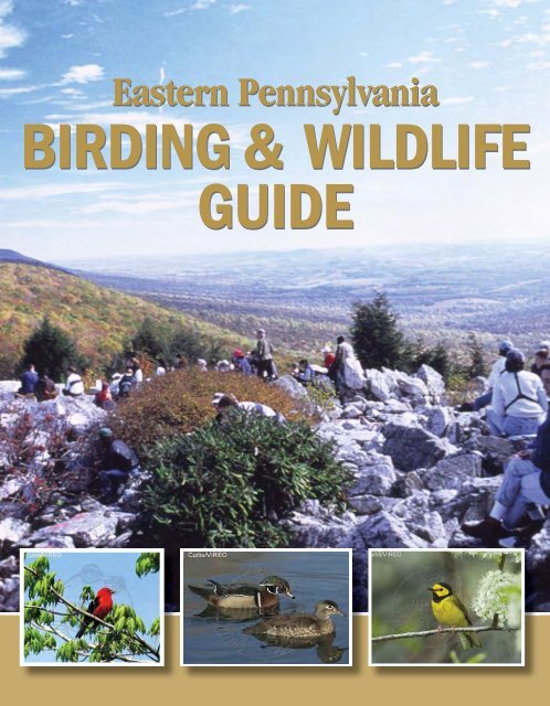
2Regional MapERIEWARRENMCKEANCRAWFORDPOTTERSUSQUEHANNATIOGABRADFORDWAYNEFORESTVENANGOELK CAMERONWYOMINGMERCERSULLIVANLACKAWANNALYCOMINGCLINTONPIKECLARIONJEFFERSONLAWRENCELUZERNECOLUMBIAMONROECLEARFIELDUNIONMONTOURBUTLERARMSTRONGCENTRECARBONBEAVERSULLIVAN NORTHUMBERLANDNORTHAMPTONMIFFLININDIANASCHUYLKILLJUNIATALEHIGHALLEGHENYCAMBRIABLAIRDAUPHINPERRYBERKSWESTMORELANDBUCKSHUNTINGDONLEBANONWASHINGTONMONTGOMERYCUMBERLANDLANCASTERBEDFORDFAYETTESOMERSETGREENEFULTONCHESTERYORKDELAWAREFRANKLINADAMSPHILADELPHIAPIKEMilfordWilkes-BarreLUZERNEMONROEHazletonCARBONJim ThorpeStroudsburgPottsvilleSCHUYLKILLLEHIGHAllentownNORTHAMPTONEastonBethlehemBERKSReadingBUCKSMONTGOMERYDoylestownCHESTERWest ChesterDELAWAREChesterNorristownPHILADELPHIAFRONT COVER PHOTOS:North Lookout, Hawk Mountain SanctuaryScarlet Tanager, R. Curtis/VIREOWood Duck, Frank Leung/iStockphoto.comHooded Warbler, R. Curtis/VIREO
6Making <strong>the</strong> Most of Your BirdingIf you are new to birding, try <strong>the</strong>se time-tested techniques:• Study field <strong>guide</strong>s at home as well as using <strong>the</strong>m in <strong>the</strong> field• Move slowly and be quiet while searching for birds• Wear neutral colors that blend with surroundings• Consider finding a good spot, <strong>the</strong>n standing still and allowing <strong>the</strong> birds to come to you• Scan trees and shrubs watching for movement, and listen care<strong>full</strong>y –many birds are heard first, and <strong>the</strong>n seen• Look at <strong>the</strong> bird as long as it is <strong>the</strong>re, and <strong>the</strong>n consult your field <strong>guide</strong> . . .<strong>the</strong> <strong>guide</strong> will stay <strong>the</strong>re, <strong>the</strong> bird will not• Look at characteristics such as beak shape, feet, tail length, wing pattern (bars) and shape,pattern of markings on <strong>the</strong> head, and behavior – not just <strong>the</strong> color of <strong>the</strong> bird• Find <strong>the</strong> bird with your naked eyes, <strong>the</strong>n continue looking at <strong>the</strong> bird and raise <strong>the</strong> binoculars infront of your eyes as you keep looking at <strong>the</strong> bird• Learn how to use <strong>the</strong> diopter feature of your binoculars to get clear vision (ask <strong>the</strong> binocular dealeror any knowledgeable birder you encounter)• Check <strong>the</strong> range map in <strong>the</strong> <strong>guide</strong> when you think you have it narrowed down to a few similarspecies – some can be eliminated by range• Learn to associate birds with particular habitats – Wood Thrushes like forests, Brown Thrashersprefer brushy habitat• Practice alone, but also bird with experienced birdersSeasonal TimelineWinterBald Eagles along Delaware and <strong>Lehigh</strong> Rivers and at unfrozen lakesand reservoirs; woodpeckers in forests (easy to see without leaves);Horned Larks and Snow Buntings in agricultural fields; AmericanTree Sparrows in old fields; chickadees, titmice, finches, cardinals,and sparrows at feeders.SpringWaterfowl migration and amphibians breeding in March; WoodDucks and Common Mergansers breeding and shad migrationbegins in April; thrushes, tanagers, orioles and warblers migratingthrough or returning to breed in May; First two weeks of May – peakwarbler migration.
8Scott Weidensaul has written more than two dozen books on natural history,including his widely acclaimed Living on <strong>the</strong> Wind: Across <strong>the</strong> Hemisphere withMigratory Birds (1999), which was a finalist for <strong>the</strong> Pulitzer Prize, and Of aFea<strong>the</strong>r: A Brief History of American Birding (2007), which traces 400 years ofornithological history. His writing has appeared in dozens of publications, includingSmithsonian, <strong>the</strong> New York Times, Audubon, and many o<strong>the</strong>rs. He also lectureswidely on conservation. In addition to writing about wildlife, Weidensaul is anactive field researcher whose work focuses on raptor migration, Saw-whet Owlmovements, and hummingbirds.
10a path to Bartram’sGarden to see him, buthis fame attracted ascruffier sort as well –people like <strong>the</strong> scrawnyyoung Scotsman whoknocked one day in1803, introducinghimself as <strong>the</strong> newschoolteacher at Gray’sFerry, a mile fur<strong>the</strong>ralong <strong>the</strong> Schuylkill.Did Bartram’s eyesnarrow a bit, lookingat <strong>the</strong> underfed youngman? Did Bartramknow <strong>the</strong> fellow hadbeen imprisoned inA. Wilson’s drawing of Barn Swallows. Courtesy of <strong>the</strong> National Audubon SocietyScotland for blackmail? Was he put off <strong>the</strong>chap’s breezy announcement that he wantedto write and illustrate <strong>the</strong> first comprehensiveornithological text on <strong>the</strong> birds of <strong>the</strong> NewWorld – even though he could not draw, anddidn’t even know what most of <strong>the</strong>se wondrousnew birds were called?Or did Bartram see a little of himself in<strong>the</strong> young man, who was called AlexanderWilson, and who would, within just 10 years(and with a generous dose of Bartram’s help,and by working himself into an early grave)achieve his goal and lasting recognition as <strong>the</strong>Fa<strong>the</strong>r of AmericanOrnithology?Perhaps. But whatnei<strong>the</strong>r man knewwas that just 25miles upstream, atan estate named MillGrove, ano<strong>the</strong>r birdmadyoung man hadrecently landed – <strong>the</strong>illegitimate, Haitianbornson of a Frenchnaval captain. Hewas a self-absorbed18-year-old, fond ofdancing and shooting,with no interest inmanaging his fa<strong>the</strong>r’sland; by any objective assessment <strong>the</strong> youngfellow, christened Jean Rabine, was likely tomake nothing more of himself than a mildlyrich fop.The one thing that did interest him verymuch, though – <strong>the</strong> one thing that harnessedhis surprisingly sharp intellect and hisformidable, if self-taught, artistic skill – were<strong>the</strong> birds he chased along <strong>the</strong> Schuylkill River,painting <strong>the</strong>m in works signed not with <strong>the</strong>name he was given at birth, but <strong>the</strong> anglicizedversion of <strong>the</strong> name his fa<strong>the</strong>r had given him:John James Audubon.
11J.J Audubon’s drawing of Ruffed Grouse. Courtesy of <strong>the</strong> National Audubon Society“Mill Grove was ever to me a blessed spot,”Audubon wrote years later. And no wonder.Ruffed grouse were common in <strong>the</strong> coniferthickets, flocks of ducks filled <strong>the</strong> air,woodcock did <strong>the</strong>ir skydances along <strong>the</strong> edgesof meadows, and songbirds swarmed <strong>the</strong> treesin spring.Audubon only lived along <strong>the</strong> Schuylkill forfour years before moving to Kentucky, but<strong>the</strong>y were crucial ones for his development asan artist and ornithologist. It was here tha<strong>the</strong> struck upon his great inspiration – to pina freshly shot specimen into a lifelike poseusing a wooden framework and an armatureof slender wires, <strong>the</strong>n to paint it lifesizeon watercolor paper. Compared with <strong>the</strong>stiff illustrations of Wilson and o<strong>the</strong>r earlynaturalists, Audubon’s work was a riot of lifeand movement. Art and nature have neverbeen <strong>the</strong> same.John James AudubonAudubon worked in his own little bubble,never meeting Bartram, and not encounteringWilson until years later in Louisville,Kentucky, a chance meeting that probablysparked Audubon’s own interest in creatinghis great Birds of America folios. Once thatspark was struck, though, he kept returningto eastern Pennsylvania for inspiration andspecimens.In 1829, for instance, he embarked on a sixweekexpedition up <strong>the</strong> <strong>Lehigh</strong> River to its
Mallardheadwaters, in what was <strong>the</strong>n known as <strong>the</strong>Great Pine Swamp – <strong>the</strong> virgin forest of whitepine, hemlock of hardwoods that covered whatis now Carbon and Luzerne counties, a forestso deep and shadowed that it was also knownas “<strong>the</strong> Shades of Death.” There was nothinggloomy about it to Audubon, though, who wentout each day with his gun Tear-jacket, livingin a logger’s cabin and eating “juicy venison,excellent Bear flesh, and delightful trout,”painting pileated woodpeckers, red-breastednuthatches, ravens, warblers and much more– 95 of his great paintings in all.Eastern Pennsylvania was <strong>the</strong> cradle ofAmerican science, home to <strong>the</strong> AmericanPhilosophical Society (whose members, at<strong>the</strong> requestof ThomasJefferson,gave a crashcourse in <strong>the</strong>natural sciencesto Meriwe<strong>the</strong>r Lewis, <strong>the</strong> introspective,melancholic half of <strong>the</strong> Lewis and Clarkexpedition. When <strong>the</strong>y set out across <strong>the</strong>West, Lewis was armed with <strong>the</strong> basics ofornithology, along with medicine, botany,ethnology and paleontology). In 1812, <strong>the</strong>Academy of Natural Sciences opened it doors– though not willingly to Audubon, who hadgotten himself crossways with <strong>the</strong> Academyby denigrating Wilson’s work. George Ord,Wilson’s friend, biographer and collector, spent<strong>the</strong> rest of his life savaging Audubon at everyopportunity.As <strong>the</strong> two rivers connect <strong>the</strong> landscape, sotoo does a continuous thread connect <strong>the</strong> livesof <strong>the</strong>ir great ornithologists – though it runsupstream, flowing through time from <strong>the</strong>mouths of <strong>the</strong> rivers toward <strong>the</strong>ir headwatersin <strong>the</strong> mountains. In 1823, a boy was born inReading, Berks County, along <strong>the</strong> Schuylkillwhose life linked <strong>the</strong> generation of pioneeringbird students with those who helped sparked <strong>the</strong>general public’s interest in birds a century later.Before his widowed mo<strong>the</strong>r moved <strong>the</strong> familyfrom Reading to Carlisle when he was 10, it’slikely that youngSpencer FullertonBaird thrilledto <strong>the</strong> sight ofpassenger pigeonflocks roostingon <strong>the</strong> flanks ofNeversink Mountain, and flying down to animmense boulder in <strong>the</strong> Schuylkill, knownto this day as “Pigeon Rock.” Baird was aprodigy; a college graduate at 17, discoverer(with his bro<strong>the</strong>r) of several new species ofbirds including <strong>the</strong> least and yellow-belliedflycatchers, friend and protégé of Audubon,and later <strong>the</strong> founder of <strong>the</strong> National Museumof Natural History and secretary of <strong>the</strong>Smithsonian Institution.“As <strong>the</strong> two rivers connect <strong>the</strong>landscape, so too does acontinuous thread connect <strong>the</strong>lives of <strong>the</strong>ir great ornithologists.”13
14And as Audubon mentored Baird, so did Bairdmentor dozens of <strong>the</strong> best ornithologists of<strong>the</strong> late 19th and early 20th centuries, manyof whom got <strong>the</strong>ir start as frontier collectors.(Baird’s fa<strong>the</strong>r-in-law was Inspector-Generalof <strong>the</strong> U.S. Army, and through him, Bairdcould post military officers with a knack forscience to almost any Western fort that hewished).Not all were Army surgeons and cavalryofficers, though. Among Baird’s manycorrespondents was a young schoolteacherfrom Berks County named Levi Mengel, whoeven before he graduated high school in <strong>the</strong>1880s had assembled a collection that wouldeventually grow to thousands of eggs andbird skins, and form <strong>the</strong> basis of <strong>the</strong> ReadingPublic Museum, which he founded in 1907.Mengel, in turn, struck up a friendship witha young artist and museum collector at <strong>the</strong>Academy of Natural Sciences named EarlPoole, who eventually succeeded Mengel as<strong>the</strong> director of <strong>the</strong> Reading Museum, and whowent on to an illustrious career as a scientist,illustrator and educator.The Schuylkill and <strong>the</strong> Delaware bothflow through <strong>the</strong> same, 220-mile-longridge, variously known as <strong>the</strong> Blue or FirstMountain but more formally called <strong>the</strong>Kittatinny Ridge. The water gaps <strong>the</strong>y formare among <strong>the</strong> prettiest on Earth (thoughrecent commercial sprawl in <strong>the</strong> neighboringDead hawks from one day of shooting. Courtesy Hawk Mountain Sanctuary Archivesvalley has marred <strong>the</strong> Schuylkill gap). But alongthis long, narrow ridgeline comes a great floodtide ofraptors each fall, one of <strong>the</strong> greatest bird migrations inNorth America, and one whose history was pivotal forconservation.In <strong>the</strong> late 1920s, state ornithologist George MikschSutton wrote a short note in an ornithological journalabout <strong>the</strong> unusual concentration of nor<strong>the</strong>rn goshawksturned in for bounty at one spot along <strong>the</strong> Kittatinnyon <strong>the</strong> Schuylkill/Berks county line, and a youngconservationist named Dick Pough – who would go onto found <strong>the</strong> <strong>Nature</strong> Conservancy two decades later–came to investigate.
15He found carnage on <strong>the</strong> ridge – gunnersblasting thousands of migrating hawkseach fall, <strong>the</strong>ir broken and rotting carcasseslittering <strong>the</strong> woods below. Pough tried to rallysupport for ending <strong>the</strong> slaughter, using <strong>the</strong>gruesome photographs he took, and was metby a yawn – even many ornithologists andconservationists thought hawks were “bad”birds, not worthy of protection.But Pough did energize a formidable womannamed Rosalie Edge, a New York veteran of<strong>the</strong> women’s suffrage movement, and a largelyforgotten conservation heroine to whom weowe Olympic and King’s Canyon nationalparks, and <strong>the</strong> preservation of much ofYosemite. Mrs. Edge formed <strong>the</strong> EmergencyConservation Committee and leased <strong>the</strong>mountaintop where <strong>the</strong> gunning was worst– and in <strong>the</strong> nick of time, as a local huntingclub voted that same day to buy <strong>the</strong> land forhawk-shooting.Instead, <strong>the</strong> ridgetop became Hawk MountainSanctuary, <strong>the</strong> world’s first refuge for birdsof prey, and one that has grown into oneof <strong>the</strong> leading centers of raptor conservationand research in <strong>the</strong> world. The rocks of NorthLookout, which rise high above <strong>the</strong> LittleSchuylkill River, have for generations been<strong>the</strong> crossroads of naturalists like Roger ToryPeterson and Rachel Carson, just to name afew of <strong>the</strong> luminaries who made <strong>the</strong> pilgrimagemany times over <strong>the</strong> years.Broad-winged hawk, B.K. Wheeler/VIREOR.T. Peterson on North Lookout, Hawk Mountain Sanctuary Archives
Eastern Bluebird17“Today, it’s still possible to walk <strong>the</strong> same paths,and see many of <strong>the</strong> same species, that <strong>the</strong>giants of early American ornithology saw.”History has flowed, just as have <strong>the</strong> rivers thatframe eastern Pennsylvania. Few parts of <strong>the</strong>state have been hit as hard by development– yet <strong>the</strong> birding opportunities here remainrich. Stretching from <strong>the</strong> tidal marshes of<strong>the</strong> lower Delaware, through <strong>the</strong> Piedmontfarmland to <strong>the</strong> extensive forests of <strong>the</strong> ridgeand-valleysystem and <strong>the</strong> cool, conifer-lacedbogs of <strong>the</strong> Pocono plateau, it’s a region ofvaried topography and habitat, and thus greatfor birds.It’s also a region which, despite its largehuman population, still has a lot of publicland that’s open for birding, from state parkslike Hickory Run and <strong>Lehigh</strong> Gorge in CarbonCounty, to state forests and natural areas likeBruce Lake in Pike County and Brady’s Lakein Monroe, as well as tens of thousands ofacres of state game lands, local and countyparks. The region also has an unusual numberof private preserves like Hawk Mountain, <strong>the</strong><strong>Lehigh</strong> <strong>Gap</strong> <strong>Nature</strong> <strong>Center</strong> and TannersvilleCranberry Bog Preserve.Today, it’s still possible to walk <strong>the</strong> same paths,and see many of <strong>the</strong> same species, that <strong>the</strong>giants of early American ornithology saw,whe<strong>the</strong>r it’s spring migrants filling <strong>the</strong> old treesat Bartram’s Garden, or <strong>the</strong> eastern phoebesthat still nest along Perkiomen Creek at MillGrove, where Audubon tied silver wires to <strong>the</strong>irlegs to prove that <strong>the</strong> same phoebes came backto nest each spring – <strong>the</strong> first crude attempt atbird-banding.You can chase Audubon’s ghost through <strong>the</strong>“Shades of Death” on <strong>the</strong> upper <strong>Lehigh</strong>, wherenor<strong>the</strong>rn warblers still abound, and whereravens have returned after a century’s absence– and if <strong>the</strong> passenger pigeons that once drankfrom <strong>the</strong> Schuylkill are just a memory, <strong>the</strong>sting is eased by resurgent peregrine falcons,nesting in Allentown, Reading and on <strong>the</strong> cliffsof <strong>the</strong> Delaware Water <strong>Gap</strong>, or bald eaglesin growing numbers throughout <strong>the</strong> region.Everywhere you look in eastern Pennsylvania,you’ll find birds. All you need is time,binoculars – and this <strong>guide</strong>, of course.
18o n R e s .e r ick s b u r gBerksCountyD o n a ld s o nR a v in eC r y s t a l R e s .T r e m o n tN e w to w nS w e e t A r r o wL a k eP in e G r o v eB r a n c h d a leI n d i a n R u n R e s .501C r e s s o n aF r ie d e n s b u r gL a k e W y n o n a hS u m m it S ta tio n4194P a lo A ltoM t C a r b o nS c h u y lk illH a v e nS t a i r w a yL a k e5Strausstown183O r w ig s b u r gL a n d in g v illeA u b u r n6M c K e a n s b u r gD e e r L a k eP o r tC lin to nN e w K e r n s v i l l eL a k eShartlesvilleD a u b e r v i l l e L a k e7Port Clinton61Leesport3HamburgO n t e l a u n e eL a k eL e a s e r L a k e !Kempton78Lenhartsvillee7371432222KutztownR a n g e r L a k eC o p laH o k e n d a u q uA n c ie n t O a k sA lb u r tisM a c u n g ieo n e s to w n!S a n d H ill !P le a s a n tH illQ u e n tint G r e tn aM y e r s t o w n R e s .C o r n w a llA v o nL e b a n o n S o u th^_!422M y e r s to w nR ic h la n dN e w m a n s to w nS c h a e f fe r s to w nB r ic k e r v illeM i d d l eC r e e k R e s .D e n v e rB l u e M a r s h L a k eR e a m s to w n8A d a m s to w n2222727249N O L D EF O R E S T625568B e r n h a r t R e s .A n t i e t a m !R e s .Reading176G r e e n H i l l sL a k e662e5623451662422T r o u t R u nR e s .Boyertownto w eS . P o tts to w nE N C H C R E E KK e n ilw o r thG ilb e r ts v illeH a lf w a y H o u s eP o tts g r o v eS a n a to g aP o tts to w n. G r e e n v illG r e e n L a n e R e s .R o y eE p h r a taG r a c e M i n e R e s .S p r in g C ityM a n h e imL ititzA k r o nT e r r e H illE lv e r s o nR o th s v illeAP h o e n ix v illeLegendHandicappedAccessibilityHikingTrailsBikingTrailsRestroomsDogsAllowed
1HAY CREEK —FRENCH CREEKSTATE PARKBerks19Location: Most of this large site is located in sou<strong>the</strong>asternBerks County. About 20% of <strong>the</strong> site is in Chester County.Owner & Contacts: (Total site approximately 12,000acres) French Creek State Park–PA Department of Conservationand Natural Resources (7,475 acres)610-582-9680843 Park Rd., Elverson, PA 19520-9523www.dcnr.state.pa.us/stateparks/Parks/frenchcreek.aspxBirdsboro Municipal Water AuthorityHopewell Furnace National Historic Site–National Park Service(848 acres)610-582-87732 Mark Bird Lane, Elverson, PA 19520www.nps.gov/hofuDirections, Access & Parking: To reach <strong>the</strong> areafrom <strong>the</strong> south, at <strong>the</strong> intersection of Rt. 23 (Ridge Rd.) andRt. 345, go north on Rt. 345 for at least 3 miles to <strong>the</strong> site. Toreach <strong>the</strong> site from <strong>the</strong> north, from <strong>the</strong> intersection of U.S. 422and Rt. 82, go south on Rt. 82 and cross <strong>the</strong> Schuylkill River.Shortly after crossing <strong>the</strong> river you will come to <strong>the</strong> intersectionof Rt. 82 and Rt. 724 (Main St.). Go left (east) on Main St. forabout 0.4 miles and turn right (south) on Rt. 345 (ChestnutSt.). Continue south on Rt. 345 for about 3 miles to FrenchCreek State Park. There are numerous places to park within <strong>the</strong>site. Restrooms are available.Site Description: This site is a large block ofunfragmented, low elevation forest with “interior forest birds”in abundance. Public lands include: French Creek State Park,Hopewell Furnace National Historic Site, Birdsboro MunicipalWater Authority lands, and State Game Lands (SGL) No. 43.The site contains high-quality wooded riparian areas andhealthy upland forest. Also present are food plots at SGL No.43, fields (Hopewell) and recreation fields at <strong>the</strong> state park.In addition to Hay Creek, o<strong>the</strong>r creeks found at <strong>the</strong> site include:Six Penny Creek, French Creek, Baptism Creek and Pine Creek.The block also includes Pine Swamp, an acidic broadleafswamp and a “site of concern” for The <strong>Nature</strong> Conservancy.The site is of particular importance due to <strong>the</strong> presence ofendangered Bog Bluegrass <strong>the</strong> emergent hummockwetlands support <strong>the</strong> endangered Bog Turtle.French Creek State Park contains two lakes: Hopewell Lake– 68 acres, Scotts Run Lake – 22 acres.Through <strong>the</strong> Seasons:Winter: Look for forest birds such as woodpeckers,nuthatches and chickadees.Spring: The area is excellent for warblers and o<strong>the</strong>rneotropical migrants such as flycatchers, Wood Thrush, Veery,Rose-breasted Grosbeak and Scarlet Tanager.Summer: A variety of neotropical migrants that are forestdependent nest at <strong>the</strong> site because of its large,unfragmented nature.Fall: Look for warblers and o<strong>the</strong>r migrant songbirds in lateAugust and September.O<strong>the</strong>r Comments: Be sure to visit Hopewell FurnaceNational Historic Site if time permits. • The entire areahas been designated an Important Bird Area by AudubonPennsylvania.Wood Thrush, G. Bailery/VIREO
202Lake OntelauneeLocation: The lake is located just north of Rt. 73,about 2 miles east of Leesport.Owner & Contacts: City of Reading Water Authority(approximately 4,300 acres)610-655-6251www.berkscountyweb.com/lakeontelaunee.htmPA Game CommissionS.E. Regional Office,610-926-3136www.pgc.state.pa.usDirections, Access & Parking: To reach <strong>the</strong>lake from <strong>the</strong> west, at <strong>the</strong> intersection of Rt. 61 and Rt.73, goeast on Rt. 73 (Lake View Dr.) for about 0.6 miles to <strong>the</strong> dambreast. Rt. 73. There are several parking lots along Rt. 73 fromwhich <strong>the</strong> lake can be observed. To reach <strong>the</strong> lake from <strong>the</strong>east, at <strong>the</strong> intersection of U.S. 222 and Rt. 73, go west onRt. 73 for about 1 mile. Ano<strong>the</strong>r place from which to view <strong>the</strong>lake is along West Shore Dr. To reach West Shore Dr., at <strong>the</strong>Schuylkill Valley High School, go north on Ontelaunee Dr. forabout 1 mile. Turn right on Kindt Corner Rd. and continue until<strong>the</strong> road becomes West Shore Dr. Continue for ano<strong>the</strong>r 1 mileuntil you reach <strong>the</strong> lake. Note that access and parking at <strong>the</strong>lake are ra<strong>the</strong>r limited so be careful.Site Description: Lake Ontelaunee was developed in1926 to extend and improve <strong>the</strong> water supply of <strong>the</strong> City ofReading. The lake is 1,082 acres. The lake is surrounded bymature coniferous forest and deciduous forest. Several areasof <strong>the</strong> land surrounding <strong>the</strong> lake are State Game PropogationAreas and are closed to public access. Hunting is allowed on<strong>the</strong> north side of Lake Ontelaunee.Common GoldeneyeThrough <strong>the</strong> Seasons:Winter: This is a good season to look for geese, ducksand gulls. Long-tailed Duck, Common Goldeneye, Bufflehead,all three species of mergansers, Redhead and Canvasbackare possible.Spring: Look for large flocks of Snow Geese early in <strong>the</strong>season. O<strong>the</strong>r spring birds include Bonapartes Gull, RuddyDuck, Common and Red-throated loons, American Wigeon,Wood Duck and many species of warblers.Summer: Cliff Swallows nest under <strong>the</strong> Rt. 73 bridge. BaldEagles nest on <strong>the</strong> property.Fall: Duck migration begins. Look for rare gulls.Birds of Special Interest: Lake Ontelaunee is noted for <strong>the</strong> rarebirds that have been sighted <strong>the</strong>re through <strong>the</strong> years. Some of<strong>the</strong>se birds include: Leach’s Storm-Petrel, White Ibis, MaskedDuck, American Avocet, Ruff, Mew Gull, Little Gull, SootyTern, Black Guillemot, Ancient Murrelet, and Black-backedWoodpecker.O<strong>the</strong>r Comments: Some of <strong>the</strong> area is off limits to<strong>the</strong> public. Birding must be done from adjacent roads inmost cases. • Although fishing is permitted from a few areasalong <strong>the</strong> shore, no boats are allowed on <strong>the</strong> lake. • LakeOntelaunee has been designated an Important Bird Area byAudubon Pennsylvania. • Visit <strong>the</strong> PA Game Commissionwebsite, www.pgc.state.pa.us, for dates of hunting seasons andblaze orange clothing requirements. Please follow State GameLand or hunting regulations posted in parking areas. There isno hunting on Sundays.
3State game land 110pine SWAMPBerks21Location: Pine Swamp is located south of Hawk MountainRd., about 2 miles east of <strong>the</strong> Headquarters Building at HawkMountain Sanctuary. State Game Land (SGL) No. 106 islocated south of Hawk Mountain Rd. in both Berks andSchuylkill counties.Owner & Contacts: PA Game CommissionS.E. Regional Office,610-926-3136www.pgc.state.pa.usO<strong>the</strong>r Comments: Be sure to visit Hawk MountainSanctuary, p. 25 (no dogs are allowed on Hawk Mountainproperty) • The area is open to hunting during season. •The Appalachian Trail goes through SGL No. 106. • As ofearly 2008 <strong>the</strong> Pennsylvania Game Commission was in <strong>the</strong>process of logging part of SGL No. 106. • Visit <strong>the</strong> PA GameCommission website, www.pgc.state.pa.us, for dates of huntingseasons and blaze orange clothing requirements. Please followState Game Land or hunting regulations posted in parkingareas. There is no hunting on Sundays.Directions, Access & Parking: To reach PineSwamp from I-78, take Lenhartsville exit No. 35. Go northon Rt. 143 for about 4 miles to <strong>the</strong> gas station on <strong>the</strong> right.Turn left at <strong>the</strong> blue Hawk Mountain sign onto Hawk MountainRd. Go west on Hawk Mountain Rd. for about 5 miles to PineSwamp Rd. at <strong>the</strong> base of <strong>the</strong> mountain. Turn left onto PineSwamp Rd. Proceed 0.4 miles and turn right to reach <strong>the</strong>first State Game Lands parking lot or continue about 200 feetfur<strong>the</strong>r down Pine Swamp Rd. and park in <strong>the</strong> lot on <strong>the</strong> left.Ano<strong>the</strong>r option is to park anywhere along <strong>the</strong> road and bird<strong>the</strong> surrounding woods. Pine Swamp Rd. loops through <strong>the</strong>woods and back to Hawk Mountain Rd. There is ano<strong>the</strong>r StateGame Land parking lot across Pine Swamp Rd. from <strong>the</strong> CivilAir Patrol camp.Site Description: Pine Swamp and State Game LandNo. 106 are almost entirely composed of mature deciduousforest with some pine groves. Parts of <strong>the</strong> game lands are verysteep.Through <strong>the</strong> Seasons:Winter: Look for typical deep forest birds including PileatedWoodpecker, Ruffed Grouse and Wild Turkey. Barred Owls arepresent some years.Spring: This is <strong>the</strong> best season to bird Pine Swamp and SGLNo. 106. The entire area is an excellent place to see a largevariety of warblers and o<strong>the</strong>r neotropical migrants such asWood Thrush, Swainson’s Thrush, Veery and Scarlet Tanager.Summer: Nesting warblers include: Worm-eating, Hooded,Kentucky, Chestnut-sided, and Ovenbird. Ruffed Grouse, WildTurkey and Pileated Woodpecker also nest in <strong>the</strong> area.Fall: Look for migrating warblers. The best birding in thisseason will be at Hawk Mountain Sanctuary’s North Lookoutwhen <strong>the</strong> fall hawk migration is in <strong>full</strong> swing.Barred Owl, Frank Leung/iStockphoto.com
224state game land 110KITTATINNY RidgeMouNTAINTOPLocation: The site is located on <strong>the</strong> Kittatinny Ridge (BlueMountain) north of <strong>the</strong> Village of Strausstown, just east ofwhere Rt. 183 crosses <strong>the</strong> mountain. This site straddles <strong>the</strong>ridge in Berks and Schuylkill Counties.Owner & Contacts: PA Game Commission(10,000 acres)S.E. Regional Office610-926-3136www.pqc.state.pa.usDirections, Access & Parking: From I-78, take<strong>the</strong> Strausstown exit No. 19. Follow Rt. 183 north for about2.7 miles and turn right onto a dirt road near <strong>the</strong> mountaintop.The dirt road leads to a large parking lot 0.1 miles from Rt.183. There are no restrooms. Be careful and give plentyof notice before turning off Rt. 183. Watch for fast-moving,downhill, traffic.Site Description: Deciduous woodlands, edge habitat,and meadows make for interesting and rewarding wildlifeviewing at this remote mountaintop site. Atop <strong>the</strong> KittatinnyRidge and part of <strong>the</strong> 10,000-acre State Game Lands No.110, <strong>the</strong> mountain top area is excellent habitat for nestingsongbirds including warblers. The AppalachianTrail is within easy reach of <strong>the</strong> site and offers aridge-top traverse. It is best to avoid <strong>the</strong> areaduring deer season (except Sundays) and usecaution during o<strong>the</strong>r hunting seasons. The site isfree and open to <strong>the</strong> public, sunrise to sunset,year-round.Through <strong>the</strong> Seasons:Winter: Look for Wild Turkey, Pileated Woodpecker, ando<strong>the</strong>r typical woodland birds such as kinglets and nuthatches.Ruffed Grouse may also be present.Spring: The sides and top of <strong>the</strong> Kittatinny Ridge are a goodplace to see migrant warblers, Great Crested Flycatcher, ScarletTanager, Indigo Bunting, and o<strong>the</strong>r songbirds.Migrating hawks may be present on days with south andsouthwest winds.Summer: Several species of warblers, including Cerulean,Black-and-white, Worm-eating and Hooded, nest on <strong>the</strong> slopesof <strong>the</strong> mountain. Wood Thrush, Great Crested Flycatcher,Scarlet Tanager and Indigo Bunting should also be present.Wild Turkey and Ruffed Grouse are seen on occasion.Fall: Look for migrating raptors, especially at times when <strong>the</strong>wind is from <strong>the</strong> east or south. Migrating warblers are presentin late August and September and Winter Wrens are possible inOctober and November.O<strong>the</strong>r Comments: If you visit during <strong>the</strong> fall hawkmigration season (September through November), visit <strong>the</strong>hawk watch just east of Rt. 183 at <strong>the</strong> top of <strong>the</strong> mountain.The hawk watch is only about 100 yards from <strong>the</strong> highway andeasy to access. • The Kittatinny Ridge has been designatedan Important Bird Area by Audubon Pennsylvania. • Visit <strong>the</strong>PA Game Commission website, www.pgc.state.pa.us, for datesof hunting seasons and blaze orange clothing requirements.Please follow State Game Land or hunting regulations postedin parking areas. There is no hunting on Sundays.Ruffed Grouse, B. Bolduan/VIREO
Berks235state game land 110KITTATINNY RidgeNORTHKILL <strong>Gap</strong>Location: Northkill <strong>Gap</strong> is located on <strong>the</strong> south flank of<strong>the</strong> Kittatinny Ridge (Blue Mountain) north of <strong>the</strong> Village ofShartlesville.Owner & Contacts: PA Game Commission(10,000 acres)S.E. Regional Office610-926-3136www.pqc.state.pa.usDirections, Access & Parking: From I-78, takeShartlesville exit No. 23. Travel north on Mountain Rd. At 0.3miles, <strong>the</strong> road makes a 90-degree right turn. Do not follow<strong>the</strong> turn; continue straight onto Forge Dam Rd. for about 1.6miles to a parking lot in a grove of hemlocks. There are norestrooms.Site Description: Part of <strong>the</strong> 10,000-acre State GameLand No. 110 and <strong>the</strong> Kittatinny Ridge (Blue Mountain), <strong>the</strong>deciduous woodlands, sorghum fields, edge habitat, andscenic Northkill Creek of Northkill <strong>Gap</strong> offer a variety of wildlifewatching and hiking opportunities. Cleared areas that offer avista are available for fall raptormigration viewing. Ano<strong>the</strong>r optionfor <strong>the</strong> more adventurous is <strong>the</strong>1.5-mile Sand Spring Trail, whichleads visitors from <strong>the</strong> ForgeDam Rd. parking area up a rockyand scenic ravine, ending at <strong>the</strong>mountaintop west of Northkill <strong>Gap</strong>.At <strong>the</strong> top of <strong>the</strong> mountain, takeadvantage of <strong>the</strong> Appalachian Trailthat traverses 125 miles along <strong>the</strong>Kittatinny Ridge. (Take care andwear plenty of orange if you visitduring hunting season.) The site isfree and open to <strong>the</strong> public sunriseto sunset, year-round.Brown Creeper, Corey HusicThrough <strong>the</strong> Seasons:Winter: Birds such as Wild Turkey, Ruffed Grouse, PileatedWoodpecker, kinglets and o<strong>the</strong>r winter woodland birds andsparrows can be found.Spring: Look for migrating songbirds, especially warblers.Migrating hawks should be present on days with south orsouthwest winds.Summer: Nesting birds found in <strong>the</strong> area include WildTurkey, Pileated Woodpecker, Eastern Wood-Pewee, EasternBluebird, Cedar Waxwing, Scarlet Tanager and Indigo Bunting.Nesting warblers include Nor<strong>the</strong>rn Parula, Black-and-White,Chestnut-sided, Prairie, Common Yellowthroat, Hooded, Wormeatingand American Redstart.Fall: Look for migrating raptors on days when <strong>the</strong> wind isfrom <strong>the</strong> east or south. Migrating songbirds, including a varietyof warblers, may be found in late August and September. Lookfor migrant sparrows in October.O<strong>the</strong>r Comments: The Kittatinny Ridge has beendesignated an Important Bird Area by Audubon Pennsylvania.• Visit <strong>the</strong> PA Game Commission website, www.pgc.state.pa.us, for dates of hunting seasons and blaze orange clothingrequirements. Please follow State Game Land or huntingregulations posted in parking areas. There’s no hunting onSundays.Downy Woodpecker, Corey Husic
246state game land 110auburn LOOKOutLocation: The lookout is located on <strong>the</strong> Kittatinny Ridge(Blue Mountain), north of <strong>the</strong> Village of Shartlesville. This sitestraddles <strong>the</strong> ridge in Berks and Schuylkill Counties.Owner & Contacts: PA Game CommissionS.E. Regional Office,610-926-3136www.pgc.state.pa.usDirections, Access & Parking: From <strong>the</strong> east, takeI-78 Hamburg exit No 30 and go north on Rt. 61 for a shortdistance. Turn left at <strong>the</strong> traffic light for Cabela Dr. (There is aMcDonalds at <strong>the</strong> northwest corner of <strong>the</strong> intersection.) Goabout 0.2 miles and turn right on Mountain Rd. Go about 3miles to <strong>the</strong> State Game Land sign on <strong>the</strong> right. Make a rightonto <strong>the</strong> dirt road and drive 0.2 miles to reach <strong>the</strong> parkinglot. From <strong>the</strong> west, take <strong>the</strong> I-78 Shartlesville exit No. 23 andgo north on Mountain Rd. At 0.3 miles, <strong>the</strong> road makes a 90-degree right turn. Keep right on Mountain Rd. and continue forabout 4 miles to <strong>the</strong> State Game Land sign on <strong>the</strong> left. From<strong>the</strong> lot, walk up <strong>the</strong> dirt road, past <strong>the</strong> gate until reaching <strong>the</strong>mountaintop. At <strong>the</strong> top, walk to <strong>the</strong> right for 50 yards and takea trail into <strong>the</strong> woods on <strong>the</strong> left. The lookout is about 100yards away. There are no restrooms.Site Description: An outstanding vista awaits thosewilling to hike <strong>the</strong> strenuous 800-foot elevation gain along <strong>the</strong>1.3-mile access road and trail that leads to <strong>the</strong> Auburn Lookout.The lookout is part of <strong>the</strong> 10,000-acre State Game Land No.110. The Appalachian Trail passes <strong>the</strong> lookout. The 2-acreboulder field on <strong>the</strong> north side of <strong>the</strong> ridge, surrounded bymixed deciduous woodland and second growth, is a great placeto watch southbound raptors during <strong>the</strong> fall migration. Theviewing is best when winds are from <strong>the</strong> west or northwest. Takecare and wear plenty of orange if visiting during hunting season.Through <strong>the</strong> Seasons:Winter: There is little in <strong>the</strong> way of birdlife to see during thisseason. However, if you decide to visit, <strong>the</strong> typical winter birdsfound in this habitat may be present.Spring: Look for migrating songbirds, especially warblers.Summer: Nesting birds include Pileated Woodpecker,Scarlet Tanager, Wood Thrush, Eastern Wood-Pewee and a varietyof warblers.Fall: This is <strong>the</strong> best time to visit Auburn Lookout. The fallraptor season extends from early September through November(see “Site Description” for details as to <strong>the</strong> best viewing days).Be prepared for cool to cold conditions, especially on windydays. Migrating songbirds should be present from late Augustinto October.O<strong>the</strong>r Comments: The Kittatinny Ridge has beendesignated an Important Bird Area by Audubon Pennsylvania.• Visit <strong>the</strong> PA Game Commission website, www.pgc.state.pa.us, for dates of hunting seasons and blaze orange clothingrequirements. Please follow State Game Land or huntingregulations posted in parking areas. There is no hunting onSundays.Osprey, Corey HusicEastern Tiger Swallowtail, Corey Husic
Berks257hawk mountainsanctuaryLocation: The sanctuary is located on <strong>the</strong> crest of <strong>the</strong>Kittatinny Ridge (Blue Mountain), about 7.5 miles west of <strong>the</strong>Village of Kempton.Owner & Contacts: Hawk Mountain SanctuaryAssociation (2,400 acres)610-756-69611700 Hawk Mountain Rd., Kempton, PA 19529www.hawkmountain.orgDirections, Access & Parking: Traveling easton I-78, take <strong>the</strong> Lenhartsville exit No. 35. Follow Rt. 143north for about 4 miles to <strong>the</strong> gas station on <strong>the</strong> right. Turnleft at <strong>the</strong> blue Hawk Mountain sign onto Hawk MountainRd. Proceed 7 miles to <strong>the</strong> top of <strong>the</strong> mountain. The parkinglots are on <strong>the</strong> left, as is <strong>the</strong> visitor center. Restrooms areavailable.Site Description: This world-renowned hawk-watchingsite was established in 1934 when Rosalie Edge arranged <strong>the</strong>purchase of 1,450 acres on <strong>the</strong> mountain to halt <strong>the</strong> annualslaughter of migrating raptors. An Important Bird Area andNational Landmark, it now contains 2,400 forested acres along<strong>the</strong>Kittatinny Ridge, a major migration flyway overlooking <strong>the</strong>picturesque farmland and rural villagesin <strong>the</strong> Great Valley. Trails are opento <strong>the</strong> public from dawn to dusk,year-round. The visitor center and giftshop are staffed 9 am to 5 pm daily (8am to 5 pm from September throughNovember). Hawk Mountain Sanctuaryis a private, non-profit organization.Non-members must pay an entrancefee for use of <strong>the</strong> trails. Members canuse <strong>the</strong> trails for free.Through <strong>the</strong> Seasons:Winter: There are feeders where <strong>the</strong> birds can be viewedfrom <strong>the</strong> comfort of <strong>the</strong> visitor center.Spring: This is a good time to see a large variety ofmigrating songbirds including many species of warblers.There are some fair days for hawk watching in spring when<strong>the</strong> winds are from <strong>the</strong> south or southwest.Summer: A wide variety of songbirds nest on or near <strong>the</strong>sanctuary. This includes warbler species such as Chestnutsided,Black-and-white, American Redstart, Worm-eating,Ovenbird, Kentucky, and Hooded.Fall: This is <strong>the</strong> important birding season at Hawk MountainSanctuary. From late August to <strong>the</strong> end of November up to20,000 raptors of 16 species pass <strong>the</strong> sanctuary’s lookoutson <strong>the</strong>ir way south for <strong>the</strong> winter. The warbler migrationcan be good some mornings in August and September.Thousands of Monarch Butterflies pass <strong>the</strong> lookouts someyears. O<strong>the</strong>r fall migrants of interest include swallows, swifts,waterfowl, loons and cormorants. Be prepared for coldwea<strong>the</strong>r later in <strong>the</strong> season, especially on days with strongwest or northwest winds.O<strong>the</strong>r Comments: Dogs are not allowed on Sanctuaryproperty. • The Visitor’s <strong>Center</strong> and trail to <strong>the</strong> SouthLookout are Handicapped Accessible.Golden Eagle, B.K. Wheeler/VIREO
268blue marsh lakeLocation: The lake is located about 10 milesnorthwest of ReadingOwner & Contacts: U.S. Army Corps of Engineers(6,500 acres total, Blue Marsh Lake – 1,150 acres)610-376-63371268 Palisades Dr., Leesport, PA 19533www.nap.usace.army.mil/sb/bm_<strong>guide</strong>.htmDirections, Access & Parking: From <strong>the</strong>interchange of Rt. 183 with <strong>the</strong> U.S. 222 By-Pass (<strong>the</strong> former“Road To Nowhere”), go west on Rt. 183 for about 3 miles toPalisades Dr. and turn left (south). Proceed about 1 mile to<strong>the</strong> Dry Brooks Day Use Area (entrance fee charged from May1 through September 30) and turn right to reach <strong>the</strong> parkinglots. To reach <strong>the</strong> visitor center, return to Palisades Dr. andturn right. Go 0.7 miles and turn right for <strong>the</strong> visitor center.Maps of <strong>the</strong> lake and trails, and a bird list, are available in<strong>the</strong> visitor center. The lake has plenty of parking areas andrestrooms.Site Description: Since its dedication in 1978,this 8-mile-long Army Corps of Engineers impoundment ofTuplehocken Creek has been used for flood control, waterstorage, water quality, and recreation. It is a multi-use areathat offers visitors swimming, fishing, water sports, hiking,horseback riding, cross-country skiing, birding and picnicareas. The lake is surrounded by about 5,000 acres, of which1,500 are woodlands intermixed with areas of successionalgrowth that provides ideal nesting grounds for an impressivenumber of birds. The habitat is enhanced by <strong>the</strong> adjacent7,000 acres of State Game Land No. 280. The visitor centeris open 8 am to 9 pm in summer and 8 am to 5 pm <strong>the</strong>remainder of <strong>the</strong> year. The boat launches are open 24 hours aday. All remote areas are open dawn to dusk.Through <strong>the</strong> Seasons:Winter: Look for gulls and waterfowl on Blue Marsh Lake if<strong>the</strong> water is not frozen. The fields provide wintering habitat forNor<strong>the</strong>rn Harriers and Short-eared Owls. Typical winter birdscan be found throughout <strong>the</strong> area.Spring: This is a good time to see a large variety ofmigrating songbirds. Look for loons, waterfowl and gulls on<strong>the</strong> lake in early spring. Brown Thrashers can be found near<strong>the</strong> visitor center.Summer: Birds that nest at Blue Marsh Lake includeWillow Flycatcher, Brown Thrasher, Veery, Wood Thrush, EasternBluebird, Yellow Warbler, Common Yellowthroat, Yellow-breastedChat, Orchard and Baltimore orioles, Eastern Towhee andEastern Meadowlark.Fall: Migrating Broad-winged Hawks, Bald Eagles, Ospreysand o<strong>the</strong>r raptors can be seen from State Hill Lookout. Ducks,geese, loons and gulls use <strong>the</strong> lake for resting and feedingduring <strong>the</strong> fall migration. A good variety of migrating songbirdscan be seen some days.O<strong>the</strong>r Comments: The Tulpehocken Valley has a longand important history that dates from <strong>the</strong> 1720s. The UnionCanal, established in 1828, was <strong>the</strong> first canal surveyed in <strong>the</strong>United States. You can ride your bike or take a leisurely strollalong a portion of <strong>the</strong> canal that is located just west ofBernville. • Blue Marsh Lake has been designated as anImportant Bird Area by Audubon Pennsylvania. • Visit <strong>the</strong> PAGame Commission website, www.pgc.state.pa.us, for datesof hunting seasons and blaze orange clothing requirements.Please follow State Game Land or hunting regulations. There isno hunting on Sundays.
Berks279nolde forestenvIRONMENTALeduCATION centerLocation: The center is located on <strong>the</strong> west side of Rt.625, about 4 miles south of Reading.Owner & Contacts: PA Department of Conservation &Natural Resources (665 acres)610-796-36992910 New Holland Rd., Reading, PA 19607www.dcnr.state.pa.us/stateparks/parks/noldeforest.aspxDirections, Access & Parking: To reach <strong>the</strong>center from <strong>the</strong> north, at <strong>the</strong> interchange of Rt. 422 andLancaster Ave. (old Rt. 222), go south on Lancaster Ave. forabout 0.6 miles and turn left on Rt. 625 (New Holland Rd.).Proceed for about 3.2 miles to <strong>the</strong> center. Nolde’s mainentrance is on <strong>the</strong> right. Look for <strong>the</strong> large state park entrancesign on <strong>the</strong> right.Site Description: In 1904, Jacob Nolde purchased 500acres of land depleted by logging and farming, intending tocreate a pine forest. More than 90% of <strong>the</strong> 1.4 million conifersplanted by <strong>the</strong> Nolde family on 310 acres survived. Today, inaddition to <strong>the</strong> coniferous plantations, <strong>the</strong> center’s 665 acresinclude a mature hardwood forest of oak, maple, beech, tulippoplar, and birch. Eleven miles of trails traversing 500 feet ofrelief provide accessibility to woodlands, ponds and streams.Access to <strong>the</strong> property is free and open to <strong>the</strong> public dawn todusk, year-round. Stop at <strong>the</strong> C. H. McConnell EnvironmentalEducation Hall for a trail map. The center is staffed 8 am to 4pm, Monday through Friday.Through <strong>the</strong> Seasons:Winter: The coniferous plantations provide a haven forGreat Horned, Screech, Barred and Saw-whet owls. O<strong>the</strong>rwinter birds to be found in association with <strong>the</strong> coniferousplantations include Pileated Woodpecker, White-breasted andRed-breasted nuthatches, Golden-crowned Kinglet and YellowrumpedWarbler.Spring: Look for migrating songbirds. Some of <strong>the</strong> owlsmentioned in <strong>the</strong> “winter” section can be found throughout<strong>the</strong> year.Summer: Birds that breed at Nolde Forest EnvironmentalEducation <strong>Center</strong> include Great Crested Flycatcher, Veery, WoodThrush, Louisiana Waterthrush and Scarlet Tanager.Fall: Migrating songbirds can be found in late August throughearly October.O<strong>the</strong>r Comments: Be sure to visit French Creek StatePark and Hopewell Furnace National Historic Site, p. 19, iftime permits.Red-breasted Nuthatch, Jason Cheever/iStockphoto.comNor<strong>the</strong>rn Saw-whet Owl, R. Austing/VIREO
28n^Bucks CountyF o u n t a i n H i l l^1 1 9H e l l e r t o w nm m a u sS a u c o n C r e e kC o o p e r s b u r g212L a k e W a r r e nUpper Black Eddy7P e n n s b u r!r a p p eR e d H i l ln k s v i l l er dS p r i n g M o u n tC o l l e g e v i l l eSc k e r i n gr . R e s .663M a p l e R u n R e s .c h u y l k i l l RG r e e n L a n eS k i p p a c kE v a n s b u r gE a g l e v i l l eE V A N S B U R GT r o o p e rA u d u b o n W . N o r r i t o n.I n d i a nC r e e kK i n g o fP r u s s i aQuakertownS o u d e r t o nH a r l e y s v i l l eC r e e kS k i p p a c k9K u l p s v i l l eL a k eT o w h e e313152N O R R I S T O W NF A R M P A R KN o r r i s t o w n!H a t f i e lE . N o r r i t o n B l u e B e l lB r i d g e p o r t563563M o r r i s4M o n t g o m e r y v i l l eN o r t h W a l e sF O R TW A S H I N G T O NP l y m o u t hM e e t i n gC o n s h o h o c k e nRu n152N O C K A M I X O NL a k e N o c k a m i x o nS p r i n g H o u s e!A m b l e r1525R a p p C r e e k611DoylestownM a p l e G l e nG l e n s i d e413P e a c e V a l l e y R e s .L i t t l eH o r s h a mW i l l o w G r o v eF o r t W a s h i n g t o nN e s h a m i n y C r e e kH a t b oJ e n k i n t o w nR o c k l e d g eM i l l Cr e e kS p r i n g f i e l d L a k e132B r y n A t h y n263New Hope2028532232T Y L E RB E N J A M I N R U S HJ e r i c h oNewtown1C r e e kL k L u x e m b o u r g41321310276513532332N E S H A M I N YD e l a w a r e R i v e r295WashingtonCrossing6332MorrisvilleC u r t i s L a k eBristolD E L A W A R E C A N A LV a n S c i v e rL a k eM a n o rL a k eG r e aC o l o n i a l L aR o w aC h e s t e r -b r o o kLegendW . C o n s h o h o c k e nHandicappedAccessibilityHikingTrailsBikingTrailsRestroomsDogsAllowed
1churchvillenature centerBucks29Location: About 4.5 miles southwest of Newtown, inNorthampton Township.Owner & Contacts: Bucks County (650 acres)215-357-4005501 Churchville Lane, Churchville, PA 18966www.churchvillenaturecenter.orgDirections, Access & Parking: From <strong>the</strong>intersection of Newtown Bypass (Routes 332 & 413) and Rt.532 (Buck Rd.) southwest of Newtown, go south on Buck Rd.for about 3.8 miles and turn right on Rocksville Rd. for just 0.1miles and turn right on Holland Rd. Go right (north) on HollandRd. for about 0.3 miles and turn left on Churchville Lane. Go0.4 miles and turn right into <strong>the</strong> <strong>Center</strong>. The Visitor <strong>Center</strong> isopen Tuesday thru Sunday, 10 am to 5 pm. (See <strong>the</strong> center’swebsite for directions from o<strong>the</strong>r locations.) Restrooms areavailable.Through <strong>the</strong> Seasons:Winter: Typical winter species are present. Look forwaterfowl on Churchville Reservoir.Spring: Look for migrating waterfowl on ChurchvilleReservoir. The center can be good for migrating warblers ando<strong>the</strong>r spring migrants.Summer: Nesting species of interest include Cooper’s Hawkand Prothonotary and Pine warblers. Great Egret and GreatBlue Heron are often present at <strong>the</strong> reservoir.Fall: Look for migrating warblers in late August andSeptember and waterfowl in late fall.O<strong>the</strong>r Comments: Churchville Reservoir is home to <strong>the</strong>state threatened Red-bellied Turtle. • Fishing is not permittedin <strong>the</strong> reservoir.Site Description: The site is a mixture of maturedeciduous forest, pine stands, early successional forest,scrublands and fallow fields. A major feature near <strong>the</strong> center is<strong>the</strong> 180-acre Churchville Reservoir. There are a wildlife garden,bird feeding station and accessible boardwalk trails. TheVisitor <strong>Center</strong> has interesting exhibits and a library with a greatwindow from which to view birds at <strong>the</strong> many feeders. (Note: Agood street map is helpful for finding any of <strong>the</strong> Bucks Countysites.)Painted Turtle, Dave LevanduskyCooper’s Hawk, John Kieffer
302core creekcouNTY PARKLocation: About 2 miles south of NewtownOwner & Contacts: Bucks County (1,200 acres)215-757-0571901 E. Bridgetown Pike, Langhorne, PA 19047-1597www.buckscounty.org/government/departments/ParksandRec/Parks/CoreCreek.aspxDirections, Access & Parking: From <strong>the</strong>intersection of <strong>the</strong> Newtown Bypass (Routes 332 & 413)and Rt. 413 (Newtown Pike) south of Newtown, go south onNewtown Pike about 0.8 miles to Tollgate Rd. Turn left (east)on Tollgate Rd. and go 0.5 miles to <strong>the</strong> north entrance to<strong>the</strong> park. Turn right to reach Lake Luxembourg. The sou<strong>the</strong>ntrance to <strong>the</strong> park can be accessed from Bridgetown Pike.To reach <strong>the</strong> south entrance, continue south on Rt. 413 andturn left at Bridgetown Pike. Continue for about 1 mile andturn left into <strong>the</strong> park. The park has a number of parking lotsand restrooms. (NOTE: A good street map is helpful for findingany of <strong>the</strong> Bucks County sites.)Through <strong>the</strong> Seasons:Winter: This season is good for sparrows and a varietyof gull species that includes Ring-billed, Herring and LesserBlack-backed gulls. Iceland and Glaucous gulls are presentsome years.Spring: There is a good variety of vireos, warblers ando<strong>the</strong>r migrating songbirds. Look for Great Blue Herons,grebes, ducks and geese on Lake Luxembourg.Summer: Breeding birds of interest include: Great BlueHeron, Wood Duck, Bald Eagle, Willow Flycatcher, White-eyedVireo, Veery, Yellow-breasted Chat and Scarlet Tanager.Fall: Look for waterfowl on <strong>the</strong> lake and migrating warblersin o<strong>the</strong>r areas,.O<strong>the</strong>r Comments: Boats can be rented from May tomid October (call 215-348-6114 for rates and times boatscan be rented). Boats are limited to electric motor only. •Fishing is popular.Site Description: The major habitats of interestinclude <strong>the</strong> 156-acre Lake Luxembourg and adjacent riparianareas. The park also includes some mature deciduous forest,early successional forests, shrub lands, wetlands and fallowand cultivated fields. The park contains a number of trails.Barn Swallow, Corey HusicYellow-breasted Chat
Bucks313five mile woodsLocation: About 3 miles west of Morrisville, in LowerMakefield TownshipOwner & Contacts: Township of LowerMakefield (285 acres)215-493-66521305 Big Oak Rd., Morrisville, PA 19067www.Imt.org/parkrecfmw.htmDirections, Access & Parking: From <strong>the</strong>interchange of U.S. 13 (Pine Rd.) and Trenton Ave. W. west ofMorrisville, go north for almost 0.2 miles to Big Oak Rd. andturn left (west). Go about 2.5 miles on Big Oak Rd. and turnleft to <strong>the</strong> nature center at Five Mile Woods, which is open to<strong>the</strong> public from dawn to dusk, 365 days a year. A map of <strong>the</strong>nature trails can be obtained at <strong>the</strong> nature center. Restroomsare available.Site Description: The site is composed mostly ofmature deciduous forest. O<strong>the</strong>r habitats include earlysuccessional forest, shrub/scrub, a small swamp and a stream.American Bittern, Jason Doucette/iStockphoto.comThrough <strong>the</strong> Seasons:Winter: The woods are good for owls. Barred and GreatHorned owls are present nearly always and Long-eared Owlscan be found some winters.Spring: The woods are good for migrating warblers, vireosand flycatchers. American Woodcock and American Bittern arepresent at times.Summer: Breeding warblers of interest include Worm-eatingand Hooded.Fall: Look for migrating warblers, vireos and flycatchers.O<strong>the</strong>r Comments: Five Mile Woods was preserved dueto its environmental uniqueness. It straddles <strong>the</strong> “fall line”– <strong>the</strong> geological divide between <strong>the</strong> Coastal Plain and <strong>the</strong>Piedmont Plateau regions.Long eared owl, Corey Husic
32Lesser Blackback Gull, Jostein Hauge/iStockphoto.com4nockamixon STATE PARKLocation: About 5 miles east of Quakertown and9 miles north of Doylestown, in <strong>the</strong> townships ofBedminster and Haycock.Owner & Contacts: PA Department of Conservationand Natural Resources5,283 acres total (Lake Nockamixon – 1,450 acres)215-529-73001542 Mountain View Dr., Quakertown, PA 18951-5732www.dcnr.state.pa.us/stateparks/parks/nockamixon.aspxDirections, Access & Parking: NockamixonState Park in located along Rt. 563 (Mountain View Dr.), justoff Rt. 313 to <strong>the</strong> west and Rt. 412 to <strong>the</strong> east. The main accesspoints to <strong>the</strong> lake are on <strong>the</strong> south side of Rt. 563. Eachaccess point has a large parking lot and a restroom.Site Description: Lake Nockamixon is <strong>the</strong> mostprominent feature of <strong>the</strong> park. O<strong>the</strong>r habitats include matureand early successional deciduous forest, mature coniferousforest, shrub/scrub lands, and cultivated and fallow fields. Thepark contains 2.8 miles of paved bike trails and 3.5 miles offoot trails.Through <strong>the</strong> Seasons:Winter: This season is good for waterfowl and gulls.Spring: Look for Common Loons, waterfowl, Great BlueHerons, and a great variety of migrating songbirds.Summer: Breeding birds of interest include Great BlueHeron, Pine Warbler, Prairie Warbler and a variety of o<strong>the</strong>rsongbirds.Fall: Look for warblers and o<strong>the</strong>r migrating songbirds inearly fall and waterfowl later in <strong>the</strong> season. (Note: LesserBlack-backed Gulls can be expected almost daily from lateSeptember through early April)O<strong>the</strong>r Comments: Lake Nockamixon has becomeknown for <strong>the</strong> many rare birds found <strong>the</strong>re. These birdsinclude Pacific Loon, American Oystercatcher, Long-tailedJaeger and Long-billed Murrelet. • A recreational <strong>guide</strong>(including a map) is available at <strong>the</strong> park office. • A kayakor canoe is an ideal way to explore all <strong>the</strong> many fingers andcoves of <strong>the</strong> lake. Ei<strong>the</strong>r bring your own or rent one at <strong>the</strong>boat concession. Call 215-538-1340 for information.
Bucks335peace valley couNTY PARKLocation: About 3 miles northwest of Doylestown, in NewBritain Township.Owner & Contacts: Bucks County (1,500 acres)(Lake Galena – 365 acres)215-345-7860170 Chapman Rd., Doylestown, PA 18901www.peacevalleynaturecenter.org/index.htmlDirections, Access & Parking: From <strong>the</strong>intersection of Rt. 611 Bypass and Rt. 313 (Swamp Rd.) northof Doylestown, go northwest on Rt. 313 for about 2.2 miles andturn left (southwest) on New Galena Rd. Proceed 0.7 miles andturn left at Chapman Rd. Go ano<strong>the</strong>r 0.3 miles to <strong>the</strong> PeaceValley <strong>Nature</strong> <strong>Center</strong>. For o<strong>the</strong>r access points to Lake Galena,go back to New Galena Rd. and turn left. Follow Lake GalenaRd. and look for <strong>the</strong> road to <strong>the</strong> public boat launch. There isano<strong>the</strong>r public boat launch on <strong>the</strong> south side of <strong>the</strong> lake, justoff Creek Rd. about 0.3 miles from <strong>the</strong> dam.Site Description: The most prominent feature of <strong>the</strong>park is <strong>the</strong> 365-acre Lake Galena. The lake is surroundedby a variety of prime birding habitats, nearly all of which areaccessible via a network of well-maintained trails; <strong>the</strong>re are 14miles of trails, and a 6-mile paved hike and bike trail. Thereis a bird blind at <strong>the</strong> nature center’s feeding station, as wellas a species logbook for <strong>the</strong> park. The Chapman Road Bridgeis almost always a nice place to walk, especially in spring andsummer.Through <strong>the</strong> Seasons:Winter: Winter is a good time to search for unusualwaterfowl, especially vagrant geese, which often mix in with <strong>the</strong>huge flock of wintering Canada Geese. Look for o<strong>the</strong>r winterbirds at <strong>the</strong> feeders near <strong>the</strong> nature center.Spring: This is ano<strong>the</strong>r good season to look for unusualwaterfowl. Lesser Black-backed Gulls can be expected almostdaily up through early April. Warblers and o<strong>the</strong>r migratingsongbirds can be found in season.Summer: Breeding birds at this season are typical of <strong>the</strong>species that can be found in <strong>the</strong> proper habitat.Fall: Look for migrating warblers in late August andSeptember. Waterfowl arrive in late October and November.Lesser Black-backed Gulls are present most days starting inlate September.O<strong>the</strong>r Comments: Bird records have been kept almostreligiously here for decades. The park has an impressive birdlist of over 280 species. • The park’s trails are very popularwith walkers, joggers and bikers on weekends. • Peace ValleyCounty Park has been designated as an Important Bird Area byAudubon Pennsylvania.Canada Goose, Corey HusicSpotted Sandpiper, R. Curtis/VIREO
346silver lakenature centerLocation: Just north of Bristol BoroughOwner & Contacts: Bucks County (235 acres;Silver Lake – 27 acres, Magnolia Lake – 26 acres)215-785-11771306 Bath Rd., Bristol, PA 19007www.silverlakenaturecenter.org/default.htmlDirections, Access & Parking: The nature centeris located on <strong>the</strong> east side of Bath Rd., about 0.9 miles northof <strong>the</strong> intersection of Bath Rd. and U.S. 13 (Bristol Pike) Accessto <strong>the</strong> center is possible by train from <strong>Center</strong> CityPhiladelphia via <strong>the</strong> SEPTA R7 line. Get off <strong>the</strong> train at <strong>the</strong>Bristol station. The visitor center building is open Tuesday-Saturday: 10 am to 5 pm and Sunday: noon to 5 pm.The building is closed Mondays. Parking is available at <strong>the</strong>visitor center. The trails are open daily sunrise to sunset.Restrooms are available. (Note: The center is veryhandicapped accessible.)Through <strong>the</strong> Seasons:Winter: This season is good for gulls and sparrows.Spring: Look for migrating waterfowl, warblers, Americanand Least bitterns and American Woodcock.Summer: Birds that have bred here include Virginia Rail,American Woodcock, Orchard Oriole, Rose-breasted Grosbeakand Spotted Sandpiper. Black-crowned Night-Heron is apossible breeder.Fall: Look for migrating warblers and waterfowl.O<strong>the</strong>r Comments: The Sou<strong>the</strong>rn Bucks Home andGarden Club has built and maintains a butterfly garden at <strong>the</strong>Silver Lake <strong>Nature</strong> <strong>Center</strong>. • Silver Lake provides refuge for <strong>the</strong>threatened Red-bellied Turtle and <strong>the</strong> marsh is home for <strong>the</strong>threatened Coastal Plain Leopard Frog. • Peregrine Falconsare nesting nearby on <strong>the</strong> PA turnpike bridge, so <strong>the</strong>y may beseen. Osprey also nest along <strong>the</strong> Delaware River and may beseen feeding in <strong>the</strong> lakes.Site Description: Silver Lake <strong>Nature</strong> <strong>Center</strong> is part of<strong>the</strong> Bucks County Park System. It is a 235-acre complex within<strong>the</strong> Mill Creek Valley Park system. The lake is <strong>the</strong> terminus ofseveral creeks. The <strong>Center</strong> is unique to Pennsylvania as well asBucks County because it contains <strong>the</strong> best-protected CoastalPlain woodland remaining in <strong>the</strong> state. Habitats include:coastal plain woodland, <strong>the</strong> lake, marshes, wet meadows andan unglaciated bog. The grounds have about 4.5 miles ofnature trails routed through or near <strong>the</strong> variety of habitats.There is a boardwalk and observation platform that overlooksSilver Lake.American Woodcock, R.& N. Bowers/VIREORed-spotted Purple, Corey Husic
Bucks357tinicum county park/giving pondrecreation areaLocation: Along Rt. 32 (River Road), just north of Erwinnain Tinicum Township. The park is located between <strong>the</strong> DelawareRiver and <strong>the</strong> Delaware Canal.Owner & Contacts: Tinicum County Park–Bucks County(126 acres)215-757-0571River Road (Rt. 32), Erwinna, PAwww.buckscounty.org/government/departments/parksandrec/parks/tinicum.aspxGiving Pond Recreation Area–PA Department of Conservationand Natural Resources (90 acres)610-982-5560www.dcnr.state.pa.us/stateparks/parks/delawarecanal.aspxDirections, Access & Parking: From <strong>the</strong> DelawareRiver Bridge in Upper Black Eddy, go south on Rt. 32 (RiverRd.) for about 2.5 miles. The parking lot for Giving Pond is on<strong>the</strong> right. Proceed ano<strong>the</strong>r 2.2 miles to Tinicum County Park.The park is on both sides of River Rd. Both areas have largeparking lots. Tinicum County Park and Giving Pond are opento <strong>the</strong> public from sunrise to sunset. Only <strong>the</strong> county park hasrestrooms.Through <strong>the</strong> Seasons:Winter: Look for waterfowl and gulls on <strong>the</strong> Delaware River.Spring: Birds of interest include warblers and o<strong>the</strong>rsongbirds.Summer: Breeding birds at this season are typical of <strong>the</strong>species that can be found in <strong>the</strong> proper habitat.Fall: Look for waterfowl and a wide range of warblers ando<strong>the</strong>r fall migrants.O<strong>the</strong>r Comments: The historic John Stover House, whichis open to <strong>the</strong> public, was built in <strong>the</strong> early 1800s. • Part of<strong>the</strong> Delaware & <strong>Lehigh</strong> Trail, Delaware Canal State Park marks<strong>the</strong> western boundary of Tinicum County Park. It is possibleto walk <strong>the</strong> towpath of <strong>the</strong> canal, from Morrisville in lowerBucks County to Easton in Northampton County. (Note: Thecanal towpath sustained severe damage from three floods thatoccurred September 2004 through June 2006. Some sectionsof <strong>the</strong> towpath may still need repairs.)Site Description: The park and pond lie in <strong>the</strong> floodplain of <strong>the</strong> Delaware River. The area is a mix of mature andearly successional deciduous forest, shrub/scrub and marsh.Giving Pond is an old quarry that has been added to DelawareCanal State Park.Mallards, Cody GoddardRaccoon, Bill Buchanan/John Heinz NWR
368tyler state parkLocation: About 1 mile west of Newtown, in Newtown andNorthampton townships.Owner & Contacts: PA Department of Conservationand Natural Resources (1,711 acres)215-968-2021101 Swamp Rd., Newtown, PA 18940-1151www.dcnr.state.pa.us/stateparks/parks/tyler.aspxDirections, Access & Parking: From <strong>the</strong>interchange of I-95 and Newtown/Yardley Rd. (Exit 49), drivewest to <strong>the</strong> 4-lane bypass (Rt. 332) around Newtown. Take <strong>the</strong>bypass south around Newtown. The park entrance is on <strong>the</strong>left at <strong>the</strong> intersection of Swamp Rd. and <strong>the</strong> 4-lane bypass.There is ano<strong>the</strong>r entrance off Rt. 332, about 0.3 miles west of<strong>the</strong> bypass. There are many parking areas and restrooms areavailable.Site Description: The park contains three mainhabitats – forests, fields and wetlands. Neshaminy Creek,Bucks County’s largest creek, is dammed, creating a small lake.There are 10.5 miles of paved bike trails, 4 miles of gravelhiking trails, and 9 miles of bridle trails.Through <strong>the</strong> Seasons:Winter: Snow Buntings are seen occasionally. The park isa good place for sparrows. Nor<strong>the</strong>rn Harriers are often seenhunting over <strong>the</strong> fields. O<strong>the</strong>r birds of interest include HermitThrush and Winter Wren.Spring: This season is good for migrating warblers ando<strong>the</strong>r songbirds. Yellow-throated and Prothonotary warblersare seen occasionally. Hooded Mergansers are possible onNeshaminy Creek.Summer: This is <strong>the</strong> best area in lower Bucks County fordeclining grassland species such as Bobolink, GrasshopperSparrow, Eastern Meadowlark and Ring-necked Pheasant.Breeding birds of interest include Warbling and Yellow-throatedvireos, Acadian and Willow flycatchers, Blue Grosbeak, OrchardOriole and Kentucky Warbler.Fall: Look for migrating warblers and o<strong>the</strong>r songbirds.O<strong>the</strong>r Comments: Tyler State Park offers a large varietyof recreation opportunities. A canoe rental concession is opendaily from Memorial Day Weekend through Labor Day, wea<strong>the</strong>rpermitting. Hours of operation are 11 am to 6 pm• There is a 27-hole disk golf course • The park is open fordeer hunting one day in winter. The park is closed to <strong>the</strong>public that day. • Horses can be rented from a farm nextto <strong>the</strong> park. • There are many picnic sites and fishing isavailable in Neshaminy Creek.Prothonotary Warbler, R. Curtis/VIREOEastern Cottontail, Corey Husic
Bucks379quakertown SWAMPLocation: The swamp is located about 2.5 miles south ofQuakertown in <strong>the</strong> townships of East Rockhill and West Rockhill.Owner & Contacts: Commonwealth of Pennsylvania(518 acres)See <strong>the</strong> Heritage Conservancy’s website: www.heritageconservancy.org/projects/quakertown_swamp.phpFor a brochure that shows where to park and view <strong>the</strong>heron nests:www.heritageconservancy.org/news/publications/pdf/heron_walk.pdfDirections, Access & Parking: QuakertownSwamp can be difficult to locate without a detailed map of <strong>the</strong>area. From <strong>the</strong> intersection of Rt. 309 and Rt. 663 just west ofQuakertown, continue south on Rt. 309 for about 2 miles andturn left (east) at <strong>the</strong> traffic light at Tollgate Rd. In 0.3 milesturn right at <strong>the</strong> T-intersection onto Old Bethlehem Pike. In0.9 miles, turn left onto Rich Hill Rd. Follow Rich Hill Rd. for1.2 miles and turn left onto Muskrat Rd., <strong>the</strong>n turn right into<strong>the</strong> small (4-car limit) State Game Lands parking area almostimmediately. Parking is available on a limited basis on MuskratRd. but watch for traffic. Bird <strong>the</strong> area on both sides of MuskratRd. and make sure to watch for traffic.Site Description: This site consists of swamp, marshand o<strong>the</strong>r wetland habitat and includes areas of maturedeciduous trees. There are no similar areas of this size (0.8 sq.mi.) in this part of Pennsylvania. More than 74 bird speciesnest in <strong>the</strong> swamp. In <strong>the</strong> late 1980s, Breeding Bird Censuswork confirmed <strong>the</strong> occurrence of Sora and Marsh Wren, twoPennsylvania Species of Special Concern. There is a large GreatBlue Heron rookery west of Muskrat Rd. The best time to view<strong>the</strong> nests is in March and April before leaf-out.Through <strong>the</strong> Seasons:Winter: Look for sparrows and o<strong>the</strong>r typical winter birds.Spring: This is <strong>the</strong> season to look for birds to be found inwetland habitat such as Least and, American bittern, BlackcrownedNight-Heron, Great Blue Heron, Virginia Rail, Sora,Marsh Wren, Common Yellowthroat and Swamp Sparrow. Thearea can also be good for warblers and o<strong>the</strong>r songbirds.Summer: As noted in <strong>the</strong> “Site Description”, a large varietyof birds nest in <strong>the</strong> swamp.Fall: Look for migrating Red-shouldered Hawk, Nor<strong>the</strong>rnHarrier and a variety of songbirds.O<strong>the</strong>r Comments: There are no restrooms.• Quakertown Swamp has been listed as a first priority site in<strong>the</strong> Bucks County Natural Areas Inventory and is listed by <strong>the</strong>U.S. Fish and Wildlife Service as an all important wetland area.The Swamp is one of only seven wetlands in <strong>the</strong> Mid-Atlanticregion to be identified by <strong>the</strong> U.S. Environmental ProtectionAgency through its Advanced Identification Program.• A portion of Quakertown Swamp is part of State GameLands No. 319. • Quakertown Swamp has been designatedan Important Bird Area by Audubon Pennsylvania. • Visit <strong>the</strong>PA Game Commission website, www.pgc.state.pa.us, for datesof hunting seasons and blaze orange clothing requirements.Please follow State Game Land or hunting regulations postedin parking areas. There is no hunting on Sundays.Green Frog, Bill BuchananGreat Blue Heron, Cody Goddard
3810bowmans hill section ofWASHINGTON CROSSINGhistoric PARKLocation: Along <strong>the</strong> Delaware River on Rt. 32 (River Rd.)in Solebury and Upper Makefield Townships, about 2.5miles south of New Hope and about 5 miles northWashington Crossing.Owner & Contacts: Pennsylvania Historical andMuseum Commission. (300 acres)P.O. 103, Washington Crossing, PA 18977215-493-4076www.phmc.state.pa.us/BHSM/toh/washington/washingtoncrossing.htm.Directions, Access & Parking: From <strong>the</strong>intersection of Rt. 179 (Bridge St.) and Rt. 32 (Main St.) inNew Hope, go south on Main St. which becomes River Rd.south of <strong>the</strong> borough for about 2.5 miles. The park is onboth sides of River Rd. From <strong>the</strong> intersection of Re. 532(General Washington Memorial Blvd.) and Rt. 32 (River Rd) inWashington Crossing, go north on River Rd. for about 5 milesto <strong>the</strong> park. There is adequate parking.O<strong>the</strong>r Comments: About 134 acres of <strong>the</strong> park arecontained by <strong>the</strong> Bowman’s Hill Wildflower Preserve which hasan entrance fee. The Visitor <strong>Center</strong> is open daily 9:00 am until5:00 pm. The grounds are open daily 8:30 am until sunset. Avery substantial fence protects <strong>the</strong> preserve’s many wildflowersfrom deer. The Visitor <strong>Center</strong> has a nice window from whichto view <strong>the</strong> many bird feeders. While at <strong>the</strong> center, be sureto visit <strong>the</strong> Platt bird eggs and nests collection. For moreinformation contact www.bhwp.org • The D&L Trail, which uses<strong>the</strong> Delaware Canal Towpath, passes through <strong>the</strong> site. Thereis a spur trail that connects <strong>the</strong> D&L Trail with Bowman’s HillWildflower Preserve. • Bowman’s Hill Tower (separate from<strong>the</strong> wildflower preserve) provides a great view of <strong>the</strong> DelawareRiver valley. As of late, unfortunately, <strong>the</strong> tower is rarely opento <strong>the</strong> public.Site Description: Mature deciduous forest dominates<strong>the</strong> park. O<strong>the</strong>r habitats inclulde early successional forest,grasslands, fallow fields and riparian habitat near <strong>the</strong>Delaware River.Through <strong>the</strong> Seasons:Winter: Expect woodpeckers and o<strong>the</strong>r typical woodlandbirds of <strong>the</strong> season.Spring: This is considered <strong>the</strong> best site in Bucks County tosee migrating warblers.Summer: Breeding birds of interest include PileatedWoodpecker, Worm-eating, Cerulean, Kentucky, Nor<strong>the</strong>rnParula, Louisiana Waterthrush, and Yellow-throated Warblersalong <strong>the</strong> Delaware Canal. Prothonotary and Hooded Warblersalso are possible some years.Fall: This is a good time to view warblers ando<strong>the</strong>r passerines.Ruby-throated Hummingbird (female), Corey Husic
Bucks39Photo courtesy of Bowman’s Hill Wildflower Preserve
40CarbonM o u n t a i n T o pCountyo p e n C r e e kP e n n L a k e P a r k!P o c o n o L a k eS t i l l wP o c o n oP i n e sN E S C O P E C KL a k e o f t h eF o u r S e a s o n s!W h i t e H a v e n3T o b y h a n n a C r e e k80L a k e H a r m o n yH I C K O R Y R U NB i g B o u l d e rL a k eP l a c i d L a k eT u n k h a n n o c kC r e e kF r e e l a n d!z l e t o nH a z l e t o n^ D a m F R e s .J e d d oRockportL E H I G H G O R G E4476903Y o s tS w a m p534I n d i a n M o uP e n n F o r e s t R e s .93L E H I G H G O R G EW i ld C r e e k R e s .c A d oB E L T Z V I L L EC r e e k R e s .G r e e n w o o dL a k eH o m e t o w nT a m a q u aIH a u t oD a mC o a l d a!N e s q u e h o n i n g Cr e e k1209Jim Thorpe<strong>Lehigh</strong>tonM a u c h C h u n k L a k e9024432Bowmanstown248209B e l t z v i l l e L a k ePalmertonA q u a s h i c o l a C r e e kB u c k w!L i z a r d C r e e kS l a t i n g t o nW a l n u t p o r tLegendL e hiHandicappedAccessibilityHikingTrailsBikingTrailsRestroomsDogsAllowed
1carbon countyenvIRONMENTALeduCATION centerCarbon41Location: The center is located on East White Bear Drive,about 5 miles west of Jim Thorpe.Owner & Contacts: Carbon County EnvironmentalEducation <strong>Center</strong> (70 acres – 2,500 acres in adjacent MauchChunk Lake Park)570-645-8597151 East White Bear Drive, Summit Hill, PA 18250www.carboneec.orgDirections, Access & Parking: From <strong>the</strong>Nor<strong>the</strong>ast Extension of <strong>the</strong> Pennsylvania Turnpike (I-476),take <strong>the</strong> Mahoning Valley Exit and follow <strong>the</strong> signs for JimThorpe/U.S. 209 South. Follow U.S. 209 South into <strong>Lehigh</strong>ton.After crossing <strong>the</strong> <strong>Lehigh</strong> River, turn right (still U.S. 209 South)toward Jim Thorpe. Turn left at <strong>the</strong> first traffic light in JimThorpe (Broadway). Broadway becomes Lentz Trail <strong>the</strong>n EastWhite Bear Drive. Continue past <strong>the</strong> main entrance to MauchChunk Lake Park on your left. Continue 2.2 miles. The centerwill be on your left. The center building is open Monday throughFriday, 8:00 am to 4:30 pm. The trails, pavilion and raptormews (cages) are open 7 days a week from dawn to dusk.Parking and restrooms are available at <strong>the</strong> center.Site Description: The Carbon County EnvironmentalEducation <strong>Center</strong> is housed in a converted 1920 dairy barn thatis on 70 acres of woodland, wetland and meadow habitat withassociated transition areas within Mauch Chunk Lake Park. Over20 years of Christmas tree recycling have created 50+ yardsof continuous hedgerows. This has become a special area forfinding small mammals, birds and reptiles. The building andgrounds underwent considerable changes. The center offers avariety of environmental education opportunities to youth, civicorganizations and <strong>the</strong> general public.Through <strong>the</strong> Seasons:Winter: Look for Pileated and Red-bellied woodpeckersand winter sparrows.Spring: Mauch Chunk Lake (330 acres) can be good forwaterfowl in early spring. The songbird migration can be goodat times.Summer: Nesting birds include several species of warblers,bluebirds, swallows and orioles.Fall: Look for migrating hawks, waterfowl on <strong>the</strong> lake,and songbirds.O<strong>the</strong>r Comments: If visiting <strong>the</strong> center, besure to leave enough time to see historic Jim Thorpe.• Be sure to wear orange if birding <strong>the</strong> area during anyhunting season. Orange vests are available on loanthroughout <strong>the</strong> hunting season. • Visit <strong>the</strong> PA GameCommission website, www.pgc.state.pa.us, for dates ofhunting seasons and blaze orange clothing requirements.Please follow State Game Land or hunting regulations postedin parking areas. There is no hunting on Sundays.Wood Duck, Frank Leung/iStockphoto.com
422beltzville state parkLocation: This state park is located 5 miles east of<strong>Lehigh</strong>ton, just off U.S. 209Owner & Contacts: PA Department of Conservationand Natural Resources, U.S. Army Corps of Engineers(2,972 acres)610-377-00452950 Pohopoco Dr., <strong>Lehigh</strong>ton, PA 18235www.dcnr.state.pa.us/StateParks/parks/beltzville.aspxDirections, Access & Parking: From <strong>the</strong>Nor<strong>the</strong>ast Extension of <strong>the</strong> Pennsylvania Turnpike (I-476), getoff <strong>the</strong> turnpike at <strong>the</strong> interchange with U.S. 209 (Exit 74).Follow <strong>the</strong> signs to Beltzville State Park. The park is about3 miles east of <strong>the</strong> turnpike exit. The main access points toBeltzville Lake are off Pohopoco Dr. that parallels <strong>the</strong> northside of <strong>the</strong> lake.Site Description: The main feature of Beltzville StatePark is <strong>the</strong> 949-acre Beltzville Lake. The remainder of <strong>the</strong> parkis composed of a variety of habitats from mature deciduousand coniferous forests to cultivated and fallow fields. The lakeis a popular recreational destination. There are 15 miles ofhiking trails. Swimming is permitted in <strong>the</strong> lake. BeltzvilleLake is one of few lakes in eastern Pennsylvania that does nothave a horsepower limit for motorboats. There is a boat rentalconcession on <strong>the</strong> north side of <strong>the</strong> lake that is open daily insummer and on weekends in May and September. The lake isvery popular with fishermen. The best time to bird <strong>the</strong> lake isfrom October through April when boating activity is ata minimum.Through <strong>the</strong> Seasons:Winter: Look for waterfowl if <strong>the</strong> lake is not frozen. Thelands surrounding <strong>the</strong> lake can be good for wintering birds.Rarities found during past winters have included PineGrosbeak, Mountain Bluebird and Nor<strong>the</strong>rn Shrike. ShortearedOwls have frequented <strong>the</strong> grassy areas near <strong>the</strong> parkinglots on <strong>the</strong> north side of <strong>the</strong> lake.Spring: This is a good season for migrating waterfowl andgulls. Warblers and o<strong>the</strong>r migrating songbirds can be found ingood numbers. Grassland sparrows such as Grasshopper andSavannah sparrow can be found in proper habitat.Summer: Several species of warblers nest in <strong>the</strong> parkincluding Yellow-breasted Chat and Pine Warbler.Fall: Look for migrating songbirds in late August andSeptember and waterfowl in October and November.O<strong>the</strong>r Comments: A number of rare bird sightings havetaken place at Beltzville Lake. Some of <strong>the</strong>se rarities haveincluded American Oystercatcher, Arctic Tern and Violet-greenSwallow. • Over 1,700 acres are open to hunting so becareful if birding <strong>the</strong> area during any of <strong>the</strong> State’s huntingseasons. • Visit <strong>the</strong> PA Game Commission website, www.pgc.state.pa.us, for dates of hunting seasons and blaze orangeclothing requirements. Please follow State Game Land orhunting regulations posted in parking areas. There is nohunting on Sundays.Nor<strong>the</strong>rn Shrike, G. McElroy/VIREOCommon Yellowthroat, G. Bailey/VIREO
Carbon433hickory run state parkLocation: The park is located south of I-80 and west of <strong>the</strong>Nor<strong>the</strong>ast Extension of <strong>the</strong> Pennsylvania Turnpike (I-476)Owner & Contacts: PA Department of Conservation andNatural Resources (approx. 15,500 acres)570-443-0400RR 1, Box 81, White Haven, PA 18661-9712www.dcnr.state.pa.us/stateparks/parks/hickoryrun.aspxDirections, Access & Parking: From I-80, takeExit 274 at <strong>the</strong> Hickory Run State Park exit and drive east onRt. 534 (right) for 6 miles. From <strong>the</strong> Nor<strong>the</strong>ast Extension of<strong>the</strong> Pennsylvania Turnpike (I-476), Take Exit 95 and drive weston Rt. 940 for 3 miles <strong>the</strong>n turn east (left) on Rt. 534 and go 6miles to <strong>the</strong> park.O<strong>the</strong>r Comments: Don’t miss <strong>the</strong> Boulder Field,a striking boulder strewn area that is a National NaturalLandmark. The Boulder Field is a periglacial formation ofboulders, formed by freezing and thawing. • Hunting is allowedin season. It is best not to bird <strong>the</strong> park at this time of year.• Hickory Run State Park has been designated an ImportantBird Area by Audubon Pennsylvania. • Visit <strong>the</strong> PA GameCommission website,www.pgc.state.pa.us, for dates of hunting seasons and blazeorange clothing requirements. Please follow State Game Landor hunting regulations posted in parking areas. There is nohunting on Sundays.Site Description: Hickory Run State Park is one ofPennsylvania’s largest state parks. The habitat consists mainlyof mature deciduous forest with a few mature coniferous forestareas. Swimming and fishing are allowed at Sand Spring Lake.The park contains a number of small streams. There are 43miles of hiking trails, 16 miles of cross-country skiing trails, and21 miles of snowmobile trails.Through <strong>the</strong> Seasons:Winter: Look for Ruffed Grouse, Wild Turkey, woodpeckersand o<strong>the</strong>r winter forest birds.Spring: The park is an excellent place to see migratingwarblers, thrushes and forest birds such as Scarlet Tanager.Summer: Many species of warblers nest at Hickory RunState Park.Fall: Look for migrating warblers and o<strong>the</strong>r birds that likedeep forest habitat.Hawk Falls, Hickory Run State Park
444lehigh gorgeSTATE PARKLocation: <strong>Lehigh</strong> Gorge State Park is located along <strong>the</strong><strong>Lehigh</strong> River, south of White Haven.Owner & Contacts: PA Department of Conservationand Natural Resources570-443-0400RR 1, Box 81, White Haven, PA 18661www.dcnr.state.pa.us/stateparks/parks/lehighgorge.aspxDirections, Access & Parking: The nor<strong>the</strong>rnaccess point to <strong>the</strong> park is off Exit 273 of I-80 at White Haven.Follow Rt. 940 east to <strong>the</strong> White Haven Shopping <strong>Center</strong>. Gothrough <strong>the</strong> shopping center parking lot and bear left to <strong>the</strong>state park access area. Rockport is <strong>the</strong> central access areaand can be reached from <strong>the</strong> south by following U.S. 209South from Jim Thorpe to Rt. 93 North. Continue to <strong>Lehigh</strong>Gorge Dr., through Wea<strong>the</strong>rly, into <strong>the</strong> small village of Rockportat Rt. 4014. Rockport is accessible from <strong>the</strong> north by followingRt. 940 west from Exit 273 of I-80. Turn left (south) onto<strong>Lehigh</strong> Gorge Dr. and continue to Rockport.Site Description: The gorge follows 26 miles ofabandoned railroad grade along <strong>the</strong> <strong>Lehigh</strong> River, providingopportunities for hiking, bicycling, sightseeing, photographyand birding. The trail is closed to motor vehicles. Parkingareas are provided in White Haven, Rockport and Glen Onoko.Very limited parking is available at <strong>Lehigh</strong> Tannery. Biking isvery popular. Bicycles can be rented at several locations and<strong>the</strong>re is shuttle service available throughout <strong>the</strong> area. Bicycleswith wide tires are recommended. Several commercialoperators offer whitewater rafting when water levels areappropriate. None of <strong>the</strong>se activities creates problems forbirders.Through <strong>the</strong> Seasons:Winter: Look for typical winter birds that are found in deepwoods such as Ruffed Grouse and woodpeckers.Spring: This time of year can be good for migrating warblersand o<strong>the</strong>r songbirds that like deep forest. A few ducks suchas Common Mergansers can be seen on <strong>the</strong> <strong>Lehigh</strong> River onoccasion.Summer: This is <strong>the</strong> season for breeding warblers. Alsolook for thrushes and Scarlet Tanagers.Fall: The warbler migration can be good at times in lateAugust and September.O<strong>the</strong>r Comments: • Hunting is permitted is seasonso be careful birding at this time of year. • Visit <strong>the</strong> PA GameCommission website, www.pgc.state.pa.us, for dates of huntingseasons and blaze orange clothing requirements. Please followState Game Land or hunting regulations posted in parkingareas. There is no hunting on Sundays.<strong>Lehigh</strong> River, Delaware & <strong>Lehigh</strong> Heritage Corridor, Inc.
Carbon45View from Chestnut Oak Trail, <strong>Lehigh</strong> <strong>Gap</strong> <strong>Nature</strong> <strong>Center</strong> (p. 61), Dave Levandusky
46ExploringAudubon’s <strong>Lehigh</strong>In 1829, John James Audubon journeyed through <strong>the</strong>deep forests and swamps of <strong>the</strong> upper <strong>Lehigh</strong> Riverwatershed in Carbon and Luzerne counties in pursuit ofbirds to paint for his famous Birds of America. Today, youcan follow a 53-mile auto tour of <strong>the</strong> region, stopping ata dozen points of interest along <strong>the</strong> way. The region isrich in cultural as well as natural resources, and <strong>the</strong>re isplenty to do in <strong>the</strong> region for non-birders, such as riverrafting, biking, fishing, and touring <strong>the</strong> cultural featuresof Jim Thorpe, Eckley Miner’s Village, <strong>the</strong> Number NineCoal Mine, and <strong>the</strong> old <strong>Lehigh</strong> Canal and its impressivelocks.The tour can begin at White Haven (Luzerne County) orJim Thorpe (Carbon County). Guide booklets and tapesare available for purchase at Hickory Run State Park,<strong>the</strong> Jim Thorpe Train Station, businesses in White Haven,or on <strong>the</strong> web at www.audubonslehigh.org. For moreinformation, contact Exploring Audubon’s <strong>Lehigh</strong>, P.O.Box 134, Wea<strong>the</strong>rly, PA 18255. Allow 3-6 hours for <strong>the</strong>complete tour.Audubon Tour stop, Jim Thorpe, PA/Cheryl KunklePileated Woodpecker, J.J. Audubon courtesy of National Audubon Society
PalmertonSuperfund site47From 1898 to 1980, zinc smelters in Palmerton,Carbon County, operated and gave off air pollutionthat, because of geography and a lack of pollutioncontrol technology at <strong>the</strong> time, destroyed vegetation onapproximately 3,000 acres surrounding <strong>the</strong> town, muchof it on <strong>the</strong> Kittatinny Ridge at <strong>Lehigh</strong> <strong>Gap</strong>. In 1983, <strong>the</strong>site was designated one of <strong>the</strong> nations first Superfundsites, making it <strong>the</strong> target of a U.S. EnvironmentalProtection Agency (EPA) mandated clean up. Toxic heavymetals from <strong>the</strong> smelting contaminated <strong>the</strong> top 6-8inches of soil, rendering it sterile.An effort on <strong>the</strong> west side of <strong>the</strong> <strong>Lehigh</strong> River in <strong>the</strong>early 1990s resulted in successful establishment ofvegetation on 700 acres, however, that effort requiredextensive road systems that changed <strong>the</strong> face of <strong>the</strong>mountain, and failed to meet all <strong>the</strong> requirements setforth by EPA. The re-vegetation process stalled until2003, when <strong>the</strong> nonprofit Wildlife Information <strong>Center</strong>purchased 750 acres on <strong>the</strong> west side of <strong>the</strong> <strong>Lehigh</strong>River, creating <strong>Lehigh</strong> <strong>Gap</strong> <strong>Nature</strong> <strong>Center</strong>.Using innovative methods of planting, <strong>the</strong> <strong>Nature</strong><strong>Center</strong>, in partnership with EPA and responsible partyViacom International (now CBS Operations), was ableto establish native, warm-season, prairie grasses onits part of <strong>the</strong> Superfund site. These methods havebeen used on most of <strong>the</strong> o<strong>the</strong>r land in <strong>the</strong> PalmertonSuperfund area, which is becoming green again for <strong>the</strong>first time in 50 years.To see <strong>the</strong> restoration project, visit <strong>Lehigh</strong><strong>Gap</strong> <strong>Nature</strong> <strong>Center</strong>, page 61, or visit www.lgnc.org.October 2002, Dan KunkleOctober 2008, Dan KunkleWest Plant, Palmerton Zinc Co. circa 1950.Courtesy C. Reinhart, Palmerton Camera Club
48ChesterA d a m s t o w nL a k er e eH a y C724!P o t t s t o w nS k i p p a c kS k i pK uo w nCountyM u d d y C r e e kT e r r e H i l lN e w H o l l a n dC o n e s t o g a R i v e rN e w M o r g a nG r a c e M i n e R e s .R o b e r t GS t r u b l e L a k e322I c e d a l e L a k e1 982!!!34576M A R S H C R E E KF R E N C H C R E E KSou t h B r a n c h F r e n c h C r e e k282M a r s h C r e e k R e s .211323S c h u y l k i l l R .F r e n c h C r e e k!!!T r a p p eR o y e r s f o r dC o l l e g e v i l l eSP i c k e r i n gC r . R e s .c h u y l k i l l R401 2521003Phoenixville111330E v a n s b u r gE a g l e v i l l e!E V A N S B U R GT r o o p e rA u d u b o n W . N o r r i t o n.C202K i n g o fP r u s s i agP a r a d i s eP e q u e aC r e e kG a pC h r i s t i a n a340C o a t e s v i l l e R e s .303721041B uc kR u nCoatesville162842322352F e r n h i l l L a k eWest ChesterW e s t t o w n L k202R I D L E Y C R E E KS p r i n g t o n R e s .Cr u mL i m aCr e e kB r o o mM e d i aS w a rB r a n d y w i n e Ce896842 82926152Kennett SquarerC h e s t e rH t sB o o t h w y nR o s e V a l l e yB r o o k h a v e nP a r kU p l a n dC h e s t e rT r a i n e r !!O c t o r a r o L a k eOct o r a r oC r e e k4O c t o r a r o C r e e kOxford1Nottingham272472796841West GroveKimblesvilleW H I T E C L A Y C R E E K54182H o o p e s R e s e r v o i rL i n w o o d!M a r c u sH o o kLegendHandicappedAccessibilityHikingTrailsBikingTrailsRestroomsDogsAllowed
1black rocksanctuaryLocation: The sanctuary is located on a bend of <strong>the</strong>Schuylkill River, off Rt. 113 (Black Rock Rd.) in Phoenixville.Owner & Contacts: Chester County (120 acres)610-469-1916935 Black Rock Rd., Phoenixville, PA 19460www.chesco.org/ccparksDirections, Access & Parking: From <strong>the</strong>intersection of Rt. 23 (Nutt Rd.) and Rt. 113 (Bridge Rd.), gonor<strong>the</strong>ast on Rt. 113 for 0.6 miles to <strong>the</strong> T-intersection with Rt.29 (Gay St.). Turn left and stay on Rt. 113 for about 1.7 milesuntil you reach Black Rock County Preserve on your right. Thereare two parking lots; one at <strong>the</strong> south end of <strong>the</strong> sanctuary andano<strong>the</strong>r just south of <strong>the</strong> Schuylkill River bridge.Site Description: This site was reclaimed from aformer coal “desiliting basin”. In <strong>the</strong> early 1900’s, wastefrom upstream coal operations contributed over 3-milliontons of silt annually to <strong>the</strong> river. By <strong>the</strong> early 1930’s so muchsilt had settled behind <strong>the</strong> dams and in <strong>the</strong> river that it wasno longer suitable for navigation or recreation. In 1945 <strong>the</strong>Commonwealth of Pennsylvania undertook <strong>the</strong> “Schuylkill RiverProject.” The river was dredged to remove built-up coal siltwhich was pumped into desilting basins built along <strong>the</strong> river.The basins were constructed of clay-filled berms about twentyfeet high and trapped <strong>the</strong> coal silt as <strong>the</strong> water returned to <strong>the</strong>river. In <strong>the</strong> case of Black Rock, an 8,000-foot long berm wasbuilt to create an 80-acre basin.Through <strong>the</strong> Seasons:Winter: Specialties that might be found in winter includeRing-necked Duck, Common Goldeneye, Yellow-belliedSapsucker, Winter Wren and Purple Finch.Spring: Look for Wood Duck, Hooded Merganser, GreenHeron and Wilson’s Snipe. Warblers and o<strong>the</strong>r passerines alsoare present.Summer: Some of <strong>the</strong> more interesting birds that breed in<strong>the</strong> sanctuary include Wood Thrush, White-eyed Vireo, BlackthroatedBlue Warbler and Rose breasted Grosbeak.Fall: Greater and Lesser yellowlegs are present at times.Look for migrating warblers and, later in <strong>the</strong> season, sparrows.Waterfowl may also be present in fall.ChesterO<strong>the</strong>r Comments: Portable toilet is availableyear-round. • Dogs must be leashed.49Interpretive sign at Black Rock Sanctuary, SRHAAmerican Widgeon, Corey Husic
502warwick county parkare found many years.Location: The large county park is located on <strong>the</strong> southside of Rt. 23 (Ridge Rd.), in <strong>the</strong> townships of Warwick andSouth Coventry.Owner & Contacts: Chester County (538 acres)610-469-1916382 County Park Rd., Pottstown, PA 19465www.chesco.org/ccparksO<strong>the</strong>r Comments: • Stop at <strong>the</strong> Park Headquartersand purchase ($1) an excellent Warwick County Park map.Directions, Access & Parking: From <strong>the</strong>intersection of Rt. 23 and Rt. 100 in nor<strong>the</strong>rn Chester County,go west on Rt. 23 for about 3.5 miles and turn left (south) onCounty Park Rd. Drive about 0.3 miles and turn left at <strong>the</strong>main park activity center. The park headquarters are on <strong>the</strong>west side of County Park Rd., about 0.2 miles past <strong>the</strong> mainpark activity center. There is a small parking lot at <strong>the</strong> northaccess gate on <strong>the</strong> south side of Rt. 23. Two o<strong>the</strong>r parking lotscan be found off Mt. Pleasant Rd. and Coventryville Rd., justsouth of Rt. 23.Site Description: The major habitats are maturedeciduous forest and an exceptional stream valley. There aremature coniferous groves, weedy meadows and somemarshland. French Creek, a state-designated exceptionalquality stream, passes through <strong>the</strong> park for about 2 miles.The stream has both coldwater and some warmwater speciesof fish such as Smallmouth Bass, Rock Bass and Sunfish.There are a number of hiking trails, including <strong>the</strong> Horse ShoeTrail that extends from Valley Forge to <strong>the</strong> Appalachian Trail inDauphin County.Through <strong>the</strong> Seasons:Winter: Typical winter birds such as nuthatches,woodpeckers, titmice, chickadees and sparrows are present.Spring: The park is good for migrating warblers and o<strong>the</strong>rsongbirds. Look for American Woodcock in early spring.Summer: Birds that nest in <strong>the</strong> park include AmericanWoodcock, Pileated Woodpecker, Great Crested Flycatcher,Eastern Wood Pewee, Wood Thrush, Veery, White-eyed Vireo,Nor<strong>the</strong>rn Parula, Worm-eating Warbler and Field Sparrow.Fall: Look for Cedar Waxwing, migrating warblers and avariety of sparrows. Red-breasted Nuthatch and Purple FinchField Sparrow, Corey HusicWarwick County Park pavilion, Chester County Parks
Chester51Gray Catbird, Michael Stubblefield/iStockphoto.com3pickering creek trail –west pikeland TOWNSHIPLocation: The trail is located along <strong>the</strong> north side ofPickering Creek, between Pikeland Rd. and Clover Mill Rd.,in <strong>the</strong> eastern part of West Pikeland Township. The trail isproposed for continuation east and west of <strong>the</strong> site.Owner & Contacts: Township of West Pikeland,(50 acres)610-827-7660Directions, Access & Parking: From <strong>the</strong>intersection of Rt. 401 (Conestoga Rd.) and Rt. 113 (KimbertonRd.), go nor<strong>the</strong>ast about 2 miles to Pikeland Rd. Turn right onPikeland Rd. and go about 100 yards to <strong>the</strong> small parking loton <strong>the</strong> left side of <strong>the</strong> road. The trail starts at <strong>the</strong> far end of <strong>the</strong>open field. The trail ends at Clover Mill Rd. where parking isextremely limited. There is room for about two cars at <strong>the</strong> most.Through <strong>the</strong> Seasons:Winter: Look for typical birds of <strong>the</strong> season such assparrows, woodpeckers, chickadees and nuthatches.Spring: Migrating warblers and o<strong>the</strong>r songbirdsSummer: Typical species nest in <strong>the</strong> riparian habitat foundalong small streams.Fall: This season can be good for migrating warblers ando<strong>the</strong>r songbirds.O<strong>the</strong>r Comments: Parking is very limited. • Thereare no bathroom facilities. • There are vernal pools whereamphibians can be found in early spring.Site Description: The trail proceeds along <strong>the</strong> northside of <strong>the</strong> creek for .8 mile through a forested wetland.
524nottingham county parkLocation: Near <strong>the</strong> Village of Nottingham, just west of Rt.1, about 4 miles southwest of Oxford.Owner & Contacts: Chester County (651 acres)610-932-2589150 Park Rd., Nottingham, PA 19362www.chesco.org/ccparks/Directions, Access & Parking: From Rt. 1 gosouth past Kennett Square and Oxford and exit onto Rt. 272at <strong>the</strong> Village of Nottingham. Go left on Rt. 272 South for .25miles and turn right onto Herr Dr. Turn right onto Old BaltimorePike and <strong>the</strong>n right onto Park Rd. Follow signs to <strong>the</strong> parkentrance on <strong>the</strong> left. Parking and restrooms are available. Thepark is open from 8 am to sunset.Through <strong>the</strong> Seasons:Winter: Look for <strong>the</strong> usual winter birds such as Red-belliedWoodpecker, Nor<strong>the</strong>rn Flicker, Carolina Chickadee and migrantsparrows.Spring: In this season, look for Red-shouldered Hawk, TreeSwallow, White-eyed Vireo, Pine and Prairie Warblers, and, onoccasion, Whip-poor-will (mostly heard). The park can be goodfor migrating songbirds.Summer: Nesting birds of interest include White-eyed Vireoand Pine and Prairie Warblers. Summer Tanager is a possibility.Fall: Look for migrating songbirds.O<strong>the</strong>r Comments: If time permits, visit <strong>the</strong> famous andspectacular Longwood Gardens, (www.longwoodgardens.org)located on Rt. 1 nor<strong>the</strong>ast of Kennett Square.Site Description: The park protects one ofPennsylvania’s unique and threatened habitats – serpentinebarrens. Serpentine, a geologic outcrop of rare, light-greenrock, produces soil low in essential nutrients and high inmetals, such as magnesium, preventing most common plantsfrom growing. The serpentine barrens support unique plants,many are rare in Pennsylvania. Nottingham County Parksupports a large forest of pitch pine. Unusual wildflowers canbe found spring through fall. Historic remains of quarry andmining operations can be found throughout <strong>the</strong> park. There aretwo small ponds, a small stream and passive recreation areas.There are several interesting nature trails.Courtesy Chester County ParksSummer Tanager, R. Curtis/VIREO
Chester535white clay creekpreserveLocation: The preserve is located in <strong>the</strong> sou<strong>the</strong>ast cornerof Chester County, 3 miles north of Newark, Delaware. WhiteClay Creek Preserve shares a boundary with White Clay CreekState Park in Delaware (3,300 acres).Owner & Contacts: PA Department of Conservationand Natural Resources (1,341 acres)610-274-2900P.O. Box 172, Laudenberg, PA 19350-0172www.dcnr.state.pa.us/stateparks/parks/whiteclaycreek.aspxDirections, Access & Parking: To reach <strong>the</strong>preserve from Rt. 1, take Rt. 841 south through West Grove toRt. 896. Go left (south) at Rt. 896 and proceed through <strong>the</strong>Village of Kimblesville to South Bank Rd. and turn left. Goabout 0.4 miles to reach <strong>the</strong> parking lots near <strong>the</strong> LondonTract Meeting House at <strong>the</strong> corner of South Bank, Sharplessand London Tract roads. There are also parking lots alongSharpless Rd. and London Tract Rd. There are no restrooms.Through <strong>the</strong> Seasons:Winter: Look for Belted Kingfisher, Pileated Woodpeckerand typical winter birds such as o<strong>the</strong>r woodpeckers, CarolinaChickadee and sparrows.Spring: The preserve is an excellent place to find migratingsongbirds, especially warblers.Summer: Breeding birds of interest include PileatedWoodpecker, Indigo Bunting, Wood Thrush, Scarlet Tanager,Orchard and Baltimore orioles, and 16 species of warblers.Fall: Look for migrating songbirds.O<strong>the</strong>r Comments: There are several points of historicalinterest in <strong>the</strong> preserve. The Yeatman Mill House is probably<strong>the</strong> oldest house in <strong>the</strong> area. The London Tract Meeting Housewas built in 1729. • If time permits, visit <strong>the</strong> famous andspectacular Longwood Gardens (www.longwoodgardens.org)on Rt. 1 nor<strong>the</strong>ast of Kennett Square. • White Clay CreekPreserve has been designated an Important Bird Area byAudubon Pennsylvania.Site Description: White Clay Creek Valley, which forms<strong>the</strong> core of <strong>the</strong> preserve, varies from steep to gradually fallingterrain with some flat bottomlands. The forests, native grassmeadows, agricultural fields, wetlands, and branches of WhiteClay Creek provide excellent birding opportunities. BecauseWhite Clay Creek possesses outstanding scenic, wildlife,recreational and cultural value, it has been designated byCongress as a National Wild and Scenic River. A 3-mile hikingtrail passes through <strong>the</strong> nor<strong>the</strong>rn portion of <strong>the</strong> preserve andconnects to trails in Delaware’s White Clay Creek State Park.An 8-mile equestrian trail and biking trail are also available.The park is free and open to <strong>the</strong> public from sunrise to sunset.Orchard Oriole, R. Crossley/VIREO
54DelawareCounty2 0!Wayne30Q u e e n L aR e s .F e r n h i l l L a k e23S p r i n g t o n R e s .Cr u mCNewtownSquarer e e k3201W e s t t o w n L kR I D L E Y C R E E K3523Media476420Swarthmore13S c h u y l k i l l R .w i n e C1r1Chads Ford20249126132245295Chester!D e l a w a r e R i v e r!!!!T e x tC o o p e r L a k eG r e e n w i c h L a k eLegendHandicappedAccessibilityHikingTrailsBikingTrailsRestroomsDogsAllowed
1john heinznational wildliferefuge AT tinicumLocation: The refuge is located in <strong>the</strong> far sou<strong>the</strong>asterncorner of Delaware County, adjacent to Philadelphia and acrossI-95 from Philadelphia International Airport.Owner & Contacts: U.S. Fish and Wildlife Service(1,200 acres) • 215-365-31188601 Lindbergh Blvd., Philadelphia, PA 19153www.fws.gov/nor<strong>the</strong>ast/heinz/Directions, Access & Parking: The main entranceto <strong>the</strong> refuge is at 86th St. and Lindberg Blvd. From <strong>the</strong> north,traveling on I-95 South, take Exit 14 (Bartram Ave.). At <strong>the</strong> 5thtraffic light turn right onto 84th St. At <strong>the</strong> second traffic lightmake a left onto Lindberg Blvd. From (I-476 South), (“The BlueRoute”) stay in <strong>the</strong> left lane and follow signs for I-95 North.Get off Exit 10 of I-95. At <strong>the</strong> first light, turn left onto BartramAve. At <strong>the</strong> 4th light, turn left onto 84th St., at <strong>the</strong> secondtraffic light turn left onto Lindberg Blvd. From <strong>the</strong> South on I-95North, follow <strong>the</strong> directions provided for I-476 after I-95 North.The refuge grounds are open every day of <strong>the</strong> year from sunriseto sunset, free of charge. Cusano EnvironmentalEducation <strong>Center</strong> is open daily from 8:30 am to 4:00 pm,free of charge. The Education <strong>Center</strong> is closed for all Federalholidays. The refuge is accessible via SEPTA’s Route 37 and108 buses. Get off at <strong>the</strong> stop at 84th St. and Lindbergh Blvd.Restrooms are available.Site Description: Tinicum Marsh is <strong>the</strong> largestremaining freshwater tidal wetland in Pennsylvania. A diked,non-tidal area of 145 acres, adjacent to <strong>the</strong> eastern end ofTinicum marsh, was donated to <strong>the</strong> City of Philadelphia by <strong>the</strong>Gulf Oil Corporation in 1955. The areas of open water, alongwith <strong>the</strong> adjacent heavily vegetated tidal wetlands, form anideal habitat for thousands of migratory waterfowl.DelawareThrough <strong>the</strong> Seasons:Any season can be good for birding at John Heinz NationalWildlife Refuge. Some of <strong>the</strong> birds found here are rarely seenanywhere else in Pennsylvania. These birds include EurasianWigeon, Tricolored Heron, King Rail, White Pelican, Eared Grebe,White Ibis, Yellow Rail, Curlew Sandpiper, Black-tailed Godwit,Gull-billed Tern, Sedge Wren and Painted Bunting.Winter: Commonly seen species include a variety of ducksand geese, raptors (including Bald Eagle and Red-shoulderedHawk), gulls, owls (including Saw-whet Owl), woodpeckers and avariety of songbirds.Spring: This is a good season for migrating waterfowl,herons, rails, many species of shorebirds, gulls, flycatchers,vireos, warblers and o<strong>the</strong>r passerines.Summer: Look for long-legged waders such as Great andSnowy egrets, Little-blue Heron, Black-crowned Night-Heron,Yellow-crowned Night-Heron and Glossy Ibis. Nesting birdsof interest include Least Bittern, Virginia Rail and CommonMoorhen. In late summer south-migrating shorebirds arrivein numbers and many species are possible. There are nestingWhite-eyed, Warbling and Red-eyed vireos, Willow and GreatCrested flycatchers, Marsh Wren, Yellow Warbler, CommonYellowthroat, and Orchard and Baltimore orioles.Fall: This is ano<strong>the</strong>r good season to visit <strong>the</strong> refuge. Look formigrating shorebirds and songbirds in early fall, waterfowl inlate fall, and raptors, rails, gulls throughout <strong>the</strong> season.O<strong>the</strong>r Comments: The refuge was established by an actof Congress in 1972 to protect at least 200 acres of freshwatertidal marsh in Pennsylvania. • John Heinz National WildlifeRefuge has been designated an Important Bird Area by AudubonPennsylvania.55Ron Holmes, John Heinz NWR
562ridley creek state parkLocation: About 2 miles northwest of MediaOwner & Contacts: PA Department of Conservationand Natural Resources (2,600 acres)610-892-39001023 Sycamore Mills Rd., Media, PA 19063www.dcnr.state.pa.us/stateparks/parks/ridleycreek.aspxDirections, Access & Parking: The two mainentrances to Ridley Creek State Park are on <strong>the</strong> north andeast sides of <strong>the</strong> park. From <strong>the</strong> north, take Sandy Flash Dr.south from West Chester Pike (Rt. 3). To reach <strong>the</strong> park from<strong>the</strong> east, take Gradyville Rd. west from Providence Rd. Turnleft (south) at Sandy Flash Dr. South to reach <strong>the</strong> parkheadquarters. Gradyville Rd. goes through <strong>the</strong> park toDelchester Rd. The park can be entered from <strong>the</strong> south byway of Painter Rd. Ample parking and restrooms are availablethroughout <strong>the</strong> park. The park is open daily sunrise to sunset.Site Description: The park is mainly mature deciduousforest with some fine riparian habitat along Ridley Creek.There are also areas of mixed forest, shrub/scrub, and afew cultivated fields. There are 12 miles of trails that passthrough a variety of habitats throughout <strong>the</strong> central portionof <strong>the</strong> park. There are hundreds of picnic tables in 14 picnicareas. Each area is equipped with restrooms. Ridley Creek isstocked with trout and provides excellent fishing.Through <strong>the</strong> Seasons:Winter: Look for typical resident species and somemigrating sparrows.Spring: The park is excellent for migrating songbirds,including many species of warblers.Summer: Typical nesting species of eastern deciduousforest are found in great numbers, including Wood Thrush,Veery, Scarlet Tanager, Red-eyed Vireo, Ovenbird and AcadianFlycatcher. Several nesting species found at <strong>the</strong> park arerare in <strong>the</strong> region, including Prairie Warbler, Chestnut-sidedWarbler, American Redstart, Blue-winged Warbler, KentuckyWarbler, Hooded Warbler and Pileated Woodpecker.Fall: Migrant songbirds are again <strong>the</strong> highlight in <strong>the</strong> fall.After warblers come through in late August to early October,a number of sparrow species can be found in October andNovember, including Fox, Swamp and White-crowned sparrows.O<strong>the</strong>r Comments: The park office is <strong>the</strong> Hunting HillMansion, part of <strong>the</strong> “Ridley Creek State Park Historic District”which is on <strong>the</strong> National Register of Historic Places. • TheColonial Pennsylvania Plantation provides visitors with anaccurate picture of life on a Delaware County farm prior to <strong>the</strong>American Revolution. A fee is charged for admission to <strong>the</strong>Colonial Plantation, which is open from April to October. •If time permits, be sure to visit Tyler Arboretum (next page)located just south of <strong>the</strong> state park. • The park is part of<strong>the</strong> Upper Ridley/Crum Important Bird Area designated byAudubon Pennsylvania.Black and White Warbler, G. Bailey/VIREOEastern Towhee , Frank Leung/iStockphoto.com
Delaware573tyler arboretumLocation: Tyler Arboretum is located immediately south ofRidley Creek State Park, about 2 miles northwest of Media.Owner & Contacts: Tyler Arboretum (650 acres)610-566-9134515 Painter Rd., Media, PA 19063www.tylerarboretum.orgDirections, Access & Parking: From <strong>the</strong> BlueRoute (I-476), take <strong>the</strong> Rt. 1 Springfield/Lima exit (Exit #5).Take Rt. 1 Southbound to Rt. 352. Turn right onto Rt. 352 Northto <strong>the</strong> first intersection after <strong>the</strong> mall and turn right onto BarrenRd. Follow Barren Rd. past Penncrest High School (on <strong>the</strong>right). Turn left at <strong>the</strong> next intersection (small intersection withfour-way stop signs) onto Painter Rd. Follow Painter Rd. about1 mile to <strong>the</strong> Arboretum entrance, located on <strong>the</strong> right.Site Description: One of <strong>the</strong> oldest arboreta in <strong>the</strong>United States, Tyler Arboretum encompasses over one squaremile of renowned plant collections, champion trees, historicbuildings, and 20 miles of hiking trails through woodlands,wetlands and meadows. The Arboretum is open year round,except Thanksgiving Day and Christmas Day, from 9:00 amto 5:00 or 8:00 pm, depending on <strong>the</strong> season. Members areadmitted free. Admission is $5 for non-member adults (16years and older) and $3 for non-member youth (3–15 years).Children under three are admitted free. Dogs are notpermitted. Restrooms and parking are available.Through <strong>the</strong> Seasons:Winter: Typical resident species and some sparrows arefound in winter.Spring: Migrating songbirds, including many species ofwarblers, are <strong>the</strong> highlight of <strong>the</strong> spring season.Summer: Typical species of eastern deciduous forest nestin great numbers at Tyler Arboretum, including Wood Thrush,Veery, Scarlet Tanager, Ovenbird and Acadian Flycatcher.Fall: Migrating songbirds are again <strong>the</strong> highlight in <strong>the</strong>fall. Warblers pass through from late August to early October.Several species of sparrows are found later in <strong>the</strong> fall.O<strong>the</strong>r Comments: When in <strong>the</strong> area, visit Ridley CreekState Park (previous page). • Tyler Arboretum is part of <strong>the</strong>Upper Ridley/Crum Important Bird Area, designated by AudubonPennsylvania.Eastern Phoebe, Corey Husic Veery, G. Bailey/VIREO
58<strong>Lehigh</strong>CountyLizard Creek3Slatington1476Leh igh River145Penn-Dixie PondGermansville8732Jordan Creek329100!Leaser Lake ! Schnecksville Ranger Lake! Jacksonville86365Catasauqua!987378100 22Allentown!Sacony Creek784Emmaus787Saucon Creek309Coopersburg!476!LegendHandicappedAccessibilityHikingTrailsBikingTrailsRestroomsDogsAllowed
1BAKE OVEN KNOB<strong>Lehigh</strong>59Location: On <strong>the</strong> crest of <strong>the</strong> Kittatinny Ridge (BlueMountain) in Heidelberg Township, about 0.4 miles east of <strong>the</strong>east parking lot on Bake Oven Rd. at <strong>the</strong> crest of <strong>the</strong> ridge. Thissite straddles <strong>the</strong> ridge in <strong>Lehigh</strong> and Carbon counties.Owner & Contacts: PA Game CommissionS.E. Office 610-926-3136www.pgc.state.pa.usFor information about <strong>the</strong> fall hawk count, call <strong>the</strong> <strong>Lehigh</strong> <strong>Gap</strong><strong>Nature</strong> <strong>Center</strong> at 610-760-8889.Directions, Access & Parking: From <strong>the</strong>interchange of I-78 and Rt. 100, take Rt. 100 north about 8.2miles to <strong>the</strong> T-intersection with Rt. 309. Turn right onto Rt. 309.In just 0.2 miles, turn left (towards Germansville) onto BakeOven Rd. Follow Bake Oven Rd. for about 4.3 miles through <strong>the</strong>stop sign at Mountain Rd. to <strong>the</strong> stop sign at <strong>the</strong> T-intersectionwith Church Rd. Turn left to continue on Bake Oven Rd. andturn right onto <strong>the</strong> gravel road that shortly enters <strong>the</strong> woodsand begins up <strong>the</strong> ridge. Continue 1.7 miles to <strong>the</strong> parking lotthat is on <strong>the</strong> right at <strong>the</strong> crest of <strong>the</strong> ridge. The trailhead isat <strong>the</strong> far end of <strong>the</strong> parking lot. Access to <strong>the</strong> knob is via <strong>the</strong>Appalachian Trail. Follow <strong>the</strong> trail (white blazed markers on <strong>the</strong>trees) east for about 0.4 miles.Site Description: Bake Oven Knob is a prominentfeature on <strong>the</strong> Kittatinny Ridge. Three outcroppings provideexcellent lookout sites for hawk watching. The south lookout,at 1,560 feet above mean sea level (about 800 feet above<strong>the</strong> south base of <strong>the</strong> ridge), offers impressive views of <strong>the</strong><strong>Lehigh</strong> Valley as well as an unobstructed view up <strong>the</strong> ridgeto <strong>the</strong> nor<strong>the</strong>ast.Through <strong>the</strong> Seasons:Winter: There is little in winter to interest a birder.Spring: There is a spring hawk flight but it is not as goodas <strong>the</strong> fall flight. O<strong>the</strong>r spring migrants include warblersand hardwood forest species such as Wood Thrush andScarlet Tanager.Summer: Nesting birds of note include Ruffed Grouse(now rare), Wild Turkey, Pileated Woodpecker, Great CrestedFlycatcher, Scarlet Tanager and several species of warblersincluding Black-and-white and Chestnut-sided.Fall: The biggest attraction is <strong>the</strong> fall raptor migration whenup to 14 species of raptors can be seen in a single day. The fallwarbler migration can be good some mornings in late Augustand September. O<strong>the</strong>r migrants seen from Bake Oven Knobinclude loons, cormorants, geese, swans, Ruby-throatedHummingbirds, swallows and winter finches. CommonRavens are present many days.O<strong>the</strong>r Comments: Bake Oven Knob should be avoidedduring <strong>the</strong> rifle deer hunting season. • Take care when climbingover rocks that can be slippery when wet. • There are norestrooms • The Kittatinny Ridge has been designated anImportant Bird Area by Audubon Pennsylvania. • Visit <strong>the</strong> PAGame Commission website, www.pgc.state.pa.us, for datesof hunting seasons and blaze orange clothing requirements.Please follow State Game Land or hunting regulations postedin parking areas. There is no hunting on Sundays.Common Raven , iStockphoto.com Karen H. JohnsonBroadwing Hawks, Ken Medd/LGNC
602LEASER LAKELocation: North of <strong>the</strong> Village of Jacksonvillein Lynn Township.Owner & Contacts: <strong>Lehigh</strong> County (228 acres)610-871-0281www.lehighcounty.org/recreation/rec.cfmPA Fish and Boat Commission (313 acres)www.fish.state.pa.usDirections, Access & Parking: From <strong>the</strong>interchange of I-78 and Rt. 100, take Rt. 100 north about 8.2miles to <strong>the</strong> T-intersection with Rt. 309. Turn left onto Rt. 309and go 2.6 miles to where it intersects with Rt. 143. Turn leftonto Rt. 143 and drive 4.7 miles to Ontelaunee Rd. (look for<strong>the</strong> small brown Leaser Lake sign). Turn right onto OntelauneeRd. and go about 1 mile to <strong>the</strong> north parking lot. At <strong>the</strong> brownsign at 0.7 miles, bear left to stay on Ontelaunee Rd. Activitycenters are located on <strong>the</strong> east, west and north sides of <strong>the</strong>lake. Each area has a paved parking lot. All three areas haverestrooms but <strong>the</strong>y are closed in winter.Site Description: The 117-acre Leaser Lake was builtby <strong>the</strong> PA Fish Commission for water-oriented recreation andopened for public use in 1971. The lake provides fishing fromboats or shore. The land north of <strong>the</strong> lake was purchased by<strong>Lehigh</strong> County in <strong>the</strong> early 1970s. This area is entirely woodedand is an addition to State Game Lands No. 217.Through <strong>the</strong> Seasons:Winter: Typical winter birds.Spring: Migrating birds of interest include waterfowl,waders (best if <strong>the</strong> water level is low), warblers ando<strong>the</strong>r woodland birds.Summer: Birds that nest in <strong>the</strong> woodlands on or at<strong>the</strong> base of <strong>the</strong> Kittatinny Ridge (Blue Mountain) includeRuffed Grouse (now rare), Wild Turkey, Pileated Woodpecker,Great Crested Flycatcher, Scarlet Tanager, Red-eyed andYellow-throated Vireos, and Black-and-white, Chestnut-sided,Cerulean, Worm-eating, Kentucky and Hooded Warblers. Birdsthat nest in <strong>the</strong> fields in <strong>the</strong> vicinity of Leaser Lake include:Eastern Meadowlark, Bobolink and Grasshopper, Savannahand Vesper Sparrows.Fall: Migrants include waterfowl, hawks and warblers.O<strong>the</strong>r Comments: Leaser Lake dam has a severe leakand <strong>the</strong> surface area of <strong>the</strong> lake may only be about 50 to 60acres. Rehabilitation by PFBC is tentatively scheduled to beginin December 2009. • From a birding standpoint, <strong>the</strong> lowwater level makes <strong>the</strong> lake better for shorebirds but not asgood for waterfowl.Worm-eating Warbler, B. Schorre/VIREO
<strong>Lehigh</strong>613LEHIGH GAPNATURE CENTERLocation: On <strong>the</strong> west side of <strong>the</strong> <strong>Lehigh</strong> River at <strong>the</strong> watergap with <strong>the</strong> Kittatinny Ridge (Blue Mountain) and extendingupriver about 2.5 miles. Main access point is in <strong>Lehigh</strong> County,but much of <strong>the</strong> center’s property is in Carbon County.Owner & Contacts: <strong>Lehigh</strong> <strong>Gap</strong><strong>Nature</strong> <strong>Center</strong> (750 acres)610-760-8889lgnc@ptd.netwww.lgnc.orgDirections, Access & Parking: From <strong>the</strong> trafficlight at <strong>the</strong> intersection of Main St. and Rt. 873 (Walnut St.)in Slatington, go north on Rt. 873 for 1.7 miles to Paint MillRd. (unmarked) that enters Rt. 873 from a sharp angle on <strong>the</strong>right. Bear right onto Paint Mill Rd. and go 0.4 miles (crossunder <strong>the</strong> Rt. 873 <strong>Lehigh</strong> River bridge) to where <strong>the</strong> roadends at <strong>the</strong> Osprey House. To reach <strong>the</strong> nor<strong>the</strong>rn end of <strong>the</strong>Preserve, take Rt. 895 west from Bowmanstown. After crossing<strong>the</strong> <strong>Lehigh</strong> River, turn left (south) on Riverview Rd. and goabout a mile. Park at <strong>the</strong> area where <strong>the</strong> road turns right andwalk straight ahead to <strong>the</strong> ponds.Through <strong>the</strong> Seasons:Winter: Typical winter birds. There are feedersat <strong>the</strong> Osprey House.Spring: Migrating raptors, waterfowl on <strong>the</strong> <strong>Lehigh</strong> River,Scarlet Tanagers, Baltimore Orioles and a variety of warblers.Summer: Breeding birds include Wood Duck, CommonMerganser, American Kestrel, Eastern Phoebe, Tree Swallow,Eastern Bluebird and Indigo Bunting. This is one of only twolocations in <strong>Lehigh</strong> County where Prairie Warblers nest.Fall: Migrating raptors and a variety of o<strong>the</strong>r fall migrants.O<strong>the</strong>r Comments: Some trails may be underconstruction or not permanently marked. • The KittatinnyRidge has been designated an Important Bird Area byAudubon Pennsylvania.Site Description: The Refuge contains three ponds,riparian forest and wetlands adjacent to <strong>the</strong> <strong>Lehigh</strong> River,forested slopes, cliffs and talus slopes. About 350 acres ofgrassland have been established on formerly barren land on<strong>the</strong> side of <strong>the</strong> mountain. This area was damaged by pollutionfrom a zinc smelter. The <strong>Center</strong> re-vegetated <strong>the</strong> mountainsideby planting native, warm-season grasses.Twelve-spotted Skimmer, Dan KunklePrairie Warbler, G. McElroy/VIREO
624LITTLE LEHIGH PARKWAYLocation: Along <strong>the</strong> Little <strong>Lehigh</strong> Creek from <strong>the</strong> westernedge of Allentown to where <strong>the</strong> Little <strong>Lehigh</strong> intersects withCedar Creek near Martin Lu<strong>the</strong>r King, Jr. Dr.Owner & Contacts: City of Allentown (583 acres)610-437-7628www.allentownpa.org/park_rec.htmDirections, Access & Parking: From <strong>the</strong>interchange of I-78 and Cedar Crest Blvd. (Rt. 29), take CedarCrest Blvd. south about 0.4 miles and turn left at <strong>the</strong> light ontoFish Hatchery Rd. Follow Fish Hatchery Rd. for about 0.3 milesto <strong>the</strong> parking lot at <strong>the</strong> fish hatchery that is on <strong>the</strong> left. (Thereis a parking lot on <strong>the</strong> south side of Fish Hatchery Rd. just after<strong>the</strong> bridge over <strong>the</strong> Little <strong>Lehigh</strong> Creek.) To access ano<strong>the</strong>rparking area, proceed east on Fish Hatchery Rd. to <strong>the</strong> light at<strong>the</strong> intersection with Oxford Dr. Go through <strong>the</strong> intersectionand immediately turn left toward <strong>the</strong> creek. There is a smallparking lot at <strong>the</strong> bottom of <strong>the</strong> hill next to <strong>the</strong> creek andcovered bridge. (Note: Little <strong>Lehigh</strong> Parkway can be accessedat o<strong>the</strong>r locations.)Through <strong>the</strong> Seasons:Winter: Birds of interest include Belted Kingfisher, Whitebreastedand Red-breasted nuthatches, Ruby-crowned andGolden-crowned kinglets, Yellow-rumped Warbler. Great HornedOwls sometimes can be found sleeping in <strong>the</strong> pine trees near<strong>the</strong> creek.Spring: Look for Great Crested Flycatcher, Scarlet Tanager,Baltimore Oriole and many species of warblers.Summer: Belted Kingfisher, Eastern Kingbird and BaltimoreOriole nest in or near <strong>the</strong> parkway.Fall: Typical fall migrants including many species of warblersO<strong>the</strong>r Comments: The few restrooms available areclosed during winter. • Expect to see lots of joggers andwalkers on nice days and especially on weekends.Site Description: The Little <strong>Lehigh</strong> Parkway is a streamvalley park that follows <strong>the</strong> Little <strong>Lehigh</strong> Creek through muchof Allentown. The area along <strong>the</strong> creek floodplain is mostlygrass but is marshy in spots. The hillsides that border <strong>the</strong>floodplain are wooded and brushy. In early morning, <strong>the</strong> sungives excellent lighting of <strong>the</strong> wooded hillsides on <strong>the</strong> west sideof <strong>the</strong> stream.Yellow-rumped Warbler, Corey HusicGreat-horned Owl
<strong>Lehigh</strong>63White-throated Sparrow, G. Bailey/VIREO5JORDAN CREEK PARKWAYLocation: Jordan Creek Parkway is a large stream valleypark that surrounds Jordan Creek in <strong>the</strong> townships of Whitehalland South Whitehall, just north of Allentown.Owner & Contacts: <strong>Lehigh</strong> County (296 acres)610-871-0281www.lehighcounty.org/Recreation/rec.cfmDirections, Access & Parking: From <strong>the</strong>intersection of Rt. 22 and 15th St., take <strong>the</strong> 15th St. exit andhead north at <strong>the</strong> end of <strong>the</strong> exit ramp onto Mauch Chunk Rd.Follow Mauch Chunk Rd. north for 0.7 miles and make a sharpright at <strong>the</strong> light onto Scherersville Rd. Follow Scherersville Rd.0.5 miles and park in <strong>the</strong> lot just past <strong>the</strong> tennis courts andmaintenance building. Parking also is available at <strong>the</strong>community gardens about 0.2 miles west of <strong>the</strong> parkmaintenance building.Through <strong>the</strong> Seasons:Winter: Typical winter residents include several speciesof woodpeckers, Tufted Titmouse, Black-capped Chickadee,nuthatches and a variety of sparrows.Spring: The park is one of <strong>the</strong> best places in <strong>the</strong> countyto view migrating birds such as flycatchers, thrushes, vireosand warblers. The trees are tall and warbler viewing can bedifficult. Good binoculars are a must.Summer: Breeding birds of interest include Great CrestedFlycatcher, Warbling Vireo, Wood Thrush, Scarlet Tanager andBaltimore Oriole.Fall: Warblers and o<strong>the</strong>r songbirds occur with regularity but<strong>the</strong> spring migration is better.O<strong>the</strong>r Comments: Jordan Creek Parkway is verypopular with walkers and mountain bikers. • Jordan Creek isheavily fished during <strong>the</strong> first week of trout season.Site Description: Jordan Creek Parkway contains avariety of habitats that make for excellent birding. Thesehabitats include <strong>the</strong> Jordan Creek, two water-filled mine holes,old-growth woods, relatively new woods and low-growth fields.There are numerous trails that wind through <strong>the</strong>se habitats andmake birding easy.
646TREXLER NATURE PRESERVE(formerly Trexler-<strong>Lehigh</strong> County Game Preserve)Great-crested Flycatcher, Robert Blanchard/iStockphoto.comLocation: In <strong>the</strong> townships of North Whitehall and Lowhill,about 2 miles west of Schnecksville.Owner & Contacts: <strong>Lehigh</strong> County (1,108 acres)610-871-1444www.lehighcounty.org/Recreation/rec.cfmDirections, Access & Parking: From <strong>the</strong>interchange of Rts. 22 and 309, drive north on Rt. 309for about 5.5 miles to <strong>the</strong> traffic light at Sand Spring Rd.Continue north through <strong>the</strong> intersection for about 0.2 milesand turn left onto Game Preserve Rd. There is a large signfor <strong>the</strong> game preserve at Game Preserve Rd. Follow GamePreserve Rd. for 2.1 miles to <strong>the</strong> entrance to <strong>the</strong> <strong>Nature</strong>Preserve and <strong>Lehigh</strong> Valley Zoo on <strong>the</strong> left. Enter <strong>the</strong> gate andproceed to <strong>the</strong> parking lot at <strong>the</strong> zoo or <strong>the</strong> loop road thatwanders through <strong>the</strong> preserve. This is <strong>the</strong> only access point to<strong>the</strong> preserve.Site Description: General Harry C. Trexler founded <strong>the</strong>Trexler-<strong>Lehigh</strong> County Game Preserve in 1909 as a sanctuaryfor preservation of various wildlife species. Upon <strong>the</strong> General’sdeath in 1933 <strong>the</strong> people of <strong>Lehigh</strong> County inherited <strong>the</strong>preserve. The preserve consists of a variety of habitats thatinclude riparian areas along <strong>the</strong> Jordan Creek, scrubland,grasslands and mature deciduous forest.Through <strong>the</strong> Seasons:Winter: Look for Red-tailed Hawk, woodpeckers,nuthatches, Eastern Bluebirds and o<strong>the</strong>r typical winter birdsSpring: The preserve can be good for warblers and o<strong>the</strong>rneotropical migrantsSummer: There are nesting Great Crested and Willowflycatchers, Eastern Bluebird, Scarlet Tanager, Baltimoreoriole and Field and Grasshopper sparrowsFall: Warblers and o<strong>the</strong>r songbirds are presentO<strong>the</strong>r Comments: The Trexler <strong>Nature</strong> Preserveis undergoing changes and it is anticipated more of <strong>the</strong>preserve will be open for public use in <strong>the</strong> future. • The<strong>Lehigh</strong> Valley Zoo is located within <strong>the</strong> Trexler <strong>Nature</strong>Preserve. For more information on <strong>the</strong> zoo, call 610-799-4171 or visit <strong>the</strong> zoo’s web site at www.lvzoo.org.Nor<strong>the</strong>rn Cardinal, G. Bailey/VIREO
<strong>Lehigh</strong>657FRANKO FARMRECREATION AREALocation: On <strong>the</strong> top of South Mountainin Salisbury TownshipOwner & Contacts: Township of Salisbury (92 acres)610-797-4000Directions, Access & Parking: From <strong>the</strong>intersection of South 4th St. (Rt. 145) and Emaus Ave. inAllentown, go east on Emaus Ave. for 1.2 miles to <strong>the</strong>intersection with Honeysuckle Rd. (<strong>the</strong> Eastern SalisburyAmbulance & Fire Rescue building is on <strong>the</strong> sou<strong>the</strong>ast corner).Turn right on Honeysuckle and go up South Mountain for 0.5miles to <strong>the</strong> intersection with Black River Rd. Turn left ontoBlack River Rd. and go ano<strong>the</strong>r 0.2 miles. The Franko FarmRecreation Area is on <strong>the</strong> left. Park in <strong>the</strong> lot to <strong>the</strong> left of <strong>the</strong>house or drive ano<strong>the</strong>r 200 yards and turn left for <strong>the</strong> parkinglot at <strong>the</strong> picnic pavilion and athletic fields. The area is opendawn to dusk.Site Description: Franko Farm Recreation Areacontains birding habitats that range from mature woods,young, second-growth woods and a variety of brushy areas.All areas are easy to bird because of <strong>the</strong> numerous, wellmaintainedtrails thatcrisscross <strong>the</strong> property.Some of <strong>the</strong> mostinteresting birds canbe found along <strong>the</strong> PPLelectric transmissionline easement. There isa small pond near <strong>the</strong>entrance to <strong>the</strong> park.Through <strong>the</strong> Seasons:Winter: Look for Wild Turkeys, woodpeckers, includingPileated, and typical winter species.Spring: This is <strong>the</strong> best season to bird <strong>the</strong> park. Springmigrants include a variety of flycatchers, thrushes, vireos,many species of warblers, Scarlet Tanager and both Orchardand Baltimore orioles. On some days a decent spring hawkmigration can be observed when winds are from <strong>the</strong> south orsouthwest.Summer: June is an excellent time to observe nestingbirds such as Great Crested and Willow flycatchers, EasternKingbird, Tree Swallow, Brown Thrasher, Red-eyed andWhite-eyed vireos, Blue-winged and Yellow warblers, CommonYellowthroat, Indigo Bunting and Orchard and Baltimoreorioles. Some years Yellow-breasted Chat nests in <strong>the</strong> brushunder <strong>the</strong> power lines.Fall: The fall warbler migration can be good some days.O<strong>the</strong>r Comments: There is a toilet near <strong>the</strong> picnicpavilions that is open all year.Brown Thrasher, Stephen Muskie/iStockphoto.com
66KittatinnyRidgeThe Kittatinny Ridge is <strong>the</strong> sou<strong>the</strong>rn-most mountain inPennsylvania’s Ridge and Valley Province. This region of<strong>the</strong> Appalachians was formed as <strong>the</strong> North Americancrust buckled under pressure created when <strong>the</strong> Africancontinental plate plowed into North America seventymillion years ago.The Kittatinny, also called Blue Mountain, stretchesmore than 175 miles through Pennsylvania and extendsinto New Jersey and New York. The Native Americans of<strong>the</strong> region called it Kittatinny, “Endless Mountain.” To<strong>the</strong> north are many more ridges, none of which is nearlyas long as <strong>the</strong> Kittatinny. To <strong>the</strong> south lie <strong>the</strong> GreatValley and <strong>the</strong> cities of Reading, Allentown, Bethlehem,and Easton.Each autumn, tens of thousands of raptors use <strong>the</strong>Kittatinny during migration. The Kittatinny is veryimportant for <strong>the</strong>se migrating raptors because it is <strong>the</strong>longest, unbroken and continuous ridge. This allows <strong>the</strong>raptors to conserve energy because <strong>the</strong>y don’t have tochange ridges to ride <strong>the</strong> updrafts. Tens of thousands ofhawkwatchers also flock to <strong>the</strong> numerous lookouts on<strong>the</strong> ridge, including world-famous Hawk MountainSanctuary.The Kittatinny has several o<strong>the</strong>r important values towildlife and wildlife watchers. Its extensive areas ofun-fragmented forest are rich habitat for forest interiorsongbirds such as Scarlet Tanagers and Wood Thrushes.In spring and fall, its forests serve as important stopoversites for migrating songbirds, and a leading line formigrating Ruby-throated Hummingbirds and MonarchButterflies. Its forests serve as an important dispersalcorridor for wildlife species such as Black Bear. Themountain is also an important watershed area for all<strong>the</strong> rivers and streams flowing to <strong>the</strong> south.Like all natural areas, various forms of developmentthreaten <strong>the</strong> Kittatinny and a variety of conservationefforts are focused on preserving its habitats.Blue Mountain/Kittatinny RidgeBake Oven Knob, Dan Kunkle
Hawkwatching67Hawkwatching was “invented” in eastern Pennsylvaniain <strong>the</strong> 1930s at Hawk Mountain. From <strong>the</strong>re, it spreadup and down <strong>the</strong> Kittatinny to Bake Oven Knob andWaggoner’s <strong>Gap</strong>, and soon spread throughout <strong>the</strong>continent and now <strong>the</strong> world. From watch sites ineastern Pennsylvania, 16 species of raptors occurregularly including hawks, falcons, eagles, Ospreys,harriers, and vultures.Most of <strong>the</strong> region’s well-known hawk watching sites areon <strong>the</strong> Kittatinny Ridge since <strong>the</strong> ridge serves as aleading line, concentrating migrating raptors eachautumn. Some of <strong>the</strong>se sites have individual sitedescriptions in <strong>the</strong> text. However, many more hawkwatch sites operate in eastern Pennsylvania each fall,and a trip to any of <strong>the</strong>m in <strong>the</strong> right season and rightwea<strong>the</strong>r conditions can produceclose-up raptorsightings or impressive numbersof raptors.Here is a list of some of <strong>the</strong> moreprominent sites and contactinformation for <strong>the</strong>m:Rose Tree Park(Delaware Co.)www.rtphawkwatch.orgDirections: Rose Tree Park is onRoute 252, 2 miles north of Media, PA and 1/4-mile north of Route 1 (Media by-pass) on Route252.Militia Hill Hawkwatch, FortWashington State Parkwww.wyncoteaudubon.org/mhhw.htmDirections: Fort Washington State Park is locatedjust north of Philadelphia on PA 73, 1 3/8 milesnorth of PA 309.Council Cup Scenic Overlook–page 69Kittatinny Ridge SitesAny place on <strong>the</strong> Kittatinny Ridge with a view to <strong>the</strong>north and east will afford views of migrating hawks inautumn in <strong>the</strong> right wind conditions. Sites are found atvarious locations along <strong>the</strong> ridge, often requiring a hiketo reach <strong>the</strong>m. Some of <strong>the</strong>se places with expansiveviews, many of which are count sites, are: DelawareWater <strong>Gap</strong>–page 75, Wind <strong>Gap</strong>, Little <strong>Gap</strong>, <strong>Lehigh</strong><strong>Gap</strong>–page 61, <strong>Lehigh</strong> Furnace, Bake Oven Knob–page59, Bear Rocks, PA 309, Hawk Mountain Sanctuary–page 25, <strong>the</strong> Pinnacle, Port Clinton, State Game Lands110–page 22, and Route 183 Hawkwatch.A young hawkwatcher, Tim Fenchel Red-tailed Hawk, Randy Flament.
68LuzerneCountyL a k eS c r a n t o nL a k e C a t a l p aB e e c h L a k eL a k e J e a nHarvey’s Lake415309F R A N C E S S L O C U MM a p l e L a k eG L E NopR I C K E T T S G L E NP i n eC r e e kK118i t c h e n C r e e kH u n t s v i l l e R e s .P i k e s C r e e k R e s .L a k e S i l k w o r t hS y l v a n L a k eS h i c k s h i n n y L a k eH u n l o c k C r e e k29Kingston211813155Wilkes-Barre476M i l l C r e e kR e s .L a k e A l e e d aB e a r Cr e e kM e a d o w L a k eW a t r eL a kC h a m pB e a r L a kr S w a m pL a k eP i n e c r e s t2393K e i l a r L a k eC r y s t a lL a k e115C h o k eC r e e kAL11Wapwallopen93 239L i t t l e Wa p w a l l o p e n1BerwickCr e e kB i g W a p w a l l o p e n C r e e kN E S C O P E C KL a k e o f t h eF o u r S e a s o n s4437White Haven940T o b y h a n n a C r e e kL a k e H a r m o n yH I C K O R Y R U NB i g B o u l d e rL a k eP l an a R .B l a c kC r .8093H u m b o l d t R e s .924309HazletonD a m F R e s .EckleyL E H I G H G O R G EP e n n F o rLegende kL E H I G H G O R G EW i l d CHandicappedAccessibilityHikingTrailsBikingTrailsRestroomsDogsAllowed
1Council cupscenic ovERLOOKLuzerne69Location: Council Cup is located about 2 miles east ofWapwallopen.Owner & Contacts: Pennsylvania Power and Light, Inc(88 acres)866-832-3312 – Energy Information <strong>Center</strong>Office hours 8 am to 3:30 pm Monday-Friday.Part of <strong>the</strong> Susquehanna Riverlands Environmental Preservewww.pplweb.com/community/enviro_preserves/susq_index.htmOperated in cooperation with <strong>the</strong> PA Game Commissionwww.pgc.state.pa.usDirections, Access & Parking: From I-80, takeexit 256, Rt. 93 west to Rt. 239 north. At Wapwallopen, turnright at <strong>the</strong> Council Cup sign onto Wapwallopen Rd. Drive 2miles and turn left onto Maple Lane (T 394). Travel 0.5 milesand turn left at <strong>the</strong> Council Cup sign. Drive 0.5 miles and turnleft again. Drive 0.4 miles and turn right into <strong>the</strong> parking lot.Site Description: Enjoy a day hawk watching during <strong>the</strong>fall raptor migration or wander <strong>the</strong> woodlands for numeroussongbirds. A series of wide and well-marked wooded trailslead through a forested natural area and across a right-of-wayto a 700-foot-high bluff overlooking <strong>the</strong> Susquehanna Rivervalley and long ridges to <strong>the</strong> north. A grassy stretch along <strong>the</strong>hilltop provides a welcome spot to linger and observe migratingraptors. Local volunteers conduct hawk counts each autumn.Council Cup Scenic overlook is open 8 am to dusk, April toDecember. There are no restrooms.Through <strong>the</strong> Seasons:Winter: This is not a very good time to bird <strong>the</strong> overlook.However, typical winter birds should be present.Spring: Look for migrating songbirds and raptors.Summer: This is an excellent season to bird <strong>the</strong> area.Nesting birds of interest include Eastern Wood-Pewee, Blueheadedand Red-eyed vireos, Wood Thrush, and Blackburnian,Pine and Worm-eating warblers, Ovenbird and Scarlet Tanager.In <strong>the</strong> right-of-way corridor, you can find Chestnut-sided, Prairieand Black-and-white warblers. Golden-winged warblers nestedin this corridor in <strong>the</strong> recent past.Fall: August through November is <strong>the</strong> best time to visit forraptors. In September, Broad-winged Hawks are common, whileOctober offers views of Sharp-shinned and Red-tailed hawks.Osprey, Peregrine Falcons and Bald Eagles are occasionallyseen from <strong>the</strong> lookout as well. The raptor migration often isgood at Council Cup Scenic Overlook on days when it is poor atmore popular lookouts such as Hawk Mountain Sanctuary–page26 and Bake Oven Knob–page 61.O<strong>the</strong>r Comments: • The area is open to hunting. Becareful if birding <strong>the</strong> area during any hunting season. • Visit<strong>the</strong> PA Game Commission website for dates of hunting seasonsand blaze orange clothing requirements. Please follow StateGame Land or hunting regulations posted in parking areas.There is no hunting on Sundays.Blue-headed Vireo, R.& N. Bowers/VIREO
702Kirby parknatural areaLocation: Kirby Park Natural Area is located on <strong>the</strong> westside of <strong>the</strong> Susquehanna River, across from downtown WilkesBarre.Owner & Contacts: City of Wilkes Barre (80 acres)Parks and Recreation: 570-208-4240www.kirbypl.wilkes.edu/Directions, Access & Parking: Take I-81 to Rt.309 North (Cross Valley Expressway) to Exit 2 (<strong>Center</strong> City).From <strong>the</strong> exit ramp, turn left onto Wilkes-Barre Blvd. At <strong>the</strong>5th traffic light turn right onto E. Market St. Take Market St.halfway around Public Square so that when you leave <strong>the</strong>Square (which is actually more like a traffic circle) you arestill on Market St. Go across <strong>the</strong> Market St. Bridge over <strong>the</strong>Susquehanna River and immediately (before <strong>the</strong> traffic light)turn right toward Reilly’s Classic Cars. Drive over <strong>the</strong> levee,park in <strong>the</strong> parking area, and walk beneath <strong>the</strong> bridge. Follow<strong>the</strong> trails through <strong>the</strong> meadow and toward <strong>the</strong> forest. Birdingis best along <strong>the</strong> trails far<strong>the</strong>r back in <strong>the</strong> forest.Through <strong>the</strong> Seasons:Winter: Typical birds present at this season includewoodpeckers, chickadees, nuthatches and a varietyof sparrows.Spring: The area is best birded in May during <strong>the</strong> peakwarbler migration when 15 to 20 species of warblers maybe seen.Summer: Birds that nest during this season include Yellowthroatedand Red-eyed vireos and Baltimore Orioles. PeregrineFalcons have nested in <strong>the</strong> area for at least 5 years. Scan <strong>the</strong>buildings across <strong>the</strong> river from Kirby Park for perched falcons.Fall: Look for migrating songbird from late August toearly October.O<strong>the</strong>r Comments: The recreational part of <strong>the</strong> parkcontains restrooms, parking areas, playground, pond, picnicpavilions, 10 tennis courts, 1 baseball diamond, 3 softballfields, 4 horseshoe courts, fireplaces and grills, running trackfield, football field, Vita Course, and concession stand.Site Description: Kirby Park Natural Area is borderedon <strong>the</strong> east by <strong>the</strong> Susquehanna River and on <strong>the</strong> west by alevee that was built in 1937. The levee separates <strong>the</strong> NaturalArea from <strong>the</strong> city’s recreational park. In earlier years, <strong>the</strong>area served as an arboretum, a greenhouse, and a zoo in <strong>the</strong>nor<strong>the</strong>rn part. Gravel mining took place in <strong>the</strong> sou<strong>the</strong>rn part.The riparian habitat along <strong>the</strong> river provides excellent habitatfor migrating and nesting birds. The forested floodplain haseasily accessible trails open to <strong>the</strong> public daily from dawn todusk. Restrooms and plenty of parking are available.Baltimore Oriole, Bob Balestri/iStockphoto.comRed-eyed Vireo, R.& N. Bowers/VIREO
Luzerne713mocanaqua LOOP trailLocation: The trail is located on <strong>the</strong> east side of <strong>the</strong>Susquehanna River, about 13 miles east of Berwick.Owner & Contacts: Earth Conservancy570-823-3445www.earthconservancy.org/projects/recamenities.htmDirections, Access & Parking: From Berwick,travel Rt. 11 north for about 13 miles. Turn right onto Rt. 239south and cross <strong>the</strong> Susquehanna River. Turn left to <strong>the</strong> parkingarea on <strong>the</strong> east side of <strong>the</strong> river. From I-80, take Exit 256 andgo north on Rt. 93. Make a right turn at Rt. 239 and proceed to<strong>the</strong> parking lot noted above. There is a sign in <strong>the</strong> parking lotindicating <strong>the</strong> need to cross <strong>the</strong> railroad tracks and continueup <strong>the</strong> gravel road to <strong>the</strong> trail.Site Description: Traversing a ridge top, this 8-milehiking/biking trail contains several scenic overlooks withpanoramic views of <strong>the</strong> Susquehanna River, surroundingmountains, and valleys below. Located in an undevelopedwooded area, <strong>the</strong> trail meanders through rugged terrain andbecomes steep and rocky – proper footwear is a must. Usecaution when crossing <strong>the</strong> railroad tracks at <strong>the</strong> parking lot.The trail is open year-round 8 am to sunset.Palm Warbler, Corey HusicThrough <strong>the</strong> Seasons:Winter: Although <strong>the</strong>re is limited birding at this season,year round residents include Pileated Woodpecker and WildTurkey.Spring: Look for spring migrants including many species ofwarblers. Watch for soaring hawks and vultures.Summer: Summer breeders include Least Flycatcher andseveral species of warblers.Fall: Migrating raptors can be seen some days. Look forsongbirds from late August to early October.O<strong>the</strong>r Comments: Located at trail head are a restroom, picnic tables and benches, bicycle racks, a waterfountain, grills.Turkey Vulture, Dave Levandusky
724nescopeckstate PARKLocation: This state park is located about 5 milesnorthwest of White Haven.Owner & Contacts: PA Department of Conservationand Natural Resources (3,550 acres)570-403-2006Box 1137, Honey Hole Rd., Drums, PA 18222www.dcnr.state.pa.us/stateparks/parks/nescopeck.aspxDirections, Access & Parking: Traveling west onI-80, take exit 273 (White Haven, Freeland). Turn right onto Rt.940 and, at <strong>the</strong> stop sign, go straight onto Rt. 437 for about4.5 miles. Past <strong>the</strong> power lines, turn left onto Honey Hole Rd.and travel about 2 miles to enter <strong>the</strong> Lake Frances Day UseArea.Site Description: Nescopeck State Park offers adiversity of habitats including forests, fields, and over 200acres of wetlands including many vernal ponds. A beautiful6-mile stretch of Nescopeck Creek flows through <strong>the</strong> parkand offers some of eastern Pennsylvania’s finest fly fishing.The parking areas at <strong>the</strong> Lake Frances and Lower Day UseAreas, and at <strong>the</strong> numerous trailheads along Honey Hole Roadand Lake Frances Rd., offer access to good birding habitat.There are 19 miles of hiking trails. Due to <strong>the</strong> unique naturalresources in <strong>the</strong> park, mountain biking is prohibited on parktrails. The park also features year-round environmentaleducation and interpretive services. The park is open sunriseto sunset.Through <strong>the</strong> Seasons:Winter: Look for Wild Turkey, Ruffed Grouse, PileatedWoodpecker and o<strong>the</strong>r birds of winter that like deep woods.Spring: Wood Duck, Osprey, Belted Kingfisher can be foundnear wet areas. Six species of woodpeckers are present inspring and summer. Also look for Least and Great Crestedflycatchers, Wood Thrush, Veery, many species of migratingwarblers, and Scarlet Tanager.Summer: Nesting warblers include Blue-winged, Chestnutsided,Yellow, Black-throated Green, Blackburnian, Black-andwhite,American Redstart, Ovenbird, Louisiana Waterthrushand Common Yellowthroat. O<strong>the</strong>r birds that nest in <strong>the</strong> parkinclude several species of flycatchers and thrushes, RosebreastedGrosbeak and Scarlet Tanager.Fall: Migrating songbirds are present in good numbers onsome days.O<strong>the</strong>r Comments: When in <strong>the</strong> area, be sure to visitHickory Run State Park–p. 43 and <strong>Lehigh</strong> George State Park–p.44 if time permits. • Most of <strong>the</strong> park is open to hunting.Use caution if visiting <strong>the</strong> park during hunting season. StateGame Land 187 borders Nescopeck State Park on three sides.• Visit <strong>the</strong> PA Game Commission website, www.pgc.state.pa.us, for dates of hunting seasons and blaze orange clothingrequirements. Please follow State Game Land or huntingregulations posted in parking areas. There is no hunting onSundays.Black-throated Green Warbler, Dave LevanduskyCardinal Flower, Dan Kunkle
Luzerne735seven tubs nature areaLocation: The site is located about 4 miles sou<strong>the</strong>ast ofdowntown Wilkes-Barre.Owner & Contacts: Luzerne County (527 acres)570-331-7046 Parks and Recreationwww.gwvas.org/tubsfolder/audubontrail.htmlO<strong>the</strong>r Comments: There are a number of state parksin close proximity including Archbald Pothole, Ricketts Glenn,Frances Slocum, Tobyhanna, and Gouldsboro parks. For moreinformation visit www.dcnr.state.pa.us and select State Parkson left. These parks are in <strong>the</strong> Nor<strong>the</strong>ast PennsylvaniaMountain Region.Directions, Access & Parking: From I-81, takeRt. 115 South for about 1.5 miles. Make a sharp right into <strong>the</strong>entrance, marked by a sign. Follow <strong>the</strong> road down to find aregular parking lot on <strong>the</strong> left and a handicapped parking lotfur<strong>the</strong>r down <strong>the</strong> road on <strong>the</strong> right.Site Description: The “tubs”, for which Seven Tubs<strong>Nature</strong> Area is named, are a series of unique glacial potholesfound along Wheelbarrow Run. The tubs were created by aseries of glaciers that passed in and out of <strong>the</strong> area during <strong>the</strong>last two million years. The Greater Wyoming Valley AudubonSociety maintains a blue-blazed 1.5-mile loop Audubon Trail,which traverses a variety of habitats including mature uplandforest, wetlands, barrens, and a riparian area along Laurel RunCreek and Wheelbarrow Run. Mountain biking is allowed ontrail loop around Laurel Run. An active rail line borders <strong>the</strong> siteand can be noisy. Use caution during wet conditions on steephillsides. The area is open 8 am to dusk daily, Memorial Daythrough Labor Day, and closed <strong>the</strong> rest of <strong>the</strong> year.Through <strong>the</strong> Seasons:Winter: The area is closed.Spring: The area opens Memorial Day.Summer: Nesting warblers of interest include BlackthroatedGreen, Black-throated Blue, Black-and-white, andOvenbird. O<strong>the</strong>r nesting birds include Broad-winged Hawk,Great-crested Flycatcher, Brown Creeper, Wood and Hermitthrushes, and Dark-eyed Junco.Fall: The area is closed after Labor Day.Dark-eyed Junco, Jim Jurica/iStockphoto.com Ovenbird, J. Wedge/VIREO
74Pocono MountainsThe Pocono Mountains of Nor<strong>the</strong>astern Pennsylvaniaincludes 2,400 square miles of wooded peaks andvalleys on a plateau with numerous lakes, bogs, andstreams with beautiful waterfalls. Ecologically, <strong>the</strong>Poconos are a touch of Canada in Pennsylvania and arehome to numerous wildlife species, including birds suchas Magnolia and Blackburnian warbler typical of morenor<strong>the</strong>rly forests.Four counties encompass <strong>the</strong> Poconos region: Carbon,Monroe, Pike, and Wayne. The region boasts 7 stateparks, 72,000 acres of state forest, <strong>the</strong> Delaware Water<strong>Gap</strong> National Recreation Area, and numerous stategame land areas.Known for its natural wonders and close to <strong>the</strong>metropolitan New York and Philadelphia regions, <strong>the</strong>Poconos is also a haven for visitors and has beeninundated with development pressure. In spite of <strong>the</strong>residential and resort development, <strong>the</strong> Poconos remaina natural wonder. Thanks to <strong>the</strong> many protected areas,it is still possible to witness <strong>the</strong> mass blooming ofPennsylvania’s state flower, <strong>the</strong> mountain laurel inJune, and <strong>the</strong> equally impressive display ofrhododendron blossoms in July. From bears tobobcats and eagles to otters, <strong>the</strong> Poconos remaina haven for wildlife and people.<strong>Lehigh</strong> River–Mud RunDingman’s Falls, Courtesy of National Park Service
DelawareWater <strong>Gap</strong>NationalRecreation AreaThe Delaware River forms <strong>the</strong> border between Pennsylvaniaand New Jersey/New York and is <strong>the</strong> largest un-dammedriver in <strong>the</strong> East. The middle 40 miles pass between forestedmountains with few signs of human development beforecutting through <strong>the</strong> Kittatinny Ridge forming <strong>the</strong> spectacularDelaware Water <strong>Gap</strong>. From here <strong>the</strong> Delaware continues 200miles to Delaware Bay.Kayaking, canoeing, fishing, and o<strong>the</strong>r water activities arepopular on <strong>the</strong> Delaware, whose watershed supplies waterto 10% of <strong>the</strong> nation’s people. In <strong>the</strong> 1950s, <strong>the</strong> federalgovernment proposed to build a large dam at Tocks Island,north of <strong>the</strong> water gap, and began acquiring <strong>the</strong> surroundingland in Pennsylvania and New Jersey. After a long andcontroversial fight, <strong>the</strong> Tocks Island Dam was finally deauthorizedand <strong>the</strong> land (about 70,000 acres) became <strong>the</strong>Delaware Water <strong>Gap</strong> National Recreation Area.On <strong>the</strong> Pennsylvania side, steep slopes with waterfalls dropfrom <strong>the</strong> Pocono Plateau to <strong>the</strong> Delaware. The streamsidesare cloaked with hemlock forests and rhododendrons. 5birding sites in this <strong>guide</strong> are located within <strong>the</strong> DelawareWater <strong>Gap</strong> NRA. Black bears, Bald Eagles, and many morewildlife species thrive in <strong>the</strong> recreation area.EagleWatchingBald eagle watching is a very popular winter activity in <strong>the</strong>Pocono Mountains. December through March, <strong>the</strong> Middleand Upper Delaware Scenic and Recreational River and <strong>the</strong>Lackawaxen River are special spots for sightings whenever <strong>the</strong>waters are not frozen. The eagles migrate south from Maineand parts of Canada to reach open waters in which to feed.The Pocono Mountains provides an ideal habitat with cleanwater and undisturbed land with lots of food and large treesin which to roost, perch and nest. Contact The Eagle Instituteat 570-685-5960 or visit <strong>the</strong>ir web site atwww.eagleinstitute.org for more information.75Delaware Water <strong>Gap</strong>,Courtesy of National Park ServiceThe Kittatinny Ridge is bisected by <strong>the</strong> river at Delaware Water<strong>Gap</strong> where <strong>the</strong> river and NRA intersect with <strong>the</strong> AppalachianTrail. As a result, <strong>the</strong> Delaware Water <strong>Gap</strong> National RecreationArea is not only a terrific place to find birds and o<strong>the</strong>r wildlife,but is also a fabulous outdoor recreation area for hiking andwater related activities.Bald Eagle, R.& N. Bowers/VIREO
76C h o k eMonroeCountyL a k eC h a m p a g n eB e a r L a k eC r e e k1B r a d y s L a k eB i g B a s sL a k eG O U L D S B O R O380T O B Y H A N N AL a k e W a t a w g aT O B Y H A N N ATobyhannaD r e s s e r L a k eL a k e C a r o b e t h196L a k e R u s s e l lP o c o n o P l a t e a u L a k e191390W i l k i n s o n L a k eB r o w n sL a k eP o r t e r s L a k eS i l v e r L aW i l dA c r e s LL a k e M aA r r o w h e a dL a k e423611L y n c h w o o d L a k eO t t e r L a k ey h a n n a C r e e ka k e H a r m o n yO R Y R U NB i g B o u l d e rL a k eP l a c i d L a k eY o s tS w a m pP e n n F o r e s t R e s .W i l d C r e e k R e s .940P o c o n o L a k eT u n k h a n n o c k53480C r e e k2S t i l l w a t e r L kL a k e N a o m iLong PondI n d i a n M o u n t a i n L a k eM o u n t a i n S p r i n g L a k e115Effort209P o c o n o S u m m i t L a k e314B I G P O C O N OL a k e A k i b a940S w i f t w a t e r L a k eTannersvilleS a y l o r s L a k eP o c o n oC r e e kT r o u t L a k e715P a r a d i s eC4r e e k447191C h er r ye kC reL a k eM o n r o eH a l l o w o o d L a k eP o c o h o n t a s L a k eP o c o n o H i g h l a n d s L a k eB l u e M o u n t a i n L a k eE. StroudsburgStroudsburg 80DelawareWater <strong>Gap</strong>5191M i n i s L a k e209402S a w C r e e k!3C a t f i s h P o n dL o w eU p p e r Y a r d s C r e e k R e s e r v o i rS u n f i s h P o n dG e n e v i e vC e d a r L a kL a k e S u s q u e h a n nL o c u s t L a k eB aB E L T Z V I L L EB e l t z v i l l e L a k eB u c k w h a C r e e k33M o u n t a i n LLegendA q u a s h i c o l a C r e e kHandicappedAccessibilityHikingTrailsBikingTrailsRestroomsDogsAllowed
Monroe771Brady’s lake natural area(STATE game lands no. 127)Location: This natural area is located on <strong>the</strong> west sideof I-380, just west of Tobyhanna and north of Pocono Lake, inCoolbaugh Township.Owner & Contacts: PA Game Commission (25,100acres)570-675-1143 N.E. Regional Officewww.pgc.state.pa.us/pgc/cwp/view.asp?a=463&q=150188Directions, Access & Parking: To reach Brady’sLake Natural Area from I-380, take Exit 8 at Tobyhanna to Rt.423. Go south on Rt. 423 until you reach Rt. 940. Go right(west) on Rt. 940 for about 2.6 miles and turn right on anunnamed road that is paved for a very short distance and <strong>the</strong>nturns to gravel. Proceed 3.3 miles to <strong>the</strong> Brady’s Lake parkinglot next to <strong>the</strong> new dam. To reach Brady’s Lake from I-80, takeExit 284 and go north on Rt. 115. Turn right (east) on Rt. 940and drive about 4.8 miles to <strong>the</strong> unnamed road on your left.There are no restrooms at Brady’s Lake.Site Description: Brady’s Lake Natural Area is anextensive tract of both mature and second growth deciduousand mixed nor<strong>the</strong>rn hardwood forest interspersed with lakes,ponds and bogs. It is <strong>the</strong> largest contiguous protected area inMonroe County and <strong>the</strong> second largest protected area innor<strong>the</strong>astern Pennsylvania. Brady’s Lake is very large andaffords great opportunity for canoeing and kayaking. O<strong>the</strong>rwater bodies include Bronte Lagoon, Lake Binney andTungatinah Lagoon. There are many hiking trails throughout<strong>the</strong> area. The road into Brady’s Lake is very wide and gets littletraffic. Birding from <strong>the</strong> road can be excellent during springmigration and summer.Through <strong>the</strong> Seasons:Winter: Look for woodland winter birds such aswoodpeckers and Ruffed Grouse.Spring: The area is excellent for migrating warblers,flycatchers, thrushes and Scarlet Tanager.Summer: A large variety of warblers, including Prairie,Chestnut-sided, Ovenbird, Black-throated Green, andCommon Yellowthroat and o<strong>the</strong>r species that like interior forestand edge habitat, nest at Brady’s Lake Natural Area. Someo<strong>the</strong>r interesting birds that nest include Hooded Merganser,Nor<strong>the</strong>rn Goshawk, Red-shouldered Hawk, Ruffed Grouse,Barred Owl, Pileated Woodpecker and Least Flycatcher.Fall: Look for migrating waterfowl, warblers and o<strong>the</strong>rsongbirds.O<strong>the</strong>r Comments: The area is home to interestingmammals that include river otter, snowshoe hare and blackbear. • The area is open to hunting. Trout fishing in <strong>the</strong> lakesand streams is very popular. • Visit <strong>the</strong> PA Game Commissionwebsite, www.pgc.state.pa.us, for dates of hunting seasons andblaze orange clothing requirements. Please follow State GameLand or hunting regulations posted in parking areas. There isno hunting on Sundays.Red-shouldered Hawk, J. Cancalos/VIREO
782long pond/hypsy gapLocation: South of I-80 and northwest of Rt. 115, inTunkhannock TownshipOwner & Contacts: The <strong>Nature</strong> Conservancy & City ofBethlehem Authority (20,000 acres)570-643-7922 or 888-560-8700www.nature.org/wherewework/northamerica/states/pennsylvania/preserves/art825.htmlDirections, Access & Parking: From I-80, takeExit 284 (Rt. 115). Turn south on Rt. 115 towards Effort. After3.1 miles, bear left at <strong>the</strong> Long Pond and Pocono Racewaysigns onto Long Pond Road. Proceed on Long Pond Roadfor about 3.5 miles. At this point <strong>the</strong>re are some very nicefields that have Bobolink in season. In ano<strong>the</strong>r 0.4 miles youreach a T-intersection. Turn right onto Kuhenbeaker Rd., drive1.3 miles, and bear left onto Hypsy <strong>Gap</strong> Road. Go 1.5 milesto gate T-5 on <strong>the</strong> left. Park near <strong>the</strong> gate (but don’t blockaccess), walk down <strong>the</strong> path to a fork and turn right. After 200yards, take a left into <strong>the</strong> area surrounding Grass Lake.Continue along Hypsy <strong>Gap</strong> Rd. ano<strong>the</strong>r 0.5 miles to a secondpull-off on <strong>the</strong> left at gate T-6. This area is also owned by <strong>the</strong>Bethlehem Authority and provides access to Conservancy land.Walk straight up <strong>the</strong> trail to <strong>the</strong> first left turn, and follow thatthrough <strong>the</strong> barren until it reaches Hypsy <strong>Gap</strong> Road.Drive back to <strong>the</strong> intersection with Kuhenbeaker Rd. and takea short left over a bridge to a dirt road on <strong>the</strong> right. Park andwalk through a rhodora barren.Site Description: Nestled along <strong>the</strong> sou<strong>the</strong>rnescarpment of <strong>the</strong> Pocono plateau, Long Pond embodies <strong>the</strong>region’s boreal heritage, harboring species tolerant to coolertemperatures reminiscent of its glacial past. Representing <strong>the</strong>only natural community of its kind in <strong>the</strong> world, <strong>the</strong> mesic tillbarrens at Long Pond are interspersed in a vast landscape ofswamps, bogs, marshes and shallow ponds surrounded by redspruce, balsam fir and eastern hemlock – woodlands morecharacteristic of Canada’s nor<strong>the</strong>rn climate.Through <strong>the</strong> Seasons:Winter: Look for winter mixed-flock species, Nor<strong>the</strong>rnHarrier, Great Horned Owl and Barred Owl.Spring: This season is good for migrating ducks, AmericanBittern and warblers.Summer: Nesting birds of interest include Red-shoulderedHawk, Swamp Sparrow and warblers that include Chestnutsided,Nashville, Louisiana Waterthrush, Golden-winged, Prairieand Common Yellowthroat.Fall: Look for migrating songbirds and waterfowl.O<strong>the</strong>r Comments: Look for river otter and black bear.• This is one of The <strong>Nature</strong> Conservancy’s “Last Great Places”due to high levels of biodiversity, especially among plants andinsects. • Long Pond has been designated an Important BirdArea by Audubon Pennsylvania. If you want to kayak or canoeLong Pond, call The <strong>Nature</strong> Conservancy office at 570-643-7922for permission.Swamp Sparrow, R. Curtis/VIREO
Monroe793delaware water gapnational RECREATION areaPARK headquartersLocation: The headquarter building is at Bushkill locatedeast of U.S. 209, near <strong>the</strong> intersection of River Rd. and HiddenLake Dr. (Watch for <strong>the</strong> signs to <strong>the</strong> NPS headquartersbuilding.)Owner & Contacts: National Park Service (100 acres)570-588-2451www.nps.gov/dewa/Directions, Access & Parking: From I-80, takeExit 309 just east of East Stroudsburg and proceed north onRt. 209. In 1.5 miles, make a right on Buttermilk Falls Rd. andproceed 0.6 miles, turn left onto River Rd. and continue forabout 7 miles and turn right on an unmarked, dirt road thatis known locally at <strong>the</strong> Freeman Tract Rd. Any place along thisroad can be excellent for birding, especially during <strong>the</strong> springwarbler migration.To reach <strong>the</strong> Park Headquarters Building, return to River Rd.,turn right and go ano<strong>the</strong>r mile. Parking and restrooms areavailable at <strong>the</strong> headquarters building.To reach ano<strong>the</strong>r good birding spot from <strong>the</strong> headquarters,drive north on River Rd. and turn right on Community Dr. Parkon <strong>the</strong> right side of <strong>the</strong> road past <strong>the</strong> farm complex. Varioustrails lead from this spot. One trail leads to <strong>the</strong> Delaware Riverwhile <strong>the</strong> o<strong>the</strong>r trail goes left (north) to a swamp created by anold beaver pond.Site Description: The important feature at <strong>the</strong>Headquarters Building is <strong>the</strong> large standing dead timber swampthat originally was created by beavers. There is a boardwalkwith observation decks for bird watching along <strong>the</strong> margin of<strong>the</strong> swamp. The remainder of <strong>the</strong> area is prime river bottomhabitat consisting of a mature deciduous forest with numerouswooded swamps and old beaver ponds.Through <strong>the</strong> Seasons:Winter: Look for forest birds such as woodpeckers,nuthatches, titmice, cardinals and White-throated Sparrows.Spring: Birds seen during this season include Red-headedWoodpecker, Pileated Woodpecker, Great Crested Flycatcher,Tree Swallow, Eastern Bluebird, Yellow-throated, Blue-headedand Red-eyed vireos, and Swamp Sparrow. This is possibly <strong>the</strong>best place in Monroe County to see a large variety of warblers.Summer: Look for cavity nesting birds such as Red-headedWoodpecker, Pileated Woodpecker, Tree Swallow and Blue Bird.Fall: Look for migrating warblers and o<strong>the</strong>r birds that likewooded swamps such as Swamp Sparrow.O<strong>the</strong>r Comments: The Delaware Water <strong>Gap</strong> NationalRecreation Area offers some of <strong>the</strong> best birding in easternPennsylvania. Be sure to get a map and o<strong>the</strong>r information about<strong>the</strong> many places to visit. Part of <strong>the</strong> Delaware Water <strong>Gap</strong> NRA isin New Jersey, where <strong>the</strong>re are more birding & wildlife watchingopportunities. • There are many hunters in <strong>the</strong> area duringdeer and turkey season so be sure to wear orange if birding <strong>the</strong>site during <strong>the</strong>se times of <strong>the</strong> year. • The Delaware Water <strong>Gap</strong>National Recreation Area has been designated an ImportantBird Area by Audubon Pennsylvania.Red-headed Woodpecker, Bill Raboin/iStockphoto.com
804tannersvillecranberry bogLocation: The bog is located about 2 miles eastof Tannersville.Owner & Contacts: The <strong>Nature</strong> Conservancy(900 acres)570-629-6031Managed by <strong>the</strong> Monroe County Conservation District570-629-3060www.mcconservation.orgDirections, Access & Parking: Call MonroeCounty Conservation District for information about accessing<strong>the</strong> bog. Access to this fragile area is very limited. A floatingboardwalk provides a unique opportunity to see <strong>the</strong> interiorof <strong>the</strong> bog. Tours are held throughout <strong>the</strong> year for <strong>the</strong> generalpublic as well as private and school groups. Monroe CountyEnvironmental Education <strong>Center</strong> educators provide interpretivetours of The <strong>Nature</strong> Conservancy’s Tannersville Cranberry Bog.Site Description: Affectionately known as “TheCranberry” to nearby residents, <strong>the</strong> bog is <strong>the</strong> sou<strong>the</strong>rnmostglacial (kettle) boreal bog in <strong>the</strong> United States. It is an islandof boreal habitat with all its characteristic vegetation includinglarge stands of black spruce, larch, pitcher plants and orchids.A floating boardwalk built during <strong>the</strong> 1980s providesaccessibility without damage to <strong>the</strong> bog.Through <strong>the</strong> Seasons:Winter: Look for Ruffed Grouse and mixed flocks oftypical winter birds such as woodpeckers, nuthatches, titmiceand chickadees.Spring: The bog is a great place to find wetland andshrub-scrub species such as Ruffed Grouse, Red-shoulderedHawk, Swainson’s Thrush, Nashville Warbler, Tennessee Warbler,Yellow Warbler, Common Yellowthroat and Nor<strong>the</strong>rnWaterthrush.Summer: Most of <strong>the</strong> species listed above breedat <strong>the</strong> bog. The bog has large population of nestingNashville Warblers.Fall: Look for migrating warblers and o<strong>the</strong>r songbirds.O<strong>the</strong>r Comments: Tannersville Cranberry Bog is mostnoted for its large number of endangered plants that includeCalla lilies, gold thread, carnivorous sundew and pitcher plantsand native orchids such as rose pogonia and heart-leavedtwayblade. • The bog is home to mammals such as beaver,black bear and river otter.View from Boardwalk, S.K. FordyceNashville Warbler
Monroe815cherry valley NWR,blakeslee FARMLocation: The farm is located in <strong>the</strong> Cherry Valley, about 5miles south of Stroudsburg.Owner & Contacts: The <strong>Nature</strong> Conservancy(285 acres)570-643-7922www.poconos.net/cherrycreek/7.htmDirections, Access & Parking: FromStroudsburg, take Rt. 191 south past <strong>the</strong> Stroudsmoor resort (1mile) into Cherry Valley and proceed 4 miles to Cherry Valley Rd.Turn right (west) on Cherry Valley Rd. and go about 2.5 milesand turn left on Blakeslee Rd. Proceed 0.5 miles to BlakesleeFarm with its fallow fields and meandering stream on <strong>the</strong> right.From Bangor Borough in Northampton County, take Rt. 191north over <strong>the</strong> Blue Mountain and down into <strong>the</strong> Cherry Valley.At Cherry Valley Rd. turn left and follow <strong>the</strong> directions givenabove. Park along <strong>the</strong> road and bird <strong>the</strong> surrounding fields,meadows and stream. The road is narrow and parking is limitedbut, luckily, <strong>the</strong>re is very little traffic. There are no restrooms.Site Description: The 285-acre Blakeslee Farm wasacquired through <strong>the</strong> Conservancy’s farmland preservation planfor <strong>the</strong> Cherry Valley. The property is composed mainly ofmature deciduous forest, Cherry Creek, and an excellent creekside riparian habitat. The site also contains fallow fields,grassland/savanna, early successional forest, swamp andmarsh. The main feature of <strong>the</strong> farm is <strong>the</strong> meandering CherryCreek with its swampy margins. This is probably <strong>the</strong> best placein Monroe County to see shore birds.Through <strong>the</strong> Seasons:Winter: Species to look for this season include CommonMerganser, Red-tailed Hawk, Rough-legged Hawk, AmericanKestrel, and winter sparrows.Spring: Look for Green-winged Teal, Blue-winged Teal,Nor<strong>the</strong>rn Pintail, Wilson’s Snipe and o<strong>the</strong>r shore birds, AmericanPipit and Eastern Bluebird. The farm can be a good place tosee migrating warblers.Summer: Nesting birds include Great Blue Heron, WoodDuck, Killdeer, Willow Flycatcher, Yellow-throated Vireo, AmericanRedstart, Savannah Sparrow and Eastern Meadowlark.Fall: Look for migrating raptors, warblers, sparrows and o<strong>the</strong>rsongbirds.O<strong>the</strong>r: The site contains a number of rare plants andamphibians. • The Cherry Valley is identified in <strong>the</strong> MonroeCounty Natural Areas Inventory as an outstanding wildlife areawith national significance. • Cherry Valley National WildlifeRefuge was authorized by Congress in 2009, but has not beendeveloped as of this printing in April 2009. The valley hasexperienced very little of <strong>the</strong> development activity that hastaken place in similar areas of eastern Pennsylvania.Lesser Yellowlegs, G. Bailey/VIREOSavannah Sparrow, R. Curtis/VIREO
82MontgomeryCountyR A L P H S T O V E RE. GreenvilleB E N J A M I N R U S HPennsburgM o r r i sR u nT r o u t R u nR e s .100PottstownG r e e n L a n e R e s .66322973SchwenksvilleRed HillM a p l e R u n R e s .Green Lane 56345663I n d i a nC r e e kr e e kS k i p p a c k C63Lansdale202P e a c e V a l l e y R e s .L i t t l eN e s h a m i n y C r e e kM il l Cr e e kE KS c h u y l k i l l R .Collegeville1E V A N S B U R G363476309463S p r i n g f i e l d L a k eC r e e k9F r e n c h C r e e k3 9113Sc h u y l k i l l R.Norristown3N O R R I S T O W NF A R M P A R KF O R TW A S H I N G T O N276Fort Washington611B E N J A M I NP i c k e r i n gC r . R e s .7202King of Prussia739 53201 3 54 0LegendF e r n h i l l L a k e9 6C76Q u e e n L a n eR e s .^E a s t P a r k R e s .F r a n k f o r d C r .R .D e l a w a r eHandicappedAccessibilityHikingTrailsBikingTrailsRestroomsDogsAllowed
Montgomery831evansbuRGstate PARKLocation: Evansburg State Park is located in south centralMontgomery County, along Skippack Creek, between Norristownand Collegeville.Owner & Contacts: PA Department of Conservation andNatural Resources (3,400 acres)610-409-1150851 Mary Hall Rd., Collegeville, PA 19426-1212www.dcnr.state.pa.us/stateparks/Parks/evansburg.aspxDirections, Access & Parking: From Collegeville,take <strong>the</strong> Germantown Pike east about 1.5 miles. From Rt.73, take Rt. 363 south to <strong>the</strong> Germantown Pike. Turn right onGermantown Pike and go about 2.2 miles to <strong>the</strong> park. To reach<strong>the</strong> park headquarters and nature center, at <strong>the</strong> intersectionof Evansburg Rd. and Mill Rd. on <strong>the</strong> north side of <strong>the</strong> park, gosouth on Mill Rd. and turn left at May Hall Rd. and go about 0.8miles to both <strong>the</strong> headquarters and nature center. It would behelpful to get a park map at <strong>the</strong> headquarters. Access to <strong>the</strong>park can be obtained from a number of o<strong>the</strong>r roads.There should be no problem finding parking.Site Description: Evansburg State Park is located in<strong>the</strong> Skippack Creek valley and provides over 5 square milesof contiguous open space in a highly suburbanized area ofMontgomery County. The park consists mostly of nor<strong>the</strong>rn andsou<strong>the</strong>rn hardwood types in various stages of growth. There arefallow fields, cropland and meadows. The park contains 6 milesof hiking trails and 5 miles of mountain bike trails. SkippackCreek is a major part of <strong>the</strong> park.O<strong>the</strong>r Comments: The park provides a large variety ofrecreational activities and can be very crowded on weekends inspring, summer and fall.Through <strong>the</strong> Seasons:Winter: In <strong>the</strong> forested areas of <strong>the</strong> park you will find <strong>the</strong>typical winter birds.Spring: The park can be good for warblers and o<strong>the</strong>rmigrating songbirds. Skippack Creek supports small numbersof Green and Great Blue herons.Summer: Breeding birds of interest include Wood Thrush,Scarlet Tanager, Baltimore Oriole and several speciesof warblers.Fall: Look for migrating warblers and o<strong>the</strong>r songbirdsin early fall.Red-bellied Woodpecker, Bill Raboin/iStockphoto.com
842green lane reservoir,green lane PARKLocation: The reservoir is located in nor<strong>the</strong>rn MontgomeryCounty, less than 1 mile southwest of <strong>the</strong> boroughs of EastGreenville, Pennsburg and Red Hill, and 1 mile northwest ofGreen Lane.Owner & Contacts: Mongtomery County/AquaPennsylvania (3,400 acres total, reservoir - 800 acres)215-234-45282144 Snyder Road, Green Lane, PA 18054http://parks.montcopa.org/parksBirding information: www.dvoc.org/DelValBirding/Places/GreenLanePA.htmDirections, Access & Parking: To reach <strong>the</strong>Church Rd. shorebird area, from <strong>the</strong> intersection of Rt. 29(Gravel Pike) and Water St., go south on Water St. whichbecomes Church Rd. at State St. for 2.9 miles until you reach<strong>the</strong> parking lot at <strong>the</strong> lake. To reach <strong>the</strong> Walt Rd. boat launchfrom Rt. 29 (Main St.) in Pennsburg, turn right at 11th St.and proceed about 0.3 miles to <strong>the</strong> intersection of 11th St.and Montgomery Ave. Stay on 11th St.; it becomes Walt Rd.Continue on Walt Rd. and look for <strong>the</strong> entrance on <strong>the</strong> right.For ano<strong>the</strong>r view of <strong>the</strong> reservoir, from <strong>the</strong> intersection of Rt.663 and Knight Rd., go east on Knight Rd. for about 0.3 milesto where <strong>the</strong> road crosses <strong>the</strong> reservoir. There is a lookout andsmall parking lot on <strong>the</strong> right just after <strong>the</strong> first lake crossing.Site Description: The main feature is <strong>the</strong> 800-acreGreen Lane Reservoir. The reservoir, along with a variety ofterrestrial habitats, makes <strong>the</strong> area attractive to an impressivevariety of birds. In addition to <strong>the</strong> reservoir, <strong>the</strong>re are twosmaller lakes, mixed riparian and upland oak forests, coniferplantations, red-cedar barrens, fallow fields and shallowmarsh/meadow.Through <strong>the</strong> Seasons:Winter: If <strong>the</strong> reservoir remains unfrozen, this is a goodtime to see waterfowl that can include Greater White-frontedGoose, Cackling Goose, Canvasback, Redhead, and more. Theresident pair of Bald Eagles begins to nest by mid-winter.There are feeders at <strong>the</strong> nature center on <strong>the</strong> west side of Rt.29 about 1.4 miles south of Red Hill. Turn right at <strong>the</strong> sign forMarlborough Elementary School and proceed straight ahead to<strong>the</strong> nature center.Spring: Bald Eagles are raising young by spring. Look formigrating waterfowl in March and April. Some days are goodfor migrating songbirds.Summer: If <strong>the</strong> water level in <strong>the</strong> reservoir is low, startlooking for shore birds in late July. Great Egret, GreatBlue Heron, Black-crowned Night-Heron, Green Heron andcormorant are often present.Fall: Look for late arriving shorebirds. As in winter, <strong>the</strong> varietyof waterfowl can be quite impressive with up to 30 species for<strong>the</strong> season. Some areas adjacent to <strong>the</strong> reservoir can be goodfor sparrow species that include Lincoln’s, Vesper, Swamp andWhite-crowned.O<strong>the</strong>r Comments: Green Lane Reservoir is <strong>the</strong> bestplace is sou<strong>the</strong>astern Pennsylvania to see sandpipers ando<strong>the</strong>r shorebirds during <strong>the</strong> fall migration. However, <strong>the</strong> waterlevel must be low to expose <strong>the</strong> mud flats at Church Road ando<strong>the</strong>r locations. Up to 30 species of shorebirds are possiblefrom late July through September • There is a toilet at <strong>the</strong>Walt Rd. boat launch area • There is heavy traffic on parktrails on weekends from spring through fall • Green LaneReservoir has been designated an Important Bird Area byAudubon Pennsylvania.Short-billed Dowitcher, G. Bailey/VIREO
Montgomery853norristownfarm PARKLocation: North side of Norristown, in <strong>the</strong> Borough ofNorristown and <strong>the</strong> Townships of East Norriton andWest Norriton.Owner & Contacts: PA Department of Conservationand Natural Resources (690 acres), Operated and maintainedby Montgomery County610-270-02152500 Upper Farm Rd., Norristown, PA 19403www.schuylkillriver.org/Detail.aspx?id=151http://parks.montcopa.org/parksDirections, Access & Parking: The main entranceis off Germantown Pike, on <strong>the</strong> north side of <strong>the</strong> park. From <strong>the</strong>intersection of South U.S. 202 and Germantown Pike, go weston Germantown Pike for about 1 mile. The entrance to <strong>the</strong> parkis on <strong>the</strong> left at Barley Sheaf Dr./ Upper Farm Rd. Stop and geta park map at <strong>the</strong> entrance.Through <strong>the</strong> Seasons:Winter: Look for typical winter species such aswoodpeckers, chickadees, titmice and a variety of sparrows.Spring: The park can be good for migrating warblers ando<strong>the</strong>r songbirds.Summer: Least Bittern bred in <strong>the</strong> park in 2006.Fall: The farm pond often attracts American Bittern, AmericanCoot and a wide assortment of waterfowl. Look for sparrows in<strong>the</strong> proper habitat.O<strong>the</strong>r Comments: The park was recently a working farmon <strong>the</strong> site of <strong>the</strong> former Norristown State Hospital.Site Description: The park is a large, open space in ahighly suburbanized area of Montgomery County. The primaryhabitats include mature deciduous forest, cultivated and fallowfields, Stoney Creek and creek side riparian habitat. NorristownFarm Park has paved hiking/biking trails, athletic fields andfishing in Stoney Creek. Parking and restrooms are available atseveral locations. One of <strong>the</strong> best places to park for birding is<strong>the</strong> last parking lot before <strong>the</strong> road ends at a stone arch bridge.This parking lot has toilets and a pavilion.Chipping Sparrow, Corey HusicAmerican Coot, Laure Neish/iStockphoto.com
864perkiomen trailnorth sectionLocation: Along <strong>the</strong> Perkiomen Creek, in nor<strong>the</strong>rnMontgomery County, between Green Lane and Spring Mount,in <strong>the</strong> townships of Marlborough and Upper Salford.Owner & Contacts: Montgomery County(about 5 liner miles)610-278-3555http://trails.montcopa.org/trailsO<strong>the</strong>r Comments: Birders must remember that muchof <strong>the</strong> trail passes private property and that <strong>the</strong>y should alwaysstay on <strong>the</strong> trail. Birders should only leave <strong>the</strong> trail at accesspoints that are clearly marked as a public place. • Expec<strong>the</strong>avy use of <strong>the</strong> trail during weekends.Directions, Access & Parking: There are threetrailheads: 1) Green Lane Park has a large parking lot at<strong>the</strong> intersection of Snyder and Deep Creek roads in UpperPerkiomen Valley Park, 2) Crusher Road trailhead on south sideof <strong>the</strong> road about 0.2 miles east of Rt. 29, 3) Harmon Roadtrailhead parking is available at William Rahmer Park, about0.5 miles south of Salford.Site Description: The Perkiomen Trail is a linear parkthat passes through many communities and neighborhoodsin <strong>the</strong> Perkiomen Creek valley. The trail allows users to travelthrough towns that grew and developed, in part, because of<strong>the</strong> railroad corridor. The trail is open during daylight hours.Through <strong>the</strong> Seasons:Winter: Look for Pileated Woodpecker in heavilywooded areas.Spring: Many species of warblers and o<strong>the</strong>r songbirds canbe found during migration. Red-headed Woodpeckers areoften present at <strong>the</strong> Spring Mountain end. Look for Great BlueHeron, Osprey, Wood Duck and Broad-winged Hawk along <strong>the</strong>creek.Summer: Expect <strong>the</strong> typical breeding birds to be foundalong a large stream valley. This includes Great CrestedFlycatcher, Warbling Vireo, Baltimore Oriole and <strong>the</strong> like.Fall: This is a good season to see migrating warblers.Belted Kingfisher, Frank Leung/iStockphoto.com
Montgomery87Green Heron, Tim Fenchel5Spring MountainLocation: About 2 miles nor<strong>the</strong>ast of Schwenksville, inUpper Salford Township.Owner & Contacts: Montgomery County, UpperSalford Township and multiple private owners (about 500 acres)610-278-3555 (Montgomery County)757 Spring Mountain Rd., Schwenksville, PA 19473www.springmountain-fun.com/directions.htmDirections, Access & Parking: From <strong>the</strong>intersection of Rt. 113 and Rt. 63 in Harleysville, gonorthwest on Rt. 63 for about 1.7 miles to Shelly Rd. Turn lefton Shelly Rd. and follow <strong>the</strong> signs to Spring Mountain. ShellyRd. becomes Schwenksville Rd. below Salford Station Rd. AtSpring Mount Rd. turn right (west). Spring Mountain is on <strong>the</strong>south side of Spring Mount Rd. From <strong>the</strong> intersection of Rt.29/73 and Spring Mount Rd. just north of Schwenksville, goeast on Spring Mount Rd. Spring Mountain is on <strong>the</strong> right afteryou cross <strong>the</strong> Perkiomen Creek. Park in <strong>the</strong> lot at <strong>the</strong> ski area.Better yet, park in <strong>the</strong> large lot on <strong>the</strong> south side of SpringMount Rd., just past <strong>the</strong> creek.Site Description: The site is composed of a variety ofhabitats that include mature deciduous forest, earlysuccessional forest, shrub/scrub and grasslands. There isconsiderable riparian habitat adjacent to <strong>the</strong> Perkiomen Creek.Through <strong>the</strong> Seasons:Winter: Look for Great Blue Heron and a variety of waterfowlalong Perkiomen Creek. Woodpeckers, nuthatches, chickadees,titmice and kinglets can be found in <strong>the</strong> woods.A variety of wintering sparrows can be found in <strong>the</strong> grasslandand savannah areas.Spring: A great variety of warblers and o<strong>the</strong>r migratingsongbirds can be found in spring. Wood Duck, Hooded andCommon mergansers, Pied-billed Grebe, Belted Kingfisher andSpotted Sandpiper are possible along Perkiomen Creek.Summer: A large variety of birds nest at Spring Mountain.These birds include Wood Duck, Great Blue Heron, Green Heron,Scarlet Tanager, Rose-breasted Grosbeak and Baltimore andOrchard orioles, to name a few.Fall: Look for migrating raptors such as Red-tailed, Cooper’sand Sharp-shinned hawks. The woods and tree rows can begood for warblers and o<strong>the</strong>r songbirds. A variety of sparrowscan be found in <strong>the</strong> proper habitat.O<strong>the</strong>r Comments: The Perkiomen Trail passes SpringMountain on <strong>the</strong> east side of Perkiomen Creek.
886unami creek valleyLocation: East of Green Lane, in <strong>the</strong> townships ofMarlborough and Salford.Owner & Contacts: Multiple owners(over 2,000 acres)See “Natural Lands Trust” website:www.natlands.org/projects/project.asp?fldProjectId=3Directions, Access & Parking: From <strong>the</strong>intersection of Rts. 29 and 63 in Green Lane, go sou<strong>the</strong>ast onRt. 63 (Sumneytown Pike) about 1.4 miles and make a sharpleft on Geryville Pike. Go about 0.2 miles and turn right onSwamp Creek Rd. At Magazine Rd. bear right and cross <strong>the</strong>creek. Follow Swamp Creek Rd. that parallels Unami Creek forabout 3.6 miles to where <strong>the</strong> road crosses Unami Creek. Anyarea along Swamp Creek Rd. can be good for birding butfinding a satisfactory place to park can be a problem. Becareful not to trespass on posted property. There are severalscout camps located on both sides of <strong>the</strong> creek.Through <strong>the</strong> Seasons:Winter: A variety of woodpeckers, including Pileated, ispresent. Look for Hooded Mergansers on Unami Creek.Spring: This is <strong>the</strong> best season to visit <strong>the</strong> valley. Warblersof special importance include Hooded, Kentucky,Yellow-throated and Louisiana Waterthrush. Yellow-throatedVireo, Acadian Flycatcher and Rose-breasted Grosbeak alsoare present.Summer: The above-listed birds all breed in <strong>the</strong> UnamiCreek Valley.Fall: Look for migrant ducks and grebes on <strong>the</strong> creek.Migrating warblers and o<strong>the</strong>r songbirds are present in early fall.O<strong>the</strong>r Comments: There are no restrooms in <strong>the</strong>Unami Creek Valley. • The valley is crowded with fishermen<strong>the</strong> first week of trout season • Mink and beaver are presentyear round • The Unami Creek Valley has been designated anImportant Bird Area by Audubon PennsylvaniaSite Description: The Unami Creek Valley is one of<strong>the</strong> largest contiguous tracts of mature deciduous forest insou<strong>the</strong>astern Pennsylvania. The unusual size and integrity of<strong>the</strong> woodlands explains why <strong>the</strong> area has been given a toppriority for protection by <strong>the</strong> The Natural Lands Trust. UnamiCreek is considered to be an “exceptional value” stream whichis <strong>the</strong> highest value granted by <strong>the</strong> PA Department ofEnvironmental Protection.Yellow-throated Vireo, Brian E, Small/VIREOCarolina Wren, Mr_Jamsey/iStockphoto.com
Montgomery897valley FORGE NATIONALhistorical PARKLocation: The park is located on <strong>the</strong> south side of <strong>the</strong>Schuylkill River, west of U.S. 422, and north of <strong>the</strong> PennsylvaniaTurnpike (I-76). Part of <strong>the</strong> park is in Chester County.Owner & Contacts: National Park Service(3,500 acres)610-783-10081400 N. Outer Line Drive, King of Prussia, PA 19406www.nps.gov/vafo/Directions, Access & Parking: The main entranceto <strong>the</strong> park is at <strong>the</strong> interchange of U.S. 422 and Rt. 23 (PortKennedy Rd.). Stop and get a visitor’s map at <strong>the</strong>Welcome <strong>Center</strong>. Ample parking and restrooms are within <strong>the</strong>park. This is one of those sites where you drive to differentspots, or use <strong>the</strong> walks or roads throughout <strong>the</strong> park.Site Description: Valley Forge National Historical Parkis one of <strong>the</strong> few, large, contiguous, protected areas insou<strong>the</strong>astern Pennsylvania that has a variety of habitat typesincluding a river, numerous streams and forested wetlands,eastern deciduous forest, and tall-grass meadows. The park’stall grass meadows are home to many birds year around, butespecially abound in songbirds that nest in late spring. Thewoodlands harbor spring nesting birds such as Wood Thrush.Through <strong>the</strong> Seasons:Winter: Look for Black Duck, Bufflehead and BeltedKingfisher along <strong>the</strong> Schuylkill River. O<strong>the</strong>r birds of winterinclude woodpeckers and typical winter species.Spring: A very good place to see migrating warblers ando<strong>the</strong>r songbirds. Wood Duck and SpottedSandpiper are found along <strong>the</strong> river.Summer: Nesting birds include several species offlycatchers, Green Heron, Common Yellowthroat andEastern Meadowlark.Fall: This is ano<strong>the</strong>r season for migrating songbirds.O<strong>the</strong>r Comments: The park is heavily used throughout<strong>the</strong> summer • The park is severely impacted by White-tailedDeer, and <strong>the</strong>y will almost walk up to you. • A wealth ofinformation about <strong>the</strong> birds at Valley Forge NHP is available, inlarge part because park staff, university cooperators, membersof <strong>the</strong> Audubon Society, and volunteers have birded at <strong>the</strong> parkfor <strong>the</strong> past 30 years.Huts in Winter, Valley Forge National Historic Park
90John James Audubon<strong>Center</strong> at Mill GroveMill Grove, Greg MatkoskyFrom 1803 to 1806, Mill Grove was <strong>the</strong> first home inAmerica of artist and naturalist John James Audubon.Today, <strong>the</strong> John James Audubon <strong>Center</strong> at Mill Grove(JJAC) preserves and displays one of <strong>the</strong> nation’s largestcollections of Audubon art inside its 245-year-oldfarmhouse, listed on <strong>the</strong> National Register of HistoricPlaces. An educational center of <strong>the</strong> National AudubonSociety, JJAC is dedicated to connecting people with<strong>the</strong> natural world by interpreting Audubon’s legacy andencouraging guests to explore <strong>the</strong> 175-acre estate,which remains largely as John found it—a haven forbirds and wildlife.The site boasts a variety of bird and wildlife habitatfrom wooded slopes to open meadows to riparianhillsides. More than 180 different species of birds havebeen observed onsite, while approximately 60 specieshave been found nesting within <strong>the</strong> sanctuary. The siteoffers approximately 5 miles of interior walking trailsin addition to <strong>the</strong> 4-mile Audubon Loop Trail, a pavedbike path that circles <strong>the</strong> property and links to <strong>the</strong>Perkiomen and Schuylkill River Trails.In addition, <strong>the</strong> site’s art museum (located inside <strong>the</strong>historic home) contains a wide variety of Audubonart. Visitors will find original prints (1826-1838)from John James Audubon’s seminal work, The Birdsof America, throughout <strong>the</strong> house. Regular museumexhibits also include examples from Audubon’s lesserknownwork, The Viviparous Quadrupeds, in which hesought to document North America’s mammals. Thespecial exhibition gallery on <strong>the</strong> second floor houseschanging exhibitions by contemporary artists working inAudubon’s naturalist tradition.Mill Grove is located at 1201 Pawlings Road, Audubon,PA 19403. 610-666-5593. The museum has anadmission fee.http://pa.audubon.org/centers_mill_grove.html
Academy ofNatural Sciences91The Academy of Natural Sciences is Philadelphia’sNatural History Museum. Founded in 1812 “for <strong>the</strong>encouragement and cultivation of <strong>the</strong> sciences, and <strong>the</strong>advancement of useful learning.” <strong>the</strong> Academy is <strong>the</strong>oldest continuously operating natural science researchinstitution and museum in <strong>the</strong> Americas. The uniqueaspect of this statement of purpose lies in <strong>the</strong> word“useful,” a mandate <strong>the</strong> Academy has continuouslyredefined through research and education that reflects<strong>the</strong> societal needs of <strong>the</strong> times.The Academy’s history mirrors <strong>the</strong> evolution of <strong>the</strong>relationship between <strong>the</strong> American people and <strong>the</strong>natural world. It was founded when <strong>the</strong> United Stateshugged <strong>the</strong> Atlantic coastline, and Philadelphia was<strong>the</strong> cultural, commercial, and scientific center of <strong>the</strong>new nation. Classic expeditions to explore <strong>the</strong> westernwilderness brought back new species of plants andanimals. These specimens were studied, cataloguedand formed <strong>the</strong> foundation of <strong>the</strong> Academy’sscientific collections.Today, <strong>the</strong> Academy’s permanent exhibits include hallsof dioramas of North American, Asian, and Africananimals and natural history; dinosaurs; and butterflies.There are also numerous changing exhibits as wellas a calendar of events and programs. The museum’scollections include nearly200,000 study skins of birds.These collections are availablefor scholarly work, but notopen to <strong>the</strong> public.Gigantosaurus skull, courtesy Academy of Natural SciencesThe museum is at 19th Streetand Ben Franklin Parkwayin Philadelphia. There is anadmission fee. You can learnmore about <strong>the</strong> Academy atwww.ansp.org.
92NorthamptonCountyS w a m pC he rry C r e ekF o r e s t R e s .l d C r e e k R e s .S a y l o r s L a k e4M i n s i L a k e512PortlandB E L T Z V I L L EBangorB e l t z v i l l e L a k eB u c k w h a C r e e kWind <strong>Gap</strong>611A q ua s h i c o la C r e e k512333946J A C O B S B U R G1Martins Creek987WalnutportL e h i g h R i ve r248BathP e n n - D i x i e P o n dNazareth33611R a n g e r L a k e329Northampton512522BethlehemEaston72B E N J A M I N R U S HFreemansburg78Hellertown6S au c on C r ee k412L a k e W a r r e nLegendHandicappedAccessibilityHikingTrailsBikingTrailsRestroomsDogsAllowed
Northampton931JacobsburgenvIRONMENTALeduCATION centerLocation: Along <strong>the</strong> Bushkill Creek in Bushkill Township,about 2 miles north of NazarethOwner & Contacts: PA Department of Conservation andNatural Resources (1,168 acres)610-746-2801835 Jacobsburg Rd., Wind <strong>Gap</strong>, PA 18091www.dcnr.state.pa.us/stateparks/parks/jacobsburg.aspxDirections, Access & Parking: From <strong>the</strong>intersection of Rt. 22 with Rt. 33, take Rt. 33 north 7 miles to<strong>the</strong> Belfast exit. At <strong>the</strong> end of <strong>the</strong> exit ramp, turn right, go to <strong>the</strong>next stop sign, and turn left onto Belfast Rd. The main parkingarea is about 0.5 miles down <strong>the</strong> road. There are o<strong>the</strong>r parkingareas throughout <strong>the</strong> park, including one on Henry Rd. that isopen from 8:30 am to 3:30 pm, and o<strong>the</strong>rs on Jacobsburg Rd.across from Fehr Rd., Douglasville Rd. and State Park Rd. Thepark is open from sunrise to sunset. Restrooms are available.Site Description: The rolling terrain offers habitats thatrange from fields in various stages of successional growth tohardwood forests dominated by oak trees. About 2.5 miles ofBushkill Creek and its tributaries wind through <strong>the</strong> center. Theportion of <strong>the</strong> center’s woodland, known as Henry’s Woods, isone of <strong>the</strong> most beautiful natural resources in NorthamptonCounty. A 1.9-mile loop trail passes through mature stands ofhemlock and dramatic slate outcroppings adjacent to BushkillCreek. This is one of <strong>the</strong> best places to bird. All total, <strong>the</strong>re are18.5 miles of trails.Through <strong>the</strong> Seasons:Winter: Winter birds include woodpeckers, chickadees,titmice, and a variety of sparrows. The center has severalfeeders where birds can be observed.Spring: This is a good time to see migrating songbirdsincluding many species of warblers. Louisiana Waterthrush canoften be found along <strong>the</strong> stream in Henry’s Woods.Summer: Breeding birds of interest include Great CrestedFlycatcher, both species of cuckoo, Yellow-breasted Chat andScarlet Tanager. Of special recent interest was <strong>the</strong> presence ofbreeding Winter Wren and Hooded Warbler.Fall: The <strong>Center</strong> can be a good place to observe migratingsongbirds.O<strong>the</strong>r Comments: The main parking area has aninformation board with a trail map. Individual maps are usuallyavailable. Maps may also be picked up at <strong>the</strong> park officeon Jacobsburg Rd., just past its intersection with Belfast Rd.,about a mile beyond <strong>the</strong> main parking lot. The office is openfrom 8 am to 4 pm., Monday through Friday. • For birding, itis best to arrive early since <strong>the</strong> park can become very crowded,especially on weekends. • Hunting is allowed in <strong>the</strong> park.Areas where hunting is allowed are clearly marked. • TheJacobsburgNational Historic District lies almost entirely within <strong>the</strong>boundaries of <strong>the</strong> <strong>Center</strong>. For a change from birding, visit <strong>the</strong>various exhibits that celebrate <strong>the</strong> Henry gun works where <strong>the</strong>famous Henry Rifle was made.Yellow-billed Cuckoo, R. Curtis/VIREOLouisiana Waterthrush, R. Curtis/VIREO
942D&L Trail(Freemansburg to Palmer Township)Location: Along <strong>the</strong> towpath of <strong>the</strong> <strong>Lehigh</strong> Canal, on <strong>the</strong>north side of <strong>the</strong> <strong>Lehigh</strong> River, for a distance of 5.5 miles.Owners: Borough of Freemansburg and <strong>the</strong> townships ofBethlehem and Palmer (each municipality owns its portion of<strong>the</strong> D&L Trail)Directions, Access & Parking: There arefour locations from which <strong>the</strong> trail can be accessed. From<strong>the</strong> interchange of I-78 and Rt. 412, go north on Rt. 412(Hellertown Rd.) for 0.8 miles and turn right onto ShimersvilleRd.. Proceed north for 1.0 mile and cross <strong>the</strong> <strong>Lehigh</strong> River toFreemansburg (Main St.). After crossing <strong>the</strong> river, go north onMain St. for about 0.7 miles and park in <strong>the</strong> lot next to <strong>the</strong>tavern or on <strong>the</strong> street. The trail is between <strong>the</strong> parking lot and<strong>the</strong> river.To reach <strong>the</strong> next access point, go north on Main St. for 0.3miles and turn right (east) on Freemansburg Highway. Goeast for 1.7 miles and turn right (south) on Farmersville Rd.Proceed for 1.0 mile to Wilson Ave. There is a small parking on<strong>the</strong> right; <strong>the</strong> trail is between <strong>the</strong> parking lot and <strong>the</strong> river.The third access point can be reached by going back north onFarmersville Rd. and turning right on Freemansburg Highway.Go east for 1.5 miles, passing over Rt. 33, to <strong>the</strong> green andwhite Fish & Boat Commission Rt. 33 Access sign and turnright. Drive ano<strong>the</strong>r 1.8 miles passing under Rt. 33 twice until<strong>the</strong> road ends at a large, paved parking lot next to <strong>the</strong> river.To reach <strong>the</strong> last access, go back to Freemansburg Highway,turn right, and go 2.3 miles to 25th St. Turn right on 25thSt. and go 0.6 miles to <strong>Lehigh</strong> Dr. Turn right on <strong>Lehigh</strong> Dr.,proceed 100 yards, and turn right into Riverview Park. Thereare two parking lots. The trail, which is paved in this area, goesbetween <strong>the</strong> two parking lots. Walk west past<strong>the</strong> playground and <strong>the</strong> athletic fields to reach <strong>the</strong> goodbirding areas.Site Description: This section of <strong>the</strong> D&L Trail iscomposed of mature bottomland forest with a dense understory in many places. There are many large sycamores.Sections of <strong>the</strong> <strong>Lehigh</strong> Canal contain water. The <strong>Lehigh</strong> Riveris never far from <strong>the</strong> trail.Through <strong>the</strong> Seasons:Winter: The area is good for woodpeckers, Carolina Wrenand o<strong>the</strong>r typical winter birds. Look for waterfowl on <strong>the</strong><strong>Lehigh</strong> River.Spring: This is <strong>the</strong> season to see a large variety ofmigrating songbirds. Waterfowl, herons and Ospreys canbe seen on or near <strong>the</strong> river.Summer: Many interesting nesting species call <strong>the</strong> <strong>Lehigh</strong>River area home. Yellow-throated Warbler is a breeding birdof special interest. Warbling Vireo can be found at regularintervals along <strong>the</strong> entire length of <strong>the</strong> trail. Great CrestedFlycatcher, Nor<strong>the</strong>rn Parula, American Redstart, Scarlet Tanager,and Baltimore Oriole nest near <strong>the</strong> trail.Fall: This season can be good for migratory songbirdsand waterfowl.O<strong>the</strong>r Comments: When complete, <strong>the</strong> D&L Trail will gofrom Bristol in lower Bucks County to Wilkes-Barre, a distanceof 165 miles. Many o<strong>the</strong>r sections of <strong>the</strong> D&L Trail are openand provide good birding. • The only access area withrestrooms is Riverview Park and <strong>the</strong>se restrooms are closed inwinter. • Watch for bike riders, especially on weekends.Yellow-throated Warbler, A. & J. Binns/VIREO
Northampton953martins creekenvIRONMENTALpreserveLocation: Also known as “Tekening”, <strong>the</strong> preserve islocated along <strong>the</strong> Delaware River in Lower Mount Be<strong>the</strong>lTownship, just north of <strong>the</strong> PPL Martin’s Creek Steam ElectricStation, and about 2 miles southwest of Belvidere, New Jersey.Owner & Contacts: PPL Electric Utilities (223 acres)6605 Foul Rift Rd., Bangor, PA 180131-800-354-8383www.pplweb.com/martins+creek+preserve/Directions, Access & Parking: From <strong>the</strong> Villageof Martin’s Creek, go north on Rt. 611 for about a mile to <strong>the</strong>intersection with Martins Creek- Belvidere Highway. Go straightonto Martins Creek-Belvidere Highway. In 2.9 miles, turn rightonto Foul Rift/Depues Ferry Rd. at <strong>the</strong> PPL Martins Creek sign.Proceed down Foul Rift/Depues Ferry Rd. and follow signs to<strong>the</strong> south parking area.To reach <strong>the</strong> boat launch area, follow signs on Foul Rift/Depues Ferry Rd. before <strong>the</strong> south parking lot. To reach <strong>the</strong>north parking lot, drive ano<strong>the</strong>r 2.3 miles along Martins Creek-Belvidere Highway and look for <strong>the</strong> Tekening sign on <strong>the</strong> right.Site Description: Thepreserve contains mostly maturedeciduous woodlands with lushunderstory and occasional redcedars. There are open fieldsand views of <strong>the</strong> river. There areabout five miles of trails, withtrailheads at both <strong>the</strong> northand south ends of <strong>the</strong> preserve.The Blue Trail parallels <strong>the</strong> river,passing by Foul Rift, an area ofwhitewater rapids.Through <strong>the</strong> Seasons:Winter: A feeding station located near <strong>the</strong> boat launch isworth a visit at this time of year. It has had up to 40 WhitecrownedSparrows along with a variety of o<strong>the</strong>r sparrows.Waterfowl are often present on <strong>the</strong> Delaware River.Spring: The preserve attracts warblers and o<strong>the</strong>r migratingsongbirds. A good birding loop begins at <strong>the</strong> north parkinglot. Take <strong>the</strong> Orange Trail (<strong>the</strong> first off <strong>the</strong> trailhead) and followit through <strong>the</strong> woods and fields until a steep stairway on <strong>the</strong>left leads toward <strong>the</strong> river where you can pick up <strong>the</strong> Blue Trailback to <strong>the</strong> parking lot.Summer: This season is excellent for nesting ScarletTanager, Eastern Bluebird, several species of warblers, andwoodland hawks. Common Merganser and Wood Duck nestalong <strong>the</strong> river. Green Herons are present in summer. Thereare active Osprey nests on <strong>the</strong> large power line towers alongMartins Creek-Belvidere Highway and on platforms near <strong>the</strong>south entrance to <strong>the</strong> area. Peregrine Falcons have nested on<strong>the</strong> PPL property.Fall: The preserve can be good for <strong>the</strong> typical fall migrants.O<strong>the</strong>r Comments: During summer, a toilet is availableat <strong>the</strong> boat launch area. • Hunting is permitted in season. •A picnic area is located near <strong>the</strong> boat access area with tables,grills and toilets. There is no running water. Picnic facillitiesopen 7am to 9pmOsprey nest
964minsi lake andbear SWAMPLocation: Minsi Lake and Bear Swamp are located inUpper Mount Be<strong>the</strong>l Township, near <strong>the</strong> base of BlueMountain, about 4 miles nor<strong>the</strong>ast of Bangor and 4miles west of Portland.Owner & Contacts: Pennsylvania Fish Commission(Minsi Lake – 311 acres)www.fish.state.pa.us/water/lakes/minsi/00minsi.htm(Minsi Lake)Northampton County (Bear Swamp – 262 acres)www.northamptoncounty.org/northampton (see “Minsi LakeWilderness Area” and “Bear Swamp Park & Archery Complex”)Directions: To reach <strong>the</strong> archery complex parking lot atBear Swamp from <strong>the</strong> intersection of Rt. 512 and Rt. 191, turnleft (north) on Rt. 191 and go about 2.4 miles to <strong>the</strong>intersection with Lake Minsi Dr. Turn right onto Lake Minsi Dr.and follow it 1.3 miles to <strong>the</strong> stop sign at <strong>the</strong> intersection withCreek Rd. Turn left on Creek Rd. (which is labeled Lake MinsiDr. in places) and go 0.7 miles to <strong>the</strong> parking lot on <strong>the</strong> right.To reach <strong>the</strong> west parking lot at Minsi Lake, go ano<strong>the</strong>r 0.3miles on Creek Rd. and turn left at Blue Mountain Rd. <strong>the</strong>n takean immediate right into <strong>the</strong> lot entrance.To reach <strong>the</strong> east parking lot, return to Creek Road/Lake MinsiDr. and continue 0.3 miles. Turn left onto East Shore Dr. andproceed 0.5 miles to <strong>the</strong> parking lot.Site Description: Minsi Lake (117 acres) is a shallow,man-made Pennsylvania Fish Commission lake. Much of <strong>the</strong>area surrounding <strong>the</strong> lake is mature woodlands. There is anature trail that circles <strong>the</strong> lake. Bear Swamp is part of <strong>the</strong>Bear Swamp Archery Complex. The boardwalk trail, <strong>the</strong> featureattraction of Bear Swamp, is a raised trail through a smallsection of a sphagnum swamp that covers an extensive area onboth sides of <strong>the</strong> road. There is a small pond and interpretivearea at <strong>the</strong> entrance to <strong>the</strong> trail. Access <strong>the</strong> trail by parkingat <strong>the</strong> archery target range. Cross <strong>the</strong> road, walk west (left)along an old railroad bed for 100 yards, <strong>the</strong>n take <strong>the</strong> secondright just before <strong>the</strong> stone fence row. Cross <strong>the</strong> gravel areaand go to <strong>the</strong> right of a short wooden walkway (which leadsto <strong>the</strong> interpretive building and pond) to reach <strong>the</strong> path to<strong>the</strong> boardwalk. The boardwalk makes almost a complete loopthrough <strong>the</strong> swamp.Through <strong>the</strong> Seasons:Winter: Barred Owls are present all year. PileatedWoodpeckers and Wild Turkeys also are present.Spring: Lake Minsi is good for migrating waterfowl, Osprey,and swallows. O<strong>the</strong>r spring migrants include vireos, thrushes,flycatchers, including Acadian, Scarlet Tanagers and a largevariety of warblers. Swamp Sparrows and Common Yellowthroatsare common along <strong>the</strong> elevated boardwalk at Bear Swampduring spring and summer.Summer: Birds that nest in <strong>the</strong> area include Great CrestedFlycatcher, Acadian Flycatcher, Scarlet Tanager, Wood Thrush,Veery and a variety of warblers.Fall: The area is good for migrating songbirds. Waterfowl canbe found at Minsi Lake.O<strong>the</strong>r Comments: Both areas are open to <strong>the</strong> publicfrom dawn until dusk daily. • The parking areas at Minsi Lakehave information boards with posted regulations, bird lists, andtrail maps. Both parking lots have toilets. • Because <strong>the</strong> soil ispoorly drained throughout <strong>the</strong> park, muddy conditions can existat any time of <strong>the</strong> year on <strong>the</strong> trails.Indigo Bunting, G. Bartley/VIREO
Northampton975monocacy <strong>Nature</strong> centerLocation: Along <strong>the</strong> Monocacy Creek in Bethlehem,between Illick’s Mill Rd. and Eaton Ave.Owner & Contacts: City of Bethlehem (20 acres)610-865-7000www.pipeline.com/~rlfreed/linda.htmDirections, Access & Parking: From <strong>the</strong>intersection of Rt. 22 and Rt. 512, take Rt. 512 (<strong>Center</strong> St.)south for 1.6 miles to Illick’s Mill Rd. Turn right onto Illick’sMill Rd. and go 0.1 miles to <strong>the</strong> parking lot on <strong>the</strong> left just pastMonocacy Creek. The trail, marked by a hanging wooden sign,begins at <strong>the</strong> south end of <strong>the</strong> parking lot.Site Description: Monocacy <strong>Nature</strong> <strong>Center</strong> is a streamvalley preserve along <strong>the</strong> Monocacy Creek. Trails lead to apond about 0.7 miles south of <strong>the</strong> parking lot. The trails passthrough moist riparian woodland, beside a partially mowedfield, and along wooded hillsides.Through <strong>the</strong> Seasons:Winter: Winter Wrens and Yellow-bellied Sapsuckers canoften be found during winter.Spring: This is <strong>the</strong> best season to bird Monocacy <strong>Nature</strong><strong>Center</strong>. The <strong>Center</strong> has a bird list of over 180 species, including34 species of warblers. O<strong>the</strong>r spring migrants of note includeBlack-crowned Night Heron, American Bittern, Green Heron,Common Snipe and a variety of songbirds.Summer: Birding is slow during summer but, on occasion, ararity such as Common Moorehen has been found.Fall: The fall warbler migration can be excellent in late Augustand September.O<strong>the</strong>r Comments: Across Illick’s Mill Rd. from <strong>the</strong>parking lot is a more developed recreation area with picnictables and a restroom that is open most of <strong>the</strong> year, but notwinter. O<strong>the</strong>r restrooms are available at <strong>the</strong> municipal ice rinkon <strong>the</strong> south side of Illick’s Mill Rd. to <strong>the</strong> west of <strong>the</strong> <strong>Nature</strong><strong>Center</strong>. • It is best to avoid <strong>the</strong> trail along <strong>the</strong> stream during<strong>the</strong> first week of trout season. • The railroad tracks are active;be alert for trains if birding from or near <strong>the</strong> tracks.Mourning Dove, Dan KunkleNor<strong>the</strong>rn Parula, Paul Tessler/iStockphoto.com
986reservoir PARK(Hellertown Reservoir)Wood Frog, Dan KunkleLocation: The park is located in along Polk Valley Rd. inLower Saucon Township, about 1.4 miles east of Hellertown.(Local birders often refer to this park as “Hellertown Reservoir.”)Owner & Contacts: Hellertown Borough Authority (257acres)610-838-8051 (Hellertown Borough Authority)Directions, Access & Parking: From <strong>the</strong>intersection of I-78 with Rt. 412 in Hellertown, take Rt. 412south for 2.1 miles through downtown Hellertown to Polk ValleyRd. (This road is immediately past a MacDonald’s on <strong>the</strong> rightand a small shopping plaza and bank on <strong>the</strong> left; it is alsolabeled “McAdoo Ave.”) Turn left onto Polk Valley Rd. and go0.7 miles to <strong>the</strong> stop sign facing <strong>the</strong> Saucon Valley schoolcomplex. Turn right to continue on Polk Valley Rd. Continueon Polk Valley Rd. ano<strong>the</strong>r 0.4 miles. Turn right onto ReservoirRd. and go 0.3 miles down a hill and across a small stonebridge. Bear left to <strong>the</strong> small parking area at <strong>the</strong> gatedentrance to <strong>the</strong> park.Site Description: Reservoir Park is part of a protectedwatershed property. The park is mostly wooded with standsof tall oak, tulip poplar, pines, hemlocks and o<strong>the</strong>r coniferousand deciduous trees. There is a large fenced-in pond, severalsmaller ponds, and two streams. To <strong>the</strong> left of <strong>the</strong> parking area,<strong>the</strong>re is a large picnic pavilion with playing fields nearby. Thereare hiking paths around <strong>the</strong> pavilion and pond areas and in <strong>the</strong>woods beyond <strong>the</strong> ponds. The main paths are paved or graveland provide easy, though slightly, hilly walking.Through <strong>the</strong> Seasons:Winter: Reservoir Park is good for woodpeckers, includingPileated that are believed to nest here. Great Horned Owls canbe heard in <strong>the</strong> late afternoon. Screech Owls and Wild Turkeysalso are present.Spring: In early spring, Eastern Phoebes nest in <strong>the</strong>pavilions and o<strong>the</strong>r small buildings. Spring migrants includemany species of warblers, Scarlet Tanager, and various thrushes.Summer: Blue-winged Warbler, Black-and-white Warbler,Ovenbird, American Redstart and Veery nest in <strong>the</strong> park.Acadian Flycatcher and Kentucky Warbler are presentsome years.Fall: Although spring is best, <strong>the</strong> fall migration can be goodsome days.O<strong>the</strong>r Comments: A restroom located near <strong>the</strong> pavilionis open May to October.Black-capped Chickadee, Bruce McQueen/iStockphoto.com
Northampton997hugh mooreHISTORICAL PARKLocation: The park is located along <strong>the</strong> banks of <strong>the</strong> <strong>Lehigh</strong>River in <strong>the</strong> City of Easton.Owner & Contacts: City of Easton (259 acres)30 Centre Square, Easton, PA 18042www.canals.org/Directions, Access & Parking: From <strong>the</strong>intersection of Rt. 33 and Rt. 22, take Rt. 22 east for 2 milesto <strong>the</strong> 25th St. exit. At <strong>the</strong> end of <strong>the</strong> exit ramp, bear rightonto 25th St. and follow it south for 1.5 miles. Just before <strong>the</strong>Glendon Bridge, turn right onto <strong>Lehigh</strong> Dr. and go 0.5 miles to<strong>the</strong> stop sign and turn right, <strong>the</strong>n cross over <strong>the</strong> bridge into <strong>the</strong>park. At <strong>the</strong> end of <strong>the</strong> bridge, turn right and proceed 0.4 milesto <strong>the</strong> main parking lot. Restrooms are available.Site Description: Hugh Moore Historical Park stretchesnarrowly along 6 miles of <strong>the</strong> <strong>Lehigh</strong> River from <strong>the</strong> confluenceof <strong>the</strong> Delaware and <strong>Lehigh</strong> rivers to <strong>the</strong> Bethlehem Boat Clubat Hope Rd in Bethlehem Twp. Oak and hickory dominate <strong>the</strong>upland forested slopes while <strong>the</strong> bottomland forest consistsmainly of American Sycamore, Cottonwood, Box Elder, SilverMaple and Black Walnut. A 2-mile section of <strong>the</strong> <strong>Lehigh</strong> Canalwas rewatered in 1975 and is used for mule-drawn canal boatrides in season. (Note: This description covers <strong>the</strong> main part of<strong>the</strong> park reached by <strong>the</strong> bridge noted in <strong>the</strong> “directions”section. For <strong>the</strong> section of <strong>the</strong> park that is on <strong>the</strong> north side of<strong>the</strong> <strong>Lehigh</strong> River, see <strong>the</strong> “D&L Trail” site description–p.94.)Through <strong>the</strong> Seasons:Winter: Look for waterfowl, gulls and land birds associatedwith riparian habitat.Spring: Migrating waterfowl that can be seen in springinclude Common and Hooded merganser, Bufflehead, CommonGoldeneye, Wood Duck and Green-winged Teal. Osprey andGreat Blue Heron can be seen fishing along <strong>the</strong> river. The<strong>Lehigh</strong> River floodplain is an excellent place to see a greatvariety of migrating songbirds, including many speciesof warblers.Summer: Breeding birds of interest include Wood Duck,Great Crested Flycatcher, Veery, Wood Thrush, Yellow-throatedVireo, Warbling Vireo (very common), Rose-breasted Grosbeak,and Orchard and Baltimore orioles. Many warblers nest here,including a high density of American Redstart, Nor<strong>the</strong>rn Parula,Yellow, and Worm-eating. Yellow-throated Warbler, a rare breederfor Northampton County, can be found in <strong>the</strong> tall sycamores on<strong>the</strong> north side of <strong>the</strong> river.Fall: Look for migrating songbirds during late August throughearly October. Migrating waterfowl, herons, gulls and raptorsoften can be seen using <strong>the</strong> <strong>Lehigh</strong> River corridor.O<strong>the</strong>r Comments: Visit <strong>the</strong> Emrick Technology <strong>Center</strong>just west of <strong>the</strong> playground. • Enjoy a ride on <strong>the</strong> Josiah WhiteII Canal Boat if you are <strong>the</strong>re in season. • Visit <strong>the</strong> CanalMuseum and Crayola <strong>Center</strong> on <strong>the</strong> square in downtown Easton.Information about <strong>the</strong>se o<strong>the</strong>r attractions is at www.canals.org.Warbling Vireo, G. McElroy/VIREOHerring Gull, A. Morris/VIREO
100PhiladelphiaBlue Bell!?Ambler!?!?F O R TFort WashingtonW A S H IN G T O N!?PlymouthMeetingGlenside!?!?Jenkintown!?Bryn AthGB E N J A M IN R U S H1463nshohockeRockledg!?3hoho26313!611232!F ra n k fo rd C r.MawrArdmore!?76Narberth30Q u e e n L a n eR e s .!1E a s t P a rk R e s .e lDR .a w a r e13!!95S w e d e s L a k eillbournsdowne!?!?!?!?Aldan Daraleon Hill!?!?!?YeadonFolcro!?y lk ill R .S c h u13291161167676S tra w b rid gC o o p e r R iv e r L a k eN e w to n L a k eE v a n s P o n dNorwoo95LegendHandicappedAccessibilityHikingTrailsBikingTrailsRestroomsDogsAllowed
Philadelphia101FAIRMOUNT PARKSYSTEMIn <strong>the</strong> 1790s, several yellow feverepidemics spurred Philadelphia to seeka system to provide safe drinking water to its citizens.An 1801 center square waterworks was built, replaced in1815 by <strong>the</strong> Fairmount Water Works and a reservoir atopFaire Mount. This former reservoir site is now occupied by<strong>the</strong> Philadelphia Museum of Art.Throughout <strong>the</strong> early 1800s industrial pollution impactedwater quality and made safeguarding <strong>the</strong> Schuylkill River,<strong>the</strong> city’s main water supply, extremely important.In <strong>the</strong> Consolidation Act of 1854 <strong>the</strong> County ofPhiladelphia became <strong>the</strong> City of Philadelphia. This actgranted <strong>the</strong> City of Philadelphia <strong>the</strong> power to acquireareas within <strong>the</strong> city as open public space.Fairmount Park was officially founded in 1855 when <strong>the</strong>Lemon Hill estate was dedicated as a public park andrenamed Fairmount Park. Thousands of citizens signed apetition urging <strong>the</strong> purchase of Lemon Hill. Over <strong>the</strong> yearso<strong>the</strong>r summer homes and villa properties were purchasedto protect <strong>the</strong> Schuylkill’s watershed and <strong>the</strong> city’s watersupply. Today Fairmount Park is sprinkled with <strong>the</strong>sehistoric homes and estates, including Strawberry Mansion,Woodmont, Belmont Mansion and Sedgley. One of <strong>the</strong>West Park estates, <strong>the</strong> 80-acre Spring Hill, later becamepart of <strong>the</strong> Philadelphia Zoo. Unlike New York City’sCentral Park with its man-made landscapes, FairmountPark evolved through this absorption of older estates, <strong>the</strong>irtree groves and open meadowland without significantalterations.The Park’s 9,200 acres accounts for over 10% of <strong>the</strong> totalland area in Philadelphia. O<strong>the</strong>r sites within FairmountPark include Bartram’s Garden, Memorial Hall, PleaseTouch Museum, Philadelphia Horticulture <strong>Center</strong>, and <strong>the</strong>Centennial Arboretum.Over 200 species of birds are known to occur within <strong>the</strong>park system each year. Of <strong>the</strong>se 80-100 are breedingspecies, while 90-100 are wintering species. The majorityof species recorded are landbirds, but many species ofwaterfowl also occur along with some waders, shorebirdsand marshbirds.The greatest diversity and concentration of birds occursduring <strong>the</strong> spring and autumn when migrating birds use<strong>the</strong> park as a stopover site. Almost all of <strong>the</strong> species oflandbirds that migrate through eastern Pennsylvaniaand New Jersey occur annually within <strong>the</strong> park duringmigration. Because so many birds migrate throughPhiladelphia, at least during <strong>the</strong> spring, birds tend tooccur throughout <strong>the</strong> park system during migration, evenin <strong>the</strong> park’s smallest and most disturbed parcels.Most of <strong>the</strong> land within <strong>the</strong> park system is deciduousforest. These large, mature forests attract several forestbreeding species like Veery, Pileated Woodpecker,Louisiana Waterthrush and Barred Owl.Five major forested streams in <strong>the</strong> Philadelphia area andattract a number of stream-side and riparian breedersincluding Louisiana Waterthrush, Acadian Flycatcher,Warbling Vireo, Belted Kingfisher, Wood Duck, and (untilrecently) Cerulean Warbler. Philadelphia’s o<strong>the</strong>r streamswere buried for use as sewers many years ago.Fairmount Park has been designated an Important BirdArea by Audubon Pennsylvania.Memorial Hall from <strong>the</strong> Centennial Exposition, now <strong>the</strong> Please Touch MuseumMichael Branscom, courtesy <strong>the</strong> Please Touch Museum
1021f.d. ROOSEvELT PARK(Fairmount Park)Location: The Park is located at <strong>the</strong> south end of BroadSt., on <strong>the</strong> west side of <strong>the</strong> street, across from <strong>the</strong> WachoviaSpectrum and <strong>the</strong> Wachovia <strong>Center</strong>.Owner & Contacts: City of Philadelphia (348 acres)215-683-0211 (Bellaire Manor)www.fairmountpark.org/FdrPark.aspDirections, Access & Parking: From <strong>the</strong>interchange of I-76 with Broad St., go south on Broad St.for about 0.4 miles and turn right (west) on Pattison Ave.Entrances to F. D. Roosevelt Park are on your left (south) not farfrom Broad St.Site Description: FDR Park’s existing waterways areremnants of <strong>the</strong> tidal marsh and channel system that originallyoccupied <strong>the</strong> area. The park also includes two ecosystems thatare nearly extinct in Pennsylvania – coastal plain forests andfresh water tidal marsh. Restrooms and lots of parking spacesare available.Through <strong>the</strong> Seasons:Winter: A large variety of ducks can be found, includingNor<strong>the</strong>rn Shoveler, Gadwall, American Wigeon, Redhead, RingneckedDuck and Ruddy Duck. O<strong>the</strong>r birds of interest includePied-billed Grebe, American Coot, Great Blue Heron, RustyBlackbird and Fox Sparrow. Surf Scoter, Ross’s Goose, CacklingGoose and Eurasian Wigeon are present some winters.Spring: Look for migrating waterfowl, herons, gulls,cormorants, raptors and a variety of songbirds, including, attimes, Yellow-breasted Chat.Summer: Nesting birds include Tree, Barn and Roughwingedswallows, Warbling Vireo, Yellow Warbler, CommonYellowthroat, Cedar Waxwing and Baltimore Oriole.Fall: Look for waterfowl, herons, cormorants, gulls, raptorsand songbirds.O<strong>the</strong>r Comments: The park can be busy on weekends• F.D. Roosevelt Park was designed by <strong>the</strong> Olmstead Bro<strong>the</strong>rsarchitectural firm • Bellaire Manor, now a part of <strong>the</strong> FDR golfcourse, was constructed between 1735 and 1750. Its originalowner, Samuel Preston, served as <strong>the</strong> trustee of William Penn’sestate • The American Swedish museum was built in FDRpark during <strong>the</strong> nation’s Sesquicentennal exposition in 1926to commerate <strong>the</strong> Swedes’ arrival in 1638 • F.D. RooseveltPark is part of Fairmount Park, which has been designated anImportant Bird Area by Audubon Pennsylvania.Nor<strong>the</strong>rn Shoveler, R.& N. Bowers/VIREO Dbl.-crested Cormorant, Frank Leung/iStockphoto.com
Philadelphia1032wissahickon creek park(Fairmount Park)Location: The park extends along <strong>the</strong> Wissahickon Creekin northwest Philadelphia from Montgomery County to <strong>the</strong>Schuylkill River.Owner & Contacts: City of Philadelphia (2,091 acres)215-685-9285www.fairmountpark.org/WissahickonEC.aspDirections, Access & Parking: There are anumber of roads from which <strong>the</strong> park can be accessed. TheWissahickon Environmental <strong>Center</strong> is located at 300 NorthwestAve. Carpenter’s Woods is at Wayne Ave. and Sedgwick St. Agood city map is helpful for locating access points to <strong>the</strong> park.Site Description: The park extends for 7 miles alongWissahickon Creek. Despite its city location, <strong>the</strong> park is anisland that is wild and free from <strong>the</strong> intrusion of <strong>the</strong> city andits traffic sounds. The mature deciduous forest, WissahickonCreek, scenic outcrops, historic stone bridges, ruins that datefrom <strong>the</strong> 1700s, and battle sights from <strong>the</strong> American Revolutioncontribute to <strong>the</strong> park’s attractiveness. There is an extensivenetwork of trailsThrough <strong>the</strong> Seasons:Winter: Birds to be found include wintering raptors, owls,woodpeckers and songbirds.Spring: The park is an excellent place to find migratingwarblers, kinglets, thrushes, vireos and o<strong>the</strong>r songbirds.Summer: Nesting species of interest include Wood Duck,Eastern Screech-Owl, Acadian Flycatcher, Eastern Wood-Pewee,Red-eyed and Yellow-throated vireos, Wood Thrush, Veery,Louisiana Waterthrush, Common Yellowthroat, Scarlet Tanagerand Baltimore oriole.Fall: Look for a large variety of migrating songbirds,including many species of warblers.O<strong>the</strong>r Comments: The park is part of Fairmount Park,which has been designated an Important Bird Area byAudubon Pennsylvania.Eastern Wood Pewee, R.& N. Bowers/VIREO Blue Jay, iStockphoto.com Stephen Muskie
1043pennypack creek park(Fairmount Park)Location: The park is located along <strong>the</strong> Pennypack Creekin nor<strong>the</strong>ast Philadelphia. It extends from Montgomery Countyto Torresdale Ave. not far from <strong>the</strong> Schuylkill River.Owner & Contacts: City of Philadelphia(1,776 acres)215-685-0407www.fairmountpark.org/PennypackEC.aspDirections, Access & Parking: The park is accessibleat numerous locations. One location is at <strong>the</strong> PennypackEnvironmental <strong>Center</strong> off Verree Rd. Ano<strong>the</strong>r location is FoxChase Farm. A good city map is helpful for locating accesspoints to <strong>the</strong> park.Site Description: Pennypack Creek Park extends for6 miles through <strong>the</strong> city along Pennypack Creek. The parkconsists mostly of mature deciduous forest and <strong>the</strong> PennypackCreek floodplain that includes some wetlands. There are areasof early succussional forest, shrub/scrub and both cultivatedand fallow fields. There are hiking and bridle path trailsthroughout <strong>the</strong> park.Through <strong>the</strong> Seasons:Winter: At this season, look for wintering owls, woodpeckersand a variety of passerines.Spring: Birds to be found along <strong>the</strong> creek include Solitaryand Spotted sandpipers, Great Blue Heron, Belted Kingfisher,woodpeckers and a large variety of warblers and o<strong>the</strong>rmigrating songbirds.Summer: Nesting species include: Wood Duck, EasternScreech-Owl, Acadian Flycatcher, Eastern Wood Pewee,Red-eyed, Warbling and White-eyed vireos, Wood Thrush, Veery,Scarlet Tanager, Indigo Bunting, Orchard and Baltimore oriolesand much more.Fall: In early Fall, look for migrating warblers, flycatchers ando<strong>the</strong>r songbirds. Solitary and Spotted sandpipers, Great BlueHeron, Belted Kingfisher, raptors and woodpeckers are present.O<strong>the</strong>r Comments: John James Audubon and AlexanderWilson, two of America’s most noted ornithologists, spent manyhours along <strong>the</strong> banks of Pennypack Creek • There are manyhistoric structures in <strong>the</strong> park. The Holmsburg Bridge at U.S.13 was built in 1697 and is <strong>the</strong> oldest stone arch bridge stillcarrying traffic. The Pennypack Baptist Church was built is1688 • The park is heavily used on weekends duringwarm wea<strong>the</strong>rGray Squirrel, Joe Gough/iStockphoto.com
Philadelphia1054Benjamin rushSTATE PARKLocation: The park is located in nor<strong>the</strong>astPhiladelphia, on <strong>the</strong> east side of Roosevelt Blvd., about1.5 miles south of <strong>the</strong> PA Turnpike (I-276).Owner & Contacts: PA Department ofConservation and Natural Resources (275 acres)215-591-5250 (Fort Washington State Park office)www.dcnr.state.pa.us/State/Parks/parks/benjaminerush.aspxDirections, Access & Parking: Currently,<strong>the</strong> only way to access <strong>the</strong> park is from <strong>the</strong> south onRoosevelt Avenue. When driving north on Roosevelt Blvd.,stay in <strong>the</strong> right set of lanes. The entrance to <strong>the</strong> park islocated about 0.2 miles north of Byberry Rd. When leaving<strong>the</strong> park, you must turn right on Roosevelt Blvd. There isplenty of parking available but none of <strong>the</strong> lots is paved.Site Description: The park is a mixture of maturedeciduous forest, fallow fields and a small stream withriparian habitat. The park is undeveloped at this time(Spring 2008) but is scheduled for improvement soon.This will involve adding a parking area and improvingtrails and signage but o<strong>the</strong>r than that <strong>the</strong> plan is to keepit green for passive recreation uses. It is <strong>the</strong> best placein Philadelphia to see Bobolinks, Vesper and Savannasparrows, and a variety of o<strong>the</strong>r sparrows and field birds.Model plane enthusiasts use <strong>the</strong> field on <strong>the</strong> east side of<strong>the</strong> park.Through <strong>the</strong> Seasons:Winter: Look for owls, woodpeckers and a varietyof sparrows.Spring: The park can be good for migrating warblersand o<strong>the</strong>r passerines. Look for migrating sparrowsand Bobolink.Summer: Breeding birds of interest include EasternKingbird, Tree, Barn and Rough-winged swallows, Warblingand Red-eyed vireos, Wood Thrush, Yellow Warbler andOrchard and Baltimore orioles.Fall: Look for migrating passerines. Vesper, Savannahand White-crowned sparrows are often present. Dickcisselhas been found on occasion.O<strong>the</strong>r Comments: Access to <strong>the</strong> park is difficult(see “Directions, Access & Parking” section). • The park isreported to have <strong>the</strong> world’s largest community gardens.• The park has been designated an Important Bird Areaby Audubon Pennsylvania.Fox Sparrow, R. Crossley/VIREO American Tree Sparrow, J. Jantunen/VIREO
106Heritage AreasSchuylkill River,Delaware & <strong>Lehigh</strong>A National Heritage Area or Corridor is a regionthat has been recognized by <strong>the</strong> United StatesCongress for its unique qualities and resources.It is a place where a combination of natural,cultural, historic and recreational resourceshas shaped a cohesive, nationally distinctivelandscape. A National Heritage Area or Corridoris a joint effort of private groups and interestedcitizens, county and municipal governments, <strong>the</strong>Commonwealth of PA Department of Conservationand Natural Resources and <strong>the</strong> National ParkService, Department of Interior.The Schuylkill River National and State Heritage Area(www.schuylkillriver.org) encompasses a five-countyarea along <strong>the</strong> Schuylkill River including parts ofSchuylkill, Berks, Chester, Montgomery and PhiladelphiaCounties. To interpret <strong>the</strong> stories of <strong>the</strong> people who shapedthis region, <strong>the</strong> Heritage Area uses as an overarching <strong>the</strong>me<strong>the</strong> River of Revolutions, interpreting <strong>the</strong> region’s people and<strong>the</strong>ir lives within <strong>the</strong> context of <strong>the</strong> American, Industrial andEnvironmental Revolutions.APPALACHIAN TRAILThe Delaware & <strong>Lehigh</strong> National Heritage Corridor(www.delawareandlehigh.org) works with its many public andprivate partners to conserve cultural and natural resourcesin <strong>the</strong> five-county region of Pennsylvania that traverses<strong>the</strong> historic Delaware and <strong>Lehigh</strong> Canals. Since <strong>the</strong> D&L’sdesignation by Congress in 1988, its mission has been toenrich <strong>the</strong> communities within <strong>the</strong> Corridor through actionsand partnerships that conserve <strong>the</strong> resources, tell <strong>the</strong> storiesand enhance <strong>the</strong> quality of life for residents of <strong>the</strong> Corridor. The165-mile D&L Trail follows <strong>the</strong> canals and railroads along <strong>the</strong>Delaware and <strong>Lehigh</strong> rivers in eastern Pennsylvania.BLUE MARSH LAKE MT. BIKE TRAILSCHUYLKILL HAVENBerks County Heritage <strong>Center</strong>UNION CANAL TOWPATH TRAILWEST READINGReading Public MuseumNolde Forest State ParkBLUE MARSH LAKEConrad Weiser HomesteadASHLANDPioneer MineLocust LakeState ParkPOTTSVILLEYuengling BrewerySovereign Majestic TheaterORWIGSBURGTuscaroraState ParkHawk Mountain SanctuaryTAMAQUATamaqua Train StationPORT CLINTONKernsville Dam Wildlife AreaWK&S Steam RailroadHAMBURGLEESPORTLeesport Locktender’s HouseLAKE ONTELAUNEEMid-Atlantic Air MuseumREADINGGoggleworksPagodaSCHUYLKILL RIVER TRAILKUTZTOWNPA German Heritage <strong>Center</strong>Daniel Boone HomesteadBIRDSBOROBOYERTOWNBoyertown MuseumJoanna Furnace Morlatton Village of Historic VehiclesFrench Creek State ParkHopewell Furnace NHSWelkinweirThe Mill at AnselmaHistoric Yellow SpringsBlack RockWaterfowlSanctuaryPHOENIXVILLEPhoenixville FoundryThe Colonial TheatreWharton Esherick StudioValley Forge NHPJenkins ArboretumPOTTSTOWNPottsgrove ManorJohn Heinz NWRAPPALACHIAN TRAILSCHWENKSVILLEPennypacker MillsSchwenkfelder Libraryand Heritage <strong>Center</strong>Goschenhoppen FolklifeMuseum and LibraryEvansburg State ParkLock 60 COLLEGEVILLEBerman Museum of ArtJ.J. Audubon <strong>Center</strong> at Mill GrovePeter Wentz FarmsteadPERKIOMEN TRAILSCHUYLKILL RIVER TRAILFort MifflinNorristown Farm ParkNORRISTOWNFort Washington State ParkW. CONSHOHOCKEN CONSHOHOCKENRiverbend Env. Edu. CtrMorris ArboretumSchuylkill <strong>Center</strong> for Env. Edu.Cliveden of <strong>the</strong> National TrustWISSAHICKON/GREEN RIBBON TRAILLower Merion ConservancyHistoric RittenhouseTownFAIRMOUNTPhiladelphia Zoo PARK Laurel Hill CemeteryPlease Touch Museum Fairmount Water WorksEastern State PenitentiaryThe Woodlands Philadelphia Museum of ArtBartram’s GardenIndependence NHP
NESCOPECKRicketts GlenState Park#9 Mine & MuseumHAZELTONCarbon County EECAPPALACHIAN TRAILNescopeckState ParkNESQUEHONINGWEISSPORTNathan Denison HouseWHITE HAVENEckley MinersVillageROCKPORT<strong>Lehigh</strong> <strong>Gap</strong><strong>Nature</strong> <strong>Center</strong>Trexler-<strong>Lehigh</strong> CountyGame PreserveSaylor KilnsLiberty Bell Museum CATASAUQUA<strong>Lehigh</strong> Valley Heritage <strong>Center</strong>Allentown Art Museum ALLENTOWNALBURTISLock RidgeFurnace ComplexWildlands ConservancyPool Wildlife SanctuaryJIM THORPEAsa Packer Mansion<strong>Lehigh</strong> Gorge Scenic RROld JailBeltzvilleState ParkFrances SlocumState ParkPALMERTONPalmerton Area Heritage <strong>Center</strong>Swetland HomesteadWILKES-BARREKirby <strong>Center</strong> for <strong>the</strong> ArtsSeven Tubs <strong>Nature</strong> AreaHickory RunState ParkWALNUTPORTLocktender’s HouseBethlehem Steel SiteMoravian Colonial Industrial AreaThe Banana FactoryKemerer Museum of Decorative ArtsBETHLEHMEASTONTwo Rivers Landing/Crayola FactoryCanal Boat RideGround Hog Lock Hugh Moore ParkRAUBSVILLE State TheaterNockamixonState ParkRalph StoverState ParkTheodore RooseveltRecreation AreaTohickon Creek AqueductDelaware Canal State ParkAdlie Mansion/Heritage ConservancyPearl S. Buck House LAHASKADOYLESTOWNMercer Museum/Fonthill Honey Hollow EECJames A. Michener Art MuseumBowman’s Hill Wildflower PreserveThompson-Neely HouseNeshaminyState ParkAPPALACHIAN TRAILTyler State ParkHistoric FallsingtonNEW HOPELocktender’s HouseNew Hope & Ivyland R.R.Parry MansionYARDLEYSilver Lake <strong>Nature</strong> <strong>Center</strong>BRISTOLGrundy MuseumPennsbury ManorRiverside TheaterMORRISVILLESummerseat Historic SiteRegionalTrailsThe eastern Pennsylvania region is blessed with a largenumber of trails, including national, regional, and localtrails. The most famous of <strong>the</strong>se is <strong>the</strong> Appalachian NationalScenic Trail (AT), which bisects <strong>the</strong> region from southwest tonor<strong>the</strong>ast, mostly along <strong>the</strong> top of <strong>the</strong> Kittatinny Ridge–pages22,23,68,121. The AT is <strong>the</strong> oldest long-distance trail in <strong>the</strong>nation, extending over 2,100 miles from Georgia to Maine.Its trademark white blazes (rectangles of paint) can befollowed easily along <strong>the</strong> trail. The Pennsylvania section isnotorious for its rocks.Two o<strong>the</strong>r national/state trails intersect with <strong>the</strong> AT in anorth-south direction, following <strong>the</strong> regions major waterways.The Schuylkill River Trail will extend from Philadelphia toPottsville, intersecting <strong>the</strong> AT near Hamburg. The Delaware &<strong>Lehigh</strong> (D&L) Trail intersects with <strong>the</strong> AT at <strong>Lehigh</strong> <strong>Gap</strong> nearPalmerton/Slatington. The D&L follows <strong>the</strong> Delaware and<strong>Lehigh</strong> Rivers and overland railroads on a path from Wilkes-Barre in <strong>the</strong> north to Bristol, just outside Philadelphia, in <strong>the</strong>south. Both <strong>the</strong> Schuylkill River Trail and <strong>the</strong> D&L Trail areunder construction with many sections completed. Many of<strong>the</strong>se trail sections along <strong>the</strong>ir respective rivers are good forbirding and wildlife watching.107The Perkiomen Trail follows Perkiomen Creek from GreenLane–p. 84, to <strong>the</strong> Schuylkill River Trail just north of ValleyForge National Historical Park–p. 89. The Perkiomen offerssome climbs in addition to sections that are rail-trails. It alsopasses through several small, charming towns that welcometrail users.Forbidden Drive and Green Ribbon Trail in Philadelphiafollows <strong>the</strong> historic Wissahickon Creek–p. 103 and offersspectacular vistas through natural gorges. Because of itsproximity to Fairmount Park–pp. 101-104, <strong>the</strong>re are manywildlife-viewing opportunities along this trail.Numerous o<strong>the</strong>r local trails can be found throughout <strong>the</strong>region. Most of <strong>the</strong>m traverse natural areas or at leastcorridors of natural habitat and are good places to look forbirds locally.
108Pike County!?!?!?M i d d le C r e e k!?590Lackawaxen4590434402GreenlyB u s h K i l l50739027398846MilfordMatamorasM i l l C r e e k44775739DELAWARE RIVERDingmans Ferry402!?Legend!?P a r a di s e C r e e kS a w C r ee kBushkill132096D e l a w a r e R i v e rN a t i o n a l R e c r e a t i o n A r eHandicappedAccessibilityHikingTrailsBikingTrailsRestroomsDogsAllowed
Pike109Site Description: The area consists mostly of youngdeciduous trees with a few pines. There are two small beaverponds next to <strong>the</strong> road. The last pond contains a number of talldead trees where Great Blue Herons nest.1Whitetail buck, Dave LevanduskyBig Egypt RoadLocation: Big Egypt Road is part of <strong>the</strong> Delaware Water<strong>Gap</strong> National Recreation Area. It is located west of Rt. 209and about 3 miles north of Bushkill.Owner & Contacts: National Park Service570-426-2452www.nps.gov/dewa (Delaware Water <strong>Gap</strong> NationalRecreation Area)Directions, Access & Parking: To reach Big EgyptRoad from <strong>the</strong> south, take Rt. 209 north. Just after mile marker4, turn left onto Little Egypt Rd. Turn left at Egypt Mills Rd. andproceed to <strong>the</strong> T-intersection with Rt. 2001. Turn right andstay on Rt. 2001 until you reach Big Egypt Rd. on your right.The distance from Rt. 209 to Big Egypt Rd. is about 3 miles. Toreach Big Egypt Road from <strong>the</strong> north, drive south on Rt. 209.Just before mile marker 5, at Tom’s Creek Picnic Area, turn righton Egypt Mills Rd. and follow <strong>the</strong> instructions given above. Turnright (east) onto Big Egypt Rd. and drive 1.4 miles to <strong>the</strong> beaverpond where <strong>the</strong> road ends. Park at <strong>the</strong> lake and bird <strong>the</strong> area.Any spot along <strong>the</strong> road can be good for birding but make surenot to block <strong>the</strong> road since it is very narrow at most places.There are no restrooms.Through <strong>the</strong> Seasons:Winter: Look for typical winter birds found in forest and fieldhabitats. The road may not be passable during much of winter,especially if <strong>the</strong>re is snow.Spring: The area can be a good place to see a variety ofspring migrants, including many species of warblers. Look forWood Ducks and Hooded Mergansers at <strong>the</strong> ponds.Summer: The area contains a small Great Blue HeronRookery at <strong>the</strong> end of <strong>the</strong> road. Prairie Warblers nest in <strong>the</strong>smaller trees. O<strong>the</strong>r nesting birds include Least Flycatcher,Great Crested Flycatcher, Tree Swallow, Ovenbird, EasternTowhee and Scarlet Tanager.Fall: Migrating songbirds are present in late August andSeptember.O<strong>the</strong>r Comments: The area has active beaver ponds• The area is excellent for hiking and observing a variety ofwildlife • Big Egypt Road has been designated an ImportantBird Area by Audubon PennsylvaniaGreat Blue Heron, R. Curtis/VIREO
1102bruce lakenatural areaLocation: Bruce Lake is located on <strong>the</strong> south side of I-84,between Routes 390 and 402 and just north of PromisedLand State Park.Owner & Contacts: PA Bureau of Forestry, DelawareState Forest (2,845 acres)717-895-4000 (District Forester)www.dcnr.state.pa.us./FORESTRY/stateforests/delawarenatural.aspxDirections, Access & Parking: From <strong>the</strong>interchange of I-84 and Rt. 390, go south about 0.1 miles toa small parking lot on your left. A trail leads from this parkinglot to Egypt Meadow Lake and Bruce Lake. Egypt MeadowLake is a short (0.4 mile) hike but <strong>the</strong> hike to Bruce Lakeis a little over 2 miles. Be sure to get a Promised Land TrailSystem map before heading out to bird as <strong>the</strong>re are lots oftrails and <strong>the</strong> area is very large. Maps are available at mapboxes at each parking lot or at Promised Land State Parkheadquarters. Map boxes may be empty some of <strong>the</strong> time.To reach <strong>the</strong> second parking area, drive south on Rt. 390 andlook for <strong>the</strong> parking lot on <strong>the</strong> right. There is a third parkingarea on <strong>the</strong> left side of Rt. 390 a little fur<strong>the</strong>r south. The trailsystem extends south into Promised Land State Park. Thereare no restrooms.O<strong>the</strong>r Comments: Bruce Lake is a natural glacial lake.• The area is excellent for hiking and observing a variety ofwildlife. • The area has been designated an Important BirdArea by Audubon Pennsylvania.Black Bear, Courtesy of National Park ServiceSite Description: The Bruce Lake Natural Areaconsists of mature deciduous and coniferous forest, swamps,riparian habitat and Bruce Lake and Egypt Meadows Lake.Through <strong>the</strong> Seasons:Winter: Look for typical winter birds to be found in a foresthabitatSpring: The Bruce Lake Natural Area is an excellent placeto see a variety of spring migrants, including many speciesof warblers. Look for migrating waterfowl on Bruce Lake andEgypt Meadows Lake in March and April.Summer: There is a Great Blue Heron rookery at BruceLake. A large variety of warblers and o<strong>the</strong>r woodland andgrassland birds nest in <strong>the</strong> area.Fall: The area is an excellent place to see migratingsongbirds in late August and September. Migrating waterfowlcan be present in October and November.Canvasback, F. Leung/iStockphoto.com
Pike1113eshbach’s farmLocation: Eshbach’s Farm is part of <strong>the</strong> Delaware Water<strong>Gap</strong> National Recreation Area. It is located between Rt. 209and <strong>the</strong> Delaware River, midway between mile markers 6 and7, just north of Tom’s Creek Picnic Area.Owner & Contacts: Delaware Water <strong>Gap</strong> NationalRecreation Area, National Park Service570-426-2452www.nps.gov/dewaDirections, Access & Parking: As noted above,<strong>the</strong> farm is located on <strong>the</strong> east side of Rt. 209 between milemarkers 6 and 7. Look for <strong>the</strong> sign to <strong>the</strong> Eshbach BoatLaunch. Drive back on <strong>the</strong> dirt road until you reach <strong>the</strong> boatlaunch area at <strong>the</strong> river. Here you will find a small parkinglot at <strong>the</strong> boat launch and an outdoor toilet. There is a farmcomplex on <strong>the</strong> west side of Rt. 209 not far from <strong>the</strong> road to<strong>the</strong> boat launchSite Description: The area consists of cultivated andfallow fields, riparian habitat along <strong>the</strong> Delaware River, and<strong>the</strong> Delaware River. Most of <strong>the</strong> area is in fields but someof <strong>the</strong> best birding can be found in <strong>the</strong> tall trees along <strong>the</strong>Delaware River.Through <strong>the</strong> Seasons:Winter: Look for waterfowl and Bald Eagles along <strong>the</strong>Delaware River. Wintering sparrows may be found in <strong>the</strong>weedy fields.Spring: The trees along <strong>the</strong> river can be a good place tofind migrating songbirds including vireos, warblers, ScarletTanager and Baltimore Oriole. Migrating waterfowl can befound on <strong>the</strong> Delaware River in March and April. Bald Eagleand Osprey may be present.Summer: Nesting birds include Great Crested Flycatcher,Eastern Kingbird, Warbling Vireo, several species of warblers,Indigo Bunting and Baltimore Oriole.Fall: Look for migrating songbirds in August andSeptember. Raptors and waterfowl may be present fromSeptember through November.O<strong>the</strong>r Comments: A boat launch provides easy accessto <strong>the</strong> Delaware River. • The area is an excellent place to seewildlife. • The farm has been designated an Important BirdArea by Audubon Pennsylvania.Rose-breasted Grosbeak, Bill Raboin/iStockphoto.comCommon Merganser (female), Dan Kunkle
1124lackawaxen river/eagle INSTITute officeLocation: The Eagle Institute office is located inLackawaxen, at <strong>the</strong> west end of <strong>the</strong> Roebling Bridge.Owner & Contacts: Eagle Institute845-557-6162176 Scenic Dr., Lackawaxen, PAwww.eagleinstitute.orgDirections, Access & Parking: From <strong>the</strong> Hawleyarea, follow Rt. 590 along <strong>the</strong> Lackawaxen River. Turn left atLackawaxen firehouse. Follow Scenic Dr. to Robeling Bridge.The office is at <strong>the</strong> entrance to <strong>the</strong> bridge. From <strong>the</strong> Milfordarea, follow U.S. 6 west about 15 miles to Rt. 434. Turn rightat <strong>the</strong> Exxon station; stay straight when Rt. 434 turns into Rt.590 in Greeley. Follow Rt. 590 north to Lackawaxen, cross <strong>the</strong>railroad tracks, and follow <strong>the</strong> signs to Roebling Bridge. Thereis a nice, paved parking lot next to <strong>the</strong> bridge. Restrooms areavailable.O<strong>the</strong>r Comments: The area is part of <strong>the</strong> UpperDelaware River National Scenic and Recreation River. •The Upper Delaware watershed hosts <strong>the</strong> largest number ofwintering Bald Eagles in <strong>the</strong> nor<strong>the</strong>ast, and a growing yearround population of eagles has made <strong>the</strong> area an ideallocation for eagle watching. • Take a walk or drive across<strong>the</strong> Historic 1848 Delaware Aqueduct (Roebling Aqueduct) toMinisink Ford, New York. • O<strong>the</strong>r places to visit include <strong>the</strong>Eagle Institute office at <strong>the</strong> west end of <strong>the</strong> bridge and <strong>the</strong>Zane Grey Museum (570-685-4871) that is located in <strong>the</strong>home where Zane Grey lived from 1914-1918. The museum isopen seasonally, usually Memorial Day Weekend through LaborDay Weekend. • The area has been designated an ImportantBird Area by Audubon Pennsylvania.Site Description: The area includes <strong>the</strong> Delaware Riverand <strong>the</strong> adjacent river bottom forest.Through <strong>the</strong> Seasons:Winter: The main attraction in winter is <strong>the</strong> number of BaldEagles that can be seen along <strong>the</strong> Delaware River. Also lookfor waterfowl.Spring: Look for migrating waterfowl in March and April.The trees along <strong>the</strong> river are a good place to look for springmigrants. The best place in <strong>the</strong> area to see spring migrantsmight be along <strong>the</strong> canal towpath on <strong>the</strong> New York side of <strong>the</strong>Delaware River.Summer: Rough-winged and Cliff swallows nest at <strong>the</strong>bridge. Warbling Vireo nest in <strong>the</strong> tall trees along <strong>the</strong> river.Fall: Look for migrating songbirds and waterfowl. BaldEagles arrive for <strong>the</strong> winter in late fall.Bald Eagle
Pike1135pecks pondLocation: The pond is located on <strong>the</strong> east side of Rt. 402,adjacent to <strong>the</strong> Village of Pecks Pond.Owner & Contacts: Delaware State Forest, PecksPond – (420 acres)717-895-4000www.peckspond.com/ (marina)Directions, Access & Parking: From <strong>the</strong> north,at <strong>the</strong> intersection of I-80 and Rt. 402, go south on Rt. 402 forabout 6.5 miles. Pecks Pond is on <strong>the</strong> east side of Rt. 402.From <strong>the</strong> south, at <strong>the</strong> intersection of Rt. 402 and Rt. 2004, gonorth on Rt. 402 for about 2 miles.Site Description: The main feature of this site isPeck’s Pond, a large, shallow lake with a forested shorelineand many marshy areas. A canoe, kayak or rowboat is neededto bird <strong>the</strong> area since most of <strong>the</strong> shore is inaccessible byfoot. Boats can be rented at Pecks Pond Marina along Rt.402.The area also contains early successional forest, riparianhabitat and a stream. Pecks Pond is part of <strong>the</strong> DelawareState Forest.Through <strong>the</strong> Seasons:Winter: Look for forest birds such as woodpeckers,nuthatches and chickadees. There may be waterfowl on <strong>the</strong>pond in areas where <strong>the</strong> water remains unfrozen.Spring: Pecks Pond can be a good place to view migratingloons, grebes, o<strong>the</strong>r waterfowl and herons. Look for Ospreysand Bald Eagles. Numbers of migrating songbirds are oftenpresent in May.Summer: A variety of nesting warblers and o<strong>the</strong>r songbirdsnest in <strong>the</strong> forest surrounding Pecks Pond.Fall: Migrating songbirds are present in early fall whilewaterfowl can be found in October and November.O<strong>the</strong>r Comments: The pond ecosystem is animportant feature of Pecks Pond. • Pecks Pond offers a trueback-to-nature escape. The pond is a quiet, peaceful placeto fish and boat at your leisure. • The Pecks Pond Marinahas a bait and tackle shop, USGS maps, and a map of PecksPond Lake. There is a lake view restaurant and a PennsylvaniaFishing Museum.Pied-billed Grebe, Jemini Joseph/iStockphoto.comCedar Waxwing, G. Frieden /iStockphoto.com
1146pocono environmentaleduCATION centerLocation: The <strong>Center</strong> is located within <strong>the</strong> Delaware Water<strong>Gap</strong> National Recreation Area, just west of U.S. 209, about 0.5miles west of <strong>the</strong> Village of Dingman’s.Owner & Contacts: Pocono Environmental Education<strong>Center</strong> (1,000+ acres)570-828-2319RR 2, Box 1010, Dingmans Ferry, PA 18328www.peec.org/Directions, Access & Parking: From <strong>the</strong> north,at <strong>the</strong> interchange of I-80 and U.S. 209, take U.S. 209 souththrough Milford and Dingmans Ferry. Look for <strong>the</strong> sign to <strong>the</strong><strong>Center</strong> between mile marker 8 and 9. Turn right on BriscoeMountain Rd., proceed 0.5 miles, and turn right again to reach<strong>the</strong> Visitor Education and Administration Building <strong>Center</strong>. Thereis plenty of parking at <strong>the</strong> <strong>Center</strong>. From <strong>the</strong> south, take U.S.209 north and look for <strong>the</strong> sign to PEEC after you pass milemarker 8. Turn left and drive a short distance to <strong>the</strong> <strong>Center</strong>.There are restrooms.Site Description: The Pocono EnvironmentalEducation <strong>Center</strong> (PEEC) is located within <strong>the</strong> Delaware Water<strong>Gap</strong> National Recreation Area. The primary habitats includemature deciduous forest, mature coniferous forest, severalsmall ponds and riparian buffer. There are 13 miles of trails.Be sure to get a trail map at <strong>the</strong> Visitor <strong>Center</strong>. There areindividual maps for many of <strong>the</strong> trails. Canoeing is possibleon <strong>the</strong> ponds. The Visitor Education and AdministrativeBuilding is <strong>the</strong> hub of activity at PEEC. The building housestwo classrooms, a library, craft center, darkroom, store, indoorpool, offices, educational displays, and meeting areas forpresentations and dances. There are 47 cabins that cancomfortably sleep from two to 16 persons on wooden bunkbeds. All cabins have modern facilities.Through <strong>the</strong> Seasons:Winter: Look for birds typically found in a mainly woodedenvironment. Rare species found at PEEC in winter haveincluded Black-backed Woodpecker.Spring: PEEC is an excellent place to see a large varietyof migrating songbirds, especially warblers. Herons may bepresent at <strong>the</strong> ponds.Summer: Many species of warblers and o<strong>the</strong>r songbirdsnest in <strong>the</strong> area.Fall: This is a good time to look for migrating songbirds. Thebest time to bird PEEC in fall is September.O<strong>the</strong>r Comments: The <strong>Center</strong> offers a large varietyof events and educational workshops. Major improvementshave been made in recent years. Improvements for 2008included repaved campus roads, refurbished cabins, and <strong>the</strong>addition of recreation areas for volleyball and basketball. •PEEC has been designated an Important Bird Area by AudubonPennsylvania.Mountain Laurel, Courtesy of National Park Service
Pike1157promised landSTATE PARKLocation: The park is located about 10 miles north ofCanadensis, on both sides of Rt. 390.Owner & Contacts: PA Department of Conservationand Natural Resources (about 3,000 acres)570-676-3428RR 1, Box 96, Greentown, PA 18426-9735www.dcnr.state.pa.us/stateparks/promisedland.aspxDirections, Access & Parking: To access <strong>the</strong>park from <strong>the</strong> south, at <strong>the</strong> intersection of Rt. 390 and Rt.447in Canadensis, go north through Skytop for about 10 miles. Toreach <strong>the</strong> park from <strong>the</strong> north, at <strong>the</strong> interchange of I-84 andRt. 390, go south of Rt. 390 for about 3 miles.Site Description: Promised Land State Park containsextensive mature deciduous and coniferous forest. There aretwo large lakes: Promised Land Lake–422 acres, and LowerLake–173 acres. There are 50 miles of hiking trails in <strong>the</strong>park and surrounding Delaware State Forest that provideaccess to many natural scenic areas that can be good forbirding. Some of <strong>the</strong> trails extend north into <strong>the</strong> Bruce LakeNatural Area. Bikers and hikers can also share <strong>the</strong> 6.5-milepaved road around Promised Land Lake. There are a variety offacilities in <strong>the</strong> park, including restrooms, changing rooms forba<strong>the</strong>rs in summer, and many places to camp. An excellenttrail map and o<strong>the</strong>r information on <strong>the</strong> park is available atpark headquarters. There are lots of picnic tables.Through <strong>the</strong> Seasons:Winter: The park is good for woodpeckers, nuthatches ando<strong>the</strong>r winter birds.Spring: Look for migrating warblers and o<strong>the</strong>r forest birdssuch at Scarlet Tanager and nesting Bald Eagles at LowerLake. The two lakes can be good for migrating waterfowl attimes.Summer: Many species of warblers nest at Promised LandState Park.Fall: Look for migrating warblers in early fall and waterfowllater in <strong>the</strong> season.O<strong>the</strong>r Comments: Promised Land State Park issurrounded by 12,464 acres of Pennsylvania’s Delaware StateForest. • The two lakes are good for fishing and have fiveboat launch areas. Boats must display a PA boat registrationsticker. • There is an active Bald Eagle nest at Lower Lake.• The park has been designated an Important Bird Area byAudubon Pennsylvania.Bobcat, Merlin BennerBird Hide, Promised Land State Park
1168State game land 180shohola WATER FOWLmanagement areaGolden-winged Warbler, G. Bartley/VIREOLocation: The area is located about 11 miles northwest ofMilford, off U.S. 6.Owner & Contacts: PA Game Commission (SGL 180- 11,493 acres, Shohola Lake – 1,150 acres)N.E. Regional Office: 570-675-1143www.pgc.state.pa.usDirections, Access & Parking: From Milford, takeU.S. 6 west for 11 miles until you see <strong>the</strong> State Game Landparking lot on <strong>the</strong> left (south) side of <strong>the</strong> highway. Park in <strong>the</strong>lot and walk down <strong>the</strong> path past <strong>the</strong> comfort station, to <strong>the</strong>lake. To reach <strong>the</strong> area from <strong>the</strong> west, at <strong>the</strong> intersection of Rt.434/1001 go east on U.S. 6 for 2.1 miles to <strong>the</strong> large parkinglot on <strong>the</strong> right. Just before <strong>the</strong> parking lot <strong>the</strong>re is a road tha<strong>the</strong>ads right (south) to a boat launch.Site Description: The Shohola Waterfowl ManagementArea is one of <strong>the</strong> largest wetlands in <strong>the</strong> region. The wetlandswere formed by a dam that was built in <strong>the</strong> 1960s on <strong>the</strong>Shohola Creek. The wetlands have limited access, but severalboat launches provide access to wonderful canoeing andkayaking. In fact a boat is needed to bird much of <strong>the</strong> area.Some areas are closed during <strong>the</strong> Bald Eagle nesting season.Much of <strong>the</strong> remainder of <strong>the</strong> area is made up of a maturemixed deciduous/coniferous forest. The PA Game Commissionhas an excellent map of State Game Land 180 that shows<strong>the</strong> location of trails, parking areas, <strong>the</strong> boat launch and alookout tower.Through <strong>the</strong> Seasons:Winter: Because of its size, <strong>the</strong> lake attracts unusualwaterfowl. The lake also has beaver, otter and muskrat.Spring: The area has long been known as a nesting site forBald Eagle. The area was a release site for Osprey when <strong>the</strong>ywere being reintroduced to Pennsylvania. Several pairs nes<strong>the</strong>re now. The lake is well known for many waterfowl species.There is a good population of Golden-winged Warblers in <strong>the</strong>cutover forest habitat on <strong>the</strong> north side of <strong>the</strong> lake.Summer: Nesting waterfowl include Mallard, Black Duck,Wood Duck, Common Merganser and Hooded Merganser. Soraand Pied-billed Grebe are confirmed nesters.Fall: The observation tower is a good place from which towatch waterfowl and migrating eagles and o<strong>the</strong>r raptors.O<strong>the</strong>r Comments: Shohola Falls and gorge, locatedbelow <strong>the</strong> lake dam, is listed in “Outstanding GeologicalFeatures of PA”. • The site has been designated an ImportantBird Area by Audubon Pennsylvania because it is a nesting areafor Bald Eagles and Ospreys. • Visit <strong>the</strong> PA Game Commissionwebsite, www.pgc.state.pa.us, for dates of hunting seasons andblaze orange clothing requirements. Please follow State GameLand or hunting regulations posted in parking areas. There isno hunting on Sundays.Hooded Merganser, R. Thornton/iStockphoto.com
Pike117Canada Geese, courtesy Delaware & <strong>Lehigh</strong> National Heritage Corridor
118SchuylkillCountyH u m b o l d t R e s .D a m F R e s .M a h a n o yC r e e kR o a r i n gCM u g s e r R u nr e e kB r u s hV a l l e y R e s .S h a m o k i n R e s .901A s h l a n d R e s .R i n g t o w n R e s .339K e h l y R u n R e s .924Mahanoy CityL O C U S T L A K EE i s e n h u t h R e s .K a u f m a n R e s .T a r R u n R e s . W o l fM i n e r s v i l l e R e s .C r e e k R e s .61St. ClaireC a t a w i s s a2C r e e k81S i l v e rC r e e k R e s .3L o f t y R e s .T U S C A R O R A209S t i l l C r e e k R e s .309G r e e n w o o dL a k eBarnesvilleTamaqua443H a u t oD a mN e s q u e h o n i n g C309rM a u c h C h u n k L aL i z a r d C r e eS n o wC r e e kL i t t l e M a h a n t a n g oC r e e kC r y s t a l R e s .Pottsville895L e a s e r L a k ee kW i c o n i s c o C r e e kP i n e Cr e e k2092512581L e b a n o n R e s .125S w a t a r aC r e e kS w e e t A r r o wL a k eI n d i a n R u n R e s .4438959014S t a i r w a yL a k e44361 895AuburnPort Clinton15N e w K e r n s v i l l eL a k eS a c o n yC r e e kS W A T A R A645O n t e l a u n e eLegendHandicappedAccessibilityHikingTrailsBikingTrailsRestroomsDogsAllowed
Schuylkill119Blue-Gray Gnatcatcher, Paul Tessler/iStockphoto.com1STATE GAME LAND 110KITTATINNY RIDGE,PORT CLINTONLocation: The site is located on <strong>the</strong> north side of <strong>the</strong>Kittatinny Ridge (Blue Mountain) west of Port Clinton.Owner & Contacts: PA Game Commission(10,000 acres)S.E. Regional Office610-926-3136www.pqc.state.pa.usDirections, Access & Parking: From I-78, take <strong>the</strong>Hamburg exit No. 30. Follow Rt. 61 north toward Port Clinton.Turn left onto Broad Street and go about 1.2 miles to a parkingarea on <strong>the</strong> right.Site Description: This 3-4 square mile area within <strong>the</strong>10,000-acre State Gamelands No. 110 is something special.Explore ridges and valleys on short trails that overlook <strong>the</strong>forested creeks and canyons of <strong>the</strong> nor<strong>the</strong>rn flanks of <strong>the</strong>Kittatinny Ridge. From <strong>the</strong> parking area, walk uphill along <strong>the</strong>ravine to <strong>the</strong> top of <strong>the</strong> hill. Once at <strong>the</strong> top, bear left and <strong>the</strong>nmake ano<strong>the</strong>r left a bit fur<strong>the</strong>r along <strong>the</strong> path to hike a linear0.9-mile trail along <strong>the</strong> southwest ridge. Back at <strong>the</strong> top of <strong>the</strong>hill, follow <strong>the</strong> loop trail to <strong>the</strong> Schuylkill River and back up to<strong>the</strong> north side of <strong>the</strong> ravine.Through <strong>the</strong> Seasons:Winter: Look for typical winter birds such as Wild Turkey,woodpeckers, nuthatches and sparrows.Spring: The ridge offers excellent songbird migration habitat.Summer: The recently logged Southwest Ridge hosts a highdensity of breeding warblers that include Hooded Warbler andYellow-breasted Chat. The loop trail hosts breeding songbirdsthat include Great Crested Flycatcher, Blue-gray Gnatcatcher,Red-eyed Vireo and a variety of warblers. Whip-poor-will canbe heard at <strong>the</strong> top of <strong>the</strong> hill and near forest edges along<strong>the</strong> ravine.Fall: The site is part of <strong>the</strong> Kittatinny Ridge raptor migrationcorridor. Look for migrating raptors throughout <strong>the</strong> fall. Themigration along <strong>the</strong> north side of <strong>the</strong> ridge is best on dayswhen winds are from <strong>the</strong> west or northwest. Look for migratingsongbirds in late August through early October.O<strong>the</strong>r Comments: If you visit in <strong>the</strong> fall, considervisiting <strong>the</strong> world-famous Hawk Mountain Sanctuary–page 26• The Kittatinny Ridge has been designated an ImportantBird area by Audubon Pennsylvania. • Visit <strong>the</strong> PA GameCommission website, www.pgc.state.pa.us, for dates of huntingseasons and blaze orange clothing requirements. Please followState Game Land or hunting regulations posted in parkingareas. There is no hunting on Sundays.
1202LOCUST LAKESTATE PARKLocation: Locust Lake State Park is located about 4miles southwest of Mahanoy City.Owner & Contacts: PA Department of Conservationand Natural Resources (1,089 acres) (Locust Lake – 52acres)570-467-2404 • RR. 1 Barnesville, PA 18214www.dcnr.state.pa.us/stateparks/parks/locustlake.aspxDirections, Access & Parking: From Pottsville,follow Rt. 61 north to St. Claire. Turn right onto HancockSt./SR 1006 at <strong>the</strong> park sign. Follow 1006 7.8 miles andturn right on SR 1011. Stay on 1011 at <strong>the</strong> stop sign (bearright), and turn right on T489 at <strong>the</strong> park sign. From I-81, Exitat 131A and follow SR1008 1.2 miles west. Turn left on SR1006/1011 for 1 mile <strong>the</strong>n turn left on SR 1011 at <strong>the</strong> parksign. Stay on 1011 at <strong>the</strong> stop sign and turn right on T489 at<strong>the</strong> park sign. Parking and restrooms are available.Site Description: Locust Lake State Park nestleson <strong>the</strong> side of Locust Mountain and is comprised mainly ofmature deciduous forest. Locust Lake is a popular fishinglake. There are two campgrounds with a total of 282campsites located near <strong>the</strong> lake. The campgrounds are openfrom early April to mid-October. The concessions are opendaily from Memorial Day to Labor Day and weekends during<strong>the</strong> fall. Rowboats and canoes are available for rent on anhourly and daily basis. A paved, one-mile, bike trail circles <strong>the</strong>lake. A number of hiking trails wind through <strong>the</strong> park and varyfrom level trails to steep, challenging trails for hearty hikers.The park gets busy during summer, especially on weekends.Through <strong>the</strong> Seasons:Winter: Look for typical winter forest birds such aswoodpeckers, nuthatches, titmice and chickadees.Spring: Migrant waterfowl can be found on Locust Lake onoccasion. In May, look for Wood Thrush, Veery, Scarlet Tanagerand a variety of migrating warblers.Summer: Scarlet Tanagers and several species of nestingwarblers can be found.Fall: Look for migrating songbirds from late August throughearly October and waterfowl in October and November.O<strong>the</strong>r Comments: Hunting is permitted during season.• Locust Lake State Park is only 6 miles from Tuscarora StatePark. • The state park adjoins 600 acres of Weiser StateForest. • Visit <strong>the</strong> PA Game Commission website, www.pgc.state.pa.us, for dates of hunting seasons and blaze orangeclothing requirements. Please follow State Game Land orhunting regulations posted in parking areas. There is nohunting on Sundays.White-breasted Nuthatch, Corey HusicRed Admiral, Corey Husic
Schuylkill1213TUSCARORA STATE PARKLocation: The park is located about 3 miles west ofTamaqua and south of Barnesville.Owner & Contacts: PA Department of Conservationand Natural Resources (1,618 acres)(Tuscarora Lake – 96 acres)570-467-2404687 Tuscarora Park Rd., Barnesville, PA 18214-9715(The Park Office and Visitor <strong>Center</strong> also serves Locust LakeState Park.)www.dcnr.state.pa.us/stateparks/parks/tuscarora.aspxDirections, Access & Parking: From Tamaqua at<strong>the</strong> Rt. 209/309 junction, travel north on Rt. 309 for 1 mileand turn left at <strong>the</strong> park sign onto SR 1018. Follow SR 1018for 2.7 miles to <strong>the</strong> park entrance road on <strong>the</strong> left. Parkingand restrooms are available.Through <strong>the</strong> Seasons:Winter: Look for typical winter forest birds such aswoodpeckers, nuthatches, titmice and chickadees.Spring: Migrating waterfowl can be found on TuscaroraLake. In May, look for migrating thrushes, Scarlet Tanagerand warblers.Summer: A variety of warblers nest in <strong>the</strong> park. Alsopresent are Wood Thrush and Scarlet Tanager.Fall: Look for migrating songbirds in late August throughearly October and waterfowl later in <strong>the</strong> season.O<strong>the</strong>r Comments: About 1,100 acres are open tohunting. • Tuscarora Lake State Park is only 6 miles fromLocust Lake State Park.Site Description: Tuscarora State Park is comprisedmostly of mature deciduous forest with some coniferous forest,fallow fields, marsh and stream habitat. There is a small lakethat offers mostly warm water game fish. There are sevenhiking trails that range in length from 0.3 miles to 1.4 miles.None of <strong>the</strong> trails involves difficult hiking. Concessions areopen Memorial Day to Labor Day and weekends during <strong>the</strong> fall.Rowboats and canoes can be rented at <strong>the</strong> lake. Tuscaroraand Locust Lake state parks offer a wide variety ofenvironmental education and interpretive programs.Check <strong>the</strong> Calendar of Events for a listing of upcoming events.The park can be very busy during summer months, especiallyon weekends.Tree Swallow, Dan Kunkle
1224LANDINGVILLE MARSHLocation: The site is located along <strong>the</strong> Schuylkill River,about one mile south of <strong>the</strong> Borough of Landingville.Owner: PA Department of Environmental Protection/Bureauof Abandoned Mine Reclamation.Directions, Access & Parking: If approachingfrom <strong>the</strong> south on Rt. 61, about 4 miles north of Port Clinton,take Rt. 895 West toward Auburn. After driving about 1.8 milesturn right (north) on Hickory Dr. at <strong>the</strong> Omnova Solutionssign. Go about 1.5 miles to Tunnel Rd. and turn left. Proceedano<strong>the</strong>r 1.1 miles to <strong>the</strong> Tunnel Road Trailhead parking lot on<strong>the</strong> right. There is plenty of parking available. The SchuylkillRiver Trail’s Bartram Section crosses Canal Street at <strong>the</strong>parking lot. To reach <strong>the</strong> Tunnel Road Trailhead from <strong>the</strong> smallBorough of Landingville (population – 175), turn east intoCherry St. and go about a block to Canal St. Cherry St. is notmuch more than an alley. It is located across <strong>the</strong> road from<strong>the</strong> large Community Fire Company parking lot. Go south onCanal St., cross <strong>the</strong> one-lane bridge over <strong>the</strong> Schuylkill River,and continue south along <strong>the</strong> east side of <strong>the</strong> river. The parkinglot is about 0.8 miles south of Landingville. Bird <strong>the</strong> trail inei<strong>the</strong>r direction from <strong>the</strong> parking lot. You can also bird along<strong>the</strong> road but watch for traffic. There are no restrooms.Through <strong>the</strong> Seasons:Winter: Ducks, Great Blue Herons and Belted Kingfishersmay be present if <strong>the</strong> water remains open. Look for typicalwinter birds such as woodpeckers, titmice, chickadees,nuthatches and winter sparrows.Spring: This is <strong>the</strong> season to see a variety of waterfowl,Great Blue and Green herons, possibly bitterns and rails. Thearea is good for migrating warblers.Summer: Birds that breed in <strong>the</strong> area include Wood Duck,Great Crested Flycatcher, Eastern Kingbird, Wood Thrush, YellowWarbler, Common Yellowthroat, Scarlet Tanager and SwampSparrow.Fall: Look for migrating warblers in late August andSeptember and waterfowl and sparrows in October andNovember.O<strong>the</strong>r Comments: The PA Fish & Boat Commission hasa public fishing and boating “Auburn Access” area on <strong>the</strong> westside of <strong>the</strong> river south of Landingville. To reach this area, drivesouth from Landingville on Meadow Dr. for about 1 mile andturn left into <strong>the</strong> parking lot.Site Description: The main features of <strong>the</strong> site are<strong>the</strong> marshes and open water along <strong>the</strong> Schuylkill River. Theareas along <strong>the</strong> trail are mostly wooded. Some field habitat ispresent on <strong>the</strong> west side of <strong>the</strong> river.Virginia Rail, R.& N. Bowers/VIREOBlue Flag Iris, Dan Kunkle
Schuylkill123American Redstartt (female), G. Bailey/VIREO5RATTLING RUN –KITTATINNY RIDGEThe site is located along Rattling Run,in Port Clinton.Owner & Contacts: Port Clinton Water Co-Op.Contact information is unavailable.Directions, Access & Parking: From I-78,take <strong>the</strong> Hamburg exit 30. Follow Rt. 61 north into PortClinton. Turn right onto Clinton St. across Rt. 61 from <strong>the</strong>Peanut Shop and <strong>the</strong> Port Clinton Hotel. Be careful of <strong>the</strong>heavy traffic on Rt. 61 and give plenty of warning beforeturning onto Clinton St. Drive to <strong>the</strong> end of <strong>the</strong> streetand park on <strong>the</strong> grass on <strong>the</strong> left next to Rattling Run.Cross <strong>the</strong> wooden bridge to <strong>the</strong> trail.Site Description: Salamanders appreciate <strong>the</strong>numerous seeps that keep this 2-mile footpath along RattlingRun a bit soggy. The trail follows a lush mountain ravine ofeastern hemlocks and white pines that provides ideal foresthabitat for nesting birds. The area is free and open to <strong>the</strong>public year-round. Please observe any water quality regulationpostings. There are no restrooms.Through <strong>the</strong> Seasons:Winter: Look for winter birds typically found in this type ofhabitat.Spring: The best times to visit Rattling Run are in springand early summer. Migrating songbirds can be found. Lookfor salamanders.Summer: Nesting birds of interest include AcadianFlycatcher, Red-eyed Vireo, Veery, Wood Thrush, Worm-eatingWarbler, Ovenbird and Louisiana Waterthrush.Fall: Migrating songbirds may be present during late Augustand September.O<strong>the</strong>r Comments: If you go in <strong>the</strong> fall, considervisiting <strong>the</strong> world-famous Hawk Mountain Sanctuary, page 25.Dogs are not allowed on Hawk Mountain property.
124Guide to specialty birdsSpecies Habitat Site(s) SeasonPied-billed Grebe lakes, ponds Shohola late spring--early autumnRoosevelt Park – Phila. autumn through springRoss’s Goose lakes, fields Lake Ontelaunee autumn through springGreater White- lakes, fields Lake Ontelaunee, autumn through springfronted GooseGreen Lane, Peace ValleyHooded Merganser lakes, ponds Shohola, Brady’s Lake late spring–early autumnGreat Blue Heron swamp (with trees) Quakertown Swamp, March–May(rookery)Big Egypt Road, Bruce LakeAmerican Bittern wetlands, wet meadows Long Pond, Quakertown springSwamp, Del. Water <strong>Gap</strong> NRA HQsLeast Bittern wetlands John Heinz NWR spring–summerVirginia Rail wetlands Quakertown Swamp spring–summerJohn Heinz NWRSora wetlands Quakertown Swamp spring–summerJohn Heinz, Shohola,Landingville MarshShorebirds mudflats, shallow water Green Lane, Cherry Valley May, Aug–SeptLesser Black- lakes Peace Valley, Core fall through springbacked Gull Creen, Lake NockamixonIceland Gull lakes Lake Nockamixon December through MarchNor<strong>the</strong>rn Harrier grassland Long Pond spring–autumnBald Eagle (nesting) lakes, rivers with forest Teekening Preserve early spring–summerShohola, Green Lane,Core Creek, Promised LandOsprey (nesting) lakes, rivers with forests Shohola, Teekening spring–summerPeregrine Falcon cliffs, tall structures Teekening Preserve early spring--summer
125Guide to specialty birds (continued)Species Habitat Site(s) SeasonMigrating raptors ridges Hawk Mt. Sanctuary autumn (some in spring)Bake Oven Knob,Kittatinny Ridge sitesRed-headed open woods and Delaware Water <strong>Gap</strong> spring–autumnWoodpecker swamps HQs, Green LaneCommon Nightwaks bare rocks, roofs <strong>Lehigh</strong> <strong>Gap</strong> <strong>Nature</strong> Ctr. summer–early autumnPrairie Warbler scrub <strong>Lehigh</strong> <strong>Gap</strong> <strong>Nature</strong> Ctr. spring—mid summerLong Pond, NottinghamGolden-winged scrub Shohola, Long Pond spring—mid summerWarblerYellow-throated riparian forest and Washington’s Crossing, spring—mid summerWarbleralong canal Unami Creek,Hugh Moore Park, D&L TrailCerulean Warbler mature forest Leaser Lake, Bake Oven spring—mid summerKnob, Washington’s CrossingWorm-eating forest Leaser Lake, Bake Oven spring—mid summerWarblerKnob, Unami CreekSGL 106/Pine SwampBlue Grosbeak grassland <strong>Lehigh</strong> <strong>Gap</strong> <strong>Nature</strong> Ctr. summerTyler State ParkGrassland Sparrows grassland Leaser Lake, Tyler spring—mid summerState Park, BeltzcvilleCherry ValleyEastern Meadowlark grassland Leaser Lake, Tyler State Park spring–early summerLong Pond Cherry Valley,Blue Marsh LakeBobolink grassland Leaser Lake, Long Pond spring–early summer
126ResourcesGeneralDelaware & <strong>Lehigh</strong> National Heritage CorridorWeb: www.delawareandlehigh.orgSchuylkill River Heritage AreaPhone: 484-945-0200Web: www.schuylkillriver.orgPennsylvania AudubonWeb: http://pa.audubon.orgPA Department of Conservation and Natural ResourcesWeb: www.dcnr.state.pa.usBerks CountyGreater Reading Convention and Visitors Bureau2525 N. 12th Street, Suite 101Reading, PA 19605Phone: 800-443-6610Web: www.readingberkspa.comBaird Ornithological Club, Reading, PAWeb:http://hometown.aol.com/kargardner/myhomepage/pagebaird.htmBucks CountyBucks County Conference and Visitors Bureau3207 Street Road, Bensalem, PA 19020Phone: 215-639-0300Web: www.buckscountycvb.orgBucks County Audubon Society6324 Upper York RoadNew Hope, Pennsylvania 18938Phone: 215-297-5880Web: www.bcas.orgCarbon, Monroe, Pike, and Wayne CountyPocono Mountains Visitors Bureau1004 Main Street Stroudsburg, PA 18360Phone: 800-762-6667Web: www.800poconos.comNor<strong>the</strong>ast PA Audubon SocietyBox 711Honesdale, Pennsylvania 18431Phone: (570) 253-9250Web: www.nepaaudubonsociety.orgMonroe County Conservation DistrictEnvironmental Education <strong>Center</strong>8050 Running Valley RoadStroudsburg, PA 18360Phone: 570-629-3061Web: www.mcconservation.org/EnvironEducation/abouteecenter.htmlChester CountyChester County Conference and Visitors Bureau400 Exton Square Parkway, Exton, PA 19341Phone: 800-228-9933Web: www.brandywinevalley.comDelaware CountyBrandywine Conference and Visitors BureauOne Beaver Valley RoadChadds Ford, PA 19317Phone: 800-343-3983Web:www.brandywinecvb.org
127Resources (continued)<strong>Lehigh</strong> and Northampton County<strong>Lehigh</strong> Valley Convention and Visitors Bureau840 Hamilton Street, Suite 200Allentown, PA 18101Phone: 800.747.0561Web: www.lehighvalleypa.org<strong>Lehigh</strong> Valley Audubon SocietyP.O. Box 290Emmaus, PA 18049Web: www.lehigh.edu/~bcm0/lvas/index.htmlLuzerne CountyLuzerne County Convention and Visitors Bureau56 Public Square, Wilkes Barre, PA 18701Phone: 888-905-2872Web: www.tournepa.comMontgomery CountyValley Forge Convention and Visitors Bureau600 West Germantown Pike, Suite 130Plymouth Meeting, PA 19462Phone: 800.441.3549Web: www.valleyforge.org/VisitorsValley Forge AudubonWeb: www.valleyforgeaudubon.orgPhiladelphiaGreater Philadelphia Tourism and Marketing Corp.30 S. 17th Street, Suite 1710Philadelphia, PA 19103Phone: 215-599-0776Web: www.philadelphiausa.travel/www.gophila.comAcademy of Natural Sciences1900 Benjamin Franklin ParkwayPhiladelphia, PA 19103Web: www.ansp.orgDelaware Valley Ornithological Clubc/o Academy of Natural SciencesWeb: www.dvoc.org/Main.htmWyncote Audubon SocietyWeb: www.wyncoteaudubon.orgSchuylkill CountySchuylkill County Visitors Bureau200 E. Arch Street, Pottsville, PA 17901Phone: 800-765-7282Web: www.schuylkill.orgSnow Geese, Steven P. Fordyce
128My Birding Notes:
My Birding Notes:129
130Site Index(SGL = State Game Land)Auburn Lookout-SGL 110................................................24Bake Oven Knob.............................................................59Beltzville State Park.......................................................42Benjamin Rush State Park............................................105Big Egypt Road.............................................................109Black Rock Sanctuary.....................................................49Blue Marsh Lake............................................................26Bowman’s Hill/Washington Crossing Historic Park..........38Brady’s Lake Natural Area-SGL 127................................77Bruce Lake Natural Area...............................................110Carbon County Environmental Education <strong>Center</strong>.............41Cherry Valley, Blakeslee Farm..........................................81Churchville <strong>Nature</strong> <strong>Center</strong>...............................................29Core Creek County Park..................................................30Council Cup Scenic Overlook..........................................69D & L Trail.......................................................................94Delaware Water <strong>Gap</strong> NRA Park HQ..................................79Delaware Water <strong>Gap</strong>.......................................................75Eshbach’s Farm............................................................111Evansburg State Park.....................................................83F.D. Roosevelt Park.......................................................102Fairmont Park System...................................................101Five Mile Woods.............................................................31Frank Farm Recreation Area............................................65French Creek State Park.................................................19Green Lane Reservoir, Green Lane Park...........................84Hawk Mountain Sanctuary..............................................25Hay Creek-French Creek State Park.................................19Hickory Run State Park...................................................43Hugh Moore Historical Park............................................99Jacobsburg Environmental Education <strong>Center</strong>..................93John Heinz National Wildlife Refuge at Tinicum...............55John James Audubon <strong>Center</strong> at Mill Grove......................90Jordan Creek Parkway.....................................................63Kirby Park Natural Area...................................................70Kittatinny Ridge..............................................................66Kittatinny Ridge Mountaintop-SGL 110...........................22Kittatinny Ridge, Northkill <strong>Gap</strong>-SGL 110.........................23Kittatinny Ridge, Port Clinton-SGL 110..........................119Lackawaxen River/Eagle Institute Office.......................112Lake Ontelaunee............................................................20Landingville Marsh.......................................................122Leaser Lake....................................................................60<strong>Lehigh</strong> <strong>Gap</strong> <strong>Nature</strong> <strong>Center</strong>..............................................61<strong>Lehigh</strong> Gorge State Park.................................................44Little <strong>Lehigh</strong> Parkway......................................................62Locust Lake State Park.................................................120Long Pond/Hypsy <strong>Gap</strong>....................................................78Martins Creek Environmental Preserve............................95Minsi Lake and Bear Swamp..........................................96Mocanaqua Loop Trail....................................................71Monocacy <strong>Nature</strong> <strong>Center</strong>................................................97Nescopeck State Park....................................................72Nockamixon State Park..................................................32Nolde Forest E.E. <strong>Center</strong>.................................................27Norristown Farm Park.....................................................85Nottingham County Park.................................................52Palmerton Superfund Site..............................................47Peace Valley County Park................................................33Peck’s Pond..................................................................113Pennypack Creek Park..................................................104Perkiomen Trail North Section........................................86Pickering Creek Trail - West Pikeland Township................51Pine Swamp...................................................................21Pocono Environmental Education <strong>Center</strong>......................114Pocono Mountains.........................................................74Promised Land State Park............................................115Quakertown Swamp........................................................37Rattling Run.................................................................123Reservoir Park................................................................98Ridley Creek State Park..................................................56Seven Tubs <strong>Nature</strong> Area..................................................73Shohola Water Fowl Management Area-SGL 180...........116Silver Lake <strong>Nature</strong> <strong>Center</strong>...............................................34Spring Mountain.............................................................87State Game Land 110...................................... 21-24, 119State Game Land 127....................................................77State Game Land 180..................................................116Tannersville Cranberry Bog..............................................80Tinicum County Park/Giving Pond Recreation Area..........35Trexler <strong>Nature</strong> Preserve...................................................64Tuscarora State Park....................................................121Tyler Arboretum...............................................................57Tyler State Park..............................................................36Unami Creek Valley.........................................................88Valley Forge National Historical Park..............................89Warwick County Park......................................................50White Clay Creek Preserve...............................................53Wissahickon Creek Park...............................................103
Regional MapBethlehemEastonNORTHAMPTONLEHIGHBUCKSPHILADELPHIADELAWAREChesterCHESTERMONTGOMERYBERKSReadingSCHUYLKILLCARBONMONROELUZERNEHazletonWilkes-BarrePIKEMilfordStroudsburgAllentownDoylestownNorristownWest ChesterPottsvilleJim ThorpeCHESTERBERKSSCHUYLKILLLUZERNECARBONPIKEMONROENORTHAMPTONLEHIGHBUCKSMONTGOMERYDELAWAREPHILADELPHIAWAYNESUSQUEHANNALACKAWANNAWYOMINGBRADFORDTIOGAPOTTERCAMERONCLINTONLYCOMINGSULLIVANCOLUMBIAMONTOURUNIONNORTHUMBERLANDSULLIVANDAUPHINLEBANONLANCASTERYORKADAMSFRANKLINFULTONBEDFORDCAMBRIABLAIRCLEARFIELDCENTREHUNTINGDONCUMBERLANDPERRYJUNIATAMIFFLINJEFFERSONELKSOMERSETMCKEANWARRENFORESTERIECRAWFORDVENANGOCLARIONARMSTRONGINDIANAMERCERLAWRENCEBUTLERBEAVERWASHINGTONGREENEFAYETTEALLEGHENYWESTMORELAND