Chapter 5 - Jackson County Oregon
Chapter 5 - Jackson County Oregon
Chapter 5 - Jackson County Oregon
Create successful ePaper yourself
Turn your PDF publications into a flip-book with our unique Google optimized e-Paper software.
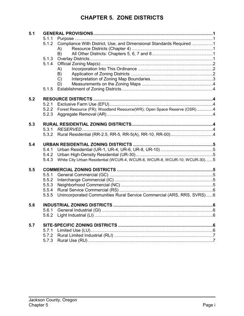
CHAPTER 5. ZONE DISTRICTS5.1 GENERAL PROVISIONS ................................................................................................ 15.1.1 Purpose ............................................................................................................... 15.1.2 Compliance With District, Use, and Dimensional Standards Required ................. 1A) Resource Districts (<strong>Chapter</strong> 4) ................................................................. 1B) All Other Districts: <strong>Chapter</strong>s 5, 6, 7 and 8 ................................................. 15.1.3 Overlay Districts ................................................................................................... 15.1.4 Official Zoning Map(s) .......................................................................................... 2A) Incorporation Into This Ordinance ............................................................ 2B) Application of Zoning Districts .................................................................. 2C) Interpretation of Zoning Map Boundaries .................................................. 3D) Measurements on the Zoning Maps ......................................................... 45.1.5 Establishment of Zoning Districts ......................................................................... 45.2 RESOURCE DISTRICTS ................................................................................................ 45.2.1 Exclusive Farm Use (EFU)................................................................................... 45.2.2 Forest Resource (FR); Woodland Resource(WR); Open Space Reserve (OSR)............. 45.2.3 Aggregate Removal (AR) ..................................................................................... 45.3 RURAL RESIDENTIAL ZONING DISTRICTS ................................................................. 45.3.1 RESERVED ......................................................................................................... 45.3.2 Rural Residential (RR-2.5, RR-5, RR-5(A), RR-10, RR-00) .................................. 45.4 URBAN RESIDENTIAL ZONING DISTRICTS ................................................................ 55.4.1 Urban Residential (UR-1, UR-4, UR-6, UR-8, UR-10) .......................................... 55.4.2 Urban High-Density Residential (UR-30).............................................................. 55.4.3 White City Urban Residential (WCUR-4, WCUR-6, WCUR-8, WCUR-10, WCUR-30) ...... 55.5 COMMERCIAL ZONING DISTRICTS ............................................................................. 55.5.1 General Commercial (GC) ................................................................................... 55.5.2 Interchange Commercial (IC) ............................................................................... 55.5.3 Neighborhood Commercial (NC) .......................................................................... 55.5.4 Rural Service Commercial (RS) ........................................................................... 65.5.5 Unincorporated Communities Rural Service Commercial (ARS, RRS, SVRS) ..... 65.6 INDUSTRIAL ZONING DISTRICTS ................................................................................ 65.6.1 General Industrial (GI) ......................................................................................... 65.6.2 Light Industrial (LI) ............................................................................................... 65.7 SITE-SPECIFIC ZONING DISTRICTS ............................................................................ 65.7.1 Limited Use (LU).................................................................................................. 65.7.2 Rural Limited Industrial (RLI) ............................................................................... 75.7.3 Rural Use (RU) .................................................................................................... 7<strong>Jackson</strong> <strong>County</strong>, <strong>Oregon</strong><strong>Chapter</strong> 5Page i
CHAPTER 5.ZONE DISTRICTS5.1 GENERAL PROVISIONS5.1.1 PurposeThese zoning regulations are established pursuant to <strong>Oregon</strong> Revised Statutes,<strong>Chapter</strong> 215, for the purpose of promoting the health, safety, and general welfareof the people of <strong>Jackson</strong> <strong>County</strong>, and to achieve the following objectives:A) To implement the Statewide Planning Goals;B) To implement the <strong>County</strong> Comprehensive Plan;C) To provide a guide for the growth and development of unincorporatedareas of the <strong>County</strong>;D) To establish zoning districts within which the needs of agriculture,forestry, commerce, industry, residences, and other land uses can beappropriately met;E) To provide minimum standards within zoning districts for the uses of land,location and height of buildings, density of population, signs, andoff-street parking facilities;F) To facilitate adequate provision of services and facilities, such as water,sewerage, schools, parks, transportation, utilities, and other publicrequirements; andG) To encourage urban level growth in appropriate urbanizable areas andensure the orderly transition from rural to urban development.5.1.2 Compliance With District, Use, and Dimensional Standards RequiredA) Resource Districts (<strong>Chapter</strong> 4)While the <strong>County</strong>'s authority under <strong>Oregon</strong> law to regulate development inthe unincorporated areas is broad, development in the Forest and Farmdistricts is strictly governed by state law. Development will be conductedin accordance with <strong>Chapter</strong> 4, <strong>Chapter</strong> 6 (Sections 6.4 and 6.5), and allother applicable provisions of this Ordinance (e.g., <strong>Chapter</strong>s 7 through10).B) All Other Districts: <strong>Chapter</strong>s 5, 6, 7 and 8In all other districts except the resource districts, no building or structurewill be erected, converted, enlarged, reconstructed, removed, replaced, oraltered for use, nor will any land, building, or structure be used orchanged, except in accordance with the zoning district regulations of this<strong>Chapter</strong>, and all other applicable regulations of this Ordinance.5.1.3 Overlay DistrictsA) Where the property is classified in an overlay district as well as a generaluse district, then the regulations governing development in the overlay<strong>Jackson</strong> <strong>County</strong>, <strong>Oregon</strong><strong>Chapter</strong> 5 Page 1
district (<strong>Chapter</strong> 7) will apply in addition to the regulations governingdevelopment in the underlying district.B) In the event of a conflict between general standards applicable in a zoneand the standards of an overlay district that apply to a particular property,the overlay district standards control.5.1.4 Official Zoning Map(s) 1A) Incorporation Into This OrdinanceThe designations, locations, and boundaries of the zoning and overlaydistricts established by this Ordinance will be shown on the OfficialZoning Maps of <strong>Jackson</strong> <strong>County</strong> ("Official Zoning Maps"). The OfficialZoning Maps will be numbered, dated, and signed by the Board ofCommissioners and maintained by the <strong>Jackson</strong> <strong>County</strong> DevelopmentServices Department. These maps and all notations, references, anddata shown thereon are incorporated by reference into this Ordinance,and will be as much a part of the Ordinance as if all were fully describedherein.B) Application of Zoning Districts1) General Map DesignationsThis Ordinance establishes base zoning districts for the OfficialZoning Maps. The map symbols and abbreviated designations forthese districts appear in Sections 5.2 through 5.6 following thename of each district. The Official Zoning Maps are intended toimplement the Comprehensive Plan and are a site-specificembodiment of goals, findings, and policies found in the <strong>Jackson</strong><strong>County</strong> Comprehensive Plan.2) Special Map DesignationsSpecial map designations also are displayed on the official mapsand take four basic forms:a) Areas of Special ConcernAreas that are designated as Areas of Special Concern aregenerally identified on the Zoning Maps by the letters"ASC." Use of this land is governed by the provisions ofthis Ordinance as well as conditions specific to the Area ofSpecial Concern, which are set forth in <strong>Chapter</strong> 7.b) Urban Growth BoundariesAreas within established Urban Growth Boundaries (e.g.,urbanizable areas) are identified on the Official ZoningMaps to indicate areas that are needed for urbanexpansion over a 20-year time period from the date eachagreement is adopted.c) Urban Reserve AreasAreas within established Urban Reserve Areas areidentified on the Official Zoning Maps to indicate areas that1Ordinance 2012-6, effective 9/23/12<strong>Jackson</strong> <strong>County</strong>, <strong>Oregon</strong><strong>Chapter</strong> 5 Page 2
are needed for urban expansion over a 30 to 50-year timeperiod from the date each agreement is adopted.d) Unincorporated CommunitiesAreas within unincorporated communities are identified onthe Official Zoning Maps to indicate rural communities,rural service centers, and urban unincorporatedcommunities (such as White City).C) Interpretation of Zoning Map BoundariesInitial Zoning boundary interpretations will be made by Planning Staffusing maps generated by the <strong>County</strong>=s Geographic Information System(GIS) data base, and printed GIS maps. In case of any dispute regardingthe Zoning classification of property subject to this Ordinance, the originalmaps contained in the Official <strong>County</strong> Records will control. Whereuncertainty exists with respect to the boundaries of the Zoning districtsshown on the Official Zoning Maps, the Director will use the followingrules to interpret the Official Zoning Maps:1) Where the Official Zoning Maps show a zoning district boundaryline located within or following a street or alley right of way,railroad or utility line right of way, easement, or waterway, thedistrict boundary will be considered to be in the center of the rightof way, easement, or waterway. If the actual location of such rightof way, easement, or waterway, as indicated in a recorded legaldescription of such, varies slightly from the location shown on theOfficial Zoning Maps, then the actual location will control;2) Where the Official Zoning Maps show a boundary line as beinglocated a specific distance from a street line or other physicalfeature, this distance will control;3) Where the Official Zoning Maps show a district boundary toapproximately coincide with a property line, urban growthboundary, or municipal border, the property line, urban growthboundary, or municipal border will be considered to be the districtboundary, unless a specific distance from a street line or otherphysical feature is shown;4) Where the Official Zoning Maps show a district boundary to notcoincide or approximately coincide with any street, alley, railroad,waterway, or property line, and no dimensions are shown, thelocation of the boundary will be determined by use of the scaleappearing on the Official Zoning Maps;5) In instances where a parcel includes two or more zoning districtsdescribed in Sections 5.3 through 5.6, or a combination of one ormore of those districts with a resource district described in Section5.2, each part of the parcel will be used in conformity with thestandards established by this Ordinance for the zoning district inwhich that part is located. See also Section 4.2.6(B)(3) [Roth v.Wood & <strong>Jackson</strong> <strong>County</strong>, LUBA 2000-083 & 2001-121]; and6) When urban growth and other community boundaries includepublic rights-of-way, the entire right-of-way that abuts lands within<strong>Jackson</strong> <strong>County</strong>, <strong>Oregon</strong><strong>Chapter</strong> 5 Page 3
the urban growth or community boundary is also within theboundary, unless otherwise specified in a city or <strong>County</strong> ordinanceadopting the boundary.D) Measurements on the Zoning Maps<strong>County</strong> staff may use standard engineering scales, rulers, or othermeasuring devices as necessary to determine distances on the OfficialZoning Maps. Where these measurements are disputed, aggrievedpersons may appeal the staff determination through a Type 2 reviewprocess.5.1.5 Establishment of Zoning DistrictsSections 5.2 through 5.7 set forth the name and description of all zoning districtsestablished for the purposes of this Ordinance.5.2 RESOURCE DISTRICTSThe purposes of the resource districts are set forth below. The resource districts arefundamentally different from all other districts established in the <strong>County</strong>. While the<strong>County</strong>'s authority under <strong>Oregon</strong> law to regulate development in the rural residential,urban residential, commercial, and industrial districts is broad, the <strong>County</strong>'s authority toregulate development in the resource districts is strictly governed by state law. For thisreason, the uses permitted and the standards for development in the resource districtsare set forth in a separate part of this Ordinance: <strong>Chapter</strong> 4: Resource Districts. All usesin the resource districts will comply with the general dimensional standards set forth in<strong>Chapter</strong> 8.5.2.1 Exclusive Farm Use (EFU)This district is intended to conserve agricultural land, and implements the <strong>Oregon</strong>Agricultural Land Use Policy, ORS 215.243, <strong>Oregon</strong> Administrative Rules, andStatewide Planning Goal 3 (Agricultural Lands). See Section 4.2 of thisOrdinance.5.2.2 Forest Resource (FR); Woodland Resource (WR); Open Space Reserve(OSR)These districts are intended to conserve forest lands and implement the <strong>Oregon</strong>Administrative Rules, and Statewide Planning Goal 4 (Forest Lands). SeeSection 4.3 of this Ordinance.5.2.3 Aggregate Removal (AR)The purpose of this district is: to allow the development and use of significantmineral and aggregate resources subject to uniform operating standards; tobalance and resolve conflicts between surface mining activities and activities onsurrounding land; and to ensure the protection of natural resources and thereclamation of mined land. See Section 4.4 of this Ordinance.5.3 RURAL RESIDENTIAL ZONING DISTRICTSThe purposes of the rural residential zoning districts are set forth below. The alloweduses for each of the districts are set forth in Table 6.2-1. All uses must comply with theapplicable development standards of this Ordinance.5.3.1 RESERVED5.3.2 Rural Residential (RR-2.5, RR-5, RR-5(A), RR-10, RR-00)The purpose of the rural residential zoning districts is to provide for large-lotresidential areas, consistent with the predominant rural character of the area and<strong>Jackson</strong> <strong>County</strong>, <strong>Oregon</strong><strong>Chapter</strong> 5 Page 4
the physical capability of the land. The RR-00 district is established for areaswhere there are physical limitations in water, or land resources or serviceavailability, or for areas where rural residential divisions could inhibit future urbandevelopment.5.4 URBAN RESIDENTIAL ZONING DISTRICTSThe purposes of the urban residential zoning districts are set forth below. The alloweduses for each of the districts are set forth in Table 6.2-1. All uses must comply with theapplicable development standards of this Ordinance.5.4.1 Urban Residential (UR-1, UR-4, UR-6, UR-8, UR-10)The purpose of these districts is to encourage, provide, and protect suitableenvironments for single- and multiple-family residences within urbanized areas ofthe <strong>County</strong> where public services and facilities are available, and to provideplanned residential areas with densities up to 10 dwellings per acre.5.4.2 Urban High-Density Residential (UR-30)This district establishes high-density residential developments up to 30 dwellingsper acre in existing urban areas where public services and facilities are available.5.4.3 White City Urban Residential (WCUR-4, WCUR-6, WCUR-8, WCUR-10,WCUR-30)Within the White City Urban Unincorporated Community urban residential areasprovide for urban levels of residential development with densities up to 10dwellings per acre for single family dwellings and up to 30 dwellings per acre formultiple-family dwellings where public services and facilities are available.Unless otherwise specified in <strong>Chapter</strong> 12, development in the WCUR districts issubject to all the same requirements as the urban residential districts describedin Section 5.4.1 and 5.4.2, above.5.5 COMMERCIAL ZONING DISTRICTSThe purposes of the commercial zoning districts are set forth below. The allowed usesfor each of the districts are set forth in Table 6.2-1. All uses must comply with theapplicable development standards of this Ordinance.5.5.1 General Commercial (GC)The purpose of this district is to provide locations for larger retail servicecommercial centers along major highways and within existing urban areas wherepublic services and facilities are available.5.5.2 Interchange Commercial (IC)The purpose of this district is provide for commercial uses that serve theimmediate needs of the traveling public, and are located at freeway interchangeswith state highways or county roads.5.5.3 Neighborhood Commercial (NC)The purpose of a small neighborhood commercial center is to convenientlyprovide basic commodities for residential neighborhoods and to provide a mix ofcommercial and residential uses that are within easy walking or short drivingdistance of residential neighborhoods and alternative transportation systems.Because of their pedestrian orientation, drive-thru's and uses that rely solely onauto trips are prohibited (OAR 660-012-0060(5)(a))<strong>Jackson</strong> <strong>County</strong>, <strong>Oregon</strong><strong>Chapter</strong> 5 Page 5
5.5.4 Rural Service Commercial (RS)The purpose of this district is to provide basic commodities to rural areas forwhich a specialized RS district has not been adopted. These include thecommunity core areas of the Foots Creek, Savage Creek, and Trail Rural ServiceCenter areas.5.5.5 Unincorporated Communities Rural Service Commercial (ARS, RRS, SVRS)The purpose of these districts is to provide basic commodities to the Applegate(ARS), Ruch (RRS) and Sams Valley (SVRS) unincorporated communities.5.6 INDUSTRIAL ZONING DISTRICTSThe purposes of the industrial zoning districts are set forth below. The allowed uses foreach of the districts are set forth in Table 6.2-1. All uses must comply with theapplicable development standards of this Ordinance.5.6.1 General Industrial (GI)The purpose of this district is to provide for heavy industrial uses.5.6.2 Light Industrial (LI)The purpose of this district is to provide for light manufacturing and fabrication.In addition, this district allows limited retail commercial and office uses in existingand new industrial parks when such uses are subordinate to industrial uses.5.7 SITE-SPECIFIC ZONING DISTRICTS5.7.1 Limited Use (LU), a Type 4 reviewThe purpose of this district is to limit uses and activities to those justified in aComprehensive Plan Amendment "Reasons" exception statement adopted bythe <strong>County</strong> and acknowledged by the state pursuant to ORS 197.732(1)(c) asrequired by OAR 660-004-0018(4)(a), or to recognize existing lawfullyestablished nonconformities as permitted uses (see Section 13.3). AComprehensive Plan Amendment "Reasons" exception adopted by the <strong>County</strong>,and acknowledged by the State pursuant to OAR 660-004-0022(1), may or maynot include a minor map amendment to designate the property LU at the<strong>County</strong>'s discretion. Similarly, a rezone to LU to recognize the continuedexistence of a legal nonconforming use may be approved where the use is:A) Of a non-industrial nature;B) The use has continuously existed for 20 or more years; andC) No citations have been issued by the <strong>County</strong> against the use.It is intended that uses and activities in a Limited Use district will be those usesand activities specified in the Ordinance adopting the LU designation, togetherwith other similar, related, accessory and supplemental uses consistent with theacknowledged Ordinance adopting the designation for the property. In no eventwill the predominant use in an LU district be industrial. Uses in the LU district willbe subject to other applicable standards, statutes, and rules governing sewagedisposal, noise, and air and water quality.<strong>Jackson</strong> <strong>County</strong>, <strong>Oregon</strong><strong>Chapter</strong> 5 Page 6
5.7.2 Rural Limited Industrial (RLI), a Type 4 reviewThe purpose of this district is to provide for industrial uses that rely on sitespecificnatural resources for their processes and activities, or create a byproductof substantial direct benefit to resource-producing lands or uses. Such uses aremore appropriately located outside an urban growth boundary. Naturalresources associated with the RLI use must be located on the subject parcel orlands immediately adjacent to it. Such industrial uses are inappropriate in anurban industrial setting because of the nature of their operating characteristics,but can be made compatible with rural land uses. A Comprehensive PlanAmendment Goal exception adopted by the <strong>County</strong>, and acknowledged by theState may or may not include a minor map amendment to designate the propertyRLI at the <strong>County</strong>'s discretion.5.7.3 Rural Use (RU) DistrictThe purpose of this district is to provide a designation for lands that are not urbanor urbanizable and do not meet the state definitions of agricultural or forest land.Designation as a Rural Use zoning district is subject to a binding site plan reviewin accordance with the development standards of this ordinance (e.g., <strong>Chapter</strong>s 7through 10).<strong>Jackson</strong> <strong>County</strong>, <strong>Oregon</strong><strong>Chapter</strong> 5 Page 7


