Peck Sink Floodplain - Hernando County
Peck Sink Floodplain - Hernando County
Peck Sink Floodplain - Hernando County

You also want an ePaper? Increase the reach of your titles
YUMPU automatically turns print PDFs into web optimized ePapers that Google loves.
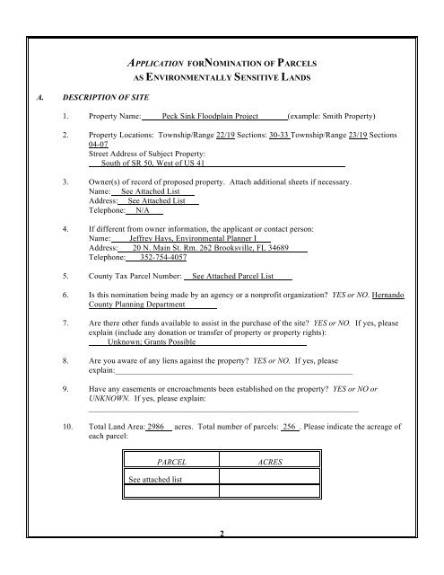
A. DESCRIPTION OF SITEAPPLICATION FORNOMINATION OF PARCELSAS ENVIRONMENTALLY SENSITIVE LANDS1. Property Name: <strong>Peck</strong> <strong>Sink</strong> <strong>Floodplain</strong> Project (example: Smith Property)2. Property Locations: Township/Range 22/19 Sections: 30-33 Township/Range 23/19 Sections04-07Street Address of Subject Property:South of SR 50, West of US 413. Owner(s) of record of proposed property. Attach additional sheets if necessary.Name: See Attached ListAddress: See Attached ListTelephone: N/A4. If different from owner information, the applicant or contact person:Name: Jeffrey Hays, Environmental Planner IAddress: 20 N. Main St. Rm. 262 Brooksville, FL 34689Telephone: 352-754-40575. <strong>County</strong> Tax Parcel Number: See Attached Parcel List6. Is this nomination being made by an agency or a nonprofit organization? YES or NO. <strong>Hernando</strong><strong>County</strong> Planning Department7. Are there other funds available to assist in the purchase of the site? YES or NO. If yes, pleaseexplain (include any donation or transfer of property or property rights):Unknown; Grants Possible8. Are you aware of any liens against the property? YES or NO. If yes, pleaseexplain:__________________________________________________________9. Have any easements or encroachments been established on the property? YES or NO orUNKNOWN. If yes, please explain:__________________________________________________________________10. Total Land Area: 2986 acres. Total number of parcels: 256 . Please indicate the acreage ofeach parcel:PARCELACRESSee attached list2
11. Please attach a legal description or property tax card and any available survey showingboundaries of the property, existing streets, buildings, watercourses, easements, section linesand any deed restrictions or encumbrances, as applicable. Applications made by propertyowners should include a copy of the deed.12. Have any waste management or disposal activities been conducted on the property? YES or NOor UNKNOWN. If yes, please explain in the narrative required in Section C.4.B. VALUATION1. Do you have an estimated fair market value? YES or NO. Attach documentation such as anappraisal, if available.2. Attach documentation of current assessed value from the <strong>Hernando</strong> <strong>County</strong> Property Appraiser'sOffice.3. Attach any available documentation of owner's willingness to arrange transfer of the property.C. ATTACHMENTS1. Provide a map with sufficient detail to locate the property in the field. Property boundaries mustbe clearly depicted. Recent aerial maps at a scale of 1"= 200' with landmarks depicted will beappropriate.2. Photographs or videos depicting the characteristics of the property may be provided by theapplicant.3. Provide a brief narrative which discusses why the project should be considered anenvironmentally sensitive land. The narrative should address the attached requisite conditionsfor designation as an ENVIRONMENTALLY SENSITIVE LAND which apply to this property.4. Provide a narrative which describes historic and current uses of the property. Such uses mayinclude but not be limited to dredge and fill activities, structural improvements, mineralextraction, waste management activities, and agricultural development. Provide copies of anysoil or farm management plans, if available.5. Persons acting as an agent for the property owner must attach an affidavit to that effect.3
PECK SINK WATERSHED FLOODPLAIN ACQUISITION PROJECTNARRATIVEIntroductionThe <strong>Peck</strong> <strong>Sink</strong>hole Complex west of Brooksville is one of the most significant sinkholecomplexes in the <strong>County</strong>. The sink complex drains a watershed of approximately 11,000 acresincluding a portion of the existing Brooksville urban area and the developing residential/golfcourse developments of <strong>Hernando</strong> Oaks and Southern Hills Plantation. The sink complex has anassociated FEMA 100-year floodplain of approximately 1,500 acres which is the primary focusof this Environmentally Sensitive Lands (ESL) application.Hydrology and Water Quality Issues (ESL Requisite Condition 12)This sink comprises a direct connection to the underlying Floridan Aquifer which provides<strong>Hernando</strong> <strong>County</strong> with its potable water. The sink receives stormwater runoff from a rapidlydeveloping urbanized area. Stormwater is conveyed to the sink through well developed channelswhich cover a large drop in elevation from 250 feet above sea level at the edge of the basin tojust 30 feet within the main sink itself. These factors contribute to a rapid rate of transport ofuntreated stormwater and debris from the urbanized area to the sink complex. This phenomenonwas documented in the 1987 USGS report Potential for Pollution of the Upper Floridan Aquiferfrom Five <strong>Sink</strong>holes and an Internally Drained Basin in West-Central Florida (Water ResourcesInvestigations Report 87-4013). According to a 1988 USGS report the project area recharges theFloridan Aquifer at more than 10 inches per year, the highest category listed (Water ResourcesInvestigation Report 88-4057).Ecological Communities (ESL Requisite Condition 1)The project area includes a large area of mesic hammock native to the Brooksville Ridge. Thereare only remnant areas of native hammock remaining in the <strong>County</strong> due to impacts fromdevelopment, mining, and agricultural. The project area also includes areas of freshwater marsh,wet prairie and several large lakes.Public Access, Recreation, Education and Consistency with the Comprehensive Plan (ESLRequisite Condition 10)There are unique opportunities for public recreation and education within this project. <strong>Peck</strong> <strong>Sink</strong>itself is an extremely impressive geologic feature. The sink would create unique environmentaleducational opportunities as part of a geologic park similar to the Devil’s Millhopper StateGeologic Park in Gainesville. Additionally, there are several prominent lakes included within theproject area which have the potential for county parks. Along with these more active uses are theusual passive recreational uses associated with Environmentally Sensitive Lands Preserves suchas hiking, biking and wildlife observation among others. These opportunities for public accessand park sites will assist the <strong>County</strong> in meeting the level of service standards for parks set out inthe Comprehensive Plan.
Threatened by Development (ESL Requisite Conditions 6 & 10)This project lies directly between the expanding urban areas of Spring Hill and the City ofBrooksville. This region has experienced increased development pressure within the past twoyears. If purchased this area would create a useful low intensity land use buffer between thesetwo communities. The establishment of a greenbelt in this area will help to focus urbandevelopment within the established urban core. This is also in line with several policies withinthe Comprehensive Plan.Feasibility of Acquisition and (ESL Requisite Condition 4)Parcels within the acquisition area range from over 500 acres to individual 1/4 acre lots. Thisapplication breaks the project area into five study areas. The separate study areas offer theopportunity to prioritize acquisition goals and objectives and then to eventually prioritizeindividual parcels. Once this prioritization has taken place the possibility of narrowing theproject into manageable units will be key. Less-than-fee acquisitions would be pursued onagricultural parcels within the project boundary.Manageability (ESL Requisite Condition 3)Due to the mesic nature of the native forest cover extensive use of prescribed burning should notbe necessary. The possibility of undertaking stormwater and floodplain management projects inthe area further enhances the potential environmental benefits of this acquisition. These benefitsshould help to leverage additional acquisition funds from state and federal agencies.Study Area DescriptionsStudy Area AStudy Area A is 204 acres and contains the <strong>Peck</strong> <strong>Sink</strong> Complex and the drainage way leading tothe sink. There are 18 dwelling units within this study area, the majority of which are alongMobley Road where the smallest parcels are located. Several of the larger parcels are undercommon ownership. There are areas of native hammock, planted pine and pasture. A geologicpark surrounding <strong>Peck</strong> <strong>Sink</strong> and stormwater treatment projects are possible future public useswithin this study area.Study Area BStudy Area B is 361 acres and contains Horse and Bonnie Lakes and their associated wetlands.There are 22 dwelling units the majority of which are in a subdivision surrounding Bonnie Lake.The area is predominantly lake, wetland, hammock and pasture. If acquired there is thepossibility of a mixed use county park along one of the lakes.
Study Area CStudy Area C is 521 acres and is primarily pasture, planted pine some native hammock. There isa large amount of FEMA 100-year floodplain within this area. As water flows out of Horse lakeunder Wiscon Rd, this area might have possibilities of offering stormwater and floodwaterretention and treatment. There are 23 dwelling units, 9 of which are within the Plantation MobileHome Park.Study Area DStudy Area D is 529 acres and is primarily pasture with some native hammock cover andfreshwater marsh. This area would be a prime candidate for less-than-fee acquisitions. There are12 dwelling units in this area. This area could serve as a primary break along the U.S. 41corridor between the intense land uses associated with Spring Hill and Brooksville.Study Area EStudy Area E is 1415 acres and includes 49 dwelling units. The largest parcels within the projectfall within this area as well as some of the largest areas of native hammock. The area alsoincludes planted pine, freshwater marsh, wet prairie and lies within a large segment of the 100-year floodplain associated with <strong>Peck</strong> <strong>Sink</strong>. There is a high density of karst features within thisstudy area.
STAFF EVALUATIONSECTION 1<strong>Peck</strong> <strong>Sink</strong> <strong>Floodplain</strong> Acquisition ProjectSupports prime examples of ecological communities native to <strong>Hernando</strong> <strong>County</strong> and/orsignificant features as identified in Section 1 of the manual.According to the Florida Fish and Wildlife Conservation Commission Landsat Habitat Mapsand Florida Land Use Cover Classification System (FLUCCS) the project area includescropland and pasture, mixed coniferous/hardwood forest, pine flatwoods, residential < 2 du/acand several wetland habitats. <strong>County</strong> data resources show 27 sinkhole features within theproject area including the <strong>Peck</strong> <strong>Sink</strong> Complex.SECTION 2Supports exceptional biodiversity - sites which represent several ecological communities orexhibit high species diversity within an ecological community native to <strong>Hernando</strong> <strong>County</strong>.Staff has not conducted any biological surveys within the project. There are large contiguousareas of native hardwood hammock within the project area interspersed with numerouswetlands which would favor high biodiversity. There is a large amount of karst activity withinthe project area as well. <strong>Sink</strong>holes sometimes harbor unique vegetative communities. Alongwith these communities there are extensive areas of improved pasture which will have lowercomparative biodiversity.SECTION 3Manageability - feasible to manage in a fashion that will protect and enhance the resource.The final determination of which of the Study Areas would receive acquisition priority wouldaffect the manageability of the project. Also a determination of which parcels would beapproached for less-than-fee purchases would also affect the manageability. There is a mosaicof land uses within the Study Areas ranging from agricultural to residential to undevelopednative cover. The ESLC and BCC will need to determine which parcels would be purchasedfor public access and park site locations and which would be targeted for conservationeasements in order to discourage more intense development of the area.E:\WPDATA\JLH\ESL\PECK\<strong>Peck</strong>StaffEval.wpd1
SECTION 4Feasibility of acquisition - ownership patterns, property restrictions or other conditionsshould not pose significant barriers.There are 256 parcels within the proposed project area ranging from 0.1 acres to 415 acres. Itis unlikely that smaller developed residential lots included in the study area would beconsidered. Once purchase priorities are determined the feasibility of acquisition of theindividual Study Areas within the larger project can be determined. Several of the largerparcels are under single ownership which may allow the purchase or conservation of largeamounts of floodplain, native hammock, and highly karst landscapes; three of the main focusesof the project. Owners of frequently flooded property might be more likely to sell than thoseof higher more developable parcels.SECTION 5Surrounding land use - the current land use of adjacent property should be compatiblewith the proposed management and preservation of the site as environmentally sensitive.The Future Land Use Map indicates that the area surrounding the project site is chieflyresidential.Current zoning surrounding the project is AG (agriculture), AR-2 (agricultural-residential) andsome R1A/R1B (residential) and PDP residential zoning including the <strong>Hernando</strong> Oakssubdivision. There are also a few commercial uses along US 41 and a recentcommercial/office professional rezoning adjacent to SR 50.SECTION 6Threatened by development - when sites are in imminent danger of development, theyshould receive preference for purchase.The development potential of the majority of the project area is limited by the amount offloodplain and by a rural Future Land Use classification. <strong>Peck</strong> <strong>Sink</strong> itself is adjacent to therecently rezoned LIAX property. The Williams property (40 acres) immediately south of thesink is for sale with potential to be developed. As Brooksville and Spring Hill continue todevelop, parcels within the area with fewer environmental constraints will undoubtedly seeincreased development pressure.E:\WPDATA\JLH\ESL\PECK\<strong>Peck</strong>StaffEval.wpd2
SECTION 7Size - large sites are preferable in order to encompass a diversity of resources and amixture of uses. Exceptions will be small vegetative communities for which only smallpopulations of listed plants or animals remain and properties which will function asgreenway/wildlife corridors. These exceptions are not required to be depicted on theEnvironmentally Sensitive Lands Map.The project area is 2986 acres as proposed. Project boundaries could be adjusted onceacquisition priorities are determined.SECTION 8Other methods of protection - sites which receive substantial protection by other strategiesshould receive lower priority.A low percentage of this project area is protected by other methods. Wetlands account for asmall portion of the project area. Changes in land use would require a zoning action.SECTION 9Rarity - vegetative communities which are poorly represented in public ownership shouldreceive preference. These communities include those species which, while not currentlylisted, are known to be poorly represented in the state or county.A large portion of this project is improved pasture. Large areas of native mixedconiferous/hardwood hammock are also present within the project. Additionally, this projectarea holds the largest concentration of sinkholes in the county according to <strong>County</strong> dataresources. The vegetative communities associated with active sinkholes are not wellrepresented in public ownership at the present time. A sinkhole complex with as largerecharge capacity as <strong>Peck</strong> <strong>Sink</strong> is certainly a rarity in the <strong>County</strong> and not well represented inpublic ownership.There is hammock habitat in public ownership at the ESL Fickett Hammock Preserve andDivision of Forestry Lands.E:\WPDATA\JLH\ESL\PECK\<strong>Peck</strong>StaffEval.wpd3
SECTION 10Consistency with Comprehensive Plan - the property satisfies a goal, objective, or policy ofthe adopted Comprehensive Plan.Relevant Comprehensive Plan language is as follows:GOAL 6.01PROTECT WILDLIFE AND CONSERVE, APPROPRIATELY USE, ANDPROTECT WILDLIFE HABITATS.IDENTIFICATION AND PRESERVATION OF ENVIRONMENTALLY SENSITIVE LANDS ANDUNIQUE NATURAL VEGETATION COMMUNITIESOBJECTIVE 6.01C:POLICY 6.01C(1):POLICY 6.01C(2):POLICY 6.01C(3):POLICY 6.01C(5):POLICY 6.01C(6):IDENTIFY AND PRESERVE ENVIRONMENTALLYSENSITIVE LANDS AND UNIQUE NATURALVEGETATIVE COMMUNITIES WHERE POSSIBLETHROUGH LAND ACQUISITION, MANAGEMENTAGREEMENTS, OR INTER-AGENCYCOOPERATION IN THE MANNER THATFURTHERS THE GOALS AND OBJECTIVES INPrepare an annual report identifying environmentallysensitive lands and unique natural vegetative communitiesincluding a prioritization of acquisition by applicablecriteria.Develop and maintain a protection plan for <strong>County</strong>-ownedenvironmentally sensitive lands and unique naturalvegetative communities.Assist state agencies in the development of protectionplans for state-owned environmentally sensitive lands andunique vegetative communities.As part of the protection plan, provide a method throughwhich private developers could increase density ordecrease on-site open space by providing funds or land fornatural preservation areas.Require in the land development approval criteria thepromotion of density clustering and protection of uniquenatural vegetative communities.E:\WPDATA\JLH\ESL\PECK\<strong>Peck</strong>StaffEval.wpd4
ESTABLISHMENT OF CONSERVATION AREASOBJECTIVE 6.01E:POLICY 6.01E(2):COOPERATE WITH CITRUS AND PASCOCOUNTIES AND THE CITY OF WEEKI WACHEETO CONSERVE, PROTECT AND APPROPRIATELYUSE UNIQUE VEGETATIVE COMMUNITIESLOCATED WITHIN MORE THAN ONE LOCALJURISDICTION.Continue to coordinate with the FG&FWFC and theDivision of Forestry regarding the management,protection, and use of CARL lands.CREATION OF NATURAL AREA GREENWAYSOBJECTIVE 6.01G:POLICY 6.01G(1):POLICY 6.01G(2):POLICY 6.01G(3):POLICY 6.01G(5):ENCOURAGE THE CREATION OF CONNECTINGNATURAL AREA GREENWAYS BY CONNECTINGENVIRONMENTALLY SENSITIVE LANDS ANDOTHER PRESERVED AREAS IN THE COUNTY.Continue to encourage appropriate agencies and privateorganizations to develop or preserve natural areagreenways which may function as wildlife corridorsand/or recreation areas, and to meet the passiverecreational needs of the <strong>County</strong> while preserving the<strong>County</strong>’s natural vegetation.The natural area greenways shall consist ofenvironmentally sensitive lands, wetlands, preservedlands, and conservation easements with vegetativecommunities which are beneficial to threatened andendangered species.Encourage inter-agency agreements for joint landacquisitions or through the use of Purchase ofDevelopment Rights (PDR) for creation of natural areagreenways.Support appropriate agencies in obtaining conservationeasements on private lands.E:\WPDATA\JLH\ESL\PECK\<strong>Peck</strong>StaffEval.wpd5
POLICY 6.01G(6):POLICY 6.01G(7):Continue to request assistance in public acquisition orthrough the use of Purchase of Development Rights(PDR) of natural preserves under regional, state andfederal programs.Prevent fragmentation of wildlife corridors, wherepossible, and continue to preserve wildlife corridors andnatural areas within development projects.GOAL 6.05CONSERVE, APPROPRIATELY USE AND PROTECT THE QUALITY ANDQUANTITY OF WETLANDS AS DESIGNATED BYSWFWMD AND DEP.GOAL 6.08GROWTH IN HARMONY WITH NATURAL CONDITIONS.DEVELOPMENT COMPATIBLE WITH THE NATURAL SYSTEMOBJECTIVE 6.08A:POLICY 6.08A(1):POLICY 6.08A(2):POLICY 6.08A(3):DEVELOPMENT SHALL BE COMPATIBLE WITHTHE ABILITY OF THE NATURAL SYSTEMS TOSUPPORT THE INTENSITY OF DEVELOPMENT.Minimum lot sizes for septic fields may be furtherrestricted from the minimum ½ acre in prime aquiferrecharge areas, sinkhole areas, areas adjacent to lakes orrivers or areas where soils have severe limitations (USDANatural Resources Conservation Service (NRCS)).Development in flood-prone areas shall generally be lessintensive and shall meet the standards established in the<strong>County</strong> flood plain ordinance.The flood plain ordinance shall minimize developmentimpacts on flood plains, including storage capacity andincrease or decrease in the natural flow of floodwater.E:\WPDATA\JLH\ESL\PECK\<strong>Peck</strong>StaffEval.wpd6
SECTION 11Location - the site has proximity to other resources which would heighten its value as asensitive land or is within an area of long range planning with the objective of preservinggreenway/wildlife corridors between existing protected resources. The property is withinthe mapped designation of environmentally sensitive lands as described in Section 2.The project is not within any of the major planned greenway/wildlife corridors. However, itcontains <strong>Peck</strong> <strong>Sink</strong> and numerous other karst features which are environmentally sensitive andvery vulnerable to contamination. The project serves as scenic greenspace between Spring Hilland Brooksville. This area serves as floodplain storage with the potential for stormwaterimprovement projects.SECTION 12Historical/archaeological/paleontological resources - must satisfy the criteria provided inSection 1.<strong>County</strong> data resources show a historical/archeological site between Wiscon Rd. and Mason-Smith Rd. The nature of this site will need to be determined prior to purchase or development.SECTION 13Hydrology - the property is critical to preserving hydrologic integrity of significant naturalsystems and/or contributes substantially to recharge of the Floridan Aquifer.The <strong>Peck</strong> <strong>Sink</strong> Complex is a major recharge point to the Floridan Aquifer. The sink drains anincreasingly urbanized 11,000 acre watershed. One of the primary focuses of acquiring thesink complex and its primary conveyance is to explore options for improving the water qualityentering the sink. Additionally there is a high density of karst features throughout the projectarea all of which have the potential to directly discharge to the aquifer. The USGS report,Potential for Pollution of the Upper Floridan Aquifer from Five <strong>Sink</strong>holes and an InternallyDrained Basin in West-Central Florida (Water Resources Investigations Report 87-4013),documents the importance, vulnerability, and high recharge capacity of this area.SECTION 14Representation - the property provides protection to lands which have not been stronglyrepresented in public ownership.See discussion on rarity in Section 9.E:\WPDATA\JLH\ESL\PECK\<strong>Peck</strong>StaffEval.wpd
<strong>Peck</strong> <strong>Sink</strong> Study AreaSR 50Wiscon Rd#AMobley RdHorseLakeBSR 50BonnieLakeCMason Smith RdWNSECalifornia StEWolf Rd0 0.5 1 MilesDUS 418/18/04d:\esri\2004\env\pecksink\pecksink.aprd:\esri\2004\env\pecksink\pecksink.pdf# The <strong>Sink</strong>Area AArea BArea CArea DArea ESPA100-Year <strong>Floodplain</strong>