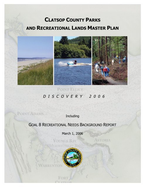
clatsop county parks and recreational lands master plan
clatsop county parks and recreational lands master plan
clatsop county parks and recreational lands master plan

Create successful ePaper yourself
Turn your PDF publications into a flip-book with our unique Google optimized e-Paper software.
As representatives of Clatsop County citizens, we are more convinced than ever thatClatsop County’s diverse <strong>recreational</strong> holdings are among our most valuable assets.What we have discovered gives us a deeper appreciation for the privilege of living here<strong>and</strong> stronger commitment to pass this on as a legacy for future generations.-Clatsop County Recreational L<strong>and</strong>s Master Plan Task ForceThank you to the citizens of Clatsop County who attended public meetings,participated in the survey <strong>and</strong> symposium <strong>and</strong> reviewed the draft reports.i
ACKNOWLEDGEMENTSClatsop County Recreational L<strong>and</strong>s Master Plan Task ForceCarolyn Eady, ChairRecreational L<strong>and</strong>s Advisory CommitteeMarc AuerbachRecreational L<strong>and</strong>s Advisory CommitteeJohn BensonRecreational L<strong>and</strong>s Advisory CommitteeMary BlakeSunset Empire Parks <strong>and</strong> RecreationRichard FencsakBikes <strong>and</strong> BeyondGail GalenRecreational L<strong>and</strong>s Advisory CommitteeLynne Lel<strong>and</strong>Oregon Equestrian TrailsNeal MaineNorth Coast L<strong>and</strong> ConservancyTom ParkeWeyerhaeuser Company, RetiredNancy SellsRecreational L<strong>and</strong>s Advisory CommitteeLarry SprouseOregon Department of ForestryScott StonumNational Park Service, Fort ClatsopDebra Kraske, Assistant County AdministratorPatrick Lines, State Parks AdvisorSteve Meshke, Parks ForemanHelen Westbrook, Board of Commissioners’ LiaisonClatsop County Recreational L<strong>and</strong>s Planning & Advisory CommitteeMarc Auerbach, ChairJohn BensonCarolyn EadyGail GalenDale McDowellNancy SellsCharles WassingerClatsop County Planning CommissionBruce Francis, ChairMarc AuerbachWilliam “Bill” HarrisJeff MartinBrian PogueDirk RohneCharles SwitzerClatsop County Board of CommissionersRichard Lee, ChairLylia GaebelSamuel PatrickPatricia RobertsHelen WestbrookConsultantIllahee Group, Vancouver WAii
Table of ContentsIntroduction 11. Planning Process 3Statewide Planning Goals 3Clatsop County Comprehensive Plan 4Goal 8 41992 Recreation Master Plan 5Recreational L<strong>and</strong>s Planning Advisory Committee 6Master Plan Task Force 72. Public Involvement 9Master Plan Task Force Meetings 9Park Opinion Survey 11Public Workshops 12Commissioner Presentation 13Symposium: “Hidden Presence, Undiscovered Treasures” 133. Clatsop County Today & Projected: Dem<strong>and</strong> for Outdoor Recreation 17Present Situation 17Demographics 19Planning Area 20Natural Features 21Benefits of Recreation <strong>and</strong> Open Space 22Statewide Outdoor Comprehensive Recreation Plan 24Dem<strong>and</strong> for Trails Today <strong>and</strong> Projected 314. Recreation Providers: Overview of Resources <strong>and</strong> Supply 37Diverse Recreational L<strong>and</strong>s 37Public L<strong>and</strong>s 41Federal L<strong>and</strong>s 41State of Oregon 41Cities 42Clatsop County 42Public School Districts 43Park <strong>and</strong> Recreation District 43iii
Private Providers 43Industrial Forest L<strong>and</strong>s 44Recreation Inventories 445. Park System Goals, Objectives <strong>and</strong> Action Strategies 53Planning Goals 53Objectives <strong>and</strong> Action Strategies 53Goals, Objectives <strong>and</strong> Action Strategies List 546. Definitions <strong>and</strong> St<strong>and</strong>ards 59Park Classifications 59Shared-use Parks 60Special Use Areas 61Natural Areas 61Gateway <strong>and</strong> Leased Park Designations 63Classification Matrix 64Zoning 657. County Parks <strong>and</strong> Recreational L<strong>and</strong>s 67Parks <strong>and</strong> Recreational L<strong>and</strong>s 67Habitat Summary 70Designated County Parks 71County-Owned Recreation Sites 104Other County-Owned Actual or Potential Recreation Sites 113Camping Facilities 115L<strong>and</strong> <strong>and</strong> Water Trails Proposals 1168. Park System Financial Analysis 117Park System Management <strong>and</strong> Financial History 117Current Budget Resources 119Grant Funding Opportunities 123Other Mechanisms <strong>and</strong> Resources 125Financing Summary <strong>and</strong> Recommendations 126Parks Management Recommendations 128iv
9. Park System Summary Recommendations<strong>and</strong> Capital Projects List 129Introduction 129Summary of Recommendations 130Procedural Recommendations 136Capital Projects List 137AppendixTask Force MeetingsA2005 Clatsop County Parks System Survey <strong>and</strong> Summary Report BPublic Meetings SummaryCCommunity SymposiumDTop LWCF Priorities: Region 1ESCORP Phone Survey: Disability InformationFSCORP: Role of County Park <strong>and</strong> Recreation DepartmentsGLocal Area Trail MapsHRecreation Rules <strong>and</strong> Map: Astoria District - ODFIRecreation Rules <strong>and</strong> Map: Weyerhaeuser Forest L<strong>and</strong>s – Clatsop CountyJTillamook <strong>and</strong> Columbia County Camping FeesKLocations of Proposed LNG Proposals on Columbia RiverLGrant Summaries <strong>and</strong> WorksheetsMRegional Recreation Council - Proposed CharterNClatsop County Park Rules <strong>and</strong> RegulationsOArticle: Sigfridson Park Adopted by Class of Star of the Sea SchoolPArticle: Camp Kiwanilong Celebrates 70 th AnniversaryQOther Funding Mechanisms <strong>and</strong> ResourcesRClatsop County Travel Impacts, 1991-2004SCounty-Owned Water Access SitesTOther County-Owned ParcelsUv
FiguresFigure 1 – Symposium Mapping Exercise 16Figure 2 – Park <strong>and</strong> Recreational L<strong>and</strong>s Map 69TablesTable 1 – Participation Rate by Activity 26Table 2 – Top 10 Outdoor Activities – State Residents 26Table 3 – Percentage of Region 1 Participating in Recreation Activities(11 most popular) 27Table 4 – Changes in Recreation Participation in Region 1 (1987-2002) 28Table 5 – Most Significant Participation Growth Activities in Region 1 29Table 6 – L<strong>and</strong> Managed for Recreation: Examples by Provider 38Table 7 – Other L<strong>and</strong> in Clatsop County Open to the Public for Recreation 39Table 8 – Supply of Outdoor Recreation Resources <strong>and</strong> Facilitiesby Major Supplier in Clatsop County 40Table 9 – Oregon Parks <strong>and</strong> Recreation Department L<strong>and</strong>s in Clatsop County 45Table 10 – Clatsop State Forest Recreation Facilities 46Table 11 – Public Water Access: Rivers <strong>and</strong> Streams 47Table 12 – Public Water Access: Boat Ramps 48Table 13 – Designated Area Trails 49Table 14 – Golf Course 49Table 15 – School District Facilities 50Table 16 – Other Tennis Courts 50Table 17 – Camping/RV Facilities 51Table 18 – Goals, Objectives, <strong>and</strong> Strategies 54Table 19 – Park <strong>and</strong> Recreational L<strong>and</strong>s Classification Matrix 64Table 20 – County Zoning Relevant to Parks <strong>and</strong> Recreation L<strong>and</strong>s 65Table 21– Parks <strong>and</strong> Recreational L<strong>and</strong>s 68Table 22 – Habitat Summary 70Table 23 – Facility Inventory by Site 71Table 24 – Undeveloped County-Owned Water Access Sites 113Table 25 – Current Budget Resources 120Table 26 – Available Grant Programs 123Table 27 – Other Mechanisms <strong>and</strong> Resources 127Table 28 – Capital <strong>and</strong> Maintenance Improvement Plan 138vi
References“Creating Connections: The Oregon Recreational Trails How-To-Manual,” a componentof “Oregon Trails 2005-2014: A Statewide Action Plan,” Oregon Parks <strong>and</strong> RecreationDepartment, May 2004. (www.prd.state.or.us/trails<strong>plan</strong>ning.php)“Clatsop State Forest Recreation Management,” PowerPoint presentation, RMPTFmeeting, 2005.“From Rails to Trails in Oregon: The Springwater Corridor,” Community DevelopmentDepartment, City of Gresham, February 1993.“Local Greenprinting for Growth Workbooks –Vol 1: OverviewVol. II: How to Define a Conservation VisionVol III: Securing Conservation FundsVol. IV: How to Acquire <strong>and</strong> Manage Park <strong>and</strong> Conservation L<strong>and</strong>s,”Trust for Public L<strong>and</strong>, 2003“Oregon Statewide Comprehensive Outdoor Recreation Plan 2003-2007,” Oregon Parks<strong>and</strong> Recreation Department, January 2003.“Oregon Trails 2005-2014:Water Trails PlanNon-Motorized Trails PlanMotorized Trails Plan,”Oregon Parks <strong>and</strong> Recreation Department, February 2005.“Rails-with-Trails: Design, Management <strong>and</strong> Operating Characteristics of 61 Trails alongActive Rail Lines,” Rails to Trails Conservancy in cooperation with National ParksService, November 2000.“Rails-with-Trails: Lessons Learned, Literature Review Current Practices, Conclusions,”U.S. Department of Transportation, August 2002.“Surface Transportation: Issues Related to Preserving Inactive Rail Lines as Trails,”Report to the Hon. Sam Brownback, U.S. Senate; U.S. General Accounting Office,October 1999. (GAO/RCED-00-4)vii
INTRODUCTIONIt is significant that the Clatsop County Recreational L<strong>and</strong>sMaster Plan Task Force (the “Task Force”) went about its workduring 2005 <strong>and</strong> 2006 – 200 years after Lewis & Clark’s Corpsof Discovery reached the mouth of the Columbia River. TheCorps set foot in this area November 26, 1805. They campednear the present-day John Day boat ramp after crossing theColumbia River at Aldrich Point. On December 9, the Corpsstarted construction of Fort Clatsop to make their winterhome. For three <strong>and</strong> one-half months they explored this area.Captain Lewis wrote more in his journal about what hediscovered here than anywhere else on the journey.The 12 Clatsop County citizens on this task force served as alatter-day Corps of Discovery, taking an inventory of existing<strong>parks</strong> <strong>and</strong> recreation sites, examining the many details of<strong>parks</strong> management <strong>and</strong> operation, <strong>and</strong> exploring ways topreserve some of our most valuable resources. The reportthat they produced is a comprehensive examination of thedem<strong>and</strong> <strong>and</strong> supply of outdoor recreation in Clatsop County,including an in-depth examination of the <strong>county</strong>-ownedresources. It is an update to the 1992 Clatsop CountyRecreational L<strong>and</strong>s Master Plan <strong>and</strong>, as such, is part of the<strong>county</strong>’s Comprehensive Plan.“We need to takeseriously the evidencethat open spacecounts in human lives<strong>and</strong> that places wherewe play can be placesof hope.”Martin J. RosenFounding Member<strong>and</strong> Presidentof the Trust forPublic L<strong>and</strong>s1972-1977The Task Force’s report is organized into nine chapters:1. Planning Process Key milestones in Oregon’s long historyof l<strong>and</strong>-use <strong>plan</strong>ning.2. Public Involvement Methods of outreach <strong>and</strong> resultsobtained through involvement of Clatsop County citizens in the<strong>plan</strong>ning process.3. Clatsop County Today <strong>and</strong> Projected: Dem<strong>and</strong> forOutdoor Recreation Examination <strong>and</strong> analysis of currenttrends, conditions <strong>and</strong> outdoor recreation needs <strong>and</strong> dem<strong>and</strong>.4. Recreational Providers: Overview of Resources <strong>and</strong>Supply The broad spectrum of <strong>recreational</strong> providers, typesof resources <strong>and</strong> inventories of current supply.Clatsop County Recreational L<strong>and</strong>s Master Plan 1
5. Park System Goals, Objectives <strong>and</strong> Action StrategiesFive identified <strong>plan</strong>ning goals with subsequent objectives <strong>and</strong>action strategies for <strong>parks</strong> <strong>and</strong> <strong>recreational</strong> l<strong>and</strong>s.6. Definitions <strong>and</strong> St<strong>and</strong>ards Proposed park classificationsystem to better manage, <strong>plan</strong> for <strong>and</strong> promote <strong>county</strong> parkresources.“Everybody needsbeauty as well asbread, places to play in<strong>and</strong> pray in, wherenature may heal <strong>and</strong>give strength to body<strong>and</strong> soul alike.”John MuirSierra Club Founder7. County Parks & Recreational L<strong>and</strong>s Benchmark dataobtained in on-site inventories at <strong>county</strong>-owned <strong>parks</strong> <strong>and</strong>recreation sites.8. Park System Financial Analysis A review of fundingmechanisms currently in use or available, <strong>and</strong> recommendedways to achieve more stable funding.9. Park System Summary Recommendations <strong>and</strong>Capital Projects List Recommendations for meetingrecreation needs of residents <strong>and</strong> visitors in the next tenyears.“In the end, oursociety will bedefined not only bywhat we create, butby what we refuse todestroy.”John SawhillPresident of theNature Conservancy1990-2000Building A LegacyWe must remain aware of our role as l<strong>and</strong> <strong>and</strong> water stewardsof Clatsop County, with a responsibility to protect <strong>and</strong>preserve the quality of life we enjoy here today. Economicgrowth, housing development <strong>and</strong> jobs should be balancedwith the need to protect our resources. Without a healthyenvironment we threaten our own health, water <strong>and</strong> foodsupplies, <strong>and</strong> the overall stability of natural systems thatsustain us.Partnerships, a coordinating council, innovative fundingstrategies <strong>and</strong> marketing tools recommended in this reportserve as effective means by which to bring about greaterrecognition of our common cultural, ecological <strong>and</strong><strong>recreational</strong> values. Above all, they reinforce the need topreserve <strong>and</strong> enhance these resources for future generations.2 Clatsop County Recreational L<strong>and</strong>s Master Plan
1 > PLANNING PROCESSThe update to the Clatsop County Parks <strong>and</strong> RecreationalL<strong>and</strong>s Master Plan builds on Oregon’s long history of l<strong>and</strong>-use<strong>plan</strong>ning <strong>and</strong> policymaking at the state <strong>and</strong> local level. Keymilestones are described here.> Statewide Planning GoalsThe State of Oregon has long maintained a strong statewideprogram for l<strong>and</strong>-use <strong>plan</strong>ning. The foundation of theprogram is a set of 19 Statewide Planning Goals to which localgovernments are required to conform. In more than threedecades since the goals were first established, there havebeen modifications in process, but the goals themselves haveremained the same.The 19 goals express the state’s consistent policies on l<strong>and</strong>use <strong>and</strong> related topics such as citizen involvement, housing,natural resources <strong>and</strong> <strong>recreational</strong> needs. Most of the goalsare accompanied by “guidelines” that suggest ways in which agoal may be applied but (as noted in Goal 2) the use of theguidelines is not m<strong>and</strong>atory.Local comprehensive <strong>plan</strong>ning is the means by whichmunicipalities achieve the Statewide Planning Goals. State lawrequires each city <strong>and</strong> <strong>county</strong> to adopt a comprehensive <strong>plan</strong>,along with the zoning <strong>and</strong> l<strong>and</strong>-division ordinances necessaryto put the <strong>plan</strong> into effect.Oregon’s L<strong>and</strong> Conservation <strong>and</strong> Development Commission(LCDC) reviews local comprehensive <strong>plan</strong>s to ensureconsistency with the Statewide Planning Goals. When LCDCofficially approves a local government’s <strong>plan</strong>, the <strong>plan</strong> is saidto be “acknowledged” <strong>and</strong> becomes the controlling documentfor l<strong>and</strong> use in the area covered by the <strong>plan</strong>.“There is a shamelessthreat to our environment<strong>and</strong> to the whole quality oflife, an unfettereddespoiling of the l<strong>and</strong>.Sagebrush subdivisions,coastal ‘condomania’ <strong>and</strong>the ravenous rampage ofsuburbia in the WillametteValley all threaten to mockOregon’s status as theenvironmental model forthe nation …“We are in dire need of astate l<strong>and</strong>-use policy, newsubdivision laws <strong>and</strong> newst<strong>and</strong>ards for <strong>plan</strong>ning <strong>and</strong>zoning by cities <strong>and</strong>counties. The interests ofOregon for today <strong>and</strong> inthe future must beprotected from graspingwastrels of the l<strong>and</strong> ...”From Gov. Tom McCall’sopening address to the 1973Legislative AssemblyJanuary 8, 1973Later that year, theLegislature adopted SenateBill 100, creating Oregon’sStatewide Planning Goals.Clatsop County Recreational L<strong>and</strong>s Master Plan 3
Oregon’s <strong>plan</strong>ning laws apply not only to local governmentsbut also to special districts <strong>and</strong> state agencies. The lawsstrongly emphasize coordination – that is, the need to keep<strong>plan</strong>s <strong>and</strong> programs consistent with each other, with the goalsthemselves, <strong>and</strong> with acknowledged local <strong>plan</strong>s.> Clatsop County Comprehensive PlanClatsop County’s Comprehensive Plan is consistent withOregon’s Statewide Planning Goals. First adopted in 1983 <strong>and</strong>amended over the years, the <strong>plan</strong> represents literallythous<strong>and</strong>s of hours of work by citizen advisory committees,the Clatsop County Planning Commission <strong>and</strong> staff of theCommunity Development Department, all supported by theactive involvement of interested residents.Oregon StatewidePlanning Goals1: Citizen Involvement2: L<strong>and</strong> Use Planning3: Agricultural L<strong>and</strong>s4: Forest L<strong>and</strong>s5: Open Spaces, Scenic<strong>and</strong> Historic Areas,<strong>and</strong> Natural Resources6. Air, Water <strong>and</strong> L<strong>and</strong>Resources Quality7. Areas Subject to NaturalDisasters <strong>and</strong> Hazards8: Recreational Needs9: Economic Development10: Housing11: Public Facilities <strong>and</strong>Services12: Transportation13: Energy Conservation14: Urbanization15: Willamette RiverGreenway16: Estuarine Resources17: Coastal Shorel<strong>and</strong>s18: Beaches <strong>and</strong> Dunes19: Ocean ResourcesThe Clatsop County Plan is a statement of public goals,policies, objectives, st<strong>and</strong>ards <strong>and</strong> maps used in makingspecific decisions about present <strong>and</strong> future l<strong>and</strong> use. As along-range policy guide it represents a public statement of themost desirable l<strong>and</strong> conservation <strong>and</strong> development uses forthe next ten to 20 years.As a vital, living document, the Clatsop County ComprehensivePlan is flexible enough to change as long as goals <strong>and</strong> policies,once established, maintain their consistency <strong>and</strong> the integrityof commitment that underlies them.> Goal 8Oregon Statewide Planning Goal 8 requires local governmentsto inventory recreation needs based on public wants <strong>and</strong>desires. They are also required to inventory recreationopportunities that are available, based on adequate research<strong>and</strong> analysis. Goal 8 urges long-range <strong>plan</strong>s, policies <strong>and</strong>action strategies.4 Clatsop County Recreational L<strong>and</strong>s Master Plan
Among issues addressed, it focuses attention on the need to:• Meet <strong>recreational</strong> needs for high-density populationcenters <strong>and</strong> persons of limited mobility <strong>and</strong> finances.• Provide maximum conservation of energy <strong>and</strong> minimizeenvironmental impact <strong>and</strong> deterioration.• Make services available to the public at nominal cost.• Meet the needs of visitors to the state.Goal 8 works in synergy with other elements of the statewide<strong>plan</strong>. Goal 1, for example – the Citizen Involvement Goal –requires that the <strong>county</strong> develop <strong>and</strong> implement a programthat provides an opportunity for citizen involvement in allphases of the l<strong>and</strong>-use <strong>plan</strong>ning process.Oregon Goal 8(www.co.<strong>clatsop</strong>.or.us)reads as follows:“To satisfy the<strong>recreational</strong> needs of thecitizens of the state <strong>and</strong>visitors <strong>and</strong>, whereappropriate, to providefor the siting ofnecessary <strong>recreational</strong>facilities <strong>and</strong> destinationresorts.”Goal 9 – the Economy Goal – requires the <strong>county</strong> to <strong>plan</strong> foreconomic development. In Clatsop County, tourism plays akey role. Large shares of the <strong>county</strong>’s <strong>recreational</strong> resourcesare provided for or are used extensively by tourists. Planningfor these types of <strong>recreational</strong> facilities maintains the <strong>county</strong>’seconomic health both by encouraging tourism <strong>and</strong> providingopportunities to keep people healthy.> The 1992 Recreation Master PlanClatsop County’s Recreational L<strong>and</strong>s Master Plan is a subset ofOregon Statewide Planning Goal 8. The original RecreationalL<strong>and</strong>s Master Plan was adopted Dec. 23, 1992, representingthe combination of two <strong>plan</strong>ning documents:Goal 8 – RecreationalL<strong>and</strong>s, Clatsop CountyComprehensive Planreads as follows:“Provide opportunitiesfor Clatsop Countyresidents <strong>and</strong> visitors toenjoy a variety of qualityoutdoor <strong>recreational</strong>activities through thedevelopment <strong>and</strong>maintenance of a wellbalanced<strong>county</strong>-widepark system.”(Goal #2, page 3)1. A <strong>recreational</strong> needs background report thatinventoried existing <strong>recreational</strong> facilities; examinedgeneral <strong>recreational</strong> needs; <strong>and</strong> reviewed l<strong>and</strong>-usecontrols relating to <strong>recreational</strong> uses.2. A management tool for <strong>county</strong>-owned l<strong>and</strong>s thatinventoried <strong>county</strong>-owned sites; provided site-specificrecommendations; <strong>and</strong> examined the <strong>county</strong>’s parkmanagement structure.Goals, Policies <strong>and</strong> ActionPlans on behalf of Goal 8(amended by Ordinance 05-04) were last updated <strong>and</strong>adopted by the ClatsopCounty Board ofCommissioners in March2005 (www.co.<strong>clatsop</strong>.or.us).Clatsop County Recreational L<strong>and</strong>s Master Plan 5
During the process of developing the <strong>master</strong> <strong>plan</strong>, the ClatsopCounty Recreational L<strong>and</strong>s Committee affirmed the followingmission statement:“As the rest of the worldsees Oregonians able tomix economic prosperitywith conservation, theywill be encouraged tobalance theircommunities, cities <strong>and</strong>counties in a healthiermanner.”Boone JohnsonFrom SOLV’s OregonOwner’s Manual“The mission of Clatsop County RecreationResource Planning is to pursue adequate funding tosupport Park <strong>and</strong> Recreation staffing with theability to implement the <strong>plan</strong>s formulated in theClatsop County Recreational L<strong>and</strong>s Master Plan <strong>and</strong>management policies.”While the <strong>master</strong> <strong>plan</strong> served successfully as a tool formanaging the <strong>county</strong>’s <strong>recreational</strong> resources, even duringtimes of great financial pressure, it is now out-of-date <strong>and</strong>does not address the future of <strong>recreational</strong> l<strong>and</strong>s in ClatsopCounty. It does not provide the broad vision needed for park<strong>and</strong> trail systems, nor an approach for resolving fundingissues.> Recreational L<strong>and</strong>s Planning AdvisoryCommitteeOn Oct. 27, 2004, the Clatsop County Board of Commissionersordered the preparation of an updated Clatsop CountyRecreational L<strong>and</strong>s Master Plan. The <strong>county</strong>’s RecreationalL<strong>and</strong>s Planning Advisory Committee, a group of citizensnamed by the <strong>county</strong> commissioners to guide the <strong>county</strong> on<strong>recreational</strong> l<strong>and</strong>-use issues, was named to supervise thepreparation of the <strong>plan</strong> update.6 Clatsop County Recreational L<strong>and</strong>s Master Plan
Master Plan Task ForceThe committee created a task force consisting of 12 citizenvolunteers. Those who served included community residents,business <strong>and</strong> civic leaders, educators <strong>and</strong> recreationprofessionals. In updating the <strong>master</strong> <strong>plan</strong>, the Task Force setgoals <strong>and</strong> priorities, recommended suitable projects for the<strong>county</strong>’s <strong>parks</strong> <strong>and</strong> other <strong>recreational</strong> l<strong>and</strong>s, <strong>and</strong> formulatedrecommendations.The Task Force met at least once a month (Appendix A –Meeting Schedule). Members completed extensive on-siteinventories of l<strong>and</strong> managed for recreation in Clatsop County,as well as l<strong>and</strong> not currently managed for recreation butavailable for that purpose. The new <strong>plan</strong> is expected to servethe <strong>county</strong>’s <strong>recreational</strong> l<strong>and</strong>-use <strong>plan</strong>ning needs for the nextten years.“A child born todaycould conceivablylive to see 2115. The<strong>plan</strong>ning done todaywill affect that child’ssunset years as wellas the childhood ofthat child’s gr<strong>and</strong>children.We’rereally setting thetone, vision, thefuture of the qualityof life forgenerations.”Mary BlakeTask Force member<strong>and</strong> general manager,Sunset Empire Parks& RecreationClatsop County Recreational L<strong>and</strong>s Master Plan 7
This page intentionally left blank8 Clatsop County Recreational L<strong>and</strong>s Master Plan
2 > PUBLIC INVOLVEMENTThe Master Plan Task Force studied conditions, trends <strong>and</strong>attitudes in the <strong>county</strong> <strong>and</strong> solicited public input to establish aframework for the preservation, restoration <strong>and</strong> enhancementof <strong>recreational</strong> l<strong>and</strong>s over the next ten years.> Master Plan Task Force MeetingsThe update to the 1992 Recreational L<strong>and</strong>s Master Plan isprimarily the work of the Master Plan Task Force, which metmonthly beginning in December 2004. The <strong>county</strong> retainedthe services of Illahee Group, a private consulting firmspecializing in park <strong>plan</strong>ning <strong>and</strong> design, to assist incompleting various component parts of the <strong>plan</strong>. Input from<strong>county</strong> <strong>and</strong> state staff, state <strong>and</strong> national <strong>parks</strong>representatives <strong>and</strong> local citizens was included in the team’sdeliberations.The Task Force undertook a series of comprehensive, on-siteinventories of designated <strong>county</strong> <strong>parks</strong> <strong>and</strong> other l<strong>and</strong> used forrecreation. Members assessed the current condition of eachproperty <strong>and</strong> evaluated possibilities for future use.Task ForceMission Statement:The mission of ClatsopCounty Parks <strong>and</strong>Recreation resource<strong>plan</strong>ning is to improve thequality of life <strong>and</strong>environment in the <strong>county</strong> bycreating a more healthful,desirable <strong>and</strong> prosperousurban <strong>and</strong> rural community.Five goals were identified along with supporting objectives <strong>and</strong>action strategies that provide detailed guidelines of <strong>parks</strong>t<strong>and</strong>ards, physical improvements, operations <strong>and</strong>maintenance, <strong>and</strong> administrative functions. These arereviewed in Chapter 5: Park System Goals, Objectives <strong>and</strong>Action Strategies.A new park classification system was developed that will serveas a guide for the ongoing management <strong>and</strong> use of <strong>county</strong><strong>parks</strong> <strong>and</strong> other <strong>county</strong>-owned holdings. It will also providedirection for the development of new facilities. Theclassification system recognizes the diversity <strong>and</strong> variety ofuses within the park system <strong>and</strong> is described in Chapter 6:Definitions <strong>and</strong> St<strong>and</strong>ards.Clatsop County Recreational L<strong>and</strong>s Master Plan 9
Trails were recognized as an important part of theRecreational L<strong>and</strong>s Master Plan because of their innate abilityto connect people to <strong>parks</strong>, waterfront areas, businesses <strong>and</strong>neighborhoods. Terry Bergerson, an outdoor <strong>plan</strong>ner with theOregon Parks <strong>and</strong> Recreation Department, made apresentation to the Task Force at the meeting on July 28,2005. The popularity of walking as documented in our localsurvey also spurred development of recommendationsregarding l<strong>and</strong> <strong>and</strong> water trails as a key element of theRecreational L<strong>and</strong>s Master Plan.The Oregon State ParksStatewide Trails Plan goesthe extra mile by includingthree components: nonmotorizedtrails, motorizedtrails, <strong>and</strong> water trails.Oregon is the first state inthe United States to givewater trails equal billing.Read the <strong>plan</strong> atoregon.gov/OPRD/PLANSSubcommittees were formed to address issues regardingpublic outreach, funding, policy recommendations <strong>and</strong><strong>plan</strong>ning for the community symposium held Dec. 7, 2005.The Parks <strong>and</strong> Recreational L<strong>and</strong>s Master Plan includesrecommendations for the overall park system, financingstrategies <strong>and</strong> the aforementioned trails report, along withextensive appendices with source documentation.The full record of the Task Force including meeting minutes<strong>and</strong> supporting documents is retained in the <strong>county</strong>’s publicrecords file.10 Clatsop County Recreational L<strong>and</strong>s Master Plan
Park Opinion SurveyA survey measuring public awareness <strong>and</strong> attitudes aboutClatsop County Parks <strong>and</strong> recreation programs was conductedduring August 2005. Surveys were h<strong>and</strong>ed out at key venues,mailed <strong>and</strong> made available online at the Clatsop County Website. The objective was to obtain information that would beuseful in preparing this report (Appendix B – Survey Form <strong>and</strong>Results).Sixty-five surveys were returned. Nine of these weresubmitted online. Of the remaining surveys, 26 were from ar<strong>and</strong>om mailing to households in Clatsop County.The results of the survey process are contained in Appendix B.Key findings are highlighted here:• When asked about favorite outdoor activities,walking/hiking received the largest percentage response ofany item (83%). Beach activities <strong>and</strong> biking werementioned by over half of the respondents, <strong>and</strong> fishing<strong>and</strong> wildlife viewing/bird watching by nearly half.• Many survey respondents said they had no knowledge ofmany <strong>parks</strong> included in the survey or the breadth ofrecreation opportunities available. One Seaside residentsaid, “County <strong>parks</strong> are seriously under-advertised.”Suggestions included better signage, brochures <strong>and</strong> mapsof park facilities.• The most heavily used <strong>county</strong> park was Cullaby Lake Park.62% of all respondents visited the park at least once in thelast 12 months. Sigfridson Park was the least-used <strong>county</strong>park <strong>and</strong> also scored lowest in name recognition.“I think <strong>county</strong> <strong>parks</strong>are seriously underadvertised.I’ve livedin the <strong>county</strong> for 20years <strong>and</strong> regularlyuse state <strong>parks</strong> …really had NO ideathere were so many<strong>county</strong> <strong>parks</strong>!”Survey respondentSeasideFavorite outdoor activitiesidentified in local survey(ranked by percent whoparticipate)Walking/hiking 83%Beach activities 55%Biking 54%Wildlife/bird watching 49%Fishing 49%Swimming 39%Natural & open spaces 37%Non-motorized boating 31%Motorized boating 26%Tent camping 26%Playgrounds 25%Golf 19%Educational 19%Hunting 17%RV camping 15%Target shooting 15%ATV 14%Sport fields 14%Basketball 11%Archery 8%Horseback riding 6%Skating 5%Tennis 5%Yurts 3%Clatsop County Recreational L<strong>and</strong>s Master Plan 11
• Survey participants were asked if they had enoughinformation about specific recreation opportunities.Walking/hiking registered the largest response. Just 26%say they currently have enough information aboutwalking/hiking. 51% say they want more.Other comments referenced the need for more trails <strong>and</strong> ATV(all-terrain vehicle) ride areas, parking <strong>and</strong> other fees, lack ofrestroom maintenance, crowded campgrounds, <strong>and</strong><strong>recreational</strong> impacts of LNG (liquefied natural gas) storagefacilities.> Public Workshops“County <strong>parks</strong> are notwell distributedgeographically.”“Link the trail system inTillamook forest to trailsin Clatsop forests.Include equestrians.”“Develop more sharedusetrails.”“Parks need signs.”“Put in a bike trial fromFort Stevens toSeaside.”“I had no idea there wereso many <strong>parks</strong>.”-- Comments by workshopparticipantsTwo public meetings were held in Clatsop County in October2005. The objectives of these meetings were to gather publiccomment on preliminary <strong>master</strong> <strong>plan</strong> findings <strong>and</strong> to solicitadditional opinions about <strong>parks</strong> <strong>and</strong> <strong>recreational</strong> l<strong>and</strong>s inClatsop County. Comparisons are made to state data inChapter 3 of this report.The first meeting was held on Oct. 6, 2005, at Astoria’s RedLion Inn. The second meeting was held on Oct. 13, 2005, inSeaside at the Bob Chisholm Community Center. Bothmeetings lasted approximately 90 minutes. Public notices,newspaper articles <strong>and</strong> radio play were used to publicize theevents.Fifteen participants, five in Astoria <strong>and</strong> ten in Seaside,attended the workshops. In addition, the meetings werestaffed by Task Force members <strong>and</strong> attended by members ofthe Clatsop County Board of Commissioners.Community comments were gathered from questionnaireforms, post-it note statements adhered to displays, <strong>and</strong> textwritten directly on maps. A summary of comments iscontained in Appendix C.12 Clatsop County Recreational L<strong>and</strong>s Master Plan
The need for better awareness of <strong>county</strong> <strong>parks</strong> was reinforced,just as in the survey. Participants advised promoting a park orother <strong>recreational</strong> opportunity in each weekend section of TheDaily Astorian. Better signage was requested.Participants made specific requests for:“Everyone needs aplace to enjoy.ATVs, bikes, horses<strong>and</strong> hikers.”Workshop participant• A shared-use trail <strong>and</strong> mountain bike system at CarnahanPark.• A horse camp at Cullaby Lake.• Parking for horse trailers <strong>and</strong> large trucks at DeLauraBeach.• A bike trail from Fort Stevens to Seaside.• An ATV park <strong>and</strong> campground on Nicolai Mountain.• More mountain bike trails.• Greater effort to limit dumping, v<strong>and</strong>alism <strong>and</strong> damage tothe dunes being done by four-wheel drive vehicles atDeLaura Beach.> Commissioner PresentationThe Recreational L<strong>and</strong>s Master Plan Task Force reported tothe Clatsop County Board of Commissioners. Chair CarolynEady made a presentation on Sept. 28, 2005, to reviewprogress on inventories, goals <strong>and</strong> priorities, <strong>and</strong> stepsnecessary to complete the work of the charter <strong>and</strong> finish the<strong>plan</strong> on schedule.> Symposium: “Hidden Presence, UndiscoveredTreasures”Seventy-eight people gathered on the evening of Dec. 7,2005, to acknowledge <strong>and</strong> celebrate the <strong>recreational</strong> resourcesof Clatsop County, <strong>and</strong> to review work to date by theRecreational L<strong>and</strong>s Master Plan Task Force (Appendix D).The symposium was held at the Rilea Armed Forces TrainingCenter, 200 years to the day after Lewis & Clark’s Corps ofDiscovery arrived at the present-day location of Fort Clatsop.“Our <strong>parks</strong> offer awealth ofopportunities forhealth, fitness <strong>and</strong>wellness, socialinteractions,economic gains <strong>and</strong>environmentalstewardship. Wewant to engage ourresidents in makingthis a workingdocument thatpreserves our mostprecious <strong>and</strong>valuable resourcesnow <strong>and</strong> for the next100 years.”Mary BlakeThe Daily AstorianDec. 1, 2005Clatsop County Recreational L<strong>and</strong>s Master Plan 13
It was an event of historic significance as guests took theopportunity to look closely at Clatsop County’s <strong>recreational</strong><strong>and</strong> natural resources, <strong>and</strong> at what the community willpreserve <strong>and</strong> enhance as a legacy for future generations.Those attending included business leaders, elected officials,<strong>plan</strong>ners, <strong>parks</strong> <strong>and</strong> recreation advocates, history enthusiasts<strong>and</strong> interested citizens of all ages.“Talk to everybody.When you give peoplea chance to buy intoyour <strong>plan</strong>, they’llsupport it.”Frank JagodnikExecutive DirectorOregon Parks &Recreation AssociationDec. 7, 2005“Parks mean so muchto someone like me.”Greta Passetti, Seaside,who made a dailyexercise regime out ofwalking trails in ClatsopCounty as she recoveredfrom a debilitatingstroke, speaking at theDec. 7, 2005 symposiumSpeakers included State Representative Debbie Boone; ClatsopCounty Commissioner Helen Westbrook; Chip Jenkins,superintendent of Lewis & Clark National Historical Park; FrankJagodnik, executive director of the Oregon Parks & RecreationAssociation; <strong>and</strong> Carolyn Eady, chair of the Recreational L<strong>and</strong>sMaster Plan Task Force.Neal Maine, executive director of the North Coast L<strong>and</strong>Conservancy <strong>and</strong> member of the Task Force, presented a slideshow featuring his original photographs. Testimonials fromcitizens Greta Passetti, Margo Lalich <strong>and</strong> Lujac Desautel spoketo the personal benefits of <strong>parks</strong> <strong>and</strong> recreation. Mary Blake,general manager of the Sunset Empire Park & RecreationDistrict, served as <strong>master</strong> of ceremonies.Harking back to 1805, lights in the mess hall were turned off<strong>and</strong> c<strong>and</strong>les lit to summon guests to dinner. The mealincluded elk stew, salad greens with pine nuts <strong>and</strong> driedberries, homemade bread <strong>and</strong> freshly churned butter. Utensilswere basic, appetites hearty.In keeping with the spirit of Lewis <strong>and</strong> Clark, guests at eachtable were asked to engage in a discussion of the <strong>county</strong>’s“undiscovered treasures” <strong>and</strong> provide a summary of theirobservations. Innovative ideas for <strong>parks</strong> <strong>and</strong> other recreationfacilities came from people who use them on a regular basis orwho are curious <strong>and</strong> want to know more.14 Clatsop County Recreational L<strong>and</strong>s Master Plan
Comments echoed those gathered in our community survey<strong>and</strong> centered on four key areas, suggesting the need to:• Raise awareness of <strong>parks</strong> <strong>and</strong> facilities.A number of guests said they did not know about some<strong>county</strong>-owned properties. They said there is an immediateneed to install more signage as long as signs are aestheticallypleasing <strong>and</strong> “respectful” to visitors.• Build <strong>parks</strong> closer to major population centers.Interest centered on <strong>parks</strong> <strong>and</strong> facilities closest toincorporated areas. There was also a desire for trailsconnecting all parts of the <strong>county</strong>, with <strong>parks</strong> serving astrailheads.• Involve youth <strong>and</strong> volunteers.High school students suggested organizing a Youth Corps, <strong>and</strong>building on the theme of “making memories” that last alifetime through organized events at <strong>parks</strong> <strong>and</strong> other playspaces. The students <strong>and</strong> many others embraced the conceptof taking ownership of their local <strong>parks</strong>.• Strengthen connections.Guests expressed the need for better connections on manylevels – for example, a single network of trails linking localcommunities to hiking <strong>and</strong> biking paths, <strong>and</strong> other attractions.Chip Jenkins said it would take just a few signs to direct usersof the <strong>county</strong>’s Lewis & Clark boat launch to the Lewis & ClarkNational Historical Park’s Netul L<strong>and</strong>ing canoe <strong>and</strong> kayaklaunch site just a mile away. From there they could follow ahiking trail to Fort Clatsop.“Kudos to reccommittee”I attended the Rec L<strong>and</strong>sSymposium at Camp Rileathis week <strong>and</strong> I’d like to saygood job to all the finepeople who both organized<strong>and</strong> presented the program,but also those inattendance …The year-long work putforth by the Rec L<strong>and</strong>sMaster Plan Committee isproducing big value <strong>and</strong>benefit for the entire region.We all owe them a largevote of confidence <strong>and</strong>appreciation for their finework …As a past member of theRec L<strong>and</strong>s AdvisoryCommittee, I am very proudof the terrific work beingaccomplished. Youcontinue a fine tradition ofadvancing the interests ofl<strong>and</strong> stewardship <strong>and</strong>access <strong>and</strong> responsible useof our wonderful l<strong>and</strong>s <strong>and</strong><strong>recreational</strong> areas. You dous all proud. Quality of lifein our region is beingpreserved by yourcontinued service <strong>and</strong>unwavering commitment.RICHARD JOHNSONWarrentonFrom a letter toThe Daily AstorianDec. 9, 2005Clatsop County Recreational L<strong>and</strong>s Master Plan 15
Others advised strengthening connections by partnering withschools, timber companies <strong>and</strong> other entities, <strong>and</strong> forpurposes of education <strong>and</strong> outreach across jurisdictions.(Appendix D – Summary Comments.)Figure 1 – Symposium Mapping Exercise16 Clatsop County Recreational L<strong>and</strong>s Master Plan
3 > CLATSOP COUNTY TODAY ANDPROJECTED: DEMAND FOR OUTDOORRECREATIONThe active support <strong>and</strong> wise use of our underutilized<strong>recreational</strong> l<strong>and</strong>s <strong>and</strong> facilities can play a key role in creatinga community that encourages healthy growth – socially,physically <strong>and</strong> economically.> Present SituationClatsop County is well-known for its rich history <strong>and</strong> wealth ofnatural resources. From the beaches of the Pacific Ocean <strong>and</strong>waters of the Columbia River to the lushly forested CoastRange, the spectrum of opportunities for outdoor recreation isamong the finest in the state.This is a keen advantage for residents <strong>and</strong> visitors, <strong>and</strong> is amajor reason many choose to live here, including a higherthan-averagenumber of retirees <strong>and</strong> people of middle age<strong>and</strong> beyond starting a second career or small business.Traditionally, Clatsop County’s economy was dependent onproducts <strong>and</strong> activities associated with its renewable naturalresources. Although not as prominent as they once were,seafood, forest products <strong>and</strong> agriculture continue to beimportant industries.A workforce analysis by the Oregon Employment Departmentfor February 2003 showed approximately 24% percent of thetotal private employment in leisure <strong>and</strong> hospitality <strong>and</strong> about12.8% percent in natural resources <strong>and</strong> mining, wood productmanufacturing <strong>and</strong> paper manufacturing.Large numbers of tourists visit during the summer months,fueling a significant portion of Clatsop County’s economy.Highways 26 <strong>and</strong> 30 provide access to Portl<strong>and</strong> <strong>and</strong> theNew homes swamp coastalcommunities to south …“More than 5,300 units orbuilding lots have beenapproved for development,according to a survey by TheOregonian …“With it come dauntingimplications for coastalcommunities as they staredown the need to exp<strong>and</strong>boundaries <strong>and</strong> build roads,sewer <strong>and</strong> water facilitieswhile confronting a growinghousing affordability problem<strong>and</strong> pondering how an influxof part-time residents mightchange the civic culture.”Sample numbers of residentiallots or building permits approvedin 2005 or <strong>plan</strong>ned fordevelopment in the near term:Gearhart 102Seaside 29Cannon Beach 26Manzanita 30Rockaway Beach 147Lincoln City 1,918Depoe Bay 91Florence 249B<strong>and</strong>on 494Brookings 1,061From The OregonianOct. 23, 2005Sources: County <strong>and</strong> city<strong>plan</strong>ning <strong>and</strong> buildingdepartmentsClatsop County Recreational L<strong>and</strong>s Master Plan 17
“Next great Destination:Astoria”Sunset Magazinein a feature articleJanuary 2006“The fastest growing epidemicin America is obesity. We’regetting fatter as a nation,putting on an average of onepound a year …“We need to apply some of thelessons learned from tobaccocontrol to obesity control <strong>and</strong>prevention – especially thepower of education <strong>and</strong>community-basedapproaches.”Susan BlumenthalFormer U.S. Assistant SurgeonGeneralMarch 8, 2004“In the last 20 years, thepercentage of adolescentswho are obese has tripled <strong>and</strong>the percentage of overweightchildren between ages 6 <strong>and</strong>11 has doubled.”Centers for Disease Control<strong>and</strong> PreventionAdult obesityrankings at a glance:1. Mississippi2. Alabama29. Washington31. California36. Oregon37. Idaho50. ColoradoWillamette Valley, while Highway 101 connects the <strong>county</strong> tothe rest of the Oregon coast <strong>and</strong> southwest Washington.While Cannon Beach <strong>and</strong> Seaside have long been vacationdestinations, Astoria has achieved “destination” status. Anincreasing number of cruise ships stop in Astoria to enjoy itshistory, retail services <strong>and</strong> cultural attractions. The Lewis &Clark Bicentennial <strong>and</strong> creation of the Lewis & Clark NationalHistorical Park are expected to significantly increase tourismlong-term.The area’s <strong>recreational</strong> opportunities are likely to continue toattract a growing number of visitors. Balancing growth withlivability issues is a challenge for many coastal communities.For example, Cannon Beach is considering whether to exp<strong>and</strong>its urban growth boundary after years of limiting growth.Clatsop County’s <strong>recreational</strong> assets are as important to thephysical health of its residents as they are to a healthy,growing economy. Much has been made in the media, <strong>and</strong>deservedly so, of health issues related to sedentary lifestyles.It is especially disturbing to note that the most rapid rise inobesity nationally is occurring among children <strong>and</strong>adolescents. Not only does this threaten the lifelong health ofindividuals, many of its costs fall on taxpayers <strong>and</strong> theinsurance-buying public.To Oregon’s credit, it is the only state not to see gains from2002-04 in the number of obese residents, holding steady at21% in a new study out in 2005 from the Centers for DiseasePrevention <strong>and</strong> Control. Interest in walking/hiking, bicycling,swimming <strong>and</strong> other activities, shown in our local survey,plays an important role in keeping our community healthy.With our higher-than-average population of aging babyboomers <strong>and</strong> retirees, lifelong fitness should be encouraged.Although the state as a whole did not show a rise in obesity,there is room for improvement. Oregon’s obesity ranking fallsjust below the median compared to the rest of the nation. We18 Clatsop County Recreational L<strong>and</strong>s Master Plan
can <strong>and</strong> must do better, <strong>and</strong> our <strong>recreational</strong> resources areone of the best means by which to do it.> DemographicsClatsop County is home to an estimated 36,340 residents,according to figures released in 2004 by the U.S. CensusBureau. This represents an approximate 2% increase sincethe last U.S. Census in 2000.The <strong>county</strong>’s major population centers are along or near thecoast. About one-third of the population resides inunincorporated areas. Growth rates have been greatest in thevacation destination, Cannon Beach, <strong>and</strong> the city ofWarrenton, which has a large l<strong>and</strong> area <strong>and</strong> annexedHammond in 1991. Astoria had slight negative annual growthin the 1990s but that trend has reversed.Clatsop County has a lower percentage of youth under 18 thanthe rest of Oregon, but more residents over 45. The numberof persons 65 years <strong>and</strong> older moving to Clatsop Countybetween 1990 <strong>and</strong> 2000 was nearly 3% greater than the stateaverage.Net personal income in Clatsop County gets a higher-thanaverageboost from transfer payments by government <strong>and</strong>businesses. Examples are social security, veterans benefits<strong>and</strong> pension <strong>plan</strong>s. During the 1969-2003 period, earnedincome in Clatsop County grew by 94.2%. Property incomeincreased by 191.8%, while transfer payments rose 301.4%.The share of Clatsop County's personal income from transferpayments is above both the national average <strong>and</strong> Oregon’saverage (see sidebar).The population remains less diverse than the state as a whole,although minorities have increased since 1990. About 93% ofthe <strong>county</strong>’s population identified themselves as white inCensus 2000, compared with the statewide average of 86.6%.(As a caveat, note that racial data from the census is self-Population ofClatsop County’s fiveincorporated cities inCensus 2000:Astoria 9,813Seaside 5,900Warrenton 4,096Cannon Beach 1,588Gearhart 995Annual Growth - Cities’90-’00Astoria -0.3%Seaside 1.0%Warrenton 4.3%Cannon Bch. 2.7%Gearhart -0.3%’00-‘03Astoria 0.3%Seaside 0.8%Warrenton 1.6%Cannon Bch. 1.1%Gearhart 1.5%Source: Portl<strong>and</strong> StateUniversity PopulationResearch CenterTransfer Payments asPercent of Total PersonalIncome in 2003:United States-14.6%Oregon-15.6%Clatsop County-19.0%Source: U.S. Departmentof Commerce, Bureau ofEconomic AnalysisClatsop County Recreational L<strong>and</strong>s Master Plan 19
eported. Respondents decide with which racial <strong>and</strong> ethnicgroup they want to be identified.)Since 1970, the <strong>county</strong> has gained over 7,800 residents.However, growth between 1990 <strong>and</strong> 2000 was 13.4% lessthan the state of Oregon as a whole according to Census2000.Finally, it should be noted that population figures representpermanent residents. The population swells to in excess of80,000 on summer weekends with vacationers drawn by thescenery, mild weather, small-town atmosphere <strong>and</strong> wealth of<strong>recreational</strong> opportunities. The number of visitors can bemany times more than that on special-event weekends suchas the August Hood to Coast Relay, the largest relay event inNorth America, which ends in Seaside.> Planning AreaL<strong>and</strong> ownership inClatsop CountyPrivate 88.1%State 9.8%Federal 1.3%County 0.8%According to the U.S. Census Bureau, Clatsop County has atotal area of 1,085 square miles – 827 square miles of l<strong>and</strong><strong>and</strong> 258 square miles of water. The latter represents 23.74%of the <strong>county</strong>’s total area. This includes a large area withinthe Columbia River.L<strong>and</strong> ownership within Clatsop County is primarily private.More than 80% of the l<strong>and</strong> is forested, <strong>and</strong> much of this isprivately owned industrial forest l<strong>and</strong>. At present, the majorprivate timber l<strong>and</strong>owners are Weyerhaeuser Company,Longview Fibre <strong>and</strong> Hampton Affiliates.20 Clatsop County Recreational L<strong>and</strong>s Master Plan
Natural FeaturesClatsop County’s location in the northwest corner of Oregonoffers a spectacular mix of physical features. The terrain ismostly mountainous timberl<strong>and</strong>, bounded on the west by thePacific Ocean <strong>and</strong> on the north by the lower Columbia River.Douglas-fir, Sitka spruce, hemlock <strong>and</strong> red alder are theprimary tree species in the forests. The silt loam bottoml<strong>and</strong>sof the Columbia <strong>and</strong> its tributary rivers, the adjoining hills <strong>and</strong>coastal plain with its dunes <strong>and</strong> bog l<strong>and</strong>s are home to most ofthe population <strong>and</strong> offer rich agricultural l<strong>and</strong>s. Whileharvesting on small woodlots makes up 40% of agriculturalsales, dairy <strong>and</strong> beef are also major-revenue agriculturalresources.Coastal weather patterns supply ample rainfall for agriculturalproduction <strong>and</strong> forest vegetation, <strong>and</strong> for feeding numerouscoastal foothill streams. Clatsop County has a temperate,marine climate, with rainy winters <strong>and</strong> moderate summers.Precipitation occurs mainly from October through April.“Each of us needsto withdraw fromthe cares whichwill not withdrawfrom us. We needhours of aimlessw<strong>and</strong>ering orspates of timesitting on parkbenches,observing themysterious worksof ants <strong>and</strong> thecanopy oftreetops.”Maya AngelouClatsop County Recreational L<strong>and</strong>s Master Plan 21
Benefits of Recreation <strong>and</strong> Open SpaceNational Recreation <strong>and</strong>Park Association: “Thebenefits are endless.”More than a popularslogan, this has becomethe rallying cry throughoutthe U.S. <strong>and</strong> Canada forthe transformation inthinking about <strong>parks</strong> <strong>and</strong>recreation that has takenplace since the early 90s.The benefits “movement”was born largely out ofcompetition for scarcepublic funds – a stress thathas increased over theyears. It became obviousto the National Recreation<strong>and</strong> Park Association(NRPA) that there was aneed professionally tomove beyond “fun <strong>and</strong>games” <strong>and</strong> make it clearthat <strong>parks</strong> <strong>and</strong> recreationplay a vital role in thehealth <strong>and</strong> well-being ofindividuals, families,neighborhoods,communities <strong>and</strong> theenvironment.“Active recreationtravelers average $442per party per trip,passive travelers spend$342 <strong>and</strong> other travelersspend $245 per party pertrip; as a whole travelersspend close to $123 perday.”Travel Industry Associationof America (TIAA), GeneralTourism Trends in Oregon,2000.Recreational l<strong>and</strong>s <strong>and</strong> open space offer a wealth of benefitsthat can be enjoyed by people of all ages <strong>and</strong> from all walks oflife.Health <strong>and</strong> Wellness. Recreational l<strong>and</strong>s provide excellentopportunities for walkers, joggers, bicyclists <strong>and</strong> equestrians;many are accessible to people with disabilities. Almosteverybody can enjoy the healthful benefits of fresh air,exercise, reduced stress <strong>and</strong> potential weight loss.Safe, Clean Transportation. Trails are an essentialcomponent of recreation, providing safe, scenic routes to <strong>and</strong>from work, school, shops, <strong>parks</strong> <strong>and</strong> other communityfacilities. Trails in <strong>and</strong> around urban areas have the potentialto reduce dependence on cars <strong>and</strong> relieve congestion onhighways <strong>and</strong> streets.Plant <strong>and</strong> Animal Habitat. Recreational l<strong>and</strong>s <strong>and</strong> openspace host native <strong>plan</strong>ts <strong>and</strong> animals, including someendangered species. Mushroom picking, hunting, clamming<strong>and</strong> birdwatching are popular activities among residents <strong>and</strong>visitors, requiring habitat to be protected <strong>and</strong> preserved.Travel corridors for breeding <strong>and</strong> foraging are needed to keepflora <strong>and</strong> fauna populations healthy.Economic Development. Recreational l<strong>and</strong>s are attractiveto companies seeking to do business in Clatsop County.Employers today recognize the economic benefits that<strong>recreational</strong> activity provides, such as greater productivity <strong>and</strong>potentially lower health care costs. For homeowners, thepresence of nearby <strong>parks</strong>, trails <strong>and</strong> open space increasesproperty values.22 Clatsop County Recreational L<strong>and</strong>s Master Plan
Tourism. Recreational opportunities encourage tourism <strong>and</strong>give visitors reason to stay in our area longer, bringing moredollars into the local economy. Unspoiled beaches, naturalforests, hiking trails, camping facilities <strong>and</strong> waters for fishing<strong>and</strong> boating are a magnet to visitors. See Appendix S for anestimate of the economic impact of visitors to the <strong>county</strong>according to the Oregon Tourism Commission.Water Quality <strong>and</strong> Flood Control. Recreational l<strong>and</strong>smanaged as natural areas can function as a buffer forwetl<strong>and</strong>s <strong>and</strong> rivers, leading to improved water quality. Theyalso act as a sponge, absorbing <strong>and</strong> reducing storm waterrunoff to minimize flooding. This reduces the need for costlyflood control measures.Cultural <strong>and</strong> Historic Preservation. Cultural resourceslocated on <strong>recreational</strong> l<strong>and</strong>s – such as historic buildings (theLindgren cabin) <strong>and</strong> heritage trees (the largest Sitka spruce) –provide the community with a sense of place <strong>and</strong> culturalcontinuity. People become more aware of their roots <strong>and</strong> takepride in their heritage when they can visit archaeologically <strong>and</strong>historically significant sites.“Nature-based tourism(travel <strong>and</strong> recreation forthe appreciation ofnature <strong>and</strong> the outdoors)is…growing at 30%annually <strong>and</strong> involvingnon-consumptiveactivities such as bird<strong>and</strong> other wildlifewatching, hiking <strong>and</strong>backpacking, naturestudy <strong>and</strong> photography,boating, biking, camping<strong>and</strong> picnicking, <strong>and</strong>allied activities”Travel Industry Associationof America (TIAA), GeneralTourism Trends in Oregon,2000.“The four (Oregon)counties where travelgeneratedearningscomprise more than tenpercent of the totalearnings are Clatsop,Curry, Lincoln, <strong>and</strong>Tillamook”Oregon Travel Impacts,1991-2005p, OregonTourism CommissionOregon Travel Spendingfor Clatsop County byyear:2000: $3062001: $3202002 : $3262003 : $3242004 : $338($Millions)Oregon Travel Impacts,1991-2005p, OregonTourism CommissionClatsop County TravelImpacts 1991-2004, seeAppendix SClatsop County Recreational L<strong>and</strong>s Master Plan 23
Statewide Comprehensive Outdoor RecreationPlanIn 2002, the Oregon Parks <strong>and</strong> Recreation Departmentcompleted a Statewide Comprehensive Outdoor RecreationPlan (SCORP) 2003-2007 for Oregon. The outdoor recreationhabits of 4,400 Oregonians <strong>and</strong> 800 residents from California,Washington <strong>and</strong> Idaho were surveyed in this study.The <strong>plan</strong> constitutes Oregon´s basic five-year strategy foroutdoor recreation. It provides the state with an up-to-dateregional information <strong>and</strong> <strong>plan</strong>ning tool serving as the basis bywhich all Oregon recreation providers (state, federal, local <strong>and</strong>private) are able to:• Catalogue <strong>and</strong> rank their recreation needs.• Obtain funding through partnerships <strong>and</strong> grants.• Clarify their respective roles.The guidance provided by the SCORP report influenced theprocess followed by the Task Force <strong>and</strong> the presentation of itsfindings.The completion of the SCORP report allowed the state tomaintain its eligibility to participate in the federal L<strong>and</strong> <strong>and</strong>Water Conservation Fund (LWCF). (The state has receivedapproximately $235 million from the fund during the last 40years.)To allocate LWCF monies in an objective manner, a set ofOpen Project Selection Process criteria were developed duringthe 2003-2007 Oregon SCORP <strong>plan</strong>ning process (See 2003-2006 Oregon SCORP, Appendix J). The Oregon Parks &Recreation Department uses these criteria to evaluatestatewide LWCF grant proposals.24 Clatsop County Recreational L<strong>and</strong>s Master Plan
Regional <strong>recreational</strong> trends <strong>and</strong> issues reported by<strong>recreational</strong> providers in SCORP have implications for ClatsopCounty. For example:• Recreational providers consistently report that the<strong>recreational</strong> infrastructure in Oregon is aging <strong>and</strong> needsrehabilitation. Recommendation was made to focusrehabilitation priorities on sites <strong>and</strong> facilities that satisfycurrent <strong>recreational</strong> need <strong>and</strong> ensure long-termperformance.• The public is asking l<strong>and</strong> managers to place moreemphasis on preserving existing vegetative communities<strong>and</strong> wildlife habitat systems. People want quiet, naturalplaces where they can go to recreate <strong>and</strong> renew.• Information <strong>and</strong> education are in greater dem<strong>and</strong>.• People are taking shorter trips closer to home due to lessdisposable leisure time. The increase in gas prices sinceSCORP was adopted has also reinforced the desire to limittravel by visiting nearby destinations.• There is an increased emphasis on regional recreation<strong>plan</strong>ning. Rural communities are becoming moreinterested in collaborating with managers <strong>and</strong> recreationproviders with the aim of diversifying their economies,while maintaining their quality-of-life values.• Recreation providers report a significant increase in waterbasedrecreation activities. The latest non-motorizedboating numbers for Oregon state show a 138% increasefrom 1987 to 2002.• Recreational trails are important to Oregonians. Thegrowing number of diverse l<strong>and</strong> <strong>and</strong> water trail usersrequires <strong>plan</strong>ning to provide additional trail facilitiesincluding inter-connected opportunities where appropriate.Nationally, there aresignificant <strong>recreational</strong>trends that are a matchfor Oregon.For example:• Camping is thenumber one outdoorvacation in America.• Biking vacationsrank as the thirdmost popularoutdoor vacationactivity, followingcamping <strong>and</strong> hiking.Clatsop County Recreational L<strong>and</strong>s Master Plan 25
SCORP examined <strong>and</strong> presented the recreation utilization datacollected in a variety of ways:Recreation Activity: StatewideTable 1 below shows the percent of Oregon’s population thatparticipates in various <strong>recreational</strong> activities. Nearly three outof four Oregon households surveyed participate in some typeof outdoor activity:Table 1 – Participation Rate by ActivityTable 2 below lists the ten most popular <strong>recreational</strong> activitiesof Oregon residents.Table 2 – Top 10 Outdoor Activities – State Residents26 Clatsop County Recreational L<strong>and</strong>s Master Plan
Recreational Activity: Residents Within the RegionIn its study of recreation trends, SCORP divided the state into11 <strong>plan</strong>ning regions. Region 1 consists of Clatsop, Tillamook<strong>and</strong> Lincoln counties, <strong>and</strong> approximately 1/5 of Lane County(the coastal portion). While it includes an area larger thanClatsop County, the Region 1 findings provide insight intotypes of recreation taking place in the north coastal region.SCORP Region 1:Clatsop, Tillamook<strong>and</strong> Lincolncounties, <strong>and</strong>approximately 1/5 ofLane County (thecoastal portion).Table 3 below shows the percentage of Region 1 residentswho participate in the 11 most popular <strong>recreational</strong> activities.Both these data <strong>and</strong> the data collected by the Task Force in itssurvey (see sidebar, page 11) show the popularity ofwalking/hiking, beach activities, nature/wildlife observation<strong>and</strong> fishing among area residents.Table 3 – Percentage of Region 1 Participating inRecreational Activities (11 most popular)Sightseeing/driving for pleasure 44%Walking for pleasure 41%Beach activities 36%Visiting cultural/historic sites 31%Running/walking for exercise 30%Nature/wildlife observation 29%Collecting (rocks, <strong>plan</strong>ts, mushrooms, etc.) 28%Picnicking 24%Fishing from a boat 24%Bird watching 22%Fishing from shore 21%Data extracted from SCORP Table 3.5Clatsop County Recreational L<strong>and</strong>s Master Plan 27
Recreational Activity Trends: Estimated Dem<strong>and</strong> byDestination RegionSCORP estimated the dem<strong>and</strong> for 30 <strong>recreational</strong> activities in2002 compared to dem<strong>and</strong> in 1987. These data are expressedas user occasions for the destination regions, in contrast tothe home regions of the respondents reported above. Table 4gives these data for Region 1:Table 4 – Changes in Recreation Participation inRegion 1 (1987-2002)*Fewer than 10 observationsSCORP Table 4.628 Clatsop County Recreational L<strong>and</strong>s Master Plan
The Task Force had concerns about a few of the levels ofchange reported in this table, specifically “Fishing from a Boat”(0.8% increase) <strong>and</strong> “Non-motorized Boating” (45.7%decrease). After consultation with OPRD staff, the Task Forcedecided that the statewide figures for these activities (44.3%increase <strong>and</strong> 137.9% increase) were more representative ofthese activities in Clatsop County.In addition, no mention was made of surfing, which is apopular activity but was not represented in the survey.SCORP combined the dem<strong>and</strong> estimates with an outdoorsupply capacity for each region to develop facility needs.Based on this analysis, SCORP states that the most significantgrowth in recreation in our region (1987-2002) has been asfollows:Table 5 – Most Significant Participation GrowthActivities in Region 1SCORP Table 4.7Clatsop County Recreational L<strong>and</strong>s Master Plan 29
ROLE OF THECOUNTY…CURRENT ROLE:Counties acquire <strong>and</strong> develop<strong>parks</strong> serving citizens of anarea larger than a singlemunicipality but less thanstatewide. Counties provide asubstantial amount of thepublic sector boating access,<strong>and</strong> RV <strong>and</strong> camping relatedfacilities around the state.…Most <strong>county</strong> programswould fall in the mid-range ofthe recreation opportunityspectrum providing developed<strong>and</strong> semi- developed outdoorrecreation opportunities forpeople in the urban/ruralinterface. Counties provide asignificant amount of thefacilities for access to naturalresource orientated activitiessuch as camping, hiking,fishing, picnicking, motorized<strong>and</strong> non-motorized boating,water-skiing, swimming, ATVriding, bicycling, nature study<strong>and</strong> interpretation.HOW ROLE MAY CHANGEIN THE NEXT 5 YEARS:…more urban areas there willbe pressure from community<strong>and</strong> environmental groups toacquire more open space,especially along the urbanfringe. This fringe area, moreoften than not, falls under thejurisdiction of the counties.…The <strong>county</strong>'s role ofproviding solely traditionalforms of <strong>parks</strong> will need toevolve. Some counties arealready evolving to meet thisnew role. Benton, Lane <strong>and</strong>Marion Counties are currentlymaking an effort in thisdirection.(Source: SCORP. SeeAppendix G)Based on the Dem<strong>and</strong> <strong>and</strong> Need Analysis, Region 1 is said tohave current peak use exceeding supply in golf, hiking trails<strong>and</strong> fishing from a dock or pier (SCORP, p. J-9). This dem<strong>and</strong>exceeding supply is projected to continue for the sameactivities in 2007.LWCF PrioritiesStatewide SCORP issues were identified (SCORP p. J-5):• Major rehabilitation of existing outdoor facilities• Recreational trails/trail connectivity• L<strong>and</strong> acquisition• Ball fields• Water-based <strong>recreational</strong> resources <strong>and</strong> facilitiesSCORP has set the top three Region 1 priorities for LWCFfunds (Appendix E – Funding Priorities):• Funding for additional camping facilities• Funding for new <strong>and</strong> rehabilitated river access facilities• Funding for additional recreation trails (non-motorized)Projects that address these regional <strong>and</strong> statewide issues willbe given additional priority points in LWCF funding requests.[Note: Later in the report, it will be shown that the TaskForce recommendations address all three of the regionalissues <strong>and</strong> all but one of the state issues (i.e., ball fields).]Other SCORP GuidelinesDisability information598 of the 3,741 households surveyed by phone had ahousehold member with a disability. SCORP provides valuableinformation regarding the type of disability <strong>and</strong> the type ofaccommodation that would be helpful. These results <strong>and</strong>respondents’ suggestions are listed in Appendix F.30 Clatsop County Recreational L<strong>and</strong>s Master Plan
Role of County Park <strong>and</strong> Recreation DepartmentsSCORP carefully delineates the roles of the various publicproviders of recreation. It describes its current role <strong>and</strong> howthe role may change by 2007 due to a variety of pressures.The <strong>county</strong> role is described in Appendix G.> Dem<strong>and</strong> for Trails Today <strong>and</strong> ProjectedTrails are an important component of any <strong>recreational</strong> <strong>plan</strong>. They arethe physical manifestation of the “connectivity” we envision for our<strong>parks</strong> <strong>and</strong> adjacent areas. The dem<strong>and</strong> for trails in Clatsop County<strong>and</strong> the state is intense <strong>and</strong> worthy of special attention. One needonly look at the miles of user-created trails, often crossing ownershipboundaries, to recognize that the public is serious about blazing newtrails <strong>and</strong> taking ownership of its trails. (See sidebar on pages 32-33for recent trail developments <strong>and</strong> Appendix H for local area trailmaps.)In its publication (Creating Connections: The OregonRecreational Trails How-To Manual, May 2004), the OregonParks <strong>and</strong> Recreation Department (OPRD) reviews some of themany benefits of trails <strong>and</strong> greenways (see sidebar).The state’s “How-To Manual” divides its discussion between l<strong>and</strong>trails, both motorized <strong>and</strong> non-motorized, <strong>and</strong> water trails. Dem<strong>and</strong><strong>and</strong> utilization data for each category of trail are addressed belowalong with critical state <strong>and</strong> regional trail issues.Non-Motorized L<strong>and</strong> TrailsAccording to the recent <strong>county</strong> Task Force survey, over 40% ofrespondents listed hiking/walking as their favorite form of recreation.This corresponds well with 2002 SCORP results that showed“running/walking for exercise” <strong>and</strong> “walking for pleasure” rankednumber one <strong>and</strong> two in the statewide user days survey, far ahead oftheir nearest competitor, “birdwatching” (SCORP Table 3-3, pp. 3-7through 3-9).Benefits of Trails <strong>and</strong>GreenwaysRECREATIONAL VALUE ANDHEALTH BENEFITSThere is a significant health<strong>and</strong> fitness benefit as most<strong>recreational</strong> activities on trailsinvolve exercise. This healthbenefit accrues to the individual<strong>and</strong>, in the form of reducedhealth-care costs, to society aswell.TRANSPORTATIONENHANCEMENT ANDSAFETY BENEFITSTrails encourage pedestrian<strong>and</strong> bicycle commuting, thusreducing traffic <strong>and</strong> congestionon roads, <strong>and</strong> reducing fuelconsumption <strong>and</strong> its associatedpollution. Designated trailsstrive to define a designatedspace for human-poweredcommuters.ECONOMIC BENEFITSTrails attract tourists that bringa direct economic benefit tolocal businesses.EDUCATIONAL BENEFITSTrail corridors can becomeoutdoor classrooms wherechildren can observe <strong>and</strong> learnabout their natural <strong>and</strong> culturalenvironment.ENVIRONMENTAL BENEFITSBy preserving critical openspace that provides naturalbuffer zones that protectstreams, rivers <strong>and</strong> lakes, trails<strong>and</strong> greenways can play animportant role in improvingwater quality.PRESERVING OUR HISTORYAND CULTURETrails have the power toconnect us to our heritage bypreserving historic places <strong>and</strong>providing access to them.They can give people a senseof place <strong>and</strong> draw people tohistoric <strong>and</strong> cultural sites.Clatsop County Recreational L<strong>and</strong>s Master Plan 31
Blazing New TrailsTo meet user dem<strong>and</strong>, therehas been a significantincrease in trail creation inClatsop County. Table 13lists the <strong>county</strong>’s majorrecognized trails.Noteworthy traildevelopments over the pastfew years include thefollowing:Warrenton TrailsAssociation.This non-profit organizationhas been working on a 25-mile loop trail connectingimportant historical <strong>and</strong>cultural sites in theWarrenton area (Appendix H– Map). Most of theproposed route is accessible,but not well signed oradvertised.Astoria Urban Trail Project.The city recently received agrant to map all of the trailswithin the Astoria area <strong>and</strong>has identified many miles ofshared-use trails that crossmultiple ownerships,including the <strong>county</strong> <strong>and</strong>ODF. The Astoria ParksDepartment has gained staterecognition for the 1.5-mileCathedral Tree Trail, the0.25-mile Column Trail, the1.5-mile James Street Trail,the 0.5-mile Middle SchoolTrail <strong>and</strong> the 1-mile ShivelyPark Trail.Continued …Also according to the state survey, day hiking in our region hasexperienced an 80.6% increase in user occasions between 1987 <strong>and</strong>2002. Horseback riding has increased 39.3% in our region;approximately 6.2% of the population participates in this <strong>recreational</strong>activity.As cited on page 31, SCORP 2003-2007 gives one of its top threeRegion 1 funding priorities to additional non-motorized recreationtrails. SCORP (p. 5-4) cites the need for:• Additional recreation trails near populated areas. This includesacquisition of l<strong>and</strong> or easements for trails <strong>and</strong> trailconnections.• Off-road bicycle trails in the Coast Range <strong>and</strong> along the coast,<strong>and</strong> opportunities for equestrian use.• Longer trails for multiple-night backpacking trips.In addition, OPRD has also identified the following top statewide nonmotorizedtrail issues:A. Need for trail connectivity within the region providingaccess from urban to rural trails, connections betweenpublic facilities, <strong>parks</strong> <strong>and</strong> open space <strong>and</strong> connectionsfrom state <strong>and</strong> regional trails to community trails.B. Need for additional non-motorized trails (for all usertypes) – especially in close proximity to where people live.C. Need for additional funding for non-motorized trailacquisition <strong>and</strong> development. Potential strategies includeallocating a certain portion of state lottery funds;acquisitions of fee title, easements <strong>and</strong> l<strong>and</strong> exchanges;<strong>and</strong> ways to allow users to pay for trail facilities <strong>and</strong>services.(Oregon Trails 2005-2014: Non-Motorized Trails, OPRD,February 2005)It is important to recognize that OPRD staff use compliance with theabove issues <strong>and</strong> priorities when evaluating grant applications.32 Clatsop County Recreational L<strong>and</strong>s Master Plan
Motorized L<strong>and</strong> TrailsThe recent Task Force survey elicited one response regardingmotorized trail activity. According to SCORP 2002 survey data,Region 1 had a slight (3.7%) increase in four-wheel driving since1988, <strong>and</strong> a 22% increase in ATV (all-terrain vehicle) riding. Whenuser occasions for these two activities are combined, they almostequal user occasions for day hiking. One can conclude that this<strong>recreational</strong> activity was under-represented in our local survey;however, it should be noted that our region includes TillamookCounty, which has a very large off-road driving constituency on ODFtrails.In OPRD’s Oregon Trails 2005-2014: Motorized Trails Plan, threemajor statewide issues are identified:A. Need for new trails/managed riding areas, including:• Additional public <strong>and</strong> privately owned OHV (offhighwayvehicle) <strong>recreational</strong> areas.• Greater emphasis on developing OHV ridingopportunities on private <strong>and</strong> local government l<strong>and</strong>.• Additional OHV opportunities in reasonably closeproximity to communities <strong>and</strong> urban areas• Increased diversity of OHV opportunities.B. Need for regional interagency coordination/cooperation intrail <strong>plan</strong>ning <strong>and</strong> management, including:• Development of a regional approach to motorized trail<strong>plan</strong>ning.• St<strong>and</strong>ardized statewide OHV management practices.C. Need for user education/training (regulatory <strong>and</strong> safetyinformation) as a means of reducing the number ofpersonal injury accidents involving <strong>recreational</strong> OHV use.[Note: These goals <strong>and</strong> objectives are developed in greater detail onpages 47-54 in the above-mentioned publication.]Blazing New Trails,ContinuedAstoria Riverwalk/River Trail.This 3.5-mile shared-use trailnext to the rails on the Astoriawaterfront has provenextremely popular with visitors<strong>and</strong> residents alike.Oregon Department ofForestry, Astoria District.ODF is also actively engaged inidentifying the many usercreatedtrials that have beencreated in the Astoria basin,<strong>and</strong> deciding which should bedesignated as “authorized.”They have also created a horsecamp <strong>and</strong> riding trail in theeastern part of the <strong>county</strong>.Lewis <strong>and</strong> Clark National <strong>and</strong>State Historical Parks.Several new trails have beencreated including the 6.5-mileFort to Sea Trail, the 2.5-mileClatsop Loop Trail at EcolaState Park, <strong>and</strong> the 1.5-mileNetul River Trail along theLewis <strong>and</strong> Clark River at FortClatsop.The Gateway to Discovery. Atrail through a 10-acre coastalforest in Seaside, along with anatural history center,showcases the region’s natural,cultural <strong>and</strong> historic resources.County Parks Department.The 1.5-mile Cullaby LakeInterpretive Trail along acoastal wetl<strong>and</strong>s was dedicatedin July 2005. An equestriangroup has unofficially adoptedthe DeLaura Beach site.Several miles of trails havebeen created that are sharedwith bicyclists <strong>and</strong> hikers.[Note: Other improvements intrails on <strong>county</strong> park <strong>and</strong><strong>recreational</strong> l<strong>and</strong>s will bediscussed later in this report.]Clatsop County Recreational L<strong>and</strong>s Master Plan 33
Water TrailsBenefits of Water TrailsA water trail can help peoplebecome acquainted with theirriver heritage.People along the river c<strong>and</strong>iscover a whole newperspective of both theircommunity <strong>and</strong> the aquaticenvironment.A water trail system withidentified launch <strong>and</strong> l<strong>and</strong>ingsites, resting places, maps<strong>and</strong> safety information canhelp people traveling on theriver find the best places topaddle based on theirexperience <strong>and</strong> availabletime.An identified trail can helpprotect natural <strong>and</strong> culturalresources from degradationby dispersing use <strong>and</strong> limitingaccess to sensitive areas.Trail information can provideguidelines for low-impact use.Trail maps <strong>and</strong> guidebookscan direct paddlers to localcommunities for campingfacilities, grocery stores,B&Bs <strong>and</strong> other amenities,helping enhance localeconomies.A sense of stewardship canbe nurtured through publiceducation <strong>and</strong> coordinatedvolunteer activities such ascleanups <strong>and</strong> water qualitymonitoring.An officially recognized watertrail can be eligible forregional <strong>and</strong> nationalresources <strong>and</strong> funding.Source: Lower ColumbiaWater Trail brochure, LowerColumbia River EstuaryPartnership (Appendix H)The publication, Oregon Trails 2005-2014: Water Trails Plan (OPRD,February 2005), provides this description of water trails:Water trails (like other <strong>recreational</strong> trails) are corridorsbetween specific locations on a lake, river or ocean. Watertrails are primarily designed for small watercraft such ascanoes, sea <strong>and</strong> whitewater kayaks, rafts <strong>and</strong> drift boats.Necessary water trail facilities include a safe place for thepublic to put in, parking, restrooms, a safe place to take out,<strong>and</strong> in some cases day-use sites <strong>and</strong> overnight campsites.Water trails …. emphasize low-impact use <strong>and</strong> encouragestewardship of the resource.This same report noted the growing interest in water trails throughoutthe state. According to SCORP, power boating has remained at arelatively static level between 1987 <strong>and</strong> 2002, whereas, nonmotorizedboating activities have increased 138% during the sameperiod.The previous Clatsop County Recreational L<strong>and</strong>s Master Plan listed 19public <strong>and</strong> quasi-public boat ramps on the Columbia, Necanicum,Nehalem <strong>and</strong> other sites (p. 22). The tables on pages 47 <strong>and</strong> 48identify boat ramps <strong>and</strong> water access points in the <strong>county</strong>.The SCORP report also established the following Region 1 fundingpriority:Funding priority for new river access facilities <strong>and</strong> rehabilitation ofexisting river access facilities• There is a lack of developed river access facilities forangling, swimming, kayaking <strong>and</strong> canoeing. In addition,there is a need for rehabilitation of existing river accessfacilities. (SCORP, 5-4)34 Clatsop County Recreational L<strong>and</strong>s Master Plan
Oregon Trails 2005-2014: Water Trails Plan lists the followingstatewide water trail issues:A. Need to address conflicts between non-motorized boaters<strong>and</strong> waterfront property owners.B. Need for public access to waterways.C. Need for adequate <strong>and</strong> consistent information resourcesincluding signs, maps, level of difficulty <strong>and</strong> water levelinformation, <strong>and</strong> available paddling information.D. Need for safety-related information, user education <strong>and</strong>outreach.E. Need for a dedicated funding source for water traildevelopment.F. Need for information describing the social <strong>and</strong> economicbenefits of water trails (pp. 10-11).Oregon Trails 2005-2014Water Trails Plan (p. 37)lists the top water trailissues in our region:1Need for more publicaccess to waterways.2Need for a designatedfunding source for nonmotorizedwatercraftfacility development.3Need to clearly addressthe navigability issue<strong>and</strong> clearly define tousers where they can<strong>and</strong> cannot exit theirwatercraft.Clatsop County Recreational L<strong>and</strong>s Master Plan 35
This page intentionally left blank36 Clatsop County Recreational L<strong>and</strong>s Master Plan
4 > RECREATIONAL PROVIDERS:OVERVIEW OF RESOURCES ANDSUPPLYL<strong>and</strong>s managed or available for recreation comprise nearly80% of Clatsop County’s total l<strong>and</strong> base, representing a broadspectrum of <strong>recreational</strong> providers <strong>and</strong> wide range of uses.> Diverse Recreational L<strong>and</strong>sThe ownership <strong>and</strong> management of <strong>recreational</strong> resources inClatsop County involve a large number of public <strong>and</strong> privateparties, including governmental agencies, businesses, nonprofitgroups <strong>and</strong> individuals. The range of providers of l<strong>and</strong>managed for recreation in Clatsop County is shown in Table 6.Examples demonstrate the diversity of <strong>recreational</strong> facilities,such as picnic areas, trails, campgrounds, boat ramps <strong>and</strong>fishing sites, golf courses <strong>and</strong> natural areas.This is, however, only part of the <strong>recreational</strong> picture in the<strong>county</strong>. In addition, there are hundreds of thous<strong>and</strong>s ofadditional acres open to the public for recreation as shown inTable 7. These include wildlife refuges, <strong>county</strong> sites notofficially recognized as <strong>parks</strong>, multi-resource state timberl<strong>and</strong><strong>and</strong> privately owned commercial timberl<strong>and</strong>. In total, otherl<strong>and</strong> open to the public for recreation constitutes 421,672acres of the total 539,520 within the <strong>county</strong>, which representsnearly 80% of the <strong>county</strong>’s l<strong>and</strong> base.Clatsop County Recreational L<strong>and</strong>s Master Plan 37
Table 6 – L<strong>and</strong> Managed for Recreation:Examples by ProviderPROVIDERTYPE OF RECREATION EXAMPLESRESOURCEThe Public Public L<strong>and</strong>s Sunset Lake ParkFederalU.S. Department of theInterior National ParkNational Historical Park Lewis & Clark NationalHistorical ParkServiceState of OregonOregon Parks <strong>and</strong>Recreation Department*Ocean Beach AccessHighway WaysideDel Rey BeachBradley ViewpointDay-use ParkEcolaDestination Campground Ft. Stevens ParkHistoric SiteFt. Stevens ReserveFishing/Boat AccessOregon Department ofForestry**CitiesCountySchool DistrictsParks DistrictsPrivateDestination CampgroundPrimitive CampgroundEquestrian CampTrailActive Sports FieldsSwimming PoolsOutdoor CourtsDay-use PicnicBoat Ramp/Marine ParkMulti-use Recreation AreaPassive Natural SiteFishing/Boating AccessDay-use PicnicActive Sports FieldsGymnasiumsPlaygroundsPublic Swimming PoolsOrganized Rec ProgramsGolf CoursesRV CampgroundsSpruce RunGnat CreekNorthrup CreekBloom LakeWarrenton – SoftballAstoria – Aquatic CenterCannon Beach – TennisHammond – BasinSeaside Quatat ParkAstoria - TapiolaNehalem ParkJohn Day Boat RampCullaby Lake ParkWarren Field-AstoriaKnappa High SchoolAstoria Middle SchoolSunset Pool-SeasideMisc ActivitiesGearhart Golf CourseCircle Creek Campground*See Table 9 for complete listing of <strong>recreational</strong> sites in Clatsop County**See Table 10 for complete listing of <strong>recreational</strong> sites in Clatsop CountyNote: In January 2006, the Port of Astoria announced <strong>plan</strong>s for a seven acre public park on the west side ofPier 3.38 Clatsop County Recreational L<strong>and</strong>s Master Plan
Table 7 – Other L<strong>and</strong> in Clatsop CountyOpen to the Public for RecreationAVAILABLE LAND / OWNERFederal L<strong>and</strong>NO. OF ACRESU.S. Department of Fish <strong>and</strong> WildlifeLewis & Clark National Wildlife RefugeJulia Butler Hansen National Wildlife RefugeHaystack Rock, Oregon Isl<strong>and</strong>s National Wildlife RefugeState L<strong>and</strong>*34,0006,873NAOregon Department of ForestryAstoria District**Forest Grove DistrictTillamook District134,3518,5922,562Oregon Department of Fish <strong>and</strong> WildlifeJewell Meadows Wildlife AreaBig Creek (north of Hwy 30)Nehalem River (one mile north of Spruce Run Park)*These holdings are described on pages 46-48.**See Appendix I for map <strong>and</strong> recreation rules.County L<strong>and</strong>s***DeLaura BeachKnappa DockClaremont ParcelTwilight Eagle SanctuaryWilliamsport Properties***These holdings are described in Chapter 7.Private L<strong>and</strong>9621435370
The SCORP 2003-2007 Report gives a general review of outdoorrecreation resources <strong>and</strong> facilities by major suppliers. Data fromRegion 1 were used to extract provider data for Clatsop County, asshown below:Table 8 – Supply of Outdoor Recreation Resources <strong>and</strong>Facilities By Major Suppliers in ClatsopCounty - 2001Data extracted from SCORP Table G.140 Clatsop County Recreational L<strong>and</strong>s Master Plan
Providers other than the <strong>county</strong> are described briefly below<strong>and</strong> specific inventory information is presented in a series oftables on pages 45-51. County <strong>parks</strong> <strong>and</strong> <strong>recreational</strong> l<strong>and</strong>sare discussed in Chapter 7.> Public L<strong>and</strong>sCertain properties or resources are considered to be owned by“the public.” Examples are the waters of the Columbia River<strong>and</strong> the Pacific Ocean or a dedicated public park area within aresidential area. The public is deemed to have the right tofreely access such properties.> Federal L<strong>and</strong>sUnlike the state as a whole, there is virtually no federaltimberl<strong>and</strong> in Clatsop County. Federal holdings include thefollowing national park <strong>and</strong> wildlife refuge l<strong>and</strong>s:• The National Park Service operates Lewis & ClarkNational Historical Park. This is America’s newestnational park (as of 2005) <strong>and</strong> incorporates units inboth Oregon <strong>and</strong> Washington including Fort Clatsop,the Corps of Discovery’s winter quarters in 1805-06.• The U.S. Department of Fish <strong>and</strong> Wildlife owns<strong>and</strong> manages the 38,000-acre Lewis & Clark NationalWildlife Refuge <strong>and</strong> 6,873 acres of Julia Butler HansenNational Wildlife Refuge established for theconservation of the Columbian white-tailed deer.> State of OregonState l<strong>and</strong> offers an assortment of <strong>recreational</strong> opportunitiesthroughout Clatsop County:The Fort-to-Sea TrailA 50-year vision becomes arealityDedicated on Nov. 14, 2005,the Fort-to-Sea Trail was thedream of the same group ofdedicated communityvolunteers who constructedthe replica of Fort Clatsop in1954 <strong>and</strong> 1955. They had yetanother idea: to build a trailconnecting the fort to the sea.The concept would be torecreate the experience thatLewis & Clark encountered asthey traveled between thetemporary fort <strong>and</strong> the PacificOcean (Appendix H – Map).The challenges were dauntinggiven the terrain <strong>and</strong> cost.The actual building of the traildid not start until 2004, whenan extraordinary alliance ofgenerous Oregon companies– along with federal, state <strong>and</strong>local agencies – was able tomake the project happen.The $10 million needed tobuild the trail included $5million for acquiring a 920-acre addition to Fort Clatsop<strong>and</strong> a 249-acre state park.Monies included federal <strong>and</strong>state grants, private donations<strong>and</strong> donations in-kind fromcitizens, groups <strong>and</strong> agenciesoffering labor, materials <strong>and</strong>engineering expertise.Scott Stonum, the chief ofresource management atLewis & Clark NationalHistorical Park <strong>and</strong> memberof the Recreational L<strong>and</strong>sMaster Plan Task Force,commented on the completionof the project:“I was anticipating more of astruggle getting it done,” hesaid. “We had an unfundedproject that was prettymonumental. But thecommunity involvement <strong>and</strong>community spirit has been anincredible, wonderfulsurprise.”Clatsop County Recreational L<strong>and</strong>s Master Plan 41
• The Oregon Parks <strong>and</strong> Recreation Departmentoperates sites managed specifically for <strong>recreational</strong>purposes, including campsites, day use areas, beachaccess, waysides <strong>and</strong> forest preserves (Table 9).• The Oregon Department of Forestry owns <strong>and</strong>manages a diverse group of recreation facilities in theAstoria District of Clatsop State Forest (Table 10).ODF has designated <strong>recreational</strong> activity zones acrossthe Clatsop State Forest as shown in Appendix I.• The Oregon Department of Fish <strong>and</strong> Wildlifemanages over 1,000 acres of wildlife habitat in ClatsopCounty, including the 962-acre Jewell Meadows WildlifeArea.> CitiesThe incorporated municipalities in Clatsop County provide<strong>recreational</strong> sites <strong>and</strong> activity programs. The city of Astoriathrough its <strong>parks</strong> <strong>and</strong> recreation department has an extensiveinventory of park sites <strong>and</strong> offers a wide range of <strong>recreational</strong>programs. Although other municipalities do not have solepurpose<strong>parks</strong> <strong>and</strong> recreation departments, all own public parkproperties <strong>and</strong> provide <strong>recreational</strong> opportunities to theirresidents, people living in adjoining unincorporated areas <strong>and</strong>visitors to Clatsop County.> Clatsop CountyClatsop County’s <strong>parks</strong> system consists of 13 <strong>parks</strong> totaling574 acres of l<strong>and</strong> <strong>and</strong> six recreation sites totaling 443 acres ofl<strong>and</strong>. Six of the <strong>parks</strong> <strong>and</strong> recreation l<strong>and</strong> sites include publicboat ramps. County park properties offer active <strong>recreational</strong>opportunities including camping, day use <strong>and</strong> passive naturalsites. See Chapter 7 for specific details.42 Clatsop County Recreational L<strong>and</strong>s Master Plan
Public School DistrictsThe local school districts in Clatsop County provide certain<strong>recreational</strong> facilities to the public. School facilities such asgymnasiums <strong>and</strong> ball fields are often made available forgeneral public use during after-school hours <strong>and</strong> the summermonths (Table 15, page 50).> Park <strong>and</strong> Recreation DistrictThe Sunset Empire Park <strong>and</strong> Recreation District with facilitieslocated in Seaside includes all properties within SeasideSchool District #10 except the incorporated cities of Gearhart<strong>and</strong> Cannon Beach. It is a tax-levying recreation districtserving an area roughly between Cullaby Lake on the north,Tolovana Park on the south, <strong>and</strong> Hamlet on the east. It hasan annual operating budget of approximately $2 million, withroughly half of this amount coming from its tax base.The district’s indoor pool <strong>and</strong> therapy pool are open to thepublic on a year-round basis. Aquatic offerings includeinstruction, fitness, recreation, competition <strong>and</strong> special eventprograms. A variety of non-aquatic recreation <strong>and</strong> leisuretimeactivity programs include competitive team sport leagues,children’s <strong>and</strong> teen activities, arts <strong>and</strong> crafts <strong>and</strong> performingarts. The district’s varied <strong>recreational</strong> offerings are enjoyed bya large number of <strong>county</strong> residents; estimated participant usesare about 100,000 per year.> Private ProvidersPrivate sector <strong>recreational</strong> providers include:• Non-profit organizations such as youth soccer <strong>and</strong> baseballgroups.• Private commercial operators, such as golf courses, RV<strong>parks</strong> <strong>and</strong> campgrounds.Clatsop County Recreational L<strong>and</strong>s Master Plan 43
Industrial Forest L<strong>and</strong>sBy total acres, private industrial forest l<strong>and</strong>s provide thelargest l<strong>and</strong> base for recreation in Clatsop County. Privateresource l<strong>and</strong> managers allow limited public <strong>recreational</strong>access to their l<strong>and</strong>s for activities such as hunting, hiking,fishing, biking <strong>and</strong> horseback riding. (See Appendix J forWeyerhaeuser Company <strong>recreational</strong> map <strong>and</strong> rules.)> Recreation InventoriesDuring the <strong>master</strong> <strong>plan</strong> update, the <strong>recreational</strong> inventories forvarious facilities <strong>and</strong> <strong>recreational</strong> providers in Clatsop Countywere generated. Tables for the following are given on pages45 through 51:• Oregon Parks <strong>and</strong> Recreation Department• Clatsop State Forest Recreation Facilities• Public Water Access: Rivers <strong>and</strong> Streams• Public Water Access: Boat Ramps• Designated Area Trails• Golf Courses• School District Facilities• Other Tennis Courts• RV <strong>and</strong> Camping Facilities44 Clatsop County Recreational L<strong>and</strong>s Master Plan
Table 9 – Oregon Parks <strong>and</strong> Recreation DepartmentL<strong>and</strong>s in Clatsop CountySITE & LOCATIONPICNICBEACHACCESSCAMPINGBIKE/HIKE/TRAILSArcadia Beach State RecreationSite US 101, 3 mi. south of CannonBeach; 25 acresXXBradley State Scenic Viewpoint,US 30, 22 mi. east of Astoria; 18XacresDel Rey Beach State RecreationSite, US 101, 2 mi. north ofXGearhart; 18 acresEcola State Park, off US 101, 2 mi.north of Cannon Beach X X X XFort Stevens State Park, RidgeRoad, Warrenton; 3762 acres X X X XCOMMENTSRestrooms, parking lotColumbia River viewpoint,restroom, parking lotVehicle beach access <strong>and</strong>parking lotOcean viewpoints, hike-incamp at Indian Creek.Elmer Feldenheimer ForestHistoric museum,Coffenbury LakeHug Point State Recreation Site,US 101, 3 mi. south of CannonBeach; 42 acresOswald West State Park, US 101,10 mi. south of Cannon Beach 2,474total acres, 281 acres in ClatsopSaddle Mountain State NaturalArea, off US 26, 10 mi. east ofSeaside 2,921 acresXXX X X XX X XRestrooms, parking lot36 primitive campsites,developed portion inTillamook County9 primitive campsites, 2 1/2mi. hiking trail to summitviewpointsSunset Beach, Sunset Beach Road;157 total acres X XSunset Highway Forest Wayside,US 26; South <strong>county</strong> line; 1,084 total Xacres, 530 in Clatsop CountyTolovana Beach State RecreationSite, US 101, 1 mi. south of Cannon XXBeach; 3 acresFor additional information, see OPRD website at: http://egov.oregon.gov/OPRD/Part of the Lewis <strong>and</strong> ClarkNat. & State Hist. Parks,restroom, parking lot, trailsRestroom, Steam DonkeyInterpretive TrailRestrooms, parking lotClatsop County Recreational L<strong>and</strong>s Master Plan 45
Table 10 – Clatsop State ForestRecreation FacilitiesSITE LOCATION COMMENTS FEESGnat Creek CampgroundHenry Rierson Spruce RunCampgroundNorthrup Creek Horse CampLost Lake4 dispersedcamping sitesBloom Lake TrailJust east of Knappa(milepost 78 on US 30)on the Gnat CreekForest RoadFive miles south of Elsie(milepost 20 on US 26)on the Lower NehalemRoadLowl<strong>and</strong> meadows ofNorthrup Creek north ofHwy 202Just east of HenryRierson Spruce RunCampground, accessibleby trailLower Nehalem RiverBloom Lake Trail On US26 about milepost 25Soapstone Lake TrailBetween mileposts 4 <strong>and</strong>5 on Hwy 53 in Hamlet,about 0.5 mile down theroad to trailhead.Archery range Just east of Hwy 202between Astoria <strong>and</strong>OlneyDemonstration forestODF office in Astoria onHwy 202Primitive campground on Gnat Creek with sixwalk-in campsites; several salmon <strong>and</strong>steelhead runs throughout the year.Amenities include 32 vehicle sites, five walkinsites, restrooms, drinking water, picnictables <strong>and</strong> fire pits; garbage service <strong>and</strong>firewood sales in summer.Eight horse camp sites with truck <strong>and</strong> horsetrailer parking, tent sites <strong>and</strong> horse corrals;vaulted restrooms, manure bins, day usearea, trails <strong>and</strong> well also available.Only developed facility at lake is a primitiveboat launching area; information kioskavailable. Lake is periodically stocked withtrout by ODFW.Sites include gravel parking areas, tent sites,picnic tables <strong>and</strong> fire rings.$5 for walk-in tentsites; $2 for eachextra vehicle$10 for vehicle sites;$2 for each extravehicle; $5 for walkintent sites.$10 for vehicle <strong>and</strong>equestrian sites; $2for each extravehicleNoneNoneTrail offers easy to moderate hiking, leading Nonefrom an information kiosk at the trailhead for1.25 miles to Bloom Lake.Two-mile trail offers moderate hikingopportunities with several bridges, sets ofsteps, a stream crossing <strong>and</strong> an elevatedwalk along the trail.Unique archery range w<strong>and</strong>ering along aforested trail with various targets to shootat.Seven-acre self-guided demonstration forestwith interpretive exhibits explaining benefitsof forest management; school field tripsencouraged.All facilities open year-round. For more information, call or visit Astoria District Office, 92219 Hwy 202. Phone: (503) 325-5451 orsee ODF website at: http://egov.oregon.gov/ODF/NoneNoneNone46 Clatsop County Recreational L<strong>and</strong>s Master Plan
Table 11 –Public Water Access:Rivers <strong>and</strong> Streams*WATERWAY SITE FRONTAGE OWNERSHIPBig Creek Big Creek County Park 1500 LF Clatsop CountyBig Creek Frontage North of US 30 1500 LF ODFWBig Creek Frontage near mouth 1200 LF ODFW access leaseColumbia River South Jetty & River Beach 2 miles State ParksColumbia River Wauna River Beach Georgia PacificColumbia RiverColumbia RiverColumbia RiverWestport River BeachClatsop SpitJetty S<strong>and</strong>sColumbia River Knappa Dock Clatsop CountyColumbia River Blind Slough North Coast L<strong>and</strong> ConservancyGnat Creek Frontage below hatchery 1500 LF ODFW access leaseGnat Creek Below hatchery 3 miles ODF open l<strong>and</strong> policyGnat Creek Above hatchery all l<strong>and</strong>s ODF open l<strong>and</strong> policyKlaskanine, N. Fork Sigfridson County Park 4000 LF Clatsop CountyKlaskanine, N. Fork Frontage above hatchery 600 LF ODF open l<strong>and</strong> policyKlaskanine, N. Fork Nehalem County Park 300 LF Clatsop CountyLewis & Clark River Frontage above 400 line WeyerhaeuserLewis & Clark River Lewis <strong>and</strong> Clark NHP 1.5 milesNecanicum River Klootchy Creek County Park 3000 LF Clatsop CountyNecanicum River Frontage above Black Bridge 1950 LF ODFW ownershipNecanicum River Beerman Creek 1830 LFNehalem River Charney Site (below Elsie) 7000 LF ODFW ownershipNehalem River Spruce Run Park ODF CampgroundNehalem River varied large stretches ODF open l<strong>and</strong> policyNehalem River, N. Fork Foss site below <strong>county</strong> parcel 1520 ODFW access easementNehalem River, N. Fork Frontage below hatchery 1500 LF ODFW ownershipYoungs River Youngs River Falls City of AstoriaYoungs River Frontage above Falls 9 miles Weyerhaeuser*Partial list of public access points, additional private <strong>and</strong> public access points exist throughout the <strong>county</strong>Clatsop County Recreational L<strong>and</strong>s Master Plan 47
Table 12 –Public Water Access:Boat Ramps*LOCATION OWNERSHIP MAINTENANCECOLUMBIA RIVERHammond Basin Town of Hammond Town of HammondWarrenton Basin (Skipanon River) City of Warrenton City of WarrentonAstoria Yacht Club (Youngs River) City of Astoria City of AstoriaEast End Basin Port of Astoria Port of AstoriaJohn Day River Clatsop County Clatsop CountyAldrich Point Private Clatsop CountyWestport Slough Georgia Pacific Clatsop CountyEast End Pier Port of Astoria -NECANICUM RIVERQuatat Park City of Seaside City of SeasideFranklin Street City of Seaside City of SeasideBeerman Creek ODFW ODFWHoward Johnson Rock Private PrivateKlootchy Creek Park Clatsop County Clatsop CountyNEAWANNA CREEKBroadway Park Seaside SeasideNEHALEM RIVERPope/Meeker Road ODFW ODFWOTHER SITESKlaskanine River Gindroz/Nygaard PrivateCullaby Lake Clatsop County Clatsop CountySunset Lake Public Neighborhood GroupCoffenbury Lake State Parks State ParksCreep & Crawl Lake State Parks State ParksSkipanon River 2nd Street City of Warrenton City of WarrentonLewis & Clark River Boat Ramp Clatsop County Clatsop CountyLewis & Clark River Netul L<strong>and</strong>ing National Park Service National Park ServiceMill Pond Seaside SeasideLost Lake ODF ODF*Partial list, additional private <strong>and</strong> public access points may exist throughout the <strong>county</strong>48 Clatsop County Recreational L<strong>and</strong>s Master Plan
Table 13 – Designated Area TrailsTRAIL NAME TYPE LENGTH OWNERSHIP/DEVELOPERFort to Sea National Historic 6.5 Lewis & Clark National/State ParkNetul River National Historic 1.5 Lewis & Clark National ParkClatsop Loop National Historic 2.5 Lewis & Clark National/State ParkGnat Creek Hiking 1.5 Oregon Department of ForestryNorthrup Creek Horse Camp/Trail Shared-use 5 Oregon Department of ForestrySoapstone Lake Shared-use 2 Oregon Department of ForestryBloom Creek Shared-use 1.3 Oregon Department of ForestrySteam Donkey Shared-use 0.8 Oregon Department of ForestryFort Stevens Shared-use 9 Oregon State ParksTillamook Hiking 4.5 Oregon State ParksSaddle Mountain Hiking 2.5 Oregon State ParksCullaby Lake Wetl<strong>and</strong> Trail Shared-use 1.5 Clatsop CountyDeLaura Beach Shared-use ~10 Clatsop CountyUrban Trails Shared-use ~50 City of AstoriaRiver Walk Rail with Trail 3.9 City of AstoriaMiddle School Hiking - City of AstoriaWarrenton Waterfront Shared-use 4 Warrenton Trails AssociationAirport Dike Trail Shared-use 2 Warrenton Trails AssociationOregon Coast Trail Hiking 25 Oregon Coast TrailGateway to Discovery Hiking - City of SeasideTable 14 – Golf CoursesSite Telephone # Location Type # Holes LengthAstoria Golf & Country Club 503-861-2211 Off US 101, 5 mi. S. of Warrenton Private 18 Holes 6,488 ydHighl<strong>and</strong>s Golf Course 503-738-5248Off US 101, Del Rey Beach Road(N. of Gearhart UGB) Public 9 Holes 1,740 ydGearhart Golf Links 503-738-3538 Off US 101, Gearhart Public 18 Holes 6,218 ydSeaside Golf Club 503-738-5261 US 101, Avenue U in Seaside Public 9 Holes 2,610 ydAlberston Golf Range 503-717-0623 33575 Toyas Ln, Seaside Public Range N/ALewis & Clark Country Golf 503-338-3386 92319 Youngs River Road, Astoria Public 9 Holes 2,738Youngs Bay Driving Range 503-325-2220 92621 Wireless Road, Astoria Public Range N/AClatsop County Recreational L<strong>and</strong>s Master Plan 49
Table 15 – School District FacilitiesSCHOOL DISTRICT GYMS BASEBALL FOOTBALL TRACK OTHERAstoria #1CAstoria High School 2 2 1 1 1Astoria Middle School 2 2 1 1 1Astor Elementary 2 2 1 2 Tennis 1Gray Elementary 1Lewis & Clark Elementary 1 1Warrenton #30Warrenton High School 1 1 1Warrenton Grade School 1 1 1Seaside #10Seaside High School 1 1 1 1 1 TennisBroadway Middle School 2 1 1 1 TennisSeaside Elementary School 1Gearhart Elementary School 1 1Cannon Beach Elementary 1Jewell #8High/Grade Schools 1 1 2 1 1 Tennis 2Knappa Columbia County #5JKnappa High School 1 1 (Soft) 1 1Hilda Lahti School 1 11Owned City of Astoria2Under construction at time of publicationTable 16 – Other Tennis CourtsCITY LOCATION COURTS MAINTENANCEAstoria Niagara Park 2 CityWarrenton City Park 4 CityGearhart City Park 2 CityGearhart Highl<strong>and</strong>s 2 PrivateCannon Beach City Park 2 City50 Clatsop County Recreational L<strong>and</strong>s Master Plan
Table 17 – Camping <strong>and</strong> RV Facilities in Clatsop CountyClatsop CountyRV Parks & CampgroundsAstoria/Seaside KOA1100 NW Ridge RdClatsop County FairgroundsWalluski Loop, hwy 202 2 mi east ofAstoriaFort Stevens State ParkRidge Road, WarrentonGnat Creek CampgroundJust east of Knappa (milepost 78 on US30) on the Gnat Creek Forest RoadHammond Marina RV Park320 Lake St., HammondKampers West Good Sampark1140 NW Warrenton Dr.Klatskanine River RV Park88590 Hwy. 202, 11 miles east of AstoriaSunset Lake Resort & RV Park33242 Sunset Beach LaneHenry Rierson Spruce RunCampgroundFive miles south of Elsie (milepost 20 onUS 26) on the Lower Nehalem RoadNorthrup Creek Horse CampMilepost 35 on Hwy 202, 4 miles west ofBirkenfeld.Ecola State ParkOff US 101, 2 mi. north of Cannon BeachRV Resort at Cannon Beach345 Elk Creek RoadOswald West State ParkUS 101, 10 mi. south of Cannon BeachSea Ranch RV Park & Stables415 Fir St.Phone E-mail/Website RV(hookup)Lower Columbia RiverTentCabin/YurtNotes503-861-2606 astoriakoa@aol.com311(222) 26 54+ 2 Mini golf, indoor pool <strong>and</strong> hot tub,www.astoriakoa.comlodges volleyball.503 325-4600 110(110) 0 0 Showers, 109 acres503-861-1671800-452 5687800-551-6949www.oregonstate<strong>parks</strong>.org/park_179.phpWright's For Camping 503-436-2347 wrights@seasurf.netBud's Campground & Grocery4412 Hwy 101Circle Creek RV Park & Campground85658 Highway 101Forest Lakes Resort85203 Hwy 101Pine Cove Motel & Trailer Court2481 Highway 101 NSaddle Mountain State Natural Area,off US 26, 10 mi. east of SeasideThous<strong>and</strong> Trails/Leisure TimeResorts1703 12th Ave. ½ east of 101Truckes Necanicum River RV Park1921 S Hwy. 101Venice RV Park1032 24 Ave, 1.25 miles N Seaside hwy101479(177) 19 15 3762 acres0/0 6 0 Primitive campground on Gnat Creekwith sixwalk-in campsites; several salmon <strong>and</strong>steelhead runs throughout the year.503-861-0547 50(50) 0 0 Laundry, shower, cable TV503-861-1814800-880-5267info@kamperswest.comwww.kamperswest.com160(160) 0 3 2 club rooms, fish cleaning, crabcooking.503-325-8595 KlatskanineRiverRVPark@msn.com 15(15) 10 0 On the river, 11 miles east of Astoria,bath room <strong>and</strong> showers.503-861-1760 sunsetlake@sunsetlake.faithweb.com 22(2) 6 0 Store, bath <strong>and</strong> laundrywww.sunsetlake.faithweb.comInterior32(0) 5 Amenities include 32 vehicle sites, fivewalk-in sites, restrooms, drinking water,picnic tables <strong>and</strong> fire pits; garbageservice <strong>and</strong> firewood sales in summer.0/0 0 8* *8 horse camp sites with truck <strong>and</strong>horse trailer parking, tent sites <strong>and</strong>horse corrals; vaulted restrooms,manure bins, day use area, trails <strong>and</strong>well also available.Cannon Beach800-452 5687 www.oregonstate<strong>parks</strong>.org 0 0 3 Hike in800-551-6949503-436-2231 info@cbrvresort.com100(100) 0 0 Cable TV, indoor Pool, spa, playground,800-847-2231 www.cbrvresort.combasketball, convenience store, shuttle800 452 5687 www.oregonstate<strong>parks</strong>.org/park_195. 0 30 0 Hike in, 2,474 acres800 551-6949 php503-436-2815 searanch@seasurf.net38(14) 41 7 Restrooms, May to Sept beach horsewww.searanchrv.comrides. Children <strong>and</strong> animal friendly.www.campingfriends.com/searanchrvpark7(0) 19 0 Showers laundry, wooded area.www.wrightsforcamping.comSeaside503-738-685526(26) 10 0 Restrooms, showers, laundry, groceries800-730–6855503-738-6070 circlecreek101@hotmail.com 44(44) 28 0 Restrooms, showers, laundry,Necanicum river fishing.503-738-0100503-738-5243 25(25) 6 0 12 motel rooms800-452-5687800-551-6949www.oregonstate<strong>parks</strong>.org/park_197.php0 10 0 Drive in, 2,921 acres503-738-0626 www.1000trails.com 219(219) 25+ 26 Private, membership required. Indoortrailers, pool, tennis, sauna, laundry, RC-cars,6 cabins basketball.503-738-8863 15(0) 0 0 Convenience store <strong>and</strong> gas503-738-8851 www.shopseaside.com/vrv 30(30) 6 0 Cable TV, laundry, showersClatsop County Recreational L<strong>and</strong>s Master Plan 51
This page intentionally left blank52 Clatsop County Recreational L<strong>and</strong>s Master Plan
5 > PARK SYSTEM GOALS, OBJECTIVESAND ACTION STRATEGIESFive goals were identified along with objectives <strong>and</strong> actionsneeded to support our vision of a vital, prosperous <strong>parks</strong> <strong>and</strong>recreation system that contributes to the quality of life inClatsop County.> Planning GoalsOregon Statewide Planning Goal 8 requires local governmentsto inventory recreation needs based on adequate research <strong>and</strong>analysis of public wants <strong>and</strong> desires <strong>and</strong> to inventory availablerecreation opportunities.Extensive time <strong>and</strong> energy were dedicated to the developmentof <strong>plan</strong>ning goals <strong>and</strong> subsequent objectives <strong>and</strong> actionstrategies for Clatsop County <strong>parks</strong> <strong>and</strong> <strong>recreational</strong> l<strong>and</strong>s.The intent of these goals has been reviewed during the publicinvolvement process <strong>and</strong> has been narrowed down to fivebroad <strong>plan</strong>ning goals. The goals listed in this section apply tothe general implementation <strong>and</strong> management of the <strong>county</strong>park system <strong>and</strong> are directed toward the vision of the missionstatement.Master Plan Task ForceVision Statement:“By 2015, Clatsop County willbe a contributor to a <strong>county</strong>wide<strong>recreational</strong> system of<strong>parks</strong> <strong>and</strong> trails that are wellknown, maintained <strong>and</strong>supported. This <strong>recreational</strong>system will add significantly tothe area’s growing reputationas a good, healthy place tolive, work <strong>and</strong> visit.”Goal 1 – Parks ManagementGoal 2 – Funding <strong>and</strong> OperationGoal 3 – Community Health <strong>and</strong> Social <strong>and</strong> Economic BenefitsGoal 4 – Environmental StewardshipGoal 5 – Regional Recreational Connections> Objectives <strong>and</strong> Action StrategiesThe strategic actions in this section identify the steps necessary toachieve the various goals <strong>and</strong> objectives outlined. Also shown arethe individuals or groups with lead responsibility for carrying outeach objective or action <strong>and</strong> the time frame in which it is to beaccomplished.Clatsop County Recreational L<strong>and</strong>s Master Plan 53
Table 18 – Goals, Objectives <strong>and</strong> Action Strategies54 Clatsop County Recreational L<strong>and</strong>s Master Plan
Clatsop County Recreational L<strong>and</strong>s Master Plan 55
56 Clatsop County Recreational L<strong>and</strong>s Master Plan
Clatsop County Recreational L<strong>and</strong>s Master Plan 57
58 Clatsop County Recreational L<strong>and</strong>s Master Plan
6 > DEFINITIONS AND STANDARDSPark classification systems have been used successfullyelsewhere in the country to manage park resources, market tothe public, <strong>and</strong> <strong>plan</strong> for future development. A system basedon existing park inventories is proposed in this report, alongwith recommendations for park <strong>and</strong> facility st<strong>and</strong>ards.> Park ClassificationsRecognizing the diversity of the resources <strong>and</strong> variety of useswithin the <strong>county</strong> <strong>parks</strong>, we recommend a park classificationsystem. The classifications will serve as a guide to theongoing management <strong>and</strong> use of the existing <strong>parks</strong> <strong>and</strong> openspace l<strong>and</strong>s, <strong>and</strong> the future development of new ones. Eachpark will be assigned a classification based on its dominantfeature, recognizing that <strong>parks</strong> may share some of thecharacteristics of other park categories.The following park <strong>and</strong> <strong>recreational</strong> l<strong>and</strong>s classifications areproposed:• Shared-use Parks• Special Use Area• Natural AreasRecommendation:Park Designation Process:Consider lease, trade or saleof park l<strong>and</strong>s that have beenidentified as not fitting theoverall mission of the ParksMaster Plan in order to fundother aspects of the <strong>parks</strong>ystem.Perform periodic reviews toevaluate whether theindividual <strong>parks</strong> designationis still valid.In addition, park <strong>and</strong> <strong>recreational</strong> l<strong>and</strong>s that meet certaincriteria may be assigned a special designation overlay. Thefollowing overlays are proposed:• Gateway Designation• Leased Park Designation“I am from the local area<strong>and</strong> have not heard ofsome sites: need moresignage <strong>and</strong>communication topublic.”Survey respondent,HammondAugust 2005Clatsop County Recreational L<strong>and</strong>s Master Plan 59
Shared-use ParksDefinitionSites that provide a range of park, recreation <strong>and</strong> open spaceopportunities.Role <strong>and</strong> FunctionMeet a variety of community-based, shared-use park <strong>and</strong><strong>recreational</strong> needs.“Unfortunately there isa lack of unv<strong>and</strong>alizedtoilet facilities.”Survey respondentAugust 2005“All the <strong>parks</strong> need to bemore publicized.Nobody knows about allthese <strong>parks</strong>. Put outmore information aboutthe <strong>parks</strong> <strong>and</strong> put bigsigns on them!”Survey respondentAugust 2005FacilitiesExamples of facilities deemed necessary to fulfill the<strong>recreational</strong> needs of the particular park: boat docks, builtrestroom facilities, water systems, covered picnic areas,playgrounds, volleyball courts, horseshoe pits, baseball fields,barbecue pits, trails, parking, fee boxes, camp hosts, fishingdocks, signage, etc.Management Focus• Maintain all facilities <strong>and</strong> grounds in attractive, clean,safe <strong>and</strong> working order.• Identify park management zones: active areas, passiveareas <strong>and</strong> natural environment areas.• Install an interpretive signage <strong>and</strong> educational programthat will highlight the wonderful natural features of thearea.• Develop trails, viewing areas <strong>and</strong> other waterfront <strong>and</strong>wetl<strong>and</strong>-related amenities, subject to environmentalconsiderations (e.g., boat launch, fishing pier, viewingplatforms or beach access).• Collect fees where feasible.60 Clatsop County Recreational L<strong>and</strong>s Master Plan
Special Use AreaDefinitionParks <strong>and</strong> recreation facilities oriented toward a single use orpurpose.Role <strong>and</strong> FunctionServe specific users <strong>and</strong> activities, including residents <strong>and</strong>visitors. Examples include boat ramps, docks, campingfacilities, etc.“Dog <strong>parks</strong>! Wehave well behavedspringers that loveto run.”Survey respondentAstoriaAugust 2005FacilitiesAll facilities support the primary use.Management Focus• Maintain all facilities <strong>and</strong> grounds in good, safe <strong>and</strong>working order.• Identify park management zones: active areas, passiveareas <strong>and</strong> natural environment areas.• Establish an interpretive signage <strong>and</strong> educationalprogram that can highlight the wonderful naturalfeatures of the area.• Facilitate public access <strong>and</strong> views to natural features.• Establish fee collection where feasible.> Natural Areas (Low-Impact Recreation)DefinitionThe primary purpose of these sites is to conserve the naturalenvironment while allowing for low-impact, nature-based<strong>recreational</strong> activities.Role <strong>and</strong> FunctionSelf-directed, resource-oriented outdoor recreation thatcomplements the unique <strong>and</strong> natural features of each sitewithout harming the environment. Natural areas are typicallyless developed <strong>and</strong> managed to preserve natural processes.Clatsop County Recreational L<strong>and</strong>s Master Plan 61
FacilitiesLow-impact facilities including trails, trailheads, modestcomfort facilities (restrooms), informal parking areas,information/interpretive kiosks, <strong>and</strong> directional/way findingsignage.“We have lived here allour lives <strong>and</strong> I havenever seen anyinformation out on<strong>county</strong> <strong>parks</strong>.”Survey respondent,Youngs River areaAugust 2005Management Focus• Protect important natural <strong>and</strong> cultural heritagefeatures.• Manage <strong>and</strong> enhance environmental resources;examples include forest l<strong>and</strong>, fisheries <strong>and</strong> otherwildlife.• Identify appropriate use of areas <strong>and</strong> trail routes.• Encourage shared-use trails wherever possible <strong>and</strong>appropriate to serve the greatest number of users;separate trail uses where necessary if conflict isunavoidable.• Install an interpretive signage <strong>and</strong> educational programthat will highlight the unique natural <strong>and</strong> historicfeatures throughout these <strong>parks</strong>; examples include birdwatching, nature enjoyment <strong>and</strong> trails use.• Establish a “Carry-in / Carry-out” trash policy withinthese scenic <strong>and</strong> natural park settings.62 Clatsop County Recreational L<strong>and</strong>s Master Plan
Gateway DesignationDefinitionGateway <strong>parks</strong> are likely points of first contact with the largerpark system.Role <strong>and</strong> FunctionServe as a gateway to the <strong>parks</strong> system with informationabout other <strong>parks</strong> that visitors might like to see.FacilitiesKiosks, information centers, fee payment systems.Management FocusMaintain the information booths, fee collection.> Leased Park DesignationDefinitionParks that are leased to a third party that manages the parkfor a specific purpose.Role <strong>and</strong> FunctionProvide a needed, popular or historic public service.FacilitiesAs needed by the leasing entity <strong>and</strong> consistent with the leaseagreement, but consistent with returning the l<strong>and</strong> to itsunderlying designated use at the conclusion of the lease.Management FocusEnsure that the terms of the lease are followed.Clatsop County Recreational L<strong>and</strong>s Master Plan 63
Table 19 – Park & Recreational L<strong>and</strong>sClassification MatrixParksA.Shared-UseB.SpecialUseC.Natural(LowImpactRec)D.GatewayAldrich PointuBig CreekuCarnahanuCullaby Lake u u*David DouglasuLee WoodenuJohn Day u u*Klootchy Creek u u*North ForkuNehalem Park(Hwy 53)Nehalem Parku(Red Bluff)SigfridsonuSmith LakeuWestport u u*E.LeasedParksRecreational AreasA.ShareduseB.SpecialUseC.Natural(LowD.GatewayE.LeasedParksImpactRec)Camp Cullaby(BSA) u uDeLaura BeachuLewis & ClarkuCamp Kiwanilong u uTwilight EagleuLower Co. Soccer u u*Proposed designations64 Clatsop County Recreational L<strong>and</strong>s Master Plan
ZoningExisting zoning does not fully account for current uses orfuture <strong>plan</strong>s for <strong>county</strong> <strong>parks</strong>. Based review by the TaskForce, <strong>county</strong> <strong>parks</strong> <strong>and</strong> <strong>recreational</strong> l<strong>and</strong>s are inconsistentlyzoned. In the opinion of the Task Force, the RM (RecreationManagement) zone is the closest match.We recommend defining all <strong>county</strong> <strong>parks</strong> <strong>and</strong> <strong>recreational</strong>l<strong>and</strong>s as <strong>county</strong>-owned l<strong>and</strong> zoned RM. The <strong>parks</strong> <strong>master</strong> <strong>plan</strong>(or specific, individual park <strong>master</strong> <strong>plan</strong>s) would become thedocument controlling use or conditional uses. The <strong>parks</strong>classification document described in this chapter provides aneffective guideline for current use <strong>and</strong> future <strong>plan</strong>s.Recommendation:We recommend definingall <strong>county</strong> <strong>parks</strong> <strong>and</strong><strong>recreational</strong> l<strong>and</strong>s as<strong>county</strong>-owned l<strong>and</strong>zoned RM.Table 20 – County Zoning Relevant to Parks <strong>and</strong>Recreation L<strong>and</strong>sUse/ZonePurposeApplicabilityDevelopment& UsePark Master Plan Zone(Section 3.900)The purpose of this zone is to providefor the long term protection,management <strong>and</strong> enjoyment ofnatural, cultural, scenic, open space<strong>and</strong> <strong>recreational</strong> resources withinpublicly-owned or managed <strong>parks</strong>.This zone will be applied only to public<strong>parks</strong> which have <strong>master</strong> <strong>plan</strong>sadopted by Clatsop County pursuantto OAR 660 Division 34Park uses <strong>and</strong> facilities that areconsistent with a park <strong>master</strong> <strong>plan</strong>adopted pursuant to OAR 660 Division34, <strong>and</strong> with applicable developmentst<strong>and</strong>ards, are allowed through thereview procedures…Open Space, Parks, <strong>and</strong>Recreation Zone(Section 3.580)The OPR zone is intended to provide forthe conservation of open space; theprotection <strong>and</strong> development of areasuniquely suited for outdoor recreation <strong>and</strong>the protection of designated scenic,natural <strong>and</strong> cultural resource areas.Farm use. Forest use. Wildlife refuge ormanagement area. Public regional parkor recreation area excludingcampgrounds. Historical or archaeologicalsite/area. Golf courses except in areasidentified as Coastal Shorel<strong>and</strong>s. R.V.Park subject to Section S3.550-S3.552except in the Clatsop Plains PlanningArea. Other watersheds. Public orprivate neighborhood park or playground.Golf driving range. Municipally ownedwatersheds. Accessory developmentcustomarily provided in conjunction withthe above developments. Property lineadjustment. Low intensity recreation.Recreation Management Zone(Section 3.594)This zone is intended to be applied toexisting public <strong>and</strong> private <strong>parks</strong>particularly those that containsignificant natural values. These areasare intended to accommodate thetype of <strong>recreational</strong> development thatinsures the maintenance of the site'snatural values.General maintenance <strong>and</strong> operationof existing recreation facilities.Recreational improvements <strong>and</strong>additions necessary to serve the samevisitor capacity served by the existingfacilities, provided that off-siteimpacts are not disturbed.Property line adjustments.Low intensity recreation.Clatsop County Recreational L<strong>and</strong>s Master Plan 65
This page intentionally left blank66 Clatsop County Recreational L<strong>and</strong>s Master Plan
7 > COUNTY PARKS AND RECREATIONALLANDSOn-site inventories conducted by Task Force members reveal anumber of opportunities for better utilizing <strong>county</strong>-owned parkproperties. The data can serve as a benchmark for future<strong>plan</strong>ning.> Parks <strong>and</strong> Recreational L<strong>and</strong>sClatsop County benefits from an array of natural resources<strong>and</strong> habitats. L<strong>and</strong>s within the <strong>county</strong> range from coastalshorelines <strong>and</strong> wetl<strong>and</strong>s to freshwater streams <strong>and</strong> estuaries;from lowl<strong>and</strong> meadows <strong>and</strong> dunes to the forested mountainsof the Coast Range. These diverse environments can beexperienced in the <strong>county</strong>’s park system.This chapter provides inventory information <strong>and</strong> site-specificrecommendations for <strong>parks</strong> <strong>and</strong> other <strong>recreational</strong> sites owned<strong>and</strong> managed by Clatsop County. Potential <strong>recreational</strong> sites<strong>and</strong> camping facilities are addressed later in the chapterTable 21 lists Clatsop County’s 13 designated <strong>parks</strong> <strong>and</strong> six<strong>recreational</strong> sites <strong>and</strong> their size. This is followed by Figure 2on which their locations are identified.Clatsop County Recreational L<strong>and</strong>s Master Plan 67
Table 21 – Parks <strong>and</strong> Recreation L<strong>and</strong>sCounty ParksAcresAldrich Point Boat Ramp 4Big Creek Park 36Carnahan Park 31Cullaby Lake Park 165David Douglas Park 64Lee Wooden/Fishhawk Falls Park. 47John Day Park/Boat Ramp 58Klootchy Creek Park 25Nehalem Park (Red Bluff) 49North Fork Nehalem Park 3Sigfridson Park 64Smith Lake Park 3Westport Boat Ramp 27Total Acreage 577Recreation L<strong>and</strong>sAcresCamp Cullaby (Camp Royce-Finel) 62Camp Kiwanilong 191DeLaura Beach 164Lewis <strong>and</strong> Clark Boat Ramp 3Lower Columbia Youth Soccer Assoc. 4Twilight Eagle Sanctuary 15Total Acreage 44368 Clatsop County Recreational L<strong>and</strong>s Master Plan
Figure 2 – Park <strong>and</strong> Recreational L<strong>and</strong>s MapClatsop County Recreational L<strong>and</strong>s Master Plan 69
Habitat SummaryOpportunities <strong>and</strong>Constraints Analysis:We recommend that furtherhabitat analysis <strong>and</strong> athorough opportunities <strong>and</strong>constraints study accompanyfuture <strong>plan</strong>ning <strong>and</strong>development of <strong>county</strong>parkl<strong>and</strong>s.Earlier <strong>plan</strong>ning efforts by the <strong>county</strong> have yielded anoverview of general habitat classifications that are common tothe park <strong>and</strong> recreation l<strong>and</strong>s. Table 22 summarizes the typesof habitat areas that are typical of each of the park <strong>and</strong>recreation l<strong>and</strong> sites <strong>and</strong> provides an overview of the sensitivehabitat areas, unusual species <strong>and</strong> development pressures.Table 22 – Habitat SummaryAquatic Riparian Wetl<strong>and</strong> Shrub Forest Meadow Sensitive Habitat/Development PressuresCounty ParksAldrich Point Boat Ramp X X X X Columbia River shoreline, isolatedBig Creek Park X X X X X X Big Creek shoreline, bank erosion <strong>and</strong> wetl<strong>and</strong>sCarnahan Park X X X X X Cullaby Lake shorelineCullaby Lake Park X X X X X Adjacent development <strong>and</strong> wetl<strong>and</strong>sDavid Douglas Park X Old growth trees, high habitat valueLee Wooden/Fishhawk Falls Pk. X X X X X X Falls are unique l<strong>and</strong>scape feature, diverse siteJohn Day Park/Boat Ramp X X X Diverse wetl<strong>and</strong>sKlootchy Creek Park X X X X X Unique tree st<strong>and</strong>, Nacanicum shorelineNehalem Park (Red Bluff) X Old growth trees, high habitat valueNorth Fork Nehalem Park X X X Nehalem River shorelineSigfridson Park X X X X X X Open meadows, Klaskanine River shorelineSmith Lake Park X X X Lake frontageWestport Boat Ramp X X X X X Slough <strong>and</strong> riparian habitatAquatic Riparian Wetl<strong>and</strong> Shrub Forest Meadow Sensitive Habitat/Development PressuresRecreation L<strong>and</strong>sCamp Cullaby (Camp Royce-Finel) X X X X X Wetl<strong>and</strong>s <strong>and</strong> mature forested areasCamp Kiwanilong X X X X X X Diverse dune habitat, wetl<strong>and</strong>s, <strong>and</strong> lakesDeLaura Beach X X X Coastal site with rare deflation plain wetl<strong>and</strong>sLewis <strong>and</strong> Clark Boat Ramp X X X Lewis & Clark River shorelineTwilight Eagle Sanctuary X X X X Columbia River shoreline, isolatedLower Columbia Youth Soccer X X X70 Clatsop County Recreational L<strong>and</strong>s Master Plan
Designated County ParksClatsop County’s 13 designated <strong>parks</strong> are described in detailon pages 72-103. Considerable effort was taken by TaskForce members to collect <strong>and</strong> verify these data; theyrepresent an important repository of historic, legal,management <strong>and</strong> marketing data.Many issues arose during the process of collecting park data.These are described in the “Management Opportunities &Challenges” <strong>and</strong> “Recommendations & Comments” section foreach park. Chapter 5 contains Goals, Objectives <strong>and</strong> ActionStrategies that relate to <strong>county</strong> <strong>parks</strong>. Current park rules <strong>and</strong>regulations are listed in Appendix O.Recommendation:Park inventory datacollected during theprocess of producing thisreport shall be:1. preserved in adatabase2. updated regularly, <strong>and</strong>3. available to the publicon the <strong>county</strong>’s Website.An overview of current facilities is shown below.Table 23– Facility Inventory by SiteDay Use Fee RequiredPaved Parking AreaPrimitive Parking AreaRestrooms (Flush)Vault Toilet/Chemical ToiletCampsitesReservable Picnic SheltersBBQ/Cooking FacilitiesCounty ParksAldrich Point Boat Ramp X X X X X XBig Creek Park X X X X XCarnahan Park X X X X X X X X XCullaby Lake Park X X X X X X X X X X X X X X X X XDavid Douglas ParkXLee Wooden/Fishhawk Falls Pk. X X XJohn Day Park/Boat Ramp X X X X X X X XKlootchy Creek Park X XNehalem Park (Red Bluff)XNorth Fork Nehalem Park X X X XSigfridson Park X X X XSmith Lake ParkXWestport Boat Ramp X X X X X X XRecreation L<strong>and</strong>sCamp Cullaby (Camp Royce-Finel) X X X X X XCamp Kiwanilong X X X X X X X XDeLaura Beach X X X XLewis <strong>and</strong> Clark Boat Ramp X X X X XLower Columbia Youth Soccer X XTwilight Eagle Sanctuary X X XBoat Launch FacilitiesFishing/Transit DockSwimming AreaFishing AreaWalking/HikingEquestrian TrailsPlaygroundPicnic TablesBaseball/Softball/SoccerVolleyball CourtsOpen Play AreaNatural Area/Wetl<strong>and</strong>sInterpretive/EducationSignageHistoric StructuresClatsop County Recreational L<strong>and</strong>s Master Plan 71
ALDRICH POINT BOAT RAMPLocation: End of Aldrich Point Road, 5.4miles north of Hwy. 30 betweenmilepost 79-80, BrownsmeadareaMap: 9N 7W Section 26 – #104, #100Size:3.73 acresOwnership Status: CountyL<strong>and</strong>-use zone:Aquatic Natural (AN)Classification:Special UseHistory:n/aAcquisition by County:n/aDescription/Natural Features:The Aldrich Point Boat Ramp is located at the end of AldrichPoint Road in the Brownsmead area in eastern Clatsop County.This narrow, one lane improved boat ramp <strong>and</strong> transit dockoffers access to the Columbia River at river mile 29. Itprovides access to the Lewis <strong>and</strong> Clark Wildlife Refuge that islocated north of the boat ramp. This site is popularthroughout the year <strong>and</strong> provides excellent water accessopportunities for canoeing, kayaking, boating, waterfowlhunting <strong>and</strong> Columbia River fishing.Cultural/Historical Significance:n/aGeological Significance:Aldrich Point is the northernmost point in the State of Oregon.This facility is located on the broad floodplain along the southshore of the Columbia River.72 Clatsop County Recreational L<strong>and</strong>s Master Plan
Recreation Utilization:The primary users year-round are fishermen <strong>and</strong> waterfowlhunters launching watercraft to access the Columbia River <strong>and</strong>Refuge. During the warmer summer months, use by nonmotorizedboaters increases. Non-boating uses are limiteddue to poor beach access <strong>and</strong> primitive facilities.Facility Inventory:• Single lane boat launch• Transit dock• Informal gravel parking area• Chemical toiletDevelopment History:• (2004) Installation of new rock fill along the edges ofboat ramp <strong>and</strong> in between the existing cement boatramp blocks for cost: of $10,500.• (1999) Removal of deteriorated boarding floats/docks.• (1999) $5,000 approved by BCC for construction bylocals of new boarding floats: no activity to date.Management Opportunities/Challenges:• Oregon State Marine Board (OSMB) provides $3,000annually for limited maintenance <strong>and</strong> operations of thissite.• At this time, <strong>county</strong> maintenance <strong>and</strong> operations costsare limited to staff time only.• Current property boundary issues prevent the <strong>county</strong>from pursuing OSMB improvement grants.• OSMB grants <strong>and</strong> other funding sources could beutilized to provide continued public access to thissection of the Columbia River for boaters, birdwatchers, nature enthusiasts, fishermen <strong>and</strong> hunters.ALDRICH POINT RAMPRecommendations &Comments:Operations <strong>and</strong>Maintenance• Resolve the propertyboundary issue toallow for improvementof this site.• Secure OSMB (OregonState Marine Board)grants for parkimprovements.• Establish a day-use fee<strong>and</strong> collection systemfor this site.Capital Improvements• Consider parkimprovements,including:‣ Improved parkingfacility‣ Enhanced boatlaunch <strong>and</strong> dockfacilities‣ Vault toiletClatsop County Recreational L<strong>and</strong>s Master Plan 73
BIG CREEK COUNTY PARKLocation:Big Creek Lane off of HillcrestLoop, ½ mile south of Hwy. 30at milepost 82, Knappa areaMap: 8N 7W Section 19 – #25Size:36 acres, including 1,500 linearfeet Big CreekOwnership Status: CountyL<strong>and</strong>-use zone:Recreational Management (RM)Classification:Shared-useHistory:n/aAcquisition by County:The property was acquired from the Knappa DevelopmentCompany on April 4, 1969 for the sum of $17,000.Description/Natural Features:This <strong>county</strong> park site, which adjoins Big Creek, provides anattractive, secluded, natural setting for stream fishing <strong>and</strong>day-use activities. The vegetation communities on-site arediverse <strong>and</strong> include riparian areas along Big Creek, open field<strong>and</strong> flat forested areas, wetl<strong>and</strong>s <strong>and</strong> forested foothills. Thevegetation found within the boundaries of the park is typical ofnative <strong>plan</strong>t communities found in Clatsop County. This parkprovides direct access to Big Creek salmon, steelhead <strong>and</strong>trout fisheries.Cultural/Historical Significance:n/aGeological Significance:Big Creek is a coastal foothills stream that flows from the westslope of Nicolai Mountain in a northerly direction for a distanceof about ten miles to the confluence with the Columbia River.Upstream mining activities during the 1990s caused thestream channel of Big Creak to re-route.74 Clatsop County Recreational L<strong>and</strong>s Master Plan
Recreation Utilization:Use of the site is relatively light <strong>and</strong> includes fishing, openspace <strong>and</strong> picnicking. The existing baseball field is usedperiodically.Facility Inventory:• Single baseball field, backstop, benches <strong>and</strong> concessionst<strong>and</strong> located north of the entrance road. It is currentlybeing partially maintained by local residents, <strong>and</strong> isused as a practice field.• Primitive walking paths throughout site <strong>and</strong> alongbanks of creek.• A graveled cul-de-sac turnaround area <strong>and</strong> informalparking area at terminus of entrance road. Vehiclebarriers have been installed to define parking area.• Vehicular access provided over a <strong>county</strong>-maintained,paved 16-foot wide entrance road that connects toHillcrest Loop.Development History:• (1991) Master <strong>plan</strong> completed.• (1986) Youth baseball field constructed by CountyParks in partnership with local community group.Recreation facility formerly managed by communitygroup via cooperative agreement.• Log vehicle barricades have been recently added atperimeter of parking area.BIG CREEK PARKRecommendations &Comments:Operations <strong>and</strong> Maintenance• Limit improvementswithin riparian corridor<strong>and</strong> respond to streambank erosion throughbioengineering orarmoring to prevent lossof riparian habitat <strong>and</strong>fishing access.• Review long-term valueof baseball field <strong>and</strong>consider removal toaccommodate new parkamenities.• Establish a management<strong>plan</strong> to provide minimumlevel of maintenance,sanitation <strong>and</strong> security.• Consider temporarypicnic tables <strong>and</strong>chemical toilet facilitiesduring summer monthsto accommodate usage.• Review the costs <strong>and</strong>revenue benefits ofdeveloping primitiveovernight camping atthis site.Continued…Clatsop County Recreational L<strong>and</strong>s Master Plan 75
…continuedBIG CREEK PARKRecommendations &Comments:Capital Improvements• Consider parkimprovements, including:‣ Day-use fee station‣ Permanent vehiclebarriers <strong>and</strong>/orimproved parkingarea‣ Picnic tables <strong>and</strong>shelters‣ Paved <strong>and</strong> softsurface trails‣ Vault toilet facilities<strong>and</strong> utilities‣ Site furnishingsincluding benches<strong>and</strong> trashreceptacles‣ Playgrounds‣ Enhanced ADAaccessibilityincluding parking,fishing platforms,etc.Management Opportunities/Challenges:• Vegetation management including controlling invasivespecies <strong>and</strong> restoration of riparian habitat.• Stream bank erosion from park user activities.• Underutilized forested flat area between stream bed<strong>and</strong> bluff could accommodate additional recreation <strong>and</strong>site amenities.• Large flat meadow area currently occupied by baseballfield could accommodate additional recreation <strong>and</strong> siteamenities.• Acquisition of adjacent river frontage could exp<strong>and</strong>public fishing access.• Underdeveloped <strong>and</strong> underutilized trails.• Site <strong>and</strong> water access is currently not ADA accessible.• Likely presence of on-site wetl<strong>and</strong>s.• Various park improvements have been considered, buthave been postponed due to limited budgets.76 Clatsop County Recreational L<strong>and</strong>s Master Plan
CARNAHAN COUNTY PARKLocation:Cullaby Lake Lane, ½ mileeast of Hwy. 101 betweenmilepost 13-14, south ofWarrentonMap: 7N 10W Section 15 – #500Size:31.4 acresOwnership Status: CountyL<strong>and</strong>-use zone: Open Space Parks <strong>and</strong> Rec(OPR)Classification: Shared-useHistory:The acreage for Carnahan Park was donated by the heirs of theCarnahan estate for the purpose of open space <strong>and</strong> recreation.Acquisition by County:Donated to Clatsop County in 1938.Description/Natural Features:This is an established day-use waterfront <strong>county</strong> park sitelocated on the north end of Cullaby Lake. 1,600 linear feet oflake shoreline, forested upl<strong>and</strong>s <strong>and</strong> open meadows dominatethis low intensity park site.Geological Significance:Cullaby Creek feeds Cullaby Lake <strong>and</strong> outlets into theSkipanon River <strong>and</strong> eventually the Columbia River atWarrenton. See Cullaby Lake inventory.Cultural/Historical Significance:Carnahan County Park was established in 1939 by NellCarnahan to “promote the public welfare of the citizens ofClatsop County, <strong>and</strong> as a memorial to the Carnahan family.”The Carnahan family was prominent among the early settlersto Clatsop Plains.Clatsop County Recreational L<strong>and</strong>s Master Plan 77
Recreation Utilization:Public boat launch access area to Cullaby Lake (speedrestricted area for boats), passive lake sports <strong>and</strong> fishingboats.CARNAHAN PARKRecommendations &Comments:Operations <strong>and</strong> Maintenance• County recommends thatState monitor waterquality <strong>and</strong> implementaquatic <strong>plan</strong>t removal asneeded.• Monitor docks <strong>and</strong> repairor replace to maintainsafe park access.• Maintain existing dayusefacilities as outlinedin the park <strong>master</strong> <strong>plan</strong>.Capital Improvements• Consider parkimprovements, including:‣ Exp<strong>and</strong>ed trailsystem‣ Interpretive signageat key locations‣ Off-leash pet area,with water access‣ Enhanced ADAaccessible amenitiesincluding parking,pathways <strong>and</strong> fishingdocks‣ Enhanced boat rampfacilities to broadenappeal to boaters‣ Vault toiletFacility Inventory:• Small gravel boat ramp for non-motorized <strong>and</strong> smallpower boats• Fishing <strong>and</strong> water access from wooden dock with fourfixed benches• Steep primitive trails into wooded upl<strong>and</strong>s, including apath crossing private l<strong>and</strong> connecting to Boy Scouts ofAmerica leased camp• Informal wildlife <strong>and</strong> waterfowl viewing• Six wooden picnic tables• Trash receptacles• Informal parking areas <strong>and</strong> gated access roads• Seasonal fee collection facility• Seasonal chemical toiletDevelopment History:• (1995) Wood dock was rebuilt.• (1988) Master <strong>plan</strong> completed.• Boy Scouts of America <strong>and</strong> County partnered on thedevelopment of a potable water system.Management Opportunities/Challenges:• The ODFW has identified this site as an excellent areafor the development of ADA accessible fishing facilities.• Ongoing maintenance of wood docks.• Water quality, invasive aquatic <strong>plan</strong>t growth <strong>and</strong>shoreline erosion issues associated with natural <strong>and</strong>manmade impacts.78 Clatsop County Recreational L<strong>and</strong>s Master Plan
CULLABY LAKE COUNTY PARKLocation:End of Hawkins Road off ofCullaby Lake Lane, ½ mile east ofHwy. 101 between milepost 13-14,south of WarrentonMap: 7N 10W Section 15 – 2400,Section 22 -#300, #400, #500,#600, #601, #4100, #4111,#2800, #2001Size:165 acresOwnership Status: CountyL<strong>and</strong>-use zone: Recreation Management (RM)Lake <strong>and</strong> Wetl<strong>and</strong>s (LW)Classification: Shared-use, GatewayHistory:Around the late 1800s or 1900, a ditch was created betweenCullaby Lake <strong>and</strong> the old Skipanon Creek for the purpose oflogging transport <strong>and</strong> wetl<strong>and</strong> drainage. In addition tologging, cranberry bogs on the west side of the lake wereproductive for residents in the 1900s. Around 1960, a Soil<strong>and</strong> Water Conservation project resulted in a water controlstructure at Cullaby Lake's north outflow, which created theCullaby Lake recreation area, with a parking lot, picnic areas,restrooms, boat ramps <strong>and</strong> a boat basin. In 1966 the annualAstoria Regatta was held on Cullaby Lake, <strong>and</strong> in March of1968 the Board of County Commissioners designated the165-acre site as the “Cullaby Lake County Park <strong>and</strong>Recreation Area.”Acquisition by County:Cullaby Lake County Park was created from several parcelsacquired by the <strong>county</strong> due to delinquent property taxes.The lake’s waterfront has been used for recreation for manyyears, but was officially designated a <strong>county</strong> park in 1968.Clatsop County Recreational L<strong>and</strong>s Master Plan 79
Description/Natural Features:Cullaby Lake County Park is a popular day-use waterfront parkwith natural <strong>and</strong> developed recreation facilities. Featuresinclude access to the 219-acre Cullaby Lake with 4,400 linearfeet of shoreline, beaches, natural areas <strong>and</strong> community parkamenities dominate this high intensity park site.Cultural/Historical Significance:The Clatsop people had summer camps at Cullaby Lake, <strong>and</strong>Lewis <strong>and</strong> Clark reference this site in their writings. As manyas 50 cedar dugout canoes, whose purpose may have beenceremonial burial by the native Clatsop people, were exposedwhen lake levels were artificially lowered.Cullaby was the name of a son <strong>and</strong> gr<strong>and</strong>son of a sailor whowashed ashore near Tillamook after a shipwreck. The sailor<strong>and</strong> his wife moved north to live with the Clatsop peoplemaking the lake their home for part of each year. The sonwas mentioned in the diaries of Lewis <strong>and</strong> Clark <strong>and</strong> is theorigin of the lake’s name. The gr<strong>and</strong>son was living by the lakewhen settlers began arriving in the area.The historic Lindgren Cabin, an example of early pioneer homeconstruction, was moved from its original site near SoapstoneLake to Cullaby Lake County Park. This building is owned bythe Finnish American Cultural Society <strong>and</strong> is openedperiodically for tours.Geological Significance:Between 4,000 <strong>and</strong> 5,000 years ago, the eastern side ofCullaby Lake was the ocean shore, as evidenced by theunearthing of non-native species of logs buried in the areathat had been washed ashore by the ocean that many yearsago. The gradual development of s<strong>and</strong> dunes on what is nowthe western side of Cullaby Lake was the precursor to bogs,estuarine sloughs, streams <strong>and</strong> lakes.Cullaby Creek feeds Cullaby Lake <strong>and</strong> outlets into theSkipanon River <strong>and</strong> eventually the Columbia River atWarrenton.80 Clatsop County Recreational L<strong>and</strong>s Master Plan
Recreation Utilization:Public boat launches, docks, swimming beaches, fishing areas,<strong>and</strong> diverse recreation <strong>and</strong> park amenities. This park is theonly developed public lake waterskiing <strong>and</strong> power boatingfacility in the <strong>county</strong>.Facility Inventory:• Two concrete motorized <strong>and</strong> non-motorized boat launchramp facilities• Two docks for transient moorage <strong>and</strong> fishing access• Paved automobile <strong>and</strong> trailer parking areas• Play equipment located at north picnic area• Three horseshoe pits• Two swim beaches (one at north picnic area, one atsouth picnic area)• S<strong>and</strong>y bottom; mowed grassy bank; roped designatedswim area; no lifeguard provided by <strong>county</strong>• Bank access fishing areas• Two volleyball courts• North picnic area: picnic shelter, one large coveredgrill, four pedestal grills <strong>and</strong> 29 picnic tables.• South picnic area: picnic shelter, five pedestal grills<strong>and</strong> 19 picnic tables• Restrooms: one accessible restroom at north picnicarea <strong>and</strong> boat launch, one restroom at south picnicarea• Drinking fountains: two in north picnic area, one insouth picnic area• Trash receptacles: 10 at north picnic area, six at southpicnic area• Primitive <strong>and</strong> developed trails with signage <strong>and</strong>wetl<strong>and</strong>s viewing platform• Historic Lindgren Cabin• Park caretaker <strong>and</strong> maintenance facility• Fee collection siteClatsop County Recreational L<strong>and</strong>s Master Plan 81
CULLABY LAKE PARKRecommendations &Comments:Operations <strong>and</strong> Maintenance• County recommends thatState monitor waterquality <strong>and</strong> implementaquatic <strong>plan</strong>t removal asneeded.• Map existing trail system<strong>and</strong> develop walkingmaps for park.• Maintain existing dayusefacilities as outlinedin the park <strong>master</strong> <strong>plan</strong>.• Update park<strong>master</strong> <strong>plan</strong>.• Explore statesupportedcampgroundconcept as arevenuegeneratingdevelopment.Capital Improvements• Consider parkimprovements, including:‣ Enhanced ADAamenities includingplayground <strong>and</strong>fishing areas‣ Exp<strong>and</strong>ed trail system‣ “Gateway”improvementsincluding camping,special event space,etc.Development History:• (2005) Wetl<strong>and</strong>s Trail development• (2001) North parking lot paved for cost of $81,520.• (2000-2001) Construction of beach shoreline project.• (2000) Grant reconstructed boat launch for cost of$86,220.• (2000) Re-roof of playground picnic shelter.• (2000) Re-roof of Lindgren Cabin facilities.• (1999-2000) Campground Feasibility Study grant($19,000) by OSPRD, Phase II declined by <strong>county</strong>.• (1997-1998) Grant construction of new restroom forcost of $151,000.• (1997-1998) Campground Feasibility Study grant($25,000) by OSPRD, Phase I.• (1995) Agreement increased law enforcement presencebetween OSMB <strong>and</strong> County.• (1988) Master <strong>plan</strong> completed.• Replacement of play structure <strong>plan</strong>ned, awaiting grantapproval.• Mooring dock near north parking lot was installed inthe 1960s.Management Opportunities/Challenges:• Water quality, invasive aquatic <strong>plan</strong>t growth <strong>and</strong>shoreline erosion issues associated with natural <strong>and</strong>manmade actions could impact recreation experience.• Extensive large mature trees <strong>and</strong> on-site wetl<strong>and</strong>sneed mapping.• Management of invasive <strong>plan</strong>t species.• Insect management: consider bat boxes, swallowboxes.• Potential opportunities for recreation activities onexisting paved areas.• Play equipment located at north picnic area needs tobe upgraded for safety <strong>and</strong> access.• Multiple trails throughout site provide walkingopportunities <strong>and</strong> need mapping.• Central location <strong>and</strong> access to Highway 101.82 Clatsop County Recreational L<strong>and</strong>s Master Plan
DAVID DOUGLAS COUNTY PARKLocation: Located between milepost 13-14on Hwy 26, Saddle Mountainarea of US 26.Map: 5N 8W Section 21 – #2200Size:64.4 acresOwnership Status: CountyL<strong>and</strong>-use zone:Recreation Management (RM)Classification:Natural AreaHistory:Site was designated as park l<strong>and</strong> in 1936 by County Board ofCommissioners for public benefit <strong>and</strong> preservation for futuregenerations.Acquisition by County:Property was held by the <strong>county</strong> through delinquent tax sales.The Northwest Discount Corporation deeded the property tothe <strong>county</strong> for the sum of $50.Description/Natural Features:This is a forest tract which has not been developed for anyactive <strong>recreational</strong> uses. Access to much of the site is difficultdue to topography, brush <strong>and</strong> downed trees. This is anauthentic old-growth forest site. The property contains avariety of large trees including:• Western hemlock180-200 years old• Douglas fir400-500 years old• Western red cedar400-500 years old• Pacific silver or Gr<strong>and</strong> Fir 200+ years oldA dense understory of western hemlock, about 30 years old,covers much of the site. Other species represented includeSitka spruce, red alder, red elderberry, salal, salmonberry <strong>and</strong>Oregon grape. Invasive species, such as Scotch broom,English holly <strong>and</strong> evergreen blackberries, are also present onsite.Clatsop County Recreational L<strong>and</strong>s Master Plan 83
A wide variety of fungus species are present includingimpressive conks growing on snags <strong>and</strong> downed trees. Avariety of birds are present, including pileated woodpeckers.There is evidence of deer, elk <strong>and</strong> beaver. Small ponds areused by newts <strong>and</strong> other amphibians.Cultural/Historical Significance:This site has been minimally impacted by humans. It offers aglimpse of what much of Clatsop County may have looked likeprior to the “tree farming” era.Geological Significance:Elevation ranges from 1150 feet to 1400 feet. There areseveral springs <strong>and</strong> small creeks which feed into theLittle North Fork of the Nehalem River. There are smallbeaver dams at the southeast corner of the property.Recreation Utilization:UndevelopedFacility Inventory:• Undeveloped• Location signs on both sides of Highway 26• Weyerhaeuser timber access road lies at the southeastcorner of this parcel. This road does not give goodaccess to most of this property, however. Across theravine northwest of the Weyerhaeuser road is an oldroadbed extending to a clearing about 400 feet from thehighway. This is blocked by numerous small downedtrees. This would require widening <strong>and</strong> otherimprovements were it to be put into use.Development History:Undeveloped84 Clatsop County Recreational L<strong>and</strong>s Master Plan
Management Opportunities/Challenges:• Access to this parcel may be a challenge to developmentof this property. There is limited parking on wideportions of highway shoulder.• Opportunities for hiking trail development throughoutsite to showcase significant trees. Because of steeptopography, providing ADA accessibility would bechallenging.• Interpretive signage could link Klootchy, David Douglas<strong>and</strong> Nehalem Parks. Signage could cover nature,history <strong>and</strong> economics of our forest environment.• Site is bisected by Highway 26 <strong>and</strong> on-grade roadcrossings are not feasible due to speed of traffic.• Development of a safe <strong>and</strong> secure parking area <strong>and</strong>access at this location will be challenging.Opportunities for a parking lot along the highway arelimited by slope, site distances <strong>and</strong> numerous springsin the area. Limited shoulder parking is available.ODOT right-of-way extends a significant distance fromthe roadway.• Visibility <strong>and</strong> acceleration <strong>and</strong> deceleration laneslacking.• Highway noise is fairly loud on most of this property.DAVID DOUGLAS PARKRecommendations &Comments:Operations <strong>and</strong> Maintenance• Complete a morethorough biologicalinventory, includingmapping of significanttrees.• Explore with ODOTfeasibility of developingparking facilities <strong>and</strong>vehicle access for thissite.Capital Improvements• Consider limited parkimprovements, including:‣ Primitive trails‣ Parking <strong>and</strong> accessutilizing old roadbedClatsop County Recreational L<strong>and</strong>s Master Plan 85
JOHN DAY COUNTY PARKLocation:Located on Hwy. 30 betweenmilepost 93-94, 4 miles east ofAstoriaMap: 8N 9W Section 13 – #800,#1500, #1600, #1700, #1800Size:58 acresOwnership Status: CountyL<strong>and</strong>-use zone:Recreation Management (RM)Aquatic Natural (AN)Classification:Special Use, GatewayHistory:This park is near the site where the Lewis <strong>and</strong> Clark expeditioncamped overnight on November 26, 1805, while in route totheir winter camp <strong>and</strong> Fort Clatsop. This site was declared aCounty Park <strong>and</strong> Recreation Area in 1962 <strong>and</strong> since that timemultiple improvements have been made to the site, includinga two lane concrete boat ramp, paved parking <strong>and</strong> a restroomfacility. This is a heavily used site, with <strong>plan</strong>s to exp<strong>and</strong> theparking area being currently considered.Acquisition by County:This popular boat ramp site was formed from variousproperties gained by the <strong>county</strong> through tax foreclosuresduring the years 1928 through 1940. Each of the fiveproperties that comprise the John Day Boat Ramp Facility wasacquired through tax foreclosure. Tax lot 800 (54.0 acres)was acquired in 1936, Tax lot 1500 (1.4 acres) was acquiredin 1932, Tax lot 1600 (0.80 acres) was acquired in 1936, Taxlot 1700 (0.40 acres) was acquired in 1928, <strong>and</strong> Tax lot 1800(1.4 acres) was acquired in 1940.Description/Natural Features:The John Day County Park is a 58-acre site with river frontageproviding access to the John Day River <strong>and</strong> the lowerColumbia River for general boating, fishing <strong>and</strong> hunting.86 Clatsop County Recreational L<strong>and</strong>s Master Plan
The John Day Boat Ramp is adjacent to the Lewis <strong>and</strong>Clark National Wildlife Refuge with frontage on the JohnDay River. The undeveloped portion of this site consists oflarge diverse freshwater wetl<strong>and</strong>s with varied <strong>plan</strong>tspecies.Cultural/Historical Significance:The John Day River was named after John Day, a hunter<strong>and</strong> voyager who was an employee of The Northern FurCompany in 1812. He crossed the plains along with hisemployer Mr. Crook <strong>and</strong> the first voyagers. He was afavorite among his peers <strong>and</strong> all who met him. Day leftFort Astoria in June of 1812 with a small party to carrydispatches to New York. He became seriously ill a coupleof days into their journey <strong>and</strong> his companionscommissioned Indians to return him to Fort Astoria, wherehe died shortly thereafter.Two rivers in the state are named after him: the John DayRiver in eastern Oregon, which starts in the Blue Mountains<strong>and</strong> empties into the Columbia 40 miles above The Dalles, <strong>and</strong>the John Day River in Clatsop County, near Astoria.Geological Significance:n/aRecreation Utilization:This is an established, heavily used boat ramp that providesaccess to the John Day River <strong>and</strong> the lower Columbia River forgeneral boating, fishing <strong>and</strong> hunting. The existing parking lotis filled to near-capacity during periods of peak summer use.Clatsop County Recreational L<strong>and</strong>s Master Plan 87
Facility Inventory:• A two-lane concrete <strong>plan</strong>k boat ramp with transientdocks giving access to the John Day River <strong>and</strong> theColumbia River• Paved parking for 58 vehicles with trailers <strong>and</strong> sixadditional 15-minute, single-vehicle parking spacesnear the restroom structure• Restroom with two flush restrooms <strong>and</strong> drinkingfountain• Fee collection site• One garbage receptacle• One picnic tableJOHN DAY COUNTY PARKRecommendations &Comments:Operations <strong>and</strong> Maintenance• The Oregon State MarineBoard is currently<strong>plan</strong>ning to exp<strong>and</strong>parking at this heavilyused boat ramp facility<strong>and</strong> construction will becompleted by next year(2006).• Review the costs <strong>and</strong>revenue benefits ofdeveloping selfcontainedovernightcamping at this site.Development History:• (2002) Fish sculpture installed near entryway• (1996) Grant: funded launch slip dredging of 4,123 CYfor a cost of $58,500• (1996) L<strong>and</strong>scape upgrade project completed atentryway• (1995) Grant: Reconstructed boat launch facilities <strong>and</strong>added fee collection site• (1988) Boat ramp improvements <strong>and</strong> bathrooms• (1979) Dredging <strong>and</strong> bank protection improvements• (1962) Park designation: John Day Park <strong>and</strong>Recreational AreaManagement Opportunities/Challenges:• Parking is at capacity <strong>and</strong> vehicles are parking on US 30.• The highway approach onto US 30 has limitedsite/distance visibility due to road grades <strong>and</strong> curves.Safety could be improved with the addition of aneastbound left-turn refuge <strong>and</strong> a westbound shoulderacceleration lane. The <strong>county</strong> may propose these changesto ODOT.88 Clatsop County Recreational L<strong>and</strong>s Master Plan
Klootchy Creek County ParkLocation:Located north of Hwy. 26 atmilepost twoMap: T5N, R10W, Section 14, #50Size:25 total acresOwnership Status: County ownedL<strong>and</strong>-use zone:Recreation Management (RM)Classification:Shared-use, GatewayHistory:Klootchy Creek Park has been in existence since the 1940s when itwas under private ownership. Crown Zellerbach Corporationdeveloped the park as a campground <strong>and</strong> picnic area to takeadvantage of the “Big Spruce Tree” <strong>and</strong> access to the NecanicumRiver for a boat launch site <strong>and</strong> for fishing. Campsites, restroomfacilities, water <strong>and</strong> garbage receptacles were available for visitors.When Crown Zellerbach was sold to a foreign investor in 1986, thenew company became Cavenham Forest Industries. KlootchyCreek Park soon became surplus property <strong>and</strong> Cavenham sold thel<strong>and</strong> to the <strong>county</strong>.Acquisition by County:Clatsop County purchased four parcels of l<strong>and</strong>, known asKlootchy Creek Park, <strong>and</strong> totaling 25 acres, from CavenhamForest Industries on August 12, 1988. Purchase price was$36,700. At the time of purchase, the park had 19 campsites,nine picnic tables, 13 fireplaces <strong>and</strong> four outdoor toilets. Thisbecame TL 501.To enhance the size of the park, Clatsop County purchased16.33 acres from the Carl W. Salser Trust on July 8, 1996 for$80,000. This is TL 400 in Section 11 <strong>and</strong> TL 1700 in Section14. It is unclear if a Resolution <strong>and</strong> Order has been given tothis property by the Board to declare this as a <strong>county</strong> park.Clatsop County Recreational L<strong>and</strong>s Master Plan 89
Description/Natural Features:The park area is composed of a remnant coastal temperaterainforest. The largest Sitka spruce tree in Oregon <strong>and</strong> theU.S., as registered by American Forests’ National Register ofBig Trees, is located in the park:• Species: Picea Sitchensis• Circumference: 56’• Height: 206’• Crown Spread: 93’• Age: 750+ yearsIn 1997, the Heritage Tree Committee, Oregon Travel Council,dedicated this tree as the state’s first Tree Site.Cultural/Historical Significance:The largest Sitka spruce tree in Oregon.Geological Significance:The park area is located along the Necanicum River flood plain<strong>and</strong> does partially flood in the winter during periods of veryhigh tides <strong>and</strong> heavy storms.Recreation Utilization:This is a popular day-use facility located north of Highway 26.The main attraction at this site is the Big Spruce Tree, trails<strong>and</strong> the observation platform. Picnicking is available. Thereare approximately 3,000 linear feet of river frontage along theNecanicum River for fishing. There is a small boat launch sitefor non-motorized boats.Facility Inventory:• Observation platform• Garbage receptacle• Four chemical toilets• Rock <strong>and</strong> log barricades to restrict vehicle parking• A 75’ long concrete <strong>and</strong> steel stringer bridge over theNecanicum River from Highway 26 to the park• A five-foot fence line along the east side of the park,between County <strong>and</strong> Weyerhaeuser Company property• Two picnic tables90 Clatsop County Recreational L<strong>and</strong>s Master Plan
Development History:• (1997) $55,000 grant offered from ODFW <strong>and</strong> USFWSfor $100,000 to construct a flush restroom. Wasoriginally approved by the <strong>county</strong>, but was declined bythe subsequent board.• (1995) construction of an ADA compatible observationdeck around the Big Spruce to protect the ground <strong>and</strong>roots at the base of the tree. The cost was $52,500.• (1991) Master <strong>plan</strong> completed.Management Opportunities/Challenges:• Potential Clatsop County Welcome/Visitors Center or a“gateway park” concept.• Seasonal interpretive/information personnel, or camphost.• Road surface in the park is crushed rock, <strong>and</strong> needsperiodic maintenance.• Weyerhaeuser has a permanent easement for roadaccess from Hwy. 26 through the park to reach theirNecanicum mainline hauling road east of the park. Thismainline road is the eastern boundary of the park.• There is a Weyerhaeuser maintained gate on the eastside of the parking lot to control public vehicle accessonto company property.• The condition of the Big Spruce Tree <strong>and</strong> other overmaturewestern hemlock <strong>and</strong> red alder trees needs to beassessed for safety reasons. Danger trees <strong>and</strong> snagsneed to be removed when deemed necessary.• Invasive <strong>plan</strong>t species, e.g., Japanese knotweed, havebeen spotted along the Necanicum River bank within thepark’s boundary.KLOOTCHY CREEK PARKRecommendations &Comments:Operations <strong>and</strong> Maintenance• Continue the Adopt-A-Parkprogram. In November2001, <strong>and</strong> most recently in2005, WeyerhaeuserCompany has entered intoan agreement with ClatsopCounty as part of thisprogram. Weyerhaeuserhas done park clean-ups,trail maintenance <strong>and</strong>fence brushing, <strong>and</strong> hascooperated with the<strong>county</strong> in roadmaintenance projectsthrough the parking lot.• Monitor health of Big Tree<strong>and</strong> manage invasive <strong>plan</strong>tmaterials.• Designate the 16.33 acresfrom the Salser purchaseto park status <strong>and</strong> developthe 16.33 acres of theSalser purchase withnature trails, primitivecampsites <strong>and</strong> fishingaccess down to the river.• Consider transition to aState Wayside.• Consider designating entryroad <strong>and</strong> bridge as“County” road to bring intoroad maintenancejurisdiction.Capital Improvements• Consider parkimprovements, including:‣ Fee collection system‣ Exp<strong>and</strong>ed trail systemwith interpretivesignage‣ Improved boat rampfacility‣ Improved restroomfacilities‣ Car <strong>and</strong> tent campingClatsop County Recreational L<strong>and</strong>s Master Plan 91
LEE WOODEN/FISHHAWK FALLS PARKLocation: Located on Hwy. 202 at milepost 25, 5miles west of JewellMap: 6N 7W Section 32 – #100, #200, #300Size:47.15 acresOwnership Status: CountyL<strong>and</strong>-use zone: Open Space Parks <strong>and</strong> Rec. (OPR)Classification: Natural AreaHistory:n/aAcquisition by County:This property was acquired by the <strong>county</strong> in 1962 throughproperty tax foreclosure. It was named after Lee Wooden, ahomesteader from the Jewell area.Description/Natural Features:A rural day use park that features a maintained trail from a parkingarea near Fishhawk Creek to the base of Fishhawk Falls, <strong>and</strong>approximately 2000 feet of frontage on Fishhawk Creek. Anab<strong>and</strong>oned stone road in the southeast corner leads to a naturalmeadow area. A stone quarry, located on the southwest section ofthe property, is currently used by the County Road Department.Lee Wooden Park is truly one of the hidden jewels in the <strong>county</strong> <strong>parks</strong>ystem.92 Clatsop County Recreational L<strong>and</strong>s Master Plan
Cultural/Historical Significance:Area residents have used the meadow area in the past forweddings <strong>and</strong> Boy Scout campouts.Geological Significance:The stacked basalt columns of a dike exposed at FishhawkFalls is identical to Columbia River basalt further east. Thisbasalt flow, like those at Otter Rock <strong>and</strong> Hug Point, ranksamong the longest on earth, i.e., 300 miles from easternOregon <strong>and</strong> Washington.Recreation Utilization:The falls are the main attraction for day visitors. There has beensome unauthorized primitive camping.Facility Inventory:• Two picnic tables• Primitive trail with bridge• Informal parking areaDevelopment History:• Cantilever bridge installed along low point on footpath– late 90s.• Footpath from parking area to base of falls – early 90s.• Gravel road off Hwy. 202 (NE corner) is not maintained<strong>and</strong> is partially overgrown, as is the meadow area.Management Opportunities/Challenges:• Current design <strong>and</strong> location of parking area is resultingin stream bank erosion.• Determine the “life expectancy” of the stone quarry,i.e., how much more rock can be extracted before theintegrity of the hill visible from the falls iscompromised.• Determine compatibility of surface mining (quarryactivities) with current OPR l<strong>and</strong> use zone.LEE WOODEN/FISHHAWK FALLS PARKRecommendations &Comments:Operations <strong>and</strong> Maintenance• Explore Jewell School’sinterest in “adopting” LeeWooden Park for scientificlearning <strong>and</strong> communityservice.• Build volunteer network tomanage restoration <strong>and</strong>construction of trails <strong>and</strong>restoration of degradedareas, includingdeactivated road <strong>and</strong>parking areas.• Discourage negativeactivities by engaging localyouth, increasing overallpublic awareness of park,<strong>and</strong> encouragingstewardship.• Review costs <strong>and</strong> revenuebenefits of utilizing specialuse permits for groupevents, picnics <strong>and</strong>overnight camping.Capital Improvements• Consider limited parkimprovements, including:‣ Reopened access roadat the east end of thepark <strong>and</strong> deactivated<strong>and</strong> restored (to anatural state) westroad <strong>and</strong> currentparking area.‣ Exp<strong>and</strong>ed trail system<strong>and</strong> viewing platform‣ Install vehicle entrygates at park entryroad <strong>and</strong> close park topublic during nighttimehours.Clatsop County Recreational L<strong>and</strong>s Master Plan 93
NEHALEM COUNTY PARK (RED BLUFF)Location: Red Bluff Road off of Hwy. 26,between milepost 20-21, ElsieareaMap: 5N 7W Section 32 - #300Size:49.27 acresOwnership Status: CountyL<strong>and</strong>-use zone:Recreation Management (RM)Classification:Forest AreaHistory:Site was designated as park l<strong>and</strong> in 1937 by County Board ofCommissioners for public benefit <strong>and</strong> preservation for futuregenerations.Acquisition by County:Property was held by the <strong>county</strong> through delinquent tax sales.Description/Natural Features:The tract is mostly an even-aged st<strong>and</strong> of 175 to 250-year-oldDouglas fir trees. Many specimens are four to five feet indiameter <strong>and</strong> approximately 190 feet tall. Density is notuniform. There are younger Douglas fir, red cedar, westernhemlock <strong>and</strong> spruce of mixed ages, <strong>and</strong> snags are present.The understory consists of red alder, big leaf maple, vinemaple, cascara, salmonberry, thimbleberry, huckleberry,elderberry, wild rose, ferns <strong>and</strong> Indian plum. The presence ofdevil's club in several locations indicates springs or wet areas.Numerous shade-tolerating wildflowers such as trilliums arepresent. A complete botanic inventory has not beencompleted.The site is near but not contiguous to the South Fork ofthe Nehalem River. The site is relatively flat with somedrop-off on the eastern side.94 Clatsop County Recreational L<strong>and</strong>s Master Plan
Cultural/Historical Significance:There are no known archaeological sites on this property,but attention should be paid to the possibility during anytrail building. This is one of the most significant, intactst<strong>and</strong>s of Douglas fir in the <strong>county</strong>.Geological Significance:The site is near but not contiguous to the South Fork ofthe Nehalem River. The site is relatively flat with somedrop-off on the eastern side.Recreation Utilization:NoneFacility Inventory:• Undeveloped• U.S. Highway 26 runs through the bottom third of thisparcel.• Elsie Cemetery Road runs along the southern edge ofthe parcel.• Red Bluff County Road runs diagonally through thenorthern portion of the parcel.Development History:UndevelopedManagement Opportunities/Challenges:• Off-road vehicle users have built a trail around theWeyerhaeuser gate to gain access to their property.• An adjoining property owner has cut trees from<strong>county</strong> property. This is not a visually attractiveproperty to have next to a <strong>county</strong> park.• Some invasive species such as Scotch broom <strong>and</strong>evergreen blackberries are present, especiallyalong the south side of the property.• Since this is a populated area a very long distancefrom a garbage transfer station, illegal dumping isa risk for any development.• There are two very wide spots on Red BluffCounty Road which could accommodate parking.NEHALEM COUNTY PARK(RED BLUFF)Recommendations &Comments:Operations <strong>and</strong> Maintenance• Local residents should beconsulted on what, if anyimprovements are to bemade to this parcel <strong>and</strong> toseek local volunteers tohelp with maintenance.• The property is flat enoughthat h<strong>and</strong>icapped accessshould be feasible.• Access onto Highway 26 ishazardous because of poorvisibility. Trails crossingthe highway are notfeasible.• Complete a more thoroughbiological inventory of thissite.Capital Improvements• Consider limited parkimprovements, including:‣ Primitive park areas<strong>and</strong> interpretive trailsin the south part of theproperty‣ Primitive trails‣ Explore with ODOT thefeasibility ofdeveloping parkingfacilities <strong>and</strong> vehicleaccess for this site.Clatsop County Recreational L<strong>and</strong>s Master Plan 95
NORTH FORK NEHALEM COUNTY PARKLocation:Located between milepost 7-8 onHwy. 53, next to the North ForkFish HatcheryMap: 4N 9W Section 22 – #1100Size:2.8 acresOwnership Status: CountyL<strong>and</strong>-use zone:Open Space Parks <strong>and</strong> Rec.(OPR)Classification:Natural AreaHistory:n/aAcquisition by County:n/aDescription/Natural Features:This is an undeveloped, isolated property that includes 300linear feet of stream access <strong>and</strong> is adjacent to the state fishhatchery. There is fishing access on the north boundary ofthe North Fork Nehalem River.Cultural/Historical Significance:n/aGeological Significance:Located along the North Fork Nehalem RiverRecreation Utilization:This site provides bank fishing access for steelhead <strong>and</strong> troutfishermen.Facility Inventory:• Informal parking for approximately 12 vehicles• Paved fishing access path leads to river• Mature Douglas fir <strong>and</strong> spruce with lush vegetativeunderstory96 Clatsop County Recreational L<strong>and</strong>s Master Plan
Development History:UndevelopedManagement Opportunities/Challenges:• The site is not suitable for boat launch due todownstream weirs <strong>and</strong> obstacles.• Public parking at site for stream access.• Potential day-use facility with dispersed picnic sites <strong>and</strong>connecting trail with fishing access, interpretive sitewith associated instructional signage for picnicking.NORTH FORK NEHALEMCOUNTY PARKRecommendations &Comments:Operations <strong>and</strong> Maintenance• Due to its locationadjoining state l<strong>and</strong>s,the <strong>county</strong> shouldpursue a partnershiparrangement withOregon Department ofFish <strong>and</strong> Wildlife,including sale or trade ofl<strong>and</strong>, or development oflimited day-use facilities.Clatsop County Recreational L<strong>and</strong>s Master Plan 97
SIGFRIDSON COUNTY PARKLocation:Located on Hwy 202 at milepost11, Olney AreaMap: 7N 8W Section 18 – #3100Size:64.43 AcresOwnership Status: CountyL<strong>and</strong>-use zone:Open Space Parks <strong>and</strong> Rec(OPR)Classification:Natural AreaHistory:In 1969, the community based “Save Klaskanine” group beganseeking financial donations to purchase an option on 72 acresof l<strong>and</strong> known as the Sigfridson Farm. The “Save Klaskanine”group recognized the rare opportunity to purchase nearly3,000 linear feet of river frontage to maintain public access<strong>and</strong> high quality fishing opportunities for <strong>county</strong> residents <strong>and</strong>visitors. By the middle of 1969, the group had raised nearly$300 of the $700 cost for the option, <strong>and</strong> the <strong>county</strong> <strong>and</strong> theGame Commission were solicited for financial assistance. Bythe end of the year, Clatsop County purchased the propertyfor park purposes. A science class at Star of the Sea Schoolin Astoria has adopted this park (see Appendix P).In the mid-1980s, the <strong>county</strong> leased 5.7 acres of the park,including the residence <strong>and</strong> farm buildings. A subsequent l<strong>and</strong>sale of the leased parcel reduced the park from its original 72acres to its current 64 acres98 Clatsop County Recreational L<strong>and</strong>s Master Plan
Acquisition by County:According to <strong>county</strong> record, the property was purchased inDecember 1969 as park l<strong>and</strong> by the <strong>county</strong> for $45,000.Description/Natural Features:This <strong>county</strong> property provides stream bank access tofishermen along a stretch of the North Fork Klaskanine Riverdownstream from the state fish hatchery.Cultural/Historical Significance:n/aGeological Significance:n/aRecreation Utilization:This is a heavily used public fishing area during the wintersteelhead season <strong>and</strong> also used by summer trout fishermen.This park is just downstream from an active fish hatchery <strong>and</strong>is known locally for fantastic fishing. The site receives lightusage as a day-use picnic area during the summer months.Facility Inventory:• Informal parking area• Primitive trailsDevelopment History:UndevelopedManagement Opportunities/Challenges:• Day-use facilities could be upgraded to increasesummer <strong>recreational</strong> use.• Invasive vegetation exists on site.• Primitive trails <strong>and</strong> erosion.• Southern section of site may have value for sale or treeharvest.• Portions of the park l<strong>and</strong>, including a large openmeadow, are inaccessible because of no river crossing.SIGFRIDSON COUNTYPARKRecommendations &Comments:Operations <strong>and</strong> Maintenance• Maintain park propertyfor public fishing access<strong>and</strong> day-use area.• Prepare <strong>master</strong> <strong>plan</strong> forsite.• Address knotweed <strong>and</strong>other invasive vegetationin partnership with thelocal watershed council.• Review the costs <strong>and</strong>revenue benefits ofdeveloping primitiveovernight camping atthis site, including lowimpact tent campingsouth of the river.Capital Improvements• Consider parkimprovements, including:‣ Pedestrian/maintenancebridge toaccess propertysouth of river.‣ Exp<strong>and</strong>ed foot trailsystem, includingspurs to river edge.‣ Improved entry <strong>and</strong>regulation signage.‣ Day-use facilities,including parking<strong>and</strong> vault toilet.Clatsop County Recreational L<strong>and</strong>s Master Plan 99
SMITH LAKE COUNTY PARKLocation:Smith Lake/Ridge Road, west ofWarrentonMap: 8N 10W Section 33 – #1300,#1400, #1600Size:2.56 acresOwnership Status: CountyL<strong>and</strong>-use zone:1400 & 1600: Lakes <strong>and</strong>Wetl<strong>and</strong>s (LW) 1300: SingleFamily Residential (SFR-1)All three parcels are subject toBDO zoning overlay (Beaches<strong>and</strong> Dunes Overlay)Classification:Natural AreaHistory:Designated as a <strong>county</strong> park June 14, 1995.Acquisition by County:Lots 1300 (1.18 acres) <strong>and</strong> 1400 (1.24 acres) were acquiredby the <strong>county</strong> in a tax foreclosure on 8/7/36. Lot 1600 (.14acres) was acquired in a tax foreclosure on 4/23/80.Description/Natural Features:Waterfront parcel providing potential public access to denselyvegetated Smith Lake <strong>and</strong> unique Sitka spruce wetl<strong>and</strong>s.Cultural/Historical Significance:n/aGeological Significance:Lake located within the dunes west of Warrenton with uniqueSitka spruce wetl<strong>and</strong>s.Recreation Utilization:UndevelopedFacility Inventory:100 Clatsop County Recreational L<strong>and</strong>s Master Plan
UndevelopedDevelopment History:UndevelopedManagement Opportunities/Challenges:• Public access to Smith Lake <strong>and</strong> Sitka spruce wetl<strong>and</strong>s• Lake is nearly non-navigable due to dense aquaticvegetation• Dune management <strong>and</strong> onsite wetl<strong>and</strong>s• Potential interpretive site• Potential non-motorized watercraft launch siteSMITH LAKE COUNTYPARKRecommendations &Comments:Operations <strong>and</strong> Maintenance• Prepare <strong>master</strong> <strong>plan</strong> forsite.Capital Improvements• Consider limited parkimprovements, including:‣ Nature trail‣ Interpretive signage‣ Boardwalks <strong>and</strong>wetl<strong>and</strong> observationareasClatsop County Recreational L<strong>and</strong>s Master Plan 101
WESTPORT BOAT RAMPLocation:Westport Ferry Road, ½ milenorth of Hwy. 30, betweenmilepost 70-71 on Hwy. 30,Westport areaMap: 8N 6W Section 36 – #408Size:27 acresOwnership Status: LeasedL<strong>and</strong>-use zone:Lakes <strong>and</strong> Wetl<strong>and</strong>s (LW)Heavy Industrial (HI)Classification:Special UseHistory:This site was developed as a large mill site in 1910 <strong>and</strong>operated until its closing in 1956 due to the low supply oflarge logs. The mill then burned down in 1957. The site wasleft <strong>and</strong> slowly has overgrown with <strong>plan</strong>t life to its presentstate. Wood storage areas, docks <strong>and</strong> railroad loading areaswere <strong>plan</strong>ked <strong>and</strong> some of the piers that supported the dockare still visible in the north section of property along theslough <strong>and</strong> Plympton creek.Acquisition by County:The <strong>county</strong> obtained an easement in 1972 to operate theexisting boat dock/ramp <strong>and</strong> parking lot to provide publicaccess to the Columbia River.The <strong>county</strong> is currently working on a l<strong>and</strong> donation agreementwith Georgia-Pacific for the donation of this 27-acre site.There are concerns with contaminated soil around the old millsite as noted from site surveys completed by a hiredcontractor for the <strong>county</strong>. This l<strong>and</strong> donation is on hold untilthese issues have been addressed. Site is currently leased.Description/Natural Features:This 27-acre site located in the town of Westport on theeastern edge of the <strong>county</strong> provides access to the WestportSlough that is a tributary of the Columbia River. The site102 Clatsop County Recreational L<strong>and</strong>s Master Plan
consists of a two-lane improved boat ramp, graveled parkinglot, <strong>and</strong> one chemical toilet. This site provides access to theColumbia River for boaters, fishermen <strong>and</strong> hunters. The site islocated on the eastern end of the Lewis <strong>and</strong> Clark WildlifeRefuge. It is primarily a wooded property next to the sloughthat offers access to the river as well as a place for birdwatchers <strong>and</strong> nature enthusiasts. Plympton Creek is a smallcreek that runs through the western edge of the property <strong>and</strong>provides an excellent fall Chinook fishery to the localpopulation <strong>and</strong> visitors to the area.Cultural/Historical Significance:Site of Westport Mill from 1910-1957.Geological Significance:n/aRecreation Utilization:Site is currently used for access by boaters, non-motorizedboaters, fishermen <strong>and</strong> hunters to the Columbia River.Limited fishing occurs on Plympton Creek as it runs throughthe western edge of the site.Facility Inventory:• Two-lane boat ramp to Westport Slough• Gravel parking lot• Chemical toilet• Stream bank access to Plympton CreekDevelopment History:• (February 2004) Improvements to the boat ramp byinstallation of more base rock on the boat ramp forcost of $11,985.WESTPORT BOAT RAMPRecommendations &Comments:Operations <strong>and</strong> Maintenance• Complete l<strong>and</strong>acquisition.• Complete remediation<strong>and</strong> clean-up agreementwith Georgia-PacificCompany.• Complete site <strong>master</strong><strong>plan</strong>.• Review the costs <strong>and</strong>revenue benefits ofovernight camping atthis site.Capital Improvements• Consider parkimprovements, including:‣ Day-use fee site‣ Improved ramp <strong>and</strong>transient docks‣ Improved parkingareas‣ Vault toilets‣ ADA fishing access<strong>and</strong> platforms‣ Exp<strong>and</strong>ed naturetrailsManagement Opportunities/Challenges:• Property acquisition issues with Georgia-PacificCompany.• Site remediation <strong>and</strong> clean-up.• Potential “gateway park” status for Clatsop County.Clatsop County Recreational L<strong>and</strong>s Master Plan 103
County-Owned Recreation SitesPages 105-110 provide a detailed description of the <strong>county</strong>’ssix <strong>recreational</strong> sites, their location <strong>and</strong> size. Two of thesesites – Camp Cullaby <strong>and</strong> Camp Kiwanilong – are leased by the<strong>county</strong> to organizations that provide camping experiences foryouth; a third site is leased to the Lower Columbia YouthSoccer Association. The fourth, the Twilight Eagle Sanctuary,is on <strong>county</strong>-owned l<strong>and</strong>, but is managed by the Oregon BaldEagle Foundation.The other two sites, DeLaura Beach <strong>and</strong> the Lewis <strong>and</strong> Clarkboat ramp, are well known <strong>and</strong> heavily used <strong>recreational</strong> sitesthat have not been given official park status.The DeLaura site, covering 164 acres of l<strong>and</strong> along the ocean,has important historical, <strong>recreational</strong> <strong>and</strong> ecological values.The North Coast Chapter of Oregon Equestrian Trails, astatewide service organization, has adopted the DeLauraBeach property. Its members provide ongoing trailmaintenance <strong>and</strong> garbage removal on the property.104 Clatsop County Recreational L<strong>and</strong>s Master Plan
CAMP CULLABY (CAMP ROYCE-FINEL)Location:Across from Carnahan Lake Park,Cullaby Lake Lane, ½ mile east ofHwy. 101 between milepost 13-14,south of WarrentonMap: 7N 10W Section 15 – #101, #100Size: 61.60Ownership Status: Leased to Boy Scouts of America(BSA)L<strong>and</strong>-use zone: Open Space Parks <strong>and</strong> Rec (OPR)Classification: LeasedDescription/Natural Features:Semi-primitive overnight camp located on Cullaby Lake acrossfrom Carnahan County Park. BSA refer to this site as CampRoyce-Finel.Recreation Utilization:Leased for private seasonal use.Development History:• Primitive site development to accommodate limiteduses.• BSA <strong>and</strong> County partnered on the development of apotable water system.CAMP CULLABYRecommendations &Comments:Operations <strong>and</strong> Maintenance• Review lease terms withBSA at expiration ofexisting lease.• Develop long term leasewith BSA or prepare<strong>master</strong> <strong>plan</strong> for site uponexpiration of lease.Management Opportunities/Challenges:• No <strong>county</strong>-approved <strong>master</strong> <strong>plan</strong> or management <strong>plan</strong>for future uses.• Ten-year lease signed with Boy Scouts of America inSeptember 2002 for a cost of $1 per year.Clatsop County Recreational L<strong>and</strong>s Master Plan 105
CAMP KIWANILONGLocation:West of Ridge Road, north of DeLauraBeach Road, Warrenton areaMap: 8N 10W Section 20 - #1710Size:190.57 acresOwnership Status: Leased to Camp K BoardL<strong>and</strong>-use zone: Recreation Management (RM)Classification: Share-use, LeasedDescription/Natural Features:Day-use <strong>and</strong> overnight camping, cabins <strong>and</strong> meeting facilities,leased to non-profit management. The camp is located incoastal dunes east of DeLaura Beach <strong>and</strong> includes severalsmall lakes.CAMP KIWANILONGRecommendations &Comments:Operations <strong>and</strong> Maintenance• RLPAC be asked toreview the Camp’sannual <strong>and</strong> 5-yearreports.Cultural/Historical Significance:Contains tree arboretum where the U.S. Soil ConservationService conducted dune stabilization testing. The Camp Boardsigned a 99-year lease with the <strong>county</strong> in January 2004. TheCamp Board is to present a <strong>plan</strong> for improvements,maintenance <strong>and</strong> programming of the camp to the <strong>county</strong>every five years. In addition, the Camp is to provide anannual report. See Appendix Q for article about camp’s 70 thanniversary.Recreation Utilization:Camping facility for large groups <strong>and</strong> is heavily used duringsummer.Facility Inventory:• Camping <strong>and</strong> Cabins• Lodge facilitiesManagement Opportunities/Challenges:• No <strong>county</strong>-approved <strong>master</strong> <strong>plan</strong> or management <strong>plan</strong>for future uses.• Review trail connection opportunities with DeLauraBeach <strong>and</strong> Fort Stevens.106 Clatsop County Recreational L<strong>and</strong>s Master Plan
DELAURA BEACHLocationEnd of DeLaura Beach Road, 2 mileswest of Hwy. 101, southwest ofWarrentonMap 8N 10W Section 30 – #300Size164.48 acresOwnership Status: County-owned recreation l<strong>and</strong>s siteL<strong>and</strong>-use zone: Recreation Management (RM)Classification: Natural AreaHistory:In 1935, the Civilian Conservation Corps (CCC) <strong>plan</strong>tedbeach pine, Scotch broom <strong>and</strong> European beach grass <strong>and</strong>installed fences to stop the movement of s<strong>and</strong> which wasencroaching on lakes <strong>and</strong> pastures. The development of theWarrenton Dune Soil <strong>and</strong> Water Conservation District in1941 continued the CCC efforts. The stabilization of thedunes significantly altered the l<strong>and</strong>scape <strong>and</strong> made possiblethe development of Fort Stevens State Park.Acquisition by County:Beginning in 1932, a variety of l<strong>and</strong> purchases <strong>and</strong> tradesoccurred, resulting in the acquisition of DeLaura Beach.Description/Natural Features:This 164-acre <strong>county</strong>-owned recreation l<strong>and</strong> provides oceanaccess <strong>and</strong> dune recreation opportunities for pedestrians,equestrians <strong>and</strong> bicycles. This l<strong>and</strong>scape consists of s<strong>and</strong>,beach grasses, wetl<strong>and</strong>s, pioneer <strong>plan</strong>t species <strong>and</strong> pine <strong>and</strong>spruce forests.Geological Significance:Relatively young l<strong>and</strong>scape is created by the Columbia Riversouth jetty <strong>and</strong> dune stabilization efforts. This area includesan active s<strong>and</strong> fore dune running parallel to the PacificOcean, an interdunal valley that is seasonally flooded, aninl<strong>and</strong> stabilized s<strong>and</strong> dune, <strong>and</strong> localized wetl<strong>and</strong>s <strong>and</strong>forests.Clatsop County Recreational L<strong>and</strong>s Master Plan 107
Cultural/Historical Significance:In 1882, a British ship – the “Cairnsmore” – beached on theClatsop Spit. The ship lies on <strong>county</strong>-owned l<strong>and</strong> <strong>and</strong> is buriedunder the s<strong>and</strong>. The ship was visible as late as 1914 beforebeing completely covered by moving s<strong>and</strong> dunes. Theconstruction of the south jetty at the mouth of the ColumbiaRiver caused the shoreline to move several hundred yardswest. The area where the Cairnsmore beached is now a forestof shore pine <strong>and</strong> spruce.In 1942, an artillery shell fired from a Japanese submarinel<strong>and</strong>ed near DeLaura Beach Road. A monument was erectedat this location.Recreation Utilization:Currently, any <strong>recreational</strong> use taking place in the DeLauraBeach area is dispersed <strong>and</strong> not managed. There are nofacilities or developments. DeLaura Beach Road does provideaccess to the beach; however, the beach is only accessible byhigh clearance vehicles.Current <strong>recreational</strong> uses include hiking, horseback riding,bicycling, mushroom picking, paintball <strong>and</strong> beach activities.Fort Stevens State Park is the main supplier of designated<strong>recreational</strong> opportunities in the coastal dune l<strong>and</strong> <strong>and</strong> shorepine settings. While these areas will continue to supplydesignated <strong>recreational</strong> facilities, there is a lack of free or lowcost primitive <strong>recreational</strong> areas near the coast.Facility Inventory:• Undeveloped• Extensive primitive <strong>and</strong> equestrian trail systemconnects with trails in Fort Stevens State Park <strong>and</strong>Camp Kiwanilong.Development History:• (1995) Master <strong>plan</strong> completed.• (1991) Road improvements to reroute road <strong>and</strong>improve surface.108 Clatsop County Recreational L<strong>and</strong>s Master Plan
Management Opportunities/Challenges:• Large undeveloped ocean front dune l<strong>and</strong>scape.• High quantities of wetl<strong>and</strong>s.• This area receives extensive use of the trail system bylocal horseback riders <strong>and</strong> many from out of the area.For the past nine years the local Oregon EquestrianTrails Chapter has held a Poker Ride that bringsapproximately 300 riders <strong>and</strong> horses to use thesetrails.• Most of these trails are maintained by local equestrianswho also spend many hours every year cleaning upgarbage in the area.• Adjacent to Fort Stevens, Camp Rilea <strong>and</strong> CampKiwanilong.• Nuisance activities including dumping <strong>and</strong> v<strong>and</strong>alism.• High impact vehicular activities damaging fragile dunes<strong>and</strong> wetl<strong>and</strong>s.DELAURA BEACHRecommendations &Comments:Operations <strong>and</strong> Maintenance• Update <strong>master</strong> <strong>plan</strong>.• Clarify boundaries of thissite.• Designate site as a“<strong>county</strong> park.”Capital Improvements• Consider limited parkimprovements, including:‣ Developed horsetrailer parkingfacilities at the southend of Burma Road.Clatsop County Recreational L<strong>and</strong>s Master Plan 109
LEWIS & CLARK RIVER BOAT RAMPLocation:South of Netel Bridge, betweenLogan Road <strong>and</strong> Lewis & ClarkRiver.Map: 7N 10W Section 12 - #900Size:2.8 acresOwnership Status: State License to operate a boatramp on submersible l<strong>and</strong>s ofthe Lewis <strong>and</strong> Clark River.L<strong>and</strong>-use Zone:Zoned AC-2Classification:Special UseAcquisition by County:Per a 1996 Oregon Department of State L<strong>and</strong>s license, the<strong>county</strong> has permission to operate a boat ramp on thesubmersible l<strong>and</strong>s of the Lewis <strong>and</strong> Clark River.LEWIS & CLARK RIVERBOAT RAMPRecommendations &Comments:Operations <strong>and</strong> Maintenance• Acquire or secure use ofupl<strong>and</strong>s between road<strong>and</strong> submersible l<strong>and</strong>s.Capital Improvements• Potential OSMB grantDescription/Natural Features:Public boat ramp on the Lewis <strong>and</strong> Clark River.Facility Inventory:• Boat launch ramp• Primitive parking areaDevelopment History:• (1997) Boat launch ramp constructedManagement Opportunities/Challenges:• The current license is for a boat ramp only.• The <strong>county</strong> does not have a written deed orother document giving it an interest in theupl<strong>and</strong>s between the road <strong>and</strong> the submersiblel<strong>and</strong>.• Improvements to the upl<strong>and</strong>s will requireacquisition, easement or long-term lease fromthe l<strong>and</strong> owners.• Potential OSMB grant site110 Clatsop County Recreational L<strong>and</strong>s Master Plan
TWILIGHT CREEK EAGLE SANCTUARYLocation:On Highway 30 east of Astoriabetween milepost 87-88. Turn Northonto Burnside Loop Road <strong>and</strong> go .5miles to viewing platformMap: 8N 8W Section 20 – 2000Size:15.3 acresOwnership Status: CountyL<strong>and</strong>-use zone: Recreational management, AquaticNaturalClassification: Special UseHistory:The purpose of the Twilight Eagle Sanctuary was to protectthe area from eminent logging <strong>and</strong> future development. Thiseffort was to provide habitat for use by the Twilight Creekeagles, including use by other wintering eagles <strong>and</strong> eaglesfrom the Mary’s Creek roost.Acquisition by County:L<strong>and</strong> was purchased in 1990 from Cavenham Forest Industriesfor the purpose of the Twilight Eagle Sanctuary. The fundingwas from the North Coast L<strong>and</strong> Conservancy <strong>and</strong> the OregonEagle Foundation through fundraising events <strong>and</strong> grants.Description/Natural Features:This site has a viewing platform located along Burnside LoopRoad that views Twilight Creek Eagle Sanctuary. Theviewpoint is located east of the actual sanctuary where youcan view tidal marshes, open water <strong>and</strong> isl<strong>and</strong>s, <strong>and</strong> viewhundreds of <strong>plan</strong>t <strong>and</strong> animal species <strong>and</strong> thous<strong>and</strong>s ofwaterfowl in the winter. The Twilight Eagle Sanctuary consistsof 15.3 acres of upl<strong>and</strong> forested area with wetl<strong>and</strong> edges.Clatsop County Recreational L<strong>and</strong>s Master Plan 111
Twilight Creek EagleSanctuaryRecommendations &Comments:Operations <strong>and</strong> Maintenance• Establish a management<strong>plan</strong> to provide minimumlevel of maintenance,sanitation <strong>and</strong> security.Capital Improvements• Consider parkimprovements, including:‣ Permanent vehiclebarriers <strong>and</strong>/orimproved parkingarea.‣ Updating of theinterpretive signs.‣ Enhanced ADAaccessibilityincluding parking<strong>and</strong> platform.Recreation Utilization:Bird watchers <strong>and</strong> sightseers use this site to observe the baldeagles <strong>and</strong> many other species of birds, wildlife <strong>and</strong> thebeauty of the lower Columbia River estuary.Facility Inventory:This site consists of one viewing platform with interpretivesigns located along Burnside Loop Road east of the 15.3 acres.Development History:The viewing platform was constructed in 1990.Management Opportunities/Challenges:• Ongoing maintenance around viewing platform.LOWER COLUMBIA YOUTH SOCCER FIELDSLocation:East of DeLaura Beach <strong>and</strong>Camp Kiwanilong, 2 miles westof Hwy. 101, southwest ofWarrentonMap: 8N 10W Section 20Size:3.8 acresOwnership Status: Leased to Lower Columbia YouthSoccer AssociationL<strong>and</strong>-use Zone: R-10Classification:Special Use, LeasedSummary:The Lower Columbia Youth Soccer Association signed a 10-year lease with the <strong>county</strong> on October 1, 2003. The leaserequires an annual report regarding the use of the propertythe previous year.112 Clatsop County Recreational L<strong>and</strong>s Master Plan
Other County-Owned Actual or PotentialRecreational SitesThe Task Force collaborated with the <strong>county</strong>’s propertymanagement specialist to determine if other <strong>county</strong>-ownedl<strong>and</strong> is currently being used for recreation or has the potentialto be designated <strong>and</strong> developed for this purpose. Sites in thiscategory are shown below <strong>and</strong> on the next two pages withtheir management recommendation.Following are the parcels identified that provide water access<strong>and</strong> the disposition recommended by the Task Force:Table 24– Undeveloped County-Owned Water AccessSitesSITEKnappa dockWalluski Riverboat accessRodney Roadparcels on theSkipanon RiverTansy CreekparcelFort StevensparcelSkipanonPeninsulaRECOMMENDATIONDevelop a <strong>plan</strong> for improvement; designateas a <strong>county</strong> park.Develop as a non-motorized boat site;designate as a <strong>county</strong> park.Natural wetl<strong>and</strong>s deserving of protection.Explore feasibility of a small floating dockat the Perkins Road bridge, about 0.5 milesdown the road.Need to clarify ownership of this vacatedroad <strong>and</strong> determine future development tooccur on adjacent property beforedisposition is decided.The state may have interest in buying ortrading this 72.3-acre parcel of <strong>county</strong> l<strong>and</strong>on the ocean within Fort Stevens.Hold for future development or wetl<strong>and</strong>mitigation projectSee Appendix T for additional information relating to each<strong>county</strong>-owned actual or potential recreation sites.Clatsop County Recreational L<strong>and</strong>s Master Plan 113
The following three sites have trails that are either currentlybeing used for recreation by Clatsop County residents, or havepotential for this use:• Claremont Road: This site, next to ODF’s Claremont parcelshould be retained an interpretive/educational site. [Note:ODF’s Claremont parcel is part of the G & N L<strong>and</strong>Exchange – currently held up because of an appeal inState Court.]• North of County Public Works: Approach Astoria MiddleSchool about renewing agreement for nature trails.Depending on the future location of Public Works, site mayhave significantly increased value in the future.• Williamsport Road Parcels: See below.See Appendix U for additional information regarding theseparcels.Williamsport Road parcels> Williamsport Road –Groups #1 <strong>and</strong> #2Recommendation:Negotiate a sale to CityParks or a conservancygroup that would havedeed restrictions to protectthese areas for futuregenerations. Any funds orproceeds should bedesignated to the Park <strong>and</strong>L<strong>and</strong> Acquisition <strong>and</strong>Maintenance Fund.Williamsport Road –Group #3Recommendation:The area west ofWilliamsport Road shouldbe evaluated for other use.Group #3 east of the roadshould be evaluated forsale.This complex set of Williamsport Road parcels owned byClatsop County, near the Astoria Column <strong>and</strong> WilliamsportRoad, requires careful consideration. The Task Force hasdivided them into the following groups:• Groups #1 <strong>and</strong> #2 total 187 acres. They are locatedon both sides of Williamsport Road <strong>and</strong> include parcelseast of the Astoria Column <strong>and</strong> north of the city’s highpressurewater reservoir. These properties are lacedwith user-created trails (Appendix H-6) that windthrough a mature forest.• Group #3 parcels total eight acres. They are locatedbelow the waste disposal <strong>and</strong> recycle center on bothsides of Williamsport Road. The area west ofWilliamsport Road has recently had some residentialdevelopment. The area east of the road is very low<strong>and</strong> swampy.114 Clatsop County Recreational L<strong>and</strong>s Master Plan
Camping FacilitiesCar camping with a tent <strong>and</strong> RV/trailer camping are popularactivities, ranked 10th <strong>and</strong> 15th in our local survey. Moreover,tent camping ranked sixth <strong>and</strong> RV/trailer camping 12th whensurvey participants were asked the specific activities they areinterested in <strong>and</strong> want to know more about. Overnightcamping facilities are a primary requirement.At this time, the only camping facilities on <strong>county</strong>-owned l<strong>and</strong>are the two leased youth camps; these are Camp Kiwanilong<strong>and</strong> Camp Cullaby. The <strong>county</strong> managed the Spruce RunCampground under a lease agreement until 2002. This facilityis now managed by ODF as Henry Rierson Spruce RunCampground. Clatsop County Parks may allow overnight selfcontainedRV/trailer camping at John Day Park in 2006.“I love to tent camp,but sometimes certain<strong>parks</strong> are too crowded,or they do not haveenough open area.”Survey respondentAstoriaAugust, 2005The Task Force has identified the potential for camping atother <strong>county</strong> <strong>parks</strong> in the following priority order:• Westport*• Cullaby Lake• Big Creek• Klootchy Creek• Sigfridson• Lee Wooden/Fishhawk Falls> Recommendation:Clatsop County Parks<strong>and</strong> RLPAC begin todevelop a <strong>plan</strong> foradding camping facilitiesat each of the listed<strong>county</strong> <strong>parks</strong>.*The <strong>county</strong> is negotiating the acquisition.These projects should be developed by Clatsop County Parksin collaboration with the RLPAC. The sequence <strong>and</strong> priority ofdeveloping camping facilities will depend on multiple factorsincluding projected dem<strong>and</strong>, availability of grant funds,staffing required <strong>and</strong> net impact on the Clatsop County Parksoperating budget. Without question, the work involved in<strong>plan</strong>ning, seeking grants, designing, estimating revenue <strong>and</strong>expenses for these facilities – as well as operating <strong>and</strong>maintaining them – will require additional personnel. The“I would like to knowmore about tentcamping in lesspopulatedareas.Sometimes theamount of peopleis overwhelming. Idefinitely wouldcamp more at your<strong>parks</strong> if I knew moresecluded areas.”Survey respondentAstoriaAugust, 2005Clatsop County Recreational L<strong>and</strong>s Master Plan 115
intention is to create facilities that generate revenue <strong>and</strong>address unmet public needs.Adjacent <strong>county</strong> park2005 camping fees at aglance …Columbia CountyDay use:$2 per motor vehicleCampsite with hookups:$18 per nightCampsite without hookups:$14 per nightBicyclist/hiker overnight:$5 per nightTillamook CountyDay use:$2 per motor vehicleDesignated campsite:$10-$20 per nightRV hookup site:$20-$25 per nightHiker/biker campsite:$5 per nightTillamook <strong>and</strong> Columbia counties have made a significantinvestment in camping facilities. Their fee structures areshown on charts in Appendix K (see sidebar for fees at aglance).> L<strong>and</strong> <strong>and</strong> Water Trails ProposalsThe Task Force recommends that the <strong>county</strong>, through thecreation of a Regional Recreation Council, support thefollowing efforts within its own sites as well as throughout the<strong>county</strong>:• Improve <strong>and</strong> link existing trails.• Create uniform user guidelines <strong>and</strong> consistentsignage.• Exp<strong>and</strong> existing or create new trails.• Develop <strong>and</strong> maintain a database of approvedtrails.The primary means of developing these <strong>plan</strong>s <strong>and</strong> proposalsamong l<strong>and</strong>owners will be through the Regional RecreationCouncil (See Goal 5). We recommend that the <strong>county</strong>specifically support the need to:• Connect trails in the Clatsop State Forest withthose in the Tillamook State Forest.• Use the public right-of-way along the railroadtracks to extend Astoria’s Riverwalk both east <strong>and</strong>west.• Connect Cullaby/Carnahan Parks to the Fort-to-SeaTrail.• Connect the County Fairground/ODF District Officearea with trials in the Astoria basin.• Establish a water trail from Klootchy Creek Park toSeaside.• Identify <strong>and</strong> improve both motorized <strong>and</strong> nonmotorizedboat launch sites.• Support development of the Lower Columbia WaterTrail (Appendix H-3).116 Clatsop County Recreational L<strong>and</strong>s Master Plan
8 > PARK SYSTEM FINANCIAL ANALYSISBeginning with a brief financial history of Clatsop CountyParks, this analysis of the current situation reviews fundingmechanisms <strong>and</strong> programs that are now in use or available,<strong>and</strong> recommended ways to achieve stable funding <strong>and</strong> moreefficient management.> Park System Management <strong>and</strong> Financial HistoryIn 1992, when the last Recreational L<strong>and</strong>s Master Plan waswritten <strong>and</strong> approved, the <strong>county</strong> did not have a <strong>parks</strong>department. As described on page 30 of the 1992 <strong>plan</strong>:Rather, the County Road Department oversees the<strong>county</strong>’s <strong>recreational</strong> l<strong>and</strong> properties <strong>and</strong> expenditureof park funds. Road Department personnel <strong>and</strong>equipment are utilized to perform basic maintenancetasks. In the past five years, about $80,000 annuallyhas been appropriated in the <strong>county</strong>’s general fund forpark purposes. (1992 Plan)At that time, the <strong>plan</strong> called for the establishment of a <strong>county</strong><strong>parks</strong> system as soon as practical “in order to more effectivelymanage its recreation l<strong>and</strong> properties <strong>and</strong> existing improvedsites.” The <strong>plan</strong> also sought:• A stable source of funding; <strong>and</strong>• Administrative staffing support for themanagement of <strong>county</strong> <strong>parks</strong>.A <strong>parks</strong> supervisor was hired in 1994 who reported to theDirector of Public Works. A second full-time position, a <strong>parks</strong>ranger, was added in fiscal year 1996. During the summermonths, a few temporary personnel were employed to collectfees <strong>and</strong> assist with other duties.Clatsop County Recreational L<strong>and</strong>s Master Plan 117
There were major improvements in the <strong>county</strong> <strong>parks</strong> duringthe 1990s due largely to the efforts of the staff <strong>and</strong> theirsuccess in obtaining $500,000 of grants. These grants,together with varying percentages of matching funds by the<strong>county</strong>, resulted in more than a half-dozen capitalimprovements. While much work remains, there is noquestion that these <strong>and</strong> other recent efforts have made a realdifference in the quality of the <strong>recreational</strong> experiencesenjoyed by the <strong>county</strong>’s residents <strong>and</strong> visitors.Beginning in fiscal year 1998, the financial history of the<strong>county</strong> <strong>parks</strong> operation can only be described as “difficult” forseveral reasons:• In 1997-98, under financial pressure, the Board ofCommissioners decided to eliminate the <strong>parks</strong>’operational account <strong>and</strong> transfer these expenses to the<strong>parks</strong>’ acquisition account. (At that time, the accounthad a balance of $263,000.) This action had the effectof eliminating all general fund support for <strong>parks</strong> <strong>and</strong>,eventually, led to the virtual elimination of any balancein the acquisition account.• In 1998, the Recreational L<strong>and</strong>s Planning AdvisoryCommittee was asked to prepare a report outlining thecost of closing the <strong>parks</strong>.• In March 1999, the Parks Budget Summary Sheetsubmitted for the 1999-2000 fiscal year contained thefollowing statement:This budget allows us to maintain the operation of<strong>parks</strong> for one additional summer season, but afterthat the <strong>parks</strong> will effectively be out of operatingmoney <strong>and</strong> we will start the process to close the<strong>parks</strong>.• During the late 1990s, Parks was discouraged fromapplying for any new grants. This put a halt to anysignificant capital improvements.118 Clatsop County Recreational L<strong>and</strong>s Master Plan
• In the spring of 2000, the Board of Commissionersapproved $64,000 from the general fund to keep the<strong>parks</strong> open.Because of the financial pressures, a concerted effort wasmade during the late 1990s to make the <strong>parks</strong> more selfsupportingby initiating or increasing park fees. In 2001 theannual revenue generated by Parks was $92,000, or almost50% of its expense budget of $186,500. However, when themanagement of Spruce Run Park was shifted to the AstoriaDistrict of ODF in 2002, the revenue from park fees droppedsignificantly.During the past few years, Parks has reported to the Directorof Central Services. Staffing consists of a full-time <strong>parks</strong>foreman <strong>and</strong> temporary summer help. The Park L<strong>and</strong>s <strong>and</strong>Acquisition Fund had an infusion of approximately $700,000 in2004 with the sale of Sunset Beach to State Parks. This fund isbeing used to provide matching funds for grants, some capitalexpenses <strong>and</strong> a proportion of operating expenses.> Current Budget ResourcesThis section discusses various funding mechanisms <strong>and</strong>programs that are available or currently in use to support park<strong>and</strong> recreation services <strong>and</strong> facilities. The section discusses:1) programs <strong>and</strong> resources currently used by the <strong>county</strong>; 2)selected grant programs; <strong>and</strong> 3) other potential resources.The <strong>parks</strong> budget for 2005-2006 is $154,500. Dedicated <strong>parks</strong>staffing consists of a full-time <strong>parks</strong> foreman, two full-timeseasonal employees (April 1 thru September 30) <strong>and</strong> one halftimeseasonal employee (April 1 thru September 30). Inaddition, a part of the <strong>parks</strong> budget is utilized to support aportion of two full-time positions within the Central Servicesdepartment. In the 2005-2006 budget, $5,000 was allocatedfor a shared staff assistant <strong>and</strong> $8,100 was allocated for thedepartment director. This additional funding supports aportion of these two permanent <strong>county</strong> employees to coverservices relating to <strong>parks</strong> operations.Clatsop County Recreational L<strong>and</strong>s Master Plan 119
Funding for the operations, development <strong>and</strong> maintenance of<strong>county</strong> <strong>parks</strong> comes from six revenue <strong>and</strong> assistance sources.In addition, volunteers/partnerships <strong>and</strong> offender work crewshelp maintain the <strong>parks</strong>. This funding is applied throughoutthe system <strong>and</strong> may fluctuate between budget cycles due tovariable revenues from user fees, grants <strong>and</strong> state assistanceprograms. Current budget resources include the following:Table 25 – Current Budget ResourcesGeneral FundUser FeesPark & L<strong>and</strong>Acquisition &Maintenance FundThe general fund provides budget support for a variety ofcommunity programs <strong>and</strong> services. The general fund derivesrevenue from property taxes, timber revenue <strong>and</strong> other sources,<strong>and</strong> is susceptible to shortfalls that may require budgetreductions. The <strong>county</strong> has adopted implementing policies <strong>and</strong>a “resource reduction strategy” to help guide use of the fund.To accommodate the potential need for expenditure reductions,<strong>county</strong> budget policies emphasize conserving General Funddiscretionary revenues to fund high priority programs (e.g.,Public Safety <strong>and</strong> Justice). To the extent additionaldiscretionary resources are available, high-priority service areaswill be slated for growth <strong>and</strong> lower priority areas will receiveconstant or decreasing discretionary support.User fees are charges placed on facilities <strong>and</strong> programs to helpdefray the cost of operation, maintenance <strong>and</strong> other services.Clatsop County has implemented a system of user fees thatincludes day-use fees (Cullaby Lake, Carnahan <strong>and</strong> John DayBoat Launch), annual passes, facility reservations (Cullaby LakeShelter) <strong>and</strong> special events permits. The Board of CountyCommissioners has final authority to place or modify the feeprogram.This <strong>county</strong>-based fund provides dedicated monies for thedevelopment <strong>and</strong> operation of park <strong>and</strong> recreation sites. The<strong>county</strong> established the fund in 2003-04, using the proceedsfrom the sale of the Sunset Beach property to State Parks forthe Lewis <strong>and</strong> Clark Trail from Fort Clatsop to the Pacific Ocean.This fund is intended for capital projects; however, in recentyears a portion of the account has been used to supplement thegeneral operating budget.120 Clatsop County Recreational L<strong>and</strong>s Master Plan
Table 25– Current Budget Resources, continuedCounty ParksAssistanceProgram (OPRD)MaintenanceAssistanceProgram (OMB)GrantsPartnerships <strong>and</strong>VolunteersThis program provides funds to Oregon counties, includingClatsop, for the acquisition, development, maintenance, care<strong>and</strong> use of <strong>county</strong> park <strong>and</strong> recreation areas. Funds are derivedfrom RV registration fees. The program distributes fundsannually to counties based on three factors: number ofcampsites managed by the <strong>county</strong> (50% of available revenue);number of RV registrations in the <strong>county</strong> (20%); <strong>and</strong> <strong>county</strong>population (30%).This Oregon Marine Board (OMB) program provides funds tocounties <strong>and</strong> other eligible jurisdictions for the maintenance ofimproved public marine facilities. The program is intended tosupplement, not replace, existing local funds. Funds may beused for “routine <strong>and</strong> ordinary maintenance” of boating facilitiesincluding but not limited to boat ramps, docks, parking areas<strong>and</strong> restrooms, <strong>and</strong> may be used for garbage <strong>and</strong> litter pick up,grounds keeping <strong>and</strong> minor repairs of eligible facilities.Counties are eligible for a variety of public- <strong>and</strong> private-sectorgrants that support acquisition, development, rehabilitation,maintenance <strong>and</strong> management of park <strong>and</strong> recreation grounds,facilities <strong>and</strong> services. Generally, these programs provide fundson a matching basis, <strong>and</strong> include terms <strong>and</strong> conditions forreceiving <strong>and</strong> utilizing funds that are unique to each program.The next section of this chapter summarizes selected programs.An addendum provides exp<strong>and</strong>ed information about programpurpose, eligible <strong>and</strong> ineligible costs, funding capacity,evaluation criteria <strong>and</strong> related elements.Currently, the <strong>county</strong>’s Adopt-A-Park program providesopportunities for volunteers. Groups have “adopted” KlootchyCreek <strong>and</strong> Sigfridson Parks (see “Star of the Sea” article inAppendix P). The primary services involve litter pick-up <strong>and</strong> trailmaintenance, <strong>and</strong> groups visit sites about four times a year.Historically, groups such as the Boy Scouts have also providedsimilar services on an individual-event basis. Currently, theParks Department coordinates the Adopt-A-Park program <strong>and</strong>provides necessary supervision. In addition, Clatsop Countyemploys a volunteer coordinator who helps organize volunteerefforts. Volunteers are asked to complete application forms <strong>and</strong>must be at least 16 years old. The coordinator will interviewinterested persons to help identify areas of interest <strong>and</strong> toprovide the best work experience for the volunteer. Generally,volunteer programs supplement ongoing, maintenance <strong>and</strong>operation activities or focus on specific improvement projects.Clatsop County Recreational L<strong>and</strong>s Master Plan 121
Table 25 – Current Budget Resources, continuedOffender WorkCrewsThe use of work release <strong>and</strong> corrections work crews can providean important resource for park maintenance services.Currently, the Parks Department uses adult work crews severaltimes a year for tree removal, <strong>and</strong> also used the crews for thetrail improvement project at Cullaby Lake. The ParksDepartment also uses juvenile work crews for variousmaintenance activities; current levels of service equate to 45days of work from the crew. A foreman is provided to assistwith supervision <strong>and</strong> transportation.122 Clatsop County Recreational L<strong>and</strong>s Master Plan
Grant Funding OpportunitiesAnalysis of park system financing includes a review ofavailable grant funding opportunities. Clatsop County iseligible for a variety of acquisition, development, restoration<strong>and</strong> rehabilitation grants administered by state <strong>and</strong> federalprograms. Separate work sheets have been prepared formany programs to provide additional detail about programpurpose, eligible <strong>and</strong> ineligible costs, funding capacity, userestrictions, <strong>and</strong> project evaluation criteria. These work sheets<strong>and</strong> detailed grant summaries can be found in Appendix M. Asummary list of granting agencies <strong>and</strong> available grantprograms follows:Table 26 – Available Grant ProgramsOregon State Parks <strong>and</strong>Recreation DepartmentOregon Marine BoardOregon Department of Fish<strong>and</strong> WildlifeOregon Department of L<strong>and</strong>Conservation <strong>and</strong>DevelopmentOregon Department ofTransportationNational Fish <strong>and</strong> WildlifeFoundationATV Grant ProgramCounty OpportunityGrantsL<strong>and</strong> & WaterConservation FundLocal Government GrantsRecreational TrailsProgramFacility Grant ProgramRestoration <strong>and</strong>Enhancement Program306A ProgramTransportationEnhancement ProgramGeneral Matching GrantsColumbia River EstuarineCoastal FundFive-Star RestorationMatching GrantsOregon Governor’s Fundfor the EnvironmentClatsop County Recreational L<strong>and</strong>s Master Plan 123
Table 26 – Available Grant Programs, continuedOregon Watershed EnhancementBoardNorth American Wetl<strong>and</strong>sConservation ActLower Columbia River EstuaryPartnership (LCREP)General GrantProgramSmall Grant ProgramSt<strong>and</strong>ard GrantsProgramSmall GrantsProgramHabitat RestorationProgramClatsop County has successfully demonstrated its ability toutilize grants to develop <strong>and</strong> rehabilitate park <strong>and</strong> recreationfacilities. Throughout the public involvement process, the useof grants was viewed favorably among communityparticipants. County staff should carefully consider grantrequirements <strong>and</strong> the associated maintenance implicationswhen evaluating potential grant funded projects. Werecommend the increased use of grants from state, federal,<strong>and</strong> private sources.124 Clatsop County Recreational L<strong>and</strong>s Master Plan
Other Mechanisms <strong>and</strong> ResourcesIn addition to current <strong>county</strong> general fund <strong>and</strong> grantresources, other potential public <strong>and</strong> private fundingmechanisms are available. These resources range fromincreased partnerships <strong>and</strong> donations to the creation of voterapproved taxing districts <strong>and</strong> dedicated revenue streams.Potential mechanisms <strong>and</strong> resources reviewed during this<strong>master</strong> <strong>plan</strong> process include:Table 27 – Other Mechanisms <strong>and</strong> ResourcesPrivate NonprofitDistrictsVoter-approved Bonds<strong>and</strong> TaxesDevelopment FeesOther OpportunitiesL<strong>and</strong> TrustsL<strong>and</strong> ConservanciesPark <strong>and</strong> Recreation DistrictsCounty Service DistrictsGeneral Obligation BondsRevenue BondsLocal Option TaxesSystems DevelopmentCharges (SDC)ODOT Highway FundPartnerships <strong>and</strong> VolunteersPrivate Grants, Donations<strong>and</strong> GiftsRecommendation:Of the mechanismslisted in Table 27, werecommend that the greatestattention begiven to the followingfor stable, long-term,supplemental funding:During the <strong>plan</strong>ning process, other potential fundingmechanisms <strong>and</strong> resources were also evaluated. Thesesources are detailed in Appendix R. Community commentsnoted during public workshops <strong>and</strong> park surveys indicate lowsupport for additional <strong>county</strong> property taxes. Comments fromelected officials <strong>and</strong> Task Force members highlighted thedifficulty in proposing new property tax measures at this time.• Development fees.• Increased use ofpartnerships<strong>and</strong> volunteers.• A restricted fund orfoundation.Clatsop County Recreational L<strong>and</strong>s Master Plan 125
Financing Summary <strong>and</strong> RecommendationsDuring much of the past decade, the <strong>parks</strong> department hasbeen successful in obtaining grants for park improvements,including the necessary matching funds from the <strong>county</strong>.Providing stable funding support for the park department’soperating budget continues to be an ongoing challenge.Without a major increase in the <strong>county</strong>’s revenue stream, it isassumed that the level of support for the <strong>parks</strong> departmentfrom the general fund will not rise significantly above currentlevels. The <strong>parks</strong> department continues to operate within itscurrent resources as it seeks greater efficiency in itsoperations <strong>and</strong> searches for new funding mechanisms. Thechallenge in the coming decade will be to achieve theambitious goals outlined in this report, including making park’soperations increasingly self-sustaining, while working withinthese financial realities.We recommend that the <strong>county</strong> pursue a multi-facetedapproach, including:1. Leverage available funds by continuing to aggressivelypursue grants for capital improvements.2. Seek all means to maximize <strong>parks</strong>’ revenue.• Review user fees annually to ensure a level that isreasonable but does not undercut private facilities<strong>and</strong> consider a graduated fee schedule for<strong>county</strong>/non-<strong>county</strong> residents.• Determine if State County Park Assistance Programfunding could be increased by recognition of thecamping facilities at Camp Kiwanilong <strong>and</strong> CampCullaby.• Assign to <strong>parks</strong> the revenue the <strong>county</strong> receivesfrom ODF for their camping facilities.3. Find ways to creatively reward <strong>and</strong> encourageefficiencies in the <strong>parks</strong>’ structure <strong>and</strong> operation.126 Clatsop County Recreational L<strong>and</strong>s Master Plan
4. Exp<strong>and</strong> user fee <strong>and</strong> revenue from the state by addingnew camping facilities.• The net operational impact should be carefullyconsidered when proposing new facilities.• If feasible, those facilities that increase revenue willbe proposed before those that are revenue neutralor require general fund support.5. Increase the Parks Acquisition <strong>and</strong> MaintenanceAccount through the sale of parcels in the WilliamsportRoad area <strong>and</strong> the parcels in Fort Stevens.6. Seek a group of interested <strong>and</strong> committed citizenswilling to establish a “Friends of Parks” nonprofitfoundation to accept tax-deductible donations.7. Consider other mechanisms <strong>and</strong> resources to sustainlong term park financing needs while maximizingefficiency of existing resources. These newmechanisms <strong>and</strong> resources include:• Consider establishing a systems developmentcharge (SDC) for new construction within theunincorporated <strong>county</strong> to provide funding for parkcapital improvements.• Develop methods for utilizing the ODOT <strong>county</strong>highway fund for park <strong>and</strong> trail improvements.• Utilize volunteers <strong>and</strong> partnerships wheneverpossible to develop <strong>and</strong> maintain the park system.It is recognized that, unless stable funding is achieved, thecurrent operation of the <strong>parks</strong> department will most likelyresult in a “spending down” of the Park L<strong>and</strong> Acquisition &Maintenance Fund. Without consistent funding, it will bedifficult to realize the goals outlined in this report.Clatsop County Recreational L<strong>and</strong>s Master Plan 127
Park System Management <strong>and</strong>RecommendationsAs elements of the <strong>master</strong> <strong>plan</strong> are implemented, parkadministration <strong>and</strong> maintenance staff will have increasedresponsibilities. The workload <strong>and</strong> job duties of staff,especially the <strong>parks</strong> foreman, should be monitored <strong>and</strong>recognized with appropriate compensation as the programmoves forward. Another critical element during the next tenyears will be additional secretarial/administrative support. Itwill also be impossible to achieve the goals outlined in thisreport without the backing <strong>and</strong> assistance of <strong>parks</strong>administration. Ideally, administrative support during thisexpansion phase should include personnel with priorexperience in building <strong>and</strong> improving a <strong>parks</strong> operation.We recommend the <strong>county</strong> consider organizational changes<strong>and</strong> periodic management evaluation, including:• Reorganize the <strong>parks</strong> section within the <strong>county</strong>’s publicworks department to gain greater efficiency in theutilization of personnel, equipment <strong>and</strong> materials.• Review staffing needs as exp<strong>and</strong>ed park operations areconsidered <strong>and</strong> measure associated costs whendetermining project feasibility.• Request that the RLPAC prepare an annual reportsummarizing the progress made toward meeting goals,objectives <strong>and</strong> actions strategies outlined in the <strong>master</strong><strong>plan</strong>.128 Clatsop County Recreational L<strong>and</strong>s Master Plan
9 > PARK SYSTEM SUMMARYRECOMMENDATIONS AND CAPITALPROJECTS LISTClatsop County’s diverse <strong>recreational</strong> holdings are among ourmost valuable assets. Following is a summary of ourrecommendations for meeting park <strong>and</strong> recreation needs of<strong>county</strong> residents <strong>and</strong> visitors, followed by proceduralrecommendations.> IntroductionThe all-volunteer Recreational L<strong>and</strong>s Master Plan Task Forceinvested many hours in collecting data, developingrecommendations <strong>and</strong> preparing this report. The relevantrecommendations, based on goals, policies <strong>and</strong> prioritiesidentified during the inventory <strong>and</strong> <strong>plan</strong>ning process, havebeen extracted from the main body of this report <strong>and</strong> arelisted on the following pages. Recommendations for individual<strong>parks</strong> <strong>and</strong> recreation l<strong>and</strong>s are contained on pages 72-112.The action <strong>plan</strong> will help guide the <strong>county</strong> <strong>and</strong> its partners asthey make the necessary long-term <strong>plan</strong>ning <strong>and</strong> financialdecisions regarding <strong>county</strong> <strong>parks</strong> <strong>and</strong> <strong>recreational</strong> l<strong>and</strong>s. This<strong>plan</strong> will also allow the public to better underst<strong>and</strong> their <strong>parks</strong>ystem, take a sense of ownership in it, <strong>and</strong> support the typeof improvements that are being proposed in the <strong>plan</strong>.Ultimately, it will help us realize our vision for a park systemthat is a vital <strong>and</strong> publicly recognized contributor to a vibrant,growing economy <strong>and</strong> healthy, active citizenry.Clatsop County Recreational L<strong>and</strong>s Master Plan 129
Four recurring themes were identified during this <strong>plan</strong>ningprocess:• Improve the <strong>parks</strong>• Connect with the community• Link the <strong>recreational</strong> resources• Fund the <strong>parks</strong>In this chapter, the objectives <strong>and</strong> actions that the Task Force wouldlike to see addressed for each of these themes are summarized inthe pages that follow. Those that the Task Force would like to seeaccomplished during the next three years are listed first in prioritynumber order. These that follow are the ones that the Task Forcebelieves can be accomplished over the next ten years.130 Clatsop County Recreational L<strong>and</strong>s Master Plan
Improve the <strong>parks</strong>1. Focus immediately on signage, appearance <strong>and</strong>maintenance.• Establish consistent, high-quality <strong>and</strong> recognizableidentity for Clatsop County <strong>parks</strong> <strong>and</strong> <strong>recreational</strong>l<strong>and</strong>s, including uniform park entry <strong>and</strong> rules signage.• Display information about the entire park system ateach developed <strong>county</strong> park.• Establish <strong>county</strong>-wide development, building <strong>and</strong>maintenance st<strong>and</strong>ards.2. Establish the exact boundaries <strong>and</strong> ownership of all<strong>county</strong> <strong>parks</strong>, <strong>recreational</strong> l<strong>and</strong>s <strong>and</strong> other l<strong>and</strong>savailable for recreation, with special attention toAldrich Point, Westport, DeLaura Beach <strong>and</strong> theLewis <strong>and</strong> Clark boat ramp.3. Provide more restroom facilities.4. Recommend that <strong>parks</strong> management develop astrategic <strong>plan</strong> for implementing new campingfacilities at Big Creek, Cullaby Lake, Klootchy Creek,Lee Wooden/Fishhawk Falls, Sigfridson <strong>and</strong>Westport.5. Designate DeLaura Beach as a <strong>county</strong> “Park” <strong>and</strong>direct Clatsop County Parks <strong>and</strong> RLPAC to develop a<strong>plan</strong> to protect onsite natural resources <strong>and</strong>develop limited park facilities.Other recommendations:Planning• Strive to locate <strong>parks</strong> close to population centers.• Create a policy for the acquisition, development <strong>and</strong>disposal of <strong>parks</strong> <strong>and</strong> <strong>recreational</strong> l<strong>and</strong>s that addresseslong-term <strong>county</strong> needs.• Rezone all park l<strong>and</strong>s to the RM (RecreationManagement) zone.Clatsop County Recreational L<strong>and</strong>s Master Plan 131
Management• Reorganize the <strong>parks</strong> section within the <strong>county</strong>’s publicworks department to gain greater efficiency in theutilization of personnel, equipment <strong>and</strong> materials.• Provide park facilities that are safe <strong>and</strong> accessible fortheir designated uses.• Consider implementing ADA (Americans withDisabilities Act) accessibility st<strong>and</strong>ards within existingfacilities, e.g., new h<strong>and</strong>icapped-accessible fishingplatforms at existing park sites.• Increase the number of maintained trails in each park.• Increase the number of designated fishing locations.• Identify <strong>and</strong> improve both motorized <strong>and</strong> nonmotorizedboat launch sites.• Designate the Lewis & Clark boat ramp as a <strong>county</strong>“Park” based on a sale, lease, donation or easementagreement being reached with the current owner ofthe site.Environmental• Complete a system-wide Natural Resources Inventoryto be used to protect <strong>and</strong> enhance the environment.• Practice environmentally responsible parkmanagement.• Provide staff training on issues of resourcemanagement <strong>and</strong> protection.• Implement a noxious weed control program.• Develop <strong>and</strong> implement a “green purchasing” programfor park maintenance <strong>and</strong> operations.132 Clatsop County Recreational L<strong>and</strong>s Master Plan
Connect with the community1. Use various media, such as newsletters,interpretive panels <strong>and</strong> the <strong>county</strong>’s Web site, tohighlight the <strong>parks</strong>’ natural <strong>and</strong> cultural resources.• Create a <strong>parks</strong> brochure detailing all <strong>parks</strong> facilities.2. Exp<strong>and</strong> use of volunteers <strong>and</strong> partnership to aid inmaintenance, construction <strong>and</strong> enjoyment of the<strong>parks</strong>. Example:• Exp<strong>and</strong> the Adopt-A-Park program, encouraging areaschools, businesses <strong>and</strong> other community organizationsto participate.3. Preserve the park inventory data collected duringthe process of producing this report <strong>and</strong> regularlyupdate.4. Sponsor public events that highlight the <strong>county</strong>’sunique natural <strong>and</strong> cultural features.Other recommendations:Marketing• Develop a marketing <strong>plan</strong>, including cross-marketingopportunities with other <strong>recreational</strong> providers, tohighlight the <strong>county</strong>’s scenic, <strong>recreational</strong> <strong>and</strong> culturalqualities as an important part of a desirable, healthylifestyle.• Identify opportunities to collaborate on <strong>recreational</strong>maps <strong>and</strong> other visitor information.Special Use• Consider special-use areas, including off-leash dog<strong>parks</strong>.Clatsop County Recreational L<strong>and</strong>s Master Plan 133
Link the <strong>recreational</strong> resources1. Establish a permanent Regional Recreation Councilof local, <strong>county</strong>, state, federal <strong>and</strong> privaterecreation providers in Clatsop County to improve<strong>and</strong> integrate regional park <strong>and</strong> trail developments.• Fund a 1 /4-time position for six months to staff thecouncil.• (See Appendix N for the proposed council charter,including major goals, composition of membership,staffing, etc.)2. Strive to increase connectivity between <strong>parks</strong> <strong>and</strong>adjacent recreation areas. Examples:• Connect the trails being developed in the Clatsop StateForest with those in the Tillamook State Forest.• Use the public right-of-way along the railroad tracks toextend Astoria’s Riverwalk both east <strong>and</strong> west.• Connect Cullaby/Carnahan Parks to the Fort-to-SeaTrail.• Connect the County Fairground/ODF District Officearea with the trials in the Astoria basin.• Establish a water trail from Klootchy Creek Park toSeaside.3. Incorporate inventories of all park <strong>and</strong> recreationfacilities, including <strong>parks</strong>, sport fields, trails,<strong>recreational</strong> l<strong>and</strong>s, historic sites <strong>and</strong> other relevantdata, into the <strong>county</strong>’s geographical informationsystem (GIS).4. Create a L<strong>and</strong> <strong>and</strong> Water Trails Plan.• Identify <strong>and</strong> investigate opportunities to secure publicaccess to rivers, streams <strong>and</strong> lakes, as well assignificant trails <strong>and</strong> natural or historic sites.• Identify <strong>and</strong> improve both motorized <strong>and</strong> nonmotorizedboat launch sites.• Support Lower Columbia Water Trail development.134 Clatsop County Recreational L<strong>and</strong>s Master Plan
Other recommendation:Security• Coordinate with other law enforcement <strong>and</strong> securitypersonnel to share patrolling of <strong>county</strong> <strong>parks</strong> asappropriate.Fund the Parks1. Increase the Parks Acquisition <strong>and</strong> MaintenanceAccount through the sale of parcels in theWilliamsport Road area <strong>and</strong> the parcels in FortStevens.2. Determine if State County Park Assistance Programfunding can be increased by recognition of thecamping facilities at Camp Kiwanilong <strong>and</strong> CampCullaby.3. Consider establishing a systems developmentcharge (SDC) for new residential constructionwithin the <strong>county</strong> to provide funding for parkcapital improvements.4. Exp<strong>and</strong> user fee <strong>and</strong> revenue from the state byadding new camping facilities.5. Fund other <strong>parks</strong>’ capital improvement projects(see page 137-139).6. Investigate the establishment of a “Friends of theParks” foundation to increase fundraising.7. Assign to <strong>parks</strong> a portion of the revenue the <strong>county</strong>retains from ODF for its camping facilities.Other recommendations:Efficiency• Maximize use of volunteers, partnerships, offenderwork crews <strong>and</strong> inter-jurisdictional efforts.• Reward <strong>and</strong> encourage efficiencies in the <strong>parks</strong>’structure <strong>and</strong> operation.Clatsop County Recreational L<strong>and</strong>s Master Plan 135
• Review staffing needs as exp<strong>and</strong>ed park operations areconsidered <strong>and</strong> measure associated costs whendetermining project feasibility.Leveraging Funds• Continue to aggressively pursue grants from state,federal <strong>and</strong> private sources.• Leverage appropriate revenue generating potential ofthe <strong>county</strong> <strong>parks</strong>, including a graduated fee schedulefor <strong>county</strong>/non-<strong>county</strong> residents.• Develop methods for utilizing the ODOT <strong>county</strong>highway fund for park <strong>and</strong> trail improvements.> Procedural RecommendationsAchieving the Task Force’s vision for the <strong>county</strong>’s park <strong>and</strong><strong>recreational</strong> l<strong>and</strong>s will require the coordinated <strong>plan</strong>ning <strong>and</strong>effort of many people. To increase the likelihood of success,we recommend the following procedural recommendations:1. The <strong>county</strong>’s administrative staff shall prepare animplementation strategy of the recommendations inthis report for consideration <strong>and</strong> approval by theBoard of Commissioners.2. Within a year after this Master Plan is approved,RLPAC shall propose changes to the <strong>county</strong>’s Goal 8Comprehensive Plan that bring the Goal 8 documentin sync with the Master Plan.3. Each year, RLPAC shall prepare a report thatsummarizes the progress in meeting therecommendations in the approved Master Plan.136 Clatsop County Recreational L<strong>and</strong>s Master Plan
Capital Project ListThis section includes the preliminary capital project lists basedupon priorities <strong>and</strong> timeframe for completion. This list alsoidentifies possible funding sources <strong>and</strong> estimated capital costs.It is anticipated that this list will be reviewed annually <strong>and</strong>updated to respond to:• New funding opportunities• Changed management <strong>and</strong> operations capacity• Completed or modified projects• New partnerships <strong>and</strong> volunteer opportunities• Changing priorities <strong>and</strong> trendsWe recommend that the Westport projects be given highestpriority if constraints can be resolved regarding propertyownership. The following order of priority is established bythe Task Force for other projects:• Cullaby Lake Park• DeLaura Beach• Big Creek Park• Klootchy Creek• Sigfridson Park• Lee Wooden ParkIt should be noted that other maintenance needs as they arisemust be prioritized <strong>and</strong> may override projected capitalprojects.Clatsop County Recreational L<strong>and</strong>s Master Plan 137
Table 28 – Capital <strong>and</strong> Maintenance Improvement PlanProject: Priority Time Frame 2005 Cost: Potential Grant Match Cost to CountyAldrich PointPark entry <strong>and</strong> rules signs High Short term $1,200 Unknown $1,200Boat ramp/dock improvements Med Mid term $150,000 80% State Marine Board $30,000Vault toilet (single stall) Med Mid term $15,000 80% State Marine Board $3,000Total for Aldrich $166,200 $34,200Big Creek ParkPark entry <strong>and</strong> rules signs High Short term $1,200 Unknown $1,200Day-use fee station (manual) Med Mid term $2,500 Unknown $2,500Paved entry road <strong>and</strong> ADA parking area Med Mid term $20,000 50% State Parks $10,000Picnic shelter (24-foot) Med Mid term $20,000 50% State Parks $10,000Site furnishings Med Mid term $5,000 50% State Parks $2,500Playground Med Mid term $10,000 50% State Parks $5,000ADA fishing enhancements Med Mid term $7,500 Volunteer/Partnership $3,750Vault Toilet (two stall) Med Mid term $28,000 50% State Parks $14,000Campground with host site <strong>and</strong> two stall vault toilet Med Mid term $150,000 50% State Parks $75,000Total for Big Creek $244,200 $123,950Carnahan ParkDock replacement (three 20' docks <strong>and</strong> brow) Med Mid term $55,000 80% State Marine Board $11,000Exp<strong>and</strong>ed trail system Low Long term $5,000 Volunteer/Partnership $1,500Off-leash dog area (signage, dog waste station <strong>and</strong> water) Med Mid term $5,000 Volunteer/Partnership $2,500Interpretive signage Low Long term $5,000 Unknown $5,000ADA fishing enhancements Med Mid term $7,500 Volunteer/Partnership $3,750Vault toilet (single stall) Med Mid term $15,000 80% State Marine Board $3,000Boat ramp upgrade <strong>and</strong> paving of parking lot Med Mid term $100,000 80% State Marine Board $20,000Total for Carnahan $192,500 $46,750Cullaby Lake ParkReplacement of Boarding Dock behind north restrooms High Short term $55,000 80% State Marine Board $11,000Replacement of roof on South Picnic Shelter (metal roofing) Med Short term $13,000 Unknown $13,000Replacement of roof on North Picnic Shelter (metal roofing) Med Mid term $13,000 Unknown $13,000ADA fishing enhancements Med Mid term $7,500 Volunteer/Partnership $3,750Campground with host site <strong>and</strong> two stall vault toilet Med Mid term $150,000 50% State Parks $75,000Replacement of restrooms at south end of the park Low Long term $180,000 50% State Parks $90,000Total for Cullaby Lake: $418,500 $205,750David Douglas ParkPark entry <strong>and</strong> rules signs Low Long term $1,200 Unknown $1,200Primitive trails Low Long term $7,500 Volunteer/Partnership $3,750Parking area (primitive) utilizing old roadbed Low Long term $15,000 Unknown $15,000Total for David Douglas $23,700 $19,950John Day County ParkReplacement of roof on restrooms (metal roof) Med Short term $1,300 Unknown $1,300Installation of park Host site Med Mid term $15,000 Unknown $15,000Total for John Day $16,300 $16,300Subtotal $1,061,400 Subtotal $446,900Time Frame: Short Term (1-3 years) Mid Term (4-7 years) Long Term (8-10+ years)Note: Costs do not include design <strong>and</strong> engineering services, permit fees or other soft costs138 Clatsop County Recreational L<strong>and</strong>s Master Plan
Table 28 – Capital <strong>and</strong> Maintenance ImprovementPlan, continuedProject: Priority Time Frame 2005 Cost: Potential Grant Match Cost to CountyKlootchy CreekPark entry <strong>and</strong> rules signs High Short term $1,200 Unknown $1,200Day-use fee station (automatic) Med Mid term $20,000 Unknown $20,000Exp<strong>and</strong>ed trail system Med Mid term $10,000 Volunteer/Partnership $5,000Campground with host site <strong>and</strong> two stall vault toilet Med Mid term $150,000 50% State Parks $75,000Boat ramp/dock improvements Low Long term $75,000 80% State Marine Board $15,000Deck surface replacement (Trex decking, materials only) Med Short term $25,000 Unknown $25,000Installation of Vault Toilet (two stall) Med Mid term $28,000 50% State Parks $14,000Total Klootchy Creek $309,200 $155,200Lee Wooden ParkPark entry <strong>and</strong> rules signs High Short term $1,200 Unknown $1,200Install primitive trails Med Mid term $7,500 Volunteer/Partnership $3,750Install new access road, parking lot & gate, day use area Med Mid term $20,000 50% State Parks $10,000Total for Lee Wooden $28,700 $14,950Nehalem County Park (Red Bluff)Park entry <strong>and</strong> rules signs High Short term $1,200 Unknown $1,200Primitive trails Med Mid term $7,500 Volunteer/Partnership $3,750Parking area (primitive) Low Long term $20,000 50% State Parks $10,000Total for Nehalem County Park $28,700 $14,950SigfridsonPark entry <strong>and</strong> rules signs High Short term $1,200 Unknown $1,200Primitive trails Med Mid term $10,000 Volunteer/Partnership $5,000Pedestrian/Maintenance bridge Low Long term $100,000 50% State Parks $50,000Site furnishings Med Mid term $5,000 50% State Parks $2,500Day-use fee station (manual) Med Mid term $2,500 Unknown $2,500Parking area Med Mid term $30,000 50% State Parks $15,000Install single vault toilet Med Mid term $15,000 50% State Parks $7,500Total for Sigfridson $163,700 $83,700Smith LakePark entry <strong>and</strong> rules signs Low Mid term $1,200 Unknown $1,200Primitive trails Low Long term $5,000 Volunteer/Partnership $2,500Boardwalks, interpretive signage <strong>and</strong> wetl<strong>and</strong> observation Low Long term $20,000 Volunteer/Partnership $10,000Total for Smith Lake $26,200 $13,700WestportPark entry <strong>and</strong> rules signs High Short term $1,200 Unknown $1,200Day-use fee station (automatic) High Short term $20,000 Unknown $20,000Primitive trails Med Mid term $10,000 Volunteer/Partnership $5,000ADA fishing enhancements Med Mid term $7,500 Volunteer/Partnership $3,750Parking lot <strong>and</strong> boat launch upgrade High Short term $230,000 80% State Marine Board $46,000Restroom installation (flush type) High Short term $110,000 80% State Marine Board $22,000Installation of a RV/Trailer campground High Short term $500,000 50% State Parks $250,000Total for Westport $878,700 $347,950Delaura Beach (Recreational L<strong>and</strong>s Site)Park entry <strong>and</strong> rules signs High Short term $1,200 Unknown $1,200Install new access road <strong>and</strong> trailer parking lot Med Mid term $80,000 50% State Parks $40,000Total for Deluara Beach $81,200 $41,200Total CapitalTotal CostsCosts $2,577,800 with Grant Match $1,118,550Time Frame: Short Term (1-3 years) Mid Term (4-7 years) Long Term (8-10+ years)Note: Costs do not include design <strong>and</strong> engineering services, permit fees or other soft costsClatsop County Recreational L<strong>and</strong>s Master Plan 139