pdf/7487 KB - GGOS Portal
pdf/7487 KB - GGOS Portal
pdf/7487 KB - GGOS Portal

Create successful ePaper yourself
Turn your PDF publications into a flip-book with our unique Google optimized e-Paper software.
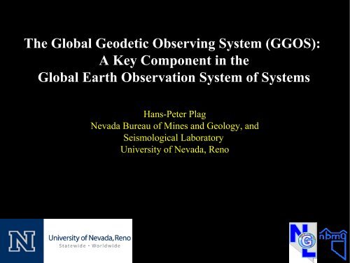
The Global Geodetic Observing System (<strong>GGOS</strong>):A Key Component in theGlobal Earth Observation System of SystemsHans-Peter PlagNevada Bureau of Mines and Geology, andSeismological LaboratoryUniversity of Nevada, Reno
The Global Geodetic Observing System (<strong>GGOS</strong>):A Key Component in theGlobal Earth Observation System of SystemsPlease, note:All statements made during this presentation reflect solely my personalopinion. None of my statements is approved or endorsed by the IAGExecutive Committee or can be taken as IAG's official position.
The Global Geodetic Observing System (<strong>GGOS</strong>):A Key Component in theGlobal Earth Observation System of Systems- GEO and GEOSS: A Brief Introduction- <strong>GGOS</strong>: A Brief Introduction- <strong>GGOS</strong> the observing system- <strong>GGOS</strong>: the organization- <strong>GGOS</strong> and GEO- <strong>GGOS</strong> and GEOSS- Mutual Benefits IAG/<strong>GGOS</strong> and GEO/GEOSS
GEO and GEOSS: A Brief Introduction2002: World Summit on Sustainable Development in Johannesburg,South Africa:Urgent need for coordinated observations of the state of the EarthJune 2003: G8 Meeting in Evian:re-emphasizes the importance of Earth ObservationsJuly 2003: First Earth Observation Summit (EOS-I) inand IUGGWashington, DC with 33 Countries+EC and 21 international Organisations:- Establishes the ad hoc Intergovern. Group on Earth Observation (ad hoc GEO)- Task of ad hoc GEO: initial 10 year Implementation Plan by February 2005April 2004: EOS-II in Tokyo, 43 Countries + EC plus 25 internationalorganisations:- Adopts the 'Framework Document', which defines ninesocietal benefit areas for Earth observationsFebruary 2005: EOS-III in Brussels:July 2003: <strong>GGOS</strong> isestablished by IAGIAG joins GEO asParticipatingOrganisation- Adopts the 10 Year Implementation Plan for a Global Earth Observation Systemof Systems (GEOSS)- Establishes the Group on Earth Observation (GEO) with the task to implementGEOSS
GEO and GEOSS: A Brief IntroductionMillennium Development Goals for 2015:Eradicate Extreme Poverty and HungerAchieve Universal Primary EducationPromote Gender Equality and Empower WomenReduce Child MortalityImprove Maternal HealthCombat HIV/AIDS, Malaria and other DiseasesEnsure Environmental SustainabilityDevelop a Global Partnership for Development
GEO and GEOSS: A Brief IntroductionStructure and approach of GEO:GEO Work Plan:- Currently: 2007-2009;- 73 Tasks and Task Teams;- linked with the Committees;- Frequent update of Task SheetsActivities:- Earth Observation Summits- Annual Plenary Meetings- ~ three EC meetings per year- ~ three meetings of eachcommittee- Workshops, conferences,symposiums- Task team activitiesImplementation of GEOSS:- CoPs activities- GEOSS Common Infrastructure (web-based portal; clearinghouse, information andservices; registries, standards and best practices);- GCI one year evaluation phase just started;- Architecture Implementation Pilots (AIP): CfP in preparation
<strong>GGOS</strong>: A Brief IntroductionIUGG 2007:<strong>GGOS</strong> is the Observing System of the International Associationof Geodesy (IAG): The Global Geodetic Observing System (<strong>GGOS</strong>)works with the IAG components to provide the geodetic infrastructurenecessary for monitoring the Earth system and for global changeresearch.“<strong>GGOS</strong>” has two meanings:(1) The Observing System(2) The Organization
<strong>GGOS</strong>: The Observing SystemThe 'three pillars of geodesy':- Earth's Shape (Geokinematics)- Earth's Gravity Field- Earth Rotation<strong>GGOS</strong> observesimportantcharacteristics of theEarth SystemOutput:- Reference Frame- Observations of the Shape,- Gravitational Field and Rotationof the Earth<strong>GGOS</strong> observes thetemporal variation of theEarth shape, gravityfield, and rotation.
<strong>GGOS</strong>: The Observing System
<strong>GGOS</strong>: The Observing System
<strong>GGOS</strong>: The Organization<strong>GGOS</strong> ShareholdersStd Ocean Gravimetry GeometryIERS:IGS:IVS:ILRS:IDS:IGFS:BGI:IGeS:ICET:International Earth Rotation and Reference SystemsServiceInternational GNSS ServiceInternational VLBI ServiceInternational Laser Ranging ServiceInternational DORIS ServiceInternational Gravity Field ServiceBureau Gravimetrique InternationalInternational Geoid ServiceInternational Center for Earth TidesICGEM: International Center for Global Earth ModelsPSMSL: Permanent Service for Mean Sea LevelIAS:International Altimetry Service (in preparation)BIPM: Bureau International des Poids et MesuresIBS:IAG Bibliographic Service
<strong>GGOS</strong>: A Brief Introduction<strong>GGOS</strong> observes with many techniquesdifferent parameters of one unique Earthsystem.<strong>GGOS</strong> aims to extract (small) signals ofglobal change and Earth system processessignals from the observations:accuracy of < 1 ppb.Challenges:Consistency of the three pillars;Global change and geohazards-related effects aresmall;Reference frame needs to be available anywhere,any time.Solution: Integration ofSystems,Observations,Analysis, andGeodetic and physical models (conventions)
<strong>GGOS</strong> and GEOLink between IAG/<strong>GGOS</strong> and GEOIAG Participating Organization in GEOIAG Lead Organization for one GEO TaskIAG delegated representation in GEO to <strong>GGOS</strong><strong>GGOS</strong> Working Group on GEO Relations (Chair: H.-P. Plag)- Members: Delegates to GEO Committees (two or more per Committee)Mission:- promote the work of <strong>GGOS</strong> and IAG in GEO- foster the contribution of <strong>GGOS</strong> to GEOSS- ensure adequate representation of <strong>GGOS</strong> and IAG in all GEO Committees and therelevant Teams of GEO Work Plan Tasks- facilitate informed decision by GEO with respect to geodetic issues,- ensure effective information flow between <strong>GGOS</strong>/IAG and GEO;- emphasise interoperability of <strong>GGOS</strong> with GEOSS as a prerequisitefor utilizing the full benefit of <strong>GGOS</strong> for Earth observation.
<strong>GGOS</strong> and GEOContribution to GEO Work Plan•GEO: Task AR-07-03: Global Geodetic Reference Frames(1) Understand the user requirements of the nine SBAs in terms of access to aglobal reference frame (accurate positions) AND geodetic observations;(2) Improve the framework conditions for the maintenance of the geodeticinfrastructure, support for transition research to operational.•(Point of Contact: H.-P. Plag)•Main Deliverable of the Task:•- The Global Geodetic Observing System: Meeting the Requirements of aGlobal Society on a Changing Planet in 2020 (<strong>GGOS</strong> 2020)- Deliverable of Task AR-07-03- Community study aimed at (1); five chapters on observational requirements;- Scientific rational for the future development and implementation of <strong>GGOS</strong>-
<strong>GGOS</strong> and GEOContribution to Communities of Practice (CoP)Geohazards CoP: GEO/<strong>GGOS</strong> Workshop: The <strong>GGOS</strong> Contribution toGEOSS and an Observing System for Geohazards and Disaster Prevention,November 5-6, 2007, Frascati, Italy.Coastal Zone CoP (CZCP): GEO Workshop Series: GEOSS Support forDecision-Making in the Coastal Zone: Managing and Mitigating the Impactsof Human Activities and Natural Hazards in the Coastal ZoneFirst Workshop: Observing System Requirements for Managing andMitigating the Impacts of Human Activities and Coastal Inundation in theMediterranean Region, June 9-13, 2008, Athens, Greece.Water Cycle CoP: GEO/<strong>GGOS</strong> sponsored IGCP 565 Project: Developing theGlobal Geodetic Observing System into a Monitoring System for the GlobalWater Cycle, First Workshop: December 11, 2008, San Francisco.
<strong>GGOS</strong> and GEOSSGEO/<strong>GGOS</strong> Workshop Conclusions:The global geodetic reference frames, ITRF and ICRF, and Earth rotationparameters are indispensable for Earth observations and their accuracy isa key limiting factor.Global geodetic infrastructure, in particular <strong>GGOS</strong>, is a core element in theglobal Earth observation system of systemsWith respect to Geohazards:- Geodetic observations and products play a crucial role in all aspects ofdisaster prevention and mitigation, including risk assessment and themonitoring of hazardous situations for early warning systems.- Geodetic Observations have:- already transformed our understanding of geohazards,- started to contribute to early warning,- opened up new scientific frontiers.
<strong>GGOS</strong> and GEOSS
Mutual Benefits IAG/<strong>GGOS</strong> and GEO/GEOSSIAG/<strong>GGOS</strong> provide:- crucial expertise;- the metrological basis for GEOSS;- observations pivotal for many GEOSS services and applications.GEO provides:- a link to experts in other fields relevant for <strong>GGOS</strong>;- a unique link to users on all levels, in particular global;- an intergovernmental frame for promotion of <strong>GGOS</strong>/IAG and links toimportant providers.GEOSS provides:- an opportunity to disseminate <strong>GGOS</strong> products;- incentive to improve interoperability of IAG Services;- a technological framework for the <strong>GGOS</strong> implementation.