Worth Nowlin - Gulf of Mexico Coastal Ocean Observing System ...
Worth Nowlin - Gulf of Mexico Coastal Ocean Observing System ...
Worth Nowlin - Gulf of Mexico Coastal Ocean Observing System ...

You also want an ePaper? Increase the reach of your titles
YUMPU automatically turns print PDFs into web optimized ePapers that Google loves.
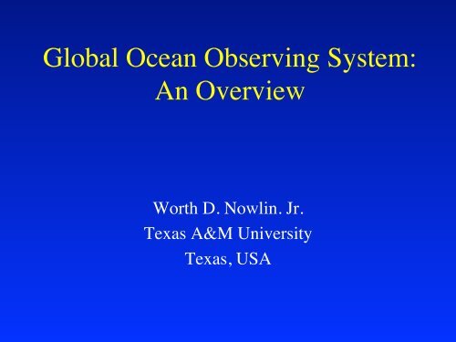
Global <strong>Ocean</strong> <strong>Observing</strong> <strong>System</strong>:An Overview <strong>Worth</strong> D. <strong>Nowlin</strong>. Jr. Texas A&M University Texas, USA
Sustained observations <strong>of</strong> the oceanare required for:• Understanding global change• Predicting climate variability• Protecting and managing marine ecosystems• Complying with international agreements• Protecting life and property on the coast and at sea• Providing forecasts <strong>of</strong> its future states for a variety<strong>of</strong> uses and users.
RequirementsMaritime safety and transportv Large proportion <strong>of</strong>global commercev Critically sensitive tomarine weather and climate
RequirementsNatural disaster preventionv Tropical cyclones,waves and storm surgesv Maximum impact incoastal areasv Operational forecasts andwarnings, meteorology,oceanography, hydrology
Global <strong>Ocean</strong> <strong>Observing</strong> <strong>System</strong>Established 1990byIntergovernmental <strong>Ocean</strong>ographic CommissionWorld Meteorological OrganizationInternational Council <strong>of</strong> Scientific UnionsUnited Nations Environment Programme
Organized in two modules• Global Module dealing with climate andmarine services• <strong>Coastal</strong> Module dealing with neededproducts from the coastal oceanConsiderable overlap in observations and inareas <strong>of</strong> interest
Milestonesn 1995 Strategic Design for Climate Modulen 1998 Initial Action Plan for ClimateModulen 1999 Formation <strong>of</strong> Capacity Building Paneln 2003 Strategic Design for <strong>Coastal</strong> Modulen 2005 Initial Implementation Plan for<strong>Coastal</strong> Module
IN SITU OPEN OCEANMEASUREMENTS FORWEATHER AND CLIMATE
LONG-TERM GOAL: A COMPREHENSIVEOPERATIONAL SYSTEM FOR OBSERVING THEGLOBAL OCEANS.
Joint Technical Commission for<strong>Ocean</strong>ography and MarineMeteorology (JCOMM)Established in 2001 jointly by the WorldMeteorological Organization and theIntergovernmental <strong>Ocean</strong>ographic Commission
WMO/IOC Joint Technical Commission for<strong>Ocean</strong>ography and Marine Meteorology• Intergovernmental coordination <strong>of</strong> the implementation <strong>of</strong> operational marinemeteorology and oceanography• Equivalent for the oceans <strong>of</strong> existing bodies for operational meteorology• Integrated operational ocean observing system and data management• New products and services, close user interaction• Involvement <strong>of</strong> all maritime countries• An implementation mechanism for global GOOS• Needs strong regional interactions and support
Present JCOMM Activities• Ship-based observations 6000 VOS observing meteorology and surfaceoceanography 120 SOOP for subsurface T&S 20+ ASAP for upper air Liaison with ocean CO 2 community• 1400 drifters observing meteorology and surfaceoceanography• 100s <strong>of</strong> ocean buoys for met & ocean• 300 sea level stations in GLOSS• Liaison with pr<strong>of</strong>iling float program, Argo• Sea ice monitoring• Coordination with ocean satellites
JCOMMOPS DBCP, SOT, ArgoJCOMM Support Facilities A coordination, metadata and information facility for in situplatform deployers and users http://www.jcommopsjcommops.org JCOMM Electronic Products Bulletin Operational ocean products and data fields, updatedmonthly http://iriiri.ldeo.columbia.edu/climate/monitoring//climate/monitoring/ipb/ JCOMM web site Information exchange on JCOMM documents, meetings, operationsand people To become http://jcommjcomm.net
Tide Gauges Surface Drifting Buoys Tropical Moored Buoys Ships <strong>of</strong> Opportunity Argo Floats Reference Stations <strong>Coastal</strong> Moorings <strong>Ocean</strong> Carbon Network Dedicated Ship Time <strong>System</strong> Evaluation The Ten-Year Plan for In-situ Observations2000 2001 2002 2003 2004 2005 2006 2007 2008 2009 2010 4040772425045792625045807 671 779 810 7723200 310 544 792610002505583291 2 6 7 10 801050 1250 125087322000 300024 430 140 0 0 0 15 4014 16 18 20250 0 1 1 1326703 486 90363000168036700686125094 41 3000291203876078612509941300029150 40820986125099413000291504082010861250994130002915040820 10Operational GPS/DORISStationsNumber <strong>of</strong> buoysNumber <strong>of</strong> mooringsHigh resolution and frequentlyrepeated lines occupiedNumber <strong>of</strong> floatsNumber <strong>of</strong> flux mooringsMoorings with climate sensorsNumber <strong>of</strong> flux sites/lines,One inventory per 10 yearsDays at sea (NOAA contribution)Product evaluation andfeedback loops implementedTotal <strong>System</strong>30 34 40 4448 77 88 94 99 100 1002000 2001 2002 2003 2004 2005 2006 2007 2008 2009 2010 <strong>System</strong> % Complete
OBSERVING THE OCEANSFROM SPACE
OCEAN PARAMETERS ESTIMATEDFROM SPACE BY 2010CurrentsFresh WaterIce Surface TemperatureImageryLittoral Sediment TransportNet Heat FluxNet Short Wave Radiance<strong>Ocean</strong> Color/ChlorophyllTurbidity<strong>Ocean</strong> Wave CharacteristicsSalinitySea Ice Age and Edge MotionSea Surface Height/TopographySea Surface TemperatureSea Surface WindsSurface Wind StressSuspended Matter
Satellite Altimeter Data forWave ForecastsMarch-May 20010 rms diff (m) 1.6NOAA 24-hour wave forecast accuracy,estimated from ERS2 altimeter observations
Along-Track Scanning RadiometerSpecifically designed toretrieve high-precisionsea surfacetemperatures for climatemonitoring:– Highly accurateon-board calibration(
Topex/PoseidonJason AltimeterGeostrophicCurrentEstablishing an OperationalData <strong>System</strong> for SurfaceCurrents from SatelliteAltimeters and ScatterometersTotal Surface Current VelocityQuikScatScatterometerWind-DrivenCurrent
<strong>Coastal</strong> Wind Images from SAR
Alaska SAR DemonstrationHIGH RESOLUTION INFORMATIONFOR IMPROVED ICE EDGEFORECASTSICE INFORMATION ANDVESSEL POSTIONS FORFISHERIES MANAGEMENTSEA ICE EDGE AND SNOW CRAB FISHERY FLEET
Arabian Sea - December 2000TERRA-MODIS Chlorophyll a
Harmful Algal Bloom
Global Coverage <strong>of</strong> <strong>Ocean</strong> Winds & Detailed Structure <strong>of</strong> Hurricane Floyd
TOPEX/POSEIDON ALTIMETRYFOR EL NIÑO
NEW ELEMENTS: ARGO ANDGODAE
6,316BATHY & TESACreports collectedin real timeduringDecember, 2000.We have limited ability to observebeneath the surface <strong>of</strong> the ocean.
Argo will cover the global oceanswith 3,000 pr<strong>of</strong>iling floats.
GODAEGLOBAL OCEAN DATA ASSIMILATION EXPERIMENTObjective: practical demonstration <strong>of</strong> real-time, global ocean dataassimilation for operational oceanographyTo apply state-<strong>of</strong>-the-art ocean models & assimilation methods for:-- short-range open-ocean forecasts-- boundary conditions for coastal forecasts-- initial conditions for climate forecast modelsTo provide global ocean analyses and re-analyses to improve our:-- understanding <strong>of</strong> the oceans-- assessments <strong>of</strong> the predictability <strong>of</strong> ocean systems-- the design & effectiveness <strong>of</strong> the global ocean observing system
MERCATOR Bulletin for June 19,2002 : how is the ocean next week ?Sea Sea Surface SurfaceHeight HeightSea Sea Surface SurfaceTemperatureTemperatureSalinity Salinity at at 1000 1000 mdepth depthGODAE, Biarritz – 13 June, 2002
EL NIÑO AND OTHER LONGPERIOD OSCILLATIONS
THE EL NIÑO/SOUTHERN OSCILLATION
ZIMBABWE MAIZE YIELD AND EL NIÑO
EL NIÑO AND HEALTH RISKS: MALARIA
NORTH ATLANTIC OSCILLATION (NAO)
NORTH ATLANTIC OSCILLATION AFFECTSZOOPLANKTON (CALANUS)
THE PACIFIC DECADAL OSCILLATION1947-19761977-1997Courtesy <strong>of</strong> the National Geographic Magazine
Change has pr<strong>of</strong>oundconsequences for all naturalresources, stakeholders andmanagersGOA - Early ’70sSource: Francis and Hare 1994GOA Late ’70sCentral Alaska Sockeye catchesGOA 1980s-’90s
GOOS IN COASTAL SEAS ANDEEZs
Integrated, Ecosystem BasedAdaptive ManagementResource Management, Environmental Protection,<strong>Coastal</strong> Area Management, <strong>Coastal</strong> EngineeringRequires ability toØØRoutinely & Rapidlydetect changesProvide timelypredictions <strong>of</strong> changesWE DO NOT HAVE THISCAPABILITYTODAY
<strong>Coastal</strong> Phenomena <strong>of</strong> InterestDrivers <strong>of</strong> Change Ecosystem DynamicsnnnMarine Operations & Public SafetyØØØSea state, Currents, Sea iceSea level, SST<strong>Coastal</strong> flooding & erosionPublic HealthØØSeafood contaminationAmbient levels <strong>of</strong> pathogensEcosystem Health & LMRsØØØØØØDeclines in living resourcesAquacultureLoss <strong>of</strong> habitat & biodiversityHABs, Invasive speciesMass mortalitiesChemical contamination
Global <strong>Coastal</strong> NetworkProvisional Common VariablesPHYSICALSea level, Temperature, Salinity, Surface currents,Surface wave spectra, Bathymetry, Shoreline positionCHEMICALSediment grain size/organic content,Dissolved inorganic N-P-Si, Dissolved O 2BIOLOGICALChlorophyll a, Attenuation <strong>of</strong> solar radiation,Benthic biomass, Fecal indicators
<strong>Observing</strong> Subsystem:Key elements <strong>of</strong> infrastructure• In situ sensing• <strong>Coastal</strong> <strong>Observing</strong> Network for the Near Shore• GLOSS• Fixed platforms, moorings, drifters, AUVs• SOOP, VOOS (e.g., Instrumented Ferries)• Remote sensing• Satellites & aircraft• Land-based – HF Radar
New Jersey Shelf <strong>Observing</strong> <strong>System</strong>RemoteSensingHFRadarGliders4-D Visualization300km x 300kmREMOTE SENSING,RADAR, GLIDERS
GOOS NATIONAL PROGRAMSAND REGIONAL ALLIANCES
Global Distribution <strong>of</strong> National GOOS Committeesor Contact PointsRegional GOOS BodiesNational GOOS Committees/Contact Pointshttp://ioc.unesco.org/goos
GOOS REGIONSEuroGOOSBS-GOOSMedGOOSGOOS-AFRICAIO-GOOSNEAR- IOCARIBE-GOOS GOOSSEA-GOOSPI-GOOSGRASPEuAF
What nextn Develop new Regional efforts: S.E. Pacific GOOSn Implement <strong>Coastal</strong> GOOS inc. water quality monitoring& living resources.n Build remote sensing capacityn Build numerical modeling capacity for data processingand analysisn Encourage pooling <strong>of</strong> resources in Regional Processingcentersn Improving data exchange and managementn Find out what your users want
THANK YOU FOR YOURATTENTION