Performance Evaluation of Global Differential GPS (GDGPS) for ...
Performance Evaluation of Global Differential GPS (GDGPS) for ...
Performance Evaluation of Global Differential GPS (GDGPS) for ...
You also want an ePaper? Increase the reach of your titles
YUMPU automatically turns print PDFs into web optimized ePapers that Google loves.
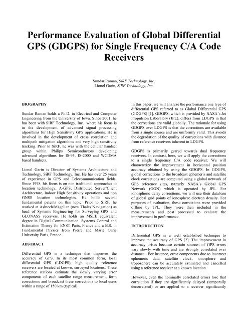
<strong>Per<strong>for</strong>mance</strong> <strong>Evaluation</strong> <strong>of</strong> <strong>Global</strong> <strong>Differential</strong><strong>GPS</strong> (GD<strong>GPS</strong>) <strong>for</strong> Single Frequency C/A CodeReceiversSundar Raman, SiRF Technology, Inc.Lionel Garin, SiRF Technology, Inc.BIOGRAPHYSundar Raman holds a Ph.D. in Electrical and ComputerEngineering from the University <strong>of</strong> Iowa. Since 2001, hehas been with SiRF Technology, Inc. where his focus isin the development <strong>of</strong> advanced signal processingalgorithms <strong>for</strong> High Sensitivity <strong>GPS</strong> applications. He isinvolved in the development <strong>of</strong> cross correlation andmultipath mitigation algorithms and very high sensitivitytracking. Prior to SiRF, he was with the cellular handsetgroup within Philips Semiconductors developingadvanced algorithms <strong>for</strong> IS-95, IS-2000 and WCDMAbased handsets.Lionel Garin is Director <strong>of</strong> Systems Architecture andTechnology, SiRF Technology, Inc. He has over 25 years<strong>of</strong> experience in <strong>GPS</strong> and Telecommunication fields.Since 1998, his focus is on non traditional approaches tolocation technology, A-<strong>GPS</strong>, Distributed Server/ClientArchitecture, Indoor High Sensitivity operations and nonGNSS location technologies. He holds severalfundamental patents on this topic. Prior to SiRF, heworked at Ashtech/Magellan (now Thales Navigation) ashead <strong>of</strong> Systems Engineering <strong>for</strong> Surveying <strong>GPS</strong> andGLONASS receivers. He holds an MSEE equivalentdegree in Digital Communication, Systems Control andEstimation Theory <strong>for</strong> ENST Paris, France and a B.S. inFundamental Physics from Pierre and Marie CurieUniversity Paris, France.ABSTRACT<strong>Differential</strong> <strong>GPS</strong> is a technique that improves theaccuracy <strong>of</strong> <strong>GPS</strong>. In its most common <strong>for</strong>m, localdifferential <strong>GPS</strong> (LD<strong>GPS</strong>), high quality referencereceivers are located at known, surveyed locations. Thesereference stations estimate the slowly varying errorcomponents <strong>of</strong> each satellite range measurement, <strong>for</strong>mcorrections and broadcast these corrections to local userswithin a range <strong>of</strong> 150 km (typical).In this paper, we will analyze the per<strong>for</strong>mance one type <strong>of</strong>differential <strong>GPS</strong> referred to as <strong>Global</strong> <strong>Differential</strong> <strong>GPS</strong>(GD<strong>GPS</strong>) [1]. GD<strong>GPS</strong>, which is provided by NASA’s JetPropulsion Laboratory (JPL), differs from LD<strong>GPS</strong> in thatthe corrections are valid globally. The rationale <strong>for</strong> usingGD<strong>GPS</strong> over LD<strong>GPS</strong> is that the corrections are availablefrom a single source and are uni<strong>for</strong>mly valid. This avoidsthe degradation <strong>of</strong> the quality <strong>of</strong> corrections with distancefrom reference receivers inherent in LD<strong>GPS</strong>.GD<strong>GPS</strong> is primarily geared towards dual frequencyreceivers. In contrast, here, we will apply the correctionsto a single frequency C/A code receiver. We willcharacterize the improvement in horizontal positionaccuracy obtained by using the GD<strong>GPS</strong>. In GD<strong>GPS</strong>,global corrections to the broadcast ephemeris and satelliteclock corrections are computed using a global network <strong>of</strong><strong>GPS</strong> reference sites, namely NASA’s <strong>Global</strong> <strong>GPS</strong>Network (GGN) which is operated by JPL. Forionospheric delay corrections, we will use their database<strong>of</strong> global grid points <strong>of</strong> ionosphere electron density. Forpurposes <strong>of</strong> evaluation, these corrections were provided<strong>of</strong>fline by JPL. They were then included in themeasurements and post processed to evaluate theimprovement in per<strong>for</strong>mance.INTRODUCTION<strong>Differential</strong> <strong>GPS</strong> is a well established technique toimprove the accuracy <strong>of</strong> <strong>GPS</strong> [2]. The improvement inaccuracy arises because certain sources <strong>of</strong> <strong>GPS</strong> errorsvary slowly with time and are strongly correlated overdistance. For instance, error components due to incorrectephemeris data, satellite clock, ionosphere andtroposphere can be accurately estimated and cancelledusing a reference receiver at a known location.However, even the nominally correlated errors lose thatcorrelation if they are significantly delayed (temporallydecorrelated) or are applied to a receiver significantly
separated from the reference station(geographically/spatially decorrelated). The per<strong>for</strong>mance<strong>of</strong> local D<strong>GPS</strong> (LD<strong>GPS</strong>) receivers degrade with thedistance from the reference receivers.There are many D<strong>GPS</strong> techniques and applications. Theseinclude the LD<strong>GPS</strong> which uses a single reference stationto develop a scalar correction to the code phasemeasurement <strong>for</strong> each satellite. Another alternative is theWide Area <strong>Differential</strong> <strong>GPS</strong> (WAD<strong>GPS</strong>) where anetwork <strong>of</strong> reference stations is used to <strong>for</strong>m a vectorcorrection <strong>for</strong> each satellite. The vector consists <strong>of</strong>individual corrections <strong>for</strong> the satellite clock, threecomponents <strong>of</strong> the satellite ephemeris and parameters <strong>of</strong>an ionosphere delay model. The vector correction is validover much greater geographical areas as compared toLD<strong>GPS</strong> corrections.In this paper we will consider one <strong>for</strong>m <strong>of</strong> WAD<strong>GPS</strong>which is based on JPL's patented <strong>Global</strong> <strong>Differential</strong> <strong>GPS</strong>(GD<strong>GPS</strong>) architecture. The reader is referred to the linksprovided in reference [3] <strong>for</strong> a list <strong>of</strong> papers detailing theGD<strong>GPS</strong> architecture. GD<strong>GPS</strong> takes advantage <strong>of</strong> thenetwork <strong>of</strong> reference receivers provided by NASA’s<strong>Global</strong> <strong>GPS</strong> Network (GGN), which is operated andmaintained by JPL. <strong>GPS</strong> observables from remote sitesare compressed, packetized and transmitted over theinternet to the processing centers. At the processingcenters the global data is analyzed to produce precise <strong>GPS</strong>orbits and clocks. These are <strong>for</strong>matted as corrections tothe <strong>GPS</strong> broadcast ephemerides, encoded, and areprovided over a variety <strong>of</strong> communications channels toauthorized users [1,3,4].The fundamental tenet <strong>of</strong> GD<strong>GPS</strong> architecture is a statespaceapproach, where the orbits <strong>of</strong> the <strong>GPS</strong> satellites areprecisely modeled, and the primary estimated parametersare the satellite state and clock [5]. The advantage <strong>of</strong>GD<strong>GPS</strong> over LD<strong>GPS</strong> is that the corrections are globallyuni<strong>for</strong>m and seamless. The corrections are provided asvector corrections independent <strong>of</strong> the user rather than asscalar pseudorange corrections. Users anywhere on theground, in the air, or in near space can have access to theworld's most precise differential corrections.Robustness is achieved through redundancy. Multipleprocessing centers are operated in parallel and thecorrections are transmitted through redundantcommunications channels including the internet.GD<strong>GPS</strong> is primarily geared towards the dual frequencyusers. Various per<strong>for</strong>mance studies have been carried out<strong>for</strong> dual frequency receivers [3]. However, relativelylittle analysis has been done on the improvement <strong>of</strong>GD<strong>GPS</strong> <strong>for</strong> single frequency C/A code receivers. In light<strong>of</strong> the above advantages, it is worthwhile to quantify theimprovements <strong>for</strong> this class <strong>of</strong> receivers using GD<strong>GPS</strong>architecture.For purposes <strong>of</strong> evaluation, GD<strong>GPS</strong> corrections wereprovided <strong>of</strong>fline by JPL. They were then included in themeasurements and post processed to evaluate theimprovement in per<strong>for</strong>mance.The measurement errors that were corrected usingGD<strong>GPS</strong> corrections were1) Ionosphere Delay2) Satellite State (orbit + clock)Below we describe in detail the above types <strong>of</strong> correctionsthat are provided by JPL using their GD<strong>GPS</strong> system.SATELLITE STATE CORRECTIONSSatellite State corrections include corrections to satelliteorbit and satellite clock.The satellite orbit corrections are provided in the <strong>for</strong>m <strong>of</strong>more accurate satellite orbit vectors. These vectors areprovided <strong>for</strong> all satellites at an interval <strong>of</strong> 1 minute. Theseaccurate orbit vectors are differenced from the broadcastsatellite position vectors at the corresponding times toobtain the errors in satellite orbits.The satellite clock corrections are provided as broadcastclock corrections and the estimated clock corrections. Theestimated value includes the corrections and is providedin km at an interval <strong>of</strong> 1 second. A “sigma” value whichprovides a <strong>for</strong>mal error associated with the correction isalso provided.For evaluation purposes, the satellite orbit errors areconverted to a pseudorange correction by projecting themonto the line <strong>of</strong> sight (LOS) from user to the satellite.They are then combined with the satellite clockcorrections.IONOSPHERIC DELAY CORRECTIONSThe <strong>GPS</strong> signals are delayed in proportion to the number<strong>of</strong> free electrons encountered. This delay is alsodependent on the frequency. The ionosphere is usuallyreasonably well-behaved and stable in the temperatezones; near the equator or magnetic poles it can fluctuateconsiderably. Users need to correct the raw pseudoranges<strong>for</strong> this ionospheric delay.The method below <strong>for</strong> removing ionospheric delay fromsingle frequency <strong>GPS</strong> data is based on a database <strong>of</strong>global grid maps <strong>of</strong> ionosphere electron density. Thesemaps are created in real time using input data from the
GD<strong>GPS</strong> network <strong>of</strong> <strong>GPS</strong> receivers. These maps wereprovided at 5 minute intervalsIn the GD<strong>GPS</strong> implementation, the ionosphere is modeledas a spherical layer 450 km above the earth. The verticaltotal electron content <strong>of</strong> the ionosphere as a function <strong>of</strong>latitude and longitude is provided at 5 minute intervals.The data are presented on a 2 deg x 2 deg grid. The unitsare TECU. To obtain the correction <strong>for</strong> the <strong>GPS</strong> signal (atthe L1 frequency) transmitted vertically, interpolate thegrid to the desired latitude/longitude and multiply by thefactor 0.162 meters/TECU.We compare the position accuracy obtained with GD<strong>GPS</strong>corrections against the position accuracy without thesecorrections. Figures 1 – 4 show the position accuracywith and without GDPGS corrections <strong>for</strong> variouslocations. Figure 5 quantifies the average improvementover these locations.For a non-vertical <strong>GPS</strong> ray path, we first determine wherethe receiver/satellite line-<strong>of</strong>-sight intersects theionospheric layer (pierce points) and evaluate the verticalTEC (with appropriate interpolation). We then multiplythis by an obliquity (which is a function <strong>of</strong> elevationangle) to account <strong>for</strong> the signal path length through theionosphere as a function <strong>of</strong> elevation angle.TROPOSPHERIC CORRECTIONSFor tropospheric corrections, the model as detailed insection A.4.2.4 reference [6] was used.POSITION ACCURACY WITH AND WITHOUTGD<strong>GPS</strong> CORRECTIONSFigure 2: Plot <strong>of</strong> position accuracy with and withoutGD<strong>GPS</strong> corrections (PENC 47.79 deg. N, 19.28 deg. E)Below we quantify the improvement in horizontalposition accuracy using these GD<strong>GPS</strong>. It is assumed herethat the measurements correspond to a single frequency(L1) C/A code measurement. The test locations arechosen to span a range <strong>of</strong> latitudes to provide a betterunderstanding <strong>of</strong> ionosphere delay corrections. The testduration is 24 hours (January 12, 2005) at a samplinginterval <strong>of</strong> 30 seconds..Figure 3: Plot <strong>of</strong> position accuracy with and withoutGD<strong>GPS</strong> corrections (NTUS 1.345 deg. N, 103.67 deg. E)TEMPORAL CORRELATION OF GD<strong>GPS</strong>CORRECTIONSFigure 1: Plot <strong>of</strong> position accuracy with and withoutGD<strong>GPS</strong> corrections (CAGZ: 39.14 deg. N, 8.17 deg. E)The GD<strong>GPS</strong> satellite state corrections (orbit, clock) areprovided every minute and the ionosphere corrections areprovided every 5 minutes. It is desirable to quantify the
corrections will not be obvious to the user. The urbancanyon/indoor scenarios necessitate effective multipathcancellation in parallel with GD<strong>GPS</strong>.The application <strong>of</strong> GD<strong>GPS</strong> to Assisted <strong>GPS</strong> (A-<strong>GPS</strong>) hasseveral distinct advantages. These include the simplicity<strong>of</strong> the correction data collection and the datadissemination to the end user. Furthermore, thehorizontal accuracy can be brought less than 1 meter (onesigma) even when the reference network is not verydense.ACKNOWLEDGMENTSWe acknowledge the help <strong>of</strong> Dr. Yoaz Bar-Sever and histeam in JPL <strong>for</strong> providing GD<strong>GPS</strong> corrections and theirfeedback on the processed results.REFERENCES1) “An Internet-Based <strong>Global</strong> <strong>Differential</strong> <strong>GPS</strong> System,Initial Results”, Ronald J. Muellerschoen, Willy I.Bertiger, Michael Lough, Dave Stowers and Danan Dong,ION National Technical Meeting, Anaheim, CA, Jan,2000.2) “<strong>Global</strong> Positioning Systems; Theory and Applications,Volume II”, Edited by B. Parkinson, J.L. Spilker, Jr.3) “The <strong>Global</strong> <strong>Differential</strong> <strong>GPS</strong> (GD<strong>GPS</strong>) System”,http://www.gdgps.net4) “The development and demonstration <strong>of</strong> NASA’s<strong>Global</strong> <strong>Differential</strong> System”, Yoaz Bar-Sever, Ronald J.Muellerschoen, Angie Reichert, ESTC ConferenceProceedings, 2002.5) “Orbit Determination with NASA’s High AccuracyReal-Time <strong>Global</strong> <strong>Differential</strong> <strong>GPS</strong> System”, Ronald J.Muellerschoen, Angie Reichert, Da Kuang, MichaelHeflin, Willy Bertiger, Yoaz Bar-Sever, Proceedings <strong>of</strong>ION <strong>GPS</strong>-2001, Salt Lake City, UT, September 2001.6) Minimum Operation <strong>Per<strong>for</strong>mance</strong> Standards <strong>for</strong> <strong>Global</strong>Positioning System/Wide Area Augmentation System <strong>for</strong>Airborne Equipment, RTCA/DO-229C, November 28,2001.


