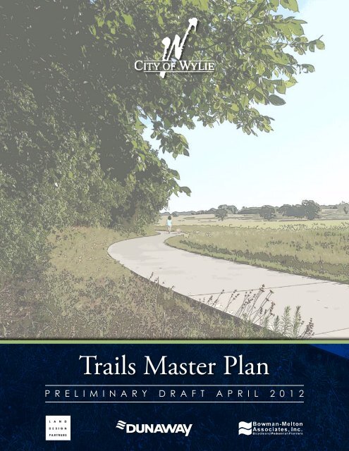
Trails Master Plan - City of Wylie
Trails Master Plan - City of Wylie
Trails Master Plan - City of Wylie
- No tags were found...

Create successful ePaper yourself
Turn your PDF publications into a flip-book with our unique Google optimized e-Paper software.
“<strong>Trails</strong> not only connect us with each other,they connect us with ourselves.”- David Burwell, 2001
ContentsIntroduction...............................................................................................................................................................3Acknowledgements.....................................................................................................................................................4<strong>Plan</strong>ning Process.....................................................................................................................................................6• Data Gathering & Base Mapping...................................................................................................................6• Site Review/Existing Conditions.....................................................................................................................6• Opportunities & Constraints..........................................................................................................................9• Conceptual <strong>Trails</strong> Network <strong>Plan</strong>...................................................................................................................17• Preliminary <strong>Trails</strong> <strong>Master</strong> <strong>Plan</strong>......................................................................................................................17• Final <strong>Trails</strong> <strong>Master</strong> <strong>Plan</strong>................................................................................................................................17<strong>Plan</strong>ning Recommendations...............................................................................................................................19• Focus Area: Greenways and Utility Corridors...............................................................................................20• Focus Area: Lakefront/Access.......................................................................................................................22• Focus Area: Roadways & Parkways...............................................................................................................24• Focus Area: Trailheads & Intersections.........................................................................................................26• Other Recommendations..............................................................................................................................28• Conclusion...................................................................................................................................................30Bibliography..........................................................................................................................................................32Appendices.............................................................................................................................................................34• Appendix A – <strong>Trails</strong> <strong>Master</strong> <strong>Plan</strong> Graphic• Appendix B – Trail Recommendations Chart• Full-Size Final <strong>Master</strong> <strong>Plan</strong><strong>Trails</strong> <strong>Master</strong> <strong>Plan</strong> 2
This master plan proposes a diverse network <strong>of</strong> trail connections within the <strong>City</strong> <strong>of</strong> <strong>Wylie</strong>. The current Parks, Recreation,and Open Space <strong>Master</strong> <strong>Plan</strong>, prepared for the city in 2010, identifies the need for developing hike & bike trails as thehighest priority for outdoor facilities in the city. Although the park system already includes a certain number <strong>of</strong> park-relatedtrails, the overall network is fragmented; therefore, a safe, accessible network <strong>of</strong> trail connections between neighborhoods,parks, and key city destinations needs to be strategically developed.As a commitment to meeting these needs, <strong>Wylie</strong> city leaders hired the design team <strong>of</strong> landscape architects and planners fromDunaway Associates, Bowman-Melton Associates, and Land Design Partners. This collaborative team began working withthe Parks & Recreation Department to further study the feasibility <strong>of</strong> a citywide trails network. The primary emphasis <strong>of</strong>this study has been to target four main areas <strong>of</strong> focus identified by city leaders as being central to citywide trail development.They include:• <strong>Trails</strong> along Greenways & Utility Corridors• <strong>Trails</strong> along Lake Frontage• <strong>Trails</strong> along Roadways & Parkways• Trail Gateways & IntersectionsIntroductionThe Trail <strong>Master</strong> <strong>Plan</strong> is intended to become a tool that city <strong>of</strong>ficials can use to plan and coordinate future improvementsfor trails and associated infrastructure by various city departments. As this plan is implemented, citizens <strong>of</strong> <strong>Wylie</strong> will beafforded more mobility choices in connecting to city destinations, as well as increased opportunities for outdoor exerciseand recreation.Vision“To complement <strong>Wylie</strong>’s hometown atmosphere througha variety <strong>of</strong> trails and pedestrian connections”<strong>Trails</strong> <strong>Master</strong> <strong>Plan</strong> 3
AcknowledgementsCITY COUNCILEric Hogue, MayorM.G. “Red” Byboth, Mayor Pro TemDavid GossKathy SpillyardsBennie JonesRick WhiteDiane CulverPARKS & RECREATION BOARDAnne Hiney, ChairMatt Rose, Vice-ChairDan ChesnutCristine PriceGary RobasJim WardJeff HarrisConsultant TeamDunaway AssociatesPhilip Neeley, ASLA, Project DirectorElizabeth McIlrath, ASLA, Project ManagerBowman-Melton & AssociatesBud Melton, Vice President, <strong>Trails</strong> SpecialistAnnie Melton, AICP, PrincipalLand Design PartnersBill Nicholson, RLA, PrincipalCITY STAFFMindy Manson, <strong>City</strong> ManagerJeff Butters, Assistant <strong>City</strong> ManagerMike Sferra, Public Services DirectorRobert Diaz, Parks & Recreation SuperintendentNancy Williams, Parks & Recreation Administrative AssistantCharles Lee, Senior <strong>Plan</strong>nerChris Holsted, <strong>City</strong> EngineerShohn Rodgers, Parks ManagerADVISORY COMMITTEEAnne HineyGary RobasJim WardCharles LeeChris HolstedShohn RodgersRobert DiazNancy Williams<strong>Trails</strong> <strong>Master</strong> <strong>Plan</strong> 4
<strong>Plan</strong>ning Process
<strong>Plan</strong>ning ProcessMunicipal ComplexDuring the site visits, the team made special note <strong>of</strong> the MunicipalComplex area. This property has already begun to serve as the “civic heart”<strong>of</strong> <strong>Wylie</strong> and will likely continue to do so as development continues inand around the property. As described in the Parks, Recreation andOpen Space <strong>Master</strong> <strong>Plan</strong>, city leaders have expressed favor for the “LowImpact Scenario” <strong>of</strong> planned development at the Municipal Complex.This scenario endeavors to preserve the natural character <strong>of</strong> the site andto create passive recreational areas including an amphitheater, protectedmeadow / habitats, and a trail system throughout the property. Withutility corridors and adjacent neighborhood parcels left open to the east,a wide abandoned road corridor leading to the south, roadside sidewalkconnections to the north, and parkland connections to the west, theopportunity for connecting this civic resource to a citywide network <strong>of</strong>trails has great potential.While the Municipal Complex serves as <strong>Wylie</strong>’s “civic heart”, Founders Park and Community Park serve as the “activitycenters” <strong>of</strong> the city. These parks primarily focus on athletics, but have incorporated a trail system to support park activities.The team toured recent renovations at Founders Park, which includes some trail development internal to the park and thepotential to complement future trail network connections. In addition, the team noted that these parks are fairly centrallylocated within the city limits and hold a greater capacity for parking than smaller neighborhood parks. These “activity centers”have potential to become trailhead type access points within the larger trail network. Other community parks <strong>of</strong> note whichwere evaluated by the design team included Valentine Park and Olde <strong>City</strong> Park. These parks, although much smaller than thenearby athletic parks, will be important considerations in linking <strong>Wylie</strong> parks through a citywide trail network.Connecting future trail users to key retail and tourist destinations isalso important. The team toured the city’s major retail developmentzones following Kirby Rd. (FM 544), including the newer WoodbridgeCrossing development, through to the historic downtown and alongHwy. 78, a primary retail / industrial spine. In general, segments <strong>of</strong>roadside sidewalks are in place in front <strong>of</strong> newer retail developments butthere is a need for wider, shared-use trails to serve the same developmentareas. The design team also toured major thoroughfares in the city thatare currently undergoing expansion, as well as those currently slatedfor design upgrade / construction (Stone, Brown, McMillen Rd., etc.).Current and future thoroughfare routes <strong>of</strong>fer opportunities for potentialtrail integration along the city roadway system.Retail DestinationsLavon LakeUnlike any other city in the DFW region, the <strong>City</strong> <strong>of</strong> <strong>Wylie</strong> is situatedbetween two major lakes. <strong>City</strong> leaders have expressed a unified desireto become a city that will “Embrace the Lakes”, and plan for expandedshoreline access for citizens and visitors alike. With this in mind, theAdvisory Committee took great care during the site tour to give thedesign team a thorough overview <strong>of</strong> current issues and opportunitiesat the lake edge properties. Currently, the parks along Lavon Lake(Avalon Park, East Fork Park, and Collin Park & Marina) are under thejurisdiction <strong>of</strong> the USACE (United States Army Corps <strong>of</strong> Engineers).As such, the parks are gated and may only be accessed through paying ause fee. In like manner, the shoreline along Lake Ray Hubbard is largely<strong>Trails</strong> <strong>Master</strong> <strong>Plan</strong> 7
<strong>Plan</strong>ning Processpopulated by private parcels, making both visual and physical accessto the lake limited. The two lakes are loosely connected by SkyviewDrive, a narrow, asphalt roadway that runs along the southern shore<strong>of</strong> Lavon and southward near the western shore <strong>of</strong> Lake Ray Hubbard.Public-use trail development at the lakes essentially consists <strong>of</strong> a wellusedequestrian trail system with some parking and a small restroomfacility located at the Trinity Trailhead on Lavon Lake. With restrictedparking provided, access to the existing trails essentially aimed at oneuser group (equestrians), and limited visual connections to the lakes,it seems clear that the lake parks are generally underutilized by citizens<strong>of</strong> <strong>Wylie</strong> and its visitors.View across private property to Lake Ray HubbardDuring the site tour, committee members also emphasized a desire for connections to the Muddy Creek and Rush Creek ripariancorridors. The team toured a number <strong>of</strong> localized park trails that are in close vicinity to the Muddy Creek corridor, whichruns north/south through the west side <strong>of</strong> <strong>Wylie</strong> (including Creekside Park, Sage Creek Park, Riverway Park, WoodbridgeGolf Club, and Muddy Creek Preserve). The team also touredaccessible portions <strong>of</strong> the Rush Creek corridor which runs north/south through <strong>Wylie</strong>’s east side. Although existing trail connectionsalong the Rush Creek Corridor are substantially less developed, theAdvisory Committee showed the design team potential connectionpossibilities through Oncor Lavon Park and private developmentssuch as Bozman Farms where partnerships may occur. Both <strong>of</strong> thesemajor riparian corridors are rich greenbelt resources, and hold thepotential to <strong>of</strong>fer future trail users a diverse variety <strong>of</strong> recreationalactivities such as bird watching, interpretive areas, nature trails, andpicnicking, among others.Muddy Creek Preserve<strong>Trails</strong> <strong>Master</strong> <strong>Plan</strong> 8
<strong>Trails</strong> <strong>Master</strong> <strong>Plan</strong> 10
<strong>Plan</strong>ning ProcessFocus Area: Lake Frontage / AccessApproximately 94% <strong>of</strong> citizens surveyed in the 2010 Parks, Recreation, and Open Space <strong>Master</strong> <strong>Plan</strong> cited better access toLavon Lake and Lake Ray Hubbard as being a top priority for future park development in <strong>Wylie</strong>. In an effort to increaseaccess to the lakes and support the “Embrace the Lakes” concept, the design team identified a number <strong>of</strong> opportunitiesto connect trail users to (and between) the lakes. This could happen by strategically using a combination <strong>of</strong> park landpartnerships, utility corridors, and trail development along future roadway improvements as identified in the city’s currentThoroughfare <strong>Plan</strong> (see page 12).At Lavon Lake, the three major lakefront parks are currently under ownership <strong>of</strong> the USACE with fee access to private areas only.In recent years, the Corps has been receptive to partnering for passive or low impact recreational development along USACEcontrolled shorelines. With no other lakefront park lands currently available to the city <strong>of</strong> <strong>Wylie</strong>, taking the opportunity toapproach the Corps for partnership in developing trails and/or other recreational improvements for public use will be vital toshoreline trail access at Lavon Lake.A number <strong>of</strong> possible utility corridors / connections are also in place, which could provide other opportunities for lakesidetrail connection. Existing overhead electric corridors (ONCOR) and underground water line easements (NTMWD) mayprovide open pathways linking the western and southern shores <strong>of</strong> Lavon Lake. Seeking partnerships with these utilityagencies should be encouraged as part <strong>of</strong> the city’s implementation <strong>of</strong> this master plan.Like Lavon Lake, shoreline access to Lake Ray Hubbard has also been historically restricted and difficult to access. A string<strong>of</strong> private parcels occupy the majority <strong>of</strong> <strong>Wylie</strong>’s lake shore and interrupt a continuous public corridor from Lavon Laketo Lake Ray Hubbard. However, the city’s Thoroughfare <strong>Plan</strong> identifies long-term development plans for Skyview nearLavon, running along Ray Hubbard’s western shore to Alanis. Roadside rights-<strong>of</strong>-way may become important corridors forinter-lake trail connections, provided they are wide enough for shared-use trails and depending on scheduling <strong>of</strong> long termimprovements. In addition, providing a low-impact, lakeside destination along the shore could be a key initiative in openingthe shores <strong>of</strong> Lake Ray Hubbard to the citizens <strong>of</strong> <strong>Wylie</strong>. Given the character <strong>of</strong> much <strong>of</strong> the shoreline in this area, there is aunique opportunity for an environmental learning facility to showcase diverse wildlife habitat as well as provide other passiverecreational opportunities.East Fork Park<strong>Trails</strong> <strong>Master</strong> <strong>Plan</strong> 11
<strong>Trails</strong> <strong>Master</strong> <strong>Plan</strong> 12
<strong>Plan</strong>ning ProcessFocus Area: Roadways & Parkways<strong>City</strong> leaders have estimated the growth <strong>of</strong> <strong>Wylie</strong>’s population atapproximately 177% over the past decade. As <strong>Wylie</strong> continuesto grow, roadways will become busier and safe access forpedestrians and non-motorized vehicles will be increasinglyimportant. A notable goal <strong>of</strong> this study is to provide safe,walkable/bikeable connections to city destinations that aretoday mostly accessible by motorized vehicles. An importantopportunity in developing this master plan has been to integratepotential trail corridors with the city’s current thoroughfareimprovements plan and design standards (see page 14).Old Railroad Corridor Along Highway 78Although many <strong>of</strong> the city’s major roadway expansions were already under design or construction at the time <strong>of</strong> this study(e.g., McMillen, Brown, etc.), key roadways in the Thoroughfare <strong>Plan</strong> were evaluated for opportunities to develop sharedusetrails within existing or planned thoroughfare rights-<strong>of</strong>-way. The team evaluated potential north/south and east/westconnectors, as well as long term connectors (Skyview) and available railway corridors. During the evaluation process, the cityengineer provided valuable feedback regarding current right-<strong>of</strong>-way widths, current sidewalk design standards, and potentialfor future right-<strong>of</strong>-way expansion.Woodbridge Crossing Retail Area<strong>Trails</strong> <strong>Master</strong> <strong>Plan</strong> 13
<strong>Trails</strong> <strong>Master</strong> <strong>Plan</strong> 14
<strong>Plan</strong>ning ProcessFocus Area: Trail Gateways & IntersectionsAlthough foundational to the vision for a citywide trail network,providing connections between city destinations and neighborhoodsis only one facet <strong>of</strong> a successful trail system. Equally vital is thecreation <strong>of</strong> a system <strong>of</strong> trailheads, access points, and intersectiontreatments that work together within a family <strong>of</strong> design elementsthroughout the city’s trail network and roadway system.Several trailhead / gateway / intersection locations were evaluatedby the team as potential trail access points. Primary opportunities,focused more on visitors to the city and connections between majorcity destinations, were identified along the retail & industrial spines<strong>of</strong> FM 544 and Hwy 78. Secondary opportunities, focused more onresidential trail users and connections to neighborhoods, were also identified (See page 16).Trinity TrailheadWhile outside the scope <strong>of</strong> this study, it will be an important step for city leaders to brand a unified city identity program,and develop design guidelines for a range <strong>of</strong> city gateways, intersections, and trailhead treatments that are unique to thecharacter <strong>of</strong> <strong>Wylie</strong>.To conclude the analysis phase, the design team held an interactive work session with the Advisory Committee to review theinformation gathered during base mapping and the site tour, as well as to discuss trail corridor opportunities & constraints asshown on the analysis exhibits. Feedback received during this work session provided the basis for the next step in the masterplan process, an overall concept network plan.Hwy. 78 @ Ballard Intersection<strong>Trails</strong> <strong>Master</strong> <strong>Plan</strong> 15
<strong>Trails</strong> <strong>Master</strong> <strong>Plan</strong> 16
<strong>Plan</strong>ning ProcessPhase 2 - CONCEPTUAL TRAILS NETWORK PLANNINGThe design team incorporated trail corridor opportunities from each<strong>of</strong> the four focus areas into (1) one Conceptual <strong>Trails</strong> Network <strong>Plan</strong>graphic capturing a range <strong>of</strong> corridor opportunities throughout <strong>Wylie</strong>.Where potential trail connection routes are interrupted by propertyboundaries not currently under city ownership (private, ETJ, etc.),partnership corridor routes were noted in order to provide developers,HOAs, private owners, and others an opportunity to partner withthe city. Such partnering will expand connectivity throughout thenetwork by granting public access easements, donating or sellingland, or privately developing trails for public use.Advisory Committee MeetingThe Advisory Committee stayed involved throughout the planning process and reviewed the overall concept network toprovide comments to the consultant team. Once revised, the consultant team held a Park Board Briefing and CommunityMeeting with citizens to receive input and comment regarding the proposed network plan. Details <strong>of</strong> this concept plan andplanning recommendations are discussed in the next section <strong>of</strong> this master plan document.Phase 3 – PRELIMINARY MASTER PLANFINAL TRAILS MASTER PLANTo document the planning process and begin to outlinerecommendations regarding trail planning in each <strong>of</strong> the four focusareas, the design team prepared a Preliminary <strong>Trails</strong> <strong>Master</strong> <strong>Plan</strong>Report. This report was reviewed by the Advisory Committee, ParkBoard, and <strong>City</strong> Council for revisions to be incorporated prior t<strong>of</strong>inal review and plan adoption.Once final revisions were made, the consultant team engaged theAdvisory Committee, Park Board, and <strong>City</strong> Council to review thefinal master plan recommendations and this master plan as a baseguide for future trail segment implementation.Community Meeting<strong>Trails</strong> <strong>Master</strong> <strong>Plan</strong> 17
<strong>Plan</strong>ning Recommendations
The planning recommendations in this section are the result <strong>of</strong> incorporating evaluations made by the AdvisoryCommittee, city staff, Park Board, <strong>City</strong> Council, and <strong>Wylie</strong> citizens. The following section provides a description <strong>of</strong> thegoals and recommendations proposed to develop trails in each <strong>of</strong> this study’s Four Focus Areas.While each <strong>of</strong> the focus areas present a different set <strong>of</strong> challenges and opportunities, each can be evaluated by the followingquestions:GOAL: What are we trying to accomplish in this focus area?LOCATION: Where are the opportunities for trail development in this focus area?STRATEGY: How can we accomplish our goals in these locations?<strong>Plan</strong>ning RecommendationsPARTNERSHIPS: What other parties might be involved in implementing these strategies?These Four Focus Areas provide a framework for development <strong>of</strong> a city-wide trail network. Various segments can bestrategically implemented annually and in close coordination with other city infrastructure projects. Recommendationsregarding trail locations, preferred widths, surface materials, etc. are summarized in the following pages. A graphic summary<strong>of</strong> these recommendations can be found in the Appendix.<strong>Trails</strong> <strong>Master</strong> <strong>Plan</strong> 19
<strong>Plan</strong>ning RecommendationsFocus Area: Greenways and Utility CorridorsGOAL:Utilize greenbelts, drainageways, and utility corridors for trail systemconnectionsLOCATION:• Creeks (Muddy, Rush, etc.)• Floodplain Zones• Utility Corridors (overhead electric, underground easements, etc.)STRATEGY:Identify utility corridors where partnerships may be possible• Newly constructed water district pipeline• Overhead electric easements• Railroad corridors with open R.O.W.• Other utility easementsPARTNERSHIPS:Encourage private landowners, utility companies, counties, andneighboring cities to partner in developing expanded connectivity inthe trail networkMajor Greenbelt TrailAs valuable natural resources, the greenway corridors through <strong>Wylie</strong> consist primarily <strong>of</strong> floodplain and riparian corridorsalong Muddy Creek and Rush Creek. Coupled with this are several overhead and underground utility easements thatprovide a number <strong>of</strong> opportunities for trail network connection throughout the city.The creek corridor and floodplain associated with Muddy Creek<strong>of</strong>fers potential for a major north/south trail connection through thewestern portion <strong>of</strong> <strong>Wylie</strong>. From Parker Road south to McMillen, aseries <strong>of</strong> parkland trails and partnerships can link the northern edge<strong>of</strong> the city with the larger trail network. From McMillen southward,new trail segments can connect with existing trails and provide trailusers a link with an important cluster <strong>of</strong> civic destinations -- theMunicipal Complex, <strong>Wylie</strong> High School, and Founders Park. Withinthe Municipal Complex itself, a network <strong>of</strong> shared-use trails, naturetrails, and civic destinations have potential to become a signaturedestination for <strong>Wylie</strong> citizens and visitors alike. Beyond FoundersPark to the south, partnering with neighboring Sachse and privateScenic Greenway Overlookowners can connect this community park destination with one <strong>of</strong> thelongest continuous trail segments in the <strong>Wylie</strong> system, the Woodbridge Golf Club trails. And, the remote Muddy CreekPreserve in the southern edge <strong>of</strong> the city limits can be connected through partnerships with private owners in the city’s ETJ.In the eastern portion <strong>of</strong> the city, Rush Creek is another creek corridor that <strong>of</strong>fers the potential for developing north/southtrail connections. From Oncor-Lavon Park southward across Stone Rd., and through the Bozman Farms development,partnerships with land developers have potential to link a number <strong>of</strong> <strong>Wylie</strong> residents to parkland destinations (AvalonPark, Bozman Farms Park), schools (Akin Elementary, future school sites), and even Lake Ray Hubbard as future lakesidedestinations are planned and developed.<strong>Trails</strong> <strong>Master</strong> <strong>Plan</strong> 20
<strong>Plan</strong>ning RecommendationsIn the central portion <strong>of</strong> the city, a series <strong>of</strong> parkland, partnership,and roadside sidewalk connections can complete an important north/south corridor from the active school/park hub at Community Parksouthward. Following drainage easements through the newer TwinLakes / Southbrook Park and connecting to an underground sewereasement along Pleasant Valley Road, there is potential to connecttrail users to the Muddy Creek Preserve system. Drainagewayconnection opportunities may also be pursued through partnershipsand parkland development from W.A. Allen Blvd. through PheasantCreek Park, across Troy Rd. to Lake Ray Hubbard.Greenway TrailWhile creek corridors in <strong>Wylie</strong> are a rich natural resource, various utility corridors can also play a role in trail networkconnection throughout the city. Overhead electric easements and unused railroad corridors can provide vital east/westconnections. The Municipal Complex can be connected to existing trails at Joel Scott Memorial Park and beyond to theNTMWD (North Texas Municipal Water District) property edge. In the same manner, Avalon Park can be connectedthrough a partnership to the north edge <strong>of</strong> Lake Ray Hubbard. Additionally, open railroad corridors may present potentialfor network connections from the city’s historic downtown to the <strong>Wylie</strong> Lakes Park area.Trail development in these greenway corridors and utility corridors willcomprise a large portion <strong>of</strong> the future trail network in <strong>Wylie</strong>. Eachproposed segment will have to be evaluated closely to determine sitespecific trail routing as well as the feasibility <strong>of</strong> partnering with adjacentland owners for trail development. As future site design progresses,trail corridors in this focus area should be developed within a corridor<strong>of</strong> 25’ (minimum) in width, clear <strong>of</strong> vegetation or vertical obstructionsto allow for greater visibility, and to maintain a wide enough corridorfor ease <strong>of</strong> maintenance and emergency access.Trail in Overhead Electric EasementNew trail developments should be designed using materials that respond to the character <strong>of</strong> the environment through whichthey are located. Greenway or drainageway trails will likely see heavy use by a variety <strong>of</strong> users, and should be constructed <strong>of</strong> adurable material at an appropriate width. Concrete trails at 10’-12’ minimum, and 12’-14’ preferred width are recommended.Utility easements used for trail development will serve for shared-use, and should also be constructed <strong>of</strong> concrete, at a 12’-14’ width, and with a thicker pr<strong>of</strong>ile where motor vehicle traffic is anticipated. Where trails traverse through preserves orecologically sensitive areas, natural trail materials such as decomposed granite or other permeable materials should be used.Trail widths in the 6’-8’ range will likely be most appropriate for most <strong>of</strong> these areas.It is important to note that these unique trails can serve as a veryimportant connection to <strong>Wylie</strong>’s beautiful natural resources. Alongwith typical trail activities like walking or jogging, a range <strong>of</strong> passiverecreational activities can be incorporated into these trail developments.Facilities that <strong>of</strong>fer picnicking, wildlife viewing, interpretive learning,and discovery <strong>of</strong> natural features (overlooks) will add significantenjoyment to the city’s greenway corridors.Nature <strong>Trails</strong><strong>Trails</strong> <strong>Master</strong> <strong>Plan</strong> 21
<strong>Plan</strong>ning RecommendationsFocus Area: Lake Frontage / AccessGOAL:Identify routes <strong>of</strong> walkable / bikeable access to Lavon Lake & Lake RayHubbardLOCATION:• Lake Frontage Properties• United States Army Corps <strong>of</strong> Engineers (USACE) Property• Extra-Territorial Jurisdiction (ETJ) & Floodplain PropertiesSTRATEGY:• Connect citywide trail network to both lakes• Connect lakes to each other• Consider development <strong>of</strong> new lakeside destinationsPARTNERSHIPS:• Pursue recreational use partnerships with the USACE• Provide opportunity for private landowners to partner indeveloping expanded connectivity in the trail networkRegional Lakeside TrailThe <strong>City</strong> <strong>of</strong> <strong>Wylie</strong> has a unique setting in DFW by its proximity to two major recreational lakes. However, with little to noownership or access to shoreline park land, the city has been limited in its ability to provide citizens and visitors access to thelakes. Evaluating the feasibility <strong>of</strong> access to Lavon Lake and Lake Ray Hubbard via trails has been an important focus area<strong>of</strong> this study.Regional Lakeside TrailBy partnering with the Army Corps <strong>of</strong> Engineers (USACE) and otherutility agencies, a number <strong>of</strong> trail network opportunities can connect usersto Lavon Lake. Through these partnerships, trail users could have accessaround the entire southwestern shoreline <strong>of</strong> Lavon Lake from Collin Parkalong the USACE-controlled shoreline to the new North Texas MunicipalWater District (NTMWD) pipeline easement. Similar partnerships couldprovide opportunity to extend a trail connection from the NTMWDpipeline eastward through East Fork Park and Avalon Park to Skyview Drivenear the spillway. Across Hwy 78 and continuing south along existingfloodplain at the city’s ETJ, the trail network can connect <strong>Wylie</strong> East HighSchool and a potential future environmental learning center with its vastwetlands and natural systems at the north end <strong>of</strong> Lake Ray Hubbard.Strategic recreational use partnerships will be vital in establishing trailconnections along and between the two lakes. As these partnershipsprogress and site specific design is explored, a few guidelines should be keptin mind. Similar to trail corridors in the greenways focus area, these trailcorridors should be developed within a corridor <strong>of</strong> 25’ width (minimum),clear <strong>of</strong> vegetation or vertical obstruction to allow for greater visibility, andto maintain a wide enough corridor for ease <strong>of</strong> maintenance and emergencyaccess. Also similar to greenway corridors, lake access trails will likely seeheavy use by a variety <strong>of</strong> users and should be constructed <strong>of</strong> a durablematerial at an appropriate width. Concrete trails at 12’-14’ minimumEnvironmental Learning<strong>Trails</strong> <strong>Master</strong> <strong>Plan</strong> 22
<strong>Plan</strong>ning Recommendationswidth are recommended. Where s<strong>of</strong>t / natural trails are desirablein this focus area, materials such as decomposed granite or otherpermeable materials in the 6’-8’ width range should be used.Historically, s<strong>of</strong>t / natural trails at Lavon Lake have primarily been usedby equestrians through the Trinity Trailhead. Equestrian trail accessshould continue to be allowed in this area and should be designed asseparate paths from the primary pedestrian / bicycle trail. Separatingspecialized trail users in this manner will provide <strong>Wylie</strong>’s equestrians atrail experience tailored to their preferred use, and will reduce conflictsbetween trail users such as pedestrians, bicyclists, skaters, strollers, etc.Shoreline Trail<strong>Trails</strong> <strong>Master</strong> <strong>Plan</strong> 23
<strong>Plan</strong>ning RecommendationsFocus Area: Roadways & ParkwaysGOAL:Identify routes <strong>of</strong> walkable / bikeable access to and from key citydestinations (retail, civic, schools, tourism, etc.)LOCATION:• Existing Thoroughfares• <strong>Plan</strong>ned Roadways as described in the city’s currentThoroughfare <strong>Plan</strong>STRATEGY:• Utilize existing sidewalks / R.O.W.s as minor connectorsbetween trail segments• Identify opportunities for R.O.W. expansion to allow forshared-use trailsPARTNERSHIPS:• Partner with other city departments (engineering, planning, etc.)• Partner with governing transportation agencies (TxDOT,NCTCOG, Collin County, etc.)• Partner with private land owners for use <strong>of</strong> roadside propertyParkway TrailAs a growing city that is part <strong>of</strong> an expanding metropolitan region, <strong>Wylie</strong> has had to respond to increased population andvehicle congestion by continuing to develop roadways that will carry active traffic volumes. While designed to carry suchvolumes, the current road system is not designed to accommodate bicycles and allow for other non-motorized transportationtypes. <strong>City</strong> leaders recognize that integrating trails along roadways and parkways in <strong>Wylie</strong> is a significant step in a successfultrail network, and have prioritized its evaluation as a focus area in this study.Current roadway design standards in <strong>Wylie</strong> outline a minimum 5’ wideconcrete sidewalk to be constructed along all new roadway improvements.Although they provide important connections along city roadways,a sidewalk is <strong>of</strong> insufficient width to be classified as a trail (10’ widthminimum), and is generally inappropriate for shared-use. However,these connectors should not be dismissed. In addition to sidewalksalready in place, major roadway projects under design or construction atthe time <strong>of</strong> this study include McMillen, Brown and Stone. Althoughthey generally meet the 5’ minimum width requirement, the existingsidewalks and the new sidewalks built with these roadway improvementswill serve as important minor connectors between wider, shared-use trailsegments (creek corridors, lake trails, etc.).Trail in Vegetated ParkwayWhile it is beyond the scope <strong>of</strong> this study to evaluate the entire sidewalk network within the city, a few key sidewalkconnections that should be noted as part <strong>of</strong> the trail network are: a) north/south along McCreary between McMillen andFM 544; b) north/south along Country Club from Hensley to Parker Road; c) neighborhood sidewalk connections fromMcMillen to Creekside Estates Park, d) along Westgate Way from FM 544 to Joel Scott Memorial Park; e) along FM 544/Stone at Ballard, and f) north/south along Ballard from Alanis to the historic downtown area. These existing routes provideresidents useable access to the larger trail network. When feasible and R.O.W. is available, these routes should be consideredfor widening to accommodate shared-use by trail users.<strong>Trails</strong> <strong>Master</strong> <strong>Plan</strong> 24
<strong>Plan</strong>ning RecommendationsTo fill the gaps where existing sidewalks are unavailable, trailplacement should be considered. Notable connections can be: a)east/west along Parker Road from the city limit to Country Club;b) east/west along McMillen from McCreary to Country Club; c)along Park Road from Davis Intermediate School to Skyview Driveand East Fork Park; d) along Brown from the municipal complex tothe historic downtown and eastward to <strong>Wylie</strong> East High School; e)along FM 544 / Kirby to the municipal complex and <strong>Wylie</strong> HighSchool; and, f) along Alanis from Hensley to Ballard and eastwardacross W.A. Allen to Lake Ray Hubbard.In future trail design where sufficient R.O.W. is available, trailsAt - Grade Crossingalong roadways and parkways should be designed at 10’ width (minimum), with a minimum <strong>of</strong> 3’-5’ between the back<strong>of</strong> curb and inside edge <strong>of</strong> trail. Where the R.O.W. is narrower in width, 8’ wide trails should be constructed with aminimum <strong>of</strong> 2’ between the back <strong>of</strong> curb and inside edge <strong>of</strong> pavement. Surfaces along roadways should be durable, andthe use <strong>of</strong> concrete is recommended.To develop this part <strong>of</strong> the trail network, cooperation andpartnership will be required between city <strong>of</strong>ficials and otherroadway governing agencies (TxDOT, NCTCOG, etc.), as well asbetween city departments (i.e., engineering, planning, parks, etc.).Where feasible, city engineering should pursue acquiring additionalR.O.W. and approach private land owners for potential partneringalong roadside property edges where R.O.W. is not available.As part <strong>of</strong> developing trails along roadways will come the issue <strong>of</strong>providing safe crossings where trails intersect with roadways orrailroads. In the condition that height clearances <strong>of</strong> 8’ to 10’ canbe achieved, underbridge crossings should be constructed. SecurityUnder-bridge Crossinglighting, overhead clearance height signage, speed limit signage, and guardrails are typical safety measures that should beincorporated when designing these crossings. Where these height clearances are not achievable, safe at-grade crossingsshould be incorporated. A large number <strong>of</strong> design approaches exist to demark at-grade trail crossings and give themdistinction for both motor vehicles and trail users. Some combination <strong>of</strong> decorative paving, accent lighting, decorativebollards, and landscape enhancements would be appropriate to be considered here. In general, key guidelines to followwhen considering site specific at-grade crossing design include: a) crossing the roadways at a perpendicular angle, b)aligning accessible ramps with the trail route rather than at a 45-degree angle to traffic, and c) promoting visibility <strong>of</strong>trail users to drivers and vice versa by creating a simple, yet distinct visual difference between the trail route and regularvehicular route.<strong>Trails</strong> <strong>Master</strong> <strong>Plan</strong> 25
<strong>Plan</strong>ning RecommendationsEstimating Cost <strong>of</strong> Implementation & Funding SourcesThe current estimated construction cost for a hard surface trail is calculated at approximately $5-$6 per square foot (trailonly), or around $316,000 to $380,000 per mile for a 12’ wide trail. Depending on the level <strong>of</strong> recreational elements andamenities added (rest areas, trailheads, etc.), cost <strong>of</strong> construction for a complete trail project can reach amounts around $1million per mile <strong>of</strong> hard surface trail. The cost for constructing a s<strong>of</strong>t surface trail can vary, but for this plan, current costs areestimated at around $4 per square foot (trail only), or around $170,000 per mile for an 8’ wide trail.When budgeting for trail improvements, other infrastructure expenditures must be thought through in addition to baselinetrail construction costs. At-grade or under-bridge thoroughfare crossings, creek bridge crossings, and varying levels <strong>of</strong> trailamenities must also be considered. As these costs can vary widely, they have not been estimated as part <strong>of</strong> this plan.Once a budget number is reached, it is important to consider what funding sources might be available to help the citysupplement the cost <strong>of</strong> trail network expansion. When seeking funding for trails, other cities have had success using a grantscoordinator to guide them throughout the application process. The following list identifies potential funding sources for the<strong>City</strong> <strong>of</strong> <strong>Wylie</strong> to strategically pursue.County• Collin County Parks and Open Space Program• Dallas County Trail and Preserve ProgramState <strong>of</strong> Texas• Texas Parks and Wildlife Department (TPWD)- Recreational Trail Grants- Boating Access Grants• Texas Department <strong>of</strong> Transportation (TxDOT)- Safe Routes to School Program• State Energy Conservation Office- Energy Efficiency and Conservation Block GrantNorth Central Texas Council <strong>of</strong> Governments (NCTCOG)• Transportation Enhancement Program• Sustainable Development Calls for Projects• Regional Tollway Revenue Funding InitiativeFederal Transportation Funding Sources• Highway Bridge Replacement and Rehabilitation Program• Highway Safety Improvement Program• National Highway System• Surface Transportation Program• Federal Transit Administration Programs• Interstate Maintenance• Transportation and Community and System PreservationFederally Funded Programs that include Bicycle and Pedestrian Opportunities• U.S. Department <strong>of</strong> Housing and Urban Development- Community Development Block Grant• U.S. Army Corps <strong>of</strong> Engineers (USACE)• U.S. Department <strong>of</strong> Interior (USDOI)- National Parks Service’s Rivers, <strong>Trails</strong> and Conservation AssistanceOther Sources <strong>of</strong> Funding for Trail Development• Land Trusts• Communities Foundation <strong>of</strong> Texas• Meadows Foundation• Recreational Equipment, Inc.• Foundation Directory On-Line• Private Donations Partnerships with Volunteer Groups<strong>Trails</strong> <strong>Master</strong> <strong>Plan</strong> 29
<strong>Plan</strong>ning RecommendationsConclusionBy undertaking this plan, the <strong>City</strong> <strong>of</strong> <strong>Wylie</strong> has taken an important step in creating a city-wide network <strong>of</strong> trail connections,which has potential to become one <strong>of</strong> the great assets <strong>of</strong> its recreation and transportation system.Having garnered enthusiasm from city leaders and citizens, <strong>Wylie</strong> is well postured to begin implementing one or more <strong>of</strong>the proposed trail segments. A coordinated effort with other city departments will ensure funds are directed to the commonvision for <strong>Wylie</strong>.While this plan provides guidance for locating trails in each <strong>of</strong> the city’s primary focus areas, site-specific alignments shouldbe viewed as flexible and adjustable as needed to work with the objectives <strong>of</strong> residents, business owners, and developers. bytaking steps to implement this trail plan, <strong>Wylie</strong> city leaders can work towards providing safe, healthy transportation choicesand recreational opportunities for its citizens and visitors alike.<strong>Trails</strong> <strong>Master</strong> <strong>Plan</strong> 30
Bibliography
Bibliography1. Comprehensive <strong>Master</strong> <strong>Plan</strong> DRAFT, <strong>City</strong> <strong>of</strong> <strong>Wylie</strong> <strong>Plan</strong>ning Department, 2012.2. The 2010 Parks, Recreation & Open Space <strong>Master</strong> <strong>Plan</strong>, <strong>Wylie</strong>: Halff Associates, 2010.3. Manuals for the Design <strong>of</strong> Storm Drainage Systems, Water and Sanitary Sewer Lines, and Thoroughfare Standards, <strong>City</strong><strong>of</strong> <strong>Wylie</strong>, 2005.4. Trail Quotes: From Advocacy to Wilderness, 2001, Jim Schmidt, editor, South Carolina Department <strong>of</strong> Parks, Recreationand Tourism, Columbia, SC.5. Dallas Trail Network <strong>Plan</strong>, <strong>City</strong> <strong>of</strong> Dallas Park & Recreation Department, 2008.<strong>Trails</strong> <strong>Master</strong> <strong>Plan</strong> 32
Appendices
Focus Area Goal Locations & Estimated Lengths <strong>of</strong> Proposed <strong>Trails</strong> Width Surface Cost RangeGreenways & Utility Corridors• Concrete• $ 5 / sq. ft.(Total Estimated 32.25 miles)• Crushed Stone • $ 4 / sq. ft.Utilize greenbelts, drainageways,& utility corridors as trail systemconnections• Municipal Complex Property (est. 3.5 miles)• Central floodplain (south from Community Park) (est. 1 mile)• Rush Creek floodplain & riparian corridor (est. 3.5 miles)• Drainageway connection from Park to Joel Scott Memorial Park (est. .5 mile)• Drainageway from W.A. Allen through Pheasant Creek Park to Lake Ray Hubbard (est. 1.5 miles)• Overhead electric from Municipal Complex to NTMWD property (est. 1.5 miles)• NTMWD easement at Lavon Lake (est. 1.5 miles)• Sewer easement at Pleasant Valley (est. 1.5 miles)• Overhead electric easement from Avalon Park to Lake Ray Hubbard (est. 1.5 miles)• Rail corridor connection from McCreary to Lakeside Estates Park (est. .5 mile)• Rail corridor through Historic core (est. .5 mile)• Rail corridor along Highway 78 (est. 2 miles)• Bozman Farms from OHE to Rush Creek (est. 2 miles)• Avalon Park (2) to Rush Creek (est. .5 mile)• Along Forrest Ross from Eubanks to East Fork Park (est. 1 mile)• Community Park to Ballard (est. .5 mile)• Brown through Birmingham Farms (est. .75 miles)• Muddy Creek from Parker to McMillen (est. 2 miles)• Muddy Creek from McMillen to Municipal Complex (est. 2.5 miles)• Muddy Creek from FM 544 (Kirby) to Hensley (est. 1.5 miles)• Muddy Creek from Founders Park to Woodbridge Golf Club (est. 1 mile)• Alanis Landfill to Woodbridge Golf Club (est. .5 mile)• Woodbridge Golf Club to Muddy Creek Preserve (est. 1 mile)• Greenways , 10’-12’ minimum / 12’ – 14’ preferred• Utility Corridors, 12’-14’ preferred• Nature <strong>Trails</strong>, 6’-8’ RangeRecommendationsLake Frontage / Access(Total Estimated 12.5 miles)Open walkable / bikeable accessto Lavon Lake & Lake RayHubbard• Shoreline along Collin Park to NTMWD easement (est. 2.5 miles)• NTMWD Easement at Lavon Lake (est. 1.5 miles)• USACE shoreline near NTMWD station (est. 1 mile)• Shoreline along East Fork Park (est. 2 miles)• Skyview Dr. from East Fork Park to Avalon Park (est. .5 mile)• Shoreline along Avalon Park (est. 2 miles)• Skyview Dr. from Avalon Park to Hwy. 78 (est. 1 mile)• Along floodplain / ETJ limits from Hwy 78 to overhead electric easement at north end <strong>of</strong> Lake Ray Hubbard (est. 1.5 miles)• Along Ray Hubbard Shorline @ Rush Creek (est. .5 mile)• Shoreline Trail, 12’ – 14’ preferred• Nature <strong>Trails</strong>, 6’-8’ Range• Concrete• Crushed Stone• $ 5 / sq. ft.• $ 4 / sq. ftRoadways & Parkways(Total Estimated 21 miles)Provide safe, walkable / bikeableconnections to & from key citydestinations• Along McCreary from McMillen to Hensley (est. 1 mile)• Along Westgate from Joel Scott Memorial Park to Kirby (FM 544) (est. .2 mile)• Along Ballard from the electric easement, to historic downtown (est. .5 mile)• Along W.A. Allen from Stone to the Pheasant Creek greenbelt area (est. 1 mile)• Along Parker Rd. from city limits to Country Club Rd. (est. 1 mile)• Along McMillen to Dodd Elementary (est. 1.5 miles)• Along Park from Davis Intermediate School to Forrest Ross (est. 2.5 miles)• Along Brown from municipal complex to <strong>Wylie</strong> East High School (est. 2.5 miles)• Along FM 544 from McCreary to Rush Creek (est. 3 miles)• Along Hensley from Country Club to Sanden (est. .5 mile)• Along Alanis from Hensley to Rush Creek (est. 3.5 miles)• Along Skyview from <strong>Wylie</strong> E.H.S. to OHE (est. .25 mile)• Along Ballard from Alanis to Pleasant Valley (est. 1.5 miles)• Along Sachse Rd. from Ballard to Woodbridge Golf Club (est. 1 mile)• Along from electric easement to Park (est. .5 mile)• Along Country Club from FM 544 to city limits (est. 1 mile)• 8’-10’minimum where R.O.W. available• 8’ in narrow width R.O.W.s• Concrete• $ 5 / sq. ft.Trailheads & IntersectionsEstablish locations for trailheadtreatments to serve as wayfinding& signature elements throughoutthe trail systemMajor Trailheads / Intersections:• FM 544 @ Country Club• Community Park @ Thomas• Eubanks @ rail corridor near CentennialMinor Trailheads / Intersections:• McMillen @ Muddy Creek• Country Club @ McMillen• McMillen @ McMillen Jr. High School• Park @ Davis Intermediate School• Skyview @ Forrest Ross• Skyview @ <strong>Wylie</strong> Lakes Park• Skyview @ Avalon Park• Country Club @ Brown• Ballard @ Brown• Olde <strong>City</strong> Park• Hwy 78 @ Woodbridge Golf Club• Woodbridge Golf Club @ Ballard• Rush Creek near Troy @ AlanisFuture <strong>City</strong> Identity Opportunities:Major• Hwy 78 @ Alanis• Hwy 78 @ Ballard• Hwy 78 @ <strong>Wylie</strong> East Dr.Minor• McCreary @ McMillen• McCreary @ FM 544• Parker @ FM 1378 / Country Club• Park @ FM 2514• Hwy 78 @ FM 544• Ballard @ Alanis• Hwy 78 @ Eubanks• Troy @ Alanis• Brown @ <strong>Wylie</strong> East Dr.Varies• Concrete• Enhanced Concrete• Unit Pavers• $ 5 / sq. ft.• $ 8 - $ 10 / sq. ft.• $ 8 / sq. ft.