prepared by prepared for - Miami Downtown Development Authority
prepared by prepared for - Miami Downtown Development Authority
prepared by prepared for - Miami Downtown Development Authority
- No tags were found...

Create successful ePaper yourself
Turn your PDF publications into a flip-book with our unique Google optimized e-Paper software.
PREPARED FORPREPARED BY040829022.11
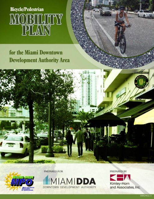
<strong>Miami</strong>-Dade Metropolitan Planning Organizationin conjunction with<strong>Miami</strong> <strong>Downtown</strong> <strong>Development</strong> <strong>Authority</strong>presentBicycle/Pedestrian Mobility PlanFor the <strong>Miami</strong> <strong>Downtown</strong> <strong>Development</strong> <strong>Authority</strong> AreaPrepared <strong>by</strong>:Kimley-Horn and Associates, IncKimley-Horn and Associates, Inc.2010040829021The preparation of this report has been financed inpart <strong>by</strong> the U.S. Department of Transportation(USDOT), through the Federal HighwayAdministration (FHWA) and/or the Federal TransitAdministration (FTA), the State Planning andResearch Program (Section 505 of Title 23, U.S. Code)and <strong>Miami</strong>-Dade County, Florida.The contents of this report do not necessarily reflectthe official views or policy of the U.S. Department ofTransportation.
TABLE OF CONTENTSCONTEXT .......................................................................................................................................................................... 1PLAN OBJECTIVE .......................................................................................................................................................... 3LITERATURE REVIEW ................................................................................................................................................ 5TRANSPORTATION MOBILITY ANALYSIS ..................................................................................................... 20Field Review Observations ............................................................................................................................ 20Pedestrian and Bicyclist Counts .................................................................................................................. 21Transit Data........................................................................................................................................................... 23Online Survey Results ...................................................................................................................................... 24GOALS AND OBJECTIVES ....................................................................................................................................... 27RECOMMENDED IMPROVEMENTS ................................................................................................................... 28Area Wide Improvements Listing .............................................................................................................. 29Metromover Improvements Listing .......................................................................................................... 29Segment Improvements Listing .................................................................................................................. 29Non-Engineering Improvements Listing ................................................................................................ 29SUMMARY AND NEXT STEPS ............................................................................................................................... 78APPENDICESAppendix A: Field Review Observations Data Collection SheetsAppendix B: Bicycle and Pedestrian Count DataAppendix C: Transit DataAppendix D: Online Survey ResultsAppendix E: Implementation Summary Tableii
LIST OF FIGURESFigure 1: Pedestrians at an unmarked crossing............................................................................................. 1Figure 2: Bicyclists riding through Brickell Park .......................................................................................... 1Figure 3: Pedestrians walking along Brickell Avenue ................................................................................. 2Figure 4: Interstate wayfinding sign ................................................................................................................... 2Figure 5: Metromover approaching Bayfront Station ................................................................................. 2Figure 6: Pedestrians walking along S <strong>Miami</strong> Avenue ................................................................................ 2Figure 7: Bicycle at a bicycle rack ......................................................................................................................... 3Figure 8: Study Area Map .......................................................................................................................................... 4Figure 9: Bicyclist riding along Biscayne Blvd ................................................................................................ 5Figure 10: 2025 <strong>Downtown</strong> <strong>Miami</strong> Master Plan ............................................................................................ 6Figure 11: Condo building in downtown <strong>Miami</strong> ............................................................................................ 7Figure 12: Bicyclist riding south on Biscayne Blvd ...................................................................................... 8Figure 13: City of <strong>Miami</strong> CIP Improvements................................................................................................. 12Figure 14: Missing crosswalk Brickell Av SE 10th St................................................................................ 19Figure 15: Corridors observed during field review .................................................................................. 20Figure 16: Pedestrian count locations map................................................................................................... 21Figure 17: Potential Modal Priority Designation within downtown <strong>Miami</strong> .................................. 30Figure 18: Perceptual design technique utilized at the Adrienne Arsht Center <strong>for</strong> thePer<strong>for</strong>ming Arts across Biscayne Boulevard ................................................................................................ 31Figure 19: Potential one-way to two-way street conversions ............................................................. 33Figure 20: Flagler Street Closure <strong>for</strong> Bike <strong>Miami</strong> Days Blvd ................................................................. 34Figure 21: Example of removable bollard...................................................................................................... 34Figure 22: Utility poles along NE 2nd Avenue ............................................................................................. 35Figure 23: Street furniture along Biscayne Blvd......................................................................................... 35Figure 24: Pedestrian shading can be provided through natural and synthetic techniques 36Figure 25: Solar Powered Street Light............................................................................................................. 37Figure 26: Automated pedestrian detection ................................................................................................. 39Figure 27: Automated pedestrian detection locations ............................................................................ 41Figure 28: <strong>Miami</strong> River Greenway improvements ..................................................................................... 43Figure 29: Bicyclist riding along Bike Route 1 ............................................................................................. 44Figure 30: Bike Route 1 sign, E side of Brickell Avenue .......................................................................... 44Figure 31: Sign obstruction in the middle of Bike Route 1 .................................................................... 45Figure 32: Conflicts around street furniture advertisement ................................................................ 45Figure 33: Narrow, non-compliant curb ramp on Route 1 .................................................................... 45Figure 34: City of <strong>Miami</strong> 2030 Bicycle Master Plan................................................................................... 47Figure 35: Proposed east crosswalk at S <strong>Miami</strong> Av and 14th St ......................................................... 48Figure 36: Proposed sidewalk widening along 14th St ........................................................................... 48Figure 37: Access to Brickell Station ................................................................................................................ 49Figure 38: Brickell Station access improvements ...................................................................................... 49Figure 39: Fence reducing space at intersection corner ......................................................................... 50iii
CONTEXT<strong>Downtown</strong> <strong>Miami</strong> is a world class destination <strong>for</strong> residents, tourists, commerce, andculture. Significant redevelopment and densification have taken place in the past and asimilar trend is expected to continue in the <strong>for</strong>eseeable future. In addition, the downtowncondo market is recovering strongly from one of the most historic boom-turned-busts inU.S. housing market history. The population growth resulting from these trends ispositively impacting <strong>Downtown</strong> <strong>Miami</strong>’s commercial base as well.<strong>Downtown</strong> <strong>Miami</strong> is the hub of the SouthFlorida urbanized region. In fact, as the<strong>Downtown</strong> <strong>Development</strong> <strong>Authority</strong>’s (DDA)Master Plan 2025 Vision Statement states,“<strong>Downtown</strong> <strong>Miami</strong> is the business, social andcultural epicenter of the Americas, whichcapitalizes on its unique position as a majorworld city in a tropical waterfrontenvironment.”Figure 2: Bicyclists riding through Brickell ParkFigure 1: Pedestrians at an unmarked crossingIt is critical to enhance non-motorizedtransportation mobility and accessibility<strong>for</strong> <strong>Downtown</strong> <strong>Miami</strong> to sustain its statusas a major world city. Pedestrian-friendlydowntown environments invite residentsand tourists alike to patronize downtownbusinesses, enjoy beautiful waterfrontvistas, walk to work, access publictransportation <strong>for</strong> longer trips, and marvelat the spectacle of grand boulevards. Furthermore, promoting walking and bicycling in the<strong>Downtown</strong> achieves important sustainability, health, and recreation goals as well.1
At the outset of the Plan, two questions were established to illustrate the context of theultimate outcomes that project constituents desired to be achieved. Can you spend a pleasant hour walking and end up in a variety of great andinteresting places? Is the bicycle as convenient to use as the automobile?The <strong>Miami</strong>-Dade Metropolitan Planning Organization (MPO), <strong>Miami</strong> DDA, and the City of<strong>Miami</strong> are continually seeking ways to strengthen <strong>Downtown</strong> <strong>Miami</strong>’s status as the worldclass epicenter of the Americas. The 2025 <strong>Downtown</strong> <strong>Miami</strong> Master Plan and <strong>Miami</strong> 21present an aggressive vision and development plan <strong>for</strong> the <strong>Miami</strong> of the 21 st century. Anefficient and robust transportation system is vital to sustain and underpin the plannedgrowth. This Plan presents improvement strategies developed through technical analysisto enhance the important non-motorized transportation network of <strong>Downtown</strong> <strong>Miami</strong> tosupport sustainable growth.Figure 3: Pedestrians walking along Brickell AvenueFigure 4: Interstate wayfinding signFigure 6: Pedestrians walking along S <strong>Miami</strong> AveFigure 5: Metromover approaching Bayfront2
PLAN OBJECTIVEThe primary objective is to prepare a bicycle and pedestrian mobility plan <strong>for</strong> the <strong>Miami</strong><strong>Downtown</strong> <strong>Development</strong> <strong>Authority</strong> (DDA) area.This mobility plan should develop and recommend projects to help implement the DDA’sgoals related to bicycle and pedestrian mobility including creating great streets andcommunity spaces, elevating grand boulevards to prominence, and leveraging the iconictropical waterfront. Furthermore, this mobility plan should focus on improvingmultimodal access to public transportation, which will promote regional connectivity. TheDDA study area is depicted on the map in Figure 8 on the following page.Figure 7: Bicycle at a bicycle rack3
Figure 8: Study Area Map4
LITERATURE REVIEWAn important element of a successful multimodal mobility plan is to understand priorinitiatives that can provide in<strong>for</strong>mation about the context within which this plan exists.Recommendations and projects identified in prior studies that may affect the outcome ofthis plan have been identified.The following data sources, studies, and plans were reviewed as part of this ef<strong>for</strong>t. A briefsummary of the review of each item is included.• DWNTWN <strong>Miami</strong>… 2025 <strong>Downtown</strong> <strong>Miami</strong> Master Plan• DDA Residential Closings and Occupancy Study• National Household Travel Survey• U.S. Census Journey-to-Work Data• Florida Department of Transportation Work Program• <strong>Miami</strong>-Dade MPO Transportation Improvement Program (TIP)• City of <strong>Miami</strong> Capital Improvement Program (CIP)• City of <strong>Miami</strong> 2030 Bicycle Master Plan• <strong>Miami</strong> <strong>Downtown</strong> Transportation Master Plan• DDA Transportation Enhancement Strategies <strong>for</strong> <strong>Downtown</strong> <strong>Miami</strong>• <strong>Miami</strong> River Urban Infill Plan• <strong>Miami</strong> River Corridor MultimodalTransportation Plan• M-Path Master Plan• <strong>Miami</strong>-Dade MPO 2035 Long RangeTransportation Plan (LRTP)• USDOT Complete Streets• Context Sensitive SolutionsFigure 9: Bicyclist riding along Biscayne Blvd5
DWNTWN <strong>Miami</strong>… 2025 <strong>Downtown</strong> <strong>Miami</strong> Master PlanThe <strong>Miami</strong> DDA in conjunction with EDAW/AECOM and the guidance of the Greater <strong>Miami</strong>Chamber of Commerce – New World Committee <strong>Downtown</strong> Master Plan Task Forcedeveloped a master plan <strong>for</strong> <strong>Downtown</strong> <strong>Miami</strong> with a long-term horizon of 2025. The goalof the master plan was to create a connection between, and to reach the maximumpotential of each of the distinct districts within the DDA area. This master planwas builtupon a solid foundation of previous studies <strong>prepared</strong> <strong>for</strong> the <strong>Downtown</strong> <strong>Miami</strong>’s mobility,aesthetics, and urbanism. The intent of the document was to create an action-orientedmaster plan that will allow <strong>for</strong> instant implementationsince it provides goals with a timeline frame rangingfrom “now” (present day) up to “long-term” (year2025). It should be noted that, as mentioned be<strong>for</strong>e,<strong>Downtown</strong> <strong>Miami</strong> is underway to becoming a worldclass city which will in turn develop the most livableurban center in the nation and it will strengthen itsposition as an international center <strong>for</strong> commerce,culture, and tourism. The 2025 <strong>Downtown</strong> <strong>Miami</strong>Master Plan establishes the following goals:Figure 10: 2025 <strong>Downtown</strong> <strong>Miami</strong> Master Plan• Enhance our position as the business and cultural epicenter of the Americas• Leverage our beautiful and iconic tropical waterfront• Elevate our grand boulevards to prominence• Create great streets and community spaces• Promote transit and regional connectivityThese goals promote a green urban environment where pedestrian mobility is thetransportation priority.6
DDA Residential Closings and Occupancy StudyThe <strong>Miami</strong> DDA commissioned an update of the Residential Closings and Occupancy Study<strong>prepared</strong> <strong>by</strong> Goodkin Consulting and Focus Real Estate Advisors. The report update waspublished in March 2010. Major findings are summarized below.• Occupancy in new condominium buildingsincluding owners and renters increased 12percentage points from 62 percent to 74percent of completed units between May2009 and February 2010.• Completed buildings studied included 75condo buildings representing a total of22,079 units. Two new buildings totaling876 units are expected to be completed inthe near term.• Approximately 87 percent of the 16,415sold condo units are filled with full-timeresidents.• Substantial household growth is predictedto continue in <strong>Downtown</strong> <strong>Miami</strong>. TheFigure 11: Condo building in downtown <strong>Miami</strong>substantial supply of new condominium units is increasingly being brought tomarket as rental stock, generating a highly competitive rental market that translatesinto greater af<strong>for</strong>dability and choice attractive to the substantial downtownemployment base.• The Brickell area accounts <strong>for</strong> the largest concentration of new condominiumbuildings/units in the downtown area, representing about 10,400 units. The CentralBusiness District (CBD) and the Wynwood/Edgewater area represent other largemarkets.7
The applicability of this study <strong>for</strong> the Bicycle and Pedestrian Mobility Plan is that theincreasing demand <strong>for</strong> urban living creates additional need <strong>for</strong> sustainable non-motorizedtransportation solutions to serve the resulting urban trip patterns.National Household Travel SurveyAccording to the 2001 National Household Travel Survey, nearly one-half of all trips areless than three miles in length. Approximately 28 percent of trips are less than one mile.Yet less than one percent of all trips are made <strong>by</strong> bicycle according to United States Censusdata. Although comprehensive travel mode and trip length data is expensive to collect andnot frequently updated, it is unlikely that percentages are significantly different than theywere in 2001. In a geographic area such as <strong>Downtown</strong> <strong>Miami</strong>, it is likely that thepercentage of short trips is even higher than the national average.Figure 12: Bicyclist riding south on Biscayne BlvdActive transportation, such as bicycling,walking, or accessing public transportation, hasthe potential to serve a greater market share oftrips than it currently does. Facilities such aswide sidewalks, pedestrian crossing features atkey intersections, bicycle parking areas, andinterconnected bike lanes are important <strong>for</strong>attracting a greater modal share <strong>for</strong> alternativetravel modes. Focusing planning ef<strong>for</strong>ts onalternative transportation modes is vital.U.S. Census Journey-to-Work DataThe United States Bureau of the Census measures transportation data <strong>for</strong> work trips onlyusing a sampling of respondents that complete the census long <strong>for</strong>m as part of the annualAmerican Community Survey (ACS). Updated socioeconomic, demographic, and housingin<strong>for</strong>mation is now available on an annual basis.8
Journey-to-work data <strong>for</strong> the <strong>Miami</strong> DDA area was extracted from geographic in<strong>for</strong>mationsystem (GIS) data available from the Census ACS. The most recent year of data available<strong>for</strong> this analysis is from 2008.Work trip characteristics in <strong>Downtown</strong> <strong>Miami</strong> demonstrate that <strong>Downtown</strong> residents aremore likely to make work trips on foot than in the City, County, and State as a whole.Although “drove alone” is still the dominant journey-to-work mode within the <strong>Downtown</strong>,the percentage of single occupant vehicles is 7 percent less than in the County and 9percent less than in the State as a whole.Table 1: Journey to Work Data<strong>Downtown</strong> <strong>Miami</strong>(DDA Study Area)City of <strong>Miami</strong> <strong>Miami</strong>-Dade County State of FloridaDescription Number Percent Number Percent Number Percent Number PercentCar, truck, or van 10,144 80.14% 122,481 79.40% 941,634 86.70% 7,353,552 89.99%Drove alone 8,908 70.37% 108,065 70.05% 840,379 77.37% 6,491,993 79.45%Carpooled 1,236 9.76% 14,416 9.35% 101,255 9.32% 861,559 10.54%Public Transportation 1,014 8.01% 18,845 12.22% 61,239 5.64% 160,424 1.96%Motorcycle 0 0.00% 347 0.22% 2,165 0.20% 24,632 0.30%Bicycle 40 0.32% 452 0.29% 3,456 0.32% 45,333 0.55%Walked 674 5.32% 5,433 3.52% 21,745 2.00% 131,860 1.61%Other means 254 2.01% 2,409 1.56% 15,032 1.38% 103,960 1.27%Worked at home 532 4.20% 4,145 2.69% 39,192 3.61% 344,756 4.22%Florida Department of Transportation Work ProgramThe Florida Department of Transportation (FDOT) prepares an annual work program <strong>for</strong>projects to be completed in the next five years. <strong>Miami</strong>-Dade County falls within thejurisdiction of FDOT District Six. The FDOT 2010 – 2014 work program was reviewed to9
determine what projects are expected to be completed within the next five years.According to Florida Statute 335.065, bicycle and pedestrian ways shall be established inconjunction with the construction, reconstruction, or other change of any statetransportation facility. The following projects are programmed <strong>by</strong> FDOT that are ofinterest to this Plan.Table 2: FDOT Work ProgramProjects within the <strong>Miami</strong> DDA AreaFM Number Location From To Improvement Year*412473-1 Brickell Avenue SE 25 th Road SE 4 th Street424407-1 SW 1 st Street <strong>Miami</strong> River <strong>Miami</strong> River414624-1BiscayneBoulevard418334-1 Riverwalk420907-1<strong>Miami</strong> RiverGreenwayNE 15 th StreetSW 2 nd AvenueBridgeNW 12 th AvenueNE 35 th TerraceS <strong>Miami</strong> AvenueBridgeSW 5 th Street414633-1 Flagler Street West 14 th Avenue West 2 nd AvenueRigid PavementRehabilitationBridge ReplacementPD&EFlexible PavementReconstructionBike Path/Trail(Enhancement Funds– City of <strong>Miami</strong> is theProject Manager)Bike Path/Trail(Federal Earmark –City of <strong>Miami</strong> is theProject Manager)Flexible PavementReconstruction251156-3 Port of <strong>Miami</strong> Port of <strong>Miami</strong> Macarthur Cswy Tunnel 2015* Project completion date201220182012201120122016<strong>Miami</strong>-Dade MPO Transportation Improvement Program (TIP)The <strong>Miami</strong>-Dade MPO prepares the annual Transportation Improvement Program (TIP)consistent with federal guidelines. The TIP in effect at the time of this Plan is the FY2009/10 to FY 2013/14 TIP adopted <strong>by</strong> the <strong>Miami</strong>-Dade MPO Governing Board on May 28,2009. The TIP specifies proposed transportation improvements to be implemented in<strong>Miami</strong>-Dade County over the coming five years. The TIP was reviewed to determineprogrammed projects within the study area. Programmed projects are depicted in Table 3.10
FDOT projects identified in the previous section under FDOT Work Program are notrepeated in Table 3.Table 3: <strong>Miami</strong>-Dade MPO TIPProjects within the <strong>Miami</strong> DDA AreaFM Number Location From To Improvement YearPW671203 NW 14 th Street Civic CenterBiscayneBoulevardPW000306a NE 2 nd Avenue NE 20 th Street NE 36 th StreetPW671204 NW 20 th Street Civic CenterBiscayneBoulevardWidening to 3LanesTraffic OperationsImprovementResurfacing andRe-striping 4 LanesN/A2011N/ACity of <strong>Miami</strong> Capital Improvement Program (CIP)The City of <strong>Miami</strong> <strong>prepared</strong> the Capital Improvement Program (CIP) as part of thebudgeting process <strong>for</strong> projects expected to be built over the next five years. The latest CIPavailable at the time of this Plan is the FY 2008/09 to FY 2013/14 CIP. The City of <strong>Miami</strong>CIP was reviewed to determine programmed projects within the study area. GIS data <strong>for</strong>CIP projects were provided <strong>by</strong> the City of <strong>Miami</strong>. CIP projects are mapped in Figure 13.City of <strong>Miami</strong> 2030 Bicycle Master PlanThe City of <strong>Miami</strong> published their first Bicycle Master Plan in September 2009. This BicycleMaster Plan was developed with the guidance of previous bicycle study ef<strong>for</strong>ts locally andnationally. The study assessed the existing conditions, public input, and city staffrecommendations to establish the citywide bicycle network plan and bicycle parking plan.This ef<strong>for</strong>t can be used as guidance <strong>for</strong> the development of the bicycle network and parking<strong>for</strong> the period 2010-2030 within the <strong>Downtown</strong> study area. The Plan identified that mostof the existing corridors within the City are primarily designed <strong>for</strong> automobile use. Veryfew bicycle facilities exist within the <strong>Downtown</strong> area, which makes <strong>for</strong> an unsafeenvironment <strong>for</strong> bicyclists along these corridors.11
Figure 13: City of <strong>Miami</strong> CIP Improvements12
<strong>Miami</strong> <strong>Downtown</strong> Transportation Master PlanThe <strong>Miami</strong> <strong>Downtown</strong> Transportation Master Plan (MDTMP) was developed in 2003 to seta general framework <strong>for</strong> the transportation system in <strong>Downtown</strong> <strong>Miami</strong>. As a result, themaster plan generated a series of recommendations <strong>for</strong> the <strong>Downtown</strong> through the year2020. The MDTMP focused on maintaining levels of mobility <strong>for</strong> employees, residents, andvisitors. Emphasis was placed on the use of transit (Metrorail, Metromover, shuttles, etc.)and improving the pedestrian environment. Since this study was published, other studieshave been completed that expand to provide a more pedestrian-oriented environment.The most recent study was developed <strong>by</strong> the <strong>Miami</strong> DDA in their 2025 <strong>Downtown</strong> <strong>Miami</strong>Master Plan.DDA Transportation Enhancement Strategies <strong>for</strong> <strong>Downtown</strong> <strong>Miami</strong>An evaluation of the City of <strong>Miami</strong>’s existing transportation system and development oftransportation enhancement strategies <strong>for</strong> <strong>Downtown</strong> <strong>Miami</strong> was completed in early 2009.The purpose of this project was to set the framework and identify all the potentialroadway, transit, and bicycle/pedestrian facility improvements to achieve these objectives.The study evaluated the City’s existing transportation system and provides potentialimprovement strategies. A series of maps were developed to illustrate the transportationsystem and the potential improvements. As a result of an interactive process with the DDA,this report also includes a prioritization of the already planned projects and thedevelopment of conceptual improvements. As part of this ef<strong>for</strong>t, a series of improvementshave been identified to improve the safety of the existing users and to encourage currentautomobile users to walk and/or bike <strong>for</strong> their mobility needs within <strong>Downtown</strong> <strong>Miami</strong>.The pedestrian/bicycle improvements are expected to enhance access to the transit systemto provide better alternative travel options to automobile. These recommendations arelisted in Table 4.13
Table 4: DDA Transportation Enhancement StrategiesPedestrian/Bicycle ImprovementsProject Purpose Served StatusBicycle Path Improvementsalong 14 th StreetBicycle Path Improvementsalong NW 1 st AvenueFEC Urban GreenwayCorridorM-Path Greenway<strong>Miami</strong> River Greenway M-Path ConnectorPedestrian CorridorImprovements• <strong>Miami</strong> Avenue• Biscayne Boulevard• Flagler Street• W. 2 nd Avenue• N. 5 th Street• N.E. 2 nd Avenue• N.E. 3 rd Street• N.E. 1 st Avenue• N.E. 2 nd Street• S. 1 st Street• N. 4 th StreetPedestrianConnections/WalkwaysConnect the Per<strong>for</strong>ming Arts Center/EntertainmentArea to the University of <strong>Miami</strong> Medical CenterHealth DistrictConnect <strong>Downtown</strong> <strong>Miami</strong> Government Center to theproposed bicycle lanes along 14 th StreetGreenway along the FEC railroad right-of-way toconnect Bayfront Park to the bicycle lanes on NW 1 stAvenueConnect the existing bicycle lanes on SW 15 th Roadto the Brickell Metrorail StationConnect the <strong>Miami</strong> River Greenway to the M-PathGreenway starting at SW 7 th StreetPedestrian corridor improvements and connection ofexisting pedestrian corridors to provide a continuedcorridor<strong>Miami</strong> RiverwalkConnection between American Airlines Arena andBayside along with other existing walkwaysPlannedPlannedPlannedPlannedPlanned<strong>Miami</strong> <strong>Downtown</strong>Transportation MasterPlan<strong>Miami</strong> <strong>Downtown</strong>Transportation MasterPlan<strong>Miami</strong> River Corridor Urban Infill PlanIn 2002, Kimley-Horn <strong>prepared</strong> the first <strong>Miami</strong> River Corridor Urban Infill Plan <strong>for</strong> the<strong>Miami</strong> River Commission. The <strong>Miami</strong> River Commission joined ef<strong>for</strong>ts with the City of<strong>Miami</strong>, <strong>Miami</strong>-Dade County and <strong>Miami</strong> River Corridor stakeholders to kick-start this UrbanInfill ef<strong>for</strong>t. The plan was built upon previous plans <strong>for</strong> the <strong>Miami</strong> River including the<strong>Miami</strong> River Greenway Action Plan, <strong>Miami</strong> River Master Plan, <strong>Miami</strong> River Study14
Commission Report, and <strong>Miami</strong> River Commission’s Water Quality Improvement Plan. TheUrban Infill Plan focused on establishing a unified vision <strong>for</strong> the future use anddevelopment along the <strong>Miami</strong> River. This plan mainly promotes and protects riverinterests, encourages smart redevelopment within the <strong>Miami</strong> River Infill Area, createspublic awareness of the river, and defines and protects the quality of life along the river. Inaddition, the Urban Infill Plan provides a vision <strong>for</strong> the future of the <strong>Miami</strong> River Corridoras a true multimodal transportation system. The plan also identifies specificrecommendations to improve pedestrian mobility.M-Path Master PlanKimley-Horn developed the M-Path Master Plan <strong>for</strong> the <strong>Miami</strong>-Dade MPO in 2007. The M-Path is currently a nine-mile, eight-foot wide multi-use path that connects <strong>Downtown</strong><strong>Miami</strong> to SW 67th Avenue (Ludlam Road) in South <strong>Miami</strong>. The M-Path was built within<strong>Miami</strong>-Dade Transit right-of-way, meandering under the elevated Metrorail. Along thecorridor, discontinuities exist and the path does not meet current trail design standards <strong>for</strong>bi-directional multi-use paths. The objective of the M-Path Master Plan was to addressoperational issues and problem areas along the alignment with a comprehensive program<strong>for</strong> the path as a whole. M-Path concerns and issues were identified and documented <strong>by</strong>the study team team at the outset of the plan through corridor inventories andphotography. Guiding principles were developed to provide focus <strong>for</strong> design standards andtrail improvements. Trail design standards were established that will guide theimprovement of existing segments and will serve as a basis <strong>for</strong> the design of futuresegments and connections to the M-Path. A conceptual design was <strong>prepared</strong> on aerialphotography that identified locations <strong>for</strong> trail improvements such as enhanced intersectioncrossings, trail re-alignments, safety features, signage, lighting, landscaping, and Metrorailplaza treatments. In addition to existing trail enhancements, the M-Path is programmed tobe extended in 2011 from SW 67 th Avenue to Dadeland South, where it will connect to the20-mile South Dade Trail.15
<strong>Miami</strong>-Dade MPO 2035 Long Range Transportation Plan (LRTP)The <strong>Miami</strong>-Dade Metropolitan Planning Organization (MPO) updates their LRTP every fiveyears per federal legislation requirements. The LRTP outlines expenditures <strong>for</strong> surfacetransportation programs including highways, transit, safety, research and freight. Thecurrent LRTP is <strong>for</strong> long term planning horizon 2035. The 2035 LRTP was adopted <strong>by</strong> theMPO Governing Board late 2009. The plan addresses several transportationimprovements, including mobility, safety, security, economic vitality, environment,connectivity, and system preservation. The plan identified several projects in the vicinityof the DDA area. Some of these projects include rubber-tire mass transit, traffic operationsimprovements, bridge rehabilitation/construction, Port of <strong>Miami</strong> access improvements,and bicycle and pedestrian facilities. Table 5 and Table 6 summarize these projects.Table 5: <strong>Miami</strong>-Dade 2035 LRTP Cost Feasible PlanProjects in Priorities I to IVFacility From To DescriptionCoral Way-Brickell TrolleyBrickell Metrorail/Metromover StationPonce de LeonBoulevardImplement rubber tire trolley service<strong>Downtown</strong>-Brickell TrolleyBrickell Metrorail/Metromover StationOmni areaImplement rubber tire trolley serviceNE 2 nd Avenue NE 20 th Street NE 91 st StreetStreet/Traffic OperationalImprovementsSR 5/US-1/Biscayne BRT Omni Terminal Aventura Mall Premium transit improvementSW 1 st Street Bridge over <strong>Miami</strong> River US-1 Bridge replacement<strong>Downtown</strong>/Port AccessSR 5/US-1/BiscayneBoulevardConstruct I-95 NB Slip ramp on NW6 th Street; Implement NE/NW 5 th /6 th/Port Blvd. improvements <strong>for</strong> accessbetween POM and I-95 Slip rampExpand SB left turn lane <strong>for</strong> trucksentering Port16
Table 6: <strong>Miami</strong>-Dade 2035 LRTP Cost Feasible PlanNon-Motorized ProjectsFacility From To DescriptionNE 2 nd Avenue NE 20 th Street NE 36 th StreetSafe Route to SchoolProgramSouthsideNorth <strong>Miami</strong> Avenue NW 14 th Street NW 29 th StreetNorth <strong>Miami</strong> Avenue NW 5 th Street NW 14 th StreetNW 2 nd Avenue NW 17 th Street NW 20 th StreetNW 3 rd Court I-95 NW 8 th StreetSouth <strong>Miami</strong> Avenue SW 14 th Terrace SW 12 th StreetSouth <strong>Miami</strong> Avenue SW 6 th Street SW 3 rd StreetSW/NW 1 st Avenue SW 2 nd Street NW 20 th StreetSW 2 nd Avenue SW 15 th Road SW 8 th StreetOvertown Greenway(except portion betweenNW 3 rd and 7 th Avenue)Bicycle FacilityImprovementsNon-motorized FacilityImprovementsBicycle FacilityImprovements (Restriping)Bicycle FacilityImprovements (Restriping)Pedestrian FacilityImprovementsPedestrian facilityImprovementsBicycle FacilityImprovements (restriping)Bicycle FacilityImprovements (restriping)Bicycle FacilityImprovements (restriping)Bicycle FacilityImprovements (restriping)<strong>Miami</strong> River Greenway Bicentennial Park Trail Improvements<strong>Miami</strong> River Corridor Multimodal Transportation PlanKimley-Horn developed the <strong>Miami</strong> River Corridor Multimodal Transportation Plan <strong>for</strong> the<strong>Miami</strong>-Dade MPO and the <strong>Miami</strong> River Commission. This Plan addressed various types oftransportation along the river. The Plan incorporated the <strong>Miami</strong> River Greenway ActionPlan (MRGAC) as well as the relationship between the MRGAC and multiple modes oftransportation improvements along the corridor. These include pedestrian, bicycle, transit,and roadway improvements. The Plan developed a multimodal transportation strategythat envisioned alternative modes of transportation that will alleviate the traffic congestion17
on the adjacent roads and increase the functionality of the <strong>Miami</strong> River Corridor, includingsteps necessary <strong>for</strong> completion of the <strong>Miami</strong> River Greenway. Project recommendationswere made <strong>for</strong> the Upper River, Middle River, and Lower River. The Lower River sectionincludes a portion of the DDA study area.Complete Streets (USDOT)In March 2010, the Secretary of the United States Department of Transportation (USDOT)announced the end of favoring motorized transportation at the expense of non-motorizedtransportation. To accomplish this objective, the USDOT is directing state DOTs, MPOs, andlocal jurisdictions to:• treat walking and bicycling as equals with other transportation modes,• go beyond minimum standards within a context sensitive solution,• collect data on walking and bicycling trips, and• improve non-motorized facilities during maintenance projects.Complete streets are designed and implemented to enable safe access <strong>for</strong> all users so thatpedestrians, bicyclists, transit passengers, and motorists of all ages and abilities are notdiscriminated against in the design of the transportation network. Complete streets aredefined <strong>by</strong> the National Complete Streets Coalition (NCSC), a national non-profitpartnership, as safe, com<strong>for</strong>table and convenient <strong>for</strong> travel <strong>by</strong> everyone, regardless of ageor ability – motorists, pedestrians, bicyclists, and public transportation riders.In 1984, the State of Florida adopted a Statute <strong>for</strong> Bicycle and Pedestrian Ways (FloridaStatute 335.065), which is widely regarded as an early <strong>for</strong>m of the complete streetsprinciple. Over the years this initiative has evolved to its current <strong>for</strong>m where it states thatboth bicycle and pedestrians shall be given full consideration in the planning anddevelopment of transportation facilities, with a special emphasis to projects within onemile of an urban area. In addition, in March of 2009, the City of <strong>Miami</strong> adopted a resolutionestablishing a “Complete Streets Program.”18
Context Sensitive SolutionsThe concept of Context Sensitive Solutions (CSS)has been around since late 1960’s when theNational Environmental Policy Act (NEPA) of1969 required transportation agencies toconsider the possible adverse effects oftransportation projects on the environment.In the late 1990’s, the American Association ofFigure 14: Missing crosswalk Brickell Av SE 10 th StState Highway and Transportation Officials (AASHTO) and the Federal HighwayAdministration (FHWA) jointly sponsored the “Thinking Beyond the Pavement” nationalconference, which generated the definition of context sensitive design (CSD). It was thenthat CSS really gained significant momentum.In the fall of 2006 AASHTO’s Center <strong>for</strong> Environmental Excellence and FHWA sponsored aconference, whose results generated the following definition of CSS:“Context sensitive solutions (CSS) is a collaborative, interdisciplinary approach thatinvolves all stakeholders in providing a transportation facility that fits its setting. Itis an approach that leads to preserving and enhancing scenic, aesthetic, historic,community, and environmental resources, while improving or maintaining safety,mobility, and infrastructure conditions”.The core principles of CSS are applied to transportation planning and design and areespecially relevant within the exceptional context of <strong>Downtown</strong> <strong>Miami</strong>. One of thememphasizes exercising flexibility and creativity to shape effective transportation solutions,while preserving and enhancing community and natural environments. In addition, CSSdesign stresses that in urban environments pedestrians should not be expected to makeinconvenient diversions from their travel paths to cross an intersection or a roadway.19
TRANSPORTATION MOBILITY ANALYSISA general transportation mobility analysis has been completed to identify bicycle andpedestrian trip patterns and mobility issues throughout the DDA area. The analysis wasbased on existing conditions, data collected <strong>for</strong> this Plan, and an online bicycle andpedestrian survey. The purpose of this task was to collect data that will allow the studyteam to properly assess the existing conditions of alternative travel modes in <strong>Downtown</strong><strong>Miami</strong>, and to analyze the future bicycle and pedestrian infrastructure needs.Field Review ObservationsFigure 15: Corridors observed during field reviewField observations were conducted from February toMay 2010 along major travel corridors within theDDA area. Detailed field observations of thesecorridors were conducted to determine existingconditions, width of curb lane, sidewalk width,median type, posted speed limits, presence of onstreetparking, and existing bike facilities. Figure 15illustrates the study corridors that were included inthe field review. Data collection sheets are included inAppendix A.Results of these field observations recognize thatwithin the downtown area there are just a fewcorridors identified as bicycle facilities. In addition itwas noted that not too many corridors provide awide sidewalk with physical separation from thetraffic, as recommended in the CSS guidelines. It wasalso noted that the average curb lane width along20
these corridors was approximately 11 feet, which potentially limits the future bicyclefacilities to “bicycle routes”, “sharrows” or “bicycle boulevards.” Several pedestrian/bicyclemobility issues were identified during the field reviews. These issues may be summarizedas follows:• unmarked crossings on key approaches at several major intersections• pedestrian visibility concerns at intersection crosswalks• lack of connectivity along the <strong>Miami</strong> River Greenway• lack of adequate access to the <strong>Miami</strong> River Greenway• high occurrence of undesignated bicycle parking indicating some latent demand• inconvenient access to Metromover stations’ ADA accessible entrances• pedestrian corridors designed to meet minimum standards, not context sensitivePedestrian and Bicyclist CountsIn order to capture the magnitude of pedestrian andbicycles in downtown major corridors, 2-hour countswere collected at eight locations within the studyarea. Bicycle and pedestrian counts help to monitorlocations, better define safety issues, developimprovements, and prioritize locations <strong>for</strong>implementation. In addition, bicycle and pedestriancounts could be used to define bicycle safety issues(i.e., crashes) in relation to exposure.Figure 16: Pedestrian count locations mapAs indicated in Figure 16, these counts werestrategically located at key distinct locations andspecific times. Each location and timing wasparticularly selected to capture different travelpatterns within different land uses. Pedestriancounts during a typical Friday lunch peak period21
were collected along Flagler Street and Brickell Avenue, capturing pedestrian volume in theCentral Business and Financial Districts. A total of 657 pedestrians per hour were countedat the intersection of Brickell Avenue and SE 10 th Street, and 1,262 pedestrians alongFlagler Street between <strong>Miami</strong> Avenue and E 1 st Avenue during the peak hour. Evening peakperiod pedestrian counts were obtained at the heart of the entertainment district in MaryBrickell Village during a typical Thursday evening. Approximately 400 pedestrians werecounted from 9:45 p.m. to 10:45 p.m. at the Mary Brickell Village.Pedestrian counts were also per<strong>for</strong>med during specialevents at Bayfront Park, the American Airlines Arena(AAA), and the Adrienne Arsht Per<strong>for</strong>ming Arts Center. Apedestrian count was per<strong>for</strong>med on a Friday afternoon atthe steps of the DWNTWN concert series, whereapproximately 650 pedestrians were counted walking toand from Bayfront Park. On a typical Saturday evening <strong>for</strong>a Heat home game, a total of 6,565 pedestrians wereobserved to approach the AAA prior to the game start. As a comparison, an average of1,750 vehicles per hour were observed during a typical weekday evening in January 2009(source: FDOT Florida Traffic In<strong>for</strong>mation 2009). Approximately 340 pedestrians werecounted approaching the Per<strong>for</strong>ming Arts Center an hour be<strong>for</strong>e the per<strong>for</strong>mances started.Bicycle counts were also per<strong>for</strong>med at Brickell Avenueand Biscayne Boulevard with approximately 60 and70 bicyclists per hour on the peak hour of a typicalSaturday morning. Detailed in<strong>for</strong>mation of the countdata is included in Appendix B.22
Transit DataTransit boarding and alighting data <strong>for</strong> Metrorail and Metromover stations within the DDAboundaries were obtained from the Ridership Technical Report <strong>prepared</strong> <strong>by</strong> the Office ofPer<strong>for</strong>mance Management of <strong>Miami</strong>-Dade Transit in April, 2010. Three (3) out of the 22Metrorail stations are within the DDA area boundaries – Brickell Station, GovernmentCenter Station, and Overtown/Arena Station. The Government Center Station has the mostboardings of the entire Metrorail system with the total boardings surpassing 275,000 in amonth. The Brickell Station is ranked 6 th and the Overtown/Arena Station is ranked 15 thwith boardings of approximately 92,000 and 33,000, respectively. Although these numberscorrespond only to boardings, it is safe to assume that a vast majority of these trips are partof a roundtrip. These numbers are significant and indicate that approximately 20,000people arrive in downtown every weekday via Metrorail.In addition, data from the Metromover downtown people mover system were obtained. Asindicated in Table 7, there are 20 operating stations. Metromover boardings totalapproximately 650,000 per month. Of these boardings, approximately 84 percent occurredduring the weekdays serving <strong>Downtown</strong>ers that live and work in the area, commutersarriving <strong>by</strong> car, and transit commuters that become pedestrians once they reach theirdestination. Detailed transit data are included in Appendix C.23
Stations 1TotalBoardings 2Table 7: Metromover Boardings <strong>by</strong> StationWeekdayBoardingsSaturdayBoardingsSundayBoardingsGovernment Center 145,716 129,297 88.7% 9,034 6.2% 7,385 5.1%Bayfront Park 88,088 73,991 84.0% 7,874 8.9% 6,223 7.1%Omni 68,244 54,648 80.1% 7,648 11.2% 5,948 8.7%College/Bayside 48,915 39,392 80.5% 5,205 10.6% 4,318 8.8%Brickell 48,521 41,341 85.2% 4,059 8.4% 3,121 6.4%First Street 35,681 29,640 83.1% 2,927 8.2% 3,114 8.7%College North 27,302 23,731 86.9% 1,834 6.7% 1,737 6.4%School Board 25,361 19,748 77.9% 3,026 11.9% 2,587 10.2%Financial District 24,633 21,480 87.2% 1,783 7.2% 1,370 5.6%Tenth Street 20,358 17,115 84.1% 1,848 9.1% 1,395 6.9%Knight Center 17,690 12,077 68.3% 3,026 17.1% 2,587 14.6%<strong>Miami</strong> Avenue 17,430 15,378 88.2% 1,351 7.8% 701 4.0%Freedom Tower 16,651 13,598 81.7% 1,467 8.8% 1,586 9.5%Eighth Street 13,310 11,059 83.1% 1,221 9.2% 1,030 7.7%Riverwalk 12,618 10,505 83.3% 1,219 9.7% 894 7.1%Park West 11,026 8,162 74.0% 1,436 13.0% 1,428 13.0%Arena/State Plaza 9,873 8,338 84.5% 834 8.4% 701 7.1%Fifth Street 9,010 7,795 86.5% 748 8.3% 467 5.2%Third Street 7,878 6,539 83.0% 814 10.3% 525 6.7%Eleventh Street 5,523 4,123 74.7% 737 13.3% 663 12.0%Bicentennial Park 3 0 0 - 0 - 0 -Total/Average 653,828 547,957 83.8% 58,091 8.9% 47,780 7.3%Notes:1 The stations are sorted in descending order of Total Boarding2Boarding values presented in this table are established per month3Station is currently closedOnline Survey ResultsIn addition to quantitative data from field reviews andpedestrian counts, an online survey was administered<strong>by</strong> DDA staff to obtain downtown street users’perspective about the quality of existing conditions andusage. A total of 339 people responded to the onlinesurvey. The survey included qualitative andquantitative questions regarding the use of downtownstreets <strong>for</strong> walking and bicycling.24
One of the questions was to rank a set of bicycle-pedestrian amenities in order ofimportance (1 being the least important and 10 being the most important). The resultsindicate that to <strong>Downtown</strong>ers, bicycle lanes, sidewalks and crosswalks are the mostimportant elements <strong>for</strong> a pleasant trip experience. These are followed <strong>by</strong> traffic signals andproper signage. Table 8 shows the results of this survey question. Detailed survey resultsare included in Appendix D.Table 8: Bicycle-Pedestrian Amenities RankingA sampling of quotes that survey respondents provided <strong>for</strong> open-ended questions can befound below.25
Appendix D includes all of the additional written responses provided in the online survey.26
GOALS AND OBJECTIVESOn May 25 th , 2010, the Study Advisory Committee <strong>for</strong> the project met to identify the maingoals and objectives <strong>for</strong> this Plan in consideration of the results of the Literature Reviewand the Transportation Mobility Analysis.The primary goal established <strong>by</strong> the Committee is to promote a green urban environmentwhere pedestrian and bicycle mobility are the transportation priorities. In addition, theCommittee members agreed upon the objective to identify projects and strategiesconsistent with goals outlined in the 2025 <strong>Downtown</strong> <strong>Miami</strong> Master Plan. The key goalsoutlined in the master plan <strong>for</strong> healthy transportation solutions are listed below.• Complete Baywalk and Riverwalk• Elevate Brickell Avenue to Iconic Status• Create a Grand Promenade Along Biscayne Boulevard• Promote Flagler Street as <strong>Miami</strong>’s Pedestrian Oriented Main Street• Rein<strong>for</strong>ce Connectivity to Brickell Village Center• Enhance Connectivity to Surrounding Neighborhoods• Promote Transit Connectivity• Rebalance Roadways Towards Transit, Pedestrians, and Bicyclists27
RECOMMENDED IMPROVEMENTSBicycle and pedestrian mobility recommendations were developed <strong>for</strong> the DDA area basedon input from the Study Advisory Committee and the prior work tasks of this Plan,including the literature review, transportation mobility analysis, and the identification ofgoals and objectives. All improvements have been developed under an overarchingprinciple to support and prioritize pedestrians and bicyclists within the exceptional contextof downtown <strong>Miami</strong> through use of context sensitive solutions (CSS) and complete streetsprinciples as discussed in the Literature Review component of this report.Project ListingThis Plan recommends the following improvement projects to promote safe andsustainable pedestrian and bicycle mobility within the <strong>Miami</strong> DDA. Most of the Planprojects are capital improvement projects. Project descriptions, lead agencies, tasks,timeframes, implementation strategies, and generalized implementation cost levels <strong>for</strong>these projects are included below. Generalized implementation costs are identified <strong>by</strong>using dollar signs “$” and ranging from lower cost “$” to higher cost “$$$$.” A tablesummarizing the generalized implementation costs <strong>for</strong> the proposed projects is included inAppendix E. Photos, drawings, maps, and tables were developed or obtained from existingsources as necessary to provide further in<strong>for</strong>mation and definition regarding the projects.The capital projects represent the Engineering “E” of the League of American Bicyclists’“Five E” multimodal planning process. The remaining four “Es” each have individualrecommendations summarized at the end of the Plan – Education, Encouragement,En<strong>for</strong>cement, and Evaluation. The projects are organized as follows.28
Area Wide ImprovementsProject 1: Modal Priority ZoneProject 2: Low-Speed Design PrinciplesProject 3: One-Way to Two-Way Street ConversionProject 4: Festival StreetsProject 5: Pedestrian Throughway ZoneProject 6: Pedestrian Shade CorridorsProject 7: Pedestrian LightingProject 8: Pedestrian Signalization ImprovementsProject 9: Automated Pedestrian DetectionProject 10: <strong>Miami</strong> River Greenway ImprovementsProject 11: Bike Route 1 ImprovementsProject 12: Other Bicycle ImprovementsMetromover ImprovementsProject 13: Financial District Metromover StationProject 14: Brickell Metromover StationProject 15: Tenth Street Metromover StationProject 16: Fifth Street Metromover StationProject 17: Third Street Metromover StationProject 18: First Street Metromover StationProject 19: College/Bayside Metromover StationSegment ImprovementsProject 20: Biscayne Boulevard Median ImprovementsProject 21: Pedestrian Mobility Improvements – Biscayne Blvd.–NorthProject 22: Pedestrian Mobility Improvements – Biscayne Blvd.–SouthProject 23: Pedestrian Mobility Improvements – Brickell AvenueProject 24: Pedestrian Mobility Improvements – <strong>Miami</strong> AvenueProject 25: Pedestrian Mobility Improvements – S <strong>Miami</strong> AvenueProject 26: Pedestrian Mobility Improvements – NE 2 nd Avenue–NorthProject 27: Pedestrian Mobility Improvements – NE 2 nd Avenue–SouthProject 28: Pedestrian Mobility Improvements – SE/NE 2 nd AvenueProject 29: Pedestrian Mobility Improvements – SW 1 st AvenueProject 30: Pedestrian Mobility Improvements – Brickell Bay DriveProject 31: Court House Pedestrian ImprovementsProject 32: High Density Bicycle ParkingProject 33: NW 1st Street Transit MallNon-Engineering ImprovementsProject 34: Education ImprovementsProject 35: Encouragement ImprovementsProject 36: En<strong>for</strong>cement ImprovementsProject 37: Evaluation and Monitoring29
Project 1: Modal Priority ZoneProjectModal Priority Zone Adopt a Modal Priority designation (illustrated in Figure 17)within the <strong>Miami</strong> DDA boundaries to account <strong>for</strong> theexceptional context of downtown <strong>Miami</strong>, the largest urbancenter in FloridaProject Description Prioritize pedestrians and bicycles over other modes torecognize that the downtown core is a unique setting wherenon-motorized transportation is a particularly viable andsustainable solution All roadway studies and projects must consider all modes andprovide improvements <strong>for</strong> all modesLead Agencies <strong>Miami</strong> DDA, City of <strong>Miami</strong>, <strong>Miami</strong>-Dade County, FDOT The unique relationship between land use density, desirableNotesorigins and destinations, infrastructure improvements, andurban design within downtown ensure the necessity of a multimodalcore <strong>for</strong> downtown <strong>Miami</strong> to maintain its viability Apply guiding principles and lessons learned from cities thathave developed a successful Modal Priority plan <strong>for</strong> applicationwithin their downtown cores (e.g. Minneapolis, MN andVancouver, BC), both widely considered to be among the mostwalkable cities in North America Prepare a be<strong>for</strong>e-and-after evaluation and a monitoringTasks Involvedprogram to insure the effectiveness of the prioritization and theachievement of objectives Coordinate with the City of <strong>Miami</strong>, <strong>Miami</strong>-Dade County, and theFlorida Department of Transportation to update all relevantstandards, manuals, guidelines, transportation plans, andcapital improvement programs to support the Modal Prioritydesignation within the <strong>Miami</strong> DDA boundariesFigure 17: Potential Modal PriorityDesignation within downtown <strong>Miami</strong> –Pedestrians would be prioritized at the top ofthe pyramid followed <strong>by</strong> bicycles, then <strong>by</strong>public transportation, and finally personal car30
Project 2: Low-Speed Design PrinciplesProjectProject DescriptionLead AgenciesNotesTasks InvolvedImplementationStrategyImplementation Cost $$Low-Speed Design PrinciplesAs streets are redesigned, reconstructed, and redeveloped, uselow-speed design principles to achieve lower speeds in thestudy area through techniques such as smaller corner radii,pedestrian bulb-outs, traffic circles that accommodate bicyclesand pedestrians, and utilizing traffic calming devices whereappropriatePerceptual design features such as patterns painted, stamped,or built into the roadway surface encourage motorists toreduce speedsCity of <strong>Miami</strong> and <strong>Miami</strong>-Dade County Public WorksDepartmentsA general recommendation <strong>for</strong> most downtown streets wouldbe to design <strong>for</strong> no more than 30 miles per hour; however, eachstreet would need to be evaluated on a case-<strong>by</strong>-case basisRoadway safety statistics underscore the need to promote lowspeeds within high pedestrian areas such as downtown <strong>Miami</strong>The likelihood of a pedestrian surviving a crash with a motorvehicle significantly increases as the vehicular speed at impactdecreasesPromote the use of low-speed design techniques within theengineering communityAll applicable engineering projects within the study areaFigure 18: Perceptual designtechnique utilized at theAdrienne Arsht Center <strong>for</strong>the Per<strong>for</strong>ming Arts acrossBiscayne BoulevardSource: South <strong>Miami</strong> AvenueStreetscape Design, <strong>prepared</strong><strong>for</strong> the <strong>Miami</strong> DDA <strong>by</strong>AECOM, September 201031
Project 3: One-Way to Two-Way Street ConversionProjectProject DescriptionOne-Way to Two-Way Street Conversion Consider two-way conversion on the streets listed in Table 9and illustrated in Figure 19 as streets are resurfaced,reconstructed, or redeveloped.Lead Agencies City of <strong>Miami</strong>NotesTasks InvolvedImplementationTimeframeImplementationStrategyImplementation Cost $$$Detailed Traffic Operations Analysis Studies would have to beper<strong>for</strong>med to assess the impact of the conversion of the onewaynetwork to two-way network including consideration ofimpacts on vehicular and pedestrian access to all existingproperty, garage entrances, and intersecting roadways.Coordinate with <strong>Miami</strong>-Dade County and the FloridaDepartment of Transportation (FDOT) to per<strong>for</strong>m detailedtraffic operations studiesCoordinate with the City of <strong>Miami</strong> to include proposedimprovements in Capital Improvements Program (CIP)Now (1-2 yrs): traffic operations analysis studiesShort-term (3-5 yrs) and Long-term (5+): two-way conversionFuture CIP/TIP projectsTable 9: One-Way to Two-Way Street Conversion SW 1 st Avenue From SW 7 th Street to SW 13 th Street SW 11 th Street From SW 1 st Avenue to S <strong>Miami</strong> Avenue SW 9 th Street From SW 1 st Avenue to S <strong>Miami</strong> Avenue S <strong>Miami</strong> Avenue From SW 12 th Street to SW 7 th Street SW/SE 1 st Street From SW 2 nd Avenue to Biscayne Boulevard NW/NE 1 st Street From NW <strong>Miami</strong> Court to Biscayne Boulevard NW/NE 2 nd Street From NW 1 st Avenue to Biscayne Boulevard NW/NE 3 rd Street From NW 1 st Avenue to NE 2 nd Avenue <strong>Miami</strong> Avenue From SW/SE 2 nd Street to NW/NE 12 th Street SE/NE 1 st Avenue From SE 2 nd Street to NE 14 th Street SE/NE 2 nd Avenue From SE 2 nd Street to NE 12 th Street NE 13 th Street From NE 1 st Avenue to N Bayshore Drive32
Figure 19: Potential one-way to two-way street conversions33
Project 4: Festival StreetsProjectFestival StreetsProject DescriptionLead Agencies City of <strong>Miami</strong>Designate Flagler Street and <strong>Miami</strong> Avenue as Festival Streetsthat can be closed <strong>for</strong> street festivals and special events.NotesTasks InvolvedImplementationTimeframeImplementationStrategyFlagler Street and <strong>Miami</strong> Avenue are frequently used <strong>for</strong> streetfestivals. This project provides a <strong>for</strong>mal designation andimproves the ease and reduces the cost of closing the streets <strong>for</strong>such events.Continue to coordinate with the <strong>Miami</strong> Police Department tomaintain effective traffic circulation during the closure ofFlagler Street and <strong>Miami</strong> AvenueCoordinate with the City of <strong>Miami</strong> Public Works Department toinstall removable bollards along the festival streets corridorsNow (1-2 yrs)Future CIP projectsImplementation Cost $$Figure 20: Flagler Street Closure <strong>for</strong> Bike <strong>Miami</strong>Figure 21: Example of removable bollard34
Project 5: Pedestrian Throughway ZoneProjectPedestrian Throughway Zone As streets are redeveloped relocate elements within the rightof-way(including but not limited to signage, lighting, trees,Project Descriptionbenches, and traffic signal devices) obstructing bicycle andpedestrians paths to establish a clear throughway pedestriannetwork throughout downtown <strong>Miami</strong> consistent with <strong>Miami</strong>21Lead Agencies City of <strong>Miami</strong>, <strong>Miami</strong>-Dade County Clear pedestrian travel zones enhance the pedestrianenvironment and foster community life in residential andcommercial districts A desired minimum pedestrian travel zone width of 6 feetshould be provided in areas with active pedestrian activity suchNotesas downtown <strong>Miami</strong> For higher pedestrian volume areas, such as BiscayneBoulevard, Flagler Street, and transit stations, additional widthshould be provided Trees, planting strips, utilities, traffic signal equipment,benches, water fountains, bicycle parking racks are examples ofstreet furnitureImplementationTimeframe Now (1-2 yrs)ImplementationStrategyImplementation Cost $Implement as a component of any roadway improvement orbeautification projectsFigure 22: Utility poles along NE 2 nd AvenueFigure 23: Street furniture along Biscayne Blvd35
Project 6: Pedestrian Shade CorridorsProjectPedestrian Shade CorridorsProject DescriptionLead AgenciesNotesTasks InvolvedImplementationTimeframeImplementationStrategyProvide pedestrian shade corridors along the followingheavily-walked thoroughfares:o Biscayne Boulevardo <strong>Miami</strong> Avenueo SW/NW 2 nd Avenueo SW/SE 7 th Streeto SW/SE 8 th StreetCity of <strong>Miami</strong> and <strong>Miami</strong>-Dade County Public WorksDepartmentsUrban environments with complete pedestrian corridorsprovide continuity and invite pedestrians to walkThe main purpose of having a complete streetscape should beto provide pedestrians with a convenient and pleasantwalking experienceCoordinate with the City of <strong>Miami</strong> to include proposedimprovements in Capital Improvements Program (CIP)Now (1-2 yrs)Short Term (3-5 years) County’s South <strong>Miami</strong> Avenue Streetscape Project Future CIP projectsImplementation Cost $$Figure 24: Pedestrian shading can be provided through natural and synthetic techniques36
Project 7: Pedestrian LightingProjectPedestrian Lighting Provide enhanced pedestrian lighting in key areasProject Descriptionassociated with bus stops, Metromover stations, streetadvertising panels, areas of security concern, and highpedestrian visibility concernsLead Agencies City of <strong>Miami</strong> and <strong>Miami</strong>-Dade County Public WorksDepartments Urban environments with strategically placed lightingNotesprovide safe and inviting places to walk Solar powered lighting solutions can be utilized tocontribute to a cleaner and greener <strong>Miami</strong>Tasks Involved Coordinate with the City of <strong>Miami</strong> to include proposedimprovements in Capital Improvements Program (CIP)ImplementationTimeframe Now (1-2 yrs)ImplementationStrategy Future CIP projectsImplementation Cost $$Figure 25: Solar Powered Street Light37
Project 8: Pedestrian Signalization ImprovementsProjectPedestrian Signalization ImprovementsProject Description Modify signal operating plans at the intersections listed inTable 10 to include an exclusive pedestrian phaseLead Agencies <strong>Miami</strong>-Dade County Public Works Department TrafficEngineering Division and Signals and Signs DivisionNotes Exclusive pedestrian phase, also known as “pedestrianscramble” provide a safer environment <strong>for</strong> pedestrians All traffic stops and pedestrians cross with no conflicts Diagonal crossing may be allowed Preferred where there are high volume turning movementsTasks Involved Install exclusive pedestrian phases at the locations listed inTable 10ImplementationTimeframe Now (1-2 yrs)ImplementationStrategy Install as part of routine signal re-timing ef<strong>for</strong>ts or as part ofthe Advanced Traffic Management System (ATMS) migrationImplementation Cost $Table 10: Pedestrian Signalization Improvements Brickell Avenue @ SE 10 th Street S <strong>Miami</strong> Avenue @ S 1 st Street Flagler Street E @ E 3 rd Avenue Flagler Street E @ E 2 nd Avenue Flagler Street E @ E 1 st Avenue Flagler Street @ <strong>Miami</strong> Avenue Flagler Street W @ W 1 st Avenue SE 2 nd Avenue @ SE 1 st Street SE 1 st Avenue @ SE 1 st Street SW 2 nd Avenue @ SW 1 st Street38
Project 9: Automated Pedestrian DetectionProjectAutomated Pedestrian DetectionProject Description Install automated pedestrian detection systems at thesignalized intersections listed in Table 11 and illustrated inFigure 27Lead Agencies <strong>Miami</strong>-Dade County Public Works Department Signals andSigns DivisionNotes Automated pedestrian detectors are intelligent systems thatautomatically detect the presence of pedestrians (Figure 26) Automated detection tends to result in faster service time <strong>for</strong>pedestrians, which may lead to increased compliance andenhanced safety (FHWA Report No. FHWA-RD-00-097)These systems can be used to extend crossing time <strong>for</strong> largerpedestrian platoons or slower moving pedestrians in acrosswalkTasks Involved Coordinate with MDCPWD <strong>for</strong> signal equipmentmodificationsImplementationTimeframeImplementationStrategyImplementation Cost $$Short-term (3-5 yrs)Install as part of routine signal re-timing ef<strong>for</strong>ts or as part ofthe Advanced Traffic Management System (ATMS) migrationFigure 26: Automated pedestrian detection39
Table 11: Automated Pedestrian Detection Improvements SW 13 th Street @ SW 1 st Avenue SE 1 st Street @ Biscayne Boulevard SW/SE 13 th Street @ S <strong>Miami</strong> Avenue Flagler Street @ SW/NW 1 st Avenue SE 13 th Street @ Brickell Avenue Flagler Street @ <strong>Miami</strong> Avenue SE 10 th Street @ Brickell Avenue Flagler Street @ mid-block between<strong>Miami</strong> Avenue and SE/NE 1 st Avenue SW 8 th Street @ SW 1 st Avenue Flagler Street @ mid-block betweenSE/NE 1 st Avenue and SE/NE 2 nd Avenue SW/SE 8 th Street @ S <strong>Miami</strong> Avenue Flagler Street @ SE 3 rd Avenue SE 8 th Street @ SE 1 st Avenue Flagler Street @ Biscayne Boulevard SE 8 th Street @ Brickell Avenue NW 1 st Street @ NW 1 st Avenue SW 7 th Street @ SW 1 st Avenue NE 3 rd Street @ NE 2 nd Avenue SW/SE 7 th Street @ S <strong>Miami</strong> Avenue NE 4 th Street @ NE 1 st Avenue SE 7 th Street @ Brickell Avenue NE 4 th Street @ NE 2 nd Avenue SE 2 nd Street @ Biscayne Boulevard NE 4 th Street @ Biscayne Boulevard SW 1 st Street @ SW 1 st Avenue NE 6 th Street @ Biscayne Boulevard SW/SE 1 st Street @ S <strong>Miami</strong> Avenue NE 13 th Street @ Biscayne BoulevardSE 1 st Street @ mid-block betweenS <strong>Miami</strong> Avenue and SE 1 st AvenueSE 1 st Street @ mid-block betweenSE 1 st Avenue and SE 2 nd AvenueNE 14 th Street @ Biscayne Boulevard40
Figure 27: Automated pedestrian detection locations41
Project 10: <strong>Miami</strong> River Greenway ImprovementsProject<strong>Miami</strong> River Greenway ImprovementsProject DescriptionLead AgenciesNotesComplete the <strong>Miami</strong> River Greenway along the <strong>Miami</strong> Riverand adjacent streets as indicated in Figure 28- Build connector between North River Drive on-streetgreenway and MRC Riverwalk south of SW 2 nd Street- Build north side Riverwalk between Metrorail and <strong>Miami</strong>Avenue- Build SE 5 th Street Greenway from SW 1 st Ave to Brickell Ave- Build south side Riverwalk immediately west of BrickellBridgeImprove access to the <strong>Miami</strong> River Greenway fromsurrounding streets and destinations as indicated Figure 28- Provide accessible path and wayfinding signage from SE 2 ndAvenue to the <strong>Miami</strong> River Greenway north side Riverwalkalong the west side of SE 2 nd Avenue between the public rightof-wayand the Hyatt. May require easement.- Provide accessible path and wayfinding signage from theeast side of SW 2 nd Avenue to the <strong>Miami</strong> River Greenwaynorth side Riverwalk. In addition, provide wayfinding signage<strong>for</strong> the existing west side connector path between SW 2 ndAvenue and the <strong>Miami</strong> River Greenway north side Riverwalk<strong>Miami</strong>-Dade County Public Works DepartmentCity of <strong>Miami</strong>The <strong>Miami</strong> River Greenway offers a healthy urban settingwhile maintaining the <strong>Miami</strong> River as a natural resource andpublic amenity. The <strong>Miami</strong> River Greenway encompasseslandscaped pathways, street improvements, lighting, seating,signage, historic markers and other amenities throughout theentire river corridor. Through the <strong>Miami</strong> DDA area, the <strong>Miami</strong>River Greenway runs <strong>for</strong> more than 9,000 linear-feet, withapproximately 2,700 linear-feet in gaps along the corridor.In addition, there are several locations throughout thecorridor that the <strong>Miami</strong> River Greenway lacks of convenientaccess from the surface streets.42
Tasks InvolvedImplementationTimeframeImplementationStrategyImplementationCost $$Coordinate with City of <strong>Miami</strong> to include proposedimprovements in Capital Improvements Program (CIP)Now (1-2 yrs)Construct as part of the <strong>Miami</strong> River Greenway – 5 th StreetExtension and SW 1 st Court projects identified in CIP (ID B-30631 and ID B-30130)Figure 28: <strong>Miami</strong> River Greenway improvements43
Project 11: Bike Route 1 ImprovementsProjectProject DescriptionLead AgenciesNotesBike Route 1 ImprovementsModify curb ramps and travel path to reflect Bike Route 1 as ashared used path with substantial use <strong>by</strong> bicycles, pedestrians,joggers and other non-motorized transportation modeso widen narrow curb ramps from the minimum of 4 feet to atleast 8 feet to reflect shared use path designo reorganize street furniture zone to maintain at least 8 feet ofminimum sidewalk widtho move sign posts away from the middle of path<strong>Miami</strong>-Dade County Public Works DepartmentFlorida Department of Transportation (FDOT)City of <strong>Miami</strong>Bike Route 1 is an off-street bicycle path that runs north-southalong Biscayne Boulevard and Brickell AvenueThe curb ramps along the corridor should be at least the samewidth as the shared use path (Florida Green Book Chapter 9Section C-7 and FDOT Plans Preparation Manual Section 8.3.2) Coordinate with FDOT <strong>for</strong> modifications along US 1 Coordinate with MDCPWD <strong>for</strong> Bike Route network planningTasks Involved Coordinate with the City of <strong>Miami</strong> <strong>for</strong> modifications to streetfurniture and to reduce street clutter Consider obtaining easements in order to set-back the pedestrianobstructions behind the back edge of the sidewalk.Implementation Now (1-2 yrs): Street clutter reductionTimeframe Short-term (3-5 yrs): Sidewalk and curb ramp reconstructionImplementation Explore potential of including improvements in FDOT Project No.412473-1Strategy Work with MDCPWD/MPO to add improvements to TIPImplementation Cost $$$Figure 29: Bicyclist riding along Bike Route 1Figure 30: BikeRoute 1 sign,E side ofBrickell Avenue44
Figure 31: Sign obstruction in the middle of Bike Route 1Figure 32: Conflicts around street furniture advertisementFigure 33: Narrow, non-compliant curb ramp on Route 145
Project 12: Other Bicycle ImprovementsProjectProject DescriptionLead AgenciesNotesTasks InvolvedImplementationTimeframeImplementationStrategyImplementation Cost $$$Other Bicycle Improvements Implement recommended bicycle facilities and amenitiesidentified in the City of <strong>Miami</strong> 2030 Bicycle Master Plan, asindicated in Figure 34 Extend Overtown Greenway from NW 3rd Avenue toBicentennial Park City of <strong>Miami</strong> and <strong>Miami</strong>-Dade County Public WorksDepartment The City of <strong>Miami</strong> published their first Bicycle Master Planin September 2009 that assessed the existing conditions,public input, and city staff recommendations to establish acitywide bicycle network plan and bicycle parking plan The Plan identified that most of the existing corridorswithin the city are primarily designed <strong>for</strong> automobile use Very few bicycle facilities exist within the <strong>Downtown</strong> area,which makes <strong>for</strong> an unsafe environment <strong>for</strong> bicyclists alongthese corridors Coordinate with the City of <strong>Miami</strong> to include proposedimprovements in the Capital Improvements Program (CIP) Coordinate with <strong>Miami</strong>-Dade County <strong>for</strong> the implementationof bicycle facility improvements identified in the <strong>Miami</strong>-Dade Long Range Transportation Plan (LRTP) Now (1-2 yrs) Short-term (3-5) Long-term(5+) Construct as part of the <strong>Miami</strong>-Dade 2035 LRTP CostFeasible Plan <strong>for</strong> non-motorized projects46
Figure 34: City of <strong>Miami</strong> 2030 Bicycle Master PlanPrepared <strong>for</strong> the City of <strong>Miami</strong> <strong>by</strong> The Street Plans Collaborative, September 200947
Project 13: Financial District Metromover StationProjectFinancial District Metromover Station access improvementsProject DescriptionLead AgenciesTasks InvolvedImplementationTimeframeImplementationStrategyImplementation Cost $$Modify curb to include curb ramps on the east side of theintersection of S 14 th Street and S <strong>Miami</strong> AvenueProvide marked crosswalk on the east side of the intersectionof at S 14 th Street and S <strong>Miami</strong> Avenue (Figure 35)Modify curb to include curb ramps at SE 14 th Street and thealley between S <strong>Miami</strong> Avenue and Brickell AvenueReduce lane width to provide a wider sidewalk on the southside of SE 14 th Street (Figure 36)Provide mid-block crosswalk across SE 14 th Street at the westentrance to the Metromover StationAdd pedestrian crossing signsCity of <strong>Miami</strong> and <strong>Miami</strong>-Dade County Public WorksDepartmentsCoordinate with the City of <strong>Miami</strong> to include proposedimprovements in Capital Improvements Program (CIP)Now (1-2 yrs): curb-ramps, crosswalks and pedestrian signsShort-term (3-5 yrs): sidewalk wideningImplement as part of the City’s Brickell Street Improvementsor the County’s South <strong>Miami</strong> Avenue Streetscape ProjectFigure 35: Proposed east crosswalkat S <strong>Miami</strong> Av and 14 th StFigure 36: Proposed sidewalk widening along 14 th St48
Project 14: Brickell Metromover StationProjectBrickell Metromover Station access improvementsProject DescriptionLead AgenciesNotesTasks InvolvedImplementationTimeframeImplementationStrategyImplementation Cost $$Extend west curb 10 feet north to provide added space <strong>for</strong>pedestrian activity at the crosswalk landing on SW 1 st AvenueProvide curb extension on east side of SW 1 st Avenue (betweenon-street parking)Provide mid-block raised crosswalk across SW 1 st Avenue(Figures 37 and 38)Add pedestrian crossing signsRemove existing curb ramps and reconstruct sidewalk on bothsides at unmarked crosswalk 90 feet north of the stationProvide “advance stop bar” <strong>for</strong> the un-signalized crosswalkCity of <strong>Miami</strong> and <strong>Miami</strong>-Dade County Public WorksDepartmentsExisting east-west crosswalk is 90 feet north of the station andis located at the widest point of the roadwayWest curb ramp located within bus baySafe Route to School Program (Southside)Coordinate with the City of <strong>Miami</strong> Parking <strong>Authority</strong> <strong>for</strong>removal of approximately two (2) on-street parking spaces onthe west side of SW 1 st Ave between SW 11 th St and SW 12 th StNow (1-2 yrs): curb modifications, mid-block raised crosswalkand pedestrian crossing signsConstruct as part of the non-motorized improvement projectidentified in the <strong>Miami</strong>-Dade 2035 LRTP Cost Feasible PlanFigure 37: Access to Brickell StationFigure 38: Brickell Station access improvements49
Project 15: Tenth Street Metromover StationProjectProject DescriptionLead AgenciesTasks InvolvedImplementationTimeframeImplementationStrategyTenth Street Metromover Station access improvementsImplementation Cost $$Relocate fence at the north entrance of the station to allow <strong>for</strong>pedestrian activity at the intersection (SW corner of Brickell Plazaand SE 10 th Street) (Figure 39)Reduce lane width to 10 feet in each direction and provide widersidewalk on the east side of Brickell Plaza (south of SE 10 th Street)Provide mid-block raised crosswalk at Metromover Station’s southentrance (Figure 40)Provide curb extension on west side of Brickell Plaza (between onstreetparking)Add pedestrian crossing signsCity of <strong>Miami</strong> and <strong>Miami</strong>-Dade County Public Works Departments<strong>Miami</strong>-Dade TransitCoordinate with the City of <strong>Miami</strong> to include proposedimprovements in Capital Improvements Program (CIP)Coordinate with City of <strong>Miami</strong> Parking <strong>Authority</strong> <strong>for</strong> removal ofapproximately two on-street parking spaces between SE 10 th Stand SE 11 th StCoordinate with <strong>Miami</strong>-Dade Transit to provide an easement orthe relocation of the fenceNow (1-2 yrs): fence relocationShort-term (3-5 yrs): lane reduction, curb extension, raisedcrosswalk and pedestrian crossing signsCoordinate with CIP project <strong>for</strong> drainage improvements in the area(ID B-30637)Figure 40: Fence reducing space at intersection cornerFigure 39: Proposed raised crosswalk along Brickell Plaza50
Project 16: Fifth Street Metromover StationProjectFifth Street Metromover Station access improvementsProject DescriptionLead AgenciesNotesTasks InvolvedImplementationTimeframeImplementationStrategyProvide sidewalk on both sides of SE 5 th Street west of thestation (Figure 41)Install marked crosswalk on west side of the intersection of SE5 th Street and SE 1 st Avenue (Figure 42)Add pedestrian crossing signsProvide curb ramp at south side of crosswalkRemove existing crosswalks on east and north sidesCity of <strong>Miami</strong> and <strong>Miami</strong>-Dade County Public WorksDepartmentsFifth Street Station is the closest station to the <strong>Miami</strong> RiverGreenway on the south side of the riverCoordinate with the City of <strong>Miami</strong> to include proposedimprovements in Capital Improvements Program (CIP)Now (1-2 yrs)Construct as part of the <strong>Miami</strong> River Greenway – 5 th StreetExtension project identified in CIP (ID B-30631)Implementation Cost $Figure 41: Proposed sidewalk along SE 5 th StFigure 42: Proposed crosswalk at Metromover access51
Project 17: Third Street Metromover StationProjectThird Street Metromover Station access improvementsProject DescriptionLead AgenciesNotesTasks InvolvedImplementationTimeframeImplementationStrategyProvide mid-block raised crosswalk between the two entrances(Figure 43)Add pedestrian crossing signsProvide “advance stop bar” <strong>for</strong> the un-signalized crosswalkCity of <strong>Miami</strong> and <strong>Miami</strong>-Dade County Public WorksDepartmentsADA accessible entrance to the Metromover Station is located inthe east sideCoordinate with the City of <strong>Miami</strong> to include proposedimprovements in Capital Improvements Program (CIP)Coordinate with <strong>Miami</strong>-Dade County Public Works TrafficEngineering Department <strong>for</strong> potential conflicts to the existingtraffic signal to the southNow (1-2 yrs)Include in CIPImplementation Cost $Figure 43: Proposed raised mid-block crossing52
Project 18: First Street Metromover StationProjectProject DescriptionLead AgenciesTasks InvolvedImplementationTimeframeImplementationStrategyFirst Street Metromover Station access improvementsImplementation Cost $Provide mid-block raised crosswalk at both the south andnorth entrances (across NE 1 st and NE 2 nd Streets east of NE2 nd Avenue) (Figure 45)Provide “advance stop bar” <strong>for</strong> un-signalized crosswalksAdd pedestrian crossing signsCity of <strong>Miami</strong> and <strong>Miami</strong>-Dade County Public WorksDepartmentsCoordinate with the City of <strong>Miami</strong> to include proposedimprovements in Capital Improvements Program (CIP)Coordinate with City of <strong>Miami</strong> Parking <strong>Authority</strong> <strong>for</strong> removalof approximately two unofficial on-street parking spaces onNE 1 st Street and <strong>for</strong> removal of approximately two on-streetparking spaces on NE 2 nd StreetNow (1-2 yrs)Construct as part of the DWNTWN Beautification projectidentified in the CIP (ID B-30606)Figure 44: First Street Station crossing deficiencyFigure 45: Proposed raised crosswalk on NE 1 st St53
Project 19: College/Bayside Metromover StationProjectProject DescriptionLead AgenciesNotesTasks InvolvedImplementationTimeframeImplementationStrategyCollege Bayside Metromover Station access improvementsImplementation Cost $Provide mid-block raised crosswalk at the south entrance(NE 3 rd Street) (Figure 46)Provide “advance stop bar” <strong>for</strong> the un-signalized crosswalkAdd pedestrian crossing signsEstablish a clear path criteria and relocate obstructingobjects along cut-through pathsCity of <strong>Miami</strong> and <strong>Miami</strong>-Dade County Public WorksDepartments; <strong>Miami</strong>-Dade TransitSeveral objects obstruct the cut-through path under theguide way, between the two station entrancesCoordinate with the City of <strong>Miami</strong> to include proposedimprovements in Capital Improvements Program (CIP)Coordinate with City of <strong>Miami</strong> Parking <strong>Authority</strong> <strong>for</strong> removalof approximately two on-street parking spaces on NE 3 rdStreetNow (1-2 yrs)Construct as part of the DWNTWN Beautification projectidentified in the CIP (ID B-30606)Figure 46: College/Bayside improvements on NE 3 rd St54
Project 20: Biscayne Boulevard Median ImprovementsProjectBiscayne Boulevard Median Improvements Replace median parking between SE 1 st Street and NE 5 th Streetwith a pedestrian oriented green median, including retail kiosksand other urban services (Figure 47) Reduce number of lanes to three lanes in each direction betweenProject DescriptionSE 1 st Street and NE 5 th Street Provide bicycle lanes Provide wide on-street parking Reduce crossing lengths <strong>by</strong> adding curb bulb-outs at intersections Florida Department of Transportation (FDOT)Lead Agencies <strong>Miami</strong> Parking <strong>Authority</strong> One of the main goals of the <strong>Downtown</strong> <strong>Miami</strong> Master Plan is torevitalize and elevate to prominence two of downtown’s greatstreets, one of which is Biscayne Boulevard A preliminary examination of 2009 traffic volumes on BiscayneBoulevard between Flagler Street and NE 5 th Street indicates thatthe roadway would operate under capacity <strong>for</strong> a three-lane inNoteseach direction roadway according to FDOT’s 2009 Quality/Levelof Service Handbook Biscayne Boulevard is designated as Bicycle Route 1 in the <strong>Miami</strong>-Dade County Bicycle Route Numbering System A detailed Traffic Operations Analysis Study would have to beper<strong>for</strong>med to assess the short term and long term operationalimpacts on the corridor and parallel facilities. Coordinate with City of <strong>Miami</strong> Parking <strong>Authority</strong> <strong>for</strong> the relocationof median parking spaces Coordinate with <strong>Miami</strong>-Dade County to include improvements inTasks Involvedthe Long Range Transportation Plan (LRTP) Coordinate with FDOT to include improvements in the StateTransportation Improvement Program (STIP) Coordinate with FDOT <strong>for</strong> the detailed traffic operational analysis Now (1-2 yrs): traffic operation analysis studyImplementation Short-term (3-5): lane reduction and on-street parkingTimeframe Long-term (5+): pedestrian oriented green median Confirm viability of the lane reduction strategy through the trafficoperational analysis studyImplementation Identify feasibility of parking relocation strategyStrategy Include bicycle lanes, enhanced pedestrian infrastructure, andmedian improvements per grand boulevard visionImplementation Cost $$$$55
Figure 47: Concept of a pedestrian oriented green medianSource: <strong>Miami</strong> DDA56
Project 21: Pedestrian Mobility Improvements – Biscayne Blvd.–NorthProjectPedestrian Mobility Improvements – Biscayne Boulevard North(from NE 13 th Street to NE 24 th Street) Install pedestrian mobility improvements along BiscayneProject Description Boulevard from NE 13 th Street to NE 24 th Street as indicatedin Table 12Lead Agencies Florida Department of Transportation Coordinate with FDOT to include improvements in the LongTasks InvolvedImplementationTimeframeRange Transportation Plan (LRTP)Coordinate with <strong>Miami</strong>-Dade County Public Works TrafficEngineering Department <strong>for</strong> signal modifications at NE 22 ndStreetNow (1-2 yrs)Implementation Implement as part of FDOT Project No. 414624-1 Construct as part of <strong>Miami</strong>-Dade MPO TIP project <strong>for</strong>Strategyroadway improvements along NW 20 th Street (PW671204)Implementation Cost $Table 12: Pedestrian Mobility Improvements – Biscayne Blvd. NorthCrosswalk ImprovementCurb ModificationNorth South East WestNW NE SE SWcorner corner corner cornerBiscayne Boulevard @ NE 23 rd Street CW CW CR CR CR CRBiscayne Boulevard @ NE 22 nd Street CW CW CR CR CR CRBiscayne Boulevard @ NE 20 th Terrace CW CW CR CR CR CRBiscayne Boulevard @ NE 20 th Street CW CR CRBiscayne Boulevard @ NE 18 th Street CW CW CR CR CR CRBiscayne Boulevard @ NE 16 th Street CW CW CR CR CR CRLegend:CWCRAdd new pedestrian crosswalk at locations indicated aboveAdd new curb ramp at locations indicated above57
Project 22: Pedestrian Mobility Improvements – Biscayne Blvd.–SouthProjectPedestrian Mobility Improvements – Biscayne Boulevard (fromNE 12 th Street to the <strong>Miami</strong> River) Install pedestrian mobility improvements along BiscayneProject Description Boulevard from NE 12 th Street to the <strong>Miami</strong> River asindicated in Table 13Lead Agencies Florida Department of Transportation Coordinate with FDOT to include improvements in the LongRange Transportation Plan (LRTP) Coordinate with <strong>Miami</strong>-Dade County Public Works TrafficTasks InvolvedEngineering Department <strong>for</strong> signal modifications at NE 4 thStreet, Flagler Street, SE 1 st Street, and Chopin PlazaImplementationTimeframeCoordinate with the City of <strong>Miami</strong> to incorporate theseimprovements to the Capital Improvement Program (CIP)projects identified <strong>for</strong> the areaNow (1-2 yrs) Implement Biscayne Boulevard Median Improvements perImplementationProject 20Strategy Incorporate improvements at Chopin Plaza and SE 3 rd Streetto the projects identified in the CIP (B-30606 and B-31206)Implementation Cost $Table 13: Pedestrian Mobility Improvements – Biscayne Blvd. SouthCrosswalk ImprovementCurb ModificationNorth South East WestNW NE SE SWcorner corner corner cornerBiscayne Boulevard NB @ NE 4 th Street CW CR CRBiscayne Boulevard NB @ NE 1 st Street ECWBiscayne Boulevard NB @ Flagler Street CW CR CRBiscayne Boulevard SB @ SE 1 st Street 1 CW RCR CR RCRBiscayne Boulevard NB @ Chopin Plaza ECW CWA CEBiscayne Boulevard @ SE 3 rd Street CW CW CR CRLegend:ECW Enhance pedestrian crosswalk to improve visibility (i.e. high visibility crosswalk and pedestrian crossing signs)CW Add new pedestrian crosswalk as indicated aboveCR Add new curb ramp as indicated aboveCWA Realign pedestrian crosswalk to improve visibility and reduce crossing distanceRCR Reduce curb radii to promote lower vehicle right-turning speeds and reduce pedestrian crossing distance (include curb ramps)CE Add curb extension to promote lower vehicle speeds and reduce pedestrian crossing distanceNotes:1See Figure 4858
Figure 48: Photo simulation <strong>for</strong> missing crosswalk – Biscayne Blvd at SE 1 st St59
Project 23: Pedestrian Mobility Improvements – Brickell AvenueProjectPedestrian Mobility Improvements – Brickell Avenue (from the<strong>Miami</strong> River to SE 15 th Road) Install pedestrian mobility improvements along BrickellProject Description Avenue from the <strong>Miami</strong> River to SE 15 th Road as indicated inTable 14Lead Agencies Florida Department of Transportation Coordinate with the City of <strong>Miami</strong> to include proposedimprovements in Capital Improvements Program (CIP) projectTasks Involved Coordinate with <strong>Miami</strong>-Dade County Public Works TrafficEngineering Department <strong>for</strong> signal modifications at SE 7 th , SE8 th and SE 10 th StreetsImplementationTimeframe Now (1-2 yrs)ImplementationStrategy Construct as part of the FDOT Rigid Pavement Rehabilitationproject (FM#412473)Implementation Cost $Table 14: Pedestrian Mobility Improvements – Brickell AvenueCrosswalk ImprovementNorth South East WestNW NEcorner cornerBrickell Avenue @ SE 7 th Street CW CR CRBrickell Avenue @ SE 8 th Street CW CR CRBrickell Avenue @ SE 10 th Street CW CR CRBrickell Avenue @ SE 13 th StreetCWBrickell Avenue @ SE 14 th Terrace* CWLegend:CW Add new pedestrian crosswalk as indicated aboveCR Add new curb ramp as indicated aboveNotes:* Add new un-signalized mid-block crossing with curb-ramps at both, the east and the west endCurb ModificationSEcornerSWcorner60
Project 24: Pedestrian Mobility Improvements – <strong>Miami</strong> AvenueProjectProject DescriptionLead AgenciesTasks InvolvedImplementationTimeframe Now (1-2 yrs)ImplementationStrategyImplementation Cost $Pedestrian Mobility Improvements – <strong>Miami</strong> Avenue (from the<strong>Miami</strong> River to NW/NE 11 th Street)Install pedestrian mobility improvements along SW 1 stAvenue from the <strong>Miami</strong> River to NW/NE 11 th Street asindicated in Table 15City of <strong>Miami</strong> and <strong>Miami</strong>-Dade County Public WorksDepartmentsCoordinate with the City of <strong>Miami</strong> to include proposedimprovements in Capital Improvements Program (CIP)Construct as part of the DWNTWN Beautification projectidentified in the CIP (ID B-30606)Table 15: Pedestrian Mobility Improvements – <strong>Miami</strong> AvenueCrosswalk ImprovementCurb ModificationNorth South East WestNW NE SE SWcorner corner corner cornerN <strong>Miami</strong> Avenue @ N 3 rd Street CW CW CR CR CR CRN <strong>Miami</strong> Avenue @ N 1 st Street CW CR CRS <strong>Miami</strong> Avenue @ S 2 nd Street CW CW CW CW* CR CR CR CRS <strong>Miami</strong> Avenue @ S 3 rd StreetCW**Legend:CW Add new pedestrian crosswalk as indicated aboveCR Add new curb ramp as indicated aboveNotes* Add new pedestrian crosswalk crossing SW 2 nd Street 80 feet west of existing crosswalk** Add new unsignalized pedestrian crossing with advance pedestrian crossing signs and curb ramps at the I-95 distributor rampserving westbound SW 3 rd Street Traffic. Approximately 60 feet west of the intersection of S <strong>Miami</strong> Avenue and SW 3 rd Street.61
Project 25: Pedestrian Mobility Improvements – S <strong>Miami</strong> AvenueProjectProject DescriptionLead AgenciesTasks InvolvedImplementationTimeframe Now (1-2 yrs)ImplementationStrategyImplementation Cost $$$Pedestrian Mobility Improvements – S <strong>Miami</strong> Avenue (from SE15 th Road to the <strong>Miami</strong> River)Install pedestrian mobility improvements along S <strong>Miami</strong>Avenue from the <strong>Miami</strong> River to SE 15 th Road as indicated inthe S <strong>Miami</strong> Avenue Streetscape project per<strong>for</strong>med <strong>by</strong> the<strong>Miami</strong> DDACity of <strong>Miami</strong> and <strong>Miami</strong>-Dade County Public WorksDepartments; <strong>Miami</strong> DDACoordinate with the City of <strong>Miami</strong> to include proposedimprovements in Capital Improvements Program (CIP)Construct as part of the Mary Brickell Village DrainageImprovements project identified in the CIP (B-30637)Figure 49: S <strong>Miami</strong> Ave example typical sectionSource: South <strong>Miami</strong> Avenue Streetscape Design, <strong>prepared</strong> <strong>for</strong> the <strong>Miami</strong> DDA <strong>by</strong> AECOM, September 201062
Project 26: Pedestrian Mobility Improvements – NE 2nd Avenue–NorthProjectProject DescriptionLead AgenciesTasks InvolvedImplementationTimeframePedestrian Mobility Improvements – NE 2 nd Avenue North (fromNE 12 th Street to NE 24 th Street)Install pedestrian mobility improvements along NE 2 ndAvenue from NE 12 th Street to NE 24 th Street as indicated inTable 16City of <strong>Miami</strong> and <strong>Miami</strong>-Dade County Public WorksDepartmentsCoordinate with City of <strong>Miami</strong> to include proposedimprovements in Capital Improvements Program (CIP)Coordinate with the <strong>Miami</strong>-Dade County MPO to includeproposed improvements in the Transportationimprovement Plan (TIP)Coordinate with <strong>Miami</strong>-Dade County Public Works TrafficEngineering Department <strong>for</strong> signal modifications at NE 12 thStreetNow (1-2 yrs)Implementation Construct as part of NE 2 Avenue Improvements projectidentified in the CIP (ID B-78508)Strategy Construct as part of the NE 2 nd Avenue Traffic OperationsImprovement project identified in the TIP (PW000306a)Implementation Cost $Table 16: Pedestrian Mobility Improvements – NE 2nd Avenue–NorthCrosswalk ImprovementNorth South East WestNW NEcorner cornerNE 2 nd Avenue @ NE 22 nd Street CW CR CRNE 2 nd Avenue @ NE 20 th Terrace CW CR CRNE 2 nd Avenue @ NE 12 th Street CW CR CRLegend:CWCRNotes:Add new pedestrian crosswalk at locations indicated aboveAdd new curb ramp at locations indicated aboveCurb ModificationSEcornerSWcorner63
Project 27: Pedestrian Mobility Improvements – NE 2nd AvenueProjectProject DescriptionLead AgenciesTasks InvolvedImplementationTimeframeImplementationStrategyImplementation Cost $Pedestrian Mobility Improvements – NE 2 nd Avenue (from NE6 th Street to NE 12 th Street)Install pedestrian mobility improvements along NE 2 ndAvenue from NE 6 th Street to NE 12 th Street as indicated inTable 17City of <strong>Miami</strong> and <strong>Miami</strong>-Dade County Public WorksDepartmentsCoordinate with City of <strong>Miami</strong> to include proposedimprovements in Capital Improvements Program (CIP)Coordinate with <strong>Miami</strong>-Dade County Public Works TrafficEngineering Department <strong>for</strong> signal modifications at NE 11 thStreetNow (1-2 yrs)Extend the NE 2 nd Avenue Traffic Operations Improvementproject (PW000306a) to include the needed improvementsidentified in Project 15 or include these improvements inthe next resurfacing project along this section of NE 2 ndAvenueTable 17: Pedestrian Mobility Improvements – NE 2nd Avenue–SouthCrosswalk ImprovementCurb ModificationNW NE SE SWNorth South East Westcorner corner corner cornerNE 2 nd Avenue @ NE 11 th Street CW CW CW CR CR CR CRNE 2 nd Avenue @ NE 10 th Street CW CW CR CR CR CRNE 2 nd Avenue @ NE 9 th Street CW CW CR CR CRNE 2 nd Avenue @ NE 7 th Street CW CW CR CR CR CRLegend:CW Add new pedestrian crosswalk at locations indicated aboveCR Add new curb ramp at locations indicated above64
Project 28: Pedestrian Mobility Improvements – SE/NE 2nd Avenue(from the <strong>Miami</strong> River to NE 6th Street)ProjectProject DescriptionLead AgenciesTasks InvolvedImplementationTimeframe Now (1-2 yrs)ImplementationStrategyImplementation Cost $Pedestrian Mobility Improvements – SE/NE 2 nd Avenue (fromthe <strong>Miami</strong> River to NE 6 th Street) Install pedestrian mobility improvements along SE/NE 2 ndAvenue from the <strong>Miami</strong> River to NE 6 th Street as indicated inTable 18 City of <strong>Miami</strong> and <strong>Miami</strong>-Dade County Public WorksDepartments Coordinate with City of <strong>Miami</strong> to include proposedimprovements in Capital Improvements Program (CIP) Coordinate with <strong>Miami</strong>-Dade County Public Works TrafficEngineering Department <strong>for</strong> signal modifications at NE 6 thStreet, NE 1 st Street and SE 2 nd StreetConstruct as part of the DWNTWN Beautification projectidentified in the CIP (ID B-30606)Table 18: Pedestrian Mobility Improvements – SE/NE 2nd AvenueCrosswalk ImprovementCurb ModificationNorth South East WestNW NE SE SWcorner corner corner cornerNE 2 nd Avenue @ NE 6 th Street CWA CW CW CR CRNE 2 nd Avenue @ NE 1 st Street CWA CRSE 2 nd Avenue @ SE 2 nd Street CW* CR CR CBOSE 2 nd Avenue @ I-95 Slip On-Ramp CWA CR CRLegend:CW Add new pedestrian crosswalk as indicated aboveCR Add new curb ramp as indicated aboveCWA Realign pedestrian crosswalk to improve visibility and reduce crossing distanceCBO Add curb bulb-out to promote lower vehicle speeds and reduce pedestrian crossing distance (include curb ramps)Notes:* Missing crosswalk at the un-signalized eastbound left-turn movement. Provide high visibility crosswalk. New crosswalk installation shouldinclude advance pedestrian crossing signs65
Project 29: Pedestrian Mobility Improvements – SW 1st AvenueProjectPedestrian Mobility Improvements – SW 1 st Avenue (from the <strong>Miami</strong>River to SW 15 th Road) Install pedestrian mobility improvements along SW 1 st Avenuefrom the <strong>Miami</strong> River to SW 15 th Road as indicated in Table 19 Install crosswalks and curb bulb-outs on the north and south sideof the SW 9 th Street intersection Provide bicycle parking corral within the proposed curb bulb-outProject Description space in the southeast corner of the SW 9 th Street intersection Reduce travel lane width to 11 feet between SW 7 th Street and SW11 th Street Widen sidewalk on the east side of SW 1 st Avenue between SW10 th Street and SW 11 th Street Provide bicycle lane between SW 7 th Street and SW 11 th StreetLead Agencies City of <strong>Miami</strong> and <strong>Miami</strong>-Dade County Public Works DepartmentsTasks Involved Coordinate with the City of <strong>Miami</strong> to include proposedimprovements in Capital Improvements Program (CIP)ImplementationTimeframe Now (1-2 yrs)ImplementationStrategy Construct as part of the Mary Brickell Village DrainageImprovements project identified in the CIP (B-30637)Implementation Cost $Table 19: Pedestrian Mobility Improvements – SW 1st AvenueCrosswalk ImprovementCurb ModificationNorth South East WestNW NE SE SWcorner corner corner cornerSW 1 st Avenue @ SW 7 th Street CW CW CR CR CRSW 1 st Avenue @ SW 8 th Street CWA CBO CBO RCRSW 1 st Avenue @ SW 9 th Street CW CW CR CBO CRSW 1 st Avenue @ SW 10 th Street ECW CBO CBOSW 1 st Avenue @ SW 11 th Street CW CW CW CR CR CR CRSW 1 st Avenue @ SW 12 th Street CW CBO CBOLegend:ECW Enhance pedestrian crosswalk to improve visibility (i.e. high visibility crosswalk and pedestrian crossing signs)CW Add new pedestrian crosswalk as indicated aboveCR Add new curb ramp as indicated aboveCWA Realign pedestrian crosswalk to improve visibility and reduce crossing distanceRCR Reduce curb radii to promote lower vehicle right-turning speeds and reduce pedestrian crossing distance (include curb ramps)CE Add curb extension to promote lower vehicle speeds and reduce pedestrian crossing distanceCBO Add curb bulb-out to promote lower vehicle speeds and reduce pedestrian crossing distance (include curb ramps)66
Figure 50: SW 1 st Avenue improvements at SW 9 th Street67
Project 30: Pedestrian Mobility Improvements – Brickell Bay DriveProjectPedestrian Mobility Improvements – Brickell Bay Drive (from SE8 th Street to SE 14 th Street) Install pedestrian mobility improvements along BrickellProject Description Avenue from the <strong>Miami</strong> River to SE 15 th Road as indicated inTable 20Lead Agencies City of <strong>Miami</strong> and <strong>Miami</strong>-Dade County Public WorksDepartmentsTasks Involved Coordinate with the City of <strong>Miami</strong> to include proposedimprovements in Capital Improvements Program (CIP)ImplementationTimeframe Now (1-2 yrs)ImplementationStrategy Implement as part of the City’s Brickell Street ImprovementsImplementation Cost $Table 20: Pedestrian Mobility Improvements – Brickell Bay DriveCrosswalk ImprovementNorth South East WestNWcornerCurb ModificationNEcornerSEcornerSWcornerBrickell Bay Drive mid-block crossingbetween SE 8 th and SE 10 th StreetsCE ECW (both east and west sides)*Brickell Bay Drive @ SE 10 th Street ECW CR (east side)Brickell Bay Drive @ SE 12 th Street CW CW CR CR CR CRBrickell Bay Drive @ SE 13 th Street CW CW CR CR CR CRBrickell Bay Drive @ SE 14 th Street CW CW CR CR CR CRLegend:ECW Enhance pedestrian crosswalk to improve visibility (i.e. high visibility crosswalk and pedestrian crossing signs)CW Add new pedestrian crosswalk as indicated aboveCR Add new curb ramp as indicated aboveCE Add curb extension to promote lower vehicle speeds and reduce pedestrian crossing distanceNotes:* Install curb extension at mid-block crossing to increase pedestrian visibility. Curb extension should curb ramps, pedestrian crossing signs andadvance stop bar <strong>for</strong> both directions (northbound and southbound)68
Project 31: Court House Pedestrian ImprovementsProjectCourt House Pedestrian ImprovementsProject DescriptionLead AgenciesNotesTasks InvolvedImplementationTimeframe Short-term (3-5 yrs)ImplementationStrategyImplementation Cost $$Re-build sidewalk along the north side of NW 1 st Street, east ofNW 1 st Avenue, and create small pedestrian plaza with plantersRealign crosswalk at intersection of NW 1 st Street and NW <strong>Miami</strong>Court and relocate northbound approach’s stop bar andpavement markingsAdd curb bulb-out at the SE corner of the intersection of NW 1 stStreet and NW <strong>Miami</strong> CourtBuild a curb extension on the south side of the mid-blockcrossing at the court houseRaise the mid-block crosswalkRealign east crosswalk at intersection of NW 1 st Avenue and NW1 st Street and modify curb ramps (Figures 51 and 52)City of <strong>Miami</strong> and <strong>Miami</strong>-Dade County Public WorksDepartmentsAdditional drainage improvements might be needed at thislocationCoordinate with City of <strong>Miami</strong> to include proposedimprovements in Capital Improvements Program (CIP)Coordinate with City of <strong>Miami</strong> Parking <strong>Authority</strong> <strong>for</strong> removal ofone on-street parking space on the north side of NW 1 st Streetwest of NW <strong>Miami</strong> Ct (note: additional on-street parking spacesshown on the aerial in Figure 32 have already been removed)Construct as part of the DWNTWN Beautification projectidentified in the CIP (ID B-30606)69
Figure 51: Recommended improvements at NW 1 st Street (north of Court House)Figure 52: Photo simulation <strong>for</strong> sidewalk improvements at NW 1 st Street (north of Court House)70
Project 32: High Density Bicycle ParkingProjectProject DescriptionLead AgenciesTasks InvolvedImplementationTimeframeImplementationStrategyHigh Density Bicycle ParkingImplementation Cost $Install high-density bicycle parking improvements at thefollowing locationso Bike corral at Flagler Street and NW <strong>Miami</strong> Court (NEcorner)o Bike corral at SE 1 st Street and SE 3 rd Avenue (SW corner)o Bike corral at SW 9 th Street and SW 1 st Avenue (SE corner)o Bike corral at Brickell Avenue and SE 13 th Street (NEcorner)City of <strong>Miami</strong><strong>Miami</strong>-Dade County Public Works DepartmentCity of <strong>Miami</strong> Parking <strong>Authority</strong>Coordinate with the City of <strong>Miami</strong> to include proposedimprovements in Capital Improvements Program (CIP)Now (1-2 yrs)Bike corrals can be implemented in the proper furniture zoneas part of curb bulb-out projectsFigure 53: Example of bicycle parking corral in San Francisco, CANote: Design could be improved with concrete curbs71
Project 33: NW 1st Street Transit MallProjectProject DescriptionNW 1 st Street Transit MallCreate a pedestrian-oriented Transit Mall along NW 1 stStreet near the Government Center Metrorail/MetromoverStation, between NW 1 st Avenue and NW 2 nd Avenue (Figure54)Lead Agencies <strong>Miami</strong>-Dade County Public Works and <strong>Miami</strong>-Dade TransitNotesTasks InvolvedImplementationTimeframeImplementationStrategyImplementation Cost $$$Detailed Traffic Operations Analysis Study would have to beper<strong>for</strong>med to assess the impact on vehicular and pedestrianaccess to all existing property and intersecting roadways.Coordinate with <strong>Miami</strong>-Dade County Public Works toper<strong>for</strong>m a detailed Traffic Operations Analysis StudyCoordinate with <strong>Miami</strong>-Dade Transit to consider thepedestrian plaza and east-west connection to the station asplanning and design of the Government Center MultimodalCenter advanceNow (1-2 yrs): traffic operations analysis studyLong-term (5+ yrs)Confirm viability of the vehicular traffic closure strategythrough the traffic operation analysis studyInclude as future TIP project72
Figure 54: Concept of a NW 1 st Street transit mallSource: <strong>Miami</strong>-Dade MPO73
Project 34: Education ImprovementsProjectProject DescriptionLead AgenciesImplementation Cost $Education ImprovementsThe objective of the education improvements are topromote the concept of urban mobility within downtown<strong>Miami</strong> to the general public in order to get more peoplewalking and bikingProvide educational pamphlets and workshops about theuse of new facilities such as bicycle-activated signals, bicyclelanes, sharrows, raised crosswalks, and un-signalized midblockcrossings.Support DWNTWN Ambassador Program in distributingthese materials and spreading the word about theimportance of walking and bicycling.Educate downtown police <strong>for</strong>ce utilizing the Florida BicycleLaw En<strong>for</strong>cement Guide and the new Bicycle LawEn<strong>for</strong>cement Video to enhance en<strong>for</strong>cement.<strong>Miami</strong>-Dade MPO, <strong>Miami</strong> DDA, City of <strong>Miami</strong>, <strong>Miami</strong>-DadeCounty74
Project 35: Encouragement ImprovementsProjectProject DescriptionLead AgenciesEncouragement ImprovementsImplementation Cost $Establish bike rental/sharing facilities in downtown <strong>Miami</strong>.Promote scenic walking tours.Work with local non-profit organizations to organize communityevents that would promote safely walking downtown <strong>Miami</strong> duringevenings hours.Work with local bicycle clubs and advocacy groups to support andorganize bicycle-related community events in downtown <strong>Miami</strong> toact as an in<strong>for</strong>mation source <strong>for</strong> bicyclists.Mandate bicycle parking improvements as part of any newdevelopment per City of <strong>Miami</strong> Code.Promote the development of Biscayne Boulevard and BrickellAvenue as Grand Boulevards.Promote bicycle amenities such as bicycle parking racks, bicycletransport racks, lockers, and showers at workplaces. Theavailability of workplace amenities encourages bicycle commuting<strong>by</strong> providing facilities that allow employees to maintain aprofessional appearance.Team with local bicycle clubs, advocacy groups, chambers ofcommerce, and major downtown businesses to install bicyclestorage facilities at major commercial and recreational destinationssuch as office towers, Bayside, and Mary Brickell Village.City of <strong>Miami</strong>, <strong>Miami</strong>-Dade County, Health Advocacy Groups, Nonprofits,Bicycle clubs75
Project 36: En<strong>for</strong>cement ImprovementsProjectProject DescriptionEn<strong>for</strong>cement Improvements Utilize targeted en<strong>for</strong>cement <strong>for</strong> both motorists and nonmotoriststo ensure that the rights of both groups are respected. Expand the use of police on bicycles. Develop a bicycle registration program to reduce theft. En<strong>for</strong>ce citizen warnings to pedestrians not following safewalking protocol. Promote the Ride Right, Drive Right campaign to en<strong>for</strong>ce the 3-feet separation law between motorists and bicyclists. Install bicycle activated detectors on low volume side streetapproaches to signalized intersections to reduce occurrences ofbicyclists having to violate a red light. Gradually install themalong all significant bicycle corridors and crossings including M-Path intersections and Bike Route 1 intersections. Monitor theinstallation of bicycle activated detectors to study the effect onbicyclist red-light running. Develop a “bicycle traffic school” program <strong>for</strong> adult cyclists whohave violated the vehicle code on their bicycle, with the purposeof teaching safe bicycling practices. En<strong>for</strong>cement improvements provide a better environment <strong>for</strong>pedestrians and bicyclists in downtown <strong>Miami</strong>Lead Agencies City of <strong>Miami</strong>, <strong>Miami</strong>-Dade CountyImplementation Cost $Figure 55: Ride right, drive right signage76
Project 37: Evaluation and MonitoringProjectProject DescriptionEvaluation and Monitoring ImprovementsConduct an annual online survey to gauge the quality of thepedestrian experience in downtown <strong>Miami</strong> and measure changeover time in the perceived safety and pleasantness of thepedestrian environmentEvaluate the change in pedestrian and bicycle volume over time <strong>by</strong>continuing the count program in the general vicinity of the countsconducted <strong>for</strong> this study. Document improvements implementedbetween counts to assess the impact of these improvements.Lead Agencies <strong>Miami</strong> DDA, <strong>Miami</strong>-Dade MPOImplementation Cost $77
SUMMARYThe Bicycle/Pedestrian Mobility Plan <strong>for</strong> the <strong>Miami</strong> <strong>Downtown</strong> <strong>Development</strong> <strong>Authority</strong>(DDA) area develops and recommends projects to help implement the DDA’s goals relatedto bicycle and pedestrian mobility. A focus was placed on developing projects that willimprove the experience that bicyclists and pedestrians enjoy in downtown <strong>Miami</strong>.Regional connectivity was addressed through improving access to public transportation.Implementation tasks and strategies were identified to guide the lead agencies in realizingthe vision and implementing the DDA’s mobility goals.Figure 56: The Plan addresses non-motorized mobility and transit connectivity78
APPENDIX AFIELD REVIEW OBSERVATIONS DATA COLLECTION SHEETS
APPENDIX BBICYCLE AND PEDESTRIAN COUNT DATA
APPENDIX CTRANSIT DATA
NW 7 Ave MAXBiscayne BlvdN. <strong>Miami</strong> AveNE 1 AveNE 2 AveMETRORAILNE 1 AveBiscayne BlvdNE 1 AveNW 14 Ave NW 14 Ave NW 14 AveNW 17 StNW 21 StNW 16 StNW 13 Ave NW 13 AveMNW 14 StNW 12 St7NW 12 Ave32 95NW 16 StNW 12 Ave246SW 12 Ave NW 12 AveNW 12 AveNW 12 AveNW 11 CtNW 11 Ave<strong>Downtown</strong>95<strong>Miami</strong> Enlargement246953295122295128362827952221<strong>Miami</strong> River23122995Flagler StSW 1 St2469512213222M12122212SANTA CLARAMETRORAIL STATION122122CIVIC CENTERMETRORAIL STATION95NW 7 StM22246 12NW 14 St Night Owl1122NW 11 St208NW 10 AveNW 10 AveCIVIC CENTER6327NW 10 Ave122122Bob Hope Rd211NW 10 Ave222612NW 20 StBob Hope RdNW 9 AveNW 4 StNW 8 Ave NW 8 AveNW 21 St24NW S River DrMNW 8 Rd7NW 8 Ave NW 8 AveNW 7 Ave NW 7 AveNW 7 Ave777777Flag. MAXNW 6 StNW 8 St77Little HavanaCirculatorNW 5 AveNW 5 AveNW 4 CtNW 19 StNW 10 StNW 9 StNW 8 St7211NW 6 St21 7 2 7NW 6 St95NW 5 St6SW 1 St20711 5111751246Night Owl27727795 95CULMERMETRORAIL STATIONOvertown Circulator3225211211Overtown Circulator277219595NW 17 St211NW 7 Ave MAX77277Flagler StLittle HavanaCirculator246NW 8 AveNW 20 St7SW/NW 2 AveNW 2 Ave NW 2 Ave NW 2 AveNight Owl246NW 5 St21195Night Owl3NW 10 StNW 9 StNW 1 AveARENA/STATEPLAZASTATIONNW 1 Ave27777277SW 2 St 207SW 2 St B20866MIAMI AVENUE STATION24NE 20 St6Beach MAXNE 19 St 32 3610120NE 7 StFREEDOMTOWERSTATIONCOLLEGE NORTHSTATION24KNIGHT CENTERSTATIONCOLLEGE/BAYSIDESTATIONSeaport ConnectionFlagler St648B SW 10 St15 Museum of Science ...................N-1246 Baptist Hospital ..........................O-848BGovernment CentersSouth Dade .................................S-7122 CocoWalk ...................................M-11Government CentersSouth Dade .................................S-747 Bascom Palmer Eye Institute/Schools & Colleges95 Bal Harbour Shops .....................F-1724816 Former Orange Bowl Site ...........K-1247 Bascom Palmer Eye Institute/Schools & Colleges95 Bal Harbour Shops .....................F-1734 <strong>Miami</strong>-Dade State Attorney's Office ..J-1224834 <strong>Miami</strong>-Dade State Attorney's Office Ann ..J-12 Bates Leach Eye Ann Hospital Bates Leach ........J-13 Eye Hospital66........J-13South Shore Hospital 66 South .................K-16Shore Hospital .................K-16 81 Barry University 81 ..........................F-14Barry University ..........................F-14 97 Southland Mall 97 ...........................S-7Southland Mall ...........................S-7 24248SW 11 StSW 11 St648LEGEND6SW 11 St9595Metrobus Routes (All Colors) Bus Route Numbers Metrorail Busway Corridor 6 Tri-Rail Passenger Station Points BMetrobus Routes (All Colors) Bus Route Numbers Metrorail Busway Corridor Tri-Rail Passenger Station of Interest Points of Interest24 35 65 24 35 65 6 27 113 6 27 113500SE 13 St24SW 13 St (Coral Way)2119521<strong>Miami</strong> River21395211NW 3 AveOvertown CirculatorNW 14 St9522121MNW 3 Ave21Overtown Circulator21SW 3 AveNight OwlNW 13 St95222NW 14 StNW 12 StNW 1 Ave95395N. <strong>Miami</strong> Ave N. <strong>Miami</strong> Ave N. <strong>Miami</strong> Ave6SCHOOL BOARDSTATIONNW 11 StOVERTOWNPoints of Points Interest of Interest 17 Jungle Island 17 ..............................K-15Jungle Island ..............................K-15 35 U.S. Post Office 35 General U.S. Post Mail Office General Mail 48 Cedars Medical 48 Center Cedars ..............J-12 Medical Center ..............J-12 67 Veterans Administration 67 Veterans Administration 82 St. Thomas University 82 St. Thomas ................D-11 University ................D-11 988Dadeland Mall 98 ............................O-9Dadeland Mall ............................O-950018 Jackie Gleason618 Theater Jackie of Gleason Theater of Facility .........................................J-9Facility .........................................J-9 49 Coral Gables 49 Hospital Coral ................M-11Gables Hospital ................M-11 Hospital .......................................J-12Hospital .......................................J-12 83 FIU Biscayne 83 Bay FIU Campus Biscayne ........E-15 Bay Campus 99 SE ........E-15 Dolphin 4 St Mall 99 ...............................J-7Dolphin Mall ...............................J-7Airports Airportsthe Per<strong>for</strong>ming Arts the ....................J-17Per<strong>for</strong>ming Arts ....................J-17 36 Joseph Caleb 36 Community Joseph Caleb Community 50 Dade County 131 Opa-locka Airport .......................E-1050 Health Dade County Health 68 Westchester General 68 Westchester Hospital ......M-9 General Hospital 84 ......M-9 FIU University 84 Park FIU Campus University .....L-7 Park Campus 100 .....L-7 Prime Outlets 100 at Florida Prime Outlets City ......W-3 SE at 4 Florida St City ......W-31 Opa-locka Airport .......................E-10 19 Vizcaya ........................................M-1319 Vizcaya ........................................M-13 Center ..........................................H-12Center ..........................................H-12 Department & Public Department Health & Public Health 69 <strong>Miami</strong> Children’s 69 <strong>Miami</strong> Hospital Children’s .........M-9 Hospital B85 .........M-9 FIorida Memorial2 <strong>Miami</strong> International Airport ........J-1085 FIorida College Memorial ..........E-10 College 101 ..........E-10 <strong>Miami</strong> International 101 <strong>Miami</strong> Mall International ............J-8 Mall ............J-82 <strong>Miami</strong> International Airport 57 ........J-10 <strong>Miami</strong> Chidren’s 57 <strong>Miami</strong> Museum Chidren’s .........K-15 Museum 37 .........K-15 Richard E. Gerstein 37 Richard Justice E. Gerstein Justice Laboratory ...................................J-12Laboratory ...................................J-12 119 Homestead Hospital 119 Homestead ...................V-5 Hospital ...................V-5 86 MDC North Campus 243 Kendall-Tamiami ExecutiveBuilding ......................................J-1286 MDC ..................F-11North Campus ..................F-11 102 Lincoln Road 102 ..............................J-17Lincoln Road ..............................J-173 Kendall-Tamiami ExecutiveBuilding ......................................J-12 51 Jackson SouthAirport .........................................P-5 Bus Terminals/Park & Ride Lots51 Hospital Jackson .............Q-8 South Hospital .............Q-8 125 Memorial Hospital West ............A-9Airport .........................................P-5 Bus Terminals/Park & Ride38Lots125 Memorial Hospital West ............A-9 87 MDC Kendall<strong>Miami</strong>-Dade Jail .........................J-1287 Campus MDC Kendall ...............O-7 Campus ...............O-7 103 Mall of the Americas 103 Mall ..................K-9of the Americas ..................K-922 Golden Glades38 <strong>Miami</strong>-Dade Jail .........................J-1222 Golden Glades52 Doctors Hospital 52 Doctors .........................M-10 Hospital .........................M-10Parks & Beaches 95Attractions & Recreational Facilities Park & Ride Lot ..........................D-13 39 <strong>Miami</strong>-Dade PoliceParks & Beaches 88 MDC Medical 88 Center MDC .................J-13Medical Center .................J-13 104 Mayfair in the 104 Grove Mayfair ...................M-11 in the Grove ...................M-11Attractions & Recreational Facilities Park & Ride Lot ..........................D-13 39 <strong>Miami</strong>-Dade Police 53 Hialeah Hospital 53 Hialeah .........................G-10 Hospital .........................G-10 70 Amelia Earhart Park ......................F-104 Calder Race Course ...................B-12Department .................................I-870 Amelia Earhart Park ......................F-104 Calder Race Course ...................B-12 23 Greyhound Bus Station ..............I-11Department .................................I-889 MDC Homestead 89 MDC ........................V-3 Homestead ........................V-3 105 Miracle Mile 105 ...............................L-11Miracle Mile ...............................L-1123 Greyhound Bus Station ..............I-1154 Jackson Memorial 54 Jackson Hospital Memorial .......J-13 Hospital 71 .......J-13 Bill Baggs Cape Florida5 Coconut Grove Playhouse .........N-1124 Greyhound LITTLE Bus Station HAVANA 41 North Dade Justice Center .........D-1671 Bill Baggs Cape Florida5 Coconut Grove Playhouse .........N-11..............D-1441 North Dade Justice Center90 <strong>Miami</strong> Lakes Technical55 .........D-1690 <strong>Miami</strong> Lakes Technical 106 Northside Shopping 106 Northside Plaza .........G-11 Shopping Plaza .........G-1124 Greyhound Bus Station ..............D-14Mercy Hospital 55 ...........................M-13Mercy Hospital ...........................M-13 State Park ....................................R-16State Park ....................................R-16 Education Center ........................E-106 Dade County Auditorium ...........K-1142 Seaport Terminal ........................K-16Education Center ........................E-106 Dade County Auditorium ...........K-11 25 Hammocks Town Center Park42 Seaport Terminal ........................K-16107 Perrine Plaza 107 ...............................Q-8Perrine Plaza ...............................Q-825 Hammocks Town Center Park56 <strong>Miami</strong> Heart Institute 56 <strong>Miami</strong> ..................H-17Heart Institute ..................H-17 72 Crandon Park 72 Beach Crandon ..................P-17 Park Beach ..................P-17 91 Lindsey Hopkins Technical7 Dinner Key Auditorium ..............N-126& Ride .........................................O-4 43 South <strong>Miami</strong>-Dade91 Lindsey Hopkins Technical7 Dinner Key Auditorium ..............N-12108 Skylake Mall ...............................C-16& Ride .........................................O-4 43 South <strong>Miami</strong>-Dade108 Skylake Mall ...............................C-1658 Mount Sinai Hospital .................I-16 73 Greynolds Park ...........................C-16 Education Center ........................J-138 Flagler Kennel Club ....................K-11SW 7 St Government Center ....................S-758 Mount Sinai Hospital .................I-16 73 Greynolds Park ...........................C-16 Education Center ........................J-138 Flagler Kennel Club ....................K-118SW 7 St8SE 1097 163rd St Street Mall ........................D-1526 SW 200 Street 207 Park & Ride .......R-7Government Center ....................S-7109 163rd Street Mall ........................D-1526 SW 200 Street Park & Ride .......R-759 North Dade Health Center ..........D-12 74 Harris Field 207 .................................V-3 92 Robert Morgan Technical BLittle Havana CirculatorB9 Hialeah Race Track 9 Hialeah .....................G-10 Race Track .....................G-10116 Department of Children &59 North Dade Health Center ..........D-12 74 Harris Field .................................V-3 92 Robert Morgan Technical 110 The Falls Shopping Center ..........Q-827 MDC Kendall 27 Campus MDC Kendall Park116 Department of Children &Campus Park8610 Dolphin Stadium ........................C-12Families ......................................H-11 60 North Shore Hospital .................G-12 75 Haulover Beach Park ..................E-18 Education Center ........................R-6110 The Falls Shopping Center ..........Q-810 Dolphin Stadium ........................C-12 & Ride .........................................0-7Families ......................................H-11 60 North Shore Hospital .................G-12 75 Haulover Beach Park ..................E-18 Education Center ........................R-6& Ride .........................................0-7111 Town and Country Mall ..............O-7Little Havana CirculatorSW 8 StSW 8 St208120 South Dade Correctional61 Palmetto General Hospital .........F-9 76 Matheson Hammock Park &93 University of <strong>Miami</strong> ....................J-10111 Town and Country Mall ..............O-76SE 8 St11 Metrozoo .....................................Q-6 30 SW 152 Street Park & Ride .......Q-8120 South Dade Correctional61 Palmetto General Hospital .........F-9 76 Matheson Hammock Park &93 University of <strong>Miami</strong> ....................J-108 20811 Metrozoo .....................................Q-6 30 SW 152 Street Park & Ride .......Q-8112 Westchester Shopping Center ......M-888248Institution ....................................X-2Institution ....................................X-2 62 Palm Springs GeneralMarina .........................................O-11 121 Homestead High School ............W-4112 Westchester Shopping Center ......M-862 Palm Springs GeneralMarina .........................................O-11 121 Homestead High School ............W-4 48 B9512 <strong>Miami</strong> Beach 12 Convention <strong>Miami</strong> Beach Convention 31 Coral Reef Park 31 & Coral Ride Reef ..............Q-7 Park & Ride ..............Q-7113 Westland Mall .............................G-9Hospital .......................................G-9Hospital .......................................G-9 77 Morningside Park .......................H-15 500 127 MDC West Campus 8 14...................I-7113 Westland Mall .............................G-9Center ..........................................J-17BCenter ..........................................J-1712 32 SW 296 Street Park & Ride .......U-3Hospitals77 Morningside Park .......................H-15 127 MDC West Campus ...................I-732 SW 296 Street Park & Ride114 Diplomat Mall .............................A-17624813 <strong>Miami</strong> Jai-Alai ............................I-1144.......U-3HospitalsKendall AMI ................................M-6 63 Jackson North Hospital ..............D-13 78 Tamiami Park ..............................L-7 128 MDC Interamerican ....................L-12114 Diplomat Mall .............................A-17SW 9 St 613 <strong>Miami</strong> Jai-Alai ............................I-1144 Kendall AMI ................................M-6 63 Jackson North Hospital ..............D-13 78 Tamiami Park ..............................L-7 128 MDC Interamerican ....................L-12117 SW 168 St Park 117 & SW Ride 168 .............Q-8 St Park & Ride .............Q-8115 Shops at Sunset Place ...............N-1014 <strong>Miami</strong> Seaquarium .....................N-1645 Aventura Hospital .......................B-15 64 South <strong>Miami</strong> Hospital ................O-9115 Shops at Sunset Place ...............N-1079 Tropical Park ...............................M-9 Shopping Centers14 <strong>Miami</strong> Seaquarium .....................N-1645 Aventura Hospital .......................B-15 64 South <strong>Miami</strong> Hospital ................O-9 79 Tropical Park ...............................M-9 Shopping Centers129 SW 244 Street 129 Park SW & 244 Ride Street .......T-5 Park & Ride118 Shoppes at Paradise Lakes ........O-315 Museum of Science ...................N-1246.......T-5Baptist Hospital ..........................O-8 65 Community Health 65 Community Center of118 Shoppes at Paradise Lakes ........O-3Health Center of 80 Oleta River State 80 Oleta Park .................D17River State Park .................D17 94 Aventura Mall 94 .............................C-16Aventura Mall .............................C-16122 CocoWalk ...................................M-1116 Former Orange Bowl Site ...........K-12LEGEND207211SW 15 RdNW 11 St2112112019NW 8 StNE 17 St6M69NE 19 StBeach MAXNE 14 St120ELEVENTHSTREETSTATION120NE 13 StPARK WESTSTATION8 2462 68216767 NW 3 St7NE 3 St243316933Bisc. MAX816993120243 NW/NE 1 StNW 1 StS7777NW 7 Ave MAX5120810 9551911246Flagler St21 9512NW 7 Ave MAX95SW 1 StLittle Havana CirculatorMidnight Owl SW 2 AveSW 2 Ave32NW 7 Ave MAX1 AveBRICKELLMETRORAIL/METROMOVERSTATION<strong>Miami</strong>1 AveBrickell Key ShuttleTHIRD STREETSTATIONSW 1 AveRiverSouth <strong>Miami</strong> AveS <strong>Miami</strong> AveNE 6 StTENTH STREET/PROMENADE STATIONRIVERWALKSTATIONFIFTH STREETSTATIONEIGHTH STREETSTATIONSE 1 AveSE 10 StBrickell AveNE 2 Ave NE 2 AveNE 6 StNE 2 Ave91010SE 12 Terr120Biscayne Blvd Biscayne BlvdBeach MAXFIRST STREETSTATIONSE 1 StSE 1 St243169331695Bisc. MAX 93Brickell AveBrickell Bay DrBrickell Bay Dr95CBiscayne MAXA120SBrickell Key DrBrickell Key ShuttleNE 17 TerrOMNI836OMNI STATIONNW N River DrNW S River DrHISTORIC OVERTOWN/LYRIC THEATREMETRORAIL STATIONGOVERNMENT CENTERMETRORAIL/METROMOVERSTATION99962111512246 Night Owl51 Flag. MAX4243395DOWNTOWNB623NE 1 StSE 2 StSE 3 Ave322431693Bayshore DrBICENTENNIALPARK STATION(closed)Biscayne BlvdBRICKELLBicentennialParkSeaportConnection95779551246MargaretPaceParkK M C S 246Night OwlSeaport Connection511CBAYFRONT PARKSTATIONWaySABayfrontPark248Venetian CausewayTo <strong>Miami</strong> BeachTo Watson Island16 17 18MacArthur CausewayTo Port of <strong>Miami</strong>Claughton Island DrPort BlvdBRICKELLKEY15BiscayneBayMidnight OwlSW 3 Ave (Coral Way)50095SW 15 RdSW 14 StFINANCIAL DISTRICTSTATION48SE 14 St24BPoints of Points Interest of Interest10 <strong>Miami</strong>-Dade 10 County <strong>Miami</strong>-Dade Courthouse County Courthouse 22 Jackson Memorial 22 Jackson Hospital Memorial Hospital11 <strong>Miami</strong> International 11 <strong>Miami</strong> University International of Art University & Design of Art & 23 Design Veterans Administration 23 Veterans Administration Hospital Hospital1 Omni Metromover 1 Omni Station Metromover and Metrobus Station and MetrobusTerminal12 <strong>Downtown</strong> Metrobus Terminal24 Bascom Palmer Eye Institute/Ann Bates LeachTerminal12 <strong>Downtown</strong> Metrobus Terminal24 Bascom Palmer Eye Institute/Ann Bates Leach2 Adrienne Arsht Center <strong>for</strong> the Per<strong>for</strong>ming Arts13 James L. Knight CenterEye Hospital2 Adrienne Arsht Center the Per<strong>for</strong>ming Arts13 James L. Knight CenterEye Hospital3 Greyhound Bus Station14 Social Security Office25 Lindsey Hopkins Technical Education Center3 Greyhound Bus Station14 Social Security Office25 Lindsey Hopkins Technical Education Center4 American Airlines Arena15 Port Of <strong>Miami</strong>26 <strong>Miami</strong> Dade College Medical Center4 American Airlines Arena15 Port Of <strong>Miami</strong>26 <strong>Miami</strong> Dade College Medical Center5 Bayside Marketplace16 Jungle Island27 Richard E. Gersten Justice Building5 Bayside Marketplace16 Jungle Island27 Richard E. Gersten Justice Building6 <strong>Miami</strong> Dade College Wolfson Campus17 <strong>Miami</strong> Children’s Museum28 Pre-Trial Detention Center6 <strong>Miami</strong> Dade College Wolfson Campus17 <strong>Miami</strong> Children’s Museum28 Pre-Trial Detention Center7 Federal Courthouse18 Ichimura <strong>Miami</strong> Japan Garden29 <strong>Miami</strong>-Dade State Attorney's Office7 Federal Courthouse18 Ichimura <strong>Miami</strong> Japan Garden29 <strong>Miami</strong>-Dade State Attorney's Office8 <strong>Miami</strong> Police Department19 Overtown Transit Village8 <strong>Miami</strong> Police Department19 Overtown Transit Village9 <strong>Miami</strong> Art Museum, Historical Museum of20 Lyric Theatre9 <strong>Miami</strong> Art Museum, Historical Museum of20 Lyric TheatreSouth Florida, <strong>Miami</strong>-Dade South Florida, Library <strong>Miami</strong>-Dade Main Branch Library Main 21 Branch Cedars Medical 21 Cedars Center Medical CenterLegend Legend24 736 17Metrobus Route Metrobus Route(All Colors) (All Colors)Bus 24 Route 73 Number Bus Route NumberMetrorailMetrorailPoints 6 17 of Interest Points of InterestOuter LoopInner LoopMETROMOVER METROMOVEROmni Loop Omni LoopOuter LoopBrickell LoopBrickell LoopInner Loop <strong>Downtown</strong> Loop <strong>Downtown</strong> LoopStation StationTransfer Station Transfer Station
RIDERSHIP TECHNICAL REPORTOffice of Per<strong>for</strong>mance ManagementApril, 2010 1
Table of ContentsAverage Weekday and Weekend Boardings 3Total Weekday and Weekend Boarding By Mode 4Bus, Rail, Mover, STS Modes Ridership Comparison By Fiscal Year 5All Modes Ridership Comparison By Fiscal Year 6Metrobus:Boarding <strong>by</strong> Route 7-10Average Weekday Comparison to Previous Month 11Total Monthly Boarding 12Parking Patronage Summary 13Metrorail:Boarding <strong>by</strong> Station 14Average Weekday Comparison to Previous Month/Year 15Parking Patronage Summary 16Metromover:Boarding <strong>by</strong> Station 17-18Average Comparison to Previous Month/Year 19April, 2010 2
AVERAGE WEEKDAY AND WEEKEND BOARDINGS BY MODETravel Average Average % Change % Change % Change % ChangeMode Weekday Weekend Mar 2010 Mar 2010 Apr 2009 Apr 2009Weekday Weekend Weekday WeekendMETROBUS 228,200 238,800 -0.39% -5.39% -11.07% -7.80%METRORAIL 66,700 40,300 8.63% -13.52% 7.75% -17.92%METROMOVER 27,400 26,500 17.09% -7.02% 10.04% -13.96%STS 5,400 3,800 0.00% 2.70% 1.89% 0.00%Totals - 327,700 309,400 2.63% -6.58% -6.02% -9.72%April, 2010 3
TOTAL WEEKDAY AND WEEKEND BOARDINGS BY MODETRAVEL MODETOTALWEEKDAYRIDERSHIPTOTALSATURDAYRIDERSHIPTOTALSUNDAYRIDERSHIPTOTALRIDERSHIP% CHA NGEMAR10 TOTALRIDERSHIP% CHA NGEAPR09 TOTALRIDERSHIPMETROBUS 5,019,796 572,972 382,324 5,975,092 13.41% -10.57%METRORAIL 1,333,259 94,854 66,488 1,494,601 5.80% -4.04%METROMOVER 547,957 58,091 47,780 653,828 0.14% -2.48%STS 118,728 8,482 6,644 133,854 8.27% 1.69%TOTAL 7,019,740 734,399 503,236 8,257,375 -4.58% -8.67%April, 2010 4
Bus, Rail, Mover & STS Modes Ridership Comparison By Fiscal YearAllVariance Variance Variance Variance VarianceFY 06* FY 07* 06 to 07 FY 08 07 to 08 FY 0908 to 09 FY 10 09 to 10 06 to 10OCT 8,072,941 9,714,826 20.3% 9,926,068 2.0% 9,669,419 -2.6% 8,391,195 -13.2% 3.9%NOV 9,140,230 9,103,121 -0.4% 9,470,883 3.9% 8,569,210 -9.5% 7,683,807 -10.3% -15.9%DEC 9,357,379 8,970,192 -4.1% 9,037,964 1.1% 8,813,282 -2.5% 7,913,244 -10.2% -15.4%JAN 9,394,695 9,432,812 0.4% 9,285,828 -1.8% 8,737,034 -5.9% 7,614,618 -12.8% -18.9%FEB 8,751,300 8,840,585 1.0% 9,189,664 3.9% 8,415,671 -8.4% 7,612,744 -9.5% -13.0%MAR 10,047,623 9,930,533 -1.2% 9,683,553 -2.3% 9,023,679 -6.8% 8,668,469 -3.9% -13.7%APR 9,093,111 9,069,908 -0.3% 9,626,403 6.0% 9,041,078 -6.1% 8,257,375 -8.7% -9.2%MAY 9,383,975 9,376,162 -0.1% 9,698,344 3.6% 8,435,241 -13.0%JUNE 9,020,832 8,899,764 -1.3% 9,363,441 5.1% 8,047,301 -14.1%JULY 8,693,788 8,890,242 2.3% 9,673,599 8.6% 8,267,368 -14.5%AUG 9,189,434 9,550,129 3.9% 9,272,220 -2.7% 8,247,490 -11.1%SEP 9,252,502 9,482,132 2.5% 9,543,848 0.5% 8,238,402 -13.7%TOTAL 109,397,810 111,260,406 1.7% 113,771,814 2.2% 103,505,175 -9.0%*STS ridership totals beginning FY08 converted from reporting on billing-weeks to calendar months to alignbetter with other modes.April, 2010 5
Mode Ridership Comparison By Fiscal YearBusVariance Variance Variance Variance VarianceRailVariance Variance Variance Variance VarianceFY 06 FY 0706 to 07 FY 08 07 to 08 FY 09 08 to 09 FY 1009 to 10 06 to 10OCT 6,238,233 7,316,800 17.3% 7,471,679 2.1% 7,005,490 -6.2% 6,013,582 -14.2% -3.6%NOV 6,979,043 6,865,845 -1.6% 7,140,346 4.0% 6,275,304 -12.1% 5,543,805 -11.7% -20.6%DEC 7,016,281 6,767,548 -3.5% 6,892,147 1.8% 6,485,163 -5.9% 5,711,909 -11.9% -18.6%JAN 7,116,902 7,101,948 -0.2% 7,007,292 -1.3% 6,439,187 -8.1% 5,498,964 -3.6% -14.6%FEB 6,596,309 6,646,542 0.8% 6,911,152 4.0% 6,228,439 -9.9% 5,532,189 -11.2% -16.1%MAR 7,544,232 7,480,680 -0.8% 7,185,361 -3.9% 6,710,002 -6.6% 6,278,254 -6.4% -16.8%APR 6,816,648 6,802,351 -0.2% 7,124,424 4.7% 6,681,421 -6.2% 5,975,092 -10.6% -12.3%MAY 7,061,305 7,089,681 0.4% 7,287,526 2.8% 6,170,983 -15.3%JUN 6,648,118 6,595,846 -0.8% 6,871,756 4.2% 5,763,813 -16.1%JUL 6,465,599 6,587,822 1.9% 7,035,425 6.8% 5,928,602 -15.7%AUG 6,969,995 7,153,133 2.6% 6,851,400 -4.2% 5,947,793 -13.2%SEP 6,911,942 7,050,181 2.0% 6,996,828 -0.8% 5,972,369 -14.6%TOTAL 82,364,607 83,458,376 1.3% 84,775,337 1.6% 75,608,566 -10.8%FY 06 FY 0706 to 07 FY 08 07 to 08 FY 09 08 to 09 FY 10 09 to 10 06 to 10OCT 1,208,958 1,513,850 25.2% 1,494,122 -1.3% 1,751,823 17.2% 1,538,740 -12.2% 27.3%NOV 1,494,197 1,424,404 -4.7% 1,431,547 0.5% 1,510,939 5.5% 1,399,814 -7.4% -6.3%DEC 1,448,427 1,366,520 -5.7% 1,308,151 -4.3% 1,553,064 18.7% 1,424,653 -8.3% -1.6%JAN 1,472,936 1,488,572 1.1% 1,417,956 -4.7% 1,503,982 6.1% 1,394,948 -7.2% -5.3%FEB 1,388,912 1,389,605 0.0% 1,450,333 4.4% 1,440,241 -0.7% 1,386,975 -3.7% -0.1%MAR 1,622,306 1,517,151 -6.5% 1,642,471 8.3% 1,515,358 -7.7% 1,598,906 5.5% -1.4%APR 1,418,928 1,425,574 0.5% 1,615,831 13.3% 1,557,557 -3.6% 1,494,601 -4.0% 5.3%MAY 1,469,264 1,428,991 -2.7% 1,531,812 7.2% 1,465,860 -4.3%JUN 1,485,278 1,458,236 -1.8% 1,625,352 11.5% 1,476,597 -9.2%JUL 1,375,882 1,432,826 4.1% 1,715,337 19.7% 1,503,393 -12.4%AUG 1,426,290 1,512,083 6.0% 1,582,858 4.7% 1,492,221 -5.7%SEP 1,423,586 1,543,471 8.4% 1,706,981 10.6% 1,473,442 -13.7%TOTAL 17,234,964 17,501,283 1.5% 18,522,752 5.8% 18,244,477 -1.5%MoverVariance Variance Variance Variance VarianceSTSVariance Variance Variance Variance VarianceFY 06 FY 0706 to 07 FY 08 07 to 08 FY 09 08 to 09 FY 10 09 to 10 06 to 10OCT 498,001 750,465 50.7% 811,782 8.2% 768,986 -5.3% 700,651 -8.9% 40.7%NOV 556,769 687,422 23.5% 763,116 11.0% 662,280 -13.2% 614,743 -7.2% 10.4%DEC 753,095 681,386 -9.5% 711,904 4.5% 651,669 -8.5% 653,547 0.3% -13.2%JAN 687,985 719,036 4.5% 725,615 0.9% 669,683 -7.7% 628,658 -6.1% -8.6%FEB 643,305 670,904 4.3% 693,208 3.3% 625,473 -9.8% 571,928 -8.6% -11.1%MAR 754,666 762,434 1.0% 717,003 -6.0% 661,968 -7.7% 652,928 -1.4% -13.5%APR 701,883 709,682 1.1% 744,470 4.9% 670,474 -9.9% 653,828 -2.5% -6.8%MAY 725,910 724,090 -0.3% 736,296 1.7% 669,533 -9.1%JUN 765,217 718,444 -6.1% 729,221 1.5% 676,763 -7.2%JUL 702,717 743,277 5.8% 783,342 5.4% 703,916 -10.1%AUG 666,532 726,909 9.1% 716,061 -1.5% 680,152 -5.0%SEP 765,607 728,680 -4.8% 707,138 -3.0% 659,247 -6.8%TOTAL 8,221,687 8,622,729 4.9% 8,839,156 2.5% 8,100,144 -8.4%FY 06 FY 0706 to 07 FY 08 07 to 08 FY 09 08 to 09 FY 10 09 to 10 06 to 10OCT 127,749 133,711 4.7% 148,485 -3.2% 143,120 -3.6% 138,222 -3.4% 8.2%NOV 110,221 125,450 13.8% 135,873 -1.6% 120,687 -11.2% 125,445 3.9% 7.5%DEC 139,576 154,738 10.9% 125,762 -1.6% 123,386 -1.9% 123,135 -0.2% -17.4%JAN 116,872 123,256 5.5% 134,965 -6.6% 124,182 -8.0% 118,653 -4.5% 12.8%FEB 122,774 133,533 8.8% 134,970 -3.0% 121,518 -10.0% 121,652 0.1% -0.9%MAR 126,419 170,268 34.7% 138,718 -4.7% 136,351 -1.7% 138,381 1.5% -2.2%APR 155,652 132,301 -15.0% 141,677 -2.2% 131,626 -7.1% 133,854 1.7% -2.1%MAY 127,496 133,400 4.6% 142,710 21.3% 128,865 -9.7%JUN 122,219 127,239 4.1% 137,112 2.1% 130,128 -5.1%JUL 149,590 126,318 -15.6% 139,495 -2.5% 131,457 -5.8%AUG 126,617 158,004 24.8% 121,901 -8.8% 127,324 4.4%SEP 151,367 159,800 5.6% 132,901 -23.5% 133,344 0.3%TOTAL 1,415,487 1,576,552 11.4% 1,634,569 -3.3% 1,551,988 -5.1%*STS ridership totals beginning FY08 converted from reporting onbilling-weeks to calendar months to align better with other modes.April, 2010 6
METROBUSBoardings By RouteTOTALAverage Boardings By Day of Week MonthlyROUTES Weekday Weekdays Saturdays Sundays Boardings1 2,381 52,387 6,869 3,404 62,6602 3,084 67,844 7,741 4,237 79,8223 7,638 168,045 32,457 21,342 221,8446 905 19,910 2,981 2,723 25,6157 5,479 120,537 17,341 10,928 148,8068 7,717 169,767 18,727 10,465 198,9599 6,685 147,064 15,323 8,851 171,23710 3,005 66,115 9,476 7,084 82,67511 11,714 257,712 35,138 23,485 316,33512 2,951 64,928 5,496 4,550 74,97416 2,986 65,695 7,771 4,213 77,67917 4,537 99,818 11,967 7,501 119,28619 1,815 39,921 - - 39,92121 1,765 38,820 4,958 3,618 47,39622 4,136 90,999 10,202 5,910 107,11124 3,387 74,514 8,439 5,091 88,04427 9,476 208,478 25,033 14,903 248,41429 856 18,821 - - 18,82131-BUSWAY LOCAL 1,672 36,790 3,883 2,759 43,43132 3,438 75,631 5,977 2,277 83,88533 1,427 31,397 4,430 3,158 38,98534-BUSWAY FLYER 1,786 39,302 - - 39,302April, 2010 7
METROBUSBoardings By RouteTOTALAverage Boardings By Day of Week MonthlyROUTES Weekday Weekdays Saturdays Sundays Boardings35 2,525 55,542 4,855 2,669 63,06636 2,915 64,131 5,859 3,990 73,98037 4,073 89,610 12,251 9,167 111,02838/500-BWMX/MIDN 7,288 160,325 22,584 15,786 198,69540 2,463 54,189 4,164 2,598 60,95142 1,895 41,680 5,651 3,677 51,00746-LIBERTY CITY CONN 150 3,292 - - 3,29248 387 8,504 - - 8,50449 87 1,922 - - 1,92251-FLAGLER MAX 3,307 72,760 - - 72,76052 1,595 35,083 3,601 2,300 40,98454 3,625 79,747 9,880 6,158 95,78556 781 17,177 - - 17,17757 681 14,985 - - 14,98559 27 605 - - 60562 3,244 71,367 7,445 4,202 83,01370 1,335 29,370 2,444 1,808 33,62271 1,078 23,712 2,129 986 26,82772 993 21,844 1,878 1,714 25,43773 2,393 52,643 3,532 2,179 58,35375 2,035 44,763 2,612 1,548 48,92377 9,065 199,437 21,266 10,079 230,78279 447 9,828 - - 9,82887 1,826 40,163 1,807 1,363 43,33388 2,762 60,764 6,822 5,179 72,76693 - BISCAYNE MAX 3,295 72,496 - - 72,49695-EXPRESS 2,030 44,668 - - 44,668April, 2010 8
METROBUSBoardings By RouteTOTA LAverage Boardings By Day of Week MonthlyROUTES Weekday Weekdays Saturdays Sundays Boardings97 - 27 MAX 1,225 26,943 - - 26,94399 1,700 37,396 4,144 2,198 43,738104 1,122 24,695 2,624 1,664 28,983A 457 10,046 1,210 1,401 12,656B 1,818 39,989 4,950 3,684 48,622C 3,629 79,829 12,916 8,084 100,829E 1,548 34,048 3,586 2,685 40,319G 2,138 47,028 6,786 3,762 57,577H 2,157 47,454 7,486 5,063 60,002J 3,208 70,586 9,286 6,893 86,765L 9,568 210,500 32,865 23,114 266,478M 717 15,779 2,042 1,917 19,738115-MID NORTH BEACH CONN 1,073 23,606 2,219 1,511 27,336S 13,807 303,757 48,868 42,398 395,022120-SOUTH BEACH MAX 6,442 141,719 23,214 13,388 178,322123-SOUTH BEACH LOCAL 4,785 105,275 18,714 14,541 138,530132 -TRI-RAIL DORAL 41 894 - - 894133 - TRI-RAIL AIRPORT 513 11,286 395 469 12,150135 1,483 32,619 2,619 3,158 38,396136 437 9,603 - - 9,603137-WEST DADE CONN 1,900 41,797 4,847 1,562 48,206150-AIRPORT FLYER 1,026 22,565 4,387 4,300 31,252183-LOCAL 3,541 77,893 8,969 4,906 91,769195 786 17,291 - - 17,291202-LITTLE HAITI CONN 217 4,784 820 482 6,087207(7st)-LITTLE HAVANA CONN 1,649 36,272 5,189 4,397 45,858208(8st)-LITTLE HAVANA CONN 1,870 41,137 5,457 4,641 51,235211-OVERTOWN CIRC 136 2,997 - - 2,997212-SWEETWATER CIRC 75 1,655 - - 1,655April, 2010 9
METROBUSBoardings By RouteTOTALAverage Boardings By Day of Week MonthlyROUTES Weekday Weekdays Saturdays Sundays Boardings238-EAST/WEST CONN 509 11,205 - - 11,205243-SEAPORT CONN 59 1,296 - - 1,296246-NIGHT OWL 108 2,381 540 399 3,320248-BRICKELL KEY 187 4,123 - - 4,123249-COCONUT GROVE 1,365 30,021 3,886 2,908 36,815252-CORAL REEF 1,210 26,629 1,666 898 29,193254-BROWNSVILLE CIRC 70 1,531 - - 1,531277-7Tth AVENUE MAX 852 18,743 - - 18,743286-NORTH POINTE CIRC 122 2,674 275 - 2,949287-SAGA BAY 480 10,549 - - 10,549344 156 3,432 - - 3,432KAT-KILLIAN 1,534 33,742 - - 33,742KAT-SUNSET 729 16,029 - - 16,029KAT-KENDALL 578 12,725 - - 12,725GREEN HILLS SHUTTLE 7 27 - - 27KINGS CREEK SHUTTLE 8 38 - - 38SIERRA LAKES SHUTTLE 6 30 - - 30ROBERT SHARPE SHUTTLE 4 20 - - 20AHEPA APTS 12 58 - - 58FEDERATION GARDENS APT - - 24 - 24Special - - - - -Park n Ride - - - - -TOTALS 228,201 5,019,796 572,972 382,324 5,975,091April, 2010 10
METROBUSAverage Weekday Boardings - Comparison to Previous MonthROUTE MAR/10 APR/10 %DIFF ROUTE MAR/10 APR/10 %DIFF ROUTE MAR/10 APR/10 %DIFFC 1,195 3,629 203.6% 36 2,813 2,915 3.6% KINGS CREEK SHUTTLE 8 8 -1.9%104 554 1,122 102.6% 344 151 156 3.4% 22 4,235 4,136 -1.9%59 20 27 40.2% 252-CORAL REEF 1,171 1,210 3.4% 137-WEST DADE CONN 1,946 1,900 -2.3%72 792 993 25.4% 287-SAGA BAY 464 480 3.3% 3 7,855 7,638 -2.3%195 659 786 19.2% 2 2,989 3,084 3.2% 9 6,883 6,685 -2.8%KAT-SUNSET 621 729 17.3% G 2,077 2,138 2.9% 12 3,045 2,951 -2.9%286-NORTH POINTE CIRC 106 122 14.5% 51-FLAGLER MAX 3,228 3,307 2.5% 238-EAST/WEST CONN 527 509 -3.1%KAT-KENDALL 511 578 13.1% 135 1,450 1,483 2.3% 35 2,620 2,525 -3.4%KAT-KILLIAN 1,360 1,534 12.8% 48 378 387 2.2% H 2,247 2,157 -3.6%136 388 437 12.5% 211-OVERTOWN CIRC 133 136 2.1% 277-7Tth AVENUE M AX 891 852 -4.0%87 1,623 1,826 12.5% 24 3,325 3,387 1.9% 95-EXPRESS 2,128 2,030 -4.4%29 765 856 11.9% 46-LIBERTY CITY CONN 147 150 1.5% 97 - 27 M AX 1,287 1,225 -4.6%212-SWEETWATER CIRC 67 75 11.8% 248-BRICKELL KEY 185 187 1.4% 7 5,763 5,479 -4.8%243-SEAPORT CONN 53 59 11.4% 56 771 781 1.3% E 1,640 1,548 -4.9%246-NIGHT OWL 98 108 10.8% 8 7,649 7,717 0.9% S 14,681 13,807 -5.6%34-BUSWAY FLYER 1,625 1,786 9.9% 52 1,585 1,595 0.6% 19 1,941 1,815 -6.0%11 10,667 11,714 9.8% 75 2,023 2,035 0.6% 79 478 447 -6.5%254-BROWNSVILLE CIRC 64 70 9.0% 133 - TRI-RAIL AIRPORT 513 513 0.6% 6 976 905 -6.6%GREEN HILLS SHUTTLE 6 7 8.0% 38/500-B WM X/M IDN 7,288 7,288 0.0% 202-LITTLE HAITI CONN 239 217 -7.3%57 638 681 6.7% 120-SOUTH BEACH M AX 6,454 6,442 0.0% 70 1,468 1,335 -9.0%40 2,312 2,463 6.5% 93 - BISCAYNE M AX 3,308 3,295 -0.2% 21 1,942 1,765 -9.1%42 1,784 1,895 6.2% 62 3,260 3,244 -0.4% 33 1,639 1,427 -9.1%88 2,624 2,762 5.3% L 9,666 9,568 -0.5% 49 102 87 -12.9%10 2,865 3,005 4.9% 77 9,162 9,065 -1.0% M 951 717 -14.7%37 3,884 4,073 4.9% 183-LOCAL 3,579 3,541 -1.1% 1 3,273 2,381 -24.6%123-SOUTH BEACH LOCAL 4,567 4,785 4.8% 17 4,588 4,537 -1.1% AHEPA SHUTTLE 19 12 -27.2%31-BUSWAY LOCAL 1,596 1,672 4.8% 71 1,090 1,078 -1.1% SIERRA LAKES SHUTTLE 12 6 -40.0%208(8st)-LITTLE HAVANA CONN 1,790 1,870 4.5% 32 3,481 3,438 -1.1% ROBERT SHARPE SHUTTLE 8 4 -48.6%150-AIRPORT FLYER 985 1,026 4.1% 99 1,722 1,700 -1.2% B 3,766 1,818 -50.0%115-M ID NORTH BEACH CONN 1,031 1,073 4.0% J 3,258 3,208 -1.3% 132 -TRI-RAIL DORAL 88 41 -51.7%73 2,300 2,393 4.0% 27 9,629 9,476 -1.5%207(7st)-LITTLE HAVANA CONN 1,589 1,649 3.8% 16 3,042 2,986 -1.6%249-COCONUT GROVE 1,316 1,365 3.7% 54 3,693 3,625 -1.8%Coding issues resolved in April may affect % change <strong>for</strong> routes such as 1, 10, 11, C (103), and 104.April, 2010 11
METROBUSBoardings By Route - Sorted By Total MonthlyROUTE Avg Wkday Total M onthly Bdg ROUTE Avg Wkday Total M onthly BdgS 13,807 395,022 87 1,826 43,33311 11,714 3 16 ,3 3 5 52 1,595 40,984L 9,568 266,478 E 1,548 40,31927 9,476 248,414 19 1,815 39,92177 9,065 230,782 34-BUSWAY FLYER 1,786 39,3023 7,638 221,844 33 1,427 38,9858 7,717 19 8 ,9 59 13 5 1,483 38,39638/500-BWMX/MIDN 7,288 198,695 249-COCONUT GROVE 1,365 36,815120-SOUTH BEACH MAX 6,442 178,322 KAT-KILLIAN 1,534 33,7429 6,685 171,2 3 7 70 1,335 33,6227 5,479 14 8 ,806 150 -AIRPORT FLYER 1,026 31,252123-SOUTH BEACH LOCAL 4,785 138,530 252-CORAL REEF 1,210 29,19317 4,537 119 ,286 10 4 1,12 2 28,98337 4,073 111,028 115-M ID NORTH BEACH CONN 1,073 27,33622 4,136 107,111 97 - 27 MAX 1,225 26,943C 3,629 100,829 71 1,078 26,82754 3,625 95,785 6 905 25,615183-LOCAL 3,541 91,769 72 993 25,43724 3,387 88,044 M 717 19 ,738J 3,208 86,765 29 856 18,82132 3,438 83,885 277-7Tth AVENUE M AX 852 18,74362 3,244 83,013 195 786 17,29110 3 ,0 0 5 82,675 56 781 17,1772 3,084 79,822 KAT-SUNSET 729 16,02916 2,986 77,679 57 681 14,98512 2,951 74,974 KAT-KENDALL 578 12,72536 2,915 73,980 A 457 12,65688 2,762 72,766 133 - TRI-RAIL AIRPORT 513 12,15051-FLAGLER M AX 3,307 72,760 238-EAST/ WEST CONN 509 11,20593 - BISCAYNE MAX 3,295 72,496 287-SAGA BAY 480 10,54935 2,525 63,066 79 447 9,8281 2,381 62,660 13 6 437 9,60340 2,463 60,951 48 387 8,504H 2,157 60,002 202-LITTLE HAITI CONN 217 6,08773 2,393 58,353 248-BRICKELL KEY 18 7 4,12 3G 2,138 57,577 344 156 3,432208(8st )-LITTLE HAVANA CONN 1,870 51,235 246-NIGHT OWL 108 3,32042 1,895 51,007 46-LIBERTY CITY CONN 150 3,29275 2,035 48,923 211-OVERTOWN CIRC 136 2,997B 1,818 48,622 286-NORTH POINTE CIRC 122 2,949137-WEST DADE CONN 1,900 48,206 49 87 1,92221 1,765 47,396 212-SWEETWATER CIRC 75 1,655207(7st)-LITTLE HAVANA CONN 1,649 45,858 254-BROWNSVILLE CIRC 70 1,53195-EXPRESS 2,030 44,668 243-SEAPORT CONN 59 129699 1,700 43,738 13 2 -TRI-RAIL DORAL 41 89431-BUSWAY LOCAL 1,672 43,431 59 27 605April, 2010 12
METROBUSParking Patronage SummaryACTUAL AVG.WEEKDAY PERCENT % CHANGE % CHANGEPARK-RIDE LOT AVAILABLE SPACES COUNT OCCUPANCY PREVIOUS YEAR PREVIOUS MONTHBUSWAY/SW 152nd ST. 126 112 89% -21.7% -18.8%BUSWAY/SW 168TH STREET 149 131 88% 17.0% 4.8%BUSWAY/SW 244TH STREET 95 56 59% -21.1% 3.7%BUSWAY/SW 296TH STREET 139 27 19% -41.3% 12.5%CORAL REEF DRIVE 117/TURNPIKE 95 43 45% 4.9% -2.3%GOLDEN GLADES-EAST LOT (effective 12/2009) 535 118 22% N/A 47.5%GOLDEN GLADES-WEST LOT (effective 12/2009) 1,007 769 76% -16.6% 24.0%HAMMOCKS TOWN CENTER (SW 152nd AVE./SW 104th ST.) 50 67 134% 26.4% 42.6%TARGET (BUSWAY/SW 112 AVE.) 450 96 21% N/A 28.0%TOTAL 2,646 1,419 54% 2.2% 17.6%Note: Some park-ride lots are joint-use and the number of park-ride vehicles may exceed the number of spaces allocated.April, 2010 13
METRORAILBoardings By StationsAVERAGE WEEKDAY SATURDAY SUNDAY TOTALSTATIONS WEEKDAY BOARDINGS BOARDINGS BOARDINGS BOARDINGSDadeland South 7,302 146,030 11,010 7,866 164,906Dadeland North 6,761 135,213 8,462 5,991 149,666South M iami 3,652 73,036 6,305 4,120 83,461University 2,129 42,570 2,456 1,551 46,577Douglas 4,183 83,653 6,292 4,352 94,297Coconut Grove 1,923 38,451 3,779 2,551 44,781Vizcaya 1,425 28,495 2,328 1,569 32,392Brickell 4,077 81,540 6,469 4,620 92,629Government Cent er 12,396 247,916 16,279 11,959 276,154Overtown/Arena 1,493 29,861 1,731 1,415 33,007Culmer 951 19,021 1,778 1,200 21,999Civic Center 6,861 137,215 3,807 2,629 143,651Sant a Clara 731 14,626 1,435 945 17,006Allapattah 1,741 34,815 3,407 2,431 40,653Earlington Heights 993 19,858 2,077 1,478 23,413Brownsville 981 19,624 2,023 1,526 23,173M artin Lut her King 1,477 29,543 2,878 1,922 34,343Northside 1,451 29,028 3,146 2,131 34,305Tri-Rail 1,591 31,823 3,132 2,388 37,343Hialeah 1,808 36,167 3,273 2,080 41,520Okeechobee 1,504 30,079 1,681 1,058 32,818Palmetto 1,235 24,695 1,106 706 26,507Total 66,663 1,333,259 94,854 66,488 1,494,601April, 2010 14
METRORAILAverage Weekday Boardings - Comparison to Previous Month And Previous YearM ARCH APRIL APRIL PREVIOUS M ONTH PREVIOUS YEARSTATIONS 2010 2009 2010 DIFFERENCE DIFFERENCEDadeland South 6,601 6,967 7,302 11% 5%Dadeland North 6,158 5,139 6,761 10% 32%Sout h M iami 3,294 3,410 3,652 11% 7%University 1,921 2,187 2,129 11% -3%Douglas 3,787 3,558 4,183 10% 18%Coconut Grove 1,761 1,751 1,923 9% 10%Vizcaya 1,251 1,437 1,425 14% -1%Brickell 3,737 2,721 4,077 9% 50%Government Center 11,136 9,908 12,396 11% 25%Overtown/Arena 1,358 1,714 1,493 10% -13%Culmer 1,130 1,287 951 -16% -26%Civic Center 6,321 6,203 6,861 9% 11%Sant a Clara 665 700 731 10% 4%Allapattah 1,494 1,930 1,741 17% -10%Earlington Heights 1,291 1,586 993 -23% -37%Brownsville 890 959 981 10% 2%M art in Luther King 1,326 1,357 1,477 11% 9%Northside 1,611 2,230 1,451 -10% -35%Tri-Rail 1,529 2,044 1,591 4% -22%Hialeah 1,6 13 2 ,113 1,8 0 8 12 % - 14 %Okeechobee 1,386 1,168 1,504 9% 29%Palmetto 1,160 1,498 1,235 6% -18%TOTAL 61,420 61,866 66,663 9% 8%April, 2010 15
METRORAILParking Patronage SummaryAVERAGE AVAILABLE PERCENT % CHANGE % CHANGESTATION WEEKDAY PARKING SPACES OCCUPANCY PREVIOUS YEAR PREVIOUS MONTHDADELAND SOUTH 1,242 1,356 92% 45.8% 2.1%DADELAND NORTH 1,948 1,975 99% 48.7% 4.6%SOUTH MIAMI 940 1,774 53% -5.3% -12.1%UNIVERSITY 150 401 37% 7.7% -11.1%DOUGLAS ROAD 223 226 99% 10.2% 2.1%COCONUT GROVE 81 204 40% -1.3% -21.8%VIZCAYA 59 91 65% -33.5% -6.0%OVERTOWN N/A 0 N/A N/A N/ASANTA CLARA 37 61 60% -7.5% -27.2%ALLAPATTAH 27 66 41% -29.3% 75.0%EARLINGTON HEIGHTS 56 95 59% -1.0% -5.0%BROWNSVILLE 13 400 3% 0.7% -46.4%MARTIN LUTHER KING 398 616 65% 5.5% -2.6%NORTHSIDE 162 282 57% -11.5% -5.2%HIALEAH 115 321 36% -4.0% 4.7%OKEECHOBEE 455 1,180 39% -5.4% -7.6%PALMETTO 401 710 57% 42.1% -4.2%TOTAL 6,307 9,758 65% 20.0% -2.3%Note: No parking at Brickell, Government Center, Civic Center, Culmer and Tri-Rail stations. Overtown is under construction.April, 2010 16
METROMOVERBoardings By StationsAVERAGE WEEKDAY SATURDAY SUNDAY TOTALSTATIONS WEEKDAY BOARDINGS BOARDINGS BOARDINGS BOARDINGSSchool Board 987 19,748 3,026 2,587 25,361Omni 2,732 54,648 7,648 5,948 68,244Bicentennial Park 0 0 0 0 0Eleventh Street 206 4,123 737 663 5,523Park West 408 8,162 1,436 1,428 11,026Freedom Tower 680 13,598 1,467 1,586 16,651Government Center 6,465 129,297 9,034 7,385 145,716<strong>Miami</strong> Avenue 769 15,378 1,351 701 17,430Third Street 327 6,539 814 525 7,878Knight Center 604 12,077 3,026 2,587 17,690Bayfront Park 3,700 73,991 7,874 6,223 88,088First Street 1,482 29,640 2,927 3,114 35,681College/Bayside 1,970 39,392 5,205 4,318 48,915College North 1,187 23,731 1,834 1,737 27,302Arena/State Plaza 417 8,338 834 701 9,873Riverwalk 525 10,505 1,219 894 12,618Fifth Street 390 7,795 748 467 9,010Eighth Street 553 11,059 1,221 1,030 13,310Tenth Street 856 17,115 1,848 1,395 20,358Brickell 2,067 41,341 4,059 3,121 48,521Financial District 1,074 21,480 1,783 1,370 24,633Total 27,39 8 54 7,9 57 58 ,09 1 4 7,78 0 653 ,8 28April, 2010 17
METROMOVERTransfer and Direct BoardingRAIL DIRECT TOTALSTATIONS XFER MOVER BDGS BOARDINGSSchool Board 25,361 25,361Omni 68,244 68,244Bicentennial Park 0 0Eleventh Street 5,523 5,523Park West 11,026 11,026Freedom Tower 16,651 16,651Government Center 46,651 99,065 145,716<strong>Miami</strong> Avenue 17,430 17,430Third Street 7,878 7,878Knight Center 17,690 17,690Bayfront Park 88,088 88,088First Street 35,681 35,681College/Bayside 48,915 48,915College North 27,302 27,302Arena/State Plaza 9,873 9,873Riverwalk 12,618 12,618Fifth Street 9,010 9,010Eigth Street 13,310 13,310Tenth Street 20,358 20,358Brickell 13,239 35,282 48,521Financial District 24,633 24,633TOTAL 59,890 593,938 653,828Note: Metromover collects no fares since November 2002 with the passage ofthe People’s Transportation Plan.April, 2010 18
METROMOVERAverage Weekday Boardings - Comparison to Previous Month And Previous YearMARCH APRIL APRIL PREVIOUS MONTH PREVIOUS YEARSTATIONS 2010 2009 2010 DIFFERENCE DIFFERENCESchool Board 844 886 987 17% 11%Omni 2,329 2,175 2732 17% 26%Bicentennial Park 0 0 0 0% 0%Eleventh Street 234 290 206 -12% -29%Park West 369 530 408 11% -23%Freedom Tower 670 736 680 1% -8%Government Center 5,625 5,931 6465 15% 9%<strong>Miami</strong> Avenue 731 1,029 769 5% -25%Third Street 309 34 327 6% 853%Knight Center 622 992 604 -3% -39%Bayfront Park 2,988 3,562 3700 24% 4%First Street 966 520 1482 53% 185%College/Bayside 1,668 1,124 1970 18% 75%College North 995 827 1187 19% 43%Arena/State Plaza 320 884 417 30% -53%Riverwalk 440 497 525 19% 6%Fifth Street 352 398 390 11% -2%Eighth Street 461 348 553 20% 59%Tenth Street 750 694 856 14% 23%Brickell 1,752 2,139 2067 18% -3%Financial District 1,009 1,288 1074 6% -17%TOTAL 23,434 24,883 27,398 17% 10%April, 2010 19
APPENDIX DONLINE SURVEY RESULTS
Constant Contact Survey ResultsSurvey Name: Bike and Ped SurveyResponse Status: Partial & CompletedFilter: NoneApr 13, 2010 3:12:05 PM<strong>Downtown</strong> <strong>Miami</strong> is where I… (Check all that apply)Answer 0% 100%Number ofResponse(s)ResponseRatioLive 148 44.0 %Work 197 58.6 %Shop 148 44.0 %Play 214 63.6 %Totals 336 100%In which district do you primarily… (Select one <strong>for</strong> each activity)1 = Arts & Entertainment, 2 = Central Business, 3 = Brickell AreaAnswer 1 2 3Number ofResponse(s)RatingScore*Live 186 2.1Work 231 2.1Shop 240 2.0Play 276 2.1*The Rating Score is the weighted average calculated <strong>by</strong> dividing the sum of all weighted ratings <strong>by</strong> the number of total responses.Page 1
When you are working, shopping, or playing in <strong>Downtown</strong>, how do you get around?1 = Often, 2 = Occasionally, 3 = Seldom, 4 = NeverAnswer 1 2 3 4Number ofResponse(s)RatingScore*Car 303 1.9Public Transit 304 2.2Walk 310 1.6Bicycle 285 2.8*The Rating Score is the weighted average calculated <strong>by</strong> dividing the sum of all weighted ratings <strong>by</strong> the number of total responses.How many times per week do you take a five (or more) minute WALK in <strong>Downtown</strong>?Number of ResponseAnswer 0% 100% Response(s) RatioLESS than 3 times a week 139 41.0 %3 to 5 times a week 103 30.3 %MORE than 5 times a week 94 27.7 %No Response(s) 3
How many times per week do you ride your BIKE in <strong>Downtown</strong>?Number of ResponseAnswer 0% 100% Response(s) RatioLESS than 3 times a week 98 28.9 %3 to 5 times a week 33 9.7 %MORE than 5 times a week 30 8.8 %I don't bike at all 175 51.6 %No Response(s) 3
On which <strong>Downtown</strong> streets do you like to WALK or BIKE? (Specify other areas not listed in the"Comment" box below)1 = Walk, 2 = BikeAnswer 1 2Number ofResponse(s)RatingScore*Brickell Avenue 256 1.3Biscayne Boulevard 261 1.3South <strong>Miami</strong> Avenue 226 1.5Flagler Street 225 1.2Bayshore Drive 190 1.5Brickell Bay Drive 190 1.4Coral Way 140 1.6Venetian Causeway 176 1.8River Walk 171 1.3Baywalk 188 1.2*The Rating Score is the weighted average calculated <strong>by</strong> dividing the sum of all weighted ratings <strong>by</strong> the number of total responses.Please rank the following bicycle-pedestrian amenities in order of importance (1=LEAST Important,10=MOST Important, use the "Comment" section <strong>for</strong> additional amentities):1 = LEAST ImportantAnswer 1 2 3 4 5 6 7 8 9 10Number ofResponse(s)RankingScore*Crosswalks 313 7.0Signage 313 5.7Benches 313 4.4Bicycle Lanes 313 6.6Restrooms 313 4.2Water Fountains 313 3.9Shade 313 5.2Bicycle Racks 313 4.9Traffic Signals 313 5.9Sidewalks 313 7.1*The Ranking Score is the weighted average calculated <strong>by</strong> dividing the sum of all weighted rankings <strong>by</strong> the number of total responses.Page 4
Do you support greater public investment in bicycle-pedestrian improvements throughout <strong>Downtown</strong><strong>Miami</strong>?Number of ResponseAnswer 0% 100% Response(s) RatioYes 316 93.2 %No 17 5.0 %No Response(s) 6 1.7 %Totals 339 100%What are the best things about WALKING in <strong>Downtown</strong> <strong>Miami</strong>?219 Response(s)What are the best things about BIKING in <strong>Downtown</strong> <strong>Miami</strong>?180 Response(s)What is your gender?Answer 0% 100%Number ofResponse(s)ResponseRatioMale 193 56.9 %Female 137 40.4 %Prefer not to answer 3
Which category describes your age?Answer 0% 100%Number ofResponse(s)ResponseRatioYounger than 20 1
Constant Contact SurveyResultsSurvey Name: Bike and Ped SurveyResponse Status: Partial & CompletedFilter: NoneFeb 07, 2011 10:50:48 AM8. On which <strong>Downtown</strong> streets do you like to WALK or BIKE? (Specify other areas not listed in the "Comment" box below) - CommentsAnswerIncreased shade is critical, especially between May and October.All need improvement, however:Brickell Ave is a bore to walk;Biscayne Blvd needs shade trees;S. <strong>Miami</strong> Ave needs wider sidewalks and a crosswalk between either side of MBV;Flagler needs benches; &The Riverwalk/Baywalk need to be completedBrickell often is not user friendly <strong>for</strong> walkers. Too much traffic (and they don't respect pedestrians) and too much construction taking up sidewalkswe need more parking at lower price so that we an spend money shopping or eat at restaurante paid $20 to $50 every time there is a event is out mind thatis why I stop go to any event just <strong>for</strong> the parking feePlease present a map to in<strong>for</strong>m respondents of the geographic areas this survey is interested in (Arts & Entertainment Central Business Brickell Area).2nd Avenue/Government Center areait is dangerous to ride a bike on most of these areasif we're lucky in 50 yrs we may have small pockets of "manhatten" like street life...I do love miami & brickell ave.. as a native, am proud of our cityi would like to see bike lanes established in all of the above areas where i bike.I can't say that I "like" to walk Flagler Street. It is very unattractive and neglected, although compared to some others it is a little bit bette. (NE 1st Streetbetween NE 2d Avenue and NE 3rd Avenues is simply a disgrace.) I have no choice about using Flagler or not because it is simply near<strong>by</strong>.Use bike to either go to beach or key biscayne. Walk either at my park (pace) or mary brickell village. sometime downtown (GF) lives there...i live on 20th(Cite)I work at downtown and use the metrorail, if the service were reliable in the evenings I would use it at leisure hours. The metrorail takes too long at not solate hours and in weekends its a joke to try to take it.It's too scary to bike in these areas because of traffic and other bikers. Especially the ones that bike in a group of 20 and more!Too dangerous to bike and walking is pretty treacherous-scary drivers.This survey pays NO attention to we people who live in midtown (Edgewater) and want better public transport options to and from downtown/Brickell--especially at night, now that downtown/Brickell has good restaurants, galleries, and shops open after daytime business hours! Come on! Get that trolleyfrom the Design District down Biscayne and Brickell going.
Normally park <strong>by</strong> Alice Waynewright near Viscaya and then bike as parking is a problem in downtown -too expensive or there are never meter parkingavaialble in a well-lit area to feel safe.Don't really bike at any of these places. My daughter does ...Love to do it , but there are no lanes <strong>for</strong> bikers.I would bike a lot more frequently if I didn't feel it was so dangerous. Drivers rarely pay attention to what they're doing much less watch out <strong>for</strong> cyclists andpedestrians.1. Brickell Bay Drive is too dangerous to bike! During the day cars use it to speed through trying to avoid the Brickell Ave traffic and at night the samehappens, but its coupled with very poor lighting.2. There are two crosswalks (painted on street floor) between 8th and 10th, but no flashing lights or anything to tell cars to stop <strong>for</strong> pedestrians.3. What happened to the park/dog park in the empty lot between the Mark and the Jade. We need a dog park in the area.4. Better street lightingI would LOVE if there were more bike lanes<strong>Downtown</strong> smells like rottng garbage and it is nausiating to walk downtown on a hot summer day. I'm not talking about dumpsters (which need to emptiedmore often) but the piles of trash on the street. I read an article calling the area around NE 2nd Ave, NE 8th St, NE 1st Ave., and NE 10th St. "a third worldnation". Why would anyone refer to it as such? Because of the piles of trash on the street and the overflowing dumpsters. Clean up this city and and morepeople will have pride in it!MiMo - morningside area; South BeachNE 2nd Avenuei like to bike AND walk on Flagler, Brickell Ave, River walk and Biscayne.I love to bike but I don't always feel very safe with the way that the drivers are in <strong>Miami</strong>.Brickell Bay Drive is very dangerous to pedestrians. I would like to walk there but it would be too precarious <strong>for</strong> me and my kid. There are no real trafficcalming devices from 14th street to 8th (brickell key). At night there is no lighting, the valet drivers are maniacs,and pedestrians are not visible (let alonedogs..). Nobody stops @ the stop sign on Brickell Bay dr. + 14th street.THe downtown area should incorporate more friendly pedestrian and cycling mobility it will bring more people to <strong>Downtown</strong> including myself and it wouldbe great <strong>for</strong> the city. I think it is very important <strong>for</strong> <strong>Miami</strong>, <strong>for</strong> people as well to become healthier and have other options of getting around.It's too dangerous to ride the bike, and walking to work is not easy either. The lights are too short to get across Brickell and the drivers go WAY too fast. Onweekends there's less traffice but people drive like maniacs and there are NEVER any police around. EVER. Get some cops walking down here. They didit in Chicago and it was great.I would like to see biking along the streets that are parallel to the major arterials that serve similar areas but have less trafficI really don't like walking on any of the streets. They are very dirty and poorly maintained and uninteresting with very few shops and restaurants of goodcaliber. Biscayne has great potential next to the bay and park, but there are no gestures indicating that those amenities are even there when walking on thesidewalk, and the scale isall wrong. I used to love to run and walk the Venetian Causeway when I lived on the Beach.the downtown streets/sidewalks are not condusive to biking and walking at night. Streets need to be better lit and better suited <strong>for</strong> walking and biking.Coming from the Viscaya area, I have trouble crossing the river (Brickell Ave is horrific!) to get to downtownIncreased accommodations <strong>for</strong> cyclists would greatly improve the <strong>Downtown</strong> area. More racks, covered storage, and especially bicycle lanes would bewonderful additions.
I would like safer biking conditions in the downtown areas. I also like walking all over downtown. I also lke walking and riding <strong>by</strong> the metro rail mpath but itis fragmented and should be better connected.I ride my bike a lot around the area in constant fear of being hit <strong>by</strong> a car. Please DO something to improve this. The safest places are behind one miamion the bay walk and around brickell key island.I walk to the AA arena.I also like to bike on several of the streets listed above, but I primarily walk.Also, North <strong>Miami</strong> Ave. Will be great to relocate Camillus House, it is becoming an problem.riverwalk and baywalk must be prioritized <strong>for</strong> completionBaywalk around the Inter-Continental Hotel, Bayfront Park and Bayside.I don't ride a bike.NE 2nd AveI hate it when they shut down our city streets so people can do a bike ride. This is a serious residential area now, and i do not appreciate my streets beingblocked off so i can't drive down my normal routes. it is an INCREDIBLE, INCREDIBLE inconvenience. I'm still stinging from the inconvenience of the last"bike <strong>Miami</strong>" event. Awful!!!!!!!!!! Pure hell <strong>for</strong> us residents. Beyond frustrating.I have biked in all the areas listed above but I do not feel safe biking there.All answers are based on, as if I were a biker. I am actually looking <strong>for</strong>ward to becoming a biker.Brickell Avenue is a death trap <strong>for</strong> cyclists. The design speed of Brickell is 40-50mph. Same <strong>for</strong> Bayshore, Coral Way, and Biscayne Blvd. The designspeed of these roads should not exceed 30-35. Brickell should have a design speed of 25 mph.Brickell Avenue and Biscayne Blvd are not bike ready, both are very dangerous road to ride a bike on.Also, there should be more bike lanes on the roads in downtown, sharing sidewalks with pedestrians is not the solution, sharing the road with cars via bikelanes is.I live on Brickell and bike to work at UM medical/Jackson area. I ride my bike on the sidewalk on Brickell (I use a bell and "on your left/right passingpedestrians) until I can get over to South <strong>Miami</strong> Ave as I don't trust the speeding drivers on Brickell. I do not like the use of decorative pavers in the roads,they create an uneven riding surface <strong>for</strong> bikes and pedestrians (there is a reason we paved over cobblestones years ago).I run from Brickell/Four Seasons over the Key Biscayne bridge and back again-6 miles daily.But I would bike and run more downtown and all around if there were safe areas <strong>for</strong> these! It would be nice to have padded/softer shoulders to run along.One idea, maybe the recyclyed tire-rubber surface <strong>for</strong> biking and running would be amazing as a continuous throughout the downtown-KB as a loop/route!N <strong>Miami</strong> Avenue becasuse it is the only street with no truck and I-95 traffic and the best N/S connectorI don;t bike in <strong>Downtown</strong>. Between the taxi drivers, the tourists and the new residents that have never had a car in their life, it's impossible.lunch timeI live in <strong>Miami</strong> Shores.1 NE area is where I work, the remodeling of the downtown its looking good now if we could get the different building owners to clean-up it would begreat....the Metromall building looks pretty bad inside the lob<strong>by</strong> and the outside.
Walking isn't difficult in downtown.Cycling on the other hand is awful, difficult, and dangerous.<strong>Downtown</strong> <strong>Miami</strong> desperately needs bike lanes and bike parking. This initiative will promote more bike usage and will definitely help <strong>Downtown</strong> <strong>Miami</strong>stand out as a bike friendly town. The more bike lanes we built, the more people will be interested in coming here. Biking as we all know also reduces thecarbon footprint. Biking is also a great way to exercise. <strong>Miami</strong> should move ahead faster, we shouldn't be on any list rating this city as "the worst <strong>for</strong>biking". Thank you.I left Brickell Ave and Biscayne BLVD. blank because they are hostile environments <strong>for</strong> either mode.Because of the conditions of the current streets, I don't do much more than drive to and from and walk within the areas.I bike everywhere. The more paths laid out and police not harassing me <strong>for</strong> taking my legal share of the road, the betterWe should really have more bike lanes. <strong>Downtown</strong> can be a dangerous place to ride, and it doesn't have to be. It should be more accessible to cyclists.The South <strong>Miami</strong> Ave bike path should be extended to run through Mary Brickell Village, or it should turn onto Brickell Ave / Biscayne Bvd - at least untilthe Venetian causeway. This would provide a great way to head to the beach from downtown. Furthermore, the M path should connect to a path thatshould extend further north, through downtownThey are all incredibly SCARY! I have had friends get hit <strong>by</strong> cars, which has made me less inclined to walk or ride a bike. IMPROVEMENTS <strong>for</strong>pedestrians and cyclist safety are NEEDED BADLY!!!I live in the Beach and so bike on a regular basis but only on the beach or the Venetian Causeway or the County trails south. I biked once along Biscayneand it was a dare devil act.I ride my bike in my neighborhood - MIMO.I would ride my bike more to these areas if it was safe to do so...Everywere!It would be great if we had more diversity of stores and nicie store windows to look at instead of the clutter and more up graded storesI live in 50 Biscayne and I love walking in all Biscayne boulevard though I feel it needs more lighting and coffe shops, restaurants to open in the future...Iknow everything is changing rapidly...IN downtown I walk everyday to do my errands and now that there are more restaurants to dine in this area. I do nothave a bike so I do not bike, Thanks. ANA9. Please rank the following bicycle-pedestrian amenities in order of importance (1=LEAST Important, 10=MOST Important, use the "Comment" section <strong>for</strong> additional amentities): -AnswerI lived in Brickell from 2001 to 2009. The DDA needs to focus more on the Brickell area. For too long it just collected the taxes and dumped them over thebridge into downtown. It use to be a good way to collect taxes from non-homesteaded property to help downtown since those owners had no voice. Thosedays are over with the increase in condo units in the Brickell DDA area. Continued improvements to Brickell will ultimately cause a still over effect intodowntown anyway.Wider sidewalks, more signals/crosswalks, better wayfinding, more shade trees, and abundant street furniture (benches, bike racks, etc.) are desperatelyneeded.More trees/shade please, like Brickell Area. Also, where is the city square? How about closing off the intersection of Flagler and <strong>Miami</strong> Avenue and makingit the city square. Car traffic could flow around it via 1st Avenues and 1 Streets. Car traffic is already bad there. Maybe this would divert some of the cartraffic from the center.Pedestrians and bicyclists need to feel safe. Cars dominate the downtown even the interesctions of streets that ought to be easy to cross <strong>by</strong> foot.Crosswalk improvements and pedestrian signalage is easy to implement as are bike lanes and racks.
I wish it were much easier to get from South Beach downtown--busses that didn't stop at 16th street, express busses, shuttles running often, and I wishthere were more shops and restaurants open later, and a greater diversity and quality of shops and restaurants.I owuld bike if there were more marked bicycle lanesall of these are important to me, but the top are 10-5The traffic signals, especially the pedestrian signals, are often not working properly or not working at all. This is not simply annoying; it is dangerous. Itwas months be<strong>for</strong>e the signal on the NE corner of SE 1st Street and SE 2nd Avenue was repaired, and I reported it a least twice more than two monthsbe<strong>for</strong>e it was finally fixed. This is not an exceptional situation.I find this item badly put together.Traffic signals and benches cannot (shouldn't) be compared.Drivers need to be more aware of people in the Crosswalk. I constantly notice that drivers will not pause to allow people to cross in the crosswalk, whichencourages people to cross away from the crosswal since it is not being respected <strong>by</strong> the drivers.signage?I think that the most important thing is that the city itself starts to appreciate and think more about the people that walk and use their bikes. When thishappens the stores, restaurants, banks, etc. Change their appearance and become more walkers/bikers friendly, this will attract more people to come andwill ultimately generate the change in the peopleâ  s perception of the downtown. You have to work to change everybodyâ  s perceptiontowards what you are trying to achieve.Traffic laws are there...but NEVER en<strong>for</strong>ced....I have seen many violators in front of cops who do nothing!How about some trolleys, streetcars, etc. that run straight up and down Biscayne from at least the Mimo District, instead of just north-to-south busses thatdump passengers way west of Biscayne so none of the new restaurants are within civilized, safe walking distance?As <strong>for</strong> bicycle racks: I won't even ride my motor scooter downtown because of fear of thieves, though I have the lock of doom. Like I'd really ride my muchlighter, easier-to-steal bike. As if.My area (Bricell Ave/Brickell Bay Drive between 8th and 15th) needs better crosswalks with signage, flashing lights, traffic signals and bike lanes clearlymarkes and visible. Everyone uses Brickell Bay drive as a drag race strip to avoid Brickell Avenue jams.I would ride my bike to work everyday if it was safer- there aren't any bike lanes and drivers are not educated on the rules of the road or bicyclists. I usuallyrun home twice a week as well and find that drivers pulling in and out of streets and driveways have no reguard <strong>for</strong> pedestrians. I would probably never usemy car if the streets were safer to ride/run on.You know what? Traffic signals don't matter if the drivers don't pay attention to them. Ultimately it is up the the driver. I would void drinking fountains andbenches because they would be overcome with the homeless population in no time at all. That is my biggest deterant <strong>for</strong> walking downtown more: thehomeless people.There are NOT enough bicycle racks downtown. You spend more time looking <strong>for</strong> a safe place to leave your bike than it takes to get to downtown.Traffic calming must be #1 priority. ALL downtown streets should be 25 mph or less - and the streets should be designed with pedestrian safety in mind.(10' travel lanes + wide sidewalks + bike sharrows)The bike lanes need some adapting. They are not always planned properly. At South <strong>Miami</strong> Avenue headed south at SW 25th Road they have eliminatedthe right turn lane and it causes back up. On SW 2nd Avenue between the Publix and Walgreens, they have eliminated a lane, causing back up as thereis no turn lane. While they may be good ideas they are sometimes not being implemented appropriately and lead to more traffic and safety issues.
Bike Lanes are really only needed on a few streets to get around the area. Biscayne, Brickell Bay Dr, S <strong>Miami</strong> Ave, NE 2nd Ave, NW 2nd Ave, 15th Road,SW 2nd Ave, Port Bridge, Julia Tuttle Cswy. Bike racks need to be located conveniently to businesses and parks.The main factor <strong>for</strong> downtown is crosswalk upgrades, shade, signage <strong>for</strong> sights, parking,and interstates.Some nice well place speed bumps would be great also. Particularly in Mary Brickell and Brickell Ave.Adequate light and safety issues are the most important.the city/county should install cross walks in the downtown area like has already been done on brickell avenue, bayshore drive in coconut grove (<strong>by</strong> thecommissioners office)...It depends on walking OR bicycling. I tried to average them but obviously, sidewalks are not important to cyclists-I would like safer ped crossings but also want safe bike facilities. I think slow speeds may help fit both needs.There needs to be bike lanes and barriers b/w the road and bike/walking areas. Also, the traffic signals are not pedestrian friendly. people are alwaysturning at you from all directions even if you have a green light!The #2 pedestrian amenity in <strong>Downtown</strong> after shade would be to get rid of the parking median in Biscayne Blvd.None of these is as important as the terrible street design that encourages speeding <strong>by</strong> drivers. Sidewalks are too narrow, buildings are not street friendly,curb cuts hinder biking and walking...Biking might be nice but sometimes the bikers are not careful and can interfere with those walking in the park or sidewalk. Also in traffic some bikers lackprecaution in dealing with high-traffic areas.Improve Police presence and related security.all 10 all necessary except <strong>for</strong> bike bicylcle racks..En<strong>for</strong>cement. I don't feel safe biking or walking across heavily trafficked roads when I know people are more likely than not to run red lights, roll throughlights making turns, or (and this happens all the time when I'm on a bike) speed up and try to beat me across an intersection. It's terrifying.Need to be more pedestrian friendly.I hate it when they shut down our city streets so people can do a bike ride. This is a serious residential area now, and i do not appreciate my streets beingblocked off so i can't drive down my normal routes. it is an INCREDIBLE, INCREDIBLE inconvenience. I'm still stinging from the inconvenience of the last"bike <strong>Miami</strong>" event. Awful!!!!!!!!!! Pure hell <strong>for</strong> us residents. Beyond frustrating.If you can get the homeless and panhandlers off the streets the entire downtown experience would be better. I frequently curtail my walking because of theconstant intrusion. Bike paths and sidewalks won't address this problem. Open your eyes!!!!It is essential to improve pedestrian safety in <strong>Miami</strong> first. Traffic signals are poor and sidewalks are hazardous. Drivers are not interested in being curteousto pedestrians.Traffic calming devices, such as elevated pedestrian crosswalks are needed. Roundabouts should be used on Brickell too. No right hand turn on red shouldbe the rule of law in downtown and brickell. Speed limit should not exceed 25 mph on Brickell and other secondary roads in the urban core such asBiscayne Blvd should not exceed 30 mphThe crosswalks throughout <strong>Downtown</strong>, especially Brickell need to be fixed. Brickell Avenue is very dangerous to cross and has large areas without anynear<strong>by</strong> crosswalks. Bicycle lanes should also be painted throughout all <strong>Downtown</strong>.Another idea, making Flagler Street pedestrian-only, similar to Lincoln Road, would really improve the look and popularity of Flagler Street, and really set itas the focal shopping street in the area.Would be nice to have a bike lane aong the water
I can't believe the only bicycle lane existing in downtown <strong>Miami</strong> is the venetian causeway lane. There should be more.Speeding en<strong>for</strong>cement on Brickell!Since we don't have a "Central Park" the City of <strong>Miami</strong> (Brickell and downtown) really needs a surfaced large city loop area <strong>for</strong> biking and running protectedfrom the cars!PLEASE CONSIDER REPLACEMENT OF TRAFFIC SIGNALS ON THE NEAR-SIDE (AS OPPOSED TO THE FAR SIDE) OF THE INTERSECTION,THIS WILL PROTECT PEDESTIRANS, AS WELL AS KEEP CARS FROM BLOCKING THE INTERESECTION BETWEEN LIGHTS IN HEAVYTRAFFICWish you the best of luck towards a better bike friendly <strong>Miami</strong>!I know a northern extension of the metrorail is in planning. Please push <strong>for</strong> the light rail along the rail road corridor that runs parallel to Biscayne BLVD. It isless than two miles from me and thus walking distance.We shouldnt waste monie on water fountains, they will not last more than a week.Bicycle lanes, Bicycle lanes and more more more bicycle lanes.Urban citys like New york, Boston and Chicago. Are well known <strong>for</strong> there cycling communities.<strong>Miami</strong> makes it impossible to commute on bicycle.The two most important areas of concentration here are to build bike lanes, and bicycle racks. This will tremendously encourage and promote a betteractive lifestyle in our city.I ranked these, but all of them are essential to a vital public realm. It's generally unfair to ask weather sidewalks are more important than crosswalks.I ride my bike trough downtown on a weekly basis. Conditions are not ideal nor adequate <strong>for</strong> cyclist. Wish they were.Most important are bicycle lanes. We need them badly! Signage and traffic signals are needed to protect cyclists, especially signs that educate drivers.Bike lanes, bike lanes, bike lanes. Cant stress that enough. And police education so they no longer harass and ticket lawful bicyclists.Some of these, I think are equally important but the survey would not allow it.The city is lacking in safe, usable bike lanes and sidewalks which is crucial to encourage bikes, walking, AND USE OF PUBLIC TRANSPORTATION!Please consider linking all of this to public transportation. Thinks like, bike racks <strong>for</strong> buses, and ease of bringing bikes on metro rail and metro mover.Need deignated bike routes with all the safety mechanisms in place that would minimize the conflicts between the modes. What I have found in my travelsis that either you have a deignated trail or a safe shared route or an accommodating sidewalk.In this town all tens!It's embarrassing to have our sidewalks and downtown area in such a deplorable state. DDA money needs to be used to improve sidewalks, benches,crosswalks, provide more shade, improve signage AND business facade, NOT on expensive and useless publications or concerts11. What are the best things about WALKING in <strong>Downtown</strong> <strong>Miami</strong>? - ResponsesAnswerhistoric buildings, vibe, importance of <strong>Downtown</strong> overall.
The number of restaurants in the Flager area.Plenty of things to see, diversity amongst the culture and communityexercise !see try NEW restaurants in dntnVery little. Walking in downtown is a miserable experience.Traditional street grid and short blocks make it easy to walk.The variety of neighborhoods that can be reached in a short time period. The fresh ocean air breeze. The mix of architecture styles. The ability to avoid thehassle of parking.Shops and restaurants are conveniently located. I like the urban feeling, it's pretty cool !Always something going on so it's interestingIt is really a small area, walking is pleasant.evrything 1 day will be close supermarket and storeHigh energy, hustle and bustle. Diversity in businesses. Everything is close to each other and connected via sidewalks and metro mover/metro rail. Prettyeasy to get around.avoid traffic, get some excersice, enjoy the weatherViews, weather, breezeSlowing travel allows <strong>for</strong> a full experience, noticing city life, and structures, while supporting local businesses between major destinations.lack of traffic congestion.During the day there is plenty of foot traffic (during the night however, I do not feel safe), proximity to public transportationDont have to park.Honestly, it's a profoundly unhip downtown, which kind of makes it interesting--lots of small mom and pop businesses gives it a unique character. But Iwish there were more things to do down there, better public transportation to get in and get out of there, just more options, more vitality.Don't have to driveHopefully, more restaurants and attractions will open. The weather in <strong>Miami</strong> typcially is wonderful <strong>for</strong> walking.avoiding tracffic and exercisingnoticing details/things/places/people you otherwise would have missed in a car.xxxxxxxEverything is close <strong>by</strong>.much easier access than bike or carBeautiful views, lots of green, and lots of shopping/entertainment options along the way.The weather.quite compactDiversity of activity, businesses, people that the new development has broughtBeing able to get out of my car and enjoy the weather in <strong>Miami</strong>.No need to park a car.restaurants and shopsYou can take advantage of smaller scale aspects of the city: small shops, eateries, people, strolling <strong>by</strong> the water...the ShadeThe feel of living in a vibrant City.it's relatively safe and also rather shady compared to other areas of the citywatching peopleVariety of expereicnes available in smll geographic areaYou get to see all the neat restaurants and stores hidden in the nook and crannies you'd miss otherwise.The restaurants and shopping districtfun
there aren't anyThe experience of really knowing the city, when you walk or bike you can appreciate the architecture, people, shops and the city in general in a completelydifferent way. You can interact with the city and appreciate it much more.That more people are actually out walking now so it is safer and not so lonely, more shops/ restaurants are making a presence on the sidewalkthe beauty of the city and the weatherAround the Brickell area you mostly feel safe because of the amount of people on the streetssurroundingsThe decrease in traffic.NO PARKING AND TRAFFICYou discover shops etc. that you miss when driving past looking <strong>for</strong> a reasonably-priced parking space (which are impossible to find, despite the MPAsnew alleged "deals".Trees... of which there are few.get familiar with the businesses and have opportunties to explore the area - <strong>by</strong> car it's impossible.MOVILITYIt is very nice to see all the improvments made. I don;t really go to Down town but I do walk around in the Design /Wynwood area.less traffic and dont have to parkSame as 12, except you have all the homeless begging you <strong>for</strong> money.Not much currently, but it could be GREAT.It would save so much time in traffic <strong>for</strong> everyone!There are a growing number of attainable establishments. It is nice to run into your neighbors randomly, and to 'people-watch.'The weather is fantastic all year. Walking promotes the need <strong>for</strong> more dining and shopping opportunities. It also pushes garages and parking lots to theexterior, so we can create more density with activities and key locations.Seeing all the diverse areas.Lessens traffic, excellent exercise, cultural connection, community connection, public awarness of other issues within the city, less pollution, less parkinglots, heat-island redution, healthier populationThe variety of restaurants and the parks.If you walk, you don't have to pay the expensive parking rates. However, if you do walk, you risk the chance of getting mugged or stalked!I don't own a car so I walk quite a bit...but I have to say that it is great to be able to walk into downtown to work and nopt be "stuck" in traffic...Getting to know what is available that normally would be missed if you are in a car. Also, enjoying the outdoor spaces that are available. Un<strong>for</strong>tunately youstill brush up against homeless and the general unsightly appearance of many side streets.not having to driveShopping/ restaurantsCafes, business, more pedestrian friendly environment.encourage folks to walk and this will bring more business to the shops, restaurants and entertainment.Not dealing with parking
Getting to destination without having to drive, wasting gas, paying to park or the traffic hassels.Health benefit without having to dediate time to excercising.People watching, views, sea breeze and bay/water.No parking requiredHaving the urban city life but also being able to enjoy the scenary and enjoy being more active.During the day, the different shops, restaurants, etc. At night, Brickell is lively, but the Business & Entertainment Districts definitely do not feel safe.A chance to view the shops and restaurants. Good place to see people and events instead of being cooped up in a car or worrying about traffic while ridingbike.there should be a general comments section.yes, i support public investment in bicycle-ped improvements, but only if it's actually used the right way. let's face it miami doesn't have the best reputation<strong>for</strong> spending public money wisely. the person overseeing this program has to be honest and doing it in the publics best interest. no thieves!Seeing other people. Enjoying the shopping. Active street life on streets with sidewalk cafe's. Admiring the amazing architecture (on some streets).The scenery, different streetscapes and ability to get to certain restaurants and shops.Everything is near.Its easy to get around and we are lucky enough to have nice enough weather to be able to do so all year around.I enjoy the interaction w/ the people and the restaurant and entertaiment venues that are opening up in the areamany new places to see.This needs work. A lot of work.The weather, waterfront access, local businesses that provide services, density, proximity of my residence to my business and complimentary services tomy business.The WomenThe scenery.You can see all the cool sites that are normally missed when driving or walking.Parks and waterside; access to storefrontsYou can get some exercise, enjoy the great weather, stop and check out the shops, maybe get a bite to eat.Seeing more and experiencing the cityThe density of stores and restaurants provides a great atmosphere <strong>for</strong> walking.The parks.can get to a lot of businesses and offices easily; compact <strong>for</strong>m is very efficientWe need wide sidewalks! We need roadside hardware to <strong>for</strong>ce pedestrians to use designated crosswalks.The weather, the people watching, and the bay.Mix use, water viewsnot much...streets are dirty, need better lighting, more trash cans, traffic/pedestrian crosswalks & lights to be operationalNone - its not so good.Seeing all the storefronts and people.
Hmm, I can answer what isn't? The smell of urine in recessed doorways... Need more awnings and SHADE trees, not the useless list of trees you've justinstalled. Less palms.Street environment - urban setting: availability to interact with fellow citizensalways find something newnature and community interactionIt's quick, it allows you to really enjoy the historic qualities of the buildings and the community feel of the area. It is also the easiest way to discover newstores or new in<strong>for</strong>mation about restaurants, cafes, etc.The sites. Proximity to things.I can leave my car at my building, I like being near the bay and the AA arena.You get more of an experience of <strong>Downtown</strong>.Are able to see shops and restaurants that you would miss if driving.Not having to look <strong>for</strong> parking.SE 1 St between 2 and 3 Ave, north side, with canopies, shade trees, sidewalk cafes, and other active ground floor uses. 2nd best is Flagler because ithas continuous storefronts, no vacant land, surface parking, or blank walls, which you encounter almost immediately if you turn off Flager.It's great to be able to walk everywhere, restaurants, parks, AA arena, Bayside, but it has to be more pedestrian friendlyease of accessthe peopleThe people. The safety. It's interestingThe opportunity to know your <strong>Downtown</strong> and support all the great business they provide.THe ammenities, people-watching, the weather, bayfront park is turning out beautiful.all the neat stores and architecture throughout downtown. freindly business owners and crack heads talking to them selves as they walk <strong>by</strong>.One-Way Streets and the closed to traffic streets (<strong>Miami</strong>-Dade College), good traffic lights and crosswalksYou get to experience the city life and shops at a different level. In the eco-friendly set of mind, it's better <strong>for</strong> our environment than driving. Also, there isno need to struggle to find parking or pay <strong>for</strong> parking.the water and the palm treesI have a vacation home in <strong>Miami</strong> Beach. Just love the atmosphere,culture,feeling and scenery of downtown <strong>Miami</strong>.There has been an influx of business into the CBD especially that makes walking more pleasant, as the residents now have places to frequent. There issomewhat of a resident scene developing along with bikers, runners and people with pets making it a much better atmosphere overallNot driving in traffic. Good exercise, refreshing, relaxing, interaction with neighbors. No drinking and driving.SafetyEasy to navigate. I love being able to walk to work safely from my apartment.You get to see stores and restaurants that you would nornally drive <strong>by</strong>, and not see.The combination of transit with walking. I can get to/from wirtually any place in DWNTWN <strong>by</strong> walking and hoping in the MetroMover. Brickell area offersmany options <strong>for</strong> dining and meeting friends after office hours.interesting, historic, spatially enclosed.NABeing able to relax during lunch break, after work or on weekends. Best to use public transportation than to drive to Arts & Entertainment Events that getcrowded with people.It is one of the only places in <strong>Miami</strong> that is to some extent pedestrian oriented. The core CBD area has an intimate walkable feel that renders it a potentiallyvery active place to walk if more is invested in the infrastructure and well being of the area.I get to meet and greet people and actually go slow enough to enjoy the the views in the areas. I am not stuck in traffic and don't have to look <strong>for</strong> parking.
I can walk to nearly everything i do on a regular basis-grocery shop, general shopping, opera, church, ballet, library, etcScenery, Excercise, Restaurants, Safety, Police presence, Security, No-panhandlers.The shopssome variety in retail establishmentsentertaining, familiarizing yourself with the many vendors/stores.Avoids trafficArrive at destination fasterLess stressfulHealthyPeople WatchingNotice more storesDon't have to pay to park or find parkingnothing.It's good exercise, I don't have to worry about parking, and it's a great way to get to know the neighborhood. Also, my office, apartment, and favoriterestaurant are all in walking distance.It's turning into an attractive, lively place. A lot of things are within walking distance.Fratelli Milano, Cuban coffee counters... easy access to dry cleaning, CVS, SunTrust bank, pretty area around One <strong>Miami</strong> (River Walk) and also the streetin front of Epic--gorgeous, fragrant flowers along that sidewalk! amazing!Great whether and a scenic routeThe New Restaurants are really nice.THe water and people watching.It's interesting, free and good exercise.ConvenienceThe parks and the views, along with the new coming cafes and restaurants.everything is so close, basically there is a lack of parking space anyway when it comes to flagler 3rd & 2nd ave"<strong>Downtown</strong>" really needs to become an actual <strong>Downtown</strong>! With the type of stores, restaurants, and everything else, I'm actually embarrassed to claim<strong>Downtown</strong> <strong>Miami</strong>!Its an eyesore not only to the whole live-work-play "concept",but also to the City of <strong>Miami</strong>!I'm a <strong>Miami</strong> native,and nothing has changeddowntown,it still looks the same as when I was a kid!Some street have shade and nice side walks<strong>Downtown</strong> <strong>Miami</strong>'s accessible contact (physical and visual) with the water is one of its best assets. The recent variety of building typologies and scales hasmade <strong>Downtown</strong> appealing to explore.I think walking in downtown has become an essential part of living and feeling as part of a metropolitan city. Not only does everything from local eateries toshopping areas become easily accessible but it gives the people who live and work in the area a greater feel of what the city really has to offer locally.experiencing the city first handNothing...there need to be more things to do.very littleplaces to park in & outThe architecture of the old buildings. Not enough shade to go <strong>for</strong> long walks.Palm trees, shops, events
not getting a parking ticket and not circling <strong>for</strong> parking. Also discovering new shops. Bumping into people. enjoying the weather.Shops and entertainment walking distance from home.less car trafficScenic route of Brickell Avenue/South <strong>Miami</strong> Avenue.The best thing about walking is the close proximity of things (mixed uses)Sorry, but the walking experience in downtown <strong>Miami</strong>/Brickell is not very pleasant. I'm healthy and crossing a street is dangerous. Crosswalks andcrosswalk signals are virtually non-existent in many places. I often have to walk two or three blocks to find a crosswalk.to feel like in a village. safely and with nice windows and good restaurants. I would like to see downtown cleaner with greenery and less beggers andpanhandlers. It is very important to improve that situation specially with panhandler.I really enjoy walking down Flagler Street because it is very urban. I appreciate the CBD area more than Brickell <strong>for</strong> walking, because the streets aredesigned in a way that promotes walkability, where Brickell streets are very harsh to the pedestrian, and just promote driving.waterfront areashops restaurantsI love walking around in a crowd of other pedestrians..it helps me to relax as I get from one point to another. It also feels safer. I enjoy the number ofsidewalks and crosswalks and the proximity to the bay; which, is my final destination when I leave my home or office to de-stress/relax.Wide, shady sidewalks.diversityDifferent shops, nice views, good exercise.Easy to use, no waitingThe breeze coming from over from Biscayne Bay.Very scenic, never boringMemories of my childhood.Being able to leave the car at home.You can see things that you miss when you drive.nice weather, lots of little shops, cool views,I enjoy the palm trees.not worrying about parking! Connecting with people. seeing more of what is going on in shops, etc.As more business develope you have everything within walking distance.Shopping. Finding interesting cool store along the way.The parks and the ocean views.convenience and proximity of supermarkets, restaraunts, retail and pharmacy. It is good to have an urban village that can support itself with all or most ofday-to-day necessities <strong>for</strong> its residents. Why drive to Kendall? What a hassle!you don't have to park your car. new opportunities present themselves.architectureLots of busses and metrorail/ metromover accessible. Can drink and not worry about driving home! No pay <strong>for</strong> parking.Not having to deal traffic congestion or paying <strong>for</strong> parking.There's many good restaurants. Shopping is okay at best. There's some nice places to go downtown.Convenience; its really nice if the sidewalk is completely covered <strong>by</strong> shade trees.Walking <strong>by</strong> Bayside and looking at the people and taking lunch <strong>by</strong> the ocean.People mover is easy to reachshops, people, access
I wouldn't know. I bike exclusively.I prefer been able to walk and bike everywhere than having to drive and be stuck on traffic. I rather spend more time walking around downtown and biking,driving in a car gives me no physical benefits. Biking and walking gives me more satisfaction that I'm helping out the environment and benefiting myhealth overall.Flagler Street. It's the only street with continuous street walls, sidewalks that are wide enough, and decent destinations.<strong>Downtown</strong> is really beautiful, <strong>for</strong> the most part. Outside of safety concerns <strong>for</strong> lone pedestrians (either due to crime or poor regard <strong>for</strong> pedestrians), it's alovely place to go and walk. Walking reduces the environmental risks of commuting via automobile. <strong>Downtown</strong> has a lot of opportunity <strong>for</strong> improving publictransit and safety <strong>for</strong> pedestrians.Catching glimpses of old <strong>Miami</strong> that still exists, despite the overdose of electronic, b-stock clothing, and other sketchy retail stores. The parks are nice, too.There are lots of people to see and things to do in such a concentrated area. It is incredibly convenient.Bayfront parkNot much. The streets are dirty and full of litter, theres a constant urine smell through most of downtown proper and I would not want to be out after dark,too many shady charactersThe city-scape, parks, city life.There are a couple of open areas to walk in, though it would be better if there were more.The convergence of shops, parks, restaurants, business all within walking distance.-Being outdoors in beautiful <strong>Miami</strong>.-Discovering shops and restaurants that might be unseen from a car.-Exercise.-Feeling happy to not be polluting additional car exhaust.-Not being hassled <strong>by</strong> parking difficulties and expense.-Contributing to civic life <strong>by</strong> interacting with the people on the street.Parking is horrible and everything is so close that walking is an attractive option. More shade would be nice. The new sidewalk designs are nice but theyneed MANY more trees to provide shade.Best way to feel the energy of <strong>Miami</strong>not having to drive or parkWe have a compact downtown area which is perfect <strong>for</strong> walking. We also benefit from Metromover. You can walk in one direction and ride the mover in theother. Need more shade. City should have made columnades mandatory as in the new zoning districts in unincorporated. DDA has done an excellent jobplanting trees, need more though.Scenery near bayside, <strong>Miami</strong> Dade college area and the close proximity of different cafes.Worst thing is the smell of urine.Enjoying the cultural diversityBeing outside, people watchingThe activity and shopping downtown and the beautiful park near the water.Looking at the shops and restaurants.To see people, the stores opened, cleaning walksidesGreat city to walk, bike, play and livegetting to see all the local businesses with more time / not having to pay <strong>for</strong> parking / good exercise / less carbon emmisions
So much to see and do, during the day. Great places if you take your time and invest in walking the area often.You feel you are in a real downtown (to compare to Manhattan). Walking is a good exercice, so you can combine leisure (going to a restaurant) andhealthy sport.No comment!the character, the vibrant nature of the area, that we are beginning to feel like a big city,the new side walk cafesThe sights that we r able to seeDense urban community.weatherVisit more of what there is to offer.sights and people out and aboutOf course, I do not like to see so many homeless people, and the streets are many times very dirty. People are not at all glamorous! I just walk because Ilive in the area but it needs still a lot of improvement (which little <strong>by</strong> little is happening)not having to parkAll the stores and all the people, I am going to be honest I am only here Mon-Thurs during working hours so I only walk during Lunch or after work.Beautiful sceneryNone. I have tripped and almost fallen on broken sidewalks. it's a disgrace to have such bad sidewalks and crosswalks in a city that claims to be worldclass. Spend our tax dollars in infrastructure and stop wasting our money in silly publications that don't do a thing to attract more business to our area12. What are the best things about BIKING in <strong>Downtown</strong> <strong>Miami</strong>? - ResponsesAnswerClose to Bayfront Park, new shops/places to explore in a large areaLittle traffic on the weekends.There needs to be a bike specific park where I can ride around and do laps that's away from traffic.The ability to avoid the hassle of parking. The speed is faster compared to walking. It's fun.I don't bike at all in downtown <strong>Miami</strong>.I don't bike, but maybe I would if there were safe and easy rouesThere is a lot to be seen.we have the best sidewalk in downtown we do not nedd special road <strong>for</strong> bikeBicycling allows the exploration of many places inbetween major destinations.Slower traffic, more shade from the buildings, proximity of interesting spots, i.e. restaurants, bars, parksWhen they close the streets to cars, its great. If there were safe lanes all the time with respectful drivers, I might bike down there more often.In the parks its nice to get out of the concrete jungle.exercising and exploring new placesnoticing details/things/places/people you otherwise would have missed in a car.xxxxxmuch easier access than carDon't have a bike yet but plan to buy oneThe weather.also: compact. great views.Reduction in car trafficNo need to park a car.though I don't bike in <strong>Downtown</strong> <strong>Miami</strong>, I think it reduces congestion, better <strong>for</strong> the environment, more pedestrian friendly and safer.there needs to be a safe route through <strong>Downtown</strong> where bicyclists lives will not be in danger from inattentive motorists who are sightseeing, texting, talkingon the telephone etc.n/a
I don't bike that muchwatching changes to skyline and activities along<strong>Miami</strong> RiverNot much to recommend biking in downtown, which is why public investment is required.Riding along a beautiful bay!The view and the route to Key Biscayne, the restaurants to stop in <strong>for</strong> breakfast after riding.There aren't any.The experience of really knowing the city, when you walk or bike you can appreciate the architecture, people, shops and the city in general in a completelydifferent way. Additionally when you bike the city you have the same feeling that walking it with the advantage of being able to move faster if you just feellike ithelping to send a message to motorists that their mode should no longer dominate in this habitat.n/afastSame as above.NO PARKING AND TRAFFICNothing. Car/truck drivers in <strong>Miami</strong> are nutcases. So riding a bike, or even a scooter, is hugely stressful. In other cities, even NYC, these things are doable,even relatively pleasant.The waterfront.don't bike in downtown - not safe; only bike around South <strong>Miami</strong> Ave and Brickell area.MOVILITYN/Abeautiful ride from venetian causeway to key biscayneNothingBest part is being able to learn what <strong>Downtown</strong> has to offer. You can't really do that when you are driving. Biking you can stop on the sidewalk to check outvenues or bike slowly and check new things out.Again, now...not much.It COULD be GREAT.You can easily get to anywhere you need to go, to do anything from shopping to banking and entertainment - even to the beach.I do not own a bike, but my main concern is bike safety. They need to follow the rules of the road and in turn have accessible bike paths and lanes.Seeing and passing through downtown miami seeing the diver culter.Lessens traffic, excellent exercise, cultural connection, community connection, public awarness of other issues within the city, less pollution, less parkinglots, heat-island redution, healthier population, biking reduces my transit timeWide sidewalks on Biscayne.I don't bike.n/aI wish I had a bike - mine was stolen right out of my building. Crime is still very much a problem in downtown - not sure that anything can ever be doneabout that. As much as I hate to say, you either learn to deal with it or you move out.keeps you from getting fatEasy accessEasier than trying to find parking.Encouorage residents and folks who work in the area to use no motorized transportation
Not dealing with parkingBiking downtown is not all that great. No bike lanes and motorist aren't aware they need to share the road. However, it is close Venetian and Rickenbackercauseways which are great <strong>for</strong> biking.No parking requiredNAI do not bike.<strong>Downtown</strong> is not very bike friendly. The intersection of Biscayne and the exit from the Port of <strong>Miami</strong> is very dangerous, trucks take the red light all the timeat a very high rate of speed because there is never a policeman at that intersection to en<strong>for</strong>ce the law.not much only good time is early mornings and sundays. Rest of the week kind of dangerous because of erratic and impatient drivers. have had too manyclose calls to ride during the weekdays unless early morning.how about improving on what we already have. lets get businesses in DT so that we walkers and bikers have somewhere to go. let's clean up the streets.where i walk and bike there is litter everywhere, let's address the massive homeless problem so that when you do go out <strong>for</strong> a ride or walk you don't passpiles of poop (human), trash and debris.Seeing other people. Active street life. Admiring the amazing architecture (on some streets). Not having to own a car. :)Everything is near.We should be able to get around easily in quickly with a few improvements.seeing the water, going to parks.This also needs work. A lot of downtown miami looks like a DMZ.Everything is close <strong>by</strong>, no parking cost or time loss looking <strong>for</strong> a space. Good recreation in the middle of a busy day while commuting.THe sceneryEasier to get around traffic on bike. Biking is a lot faster than any other modes of transportation when getting around <strong>Downtown</strong>.There aren't any.No worries about parkingThe lanes and sidewalksNever do, unsafeQuick, easy to find parking. Avoid parking fees.Traffic isn't too horrible.DOn't know - too afraidImproved signage and roadway accommodations.energy conservation, excercise, independence, community interactionIt's how I get where I need to go. Whether it's an appointment on Brickell, a lunch date in the CBD or drinks at TRE after work. Also, at night, it's just alovely way to explore the area in a relaxed way.It's exciting and there are many attractions. I love riding amongst the buildings and sites.There is a lot going on in a small area, biking is an easy way to get around to doing stuff and is fun and good exercise, nice to get fresh air.Generous lane widths on main roads, relatively calm traffic on secondary roads.I dont bike but have been wanting to <strong>for</strong> a long timeAccess to all the biking areas lie Key biscayne but right now is too dangerousEverybody could feel they are at home.The weather, the access to Brickell, Coconut Grove, South Beach; the ammenitiesalmost being hit <strong>by</strong> some south american driving a rental car not caring if they hit you or not because they dont even have a drivers license from their owncountry... ahh i heart downtownSidewalks are wide enough (in some areas) to allow bike AND pedestrian traffic so that you don't have to take your life in your handlebars because thereare NO bike lanes! (except on the Venetian Causeway)
i don't bike right now. but i'm sure the same.the best things are that you can easily access areas where the metro mover does not go efficiently. In my opinion the metro mover takes longer to usethan walking or biking, making it a waste <strong>for</strong> many destinations. The worst things about biking are that it is incredibly dangerous as intersections are notbiker friendly, nor are their bike pathsPeople has to get used to bikers.Easier to park and get around.Certain portions of the major roads are wide enough <strong>for</strong> a cyclist to feel safe on a leisure Saturday morning bike-around. I also like the fact that I can get toKey Biscayne safe and almost without traffic interruptions.same as walking. but both pedestrians and bikers may feel third class since everything seems to be designed <strong>for</strong> ease of driving.NADon't really see too much benefit to it.There are a lot of great sights to see, though <strong>Downtown</strong> is traditionally not a welcoming place to bike. The roads have a dysfunctional layout thatdiscourage safe biking, since we all now that drivers are not safe here to being with.I can get to most places with relative easy, in a timely fashion. I am able to enjoy the sights. I can stop at any location, store, restaurant and find newplaces I would normally miss while driving <strong>by</strong>.Excercise, Faster movements.The wide sidewalks along Biscayne BlvdHave not done it.Faster than drivingDon't have to pay to park or find parkingI don't bikeDon't have to worry about parking.I hate it when they shut down our city streets so people can do a bike ride. This is a serious residential area now, and i do not appreciate my streets beingblocked off so i can't drive down my normal routes. it is an INCREDIBLE, INCREDIBLE inconvenience.Don't ride.I like the idea of mobility via bicycle but I don't generally feel safe biking <strong>by</strong> myself downtown. I enjoy biking over the Venetian Causeway.n/athe views, the parks...bike lanesN/AIt is nice to biking after work when the sun is going down and streets are not so busy after 7pm in the summer time.I don't bike but has considered it.In two words: EASY PARKING.avoiding traffic and overpriced parkingnever bike not safe to hotN/Acan get around faster. Parking not an issue.Can't tellless car trafficAbility to bike to community/cultural events, example: Coconut Grove Arts Festival on Bayshore.Again, close proximity of things (Mixed uses) I'm a very experienced cyclist and don't feel com<strong>for</strong>table riding here. Cars are moving to fast. If we are reallyserious about making walking and cycling safer, then we need to reduce speed limits and design our roads to discourage speeding. Speed humps,elevated crosswalk, and roundabouts.I've never biked in <strong>Downtown</strong>, as I live in Westchester. But I bike daily in Westchester, and it can be hassle since there are no bike lanes in the area, andcars drive too fast.
Getting from point A to point B faster than traffic. A fun way to exercise and see things in <strong>Miami</strong> I wouldn't when I'm driving.Some of the best things about biking downtown include the wide sidewalks on Biscayne Blvd. and the urban grid combined with less traffic on theweekends. Proximity to parks and the bay are other pluses.Bicycle lanes.sorry, still too dangerousNot much.You can go around quickly, parking is freesame, nature! We need more trees and parks!!NAHaven't done it yet, don't want to be runned over.Being able to leave the car at home.You don't have to worried about the parking.not getting killed.Avoid traffic and move independently on longer distancesI don't bike because there are no lanes and people here drive crazily.nothing right now. Not bike friendly, though Bike <strong>Miami</strong> days are fun keep those coming!easy to get around a larger area and go specifically to where you want to go quickly.water viewsSeeing stuff, "people watching", getting around many places quickly. Shops, restuarants, etc. No worry to pay <strong>for</strong> parking!I walk and jog. I do not currently bike, but I would if there were more bike racks.Speed of moving around.i dont bikeOne way streets make it easier to turn and cross intersections. Easier to find "parking" if you're on a bicycle.Don't bicycleInteresting way to truly interact with the city, in a manner which cars do not provide.I think in taking a survey about how to improve cycling/pedestrian facilities, this is a stupid question. What's best? It's sunny. Is the governmentresponsible <strong>for</strong> that? Now, why not ask me what we need? How about bike lanes, and bike lanes, or bike lanes...maybe some bike lanes, and moreadequate street lights. And maybe clean up the glass.Been able to connect to so many areas of our city that connect through <strong>Downtown</strong> <strong>Miami</strong>. When I ride my bike in downtown, I'm able to connect toBrickell, Wynwood, Overtown, Little Havana, and so many other neighborhoods. In other words, <strong>Downtown</strong> is the center of all, our downtown should bevery equipped with bike lanes and bike parking everywhere.Flagler is nice because I can share the street equally with motorists. It's also the fastest way to get around the area.Many things to see and do in a concentrated area.The element of danger.I would love to bike in <strong>Downtown</strong>.Being able to survive to tell the tale.Not worrying about parking.Realizing that you are one of the few who are part of a real solution to the unsustainable, status quo of "build more lanes" and "build more parking"mentalities that have strangled the downtown area <strong>for</strong> decades.It is so much better than driving because I don't have to worry about finding parking and the expense of paying <strong>for</strong> parking. Biking is convenient becausethe congestion allows <strong>for</strong> safer biking.being able to get anywhere and faster than cars (usually)
The continuity and predictability of traffic patterns.As a bike messenger, it's essential to be able to project ahead several blocks in advance.I need to do it as a commuter. Sadly, I mostly bike through it to somewhere else when I bike <strong>for</strong> fun.The streets are usually pretty well maintained and laid out well. Other than the large number of busses and insane homicidal jitney drivers the streets are apleasure to ride. Its <strong>by</strong> far the easiest way to get around the downtown area.It's truly amazing to be riding amidst the sky scrapers on the edge of the water.Biking near the oceanThere are very few things to like about biking in <strong>Downtown</strong> <strong>Miami</strong>. There's no signage to alert others to be cognizant and respectful of cyclists.scenery, bridges.-Being enviromentally sound <strong>by</strong> not using a car.-Exercise.-Discovering shops and restaurants that might be unseen from a car.-Not being hassled <strong>by</strong> parking difficulties and expense.Bike lane and racks are desperately needed if we want people to bike a lot moreFast and healthyexercise, easy to get aronudI am afraid of biking in downtown. There is a lot of safety improvements needed to safeguard biking in an area with a relative small grid pattern and nodeisgnated bike routes.I dont bike, yetThe health benefits of exercise, reduction on traffic and polution, the improved image of the city, less traffic and stressSame as aboveHaven't really done it.spacessame as above / can also cover more ground than walking / avoiding trafficReally can not say because I feel it is very unsafe to ride your bike, with no bike lanes.No comment!It saves gasn/aopen airI do not think it is the best place to bike right now, sincerely....they need <strong>by</strong>ke lanes,don't do it but would love toI do Bike but not in <strong>Downtown</strong> <strong>Miami</strong> so I cannot really give a commentN/A
Home Zip 6460 119340 133009 133012 133013 133014 233015 133016 133021 233024 133027 133033 133054 133118 133125 133127 133128 333129 1933130 1733131 6433132 3833133 1233134 433135 233136 833137 2233138 1533139 1733140 533141 833142 233143 833145 1033146 633149 133154 333155 633156 333157 333160 133161 333166 333172 133174 133175 133176 433178 333179 233180 333181 133182 1ERROR 21Total 339
APPENDIX EIMPLEMENTATION SUMMARY TABLE
ProjectTime Frame CostsArea Wide Improvements1 Modal Priority Zone Now -2 Low-Speed Design Principles Now $$3 One-Way to Two-Way Street Conversion Short Term $$$4 Festival Streets Now $$5 Pedestrian Throughway Zone Now $6 Pedestrian Shade Corridors Short Term $$7 Pedestrian Lighting Now $$8 Pedestrian Signalization Improvements Now $9 Automated Pedestrian Detection Short Term $$10 <strong>Miami</strong> River Greenway Improvements Now $$11 Bike Route 1 Improvements Short Term $$12 Other Bicycle Improvements Short Term $$$Metromover Improvements - -13 Financial District Metromover Station Now $$14 Brickell Metromover Station Now $$15 Tenth Street Metromover Station Short Term $$16 Fifth Street Metromover Station Now $17 Third Street Metromover Station Now $18 First Street Metromover Station Now $19 College/Bayside Metromover Station Now $Segment Improvements - -20 Biscayne Boulevard Median Improvements Long Term $$$$21 Pedestrian Mobility Improvements – Biscayne Blvd.–North Now $22 Pedestrian Mobility Improvements – Biscayne Blvd.–South Now $23 Pedestrian Mobility Improvements – Brickell Avenue Now $24 Pedestrian Mobility Improvements – <strong>Miami</strong> Avenue Now $25 Pedestrian Mobility Improvements – S <strong>Miami</strong> Avenue Now $$$26 Pedestrian Mobility Improvements – NE 2nd Avenue–North Now $27 Pedestrian Mobility Improvements – NE 2nd Avenue–South Now $28 Pedestrian Mobility Improvements – SE/NE 2nd Avenue Now $29 Pedestrian Mobility Improvements – SW 1st Avenue Now $30 Pedestrian Mobility Improvements – Brickell Bay Drive Now $31 Court House Pedestrian Improvements Short Term $$32 High Density Bicycle Parking Now $33 NW 1st Street Transit Mall Long Term $$$Non-Engineering Improvements - -34 Education Improvements Now $35 Encouragement Improvements Now $36 En<strong>for</strong>cement Improvements Now $37 Evaluation and Monitoring Now $