70 years of Atmospheric research flying timeline ... - Met Office
70 years of Atmospheric research flying timeline ... - Met Office
70 years of Atmospheric research flying timeline ... - Met Office
- No tags were found...

You also want an ePaper? Increase the reach of your titles
YUMPU automatically turns print PDFs into web optimized ePapers that Google loves.
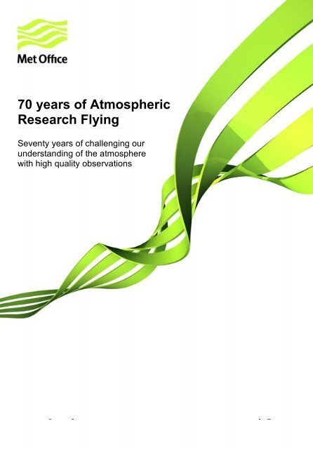
<strong>70</strong> <strong>years</strong> <strong>of</strong> <strong>Atmospheric</strong>Research FlyingSeventy <strong>years</strong> <strong>of</strong> challenging ourunderstanding <strong>of</strong> the atmospherewith high quality observationsall-<strong>timeline</strong>-info REWORK APPEARANCE.dot - 1 –© Crown copyright 2008
<strong>70</strong> <strong>years</strong> <strong>of</strong> <strong>Atmospheric</strong> Research FlyingSeventy <strong>years</strong> <strong>of</strong> challenging our understanding <strong>of</strong> the atmospherewith high quality observations1942<strong>Met</strong>eorologists led by Alan Brewer assigned to High Altitude Flight(HAF) to investigatecontrail formation.In an article link (1948_<strong>Met</strong>_Mag_.pdf) written for the <strong>Met</strong>eorological Magazine(published November 1948) by R. Frith it was stated that “The presence <strong>of</strong> cloud, and itstype, could be reported from an aircraft, but no measurements could be made <strong>of</strong> itsdensity (liquid or solid content) or the number and size <strong>of</strong> its particles. It was believedthat knowledge <strong>of</strong> these quantities would not only benefit the general science <strong>of</strong>meteorology, but would be <strong>of</strong> great value in connexion with two special problems throwninto prominence by the war – icing and condensation trails. So in 1942, it was arrangedthat the High Altitude Flight at Boscombe Down should be given facilities formeteorological investigations to be carried out by meteorologists in aircraft. The initialobjective was the improvement <strong>of</strong> existing aircraft meteorological instruments and thedevelopment <strong>of</strong> new ones. It was expected that in the course <strong>of</strong> this work the <strong>research</strong>unit would accumulate valuable meteorological data. This expectation has beenjustified.”© Crown copyright 20121
1942Two Boston Aircraft (AL480 & AL481) tasked with “High altitude <strong>Met</strong>eorologicalResearch”.These new additions to the fleet joined two Mk2 spitfires (P8021, and P7661) and aBoston Mk 3 (W8291). These early aircraft were involved in studies during the 40’swhich led to the discovery <strong>of</strong> very strong upper winds, which we now refer to as the jetstream and Clear Air Turbulence (CAT). In September 1942 three more Bostons BZ315,BZ362, BZ262 (1942 – 1944) also joined the fleet.1943Fortress Mk2A (FK192) arrived and Boston aircraft retired.The Flying Fortress was one <strong>of</strong> six B17’s presented to Winston Churchill by PresidentRoosevelt. This aircraft was used for the installation <strong>of</strong> the first airborne flat platethermometer for the measurement <strong>of</strong> temperature. Later in the year a Mosquito PF391(1943 – 1944) also joined the fleet, and the Boston Mk3 W8291was retired.1943First Reliable Humidity Measurement made in the stratosphere. Using newly developedDobson-Brewer Hygrometer on Fortress aircraft.When MRF was first started the need for more accurate measurements <strong>of</strong> humidity athigh altitude and low frost points, and the limitations <strong>of</strong> existing instrumentation led to the© Crown copyright 20122
development <strong>of</strong> a new instrument to undertake such measurements. Developed byDobson, Brewer & Cwilong in 1942/3 link (1943_Dobson_Brewer_Cwilong.pdf) the frostpoint hygrometer was used to make what were believed to be the first reliable humiditymeasurements in the stratosphere. The Boston (W8291) aircraft was used in thedevelopment and testing <strong>of</strong> this new instrument and the first successful scientific flighttook place in December 1943 with an ascent to just over 35,000 feet.The instrument operated by passing sample air across the surface <strong>of</strong> a thimble that wascooled until a deposit <strong>of</strong> frost just started to form on the thimble. The thimbletemperature and air sample temperature were measured using two platinum resistancethermometers. The temperature <strong>of</strong> the thimble, at which the amount <strong>of</strong> frost forming isthe same as the amount dissipating, is the true hoarfrost point, and to observe this thethimble was illuminated, and viewed by the instrument operator.The Dobson Brewer hygrometer enabled regular measurements <strong>of</strong> humidity to be madein the stratosphere for the first time and was in use for over 40 <strong>years</strong>. This work greatlyadded to the knowledge <strong>of</strong> the lower stratosphere, building up a data set on humidityand other elements such as ozone that is still widely used today. Furthermore, theprinciple <strong>of</strong> operation <strong>of</strong> the Dobson Brewer hygrometer is still used in the frost-pointhygrometers flown on the current BAe-146 aircraft.1944Hudson FR406 and Mosquito Mk16B MM174 arrived.The Mosquito became a very popular aircraft with the crew as the pilot andmeteorological observer were able to sit side by side. Some <strong>of</strong> the earliest flights in tothe Stratosphere were made with this aircraft, specifically to make humiditymeasurements, with flights frequently making it above 40000ft. In the early days <strong>of</strong> the© Crown copyright 20123
<strong>Met</strong>eorological Research Flight, the science <strong>of</strong> atmospheric measurement from aircraftwas still in its infancy, one problem faced by the scientists <strong>of</strong> MRF was measuringtemperature from its Mosquito aircraft.Measuring air temperature from an aircraft moving at speeds <strong>of</strong> up to 366 mph and ataltitudes up to 40,000ft presents a range <strong>of</strong> challenges, as bringing the air into a samplevolume reduces its speed relative to the aircraft and causes its thermodynamicproperties to change. Thermodynamic theory can be used to calculate kinetic heatingcorrections for this problem, however the application <strong>of</strong> this theory to such high speedand low pressure conditions was relatively new, so the MRF worked with its wing <strong>of</strong> highspeed, high altitude Mosquito aircraft to examine and improve the corrections applied totemperature measurements from aircraft.This work was vital to much <strong>of</strong> the <strong>research</strong> that followed, as temperature is a keyatmospheric parameter, and is used in conjunction with measurements from a widerange <strong>of</strong> instruments to help improve our understanding <strong>of</strong> the atmosphere. In additionreliable temperature measurements by commercial aircraft allow the crew to understandthe difference between the atmosphere they are <strong>flying</strong> in and a standard atmosphereand hence understand fuel burn and performance criteria <strong>of</strong> their aircraft. It is anessential part <strong>of</strong> aircraft safety to this day.Spitfire Mk2 P8021, and Bostons BZ315, BZ362, BZ262, AL480 and AL481 all left thisyear.1945Hudson wrecked when undercarriage collapsed on landing and Flying Fortress retired.Hudson and Flying Fortress together.1946Two Halifax Mk6 (ST796 & AT817) and a Mosquito PR34 (RG248) arrived.1946HAF renamed <strong>Met</strong>eorological Research Flight (MRF).1946“Condensation Trails” paper published by Brewer in Weather© Crown copyright 20124
Link (1946_Brewer_condensation_trails.pdf)During the Second World War, a meteorological issue <strong>of</strong> great importance was theproduction <strong>of</strong> condensation trails (contrails) in the wake <strong>of</strong> high-altitude aircraft. Suchtrails provided the enemy with visible confirmation <strong>of</strong> the presence <strong>of</strong> aircraft, and insome situations the trails could persist for hours. For this reason a meteorologist joinedthe High Altitude Flight in 1942 to investigate what caused these contrails to form and topersist.The work undertaken by the scientists <strong>of</strong> the High Altitude Flight (HAF) found that thepassage <strong>of</strong> an aircraft through the atmosphere increases the air temperature, and waterfrom the exhausts can increase the relative humidity causing an ice cloud to form if theair temperature is low enough. If the relative humidity <strong>of</strong> the surrounding air is sufficientlyhigh, the cloud will persist and may even grow after the aircraft is long gone.Understanding this, allowed pilots to plan flights so as to minimise contrail production,which reduced the likelihood <strong>of</strong> their position being given away while <strong>flying</strong> over enemyterritory.Work is still being undertaken by scientists in Observational Based Research (thecurrent incarnation <strong>of</strong> HAF) to look at the impact that aircraft contrails are having onclimate change, and ways in which this impact can be reduced.© Crown copyright 20125
1948MRF equipped with a second Mosquito PR34 (VL621) seen here with a Halifax.1948MRF staff measuring the size <strong>of</strong> cloud particles on board a Halifax.© Crown copyright 20126
1949Mosquito PF673 arrived, Mosquito Mk16B MM174 retired.1950Hastings C1A (TG618 and TG619) arrived.Mosquito PF673 retired.In November 1950 MRF suffered a tragic loss. Flt Lt K.L.Howard DFM, a member <strong>of</strong> theMRF aircrew, died in the Cambridge Military Hospital in Aldershot, as a result <strong>of</strong>"decompression collapse". This followed a flight to 30000ft in Hastings TG618 during anexperiment to investigate the tropopause.1951Frith publishes ‘Recent work <strong>of</strong> the <strong>Met</strong>eorological Research Flight. Link (1951_Frith.pdf)1952Halifax (ST796) retired.© Crown copyright 20127
1953Canberra B2 (WJ582) arrived and Mosquito (RG248) retired.The Canberra became the primary replacement for the Mosquito as it could reachattitudes <strong>of</strong> 15 km under favourable conditions making it ideal for upper tropospheric andstratospheric measurements.1954Infrared radiometer (from Oxford University) flown on Mosquito aircraft.Dr Brewer and Dr J T Houghton (Oxford University, later to be Director General <strong>of</strong> the<strong>Met</strong>eorological <strong>Office</strong>) flew an infra-red radiometer from a Mosquito aircraft to makesome <strong>of</strong> the earliest measurements <strong>of</strong> long-wave radiative fluxes and heating ratesthroughout the troposphere. So began a long tradition <strong>of</strong> the use <strong>of</strong> MRF facilities byOxford to fly radiometers developed in the Clarendon Laboratory. Later, the installation<strong>of</strong> photometers and solarimeters on MRF aircraft were used to measure upward anddownward solar fluxes (radiation from the sun) in cloud and clear air. The infraredabsorption properties <strong>of</strong> liquid water and water vapour were already known, but MRFflights gave some <strong>of</strong> the earliest indications <strong>of</strong> significant additional absorption <strong>of</strong> solarradiation in clouds and clear air, attributed to the presence <strong>of</strong> aerosol, particularlydownstream <strong>of</strong> urban areas.1955Murgatroyd et al., publishes “Some recent measurements <strong>of</strong> humidity from aircraft up toheights <strong>of</strong> about 50,000 ft over southern England” in QJRMS.Link (1955_Murgatroyd_Goldsmith_Hollings.pdf)1955Mosquito (VL621) retired.1955Varsity T1 (WJ906) aircraft arrived.© Crown copyright 20128
1956Durbin reports on the results <strong>of</strong> repetitive drop sampling in 10 cumulus clouds.Sensors used then were: impaction on aluminium foil to detect ice particles and drizzledroplets, oiled slides to collect cloud droplets, hot-wire devices to measure cloud watercontent and a (Pollak) total aerosol counter. Data had to be manually processed whichwas very slow and time-consuming, but nevertheless produced some valuable studies.The emphasis was on rain-producing clouds, particularly cumulus in various stages <strong>of</strong>development, but some studies <strong>of</strong> clouds associated with atmospheric fronts, and alsolayer clouds were made. This work was combined with laboratory studies <strong>of</strong> cloudmicrophysics being made at that time under B.J.Mason at Imperial College, to a gainbetter understanding <strong>of</strong> the generation <strong>of</strong> precipitation, and the role <strong>of</strong> ice particles inthis.1957Staff flight planning (Robert Murgatroyd seated in centre).1960Singleton and Smith publish “Some observations <strong>of</strong> dropsize distributions In low layerclouds” which examines cloud droplet measurements made from aircraft.Link (1960_Singleton_Smith.pdf)© Crown copyright 20129
1961 MRF staff moved to a purpose built brick building at Farnborough.Where they were based until 2003 When the <strong>Met</strong> <strong>Office</strong> moved to Exeter. Prior to thisthe scientists were accommodated in ‘temporary’ prefabricated huts near the airfieldcontrol tower.© Crown copyright 201210
1962Canberra B2 WJ582 Crashed into St Andrews Bay while on approach to RAF Leuchars,miraculously there was no loss <strong>of</strong> life.Link (Canberra_Crash.pdf)1963Canberra PR3 (WF173) arrived.© Crown copyright 201211
1964Inside the Hastings.© Crown copyright 201212
1966Inertial navigation system and nose probes installed in the Canberra to greatly improvewind measurements.The use <strong>of</strong> the Canberra aircraft to accurately measure vertical motions in theatmosphere during the 1960’s, led to the discovery <strong>of</strong> a thin layer <strong>of</strong> air at about 12kmaltitude where turbulence was present without any clouds. This clear air turbulence wasfound to be caused by the change in wind speed between different layers <strong>of</strong> theatmosphere (the troposphere and stratosphere). Understanding what causes thisturbulence means that it can be forecast, allowing aircraft to avoid areas where severeclear air turbulence is expected, and making air journeys safer and more comfortable.This <strong>research</strong> was made possible by the internal navigation system INS which provideda stable reference frame within which measurements <strong>of</strong> vertical and horizontal gusts andwind shear can be made. This allowed sufficiently accurate measurement <strong>of</strong> the requiredvariables to be made, allowing the mechanisms which lead to clear air turbulence to bebetter understood and forecast.The results from a case study looking at clear air turbulence and the jet stream aredescribed in a paper by Axford published in 1972 titled ‘’A case study <strong>of</strong> a high levelCanberra flight on 11 September 1968’’ link (1972_Axford.pdf)© Crown copyright 201213
1966Hastings C1A (TG618) retired.1968Flight Liaison <strong>Office</strong>r (J.F. Fisher) briefing Flight Leader (P.R. Cockrell) before a flight onthe Canberra aircraft.© Crown copyright 201214
1968Varsity T1 (WJ906) retired.1968SCILLONIA campaign commences, with the Varsity aircraft dropping wind-trackingsondes to examine warm fronts approaching the UK.The SCILLONIA campaign took place over a period <strong>of</strong> three <strong>years</strong> between 1968 and1971, making use <strong>of</strong> the Varsity aircraft to test and develop early drop-sondes. The datafrom these radar-tracked wind-finding dropsondes were used in conjunction withthermodynamic observations to study frontal systems approaching SW England. Theseearly sondes were about the size <strong>of</strong> a small, narrow dustbin with two separate metalcylinders forming the transmitting antenna. In 1975 Roach and Hardman publish“Mesoscale air motions derived from wind-finding dropsonde data: the warm front andrainbands <strong>of</strong> 18 January 1971” in QJRMS, using data from SCILLONIALink (1975_Roach_Hardman.pdf)© Crown copyright 201215
19<strong>70</strong>Varsity (WF425) arrived.‘The Varsity is shown in the middle, with the Hercules in the front and Canberraat the back.’19<strong>70</strong>Watson, N.R., publishes ‘‘Sampling <strong>of</strong> rain from a Varsity Aircraft’’ in <strong>Met</strong>eorologicalMagazine, 99, 198 – 208.Link (19<strong>70</strong>_Watson.pdf)© Crown copyright 201216
1972Hardman et al., publish a paper describing how the Canberra was used to drop sondesin a pattern to learn about the vertical movement <strong>of</strong> the atmosphere.Link (1972_Hardman_et_al.pdf)1973C-130 Hercules (XV208) arrived. Nicknamed ‘Snoopy’ because <strong>of</strong> its noseThe case for acquiring the Hercules rested heavily on the invitation to participate in theinternational Global Atlantic Tropical Experiment (GATE) and later the BAe-146participated in. The aircraft was a surplus C Mk1 plane that has served with 48 Sqn inthe Far East at RAF Changi in Singapore. It was first converted from a C Mk1 to the WMk2 by Marshall’s <strong>of</strong> Cambridge during 1972 and then fitted out as a <strong>research</strong> aircraft forits first flight on the 21 st March 1973. An Inertial navigation system, like that on theCanberra was installed on the Hercules. This consisted <strong>of</strong> rapid response wind-vanes inthe nose probe linked to inertial platforms centred near the aircraft centre <strong>of</strong> gravity,which made it possible to extract the aircraft position at any time. Later this was linked tothe newly installed on-board computer to automatically remove the aircraft motionallowing wind and turbulence data to be derived in flight – A development forseen byShaw - one <strong>of</strong> the early pioneers <strong>of</strong> airborne <strong>Met</strong>eorological Research - sixty <strong>years</strong>earlier.© Crown copyright 201217
1973Canberra detached to Colorado to investigate momentum flux transfer.1974Installation <strong>of</strong> an ‘on-board data-processing system’ on Snoopy.This was the first airborne computer for scientific purposes in MRF. Prior to this aircraftdata was recorded manually by observers, or on charts, and the subsequent processing was also largely manual. It had been realised for some time that a radical improvement in aircraft data-processing facilities was essential if further scientific progress was to bemade. This was achieved with the installation <strong>of</strong> a computer, which was able to recorddata from the meteorological sensors on tape to be processed after the flight using a ground-based computer. The computer was installed in the observers cabin (or van) inthe Hercules. The van protected observers in it from aircraft noise, and provided realtime displays to scientists in the van and on the flight deck. It could also be removedfrom the aircraft during period <strong>of</strong> major servicing.1974MRF participates in the GARP (Global <strong>Atmospheric</strong> Research Program) Atlantic TropicalExperiment (GATE) field campaign, one <strong>of</strong> the largest international meteorologicalcampaigns ever seen.The aim <strong>of</strong> this field campaign was to study convective clouds and related processes inthe tropical Atlantic. Back in the Cold War period, this was a fine example <strong>of</strong> theinternational collaborative nature <strong>of</strong> meteorology, bringing together 72 different nations© Crown copyright 201218
(http://www.eol.ucar.edu/projects/gate/). It included a number <strong>of</strong> sub-programs with theintention <strong>of</strong> describing scale interactions between convective systems <strong>of</strong>f the WestAfrican coast and their impact on larger-scale dynamics. The UK C-130 was one <strong>of</strong> acoordinated fleet <strong>of</strong> 13 aircraft consisting <strong>of</strong> 8 from the USA, 2 from Russia, 1 fromFrance, 1 from Brazil and 1 from the UK. Accompanying the aircraft were 40 ship, 14from the USSR, 9 from the USA, 4 from the UK, 4 from France, 3 from West Germany, 1from East Germany, 2 from Brazil, 1 from Canada, 1 from Mexico, and 1 from theNetherlands).This campaign was and probably remains the largest atmospheric field campaign everundertaken. The combination <strong>of</strong> small-scale in-situ measurements from aircraft withthose <strong>of</strong> heat and moisture from two groups <strong>of</strong> <strong>research</strong> ships launching radiosondes,provided a very complete description <strong>of</strong> convective processes in the area. This datasetwas, for many <strong>years</strong>, one <strong>of</strong> the most important benchmarks against which highresolution models <strong>of</strong> tropical convection and clouds were tested. The data collectedduring the GATE field campaign has provided an invaluable source <strong>of</strong> truth for scientistsdeveloping computer models <strong>of</strong> tropical meteorology, allowing forecasts for this region,and hence global forecasts, to be improved. See Kuettner’s ‘‘General Description andCentral Program <strong>of</strong> GATE’’ 1974 for more information on the campaign.Link (1974_Kuettner_general_description_<strong>of</strong>_gate.pdf)1975Varsity (WF425) was retired and flown to the Imperial War Museum, Duxford for display.© Crown copyright 201219
1978C130 Hercules participated in the Joint Air-Sea Interaction (JASIN) experiment,investigating the radiative properties <strong>of</strong> stratocumulus.This experiment was one <strong>of</strong> the first collaborative airborne campaigns looking at detailedphysical processes in stratocumulus cloud (large dark masses <strong>of</strong> cloud at low level). The<strong>Met</strong>eorological Research Flight’s C-130 aircraft flew together with the German DLRFalcon from Machrihanish in Scotland. Examining Stratocumulus clouds in theNorthwest Approaches.Stratocumulus cloud plays an important role in both weather and climate, by reflectingsunlight back out to space the cloud can produce a cooling effect, and can also make forgrey and miserable days for those living under it. MRF has been <strong>research</strong>ing thestructure <strong>of</strong> stratocumulus clouds since the 19<strong>70</strong>’s and their work has been used toimprove the forecasting <strong>of</strong> such clouds in weather and climate models. This allowsforecasters to better determine when stratocumulus cloud will form, and when it willbreak up and let the sun shine down on us. This work is also used in climate predictions,allowing scientists to asses the impact that an increase or decrease in this cloud type,could have in a changing climate.Stratocumulus cloud remains a challenge for numerical weather prediction models andwe still study the clouds now with the international VOCALS field campaign in Chile in2008 and the COALESCE field campaign around the UK in 2010/11 utilising the FAAMBAe146 aircraft. Further discussion <strong>of</strong> the JASIN experiment can be found in the 1982paper ‘’Aircraft observations <strong>of</strong> marine stratocumulus during JASIN’ by Slingo, Nichollsand Schmetz..Link(1982_Slingo_et_al_Aircraft_observations_<strong>of</strong>_marine_stratocumulus.pdf)© Crown copyright 201220
1979Measurements <strong>of</strong> turbulence made using Snoopy and a tethered balloon at Ailsa Craig.In the late 19<strong>70</strong>s, study <strong>of</strong> the impact <strong>of</strong> orography on turbulent boundary layer flows stillrelied quite a lot on theoretical modelling based on idealised topography. In order tocompare theoretical predictions with observations, it was necessary to find a piece <strong>of</strong>topography that fitted as closely as possible to the idealised model. Ailsa Craig was one<strong>of</strong> the locations chosen for its passing resemblance to a hemisphere projecting from aplane surface. Aircraft flight legs took place both upwind and downwind <strong>of</strong> the island, inconjunction with the <strong>Met</strong>eorological Research Unit (MRU) tethered balloon. In the lattercase, occasional severe turbulence events were encountered. Further studies took placein a close approximation to a 2-dimensional system <strong>of</strong> ridges and valleys - the Llanthonyvalley in South Wales - and around what could loosely be described as bluff topography- the 1100ft cliffs <strong>of</strong> Foula in the Shetlands. With the increasing power <strong>of</strong> numericalmodels, this work has evolved into the type <strong>of</strong> study undertaken recently in the COLPEXproject, which looked at cold-air pooling in valleys, using a dense ground-basedobservational network and 100m resolution simulations using the Unified Model.1980MRF collaborate with the Central Electricity Research Laboratory (CERL) to investigatethe production <strong>of</strong> acid rain over the North Sea using the C-130 Hercules.© Crown copyright 201221
Link (Acid_Rain_Research_with_Snoopy.pdf)1981Canberra (WE173) retired.‘Canberra <strong>flying</strong> alongside Snoopy’.1984John Foot publishes “Aircraft measurements <strong>of</strong> the humidity in the lower stratospherefrom 1977 to 1980 between 45ºN and 65ºN” in QJRMSLink (1984_Foot_aircraft_measurements_<strong>of</strong>_the_humidity.pdf)1987MRF collaborate with French <strong>research</strong>ers for the FRONTS87 campaign, making use <strong>of</strong>the upgraded dropsonde system.© Crown copyright 201222
The Hercules was used to look at the mesoscale dynamics <strong>of</strong> frontal systemsapproaching the UK. This campaign involved numerous sonde-dropping transectsacross the front with up to 50 sondes dropped on a single flight with as little as 20 kmspacing between them. These detailed observations - some <strong>of</strong> the first <strong>of</strong> their kind -enabled the testing <strong>of</strong> theoretical ideas about the mesoscale flow in such systems. Theybuilt on results from SCILLONIA in understanding how rainband structures are formed,and also helped to emphasise the role <strong>of</strong> snow evaporation in driving the motion <strong>of</strong>frontal systems. The FRONTS87 experiment also tested how including additionalweather information from dropsondes can provide an immediate improvement inforecasts <strong>of</strong> such systems. See ‘’Mesoscale dynamics <strong>of</strong> cold fronts: Structuresdescribed by dropsoundings in FRONTS87’’ for more information on the campaign.Link (1991_thorpe_clough_mesoscale_dynamics_<strong>of</strong>_cold_fronts.pdf)The aircraft dropsonde system was further improved during the 1990’s, evolving to useinstrumentation derived from standard balloon-borne radiosondes. This systemcontinues to be used today on the FAAM BAe-146 aircraft where it has most recentlybeen used in the DIAMET campaign. All data collected from this system is sent back tothe <strong>Met</strong> <strong>Office</strong> to be used in the Unified Model, where it helps improve the weatherforecast. The ability to record larger numbers <strong>of</strong> sondes simultaneously provides evenhigher horizontal resolution in the observations, suited to the evolving capability <strong>of</strong>numerical weather prediction models.© Crown copyright 201223
1987Equipment for the measurement <strong>of</strong> radiative transfer upgraded and the Multi ChannelRadiometer is installed on the aircraft. This is in response to <strong>research</strong> requirements <strong>of</strong>climate scientists. Data from this radiometer is also used to calibrate and verifyinformation from satellite observations.1989MRF staff examining cloud physics data on board the C130 Hercules.© Crown copyright 201224
1991Hercules aircraft and MRF staff sent to investigate environmental impacts <strong>of</strong> smoke fromKuwaiti oil fires.Link (GULFEX_photos.pdf)1992Scientist post created in MRF, funded by the National Environmental ResearchCommittee (NERC), allowing more university involvement in MRF.1993 MRF crest presented, this was designed by Royal College <strong>of</strong> Arms withRoyal Assent.© Crown copyright 201225
1994Hercules aircraft detached to California to participate in the Monterey Area Ship Track(MAST) experiment, examining the impact <strong>of</strong> ship tracks on stratocumulus clouds.This experiment was the largest ever investigation <strong>of</strong> the interaction <strong>of</strong> ship track plumesand cloud. The results are discussed by Durkee, Noone and Bluth in ‘’The MontereyArea Ship Track Experiment’’ published in 2000.Link (1996_durkee_et_al_MAST_ship_track_experiment.pdf)1996Hercules aircraft equipped with new instruments ready for the <strong>Atmospheric</strong> ChemistryStudies in the Oceanic Environment (ACSOE) project (http://www.uea.ac.uk/~acsoe/)1997Dave Kindred leads a pre-flight briefing during the STAAARTE campaign in Finland, the1st MRF campaign with European funding.© Crown copyright 201226
1997The Hercules detached to the North-East Atlantic for the 2 nd Aerosol CharacterizationExperiment (ACE-2) (link (1999_Raes_et_al_ACE2.pdf) part <strong>of</strong> the International Global<strong>Atmospheric</strong> Chemistry (IGAC) (http://www.igacproject.org/PastActivities) project© Crown copyright 201227
1999A badge from the Enhanced Contingency Planning and Support Environment (ECLIPSE)project which involved the C-130.2000First airborne measurements showing the spectral signature <strong>of</strong> Saharan dust during theSaHAran Dust Experiment (SHADE).© Crown copyright 201228
Research conducted using the <strong>Met</strong>eorological Research Flight’s C-130 for the SaHAranDust Experiment (SHADE) field campaign examined the spectral signal <strong>of</strong> Saharan dust.This was achieved using radiometer measurements, and in-situ data. Measurementswere made under over and within a layer <strong>of</strong> dust in the atmosphere, providinginformation on the size and composition <strong>of</strong> the dust, and linking this to radiationmeasurements.It was found that the radiative signature <strong>of</strong> the dust produces a decrease in upwellinglong-wave radiation (infrared energy emitted from the Earth’s surface), a decrease whichhad been observed in satellite data as a bias in the Earth’s radiation balance over Africa.The data from MRF allowed this bias to be attributed to dust blown <strong>of</strong>f the surface <strong>of</strong> theSaharan desert.The in-situ data from the SHADE campaign led to a 2 bin prognostic representation <strong>of</strong>dust to be included in the <strong>Met</strong> <strong>Office</strong> Unified Model, predicting the transport <strong>of</strong> this dust,rather than using a climatology as had been done before. Data from satellites is nowused to detect layers <strong>of</strong> Saharan dust in the atmosphere from space, allowing regionsaffected by this dust to be identified and the impact <strong>of</strong> this dust <strong>of</strong> retrievals <strong>of</strong> otheratmospheric variables to be taken into account. The work conducted by the <strong>research</strong>aircraft underpinned the representation <strong>of</strong> dust in the <strong>Met</strong> <strong>Office</strong> Unified Model which is<strong>of</strong> great benefit to climate studies and to the ministry <strong>of</strong> defence.2001C-130 Hercules (XV208) landing at the end <strong>of</strong> its final science flight (part <strong>of</strong> the POLEXexperiment). The aircraft was retired on the 21 st March after 28 <strong>years</strong> <strong>of</strong> <strong>flying</strong> with MRF© Crown copyright 201229
2001The Facility for Airborne <strong>Atmospheric</strong> Measurement (FAAM) formed as a collaborationbetween the <strong>Met</strong> <strong>Office</strong> and the National Environmental Research Council (NERC).In August 2001 the <strong>Met</strong> <strong>Office</strong>, UK university community, and Natural EnvironmentResearch Council (NERC) established a joint facility named the Facility for Airborne<strong>Atmospheric</strong> Measurements (FAAM), in order to reduce the operating costs associatedwith <strong>research</strong> aircraft use, and provide a platform shared platform that met the needs <strong>of</strong>the whole UK <strong>research</strong> community.2004FAAM, a BAe-146-301 (G-LUXE) comes into service as the UK’s primary atmospheric<strong>research</strong> aircraft. The facility is a collaboration between the <strong>Met</strong> <strong>Office</strong> and NERC.2004The BAe-146 detaches to the Azores for ITOP as part <strong>of</strong> a large international experimentspanning the North Atlantic.© Crown copyright 201230
The Intercontinental Transport <strong>of</strong> Ozone and Precursors (ITOP) experiment was aninternational project involving teams from Germany, France, the UK, Azores and USA,four aircraft, numerous ground sites and a <strong>research</strong> ship. It’s aim was to study thetransport <strong>of</strong> pollution between continents (North America and Europe) with a series <strong>of</strong>coordinated flights over three geographic regions – the east Coast <strong>of</strong> North America, theAzores and the West coast <strong>of</strong> Europe. ITOP was one part <strong>of</strong> a much larger internationalprogramme called ICARTT (http://www.esrl.noaa.gov/csd/projects/icartt/ ) (InternationalConsortium for <strong>Atmospheric</strong> Research on Transport and Transformation). The aim <strong>of</strong>ICARTT was to improve our understanding <strong>of</strong> the factors which determine air quality inNorth America, Europe and over remote regions <strong>of</strong> the North Atlantic. As part <strong>of</strong> this theaims <strong>of</strong> ITOP were to study the chemical processing in air masses transported fromNorth America to Europe, and to determine how much <strong>of</strong> the emissions remainedchemically active in the days it took the air to cross the Atlantic. During the experimentemissions from Canadian and Alaskan forest fires, industrial pollution from the USA andshipping plumes were all sampledOne <strong>of</strong> the highlights <strong>of</strong> ITOP was several excellent Lagrangian experiments where thesame polluted air mass was intercepted and measured several times as it moved fromNorth America across the North Atlantic towards Europe. During ITOP one <strong>of</strong> the mostsuccessful Lagrangian studies to date was achieved, where four aircraft sampled thesame mass multiple times over a several days as it moved across the North Atlantic.The reason this experiment was so important is it allowed scientists to study whathappens to pollutants over time as they move across the ocean, and how the changesthat occur can affect air quality in Europe and over the remote North Atlantic. Thisinformation is essential for improving the way models represent chemical reactions in theatmosphere, which in turn will improve forecasts <strong>of</strong> air quality and climate change. Formore information on the ITOP Lagrangian experiment see the paper by <strong>Met</strong>hven et al.,published in 2006 (link 2006_<strong>Met</strong>hven_et_al_lagrangian_connections.pdf) and for ageneral overview <strong>of</strong> the project see Fehsenfeld et al., 2006 (link2006_Fehsenfeld_et_al_2004study1.pdf)2005Cirrus and Anvils: European Satellite and Airborne Radiation measurements project(CAESAR) begins.© Crown copyright 201231
CAESAR was designed to study and understand the radiative properties <strong>of</strong> cirrus cloudcover, and spanned many <strong>years</strong> making measurements when conditions wereappropriate. Cirrus clouds cover approximately 30% <strong>of</strong> the globe at any one time. Andthey have a significant impact on weather and climate through their influence on theEarth’s energy balance. Cirrus clouds are spatially very inhomogeneous (variable) andthe ice crystals that form them are complex in shape.The best way to study these clouds is to fly a <strong>research</strong> aircraft in to them as was doneduring CAESAR. Before the start <strong>of</strong> this project the MRF C-130 Hercules carried outextensive <strong>research</strong> over the 1980’s, 1990’s and 2000’s. Research aircraft are able tocarry cloud probes that count and image the complex ice particles allowing us to developmodels <strong>of</strong> their evolution. The MRF C-130 and now the FAAM BAe-146 are unique inthat they measure the cloud microphysics as well as their radiative properties across avery wide region <strong>of</strong> the electromagnetic spectrum from the visible to the microwave.This capability has allowed <strong>Met</strong> <strong>Office</strong> scientists to play a world leading role in theunderstanding and modelling <strong>of</strong> cirrus clouds. We are the only operational NWP centreto have a cloud microphysical scheme that provides the cirrus particle size and shapeinformation necessary to allow a physically consistent simulation <strong>of</strong> electromagneticscattering and absorption over the visible, IR, microwave and radar portions <strong>of</strong> thespectrum. This gives us a self consistent treatment <strong>of</strong> the evolution <strong>of</strong> the cirrus cloudsand their impact on the radiative transfer something we hope is a significant step incorrectly predicting the impact <strong>of</strong> these clouds on weather and climate in to the future.2005Following a major explosion at the Buncefield oil depot, the FAAM aircraft sampled thesmoke plume, providing the only in-situ observations <strong>of</strong> the chemical constituents <strong>of</strong> thesmoke.Link (Buncefield_Summary.pdf)© Crown copyright 201232
2006An approaching dust storm during the AMMA detachment to West Africa.In the Summer <strong>of</strong> 2006 the African Monsoon Multidisciplinary Analysis (AMMA)campaign took place in Niger, West Africa with the aim <strong>of</strong> identifying, measuring andultimately understanding the key scientific processes that control the onset andvariability <strong>of</strong> the west African monsoon. This <strong>research</strong> has led to improvements inclimate models and regional forecasts as well as some important atmospheric chemistryand aerosol measurements which are still used today. An overview <strong>of</strong> the experimentcan be found in the paper http://onlinelibrary.wiley.com/doi/10.1002/qj.486/abstract2007The FAAM aircraft participates in the international JAIVEx campaign to improve the use<strong>of</strong> satellite data.In order to get the most out <strong>of</strong> data from satellite platforms, MRF has been involved in arange <strong>of</strong> campaigns aiming to calibrate and validate the satellite data. One example <strong>of</strong>this work was the Joint Airborne IASI ValidationExperiment (JAIVEx) field campaignwhich took place in 2007. The JAIVEx field campaign aimed to improve satellitemeasurements <strong>of</strong> meteorological products from the Infrared <strong>Atmospheric</strong> SoundingInterferometer (IASI) instrument, which is flown on the <strong>Met</strong>Op operational satellites. Thiswas a collaborative campaign involving the FAAM BAe-146 aircraft, the NASA WB-57aircraft and the US Department <strong>of</strong> Energy <strong>Atmospheric</strong> Radiation Measurement (ARM)facility in north central Oklahoma and the Gulf <strong>of</strong> Mexico.© Crown copyright 201233
The BAe-146 aircraft made a range <strong>of</strong> radiation measurements, launched numerousdropsondes (specially designed sensors dropped from the aircraft, which fall to theground on small parachutes) and made in-situ measurements <strong>of</strong> cloud physics and tracegases. These were made while <strong>flying</strong> in the field <strong>of</strong> view <strong>of</strong> the satellite allowing the state<strong>of</strong> the atmosphere and upwelling radiation to be characterised. This work allowed theaccuracy <strong>of</strong> satellite retrieval methods to be assessed over a range <strong>of</strong> surfaces, andhelped to establish the very high radiometric accuracy <strong>of</strong> the IASI instrument, and theretrieval <strong>of</strong> atmospheric properties such as temperature and humidity using this data.Assimilation <strong>of</strong> IASI radiances led to a marked positive impact on the <strong>Met</strong> <strong>Office</strong>’snumerical weather prediction (NWP) skill from 2007 onwards. Data from the JAIVExcampaign has been distributed to <strong>research</strong> groups across the world who use it as a testbed for developing novel and innovative satellite retrieval techniques.2008The BAe-146 detaches to Oberpfaffenh<strong>of</strong>en for the EUCAARI-LONGREX -(http://www.pa.op.dlr.de/aerosol/eucaari2008/) campaign to measure the properties <strong>of</strong>European aerosol.This was part <strong>of</strong> the ADIENT (link - http://www.reading.ac.uk/adient/) (Appraising theDirect Impacts <strong>of</strong> aErosol oN climaTe) project© Crown copyright 201234
2008The FAAM aircraft travels to Chile to participate in VOCALS-REx an international fieldcampaign examining stratocumulus cloud.2009MEVEX campaign takes place in Oman to assess the impact <strong>of</strong> dust on satelliteretrievals from IASI, and to validate model predictions <strong>of</strong> dust in the atmosphere and toevaluate the performance <strong>of</strong> tactical decision aids used by the military.© Crown copyright 201235
The <strong>Met</strong>Op series <strong>of</strong> satellites fly the IASI instrument which measures thermal emissionfrom the Earth at 8461 channels, the follow on instrument in the next series <strong>of</strong> Europeanpolar orbiters will double this number <strong>of</strong> channels. The wealth <strong>of</strong> data from satellites isset to increase dramatically over the coming decades and the ability to use this dataeffectively has been a focus <strong>of</strong> study with the <strong>research</strong> aircraft since the mid-1990’s.The MEVEX (Middle East Validation Experiment) is a continuation <strong>of</strong> this work using arange <strong>of</strong> instruments to measure the impact <strong>of</strong> dust on the energy balance <strong>of</strong> theplanet. In the mid 1990’s the Airborne Research Interferometer Evaluation SystemARIES was fitted to the MRF C130 “Snoopy” and was transferred to the FAAM BAe146in 2003. This instrument has been used to study the atmosphere and to develop newtechniques to utilise satellite data and to test innovative new techniques to model thetransfer <strong>of</strong> thermal energy through the atmosphere (termed radiative transfer). Thetransfer <strong>of</strong> energy through the atmosphere is paramount in driving the atmosphere andalso in how the <strong>Met</strong> <strong>Office</strong> utilises satellite data. Radiative transfer underpins the use <strong>of</strong>satellite data in NWP but is computationally expensive meaning that historically there ismore satellite data available than can be used. Radiative transfer also allows theprediction <strong>of</strong> the impact <strong>of</strong> the atmosphere on military systems through Tactical DecisionAid's (TDAs). The computational expense increases with the number <strong>of</strong> differentwavelengths (or instrument channels) that are required. In order to improve this theHavemann-Taylor Fast Radiative Transfer Code (HTFRTC) was developed whichallows calculation <strong>of</strong> the radiances <strong>of</strong> thousands <strong>of</strong> channels orders <strong>of</strong> magnitude fasterthan before.Exploitation <strong>of</strong> this capability is now nearing maturity with the promise <strong>of</strong> greatlyimproved Tactical Decision Aids (TDAs), and satellite data assimilation in the nearfuture. This will allow more data from hyper spectral satellite instruments to beassimilated into numerical weather prediction (NWP) models, with the increasednumber <strong>of</strong> observations providing an improvement in forecast skill. TDAs using thiscapability have helped save lives <strong>of</strong> UK and allied armed forces personnel by givingexpert predictive advice on how the weather will impact their operations.© Crown copyright 201236
2010The FAAM aircraft is tasked with providing in-situ measurements <strong>of</strong> volcanic ashfollowing the eruption <strong>of</strong> the Eyjafjallajökull volcano and subsequent closure <strong>of</strong> UKairspace. The aircraft provided vital measurements about the extent and composition <strong>of</strong>the ash present over the UK.Volcanic ash impacts aviation via closures <strong>of</strong> air space imposed by the National AirTraffic System for safety reasons. An aircraft <strong>flying</strong> through a volcanic ash layer maysuffer from damage to several <strong>of</strong> its components, including the windshield, fuselage,wings, pitot tubes, landing lights and in particular engines, which have been reported tostop functioning when ash concentrations are large.For this reason, during the Eyjafjallajökull eruption the CAA set thresholds on the ashconcentration that an aircraft may be allowed to fly into, based on which no-fly zones,limited time zones and enhanced procedure zones are established. With the eruption <strong>of</strong>Eyjafjallajokull in 2010, the European airspace was closed for several consecutive days,with a massive impact on the airline industry, and causing widespread disruption topassengers.In the case <strong>of</strong> a volcanic event, the <strong>Met</strong> <strong>Office</strong> (acting as the London VAAC) is at thefrontline in establishing the zones where aircraft are allowed to fly. The major predictingtool used is the NAME model, and satellite imagery is also used when weatherconditions permit following the ash plume (cloud-free). However, both these tools sufferfrom very large uncertainties, and for this reason the BAe-146 aircraft was used in 2010for a verification <strong>of</strong> the position <strong>of</strong> the ash clouds. By combining the in-situ observationsobtained when the aircraft was <strong>flying</strong> in the ash cloud and remote sensing with the onboardlidar, a detailed dataset has been built during six <strong>research</strong> flights. This is the mostdetailed available dataset to date, and it provides information on the position and spatialextent <strong>of</strong> the volcanic layers as well as on the concentrations. Use <strong>of</strong> this dataset is <strong>of</strong>great importance to verify and improve both the modelling and satellite products.Publications from these experiments underpin the status <strong>of</strong> the <strong>Met</strong> <strong>Office</strong> as a worldleader in the prediction <strong>of</strong> volcanic ash plumes.© Crown copyright 201237
2011The <strong>Met</strong> <strong>Office</strong> Civil Contingencies Aircraft (G-HIJK) comes into service.2011The BAe-146 detaches to Nova Scotia for the BORTAS project – Quantifying the impact<strong>of</strong> BOReal forest fires on Tropospheric oxidants over the Atlantic using Aircraft andSatellites (http://www.geos.ed.ac.uk/<strong>research</strong>/eochem/bortas/)© Crown copyright 201238
2011The FAAM aircraft is used for project DIAMET, working to improve the forecasting <strong>of</strong>extreme weather in the UK. This involved a flight into the most severe storm to impactScotland in 10 <strong>years</strong>.© Crown copyright 201239
The FAAM aircraft is used for project DIAMET, working to improve the forecasting <strong>of</strong>extreme weather in the UK. This involved a flight into the most severe storm to impactScotland in 10 <strong>years</strong> - http://www.met<strong>of</strong>fice.gov.uk/<strong>research</strong>/news/diamet2012The BAe-146 being refuelled in the snow during the MEVALI (Microwave EmissionValidation over sub-Arctic Lake Ice) project in Sweden.2012A view from the cockpit <strong>of</strong> the FAAM aircraft, showing the Elgin oil platform during aflight to examine the environmental impacts <strong>of</strong> a gas leak from the platform.© Crown copyright 201240
The FAAM BAe-146 is tasked with examining the environmental impacts <strong>of</strong> a gas leakfrom the Elgin oil platform in the North Sea. This work involves scientists from the <strong>Met</strong><strong>Office</strong> and from UK universities, drawing on expertise from both groups.© Crown copyright 201241
<strong>Met</strong> <strong>Office</strong> Tel: 08<strong>70</strong> 900 0100FitzRoy Road, Exeter Fax: 08<strong>70</strong> 900 5050Devon EX1 3PBenquiries@met<strong>of</strong>fice.gov.ukUnited Kingdomwww.met<strong>of</strong>fice.gov.uk