Naval Oceanographic Office Warfighting Support Center (NP ...
Naval Oceanographic Office Warfighting Support Center (NP ...
Naval Oceanographic Office Warfighting Support Center (NP ...
- No tags were found...

Create successful ePaper yourself
Turn your PDF publications into a flip-book with our unique Google optimized e-Paper software.
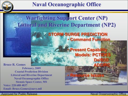
<strong>Naval</strong> <strong>Oceanographic</strong> <strong>Office</strong><strong>Warfighting</strong> <strong>Support</strong> <strong>Center</strong> (<strong>NP</strong>)Littoral and Riverine Department (<strong>NP</strong>2)Bruce R. GomesFebruary, 2009Coastal Prediction DivisionLittoral and Riverine Department<strong>Naval</strong> <strong>Oceanographic</strong> <strong>Office</strong>Stennis Space <strong>Center</strong>, MSVoice: 228 688 4837Email: Bruce.Gomes@navy.milApproved for Public ReleaseSTORM SURGE PREDICTION• Command Function• Present CapabilityModels: PCTIDESDelft3DADCIRC• Resource Issues<strong>Naval</strong> <strong>Oceanographic</strong> <strong>Office</strong>
Aligned within the Navy…Chief of <strong>Naval</strong> Operations(CNO)Washington, DCCommander, Fleet Forces Command(USFF)Norfolk, VACommander, <strong>Naval</strong> Meteorology and Oceanography Command(CNMOC)Stennis Space <strong>Center</strong>, MS<strong>Naval</strong> <strong>Oceanographic</strong> <strong>Office</strong>(NAVOCEANO)Stennis Space <strong>Center</strong>, MSApproved for Public Release<strong>Naval</strong> <strong>Oceanographic</strong> <strong>Office</strong>
<strong>Warfighting</strong> <strong>Support</strong> <strong>Center</strong> (WSC) MissionProvide environmental characterization of the littoral, estuarine, and riverineenvironment using all-source imagery and ocean models displayed andmanipulated through geospatial tools for military operations.…tell the customer what theoceanographic environment is likeat the beach scale…from themeso-scaleApproved for Public Release…to themicro-scale<strong>Naval</strong> <strong>Oceanographic</strong> <strong>Office</strong>
Very Shallow Water BathymetryModel forecasts and Image analysis supported withAdvanced Geospatial Intelligence:Multi-Spectral Imagery (MSI)• MSI technique needs:•high water clarity•little to no clouds•low seas•good only in shallow areasDepths from MSI• Results within 20% of ground truthunder favorable conditions.Approved for Public Release<strong>Naval</strong> <strong>Oceanographic</strong> <strong>Office</strong>
Cyclone Sidr HA/DR<strong>Support</strong>ed:USS Kearsarge22 nd MEUUSS Tarawa11 th MEUHumanitarian AssistanceDisaster Recovery:U.S. Navy directed assistance:before (storm surge)PACOM JIOCIII MEBC7FCoord w/MCIA / ONIUNCLASSIFIED• Struck the southwestern coast of Bangladesh (15NOV07) as a CAT 4 Storm• Radius of 311 miles (500 km) with winds between 137 and 150 mph• Storm Surge 15 feet (six meters) hit Barguna, Patuakhali and Jhalakathidistricts in Barisal divisionApproved for Public Release<strong>Naval</strong> <strong>Oceanographic</strong> <strong>Office</strong>
Myanmar (Burma) HA/DRHumanitarian AssistanceDisaster Recovery:U.S. Navy directed assistance:and after (image analysis)UNCLASSIFIEDUse all Source imagery and models for disaster supportApproved for Public Release<strong>Naval</strong> <strong>Oceanographic</strong> <strong>Office</strong>
High resolution littoral and riverine modelsNumerous Coastal and Riverine requirements2D Coastal Circulation Models (Tide Height and Currents)• RMA-2 Estuarine/Riverine Model• HYDROMAP Coastal, Estuarine where tides are primary driver• DELFT3D Coastal, Estuarine, Density Driven, Wave-Current interaction• PC-Tides Storm Surge• ADCIRC Inundation ( being transitioned)Drift Tracking Models• GNOME (NOAA oil spill)• SARMAPWave Models• Wave Model (WAM)• Simulating Waves Nearshore (SWAN)• Navy Standard Surf Model (NSSM)• DELFT3DApproved for Public Release<strong>Naval</strong> <strong>Oceanographic</strong> <strong>Office</strong>
Current CapabilitiesPC-Tides, Delft3D, ADCIRC• All run in 2D mode using Holland model to parameterize the storm wind field andlimited to where JTWC provides storm data.• For approaching Tropical Cyclone, forecast storm data must be put in the model every6 hours over a 72-hour period and updated as new forecasts become available.• Graphics are manual process for PC-Tides and Delft3D, ADCIRC not fully transitionedSuggested that we run SLOSH (Sea, Lake and Overland Surges from Hurricanes)• SLOSH model is accurate to within 20% and does not take into account river flow,rainfall, wind-wave interaction and wave setup.• SLOSH model is primarily statistical determined by compositing the model surgevalues from 200-300 hypothetical hurricanes.‣ Separate composite flood maps produced for each of the five Saffir-Simpsonhurricane categories.• No evidence that the SLOSH model contains any improved physicsApproved for Public Release<strong>Naval</strong> <strong>Oceanographic</strong> <strong>Office</strong>
PC TIDES: Rapid Implementation• Does not account for wind-wave interaction andwave setup.• Tidal elevation & currents‣ Assimilates IHO tidal stations• 2-minute bathymetry (DBDB2)‣ Does not include effects due to localbathymetry• Does not include rivers, rainfall• Does topographic inundation utilizing lowresolution topography data• Rapid implementation (24 hours)• 2D external graphics program: person in the loopCyclone SidrPC-Tides run by NRL: predicted 15-20 ftStorm surge; close to observed!Approved for Public Release<strong>Naval</strong> <strong>Oceanographic</strong> <strong>Office</strong>
Delft3D: Wave-Current Coupling• SWAN wave height & FLOW used forwave current interaction• Includes wave setup and wave breaking• High resolution bathymetry when available• Irregular boundary fitted grid• Can accept 1D water basin input whichincludes rainfall and has river-inflow capability• Does topographic inundation• 2D MATLAB graphics program: person in the loopApproved for Public Release<strong>Naval</strong> <strong>Oceanographic</strong> <strong>Office</strong>
ADCIRC: Large Grids on MSRC• Wave setup capable• Coastal currents and elevation• Fully tidal• High resolution bathymetry when available• Finite element Consortium model(NRL, Notre Dame, UNC, NOAA NOS, …)• Can accept 1D water basin input whichincludes rainfall and has river-inflow capability• Topographic inundation• Run on Linux or MSRC: Response times depend on resourcesi.e.: how many processors allocated & how many nodes:River Inflows:3 Inflows modeledApproved for Public Release<strong>Naval</strong> <strong>Oceanographic</strong> <strong>Office</strong>
Issues• What is the Military requirement for HA/DR: Available resources are of interest ie;airports, docking facilities etc.• Non-tropical storm inundation is also required.• Providing inundation for planning, will need to build & run scenarios:‣ storm dimensions, central pressure/wind speeds, and forward speeds,‣ projected paths and projected landfall‣ watershed scenarios.• Is bathymetry and topography good enough? If not, need to acquirebathymetry/topography in OCONUS and build high resolution grids.• Limited personnel to meet storm surge requirements as well as EXW and oil spill• All Models depend on JTWC locations for storm parameters, not always available.• Are present models good enough? Do we need to include wave current coupling, setupand breaking wave dissipation, 3D vs. 2D, water basin and river input?• For immediate response need rapid response models, is PC-Tides good enough?• The inability to accurately predict or parameterize the storm wind field and applythat to the wind/wave/current interaction restricts improved forecasts.Approved for Public Release<strong>Naval</strong> <strong>Oceanographic</strong> <strong>Office</strong>