John Warner, US Geological Survey, Coastal and Marine Geology ...
John Warner, US Geological Survey, Coastal and Marine Geology ...
John Warner, US Geological Survey, Coastal and Marine Geology ...
- No tags were found...

Create successful ePaper yourself
Turn your PDF publications into a flip-book with our unique Google optimized e-Paper software.
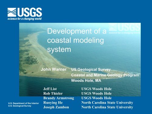
Development of acoastal modelingsystem<strong>John</strong> <strong>Warner</strong><strong>US</strong> <strong>Geological</strong> <strong>Survey</strong><strong>Coastal</strong> <strong>and</strong> <strong>Marine</strong> <strong>Geology</strong> ProgramWoods Hole, MAU.S. Department of the InteriorU.S. <strong>Geological</strong> <strong>Survey</strong>Jeff ListRob ThielerBr<strong>and</strong>y ArmstrongRuoying HeJoseph Zambon<strong>US</strong>GS Woods Hole<strong>US</strong>GS Woods Hole<strong>US</strong>GS Woods HoleNorth Carolina State UniversityNorth Carolina State University
Carolinas <strong>Coastal</strong> Change Processes ProjectObservationsModellingSea Floor Mapping1. Improve our underst<strong>and</strong>ing of the processes leading to coastal change at sub-regional to regional scales.2. Quantify interactions between the geology <strong>and</strong> physical processes that control coastal behavior.3. Develop an improved capability for predicting coastal change <strong>and</strong> vulnerability to coastal hazards.4. Provide regional information to underst<strong>and</strong> processes of coastal change relevant to the Carolinas.
Carolinas <strong>Coastal</strong> Change Processes ProjectObservationsModellingSea Floor Mapping1. Improve our underst<strong>and</strong>ing of the processes leading to coastal change at sub-regional to regional scales.2. Quantify interactions between the geology <strong>and</strong> physical processes that control coastal behavior.3. Develop an improved capability for predicting coastal change <strong>and</strong> vulnerability to coastal hazards.4. Provide regional information to underst<strong>and</strong> processes of coastal change relevant to the Carolinas.
COAWST Modeling SystemWe are developing a Coupled Ocean – Atmosphere – Wave – Sediment Transport(COAWST ) Modeling System to investigate the impacts of storms on coastal environments.Modeling SystemC = Coupled MCT http://www-unix.mcs.anl.gov/mct/O = Ocean ROMS http://www.myroms.org/A = Atmosphere WRF http://www.wrf-model.org/W = Wave SWAN http://vlm089.citg.tudelft.nl/swanST = Sediment Transport CSTMS http://woodshole.er.usgs.gov/projectpages/sediment-transport/
LatitudeModelsetupATMOSPHERE12000 mLongitudeWRF wind speed5000 mH sig , L wave , D wave ,5000 mT surf , T bott ,Q b , W dissip , U bMCTu s , v s , h, bathROMS SSTSWAN HsigOCEANWAVE
Grid refinementLatitudeGrid refinementModelsetupATMOSPHERE12000 mLongitudeWRF wind speed5000 mH sig , L wave , D wave ,5000 mT surf , T bott ,Q b , W dissip , U bMCTu s , v s , h, bathROMS SSTSWAN HsigOCEANWAVE
CSTMS - 'Sediment Transport'<strong>Warner</strong>, J.C., Sherwood, C.R., Signell, R.P., Harris, C.K., <strong>and</strong> Arango, H.G. (2008). Development of a three-dimensional,regional, coupled wave, current, <strong>and</strong> sediment-transport model, Computers & Geosciences 34, 1284–1306.
Storm surgeuse a3D modelhttp://www.nhc.noaa.gov/HAW2/english/storm_surge.shtmlconsider 2D balancefor simplicity (fornow)dp/dxt surfaceP atmdS xx /dx +dS xy /dytidet bottomconcentrate on processes for surface <strong>and</strong> bottom stress
Hurricane Isabelhttp://coastal.er.usgs.gov/hurricanes/isabel/site-index.php?storm_id=4&site_id=11http://visibleearth.nasa.gov/<strong>US</strong>GS Oblique aerial photography ofthe breach caused by Hurricane Isabel.Use the COAWST modelingsystem to hindcast HurricaneIsabel.Track of Hurricane Isabel making l<strong>and</strong>fall onthe Outer Banks on 18 Sept 2003.
Model setup• WRF (Atmosphere)• 27 vertical levels• dt 36 s• Physics• Lin microphysics• RRTM longwave, Dudhia shortwave• Mellor-Yamada-Janjic (MYJ) PBL• Kain-Fritsch (KF) cumulus scheme50WRF Grid• ROMS (Ocean)• 16 vertical levels• dt 240, 48, 9.6• Physics• GLS turbulence closure• COARE bulk fluxes• BC's from HYCOM• Timestep = 240s• SWAN (Wave)• Spectral• dt 600 s• Physics• Komen wave growth10105 4512 km grid spacingSimulation 12 Sept to 21 Sept, 2003.ROMS <strong>and</strong>SWAN Grid(s)5000m, 1000m, 200m grid spacings
Sensitivity experiments• Surface Stress• Effect of model coupling onSST <strong>and</strong> surface stress• Bottom Stress• Effect of model coupling onbottom stress?http://www.whoi.edu/science/AOPE/dept/cbl.jpg
ModelledObservedEffects of SST"3 Way Coupling"WRF ROMSSWANOcean SST as seen by the ATM model"2 Way Coupling""Uncoupled"WRF ROMSWRFcombined ROMS + RTG_SSTcombined ROMS + RTG_SST0.5 x 0.5 deg RTG_SST(http://polar.ncep.noaa.gov/sst/),daily updateGOEScoupled system provides a moreconsistent SST than uncoupled
ModelledResponse of the Atm modelEffects of SST"3 Way Coupling"WRF ROMSSWANOcean SST as seen by the ATM model"2 Way Coupling""Uncoupled"WRF ROMSWRFcombined ROMS + RTG_SSTcombined ROMS + RTG_SST0.5 x 0.5 deg RTG_SST(http://polar.ncep.noaa.gov/sst/),daily updateBut coupled system tends tracksouthward.Need better init for WRF.
wind speed magnitude (m/s)Different SST creates different windspeed"3 Way Coupling" Difference of3 Way - 2 WayDifference of3 Way - 1 WayDiff in wind speed surf stress wave generation surgeNeed both accurate SST <strong>and</strong> track to get correct surge.
t mean /(t current +t wave )Bottom propertiesdifferent formulations to includebottom stress in circulationmodels.Non-linearenhancementwave-mean bottomstress• Linear drag• Quadratic drag• Logarithmic: Zo• Zo + bedforms (ripples)• Zo + bedforms + waves t current /(t current +t wave )Look at waves as an example.Winds - > waves -- > bottom stress --> currents --> surgeGrant <strong>and</strong> Madsen (1986) Ann. Rev.Fluid Mech. 18:265-305
Wind wavegrowthformulationsSWAN wave model hasseveral options for wavegrowth.44004410254100141002
SurgeModel results at Sept 18 at 12:00 near peak of storm surgeWater level from simulation with enhancedbottom stress due to combined waves+currents.Difference in water level:wave enhanced bottom stress -constant Zo.
Summary• Developing a coastal modeling system that can be used toinvestigate storm impacts.• Model coupling allows interaction of physical processes. Weare running some tests to identify impact of the interactions.• Modeling system can be used to address issues such aswave dynamics, storm surge, ocean circulation, surfacestress, …• Coupling of atm-ocean provides better SST fields but altersstorm track <strong>and</strong> intensity.• Coupling of ocean-wave model modifies bottom stress <strong>and</strong>storm surge.
Issues• Atm model:- initialization - physics• Wav model:- bottom roughness - wave gen. formulations• Ocn model:- surface stress- bottom stress- grain sizes - waves- bedforms (ripples) - stratification (t, s, ssc)- sediment spatial variability - bathy- sediment thickness - topography