Leica ADS40 2nd Generation Airborne Digital Sensor - Gefos
Leica ADS40 2nd Generation Airborne Digital Sensor - Gefos
Leica ADS40 2nd Generation Airborne Digital Sensor - Gefos
- No tags were found...

You also want an ePaper? Increase the reach of your titles
YUMPU automatically turns print PDFs into web optimized ePapers that Google loves.
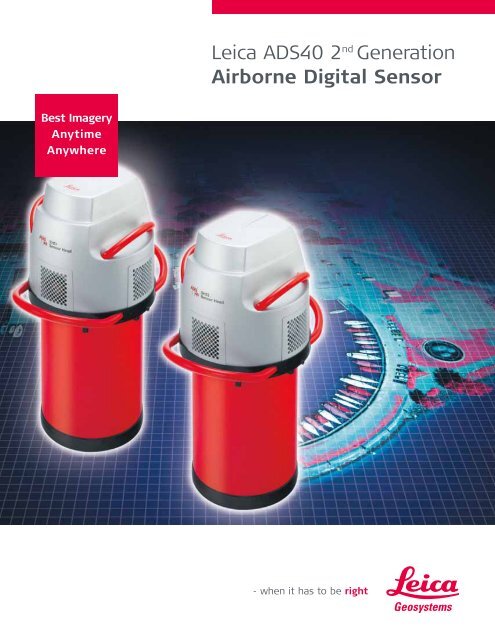
Best ImageryAnytimeAnywhere<strong>Leica</strong> <strong>ADS40</strong> 2 nd <strong>Generation</strong><strong>Airborne</strong> <strong>Digital</strong> <strong>Sensor</strong>
<strong>Leica</strong> <strong>ADS40</strong> SystemA New Era with Two 2 nd<strong>Generation</strong> <strong>Sensor</strong> Heads<strong>Leica</strong> Geosystems was first to introduce the LargeFormat <strong>Digital</strong> Camera to the market in 2001. Withmore than 50 <strong>Airborne</strong> <strong>Digital</strong> <strong>Sensor</strong>s deliveredworldwide, <strong>Leica</strong> Geosystems has the experience tointroduce two new sensor heads – SH51 and SH52 –for the <strong>ADS40</strong> System. Professionals can produce5 Band co-registered imagery to cover all applicationsin aerial surveying and airborne remote sensing. Timeand costs are saved through simultaneous acquisitionof true high-resolution panchromatic, color and colorinfrareddigital images.Key BenefitsBest Imagery The only high-resolution, fringe-free color and colorinfrared airborne imaging sensor Highest resolution stereo viewing in true color andcolor infrared Best quality images for remote sensing applicationsAnytime 4 times faster flight speed Extended flight day and flight season Data collecting on overcast daysAnywhere Greatest flexibility to perform international projects Accommodates several IMU types providingperformance, cost and exportability optionsAdditional Benefits Linescan image format enhances production ofcolor, color-infrared and panchromatic orthophotosand true orthophotos Linescan format increases feature collectionproductivity by reducing operator fatigue Increased mission execution success fromintegrated flight management system Two available sensor head models best fitperformance and budget requirementsFeatures Provides imagery for color, color-infrared andpanchromatic orthophotos and true orthophotos Color and panchromatic stereo-viewing with SH51images; and additionally, color-infrared stereoviewingwith SH52 images Perfect co-registration of all multi-spectral bandsby the new, patented Tetrachroid beamsplitter Color fringe-free products due to same viewing angle Reliable remote sensing results from equal resolution5-Band co-registered images 4 times increased sensitivity compared to1 st generation sensors Direct georeferencing of all image data Works without ground control or reference stations,depending on mission accuracy requirements Touch screen operation Highly automated flight control management system Integrated flight guidancePan SharpeningIRBGRP5-Band ImageryAll at the same resolutionNo colorizing (Pan Sharpening)
The Best <strong>Airborne</strong> <strong>Sensor</strong>Gets Even BetterThe guiding single-lens design principle for the <strong>ADS40</strong>avoids multiple-lens image patching. Pan-colorizingwith low-resolution spectral bands images is notrequired for the <strong>ADS40</strong>. The patented Tetrachroid4-band beamsplitter of the <strong>ADS40</strong> <strong>2nd</strong> <strong>Generation</strong>enables production of equal resolution 5-Bandimagery. Thus, the <strong>ADS40</strong> has reached the ultimategoal of uncompromising geometric and radiometricrepresentation of the earth’s surface.<strong>Sensor</strong> Head Features The Tetrachroid: the new, patented 4-Bandbeamsplitter with higher energy throughput The Tetrachroid enables the production of coregisteredequal resolution 5-Band imagery –red, green, blue, infrared and panchromatic Two new smaller sensor heads- SH51 focal plate with one Tetrachroid –for efficient orthophoto production- SH52 focal plate with two Tetrachroids –the universal sensor head for all applications Wider spectral bands Choice of different IMU’s, depending on applicationFocal Plate of SH51Focal Plate of SH52Upgrade Options Upgrade from SH40 to either of the two new<strong>Sensor</strong> Heads SH51 or SH52 Upgrade from older GPS/IMU systems to<strong>Leica</strong> IPAS10IR B G RThe Tetrachroid beamsplitter,designed for minimum loss ofenergy, ensures that theincoming RGB and IR light fromthe same area on the ground isdetected by four sensitive CCDlinear arrays.Backward InfraredBackward BlueBackward GreenBackward RedBackward PanchromaticNadir InfraredNadir BlueNadir GreenNadir RedNadir PanchromaticNadir Panchromatic staggeredForward Panchromatic
<strong>Leica</strong> IPAS10Advanced Inertial Position& Attitude SystemDirect georeferencing has become the state-of-the-arttechnology to shorten production time of maps forremote sensing and cartography. The <strong>ADS40</strong> systemprovides inertial position and attitude technology fullyintegrated into the sensors and data processingworkflow.Benefits Provides significant savings in airborne sensor dataproduction Eliminates the need for aerial triangulation for awide range of mapping applications Reduces need for ground control Facilitates data quality assurance and qualitycontrolFeatures Direct georeferencing of airborne sensor data:every pixel has its calculated geographic coordinate Provides position, velocity, roll, pitch and headingat high data rates and accuracies Improved real-time solution for high accuracystabilization and automatic drift control of PAV30 Embedded state-of-the-art GPS board for highdynamic airborne applications Fully integrated. User doesn’t have to deal withGPS or IMU components Universal plug-and-play interface for various IMUtypes Choice of 4 different IMU’s IPAS Pro post-processing software blends IMU datawith GPS trajectory
<strong>Leica</strong> FPESFlight Planning& Evaluation SoftwareGeospatial imaging starts with flight planning and endswith project evaluation. An optimized flight plan is thekey for cost effective airborne image acquisition.<strong>Leica</strong> FPES covers all these tasks of the geospatialimaging chain.Benefits Cost savings and reduced time for flight planning,proposals, flight reporting and invoicing Seamless data flow from flight planning tophotogrammetry Simple handling of large projects Upgrade path from ASCOT (<strong>Leica</strong>’s previousgeneration flight planning and managementsystem) – enables import of existing plansFeatures Efficient flight planning for <strong>Leica</strong> <strong>ADS40</strong> and allsensor types, including <strong>Leica</strong> RC30 and ALS50 Flight planning for all common types of geographicand grid systems Takes DTM into account to ensure adequate side lap Provides flight evaluation and project managementPlanning on DTM: zoom in on the complete flight plan to showdetails of the stereoscopically covered area.
<strong>Leica</strong> FCMSFlight & <strong>Sensor</strong> Control ManagementManaging the operation of sensors during surveyflights has always been a challenge for pilots andsensor operators. FCMS minimizes the interactionbetween sensor and user and manages the complexityof the leading edge <strong>ADS40</strong> sensor. Precise aircraftpositioning is a simple task for the pilot due to flightguidance during all phases of the survey flight.Additionally, in-flight quality control considerablyincreases productivity and cuts cost.Benefits Higher productivity- Shorter and more efficient flights- Reduced stress on the flight crew Lower costs- Minimal repetition of photo flights- Lower aircraft maintenance cost- Faster return on investmentFeatures Easy to learn and simple user operation of the sensor- Clear icons and quick navigation within the menutree- Tutorial and simulator software to train operatorsand pilots on the ground- System fully configurable for different users Optimized flight guidance with display of suggestedflight path – also for approach and turns Highly automated- Automatic integration time control- Automatic sensor release according to flight plan Remote control from multiple user interfaces- Operator and pilot can display different views System self test and self supervising- Automatic systems hardware and softwarechecking during start-up- In-flight permanent self supervising of hardwareand data- Automatic error detection providing recoveryoptions Troubleshooting with suggested user actions tosolve a problemOI40 Operator Interface GI40 Guidance Indicator OC50 Operation Controller CU40 Control Unit & MM40Mass MemoryComponents of the <strong>ADS40</strong> system controlled by FCSM
<strong>Leica</strong> GProDownload & GroundProcessing SoftwareAdvantagesState-of-the-art<strong>Airborne</strong> Imaging<strong>Leica</strong> GPro is the software designed to downloadand ground process <strong>ADS40</strong> imagery. It provides thefunctionality to generate georeferenced and orthorectifiedimagesBenefits Easy-to-use, uniform workflow from download toorthophoto generation Increased level of automation for data processing Increased productivity with distributed computingFeatures Wizards to automate processing steps Download of imagery, position and attitude data Image pyramid generation Integrated management of flight projects andphotogrammetric projects defined in FPES Analysis of position and attitude data Working with various data formats and coordinatesystems Multi-band composite orthoimage rectification Georeferencing, point matching and bundleadjustment for high accuracy stereo-viewing andfeature extractionThe <strong>ADS40</strong> <strong>2nd</strong> <strong>Generation</strong> <strong>Sensor</strong> Heads enable productionof leading edge imagery with equal resolutionin 5 Bands. The lead of the 3-line principle over allother large format digital camera concepts is furtherincreased.The Advantages include Equal resolution in all 5 Bands Wide area coverage with panchromatic, colorand color-infrared images No color distortion – pan-colorizing(pan-sharpening) is not required Temperature-stabilized telecentric lens maintainscalibration for long periods of time Automatic drift-setting with IMU andgyro-stabilized mount Automatic setting of CCD integration time(exposure time) Direct georeferencing with <strong>Leica</strong>’s integratedGPS/IMU system New flight planning & evaluation software takesDTM into account Download and ground processing software includescolor balancing Geometric and radiometric quality images forphotogrammetry and remote sensing Best stereo-viewing due to constant stereoandviewing angle of equal resolution imagery Worldwide customer supportArchivesystemDTMOrthophotosMappingRevisionGISFPESFlight Planning& Evaluation SoftwareFCMSFlight ControlManagement SoftwareMassMemoryGroundProcessingGProGround ProcessingSoftware<strong>Digital</strong>workstationPrinterVisualizationImage analysisClassificationPAN Color CIR
Whether you want to capture airborne data of an agricultural area or ofa city, record the challenges in a disaster area or the expanse of a hightension line, you need reliable measurements and solutions for yourentire workflow to build image-based maps. <strong>Leica</strong> Geosystems’ broadarray of airborne sensors and integrated software solutions capture dataefficiently, reference imagery accurately, measure easily, analyze andpresent spatial information in 3D.Those who use <strong>Leica</strong> Geosystems products every day trust them fortheir precision, their seamless integration and their superior customersupport. When data really counts, <strong>Leica</strong> Geosystems delivers geospatialimaging solutions with precision, integration and service.When it has to be right.Illustrations, descriptions and technical specifications are not binding and may change.Printed in Switzerland – Copyright <strong>Leica</strong> Geosystems AG, Heerbrugg, Switzerland, 2006.756181enUS – X.06 – RDVTotal Quality Management –our commitment to totalcustomer satisfaction.Ask your local <strong>Leica</strong> Geosystemsdealer for more informationabout our TQM program.<strong>Leica</strong> IPAS10 <strong>Leica</strong> FCMS <strong>Leica</strong> FPES <strong>Leica</strong> GPro<strong>Leica</strong> ALS50-II<strong>Leica</strong> Geosystems AGHeerbrugg, Switzerlandwww.leica-geosystems.com