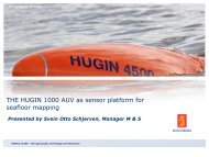
Seafloor mapping using interferometric sonars
Seafloor mapping using interferometric sonars
Seafloor mapping using interferometric sonars
- No tags were found...

Create successful ePaper yourself
Turn your PDF publications into a flip-book with our unique Google optimized e-Paper software.
GeoSwath Technology Timeline• GeoSwath 32 was introduced in 1998 by GeoAcoustics Ltd ofGreat Yarmouth, UK• GeoSwath Plus was launched Q4 2003• Continuous improvements in hardware and software havebeen improving data quality and swath width• Data has been accepted as meeting IHO standards, and beenincluded in UKHO Nautical Charts since 2005MilitaryOther• By mid-2009 over 120 systemsin use worldwideEnvironmentPorts &harboursOil&GasScientific/geologicalGeneralHydrographicDredging/ 12 / 30-Nov-09