T4 EA SUMMARY - Port Waratah Coal Services
T4 EA SUMMARY - Port Waratah Coal Services
T4 EA SUMMARY - Port Waratah Coal Services
- No tags were found...

You also want an ePaper? Increase the reach of your titles
YUMPU automatically turns print PDFs into web optimized ePapers that Google loves.
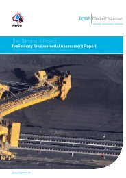
PWCS<strong>T4</strong> <strong>EA</strong> <strong>SUMMARY</strong>Community Information Sheet No.3March 2012Welcome to our third issue of the PWCS <strong>T4</strong> Project CommunityInformation sheet. In this issue we aim to provide you withfeedback on the status of our <strong>T4</strong> project, in particular thekey findings of our Environmental Assessment (<strong>EA</strong>), which isscheduled to be lodged with NSW Department of Planning andInfrastructure in late February 2012.In early 2011, PWCS commenced a formal Environmentaland Social Impact Assessment Program for the <strong>T4</strong> Project.Since commencing this Program, extensive consultation hasbeen undertaken with stakeholders and local communities inproximity to the <strong>T4</strong> site. This has provided an opportunity forthe community to contribute by:• identifying areas of value (environmental, social,recreational, heritage, etc) around the <strong>Port</strong> area, includingon Kooragang Island specifically• identifying community issues and impacts (positiveand negative) associated with the Project, for furtherassessment and analysis• providing ideas and further input on managementand enhancement strategies to address identifiedProject impacts.The local coal industry has asked PWCS to build <strong>T4</strong>, as partof a long-term coal export plan that cements Newcastle’sstatus as the world’s biggest and best coal export port. PWCSis a longstanding resident of Kooragang Island that employsa substantial local workforce and is committed to achievingbest practice environmental management across both of ourexisting terminals at Carrington and on Kooragang Island – andof course <strong>T4</strong>.We are conscious of the issues and concerns in the communityregarding further development in the <strong>Port</strong> area and associatedcumulative impacts. Consequently, the environmentalassessment for <strong>T4</strong> puts forward a number of conceptualideas and proposed ways of how such impacts may be moreeffectively managed.The first of our Community Information sheets defined the <strong>T4</strong>Project and outlined the government process that PWCS isrequired to follow in seeking approval for the developmentof <strong>T4</strong>; while the second Community Information sheetsummarised the outputs of an extensive consultation programwith over 500 key stakeholders and local community residents.This input has been critical in ensuring that <strong>T4</strong> Project planningaddresses concerns across different stakeholder groups andmeets the stringent requirements of the NSW Government. Thefeedback received has assisted the Project team greatlyin further developing the Project and in making importantdesign changes to address matters such as air quality, ecologyand traffic.Continued over next page....Want to learn more?Project overview…..2Assessment overview….2Air Quality ……4Social Impacts …..5Traffic …….7Noise …..8Ecology…..9Heritage…..10Visual Impacts……11Contamination andGroundwater…..12Surface Water……13Economic Assessment…14Greenhouse Gases…..15Contact details….16
The communityPWCS<strong>T4</strong> <strong>EA</strong> <strong>SUMMARY</strong>Perceived impacts/opportunities associated with <strong>T4</strong>Community InterviewsCommunity SurveysSocial <strong>Services</strong>1%Visual2%1%Use of Waterways1%9%HV <strong>Coal</strong> Chain1%3%Climate Change5%Rail/Trains4%6%ContaminationNoise1%4%6%11%Cumulative Industry DevelopmentEconomic contributionEnvironment2%3%8%7%9%12%Engagement ApproachIncreased TrafficIncreased Dust2%9%14%19%21%38%Key identified issues from stakeholders and local community membersThe measurement of social impacts are becoming of increasing importance to the community and regulators and as such, PWCSelected to undertake a comprehensive Social Impact Assessment (SIA) as a part of the <strong>T4</strong> Project that has involved extensiveconsultation with key stakeholders and local residents.Key elements of the study included:• Development of a detailed community profile.• Identification of community values associated with the <strong>Port</strong> of Newcastle and surrounds.• Consultation with community stakeholders and telephone survey of 400 local residents to identify community issues/impactsassociated with the Project.• Population modelling of construction workforces.• Involvement of stakeholders in the development of management and enhancement strategies to address Project impacts.What were the key findings of the study?Overall the <strong>T4</strong> Project SIA found that:• Newcastle <strong>Port</strong> holds numerous values for the local community. Recreational and commercial values were particularlyimportant for community stakeholders.• Potential impacts on air quality and traffic were issues of most concern to key stakeholders including local communityresidents (see chart above).• The <strong>T4</strong> Project could increase the demand for short-term housing in the local area during the construction phase.• There would be minimal impact on recreational water users given that <strong>T4</strong> Project activities will be concentrated in the HunterRiver South Arm.• The <strong>T4</strong> Project will have minimal impact on sense of place given its location within the Kooragang/Mayfield Northindustrial hub.• To minimise social impacts on the community, the <strong>T4</strong> Project will need to effectively manage its environmental impacts (e.g.dust emissions, traffic, noise).5
PWCS<strong>T4</strong> <strong>EA</strong> <strong>SUMMARY</strong>How is PWCS proposing to manage social impacts and enhance opportunities?In order to minimise impacts and enhance positive contributions PWCS propose to:• Work with other industries to develop a ‘Kooragang 2030’ Strategy. While still only a concept that will require participation ofa range of participants, the strategy would seek to bring Kooragang industry together and ensure improved alignment withNewcastle City Council’s 2030 Strategic Plan and other community values. This long term initiative could include thefollowing elements:– The creation of an identifiable ‘Kooragang hub’ with improved community access and amenity.– Support of green technology development by Kooragang industries.– Continued education, mentoring and training programs and opportunities to diversify skills in the region– Development of a collaborative approach to management of the Kooragang Island environs, including improved linkswith other industry, government and community.• Implementing a Community Dust Profile Program to better understand perceptions regarding dust impacts in the communityand to further develop appropriate on and off-site strategies for managing dust.• Undertaking a housing and accommodation study for the Newcastle area.• Ensuring ongoing monitoring of social impacts associated with the <strong>T4</strong> Project.6
TrafficPWCS<strong>T4</strong> <strong>EA</strong> <strong>SUMMARY</strong>A detailed traffic study and assessment has been conducted to address both the direct and cumulative traffic impacts of <strong>T4</strong> duringconstruction and operations. Traffic was one main concern raised by community during consultation, particularly traffic along the‘Cormorant Road Corridor’. The study involved:• Review of existing data.• A traffic count survey on key local roads.• Workforce traffic modelling.What were the key findings of the study?• Existing traffic flows on Cormorant Road and Tourle Street are very high during the morning and afternoon peaks (6.00am to9.00am and 3.00pm to 6.00pm).• Existing volumes include traffic from large construction projects on Kooragang Island (KCT expansion, NCIG expansion andBHP Billiton emplacement activities), which are expected to be finished before the <strong>T4</strong> Project commences.• The majority of Cormorant Road traffic is through traffic, i.e. travelling between areas north and south of Kooragang island.• The <strong>T4</strong> Project will generate construction traffic from workforce movements and deliveries.• The <strong>T4</strong> Project will have minimal traffic impacts during operation.How is PWCS proposing to assist with managing traffic?In order to minimise impacts PWCS are proposing:• Controlling access of construction traffic to maintain road safety (e.g. no right turns at some intersections).• Use of internal PWCS roads to gain access to the <strong>T4</strong> site where possible.• Provision of a ‘park and ride’ shuttle bus for a proportion of the construction workforce to reduce the number of vehicles onthe road during peak hours.• Investigation of different options to improve access and safety for construction vehicles, including construction of a newroundabout to the <strong>T4</strong> Project site on Cormorant Rd.7
PWCS<strong>T4</strong> <strong>EA</strong> <strong>SUMMARY</strong>Noise and vibrationA noise and vibration assessment was undertaken to understand potential sources of noise and vibration as well as how variouslocations could be affected from the construction and operations of the <strong>T4</strong> Project. Although noise was not raised as a key issuewith stakeholders during consultation, it was of higher concern to the broader community through the telephone survey.Key elements of the study included:• Analysis of existing noise and weather monitoring data for the region.• Analysis of potential receivers of noise and vibration from <strong>T4</strong>.• Development of a noise model which considers weather, terrain, existing developments etc.• Consideration of two noise criteria – amenity and instrusive.What were the key findings of the study?Overall, during construction and operation, the <strong>T4</strong> project will have veryminimal impacts on noise and vibration:• During peak construction, all predicted noise levels are belowrelevant criteria at all residential locations.• During operations, noise from the <strong>T4</strong> Project will generally complywith relevant intrusive and amenity criteria.• Predicted night time noise levels are below sleepdisturbance criteria.• Existing cumulative noise levels are above the relevant criteria atsome locations. Under ‘worse case’ conditions, <strong>T4</strong> Projectoperations will result in marginal (up to 1.6dBA) increases in thecumulative noise levels at Sandgate and negligible (
EcologyPWCS<strong>T4</strong> <strong>EA</strong> <strong>SUMMARY</strong>PWCS has completed an ecology study and assessment to better understand the types of flora and fauna which live in andaround the <strong>T4</strong> Project area, and to determine how the proposed project may impact these communities. Although the generalcommunity did not express significant concern regarding the environmental values on Kooragang Island, this area was ofparticular interest to specific environmental and nature-based groups.Key elements of the study included:• Review of existing literature and online databases.• Extensive flora and fauna surveys over multiple seasons.• Feedback from consultation with relevant community and government stakeholders and land managers.What were the key findings of the study?Overall, the study found that although the surrounding areas of<strong>T4</strong> are rich with wildlife, due to the disturbed nature of the <strong>T4</strong> sitecurrently, impacts on ecological communities will be minimal, withthe exception of green and golden bell frogs that live in the area.Specific findings of the study include:• The <strong>T4</strong> area is made up of largely disturbed former industrialareas (184ha) which support some but minimal wildlife whencompared to the surrounding wetlands.• Despite its industrial heritage and largely disturbedcharacteristics, the <strong>T4</strong> Project area is known to support apopulation of the threatened green and golden bell frog(Litoria aurea).• Some threatened species or ecological communities listedunder State and Commonwealth legislation have been recorded on the <strong>T4</strong>Project area (previously or during surveys for the <strong>T4</strong> Project).Green and golden bell frog (Litoria aurea)• Artificial wetlands within the <strong>T4</strong> Project area are used for foraging and roosting habitats for migratory shorebirds, otherthreatened birds and micro-bats.How is PWCS proposing to manage ecological impacts?In order to minimise ecological impacts and enhance existing habitats PWCS propose to:• Avoid, where possible, important habitat within the <strong>T4</strong> Project area.• Implement specific surface water and groundwater impact mitigation strategies and monitoring to minimise impacts onimportant habitats.• Retain and develop compensatory habitat to allow for green and golden bell frog movement and dispersal betweenKooragang and Ash islands.• Develop a comprehensive Ecological Management and Monitoring Plan.• Develop a comprehensive Biodiversity Offset Strategy to compensate for the residual impacts of the <strong>T4</strong> Project, includingrestoration and long-term protection of areas of land off-site, for vegetation and habitat conservation purposes. This wouldinclude restoration of areas of saltmarsh, shorebird and other wetland dependent bird habitat and green and golden bellfrog habitat.• Contribute to funding research, habitat restoration and management programs.9
PWCS<strong>T4</strong> <strong>EA</strong> <strong>SUMMARY</strong>Aboriginal and non-Aboriginal heritageA heritage study has been undertaken to consider both Aboriginal and non-Aboriginal heritage values, as well as potentialimpacts of the <strong>T4</strong> Project. Heritage was a relatively low issue for most stakeholders, however, of higher interest to a few specificstakeholder groups.Key elements of the study included:• A review of heritage databases (Aboriginal and non-Aboriginal).• Site walkovers and consultation with Aboriginal community stakeholders (in accordance with relevant guidelines).What were the key findings of the study?Overall, due to the disturbed nature of the site it was found that the <strong>T4</strong> project will have no impact on Aboriginal or non-Aboriginalheritage. Specific details of the study include:• Aboriginal occupation of the lower Hunter region has been confirmed at least to 17,000 years ago. Occupation of the HunterRiver estuary would have occurred about 4000 years ago. Prior to European settlement, the Worimi people occupied land tothe north of the Hunter River and the Awabakal people occupied land to the south.• Since European settlement, land reclamation, development and other activities have resulted in a highly modified anddisturbed landform across most of the <strong>T4</strong> Project area, with many metres of fill and waste overlying the ground.• No Aboriginal or non-Aboriginal heritage items or places have been recorded in the <strong>T4</strong> Project area, including during the fieldinvestigations for this study.• All land has value to the Aboriginal community stemming from the original connection of people to the land. However, theheritage assessment found the <strong>T4</strong> Project area to have no archaeological potential or other specific socio-cultural heritagevalues, Aboriginal or non-Aboriginal, due to waterlogging and the high level of disturbance and landform modification.How is PWCS proposing to enhance heritage values?In order to enhance existing heritage aspects PWCS propose to:• Work with local Aboriginal groups to highlight relevant cultural heritage aspects of Kooragang Island andnearby areas.• Continue to respect thetraditional use of the Hunterestuary environs by variousAboriginal groups and consultwith relevant Aboriginalrepresentativesas appropriate.• Adopt precautionary responsemeasures for the unlikely eventany cultural heritage materialis discovered.10Example of disturbed land on the <strong>T4</strong> Project site
VisualPWCS<strong>T4</strong> <strong>EA</strong> <strong>SUMMARY</strong>A Landscape Character and Visual Impact study examined the nature and significance of the visual impacts of the <strong>T4</strong> Project onthe surrounding landscape. Visual impacts were of relatively low concern to all stakeholders.Key elements of the study included:• Undertaking desktop analysis, survey work and visual modelling from representative viewpoints around the site.• Assessment of:– the existing visual environment.– potential landscape and visual impacts of the <strong>T4</strong> Project.• Development of 25 viewpoints (some presented below) based on preliminary project designs.What were the key findings of the study?Overall, due to the existing industrial environment, it was found that the <strong>T4</strong> Project will have very minimal impacts on the visuallandscape, with the exception of some viewpoints from Cormorant Road.Specifically the study found:• As the <strong>T4</strong> Project is being constructed in an existing industrial/port zone, visual impacts will be relatively low.• New vertical <strong>T4</strong> Project infrastructure and machinery which appear above the skyline may have a visual impact from somelong range, elevated viewpoints.• <strong>Coal</strong> storage buffer bins, conveyors and other infrastructure will be located close to Tourle Street Bridge and Cormorant Roadand will therefore be visible to passing road users.• Stockpiles will not be visible from Cormorant Road, but at times may be visible from elevated, long range locations suchas Sandgate.How is PWCS proposing to minimise visual aspects?In order to minimise visual impacts PWCS proposes to:• Consider the use of particular paint treatments (e.g. recessive colours) to reduce the visual impacts of yard machinesand shiploaders.• Landscape and plant visual screens to minimise impacts from Cormorant Road.• Develop a landscape management plan in consultation with the local community, to assist with buffering visual impacts andimplementing appropriate landscaping treatments.• Consider approaches to reduce night lighting impacts.<strong>T4</strong> Project areaView from Braye Park, <strong>Waratah</strong> WestView from Tourle Street Bridge<strong>T4</strong> Project areaView from Bull Street, MayfieldFuture tree planting11View from Cormorant Road
PWCS<strong>T4</strong> <strong>EA</strong> <strong>SUMMARY</strong>Contamination and groundwaterA detailed contamination and groundwater assessment has been completed to understand the existing groundwater environmentand potential impacts of the <strong>T4</strong> Project. Although groundwater was not a key issue for community members many people did raiseconcerns about potential contamination of surrounding landscapes and waterways. A number of stakeholders also expressed iswas positive that the Project would contribute to the effective clean-up of the site and improved management.Key elements of the study included:• Characterisation of existing soil and groundwater conditions, including contamination.• Soil, groundwater and surface water testing and monitoring (including at more than 150 groundwater wells) andgroundwater modelling.• Assessment of potential impacts on existing contamination and groundwater levels and flows.• Development of remediation and management measures.The objectives of the contamination and groundwater studies and proposed remediation measures are to ensure surroundingareas such as the Hunter River and Hunter Wetlands National Park are not impacted by the Project and long term risks posed byexisting site contamination are reduced.What were the key findings of the study?Overall, it was found that the existing site conditions pose contamination risk, however, if managed effectively the long termenvironmental conditions of the <strong>T4</strong> Project area will be improved. Specifically the study found:• The <strong>T4</strong> Project area is contaminated as a result of past land use activities, however, no significant contamination migrationoff-site has occurred to date.• Suitable management options are available to address the potential impacts which include:– Potential for mobilisation of some existing contaminants due to ‘squeezing’ of the soil under the <strong>T4</strong> Project loadand the potential for these to be transported off site in groundwater.– Potential changes to water level and flow rates.– Potential salinity impacts from saline water from the Hunter River pumped to the site as part of dredging.– Potential acid sulphate soils related impacts.How is PWCS proposing to manage impacts and improve existing site conditions?In order to minimise impacts and improve the overall environmental conditions on site, PWCS proposes to:• Undertake capping of the site, consistent with existing government requirements.• Construct barrier walls around an area containingheavy hydrocarbons, to containthese contaminants.• Monitor and install barrier walls around some areasof contamination, including an area containing leaddust, designed to maintain northerly groundwaterflows while ‘treating’ any contaminant leachate.• Extract and treat material containing lighthydrocarbon contamination.• Utilise low-permeability liner and bunds over partsof the <strong>T4</strong> Project area prior to dredging.12• Only disturb soils in accordance with detailedenvironmental management plans.Long Pond adjacent to the <strong>T4</strong> Project area
PWCS<strong>T4</strong> <strong>EA</strong> <strong>SUMMARY</strong>Surface waterA surface water study was completedto understand potential impacts on thesurface water environment. Surfacewater was an issue of low concern to allstakeholders consulted.Key elements of the study included:• Review of existing long termrainfall data, site topography andhydrology, quantitative modellingand experience from PWCS’ currentoperations and potential impacts ofclimate change.• Characterisation of the existingsurface water environment (includingmonitoring).Simplified concept for surface watermanagement of <strong>T4</strong> Project area• Assessment of potential impacts on surface water quality and quantity, including preparation of a water balance and aflood study.• Identification of appropriate management strategies.What were the key findings of the study?Overall, it was found that the existing site conditions are highly modified and that there would be no significant impacts to off-siteflows and water bodies with appropriate management strategies in place. The study specifically found:• The proposed management measures will ensure there are no significant impacts to off-site flow regimes.• During construction there is potential for surface water run-off to erode exposed areas which could lead to elevatedsuspended solids (fine soil/sand particles) in receiving waters. This will be managed through settling basins andother controls.• There is potential for runoff from operational areas of the <strong>T4</strong> Project area to contain suspended solids (coal fines),dissolved inorganic salts and traces of heavy metals. This will be managed through gross pollutant traps, settling basinsand other controls.• In normal operations surface water runoff would be captured and recycled, however during extreme weather events surfacewater runoff may be discharged to the South Arm of the Hunter River (under licence).How is PWCS proposing to minimise impacts on surface water?In order to minimise impacts and improve the overall environmental conditions PWCS proposes to:• Develop a Surface Water Management System (see diagram) to prevent sediment migration – a system has been developedwhich includes perimeter bunds, diversion drains, settling ponds, lined drainage channels, silt curtains, silt fences and othersediment control measures.• Utilise a stormwater re-use system enabling runoff from the site to be captured and re-used. Modelling indicates that thecapture and re-use of runoff will meet the majority of the site’s water needs.• Consider implementation of an integrated water management system between the <strong>T4</strong> Project and KCT.• Undertake surface water monitoring during construction operations.• Establish a water and habitat corridor through enhancement of existing surface water features which will remainpost-construction.• Utilisation of Spill and leak controls equipment.13
PWCS<strong>T4</strong> <strong>EA</strong> <strong>SUMMARY</strong>EconomicAn economic study was conducted to assess theeconomic costs and benefits of the <strong>T4</strong> Project aswell as assess its regional economic impacts. Anumber of stakeholders recognised the importanceof the economic contributions made by PWCSthrough employment, local suppliers andcommunity investment.Proposed <strong>T4</strong> siteKey elements of the study included:• Review of projected employmentand resourcing.• Review of environmental and socialimpacts of the <strong>T4</strong> Project.• Development of an economic model tooassess overall cost and benefits to local,regional and state economies.What were the key findings of the study?The economic assessment found that overall the <strong>T4</strong> Project would have a significant contribution to the local, regional and stateeconomies, specifically:• The <strong>T4</strong> Project is estimated to yield a net production benefit of between $12 to $24 billion.• Benefits would extend to a range of stakeholders including the NSW Government and Commonwealth Government, local coalmining communities, local communities, various organisations and businesses.• During construction it is estimated that the <strong>T4</strong> Project would contribute the following to the Newcastle economy:– $2.76 billion in direct and indirect output– $1.14 billion in direct and indirect value add– $812 million in income– 10,460 job years.• During operation it is estimated the <strong>T4</strong> Project would contribute the following to the Newcastle economy:– $726 million in annual direct and indirect output– $566 in annual direct and indirect value add– $30 million annually in household incomes– 389 indirect jobs annually.• The contribution of the <strong>T4</strong> Project to the NSW economy during construction and operation is estimated to be much higher.How is PWCS proposing to enhance its economic contribution?PWCS recognises that it is important that local communities benefit from the <strong>T4</strong> Project. To ensure this occurs it proposes to:• Support local businesses where possible, in line with the company’s existing Procurement Policy.• Ensure major contractors also support local businesses where possible.• Continue to train and support local youth through PWCS apprenticeship and scholarships programs.• Continue trainee programs as well as sponsorship of Newcastle University scholarship places.14• Continue sponsorship of local community organisations and programs.
PWCS<strong>T4</strong> <strong>EA</strong> <strong>SUMMARY</strong>Greenhouse GasAn Energy and Greenhouse Gas (GHG) Study has assessed the potential energy use and emissions of greenhouse gasesassociated with the <strong>T4</strong> Project. Overall, community stakeholders saw climate change and sustainability of moderate concern,particularly in the context of the coal chain and cumulative impacts.Key elements of the study included:• The identification of potential greenhouse gas emitters across the site during construction and operations.• Estimation of Scope 1 (direct) and Scope 2 (indirect) emissions is required as part of the <strong>EA</strong> process.• Estimation of Scope 3 emissions (emissions generated by third parties) undertaken voluntarily due to the level of publicinterest in these emissions.What were the key findings of the study?The GHG study found that overall, under Scope 1 and Scope 2 emissions, the <strong>T4</strong> Project will not significantly contribute to theemission of greenhouse gases, specifically:• The major source of energy use during <strong>T4</strong> Project operations will be associated with electricity use (
PWCS<strong>T4</strong> <strong>EA</strong> <strong>SUMMARY</strong>Where to from here?Having submitted the final Environmental Assessment (<strong>EA</strong>) to the Departmentof Planning and Infrastructure in late February 2012, it is expected that thedocument will be placed on public exhibition during March and April 2012.This exhibition period will provide the community with the opportunity toformally comment on the Project as well as review the detail environmentaland social studies.PWCS will be required to respond to public submissions, after which afinal decision will be made on the approval of the Project by the PlanningAssessment Commission.Thank you and feedbackIf you have comments on the information contained in this sheet, would like to raise any additional issues, or would justlike to obtain more information on the <strong>T4</strong> Project, please don’t hesitate to contact us as below.Call: 24 Hour Community Line (02) 4907 2280Website: www.pwcs.com.au/pages/projects/t4.phpEmail: contact_us@pwcs.com.au or enquiries@coakesconsulting.com.auWrite: <strong>Port</strong> <strong>Waratah</strong> <strong>Coal</strong> <strong>Services</strong>, <strong>T4</strong> Project, PO Box 57, CARRINGTON NSW 2294We trust that this Information Sheet has been useful in providing a summary ofoutcomes relating to the <strong>T4</strong> Project <strong>EA</strong>.Facilitated by:We welcome and look forward to your further feedback.