Siston Conservation Area SPD - South Gloucestershire Council
Siston Conservation Area SPD - South Gloucestershire Council
Siston Conservation Area SPD - South Gloucestershire Council
- No tags were found...

Create successful ePaper yourself
Turn your PDF publications into a flip-book with our unique Google optimized e-Paper software.
<strong>South</strong> <strong>Gloucestershire</strong> Supplementary Planning Document : <strong>Siston</strong> <strong>Conservation</strong> <strong>Area</strong>The <strong>Conservation</strong> <strong>Area</strong> BoundaryThe <strong>Siston</strong> <strong>Conservation</strong> <strong>Area</strong> boundary generally follows existing field hedgeslinking the high points of the surrounding landscape in recognition of theimportance of the landscape setting and views within the hamlet.An anomaly was the north-west boundary which followed the former KingswoodBorough <strong>Council</strong> administration boundary. Through the reappraisal process it wasconsidered that in views into-and-out of the <strong>Conservation</strong> <strong>Area</strong>, the land beyondthe original north-west boundary that leads up to Shortwood Hill was importantto the rural and undeveloped setting of the <strong>Conservation</strong> <strong>Area</strong> and so was worthyof inclusion. Consequently the proposed extension of the <strong>Conservation</strong> <strong>Area</strong> toinclude the land to the north-west was identified as a key part of a preservationand enhancement strategy and this received local support through consultation.Therefore in light of the important contribution this area makes to the character andappearance of the <strong>Conservation</strong> <strong>Area</strong> and the local support for such a proposal,the <strong>Siston</strong> <strong>Conservation</strong> <strong>Area</strong> boundary was amended on 15 th March 2010 toinclude the land to the north-west as shown on the plan below (Plan 1).Plan 1 - The Amended <strong>Siston</strong> <strong>Conservation</strong> <strong>Area</strong> BoundaryIndicating boundary of<strong>Siston</strong> <strong>Conservation</strong> <strong>Area</strong>© Copyright <strong>South</strong> <strong>Gloucestershire</strong> <strong>Council</strong> 2009. All rights reserved. © Crown Copyright. All rights reserved. 100023410, 2009.3
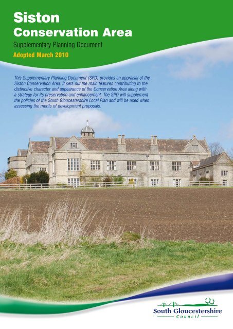
<strong>South</strong> <strong>Gloucestershire</strong> Supplementary Planning Document : <strong>Siston</strong> <strong>Conservation</strong> <strong>Area</strong><strong>Siston</strong> Character AssessmentViews looking northwards across the <strong>Conservation</strong> <strong>Area</strong> towards <strong>Siston</strong> Court.The Landscape SettingLocated close to the eastern fringes of the Bristol conurbation, the <strong>Siston</strong><strong>Conservation</strong> <strong>Area</strong> centres on the Grade I listed <strong>Siston</strong> Court and its designedlandscape setting. Situated on a ridge within the <strong>Siston</strong> Brook Valley, above thehamlet of <strong>Siston</strong> and St. Anne’s Church, the Court is evident in distant views fromthe west.The topography of the landscape contributes significantly to the character andappearance of the <strong>Conservation</strong> <strong>Area</strong>. The gently undulating <strong>Siston</strong> Brook Valleyis covered by a strong framework of hedgerows, copses and small woodlands,defining small to medium irregular shaped fields. It is essential that the rich varietyin the landscape provided by the dips and hollows in the landform, the hedgerowsand the trees are retained to ensure that the attractive rural setting of the hamlet,St Anne’s Church and <strong>Siston</strong> Court are not harmed. The removal of hedgerowsand other measures which would lead to uniformity in the landscape should beavoided. Similarly the subdivision of fields and the erection of new stables will beresisted where such development would harm the existing rural character andsetting of the hamlet.The gently rising slopes of the valley help enclose views out of the <strong>Conservation</strong><strong>Area</strong> and screen the encroaching suburban development. There are middledistance views of the Bristol conurbation which provide an unfortunate backdropto the Court, but when viewed from the west of the <strong>Conservation</strong> <strong>Area</strong>, these viewsare limited to glimpses through the established tree belts and plantations.The sense of enclosure achieved by a combination of landform and plantingcontributes significantly to the perception of remoteness and tranquillity, whichalong with the rural and undeveloped landscape is a defining characteristic ofthe <strong>Siston</strong> <strong>Conservation</strong> <strong>Area</strong>. It is also essential to retain the surrounding ruraland undeveloped landscape in order to protect the setting and views to andfrom <strong>Siston</strong> Court and the adjacent historic buildings.4
<strong>South</strong> <strong>Gloucestershire</strong> Supplementary Planning Document : <strong>Siston</strong> <strong>Conservation</strong> <strong>Area</strong>The Historic ContextThe special character of <strong>Siston</strong> <strong>Conservation</strong> <strong>Area</strong> has developed over time, largelyinfluenced by the history and development of <strong>Siston</strong> Court. The main stages of itsdevelopment are summarised below:Although some prehistoric and Roman remains have been found, the landremained largely wooded forest until the 13th century when it was cleared tocreate an estate. St Anne’s Church, was originally built in the 12th century and wasaltered in the 13th century and then again in the 18th and 19th century.In the late 16th century, <strong>Siston</strong> Court was completed replacing an earlier medievalmanor house.Kip’s engraving of <strong>Siston</strong> Court (circa 1710) as featured in Brittannia Ilustrata.The above engraving by Kip (circa 1710) shows <strong>Siston</strong> Court was once surroundedby extensive formal landscape gardens. This formal garden area featured a bowlinggreen as the principal focus for its layout with either a Dower House or PleasurePavilion at the rear.5
<strong>South</strong> <strong>Gloucestershire</strong> Supplementary Planning Document : <strong>Siston</strong> <strong>Conservation</strong> <strong>Area</strong>The 18th century saw a number of significant changes to <strong>Siston</strong> Court, most notablythe remodelling of the formal garden and creation of a more natural garden andparkland landscape in the style advocated by William Kent and later CapabilityBrown in their picturesque transformation of English parks. It is thought that theinformal gardens may have been influenced by Sanderson Miller, the mid-18thcentury Gothick architect who was related by marriage to the Trotman family whooccupied the Court at this time. Little of the garden as depicted in Kip engravingsurvives apart from a section of the former kitchen garden wall and the Well House,although it is considered that this was rebuilt in the 19th century.During the 18th and 19th century a number of properties were built in the hamletof <strong>Siston</strong> to house the estate workers and staff of <strong>Siston</strong> Court. The settlement wasdeveloped on a piecemeal basis, rather than being laid out as a planned estatevillage in a single architectural style and this historic scattered layout and formremains evident today.The 20th century saw the breaking up of the <strong>Siston</strong> Court estate and the subdivisionof the Court by the middle of the century. By the late 20th century, the decline infarming led to the residential conversion of a number of former farm buildings andland previously used for agriculture being used for pony paddocks and by theForestry Enterprise to create areas of woodland.The Kennelsonceservedthe <strong>Siston</strong> Courtestate but now isin residential use.One of the many plantations recently created by the Forestry Enterprise.The farming ofalpacas is anexample of howagricultural hasdiversified in<strong>Siston</strong>.7
<strong>South</strong> <strong>Gloucestershire</strong> Supplementary Planning Document : <strong>Siston</strong> <strong>Conservation</strong> <strong>Area</strong>Cast iron gatesand over throwwith lantern at StAnne's Church2) <strong>Siston</strong> Hamlet, Church, outlying farms and <strong>Siston</strong> LaneThe character of the hamlet of <strong>Siston</strong> has survived relatively untouched by moderndevelopment. It comprises of a scatter of properties clustered but well integratedinto the lower land within <strong>Siston</strong> Brook Valley. The hamlet features a mixture ofdomestic scale cottages in the vernacular style and ancient barns constructedof mainly coursed and random rubble lias stone with either clay pantile or slateroofs. The cottages have simple proportions and detailing with timber side hungcasements or sash windows. An exception is the former Rectory which is positioneddirectly to the south of the Church. Its Georgian formality with classical proportionsand detailing contrasts with the simplicity of the rest of the hamlet and identifies thebuilding as one of status.The Rectory (Circa early 1800's) <strong>Siston</strong> hamlet.One of themonumentswithin thegraveyard at StAnne's ChurchThe 12th century Church of St Anne lies between the hamlet and the Court. It ispositioned in a prominent and picturesque setting surrounded by a backdrop ofopen fields and acts as a focal point to the hamlet. The churchyard also offersgood views of the surrounding area and contains many interesting tombstones. The1839 Tithe Map shows that the modern church hall stands in the former gardensassociated with the Church.Date stone torear of St Anne'sChurch indicatingpossible date ofrestorationSt Anne's Church has its origins in the 12th century.12
<strong>South</strong> <strong>Gloucestershire</strong> Supplementary Planning Document : <strong>Siston</strong> <strong>Conservation</strong> <strong>Area</strong>The historic farms of Northmead and Overscourt with their associated barnsoccupy the higher reaches of the Valley, above the hamlet. A number of theformer barns have been converted for residential purposes. It is essential that anyalterations to the barns and outbuildings retain and reinforce their rural and historiccharacter. Extensions and alterations which would give a more domestic characteror harm their setting will be resisted.It is important that the existing special characteristics of the hamlet are preservedand particular care is needed to ensure that development proposals oralterations are sympathetic ones. It is considered that if new development didnot respect and adhere to the informal layout, low density and modest scale ofthe <strong>Conservation</strong> <strong>Area</strong> then it would have a significant detrimental affect on itscharacter and appearance and directly undermine one of the core reasons for itsdesignation as a conservation area.Northmead Farm.Views along <strong>Siston</strong> Lane bounded with grass verges.Although anumber havebeen extended,the cottageswithin the hamletare of modestscale andproportions.<strong>Siston</strong> Lane runs through the centre of the <strong>Conservation</strong> <strong>Area</strong> and is a narrow,twisting country lane characterised by sharp bends and largely enclosed by acombination of hedgerows, grass verges and stone walls. The many sharp bendsadd to the informal character of the lane and provide interest by giving a changingsequence of views and surprises. This informal and enclosed character makes asignificant contribution to the remote and idyllic ambience of the area.Many of the roadside hedgerows would benefit from better management to retaintheir enclosure of the road. Maintenance of the grass verges and stone wallsshould also be encouraged as they are also showing signs of neglect and in someplaces the stone walls are now completely obscured by overgrown hedges androadside verges.The creation of new field entrances has contributed to a loss of the enclosedcharacter of the lane. Proposals for additional openings will be resisted unless theyincluded enhancement measures to restore the sense of enclosure.Although thecottages are of asimple venacular,some have beenembellished bysuch features asdoor surrounds.13
<strong>South</strong> <strong>Gloucestershire</strong> Supplementary Planning Document : <strong>Siston</strong> <strong>Conservation</strong> <strong>Area</strong>The attractive narrow 19th century stone bridge known as St Anne’s Bridge, iscurrently threatened by potential increases in traffic volumes as developmentincreases within the surrounding area. The bridge is considered a fine exampleof an 18th century stone-built bridge which has survived in its original narrow andcurved form unaffected by unsightly highway improvements or safety measureswhich have often blighted similar bridges. The retention of St Anne’s Bridge in itshistoric form should be an important part of the preservation strategy becausealong with the intrinsic heritage value of the bridge, it acts as an attractive entranceto the south of the village. Therefore in the planning of any development growthareas, the potential for increased traffic along <strong>Siston</strong> Lane will need carefulconsideration in order to ensure that the existing problem of through traffic is notexacerbated.St Anne's Bridge.When consideringresidentialextensions caremust be takento ensure theresultant designand scale remainsin keeping with thehistoric characterof the area.Overall, <strong>Siston</strong> Lane makes a significant and positive contribution to theconservation area and it is important that its narrow, informal and enclosedcharacter is preserved.Preservation and Enhancement Strategy Retain the informal and low density pattern of development by protectingopen spaces around and between the existing properties.Ensure any alterations and extensions are sympathetic and respect andmaintain the traditional character and setting of the of the property andconservation area.Seek to restrict any future increases in traffic volumes to maintain thepleasant informal country charm.Ensure highway works are sympathetic to the character. Avoid use of kerbs,traffic signs and road markings to retain the rural character.Maintain enclosure to the road by resisting the widening or formation of newaccesses or the loss of stone-walls and hedgerows.Care is needed to ensure the verges and grassed areas keep their informalcharacter. Manage grass highway verges so existing roadside walls arevisible and this could also help improve pedestrian use of the lanes14
<strong>South</strong> <strong>Gloucestershire</strong> Supplementary Planning Document : <strong>Siston</strong> <strong>Conservation</strong> <strong>Area</strong>3) The former parkland, fields, woodlands and <strong>Siston</strong> Brook.Scots Pine trees set within more native species tree belt is a sign of a once managedlandscape. Note also recent planting within foreground that will help provide greater levels ofvisual enclosure.The Tithe Map of 1839 recorded land to the west of the Court as a mixtureof plantations and parkland. Although little of this remains, the remnants of aparkland style landscape survive and its open character contrasts greatly with theagricultural fields to the north and east of the <strong>Conservation</strong> <strong>Area</strong>. The overgrownponds to the rear of the Court and a line of Scots pine trees which are now setwithin a native tree belt along the western <strong>Conservation</strong> <strong>Area</strong> boundary (theLong Plantation) are also considered surviving features of a managed parklandlandscape. This tree belt also helps screen the east Bristol suburbs and encloseviews within the <strong>Conservation</strong> <strong>Area</strong> which contributes to the sense of remotenessand rural tranquillity which is a fundamental characteristic of the <strong>Conservation</strong> <strong>Area</strong>.The consolidation and extension of the western boundary planting should be partof a long term enhancement strategy. Elsewhere further tree and hedge plantingwill be encouraged along the northern and eastern boundaries to help improvelevels of screening and visual enclosure.The tree belt along north-western boundary helps screenviews out of the <strong>Conservation</strong> <strong>Area</strong>.The land to the westand south of <strong>Siston</strong>Court is largely withinthe ownership ofForestry Enterpriseand approximately 70hectares of woodlandhas been planted alongthe upper valley sides of<strong>Siston</strong> Valley. In the longterm the planting willstrengthen the landscapeframework of the locality,but at the same time itwill change the degreeof visual enclosure and careful consideration of the planting species, density andsiting of any future planting will be needed to ensure important views in and aroundthe <strong>Conservation</strong> <strong>Area</strong> are not lost as the planting matures.One of theovergrownponds to therear of <strong>Siston</strong>Court in need ofrestoration.A ForestryEnterpriseplantationadjacent toHanging Wood.One of manyglimpses of<strong>Siston</strong> Court. Thepreservation ofthese occasionaland limitedglimpses areimportant.15
<strong>South</strong> <strong>Gloucestershire</strong> Supplementary Planning Document : <strong>Siston</strong> <strong>Conservation</strong> <strong>Area</strong>Views downtowards thehamlet - the lackof managementis reducingthe enclosureafforded by thehedges and thestone walls onboth sides arealso disappearingdue to overgrowthand rising verges.To the north and east of the <strong>Conservation</strong> <strong>Area</strong> the enclosed fields are usedfor a mixture of agricultural and recreational uses. On the eastern side of the<strong>Conservation</strong> <strong>Area</strong>, a number of fields have been subdivided for horse relateduses resulting in the ad hoc development of sheds and variable maintenanceof boundaries. The cumulative effect of this and the associated infrastructureof stables, access tracks, exercise areas and jumps, has an adverse impactupon the open character of the landscape. However the visual harm has beenlargely contained and the wider character of the <strong>Conservation</strong> <strong>Area</strong> has notbeen overly affected. The pressures for recreational use of the land within the<strong>Conservation</strong> <strong>Area</strong> are likely to increase over time and this could result in far morevisually prominent areas being used for recreational purposes. To help avoid anysignificant diminution in appearance and special character of the <strong>Conservation</strong><strong>Area</strong> a more considered approach is required to control materials, siting andlandscaping. As part of this process, the preparation of a development briefcould help guide recreational development away from the most sensitive areas.More over serving an Article 4 Direction to remove permitted rights for the minoroperations of erecting boundary treatments and creating vehicular access pointsonto unclassified roads would help preserve the rural and undeveloped characterof the areas of the Conservaton <strong>Area</strong> that are or will be effected by horse- relateddevelopments.Stables and fencing to subdivide fields - the visual consequence of horse relateddevelopment can be detrimental to the open character of the conservation area.The network of public footpaths which cross the open fields and parkland provideattractive vistas that allow the rural and unspoilt setting of <strong>Siston</strong> Court and thehamlet to be fully appreciated. These important views need to be protected fromany intrusion either by development within the <strong>Conservation</strong> <strong>Area</strong> or in areas whereit would impinge on the skyline.The footpath network and parkland also provide a popular recreational resourceand with an anticipated growth in local population, the pressures placed upon16
<strong>South</strong> <strong>Gloucestershire</strong> Supplementary Planning Document : <strong>Siston</strong> <strong>Conservation</strong> <strong>Area</strong>it will increase. The most evident consequence of its popularity is the on-streetparking to the west of the <strong>Conservation</strong> <strong>Area</strong>. To avoid this increasing to a levelthat would impinge into the <strong>Conservation</strong> <strong>Area</strong>’s sense of tranquillity, as part of apreservation and enhancement strategy, there is a need for a sensitively designedand sited car park within the Forest Enterprise Land to the south-west of the<strong>Conservation</strong> <strong>Area</strong>. Greater links to the surrounding network of footpaths includingthe Community Forest Path which runs to the west of the <strong>Conservation</strong> <strong>Area</strong> couldalso help reduce vehicular traffic.The character of the parkland and fields are enhanced by landscape features suchas the copses/tree belts and a number of special historic features. The copsesare generally suffering from a lack of management and in the case of PrimroseWood, this could be extended to help screen the unsightly Wales and West gasinstallation. Additional hedge planting would also help improve the landscapecharacter, especially by replacing the field hedges which have been lost.The water management system was based on the upper reaches of <strong>Siston</strong> Brookand its tributaries. As part of its management system, a series of weirs, sluices andpools were constructed to control the flow of water through the landscape. Historicrecords show the system was far greater than what survives today, but the variousponds, pools, bridges, weirs, sluice gates and wells which do survive are elementsof significant historic interest and their repair and where possible reinstatementshould be the subject of further investigation to secure their future. There couldalso be an increasing environmental argument to restore the water managementsystem, as not only will be help enhance bio-diversity but it would also improve theability of the area to store and absorb water helping to offset predicted effects ofclimate change and extreme weather events.One of themany weirs thatform part of themanagement ofthe upper reachesof <strong>Siston</strong> Brook.The unsightlygas installationwould benefit fromgreater screening.Primrose Wood - an important landscape feature but suffering from lack of management.St Anne's Well - nolonger functionsand due to lackof maintainanceis being lost toovergrowth.Itsrestoration needsto be encouraged/secured.17
<strong>South</strong> <strong>Gloucestershire</strong> Supplementary Planning Document : <strong>Siston</strong> <strong>Conservation</strong> <strong>Area</strong>Preservation and Enhancement StrategyEncourage additional tree and hedge planting around the <strong>Conservation</strong> <strong>Area</strong>boundaries to help enclose the existing views out of the <strong>Conservation</strong> <strong>Area</strong>.Further sensitive planting to better integrate unsympathetic development such asthe gas utility stationServe an Article 4 Direction within the eastern part of the <strong>Conservation</strong> <strong>Area</strong> tohelp control the visual impact of the recreational use of former agricultural landby removing permitted development rights to erect fences and form vehicularaccess points.<strong>Siston</strong> Brook -meandering pastGibbs Lane.Seek to prepare a Development Brief to help guide recreational developmentaway from the most sensitive sites within the <strong>Conservation</strong> <strong>Area</strong>.Work with Forestry Enterprise to help provide and maintain the nature walkwayroutes for public and provide a sensitive parking area to help relieve the parkingpressures within the <strong>Conservation</strong> <strong>Area</strong>.Investigate and seek to secure sources of funding to help restore the survivingwater management features.Provide informative and sensitively designed markers to aid legibility of thelandscape and historic features.Proposals for recreational uses need to be sensitive to landscape character andinclude appropriate landscape mitigation and enhancement measures.Ensure new farm and other buildings/structures are appropriate in scale andsensitively designed, sited and landscaped.Ensure any new tree planting is appropriate in terms of species and layout andis sympathetic to historic character and setting.Seek to secure funding from new developments within the locality (through S106agreements) to help restore the surviving water management features and otherlandscape features as part of the promotion of the area as recreational resourcewhich can provide multi-functional benefitsViews of <strong>Siston</strong> Court and <strong>Siston</strong> <strong>Conservation</strong> <strong>Area</strong> from Shortwood Hill.18
<strong>South</strong> <strong>Gloucestershire</strong> Supplementary Planning Document : <strong>Siston</strong> <strong>Conservation</strong> <strong>Area</strong>Keeping and Enhancing the CharacterGreat care needs to be taken when considering changes within the <strong>Conservation</strong><strong>Area</strong> and beyond where the setting may be affected. The cumulative impact ofoften quite small changes by property owners such as using wrong details ormaterials, unsympathetic extensions, erosion of walls and loss of trees can harmthe unique character and downgrade the area. Similarly, insensitive changes to theverges, opens spaces and roads can detract from the pleasant informal characterand sense of place. Collectively, residents, landowners, local and parish councilscan help protect the unique character of <strong>Siston</strong> by ensuring any works they do aresensitive to the character. A strategy for the preservation and enhancement of thearea – including both general and more specific guidance is set out below and onthe accompanying Plan 3.Preservation and Enhancement StrategyThe overall aim is to preserve and enhance the historic character and appearanceof the <strong>Conservation</strong> <strong>Area</strong>, including its historic buildings, features, landscape andtheir setting as follows:1) Preserve and reinforce the historic characterEnsure repairs are carried out sensitively and that any works to both the listedand unlisted buildings, features and surroundings are considered in relation to thehistoric context and use appropriate materials, scale and detailing.2) Ensure that any new development (or alteration) respects thehistoric contextNew development or alteration needs to be in scale and sympathetic to thecharacter and appearance of the <strong>Conservation</strong> <strong>Area</strong>. It is important that it does notadversely harm the setting of the existing historic features, views or archaeology.3) Minimise the impact of existing modern developmentEnhancement proposals should seek to reduce the impact of modern developmentby using planting and natural stone walls to help soften the impact of intrusivefeatures and create a sense of enclosure and place, although important viewsneed to be protected.4) Preserve and reinforce the historic landscapeBy encouraging the retention (or replacement of trees where appropriate), hedges,stone walls, field patterns and other landscape features. With particular regard totrees, the siting, species and density of will need to be appropriate to the characterof the immediate and wider character.An example ofan ornamentalstructure out ofcharacter withits context. Theopen and ruralcharacter of the<strong>Conservation</strong><strong>Area</strong> should beprotected inall work - evenif planningpermission is notrequired. If youare unsure aboutthe impact ofyour proposals- please ask a<strong>Conservation</strong>Officer for advice.A roadside stonewall on Gibbs Lanewhich is being lostbecause of a lackof management.The visual lossof these wallsdiminishes thequality of theenvironment.Along withmaterials andscale, attentionto detailing isalso importantto preserve thehistoric character.19
<strong>South</strong> <strong>Gloucestershire</strong> Supplementary Planning Document : <strong>Siston</strong> <strong>Conservation</strong> <strong>Area</strong>Preserve local details and features which make an important contribution to the local character.How to contactusIf you have anyqueries or suggestions<strong>Conservation</strong> <strong>Area</strong>OfficerNatural and BuiltEnvironment TeamPlanning andEnvironment Section<strong>South</strong> <strong>Gloucestershire</strong><strong>Council</strong>PO Box 2081<strong>South</strong> <strong>Gloucestershire</strong>BS35 9BPTelephone:01454 863579Email: <strong>Conservation</strong>@southglos.gov.ukFurther information fromwww.southglos.gov.uk/<strong>Conservation</strong><strong>Area</strong>sWhat Happens Now?This leaflet was adopted as a Supplementary Planning Document (<strong>SPD</strong>) on15 th March 2010. The amended <strong>Siston</strong> <strong>Conservation</strong> <strong>Area</strong> boundary was alsodesignated on 15 th March 2010. The contents of this document will be taken intoaccount when assessing the merits of planning applications and other proposalsin the area. Applicants will need to provide an assessment of the character todemonstrate how their proposals will preserve or enhance the character of thearea. Those proposals, failing to give due weight to the guidance in this <strong>SPD</strong>,which have a harmful impact will be refused.In the preparation of this document the views of local residents and otherinterested parties were sought. Consultation on the draft document andenhancement and preservation strategy took place between September andNovember 2009 by way of an advertisement, publication on the <strong>Council</strong>’sWebsite and circulation of the leaflet within the conservation area. Commentsand proposed amendments to the document were subsequently reported to theExecutive <strong>Council</strong>lor prior to adoption. (For details see Statement on ConsultationReport – available from the <strong>Council</strong>).The <strong>Council</strong> is keen to work with the local community and other parties to helppreserve and enhance this special area. The strategy sets out ways we canhelp to achieve this. If you wish to assist in any manner or have any furthersuggestions, please let us know.www.southglos.gov.ukThis information can be made available in other languages,in large print, Braille or on audio tape.Please phone 01454 868004 if you need any of these orany other help to access <strong>Council</strong> services.Designed by <strong>South</strong> <strong>Gloucestershire</strong> <strong>Council</strong> Design & Print Services · 5148/08/09 · Tel:01454 863763 · Printed by <strong>South</strong> <strong>Gloucestershire</strong> Print on recycled paper 75% Post Consumer Waste ·20