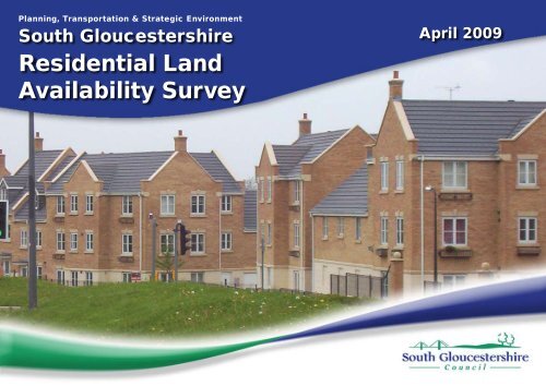
Residential Land Availability Survey - South Gloucestershire Council
Residential Land Availability Survey - South Gloucestershire Council
Residential Land Availability Survey - South Gloucestershire Council
- No tags were found...
Create successful ePaper yourself
Turn your PDF publications into a flip-book with our unique Google optimized e-Paper software.
CONTENTSPage1. The Key Facts 22. Introduction 23. Coverage of the <strong>Residential</strong> <strong>Land</strong> 3<strong>Availability</strong> <strong>Survey</strong>4. Schedule Format 45. New Housing Completions 46. Future Housing Development 57. Characteristics of New Housing 6• Previously Developed <strong>Land</strong> 6• Housing Densities 6• Housing Types 78. Affordable Housing 8Appendix 1: Large Site Completions 1996-2009 9Appendix 2: <strong>Residential</strong> <strong>Land</strong> <strong>Availability</strong> <strong>Survey</strong> – Schedule 15of Sites April 2009page 1
1 The Key Facts• House building over the first 13 years of the Local Plan period(1996 to 2011) has been below the rate set in the Local Plan.• Over three quarters of the way through the Local Plan period,75% of the strategic housing requirement has been built.• At 1 April 2009, 13,298 net additional homes had been built sincethe Local Plan’s base date of April 1996.• The April 2009 survey shows a potential for a further 10,586housing units on identified sites within the area.• Over the period 1999 to 2009, some 53% of new housing in <strong>South</strong><strong>Gloucestershire</strong> was built on previously developed land.• During the last year just over 90% of all new housing on largesites was built at an average net density of over 30 dwellings perhectare, and of these over 40% were built at an average densityof over 50 dwellings per hectare.• During the last year 52% of all new residential development onlarge sites was houses and 48% flats.• In 2008/2009 a total of 291 Affordable Houses were “delivered” in<strong>South</strong> <strong>Gloucestershire</strong>.2 Introduction2.1 The <strong>Residential</strong> <strong>Land</strong> <strong>Availability</strong> <strong>Survey</strong> (RLAS) details sites thatare potentially available for housing development under currentplanning policies.2.2 Government guidance outlines the importance of maintaining anadequate supply of land and buildings for housing, and of keepingthe situation under regular review. The RLAS forms an essentialpart of this process. The information it contains will help monitorand improve planning policies at the local and regional levels,in accordance with current best practice and the principles ofsustainable development.2.3 At the end of 2009, we shall also publish our fifth AnnualMonitoring Report, which will assess the performance of the<strong>Council</strong>’s plans, covering a wide range of land use and relatedissues, including housing.2.4 Much of the information in this April 2009 RLAS updates previousannual reports. The RLAS contains details of site densities,type of units, number of affordable units, parking provision,and whether the housing development occurs on previouslydeveloped (“brownfield”) land. Although capacity totals given foreach site are shown as gross figures, information contained inthe Notes makes specific reference to any demolitions etc., andgives the resulting net capacity where appropriate.2.5 The information contained in this document is derived fromDevelopment Control records, site surveys and other <strong>Council</strong>records. <strong>South</strong> <strong>Gloucestershire</strong> <strong>Council</strong> has made every effortto ensure the accuracy of the information, but neither the <strong>Council</strong>nor its officers can accept any responsibility for any errors oromissions.page 2
3 Coverage of the <strong>Residential</strong> <strong>Land</strong><strong>Availability</strong> <strong>Survey</strong>3.1 The survey covers “large” sites that have been identified forresidential use as a result of either:• the <strong>Council</strong> granting detailed or outline planning consent; or• a resolution to approve subject to completion of a Section 106agreement; or• a successful planning appeal.A large site is one that can accommodate 10 or more dwellings or hasa site area equal to or greater than 0.5 hectares.3.2 The RLAS sets out information for the following 4 categories ofland:• Category A Sites - with planning permission, including details ofdwellings under construction or completed.• Category B Sites - without planning permission, including sitesallocated in the <strong>South</strong> <strong>Gloucestershire</strong> Local Plan, those subjectto a S.106 Agreement or with a lapsed permission.• Category W Sites - those withdrawn since April 2008.• Category X Sites - those that have been completely finishedsince April 2008.Category A: Sites With Planning Permission.These include sites with outline, detailed, and/or reserved matterspermission at 1st April 2009. The dwelling capacities of land withoutline planning permission have in general been estimated aftermaking appropriate allowance for ancillary uses such as open space,roads, school sites etc.The total dwelling capacity of the site is shown, as is the stage ofdevelopment on sites with detailed or reserved matters planningpermission. The sum of the rows “NS” (Not Started) and “UC” (UnderConstruction), give the total dwellings to be completed. Generally,different sections on a large site are identified separately. Theschedule provides one planning application number under the “TYPEOF PERMISSION” column. Where subsequent revisions to sitecapacities or layouts are made the new planning application numbersand respective details are shown in the “NOTES” section.Category B: Sites Without Planning PermissionThese include estimates of the number of dwellings that could beconstructed on land which at 1st April 2009 was not granted planningpermission, but which has been identified for residential developmenteither through a Committee resolution to grant planning permissionsubject to the completion of a Section 106 Agreement, or an allocationin the <strong>South</strong> <strong>Gloucestershire</strong> Local Plan. Sites where a previousplanning permission has lapsed but where permission could normallybe expected to be renewed have also been included in this category.Category W: Sites WithdrawnThis category comprises those sites withdrawn since the survey in April2008.Category X: Sites Where Development Was CompletedThis category comprises sites where development had beencompleted (fully “built out”) between 1st April 2008 and 31st April 2009.page 3
4 Schedule FormatSite identification - Each site is given a RLAS site reference number,old reference numbers are also included for convenience. Singlesites may be sub-divided, where they are subject to phasing ofdevelopment. Where this is the case different parts of the site areidentified using a letter suffix “a”, “b”, “c” etc or “aa”, “ab”, “ac” etc.The National <strong>Land</strong> Use Database (NLUD) number is also included, ifapplicable. An Ordnance <strong>Survey</strong> grid reference is given as well as thesite address, postcode and Ward. For convenience sites are listed inalphabetical Ward order.Planning Status - The type of planning permission is shown togetherwith the application reference number and permission date. (Note:More detailed site plans are normally available for inspection at thePlanning, Transportation and Strategic Environment Department,<strong>Council</strong> Offices, Thornbury, during office hours, or on the <strong>Council</strong>’sWeb site at: www.southglos.gov.uk click-on “Planning applications” onthe A to Z Index).Site Size and Capacity - The area of the site is given in hectares, andthe density is also shown. The dwelling capacity reflects the numberof dwellings permitted or anticipated on the site, while “Not Started”(NS), “Under Construction” (UC) and “Completed” (Comp) shows theprogress of construction.Type of Units - Details of house types and bedroom numbers areshown for those sites listed on the “A” Schedule.Affordable Units - Where affordable homes are to be provided thenumbers are given.Parking Provision - Information is provided on numbers of parkingspaces and the average number of spaces per house.Previous Use - Information is set out confirming whether or not thesite was previously developed and gives a brief description of that use.The definition used follows that set out in PPS3, Annex B.Builder/Developer and Notes - This section provides details of theowner/applicant/developer name together with any other relevantinformation.5 New Housing Completions5.1 Over the year April 2008 – March 2009, 916 new houses and flatswere completed in <strong>South</strong> <strong>Gloucestershire</strong>.5.2 This figure is about 74% of the average annual level of housebuilding over the previous 19 years 1989 to 2008, of 1,231.During the first five years of the Local Plan period, 1996-2001,the average annual rate of new housing completions was 1,282.However, over the period 2004-09, the annual average has fallento 758 per year.Graph 1 Housing Completions 1989 to 2009Number of Completeions2200200018001600140012001000800600400200089/90 90/91 91/92 92/93 93/94 94/95 95/96 96/97 97/98 98/99 99/00 00/01 01/02 02/03 03/04 04/05 05/06 06/07 07/08 08/09YearSmall SitesLarge Sitespage 4
5.3 Table 1 sets out annual dwelling completions since 1989. Thetotal number of new completions over that period is 24,303.Table 1Annual Dwelling CompletionsFinancial Year Large Sites Small Sites Total1989/90 1,908 142 2,0501990/91 1,569 108 1,6771991/92 1,868 115 1,9831992/93 1,188 70 1,2581993/94 1,139 79 1,2181994/95 1,388 144 1,5321995/96 1,146 141 1,2871996/97 1,089 98 1,1871997/98 1,415 95 1,5101998/99 1,503 84 1,5871999/00 1,318 138 1,4562000/01 1,168 84 1,2522001/02 715 111 8262002/03 796 146 9422003/04 551 197 7482004/05 380 166 5462005/06 424 212 6362006/07 471 218 6892007/08 657 346 1,0032008/09 584 332 9166 Future Housing Development6.1 The <strong>South</strong> <strong>Gloucestershire</strong> Local Plan sets a target of 17,760dwellings to be built in the period between 1996 and 2011.6.2 The number of completed dwellings (net) over the period 1996-2009 was 13,298. Allowing for these completions, this leaves4,462 to be completed over the period 2009 to 2011 to meet theLocal Plan proposals.6.3 The Local Plan suggests that 1,184 dwellings should becompleted per annum. This is above the average of 1,023actually achieved over the period 1996-2009. The implicationof the Local Plan proposals is therefore, in effect, an increasesignificantly of average build rates achieved since 1996.6.4 Table 2 below compares the Local Plan requirement with recentrates of development..page 5
Table 2 Local Plan RequirementLocal Plan Requirement 1996 - 2011 17,760Completions 1996 - 2009Large sites 11,071Small Sites 2,227Total Completions 13,298Balance of dwellings 2009 – 2011 4,4627 Characteristics of New Housing7.1 Previously Developed <strong>Land</strong>7.1.1 During the year 2008/2009, 763 new dwellings werebuilt on previously developed “brownfield” sites – that is,78% of the total. Over the period 1999 to 2009, some53% of new housing in the area was built on previouslydeveloped land.Graph 2Brownfield and Greenfield Completed2008 to 2009Supply Available 2009Capacity on Large Sites with Planning Permission (Includingdwellings Under Construction) (“A” Sites)4,357Capacity on Other Committed Large Sites (“B” Sites) 5,116Capacity on Small Sites with Planning Permission (Includingdwellings Under Construction)1,113Total Supply 10,586Dwellings1600140012001000800600400200GreenfieldBrownfield099/00 00/01 01/02 02/03 03/04 04/05 05/06 06/07 07/08Years08/097.2 Housing Densities7.2.1 Over 90% of all new housing on large sites during2008/2009 was built at an average net density of over 30dwellings per hectare (dph). Some 41% of these were onsites where the density was over 50 dph.page 6
Graph 3Average Density of New Development on LargeSites Completed 2008 to 2009Graph 4Dwelling Types Completed2008 to 2009 (Gross)350550300450250Dwellings2003504 or more bedrooms3 bedrooms2 bedrooms150100Number of Dwellings2501501 bedroom500Below 30 30-49 50 or overDensity50House/BungalowType of DwellingFlat7.3 Housing Types7.3.1 In 2008/2009, 52% of dwelling completions were houses,while flats and apartments formed 48%.7.3.2 38% of all dwelling completions have three or morebedrooms.page 7
8 Affordable Housing8.1 In 2008/2009 a total of 291 Affordable Houses were “delivered” in<strong>South</strong> <strong>Gloucestershire</strong>.Further InformationFor further information on this report please contact:Spatial Planning TeamPlanning and EnvironmentDirectorate of Planning, Transportation and Strategic Environment<strong>Council</strong> OfficesThornburyBS35 1HFTelephone: 01454 863446/863670page 8
Appendix 1 Large Site Completions between April 1996 and April 2009OldRef.New Ref. Location DwellingsCompleted (Gross)DwellingsCompleted (Net)Dwellings Lost3020 Ventura Farm, Oldland Common 7 73073 R/O 63/67 New Cheltenham Rd. Kingswood 18 183120 <strong>Land</strong> at Bridgeyate 89 893120g 0031g Bridgeyate Service Station, Bridgeyate 39 393120h <strong>Land</strong> off Church Avenue, Warmley 55 553135S Emersons Green (<strong>South</strong>) 2,278 2,2783135N Emersons Green (North) 590 588 -23142 Alma Rd / High Street, Kingswood 42 423149 0032 Adj. Willsbridge Ldge, Court Farm Rd. Longwell Green 20 19 -13152 Bromley Heath Road, Downend 106 1063154 0033 <strong>Land</strong> at Siston Hill, Siston 384 3843156 <strong>Land</strong> adj. 98 Tower Road North, Warmley 23 233157 Salem Methodist Ch. Soundwell Rd. K/wood 15 153160 Hanham Hall Hospital, Hanham 15 153169 <strong>Land</strong> Adj 66 Stonehill, Hanham 10 103170 Christchurch Jnr School, Downend 34 343171 Siston Hill Farm, Warmley 17 173172 22 Church Road, Kingswood 12 123173 29-33 Cadbury Heath Rd. Oldland Common 8 83175 13 Tower Road, Warmley 9 93177 r/o 1-25 Wedgewood Road, Downend 16 163178 <strong>Land</strong> at Blackhorse Lane, Downend 10 9 -13179 School Site, Cossham Street, Mangotsfield 177 1773180 <strong>Land</strong> west of Bromley Farm, Downend 20 203181 <strong>Land</strong> at Memorial Road, Hanham 22 223182 <strong>Land</strong> at Rangers Walk, Hanham 20 203183 Fmr. DRG Factory, Carsons Rd. Shortwood 144 1443184 Old Co-Op Site, Park Road, Staple Hill 60 603186 <strong>Land</strong> at 18 Derrick Road, Kingswood 12 12page 9
OldRef.New Ref. Location DwellingsCompleted (Gross)DwellingsCompleted (Net)Dwellings Lost3191 Baugh Farm, Fouracre Crescent, Downend 52 50 -23193 Fmr. Sunday Sch. Blackhorse Rd. K/wood 18 183194 Bromley Farm, Bromley Heath Rd. Downend 8 7 -13195 Wetherby Court, Downend 10 103197 Fmr. BT Exchange, Hanham Rd. Kingswood 12 123198 Repeater Station, Grimsbury Rd. Kingswood 73 733199 <strong>Land</strong> at James Road, Staple Hill 20 203200 Pound Road, Kingswood 15 153201 YMCA Building, Park Road, Kingswood 13 133202 The Crescent, Soundwell 24 0 -243203 <strong>Land</strong> at Brereton Way, Cadbury Heath 40 8 -323204 0037 North of Douglas Road, Kingswood 139 1393207 0040 <strong>Land</strong> off Cloverdale Drive, Longwell Green 48 483208 Depot 79 Court Road, Kingswood 16 163209 1-3 Portland Street, Staple Hill 18 17 -13210 22 Soundwell Road, Soundwell 10 9 -13211 0041 <strong>Land</strong> off <strong>South</strong>way Drive, Warmley 13 133212 Church Avenue, Warmley 11 113213 296-300 Badminton Road, Downend 16 13 -33214 Hill View, Blackhorse Lane, Downend 10 9 -13215 0042 R/O 256 New Cheltenham Road, K/wood 15 14 -13216 <strong>Land</strong> adj. 5 Ducie Road, Staple Hill 12 123217 0043 <strong>Land</strong> at 26 Orchard Road, Kingswood 15 14 -13218 Britton House, Warmley 10 103219 <strong>Land</strong> rear of 35-47 Cleeve Hill, Downend 16 15 -13220 0044 Syston Way/Wesley Hill, Kingswood 57 573221 0045 302-306 Badminton Road, Downend 36 31 -53222 0046 Mount Hill Nursery, Court Road, Kingswood 14 13 -13224 22 Woodstock Road, Kingswood 13 12 -13225 0047 Summit Youth Centre, Orchard Road, Kingswood 71 71page 10
OldRef.New Ref. Location DwellingsCompleted (Gross)DwellingsCompleted (Net)Dwellings Lost3226 0048 Hanham Road Depot, Hanham 24 243227 G S Garage Site, Tower Rd.<strong>South</strong>, Warmley 21 213228 0049 181 High Street, Hanham 10 103230 0050 Torrance Close, Warmley 11 -17 -283231 0051 Simplex Site, Oldland Common 24 243232 0052 65-69 High Street, Staple Hill 23 22 -13234 0054 Church Road, Kingswood 23 233235 0055 49a-51 Downend Road, Kingswood 24 23 -13239 0059 7-15 Cadbury Heath Road, Cadbury Heath 14 13 -13240 0060 <strong>Land</strong> off Carsons Road, Kingswood 32 323241 0061 Builders Yard, Blackhorse Lane, Downend 19 193242 0062 Bright Street/Moravian Road, Kingswood 21 14 -73243 0063 Depot Downend Road, kingswood 14 143244 0064 29-35 High Street, Kingswood 14 12 -23245 0065 Rear of 1, 3 and 7 Tower Road <strong>South</strong> Warmley 13 133246 0066 65 Cadbury Heath Road, Cadbury Heath 14 13 -13247 0067 Rear of Jubilee Road/Rodway View, Kingswood 24 23 -13248 0068 1-3 Colston Street, Soundwell 14 143249 0069 21 Portland Street, Soundwell 14 13 -13250 0070 Former Crossroads Service Station, Downend 13 133251 0071 Downend Lower School, Downend 9 93253 0073 Kingsway Engineering Works, Hanham 14 143255 0074 <strong>Land</strong> at Lintham Drive, Kingswood 20 203256 0075 36 High Street, Staple Hill 14 13 -13257 0076 Rear of 31 Cossham Street, Mangotsfield 14 13 -13258 0077 Courtaulds Factory, Signal Road, Staple Hill 21 213259 0100 148 Hanham Road, Kingswood 14 143264 0086 Rear of Queens Road, Cadbury Heath 10 9 -13268 0090 Broad Street/Beaufort Road, Staple Hill 14 143273 0097 Wall Tyning Nursing Home, Bitton 0 -2 -2Kingswood Total 5,573 5,446 -127page 11
page 12OldRef.New Ref. Location DwellingsCompleted (Gross)DwellingsCompleted (Net)Dwellings Lost1154 0002 Bradley Stoke 2,196 2,1961284 East of Parkway, Stoke Gifford 200 2001297 <strong>Land</strong> off Little Stoke Lane, Little Stoke 33 331298 <strong>Land</strong> at Parkway North, Stoke Gifford 90 901301 0006 Stoke Park Hospital 598 590 -81309 Chillington Court, Patchway 32 -13 -451312 <strong>Land</strong> off Station Road, Filton 12 121313 Bristol Parkway North, Stoke Gifford 318 3181316 0007 Filton College, Filton 78 781322 <strong>Land</strong> off Bradley Stoke Way, Bradley Stoke 238 2381325 0010 Wallscourt Farm, Stoke Gifford 40 401327 Pretoria Road, Patchway 23 21 -21328 0012 162-164 Gloucester Road, Patchway 4 -1 -51329 Clarendon Hse. & Frenchay Mews, Frenchay 20 201332 0014 Catbrain Lane, Cribbs Causeway 71 711334 0016 Harry Stoke Farm, Harry Stoke 16 161340 0022 472-478 Filton Avenue, Filton 21 211341 0023 New Road Playing Field, Filton 6 61345 0027 The Galleon, Conygre Road, Filton 12 121347 0029 Fishpool Hill, Easter Compton 14 12 -2North Fringe Total 4,022 3,960 -621210 Swanfield, Station Road, Yate 19 18 -11212 Brimsham Park, Yate 35 351230 Tylers Farm, Yate 176 1761253 St. John's Way, Chipping Sodbury 102 1021276 Adj. White Lion, Yate 19 191278 Northern Car Park, Abbotswood, Yate 14 141290 Gravel Hill, Yate 17 171291 St. John's Way, Chipping Sodbury 21 211293 <strong>Land</strong> off St. John's Way, Chipping Sodbury 13 131305 <strong>Land</strong> off Hatters Lane, Chipping Sodbury 20 19 -1
OldRef.New Ref. Location DwellingsCompleted (Gross)DwellingsCompleted (Net)Dwellings Lost1310 <strong>Land</strong> off Station Rd./Chatterton Rd. Yate 31 311314 Tylers Farm, Gravel Hill Road, Yate 33 331319 <strong>Land</strong> at St. Briavels Drive, Yate 24 23 -11324 <strong>Land</strong> rear of Birch and Milton Roads, Yate 12 121335 0017 46-92 Milton Road, Yate 16 -8 -241336 0018 <strong>Land</strong> at Broad Lane, Yate 23 231346 0028 Lawns Inn, Yate 14 14Yate/Chipping Sodbury Total 589 562 -271008 Beach Road, Severn Beach 21 211083 Rear of High Street, Marshfield 44 441085 Back Lane, Wickwar 1 11135 Inglestone Rd./Cotswold View, Wickwar 22 221148 Prospect Close, Winterbourne 2 21171 Thornbury Hospital 45 451179 R/O Severn Salmon, Severn Beach 123 1231220 Back Lane, Coalpit Heath 5 51229 Cross Hands Road, Pilning 68 681254 <strong>Land</strong> at Townwell, Cromhall 12 121255 Old Glos. Road, Alveston 11 111257 Mill House Farm, Westerleigh 1 11270 Seawall Caravan Park, Severn Beach 46 461273 0003 Dragon Road, Winterbourne 5 51277 St. Annes Drive, Wick 4 41286 France Lane, Hawkesbury Upton 3 31289 Badminton & Woodside Rds. C/Heath 22 221292 <strong>Land</strong> at Park Farm, Frampton Cotterell 196 1961294 <strong>Land</strong> off Badminton Road, Coalpit Heath 22 221295 <strong>Land</strong> at Ridgeway, Coalpit Heath 30 301300 0005 Hortham Hospital, Almondsbury 184 1841307 <strong>Land</strong> at Badminton Road, Coalpit Heath 24 241315 Beesmoor Road, Frampton Cotterell 13 13page 13
OldRef.New Ref. Location DwellingsCompleted (Gross)DwellingsCompleted (Net)Dwellings Lost1321 Severn Salmon PH, Severn Beach 24 241330 0013 Kyneton House, Mumbleys Lane, Thornbury 14 11 -31331 Poplar Drive, Pucklechurch 19 5 -141333 0015 Toghill Lane, Doynton 21 4 -171342 0024 <strong>Land</strong> and buildings at West End, Marshfield 17 171343 0025 Whiteshill House, Hambrook 10 101344 0026 New Road, Rangeworthy 21 211348 0079 <strong>Land</strong> off Bath Road, Thornbury 30 301350 0081 Former Cattle Market, Thornbury 22 221351 0082 Siblands, Gillingstool, Thornbury 15 153223 Willsbridge House, Willsbridge Hill, Willsbridge 20 203229 <strong>Land</strong> off Golden Valley Lane, Bitton 20 20Elsewhere Total 1,137 1,103 -34<strong>South</strong> <strong>Gloucestershire</strong> Total 11,321 11,071 -250page 14
<strong>Residential</strong> <strong>Land</strong> <strong>Availability</strong> <strong>Survey</strong> "A" Sites With Planning Permission 01/04/2009Site Refs:Address/Post Code/Ward:Permission:Type/Ref/DateArea (Ha):DensityCapacity:Type of Units:AffordableUnits:ParkingProvision:PreviouslyDev'd and Use:Site Allocation:Builder/Developer:Notes:0005Grid Ref361788184402NLUD:11900016Old Ref1/300Hortham HospitalHortham LaneAlmondsburyBS32 4JH"Hortham Village"AlmondsburyFullPT06/0865/F28/03/2007Gross:Net:34.069.00Gross: 8Net: 30TotalNSUCComp270 80 Spaces: YesBarratt Homes/Bryant Homes.48355311841 bed house: 02 bed house: 403 bed house: 654 bed house: 1165 bed house: 01 bed flat: 132 bed flat: 353 bed flat: 1Actual(Per hse):1.8HospitalLocal PlanAllocationH1(A)<strong>Residential</strong> development on site offormer hospital. Capacity includes 49Flats, 41 complete, 2 under constructionand 6 not started at April '09.PT07/3177/F and PT08/2368/Fsubsitutes house types on 4 plots.0097 Wall TyningsFullGross: 0.86 Total 11 1 bed house: 0 3 Spaces: YesComax Properties Ltd.Grid Ref Cherry Garden LaneNet: 0.86 NS 0 2 bed house: 336PK07/2768/FNursing home367059 BittonUC 11 3 bed house: 0Gross: 13(Per hse): and 2 bungalows170624 BS30 6JH01/12/2008Comp 0 4 bed house: 8Net: 133.35 bed house: 0NLUD:11900512Old Ref3/273Bitton1 bed flat: 02 bed flat: 03 bed flat: 0ActualWindfallScheme involved the demolition of anexisting nursing home and two dwellings(complete at April 2009) and the erectionof 11 houses.0002hnGrid Ref361915181849NLUD:Savages Wood RoadBradley Stoke"Oakwood Grange"ResMattPT06/1609/RM17/10/2006Gross:Net:1.291.29Gross: 95Net: 95TotalNSUCComp122 0 Spaces: NoDavid Wilson Homes (<strong>South</strong> West) Ltd.130032901 bed house: 02 bed house: 03 bed house: 104 bed house: 05 bed house: 0(Per hse):1.1AgriculturalScheme includes 112 flats (25 underconstruction and 87 complete at April '09survey date).Old Ref1/154hnBradley StokeCentral and StokeLodge1 bed flat: 242 bed flat: 883 bed flat: 0ActualLocal PlanAllocationBNFLP LP715<strong>South</strong> <strong>Gloucestershire</strong> <strong>Residential</strong> <strong>Land</strong> <strong>Availability</strong> <strong>Survey</strong> April 2009
<strong>Residential</strong> <strong>Land</strong> <strong>Availability</strong> <strong>Survey</strong> "A" Sites With Planning Permission 01/04/2009Site Refs:Address/Post Code/Ward:Permission:Type/Ref/DateArea (Ha):DensityCapacity:Type of Units:AffordableUnits:ParkingProvision:PreviouslyDev'd and Use:Site Allocation:Builder/Developer:Notes:0071 Downend Lower Sch ResMatt Gross: 1.34 Total 52 1 bed house: 0 18 Spaces: YesBarratt Bristol.Grid Ref NorthviewNet: 1.34 NS 28 2 bed house: 7104PK07/3200/RMSecondary365510 DownendUC 15 3 bed house: 8Gross: 39(Per hse): school176319 BS16 5RX20/02/2008Comp 9 4 bed house: 27Net: 392.05 bed house: 6NLUD:11900422Old Ref3/251Downend1 bed flat: 42 bed flat: 03 bed flat: 0ActualWindfallDemolition of former school to faciltateresidential development. Capacityincludes 4 flats (not started at April 2009).0089 56 - 58FullGross: 0.15 Total 12 1 bed house: 0 0 Spaces: YesGeometric Group.Grid Ref Cleeve HillNet: 0.15 NS 12 2 bed house: 013PK07/1171/FTwo bungalows364923 DownendUC 0 3 bed house: 0Scheme involves the demolition of 2Gross: 82(Per hse):177061 14/03/2008Comp 0 4 bed house: 0bungalows and erection of 12 flats.BS16 6HQNet: 821.15 bed house: 0NLUD:Old Ref3/267Downend1 bed flat: 12 bed flat: 93 bed flat: 2Actual0102 17 and 25aFullGross: 0.32 Total 38 1 bed house: 0 0 Spaces: YesAmberwell Estates Ltd.Grid Ref Ovenhill RoadNet: 0.32 NS 38 2 bed house: 012PK07/1764/FTwo houses364483 DownendUC 0 3 bed house: 0Gross: 119(Per hse):176196 BS16 5DS17/07/2008Comp 0 4 bed house: 0Net: 1190.35 bed house: 0NLUD:11900616Old Ref3/275Downend1 bed flat: 282 bed flat: 103 bed flat: 0ActualWindfallWindfallScheme proposes demolition of 2existing houses and erection of 37sheltered flats and managers flat.16<strong>South</strong> <strong>Gloucestershire</strong> <strong>Residential</strong> <strong>Land</strong> <strong>Availability</strong> <strong>Survey</strong> April 2009
<strong>Residential</strong> <strong>Land</strong> <strong>Availability</strong> <strong>Survey</strong> "A" Sites With Planning Permission 01/04/2009Site Refs:Address/Post Code/Ward:Permission:Type/Ref/DateArea (Ha):DensityCapacity:Type of Units:AffordableUnits:ParkingProvision:PreviouslyDev'd and Use:Site Allocation:Builder/Developer:Notes:0092 Adjacent toFullGross: 0.48 Total 56 1 bed house: 0 0 Spaces: YesChurchill Retirement Living.Grid Ref <strong>South</strong>mead RoadNet: 0.48 NS 56 2 bed house: 019PT07/0196/FVacant land360027 FiltonUC 0 3 bed house: 0Gross: 116formerly libraryScheme proposes the erection of 55(Per hse):178958 18/02/2008Comp 0 4 bed house: 0sheltered flats and managers flat.Net: 1160.35 bed house: 0NLUD:119002501 bed flat: 40Filton2 bed flat: 16Windfall3 bed flat: 0Old RefActual1/3530008 North FieldOutlineGross: 44.00 Total 2200 1 bed house: 0 733 Spaces: YesBovis Homes Ltd/BAe Systems.Grid Ref Filton AerodromeNet: 44.00 NS 2200 2 bed house: 00PT03/3143/OAirfield and359750 PatchwayUC 0 3 bed house: 0Gross: 50associatedAllocated in the <strong>South</strong> <strong>Gloucestershire</strong>(Per hse):180800 14/03/2008Comp 0 4 bed house: 0developmentLocal Plan as a major mixedNet: 500.0development site totalling 74 ha,5 bed house: 0NLUD:including 14 ha of employment uses.119000231 bed flat: 0Filton/Patchway2 bed flat: 0Allocated SGLP3 bed flat: 0Old RefNot knownH1(4) and M11/3180010Grid Ref361676177841NLUD:Old Ref1/325Wallscourt Farm(Hewlett Packard)Stoke GiffordBS34 8QZ"Cheswick"Frenchay and StokeParkOutlinePT04/0684/O02/11/2005Gross:Net:14.6510.37Gross: 43Net: 60TotalNSUCComp625 188 Spaces: NoRedrow Homes (<strong>South</strong> West) Ltd.0625001 bed house: 02 bed house: 03 bed house: 6254 bed house: 05 bed house: 01 bed flat: 02 bed flat: 03 bed flat: 0Estimate(Per hse):0.0AgriculturalLocal PlanAllocationSGLP H1(9)Scheme proposes residentialdevelopment totalling 1,250 dwellings,950 of which are within <strong>South</strong><strong>Gloucestershire</strong>. Figure shown is thebalance of the Outline planningpermission allowing for reserved matterplanning permissions for the variousphases of development.17<strong>South</strong> <strong>Gloucestershire</strong> <strong>Residential</strong> <strong>Land</strong> <strong>Availability</strong> <strong>Survey</strong> April 2009
<strong>Residential</strong> <strong>Land</strong> <strong>Availability</strong> <strong>Survey</strong> "A" Sites With Planning Permission 01/04/2009Site Refs:Address/Post Code/Ward:Permission:Type/Ref/DateArea (Ha):DensityCapacity:Type of Units:AffordableUnits:ParkingProvision:PreviouslyDev'd and Use:Site Allocation:Builder/Developer:Notes:0010aGrid Ref361270178054NLUD:CheswickFilton RoadStoke GiffordBS34 8QZ"Tallstick"ResMattPT07/1715/RM05/11/2007Gross:Net:4.703.75Gross: 21Net: 27TotalNSUCComp100 30 Spaces: NoRedrow Homes (<strong>South</strong> West) Ltd.1551545401 bed house: 02 bed house: 223 bed house: 164 bed house: 235 bed house: 0(Per hse):1.6AgriculturalScheme includes 39 flats 21 underconstruction, 3 not started and 15complete at April 2009.Old Ref1/325aFrenchay and StokePark1 bed flat: 122 bed flat: 273 bed flat: 0ActualLocal PlanAllocationSGLP H1(9)0010bGrid Ref361839177780NLUD:Wallscourt FarmStoke GiffordBS34 8QZ"Cheswick"ResMattPT07/3519/RM16/05/2008Gross:Net:4.953.88Gross: 45Net: 58TotalNSUCComp225 1 bed house: 0 67 Spaces: YesRedrow Homes (<strong>South</strong> West) Ltd.225 2 bed house: 83Agricultural0 3 bed house: 51Proposal includes 30 flats.(Per hse):0 4 bed house: 615 bed house: 0Old Ref1/325bFrenchay and StokePark1 bed flat: 282 bed flat: 23 bed flat: 0ActualLocal PlanAllocationSGLP H1(9)0107 RoseacreFullGross: 0.32 Total 14 1 bed house: 0 0 Spaces: YesCotswoldgate Ltd.Grid Ref Harry Stoke RoadNet: 0.32 NS 14 2 bed house: 430PT07/3265/FGarden361993 Stoke GiffordUC 0 3 bed house: 7Gross: 44(Per hse):178776 BS34 8QH30/07/2008Comp 0 4 bed house: 3Net: 442.15 bed house: 0NLUD:11900617Old Ref1/355Frenchay and StokePark1 bed flat: 02 bed flat: 03 bed flat: 0ActualWindfallErection of 14 dwellings on site of formergarden and orchard.18<strong>South</strong> <strong>Gloucestershire</strong> <strong>Residential</strong> <strong>Land</strong> <strong>Availability</strong> <strong>Survey</strong> April 2009
<strong>Residential</strong> <strong>Land</strong> <strong>Availability</strong> <strong>Survey</strong> "A" Sites With Planning Permission 01/04/2009Site Refs:Address/Post Code/Ward:Permission:Type/Ref/DateArea (Ha):DensityCapacity:Type of Units:AffordableUnits:ParkingProvision:PreviouslyDev'd and Use:Site Allocation:Builder/Developer:Notes:0108 24FullGross: 0.14 Total 10 1 bed house: 0 0 Spaces: YesA Brookes.Grid Ref Church RoadNet: 0.14 NS 10 2 bed house: 015PT08/0136/FHouse362507 Stoke GiffordUC 0 3 bed house: 0Scheme involves demolition of existingGross: 71(Per hse):179366 11/04/2008Comp 0 4 bed house: 0house and erection of 10 flats.BS34 8QANet: 711.55 bed house: 0NLUD:Old Ref1/356Frenchay and StokePark1 bed flat: 22 bed flat: 83 bed flat: 0Actual0109 R/O 13, 14 and 15 OutlineGross: 0.30 Total 13 1 bed house: 0 0 Spaces: YesCoast Homes (Bristol) Ltd.Grid Ref Harry Stoke RoadNet: 0.30 NS 13 2 bed house: 027PT08/0361/OGarden362489 Stoke GiffordUC 0 3 bed house: 13Erection of 13 dwellings on formerGross: 43(Per hse):179214 02/05/2008Comp 0 4 bed house: 0garden land.BS34 8QQNet: 432.15 bed house: 0NLUD:11900618Old Ref1/357Frenchay and StokePark1 bed flat: 02 bed flat: 03 bed flat: 00058 16OutlineGross: 0.23 Total 13 1 bed house: 0 0 Spaces: YesMr Dicker.Grid Ref Lower Chapel RoadNet: 0.23 NS 13 2 bed house: 010PK03/1261/OBuilders yard364187 HanhamUC 0 3 bed house: 0Gross: 58(Per hse): and car sales lot172410 BS15 8SH22/02/2007Comp 0 4 bed house: 0Net: 580.85 bed house: 0NLUD:11900491Old Ref3/238HanhamEstimate1 bed flat: 132 bed flat: 03 bed flat: 0ActualWindfallWindfallWindfallScheme involves development of 13 flatson the site of a former builders yard andcar sales lot.19<strong>South</strong> <strong>Gloucestershire</strong> <strong>Residential</strong> <strong>Land</strong> <strong>Availability</strong> <strong>Survey</strong> April 2009
<strong>Residential</strong> <strong>Land</strong> <strong>Availability</strong> <strong>Survey</strong> "A" Sites With Planning Permission 01/04/2009Site Refs:Address/Post Code/Ward:Permission:Type/Ref/DateArea (Ha):DensityCapacity:Type of Units:AffordableUnits:ParkingProvision:PreviouslyDev'd and Use:Site Allocation:Builder/Developer:Notes:0085 Adj. 22FullGross: 0.16 Total 14 1 bed house: 0 14 Spaces: YesKnightstone Housing Association.Grid Ref Memorial RoadNet: 0.16 NS 14 2 bed house: 014PK07/3613/R3FScout and363839 HanhamUC 0 3 bed house: 0Gross: 88Guide HallsScheme involves demolition of existing(Per hse):172295 26/02/2008Comp 0 4 bed house: 0Scout and Guide halls and erection of 14BS15 3JANet: 881.0flats. PK08/1480/R3F minor5 bed house: 0NLUD:amendments to scheme.Old Ref3/263Hanham1 bed flat: 62 bed flat: 83 bed flat: 0Actual0088 Priory CourtFullGross: 0.41 Total 28 1 bed house: 0 28 Spaces: YesWestern Challenge HousingGrid Ref Whittucks RoadNet: 0.41 NS 0 2 bed house: 022Association.PK07/1991/F23 bed space364346 HanhamUC 28 3 bed house: 8Gross: 69(Per hse): communal171468 BS15 3NA02/01/2008Comp 0 4 bed house: 0establishmentNet: 690.85 bed house: 0NLUD:11900606Old Ref3/266Hanham1 bed flat: 202 bed flat: 03 bed flat: 00056 Former Linden Hotel FullGross: 0.15 Total 25 1 bed house: 0 0 Spaces: YesN Muhammad.Grid Ref 51 - 59 High StreetNet: 0.15 NS 25 2 bed house: 024PK04/1470/FHotel and two365120 KingswoodUC 0 3 bed house: 0Gross: 171(Per hse): houses173867 BS15 4AD07/04/2006Comp 0 4 bed house: 0Net: 1711.05 bed house: 0NLUD:11900492Old Ref3/236Kings ChaseActual1 bed flat: 22 bed flat: 233 bed flat: 0ActualWindfallWindfallWindfallScheme involves the refurbishment andnew build of a former residentialcommunal home to create 28 dwellingsincluding 20 flats. PK08/1911/F amendsdetails of scheme.Scheme involves demolition of existinghotel and 2 dwellings and erection of 25flats.20<strong>South</strong> <strong>Gloucestershire</strong> <strong>Residential</strong> <strong>Land</strong> <strong>Availability</strong> <strong>Survey</strong> April 2009
<strong>Residential</strong> <strong>Land</strong> <strong>Availability</strong> <strong>Survey</strong> "A" Sites With Planning Permission 01/04/2009Site Refs:Address/Post Code/Ward:Permission:Type/Ref/DateArea (Ha):DensityCapacity:Type of Units:AffordableUnits:ParkingProvision:PreviouslyDev'd and Use:Site Allocation:Builder/Developer:Notes:0099 95OutlineGross: 0.08 Total 12 1 bed house: 0 0 Spaces: YesMrs Batt.Grid Ref High StreetNet: 0.08 NS 12 2 bed house: 013PK07/1390/OOffice365243 KingswoodUC 0 3 bed house: 0Gross: 158(Per hse):173841 BS15 4AD17/12/2007Comp 0 4 bed house: 0Net: 1581.15 bed house: 0NLUD:Old Ref3/260Kings Chase1 bed flat: 02 bed flat: 123 bed flat: 0EstimateWindfallScheme proposes the demolition of theexisting office and erection of 12 flats.Capacity reflects current planningpermission although final scheme onlylikely to comprise 10 flats.0083 Dorset HouseOutlineGross: 0.22 Total 13 1 bed house: 0 0 Spaces: YesMr S J Curtis.Grid Ref Downend RoadNet: 0.22 NS 13 2 bed house: 014PK07/0224/OWorkshops and364677 KingswoodUC 0 3 bed house: 7Gross: 59garagesScheme involves demolition of existing(Per hse):174177 04/03/2008Comp 0 4 bed house: 0workshops and garages and the erectionBS15 1SENet: 591.1of 7 houses and 6 flats.5 bed house: 0NLUD:Old Ref3/261Kings Chase1 bed flat: 02 bed flat: 63 bed flat: 00095 Trading EstateFullGross: 0.46 Total 57 1 bed house: 0 19 Spaces: YesStrongvox Ltd.Grid Ref Elmtree WayNet: 0.46 NS 57 2 bed house: 047PK08/1530/FWarehouses364927 KingswoodUC 0 3 bed house: 0Gross: 124(Per hse):174088 BS15 1QT23/01/2009Comp 0 4 bed house: 0Net: 1240.85 bed house: 0NLUD:11900514Old Ref3/271Kings ChaseEstimate1 bed flat: 202 bed flat: 373 bed flat: 0ActualWindfallWindfallScheme involves the demolition of theexisting warehouses and erection of 57flats. Supersedes previous planningpermission PK06/0231/F for 48 flats.21<strong>South</strong> <strong>Gloucestershire</strong> <strong>Residential</strong> <strong>Land</strong> <strong>Availability</strong> <strong>Survey</strong> April 2009
<strong>Residential</strong> <strong>Land</strong> <strong>Availability</strong> <strong>Survey</strong> "A" Sites With Planning Permission 01/04/2009Site Refs:Address/Post Code/Ward:Permission:Type/Ref/DateArea (Ha):DensityCapacity:Type of Units:AffordableUnits:ParkingProvision:PreviouslyDev'd and Use:Site Allocation:Builder/Developer:Notes:0101 Fmr Police Station FullGross: 0.27 Total 14 1 bed house: 0 0 Spaces: YesNewland Homes Ltd.Grid Ref High StreetNet: 0.27 NS 14 2 bed house: 223PK08/0581/FPolice Station365618 KingswoodUC 0 3 bed house: 11Gross: 52(Per hse):173808 BS15 4AQ02/05/2008Comp 0 4 bed house: 1Net: 521.65 bed house: 0NLUD:11900619Old Ref3/274Kings Chase1 bed flat: 02 bed flat: 03 bed flat: 0ActualWindfallDemolition of former police station anderection of 14 houses.0009 The Lime Works FullGross: 0.89 Total 18 1 bed house: 0 0 Spaces: YesSwan Hill Homes.Grid Ref Itchington RoadNet: 0.89 NS 18 2 bed house: 533PT02/3497/FLime works365704 TytheringtonUC 0 3 bed house: 3Gross: 20(Per hse):187223 BS35 3TQ21/06/2004Comp 0 4 bed house: 5Net: 201.85 bed house: 2NLUD:11900305Old Ref1/323Ladden Brook1 bed flat: 12 bed flat: 23 bed flat: 0ActualWindfallProposal includes 5 "Key Worker"houses within the overall scheme.Capacity includes 3 flats.0111 67 to 73FullGross: 0.34 Total 29 1 bed house: 0 0 Spaces: YesMcCarthy and Stone (Dev'ts) Ltd.Grid Ref Bath RoadNet: 0.34 NS 29 2 bed house: 015PK07/2616/FThree Houses365737 Longwell GreenUC 0 3 bed house: 0Scheme proposes the demolition of threeGross: 85(Per hse):171214 26/11/2008Comp 0 4 bed house: 0dwellings and the erection of 29 shelteredBS30 9DFNet: 850.5flats.5 bed house: 0NLUD:Old Ref3/282Longwell Green1 bed flat: 42 bed flat: 253 bed flat: 0ActualWindfall22<strong>South</strong> <strong>Gloucestershire</strong> <strong>Residential</strong> <strong>Land</strong> <strong>Availability</strong> <strong>Survey</strong> April 2009
<strong>Residential</strong> <strong>Land</strong> <strong>Availability</strong> <strong>Survey</strong> "A" Sites With Planning Permission 01/04/2009Site Refs:Address/Post Code/Ward:Permission:Type/Ref/DateArea (Ha):DensityCapacity:Type of Units:AffordableUnits:ParkingProvision:PreviouslyDev'd and Use:Site Allocation:Builder/Developer:Notes:0041 <strong>Land</strong> offResMatt Gross: 0.91 Total 41 1 bed house: 41 0 Spaces: NoJ A Pye (Oxford) Ltd.Grid Ref <strong>South</strong>way DriveNet: 0.91 NS 28 2 bed house: 068PK05/0928/RMAgricultural367735 WarmleyUC 0 3 bed house: 0Erection of live/work units.Gross: 45(Per hse):172619 BS30 5JE05/09/2005Comp 13 4 bed house: 0Net: 451.75 bed house: 0NLUD:Old Ref3/211Oldland Common1 bed flat: 02 bed flat: 03 bed flat: 00012 162-164FullGross: 0.16 Total 16 1 bed house: 0 0 Spaces: YesMr A MansonGrid Ref Gloucester RoadNet: 0.16 NS 0 2 bed house: 018PT02/0729/FVeterinary360623 PatchwayUC 12 3 bed house: 0Gross: 98(Per hse): surgery, 5 flats,181398 BS34 5BG02/09/2002Comp 4 4 bed house: 0garden andNet: 981.15 bed house: 0hardstandingNLUD:11900402Old Ref1/328PatchwayActual1 bed flat: 22 bed flat: 143 bed flat: 0ActualWindfallWindfallOriginal Planning Permission for theconversion and extension of existingveterinary surgery and 5 flats to form 12flats. PT02/3699/F erection of additionalapartment block to the rear within theexisting site boundary, increasescapacity by 4 units to 16 flats.0091 <strong>Land</strong> rear ofFullGross: 0.47 Total 14 1 bed house: 0 0 Spaces: YesMeadgate Western Ltd.Grid Ref Passage RoadNet: 0.47 NS 14 2 bed house: 034PT07/0204/FTwo houses357075 AlmondsburyUC 0 3 bed house: 3Gross: 30(Per hse): and gardens180239 BS10 7TE04/12/2007Comp 0 4 bed house: 11Net: 302.45 bed house: 0NLUD:11900615Old Ref1/352Patchway1 bed flat: 02 bed flat: 03 bed flat: 0ActualWindfallScheme involves demolition of 2 housesand erection of 14 houses.23<strong>South</strong> <strong>Gloucestershire</strong> <strong>Residential</strong> <strong>Land</strong> <strong>Availability</strong> <strong>Survey</strong> April 2009
<strong>Residential</strong> <strong>Land</strong> <strong>Availability</strong> <strong>Survey</strong> "A" Sites With Planning Permission 01/04/2009Site Refs:Address/Post Code/Ward:Permission:Type/Ref/DateArea (Ha):DensityCapacity:Type of Units:AffordableUnits:ParkingProvision:PreviouslyDev'd and Use:Site Allocation:Builder/Developer:Notes:0077 Courtaulds Factory FullGross: 0.74 Total 45 1 bed house: 0 15 Spaces: YesGeorge Wimpey (Bristol) Ltd.Grid Ref Signal RoadNet: 0.74 NS 12 2 bed house: 568PK07/2574/FFactory365705 Staple HillUC 12 3 bed house: 9Demolition of existing factory premises.Gross: 61(Per hse):175726 16/01/2008Comp 21 4 bed house: 10Scheme includes 21 flats, 9 completeBS16 5PGNet: 611.5and 12 under construction at April 2009.5 bed house: 0NLUD:119005101 bed flat: 0Rodway2 bed flat: 21Windfall3 bed flat: 0Old RefActual3/2580093 23FullGross: 0.11 Total 12 1 bed house: 0 0 Spaces: YesMr A Javid.Grid Ref Stanbridge RoadNet: 0.11 NS 12 2 bed house: 012PK07/3249/FHouse and365801 DownendUC 0 3 bed house: 0Gross: 110gardenScheme proposes the demolition of the(Per hse):176709 21/07/2008Comp 0 4 bed house: 0existing dwelling and the erection of 12BS16 6AWNet: 1101.0flats.5 bed house: 0NLUD:Old Ref3/269Rodway1 bed flat: 122 bed flat: 03 bed flat: 0ActualWindfall0033Grid Ref366544175040NLUD:Old Ref3/154<strong>Land</strong> at Siston HillSistonKingswoodBS15 4NW"Beaufort Vale/TheMeadows"SistonResMattPK04/0559/RM29/12/2005Gross:Net:11.1510.30Gross: 45Net: 49TotalNSUCComp504 124 Spaces: NoDavid Wilson Homes/Barratt Homes.70687333841 bed house: 02 bed house: 03 bed house: 1604 bed house: 745 bed house: 01 bed flat: 892 bed flat: 1813 bed flat: 0Actual(Per hse):1.4Agricultural landAllocated SiteKLP.1 H18Scheme includes 270 Flats (47 N/S, 7U/C and 216 complete at April 2009survey date). PK07/0592/F increasescapacity by 5 flats.24<strong>South</strong> <strong>Gloucestershire</strong> <strong>Residential</strong> <strong>Land</strong> <strong>Availability</strong> <strong>Survey</strong> April 2009
<strong>Residential</strong> <strong>Land</strong> <strong>Availability</strong> <strong>Survey</strong> "A" Sites With Planning Permission 01/04/2009Site Refs:Address/Post Code/Ward:Permission:Type/Ref/DateArea (Ha):DensityCapacity:Type of Units:AffordableUnits:ParkingProvision:PreviouslyDev'd and Use:Site Allocation:Builder/Developer:Notes:0053 1 - 11FullGross: 0.12 Total 12 1 bed house: 0 0 Spaces: YesMr J Lossi.Grid Ref Fountain SquareNet: 0.12 NS 12 2 bed house: 06PK03/1647/FRetail365048 Staple HillUC 0 3 bed house: 0Gross: 102(Per hse):175943 BS16 5LR21/09/2004Comp 0 4 bed house: 0Net: 1020.55 bed house: 0NLUD:11900472Old Ref3/233Staple Hill1 bed flat: 02 bed flat: 123 bed flat: 0ActualWindfallErection of second floor extension toexisting retail and residential units toprovide 12 flats.0094 Wilson and Sons FullGross: 0.40 Total 43 1 bed house: 0 14 Spaces: YesNewland Homes Ltd.Grid Ref Morley RoadNet: 0.40 NS 43 2 bed house: 052PK07/2726/FFactory364914 Staple HillUC 0 3 bed house: 9Gross: 108(Per hse):175413 BS16 4QT19/01/2009Comp 0 4 bed house: 0Net: 1081.25 bed house: 0NLUD:11900609Old Ref3/270Staple Hill1 bed flat: 152 bed flat: 193 bed flat: 0ActualWindfallScheme proposes the demolition of theexisting factory and the erection of 43dwellings including 34 flats.0103 Nomix OfficesFullGross: 0.14 Total 14 1 bed house: 0 0 Spaces: YesCamborne Homes.Grid Ref Portland StreetNet: 0.14 NS 14 2 bed house: 015PK08/0578/FOffices364768 Staple HillUC 0 3 bed house: 3Scheme proposes the conversion of theGross: 98(Per hse):175437 27/05/2008Comp 0 4 bed house: 0existing offices to 10 flats and theBS16 4PSNet: 981.1erection of 3 houses and 1 flat.5 bed house: 0NLUD:Old Ref3/276Staple Hill1 bed flat: 42 bed flat: 73 bed flat: 0ActualWindfall25<strong>South</strong> <strong>Gloucestershire</strong> <strong>Residential</strong> <strong>Land</strong> <strong>Availability</strong> <strong>Survey</strong> April 2009
<strong>Residential</strong> <strong>Land</strong> <strong>Availability</strong> <strong>Survey</strong> "A" Sites With Planning Permission 01/04/2009Site Refs:Address/Post Code/Ward:Permission:Type/Ref/DateArea (Ha):DensityCapacity:Type of Units:AffordableUnits:ParkingProvision:PreviouslyDev'd and Use:Site Allocation:Builder/Developer:Notes:0104 51FullGross: 0.07 Total 14 1 bed house: 0 0 Spaces: YesTheme Job.Grid Ref Broad StreetNet: 0.07 NS 14 2 bed house: 07PK08/0953/FVacant car sales365121 Staple HillUC 0 3 bed house: 0Erection of 14 flats on site of former carGross: 200(Per hse):175925 14/07/2008Comp 0 4 bed house: 0sales area.BS16 5LSNet: 2000.55 bed house: 0NLUD:Old Ref3/277Staple Hill1 bed flat: 102 bed flat: 43 bed flat: 00105 Power Electrics OutlineGross: 0.41 Total 14 1 bed house: 0 0 Spaces: YesPower Electrics.Grid Ref Morley RoadNet: 0.41 NS 14 2 bed house: 028PK05/1350/OFactory364988 Staple HillUC 0 3 bed house: 14Gross: 35(Per hse):175356 BS16 4QT04/06/2008Comp 0 4 bed house: 0Net: 352.05 bed house: 0NLUD:11900513Old Ref3/278Staple HillActual1 bed flat: 02 bed flat: 03 bed flat: 0EstimateWindfallWindfallScheme involves demolition of existingfactory and erection of 14 dwellings.0113 Bath Street Garage FullGross: 0.05 Total 14 1 bed house: 0 0 Spaces: YesMr D Harris.Grid Ref Broad StreetNet: 0.05 NS 14 2 bed house: 00PK07/2485/FCar repair365014 Staple HillUC 0 3 bed house: 0Gross: 263garageScheme involves the demolition of the(Per hse):175872 24/10/2008Comp 0 4 bed house: 0existing car repair garage and erection ofBS16 5NUNet: 2630.014 flats.5 bed house: 0NLUD:Old Ref3/280Staple Hill1 bed flat: 132 bed flat: 13 bed flat: 0ActualWindfall26<strong>South</strong> <strong>Gloucestershire</strong> <strong>Residential</strong> <strong>Land</strong> <strong>Availability</strong> <strong>Survey</strong> April 2009
<strong>Residential</strong> <strong>Land</strong> <strong>Availability</strong> <strong>Survey</strong> "A" Sites With Planning Permission 01/04/2009Site Refs:Address/Post Code/Ward:Permission:Type/Ref/DateArea (Ha):DensityCapacity:Type of Units:AffordableUnits:ParkingProvision:PreviouslyDev'd and Use:Site Allocation:Builder/Developer:Notes:0110 Soundwell Centre FullGross: 0.07 Total 11 1 bed house: 0 0 Spaces: YesUK Screeders.Grid Ref Soundwell RoadNet: 0.07 NS 11 2 bed house: 011PK08/2859/FChucrh364791 SoundwellUC 0 3 bed house: 0Scheme proposes the erection of 11 flatsGross: 158(Per hse):175385 19/01/2009Comp 0 4 bed house: 0on the site of former church.BS16 4QRNet: 1581.05 bed house: 0NLUD:Old Ref3/281Staple Hill1 bed flat: 32 bed flat: 83 bed flat: 0Windfall0023aGrid Ref361556179158NLUD:New Rd Playing FieldNew RoadFiltonBS34 8QW"The Lawns"FullPT04/0589/F07/03/2006Gross:Net:0.420.42Gross: 55Net: 55TotalNSUCComp23 1 bed house: 0 23 Spaces: NoRedrow Homes (<strong>South</strong> West)/Somer0 2 bed house: 032HA.Playing fields23 3 bed house: 2Site forms part of a site allocated for(Per hse):0 4 bed house: 6residential dev't in the <strong>South</strong> Glos. Local1.4Plan (Policy H1(12)). Scheme includes5 bed house: 015 flats.Old Ref1/341aStoke Gifford1 bed flat: 02 bed flat: 153 bed flat: 0ActualPart of LocalPlan AllocationSGLP H1(12)0023bGrid Ref361593179189NLUD:Old Ref1/341bNew Rd Playing FieldNew RoadFiltonBS34 8SF"The Lawns"Stoke GiffordFullPT07/0493/F13/12/2007Gross:Net:0.840.79Gross: 58Net: 62TotalNSUCComp49 1 bed house: 0 49 Spaces: NoRedrow Homes (<strong>South</strong> West)34 2 bed house: 577Ltd/Somer HA.Playing Field9 3 bed house: 9(Per hse):6 4 bed house: 201.65 bed house: 01 bed flat: 82 bed flat: 73 bed flat: 0ActualPart Local PlanAllocationSGLP H1(12)Site forms part of a site allocated forresidential dev't in the <strong>South</strong> Glos. LocalPlan (Policy H1(12)). Scheme includes15 flats, 2 complete and 9 underconstruction at April 2009. PT08/1141/Fsubstitutes house types on 11 plots.27<strong>South</strong> <strong>Gloucestershire</strong> <strong>Residential</strong> <strong>Land</strong> <strong>Availability</strong> <strong>Survey</strong> April 2009
<strong>Residential</strong> <strong>Land</strong> <strong>Availability</strong> <strong>Survey</strong> "A" Sites With Planning Permission 01/04/2009Site Refs:Address/Post Code/Ward:Permission:Type/Ref/DateArea (Ha):DensityCapacity:Type of Units:AffordableUnits:ParkingProvision:PreviouslyDev'd and Use:Site Allocation:Builder/Developer:Notes:0079 <strong>Land</strong> offFullGross: 0.51 Total 45 1 bed house: 0 19 Spaces: YesBarratt Homes.Grid Ref Bath RoadNet: 0.51 NS 0 2 bed house: 258PT06/2899/FCommunity363930 ThornburyUC 15 3 bed house: 3Gross: 87(Per hse): buildings189896 BS35 2BB20/09/2007Comp 30 4 bed house: 6Net: 871.35 bed house: 0NLUD:11900405Old Ref1/348Thornbury <strong>South</strong> andAlveston1 bed flat: 82 bed flat: 263 bed flat: 0ActualWindfallRedevelopment of former site occupiedby community buildings. Capacityincludes 34 flats (26 complete, 8 underconstruction at April '09).0082 SiblandsFullGross: 0.54 Total 23 1 bed house: 0 3 Spaces: YesDavid Wilson Homes.Grid Ref GillingstoolNet: 0.54 NS 0 2 bed house: 653PT06/2887/FCommunity364184 ThornburyUC 8 3 bed house: 1Gross: 42(Per hse): building189902 BS35 2EG20/09/2007Comp 15 4 bed house: 16Net: 422.35 bed house: 0NLUD:11900404Old Ref1/351Thornbury <strong>South</strong> andAlveston1 bed flat: 02 bed flat: 03 bed flat: 0ActualWindfallErection of 23 dwellings on site of formercommunity buildings. Capacity includes6 flats all under construction at April 2009.0038Grid Ref365439173295NLUD:11900302Old Ref3/205FormerWoodstock SchoolCourtney RoadBS15 9RLKingswoodWoodstockOutlinePK04/0587/R3O08/06/2006Gross:Net:1.301.00Gross: 40Net: 52TotalNSUCComp52 16 Spaces: YesDeveloper Unknown.052001 bed house: 02 bed house: 03 bed house: 524 bed house: 05 bed house: 01 bed flat: 02 bed flat: 03 bed flat: 0Estimate(Per hse):0.0Special schoolLocal PlanAllocationH1(6)Allocated in the <strong>South</strong> <strong>Gloucestershire</strong>Local Plan. Site comprises formerschool. Capacity based on indicativelayout.28<strong>South</strong> <strong>Gloucestershire</strong> <strong>Residential</strong> <strong>Land</strong> <strong>Availability</strong> <strong>Survey</strong> April 2009
<strong>Residential</strong> <strong>Land</strong> <strong>Availability</strong> <strong>Survey</strong> "A" Sites With Planning Permission 01/04/2009Site Refs:Address/Post Code/Ward:Permission:Type/Ref/DateArea (Ha):DensityCapacity:Type of Units:AffordableUnits:ParkingProvision:PreviouslyDev'd and Use:Site Allocation:Builder/Developer:Notes:0074Grid Ref365626172922NLUD:<strong>Land</strong> atLintham DriveKingswoodBS15 9GB"The Brambles"FullPK04/2687/F13/11/2006Gross:Net:1.751.75Gross: 39Net: 39TotalNSUCComp68 22 Spaces: NoDavid Wilson Homes.89642201 bed house: 02 bed house: 63 bed house: 334 bed house: 75 bed house: 0(Per hse):1.3AgriculturalCapacity includes 22 flats, 18 underconstruction and 4 complete at April2009. PK07/3084/F amends house typesplots 12 and 13.Old Ref3/255Woodstock1 bed flat: 22 bed flat: 203 bed flat: 0ActualWindfall0084 BFS Diecutting FullGross: 0.16 Total 14 1 bed house: 0 0 Spaces: YesNewland Homes Ltd.Grid Ref 27 Hanham RoadNet: 0.16 NS 14 2 bed house: 016PK07/1493/FFactory365008 KingswoodUC 0 3 bed house: 9Gross: 90(Per hse):173562 BS15 8PT26/03/2008Comp 0 4 bed house: 0Net: 901.15 bed house: 0NLUD:Old Ref3/262Woodstock1 bed flat: 02 bed flat: 53 bed flat: 0ActualWindfallScheme involves demolition of existingfactory (demolished at October 2008)and erection of houses and flats.Scheme includes 5 flats. PK08/1690/Frepositions plots 11 and 12.0112 The Rotunda Club OutlineGross: 0.27 Total 24 1 bed house: 0 8 Spaces: YesThe Rotunda Centre Ltd.Grid Ref Moravian RoadNet: 0.27 NS 24 2 bed house: 035PK08/0028/OD2 Assembly364805 KingswoodUC 0 3 bed house: 0Gross: 89and LeisureScheme proposes the demolition of the(Per hse):173487 31/03/2009Comp 0 4 bed house: 0existing buildings and the erection ofBS15 8NFNet: 891.5offices and flats.5 bed house: 0NLUD:Old Ref3/283Woodstock1 bed flat: 122 bed flat: 123 bed flat: 0ActualWindfall29<strong>South</strong> <strong>Gloucestershire</strong> <strong>Residential</strong> <strong>Land</strong> <strong>Availability</strong> <strong>Survey</strong> April 2009
<strong>Residential</strong> <strong>Land</strong> <strong>Availability</strong> <strong>Survey</strong> "A" Sites With Planning Permission 01/04/2009Site Refs:Address/Post Code/Ward:Permission:Type/Ref/DateArea (Ha):DensityCapacity:Type of Units:AffordableUnits:ParkingProvision:PreviouslyDev'd and Use:Site Allocation:Builder/Developer:Notes:0019 R/O 69OutlineGross: 0.21 Total 10 1 bed house: 0 0 Spaces: YesMr J R Ducker.Grid Ref Westerleigh RoadNet: 0.21 NS 10 2 bed house: 00PK08/0743/OGarden370929 YateUC 0 3 bed house: 10Dwelling capacity is a maximum.Gross: 48(Per hse):182150 BS37 4BN02/05/2008Comp 0 4 bed house: 0Net: 480.05 bed house: 0NLUD:119002531 bed flat: 0Yate Central2 bed flat: 0Windfall3 bed flat: 0Old RefEstimate1/3370020 Coopers SiteOutlineGross: 1.18 Total 70 1 bed house: 0 23 Spaces: YesTerramond Ltd.Grid Ref Westerleigh RoadNet: 1.18 NS 70 2 bed house: 0103PK06/2774/OVacant land370648 YateUC 0 3 bed house: 70Gross: 59(Per hse): within factory181911 BS37 8QA04/08/2008Comp 0 4 bed house: 0siteNet: 591.55 bed house: 0NLUD:11900497Old Ref1/338Yate Central1 bed flat: 02 bed flat: 03 bed flat: 0EstimateLocal PlanAllocationH1(14)Site formerly allocated in the SGLPPolicy H1 (14). Scheme proposes theerection of 70 dwellings on vacant landwithin an existing factory site.0080Grid Ref371132183313NLUD:Old Ref1/349Corner ofCambrian Drive andWellington RoadBS37 5TRYateYate NorthFullPK07/1190/R3F16/07/2007Gross:Net:0.980.98Gross: 71Net: 71TotalNSUCComp70 60 Spaces: NoHousing 21.4970001 bed house: 02 bed house: 103 bed house: 04 bed house: 05 bed house: 01 bed flat: 72 bed flat: 533 bed flat: 0Actual(Per hse):0.7AgriculturalLocal PlanAllocationYCSLP S3Original planning permission for "ExtraCare" housing comprising 10 bungalowsand 60 flats. Capacity shown reflectsexisting planning permission although itis unlikely that the 10 bungalows will bebuilt.30<strong>South</strong> <strong>Gloucestershire</strong> <strong>Residential</strong> <strong>Land</strong> <strong>Availability</strong> <strong>Survey</strong> April 2009
<strong>Residential</strong> <strong>Land</strong> <strong>Availability</strong> <strong>Survey</strong> "B" Potential <strong>Residential</strong> Sites 01/04/2009Site Refs: Address/Postcode/Ward: Site Capacity Affordable PreviouslyArea and Net Units: Developed and(Ha) DensityFormer Use:Builder/Developer:Notes:0036Grid Ref367470177910NLUD:Emersons Green<strong>Land</strong> east of A4174Avon Ring RoadBoyd Valley/Emersons Green55.00 275050915NoAgricultural landGallagher and others.Allocated in the <strong>South</strong> <strong>Gloucestershire</strong> Local Plan Policies H1(5) and M2as part of a mixed scheme of which 40 ha residential (2,000 dwellings) anda further 15 ha residential "safeguarded beyond the Plan Period" (750dwellings). 33.3% affordable units. Details set out in the Emerson GreenEast Development Brief (Supplementary Planning Document).Old Ref: 3/1890114Grid Ref360442179658NLUD:894 to 896Filton AvenueFiltonBS34 7AYFilton0.10 101030YesTwo housesMr M ColefordResolution to grant planning permission PT08/2361/F on 16/10/2008subject to S.106 Agreement. Scheme proposes the demolition of 2existing dwellings and the erection of 10 flats.Old Ref: 1/3580011Grid Ref362590177950NLUD:<strong>Land</strong> east ofColdharbour LaneStoke GiffordFrenchay and Stoke Park9.00 50056167NoAgriculturalDeveloper Unknown.Site allocated in the <strong>South</strong> <strong>Gloucestershire</strong> Local Plan Policy H1(10) andcontrolled by the University of the West of England. Total gross area of12.60 ha. Net developable area 9.00 ha. 33.3% affordable units.Old Ref: 1/3260034Grid Ref364535171588NLUD: 11900042Hanham Hall HospitalWhittucks RoadHanhamBS15 3PUHanham3.40 1955765YesFormer HospitalEnglish Partnerships/Barratt Homes.Site controlled by English Partnerships, Barratt Homes prospectivedeveloper (under "Carbon Challenge" Scheme). Planning applicationexpected during autumn 2008. Assumed capacity shown based on bidsubmission. 33.3% affordable units.Old Ref: 3/18731<strong>South</strong> <strong>Gloucestershire</strong> <strong>Residential</strong> <strong>Land</strong> <strong>Availability</strong> <strong>Survey</strong> April 2009
<strong>Residential</strong> <strong>Land</strong> <strong>Availability</strong> <strong>Survey</strong> "B" Potential <strong>Residential</strong> Sites 01/04/2009Site Refs: Address/Postcode/Ward: Site Capacity Affordable PreviouslyArea and Net Units: Developed and(Ha) DensityFormer Use:Builder/Developer:Notes:0106Grid Ref364049172635NLUD: 11900620<strong>Land</strong> offHarolds WayKingswoodBS15 8HWHanham0.30 12400YesNurseryBathurst Ltd.Resolution to grant Planning Permission PK08/1688/O on 04/09/2008subject to S.106 Agreement. Scheme proposes the erection of a mixtureof 12 houses and flats on the site of a former nursery.Old Ref: 3/2790039Grid Ref364556174652NLUD: 11900235Old Ref: 3/206Waterworks DepotSoundwell RoadKingswoodBS15 1PNKings Chase1.30 755825YesWaterworksdepot and officesBristol Water Plc.Allocated in the <strong>South</strong> <strong>Gloucestershire</strong> Local Plan Policy H1(7).Redevelopment of former depot and offices totalling 1.60 ha gross with anet developable area of 1.30 ha. 33.3% affordable units. Resolution togrant Outline Planning Permission PK04/1724/O on 23/11/2006 subject toS.106 Agreement. Dwelling capacity shown is an estimate based onillustrative layout submitted with the application.0096Grid Ref364908173934NLUD: 11900045Whitfield URCRegent StreetKingswoodBS15 1QUKings Chase0.74 27370YesDerelict churchMr S Gaiger.Resolution to grant planning permission PK07/0064/F subject to S.106Agreement on 21/12/2007. Scheme proposes refurbishement of derelictchurch to restaurant and 21 apartments and erection of 6 apartments.Old Ref: 3/2720021Grid Ref362440178960NLUD:<strong>Land</strong> atHarry StokeStoke GiffordStoke Gifford and Winterbourne24.00 120050400NoAgriculturalCrest Nicholson/Harcourt Developemnts.Site allocated in the <strong>South</strong> <strong>Gloucestershire</strong> Local Plan Policy H1(13).Total gross area 33.20ha. 33.3% affordable units. Outline planningpermission PT06/1001/O granted on appeal 19/12/2007, the site boundaryof which differs from the allocated site. Decision currently subject toJudicial Review, outcome awaited.Old Ref: 1/33932<strong>South</strong> <strong>Gloucestershire</strong> <strong>Residential</strong> <strong>Land</strong> <strong>Availability</strong> <strong>Survey</strong> April 2009
<strong>Residential</strong> <strong>Land</strong> <strong>Availability</strong> <strong>Survey</strong> "B" Potential <strong>Residential</strong> Sites 01/04/2009Site Refs: Address/Postcode/Ward: Site Capacity Affordable PreviouslyArea and Net Units: Developed and(Ha) DensityFormer Use:Builder/Developer:Notes:0035Grid Ref364661173257NLUD: 11900034<strong>South</strong> ofDouglas RoadKingswoodBS15 2NJWoodstock4.60 34775116YesEstablishedemployment areaDeveloper unknown.Allocated in <strong>South</strong> <strong>Gloucestershire</strong> Local Plan Policy H1(1). Existingemployment uses continuing in the short term. 33.3% affordable units.Concept Statement received September 2008 following Concept Statementworkshop held in May 2008.Old Ref: 3/18833<strong>South</strong> <strong>Gloucestershire</strong> <strong>Residential</strong> <strong>Land</strong> <strong>Availability</strong> <strong>Survey</strong> April 2009
<strong>Residential</strong> <strong>Land</strong> <strong>Availability</strong> <strong>Survey</strong> "W" Withdrawn Sites in Twelve Months Prior to 01/04/2009Site Ref Other Refs Address Area (Ha) CapBuilder/ DeveloperNotes0098Grid Ref:360424178995<strong>Land</strong> at Elm ParkShellard RoadFilton0.17 21 Mr L RuebenResolution to grant planning permission PT07/0650/O subject to S.106Agreement on 7/12/2007. The S.106 not signed so application refused15/12/2008 and therefore withdrawn from survey.Old Ref1/3540087Old Ref3/265Grid Ref:364641175392Factory SitePortland StreetStaple HillBS16 4PS0.53 42 City and Provincial Plc.Scheme proposed the demolition of an existing factory and erection of 42dwellings. Resolution to grant planning permission PK07/1622/F subject toS.106 Agreement on 19/10/2007. The S.106 not signed so applicationrefused 29/12/2008 and therefore withdrawn form survey.34<strong>South</strong> <strong>Gloucestershire</strong> <strong>Residential</strong> <strong>Land</strong> <strong>Availability</strong> <strong>Survey</strong> April 2009
<strong>Residential</strong> <strong>Land</strong> <strong>Availability</strong> <strong>Survey</strong> "X" Completed Sites in Twelve Months Prior to 01/04/2009Site Refs:0024Grid Ref377197173651NLUD:11900485Old Ref1/342Address/Postcode/Ward:<strong>Land</strong> & BuildingsWest EndMarshfieldSN14 8JHBoyd ValleyArea (Ha): Capacity: Type of Units: Affordable Parking Previously Dev'd Builder/Developer:Units: Provision: and Use:Notes:DensitySite Allocation:Gross: 0.86 17 1 bed house: 0 0 Spaces: YesMessrs. Shaw and Buxton.Net: 0.212 bed house: 0343 bed house: 0WarehousesGross: 204 bed house: 0(Per hse):Net: 815 bed house: 02.01 bed flat: 32 bed flat: 43 bed flat: 10ActualWindfallThe proposal involved the change of use of theground floor of the existing warehouses toworkshops/offices and creation of 17 flats above forlive/work purposes.0065Grid Ref367071172655NLUD:11900560Old Ref3/245Rear of 1, 3 and 7Tower Road <strong>South</strong>WarmleyParkwallGross: 0.55 13 1 bed house: 0 0 Spaces: YesHannick Homes.Net: 0.552 bed house: 020Gardens3 bed house: 4Erection of 13 dwellings on site of former gardenGross: 244 bed house: 3(Per hse):land.Net: 245 bed house: 01.51 bed flat: 02 bed flat: 63 bed flat: 0ActualWindfall0086Grid Ref366417171744NLUD:11900607Old Ref3/264Rear of 57-73Queens RoadCadbury HeathBS30 8EJParkwallGross: 0.26 10 1 bed house: 0 10 Spaces: YesBromford Housing Group.Net: 0.2617House andgaragesGross: 38Net:382 bed house: 43 bed house: 44 bed house: 05 bed house: 01 bed flat: 02 bed flat: 23 bed flat: 0Actual(Per hse):1.7WindfallScheme involved demolition of 1 dwelling and 31garages to allow constructiion of 8 houses and 2flats.35<strong>South</strong> <strong>Gloucestershire</strong> <strong>Residential</strong> <strong>Land</strong> <strong>Availability</strong> <strong>Survey</strong> April 2009
<strong>Residential</strong> <strong>Land</strong> <strong>Availability</strong> <strong>Survey</strong> "X" Completed Sites in Twelve Months Prior to 01/04/2009Site Refs:0029Grid Ref357753179621NLUD:11900508Old Ref1/347Address/Postcode/Ward:Carn ElrigFishpool HillAlmondsburyPatchwayArea (Ha): Capacity: Type of Units: Affordable Parking Previously Dev'd Builder/Developer:Units: Provision: and Use:Notes:DensitySite Allocation:Gross: 0.41 14 1 bed house: 0 0 Spaces: YesWoodstock Homes.Net: 0.412 bed house: 029Two houses3 bed house: 0Scheme involved the demolition of 2 houses andGross: 344 bed house: 14(Per hse):erection of 14 houses.Net: 345 bed house: 02.11 bed flat: 02 bed flat: 03 bed flat: 0ActualWindfall0067Grid Ref365612175398NLUD:11900509Old Ref3/247Rear of Jubilee Rdand Rodway ViewKingswood"Jubilee Mews"RodwayGross: 0.50 24 1 bed house: 0 1 Spaces: YesDavid Wilson Homes.Net: 0.5042House, car repairgarage andstorageGross: 48Net: 482 bed house: 13 bed house: 144 bed house: 05 bed house: 01 bed flat: 02 bed flat: 93 bed flat: 0Acftual(Per hse):1.8WindfallScheme involved the demolition of an existingdwelling (demolished at Oct '07 survey date) tocreate access road and the erection of 15 housesand 9 flats on site of former car repair garage andstorage area. Some 7 former private dwellingsacquired by a housing association, resulting in atotal of 8 affordable units on site.0076Grid Ref366555176241NLUD:11900137Old Ref3/257Rear of 31Cossham StreetMangotsfieldBS16 9EWRodwayGross: 0.29 14 1 bed house: 0 0 Spaces: YesUnited Builders.Net: 0.292 bed house: 022House and garden3 bed house: 0Scheme involved demolition of existing dwelling toGross: 494 bed house: 4(Per hse):facilitate the erection of 14 dwellings including 10Net: 495 bed house: 01.6flats. PK08/0315/F amended details of the scheme.1 bed flat: 02 bed flat: 103 bed flat: 0ActualWindfall36<strong>South</strong> <strong>Gloucestershire</strong> <strong>Residential</strong> <strong>Land</strong> <strong>Availability</strong> <strong>Survey</strong> April 2009
<strong>Residential</strong> <strong>Land</strong> <strong>Availability</strong> <strong>Survey</strong> "X" Completed Sites in Twelve Months Prior to 01/04/2009Site Refs:0060Grid Ref366686175109NLUD:Old Ref3/240Address/Postcode/Ward:<strong>Land</strong> offCarsons RoadKingswood"Beaufort Vale"SistonArea (Ha): Capacity: Type of Units: Affordable Parking Previously Dev'd Builder/Developer:Units: Provision: and Use:Notes:DensitySite Allocation:Gross: 0.54 32 1 bed house: 0 0 Spaces: NoDavid Wilson Homes.Net: 0.462 bed house: 051Agricultural3 bed house: 14Capacity includes 18 flats (Complete April 2006).Gross: 594 bed house: 0(Per hse):Net: 705 bed house: 01.61 bed flat: 02 bed flat: 18Windfall3 bed flat: 0Actual0090Grid Ref365099175934NLUD:Old Ref3/268Broad Street/Beaufort RoadStaple HillBS16 5JXStaple HillGross: 0.10 14 1 bed house: 0 14 Spaces: YesSovereign Housing Group.Net: 0.102 bed house: 29Car showroom3 bed house: 0Scheme involved the demolition of a car showroomGross: 1394 bed house: 0(Per hse):and erection of public library and 14 dwellingsNet: 1395 bed house: 00.6including 12 flats.1 bed flat: 62 bed flat: 63 bed flat: 0ActualWindfall0081Grid Ref363809189825NLUD:Old Ref1/350Former Cattle MarketUpper Bath RoadThornburyBS35 2LBThornbuy <strong>South</strong> andAlvestonGross: 0.15 22 1 bed house: 0 16 Spaces: YesBarratt Homes.Net: 0.152 bed house: 022Cattle market3 bed house: 0Erection of 22 flats on site of former cattle market.Gross: 1424 bed house: 0(Per hse):Net: 1425 bed house: 01.01 bed flat: 122 bed flat: 103 bed flat: 0ActualWindfall37<strong>South</strong> <strong>Gloucestershire</strong> <strong>Residential</strong> <strong>Land</strong> <strong>Availability</strong> <strong>Survey</strong> April 2009
<strong>Residential</strong> <strong>Land</strong> <strong>Availability</strong> <strong>Survey</strong> "X" Completed Sites in Twelve Months Prior to 01/04/2009Site Refs:0003Grid Ref365100179924NLUD:Old Ref1/273Address/Postcode/Ward:<strong>Land</strong> offDragon RoadWinterbourneWinterbourneArea (Ha): Capacity: Type of Units: Affordable Parking Previously Dev'd Builder/Developer:Units: Provision: and Use:Notes:DensitySite Allocation:Gross: 0.89 20 1 bed house: 0 0 Spaces: NoMr T Clothier.Net: 0.892 bed house: 061Agricultural land3 bed house: 0House types amended by several permissions.Gross: 224 bed house: 20(Per hse):Net: 225 bed house: 03.11 bed flat: 02 bed flat: 03 bed flat: 0ActualWindfall0046Grid Ref364918172839NLUD:11900438Old Ref3/222Mounthill NurseryCourt RoadKingswood"Mounthill Gardens"BS15 9QNWoodstockGross: 0.36 14 1 bed house: 0 0 Spaces: YesDavid Wilson Homes.Net: 0.3628Dwelling andformer nurseryGross: 39Net: 392 bed house: 03 bed house: 134 bed house: 15 bed house: 01 bed flat: 02 bed flat: 03 bed flat: 0Actual(Per hse):2.0Windfall<strong>Residential</strong> development on site of former dwellingand nursery. Existing dwelling demolished October2005.0047Grid Ref365060173590NLUD:11900237Old Ref3/225Summit Youth CentreOrchard RoadKingswoodBS15 9THWoodstockGross: 0.70 71 1 bed house: 0 21 Spaces: YesNewland Homes Ltd.Net: 0.7090Vacant youthcentre and openGross: 102landNet:1022 bed house: 03 bed house: 114 bed house: 15 bed house: 01 bed flat: 152 bed flat: 313 bed flat: 13Actual(Per hse):1.3WindfallScheme comprises a mixture of houses and flats onthe site of former youth centre and open land.PK06/2945/F amended house type by sub-divisionof plot 26 into 2 units and deletion of plot 3.PK06/2043/F amended house type plot 71. Some5 former private dwellings acquired by a housingassociation, resulting in a total of 26 affordableunits provided on this site.38<strong>South</strong> <strong>Gloucestershire</strong> <strong>Residential</strong> <strong>Land</strong> <strong>Availability</strong> <strong>Survey</strong> April 2009
<strong>Residential</strong> <strong>Land</strong> <strong>Availability</strong> <strong>Survey</strong> "X" Completed Sites in Twelve Months Prior to 01/04/2009Site Refs:0081Grid Ref364708173105NLUD:Old Ref3/259Address/Postcode/Ward:148Hanham RoadKingswoodBS15 8NRWoodstockArea (Ha): Capacity: Type of Units: Affordable Parking Previously Dev'd Builder/Developer:Units: Provision: and Use:Notes:DensitySite Allocation:Gross: 0.18 14 1 bed house: 0 0 Spaces: YesFreemantle Estates.Net: 0.182 bed house: 020B2 industrial3 bed house: 6Scheme involved the demolition of existingGross: 774 bed house: 0(Per hse):buildings to facilitate the erection of 14 dwellingsNet: 775 bed house: 01.4including 8 flats together with office block.1 bed flat: 62 bed flat: 23 bed flat: 0ActualWindfall0028Grid Ref371499182784NLUD:11900467Old Ref1/346Lawns InnChurch RoadYate"Edward Court"BS37 5BGYate CentralGross: 0.18 14 1 bed house: 0 0 Spaces: YesBeaumont Homes.Net: 0.1814Public House carparkGross: 78Net: 782 bed house: 03 bed house: 04 bed house: 05 bed house: 01 bed flat: 42 bed flat: 103 bed flat: 0Actual(Per hse):1.0WindfallScheme involved the construction of flats on part ofcar park of public house.39<strong>South</strong> <strong>Gloucestershire</strong> <strong>Residential</strong> <strong>Land</strong> <strong>Availability</strong> <strong>Survey</strong> April 2009
This information can be madeavailable in other languages, in largeprint, Braille or on audio tape. Pleasephone 01454 868009. If you needany of these or any other help toaccess <strong>Council</strong> services.For more information about this publication contact Tel: 868009Designed by <strong>South</strong> <strong>Gloucestershire</strong> <strong>Council</strong>,Design + Print Services ref 4988/06/09Printed by <strong>South</strong> <strong>Gloucestershire</strong> print on recycled paper 75%Post Consumer WasteDate of Publication 06/06Free internet access is available at all <strong>South</strong> <strong>Gloucestershire</strong> librarieswww.southglos.gov.uk


