

NW CA cover:Layout 1 - North Norfolk District Council
NW CA cover:Layout 1 - North Norfolk District Council
NW CA cover:Layout 1 - North Norfolk District Council
- No tags were found...

You also want an ePaper? Increase the reach of your titles
YUMPU automatically turns print PDFs into web optimized ePapers that Google loves.
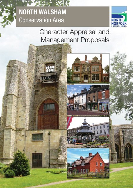
NORTH WALSHAMConservation AreaCharacter Appraisal andManagement Proposals
<strong>North</strong> <strong>Norfolk</strong> <strong>District</strong> <strong>Council</strong>Conservation & Design TeamTelephone: 01263 516165E-Mail: conservationanddesign@north-norfolk.gov.ukWrite to: Conservation & Design Manager,<strong>North</strong> <strong>Norfolk</strong> <strong>District</strong> <strong>Council</strong>,Holt Road, Cromer, NR27 9ENwww.northnorfolk.orgAll documents can be made available inBraille, audio, large print or in other languages.Please contact 01263 516165 to discuss your requirements.
<strong>North</strong> Walsham Conservation Area Character Appraisal and Management PlanPART 1 CHARACTER APPRAISAL1: Summary1.1 Key characteristics1.2 Key issues2: Introduction2.1 The <strong>North</strong> Walsham Conservation Area2.2 The purpose of a conservation area appraisal2.3 The planning policy context3: Location and setting3.1 Location and context3.2 General character and plan form3.3 Landscape setting4: Historic development and archaeology4.1 The origins and historic development of the area4.2 The archaeological significance and potential of the area4.3 The conservation area and the relationship with its setting5: Spatial analysis5.1 Character and interrelationship of spaces within the area5.2 Key views and vistas6: Character analysis6.1 Activity, prevailing or former uses within the area6.2 Character areas, the qualities of the buildings and their contribution tothe area6.2.1 Character Area 1: Historic core6.2.2 Character Area 2: Institutional6.2.3 Character Area 3: Loose knit, residential6.2.4 Character Area 4: Modern developments6.2.5 Character Area 5: Important Public Spaces6.3 Key unlisted buildings6.4 Public Realm6.5 Local details, styles and building materials444555677789910111414161717181937414245474952<strong>North</strong> <strong>Norfolk</strong> <strong>District</strong> <strong>Council</strong>
<strong>North</strong> Walsham Conservation Area Character Appraisal and Management Plan6.6 The contribution made by greenery and green spaces and ecology andbiodiversity value 626.7 Erosion of character6.8 General condition6.9 Problems, pressures and the capacity for change7: Community Involvement8: Recommendations/Conclusion8.1 Suggested boundary changes8.2 Summary of issues - SWOT analysisPART 2 MANAGEMENT PROPOSALS626363656666671: Introduction2: Issues and recommendations2.1 Review of Conservation Area boundary2.2 Alterations to unlisted buildings and Article 4(2) direction2.3 Buildings of Local Interest2.4 Development pressures and negative areas2.5 Buildings at Risk2.6 Tree management2.7 Public realm and green spaces3: Monitoring and review4: HELM as resource6970707071727273737475APPENDICESAppendix 1: <strong>North</strong> Walsham Conservation Area Map'sMap 1: Listed Buildings/Townscape FeaturesMap 2: Character AreasAppendix 2: SustainabilityAppendix 3: References and SourcesAppendix 4: Contact Details777779818283<strong>North</strong> <strong>Norfolk</strong> <strong>District</strong> <strong>Council</strong>
<strong>North</strong> Walsham Conservation Area Character Appraisal and Management PlanPART 1 CHARACTER APPRAISALART 1 CHARACTER APPRAISAL<strong>North</strong> <strong>Norfolk</strong> <strong>District</strong> <strong>Council</strong>3
<strong>North</strong> Walsham Conservation Area Character Appraisal and Management Plan1: Summary1.1 Key characteristicsThis Character Appraisal of <strong>North</strong> Walsham concludes that the following are the keycharacteristics of the Conservation Area:Growth has in the past been centred around the open spaces of Market Place andMarket StreetThe Market Place exudes the best characteristics of the relationship between spaceand built form with a good sense of enclosure.The main roads radiate away from these open areas.The majority of the housing in the centre is of a common scale and period, from thelate 18th to early 19th century. It fronts directly onto the street. These buildings have arange of classically influenced facades. A high percentage of houses in the market areahave ground floor shops.The church and churchyard are located to the north side of the Market Place.Paston College occupies a significant area to the south of Market Place.Visually intrusive modern developments have intruded into the historic core: a shoppingarcade, St Nicholas Court, a car park on the south side and a large retail outlet.Housing outside the centre is less concentrated, with more trees lining the sides of theroads.Some poor townscape surrounds the conservation area to the north and east sides.There are no through roads within the conservation area, although the Market Place isused as a short cut through the town (despite the introduction of a no parking zone in2000) consequently causing congestion at certain times.There are some good examples of terraced housing of the 19th century.1.2 Key issuesBased on the characteristics outlined in this report, the following issues have been identified.These form the basis for the management proposals in the second part of this document.Large retail developments encroaching into the historic core and detracting from itscharacter.Incongruous modern shopfronts, signage, and colouring of facades.Permitted development resulting in loss of architectural details and boundary treatments,detrimental alterations & extensions: need to protect identified areas through Article4(2) directions.Need for design of new housing to relate to historic context and prevailing character.Need to ensure consistent quality of street furniture and road surfaces.Condition and maintenance of public spaces.Need to review the Conservation Area boundary.The need to re-consider pedestrianisation of the Market Place.4<strong>North</strong> <strong>Norfolk</strong> <strong>District</strong> <strong>Council</strong>
<strong>North</strong> Walsham Conservation Area Character Appraisal and Management Plan2: Introduction2.1 The <strong>North</strong> Walsham Conservation AreaThe <strong>North</strong> Walsham Conservation Area was designated in May 1972. It <strong>cover</strong>s the historiccore of the town, centred around the Market Place and Market Street, and includes themajority of the town’s listed buildings. The Conservation Area also incorporates an area ofhousing to the south of the Market Place, bounded by King’s Arms Street, Grammar SchoolRoad and Yarmouth Road. To the north of the Market Place, a small area of housing, amodern shopping arcade and the churchyard are included, with Church Street, VicarageStreet and part of the Mundesley Road serving as its boundaries. The town centre hasdomestic architecture from the late 18th to early 19th centuries, which gives it a strong historiccharacter.Figure 1 : <strong>North</strong> Walsham Street planThe first appraisal of the conservation area was adopted in November 1998. The authorrecommended a number of improvements to the town, some of which were carried out aspart of a Heritage Economic Regeneration Scheme. This scheme also gave grants to helprestore a number of the town’s historic buildings.2.2 The purpose of a conservation area appraisalConservation Areas are designated under the provision of Section 69 of the Planning (ListedBuildings and Conservation Areas) Act 1990. A Conservation Area is defined as ‘an areaof special architectural or historic interest the character or appearance of which it is desirableto preserve or enhance’.<strong>North</strong> <strong>Norfolk</strong> <strong>District</strong> <strong>Council</strong>5
<strong>North</strong> Walsham Conservation Area Character Appraisal and Management PlanSection 71 of the same Act requires local planning authorities to formulate and publishproposals for the preservation and enhancement of these Conservation Areas. Section 72also specifies that, in making a decision on an application for development within aConservation Area, special attention must be paid to the desirability of preserving orenhancing the character or appearance of that area.In response to these statutory requirements, this appraisal document defines and recordsthe special architectural and historic interest of the Conservation Area and identifiesopportunities for enhancement. The appraisal conforms to English Heritage guidance asset out in Guidance on Conservation Area Appraisals (February 2006) and Guidance on themanagement of Conservation Areas (February 2006). Additional government guidanceregarding the management of historic buildings and Conservation Areas is set out withinPlanning Policy Guidance Note 15: Planning and the Historic Environment (PPG15).Government advice on archaeology is set out in Planning Policy Guidance Note 16:Archaeology (PPG16). A revision of both PPGs 15 and 16 is expected in 2010.This document therefore seeks to:Define the special interest of the Conservation Area and identify the issues whichthreaten the special qualities of the conservation area (Part 1: Character Appraisal)[1]Provide guidelines to prevent erosion of character and achieve enhancement (Part 2:Management Proposals).[1] No character appraisal can ever be completely comprehensive and omission of anyparticular building, feature or space should not be taken to imply that it is of no interest.2.3 The planning policy contextThis appraisal provides a firm basis on which applications for development within the <strong>North</strong>Walsham Conservation Area can be assessed. It should be read in conjunction with thewider development plan policy framework produced by <strong>North</strong> <strong>Norfolk</strong> <strong>District</strong> <strong>Council</strong>. Thatframework is set out in a number of documents:<strong>North</strong> <strong>Norfolk</strong> Local Development Framework: Core Strategy (adopted 2008)<strong>North</strong> <strong>Norfolk</strong> Local Development Framework: Site Specific Proposals (timetabled foradoption December 2010)<strong>North</strong> <strong>Norfolk</strong> Design Guide, Supplementary Planning Document (adopted 2008)<strong>North</strong> <strong>Norfolk</strong> Landscape Character Assessment, Supplementary Planning Document(adopted 2009)Planning Policy Guidance 15: Planning and the Historic EnvironmentPlanning Policy Guidance 16: Archaeology and PlanningHeritage White Paper, March 2007. ‘Heritage Protection for the 21st CenturyPlanning Policy Statement 15: Planning for the Historic Environment6<strong>North</strong> <strong>Norfolk</strong> <strong>District</strong> <strong>Council</strong>
<strong>North</strong> Walsham Conservation Area Character Appraisal and Management Plan3: Location and setting3.1 Location and context<strong>North</strong> Walsham is the largest town within <strong>North</strong> <strong>Norfolk</strong>, with a population of around 11,000.It is located 10km inland from the coast and 26km north of Norwich. Most of the town islocated immediately to the west of the B1145, B1150 and A149 main roads which link it tothe coast and to the cities of Norwich and Yarmouth. <strong>North</strong> Walsham is on the “Bittern Line”railway running between Sheringham and Norwich.The town has health, education and leisure facilities which also serve the surrounding area.There is a large industrial estate on the north-west side of the town, and <strong>North</strong> Walsham isa major provider of employment. About half the town’s workforce is employed locally.3.2 General character and plan formThe oldest part of <strong>North</strong> Walsham is centred around the Market Place and Market Street.Development here was initially linear, following and extending away from the Market Place,which runs from east to west. This area is the focus for the town’s main roads, three of whichconverge at each end of Market Place/Market Street. The layout of the roads and housingalso acknowledges the location of the church and churchyard, sited on the north side ofMarket Place.Most of the houses in the centre are from the 18th and early 19th centuries. Modestly sized,often with classically inspired facades and arranged in terraces, they front directly onto thestreet. This is the architecture of a moderately prosperous market town; there are no majorhouses erected as showpieces to an individual merchant’s success.The Market Place is the core of the town. It has a good sense of enclosure provided by acohesive relationship between built form and space.Figure 2 : The Market Cross surrounded by produce onmarket day.In plan the Market Place resembles two elongated triangles, the apex of one connecting withthe base of the other. At the east end is a narrow “pinch point”, after which the thoroughfareopens out until about half way along, where a row of buildings on the south side projectsout, narrowing the road. After this, Market Place widens again, to end where it joins King’sArms Street. At the west end of Market Place a large timber market cross serves as a central<strong>North</strong> <strong>Norfolk</strong> <strong>District</strong> <strong>Council</strong>7
<strong>North</strong> Walsham Conservation Area Character Appraisal and Management Planpoint for the weekly market, and as a meeting point for the local community. Market Streetis a short wide road which appears very much as a continuation of the Market Place, with asimilar architectural character. The ground slopes up to the east, so that Market Street risesto meet Market Place which is in turn inclined so that the east end is higher than the west.These subtle slopes add visual interest to the townscape.The church is screened from Market Street by a narrow row of houses, although its partlyruined tower is highly visible in the town. The church porch can also be glimpsed down apassageway opposite the Market Cross. The churchyard is a shallow rectangular grassmound, almost featureless apart from a few street lights, as all the gravestones have beenremoved to the south side. It serves as a small informal park although lacks facilities,particularly seating.On the north east side of the churchyard is St Nicholas Court, a mid 20th century shoppingarcade centred around a paved courtyard. The architecture is undistinguished and a poorinterruption to the historic core. Little of the Court is visible from the central streets; it isconnected to them by narrow lanes leading from the Market Place and Market Street.The roads leading off from the Market Place and Market Street contain a higher proportionof late Victorian buildings than the centre. As the roads pass outside the Conservation Area,the townscape is generally of lower visual quality.To the south of the Market Place, older buildings have been cleared away to create a carpark and space for a large store, Roys of Wroxham. There are historic buildings nearby,such as at the entrance to the Market Place, but their positive character is diluted by themodern encroachments. There is a similar situation at the rear of the Mitre Tavern Yard,where early buildings mix with the back of the modern shopping arcade and a scruffy areaused as a car park.The Paston Sixth Form College occupies a considerable part of the Conservation Area tothe south of the Market Place. While it contains a good deal of open space and some finebuildings, these have relatively little impact on the streetscape. Apart from a tree bedeckedentrance on Grammar School Road, and an inter-war block fronting King’s Arms Street,much is hidden from public view.Leaving aside the St Nicholas Court shopping arcade and car parking areas to the south,the historic character of the Market Place and the smaller side roads within the ConservationArea is largely intact. There are no other large scale developments from the Victorian orlater periods. Late 19th and 20th century additions to the town have followed a roughlyconcentric rather than linear plan, radiating away from the historic core. Larger facilities,which might have been expected within the Conservation Area, such as the Post Office,Town Hall and Library, are all located on the periphery.3.3 Landscape setting<strong>North</strong> Walsham is surrounded by relatively flat arable land, with a mixture of rich loam andsandy soils. The landscape has a generally homogenous character, comprising fields withhedgerows and isolated trees, and the occasional house or farm building. On the north eastside a gentle slope leads down to the river Ant. To the east is the former <strong>North</strong> Walshamand Dilham canal, although only part of the watercourse now survives. There are also smallareas of woodland to the east. No commons survive; three commons belonging to the townare known to have been enclosed c.1830 and were subsequently built upon.8<strong>North</strong> <strong>Norfolk</strong> <strong>District</strong> <strong>Council</strong>
<strong>North</strong> Walsham Conservation Area Character Appraisal and Management Plan4: Historic development and archaeology4.1 The origins and historic development of the areaThe church and village of <strong>North</strong> Walsham are mentioned in a royal charter of 1047. In 1080the village was included in the Domesday survey as Walesam. By 1381, during the EastAnglian peasant uprising, the settlement is referred to as “Walsham Market”.During the Mediaeval period cloth manufacture brought wealth to <strong>Norfolk</strong>, and <strong>North</strong> Walshamgrew in importance due to its weavers, who produced “Walsham cloth”. The scale of thetown’s church, started in the 14th century, is an indicator of the prosperity of the town. The14th century also saw Henry III grant a market where cloth and other produce could be sold.The town has associations with the Peasant’s Revolt of 1381, particularly the final battlebetween the peasants and forces led by the Bishop of Norwich. This took place close to thetown, and it is said fleeing peasants were slaughtered as they tried to shelter in the townand the unfinished church.On 25th June 1600, a fire destroyed much of the <strong>North</strong> Walsham. 118 houses, 70 shopsand other structures were lost, but the church survived largely intact. Around the marketplace, the town was rebuilt on its Mediaeval footprint, which is preserved today in the patternof the older streets and buildings.There were some positive aspects to the fire. It created the space to build a free grammarschool, founded by Sir William Paston, and the market cross destroyed by the fire wasreplaced by a new and particularly fine design in 1602.Figure 3 : Part of the enclosure map for <strong>North</strong> Walsham, showing the townat the end of the Regency period, 1814.<strong>North</strong> <strong>Norfolk</strong> <strong>District</strong> <strong>Council</strong>9
<strong>North</strong> Walsham Conservation Area Character Appraisal and Management Plan<strong>Norfolk</strong>’s cloth manufacturing industry declined with the coming of the Industrial Revolution.In <strong>North</strong> Walsham, agriculture replaced weaving as the main source of income. The townbecame a centre for the local corn trade and the manufacture of agricultural implements.Trade directories show how the industrial base of the town developed from this. In the mid19th century, the town had small industries including gun-makers, ironmongers and braziers.By the 1880s, the East <strong>Norfolk</strong> Iron Works had been established, with the Walsham andDilham Canal supplying raw materials. Ironmongers F.H. Randell also worked as iron &brass founders, machinists and agricultural machine makers. The building firm of Cornishand Gaymer also enjoyed considerable success in the Victorian period; by the 1880s, it wasemploying 200 men.The railways arrived in 1874. The numerous late 19th century buildings along the town’sside streets show the town’s growth around this time. Railways offered a convenient andpractical way of transporting the bulkier products of <strong>North</strong> Walsham’s industries, makingthem available to a wider market. The ornate late Victorian and Edwardian villas alongYarmouth Road attest to the prosperity of the town at this time.During the 20th century, as the importance of agriculture to the town declined, <strong>North</strong>Walsham’s manufacturing industries provided the main source of income. The town hassubsequently become a major employer in the region, and seen rapid growth, particularlyin the second half of the 20th century.There has been some change to the town centre during the 20th century. Old houses weredemolished to make way for a shopping arcade near to the church, and car parks establishedon the north and south sides of the centre.Paston College has also grown in size and importance. Once a grammar school serving thesurrounding area, it is now a sixth form college. The school has expanded to include the siteof a former iron works to the east.In recent years, <strong>North</strong> Walsham has attracted large retailers as well as new industry. Storessuch as Lidls, Sainsbury’s and Roy’s of Wroxham have established themselves just outsidethe centre. Despite their presence, the town centre appears healthy, with a variety of smallindependent retailers.4.2 The archaeological significance and potential of the areaFinds from the Palaeolithic, Mesolithic and Neolithic periods excavated during 2004-5 providethe earliest evidence for human occupation in the <strong>North</strong> Walsham area. Neolithic or Iron Agepits were also found and some artifacts from the Bronze Age. Aerial photographs haverevealed ring ditches which may be the remains of burial mounds from this period. The pitsmentioned above contained fragments of Iron Age pottery.While there is no evidence of Roman remains at present, Roman pottery, coins and jewelleryhave been found.The town’s church is a reminder that by the Medieval period <strong>North</strong> Walsham was a prosperoussettlement and some medieval artefacts have been re<strong>cover</strong>ed. Apart from the church, thereis little evidence of medieval buildings as a fire of 1600 destroyed most of the town. Somestones from Medieval houses were incorporated into later buildings as can be seen at BexleyCottages on Station Road.More recent archaeology includes the remains of the <strong>North</strong> Walsham & Dilham Canal to theeast of the town, completed in 1826. It was never a great success and fell out of use due toimproved local roads and the coming of the railways.10<strong>North</strong> <strong>Norfolk</strong> <strong>District</strong> <strong>Council</strong>
<strong>North</strong> Walsham Conservation Area Character Appraisal and Management PlanOld maps show that there were once three windmills in the parish, brickworks and a limekilnalong with a gibbet, bone mill and workhouse.A large park which once belonged to a substantial country house, The Oaks, is now thetown’s Memorial Park. Here there were once pleasure gardens, orchards, a hot house andan orangery. The Oaks was sited on the east side of the town; it was demolished in the1930s.Two world wars have added to the region’s archaeology. There are pill boxes from bothwars; the four which survive from the First World War are considered to be rare examples.Some of the best finds have turned up by accident, such as the Neolithic or Iron Age pitsdis<strong>cover</strong>ed during pipe laying works. With such a long history, any excavation work takingplace within the <strong>North</strong> Walsham historic core may produce evidence of an earlier settlement,and alterations to older buildings may produce evidence of the town’s historic development.4.3 The conservation area and the relationship with its settingThe expansion of <strong>North</strong> Walsham, particularly during the 20th century, means that theConservation Area is surrounded on all sides by commercial and residential development.There is no immediate connection with the surrounding countryside, and the most attractiveviews out of the Conservation Area are along the tree-lined approach roads, such as AylshamRoad.Leaving the Conservation Area on the north and east sides, there is an abrupt change ofcharacter. Along the Yarmouth Road, large buildings in an exposed setting dominate theview, including new stores separated by car parking and service areas. The Post office andTelecom buildings on the corner with New Road are particularly un-inspiring examples of20th century architecture; the squat shape and grey-brown colouring of the Telecom buildingis only slightly relieved by a screen of trees. As the first building one sees on leaving theConservation Area on the east side, the Post Office is an unfortunate focal point. Worse stillare the store opposite and car park behind it, which detract from the character of the otherwisemodestly-sized and compact streetscape of the conservation area on the west side ofYarmouth Road.Figure 4 : Vicarage Street looking to the west, with Vicarage St car park and recent housing developmentsat right.Immediately to the north of the Conservation Area is the Vicarage St car park, surroundedby indifferently designed modern housing and unkempt 19th century houses, with little tocreate a positive or even a definite character. There are a few attractive houses along theadjoining Bacton Road.<strong>North</strong> <strong>Norfolk</strong> <strong>District</strong> <strong>Council</strong>11
<strong>North</strong> Walsham Conservation Area Character Appraisal and Management PlanThe surroundings of the Conservation Area on the south and west sides generally providea more sympathetic and near-rural backdrop. After the busy A149 road, the Victorian housesset amongst trees and well kept gardens on the south side of the Norwich Road create abrief, but inviting entranceway to the town. Similarly, at the south end of the Aylsham Road,the few houses left outside the Conservation Area are good examples of inter-war Arts &Crafts housing, with thatched roofs. In the background, a road bridge and railway bridgesurrounded by trees provide a reasonable view, save for an accumulation of road signsnearby.Figure 5 : The south end of the Aylsham Road, with some attractive inter-war Vernacular Revival houses.On the west side, there is little to distinguish the houses inside the Conservation Area fromthose immediately outside it. Some good mid to late Victorian houses are set just outsidethe Conservation Area along the Cromer Road, together with a large chapel. Thepredominantly 19th century architecture then merges with suburban-style inter-war housesand greenery set further out of the town.Figure 6 : A good approach to the town along theCromer Road.12<strong>North</strong> <strong>Norfolk</strong> <strong>District</strong> <strong>Council</strong>
<strong>North</strong> Walsham Conservation Area Character Appraisal and Management PlanUnfortunately, the Mundesley Road fails to maintain the standard. Even within theConservation Area, there is an untidy mix of run down Victorian properties, inappropriateshopfronts and plain modern housing. Leaving the Conservation Area, small groups ofattractive Victorian houses rub shoulders with a car park, unremarkable modern houses anda bleak-looking housing estate.<strong>North</strong> <strong>Norfolk</strong> <strong>District</strong> <strong>Council</strong>13
<strong>North</strong> Walsham Conservation Area Character Appraisal and Management Plan5: Spatial analysis5.1 Character and interrelationship of spaces within the areaThe most important space within the Conservation Area is Market Place. This is a wide streetrunning east-west, incorporating part of King’s Arms Street at the west end. Market Placeis enclosed on three sides by buildings. Most are terraced and of a similar scale and period.These create a strong sense of enclosure and historic identity. The space is clearly defined,due to a restricted entranceway or “pinch point” at the east end, and the terraced houses ofKing’s Arms Street which face Market Place at the west end. The main focal point is aremarkable wooden market cross, which due to carefully placed seating and partialpedestrianisation, serves as an informal meeting point. Every Thursday, the whole of MarketPlace becomes a hub of commercial and social activity when the weekly market takes place,and traffic is diverted away from the centre.Market Street is also a wide thoroughfare, with a very similar character to Market Place, towhich it is connected at its west end. Like Market Place, it is bordered on three sides byGeorgian/Regency buildings, although Market Street is more open at the west end, wherea number of roads meet.Historically, there were a number of courtyards leading off from Market Place and MarketStreet, where weaver’s cottages were located. This pattern continues today; a number ofnarrow lanes lead from Market Place and Market Street to small open areas. Some of theseare historic, others have recent shopping developments.On the south side of Market Place are Bank Loke and Black Swan Loke. These appear assmall courtyards, but are actually the beginnings of lanes leading to Grammar School Road.Both Lokes are bordered by the rear extensions of shops and occasional outbuildings. BlackSwan Loke serves as an informal seating area for the patrons of the Black Swan pub, butthe function of Bank Loke is less definite. A new shop built on the south side suggests thatit might be developed as a retailing area, although the shop is currently unoccupied.St Nicholas Court is connected by narrow lanes to Market Place and Market Street. It isscreened from the main streets by housing, and is not sited on any convenient thoroughfareleading to the centre. It is consequently isolated from much of the daily life of the town. Thesmall scale of the Court, together with this isolation, creates a sense of privacy. When thesefactors are coupled with the neglected appearance of the Court, the area attracts antisocialbehaviour. There is a sense of general neglect and oversight in this area.14<strong>North</strong> <strong>Norfolk</strong> <strong>District</strong> <strong>Council</strong>
<strong>North</strong> Walsham Conservation Area Character Appraisal and Management PlanPicture 1 Fig 6: The churchyard is screened by thebacks of Market Place houses.St Nicholas church and churchyard adjoin the east side of the Court. The churchyard is wellmaintained, <strong>cover</strong>ed by grass and occasional flower beds. It is screened by trees or thebacks of houses on all sides. The church is set on slightly raised ground at the centre, servingas a picturesque focal point. The gravestones have been moved to one side of the churchyardto create a more open green space. There is, however, no formal seating, and onlyrudimentary street lights- so that the area seems denuded, rather than uncluttered. Despitethe lack of facilities, during the warmer weather the churchyard serves as a simple parkwhere people sit on the grass and socialise.Paston College includes a number of courtyards, both surrounding the main Nelson building,and as part of The Lawns to the west. The main entrance from Grammar School Roadincludes a lawn and shrubs, flanked on three sides by schoolrooms. Here the open areaserves as a setting for the school buildings. It is designed to impress the visitor, rather thanhave any recreational use. Between the Nelson building and King’s Arms Loke is a walledcourtyard. This is entirely <strong>cover</strong>ed in tarmac. It resembles a traditional school playground,an impression reinforced by a typical “board school” building on the west side. The area nowserves mainly as a staff car park.The open areas of The Lawns are mainly outside the Conservation Area. Here, the purposeis mainly recreational, and they reflect changing fashions as tennis courts are adapted forbasketball. To the south of the Scarburgh Building is a formal lawn, designed to provide apleasant setting for the surrounding buildings. There is a small walled and tarmac-<strong>cover</strong>edcourtyard to the north, leading out to Market Street. This does not appear to have any specificrole.The open spaces within Paston College are generally enclosed by buildings, and are onlyglimpsed from the main road. They help create a pleasant environment for the College, buthave little impact on the larger townscape.The town centre has large car parks on the north and south sides, which lack any form oflandscaping or acceptable street furniture. To the north, the Vicarage Street car park fallsoutside the Conservation Area, but its bleak appearance still detracts from the adjacentstreets of the Conservation Area. Its negative effect is compounded by some unsightly carparking areas at the rear of St Nicholas Court.<strong>North</strong> <strong>Norfolk</strong> <strong>District</strong> <strong>Council</strong>15
<strong>North</strong> Walsham Conservation Area Character Appraisal and Management PlanBank Loke is the nearest car park to the centre; its main asset is that it is largely screenedfrom the surrounding roads by buildings. The car park is an irregular shape, partly due to anumber of outbuildings scattered across the open tarmac. At the south end, shops are beingconstructed at the end of Bank Loke, so that it is no longer clear whether this part is intendedto continue as a car park or is to be developed as a retail area.5.2 Key views and vistasAs the Conservation Area is surrounded on all sides by later urban development, there is alimited range of views out of the area. These have been <strong>cover</strong>ed in section 4.3. The mostimportant views within the Conservation Area are the approaches to the market area fromthe east and west sides, at the beginning of Market Place and Market Street.16<strong>North</strong> <strong>Norfolk</strong> <strong>District</strong> <strong>Council</strong>
<strong>North</strong> Walsham Conservation Area Character Appraisal and Management Plan6: Character analysis6.1 Activity, prevailing or former uses within the area<strong>North</strong> Walsham first grew prosperous thanks to the <strong>Norfolk</strong> textile industry. Few traces ofthis industry remain today. Weavers’ cottages set around courtyards were once located tothe west of the church and south of Market Place. Most of the courtyards have been sweptaway, although their names survive in later developments, such as Old Bear Yard. A numberof old weaver’s cottages which remain today form part of The Terrace. There is the outlineof a large window at the rear of Mitre Tavern Yard which has been identified as a “weaver’swindow” and another on the Feathers Inn, but it is not known if there is any factual basis forthis. The large church and Market Cross can be viewed as a legacy of the textile industry;their size and high quality are at least in part due to the wealth that weaving brought to thetown.The next phase of <strong>North</strong> Walsham’s history was as a centre for the corn trade which led inturn to the development of small-scale industries (mentioned earlier). Much of the evidencefor this part of the town’s past has also disappeared. A corn hall of 1848 in Bank Loke hasbeen converted to a warehouse, while the site of the “East <strong>Norfolk</strong> Ironworks” foundry inKing’s Arms St is now part of the Paston College. Randell’s workshops on Bacton Road,where agricultural machinery was made, has been replaced by a supermarket store.The present centre of <strong>North</strong> Walsham reflects the activities and interests of a provincialmarket town. The most important open space in the centre is reserved for the market, whichserves the surrounding villages as well as the people of <strong>North</strong> Walsham. The architecturereflects a history of commercial activity over several hundred years. The shops on the northside of Market Place preserve the footprint of old market stalls once sited here. The town’slarger private houses are centred around and face Market Street and Market Place, wherethe town’s early shops would have been situated.Figure 7 : Historic buildings along theTerrace.<strong>North</strong> <strong>Norfolk</strong> <strong>District</strong> <strong>Council</strong>17
<strong>North</strong> Walsham Conservation Area Character Appraisal and Management PlanMany of the larger houses facing the market were probably erected by local merchants.Their quality of design and materials can be seen as an expression of the owner’s successin business. In particular, the classical fronts from the 18th and early 19th centuries- thearchitectural style of Norwich and London, are a mark of the owner’s sophistication and hisdesire to be seen as part of the larger commercial world. Most have shops on the groundfloor, perhaps in some cases a later introduction. From the later 19th century, commercialbuildings tended to be purpose-designed, with the shop front as an integral part of the façade,such as at 8, 10 & 12 King’s Arms Street. Banks grew in size and importance during thenineteenth century, and their architecture could be designed to impress, such as the HSBCBank at the west end of Market Place. Like the surrounding earlier buildings, this has aclassical façade – but here it is designed to provide a feeling of tradition and stability, andinspire confidence in its investors.Around the market place are a number of inns. They would have gained considerable tradefrom visitors to the market. The King’s Arms was once an important coaching inn, a placewhere those travelling along the turnpike road to Norwich could rest or change horses. Oneof the oldest inns, the Cross Keys is now a Woolworth’s store, while the Angel on the cornerof the Aylsham Road has been replaced by a housing development.Visitors to the market might also have attended Fisher’s Theatre on Vicarage St. Built in1828 it has had a number of uses, including a school; it is now a kitchen showroom.Religious worship has also left its mark on the town. In addition to the church and a formervicarage on Vicarage St, the conservation area includes two chapels, reflecting a strongtradition of non-conformism in <strong>Norfolk</strong>.In addition to its role as a market town, <strong>North</strong> Walsham is also a historic centre for education,thanks to the Paston College, founded in 1686. The scale of the College buildings, the earliestof which is a master’s house dating from 1765, shows the economic as well as social prestigeof this institution. While much of land in the centre has been intensively developed, theCollege has kept its spacious grounds.6.2 Character areas, the qualities of the buildings and their contribution to the areaThe Character Areas have been identified according to their present appearance, ratherthan their historical development. Nevertheless, Areas (1) and (2) are roughly equivalent tothe 18th-early 19th century housing in the centre, (3) is primarily later Victorian additions,and (4) represents modern developments.While these divisions are clear, and are shown on the accompanying maps, they do meanthat certain streets, such as Yarmouth Road, fall into two or even three character areas.Rather than dividing the descriptions of some streets into two or three parts, each one hasbeen fully described and placed within its main character area, e.g. the area which <strong>cover</strong>sthe major part of the street.Character Area 1 - Historic Core.Around the Market Square, compact town houses form almost continuous frontages alongthe street. A similar arrangement can be found along Market Street, Church Street, thebeginnings of Yarmouth Road, Mundesley Road and much of King’s Arms Street and AylshamRoad. Where there is late Victorian or modern housing, this has a similar close set characterto the earlier housing within Market Place/Market Street.Character Area 2 - Institutional.The churchyard, Paston Sixth Form College and the Roman Catholic church consist of largebuildings set within spacious grounds. They are also screened and set back from the street.18<strong>North</strong> <strong>Norfolk</strong> <strong>District</strong> <strong>Council</strong>
<strong>North</strong> Walsham Conservation Area Character Appraisal and Management PlanCharacter Area 3 - Loose Knit Residential.Further out of the centre, houses and small groups of houses are set farther apart, sometimeswith large gardens and trees. This is primarily Victorian housing, forming a buffer zonebetween the historic centre and more recent development beyond.Character Area 4 - Modern Development.This includes larger areas of non-traditional building, such as Roys of Wroxham and StNicholas Court, and a large car park to the south of Market place.6.2.1 Character Area 1: Historic coreNew RoadThe north side of New Road, between the junction with Church Street and the Town <strong>Council</strong>offices is included in the Conservation Area. The corner building with Church St is threestoreys high in a discoloured white brick. The corner wall is curved, extending for the widthof one bay along New Road. This creates a building of considerable visual interest. This isthe most attractive part of New Road. Beyond this, most of the houses are unremarkablemodern designs, while on the opposite side is a succession of modern public buildings,which have little visual or architectural appeal.Market PlaceFigure 8 : Market Place. Looking east, on market day.Market Place is the historic centre of the <strong>North</strong> Walsham. It is both a main road through thetown and a public space where the weekly market is held. There is a narrow entrance roadto Market Place from the east, which effectively hides New Road and Yarmouth Road fromview. As the road enters Market Place, it is joined by Church Street, where the trees alongthe churchyard wall enhance the view. To the west, the Market Place opens out until abouthalf way along, where a row of buildings on the south side project out. Market Place thenwidens again, passing either side of the mediaeval Market Cross. At its west end, MarketPlace terminates where it meets King’s Arms Street.The north and south sides of the Market Place are lined with terraced houses; all front directlyonto the street. Most have a classical, or later Georgian character, and are of a similar scale,with shops in the ground floor.<strong>North</strong> <strong>Norfolk</strong> <strong>District</strong> <strong>Council</strong>19
<strong>North</strong> Walsham Conservation Area Character Appraisal and Management PlanMarket Place slopes up from west to east, so that the Market Cross is situated at the lowerend. But clearly, from its scale, position and remarkable design it is the main focal point inthe street. Another focal point, the ruined church tower, can be seen over the house roofsto the north.Figure 9 : Poor shop fronts in MarketPlace.The houses which line one side of King’s Arms Street effectively form the west side of MarketPlace. Due to this screen of houses and the narrow entranceway at the east end, MarketPlace is a well defined, visually contained space.A number of small passageways lead off on the north, west and south sides to small, partlyenclosed spaces. Those on the south side connect with Bank Loke, Black Swan Loke, thecar park which adjoins them, and the houses of The Terrace. In the centre on the west sidea passage leads to Market Street Mews, a modern shopping development.On the north side there is a lane leading to the church, which provides a particularly fineview of the colourful porch.The Market Place has been subject to a number of improvements in recent years as part ofa HERS scheme. One of the most noticeable improvements has been to the area round theMarket Cross, which has been pedestrianised, set with good quality clay pavers.Behind the projecting row of buildings on the south side, King’s Arms Loke runs betweenThe Terrace and the front of the King’s Arms pub.Most of the houses in Market Place are of red or white brick, or have rendered upper floors.They generally relate well to one another, but there are a few exceptions, such as the threeshops at the north-east end. These have a coarse roughcast render which greatly devaluestheir historic appearance. There is less harmony at street level. It is not clear how many ofthese houses had some form of shop front from the outset; the majority of shop fronts areVictorian or later.20<strong>North</strong> <strong>Norfolk</strong> <strong>District</strong> <strong>Council</strong>
<strong>North</strong> Walsham Conservation Area Character Appraisal and Management PlanIn general, the earlier shop fronts which occupy only a part of the whole frontage marry betterwith the upper floors. More modern shop fronts demonstrate a tendency to try and fill thewhole of the ground floor, such as the bright blue front of a building society. The result is adisjointed facade, where there is no pleasing relationship between the ground and upperfloors.Some shops imitate the design of late Victorian shop fronts, but the proportions of detailssuch as consoles and pilasters tend to be crude. Other shops make little concession totraditional design, such as the severe rectilinear framing of the windows and doors at “KeysEstate Agents”. A few have what might be described as purely functional fronts, eg. TheJolly Swagman. These appear particularly out of character with the area, surmounted bylarge and brightly coloured fascia boards.Market Place (south side)On the south side, starting at the east end, the first houses are two storeys with simple shopfronts. The projecting rectangular bays of the blue-painted charity shop at No. 2 have aparticularly appealing vernacular character. The adjacent three storey house has a vegetableshop with an equally pleasing, although battered front. During the day, there is a picturesquedisplay of produce occupying most of an adjoining alley. After this, the largely Victorianfaçade of the former Woolworths provides a strong contrast. This former 17th century innretains its tall brick chimneys, but little else. Refronted and with a new shop front, the largeground floor windows lack glazing bars, and are large gaping spaces in the façade. The newrecessed entrance at the west end is hidden in the shadows. Next to this is a late Victorianred brick and stone façade. This has an excellent late Victorian or Edwardian shop front,with fine carved woodwork over the door.Figure 10 : Waterloo House, Market Place.There follows a row of five shops. While the upper floors of red and white brick are attractive,the shops have indifferent or poor facades and large and highly coloured fascia boards.Coral bookmakers once had a fine ground floor to match its first floor display window, butthe new ground floor windows are heavy and crudely detailed. Only the stone front of BarclaysBank in the centre of the street raises the standard, relating well to the stone windowsurrounds on the floors above. Even here the large ground floor windows lack detail,appearing stark and intrusive. Boots pharmacy next door is of more interest, with the gildedsign “R.M. Ling” in the light above the door. Regrettably, the next shop once again has anuninspired and recent front. A large first floor window above the shop front has lost all itsglazing bars, further reducing its attractiveness.<strong>North</strong> <strong>Norfolk</strong> <strong>District</strong> <strong>Council</strong>21
<strong>North</strong> Walsham Conservation Area Character Appraisal and Management PlanFigure 11 : Market Place, southeast end. Good shopfronts.After this, houses project out into the street. Waterloo House, a large and robust red brickbuilding of 1790 occupies the corner site, with a good traditional style shop front. It has anattractive entrance on the corner, with some decorative cast iron spandrels. Next is a smallercream coloured building with an excellent shop front. This is followed by the substantialLloyds Bank, with upper floors in white brick. Sadly, the brick at ground floor level is a darkand inappropriate colour, and the doors and windows of indifferent modern design. The bankis followed by a rendered building with blue painted stuccowork quoins. The shop front,possibly from the inter-war period, has some wide steps, stone cladding on the stall risersand a modern door that are detrimental to its character. Ending this side of the street is theHSBC Bank, with a grand “palazzo” style façade. The bank front is partly original at the eastend, but a new and very plain façade in polished stone occupies most of the ground floor;a regrettable addition.Figure 12 : The Kings Arms, with poorlydesigned railings and phone box in front.Partly obscured by the bank is the King’s Arms Hotel, which is set back on the corner withKing’s Arms St. The hotel has a fine rendered front with an attractive fascia board. This isunfortunately supplemented by an accumulation of blackboards and a banner advertising22<strong>North</strong> <strong>Norfolk</strong> <strong>District</strong> <strong>Council</strong>
<strong>North</strong> Walsham Conservation Area Character Appraisal and Management Plansatellite television. There are some good clay pavers in front of the Hotel, but their positiveeffect is dispelled by poor utilitarian-looking railings next to the bank and a modern glassand metal phone box.Figure 13 : Kings Arms Street forms the west end of Market Place. A mix of good and indifferent shopfronts.Market Place (north side)Starting at the east end, the first three houses are slightly smaller in size than the remainderof the terrace. Once very attractive traditional buildings, they now have a coarse roughcastrender on the upper floors. The three shop fronts are modern and unremarkable, with largewindows and low stall risers.Figure 14 : Market Place, north-east end, an attractivegroup of buildings.Five three storey houses follow. The first two have red brick upper floors, the third is renderedwith stucco work pilasters, followed by one of discoloured white brick; the last is of paintedbrick. Despite the variety of wall treatments, they are an impressive group. Only the variablequality of the shop fronts undermines the overall quality. Two shop fronts stand out, FrancisJones Jewellers, a single fronted inter-war front, and the well-detailed front of Watson’sEstate Agents with its coloured glass lights. It is not just the proportions and detailing thatmakes these fronts exceptional, it is also their tasteful and subdued colour schemes.<strong>North</strong> <strong>Norfolk</strong> <strong>District</strong> <strong>Council</strong>23
<strong>North</strong> Walsham Conservation Area Character Appraisal and Management PlanNext to the end terrace a passageway leads to the church, offering a good view of the paintedand carved porch. After the passageway are two three-storey red brick houses; the first hasa parapet in front of its low roof, the second has prominent stone or stucco window surrounds.There is a good, probably late-19th century, double-fronted shop on the second house.Next are two houses of two storeys. The first shop front is particularly poor; the second isvery good. After this, the next house, Moonshine, stands out, due both to its size and its fineappearance. Three low key but attractive shop fronts blend well with the upper floors. Atwo-storey canted oriel bay forms the central feature on this well-designed building.Two red brick buildings follow, then one rendered; all have particularly poor shop fronts. Theend house has a gable facing the street with a modelled open pediment. There follows apassage leading to St Nicholas Place. Fortunately the passage is narrow and little can beseen of this unappealing shopping arcade.The remaining houses on this side of the street present a less coherent character. Followingthe passageway, the end house appears more neo-Georgian than Georgian. The shop fronthas half round pilasters at each end and a prominent entablature with dentil mouldings. Thisseems to be a Victorian front where the shop has inter-war and post-war additions.Market Place (west side)At the south end, the first building is two storeys. It has a late Victorian character. The whitebrick façade has windows with painted, probably stuccowork flat arches, and there is a cantedoriel bay at the north end. Adjoining this is a large 3-storey rendered building. In the groundfloor are two doors with attractive doorcases. At the north end is a particularly good shopfrontwith fluted half columns. Next is a white painted brick building with moulded pilasters. At thesouth end, the building projects awkwardly over a passageway leading to a modern shoppingdevelopment, Market Cross Mews. There are two shop fronts which may be 19th or early20th century. Their general shape is good, but some later details, such as the brick stepwithin the lobby, are poor. At the corner with Market Street is a particularly pleasing 17thcentury house. After this is a charming small single storey bowed shopfront on the corner,adjoining the Feathers Hotel.The TerraceThe Terrace starts as a tarmac surfaced lane leading away from the south-west side ofMarket Place. To the east is a three-storey rendered gable end. Facing this is a very attractivetwo storey house with a fine late Victorian corner shop.The first buildings in the terrace on the east side are not promising. After this, a wall marksoff the rest of the lane as a private area, and the quality of the houses rises significantly.There are two large three-storey Georgian or Regency semi-detached houses. After a shortspace filled by a possible late Victorian single storey building, there is a similar pair of houses.In front of these houses, the lane narrows to an unmetalled path. There are attractive gardensto the west. In the background, completing a pleasant scene, are the roofs of Paston College.The buildings on the west side contribute less to the area. At the rear of the building frontingKing’s Arms Loke is an ill-maintained parking area. Beyond this a single storey building witha pitched roof fronts the lane. Beyond this is a large shop window and projecting sign. Atthe time of survey, there was a row of wheelie bins on the concrete forecourt. This unappealingsingle storey building, together with the concrete, detracts from what is otherwise a generallyattractive lane.24<strong>North</strong> <strong>Norfolk</strong> <strong>District</strong> <strong>Council</strong>
<strong>North</strong> Walsham Conservation Area Character Appraisal and Management PlanKing’s Arms LokeKing’s Arms Loke starts at the junction with the Terrace, passes behind the projectingbuildings on the south-west side of Market Place and ends at King’s Arms St. Most of itssurface is recent, of diamond cut blue clay pavers.Figure 15 : Right: The charity shop is a poorbuilding at the centre of The Terrace.Figure 16 : King’s Arms Loke,looking east.Overall, the Loke has an uninviting appearance, literally overshadowed by the backs of thehouses to the north. This is reinforced by the heavy duty grilles over most of the groundfloor windows and the collection of first floor extractor fans.Bank Loke (north, or market end)A narrow <strong>cover</strong>ed passage through the buildings on the south side of Market Place leads toBank Loke. The passage has blue clay pavers, and plain walls of red brick. The initial viewis of part of a modern block, including a toy shop. Immediately after the passageway is a<strong>North</strong> <strong>Norfolk</strong> <strong>District</strong> <strong>Council</strong>25
<strong>North</strong> Walsham Conservation Area Character Appraisal and Management Plansmall courtyard with a mixture of tarmac and concrete surfaces. It is contained on threesides by buildings; those on the east and west sides are a combination of older, mainlyVictorian outbuildings and some more modern developments. Between the buildings canbe seen the car park to the south.Figure 17 :Bank Loke: Looking back towards theMarket Place from Bank Loke car park.On the east side is a pleasant mid-Victorian red brick structure which started life as a cornhall, and was later converted for use as a warehouse. Beyond is the modern developmentfirst glimpsed along the passageway. This is in an unremarkable semi-traditional style, withlarge shop windows and brickwork at ground floor level; the first floor is rendered with redbrick quoins. To the rear of this, although not visible from the courtyard, is an old narrowoutbuilding.On the west side is a flat single-storey rear extension which connects with two red brickVictorian outbuildings separated by a small parking area.The view looking back to Market Place is filled by the rendered rear elevation of BarclaysBank. This is well maintained, and a projecting rear wing adds visual interest. Unfortunately,its appearance is diminished by utilitarian-looking and inappropriate modern windows.Black Swan Yard (north, or market end)A passage leads from the south side of Market Place to Black Swan Yard. The first view ofthe Black Swan is inviting. Only part of the building can be seen, and the viewer’s eye isdrawn to the well-painted pub sign. The passageway has attractive blue clay paving. Theside walls are less promising; the west wall is of roughcast concrete and there is a muchpatched red brick wall facing it.26<strong>North</strong> <strong>Norfolk</strong> <strong>District</strong> <strong>Council</strong>
<strong>North</strong> Walsham Conservation Area Character Appraisal and Management PlanFigure 18 : Black Swan Yard, as viewedalong the passage form Market Place.The passage leads to a small yard in front of the pub. The ground surface is a mixture offlint cobbles and fragments of concrete set in a “crazy paving” pattern. Adjoining this to theeast is a plain area of concrete with a barbecue-style table and benches set on it.A closer view of the front of the Black Swan confirms the initial impression that this is a finetraditional building, but within a very poor setting.The rear wings of the shops to the east can be considered a slight improvement. Here is anirregular group of one and two storey extensions; some are probably 19th century, othersare more recent. A few have flat roofs, the remainder are pitched and of slate.Figure 19 : The Black Swan.A narrow road curves around the east side of the Black Swan, and connects with the mainpart of Black Swan Loke. The rear wing of the Black Swan faces the road; it has a poorfacade. Opposite this is a large single storey building which serves as an additional bar forthe Black Swan. In front there is an area of concrete paving slabs with more picnic-styletables and benches.<strong>North</strong> <strong>Norfolk</strong> <strong>District</strong> <strong>Council</strong>27
<strong>North</strong> Walsham Conservation Area Character Appraisal and Management PlanTo the south of this is the Black Swan car park, surfaced in tarmac. Beyond this again is theBank Loke/Black Swan Loke car park, described in a later section.Market Cross MewsA passage beneath the extended cornice of a shop leads from Market Place to Market CrossMews. The entranceway is paved with a mixture of brickweave and paving slabs, and theimmediate view is of an unremarkable modern red brick building with shops.Once through the passage, there is more visual interest. To the north, the red brick rearwings of the Market Place shops are picturesquely grouped and vary in height.Figure 20 : Market Cross Mews. The initial view afterleaving Market Place.The rear wings of buildings on the north side connect with some modern single storey shops,which then join a squat main building with a low hipped roof at the rear of the yard. This hasa number of small shops in the ground floor.The rear part of the yard is lower than the front, and reached by a short set of steps.To the south is an open and partly overgrown area. First there is a small brick and cobbleoutbuilding, largely <strong>cover</strong>ed by creepers, a short length of breeze block wall, then a smallcar parking area. A fence and gate separate this group from an open area with wild grasses,buddleia bushes and small trees. This surprisingly rural feature serves as an informal carpark and storage area for wheelie bins. To the west are the unappealing rear elevations ofsome long low buildings belonging to Paston College.Viewed as a whole, this is an area of contrasts, without a single defining character. Theattractive rear elevations of older buildings in the Market Place lead on to an undistinguishedcourtyard and modern building with shops; this is in turn flanked by an unkempt but stillattractive area of greenery.28<strong>North</strong> <strong>Norfolk</strong> <strong>District</strong> <strong>Council</strong>
<strong>North</strong> Walsham Conservation Area Character Appraisal and Management PlanMarket StreetFigure 21 : The east end of Market St, with theunfortunate no 4 in the centre.Market Street is very much a continuation of Market Place. The road from Market Placemakes a sharp bend and enters Market Street at the south-east corner. While there is ageographical separation between Market Place and Market Street, the two areas are linkedby a similar character. Like the Market Place, Market Street is a roughly triangular open areawith terraces of buildings on three sides. Most of the houses are late 18th-early 19th century,two to three storeys in height.While there are some variations in wall treatments, with rendered, colour washed brick orplain brick, most houses share a similar understated classical character. The majority ofhouses have shops in the ground floor. Unlike the shops in Market Place, most shops inMarket Street retain their Victorian or early 20th century fronts, resulting in a much moreattractive streetscape. The street is on a slight slope, rising up towards the east end, whichadds visual interest.On the east side, a group of houses have their rendered gable ends facing the street.Differences of height and detail add to their picturesque qualities. This characterful group isthe first thing seen by anyone entering the street at the west end; the present ruinous stateof No.4 is therefore visually as well as historically significant for the town.A passage runs between 4 and 6 towards the church. This should be an attractive area, withan interesting semicircular shop added to an early building on the south side. The shop isclosed and in poor repair.Figure 22 : The road between Mitre Tavern Yard and Vicarage St. Indifferent quality buildings and poorsurfaces.<strong>North</strong> <strong>Norfolk</strong> <strong>District</strong> <strong>Council</strong>29
<strong>North</strong> Walsham Conservation Area Character Appraisal and Management PlanAt the north-east corner, two adjoining houses have been combined to form one shop withtraditional shop fronts. On the north side of No.6 is an arched passageway leading to MitreTavern Yard. The passageway is surfaced with blue clay paving and offers a good view ofthe historic buildings beyond. Further to the west, all the buildings in the terrace have goodqualities, with top floors of brickwork or render set over pleasant shop fronts. Someunsympathetic colour schemes detract from this otherwise excellent group.The next group of houses is equally good, although the inter-war front of building at the end,the Chubby Panda, appears rather brash next to the subdued Georgian/Regency style ofits neighbours. Once again, paintwork diminishes the effect of the group; the mid blue quoinsand architraves and white walls of William H. Brown’s shop create a harsh colour contrastfor an otherwise traditional front. There is also a satellite dish on the otherwise excellentCarpenter’s Arms.Figure 23 : The Feathers Hotel, at the south-eastcorner of Market StOn the south side, the street starts at the west end with The Feathers, a very well presented17th century building with a charming bow-fronted shop on the corner. A passage on thewest side leads to a garden at the rear, and allows a glimpse of some fine outbuildings setat right angles to the street. The first house next to the inn has some interesting decorativeiron railings above the shop front. This is part of another good group of 18th-early 19thcentury buildings. To the east side of Emery’s butchers shop is a narrow infill building,perhaps inter-war. Emery’s shop has a modern front, but it is well designed - possiblyreproducing an older front - and complements its surroundings. The shallow bow window atfirst floor level is particularly attractive.Next is part of Paston College; a former girl’s school. The main part is set back from the roadbehind a high wall, followed by a side wing with its gable end to Market St. Despite animpressive doorcase with Doric columns, this is a drab looking group. The school sign atthe centre of the end gable wall seems oddly placed.30<strong>North</strong> <strong>Norfolk</strong> <strong>District</strong> <strong>Council</strong>
<strong>North</strong> Walsham Conservation Area Character Appraisal and Management PlanFigure 24 : Mitre Tavern Yard, looking backto Market St.Mitre Tavern YardMitre Tavern Yard is reached by a <strong>cover</strong>ed passageway from Market Street. The passageand the yard immediately following are paved with blue clay setts. Looking down the passage,there is a limited view of a group of fine traditional buildings.The small yard immediately beyond the passage is flanked by white painted houses, whichhelp create a light and airy space. The house on the east side is obviously early in date, withmullion and transom window frames. Those on the west side have a more Victorian character.Beyond the courtyard, Mitre Tavern Yard changes to a narrow road, and tarmac and doubleyellow lines replace blue clay setts. The road curves round the end gable of a building tothe east, then continues at its former alignment to join Vicarage St. The view looking to thenorth is the worst feature of this otherwise attractive yard. It consists of the uninspired modernhousing on Vicarage Road and a bleak car parking area to the east enclosed by scaffoldingrailings.A group of three houses lining the west side are more in character. Each is stepped out alittle farther than the last, creating a gradual and very welcome sense of separation betweenthe yard and the area beyond. Only a nondescript modern shop front with overlarge signageon the end house slightly detracts from the group.Beyond this on the west side is a small car park and a modern housing development, OldBear Court. This is largely hidden behind brick walls, but appears unremarkable. The roadbeyond Mitre Tavern Yard is a great disappointment; it is undoubtedly the worst part of theConservation Area.<strong>North</strong> <strong>Norfolk</strong> <strong>District</strong> <strong>Council</strong>31
<strong>North</strong> Walsham Conservation Area Character Appraisal and Management PlanChurch StreetFigure 25 : Attractive houses on the eastside of Church Street.Church Street is one of the main entrance roads to the town. It continues away from thetown as Bacton Road. While there is a good deal of greenery along Bacton Road, the viewis dominated by large shops and the bleak expanse of the Vicarage Street car park.The Conservation Area begins at the junction with <strong>North</strong> Street, where a terrace of attractivetwo and three storey 18th century houses introduces the small scale domestic architectureof the town centre.Figure 26 : The churchyard flanking ChurchSt. An attractive combination of an old brickwall and mature trees.The east side of Church St and part of the west side is lined with two and three storey housesfrom the late 18th and early 19th centuries. These have a common and attractive character,with walls of red brick or pastel colour washed brickwork or render. On the east side, No. 14with its shaped gables, and The White Swan, are good buildings at the centre of the street.However, at the south end, similar and otherwise charming houses are overwhelmed bymodern shop fronts, advertising and obtrusive fascia boards. The 1960s ground floor of the<strong>North</strong> Walsham Chiropractic Clinic is particularly regrettable.The west side of the street contains only pleasant contrasts. It starts with a fine group ofbuildings which including a very well presented, probably mid -19th century shop front. Thenthere is Church End House, a good modern building in traditional style, followed by thechurchyard. Here mature trees spread into the street over the weathered churchyard wall;a strong and bucolic addition to the townscape.32<strong>North</strong> <strong>Norfolk</strong> <strong>District</strong> <strong>Council</strong>
<strong>North</strong> Walsham Conservation Area Character Appraisal and Management PlanFigure 27 : Approaching the centre along Kings Arms St. The junction with Park Lane.King’s Arms StOn the west side of King’s Arms St, and for much of the east side, the buildings are similarin character to those of the market area; houses set in short terraces punctuated by occasionalopen areas.The Conservation Area includes the beginning of Park Lane. The north side of Park Lanestarts with a small red brick building, followed by the brick and cream rendered terrace ofWeaver’s Court. All these houses are modern, two storeys high with traditional featuresincluding sash windows and four-panel doors. They are well-proportioned and attractive,although the lack of chimneys makes the red roofs of Weavers Court rather monotonous.In front, set near to the kerb are a large number of unappealing concrete bollards.The main area of housing in King’s Arms Street begins after the junction with Park Lane.The first house on the west side has a prominent painted and rendered end wall; this is thefirst of three 18th-early 19th century houses, all have good traditional shop fronts. Beyondthis, a building has been demolished and an unremarkable new house is being built, setback from the road next to a Victorian terrace. It is understood that another building is to bebuilt in front of this, next to the road.The open space created by this development does at least allow for a clear view of a finelate-Victorian “vernacular revival” brick and flint house nearby. Next to this is a less showyearly 18th century house with shaped gables and painted brickwork. This excellent group iscompleted by a narrow building with a pleasant 19th century shop front.After this is a small car park surrounded by bland single storey buildings, including aRegistrar’s office. The lack of appeal of this area is brought home by a nearby group of fourVictorian red brick buildings with decorative facades. Three have good shop fronts whichpreserve much of their original character, although the Job Centre has a crude fascia boardand poorly maintained stallriser.Sandwiched in the narrow space between this group and the traditional houses facing MarketPlace is a poor inter-war flat roofed building and a single storey café. While the café has apleasant appearance, overall the building is a poor design by contrast with the larger housesin the market place.Much of the east side of the street is taken up by Paston College and its attendant greenery.The more concentrated area of housing begins with No.17, a freestanding rendered buildingwith shallow moulded pilasters and overhanging roof. Next, a modern building presents a<strong>North</strong> <strong>Norfolk</strong> <strong>District</strong> <strong>Council</strong>33
<strong>North</strong> Walsham Conservation Area Character Appraisal and Management Planthree-storey gable to the street. Its style reflects the surrounding traditional architecture well.Adjoining this are three older three-storey rendered buildings. They include good detailssuch as a rusticated door surround and a small late 19th century shop front.The end of the street is marked by the King’s Arms Public House and yard. The rear wingof the building facing King’s Arms Street has interesting details, particularly the unusualround headed rusticated windows with vermiculated keystones. The pub yard is less positive.There is a small area of blue clay paving and seating immediately to the rear, but most ofthe yard has a patched concrete surface with parked cars and numerous bins, enclosed byan almost featureless high pink wall.Figure 28 : An attractive vernacular revivalhouse, Kings Arms St.Aylsham RoadAylsham Road is the most rural of the roads leading to the town centre, and for much of itslength is an attractive mix of houses and boundary walls in red brick, mature trees andgardens. At its north end, the housing has very much the same character as the marketarea.Figure 29 : Terraced housing at the north end ofAylsham RdThe southern end of the Aylsham Road is outside the Conservation Area. This begins justbefore the Willows, and includes a semi-derelict farm building. The Conservation Area thenignores all buildings, both good and indifferent, and <strong>cover</strong>s only the hedgerows and olderbrick walls on either side of the road. It only acknowledges the surrounding buildings whenit reaches a pair of listed houses mid way along the road. While the recent houses of SimpsonClose are unlikely to merit Conservation Area status, a particularly fine group of inter-warhouses to the south, Nos. 19 - 23 and 16 and The Willows could be included.34<strong>North</strong> <strong>Norfolk</strong> <strong>District</strong> <strong>Council</strong>
<strong>North</strong> Walsham Conservation Area Character Appraisal and Management PlanThe more built up part of the Aylsham Road starts with the listed buildings mentioned above;two fine 18th century red brick houses. On the west side, No. 14 is a fashionable town house,distinguished by its prominent doorcase incorporating Ionic columns and a spoked fanlightabove the door. Ivy Cottage on the east side is earlier, with a more subtle appeal. It includestraces of early features within the brickwork, and a shaped gable end.On the west side, No. 14 is followed by a plain modern house set back from the road, thena good freestanding late 18th or early 19th century house. Following this, a gap betweenthe houses affords a distant view of the Victorian chapel on the Cromer Road, and part of arear garden used for car parking.The road narrows after this, with late 19th century terraces on both sides. These have acommon scale; their plain fronts are relieved only by the detailing of the arches above thewindows and doors. The majority have inappropriate replacement windows and in somecases also replacement doors. There is one undistinguished double fronted shop on thewest side.Near to the junction with the Cromer Road and Market St, the terraces finish. On the eastside is a substantial 18th or early 19th century house with large sash windows with cut andrubbed brick arches, followed by a similar house incorporating brick and cobble walls.The west side finishes with a well detailed three storey block of flats and then the housingdevelopment of Angel Court. The quality of design and detailing is such that these buildingsfit into, and reflect their surroundings well.Figure 30 : The west side of Mundesley Road.Mundesley RoadOn the corner of the Mundesley and Cromer Roads is Kett House, a thatched house whichdates in part from the 17th century. Adjoining this on the Mundesley Road is a terrace oflate 18th - early 19th century houses, followed by a late Victorian example. All have paintedbrickwork, which helps unify the group. Their quality is, however, diminished by poor qualitymodern shopfronts. The most regrettable addition is the pizza & kebab shop set into thethatched corner house.Further along the street, at the edge of the Conservation Area, the houses are mid-lateVictorian with uninspired, largely modern, shop fronts.On the east side, there are two late commercial buildings. The inter-war corner building hasa strong façade facing Market Street, but the side gable facing the Mundesley Road is plain.Next is what seems to be a former 19th century warehouse, where 3 poor shopfronts have<strong>North</strong> <strong>Norfolk</strong> <strong>District</strong> <strong>Council</strong>35
<strong>North</strong> Walsham Conservation Area Character Appraisal and Management Planbeen inserted. Between this group and the entrance to Vicarage Road- which marks theboundary of the Conservation Area - is Paston Court, an unremarkable modern block, followedby two reasonably attractive detached Victorian houses, one of which fronts Vicarage Rd.Cromer RoadA short length of Cromer Road is included in the Conservation Area. To the west of KettHouse, there is a single storey house, then a pair of semi detached houses; all are lateVictorian in date. They have a similarity of design and pleasant character, although thereare some poor replacement windows.On the opposite side is Angel Court, which has its upper floors jettied out over the street,with well detailed supports and iron railings along the footpath. Regrettably, after such avisually interesting beginning, the modern houses which follow have bland and monotonousfacades.Vicarage StreetOnly the south side of Vicarage Street is included in the Conservation Area. At the east endis a fine row of late 18th - early 19th century houses. The first pair is in red brick, with goodshop fronts, followed by a pair of large houses with rendered and pastel-coloured fronts.The houses have awkwardly proportioned small windows, but good wooden doorcases. Onthe west side is a brick archway leading to a courtyard, then a single-storey red brickextension. The next two houses are very similar in character.Figure 31 : Angel Court, a successful moderndevelopment inAfter this, the character of the street fragments. The last-mentioned house is followed by arudimentary car park with a mix of concrete and shingle surfaces. To the rear is a moderatelyattractive group of single-storey buildings which includes the rear of the church hall. Onebuilding has a good shop front, the Saddler’s Shop.Immediately to the west is another, larger car park, flanked on two sides by the rear elevationsof St Nicholas’ Court. The buildings of the Court are tall, with a very plain utilitarian character.A continuous row of windows is set below the eaves, and there are raised roof lights. Anarea of grass and a small tree by the path does little to soften the blandness of these buildingsand the adjoining car park.36<strong>North</strong> <strong>Norfolk</strong> <strong>District</strong> <strong>Council</strong>
<strong>North</strong> Walsham Conservation Area Character Appraisal and Management PlanFigure 32 : Vicarage St: The backs of the St Nicholas Court shops and car parking areas.Beyond the first part of St Nicholas Court is a lower flat roofed block with a simple colonnadefacing the street. While it is in a different style to the other buildings of St Nicholas Court, itis equally obtrusive and ugly.After the buildings of St Nicholas Court comes a bland car park - an area of rough groundwith a scaffolding fence. To the rear is another large building forming part of the arcade,then the smaller houses of Mitre Tavern Yard. A narrow road links the Yard with VicarageStreet. At the junction of the two roads is an uninspired block-shaped modern house. Nextalong Vicarage Street is an older white painted house, but very plain and with u-PVC windows.After this is a pink-coloured warehouse-like building set back from the road, occupied byArden Kitchens. It was once an early 19th century theatre, and later became a school andthen church rooms. The best feature of this building is the large roof lights. The less inspiredfront has bland modern windows and a curious wide hood over the main entrance. Next tothis is a small open area of grass, with a lacklustre view of the houses of Old Bear Court inthe background. Finally, at the junction with Mundesley Road is a late Victorian red brickhouse.Overall, the south-west part of Vicarage Street appears neglected, an impression reinforcedby the large car park on the opposite side of the street and an uninspired assemblage of19th century and modern housing.6.2.2 Character Area 2: InstitutionalPaston College: main buildings between Grammar School Road and Market PlaceMain entrance and courtyard leading off Grammar School Road.At the south-west corner, with its side wall facing Grammar School Road is what may havebeen a stable block for the school. This has white painted walls and a black glazed pantileroof. There is a high brick wall immediately to the east, then a lower wall with an entranceflanked by pillars bearing small statues of griffons.<strong>North</strong> <strong>Norfolk</strong> <strong>District</strong> <strong>Council</strong>37
<strong>North</strong> Walsham Conservation Area Character Appraisal and Management PlanFigure 33 : Main entrance to Paston College.The entrance leads to a rectangular courtyard, partially enclosed on three sides by buildings.At the centre is an oval lawn with a hedge and shrubs, surrounded by a horseshoe-shapedtarmac path. There are small areas of garden next to the south wall, and along the east andwest sides.Figure 34 : The Nelson Building.The Nelson Building, one of the oldest parts of Paston College, is centrally placed at thenorth end of the courtyard. Its austere, near-symmetrical facade dominates the view. It isthree storeys high, of red brick with a black glazed pantile roof.Next to this is a passage leading to what appears to be a late Victorian house facing AylshamRoad.South of the passage is a two storey block of 1939, the “Expressive Arts” department. Tothe south is the possible former stable block mentioned earlier. Most of the east side isoccupied by a high brick wall, partly obscured by trees and bushes. Beyond these can beseen the backs of houses along Grammar School Road, and new developments in BankLoke car park. Set near to the Nelson building is a red brick two-storey block of 1928.38<strong>North</strong> <strong>Norfolk</strong> <strong>District</strong> <strong>Council</strong>
<strong>North</strong> Walsham Conservation Area Character Appraisal and Management PlanCourtyard between the Nelson building and Grammar School LokeHidden behind the Nelson building is a small tarmac surfaced courtyard, reached by walkingbetween this and the 1928 block. It is marked out with car parking spaces on three sides.At the north end of the courtyard an old wall contains the Paston Gate, an ogee-shaped brickarch and doorway leading to King’s Arms Loke. At the north-east corner, part of the rear ofa modern building on the Loke intrudes into the courtyard, with a lean-to extension forstudents’ cycles next to it.Figure 35 : Courtyard to the north of the Nelson building.The main buildings in the courtyard are along the west side. There is a single storey 1908building in red brick, with a two-storey gabled centre section and flat-roofed entrance porch.This is recognisably in the “board school” style. At the south end is a two-storey building of1906, with its gable end facing the courtyard. This has distinctive high chimneys at eachcorner. Most of the roofs are of slate; the remainder are of matte grey pantiles.On the east side of the courtyard is an old high wall, partly <strong>cover</strong>ed by trees and shrubswhich have spread from the gardens to the east.The rear of the Nelson building has a less coherent appearance than the front. Some windowsat the east and west ends have been replaced by poorly-detailed fire doors and metal fireescapes. To the north, beyond the boundary wall are the roofs of buildings fronting theMarket Place. They add visual interest and create a sense of detachment from the bustle ofMarket Place.Park Lane entrance and the LawnsThe conservation area includes the greenery and trees which border a tarmac footpathleading from Park Lane to the main college buildings, together with some college buildingsto the north. It includes a significant number of mature trees. A small part of this area is usedfor car parking.To the west of the path is a recreation area, including a basketball/tennis court and a studentcentre, together with a small lawn set with picnic tables.After the recreation area, the buildings to the north are grouped around three sides of a lawn.Only the north half of the lawn and the buildings on the north and east sides are included inthe Conservation Area. The buildings on the east and west sides are 20th century. Thoseset within the Conservation Area on the east side are particularly unremarkable, built in apinkish-grey brick, with uPVC windows and orange-coloured pantiles – an unattractivecombination which relates poorly to the historic Scarburgh building. Between these buildingsand the Scarburgh is a small patch of greenery, beyond which can be seen some of thesmall houses outside the school grounds.<strong>North</strong> <strong>Norfolk</strong> <strong>District</strong> <strong>Council</strong>39
<strong>North</strong> Walsham Conservation Area Character Appraisal and Management PlanThe south front of the Scarburgh building faces the lawn. The original building was symmetricaland it is two storeys high, built in white brick with a low parapet partly concealing the slateroof. The ground floor sash windows are large, extending down almost to the ground. Thereis a central doorway set within a round arched porch. All openings have cut and rubbed brickarches. At the west side is a narrow wing with a steeper pitched roof of dark pantiles. Thishas a more “vernacular” character than the main building, with tall chimneys; it has a shallowbow window on the ground floor.Courtyard facing Market StTo the north of the L-shaped Scarburgh building is a small courtyard which opens ontoMarket St. This is only accessible from the south by going through the building.The tarmac courtyard is bordered on the south and west sides by the Scarburgh buildingwhich forms an L-shape. On the east side is a weathered brick wall, with the rendered sidegable of a Market St building just beyond. The wall on the north side is of white brick, withflat topped pillars and a wide entranceway. Like the Scarburgh building, the wall is grade IIlisted. Between the entrance pillars the shops at the west end of Market Street can be seen.Figure 36 : The Scarburgh building viewed from Market St.Figure 37 : The north side of Grammar School Road, solicitor’s office and Methodist Church.40<strong>North</strong> <strong>Norfolk</strong> <strong>District</strong> <strong>Council</strong>
<strong>North</strong> Walsham Conservation Area Character Appraisal and Management PlanRoman Catholic Church of the Sacred HeartA strongly designed red brick building of 1935, the church is set at the junction of GrammarSchool Road and Kings Arms St. The church is screened from the road on the north andeast sides by trees and low hedges.Figure 38 : Roman Catholic Church of the Sacred HeartThe main access road to the church is from Kings Arms St, with low hedges on both sides.It is followed by a large gravel car park, which extends up to the side of the church. Behindthe church, on the west side, is a large well-tended lawn, bordered by trees and bushes.There is a single storey church hall on the south side, a modern and undistinguished design.The path between the hall and the main entrance to the church is of paving slabs.The grounds form a good setting for this Grade II listed building. The greenery to the westis a particularly attractive backdrop. The only improvement which could be made is to movethe edge of the car park further away from the church wall, so parked cars are not set asclose to the building.6.2.3 Character Area 3: Loose knit, residentialGrammar School Road and the junction with King’s Arms StreetGrammar School Road is notable for its attractive mix of trees and buildings. While theadjoining side roads do give occasional glimpse of some less pleasing developments, thisis an interesting and generally positive approach to the town. Its weakest feature is the viewof Lidl’s supermarket at the east end.The south-west corner of the conservation area <strong>cover</strong>s the junction with King’s Arms StandGrammar School Road. This is one of the main entry points into the town for traffic leavingthe A149. At the beginning of King’s Arms Street is a Roman Catholic church. This is a strongred brick building of 1935, although largely hidden by substantial hedges and tall conifers.After this, the street changes character; small houses front the road on the west side, facedby the inter-war buildings and grounds of Paston College on the other.Grammar School Road is a wide and generally busy road, as the variety of road signs onthe north side attest. On the south side of the road, the majority of houses are Victorian.Apart from an initial pair of single-storey houses, all houses are of two storeys. They are setback from the road with small gardens enclosed by low brick walls. Between the houses atthe west end are open areas of hard standing leading to a builder’s yard, which is followed<strong>North</strong> <strong>Norfolk</strong> <strong>District</strong> <strong>Council</strong>41
<strong>North</strong> Walsham Conservation Area Character Appraisal and Management Planby mature gardens and more greenery nearer to the Yarmouth Road. The houses arepleasant, but of unexceptional designs. The most regrettable element is at the corner withthe Yarmouth Road, where an interesting villa has acquired a small and unattractive flat-roofedextension.The larger scale and more varied architecture on the north side of Grammar School Roadattracts more attention. At least during the summer months, it is difficult to see the buildingsof Paston College, set behind mature trees. Its brick boundary wall is plain, but enlivenedby the griffons on the gateposts.There is an attractive white brick villa set well back from the road, although it is partly hiddenbehind a less appealing wooden fence set on concrete blocks. Next to this is Bank Loke,which allows a view of modern commercial developments and serried ranks of parked cars.Another white brick building follows a mid 19th century solicitor’s office with a classicaldoorcase set between prominent bay windows. Regrettably, this lacks much of its boundarywall, removed to permit off street parking. To the east is Black Swan Loke; a number ofunremarkable recent buildings can be glimpsed along it. Beside the Loke is a plain VictorianMethodist church and a 20th century Church Hall. The final building before the junction withYarmouth Road is a pleasant late 19th century villa almost hidden behind a brick wall andwell tendedYarmouth Road (south)An important entranceway to the town from the south, this extension to the ConservationArea includes the grounds of the detached Victorian/Edwardian Villas with some fine specimentrees. This part of the Conservation Area also incorporates seven buildings proposed forLocal Listing, including the Old Court House.6.2.4 Character Area 4: Modern developmentsYarmouth Road (north end)This part of the road contains elements of three character areas. It starts in the south witha large Victorian villa on the corner of Grammar School road, typical of the more dispersedhousing of Area (3). A large modern retail outlet, Roys of Wroxham is at the centre, identifiedas area (4). The street ends with more modestly-sized late Georgian housing typical of themarket area, grouped as area (1). The street has large, non-traditional buildings on bothsides which are considered to define the main character of the area.The fine Victorian villa on the south west corner has been described in the section onGrammar School Road. Its garden has trees on the north side, which screen it from Roy’sstore beyond. Roy’s of Wroxham is a long red brick building with prominent brown tripleRoman tiled roofs. It includes some traditional features, but the long frontage,minimally-detailed shop fronts and brightly coloured new materials mean it sits awkwardlyin its surroundings. Beside this is Roy’s concrete surfaced courtyard. To the rear can beseen the older buildings of Black Swan Yard, while to the north is a plain modern red brickoutbuilding and a high brick wall. What attracts most attention, however, is the unattractivemix of industrial-looking metal containers, bins and parked cars which border the yard.After the courtyard is a short modern building with an archway leading to Trafalgar court, arecent housing development tucked almost unnoticed behind older houses. The older housesstart with a red brick building with hipped roof at the south end. Another notable building isa rendered and white painted town house with a symmetrical composition with shallowdoorcase and projecting hood.42<strong>North</strong> <strong>Norfolk</strong> <strong>District</strong> <strong>Council</strong>
<strong>North</strong> Walsham Conservation Area Character Appraisal and Management PlanSt Nicholas CourtSt Nicholas Court is a mid-20th century shopping arcade which has replaced older housing.Its centre is set immediately to the west of the church, and part of the arcade extends abouta third of the way along the north side of the churchyard. The arcade is reached from thecentre by a passage at the west end of Market Place or a lane which runs between the olderhouses at the east end of Market St. The backs of the arcade buildings are set towardsVicarage St.Figure 39 : Yarmouth Road looking north, Roy's of Wroxham at the centreSt Nicholas Court is typical of numerous post-war retail developments which have beenwell-intentioned but are visually disastrous attempts to improve the range of shops in townor city centres. It fails to reflect the identity of the historic centre, into which it intrudes, andhas destroyed a traditional street pattern.The dull two-storey architecture has large areas of red brickwork in plain stretcher bond,combined with pitched roofs of dark “triple Roman” tiles or flat roofs. The shop fronts arebland, and there is no attempt to maintain a consistent style. The more recent first floorwindows are of uPVC. Flat-roofed blocks on the north and east sides have colonnades infront of the shops, with battered-looking concrete pillars.The courtyard at the centre has ageing concrete paving slabs and two rectangular areas ofplanting. These are filled by shrubs whose main advantage seems to be their ease ofmaintenance. There are also dated-looking cylindrical litter bins with rough cast surfaces,located near to bench seats with concrete supports and wooden slats.Around the exterior of St Nicholas Court, there are rough areas which serve as car parks.They suggest that the development was never adequately finished, and that no real thoughtwas given to its impact on its surroundings.St Nicholas Court represents a serious error in town planning during the post war period. Itis extraordinary that it was placed so close to the town’s fine church and churchyard. Anyattempt to improve the area would be extremely difficult, so it is recommended that this areabe completely redeveloped.<strong>North</strong> <strong>Norfolk</strong> <strong>District</strong> <strong>Council</strong>43
<strong>North</strong> Walsham Conservation Area Character Appraisal and Management PlanFigure 40 : Part of St Nicholas Court viewed from the east.Bank Loke car park including the south ends of Black Swan Loke & Bank LokeBank Loke and Black Swan Loke are narrow lanes leading north towards Market Place fromGrammar School Road. Most of the early buildings at the centres of the Lokes have beendemolished, creating the space for a car park.The car park is roughly rectangular. Black Swan Loke serves as its boundary on the eastside. This Loke connects with Black Swan Yard and the Market Place. The centre of BankLoke is less well defined. Its pavements, kerbs and double yellow lines are reduced tomarkers showing the route to different parts of the car park, rather than the course of ahistoric lane. The car park is a large area of grey tarmac, with few features to break themonotony. Nearer the centre is a CCTV camera and a smaller street light, together withsmall groups of signs, litter bins and a ticket machine.The car park is obviously a recent intrusion into the street plan; flanked on all sides by therear elevations of buildings and incorporating a few isolated outbuildings.On the north side are the backs of shops on Market Place. For the most part these are plainrear wings with few window openings.At the centre there is an opening leading to the north part of Bank Loke, through which amodern house and the rear elevation of Barclays Bank can be seen.Figure 41 : A composite view looking north across Bank Loke car park. In the centre is the north end ofBank Loke. At far right are the outbuildings at the rear of the Black Swan.At the north east end of the car park, irregular pantiled roofs form a more welcome backdrop,grouped around the higher pitched roof of the Black Swan. Some pleasant rustic-lookingoutbuildings to the rear of the Black Swan flank the car park on the east side, hiding BlackSwan Loke from view. To the south is Roy’s of Wroxham, a plain low modern building,44<strong>North</strong> <strong>Norfolk</strong> <strong>District</strong> <strong>Council</strong>
<strong>North</strong> Walsham Conservation Area Character Appraisal and Management Plantogether with a mixture of smaller, older buildings including an electricity sub-station. Thesouth end of Black Swan Loke is hidden by new developments which extend round from theeast side of Bank Loke.The car park projects out along the west side of Bank Loke, where the white-painted sidewall of a building ends the view.The most attractive view from the car park is the row of buildings of Paston School on thewest side, where attractively weathered houses alternate with trees and shrubs.Bank Loke (south end)A short group of modern houses is built along the east side of the Loke. Attached to theVictorian house on the corner with Grammar School Road is Canada House, a plain moderntwo-storey office development in pink-coloured brick. This is followed by a high brick wall,concealing some outbuildings. Next is a large development. It consists of a two and a threestorey block with red-brick ground floor and rendered top floors. These curve round to meetan electricity sub-station on Black Swan Loke.While this building incorporates some traditional features, such as canted oriel and dormerwindows, viewed as a whole, it is undistinguished. Its scale makes it a focal point; adominating presence amongst the lower buildings and surrounding car park.Black Swan Loke (south end)At the junction with Grammar School Road, there is a Victorian red brick church hall on theeast side. This has had a recent extension at the rear to create a community centre. Thehigh and relatively featureless brick walls of the church hall are briefly interrupted by a timberfence and passage, to be followed by the equally bland red brick side wall of Roy’s ofWroxham.At the corner on the west side is a white brick building housing a solicitor’s office. Theboundary wall has been removed to create a car parking area, which extends down the sideof the building facing Black Swan Loke. Behind this is a further small car park with low brickboundary wall set to the rear of the offices facing Bank Loke. This is followed by part of thelarger public car park, enclosed on three sides with an old storage building and walledelectricity sub station to the north. On the west side is the large building being constructedon Bank Loke (mentioned above). To the north are the outbuildings of the Black Swan, alongwith yet another car park for its patrons.The southern ends of Bank Loke and Black Swan Loke now serve only as access routes tothe car park and the shops beyond. What were once characterful historic lanes now have anumber of poor modern buildings and unattractive car parking areas. The design of this area,or more accurately, the lack of any overall design, is disappointing.6.2.5 Character Area 5: Important Public SpacesSt Nicholas church & churchyardThe churchyard is screened from view on three sides by houses and shops. It is only on theeast side that the churchyard contributes to the larger townscape. Here, trees spill over thechurchyard wall, enriching views along the street. The church makes a more consistentcontribution. The ruined tower is visible along most approaches to the town, and due to itslocation on raised ground, the main body of the church is visible from Vicarage Street andthe car park to the north.<strong>North</strong> <strong>Norfolk</strong> <strong>District</strong> <strong>Council</strong>45
<strong>North</strong> Walsham Conservation Area Character Appraisal and Management PlanFigure 42 : Churchyard viewed from the west side.The churchyard is a long rectangular expanse of grass, broken at the west and south-eastends by flower beds. Tarmac paths cut across the corners of the churchyard, linking theentrances on each side. The main entrance to the church and churchyard is to the south,where a paved path from the Market Place leads to a finely decorated porch.Apart from the north east and south east corners, the churchyard is bordered by rows ofmedium sized to large trees, which screen the churchyard from the poor views of the StNicholas Court shops on the west and north sides.The gravestones have been moved and set in a line along the southern edge of thechurchyard. Beyond these is a narrow path connecting the backs of the shops.The church is built of “rubblework” i.e. flint cobbles, with Barnack stone quoins. Small flintcobbles have been used, which form an interesting contrast with the large limestone blocks.The ruined tower is picturesque, although a more recent flat-roofed stone building, set withinits base, is less pleasing.The views looking out from the churchyard vary in quality. On the south side, the backs ofthe Market Place houses form an almost continuous terrace. Their weathered elevationscontain a number of features of visual and architectural interest. To the east is Church Street,a pleasant backdrop glimpsed between the mature trees. Part of the north side includes thegardens and houses at the east end of Vicarage St, followed by the unremarkablesingle-storey church hall, of which the older part is in brick and flint, while the more recentis of red brick. On the north-east and east sides is St Nicholas Court, described in moredetail elsewhere. The church is set on higher ground than the arcade and the trees set atthe edge of the churchyard, therefore partly screening views of the St Nicholas Court.Nevertheless, these are sufficient to give the impression of a neglected area.War Memorial Park, Yarmouth RoadThis main approach from the south is overhung with mature trees. On the eastern side matureoak and beech run along the boundary of War Memorial Park. The Memorial Garden withits monument and parkland trees makes a significant contribution to the character of thearea and is an important green space within the town. For these reasons It is proposed thatthe boundary is extended to include the memorial garden and mature tree boundary.46<strong>North</strong> <strong>Norfolk</strong> <strong>District</strong> <strong>Council</strong>
<strong>North</strong> Walsham Conservation Area Character Appraisal and Management PlanFigure 43 : Memorial garden, Yarmouth Road6.3 Key unlisted buildingsThe following buildings are considered of local architectural and/or historical interest andare recommended for inclusion the local list. While this does not provide the same protectionfrom alteration or demolition as national listing, it is still a material consideration in the planningprocess.A small number of buildings may be worthy of national listing, these have been indicated byan asterisk.*Aylsham Rd: Pair of houses, probably 17th or 18th century, at north-east end of street,now part of Paston College. Single storey building attached at north end. Brick and cobblewalls with traces of early window and door openings. Sash windows are of early type withexposed sash boxes, set near to the wall surface.17 Aylsham Rd18 Aylsham Rd19/21/23 Aylsham RdBlack Swan Yard: Black Swan public house, early-mid 19th century.16A, Church St. Chapel of 1820, enlarged 1828. Mid/late Victorian additions. Now with twoshops in ground floor.Cromer Rd, Congregational Church*17/19 Grammar School Rd: Pair of semi-detached houses, 18th-early 19th century. Simplewooden doorcases.Grammar School Rd, Tudor House (Further education dept, Paston College): Said tohave been constructed in 1879, this may have started life as a mid-Victorian villa which wasextended. Known to have been built by Cornish & Gaymer.4 Grammar School Rd: Detached house, probably mid-late Victorian, with paired baywindows, wooden doorcase.<strong>North</strong> <strong>Norfolk</strong> <strong>District</strong> <strong>Council</strong>47
<strong>North</strong> Walsham Conservation Area Character Appraisal and Management PlanGrammar School Rd: Methodist church of 1890 (originally Primitive Methodist Chapel).*11 King’s Arms St: House, probably late 18th or ealy 19th century, with stuccowork frontincluding pilasters. Windows replaced by uPVC.8 King’s Arms St: Late Victorian building possibly with later shop front. Roof with shapedgable half dormer. Unusual roof with lights, possibly a later addition or much altered.8a King’s Arms St: Purpose-built late Victorian commercial building. Unusual first floorround-headed window. Possibly shop front is a later addition.10 King’s Arms St: “Ye Olde Town Hall”, 1901. Red sandstone dressings, good shop front.12 King’s Arms St: House of 1890 with good ornamental brickwork. Brick doorcase inQueen Anne Revival style. Ground floor windows replaced with uPVC. (nos 8-12 form agood group)5 Market Place: Commercial building with late Victorian front. Well detailed and originaldouble-fronted shop.5a Market Place: Commercial building with late Victorian front. Some original mouldingsabove fascia, but modern shop front.12 Market Place: Barclays Bank. Probably early-mid 19th century with 20th century stonefaced bank front in ground floor.20 Market St: Commercial building, constructed in 1906. Damaged by fire and rebuilt/refronted1921 in late Arts & Crafts style. Good shop front.Mitre Tavern Yard : House, possibly early-mid 19th century with pattern of blue-blackoverfired brick headers in brickwork. Modern door.*Mitre Tavern Yard: House, probably late 18th or early 19th century. With later shop window,modern chimney. Good stuccowork detailing.*Mitre Tavern Yard: Possibly 18th century building, may originally have been a warehouse.Modern shop fronts in ground floor. End gable has interesting early brickwork.2 Norwich Rd6/8 Yarmouth Rd14/16 Yarmouth Rd: Two early 19th century buildings, red brick, original timber sashwindows, later extensions to the north and south elevations, both with modern porch's.18 Yarmouth Rd: Formal Georgian building, Golt bricks, original sixteen pane sash windows,central porch doorway in Doric order with decorative cornice, doorway complete with scrollconsoles.22/24 Yarmouth Rd: Early 19th century, red brick with slate roof, original sash windows,rubbed brick arches over windows and doors, no. 24 with later addition porch no. 22 without.28/28a: Yarmouth Rd: Late Victorian/early Edwardian Villas, knapped flint walls with redbrick quoins, red pin tile roof, original timber sash's.30/30a: Yarmouth Rd: Late Victorian/early Edwardian Villas, knapped flint walls with redbrick quoins, red pin tile roof, original timber sash's.48<strong>North</strong> <strong>Norfolk</strong> <strong>District</strong> <strong>Council</strong>
<strong>North</strong> Walsham Conservation Area Character Appraisal and Management PlanOld Court House, 34 Yarmouth Rd: Built 1903, red brick, slate roof, stone eves cornicedetail, central bay with gable and stone parapet.Stone doorway surround with arch pediment,Doric pilasters.The Grange, 48 Yarmouth Rd: Dated 1893, red brick, cley tiles, three floors, three bayswith two stone pediments complete with swag detailing, central bay stone clad with lateraddition dormer inserted into roof. The north elevation has been altered with the addition ofa flat roof extension.6.4 Public RealmSurfacesOutside the centre, the paths and roads have tarmac surfaces. Some of the paths havegravel mixed in with the tarmac. There are a few red granite kerbs, but for the most part thekerbs are of moulded concrete.Nearer to the centre, along Market St, Church Street and at the north end of Yarmouth Road,the majority of kerbs are of red granite dating from the later Victorian era. Interspersed withthese are a small number of concrete kerbs. Here, the paths are formed of concrete pavingslabs alternating with squares of red concrete brickweave. This is an improvement on tarmac,but appears rather dated when compared with the new paving in the centre.Figure 44 : Good surfaces and poor railingsand street furniture.The centre of the town around Market Place has been refurbished as part of a <strong>District</strong>-<strong>Council</strong>led HERS scheme. The paths have good quality York stone paving, and the red granitekerbs have been retained and relaid. Around the Market Cross there are yellow-grey ceramicsetts, similar in colour to the York stone, marking out a pedestrianised area. To the southof the Market Cross, the road surface is of red ceramic pavers, which extend east as far asWaterloo House, although somewhat detracting from the effect is some unfortunate whitelettering indicating a “loading bay” across some of the pavers. To the east of Waterloo House<strong>North</strong> <strong>Norfolk</strong> <strong>District</strong> <strong>Council</strong>49
<strong>North</strong> Walsham Conservation Area Character Appraisal and Management Planthe road surface is of tarmac with red granite chips. A path of red clay pavers crosses thepavement diagonally just to the east of Waterloo House, leading to The Terrace. Safe crossingpoints are marked out by yellow coloured tactile surfaces next to dropped kerbs.Figure 45 : Excellent features within MarketPlace-the Market Cross & fountain.As part of the HERS scheme, the passages leading off the Market Place have diamond-cutblue clay setts. Similar blue clay pavers are laid along King’s Arms Loke. A path leadingfrom Market Place to the south porch of the church has worn stone paving, and there issimilar paving around the entrance to the Paston School from King’s Arms Loke. Within thecourtyards adjoining Market Place and Market Street the surfaces are less satisfactory.Bank Loke: tarmac, with some old blue clay kerbs on the east side.Black Swan Loke: tarmac road, with areas of concrete at the sides. In front of the pub is anarea of flint cobbles with a diagonal path made from broken concrete paving slabs.St Nicholas Arcade: tarmac path, followed by concrete paving slabs in the main court.The Terrace: reddish-grey tarmac path, with patches of concrete at the sides.Market Cross Mews: the entrance has plain blue clay bricks; the courtyard has a mix ofconcrete paving slabs and grey-brown brickweave.Car parking areas to the south of Vicarage St, by St Nicholas Court: deteriorating concreteand tarmac surfaces.Street FurnitureThere are two notable groups of street furniture. As part of the paved area around the MarketCross, there are some excellent purpose-made brown-stained wooden benches and matchingoctagonal-section wooden bollards. The litter bins nearby and further along Market Placeare <strong>cover</strong>ed by wooden slats and have a slatted convex <strong>cover</strong>. Along the west side of the50<strong>North</strong> <strong>Norfolk</strong> <strong>District</strong> <strong>Council</strong>
<strong>North</strong> Walsham Conservation Area Character Appraisal and Management Planpaved area are some wooden planters, resembling half-barrels. These fit in well with theother wooden furniture. Less successful is a curiously shaped metal post with multiple armsfor hanging baskets, placed just to the east of the Cross. Nearby is an older piece of streetfurniture, an attractive stone drinking fountain of 1911. Sadly, the light on top of this is disused,and electrical cables have been carelessly stuffed into the lantern.After all the work to improve the area around the Market Cross, the railings around the edgeof the path by the HSBC bank are a great disappointment. They are a very plain, utilitariandesign. A modern glass and metal phone box next to the railings is equally inappropriate inthis historic environment.The second main group of street furniture is centred around a rectangular area of plantingin St Nicholas Court. This presumably dates from the later 1960s or early 1970s, when theCourt was new. The benches are unremarkable, with concrete supports holding woodenslats. The litter bins are cylindrical, with a rough concrete casing, an unsuccessful and datedattempt at “modern” design. The planting consists of two small trees with some shrubs, andappears overgrown and uncared for.Figure 46 : Town sign inNew StreetAt the junction with Yarmouth Road, New Road and the entrance to Market Place, there areareas of planting set into the pavement, some flint cobbles and the town sign. Although thereis a lack of coordinated design here, these are relatively pleasant features at the meetingpoint of two otherwise unappealing entrance roads to the town.LightingWithin the centre, along Market Place and Market Street, most of the street lights are attachedto the upper floors of the surrounding houses. As a result, they are fairly unobtrusive duringthe day. The lights are, however, of a common “highways” type, and make no concessionto their historic surroundings.Along the roads outside the centre, the lights are freestanding, both small scale on narrowaluminium posts, such as along Yarmouth Road, or larger versions as can be seen in VicarageSt. Again, these are of a common “highways” design.<strong>North</strong> <strong>Norfolk</strong> <strong>District</strong> <strong>Council</strong>51
<strong>North</strong> Walsham Conservation Area Character Appraisal and Management PlanSignageWithin the centre, a definite attempt seems to have been made to keep traffic signs smallscale and unobtrusive. In Market Place, larger signs are only to be found at the east andwest ends, and there are a limited number of large signs along Market St. Outside the centre,as one would expect, signage tends to be concentrated at road junctions.The least appealing areas of the public realm are the car parks, particularly the car park onBank Loke. This car park interrupts several older lanes. The result is disjointed areas ofpavement set within larger areas of tarmac. Within this are set occasional freestandingstreetlights, CCTV cameras and ticket machines.On a more positive note, some pleasing details enliven the pubic realm within the centre,such as the old K2 telephone box on Church St, and the Edwardian post box set into thewall at the west end of Market St.Figure 47 : Kett’s House, Mundesley Road6.5 Local details, styles and building materialsVernacular buildingsEarly houses in <strong>North</strong> Walsham would have been timber frames, clay lump, or flint cobbleswith locally made brick dressings. Roofs would have been of thatch or perhaps pantiles. Asmost early buildings were destroyed by a fire, which swept thorough the town in 1600, littleif anything survives from before the 17th century apart from the church, which combines flintcobbles with Barnack stone.Kett’s House on Mundesley Road has part of a timber frame from the 17th century, and isthe only early building which still has a thatched roof. It has a later brick front, however, sothat much of its original appearance is lost.52<strong>North</strong> <strong>Norfolk</strong> <strong>District</strong> <strong>Council</strong>
<strong>North</strong> Walsham Conservation Area Character Appraisal and Management PlanFigure 48 : Coursed and uncoursed flint usedwith brick, Bank Loke car park.Figure 49 : 3 Market Place. A refrontedhouse where the roof pitch has beenchanged.There are few examples of flint being used for wall construction in <strong>North</strong> Walsham. Brickand cobble walls are found as part of houses at 43-5 Market Place and on the north-eastcorner of Aylsham Road. One of the Paston School buildings facing Bank Loke car park hascoursed cobbles at the beginning of the wall, with uncoursed cobbles above. The cobblesare combined with bricks placed end on to help tie the inner and outer layers of the walltogether. At the north west end of Mitre Tavern yard is what may be the small area of an oldbrick and flint wall incorporated into a later building. This example is of particular interest,as it also has galleting, or small flakes of flint, placed into the mortar.It is difficult to date such walls, as brick and cobble construction seems to have changedlittle from the 17th to the mid 19th centuries. Some brick and flint walls may show how partsof earlier houses integrated into later structures, or that some of the Georgian or Regencyhouses with “classical” fronts were, at least in part, constructed of brick and cobbles. It ishard to tell what lies beneath most rendered fronts.<strong>North</strong> <strong>Norfolk</strong> <strong>District</strong> <strong>Council</strong>53
<strong>North</strong> Walsham Conservation Area Character Appraisal and Management PlanThe brick and cobble wall of a house at the corner of Aylsham Rd includes the outlines of adoorway with a round headed rough brick arch and window openings with segmental roughbrick arches.Figure 50 : Ivy Cottage, Aylsham Road. An early18th century cottage.Apart from Kett House, as mentioned earlier, there is limited evidence for thatch on <strong>North</strong>Walsham’s older buildings. There is possible evidence of this at 3 Market Place, where ahouse has been refronted and the angle of the roof raised. The original outline suggests theroof was thatched, as this required a steep angle. Pantiles, however, could cope with ashallower pitch, giving the owner the opportunity to enlarge his house. Other early houses,such as the 17th century 26-7 Market Place and the Feathers Hotel still have steeply pitchedroofs suggesting they may originally have been thatched.The material of choice for <strong>North</strong> Walsham’s houses from the 18th century onwards wasbrick. The all-brick Ivy Cottage in Aysham Road has been dated to the early 18th century,but its shaped gable reflects a style used for <strong>Norfolk</strong> houses a century earlier. There appearsto be the outline of an original doorway with brick pilasters and a segmental pediment, butthe house lacks the more ordered appearance of <strong>North</strong> Walsham’s later 18th centuryarchitecture.Ivy Cottage has brick laid in English garden wall bond and Flemish bond, but most of <strong>North</strong>Walsham’s brick houses just use Flemish Bond, which was thought at the time to be themost visually pleasing of brick bonds. One brick building at the north end of Mitre TavernYard has walls of English bond.The earliest houses in the Market Place and Market St have been dated by English Heritageto the 17th century. Examples include the Feathers Inn and nos. 2, 26 & 27 Market Place.They tend to have more steeply pitched roofs than 18th century houses, and the formerCross Keys Inn has some fine multiple chimney stacks. A characteristic of these earlybuildings is the sash windows set close to the surface of the wall, with their sash boxesexposed. Most sash windows on <strong>North</strong> Walsham’s houses have the windows recessed backfrom the front, and the sides of the sash boxes concealed by brickwork. This change is dueto Acts of Parliament of 1709 & 1744, which ruled that on London houses, windows shouldbe set back from the house front, and the sash boxes <strong>cover</strong>ed, to reduce the risk of fire. Thislegislation did not apply outside the capital, however, and it was left to fashion to dictate thechange in provincial towns such as <strong>North</strong> Walsham.54<strong>North</strong> <strong>Norfolk</strong> <strong>District</strong> <strong>Council</strong>
<strong>North</strong> Walsham Conservation Area Character Appraisal and Management PlanFigure 51 : Classical doorcase withfanlight breaking into openpediment at 14 Aylsham Rd.The classical town house, 18th-early 19th centuryMost of <strong>North</strong> Walsham’s older town houses show a strong classical influence. The shapeof the vernacular house had been dictated primarily by practical considerations, for instance,the type of building materials used. Georgian and Regency fashions dictated that housesshould, as far as possible, have a symmetrical arrangement of multiple-paned sash windows,preferably with a vertical emphasis. Roofs should be low pitched, (sometimes with a pediment)and that any decoration such as the doorcase should incorporate forms from the classicalworld. In some cases, houses were refronted, rather than completely rebuilt; White’s 1836Directory of <strong>Norfolk</strong> noted that in <strong>North</strong> Walsham “many of the old houses have been re-builtwith handsome fronts”.<strong>North</strong> <strong>Norfolk</strong> <strong>District</strong> <strong>Council</strong>55
<strong>North</strong> Walsham Conservation Area Character Appraisal and Management PlanFigure 52 : Plain classical front with parapethiding the low-pitched roof. The windowrecesses at the centre may have beenintroduced for reasons of symmetry, ratherthan being blocked to avoid paying windowtax.Most houses probably acquired their style from one of the numerous pattern-books of theday, perhaps combined with observation of fashionable town houses being built in Norwich.The designers and builders were limited by the lack of a local building stone. The only readilyavailable stone was flint cobbles, which were hardly suited to their “sophisticated” classicaldesigns. As a consequence, brick remained the material of choice for walls. Stone wouldhave been expensive, transported by cart or canal boat, so it was used sparingly, for detailssuch as lintels and keystones. For cheapness, stucco work might be substituted.The older houses tend to be in a red coloured brick, which would have been made locally.A smaller number of houses use white brick, which was popular from the second half of the18th century, as it was considered nearer in colour to stone. This may also have beenproduced locally. The chalky soils of <strong>Norfolk</strong> were capable of providing brick earth for whiteas well as red bricks, and some small brickworks produced both colours.Particularly during the Regency period, it was fashionable to <strong>cover</strong> the fronts of buildingswith a coat of render, or stucco. This reflected the enthusiasm for Italianate styles, and alsoallowed inferior building materials to be disguised under a coat of plaster. The plaster canbe scribed to imitate ashlar blocks. Stucco was also used for modelled details, includingcolumn capitals and window surrounds. Where a front was completely rendered, stucco isoccasionally used to imitate raised stone quoins.A few town classically-fronted houses have details made from what appear to be mouldedbrick “specials”, such as at 6 Market Street, where a string course between the first andsecond floors may be ovolo-shaped sections of brick. Moulded brick is not common, however,until the later Victorian era.56<strong>North</strong> <strong>Norfolk</strong> <strong>District</strong> <strong>Council</strong>
<strong>North</strong> Walsham Conservation Area Character Appraisal and Management PlanFigure 53 : 44 Market Place:Stucco-work with mouldedpilasters.Slate was the roofing material of choice for Georgian and Regency houses. This would havebeen difficult to obtain locally. While there are references to Welsh slate being supplied byboat along the <strong>Norfolk</strong> coast, it would still have to be transported inland by cart. This wouldhave added considerably to its cost, a situation not remedied until the coming of the railways.It is therefore not surprising that the builders of <strong>North</strong> Walsham continued to use pantiles.Pantiles were widespread in East Anglia by the 18th century, and local brickworks producedred clay pantiles as well as bricks. In <strong>North</strong> Walsham, there are also matte grey glazedpantiles and glossy black glazed pantiles. While there may have been practical advantagesin glazing the surface, such as frost resistance, this was also a way of making pantiles amore “select” product, nearer in colour to slate. Some houses have glazed pantiles at thefront, and plain red pantiles at the rear. It seems possible that in <strong>North</strong> Walsham glazedpantiles persisted after the Regency period. The matte glazed pantiles on 6 Market Streetappear very regular and machine made; perhaps dating from the 20th century. Slate doesoccur on some 18th century houses, although it has been suggested that most of thesehouses were reroofed in the later 19th century, after the arrival of the railways.The majority of Georgian and Regency houses have relatively plain fronts, showing the“implied order” popular from the early 18th century. In such cases, there are no pillars orpilasters, and the division between the ground floor (representing the plinth or platform) andupper floors can be marked out by a modest feature such as a brickwork string course. Theentablature is represented by a cornice set at eaves level. There are also houses wherebrick or stucco-work pilasters are placed at the ends of the front. This is derived from the“giant order” façade, where columns rise up through the first and second floors.Much of the ornamentation shows Baroque influence, and doorcases tend to be aedicular.One of the best examples is at 14 Aylsham Road, where the mid 18th century door surroundhas Ionic columns, and a (blocked) fanlight intrudes into the open pediment. The majorityof doorcases are simpler, made of wood where shallow rectangular pilasters support a plainentablature and hood.<strong>North</strong> <strong>Norfolk</strong> <strong>District</strong> <strong>Council</strong>57
<strong>North</strong> Walsham Conservation Area Character Appraisal and Management PlanThe Baroque influence is particularly evident on the façade of 44 Market Place, which hasstucco-work columns at first and second floor levels with Corinthian capitals. Another featurewhich may draw its inspiration from the Baroque style is the practice of detailing a centralwindow to make a strong focal point.The top floor windows of <strong>North</strong> Walsham’s town houses tend to be smaller than those onthe other floors, but this is probably more due to their lack of importance rather than anysystem of classical proportions. Where ground floors survive, the windows tend to be thesame size as those on the first floor.Georgian window arches are often formed from “cut and rubbed” gauged brick, a techniquederived from stone working, where the surfaces were rubbed to create a thin joint. In <strong>Norfolk</strong>this practice seems to have continued until the close of the 19th century.While classical styles were in widespread use for 18th - early 19th century town houses, itis unlikely that vernacular building styles died out. Less prestigious buildings hidden awayfrom public gaze probably continued to be built using traditional methods, such as the smalleroutbuildings now to be found in the Bank Loke car park.Figure 54 : 6 Grammar School RoadMid – Late VictorianHouses from the early-mid Victorian period tend to be relatively conservative, often continuingRegency styles. 6 Grammar School Road is probably mid Victorian, but includes a classicallyinfluenced doorcase typical of earlier buildings.One house on the corner of Grammar School road has “constructional polychrome” decorationcharacteristic of the mid-Victorian era, where white and vitrified blue-black bricks have beenused to decorate the red brickwork.Brick production continued in <strong>North</strong> Walsham during the Victorian and Edwardian periods.With the coming of the railways, <strong>North</strong> Walsham could also be supplied with a wide rangeof building materials from further afield.8, 8a,10 & 12 King’s Arms Street show some of the range of materials available to the laterVictorian builder. No 10 is a private house decorated with ornamental brick. The classicaldoor surround here reflects not the town’s Georgian/Regency past, but the influence of thefashionable “Queen Anne Revival”. The shops to the north have similarly decorative fronts.The moulded, or ornamental brickwork includes string and eaves courses and ball finials.The window arches are of cut and rubbed brick. No. 8a has red sandstone detailing, includinga well carved door lintel, while 10 and 12 have limestone details.58<strong>North</strong> <strong>Norfolk</strong> <strong>District</strong> <strong>Council</strong>
<strong>North</strong> Walsham Conservation Area Character Appraisal and Management PlanSlate was now readily available for roofs, and where clay tiles were used, they were likelyto be plain tiles rather than pantiles. It is possible that “triple Roman” tiles were also used atthis time.Within the conservation area, there are two chapels in the Gothic Revival style. They aredetailed with a variety of ornamental brick, both white and red in colour.Render had generally fallen out of favour after the Regency period, but was reintroduced inthe later Victorian era, partly as a result of the Old English and Queen Anne Revival styles.No 6 Market Place, has lower floors of red brick, with a rendered top storey.Figure 55 : Bank. Late Victorian or EdwardianBaroque.At numbers 21 & 22 Market Place is a Victorian building with a renewed classical influence.This stucco-fronted building is in the “palazzo” style, and probably owes its appearance tothe new enthusiasm for the Baroque at the end of the 19th and early 20th centuries. Thestyle was seen to express the grandeur of the empire. In provincial towns it was generallyused for official buildings such as banks and post offices.The later years of the 19th century saw a great interest in vernacular building styles andtechniques, leading to what became known as the Arts & Crafts movement. A formertelephone exchange in King’s Arms Street was built by local builders Cornish & Gaymer ina strong “local vernacular” style. It has knapped flint walls with brick quoins, crow steppedgables and a variety of casement windows set in mullion and transom frames. Thearrangement of windows has a deliberate asymmetry, designed to enhance the house’spicturesque qualities.<strong>North</strong> Walsham’s best late Victorian architecture is unfortunately outside the conservationarea. The infant and junior schools on Hall Lane are good examples of the Gothic Revivaland Queen Anne Revival. To the south of Grammar School Road, Late Victorian/Edwardianvillas on the south side of Yarmouth Road show a range of Domestic Revival and Arts &Crafts influences.Inter-war and post warThere is little distinctive architecture from between the wars in the conservation area. TheRoman Catholic church on King’s Arms Street is a striking design of 1935 by local buildersCornish and Gaymer, constructed entirely of red brick<strong>North</strong> <strong>Norfolk</strong> <strong>District</strong> <strong>Council</strong>59
<strong>North</strong> Walsham Conservation Area Character Appraisal and Management PlanA large commercial building at 20 Market Street was refronted during the inter-war period.This has adopted a number of Arts & Crafts features, such as window arches incorporatingclay tiles. It is an interesting period piece, but the detailing appears clumsy next to theunderstated classicism of the earlier houses nearby.A number of buildings were added to the Paston School during the inter-war period. Theseare mildly attractive, but appear to be inspired mainly by the design of Victorian and Edwardianboard schools.The best work from this time is at the south end of Aylsham Road, where the Arts and Craftsinfluence is used for some late vernacular revival houses with thatched roofs.During the inter-war period, the continuing interest in Arts & Crafts styles encouraged theuse of pantiles for roofs. There is also some evidence of “triple Roman” tiles being used.Post war architecture in the town centre is unremarkable. The St. Nicholas Court is typicalof 1960s shopping arcades, but the design is uninspired, and it has become a neglectedenvironment. There are a few recent and attractive buildings in traditional style, such asAngel Court, and Church End House in Church St. However, most modern imitations oftraditional architecture within the town are badly proportioned and detailed.Shop FrontsShop fronts form an important part of any streetscape, particularly around market places asat <strong>North</strong> Walsham. Despite this, there has been a tendency to undervalue traditional shopfronts, and some good examples have been lost from <strong>North</strong> <strong>Norfolk</strong>’s towns in recent years.It is not clear how many of the older houses along Market Place and Market Street originallyhad shop fronts. Some may have started out as merchant’s houses with a front door andsash windows in the ground floor. Most traditional shop fronts which survive are late Victorianor inter-war, but a few may retain earlier features. The shallow bay windows of 2 MarketPlace could be Regency or early Victorian, but they have probably been considerably alteredor added to over the years.7 Market Place has substantial half-round pilasters with ionic capitals at the sides of itswindows. Elsewhere in <strong>North</strong> <strong>Norfolk</strong>, this style is known from the 1830s-40s, although theoriginal windows would probably have had additional glazing bars and smaller panes ofglass. House of Hobbies, at 24 Market Place has similar pilasters at the sides of its cantedbay windows.The double fronted central shopfront of “Moonshine” could be from the same period –similarshopfronts are recorded from other <strong>North</strong> <strong>Norfolk</strong> towns during the 1870s.60<strong>North</strong> <strong>Norfolk</strong> <strong>District</strong> <strong>Council</strong>
<strong>North</strong> Walsham Conservation Area Character Appraisal and Management PlanFigure 56 : Excellent, possibly inter-war shop front with coloured glass lights.Market Place.Towards the end of the 19th century, the availability of mass produced components resultsin shop fronts with a more standardised appearance. Single or double fronted, the door ispartly glazed. Where the shop interior is large enough to permit it, the door can be set withina shallow lobby. The windows can have either simple canted-section mullions or narrowcolonettes, often with triangular spandrels at the top. This arrangement continued into theinter-war period, when polished stone stall risers became popular. Particularly good examplesare “the drugstore” in the Market Place, Dale’s Estate Agents and Watson’s. The shopfrontof Watson’s has unusually thick colonettes and coloured glass transom lights – details whichmay show it is an inter-war design.Figure 57 : Detail of carved woodwork.Coral bookmakers in Market Place has a Victorian first floor display window. This originallycontinued the original window pattern and colonettes of the ground floor. Regrettably, theground floor windows have been clumsily replaced, destroying the relationship between thetwo floors.A variety of details enliven late Victorian shopfronts. The doorway of the drugstore has anornate carved wood entablature and swan neck pediment, while the name of a former chemist,“R.M. Ling” is preserved in gilded lettering in the top light of no 13. Even where a shop fronthas been largely replaced, there may still be original features such as consoles at each endof the fascia, or a line of ornamental brickwork above the fascia.<strong>North</strong> <strong>Norfolk</strong> <strong>District</strong> <strong>Council</strong>61
<strong>North</strong> Walsham Conservation Area Character Appraisal and Management Plan6.6 The contribution made by greenery and green spaces and ecology and biodiversityvalueThe centre of the conservation area is very much an urban environment. The main greenspace is the churchyard, which is <strong>cover</strong>ed by well-tended grass and a few flower beds withtrees along the sides. As this is separated from most of the main streets by terraced houses,the only area where it directly impinges on the centre is along Church St. Here, trees setagainst the churchyard wall greatly enhance the street. Apart from this, there are small flowerbeds in St Nicholas Court and at the junction of Yarmouth Road and New Road. This makesa small decorative contribution to the town, but any biodiversity value is minimal.Moving out from the centre, there is more greenery. Yarmouth Road and the south end ofKing’s Arms Street are well provided with roadside trees, and in Grammar School Road, anumber of houses have front and rear gardens. There are also lawns, areas of planting andtrees in the grounds of Paston College. While these areas comprise mainly cultivated ratherthan wild plants, they still have an ecological value. Town gardens can provide a habitat forwild birds, and in <strong>Norfolk</strong>, goldfinches are often found here. Such gardens also supportinsects such as bumble bees, which are thought to have diminished in numbers in thecountryside due to the use of agricultural pesticides.A more varied ecology can be found at the south end of Aylsham Road, and where GrammarSchool Road and King’s Arms St. Here, there are hedgerows, trees and small areas of roughground supporting wild plants.The trees and gardens along the roads leading to the centre, particularly along YarmouthRoad and Aylsham Road help create a pleasant entranceway to the town. They are a reminderthat although the town centre is now surrounded on all sides by urban development, <strong>North</strong>Walsham was once much smaller, and surrounded by open fields.6.7 Erosion of characterLarge redevelopments which have taken place in the second half of the 20th century haveseriously affected the quality of the Conservation Area. In some cases, developments onthe outskirts, such as the Vicarage car park, the Post Office and Lidl Supermarket haveblighted the approach to the centre. In other cases, such as St Nicholas Court shoppingarcade and the Bank Loke car park, visually negative schemes have replaced oncecharacterful areas of townscape. The generally poor quality of townscape surrounding, andin some cases intruding into, the Conservation Area is undoubtedly the greatest threat to<strong>North</strong> Walsham’s historic character.Looking in more detail at the centre, the majority of houses along Market Street and MarketPlace are listed, so that unfortunate changes which can affect historic buildings, such asreplacement windows, satellite dishes etc. have been kept to a minimum (with a fewregrettable exceptions such as the satellite dish on the Grade II listed Carpenter’s Arms).Unfortunately, many shop fronts were altered or replaced before listing, so that there is alegacy of poor or indifferent quality shop design. Even where old shop fronts survive, theycan have inappropriate colour schemes and overly large or luridly coloured signage.Along the side streets, such as Grammar School Road, King’s Arms Stand Aylsham Road,there are fewer listed buildings. As a result, there has been more alteration. The most commonchange is the replacement of wooden windows with uPVC. In some cases traditional doorshave also been replaced. Other unwelcome alterations include the loss of some boundarywalls and the occasional replacement of older tile or slate roofs with modern concrete orceramic tiles.62<strong>North</strong> <strong>Norfolk</strong> <strong>District</strong> <strong>Council</strong>
<strong>North</strong> Walsham Conservation Area Character Appraisal and Management PlanThe side streets are also the main location for new buildings. While there have been a fewexcellent buildings in traditional style, e.g. Angel Court, Weaver’s Court and Church House,the general standard is unimpressive. All too often, new buildings are weak versions oftraditional architecture, lacking inspiration and relating poorly to their surroundings – thehouse currently being erected in King’s Arms Street is a good example. In some cases, thelocation of the new housing appears ill thought out, almost unplanned. The new offices andshops extending along the south end of Bank Loke seem to have grown without anyconsideration being given of their relationship to one another, or how good design might beused to enhance the bleak open space of Bank Loke car park.Due to a recent HERS scheme, there is a high standard of street surfaces and street furniturein the centre. It was noticeable, however, that during a recent visit one of the purpose-madebenches had been damaged, and that the limestone paving was badly stained. Without along-term programme of maintenance and repair for <strong>North</strong> Walsham’s town centre, the gainsmade by this scheme could easily be lost.6.8 General conditionOverall, <strong>North</strong> Walsham’s historic buildings appear in good condition. There are, however,some notable exceptions. The partial collapse of the listed no 4 Market Street is distressing,and a shop with curved bay at its side also seems at risk. There is also an outbuilding invery poor condition to the rear of 7 Market Place, fronting Black Swan Yard. While it isunlisted, it still deserves urgent attention. Such buildings create a very poor impression onvisitors.A number of houses are in need of modest levels of maintenance or repair. Some shopfronts would also benefit from maintenance, or even just a coat of paint, such as along theMundesley Road.The 20th century buildings of St Nicholas Court are particularly run down. Concrete detailssuch as pillars have become discoloured or chipped, and shop fronts neglected orhalf-heartedly replaced.The road surfaces and street furniture are generally in good condition, although there is aneed for more cleaning and occasional maintenance here.6.9 Problems, pressures and the capacity for changeThe main pressures on the Conservation Area are due to <strong>North</strong> Walsham's role as a mainservice and retail provider for the surrounding area, and the increase in the town’s populationduring the 20th century. This has led to a demand for car parking space within the centreand a greater variety of shops. As a consequence, historic areas have been sacrificed forcar parks and large regional or national stores.The adopted Core Strategy identifies <strong>North</strong> Walsham as one of four principle settlements inthe <strong>District</strong> where the majority of new commercial and residential development will takeplace. Ways must be found to enable new development whilst preserving or enhancing thecharacter and appearance of the historic core.Within the centre, there are still a good number of small shops which give a strong localcharacter to the town. These should be promoted, and where necessary, traditional shopsadapted for new uses without destroying their character. The Griffon Partnership has alreadyproduced an excellent leaflet promoting local shops (<strong>North</strong> Walsham Shoppers Guide).<strong>North</strong> <strong>Norfolk</strong> <strong>District</strong> <strong>Council</strong>63
<strong>North</strong> Walsham Conservation Area Character Appraisal and Management PlanIn the longer term, it would be beneficial both for the historic environment and for the uniquecharacter of <strong>North</strong> Walsham if ways could be found to reintroduce good quality shop fronts,particularly in Market Place. Some suggestions have been made to this effect in Part 2,Management Proposals.64<strong>North</strong> <strong>Norfolk</strong> <strong>District</strong> <strong>Council</strong>
<strong>North</strong> Walsham Conservation Area Character Appraisal and Management Plan7: Community InvolvementInvolving the community is an important part of the appraisal process.How have community involvement and the public consultation been undertaken?Information leaflets will be made available from key public buildings.Making contact with key community groups and providing briefing sessions.Holding a public exhibition.Publishing the draft appraisal on the council’s website, accompanied by an electroniccomments/feedback form.Use of media and press releases.Evaluation.<strong>North</strong> <strong>Norfolk</strong> <strong>District</strong> <strong>Council</strong>65
<strong>North</strong> Walsham Conservation Area Character Appraisal and Management Plan8: Recommendations/Conclusion8.1 Suggested boundary changesIt is recommended that the boundaries stay as they are at present, with three additions:The inclusion of the late Victorian and Edwardian Villas on the west side of YarmouthRoad, together with the Memorial Park on the west side.South end of Aylsham Road, to include three good inter-war vernacular revival houses,The Willows, 19-23 (Calthorpe Cottages) & no 16.The south-west corner of Grammar School Road, linking with the A149. This providesa pleasant and green entranceway to the town. Includes three attractive buildings.66<strong>North</strong> <strong>Norfolk</strong> <strong>District</strong> <strong>Council</strong>
<strong>North</strong> Walsham Conservation Area Character Appraisal and Management Plan8.2 Summary of issues - SWOT analysisStrengthsExcellent range of historic buildings dating mainly from the late 18th-early 19th centuries,giving a strong and distinctive identity to the town centre.Market Place.Good, well-defined space at centre of town, serving as the site for the weekly market.Good range of small & specialist shops.Moderate traffic through centre.Weekly market and fortnightly farmer’s market.Good facilities for surrounding area, including Paston College.Ease of parking near to centre.WeaknessesPoor surrounding townscape, including St Nicholas Court shopping arcade, car parksand large stores on periphery.Poor replacement shop fronts.Replacement of traditional features on unlisted buildings.Indifferent or poor siting and design for new houses.Condition of surfaces, particularly in courtyards adjoining Market Place/ Market St.Unappealing views out of centre, e.g. Vicarage St car park.OpportunitiesThreatsMarketing/promoting the strong Georgian character of the town centre.Possible redevelopment and/or landscaping of car parks, particularly Bank Loke carpark.Replacement of poor quality shop fronts.Redevelopment of St Nicholas Court.Possible redevelopment of Paston College Lawns site.Further enhancement of public realm, e.g. better street surfaces, lighting.Erosion of character through further inappropriate redevelopment.Loss of town centre shops due to large stores on outskirts.Lack of maintenance leading to town centre having run-down. Appearance.Continuing erosion of architectural character due to inappropriate changes to unlistedhistoric buildings.<strong>North</strong> <strong>Norfolk</strong> <strong>District</strong> <strong>Council</strong>67
<strong>North</strong> Walsham Conservation Area Character Appraisal and Management PlanPART 2 MANAGEMENT PROPOSALSART 2 MANAGEMENT PROPOSALS<strong>North</strong> <strong>Norfolk</strong> <strong>District</strong> <strong>Council</strong>68
<strong>North</strong> Walsham Conservation Area Character Appraisal and Management Plan1: IntroductionThe first part of this document identified the qualities of the <strong>North</strong> Walsham ConservationArea that make it special and distinctive. The following Management Proposals includerecommendations for improvement and change.A positive future of the Conservation Area is best achieved by raising the interest and involvingthe community in its surroundings. In addition to the more practical proposals outlined below,it is recommended that greater advantage be taken of the strong Georgian/Regency characterof the town. Perhaps events could be organised with a “period” theme, designed to appealto all age groups, together with historical tours, etc.When researching this appraisal, it was found that there was relatively little material availablerelating to the town’s past or its architecture in both library and local bookshops. A basicguide to the town, particularly its architecture, could become a positive tool. Pevsner’s guideto <strong>North</strong> <strong>Norfolk</strong> is not particularly complementary about <strong>North</strong> Walsham, and there is a needfor a more positive introduction. Perhaps the <strong>North</strong> Walsham Historical Society could beinvolved here.It is important that local people are involved with the town’s heritage, and that it is not seenas the exclusive concern of The <strong>District</strong> <strong>Council</strong> officers. The care of the town’s historicenvironment should be a collaborative venture.<strong>North</strong> <strong>Norfolk</strong> <strong>District</strong> <strong>Council</strong>69
<strong>North</strong> Walsham Conservation Area Character Appraisal and Management Plan2: Issues and recommendations2.1 Review of Conservation Area boundaryIt is proposed that five extensions are made to the existing Conservation Areaboundary:-South end of Aylsham Road, to include three good inter-war vernacular revival houses,no.16, The Willows and no's. 19-23 Calthorpe Cottages. These are unusual and wellcrafted inter-war houses, and form part of a good entrance to the town.The south-west corner of Grammar School Road, linking with the A149. This providesa pleasant and green entranceway to the town. Includes three attractive buildings withsome original garden design.The inclusion of the late Victorian and Edwardian Villas on the west side of YarmouthRoad, together with the Memorial Park. The Villas provide a positive entranceway tothe town and trees make a positive contribution to the character of the area.Inclusion of two listed buildings on New Road, the (depot and no. 9).The remainder of the Paston College Lawns site for its historic value and contributionto the setting of the town centre.2.2 Alterations to unlisted buildings and Article 4(2) directionMany of the unlisted buildings in the conservation area have been adversely affected by theloss of original architectural details and original building materials. This includes thereplacement of original timber sash or casement windows and doors and the inappropriatetreatment of historic frontages.Where buildings are not in multiple occupation or commercial use, such alterations canusually be carried out without planning permission. Development of this kind is called“permitted development” and falls into various classes, listed in the Town and CountryPlanning (GPDO) Order, 1995.Powers exist for the <strong>Council</strong>, known as article 4(2) directions, to withdraw some of thesepermitted development rights in the interest of preserving and enhancing the character andappearance of the conservation area.It is proposed that Article 4(2) Directions be applied to the following residential streetsin the Conservation Area:-Aylsham Road, west side: no's 2-12.Aylsham Road, east side: no's 1-13, also part of Paston School at north end.Aylsham Road, southern end, east & west sides: The Willows, no's 18, 19-23 & TheWillows (at present outside the conservation area).Grammar School Road: all buildings on east and west sides.Grammar School Road, Paston School: all extensions/buildings on north and southsides of Grade II listed Nelson building.Kings Arms St, west side: no's 12-42 inclusive.Kings Arms St, east side: no 11.Yarmouth Rd, west side: no's 6,8 (adjoining listed building at no 2).Yarmouth Rd, west side: no 2.Yarmouth Rd, west side: no's 14-The Grange (at present outside the conservationarea).These directions should generally <strong>cover</strong> front and prominent side elevations, and importantboundary treatments.70<strong>North</strong> <strong>Norfolk</strong> <strong>District</strong> <strong>Council</strong>
<strong>North</strong> Walsham Conservation Area Character Appraisal and Management PlanFigure 58 : Poor modern house designs along the south part of Bank Loke2.3 Buildings of Local InterestKey unlisted buildings within the Conservation Area are marked on the map and listed insection 6.3. Particularly along Market Place and Market Street, some buildings have beenselected partly for their group value with the surrounding listed buildings.It is proposed that the following buildings be Locally Listed:-*Alysham Rd, two properties (north east end, part of Paston College)17 Alysham Rd18 Alysham Rd19/21/23 Alysham RdBlack Swan Yard16A Church StCromer Rd, Congregational Church*17/19 Grammar School RdGrammar School Rd, Tudor House4 Grammar School RdGrammar School Rd, Methodist Church*11 King's Arms St8 King's Arms St8a King's Arms St10 King's St12 King's Arms St5 Market Place5a Market Place12 Market Place, Barclays Bank20 Market StMitre Tavern Yard*Mitre Tavern Yard*Mitre Tavern Yard2 Norwich Rd6/8 Yarmouth Rd14/16 Yarmouth Rd18 Yarmouth Rd22/24 Yarmouth Rd<strong>North</strong> <strong>Norfolk</strong> <strong>District</strong> <strong>Council</strong>71
<strong>North</strong> Walsham Conservation Area Character Appraisal and Management Plan28/28a Yarmouth Rd30/30a Yarmouth RdOld Court House, 34 Yarmouth RdThe Grange, 48 Yarmouth RdBuildings marked with an asterisk may be worthy of national listing.Outside the Conservation Area, a preliminary list has been prepared. It is based on a surveycarried out on foot over a limited area, and is unlikely to be complete. The villas of YarmouthRoad are considered of particular importance, and it has been recommended elsewhere inthis report that they be included within the Conservation Area.No detailed research has been carried out on the buildings, and in most cases, the datingis only intended as a general guide. It is quite possible that the present Victorian front on ahouse may be a late façade, and that the main body of the house is of an earlier date.2.4 Development pressures and negative areas<strong>North</strong> Walsham is identified as a principal town for growth in the Local DevelopmentFramework. Within the Site Specific Proposals of the LDF, two sites have been identifiedfor development within the Conservation Area for a mix of commercial and residentialdevelopment; the Vicarage Road car park and Paston College Lawns site. This documentis due to be examined and adopted in 2010.In the light of the proposed developments, much needs to be done to create a consistenthigh standard of design for new buildings. Developments such as Angel Court, Weaver’sCourt and Church House have certainly been successful. But set against these are theuninspired houses of Old Bear Court and poor designs such as the house currently underconstruction at the south end of Kings Arms St. There is also a prominent row of commercialbuildings along the south end of Bank Loke, all of which are remarkably unappealinginterpretations of traditional house designs.It is recommended that all new development conforms to the advice in this Appraisal,as well as to the <strong>North</strong> <strong>Norfolk</strong> Design Guide.New developments, and for that matter extensions or alterations to existing buildings, shouldreflect their surroundings and be well-considered designs. The <strong>North</strong> <strong>Norfolk</strong> Design Guide2008 provides guidance for everyone involved or interested in the design or alteration of thebuilt environment with the objective of raising the quality of design in the <strong>District</strong>. Furtherinformation is available in English Heritage’s document “Building in Context” and the RoyalInstitute of British Architects publication “Capital solutions”.Once it becomes clear which of the town’s car parks are likely to be retained, rather thanredeveloped, a design brief, which should involve advice on scale, form, landscaping, andstreet furniture.2.5 Buildings at RiskThere are two buildings considered to be at risk within the Conservation Area:4 Market St (now partly demolished)Outbuildings at the rear of 7 Market Place72<strong>North</strong> <strong>Norfolk</strong> <strong>District</strong> <strong>Council</strong>
<strong>North</strong> Walsham Conservation Area Character Appraisal and Management Plan2.6 Tree managementThere are currently no tree preservation orders in the <strong>North</strong> Walsham Conservation Area.Anyone proposing to cut down, top or lop a tree in a Conservation Area is required to givesix weeks notice to the local planning authority (subject to a range of exceptions includingsmall trees or dead, dying or dangerous trees).2.7 Public realm and green spacesThe <strong>Council</strong> will work with other agencies, residents and land owners to ensure the publicopen spaces continue to be maintained and enhanced.It is proposed that a maintenance regime be established in conjunction with <strong>Norfolk</strong>County <strong>Council</strong> Highways, other statutory undertakers and the <strong>Council</strong>'s own PropertyServices team; to make sure that street surfaces are properly repaired and cleaned,and street furniture is kept in good order.There is scope to improve the surfaces of a number of small courtyards within the centre,e.g. Black Swan Court, Bank Loke etc. Courtyards with poor surfaces are marked on theaccompanying maps. The appearance of the town centre would be further improved if thehigh quality paving used in Market Place was also used in the surrounding streets. As amain shopping street and high profile area within the town, Market Street should be madea priority.Shop fronts play a large part in creating positive perceptions of a street. Due to the largenumber of poor shop fronts, particularly in Market Place, it is recommended that a gradualprogramme of replacement and improvement be undertaken. As part of this, a design guidecould be produced, <strong>cover</strong>ing acceptable new designs for shop fronts, colour schemes andwell-designed fascia boards.St Nicholas Court offers opportunity for redevelopment and enhancement of the public realm.Further enhancement, to build upon the work undertaken through the HER scheme(2000-2002) should be considered on the Market Place.<strong>North</strong> <strong>Norfolk</strong> <strong>District</strong> <strong>Council</strong>73
<strong>North</strong> Walsham Conservation Area Character Appraisal and Management Plan3: Monitoring and reviewAs recommended by English Heritage, this document should be reviewed every five yearsfrom the date of its formal adoption. It will need to be assessed in the light of the emergingLocal Development Framework and changing national government policy. A review shouldinclude the following:A survey of the Conservation Area including a full photographic survey to aid possibleenforcement action.An assessment of the recommendations of this document and whether they have beenacted upon, and how successful this has been.The identification of any new issues which need to be addressed, requiring furtheractions or enhancements.The production of a short report detailing the findings of the survey and itemisingnecessary action.Publicity and advertising.It is possible that this review could be carried out by the local community under the guidanceof a heritage consultant or NNDC. This would enable the local community to become moreinvolved with the process and raise awareness of the issues in particular the problemsassociated with enforcement.The success of this document will be dependent on its adoption by local residents, regularmonitoring and an effective enforcement strategy to ensure that recommendations areachieved.74<strong>North</strong> <strong>Norfolk</strong> <strong>District</strong> <strong>Council</strong>
<strong>North</strong> Walsham Conservation Area Character Appraisal and Management Plan4: HELM as resourceFurther extensive guidance on the local management of the historic environment can befound on the online resource Historic Environment Local Management at www.helm.org.uk.<strong>North</strong> <strong>Norfolk</strong> <strong>District</strong> <strong>Council</strong>75
<strong>North</strong> Walsham Conservation Area Character Appraisal and Management PlanPPENDICESAPPENDICES<strong>North</strong> <strong>Norfolk</strong> <strong>District</strong> <strong>Council</strong>76
<strong>North</strong> Walsham Conservation Area Character Appraisal and Management PlanAppendix 1: <strong>North</strong> Walsham Conservation Area Map'sMap 1: Listed Buildings/Townscape Features<strong>North</strong> <strong>Norfolk</strong> <strong>District</strong> <strong>Council</strong>77
XXXXXXXXXXXXXXXXXXXXBased upon the Ordnance Survey Mapwith permission of the Controller ofH.M. Stationery Office(C) Crown CopyrightUnauthorised reproduction infringesCrown Copyright and may lead toprosecution or civil proceedingsO.S. Licence Number 100018623 2009Conservation Area Boundary Negative Space Listed Building Grade IGood Brick WallListed Building Grade IIImportant Boundary Buildings of Local Interest Listed Building Grade II*Important Trees Negative View Positive ViewFocal PointHedgeXNegative FeatureBuildings not reinforcing prevailing characterNORTHNORFOLKDISTRICT COUNCIL
<strong>North</strong> Walsham Conservation Area Character Appraisal and Management PlanMap 2: Character Areas<strong>North</strong> <strong>Norfolk</strong> <strong>District</strong> <strong>Council</strong>79
<strong>North</strong> Walsham Conservation Area Character Appraisal and Management PlanAppendix 2: SustainabilityEnvironmental Sustainability is an issue which is growing in importance in relation to thebuilt environment. Buildings have a significant impact on the environment, from theirconstruction throughout their useful life to their eventual demolition. A large proportion ofenergy is used to heat and power buildings, which contributes to emissions of greenhousegases, and the construction sector is globally one of the largest users of energy and producersof waste.In many ways sustainability, as with conservation, is best achieved by early planning. Carefulconsideration of the materials to be used and the design of new development can greatlyreduce impact on the environment. For example, maximising passive solar gain or providingshelter from prevailing winds can reduce heating needs thus using less energy. Choice ofmaterials can also help reduce energy requirements, for instance high levels of insulationcan ensure that buildings require less energy to heat, but also prevent excess heating insummer.There are many measures to improve sustainability which also meet objectives relating toconservation. An example of this is the use of traditional materials and construction methods.These can result in high levels of sustainability, by using renewable resources like timber orlow-embodied-energy materials such as lime, instead of synthetic materials such as plasticand concrete. The same is true for the re-use of buildings which both conserves traditionalarchitecture as well as reducing the need for new-build structures. The use of locally sourcedmaterials is another example, which helps to reinforce local distinctiveness, but also requiresless fuel to transport materials over long distances.Sticking to simple principles like using high quality materials can meet requirements for bothsustainability and conservation, as they are more durable; require replacing less often, aremore energy efficient and often more aesthetically pleasing.For more detailed information on the issues relating to sustainability and the built environmentconsult the <strong>North</strong> <strong>Norfolk</strong> Design Guide.<strong>North</strong> <strong>Norfolk</strong> <strong>District</strong> <strong>Council</strong>81
<strong>North</strong> Walsham Conservation Area Character Appraisal and Management PlanAppendix 3: References and SourcesBarringer, C (ed): <strong>North</strong> Walsham in the 18th Century (N. Walsham WEA, 1983)Emerson, S, M.R. Granger & R.S. Joby: <strong>North</strong> Walsham Past & Present (Kloffron, Norwich,undated)Fiske, R: <strong>North</strong> Walsham: A walk through the town (<strong>North</strong> Walsham Amenity Society, 1996)McManus, M, R. Fiske, M. Ling for <strong>North</strong> Walsham Historical Society: <strong>North</strong> Walsham in OldPicture Postcards (European Library, Netherlands, 1984)Pevsner, N & B. Wilson: The Buildings of <strong>Norfolk</strong> 1: Norwich & <strong>North</strong> East. 2nd edition.(Yale, 1997)Storey, N: Memories of <strong>North</strong> Walsham (Nostalgia Publications, <strong>Norfolk</strong> 1990)Tollhurst, P: <strong>North</strong> Walsham Conservation Area Appraisal (undated, NNDC)Unknown: Building a Prosperous Future for <strong>North</strong> Walsham (DTZ Pieda consulting,1998)Unknown: <strong>North</strong> Walsham Heritage Economic Regeneration Scheme (NNDC, 1999)Warren, P (ed): <strong>North</strong> Walsham in the 19th Century (N. Walsham WEA 1993)Listed building descriptions prepared by English Heritage.Trade Directories including Universal British & Kellys,1793-1930.Websites:Helm.org.uk<strong>Norfolk</strong>coast.co.uk<strong>Norfolk</strong>wildlifetrust.co.uk<strong>North</strong>norfolk.org.uk82<strong>North</strong> <strong>Norfolk</strong> <strong>District</strong> <strong>Council</strong>
<strong>North</strong> Walsham Conservation Area Character Appraisal and Management PlanAppendix 4: Contact Details<strong>North</strong> <strong>Norfolk</strong> <strong>District</strong> <strong>Council</strong>Conservation, Design and Landscape<strong>Council</strong> OfficesHolt RoadCromerNR27 9ENTel. 01263 516165Fax. 01263 514802Email: conservationanddesign@north-norfolk.gov.ukWeb: www.northnorfolk.org.ukThe Conservation and Design webpages offer links to all main heritage and conservationbodies for advice, guidance and information.<strong>Norfolk</strong> County <strong>Council</strong>Building Conservation TeamCounty HallMartineau LaneNorwichNR1 2SGTel: 01603 222705Fax: 01603 224413<strong>Norfolk</strong> Landscape ArchaeologyUnion HouseGressenhallDereham<strong>Norfolk</strong>NR20 4DRTel: 01362 869280Fax: 01362 860951Email: archaeology+environment@norfolk.gov.uk<strong>North</strong> <strong>Norfolk</strong> <strong>District</strong> <strong>Council</strong>83


