Dr. Shailesh Nayak is the Secretary MoES and Chairman, Earth ...
Dr. Shailesh Nayak is the Secretary MoES and Chairman, Earth ...
Dr. Shailesh Nayak is the Secretary MoES and Chairman, Earth ...
- No tags were found...
You also want an ePaper? Increase the reach of your titles
YUMPU automatically turns print PDFs into web optimized ePapers that Google loves.
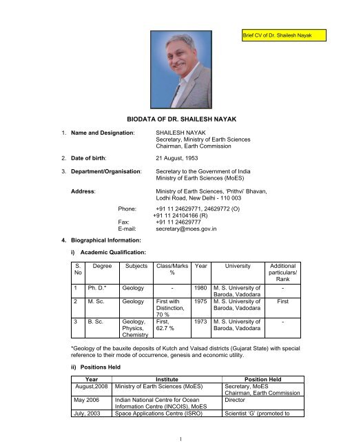
1BIODATA OF DR. SHAILESH NAYAK1. Name <strong>and</strong> Designation: SHAILESH NAYAK<strong>Secretary</strong>, Min<strong>is</strong>try of <strong>Earth</strong> Sciences<strong>Chairman</strong>, <strong>Earth</strong> Comm<strong>is</strong>sion2. Date of birth: 21 August, 19533. Department/Organ<strong>is</strong>ation: <strong>Secretary</strong> to <strong>the</strong> Government of IndiaMin<strong>is</strong>try of <strong>Earth</strong> Sciences (<strong>MoES</strong>)Address:Min<strong>is</strong>try of <strong>Earth</strong> Sciences, ‘Prithvi’ Bhavan,Lodhi Road, New Delhi - 110 003Phone: +91 11 24629771, 24629772 (O)+91 11 24104166 (R)Fax: +91 11 24629777E-mail: secretary@moes.gov.in4. Biographical Information:i) Academic Qualification:S.NoDegree Subjects Class/Marks%Year University Additionalparticulars/Rank1 Ph. D.* Geology - 1980 M. S. University ofBaroda, Vadodara2 M. Sc. Geology First with 1975 M. S. University ofD<strong>is</strong>tinction,Baroda, Vadodara70 %3 B. Sc. Geology,Physics,Chem<strong>is</strong>tryFirst,62.7 %1973 M. S. University ofBaroda, Vadodara*Geology of <strong>the</strong> bauxite deposits of Kutch <strong>and</strong> Valsad d<strong>is</strong>tricts (Gujarat State) with specialreference to <strong>the</strong>ir mode of occurrence, genes<strong>is</strong> <strong>and</strong> economic utility.ii) Positions HeldYear Institute Position HeldAugust,2008 Min<strong>is</strong>try of <strong>Earth</strong> Sciences (<strong>MoES</strong>) <strong>Secretary</strong>, <strong>MoES</strong><strong>Chairman</strong>, <strong>Earth</strong> Comm<strong>is</strong>sionMay 2006 Indian National Centre for Ocean DirectorInformation Centre (INCOIS), <strong>MoES</strong>July, 2003 Space Applications Centre (ISRO) Scient<strong>is</strong>t ‘G’ (promoted to-First-
2Scient<strong>is</strong>t ‘H” from Jan, 2007)Feb. 2001 Space Applications Centre (ISRO) Group Director, Marine &Water ResourcesJul. 1998 Space Applications Centre (ISRO) Scient<strong>is</strong>t ‘SG’Jun 1998 Space Applications Centre (ISRO) Head, Marine & WaterResourcesJan. 1993 Space Applications Centre (ISRO) Scient<strong>is</strong>t ‘SF’Jan. 1989 Space Applications Centre (ISRO) Scient<strong>is</strong>t ‘SE’Jan. 1985 Space Applications Centre (ISRO) Scient<strong>is</strong>t ‘SD’Apr. 1981 Space Applications Centre (ISRO) Scient<strong>is</strong>t ‘SC’Jan. 1978 Space Applications Centre (ISRO) Scientific Asst. ‘C’Mar. 1977 Gujarat Engineering Research Institute Senior Scientific Asst.iii)Honours/Awards1. Honorary Degree of Doctor of Science, Assam University, 2013.2. Fellow, International Society of Photogrammetry <strong>and</strong> Remote Sensing.3. Vikram Sarabhai Memorial Award for 2011-12, Remote Sensing, Geodatabases <strong>and</strong>Digital Mapping, Indian Science Congress Association, 99 th Indian Science Congress,Bhubhaneswar. 2012.4. Honorary Degree of Doctor of Science by <strong>the</strong> Andhra University, 2011.5. Bhaskara Award – 2010, Indian Society of Remote Sensing, Dehradun.6. ISRO Team Award-2008. Snow <strong>and</strong> Glacier project. Indian Space ResearchOrganization, Bangalore.7. P<strong>is</strong>haroty Memorial Lecture: <strong>Earth</strong> System Science: perspective. Kerala Congress.January 29, 20128. 48th Convocation Address. Shivaji University, Kolhapur. January 25, 2012.9. Climate Change <strong>and</strong> Humanity. 79th Convocation Address, Annamalai University,November, 9, 2011.10. Remote Sensing for Coastal Geomorphology. 2nd Prof. R. Vaidyanathan Lecture, AndhraUniversity, V<strong>is</strong>akhapatnam, Geological Society of India. September 26, 201111. Special Mention E-Govt. Projects: INCOIS’ Tsunami Warning System. PC Quest. CyberMedia (india) Ltd., Gurgaon.12. Web Ratna 09 Platinum Award of Excellence in E-Governance Initiatives “Tsunami EarlyWarning System Project” under <strong>the</strong> category “Innovative Use of Technology”. Dept. of IT<strong>and</strong> Communications, Government of India April 19, 2010. (Team award)13. Impact of Climate Change on Coastal Zone. Millennium Lecture, Indian Society ofGeomatics. Ahmedabad, February, 4, 2010.14. H. Sidique Memorial Lecture <strong>and</strong> Gold Medal of Indian Geophysical Union. “Ocean <strong>and</strong>Society’. Wadia Institute of Himalayan Geology, Dehradun. October 5, 2009.15. Foundation Day Lecture, Birbal Sahni Institute of Paleobotany. ‘Towards ClimateInformation <strong>and</strong> Services’, Lucknow, September 10, 2009.16. 26 th Convocation Address, G<strong>and</strong>higram University, G<strong>and</strong>higram, on ‘<strong>Earth</strong> Science <strong>and</strong>Rural Development’, July 18, 2009.
317. P<strong>is</strong>haroty Memorial Lecture The Planet <strong>Earth</strong>: Finite Resources <strong>and</strong> Civilizations IndianSociety of Remote Sensing, April 24, 2009, Ahmedabad.18. 12 th Foundation Lecture of IGC on Tsunami warning System for <strong>the</strong> Indian Ocean. 16 thConvention of <strong>the</strong> Indian Geological Congress, National Geophysical Research Institute,Hyderabad, February 2, 2009.19. <strong>Dr</strong>. S.P. Chatterjee Memorial Lecture on ‘Remote Sensing <strong>and</strong> GIS for Coastal ZoneManagement’, instituted by Indian National Cartographic Association (INCA), November22, 2007, V<strong>is</strong>akhapatanam.20. National Mineral Award-2005, (Applied Geology) Min<strong>is</strong>try of Mines, Govt. of India21. Indian National Remote Sensing Award for <strong>the</strong> Year 1994, Indian Society of RemoteSensing, Dehradun.22. Hari-Om Ashram Prerit Inter-University Smarak Trust Prize for <strong>the</strong> Year 1981-82 forGeology (Kutch bauxites: evidence from exotic gibbsit<strong>is</strong>ed fossils of syn-sedimentarydeposition near Naredi, Western India. Sedimentary Geology, 24: 117-124. 1981.)23. Special Achievemnt in GIS (SAG) Award -2008, E.S.R.I., San Diego, USA (for TsunamiWarning Centre)24. Skotch Challenger Award for Security <strong>and</strong> D<strong>is</strong>aster Management, Jan. 2009 (for settingup Tsunami Warning Centre) by Skotch, New Delhi.25. Geospatial Solution of <strong>the</strong> Year for Tsunami Warning System, 2008 (awrded to INCOISTeam) by Geospatial Today Magazine, Hyderabad.26. Dinesh Chokshi Memorial prize for securing highest marks in M. Sc. (Geology) in 1975.27. Irrigation R & D Award for Meritorious Technical Paper on Emerging behaviour of <strong>the</strong>Narmada estuary presented at <strong>the</strong> 56 th Annual R & D Session of CBIP for <strong>the</strong> Year 1991.iv) Subject: <strong>Earth</strong> ScienceSpecialization: Oceanography/Remote SensingArea(s) of Research: Coastal <strong>and</strong> Ocean processes, air-sea interaction, coastal hazards,coastal geomorphology, geological/geomorphic processes.v) Membership of Academic/Professional Bodies:• Fellow, International Society of Photogrametry <strong>and</strong> Remote Sensing (ISPRS)• Fellow, Indian Society of Remote Sensing, Dehradun.• Fellow, Geological Society of India, Bangalore• Fellow, Meteorological Society of India.• Life Member, Indian Society of Remote Sensing, Dehradun• Life Member, Indian Society of Geomatics, Ahmedabad• Life Member, Institution of Geoscient<strong>is</strong>ts (India), Hyderabad• Life Member, Mangrove Society of India, Goa• Life Member, Astronautical Society of India, Bangalore• Life Member, Meteorological Society of India, New Delhi5. Intellectual property, technological innovations, new products etc.
4Conceptualized, installed <strong>and</strong> operationalized <strong>the</strong> Tsunami Early Warning system for IndiaAlgorithms <strong>and</strong> software for retrieving bio-geo-chemical parameters from ocean coloursensors has been provided to many institutions in <strong>the</strong> country.Satellite based technique for identifying potential f<strong>is</strong>hing grounds has been operationallybeing utilized by <strong>the</strong> Indian National Centre for Ocean Information Services (INCOIS) forproviding forecast to f<strong>is</strong>hermen for <strong>the</strong> entire Indian coast.GIS-based model for selecting suitable sites for brack<strong>is</strong>h water aquaculture
5Major R & D projects/programmes implemented/being ImplementedConceptual<strong>is</strong>ed, executed <strong>and</strong> guided <strong>and</strong> provided leadership to following national levelprojects by involving many national <strong>and</strong> state level institutions in <strong>the</strong> field of coastal <strong>and</strong>marine environment.As <strong>the</strong> <strong>Secretary</strong>, <strong>MoES</strong>, <strong>Dr</strong>. <strong>Shailesh</strong> <strong>Nayak</strong> has initiated several newprogrammes/centres/activities relating to Global change <strong>and</strong> use of geosciences for overallsocietal benefits. To name a few, earthquake precursors, ocean biogeochem<strong>is</strong>try, ecosystemhealth <strong>and</strong> modeling, ocean multi-hazard warning system, ocean, atmosphere, marineresources <strong>and</strong> Antarctica data base organization <strong>and</strong> management, web <strong>and</strong> location-basedservices, etc. A Centre for Climate Change Research has been establ<strong>is</strong>hed in Pune. ANational Centre for Se<strong>is</strong>mology <strong>is</strong> being set up. The setting up of a Coastal Research Centrehas been initiated. A Training School for Climate <strong>and</strong> <strong>Earth</strong> System <strong>is</strong> being set up in Pune.He has initiated d<strong>is</strong>cussions <strong>and</strong> <strong>the</strong> preparation of a National V<strong>is</strong>ion document on <strong>the</strong> role<strong>Earth</strong> Sciences should play in national <strong>is</strong>sues.As Project Director, Early Warning System for Tsunami <strong>and</strong> Storm Surge, May 2006, planned<strong>and</strong> implemented an Early Warning System involving network of se<strong>is</strong>mic stations, tidalstations, bottom pressure recorders, <strong>and</strong> real time analys<strong>is</strong> of data, modelling of travel time,propagation of tsunami wave <strong>and</strong> inundation <strong>and</strong> generation of high resolution bathymetry<strong>and</strong> coastal topography data. The work involved direction, guidance, coordination of threedepartments/min<strong>is</strong>tries <strong>and</strong> fourteen national institutions involving more than 300 scient<strong>is</strong>ts todesign, develop <strong>and</strong> making such system operational in record time of 10 months at a cost ofRs.125 crores. Two major R & D projects, on <strong>the</strong> tectonic modelling of <strong>the</strong> Andaman Trench<strong>and</strong> H<strong>is</strong>tory of Tsunami have been conceptual<strong>is</strong>ed <strong>and</strong> being implemented through NGRI,PRL, NCAOR, IITs <strong>and</strong> academic institutions. The capability of India was effectivelyrepresented in international fora. One of <strong>the</strong> major achievements was that <strong>the</strong> project wasexecuted without any increase in <strong>the</strong> cost of <strong>the</strong> project.Project Director, Argo Project, organized activities related to deployment of ARGO floats in<strong>the</strong> Indian Ocean, reception <strong>and</strong> processing data in near real time, quality checks, generationof products <strong>and</strong> applications. Various applications of Argo data are being developed.As Director, INCOIS, provided direction <strong>and</strong> guidance for <strong>the</strong> societal services in <strong>the</strong> field ofPotential F<strong>is</strong>hing Zone <strong>and</strong> Ocean State Forecast Adv<strong>is</strong>ories. The success of PFZ adv<strong>is</strong>ories<strong>is</strong> around 74 per cent <strong>and</strong> led to savings in time <strong>and</strong> fuel. Due to innovative methods, <strong>the</strong> userbase in f<strong>is</strong>hermen was increased to 27 per cent. The OSF <strong>is</strong> being widely used by shipping,Coast Guards <strong>and</strong> <strong>the</strong> Indian Navy.A project on ‘Chlorophyll Monitoring of <strong>the</strong> Indian Ocean’ was conceptual<strong>is</strong>ed <strong>and</strong> beingimplemented using MODIS/OCM data. The project <strong>is</strong> env<strong>is</strong>aged to help to monitor ecosystemhealth <strong>and</strong> will provide input for ecosystem modelling.As Director of INCOIS, various steps were taken to increase activities in operationaloceanography.Principal Investigator, Jan. 2004 - April 2006, Coastal Studies (inventory, zonation of coralreefs <strong>and</strong> mangroves, coastal geomorphology, sea level r<strong>is</strong>e, shoreline change, coastalzone information system), <strong>and</strong> Snow <strong>and</strong> Glacier Studies (snow monitoring, glacier inventory<strong>and</strong> retreat, mass balance, information system) Funded by <strong>the</strong> Min<strong>is</strong>try of Environment <strong>and</strong>Forests, Govt. of India (Rs. 30 crores).Focal Point, Meteorology <strong>and</strong> Oceanography Programme (funded by ISRO), <strong>and</strong> SatelliteCoastal <strong>and</strong> Oceanographic Research. Funded by <strong>the</strong> Dept. of Ocean Development, GOI.2003 to April 2006, Biological <strong>and</strong> Geological Oceanography component <strong>and</strong> Development ofCal Val site in <strong>the</strong> Lakshadweep Sea (Rs. 5 crores)
6Deputy Project Director, Satellite Coastal <strong>and</strong> Oceanographic Research. Funded by <strong>the</strong> Dept.of Ocean Development, GOI. Indian Remote Sensing Satellite (IRS) – P4 OCM Util<strong>is</strong>ation,ISRO. 1998-2003. Development of algorithms for retrieving bio-geo-chemical parametersfrom Ocean Colour Monitor (OCM), its validation <strong>and</strong> operationalization, development ofmethodology for of application of OCM data for f<strong>is</strong>heries <strong>and</strong> coastal processes (Rs. 7Crores).Focal Point. Development Plans of Kachchh D<strong>is</strong>trict. Preparation of l<strong>and</strong> <strong>and</strong> water resourcesdevelopment plans. 2001-2004 (Rs. 2.25 crores).Deputy Project Director, Integrated Coastal <strong>and</strong> Marine Area Management Project, Fundedby <strong>the</strong> Dept. of Ocean Development. GOI. 1998-2003. Development of methodology for ecogeomorphologicalzonation of mangroves <strong>and</strong> coral reefs using Indian Remote Sensing data(Rs. 1 Crore).Principal Investigator, Coastal Zone Development. Joint project SPARRSO, Bangladesh <strong>and</strong>ISRO. Funded BY UN-ESCAP. 1997-2000. Transfer of technology to SPARRSO for coastalstudies <strong>and</strong> specifically selection of brack<strong>is</strong>h water aquaculture sites.Principal Investigator, IRS P3 Validation Experiment – Ocean. Joint Project DLR, Germany<strong>and</strong> ISRO. 1995-98. Development of algorithms for retrieving bio-geo-chemical parameters<strong>and</strong> st<strong>and</strong>ard<strong>is</strong>ing validation procedures using MOS-B data Rs. 30 Lakhs).Project Leader; L<strong>and</strong> Use Mapping of Coastal Regulation Zone, Funded by <strong>the</strong> Min<strong>is</strong>try ofEnvironment <strong>and</strong> Forests, GOI. 1993-1997. Developed techniques to delineate high tide line<strong>and</strong> low tide line using satellite data <strong>and</strong> generated database for <strong>the</strong> entire country’s coastlineon 1:25,000 scale <strong>and</strong> GIS based model for classifying coastal zone for managing coastalzone (Rs. 30 Lakhs).Principal Investigator, Coastal Studies, Funded by <strong>the</strong> Dept. of Ocean development, GOI.1990-1995. Developed methodology for identifying coral reef features <strong>and</strong> generated database on coral reef, mangroves <strong>and</strong> areas under erosion <strong>and</strong> deposition on 1:50,000 scale for<strong>the</strong> entire country’s coastline Rs. 50 Lakhs).Project Leader, Coastal L<strong>and</strong> Use Mapping for Brack<strong>is</strong>h Water Aquaculture Site Selection,Remote Sensing Application M<strong>is</strong>sion, Funded By <strong>the</strong> Min<strong>is</strong>try of Agriculture, GOI.1990-94.Generated data base on coastal l<strong>and</strong> use on 1:50,000 scale <strong>and</strong> developed a model tointegrate satellite-based information with in situ information on ecology, infrastructure, etc. toselect sites for brack<strong>is</strong>h water aquaculture (Rs. 30 Lakhs).Project Leader, Coastal Environment, Remote Sensing Applications M<strong>is</strong>sion (RSAM),Funded by <strong>the</strong> Min<strong>is</strong>try of Environment <strong>and</strong> Forests, Govt. of India (GOI). 1988-92.Generated database on coastal wetl<strong>and</strong>/l<strong>and</strong>form <strong>and</strong> shoreline change on 1:250,000 scalefor <strong>the</strong> entire country’s coastline Rs. 18 Lakhs).Principal Investigator, Monitoring of Coastal Environment, Indian Remote Sensing UtilizationProgramme (IRS-UP), ISRO. 1984-1990. Developed methodology <strong>and</strong> classification systemfor identifying coastal wetl<strong>and</strong> <strong>and</strong> l<strong>and</strong>form <strong>and</strong> shoreline change. Prepared a detailedmanual for <strong>the</strong> same (Rs. 32 Lakhs).Principal Investigator, Coastal Morphology: A Case Study in <strong>the</strong> Gulf of Khambhat. End-to-End Experiment, National Natural Resources Management System, Indian Space ResearchOrgan<strong>is</strong>ation (ISRO). 1983.
77. L<strong>is</strong>t of ten important publications <strong>and</strong>/or patents: including (a) name ofauthor(s), (b) year, (c) title, name of journal, (d) volume <strong>and</strong> pages.(h-index 16; i-10 index 31; citations ~875)1. <strong>Nayak</strong>, S. <strong>and</strong> Srinivasa Kumar, T. 2011. Tsunami Watch <strong>and</strong> Warning Centres; InEncyclopedia of Solid <strong>Earth</strong> Geophysics. In: Gupta, Harsh K. (ed.), Springer Dordrecht,Vol. 2, pp. 1498-1505 (invited contribution)2. <strong>Nayak</strong>, S. 2009. Application of Remote Sensing <strong>and</strong> GIS for Coastal Zone Management.In <strong>the</strong> Manual of Geographic Information Systems (ed. M. Madden), The AmericanSociety for Photogrammetry <strong>and</strong> Remote Sensing, Be<strong>the</strong>sda, MD. pp. 1075-1094(Invited contribution)3. Vinaych<strong>and</strong>ran, P. N., Chauhan, P., Mohan, M. <strong>and</strong> <strong>Nayak</strong>, S. 2004. Biological responseof sea around Sri Lanka to summer monsoon. Geophysical Research Letters, 31:L01302.2004. (IF: 3.204, cited 30 times)4. Chauhan, P., Mohan, M., Sarangi, R. K., Beenakumari, <strong>Nayak</strong>, S. <strong>and</strong> Matondkar, S. G.P. 2002 Surface chlorophyll a estimation in <strong>the</strong> Arabian Sea using IRS P4 Ocean ColourMonitor (OCM) satellite data. Inter. Jour. of Remote Sensing. 23(8):1663-1676. 2002 (IF:1.084, cited 48 times)5. <strong>Nayak</strong>, S. <strong>and</strong> Bahuguna, A. 2001. Application of remote sensing data to monitormangroves <strong>and</strong> o<strong>the</strong>r coastal vegetation in India. Indian Jou. Of Marine Sciences. 30(4):195-213 (cited 29 times).6. Solanki H.U. Dwivedi R.M. <strong>and</strong> <strong>Nayak</strong> S. Synerg<strong>is</strong>tic analys<strong>is</strong> of Sea WiFS chlorophyll<strong>and</strong> NOAA AVHRR derived SST features for marine living resources. Inter. Jour. ofRemote Sensing, vol.22 no.18 3877-3882. 2001. (IF:1.089, cited 24 times).7. <strong>Nayak</strong>, S., Sarangi, R. K. <strong>and</strong> Rajawat, A. S. 2001. Application of IRS P4 OCM data tostudy impact of cyclone on coastal environment of Or<strong>is</strong>sa. Current Science, 80(9):1208-1213. 2001. (IF: 0.782, cited 29 times).8. <strong>Nayak</strong>, S., P<strong>and</strong>ya, A., Gupta, M. C., Trivedi, C. R., Prasad, K. N. <strong>and</strong> Kadri, S. A.Application of satellite data for monitoring degradation of tidal wetl<strong>and</strong>s of <strong>the</strong> Gulf ofKachchh, Western India. Acta Astronautica, 20: 171-178. 1989. (IF:0.506, cited 17times).9. <strong>Nayak</strong>, S., Chauhan, P., Chauhan, H.B., Bahuguna, A., Narendra Nath, A. 1996. IRS-1Capplications for coastal zone management. 1996 Current Science, 70 (7), pp. 614-618.(IF : 0.782, cited 20 times).10. <strong>Nayak</strong>, S. <strong>and</strong> Sahai, B. Coastal morphology: a case study in <strong>the</strong> Gulf of Khambhat. Inter.Jour. of Remote Sensing, 6 (3 & 4): 559-567. 1985. (IF:1.089, cited 37 times).8. Academic <strong>and</strong> Research Activities:A. Nationali) Chair, St<strong>and</strong>ing Committee on Meteorology <strong>and</strong> Ocean Resources, National NaturalResources Management System, Planning Comm<strong>is</strong>sion, GOI (August 2008 onwards)ii)iii)Chair, Research Council, National Institute of Oceanography. Goa (2008 onwards)Chair, Research Council, Centre for <strong>Earth</strong> Science Studies, Thiruvananthapuram(2007 onwards)
8iv)Chair, Governing Body, Birbal Sahni Institute of Paleobotany, Lucknow; 2010 onwardsv) President, Indian Society of Remote Sensing (2008-2010)vi)vii)Member, Science <strong>and</strong> Engineering Research Board, Min<strong>is</strong>try of Science <strong>and</strong>Technology, GoI (June 2010 onwards).Member, CSIR Society (2010 onwards)viii) Member of Strategic Policy Group, Cabinet Secretariat, July 2011.ix)Member, CoS on National GISx) Member, Executive Committee on Climate Change (January 2013)xi)xii)xiii)xiv)Member, Consultative Group on Climate Change, Min<strong>is</strong>try of Environment <strong>and</strong> Forest,GOI (2012 onwards)Member, GIS Adv<strong>is</strong>ory Board, National GIS M<strong>is</strong>sionMember, National Steering Committee on Climate Change, set up by MoEFMember, Board of Governors, IISER, Punexv) Member, apex Committee for DRDO Awards, 2012.xvi) Member, Adv<strong>is</strong>ory Board, State Awards in Science, M. P.xvii)Member, implementation of Modified FCS in Organizations under Min<strong>is</strong>try of WaterResourcesxviii) Member, Scientific Adv<strong>is</strong>ory Committee to <strong>the</strong> Prime Min<strong>is</strong>terxix)xx)xxi)Member, Scientific Adv<strong>is</strong>ory Committee to <strong>the</strong> CabinetMember, OGC Global adv<strong>is</strong>ory Council, USAMember, Search-cum-Selection Committee, CSIRxxii) Member, Programme Adv<strong>is</strong>ory Committee on Natural Resources Management <strong>and</strong>Climate Change, MSSRF, Chennaixxiii) Member, National Bio-resource Board, Delhi.xxiv) V<strong>is</strong>itor’s Nominee, Selection Committee doe Selection of Professors/AssociateProfessors/Asst/ Professors, IIT-Bombay.xxv)xxvi)Member, Editorial Adv<strong>is</strong>ory Board, GIS DevelopmentMember, Governing Council, Indian Institute of Science, Education & Research, Pune(2008 onwards)xxvii) Member, Adv<strong>is</strong>ory Committee, Centre for Ma<strong>the</strong>matical Modelling <strong>and</strong> ComputerSimulation, Bangalore (2007 - 2008)xxviii) Member of Editorial Board, Indian Journal of Marine Science, National Institute ofScientific Communications (2001-2004), Delhi <strong>and</strong> Geospatial Today, Hyderabad.
9xxix) Member, National Coastal Zone Authority, MOEF.xxx)Member, Scientific Research Adv<strong>is</strong>ory Board, Hansen Environmental ResearchCentre-India, Kochi (2007 onwards)xxxi) Member, Scientific Adv<strong>is</strong>ory Committee, Institute of Se<strong>is</strong>mological Research, G<strong>and</strong>hiagar (2007 onwards)xxxii) Member, Science <strong>and</strong> Engineering Research Board, Min<strong>is</strong>try of Science <strong>and</strong>Technology, GoI (June 2010 onwards)xxxiii) Member, Expert Committee of NRDMS Programme, DST, New Delhi (2007 onwards)xxxiv) Member of Strategic Policy Group, Cabinet Secretariat, July 2011xxxv) Member, Committee to update <strong>and</strong> develop Curricula in RS, GIS, GPS <strong>and</strong> alliedsubjects, DOS, Bangalore.xxxvi) Member, Research Adv<strong>is</strong>ory Committee, Wadia Institute of Himalayan Geology,Dehradun (2003-06)xxxvii) Member, Coastal Protection <strong>and</strong> Development Adv<strong>is</strong>ory Committee (CPDAC), Min<strong>is</strong>tryof Water Resources, GOI. 1999-2008.xxxviii) Member, Programme Adv<strong>is</strong>ory Committee, <strong>Earth</strong> Sciences (PAC-ES) – Dept. ofScience <strong>and</strong> Technology, GOI (2004-07, 1998-2001)xxxix) Member, Gujarat Coastal Zone Authority G<strong>and</strong>hi Nagger.xl)xli)Member, Expert Group on SAR Interferometer, Department of Science & Technology,GOI. 2002-2006.Member, Sub-Group I on Cyclone Early Warning System, NDMA9. International Academic <strong>and</strong> Research Activities:i) Co-Chair, Core Committee for Hosting International Geological Congress in 2020 inIndia.ii)iii)<strong>Chairman</strong>, Indian Ocean – Global Ocean Observing System (IO-GOOS), 2006 onwards.Chair, Indian Ocean Observing System Resource Forum (IRF)iv) Chair, Executive Board, Regional Integrated Multi-Hazard Early Warning System(RIMES) for Africa <strong>and</strong> Asiav) Represented India at Intergovernmental Global Ocean Observing System (I-GOOS),2006-2008vi) Vice Chair, Intergovernmental Coordinating Group on Indian Ocean Tsunami WarningSystem (ICG-IOTWS), (2007-2011)vii) President, International Society of Photogrammetry <strong>and</strong> Remote Sensing (ISPRS),Technical Comm<strong>is</strong>sion IV on ‘Geo-databases <strong>and</strong> Digital Mapping’ (2004-2008).As President, ISPRS TC IV on Geo-databases <strong>and</strong> Digital Mapping, organ<strong>is</strong>ed anInternational Symposium on “Geo-spatial data for Sustainable Development”, September27-30, 2006, Goa.Organ<strong>is</strong>ed an International Symposium on “Application of RS & GIS for Monitoring <strong>and</strong>Prediction of D<strong>is</strong>asters”, September 25-26, 2006, Goa.
10Organ<strong>is</strong>ed ISRO/IEEE/ISPRS/OGC Workshop on “The User <strong>and</strong> GEOSS ArchitectureVI, Applications in Public Health for <strong>the</strong> Indian Ocean Region”, September 26, 2006.Organ<strong>is</strong>ed two tutorials on :a) Urban Planning <strong>and</strong> Infrastructure Developmentb) Extraction of geo-spatial information from high-spatial resolution optical satellitesensorsviii) Executive Committee Member, Partnership for Observation of Global Ocean (POGO),2006-07ix) Represented ISRO at <strong>the</strong> International Ocean Colour Co-ordinating Group (IOCCG).2001-2004.x) Member, Integrated Global Ocean Observing System (IGOS) – Coastal Theme. 2003-2006.xi) <strong>Secretary</strong>, International Society of Photogrammetry <strong>and</strong> Remote Sensing (ISPRS),Technical Comm<strong>is</strong>sion VII on Resource <strong>and</strong> Environmental Monitoring <strong>and</strong> <strong>Chairman</strong>,ISPRS WG VII/3 on ‘Integrated Monitoring System for Resource Management’ (2000-2004).xii) Co-ordinated various activities of ISPRS Technical Comm<strong>is</strong>sion I on ‘Sensors, Platforms<strong>and</strong> Imagery.’ (1996-2000).Organ<strong>is</strong>ed an International training program on “Remote Sensing of Ocean Colour:Techniques & Applications”, sponsored by IOCCG, POGO <strong>and</strong> ISRO during February12-23, 2001 at SAC. Nine participants from abroad <strong>and</strong> eleven participants from Indiaattended <strong>the</strong> training program.xiii) Faculty Member in a Training Course on “Ocean Colour”, Asian Institute of Technology,Organ<strong>is</strong>ed by NASDA, Bangkok, Thail<strong>and</strong>, December, 2000.xiv) Faculty member in a training course on “Remote Sensing <strong>and</strong> GIS for CoastalApplications”, organized by SEAMEO BIOTROP at Bogor, Indonesia during October 20-29, 2001. Delivered lectures <strong>and</strong> conducted tutorials on Ocean Colour.xv) A Pre-conference Training Module on Ocean Colour was organ<strong>is</strong>ed during PORSEC2000 during Nov. 30-Dec.2, 2000 at Goa. An interactive CD-ROM was developed.xvi) Organized a Tutorial on ‘Integrated Coastal Zone Management’, Pre-symposiumTutorial, ISPRS TC VII Symp. December 2, 2002.10. Significant Foreign AssignmentsPeriod ofV<strong>is</strong>itJan 29,30,2013Oct 29-31,2012Oct 18-20,2012Aug 21-22,2012Aug 4-7,2012May 22, 2012April 17-19,2012Institute/CountryV<strong>is</strong>itedU.K. LondonGeneva, Switzerl<strong>and</strong>Cape Town, SAWellington, NewZeal<strong>and</strong>Br<strong>is</strong>bane, AustraliaWilton Park meetingExtraordinary WMO CongressPurpose of V<strong>is</strong>itIOGOOS IX <strong>and</strong> IRF Annual Meeting17 th Meeting of <strong>the</strong> International Continental <strong>Dr</strong>illingProgramme (ICDP) Assembly of Governors34th International Geological CongressAdd<strong>is</strong> Ababa, AMESD Conference on <strong>the</strong> Use of <strong>Earth</strong> Observation toEthiopiaSupport Environmental Policies in AfricaLondon, U.K. 3 rd meeting of <strong>the</strong> India UK Science & Innovation Council –delegation led by Hon’ble Min<strong>is</strong>ter for S&T <strong>and</strong> <strong>Earth</strong> Sciences
11Jan 17-18, Kyoto, Japan5 th Belmont Forum meeting2012Nov 1-3,2011Par<strong>is</strong>36 th General Conference of UNESCO. Delegation led byHon’ble Min<strong>is</strong>ter of HRDOct 3-7, 2011 Taipei Asian Remote Sensing ConferenceJuly 12-15, Jakarta, Indonesia Head of Delegation – Implementation of <strong>MoES</strong>-BKMG MoU2011June 23-29,2011Par<strong>is</strong>Participate in <strong>the</strong> Executive Council of IOC at UNESCOHeadquartersMay 2-6, Melbourne, Australia Participate in <strong>the</strong> ICG / IOTWS meetings2011Apr 5-7, 2011 Par<strong>is</strong> Meeting of <strong>the</strong> Belmont ForumFeb 24-26,2011BangkokParticipate in <strong>the</strong> Council Meeting of <strong>the</strong> Regional IntegratedMulti-hazard Early Warning System (RIMES)Jun 24-25,2010USAUS-Indo Joint Comm<strong>is</strong>sion for S&T Cooperation led by Hon’bleMin<strong>is</strong>ter for <strong>Earth</strong> SciencesJun 10-11,2010Par<strong>is</strong>Participate in <strong>the</strong> 43 rd Session of <strong>the</strong> Executive Council of IOCat UNESCO HeadquartersJun 5-8,2010NorwayDelegation led by Hon’ble Min<strong>is</strong>ter of <strong>Earth</strong> Sciences to v<strong>is</strong>itIndian station ‘Himadri’ in Arctic (Norwary)Apr 13-1, IndonesiaTsunami Regional Group Meeting in B<strong>and</strong>a Aceh, Indonesia2010Nov. 28 –Dec 4, 2009Matri Station, Antarctica Review scientific activities of <strong>the</strong> Winter team <strong>and</strong> assesslog<strong>is</strong>tic <strong>and</strong> infrastructure requirement of <strong>the</strong> stationOct 11-14,2009Par<strong>is</strong>Ocean Round Table Conference, UNESCOSep 21-25,2009Sep 1-5,2009Jun 17-21,2009May 11-15,2009Feb. 23-27,2009Feb. 4-8,2009Nov 12-15,2008Jul 3-14,2008Jun. 21-28,2008Apr, 7-10,2008Feb. 19-20,2008Nov.29-Dec.4, 2007Nov. 13-14,2007Sep. 21-24,2007Jun13-28,2007Venice, LidoItalyGeneva,Switzerl<strong>and</strong>Par<strong>is</strong>, UNESCOManado, IndonesiaPerth <strong>and</strong> MelbourneAustraliaFranceBali, IndonesiaBeijing, ChinaUNESCO, Par<strong>is</strong>KualaMalyasiaUNESCO, Par<strong>is</strong>Phuket, Thail<strong>and</strong>Kuala Lumpur,MalaysiaBeijing, ChinaUNESCO, Par<strong>is</strong>Lumpur,Invited Talk at <strong>the</strong> Ocean Observations Conference 2009 <strong>and</strong>d<strong>is</strong>cussion of ocean observation program for <strong>the</strong> Indian OceanHead of <strong>the</strong> Indian Delegation to <strong>the</strong> WMO World ClimateConferenceHead of <strong>the</strong> Indian Delegation, IOC Assembly sessionHead of <strong>the</strong> Indian Delegation, World Ocean Conference,ManadoParticipate in GSSC XII Session at Perth; ICG/IOTWS WG Vmeeting <strong>and</strong> Steering Committee Meeting at MelbourneV<strong>is</strong>it to Meteo France <strong>and</strong> Meteo France International SteeringCommittee meetingParticipate in ICG/IOTWS WG V Meeting <strong>and</strong> Conf. onParticipation in ISPRS CongressParticipation in 40 th IOC Executive Council MeetingParticipation in ICG/IOTWS - VParticipation in IOC WG on ‘Future of IOC’Organ<strong>is</strong>ed Vth IO-GOOS Meeting, High Level Indian OceanPanel review <strong>and</strong> D<strong>is</strong>. With ADPCInvited Talk <strong>and</strong> Demonstration at ISPRS-OGC-IEEE-GEOSSWorkshop on ‘<strong>Earth</strong> Observation to Benefit Tsunami’Participation in <strong>the</strong> Joint Meeting of <strong>the</strong> Inter. Soc. OfPhotogrammetry <strong>and</strong> Remote Sensing Council <strong>and</strong>Comm<strong>is</strong>sion PresidentsParticipation in <strong>the</strong> IOC EC <strong>and</strong> General AssemblyRepresented India in I_GOOS Meeting
12Feb. 26-Mar.2, 2007Jan. 16-18,2007.Nov. 14-17,2006Oct. 10-12,2006Jul 31- Aug 2,2006Washington, Houston,Los Angeles, USAQingdao, ChinaCape Town, S. AfricaZanzibar, YanzaniaBali, IndonesiaMember of Indian Delegation to participate in JWG meeting on“Civil Space Cooperation “ during Feb 27-28, 2007 as arepresentative of <strong>MoES</strong>. Also v<strong>is</strong>ited FSFC, Houston <strong>and</strong> JPL,Los Angeles during March 1-2, 2007INCOIS representative to POGO-8 Meeting. Delivered invitedtalk on F<strong>is</strong>heries <strong>and</strong> ocean observations. Chaired a sessionon POGO Business.Representing India <strong>and</strong> IO-GOOS at <strong>the</strong> 3 rd Forum of GOOSRegional Alliance MeetingINCOIS representative to 4 th IO-GOOS MeetingNational representative to <strong>the</strong> 3 rd ICG-ITWS MeetingJun 2006 UNESCO, Par<strong>is</strong> Participation in 39th IOC Executive Council MeetingSep 29- Oct. ITC, Enschede, The Participation in <strong>the</strong> Joint Meeting of <strong>the</strong> Inter. Soc. Of1, 2005 Ne<strong>the</strong>rl<strong>and</strong>sPhotogrammetry <strong>and</strong> Remote Sensing Council <strong>and</strong>Nov 22-26,2004Jul 13-24,2004Apr 26-29,2004Feb. 24-26,2003Nov. 4-10,2002Jan. 10-12,2002Chiang Mai, Thail<strong>and</strong>Istanbul, TurkeyColombo, Sri LankaFlorence, ItalyMauritiusVillefranche, FranceComm<strong>is</strong>sion PresidentsParticipation in <strong>the</strong> Joint Meeting of <strong>the</strong> Inter. Soc. OfPhotogrammetry <strong>and</strong> Remote Sensing Council <strong>and</strong>Comm<strong>is</strong>sion PresidentsInvited Talk, Chairing Sessions at <strong>the</strong> Inter. Soc. OfPhotogrammetry <strong>and</strong> Remote Sensing CongressInvited Talk at <strong>the</strong> Indian Ocean - Global Ocean ObservingSystem Workshop <strong>and</strong> 2 nd Annual MeetingParticipated in <strong>the</strong> meeting of <strong>the</strong> International Ocean ColourCoordinating GroupInvited talk at <strong>the</strong> First Conference on Indian Ocean – GlobalOcean Observing SystemParticipated in <strong>the</strong> meeting of <strong>the</strong> International Ocean ColourCoordinating GroupOct. 20-29,2001SEAMEO IOTROP,Bogor, IndonesiaFaculty at <strong>the</strong> Training Course on ‘Remote Sensing <strong>and</strong> GIS forCoastal ApplicationsDec. 9-16,2000Sep. 7-10,1997Asian Institute ofRemote Sensing,Thail<strong>and</strong>Rio de Janeiro, BrazilSep. 28-Oct. Oslo, Norway6 19951986 Bangladesh SpaceResearch <strong>and</strong> RemoteSensing Organ<strong>is</strong>ationDhaka BangladeshFaculty at <strong>the</strong> Training Course on Ocean ColourParticipation in <strong>the</strong> Joint Meeting of <strong>the</strong> Inter. Soc. OfPhotogrammetry <strong>and</strong> Remote Sensing Council <strong>and</strong>Comm<strong>is</strong>sion PresidentsInvited Talk at UN/IAF Workshop <strong>and</strong> participation in IAFCongressParticipation in Regional Seminar on <strong>the</strong> Application of RemoteSensing Techniques to Coastal Zone Management <strong>and</strong>Environmental Monitoring11. Interaction with Academic Institutions• Paper Setter <strong>and</strong> Examiner, M. Tech. Remote Sensing, Indian Scholl of Mines, 2002.• Member, Doctoral Committee, Anna University, Chennai• Adv<strong>is</strong>or, Designing syllabus for Geospatial Information Technology in Planning at PGlevel, Centre for Environmental Planning & Technology, Ahmedabad, 2002.• Paper setter <strong>and</strong> Examiner, Pre-Ph. D., Jawaharlal Technological University, Hyderabad,2002.• Paper setter <strong>and</strong> Examiner for M. Sc. Environmental Science, Maharshi Dayan<strong>and</strong>Sarswati V<strong>is</strong>hwa Vidyalaya, Ajmer, 2002.• Examiner, M. Sc. Geology, Vikram University, Ujjain, 2001.• Examiner, Ph. D. Geology, Vikram University, Ujjain, 2000.• Member, Board of Studies, Geology, Vikram University, Ujjain., M. S. University ofBaroda.
13• Examiner, M. Sc. Remote Sensing, Cochin University, 1999.• Examiner, Ph. D. Geomorphology, Osmania University, 1998.• Examiner, M. Sc. Remote Sensing, Berhampur University, Berhampur, 1998.• Examiner, Ph. D. Marine Science, Berhampur University, Berhampur, 1997.• Guide, PG Student, Coastal environment, Centre for Environmental Planning <strong>and</strong>Environment, Ahmedabad.• Guide, M. Tech. Student, Salinity ingress along coast. L. D. Collage of Engineering,Ahmedabad.• Examiner, M. Sc. Applied Geology, M. S. University of Baroda, Vadodara, 1989, 1990,1991.• Examiner, B. Sc. Geology, M. S. University of Baroda, Vadodara, 1986, 1987, 1988.12. Recogn<strong>is</strong>ed Ph. D. GuideUniversityBerhampur University, BerhampurGujarat University, AhmedabadVikram University, UjjainUniversity of Pune, PuneUniversity of Rajasthan, JaipurMangalore University, MangalagangothriNima University, AhmedabadSubjectMarine ScienceGeology-Remote SensingGeologyGeologyGeologyMarine Geology & GeoinforMaticsGeology, <strong>Earth</strong> Science13. Number of Ph. D.s CompletedName Topic Year of UniversityAwardRamanujBanerjeeSe<strong>is</strong>mic Hazard Zonation Of Kachchh AreaUsing Remote Sensing2009 PuneUniversityR. K. Sarangi Impact of surface feature changes on 2008 Berhampurphytoplankton variability in seas off sou<strong>the</strong>rnUniversitypart of <strong>the</strong> Indian peninsula: a remote sensingapproachA. S. Rajawat Reconstruction, evolution <strong>and</strong> significance ofpaleo-drainage network in Western Rajasthan:an investigation based on multi-sensor satellitedata <strong>and</strong> GIS.DevendraKumarApplication of satellite-derived terrainparameters for <strong>the</strong> geomorphic <strong>and</strong> structuralstudies in <strong>the</strong> Jharia coal field, Jharkh<strong>and</strong>.2006 Vikram Uni,Ujjain2006 RajasthanUniversity,JaipurYashwantPradhanCirculation <strong>and</strong> d<strong>is</strong>persal pattern in <strong>the</strong> Bay ofBengal – a study based on satellite derivedocean colour applicationsB. Deshmukh Geomorphological study of coral reefs in a partof Gulf of Kachchh using remote sensing data2005 BerhampurUni.Berhampur2004 Vikram Uni,Ujjain14. Invited TalksA. International Conferences
14Chair, Session on Experiences in Data Sharing <strong>and</strong> how to Accelerate it among <strong>the</strong> Asia-Pacific Region, <strong>the</strong> Sixth GEOSS Asia-Pacific Symposium: Accelerating Inter-linkages in <strong>the</strong>Asia Pacific region for Global <strong>Earth</strong> Observations. Ahmedabad, February 25, 2013.Forecasting Monsoon. Key-note Address. International Conference on SWAT. Delhi IIT. NewDelhi. July 18, 2012.Societal benefits of earth system science. Key-note Address. Use of <strong>Earth</strong> Observation toSupport Environmental Policies in Africa, The African Monitoring of <strong>the</strong> Environment forSustainable Development, Add<strong>is</strong> Ababa, May 21-22, 2012.Special Address, Himalayan Glaciers. Open Science Policy Seminar, TERI, New Delhi. April4, 2012.Importance of Oceans: a Perspective. Side Event on Oceans at <strong>the</strong> UN Conference of onSustainable Development (Rio+20), 36th General Conference of UNESCO, Par<strong>is</strong>. Nov 1,2011.'Indian Ocean Tsunami Warning System, Key Note Address, 32nd Asian Conference forRemote Sensing, Taipei, Taiwan. October 3, 2011.Managing <strong>Earth</strong> System Geospatially. Todarmal Lecture Series, XXX INCA InternationalCongress, Dehradun. November 10, 2010Focusing National Agenda for Stewardship of Oceans. D<strong>is</strong>tingu<strong>is</strong>hed Lecture, OceanScience Section, 7 th Meeting of <strong>the</strong> Asia Oceania Geosciences Society, Hyderabad, India.July 7, 2010.<strong>Earth</strong> Science <strong>and</strong> Climate Resilience: Available Methods <strong>and</strong> Data. International Workshopon Sustainable <strong>and</strong> Climate Resilience Urban Development, Integrated Research <strong>and</strong> Actionfor Development, New Delhi. September 9, 2010.Remote Sensing Applications to F<strong>is</strong>heries: Indian Initiatives to <strong>the</strong> Improvement of <strong>the</strong> Socioeconomicsof F<strong>is</strong>hing Communities. Inter. Symposium on Remote Sensing <strong>and</strong> F<strong>is</strong>heries,SAFARI/GEOSS, Kochi. Feb. 15, 2010.Antarctic Governance <strong>and</strong> Treaty Regime. Key Note Address.7 th International Conferenceon Legal Regime of Sea, Antarctica, Air <strong>and</strong> Space, The Indian Society of International Law.New Delhi. 16 January, 2010.Ocean Observations to Services.iGEON, The Geosciences, Network Cyber Infrastructure Workshop, University of Hyderabad,August 3, 2007, Hyderabad.Ocean Data <strong>and</strong> Information Management Open St<strong>and</strong>ards <strong>and</strong> interoperability.St<strong>and</strong>ards <strong>and</strong> Interoperability Map World Forum on January 25, 2007, Hyderabad, India.F<strong>is</strong>heries <strong>and</strong> Ocean Observations,POGO-8 Meeting, Qingdao, China on January 18, 2007.Early Warning System for Tsunami <strong>and</strong> Strom SurgesApplication of Remote Sensing <strong>and</strong> GIS for Monitoring <strong>and</strong> Prediction of D<strong>is</strong>asters’ duringSeptember 25-26, 2006.Application of Remote Sensing for Implementation of Coastal Zone Regulations: A CaseStudy of India.7 th GSDI Conference, Bangalore. Feb. 2-7, 2004.OCEANSAT II.2 nd IO-GOOS Meeting, Colombo, Sri Lanka, April 26-29, 2004.
15Ocean Biology <strong>and</strong> Coastal Processes.India-US Conference on Space Science, Applications <strong>and</strong> Commerce, Bangalore, India. June21-25, 2004Role of Remote Sensing in Integrated Coastal Zone Management,Theme Session 18 on Integrated Coastal Zone Management, July 21, 2004. ISPRS, July,Istanbul.Remote Sensing Applications in F<strong>is</strong>heries.F<strong>is</strong>h for All Summit., M. S. Swaminathan Foundation, World F<strong>is</strong>h Centre <strong>and</strong> Govt. of WestBengal, December 18, 2003.Prospects of Remote Sensing for Monitoring Coastal <strong>and</strong> Marine Biodiversity.Workshop on Coastal <strong>and</strong> Marine Biodiversity of <strong>the</strong> Indian Ocean. Census of Marine Life,Intergovernmental Oceanographic Comm<strong>is</strong>sion, Partnership for <strong>the</strong> Observation of <strong>the</strong> GlobalOceans, Goa, December 13, 2003.Use of satellite data in coastal mapping.XXII INCA International Congress on Convergence of Imagery, Information <strong>and</strong> Maps.October 30, 2002. Ahmedabad.Monitoring of coastal regions using IRS-P3 MOS-B data.ISRO-DLR Inter. Workshop on Environment <strong>and</strong> Remote Sensing, NRSA. Hyderabad.October 29, 1999.B. National ConferencesCoastal Ecosystems <strong>and</strong> Climate Change. National Seminar on Ecology, Communication <strong>and</strong>Youth. MICA <strong>and</strong> GEC. Ahmedabad. February 25, 2013.V<strong>is</strong>ion of National GIS, Inaugural Address, workshop on Karnataka GIS <strong>and</strong> User Needs.Govt. Of Karnataka, Bangalore. January 23, 2013.Key Note Address. Towards Geo-Enabled Economy, India Geospatial Forum, Hyderabad,India. January 22, 2013.Societal Benefits of <strong>Earth</strong> System Science, Public Outreach Lecture, Indian National ScienceAcademy, New Delhi. January 21, 2013.<strong>Earth</strong> System Science. Public Outreach Session, 100 th Science Congress, Kolkata. January4, 2013.<strong>Earth</strong> System Science: A Perspective. D. N. Wadia Session on <strong>Earth</strong> Sciences,Symposia, 100 th Science Congress, Kolkata. January 4, 2013.Key Note Address. Workshop on Meteorological Satellite Kalpana:a decade of service to <strong>the</strong>Nation. Space Applications Centre, Ahmedabad. October 9, 2012.Towards Stewardship of Ocean Resources. Geospatial Artha Summit, Geospatial Media +Communications, Delhi. September 24, 2012.<strong>Earth</strong> System Science in India: a Perspective. Regional Science Congress on Shaping ofIndia's Future. M. S. University of Baroda, Vododara, September 15, 2012.National GIS. Rendezvous with GIS. ESRI India. June 27, 2012.Sustainability of Cities. One-Day Workshop on Geoinformatics for Urban Planning, SpaceApplications Centre, Ahmedabad. January 7, 2012.
16<strong>Earth</strong> System Science: A Perspective. Platinum Jubilee Lecture, <strong>Earth</strong> System ScienceSession, 99th Science Congress, Bhubaneswar. January 4, 2012.Modern <strong>and</strong> Paleosediments. Inaugural Lecture. National Seminar on Modern <strong>and</strong>Paleosediments: Implication to climate, water resources <strong>and</strong> environmental changes, IndianAssociation of Sedimentolog<strong>is</strong>ts, JNU, November 24, 2011.Impact of Climate Change on Sustainability of Coastal Ecosystems. Inaugural Address.November 10, 2011.Polar Meteorology. Inaugural address at <strong>the</strong> National Seminar on Polar Meteorology. IndiaMeteorological, Department, new Delhi. November 8, 2011.Inaugural Address. Indian Ocean IODP Workshop, October 17, 2011, Goa.Green Conclave 2011; New Delhi; October 14, 2011Sustainability of Cities, Inaugural Address, Sep 26, 2011. V,Zag.Polar Science: a climate change perspective. Inaugural Address at <strong>the</strong> Third NationalWorkshop on Climate Change: Polar Oceans <strong>and</strong> Monsoon, Sep 20-22, 2011, NCAOR, Goa.National GIS, Sep 14, 2011, New Delhi. Address at <strong>the</strong> National GIS Workshop, PlanningComm<strong>is</strong>sion <strong>and</strong> Min<strong>is</strong>try of <strong>Earth</strong> Sciences, New Delhi, September 14, 2011.Bharat Chamber of Commerce, August 30, 2011.Monsoon Variability. Inaugural address at <strong>the</strong> Workshop on Monsoon Variability, Indianinstitute of Science, Bangalore, Aug. 17, 2011.National workshop on Climate Change: Polar Climate, Oceans <strong>and</strong> Monsoon; NationalCentre for Antarctic & Ocean Research, Goa; September 20, 2011<strong>Earth</strong> Sciences: New Initiatives <strong>and</strong> Future Plans. Interactive Session on ‘<strong>Earth</strong> Sciences:Recent Initiatives <strong>and</strong> Future Plans. Bharat Chamber of Commerce, Kolkata. August 30,2011.Geospatial World, Hyderabad, January, 18, 2011Inaugural Lecture. Indian Marine Living Resources Program. Kochi. December 2, 2010.<strong>Earth</strong> System Science: Challenges Ahead. Indian Institute of Remote Sensing, Dehradun.November 10, 2010.Climate Change: Issues <strong>and</strong> Consequences. Inaugural Address, M. S. University of Baroda,Vadodara. October 22, 2010.Energy from Ocean, Energy Conclave. IIT, G<strong>and</strong>hinagar, October 9, 2010.Societal benefits of <strong>Earth</strong> System Science. Foundation Day Lecture, NGRI, Hyderabad.September 26, 2010.Managing <strong>Earth</strong> Systems Geospatially. Guest Lecture. Defining Geospatial V<strong>is</strong>ion for India.Map India 2010. Gurgaon, India. January 19, 2010.<strong>Earth</strong> System Science: A Perspective. Wea<strong>the</strong>r, Climate <strong>and</strong> Environment, Science <strong>and</strong>Technology Challenges of 21 st Century – National Perspective, 97 th Science Congress,Kerala University, Thiruvananthapuram. January 5, 2010.
17<strong>Earth</strong> System Science Programme. Science Programme for <strong>the</strong> Country, Science <strong>and</strong>Technology Challenges of 21 st Century – National Perspective, 97 th Science Congress,Kerala University, Thiruvananthapuram. January 3, 2010.Indian Initiatives for Tsunami Warning System’Workshop on International Science Years, INSA, New Delhi, October 3, 2007.“Early Warning System for TsunamiImpact of Technology on Short-term F<strong>is</strong>hery Forecast.Annual Technical Convention on Interactive ECTs- A Focus on Rural India. The Institution ofElectronics & Telecommunication Engineers, Sep. 29, 2007, Hyderabad.Images to Ocean Information <strong>and</strong> Services,Key Note Address at Sierra Geospatial Conference, July 13, 2007. Hyderabad.National Seminar on Technology Based Solutions to D<strong>is</strong>aster Management. A NationalSecurity Perspective, University of Madras on 16, February 2007 at Chennai.“Early Warning System for Tsunami”Lecture at ISRS Chennai Chapter, Satyabhama University, Chennai on 16 February, 2007.Impact of Ep<strong>is</strong>odic events & climate change on Coastal & Marine ecosystems.Theme Session : International Year of Planet <strong>Earth</strong>; Indian Initiatives, 94 th IndianScience Congress, January 03-07, 2007 at Chidambaram. January 6, 2007.The Early Warning System for tsunami & storm surge of India. Environmental SciencesSectional Committee meeting, 94 th Indian Science Congress, January 03-07, 2007 atChidambaram. January 4, 2007.Potential F<strong>is</strong>hing Zone (PFZ) <strong>and</strong> Ocean State Forecast (OSF) adv<strong>is</strong>ories.Workshop on “Space Technology Util<strong>is</strong>ation for F<strong>is</strong>heries” Govt. of Kerala, December 09,2006, Thiruvananthapuram.Key–note address on Preparedness for Ocean Hazards”National Workshop on “D<strong>is</strong>aster Preparedness Press Institute of India & Helpage ”,November 21, 2006, Delhi.Monitoring Coastal <strong>and</strong> Marine Bio-Diversity using Remote Sensing”National Symposium on “Marine Biodiversity Conservation <strong>and</strong> Community” GEERFoundation, G<strong>and</strong>hi Nagar, June 15, 2006.Monitoring Coastal <strong>and</strong> Marine Bio-Diversity using Remote Sensing”National Symposium on “Marine Biodiversity Conservation <strong>and</strong> Community” GEERFoundation, G<strong>and</strong>hi Nagar, June 15, 2006.Planning <strong>and</strong> Management of <strong>the</strong> Indian Coast: an integrated approachBrain Storming Session on The Coastal Zone: Planning & Management, Andhra University,V<strong>is</strong>akhapatanam, May 22, 2006.Application of remote sensing <strong>and</strong> GIS for coastal zone management.ISG National Conference on Geomatics 2006, January 6, 2006.Role of remote sensing <strong>and</strong> GIS in coastal zone management.Panel D<strong>is</strong>cussion on ‘Coastal Zone Management’, 93rd Indian ScienceHyderabad. January 4, 2006.Congress,Coastal geomorphology <strong>and</strong> habitat of <strong>the</strong> Gulf of Khambhat: Possible impact of <strong>the</strong> Kalpsarproject
18Seminar on Kalpsar Dam Project, CFDA, Ahmedabad, June 25, 2005Inventory of Coastal Wetl<strong>and</strong>s- A Space Technology PerspectiveISRS Hyderabad Chapter, Hyderabad on May 19, 2005.Preliminary Investigations for Coastal, Marine <strong>and</strong> Glacial Environments usingRESOURCESAT-1 Data,National Workshop on Remote Sensing with Resourcesat-1 (IRS-P6), October 19-20, 2004,NRSA, Hyderabad.Advancements <strong>and</strong> Applications of Space Technology in National Development.Inaugural Address at <strong>the</strong> One day Awareness Workshop on Remote Sensing <strong>and</strong> GISapplications in Civil Engineering. Manipal Institute of Technology <strong>and</strong> Indian Society ofGeomatics – Mangalore Chapter, Manipal, Sep. 25, 2004.Role of Remote Sensing for Implementation of Coastal Zone Regulations.National Workshop on Coastal Regulation Zone , MOEF, Chennai. June 18-19, 2004.Space Technology for Water Cycle.Water Resources <strong>and</strong> Information Age. World Meteorological Day. Centre for EnvironmentalPlanning <strong>and</strong> Technology, India Meteorology Society – Ahmedabad Chapter, Ahmedabad.March 23, 2004.Remote Sensing Applications for F<strong>is</strong>heries.XVIII Gujarat Science Congress on ’Linkage of Science, Technology <strong>and</strong> Industries,Saurashtra University, Rajkot. March 13, 2004.Remote sensing in underwater archaeology.National Workshop on Marine Archaeology in <strong>the</strong> Gulf off Cambay. July 1, 2002.Input for NSDI Quality St<strong>and</strong>ards.2 nd National Spatial Data Infrastructure, July 30, ISRO & DST, Ooty.Geomatics for <strong>Earth</strong>quake mitigation.Conference on IT enabled Spatial Data Services. September 20, ISG, Tiruchirapalli.Space Technology for Water: Vital To Humanity.World Space Week, October 8, 2002, AMA, Space Applications Centre Ahmedabad.Space Technology for WaterAtyabhateeya-2002, National Seminar on “benefits of Space programme to Mankind. October13, 2002. Swadeshi Science Movement, Thiruvananthapuram.Monitoring of oil spill through remote sensing technology.Oil Spill Combat <strong>and</strong> Emergency Response Plan for <strong>the</strong> Indian Coast, SPILLCOMB-2002.October 18, 2002. Gujarat Maritime Board <strong>and</strong> Dept. of Environment & Forests, Govt. ofGujarat. Ahmedabad.Bhuj <strong>Earth</strong>quakeAt <strong>the</strong> Arvind Mills, Ahmedabad on February 2, 2001.Coastal Zone StudiesWorkshop on Biodiversity Characterization in Andaman <strong>and</strong> Nicobar Isl<strong>and</strong>s, Port Blair,September 3, 2001.Engineering geology <strong>and</strong> Mineral exploration.Workshop on Commercial Applications of Remote Sensing <strong>and</strong> GIS (CARG-99).ISRS <strong>and</strong> SAC, Ahmedabad. February 16, 1999.
19Remote sensing application for coastal/oceanographic studies.National Symp. On Remote Sensing for Natural Resources with special emphas<strong>is</strong> onWatershed Management, March 22-24, 2000. ISRS <strong>and</strong> ORSAC, Bhubaneshwar.IRS P4 OCM Preliminary Results.ISAC, Bangalore. May 26, 2000.Remote Sensing for National Development.Bharat Petroleum Corp. Ltd. Mumbai. November 17, 2000.Remote Sensing Applications to Coastal geomorphology.PAC-Es, DST, Nagpur, April 8, 2000.Environmental <strong>and</strong> coastal habitat inventory in <strong>the</strong> Gulf of Kachchh using remote sensingtechniques.Workshop on ICMAM Plan for Gulf of Kachchh, DOD, Guj. F & ED, SAC, September 27,1999.Remote Sensing applications to coastal zones of India.Expert Meeting on L<strong>and</strong> use/cover Change Data Development in <strong>the</strong> Coastal regions of India.Goa, April 7-9, 1999.C. Training Courses / Academic InstitutionsInaugural Address. TERI-BCCR Climate Research School II, Beyond Regional ClimateModelling - Best Practices <strong>and</strong> New Insights, TERI University, New Delhi. October 1, 2012.India's Environmental Challenges <strong>and</strong> <strong>the</strong> Path Forward. Amrita V<strong>is</strong>hwa Vidyapitham,Amritapuri. January 28, 2012International Workshop on scientific drilling in Indian Ocean; National Centre for Antarctic &Ocean Research, Goa; October 17, 2011ICAMG-7; National Institute of Oceanography, Goa; October 11, 2011Remote Sensing for Coastal Geomorphology, 2nd Prof. R. Vaidyanathan Lecture, AndhraUniversity, V<strong>is</strong>akhapatnam, September 26, 2011<strong>Earth</strong> Sciences: New Initiatives <strong>and</strong> Future Plans; Bharat Chamber of Commerce, Kolkata;August 30, 2011Asian Forum for Polar Sciences; National Centre for Antarctic & Ocean Research, Goa;August 25, 2011Inaugural address, Workshop on Monsoon M<strong>is</strong>sion, Indian Institute of Sciences, Bengaluru;August 17, 2011.Convocation Address, Andhra University, V<strong>is</strong>akhapatnam; June 06, 2011.Societal Benefits of <strong>Earth</strong> System Science” - 40 thInstitute of Geomagnet<strong>is</strong>m, Mumbai; April 01, 2011Annual Day Celebrations of <strong>the</strong> IndianInaugural Address on “Geodatabases – Trends <strong>and</strong> Challenges”Training Programme on “Web-based open Source GIS”, GIS Development, Hyderabad,October 29, 2007.Application of Remote Sensing <strong>and</strong> GIS in Coastal Zone Management3rd Course on Application of Geo-informatics in D<strong>is</strong>aster Management, GSI Training Institute,May 4, 2007, Hyderabad.
20Geospatial technologies for National Development.Inaugural Address. Short-term Training program in Geospatial Technologies. NRDMS, DST,Govt. of India <strong>and</strong> J. N. Technological University, Hyderabad. February, 12, 2007.Spatial Technologies for Marine Resources Management.International Training Programme for Asia Pacific Countries on GIS Application s in RuralDevelopment, NIRD, Hyderabad, October 06, 2006.Application of RS <strong>and</strong> GIS in Coastal Zone Management.Geological Survey of India Training Institute, Hyderabad, August 9, 2006.Quantitative Geomorphology: Role of RS.Short course on “Recognition of L<strong>and</strong>forms from Topographical Maps”, Hyderabad Universityon August 20, 2006.Remote Sensing Applications in IndiaTraining program on ‘Coastal Oceanography: Remote Sensing <strong>and</strong> GIS Applications’, AndhraUniversity, V<strong>is</strong>akhapatanam. February 11, 2006.Water ResourcesISRO Induction Training Programme (IITP-10), Space Applications Centre, Ahmedabad.February 2, 2006.Space technology for water cycleISRO Induction Training Program (IITP-08), SAC, Ahmedabad, July 21, 2005Remote Sensing Applications in IndiaCourse on ‘Snow Cover Evaluation using Satellite Data <strong>and</strong> GIS Techniques’. SASE,Ch<strong>and</strong>igarh on May 30, 2005.Remote sensing for monitoring of water quality.Application of GIS, RS <strong>and</strong> GPS in civil engineering. L. D. College of Engineering.Ahmedabad. November 13, 2003.Remote Sensing – Fundamentals <strong>and</strong> remote sensing.Kendriya Vidyalaya, Thiruvananthapuram, Oct. 31, 2003.Fundamental <strong>and</strong> Applications of remote sensing,Gujarat Jal Sewa Nigam Training Institute, G<strong>and</strong>hinagar. Oct. 6, 2003.Space Technology for Coastal Zone Management,CEPT, Ahmedabad. October 1, 2004.Satellite Oceanography.National Institute of Ocean Technology, Chennai. July 21, 2003.Coastal geomorphologyTraining Course on Role of GIS <strong>and</strong> Remote Sensing, March 6 2002., CWPRS, PuneD<strong>is</strong>aster Mitigation: Role of Remote Sensing.International Short Course on Emerging Trends in Satellite Meteorological Applications withspecial reference to Microwave Remote Sensing. May 6-13, 2002. CSSTE-AP, SAC,Ahmedabad.Coastal hazard assessment.Geoinformatics for Environmental Assessment <strong>and</strong> D<strong>is</strong>aster Management, July 9, IndianInstitute of Remote Sensing, Dehradun.Marine, coastal <strong>and</strong> water resources.
21First ISRO-wide Induction Training, August 6, SAC, Ahmedabad.Integrated Coastal Zone Management.At <strong>the</strong> International Training Course on “Remote Sensing of Ocean Colour: Techniques &Applications”, sponsored by IOCCG, POGO <strong>and</strong> ISRO during February 12-23, 2001 at SAC.Remote Sensing for <strong>the</strong> National Development.At <strong>the</strong> Gujarat University, Ahmedabad, April 8, 2001.Remote sensing applications in coastal zone managementAt Department of Geo-engineering, Andhra University, V<strong>is</strong>akhapatanam on September 11,2001.Coastal Zone Management - Role of Remote SensingAt <strong>the</strong> Training course on “Remote Sensing <strong>and</strong> GIS for Coastal Applications”, organized bySEAMEO BIOTROP at Bogor, Indonesia, October 23, 2001.Ocean Colour Applications.At <strong>the</strong> Training course on “Remote Sensing <strong>and</strong> GIS for Coastal Applications”, organized bySEAMEO BIOTROP at Bogor, Indonesia, October 23, 2001.Image Interpretation.Training Course on Application of Remote Sensing in Snow, Ice <strong>and</strong> Glacier Studies, SASE.Manali, May 1-12, 2000.IRS P4 Data Applications in Resource Management.Training Course on Application of Remote Sensing in Snow, Ice <strong>and</strong> Glacier Studies, SASE.Manali, May 1-12, 2000.Remote Sensing Applications: an overview.Tamil Nadu University participants at SAC, October 31, 2000.Coastal Zone Management.Refresher Course on Applied geology, M. S. University of Baroda, Dec. 20, 2000.Remote Sensing of Coastal processes.Refresher Course on Applied geology, M. S. University of Baroda, Dec. 20, 2000.Remote Sensing Fundamentals.Training Program for <strong>the</strong> Forest Officials on Applications of Remote Sensing Technology inForest Areas.GEER Foundation, G<strong>and</strong>hinagar, January 28, 1999.Role of Remote Sensing in Integrated Coastal Zone Management.Training Program for <strong>the</strong> Forest Officials on Applications of Remote Sensing Technology inForest Areas., GEER Foundation, G<strong>and</strong>hinagar, January 28, 1999.Coastal hazard assessment.Geoinformatics for Environmental Assessment <strong>and</strong> D<strong>is</strong>aster Management, July 9, 1999.Indian Institute of Remote Sensing, Dehradun.Chair in International ConferencesOceans <strong>and</strong> Monsoons, International Conference on ‘Celebrating <strong>the</strong> Monsoon’ IISC, July 26,2007, Bangalore.POGO Business, 8 th POGO Meeting, Qingtao, China, January 19, 2007.
22“Implementation Strategy for Coastal Module of GOOS.” 3 rd Regional GOOS Forum, CapeTown, South Africa, November 14-17, 2006.Remote Sensing, 4 th Annual Meeting of IO-GOOS, Zanzibar, October 10-12, 2006.Early Warning System for various marine hazards – Present Status” at <strong>the</strong> InternationalConference on Marine hazards <strong>and</strong> opportunities”, July 3, FICCI, Chennai.Silver Jubilee Symposium on Antarctica Expedition, May 25-26, 2006.Chaired following sessions in <strong>the</strong> International Society of Photogrammetry <strong>and</strong>Remote Sensing (ISPRS) XXth Congress held at Istanbul, Turkey.i) TS VII/3: Integrated Monitoring System for Resource Management, July 19, 2004.ii) PS VII/3: Integrated Monitoring System for Resource Management, July 19, 2004.iii) SS 1 International Committee on Remote Sensing of Environment (ICORSE) – <strong>Earth</strong>Observation Systems for Sustainable Development, July 20, 2004.iv) SS 12 IEEE – GRSS – Geo-scientific Information from Remote Sensing, July 20, 2004.v) SS 2 ICORSE – Remote Sensing of Ocean Colour, July 21, 2004.vi) ThS 18: Integrated Coastal Zone Management, July 21, 2004.15. Participation in Seminars:Chief Guest, International Seminar on Remote Sensing <strong>and</strong> F<strong>is</strong>heries, SAFARI, CIFT, Kochi,Feb. 15, 2010.Coastal Processes, Resources <strong>and</strong> Management. Inaugural Lecture. National Conference onCoastal Processes, Resources <strong>and</strong> Management. Centre for <strong>Earth</strong> Science Studies,Thiruvananthapuram, February, 5, 2010.Climate Change <strong>and</strong> Coastal ecosystems. Guest of Honour, Annual Convention of <strong>the</strong>Geomatics Society of India, February 4, 2010.Chair, Plenary Session Climate Change <strong>and</strong> Coastal ecosystems, February, 4, 2010.Chief Secretaries Conference, Feb. 1, 2010.International Symposium on Resource <strong>and</strong> Environmental Monitoring, ISPRS, Hyderabad,December 3-6, 2002.Integrated Coastal Zone Management & Ocean Colour16. Important MeetingsH. E. Mohamed Waheed, Vice President, Republic of Maldives, Feb. 20, 2010 along withHon’ble Min<strong>is</strong>ter for <strong>Earth</strong> Sciences


