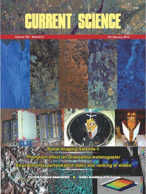
Special Issue on RISAT-1, Current Science, 25 March 2013 - Space ...
Special Issue on RISAT-1, Current Science, 25 March 2013 - Space ...
Special Issue on RISAT-1, Current Science, 25 March 2013 - Space ...
- No tags were found...

You also want an ePaper? Increase the reach of your titles
YUMPU automatically turns print PDFs into web optimized ePapers that Google loves.
Radar Imaging Satellite-1With the launch of Radar ImagingSatellite-1 (<strong>RISAT</strong>-1), a new chapterhas been opened in Indian <strong>Space</strong>Research Organisati<strong>on</strong>’s (ISRO), EarthObservati<strong>on</strong> (EO) programme – indigenouscapability of developing,launching and operati<strong>on</strong> of microwaveimaging sensor. A set of fivearticles, in this special issue, tracesall aspects of <strong>RISAT</strong>-1 from developingthe SAR sensor to illustratingdifferent possibilities of utilizing itsdata in day to day practical applicati<strong>on</strong>s.In the Foreword, A. S. Kirankumar(page 444), <strong>on</strong>e of the primearchitects of ISRO’s EO programme,enunciates the significance of <strong>RISAT</strong>-1from the overall perspective ofISRO’s EO missi<strong>on</strong>, especially howit complements existing array of sensorsin optical bands and its additi<strong>on</strong>alstrengths which are unique tomicrowave bands and its ability tomeasure all the comp<strong>on</strong>ents of electromagneticwaves, i.e. polarizati<strong>on</strong>,amplitude and phase.<strong>RISAT</strong>-1 Synthetic Aperture Radar(SAR) payload is a complex payloadwith a very large array of imagingcapabilities in-built. It is not <strong>on</strong>lyISRO’s first SAR payload in space,but also India’s first state-of-the-artactive antenna in space. Further, forthe first time, it is carrying the capabilityof all traditi<strong>on</strong>al SAR imagingmodes in opti<strong>on</strong>al hybrid polarimetryc<strong>on</strong>figurati<strong>on</strong>. Design philosophybehind <strong>RISAT</strong>-1 SAR, its realizati<strong>on</strong>,illustrati<strong>on</strong> of initial results and itscalibrati<strong>on</strong> have been brought out inthe article by Tapan Misra et al.(page 446).In this issue<strong>RISAT</strong>-1 SAR is the heaviest payloadbuilt in ISRO, weighing close to950 kg. The challenge was to accommodateit in a satellite bus which canbe flown in PSLV. The large SARantenna provides obstructi<strong>on</strong> to viewinggeometry of satellite sensors anddata transmissi<strong>on</strong> systems. Further,designers wanted a simplified antennadeployment system which guaranteessuccess. Moreover, spacecraft resourceshave to cater to large powerdemand (~5 kW) and high data rate(~1.5 Gbps) for SAR operati<strong>on</strong>. Allthese requirements resulted into anew and unique bus c<strong>on</strong>figurati<strong>on</strong>,distinct from ISRO’s traditi<strong>on</strong>alworkhorses like IRS and INSAT.The complete gamut of <strong>RISAT</strong>-1 satellitec<strong>on</strong>figurati<strong>on</strong> is presented byN. Valarmathi et al. (page 462).<strong>RISAT</strong>-1 is also the heaviest satellite(dry mass wise) built in ISRO,bordering <strong>on</strong> the outer limit of thelaunch capability of highest versi<strong>on</strong>of PSLV. Specific PSLV XLlauncher c<strong>on</strong>figurati<strong>on</strong> and its resultantperformances, very close to theintended <strong>on</strong>es, are presented in thearticle by P. Kunhikrishnan et al.(page 472).<strong>RISAT</strong>-1 has a very large numberof flexible imaging capabilites, operatedtransparently by <strong>on</strong>-board computer.For its seamless operati<strong>on</strong>,complex missi<strong>on</strong> planning and operati<strong>on</strong>were built in ground c<strong>on</strong>trol ofspacecraft from ISTRAC, Bangalore.Further, ISRO’s data recepti<strong>on</strong> systemat NRSC, Hyderabad had to beupgraded by six folds from 110 to640 Mbps for <strong>RISAT</strong>-1 operati<strong>on</strong>.The data processing, archiving anddisseminati<strong>on</strong> system for <strong>RISAT</strong>-1had to be integrated in new IMGEOSfacility of NRSC. The heart of theground segment is a complex SARsignal processor, implemented inboth off line and near real time processingsystems at NRSC, to c<strong>on</strong>vertnoise like SAR signals to meaningfuldigital images with all the correcti<strong>on</strong>sand map projecti<strong>on</strong>s for disseminati<strong>on</strong>to users in user friendlyand universally acceptable data formats.All the facets of Ground Segment,as these activities are referredto in ISRO parlance, are presented inthe article by V. Mahadevan et al.(page 477).Ultimate aim of <strong>RISAT</strong>-1 programmeis to c<strong>on</strong>vert digital imagesto meaningful, user-specific geophysical,ecological and myriad otherapplicati<strong>on</strong> informati<strong>on</strong> so thatstrength of <strong>RISAT</strong>-1 data is harnessedby governmental agencies,commercial entities, global users, resourcescientists and general public.During the course of spacecraft’slifetime and bey<strong>on</strong>d, there is a possibilityof getting the data used formany different applicati<strong>on</strong>s, limitedby basic physics behind the radarsignal, its interacti<strong>on</strong> with earth elementsand ingenuity of resourcescientists. Very initial results, in thisendeavour, are presented in the articleby Manab Chakraborty et al.(page 490).402CURRENT SCIENCE, VOL. 104, NO. 4, <strong>25</strong> FEBRUARY <strong>2013</strong>
SPECIAL SECTION: RADAR IMAGING SATELLITE-1ForewordSignificance of <strong>RISAT</strong>-1 in ISRO’s EarthObservati<strong>on</strong> ProgrammeA. S. Kiran Kumar*<strong>Space</strong> Applicati<strong>on</strong>s Centre, Indian <strong>Space</strong> Research Organisati<strong>on</strong>, Ahmedabad 380 015, IndiaThe Indian <strong>Space</strong> Research Organisati<strong>on</strong> (ISRO) beganits space-based Earth Observati<strong>on</strong> Programme in an experimentalmode with Bhaskara-1 in 1979, from a low earthorbiting platform. Operati<strong>on</strong>al Earth observati<strong>on</strong> activitiesfrom a geostati<strong>on</strong>ary platform began with the IndianNati<strong>on</strong>al Satellite (INSAT) series (since 1982) with VeryHigh Resoluti<strong>on</strong> Radiometer (VHRR) payload. TheIndian Remote Sensing (IRS) satellite series, since 1988,has been providing Earth observati<strong>on</strong> data in a wide rangeof spatial, spectral, radiometric and temporal resoluti<strong>on</strong>susing push-broom technology optical imaging sensors.The data from these optical sensors have c<strong>on</strong>tributed tovarious applicati<strong>on</strong> activities encompassing resourcem<strong>on</strong>itoring, agricultural crop-yield forecasting, prospectivefishing-z<strong>on</strong>e identificati<strong>on</strong>, cycl<strong>on</strong>e m<strong>on</strong>itoring andtracking, weather m<strong>on</strong>itoring and forecasting, cartographyand disaster management, etc.However, space-based Earth observati<strong>on</strong> in the opticaldomain is c<strong>on</strong>strained by cloud cover and during m<strong>on</strong>so<strong>on</strong>period over the Indian regi<strong>on</strong> it becomes a severelimitati<strong>on</strong>. This significantly restricts the capability toprovide useful inputs for resource and disaster m<strong>on</strong>itoringfrom space. Microwave imaging sensors – by virtue oftheir ability to see through the clouds – can overcome thisc<strong>on</strong>straint and enable establishing an effective Earthobservati<strong>on</strong> capability from space.The launch of Radar Imaging Satellite-1 (<strong>RISAT</strong>-1) <strong>on</strong>26 April 2012 with a C-band Synthetic Aperture Radar(SAR) <strong>on</strong>-board, marks the initiati<strong>on</strong> of a new class ofEarth observati<strong>on</strong> imaging products and services. <strong>RISAT</strong>-1, the indigenous space-based radar imaging missi<strong>on</strong> ofISRO, is capable of observing the Earth at any time of theday as it carries its own source of illuminati<strong>on</strong>.Imaging products of SAR are complementary to opticalimaging, avoiding informati<strong>on</strong> duplicati<strong>on</strong>. In other words,while optical sensors give informati<strong>on</strong> regarding frequencyselective absorpti<strong>on</strong> and reflecti<strong>on</strong> properties, SAR signalsare sensitive to structural shapes and dielectric propertiesof the objects being imaged. SAR hardware can be c<strong>on</strong>figuredfor exploring object sensitivity to polarizati<strong>on</strong>diversity and phase angle. Coupled with this sensitivity*e-mail: kiran@sac.isro.gov.in444and being transparent to cloud cover, SAR images findapplicati<strong>on</strong>s in crop assessment during m<strong>on</strong>so<strong>on</strong>, imagingin perennially cloud-covered regi<strong>on</strong>s, disaster management,soil moisture, forestry, geology, oceanography,bathymetry, etc.Another notable advantage of SAR technology is thatthe resoluti<strong>on</strong> of the system is independent of height orrange, limited <strong>on</strong>ly by available transmitted power andc<strong>on</strong>sequent signal-to-noise ratio. Because of the natureof processing, geometric accuracy of the images is notaffected by angular accuracy of the satellite and is limited<strong>on</strong>ly by the knowledge of orbital positi<strong>on</strong>al accuracy ofthe satellite and Digital Elevati<strong>on</strong> Model resulting inrepeatable locati<strong>on</strong> accuracy of the images.<strong>RISAT</strong>-1 has been built with state-of-the-art technologyand is endowed with many SAR imaging modes likec<strong>on</strong>venti<strong>on</strong>al stripmap, high-resoluti<strong>on</strong> sliding spotlight,wide swath scanSAR, etc. It can be operated in single ordual polarizati<strong>on</strong> or in quad polarizati<strong>on</strong> modes, providingimaging ability from 1 m to 50 m resoluti<strong>on</strong> over 10 kmswath to 2<strong>25</strong> km swath.Its c<strong>on</strong>figurati<strong>on</strong> of dedicating separate set of poweramplifiers for V and H polarizati<strong>on</strong> transmissi<strong>on</strong>, has madeit a unique spaceborne Hybrid Polarimetric Sensor. Theother operati<strong>on</strong>al spaceborne SARs like <strong>on</strong> Radarsat-2,TerraSAR-X or CosmoSkymed, are equipped with specificlinear polarimetric mode which is usually operatedwithin the restricted coverage of 20° to 30° incidenceangle, because of doubling of pulse repetiti<strong>on</strong> frequency(PRF) and usually a specific imaging mode is dedicatedfor linear polarimetric operati<strong>on</strong>. However, in the hybridpolarimetric operati<strong>on</strong> of <strong>RISAT</strong>-1, signal is transmittedin circular polarizati<strong>on</strong> and the received signal is digitizedin two orthog<strong>on</strong>al polarizati<strong>on</strong> chains. This ensuresc<strong>on</strong>venti<strong>on</strong>al PRF of operati<strong>on</strong> without any increase indata rate. Hybrid polarizati<strong>on</strong> in <strong>RISAT</strong>-1 can be activatedfor any imaging mode (spotlight/stripmap/scan-SAR) and can be operated over any incidence angleranging from 12° to 55°. Its dual polarized antennaelements are fed by an array of transmit–receive (TR)modules, c<strong>on</strong>trolled by more than 300 processors andpowered by miniaturized pulsed electrical power c<strong>on</strong>diti<strong>on</strong>ers.CURRENT SCIENCE, VOL. 104, NO. 4, <strong>25</strong> FEBRUARY <strong>2013</strong>
SPECIAL SECTION: RADAR IMAGING SATELLITE-1<strong>RISAT</strong>-1 comprises around 1400 subsystems, including300 processors. The active array subsystems are largein number and less <strong>on</strong> design variety. Each of the subsystemsrequires rigorous space grade fabricati<strong>on</strong> and qualificati<strong>on</strong>.Fabricati<strong>on</strong> and characterizati<strong>on</strong> of each of thesesubsystems are typically spread over 5–6 weeks. Industrialproducti<strong>on</strong> and space qualificati<strong>on</strong> of the subsystemswere carried out by the Indian industry based <strong>on</strong> in-housedesigns of ISRO. These industries had limited exposureto space-grade electr<strong>on</strong>ics and therefore in the spirit ofpartnership, they had to undergo a rigorous regime oftraining in space-grade fabricati<strong>on</strong> processes, qualificati<strong>on</strong>methods and documentati<strong>on</strong> processes. This alsohelped in the development of indigenous source of RFM<strong>on</strong>olithic Microwave Integrated Circuits (MMICs), TRmodules, Applicati<strong>on</strong> Specific Integrated Circuits(ASICs), miniaturized power supply and printed antennaarray. <strong>RISAT</strong>-1 effectively acted as a catalyst in expandingthe indigenous industrial base for producti<strong>on</strong> ofspace-grade SAR subsystems.ISRO used its in-house pool of ingenuity in c<strong>on</strong>ceptualizing,engineering and realizing the SAR systemof <strong>RISAT</strong>-1, which is a vastly complex payload withsignificant level of flexibility in rec<strong>on</strong>figurati<strong>on</strong> to meetdifferent imaging requirements and ease of operability.This was possible because of large <strong>on</strong>-board softwarespread over 300 processors. The characterizati<strong>on</strong>of the system itself was unique, where all the 126beams have been characterized with precisi<strong>on</strong>. Thisresulted in calibrati<strong>on</strong> and quick operati<strong>on</strong>alizati<strong>on</strong> of thesystem.Realizati<strong>on</strong> of state-of-the-art radar imaging satellite<strong>RISAT</strong>-1 needed significant developments in the spacecraftcapabilities to accommodate large weight, powerand transmissi<strong>on</strong> data rates. For example, the data rate oftransmissi<strong>on</strong> was increased six fold from 110 to 640 Mbits.Though weighing 1858 kg, <strong>RISAT</strong>-1 is heaviest am<strong>on</strong>gISRO’s remote sensing satellites, it is the lightest satellitecompared to those bel<strong>on</strong>ging to the same class.Data products from <strong>RISAT</strong>-1 have already been releasedto users from 19 October 2012. <strong>RISAT</strong>-1 imagingproducts are expected to enhance the applicati<strong>on</strong> potentialof SAR data not <strong>on</strong>ly in India, but also globally in manyimportant resource applicati<strong>on</strong>s and disaster managementsituati<strong>on</strong>s. Radio Detecti<strong>on</strong> and Ranging (RADAR) datafrom space platforms have already made a significantmark world over because of the ability of the radars tomake observati<strong>on</strong>s during the day or night, look throughcloud cover and achieve resoluti<strong>on</strong> and observe detailsthat are difficult for optical and infrared sensors. Manyoperati<strong>on</strong>al modes and hybrid polarimetric capability of<strong>RISAT</strong>-1 are expected to open up newer avenues, as itprovides many more observable parameters like amplitude,phase and state of polarizati<strong>on</strong> enabling many newscientific studies leading to diverse and novel applicati<strong>on</strong>susing microwave data.CURRENT SCIENCE, VOL. 104, NO. 4, <strong>25</strong> FEBRUARY <strong>2013</strong> 445
SPECIAL SECTION: RADAR IMAGING SATELLITE-1Synthetic Aperture Radar payload <strong>on</strong>-board<strong>RISAT</strong>-1: c<strong>on</strong>figurati<strong>on</strong>, technology andperformanceTapan Misra 1, *, S. S. Rana 2 , N. M. Desai 1 , D. B. Dave 1 , Rajeevjyoti 1 ,R. K. Arora 1 , C. V. N. Rao 1 , B. V. Bakori 1 , R. Neelakantan 2 and J. G. Vachchani 11 <strong>Space</strong> Applicati<strong>on</strong>s Centre, Indian <strong>Space</strong> Research Organisati<strong>on</strong>, Ahmedabad 380 015, India2 Formerly with <strong>Space</strong> Applicati<strong>on</strong>s Centre, Indian <strong>Space</strong> Research Organisati<strong>on</strong>, Ahmedabad 380 015, IndiaThe launch of Radar Imaging Satellite (<strong>RISAT</strong>-1)marked a new chapter in the remote sensing programmeof Indian <strong>Space</strong> Research Organisati<strong>on</strong>(ISRO). <strong>RISAT</strong>-1, carrying a multi-mode SyntheticAperture Radar (SAR) system, will provide complementaryimaging capability in microwave al<strong>on</strong>g withoptical images, being obtained from the well-establishedIRS class of satellites. <strong>RISAT</strong>-1 supports a variety ofresoluti<strong>on</strong> and swath requirements. Both c<strong>on</strong>venti<strong>on</strong>alstripmap and scanSAR modes are supported, withdual polarizati<strong>on</strong> mode of operati<strong>on</strong>. Additi<strong>on</strong>ally aquad polarizati<strong>on</strong> stripmap mode is provided foravailing additi<strong>on</strong>al resource classificati<strong>on</strong>. In all thesemodes, resoluti<strong>on</strong>s from 3 to 50 m can be achievedwith swath ranging from <strong>25</strong> to 223 km. On experimentalbasis, a sliding spotlight mode is also available. In allthe imaging modes, a novel polarimetry mode calledcircular or hybrid polarimetry can be exercised seamlessly.The system is capable of imaging <strong>on</strong> either sideof the flight track depending up<strong>on</strong> prior programmingof the satellite. The satellite is placed in a Sun-synchr<strong>on</strong>ousorbit with 6 am–6 pm equatorial crossing. Thisorbit c<strong>on</strong>figurati<strong>on</strong> is chosen to maximize solar poweravailability. The satellite has an <strong>on</strong>-board-solid staterecorder for supporting data acquisiti<strong>on</strong> bey<strong>on</strong>dground stati<strong>on</strong> visibility. The payload is based <strong>on</strong> activeantenna array technology. Crucial technologyelements like C-band MMICs, TR module and miniaturizedpower supplies have already been developed inIndia. A pulsed mode near-field test facility has alsobeen developed in-house in order to characterize thepayload in the integrati<strong>on</strong> laboratory itself.Keywords: C-band, near field antenna facility, radarimaging satellite, stripmap mode, scanSAR mode, SyntheticAperture Radar, transmit–receive module.Introducti<strong>on</strong>*For corresp<strong>on</strong>dence. (e-mail: misratapan@sac.isro.gov.in)446SINCE the launch of SeaSAT missi<strong>on</strong> in 1978, there was aspurt of operati<strong>on</strong>al and experimental spaceborne SyntheticAperture Radar (SAR) missi<strong>on</strong>s by major spaceagencies. The major SAR missi<strong>on</strong>s carried out over thelast three decades 1–13 have covered significant grounds inSAR applicati<strong>on</strong>s from L to X bands. SAR system c<strong>on</strong>figurati<strong>on</strong>also graduated from single-beam fixed resoluti<strong>on</strong>system to multiple resoluti<strong>on</strong> and swath systems. C<strong>on</strong>sequently,SAR technology also witnessed transformati<strong>on</strong>from passive antenna-based system to active antenna/phased array-based systems (e.g. PALSAR, Radarsat-1and -2, TerraSAR-X1, etc.). Growing applicati<strong>on</strong> needshave brought about significant changes in SAR systems,over the period, from single polarizati<strong>on</strong> c<strong>on</strong>figurati<strong>on</strong> tomulti-polarizati<strong>on</strong>/polarimetric c<strong>on</strong>figurati<strong>on</strong>.Al<strong>on</strong>g with the presently orbiting spaceborne SAR systems(Table 1), Radar Imaging Satellite-1 (<strong>RISAT</strong>-1),which has been launched <strong>on</strong> 26 April 2012, is available tothe internati<strong>on</strong>al SAR community and researchers as asource of multi-resoluti<strong>on</strong>/multi-swath/multi-polarizati<strong>on</strong>SAR data. <strong>RISAT</strong>-1 is a new class of satellite, dedicatedto imaging in the microwave band. Its primary aim is tocomplement and supplement operati<strong>on</strong>ally optical imagingsystems, being flown in its established Indian RemoteSensing (IRS) class of satellites. <strong>RISAT</strong>-1 carries a multimodeSAR satellite in C-band as the sole payload.Missi<strong>on</strong> objectivesThe primary applicati<strong>on</strong>s envisaged for <strong>RISAT</strong>-1 are: (a)Agriculture m<strong>on</strong>itoring, mainly during m<strong>on</strong>so<strong>on</strong> seas<strong>on</strong>and (b) flood mapping, as part of the Nati<strong>on</strong>al DisasterManagement Programme. Agricultural m<strong>on</strong>itoring, based<strong>on</strong> Radarsat-1 and -2 data, has been made operati<strong>on</strong>al inIndia. <strong>RISAT</strong>-1 is designed to maintain c<strong>on</strong>tinuity of serviceand improve temporal sampling. Hence, C-band wasselected as the operating frequency. For m<strong>on</strong>itoringgrowth cycle of paddy, the principal crop cultivated duringm<strong>on</strong>so<strong>on</strong> seas<strong>on</strong>, a revisit period of <strong>25</strong> days, with thesame incidence angle reference, was decided up<strong>on</strong>. C<strong>on</strong>sequently,two scanSAR swath modes of 223 km swath/50 m resoluti<strong>on</strong> and 115 km swath/<strong>25</strong> m resoluti<strong>on</strong> wereselected. Flood mapping and m<strong>on</strong>itoring require bothCURRENT SCIENCE, VOL. 104, NO. 4, <strong>25</strong> FEBRUARY <strong>2013</strong>
SPECIAL SECTION: RADAR IMAGING SATELLITE-1Table 1.Major internati<strong>on</strong>al spaceborne SAR missi<strong>on</strong>s (currently operati<strong>on</strong>al)Frequency band,SAR system Operati<strong>on</strong>al from resoluti<strong>on</strong> (azimuth × range) SwathRadarsat-1 November 1995 C-band, 9–100 m 45–510 kmRadarsat-2 December 2007 C-band, 3–100 m 10–500 kmTerraSAR-X1 June 2007 X-band, Spotlight 1: 5 km × 10 km,Spotlight 1: 1 m × 1.2 mSpotlight 2: 10 km × 10 km,Spotlight 2: 2 m × 1.2 mStripmap: 40 km,Stripmap: 3.2 m ×
SPECIAL SECTION: RADAR IMAGING SATELLITE-1Table 2.<strong>RISAT</strong>-1 image quality parametersSwath coverageSelectable within 107–659 km off-nadir distance <strong>on</strong> either sideIncidence angle coverage 12°–55°Image qualityModePolarizati<strong>on</strong>Single pol Dual pol Circular (hybrid) Quad polHH/HV/VV/VH HH + HV/VV + VH polarimetry HH + HV + VV + VHTX: CPRx: V and H(experimental)HRSFRS-11 m (azimuth) × 0.67 m (range) resoluti<strong>on</strong>,10 × 10 km (10 × 100 km experimental) spot,Min σ 0 = –16 dB3 m (azimuth) × 2 m (range) resoluti<strong>on</strong>,<strong>25</strong> km swath,Min σ 0 = –17 dBFRS-2 3 m (azimuth) × 4 m 9 m (azimuth) × 4 m(range) resoluti<strong>on</strong>, (range) resoluti<strong>on</strong>,<strong>25</strong> km swath, <strong>25</strong> km swath,Min σ 0 = –19 dB σ 0 = –20 dBMRSCRS21–23 m (azimuth) × 8 m (range) resoluti<strong>on</strong>,115 km swath,Min σ o = –17 dB41–55 m (azimuth) × 8 m (range) resoluti<strong>on</strong>,223 km swath,Min σ 0 = –17 dBrestricted over 550 km distance starting at a stand-off distanceof 107 km (Figures 1 and 2).<strong>RISAT</strong>-1 satellite448Figure 2.Imaging geometry of <strong>RISAT</strong>-1.The hybrid polarimetry mode does not require doublingof pulse repetiti<strong>on</strong> frequency (PRF) as in the case of linearpolarimetry. So unlike linear polarimetry mode whereincidence angle coverage is very narrow to accommodatedata collecti<strong>on</strong> with doubled PRF, hybrid polarimetrymode can be operated seamlessly over all incidenceangles and all resoluti<strong>on</strong>-swath modes as PRF remainsunchanged.The SAR can image <strong>on</strong> either side of the track by rolltilting of the spacecraft. However, imaging opti<strong>on</strong> ofeither <strong>on</strong> left or right side is operati<strong>on</strong>ally kept fixed inany particular orbit. On either side, imaging area isThe <strong>RISAT</strong>-1 spacecraft has been built around the SARpayload in order to optimize the spacecraft weight andstructure. <strong>RISAT</strong>-1 satellite, in fully deployed c<strong>on</strong>figurati<strong>on</strong>,is shown in Figure 3. The prism shape of the satelliteallows stowing of the active antenna, in three foldsaround the prism structure. The prism structure is builtaround a central cylinder. Most of the spacecraft subsystemsand the complete payload are integrated in the prismstructure and the central cylinder. The solar panel and therest of the spacecraft subsystems are mounted <strong>on</strong> thecuboid porti<strong>on</strong> of the <strong>RISAT</strong>-1 satellite, so that the deployedantenna does not cast its shadow <strong>on</strong> the solar panels.In-orbit mass of the satellite is around 1858 kg, of whichthe SAR payload c<strong>on</strong>tributes around 950 kg. Two solarpanels with high efficiency multi-juncti<strong>on</strong> solar cells,charge Ni–H2 batteries with 70 Ah capacity. The batterysizing is d<strong>on</strong>e such that it is possible to operate maximumof 10 min durati<strong>on</strong> in each orbit. The satellite has thecapability of storing up to 240 Gbits of data in the solidstate recorder (SSR) <strong>on</strong>-board. The <strong>on</strong>-board data transmittercan transmit with a maximum data rate of640 Mbits/sec in X-band, <strong>on</strong> two polarizati<strong>on</strong>s (RHC andLHC) <strong>on</strong> the same X-band carrier.In the n<strong>on</strong>-operating c<strong>on</strong>diti<strong>on</strong>, the active antennapoints towards nadir. Prior to operati<strong>on</strong>, the spacecraftCURRENT SCIENCE, VOL. 104, NO. 4, <strong>25</strong> FEBRUARY <strong>2013</strong>
SPECIAL SECTION: RADAR IMAGING SATELLITE-1Figure 3. Artistic and actual view of <strong>RISAT</strong>-1 with antenna in deployed and stowed c<strong>on</strong>diti<strong>on</strong>.Table 3.Salient features of <strong>RISAT</strong>-1 spacecraftOrbitCircular polar sun synchr<strong>on</strong>ousOrbit altitude536 kmOrbit inclinati<strong>on</strong> 97.552°Orbit period95.49 minNo. of orbits per day 14Equator crossing6.00 a.m./6.00 p.m.<strong>Space</strong>craft height3.85 mMass1858 kgPowerSolar array generating 2200 W and<strong>on</strong>e 70 AH Ni-H2 batteryMax power handling capacity 4.3 kWData rate2 × 160 Mbps (total 640 Mbps intwo chains)SSR240 Gbits (End of Life)TT&CS-bandPayload down linkX-bandPower70 V bus/42 V busPointing accuracy 0.05°Drift rate5.0 × 10 –5 °/secAttitude knowledge 0.02°will be roll-tilted by ±36° to enable viewing either theright or left side of the flight track. Additi<strong>on</strong>ally, thesatellite has a capability of pitch steering up to ± 13° foroperati<strong>on</strong> in HRS mode. The satellite also has yaw steeringcapability in order to minimize the earth rotati<strong>on</strong>effects <strong>on</strong> the SAR signal. In fact, yaw steering implemented<strong>on</strong>-board ensures Doppler centroid within± 100 Hz. <strong>RISAT</strong>-1 operates in a sun-synchr<strong>on</strong>ous orbitat an altitude of 536 km with revisit period of <strong>25</strong> days forMRS mode. Equator crossing time is kept at 6 a.m.(descending)–6 p.m (ascending). in order to minimizeeclipse period to the extent of maximum of 20 min duringsummer <strong>on</strong>ly, that too in the southern hemisphere, and toensure maximizati<strong>on</strong> of battery charging period. Salientfeatures of <strong>RISAT</strong>-1 satellite are presented in Table 3.SAR system design c<strong>on</strong>siderati<strong>on</strong>sThe basic goal of SAR system design was to provide 3 mresoluti<strong>on</strong> capability as well as 115 km swath with coarseresoluti<strong>on</strong> of <strong>25</strong> m. Also fine resoluti<strong>on</strong> requirement of3 m, in stripmap mode, restricted the antenna length to6 m. Further imaging capability from 12° to 55° incidenceangle, with the above modes with basic beam illuminati<strong>on</strong>requirement over <strong>25</strong> km swath per beam,restricted the elevati<strong>on</strong> width to 2 m. The limitati<strong>on</strong> inwidth of the antenna was also dictated by accommodati<strong>on</strong>envelop of PSLV. The 1 : 3 ratio of antenna dimensi<strong>on</strong>salso resulted in basic prism-shaped architecture of<strong>RISAT</strong>-1 spacecraft with simplified deployment mechanism.These two basic imaging modes were compatiblewith the existing capability of data transmissi<strong>on</strong> rate of640 Mbps with 4 BAQ (Block Adaptive Quantizati<strong>on</strong>)operati<strong>on</strong>. ScanSAR mode of operati<strong>on</strong> dictated a choiceof either phased array or active array architecture. Thelatter though complex, was selected mainly from c<strong>on</strong>siderati<strong>on</strong>of availability of existing technology in India.Power sizing of transmit–receive (TR) modules in theactive antenna was carried out from the prime c<strong>on</strong>siderati<strong>on</strong>of meeting the user requirement of minimum noiseequivalent σ 0 ~ –18 dB.The SAR system was c<strong>on</strong>ceived to provide simultaneouslyco- and cross-polarizati<strong>on</strong> resp<strong>on</strong>se and systemarchitecture was drawn accordingly. A quad polarizati<strong>on</strong>mode (FRS-2) was added after taking advantage of thedual polarized c<strong>on</strong>figurati<strong>on</strong> of the SAR system.CURRENT SCIENCE, VOL. 104, NO. 4, <strong>25</strong> FEBRUARY <strong>2013</strong> 449
SPECIAL SECTION: RADAR IMAGING SATELLITE-1Table 4.Hardware specificati<strong>on</strong> of <strong>RISAT</strong>-1–SARFrequencyAntenna typeAntenna sizeSide lobe levelNo. of TR modulesPulse widthAverage DC input power5.350 GHzPrinted antenna6 m (al<strong>on</strong>g flight) × 2 m (cross flight)–13 dB (azimuth), –13 dB (elevati<strong>on</strong>)288, each with 10 W peak power20/10 μs1.8–3.9 kWHRS FRS-1 FRS-2 MRS/CRSChirp bandwidth (MHz) 2<strong>25</strong> 75 37.5 18.75Sampling rate (MHz) <strong>25</strong>0 83.3 41.67 20.83PRF (Hz) 3500 ± 200 3000 ± 200 3000 ± 200 3000 ± 200Quantizati<strong>on</strong> 2/3 bit BAQ 2/3/4/5/6 bit BAQMaximum data rate 739 Mbits/sec 556 Mbits/sec 564 Mbits/sec 142 Mbits/sec@ 3 bit BAQ for HRS (single polarizati<strong>on</strong>) (single polarizati<strong>on</strong>) (single polarizati<strong>on</strong>)@ 6 bit BAQ for rest of the modes 1478 Mbits/sec 1112 Mbits/sec 284 Mbits/sec(dual polarizati<strong>on</strong>) (dual polarizati<strong>on</strong>) (dual polarizati<strong>on</strong>)Figure 4.Simplified schematic of <strong>RISAT</strong>-1 SAR system c<strong>on</strong>figurati<strong>on</strong>.<strong>RISAT</strong>-1 SAR architecture was unique in the sense forH and V polarizati<strong>on</strong> transmissi<strong>on</strong>, separate TR modules,with independent transmit and receive chains, were provided.In other SAR systems of similar active array architecture(e.g. TerraSAR-X, Radarsat-2), <strong>on</strong>e Solid StatePower Amplifier (SSPA) is switched between V and Htransmissi<strong>on</strong>. This advantage of architecture was harnessedto add hybrid polarimetric measurement as a separatefeature.Though the main aim of <strong>RISAT</strong>-1 is to provide SARdata to users operati<strong>on</strong>ally, purely from technology experimentati<strong>on</strong>c<strong>on</strong>siderati<strong>on</strong>, sliding spotlight mode (HRS)was introduced in the c<strong>on</strong>figurati<strong>on</strong>. Introducti<strong>on</strong> of HRSmode called for substantial increase in system bandwidthand data rate.SAR system <strong>on</strong>-board <strong>RISAT</strong>-1450The SAR system, <strong>on</strong>-board <strong>RISAT</strong>-1, is c<strong>on</strong>figured <strong>on</strong> adual receiver c<strong>on</strong>cept (Figure 4) providing identical resoluti<strong>on</strong>and swath in both simultaneous operati<strong>on</strong> inco- and cross polarizati<strong>on</strong>. Single feeder SSPA is sharedbetween the two linear polarizati<strong>on</strong> channels for maintainingcomm<strong>on</strong> amplitude and phase reference. Majorspecificati<strong>on</strong>s of the SAR system are summarized inTable 4. The SAR system c<strong>on</strong>sists of two broad segments,namely (i) deployable active antenna and (ii) RFand baseband systems housed <strong>on</strong> the satellite deck.Deployable active antennaThe Earth-facing side of the active antenna is a broadbanddual polarized microstrip radiating aperture. The activeantenna system c<strong>on</strong>sists of three deployable panels,each of 2 m × 2 m size. Each of the panels is subdividedinto four tiles of 1 m × 1 m size (Figure 5). Each tile c<strong>on</strong>sistsof 24 dual polarized linear arrays, aligned al<strong>on</strong>g theazimuth directi<strong>on</strong>. Each of the linear arrays, of length1 m, is basically composed of 20 equispaced microstrippatches, EM coupled by two orthog<strong>on</strong>al strip lineCURRENT SCIENCE, VOL. 104, NO. 4, <strong>25</strong> FEBRUARY <strong>2013</strong>
SPECIAL SECTION: RADAR IMAGING SATELLITE-1Figure 5.Organizati<strong>on</strong> of <strong>RISAT</strong>-1 antenna with detailed view of a tile.Figure 6. Typical c<strong>on</strong>figurati<strong>on</strong> of microstrip patch used in <strong>RISAT</strong>-1.networks (Figure 6). Each of these linear arrays is fed byfuncti<strong>on</strong>ally two separate TR modules feeding two separatedistributi<strong>on</strong> networks for V and H operati<strong>on</strong> with thesame radiating patches. The outer duroid layer also doublesup as a radome and the patches are printed <strong>on</strong> theinner side of the outer duroid layer. A glass-wool blanket<strong>on</strong> the antenna isolates it from heating by the Earth aswell as solar radiati<strong>on</strong> or from cooling in the absence ofsolar radiati<strong>on</strong>, when the antenna points away from solarilluminati<strong>on</strong>.The printed antenna is grown <strong>on</strong> <strong>on</strong>e side of a Carb<strong>on</strong>Fibre Reinforced Plastic (CFRP) h<strong>on</strong>eycomb plate. Therest of the active antenna electr<strong>on</strong>ics is mounted <strong>on</strong> theother side of this plate. Fast beam switching and beamwidthc<strong>on</strong>trol is achieved by electr<strong>on</strong>ic elevati<strong>on</strong> beamc<strong>on</strong>trol in the active antenna. Sixty-<strong>on</strong>e beam-pointingpositi<strong>on</strong>s have been identified to enable imaging anywhereover 550 km regi<strong>on</strong> <strong>on</strong> <strong>on</strong>e side of the sub-satellitetrack, with the best possible performance. Each beam iscentred at off-nadir intervals of ~ 9 km. Two additi<strong>on</strong>albeams with no pointing (0° with respect to antenna orientati<strong>on</strong>angle, i.e. ± 36°) are defined for two halves of theantenna, 6 m × 1 m each. Therefore, there are 63 beampositi<strong>on</strong>s defined for imaging <strong>on</strong> each side of the subsatellitetrack. As a result, a total of 126 beams are usedfor imaging <strong>on</strong> either side of the track. Opti<strong>on</strong> of yaw rotati<strong>on</strong>for left–right imaging would have reduced the requirementof the number of beams by half. But operati<strong>on</strong>ally,this opti<strong>on</strong> would have an implicati<strong>on</strong> <strong>on</strong> the time forswitching to imaging <strong>on</strong> either side of the track.The active beam-width in elevati<strong>on</strong> directi<strong>on</strong> is c<strong>on</strong>trolledsuch that for each beam a <strong>25</strong> km swath with nearidentical σ 0 performance is achieved irrespective of theelevati<strong>on</strong> pointing. Typical σ 0 performance over differentoff-nadir distances is shown in Figure 7. TR-modules areswitched off in the width directi<strong>on</strong>, equally from theouter edges of the two adjacent tiles to c<strong>on</strong>trol elevati<strong>on</strong>beam-width between 2.48° and 1.67°. Such a strategy hasbeen adopted for elevati<strong>on</strong> beam c<strong>on</strong>trol for easing outthermal management.The peak RF power, fed by each TR module, is 10 Wat a duty cycle of ~ 7%. These two functi<strong>on</strong>ally separateTR modules are housed in two different physical enclosures,sharing the same power supply and TR c<strong>on</strong>trolCURRENT SCIENCE, VOL. 104, NO. 4, <strong>25</strong> FEBRUARY <strong>2013</strong> 451
SPECIAL SECTION: RADAR IMAGING SATELLITE-1electr<strong>on</strong>ics (TRC). Basic architecture of TR module isshown in Figure 8. Phase and amplitude c<strong>on</strong>trol of the TRmodule is achieved by 6 bit phase shifter and 6 bit attenuator,which in turn are shared by both transmit andreceive paths. Each of the TR modules is extensivelycharacterized over ambient temperature from –10°C to60°C. Typical temperature-dependent characteristics of aTR module are shown in Figure 9. The low noise amplifier(LNA) of the TR module is protected by a PIN diodeswitch. At the circulator output a coupler provides the requiredcalibrati<strong>on</strong> stimuli. On the tile, two rows of TRmodules, each c<strong>on</strong>sisting of 12 modules, feed alternateantenna arrays.Both the TR modules (H and V) and TRC are poweredby a miniaturized pulsed Electr<strong>on</strong>ic Power C<strong>on</strong>diti<strong>on</strong>er(EPC) called Power C<strong>on</strong>diti<strong>on</strong>ing and Processing Unit(PCPU). Applicati<strong>on</strong> Specific Integrated Circuit (ASIC)-based TRC c<strong>on</strong>trols both H and V TR modules andPCPU. Power sequencing is such that both transmit andreceive paths are switched <strong>on</strong> by power pulsing <strong>on</strong>ly, forthe required durati<strong>on</strong> in every PRI (pulse repetiti<strong>on</strong> interval),in order to c<strong>on</strong>serve power. It not <strong>on</strong>ly sequences theFigure 7. Minimum σ 0 performance over the swath for FRS-1 modeoperati<strong>on</strong>.smooth operati<strong>on</strong> of TR modules, but also provides requisitetemperature compensati<strong>on</strong> of phase and amplitudevariati<strong>on</strong> from stored characterizati<strong>on</strong> table. A thermistorvoltage from the TR modules provides the requisite inputfor appropriate reading of LUT (look-up table).All the 24 TR modules <strong>on</strong> the tile are c<strong>on</strong>trolled by <strong>on</strong>eTile C<strong>on</strong>trol Unit (TCU). It provides synchr<strong>on</strong>izati<strong>on</strong> ofTR modules with a master reference. It also providesrequisite amplitude and phase correcti<strong>on</strong> required <strong>on</strong> eachTR module for appropriate collimati<strong>on</strong> for a particularbeam pointing and pattern weighting. No weighting ispossible to be provided during transmissi<strong>on</strong> as all the TRmodules operate in saturati<strong>on</strong> c<strong>on</strong>diti<strong>on</strong>. Only <strong>on</strong> recepti<strong>on</strong>,is the weighting applied.The RF pulse from the feeder SSPA is distributed tothree panels where in turn they are again distributed tofour tiles. In each tile, the signal is fed into two sets ofTR modules via two 1 : 12 RF distributi<strong>on</strong> networks(DNs). The two sets of TR modules, grouped <strong>on</strong> each sideof the tile, feed alternate rows of linear arrays. C<strong>on</strong>siderableemphasis has been laid in matching group delaythrough different signal distributi<strong>on</strong> paths, to the tune of10 ps, in order to get the optimal frequency resp<strong>on</strong>se overthe signal bandwidth. A glimpse of the active antennasubsystems developed and qualified at ISRO is providedin Figure 10.An extensive <strong>on</strong>-board calibrati<strong>on</strong> facility is providedwith the help of a set of CAL switches and dedicateddistributi<strong>on</strong> networks, for calibrating transmit and receivepaths of each of the TR modules separately. This switchmatrix also provides calibrati<strong>on</strong> of the feeder SSPA andreceiver path, bypassing the active antenna.The peak power from the active antenna is 2880 kWand it c<strong>on</strong>sumes up to 3.1 kW DC power during SARoperati<strong>on</strong>. Thermal management of the tiles under such alarge dissipati<strong>on</strong> during SAR operati<strong>on</strong> is of prime importance.A set of four heat pipes, embedded in the CFRPh<strong>on</strong>eycomb substrate of the tile, carries away heat fromthe base of the TR modules and PCPU to the OpticalSolar Reflector (OSR). The OSR is pasted <strong>on</strong> the edge ofthe printed patch antenna. The back side of all the tiles iscovered with a Multi Layer Insulati<strong>on</strong> (MLI) blanket forthermal isolati<strong>on</strong> from free space or from the Sun dependingup<strong>on</strong> the antenna positi<strong>on</strong>. During SAR operati<strong>on</strong>, thetemperature of the active antenna will be maintainedbetween 0°C and 50°C.Figure 8.Block schematic of a TR module for <strong>RISAT</strong>-1.RF and baseband subsystemsThe RF and baseband subsystems are housed <strong>on</strong> the satellitedeck just behind the static antenna panel. The blockschematic of the same is shown in Figure 11. Two separatechains of receiver (Rx) and Data Acquisiti<strong>on</strong> andCompressi<strong>on</strong> System (DACS) cater to simultaneousoperati<strong>on</strong> in two polarizati<strong>on</strong>s. However, feeder SSPA,frequency generator (FG) and digital chirp generator452CURRENT SCIENCE, VOL. 104, NO. 4, <strong>25</strong> FEBRUARY <strong>2013</strong>
SPECIAL SECTION: RADAR IMAGING SATELLITE-1Figure 9.Typical temperature-dependent characteristics of TR module.Figure 10. Active antenna comp<strong>on</strong>ents developed for <strong>RISAT</strong>-1 indigenously.a, Dual Polarised Antenna; b, MMICs; c, TR module; d,Miniaturized PCPU and e, TR c<strong>on</strong>trol.(DCG) are comm<strong>on</strong> to both the polarizati<strong>on</strong> chains. Allthe subsystems are c<strong>on</strong>figured with 100% redundancy.Feeder SSPA transmits a chirped pulse of 20 μsec to theactive antenna during transmissi<strong>on</strong> durati<strong>on</strong>. However, incircular polarimetry mode, the pulse width is reduced to10 μsec to maintain power balance as in this case both theSSPAs in V and H TR modules are active. Flexible DCGgenerates expanded pulses of four different bandwidths of2<strong>25</strong>/9, 75/9, 37.5/9 and 18.75/9 MHz for operati<strong>on</strong> invarious imaging modes. They are I–Q modulated atintermediate frequency (IF) of 500 MHz and frequencymultiplied nine times in FG to final RF frequency of4.5 GHz with chirp bandwidths 2<strong>25</strong>, 75, 37.5 and18.75 MHz respectively. Finally, the 4.5 GHz chirpedcarrier is up-c<strong>on</strong>verted with an IF of 850 MHz to a finalcarrier of 5.35 GHz.The combined receive signal from the active antenna isdown c<strong>on</strong>verted with an LO of 4.5 GHz to IF of 850 MHz.The IF signal is subsequently I–Q detected prior to digitizati<strong>on</strong>.No provisi<strong>on</strong> for <strong>on</strong>-board range compressi<strong>on</strong>exists. Hence, range compressi<strong>on</strong> has to be carried out <strong>on</strong>ground. The baseband I–Q detected received signal issuitably band limited to maximize signal-to-noise ratio(SNR) by a set of four selectable I–Q filters.The first stage of the data acquisiti<strong>on</strong> unit is an 8 bitdigitizer which digitizes the received signal at <strong>25</strong>0 MHz.Subsequently, the data are decimated depending up<strong>on</strong> themode and fed to the BAQ subsecti<strong>on</strong>. <strong>RISAT</strong> providesthe unique feature of user selecti<strong>on</strong> of seamless BAQopti<strong>on</strong>, from 2 to 6 bits, depending up<strong>on</strong> the applicati<strong>on</strong>requirements. However, for HRS mode, BAQ is limitedCURRENT SCIENCE, VOL. 104, NO. 4, <strong>25</strong> FEBRUARY <strong>2013</strong> 453
SPECIAL SECTION: RADAR IMAGING SATELLITE-1Figure 11.C<strong>on</strong>figurati<strong>on</strong> of RF and baseband system.Figure 12.454SQNR performance of DACS measured in the laboratory.to 2–3 bits to maintain maximum data rate per channel upto 750 Mbits. Typical measured signal to quantizati<strong>on</strong>noise ratio (SQNR) performance of DACS is shown inFigure 12.The choice of antenna dimensi<strong>on</strong> puts a c<strong>on</strong>straint inthe selecti<strong>on</strong> of PRF within a range of 2800–3700 Hzfrom both Doppler sampling requirement and rangeambiguity c<strong>on</strong>siderati<strong>on</strong>. Total data rate from the SARpayload to <strong>Space</strong>craft Data Handling subsystem rangesfrom 140 to 1,500 Mbps.Payload c<strong>on</strong>trol and management<strong>RISAT</strong>–SAR payload is c<strong>on</strong>trolled by an array of c<strong>on</strong>trollersorganized in three-tier hierarchy as depicted in Figure13. At the top level of hierarchy, complete payload isc<strong>on</strong>trolled by a central computer called Payload C<strong>on</strong>troller(PLC), which interfaces with all the RF and basebandsubsystems: DCG, V and H Receivers, FG, Feeder SSPA,calibrati<strong>on</strong> Switch Matrix and DACS. PLC is an aut<strong>on</strong>omousc<strong>on</strong>troller with the <strong>on</strong>ly spacecraft interface beingDC power and 1553 interface with On Board Computer(OBC) of the spacecraft. OBC is the central computer ofthe spacecraft. PLC generates all the timing signalsrequired for synchr<strong>on</strong>ized operati<strong>on</strong> of the SAR payload.The payload operati<strong>on</strong> is c<strong>on</strong>trolled and managedaut<strong>on</strong>omously by PLC. OBC translates the ground commandto suitable instructi<strong>on</strong>s to PLC for macro-levelpayload operati<strong>on</strong> sequence.Six serial data channels, each operating at 240 Mbps, atthe DACS output are directly interfaced with the BasebandData Handling Unit (BDH) of the spacecraft for furtherformatting, recording, encrypti<strong>on</strong> and transmissi<strong>on</strong> toground recepti<strong>on</strong> system. The sensor operates with variablePRF and variable data window depending up<strong>on</strong> theantenna positi<strong>on</strong>. In scanSAR mode, different bursts areoperated at different PRFs and different data windowlengths. In order to maintain c<strong>on</strong>stant data rate at the datatransmissi<strong>on</strong> end, two levels of formatting are implemented.DACS formats every record with separate auxiliarydata and pseudo-random noise (PN) sequence header.In the BDH subsystem, fixed number of bytes from thepayload data is collected and reformatted. In case, no dataare available from DACS during formatting, null data areposted. In the <strong>on</strong>-board recorder, null frames are notstored. However, for maintaining data rate c<strong>on</strong>stant forground transmissi<strong>on</strong>, null frames are sent al<strong>on</strong>g withvalid data in real time mode.The payload c<strong>on</strong>troller in turn c<strong>on</strong>trols the active antennavia the TCUs residing in each tile. PLC essentially transmitsbeam definiti<strong>on</strong> command and switching sequencedefiniti<strong>on</strong>s to the active antenna. It also provides synchr<strong>on</strong>izati<strong>on</strong>signals for beam switching and pulse operati<strong>on</strong>to TCU, which in turn relays them back to TRC. PLCalso sends the beam weighting functi<strong>on</strong> definiti<strong>on</strong>s andresidual amplitude and phase correcti<strong>on</strong> parameters toTCU so that collimati<strong>on</strong> of the beam is ensured.Default values of these parameters have been stored <strong>on</strong>boardin PLC, after integrated testing of the antenna. Provisi<strong>on</strong>is made to impart these correcti<strong>on</strong>s either fromhard coded parameters residing in LUT of PLC or fromCURRENT SCIENCE, VOL. 104, NO. 4, <strong>25</strong> FEBRUARY <strong>2013</strong>
SPECIAL SECTION: RADAR IMAGING SATELLITE-1Figure 13.Three-tier c<strong>on</strong>trol of <strong>RISAT</strong>-1.modules, each dedicated for <strong>on</strong>e polarizati<strong>on</strong> and <strong>on</strong>eEPC (PCPU) powering the TRC and two TR modules.TRC has in its memory all the temperature-related phaseand amplitude calibrati<strong>on</strong> data for each TR module andimparts the corresp<strong>on</strong>ding correcti<strong>on</strong>s from instantaneousmeasurement of ambient temperature.Redundancy approachFigure 14. Degradati<strong>on</strong> in gain of <strong>RISAT</strong>-1 antenna because of randomfailure of TR modules.OBC, with parameters uploaded from the ground. However,till today, there has been no need to upload the collimati<strong>on</strong>parameters from the ground.TCU c<strong>on</strong>trols beam pointing and beam setting in a tilevia TR c<strong>on</strong>troller. It also sequences TRM power <strong>on</strong>/offcommand. TCU transmits TR module-specific beamshifting, beam weighting, and phase and amplitude coefficients,after due correcti<strong>on</strong> of phase and amplitudemismatch, to specific TR modules.Each of the TR modules is c<strong>on</strong>trolled by the corresp<strong>on</strong>dingTRC. Each TRC c<strong>on</strong>trols two independent TRSeparate main and redundant chains are provided for theRF and baseband subsystems. However, for tile electr<strong>on</strong>ics,no redundancy is provided except for TCU. TCU isarranged in main-redundant c<strong>on</strong>figurati<strong>on</strong>, printed <strong>on</strong> thesame Printed Circuit Board (PCB), fed by two separatepower supplies. Additi<strong>on</strong>ally, cross patching is providedbetween PLC-main and PLC-redundant and TCU-mainand TCU-redundant, to ensure better reliability. Randomfailure in TR modules will lead to graceful degradati<strong>on</strong> inantenna gain as predicted in Figure 14.Performance of integrated payload<strong>RISAT</strong>-1 SAR has a total of 126 antenna beams. Eachbeam definiti<strong>on</strong> comprises two transmit beams and tworeceive beams in H and V polarizati<strong>on</strong>s. These 126 beampointings are divided into 63 pointings for each side ofthe satellite track. Since left and right orientati<strong>on</strong>s areachieved in the shortest time by roll tilting, the 63 pointingsCURRENT SCIENCE, VOL. 104, NO. 4, <strong>25</strong> FEBRUARY <strong>2013</strong> 455
SPECIAL SECTION: RADAR IMAGING SATELLITE-1Figure 15. Integrated <strong>RISAT</strong> Active Antenna in near-field antenna test set up in the clean room. a, In stowed c<strong>on</strong>diti<strong>on</strong>, prior todeployment; b, After deployment.Figure 16. Time domain isolati<strong>on</strong> of unwanted returns in the pulsecompressi<strong>on</strong>-based near-field measurement system for antenna patternmeasurement of <strong>RISAT</strong>–SAR.456<strong>on</strong> either side of the flight track are distinct. These pointingsalso include two patterns at zero pointing withantenna illuminati<strong>on</strong> of two l<strong>on</strong>gitudinal halves ofantenna of 6 × 1 m dimensi<strong>on</strong>. Antenna pattern wasmeasured in the integrati<strong>on</strong> laboratory itself. The measurementphilosophy is based <strong>on</strong> a novel c<strong>on</strong>cept of planarnear field (PNF) using time gating (Figure 15). It hasfacility to measure both transmit and receive patternmeasurements in both polarizati<strong>on</strong>s using the SAR pulse.The measurement was carried out under zero-g c<strong>on</strong>diti<strong>on</strong>.The proposed measurement scheme ensured that themechanical references are kept the same for the fourdifferent pattern (Tx-V, Tx-H, Rx-V and Rx-H) measurements.The scanner is basically capable of scanning aprobe in the X–Y plane of the clean scan area of8 m × 4 m. However, it has a limited Z-axis scan capabilityof 20 cm. The scan plane is made parallel to the actualantenna plane. A laser tracking instrument providesinformati<strong>on</strong> about the antenna plane.The PNF set-up is integrated with the payload such thatpayload itself is the source of PNF signal and payload receiverand digitizer are used as PNF receiver. The probemovement and CNC c<strong>on</strong>trol are synchr<strong>on</strong>ized with thepayload operati<strong>on</strong> such that the radar chirp pulse itself isused as a stimuli for near field (NF) measurement. Phaseand amplitude informati<strong>on</strong> for NF measurement at differentscan positi<strong>on</strong>s is derived from the compressed pulseresp<strong>on</strong>se. In fact, at each scan positi<strong>on</strong>, the beam pointingis rotated through 12 pointing positi<strong>on</strong>s so that in effectany 12 antenna patterns can be measured simultaneously.Pulse compressi<strong>on</strong> aids in the suppressi<strong>on</strong> of returns fromunwanted targets from the vicinity, by separating them intime domain and thereby enabling NF measurement in theintegrati<strong>on</strong> laboratory (Figure 16). Use of chirped pulsefor antenna measurement ensured that the antenna patternobtained is essentially the <strong>on</strong>e integrated over the fullbandwidth.Amplitude and phase deviati<strong>on</strong>s of each of the TRmodules are estimated in PNF through unique calibrati<strong>on</strong>method by a single scan across the antenna and the reversecorrecti<strong>on</strong>s are introduced in the TR module. The effectivenessof the correcti<strong>on</strong> procedure is shown in Figure17 for a single tile. In fact, the final correcti<strong>on</strong> factors arecoded in the PLC prior to payload shipment. However,<strong>on</strong>-board calibrati<strong>on</strong> can track relative drift from thedefined correcti<strong>on</strong> coefficients and provisi<strong>on</strong> is made toupload the residual correcti<strong>on</strong> coefficients to collimatethe beams. The effectiveness of the collimati<strong>on</strong> strategycan be gauged from integrated antenna illuminati<strong>on</strong>measurement carried out in PNF as shown in Figure 18.Though the integrated antenna can carry out 12 patternmeasurements simultaneously for a particular polarizati<strong>on</strong>CURRENT SCIENCE, VOL. 104, NO. 4, <strong>25</strong> FEBRUARY <strong>2013</strong>
SPECIAL SECTION: RADAR IMAGING SATELLITE-1Figure 17.Measured illuminati<strong>on</strong> profile for a tile prior to (a) and after (b) collimati<strong>on</strong>.and transmit/receive c<strong>on</strong>figurati<strong>on</strong>, each cycle of measurementwas time-c<strong>on</strong>suming of the order of 10 days <strong>on</strong>24 × 7 basis. So 12 antenna pattern measurements, welldistributed in pointing angles, in both Tx/Rx c<strong>on</strong>figurati<strong>on</strong>and H and V polarizati<strong>on</strong> were carried out over 45days. Subsequently, the rest of the antenna patterns werepredicted from the above measurements. In order toassess the predicti<strong>on</strong> algorithm, 12 sets of antenna patternswere selected randomly and measured in the testset-up. Typical comparis<strong>on</strong> of the predicted and measuredantenna patterns is shown in Figure 19. The figure showsclose agreement of predicted and measured antenna patternsup to a number of sidelobes.Post-launch performanceFigure 18. Typical antenna illuminati<strong>on</strong> profile for two differentpointings of <strong>RISAT</strong>-1 antenna as measured during integrated testing.Figure 19. Comparis<strong>on</strong> of a typical predicted and measured antennapattern.Imaging operati<strong>on</strong>s of <strong>RISAT</strong>-1 SAR commenced from1 May 2012. After calibrati<strong>on</strong> and validati<strong>on</strong> of the imageproducts, the <strong>RISAT</strong>-1 image products were released forglobal users from 19 October 2012. They are availablefrom Nati<strong>on</strong>al Remote Sensing Centre (NRSC), Hyderabad.Typical images, obtained by <strong>RISAT</strong>-1, are shown inFigure 20. They dem<strong>on</strong>strate the quality of the <strong>RISAT</strong>-1SAR images in a nutshell.During In-Orbit Test (IOT), azimuth antenna pattern ofthe <strong>RISAT</strong> active antenna was measured through a groundreceiver. Figure 21 shows close agreement of the measuredpattern with the predicted antenna pattern. It is to benoted that during integrated testing, antenna patterns werepredicted based <strong>on</strong> the limited NF measurements. DuringIOT <strong>on</strong>ly, for the first time far-field antenna patternswere measured. Further, radiometric correcti<strong>on</strong> usingpredicted elevati<strong>on</strong> pattern could result in excellent radiometricbalance over required swath within ± 0.5 dB. Boththe above observati<strong>on</strong>s led to c<strong>on</strong>fidence in achievingcalibrati<strong>on</strong> of <strong>RISAT</strong>–SAR system using a single cornerreflector. The performance of calibrati<strong>on</strong> is shown inFigure 22 for FRS-1 mode image over Amaz<strong>on</strong> rainforest.Reported average sigma naught (σ 0 ) over Amaz<strong>on</strong>rainforest is –7.5 dB. The calibrated average estimated σ 0from <strong>RISAT</strong>-1 is close to the reported number.CURRENT SCIENCE, VOL. 104, NO. 4, <strong>25</strong> FEBRUARY <strong>2013</strong> 457
SPECIAL SECTION: RADAR IMAGING SATELLITE-1Figure 20.Typical images obtained by <strong>RISAT</strong>-1.Industrial partnership458<strong>RISAT</strong>-1, when c<strong>on</strong>ceived way back in 2002, was anambitious project where many new technologies were requiredto be mastered (Table 5 lists those which weremastered). The access to these technologies was restrictedbecause of internati<strong>on</strong>al technology embargo, imposed <strong>on</strong>ISRO. The number of subsystems needed for this systemwas prohibitively large (precisely 1391 subsystems, ofwhich 312 are 8 bit computers). Of these subsystems,those which were part of RF and baseband subsystemsand define the basic pulse Doppler radar blocks wereelectr<strong>on</strong>ics and software-intensive. They required complexdesigns and were required in fewer numbers. Theywere completely designed, fabricated and qualified inhouse.Whereas 95% electr<strong>on</strong>ics for active antenna realizati<strong>on</strong>were of few types (6 in number of types), withcomplex design, required in large numbers. Further, itwas decided to source all MMICs needed for TR modulefrom GAETEC, which was not even qualified for spaceuse at that point of time. All the electr<strong>on</strong>ics packageswere designed in-house, but producti<strong>on</strong> replicati<strong>on</strong>s werecarried out in the Indian industry. However, MMICs weredesigned jointly with GAETEC.To qualify each of these subsystems to space grade, itrequired almost 3 weeks of testing for each of theseCURRENT SCIENCE, VOL. 104, NO. 4, <strong>25</strong> FEBRUARY <strong>2013</strong>
SPECIAL SECTION: RADAR IMAGING SATELLITE-1Figure 21.Close match of measured active antenna patterns during in-orbit test with predicted <strong>on</strong>es.Figure 22. Estimated average σ 0 over Amaz<strong>on</strong> rainforest (FRS-1 mode).subsystems. ISRO’s experience with satellites never exceededdealing with more than 100–200 subsystems.ISRO’s resources were inadequate to carry out fabricati<strong>on</strong>and testing of such large number of elements. Indian industrywas not equipped to handle space-quality fabricati<strong>on</strong>,let al<strong>on</strong>e handle such large numbers with zero defectproducti<strong>on</strong> and testing approach. A number of industrieswere imparted training to carry out mass producti<strong>on</strong>based <strong>on</strong> final blueprints which were designed and perfectedin-house.The highlight of <strong>RISAT</strong>-1 programme was developmentof hardware elements through industry partnership.Various new technology elements like different types ofMMICs, miniaturized C-band TR module and pulsedpower supplies, dual polarized printed antenna, integrati<strong>on</strong>block and power distributi<strong>on</strong> network, high-speeddigitizers, micro-c<strong>on</strong>troller and FPGA-based central distributedc<strong>on</strong>trol systems have been realized with the activeparticipati<strong>on</strong> and collaborati<strong>on</strong> of public and private sectorindustries like GAETEC, ASTRA, CENTUM, CMC, ShahjanandLaser Technologies (SLT), etc. Indigenous MMICfabricati<strong>on</strong> line has been qualified at the GAETEC foundry.Design, development and qualificati<strong>on</strong> of an indigenous<strong>on</strong>-board c<strong>on</strong>troller ASIC for tile electr<strong>on</strong>ics haveCURRENT SCIENCE, VOL. 104, NO. 4, <strong>25</strong> FEBRUARY <strong>2013</strong> 459
SPECIAL SECTION: RADAR IMAGING SATELLITE-1Table 5.New technologies/c<strong>on</strong>cepts implemented in <strong>RISAT</strong>-1Imaging modesExtended spotlightCircular polarimetryHardware technology<strong>Space</strong> qualificati<strong>on</strong> of GAETEC MMIC foundryDesign, producti<strong>on</strong> and qualificati<strong>on</strong>s of MMICs by three processesDesign, development and characterizati<strong>on</strong> of TR modulesMiniaturized pulsed EPCs with 3 HMCs and planar transformersLaser guided printed antenna fabricati<strong>on</strong>Dual channel digitized at <strong>25</strong>0 MHz sampling with 22 W dissipati<strong>on</strong>In-house designed ASIC with 8 bit processor core3-Tier synchr<strong>on</strong>ized software c<strong>on</strong>trol spread over 312 ASICSMeasurement technologyNear field processorNovel time gated near-field antenna measurement systemNovel active antenna beam collimati<strong>on</strong> methodTR module characterizati<strong>on</strong> methodPrecise measurement of group delay of RF cables with accuracy better than 1 psFabricati<strong>on</strong> technologyGroup delay equalized RF cable fabricati<strong>on</strong> with S.D. better than 4–5 ps withmore than 90% yieldAlgorithm developmentExtended spotlight SAR processing algorithmDecompositi<strong>on</strong> algorithm for hybrid polarimetric SAR dataFirst time in <strong>RISAT</strong>First time in <strong>RISAT</strong>CopyrightedPatent appliedPatent appliedPatent appliedCopyrightedKnowhow transferredPatentedPatent appliedTable 6.Industrial partnership in <strong>RISAT</strong>-1 developmentIndustryGAETEC, HyderabadASTRA Microwaves, HyderabadKomolin, Ahmedabad as part of ASTRACentum Electr<strong>on</strong>ics, BangaloreBEL, GhaziabadAgilent IndiaCG-COREL/AEROFLEXSLT, GandhinagarCMC, Hyderabad and AhmedabadBombay Machines, BangaloreK.V. Microwaves, GhaziabadMaharshi Electr<strong>on</strong>ics and Komolin, AhmedabadHardware c<strong>on</strong>tributi<strong>on</strong>7 types of MMICS involving three processesTR module, TRC, 1 : 12 RF power dividers, power amplifier modules,etching of antennaTR module, TRC, 1 : 12 RF power dividers, Power amplifier modulesPCPU, TRC, harness, EPC for TCU, TCUPower amplifier moduleTR module characterizati<strong>on</strong> systemASIC for TRCAntenna fabricati<strong>on</strong>All digital subsystems for design verificati<strong>on</strong> model of <strong>RISAT</strong>9 m × 6 m scanner for near-field measurementIndigenous microwave absorbers for testingHarness and RF cable fabricati<strong>on</strong> and integrati<strong>on</strong>also been accomplished in collaborati<strong>on</strong> with privateindustries like CG COREL/AEROFLEX. The participatingindustries had to go through a learning curve with issueslike space-grade circuit fabricati<strong>on</strong>, quality c<strong>on</strong>trol,test facility development and testing methodology. Detailedlisting of these partner industries and their c<strong>on</strong>tributi<strong>on</strong>shas been made in Table 6. This programme hasalso added to industrial capacity building within thecountry. Thus, the challenge of microwave SAR payloadrealizati<strong>on</strong> has been addressed and with industry participati<strong>on</strong>in these activities, a new beginning has been made.C<strong>on</strong>clusi<strong>on</strong>Initial performance assessment indicates satisfactory performanceof the SAR system of <strong>RISAT</strong>-1 in terms of460image quality and active antenna pattern synthesis. Thisperformance is the result of development of complex SARhardware, active antenna system, accurate ground measurementand all the necessary innovati<strong>on</strong>s which haveg<strong>on</strong>e into making the technology development completelyindigenous. Such complex development would not havebeen possible without the partnership forged throughindustry after due training was imparted to them <strong>on</strong> fabricati<strong>on</strong>and qualificati<strong>on</strong> of space-grade electr<strong>on</strong>ics.1. Kramer, H. J., Observati<strong>on</strong> of the Earth and its Envir<strong>on</strong>ment:Survey of Missi<strong>on</strong>s and Sensors, Springer, 2002.2. Henders<strong>on</strong>, F. M. and Lewis, A. J. (eds), Principles and Applicati<strong>on</strong>sof Imaging Radar, Manual of Remote Sensing, John Wiley,1998, 3rd edn, vol. 2.3. Jordan, R. L., The Seasat-A synthetic aperture radar system. IEEEJ. Ocean. Eng., 1980, OE-5, 154–164.CURRENT SCIENCE, VOL. 104, NO. 4, <strong>25</strong> FEBRUARY <strong>2013</strong>
SPECIAL SECTION: RADAR IMAGING SATELLITE-14. Cimino, J. B., Elachi, C. and Settle, M., SIR-B – the sec<strong>on</strong>d shuttleimaging radar experiment. IEEE Trans. Geosci. Remote Sensing,1986, GE-24, 445–452.5. Almaz to add dimensi<strong>on</strong> to earth study. <strong>Space</strong> News, 18–24 <strong>March</strong>1991, p. 1.6. Attena, E. P. W., The active microwave instrument, <strong>on</strong>-board theERS-1 satellite. Proc. IEEE, 79, 791–799.7. Nemoto, Y., Nishino, H., Ono, M., Mizutamari, H., Nishikawa, K.and Tanaka, K., Japanese earth resources satellite-1 syntheticaperture radar. Proc. IEEE, 79, 800–809.8. Jordan, R. L., Huneycutt, B. L. and Werner, M., The SIR-C/X-SAR synthetic aperture radar system. Proc. IEEE, 1991, 79, 827–838.9. Raney, R. K., Luscombe, A. P., Langham, E. J. and Ahmed, S.,RADARSAT, Proc. IEEE, 1991, 79, 839–849.10. Jordan, R. L. et al., Shuttle Radar topography mapper. In Proceedingsof the EUROPTO C<strong>on</strong>ference: Symposium <strong>on</strong> Remote Sensing,Taormina, Italy, 1996.11. ENVISAT <str<strong>on</strong>g>Special</str<strong>on</strong>g> <str<strong>on</strong>g>Issue</str<strong>on</strong>g>, ESA Bulletin, June 2001, no. 106.12. Fox, P., The RADARSAT-II Missi<strong>on</strong>. In Proceedings of theIGARSS’99, Hamburg, Germany, 1999, vol. III, pp. 1500–1502.13. Wakabayashi, H. et al., PALSAR system <strong>on</strong> the ALOS. Proc.SPIE, 1998, vol. 3498, p. 181.14. Keith Raney, R., Hybrid-polarity SAR architecture. IEEE Trans.Geosci. Remote Sensing, 2007, 45, 3397–3404.ACKNOWLEDGEMENTS. Development of <strong>RISAT</strong> SAR payloadwould not have been possible without active involvement and dedicatedefforts of a large number of engineers and scientists from ISRO andalso our industrial partners. We thank all of them for their efforts tobring this advanced technology to maturity. We also thank Dr K.Radhakrishnan (Chairman, ISRO), Dr K. Kasturirangan, Dr G. MadhavanNair (former Chairmen, ISRO), A. S. Kirankumar (Director, SAC),Dr A. K. S. Gopalan, Dr K. N. Shankara and Dr R. N. Navalgund (formerDirectors, SAC) and Dr P. S. Goel and Dr T. K. Alex (formerDirectors, ISAC) for providing sustained support, encouragement andguidance.CURRENT SCIENCE, VOL. 104, NO. 4, <strong>25</strong> FEBRUARY <strong>2013</strong> 461
SPECIAL SECTION: RADAR IMAGING SATELLITE-1<strong>RISAT</strong>-1 spacecraft c<strong>on</strong>figurati<strong>on</strong>:architecture, technology and performanceN. Valarmathi 1, *, R. N. Tyagi 2 , S. M. Kamath 1 , B. Trinatha Reddy 1 ,M. VenkataRamana 1 , V. V. Srinivasan 1 , Chayan Dutta 1 , N. Veena 1 ,K. Venketesh 1 , G. N. Raveendranath 1 , G. Ravi Chandra Babu 1 ,K. Sreenivasa Prasad 1 , Rajeev R. Badagandi 1 , P. Natarajan 1 , S. Sudhakar 1 ,J. Subhalakshmi 3 , Sreenivasa Rao 4 and M. Krishna Reddy 51 ISRO Satellite Centre, Indian <strong>Space</strong> Research Organisati<strong>on</strong>, Bangalore 560 017, India2 Formerly with ISRO Satellite Centre, Indian <strong>Space</strong> Research Organisati<strong>on</strong>, Bangalore 560 017, India3 Laboratory for Electro-Optics Systems, and 4 Liquid Propulsi<strong>on</strong> Systems Centre, Indian <strong>Space</strong> Research Organisati<strong>on</strong>, Bangalore 560 058, India5 ISRO Inertial Systems Unit, Indian <strong>Space</strong> Research Organisati<strong>on</strong>, Thiruvananthapuram 695 013, India<strong>RISAT</strong>-1 is the first indigenous active Radar ImagingSatellite launched by Polar Satellite Launch Vehicle(PSLV) in April 2012 from Sriharikota. It carries C-band Synthetic Aperture Radar (SAR) payload whichcan operate at various values of resoluti<strong>on</strong> and swathfor various applicati<strong>on</strong>s. <strong>RISAT</strong>-1 is the heaviest andhigh-power satellite with many new technologies tosupport the SAR payload and the associated elements.<strong>RISAT</strong>-1 operates at polar sun-synchr<strong>on</strong>ous orbit of536 km altitude with the inclinati<strong>on</strong> of 97.554° and itis designed for 5 years lifetime. Performance of thespacecraft system and the SAR payload is satisfactory.This article outlines the architecture, design and <strong>on</strong>orbitperformance of <strong>RISAT</strong>-1.Keywords: Architecture and design, radar imaging satellite,synthetic aperture radar payload.Introducti<strong>on</strong>THE space-based remote sensing programme is applicati<strong>on</strong>s-drivenand covers observati<strong>on</strong>s <strong>on</strong> land, ocean andatmosphere. To serve these applicati<strong>on</strong>s effectively, satellitesneed to fly various types of sensors which may operatein optical or microwave regi<strong>on</strong> of the electromagneticspectrum. So far ISRO has operated satellites using bothregi<strong>on</strong>s. While Indian Remote Sensing Satellite (IRS)series of satellites were mainly based <strong>on</strong> electro-opticalsensors, there are other sensors like Multi-frequencyScanning Microwave Radiometer (MSMR), scatterometerand X-band Synthetic Aperture Radar (SAR) <strong>on</strong>OCEANSAT-1, OCEANSAT-2 and <strong>RISAT</strong>-2 respectively.Sensors operating in microwave regi<strong>on</strong> of electromagneticspectrum have the capability to provide dataduring the day, night and all weather c<strong>on</strong>diti<strong>on</strong>s. SAR*For corresp<strong>on</strong>dence. (e-mail: valar@isac.gov.in)462technology provides data <strong>on</strong> structural informati<strong>on</strong> togeologists for mineral explorati<strong>on</strong>, oil spill boundaries <strong>on</strong>water to envir<strong>on</strong>mentalists, state of the sea and ice hazardmaps to navigators and rec<strong>on</strong>naissance data to strategicapplicati<strong>on</strong>s. SAR data is well suited for the quantitativeobservati<strong>on</strong> of critical nati<strong>on</strong>al and global resources suchas tropical forests and will be a primary source of informati<strong>on</strong>for resource-m<strong>on</strong>itoring and analysis.The SAR programme began with C-band SAR for airborneapplicati<strong>on</strong>s and the user community is providedwith imagery from airborne SAR and C-band imageryfrom RADARSAT-1/RADARSAT-2. The attributes ofSAR imagery depend up<strong>on</strong> the sensor parameters such asfrequency, polarizati<strong>on</strong>, look angle and the attributes ofobjects such as surface roughness, moisture c<strong>on</strong>tent, orientati<strong>on</strong>,dielectric c<strong>on</strong>stant, etc. Thus C-band was chosenfor <strong>RISAT</strong>-1 to cater to a wide variety of applicati<strong>on</strong>s.The missi<strong>on</strong> elements of <strong>RISAT</strong>-1 are:• <strong>Space</strong> segment comprising three-axis stabilized satellite,flying SAR payload and mainframe systems.• Data recepti<strong>on</strong>, recording, processing and disseminati<strong>on</strong>facilities having the required hardware and softwarecomp<strong>on</strong>ents <strong>on</strong> ground.• <strong>Space</strong>craft c<strong>on</strong>trol centre for tracking, commandingand receiving telemetry data for satellite health m<strong>on</strong>itoringand analysis, orbit maintenance and payloadprogramming functi<strong>on</strong>s.• Development of user-friendly data products and dataarchival.Orbit choice for <strong>RISAT</strong>-1The main guiding parameter for choosing the orbit for<strong>RISAT</strong>-1 is achieving global coverage in a systematicway for a given swath. Other c<strong>on</strong>siderati<strong>on</strong>s such as thepresence of atomic oxygen and atmospheric drag havealso been kept in view.CURRENT SCIENCE, VOL. 104, NO. 4, <strong>25</strong> FEBRUARY <strong>2013</strong>
SPECIAL SECTION: RADAR IMAGING SATELLITE-1Figure 1.Block diagram of <strong>RISAT</strong>-1 spacecraft.A polar sun-synchr<strong>on</strong>ous orbit at 536.38 km altitudeand inclinati<strong>on</strong> of 97.554° with repetivity cycle of 377orbits in <strong>25</strong> days is chosen. Global coverage is achievedtwice in the repetivity cycle, <strong>on</strong>ce by a set of descendingpasses and next by a set of ascending passes, as SAR is amicrowave payload with no illuminati<strong>on</strong> c<strong>on</strong>straints.<strong>RISAT</strong>-1 c<strong>on</strong>figurati<strong>on</strong> and architecture<strong>RISAT</strong>-1 is a high power, heavy-weight active microwavesatellite. It is a 3-axis stabilized satellite operatingin sun-synchr<strong>on</strong>ous 6 a.m.–6 p.m. orbit of 536 km. It carriesthe SAR payload supported by other mainframe elements.It can take images with ± 36° roll bias <strong>on</strong> orbit.The architecture is similar to that of earlier missi<strong>on</strong>s suchthat it supports the synthetic aperture microwave payload,electrically and mechanically. <strong>RISAT</strong>-1 adapted a technologyfor the mainframe system in order to meet itsspecificati<strong>on</strong> and requirements. The basic block diagramof <strong>RISAT</strong>-1 is given in Figure 1. It carries many new elements(with new designs) like power, battery, X-bandmodulator, phased array antenna (PAA), <strong>on</strong>-board computer,reacti<strong>on</strong> wheels, solar array drive electr<strong>on</strong>ics andassembly, payload data handling system, structure andSAR antenna deployment mechanism. Single-point failureand redundancy for the subsystems have been takencare in the c<strong>on</strong>figurati<strong>on</strong>.The structure is built around a central cylinder withequipment decks for accommodati<strong>on</strong> of subsystems. Ithas a unique structure carrying elements of bus systemand payload system which is different from earlier remotesensing missi<strong>on</strong>s. The spacecraft bus subsystems providebasic housekeeping functi<strong>on</strong>s like orbit correcti<strong>on</strong>, attitudedeterminati<strong>on</strong>, thermal c<strong>on</strong>trol, electrical power generati<strong>on</strong>and distributi<strong>on</strong>, ground communicati<strong>on</strong>s, SARimage data handling and storage and data transmissi<strong>on</strong> tothe ground. The bus module c<strong>on</strong>tains all the necessarysystems to operate and maintain the spacecraft in orbitand support the SAR payload. The overall mechanicalc<strong>on</strong>figurati<strong>on</strong> of <strong>RISAT</strong>-1 is simple and efficient. It alsosatisfies the envelope and Centre of Gravity (CG) c<strong>on</strong>straints/requirementsof the launch vehicle. PSLV-XLwas the launch vehicle for <strong>RISAT</strong>-1 spacecraft.Stowed c<strong>on</strong>figurati<strong>on</strong> of <strong>RISAT</strong>-1 at the launch padinside Polar Satellite Launch Vehicle (PSLV) is shown inFigure 2 and the deployed c<strong>on</strong>figurati<strong>on</strong> of <strong>RISAT</strong>-1 isshown in Figure 3.<strong>RISAT</strong>-1 designStructureThe structure is designed to meet the stiffness, strengthand pointing requirements of the payload, sensors andalso c<strong>on</strong>fining the overall bus volume within the launchvehicle envelope. It is based <strong>on</strong> a single bus c<strong>on</strong>cept builtaround a central cylinder. A truncated triangular structureis built around the cylinder to hold the SAR antenna andCURRENT SCIENCE, VOL. 104, NO. 4, <strong>25</strong> FEBRUARY <strong>2013</strong> 463
SPECIAL SECTION: RADAR IMAGING SATELLITE-1major bus service elements. A cuboid structure is built <strong>on</strong>top of the cylinder to accommodate the solar arrays, majorityof the sensors and antennae. The primary structurec<strong>on</strong>sists of a central cylinder, interface rings and shearwebs. The central cylinder is of sandwich c<strong>on</strong>structi<strong>on</strong>with aluminium core and carb<strong>on</strong>-fibre-reinforced polymer(CFRP) face skin. It has an aluminium alloy interfacering at the bottom to interface with the launch vehicle.The cylinder also provides interface for the propellanttank and reacti<strong>on</strong> wheel deck. Sec<strong>on</strong>dary structures c<strong>on</strong>sistof equipment panels/decks of the payload module andthe cuboid module.The payload module structure c<strong>on</strong>sists of three equipmentpanels, three corner panels and top and bottom deck.All the equipment panels and corner panels of the payloadmodule are made of sandwich c<strong>on</strong>structi<strong>on</strong> with aluminiumcore and aluminium face skin, whereas the shear webs aremade of sandwich c<strong>on</strong>structi<strong>on</strong> with CFRP face skin. Thetriangular decks carry the hold-down brackets to hold theSAR antenna in launch c<strong>on</strong>figurati<strong>on</strong>.The SAR antenna is comprised of three panels, ofwhich <strong>on</strong>e is fixed and the other two are stowed <strong>on</strong>toeither sides of the triangular structure during launch andare deployed in the orbit. Tile Substrate and Panel Frameare two basic structures over which the SAR payloadis built. The radiati<strong>on</strong> patch antennae are b<strong>on</strong>ded <strong>on</strong> <strong>on</strong>eside of the Tile substrate and the Tile electr<strong>on</strong>ics mounted<strong>on</strong> the other side of the substrate. Four Tiles form a panelfor the SAR antenna. To support these four Tiles, aframed structure is evolved. Most of the sensors, antennae,solar arrays and their associated electr<strong>on</strong>ics aremounted in the cuboid module. <strong>RISAT</strong>-1 main structureis shown in Figure 4.The subsystem layout has been evolved c<strong>on</strong>sideringvarious factors like electrical requirements, interfacesam<strong>on</strong>g various subsystems, physical size and locati<strong>on</strong>feasibility, look angle and field-of-view (FOV) requirementsof various elements (payloads, sensors, antennae),thermal requirements, mechanical loads, transmissibilityfactors, physical parameters and balancing, ease ofassembly/dis-assembly and accessibility during assembly,integrati<strong>on</strong> and testing (AIT) and pre-launch operati<strong>on</strong>s.All the subsystem electr<strong>on</strong>ics packages are accommodated<strong>on</strong> the equipment decks/panels.The payload module (triangular structure) accommodatesmost of the mainframe systems and the payloadelectr<strong>on</strong>ics. The cuboid module accommodates solararrays, most of the sensors and antennae, viz. Digital SunSensor (DSS), Solar Panel Sun Sensor (SPSS), EarthSensor (ES), 4π Sun Sensors, PAA, TTC Antennae andSatellite Positi<strong>on</strong>ing System (SPS). All the Reacti<strong>on</strong> C<strong>on</strong>trolSystem (RCS) comp<strong>on</strong>ents are accommodated <strong>on</strong> <strong>on</strong>eof the shear webs and the exterior surface of the triangularbottom deck. The propellant tank is mounted insidethe main cylinder. The reacti<strong>on</strong> wheels are mounted <strong>on</strong> acircular deck in a tetrahedral c<strong>on</strong>figurati<strong>on</strong>. The circularFigure 2. Stowed c<strong>on</strong>figurati<strong>on</strong> of <strong>RISAT</strong>-1.Figure 3.Deployed c<strong>on</strong>figurati<strong>on</strong> of <strong>RISAT</strong>-1.Figure 4. <strong>RISAT</strong>-1 main structure.464CURRENT SCIENCE, VOL. 104, NO. 4, <strong>25</strong> FEBRUARY <strong>2013</strong>
SPECIAL SECTION: RADAR IMAGING SATELLITE-1deck is accommodated inside the main cylinder below thetank and is c<strong>on</strong>nected to the cylinder through a ring.Thermal systemThermal design should maintain the temperatures of thesubsystems within design limits during all c<strong>on</strong>diti<strong>on</strong>s ofoperati<strong>on</strong>, all seas<strong>on</strong>s and throughout the lifetime of thespacecraft.The c<strong>on</strong>figurati<strong>on</strong> and equatorial crossing time of<strong>RISAT</strong>-1 are different from other satellites in the IRSseries. Though it is an earth-oriented satellite, during payloadoperati<strong>on</strong> the satellite will be rotated by ± 36° aboutroll axis. This new c<strong>on</strong>figurati<strong>on</strong>, orientati<strong>on</strong> and equatorialcrossing time result in new external load patterns andextreme load c<strong>on</strong>diti<strong>on</strong>s which are different from otherIRS satellites. Moreover, a number of heat dissipatingpackages are accommodated inside the structure.Thermal c<strong>on</strong>trol is provided using space-proven thermalc<strong>on</strong>trol elements such as optical solar reflector(OSR), multilayer insulati<strong>on</strong> (MLI), paints, thermal c<strong>on</strong>troltapes, quartz wool blanket, sink plates and heat pipes.In additi<strong>on</strong>, heaters will be provided to maintain temperaturesduring cold c<strong>on</strong>diti<strong>on</strong>s.Mechanism<strong>RISAT</strong>-1 spacecraft employs SAR antenna deploymentmechanism and solar array deployment mechanism. SARantenna and solar array are stowed during the launch andare deployed in the orbit in order to meet the c<strong>on</strong>straintsimposed by the launch vehicle. In order to performdeployment in the orbit, a hold-down and release mechanismis employed. The solar array deployment mechanismis identical to earlier IRS missi<strong>on</strong>s.The deployed SAR antenna has dimensi<strong>on</strong>s of6.29 m × 2.09 m × 0.220 m. It c<strong>on</strong>sists of three panels outof which <strong>on</strong>e is rigidly attached to the triangular structure.In the launch c<strong>on</strong>figurati<strong>on</strong>, the deployable panelsare folded over the triangular structure and are held byusing a hold-down mechanism. In the orbit both thedeployable panels are released sequentially and deployed.The mass of each panel is about 290 kg.Electrical power system: The power system c<strong>on</strong>sists ofsolar array for power generati<strong>on</strong>, chemical battery forpower storage and power electr<strong>on</strong>ics for power c<strong>on</strong>diti<strong>on</strong>ingand distributi<strong>on</strong>. It is designed to meet the 6 a.m./6 p.m. orbit illuminati<strong>on</strong> c<strong>on</strong>diti<strong>on</strong>s, large power requirementof SAR payload and solar eclipse c<strong>on</strong>diti<strong>on</strong>sduring summer solstice.The solar array c<strong>on</strong>sists of six panels arranged in twowings with three panels in each wing in positive roll andnegative roll axes. The array c<strong>on</strong>sists of multi-juncti<strong>on</strong>cells c<strong>on</strong>nected in series and parallel for optimum c<strong>on</strong>figurati<strong>on</strong>.The solar array drive assembly helps in compensatingthe roll bias (± 36°) given during payloadoperati<strong>on</strong> and also aids in obtaining more generati<strong>on</strong> nearpole transit.The energy storage system for <strong>RISAT</strong>-1 employs asingle NiH 2 battery of 70AH capacity to meet the peakload requirement and also the eclipse requirement.It is a single-bus system operating at 70 V and the c<strong>on</strong>figurati<strong>on</strong>is arrived at to meet all the requirements ofusers and interfaces. During the sunlit period, the array isregulated to 70 V and the battery gets charged. A BatteryDischarge Regulator (BDR) supports power to the buswhen the load demand exceeds the array generati<strong>on</strong> duringpayload operati<strong>on</strong> and eclipse c<strong>on</strong>diti<strong>on</strong>s by regulatingthe bus to 70 V. Bus voltage selecti<strong>on</strong> is mainly driven bypayload requirement. The single bus of 70 V is fully protectedagainst over voltage, over current and is singlepointfailure proof. The bus is distributed to all usersthrough fuses, centrally located in fuse-distributi<strong>on</strong> packages.Software Logics (software resident in the <strong>on</strong>-boardc<strong>on</strong>troller) enhances the safety of the power system.On-board computerIn order to minimize power, weight and volume, thespacecraft functi<strong>on</strong>s like commanding, housekeeping (telemetry),attitude and orbit c<strong>on</strong>trol, thermal management,sensor data processing, etc. have been integrated into asingle package called On-board Computer (OBC), whichalso implements the MIL STD 1553B protocol for interfacingwith other subsystems of the spacecraft (Figure 5).The use of MIL STD 1553B interfaces between OBCand other subsystems greatly decreases the volume andmass of cabling, and the associated c<strong>on</strong>nectors. The OBCsystem is realized with the functi<strong>on</strong>s of sensor electr<strong>on</strong>ics,command processing, telemetry and house-keeping,attitude and orbit c<strong>on</strong>trol and thermal management.Besides, the OBC interfaces with power, telemetry–telecommand (TM–TC; RF) for command and telemetry,sensors, heaters, thrusters and reacti<strong>on</strong> wheels throughspecial logics.Figure 5. Block diagram of <strong>on</strong>-board computer.CURRENT SCIENCE, VOL. 104, NO. 4, <strong>25</strong> FEBRUARY <strong>2013</strong> 465
SPECIAL SECTION: RADAR IMAGING SATELLITE-1Integrated c<strong>on</strong>trol subsystem: AOCS specificati<strong>on</strong>s duringimaging are as follows: pointing: ± 0.05° (3σ ); driftrate: ± 3.0e-04°/s (3σ ).The AOCS c<strong>on</strong>figurati<strong>on</strong> is as follows: The attitudeorbit c<strong>on</strong>trol system for <strong>RISAT</strong>-1 is c<strong>on</strong>figured with 4πSun Sensor, Magnetometer, Inertial Reference Unit(IRU), Star Sensor, Earth Sensor, Digital Sun Sensor andSolar Panel Sun Sensor. Acutators are eight numbers ofcanted 11 N thrusters (m<strong>on</strong>o propellant hydrazine systemoperating in blow-down mode) with two-axis cantingfrom + pitch axis for acquisiti<strong>on</strong> and OM operati<strong>on</strong>, 1number of central 11 N thruster for OM operati<strong>on</strong>, 4numbers of reacti<strong>on</strong> wheels (of capacity 0.3 Nm torqueand 50.0 NMS) mounted in tetrahedral c<strong>on</strong>figurati<strong>on</strong>about – pitch axis and magnetic torquers of 60.0 A m 2capacity for momentum dumping. Sun sensors, star sensorsand magnetometer provide attitude data in the formof absolute attitude errors. The magnetometer, 4π sunsensor and temperature sensor data are processed in OBC.All AOCS software modules are implemented in OBC.Reacti<strong>on</strong> C<strong>on</strong>trol SystemThe reacti<strong>on</strong> c<strong>on</strong>trol system comprises propellant tank,thrusters (9 numbers of 11 N), latch valves, fill and drain/vent valves, pressure transducers, system filters, thermocouples,flow c<strong>on</strong>trol valves and titanium tubes to c<strong>on</strong>nectall the reacti<strong>on</strong> c<strong>on</strong>trol elements. Block schematic ofreacti<strong>on</strong> c<strong>on</strong>trol system is given in Figure 6. One central11 N thruster is meant for orbit c<strong>on</strong>trol and the remainingeight 11 N thrusters for attitude c<strong>on</strong>trol.Telemetry Tracking and Command SubsystemThe Telemetry, Tracking and Command (RF) system for<strong>RISAT</strong>-1 c<strong>on</strong>sists of two chains of Phase Locked Loop(PLL) coherent S-band transp<strong>on</strong>der c<strong>on</strong>nected to a comm<strong>on</strong>antenna system. The basic c<strong>on</strong>figurati<strong>on</strong> is identicalto the <strong>on</strong>es employed in earlier IRS missi<strong>on</strong>s. The TCdemodulati<strong>on</strong> scheme is phase shift keying (PSK)/pulsecode modulati<strong>on</strong> (PCM) with a date rate of 4 kbps. Thetransp<strong>on</strong>der c<strong>on</strong>sists of a receiving and transmitting systemand can operate in either coherent or n<strong>on</strong>-coherentmode. Range and two-way Doppler data from the transp<strong>on</strong>derare useful for orbit determinati<strong>on</strong>.Payload Data Handling Subsystem<strong>RISAT</strong>-1 payload data need to be transmitted either inreal time or in playback mode depending up<strong>on</strong> the datarates at different modes. The data-handling system of<strong>RISAT</strong>-1 is c<strong>on</strong>figured with two formatters for each ofthe SAR payload receivers respectively (Figure 7).They are high data rate formatters for different datarates of payload with memories for burst data formatting.Systems have been realized by field-programmable gatearrays (FPGAs) and the design is optimized for weight,power and volume. When the data rate of SAR payloadand BDH overhead together is greater than 640 Mbps,real-time transmissi<strong>on</strong> is not possible and the data isrecorded in SSR. Recorded data can be played back later.Data handling system can operate in real time, real-timestretch mode, record and playback modes.Solid State RecorderThe <strong>RISAT</strong>-1 Solid State Recorder (SSR) has a capacityof 300 Gbits, realized with six memory boards of50 Gbits capacity each. The memory boards, by defaultare c<strong>on</strong>figured into two partiti<strong>on</strong>s each of 150 Gbits withthree memory boards per partiti<strong>on</strong>. The SSR has two c<strong>on</strong>trolunits for c<strong>on</strong>figuring and c<strong>on</strong>trolling the internal operati<strong>on</strong>s.The c<strong>on</strong>troller has two separate 32-bit parallelinterface with memory boards. The default c<strong>on</strong>figurati<strong>on</strong>Figure 6.Block schematic of reacti<strong>on</strong> c<strong>on</strong>trol system.Figure 7. Payload data formatters.466CURRENT SCIENCE, VOL. 104, NO. 4, <strong>25</strong> FEBRUARY <strong>2013</strong>
SPECIAL SECTION: RADAR IMAGING SATELLITE-1is for two partiti<strong>on</strong>s; however, the system can be c<strong>on</strong>figuredfor single partiti<strong>on</strong> with allocati<strong>on</strong> of all the memoryboards to the selected partiti<strong>on</strong>. The SSR is able to manageup to 32 different files for each input port.The memory management guarantees the usage of allgood devices by automatic c<strong>on</strong>figurati<strong>on</strong> after the diagnosticscommand is issued.The allocati<strong>on</strong> of address during recording is managedby the SSR and ground c<strong>on</strong>trol will not be possible. Eraseoperati<strong>on</strong> of files is carried out by a command with thefile identifier. Playback with segment erase is also <strong>on</strong>e ofthe opti<strong>on</strong>s wherein the segments played back shall be released,with a gap of <strong>on</strong>e segment. The record operati<strong>on</strong>depends <strong>on</strong> the available free space in the SSR capacity.It is possible to read the data files in any order and anynumber of times. The bit error rate (BER) at SSR level isbetter than 1 × 10 –12 .The memory plan is c<strong>on</strong>stituted by four physical levels,namely memory device level, memory module level,memory bank level and board level and partiti<strong>on</strong> level.There are a total of six memory boards which can beswitched ON/OFF by command.X-band RFThe X-band RF is required to accept the payload datafrom the baseband data handling system, modulate theabove data <strong>on</strong> two X-band carriers and transmit the sameto the ground after suitable amplificati<strong>on</strong> and filtering.The SAR payload of <strong>RISAT</strong>-1 when operated in dualpolarizati<strong>on</strong> imaging mode generates data at the rate of640 Mbps and this needs to be transmitted to the groundstati<strong>on</strong>s. Data rates up to 170 Mbps have been transmittedat X-band using shaped beam antenna in earlier missi<strong>on</strong>slike IRS-1C/1D and PAA in Technology experimentsatellite. In order to meet the high data rate transmissi<strong>on</strong>requirement in X-band quadrature phase shift keying(QPSK) modulati<strong>on</strong> with frequency reuse by polarizati<strong>on</strong>discriminati<strong>on</strong> is implemented.In the data transmissi<strong>on</strong> for <strong>RISAT</strong>-1, half the data, i.e.320 Mbps will be transmitted in right-hand circularpolarizati<strong>on</strong> (RHCP) and the remaining 320 Mbps in theleft-hand circular polarizati<strong>on</strong> (LHCP); two identicalchains operating at X-band are used to transmit 640 Mbpsof payload data. The carrier generati<strong>on</strong> secti<strong>on</strong>, QPSKmodulator secti<strong>on</strong>, filter units, selecti<strong>on</strong> of main andredundant chain units are identical in all the chains as thefrequency of operati<strong>on</strong> and modulati<strong>on</strong> schemes is identical.Both the chains have end-to-end redundancy.Phased Array AntennaThe spherical PAA has radiating elements distributedalmost uniformly <strong>on</strong> a hemispherical surface. It generatesa beam in the required directi<strong>on</strong> by switching ‘ON’ <strong>on</strong>lythose elements which can c<strong>on</strong>tribute significantly towardsthe beam directi<strong>on</strong>. It is proposed to use the 64 elementarray.Operati<strong>on</strong>ally it c<strong>on</strong>sists of two identical phased arrays,<strong>on</strong>e operating in RHCP and the other operating in LHCP,and located in the same hardware. On the spherical domean element is located at a defined locati<strong>on</strong>. A waveguideradiating element fed by a septum polarizer is plannedand this has two ports, <strong>on</strong>e for RHCP and the other forLHCP. The radiating element is optimized to provide therequired isolati<strong>on</strong> (better than –<strong>25</strong> dB) between the twopolarizati<strong>on</strong>s to minimize the interference.The RHCP and LHCP ports of the phased array arec<strong>on</strong>nected to two separate sets of power dividers andm<strong>on</strong>olithic microwave integrated circuit (MMIC) amplifiers.A comm<strong>on</strong> beam steering electr<strong>on</strong>ics c<strong>on</strong>trols theswitch positi<strong>on</strong> and phase setting for all the MMIC amplifiers.Data transmissi<strong>on</strong> chain is given in Figure 8.Satellite Positi<strong>on</strong>ing SystemSatellite Positi<strong>on</strong>ing System (SPS) for <strong>RISAT</strong>-1 comprises10-channel C/A code GPS receiver at L1(1575.42 MHz) frequency. SPS is designed for computingthe state vector of the high-dynamic platform.SPS for <strong>RISAT</strong>-1 will have full-chain (end-to-end)redundancy. Each chain c<strong>on</strong>sists of a receiving antenna,low-noise amplifier, RF amplifier and power divider inL-band followed by a 10-channel and 8-channel GPSreceiver with MIL 1553B interface. Each GPS receiverc<strong>on</strong>sists of two high dynamics GPS receiver core engine(RCE) modules to compute state vectors and <strong>on</strong>e receiverchain will be active at a time.SPS is placed in <strong>RISAT</strong>-1 to track GPS signals c<strong>on</strong>tinuously.It requires an antenna system with hemisphericalradiati<strong>on</strong> coverage to receive the circularly polarizedGPS signal from the navigati<strong>on</strong>al satellites. Micro-strippatch antenna is used for this applicati<strong>on</strong>.<strong>RISAT</strong>-1 specificati<strong>on</strong>s, new elements andchallengesFor all the new elements, the c<strong>on</strong>cept was proved withdevelopmental model followed by qualificati<strong>on</strong> modeland flight model. Baseline design review (<strong>on</strong>ly for newelements), preliminary design review, detailed design reviewhave been c<strong>on</strong>ducted for all the subsystems and therecommendati<strong>on</strong>s have been implemented successfully.Preliminary design review and critical design reviewwere c<strong>on</strong>ducted for the space segment and the groundsegment. Thermal analysis, derating analysis and failuremode, effects and criticality analysis (FMECA) were carriedout for all the subsystems and suitable measures havebeen adopted. Fabricati<strong>on</strong> procedure/new processinghas been followed after due approval by the MaterialCURRENT SCIENCE, VOL. 104, NO. 4, <strong>25</strong> FEBRUARY <strong>2013</strong> 467
SPECIAL SECTION: RADAR IMAGING SATELLITE-1Figure 8. Data flow from SAR payload to Phased Array Antenna.468Table 1. RSIAT-1 Major specificati<strong>on</strong>sOrbit536.38 km, 6 a.m.–6 p.m.Inclinati<strong>on</strong> 97.554°SAR payloadC-band (5.35 GHz)SAR payload operating modes CRS, MRS, FRS1, FRS2, HRS (withlinear and circular polarizati<strong>on</strong>)Resoluti<strong>on</strong>1–50 mData rate for transmissi<strong>on</strong> 2 × 320 MbpsSSR240 GbitsTT&CS-bandPayload down linkX-band (frequency reuse)PowerRegulated bus 70 V/42 V/U-busBattery70 AHTelecommand4 Kbps PSKTelemetry4 Kbps PSKSatellite mass1858 KgReview Board. Test and evaluati<strong>on</strong> results of all the subsystemswere submitted for review.Total number of <strong>RISAT</strong>-1 subsystems were 1300(approx.) with many c<strong>on</strong>trollers, DC–DC c<strong>on</strong>verters, highfrequency and high dissipating packages, a variety ofinterfaces (MIL STD 1553 B, RS 422, RS 488, LVDS),RF cables, power lines and c<strong>on</strong>trol signal lines whichdemanded proficiency in carrying out the assembly integrati<strong>on</strong>activities. Disassembled c<strong>on</strong>figurati<strong>on</strong> to assembledc<strong>on</strong>figurati<strong>on</strong> was executed faultlessly. Testing themicrowave payload and the related mainframe elementswas quite taxing at all test phases and SAR testing calledfor antennae panel in deployed c<strong>on</strong>diti<strong>on</strong>.Handling <strong>RISAT</strong>-1 satellite which is the heaviest satelliteof mass 1858 kg in the remote sensing satellite classand high power of 4200 W at all test phases, was the biggesttask. Thermovac test posed a big challenge for theteam. The spacecraft was positi<strong>on</strong>ed inside the thermovacchamber in deployed c<strong>on</strong>diti<strong>on</strong> with thermal instrumentati<strong>on</strong>(Figure 9). The thermovac test was c<strong>on</strong>ducted successfully.<str<strong>on</strong>g>Special</str<strong>on</strong>g> tests, namely radiati<strong>on</strong>, EMI/EMC, RF compatibility,wheel interacti<strong>on</strong> test with main structure (byhanging the satellite in <strong>on</strong> c<strong>on</strong>diti<strong>on</strong> with wheels operati<strong>on</strong>)and polarity test were c<strong>on</strong>ducted. The satelliteunderwent vibrati<strong>on</strong> test and acoustic test in the newacoustic test facility at ISITE. Pre-launch test at SHARwas executed smoothly. Fuel filling was the final activityCURRENT SCIENCE, VOL. 104, NO. 4, <strong>25</strong> FEBRUARY <strong>2013</strong>
SPECIAL SECTION: RADAR IMAGING SATELLITE-1before PSLV mating and was executed accurately as themass of <strong>RISAT</strong>-1 had to meet the requirement of PSLV.RCS performance was critical for raising the orbit to536 km from 436 km. Data recepti<strong>on</strong>, data processing anddata product generati<strong>on</strong> (first of their kind) are being executedearnestly.Performance of <strong>RISAT</strong>-1 systemAfter mating with PSLV, launch base c<strong>on</strong>figurati<strong>on</strong>of <strong>RISAT</strong>-1 was selected according to plan. PSLV had injectedthe spacecraft into 436 km orbit. Solar arrays andSAR antenna panels were deployed by snap commandTable 2. <strong>RISAT</strong>-1 new elementsSubsystem (no heritage) HighlightSAR payloadBased <strong>on</strong> TR module architectureStructureTriangular prism, cuboid module,tile frame, tiles, etc.Thermal systems Designed for 6 a.m.–6 p.m. orbitMechanismSAR antenna deployment for 300 kg panelReacti<strong>on</strong> wheels 50 NMS angular momentum and 0.3 NMtorque for missi<strong>on</strong> manoeuvrePower70 V bus high power (4.2 KW)Battery 70 AH NiH 2BDH320 Mbps (variable data rate)X-band systemHigh data rate modulator 320 MbpsPhased array antenna Wave guide antenna with RHCP and LHCPSSR300 Gb with high data rate handlingFigure 9. <strong>RISAT</strong>-1 spacecraft in thermovac.according to missi<strong>on</strong> requirements so<strong>on</strong> after the spacecraftseparati<strong>on</strong> from PSLV. The performance of themechanism systems is listed in Table 3.Orbit manoeuvres were carried out to raise <strong>RISAT</strong>-1from the present orbit to 536 km and also get it ready foroperati<strong>on</strong>al services. Reacti<strong>on</strong> c<strong>on</strong>trol system completedits task according to design. The fuel available <strong>on</strong>-boardis estimated to be 53.485 kg. C<strong>on</strong>sidering all aspects offuel c<strong>on</strong>sumpti<strong>on</strong>, the <strong>RISAT</strong>-1 can be expected to have auseful life of more than design value. SPS data is the primarymode of orbit determinati<strong>on</strong> for this missi<strong>on</strong> and theperformance of the same is satisfactory.On-board computer performance is normal. Launchphase sequencer operati<strong>on</strong>s for deployment of solar arrayand SAR panels were executed successfully. Initialacquisiti<strong>on</strong> with inertial acquisiti<strong>on</strong> (IAC) mode and laterearth acquisiti<strong>on</strong> operati<strong>on</strong>s were normal. Safety logicsare enabled. Interfaces with sensors, actuators, power andthermal systems are functi<strong>on</strong>ing well. On-board performanceof inertial reference unit (IRU) is satisfactory and allperformance parameters are within specified limits.The telemetry, tracking and command system has beenproviding health informati<strong>on</strong>, access to c<strong>on</strong>figuring thespacecraft for various routine operati<strong>on</strong>al requirements.The link margins <strong>on</strong> S-band uplink and downlink areabove 15 dB as observed from ISTRAC ground stati<strong>on</strong>s.The telemetry data storage and SPS data storage system isoperated routinely in every orbit to assess the health ofthe spacecraft even outside the network visibility.Solar array power generati<strong>on</strong> is 2100 W and power generati<strong>on</strong>started right after the heat shield separati<strong>on</strong>. Thepower system has been generating, c<strong>on</strong>diti<strong>on</strong>ing and supportingthe various load requirements of all the systems.Battery supported the launch, all the initial operati<strong>on</strong>s likeorbit manoeuvres and payload operati<strong>on</strong>s successfully, andsupport c<strong>on</strong>tinues subsequently for payload operati<strong>on</strong> andeclipse c<strong>on</strong>diti<strong>on</strong>s. Battery charging operati<strong>on</strong> is automaticallytaking place according to the set rate and charge terminati<strong>on</strong>voltage. Power system performance is normal andall modes of payload operati<strong>on</strong>s are well supported.Attitude and orbit c<strong>on</strong>trol system (AOCS) has beenperforming well in the three-axis stabilized mode. Variousmodes of AOCS have been exercised and the performanceis normal. Four reacti<strong>on</strong> wheels, two gyros anda star sensor with corresp<strong>on</strong>ding c<strong>on</strong>trol electr<strong>on</strong>ics havebeen maintaining the attitude of the spacecraft within thespecified limits. Earth sensors are used for safe modedetecti<strong>on</strong>. <strong>Space</strong>craft rates during three-axis acquisiti<strong>on</strong>are given in Figure 10. Attitude performance during firstpayload operati<strong>on</strong> is given in Figure 11.A summary of AOCS performance is as follows:• Pointing out errors during imaging within 0.0034°.• Residual S/C body rates during imaging:yaw: 3 × 10 –5 deg/sec, roll: 5 × 10 –5 deg/sec,pitch: 2 × 10 –5 deg/sec.CURRENT SCIENCE, VOL. 104, NO. 4, <strong>25</strong> FEBRUARY <strong>2013</strong> 469
SPECIAL SECTION: RADAR IMAGING SATELLITE-1Figure 10.<strong>Space</strong>craft rates during three-axis acquisiti<strong>on</strong>.Figure 11.Attitude performance during first payload operati<strong>on</strong>.• S/C pointing error as measured by star sensor:yaw: 0.03°, roll: 0.01–0.04°, pitch: 0.05–0.08°.On-board performance of all four reacti<strong>on</strong> wheels is satisfactory.Wheel current and bearing temperature are withinspecified limits. Wheel speed during payload operati<strong>on</strong>sis according to expectati<strong>on</strong> (Figure 12).Thermal performance of <strong>RISAT</strong>-1 spacecraft is normaland as expected. Temperatures are stable. Functi<strong>on</strong>ing ofall thermal c<strong>on</strong>trol elements (<strong>25</strong>3 temperature sensors,133 heaters, 54 heat pipes, 13 m 2 of quartz wool blanket,470MLI, OSR, thermal c<strong>on</strong>trol tapes, heat sink plates) isnormal and as expected. Temperatures of spacecraft and<strong>on</strong>-board systems are matching closely with the predictedvalues for <strong>on</strong>-orbit cold seas<strong>on</strong>. ATC heaters for payload,battery, RCS elements, wheels, SSR, BDR, PAA andcuboid are enabled and operating with predicted dutycycles.<strong>RISAT</strong>-1 has been functi<strong>on</strong>ing satisfactorily and the inorbitoperati<strong>on</strong>s are being executed according to plan.The mainframe has been supporting the payload operati<strong>on</strong>sand the SAR payload is sending quality picturesCURRENT SCIENCE, VOL. 104, NO. 4, <strong>25</strong> FEBRUARY <strong>2013</strong>
SPECIAL SECTION: RADAR IMAGING SATELLITE-1Figure 12.Speed of wheels during payload operati<strong>on</strong>s.Figure 13.Sample of <strong>RISAT</strong>-1 images.Table 3.On-orbit performance of the mechanism systemsOn-orbit predicted Actual <strong>on</strong>-orbitSubsystem deployment time (sec) deployment time (sec)P2-SAR antenna 87 87.17P3-SAR antenna 81 80.89+ Roll solar array 6.8 6.4– Roll solar array 6.6 6.34during morning and evening passes over India. Variousmodes of payload are carried out in sequencer mode(auto) through timers which are set prior to the intendedoperati<strong>on</strong>s by the spacecraft c<strong>on</strong>trol centre pers<strong>on</strong>nel. Allspecial requests and events of importance in and aroundIndia are being covered. Sample data products of FRS 1and MRS are given in Figure 13.The X-band data transmissi<strong>on</strong> link has been performingsatisfactorily and the margin established during initialphase is still valid and satisfactory.C<strong>on</strong>clusi<strong>on</strong>sWith the launching and operati<strong>on</strong>alizati<strong>on</strong> of <strong>RISAT</strong>-1,India has emerged as <strong>on</strong>e of the few counties in the worldwith a capability of using satellite-based microwaveremotely-sensed data for various resource applicati<strong>on</strong>s <strong>on</strong>an operati<strong>on</strong>al basis. The capabilities of <strong>RISAT</strong>-1 arecomparable with other c<strong>on</strong>temporary satellite missi<strong>on</strong>s.<strong>RISAT</strong>-1 has thus laid a str<strong>on</strong>g foundati<strong>on</strong> for the futureof microwave remote sensing activities in the country.Advanced versi<strong>on</strong>s of SAR missi<strong>on</strong>s will provide the c<strong>on</strong>tinuityof <strong>RISAT</strong>-1 services to the user community inIndia in the coming years.ACKNOWLEDGEMENTS. We thank Chairman, ISRO, Director,ISAC and Programme Director (IRS&SSS) for their support and encouragementthroughout the project. We thank Centre Director of variousISRO Centres and Units for their guidance and support. We also thankthe various Groups and the Facilities of ISRO Satellite Centre, whichhave been involved in the development and realizati<strong>on</strong> of this missi<strong>on</strong>.CURRENT SCIENCE, VOL. 104, NO. 4, <strong>25</strong> FEBRUARY <strong>2013</strong> 471
SPECIAL SECTION: RADAR IMAGING SATELLITE-1PSLV-C19/<strong>RISAT</strong>-1 missi<strong>on</strong>: the launcheraspectsP. Kunhikrishnan*, L. Sowmianarayanan and M. Vishnu NampoothiriPSLV Project, Vikram Sarabhai <strong>Space</strong> Centre, Indian <strong>Space</strong> Research Organisati<strong>on</strong>, Thiruvananthapuram 695 022, IndiaIndia’s Polar Satellite Launch Vehicle (PSLV) preciselyplaced the indigenous Radar Imaging Satellite(<strong>RISAT</strong>-1) in the intended orbit successfully <strong>on</strong>26 April 2012. This marked the 20th successive successof the launcher. This article gives the specialaspects of the ‘PSLV-C19/<strong>RISAT</strong>-1 missi<strong>on</strong>’ from thetechno-managerial perspective of launch vehicle project.Also given is a summary of the performance ofthe launch vehicle in this flight.Keywords: Launch vehicle, orbit planning, satellite,techno-managerial challenges.Introducti<strong>on</strong>THE Polar Satellite Launch Vehicle (PSLV) is a fourstagelaunch vehicle designed and developed with theprimary objective of placing spacecraft in the Sun-Synchr<strong>on</strong>ous Polar Orbits (SSPO). After three valuabledevelopmental flights, PSLV was operati<strong>on</strong>alized in 1997with the launch of PSLV-C1 carrying the 1205 kg IndianRemote Sensing satellite, IRS-1D.During the operati<strong>on</strong>al phase, the payload capacity ofPSLV was enhanced by increasing the propellant loadingof the first stage from 1<strong>25</strong> t<strong>on</strong>nes to 139 t<strong>on</strong>nes, inducti<strong>on</strong>of augmented sec<strong>on</strong>d stage (liquid PL40), high performancethird stage solid motor (HPS3) and carb<strong>on</strong> fibrereinforced polymer (CFRP)-based structures. Provisi<strong>on</strong>swere added for accommodating multiple spacecraft eitherusing Dual Launch Adaptor (DLA) or auxiliary payloaddecks <strong>on</strong> the Equipment Bay (EB) of the vehicle.PSLV has three variants, namely, PSLV – the genericversi<strong>on</strong> with six regular strap-<strong>on</strong> motors (S9), PSLV–CA – the core al<strong>on</strong>e versi<strong>on</strong> without strap-<strong>on</strong> motors andthe more powerful PSLV-XL with S12 strap-<strong>on</strong> motors(S12 is the extended versi<strong>on</strong> of the regular S9 strap-<strong>on</strong>sin terms of length and propellant loading). The upperstage has three versi<strong>on</strong>s based <strong>on</strong> propellant loading requiredfor a particular missi<strong>on</strong>. The vehicle c<strong>on</strong>figurati<strong>on</strong>for a missi<strong>on</strong> is selected based <strong>on</strong> spacecraft characteristicsand the missi<strong>on</strong> requirements. The current payloadcapability of the PSLV-XL vehicle is 1750 kg in 600 kmSSPO and 14<strong>25</strong> kg for the Sub Geosynchr<strong>on</strong>ous TransferOrbit (Sub-GTO) of 284 × 21,000 km.*For corresp<strong>on</strong>dence. (e-mail: p_kunhikrishnan@vssc.gov.in)472All the three variants of PSLV have been successfullyemployed to place spacecraft in different destinati<strong>on</strong>s likeSSPOs, planar orbits with specific inclinati<strong>on</strong> and alsothe Sub-GTOs. Today, PSLV is a universal and versatilelaunch vehicle. Each of its missi<strong>on</strong>s is unique with respectto the orbit, spacecraft, trajectory parameters and otherrequirements, posing fresh techno-managerial challengesto the planning and executi<strong>on</strong> teams. The recent PSLV-C19/<strong>RISAT</strong>-1 missi<strong>on</strong> is an apt example in this regard.New aspects of PSLV-C19The PSLV-C19/<strong>RISAT</strong>-1 missi<strong>on</strong> employed PSLV-XLc<strong>on</strong>figurati<strong>on</strong> of the launch vehicle (Figure 1) with itsupper stage (PS4) loaded with 2.5 t<strong>on</strong>nes of liquid propellantto carry the heaviest satellite (1858 kg) ever entrustedto PSLV. There are several unique features andrequirements specific to PSLV-C19 vehicle, the followingbeing the salient <strong>on</strong>es.Figure 1. PSLV-C19 lifting off with <strong>RISAT</strong>-1 <strong>on</strong> 26 April 2012 at05.47 h IST.CURRENT SCIENCE, VOL. 104, NO. 4, <strong>25</strong> FEBRUARY <strong>2013</strong>
SPECIAL SECTION: RADAR IMAGING SATELLITE-1Orbit planningThe initial mass budget for <strong>RISAT</strong>-1 was 17<strong>25</strong> kg aiminga SSPO, 627 km above the Earth. Later, the satellite masswas respecified to 1858 kg. Corresp<strong>on</strong>ding capability ofPSLV-XL was assessed for various feasible orbits and itwas decided to inject the satellite in 480 km circular orbitwith an inclinati<strong>on</strong> corresp<strong>on</strong>ding to 536 km SSPO missi<strong>on</strong>,so that the orbit could be raised to 536 km using spacecraftpropulsi<strong>on</strong> system.Accommodati<strong>on</strong> of <strong>RISAT</strong>-1 within the payloadfairing of the launcherCentre, Sriharikota. At FLP, the rocket is built up <strong>on</strong> astati<strong>on</strong>ary launch pedestal near the umbilical tower usinga Mobile Service Tower (MST) which houses the entirelaunch vehicle during preparati<strong>on</strong> and moves away <strong>on</strong> railsat the time of launch. Both the previous launches ofPSLV-XL variant took place from the Sec<strong>on</strong>d LaunchPad (SLP), where the launch vehicle gets integrated <strong>on</strong> amobile launch pedestal inside a c<strong>on</strong>veniently large stati<strong>on</strong>arybuilding. Once the integrati<strong>on</strong> is complete, themobile pedestal carries the launch vehicle to the umbilicaltower of SLP. It was important to verify that MST atFLP could handle the S12 strap-<strong>on</strong> motors with adequate<strong>RISAT</strong>-1 was the biggest satellite to occupy the envelopeof payload fairings of PSLV. Initially, it was proposed touse a larger heat shield which demanded exhaustive study<strong>on</strong> the aerodynamics of the altered c<strong>on</strong>figurati<strong>on</strong> of thelauncher. Later, the <strong>RISAT</strong>-1 c<strong>on</strong>figurati<strong>on</strong> was optimized(Figure 2) by swapping the locati<strong>on</strong>s of its payload(the specific instruments/equipment housed in the satellite)and the satellite bus (the standard structure of thesatellite), enabling accommodati<strong>on</strong> of <strong>RISAT</strong>-1 wellwithin the existing proven payload fairings (Figure 3).This was a major preparatory step towards launching<strong>RISAT</strong>-1 <strong>on</strong>-board PSLV (Figure 4).Assessment <strong>on</strong> launch padPSLV-C19 was the first PSLV-XL to be launched fromthe First Launch Pad (FLP) of Satish Dhawan <strong>Space</strong>Figure 3.Accommodati<strong>on</strong> of <strong>RISAT</strong>-1 within PSLV heat shield.Figure 2.Final c<strong>on</strong>figurati<strong>on</strong> of <strong>RISAT</strong>-1.Figure 4.<strong>RISAT</strong>-1 before closure of heat shield.CURRENT SCIENCE, VOL. 104, NO. 4, <strong>25</strong> FEBRUARY <strong>2013</strong> 473
SPECIAL SECTION: RADAR IMAGING SATELLITE-1assembly access. A trial of S12 strap-<strong>on</strong> motor assemblywas carried out at FLP, dem<strong>on</strong>strating the total feasibility.Figure 5 shows the S12 assembly in PSLV-C19.Another aspect examined in detail was the vehicle liftoffdynamics with respect to the physical gap between thePSLV-XL and the nearby ground structures (namely thelaunch pedestal and the umbilical tower) at FLP. Analysiswas carried out <strong>on</strong> the launch pad acoustics and thermalaspects as well. All parameters were c<strong>on</strong>firmed to bebenign and acceptable.First polar missi<strong>on</strong> of XL variantThough PSLV-C19 was the third launch of PSLV-XLversi<strong>on</strong>, after the PSLV-C11/Chandrayaan-1 and thePSLV-C17/GSAT-12 missi<strong>on</strong>s, this was the first polarorbit venture of the variant. The trajectory of the vehiclewas designed such that all the c<strong>on</strong>straints such as downrangesafety and envir<strong>on</strong>mental parameters (dynamicpressure, angle of attack, tail-off thrust of separating bodies,etc. during lower stage separati<strong>on</strong> events) were met.With respect to acquiring the telemetry signal from thelaunch vehicle, analysis showed a visibility gap betweenthe down-range tracking stati<strong>on</strong>s at Thiruvananthapuramand Mauritius, due to the low injecti<strong>on</strong> altitude of 480 km.An additi<strong>on</strong>al tracking stati<strong>on</strong> was provided at RodriguesIsland (using transportati<strong>on</strong> terminal) so that completetelemetry signal could be received in real time withoutany data loss.behaviour was influenced by the heaviest satellite attachedatop. Its impact <strong>on</strong> c<strong>on</strong>trol capability of the vehicle had tobe well understood. Extensive vibrati<strong>on</strong> tests were carriedout with a stacked c<strong>on</strong>figurati<strong>on</strong> of a flight-identical PS4stage with simulated satellite mass of about 2000 kgfor validati<strong>on</strong> of the structural dynamics characteristics(Figure 6).It was observed that due to the heavy spacecraft thebase-fixed lateral frequencies were lower than the vehiclerequirements. In the vehicle stack level, the sec<strong>on</strong>d andthird bending mode frequencies were lower from the c<strong>on</strong>trol–structure–interacti<strong>on</strong>point of view. Also, there was alocal bending in the yaw plane at inertial sensor areawhich could prompt unnecessary c<strong>on</strong>trol acti<strong>on</strong>. Based <strong>on</strong>exhaustive analysis of the test results and a series ofreviews, the Digital Auto Pilot (DAP) design was finetuned.In the new design of DAP, compensators weretuned to provide extra attenuati<strong>on</strong> to sec<strong>on</strong>d bendingmodes during first stage flight regime in the yaw plane byreducing the rigid-body band width by a small margincompared to earlier missi<strong>on</strong>s. The changes were made forinitial flight regimes up to the burn out of strap-<strong>on</strong>motors (named z<strong>on</strong>e-1 and z<strong>on</strong>e-2). A comparis<strong>on</strong> of theUpper stage structural characteristics and itsimpact <strong>on</strong> autopilot designThe upper stage of the vehicle (PS4) was meticulouslylooked into with respect to the way in which its structuralFigure 5. Assembly of S12 strap-<strong>on</strong> motors in PSLV-C19 at firstlaunch pad.474Figure 6. Vibrati<strong>on</strong> test of PS4 stage with simulated <strong>RISAT</strong>-1 massfor dynamic characterizati<strong>on</strong>.CURRENT SCIENCE, VOL. 104, NO. 4, <strong>25</strong> FEBRUARY <strong>2013</strong>
SPECIAL SECTION: RADAR IMAGING SATELLITE-1Table 1.Missi<strong>on</strong> simulati<strong>on</strong>: various levelsSimulati<strong>on</strong> test bed6D simulati<strong>on</strong>sOILS (On-board computers-In-Loop Simulati<strong>on</strong>s)HLS (Hardware-in-Loop Simulati<strong>on</strong>s).Actual inertial sensors in the loopALS (Actuator-in-Loop Simulati<strong>on</strong>s)PurposeTo validate trajectory, Closed Loop Guidance (CLG) and Digital Auto Pilot (DAP) designsin aut<strong>on</strong>omous mode using the mathematical models for vehicle, c<strong>on</strong>trol, navigati<strong>on</strong> andenvir<strong>on</strong>mental parameters.To validate the <strong>on</strong>-board software design. Stress tests are devised and carried out to ensureerror-free <strong>on</strong>-board software by perturbing all the parameters well bey<strong>on</strong>d 3σ dispersi<strong>on</strong>s.To validate flight computers and Inertial Navigati<strong>on</strong> Systems (INS) in closed loop bymounting INS <strong>on</strong> Angular Moti<strong>on</strong> Simulator (AMS).In these simulati<strong>on</strong>s, the resp<strong>on</strong>se and performance of the flight c<strong>on</strong>trol actuators areassessed in the closed loop mode.compensator characteristics before and after the modificati<strong>on</strong>sfor z<strong>on</strong>e-2 regime (from <strong>25</strong> to 70 sec after igniti<strong>on</strong>of first stage) is shown in Figure 7.The process towards successFigure 7. Comparis<strong>on</strong> of compensator characteristics before and afterdigital auto pilot modificati<strong>on</strong>s during z<strong>on</strong>e-2 in yaw plane (first stageregime).All the regular and the new aspects of PSLV-C19 werethoroughly assessed by the launch vehicle design reviewteams c<strong>on</strong>cerned. All the mandatory missi<strong>on</strong> simulati<strong>on</strong>swere carried out with missi<strong>on</strong> hardware such as <strong>on</strong>-boardcomputers, c<strong>on</strong>trol electr<strong>on</strong>ics, actuators and also theassociated software <strong>on</strong>-board. Table 1 shows the variouslevels of missi<strong>on</strong> simulati<strong>on</strong>s. Nearly 100 such simulati<strong>on</strong>cases were exercised for PSLV-C19.The realized propulsi<strong>on</strong>, mechanical, electrical, avi<strong>on</strong>icsand software systems were all critically verified bythe mandatory mechanisms of Flight Readiness Review(FRR) in the system level and the launch vehicle level.Quality assessment and audit teams, again in system aswell as launch vehicle levels, c<strong>on</strong>firmed the acceptabilityof all the flight elements.The elaborate testing of the launcher was carried outduring different phases of vehicle integrati<strong>on</strong>, supervizedby the Missi<strong>on</strong> Readiness Review (MRR) team. On successfullaunch rehearsal (Figure 8) and c<strong>on</strong>firmati<strong>on</strong> ofall the health parameters, the final clearance for goingahead with the missi<strong>on</strong> was issued by the LaunchAuthorizati<strong>on</strong> Board (LAB). PSLV-C19 lifted off with<strong>RISAT</strong>-1 <strong>on</strong> 26 April 2012 at 05.47 h IST.Post-flight analysisFigure 8. PSLV-C19 with <strong>RISAT</strong>-1 <strong>on</strong> the launch rehearsal day.PSLV-C19 injected <strong>RISAT</strong>-1 into a polar orbit with470 km perigee (distance from the Earth to the nearestpoint <strong>on</strong> the orbit) and 479 km apogee (distance from theEarth to the farthest point <strong>on</strong> the orbit) with an inclinati<strong>on</strong>of nearly 97.6°. The orbit was well within the dispersi<strong>on</strong>sspecified. The vehicle body rates at satellite separati<strong>on</strong>were less than 0.5°/sec as planned.<strong>RISAT</strong>-1 was later raised to 536 km SSPO using itsthrusters <strong>on</strong>-board. After the orbit raising, about 62 kg ofpropellant (out of 100 kg initially loaded) remained in theCURRENT SCIENCE, VOL. 104, NO. 4, <strong>25</strong> FEBRUARY <strong>2013</strong> 475
SPECIAL SECTION: RADAR IMAGING SATELLITE-1Table 2.PSLV-C19 flight profileTime (sec) Local altitude (km) Inertial velocity (m/sec)Event Flight Predicti<strong>on</strong> Flight Predicti<strong>on</strong> FlightStage-I igniti<strong>on</strong> 0.00 0.02381 0.02381 451.89 451.89Stage-I separati<strong>on</strong> 114.20 70.093 72.130 2147.31 2160.86Stage-II igniti<strong>on</strong> 114.40 70.326 72.712 2146.45 2159.04Heat shield separati<strong>on</strong> 155.20 116.235 117.938 2388.70 2387.36Stage-II separati<strong>on</strong> 265.86 226.021 227.202 4098.79 4115.84Stage-III igniti<strong>on</strong> 267.06 227.223 228.212 4096.11 4113.33Stage-III separati<strong>on</strong> 512.72 434.574 446.450 5871.01 5881.90Stage-IV igniti<strong>on</strong> 522.72 440.729 452.630 5862.01 5873.10Stage-IV cut-off 1027.74 485.340 485.390 7618.74 7616.00<strong>RISAT</strong>-1 separati<strong>on</strong> 1064.74 486.143 486.200 7623.20 7622.83Table 3. Comparis<strong>on</strong> of the first two global lateral modes with thepredicted valuesFirst mode (Hz)Sec<strong>on</strong>d mode (Hz)Analysis Flight Analysis Flight2.11 2.<strong>25</strong> 4.72 5.01satellite because of the precise orbital placement byPSLV and the performance of the satellite thrusters,extending the satellite life further.Uninterrupted telemetry data was available as a resultof deployment of additi<strong>on</strong>al stati<strong>on</strong> at Rodrigues Island.The Post Flight Analysis (PFA) teams have g<strong>on</strong>e throughthe telemetry data <strong>on</strong> various vehicle comp<strong>on</strong>ents such asthe propulsi<strong>on</strong> systems, structural systems, avi<strong>on</strong>ics systems,c<strong>on</strong>trol systems, separati<strong>on</strong> systems, etc. and c<strong>on</strong>firmedsatisfactory performance (Table 2).All the propulsi<strong>on</strong> systems performed almost in thenominal range. The estimated specific impulse values ofthe stages, derived from trajectory matching, are withinthe dispersi<strong>on</strong> bounds specified. No c<strong>on</strong>trol–structureinteracti<strong>on</strong> was seen during the first stage regime (withrespect to the effect of the heaviest satellite). All theseparati<strong>on</strong> events were clean and imparted <strong>on</strong>ly negligibledisturbance to the <strong>on</strong>going stage.Benign vehicle loads and c<strong>on</strong>trol force requirementswere seen from PFA. The aerodynamics parameters, viz.Mach number, dynamic pressure, relative velocity, altitude,angle of attack and Q-alpha during the first-stageregime were rec<strong>on</strong>structed from positi<strong>on</strong>, velocity andvehicle orientati<strong>on</strong> angles in Earth centred inertial frameand also from wind profiles measured at T + 15 min(T denotes the lift-off time).The peak dynamic pressure observed in PSLV-C19flight was 69.77 kPa (upper limit 90 kPa) and the maximumangle of attack was around 0.84° (upper limit 3°)during the maximum dynamic pressure regime. Themaximum Q-alpha was 649.89 Pascal-radians (upperlimit 4000 Pascal-radians) at 60 sec into the flight.The effectiveness of DAP compensator tuning based <strong>on</strong>stage-level vibrati<strong>on</strong> test was assessed during PFA bycomparing the first two global lateral modes with thepredicted values and good matching was observed (Table3). Body rates showed no c<strong>on</strong>trol–structure interacti<strong>on</strong>during the entire flight regime.C<strong>on</strong>clusi<strong>on</strong>PSLV-C19/<strong>RISAT</strong>-1 missi<strong>on</strong> was the 20th c<strong>on</strong>secutivesuccess of the workhorse launcher of Indian <strong>Space</strong> ResearchOrganisati<strong>on</strong>. The satellite was the heaviest andbiggest am<strong>on</strong>g the various spacecraft carried till date byPSLV. Typical aspects that called for closer attenti<strong>on</strong> andanalysis have been pointed out in this article. Also menti<strong>on</strong>edis the way in which each specific requirement wascatered to. The major findings from PFA have beensummarized. The professi<strong>on</strong>alism and adequacy of launchvehicle management in terms of planning, preparati<strong>on</strong>and pursuit are brought out.ACKNOWLEDGEMENTS. We thank all the System DevelopmentAgencies of PSLV in various Centres of ISRO who extended full supportin meeting all the special requirements with respect to PSLV-C19in terms of new extensive studies, trials, characterizati<strong>on</strong> tests, assessmentsand the specific attenti<strong>on</strong> <strong>on</strong> c<strong>on</strong>trol aspect. We also thankthe senior executives of ISRO for providing valuable guidance towardsthe successful accomplishment of PSLV-C19/<strong>RISAT</strong>-1 missi<strong>on</strong>.476CURRENT SCIENCE, VOL. 104, NO. 4, <strong>25</strong> FEBRUARY <strong>2013</strong>
SPECIAL SECTION: RADAR IMAGING SATELLITE-1Ground segment for <strong>RISAT</strong>-1 SAR missi<strong>on</strong>V. Mahadevan 1, *, T. V. S. R. K. Prasad 2 , D. S. Jain 3 , Santanu Chowdhury 4 ,M. Pitchamani 2 and N. M. Desai 41 ISRO Satellite Centre, Indian <strong>Space</strong> Research Organisati<strong>on</strong>, Bangalore 560 017, India2 ISRO Telemetry, Tracking and Command Network, Indian <strong>Space</strong> Research Organisati<strong>on</strong>, Bangalore 560 058, India3 Nati<strong>on</strong>al Remote Sensing Centre, Indian <strong>Space</strong> Research Organisati<strong>on</strong>, Hyderabad 500 6<strong>25</strong>, India4 <strong>Space</strong> Applicati<strong>on</strong>s Centre, Indian <strong>Space</strong> Research Organisati<strong>on</strong>, Ahmedabad 380 015, India<strong>RISAT</strong>-1 carries a C-band multi-mode SyntheticAperture Radar (SAR) operating in Stripmap, Scan-SAR and Sliding Spotlight modes and mainly caters tocivilian land applicati<strong>on</strong>s related to agriculture, forestryand disaster management. C<strong>on</strong>sidering themulti-resoluti<strong>on</strong> and multi-polarizati<strong>on</strong> requirementsof <strong>RISAT</strong>-1 SAR, <strong>on</strong>-board programmability andflexibility in SAR payload as well as fairly aut<strong>on</strong>omousoperati<strong>on</strong> have been major missi<strong>on</strong> requirements.The necessary intelligence and sophisticati<strong>on</strong>have been built into the <strong>on</strong>-board SAR subsystems tofulfill these essential requirements, apart from intelligentc<strong>on</strong>trol and coordinati<strong>on</strong> of active antenna of<strong>RISAT</strong>-1 SAR payload.The complexity and large size of <strong>on</strong>-board SARinstrument have demanded a matching and equallyinnovative approach for ground segment operati<strong>on</strong>sfor <strong>RISAT</strong>-1 missi<strong>on</strong>. Since the launch of <strong>RISAT</strong>-1satellite by PSLV-C19 flight <strong>on</strong> 26 April 2012, the satelliteand SAR payload performances as well as missi<strong>on</strong>and ground segment operati<strong>on</strong>s have been foundto be nominal and satisfactory. This article highlightsthe features and achievements of various <strong>RISAT</strong>-1ground segment systems and the activities carried outduring pre-launch, launch and Early Orbit Phase andnormal operating phases of <strong>RISAT</strong>-1 SAR missi<strong>on</strong>,data recepti<strong>on</strong> chain, quick look processing, offlinedata product generati<strong>on</strong> and disseminati<strong>on</strong> chains.Keywords: Missi<strong>on</strong> operati<strong>on</strong>s, offline data processingand disseminati<strong>on</strong>, quick look processing, SyntheticAperture Radar.Introducti<strong>on</strong><strong>RISAT</strong>-1 Synthetic Aperture Radar (SAR) is India’s firstindigenous, active, antenna-based microwave radar sensorin space. It is a C-band multi-mode spaceborne SAR withdifferent operating modes, viz. Stripmap, ScanSAR andSliding Spotlight and varying swath coverage of 10–2<strong>25</strong> km with imaging resoluti<strong>on</strong> of 1–50 m. It meets allthe basic civilian applicati<strong>on</strong>s like agriculture, vegetati<strong>on</strong>,forestry, flood mapping, disaster management, geology,*For corresp<strong>on</strong>dence. (e-mail: vm@isac.gov.in)ocean applicati<strong>on</strong>s, polluti<strong>on</strong> m<strong>on</strong>itoring, etc. and feedsinto the database for India’s nati<strong>on</strong>al natural resourcemanagement system 1 .A multi-mode system like <strong>RISAT</strong>-1 SAR generates alarge and variable volume of data, in view of differentswath coverage and resoluti<strong>on</strong> modes. Block AdaptiveQuantizer (BAQ)-based SAR data compressi<strong>on</strong> and variabledata rate formatting before SAR data transmissi<strong>on</strong>through spacecraft X-band downlink add to the complexityof subsequent ground processing chain. The unique approachof overall SAR payload c<strong>on</strong>trol and coordinati<strong>on</strong> operati<strong>on</strong>susing a separate <strong>on</strong>-board radar Payload C<strong>on</strong>troller(PLC) has also resulted in the changes in the missi<strong>on</strong>Telecommand and Telemetry Segment which interfaceswith the On-Board Computer (OBC) and Bus ManagementUnit (BMU) of the spacecraft.<strong>RISAT</strong>-1 satellite health maintenance and SAR payloadoperati<strong>on</strong>s are carried out from the Missi<strong>on</strong> Operati<strong>on</strong>sComplex (MOX) of ISRO Telemetry, Tracking andCommand Network (ISTRAC), Bangalore, using variousmissi<strong>on</strong> computers and associated missi<strong>on</strong> software andcommunicati<strong>on</strong> links. The Telemetry, Tracking and Command(TTC) functi<strong>on</strong>s of the satellite in S-band are alsosupported by a network of ground stati<strong>on</strong>s. The recentlyoperati<strong>on</strong>alized Integrated Multi-missi<strong>on</strong> Ground segmentfor Earth Observati<strong>on</strong> Satellites (IMGEOS) facility atNRSC, Shadnagar, Hyderabad Complex carries out theautomated executi<strong>on</strong> of entire ground-processing tasksfor <strong>RISAT</strong>-1 missi<strong>on</strong> beginning with SAR payload programming,data acquisiti<strong>on</strong> and SAR signal and imagedata processing (DP) to SAR raw data and data productdisseminati<strong>on</strong> with fast turn-around times (TATs). Unlikeoptical sensors, SAR image or data product generati<strong>on</strong>involves elaborate pre-processing of SAR raw data aswell as complex, two-dimensi<strong>on</strong>al radar-matched filteringor focusing apart from other moti<strong>on</strong> correcti<strong>on</strong> tasks, allof which have been implemented and operati<strong>on</strong>alized bySIPA/SAC team. A Hardware Quick Look SAR Processor(HWQLP)/Near Real Time SAR Processor (NRTP)has also been built by the MRSA/SAC team at Ahmedabadand installed at IMGEOS, NRSC, Shadnagar.C<strong>on</strong>sidering the fact that <strong>RISAT</strong>-1 is the heaviest satellitelaunched by PSLV till date, elaborate and complexground segment systems and operati<strong>on</strong>s were put in placeCURRENT SCIENCE, VOL. 104, NO. 4, <strong>25</strong> FEBRUARY <strong>2013</strong> 477
SPECIAL SECTION: RADAR IMAGING SATELLITE-1for successful operati<strong>on</strong>alizati<strong>on</strong> of SAR payload. Startingfrom missi<strong>on</strong> operati<strong>on</strong>s to SAR data product generati<strong>on</strong>,many new systems and innovative techniques havebeen developed and established specifically for <strong>RISAT</strong>-1SAR. Thus, the complexity and large size of <strong>on</strong>-boardSAR instrument have demanded equally innovative andchallenging developments for ground segment operati<strong>on</strong>sfor <strong>RISAT</strong>-1 missi<strong>on</strong>. Since the launch of <strong>RISAT</strong>-1 <strong>on</strong> 26April 2012, the satellite and SAR payload performances aswell as missi<strong>on</strong> and ground segment operati<strong>on</strong>s have beenfound to be nominal and satisfactory. The secti<strong>on</strong>s belowgive the details of various <strong>RISAT</strong>-1 ground segment activitiesrelated to missi<strong>on</strong> operati<strong>on</strong>s and management as wellas data recepti<strong>on</strong>, processing and disseminati<strong>on</strong>.<strong>RISAT</strong>-1 missi<strong>on</strong> planning and management<strong>RISAT</strong>-1 has been a challenging missi<strong>on</strong> to operate withhigh power requirements of SAR payload, calling forjudicious battery and power bus management, thermalmanagement, high transmissi<strong>on</strong> data rates and the largeinertia of the satellite demanding manoeuvring capabilities<strong>on</strong> the c<strong>on</strong>trol system supported by high torque reacti<strong>on</strong>wheels apart from the other bus subsystems. Thus,the missi<strong>on</strong> planning and management involved manynew elements with the OBC providing extensive faulttolerantfeatures pre-programmed in the <strong>on</strong>-board memoryand supplemented by additi<strong>on</strong>al software programmedfrom the ground to provide safety features for in-orbitoperati<strong>on</strong>s besides taking care of the many observati<strong>on</strong>s<strong>on</strong> the various subsystems of the satellite in the groundcheck out and integrati<strong>on</strong> phase. The secti<strong>on</strong>s below detailthe planning aspects for the missi<strong>on</strong>, summary ofmissi<strong>on</strong> operati<strong>on</strong>s and performance analysis.Orbit specificati<strong>on</strong>s478For <strong>RISAT</strong>-1 missi<strong>on</strong>, a polar Sun-Synchr<strong>on</strong>ous Orbit at536.38 km altitude with an inclinati<strong>on</strong> of 97.554° waschosen c<strong>on</strong>sidering the overall weight and power requirements,atomic oxygen effects <strong>on</strong> solar panels and thermalmaterials, atmospheric drag and systematic coverage requirementsof SAR payload. This orbital c<strong>on</strong>figurati<strong>on</strong>gives a repetivity cycle of 377 orbits in <strong>25</strong> days with alocal time of 6 a.m. at descending node and path-to-pathdistance of 106 km, which ensures sufficient overlap forc<strong>on</strong>tiguous swath even with the uncertainties due to attitudepointing and ground-track shifts. Global coverageis achieved twice in the repetivity cycle, both by thedescending as well as ascending passes, as SAR is amicrowave payload with no illuminati<strong>on</strong> c<strong>on</strong>straints.A number of simulati<strong>on</strong>s had been carried out prior tolaunch to ensure smooth c<strong>on</strong>duct of the various missi<strong>on</strong>operati<strong>on</strong>s, performance of communicati<strong>on</strong> links andnetwork stati<strong>on</strong>s. Operati<strong>on</strong>al procedures were exhaustivelyprepared to facilitate the end-to-end c<strong>on</strong>duct of themissi<strong>on</strong> from lift-off to normalizati<strong>on</strong> of all subsystemsand commissi<strong>on</strong>ing of SAR payload in all its operati<strong>on</strong>almodes. Each of these operati<strong>on</strong>s involved <strong>on</strong>line performanceevaluati<strong>on</strong> of the system, sighting soluti<strong>on</strong>s andtheir implementati<strong>on</strong>. C<strong>on</strong>tingency procedures were alsoworked out in view of limited satellite-to-stati<strong>on</strong> visibilityfor operati<strong>on</strong>s. Activities spanning various workcentres called for extensive interfacing to ensure smoothcommunicati<strong>on</strong> flow. The required network supportduring various stages of the operati<strong>on</strong>s was worked outfor the commissi<strong>on</strong>ing phase qualifying them throughnetwork simulati<strong>on</strong>s prior to launch. A dynamic ‘softwarespacecraft simulator’, an important comp<strong>on</strong>ent in theoverall missi<strong>on</strong> planning, was developed for testing andvalidati<strong>on</strong> of ground segment facilities (networks) andoperati<strong>on</strong> procedure, training of operati<strong>on</strong>s pers<strong>on</strong>nel, etc.<strong>Space</strong>craft initial phase operati<strong>on</strong>s<strong>RISAT</strong>-1 satellite was launched <strong>on</strong> 26 April 2012 at 00 : 17 :05 UT (05 : 47 h IST) from the Satish Dhawan <strong>Space</strong>Centre (SDSC), Sriharikota launch pad. Immediately afterthe spacecraft injecti<strong>on</strong> into its polar Sun-Synchr<strong>on</strong>ousOrbit, the automatic deployment of solar panels and SARantenna deployments were carried out by the <strong>on</strong>-boardtimers triggered by the launcher and the initial acquisiti<strong>on</strong>was initiated over Troll ground stati<strong>on</strong> near South Poleusing the pre-loaded attitude Quaterni<strong>on</strong>s, followed bythree-axis attitude acquisiti<strong>on</strong> using ground commands.When the negative pitch axis of the spacecraft was madeto point towards the Sun, the solar panels were rotated togenerate the power and Earth Sensor and digital Sun Sensorswere switched ON. After the attitude c<strong>on</strong>vergence,Earth acquisiti<strong>on</strong> with yaw capture mode was commandedafter c<strong>on</strong>firming Earth presence signal. In orbit-2 over thenetwork visibilities from Svalbard, Lucknow, Bangalore,Mauritius and Trolls, further activities for normalizati<strong>on</strong>of the spacecraft were carried out. Wheels were switchedON and run at nominal c<strong>on</strong>trol speed (3500 rpm) to getbetter dynamic fricti<strong>on</strong> estimati<strong>on</strong>, which was subsequentlychanged to recommended nominal 1500 rpm in orbit-3.Both the star trackers were switched ON and normalizedto get star updates. GPS-based On-board Orbit Determinati<strong>on</strong>System (GOODS) was initialized after c<strong>on</strong>firmati<strong>on</strong>of the Satellite Positi<strong>on</strong>ing System (SPS) tracking thesatellites. Thermal heaters and auto temperature c<strong>on</strong>trollimits were fine-tuned with respect to <strong>on</strong>-orbit c<strong>on</strong>figurati<strong>on</strong>.After c<strong>on</strong>firming star sensor updates, the spacecraftwas put in normal mode with star sensor in loop followedlater by star Kalman filter mode. The safety features<strong>on</strong>-board the spacecraft – hardware safe mode, wheelover-speed logic, spurious speed logic, auto rec<strong>on</strong>figurati<strong>on</strong>logic for wheels, failure detecti<strong>on</strong> logic of solar arraydrive, battery temperature c<strong>on</strong>trol, etc. were enabled 2 .CURRENT SCIENCE, VOL. 104, NO. 4, <strong>25</strong> FEBRUARY <strong>2013</strong>
SPECIAL SECTION: RADAR IMAGING SATELLITE-1PSLV-C19 launcher was required to place <strong>RISAT</strong>-1 at476 km altitude in view of the large mass of the satellite(1858 kg). The final injecti<strong>on</strong> orbit achieved was 470 kmand had benign dispersi<strong>on</strong>s of about 6 km less in thesemi-major axis and an inclinati<strong>on</strong> of + 0.06° with respectto the nominal injecti<strong>on</strong> parameters. A series (four) oforbit manoeuvres by firing five thrusters for cumulative1844.371 sec durati<strong>on</strong> and utilizing 37 kg of <strong>on</strong>-boardfuel <strong>on</strong> the satellite ensured that the final missi<strong>on</strong> orbit of536.6 km with inclinati<strong>on</strong> 97.562° was achieved, asplanned, within the first two days after launch.SAR payload commissi<strong>on</strong>ing<strong>RISAT</strong>-1 SAR payload commissi<strong>on</strong>ing-related exercisesstarted from 29 April 2012 <strong>on</strong>wards after the missi<strong>on</strong>orbit of 536.6 km was reached. Unlike other satellites, forthe first time in <strong>RISAT</strong>-1, a single X-band carrier is beingused to transmit V and H polarizati<strong>on</strong> data in RHCP andLHCP modes. Thus, systematic characterizati<strong>on</strong> of theground recepti<strong>on</strong> systems was carried out with data handlingtests using RHCP mode al<strong>on</strong>e in <strong>on</strong>e pass, LHCPmode al<strong>on</strong>e in another pass and then both together in yetanother pass. SAR payload commissi<strong>on</strong>ing started in aplanned manner by operating the payload in Fine Resoluti<strong>on</strong>Stripmap-1 (FRS-1) mode with single beam operati<strong>on</strong>and then Medium and Coarse Resoluti<strong>on</strong> ScanSAR(MRS/CRS) modes with multiple beam operati<strong>on</strong>s. Thenear beam(s) and far beam(s) energizing exercises werec<strong>on</strong>ducted for various modes and their power profileswere characterized in-orbit. About 27 test cases, including<strong>on</strong>-board calibrati<strong>on</strong> operati<strong>on</strong>s were exercised duringthe in-orbit commissi<strong>on</strong>ing of SAR payload. Solid StateRecorder (SSR) was also commissi<strong>on</strong>ed with recordingand downloading of the PN sequence, followed by imagingsessi<strong>on</strong>s that required SSR recording. The High Resoluti<strong>on</strong>Sliding Spotlight (HRS) mode will be characterizedwithin the next few m<strong>on</strong>ths, due to various satellitemanoeuvring operati<strong>on</strong>s involved.Eclipse operati<strong>on</strong>sIn <strong>RISAT</strong>-1, due to 6 a.m./6 p.m. Sun-Synchr<strong>on</strong>ous536 km orbit, the orbital eclipse is <strong>on</strong>ly seas<strong>on</strong>al (2 May–12 August) with maximum eclipse durati<strong>on</strong> of about22 min (around 23 June, when the Sun declinati<strong>on</strong> is23.5°), unlike other IRS missi<strong>on</strong>s where eclipse is encounteredin every orbit. Regular m<strong>on</strong>itoring and managementof solar array and battery resources, and thermalc<strong>on</strong>trol of <strong>on</strong>-board systems are carried out to match withthese variable eclipse periods and seas<strong>on</strong>al variati<strong>on</strong>s.Daily uploading of the eclipse start time and durati<strong>on</strong> tothe <strong>on</strong>-board systems is necessary for the initiati<strong>on</strong> ofSolar Array Drive Assembly (SADA) auto capture in caseof panel n<strong>on</strong>-tracking during sunlit period. During orbitaleclipse period, SAR payload (P/L) operati<strong>on</strong> is avoided asthe full load of the payload al<strong>on</strong>g with the mainframe isrequired to be supported <strong>on</strong>ly by the battery. Similarly,during the solar eclipse time (lunar shadow <strong>on</strong> Earth)also, the SAR P/L operati<strong>on</strong> is not planned. These operati<strong>on</strong>aldisciplines are integrated in the P/L planning S/Wsystems itself.<str<strong>on</strong>g>Special</str<strong>on</strong>g> operati<strong>on</strong>sAfter SAR payload commissi<strong>on</strong>ing through In-OrbitTests (IOTs), special operati<strong>on</strong>s for SAR payload calibrati<strong>on</strong>were also planned and executed. To perform externalcalibrati<strong>on</strong>s of SAR payload, Amaz<strong>on</strong> rainforests areideal sites apart from other sites identified at Shadnagar,Nargoda, SAC–ISRO campus, Nalsarovar and Little Rannof Kutch, Gujarat. Apart from this, <strong>RISAT</strong>-1 also participatedin the oil-spill experiments organized by KSAT,Norway. The <strong>on</strong>-board SSR was also tested in playbackmode before using TROMSO stati<strong>on</strong> near North Pole forplayback of SAR payload data.Safety featuresAny SAR payload operati<strong>on</strong> in <strong>RISAT</strong>-1 requires thesupport of both batteries and solar panels to meet itsoverall power requirements. There are software-basedchecks to ensure that the battery charge and solar powergenerati<strong>on</strong> are sufficient to meet the payload and satelliteoperati<strong>on</strong>s. Based <strong>on</strong> the communicati<strong>on</strong> between SARPLC and OBC, SAR imaging is carried out <strong>on</strong>ly if thehealth parameters of all the payload subsystems are fine.OBC aborts the operati<strong>on</strong> if any n<strong>on</strong>-nominal c<strong>on</strong>diti<strong>on</strong> isobserved in any of the payload or spacecraft elements.Since the payload operati<strong>on</strong>s require biasing of the satellite,which is performed with wheels, momentum ischecked c<strong>on</strong>tinuously to ensure that it is kept within operati<strong>on</strong>allimits. Remote programming to OBC throughground commanding is carried out to trigger event-basedoperati<strong>on</strong>s for many c<strong>on</strong>tingencies foreseen by systemanalysis and acti<strong>on</strong>s for recovery are also pre-programmed.OBC has features like C<strong>on</strong>figurable Command Blocks(CCBs) and event-based programming, where CCBs canbe programmed from the ground to execute any given setof commands. In <strong>RISAT</strong>-1, CCBs were extensively used toswitchoff heaters during payload and switch them <strong>on</strong>again after payload operati<strong>on</strong>, for load management.Event-based programming is also performed to keep batterycharge within acceptable limits and switch off allsystems, except the minimum essential to keep up theattitude and allow for battery charging.<strong>RISAT</strong>-1 missi<strong>on</strong> nominal operati<strong>on</strong>s and healthmaintenanceThe complexity of <strong>RISAT</strong>-1 missi<strong>on</strong> entailed properplanning, executi<strong>on</strong> and critical m<strong>on</strong>itoring of <strong>on</strong>-boardCURRENT SCIENCE, VOL. 104, NO. 4, <strong>25</strong> FEBRUARY <strong>2013</strong> 479
SPECIAL SECTION: RADAR IMAGING SATELLITE-1Figure 1. Organizati<strong>on</strong> of ground segment operati<strong>on</strong>s.payload subsystems. <strong>RISAT</strong>-1 missi<strong>on</strong> c<strong>on</strong>trol and healthm<strong>on</strong>itoring operati<strong>on</strong>s during pre-launch, Launch andEarly Orbit Phase (LEOP), initial and normal phases areprovided from the MOX, ISTRAC, Bangalore. Figure 1shows the functi<strong>on</strong>al organizati<strong>on</strong> of <strong>RISAT</strong>-1 groundsegment operati<strong>on</strong>s. The ground elements participating inthe missi<strong>on</strong> operati<strong>on</strong>s and their interfaces are checkedduring the pre-launch simulati<strong>on</strong> exercises. Missi<strong>on</strong> scenariodata recorded during <strong>RISAT</strong>-1 satellite integrati<strong>on</strong>and testing at ground checkout were used as test data duringsimulati<strong>on</strong>s. The simulati<strong>on</strong> exercises includedaut<strong>on</strong>omous tests, data flow tests, integrati<strong>on</strong> tests andfull dress rehearsals. <strong>RISAT</strong>-1 satellite being the first ofits kind had many new elements to meet the high powerand high data rate requirements of SAR payload. Thesatellite health m<strong>on</strong>itoring included critical observati<strong>on</strong>and analysis of status and performance of these subsystemelements during various payload modes.The analysis of launch trajectory revealed that therewas a requirement of stati<strong>on</strong> to fill the visibility gapbetween Trivandrum and Mauritius. A TTC TransportableTerminal (TT) at Rodrigues Island near Mauritius wasintegrated, tested, transported and operati<strong>on</strong>alized successfullyfor the <strong>RISAT</strong>-1 launch support. SHAR1 andSHAR2 ground stati<strong>on</strong>s provided <strong>RISAT</strong>-1 satellite datam<strong>on</strong>itoring and command support during launch padoperati<strong>on</strong>s. The transportable terminal (TT1) at RodriguesIsland, Mauritius and TROLL stati<strong>on</strong> provided the LEOPoperati<strong>on</strong>s support during which the SNAP signal, autosolar panel deployment and initiati<strong>on</strong> of SAR antennadeployment operati<strong>on</strong>s were m<strong>on</strong>itored. TTC stati<strong>on</strong>s atBangalore, Lucknow, Mauritius, Biak and Svalbard providedthe normal phase operati<strong>on</strong>s of the satellite. Them<strong>on</strong>itoring and c<strong>on</strong>trol system (MCS) at ISTRAC NetworkC<strong>on</strong>trol Centre (INCC) also provides the remotem<strong>on</strong>itoring and c<strong>on</strong>trol of all TTC ground stati<strong>on</strong> equipments.480Figure 2 shows the TTC ground stati<strong>on</strong> c<strong>on</strong>figurati<strong>on</strong>.ISTRAC TTC stati<strong>on</strong>s are equipped with antenna subsystemwith Transmit–Receive (TR) feed, TTC Processor(TTCP), Stati<strong>on</strong> Computer (STC), and M<strong>on</strong>itor and C<strong>on</strong>trolSystem. The stati<strong>on</strong> is c<strong>on</strong>figured to support S-bandcarrier recepti<strong>on</strong> with polarizati<strong>on</strong> diversity mode forauto track and ranging functi<strong>on</strong>s. It receives both RCPand LCP signals simultaneously and combines them optimallybefore data detecti<strong>on</strong>. ISTRAC communicati<strong>on</strong>network provides the real-time voice/data/fax c<strong>on</strong>nectivityfor the missi<strong>on</strong> operati<strong>on</strong>s between the MOX,Vehicle C<strong>on</strong>trol Centre, TTC stati<strong>on</strong>s, payload dataacquisiti<strong>on</strong> and DP centres. Communicati<strong>on</strong> is establishedusing satellite links, terrestrial links and dedicated fibrelinks. The pre-launch, launch and initial phase operati<strong>on</strong>sare supported from the Missi<strong>on</strong> C<strong>on</strong>trol Room (MCR)and Missi<strong>on</strong> Analysis Room (MAR). The regular normalphase operati<strong>on</strong>s are being supported from DedicatedMissi<strong>on</strong> C<strong>on</strong>trol Room (DMCR). Network communicati<strong>on</strong>software in c<strong>on</strong>juncti<strong>on</strong> with the dedicated communicati<strong>on</strong>links c<strong>on</strong>nects all the supporting TTC stati<strong>on</strong>sthrough which the ISTRAC operati<strong>on</strong>s team also interfacesclosely with the missi<strong>on</strong> team, subsystem designers,payload data acquisiti<strong>on</strong> and processing teams spreadacross various ISRO work centres. Scheduling networkstati<strong>on</strong>s and spacecraft and payload operati<strong>on</strong>s is animportant activity in multi-missi<strong>on</strong> envir<strong>on</strong>ment. Flightdynamics operati<strong>on</strong>s of the satellite include the orbitdeterminati<strong>on</strong> using <strong>on</strong>-board SPS data, generati<strong>on</strong> anddisseminati<strong>on</strong> of orbital elements and orbit manoeuvreplanning.<strong>Space</strong>craft c<strong>on</strong>figurati<strong>on</strong>The Attitude Orbit C<strong>on</strong>trol System for <strong>RISAT</strong>-1 is c<strong>on</strong>figuredwith the 4π Sun sensors, Magnetometers, InertialReference Unit (IRU), Star Sensors, Earth Sensors,CURRENT SCIENCE, VOL. 104, NO. 4, <strong>25</strong> FEBRUARY <strong>2013</strong>
SPECIAL SECTION: RADAR IMAGING SATELLITE-1Figure 2. C<strong>on</strong>figurati<strong>on</strong> of TTC ground stati<strong>on</strong>.Digital Sun Sensor and Solar-panel Sun Sensor. All theSun Sensors, Star Sensors and Magnetometers provideattitude informati<strong>on</strong> in the form of absolute attitude andattitude errors. The 4π Sun Sensor is used for Sun-pointingthe spacecraft during the initial acquisiti<strong>on</strong> after injecti<strong>on</strong>and in the safe mode attitude holding. Magnetometers areused for updating the magnetic torquers, which in turn areused for the desaturati<strong>on</strong> of momentum of the wheels.The star sensor is used as the prime attitude sensor forattitude measurement. Orbit informati<strong>on</strong> <strong>on</strong>-board is derivedfrom GPS receiver called SPS. Nominal attitudec<strong>on</strong>trol is through four reacti<strong>on</strong> wheels with a capacity of0.3 Nm torque and 50.0 NMS @ 4410 RPM mounted in atetrahedral c<strong>on</strong>figurati<strong>on</strong> about pitch axis. The OBC c<strong>on</strong>tainsthe spacecraft c<strong>on</strong>trol software as well as powerrelatedsafety logics. Its remote programming feature hasbeen extensively used for introducing additi<strong>on</strong>al <strong>on</strong>-boardsoftware patches into it. Thermal c<strong>on</strong>trol of spacecraft isthrough 131 heaters operated in auto thermal c<strong>on</strong>trolmode with temperature limits as uplinked to the satellite.Due to the 6 a.m./6 p.m. orbit of <strong>RISAT</strong>-1, the solar panelslie in orbit plane. Sun tracking solar panels are drivenby unified SADA for aut<strong>on</strong>omous acquisiti<strong>on</strong>, sensorclose loop mode and profile mode. Through micro steppingof SADA, the periodic disturbance to the spacecraftis minimized and the solar panels are also rotated al<strong>on</strong>gthe roll axis during payload operati<strong>on</strong>s. The OBC drivesSADA to track the amplitude and phase profile. The threeminiature gyros in the c<strong>on</strong>figurati<strong>on</strong> drive the spacecraftplatform with frequent attitude updates from star sensors.The <strong>on</strong>-board computed azimuth and elevati<strong>on</strong> of theground stati<strong>on</strong> with respect to <strong>on</strong>-board Phased Array Antenna(PAA) is used to download the data. PAA has aField-of-View (FOV) blockage of +15° to +165° in azimuthand elevati<strong>on</strong> of 82.5–100° due to SAR antenna.Through ground software, these blockage z<strong>on</strong>es duringdata transmissi<strong>on</strong> requirement are estimated and appropriatelyeither real time or recording of imaging operati<strong>on</strong>is planned. The Basedband Data Handling (BDH) mode isdecided based <strong>on</strong> the payload data rate and selected prior toimaging operati<strong>on</strong>. SAR payload operati<strong>on</strong>s are c<strong>on</strong>trolledthrough an <strong>on</strong>-board PLC. For every operati<strong>on</strong>, the SARpayload requires beam definiti<strong>on</strong> parameters, which arestored in remote uplinkable locati<strong>on</strong>s of OBC and passed<strong>on</strong>to PLC at pre-defined timelines. The <strong>on</strong>-board payloadsequencer complements the ground plan by providing thenecessary commands according to the time line for SARpayload, attitude manoeuvre and c<strong>on</strong>trol, solar panel offsetand tracking, handling of varying high rate payload dataand management of <strong>on</strong>-board SSR and X-band systems.The payload sequencer is organized to carry out operati<strong>on</strong>sin terms of sessi<strong>on</strong>s (max 128) and strips (max 16). A sessi<strong>on</strong>is defined as the durati<strong>on</strong> between nadir positi<strong>on</strong> to 36°roll bias and again return to nadir positi<strong>on</strong> of the spacecraft3 . Unlike earlier missi<strong>on</strong>s, the power generati<strong>on</strong> patternof <strong>RISAT</strong>-1 varies over an orbit with variable sunaspect angle. Orbit average power estimati<strong>on</strong>s are usedwhile programming payload operati<strong>on</strong>s. To meet the highpower requirement, a set of thermal heaters is kept OFFduring payload operati<strong>on</strong>s. Pre-defined sequences in OBCCURRENT SCIENCE, VOL. 104, NO. 4, <strong>25</strong> FEBRUARY <strong>2013</strong> 481
SPECIAL SECTION: RADAR IMAGING SATELLITE-1are used for thermal management of Payload and Batteryheaters during payload operati<strong>on</strong> to meet the overallpower requirements. Power safe logics are verified at thestart and during every payload operati<strong>on</strong>. In case of anypower eventuality, automatic payload abort sequence isinitiated to switch OFF the payload.Roll bias and attitude steering for zero DopplerSince the SAR payload is a side-looking radar, there is aroll bias requirement of ± 36° for left and right-lookingc<strong>on</strong>figurati<strong>on</strong>. Also to nullify the Doppler due to Earth’srotati<strong>on</strong> and the Doppler variati<strong>on</strong>s due to eccentricity ofthe orbit and oblateness of Earth, yaw and pitch steeringof the spacecraft have to be performed. The necessarysteering coefficients and bias commands are uploaded tothe satellite through ground commanding. Both yaw andpitch steering coefficients are computed <strong>on</strong> ground anduplinked to the satellite. The residual Doppler (50–150 Hz) can be estimated either from SAR raw data orusing spacecraft attitude data and corrected during processing.SAR payload operati<strong>on</strong>s<strong>RISAT</strong>-1 SAR payload operati<strong>on</strong>s are carried out usingthe <strong>on</strong>-board payload sequencer by transmitting thecommands generated by the Command Sequence Generator(CSG) based <strong>on</strong> the Request file received from NRSCData Centre (NDC), Hyderabad by the Payload ProgrammingSystem (PPS). PPS is a ground-based operati<strong>on</strong>alsoftware system to efficiently plan user imageacquisiti<strong>on</strong> requests and generate spacecraft payloadsequencing commands for imaging the area of userrequest. It also helps image maximum number of userrequested Areas of Interest (AOI) in pass-wise sequence,by arranging the user requests in <strong>on</strong>e orbit and optimallyusing the spacecraft resources. PPS c<strong>on</strong>sists of severalmodules, viz. Proposal Generator (PG), Clash Checker(CC), Day-wise sequencer (Master Scheduler), Scheduleand Status Generator (SSG) and CSG. The various userrequirements for SAR P/L data acquisiti<strong>on</strong> are c<strong>on</strong>solidated,prioritized and optimized for maximum number ofservicing in a day. Thus, PPS is utilized to generate theP/L operati<strong>on</strong>s <strong>on</strong> a given day, including SSR recordingoperati<strong>on</strong>s elsewhere in the world. These c<strong>on</strong>solidatedP/L plan is sent to the <strong>Space</strong>craft C<strong>on</strong>trol Centre (SCC),ISTRAC, Bangalore for command generati<strong>on</strong> throughCSG system. CSG is resp<strong>on</strong>sible for the generati<strong>on</strong> ofc<strong>on</strong>figurati<strong>on</strong> and timing informati<strong>on</strong> and beam parametersfor c<strong>on</strong>ducting SAR payload operati<strong>on</strong>s. SAR P/Loperati<strong>on</strong> commands are up-linked <strong>on</strong>e day in advance.Thus, PPS and CSG are important comp<strong>on</strong>ents of theMissi<strong>on</strong> Management System (MMS).482Health m<strong>on</strong>itoringThe health m<strong>on</strong>itoring and c<strong>on</strong>trol of spacecraft c<strong>on</strong>stituentsis carried out through telemetry analysis and associatedtele-commands. Each of the telemetry sources hasbeen identified with a series of parameters and expertsm<strong>on</strong>itor these parameters to analyse the overall spacecrafthealth. Different techniques such as tabular display,graphical display, alarms, pictorial and mimic representati<strong>on</strong>sin a single Graphical User Interface (GUI) window,developed using <strong>Space</strong>craft Health M<strong>on</strong>itoring and C<strong>on</strong>trolSoftware (SCHEMACS) package, are utilized to presentthe spacecraft health parameters. For telemetryprocessing in real-time and offline, SCHEMACS core isorganized into three loosely coupled layers of data acquisiti<strong>on</strong>,data processing and data presentati<strong>on</strong>. The commandgenerati<strong>on</strong> and uplinking of these commands forc<strong>on</strong>trolling the spacecraft are taken up by the commandchain. The chain has various elements like command filecreators, verifiers, data command c<strong>on</strong>verters, telecommanddisplays, etc. to carry out different functi<strong>on</strong>s at differentlevels. The offline chain carries out archival,retrieval and presentati<strong>on</strong> of data day-wise in offlinemode. Payload aux display developed <strong>on</strong> Linux gives theoverall picture of payload and active antenna (TR modules)health. Mimic display for SAR payload and SSR–BDH chain gives the pictorial representati<strong>on</strong> of c<strong>on</strong>nectivity,interfaces and their behaviour in real-time andoffline. Web technology-based soluti<strong>on</strong>s enable thespacecraft health m<strong>on</strong>itoring and analysis system usableand interoperable over different operating systems. Thiswould also allow the spacecraft subsystem experts fromremote stati<strong>on</strong>s/centres to access the spacecraft healthdata for analysis and operati<strong>on</strong>s with simple web browsersover the ISRO net. Figure 3 shows a snapshot of atypical SCHEMACS screen display page and display ofhealth m<strong>on</strong>itoring parameters as well as mimic displays.Payload auxiliary data received through 2 Mbps data linkfrom HWQLP at Shadnagar, NRSC is also used to evaluatethe overall performance of SAR active antenna duringbuilt-in calibrati<strong>on</strong> and imaging operati<strong>on</strong>s.Ground recepti<strong>on</strong>, processing and disseminati<strong>on</strong>systemThe engineering challenges of acquiring and processingradar data from SAR sensor are complex and demandstate-of-the-art high computing infrastructure. The IntegratedIMGEOS implemented at NRSC, Shadnagar hasprovided the right platform to facilitate <strong>RISAT</strong>-1 datarecepti<strong>on</strong>, processing and disseminati<strong>on</strong> in an integratedmanner. The IMGEOS facilitated process re-engineeringof the entire data chain from payload programming todata disseminati<strong>on</strong> with an integrated multi-missi<strong>on</strong>approach and has c<strong>on</strong>solidated data acquisiti<strong>on</strong> andCURRENT SCIENCE, VOL. 104, NO. 4, <strong>25</strong> FEBRUARY <strong>2013</strong>
SPECIAL SECTION: RADAR IMAGING SATELLITE-1Figure 3. Typical <strong>RISAT</strong>-1 health m<strong>on</strong>itoring and mimic displays.processing systems with scalable architecture to cater tocurrent and future EO missi<strong>on</strong>s. It features a world-classdata centre with three-tier SAN, secured networks,improved product accuracy, enhanced user servicesthrough implementati<strong>on</strong> of CRM and resoluti<strong>on</strong>-based<strong>on</strong>line data ordering and disseminati<strong>on</strong>. <strong>RISAT</strong>-1 is implementedin IMGEOS architecture and operati<strong>on</strong>alizedfrom the first day of data acquisiti<strong>on</strong>. The <strong>RISAT</strong>-1 systemsc<strong>on</strong>figurati<strong>on</strong> is worked out in accordance with theIMGEOS objective of integrated automated process flowfrom data recepti<strong>on</strong> to disseminati<strong>on</strong> with combinedthroughput of 1000 products/day and TAT of 1 h for anemergency product and 24 h for a normal product.Data Recepti<strong>on</strong> SystemData Recepti<strong>on</strong> System (DRS) comprises four 7.5 mantenna systems with dual polarizati<strong>on</strong> c<strong>on</strong>figured inmulti-missi<strong>on</strong> mode to track and receive data from anyremote sensing satellite. It is equipped with the state-ofthe-artbore-site facility for validating the data recepti<strong>on</strong>chain both in local loop and radiati<strong>on</strong> mode. Figure 4shows <strong>on</strong>e of the <strong>RISAT</strong>-1 DRS chains c<strong>on</strong>figured underIMGEOS architecture. It comprises of Antenna andTracking Pedestal, Dual Polarized Feed and RF systems,Digital Servo and Automati<strong>on</strong> system, IF and Base-Bandsystem and Data Ingest System. The composite S/X feedis dual circularly polarized in both S- and X-bands withthe capability to receive LHC and RHC polarized signalssimultaneously using frequency reuse technique. TheS-band Telemetry Data and Tracking signals are downc<strong>on</strong>vertedto 70 MHz IF. The down-c<strong>on</strong>verted X- andS-band tracking IF signals are fed to a three-channelIntegrated Tracking System (ITS). The IF outputs fromfirst data down-c<strong>on</strong>verter (two carriers) and S-band dataIF are driven to the c<strong>on</strong>trol room through a multi-coreoptical fibre cable and fed through programmable IFmatrix to the sec<strong>on</strong>d down-c<strong>on</strong>verter and then to highdata rate digital demodulator. The data and clock signalsfrom high rate digital demodulators are driven throughLVDS interface to the data ingest system for further processingand product generati<strong>on</strong>.The salient features of <strong>RISAT</strong>-1 DRS are as follows:• 7.5 m Cassegrain antenna system with G/T of32 dB/°K @ 5° EL.• Simultaneous RHC and LHC polarized signal recepti<strong>on</strong>@ 8212.5 MHz with dual polarized S/X-bandcomposite Feed using the frequency reuse technique.• Feed and fr<strong>on</strong>t-end system realized single channelm<strong>on</strong>o pulse tracking.• Two data recepti<strong>on</strong> chains at 720 MHz IF, each with320 MHz bandwidth.CURRENT SCIENCE, VOL. 104, NO. 4, <strong>25</strong> FEBRUARY <strong>2013</strong> 483
SPECIAL SECTION: RADAR IMAGING SATELLITE-1Figure 4. <strong>RISAT</strong>-1 data recepti<strong>on</strong> chain.• X-band auto track either through RHCP or LHCP carrier.• QPSK modulated RF carrier with 160 Mbps data rateeach in I and Q channels.• Synthesized up/down c<strong>on</strong>verter with additi<strong>on</strong>al channels.• IF link for transfer of high data rate modulated IFspectrums.• High data rate demodulators at 320 Mbps (I + Q) datarate.Figure 5 shows the software and hardware processingchains for data product generati<strong>on</strong>. The major c<strong>on</strong>stituentsare described in the following secti<strong>on</strong>s.Data Ingest SystemIt c<strong>on</strong>sists of PC servers with RAID for real-time dataingest and PCI-Fr<strong>on</strong>t-end Hardware (FEH) cards c<strong>on</strong>nectedto the demodulators. SAR data are acquired in <strong>on</strong>eor two streams in real time, at 320 Mbps data rate foreach stream and archived stream-wise and channel-wise<strong>on</strong>to RAID. The raw data are then transferred to SAN innear-real time for level-O processing and product generati<strong>on</strong>.Ancillary Data ProcessingAncillary Data Processing (ADP) system generates AncillaryData Interface File (ADIF), Browse and Formattedraw data (FRED). The ADIF is populated in the database484for subsequent access and pre-processing of data. Thebrowse images are automatically screened for quality witha provisi<strong>on</strong> for manual certificati<strong>on</strong> before releasing tointernet for user access. The FRED data are stored <strong>on</strong>to<strong>on</strong>line data storage SAN for further processing.Data processingIn the IMGEOS envir<strong>on</strong>ment, the DP Schedulers are classifiedinto optical, microwave and n<strong>on</strong>-imaging categories.<strong>RISAT</strong>-1 products are routed to Microwave DPscheduler. The DP servers of each category operate inmulti-missi<strong>on</strong> mode for optimum resource utilizati<strong>on</strong>.The data centre features state-of-the-art centralized threetierSAN storage c<strong>on</strong>figured with high reliability andredundancy for c<strong>on</strong>solidati<strong>on</strong> of data of all the satellitesand to facilitate <strong>on</strong>line data archival and retrieval. Thecomputer systems are c<strong>on</strong>nected to SAN by FC and gigabitethernet for instant access and processing. The highend<strong>RISAT</strong>-1 systems with multi core and multi-CPU aresized and c<strong>on</strong>figured keeping in view the complex processing,storage and throughput requirements. The standardproducts with UTM/WGS-84 are generated everyday for all the passes and archived in product archives asoff-the-shelf products in additi<strong>on</strong> to the user-orderedproducts.Workflow ManagerThe Stati<strong>on</strong> Workflow Manager software provides centralizedscheduling of all the antenna recepti<strong>on</strong> systems,CURRENT SCIENCE, VOL. 104, NO. 4, <strong>25</strong> FEBRUARY <strong>2013</strong>
SPECIAL SECTION: RADAR IMAGING SATELLITE-1Figure 5. C<strong>on</strong>figurati<strong>on</strong> of software and hardware data ingest and processing systems.event m<strong>on</strong>itoring and c<strong>on</strong>trol functi<strong>on</strong>s for stati<strong>on</strong> operati<strong>on</strong>swith appropriate interfaces for user order processingsystems. A centralized Event M<strong>on</strong>itor and C<strong>on</strong>trol (EMC)is integrated in the producti<strong>on</strong> chain for m<strong>on</strong>itoring allthe events.Data disseminati<strong>on</strong> and user servicesAll the processes involved in product generati<strong>on</strong> areautomated right from <strong>on</strong>line data ordering to data disseminati<strong>on</strong>to user through FTP. The emergency productsare delivered within 1 h from the time of acquisiti<strong>on</strong> andnormal products within 24 h.User Ordering Processing SystemThe services provided through User Ordering ProcessingSystem (UOPS) are data browsing, ordering and futurecollecti<strong>on</strong>s. Browsing and ordering service is prerequisiteinformati<strong>on</strong> provided to the users for c<strong>on</strong>vertingthe required AOI into scenes and checking the data availabilityfor the required AOI. In case of <strong>RISAT</strong>-1, themeta informati<strong>on</strong> is populated to enable the user to verifycoverage. The browse facility has been integrated withdata ordering and PPSs. Different browsing opti<strong>on</strong>s based<strong>on</strong> map, AOI, path and date are provided for data search.Payload programmingPayload programming system (PPS) caters to the userneeds and for optimized utilizati<strong>on</strong> of <strong>on</strong>-board and groundresources. The requests for future data can be placed inadvance up to T-2 day (where T is the target day). All therequests from the users move automatically to the passplanning server. The clashes are resolved at PPS andschedules are generated and sent to ISTRAC, Bangalorefor command up-linking. The data are acquired accordinglyand provided to the user.SAR off-line DP and products generati<strong>on</strong>The off-line operati<strong>on</strong>al DP for <strong>RISAT</strong>-1 SAR is carriedout at NRSC, Shadnagar in an IMGEOS envir<strong>on</strong>ment <strong>on</strong>six SMP nodes with each node having four 8 coremachines.The basic steps of SAR DP can be summarizedas follows:• Block adaptive quantizati<strong>on</strong> decompressi<strong>on</strong>.• Correcti<strong>on</strong> for I and Q imbalance.• Doppler centroid estimati<strong>on</strong>.• Range compressi<strong>on</strong>.• Range cell migrati<strong>on</strong> correcti<strong>on</strong>.• Azimuth compressi<strong>on</strong>.CURRENT SCIENCE, VOL. 104, NO. 4, <strong>25</strong> FEBRUARY <strong>2013</strong> 485
SPECIAL SECTION: RADAR IMAGING SATELLITE-1• Single-look complex or multi-look data generati<strong>on</strong>.• Slant range to ground range c<strong>on</strong>versi<strong>on</strong>.• Geocoding.Figure 6 shows the basic data flow diagram for SARprocessor. The request for data product generati<strong>on</strong> isingested through Data Product work flow managers. Masterand slave schedulers execute <strong>on</strong> separate hosts. Once awork-order arrives, the software automatically routes it toa free slave node and generates the outputs. The status ofwork-orders, viz. running, suspended, aborted, scheduled,error or completed for a particular scheduler sessi<strong>on</strong> canbe known from GUI. The data products generati<strong>on</strong> facilitycaters to Stripmap, ScanSAR and Spotlight imagingmodes of <strong>RISAT</strong>-1 satellite with the following productlevelspecificati<strong>on</strong>s.Raw Signal Products (level-0)This product c<strong>on</strong>tains raw SAR echo data in complex inphaseand quadrature signal (I and Q) format. The <strong>on</strong>lyprocessing performed <strong>on</strong> the data is the stripping of thedownlink frame format, BAQ decoded (opti<strong>on</strong>al) andre-assembly of the data into c<strong>on</strong>tiguous radar range lines.Each range line of data is represented by <strong>on</strong>e signal datarecord in the RAW CEOS product. Auxiliary datarequired for processing are also made available al<strong>on</strong>gwith echo data.Geo-Tagged Products (level-1)The image is geo-tagged using orbit and attitude datafrom the satellite. This allows latitude and l<strong>on</strong>gitudeinformati<strong>on</strong> to be calculated for each line in the image.The earth geometry is assumed to be the standard ellipsoid.Each image line c<strong>on</strong>tains auxiliary informati<strong>on</strong> whichincludes the latitude and l<strong>on</strong>gitude of the first, mid andlast pixels of the line. The raw radar signal data are processedto provide SAR image data pixels. The image pixeldata are represented by a series of CEOS processed datarecords, each record c<strong>on</strong>taining <strong>on</strong>e complete line ofpixels lying in the range dimensi<strong>on</strong> of the image. Theproduct can be obtained as slant range data (16 bit I and16 bit Q) or ground range (16 bit) amplitude data. Additi<strong>on</strong>ally,an auxiliary file c<strong>on</strong>taining a dense grid of geolocati<strong>on</strong>sis associated al<strong>on</strong>g with the data file.Terrain-corrected Geocoded Products (level-2)This product c<strong>on</strong>tains terrain-corrected and geocodeddata. Provisi<strong>on</strong>s exist for UTM (default for systematicpojecti<strong>on</strong>) and polyc<strong>on</strong>ic map projecti<strong>on</strong>. The pixel spacingin the product will depend <strong>on</strong> SAR operating mode,number of looks and look angle. The opti<strong>on</strong>s for productformats are CEOS and GEOTIFF.Figure 7 shows typical <strong>RISAT</strong>-I SAR data products forvarious SAR operating modes.Hardware quick look and near real-time SARprocessorsC<strong>on</strong>sidering the growing user demand and inevitable necessityof real or near-real time SAR DP, the design anddevelopment of a HWQLP/NRTP was pursued as <strong>on</strong>e ofthe missi<strong>on</strong> goals of <strong>RISAT</strong>-1 ground segment. TheHWQLP/NRTP has been built, to the extent possible,using <strong>on</strong>ly Commercial-Off-The-Shelf (COTS) DigitalSignal Processor (DSP) and other hardware plug-in modules<strong>on</strong> a Compact PCI (cPCI) platform. Thus, the majorthrust for the HWQLP has been <strong>on</strong> working out multi-DSP architecture and algorithm development and optimizati<strong>on</strong>.The HWQLP is currently installed at NRSCShadnagar, ground receive stati<strong>on</strong> with system c<strong>on</strong>figurati<strong>on</strong>as shown in Figure 5, and is mainly used for dataFigure 6. <strong>RISAT</strong> data flow for SAR processor.Figure 7.<strong>RISAT</strong>-I data products for various SAR modes of operati<strong>on</strong>.486CURRENT SCIENCE, VOL. 104, NO. 4, <strong>25</strong> FEBRUARY <strong>2013</strong>
SPECIAL SECTION: RADAR IMAGING SATELLITE-1archival, SAR sensor performance evaluati<strong>on</strong> and real/near real-time browse product generati<strong>on</strong> 4 .<strong>RISAT</strong>-1 SAR image generati<strong>on</strong> throughput requirementsare of high order and involve BAQ data decompressi<strong>on</strong>,two-dimensi<strong>on</strong>al complex signal compressi<strong>on</strong>based <strong>on</strong> radar matched filtering algorithms al<strong>on</strong>g boththe range and azimuth directi<strong>on</strong>s, as well as moti<strong>on</strong> sensingand compensati<strong>on</strong> tasks like Doppler CentroidEstimati<strong>on</strong> and AutoFocus. The two-dimensi<strong>on</strong>al SARprocessing tasks are performed by DSP boards and theprocessed SAR images after mosaicing are displayed <strong>on</strong>the m<strong>on</strong>itor screen as well as stored <strong>on</strong> a suitable recordingmedia.The HWQLP/NRTP system is c<strong>on</strong>figured to operate inthe following modes:(a) Quick Look Processor (QLP) and Data ArchivalMode: QLP mode is exercised during the satellitepass over India. In this mode, <strong>RISAT</strong>-1 raw SARdata available from the Ground segment FEH aredirectly received by HWQLP and archived <strong>on</strong> dedicatedJBOD/RAID recorder and SAR image generati<strong>on</strong>is accomplished in real time.(b) NRTP Mode: In this mode, the data archived duringthe satellite pass are played back from the archivalsystem to NRTP at a slower rate. In this mode,NRTP may utilize the ADIF/OAT files availablefrom the ground segment processing chain to generateprecisi<strong>on</strong> SAR images.(c) Payload Performance Evaluati<strong>on</strong> (PPE) Mode: Inthis mode, HWQLP/NRTP system is used to evaluatethe performance of the <strong>RISAT</strong>-1 SAR payload,operating in calibrati<strong>on</strong> (CAL) mode. The payloadperformance evaluati<strong>on</strong> includes data format verificati<strong>on</strong>,raw data statistics, antenna performanceevaluati<strong>on</strong>, etc.For FRS-1 Stripmap mode and MRS/CRS c<strong>on</strong>venti<strong>on</strong>alScanSAR imaging modes, frequency domain range-Doppler algorithm is employed in HWQLP/NRTP. Individualsub-swaths of MRS/CRS are processed by zeropaddingin the burst gaps in azimuth directi<strong>on</strong> and all thebursts are processed at <strong>on</strong>ce using a full-aperture matchedfilter. Therefore, the compressi<strong>on</strong> algorithm is similar tothat of c<strong>on</strong>tinuous case and additi<strong>on</strong>ally includes scallopingremoval and range mosaicing. SPECAN or Derampingalgorithm is also being implemented in HWQLP/NRTP for MRS/CRS and FRS-2, which is quad polarizati<strong>on</strong>and burst mode SAR imaging mode. Spotlight orSliding Spotlight SAR processing algorithm for HWQLP/NRTP is a variant of the range-Doppler algorithm withadditi<strong>on</strong>al processing steps like time-domain bulk RCMcorrecti<strong>on</strong> and reverse RCMC.The overall HWQLP/NRTP system c<strong>on</strong>sists of twounits corresp<strong>on</strong>ding to V and H receive chains of <strong>RISAT</strong>-1 SAR payload. Each HWQLP/NRTP system is c<strong>on</strong>figuredaround a 16-slot cPCI chassis with a host SBC andanalog devices 112 TigerSHARC, TS201S processors.Additi<strong>on</strong>ally, each HWQLP/NRTP has its own archivalsystem c<strong>on</strong>sisting of a cPCI recording blade al<strong>on</strong>g with 2TByte JBOD/RAID-based disk array. HWQLP/NRTPsystem caters to various <strong>RISAT</strong>-1 spacecraft data transmissi<strong>on</strong>modes, namely Real Time (RT) transmissi<strong>on</strong>mode, stretch mode and SSR playback mode. SAR processingalgorithm and other software utilities for HWQLP/NRTP have been coded using VC++, Visual DSP++,Matlab and DSP assembly language. One of the challengingaspects in the design and development of theHWQLP/NRTP system is the development of real-timeDSP software for inter-processor communicati<strong>on</strong> betweenprocessing modules without the use of any centralizedReal Time Operating System (RTOS). The HWQLPsoftware is a fully automated system wherein it automaticallyreads the pass schedule file and c<strong>on</strong>figures itself forRT data archival and processing. Figure 8 shows a photographof HWQLP/NRTP system at NRSC, Shadnagar andsome of the results of <strong>RISAT</strong>-1 SAR images generatedusing this system.As menti<strong>on</strong>ed earlier, the other off-line applicati<strong>on</strong> ofHWQLP/NRTP is for the evaluati<strong>on</strong> of sensor performanceof <strong>RISAT</strong>-1 SAR using calibrati<strong>on</strong> (CAL) modedata. A GUI-based software package called ‘<strong>RISAT</strong>-1SAR Payload Performance Evaluati<strong>on</strong> (QLP/NRTP)’ inVC++ has been designed and developed. This softwareevaluates major auxiliary parameters related to SAR payloadsubsystems and spacecraft subsystems. It also measuresthe quality of video data received in each of thereceive chains and m<strong>on</strong>itors the health and performanceof 288 pairs of TR modules used in the <strong>RISAT</strong>-1 SARactive antenna by computing the gain and phase resp<strong>on</strong>seof each TR module. The in-orbit gain and phase resp<strong>on</strong>seof each TR module is then compared with the previouslystored ground reference. This software also generatesdifferent TR module health informati<strong>on</strong> files which aretransferred from NRSC, Shadnagar over a dedicated link(2 Mbps) to ISTRAC, Bangalore for further analysis atthe Missi<strong>on</strong> C<strong>on</strong>trol Centre.C<strong>on</strong>clusi<strong>on</strong>sThe ground segment operati<strong>on</strong>s for <strong>RISAT</strong>-1 SAR missi<strong>on</strong>are more complex and technologically challenging comparedto any other previous earth observati<strong>on</strong> missi<strong>on</strong>shandled by ISRO. It comprises of handling the multimodehigh power, variable and high data rate microwaveSAR payload and management of spacecraft <strong>on</strong>-boardmainframe systems during variable eclipse periods. Thepreparedness of missi<strong>on</strong> operati<strong>on</strong>s planning, necessaryTTC and c<strong>on</strong>trol centre hardware and the required missi<strong>on</strong>software ensured the smooth functi<strong>on</strong>ing of <strong>RISAT</strong>-1during launch, initial phase and normal phase operati<strong>on</strong>s.CURRENT SCIENCE, VOL. 104, NO. 4, <strong>25</strong> FEBRUARY <strong>2013</strong> 487
SPECIAL SECTION: RADAR IMAGING SATELLITE-1Figure 8. <strong>RISAT</strong>-1 SAR HWQLP/NRTP system and results.488CURRENT SCIENCE, VOL. 104, NO. 4, <strong>25</strong> FEBRUARY <strong>2013</strong>
SPECIAL SECTION: RADAR IMAGING SATELLITE-1The major challenge in this missi<strong>on</strong> was the synchr<strong>on</strong>izedand coordinated executi<strong>on</strong> of the various tasks for<strong>RISAT</strong>-1 SAR payload operati<strong>on</strong> and the role of missi<strong>on</strong>planning, c<strong>on</strong>trol and m<strong>on</strong>itoring was therefore crucial.This apart, realizati<strong>on</strong> and successful operati<strong>on</strong> of dualpolarizati<strong>on</strong> high data rate (640 Mbps) recepti<strong>on</strong> linksand quick look real/near-real time and off-line SAR DPchains, SAR payload programming, etc. have also beensignificant achievements.It is envisaged that these new technology developmentsare significant steps in standardizati<strong>on</strong> of ground segmentand missi<strong>on</strong> operati<strong>on</strong>s for ISRO’s future spaceborneSAR missi<strong>on</strong>s like L-band SAR and X-band SAR. Thisapart, the involvement of indigenous Indian industries insome of these developments, has also been a significantachievement, which will help ISRO in faster executi<strong>on</strong> ofsuch complex missi<strong>on</strong>s of similar complexity, nature andvolume.1. <strong>RISAT</strong> SAR payload-detailed design review documents, SAC/ISROinternal reports, February 2009.2. <strong>RISAT</strong>-1 missi<strong>on</strong> operati<strong>on</strong>s plan, ISRO-ISAC-<strong>RISAT</strong>-1-PR-1652.3. <strong>RISAT</strong> <strong>Space</strong>craft C<strong>on</strong>figurati<strong>on</strong> Data Book, ISRO-ISAC-<strong>RISAT</strong>-1-PR-1663.4. Quick look/near real time SAR processor system for <strong>RISAT</strong>-1: detaileddesign review document. SAC/ISRO internal report, November2011, p. 92.ACKNOWLEDGEMENTS. We thank the Chairman, ISRO andDirectors of various ISRO Centres and Units for their c<strong>on</strong>tinuous guidance,support and encouragement towards developmental activitiesrelated to <strong>RISAT</strong>-1 SAR missi<strong>on</strong> in general and its ground segment, inparticular. We also thank the <strong>RISAT</strong>-1 project teams at various ISROCentres and other colleagues and staff members as well as privateindustries in India and abroad, for their support.CURRENT SCIENCE, VOL. 104, NO. 4, <strong>25</strong> FEBRUARY <strong>2013</strong> 489
SPECIAL SECTION: RADAR IMAGING SATELLITE-1Initial results using <strong>RISAT</strong>-1 C-band SAR dataManab Chakraborty 1, *, Sushma Panigrahy 2 , A. S. Rajawat 1 , Raj Kumar 1 ,T. V. R. Murthy 1 , Dipanwita Haldar 1 , Abhisek Chakraborty 1 , Tanumi Kumar 1 ,Sneha Rode 1 , Hrishikesh Kumar 1 , Manik Mahapatra 1 and Sanchayita Kundu 11 <strong>Space</strong> Applicati<strong>on</strong>s Centre, Indian <strong>Space</strong> Research Organisati<strong>on</strong>, Ahmedabad 380 015, India2 Formerly with <strong>Space</strong> Applicati<strong>on</strong>s Centre, Indian <strong>Space</strong> Research Organisati<strong>on</strong>, Ahmedabad 380 015, IndiaImaging radars provide informati<strong>on</strong> that is fundamentallydifferent from sensors that operate in thevisible and infrared porti<strong>on</strong>s of the electromagneticspectrum. The Indian <strong>Space</strong> Research Organisati<strong>on</strong>(ISRO) has launched a multi-mode, multi-polarizati<strong>on</strong>Synthetic Aperture Radar (SAR) <strong>on</strong>-board Radar ImagingSATellite-1 (<strong>RISAT</strong>-1) <strong>on</strong> 26 April 2012. Variousdata products from <strong>RISAT</strong>-1 SAR are now goingthrough calibrati<strong>on</strong>–validati<strong>on</strong> (cal–val) phase andso<strong>on</strong> will be available for the global users for operati<strong>on</strong>aland research purposes. In this regard, algorithmsare being developed to retrieve variousparameters in diverse applicati<strong>on</strong> areas. This articledeals with the in-house algorithm development forstudying different resources using initial availabledata of <strong>RISAT</strong>-1.Keywords: Mangrove ecosystem, ocean surface wind,rice acreage, <strong>RISAT</strong>-1, ship detecti<strong>on</strong>, Synthetic ApertureRadar, wave spectra.Introducti<strong>on</strong>*For corresp<strong>on</strong>dence. (e-mail: manab@sac.isro.gov.in)490RICE, a major staple food crop in India, is grown mostlyduring the kharif seas<strong>on</strong>. Extensive cloud coverage hindersoptical sensors to sense the crop growth, particularlyduring m<strong>on</strong>so<strong>on</strong> seas<strong>on</strong>. Thus SAR data remain the <strong>on</strong>lyviable opti<strong>on</strong>. Previous studies have dem<strong>on</strong>strated thatthe signature of rice is unique and dynamic when m<strong>on</strong>itoredusing SAR data due to the presence of water backgroundin most parts of the country throughout majorityof its growth phase. Backscatter shows a steady increasewith time since transplanting until the heading stage andthereafter it maintains a c<strong>on</strong>stant value 1 . Results usingmulti-temporal ERS/RADARSAT imagery have c<strong>on</strong>firmedthat C-HH backscatter can detect differences incrop type, crop growth stage and crop indicators. Crosspolarizedradar returns (HV or VH) result from multiplereflecti<strong>on</strong>s within the vegetati<strong>on</strong> volume and thus can addan extra dimensi<strong>on</strong> to the existing single polarizati<strong>on</strong>mode. <strong>RISAT</strong>-1, the country’s first indigenously developedSAR satellite, has come up with huge potential tom<strong>on</strong>itor rice acreage. In the present study rice crop identificati<strong>on</strong>and classificati<strong>on</strong> was attempted using <strong>RISAT</strong>-1C-band two-date data with central incidence angle 37°,HH/HV polarizati<strong>on</strong>. During initiati<strong>on</strong> of the nati<strong>on</strong>alkharif rice m<strong>on</strong>itoring and acreage estimati<strong>on</strong> project,rice signature has been developed from multi-temporalSAR dataset by Panigrahy et al. 2 . The model is suitablyused to study the rice crop of recently launched <strong>RISAT</strong>-1.The present study is an attempt to m<strong>on</strong>itor the ricegrowingareas with the initial datasets (MRS, MediumResoluti<strong>on</strong> SAR) from this satellite, which will be theSAR workhorse in near future.Various oceanographic applicati<strong>on</strong>s have shown thepotentiality of SAR images during the past three decadeswith the successful launch of a range of spaceborne SARs(SEASAT in 1978, ERS-1 in 1995, ERS-2 in 1995,RADARSAT-1 in 1995, ENVir<strong>on</strong>mental SATellite(ENVISAT) in 2002, etc.). The ocean features comm<strong>on</strong>lyseen <strong>on</strong> SAR imagery include surface waves, mesoscaleocean circulati<strong>on</strong> structures such as eddies and currents,oil slicks, ships and wakes, internal waves and coastalbathymetry. The SAR is so sensitive to the interacti<strong>on</strong> ofwind with the ocean surface that, in additi<strong>on</strong> to windspeed, patterns and structures within the atmosphericboundary layer produce identifiable surface imprints 3 . Analgorithm has been developed for the retrieval of veryhigh resoluti<strong>on</strong> ocean surface winds, ocean wave spectraas well as detecti<strong>on</strong> of coastal and deep sea ships using<strong>RISAT</strong>-1 SAR data.Sensitivity of radar to water, due to its high dielectricc<strong>on</strong>stant, is extremely valuable to the remote sensing ofwetlands. It is not <strong>on</strong>ly sensitive to soil moisture, but canalso differentiate between moist soil and standing water 4 .High sensitivity to standing water and soil moisturemakes radar an efficient tool for determining hydro pattern5,6 . SAR technology with improved spatial resoluti<strong>on</strong>allows regi<strong>on</strong>al wetland mapping. In a study by Baghdadiet al. 7 , it was suggested that C-band data are useful inwetland mapping and m<strong>on</strong>itoring. Studies c<strong>on</strong>ducted withShuttle Imaging Radar (SIR-C) and Japanese EarthResources Satellite (JERS)-1 L–HH band imagery c<strong>on</strong>firmedthis finding 8,9 . Slatt<strong>on</strong> 10 had shown that polarimetricmultiband SAR has potential for mapping the majorsub-envir<strong>on</strong>ments associated with coastal herbaceouswetlands. Discriminati<strong>on</strong> of different types of marshes,swamp thickets and swamp forests is also possible withCURRENT SCIENCE, VOL. 104, NO. 4, <strong>25</strong> FEBRUARY <strong>2013</strong>
SPECIAL SECTION: RADAR IMAGING SATELLITE-1radar imagery due to varying stem height and density 11 .The use of multi-temporal radar data combined via anintensity, hue and saturati<strong>on</strong> (IHS) transformati<strong>on</strong> hasalso been found to improve wetland mapping 12 . Theopportunity to explore the potential of radar data willimprove as many SAR satellites are currently beinglaunched or will so<strong>on</strong> be launched. These extra satelliteswill not <strong>on</strong>ly increase the amount of data available foranalysis, but will also increase collecti<strong>on</strong> frequency andthe variety of polarizati<strong>on</strong>s and frequencies available 13 .Forest inventory and m<strong>on</strong>itoring have been routinelyd<strong>on</strong>e by satellite remote sensing techniques. While opticalremote sensing is widely used for this purpose, it isoften affected by sun angle and atmospheric parameters(e.g. clouds, haze and aerosols) and hinders quantitativemodelling. In this c<strong>on</strong>text, the active radar remote sensing,having particular significance for all-weather, day–night imaging capability and resp<strong>on</strong>siveness to moisturec<strong>on</strong>tent and structural attributes of vegetati<strong>on</strong>, holdspromise for quantitative analysis in studies <strong>on</strong> forestry.One of the unique potentials dem<strong>on</strong>strated by spaceborneradar images is their penetrati<strong>on</strong> capability throughshallow sand cover in arid regi<strong>on</strong>s and detecting subsurfacegeological and archaeological features, in particularburied river channels and imprints of archaeological sitesoccurring in the adjoining areas. Images acquired innortheastern Sahara in 1981 during the first NASA ShuttleImage Radar missi<strong>on</strong> (SIR-A) dem<strong>on</strong>strated the capabilityof the L-band (wavelength 24.5 cm) to penetrate1–2 m of loose sand and return informati<strong>on</strong> about geologicand geomorphologic features covered by sand 14,15 .Subsequently, radar images in L-band by Seasat, SIR-Aand SIR-B acquired in the Baden-Jaran Desert of China 16 ,in Saudi Arabia 17,18 and in the Mojave Desert of California19,20 c<strong>on</strong>firmed the benefit of radar images to studybedrock features beneath few metres of loose sand.Analysis of Seasat, SIR-A and SIR-B images revealedigneous features (dykes) buried as much as 2 m beneathalluvium in the Mojave Desert 19 . The radar energy haspenetrated through the shallow sand cover and subsurfaceigneous dykes have acted as subsurface rough surfacesand provided high backscatter to be detected by the radarsensor. Ancient drainage pattern cut in the bedrock is notvisible in the optical images because of the sand cover.The buried palaeodrainage network appears as dark featuresdue to smoother channel fillings and is identifieddue to c<strong>on</strong>trasting brightness of hard substrate of theadjoining regi<strong>on</strong> 14,15,21–24 .Kharif rice acreage using two-date <strong>RISAT</strong>-1 dataDataset and study area<strong>RISAT</strong>-1 C-band (5.35 GHz) dual-polarizati<strong>on</strong> (HH, HV)MRS L2 data (18 m pixel spacing and 37° incidence angle)are used for estimating kharif rice acreage estimati<strong>on</strong>.Data have been collected for two different dates sufficientlyspaced in phenology to identify rice fields. Spacingbetween the data is minimum of 12 days for the Odishacoastal area and maximum 50 days for Allahabad. Detailedinformati<strong>on</strong> about the dataset used is given in Table 1.Rice is predominantly grown in the entire Indo-Gangetic plain during m<strong>on</strong>so<strong>on</strong> seas<strong>on</strong>. Uttar Pradesh,Bihar, Odisha and West Bengal are c<strong>on</strong>sidered as the ricebowl of the country. Two-date scenes having overlap inmajor rice-growing regi<strong>on</strong>s of these states are selected asthe test area (Figure 1).MethodologyProcessing of the <strong>RISAT</strong>-1 data was carried out usingPCI Geomatica (ver. 9.0) software. L2 product is availablein .tiff format. HH and HV images are imported t<strong>on</strong>ative raster format of PCI Geomatica (.pix) and transferredto a single file as two separate channels. Reprojecti<strong>on</strong>(if needed) is d<strong>on</strong>e and then the image is filtered byenhanced Lee adaptive filter with kernel size 5 × 5, asestablished by standard procedures 1 . Most of the sceneshad abrupt brightness variati<strong>on</strong>s in the near and far rangeside and banding at equal interval al<strong>on</strong>g the track due tomosaicing of data of beams used to form the MRS data.These unwanted patterns were removed by marking atransect across the image and adjusting the brightness byplotting the variati<strong>on</strong>s in brightness across the pixels. Thecoefficient and central pixel values are used to correctthis pattern. Calibrati<strong>on</strong> for HH and HV polarizati<strong>on</strong> amplitudeimage were carried out using the calibrati<strong>on</strong> c<strong>on</strong>stantin product.xml as:Value in dB (in 32-bit real channel)= 20 × log10 (DN) – calibrati<strong>on</strong> c<strong>on</strong>stant.The two-date images were co-registered by fitting manualGCPs with about <strong>25</strong> well-distributed points throughoutthe image scene. A sec<strong>on</strong>d-order polynomial model wasfitted to register the sec<strong>on</strong>d date image with respect to thefirst date image.On this two-date HH–HV image, the vectors in theform of sample-segment or district boundary were overlaid.Classificati<strong>on</strong> of the rice area is performed insidethese segments to derive the crop proporti<strong>on</strong> and finallydistrict rice acreage. Additi<strong>on</strong> of HV channel takes careof the fallow and river border regi<strong>on</strong> otherwise classifiedas rice using two-date HH data.Observati<strong>on</strong>Rice, being a semi-aquatic crop, generates unique temporalbackscatter profile unlike other crops. During transplantati<strong>on</strong>,backscatter is quite low due to puddled fieldsin standing water c<strong>on</strong>diti<strong>on</strong> which reflects more energy inCURRENT SCIENCE, VOL. 104, NO. 4, <strong>25</strong> FEBRUARY <strong>2013</strong> 491
SPECIAL SECTION: RADAR IMAGING SATELLITE-1Table 1.Details of <strong>RISAT</strong>-1 scenes used for the studyIncidence Temporal PixelArea Date Polarizati<strong>on</strong> angle interval (days) spacingAllahabad, Uttar Pradesh 17 July 2012 HH 35.09 50 18 × 185 September 2012 HV 36.58Baleswar, Odisha 2 August 2012 HH 35.04 12 18 × 1814 August 2012 HV 37.49Aurangabad, Bihar 18 July 2012 HH 34.30 38 18 × 1826 August 2012 HV 36.56Figure 1. Area overlapped by two-date <strong>RISAT</strong>-1 scenes.forward directi<strong>on</strong> and minimal in the backscatteringdirecti<strong>on</strong>. Only HH data-based assessment for rice fieldalso includes waterbodies and moist fallow lands ascommissi<strong>on</strong> error. The overestimated area can be removedby introducing HV data with previous set. In many cases,it has been noticed that signature generated from HHbackscattered coefficient (in dB) of rice fields has beenmixed with waterbody or moist fallow land in the borderingfields, whereas HV backscattering for these featuresdiffers. HH–HV difference is higher for cropped fieldscompared to fallow land or waterbodies. Two-date datasetin Allahabad, Aurangabad and Odisha areas can successfullyidentify early and late transplanted rice cropwith combinati<strong>on</strong> of HH and HV data.In two-date FCC, early transplanted rice fields appearas bright green patches. During first-date data acquisiti<strong>on</strong>,as transplantati<strong>on</strong> had taken place, rice fields had sufficientlylow amount of backscattering which had subsequentlyincreased in sec<strong>on</strong>d-date acquisiti<strong>on</strong>. For late ricetransplanted fields, there is a sudden dip in backscatteredcoefficient in the sec<strong>on</strong>d date. So, energy available ingreen and blue channel is less and it appears as bright redpatches in the images (Figure 2).492Figure 2. Two-date <strong>RISAT</strong> image covering a part of rice-growingarea of Aurangabad district, Bihar. a, Overview of two-date overlappedarea in FCC (R: First date HH, G: Sec<strong>on</strong>d date HH, B: Sec<strong>on</strong>d dateHV). b, Rice sample segments. c, Classified rice as early (yellow) andlate (magenta) transplanted.Sample segments are used to find the crop proporti<strong>on</strong>of the study regi<strong>on</strong>. Rice is classified within the agriculturalsample segments. Crop proporti<strong>on</strong> is calculated bytaking ratio of total number of pixels and total number ofpixels classified as rice. Crop acreage is estimated bymultiplying this value with total populati<strong>on</strong> of each district.The procedure can be summarized as follows.Crop proporti<strong>on</strong> = Pixel classified as rice withinsample segments/Total number of pixels withinsample segments.Acreage = Crop proporti<strong>on</strong> × N × Segment area insuitable units.where N is the total populati<strong>on</strong> of agricultural segments.Crop proporti<strong>on</strong> for early transplanted rice in Aurangabadarea is recorded as 0.094. On the other hand, it isCURRENT SCIENCE, VOL. 104, NO. 4, <strong>25</strong> FEBRUARY <strong>2013</strong>
SPECIAL SECTION: RADAR IMAGING SATELLITE-10.30 for late transplanted rice. Misclassificati<strong>on</strong> due tomoist soil and waterbodies in two-date single polarizati<strong>on</strong>data has been solved by adding HV polarizati<strong>on</strong> in bothdates. HV is more sensitive to above-ground volume andhence backscattering differs. Due to late <strong>on</strong>set of m<strong>on</strong>so<strong>on</strong>,most of the area has transplanted rice lately, whichclearly showed up in the sec<strong>on</strong>d-date data.Dataset for coastal Odisha comprises <strong>on</strong>e ascendingpass and another descending with 10 days temporal interval.Though the interval is too small to identify early andlate transplanted rice, the SAR data successfully pickedup rice fields because majority of transplanting operati<strong>on</strong>scoincided with these dates. Crop ratio for this areais estimated as 0.10 and 0.31 for early and late transplantedrice respectively. The FCC composed by two-dateHH polarizati<strong>on</strong> shows a similar picture of the study area(Figure 4).In the Allahabad scene (Figure 3), analysis shows thatmost of the rice-growing areas have early transplantedrice, <strong>on</strong>ly few fields have sown it late. Crop proporti<strong>on</strong> ofearly transplanted rice is estimated as 0.30 and for latetransplanted rice it is 0.08. Two-date HH dataset was alsoanalysed and results have been compared. Overestimati<strong>on</strong>of late transplanted rice is clearly identified, which estimatedcrop ratio of late transplanted rice as 0.15. Thelarge data gap (50 days) between the two dates renderedsome difficulty in picking up the late transplanted paddyas it was missed in the 10 August scene. The fully-growncrop was picked up in the third date, but critical transplantati<strong>on</strong>phase for some parts was missed.Figure 3. a, classified rice sample segment in Allahabad regi<strong>on</strong>. b,classified rice in coastal Odisha.Figure 4. Comparis<strong>on</strong> between two-date HH FCC of <strong>RISAT</strong>-1 andRadarsat-2.The present study is a preliminary attempt to utilize the<strong>RISAT</strong>-1 data for kharif rice m<strong>on</strong>itoring, which was thelargest nati<strong>on</strong>al project using microwave data from a foreignsatellites till the launch of <strong>RISAT</strong>-1. The feasibilityof <strong>RISAT</strong>-1 data for m<strong>on</strong>itoring the nati<strong>on</strong>al rice acreagehas been dem<strong>on</strong>strated in this study. Suitable datasetsfrom <strong>RISAT</strong>-1 would improve classificati<strong>on</strong> of the presentstudy and also boost the m<strong>on</strong>itoring of other kharifcrops in future. The low data cost would be a bo<strong>on</strong> for themicrowave remote sensing community globally in allarenas of applicati<strong>on</strong>.Oceanographic applicati<strong>on</strong>s of <strong>RISAT</strong>-1 SARDataIt is well known that for oceanographic applicati<strong>on</strong>s wideswath (scanSAR)-mode data are best suitable. Hencein-house development of all the retrieval algorithms hasbeen carried out using Wide Swath Medium resoluti<strong>on</strong>(Wide Swath Mode, WSM) data from Advanced SAR(ASAR) <strong>on</strong>-board ENVISAT. The algorithms are tested<strong>on</strong> Fine Resoluti<strong>on</strong> (FRS) and Medium Resoluti<strong>on</strong>(MRS)-mode data from <strong>RISAT</strong>-1 SAR (due to n<strong>on</strong>availabilityof wide swath data from <strong>RISAT</strong>-1 while preparingthis manuscript). Brief descripti<strong>on</strong>s of the variousdata used in this study are given below.(1) ENVISAT–ASAR: ENVISAT was launched by theEuropean <strong>Space</strong> Agency (ESA) <strong>on</strong> 1 <strong>March</strong> 2002 in aSun-synchr<strong>on</strong>ous orbit of altitude 799.8 km with inclinati<strong>on</strong>98.550°, as a successor to ERS-1 and ERS-2. The orbitalperiod of ENVISAT is 100.59 min with a repeatcycle of 35 days and varying imaging frequency from1 to 3 days. ASAR is <strong>on</strong>e of the ten payloads carried byENVISAT. ASAR uses in-phase array with an incidenceangle range of 15–45° and is able to operate in five differentpolarizati<strong>on</strong> modes (VV, HH, VV/HH, HV/HH,VH/VV) in C-band (5.3 GHz, 5.6 cm). Am<strong>on</strong>g the fiveoperating modes of ASAR (Image Mode, AlternatingPolarizati<strong>on</strong>, WSM, Wave Mode and Global M<strong>on</strong>itoring),<strong>on</strong>ly the WSM, using the scanSAR technique, offers awide enough swath (around 400 km) with a spatial resoluti<strong>on</strong>adapted to accurate regi<strong>on</strong>al m<strong>on</strong>itoring (with apixel spacing of 75 m). The incidence angle in eachimage ranges from 17° to 42°.(2) <strong>RISAT</strong>-1 SAR: <strong>RISAT</strong>-1 was launched <strong>on</strong> 26 April2012 by ISRO in a Sun-synchr<strong>on</strong>ous dawn–dusk orbit ofaltitude 536 km with inclinati<strong>on</strong> of 97.55° and orbitalperiod of 95.5 min. <strong>RISAT</strong>-1 carries a C-band (5.35 GHz)SAR as the sole payload. The <strong>RISAT</strong>-1 SAR is capableof imaging the Earth’s surface in different modes, e.g.HRS (spotlight scanning, resoluti<strong>on</strong> less than 2 m), FRS-1 (Stripmap scanning, resoluti<strong>on</strong> 3 m), FRS-2 (StripmapScanning, resoluti<strong>on</strong> 6 m, quad-pol capability), MRSCURRENT SCIENCE, VOL. 104, NO. 4, <strong>25</strong> FEBRUARY <strong>2013</strong> 493
SPECIAL SECTION: RADAR IMAGING SATELLITE-1(scanSAR scanning, resoluti<strong>on</strong> <strong>25</strong> m) and CRS (scanSARscanning, resoluti<strong>on</strong> 50 m) with variable swath widthsranging from 30 to 240 km.Methodologyimagery, a single SAR image frame is extracted. In caseof <strong>RISAT</strong>-1 FRS-1 mode, such a frame is comprised of512 × 512 image pixels. Since each pixel represents a3 m × 3 m area, the image frame corresp<strong>on</strong>ds to 1.5 km ×SAR achieves its azimuth resoluti<strong>on</strong> by coherent processingof radar returns. Due to this coherent processing,noises (speckles) appear <strong>on</strong> the SAR images. Before theprocessing of SAR images for any retrieval purposes,such speckles have to be removed. In our methodology,speckle removal is performed using a 5 × 5 gamma MAPfilter. In case of coastal SAR images, the land porti<strong>on</strong>s ofthe images are to be masked so as to eliminate land c<strong>on</strong>taminati<strong>on</strong>in the resultant product. We do this using30 arcsec global topography (GTOPO30) data availablefrom the US Geological Survey (USGS). At this end theSAR image is ready for retrieval of oceanographicparameters.Retrieval of ocean surface winds: Over the oceans, theroughness explicitly depends <strong>on</strong> the winds blowing overthe surface. Greater the wind speed, the higher is the surfaceroughness and so is Normalized Radar Cross Secti<strong>on</strong>(NRCS) <strong>25</strong> . The variati<strong>on</strong> in surface roughness causesvariati<strong>on</strong> in backscattered power and hence in SAR imageintensity, which is directly proporti<strong>on</strong>al to the NRCS fora calibrated SAR image 26 . Both the SAR images fromENVISAT and <strong>RISAT</strong>-1 are calibrated using the methodproposed by Rosich and Meadows 27 c<strong>on</strong>sidering theeffect of SAR digital counts, external calibrati<strong>on</strong> c<strong>on</strong>stantand local incidence angles. The calibrated SAR image isthen inverted to obtain the wind speed using a C-bandmodel functi<strong>on</strong> (CMOD5) and using auxiliary wind directi<strong>on</strong>informati<strong>on</strong> from numerical weather model (Nati<strong>on</strong>alCentre for Envir<strong>on</strong>mental Predicti<strong>on</strong>, Global DataAssimilati<strong>on</strong> System, NCEP-GDAS) 28 . This auxiliaryinformati<strong>on</strong> of wind directi<strong>on</strong> is necessary to invertCMOD5, because single-antenna SAR cannot directlymeasure wind directi<strong>on</strong>. All the CMODs are developedbased <strong>on</strong> VV polarizati<strong>on</strong> SAR images. However, thewind retrievals from HH polarized images are performedusing an azimuth and incident angle-dependent parameterizati<strong>on</strong>for the effective polarizati<strong>on</strong> ratio as givenby Mouche et al. 29 . Figure 5 shows SAR images fromENVISAT and <strong>RISAT</strong>-1 and their corresp<strong>on</strong>ding retrievedwinds. Figure 6 shows the validati<strong>on</strong> results ofretrieved wind speeds from ENVISAT. The validati<strong>on</strong>results in Table 2 show that the accuracy of the output ofthe algorithm is suited for operati<strong>on</strong>al use 30 .Retrieval of ocean wave spectra: At typical incidenceangle between 20° to 70°, SAR interacts with the oceansurface through Bragg’s res<strong>on</strong>ance 31 . Within this incidenceangle range ocean wave spectra are retrieved fromSAR images. From the speckle-free SAR intensity494Figure 5. Wind retrieval from (a) coastal winds from ENVISATASAR (output resoluti<strong>on</strong> 975 m) and (b) open ocean winds from<strong>RISAT</strong>-1 SAR (output resoluti<strong>on</strong> 900 m).Figure 6. Validati<strong>on</strong> of ENVISAT ASAR-derived ocean surface windspeeds with OSCAT, TMI, SSMI and JASON-2. Table 2 shows therespective validati<strong>on</strong> results with OSCAT, TMI, SSMI, Jas<strong>on</strong>-2 andtheir statistics.CURRENT SCIENCE, VOL. 104, NO. 4, <strong>25</strong> FEBRUARY <strong>2013</strong>
SPECIAL SECTION: RADAR IMAGING SATELLITE-1Table 2.Validati<strong>on</strong> results with OSCAT, TMI, SSMI, Jas<strong>on</strong>-2 and their statisticsData No. of points Bias (m s –1 ) Standard deviati<strong>on</strong> (m s –1 ) ROSCAT/ASAR 629 0.87 1.17 0.94TMI/ASAR 1641 0.48 1.51 0.89SSMI/ASAR 634 0.38 0.99 0.93Jas<strong>on</strong>-2/ASAR 217 0.04 1.33 0.88(OSCAT + TMI + SSM/I + Jas<strong>on</strong>-2)/ASAR 3121 0.35 1.40 0.91Figure 7.Retrieval of ocean wave spectra from a subset of <strong>RISAT</strong>-1 SAR image 952F1_S58_RV.Figure 8. Ship detecti<strong>on</strong> from <strong>RISAT</strong>-1 SAR image 21343_VV. The adjacent table shows the numberof detected ships and their corresp<strong>on</strong>ding geo-locati<strong>on</strong> for the subset.1.5 km patch <strong>on</strong> the ocean surface. The frame size providesa sufficiently large area that at least 10 cycles ofvery l<strong>on</strong>g surface waves, up to 150 m in length, can beincluded in a single frame. At the same time, the framesare also small enough that the ocean surface can beassumed homogeneous within a frame.The mean intensity is subtracted from the image frameand the resultant is normalized by dividing by the meanintensity. This image of fracti<strong>on</strong>al modulati<strong>on</strong> is thenFourier transformed and squared to produce image intensity-variancespectrum as a functi<strong>on</strong> of azimuth and rangewavenumber. The image is then corrected for stati<strong>on</strong>aryresp<strong>on</strong>se.Since the resulting image has <strong>on</strong>ly two degrees of freedom,the value of the spectrum at each two-dimensi<strong>on</strong>alwavenumber bin is a noisy representati<strong>on</strong> of the underlyingspectrum. Hence from the 2D spectrum, 20% of theensemble average is subtracted after c<strong>on</strong>volving with aGaussian-shaped kernel to remove the noise 32 . After this,the 2D spectra are divided by magnitude of modulati<strong>on</strong>transfer functi<strong>on</strong> (MTF) that accounts for the modulati<strong>on</strong>of capillary wave by underlying gravity waves 33 . Figure 7shows a <strong>RISAT</strong>-1 FRS-1 image and retrieved wave spectra.Ship detecti<strong>on</strong>: Real-time detecti<strong>on</strong> of coastal as well asopen ocean ships using SAR images provides a valuableaid for building a space-based surveillance system. Fromthe SAR imagery ships can be detected by means of theirintensity c<strong>on</strong>trast relative to the immediate background.In a SAR image, a 20 × 20 pixels window is selected. Ifthe intensity of a pixel is greater than the threshold (computedby the mean and standard deviati<strong>on</strong> of 400 pixelsCURRENT SCIENCE, VOL. 104, NO. 4, <strong>25</strong> FEBRUARY <strong>2013</strong> 495
SPECIAL SECTION: RADAR IMAGING SATELLITE-1within a single window and assuming a c<strong>on</strong>stant falsealarm rate, CFAR) of the window enclosing the particularpixel, the pixel is detected as a ‘potential ship pixel’ 34 .The window is then moved through the whole SAR imagesearching all the potential ship pixels. When the searchingoperati<strong>on</strong> is completed, ships are identified based <strong>on</strong> theship pixels using a scanning-based ship cluster algorithm.Figure 8 shows ship detecti<strong>on</strong> results from <strong>on</strong>e <strong>RISAT</strong>-1image. The algorithm has been validated using informati<strong>on</strong>from Director General, Shipping Corporati<strong>on</strong>, Mumbaiand found to be very sound for operati<strong>on</strong> purposes.Future scopeThis article discusses the algorithm development forretrieval of high-resoluti<strong>on</strong> ocean surface winds, oceanwave spectra and ship detecti<strong>on</strong> from SAR images foroperati<strong>on</strong>al utilizati<strong>on</strong>. All these algorithms were developedusing ENVISAT ASAR data and then implemented<strong>on</strong> <strong>RISAT</strong>-1 SAR data. Since <strong>RISAT</strong>-1 is now commissi<strong>on</strong>edfor cal–val phase, much of <strong>RISAT</strong>-1 data couldnot be used, particularly wide swath data. After the completi<strong>on</strong>of cal–val phase, more data will be available tothe users and then extensive validati<strong>on</strong>s of these algorithmsare planned. Also, several new aspects of <strong>RISAT</strong>-1 SAR, e.g. circular polarizati<strong>on</strong>, etc. can be utilized forfurther improvement of these algorithms.Analysis of structural comp<strong>on</strong>ents of Wular Lake –Ramsar Site, India – based <strong>on</strong> <strong>RISAT</strong>-1 dataStudy areaThe study area – Wular Lake, Jammu and Kashmir (J&K)is an internati<strong>on</strong>ally important wetland under the RamsarC<strong>on</strong>venti<strong>on</strong>. The lake, al<strong>on</strong>g with the extensive marshessurrounding it, is an important natural habitat for wildlife.It is also an important habitat for fish, accounting for60% of the total fish producti<strong>on</strong> in J&K. The lake is asource of livelihood for the large human populati<strong>on</strong> livingal<strong>on</strong>g its fringes. Encroachments resulting in the c<strong>on</strong>versi<strong>on</strong>of vast catchment areas into agriculture land, polluti<strong>on</strong>from fertilizers and animal wastes, poaching ofwaterfowl and migratory birds and weed infestati<strong>on</strong> arethe main threats to the wetland.The objective is to study applicati<strong>on</strong> of initial set of SAR(C-band HH/HV) data from <strong>RISAT</strong>-1 for extracti<strong>on</strong> ofstructural comp<strong>on</strong>ents of Wular Lake by way of delineati<strong>on</strong>of open water and various vegetati<strong>on</strong> types/densities.The satellite includes <strong>RISAT</strong>-1 (C-band HH/HV, MRSwith 35.07° incidence angle and 18 m pixel spacing) georeferenceddata of 12 July 2012. The field data comprisesvegetati<strong>on</strong>-related informati<strong>on</strong>.MethodologyThe methodology involves a standard approach wherein:• The data were subjected to speckle removal.• The GPS-aided ground truth informati<strong>on</strong> is c<strong>on</strong>vertedinto a spatial point-layer with the updated attributes offield data.• Classificati<strong>on</strong> of the SAR data after defining the trainingclasses based <strong>on</strong> ground truth as stored in the spatiallayer (point layer).Results<strong>RISAT</strong>-1 data comprising C-band HH/HV with 35° incidenceangle and pixel spacing of 18 m in MRS mode hasshown reas<strong>on</strong>ably good geometric fidelity and uniformityin c<strong>on</strong>trast without much speckle (Figure 9).The Wular Lake has an area of 11,377 ha (Table 3).The classified image shows that Trapa natans and Trapabispinosa are dominant in the wetland, occupying an areaof 4427 ha. Due to lower density, water beneath Phragmitescommunis could be delineated which accounts for1206 ha area. Fringes of the wetland are observed to havebeen planted or have natural vegetati<strong>on</strong> comprising willow,of two density classes – medium density (1543 ha)and high density (1767 ha). Paddy fields and fallow areobserved <strong>on</strong> the fringes, which together with willow indicateencroachment into the wetland. Details of aerialextents of various classes are given in Table 3.Preliminary decisi<strong>on</strong> rule classificati<strong>on</strong> ofmangrove ecosystem using single-date VVpolarizati<strong>on</strong> SARMangrove forests are found in the intertidal z<strong>on</strong>es oftropical and subtropical coastlines, and exist as an ecosystemcomprising estuaries, lago<strong>on</strong>s, creeks andObjectives and data used496Figure 9. (a) Wular Lake <strong>RISAT</strong>-1 SAR image (C-band HH/HV) of12 July 2012 and (b) the corresp<strong>on</strong>ding classified image (colour codeswith their associated descripti<strong>on</strong> are given in Table 3).CURRENT SCIENCE, VOL. 104, NO. 4, <strong>25</strong> FEBRUARY <strong>2013</strong>
SPECIAL SECTION: RADAR IMAGING SATELLITE-1Table 3.Area under various structural comp<strong>on</strong>ents in Wular LakeColourcodeClass descripti<strong>on</strong>Area(ha)Open water 580Low density Trapa (Trapa natans and T. bispinosa) 2,249Medium density Trapa (T. natans and T. bispinosa) 809High density Trapa (T. natans and T. bispinosa) 1,369Medium density willow 1,543High density willow 1,767Water beneath the emergent vegetati<strong>on</strong> (mainly Phragmites communis) 1,206Habitati<strong>on</strong> 947Paddy fields 168Fallow 739Total 11,377of studies <strong>on</strong> radar remote sensing has been reviewed inthe field of mangroves 38 . Though most of these studiesgive immense knowledge in understanding radar interacti<strong>on</strong>with mangroves, <strong>on</strong>e rarely finds large area applicati<strong>on</strong>sleading to operati<strong>on</strong>al forestry requirements. Studiesregarding the characterizati<strong>on</strong> of Indian mangrove ecosystemsusing SAR are minimal. The objective of thepresent work is to study the usefulness of single-date VVpolarizati<strong>on</strong> C-band SAR for broad classificati<strong>on</strong> of mangroveecosystem.Study area and datum usedFigure 10. LISS III false colour composite (FCC) showing IndianSundarbans as the dark red z<strong>on</strong>e. Yellow colour depicts the boundariesof the districts. The hollow rectangle overlaid <strong>on</strong> the FCC shows thestudy area.intertidal mudflats 35 . The mangrove forests c<strong>on</strong>sist ofspreading trees with numerous arched aerial roots andpneumatophores. The system is sensitive to changes inthe local hydrological envir<strong>on</strong>ment, and the changes aretypically manifested through alterati<strong>on</strong>s in their species/communitycompositi<strong>on</strong>, structure and biomass.Essentially, the backscatter coefficient of a mangrovecanopy depends up<strong>on</strong> the interacti<strong>on</strong> of microwaves withleaves, branches, trunks, above-ground roots/pneumatophoresand the underlying mud/water. Thus, apart fromsensor parameters (polarizati<strong>on</strong>, frequency and incidenceangle), the type and structure of mangrove vegetati<strong>on</strong> affectthe backscatter 36 .Studies have already dem<strong>on</strong>strated that microwavescattering and attenuati<strong>on</strong> in C-band SAR result from interacti<strong>on</strong>swith tree canopy and small sec<strong>on</strong>dary branches, butC-band backscatter from tree trunks is small due tominimal canopy penetrati<strong>on</strong>, resulting in a larger amountof signal absorbed and less signal returned 37 . A summaryThe study area is Dhanchi Island (Figure 10), lyingbetween 21°36′N–21°43′N lat. and 88°<strong>25</strong>′E–88°28′El<strong>on</strong>g. and located in the c<strong>on</strong>fluence of the Thakuran Riverin the east, the Jagdal Ganga in the west and the Bay ofBengal in the south. There are two prominent creeks inthe island; <strong>on</strong>e originating from the east and the otherfrom the west.<strong>RISAT</strong>-1 Fine Resoluti<strong>on</strong> Stripmap Beam (FRS) datumhaving an incidence angle of 17.84° was utilized. Singledatedatum acquired <strong>on</strong> 10 May 2012 of ascending mode(around 1709 h local time) was used. The datum characteristicsare provided in Table 4. The acquisiti<strong>on</strong> time ofthe image corresp<strong>on</strong>ded with low-tide c<strong>on</strong>diti<strong>on</strong>s in theisland.MethodologyThe processing of the single-date <strong>RISAT</strong>-1 datum for thisstudy involved downloading, speckle reducti<strong>on</strong> and calibrati<strong>on</strong>.Mangrove ecosystem is composed of mangrove forests,creeks/channels and mudflats. Thus, as a first step, <strong>on</strong>ehas to discriminate mangrove forests from these associatedclasses. Mangroves being evergreen forests, the canopyundergoes changes during the phenological eventsof flowering and fruiting 39 . Thus, <strong>on</strong>e can expect littledeviati<strong>on</strong> in backscatter signature during a particular seas<strong>on</strong>.However, the intra-class variability within mangroveforests is significant, mainly due to species compositi<strong>on</strong>,density, age and gradient from tidal influx.CURRENT SCIENCE, VOL. 104, NO. 4, <strong>25</strong> FEBRUARY <strong>2013</strong> 497
SPECIAL SECTION: RADAR IMAGING SATELLITE-1Single polarizati<strong>on</strong> (VV) SAR datum was used and thesignatures of the different comp<strong>on</strong>ents of mangrove ecosystemof the island were noted. Based <strong>on</strong> the backscattersignatures and ancillary informati<strong>on</strong>, a knowledge basewas developed which culminated into decisi<strong>on</strong> rules thatwere used for classificati<strong>on</strong>. The training sets wereselected using the mangrove ecosystem map of Nati<strong>on</strong>alWetland Inventory and Assessment, showing mangroveforests, creeks and intertidal mudflats 40 . C<strong>on</strong>sidering theintra-class variability within mangrove forests, care wastaken to c<strong>on</strong>sider training classes covering these variabilities.These categories were grouped into sub-classes. Foreach class training samples were appropriately selected.A decisi<strong>on</strong> rule algorithm was developed based <strong>on</strong> 65%of training class signature and validated <strong>on</strong> the rest of35% samples. A mask of the mangrove regi<strong>on</strong> was createdusing available Sundarban maps. Within this maskdifferent ranges of amplitude backscatter values of single-dateVV polarizati<strong>on</strong> were used for rule development.Using macro language of EASI/PACE, the decisi<strong>on</strong> ruleswere generated to classify the single-date image.high backscatter (Figure 11). The mangrove forests registeredbackscatter values ranging from –12 to –7.5 dB.Preliminary decisi<strong>on</strong> rule classificati<strong>on</strong>The mangrove ecosystem of the island could be classifiedinto mangrove forests, intertidal mudflat and creeks/channels (Figure 12). The mangrove forests could bedivided into two broad classes, viz. dense and sparsemangrove based <strong>on</strong> canopy closure (< 40% closure forsparse mangrove and > 40% for dense mangrove). Thus,dense mangrove corresp<strong>on</strong>ded to very dense and moderatelydense forests, and sparse mangrove to open forests,scrub and n<strong>on</strong> forest z<strong>on</strong>es of the forest cover classificati<strong>on</strong>scheme provided by Forest Survey of India 41 . Sincelow-tide c<strong>on</strong>diti<strong>on</strong>s prevailed during the image acquisiti<strong>on</strong>time, mudflats could be demarcated al<strong>on</strong>g both theeastern and the western creeks and several other minorResults and discussi<strong>on</strong>VV image and corresp<strong>on</strong>ding backscatter valuesIn the image intertidal mudflats appeared dark due to lowbackscatter and creeks/channels appeared bright due toDatum characteristicsTable 4.Datum characteristicsSpecificati<strong>on</strong>Product format<strong>RISAT</strong>-1-GeoTIFFSAR band and polarizati<strong>on</strong>C band, VV polarizati<strong>on</strong>Beam modeFRS1Sampled pixel spacing (m) 9 × 9Number of looks (range × azimuth) 2 × 4Incidence angle (degree) 17.84Pass directi<strong>on</strong>AscendingMap projecti<strong>on</strong>UTMDate of acquisiti<strong>on</strong> 10 May 2012Acquisiti<strong>on</strong> time (local)Around 17 : 09 h (IST)Figure 12. Preliminary decisi<strong>on</strong> rule classificati<strong>on</strong> of mangrove ecosystemapplied <strong>on</strong> the mask of mangrove regi<strong>on</strong> of Dhanchi Island <strong>on</strong>VV image.Figure 11. Mean backscatter values with standard deviati<strong>on</strong> bars (ofthe populati<strong>on</strong> means) of VV polarizati<strong>on</strong> of different mangrove ecosystemcomp<strong>on</strong>ents of Dhanchi Island.498Figure 13. Proporti<strong>on</strong> of different classes of mangrove ecosystem ofDhanchi Island.CURRENT SCIENCE, VOL. 104, NO. 4, <strong>25</strong> FEBRUARY <strong>2013</strong>
SPECIAL SECTION: RADAR IMAGING SATELLITE-1Figure 14.Ground photographs of different classes of mangrove ecosystem of Dhanchi Island.island was of the order dense mangrove > sparse mangrove> intertidal mudflats > creeks/channels (Figure 13).Major porti<strong>on</strong>s of the sparse mangrove occurred in thearea above the eastern creek (Binidar creek) and in thearea between the two creeks. Figure 14 shows groundphotographs of the different classes.Potentials of <strong>RISAT</strong> SAR in detectingpalaeo/buried channelsFigure 15. Parts of the palaeochannel of the lost Sarasvati aroundAnupgarh, northern Rajasthan as seen <strong>on</strong> (a) <strong>RISAT</strong> SAR acquired <strong>on</strong>12 July 2012; (b) Landsat ETM FCC and (c) FCC of <strong>RISAT</strong> SAR andLandsat ETM merged product.creeks and channels. Mudflats could be also discriminatedal<strong>on</strong>g the eastern coast of the island. The proporti<strong>on</strong>of the different mangrove ecosystem comp<strong>on</strong>ents in theThe regi<strong>on</strong> of northwestern India (covering the states ofPunjab, Haryana, Gujarat and Rajasthan) and floodplainsof River Indus and its tributaries in Pakistan aregeographically diverse, geologically active and rich inarchaeological sites of Harappan Civilizati<strong>on</strong> (<strong>25</strong>00–500 BC). In the past few decades a large amount of workhas been carried out to map palaeo/buried channels in thisregi<strong>on</strong> using multi-sensor satellite data, including radardata and understand their migrati<strong>on</strong> and evoluti<strong>on</strong> 42–50 .These studies have shown evidence of a prominent riversystem, which has become buried under sand cover of theThar Desert sometime during late Holocene. This majorriver has been identified as Sarasvati, a legendary rivermenti<strong>on</strong>ed in ancient Indian texts. Late Quaternary climaticchanges and neotect<strong>on</strong>ics have significantly modifiedthe ancient drainage courses in the regi<strong>on</strong> and it isdifficult to interpret buried/palaeo channels due to presenceof vast spread of aeolian sand cover in opticalimages. Sahai 51 , and Rajani and Rajawat 52 have attemptedto understand spatial distributi<strong>on</strong> and number of Harappansites al<strong>on</strong>g the identified courses of the River Sarasvatiby superposing locati<strong>on</strong> of Harappan sites <strong>on</strong> thepalaeochannels of the River Sarasvati in a GIS envir<strong>on</strong>ment.The study could dem<strong>on</strong>strate that the clusters ofHarappan settlements from the mature period to laterperiod have moved in the same directi<strong>on</strong> as the migrati<strong>on</strong>CURRENT SCIENCE, VOL. 104, NO. 4, <strong>25</strong> FEBRUARY <strong>2013</strong> 499
SPECIAL SECTION: RADAR IMAGING SATELLITE-1Figure 16. Palaeochannel detected <strong>on</strong> <strong>RISAT</strong> SAR and Landsat ETMmerged FCC covering parts of Barmer, Jalor and Pali districts in thesouthern regi<strong>on</strong> of Luni River.of the River Sarasvati. The analysis of ERS-1/2 SAR datacovering parts of Thar Desert in western Rajasthan ledto identificati<strong>on</strong> of hitherto unknown buried channels,relict valleys and shallow, sand-covered limest<strong>on</strong>eareas 47,49,50,53,54 . Buried channel was identified near anarchaeological site, Talakadu (Mysore District, Karnataka)situated <strong>on</strong> the banks of the River Cauvery is southernIndia using RADARSAT-1, C band, VV polarizati<strong>on</strong>,fine-beam SAR data 55,56 of 22, <strong>25</strong> April and 19 May2008. <strong>RISAT</strong> SAR data in c<strong>on</strong>juncti<strong>on</strong> with optical imagesare being analysed to detect buried channels and associatedarchaeological sites followed by field studies forvalidati<strong>on</strong> in the Thar Desert. Figures 15 and 16 dem<strong>on</strong>stratethe potential of <strong>RISAT</strong> SAR data to detect palaeochannelsin parts of Rajasthan.These are known palaeochannels, and distinct high tomoderate backscatter is observed <strong>on</strong> <strong>RISAT</strong> SAR imagesdue to higher soil moisture compared to the adjoiningsand-dune areas. In additi<strong>on</strong>, lower topography al<strong>on</strong>g thepalaeochannel is better enhanced due to oblique illuminati<strong>on</strong>of SAR. Vegetati<strong>on</strong> al<strong>on</strong>g the palaeochannel is distinctlyseen <strong>on</strong> Landsat ETM FCC. Merged <strong>RISAT</strong> SARand Landsat ETM FCC integrate the complementaryinformati<strong>on</strong> c<strong>on</strong>tent of both sensors and the signature ofpalaeochannel is distinctly enhanced. Work is in progressto detect hitherto unknown palaeochannels in other partsof the Thar Desert.1. Chakraborty, M., Panigrahy, S. and Sharma, S. A., Discriminati<strong>on</strong>of rice crop grown under different cultural practices using temporalERS-1 SAR data. ISPRS Photogramm. Remote Sensing, 1997,52, 183–191.2. Panigrahy, S., Chakraborty, M., Sharma, S. A., Kundu, N., Ghose,S. C. and Pal, M., Early estimati<strong>on</strong> of rice acre using temporalERS -1 Synthetic Aperture Radar data – a case study for Howrahand Hughly districts of West Bengal, India. Int. J. Remote Sensing,1997, 18, 1827–1833.3. Alpers, W. and Brummer, B., Atmospheric boundary layer rollsobserved by the synthetic aperture radar aboard the ERS-1 satellite.J. Geophys. Res., 1994, 99, 12613–12621.4. Kasischke, E. and Bourgeau-Chavez, L., M<strong>on</strong>itoring South Floridawetlands using ERS-1 SAR imagery. Photogramm. Eng. RemoteSensing, 1997, 63, 281–291.5005. Kasischke, E., Bourgeau-Chavez, L., Smith, K., Romanowicz, E.and Richards<strong>on</strong>, C., M<strong>on</strong>itoring hydropatterns in South Floridaecosystems using ERS SAR data. In Proceedings of the ThirdSymposium <strong>on</strong> <strong>Space</strong> at the Service of our Envir<strong>on</strong>ment, Florence,Italy, 1997, pp. 71–76.6. Dwivedi, R. S., Rao, B. R. M. and Bhattacharya, S., Mapping wetlandof Sunderban delta and its envir<strong>on</strong>s using ERS-1 SAR data.Int. J. Remote Sensing, 1999, 20, 2235–2247.7. Baghdadi, N., Bernier, M., Gauthier, R. and Nees<strong>on</strong>, I., Evaluati<strong>on</strong>of C-band SAR data for wetland mapping. Int. J. Remote Sensing,2001, 22, 71–88.8. Hess, L., Melack, J. and Sim<strong>on</strong>ett, D., Radar detecti<strong>on</strong> of floodingbeneath the forest canopy: a review. Int. J. Remote Sensing, 1990,11, 1313–13<strong>25</strong>.9. Hess, L., Melack, J., Filoso, S. and Wang, Y., Delineati<strong>on</strong> of inundatedarea and vegetati<strong>on</strong> al<strong>on</strong>g the Amaz<strong>on</strong> floodplain with theSIR-C synthetic aperture radar. IEEE Trans. Geosci. Remote Sensing,1995, 33, 896–904.10. Slatt<strong>on</strong>, K. C., Crawford, M. M., Gibeaut, J. C. and Gutierrez, R.,Wetland vegetati<strong>on</strong> using polarimetric SAR. http://www.csr.utexas.edu/projects/rs/bol1.html (accessed <strong>on</strong> 19 April 2006).11. Pope, K., Rey-Benayas, J. and Paris, J., Radar remote sensing offorest and wetland ecosystems in the Central American tropics.Remote Sensing Envir<strong>on</strong>., 1994, 48, 205–219.12. Kushwaha, S., Dwivedi, R. S. and Rao, B. R. M., Evaluati<strong>on</strong> ofvarious digital image processing techniques for detecti<strong>on</strong> ofcoastal wetlands using ERS-1 SAR data. Int. J. Remote Sensing,2000, 21, 565–579.13. Ramsey, E. and Laine, S., Comparis<strong>on</strong> of Landsat Thematic Mapperand high resoluti<strong>on</strong> photographs to identify change in complexcoastal wetlands. J. Coast. Res., 1997, 13, 281–292.14. McCauley, J. F. et al., Subsurface valley and geoarchaeology ofeastern Sahara revealed by Shuttle Radar. <strong>Science</strong>, 1982, 218,1004–1019.15. Schaber, G. G., McCauley, J. F., Breed, C. S. and Olhoeft, G. R.,Shuttle imaging radar: physical c<strong>on</strong>trols <strong>on</strong> signal penetrati<strong>on</strong> andsubsurface scattering in the eastern Sahara. IEEE Trans. Geosci.Remote Sensing, 1986, GE-24, 603–623.16. Guo, H., Schaber, G. G. and Breed, C. S., Shuttle imaging radarresp<strong>on</strong>se from sand and subsurface rocks of Alashan Plateau innorth-central China. In Internati<strong>on</strong>al Symposium <strong>on</strong> Remote Sensingfor Resources Development and Envir<strong>on</strong>mental Management,7th, Proc. ISPRS Comm. VII, Balkema, Bost<strong>on</strong>, 1986, pp. 137–143.17. Berlin, G. L., Tarabzouni, M. A., Al-Nasser, A., Sheikho, K. M.and Lars<strong>on</strong>, R. W., SIR-B subsurface imaging of a sand buriedlandscape: Al Labbah Plateau, Saudi Arabia. IEEE Trans. Geosci.Remote Sensing, 1986, GE-24, 595–602.18. Avery, T. E. and Berlin, G. L., Fundamentals of Remote Sensingand Airphoto Interpretati<strong>on</strong>, MacMillan, New York, 1992, 5thedn, p. 472.19. Blom, R. G., Crippen, R. E. and Elachi, C., Detecti<strong>on</strong> of subsurfacefeatures in SEASAT radar images of Means Valley, MojaveDesert, California. Geology, 1984, 12, 346–349.20. Farr, T. G., Elachi, C., Hartl, P. H. and Chowdhury, K., Microwavepenetrati<strong>on</strong> and attenuati<strong>on</strong> in desert soil: a field experimentwith the Shuttle Imaging Radar. IEEE Trans. Geosci. RemoteSensing, 1986, GE-24, 590–594.21. Breed, C. S., Schaber, G. G. and McCauley, J. F., Subsurfacegeology of the Western Desert in Egypt and Sudan revealed byShuttle Imaging Radar (SIR-A). In First <strong>Space</strong>borne ImagingRadar Symposium, JPL Publ. 83-11, Jet Propulsi<strong>on</strong> Laboratory,Pasadena, CA, 1983, pp. 10–12.22. Davis, P. A., Breed, C. S., McCauley, J. F. and Schaber, G. G.,Surficial geology of the Safsaf regi<strong>on</strong>, south-central Egypt,derived from remote-sensing and field data. Remote Sensing Envir<strong>on</strong>.,1993, 46, 183–203.CURRENT SCIENCE, VOL. 104, NO. 4, <strong>25</strong> FEBRUARY <strong>2013</strong>
SPECIAL SECTION: RADAR IMAGING SATELLITE-123. Elachi, C. Roth, L. E. and Schaber, G. G., <strong>Space</strong>borne radar subsurfaceimaging in hyperarid regi<strong>on</strong>s. IEEE Trans. Geosci. RemoteSensing, 1984, GE-22, 383–388.24. McCauley, J. F. et al., Palaeodrainages of the Eastern Sahara –the radar rivers revisited (SIR-A/B implicati<strong>on</strong>s for a Mid-TertiaryTrans-African drainage system). IEEE Trans. Geosci. RemoteSensing, 1986, GE-24, 624–648.<strong>25</strong>. Brandt, P., Alpers, W. and Backhaus, J. O., Study of the generati<strong>on</strong>and propagati<strong>on</strong> of internal waves in the Strait of Gibraltarusing a numerical model and synthetic aperture radar images ofthe European ERS 1 satellite. J. Geophys. Res., 1996, 101, 14237–14<strong>25</strong>2.26. Horstmann, J., Koch, W., Lehner, S. and T<strong>on</strong>boe, R., Wind retrievalover the ocean using synthetic aperture radar with C-bandHH polarizati<strong>on</strong>. IEEE Trans. Geosci. Remote Sensing, 2000, 38,2122–2131.27. Rosich, B. and Meadows, P., Absolute calibrati<strong>on</strong> of ASAR level1 products generated with PF-ASAR. Technical Note, ENVI-CLVL-EOPG-TN-03-0010, European <strong>Space</strong> Agency, <str<strong>on</strong>g>Issue</str<strong>on</strong>g> 1 revisi<strong>on</strong>5, 7 October 2004, p. 26.28. Hersbach, H., Stoffelen, A. and Haan De, S., An improved C-bandscatterometer ocean geophysical model functi<strong>on</strong>: CMOD5. J.Geophys. Res., 2007, 112, 1–18; doi:10.1029/2006JC003743.29. Mouche, A. A., Hauser, D., Daloze, J. F. and Guerin, C., Dual polarizati<strong>on</strong>measurements at C-band over the oceans: results from airborneradar observati<strong>on</strong>s and comparis<strong>on</strong> with ENVISAT ASAR data. IEEETrans. Geosci. Remote Sensing, 2005, 43, 753–769.30. M<strong>on</strong>aldo, F., Thomps<strong>on</strong>, D. R., Beal, R. C., Pichel, W. G. andClemente-Col<strong>on</strong>, P., Comparis<strong>on</strong> of SAR-derived wind speed withmodel predicti<strong>on</strong>s and ocean buoy measurements. IEEE Trans.Geosci. Remote Sensing, 2001, 39, <strong>25</strong>87–2600.31. Wright, J. W., Backscattering from capillary waves with applicati<strong>on</strong>to sea clutter. IEEE Trans. Antennas Propag., 1966, AP-14,749–754.32. Goldfinger, A. D., Estimati<strong>on</strong> of spectra from speckled images.IEEE Trans. Aerosp. Electr<strong>on</strong>. Syst., 1982, AES-18, 675–681.33. Engen, G., Vach<strong>on</strong>, P. W., Johnsen, H. and Dobs<strong>on</strong>. F. W.,Retrieval of ocean wave spectra and RAR MTFs from dualpolarizati<strong>on</strong>SAR data. IEEE Trans. Geosci. Remote Sensing,2000, 38, 391–403.34. Eldhuset, K., An automatic ship and ship wake detecti<strong>on</strong> systemfor spaceborne SAR images in coastal regi<strong>on</strong>s. IEEE Trans. Geosci.Remote Sensing, 1996, 34, 1010–1019.35. Kathiresan, K. and Bingham, B. L., Biology of mangroves andmangrove ecosystems. Adv. Mar. Biol., 2001, 40, 81–<strong>25</strong>1.36. Lucas, R. M., Mitchell, A. L., Rosenqvist, A., Proisy, C., Melius, A.and Ticehurst, C., The potential of L-band SAR for quantifying mangrovecharacteristics and change: case studies from the tropics.Aquat. C<strong>on</strong>serv.: Mar. Freshwater Ecosyst., 2007, 17, 245–264.37. Kasichke, E. S., Melack, J. M. and Dobs<strong>on</strong>, M. C., The use ofimaging radars for ecological applicati<strong>on</strong>s – a review. RemoteSensing Envir<strong>on</strong>., 1997, 59, 141–156.38. Proisy, C., Mougin, E. and Fromard, F., Radar remote sensing ofmangroves: results and perspectives. In Proceedings of IGARSSC<strong>on</strong>ference, Sydney, Australia, 9–13 July 2001.39. Kumar, T. and Patnaik, C., Characterizati<strong>on</strong> of mangrove vegetati<strong>on</strong>using temporal C-band synthetic aperture radar data: a casestudy of Sundarbans. In Proceedings of Internati<strong>on</strong>al C<strong>on</strong>ference<strong>on</strong> Geospatial Technologies and Applicati<strong>on</strong>s ‘Geomatrix 12’, IITMumbai, CD-ROM, 2012.40. Nati<strong>on</strong>al Wetland Atlas. SAC/EPSA/ABHG/NWIA/ATLAS/34/2011, <strong>Space</strong> Applicati<strong>on</strong>s Centre, ISRO, Ahmedabad, 2011.41. Forest Survey of India, Forest cover mapping. Ministry of Envir<strong>on</strong>mentand Forests, FSI, Dehradun, 2009; http://www.fsi.org.in/scheme_of_classificati<strong>on</strong>.html42. Ghose, B., Kar, A. and Hussain, Z., The lost courses of the SarasvatiRiver in the Great Indian Desert: new evidence from theLandsat imagery. Geogr. J., L<strong>on</strong>d<strong>on</strong>, 1979, 145, 446–451.43. Ghose, B., Kar, A. and Hussain, Z., Comparative role of Aravalliand the Himalayan river systems in the fluvial sedimentati<strong>on</strong> ofthe Rajasthan desert. Man Envir<strong>on</strong>., 1980, 4, 8–12.44. Pal, Y., Sahai Baldev, Sood, R. K. and Agarwal, D. P., Remotesensing of the ‘lost’ Saraswati river. Proc. Indian Acad. Sci.(Earth Planet. Sci.), 1980, 89, 317–331.45. Sood, R. K. and Sahai, B., Hydrographic changes in northwesternIndia. Man Envir<strong>on</strong>., 1983, 7, 166–169.46. Ramasamy, S. M., Bakliwal, P. C. and Verma, R. P., Remote sensingand river migrati<strong>on</strong> in western India. Int. J. Remote Sensing,1991, 12, <strong>25</strong>97–2609.47. Rajawat, A. S. et al., Potentials of radar (ERS-1/2 SAR) and highresoluti<strong>on</strong> IRS-1C data in rec<strong>on</strong>structing palaeodrainage networkof western Rajasthan. Mem. Geol. Soc. India, 1999, 42, 245–<strong>25</strong>8.48. Rajawat, A. S., Sastry, C. V. S. and Narain, A., Applicati<strong>on</strong> of pyramidalprocessing <strong>on</strong> high resoluti<strong>on</strong> IRS-1C data for tracing themigrati<strong>on</strong> of the Saraswati river in parts of the Thar desert. Mem.Geol. Soc. India, 1999, 42, <strong>25</strong>9–272.49. Rajawat, A. S., Verma, P. K. and Nayak, S., Rec<strong>on</strong>structi<strong>on</strong> of palaeodrainagenetwork in northwest India: retrospect and prospectsof remote sensing based studies. Proc. Indian Natl. Sci. Acad. PartA, 2003, 69, 217–230.50. Rajawat, A. S., Rec<strong>on</strong>structi<strong>on</strong>, evoluti<strong>on</strong> and significance ofpalaeodrainage network in western Rajasthan: an investigati<strong>on</strong>based <strong>on</strong> multisensor satellite data and Geographic Informati<strong>on</strong>System (GIS). Ph D thesis, Vikram University, Ujjain, 2006,p. 331.51. Sahai, B., Unraveling of the ‘lost’ Vedic Sarasvati. Mem. Geol.Soc. India, 1999, 42, 121–141.52. Rajani, M. B. and Rajawat, A. S., Lost courses of River Sarasvatiand spatial distributi<strong>on</strong> of Harappan settlements – observati<strong>on</strong>sbased <strong>on</strong> multisensor satellite data. In Remote Sensing for Archeologyand Cultural Heritage Management (eds Lasap<strong>on</strong>ara, R. andMasini, N.), Rome, Italy, 2008, pp. 383–386.53. Mehta, N. S., Rajawat, A. S., Bahuguna, I. M., Mehta, D. S. andShrimal, A. K., Geological potential of ERS-1 SAR data: observati<strong>on</strong>sin parts of Aravalli and Thar Desert (western India). In Proceedingsof the Sec<strong>on</strong>d ERS-1 Symposium – <strong>Space</strong> at the Serviceof Our Envir<strong>on</strong>ment, Hamburg, Germany, ESA SP-361, 11–14October 1993, pp. 931–936.54. Mehta, N. S., Rajawat, A. S., Bahuguna, I. M., Mehta, D. S.,Bhatnagar, P. and Shrimal, A. K., Remote sensing for mineralexplorati<strong>on</strong>: geological potentials of ERS-1 SAR data coveringparts of Aravalli Hills and Thar Desert (Rajasthan, India). ProjectReport, SAC/RSA/RSAG/ERS-1/GEO/PR/01/94, <strong>Space</strong> Applicati<strong>on</strong>sCentre, ISRO, Ahmedabad, 1994, p. 67.55. Rajani, M. B., Rajawat, A. S., Krishna Murthy, M. S., Kamini, J.and Rao, S., Dem<strong>on</strong>strati<strong>on</strong> of the synergy between multi-sensorsatellite data, GIS and ground truth to explore the archaeologicalsite in Talakadu regi<strong>on</strong> in South India. J. Geomatics, 2012, 6, 37–42.56. Rajani, M. B., Bhattacharya, S. and Rajawat, A. S., Synergisticapplicati<strong>on</strong> of optical and radar data for archaeological explorati<strong>on</strong>in the Talakadu regi<strong>on</strong>, Karnataka. J. Indian Soc. Remote Sensing,doi: 10.1007/s1<strong>25</strong>24-011-0102-6, published <strong>on</strong>line: 3 June 2011.ACKNOWLEDGEMENTS. This work was carried out under the<strong>RISAT</strong>-1 Utilizati<strong>on</strong> Programme funded by ISRO. We thank A. S.Kiran Kumar, Director, <strong>Space</strong> Applicati<strong>on</strong>s Centre, ISRO, Ahmedabadand Dr J. S. Parihar, Deputy Director, Earth, Ocean, Atmosphere,Planetary <strong>Science</strong>s and Applicati<strong>on</strong>s Area for their encouragement.CURRENT SCIENCE, VOL. 104, NO. 4, <strong>25</strong> FEBRUARY <strong>2013</strong> 501