G01 Carter - GeoTools - NOAA
G01 Carter - GeoTools - NOAA
G01 Carter - GeoTools - NOAA
- No tags were found...

You also want an ePaper? Increase the reach of your titles
YUMPU automatically turns print PDFs into web optimized ePapers that Google loves.
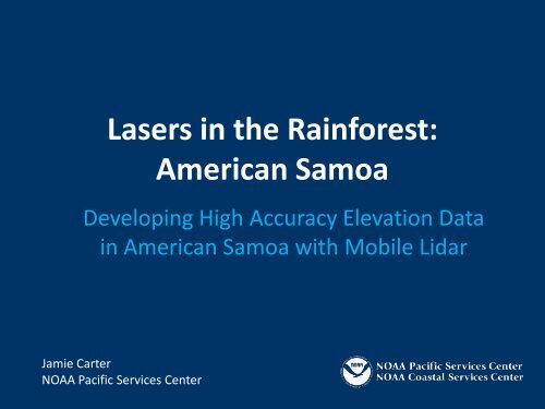
Lasers in the Rainforest:American SamoaDeveloping High Accuracy Elevation Datain American Samoa with Mobile LidarJamie <strong>Carter</strong><strong>NOAA</strong> Pacific Services Center
Outline• Introduction• Phase I: Feasibility study• Phase II: Data collection• Phase III: Data processing• Phase IV: Tsunami modeling• Conclusion
September 29, 2009• 6:48 a.m. – Magnitude 8.1(M w ) earthquake 120 milesto the Southwest• 7:13 a.m. – Tide gaugedetected 3.14-meter wavein harbor• Three additional waves• 191 casualties• $150 million in damages Source:Source:GordonUSGSYamasakiOFR 2010-1018(<strong>NOAA</strong>)
Post-Event Data Collection• U.S. Geological Survey(USGS) deployed rapidresponse field teams• Inundation limit dataWater heights exceeded17 metersInundation observed upto 600 meters inland• Sources of uncertaintyIdentification errordGPS error (2.5m at 95percent confidence)Source: USGS
Height Characterization of Inundation• 15,703 points mapped• 95% of points less than orequal to 15 meters abovemean sea level (USGS NED)Source: USGS
VulnerabilityTypeBelow 15mSchools 63%Gas Stations 83%Businesses 69%Churches/Shelters 79%Commercial (canneries) 100%Communications 100%Fire Stations 100%Police 100%Airport 100%Government buildings 89%Hospital 100%Ferry terminal 100%Utilities 100%
Height Characterization of Inundation• Accuracy z of NED isapproximately ±7 meters• Vulnerability recomputedusing confidence boundsType Below 8m Below 15m Below 22mSchools 43% 63% 78%Gas Stations 50% 83% 89%Businesses 41% 69% 79%Churches/Shelters 66% 79% 86%Commercial 100% 100% 100%Communications 60% 100% 100%Fire Stations 100% 100% 100%Police 50% 100% 100%Airport 100% 100% 100%Government buildings 78% 89% 100%Hospital 100% 100% 100%Ferry terminal 100% 100% 100%Utilities 0% 100% 100%
Phase I: Feasibility StudyTerritory of American SamoaClimateLand CoverGeomorphologyReconnaissance Mission
Territory of American Samoa• 170° West, 14° South• Five volcanic islands andtwo distant atolls• Total land area is 76square miles (mi 2 )• 57,291 people (2000Census)• Tutuila makes up 72% ofland mass and has 97% ofthe populationTutuilaAunu’uTauOfu/Olosega
Climate of American Samoa• Average annualtemperature is 79° F• Mean annual rainfall is200 inches, with frequentshowers• Precipitation occurs 300days per year on average• Rainy season runs fromOctober to May• Dry season runs from Juneto September
Land Cover of Tutuila and Aunu‘uClass NameSquareMilesPercent ofTotalImpervious Surface 3.14 5.66%Developed, Open Space 2.86 5.15%Cultivated Crops 1.24 2.24%Pasture/Hay 0.10 0.17%Grassland/Herbaceous 0.34 0.61%Deciduous Forest 0.00 0.00%Evergreen Forest 43.09 77.72%Scrub/Shrub 4.38 7.90%Palustrine Forested Wetland 0.01 0.02%Palustrine Scrub/Shrub Wetland 0.01 0.02%Palustrine Emergent Wetland 0.01 0.02%Estuarine Forested Wetland 0.00 0.00%Estuarine Scrub/Shrub Wetland 0.00 0.00%Estuarine Emergent Wetland 0.00 0.00%Unconsolidated Shore 0.00 0.00%Bare Land 0.27 0.49%Source: <strong>NOAA</strong> Coastal-Change Analysis Program (C-CAP) 2003
Geomorphology of Tutuila• Eroded summit of a largebasaltic volcano• Drowned coastline andunderdeveloped fringingreefs• 20 miles long by 4 mileswide with peak at 2,142 feet• Steep and narrow valleys• Narrow coastal plains
Reconnaissance Mission• Fa’a SamoaCommunicationsCurfews• Resource assessmentVehiclesEquipment/suppliesCalibration targetsLodgingStorage• Site prioritization withAmerican Samoa DOC
Reconnaissance ReportIdentified Challenges:• Dense ground cover andfoliage along the roads• Dense ground cover andfoliage near buildings• Restricted access near andaround buildings and streams• Steep banks andobstructing shorelinestructures
Final Sites
Phase II: Data CollectionOctober 25 to November 2, 2010Mobile mappingConventional survey
Mobile Mapping SystemOptech Lynx Mobile Mapper• Number of lidar sensors: 2• Cameras: 4 x 5-megapixel• Maximum range: >100 meters• Range precision: ± 8 mm• Absolute accuracy: ± 5 cm• Spatial resolution: 1 cm• Laser measurement rate: 200kilohertz programmable• Returns per laser pulse: 4• Scan field of view: 360 degrees
Mission PlanningSurvey planning performedto evaluate:• Calibration site• Satellite visibility• Route redundancy• Potential data gapsCalibration site
Village Mapping Protocol• Samoan Affairs draftedletter to village councils• Local ASDOC staff selectedfor field support• Village mayors consultedbefore all operations
Mobile Lidar Data Collection• Village scans performedwith support from DOC• Data downloaded daily andchecked for quality andcoverage
Conventional Survey Data Collection• Global Positioning System(GPS) networkProcessed againstContinuously OperatingReference Station (CORS)Ground control for mobilemapping system• Total stationUsed in areas where GPSwas not availablePrimarily focused onslope breaks
Phase III: ProcessingCalibrationClassificationProduct Generation
Mobile Lidar Data
Data Processing• Calibration:Horizontal offsetsGhosting• Classification:Bare earthVegetationBuildingsWaterNoise
Product Generation• Calibrated point cloud• Classified point cloud• Bare-earth surfacesTriangulated irregularnetwork (TIN)Raster digital elevationmodel (DEM)• Contours• Geocoded digital imagery• Metadata
Phase IV: Tsunami ModelingNumerical Grid DevelopmentModeling and Analysis
Numerical Grid Development• <strong>NOAA</strong> NationalGeophysical Data Center(NGDC)3 arc-second seamlessbathymetry/topography1/3 arc-second seamlessbathymetry/topography1/9 arc-second seamless“community” models• Data quality issuesTopographyNearshore bathymetry
Tsunami Modeling<strong>NOAA</strong> Center for TsunamiResearch, Pacific MarineEnvironmental Laboratory(PMEL)• Tsunami generation• Tsunami propagation• Tsunami inundationWave arrival timeWave heightInundation extentTumon Bay, GuamTsunamiZoneRoadsMaps and graphics by: Jessie Huart,<strong>NOAA</strong> Pacific Services Center
ConclusionPros• Mobile platform moreefficient than static• Excellent accuracies inaccessible areas• High-resolution• Rapid acquisitionCons• Data storage• Atmospheric conditions• Vegetation and otherobstructions
AcknowledgementsAmerican Samoa Coastal Management ProgramAmerican Samoa Department of CommerceAmerican Samoa National Park ServiceUnited States Geological SurveyThe Sanborn Map CompanyDean and Isabel HudsonSamoan AffairsThe People of American Samoa
Questions?Jamie.<strong>Carter</strong>@noaa.gov