Intro to Spatial Technologies â Mid-Term Exam Study Guide Spring ...
Intro to Spatial Technologies â Mid-Term Exam Study Guide Spring ...
Intro to Spatial Technologies â Mid-Term Exam Study Guide Spring ...

Create successful ePaper yourself
Turn your PDF publications into a flip-book with our unique Google optimized e-Paper software.
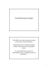
<strong>Intro</strong> <strong>to</strong> <strong>Spatial</strong> <strong>Technologies</strong> – <strong>Mid</strong>-<strong>Term</strong> <strong>Exam</strong> <strong>Study</strong> <strong>Guide</strong><strong>Spring</strong> 2011The exam will have 3 parts. All require writing a couple sentences. The first part will be oneimportant question with 5 sub-questions worth 35 points. You will have <strong>to</strong> answer this questionand it relates <strong>to</strong> a really important concept that you need <strong>to</strong> understand in order <strong>to</strong> use GIS. Thesecond part has 7 questions and you have choice; you are asked <strong>to</strong> answer 5. Each question isworth 10 points. The third part is one question asking you <strong>to</strong> reflect on some of the guestspeakers who have presented projects in class.Important general concepts• The two general types of spatial representation – raster and vec<strong>to</strong>r• The three types of vec<strong>to</strong>r representation• The meaning of “spatial data attributes”• Georeferencing concepts• In general, I want you <strong>to</strong> know (and generally understand) the process I <strong>to</strong>ok youthrough from a 3-D real earth <strong>to</strong> a 2-D map? The 5 major concepts described in thepowerpoint lecture available athttp://courses.umass.edu/nrc297s/PDFs/Georeferencing_concepts.pdf• Spheriods/Ellipsoids/Concept of spherical coordinate systems (you don’t need <strong>to</strong>know specific types – just the concepts)• Geographic versus Projected coordinate systems. Conceptually, how do they differ?• What does the term “Graticule” refer <strong>to</strong>?• Datum, what is it, why is it needed? We’ve used NAD83 in our labs, and I’vementioned that GPS machines default <strong>to</strong> WGS84. What is the difference betweenthese two datums, in general?• Projection, what is it, why is it needed? What are the three main ways of projecting aportion of the Earth’s surface on a flat paper. (note I don’t expect you <strong>to</strong> understandall the different types of projections…)?• What is a fundamental problem with wanting <strong>to</strong> represent a curved surface like theEarth on a flat piece of paper?• What are the four types of dis<strong>to</strong>rtion that could occur from representing a curvedsurface on a flat piece of paper?• Think about the general approach used <strong>to</strong> georeferencing a scanned <strong>to</strong>pomap – e.g., a)reviewing a map for useful ground control points and documenting those coordinates, b) scanthe map on a scanner, c) specifying (or digitizing) the location of these ground control points.What information is important for you <strong>to</strong> make sure you have in this process?• Suppose you found some old aerial pho<strong>to</strong>s of your <strong>to</strong>wn and you wanted <strong>to</strong> georeferencethem. Thinking about the georeferencing process we did in lab, any ideas how would yougeoreference a scanned aerial pho<strong>to</strong>? (We should discuss this one in the exam reviewsession! Ask me!)• What is the concept of “metadata.” Why it is important? What are some examples?• “On the fly projection” – what does it mean?• What are the three main approaches or options <strong>to</strong> getting data in<strong>to</strong> GIS that we’ve talkedabout in class? We’ve done two of them now in our classes and labs and will do one morewhen we return from <strong>Spring</strong> Break.
• What is the utility of digitizing features off of a background map like an orthopho<strong>to</strong>? Whywould you want <strong>to</strong> do this? (This question gets at the real power of GIS)• Key issues related <strong>to</strong> searching for data on the Internet (e.g., key file types <strong>to</strong> look for) –these are technical things we’ve had <strong>to</strong> deal with. E.g., Geotiff, zip files, shp files, MrSid, etc.• Suppose you <strong>to</strong>ok a job and they discovered you have some GIS background and want you<strong>to</strong> develop a GIS for a project they are starting, like the mapping of vernal pools in thepioneer valley. They ask you what this would involve. In four or 5 sentences, what would yousay?• Think about the process of backing up a QGIS project. Generally, what files would you need<strong>to</strong> back up?• What are the pluses and minuses of using open source software?Guest SpeakersI will ask you <strong>to</strong> make some reflections on class guest speakers – all of these used GIS <strong>to</strong> answera question, or <strong>to</strong> help with natural resources management in some way. These powerpoints arelinked on the course calendar page and I provide the URLs below.Lori Pelech talked about Wind Energy and <strong>Spatial</strong> Technology. Her powerpoint is at:http://courses.umass.edu/nrc297s/PDFs/presentations/lori_wind_energy_and_spatial_technology.pdfLara Aniskoff talked about her GIS work <strong>to</strong> simulate streamflow in the Niger River. Powerpointat:http://courses.umass.edu/nrc297s/PDFs/presentations/lara_Using%20GIS%20<strong>to</strong>%20model%20Streamflow%20in%20the%20NRB.pdfMike Akresh talked about Using GIS <strong>to</strong> estimate terri<strong>to</strong>ry size and assess nest site selectionfor a shurbland bird. Powerpoint at:http://courses.umass.edu/nrc297s/PDFs/presentations/akresh_2011.pdfDavid Goodwin: Management Forestry Program, Mass Dept of Conservation and Recreation,talked about GIS trail mapping and a forest management GIS model he built.Powerpoint: http://courses.umass.edu/nrc297s/PDFs/presentations/goodwin%202011.pdf (Note:this is a VERY BIG file… 34MB)