Minutes & Attachments - Marine Corps Base Camp Pendleton
Minutes & Attachments - Marine Corps Base Camp Pendleton
Minutes & Attachments - Marine Corps Base Camp Pendleton
You also want an ePaper? Increase the reach of your titles
YUMPU automatically turns print PDFs into web optimized ePapers that Google loves.
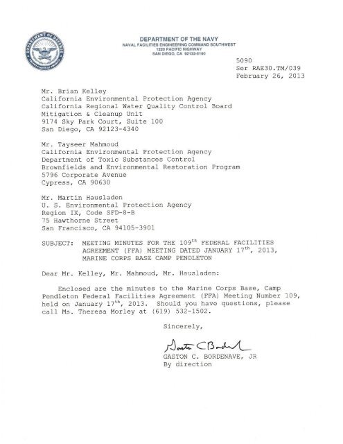
Ms. Prowell announced that she will be transferring to Region 2 of the RWQCB, andthat Brian Kelly will be the interim point of contact for the RWQCB for the <strong>Camp</strong><strong>Pendleton</strong> project.Fiscal Year 2013 Funding and Projects BriefingMs. Morley presented a summary of planned projects (see attached slides). There wassome discussion about the Five Year Review. Site 7 is currently the only site to beincluded in a Five Year Review in 2013. 22/23 Area Groundwater will be included in afuture Five Year Review after the ROD is completed due to the inclusion of Land UseControls in the remedy. Regarding Site 7, the Department of the Navy (DON) will likelypropose a revised monitoring schedule for the site before the next FFA meeting. Ms.Morley noted that the United States Geological Survey (USGS) suggested the use ofphytoremediation at Site 1D. Mr. Hausladen said to check with the people doingphytoremediation at the Long Beach project.Ms. Prowell asked where the USGS data will be published for 22/23 Area and Site1119. Mr. Sacker indicated that the data for 22/23 Area was in the RemedialInvestigation/Feasibility Study (RI/FS) Report for that site, and the Site 1119 RI/FSReport will contain the data from Wells 26016 and 26018.22/23 Area Groundwater Well Siting StudyMr. Griswold provided a summary of the status of the Well Siting Study (see attachedslides). The study is being conducted in a portion of the Santa Margarita Riverdesignated as the Chappo Subbasin. A briefing was held on December 3 with the newdirector of the <strong>Base</strong> Office of Water Resources regarding the IR Program and thisspecific site. The investigation involves installation of wells at multiple screen depths ateach of four locations, and sampling of existing well CH-5a. One of the plannedmonitoring well locations could not be used due to access and habitat issues, and hasbeen relocated on the <strong>Marine</strong> <strong>Corps</strong> Air Station (MCAS). The new planned location is inthe process of being approved by MCAS for biological, air space clear zones, utilities,rig mast height, and operational constraints.Site 21 Pilot Study UpdateMr. Griswold updated the team on the current status of the pilot study at Site 21 (seeattached slides). Some details were provided regarding well installations and injectionof carbon substrate to test the effectiveness of enhanced in-situ bioremediation. Thedata collected to date shows that the initial pilot study injection was successful atreducing volatile organic compound (VOC) (primarily trichloroethene [TCE])concentrations in the treated area. It is anticipated that this expanded pilot study will beas effective in an area of the site with lower concentrations (below approximately 100microgram per liter [µg/L]). Mr. Mahmoud asked if the pond would be sampled, and Mr.Griswold said that is not planned at this time because pond water was sampled in thepast, which showed detections of TCE at concentrations well below regulatoryscreening limits. .Page 2 of 5
Site 1116 Phase I and Phase II Site Inspection ResultsMs. Morley presented a history of investigations and actions at the three subsites thatcomprise Site 1116 (Subsites 140008, 1491, and 14112, see attached slides). Conepenetrometer test (CPT) and hydropunch data at Site 140008 indicate the presence ofTCE up to 280 µg/L, with higher concentrations in the vicinity of the stream channel. AtSubsite 1491, TCE is present up to 84 µg/L, and the higher concentrations are also inthe vicinity of the stream channel. Groundwater appears to flow from Subsite 140008toward the northeast to Subsite 1491 within alluvial sediments in the channel. Ms.Morley noted that the remediation planned at the subsites will proceed, but that therewill also be further delineation of the TCE.There was some discussion about the planned medical clinic that will be built in thevicinity of Building 1431. Dr. Day Gettmann requested that a soil gas survey beconducted where the building is planned. Although the site is thought to be on bedrock,there may be cracks or fissures that could transmit vapor. Ms. Morley agreed that a soilgas survey could be done. Dr. Day Gettmann and Ms. Prowell discussed the possibleneed for a vapor barrier at the new building or possibly adding a ground-floor garage forventilation. There was no FFA Team approval for a permanent structure at this locationwithout a vapor intrusion assessment and/or the possible use of a vapor barrier at thesite. Ms. Prowell said that the figure seemed to show the new building footprint on thestreambed, and Ms. Morley said that the figure in question needs to be corrected.Ms. Morley provided an overview of the status and data obtained at Subsite 14112,where sample results show TCE and fuel-related compounds in groundwater. ARemoval Action Work Plan is in progress for Site 1116.Site 1115 Update for Remedial Investigation/Feasibility Study (RI/FS)Dr. Oslick provided a status update for the Site 1115 RI/FS (see attached slides),including background information for each of the different areas of the site where pastreleases occurred. The three areas are a) Former Underground Storage Tank (UST)Site 1 (Gas Station), b) Former UST sites 5/8/9/17 (Motor Pool Service Bays), and c)Former UST Sites 6/7 (Wash Rack Area). Fuel-related compounds are the primarychemicals of potential concern (COPCs) at the Site 1 area, and a mixture of fuel-ratedcontaminants and solvents are the primary COPCs at the other two locations. Dr.Oslick described groundwater gradients, the results of previous investigations and thelatest data obtained at the site.To address the different areas of contamination at the site, Target Treatment Zones(TTZs) will be established based on the types and concentrations of contaminants ineach area. In addition, the shallow and the deep water-bearing zones at the site willlikely be separate TTZs because the deeper zone has much lower concentrations ofCOPCs, and because a different approach may be needed for the shallow vs. the deepzones.Dr. Oslick showed conceptual maps of where the different TTZs are located on the site,and also described potential technology types that would be considered. He also saidthat it will likely be necessary to have Land Use Controls (LUCs) as part of the remedyfor the site. Ms. Morley noted that a large part of the site may need LUCs initially, butthat the area would likely shrink over time as plumes become smaller. Dr. Mabey askedPage 3 of 5
if the remediation approach for the site would be more aggressive or passive. Ms.Morley said that the hottest spots in the source areas would likely have more aggressivetreatment, and that the more dilute areas outside the source areas may have lessaggressive treatment. There was discussion of several possible treatment options. Dr.Mabey mentioned that thermal remediation was not on the list in the presentation, andnoted that at a recent conference there were interesting results with thermal remediationcombined with persulfate. Dr. Oslick noted that 1,2-dichloroethane (DCA) is arecalcitrant compound, and that naturally high sulfate in groundwater complicates theuse of bioremediation. There was also a brief discussion about the possible use ofthermal remediation at the site, but it was noted that the energy costs for thermal arehigh, and that renewable energy sources will be evaluated.Path Forward for IR Site 33 (52 Area Armory)Ms. Morley summarized the status of Site 33 and the planned approach going forward.The worst of the plume was removed by excavation, and now soil gas will be sampledunder the gun cleaning pad at a depth of 3-6 feet below ground surface to addressvapor intrusion risk. The soil gas sampling cannot be done until mid February due toutility clearances, but if the readings are high, additional excavation may be needed.Ms. Morley noted that if additional excavation is needed, the actual remedy will notchange, but just the footprint. Mr. Hausladen asked if the costs will change substantiallyfrom the Engineering Evaluation/Cost Analysis (EE/CA), and Ms. Morley said that theywill not because the original work came in under that estimate. Mr. Hausladen said thatit may be possible to do an addendum to the Action Memorandum since there are nonew contaminants of concern or difference in approach. It will need to documentchange in site boundary. But, he will check with EPA legal to determine if a differentapproach is needed. Mr. Mahmoud indicated that DTSC would likely be agreeable withwhat the EPA comes up with regarding the needed documentation. Ms. Prowell saidthat an addendum to the Action Memorandum should be appropriate given that furtheraction would still be within the estimated budget. The Team agreed that they are opento this planned modification, but will await the review of the new data to reach finalagreement.Path Forward for Site 1116Ms. Morley noted that the highest concentrations of TCE at Subsite 1491 are in adifferent location than as shown in the Action Memorandum. In the interest ofstreamlining the process, she is proposing that an addendum to the ActionMemorandum be prepared to show the changed location of the planned cleanup action.Mr. Hausladen said that the Navy should send a letter documenting the change and theplanned location.There was also discussion about how the Site 1116 subsites have petroleumcontamination as well as Comprehensive Environmental Response, Compensation, andLiability Act (CERCLA) contaminants. Ms. Prowell agreed with Ms. Morley that it wouldbe helpful to get the sites, or portions of sites, that have petroleum contamination backinto the UST program. The remaining subsites (14112, 1491 and 140008) may becomea new site so IR 1116 could be closed.Page 4 of 5
Schedule for Next FFA MeetingThe next FFA Meeting is scheduled to be held at MCB <strong>Camp</strong> <strong>Pendleton</strong> on May 16,2013.Page 5 of 5
MCB <strong>Camp</strong> <strong>Pendleton</strong>109 th FFA Meeting Agenda101 West Walnut StreetPasadena, CA 91103January 17 th , 20130930 – 0945 Welcome and Introductions (Navy)0945 – 1015 Project Deliverables, FFA Schedule Update and Planned/InProgress Field Work Status (Navy)1015 – 1045 Fiscal Year 2013 Funding and Projects Briefing1045 – 1100 Break1100 – 1200 Presentation on Field Data for Site 1116 and Changes toRemoval Action – 14 Area Groundwater1200 – 1245 Lunch1245 – 1345 Presentation on Field Data for Site 1115 – FSSG Lot1345 – 1430 Discussion on Path Forward for IR Site 33 (52 Area Armory)and Site 1116 (14 Area Groundwater)
Site 33 – 52 Area ArmoryGun cleaning in the armory contributed to a PCE plume downgradient of the armory. A Remedial Investigationand Feasibility Study have been completed for this site. An Engineering Evaluation/Cost Analysis and Non‐Time Critical Action Memorandum have also been completed. The preferred remedy is excavation of thesource material, including groundwater which would then be treated and disposed of in the sanitary sewersystem and is almost complete. Removal Action Work Plancomplete Removal Action (geophysical work started 15 Nov 11)complete Removal Action Completion Report 10/25/2013* Proposed Plan 11/15/2014* Record of Decision 11/15/2015*Site 150 – 21 Area, Location 1This site became an IR site recently after a discovery investigation conducted based on information gainedfrom a former <strong>Marine</strong> stationed at <strong>Camp</strong> <strong>Pendleton</strong>. During the discovery investigation, one location had vinylchloride in soil gas that exceeded risk screening criteria. Field work for the Site Inspection has locatedgroundwater contamination. This will move the site to the Remedial Investigation phase. Site Inspection Field Workcomplete Site Inspection Reportcomplete Remedial Investigation Work Plan 4/21/2013 Field Work for Remedial Investigation 4/21/2014 Remedial Investigation Report 2015* Proposed Plan 2016* Record of Decision 2017*Dates changed (RI added) as a result of the SI field workSite 1003 (Site number is for funding purposes only) – Site 1D GroundwaterThis site is a former burn ash site and has undergone a Remedial Investigation and Feasibility Study for soilonly. A ROD was signed documenting the selected remedy consisting of excavation and off‐base disposal ofcontaminated soil. During the remedial action a cell with 90 drums and drum fragments containing liquid andsolid chemicals was discovered. The drums were removed but the material in the drums had reachedgroundwater. A Remedial Action Closure Report was completed to close out the soil portion of the site, butthe groundwater contamination remains to be addressed. As an interim measure, until funding could besecured for further investigation, 650,000 gallons of the groundwater was pumped from the site, treated anddisposed of in the base sanitary sewer system. This lowered the concentrations of contaminants in
groundwater, however, additional work is planned. This site is for soil only; the groundwater is a new IR Sitelisted as IR Site 1121. This site will close once the Data Gap Analysis Report is complete. Data Gap Analysis for Groundwater Work Plan Data Gap Analysis Field Work Data Gap Analysis Reportcompletecompletein agency reviewSite 1111 – 26 Area Ash and Debris Disposal AreaThis burn ash site was remediated and four quarters of groundwater monitoring have been completed. Thesite was revegetated and a report was written summarizing the actions that had been completed to date, andwhy the site qualified for unrestricted land use. Proposed Plan for No Further Action Record of Decision for NFAcompletein reviewSite 1114 – 41 Area ArroyoThis site was created to investigate the PCE concentrations in one well that used to be associated with IR Site 9(closed). A Site Inspection was carried out and described low‐level concentrations of TPH and vinyl chloridesin soil gas and groundwater. A Remedial Investigation was conducted to validate the findings of the SI and tocomplete a risk assessment for the site. The EPA did not agree with the proposed NFA, therefore the site willmove to the remediation phase. Remedial Investigation Reportcomplete Engineering Evaluation/Cost Analysis & Action Memorandum in progress Removal Action Work Plan 4/1/2013 Removal Action 2013* Removal Action Completion Report 2014* Proposed Plan 2015* Record of Decision 2016*Dates were changed as a result of EPA rejection of AMSite 1115 – 13 Area FSSG LotThere are two plumes underneath the parking lot at this site, one shallow and one deep, containingchlorinated solvents and benzene. A Remedial Investigation and Feasibility Study are needed for the site. Apilot study to evaluate the effectiveness of in‐situ bioremediation of chlorinated solvents in groundwater wascompleted. The technology was successful, but the site geology limited its effectiveness. A TechnicalMemorandum detailing the pilot study is complete. A work plan to collect more data is final and thecontractor is currently in the field; the results will be included in a Remedial Investigation/Feasibility Study.
Tech Memocomplete Work Plan to collect additional data for sitecomplete Field Work to collect additional datacomplete Remedial Investigation/Feasibility Study 4/30/2013 Proposed Plan 4/30/2014* Record of Decision 4/30/2015*Dates were changed as a result of the September 15, 2011 FFA meetingSite 1116 – 14 Area GroundwaterNine USTs were transferred from the UST Program to the IR Program due to low‐levels of chlorinated solvents.A Site Inspection was completed and six of the sites do not warrant further action under the IR Program. Thethree other sites will be remediated. An EE/CA and Action Memo were sent, along with a work plan forlimited investigation to close data gaps, to the agencies for review. Once the field work for the limitedinvestigation is complete, a work plan to remediate the sites will be prepared. Engineering Evaluation/Cost Analysis (3 subsites – Moving Forward) appendix to Action Memo Action Memorandum (3 subsites – Moving Forward) complete Expanded Site Inspection WP (3 subsites – Moving Forward) complete Field Work for Site Inspection (3 subsites – Moving Forward) complete Expanded Site Inspection Report (3 subsites – Moving Forward) appendix to RAWP Removal Action Work Plan (RAWP) (3 subsites – Moving Forward) 3/23/2013 Interim Removal Action (3 subsites – Moving Forward) 8/14/2013* Removal Action Completion Report (3 subsites – Moving Forward) 2014* Proposed Plan for No Further Action (6 subsites – NFA) 2015* Record of Decision (6 subsites – NFA) 2016*Dates were changed as a result of the September 17, 2012 FFA meeting.Site 1117 – 15/16 Area GroundwaterSix USTs were transferred from the UST Program to the IR Program due to low‐levels of chlorinated solvents.The agencies have reviewed the Site Inspection Report recommending the site move into the RemedialInvestigation phase. Field Work for Site Inspectioncomplete Site Inspection Reportcomplete Remedial Investigation Work Plan 5/6/2013 Remedial Investigation Field Work 9/27/2013* Remedial Investigation Report 2014* Proposed Plan 2015* Record of Decision 2016*Remedial Investigation added based on agency comments on Site Inspection
Site 1118 – 21/26/52 Area GroundwaterThree USTs were transferred from the UST Program to the IR Program due to low‐levels of chlorinatedsolvents. The Site Inspection report was reviewed by the regulatory agencies and additional work, including asoil gas investigation, is needed to verify if no further action is appropriate for these sites. An Extended SiteInspection Work Plan to address agency concerns with the Site Inspection Report is in agency review. Extended Site Inspection (ESI) Work Planin progress Field Work for Site Inspection 2/27/2013* Extended Site Inspection Report 9/27/2013* Proposed Plan 5/27/2014* Record of Decision 1/27/2015*Dates changed as a result of document quality issuesSite 1119 – 26 Area GroundwaterThis site was created to investigate the source or sources of chlorinated solvents in the 26 Area productionwells. Field work for the Remedial Investigation has been completed and lab data is in data validation. TCEhad been discovered at two of the wells and further investigation is needed to delineate extent ofcontamination and to locate the source, if possible. An addendum to the Remedial Investigation Work Plan iscurrently in preparation. Field Work for Remedial Investigationcomplete Work Plan Addendum to Delineate Sourcein progress Additional RI Field Work 2013* RI/FS Report 2013* Proposed Plan 2014* Record of Decision 2015*Dates changed as a result of the Jan 19, 2011 FFA meetingSite 62 – Asphalt Batch PlantThis site was created when a transformer containing PCBs tipped over and spilled. A Site Inspection wasperformed, however data was missing and further investigation was needed. An Extended Site Inspection wasconducted and the report is being reviewed by the agencies. The report recommends further action. Extended Site Inspection Work Plancomplete Field Work for Extended Site Inspectioncomplete Extended Site Inspection Reportrecalled Proposed Plan 5/1/2013* Record of Decision 5/1/2014*
Site 1120 – Stuart Mesa Pesticide Maintenance AreasThis site was created in 2012 to address pesticide contamination due to agricultural maintenance activities. APhase II Environmental Assessment was completed for this site in support of real estate agreement closure.The Environmental Assessment is analogous to a Site Inspection, so this site enters the Installation RestorationProgram at the Remedial Investigation stage. Remedial Investigation Work Plan 2013* Remedial Investigation Field Work 2014* Remedial Investigation Report 2015* Proposed Plan 2016* Record of Decision 2017*Site 1121 – Site 1D GroundwaterThis site was created in 2012 to differentiate Site 1D groundwater from Site 1D soil, which was closed due to aprevious remedial action and Record of Decision. There is a plume consisting of elevated concentrations ofVOCs, metals, and pesticides. Remedial Investigation Work Planin progress Remedial Investigation Field Work 4/15/2013 Remedial Investigation Report 2014* Proposed Plan 2015* Record of Decision 2016*Site 1122 – Shot Fall ZoneThis site was created in 2013 to address lead and Polycyclic Aromatic Hydrocarbon contamination due toovershot from skeet range activities off base. Limited soil samples were collected that indicated elevatedlevels of lead, so the site will come into the Installation Restoration Program at the Site Inspection stage. Site Inspection Work Plan 2014* Site Inspection Field Work 2015* Site Inspection Report 2016* Proposed Plan 2017* Record of Decision 2018*
MCB <strong>Camp</strong> <strong>Pendleton</strong> Deliverables SpreadsheetDate: 1/17/13Date Due Agency Comments Response Received From:Item Document Contractor Status to Agencies Due By EPA DTSC RWQCB1 ROD for NFA at Site 1111 SDV Waiting on EPA 12/22/11 2/20/12 28-Mar 15-Feb 17-Feb2 Report for NMOCs - Site 7 Box Canyon Trevet FINAL 2/21/12 4/23/12 NC 23-Apr 26-Apr3 ROD for 22/23 Area Groundwater Parsons Waiting on EPA 5/8/12 7/9/12 25-Jun 27-Jun 9-Jul4 SAP for Well Siting Study - 22/23 Area Groundwater Parsons FINAL 5/23/12 7/23/12 23-Jul 3-Jul 20-Jul5 Work Plan for EISB - 22/23 Area Groundwater Battelle FINAL 6/1/12 7/31/12 1-Aug 24-Jul 23-Jul6 Annual Groundwater Monitoring Report - Site 7 - Box Canyon Trevet FINAL 6/8/12 8/7/12 NC 2-Aug 6-Aug7 SI Report for Site 150 - SEERMA Site TEC FINAL 6/15/12 8/14/12 NC 9-Aug 10-Aug8 Data Gap Analysis Report for Site 1D - Burn Ash Site SDV Responding to agency comments 7/23/12 9/21/12 21-Sep 10-Sep 21-Sep9 ESI Report for Site 62 - Asphalt Batch Plant Recalled10 EE/CA and AM for Site 1114 - 41 Area Arroyo Battelle Responding to agency comments 8/22/12 10/22/12 23-Oct 11-Oct 27-Sep11 Project Completion Report - 12 Area Site 13 SDV Responding to agency comments 9/12/12 11/12/12 NC 8-Nov 5-Nov12 ESI Work Plan for Site 1118 - 21/26/52 Area Groundwater ECM Responding to agency comments 9/17/12 11/16/12 NC 14-Nov 16-Nov13 RI Work Plan - Site 1121 - 1D Groundwater SDV Responding to agency comments 10/10/12 12/10/12 NC 10-Dec 10-Dec14 RI Work Plan Addendum for Site 1119 - 26 Area Groundwater Parsons With agencies 12/19/13 2/18/1315 Work Plan to Install Wells & Monitor Groundwater - Site 33 Trevet Preparing pre-draft 3/15/1316 ESI Report for Site 1116 - 14 Area Groundwater ECM Preparing pre-draft 3/23/1317 Removal Action Work Plan - Site 1116 14 Area Groundwater ECM Preparing pre-draft 3/23/1318 RAWP for Site 1114 - 41 Area Arroyo Trevet Preparing pre-draft 4/1/1319 RI Work Plan for Site 150 - 21 Area Boat Basin Trevet Preparing pre-draft 4/21/1320 RI/FS for Site 1115 - FSSG Lot Parsons Preparing pre-draft 4/30/1321 RI Work Plan for Site 1117 - 16/17 Area Groundwater Trevet Preparing pre-draft 5/6/13Agencies have commented
MCB <strong>Camp</strong> <strong>Pendleton</strong> Fieldwork SpreadsheetDate: 1/17/13Item Field Work Planned Start Date Planned Completion Date2/6 - 2/8: Well Installations12/13 - 2/15: Well Develop/SurveyField Work for 22/23 Area Groundwater ZVZ2/20 - 2/24: <strong>Base</strong>line GW Event/SlugPilot StudyTest April -Install PRBon hold2 Field Work for Site 1116 ESI complete3 Field Work for Site 21 Pilot Study (remob) complete4 Field Work for Site 1115 Data Collection complete5 Field Work for Site 1118 ESI February6 EISB Pilot Study - 22/23 Area GW February7 Well Siting Study - 22/23 Area Groundwater 3-Dec-12 15-Mar-138 RI Field Work - Site 1D
Date: 1/17/13RTC ApprovedItem Document Contractor RTCs to agencies EPA DTSC RWQCB1 ROD for NFA at Site 1111 SDV RTCs sent 11/26 26-Nov 26-Nov2 ROD for 22/23 Area Groundwater Parsons addl RTCs sent 9/4 31-Aug 4-Sep3 Data Gap Analysis Report for Site 1D - Burn Ash Site SDV4 EE/CA and AM for Site 1114 - 41 Area Arroyo Battelle5 Project Completion Report - 12 Area Site 13 SDV6 RI Work Plan Site 1121 - 1D Groundwater SDV7 Work Plan Addendum for Site 1119 - 26 Area GW Parsons8 ESI Work Plan for Site 1118 - 21/26/52 Area GW ECM9 RI Work Plan - Site 1D Groundwater SDV10 RI/FS for Site 1115 - FSSG Lot Parsons11 Removal Action Work Plan - Site 1116 14 Area GW ECM12
109 th FFA MeetingJanuary 17,2013• 22/23 Area Groundwater – Land UseControl Implementation Plan (LUCIP)• 22/23 Area Groundwater – 1 st yeargroundwater monitoring• Site 7 (Box Canyon Landfill) – InstallGas Probes to Replace GP-14 and GP-15• Site 7 – Five Year Review (in-house)
• Site 7 – Revegetation• Site 7 – Long Term Monitoring andMaintenance/Operation of Gas ControlSystem• Site 33 (52 Armory) – Excavate GunCleaning Pad for Vapour Intrusion Risk• Site 33 – Proposed Plan and Record ofDecision• Complete Site 62 (Asphalt Batch Plant)• Site 1114 (41 Area Arroyo) – InstallMonitoring Wells and GroundwaterSampling• 12 Area Site 13 – EngineeringiEvaluation/Cost Analysis and ActionMemorandum• Site 1115 (FSSG Lot) – Pave crescent andRemedial Action
• Site 1116 (14 Area Groundwater) –Performance Monitoring• Site 1116 – Investigate TCE Plume?• Site 1119 (26 Area Groundwater) –Proposed dPlan and dRecord of Decisioni• Revegetation• Monitoring Well Database• New Site 1120 (Ag Fields MaintenanceArea) – Remedial Investigation• New Site 1121 (Site 1D Groundwater) –Pilot Study with USGS forPhytoremediation?• New Site 1121 – Proposed Plan andRecord of Decisioni• New Site 1122 (Shot Fall Zone) –Remedial Investigation?
MCB CAMP PENDLETON22/23 AREA GROUNDWATERWELL SITING STUDY(CHAPPO SUBBASIN)S 17 January 2013109 th FFA Meeting{}CHAPPO SUBBASIN INVESTIGATIONUpdate: December 5, 2012 – Sent Final Sampling andAnalysis Plan to FFA Team December 3, 2012 - Briefed OWR on the IR Program,this IR Site, and the New Well December 28, 2012 - Sampled Well CH-5A‣ HydraSleeves for 1,2,3,-TCP – Preliminary Results ND.‣ Passive Diffusion Bags (PDBs) placed to sample for all otherVOCs (will return to collect samples January 18, 2013). January 21 – Planned start date for drilling and well{} installation2
CHAPPO SUBBASIN INVESTIGATIONWell CSB-MW2: Original well location could not be used due toaccess issues and habitat concerns. December 13, 2012 - Meeting held at MCAS todetermine alternate location. Alternate location approved by <strong>Base</strong> Office of WaterResources (OWR). Alternate location in process of being approved byMCAS (biological, air space clear zones, utilities, rigmast height, and operational constraints).{} 3CHAPPO SUBBASIN INVESTIGATION{} 4
MCB CAMP PENDLETONSITE 21PILOT STUDY UPDATE17 January 2013109 th FFA Meeting{}Update:Site 21 Pilot StudyMay 2012 - New wells installed and baseline groundwatersamples collected and analyzed. July 2012 - Initial expanded injection began.{} 2
Update:Site 21 Pilot StudyAugust/September 2012 - Injection wells 21W-28 and 21W-29 werere-drilled d and re-installed with stronger annular seal.October 2012 - Injectioncompleted at wells21W-4B, 21W-25,2521W-28, and 21W-29.Substrate consisted ofemulsified vegetableoil (EVO), pH buffer,dairy whey, and sitegroundwater.{} 3Injection Details:Site 21 Pilot StudyGroundwater was extracted from site monitoring wells usingsubmersible pumps and placed in two 500 gallon storage tanks.Monitoring wells used for groundwater extraction included:21W-13, 21W-14, 21W-18B, 21W-20B, 21W-23, 21W-26, 21W-27,21W-30, and 21W-31.EVO and dairy whey were added directly to the tankscontaining extracted groundwater then mixed usingdiaphragm pump.pH buffer was added using a dosimeter.Injection volumes in individual wells were adjusted toaccommodate for actual hydraulic conditionsencountered during the field effort.{} 4
Injection Details:Site 21 Pilot StudyHydraulic communication was verified in the fieldby water level l measurements in monitoring i wells inproximity to the injection wells and/or the presenceof substrate in extraction wells.Hydraulic communication was observed in wells21W-13, 21W-20B, 21W-23, 21W-26, 21W-27, 21W-30,and 21W-31.Substrate was uniformly distributed through theentire treatment area based on locations wherehydraulic communication was observed.Next performance groundwater sampling isscheduled to occur late February 2013.{} 5Site 21 Pilot Study Injection{}6
IR SITE 1116 PHASE I & II SIIR SITE 1116 PHASE I AND PHASE IISITE INSPECTION RESULTS1JANUARY 17, 2013, FFA MEETINGIR SITE 1116 PHASE I & II SIHistory• March 2007 - Nine UST sites in Area 14 transferred to IRProgram. Designated as Site 1116.• We now refer to the UST sites as “Subsites” of Site 1116.• 2010 – Site Inspection investigated previously identifiedVOCs in soil and groundwater at six Subsites.• February 2011 – SI Report recommended additionalinvestigations for Subsites 1491, 14112 and 140008.• EE/CA and Action Memorandum for interim remedialaction have been approved by the FFA.2
IR SITE 1116 PHASE I & II SISubsite 14112Subsite 1491Subsite1400083IR SITE 1116 PHASE I & II SIPhase I SI Activities Conducted (April 2012)• UST Search at Subsite 140008:• Purpose: Locate the possible presence of a heating oil tank orany other undocumented USTs.• A records search did not indicate the presence of additionalUSTs near Building 140008.• Geophysical survey:• Covered approximately 15,000 square feet area near well RW1and in the area of historical high TCE concentrations.• The only anomaly was a storm drain inlet.4
IR SITE 1116 PHASE I & II SIPhase I SI – Geophysical Survey Near Building 140008GeophysicalSurvey Area512,000gallonUSTremovedin 1995IR SITE 1116 PHASE I & II SIPhase I SI Activities Conducted (April 2012)• Cone penetration test (CPT) investigation:• To facilitate the placement and screening of groundwatermonitoring wells.• 10 CPT locations at Subsite 140008.• 17 CPT locations at Subsite 1491.• Groundwater sampling at CPT locations withHydropunch® sampler.6
IR SITE 1116 PHASE I & II SIPhase I SI – Hydropunch® TCE Concentrations (Subsite 140008)• TCE concentrationsrange from non-detectto 280 μg/L.• Higher concentrationsin the vicinity i it of thestream channel7StreamChannelIR SITE 1116 PHASE I & II SIPhase I SI – Hydropunch TCE Concentrations (Subsite 1491)• TCE concentrations rangefrom non-detect to 84 μg/L.• Higher concentrations in thevicinity of the stream channelStreamChannel8
IR SITE 1116 PHASE I & II SIPhase II SI (October 2012) – Subsite 140008• <strong>Base</strong>d on historical and Phase I results, eight groundwatermonitoring wells (MW5, MW6, MW7A, MW7B, MW8A,MW8B, MW9, and MW10) were installed.• Two locations were dry (PMW-2 and PMW-3, located south of15 th Street) (boring refusal at granitic bedrock).• The borings indicate that soils are characterized by silts andsands underlain by sandstone and siltstone north of the streamchannel and granitic bd bedrock south of fthe stream channel.9• The stream channel is underlain by unconsolidated soils(undifferentiated titdweathered bedrock, alluvium and fill soils) andare more permeable than bedrock to either side.IR SITE 1116 PHASE I & II SIGroundwater Elevation Contours (Subsite 140008)StreamChannel10Topographyincreases south of15 th street (hill)
IR SITE 1116 PHASE I & II SIGroundwater TCE Concentrations (Subsite 140008)StreamChannelTopography11increases south of15 th street (hill)IR SITE 1116 PHASE I & II SIPhase II SI (October 2012) – Subsite 140008• Groundwater flow:• Inferred groundwater flow direction is towards the northeast.• Seems to follow the stream channel.• TCE concentrations:• Relatively high in the vicinity of the stream channel.• Reported TCE concentrations range from 0.34 μg/L (estimated value)(MW2) to 340 μg/L (MW10).• Reported PCE concentrations range from 0.2 μg/L (MW2) to 5.7μg/L (MW10).12
IR SITE 1116 PHASE I & II SIPhase II SI (October 2012) – Subsite 1491• <strong>Base</strong>d on historical and Phase I results, eight groundwatermonitoring wells (MW13, MW14, MW15, MW16A, MW16B,MW17, MW18, MW19) were installed.• <strong>Base</strong>d on the borings and the Morro Hill 7.5' Quadrangle map,soils at the site are characterized by silts and sands underlain bygranitic bedrock.• The stream channel is underlain by unconsolidated soils(undifferentiated weathered bedrock, alluvium and fill soils) andare more permeable than bedrock to either side.13IR SITE 1116 PHASE I & II SIGroundwater Elevation Contours (Subsite 1491)14StreamChannel
IR SITE 1116 PHASE I & II SIGroundwater TCE Concentrations (Subsite 1491)StreamChannel15IR SITE 1116 PHASE I & II SIPhase II SI (October 2012) – Subsite 1491• Groundwater flow:• Inferred groundwater flow direction is towards the northeast.• TCE concentrations:• Relatively high in the vicinity of the stream channel.• Reported TCE concentrations range from 0.39 μg/L (estimated value)(MW05) to 220 μg/L (MW13).• Reported concentrations of PCE ranged from 0.2 μg/L(estimated value) (MW18) to 37μg/L 3.7 (MW13).• Reported concentrations of benzene range from 0.33 μg/L(estimated value) (MW01) to 58μg/L 5.8 (MW12).16
IR SITE 1116 PHASE I & II SIPHASE II ACTIVITIES (October 2012) – Subsite 14112• Two 1,500 gallon reinforced concrete USTs used for storingdiesel fuel were removed in 1997.• During the 2010 SI, 1,2-DCA, benzene, cis-1,2-DCE, and TCEwere detected at concentrations exceeding the project screeninglimits.• MW13 was installed downgradient of MW-5 and MW-10 todelineate TPH and VOCs.• Sampled MW01 with phase separated hydrocarbons (PSH).17• All wells without PSH were sampled.IR SITE 1116 PHASE I & II SIGroundwater Elevation Contours (Subsite 14112)New WellHydraulic headvalues at WellsMW01 andMW04 werecorrected forphase separatedhydrocarbons18
IR SITE 1116 PHASE I & II SIGroundwater Sample Results (Subsite 14112)New Well19IR SITE 1116 PHASE I & II SISI ACTIVITIES (October 2012) – Subsite 14112• Groundwater flow direction is generally to the northeast.t• Separate phase hydrocarbons were observed in MW01 (0.72 ft) and MW04(0.22 ft).• Groundwater sampling results – new well (MW13):• Benzene was reported at an estimated concentration of 0.37 μg/L(below the project screening limit i [0.39 μg/L] / ] [tapwater RSL].• Remaining analytes were not reported at or above the respectivereporting limits.20
IR SITE 1116 PHASE I & II SISI ACTIVITIES (October 2012) – Subsite 14112• Summary of Groundwater Sampling results for the remaining Wells:(Analytes with at least one reported concentration above the respective ProjectScreening Limit):Analyte MinimumConcentration(μg/L) MaximumConcentration(μg/L)1,2-DCA 0.20 J (MW01) 0.96 J (MW10-1A)Benzene 0.31 J (MW10) 32 (MW01)Naphthalene 0.44 J (MW08) 150 (MW01)PCE 0.16 J (MW10) 0.27 J (MW01)TCE 0.85 J (MW11) 7.5 (MW05)cis-1,2-DCE 1 U (various) 13 (MW01)21IR SITE 1116 PHASE I & II SIQUESTIONS?22
SOUTHWEST DIVISIONMCB <strong>Camp</strong> <strong>Pendleton</strong>IR Site 1115Remedial Investigation/Feasibility StudyFFA Meeting - January 17, 20131 NAS North Island Operable Unit 20Presentation OverviewI. Background InformationII.III.A. Former UST Site 1 (Gas Station)A. Nature of ContaminationB. Removal Actions / Pilot StudiesB. Former UST Sites 5/8/9/17 (Motor Pool Service Bays)A. Nature of ContaminationB. Removal Actions / Pilot StudiesC. Former UST Sites 6/7 (Wash Rack Area)A. Nature of ContaminationExtent of Contamination – Conceptual Designation ofTarget Treatment ZonesGeneral Response Actions & Technology Screening2 NAS North Island Operable Unit 20 January 17, 2013
IR Site 1115 - LocationSite 6/7Site 1Site5/8/9/173 NAS North Island Operable Unit 20 January 17, 2013I. Background InformationFormer Site 1 Gas Station• 10,000 Gallon gasoline UST• Sources: UST leak, well (abandoned) screenedacross aquitard (deep aquifer source)Principal Contaminants• Large benzene/petroleum hydrocarbon (TPH)/1,2-dichloroethane (1,2-DCA) plume in shallow and deep aquifer zones;trichlorethene (TCE) and daughter products farther from Site 1• Historical free product TPH (gasoline)Interim Actions Completed• Abandonment of long-screened well• Soil removal action in 2001 (vadose zone)• Soil vapor extraction/air-sparge pilot test (2001)4 NAS North Island Operable Unit 20 January 17, 2013
I. Background InformationFormer UST Sites 5/8/9/17• UST 5: 1,500 gal UST for diesel/heating• UST 8: 200 gal UST for diesel/heating• UST 9: 650 gal UST for waste oil• UST 17 (pipeline connecting USTs 5 & 8)Principal Contaminants• TPH, TCE, daughter products• Historical free-product TPH (shallow aquifer)• Dilute plume in deep aquiferInterim Actions Completed• Free product removal• SVE/product extraction pilot test (2001)• Bioremediation pilot test (2009)5 NAS North Island Operable Unit 20 January 17, 2013I. Background InformationFormer UST Sites 6/7• UST 6: 350 gal UST for oily waste• UST 7: 500 gal UST for oily waste• Wash RackPrincipal Contaminants• TPH, TCE, Benzene, 1,2-DCAInterim Actions Completed• Free product removal6 NAS North Island Operable Unit 20 January 17, 2013
Groundwater Flow – Shallow Aquifer7 NAS North Island Operable Unit 20 January 17, 2013Groundwater Flow – Deep Aquifer8 NAS North Island Operable Unit 20 January 17, 2013
II. Extent of Contamination –Recent Additional DelineationFour new monitoring wells installed and sampled in 2012:• 1115-MW9– Purpose: Define deep aquifer VOC conditions on west side of Site 1115.– Results were below Maximum Contaminant Levels (MCLs). Trichloroethene(TCE) and chloroform were above Project Screening Limits (PSLs).• 1115-MW10 and 1115-MW11– Purpose: Shallow aquifer VOC delineationsoutheast of Site 5/8/9/17– Results were below PSLs• 1115-MW12– Purpose: Refine limit of VOC contamination innortheast portion of Site 1115– Results were below MCLs; Above PSLs forbenzene, TCE, napthalene9 NAS North Island Operable Unit 20January 17, 2013II. Conceptual Target Treatment Zones(TTZs)• Purpose: TTZs are designated to promoteoptimal selection of response actions andremedial alternatives.• TTZs represent distinct chemical and/orhydrogeological conditions.• Delineation of boundaries of dilute plume (nonsourcearea) TTZs will be based on thedominant contaminants present in each area.• “Source zone” TTZs will be defined based onestimated contaminant concentrationthresholds.10 NAS North Island Operable Unit 20 January 17, 2013
II. Extent of Contamination & Conceptual ShallowTarget Treatment Zones (TTZs)11 NAS North Island Operable Unit 20 January 17, 2013II. Extent of Contamination & ConceptualDeep Target Treatment Zones12 NAS North Island Operable Unit 20 January 17, 2013
II. Conceptual Target Treatment ZonesCross-Section Locations13 NAS North Island Operable Unit 20 January 17, 2013II. Conceptual Target Treatment Zones14 NAS North Island Operable Unit 20 January 17, 2013
II. Conceptual Target Treatment Zones15 NAS North Island Operable Unit 20 January 17, 2013II. Conceptual Target Treatment Zones16 NAS North Island Operable Unit 20 January 17, 2013
II. Conceptual Target Treatment Zones17 NAS North Island Operable Unit 20 January 17, 2013III. General Response ActionsWide range of GRAs are potentially applicable at Site 1115 due tothe following factors:• Large aerial extent of contaminant dilute plumes• Shallow and deep aquifers impacted• Locally high concentrations of contaminants, free product• Complex contaminant mixtures• Most aquifer areas are very fine grained; pilot studiesrevealed difficulties of implementing various in-situalternatives• Remediation is anticipated to require substantial time18 NAS North Island Operable Unit 20 January 17, 2013
III. General Response Actions(Continued)• Current site use is only for intermittent equipment staging.• Land use controls for future land uses and groundwater usemay be identified; potentially released as unrestricted asremedial actions are deemed effective over time.• Remedial Investigation will evaluate the boundaries of IRSite 1115 to support proposed limits of land use controls, ifimplemented.19 NAS North Island Operable Unit 20 January 17, 2013III. Technology Screening/Alternatives AnalysisTechnology Screening & Remedial Alternatives Analysis• The NOREAS/Parsons team is performing a comprehensivetechnology screening and identification of remedialalternatives for each TTZ• Anticipate Navy RAA review process in Jan/Feb 201320 NAS North Island Operable Unit 20 January 17, 2013
III. Technology Screening/Alternatives AnalysisGRA Technology Types Screening CommentsGroundwaterNo action Not applicable Retained, required by NCPIn situ treatmentBiological (e.g. in situ bioremediation), chemical (e.g. inRetained, in situ treatment techniques potentially effectivesitu chemical oxidation), physical (e.g. air sparging/soiland implementable.vapor extraction)Ex situ treatment Removal (on-site treatment or off-site disposal)Retained, ex situ treatment techniques potentially effectiveand implementable, principally in sources zones.MonitoringMonitored Natural AttenuationRetained, potentially effective and implementable for lowconcentration areasInstitutional controls Land-use restrictionsRetained, if required to address risk during long-termremediationAccess restrictions Engineering controls (fences, etc.) Due to depth of groundwater, eliminated as not applicableContainment Hydraulic control Plumes are largely stable based on long-term monitoringSoilNo action Not applicable Retained, required by NCPIn situ treatmentt tBiological (bioventing), physicochemical (insitusolidification, soil vapor extraction)Retained, potentially ti effective for source areasEx situ treatment excavation with on-site treatment or off-site disposal Retained, potentially effective for source areasMonitoringSoil gas monitoringEliminated, not applicable to high concentrations observed insource areasInstitutional controls Land-use restrictions Retained, potentially effective for source areasAccess restrictions Engineering controls Retained, potentially effective for source areasContainment Capping Retained, potentially effective for source areas21 NAS North Island Operable Unit 20 January 17, 2013


