Chelsea Open Space and Recreation Plan 2010 - Chelsea City Hall
Chelsea Open Space and Recreation Plan 2010 - Chelsea City Hall
Chelsea Open Space and Recreation Plan 2010 - Chelsea City Hall
- No tags were found...

Create successful ePaper yourself
Turn your PDF publications into a flip-book with our unique Google optimized e-Paper software.
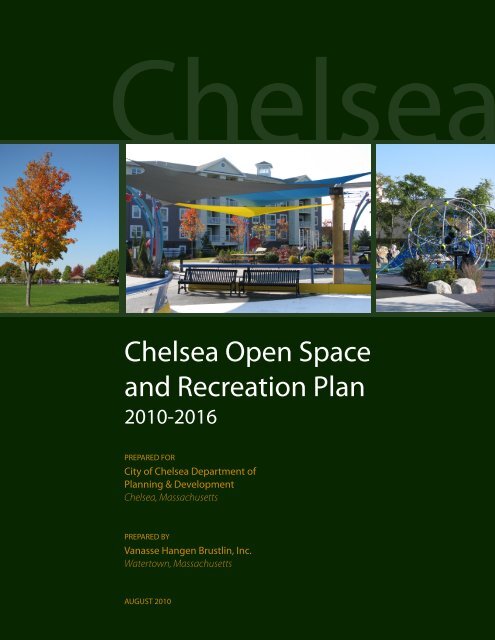
<strong>Chelsea</strong><strong>Chelsea</strong> <strong>Open</strong> <strong>Space</strong><strong>and</strong> <strong>Recreation</strong> <strong>Plan</strong><strong>2010</strong>-2016PREPARED FOR<strong>City</strong> of <strong>Chelsea</strong> Department of<strong>Plan</strong>ning & Development<strong>Chelsea</strong>, MassachusettsPREPARED BYVanasse Hangen Brustlin, Inc.Watertown, MassachusettsAUGUST <strong>2010</strong>
1<strong>Plan</strong> Summary<strong>Chelsea</strong> is a densely populated, urban community located just north of Boston. Onceincluding the territory that now makes up Revere, Winthrop, <strong>and</strong> a portion ofSaugus, <strong>and</strong> once being part of Boston, today’s 2.2 square mile city comprises thesmallest community in the Commonwealth.Since 1995, <strong>City</strong> government has operated under a manager/council form ofgovernment. A strong city manager maintains all hiring <strong>and</strong> firing authority <strong>and</strong> isresponsible for the day-to-day operations of a twenty-first century municipality. The11-member <strong>City</strong> Council that selects a <strong>City</strong> Manager is also responsible for budgetadoption, general policy development <strong>and</strong> approval <strong>and</strong> oversight of the municipaladministration. The two-year Council is comprised of three members elected at-large<strong>and</strong> eight elected in individual districts.In 2000, with the appointment of the current <strong>City</strong> Manager, the philosophical tenet of<strong>City</strong> government was identified <strong>and</strong> subsequently advanced by a core set ofprinciples, dubbed the ‚Fundamentals.‛ Those six guiding principles continue tosteer the administration of the <strong>City</strong> on matters relating to finance, economicdevelopment, public safety, neighborhood enhancement, community development,<strong>and</strong> general government philosophy. As a result of an adherence to theFundamentals, as well as responsible municipal leadership from the <strong>City</strong>’s elected<strong>and</strong> appointed leaders <strong>and</strong> significant contributions from the <strong>City</strong>’s otherstakeholders, today’s <strong>Chelsea</strong> enjoys a growing reputation for operation <strong>and</strong>revitalization.As the Fundamentals relate to open space, finance ensures funds exist to create <strong>and</strong>maintain open space. Economic development helps to support the expansion of thetax base to finance open space <strong>and</strong> also creates opportunities for open spacedevelopment as part of an overall development project. Public safety is obviouslycritical to the safe enjoyment of open space. Neighborhood enhancement especiallypromotes the creation <strong>and</strong> maintenance of open space supporting the <strong>City</strong>’sneighborhoods. Community development counts among its goals the need to havemunicipal facilities, including open space, support the needs of the <strong>City</strong>’s residents,\\mawald\ld\10892.00\reports\<strong>Chelsea</strong> <strong>Open</strong><strong>Space</strong> <strong>Plan</strong> Update <strong>2010</strong>.docx 1 Introduction August <strong>2010</strong>
especially its youth. General government philosophy supports the concept thatstakeholders, including open space advocates, need to <strong>and</strong> should be heard onimportant issues impacting them <strong>and</strong> their community, with that input thentranslating into action.Just as open space is supported by all the Fundamentals, the <strong>City</strong>’s open space <strong>and</strong>recreation initiatives can play a pivotal role in achieving the Fundamentals. <strong>Open</strong>space promotes economic growth <strong>and</strong> opportunity that supports finance, economicdevelopment, neighborhood enhancement, <strong>and</strong> community development. This isespecially true of neighborhood enhancement, where the upgrade or establishmentof a new park can be a major determining factor in the revitalization of thatneighborhood. Public safety is advanced as parks <strong>and</strong> other recreationalopportunities provide kids with places to get off of the streets <strong>and</strong> help reduce thestress of living in a densely populated community. Even when it comes to generalgovernment philosophy, stakeholders react more favorably to the <strong>City</strong>’s overallagenda when they see their needs <strong>and</strong> desires being addressed through open spaceemphasis. The participation in planning meetings <strong>and</strong> neighborhood cleanups helpsto build community, a substantial goal of that Fundamental.In October of 2003, <strong>and</strong> with the goal of promoting the livability <strong>and</strong> vitality of thecommunity, the <strong>City</strong> published its last <strong>Open</strong> <strong>Space</strong> <strong>and</strong> <strong>Recreation</strong> <strong>Plan</strong>. Since thattime <strong>Chelsea</strong> has made significant progress towards the goals of that plan <strong>and</strong>subsequent updates. A series of parks <strong>and</strong> open spaces were rehabbed, three schools<strong>and</strong> adjacent open space were rebuilt, new parks have been built, <strong>and</strong> communitygroups have become active in developing improved access to the <strong>Chelsea</strong> waterfront.This plan seeks to continue the efforts outlined in the 2003 <strong>Plan</strong> <strong>and</strong> provide thefacilities <strong>and</strong> environments that are most needed by <strong>Chelsea</strong>'s dense urbanpopulation.\\mawald\ld\10892.00\reports\<strong>Chelsea</strong> <strong>Open</strong><strong>Space</strong> <strong>Plan</strong> Update <strong>2010</strong>.docx 2 Introduction August <strong>2010</strong>
2IntroductionStatement of PurposeThe purpose of this <strong>Plan</strong> is to provide both a targeted framework <strong>and</strong> strategy forfuture management of <strong>Chelsea</strong>’s open space <strong>and</strong> recreation resources. It comes at atime when the dem<strong>and</strong> for parks <strong>and</strong> recreation facilities has grown dramaticallygiven the dense population <strong>and</strong> lack of open spaces in <strong>Chelsea</strong>. This updated planwill assist <strong>Chelsea</strong> in making intelligent decisions about its future policies,particularly with respect to maintenance <strong>and</strong> enhancement of existing facilities, giventhe lack of space for significant expansion. The purpose of this plan is to make thosedecisions clear <strong>and</strong> prioritize them relative to the <strong>City</strong>’s needs.The last <strong>Chelsea</strong> <strong>Open</strong> <strong>Space</strong> <strong>and</strong> <strong>Recreation</strong> <strong>Plan</strong> was completed in 2003. This planreviews progress since then, elaborates on some of the goals <strong>and</strong> objectives, <strong>and</strong>identifies actions to direct open space improvements for the next seven years.The primary goals of the plan are:Provide recreational <strong>and</strong> fitness opportunities suited to <strong>Chelsea</strong>'s population;Take advantage of <strong>Chelsea</strong>'s environmental, historic, <strong>and</strong> scenic resources;Integrate the open space into the city fabric.<strong>Plan</strong>ning Process <strong>and</strong> Public ParticipationThe goals, objectives <strong>and</strong> actions outlined in this plan were developed from thefollowing sources:<strong>Chelsea</strong> Department of <strong>Plan</strong>ning <strong>and</strong> Development;Two Public Meetings;A inventory of the conditions of <strong>City</strong>-owned parks <strong>and</strong> facilities;Consultation with state <strong>and</strong> local stakeholders;\\mawald\ld\10892.00\reports\<strong>Chelsea</strong> <strong>Open</strong><strong>Space</strong> <strong>Plan</strong> Update <strong>2010</strong>.docx 3 Introduction August <strong>2010</strong>
Consultation with the <strong>Chelsea</strong> Green <strong>Space</strong> <strong>and</strong> <strong>Recreation</strong> Committee;Consultation with the <strong>Chelsea</strong> Housing Authority;Consultation with the <strong>Chelsea</strong> School Department; <strong>and</strong>Review of information in the 2003 <strong>Open</strong> <strong>Space</strong> <strong>and</strong> <strong>Recreation</strong> <strong>Plan</strong>A key step in the planning process was site visits to significant open space <strong>and</strong>recreation parcels in <strong>Chelsea</strong> in June 2009. The tour was guided by staff from theDepartment of <strong>Plan</strong>ning <strong>and</strong> Development <strong>and</strong> provided a means of gaining insightinto the condition, type, <strong>and</strong> quality of <strong>Chelsea</strong>’s open space <strong>and</strong> recreationresources. Additionally, as discussed in Chapter 5 (Inventory of L<strong>and</strong>s ofConservation <strong>and</strong> <strong>Recreation</strong> Interest), the <strong>City</strong> has conducted detailed assessmentsof each park to determine its condition <strong>and</strong> need for enhancements during thisseven-year planning horizon.A public forum was held in the process of updating the <strong>Plan</strong>. The forum was held at<strong>City</strong> <strong>Hall</strong> in June 2009. The forum served to inform the public on open space <strong>and</strong>recreation planning in general, the progress of the <strong>Plan</strong>, as well as to seek input onhow to shape the new <strong>Plan</strong>. It provided valuable insight into what the citizens of<strong>Chelsea</strong> felt the most important areas of the <strong>Plan</strong> should be <strong>and</strong> how to successfullyfulfill them. Two key exercises were performed at the first public forum to reachthese conclusions:A Strengths, Weaknesses, Opportunities, Threats (SWOT) exerciseA voting exercise designed to validate <strong>and</strong> update the goals <strong>and</strong> objectivesfrom the 2003 <strong>Open</strong> <strong>Space</strong> <strong>and</strong> <strong>Recreation</strong> <strong>Plan</strong>The results of the SWOT exercise are discussed in Appendix B.Additionally, the <strong>City</strong> has undertaken a number of planning efforts that involvestakeholders with an interest in open space <strong>and</strong> recreation. In 2007, the <strong>City</strong>conducted a planning study for the <strong>Chelsea</strong> Creek waterfront, which included localcommunity groups including community groups such as the <strong>Chelsea</strong> Creek ActionGroup, the <strong>Chelsea</strong> Green <strong>Space</strong> <strong>and</strong> <strong>Recreation</strong> Committee, <strong>and</strong> the <strong>Chelsea</strong> CreekRestoration Partnership.That same year, the <strong>City</strong> completed a plan for its Gerrish-Bellingham neighborhoodthat, among other issues, identified a need for open space. This plan was followedby a cooperative planning effort between the <strong>City</strong> <strong>and</strong> <strong>Chelsea</strong> NeighborhoodDevelopers (CND), a local non-profit, that identified specific open space initiatives inthat neighborhood.In 2009, the <strong>City</strong> was designated a Gateway Community <strong>and</strong> was awarded aGateway Communities Plus grant to complete a planning study for the Addison-Orange neighborhood. That study identified a number of constraints that affect theneighborhood, including the lack of open space, <strong>and</strong> developed an action plan toaddress the neighborhood’s needs.\\mawald\ld\10892.00\reports\<strong>Chelsea</strong> <strong>Open</strong><strong>Space</strong> <strong>Plan</strong> Update <strong>2010</strong>.docx 4 Introduction August <strong>2010</strong>
Enhanced Outreach <strong>and</strong> Public ParticipationMassGIS has identified the <strong>City</strong> as having Environmental Justice populationsthroughout the entire <strong>City</strong>. See Map 2, Environmental Justice Populations. The largest ofthese populations are the Spanish speaking groups from Central America <strong>and</strong> PuertoRico. For specialized planning efforts, the <strong>City</strong> traditionally issues its meeting noticesin English <strong>and</strong> Spanish, posts the meeting notices with the <strong>City</strong> Clerk <strong>and</strong> on the <strong>City</strong><strong>Hall</strong> bulletin board, provides copies of the notices to the <strong>City</strong> Councilors, <strong>and</strong> placesthe notice in the local paper. In the case of the <strong>Open</strong> <strong>Space</strong> <strong>and</strong> <strong>Recreation</strong> <strong>Plan</strong>hearing, the <strong>City</strong> not only did all of this, but also posted the notice in the <strong>Chelsea</strong>Library, on the <strong>City</strong>’s web site <strong>and</strong> the cable television channel, <strong>and</strong> in the offices ofthe nonprofit community development corporations with which we work. TheDepartment of <strong>Plan</strong>ning <strong>and</strong> Development solicited the assistance of the <strong>Chelsea</strong>Green <strong>Space</strong> Committee to undertake extra outreach. The Green <strong>Space</strong> Committee isadept at working within its community network to solicit the input of residents inthe open space <strong>and</strong> recreation planning effort. These nonprofit communitydevelopment corporations <strong>and</strong> the <strong>Chelsea</strong> Green <strong>Space</strong> Committee are adept atreaching out to the bilingual community in <strong>Chelsea</strong> <strong>and</strong> have worked cooperativelywith the <strong>City</strong> to provide needed outreach to the <strong>City</strong>’s Spanish-speaking populations.In addition, the <strong>City</strong> involved the <strong>Plan</strong>ning Board <strong>and</strong> the Conservation Commissionin its open space <strong>and</strong> recreation effort by providing the boards with briefings. Thesebriefings, which included updates on the progress of the planning effort <strong>and</strong>opportunity for input, were provided at open public meetings. The <strong>Plan</strong>ning Boardwas also provided with a copy of the draft plan for review <strong>and</strong> comment.Aside from the briefings for the <strong>Plan</strong>ning Board, the <strong>City</strong> conducted a public hearingin June 2009, during which the goals <strong>and</strong> objectives of the previous plan werereviewed for relevancy in the updated plan. New ideas, comments, concerns <strong>and</strong>goals <strong>and</strong> objectives were identified <strong>and</strong> analyzed for insertion in the final plan.Finally, as part of the Lower Mystic River Corridor Strategy, the <strong>City</strong> will work withthe Metropolitan Area <strong>Plan</strong>ning Council (MAPC) <strong>and</strong> the other participating cities ofBoston, Everett, Malden, Medford <strong>and</strong> Somerville to integrate environmental justiceinto all of the strategy elements. This planning effort is discussed in more detail inSection 3 of this <strong>Plan</strong>. As implementation goes forward, MAPC <strong>and</strong> the six cities willseek to work in partnership with established local organizations such as LaComunidad Inc., Roca, Alternatives for Community <strong>and</strong> Environment, Inc., <strong>and</strong>Neighborhood of Affordable Housing to gain a better underst<strong>and</strong>ing of the concerns<strong>and</strong> needs of residents regarding public health/environmental concerns, open space,recreation, <strong>and</strong> l<strong>and</strong> use. The mission of each of these organizations is to reach out tolocal environmental justice populations <strong>and</strong> to engage them in civic activities in waysthat can improve their quality of life.See Section 6 for more details on the public participation process.\\mawald\ld\10892.00\reports\<strong>Chelsea</strong> <strong>Open</strong><strong>Space</strong> <strong>Plan</strong> Update <strong>2010</strong>.docx 5 Introduction August <strong>2010</strong>
Progress Since the 2003 <strong>Plan</strong><strong>Chelsea</strong> has made considerable progress since the 2003 plan, which build upon themany upgrades that have occurred since 2000. Streetscape improvements have beenmade in many neighborhoods, additional new schools <strong>and</strong> associated play spaceswere completed, <strong>and</strong> a series of parks were improved. This list below outlines someof the improvements:‣ Pocket park renovations <strong>and</strong> additions, including a new park on 5 th St.‣ Williams School provides indoor <strong>and</strong> outdoor recreational opportunities‣ CCS program expansions‣ Vietnam Veterans Memorial Pool renovation (a Department of Conservation<strong>and</strong> <strong>Recreation</strong> facility)‣ Riverwalk addition‣ Americans with Disabilities Act (ADA) upgrades at several parks <strong>and</strong>playgrounds‣ Completion of the Creekside Commons new park acquisition/development‣ Completion of the <strong>Chelsea</strong> Creek Waterfront <strong>Plan</strong>‣ Reconstruction of Dever Park‣ Improved site plan review process <strong>and</strong> st<strong>and</strong>ards\\mawald\ld\10892.00\reports\<strong>Chelsea</strong> <strong>Open</strong><strong>Space</strong> <strong>Plan</strong> Update <strong>2010</strong>.docx 6 Introduction August <strong>2010</strong>
Boys <strong>and</strong> Girls Club built in 2001\\mawald\ld\10892.00\reports\<strong>Chelsea</strong> <strong>Open</strong><strong>Space</strong> <strong>Plan</strong> Update <strong>2010</strong>.docx 7 Introduction August <strong>2010</strong>
3Community SettingRegional Context<strong>Chelsea</strong> is located just north of Boston <strong>and</strong> shares borders with Revere on the north<strong>and</strong> east, Everett on the west, <strong>and</strong> Boston across the harbor <strong>and</strong> <strong>Chelsea</strong> Creek. As adiverse, working class community that contains a high level of industrial activity,<strong>Chelsea</strong> has many similarities to its surroundings. Revere, Everett <strong>and</strong> the portions ofBoston adjacent to <strong>Chelsea</strong> are similarly working class residential <strong>and</strong> industrial areas.<strong>Chelsea</strong> is only 2.2 square miles in area, with an estimated population of 41,577 1 ; thecity is very densely settled, surpassing its neighbors with almost 18,899 people persquare mile. <strong>Chelsea</strong> is the 38 th highest populated city or town of the 351 inMassachusetts.<strong>Chelsea</strong> has four <strong>and</strong> one-half miles of waterfront made up of four borderingwaterways. These are the Isl<strong>and</strong> End River, the Mystic River, <strong>Chelsea</strong> Creek, <strong>and</strong> MillCreek, Three bridges provide vehicular access from <strong>Chelsea</strong> to Boston. The TobinBridge (Route 1) connects to Charlestown, <strong>and</strong> the Meridian Street <strong>and</strong> <strong>Chelsea</strong> StreetBridges connect to East Boston.Most of <strong>Chelsea</strong>'s major l<strong>and</strong> use patterns have been influenced by its context. As aresult of its proximity to Boston, <strong>Chelsea</strong> has become the site of distribution centerssuch as the New Engl<strong>and</strong> Produce Market. The relationship to Logan Airport hasmade <strong>Chelsea</strong> an attractive location for airport-related commercial <strong>and</strong> industrialactivity, including freight forwarding <strong>and</strong> employee parking. <strong>Chelsea</strong>'s waterfrontprovides access to Boston Harbor, the majority of which is restricted to industrial <strong>and</strong>maritime uses under the state's Designated Port Area (DPA) regulations. As a resultof this, a number of petroleum storage facilities <strong>and</strong> a salt pile are located here.1 US Census Bureau, Population Estimates Program—20082 The ICC is comprised of representatives from twenty of the metropolitan area’s innermost communities: Arlington,\\mawald\ld\10892.00\reports\<strong>Chelsea</strong> <strong>Open</strong><strong>Space</strong> <strong>Plan</strong> Update <strong>2010</strong>.docx 8 Community Setting August <strong>2010</strong>
•MAPC <strong>and</strong> MetroFuture<strong>Chelsea</strong> is a member of the Inner Core Committee (ICC), which is one of eightsubregions of the Metropolitan Area <strong>Plan</strong>ning Council (MAPC). The ICC is a groupof 20 cities <strong>and</strong> towns 2 that meet regularly to discuss issues of common interest,thereby creating an excellent forum for discussing regional issues, including openspace <strong>and</strong> recreation planning <strong>and</strong> opportunities.Adopted in June 2009, MetroFuture 3 is the official regional smart growth plan for theGreater Boston area. The plan includes goals <strong>and</strong> objectives, along with thirteendetailed implementation strategies for accomplishing these goals. Several examplesof how this <strong>Plan</strong> is consistent with MetroFuture include:Implement Coordinated <strong>Plan</strong>s – As discussed in more detail below, <strong>Chelsea</strong>collaborated with five other Inner Core communities to prepare the LowerMystic River Corridor Strategy.Protect Natural L<strong>and</strong>scapes – As demonstrated in this <strong>Plan</strong>, therecommendations provide support for the enhancement <strong>and</strong> preservation ofnatural l<strong>and</strong>scapes such as those along the waterfront. While recognizingthat <strong>Chelsea</strong> is predominantly an urban environment, efforts have beenmade to protect existing natural resources such as the Mystic River.Exp<strong>and</strong> Coordinated Transportation – The <strong>Chelsea</strong> OSRP advocates forincreased bicycle, pedestrian, <strong>and</strong> transit accessibility.Conserve Natural Resources – The <strong>City</strong> will continue to seek ways to bettermanage water, stormwater, <strong>and</strong> energy resources throughout the <strong>City</strong>’soperations.Additionally, this <strong>Plan</strong> includes discussion of regional resources, which is consistentwith MetroFuture‘s goal of encouraging regional efforts to protect open space <strong>and</strong>natural resources – particularly ones that cross municipal borders. The Lower MysticRiver Corridor Strategy is a primary example of this <strong>and</strong> is discussed below.•The Lower Mystic River Corridor Strategy 4The Lower Mystic River Corridor Strategy is a plan prepared for the cities of Boston,<strong>Chelsea</strong>, Everett, Malden, Medford <strong>and</strong> Somerville by the MAPC. The study areaencompassed 6.14 square miles of the 76 square mile Mystic River watershed. This2 The ICC is comprised of representatives from twenty of the metropolitan area’s innermost communities: Arlington,Belmont, Boston, Brookline, Cambridge, <strong>Chelsea</strong>, Everett, Lynn, Malden, Medford, Melrose, Milton, Newton, Quincy,Revere, Saugus, Somerville, Waltham, Watertown <strong>and</strong> Winthrop.3 http://www.metrofuture.org4 Metropolitan Area <strong>Plan</strong>ning Council, The Lower Mystic River Corridor Strategy: Working Together to Achieve the FullPotential of the Lower Mystic, June 2009, http://www.mapc.org/smart-growth/environment/mystic-river\\mawald\ld\10892.00\reports\<strong>Chelsea</strong> <strong>Open</strong><strong>Space</strong> <strong>Plan</strong> Update <strong>2010</strong>.docx 9 Community Setting August <strong>2010</strong>
effort is designed to improve the quality of life along the river corridor <strong>and</strong> enhancethe river environment. The overall vision of the plan is to create new open spaceopportunities by improving existing open spaces, acquiring new ones, <strong>and</strong> creating aconnected trail network that is easily accessible through a variety of transportationmodes. It is envisioned that economically viable maritime uses would continue toexist in a manner that is compatible with adjacent commercial, residential, <strong>and</strong>recreational uses along the corridor. Environmentally sustainable practices <strong>and</strong> lowimpact development techniques will be utilized to maintain <strong>and</strong> improve theenvironmental quality of the area.Six strategies will be employed to achieve this vision 5 .Strategy #1: Acquire, Protect, Enhance <strong>and</strong> Link Regionally Significant <strong>Open</strong><strong>Space</strong> ParcelsStrategy #2: Enhance <strong>and</strong> Encourage Sustainable Development <strong>and</strong>Redevelopment within the CorridorStrategy #3: Improve Access to <strong>and</strong> along the River through theDevelopment of Water Transportation, Public Transit, RoadwayImprovements, <strong>and</strong> Bicycle <strong>and</strong> Pedestrian AccommodationsStrategy #4: Work With Regional Partners to Influence Policy <strong>and</strong> Ensurethat Agencies <strong>and</strong> Organizations Have Sufficient Resources to Effect Changeon the Mystic RiverStrategy #5: Develop <strong>and</strong> Advocate for a Strong Legislative Response toMystic River NeedsStrategy #6: Develop <strong>and</strong> Maintain an Information ClearinghouseThe plan identified 11 priority open space initiatives. The one that is listed in <strong>Chelsea</strong>is the CSX right-of-way. This project, which was mentioned in the 2003 <strong>Chelsea</strong>OSRP, involves the development of a multi-use path along all or a portion of theunused right-of-way in <strong>Chelsea</strong> from Eastern Avenue to Sixth Street, which is nowowned by CSX. This right-of-way serves as a critical link between various publictransportation routes, the neighborhoods, <strong>and</strong> the river as part of the proposedUrban Ring project (a plan to develop a transit ring through Boston’s inner suburbs).This is identified as an implementation strategy in the Seven Year Action Pl<strong>and</strong>escribed in Section 9 of this <strong>Plan</strong>.The plan also includes reference to identifying open space opportunities in theDesignated Port Area along <strong>Chelsea</strong> Creek. This is discussed further in Section 4below.5 Ibid., pp. 3-4\\mawald\ld\10892.00\reports\<strong>Chelsea</strong> <strong>Open</strong><strong>Space</strong> <strong>Plan</strong> Update <strong>2010</strong>.docx 10 Community Setting August <strong>2010</strong>
History of the CommunityThe Pawtucket Indians, a division of the Algonkian Tribe, had a settlement calledWinnisimmet on the site of present-day <strong>Chelsea</strong>. In 1624, a 22-year-old Englishmannamed Samuel Maverick saw the lucrative potential in establishing permanent tradewith Winnisimmet. With a small b<strong>and</strong> of followers, he set up a permanenthomestead there, the first one in Boston Harbor, <strong>and</strong> began a profitable careertrading with the Pawtuckets.Ten years later, Maverick sold his homestead to Governor Richard Bellingham. TheGovernor divided the l<strong>and</strong> into four farms named after the tenant farmers wholeased them; Williams, Carter, Shurtleff <strong>and</strong> Gary, for whom city streets are named.The area became known as <strong>Chelsea</strong> <strong>and</strong> developed a role as an agriculturalcommunity <strong>and</strong> beach resort.An act of the legislature, passed January 10, 1739 established <strong>Chelsea</strong> as anindependent town, separate from Boston, The extent of <strong>Chelsea</strong> at this time includedall of present day <strong>Chelsea</strong>, Winthrop, Revere, <strong>and</strong> part of Saugus. In 1841, the area of<strong>Chelsea</strong> known as the panh<strong>and</strong>le was set off to the town of Saugus. On March 19,1846, North <strong>Chelsea</strong> (present day Revere <strong>and</strong> Winthrop) became a separate town. In1857, <strong>Chelsea</strong> was granted a charter as a city.Historically, <strong>Chelsea</strong>'s development was the result of water-related transportationfacilities, including bridges, ferries, <strong>and</strong> Naval installations. As early as 1631, therewas a ferry service between <strong>Chelsea</strong> <strong>and</strong> Boston, which operated in some form for250 years. In 1775, at the Battle of <strong>Chelsea</strong> Creek, Colonial forces captured a Britishschooner in the first naval battle of the American Revolution. In 1803, the first<strong>Chelsea</strong>-Charlestown bridge was built. However, <strong>Chelsea</strong> remained largelyuninhabited until a new Steam Ferry was provided in 1831.Along with greater access to the city came greater population. In 1820, <strong>Chelsea</strong>'spopulation was only 642. When chartered as a city in 1857, its population skyrocketedto in excess of 12,000 people. In 1925, <strong>Chelsea</strong>'s population peaked at 47,247.In the early 1800s, the U.S. Navy established one of the first naval hospitals in thenation on Admiral's Hill in <strong>Chelsea</strong>. Munitions for the USS Constitution were storedin a building that still st<strong>and</strong>s on this site.The Mystic River Bridge, now known as the Tobin Bridge, was opened in 1950. Theconstruction of this bridge <strong>and</strong> the elevated Route 1 caused 55 houses <strong>and</strong> 462families to be relocated, <strong>and</strong> effectively cut the physical fabric of the community inhalf. This impact of the bridge's presence in the city persists to this day.Another major factor in the development of <strong>Chelsea</strong> has been fire. On the morning ofPalm Sunday, April 12, 1908, a devastating fire swept across the center of the city.School buildings, churches, public buildings <strong>and</strong> seventeen miles of city streets werecompletely destroyed <strong>and</strong> 16,000 people were left homeless. Over 2,800 buildings\\mawald\ld\10892.00\reports\<strong>Chelsea</strong> <strong>Open</strong><strong>Space</strong> <strong>Plan</strong> Update <strong>2010</strong>.docx 11 Community Setting August <strong>2010</strong>
covering 280 acres in the heart of the city were burned to the ground, resulting in areduction in the city's valuation of about 20%. In 1973, another major fire occurredthat devastated 18 city blocks west of Route 1.The damage caused by these fires was repaired through a reconstruction effort thatoccurred over a relatively short period of time rather than through incrementaldevelopment with gradual replacement, rehabilitation, or modification of olderbuildings. This process has created a marked contrast in building type, scale, <strong>and</strong>urban character between newer <strong>and</strong> older parts of the city. In particular, the areadestroyed by the 1973 fire has been rebuilt with large-scale buildings servingcommercial <strong>and</strong> industrial uses.Demographic Characteristics•Overall Population Trends<strong>Chelsea</strong> is a densely developed, working class community with a diverse population.After 1920, the population of <strong>Chelsea</strong> steadily declined, reaching its lowest point in60 years with a population of 25,431 in 1980. In the last twenty years, there has been asteady recovery, <strong>and</strong> the U.S. Census Bureau’s 2008 population estimate for <strong>Chelsea</strong>has risen to 41,577. Since 1990 when <strong>Chelsea</strong> counted 28,710 residents, there has beenan increase of over 45%. Since 1980, the increase has been almost 66%. This can beattributed to in-migration, including significant influxes of a number of minoritypopulations, as well as better counting in ‚hard-to-count‛ communities such as<strong>Chelsea</strong>.Table 3-1Population Trend 1920 - 20081920 41,0001930 45,0001940 39,5003950 38,0001960 33,5001970 30,5001980 25,4311990 28,7102000 35,0802008 41,577\\mawald\ld\10892.00\reports\<strong>Chelsea</strong> <strong>Open</strong><strong>Space</strong> <strong>Plan</strong> Update <strong>2010</strong>.docx 12 Community Setting August <strong>2010</strong>
•Density<strong>Chelsea</strong> is a very densely populated community. There are pockets (census blocks) inthe Shurtleff-Bellingham, Downtown, <strong>and</strong> Addison-Orange neighborhoods wherepopulation density is above 200 people per acre. The least dense residential portionsof the city are Prattville <strong>and</strong> the Mill Hill area. High density in <strong>Chelsea</strong> results from acombination of a housing stock that includes many apartments <strong>and</strong> the tendency forrecent immigrant groups to share apartments with extended family members <strong>and</strong>friends. Twelve census blocks within the city have mean housing unit densitiesabove 50 units per acre.•Ethnic CompositionAccording to the Census Bureau’s 2006–2008 American Community Survey 3-yearestimates, the total number of minority residents now st<strong>and</strong>s at approximately37.1 percent of the total population. Thus, <strong>Chelsea</strong> is a highly diverse community,with many cultures added to the mix.The following statistics from the American Community Survey 3-year estimatesillustrate the diversity of <strong>Chelsea</strong>'s population:56.1 percent of the city's population is of Hispanic or Latino origin; thisidentity overlaps with various racial identities 656 percent identified themselves as White (31.7 percent as ‚White alone‛)9 percent identified themselves as Black or African-American1.9 percent are Asian10.9 percent identified themselves as some other race22.1 percent are of two or more races•Age <strong>and</strong> Gender DistributionAccording to the American Community Survey, 8.9 percent of <strong>Chelsea</strong>'s populationis under five years of age, 17 percent of the population is between five <strong>and</strong> seventeenyears, <strong>and</strong> 11. 4 percent of the population is over age sixty-five. Altogether, theseyounger <strong>and</strong> older age groups constitute 37.3 percent of <strong>Chelsea</strong>'s population. Theseage groups represent the least independent segment of the population in terms oftransportation access, <strong>and</strong> therefore the most in need of nearby open space <strong>and</strong>recreational facilities.6 Due to the number of sample cases being too small, updated data was not available through the American CommunitySurvey. The information presented in this bullet reflects 2000 Census information.\\mawald\ld\10892.00\reports\<strong>Chelsea</strong> <strong>Open</strong><strong>Space</strong> <strong>Plan</strong> Update <strong>2010</strong>.docx 13 Community Setting August <strong>2010</strong>
Table 3-22008 Population Distribution by AgeAgePercent of PopulationUnder five years 8.95-17 years 1718-24 years 8.925-44 years 35.745-54 years 10.955-64 years 7.265-74 years 5.3Over 75 years 6.1The male population represented 46.7 percent <strong>and</strong> the female population is 53.3percent of the total.Jobs <strong>and</strong> Income<strong>Chelsea</strong>'s population has one of the lowest median incomes in the state. The medianhousehold income in 2008 according to the American Community Survey was $21,783. Themedian household income is $39,439, which is lower than any of the communitiessurrounding the <strong>City</strong>. The percentage of <strong>Chelsea</strong> residents living below the poverty levelwas 20 percent in 2008, which is significantly higher than the statewide average.In December 2009, the unemployment rate in <strong>Chelsea</strong> was 10.9 percent, compared toa state average of 9.4 percent, recognizing that this is a statistical high as a result ofthe current recession.\\mawald\ld\10892.00\reports\<strong>Chelsea</strong> <strong>Open</strong><strong>Space</strong> <strong>Plan</strong> Update <strong>2010</strong>.docx 14 Community Setting August <strong>2010</strong>
•IndustryAverage EmploymentThe sector of industry with the largest average employment in <strong>Chelsea</strong> is PublicAdministration. According to the 2008 figures from the Commonwealth’s ExecutiveOffice of Labor <strong>and</strong> Workforce Development, 1,727 people are employed in thissector, see Table 3-3. It is interesting to note that while this sector employs the mostpeople in <strong>Chelsea</strong> it has one of the lowest establishment totals—16, as seen in Chart3-1. The industries with the next highest level of average employment arerespectively: Health Care & Social Assistance <strong>and</strong> Retail Trade. The Health Care &Social Assistance sector employs 1,696 while the Retail Trade sector employs 1,427. 7Total WagesPublic Administration also accounts for the largest sum of total wages in <strong>Chelsea</strong> bymore than 18 percent over the second place industry of Wholesale Trade. TheTransportation <strong>and</strong> Warehousing sector represents the next highest contributor tototal wages in the <strong>City</strong>. The combination of the large amount of total employees inthe Wholesale Trade <strong>and</strong> Public Administration sectors, along with the relativelyhigh average weekly wages contribute to the higher ranking for these twoindustries. 8Average Weekly WageThe industry with the highest average weekly wage is Wholesale Trade with anaverage of $1,265 per employee. This is followed by Construction <strong>and</strong> thenProfessional & Technical Services. The lowest average weekly wage in <strong>Chelsea</strong> is$332 in the Accommodation <strong>and</strong> Food Services sector. The average weekly wage forall industries in <strong>Chelsea</strong> is $846 per employee. 97 Executive Office of Labor <strong>and</strong> Workforce Development, http://lmi2.detma.org/lmi/lmi_town.asp?Area=0001418 Ibid.9 Ibid.\\mawald\ld\10892.00\reports\<strong>Chelsea</strong> <strong>Open</strong><strong>Space</strong> <strong>Plan</strong> Update <strong>2010</strong>.docx 15 Community Setting August <strong>2010</strong>
Chart 3-12008 Industry Establishment Totals in <strong>Chelsea</strong>100Other Services, Ex. Public Admin97Manufacturing93Retail Trade78Wholesale Trade526241916133842547072Transportation <strong>and</strong> WarehousingHealth Care <strong>and</strong> Social AssistanceAccommodation <strong>and</strong> Food ServicesProfessional <strong>and</strong> Technical ServicesConstructionAdministrative <strong>and</strong> Waste ServicesReal Estate <strong>and</strong> Rental <strong>and</strong> LeasingFinance <strong>and</strong> InsurancePublic AdministrationManagement of Companies <strong>and</strong> EnterprisesInformation0 20 40 60 80 100 120# of EstablishmentsSource: Commonwealth of MA, Executive Office of Labor <strong>and</strong> Workforce Development—http://lmi2.detma.org/lmi/Townbox.asp\\mawald\ld\10892.00\reports\<strong>Chelsea</strong> <strong>Open</strong><strong>Space</strong> <strong>Plan</strong> Update <strong>2010</strong>.docx 16 Community Setting August <strong>2010</strong>
EstablishmentsAverageEmploymentAverageWeekly WageTable 3-32008 Average Employment <strong>and</strong> Wages by Industry in <strong>Chelsea</strong>IndustryTotal WagesConstruction 38 $21,399,635 340 $1,210Manufacturing 97 $61,697, 448 1,391 $853Wholesale Trade 78 $85,415,705 1,299 $1,265Retail Trade 93 $42,791,947 1,427 $577Transportation <strong>and</strong> Warehousing 72 $68,310,906 1,421 $924Information 5 $741, 475 25 $570Finance <strong>and</strong> Insurance 19 $4,501,044 123 $704Real Estate <strong>and</strong> Rental <strong>and</strong> Leasing 24 $4,759,834 116 $789Professional <strong>and</strong> Technical Services 42 $16,788,423 272 $1,187Management of Companies <strong>and</strong> Enterprises 13 $16,525,677 296 $1,074Administrative <strong>and</strong> Waste Services 26 $27,743,359 1,045 $511Health Care <strong>and</strong> Social Assistance 70 $60,785,633 1,696 $689Accommodation <strong>and</strong> Food Services 54 $11,942,809 691 $332Other Services, Ex. Public Admin 100 $11,641,520 362 $618Public Administration 16 $104,149,198 1,727 $1,160Total 699 $586,087,992 13,328 $846Source: Commonwealth of MA, Executive Office of Labor <strong>and</strong> Workforce Development—http://lmi2.detma.org/lmi/Townbox.asp• Environmental Justice Population(s) Characteristics●●●Environmental justicepopulations are thosesegments of the populationthat include highpercentages of minority <strong>and</strong>low-income people that mayexperiencedisproportionately high <strong>and</strong>adverse human health <strong>and</strong>environmental impacts.●●●The entire <strong>City</strong> of <strong>Chelsea</strong> is occupied with environmental justice (EJ) populations.Specifically, there are twenty-seven EJ census block groups within the <strong>City</strong>, asidentified by MassGIS. These EJ populations are defined as minority or foreign bornpopulations exceeding 25 percent of the total block group or a household earning 65percent or less of the statewide median household income according to the mostrecent US Census data. The areas have been assigned a number <strong>and</strong> are examined indetail in the table below—see Map 2, Environmental Justice Populations, for correlation<strong>and</strong> location.The primary ethnic group in <strong>Chelsea</strong> is Hispanic <strong>and</strong> therefore the language mostfrequently spoken aside from English is Spanish. Asian populations are also\\mawald\ld\10892.00\reports\<strong>Chelsea</strong> <strong>Open</strong><strong>Space</strong> <strong>Plan</strong> Update <strong>2010</strong>.docx 17 Community Setting August <strong>2010</strong>
significant, which can encompass a variety of languages. Of the 27 census blockgroups, only five fall below the 75% threshold for English proficiency.Table 3-4Environmental Justice PopulationsArea Number 10TotalPopulationPercentForeign BornMedianHouseholdIncomePercentMinorityPercentProficient inEnglish1 1,861 48 $25,324 83 822 1,391 45 $32,083 75 733 1,684 23 $32,067 61 904 1,051 28 $41,563 74 875 1,554 47 $33,269 86 896 1,269 51 $28,906 83 687 1,156 51 $21,750 90 648 1,495 42 $29,375 71 809 677 17 $41,544 30 9110 1,567 20 $34,402 26 9011 938 52 $29,766 71 6412 1,833 58 $22,829 83 6713 1,383 13 $30,972 40 8514 1,374 31 $25,321 54 9015 1,665 39 $26,163 61 7416 1,293 39 $48,839 66 7517 759 21 $9,752 63 7918 1,006 56 $24,743 85 7319 1,927 50 $32,379 73 7320 849 34 $26,976 76 7921 794 19 $29,053 24 9722 778 17 $28,088 57 9023 1,572 24 $30,250 53 8724 2,266 34 $43,125 50 8225 1,226 28 $35,739 50 8626 765 17 $29,688 25 9727 947 23 $27,198 16 90Source: MassGIS, note: EJ population shapes are based from Census 2000 block groups<strong>Chelsea</strong> is a compact community with its open space <strong>and</strong> recreation resources spreadevenly throughout the <strong>City</strong>. As such, all of the environmental justice populations arewell served by <strong>Chelsea</strong>’s open space <strong>and</strong> recreation network, although many of theseparks are smaller playgrounds <strong>and</strong> pocket parks. See Map 2, Environmental Justice10 The demographic data described in this table is shown on Map 2 for its corresponding location in <strong>Chelsea</strong>.\\mawald\ld\10892.00\reports\<strong>Chelsea</strong> <strong>Open</strong><strong>Space</strong> <strong>Plan</strong> Update <strong>2010</strong>.docx 18 Community Setting August <strong>2010</strong>
Populations. The north of the <strong>City</strong> is served by facilities such as Voke Park,Washington Park, <strong>and</strong> Scrivano Park. Towards the center of the <strong>City</strong>, Carter Park,Malone Park, <strong>and</strong> the Mary C. Burke Elementary School Complex are available tomeet citizen’s needs. Finally, in the southern portion of the <strong>City</strong>, residents can easilyaccess Kayem Park, Mary O’Malley Waterfront Park, Polonia Park, Highl<strong>and</strong> Park,<strong>and</strong> Quigley Park. As described elsewhere in the <strong>Plan</strong>, the <strong>City</strong> has added severalnew parks that have been well-received by city residents.Growth <strong>and</strong> Development Patterns• Neighborhoods<strong>Chelsea</strong> is a fully urbanized community in which there is little vacant l<strong>and</strong>. Newdevelopment occurs largely through a process of redeveloping existing l<strong>and</strong>. Givenits proximity to the airport, Boston Harbor, <strong>and</strong> significant roadways, the <strong>City</strong> playsan important role in providing access to a number of industries, especially along theworking waterfront. The current pattern of l<strong>and</strong> use is indicative of past trends <strong>and</strong>long-term future development patterns.North of the railroad <strong>and</strong> east of Route 1 lie the Mill Hill, Soldiers Home (orPowderhorn Hill), <strong>and</strong> Addison-Orange neighborhoods. Prattville lies west of Route1. Washington Avenue runs through Prattville <strong>and</strong> connects it with the Addison-Orange <strong>and</strong> Soldiers Home neighborhoods <strong>and</strong> Downtown.South of the railroad lies the Downtown/Lower Broadway neighborhood, whichincludes residential, downtown business, institutional <strong>and</strong> government uses. East ofdowntown is the large Shurtleff-Bellingham neighborhood. The Admirals Hillresidential development occupies a drumlin at the south end of <strong>Chelsea</strong>.Two major shopping centers serve <strong>Chelsea</strong> <strong>and</strong> adjacent cities. They are the MysticMall on Everett Avenue at Spruce Street, <strong>and</strong> <strong>Chelsea</strong> Commons at the north end ofthe city adjacent to Revere Beach Parkway <strong>and</strong> Mill Creek.The <strong>Chelsea</strong> Creek waterfront is occupied by petroleum tank farms, a bulk saltstorage area, airport-related trucking services, <strong>and</strong> parking for airport employees. Aparking garage near <strong>Chelsea</strong> Creek serving employees at Logan Airport <strong>and</strong> severalprivate parking lots for airline <strong>and</strong> car rental companies are located at the waterfrontalong Eastern Avenue <strong>and</strong> Marginal Street. Forbes Industrial Park comprises a groupof older industrial buildings at the mouth of Mill Creek, which are currently underredevelopment for residential use.The triangle that separates the Shurtleff-Bellingham <strong>and</strong> Mill Hill neighborhoods isformed by the existing MBTA commuter rail line on the north <strong>and</strong> the unused CSXrailroad bed on the south. This area is zoned for <strong>and</strong> occupied by industrial uses,\\mawald\ld\10892.00\reports\<strong>Chelsea</strong> <strong>Open</strong><strong>Space</strong> <strong>Plan</strong> Update <strong>2010</strong>.docx 19 Community Setting August <strong>2010</strong>
primarily airport-related trucking. In 2001, a ten acre parcel was redeveloped for theMWRA office building <strong>and</strong> north shore maintenance facility.•Patterns <strong>and</strong> TrendsWhen <strong>Chelsea</strong> was established as an independent Town from Boston in 1739 itsextents included all of present day <strong>Chelsea</strong>, Winthrop, Revere, <strong>and</strong> part of Saugus. In1841, the area of <strong>Chelsea</strong> known as the panh<strong>and</strong>le was set off to the Town of Saugus.On March 19, 1846, North <strong>Chelsea</strong> (present day Revere <strong>and</strong> Winthrop) became aseparate town. In 1857, <strong>Chelsea</strong> was granted a charter as a city.<strong>Chelsea</strong>'s development has been the result of water-related transportation facilities,including bridges, ferries, <strong>and</strong> Naval installations. As early as 1631, there was ferryservice between <strong>Chelsea</strong> <strong>and</strong> Boston, which operated in some form for 250 years. In1775, at the Battle of <strong>Chelsea</strong> Creek, Colonial forces captured a British schooner in thefirst naval battle of the American Revolution. In 1803, the first <strong>Chelsea</strong>-Charlestownbridge was built. However, <strong>Chelsea</strong> remained largely uninhabited until a new SteamFerry was provided in 1831.Along with greater access to the city came greater population. In 1820, <strong>Chelsea</strong>'spopulation was only 642. When chartered as a city in 1857, its population skyrocketedto in excess of 12,000 people. In 1925, <strong>Chelsea</strong>'s population peaked at 47,247 <strong>and</strong> itcurrently st<strong>and</strong>s at 34,356.The <strong>City</strong> is a highly urbanized, densely populated community with a significantindustrial component. It is essentially built out with very little open l<strong>and</strong> remaining.On the west side of <strong>Chelsea</strong>, in a sector of the city that was razed by the fire of 1973, largecommercial <strong>and</strong> light industrial developments are occurring, leading to higher use of thel<strong>and</strong>. In recent years much of this area has been redeveloping as a result of city efforts<strong>and</strong> the 1998 Everett Avenue Urban Revitalization <strong>and</strong> Development <strong>Plan</strong>. A new hotelopened on Everett Ave, at the corner of Maple Street in 2000, <strong>and</strong> other parcels have beencleared <strong>and</strong> are planned for new office buildings. The Massachusetts InformationTechnology Center (MITC, a state data processing facility) was built in this area in theearly 1990s, the <strong>Chelsea</strong> Produce Market <strong>and</strong> related businesses serve a regional market.A new office building at Harbour Point Office park was recently completed in this samearea. The fate of the Mystic Mall, set on a large parcel to the west of Everett Ave, remainsto be seen. The 39 acre mall site was purchased by the Market Basket grocery chain<strong>and</strong> is in the process of redevelopment. In 2009, Market Basket opened a new 140,000square foot store, the flagship outlet of the chain, <strong>and</strong> the chain is in the process ofworking with the <strong>City</strong> to redevelop the site for a mixed-use transit-orienteddevelopment.\\mawald\ld\10892.00\reports\<strong>Chelsea</strong> <strong>Open</strong><strong>Space</strong> <strong>Plan</strong> Update <strong>2010</strong>.docx 20 Community Setting August <strong>2010</strong>
•InfrastructureTransportationMajor highways <strong>and</strong> active rail lines traverse the <strong>City</strong>; commuter bus <strong>and</strong> trainservices are readily available, too. Thus, there is direct access to Boston by usingmultiple modes of transportation. Logan Airport is only a few minutes away <strong>and</strong> isaccessed via a variety of local roadways. <strong>Chelsea</strong>'s major transportation routesinclude Route 1 / Tobin Bridge (with several on <strong>and</strong> off ramps in <strong>Chelsea</strong>), <strong>and</strong> theMBTA North Shore Commuter Railroad, which divides the city into quadrants. Themajor streets are as follows; Broadway which acts as a north–south spine through thecity, Revere Beach Parkway (Route 16) which parallels Route 1, Marginal Street <strong>and</strong>Eastern Avenue which are truck routes running along the waterfront to the south<strong>and</strong> west, <strong>and</strong> Everett Avenue to the west of Broadway. Access to East Boston is viathe Meridian Street <strong>and</strong> <strong>Chelsea</strong> Street Bridges, which connect to Marginal Street in<strong>Chelsea</strong>.The first stop of the Newburyport/Rockport Commuter Rail out of Boston is in<strong>Chelsea</strong> (Arlington <strong>and</strong> 6 th Streets). There are no subway stops in <strong>Chelsea</strong>, althoughthere are several Blue Line stations in nearby Revere <strong>and</strong> East Boston. Some of thebus routes connecting at these stations run into <strong>Chelsea</strong>, as well as connecting to Red<strong>and</strong> Orange Line stations that bring passengers into downtown Boston. With itsdense population, it is important for <strong>Chelsea</strong> residents to have access to publictransportation.Another important component is the port facilities along the waterfront, particularlyalong <strong>Chelsea</strong> Creek <strong>and</strong> the Isl<strong>and</strong> End River. The freight traffic consists mainly ofroad salt, petroleum, <strong>and</strong> petroleum products, <strong>and</strong> the New Engl<strong>and</strong> Produce Centeris located nearby as well.Water SupplyMost development in <strong>Chelsea</strong> is serviced by a public sanitary sewer system <strong>and</strong> apublic water distribution system. All of <strong>Chelsea</strong> has sanitary services available.However, older sanitary sewers, storm sewers, <strong>and</strong> water lines without modern sealsare subject to infiltration/outflow problems.Sewer Service<strong>Chelsea</strong> is fully sewered <strong>and</strong> supplied with water by the Massachusetts WaterResources Authority (MWRA). Approximately 70 percent of <strong>Chelsea</strong>’s sewer systemis a combined system—both wastewater <strong>and</strong> stormwater are carried through thesame conduit. During periods of dry weather <strong>Chelsea</strong>’s wastewater is conveyed tothe MWRA <strong>and</strong> onto Deer Isl<strong>and</strong> for treatment. During periods of heavy rain thecombined wastewater <strong>and</strong> stormwater is discharged untreated via four Combined\\mawald\ld\10892.00\reports\<strong>Chelsea</strong> <strong>Open</strong><strong>Space</strong> <strong>Plan</strong> Update <strong>2010</strong>.docx 21 Community Setting August <strong>2010</strong>
Sewer Overflows (CSOs). This action prevents backups of flows into area homes <strong>and</strong>businesses. The four CSOs are as follows 11 : (1) CHE002 Located on Broadway <strong>and</strong>discharges to Boston Inner Harbor, (2) CHE003 Located on Winnisimmet Street <strong>and</strong>discharges to <strong>Chelsea</strong> River, (3) CHE004 Located on Pearl Street <strong>and</strong> discharges to<strong>Chelsea</strong> River, <strong>and</strong> (4) CHE008 Located on Eastern Avenue <strong>and</strong> discharges to<strong>Chelsea</strong> River.Separation of combined sewers is something the <strong>City</strong> is in the process ofaccomplishing. This will both increase service efficiency <strong>and</strong> decrease environmentalcontamination via untreated discharges. Additionally, the upgrade of water mains isan ongoing concern in the <strong>City</strong>.•Long-term Development Patterns<strong>Chelsea</strong>'s zoning map closely reflects current l<strong>and</strong> use <strong>and</strong> development efforts. AWaterfront District was established to promote water-oriented industrial uses at ForbesIndustrial Park <strong>and</strong> the lower <strong>Chelsea</strong> Creek waterfront. Most of the waterfront from theTobin Bridge to the mouth of Mill Creek is a Designated Port Area (DPA). As such,development in this area must be reviewed for consistency with water-related <strong>and</strong> portuses by the Massachusetts Department of Environmental Protection <strong>and</strong> the CoastalZone Management Program (see discussion of the DPA in Section 4). However,waterfront park access is compatible with appropriate port uses in many instances asrecommended in the <strong>Chelsea</strong> Creek Waterfront <strong>Plan</strong> (see recommendations of that planin Section 9). Therefore the Action <strong>Plan</strong> that follows proposes several places wherewaterfront access can be improved.Given the built-out nature of the <strong>City</strong>, any future development will be the redevelopmentof vacant or underutilized parcels. An important element of any redevelopment is thecontinuing effort to enhance the <strong>City</strong>’s neighborhoods with road <strong>and</strong> sidewalk projects,working with local non-profits such as the <strong>Chelsea</strong> Neighborhood Developers ondevelopment projects, housing affordability, <strong>and</strong> the creation of new parks when theopportunity presents itself. The current challenge brought about by the spate offoreclosures is being addressed through local <strong>and</strong> state neighborhood revitalizationprograms. Additionally, the <strong>City</strong> is working to reduce the residential <strong>and</strong> industrialconflicts that have existed for a number of years.Among the more recent developments of significance are:Market Basket located at 160 Everett Ave., which replaced a run-downunderperforming store;John M. Corcoran Management residential project – 260 apartments (adjacent toCreekside Commons Park);11 http://www.ci.chelsea.ma.us/Public_Documents/<strong>Chelsea</strong>MA_DPW/cso.htm\\mawald\ld\10892.00\reports\<strong>Chelsea</strong> <strong>Open</strong><strong>Space</strong> <strong>Plan</strong> Update <strong>2010</strong>.docx 22 Community Setting August <strong>2010</strong>
Affordable housing project for developmentally delayed individuals indowntown’s Till Building;Parkway Plaza, a 222,000 square foot retail development anchored by HomeDepot, located at 1100 Revere Beach Parkway;The smart growth redevelopment of the Box District, a former industrialproperty, into affordable <strong>and</strong> market rate housing along with newly constructedstreets;JPI development of 160 market-rate units on Admiral’s Hill; <strong>and</strong><strong>Chelsea</strong> Jewish Nursing Home, a 100-bed ‚green‛ nursing home.Quigley ParkSurrounding Communities<strong>Chelsea</strong> residents use regional recreational facilities in surrounding communities thatare accessible via MBTA bus service, such as Revere Beach <strong>and</strong> the DowntownBoston waterfront. The Department of Conservation <strong>and</strong> <strong>Recreation</strong> (DCR) ownsl<strong>and</strong> (Mary O’Malley Memorial Park – the <strong>City</strong>’s largest park) <strong>and</strong> operates an iceskating rink on the Revere side of Mill Creek <strong>and</strong> the Vietnam Veterans MemorialPool. The Northeast Petroleum site in <strong>Chelsea</strong> overlooks a waterfront open space onCondor Street in East Boston. <strong>Open</strong> spaces <strong>and</strong> recreation facilities in Everett do notserve large numbers of <strong>Chelsea</strong> residents nor have major potential to do so. Althoughthere may be some limited use of <strong>Chelsea</strong>'s parks <strong>and</strong> open space by residents ofother communities, the extent of this use is organized sports involving inter-\\mawald\ld\10892.00\reports\<strong>Chelsea</strong> <strong>Open</strong><strong>Space</strong> <strong>Plan</strong> Update <strong>2010</strong>.docx 23 Community Setting August <strong>2010</strong>
community leagues, particularly soccer. The DCR's Mary O'Malley Park is a regionalpassive open space that may receive wider use, but is separated from Everett'sresidential neighborhoods by extensive industrial l<strong>and</strong> areas in both cities.Coordination with surrounding cities is an appropriate way to increase open spaceopportunities <strong>and</strong> potential, given the relatively small amounts of available openspace in the <strong>City</strong>. This is particularly true with regard to the improvement of theCondor Street Wilds in East Boston, <strong>and</strong> potential bicycle connections to East Boston<strong>and</strong> Revere. These opportunities are discussed in the Action <strong>Plan</strong> section of thisreport. Additionally, as discussed above, <strong>Chelsea</strong> is a participating community in theLower Mystic River Corridor Strategy.\\mawald\ld\10892.00\reports\<strong>Chelsea</strong> <strong>Open</strong><strong>Space</strong> <strong>Plan</strong> Update <strong>2010</strong>.docx 24 Community Setting August <strong>2010</strong>
4EnvironmentalInventory & AnalysisGeology, Soils, <strong>and</strong> TopographyThe topography of <strong>Chelsea</strong> consists primarily of coastal lowl<strong>and</strong>s, punctuated byfour drumlins formed during the last Ice Age. These drumlins are located in thesouthwest (Admirals Hill), southeast (Mount Bellingham), northeast (PowderhornHill) <strong>and</strong> northwest (Mount Washington). A smaller drumlin (Mill Hill) is located onthe east side of <strong>Chelsea</strong>, adjacent to Mill Creek. Soils in the city are primarily urbanfill, <strong>and</strong> there is very little undeveloped l<strong>and</strong>. The U.S. Soil Conservation Serviceidentified four other major soil classifications. Woodbridge-Urban complex,Newport-Urban Complex, <strong>and</strong> Canton-Urban Complex comprise most of the city'sl<strong>and</strong> area not designated as urban. The Udorthents classification of wet substratum isfound along portions of the city's waterfront. <strong>Chelsea</strong> has no undeveloped areasdesignated as prime agricultural l<strong>and</strong>.The topography of the area provides a number of amenities for recreationaldevelopment, both on the hills that provide lovely views over the city to the Harbor<strong>and</strong> Boston, <strong>and</strong> along the waterfront. Currently however, these opportunities havenot been fully developed. Most of the waterfront is used for industrial purposes <strong>and</strong>much of the hilltop areas are covered with residential development.L<strong>and</strong>scape Character, Scenic Resources, <strong>and</strong>Unique Environments<strong>Chelsea</strong> is bordered on three sides by water, giving the city a unique character <strong>and</strong> apotentially high degree of access to waterfront areas. The Mystic River borders<strong>Chelsea</strong> on the southwest, the <strong>Chelsea</strong> Creek <strong>and</strong> Mill Creek on the east, <strong>and</strong> theIsl<strong>and</strong> End River on the west. Mill Creek is bordered by marshy wetl<strong>and</strong>s betweenthe developed portions of the city <strong>and</strong> the creek itself. <strong>Chelsea</strong> Creek has a more\\mawald\ld\10892.00\reports\<strong>Chelsea</strong> <strong>Open</strong><strong>Space</strong> <strong>Plan</strong> Update <strong>2010</strong>.docx 25 Environmental Inventory & Analysis August <strong>2010</strong>
abrupt shoreline, with filled areas dropping off quickly into the creek <strong>and</strong> industrialuses obscuring much of the access to the shore. The city's accessible frontage on theMystic River is mostly in the Admiral's Hill area, which has banks gradually slopingdown to the water on recreation l<strong>and</strong>,<strong>Chelsea</strong>'s character is not only related to its adjacent rivers, but also to the characterof its l<strong>and</strong>scape. The l<strong>and</strong> in <strong>Chelsea</strong> is occupied by the five glacial drumlinsdescribed above, rising 150'-200' above sea level. This sloped <strong>and</strong> hilly l<strong>and</strong>scapehelps to divide the city into discernible neighborhoods, each with its own character,thereby giving the city a manageable sense of scale <strong>and</strong> orientation (see Map 4). Fromthe tops of these drumlins, there are dramatic views of Boston, Revere, <strong>and</strong> othersurrounding areas. Despite the fact that in most of the city the natural l<strong>and</strong>scape hasbeen completely covered by development, <strong>Chelsea</strong>'s topography <strong>and</strong> proximity towater remain dominant features.<strong>Chelsea</strong> has no areas listed on the Massachusetts Department of Conservation <strong>and</strong><strong>Recreation</strong>'s Areas of Critical Environmental Concern or Scenic L<strong>and</strong>scape Inventory.Neighborhood Character•Admirals Hill•Lower BroadwayAdmirals Hill sits atop a point of l<strong>and</strong> between the Mystic River <strong>and</strong> Isl<strong>and</strong> EndRiver. The slopes of the hill are covered by residential development enjoyingexpansive views. On the south slope of the hill is the site of the historic NavalHospital, with several brick <strong>and</strong> granite structures that have been converted to otheruses. Between the Naval Hospital <strong>and</strong> the shoreline is the DCR's Mary O'MalleyPark. This park is a major resource for the <strong>City</strong>, <strong>and</strong> is composed of broad sweepingexpanses of grassy areas with picnic facilities, parking areas, a pier, <strong>and</strong> a pedestrian<strong>and</strong> bicycle path.The Lower Broadway neighborhood is a small area nestled at the foot of the TobinBridge as it completes its span of the Mystic River <strong>and</strong> merges once again with thel<strong>and</strong>. This area is characterized by low <strong>and</strong> flat l<strong>and</strong>, <strong>and</strong> contains mostly attachedthree <strong>and</strong> four-story residential brick row houses. The streets are narrow <strong>and</strong> shadywith very short blocks. The views looking across to Boston from Ferry Street areamong the best in <strong>Chelsea</strong>. Three small open spaces serve this neighborhood: Polonia<strong>and</strong> Ciepiella Parks <strong>and</strong> O'Neil Tot-Lot.\\mawald\ld\10892.00\reports\<strong>Chelsea</strong> <strong>Open</strong><strong>Space</strong> <strong>Plan</strong> Update <strong>2010</strong>.docx 26 Environmental Inventory & Analysis August <strong>2010</strong>
•Downtown AreaThe Downtown area is an intact commercial district that also contains many of thecity's municipal buildings, such as the <strong>City</strong> Hail, the Library <strong>and</strong> the Police Station.Urban redevelopment projects have occurred in past years that have provided thefunding to implement streetscape improvements, including those called for in the1994 <strong>Open</strong> <strong>Space</strong> <strong>Plan</strong>. As a result, many of the sidewalks <strong>and</strong> crosswalks are pavedwith brick <strong>and</strong> relatively new bollards, street trees, <strong>and</strong> street furniture have beeninstalled, although some are in disrepair. Surrounding the Downtown area areresidential neighborhoods of three <strong>and</strong> four-story apartment buildings <strong>and</strong> attachedrow houses, primarily of constructed of brick. Two public squares serve theneighborhood – Bellingham Square <strong>and</strong> <strong>Chelsea</strong> Square. Also proximate is theWilliams School, the site of the <strong>Chelsea</strong> Community Schools, <strong>and</strong> Kayem Park, asmall park that was recently constructed with State funds.•Marginal StreetAlthough Marginal Street runs along much of the city's frontage on <strong>Chelsea</strong> Creek,its potential to provide attractive views is currently limited. While Marginal Streetgives access to the many industrial uses that are located along the waterfront, theseviews do not open up to the harbor as do those from the waterfront areas to the west,The views across <strong>Chelsea</strong> Creek to the East Boston shore include waterfrontindustrial sites <strong>and</strong> storage tanks, sites planned for open space <strong>and</strong> residentialneighborhoods on Eagle Hill above the waterfront.•Shurtleff-Bellingham NeighborhoodThe l<strong>and</strong> in this neighborhood slopes upward to the top of Mount Bellingham from theflats of Marginal Street. The houses in this neighborhood are primarily detached woodframethree <strong>and</strong> four-story buildings along streets that are often treeless. The tightarrangement of these buildings <strong>and</strong> the high population in the area result in a relativelyhigh density neighborhood. The main l<strong>and</strong>scape features in this neighborhood are theGarden Cemetery, a cool but inaccessible burial ground in the middle of a residentialgrid of streets, <strong>and</strong> the peak of the hill at the intersection of Highl<strong>and</strong> <strong>and</strong> BellinghamStreets, on which the new Bellingham Hill Park provides dramatic views, albeitsomewhat limited by the residential <strong>and</strong> institutional development which encircle it.Bosson <strong>and</strong> Quigley Playgrounds <strong>and</strong> Highl<strong>and</strong> Park also are located in thisneighborhood. The <strong>Chelsea</strong> Early Learning Center is located in the old Shurtleff School,<strong>and</strong> the Jordan Boys <strong>and</strong> Girls Club is located on Willow Street.\\mawald\ld\10892.00\reports\<strong>Chelsea</strong> <strong>Open</strong><strong>Space</strong> <strong>Plan</strong> Update <strong>2010</strong>.docx 27 Environmental Inventory & Analysis August <strong>2010</strong>
•Mill HillThe residential area that surrounds Merritt Park <strong>and</strong> the new Burke ElementarySchool has many pleasant characteristics. This area is largely composed of two- <strong>and</strong>three-story wood frame detached buildings. Covering the smallest of the city'sdrumlins, the Mill Hill neighborhood sits on a small neck of l<strong>and</strong> bounded by<strong>Chelsea</strong> Creek <strong>and</strong> Mill Creek. The creeks merge <strong>and</strong> widen at this point, whichprovides pleasant views looking both toward the East Boston shore <strong>and</strong> back towardthe city. The Revere shore across Mill Creek is lined with marshes that provide abuffer to the developed areas behind it. An old, wood-frame industrial structure onthe Revere side was converted into a museum <strong>and</strong> provides an interesting visualfocal point to the marshes that is unobtrusive despite being a built object in anotherwise natural environment. Dever Park is located in this neighborhood.•Addison-Orange NeighborhoodAdjacent to the north side of downtown is the Addison-Orange neighborhood.Smaller lot sizes <strong>and</strong> a relatively flat terrain result in a residential urban density thatrelates to the Downtown area. Where Route 1 sweeps along the western edge of theneighborhood, residential density decreases. Use <strong>and</strong> scale at this point change froma tight arrangement of relatively small-scale residential buildings to a series of vacantparcels, which were cleared <strong>and</strong> await high-density residential development as partof the Everett Avenue Urban Renewal Area project. Limited views from within theapproximately 20 square block neighborhood provide brief glimpses of the TobinBridge <strong>and</strong> Route 1 to the west <strong>and</strong> north. This neighborhood is located next to thenew High School <strong>and</strong> Carter Park, but has only one public open space within it, EdenStreet Park.In 2009, a Revitalization <strong>Plan</strong> was prepared for this neighborhood to addresshousing, real estate development, <strong>and</strong> infrastructure issues in the area. Specifically,the plan focused on the following issues: Housing foreclosures, overcrowding <strong>and</strong> illegal rooming houses Infrastructure <strong>and</strong> open space needs Redevelopment of the urban renewal district 1212 Vine Associates, Addison-Orange Neighborhood Revitalization <strong>Plan</strong>, August 2009\\mawald\ld\10892.00\reports\<strong>Chelsea</strong> <strong>Open</strong><strong>Space</strong> <strong>Plan</strong> Update <strong>2010</strong>.docx 28 Environmental Inventory & Analysis August <strong>2010</strong>
•BroadwayBroadway's commercial district runs like a spine through <strong>Chelsea</strong>, with the TobinBridge looming over the western end <strong>and</strong> views into Revere at the eastern end. Thisroad is a major source of orientation within the city, giving visitors a clear picture oftheir location in relation to <strong>Chelsea</strong>'s major l<strong>and</strong>marks.•<strong>Chelsea</strong> Commons (formerly Parkway Plaza)•Soldiers Home Neighborhood•Carter Park Area<strong>Chelsea</strong> Commons sits on a low flat area near the end of Mill Creek. The plaza iscomprised of big-box retail, fast-food restaurants, <strong>and</strong> large apartment building.Behind the plaza, however, the Mill Creek winds its way back to its termination atthe highway. It is bordered by a strip of wetl<strong>and</strong>s on both sides that are a valuableremnant of the natural l<strong>and</strong>scape in this heavily developed area. A pedestrian bicyclepath follows the <strong>Chelsea</strong> side of the Mill Creek. The new <strong>Chelsea</strong> Commons Parkwas just completed adjacent to this site.The Soldiers Home neighborhood covers the steep slopes <strong>and</strong> the peak ofPowderhorn Hill. This residential area contains some examples of Queen Anne stylearchitecture. Soldiers Home is one of the least dense neighborhoods in the city <strong>and</strong>benefits from the presence of Malone Park, a flat open space which lies just to thewest of the peak of the hill. At the peak sits the Soldiers Home, a large structure thatdominates much of this area. However, there are some smaller brick structuresassociated with the home that are of a visually more manageable scale <strong>and</strong> comm<strong>and</strong>glorious views across <strong>Chelsea</strong> <strong>and</strong> East Boston to the marshes around the airport <strong>and</strong>the ocean beyond, as well as views of downtown Boston. This property is owned bythe State but maintained by the <strong>City</strong>.The neighborhood around Carter Park is a small enclave of mostly single-familyQueen Anne style homes surrounded by heavy commercial <strong>and</strong> highly traffickedareas. The highway looms above the southeastern edge, <strong>and</strong> Revere Beach Parkwaywinds along the northern edge. Limited access is provided from the parkway into thetree-lined neighborhood. Although Carter Park is a sloped area, the neighborhood isnot at one of the high elevations in <strong>Chelsea</strong>. The slope gives way <strong>and</strong> flattens out intoCarter Park, which lies bounded by the neighborhood, the <strong>Chelsea</strong> Stadium, <strong>Chelsea</strong>High School, <strong>and</strong> the highway above. Residents of the neighborhood have bothvisual <strong>and</strong> physical access to the park <strong>and</strong> new high school, <strong>and</strong> the commercial area\\mawald\ld\10892.00\reports\<strong>Chelsea</strong> <strong>Open</strong><strong>Space</strong> <strong>Plan</strong> Update <strong>2010</strong>.docx 29 Environmental Inventory & Analysis August <strong>2010</strong>
eyond. A DCR pool (Vietnam Veterans Memorial Swimming Pool), was closedseveral years ago, <strong>and</strong> was recently reconstructed <strong>and</strong> has since reopened.•Prattville NeighborhoodThe Prattville neighborhood climbs up a drumlin from Washington Park, spreadingnorth <strong>and</strong> east toward the boundaries of Everett <strong>and</strong> Revere. Covering the top of thedrumlin, this area is characterized by narrow, steep, tree-lined streets. Sporadicglimpses of the Boston skyline <strong>and</strong> Everett in the distance, as well as views ofPowderhorn Hill <strong>and</strong> Washington Park can be attained at the higher elevations of theneighborhood. The lower areas rest closer to the commercial zone <strong>and</strong> have morelimited views to such features as Powderhorn Hill <strong>and</strong> the highway.Washington Park sits on the south-facing slope of one of the city's drumlins <strong>and</strong> iseffectively a "town green" for the neighborhood. A relatively small commercial areaon one side of the park is dominated by the three residential edges. The park isclearly identifiable, with a low stonewall <strong>and</strong> many canopy trees, <strong>and</strong> provides awell-used connection <strong>and</strong> transition from a small commercial area to the Prattvilleresidential area beyond. Views of Powderhorn Hill can be seen from the north side ofthe park.Voke Park is a multi-use sports facility that sits on the base of the north side of thePrattville drumlin (very close to Everett <strong>and</strong> Revere). Streets are wider here than inother sections of the neighborhood <strong>and</strong> a mixture of building types provides aheterogeneous character that is different from the other side of the drumlin. Adjacentto the north corner of the park is a small commercial zone where public access to thepark is most available. Views are limited to the residential hills of Revere.Historic <strong>and</strong> Cultural Resources<strong>Chelsea</strong> is the site of four districts that are included in the National Register ofHistoric Places (see Map 5). It also contains four independent properties that are onthe National Register. In 2000, the <strong>Chelsea</strong> Historic Commission, with funding fromthe State, completed an extensive survey of historic residences, as well as a survey ofhistoric industrial properties in the <strong>City</strong>. <strong>Chelsea</strong>'s location on the fringes of Bostonas an early settlement site, <strong>and</strong> its current appeal to many of the new residents ofBoston, make it a city that continues to have an evolving historical <strong>and</strong> culturalsignificance. A description of the National Register Districts <strong>and</strong> properties follows.\\mawald\ld\10892.00\reports\<strong>Chelsea</strong> <strong>Open</strong><strong>Space</strong> <strong>Plan</strong> Update <strong>2010</strong>.docx 30 Environmental Inventory & Analysis August <strong>2010</strong>
•National Register Districts•National Register Buildings Outside DistrictsBellingham Square District: Broadway, Chester, Chestnut, <strong>City</strong> <strong>Hall</strong> Ave., 4th, 5th,Grove, Hawthorne, Marlboro, Shawmut, Shurtleff <strong>and</strong> Washington Streets.Comprising over 150 structures, this district became the center of commerce <strong>and</strong>government after the 1908 fire. The cohesiveness of design is the result of communityplanning after the fire. The district includes <strong>City</strong> <strong>Hall</strong>, modeled after OldIndependence <strong>Hall</strong> in Philadelphia, <strong>and</strong> the Public Library (opened in 1910).<strong>Chelsea</strong> Square Historic District: Broadway, Medford, Tremont, Winnisimmet,Cross, Park <strong>and</strong> Beacon Streets. Notable for containing the finest <strong>and</strong> most intactgrouping of mid 19th <strong>and</strong> early 20th century commercial architecture in the city, thisdistrict also includes a waterfront district (South Broadway neighborhood) with brickrow houses dating to the mid to late 19th century.Downtown <strong>Chelsea</strong> Residential District: Roughly bounded by Shurtleff, Marginal<strong>and</strong> Division Streets, <strong>and</strong> Bellingham Square. This district incorporates the ShurtleffSchool (now the Early Learning Center) <strong>and</strong> period structures around the school. Thearea had been completely devastated in the 1908 fire <strong>and</strong> had previously contained<strong>City</strong> <strong>Hall</strong> <strong>and</strong> a number of other community buildings. The 1909 construction of theschool, which takes up an entire city block, spurred residential development in thearea.Naval Hospital District: (Now Admirals Hill residential neighborhood <strong>and</strong> MaryO'Malley Park). The U.S. Naval Hospital, established in the early 1800s, was one of thefirst in the nation. The area contains several historic properties including a hospitalbuilding designed by the 19th century architect Charles Bulfinch. Munitions for theUSS Constitution were stored in a building still st<strong>and</strong>ing on this site. The site iscurrently a residential community, with some limited commercial uses <strong>and</strong> MaryO'Malley Park.Governor Bellingham-Cary House: 34 Parker Street. Governor Bellingham built thishouse in 1659, primarily for use as a hunting lodge. It was rebuilt <strong>and</strong> enlarged in1791 by Samuel Cary, <strong>and</strong> is maintained as a museum.Congregation Agudath Shalom: 145 Walnut Street. This synagogue, built in 1908-1909, is the largest Orthodox Jewish synagogue of its era in continuous use in NewEngl<strong>and</strong>. It was the first synagogue constructed after the 1908 fire <strong>and</strong> for manyyears the only synagogue of the eventual 14 in the city. It was designed by HarryDustin Joll, one of the three primary architects involved in the rebuilding of <strong>Chelsea</strong>after the fire.\\mawald\ld\10892.00\reports\<strong>Chelsea</strong> <strong>Open</strong><strong>Space</strong> <strong>Plan</strong> Update <strong>2010</strong>.docx 31 Environmental Inventory & Analysis August <strong>2010</strong>
The C. Henry Kimball House: 295 Washington Street, Built in 1896, the house is oneof the finest examples of the Queen Anne style in <strong>Chelsea</strong>. It was built by CharlesHenry Kimball, a prominent businessman active in community affairs.<strong>Chelsea</strong> Garden Cemetery: Located on Shawmut Street, the cemetery was added tothe National Historic Register in 2001. It is historically significant because itrepresents a change in graveyard <strong>and</strong> l<strong>and</strong>scape design dating back to the 1830’s,which has been maintained as such since that time. It is also a located in a denselypopulated urban area <strong>and</strong> within a short distance of the historic districts describedabove. It is the only surviving remnant of the Shurtleff-Bellingham neighborhood.Water Resources<strong>Chelsea</strong> is surrounded by water on three sides, with Mill Creek to the northeast,<strong>Chelsea</strong> Creek to the south <strong>and</strong> east, Mystic River to the south, <strong>and</strong> Isl<strong>and</strong> End Riverto the southwest. From the Lower Mystic Lake, the Mystic River flows throughArlington, Somerville, Medford, Everett, <strong>Chelsea</strong>, Charlestown, <strong>and</strong> East Bostonbefore emptying into Boston Harbor. The <strong>City</strong> drains into the Isl<strong>and</strong> End River <strong>and</strong><strong>Chelsea</strong> Creek sub-basins, both of which are a part of the Mystic River Basin. Thewatershed line dividing these basins is shown in Map 6. The shoreline consistsprimarily of coastal bank, coastal beach, salt marsh, upl<strong>and</strong> <strong>and</strong> rocky shore. AlongMill Creek, east of Broadway, the shoreline is a narrow b<strong>and</strong> of salt marsh,continuing around the mouth of the creek <strong>and</strong> south into <strong>Chelsea</strong> Creek. Along<strong>Chelsea</strong> Creek, between the <strong>Chelsea</strong> <strong>and</strong> Meridian Street Bridges, the shorelinealternates between coastal bank <strong>and</strong> coastal beach, with small patches of rocky shore.Around Admirals Hill, at the confluence of the Mystic River <strong>and</strong> the Isl<strong>and</strong> EndRiver, the shoreline transitions from tidal flats to upl<strong>and</strong> to coastal beach. Thenorthern end of Isl<strong>and</strong> End River transitions from coastal bank to tidal flats.Vegetated wetl<strong>and</strong>s include the area around Mill Creek in northeastern <strong>Chelsea</strong>, <strong>and</strong>a small salt marsh on <strong>Chelsea</strong>' Creek in eastern <strong>Chelsea</strong> at the point where therailroad tracks run along the edge of the creek.Mary O'Malley Park at Admirals Hill serves as the only waterfront open spaceaccessible to the public on a regular basis. Most of the remainder of the <strong>Chelsea</strong>Creek waterfront has been developed for industrial uses, with no public accessexcept for the walkway at the former Northeast Petroleum site, now a temporaryparking lot, <strong>and</strong> a small open area on Marginal Street. A public park now underconstruction at the head of the Isl<strong>and</strong> End River will provide some additional access.A walkway along the Mill Creek provides some access to that water body.The Mystic River Watershed Association is very active in <strong>Chelsea</strong> <strong>and</strong> works towardthe protection <strong>and</strong> restoration of the river, its tributaries, <strong>and</strong> watershed l<strong>and</strong>. Thisincludes resource management, water quality monitoring, <strong>and</strong> enhancement ofaccess to the river.\\mawald\ld\10892.00\reports\<strong>Chelsea</strong> <strong>Open</strong><strong>Space</strong> <strong>Plan</strong> Update <strong>2010</strong>.docx 32 Environmental Inventory & Analysis August <strong>2010</strong>
•Flood Hazard AreasThere are designated flood hazard areas in <strong>Chelsea</strong>, primarily along <strong>Chelsea</strong> Creek<strong>and</strong> along a portion of the Mystic River. This includes sections depicted on Map 6aas being in the 100- or 500-year flood zones.•Aquifer Recharge AreasGiven the highly urbanized area in which the <strong>City</strong> is located <strong>and</strong> the fact that the <strong>City</strong><strong>and</strong> its surrounding communities are served by the Massachusetts Water ResourcesAuthority, there are no aquifer recharge area that contribute to public water supplywells.The high percentage of impermeable surface in <strong>Chelsea</strong>, both natural <strong>and</strong> humanmade,results in a high rate of precipitation runoff, which reduces the amount ofwater available for groundwater recharge. Groundwater recharge takes place inwetl<strong>and</strong>s; such as those along Mill Creek in northeastern <strong>Chelsea</strong>, on <strong>Chelsea</strong> Creekwhere a small salt marsh exists along the edge, <strong>and</strong> along the confluence of theMystic River <strong>and</strong> Isl<strong>and</strong> End River. <strong>Chelsea</strong> lacks any Department of EnvironmentalProtection Approved Wellhead Protection Areas (Zone II). Please see Map 6, WaterResources.•Designated Port AreaMassachusetts coastal zone policy established Designated Port Areas (DPA) toaccommodate water-dependent industrial uses in areas where such activity hashistorically occurred in an effort to minimize similar uses elsewhere along thewaterfront. Several criteria must be met to obtain a DPA designation including thatthe waterway or waterfront area can support commercial navigation; that theadjacent l<strong>and</strong> area is compatible with industrial development; <strong>and</strong> that there is aninfrastructure to meet the needs of such development.The <strong>Chelsea</strong> DPA, which extends along <strong>Chelsea</strong> Creek into Revere <strong>and</strong> East Boston,is in fact an area that has historically seen a significant amount of industrialdevelopment <strong>and</strong> commercial navigation. The industrial uses include both waterdependent uses <strong>and</strong> non-water dependent uses, many of which may predate thecreation of the DPA program. As a result of the industrial activity, this area is\\mawald\ld\10892.00\reports\<strong>Chelsea</strong> <strong>Open</strong><strong>Space</strong> <strong>Plan</strong> Update <strong>2010</strong>.docx 33 Environmental Inventory & Analysis August <strong>2010</strong>
generally not accessible to the public <strong>and</strong> is not compatible with open space <strong>and</strong>recreational opportunities seen in other waterfront areas, including Isl<strong>and</strong> End Park.Recently, the <strong>City</strong> has undertaken a planning effort to examine future options for thewaterfront area. The <strong>City</strong>’s vision is to create a vibrant, accessible waterfront withmixed-use development. However, the realization of that vision may be hamperedby the DPA regulations. 13Vegetation<strong>Chelsea</strong> is a very densely developed urban area, <strong>and</strong> thus has little undevelopedopen l<strong>and</strong>. However, opportunities exist for reclamation of degraded salt marshareas in both the Isl<strong>and</strong> End River <strong>and</strong> the Mill Creek.Based on information in the Natural Heritage <strong>and</strong> Endangered Species (NHESP)program, updated through September 2009, there is no record of any state listed rareor endangered plant species found in <strong>Chelsea</strong>.•Urban ForestryThe <strong>City</strong> of <strong>Chelsea</strong> has planted 253 new trees from FY 2006 – FY 2009, earning thecity recognition as a ‚Tree <strong>City</strong> USA‛ for the last four years. The <strong>City</strong> recentlyworked with the Urban Ecology Institute to update its street tree inventory. A treeboard has been established <strong>and</strong> is meeting on a regular basis to advocate for thepreservation <strong>and</strong> enhancement of the urban canopy.13 Heacock, Erin, The Complex Waterfront: A Study of the <strong>Chelsea</strong> Creek Designated PortArea in <strong>Chelsea</strong>, Massachusetts, February 2009, pp. 31-34.\\mawald\ld\10892.00\reports\<strong>Chelsea</strong> <strong>Open</strong><strong>Space</strong> <strong>Plan</strong> Update <strong>2010</strong>.docx 34 Environmental Inventory & Analysis August <strong>2010</strong>
Mill CreekFisheries & WildlifeBased on information in the NHESP program, updated through September 2009,there is no record of any state listed rare or endangered animal species found in<strong>Chelsea</strong>. With improving water quality in Boston Harbor, the diversity of wildlife inthese areas has increased. Sightings of harbor seals, nesting swans, hawks <strong>and</strong> egretshave been reported. The <strong>City</strong> has no woods or resource protection areas, <strong>and</strong> as aresult, has no area that could be considered as an established wildlife corridor.\\mawald\ld\10892.00\reports\<strong>Chelsea</strong> <strong>Open</strong><strong>Space</strong> <strong>Plan</strong> Update <strong>2010</strong>.docx 35 Environmental Inventory & Analysis August <strong>2010</strong>
Environmental ChallengesLong-term industrial use of the waterfront, with large tank farms, indicates thatmuch of the waterfront may be contaminated with hazardous materials. The <strong>Chelsea</strong>Creek DPA is estimated to have approximately 50 acres of contaminated l<strong>and</strong>,according to the 2004 <strong>Chelsea</strong> Community Development <strong>Plan</strong>. Similarly, the freightrailroad corridor running east/west through the city may be contaminated as istypical of such railroad rights of way. Contamination of some industrial sites hasbeen confirmed, <strong>and</strong> it is suspected at others. Other industrial areas, such as those inthe Everett Avenue Urban Renewal Area, have been assessed <strong>and</strong> in most cases,determined to be suitable for redevelopment.Since 1986, the Massachusetts Department of Environmental Protection hasidentified 337 sites on its Reportable Release database 14 . Although they appear to bewell distributed across the <strong>City</strong>, a number of them are located along the <strong>Chelsea</strong>waterfront as a result of the petroleum storage <strong>and</strong> distribution facilities allocatedalong <strong>Chelsea</strong> Creek. Many of them involve a release of oil <strong>and</strong> have been resolved,although there are a number of sites undergoing remediation efforts.As <strong>Chelsea</strong> is a fully built-out city, the development that occurs is redevelopment,<strong>and</strong> consequently, the potential for loss of open space is negligible. In fact, newdevelopment has yielded mostly positive results in recent years. Redevelopmentprojects have replaced vacant or underutilized structures with new ones that haveeither created new economic development opportunities or new housing choices,including a number of affordable units. Moreover, in several cases, new parks havebeen created as a result of new development that set aside previously developed l<strong>and</strong>for parks (i.e. Creekside Commons, Jefferson at Admirals Hill, Box District Park), orl<strong>and</strong> or money has been donated to build new parks (i.e. Kayem Park). The <strong>City</strong> willcontinue to redevelop city-owned l<strong>and</strong> <strong>and</strong> look for opportunities to work withdevelopers to exp<strong>and</strong> its open space <strong>and</strong> park inventory. Additionally the <strong>City</strong> of<strong>Chelsea</strong> is working with both public <strong>and</strong> private entities to increase its urban forestcanopy in open spaces, sites under redevelopment <strong>and</strong> along roadways.14 http://db.state.ma.us/dep/cleanup/sites/search.asp\\mawald\ld\10892.00\reports\<strong>Chelsea</strong> <strong>Open</strong><strong>Space</strong> <strong>Plan</strong> Update <strong>2010</strong>.docx 36 Environmental Inventory & Analysis August <strong>2010</strong>
Another environmental challenge is the need to ensure that stormwater managementis adequately addressed through the development review process. The <strong>City</strong> hasadopted a new stormwater ordinance as of October 2009 to address this issue.Development submissions are now referring to DEP st<strong>and</strong>ards for stormwatermanagement even when they are not required to (i.e. not within a wetl<strong>and</strong> resourcearea or buffer zone to a wetl<strong>and</strong> resource area). A related issue is potential erosion<strong>and</strong> sedimentation that may temporarily become a problem as a result ofconstruction, but again since there is little undeveloped l<strong>and</strong>, <strong>and</strong> since the <strong>City</strong> hasestablished a development review process that includes review for erosion <strong>and</strong>sedimentation, this has not been a major problem. However, sedimentation has beena problem is Isl<strong>and</strong> End River at the Admirals Hill Marina where there is an outfallthat has sediment built up in front of it <strong>and</strong> also in many of our drainage conduit.Good housekeeping activities involving more frequent sweeping of parking lots aswell as additional structural controls should help to control this.According to the Metro Boston Regional Multi-Hazard Mitigation <strong>Plan</strong>, flooding <strong>and</strong>winter storms remain the highest hazards for <strong>Chelsea</strong>, both in frequency <strong>and</strong>severity. The majority of flooding in the <strong>City</strong> is caused by deficiencies in the drainagesystem rather than location within the flood plain. In addition, portions of the <strong>City</strong> liewithin hurricane storm surge zones.There are two inactive municipal solid waste l<strong>and</strong>fills in <strong>Chelsea</strong>. One is in the southof the <strong>City</strong> on Marginal Street, which is not believed to be capped. The other is in thenortheast section of the <strong>City</strong> on Webster Street. Its status with respect to capping islisted as ‚unknown‛ according to DEP records. Also, Wood Waste of Boston is anactive waste h<strong>and</strong>ling/transfer station located on the Everett/<strong>Chelsea</strong> line.\\mawald\ld\10892.00\reports\<strong>Chelsea</strong> <strong>Open</strong><strong>Space</strong> <strong>Plan</strong> Update <strong>2010</strong>.docx 37 Environmental Inventory & Analysis August <strong>2010</strong>
5Inventory of L<strong>and</strong>s ofConservation <strong>and</strong><strong>Recreation</strong> InterestIntroductionThis section details information about open space <strong>and</strong> recreational l<strong>and</strong>s in the <strong>City</strong>of <strong>Chelsea</strong>. According to the Massachusetts’ Executive Office of Energy <strong>and</strong>Environmental Affairs, open space is:“conservation l<strong>and</strong>, recreation l<strong>and</strong>, agricultural l<strong>and</strong>, corridor parks <strong>and</strong>amenities such as small parks, green buffers along roadways or any openarea that is owned by an agency or organization dedicated to conservation.”The importance of open space <strong>and</strong> recreation resources to a community cannot beunderstated. The protection <strong>and</strong> stewardship of these assets via past, future, <strong>and</strong>current <strong>Open</strong> <strong>Space</strong> <strong>and</strong> <strong>Recreation</strong> <strong>Plan</strong>s is a crucial piece in shaping anenvironment where people want to live. Citizens need not only adequate servicesfrom the <strong>City</strong> day to day but also a hospitable environment—one which presentsopportunities for the average citizen to relax, play, <strong>and</strong> explore. <strong>Open</strong> space <strong>and</strong>recreation resources provide all of these opportunities <strong>and</strong> are integral to life in the<strong>City</strong> of <strong>Chelsea</strong>.For the most part, <strong>Chelsea</strong>’s 53.47 acres of such open space is comprised of smallpocket parks <strong>and</strong> playgrounds, mostly owned by the <strong>City</strong>. DCR owns <strong>and</strong> managesthree facilities. There are a few private parcels, but no Chapter 61, 61A or 61B l<strong>and</strong>.Over the last few years, <strong>City</strong> staff performed detailed surveys of all 40 parcels of l<strong>and</strong>dedicated to open space <strong>and</strong> recreational activities in <strong>Chelsea</strong>. The survey forms guidedthe process <strong>and</strong> ensured that each park was reviewed at the same level of detail.Surveyors recorded facilities, facility condition (including pavement, equipment, walls\\mawald\ld\10892.00\reports\<strong>Chelsea</strong> <strong>Open</strong><strong>Space</strong> <strong>Plan</strong> Update <strong>2010</strong>.docx 38 Inventory of L<strong>and</strong>s of Conservation <strong>and</strong> <strong>Recreation</strong> Interest August <strong>2010</strong>
<strong>and</strong> curbs, trees <strong>and</strong>, lawn/vegetation), <strong>and</strong> ADA compliance. Facilities were inventoriedas well. In general, the parks <strong>and</strong> playgrounds in <strong>Chelsea</strong> are well-maintained <strong>and</strong> havehigh recreational potential. During the summer of <strong>2010</strong>, the <strong>City</strong>’s park <strong>and</strong> recreationfacilities were reassessed for ADA compliance <strong>and</strong> the self assessment forms areincluded in Appendix A of this <strong>Plan</strong>.Types of <strong>Open</strong> <strong>Space</strong> <strong>and</strong> <strong>Recreation</strong> L<strong>and</strong> ProtectionDetermining where the open space <strong>and</strong> recreation l<strong>and</strong> is located in <strong>Chelsea</strong> is thebeginning stage of fully underst<strong>and</strong>ing what resources the <strong>City</strong> has <strong>and</strong> how best tomanage them. Once this l<strong>and</strong> has been identified, it is important to ensure itsprotection <strong>and</strong> maintenance into the future to help guarantee that many moregenerations of residents can enjoy them. According to the Division of ConservationServices, l<strong>and</strong> within a community is protected in perpetuity if it is owned by thelocal Conservation Commission, by Executive Office of Energy <strong>and</strong> EnvironmentalAffairs (EOEEA) agencies, or by a nonprofit l<strong>and</strong> trust, or if the <strong>City</strong> received state orfederal monies for the improvement or purchase of the l<strong>and</strong>. Typically, l<strong>and</strong> ownedby <strong>City</strong> agencies <strong>and</strong> the local school system should not be presumed to bepermanently protected.During the update process for this <strong>Plan</strong>, a GIS analysis was conducted to determinethe amount of <strong>Chelsea</strong>’s open space that is protected in perpetuity. The data for thisanalysis was provided by the Commonwealth of Massachusetts via the Office ofGeographic <strong>and</strong> Environmental Information (MassGIS). The analysis results showthat approximately 83 percent (44.56 acres) of the total acreage in <strong>Chelsea</strong> isprotected in perpetuity as open space.Inventory of <strong>Open</strong> <strong>Space</strong> <strong>and</strong> <strong>Recreation</strong> ResourcesThe <strong>Chelsea</strong> Inventory of Public <strong>and</strong> Private <strong>Open</strong> <strong>Space</strong> includes public l<strong>and</strong> used forparks <strong>and</strong> recreational facilities. The inventory shows a total of 40 parcels covering52.6 acres of conservation <strong>and</strong> recreation l<strong>and</strong> owned <strong>and</strong> managed either by the <strong>City</strong>or DCR. The inventory, with details about each park, can be found in Appendix C.All properties identified in the inventory are depicted in Map 7, <strong>Open</strong> <strong>Space</strong> Inventory.The <strong>Open</strong> <strong>Space</strong> Matrix column headings are defined belowName/Location - Names the open space site <strong>and</strong> its street address, <strong>and</strong>identifies the map <strong>and</strong> lot numbers on the <strong>City</strong> assessor’s maps.Public Access - Indicates if the public can access the site.\\mawald\ld\10892.00\reports\<strong>Chelsea</strong> <strong>Open</strong><strong>Space</strong> <strong>Plan</strong> Update <strong>2010</strong>.docx 39 Inventory of L<strong>and</strong>s of Conservation <strong>and</strong> <strong>Recreation</strong> Interest August <strong>2010</strong>
Acres - Gives the site’s acreage or an approximation in cases where specificinformation was not attainable. One acre is 43,560 square feet or 1/640 of asquare mile.Ownership/Management - Indicates the owner of the property <strong>and</strong> theagency or department responsible for managing <strong>and</strong> maintaining the parcel.Usually the two are the same.Protection Status/Deed Restrictions - Indicates if the site, either by virtue ofits zoning, ownership, existence of deed restrictions, or by the fact that it hasreceived state or federal funding, is protected against conversion to someother use (see below).<strong>Recreation</strong> Potential - For l<strong>and</strong> not used for recreational purposes, potentialfor recreational activities is identified. Conservation l<strong>and</strong> is generallydeemed to have limited recreation potential except for passive recreationsuch as hiking <strong>and</strong> walking. Cemeteries <strong>and</strong> other similar l<strong>and</strong>s arepresumed to have no recreational potential.Current Use - Details the main uses for the site.Zoning - Identifies the zoning district in which the parcel is located.Grant Received - Where applicable, identifies the source of funding for theacquisition of the parcel, including public grants, private donations, deedrestrictions, etc.ADA Accessible - Indicates if people with disabilities can access the site orits amenities.Condition - Identifies the site condition (excellent, good, fair or poor). <strong>City</strong>ownedopen spaces <strong>and</strong> parks were surveyed to obtain a general sense of thecondition of the property <strong>and</strong> any facilities located on it (parking, fields, playgroundequipment, etc.).Park <strong>and</strong> <strong>Open</strong> <strong>Space</strong> EquityMap 2 depicts the Environmental Justice (EJ) populations found in <strong>Chelsea</strong> basedupon Mass GIS data. The map also shows the proximity of the <strong>City</strong>’s open space <strong>and</strong>recreational resources. The EJ populations cover the entire <strong>City</strong>. The map depictscensus block groups <strong>and</strong> which EJ criteria each one meets. These criteria include aforeign born or minority population that exceeds 25% of the total; a population ofpeople in which less than 75% have proficiency in English; <strong>and</strong> where the populationfalls below 65% of the statewide median household income. Four block groups meetthe minority population criteria <strong>and</strong> three meet only the income threshold. Theremaining 20 census block groups meet between two <strong>and</strong> all four of the criteria.Although the overall acreage of park <strong>and</strong> recreation facilities is relatively small,many of the <strong>City</strong>’s residents have some access to a variety of open space resources.Given the nature of <strong>Chelsea</strong>’s densely developed <strong>and</strong> populated city streets, the<strong>City</strong>’s best option is to try to identify vacant lots that can be easily transformed intoparks or open spaces. The <strong>City</strong> has had recent success in establishing small pocketparks in several locations <strong>and</strong> while dem<strong>and</strong> for such facilities will likely exceed\\mawald\ld\10892.00\reports\<strong>Chelsea</strong> <strong>Open</strong><strong>Space</strong> <strong>Plan</strong> Update <strong>2010</strong>.docx 40 Inventory of L<strong>and</strong>s of Conservation <strong>and</strong> <strong>Recreation</strong> Interest August <strong>2010</strong>
supply for quite some time, there has been an effort to provide recreationalopportunities throughout the <strong>City</strong> to serve its diverse population.As described in Section 4, Environmental Inventory <strong>and</strong> Analysis there are a number ofbrownfield sites throughout the <strong>City</strong>, although many of the hazardous waste siteissues in <strong>Chelsea</strong> are from oil releases from gas stations or similar l<strong>and</strong> uses.Important <strong>Open</strong> <strong>Space</strong> <strong>and</strong> <strong>Recreation</strong>al ResourcesThis section provides narratives describing the most important open space <strong>and</strong>recreational resources located in <strong>Chelsea</strong>. They are presented in no particular order.Kayem Park in the summerKayem ParkLocated at the corner of Chestnut <strong>and</strong> Fifth Street, a new park was constructed with a$400,000 Urban Self-Help grant <strong>and</strong> financial assistance from Kayem Foods, one ofthe <strong>City</strong>’s largest employers. Formerly owned by Massport, the site was given to the<strong>City</strong> for the development of a park. Prior to the creation of this park, the site wasundeveloped, fenced off, <strong>and</strong> isolated from the surrounding neighborhood. Since the<strong>City</strong> is built-out, opportunities for adding to the inventory of open spaces will belimited to small redeveloped infill parcels such as this one. It plays an important rolein providing the surrounding neighborhood with a much needed sanctuary from theurban environment <strong>and</strong> creates a new outlet for small children to play. While smallin size, it is highly valued by the immediate neighborhood.\\mawald\ld\10892.00\reports\<strong>Chelsea</strong> <strong>Open</strong><strong>Space</strong> <strong>Plan</strong> Update <strong>2010</strong>.docx 41 Inventory of L<strong>and</strong>s of Conservation <strong>and</strong> <strong>Recreation</strong> Interest August <strong>2010</strong>
Mary O’Malley ParkA DCR owned park on Admiral’s Hill, Mary O’Malley Park fronts on both the MysticRiver <strong>and</strong> the Isl<strong>and</strong> End Creek, it is one of the few places in <strong>Chelsea</strong> that residentshave direct access to the waterfront. Until very recently, the DCR did not maintainthe park very well; the riverfront was overgrown with weeds, the limited playequipment was in poor condition, <strong>and</strong> the pier was in need of serious repairs. Whilethe pier is still in need of repairs, the brush along the water has been removed <strong>and</strong>views to Charlestown <strong>and</strong> Boston opened up. The play equipment was repaired <strong>and</strong>additional play structures for children installed. The tennis courts have also beenupgraded. Much of this renewed effort to maintain the site can be attributed topressure put on the DCR by the <strong>City</strong> <strong>and</strong> the recently established Friends of MaryO’Malley Park non-profit organization.Vietnam Veterans Memorial Swimming PoolAlso a DCR facility, the Vietnam Veterans Memorial Swimming Pool is heavilyutilized by local children <strong>and</strong> adults, it was recently (2008) reopened after a multiyearclosure <strong>and</strong> a reconstruction of the facility. The <strong>City</strong> is working with DCR tohelp staff lifeguard positions so that the pool can stay open longer hours severalnights a week. It is significant since it is the only outdoors swimming facility in<strong>Chelsea</strong>.Creekside CommonsCreekside Commons duringconstructionCreekside Commons is a $1.3 million park constructed on an approximately one acresite along Mill Creek. The site was donated to the <strong>City</strong> by Corcoran Management inconjunction with the construction of a 260 unit apartment building. <strong>Open</strong>ed onAugust 4, 2009, the facility includes: a year-round ice skating rink with artificial ice,climbing structures, whisper chairs, water play areas, a therapeutic garden, benches,walkways, musical play equipment, a parking area, <strong>and</strong> a direct connection to thewalkway along Mill Creek. The park was funded with $900,000 in private donations,<strong>and</strong> $400,000 in Urban Self-Help funds.\\mawald\ld\10892.00\reports\<strong>Chelsea</strong> <strong>Open</strong><strong>Space</strong> <strong>Plan</strong> Update <strong>2010</strong>.docx 42 Inventory of L<strong>and</strong>s of Conservation <strong>and</strong> <strong>Recreation</strong> Interest August <strong>2010</strong>
Isl<strong>and</strong> End ParkThe Site of Isl<strong>and</strong> End ParkThis park is currently under construction. The city owned site is located on anupl<strong>and</strong> area of approximately 7,000 sq ft overlooking Isl<strong>and</strong> End River. The Park willbe accessed by a boardwalk constructed by a private developer of a 160 unit rentalbuilding that runs from the Admiral’s Hill Marina to the site. The park will includeopportunities for passive recreation <strong>and</strong> will have green features. The pathway willbe constructed with a pervious surface; natural vegetation will be used inl<strong>and</strong>scaping; <strong>and</strong> solar powered lighting <strong>and</strong> a solar power trash compactor will beinstalled. A gazebo will provide an area for viewing down-river to Charlestown <strong>and</strong>Boston. Benches, an art piece, interpretive signage, <strong>and</strong> a bike rack will also beinstalled. The park is being funded through a $400K PARC Grant, <strong>and</strong> will becompleted by June 1, <strong>2010</strong>. Once complete, it will be possible to walk along the riverfrom Broadway to Beacham Street.75 percent Design <strong>Plan</strong> forIsl<strong>and</strong> End Park\\mawald\ld\10892.00\reports\<strong>Chelsea</strong> <strong>Open</strong><strong>Space</strong> <strong>Plan</strong> Update <strong>2010</strong>.docx 43 Inventory of L<strong>and</strong>s of Conservation <strong>and</strong> <strong>Recreation</strong> Interest August <strong>2010</strong>
6Community GoalsDescription of ProcessThe goals of this plan were developed during the June 2009 public meeting duringwhich the goals <strong>and</strong> objectives of the 2003 plan were reviewed <strong>and</strong> validated as totheir relevancy to the <strong>2010</strong> update. In addition to reviewing the goals <strong>and</strong> objectivesof the 2003 plan, new ideas, comments, concerns, goals <strong>and</strong> objectives wereformulated by the community. This plan reflects the concerns outlined in the June2009 public meeting. Outreach for that June 2009 public meeting included multipleoutreach notices supplied in English <strong>and</strong> Spanish. These notices were distributedthroughout various sources including newspaper ads, public television ads, internet,public postings at <strong>City</strong> <strong>Hall</strong>, <strong>Chelsea</strong> Public Library, <strong>and</strong> at the offices of various nonprofits.Statement of <strong>Open</strong> <strong>Space</strong> <strong>and</strong> <strong>Recreation</strong>al GoalsIn the area of open space <strong>and</strong> recreation, <strong>Chelsea</strong> faces severe constraints <strong>and</strong>problems including:Its extraordinarily small size, high density, <strong>and</strong> relatively limited open space.Its limited fiscal resources.The physical barriers within the city caused by the bridge, highways, <strong>and</strong> railbeds.A mature l<strong>and</strong> use pattern – <strong>City</strong> was almost fully built out at a time whenthere was less emphasis <strong>and</strong>/or awareness of the value of open space.Its historical use of the waterfront by industry <strong>and</strong> legal limitations to publicuse of this potential open space resource.\\mawald\ld\10892.00\reports\<strong>Chelsea</strong> <strong>Open</strong><strong>Space</strong> <strong>Plan</strong> Update <strong>2010</strong>.docx 44 Community Goals August <strong>2010</strong>
The goal of this planning process is to work within these constraints toprovide the highest quality open space possible with the resources available.The goal for the open space is to maximize the opportunities created by thecity's unique resources:ooonatural resources—hills <strong>and</strong> waterfrontrich cultural heritage, diversity, <strong>and</strong> historycommunity pride <strong>and</strong> civic commitment<strong>Open</strong> space <strong>and</strong> recreational opportunities are not merely ends in themselves – theyare a means to an end. The goal of this community is to implement an open space<strong>and</strong> recreation plan that meets the challenges, takes advantage of the opportunities,<strong>and</strong> thus helps the people of <strong>Chelsea</strong> make a reality of its vision of a stable,economically sound <strong>and</strong> socially healthy, <strong>and</strong> diverse city, with opportunities for allits citizens to enjoy high quality open space <strong>and</strong> recreational facilities.Strengths, Weaknesses, Opportunities <strong>and</strong> ThreatsDuring the June 2009 public forum, a Strengths, Weaknesses, Opportunities, <strong>and</strong>Threats (SWOT) analysis was conducted.StrengthsNumber of parksNew Kayem Parko New <strong>and</strong> cleano L<strong>and</strong>scapingo Good facilitieso Safeo QuietOngoing plan for maintenance <strong>and</strong> redevelopmentGroups that advocate for parks (i.e. Friends of Mary O’Malley Park)Developers willing to donate open spaceActive community gardeningCreeksideCommunity activities (i.e. kite day, etc.)Outdoor performancesDifferent age groups are accommodatedAdministration provides for open space planningParks are heavily utilizedNice muralsParks attract familiesBellingham Hill Park – neighbors did planting\\mawald\ld\10892.00\reports\<strong>Chelsea</strong> <strong>Open</strong><strong>Space</strong> <strong>Plan</strong> Update <strong>2010</strong>.docx 45 Community Goals August <strong>2010</strong>
Weaknesses <strong>and</strong> ThreatsPeople need better information on the location of parksShade at the Kayem ParkInformation needs to be made available in a non-electronic format for peoplewithout computersAlways a need for more open spaceo Organized sportso Dog parkso Skate parkso Larger baseball fieldo High dem<strong>and</strong>s in generalHeavily utilized parks need more maintenanceLow or no staffing levels to support programming in parksConflict between development <strong>and</strong> open space prioritiesNeed parks that cater to adult activitiesNeed water facilities for smaller children (i.e. wading pools)OpportunitiesFederal fundingInformation on <strong>City</strong> websiteEducate people about trash, etc.Use flower baskets, l<strong>and</strong>scaping, <strong>and</strong> other treatments to enhance areasConnections via streetscapeCharles River Watershed Association – greenspace used to address runoffAcquire foreclosed properties for small open space parcelsMore community garden spaceNortheast Petroleum Walkway – staging area used for bridge work can bereused as parkl<strong>and</strong> once project is completedOutreach material/displays/mapso <strong>City</strong> <strong>Hall</strong>o Market BasketForbes Park developmentAdult swim at Boys <strong>and</strong> Girls ClubUnder Tobin BridgeRail line along the Box District\\mawald\ld\10892.00\reports\<strong>Chelsea</strong> <strong>Open</strong><strong>Space</strong> <strong>Plan</strong> Update <strong>2010</strong>.docx 46 Community Goals August <strong>2010</strong>
7Analysis of NeedSummary of Resource Protection NeedsThe resource protection needs of <strong>Chelsea</strong> concern the major natural resource areas ofthe city, such as the city's waterfront <strong>and</strong> scenic l<strong>and</strong>scapes. The following resourceshave been identified for protection <strong>and</strong>/or enhancement:Coastline <strong>and</strong> Major Water Bodies, Rivers <strong>and</strong> Streams: Much of this area is currentlyin industrial use with little public access. The plan should provide public access to asmuch of the waterfront as is consistent with the Designated Port Area, linking waterfrontresources with each other as well as with other open spaces. As additional waterfrontl<strong>and</strong> becomes available, it should be considered for shared opportunities between openspace <strong>and</strong> development uses. As uses along the waterfront change, opportunities forincreased public access should be studied.Scenic L<strong>and</strong>scapes: Because of the series of drumlins on which <strong>Chelsea</strong> is built, thereare a number of open spaces with scenic views of the city, the Boston Harbor, <strong>and</strong>Downtown Boston. Areas with particularly attractive views includeBellingham/Highl<strong>and</strong>, Malone Park, <strong>and</strong> Mary O'Malley Park. These views should bemaintained <strong>and</strong> enhanced, <strong>and</strong> where possible, new views should be developed forpublic access.Polonia Park\\mawald\ld\10892.00\reports\<strong>Chelsea</strong> <strong>Open</strong><strong>Space</strong> <strong>Plan</strong> Update <strong>2010</strong>.docx 47 Analysis of Need August <strong>2010</strong>
Summary of Community's NeedThe <strong>Chelsea</strong> community has a strong need for all types of open space <strong>and</strong> recreationfacilities, including tot lots, active recreation areas, passive parks in certain neighborhoods,<strong>and</strong> a system of linkages between these facilities. As described in Chapter 3, the lowincome level of a significant proportion of the population greatly limits their access tocommercial entertainment or recreation facilities, as well as facilities at a distance thatrequire travel. Also, the dense settlement pattern of the <strong>City</strong> results in very few privateyards that can be enjoyed as private open spaces. Therefore, it is a priority for the <strong>City</strong> toprovide for the community's open space <strong>and</strong> recreation needs.Analysis of NeedThrough surveys over the years, input from community groups, as well asobservation <strong>and</strong> anecdotal information, the <strong>City</strong> has identified the following trendsregarding the use of its open space <strong>and</strong> recreational facilities.<strong>Chelsea</strong> parks <strong>and</strong> open spaces have seen high levels of use, particularlyballfields <strong>and</strong> playgrounds.Mary O'Malley Memorial Park (Admiral's Hill) appears to be the mostpopular park in the <strong>City</strong> <strong>and</strong> is consistent across age groups. Highl<strong>and</strong> Park<strong>and</strong> Quigley Park are the parks used the most frequently.Garden Cemetery\\mawald\ld\10892.00\reports\<strong>Chelsea</strong> <strong>Open</strong><strong>Space</strong> <strong>Plan</strong> Update <strong>2010</strong>.docx 48 Analysis of Need August <strong>2010</strong>
Street trees in downtown <strong>Chelsea</strong>There is substantial interest in swimming. Other highly utilized outdoor facilitiesin terms of need included basketball courts <strong>and</strong> baseball fields. The need forthese facilities remains high.There is a high level of interest among residents in helping to maintain aneighborhood park.The need for ongoing maintenance is a high priority for <strong>Chelsea</strong> residents. Police presence <strong>and</strong> oversight is still an issue that was raised at the June 30,2009 public meeting.There is substantial interest in passive activities in parks, including places tosit or walk, waterfront parks, <strong>and</strong> beautification of the streetscape. Evensmall pocket parks with benches can provide relief from the urbanenvironment.Community meetings produced significant feedback about current needs. Amongthe most frequent comments were the following:There is a general need for more open space <strong>and</strong> recreation facilities.<strong>Chelsea</strong> needs more field/court facilities to accommodate both organizedleagues <strong>and</strong> informal play. Of particular concern is the lack of soccer fields,places for skateboarding <strong>and</strong> in-line skating, tennis courts, softball/littleleague fields, baseball fields, <strong>and</strong> basketball courts. Soccer, in particular, is anincreasingly popular sport for both children <strong>and</strong> adults, which is nowaccommodated mostly at Highl<strong>and</strong> Park <strong>and</strong> the High School athletic field.People want more parks for young children to play, particularly placeswhere older children will not interfere <strong>and</strong> compromise their safety.\\mawald\ld\10892.00\reports\<strong>Chelsea</strong> <strong>Open</strong><strong>Space</strong> <strong>Plan</strong> Update <strong>2010</strong>.docx 49 Analysis of Need August <strong>2010</strong>
Dog parks should be provided.The city should establish community gathering places for fairs <strong>and</strong> othercivic events.The city should consider acquiring vacant l<strong>and</strong> <strong>and</strong> using the sites for openspace.There is interest in bike paths along the rail rights-of-way.People want more access to the waterfront.There should be better lighting in the parks.There is a need for more organized recreational activities that are dedicatedfor young teens.There should be more police oversight of the parks.Additional victory garden locations are needed.<strong>Plan</strong>tings in passive parks should be improved.Speeding traffic on residential streets is an issue because children often playin the streets in dense neighborhoods.There is a need for more / better maintained open space at housing projects.Management Needs, Potential Change of UseThe <strong>City</strong> has developed an Administrative Code, which provides for the internalorganization <strong>and</strong> administration of the city government. The Code clearly outlineseach department's authority <strong>and</strong> lines of interaction with other departments. TheCode is helpful in establishing each department's responsibilities <strong>and</strong> role in specificareas.The maintenance of <strong>Chelsea</strong>'s parks <strong>and</strong> open spaces was the responsibility of theParks Department until 1992. At that point, park maintenance became theresponsibility of the Department of Public Works (DPW). Currently, a combinationof an understaffed DPW <strong>and</strong> private contractors maintain all city parks <strong>and</strong> the ninepublic buildings in the <strong>City</strong>. The DPW continues to maintain the <strong>City</strong>'s parks with anestablished maintenance plan for each facility. During the peak season, maintenancecrews visit each facility three to five times a week for trash removal <strong>and</strong> to conductnormal maintenance activities (once a week during the off-season). When a specificproblem is encountered (i.e. a needed repair, v<strong>and</strong>alism, graffiti, etc.) repair crewsare dispatched at least every other day to make the necessary repairs. Immediaterepairs are made as needed regardless of schedule. Currently, the Departmentcontracts out lawn maintenance, but uses <strong>City</strong> staff to address other routinemaintenance <strong>and</strong> improvements. The one baseball field will be prepared in advanceof league games by other DPW staff. Ideally the Department would like to have at\\mawald\ld\10892.00\reports\<strong>Chelsea</strong> <strong>Open</strong><strong>Space</strong> <strong>Plan</strong> Update <strong>2010</strong>.docx 50 Analysis of Need August <strong>2010</strong>
least two people specifically dedicated to maintenance of open space <strong>and</strong> recreationalfacilities during the peak season.In addition to the DPW efforts at oversight <strong>and</strong> maintenance of <strong>Chelsea</strong> parks, the<strong>Chelsea</strong> Green <strong>Space</strong> <strong>and</strong> <strong>Recreation</strong> Committee, a community coalition interested inopen space <strong>and</strong> environmental quality in the <strong>City</strong>, has established a Park Rangerprogram. This program assists in the monitoring, clean up, <strong>and</strong> maintenance of park<strong>and</strong> recreation facilities. In 2009, the <strong>City</strong> had park rangers in three parks (Bosson,Voke, <strong>and</strong> Mary O’Malley). Over the past several years, Park Rangers have staffedthree or four parks, with Bosson always being one of the parks. Other parksparticipating in the program include Bellingham Hill Park <strong>and</strong> Quigley Park. In<strong>2010</strong>, there will likely be three parks staffed with Park Rangers.Programming at the <strong>City</strong>'s recreational facilities is addressed through the licensingfunctions of the <strong>City</strong> Clerk’s office. The <strong>City</strong> Clerk creates, coordinates <strong>and</strong>/orimplements comprehensive recreational <strong>and</strong> cultural activities <strong>and</strong> programs for allresidents which enhance the quality use of leisure time.The Community Schools Program is responsible for the establishment, coordination<strong>and</strong>/or implementation of community sports programs for youth <strong>and</strong> adults,including working with the <strong>City</strong>'s youth leagues (i.e. Pop Warner); the supervision<strong>and</strong> coordination of a Community Schools Program within the new public schoolsbuildings; the planning <strong>and</strong> coordination of cultural events <strong>and</strong> any festivals or localpublic events in collaboration with other <strong>City</strong> departments, along with the CulturalCouncil; <strong>and</strong> the establishment of continuing education programs (including art,dance, <strong>and</strong> fitness) for <strong>Chelsea</strong> residents. Community Schools is based in theWilliams Middle School <strong>and</strong> the Jordan Boys <strong>and</strong> Girls Club. These programs arevery popular <strong>and</strong> serve to meet the needs of an urban population, especially sincethere is no YMCA/YWCA or other recreation facilities in <strong>Chelsea</strong>. When space isavailable, programs are opened to residents in neighboring cities.The Community Schools program is open seven days a week in the winter <strong>and</strong> sixdays the rest of the year. In all, it serves at least 2,000 people of all ages throughoutthe year. There are three registration periods (fall/winter, spring, summer) <strong>and</strong> over150 classes are offered throughout the year. Occasionally, people are turned awaywhen a class has reached capacity. Nominal fees are required for some classes, whichgoes back into the program. Additionally, it is funded through CommunityDevelopment Block Grant funds. It has a $250,000 budget for a full-time director <strong>and</strong>on-site manager, along with three part-time staff <strong>and</strong> interns. Custodial <strong>and</strong> securitystaff is available as well.The facilities include one large gym, but the high school gym can sometimes be madeavailable if there is sufficient dem<strong>and</strong> for space. If more staff could be provided, theCommunity Schools program could also use additional space.\\mawald\ld\10892.00\reports\<strong>Chelsea</strong> <strong>Open</strong><strong>Space</strong> <strong>Plan</strong> Update <strong>2010</strong>.docx 51 Analysis of Need August <strong>2010</strong>
The Boys <strong>and</strong> Girls Club on Willow Street is a private non-profit organizationoffering active recreation for children, <strong>and</strong> operates out of the Jordan Club. Thisfacility includes an art room, climbing wall, Computer Clubhouse, education room,fitness center, games room, gym, music studio, performing arts center, pool, ropescourse, teen center/lounge, <strong>and</strong> weight room. This program serves over 1,900children from ages 6 – 18, <strong>and</strong> is also over-subscribed periodically, indicating thecontinued need to provide such services for the school-aged children in <strong>Chelsea</strong>.The <strong>City</strong> Clerk provides administrative support to the Licensing Commission <strong>and</strong> isresponsible for the issuance of all licenses <strong>and</strong> permits granted by the LicensingCommission, as well as licenses <strong>and</strong> permits granted by the <strong>City</strong>. This includespermits for fairs, cultural events <strong>and</strong> activities, <strong>and</strong> use of fields <strong>and</strong> playgroundfacilities. Certain fees apply to the use of fields by adult leagues. The <strong>City</strong> hasestablished permit rules <strong>and</strong> regulations for the use of <strong>Chelsea</strong> parks <strong>and</strong> publicspaces for various events.The Department of <strong>Plan</strong>ning <strong>and</strong> Development serves as an advocate for open space<strong>and</strong> recreation issues in the <strong>City</strong>, The Department identifies open space <strong>and</strong>recreation concerns/needs <strong>and</strong> develops plans to address the concerns <strong>and</strong> needs.The Department oversees implementation of the <strong>Open</strong> <strong>Space</strong> <strong>and</strong> <strong>Recreation</strong> <strong>Plan</strong>through, among other actions, open space, park <strong>and</strong> streetscape design, acquisition,<strong>and</strong> construction. Through the permit review process, the Department works withl<strong>and</strong> use boards to assure that construction projects meet requirements for usableopen space <strong>and</strong> conform to <strong>City</strong> st<strong>and</strong>ards for design.The <strong>City</strong> prepares an annual Capital Improvement <strong>Plan</strong> (CIP), which identifies majorimprovement projects, funding sources, <strong>and</strong> priorities. The CIP includes an openspace <strong>and</strong> recreation facility element that helps insure that there is planning <strong>and</strong>funding for significant park improvements.Continued coordination between these <strong>City</strong> departments is essential to the on-goingdevelopment <strong>and</strong> maintenance of open space <strong>and</strong> recreation opportunities <strong>and</strong>facilities in <strong>Chelsea</strong>. While the <strong>City</strong> is small enough that informal channels ofcommunication often suffice, it is important to maintain the institutionalizedcoordination between these parties <strong>and</strong> to continue the assignment of roles <strong>and</strong>responsibilities established through the Administrative Code. Without such formal<strong>and</strong> regular coordination of efforts there might be wasteful duplication of efforts, oressential activities could be neglected or overlooked. Without an evident division ofresponsibilities, it becomes extremely difficult for the community to access park <strong>and</strong>recreation activities or to hold the various entities accountable. This latter potentialproblem is important to solve so that the <strong>City</strong> can continue to incorporate communityparticipation in park planning <strong>and</strong> maintenance <strong>and</strong> thereby improve the quality ofthe parks <strong>and</strong> responsiveness to community needs.The <strong>City</strong> continues its partnership with non-profits, open space advocates <strong>and</strong>private recreation leagues to serve the <strong>City</strong>’s residents by exp<strong>and</strong>ing <strong>and</strong> enhancing\\mawald\ld\10892.00\reports\<strong>Chelsea</strong> <strong>Open</strong><strong>Space</strong> <strong>Plan</strong> Update <strong>2010</strong>.docx 52 Analysis of Need August <strong>2010</strong>
ecreation <strong>and</strong> education opportunities. The on-going program of restoration <strong>and</strong>expansion of its parks <strong>and</strong> open spaces continues to provide local residents withimproved <strong>and</strong> modern facilities designed to accommodate a mix of age groups, uses<strong>and</strong> levels of ability.The <strong>City</strong> has four citywide parks with recreational facilities, two of which werecompletely reconstructed as part of the school building project. The school buildingproject also greatly exp<strong>and</strong>ed the number of recreational opportunities now existinglocally. Eleven neighborhood parks, playgrounds, <strong>and</strong> play lots of various sizes,including a historic cemetery <strong>and</strong> several historic public squares add, to the <strong>City</strong>’sinventory of parks <strong>and</strong> open space. An envisioned <strong>Chelsea</strong> waterfront open spacesystem, parts of which already exist, is planned for future implementation throughincremental design <strong>and</strong> development. Some of these parks <strong>and</strong> facilities needimprovements to be brought to current safety <strong>and</strong> accessibility st<strong>and</strong>ards.Historically, park funding has been derived almost exclusively from grants, whichlimited the <strong>City</strong>’s ability to make planned improvements. In the past, an annual fundcommitment in the CIP, supplemented by State funds, particularly through theState's Urban Self-Help Program, now the Parkl<strong>and</strong> Acquisitions <strong>and</strong> Renovationsfor Communities (PARC) Program, provided a funding base <strong>and</strong> greatly acceleratedimprovements to the overall park system. Initiatives by the Massachusetts HistoricCommission <strong>and</strong> the Department of Environmental Management for thepreservation of historic l<strong>and</strong>scapes also offered opportunities to accomplishimprovements to local historic spaces.Recognizing the constraints in the existing park system, the <strong>City</strong> advanced initiativesthat resulted in the construction of an artificial turf field at the <strong>Chelsea</strong> MemorialStadium, the construction of a new tot lot on a former brownfield, <strong>and</strong> the renovationof two <strong>Chelsea</strong> Housing Authority (CHA) tot lots. In addition to providing betterquality ‚play‛ at the CHA tot lots <strong>and</strong> play opportunities at the new tot lot, theartificial field at <strong>Chelsea</strong> Memorial exp<strong>and</strong>ed the stadium’s use by 17-times, from anestimated 250 hours per year to 4,400 hours per year. Another future considerationwould be the programming of more recreational activities at Malone <strong>and</strong> MaryO’Malley Parks to help meet the recreational needs of the <strong>City</strong>.To support additional planning <strong>and</strong> programming support, the <strong>City</strong> has updated itsseven-year <strong>Open</strong> <strong>Space</strong> <strong>Plan</strong>. The new plan identifies <strong>and</strong> prioritizes action items forimplementation, <strong>and</strong> makes the <strong>City</strong> eligible to apply for grants through the year2017.In addition to parks, the importance of open space <strong>and</strong> pleasant streetscapes toenhance the livability of local neighborhoods continues to be seen as a way ofimproving a neighborhood’s appearance <strong>and</strong> connecting parks <strong>and</strong> open spaces toeach other. The <strong>City</strong>’s look <strong>and</strong> feel can be enlivened dramatically by attention tostreetscapes <strong>and</strong> street trees. As indicated in the <strong>City</strong>’s <strong>Open</strong> <strong>Space</strong> <strong>and</strong> <strong>Recreation</strong>\\mawald\ld\10892.00\reports\<strong>Chelsea</strong> <strong>Open</strong><strong>Space</strong> <strong>Plan</strong> Update <strong>2010</strong>.docx 53 Analysis of Need August <strong>2010</strong>
<strong>Plan</strong> Update, providing sidewalk <strong>and</strong> street tree amenities to roadway projects willcontinue to be a priority, as will a st<strong>and</strong>-alone program for street trees.ChallengesPrevious Parks <strong>and</strong> <strong>Open</strong> <strong>Space</strong> initiatives built upon the priorities set forth in the2003 <strong>Open</strong> <strong>Space</strong> <strong>and</strong> <strong>Recreation</strong> <strong>Plan</strong>. Projects focus on maintenance <strong>and</strong>rehabilitation of existing open space facilities <strong>and</strong> the management of these facilitiesto maximize recreation opportunities, <strong>and</strong> also seek to improve the appearance ofneighborhood open spaces <strong>and</strong> provide connections between neighborhoods. Thechief priority is to integrate open space into the fabric of the city so that all newplanning <strong>and</strong> development initiatives acknowledge its inclusion as a component ofthe activity.Given the constraints on the <strong>City</strong>’s open space <strong>and</strong> recreational resources <strong>and</strong> thelimitations that the <strong>City</strong> faces in developing new parkl<strong>and</strong>, the <strong>City</strong> must continue towork to manage existing facilities in order to optimize their use. To further this goal,the <strong>City</strong> includes opportunities for various age groups in all its park design. Inaddition, the <strong>City</strong> has hired a full-time community schools director. The director hasdeveloped programs to make the community school programs more accessible to agreater number of city residents.The <strong>Chelsea</strong> Boys <strong>and</strong> Girls Club continue to provide quality recreation <strong>and</strong>guidance to local youth. The update to the <strong>City</strong>’s <strong>Open</strong> <strong>Space</strong> <strong>and</strong> <strong>Recreation</strong> <strong>Plan</strong>provides a framework for promoting use of the <strong>City</strong>’s recreation facilities <strong>and</strong> a planfor management of the <strong>City</strong>’s parks. Implementation of the plan has been a priority.The <strong>City</strong>’s efforts at building lines of communication to anticipate the recreationalneeds of local residents through more interactive planning processes has resulted inthe establishment of constituencies to care for local parks <strong>and</strong> has improved the<strong>City</strong>’s ability to compete for grants. The <strong>City</strong> must continue to foster thiscommunication <strong>and</strong> to build upon it in order to involve more residents <strong>and</strong>businesses in the process. Building bridges between recreational programs in thepublic park system, <strong>and</strong> those offered through local non-profits <strong>and</strong> the after-schoolprogram will continue to bring age appropriate activities to everyone in thecommunity.The <strong>City</strong>’s Park <strong>and</strong> <strong>Open</strong> <strong>Space</strong> system must continue to be an essential part of avibrant <strong>and</strong> healthy community. Massachusetts is experiencing high childhoodobesity rates (approximately 25 – 30% of children between the ages of 10 <strong>and</strong> 17), <strong>and</strong>it may be higher in <strong>Chelsea</strong>. The general lack of access to recreational opportunitiesmay be one of the reasons for potentially elevated rates in <strong>Chelsea</strong>. The <strong>City</strong> willcontinue to refine open space priorities, <strong>and</strong> set new goals to realize that vision for aquality open space system to serve all the city’s residents.\\mawald\ld\10892.00\reports\<strong>Chelsea</strong> <strong>Open</strong><strong>Space</strong> <strong>Plan</strong> Update <strong>2010</strong>.docx 54 Analysis of Need August <strong>2010</strong>
The <strong>City</strong> can continue to look for new opportunities in conjunction with localbusinesses. Eastern Mineral, which owns the l<strong>and</strong> on which the road salt pile islocated, has established a publically organized recreation territory (PORT) to makethe site accessible to the public during the summer months when more space isavailable there. 15 In a <strong>City</strong> where l<strong>and</strong> for recreation is scarce, private-publicpartnerships can be useful in creating additional opportunities.Recent <strong>and</strong> Current ProjectsIn recent years, the CIP has supported an extensive system of improvements to the<strong>City</strong>’s open space system, <strong>and</strong> resulted in the complete overhaul <strong>and</strong> modestadditions to the system, including the:Renovation of Quigley Park, Polonia Park, Highl<strong>and</strong> Park, Bosson Park,Voke Park, <strong>and</strong> Cipiella Park;Expansion of the park system with new parks at Bellingham Hill Park, EdenPark <strong>and</strong> the Mace Tot Lot;Installation of pedestrian walkway at the Highl<strong>and</strong> Street slope;Reconstruction of the tot lots at the <strong>Chelsea</strong> Housing Authority’s Innes <strong>and</strong>Fitzpatrick Developments;Construction of an artificial turf field at <strong>Chelsea</strong> Stadium, in cooperationwith <strong>and</strong> through funding support of Metro Lacrosse <strong>and</strong> the NationalFootball League;Completion of an historic building <strong>and</strong> site inventory, which includesresidential <strong>and</strong> industrial/commercial structures;Renovation of Winnisimmet Square <strong>and</strong> the historic fountain;Work with the state to identify potential improvements to pedestrian <strong>and</strong>bicycle traffic in the downtown;Work with the Safe Routes to School program to improve pedestrian routes;Completion of the first phase of the Garden Cemetery Preservation Pl<strong>and</strong>etailing the placement <strong>and</strong> names of the burial markers;New streetscape improvements <strong>and</strong> new street trees; <strong>and</strong>Completion of this <strong>Open</strong> <strong>Space</strong> <strong>and</strong> <strong>Recreation</strong> <strong>Plan</strong> <strong>2010</strong>-2017 Update.A new open space opportunity has been realized as a result of the redevelopment ofthe former Parkway Plaza site <strong>and</strong> the permitting of a new development at theformer American Finish <strong>and</strong> Chemical Company facility at 1012 Broadway. Thatopportunity has resulted in the near completion of the RiverWalk along Mill Creek.The RiverWalk follows the contours of the Mill Creek with connections through thedevelopment to the neighborhoods. A planned connection of the RiverWalk to the15 Heacock, Erin, The Complex Waterfront: A Study of the <strong>Chelsea</strong> Creek Designated PortArea in <strong>Chelsea</strong>, Massachusetts, February 2009, p. 74\\mawald\ld\10892.00\reports\<strong>Chelsea</strong> <strong>Open</strong><strong>Space</strong> <strong>Plan</strong> Update <strong>2010</strong>.docx 55 Analysis of Need August <strong>2010</strong>
adjoining property at 1012 Broadway will be installed when the site work is complete<strong>and</strong> the new building constructed, thereby creating a continuous walkway fromBroadway to Locke Street.Ongoing <strong>and</strong> recent projects include:The conversion of an underused lot at the corner of Chestnut Street-FifthStreet to a playground for neighborhood children; a project supported by theMassachusetts Urban Self-Help Program <strong>and</strong> Massport.The construction of a new one-acre park at Creekside Commons – formerlyParkway Plaza – with an innovative design concept highlightingintergenerational <strong>and</strong> environmental themes.<strong>Plan</strong>ning for the expansion of the park system into the underserved BOX-WORKS neighborhood.<strong>Plan</strong>ning for the installation of an artificial turf field to replace the overusedsoccer field at Highl<strong>and</strong> Park.<strong>Plan</strong>ning for the completion of a waterfront viewing area at the terminus ofthe boardwalk at Isl<strong>and</strong> End River.SCORPIn 2006, the Commonwealth of Massachusetts produced a document called theMassachusetts Outdoors 2006, Statewide Comprehensive Outdoor <strong>Recreation</strong> <strong>Plan</strong>(SCORP). 16 The SCORP document looks at open space <strong>and</strong> recreation from a regionalperspective. The purpose of the plan is to help direct the best investment of funds<strong>and</strong> effort towards protecting <strong>and</strong> enhancing recreation resources.<strong>Chelsea</strong> is located in the Metropolitan Boston Region of the SCORP, a highlyurbanized <strong>and</strong> densely populated area. Since this region is so dense, l<strong>and</strong> availablefor open space <strong>and</strong> recreation is more limited than in other parts of Massachusetts—the per capita acreage is only .03 acres per person. The Metropolitan Boston Region isthe smallest of the SCORP regions in area, but also contains the least amount of openspace acreage <strong>and</strong> the highest concentration of people. However, the percentage oftotal l<strong>and</strong> area dedicated to recreation <strong>and</strong> open space in this region is 26 percent.This ranks third among the seven SCORP regions in total l<strong>and</strong> area percentagededicated to recreation <strong>and</strong> open space. This is rather striking considering that theMetropolitan Boston Region of the SCORP contains 32 percent of the state population16 Massachusetts Outdoors 2006, Statewide Comprehensive Outdoor <strong>Recreation</strong> <strong>Plan</strong>, Division of Conservation Services,2006.\\mawald\ld\10892.00\reports\<strong>Chelsea</strong> <strong>Open</strong><strong>Space</strong> <strong>Plan</strong> Update <strong>2010</strong>.docx 56 Analysis of Need August <strong>2010</strong>
ut only 4.8 percent of the state’s l<strong>and</strong> area. While this may be true for the region asdefined by SCORP, the reality in the <strong>City</strong> of <strong>Chelsea</strong> is significantly different.The most popular activities (listed sequentially from highest to lowest) in thisregion’s open space areas include: walking, sightseeing, swimming, golfing,picnicking, playground activity, sunbathing, fishing, biking, tot lot activity,basketball, <strong>and</strong> baseball. The <strong>City</strong> of <strong>Chelsea</strong> provides opportunities for many ofthese pastimes, such as walking <strong>and</strong> sightseeing in Mary O’ Malley Park, whichprovides h<strong>and</strong>some vistas of Charlestown <strong>and</strong> Boston to its users. Soon it will bepossible to walk along the Isl<strong>and</strong> End <strong>and</strong> Mystic Rivers from Beacham Street toBroadway, a distance of approximately one mile, via the future Isl<strong>and</strong> End Park <strong>and</strong>Mary O’Malley Park. Sightseeing is also a viable option in <strong>Chelsea</strong> with the presenceof four National Register Historic Properties <strong>and</strong> four National Register HistoricDistricts. Swimming is available from the recently reopened Vietnam VeteransMemorial Pool. There are also numerous playground, basketball, <strong>and</strong> baseballopportunities both in <strong>Chelsea</strong> <strong>and</strong> nearby within the region.Among the more heavily used resources in the region are golf courses, neighborhoodparks, playgrounds <strong>and</strong> tot lots, lakes <strong>and</strong> ponds, <strong>and</strong> historic <strong>and</strong> cultural sites.Agricultural sites <strong>and</strong> wetl<strong>and</strong> resources were less frequently used <strong>and</strong> there was ahigh level of dissatisfaction relating to them. Additionally, high levels ofdissatisfaction were associated with rivers or streams, bikeways <strong>and</strong> golf courses,neighborhood parks, playgrounds <strong>and</strong> tot lots. However, a number of theseresources are not available to <strong>Chelsea</strong> residents. These resources seem to be sufferingdue the overall population density of the region. Overall the satisfaction levels of theMetropolitan Boston Region are much lower than other SCORP regions. Historicresources are the only asset to receive high satisfaction levels, which the region’sresidents travel the least distance to visit.It was indicated that the most pressing need among the region’s residents isimproved access for people with disabilities. <strong>Chelsea</strong>’s policy is to improve access toits parks for all of its residents, including the disabled, as the parks are rehabilitated.Additionally, all new parks are designed to meet accessibility st<strong>and</strong>ards. In terms ofother needs the region places maintenance of facilities high on the list, this isfollowed by a desire to exp<strong>and</strong> environmental education programs <strong>and</strong> also improveaccess to open space resources from public transport. In terms of facilities needs,residents from the Metropolitan Boston Region placed walking, swimming, <strong>and</strong> roadbiking as the highest priorities. Also this region’s needs for tennis <strong>and</strong> basketballwere well above the state average.\\mawald\ld\10892.00\reports\<strong>Chelsea</strong> <strong>Open</strong><strong>Space</strong> <strong>Plan</strong> Update <strong>2010</strong>.docx 57 Analysis of Need August <strong>2010</strong>
8Goals <strong>and</strong> ObjectivesGoals are the most basic statement about what <strong>Chelsea</strong>'s open space <strong>and</strong> recreationfacilities should achieve. There are three basic goals, with a number of more specificobjectives under each of them. These goals incorporate the input received during thepreparation of the <strong>Open</strong> <strong>Space</strong> <strong>and</strong> <strong>Recreation</strong> <strong>Plan</strong>, as described in Chapter 6. Thesegoals <strong>and</strong> objectives essentially mirror those of the 2003 <strong>Plan</strong>, but were reviewed <strong>and</strong>validated by participants in the public input process associated with this <strong>Plan</strong>.Goal 1: Provide active <strong>and</strong> passive recreational <strong>and</strong> fitness opportunities suited to<strong>Chelsea</strong>'s urban population<strong>Chelsea</strong> is one of the smallest, most densely populated, <strong>and</strong> most ethnically diversecommunities in Massachusetts. Its small size <strong>and</strong> high-density place severelimitations on the availability of park <strong>and</strong> recreation space in the city. This limitationto satisfying the open space needs of <strong>Chelsea</strong> residents is compounded by theminimal private open space <strong>and</strong> relatively poor transportation <strong>and</strong> financialresources of the residents, which limit their access to other public <strong>and</strong> privaterecreational opportunities. Therefore, <strong>Chelsea</strong>'s public parks <strong>and</strong> recreations facilities mustmeet the diverse recreational needs of the population year-round.Give top priority to the rehabilitation <strong>and</strong> maintenance of existing parks,playgrounds, <strong>and</strong> indoor recreation facilities.Provide a full range of recreational opportunities appropriate to citywide<strong>and</strong> neighborhood recreation needs <strong>and</strong> age groups. These include but arenot limited to: baseball <strong>and</strong> soccer; tot lots, basketball, bocce, chess tables;indoor facilities for year round <strong>and</strong> winter use; facilities for organizedleagues; family oriented facilities; bicycling, jogging, roller skating, <strong>and</strong>walking facilities.Provide each neighborhood with an adequate range of appropriately locatedparks, playgrounds <strong>and</strong> recreation facilities.Design facilities to serve the disabled, special needs, <strong>and</strong> elderly populationsof <strong>Chelsea</strong>; remove barriers that prevent access to <strong>and</strong> use of existing parks.\\mawald\ld\10892.00\reports\<strong>Chelsea</strong> <strong>Open</strong><strong>Space</strong> <strong>Plan</strong> Update <strong>2010</strong>.docx 58 Goals <strong>and</strong> Objectives August <strong>2010</strong>
Pursue acquisition of other sites for open space <strong>and</strong> recreation developmentwhere available <strong>and</strong> appropriate.Provide safety <strong>and</strong> security in all parks <strong>and</strong> playgrounds throughappropriate programming <strong>and</strong> design, proper upkeep, <strong>and</strong> community <strong>and</strong>police participation in planning <strong>and</strong> operation of the parks.Work with neighbors <strong>and</strong> park users to achieve compatible use at parks <strong>and</strong>playgrounds <strong>and</strong> to upgrade <strong>and</strong> maintain them. Encourage local parkgroups <strong>and</strong> the Community Schools program to be involved inprogramming activities.Provide adequate staffing to maintain parks <strong>and</strong> playgrounds <strong>and</strong> tocoordinate programs in them. Programs such as a Kite Festival at MalonePark, the farmers market, <strong>and</strong> the park ranger program promote this goal.Assess conditions at city parks <strong>and</strong> playgrounds annually <strong>and</strong> take correctiveaction through routine maintenance <strong>and</strong> by budgeting capital improvements.Goal 2: Take advantage of <strong>Chelsea</strong>'s environmental, historic, <strong>and</strong> scenic resources<strong>Chelsea</strong> is surrounded by water on three sides with direct access to BostonHarbor. There are five drumlins in the city with many scenic views. New <strong>and</strong>existing parks <strong>and</strong> open space should take advantage of these opportunities to enrichthe experience of city residents.Take advantage of hilltop views in acquiring, designing, <strong>and</strong> maintaining hilltop park sites.Acquire waterfront properties large enough to serve as park nodes. Developclear connections to waterfront nodes using existing streets <strong>and</strong> improvedstreetscape.Preserve, enhance, <strong>and</strong> restore wetl<strong>and</strong> areas through open spaceacquisition, easements, <strong>and</strong> deed restrictions.Provide waterfront vantage points from which marine activities can beviewed.Incorporate <strong>Chelsea</strong>'s historic resources, including the Garden Cemetery, inthe open space system.Work with DCR <strong>and</strong> other state agencies in planning the acquisition,programming, operation, <strong>and</strong> maintenance of the city's natural, historic, <strong>and</strong>cultural resources.Goal 3: Integrate the open space system into the city fabricAs an urban place, there is an intimate relationship between neighborhood openspaces <strong>and</strong> the surrounding residential, commercial, <strong>and</strong> industrial areas. Urb<strong>and</strong>wellers utilize public sidewalks <strong>and</strong> plazas in the same manner as parks. <strong>Open</strong> space\\mawald\ld\10892.00\reports\<strong>Chelsea</strong> <strong>Open</strong><strong>Space</strong> <strong>Plan</strong> Update <strong>2010</strong>.docx 59 Goals <strong>and</strong> Objectives August <strong>2010</strong>
should help tie city neighborhoods together, provide buffers against incompatible uses, <strong>and</strong>add value to surrounding properties.Provide safe <strong>and</strong> secure pedestrian <strong>and</strong> bicycle connections to major openspace <strong>and</strong> recreation opportunities, transit, <strong>and</strong> <strong>Chelsea</strong>'s schools. Encouragewalking <strong>and</strong> hiking for transportation <strong>and</strong> fitness.Facilitate access to parks through pedestrian <strong>and</strong> bicycle improvements, <strong>and</strong>thereby assist in the rehabilitation of neighborhoods <strong>and</strong> the downtown. Usetraffic calming to improve the safety of city streets <strong>and</strong> integrate streets intothe public open space system.Enhance the open space value of city streets <strong>and</strong> squares for passive use.Use the open space system to help tie the city together. Develop physicalconnections <strong>and</strong> promote events that attract residents from variousneighborhoods city wide.Help beautify the city through appropriate open space, park, <strong>and</strong> streetscapeimprovements, <strong>and</strong> thereby assist in the rehabilitation of neighborhoods <strong>and</strong>the downtown. Programs such as <strong>Chelsea</strong>'s Street Tree Program <strong>and</strong> thedevelopment of community gardens would further this goal.\\mawald\ld\10892.00\reports\<strong>Chelsea</strong> <strong>Open</strong><strong>Space</strong> <strong>Plan</strong> Update <strong>2010</strong>.docx 60 Goals <strong>and</strong> Objectives August <strong>2010</strong>
9Seven Year Action <strong>Plan</strong>IntroductionThe Seven Year Action <strong>Plan</strong> is based on the goals <strong>and</strong> objectives of the previoussection. To ensure the implementation on a year-to-year basis of these actions, the<strong>City</strong> of <strong>Chelsea</strong> will rely on existing <strong>City</strong> staff such as the directors of <strong>Plan</strong>ning <strong>and</strong>Development, Public Works, the School Department, <strong>and</strong> Health Services for overallexecution of the <strong>Plan</strong>. The <strong>City</strong> will also work to ensure that public outreach <strong>and</strong>education is achieved.The Seven Year Action <strong>Plan</strong> is often the most difficult component of an <strong>Open</strong> <strong>Space</strong><strong>and</strong> <strong>Recreation</strong> <strong>Plan</strong>. Unlike the lofty goals <strong>and</strong> objectives of the previous sections,here is where the rubber meets the road, where the planning ideals are translatedinto concrete actions. An Action <strong>Plan</strong> can sometimes be difficult to commit to <strong>and</strong> beproblematic to review over time. Items that have been accomplished fade from view,while the more intractable problems linger for years. Financial <strong>and</strong> political trendsmay change, advancing some items while leaving others untouched. For thesereasons alone, many communities are hesitant to put in writing the full scope of theirintentions.The following action plan intends to deliver on the promise of the goals <strong>and</strong>objectives expressed throughout this process, with a program of tangible steps for the<strong>City</strong> to take over the next seven years. There is a high level of activity alreadyunderway on many of these steps, based upon the input received during theplanning process.These actions are targeted to address the physical as well as the organizational issuesconfronting the <strong>City</strong>, as described <strong>and</strong> analyzed in Section 7, Analysis of Needs. Theseven year action plan described below works to correct these ‚process‛ problems,while still maintaining a focus on the substantive issues of open space <strong>and</strong> recreationpreservation, acquisition, enhancement, management, <strong>and</strong> maintenance. In additionto the more detailed plan below, some key items are displayed on Map 8, Action <strong>Plan</strong><strong>and</strong> Priorities.\\mawald\ld\10892.00\reports\<strong>Chelsea</strong> <strong>Open</strong><strong>Space</strong> <strong>Plan</strong> Update <strong>2010</strong>.docx 61 Seven Year Action <strong>Plan</strong> August <strong>2010</strong>
Some of these actions may already be well underway; others are ongoing but needadditional support. And while all actions listed are recognized as important, threeareas in particular rise to the top as being absolutely essential for any future progresstowards meeting the goals of this <strong>Plan</strong>:‣ Obtaining support from <strong>City</strong> staff, commissions, <strong>and</strong> boards that open space <strong>and</strong>recreation is a central <strong>and</strong> lasting priority for <strong>Chelsea</strong>. While it is to beunderstood that there may be competing needs in the <strong>City</strong>, all groups must abideby the central tenet that these issues are extremely important to the residents of<strong>Chelsea</strong>. Essentially, this was the tone of the public comments, which reinforcedthe need for the <strong>City</strong> to have <strong>and</strong> maintain high quality open space <strong>and</strong>recreational resources. Where open space <strong>and</strong> recreational resources areconcerned, the goals <strong>and</strong> policies of this <strong>Plan</strong> <strong>and</strong> the committee members <strong>and</strong>staff of the <strong>City</strong> must be consulted. Furthermore, groups must agree in advanceon the proper decision making procedures to be followed in such matters.‣ Securing additional sources of funding, staffing, <strong>and</strong> other support for parkfacility maintenance <strong>and</strong> enhancement. One of the <strong>City</strong>’s main concerns is theneed to maintain <strong>and</strong> enhance its existing parks <strong>and</strong> playing fields. Resources toachieve these goals can be scarce <strong>and</strong> the <strong>City</strong> must be creative in how funds areraised. Several recommendations are made specifically to identify the means forspreading the responsibility specifically for parks maintenance, such as creating‚friends of‛ groups for local parks <strong>and</strong> working with <strong>Chelsea</strong>’s Green <strong>Space</strong> <strong>and</strong><strong>Recreation</strong> Committee <strong>and</strong> its Park Rangers.It is a general policy of the <strong>City</strong> that parks <strong>and</strong> open space must be maximized to: Provide active <strong>and</strong> passive recreational opportunities suited to the city’s urbanpopulation; Resolve conflicts among those competing to use open space that is available; Take advantage of local environmental, historic <strong>and</strong> scenic resources, <strong>and</strong> Integrate the open space system into the city fabric to help link neighborhoods,provide buffers against incompatible uses <strong>and</strong> add value to surroundingproperties.Moreover, the <strong>City</strong>’s recreation facilities need to be assessed <strong>and</strong> updated: To monitor the condition of existing facilities;To meet code requirements, <strong>and</strong>To address changes in recreation dem<strong>and</strong>.\\mawald\ld\10892.00\reports\<strong>Chelsea</strong> <strong>Open</strong><strong>Space</strong> <strong>Plan</strong> Update <strong>2010</strong>.docx 62 Seven Year Action <strong>Plan</strong> August <strong>2010</strong>
The programs included in this <strong>Plan</strong> allow the <strong>City</strong> to better maintain its existing openspace while also providing the resources to increase recreational opportunity to otherparcels in the <strong>City</strong>. The programs also provide for the enhancement of the <strong>City</strong>’sstreetscape features through l<strong>and</strong>scaping. Specific programs include: Continue to implement this Seven-Year Action <strong>Plan</strong> contained in the <strong>City</strong>’s<strong>Open</strong> <strong>Space</strong> <strong>and</strong> <strong>Recreation</strong> <strong>Plan</strong> (<strong>2010</strong>-2017) to guide development of the parksystem; Adopt a more robust Comprehensive Maintenance Program for all <strong>City</strong> openspace <strong>and</strong> recreation facilities, coordinated with the school playground <strong>and</strong>playfield facilities; Renovation of community parks <strong>and</strong> open space to improve recreationopportunities <strong>and</strong> enhance the quality of life for the <strong>City</strong>’s residents, <strong>and</strong>Installation of street trees <strong>and</strong> other features to enhance the <strong>City</strong>’s streetscape<strong>and</strong> to provide amenities for pedestriansThe <strong>Open</strong> <strong>Space</strong> Program area will focus on making the following types ofenhancements over the next seven years:Renovations to playing fields, basketball <strong>and</strong> tennis courts, <strong>and</strong> playgroundareas at existing parks to address the most pressing safety concerns <strong>and</strong>community needs in the park system;Assessment of ongoing open space needs as they pertain to recreation <strong>and</strong>resource (passive) opportunities;Enhancement of existing open spaces to improve recreational opportunities;Acquisition <strong>and</strong> development of new parks <strong>and</strong> playgrounds, especially inneighborhoods underserved by current resources;Purchase <strong>and</strong> installation of street trees to improve neighborhood streets <strong>and</strong><strong>City</strong> parks; <strong>and</strong>Update the <strong>Open</strong> <strong>Space</strong> <strong>and</strong> <strong>Recreation</strong> <strong>Plan</strong>, as needed, to maintain the<strong>City</strong>’s eligibility for open space <strong>and</strong> recreation funding.In addition, the <strong>City</strong> prepared the <strong>Chelsea</strong> Creek Waterfront <strong>Plan</strong> in August 2007,written by Vine Associates. This plan was prepared to examine viable waterdependentuses that could exp<strong>and</strong> or locate along <strong>Chelsea</strong> Creek, identify neededinfrastructure improvements, <strong>and</strong> look for ways to provide for public access to thewaterfront that do not conflict with the existing uses. In the plan, several open space<strong>and</strong> recreation recommendations designed to enhance public access to the waterfrontwere identified that the <strong>City</strong> should pursue as it implements that plan. They are\\mawald\ld\10892.00\reports\<strong>Chelsea</strong> <strong>Open</strong><strong>Space</strong> <strong>Plan</strong> Update <strong>2010</strong>.docx 63 Seven Year Action <strong>Plan</strong> August <strong>2010</strong>
made with the recognition that the waterfront presents a number of opportunitiesthat need to be carefully considered given the potential conflicts with existingindustrial activities. Thus, public safety <strong>and</strong> security require careful planning as theserecommendations are considered for future action.Environmental RestorationThe communities should continue to work with local community groups toseek funding <strong>and</strong> implement environmental restoration activities in <strong>and</strong>along Mill Creek.Mill Street BridgeA feasibility study to assess the possibility of providing a pedestrian bridgeacross Mill Creek to link the north <strong>and</strong> south banks should be prepared.Such a bridge would provide a much needed pedestrian connection to theSlade’s Mill <strong>and</strong> DCR properties from a predominately residential section of<strong>Chelsea</strong>. The connection could also potentially link the Forbes developmentto Mill Creek’s existing <strong>and</strong> future open space <strong>and</strong> walkway improvementsat Cronin Rink <strong>and</strong> Parkway Plaza.Logan PreFlight Airport Parking/Enterprise Car Rental WalkwayThe <strong>City</strong> of <strong>Chelsea</strong> should negotiate with the owners of the Logan PreFlightparcel <strong>and</strong> work with the state to determine if it is feasible to create awalkway along the entire water’s edge of the site. 17The plan also raised the possibility of recreational boating, including a communityboating program for kayaking <strong>and</strong> rowing outside of the actively used shippingareas, <strong>and</strong> long-term goals to create recreational marinas <strong>and</strong> a public boat launchingramp once the industrial uses on <strong>Chelsea</strong> Creek have been substantially reduced.The August 2009 Addison-Orange Neighborhood Revitalization <strong>Plan</strong> prepared byVine Associates contained several recommendations pertaining to open space <strong>and</strong>recreation. In summary, the report states the following:There is a need to provide additional open space opportunities in theneighborhood <strong>and</strong> a community desire to create a youth center <strong>and</strong>/oroutdoor youth activities. Suggested open space <strong>and</strong> recreation improvementsinclude:o Community garden(s)o Pocket parkso Green space/additional l<strong>and</strong>scapingo Large, more central green spaceo <strong>Recreation</strong>al facilities for youth such as skateboard or bikepath17 Vine Associates, <strong>Chelsea</strong> Creek Waterfront <strong>Plan</strong>, August 2007, p. 5-9\\mawald\ld\10892.00\reports\<strong>Chelsea</strong> <strong>Open</strong><strong>Space</strong> <strong>Plan</strong> Update <strong>2010</strong>.docx 64 Seven Year Action <strong>Plan</strong> August <strong>2010</strong>
o Wider sidewalks <strong>and</strong> small plazas at Cary Square to supportcafés, additional trees <strong>and</strong> seatingo A linear, green, multi‐use path connecting Spruce Street toCartero Street along the east side of Sixth Streeto Youth Center/Programs 18Recommendations relating to the revitalization plan are included within the sevenyear action plan below.Both the <strong>City</strong>’s 2007 Gerrish Avenue/Bellingham Street Neighborhood Action <strong>Plan</strong>, <strong>and</strong>the <strong>Chelsea</strong> Neighborhood Developers’ (CND) 2009 North Bellingham HillRevitalization <strong>Plan</strong> planning process, in which the <strong>City</strong> was a major participant,recommend the development of open space in the Gerrish-Bellinghamneighborhood. Specifically, the plans recommended:The development of a park on an underutilized parcel on Highl<strong>and</strong> Avenue;The development of linear open space along the ab<strong>and</strong>oned CSX right-ofway;Enhancement of the open space at the Highl<strong>and</strong> Steps;Enhancement of the parking area at the top of Bellingham Hill to includel<strong>and</strong>scaping; <strong>and</strong>Streetscape improvements to tie these green spaces together.The <strong>City</strong> has been working to implement these recommendations. Through a TransitOriented Development Grant, the <strong>City</strong> has rebuilt several streets in the neighborhood<strong>and</strong> has provided for improved lighting <strong>and</strong> street trees to enhance pedestrianactivity. CND has purchased the underutilized site identified in the plans for thedevelopment of a park, <strong>and</strong> the <strong>City</strong> has permitted the redevelopment of the site toinclude 32 units of affordable rental housing <strong>and</strong> a 13,300 square foot park. The <strong>City</strong>is working to identify strategies to develop the former CSX right-of-way as a multiusepathway/linear park.18 Vine Associates, Addison-Orange Neighborhood Revitalization <strong>Plan</strong>, August 2009, p. 39\\mawald\ld\10892.00\reports\<strong>Chelsea</strong> <strong>Open</strong><strong>Space</strong> <strong>Plan</strong> Update <strong>2010</strong>.docx 65 Seven Year Action <strong>Plan</strong> August <strong>2010</strong>
<strong>2010</strong>201120122013201420162015Table 9-1Seven-Year Action <strong>Plan</strong>Objective/Action ItemPotential FundingSourceResponsiblePartyAction Year(s)Goal 1: Provide active <strong>and</strong> passive recreational <strong>and</strong> fitness opportunities suited to <strong>Chelsea</strong>'s urban populationProvide a full range of recreational opportunities appropriate to citywide <strong>and</strong> neighborhood recreation needs <strong>and</strong> age groups. These include, but arenot limited to: baseball <strong>and</strong> soccer; tot lots, basketball, bocce, chess tables; indoor facilities for year round <strong>and</strong> winter use; facilities for organizedleagues; family oriented facilities; bicycling, jogging, roller skating, <strong>and</strong> walking facilities. Give top priority to the rehabilitation <strong>and</strong> maintenance ofexisting parks, playgrounds, <strong>and</strong> indoor recreationfacilities. Identify regular maintenance needs <strong>and</strong> the resourcesnecessary to achieve the maintenance scheduleDPW; CommunitySchoolsDPW• • • • • • •• Collaborate with Community Schools <strong>and</strong>/or JordanBoys <strong>and</strong> Girls Club to provide recreation programmingfor older youth at the Williams SchoolCommunitySchools; JordanBoys & Girls Create recreation uses at the former Tudor Garage site PARC <strong>Plan</strong>ning &Development Provide each neighborhood with an adequate range ofappropriately located parks, playgrounds <strong>and</strong> recreationfacilities. Design facilities to serve the disabled, special needs,<strong>and</strong> elderly populations of <strong>Chelsea</strong>; remove barriers thatprevent access to <strong>and</strong> use of existing parks. Continue <strong>City</strong> policy to build all new facilities to meetADA st<strong>and</strong>ards <strong>and</strong> develop plan to upgrade existingfacilities as needed to meet st<strong>and</strong>ards Use ADA self assessment information to develop a list ofthe top ten safety <strong>and</strong> ADA compliance issues Identify vacant or ab<strong>and</strong>oned properties <strong>and</strong> assessthem for opportunities to create new pocket parks <strong>and</strong>tot lots Investigate potential to acquire vacant lot on south sideof Washington St. near Carter for a park Develop criteria for determining priority sites foracquisition; identify <strong>and</strong> prioritize sites with open space<strong>and</strong> recreation potential Pursue acquisition of other sites for open space <strong>and</strong>recreation development where available <strong>and</strong>appropriate. This includes potential creation of 4 – 6pocket parks in Addison-Orange neighborhood.PARCPARCLAND, PARCLAND, PARC<strong>Plan</strong>ning &Development<strong>Plan</strong>ning &Development<strong>Plan</strong>ning &Development<strong>Plan</strong>ning &Development<strong>Plan</strong>ning &Development<strong>Plan</strong>ning &Development<strong>Plan</strong>ning &Development<strong>City</strong> Council;<strong>Plan</strong>ning &Development• •• •• • • • • • •• • • • • • •• • • • • • •• •• •• ••• •\\mawald\ld\10892.00\reports\<strong>Chelsea</strong> <strong>Open</strong><strong>Space</strong> <strong>Plan</strong> Update <strong>2010</strong>.docx 66 Seven Year Action <strong>Plan</strong> August <strong>2010</strong>
<strong>2010</strong>201120122013201420162015Table 9-1Seven-Year Action <strong>Plan</strong>Action Year(s)Objective/Action ItemPotential FundingSourceResponsibleParty Create a variety of new green spaces <strong>and</strong> small parks toserve a range of user groups including communitygardens <strong>and</strong> passive parks for socialization <strong>and</strong>relaxationLAND, PARC<strong>City</strong> Council;<strong>Plan</strong>ning &Development• • Work with Police Department to identify park <strong>and</strong>recreation facilities where public safety needs arehighestPolice; CommunitySchools• • Provide safety <strong>and</strong> security in all parks <strong>and</strong> playgroundsthrough appropriate programming <strong>and</strong> design, properupkeep, <strong>and</strong> community <strong>and</strong> police participation inplanning <strong>and</strong> operation of the parks.Police; CommunitySchools• • • • • • • Consider public safety criteria in the design of futurefacilitiesPARC<strong>Plan</strong>ning &Development;Police• • • • • • • Work with neighbors <strong>and</strong> park users to achievecompatible use at parks <strong>and</strong> playgrounds <strong>and</strong> toupgrade <strong>and</strong> maintain them. Encourage local parkgroups <strong>and</strong> the Community Schools program to beinvolved in programming activities.Private in-kind<strong>Plan</strong>ning &Development;CommunitySchools; <strong>Chelsea</strong>Green <strong>Space</strong>• • • • • • • Exp<strong>and</strong> citizen stewardship programs to identify <strong>and</strong>rectify problemsPrivate in-kind<strong>Chelsea</strong> Green<strong>Space</strong>; DCR• • • • • • • Provide adequate staffing to maintain parks <strong>and</strong>playgrounds <strong>and</strong> to coordinate programs in them.Programs such as a Kite Festival at Malone Park, thefarmers market, <strong>and</strong> the park ranger program promotethis goal.<strong>City</strong> Council; DPW• • • • • • • Assess conditions at city parks <strong>and</strong> playgroundsannually <strong>and</strong> take corrective action through routinemaintenance <strong>and</strong> by budgeting capital improvements.DPW• • • • • • •Goal 2: Take advantage of <strong>Chelsea</strong>'s environmental, historic, <strong>and</strong> scenic resources<strong>Chelsea</strong> is surrounded by water on three sides with direct access to Boston Harbor. There are five drumlins in the city with many scenic views. New<strong>and</strong> existing parks <strong>and</strong> open space should take advantage of these opportunities to enrich the experience of city residents. Take advantage of hilltop views in acquiring, designing,<strong>and</strong> maintaining hill top park sites.LAND<strong>City</strong> Council;<strong>Plan</strong>ning &Development• •\\mawald\ld\10892.00\reports\<strong>Chelsea</strong> <strong>Open</strong><strong>Space</strong> <strong>Plan</strong> Update <strong>2010</strong>.docx 67 Seven Year Action <strong>Plan</strong> August <strong>2010</strong>
<strong>2010</strong>201120122013201420162015Table 9-1Seven-Year Action <strong>Plan</strong>Action Year(s)Objective/Action ItemPotential FundingSourceResponsibleParty Acquire waterfront properties large enough to serve aspark nodes. Develop clear connections to waterfrontnodes using existing streets <strong>and</strong> improved streetscape.LAND<strong>City</strong> Council;<strong>Plan</strong>ning &Development• • Preserve, enhance, <strong>and</strong> restore wetl<strong>and</strong> areas throughopen space acquisition, easements, <strong>and</strong> deedrestrictions.LANDConservationCommission• • Provide waterfront vantage points from which marineactivities can be viewed.<strong>Plan</strong>ning &Development• • • • • • • Move toward the completion of a waterfront viewingarea at the terminus of the boardwalk at Isl<strong>and</strong> EndRiverPARC; Rivers <strong>and</strong>Harbors Grant<strong>Plan</strong>ning &Development• • Incorporate <strong>Chelsea</strong>'s historic resources, including theGarden. Cemetery, in the open space system.<strong>Plan</strong>ning &Development;HistoricalCommission• • Work with DCR <strong>and</strong> other state agencies in planning theacquisition, programming, operation, <strong>and</strong> maintenanceof the city's natural, historic, <strong>and</strong> cultural resources.LAND, Historic taxcredits<strong>Plan</strong>ning &Development• • • • • • •Goal 3: Integrate the open space system into the city fabricAs an urban place, there is an intimate relationship between neighborhood open spaces <strong>and</strong> the surrounding residential, commercial, <strong>and</strong> industrialareas. Urban dwellers utilize public sidewalks <strong>and</strong> plazas in the same manner as parks. <strong>Open</strong> space should help tie city neighborhoods together,provide buffers against incompatible uses, <strong>and</strong> add value to surrounding properties. Provide safe <strong>and</strong> secure pedestrian <strong>and</strong> bicycleconnections to major open space <strong>and</strong> recreationopportunities, transit, <strong>and</strong> <strong>Chelsea</strong>'s schools. Encouragewalking <strong>and</strong> hiking for transportation <strong>and</strong> fitness.<strong>Recreation</strong> Trail Grants,PARC<strong>Plan</strong>ning &Development; DPW• • • • • • • Facilitate access to parks through pedestrian <strong>and</strong> bicycleimprovements, <strong>and</strong> thereby assist in the rehabilitation ofneighborhoods <strong>and</strong> the downtown. Use traffic calming toimprove the safety of city streets <strong>and</strong> integrate streetsinto the public open space system.<strong>Plan</strong>ning &Development; DPW• • • • • • • Enhance the open space value of city streets <strong>and</strong>squares for passive use.<strong>Plan</strong>ning &Development; DPW• • • • • • •\\mawald\ld\10892.00\reports\<strong>Chelsea</strong> <strong>Open</strong><strong>Space</strong> <strong>Plan</strong> Update <strong>2010</strong>.docx 68 Seven Year Action <strong>Plan</strong> August <strong>2010</strong>
<strong>2010</strong>201120122013201420162015Table 9-1Seven-Year Action <strong>Plan</strong>Action Year(s)Objective/Action ItemPotential FundingSourceResponsibleParty Use the open space system to help tie the city together.Develop physical connections <strong>and</strong> promote events thatattract residents from various neighborhoods city wide.<strong>City</strong> Clerk; <strong>Plan</strong>ning& Development• • • • • • • Help beautify the city through appropriate open space,park, <strong>and</strong> streetscape improvements, <strong>and</strong> thereby assistin the rehabilitation of neighborhoods <strong>and</strong> the downtown.Programs such as <strong>Chelsea</strong>'s Street Tree Program <strong>and</strong>the development of community gardens would furtherthis goal.<strong>Plan</strong>ning &Development; DPW• • • • • • • Link the <strong>Chelsea</strong> Green <strong>Space</strong> <strong>and</strong> <strong>Recreation</strong>Committee to the <strong>City</strong> website in an effort to increaseoutreach on important open space <strong>and</strong> recreation issuesfacing the <strong>City</strong>.<strong>Chelsea</strong> Green<strong>Space</strong>; Info Tech• Develop design study for creation of linear buffer alongSixth St./Rt. 1; design should include walking/bike path<strong>Recreation</strong> Trails Grant<strong>Plan</strong>ning &Development• Encourage developers to include l<strong>and</strong>scaped areasalong edge of Spruce St. (between Sixth <strong>and</strong> Heard)<strong>Plan</strong>ning &Development• • • Encourage streetscape improvements to improvepedestrian connections from Addison-Orange to EverettAve. Urban Renewal District; also linking Carter St. withopen space areas adjoining the high school<strong>Plan</strong>ning &Development• • Determine feasibility of an easement to extend CarmelSteps to Malone Park<strong>Plan</strong>ning &Development• • Work with Temple Emmanuel to determine if <strong>City</strong> shouldsecure an easement for lawn area at the corner of Cary<strong>and</strong> Gardner Sts.LAND<strong>Plan</strong>ning &Development• Coordination with surrounding cities to increase openspace opportunities <strong>and</strong> potential, given the relativelysmall amounts of available open space in the <strong>City</strong>.Examples include the improvement of the Condor StreetWilds in East Boston, <strong>and</strong> potential bicycle connectionsto East Boston <strong>and</strong> Revere.<strong>Recreation</strong> Trails Grant,PARC<strong>Plan</strong>ning &Development• • • • • • • Develop neighborhood park on underutilized parcel onHighl<strong>and</strong> Ave.CBGB; PARC<strong>Plan</strong>ning &Development;<strong>Chelsea</strong>NeighborhoodDevelopers• •\\mawald\ld\10892.00\reports\<strong>Chelsea</strong> <strong>Open</strong><strong>Space</strong> <strong>Plan</strong> Update <strong>2010</strong>.docx 69 Seven Year Action <strong>Plan</strong> August <strong>2010</strong>
<strong>2010</strong>201120122013201420162015Table 9-1Seven-Year Action <strong>Plan</strong>Objective/Action ItemPotential FundingSourceResponsiblePartyAction Year(s) Develop a multi-use pathway/linear park on former CSXROW Explore options for enhancing l<strong>and</strong>scaping at parkingarea on top of Bellingham HillCBGB; PARC<strong>Plan</strong>ning &Development<strong>Plan</strong>ning &Development Improve l<strong>and</strong>scaping at Highl<strong>and</strong> Steps CBGB; PARC <strong>Plan</strong>ning &Development• • •••\\mawald\ld\10892.00\reports\<strong>Chelsea</strong> <strong>Open</strong><strong>Space</strong> <strong>Plan</strong> Update <strong>2010</strong>.docx 70 Seven Year Action <strong>Plan</strong> August <strong>2010</strong>
10Letters of Approval1. Jay Ash, <strong>City</strong> Manager2. <strong>City</strong> of <strong>Chelsea</strong> <strong>Plan</strong>ning Board3. Metropolitan Area <strong>Plan</strong>ning Council (MAPC)\\mawald\ld\10892.00\reports\<strong>Chelsea</strong> <strong>Open</strong><strong>Space</strong> <strong>Plan</strong> Update <strong>2010</strong>.docx 71 Seven Year Action <strong>Plan</strong> August <strong>2010</strong>
Jay Ash<strong>City</strong> ManagerCITY OF CHELSEAExecutive Office<strong>City</strong> <strong>Hall</strong>, Room #302, 500 Broadway<strong>Chelsea</strong>, Massachusetts 02150AAAAAAAAAAAAAAAAAAAAAAAAAAAAAAAAAAAAAAAAAAAAAAAAAAAAAAAAAAJTelephone (617) 466-4100 / Fax (617) 466-4105Email: jash@chelseama.govJune 28, <strong>2010</strong>Ms. Melissa CryanDivision of Conservation ServicesExecutive Office of Environmental Affairs100 Cambridge StreetBoston, MA 02002Re: <strong>Chelsea</strong> <strong>Open</strong> <strong>Space</strong> <strong>and</strong> <strong>Recreation</strong> <strong>Plan</strong> <strong>2010</strong>Dear Ms. Cryan,I am pleased to share with you the enclosed open space <strong>and</strong> recreation plan for the <strong>City</strong> of <strong>Chelsea</strong>.As a native of the city who spent more time playing on the streets than in the limited open spaceoptions that existed in the community many decades ago, I am excited about all we haveaccomplished <strong>and</strong> what we have in store for the continuing expansion of open space here.However, as much as we press forward, many share my opinion that even more needs to be doneto provide local residents with the access to bountiful, quality <strong>and</strong> accessible open space that meetsthe recreational desires of our entire community.Having noted a weakness, I cannot help but return to our strength. It is truly remarkable that wehave been able to achieve so much on our open space agenda in a community that was seeminglyfully built out around the Industrial Revolution. Those achievements have come as a result ofvision, persistence, creativity <strong>and</strong> partnership. Regarding the latter, it is important to emphasizethe role the Commonwealth has played in helping <strong>Chelsea</strong> maintain existing <strong>and</strong> secure new parks<strong>and</strong> playgrounds around the city. Without the leadership of the State, the <strong>City</strong>’s open spaceresources would most certainly be in less appealing shape <strong>and</strong> productive use.Speaking of partnership, <strong>Chelsea</strong> is fortunate to also have one of the state’s, if not the country’s,leading open space advocacy groups doing terrific work in advocating for the greening of <strong>Chelsea</strong>.The <strong>Chelsea</strong> Green <strong>Space</strong> <strong>and</strong> <strong>Recreation</strong> Committee can be both a formidable opponent <strong>and</strong> loyalpartner in its quest to provide local residents with greater open space opportunity <strong>and</strong> to provideour planet with a better environment. Green <strong>Space</strong> is not the only organization with which the<strong>City</strong> partners on open space issues, however, its level of success in the arena is truly unparalleledhere <strong>and</strong> elsewhere.Back to vision, persistence <strong>and</strong> creativity. The <strong>City</strong> has fostered an exp<strong>and</strong>ing embrace of openspace over the past twenty years, with that energized focus leading to some early, yet substantial
gains on community’s vision of open space that is more prevalent <strong>and</strong> connected. Walkways bycreeks <strong>and</strong> rivers, parks in long forgotten spaces, <strong>and</strong> hopes for greater waterfront access havebeen abounding. Reclaiming open space does not happen overnight, so the <strong>City</strong> <strong>and</strong> its partnershave had to be eager but patient. In order to accelerate the process or derive more use out ofexisting spaces, the <strong>City</strong> has creatively used resources to, among other outcomes, encouragebusinesses to relocate <strong>and</strong> utilize artificial surfaces to generate more quality play hours at existingfields. Thus is the method by which a nearly 400 year old community that long ago ab<strong>and</strong>onedopen spaces, like an Olmstead designed park, for “progress” during many waves ofindustrialization must now operate.In a community where densely populated neighborhoods remain underserved by that which canmake urban life more bearable, the charge of promoting an aggressive open space agenda isespecially merited. That is, with the proviso, that we also reclaim aging, blighted, <strong>and</strong> perhapspolluting industrial sites for smart growth development, that we exp<strong>and</strong> our tax base to meet theneeds of our open space <strong>and</strong> other agendas, <strong>and</strong> we are mindful to not push progress to fast inplaces where open space <strong>and</strong> longer-st<strong>and</strong>ing, incompatible uses do not mix. To some, this maysound like an impossible list of goals to balance, but we here in <strong>Chelsea</strong> truly believe that we cancontinue to weave a community together that emphasizes the positive of each of those aspects <strong>and</strong>further limits their negatives. <strong>Open</strong> space is a great way to do so <strong>and</strong> we continue to see thebenefits of doing just that.The <strong>City</strong> remains committed to its open space <strong>and</strong> offers the attached plan as testament to ourcommitment <strong>and</strong> as a record against which our intentions <strong>and</strong> effectiveness should be judged. Weare truly pleased at the success we have already achieved. With this document as the controllingblueprint for our even greater achievement, we look forward with great anticipation to a greener<strong>and</strong> healthier <strong>Chelsea</strong> as a result of our open space commitment advance through this open spaceplan.Respectfully,Jay Ash<strong>City</strong> Manager
Tuck Willis, Chairman<strong>City</strong> of <strong>Chelsea</strong>PLANNING BOARD<strong>Chelsea</strong> <strong>City</strong> <strong>Hall</strong>500 Broadway, Room 101<strong>Chelsea</strong>, Massachusetts 02150Tel: (617) 889 - 8233Fax: (617) 889 - 8357June 28, <strong>2010</strong>Ms. Melissa CryanDivision of Conservation ServicesExecutive Office of Environmental Affairs100 Cambridge StreetBoston, MA 02002Re: <strong>Chelsea</strong> <strong>Open</strong> <strong>Space</strong> <strong>and</strong> <strong>Recreation</strong> <strong>Plan</strong> <strong>2010</strong>Dear Ms. Cryan,The <strong>Plan</strong>ning Board has reviewed <strong>Chelsea</strong>’s <strong>Open</strong> <strong>Space</strong> <strong>and</strong> <strong>Recreation</strong> <strong>Plan</strong> Update<strong>2010</strong>–2017 <strong>and</strong> provided comments to the Department of <strong>Plan</strong>ning <strong>and</strong> Development. In general,the <strong>Plan</strong>ning Board finds the updated <strong>Plan</strong> as very important to how <strong>Chelsea</strong> should proceed in thenext 7 years to acquire, develop <strong>and</strong> protect open space that our residents currently enjoy <strong>and</strong>appreciate. The <strong>City</strong>, in conjunction with the <strong>Plan</strong>ning Board, remains committed to theimportance of open space throughout <strong>Chelsea</strong>, <strong>and</strong> the attached plan is a testament to ourcommitment currently <strong>and</strong> in the future. We look forward to a greener <strong>and</strong> healthier <strong>Chelsea</strong>through this <strong>Open</strong> <strong>Space</strong> <strong>and</strong> <strong>Recreation</strong> <strong>Plan</strong> Update.Respectfully for the <strong>Plan</strong>ning Board,Ryan Tully<strong>Plan</strong>ning Board Administrator<strong>Plan</strong>ning Board Staff1
11ReferencesReferences<strong>City</strong> of <strong>Chelsea</strong>, 2003 Salem <strong>Open</strong> <strong>Space</strong> <strong>and</strong> <strong>Recreation</strong> <strong>Plan</strong>, 2003<strong>City</strong> of <strong>Chelsea</strong>, Gerrish Avenue/Bellingham Street Neighborhood Action <strong>Plan</strong>, 2007<strong>Chelsea</strong> Neighborhood Developers (CND) North Bellingham Hill Revitalization<strong>Plan</strong>, 2009Department of Conservation <strong>and</strong> <strong>Recreation</strong> [Online] http://www.mass.gov/dcr/Heacock, Erin, The Complex Waterfront: A Study of the <strong>Chelsea</strong> Creek DesignatedPort Area in <strong>Chelsea</strong>, Massachusetts, February 2009Massachusetts Department of Environmental Protection [Online]http://www.mass.gov/dep/Massachusetts Division of Fisheries <strong>and</strong> Wildlife, Natural Heritage <strong>and</strong> EndangeredSpecies Program [Online] www.state.ma.us/dfweleMassachusetts Executive Office of Energy <strong>and</strong> Environmental Affairs, March 2008<strong>Open</strong> <strong>Space</strong> <strong>Plan</strong>ner’s Workbook, Boston, MAMassachusetts Executive Office of Environmental Affairs (EOEA) [Online]http://www.mass.gov/?pageID=eoeeahomepage&L=1&L0=Home&sid=EoeeaMassachusetts Natural Heritage <strong>and</strong> Endangered Species Program [Online]http://www.mass.gov/dfwele/dfw/nhesp/nhesp.htmMassachusetts Office of Geographic Information Systems (MassGIS) [Online]http://www.state.ma.us/mgis\\mawald\ld\10892.00\reports\<strong>Chelsea</strong> <strong>Open</strong><strong>Space</strong> <strong>Plan</strong> Update <strong>2010</strong>.docx 75 Seven Year Action <strong>Plan</strong> August <strong>2010</strong>
Massachusetts Outdoors 2006, Statewide Comprehensive Outdoor <strong>Recreation</strong> <strong>Plan</strong>,Division of Conservation Services, 2006.Metropolitan Area <strong>Plan</strong>ning Council, MetroFuture, June 2009Metropolitan Area <strong>Plan</strong>ning Council, The Lower Mystic River Corridor Strategy:Working Together to Achieve the Full Potential of the Lower Mystic, June 2009.United States Census [Online] http://www.census.govVine Associates, Addison-Orange Neighborhood Revitalization <strong>Plan</strong>, August 2009Vine Associates, <strong>Chelsea</strong> Creek Waterfront <strong>Plan</strong>, August 2007Individuals <strong>and</strong> AgenciesJay Ash, <strong>City</strong> ManagerJohn DePriest, AICP – Director of <strong>Plan</strong>ning <strong>and</strong> DevelopmentRyan Tully <strong>and</strong> DJ Forbes, staff at the Department of <strong>Plan</strong>ning <strong>and</strong> Development<strong>Chelsea</strong> Boys <strong>and</strong> Girls Club<strong>Chelsea</strong> <strong>City</strong> Clerk’s Office<strong>Chelsea</strong> Community Schools Program<strong>Chelsea</strong> Department of Public Works<strong>Chelsea</strong> Green <strong>Space</strong> <strong>and</strong> <strong>Recreation</strong> Committee<strong>Chelsea</strong> Housing Authority<strong>Chelsea</strong> School Department\\mawald\ld\10892.00\reports\<strong>Chelsea</strong> <strong>Open</strong><strong>Space</strong> <strong>Plan</strong> Update <strong>2010</strong>.docx 76 Seven Year Action <strong>Plan</strong> August <strong>2010</strong>
Maps1. Regional Context Map2. Environmental Justice Populations3. Zoning4. Soils <strong>and</strong> Geologic Features5. Unique Features6. Water Resources6a. Flood Hazard Areas7. <strong>Open</strong> <strong>Space</strong> Inventory8. Action <strong>Plan</strong>\\mawald\ld\10892.00\reports\<strong>Chelsea</strong> <strong>Open</strong><strong>Space</strong> <strong>Plan</strong> Update <strong>2010</strong>.docx 77 Seven Year Action <strong>Plan</strong> August <strong>2010</strong>
\\mawald\ld\10892.00\GIS\project\maps\01 regional context.mxd!"#$ 95 UV 129W A K E F I E L DW O B U R NL Y N NS T O N E H A MS A U G U SUV 129W I N C H E S T E RM E L R O S EUV 28!"#$ 93UV 107M A L D E NM E D F O R DUVUV 1A107R E V E R E£¤ UV 1 60UV 16 E V E R E T TUV 107UV 145CHELSEAS O M E R V I L L EUV 99C A M B R I D G EW I N T H R O PUV 3!"#$ 90 UV 28 !"#$UV 902 UV 1AB R O O K L I N EB O S T O NUV 28UV 2 UV 38UV 2A UV 129ABoston HarborBroad SoundS A L E MNahantBay0 4,000 8,000 FeetSource(s): MassGIS, <strong>City</strong> of <strong>Chelsea</strong>Map 1Regional Context Map<strong>Chelsea</strong> <strong>Open</strong> <strong>Space</strong> <strong>and</strong> <strong>Recreation</strong> <strong>Plan</strong> Update <strong>2010</strong>
\\mawald\ld\10892.00\GIS\project\maps\02 environmental justice populations.mxd! 21794personsR E V E R E! 26765personsE V E R E T T!778! 22persons947! 2725persons1226persons1572UV ! 16 personsUV 2316 !2266! 2419 persons1927persons1383 ! 13849personspersons! 2075912931665personspersons persons1006persons! ! !938! 18 16 1511 persons! 1413741269personspersons! 1 18611833personspersons1156 ! 12persons ! 61391! 2persons! ! ! 10 7 515671554personspersons! 8 1495persons1684persons677 !! UV 41051 ! 1A9 3personspersonsUV 145£¤ 1Mystic RiverUV 99 UV 107T O B I N B R I D G EE V E R E T T AV E N U EC H E S T N U T S TR E E T!!C O O K AV E N U E!!!!B U R M A R O A DW E B S T E R AV E N U EB R O A D WAYCO T TA G E S T R E E TC L A R K AV E N U E! 17 UV 1AB O S T O NUV 1A£¤ 1 £¤ 1 UV 1AE A S TE R N AV E N U E<strong>Chelsea</strong> Creek£¤ 1 Map 2!"#$ 900 900 1,800 FeetSource(s): MassGIS, <strong>City</strong> of <strong>Chelsea</strong>Legend#Environmental Justice Population with:Foreign-Born Population >= 25%= 25%
U N I O N S T R E E T\\mawald\ld\10892.00\GIS\project\maps\03 zoning.mxdW I N T H R O P R O A DUV 99 UV 107MA D I S O N AV E N U EC O O K AV E N U ER E V E R EB U R M A R O A DE V E R E T TF R A N K L I N S T R E E TWA S H I N G T O N AV EN U ER1JO N E S AV E N U EUV 16SCS U M M I T AV E N U ENHRB E A C H A M S T R E E TB R E A K W A T E R D R I V ECO M M AN D A NC A P TAI N ' S R O WUV 16 UV 145FO U R T H S T R E E TS E C O N D S T R E E TW IL L I A M S S T RE E TLIE V E R E T T AV E N U ET O B I N B R I D G EIC A R T E R S T R E E TBBHS P R U C E S T R E E TA R L I N G T O N S T R E E TO R A N G E S TR E E TB LO S S O M S T R E E TNHCBRC H E S T N U T S TR E E TD IV I S I ON S TR EE TFR A N K L I N AV E N U ER2T UD O R S T R E E TL I B R A RY ST R E E TG R O V E S T R E E TW AT T SC E N T R A L AV E N U EW E B S T E R AV E N U EB R O A D WAYCO T TA G E S T R E E TS T R E E TC L A R K AV E N U ER3LI2G R I F FI N W A YE A S TE R N AV E N U EBR2LO U I S S TR E E TW<strong>Chelsea</strong> CreekC O N G RE S S AV E N U ET ' S W AYC LI N TO N S T R E E TMystic RiverMA R G I N A L S T R E E TUV 1AUV£¤ 1A1 B O S T O N£¤ 1!"#$ 900 900 1,800 FeetSource(s): MassGIS, <strong>City</strong> of <strong>Chelsea</strong>LegendZoningBusiness (B)Highway Business (BH)Industrial (I)Light Industrial (LI)Lt Industrial 2 (LI2)Naval Hospt ComNaval Hospt ResResidence 3 (R3)Residential 1 (R1)Residential 2 (R2)Retail Business (BR)Retail Business 2 (BR2)Shopping Center (SC)Waterfront (W)Map 3Zoning<strong>Chelsea</strong> <strong>Open</strong> <strong>Space</strong> <strong>and</strong> <strong>Recreation</strong> <strong>Plan</strong> Update <strong>2010</strong>
\\mawald\ld\10892.00\GIS\project\maps\04 soils <strong>and</strong> geologic features.mxd627C629C626B 602629C325D603627C345B654NuCUxANuCUV 107655626BUV 99 655Ue325D603UrR E V E R E627CE V E R E T T626B602627CNuCUwNuCNpDMnBNpDUrMnBUeIpNuCMnBUeUe603655UePtBNuCNuCCdCMnBUwUwUe655655UeUeNpDNpDNuCUrNuCUaUeNuC1UxAUeUeUwUV 16 UV 145£¤ 1 UeUwUr£¤ B O S T O N UV 1 MmBUwUwUV 1AWNuCUrUeNuCBeUrUeNuCWUwUV 16 Map 4!"#$ 90UwUe0 900 1,800 FeetUeSource(s): MassGIS, <strong>City</strong> of <strong>Chelsea</strong>LegendDEP <strong>Open</strong> WaterMass DEP Wetl<strong>and</strong>sNRCS SoilsSurficial GeologyS<strong>and</strong> <strong>and</strong> gravel depositsTill or bedrockFine-grained depositsFloodplain alluviumSoils <strong>and</strong> Geologic Features<strong>Chelsea</strong> <strong>Open</strong> <strong>Space</strong> <strong>and</strong> <strong>Recreation</strong> <strong>Plan</strong> Update <strong>2010</strong>
U N I O N S T R E E T\\mawald\ld\10892.00\GIS\project\maps\05 unique features.mxdW I N T H R O P R O A DUV 99 UV 107MA D I S O N AV E N U ER E V E R EFR E M O N T AV E N U EE V E R E T TJO N E S AV E N U EUV 16 Map 5UV 16 UV 145lKimball, C. Henry HousePO WD E R H O RN HI LLC R E S T AV E NU EC LI N TO N S T R E E TMILL H ILLLO U I S S TR E E TB E A C H A M S T R E E TC O M M A N D A NT ' S WAYS E C O N D S T R E E TNaval HospitalHistoric DistrictFO U R T H S T R E E TW IL L I A M S S T RE E TE V E R E T T AV E N U ES P R U C E S T R E E TB E E C H S T RE E TBellingham SquareDistrictCongregation Agudath Sholom<strong>Chelsea</strong> SquareHistoric DistrictlA R L I N G T O N S T R E E T!llDowntown <strong>Chelsea</strong>Residential DistrictC H E S T E R AV E N U El<strong>Chelsea</strong> <strong>City</strong> <strong>Hall</strong>B R O A D WAYFormer U. S. Post OfficeBellingham - Cary, Gov. HouseC L A R K AV E N U EMT BE LLI N G HA ME A S TE R N AV E N U E<strong>Chelsea</strong> CreekMystic RiverT O B I N B R ID G EMA R G I N A L S T R E E TUV 1AUV£¤ 1A1 B O S T O N£¤ 1!"#$ 900 900 1,800 FeetSource(s): MassGIS, <strong>City</strong> of <strong>Chelsea</strong>Legend<strong>City</strong> ParkStatewide Protected <strong>and</strong><strong>Recreation</strong>al <strong>Open</strong> <strong>Space</strong>Mass DEP Wetl<strong>and</strong>s30 Foot ContourslNHESP Priority Habitatsof Rare SpeciesState Register of Historic Places DistrictState Register of Historic Places SiteUnique Features<strong>Chelsea</strong> <strong>Open</strong> <strong>Space</strong> <strong>and</strong> <strong>Recreation</strong> <strong>Plan</strong> Update <strong>2010</strong>
\\mawald\ld\10892.00\GIS\project\maps\06 water resources.mxdN O R T HUV 107C O A S TW A T E R S H E DUV 99R E V E R EE V E R E T TUV 16 B O S T O NM Y S T I CW A T E R S H E DUV 16 UV 145<strong>Chelsea</strong> CreekIs l<strong>and</strong> End Ri ve rS u b b a si nCh e l se a C re e kS u b b a si nMystic RiverUV 1A£¤ UV 1 1A£¤ 1!"#$ 900 900 1,800 FeetLegendSubbasin BoundaryBogBeachesMarshes<strong>Open</strong> WaterTidal FlatsWetl<strong>and</strong>Flood Hazard ZonesMajor WatershedsCharlesMysticNorth CoastMap 6Water Resources<strong>Chelsea</strong> <strong>Open</strong> <strong>Space</strong> <strong>and</strong> <strong>Recreation</strong> <strong>Plan</strong> Update <strong>2010</strong>
\\mawald\ld\10892.00\GIS\project\maps\06a flood hazard areas.mxdN O R T HUV 107C O A S TW A T E R S H E DUV 99WINTHROP ROADMADISON AVENUER E V E R ECOOK AVENUEGARFIELD AVENUEGARLAND STREETE V E R E T THOYT STREETLASH STREETSAGAMORE AVENUEUV 16Mystic RiverBEACHAM STREETCAPBREAK WAT ER DRIVEC O MMANDANT'S WAYTOBIN BRIDGEUV 16 UV 145THIRD STREETSECOND STREETTAIN'S ROWFOURTH STREETWILLIAMS STREETEVERETT AVENUETREMONT STREETCARTER ST R EE TSPRUCE STREETHEARD STREETARLINGTON STREETCHERRY STREETPARK STREETWASHINGTON AVENUEORANGE STREETCHESTNUT STREETSHURTLEFF STREETLAFAYETTE AV ENUECHESTER AVENUECONGRESS AVENUESUMMIT AV ENUETUDOR STREETGROVE STREETMAVERICK STREETGARDNER STREETMARGINAL STREETBROADWAYGERRISH AVENUEWEBSTER AVENUECLARK AVENUECOTTAGE STREETCENTRAL AVENUESPENCER AVE NUEGRICRESCENT AVENUEF FIN WAYEASTERN AVENUECLINTON STREETCARROLL STREETLOUIS STREETUV 1A£¤ UV 1 1AB O S T O N£¤ 1<strong>Chelsea</strong> Creek!"#$ 900 900 1,800 FeetSource(s): MassGIS, <strong>City</strong> of <strong>Chelsea</strong>LegendMap 6aBogBeachesMarshes<strong>Open</strong> WaterTidal FlatsWetl<strong>and</strong>FEMA Flood Zones100 Year Flood500 Year FloodFlood Hazard Areas<strong>Chelsea</strong> <strong>Open</strong> <strong>Space</strong> <strong>and</strong> <strong>Recreation</strong> <strong>Plan</strong> Update <strong>2010</strong>
\\mawald\ld\10892.00\GIS\project\maps\07 open space inventory.mxdW IN T H R O P R O A DUV 99 UV 107MA D IS O N AV EN U EVoke ParkWashington ParkUN IO N ST RE ETF R EM O N T AVE NU EJ O NE S AV EN U EPrattville-FitzpatrickDevelopment ParkScrivanoParkCreeksideCommonCarter ParkMalone ParkDever ParkC L A R K AV E N U EMary C. Burke ElementarySchool ComplexMace HousingDevelopment ParkEV ER ET T AVE N UEB E E CH S T R E E TUV 16 Map 7UV 16 UV 145C RE S T AV E N U ECL IN T O N S T R EE TL O UI S S T R EE TF O UR T H ST R EE T<strong>Chelsea</strong>Bellingham Hill ParkGardenSquareQuigley CemeteryO'Neil Tot LotMary O'MalleyParkRepici-Brenes Tot LotWaterfront ParkPoloniaParkCiepielaHighl<strong>and</strong> ParkUV 1APark£¤ UV 1 1A£¤ 1Mystic RiverB E A C H A M S T R E E TC O M M A N D A N T ' S WAYSE CO N D S T R EE TT O B I N BR I D G EW I L L I A M S S T R E E TSP RU C E ST R EE TEden Street GardenKayem ParkMA R G IN A L S T R EE TBR O AD WAYMace Tot LotBosson PlaygroundAR L I N GT O N ST RE ETC H E ST E R AV E N U EEA ST ER N AV EN U E<strong>Chelsea</strong> Creek!"#$ 900 900 1,800 FeetSource(s): MassGIS, <strong>City</strong> of <strong>Chelsea</strong>Legend<strong>City</strong> ParkStatewide Protected <strong>and</strong><strong>Recreation</strong>al <strong>Open</strong> <strong>Space</strong>Mass DEP Wetl<strong>and</strong>s<strong>Open</strong> <strong>Space</strong> Inventory<strong>Chelsea</strong> <strong>Open</strong> <strong>Space</strong> <strong>and</strong> <strong>Recreation</strong> <strong>Plan</strong> Update <strong>2010</strong>
!!\\mawald\ld\10892.00\GIS\project\maps\08 action plan.mxdW IN T H R O P R O A DUV 99 UV 107MA D IS O N AV EN U ER E V E R EE V E R E T TVietnam VeteransMemorial PoolWork with DCR to ensurelifeguard positions at pool.Voke ParkWashington ParkUN IO N ST RE ETF R EM O N T AVE NU EJ O NE S AV EN U EPrattville-FitzpatrickDevelopment ParkScrivanoParkCreeksideCommonUV 16 UV 145Mystic River!B E A C H A M S T R E E TSE CO N D S T R EE TO'Neil Tot LotC O M M A N D A N T ' S WAYEV ER ET T AVE N UESP RU C E ST R EE TCarter Park<strong>Chelsea</strong> SquareMaloneParkEden StreetOverallIdentify vacant lots Garden with potentialfor future pocket park development.Kayem ParkQuigley ParkBR O AD WAYDever ParkMace Tot LotBosson PlaygroundC L A R K AV E N U EBellingham Hill ParkMary C. Burke ElementarySchool ComplexRepici-Brenes Tot LotPolonia ParkHighl<strong>and</strong> ParkUV 1AIsl<strong>and</strong> End ParkComplete development of Isl<strong>and</strong>End Park.B O S T O NUV 1AMary O'MalleyWaterfront ParkWork with DCR <strong>and</strong> Friends of MaryO'Malley Park to maintain<strong>and</strong> upgrade the park as needed.£¤ 1T O B I N BR I D G EF O UR T H ST R EE TW I L L I A M S S T R E E T!B E E CH S T R E E TAR L I N GT O N ST RE ETWA S HI N GT O N AV EWA S HI N GT O N AV EC H E S T E R AV E N U EMA R G IN A L S T R EE TC RE S T AV E N U E!"#$ 90EA ST ER N AV EN U ECL IN T O N S T R EE TL O UI S S T R EE T!!Mace HousingDevelopment Park<strong>Chelsea</strong> Creek<strong>Chelsea</strong> CreekConsider suitable locationsfor waterfront accessalong <strong>Chelsea</strong> Creek.£¤ 1 Map 80 900 1,800 FeetSource(s): MassGIS, <strong>City</strong> of <strong>Chelsea</strong>Legend<strong>City</strong> ParkStatewide Protected <strong>and</strong><strong>Recreation</strong>al <strong>Open</strong> <strong>Space</strong>Mass DEP Wetl<strong>and</strong>sAction <strong>Plan</strong><strong>Chelsea</strong> <strong>Open</strong> <strong>Space</strong> <strong>and</strong> <strong>Recreation</strong> <strong>Plan</strong> Update <strong>2010</strong>
AppendicesAppendix A: Section 504/ADA ComplianceAppendix B: Public Participation NotesAppendix C: Inventory of Public <strong>and</strong> Private <strong>Open</strong> <strong>Space</strong>Appendix D: Letters of Approval\\mawald\ld\10892.00\reports\<strong>Chelsea</strong> <strong>Open</strong><strong>Space</strong> <strong>Plan</strong> Update <strong>2010</strong>.docx 87 Appendices
Appendix A:Section 504/ADA Compliance•The <strong>City</strong> of <strong>Chelsea</strong> has done extensive work to meet its obligations under Section504 <strong>and</strong> the Americans with Disabilities Act (ADA). As new parks are built <strong>and</strong>existing parks are rehabilitated they are brought into compliance with ADA. As partof this <strong>Open</strong> <strong>Space</strong> <strong>and</strong> <strong>Recreation</strong> <strong>Plan</strong> Update each park was surveyed by aL<strong>and</strong>scape Architect <strong>and</strong> compliance on for each item was recorded.Part I: Administrative Requirements1. Designation of the 504 CoordinatorThe city has designated the Director of the <strong>Chelsea</strong> Department of Health, Mr. LouisPrado as 504 Coordinator.2. Grievance ProceduresThe 504 Coordinator has developed a Grievance Procedure. The procedure is basedon the model procedure provided in the ADA Title II Guide for State <strong>and</strong> LocalGovernments, a h<strong>and</strong>book which has been reviewed for accuracy the U.S.Department of Justice. To date, no grievances have been filed.3. Public Notification RequirementsThe 504 Coordinator has complied with requirements for public notice. St<strong>and</strong>ardprocedures for notice will be based on the model provided in the ADA Title II Guidefor State <strong>and</strong> Local Governments.4. Participation<strong>Chelsea</strong> established a 504/ADA Committee which included people with disabilities<strong>and</strong> organizations representing the interests of people with disabilities. TheCommittee worked with the city to perform the required self-evaluation. The <strong>Open</strong><strong>Space</strong> <strong>and</strong> <strong>Recreation</strong> <strong>Plan</strong> emphasizes the involvement of neighborhood residents<strong>and</strong> park users in the design, construction, operation <strong>and</strong> maintenance of parks.Accessibility issues were discussed in public forums with all participating groups.\\mawald\ld\10892.00\reports\<strong>Chelsea</strong> <strong>Open</strong><strong>Space</strong> <strong>Plan</strong> Update <strong>2010</strong>.docx 88 Appendices
Part II: Program Accessibility<strong>Chelsea</strong> has surveyed all parks under its jurisdiction <strong>and</strong> identified necessaryimprovements in site conditions, access, <strong>and</strong> equipment to comply with Section 504<strong>and</strong> ADA. Based on this input, the city continues to develop methods for creatingprogrammatic <strong>and</strong>/or physical access to ensure people with disabilities have equalopportunity to participate in recreation programs <strong>and</strong> to fully utilize <strong>and</strong> enjoypublic parks <strong>and</strong> open space. The city continuously works on its strategy foraccessibility, which includes priorities for improving <strong>and</strong> upgrading accessibility atfacilities such that the system in its entirety will have sufficient <strong>and</strong> appropriateaccess for all. Once project specific methods have been decided upon, the city willdraft a plan which includes all of the 504/ADA required components for parks <strong>and</strong>open space. <strong>Chelsea</strong> will incorporate these measures in each action plan item for newparks, park improvements, management, maintenance <strong>and</strong> programming.At present, many city parks <strong>and</strong> playgrounds have level, barrier-free access in atleast one direction, but nearly all require replacement or upgrading of equipment tocomply fully with Section 504 <strong>and</strong> ADA. To be fully accessible, several would alsoneed access improvements in some places <strong>and</strong> accessible paving around playstructures. New indoor <strong>and</strong> outdoor recreation facilities developed in conjunctionwith <strong>Chelsea</strong> Schools construction comply, <strong>and</strong> represent an important first steptoward full compliance. Other municipal buildings, including <strong>City</strong> <strong>Hall</strong> <strong>and</strong> the<strong>Chelsea</strong> Public Library, have been made accessible with ramps <strong>and</strong> elevators.Part III: Employment PracticesThe city departments with responsibilities for open space, parks <strong>and</strong> recreation aremunicipal entities which adhere to <strong>Chelsea</strong>'s employment practices. The accessconsultants assisting the city with 504/ADA compliance are in the process ofreviewing city employment policies <strong>and</strong> practices for compliance with theregulations.ADA Survey FormsUnder Separate Cover\\mawald\ld\10892.00\reports\<strong>Chelsea</strong> <strong>Open</strong><strong>Space</strong> <strong>Plan</strong> Update <strong>2010</strong>.docx 89 Appendices
•Appendix B:Public ParticipationThe <strong>Chelsea</strong> <strong>Open</strong> <strong>Space</strong> <strong>and</strong> <strong>Recreation</strong> <strong>Plan</strong> was updated in <strong>2010</strong>. Public input wasprimarily obtained through public meetings.Public MeetingsThe first public meeting for <strong>Open</strong> <strong>Space</strong> <strong>and</strong> <strong>Recreation</strong> <strong>Plan</strong> Update was held onJune 30, 2009. Notes from this meeting are included in this appendix.June 30, 2009Strengths, Weaknesses, Opportunities, <strong>and</strong> Threats (SWOT)StrengthsNumber of parksNew 5 th St. park New <strong>and</strong> clean L<strong>and</strong>scaping Good facilities Safe QuietOngoing plan for maintenance <strong>and</strong> redevelopmentGroups that advocate for parks (i.e. Friends of Mary O’Malley Park)Developers willing to donate open spaceActive community gardeningCreeksideCommunity activities (i.e. kite day, etc.)Outdoor performancesDifferent age groups are accommodatedAdministration provides for open space planningParks are heavily utilizedNice muralsParks attract familiesBellingham Hill Park – neighbors did planting\\mawald\ld\10892.00\reports\<strong>Chelsea</strong> <strong>Open</strong><strong>Space</strong> <strong>Plan</strong> Update <strong>2010</strong>.docx 90 Appendices
Weaknesses <strong>and</strong> ThreatsPeople need better information on the location of parksShade at the 5 th St. parkInformation needs to be made available in a non-electronic format for people withoutcomputersAlways a need for more open space Organized sports High dem<strong>and</strong>s in generalHeavily utilized parks need more maintenanceNeed parks that don’t attract familiesNeed water facilities for smaller children (i.e. wading pools)OpportunitiesFederal FundingInformation on <strong>City</strong> websiteEducate people about trash, etc.Use flower baskets, l<strong>and</strong>scaping, <strong>and</strong> other treatments to enhance areasConnections via streetscapeCharles River Watershed Association – greenspace used to address runoffAcquire foreclosed properties for small open space parcelsMore community garden spaceNortheast Petroleum Walkway – staging area used for bridge work can be reused asparkl<strong>and</strong> once project is completedOutreach material/displays/maps <strong>City</strong> <strong>Hall</strong> Market BasketForbes Park developmentAdult swim at Boys <strong>and</strong> Girls ClubAdditionally, the attendees were asked to discuss the goals <strong>and</strong> objectives of the planusing those from the 2003 as a starting point. The participants agreed that thosegoals <strong>and</strong> objectives were still valid <strong>and</strong> accurately reflected how the <strong>City</strong> shouldcontinue to address open space <strong>and</strong> recreational needs for the next five years. A dotvoting exercise was undertaken to allow the participants to prioritize the specificobjectives. The objectives that received the most votes were as follows:Provide a full range of recreational opportunities appropriate to citywide <strong>and</strong>neighborhood recreation needs <strong>and</strong> age groups. These include: baseball <strong>and</strong> soccer;tot lots, basketball, bocce, chess tables; indoor facilities for year round <strong>and</strong> winteruse; facilities for organized leagues; family oriented facilities; bicycling, jogging,roller skating, <strong>and</strong> walking facilities.Help beautify the city through appropriate open space, park, <strong>and</strong> streetscapeimprovements, <strong>and</strong> thereby assist in the rehabilitation of neighborhoods <strong>and</strong> the\\mawald\ld\10892.00\reports\<strong>Chelsea</strong> <strong>Open</strong><strong>Space</strong> <strong>Plan</strong> Update <strong>2010</strong>.docx 91 Appendices
downtown. Programs such as <strong>Chelsea</strong>'s Street Tree Program <strong>and</strong> the development ofvictory gardens would further this goal.Provide adequate staffing to maintain parks <strong>and</strong> playgrounds <strong>and</strong> to coordinateprograms in them. Programs such as a Kite Festival at Malone Park, the farmersmarket, <strong>and</strong> the park ranger program promote this goal.\\mawald\ld\10892.00\reports\<strong>Chelsea</strong> <strong>Open</strong><strong>Space</strong> <strong>Plan</strong> Update <strong>2010</strong>.docx 92 Appendices
Appendix C:Inventory of Public <strong>and</strong> Private<strong>Open</strong> <strong>Space</strong>•\\mawald\ld\10892.00\reports\<strong>Chelsea</strong> <strong>Open</strong><strong>Space</strong> <strong>Plan</strong> Update <strong>2010</strong>.docx 93 Appendices
Inventory of Public <strong>and</strong> Private <strong>Open</strong> <strong>Space</strong>Park NameGeneral InfoConditionPublicAccessArea (acres)OwnershipManagementAgencyProtected?<strong>Recreation</strong>PotentialCurrent UseZoningDistrictPublic Grant Type ADA Pavement Equipment Walls/Curbs Trees Lawns91 Marginal Street N 0.55 MWRA MWRA N Low Passive W N n/a n/a n/a Good GoodBasset Square Y n/a <strong>City</strong> DPW Y Low Passive R2 Fair n/a good Good n/aBellingham Hill Park Y 4.1 <strong>City</strong> DPW Y High Active/Passive R2 Y Good Good Good Good GoodBellingham Square Y 0.062 <strong>City</strong> DPW N Low Passive BR Good Good n/a Good n/aBosson Playground Y 0.73 <strong>City</strong> DPW Y High Active R2Urban Self-HelpY Good Good Good Good GoodCarter Park Athletic Fields Y 2.58 <strong>City</strong> DPW Y High Active R2 Y n/a Good Good Good GoodCarter Park Playground Y 0.377 <strong>City</strong> DPW N High Active R2 Y Good Good Good Fair Good<strong>Chelsea</strong> Square Y 0.48 <strong>City</strong> DPW N Low Passive BR Fair Poor Good Good GoodCiepiela Park Y 0.04 <strong>City</strong> DPW N Low Passive R1Urban Self-HelpSome Poor Fair n/a Good Fair<strong>City</strong> <strong>Hall</strong> Lawn Y 0.128 <strong>City</strong> DPW Y Low Passive BR Fair Fair Good Good GoodCordero Park Y 0.185 CHA CHA Y High Active R1 Good Good Good Good GoodCreekside Common Y ±1 <strong>City</strong> DPW Y High Active SCUrban Self-HelpExcellent Excellent Excellent Excellent ExcellentDever Park Y 0.28 <strong>City</strong> DPW Y High Active R1 Y Fair Fair n/a Good PoorEarly Learning Center Playground (East) Limited 0.238 <strong>City</strong> School Dept Y High Active R2 Good Good Good Good n/aEarly Learning Center Playground (West) Limited 0.226 <strong>City</strong> School Dept Y High Active R2 Good Good Good Good PoorEarly Learning Center Lawn Y 0.052 <strong>City</strong> School Dept N Fair Passive R2 n/a Good Good Good GoodEden Street Garden Y 0.22 <strong>City</strong> DPW Y High Passive R2 Y Good Good Good Good GoodGarden Cemetery Locked 3 <strong>City</strong> DPW Y High Passive R2 N Fair to Poor Fair Fair Good Good\\mawald\ld\10892.00\reports\<strong>Chelsea</strong> <strong>Open</strong><strong>Space</strong> <strong>Plan</strong> Update <strong>2010</strong>.docx 94 Appendices
Inventory of Public <strong>and</strong> Private <strong>Open</strong> <strong>Space</strong>P ark NameG eneral I nf oCondit ionPublicAccessArea(acres)OwnershipM anagementAgencyProtected?<strong>Recreation</strong>PotentialCurrent UseZoningDistrictPublic GrantTypeADA Pavement Equipment Walls/Curbs Trees LawnsHigh S chool/ Memorial S t adium Y 5.04 <strong>City</strong> School Dept Y High Active R2 Y Good Good Good Good GoodHighl<strong>and</strong> P ark Y 1.74 <strong>City</strong> DPW Y High Active I/ARODUrban Self-HelpY Good Good Good Good PoorI sl<strong>and</strong> E nd P ark Y 0.16 <strong>City</strong> DPW Y Low Passive I PARC Yto open mid <strong>2010</strong>I sl<strong>and</strong> E nd Wat erf ront P arkway Y 0.17Private/<strong>City</strong>Private/DPWN High ActiveK ayem P ark Y 0.11 <strong>City</strong> DPW Y High Active R2NHD/NHC/IUrban Self-HelpGood n/a n/a n/a n/aY Good Good Good Good GoodLibrary Lawn No 0.155 <strong>City</strong> DPW Y Low Passive R2 N Good Fair Good Good GoodMace Housing Development Court Y 0.11 CHA CHA N High Active R1 Fair Fair n/a n/a n/aMace Tot -Lot Y 0.137 <strong>City</strong> DPW N High Active R3Urban Self-HelpGood Good Good Good FairMalone P ark Y 5.426 State DCR N High Passive 4 Poor n/a n/a Good n/aMary C. B urke A t hlet ic Fields Y 2.214SchoolDeptSchool Dept Y High Active R1 Good Good Good Good GoodMary C. B urke P layground Y 1.137 <strong>City</strong> School Dept Y High Active R1 Good Good Good Good GoodMary O 'Malley Memorial P ark Y 15.335 State DCR Y HighMill Creek Riverwalk Y 0.554 Private Private N HighActive/PasssiveActive/PasssiveO 'Neil Tot Lot Y 0.08 <strong>City</strong> DPW N High Active R1P olonia P ark Y 0.39 <strong>City</strong> DPW Y High Active R1P rat t ville-Fit zpat rick DevelopmentP arkNHR Fair n/a n/a Good GoodSC/BR2 Good Good n/a Good n/aUrban Self-HelpUrban Self-HelpY Fair Good Fair Fair GoodY Fair Good Good Good FairY 0.1 CHA CHA Y High Active R1 Fair Good Good Poor Fair\\mawald\ld\10892.00\reports\<strong>Chelsea</strong> <strong>Open</strong><strong>Space</strong> <strong>Plan</strong> Update <strong>2010</strong>.docx 95 Appendices
Inventory of Public <strong>and</strong> Private <strong>Open</strong> <strong>Space</strong>P ark NameG eneral I nf oCondit ionPublicAccessArea(acres)OwnershipM anagementAgencyProtected?<strong>Recreation</strong>PotentialCurrent UseZoningDistrictPublic GrantTypeADA Pavement Equipment Walls/Curbs Trees LawnsQ uigly P ark Y 0.55 <strong>City</strong> DPW Y High Active R2Urban Self-HelpY Good Fair Fair Good FairRecipi-B renes Tot -Lot Y 0.126 CHA CHA Y High Active R2 Good Good Good Good GoodRoche P ark Y 0.182 CHA CHA Y High Active R2 Good Good Good Good GoodS crivano Court Y 0.166 CHA CHA N High Active R2 Poor n/a n/a n/a n/aV iet n/ am V et erans Memorial P ool Y 0.579 State DCR Y High Active R2 Good Good Good Fair n/aV oke P ark Y 3.338 <strong>City</strong> DPW Y High Active R1Urban Self-HelpYFair toPoorGood Good Good GoodWashingt on P ark Y 1.7 <strong>City</strong> DPW N High Active R1 Y Good Fair Good Good GoodWilliams S chool Y 0.719 <strong>City</strong> School Dept Y High Active R2 Y Good Fair Good Good GoodTotal <strong>Open</strong> <strong>Space</strong>53.47 acres\\mawald\ld\10892.00\reports\<strong>Chelsea</strong> <strong>Open</strong><strong>Space</strong> <strong>Plan</strong> Update <strong>2010</strong>.docx 96 Appendices