Parks Element - City of Bonney Lake
Parks Element - City of Bonney Lake
Parks Element - City of Bonney Lake
- No tags were found...

Create successful ePaper yourself
Turn your PDF publications into a flip-book with our unique Google optimized e-Paper software.
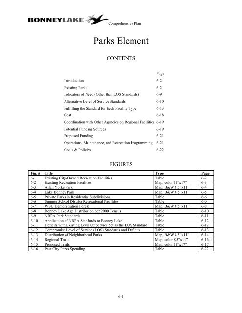
Comprehensive Plan<strong>Parks</strong> <strong>Element</strong>CONTENTSPageIntroduction 6-2Existing <strong>Parks</strong> 6-2Indicators <strong>of</strong> Need (Other than LOS Standards) 6-9Alternative Level <strong>of</strong> Service Standards 6-10Fulfilling the Standard for Each Facility Type 6-13Cost 6-18Coordination with Other Agencies on Regional Facilities 6-19Potential Funding Sources 6-19Proposed Funding 6-21Operations, Maintenance, and Recreation Programming 6-21Goals & Policies 6-22FIGURESFig. # Title Type Page6-1 Existing <strong>City</strong>-Owned Recreation Facilities Table 6-26-2 Existing Recreation Facilities Map, color 11”x17” 6-36-3 Allan Yorke Park Map, B&W 8.5”x11” 6-46-4 <strong>Lake</strong> <strong>Bonney</strong> Park Map, B&W 8.5”x11” 6-56-5 Private <strong>Parks</strong> in Residential Subdivisions Table 6-66-6 Sumner School District Recreational Facilities Table 6-66-7 WSU Demonstration Forest Map, B&W 8.5”x11” 6-86-8 <strong>Bonney</strong> <strong>Lake</strong> Age Distribution per 2000 Census Table 6-106-9 NRPA Park Standards Table 6-116-10 Application <strong>of</strong> NRPA Standards to <strong>Bonney</strong> <strong>Lake</strong> Table 6-126-11 Deficits with Existing Level Of Service Set as the LOS Standard Table 6-126-12 Compromise Level <strong>of</strong> Service (LOS) Standards and Deficits Table 6-136-13 Distribution <strong>of</strong> Neighborhood <strong>Parks</strong> Map, B&W 8.5”x11” 6-146-14 Regional Trails Map, color 8.5”x11” 6-166-15 Proposed Trails Map, color 11”x17” 6-176-16 Past <strong>City</strong> <strong>Parks</strong> Spending Table 6-226-1
Comprehensive PlanIntroductionIn this <strong>Element</strong>, unless the meaning is clearly otherwise, “parks” is meant to include recreational facilities such asball fields, athletic courts, and senior, youth, and community centers.<strong>Parks</strong> boost a community’ quality <strong>of</strong> life by facilitating active play, quiet reflection, and community interaction.They are gathering places, fostering a sense <strong>of</strong> community. <strong>Parks</strong> can also preserve important environmental featuressuch wildlife habitat and open space corridors. The <strong>City</strong> is sorely lacking in parks. It needs to acquire park land assoon as possible, because as the <strong>City</strong> grows the availability <strong>of</strong> suitable park land decreases.This <strong>Element</strong> shows how <strong>Bonney</strong> <strong>Lake</strong> will acquire and develop parks. It also makes the <strong>City</strong> eligible forgovernment grants earmarked for parks and recreation.Existing <strong>Parks</strong>Figure 6-2 (next page) shows all existing recreation facilities in the vicinity, regardless <strong>of</strong> ownership.<strong>City</strong> <strong>of</strong> <strong>Bonney</strong> <strong>Lake</strong>Figure 6-1 shows recreation facilities owned by the <strong>City</strong>.Figure 6-1<strong>City</strong> Recreational FacilitiesAcres Facilities NotesAllan Yorke Park 33.92 • picnic facilities• children’s play area• 2 boat ramps• swimming area• 4 baseball fields• 2 tennis courts• skate park<strong>Bonney</strong> <strong>Lake</strong><strong>Element</strong>ary School siteCedarview Park 2.73 • children’s play area• baseball field• open grass area<strong>Lake</strong> <strong>Bonney</strong> Park 1.3 • picnic tables• children’s play area• boat rampAscent Park 0.02 “Welcome to <strong>Bonney</strong><strong>Lake</strong>” entry sign. Nopublic access.<strong>Bonney</strong> <strong>Lake</strong> SeniorCenterIncludes 21.5 acres plus 12.42 acres purchasedfrom Schuur Brothers in 2004. One <strong>of</strong> thebaseball fields is behind <strong>City</strong> Hall.3.7 None Purchased from Sumner School District in 2004.1.2 Meals, games andactivities.Figures 6-3 and 6-4 show Allan Yorke Park and <strong>Lake</strong> <strong>Bonney</strong> Park.Gifted by Cedarview homeowners association in2004.Boat ramp is owned and maintained by theDepartment <strong>of</strong> Fish and Wildlife.Leased from WSDOT. The <strong>City</strong> could considercoordinating with WSDOT and/or acquiringadjacent land to create a scenic viewpoint <strong>of</strong> thePuyallup Valley, with additional landscaping.During day and early evening6-2
230TH AV E<strong>Bonney</strong> <strong>Lake</strong> Comprehensive PlanBUCKLEY-TAPPS HWY EFigure 6-2Existing Recreational Facilities<strong>City</strong> parksOther agencies' facilities<strong>Element</strong>ary schoolSecondary schoolHomeowner association parksOther private or commercialSUMNER-BUCKLEY HWY E<strong>City</strong> limitsExisting UGANHighway 410 GolfDriving Range233RD AVSR 410 E234TH AV E112TH ST E218TH AV E56THWEST TAPPS DR ES TAPPS DR E218TH AV EWEST TAPPS HWYCHURCHLAKEDR EVANDERMARK RD71ST ST EBONNEY LAKE BLVDCONNELLS PRAIRIE RD E214TH AV ECHURCH LAKE RDW TAPPS HWYOLDBUCKLEYHWYKELLY LAKE RD ECHURCH LAKE RDLOCUST AVSUMNER-BUCKLEY HWY EANGELINE RD ESR 410 E96TH ST ESR 410 E199TH AVCT214TH AV ESOUTH PRAIRIE RD112TH ST E120TH ST E98TH AV E<strong>Lake</strong> RidgeMiddle School<strong>Bonney</strong> <strong>Lake</strong><strong>Element</strong>arySwissParkWSU DemonstrationForest and RecreationareaSR 410 E<strong>Lake</strong> <strong>Bonney</strong>Park<strong>Bonney</strong> <strong>Lake</strong>High School siteVictorFallsMt. ViewJunior HighMYERS RDAscentParkSky Island ParkDebra JaneParkJenksPark<strong>Bonney</strong> lakeSenior CenterEmerald Hills<strong>Element</strong>aryInlet IslandParkChurch <strong>Lake</strong>Park0 0.5 1 MilesAllen YorkPark<strong>Lake</strong>viewTarraceParkCedarviewParkClear WaterParkCreated ByGreg StottDec. 19, 2003ANGELINE RD ERHODES LAKE RD ESUMNER-TAPPS HWY E60TH ST E64TH ST E166TH AV E78TH ST ERIVERSIDE RD E160TH AV E158 AV ERDRSIDE RD EMCCUTCHEON RDUTCHEON RD EH:\data/compupdates/2004/parks_element/parks_recreation.apr
Debra Jane <strong>Lake</strong>BONNEY LAKE BLVD16768161510101016911104531614132116WEST TAPPS HWY12<strong>Lake</strong> Tapps<strong>Bonney</strong> <strong>Lake</strong> Comprehensive PlanFigure 6-3Allan Yorke ParkandAdjacent <strong>City</strong> Facilities1 Swimming Area2 Boat Launch3 Restrooms4 Skate Park5 Storage Yard6 <strong>City</strong> Hall7 Senior Center8 Public Works Shops9 Soccer Field10 Ballfields11 Seating12 Playground13 Tennis Courts14 Basketball Court15 Trailer Parking16 ParkingW E T L A N D SH:\data/compupdates/2004/parks_element/allenyorkpark.aprN0 100 200 300 400 500 FeetJCG 01/30/2004
74th St.ParkingSwingDrainageDitchPicnic TablesLawnWetlandFishing Access<strong>Lake</strong> <strong>Bonney</strong>Figure 6-4<strong>Lake</strong> <strong>Bonney</strong> Park<strong>Bonney</strong> <strong>Lake</strong> Comprehensive PlanH:\data/compupdates/2004/parks_element/lakebonneypark.apr0 50 100 150 FeetWNSE01/30/2004
Comprehensive Plan<strong>Element</strong>ary, and North Tapps Middle School (Dieringer School District). The new <strong>Bonney</strong> <strong>Lake</strong> High School,adjacent to Mountain View Junior High, will include sports facilities including gyms, football field, baseball fields,a soccer field, tennis courts, and outdoor basketball courts.Other Private or Commercial FacilitiesA commercial driving range along SR 410 is 5.5 acres in size and provides 12 spaces for golf driving practice.The Swiss Sportsman’s Club is 11 acres in size. This private park has a shooting range (recreational and competitionshooting), children’s play area, and horseshoe pits.Other AgenciesThe Washington State University Demonstration Forest, along SR 410, is 152.5 acres in size. It has 1.1 mile <strong>of</strong>trails. It is forested land, granted by Weyerhaeuser for educational purposes. Local 4-H clubs use the site to learnabout forestry. The Forest also includes a ropes course. See Figure 6-7.Pierce County owns <strong>Lake</strong> Tapps Park, at the north end <strong>of</strong> the lake. The 80-acre sites has restrooms, trails, and a boatlaunch.6-7
SR 410Figure 6-7WSU Demonstration Forest<strong>Bonney</strong> <strong>Lake</strong> Comprehensive PlanTrailsH:\data/compupdates/2004/parks_element/wsudemforest.aprWNSE0 300 600 900 1200 Feet
Comprehensive PlanSummaryAllan Yorke Park is the <strong>City</strong>’s only significant park. The Sumner School District and private residentialdevelopments have filled some <strong>of</strong> the gap by providing recreational facilities for their constituencies.Indicators <strong>of</strong> Need (Other than LOS Standards)1997 Park, Open Space and Recreation SurveyIn July, 1997, the <strong>City</strong> distributed a questionnaire to 3,100 <strong>Bonney</strong> <strong>Lake</strong> households and received 150 completedquestionnaires. The purpose <strong>of</strong> the survey was to gauge demand for the various types <strong>of</strong> recreational facilities. Thesurvey is now too old to be relied upon, but can be used to corroborate other findings.The majority <strong>of</strong> those responding indicated their first priority was a system <strong>of</strong> trails for walking, jogging, and biking.The next highest priority was sports fields, children’s play areas, and picnic areas. Respondents assigned highpriority to acquisition <strong>of</strong> new park land.For a complete summary <strong>of</strong> the park survey results, see the <strong>Parks</strong> Plan adopted by Ordinance #767 on March 24,1998, available from the Department <strong>of</strong> Community Development.Age DistributionDifferent age groups have different recreational needs. Table 6-8 shows the <strong>City</strong>’s age distribution as <strong>of</strong> the 2000Census. <strong>Bonney</strong> <strong>Lake</strong> has a large school-age population and a large middle-aged population. The proportion <strong>of</strong>elderly persons is rather low. This data indicates a high proportion <strong>of</strong> families with children. Such families typicallydesire a high level <strong>of</strong> parks and athletic facilities.6-9
Comprehensive PlanFigure 6-8<strong>Bonney</strong> <strong>Lake</strong> Age Distribution per 2000 Census85-12075-8465-7460-6455-59Age in Years45-5435-4425-3420-2415-1910-145-90-50 500 1000 1500 2000 2500# <strong>of</strong> IndividualsAlternative LOS StandardsThis part <strong>of</strong> the <strong>Parks</strong> <strong>Element</strong> will be simplified after consensus is reached on the LOS standard. Three alternativesare presented:1. Applying the former NRPA standards to <strong>Bonney</strong> <strong>Lake</strong>.2. Setting the existing level <strong>of</strong> service as the LOS standard.3. The adopted LOS standard, which is a compromise between the above two, and which includes a combinedsenior/youth/community center.National Recreation and Park Association StandardsUntil recently, the National Recreation and Park Association (NRPA) recommended the following standards forparks. Because the NRPA did not recommend any succinct standards ion their place, many communities still refer tothese standards.6-10
Comprehensive PlanMini-ParkNeighborhoodParkCommunityParkNatural OpenSpace/RegionalParkTypicalsizeless than1/2 acre1-10acres10-30acres20 ormoreacresServiceradius½ mile1-2milesFigure 6-9NRPA Park StandardsTypical featuresHistorical marker, civicgarden, or memorialPassive recreation, picnicfacilities, play areas, halfbasketball courtsThe above plus leaguesports fields, tennis courts,swimming, boat ramps, etc.Green belts, nature parks,trails<strong>Bonney</strong> <strong>Lake</strong>facilities <strong>of</strong> this typeAscent Park<strong>Lake</strong> <strong>Bonney</strong> ParkAllan Yorke ParkWSU DemonstrationForestStandardNone1.5 acres per1,000 pop.6.5 acres per1,000 pop.7.5 acres per1,000 pop.Trails None 3/8 mile per 1,000pop.Senior center Senior Center 1 per 20,000 pop.Youth center None 1 per 20,000 pop.IndoorNone1 per 20,000 pop.swimming poolS<strong>of</strong>tball field At Allan Yorke Park 1 per 3,000 pop.Baseball field At Allan Yorke Park 1 per 4,000 pop.Soccer field At Allan Yorke Park 1 per 3,000 pop.Tennis courts At Allan Yorke Park 1 per 3,000 pop.BasketballcourtsNotes:1) blank means not applicable.2) where the NRPA standard was a range, the mean is shown.At Allan Yorke Park1 per 2,000 pop.Figure 6-10 compares the NRPA standards to the status quo in <strong>Bonney</strong> <strong>Lake</strong> as <strong>of</strong> 2003 and 2022 (the planninghorizon <strong>of</strong> this Plan) if no more parks are developed.For the purpose <strong>of</strong> the Existing Supply column in Figure 6-10, each elementary school in the UGA is assumed toprovide 3 acres toward the neighborhood park requirement. However, all school facilities are divided by 2 toaccount for the fact that they are not always available to the general community. School basketball courts aredivided by 2 again to reflect their not all being full-court. Combination ball fields have been put in the soccer fieldcolumn. Similarly, homeowner association parks are counted toward the neighborhood park requirement on thebasis <strong>of</strong> 50% <strong>of</strong> their acreage because they are not available to the entire population. The driving range and theSwiss Sportsman’s Club are not counted since they draw from a larger area.6-11
Comprehensive PlanFigure 6-10Application <strong>of</strong> NRPA standards to <strong>Bonney</strong> <strong>Lake</strong>Standardapplied to2003 Pop.(12,950)Standardapplied to2022 Pop.(27,284)2003Deficit (-) orSurplus (+)Existing2022StandardsupplyDeficit (-)Neighborhood park 1.5 ac. / 1000 19.4 ac. 40.9 13.1 -6.4 -27.9Community park 6.5 ac. / 1000 84.2 ac. 177.3 33.9 50.3 143.4Regional park/open space 7.5 ac. / 1000 97.1 ac 204.6 152.5 +55.4 -52.1Trails .375 mi./1,000 4.9 miles 10.2 1.1 -3.8 miles -9.1 milesSenior center 1/20,000 1 1 1 0 0Youth center 1/20,000 1 1 0 -1 -1Indoor swimming pool 1/20,000 1 1 0 -1 -1S<strong>of</strong>tball field 1/3,000 4 9 1.5 -3 -8Baseball field 1/4,000 3 7 5.50 +2 -1Soccer field 1/3,000 4 9 3 -1 -6Tennis courts 1/3,000 4 9 5 +1 -4Basketball courts 1/2,000 6 14 4 -2 -10Based on the old NRPA standards, <strong>Bonney</strong> <strong>Lake</strong> is deficient in most categories. These deficits will be greatlyexacerbated in 2022 unless corrective action is taken. The southern part <strong>of</strong> the city is most lacking in parks.Setting the existing level <strong>of</strong> service as the LOS standardThe <strong>City</strong> could set its neighborhood park, community park, and trail LOS standards equal to the status quo, ignoringfor now the other standards. (Field and court facilities are typically located in community parks anyway, so bymeeting the community parks standard, a community tends to also meet the standard for field and court facilities.) Inthis case the 2003 deficits are zero by definition. The 2022 deficits, assuming existing parks only, are substantial.Figure 6-11Deficits with Existing Level Of Service Set as the LOS StandardStandard appliedto 2003 Pop.(12,950) =Existing supplyStandardapplied to2022 Pop.(27,284)Serviceradius LOS Standard2003DeficitNeighborhood park .5 mile 1.01 ac. / 1000 13.1 acres 27.6 acres 0 -14.5 ac.Community park 2 miles 1.66 ac. / 1000 33.9acres 45.3 acres 0 11.4 ac.Trails N/A .084 mi. / 1000 1.1 mile 2.32 miles 0 -1.22 mi.2022 Deficit(-)Adopted LOS standardMost communities adopt standards that are customized to meet their specific needs and financial wherewithal. A1999 survey <strong>of</strong> eight small cities in Western Washington showed that the average LOS standard for neighborhoodparks was 2.3 acres per 1000 population, and that for community parks was 3.7 acres. The following standards arebelow both the former NRPA standards and the average per said survey, but are affordable and realistic. Standardsare included for neighborhood park, community park, trails, and a civic center.The civic center would combine the functions <strong>of</strong> a senior, youth, and community center. The standard is stated interms <strong>of</strong> square feet <strong>of</strong> building space. The current supply consists <strong>of</strong> the Senior Center, which has 3,180 square feet.6-12
RHODES LAKE RD E56THS TAPPS DR E60TH ST EBUCKLEY-TAPPS HWY E64TH ST EWEST TAPPS HWY166TH AV ESR 410 EBONNEY LAKE BLVD71ST ST E218TH AV E78TH ST EMYERS RDLOCUST AVOLDBUCKLEYHWYCHURCH LAKE RDW TAPPS HWYCHURCH LAKE RDCHURCHLAKEDR EVANDERMARK RDKELLY LAKE RD E214TH AV ECONNELLS PRAIRIE RD ESUMNERRIVERSIDE RD EANGELINE RD ESUMNER-BUCKLEY HWY ETCHEON RDANGELINE RD ESR 410 E199TH AVCTSR 410 E96TH ST E233RD AV214TH AV E234TH AV ESOUTH PRAIRIE RD112TH ST E112TH STV EH:\data/compupdates/2004/parks_element/neighborhood_parks.apr<strong>Bonney</strong> <strong>Lake</strong> Comprehensive PlanWFigure 6-13Distribution <strong>of</strong>Neighborhood <strong>Parks</strong>NSE0 0.5 MilesLightcircles representthe service radius<strong>of</strong> the EXISTINGfacilities listedbelow.Neighborhood <strong>Parks</strong>Homewowner <strong>Parks</strong><strong>Element</strong>ary SchoolsHeavycircles representthe service radius<strong>of</strong> NEEDEDneighborhoodparks.
Comprehensive PlanCommunity <strong>Parks</strong>By 2022, <strong>Bonney</strong> <strong>Lake</strong> will need 34.3 additional acres <strong>of</strong> community park. Ideally, this should take the form <strong>of</strong> twonew parks, located so that the three community parks (one existing and two new) are dispersed within thecommunity. Alternatively, the <strong>City</strong> could satisfy the deficit in the form <strong>of</strong> one large park in south or central <strong>Bonney</strong><strong>Lake</strong>. The park(s) will include s<strong>of</strong>tball, baseball, soccer, and multi-purpose fields, tennis and basketball courts, playequipment, picnic areas, and perhaps trails. By fully developing the proposed community parks, the need for fieldand court facilities will be automatically met. The cost will be approximately 34.3 x $100,000 (for the land) plus34.3 x $75,000 (for development), for a total <strong>of</strong> $6,002,500. Due to the shrinking supply <strong>of</strong> suitably located vacantland, the <strong>City</strong> should acquire the site(s) as soon as possible, then construct the park(s) as funding becomes available.Development should be complete by 2022. The site selection criteria are as follows:1. First preference goes to two new community parks 20-30 acres in size, so located that the three parks(counting Allan Yorke) are dispersed within the community. That is, one <strong>of</strong> the new parks could be in south<strong>Bonney</strong> <strong>Lake</strong>, the other in central <strong>Bonney</strong> <strong>Lake</strong>, or one could be in southwest <strong>Bonney</strong> <strong>Lake</strong>, the other insoutheast <strong>Bonney</strong> <strong>Lake</strong>.2. Second preference goes to one large park located in south or central <strong>Bonney</strong> <strong>Lake</strong>, 40-50 acres in size.3. For accessibility, the sites should be within the existing Urban Growth Area.4. The site should be relatively flat and developable. The site can include wetlands, steep slopes, etc. but suchenvironmentally constrained areas should not be counted toward the acreage goal.5. The site should be available on reasonable terms.TrailsBy 2022, <strong>Bonney</strong> <strong>Lake</strong> will need 7.1 miles <strong>of</strong> new trails. <strong>Bonney</strong> <strong>Lake</strong>’s trails must integrate with the regional trailsshown on Figure 6-14. This figure is based on the Pierce County Non-Motorized Transportation Plan (NMTP)which Pierce County adopted in 1997 as part <strong>of</strong> its Transportation <strong>Element</strong>. The NMTP shows premier-priority,high-priority, medium-priority, low-priority, and “state and city” trails (separate from roads) and roadside routes(sidewalks, paths, widened shoulders, bicycle lanes, etc.). Figure 6-14 shows the NMTP’s <strong>of</strong>f-road trails in the<strong>Bonney</strong> <strong>Lake</strong> vicinity. When the system is complete, <strong>Bonney</strong> <strong>Lake</strong> citizens will be able to walk, run, bike, or rollerblade to Sumner, Puyallup, Orting, Wilkeson, Buckley, and Enumclaw via the Foothills Trail which Pierce Countyis building in railroad rights-<strong>of</strong>-way in the South Prairie Creek/Carbon River/Puyallup River valley. The FoothillsTrail will connect to the Interurban Trail, allowing trail access to Auburn, Kent, and Seattle as well. Most <strong>of</strong> thissystem will be well separated from the noise and danger <strong>of</strong> vehicular traffic. With the added option <strong>of</strong> routes thatwill lie within road rights-<strong>of</strong>-way, citizens’ possible non-motorized travel destinations will be far greater still.Most <strong>of</strong> <strong>Bonney</strong> <strong>Lake</strong>’s trail mileage will be in the Fennel Creek Trail, which the <strong>City</strong> has proposed since 1997. SeeFigure 6-15. This trail will ultimately link westward and eastward with the Foothills Trail. The <strong>City</strong> hereby adoptsby reference the Fennel Creek Trail Plan dated May 31, 2007 as a component <strong>of</strong> this <strong>Parks</strong> <strong>Element</strong>.The <strong>City</strong>’s portion <strong>of</strong> the trail will begin at Victor Falls, where it will connect with the Foothills Trail via at least one<strong>of</strong> the following possibilities. 1) The <strong>City</strong> encourages Pierce County to extend the Fennel Creek Trail west down theFennel Creek canyon to the creek’s mouth. From that point, on-road routes will lead to the Foothills Trail.2) The Rhodes <strong>Lake</strong> Road Corridor (see the Transportation <strong>Element</strong>) is planned to include a roadside path that couldconnect the Fennel Creek Trail westward to the Foothills Trail. 3) The Pierce County NMTP shows a system <strong>of</strong>“state and city” routes in the rights-<strong>of</strong>-way <strong>of</strong> future roads in the planned city <strong>of</strong> Cascadia. The Cascadia system willconnect westward to the Foothills Trail. The Cascadia system may also be connected southward to Orting via a newbridge over the Carbon River.From Victor Falls, the Fennel Creek Trail will run north and east along one or both sides <strong>of</strong> Fennel Creek to 214 thAve. The Pierce County NMTP includes a roadside pedestrian route along 214 th Ave., which hikers and bikers canfollow northbound to the Puget Sound Energy flume. The NMTP shows a low-priority trail along the Puget SoundEnergy flume to Buckley, where it will connect with the Foothills Trail. The <strong>City</strong> encourages Pierce County toupgrade the priority <strong>of</strong> the Puget Sound Energy flume trail.That portion <strong>of</strong> the Fennel Creek Trail in <strong>City</strong> jurisdiction, including the spur to Allan Yorke Park, will be about 5.2miles long. See the Natural Environment <strong>Element</strong> for a discussion <strong>of</strong> the Fennel Creek environmental corridor.6-15
to Interurban TrailProposed Flume Trailto EnumclawFoothills TrailFoothills TrailFoothills TrailFigure 6-14Regional Trails<strong>Bonney</strong> <strong>Lake</strong> Comprehensive Planfrom Pierce County Nonmotorized Transportaion PlanExisting <strong>City</strong> TrailPremier Priority TrailLow Priority TrailProposed On-Road
Comprehensive PlanThe <strong>City</strong> will also add about one mile to the trail network in the WSU Demonstration Forest. The proposed trailwhich Figure 6-15 shows in the WSU Demonstration Forest is illustrative only. The actual route will be decidedlater.Figure 6-15 also shows further options. A trail could run from Allan Yorke Park east to 214 th Avenue. Parts <strong>of</strong> thistrail would have to be within street rights-<strong>of</strong>-way. Or trails could be built on the slopes below Panorama Heights.Trails may be installed in the new community park(s), wherever those are located. These options will make up theremaining .9 miles <strong>of</strong> trails, as follows:Fennel Creek Trail w/ spur to Allan Yorke Park 5.2New trail in the WSU Demonstration Forest 1.0Other trails +.9Total7.1 miles.<strong>Bonney</strong> <strong>Lake</strong>’s trails will connect at various locations to sidewalks in the <strong>Bonney</strong> <strong>Lake</strong> street network in accordancewith the <strong>Bonney</strong> <strong>Lake</strong> Non-Motorized Transportation Plan. As shown in Figure 6-15, the Fennel Creek Trail includesome short spur trails that will connect to the sidewalk system or important pedestrian destinations.The Fennel Creek Trail Plan estimates that the Fennel Creek Trail with spur to Allan Yorke Park will costapproximately $6,129,000 for construction plus $1,000,000 for acquisition plus $474,000 for wetland mitigation, fora total cost <strong>of</strong> $7,603,000. The other trails will cost about $1,000,000 per mile times 1.9 miles = $1,900,000. Thismillion-dollars-per-mile cost estimate assumes that most <strong>of</strong> the trail right-<strong>of</strong>-way will have to be purchased, but notall, and that these trails will cost somewhat less that the Fennel Creek Trail per mile. Subdivisions in trail corridorscan be required to dedicate trail right-<strong>of</strong>-way to the public. Right-<strong>of</strong>-way need not be purchased in the WSUDemonstration Forest or future community parks. The cost assumes a range <strong>of</strong> terrain conditions. Total trails cost is($7,603,000 + $1,900,000 =) $9,503,000.The trails deficit should be remedied as soon as funding becomes available. Priority should be placed on acquiringright-<strong>of</strong>-way which cannot be expected from the subdivision process. All 7.1 miles should be built by 2022.Civic CenterThe civic center should be located Downtown next to the central plaza as discussed in the Downtown Plan (seeCommunity Character <strong>Element</strong>). It will cost approximately $600,000 for the land plus $200,000 for site preparation(including parking) plus $130 per square foot (including s<strong>of</strong>t costs) times 40,000 square feet ($5,200,000) for a total<strong>of</strong> $5,820,000. It should be constructed whenever funding becomes available, but it should be sized to accommodatethe 2022 population.Alternatively, the youth center portion <strong>of</strong> the facility could be located in a separate building to be built in the WSUDemonstration Forest.CostThe total cost <strong>of</strong> the above is as follows. These estimates are good for advance planning purposes only.neighborhood parks: $1,420,000community parks: $6,002,500trails: $$9,503,000civic center: $5,820,000Total: $22,745,5006-18
Comprehensive PlanCoordination with Other Agencies on Regional FacilitiesIndoor Swimming Pool<strong>Bonney</strong> <strong>Lake</strong> cannot afford its own indoor swimming pool. Nor will the new <strong>Bonney</strong> <strong>Lake</strong> High School include apool. The nearest pool is at Sumner High School. The <strong>City</strong> <strong>of</strong> Sumner <strong>Parks</strong> and Recreation and Sumner SchoolDistrict operate it cooperatively.Regional <strong>Parks</strong><strong>Bonney</strong> <strong>Lake</strong> is too small to provide a regional park. The “region” is Pierce County, which is encouraged to providerecreational facilities benefiting <strong>Bonney</strong> <strong>Lake</strong> residents. Pierce County has proposed that the cities <strong>of</strong> <strong>Bonney</strong> <strong>Lake</strong>,Sumner, and Buckley jointly develop a regional facility. The County is particularly interested in an 80-acre site towhich it already holds an ownership interest, at the southeast corner <strong>of</strong> 198 th Ave. and 128 th Street. The site’s terrainand location are excellent for a regional park. The <strong>City</strong> encourages Pierce County to proceed with this project, butprefers to meet its neighborhood and community park needs independently.The WSU Demonstration Forest can also be considered a regional park. The future <strong>of</strong> this facility is unknown.Though the <strong>City</strong> has no proprietary control over the Demonstration Forest, the <strong>City</strong> endorses its preservation andaugmented use by the public. The <strong>City</strong> proposes to help ensure the continued use <strong>of</strong> the Demonstration Forest foreducational and recreational purposes by adding to its trail network. See Trails, above.The <strong>City</strong> will also coordinate with other agencies on recreational programming. See Maintenance, Operations, andRecreation Programs.Potential Funding SourcesFollowing are alternatives for funding parks.<strong>City</strong> General FundThe general fund, generated through property taxes and other sources, has been the main source <strong>of</strong> funding for<strong>Bonney</strong> <strong>Lake</strong> parks maintenance and operation.User feesUsers <strong>of</strong> the Allan Yorke Park boat ramp pay user fees which go into the general fund.Washington State IAC GrantsThe Inter-Agency Committee for Outdoor Recreation (IAC) is a source <strong>of</strong> grants for parks and recreation. The IACreceives its funds from state and federal sources.6-19
Comprehensive PlanPierce County Conservation Futures GrantsThis Pierce County program protects threatened open spaces, timber lands, wetlands, wildlife habitats, and farmlands in Pierce County. The funds are used to purchase the land or the land’s development rights. The program isfunded by a tax <strong>of</strong> up to $.0625 per thousand dollars <strong>of</strong> assessed property value. Individuals, non-pr<strong>of</strong>it groups, andlocal governments can nominate a property for purchase. Properties are nominated annually. A citizens advisoryboard recommends to the Pierce County Council, which makes the final selection. This funding source may beespecially logical for acquisitions within the Fennel Creek Corridor.Metropolitan Park District (MPD)RCW 35.61 allows for creation <strong>of</strong> a metropolitan park district that is co-extensive with the city limits. Based on year2001 assessed value, the MPD could a) bond up to $1.55 million without a vote to increase bonded debt limit andb) raise a property tax levy <strong>of</strong> up to $0.75 per $1000 <strong>of</strong> assessed value, generating up to $466,441 per year. Thebond limit could increase to $15.55 million with a 60% vote <strong>of</strong> the public.<strong>Parks</strong> and Recreation District (PRD)RCW 36.69 allows the county council to create a Park and Recreation District with any boundaries. Based on year2001 assessed value, the PRD could sell bonds and levy taxes up to $0.60 per $1000 <strong>of</strong> assessed value, generatingup to $373,153 per year. An excess levy is possible with a 60% vote <strong>of</strong> the public.General Obligation BondGeneral obligation bonds are voter-approved bond issues whose debt is serviced by a additional property tax levy.The revenue is a function <strong>of</strong> rate times assessed value. The assessed value <strong>of</strong> <strong>Bonney</strong> <strong>Lake</strong> for 2001 was$621,921,668. As Pierce County grows, its assessed value increases. During the 1990s, assessed value increased at6.8% per year. In 2001 the County’s tax rate for <strong>Bonney</strong> <strong>Lake</strong> was $2.1858 per $1,000 <strong>of</strong> assessed value, withadditional assessments for school, fire, and other districts. Within <strong>Bonney</strong> <strong>Lake</strong> there are eight taxing rates,depending on school district and library district. In 2001 the total property tax rates ranged from $15.0777 to$16.5076 per 1,000. The general obligation bond would increase these tax rates.Impact FeeThe Growth Management Act allows cities to impose impact fees for capital facilities such as parks. The impact feemust reasonably represent the cost which the <strong>City</strong> will bear as a result <strong>of</strong> the development action (usually restrictedto housing units) triggering the impact fee. Those costs are a function <strong>of</strong> the LOS standard and the capital facilityplan (this document) adopted to maintain that standard. The impact fee cannot be used to pay for alleviating existingfacility deficits.The maximum impact fee the <strong>City</strong> could impose is calculable from the LOS standards and cost assumptions utilizedin this Plan, as follows.Neighborhood parks cost $100,000 per acre. One acre is required per 1,000 people. Thus the cost per person is$100. The average household size is 2.9645. Thus the maximum impact fee for neighborhood parks is $296.45.Community parks cost $175,000 per acre. 2.5 acres are required per 1,000 people, thus one acre is required per 400people. Thus the cost per person is $437.50. The average household size is 2.9645. Thus the maximum impact feefor community parks is $1,296.97.6-20
Comprehensive PlanTrails will cost $9,503,000, an average <strong>of</strong> $1,338,451 per mile. 3 miles are required per 1000 people, thus one mileis required per 3,333 people. Thus the cost per person is $401.58. The average household size is 2.9645. Thus themaximum impact fee for trails is $1,190.47.The civic center will cost $5,820,000, divided by 40,000 square feet equals $145.50 per square foot. The LOSstandard is 1,466 sq. ft. per 1000 people. The average household size is 2.9645. 1,466/1000 = 4.346/2.9645. That is,one household requires 4.346 square feet. 4.346 times $145.50 is $632.34, which is the maximum impact fee for thecivic center.The total maximum impact fee is ($296.45+$1,296.97 +$1,190.47+$632.34=) $3,416.24.Proposed FundingThe <strong>City</strong> assesses a parks impact fee <strong>of</strong> $2,893 per housing unit. Per the Land Use <strong>Element</strong>, the 2003 population is12,950. The 2022 population will be 27,284. The increase will be 14,334, divided by the 2.9645 household sizeequals 4,835 new units. $2,893 times 4,835 equals $13,987,655.The <strong>City</strong> will use impact fees together with other sources as follows to fund the total parks cost. The amounts shownfor grants represent modest assumptions.<strong>City</strong> General Fund: $1,856,370Washington State IAC Grants: $600,000Pierce County Conservation Futures Grants: $500,000General Obligation Bond: $5,801,475Impact Fee: $13,987,655Total: $22,745,500Operations, Maintenance, and Recreation ProgrammingThe Public Works Department operates and maintains <strong>City</strong> parks. The <strong>City</strong> has no recreation program, but it makesits parks available to organizers <strong>of</strong> recreational activities such as youth baseball. The <strong>Bonney</strong> <strong>Lake</strong> Senior Centerprovides a place to visit and participate in organized activities, including bingo, luncheons and field trips. Thesenior center is occasionally rented out to local groups. <strong>Bonney</strong> <strong>Lake</strong> Days is a city-wide celebration that occursevery August. Activities have included carnival games, amusement park rides, food vending, arts and crafts, and astreet dance.The Sumner/<strong>Bonney</strong> <strong>Lake</strong> <strong>Parks</strong> and Recreation Department <strong>of</strong> the Sumner School District organizes adult classes,adult and youth sports, and specialized forms <strong>of</strong> recreation such as aerobics, arts and crafts, and yoga. These classesare held at various <strong>Bonney</strong> <strong>Lake</strong> schools. The District also sponsors seasonal clinics and league play for all ages involleyball, basketball, s<strong>of</strong>tball, and soccer using school facilities in <strong>Bonney</strong> <strong>Lake</strong> and Sumner. As Figure 6-19shows, the <strong>City</strong> has annually paid the Sumner School District for recreational programs <strong>of</strong>fered in <strong>Bonney</strong> <strong>Lake</strong>.The WSU 4-H Challenge Program sponsors recreational and learning activities at the WSU Demonstration Forest.As <strong>Bonney</strong> <strong>Lake</strong>’s parks become more substantial, maintenance and operations spending will have to increase. Newfields will encourage the development <strong>of</strong> new leagues, with associated operational costs. The park system will soonreach the point where a full-time position is necessary to oversee maintenance, operate the parks, administer rentals,and coordinate with ball leagues and similar organizations. That person could become responsible for <strong>Bonney</strong> <strong>Lake</strong>Days, and any other recreational programming the <strong>City</strong> chooses to provide. In some respects, however, the <strong>City</strong> may6-21
Comprehensive Planbe better <strong>of</strong>f pooling its resources with Pierce County, the <strong>City</strong> <strong>of</strong> Sumner, and/or the school district to developprograms. For example, a high school “select” soccer league might be best implement through inter-agencycoordination.Figure 6-16 shows historical information on <strong>City</strong> parks spending, including capital projects.Figure 6-16Past <strong>City</strong> <strong>Parks</strong> Spending1998Actual1999Actual2000Actual2001Estimate2002BudgetSalaries & wages $54,392 $50,735 $54,128 $58,328 $88,603Personnel benefits 16,712 14,898 14,647 15,025 19,946Supplies 7,783 11,663 10,852 5,276 7,800Outside services 13,186 7,509 13,966 6,526 11,350Payments to Sumner S.D. for programs 20,000 20,000 27,500 25,000 25,000Interfund services 3,819 2,815 4,406 0 9,179Subtotal operations 115,892 107,620 125,499 110,154 161,878Capital outlay 0 17,488 35,895 0 3,875Parking lot/swim dock/play equipment 0 0 0 0 75,000Skate park 0 0 0 0 311,000Subtotal capital 0 17,488 35,895 0 389,875Total $231,784 $232,728 $286,893 $220,308 $713,631Goals and PoliciesGoal 6-1 Provide cost-effective parks and recreation facilities as necessary to maintain the level <strong>of</strong> servicestandards stated in this <strong>Element</strong>.Policy 6-1a Provide parks and recreational facilities that enhance the <strong>City</strong>’s natural setting, respect naturalresources, and preserve the community character.Policy 6-1b Where land is conserved due to environmental limitations such as wetlands or riparian corridors,consider providing public access if compatible with conservation goals.Policy 6-1cfeasible.Incorporate historical and cultural sites, markers, or activities into the park system wherePolicy6-1d Keep the parks safe though proper design, visibility, maintenance, supervision, and education asto acceptable behavior.Policy 6-1e Require new developments to either pay impact fees or provide parks as necessary to maintain thelevel <strong>of</strong> service standards, accepting only land that meets the site selection criteria for the applicable facility type.Policy 6-1fPolicy 6-1gDevelop and update master plans for the improvement <strong>of</strong> existing parks.Design the parks to require low maintenance, and adequately fund maintenance.6-22
Comprehensive PlanPolicy 6-1hDesign recreational facilities to be accessible to all citizens, including the disabled.Policy 6-1i The strategies and site selection criteria contained in “Fulfilling the Standard for Each <strong>of</strong> FacilityType” shall have the status <strong>of</strong> policies.Policy 6-1j Finance parks acquisition and development through a combination <strong>of</strong> tax revenues, grants, andpark impact fees.Policy 6-1kConcentrate on acquiring park sites before development or improvement <strong>of</strong> existing parks.Goal 6-2Policy 6-2aDevelop a balance <strong>of</strong> passive and active recreational facilities.Encourage recreational programs for youth and adult leisure sports.Policy 6-2b Provide athletic facilities meeting competitive playing standards, concentrating on those field andcourt activities which attract the most participants.Policy6-2cPolicy 6-2dIlluminate fields and courts to allow greater use by working adults and tournaments.Develop a community center which facilitates year-round indoor athletic activities.GOAL 6-3Create a system <strong>of</strong> pedestrian/bicycle trails through pleasant natural ecosystems.Policy 6-3a Where possible, use trails to link parks, open spaces, schools, community facilities, sidewalks (seeTransportation <strong>Element</strong>), and other agencies’ trials, such as the Pierce County Foothills Trail.Policy 6-3b Require subdivisions along the Fennel Creek corridor to dedicate trail right-<strong>of</strong>-way and developtheir portions <strong>of</strong> the trail.Policy 6-3c Require new subdivisions to provide internal pathways as necessary to connect the subdivision tonearby pedestrian destinations. See Figure 6-13 in the Transportation <strong>Element</strong>.Policy 6-3decosystems.Extend trails through nature conservation areas corridors where possible without compromisingGOAL 6-4Policy 6-4aCooperate with other organizations and individuals to maximize recreational opportunities.Encourage homeowner associations, churches, and schools to develop recreational facilities.Policy 6-4b Where appropriate, provide recreational programs cooperatively with other agencies such asPierce County and the school districts.Policy 6-4c Encourage Pierce County to provide regional parks and satisfy the recreational needs <strong>of</strong> theproposed Cascadia development.Policy 6-4d Take over maintenance and operation <strong>of</strong> existing homeowner-owned parks only if the homeownersassociation <strong>of</strong>fers the park to the <strong>City</strong> as a gift for public use.Policy 6-4e Encourage private parties to help provide recreational facilities through donations, sponsorships,and volunteerism.6-23
Comprehensive PlanPolicy 6-4f Encourage the formation <strong>of</strong> garden clubs to develop and maintain flower gardens where nowthere are barren, weed infested areas within highly visible <strong>City</strong> rights-<strong>of</strong>-wayPolicy 6-4g If land owned by other public entities is no longer needed for its original purpose, and if said landis suitable for parks, arrange to retain that land and convert it to park use.Policy 6-4h Help ensure the continued use <strong>of</strong> the Demonstration Forest for educational and recreationalpurposes by adding to its trail network.6-24