Climate risks and adaptation in Asian coastal megacities: A synthesis
Climate risks and adaptation in Asian coastal megacities: A synthesis
Climate risks and adaptation in Asian coastal megacities: A synthesis
- No tags were found...

Create successful ePaper yourself
Turn your PDF publications into a flip-book with our unique Google optimized e-Paper software.
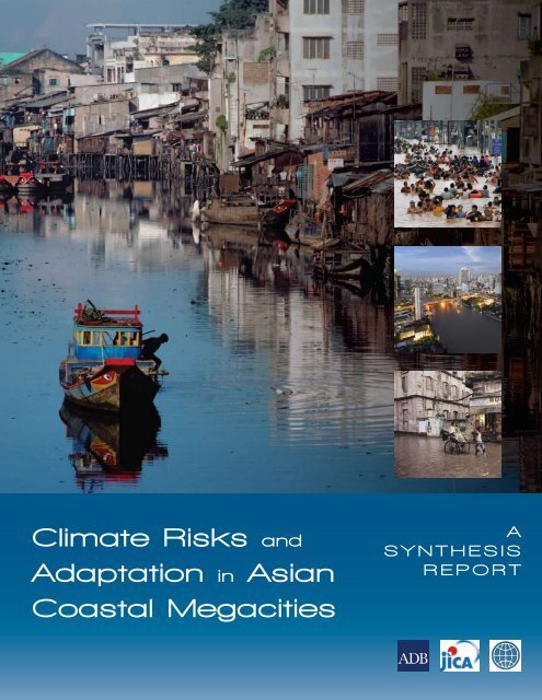
© 2010 The International Bank for Reconstruction<strong>and</strong> Development / THE WORLD BANK1818 H Street, NWWash<strong>in</strong>gton, DC 20433, U.S.A.Telephone: 202-473-1000Internet: www.worldbank.org/climatechangeE-mail: feedback@worldbank.orgAll rights reserved.September 2010This volume is a product of the staff of the International Bank for Reconstruction <strong>and</strong> Development / The World Bank. The f<strong>in</strong>d<strong>in</strong>gs, <strong>in</strong>terpretations, <strong>and</strong>conclusions expressed <strong>in</strong> this volume do not necessarily reflect the views of the Executive Directors of The World Bank or the governments they represent.The World Bank does not guarantee the accuracy of the data <strong>in</strong>cluded <strong>in</strong> this work. The boundaries, colors, denom<strong>in</strong>ations, <strong>and</strong> other <strong>in</strong>formation shownon any map <strong>in</strong> this work do not imply any judgement on the part of the World Bank concern<strong>in</strong>g the legal status of any territory or the endorsement oracceptance of such boundaries.R I G H T S A N D P E R M I S S I O N SThe material <strong>in</strong> this publication is copyrighted. Copy<strong>in</strong>g <strong>and</strong>/or transmitt<strong>in</strong>g portions or all of this work without permission may be a violation of applicablelaw. The International Bank for Reconstruction <strong>and</strong> Development / The World Bank encourages dissem<strong>in</strong>ation of its work <strong>and</strong> will normally grantpermission to reproduce portions of the work promptly.For permission to photocopy or repr<strong>in</strong>t any part of this work, please send a request with complete <strong>in</strong>formation to the Copyright Clearance Center Inc.,222 Rosewood Drive, Danvers, MA 01923, USA; telephone 978-750-8400; fax 978-750-4470; Internet: www.copyright.com.Cover images:Large image: Ho Chi M<strong>in</strong>h City, © Karen Kasmauski/CorbisSmall images: top: Manila, © Francis R. Malasig/Corbis; middle: Bangkok, © I. Saxar/Shutterstock Images, LLC; bottom: Kolkata, © Bruce Burkhardt/CorbisAll dollars are U.S. dollars unless otherwise <strong>in</strong>dicated.
Table of ContentsAcknowledgments...................................................................................................................................viiAbbreviations <strong>and</strong> Acronyms................................................................................................................ ixExecutive Summary.................................................................................................................................. xi1. Introduction.........................................................................................................................................1Background <strong>and</strong> Rationale............................................................................................................................. 1Objective........................................................................................................................................................... 2Process of Preparation.................................................................................................................................... 3Overview of Methodology/Approach <strong>and</strong> <strong>Climate</strong> Parameters Selected............................................. 3Structure of the Report................................................................................................................................... 42. Methodologies for Downscal<strong>in</strong>g, Hydrological Mapp<strong>in</strong>g, <strong>and</strong> .Assess<strong>in</strong>g Damage Costs ..................................................................................................................5Selection of Emissions Scenarios, Downscal<strong>in</strong>g, <strong>and</strong> Uncerta<strong>in</strong>ties ....................................................... 5Hydrological Model<strong>in</strong>g for Develop<strong>in</strong>g Scenarios of Flood Risk ........................................................... 9Approach to Assess<strong>in</strong>g Damage Costs....................................................................................................... 12Assessment of Damage Costs <strong>in</strong> the HCMC Study ................................................................................ 17Assumptions about the Future of Cities <strong>in</strong> Estimat<strong>in</strong>g Damage Costs ................................................ 19Conclusion: Methodological Limitations <strong>and</strong> Uncerta<strong>in</strong>ties <strong>in</strong> Interpret<strong>in</strong>g Resultsof the Study ............................................................................................................................................. 203. Estimat<strong>in</strong>g Flood Impacts <strong>and</strong> Vulnerabilities <strong>in</strong> Coastal Cities.............................................23Estimat<strong>in</strong>g Future <strong>Climate</strong>-related Impacts <strong>in</strong> Bangkok......................................................................... 23Ma<strong>in</strong> F<strong>in</strong>d<strong>in</strong>gs from Hydrological Analysis <strong>and</strong> GIS Mapp<strong>in</strong>g for Bangkok ..................................... 28Estimat<strong>in</strong>g <strong>Climate</strong>-related Impacts <strong>in</strong> Manila ........................................................................................ 31F<strong>in</strong>d<strong>in</strong>gs from the Hydrological Analysis <strong>and</strong> GIS Mapp<strong>in</strong>g for Metro Manila.................................. 35Estimat<strong>in</strong>g <strong>Climate</strong>-related Impacts <strong>in</strong> Ho Chi M<strong>in</strong>h City, Vietnam..................................................... 38Ma<strong>in</strong> F<strong>in</strong>d<strong>in</strong>gs from Hydrological Analysis <strong>and</strong> GIS Mapp<strong>in</strong>g for HCMC......................................... 44Conclusion...................................................................................................................................................... 504. Assess<strong>in</strong>g Damage Costs <strong>and</strong> Prioritiz<strong>in</strong>g Adaptation Options..............................................51Bangkok: Analysis of Damage Costs Related to Flood<strong>in</strong>g <strong>in</strong> 2008 <strong>and</strong> 2050........................................ 51Prioritization of Adaptation Options <strong>in</strong> Bangkok.................................................................................... 56Analysis of Damage Costs Related to Flood<strong>in</strong>g <strong>in</strong> Metro Manila ......................................................... 60Prioritization of Adaptation Options <strong>in</strong> Manila....................................................................................... 65Analysis of Damage Costs <strong>in</strong> HCMC......................................................................................................... 69Analysis of Adaptation <strong>in</strong> HCMC.............................................................................................................. 72Conclusion...................................................................................................................................................... 73iii
Figure 4.6 Damage Costs Associated with Different Scenarios (PHP) ...................................................... 63Figure 4.7 Damages to Build<strong>in</strong>gs from a 1-<strong>in</strong>-30-year Flood (2008 PHP)................................................... 63Figure 4.8 Flood Costs as a Percent of 2008 GDP........................................................................................... 65Figure 4.9 Annual Benefits from Adaptation Investments <strong>in</strong> Metro Manila............................................. 68BoxesBox 2.1 Strengths <strong>and</strong> Limitations of Different Downscal<strong>in</strong>g Techniques Selected for this Study.......... 7Box 2.2 Downscal<strong>in</strong>g from 16 GCMs................................................................................................................ 8Box 2.3 Some Basic Pr<strong>in</strong>ciples for Hydrological Mapp<strong>in</strong>g...........................................................................11Box 3.1 The Bangkok Metropolitan Region (BMR): Some Assumptions about the Future.................... 26Box 3.2 What does Metro Manila Look Like <strong>in</strong> the Future? ....................................................................... 35Box 3.3 HCMC <strong>in</strong> 2050 ..................................................................................................................................... 41Box 3.4 Overview of Downscal<strong>in</strong>g <strong>and</strong> Hydrological Analysis Carried out for HCMC Study............. 42Box 4.1 Exam<strong>in</strong><strong>in</strong>g Build<strong>in</strong>g Damages, Income Losses, <strong>and</strong> Health Costs <strong>in</strong> Bangkok ......................... 55Box 4.2 Expected Annual Benefits from Adaptation <strong>in</strong> Bangkok............................................................... 58Box 4.3 Increased Time Costs <strong>and</strong> Health Risk from Flood<strong>in</strong>g <strong>in</strong> Manila................................................. 65Box 4.4 Rough Estimate of Viability of Proposed Flood Control Measures.............................................. 72TablesTable 2.1 <strong>Climate</strong> Change Forecasts for 2050...................................................................................................... 8Table 2.2 Summary of City Case Study Hydrologic Model<strong>in</strong>g.......................................................................11Table 2.3 Direct <strong>and</strong> Indirect Costs from Flood<strong>in</strong>g.......................................................................................... 13Table 2.4 Flood Damage Rate by Type of Build<strong>in</strong>g <strong>in</strong> Manila........................................................................ 15Table 3.1 Poverty L<strong>in</strong>e <strong>and</strong> the Poor <strong>in</strong> the BMR1........................................................................................... 24Table 3.2 Bangkok Monthly Average Temperature <strong>and</strong> Precipitation.......................................................... 25Table 3.3 <strong>Climate</strong> Change <strong>and</strong> L<strong>and</strong> Subsidence Parameter Summary for Bangkok................................. 27Table 3.4 Bangkok Inundated Area under Current Conditions <strong>and</strong> Future Scenarios.............................. 28Table 3.5 Exposure of Bangkok Population to Flood<strong>in</strong>g................................................................................. 30Table 3.6 Manila: Monthly Average Temperature <strong>and</strong> Precipitation............................................................ 33Table 3.7 Manila <strong>Climate</strong> Change Parameters.................................................................................................. 35Table 3.8 Manila: Comparison of Inundated Area (km 2 ) with 1-<strong>in</strong>-100-year flood for2008 <strong>and</strong> 2050 <strong>Climate</strong> Change Scenarios with only Exist<strong>in</strong>g Infrastructure <strong>and</strong>with Completion of 1990 Master Plan............................................................................................... 36Table 3.9 Affected Length of Road by Inundation Depth............................................................................... 38Table 3.10 HCMC District Poverty Rates. 2003.................................................................................................. 39Table 3.11 Ho Chi M<strong>in</strong>h City: Monthly Average Temperature <strong>and</strong> Precipitation......................................... 40Table 3.12 <strong>Climate</strong> Change Parameter Summary for HCMC ......................................................................... 44Table 3.13 Summary of Flood<strong>in</strong>g at Present <strong>and</strong> <strong>in</strong> 2050 with <strong>Climate</strong> Change........................................... 44Table 3.14 District Population Affected by an Extreme Event <strong>in</strong> 2050............................................................ 46Table 3.15 Districts Affected by Flood<strong>in</strong>g <strong>in</strong> Base Year <strong>and</strong> <strong>in</strong> 2050................................................................ 47Table 3.16 Effects of Flood<strong>in</strong>g on Future L<strong>and</strong> Use under 2050 A2 Extreme Event ..................................... 49Table 4.1 Summary of Damages Assessed <strong>in</strong> the Bangkok Study................................................................. 51Table 4.2 Summary of Flood <strong>and</strong> Storm Damages, Bangkok (million 2008 THB)...................................... 53Table 4.3 Changes <strong>in</strong> Income Losses to Wage Earners, Commerce, <strong>and</strong> Industry...................................... 55Table 4.4 Damage Costs <strong>in</strong> Bangkok <strong>and</strong> Regional GRDP............................................................................. 56Table 4.5 Investment Costs for Adaptation Projects <strong>in</strong> Bangkok (million THB)......................................... 57Table 4.6 Flood Damage Costs With <strong>and</strong> Without a 30-year Return Period Flood ProtectionProject (million THB)........................................................................................................................... 59Table of Contents| v
Table 4.7 Net Present Value of Adaptation Measures to Provide Protection Aga<strong>in</strong>sta 1-<strong>in</strong>-30 <strong>and</strong> 1-<strong>in</strong>-10-year Flood (million THB)............................................................................... 59Table 4.8 Flood Damage Costs <strong>in</strong> Manila (2008 PHP) .................................................................................... 61Table 4.9 Income <strong>and</strong> Revenue Losses to Individuals <strong>and</strong> Firms Associated with Floods(2008 PHP)............................................................................................................................................. 64Table 4.10 Damage Costs from 1-<strong>in</strong>-10, 1-<strong>in</strong>-30, <strong>and</strong> 1-<strong>in</strong>-100-year Floods <strong>in</strong> Different Scenarios(2008 PHP)............................................................................................................................................. 65Table 4.11 Adaptation Investments Considered for Different Return Periods <strong>and</strong><strong>Climate</strong> Scenarios................................................................................................................................. 67Table 4.12 Investment Costs <strong>and</strong> Net Present Value of Benefits Associated with DifferentFlood Control Projects <strong>in</strong> Manila (PHP) us<strong>in</strong>g a 15 percent discount rate.................................. 67Table 4.13 Expected Cost of Flood<strong>in</strong>g based on Quadratic Relationship between Durationof Flood<strong>in</strong>g <strong>and</strong> L<strong>and</strong> Values <strong>in</strong> HCMC........................................................................................... 70Table 4.14 Present Value of the Cost of Floods up to 2050 us<strong>in</strong>g the GDP Estimation Method.................. 71Table 4.15 Summary of Present Value of <strong>Climate</strong> Change Costs <strong>in</strong> HCMC (USD)...................................... 72Table 4.16 Proposed Implementation Arrangements for HCMC.................................................................... 74vi | <strong>Climate</strong> Risks <strong>and</strong> Adaptation <strong>in</strong> <strong>Asian</strong> Coastal Megacities: A Synthesis Report
AcknowledgmentsThis <strong>synthesis</strong> report is a product of a jo<strong>in</strong>t programon <strong>Climate</strong> Adaptation <strong>in</strong> <strong>Asian</strong> CoastalMegacities undertaken by the World Bank <strong>in</strong>collaboration with the <strong>Asian</strong> Development Bank<strong>and</strong> the Japan International Cooperation Agency. Itis based on extensive collaboration among the threeagencies, who jo<strong>in</strong>tly agreed to undertake severalcity-level studies <strong>and</strong> prepare a <strong>synthesis</strong> report.The core team prepar<strong>in</strong>g this <strong>synthesis</strong> reportconsisted of Poonam Pillai (Sr. Environmental Specialist<strong>and</strong> task team leader), Bradford Ryan Philips(Sr. Civil Eng<strong>in</strong>eer, consultant), Priya Shyamsundar(Sr. Environmental Economist, consultant), KaziAhmed (consultant) <strong>and</strong> Lim<strong>in</strong> Wang (Sr. EnvironmentalEconomist, consultant) <strong>and</strong> <strong>in</strong>cludedextensive collaboration with the different city-levelteams. In particular, we would like to thank JanBojo (World Bank), who led the Bangkok study;Megumi Muto (JICA), who led the Manila study<strong>and</strong> was the ma<strong>in</strong> focal po<strong>in</strong>t from JICA; Jay Roop(ADB), who led the Ho Chi M<strong>in</strong>h City study <strong>and</strong> wasthe ma<strong>in</strong> focal po<strong>in</strong>t from ADB, <strong>and</strong> Maria Sarraf<strong>and</strong> Susmita Dasgupta (World Bank), who led theKolkata study. For the Bangkok report, we are alsograteful to the team at Panya consultants; to BangkokMetropolitan Adm<strong>in</strong>istration professionals;<strong>and</strong> to Manuel Cocco, Pongtip Puvacharoen, <strong>and</strong>Yabei Zhang. For the HCMC study, we thank theconsult<strong>in</strong>g team at the International Centre for EnvironmentalManagement, <strong>in</strong>clud<strong>in</strong>g Jeremy Carew-Reid, Anond Snidvongs, Peter-John Meynell, JohnEdmund Sawdon, Nigel Peter Hayball, Tran Thi Ut,Tranh Thanh Cong, Nguyen Thi Nga, Nguyen LeN<strong>in</strong>h, Nguyen Huu Nhan, <strong>and</strong> Nguyen D<strong>in</strong>h Tho;the Ho Chi M<strong>in</strong>h City People’s Committee; <strong>and</strong> theDepartment of Natural Resources <strong>and</strong> Environment(DoNRE). For the Manila study, we are grateful tothe Metro Manila Development Authority, NationalStatistics Office, Professor Emma Porio <strong>and</strong> staffat Ateneo de Manila University, CTI Eng<strong>in</strong>eer<strong>in</strong>gInternational, <strong>and</strong> ALMEC Corporation, as wellas the local government officials <strong>and</strong> communityleaders who provided valuable <strong>in</strong>puts to the report.We also gratefully acknowledge the contributionsof Professor Akimasa Sumi (University of Tokyo),Professor Nobuo Mimura (Ibaraki Universty),<strong>and</strong> Dr. Masahiro Sugiyama (Central ResearchInstitute of Electric Power Industry) for provid<strong>in</strong>gthe analytic framework for downscal<strong>in</strong>g the IPCCclimate models. We thank the Kolkata team <strong>and</strong><strong>in</strong> particular Subhendu Roy <strong>and</strong> the INRM teamfor their <strong>in</strong>puts <strong>and</strong> collaboration, <strong>and</strong> to AdrianaDamianova for <strong>in</strong>itially lead<strong>in</strong>g the Kolkata study.Suggestions from Ian Noble also helped strengthenthe analysis. We are especially grateful to DanielHoornweg, Anthony Bigio, <strong>and</strong> Tapas Paul for peerreview<strong>in</strong>g this report.A special thanks to James Warren Evans (Director,Environment Department, World Bank), MagdaLovei, (Sector Manager, EASER, World Bank), NeerajPrasad (Lead Carbon F<strong>in</strong>ance Specialist, ENVCF),Megumi Muto (Research Fellow, JICA) <strong>and</strong> Jay Roop(Environmental Specialist, ADB) for <strong>in</strong>itiat<strong>in</strong>g thiscollaborative activity <strong>and</strong> to Kseniya Lvovsky (ProgramManager, <strong>Climate</strong> Change team, EnvironmentDepartment), Michele De Nevers (Senior Manager,Environment Department, World Bank), Gajan<strong>and</strong>Pathmanathan (Manager, SASDO <strong>and</strong> Act<strong>in</strong>g SectorManager, SASDI), Nessim Ahmad (Director, Environment<strong>and</strong> Safeguards, <strong>Asian</strong> Development Bank), DrKeiichi Tsunekawa (Director, JICA Research Institute)<strong>and</strong> Mr. Hiroto Arakawa (Senior Special Advisor,JICA) under whose general guidance this reportwas prepared. Thanks to Perpetual Boetang for hervii
Abbreviations <strong>and</strong> AcronymsADB <strong>Asian</strong> Development BankAOGCM Atmosphere-ocean general circulationmodelsBMR Bangkok Metropolitan RegionBAU Bus<strong>in</strong>ess as usualCCA <strong>Climate</strong> change <strong>adaptation</strong>CoP Conferences of PartiesDIVA Dynamic <strong>in</strong>teractive vulnerabilityassessmentDRR Disaster risk reductionECLAC Economic Commission for Lat<strong>in</strong>America <strong>and</strong> the CaribbeanGCMs Global climate modelsGDP Gross domestic productGEF Global Environment FacilityGHG Greenhouse gasGPCP Global Precipitation ClimatologyProjectGRDP Gross regional domestic productHCMC Ho Chi M<strong>in</strong>h City1DD One-degree dailyIPCC Intergovernmental Panel for <strong>Climate</strong>ChangeIRS3 Integrated research system forsusta<strong>in</strong>ability scienceIZ Industrial zonesJICA Japan International CooperationAgencyLGUs Local government unitsMONRE M<strong>in</strong>istry of Natural Resources <strong>and</strong>EnvironmentMP Master planNESDB National Economic <strong>and</strong> SocialDevelopment BoardPC People’s CommitteePCMDI Program for <strong>Climate</strong> Model Diagnosis<strong>and</strong> IntercomparisonSRES Special Report on Emissions ScenariosUNDP United Nations Development ProgramUNFCCC United Nations FrameworkConvention on <strong>Climate</strong> ChangeVOC Vehicle operations costWCRP World <strong>Climate</strong> Research ProgramWGCM Work<strong>in</strong>g Group on Coupled Model<strong>in</strong>gNote: Unless otherwise noted, all dollars are U.S. dollars.ix
Executive SummaryIntroduction <strong>and</strong> RationaleCoastal areas <strong>in</strong> both develop<strong>in</strong>g <strong>and</strong> more <strong>in</strong>dustrializedeconomies face a range of <strong>risks</strong> related to climatechange <strong>and</strong> variability (IPCC 2007a). Potential<strong>risks</strong> <strong>in</strong>clude accelerated sea level rise, <strong>in</strong>crease <strong>in</strong> seasurface temperatures, <strong>in</strong>tensification of tropical <strong>and</strong>extra tropical cyclones, extreme waves <strong>and</strong> stormsurges, altered precipitation <strong>and</strong> runoff, <strong>and</strong> oceanacidification (Nicholls et al. 2007). The IntergovernmentalPanel for <strong>Climate</strong> Change Fourth AssessmentReport (IPCC 2007a) po<strong>in</strong>ts to a range of outcomesunder different scenarios. It identifies a number ofhotspots—<strong>in</strong>clud<strong>in</strong>g heavily urbanized areas situated<strong>in</strong> the low-ly<strong>in</strong>g deltas of Asia <strong>and</strong> Africa—asespecially vulnerable to climate-related impacts.The number of major cities located near coastl<strong>in</strong>es,rivers, <strong>and</strong> deltas provides an <strong>in</strong>dication of thepopulation <strong>and</strong> assets at risk. Thirteen of the world’s20 largest cities are located on the coast, <strong>and</strong> morethan a third of the world’s people live with<strong>in</strong> 100miles of a shorel<strong>in</strong>e. Low-ly<strong>in</strong>g <strong>coastal</strong> areas represent2 percent of the world’s l<strong>and</strong> area, but conta<strong>in</strong>13 percent of the urban population (McGranahan etal. 2007). A recent study of 136 port cities showedthat much of the <strong>in</strong>crease <strong>in</strong> exposure of population<strong>and</strong> assets to <strong>coastal</strong> flood<strong>in</strong>g is likely to be <strong>in</strong> cities<strong>in</strong> develop<strong>in</strong>g countries, especially <strong>in</strong> East <strong>and</strong> SouthAsia (Nicholls et al. 2008).In terms of population exposed to <strong>coastal</strong> flood<strong>in</strong>g,for example, <strong>in</strong> 2005 five of the ten most populouscities <strong>in</strong>cluded Mumbai, Guangzhou, Shanghai,Ho Chi M<strong>in</strong>h City, <strong>and</strong> Kolkata (formerly Calcutta).By 2070, n<strong>in</strong>e of the top ten cities <strong>in</strong> terms of populationexposure are expected to be <strong>in</strong> <strong>Asian</strong> develop<strong>in</strong>gcountries (Nicholls et al. 2008). The vulnerability ofthe East Asia region is also highlighted by the globalstudy on the economics of <strong>adaptation</strong> to climatechange, which estimates that the cost of <strong>adaptation</strong>to climate change is likely to be the highest <strong>in</strong> thisregion (World Bank 2010). In flood-prone cities suchas Ho Chi M<strong>in</strong>h City, Kolkata, Dhaka, <strong>and</strong> Manila,potential sea level rise <strong>and</strong> <strong>in</strong>creased frequency <strong>and</strong><strong>in</strong>tensity of extreme weather events poses enormous<strong>adaptation</strong> challenges. The urban poor—often liv<strong>in</strong>g<strong>in</strong> riskier urban environments such as floodpla<strong>in</strong>s orunstable slopes, work<strong>in</strong>g <strong>in</strong> the <strong>in</strong>formal economy,<strong>and</strong> with fewer assets—are most at risk from exposureto hazards (Satterthwaite et al. 2007).Despite its importance, few develop<strong>in</strong>g countrycities have attempted to address climate change systematicallyas part of their decision-mak<strong>in</strong>g process.Given the <strong>risks</strong> faced by <strong>coastal</strong> cities <strong>and</strong> the importanceof cities more broadly as drivers of regionaleconomic growth, <strong>adaptation</strong> must become a coreelement of long-term urban plann<strong>in</strong>g. The Mayor’sSummit <strong>in</strong> Copenhagen <strong>in</strong> December 2009—<strong>and</strong>follow-on efforts to <strong>in</strong>stitutionalize a Mayor’s TaskForce on Urban Poverty <strong>and</strong> <strong>Climate</strong> Change—signifymuch-needed attention to this issue.In response to client dem<strong>and</strong> <strong>and</strong> recogniz<strong>in</strong>gthe importance of address<strong>in</strong>g urban <strong>adaptation</strong><strong>and</strong> major vulnerabilities of <strong>Asian</strong> <strong>coastal</strong> cities, the<strong>Asian</strong> Development Bank (ADB), the Japan InternationalCooperation Agency (JICA), <strong>and</strong> the WorldBank agreed to undertake an analysis <strong>in</strong> several<strong>coastal</strong> <strong>megacities</strong> to address climate <strong>adaptation</strong><strong>and</strong> prepare a <strong>synthesis</strong> report based on the citylevelf<strong>in</strong>d<strong>in</strong>gs. The selected cities <strong>in</strong>cluded Manila(led by JICA), Ho Chi M<strong>in</strong>h City (led by ADB), <strong>and</strong>Bangkok (led by the World Bank). 11Kolkata is also one of the selected cities but is not <strong>in</strong>cluded<strong>in</strong> the <strong>synthesis</strong> report as it was ongo<strong>in</strong>g at the time of the preparationof this report. A brief overview is <strong>in</strong>cluded <strong>in</strong> Annex A.xi
Why these three cities? The three develop<strong>in</strong>gcountry cities selected for this study are all <strong>coastal</strong><strong>megacities</strong> with populations (official <strong>and</strong> unofficial)rang<strong>in</strong>g from 8 to 15 million people. Two are capitalcities <strong>and</strong> all three are centers of national <strong>and</strong> regionaleconomic growth contribut<strong>in</strong>g substantially to theGDP of the respective countries. However, be<strong>in</strong>g lowly<strong>in</strong>g<strong>coastal</strong> cities situated <strong>in</strong> the deltas of major riversystems <strong>in</strong> the East Asia region, all three are highlyvulnerable to climate-related <strong>risks</strong> <strong>and</strong> rank high <strong>in</strong>recent rank<strong>in</strong>gs of exposure <strong>and</strong> vulnerability. HoChi M<strong>in</strong>h City <strong>and</strong> Bangkok are among the top 10cities <strong>in</strong> terms of population likely to be exposed to<strong>coastal</strong> flood<strong>in</strong>g due to climate-related <strong>risks</strong> <strong>in</strong> 2070,accord<strong>in</strong>g to the first global assessment of port cities(Nicholls et al. 2008). Further, Manila has been identifiedas particularly vulnerable to typhoon damage,<strong>and</strong> HCMC ranks fifth by population exposed tothe effects of climate change (Nicholls et al. 2008). Arecent study also identifies Manila, Ho Chi M<strong>in</strong>h City,<strong>and</strong> Bangkok among the top eleven <strong>Asian</strong> <strong>megacities</strong>that are most vulnerable to climate change (Yusuf<strong>and</strong> Francisco 2009). 2 Devastat<strong>in</strong>g floods <strong>in</strong> Manila<strong>in</strong> 2009 only confirm the vulnerability of this city toextreme weather events. For <strong>in</strong>stance, flood<strong>in</strong>g <strong>in</strong>Manila from tropical storm Ketsana <strong>in</strong> Septemberwas the heaviest <strong>in</strong> almost 40 years, with flood watersreach<strong>in</strong>g nearly 7 meters. More than 80 percent ofthe city was underwater, caus<strong>in</strong>g immense damageto hous<strong>in</strong>g <strong>and</strong> <strong>in</strong>frastructure <strong>and</strong> displac<strong>in</strong>g around280,000–300,000 people. 3 All of this highlights theneed to better underst<strong>and</strong> <strong>and</strong> prepare for such climate<strong>risks</strong> <strong>and</strong> <strong>in</strong>corporate appropriate <strong>adaptation</strong>measures <strong>in</strong>to urban plann<strong>in</strong>g.While there is a grow<strong>in</strong>g literature on cities <strong>and</strong>climate change, as yet there is limited research onsystematically assess<strong>in</strong>g climate-related <strong>risks</strong> at thecity level. This report aims to fill this gap. Further,it aims to provide evidence-based <strong>in</strong>formation tosupport urban policy <strong>and</strong> plann<strong>in</strong>g as these issuesare debated at the local, national, <strong>and</strong> global levels.ObjectiveThe ma<strong>in</strong> objective of this report is to strengthenour underst<strong>and</strong><strong>in</strong>g of climate-related <strong>risks</strong> <strong>and</strong> impacts<strong>in</strong> <strong>coastal</strong> <strong>megacities</strong> <strong>in</strong> develop<strong>in</strong>g countriesus<strong>in</strong>g case studies of three cities that are different<strong>in</strong> their climate, hydrological, <strong>and</strong> socioeconomiccharacteristics. Specifically, it draws on an <strong>in</strong>-depthanalysis of climate <strong>risks</strong> <strong>and</strong> impacts <strong>in</strong> Bangkok,Manila, <strong>and</strong> Ho Chi M<strong>in</strong>h City to highlight to national<strong>and</strong> municipal decision makers (a) the scaleof climate-related impacts <strong>and</strong> vulnerabilities atthe city level, (b) estimates of associated damagecosts, <strong>and</strong> (c) potential <strong>adaptation</strong> options. Whilethe report focuses on three cities <strong>in</strong> East Asia, thepolicy implications result<strong>in</strong>g from the comparativeanalysis of these cities has broader relevance forassess<strong>in</strong>g climate <strong>risks</strong> <strong>and</strong> identify<strong>in</strong>g <strong>adaptation</strong>options <strong>in</strong> other <strong>coastal</strong> areas.Approach <strong>and</strong> MethodologyThe approach to assess<strong>in</strong>g climate <strong>risks</strong> <strong>and</strong> impactsconsists of the follow<strong>in</strong>g sequential steps: (1)determ<strong>in</strong><strong>in</strong>g climate variables at the level of thecity/watershed through downscal<strong>in</strong>g techniques;(2) estimat<strong>in</strong>g impacts <strong>and</strong> vulnerability throughhydrometeorological model<strong>in</strong>g, scenario analysis,<strong>and</strong> GIS mapp<strong>in</strong>g; <strong>and</strong> (3) prepar<strong>in</strong>g a damage/loss assessment <strong>and</strong> identification/prioritizationof <strong>adaptation</strong> options.As a first step, each of the city-level studiesconsidered two IPCC scenarios, a high- <strong>and</strong> a lowemissionsscenario, 4 <strong>and</strong> estimated climate <strong>risks</strong>to 2050. The 2050 time horizon for the study is appropriategiven city-level plann<strong>in</strong>g horizons <strong>and</strong>the typical time frame for major flood protectionmeasures. The downscal<strong>in</strong>g analysis allowed estimationof changes <strong>in</strong> temperature <strong>and</strong> precipitation<strong>in</strong> 2050. These parameters were used as <strong>in</strong>puts to thehydrological model<strong>in</strong>g. In addition to this, assumptions<strong>and</strong> estimates were also made about changes<strong>in</strong> sea level rise <strong>and</strong> storm surge <strong>in</strong> 2050 based onpast historical data <strong>and</strong> available estimates.2Vulnerability <strong>in</strong> the scorecard was understood <strong>in</strong>terms of exposure, sensitivity, <strong>and</strong> adaptive capacity ofthe cities. See also http://www.idrc.ca/uploads/user-S/12324196651Mapp<strong>in</strong>g_Report.pdf.3http://edition.cnn.com/2009/WORLD/asiapcf/09/27/philipp<strong>in</strong>es.floods/<strong>in</strong>dex.html.4Different scenarios were considered to assess impact dueto the uncerta<strong>in</strong>ties <strong>in</strong> project<strong>in</strong>g future climate conditions.xii | <strong>Climate</strong> Risks <strong>and</strong> Adaptation <strong>in</strong> <strong>Asian</strong> Coastal Megacities: A Synthesis Report
For each city, complex hydrometeorologicalmodels were then developed us<strong>in</strong>g a whole hostof local <strong>in</strong>formation. These <strong>in</strong>cluded (a) climatevariables such as changes <strong>in</strong> temperature, precipitation,sea level rise, <strong>and</strong> storm surge; (b) socioeconomic<strong>and</strong> developmental factors such as l<strong>and</strong>subsidence, l<strong>and</strong> use, <strong>and</strong> population <strong>in</strong>creases;<strong>and</strong> (c) local topographical <strong>and</strong> hydrological<strong>in</strong>formation. Flood<strong>in</strong>g <strong>in</strong> the metropolitan areaswas chosen as the key variable to assess impact.The hydrological analysis allowed determ<strong>in</strong>ationof the area, depth, <strong>and</strong> duration of flood<strong>in</strong>g underdifferent scenarios. This <strong>in</strong>formation was used toidentify the scale of <strong>risks</strong> <strong>and</strong> vulnerability of sectors,local populations, <strong>and</strong> districts (represented<strong>in</strong> GIS maps), as well as estimate damage costs.Two of the three studies undertook cost-benefitanalysis to prioritize <strong>adaptation</strong> options, whilethe third approached the issue of <strong>adaptation</strong> morequalitatively. To underst<strong>and</strong> the impact of climatechange <strong>in</strong> 2050 <strong>in</strong> each city, an important assumptionmade by all teams was that without climatechange, the climate <strong>in</strong> 2050 would be similar to the2008/ base-year climate. Various climate scenariosare overlaid on this assumption.Process of PreparationThe analysis was carried out over a period of one<strong>and</strong>-a-halfyears. The <strong>synthesis</strong> team <strong>and</strong> the citylevelteams met periodically <strong>and</strong> worked closely todevelop common terms of reference to guide thecity-level studies, as well as share methodologicalissues <strong>and</strong> ongo<strong>in</strong>g f<strong>in</strong>d<strong>in</strong>gs. These discussions <strong>and</strong>the analysis undertaken for each city have formedthe basis of this report. Further, each city-levelteam worked with their respective country/urbancounterparts to build ownership <strong>and</strong> capacity forthe analysis. For <strong>in</strong>stance, the ma<strong>in</strong> counterparts <strong>in</strong>HCMC were the HCMC People’s Committee <strong>and</strong>the Department of Natural Resources <strong>and</strong> Environment(DoNRE). The study sought to <strong>in</strong>form thepreparation of HCMC’s citywide <strong>adaptation</strong> plan.In Bangkok, the ma<strong>in</strong> counterpart was the BangkokMunicipal Authority. In Metro Manila, the ma<strong>in</strong>counterpart was Metro Manila Development Authority(MMDA). At the global level, a prelim<strong>in</strong>aryversion of the study has been presented at several<strong>in</strong>ternational forums.Uncerta<strong>in</strong>ties, Limitations,<strong>and</strong> Interpret<strong>in</strong>g theF<strong>in</strong>d<strong>in</strong>gs of this StudyAny study forecast<strong>in</strong>g conditions four decadeshence will be faced with large uncerta<strong>in</strong>ties <strong>and</strong>these need to be borne <strong>in</strong> m<strong>in</strong>d <strong>in</strong> <strong>in</strong>terpret<strong>in</strong>g theresults of this study. One uncerta<strong>in</strong>ty concernsthe pathway of GHG emissions. To address thatissue, the city case studies exam<strong>in</strong>ed both a high<strong>and</strong> a low GHG emissions scenario to bracket thelikely future conditions. In the climate changedownscal<strong>in</strong>g methodologies, there are uncerta<strong>in</strong>ties<strong>in</strong> forecast<strong>in</strong>g the <strong>in</strong>crease <strong>in</strong> extreme <strong>and</strong>seasonal precipitation under the different scenarios.The techniques applied <strong>in</strong> the statisticaldownscal<strong>in</strong>g exam<strong>in</strong>ed the results from sixteenatmosphere-ocean general circulation models(AOGCM). Robust relationships were identifiedfor temperature (with a ~ 10 percent <strong>in</strong>ternalerror) <strong>and</strong> precipitable water <strong>in</strong>creases (with a ~10–20 percent error) (Sugiyama 2008). Hydrologicmodels can simulate flood events with relativelysmall errors (
Key F<strong>in</strong>d<strong>in</strong>gsFrequency of extreme events likely to <strong>in</strong>creaseAll three cities are likely to witness <strong>in</strong>creases <strong>in</strong>temperature <strong>and</strong> precipitation l<strong>in</strong>ked with climatechange <strong>and</strong> variability. In Bangkok, temperature<strong>in</strong>creases of 1.9 ° C <strong>and</strong> 1.2 ° C for the high <strong>and</strong> lowemissions scenarios respectively are estimated for2050 <strong>and</strong> are l<strong>in</strong>ked with a 3 percent <strong>and</strong> 2 percent<strong>in</strong>crease <strong>in</strong> mean seasonal precipitation respectively.In Manila, the mean seasonal precipitation is expectedto <strong>in</strong>crease by 4 percent <strong>and</strong> 2.6 percent forthe high <strong>and</strong> low emissions scenarios. In HCMC,future projections suggest greater seasonal variability<strong>in</strong> ra<strong>in</strong>fall <strong>and</strong> <strong>in</strong>creas<strong>in</strong>g frequency of extremera<strong>in</strong>fall related to storms.Increase <strong>in</strong> flood-prone area due to climatechange <strong>in</strong> all three citiesIn all three <strong>megacities</strong>, <strong>in</strong> 2050, there is an <strong>in</strong>crease <strong>in</strong>the area likely to be flooded under different climatescenarios compared to a situation without climatechange. In Bangkok, for <strong>in</strong>stance, under the conditionsthat currently generate a 1-<strong>in</strong>-30-year flood,but with the added precipitation projected for a highemissions scenario, there will be approximately a 30percent <strong>in</strong>crease <strong>in</strong> the flood-prone area. In Manila,even if current flood <strong>in</strong>frastructure plans are implemented,the area flooded <strong>in</strong> 2050 will <strong>in</strong>crease by 42percent <strong>in</strong> the event of a 1-<strong>in</strong>-100-year flood underthe high emission scenario compared to a situationwithout climate change. In HCMC, for regularevents <strong>in</strong> 2050, the area <strong>in</strong>undated <strong>in</strong>creases from 54percent <strong>in</strong> a situation without climate change to 61percent with climate <strong>risks</strong> considered under the highemission scenario. For extreme (1-<strong>in</strong>-30 year) events,<strong>in</strong> 2050, the area <strong>in</strong>undated <strong>in</strong>creases from 68 percent(without climate change) to 71 percent (with climate<strong>risks</strong> considered) under the high emission scenario.Further, there is a significant <strong>in</strong>crease <strong>in</strong> both depth<strong>and</strong> duration for both regular <strong>and</strong> extreme floodsover current levels <strong>in</strong> 2050 <strong>in</strong> HCMC. The analysisalso highlights areas that will be at greater risk offlood<strong>in</strong>g <strong>in</strong> each metropolitan area. In Metro Manila,for <strong>in</strong>stance, areas of high population density suchas Manila City, Quezon City, Pasig City, Marik<strong>in</strong>aCity, <strong>and</strong> San Juan M<strong>and</strong>aluyong City are likely toface serious <strong>risks</strong> of flood<strong>in</strong>g.Increase <strong>in</strong> population exposed to flood<strong>in</strong>gIn all three cities, there is likely to be an <strong>in</strong>crease <strong>in</strong>the number of persons exposed to flood<strong>in</strong>g <strong>in</strong> 2050under different climate scenarios compared to a situationwithout climate change. For <strong>in</strong>stance, <strong>in</strong> Bangkok<strong>in</strong> 2050, the number of persons affected (floodedfor more than 30 days) by a 1-<strong>in</strong>-30-year event willrise sharply for both the low <strong>and</strong> high emission scenarios—by47 percent <strong>and</strong> 75 percent respectively—compared to those affected by floods <strong>in</strong> a situationwithout climate change. In Manila, for a 1-<strong>in</strong>-100-yearflood <strong>in</strong> 2050, under the high emission scenario morethan 2.5 million people are likely to be affected (assum<strong>in</strong>gthat the <strong>in</strong>frastructure <strong>in</strong> 2050 is the same as<strong>in</strong> the base year), <strong>and</strong> about 1.3 million people if the1990 master plan is implemented. In HCMC, currently,about 26 percent of the population would beaffected by a 1-<strong>in</strong>-30-year event. However, by 2050,it is estimated that approximately 62 percent of thepopulation will be affected under the high emissionscenario without implementation of the proposedflood control measures. Even with the implementationof these flood control measures, more than half ofthe projected 2050 population is still likely to be at riskfrom flood<strong>in</strong>g dur<strong>in</strong>g extreme events. How to plan forsuch large percentages of population be<strong>in</strong>g exposedto future flood<strong>in</strong>g needs to be seriously considered.Costs of damage likely to be substantial <strong>and</strong>can range from 2 to 6 percent of regionalGDPIn Bangkok, the <strong>in</strong>creased costs associated withclimate change (<strong>in</strong> a high emission scenario) froma 1-<strong>in</strong>-30-year flood is THB 49 billion ($1.5 billion),or approximately 2 percent of GRDP. These are theadditional costs associated with climate change. Theactual costs of a 1-<strong>in</strong>-30-year flood—<strong>in</strong>clud<strong>in</strong>g costsresult<strong>in</strong>g from both climate change <strong>and</strong> l<strong>and</strong> subsidence—areclose to $4.6 billion <strong>in</strong> 2050. In Manila, asimilar 1-<strong>in</strong>-30-year flood can lead to costs of flood<strong>in</strong>grang<strong>in</strong>g from PHP 40 billion ($0.9 billion)—givencurrent flood control <strong>in</strong>frastructure <strong>and</strong> climate conditions—toPHP 70 billion ($1.5 billion) with similarxiv | <strong>Climate</strong> Risks <strong>and</strong> Adaptation <strong>in</strong> <strong>Asian</strong> Coastal Megacities: A Synthesis Report
<strong>in</strong>frastructure but a high emission climate scenario.Thus, the additional costs of climate change froma 1-<strong>in</strong>-30-year flood would be approximately PHP30 billion ($0.65 billion) or 6 percent of GRDP. TheHCMC study adopts a different methodology to analyzecosts <strong>and</strong> its results cannot directly be comparedto the costs of Manila <strong>and</strong> Bangkok. The HCMC studyuses a macro approach <strong>and</strong> estimates a series of annualcosts up to 2050. The flood costs to HCMC, <strong>in</strong>present value terms, range from $6.5 to $50 billion. 5The “annualized” costs of flood<strong>in</strong>g would likely becomparable to the costs of Bangkok <strong>and</strong> Manila.Damage to build<strong>in</strong>gs is an importantcomponent of flood-related costsDamage to build<strong>in</strong>gs is a dom<strong>in</strong>ant component offlood-related costs, at least <strong>in</strong> Bangkok <strong>and</strong> Manila.In these cities, over 70 percent of flood-related costs<strong>in</strong> all scenarios are a result of damages to build<strong>in</strong>gs.Cities are, almost by def<strong>in</strong>ition, built-up areas fullof concrete structures, so it is not surpris<strong>in</strong>g thatthe ma<strong>in</strong> impact of floods is on these structures<strong>and</strong> the assets they carry. In HCMC, 61 percent ofurban l<strong>and</strong> use <strong>and</strong> 67 percent of <strong>in</strong>dustrial l<strong>and</strong>use are expected to be flooded <strong>in</strong> 2050 <strong>in</strong> an extremeevent if the proposed flood control measures arenot implemented. Potential flood<strong>in</strong>g <strong>in</strong> HCMC alsohas major implications for plann<strong>in</strong>g <strong>in</strong> key sectorssuch as transportation <strong>and</strong> waste management. For<strong>in</strong>stance, the city’s exist<strong>in</strong>g <strong>and</strong> planned transportationnetwork, wastewater treatment plants <strong>and</strong>l<strong>and</strong>fill sites are likely to be exposed to <strong>in</strong>creasedflood<strong>in</strong>g under the high emission scenario even withthe implementation of the proposed flood protectionsystem, rais<strong>in</strong>g important issues for plannerssuch as manag<strong>in</strong>g the environmental consequencesof flood<strong>in</strong>g. Thus, as cities develop over the next 40years, it will be important to consider climate <strong>risks</strong><strong>in</strong> design<strong>in</strong>g their commercial, residential, <strong>and</strong> <strong>in</strong>dustrialassets <strong>and</strong> zones.Impact on the poor <strong>and</strong> vulnerable will besubstantial, but even better-off communitieswill be affected by flood<strong>in</strong>gIn Bangkok, the study estimates that about 1 million<strong>in</strong>habitants will be affected by flood<strong>in</strong>g undera high emission scenario <strong>in</strong> 2050. One out of eightof the affected <strong>in</strong>habitants will be those liv<strong>in</strong>g <strong>in</strong>condensed hous<strong>in</strong>g areas where the populationprimarily lives below the poverty l<strong>in</strong>e. Of the totalaffected population, approximately one-third mayhave to encounter <strong>in</strong>undation of more than a halfmeterfor at least one week, mark<strong>in</strong>g a two-fold<strong>in</strong>crease <strong>in</strong> the vulnerable population. People liv<strong>in</strong>g<strong>in</strong> the Bang Khun Thian district of Bangkok <strong>and</strong> thePhra Samut Chedi district of Samut Prakarn will beespecially affected. In HCMC, <strong>in</strong> some of the areas,both the poor <strong>and</strong> non-poor are at risk. However, <strong>in</strong>general, poorer areas are more vulnerable to flood<strong>in</strong>g.Thus city planners need to devise strategiesthat focus on the poorer sections of the city throughimproved access to hous<strong>in</strong>g, <strong>in</strong>frastructure <strong>and</strong>dra<strong>in</strong>age, devis<strong>in</strong>g appropriate l<strong>and</strong> use policies<strong>and</strong> improv<strong>in</strong>g the level of preparedness amongthe more disadvantaged social groups.L<strong>and</strong> subsidence is a major problem <strong>and</strong>can account for a greater share of thedamage cost from flood<strong>in</strong>g compared toclimate-related factorsOne of the ma<strong>in</strong> f<strong>in</strong>d<strong>in</strong>gs of this study is that nonclimate-relatedfactors such as l<strong>and</strong> subsidence areimportant <strong>and</strong> <strong>in</strong> some cases even more importantthan climate <strong>risks</strong> <strong>in</strong> contribut<strong>in</strong>g to urban flood<strong>in</strong>g.In Bangkok for <strong>in</strong>stance, there is nearly a two-fold<strong>in</strong>crease <strong>in</strong> damage costs between 2008 <strong>and</strong> 2050 dueto l<strong>and</strong> subsidence. Further, almost 70 percent of the<strong>in</strong>crease <strong>in</strong> flood<strong>in</strong>g costs <strong>in</strong> 2050 <strong>in</strong> the city is dueto l<strong>and</strong> subsidence. While data for l<strong>and</strong> subsidencewere not available for Manila <strong>and</strong> HCMC <strong>and</strong> thisissue was not considered <strong>in</strong> the hydrological model<strong>in</strong>gfor these two cities, available literature suggeststhat it is an important factor <strong>in</strong> all three cities <strong>and</strong>should be considered <strong>in</strong> follow-up studies. Eventhough the <strong>megacities</strong> have already undertaken anumber of measures to slow down l<strong>and</strong> subsidence,further regulatory <strong>and</strong> market <strong>in</strong>centives are clearlyrequired to stem groundwater losses. City governmentsneed to better assess factors contribut<strong>in</strong>g tol<strong>and</strong> subsidence <strong>and</strong> consider options to reduce it.5The exchange rates used were the average exchange rates<strong>in</strong> 2008: 1 USD = THB 33.31, PHP 44.47 <strong>and</strong> VND 16,302.25.Executive Summary| xv
RecommendationsCoastal cities <strong>in</strong> develop<strong>in</strong>g countries face enormouschallenges l<strong>in</strong>ked with current patternsof population <strong>and</strong> economic growth, associatedenvironmental externalities, urban expansion <strong>and</strong>exist<strong>in</strong>g climate variability. <strong>Climate</strong> change willpose additional <strong>risks</strong> beyond those currently fac<strong>in</strong>g<strong>coastal</strong> <strong>megacities</strong>. As the study shows, these <strong>risks</strong>will also be associated with significant costs to localpopulations <strong>and</strong> <strong>in</strong>frastructure. Strong political willis thus needed to strengthen the capacity to addressboth exist<strong>in</strong>g climate variability <strong>and</strong> additional <strong>risks</strong>posed by climate change. Three ma<strong>in</strong> lessons st<strong>and</strong>out from the study.Better management of urban environment<strong>and</strong> <strong>in</strong>frastructure will help manage potentialclimate-related impactsAnalysis carried out <strong>in</strong> the city case studies showthat sound urban environmental management isalso good for climate <strong>adaptation</strong>. As the Bangkokstudy shows, l<strong>and</strong> subsidence, if not arrested, wouldcontribute a greater share of damage costs fromfloods than a projected change <strong>in</strong> climate conditions.Thus, address<strong>in</strong>g l<strong>and</strong> subsidence <strong>and</strong> factors contribut<strong>in</strong>gto it is important from the perspective ofurban <strong>adaptation</strong>. While the HCMC study has notestimated the damage costs due to other environment-developmentfactors—such as the presence ofsolid waste <strong>in</strong> the city’s dra<strong>in</strong>s <strong>and</strong> waterways, poordredg<strong>in</strong>g of canals, siltation of dra<strong>in</strong>s, deforestation<strong>in</strong> the upper watershed—it provides extensivequalitative evidence to demonstrate the role thesefactors play <strong>in</strong> contribut<strong>in</strong>g to urban flood<strong>in</strong>g.Collectively, the studies highlight the importanceof address<strong>in</strong>g exist<strong>in</strong>g environment-developmentfactors as a critical part of urban <strong>adaptation</strong>. Theyalso show that given the high <strong>risks</strong> of cont<strong>in</strong>u<strong>in</strong>gto urbanize accord<strong>in</strong>g to current patterns, muchmore effort should be given to consider<strong>in</strong>g theenvironmental implications of urban growth <strong>and</strong>expansion <strong>in</strong> the context of manag<strong>in</strong>g current <strong>and</strong>future climate <strong>risks</strong>.<strong>Climate</strong>-related <strong>risks</strong> should be considered asan <strong>in</strong>tegral part of city <strong>and</strong> regional plann<strong>in</strong>gWhile improved urban environmental managementis important, the studies also show that given theadditional costs l<strong>in</strong>ked with climate change, citiesneed to make a proactive effort to consider climaterelated<strong>risks</strong> as an <strong>in</strong>tegral part of urban plann<strong>in</strong>g<strong>and</strong> to do so now. First, city planners need to developstrategic urban <strong>adaptation</strong> frameworks formanag<strong>in</strong>g climate <strong>risks</strong> <strong>in</strong>volv<strong>in</strong>g a range of toolssuch as policy <strong>and</strong> regulatory reforms, <strong>in</strong>vestments,<strong>and</strong> capacity build<strong>in</strong>g. Such a strategy can providean overarch<strong>in</strong>g framework for actions taken with<strong>in</strong>each sector at the regional, delta, <strong>and</strong> city levels.Second, much more emphasis needs to be given toimprov<strong>in</strong>g the knowledge base regard<strong>in</strong>g climate<strong>risks</strong> <strong>and</strong> related socioeconomic <strong>and</strong> developmentfactors. Develop<strong>in</strong>g <strong>and</strong> updat<strong>in</strong>g scenarios <strong>and</strong>plann<strong>in</strong>g for a range of potential outcomes will becritical for urban planners. This can be accomplishedby strengthen<strong>in</strong>g the collaboration between plann<strong>in</strong>g<strong>and</strong> sector agencies <strong>and</strong> research <strong>in</strong>stitutions,thus giv<strong>in</strong>g municipal agencies the tools to makedecisions regard<strong>in</strong>g risk management over the longterm (Rosenzweig et al. 2007) Third, it is importantto strengthen the capacity of local urban governmental<strong>in</strong>stitutions to adapt to climate change.Among other th<strong>in</strong>gs, this <strong>in</strong>volves strengthen<strong>in</strong>g thecapacity to prioritize different <strong>adaptation</strong> options,improv<strong>in</strong>g coord<strong>in</strong>ation between various urbansector agencies <strong>and</strong> sector plans, <strong>and</strong> <strong>in</strong>corporat<strong>in</strong>gclimate change considerations <strong>in</strong>to the earlieststages of decision mak<strong>in</strong>g.Targeted, city-specific solutions comb<strong>in</strong><strong>in</strong>g<strong>in</strong>frastructure <strong>in</strong>vestments, zon<strong>in</strong>g, <strong>and</strong>ecosystem-based strategies are requiredGiven that cities are characterized by dist<strong>in</strong>ct climatic,hydrological, <strong>and</strong> socioeconomic features—but also that the urban poor <strong>in</strong> general are morevulnerable to <strong>in</strong>creased flood<strong>in</strong>g due to climatechange—targeted, city-specific, <strong>and</strong> cutt<strong>in</strong>g edgeapproaches to urban <strong>adaptation</strong> are needed. First,xvi | <strong>Climate</strong> Risks <strong>and</strong> Adaptation <strong>in</strong> <strong>Asian</strong> Coastal Megacities: A Synthesis Report
these <strong>in</strong>clude strategies that focus on the morevulnerable areas of the city <strong>and</strong> the urban poor.Second, as the studies show, hard <strong>in</strong>frastructure<strong>in</strong>terventions can also be usefully comb<strong>in</strong>ed withecosystem-based solutions. For <strong>in</strong>stance, constructionof dykes can be matched with management<strong>and</strong> rehabilitation of mangrove systems, reforestationof upper watersheds, river <strong>and</strong> canal bankprotection, <strong>and</strong> implementation of bas<strong>in</strong>-wide flowmanagement strategies. Urban wetl<strong>and</strong>s providea range of services, <strong>in</strong>clud<strong>in</strong>g flood resilience, allow<strong>in</strong>ggroundwater recharge <strong>and</strong> <strong>in</strong>filtration, <strong>and</strong>provid<strong>in</strong>g a buffer aga<strong>in</strong>st fluctuations <strong>in</strong> sea level<strong>and</strong> storm surges. Thus, rehabilitation of urbanwetl<strong>and</strong>s is critical. Third, as the city case studiesshow, while a comb<strong>in</strong>ation of climate-related factorscan contribute to urban flood<strong>in</strong>g, some factors aremuch more important than others <strong>in</strong> different citiesdepend<strong>in</strong>g on location, elevation, <strong>and</strong> topographyof the city. For <strong>in</strong>stance, <strong>in</strong> HCMC, storm surges<strong>and</strong> sea level rise are important factors contribut<strong>in</strong>gto flood<strong>in</strong>g. However, <strong>in</strong> Bangkok these factors arerelatively less important. The policy implication isthat <strong>adaptation</strong> measures need to be designed basedon the specific hydrological <strong>and</strong> climate characteristicsof each city. Fourth, damages to build<strong>in</strong>gsemerge as a dom<strong>in</strong>ant component of flood-relatedcosts, at least <strong>in</strong> Bangkok <strong>and</strong> Manila. Vulnerabilitymapp<strong>in</strong>g, l<strong>and</strong> use plann<strong>in</strong>g <strong>and</strong> zon<strong>in</strong>g could beused to restrict future development <strong>in</strong> hazardouslocations, ultimately retir<strong>in</strong>g key <strong>in</strong>frastructure<strong>and</strong> vulnerable build<strong>in</strong>gs <strong>in</strong> these areas. Similarly,build<strong>in</strong>g codes aimed at flood-proof<strong>in</strong>g build<strong>in</strong>gs(<strong>in</strong>clud<strong>in</strong>g the lowest habitable elevation <strong>in</strong> vulnerableareas) could dramatically reduce damage costs.Such targeted measures could go a long way <strong>in</strong>help<strong>in</strong>g <strong>coastal</strong> <strong>megacities</strong> to adapt to current <strong>and</strong>future climate <strong>risks</strong>.Executive Summary| xvii
1IntroductionBackground <strong>and</strong> RationaleAs recent weather events have illustrated, <strong>coastal</strong>areas <strong>in</strong> both develop<strong>in</strong>g <strong>and</strong> more <strong>in</strong>dustrializedeconomies face a range of <strong>risks</strong> related to climatechange (IPCC 2007a). Anticipated <strong>risks</strong> <strong>in</strong>clude anaccelerated rise <strong>in</strong> sea level of up to 0.6 meters ormore by 2100, a further rise <strong>in</strong> sea surface temperaturesby up to 3° C, an <strong>in</strong>tensification of tropical<strong>and</strong> extra tropical cyclones, larger extreme waves<strong>and</strong> storm surges, altered precipitation <strong>and</strong> runoff,<strong>and</strong> ocean acidification (Nicholls et al. 2007).The Intergovernmental Panel for <strong>Climate</strong> ChangeFourth Assessment Report (IPCC 2007a) po<strong>in</strong>ts toa range of outcomes under different scenarios <strong>and</strong>identifies a number of hotspots—<strong>in</strong>clud<strong>in</strong>g heavilyurbanized areas situated <strong>in</strong> the large low-ly<strong>in</strong>gdeltas of Asia <strong>and</strong> Africa—as especially vulnerableto climate-related impacts. For <strong>in</strong>stance, by 2080,the report po<strong>in</strong>ts out, many millions more peoplemay experience floods annually due to sea levelrise (IPCC 2007a). More frequent flood<strong>in</strong>g <strong>and</strong> <strong>in</strong>undationof <strong>coastal</strong> areas can also result <strong>in</strong> various<strong>in</strong>direct effects, such as water resource constra<strong>in</strong>tsdue to <strong>in</strong>creased sal<strong>in</strong>ization of groundwater supplies.Human-<strong>in</strong>duced pressures on <strong>coastal</strong> regionscan further compound these effects.The location of many of the world’s major cities—suchas Mumbai, Shanghai, Jakarta, Lagos,<strong>and</strong> Kolkata—around coastl<strong>in</strong>es, rivers, <strong>and</strong> deltasprovides an <strong>in</strong>dication of the population <strong>and</strong> assetsat risk. Thirteen of the world’s 20 largest citiesare located on the coast <strong>and</strong> more than a third ofthe world’s population lives with<strong>in</strong> 100 miles ofa shorel<strong>in</strong>e. Low-ly<strong>in</strong>g <strong>coastal</strong> areas—def<strong>in</strong>ed asareas along the coast that are less than 10 metersabove sea level—represent 2 percent of the world’sl<strong>and</strong> area, but conta<strong>in</strong> 13 percent of the urban population(McGranahan et al. 2007). A recent study of136 port cities showed that the population exposedto flood<strong>in</strong>g l<strong>in</strong>ked with a 1-<strong>in</strong>-100-year event islikely to rise dramatically, from 40 million currentlyto 150 million by 2070 (Nicholls et al. 2008).Similarly, the value of assets exposed to flood<strong>in</strong>gis estimated to rise to $35 trillion, up from $3 trilliontoday. The study also shows that significant,<strong>in</strong>creas<strong>in</strong>g exposure is expected for the populations<strong>and</strong> economic assets <strong>in</strong> Asia’s <strong>coastal</strong> cities.In flood-prone cities such as Manila, potentialsea level rise <strong>and</strong> <strong>in</strong>creased frequency <strong>and</strong> <strong>in</strong>tensityof extreme weather events poses enormouschallenges on urban local bodies’ ability to adapt.Apart from their location, the scale of risk is also<strong>in</strong>fluenced by the quality of hous<strong>in</strong>g <strong>and</strong> <strong>in</strong>frastructure,<strong>in</strong>stitutional capacity with respect toemergency services, <strong>and</strong> the city’s preparednessto respond. The urban poor are most at risk fromexposure to hazards <strong>in</strong> <strong>coastal</strong> cities, as they tendto live <strong>in</strong> riskier urban environments (such asfloodpla<strong>in</strong>s, unstable slopes), tend to work <strong>in</strong> the<strong>in</strong>formal economy, have fewer assets, <strong>and</strong> receiverelatively less protection from government <strong>in</strong>stitutions(Satterthwaite et al. 2007).Despite its importance, few develop<strong>in</strong>g countrycities have <strong>in</strong>itiated efforts to <strong>in</strong>tegrate climatechange issues as part of their decision-mak<strong>in</strong>gprocess. Given the <strong>risks</strong> faced by <strong>coastal</strong> cities <strong>and</strong>the importance of cities more broadly as drivers of1
policy implications have broader relevance forassess<strong>in</strong>g climate <strong>risks</strong> <strong>and</strong> identify<strong>in</strong>g <strong>adaptation</strong>options <strong>in</strong> other <strong>coastal</strong> areas.Process of PreparationThe analysis was carried out over a period of one<strong>and</strong>-a-halfyears. The <strong>synthesis</strong> team <strong>and</strong> the citylevelteams worked closely to develop commonterms of reference to guide the city-level studies.Further, while the <strong>synthesis</strong> team helped coord<strong>in</strong>atethe process, each city-level team worked <strong>in</strong>dependentlywith their respective country counterparts tobuild ownership <strong>and</strong> capacity for the analysis. Thecity teams were comprised of members with a rangeof skills, <strong>in</strong>clud<strong>in</strong>g climate model<strong>in</strong>g, hydrologicalanalysis, GIS mapp<strong>in</strong>g, economic analysis, <strong>and</strong>urban plann<strong>in</strong>g. The city teams <strong>and</strong> the <strong>synthesis</strong>team prepar<strong>in</strong>g this report also met periodically toshare methodological issues <strong>and</strong> ongo<strong>in</strong>g f<strong>in</strong>d<strong>in</strong>gs<strong>and</strong> research. These discussions <strong>and</strong> the analysisundertaken for each city have formed the basis ofthe preparation of this <strong>synthesis</strong> report. At the levelof each city, the teams have undertaken stakeholderconsultations with city officials <strong>and</strong> governmentagencies at different levels, nongovernmentalorganizations, the private sector, <strong>and</strong> other constituencies.For <strong>in</strong>stance, the ma<strong>in</strong> counterparts <strong>in</strong>HCMC were the HCMC People’s Committee <strong>and</strong>the M<strong>in</strong>istry of Natural Resources <strong>and</strong> Environment(MONRE); the study sought to <strong>in</strong>form preparationof HCMC’s city-wide <strong>adaptation</strong> plan. In Bangkok,the ma<strong>in</strong> counterpart was the Bangkok Municipalauthority. In Metro Manila, it was the Metro ManilaDevelopment Authority (MMDA). At the globallevel, prelim<strong>in</strong>ary f<strong>in</strong>d<strong>in</strong>gs have already been presentedat several <strong>in</strong>ternational forums to reachurban planners, municipal decision makers, <strong>and</strong>researchers.Overview of Methodology/Approach <strong>and</strong> <strong>Climate</strong>Parameters SelectedThe city-level studies considered two IPCC emissionsscenarios, 9 A1FI <strong>and</strong> B1 (with the exception ofHCMC, which considered the A2 <strong>and</strong> B2 scenarios),<strong>and</strong> estimated climate <strong>risks</strong> to 2050. The 2050 timehorizon for the study is appropriate, given plann<strong>in</strong>ghorizons <strong>in</strong> most cities <strong>and</strong> given that the typicaltime frame for major flood protection plann<strong>in</strong>g isabout 30 years. Moreover, the uncerta<strong>in</strong>ty <strong>in</strong> climateprojections exp<strong>and</strong>s rapidly past roughly themid-21st century, provid<strong>in</strong>g additional justificationfor limit<strong>in</strong>g the time horizon to 2050. <strong>Climate</strong> variablesconsidered <strong>in</strong>cluded changes <strong>in</strong> temperature,changes <strong>in</strong> precipitation, estimated sea level rise,<strong>and</strong> estimated storm surge. In addition, non-climatefactors—such as l<strong>and</strong> subsidence, l<strong>and</strong> use changes,sal<strong>in</strong>ity <strong>in</strong>trusion, <strong>and</strong> population <strong>in</strong>creases—werealso considered. Flood<strong>in</strong>g <strong>in</strong> the metropolitan areaswas chosen as the key climate variable to beexam<strong>in</strong>ed. The approach consisted of the follow<strong>in</strong>gsequential steps: (1) downscal<strong>in</strong>g climate variablesto the level of the city/watershed; (2) hydrometeorologicalmodel<strong>in</strong>g <strong>and</strong> scenario analysis, presented<strong>in</strong> GIS maps; <strong>and</strong> (3) damage/loss assessment <strong>and</strong>identification/prioritization of <strong>adaptation</strong> options.These steps are discussed <strong>in</strong> more detail <strong>in</strong> chapter 2.To support this analysis, each city team collectedextensive historical <strong>and</strong> city-specific data relatedto past climate events such as storms <strong>and</strong> flood<strong>in</strong>g,socioeconomic data, <strong>in</strong>formation about local topography<strong>and</strong> hydrology, <strong>in</strong>formation on l<strong>and</strong> use, <strong>and</strong>so forth. Data limitations were a major challenge,but each team worked with exist<strong>in</strong>g data from publicsources, as well as data made available by citygovernments <strong>and</strong> <strong>in</strong>stitutions. There are numerousuncerta<strong>in</strong>ties at each step of the analysis.While the ma<strong>in</strong> focus of this report is on assess<strong>in</strong>gfuture climate <strong>risks</strong> at the city level, it buildson the recognition of strong l<strong>in</strong>ks between climate<strong>adaptation</strong> <strong>and</strong> ongo<strong>in</strong>g efforts toward disasterrisk management. Despite the <strong>in</strong>stitutional differences<strong>in</strong> terms of how these efforts have emerged,<strong>and</strong> differences <strong>in</strong> how climate change/variability<strong>and</strong> disasters manifest themselves, they both sharecommon ground <strong>in</strong> striv<strong>in</strong>g toward strengthen<strong>in</strong>gadaptive capacity of vulnerable communities, build<strong>in</strong>gresilience, <strong>and</strong> reduc<strong>in</strong>g the impact of extreme9Different scenarios were considered to assess impact dueto the uncerta<strong>in</strong>ties <strong>in</strong> project<strong>in</strong>g future climate conditions.Introduction | 3
events. The analysis undertaken <strong>in</strong> this report usesseveral methodologies that have long been used<strong>in</strong> the context of disaster risk management—suchas damage cost assessment <strong>and</strong> probabilistic riskanalysis—illustrat<strong>in</strong>g the opportunities for crossfertilization<strong>in</strong> both areas.Structure of the ReportChapter 2 presents methodologies used to determ<strong>in</strong>eclimate change <strong>risks</strong> at the city/river-bas<strong>in</strong>level through downscal<strong>in</strong>g techniques, flood riskassessment through hydrometeorological models,<strong>and</strong> damage cost analysis. Chapter 3 presentsthe ma<strong>in</strong> f<strong>in</strong>d<strong>in</strong>gs from climate downscal<strong>in</strong>g,hydrological model<strong>in</strong>g analyses, <strong>and</strong> use of GISmapp<strong>in</strong>g. 10 Chapter 4 presents the analysis <strong>and</strong>f<strong>in</strong>d<strong>in</strong>gs relat<strong>in</strong>g to damage cost assessment, aswell as an analysis of <strong>adaptation</strong> options. F<strong>in</strong>ally,Chapter 5 draws broad policy lessons <strong>and</strong> presentsconclusions.10For a broader set of GIS maps, please refer to city-specificreports.4 | <strong>Climate</strong> Risks <strong>and</strong> Adaptation <strong>in</strong> <strong>Asian</strong> Coastal Megacities: A Synthesis Report
2Methodologies forDownscal<strong>in</strong>g, HydrologicalMapp<strong>in</strong>g, <strong>and</strong> Assess<strong>in</strong>gDamage CostsIn order to assess the impact of climate change<strong>in</strong> terms of <strong>in</strong>creased flood<strong>in</strong>g <strong>in</strong> 2050 <strong>in</strong> eachof the <strong>coastal</strong> cities, three ma<strong>in</strong> methodologicalsteps were taken. These <strong>in</strong>clude (1) determ<strong>in</strong><strong>in</strong>gclimate-related impacts at the city/river-bas<strong>in</strong> levelthrough downscal<strong>in</strong>g; (2) develop<strong>in</strong>g flood riskassessment hydrometeorological models for eachcity to estimate flood<strong>in</strong>g <strong>in</strong> 2050 under different scenarios;<strong>and</strong> (3) assess<strong>in</strong>g damage costs. This chapterprovides a summary of these methodologies. Ithighlights the climate change scenarios selected, approachesto downscal<strong>in</strong>g, assumptions underly<strong>in</strong>ghydrological analysis, <strong>and</strong> the approach to damagecost assessment. Some of the methodologies usedhere—such as damage cost analysis <strong>and</strong> probabilisticrisk assessment—are also used <strong>in</strong> disaster riskmanagement. 11 Uncerta<strong>in</strong>ties <strong>and</strong> errors <strong>in</strong>volved<strong>in</strong> different steps of the analysis are also discussed.Selection of EmissionsScenarios, Downscal<strong>in</strong>g,<strong>and</strong> Uncerta<strong>in</strong>tiesTo measure the impact of climate change on thecities <strong>in</strong> 2050, it was necessary to assume emissionsscenarios <strong>and</strong> as a first step, “downscale” climatechange forecasts to local levels so that the meteorologicalparameters—such as changes <strong>in</strong> temperature<strong>and</strong> precipitation—could be applied as <strong>in</strong>puts to thehydrometeorological models.Range of emissions scenarios consideredThe potential impact of climate change can varygreatly depend<strong>in</strong>g on the development pathwaythat is assumed. Beg<strong>in</strong>n<strong>in</strong>g <strong>in</strong> 1992, the IPCC hasprovided various scenarios for the emissions ofgreenhouse gases based on assumptions of differentdevelopment pathways—namely, complex <strong>and</strong>dynamic <strong>in</strong>teractions among future demographicchanges, economic growth, <strong>and</strong> technological <strong>and</strong> environmentalchanges. These emissions scenarios areprojections of what the future may look like <strong>and</strong> area tool to model climate change impacts <strong>and</strong> relateduncerta<strong>in</strong>ties. As described <strong>in</strong> the IPCC Special Report11A probabilistic risk assessment provides an estimateof the probability of loss due to hazards. It is commonlyused <strong>in</strong> disaster risk management plann<strong>in</strong>g <strong>and</strong> provides aquantitative basel<strong>in</strong>e for measur<strong>in</strong>g the benefits (or lossesavoided) of disaster management alternatives. In climatechange impact <strong>and</strong> <strong>adaptation</strong> studies, it also provides abasel<strong>in</strong>e for assess<strong>in</strong>g the change <strong>in</strong> <strong>risks</strong> due to the <strong>in</strong>creas<strong>in</strong>ghydrometeorological hazards associated withclimate change. See, for <strong>in</strong>stance, Earthquake VulnerabilityReduction Program <strong>in</strong> Colombia, A Probabilistic Cost-benefitAnalysis (World Bank Policy Research Work<strong>in</strong>g Paper3939, June 2006) for an example of a probabilistic risk assessmentused <strong>in</strong> disaster risk management plann<strong>in</strong>g. Theprocess <strong>in</strong>volves the development of several <strong>in</strong>terconnectedmodules, which calculate <strong>in</strong> turn the hazard probability,exposure, vulnerability (or sensitivity to damage),damages, <strong>and</strong> losses. While the approaches used <strong>in</strong> the developmentof the modules <strong>and</strong> the calculation of the lossesvaried, each city case study did, however, follow a similaranalytical process.5
Box 2.1 ■ Strengths <strong>and</strong> Limitations of Different Downscal<strong>in</strong>g TechniquesSelected for this StudyThe city studies utilized two different downscal<strong>in</strong>g techniques—pattern scal<strong>in</strong>g which is a k<strong>in</strong>d of statistical downscal<strong>in</strong>g, <strong>and</strong> dynamic downscal<strong>in</strong>gtechniques. The first was undertaken for all the studies. The HCMC study also used dynamic downscal<strong>in</strong>g. Briefly, statistical downscal<strong>in</strong>g techniques are“based on the construction of relationships between large scale <strong>and</strong> local variables calibrated from historical data” (Jones et al. 2004). These statisticalrelationships are then applied to large-scale climate variables from AOGCM simulations to estimate correspond<strong>in</strong>g local/regional characteristics (liketemperature <strong>and</strong> precipitation). Pattern scal<strong>in</strong>g, one of the techniques used <strong>in</strong> this work, is a form of statistical downscal<strong>in</strong>g that requires m<strong>in</strong>imalregional meteorological data <strong>and</strong> is computationally not very complicated. In pattern scal<strong>in</strong>g the change <strong>in</strong> the local variable of <strong>in</strong>terest—liketemperature or precipitation—is represented <strong>in</strong> terms of the GCM’s change for the variable per unit change <strong>in</strong> global temperature (this is the scal<strong>in</strong>gfactor). This factor is then multiplied by the global change <strong>in</strong> temperature associated with a specific IPCC scenario (A1FI <strong>and</strong> B1). In this specific case,the scal<strong>in</strong>g factor was obta<strong>in</strong>ed by perform<strong>in</strong>g a l<strong>in</strong>ear regression on a number of GCM models available (see Sugiyama 2008 for details). The ma<strong>in</strong>advantage of statistical downscal<strong>in</strong>g is that it is computationally not very expensive <strong>and</strong> can provide <strong>in</strong>formation at po<strong>in</strong>t locations. However, amongseveral limitations, one issue is that the statistical relationships may not rema<strong>in</strong> the same <strong>in</strong> a future climate world <strong>and</strong> the method does not provide<strong>in</strong>formation on temporal <strong>and</strong> location l<strong>in</strong>kages.In contrast, dynamical model<strong>in</strong>g techniques use physical models of the climate system allow<strong>in</strong>g direct model<strong>in</strong>g of the dynamics of the physicalsystems that <strong>in</strong>fluence the climate of a region. They are rapidly becom<strong>in</strong>g the most widely applied downscal<strong>in</strong>g technique. New systems like PRECIS—usedby the HCMC study—can be utilized from a PC platform, but they can still generate a broad range of daily, site-specific (i.e., 25 kms resolution grids)hydrometeorological data for time periods spann<strong>in</strong>g a century. This allows exam<strong>in</strong>ation of time slices like 2030 to 2070 to establish frequency relationsfor events <strong>in</strong> 2050 that can <strong>in</strong>clude both floods <strong>and</strong> droughts. Boundary conditions need to be derived from coupled GCMs. Nevertheless, RCMs also havea number of potential pitfalls that need to be understood. They require large amounts of boundary data l<strong>in</strong>ked with the parent GCM, acquire the errors ofthe parent GCM, <strong>and</strong> (as is the case with PRECIS) may take several months to run. An additional limitation is their potential exclusive reliance on only oneAOGCM. Before apply<strong>in</strong>g the RCM, the user needs to underst<strong>and</strong> whether it can model the types of events (e.g., typhoons) that are of particular <strong>in</strong>terest<strong>in</strong> the study. Typically, for studies that <strong>in</strong>volve downscal<strong>in</strong>g analysis such as disaster risk assessments, when try<strong>in</strong>g to <strong>in</strong>corporate climate change riskfactors <strong>in</strong>to the analysis, statistical downscal<strong>in</strong>g or regional climate models are likely to be the methods of choice.Source: Authors’ compilation.pact parameters (e.g., precipitation <strong>and</strong> temperature<strong>in</strong>crease) that are generated are applied <strong>in</strong> estimat<strong>in</strong>gflood impacts at the city level. Try<strong>in</strong>g to quantifythese uncerta<strong>in</strong>ties—<strong>and</strong> given a confidence <strong>in</strong>tervalfor the outcomes—is extremely difficult, <strong>and</strong> someuncerta<strong>in</strong>ties—like future emission scenarios—cannotbe assessed. However, despite these uncerta<strong>in</strong>ties,the IPCC AR4 recognizes that the AOGCMclimate change models do allow global forecasts,<strong>and</strong> that <strong>in</strong>creas<strong>in</strong>gly the downscal<strong>in</strong>g techniquesare provid<strong>in</strong>g <strong>in</strong>formation on the likely scale of differentclimate impacts at local levels (Giorgi 2008).Estimates for changes <strong>in</strong> temperature <strong>and</strong>precipitation <strong>in</strong> 2050 based on statisticaldownscal<strong>in</strong>g approachThe statistical downscal<strong>in</strong>g technique used <strong>in</strong> thestudy (see Sugiyama 2008) 16 provided estimates of(a) the expected temperature <strong>in</strong>creases, (b) extreme24-hour precipitation <strong>in</strong>crease factors, <strong>and</strong> (c) seasonalmean precipitation <strong>in</strong>creases for 2050 for thetwo climate change scenarios A1FI <strong>and</strong> B1. Thesefactors were derived from16 AOGCMs models forall four cities <strong>and</strong> are shown <strong>in</strong> Table 2.1.The robustness of the relationships was exam<strong>in</strong>edstatistically by the IR3S team by exam<strong>in</strong><strong>in</strong>gthe scatter among the data po<strong>in</strong>ts generated by thedownscal<strong>in</strong>g of the 16 AOGCMs. They found robustrelations for global <strong>and</strong> local temperature <strong>and</strong>precipitable water (used as a proxy for extreme precipitation)relationships, <strong>and</strong> viable but less strongrelationships for the temperature/mean seasonalprecipitation <strong>in</strong>creases. How this was h<strong>and</strong>led isexpla<strong>in</strong>ed <strong>in</strong> Box 2.2.16This part of the analysis was carried out by IntegratedResearch System for Susta<strong>in</strong>ability Science (IR3S) at theUniversity of Tokyo. The results are presented <strong>in</strong> Sugiyama(2008).Methodologies for Downscal<strong>in</strong>g, Hydrological Mapp<strong>in</strong>g, <strong>and</strong> Assess<strong>in</strong>g Damage Costs | 7
Table 2.1 ■ <strong>Climate</strong> Change Forecasts for 2050City Manila Bangkok Ho Chi M<strong>in</strong>h City KolkataApprox. longitude 121° E 100° E 106° E 88° EApprox. latitude 14° N 13° N 10° N 23° N∆T local/ ∆T global[unit less] 0.88 0.94 0.89 0.90∆T local(A1FI) [K] 1.8 1.9 1.8 1.8∆T local(B1) [K] 1.1 1.2 1.2 1.2present∆P mean/ P mean2.0 1.5 2.2 5.1/ ∆T global[% / K]present∆P mean/ P mean(A1FI) [%] (June-July-August) 4.0 3.0 4.4 10present∆P mean/ P mean(B1) [%] (June-July-August) 2.6 2.0 2.9 6.6∆P extreme/ P extreme/ ∆T global[% / K]present8 8 8 9present∆P extreme/ P extreme(A1FI) [%] 14 15 14 16present∆P extreme/ P extreme(B1) [%] 9.2 9.8 9.3 11Source: Sugiyama (2008).Box 2.2 ■ Downscal<strong>in</strong>g from 16 GCMsTo develop the estimates, the study first downscaled global mean temperature <strong>and</strong> precipitation. The pattern scal<strong>in</strong>g technique adopted ignores thedifferences between locations with<strong>in</strong> the grid used <strong>in</strong> the GCM. The downscaled relationships were robust <strong>and</strong> the <strong>in</strong>ter-model variation was small.To exam<strong>in</strong>e the <strong>in</strong>creases <strong>in</strong> extreme <strong>and</strong> mean precipitation, the study exam<strong>in</strong>ed the forecasts made by the models for 24-hr extreme <strong>and</strong> meanprecipitation <strong>in</strong>creases. They found significant variability among them <strong>in</strong> the simulation. For example, the factor <strong>in</strong>crease for extreme precipitation<strong>in</strong> the tropics as drawn from the models ranged from 3 percent/°C to 28 percent/°C. For storms with a 1-<strong>in</strong>-30-year return period, the mean <strong>in</strong>creaseamong the models was 10 percent/°C, but the st<strong>and</strong>ard deviation was 6.9 percent/°C , mak<strong>in</strong>g the statistical relationships unusable.To overcome this problem, the study used the <strong>in</strong>crease <strong>in</strong> precipitable water (i.e., the amount of water <strong>in</strong> a column of air that could fall as precipitation),for which there was a more robust relationship with<strong>in</strong> the models, which researchers have <strong>in</strong>dicated would serve as a good scal<strong>in</strong>g factor forextreme precipitation (Allen <strong>and</strong> Ingram 2002) as a proxy for the <strong>in</strong>creases <strong>in</strong> extreme precipitation. Such relationships have been established <strong>in</strong> theliterature (see the report for the references). For mean precipitation, the team found a stronger correlation <strong>in</strong> monthly mean precipitation estimates<strong>and</strong> used these data sets to make the mean <strong>in</strong>crease estimates.Source: Sugiyama, 2008Use of regional climate model<strong>in</strong>g <strong>in</strong> HCMCstudyIn addition to the above, the HCMC study also utilizedthe PRECIS model nested <strong>in</strong> the low resolution(~2o) ECHAM Version 4 AOGCM model (EuropeanCentre for Medium Range Weather Forecasts, Universityof Hamburg) to generate daily hydrometeorologicaldata for the study. 17 For this model<strong>in</strong>g,A2 <strong>and</strong> B2 scenarios were used, which for the year2050 do not deviate dramatically from the A1FI <strong>and</strong>B1 scenarios respectively. For the parent AOGCMused, the A1FI <strong>and</strong> B1 forecast simulations werenot available. Although HCMC utilized a dynamicdownscal<strong>in</strong>g technique, they also compared theirprecipitation forecasts with those derived from thestatistical method <strong>and</strong> found the results broadlyconsistent with their forecasts.17The Southeast Asia (SEA) Regional Center (RC) for theSystems for Analysis, Research <strong>and</strong> Tra<strong>in</strong><strong>in</strong>g (START) undertookthe work.8 | <strong>Climate</strong> Risks <strong>and</strong> Adaptation <strong>in</strong> <strong>Asian</strong> Coastal Megacities: A Synthesis Report
Uncerta<strong>in</strong>ties <strong>in</strong> the assignment of futureprobabilitiesHydrometeorological probability assessments (asused <strong>in</strong> this study) are based on the analysis ofhistorical data of extreme events <strong>and</strong> assume thatthe underly<strong>in</strong>g population’s statistics (e.g., mean,st<strong>and</strong>ard deviation, skew, etc.) do not change overtime. In this regard, the discussion of probabilitiesassociated with future extreme events presentsa conundrum, which is approached differentlydepend<strong>in</strong>g on whether a statistical or nested RCMdownscal<strong>in</strong>g technique has been used. For the statisticalmethodology used <strong>in</strong> this study, a factor <strong>in</strong>creasehas been computed for extreme 24-hour <strong>and</strong>mean seasonal precipitation events. These factorswere applied to current events with the comparableprobability. For the RCM methodology, simulationsover a 40-year time slice around the study date(2050) allowed calculation of the probability of theextreme events. These approaches have some <strong>in</strong>herentlimitations. For the statistical methodology,it assumes that the parent population’s <strong>in</strong>herentvariability rema<strong>in</strong>s the same, which could easilybe wrong. For the RCM, decadal variations, whichalso affect the population sets’ characteristics, maynot be reflected. The statistical downscal<strong>in</strong>g “factor<strong>in</strong>crease” or RCM forecasts can have significanterrors even though they both reflect best practices<strong>in</strong> climate science. The specific question of the<strong>in</strong>fluence of these errors on downstream impactassessments has not been studied <strong>in</strong> any detail. Inaddition to estimat<strong>in</strong>g changes <strong>in</strong> temperature <strong>and</strong>precipitation under different scenarios <strong>in</strong> 2050, eachcity team also made estimates for changes <strong>in</strong> stormsurge <strong>and</strong> sea level rise. Further, where data wasavailable, estimates for l<strong>and</strong> subsidence were alsoconsidered <strong>in</strong> estimat<strong>in</strong>g flood<strong>in</strong>g under differentscenarios. How each city study approached theseissues is discussed <strong>in</strong> more detail <strong>in</strong> chapter 3.Hydrological Model<strong>in</strong>gfor Develop<strong>in</strong>g Scenariosof Flood RiskThe second sequential step of the analysis <strong>in</strong>volvedhydrological analysis to estimate the extent offlood<strong>in</strong>g <strong>in</strong> each <strong>coastal</strong> city under different scenarios<strong>in</strong> 2050. Outputs from the downscal<strong>in</strong>ganalysis—<strong>in</strong>clud<strong>in</strong>g estimates <strong>and</strong> assumptionsfor a range of climate variables (such as sea levelrise, storm surge) <strong>and</strong> non-climate variables (suchas l<strong>and</strong> subsidence, l<strong>and</strong> use, population changes,economic growth, exist<strong>in</strong>g <strong>and</strong> planned <strong>in</strong>frastructure)—wereused as <strong>in</strong>puts <strong>in</strong>to the hydrologicalanalysis <strong>and</strong> GIS mapp<strong>in</strong>g. This part of the analysisis discussed below.Estimat<strong>in</strong>g flood<strong>in</strong>g <strong>in</strong> urban areas underdifferent scenariosThe risk of loss from a hazard such as flood<strong>in</strong>gis based on exposure <strong>and</strong>, consequently, is sitespecific. Thus, to estimate the extent of flood risk<strong>in</strong> each city, hydrometeorologic models specific toeach city (Box 2.3) were developed. These modelswere based on a host of historical <strong>and</strong> city-specific<strong>in</strong>formation—such as exist<strong>in</strong>g dra<strong>in</strong>age <strong>and</strong> seweragesystems, soil characteristics, river flow,canals, dams, l<strong>and</strong> subsidence, siltation, exist<strong>in</strong>gflood protection <strong>in</strong>frastructure, <strong>and</strong> so forth—toestimate future flood<strong>in</strong>g under different scenarios.Floods can occur from a comb<strong>in</strong>ation of factors,<strong>in</strong>clud<strong>in</strong>g upstream storm runoff, storm ra<strong>in</strong>fallon the city, or sea level rise <strong>and</strong> storm surge act<strong>in</strong>galone or <strong>in</strong> conjunction with other storm events.These factors were <strong>in</strong>corporated <strong>in</strong>to the scenarioanalysis.The extent of flood<strong>in</strong>g was estimated <strong>in</strong> termsof the depth, duration <strong>and</strong> area flooded <strong>and</strong> overlaidon GIS maps with l<strong>and</strong>-use mapp<strong>in</strong>g of thepopulation (disaggregated by poverty levels <strong>and</strong>other vulnerability criteria), assets, <strong>in</strong>frastructure,utilities, <strong>and</strong> environmental <strong>and</strong> cultural resources.This was done both for the base case <strong>and</strong> for theyear 2050 under different climate scenarios. For thepurposes of this study, the city studies assumedthat without climate change, the climate <strong>in</strong> 2050would be similar to the climate <strong>in</strong> 2008/base year.This helped assess the scale of physical damagethat can be caused to <strong>in</strong>frastructure, <strong>in</strong>come, l<strong>and</strong>,populations, etc, <strong>in</strong> the cities with <strong>and</strong> withoutclimate change.Methodologies for Downscal<strong>in</strong>g, Hydrological Mapp<strong>in</strong>g, <strong>and</strong> Assess<strong>in</strong>g Damage Costs | 9
Return periods considered 18In this study, for each of the cities, flood risk wasestimated for events of different <strong>in</strong>tensities or returnperiods, namely a 1-<strong>in</strong>-10-year, 1-<strong>in</strong>-30-year, <strong>and</strong>1-<strong>in</strong>-100-year floods <strong>in</strong> the base year <strong>and</strong> <strong>in</strong> 2050. 19This was based on a statistical evaluation of historicstorm events that allowed the assignment of probabilitiesto extreme precipitation events 20 associatedwith the floods.Hydrological model<strong>in</strong>g undertaken toestimate flood<strong>in</strong>g under different scenariosThe hydrological models simulate the movementof water on l<strong>and</strong> after it falls as precipitation. 21 Akey <strong>in</strong>itiat<strong>in</strong>g <strong>in</strong>put parameter for such model<strong>in</strong>gis precipitation (derived for each city from thedownscal<strong>in</strong>g analysis). The manner <strong>and</strong> tim<strong>in</strong>g ofthe precipitation’s arrival <strong>in</strong> the rivers is driven bythe precipitation <strong>in</strong>tensity <strong>and</strong> duration, the terra<strong>in</strong>slopes <strong>and</strong> l<strong>and</strong> use cover (which can drive <strong>in</strong>filtration<strong>and</strong> evapotranspiration), <strong>and</strong> the channelcharacteristics. Computer models, <strong>in</strong> which the relevant<strong>in</strong>formation is digitized, allow the otherwisedaunt<strong>in</strong>g calculation of the movement of waterthrough the watershed <strong>and</strong> channel. In additionto the <strong>in</strong>put parameter of precipitation <strong>and</strong> spatialdata affect<strong>in</strong>g the flow of the runoff, the boundary(or tail-water) conditions where the flood exits asystem <strong>in</strong>to the sea can create a backwater effect,rais<strong>in</strong>g the water level profile of the river upstreamfrom the sea <strong>and</strong> <strong>in</strong>creas<strong>in</strong>g the overbank spillage<strong>and</strong> flood <strong>in</strong>undation levels. Storm surge can alsocause the movement of the water upstream from thesea <strong>in</strong>to the <strong>coastal</strong> cities. The hydrometeorologicalmodels were designed to model these <strong>in</strong>teractions<strong>and</strong> are based on general pr<strong>in</strong>ciples outl<strong>in</strong>ed below(Box 2.3).Manila <strong>and</strong> Bangkok applied commerciallyavailable software to develop the hydrologic models<strong>and</strong> HCMC utilized hydrologic models that hadalready been developed <strong>and</strong> calibrated by the governmentfor their catchment area. Outputs from theHCMC hydrologic models can also be l<strong>in</strong>ked to commercialor open-sourced software models to ref<strong>in</strong>e<strong>in</strong>undation <strong>in</strong>formation. Typically a comb<strong>in</strong>ationof models was used <strong>in</strong> the city studies (Table 2.2).Large watersheds with many sub-bas<strong>in</strong>s, reservoirs,diversions, etc. have necessarily complexmodels describ<strong>in</strong>g the water transfer with<strong>in</strong> thebas<strong>in</strong>. For the Chao Phraya River Bas<strong>in</strong>, for example,a complex comb<strong>in</strong>ation of models neededto be <strong>in</strong>terl<strong>in</strong>ked to accurately simulate flood<strong>in</strong>g <strong>in</strong>Bangkok. The schematic shown <strong>in</strong> Figure 2.1 belowshows the <strong>in</strong>terconnectedness of ra<strong>in</strong>fall-runoff (onthe upper watersheds), reservoir <strong>and</strong> river rout<strong>in</strong>g,<strong>and</strong> flood rout<strong>in</strong>g (2D). The complexity has an impacton the time <strong>and</strong> depth of analysis. For example,a simulation run for Bangkok with one set of <strong>in</strong>putparameters took 24 hours of computer time, <strong>and</strong> thestudy required over 30 simulation runs not count<strong>in</strong>gthe runs required for calibration. HCMC used asimulation model that had been previously developed<strong>and</strong> calibrated by the government. Manila’shydrologic models were far simpler <strong>and</strong> the periodof flood<strong>in</strong>g modeled was only a few days, so thelength of the simulation runs <strong>in</strong> terms of computertime was far shorter than for Bangkok.Calibration of hydrometeorological modelsAs noted above, to ensure the accuracy of the models,rigorous calibration is necessary. The process requiressignificant trial <strong>and</strong> error <strong>in</strong> gett<strong>in</strong>g the modelto accurately reflect historic movements of floods asrunoff, through river channels <strong>and</strong> overl<strong>and</strong> floodevents. In Figure 2.2 below for Manila, the dottedl<strong>in</strong>e shows the observed discharge <strong>and</strong> the blue l<strong>in</strong>e18This refers to the recurrence <strong>in</strong>terval or the return periodof a flood <strong>and</strong> is an estimate of the time <strong>in</strong>terval betweentwo flood events of certa<strong>in</strong> <strong>in</strong>tensity. It is a statistical measureof the average recurrence <strong>in</strong>terval over a long period oftime <strong>and</strong> is the <strong>in</strong>verse of the probability that the event willbe exceeded <strong>in</strong> any one year. For example, a 10-year floodhas a 1 / 10 = 0.1 or 10 percent chance of be<strong>in</strong>g exceeded<strong>in</strong> any one year <strong>and</strong> a 50-year flood has a 0.02 or 2 percentchance of be<strong>in</strong>g exceeded <strong>in</strong> any one year. Thus, a 100-yearflood has a 1 percent chance of occurr<strong>in</strong>g <strong>in</strong> any given year.However, as more data becomes available, the level of the1/100 year flood will change.19HCMC restricted its analyses to 1-<strong>in</strong>-100 <strong>and</strong> 1-<strong>in</strong>-30-yearfloods.20An extreme event that causes flood<strong>in</strong>g could be fromextreme 24-hour ra<strong>in</strong>fall on a small watershed, a high seasonalra<strong>in</strong>fall on a large watershed, or a typhoon or cyclone<strong>and</strong> associated storm surge.21Storm surge <strong>and</strong> SLR have been <strong>in</strong>corporated <strong>in</strong>to themodels as boundary tailwater conditions for the hydrologicmodels.10 | <strong>Climate</strong> Risks <strong>and</strong> Adaptation <strong>in</strong> <strong>Asian</strong> Coastal Megacities: A Synthesis Report
Box 2.3 ■ Some Basic Pr<strong>in</strong>ciples for Hydrological Mapp<strong>in</strong>gHydrologic models use a mass balance approach<strong>in</strong> develop<strong>in</strong>g the empirical relationships, where<strong>in</strong>the volume of <strong>in</strong>flow (or precipitation) m<strong>in</strong>usthe losses equals the volume of outflow. For thera<strong>in</strong>fall-runoff relationship, the ra<strong>in</strong>fall excess,which appears as runoff <strong>in</strong> the river channels, isequal to the precipitation m<strong>in</strong>us the evaporation,<strong>in</strong>filtration, depression storage, <strong>and</strong> <strong>in</strong>terceptionas depicted <strong>in</strong> the figure below. The empiricalmodels must be calibrated aga<strong>in</strong>st observedevents <strong>in</strong> order to provide useful estimates.The empirical relationships generallycapture physical <strong>in</strong>formation (e.g., l<strong>and</strong> use<strong>in</strong>formation, soil types, antecedent ra<strong>in</strong>fall,area, <strong>and</strong> gradients for ra<strong>in</strong>fall-runoff models,or river gradient, cross-sections, <strong>and</strong> roughnessRATE, DEPTH PER UNIT TIMEestimates for river-channel rout<strong>in</strong>g models) that are used with parameters to generate the <strong>in</strong>put-output relationships. The parameters are adjusted<strong>in</strong> an iterative approach to obta<strong>in</strong> the best fit to the actual data as part of the calibration process.Source: American Society of Civil Eng<strong>in</strong>eers, Hydrology H<strong>and</strong>book (1996).INFILTRATIONDEPRESSION STORAGE+ INTERCEPTIONCONSTANT INTENSITY RAINFALLTIMERAINFALL EXCESSEVAPORATIONTable 2.2 ■ Summary of City CaseStudy Hydrologic Model<strong>in</strong>gCity StudyBangkokHCMCManilaHydrologic models usedRa<strong>in</strong>fall-runoff model<strong>in</strong>g of the upper Chao Phrayawatershed entailed divid<strong>in</strong>g the bas<strong>in</strong> <strong>in</strong>to 15 subbas<strong>in</strong>s<strong>and</strong> us<strong>in</strong>g NAM model; the MIKE FLOOD softwaremodel was used for the lower Chao Phraya coupl<strong>in</strong>g theMIKE 11 <strong>and</strong> MIKE 21 for 1D <strong>and</strong> 2D flows.*Ra<strong>in</strong>fall <strong>in</strong> the upper watershed of the Saigon <strong>and</strong>Dong Nai rivers are captured by the Dau Tieng <strong>and</strong> TriAn reservoirs; outflows from these were modeled bythe Southern Institute of Water Resource <strong>and</strong> Plann<strong>in</strong>gbased on historical (2000) flood<strong>in</strong>g. The HYDROGISmodel was used for the model<strong>in</strong>g of HCMC. It has beenspecifically designed <strong>and</strong> calibrated by Vietnam’sM<strong>in</strong>istry of Natural Resources <strong>and</strong> Environment’sInstitute of Meteorology, Hydrology <strong>and</strong> Environment<strong>and</strong> models both 1D <strong>and</strong> 2D flows.The NAM software was used to model the ra<strong>in</strong>fall-runoffrelations l<strong>in</strong>ked to the MIKE FLOOD; MIKE 11 <strong>and</strong> 21were used to model floods <strong>in</strong> Manila.shows the simulated discharge us<strong>in</strong>g the model<strong>and</strong> the actual <strong>in</strong>put precipitation data, <strong>in</strong>dicat<strong>in</strong>gthe robustness of the model. This type of “groundtruth<strong>in</strong>g”was done for the hydrological model<strong>in</strong>g<strong>in</strong> the Bangkok <strong>and</strong> HCMC studies as well.Figure 2.1 ■ HydrometeorologicalModel Schematic forChao Phraya WatershedNote: * When the water is flow<strong>in</strong>g <strong>in</strong> a channel, the model is frequently referred to asone-dimensional (1-D) <strong>and</strong> overl<strong>and</strong> flow models are referred to as two-dimensional(2-D) models.Source: Panya Consultants.Methodologies for Downscal<strong>in</strong>g, Hydrological Mapp<strong>in</strong>g, <strong>and</strong> Assess<strong>in</strong>g Damage Costs | 11
Figure 2.2 ■ Manila Ra<strong>in</strong>fall-Runoff Calibration HydrographsSource: Muto et al. (2010).Infrastructure scenarios <strong>and</strong> additionalclimate <strong>in</strong>puts <strong>in</strong>to hydrological model<strong>in</strong>gS<strong>in</strong>ce the extent <strong>and</strong> impact of flood<strong>in</strong>g <strong>in</strong> 2050 <strong>in</strong>different cities will depend not only on climate <strong>and</strong>weather variables but also on the <strong>in</strong>frastructureavailable <strong>in</strong> the cities to dra<strong>in</strong> water <strong>and</strong> preventflood<strong>in</strong>g, the hydrological models also assumedcerta<strong>in</strong> <strong>in</strong>frastructure <strong>and</strong> flood protection scenariosto estimate flood occurrences. Further, the studiesalso made estimates <strong>and</strong> made assumptions regard<strong>in</strong>gstorm surge <strong>and</strong> sea level rise as <strong>in</strong>puts to thehydrological model<strong>in</strong>g. These assumptions <strong>and</strong>estimates are discussed <strong>in</strong> more detail <strong>in</strong> chapter 3.Approach to Assess<strong>in</strong>gDamage CostsThe ma<strong>in</strong> impact of climate change on the four cities<strong>in</strong> 2050 is assumed to be <strong>in</strong> the form of <strong>in</strong>creasedflood<strong>in</strong>g. Flood<strong>in</strong>g has direct <strong>and</strong> <strong>in</strong>direct effects.The direct impacts have to do with immediatephysical harm caused to “humans, property <strong>and</strong>the environment” (Messner et al. 2007) <strong>and</strong> <strong>in</strong>volvecosts from loss <strong>in</strong> the stock of <strong>in</strong>frastructure, tangibleassets <strong>and</strong> <strong>in</strong>ventory, agricultural <strong>and</strong> environmentalgoods, <strong>and</strong> <strong>in</strong>juries <strong>and</strong> life loss. 22 The <strong>in</strong>directimpacts of flood<strong>in</strong>g are a result of a loss <strong>in</strong> the flowof goods <strong>and</strong> services to the economy (ECLAC 2003;Messner et al. 2007). 23 These costs are <strong>in</strong> terms oftraffic delays, production losses, or emergency expenditures.Some delays may be immediate, whileothers may be more medium term because of thesecondary effects of flood-related transportationbottlenecks <strong>and</strong> re-directed traffic, for example.Table 2.3 summarizes the different direct <strong>and</strong> <strong>in</strong>direct<strong>and</strong> tangible <strong>and</strong> <strong>in</strong>-tangible costs associatedwith flood<strong>in</strong>g.The Bangkok <strong>and</strong> Manila case studies follow theapproach outl<strong>in</strong>ed above <strong>and</strong> estimate direct <strong>and</strong><strong>in</strong>direct costs for four areas: (1) build<strong>in</strong>gs, <strong>in</strong>dustry,<strong>and</strong> commerce; (2) transportation <strong>and</strong> related<strong>in</strong>frastructure; (3) public utilities such as energy<strong>and</strong> water supply <strong>and</strong> sanitation services; <strong>and</strong> (4)people, <strong>in</strong>come, <strong>and</strong> health. The HCMC study alsodiscusses the impacts of extreme events on naturalecosystems. However, the HCMC study does notprovide any detailed monetization of impacts. Themore macro approach it takes to damage cost assessmentis discussed <strong>in</strong> detail later <strong>in</strong> this chapter. The22One of most difficult of the direct costs to value is loss oflife. Manila <strong>and</strong> HCMC have both witnessed loss of livesdur<strong>in</strong>g major storms <strong>in</strong> the past but do not attempt to valuesuch losses from future storms.23It is important to be careful not to double count damagess<strong>in</strong>ce the value of the sum for flows from an asset wouldequal the value of the asset.12 | <strong>Climate</strong> Risks <strong>and</strong> Adaptation <strong>in</strong> <strong>Asian</strong> Coastal Megacities: A Synthesis Report
Table 2.3 ■ Direct <strong>and</strong> Indirect Costs from Flood<strong>in</strong>gTangibleDirect Costs Repair, replacement, <strong>and</strong> clean<strong>in</strong>g costs associated with physical damage to assetsPublic <strong>in</strong>frastructureCommercial <strong>and</strong> residential build<strong>in</strong>gsInventoryVehiclesLoss of productive l<strong>and</strong> <strong>and</strong> livestockCrop loss 1IndirectCostsLoss of <strong>in</strong>dustrial production or revenuesIncreased operational costs for commercial entitiesLost earn<strong>in</strong>gs or wagesTime costs from traffic disruptionsPost-flood flood proof<strong>in</strong>g <strong>in</strong>vestments by the private sectorEmergency flood management costs to the public sectorIntangibleLoss of human lifeLoss of ecological goodsLoss of archaeological resourcesLong-term health costs from pollution or flood<strong>in</strong>juriesPost-flood recovery <strong>in</strong>convenience <strong>and</strong>vulnerability1Income loss from crop destruction is conventionally treated as a direct cost. If l<strong>and</strong> is sal<strong>in</strong>ized or there is permanent <strong>in</strong>undation, then the loss <strong>in</strong> the asset value of l<strong>and</strong> is the cost to<strong>in</strong>clude. Care needs to be taken to dist<strong>in</strong>guish between one-time crop loss <strong>and</strong> l<strong>and</strong> value losses that are of longer duration.Source: Modified from Messner et al. (2007).methods used by the Manila <strong>and</strong> Bangkok study todevelop cost estimates are discussed below. Figure2.3 summarizes the ma<strong>in</strong> steps taken <strong>in</strong> estimat<strong>in</strong>gcosts <strong>and</strong> then estimat<strong>in</strong>g the net benefits from<strong>in</strong>vestments to reduce flood<strong>in</strong>g.Damages to build<strong>in</strong>gs, <strong>in</strong>dustry, commerce,<strong>and</strong> residents <strong>in</strong> Bangkok <strong>and</strong> ManilaA key impact of floods is on exist<strong>in</strong>g build<strong>in</strong>gs.Floods are assumed to cause damage but not destroyFigure 2.3 ■ Estimat<strong>in</strong>g Impacts—A Flow ChartCurrent <strong>and</strong> 2050Floods (all cities)1 Area flooded2 Duration of flood3 Depth of floodbased on different climatechanges, l<strong>and</strong> subsidence,<strong>and</strong> assumptionsabout flood control <strong>in</strong>frastructureImpacts <strong>in</strong> floodedareas on:1 Industry <strong>and</strong> Commerce2 L<strong>and</strong>, agriculture <strong>and</strong>ecosystems3 Transportation4 Energy, water <strong>and</strong>sanitation5 Income, population,<strong>and</strong> healthbased on flood duration<strong>and</strong> depthValuation of damages(Bangkok <strong>and</strong> Manila):1 Repairs of build<strong>in</strong>gs2 Losses <strong>in</strong> household assets <strong>and</strong>commercial <strong>in</strong>ventory <strong>and</strong> assets3 Transport delay <strong>and</strong> <strong>in</strong>frastructurecosts4 Revenue losses to the public sector(electricity utilities, hospitals,transportation authorities, water<strong>and</strong> sanitation utilities)5 Wage <strong>and</strong> <strong>in</strong>come lossesVulnerability assessment (HCMC)<strong>and</strong> valuation of:1 Infrastructure at risk2 People at risk3 L<strong>and</strong> at risk4 Likely GDP losses5 Ecosystems at risk (no valuation)AdaptationIdentification of <strong>adaptation</strong>strategies (all cities)Estimation of <strong>adaptation</strong><strong>in</strong>frastructure costs <strong>and</strong>annualized benefits(Bangkok <strong>and</strong> Manila)Estimation of discountednet benefits (Bangkok <strong>and</strong>Manila)Methodologies for Downscal<strong>in</strong>g, Hydrological Mapp<strong>in</strong>g, <strong>and</strong> Assess<strong>in</strong>g Damage Costs | 13
Figure 2.3 ■ Estimation of Damage to Build<strong>in</strong>gs, Assets, <strong>and</strong> Inventories <strong>in</strong> theBangkok <strong>and</strong> Manila Cases1Identify build<strong>in</strong>gs <strong>in</strong>flooded areas us<strong>in</strong>gbuild<strong>in</strong>g /<strong>in</strong>frastructuresurveys.2Classify build<strong>in</strong>gs <strong>in</strong>tocommercial, <strong>in</strong>dustrial,residential or othersub-classifications.3Identify assets <strong>and</strong><strong>in</strong>ventories <strong>in</strong> build<strong>in</strong>gsbased on surveysor on the type ofbuild<strong>in</strong>g.4Establish average valuesof build<strong>in</strong>gs <strong>and</strong>assets/<strong>in</strong>ventoriesbased on tax <strong>in</strong>formation,<strong>in</strong>dustrial surveys,householddurable wealth dataetc.5Apply a damage rateto different build<strong>in</strong>gs<strong>and</strong> assets/<strong>in</strong>ventoriesto establish actualdamage at differentlevels of flood<strong>in</strong>g. Thedamage rate isobta<strong>in</strong>ed from previousflood <strong>in</strong>formationor from secondarysources <strong>and</strong> varies withthe level of floods.build<strong>in</strong>gs. The steps used <strong>in</strong> estimat<strong>in</strong>g damagecosts <strong>in</strong> the case of Bangkok <strong>and</strong> Manila are identified<strong>in</strong> Figure 2.4.Identify<strong>in</strong>g, classify<strong>in</strong>g, <strong>and</strong> valu<strong>in</strong>g damageto build<strong>in</strong>gsThe Bangkok <strong>and</strong> Manila case studies used <strong>in</strong>formationfrom build<strong>in</strong>g censuses <strong>and</strong> other <strong>in</strong>frastructure-relatedstudies to classify build<strong>in</strong>gs first <strong>in</strong>toresidential, commercial, <strong>and</strong> <strong>in</strong>dustrial build<strong>in</strong>gs.Based on national statistical organization classifications,these categories of build<strong>in</strong>gs were furthersubdivided. For example, commercial build<strong>in</strong>gsalone were subcategorized <strong>in</strong>to n<strong>in</strong>e groups <strong>in</strong> thecase of Bangkok.Once build<strong>in</strong>gs were classified <strong>in</strong>to differentsubgroups, they were valued based on availablegovernment data. The Bangkok case study identifiedthe book values of build<strong>in</strong>gs of different typesbased on construction costs when the build<strong>in</strong>gswere legally registered. These values were thendepreciated to reflect ag<strong>in</strong>g. In Manila, the baseunit construction cost of residential <strong>and</strong> commercialbuild<strong>in</strong>gs was obta<strong>in</strong>ed from the governmentassessor’s office <strong>and</strong> the median value of differenttypes of build<strong>in</strong>gs estimated. Then, based on theestimated depth of floods (output from the hydrologicalanalysis), the value of floor areas of floodaffectedbuild<strong>in</strong>gs was identified.In order to estimate the actual cost of damageto build<strong>in</strong>gs, the case studies used different damagerates depend<strong>in</strong>g on the level of the flood. 24 The damagerate or the percent of the value lost from floodsis dependent on the depth of <strong>in</strong>undation. A differentrate is applied to assess damage to build<strong>in</strong>gs <strong>and</strong>damage to assets. The Bangkok study used a 1997survey to establish damage rates; the rate was usedfor all types of build<strong>in</strong>gs <strong>and</strong> hous<strong>in</strong>g (residential,commercial, <strong>and</strong> <strong>in</strong>dustrial). The Manila study useddamage rates, which vary across build<strong>in</strong>gs <strong>and</strong> assets.Assets such as mach<strong>in</strong>ery, office furniture,<strong>and</strong> <strong>in</strong>ventory damaged by floods also need to bevalued. The loss of assets from damaged build<strong>in</strong>gswas evaluated based on “representative assets”<strong>in</strong> different types of build<strong>in</strong>gs. For example, <strong>in</strong>the case of the Bangkok case study, average assetvalues obta<strong>in</strong>ed from census data for build<strong>in</strong>gs areTHB 328889 ($9,873) for Bangkok <strong>and</strong> THB 220180($6,609) for Samut Prakarn. In the Manila study,the value of stocks, assets, <strong>and</strong> <strong>in</strong>ventories of commercial<strong>and</strong> <strong>in</strong>dustrial enterprises was obta<strong>in</strong>edfrom the National Statistical Organizations’ data of24The flood damage rates used <strong>in</strong> the case studies were obta<strong>in</strong>edfrom either local surveys or from secondary sources.14 | <strong>Climate</strong> Risks <strong>and</strong> Adaptation <strong>in</strong> <strong>Asian</strong> Coastal Megacities: A Synthesis Report
establishments. A damage rate (Table 2.4) was appliedto assets <strong>and</strong> <strong>in</strong>ventories to determ<strong>in</strong>e losses.The Bangkok study used a similar approach.To estimate losses to residential assets, the valueof household goods first needs to be established. Inthe Manila case, the value of household effects wasestimated to be 35 percent of the value of residentialconstruction costs of flooded build<strong>in</strong>gs. Similarly, f<strong>in</strong>ish<strong>in</strong>gswere estimated to be 25 percent of constructioncosts. In the Bangkok study, average householdassets or durables were obta<strong>in</strong>ed from the Population<strong>and</strong> Hous<strong>in</strong>g Census of 2000. The value of theseassets was based on market prices. Once the assetvalues were obta<strong>in</strong>ed, damage rates were used toestimate the losses from different levels of flood<strong>in</strong>g.Assess<strong>in</strong>g impacts on roads <strong>and</strong>transportation networksFlood<strong>in</strong>g affects road <strong>and</strong> tra<strong>in</strong> networks <strong>in</strong> all thecities. There are direct <strong>and</strong> <strong>in</strong>direct costs associatedwith loss of transportation <strong>in</strong>frastructure. Directcosts are (a) construction or repair costs; <strong>and</strong> (b)any losses of vehicles or damaged tra<strong>in</strong>s <strong>and</strong> so on.These costs are estimated where applicable, basedon average repair costs. Indirect costs associatedwith damage to transportation <strong>in</strong>frastructure <strong>in</strong>clude<strong>in</strong>creased vehicle operations costs (VOC) result<strong>in</strong>gfrom damages to roads from flood<strong>in</strong>g or because ofchanges <strong>in</strong> traffic pattern (<strong>in</strong>creased petrol costs), ortime costs from losses <strong>in</strong> productivity (ECLAC 2003).More than 90 percent of <strong>in</strong>habitants of Bangkok<strong>and</strong> Samut Prakarn travel by roads <strong>and</strong> highways.However, the road network <strong>in</strong> Bangkok, SamutPrakarn, <strong>and</strong> the BMR are set at an elevation of1.5–2.0 meters above ground, <strong>and</strong> most of themare covered with re<strong>in</strong>forced concrete pavement or7–10 cm of asphaltic pavement. Therefore, they arenot expected to <strong>in</strong>cur flood damages. Rail l<strong>in</strong>es aregenerally set at about 1 meter above the surround<strong>in</strong>gground level. The Bangkok rapid transit system,both elevated <strong>and</strong> underground, has been designedto be protected from overflow flood water. Thus,the costs associated with transport networks fromflood<strong>in</strong>g <strong>in</strong> Bangkok are expected to be m<strong>in</strong>imal.The Manila study undertook a detailed analysisof damages to the transport sector. First, based onthe transport master plan, future road constructionTable 2.4 ■ Flood Damage Rate by Typeof Build<strong>in</strong>g <strong>in</strong> ManilaType of Build<strong>in</strong>gAffected AssetsFlood Level100–200 cm 200–300 cmResidential F<strong>in</strong>ish<strong>in</strong>gs 0.119 0.58Household Effects 0.326 0.928Bus<strong>in</strong>ess Entities Assets 0.453 0.966Stocks 0.267 0.897Source: Adapted from Manual on Economic Study of Floods, JapanNote: Damage rates are available for less than 50cm <strong>and</strong> more than 300 cm as wellwas identified. The length of major <strong>and</strong> m<strong>in</strong>or current<strong>and</strong> future roads likely to be affected by floodswas then established. Based on unit ma<strong>in</strong>tenancecost data from the Department of Public Works<strong>and</strong> Highways, the cost of ma<strong>in</strong>ta<strong>in</strong><strong>in</strong>g these floodaffectedroads was estimated. The Manila study alsoestimated <strong>in</strong>direct costs from flood<strong>in</strong>g related totime delays from traffic disruptions <strong>and</strong> problemswith vehicle operations. In the Manila case, thevehicle operations cost (VOC) is obta<strong>in</strong>ed from theDepartment of Public Works <strong>and</strong> Highways <strong>and</strong> <strong>in</strong>cludesfixed costs of operat<strong>in</strong>g vehicles <strong>and</strong> runn<strong>in</strong>gcosts. The costs of floods or the change <strong>in</strong> VOC perkm was estimated as the difference between VOCon flooded roads <strong>and</strong> on roads <strong>in</strong> good condition.This difference <strong>in</strong> VOC is multiplied by the numberof affected roads <strong>in</strong> 2008 <strong>and</strong> 2050 to obta<strong>in</strong> damagecosts <strong>in</strong> these two periods. To estimate time-delaycosts, data on flood related transport delays <strong>and</strong>the number of road commuters were obta<strong>in</strong>ed fromsecondary sources <strong>and</strong> transportation surveys. 25The number of commuters delayed by flood<strong>in</strong>gwas then multiplied by average hourly <strong>in</strong>come asa proxy for time costs.Assess<strong>in</strong>g direct <strong>and</strong> <strong>in</strong>direct costs <strong>in</strong>energy, water supply <strong>and</strong> sanitationEnergy, like the transportation sector, may susta<strong>in</strong>direct <strong>and</strong> <strong>in</strong>direct damages from floods. Directdamages to electricity generation plants, transmis-25The Manila study draws heavily on the government’sTransport Master Plan, which lays out potential transportationchanges up to 2015, <strong>and</strong> on the Metro Manila UrbanTransportation Integration Study (MMUTIS).Methodologies for Downscal<strong>in</strong>g, Hydrological Mapp<strong>in</strong>g, <strong>and</strong> Assess<strong>in</strong>g Damage Costs | 15
sion <strong>and</strong> distribution l<strong>in</strong>es, <strong>and</strong> energy distributioncenters depends on whether these facilities are <strong>in</strong>the flood-affected area of each city. If they are, thenthe extent of damage is estimated <strong>and</strong> replacement<strong>and</strong> repair costs are used to value these damagesbased on cost <strong>in</strong>formation available with governmentdepartments. In most cases, electric utilitieshave strict rules for cutt<strong>in</strong>g electricity dur<strong>in</strong>g certa<strong>in</strong>types of floods. This leads to revenue losses, whichwere estimated <strong>in</strong> the Bangkok case study. In termsof direct costs, future power generation plants forBangkok <strong>and</strong> Samut Prakarn are planned outsidethe cities <strong>and</strong> there will be no direct impact. TheManila study did not estimate energy-related costs.As with the case of the energy sector, costs towater <strong>and</strong> sanitation systems are evaluated only ifit is established that there is a likelihood of flooddamage to specific subcomponents such as water<strong>in</strong>take facilities, pump<strong>in</strong>g stations, water treatmentplants, ma<strong>in</strong> l<strong>in</strong>es to storage tanks, storage tanks,distribution networks, <strong>and</strong> so on. In the case ofBangkok, it is assumed that water supply will becomedysfunctional if water floods reach 2 metersabove the ground surface. This will disrupt waterservices to the area <strong>and</strong> result <strong>in</strong> revenue losses tothe utilities as well as other costs, <strong>in</strong>clud<strong>in</strong>g healthcosts. The calculation of sales loss for the water supplysystem due to flood damages <strong>in</strong> Bangkok wasestimated as follows:Water supply sales loss = No. affected usersx water dem<strong>and</strong> per user x water sales ratex flood durationThe data for this estimation came from the five-yearrecord of the Metropolitan Waterworks Authority,which <strong>in</strong>dicates water sales for a residential unit are0.48 m 3 per day per household <strong>and</strong> water revenue is2.06 baht per m 3 . Water sales for a nonresidential unitare 3.71 m 3 per day per customer <strong>and</strong> water revenueis 2.83 baht per m 3 . In the Bangkok study, direct damageto the water supply <strong>and</strong> sanitary <strong>in</strong>frastructureis not assessed s<strong>in</strong>ce they are protected from theworst possible flood <strong>in</strong> the future. The calculationof <strong>in</strong>come losses to sanitation service providersbecause of the shutdown of sanitation services wassimilarly undertaken. The Manila study did not f<strong>in</strong>dmajor costs associated with the water delivery sectorbecause of the position of the pipes <strong>and</strong> extentof pressure <strong>in</strong> them.Estimat<strong>in</strong>g <strong>in</strong>come lossesAs previously noted, each city estimates the populationlikely to be affected by 2050 floods. Wherepossible, survey data <strong>and</strong> other secondary sourceswere used to identify the characteristics of the affectedpopulation, particularly to exam<strong>in</strong>e whetherfloods will affect the poorest communities.Income losses to the commercial sectorIn order to estimate <strong>in</strong>come losses from floods, theManila <strong>and</strong> Bangkok case studies exam<strong>in</strong>ed lossesto firms <strong>and</strong> <strong>in</strong>dividuals. Dur<strong>in</strong>g the duration of theflood, <strong>in</strong>come losses are borne by the private commercialsector because of a halt <strong>in</strong> their activities.S<strong>in</strong>ce it is difficult to directly estimate these costswithout detailed production <strong>in</strong>formation, whereavailable, national statistics on <strong>in</strong>come per day associatedwith different k<strong>in</strong>ds of commercial structureswere used.The Bangkok study identified the number ofbuild<strong>in</strong>gs <strong>in</strong> flood-affected areas <strong>and</strong> then, basedon the duration of the flood, estimated the rate ofdamage to these build<strong>in</strong>gs. To obta<strong>in</strong> bus<strong>in</strong>ess losses,the Bangkok case study then identified the average<strong>in</strong>come per day from commercial establishmentsbased on bus<strong>in</strong>ess surveys. The loss <strong>in</strong> value addedper day (net <strong>in</strong>come) was adjusted due to sav<strong>in</strong>gs <strong>in</strong>bus<strong>in</strong>ess expenditure when an operation is closeddown. The net commercial <strong>in</strong>come was estimatedto be THB 4930 ($149) per establishment per day.A similar account<strong>in</strong>g was used to estimate average<strong>in</strong>come to <strong>in</strong>dustrial establishments. These averagevalues are multiplied by the number of days of flood<strong>in</strong>g<strong>and</strong> the number of build<strong>in</strong>gs affected by floods toestimate <strong>in</strong>come losses from commerce <strong>and</strong> <strong>in</strong>dustry.The Manila case study took a similar approach.The analysis was based on a 2008 survey on bus<strong>in</strong>ess<strong>in</strong>come losses to flood-affected firms. The studyused data on sales losses as a substitute for <strong>in</strong>comeor profit data, which were unavailable. Build<strong>in</strong>gsthat were affected by floods were categorized accord<strong>in</strong>gto different commercial activities; each floorwas assumed to host one firm. By multiply<strong>in</strong>g the16 | <strong>Climate</strong> Risks <strong>and</strong> Adaptation <strong>in</strong> <strong>Asian</strong> Coastal Megacities: A Synthesis Report
sales loss data (categorized by type of economicactivity) by the number of affected build<strong>in</strong>gs <strong>in</strong> eacheconomic category, the study established the valueof <strong>in</strong>come losses to the commercial sector.Estimation of <strong>in</strong>come losses for poor <strong>and</strong>non-poor householdsHouseholds who work <strong>in</strong> flood-affected areas maylose <strong>in</strong>come dur<strong>in</strong>g the duration of the flood. Ageneral assumption made <strong>in</strong> the Bangkok case isthat salaried workers will not see <strong>in</strong>come lossesfrom floods. However, the <strong>in</strong>formal sector needsfurther account<strong>in</strong>g. In Bangkok, the low-<strong>in</strong>comehous<strong>in</strong>g developments, called condensed hous<strong>in</strong>g,<strong>in</strong> flooded areas are identified <strong>and</strong>—based onestimates of household size—the number of dailywage earners <strong>in</strong> this area is estimated. Then basedon the daily wage rate, the <strong>in</strong>come loss to poor <strong>and</strong>non-poor households is calculated.The Manila case study exam<strong>in</strong>es <strong>in</strong>come lossesto workers <strong>in</strong> the formal <strong>and</strong> <strong>in</strong>formal sectors. Becauseof lack of data on number of households, thecase study, like Bangkok, relied on the number ofbuild<strong>in</strong>gs affected by floods. Non-poor residentswere assumed to occupy residential build<strong>in</strong>gs at therate of 1.5 households per build<strong>in</strong>g. This allowed theManila study to estimate the total number of nonpoorresident households <strong>in</strong> flood-affected “formal”residential build<strong>in</strong>gs. The total number of affectedhouseholds was multiplied by the average <strong>in</strong>comeper household (based on government statistics) toobta<strong>in</strong> <strong>in</strong>come losses to the formal sector.To establish losses to the poor, the Manila studyfirst estimated the number of <strong>in</strong>formal structuresaffected by floods. It was assumed that at least twohouseholds live <strong>in</strong> each structure. Thus, the totalnumber of affected households was estimated.Aga<strong>in</strong>, us<strong>in</strong>g government statistics on the povertylevel per day of PHP 266 per household, the totallosses to the <strong>in</strong>formal sector was then established.Limited analysis of health impacts <strong>in</strong> thecity studiesAn important question concerns the impact of floodson public health. Each city is different <strong>and</strong> has healthimpact data based on previous experience with floods<strong>and</strong> expert advice. The ma<strong>in</strong> diseases associated withfloods are diarrhea, conjunctivitis, athlete’s foot,malaria, cholera, <strong>and</strong> typhoid. Ideally, we wouldrequire <strong>in</strong>formation on different outbreaks <strong>and</strong> costper episode per person for specific diseases <strong>in</strong> orderto value health impacts. However, this is difficultto obta<strong>in</strong> <strong>and</strong> some approximations are made. TheBangkok study makes an attempt to exam<strong>in</strong>e healthcosts associated with floods. In this case study, thenumber of <strong>in</strong>dividuals affected by floods is estimated<strong>and</strong> multiplied by the average per person health costsassociated with hospital admissions. This is clearly afirst approximation for what might be the real costson health from flood<strong>in</strong>g. However, lack of data, <strong>and</strong>difficulties <strong>in</strong> establish<strong>in</strong>g dose-response <strong>in</strong>formationrelated to different flood-related diseases, leadto this more simplistic analyses. The Manila studydoes not estimate the health costs from floods eventhough it makes an attempt to estimate some of thehealth impacts of flood<strong>in</strong>g. A more detailed analysisof health impacts needs to be carried out as a followupto this study.Assessment of Damage Costs<strong>in</strong> the HCMC StudyThe HCMC study used a macro-approach to assessdamage costs. Two different methods were used tocalculate the cost of climate change at an aggregatemacro-level: (1) cost estimates us<strong>in</strong>g l<strong>and</strong> values; <strong>and</strong>(2) cost estimates based on aggregate GDP loss. Themethodology applied <strong>in</strong> each of these approaches<strong>and</strong> the results obta<strong>in</strong>ed are described below.The l<strong>and</strong> value approachEconomically speak<strong>in</strong>g, the value of any asset isthe sum of the value it is expected to generate overtime, discounted to reflect people’s preferences forconsumption <strong>in</strong> the present. The same is true forl<strong>and</strong>. In pr<strong>in</strong>ciple, the current value of the l<strong>and</strong> stock<strong>in</strong> HCMC is the value of future production that canbe expected to be generated with this asset. L<strong>and</strong>value can be a particularly good guide to the cost ofclimate change as l<strong>and</strong> values capitalize most valuesthat need to be captured <strong>in</strong> any assessment of cost(such as roads, railways, water supply systems,Methodologies for Downscal<strong>in</strong>g, Hydrological Mapp<strong>in</strong>g, <strong>and</strong> Assess<strong>in</strong>g Damage Costs | 17
Figure 2.5 ■ Possible Relationships between Flood Duration <strong>and</strong> L<strong>and</strong> Value LossLoss of l<strong>and</strong> values10.90.80.70.60.50.40.30.20.1L<strong>in</strong>ear relationship betweenpercentage of time the area isflooded <strong>and</strong> % loss of l<strong>and</strong> valueQuadratic relationship betweenpercentage of time the area isflooded <strong>and</strong> % loss of l<strong>and</strong> value0 0.01 0.06 0.11 0.16 0.21 0.26 0.31 0.36 0.41 0.46 0.51 0.56 0.61 0.66 0.71 0.76 0.81 0.86 0.91 0.96(Days of flood/365)Source: ADB (2010).dra<strong>in</strong>age systems, energy <strong>in</strong>frastructure, hospital<strong>and</strong> schools). An estimation of how the impacts ofclimate change may affect the value of the l<strong>and</strong> stock<strong>in</strong> HCMC thus provides a first-order approximationof the economic costs of climate change for the city.The first step <strong>in</strong> the analysis was to determ<strong>in</strong>el<strong>and</strong> prices. L<strong>and</strong> price data was aggregated bydistrict <strong>and</strong> an average l<strong>and</strong> price determ<strong>in</strong>ed foreach district. The adm<strong>in</strong>istratively determ<strong>in</strong>edprice for l<strong>and</strong> is published by HCMC People’sCommittee annually, as required under the 2004L<strong>and</strong> Law. These prices are used to determ<strong>in</strong>e thelevel of compensation for state appropriations ofl<strong>and</strong> <strong>and</strong> for taxation purposes. In pr<strong>in</strong>ciple, theseadm<strong>in</strong>istrative prices are based upon the potentialproductive value of the l<strong>and</strong>, rather than marketprices (although follow<strong>in</strong>g the 2004 L<strong>and</strong> Law, theadm<strong>in</strong>istrative price for l<strong>and</strong> has moved closer tol<strong>and</strong> market values). These are current l<strong>and</strong> prices,not 2050. These are also not market prices.The area subject to flood<strong>in</strong>g both <strong>in</strong> extremeevents <strong>and</strong> regular flood<strong>in</strong>g was then determ<strong>in</strong>edunder future scenarios us<strong>in</strong>g the HydroGIS model<strong>in</strong>g.Once the average l<strong>and</strong> price <strong>and</strong> flood<strong>in</strong>gextent <strong>and</strong> duration were estimated, the relationshipbetween the flood<strong>in</strong>g <strong>and</strong> the decl<strong>in</strong>e <strong>in</strong> theeconomic value of the flooded l<strong>and</strong> was determ<strong>in</strong>edto allow the calculation of the cost of flood<strong>in</strong>g dueto climate change. The study assumes that there issome positive relationship between the duration ofthe flood<strong>in</strong>g <strong>and</strong> the loss <strong>in</strong> l<strong>and</strong> value: that is, thelonger the period of flood<strong>in</strong>g, the greater the loss <strong>in</strong>l<strong>and</strong> value. However, the precise nature of that relationshipbetween the economic value of l<strong>and</strong> <strong>and</strong>the number of days <strong>in</strong> any given year that an area isflooded is not known, <strong>and</strong> must be assumed.In the HCMC report, two types of relationshiphave been assumed: The loss of l<strong>and</strong> value is directlyproportional to the proportion of time the l<strong>and</strong> is<strong>in</strong>undated; this is the l<strong>in</strong>ear relationship <strong>in</strong> Figure 2.5.For example, if the l<strong>and</strong> is flooded for 182 days peryear, (about half of the time), this assumption yieldsan estimated loss of 50 percent of the l<strong>and</strong> value. Aproportional relationship would overestimate theloss <strong>in</strong> l<strong>and</strong> value. Indeed, if l<strong>and</strong> is flooded only afew days a year, we might suppose that this wouldhave a limited impact on the value of the l<strong>and</strong>, if any.On the other h<strong>and</strong>, the proportion of the loss of l<strong>and</strong>value may <strong>in</strong>crease at an <strong>in</strong>creas<strong>in</strong>g rate as the lengthof time the l<strong>and</strong> is flooded <strong>in</strong>creases, reach<strong>in</strong>g 100percent of l<strong>and</strong> value lost when the l<strong>and</strong> is floodedfor 100 percent of the time (the quadratic relationshipis shown <strong>in</strong> Figure 2.5). The quadratic relationshipis considered to represent a more realistic relationshipbetween flood duration <strong>and</strong> l<strong>and</strong> value loss assmall periods of flood<strong>in</strong>g (e.g. for one or two days)are unlikely to <strong>in</strong>fluence l<strong>and</strong> value much, whereaslonger term flood<strong>in</strong>g (e.g. for 300 days a year) islikely to reduce the value to near zero.The GDP approachThe second approach to estimat<strong>in</strong>g the costs ofclimate change is to calculate costs on the basis ofexpected losses <strong>in</strong> production (proxied by GDP) dueto climate-change-<strong>in</strong>duced flood<strong>in</strong>g. Like l<strong>and</strong>, GDP18 | <strong>Climate</strong> Risks <strong>and</strong> Adaptation <strong>in</strong> <strong>Asian</strong> Coastal Megacities: A Synthesis Report
measures capture a number of important values (levelof economic development, extent of <strong>in</strong>dustrial activities,transportation system, water supply, dra<strong>in</strong>age,etc). To calculate costs us<strong>in</strong>g this method, a numberof important assumptions were <strong>in</strong>tegrated <strong>in</strong>to theanalysis: Areas subject to flood<strong>in</strong>g lose all theirproductivity for the duration of the flood. The GDPproduced <strong>in</strong> a particular area is directly proportionateto population (i.e. if an area accounts for 1 percent ofthe population it will also account for 1 percent of theGDP). GDP is produced evenly over time (i.e. with1/365th of annual GDP be<strong>in</strong>g produced everyday).Based on GSO statistics, GDP growth will average11.5 percent between 2006–10; 8.7 percent between2011–25; <strong>and</strong> 8 percent between 2026–50. Populationgrowth will take place <strong>in</strong> l<strong>in</strong>e with the high estimatediscussed <strong>in</strong> chapter 4. Future values are discountedat an annual rate of 10 percent. 26Given these assumptions <strong>and</strong> the <strong>in</strong>formationon flood<strong>in</strong>g derived from the HydroGIS models, anestimation of the costs due to flood<strong>in</strong>g is relativelystraightforward. For each district <strong>and</strong> for each yearuntil 2050, the follow<strong>in</strong>g calculation was performed:Annual costof flood<strong>in</strong>g=Number of days the district is flooded xnumber of people affected x GDP/capita/dayThe annual cost of flood<strong>in</strong>g was calculatedfor each year between 2006 <strong>and</strong> 2050, <strong>and</strong> the discountedcosts summed for the whole period. TheHCMC study presents results from both the l<strong>and</strong>values <strong>and</strong> GDP measures. The differences <strong>in</strong> theresults <strong>and</strong> approaches are discussed <strong>in</strong> chapter 4.Assumptions aboutthe Future of Cities <strong>in</strong>Estimat<strong>in</strong>g Damage CostsCities <strong>in</strong> 2050 are likely to be vastly different fromtoday’s cities. Underst<strong>and</strong><strong>in</strong>g how different is ahuge task <strong>and</strong> there is no attempt to model economicgrowth <strong>and</strong> l<strong>in</strong>k it to urban development. Instead,exist<strong>in</strong>g data <strong>and</strong> official plans <strong>and</strong> projections areused to underst<strong>and</strong> <strong>and</strong> develop GIS-based maps.Further, <strong>in</strong> assess<strong>in</strong>g damage costs, each city studymade assumptions about population size <strong>and</strong> distribution,poverty, economic growth <strong>and</strong> city-specificgross domestic product, urbanization, flood <strong>and</strong>transportation <strong>in</strong>frastructure, <strong>and</strong> spontaneous<strong>adaptation</strong> <strong>and</strong> migration. Where possible, theybuilt on exist<strong>in</strong>g plans <strong>and</strong> studies undertaken bycity governments related to urban growth, publicutilities <strong>and</strong> transportation networks, <strong>and</strong> so forth.Population <strong>in</strong> 2050 is estimated based on the bestavailable local projections for each city. The populationdistribution with<strong>in</strong> each city <strong>in</strong> 2050 buildson available estimates of population density <strong>and</strong>distribution <strong>and</strong> some underst<strong>and</strong><strong>in</strong>g of futurepopulation dynamics. Economic growth <strong>and</strong> povertyprojected <strong>in</strong> 2050 varies across the case studies.These assumptions are made explicit <strong>in</strong> the follow<strong>in</strong>gchapters with respect to each city.Human spontaneous <strong>adaptation</strong> to the possibilityof <strong>in</strong>creased flood<strong>in</strong>g is considered but is notfully <strong>in</strong>corporated <strong>in</strong>to the studies. This is partlybecause of the difficulties <strong>in</strong> predict<strong>in</strong>g <strong>adaptation</strong>behavior <strong>and</strong> partly because populations, whilelikely to respond to <strong>in</strong>cremental change, may nothave a measured response to the type of extremeevents considered <strong>in</strong> this study. 27 The case studiesdo take <strong>in</strong>to account human migration <strong>in</strong> identify<strong>in</strong>gpopulation distribution <strong>in</strong> 2050. In general, populationsexposed to flood<strong>in</strong>g are likely to cont<strong>in</strong>ue tobe exposed to flood<strong>in</strong>g except <strong>in</strong> cases where thereis improved flood <strong>in</strong>frastructure put <strong>in</strong>to place.Assumptions about pricesGiven difficulties <strong>in</strong> estimat<strong>in</strong>g future prices, allthe three case studies largely keep the real value ofgoods <strong>and</strong> services unchanged. The Bangkok studyestimates the costs of damage <strong>in</strong> 2008 us<strong>in</strong>g current26Because <strong>in</strong> the case of l<strong>and</strong>, the l<strong>and</strong> value already representsthe discounted future <strong>in</strong>come stream capitalized <strong>in</strong>l<strong>and</strong> value, so there is no need for discount<strong>in</strong>g when us<strong>in</strong>gl<strong>and</strong> values to estimate the cost of climate change <strong>in</strong> the previousanalysis.27Yohe et al. (1995), for example, argue that if permanent<strong>in</strong>undation is expected due to SLR, it might be appropriate<strong>in</strong> cost-benefit analyses to treat the value of <strong>in</strong>undatedbuild<strong>in</strong>gs as zero or very low. If there is full <strong>in</strong>formation <strong>and</strong>efficient <strong>adaptation</strong>, economic agents can be expected to letthese build<strong>in</strong>gs fully depreciate before they are <strong>in</strong>undated.In our study, we do not assume full <strong>in</strong>formation. Nonetheless,rational households who can afford to move are likelyto move away from flood-prone areas, which may be thenpopulated by poorer communities.Methodologies for Downscal<strong>in</strong>g, Hydrological Mapp<strong>in</strong>g, <strong>and</strong> Assess<strong>in</strong>g Damage Costs | 19
prices <strong>and</strong> the same prices are applied to 2050 damages.The Manila study assumes a 5 percent annualgrowth <strong>in</strong> the value of goods <strong>and</strong> services lost fromfloods; that is, damages grow annually at 5 percentup to 2050. However, for comparison, the Manilastudy deflates its 2050 values <strong>and</strong> presents the 2008values of all damages whether they occur <strong>in</strong> 2008 or2050. The HCMC study uses a macro approach toestimat<strong>in</strong>g costs <strong>and</strong> exam<strong>in</strong>es current l<strong>and</strong> valuesas well as annual <strong>in</strong>come loss based on annuallyprojected GDP. 28The <strong>in</strong>terest rate is an important price variablefor assess<strong>in</strong>g adaption <strong>in</strong>vestments. The case studiesuse discount rates that are normally used to discountpublic <strong>in</strong>vestments <strong>in</strong> each city. The Bangkokstudy presents results us<strong>in</strong>g 8 percent, 10 percent,<strong>and</strong> 12 percent rates. The Manila study uses a 15percent discount rate <strong>and</strong> the HCMC study uses a10 percent rate.Conclusion:Methodological Limitations<strong>and</strong> Uncerta<strong>in</strong>ties <strong>in</strong>Interpret<strong>in</strong>g Resultsof the StudyDifficulties with 2050 projectionsWhile the studies attempt to establish some underst<strong>and</strong><strong>in</strong>gof how the cities may look <strong>in</strong> 40 or so yearsfrom now as is discussed <strong>in</strong> the follow<strong>in</strong>g chapters,this is really very difficult to do. Hydrologicalmodels <strong>in</strong> all three studies <strong>in</strong>corporate flood control<strong>in</strong>frastructure <strong>and</strong> the type of l<strong>and</strong> use that may exist<strong>in</strong> the future. Future transportation networks are<strong>in</strong>corporated <strong>in</strong>to damage assessments undertakenby Manila <strong>and</strong> Bangkok, <strong>and</strong> official populationprojections are used. Yet there are numerous assumptionsunderly<strong>in</strong>g each of these projections <strong>and</strong>the future may look different from what is assumed.The road networks may not be built, new l<strong>and</strong> useplans may be put <strong>in</strong> place, <strong>and</strong> exogenous shockscould change the population distribution. We canimag<strong>in</strong>e a situation where flood-prone areas aremade <strong>in</strong>to wetl<strong>and</strong>s or parks <strong>and</strong> set aside for someform of recreation. In these circumstances, the costsof flood<strong>in</strong>g may be very different.Impacts on populations work<strong>in</strong>g <strong>in</strong> floodedareas are another area of concern. It is hard to establishwhat categories of people may actually <strong>in</strong>habitflood-prone areas <strong>in</strong> 2050. While the studies <strong>in</strong>corporatetrends <strong>in</strong> population distribution, it is notclear that these trends will rema<strong>in</strong> unchanged <strong>in</strong> thenext forty years. It is rational to consider a scenariowhere <strong>in</strong>creased flood<strong>in</strong>g will lead to commercialestablishments mov<strong>in</strong>g away from flood-proneareas. Thus, these areas could become recreationalareas as previously discussed, or they could becomea refuge for the poor <strong>and</strong> vulnerable because of lowl<strong>and</strong> values. These complex issues cannot be teasedout <strong>in</strong> the damage costs framework that is used.There are two confound<strong>in</strong>g issues to consider<strong>in</strong> exam<strong>in</strong><strong>in</strong>g health impacts: (a) climate change islikely to change the <strong>in</strong>cidence <strong>and</strong> geographic rangeof different diseases such as dengue or malaria, forexample, <strong>and</strong> it is difficult to predict changes <strong>in</strong> thegeneral prevalence of these diseases <strong>in</strong> the three cities<strong>in</strong> 2050; <strong>and</strong> (b) economic growth <strong>and</strong> <strong>in</strong>creasededucation will potentially reduce the prevalenceof certa<strong>in</strong> diseases such as diarrhea. Each city hasmade its own assumptions about health impacts<strong>and</strong> provides qualitative <strong>and</strong> some quantitative<strong>in</strong>formation on costs, but this <strong>in</strong>formation is subjectto significant uncerta<strong>in</strong>ty.Estimat<strong>in</strong>g physical damages requires avariety of assumptionsEstablish<strong>in</strong>g exactly how <strong>and</strong> what will be affectedby natural disasters is not easy. The Bangkok <strong>and</strong>Manila studies exam<strong>in</strong>e a variety of impacts onbuild<strong>in</strong>gs <strong>and</strong> <strong>in</strong>come, but a series of assumptionsunderlie this analysis. In order to estimate <strong>in</strong>comelosses, for example, both case studies have to makeassumptions about the number of households <strong>and</strong>firms resid<strong>in</strong>g <strong>in</strong> flood-affected build<strong>in</strong>gs. Without acareful survey of each flood-affected area, it would28In order to exam<strong>in</strong>e <strong>adaptation</strong>-related <strong>in</strong>vestments, someadditional assumptions are made. The Bangkok study estimatesnet benefits under two scenarios: (a) prices stay thesame, <strong>and</strong> (b) net benefits grow at an annual rate of 3 percent .The Manila study uses a 5 percent annual rate of growth.20 | <strong>Climate</strong> Risks <strong>and</strong> Adaptation <strong>in</strong> <strong>Asian</strong> Coastal Megacities: A Synthesis Report
e very difficult to know how accurate these assumptionsare.Valuation considerationsThere are numerous challenges to valu<strong>in</strong>g floodimpacts that have to do with current <strong>and</strong> future dataavailability. Flood<strong>in</strong>g damages to build<strong>in</strong>g stocks<strong>and</strong> mach<strong>in</strong>ery, for <strong>in</strong>stance, are best valued at theirdepreciated replacement cost. In practical terms,the valuation exercise was carried out <strong>in</strong> differentways <strong>in</strong> each study depend<strong>in</strong>g on data availability.For example, <strong>in</strong> Bangkok the value of an entire assetor build<strong>in</strong>g was assessed <strong>and</strong> a percentage ofthe value was treated as the damage cost. Further,<strong>in</strong> Manila <strong>and</strong> Bangkok, build<strong>in</strong>gs are evaluated atbook-values, or the cost of the build<strong>in</strong>gs when theywere <strong>in</strong>itially established. In HCMC, l<strong>and</strong> is evaluatedat government-established prices, but <strong>in</strong> somecases the market value of this l<strong>and</strong> may be higher.Also, the cost of repair<strong>in</strong>g flooded components of abuild<strong>in</strong>g may be very different from the value obta<strong>in</strong>edby apply<strong>in</strong>g a damage rate to the entire valueof the build<strong>in</strong>g. Another issue is how losses relatedto electricity <strong>and</strong> water supply have been evaluatedbecause of lack of appropriate <strong>in</strong>formation. The costsof supply disruptions should be assessed by estimat<strong>in</strong>gthe economic value of public water/electricitysupply, or, for example, by estimat<strong>in</strong>g the coststo water consumers of secur<strong>in</strong>g alternative waterwhen service is <strong>in</strong>terrupted. In Bangkok, water <strong>and</strong>energy-related flood costs, however, are estimatedby exam<strong>in</strong><strong>in</strong>g revenue losses to the government.Another important issue is the role of prices.It is very difficult to estimate the value of assets<strong>and</strong> <strong>in</strong>comes damaged by flood<strong>in</strong>g <strong>in</strong> 2050. Givendifficulties <strong>in</strong> predict<strong>in</strong>g prices, most prices areheld constant or <strong>in</strong> some cases some reasonablegrowth rates are assumed. However, urban realestate prices <strong>and</strong> the prices of a variety of goods<strong>and</strong> services damaged by floods can change significantly<strong>and</strong> this would affect the evaluation <strong>in</strong> 2050.There are also difficulties <strong>in</strong> estimat<strong>in</strong>g <strong>in</strong>come orproductivity losses as a result of floods. The Manilastudy <strong>and</strong> Bangkok (for low <strong>in</strong>come households)estimate the number of households affected byfloods <strong>and</strong> multiply this by an average value ofhousehold <strong>in</strong>come based on the type of housesthese families live <strong>in</strong>. However, average valuesused may not apply for flood-prone areas. Further,the families may have a way of earn<strong>in</strong>g <strong>in</strong>comeeven under flood circumstances if they can leavethe area for work. In the HCMC study, a macroapproach is applied <strong>and</strong> GDP per capita is usedas the value of productivity lost <strong>in</strong> flooded areas.However, if these areas may not be produc<strong>in</strong>g the“average GDP per capita,” this could lead to anoverestimation of impacts. These uncerta<strong>in</strong>ties <strong>and</strong>limitations need to be borne <strong>in</strong> m<strong>in</strong>d <strong>in</strong> <strong>in</strong>terpret<strong>in</strong>gthe results of this study.Methodologies for Downscal<strong>in</strong>g, Hydrological Mapp<strong>in</strong>g, <strong>and</strong> Assess<strong>in</strong>g Damage Costs | 21
3Estimat<strong>in</strong>g Flood Impacts<strong>and</strong> Vulnerabilities<strong>in</strong> Coastal CitiesIn this chapter, the ma<strong>in</strong> f<strong>in</strong>d<strong>in</strong>gs of the hydrologicalanalysis—<strong>in</strong> terms of potential <strong>in</strong>crease<strong>in</strong> flood<strong>in</strong>g <strong>in</strong> 2050 under different scenarios—are presented. For each city, the analysis presentsthe ma<strong>in</strong> drivers of flood<strong>in</strong>g, how climate changeis likely to <strong>in</strong>fluence flood<strong>in</strong>g, <strong>and</strong> the potentialphysical consequences on the city <strong>and</strong> its residents<strong>in</strong> 2050. The f<strong>in</strong>d<strong>in</strong>gs from the hydrological model<strong>in</strong>gwere overlaid on GIS maps, thus relat<strong>in</strong>g flooddepth/duration <strong>and</strong> area flooded (estimated fromthe hydrologic model<strong>in</strong>g) with maps of futurel<strong>and</strong> use; location of residential, commercial, <strong>and</strong><strong>in</strong>dustrial areas; <strong>and</strong> essential <strong>in</strong>frastructure <strong>and</strong>environmental resources. Use of GIS enables avisual mapp<strong>in</strong>g of the area <strong>in</strong>undated <strong>and</strong> districts<strong>and</strong> sectors likely to be at risk from flood<strong>in</strong>g underdifferent scenarios <strong>in</strong> 2050. 29 For the purposes of thisreport, only a selection of GIS maps is <strong>in</strong>cluded; amore extensive set of maps can be obta<strong>in</strong>ed fromthe city-level studies.Estimat<strong>in</strong>g Future <strong>Climate</strong>relatedImpacts <strong>in</strong> BangkokThe Bangkok Municipal Region covers an area ofabout 1,569 sq kms <strong>and</strong> is located <strong>in</strong> the delta of theChao Phraya River bas<strong>in</strong>—the largest river bas<strong>in</strong> <strong>in</strong>Thail<strong>and</strong>, cover<strong>in</strong>g an area of 159,000 sq kms, or 35percent of the total l<strong>and</strong> area of the country (Figure3.1). The bas<strong>in</strong> area is flat at an average elevationof 1–2m from mean sea level. Some areas are at seaFigure 3.1 ■ Location of Bangkok <strong>in</strong> theChao Praya River Bas<strong>in</strong>THAILANDCHAO PHRAYA RIVER18°M YA N M A RAndamanSea0 100KILOMETERSPROJECT RIVERSELECTED CITIESNATIONAL CAPITALINTERNATIONALBOUNDARYThis map was produced by the Map Design Unit of The World Bank.The boundaries, colors, denom<strong>in</strong>ations <strong>and</strong> any other <strong>in</strong>formationshown on this map do not imply, on the part of The World BankGroup, any judgment on the legal status of any territory, or anyendorsement or acceptance of such boundaries.MYANMARNAYPYIDAW15°NArea ofMapAndamanSea15°N15°NLAOP.D.R.VIENTIANETHAILANDBANGKOKGulf ofThail<strong>and</strong>PHNOMPENH100°E MALAYSIA 105°EHANOIVIETNAMCAMBODIASource: Thail<strong>and</strong> map IBRD 37477.14°Chiang MaiTakPathum ThaniNonthaburiBangkokSamut PrakanRatchaburi SamutSakhonGulf ofThail<strong>and</strong>100°level due to l<strong>and</strong> subsidence. Bangkok straddlesthe Chao Phraya River approximately 33 kilometersabove the Gulf of Thail<strong>and</strong>.29For 2050, projected l<strong>and</strong> use changes—where available—were <strong>in</strong>corporated <strong>in</strong>to the GIS to assess the future impacts.YomKamphaengPhetP<strong>in</strong>g100°Nakhon SawanUthai ThaniSupham BuriTha Ch<strong>in</strong>PhraeUttaraditPhichitNanCha<strong>in</strong>atChao PhrayaNanT H A I L A N DS<strong>in</strong>g BuriThahanbok Lop BuriAng ThongL A OP. D . R .Phra Nakhon Si AyutthayaIBRD 37477102°102°20°18°16°14°JANUARY 201023
Importance of BMR to the regionaleconomyThe Bangkok Metropolitan Region (BMR) is theeconomic center of Thail<strong>and</strong>. It is the headquartersfor all of Thail<strong>and</strong>’s large commercial banks <strong>and</strong>f<strong>in</strong>ancial <strong>in</strong>stitutions. The area to the east of Bangkok<strong>and</strong> Samut Prakarn is also an important <strong>in</strong>dustrialzone. In 2006, the gross domestic product (GDP) ofthe Bangkok Municipal Region was 3,352 billionbaht, or 43 percent of the country’s GDP (7,830 billionbaht). The annual average growth rate was 7.04 percent,<strong>and</strong> per capita GDP was 311,225 baht (Bangkokcase study report). The current official population ofBangkok is estimated to be about 10 million people(based on 2007 estimates) with an estimated growthrate of .64 percent between 2003–07. 30Nature of urban povertyAs stated <strong>in</strong> the Bangkok study, <strong>in</strong> 2007, 0.6 percentor 88,361 people <strong>in</strong> the BMR were poor (Table 3.1).The poverty l<strong>in</strong>e for the Bangkok municipal regionwas 1,638 baht ($49) per person per month <strong>in</strong> 2007. 31The number of poor is an official estimate <strong>and</strong> doesnot <strong>in</strong>clude unregistered people. Most of the poorlive <strong>in</strong> condensed hous<strong>in</strong>g <strong>and</strong> are unregistered.Statistics from the Office of National Economic <strong>and</strong>Social Development Board (NESDB 2007) show768,220 people liv<strong>in</strong>g <strong>in</strong> 133,317 hous<strong>in</strong>g units ofthe condensed hous<strong>in</strong>g area. Therefore <strong>in</strong> the assessmentof flood impacts on the poor, this hous<strong>in</strong>gunit <strong>and</strong> population was used as a base for the assessmentof <strong>in</strong>come loss of the poor.<strong>Climate</strong> <strong>and</strong> precipitation <strong>in</strong> the ChaoPhraya River Bas<strong>in</strong>Bangkok has a tropical monsoon climate. The averageannual ra<strong>in</strong>fall over the bas<strong>in</strong> is 1,130 mm, <strong>and</strong> ishigher <strong>in</strong> the northeastern region of the bas<strong>in</strong> (Table3.2). About 85 percent of the average annual ra<strong>in</strong>falloccurs between May <strong>and</strong> October (Panya Consultants2009). Tropical cyclones occur between September<strong>and</strong> October. In this case, ra<strong>in</strong>fall cont<strong>in</strong>uesfor a long period of time <strong>in</strong> a relatively wide area.The peak river discharge is registered <strong>in</strong> October atthe end of the ra<strong>in</strong>y season. Severe flood damagemay arise with high tide <strong>in</strong> this period (ibid.). BMA’smaximum temperature is <strong>in</strong> April <strong>and</strong> its m<strong>in</strong>imumtemperature is <strong>in</strong> December. The mean temperatureranges from 26 ° C to 31 ° C.Ma<strong>in</strong> climate-related drivers of flood<strong>in</strong>gSevere flood<strong>in</strong>g <strong>in</strong> Bangkok is associated withheavier than normal ra<strong>in</strong>fall occurr<strong>in</strong>g over several30This figure does not <strong>in</strong>clude unregistered migrants.31Poverty <strong>in</strong>cidence is measured at the household level bycompar<strong>in</strong>g per capita household <strong>in</strong>come aga<strong>in</strong>st the povertyl<strong>in</strong>e, which is the <strong>in</strong>come level that is sufficient for an<strong>in</strong>dividual to enjoy society’s m<strong>in</strong>imum st<strong>and</strong>ards of liv<strong>in</strong>g.If an <strong>in</strong>dividual’s <strong>in</strong>come falls below the poverty l<strong>in</strong>e, he orshe is classified as poor.Table 3.1 ■ Poverty L<strong>in</strong>e <strong>and</strong> the Poor <strong>in</strong> the BMR 1Poverty L<strong>in</strong>e (Baht/person/month) Proportion of the Poor (%) No. of the Poor (person)Prov<strong>in</strong>ce2006 2007 2006 2007 2006 2007BMA 2,020 2,065 0.51 1.14 28,692 64,422Samut Prakarn 1,647 1,712 — 0.78 — 9,961Samut Sakhon 1,511 1,564 0.76 0.42 4,313 2,436Nonthaburi 1,529 1,561 0.30 0.06 4,124 845Pathum Thani 1,409 1,458 0.56 0.20 5,376 1,939Nakhon Pathom 1,434 1,466 0.45 0.98 3,918 8,758BMR 1,592 1,638 0.43 0.60 46,422 88,361Source: The Office of National Economic <strong>and</strong> Social Development Board (NESDB), 2007 as cited <strong>in</strong> the Bangkok city study.1Most of the poor live <strong>in</strong> condensed hous<strong>in</strong>g <strong>and</strong> are unregistered. So the figure of 768,220 does not align with the number of poor <strong>in</strong> the table.24 | <strong>Climate</strong> Risks <strong>and</strong> Adaptation <strong>in</strong> <strong>Asian</strong> Coastal Megacities: A Synthesis Report
Table 3.2 ■ Bangkok Monthly Average Temperature <strong>and</strong> PrecipitationMonth Temperature Average Low ( o C) Temperature Average High ( o C) Average precipitation (mm)January 23° 32° 7.2February 24° 33° 13.7March 26° 34° 32.5April 27° 35° 58.3May 27° 34° 170.8June 26° 33° 112.5July 26° 33° 118.1August 26° 33° 160.0September 25° 33° 262.5October 25° 32° 207.3November 24° 32° 32.4December 22° 32° 3.3Total 1,171.4Source: http://weather.uk.msn.com/monthly_averages.aspx?wealocations=wc:THXX0002months dur<strong>in</strong>g the monsoon period over the ChaoPhraya watershed. The flood<strong>in</strong>g can last severalweeks to over a month. Intense short-duration ra<strong>in</strong>fallover the city can cause localized flood<strong>in</strong>g thatnormally lasts for less than 24 hours. Bangkok isnot subject to direct hits from tropical typhoons orcyclones. Large floods have occurred <strong>in</strong> 1942, 1978,1980, 1983, 1995, 1996, 2002, <strong>and</strong> 2006. A numberof dams <strong>in</strong> the upper watershed—<strong>in</strong>clud<strong>in</strong>g theBhumibol Dam (1964) <strong>and</strong> Sirikit Dam (1971)—havehelped reduce flood<strong>in</strong>g <strong>in</strong> Bangkok. In 1995 a seriousflood occurred due to a series of tropical stormsreach<strong>in</strong>g the upper watershed from the end of Julyto September. The resultant runoff exceeded the storagecapacity of the Sirikit Dam, which had to release2,900 million m 3 of storm runoff. Despite efforts toattenuate the flood wave by allow<strong>in</strong>g flood<strong>in</strong>g ofagriculture l<strong>and</strong>s upstream of Bangkok, the floodwave crest reached Bangkok at the same time as thehigh spr<strong>in</strong>g tide, flood<strong>in</strong>g 65 percent of BMA with<strong>in</strong>undation depths up to 2 meters <strong>and</strong> left some areasflooded <strong>in</strong>to December. The flood event of 1995 isestimated to have a return frequency of 1-<strong>in</strong>-30 years.Non-climate drivers of flood<strong>in</strong>gIn addition to climate-related drivers, non-climatedrivers such as l<strong>and</strong> subsidence, deforestation,urbanization, <strong>and</strong> removal of natural attenuationbas<strong>in</strong>s (like wetl<strong>and</strong>s) also contribute to flood<strong>in</strong>g.L<strong>and</strong> subsidence is a critical factor <strong>in</strong> flood<strong>in</strong>g <strong>and</strong>is discussed later <strong>in</strong> the section.Exist<strong>in</strong>g flood protection <strong>in</strong> Bangkok—diversion canals <strong>and</strong> flood dikes withpumped dra<strong>in</strong>ageIn response to the flood<strong>in</strong>g, Bangkok has implementeda large-scale flood protection system that<strong>in</strong>cludes a flood embankment surround<strong>in</strong>g thecity <strong>and</strong> a pumped dra<strong>in</strong>age system. In 2006 therewas another significant flood event <strong>in</strong> the upperChao Phraya watershed. Flood peaks were aga<strong>in</strong>attenuated by allow<strong>in</strong>g the agricultural l<strong>and</strong>s northof Bangkok to flood, <strong>and</strong> flood flows were also divertedto channels to the east of Bangkok. The floodembankment system <strong>and</strong> pumped dra<strong>in</strong>age systemprotected the city. Nevertheless, areas surround<strong>in</strong>gBangkok cont<strong>in</strong>ue to experience <strong>in</strong>undation dur<strong>in</strong>gpeak flood flow. The city <strong>and</strong> national plannershave plans to add further flood protection, whichhas been planned <strong>and</strong> budgeted through 2014. Thelong-term l<strong>and</strong> use plan until 2057 for the greaterBangkok region provides for development areas<strong>and</strong> environmental zones that will be used to allowflood flows <strong>and</strong> dra<strong>in</strong>age. Most of the flood controlEstimat<strong>in</strong>g Flood Impacts <strong>and</strong> Vulnerabilities <strong>in</strong> Coastal Cities | 25
activities that are be<strong>in</strong>g considered <strong>in</strong> the Royal IrrigationDepartment master plan are <strong>in</strong>frastructureactivities (such as construction <strong>and</strong> improvement ofcanals, dikes, pump<strong>in</strong>g stations, etc.). Flood<strong>in</strong>g ofagricultural l<strong>and</strong>s upstream of Bangkok is utilizeddur<strong>in</strong>g major floods to help attenuate the flood peak,lower<strong>in</strong>g the flood profile <strong>in</strong> Bangkok.Current <strong>and</strong> planned l<strong>and</strong> use <strong>and</strong> urbanplann<strong>in</strong>g <strong>in</strong> Bangkok—Bangkok <strong>in</strong> the futureThe Bangkok study projected what the city wouldlook like <strong>in</strong> the future based on a wide range ofavailable data about population <strong>and</strong> growth <strong>and</strong> anumber of sectoral <strong>and</strong> urban development plans(Box 3.1). Modern urban l<strong>and</strong> use plann<strong>in</strong>g <strong>in</strong>Bangkok started <strong>in</strong> the 1950s. Bangkok’s <strong>in</strong>ner cityconta<strong>in</strong>s the Gr<strong>and</strong> Palace, government offices, majoruniversities <strong>and</strong> educational establishments, <strong>and</strong>2-to-4-story row houses that are used as commercial<strong>and</strong> residential units. The <strong>in</strong>ner city is a nationalhistoric conservation area where construction ofhigh-rise build<strong>in</strong>gs is prohibited. Urban growth <strong>in</strong>Bangkok, however, has progressed <strong>in</strong> a sometimesad hoc manner <strong>and</strong> without a unified plan l<strong>in</strong>k<strong>in</strong>git to the surround<strong>in</strong>g areas. To remedy this problem,the government has developed a 50-year regionalspatial plan (f<strong>in</strong>ished <strong>in</strong> 2007) that foresees growthof the surround<strong>in</strong>g areas. This plan also providesfor significant environmental protection <strong>and</strong> wetl<strong>and</strong>areas.<strong>Climate</strong> change parameters—statisticaldownscal<strong>in</strong>gFor the 2050 simulations, the Bangkok City casestudy applied the statistical downscal<strong>in</strong>g factorsestimated by the University of Tokyo’s IntegratedResearch System for Susta<strong>in</strong>ability Science (IRS3)discussed <strong>in</strong> chapter 2. Given the size of the ChaoPhraya watershed <strong>and</strong> the long time it takes upperwatershed ra<strong>in</strong>fall to reach Bangkok as stream flow,the team applied the mean <strong>in</strong>crease <strong>in</strong> seasonalprecipitation (3 percent <strong>and</strong> 2 percent for A1FI <strong>and</strong>B1 respectively) to the three-month ra<strong>in</strong>fall eventsfor the correspond<strong>in</strong>g 1-<strong>in</strong>-10, 1-<strong>in</strong>-30 <strong>and</strong> 1-<strong>in</strong>-100-year precipitation events for the watershed. Thesetotal precipitation levels were distributed over thewatershed us<strong>in</strong>g spatial <strong>and</strong> temporal patterns fromhistoric flood years. The forecasted temperature<strong>in</strong>creases of 1.9 ° C <strong>and</strong> 1.2 ° C for the A1FI <strong>and</strong> B1scenarios respectively for 2050 were used <strong>in</strong> the hydrologicalmodel<strong>in</strong>g. The SLR estimates used were0.29 m <strong>and</strong> 0.19 m for the A1FI <strong>and</strong> B1 scenariosrespectively. This was based on IPCC AR4 (Work<strong>in</strong>gGroup 1, Chapter 10, Table 10.7) estimates. It wasdecided to use half of the 2099 <strong>in</strong>crease for the 2050estimates; namely, 0.29 m <strong>and</strong> 0.19 m for the A1FI<strong>and</strong> B1 scenarios respectively.Box 3.1 ■ The Bangkok MetropolitanRegion (BMR): SomeAssumptions about theFutureBangkok is chang<strong>in</strong>g rapidly <strong>and</strong> some of these changes havebeen taken <strong>in</strong>to account <strong>in</strong> model<strong>in</strong>g the future. Bangkok is<strong>in</strong>creas<strong>in</strong>gly “suburbaniz<strong>in</strong>g.” Between 1998 <strong>and</strong> 2003, BMR sawa 74 percent <strong>in</strong>crease <strong>in</strong> urban development. The city’s hous<strong>in</strong>gstock has doubled <strong>in</strong> the last decade. This trend is expected tocont<strong>in</strong>ue. The Government’s L<strong>and</strong> Use Plan for 2057 is used toproject the number of commercial, residential, <strong>and</strong> <strong>in</strong>dustrialbuild<strong>in</strong>gs <strong>in</strong> Bangkok <strong>in</strong> 2050. Available government plans aretaken <strong>in</strong>to account <strong>in</strong> establish<strong>in</strong>g future road <strong>and</strong> transportationnetworks. Plans suggest tightened urban areas with<strong>in</strong> a networkof expressways bounded by large environmental protection areasto divert any floods from the centers.Based on exist<strong>in</strong>g trends, the city of Bangkok is not expectedto grow a lot, while neighbor<strong>in</strong>g suburbs will cont<strong>in</strong>ue to grow.For <strong>in</strong>stance, suburban Nonthaburi <strong>in</strong>creased its population by47 percent dur<strong>in</strong>g 2002–07. Bangkok City is expected to have apopulation of 10.55 million (4.65 million households) <strong>and</strong> BMR apopulation of nearly 16 million by 2050. To forecast the population<strong>in</strong> 2050 for BMR, <strong>in</strong>formation on population projections for Thail<strong>and</strong>2003–30 prepared by the government (NESDB) was used as a base.The NESDB report projects population to the year 2030 for the wholek<strong>in</strong>gdom <strong>and</strong> to 2025 <strong>and</strong> 2020 for Bangkok <strong>and</strong> other prov<strong>in</strong>cesrespectively. In project<strong>in</strong>g the population to 2050, a regressionfunction was applied.In terms of the BMR economy, regional GDP is projected for twoareas (Bangkok <strong>and</strong> Samut Prakarn) of BMR most likely to be affectedby flood<strong>in</strong>g. GDP for Bangkok <strong>and</strong> Samut Prakarn <strong>in</strong> 2050 is expectedto be six-fold higher than the current GDP. In terms of poverty <strong>in</strong>the cities, <strong>in</strong> Bangkok <strong>in</strong> 2007 only 88,361 people (0.6 percent ofthe total) <strong>in</strong> the BMR were officially considered poor. However, thisnumber excludes some 768,220 people liv<strong>in</strong>g <strong>in</strong> 133,317 condensedhous<strong>in</strong>g units. In the flood impact assessment, the higher, moreaccurate number was used.Source: Adapted from Panya Consultants (2009).26 | <strong>Climate</strong> Risks <strong>and</strong> Adaptation <strong>in</strong> <strong>Asian</strong> Coastal Megacities: A Synthesis Report
Estimation of storm surge <strong>in</strong> the case ofBangkokFor storm surge, the team exam<strong>in</strong>ed historic stormsurges <strong>in</strong> the Gulf of Thail<strong>and</strong>. There have beenthree events s<strong>in</strong>ce 1962 along the coast of southernThail<strong>and</strong>. No recorded typhoon or cyclone has had atrack that approached the mouth of the Chao Phrayaat the north of the Gulf of Thail<strong>and</strong>. Nevertheless,one typhoon created w<strong>in</strong>d patterns that drove 2 to 3meter waves near the mouth <strong>and</strong> drove up sea levels.As a result, the team used a storm surge of 0.61 m forthe study. It needs to be noted that the time frame forthe storm surge would be on the order of 24 hours,<strong>and</strong> only one event has been recorded <strong>in</strong> 30 years.The hydrometeorological processes driv<strong>in</strong>g theseevents have little or no correlation. To have a jo<strong>in</strong>timpact, the storm surge effect would have to occurnear the peak storm discharge for the Chao Phrayawatershed. The jo<strong>in</strong>t probability of occurrence, althoughnot calculated <strong>in</strong> detail, is less than 1/1000.Table 3.3 summarizes the climate change parametersused to model the 2050 impacts <strong>in</strong> Bangkok.L<strong>and</strong> subsidence – a significant contributorto future flood<strong>in</strong>gAlthough l<strong>and</strong> subsidence is not driven by climatechange, its impact on flood<strong>in</strong>g <strong>in</strong> Bangkok needs tobe considered for the 2050 simulations. The teamundertook a comprehensive assessment of historic<strong>and</strong> forecasted l<strong>and</strong> subsidence for Bangkok, <strong>and</strong>held technical consultations with the concernedagencies. Historic l<strong>and</strong> subsidence <strong>in</strong> Bangkok hasreduced from highs of 10 cm/year to 1 to 2 cm/yearover the period of 1978 to 2007, <strong>and</strong> from 2002 to2007 the rate had decl<strong>in</strong>ed to 0.97 cm/year. The teampredicted that due to government efforts to controlgroundwater pump<strong>in</strong>g, the average subsidence ratewould cont<strong>in</strong>ue to decl<strong>in</strong>e by 10 percent/year, assum<strong>in</strong>gthat current efforts to reduce groundwaterextraction cont<strong>in</strong>ue. As a consequence, the team’sestimate of l<strong>and</strong> subsidence by 2050 varied from 5 to30 cm depend<strong>in</strong>g on the location. Figure 3.2 showsl<strong>and</strong> elevations <strong>in</strong> 2002 versus projected l<strong>and</strong> elevations<strong>in</strong> 2050 as a consequence of l<strong>and</strong> subsidence.Simulation events modeledThe study ran simulations for 1-<strong>in</strong>-10, 1-<strong>in</strong>-30, <strong>and</strong>1-<strong>in</strong>-100-year flood events for 2008 as the basel<strong>in</strong>efor the <strong>in</strong>undation hazard. The study then ran simulationsapply<strong>in</strong>g only the l<strong>and</strong> subsidence expectedby 2050 without apply<strong>in</strong>g the climate change factorsfor precipitation or SLR. This was done to allow differentiationof the contribution of l<strong>and</strong> subsidenceto the flood hazards <strong>and</strong> <strong>risks</strong>. Then simulation runswere made for 1-<strong>in</strong>-10, 1-<strong>in</strong>-30, <strong>and</strong> 1-<strong>in</strong>-100-yearflood events <strong>in</strong> 2050, apply<strong>in</strong>g either the A1FI or B1forecasted variables (precipitation <strong>and</strong> SLR). F<strong>in</strong>ally,simulation runs were made for the impact of stormsurge on the 1-<strong>in</strong>-30-year A1FI <strong>and</strong> 1-<strong>in</strong>-100 A1FI<strong>and</strong> B1 simulations.Infrastructure scenarios were assumed as follows.For the 2008 base year calculations, it wasassumed that the exist<strong>in</strong>g <strong>and</strong> nearly completedflood protection <strong>in</strong>frastructure was <strong>in</strong> place. For thefuture 2050 calculations, it was assumed that theplanned flood protection <strong>in</strong>frastructure will havebeen implemented (Panya Consultants 2009).Conservative values were used <strong>in</strong> forecastsThe use of the mean <strong>in</strong>crease <strong>in</strong> seasonal precipitationfor the Chao Phraya watershed is appropriate, as itmatches the time to concentration for the flood<strong>in</strong>g<strong>in</strong> Bangkok. Mean seasonal <strong>in</strong>creases were appliedto the 1-<strong>in</strong>-10-year, 1-<strong>in</strong>-30-year, <strong>and</strong> 1-<strong>in</strong>-100-yearprecipitation events <strong>and</strong> distributed across the watershedspatially <strong>and</strong> temporally us<strong>in</strong>g historical ra<strong>in</strong>fallTable 3.3 ■ <strong>Climate</strong> Change <strong>and</strong> L<strong>and</strong> Subsidence Parameter Summary for BangkokIPCC ScenarioTemperature <strong>in</strong>crease( o C)Mean SeasonalPrecipitation Increase (%) Sea Level Rise (m) Storm Surge (m) L<strong>and</strong> subsidence (m)B1 1.2 2 0.19 0.61 0.05 to 0.3A1FI 1.9 3 0.29 0.61 0.05 to 0.3Estimat<strong>in</strong>g Flood Impacts <strong>and</strong> Vulnerabilities <strong>in</strong> Coastal Cities | 27
2.1.2 L<strong>and</strong> Subsidence 2.1.2 L<strong>and</strong> SubsidenceFrom observed data, From the observed average l<strong>and</strong> data, subsidence the average rate l<strong>and</strong> <strong>in</strong> subsidence the Bangkok rate Metropolitan <strong>in</strong> the Bangkok Region Metropolitan (BMR) Region (BMR)has gradually reduced has gradually from 10 cm reduced per year from to 101-2 cm cm per per year year to from 1-2 cm 1978 per to year 2007. from Furthermore, 1978 to 2007. Furthermore,dur<strong>in</strong>g the last 5 years dur<strong>in</strong>g (2002-2007), the last 5 years the average (2002-2007), l<strong>and</strong> subsidence the average rate l<strong>and</strong> has subsidence reduced to rate 0.97 has cm reduced per to 0.97 cm peryear. Therefore, it year. is expected Therefore, that it the is expected l<strong>and</strong> subsidence that the rate l<strong>and</strong> would subsidence reduce rate by 10% would per reduce year. by Thus, 10% per year. Thus,the accumulated l<strong>and</strong> the accumulated subsidence dur<strong>in</strong>g l<strong>and</strong> subsidence 2002-2050 dur<strong>in</strong>g (48 years) 2002-2050 would (48 spatially years) vary would from spatially 5 to 30 vary from 5 to 30cm depend<strong>in</strong>g on location cm depend<strong>in</strong>g as shown on location <strong>in</strong> Figure as 2.1-3. shown <strong>in</strong> Figure 2.1-3.Figure 3.2 ■ L<strong>and</strong> Elevations, 2002 versus 2050 L<strong>and</strong> Subsidence640000660000640000680000660000700000680000640000700000660000640000680000660000700000680000700000!(Pathum Thani!(Pathum Thani!(Pathum Thani!(Pathum Thani!(Nonthaburi!(Bangkok!(Samut Prakan14800001480000150000015000001520000152000015400001540000!(Nonthaburi!(Bangkok!(Samut Prakan14800001480000150000015000001520000152000015400001540000!(Nonthaburi!(Bangkok!(Samut Prakan14800001480000150000015000001520000152000015400001540000!(Nonthaburi!(Bangkok!(Samut Prakan14800001480000150000015000001520000152000015400001540000640000660000640000680000660000700000680000640000700000660000640000680000660000700000680000700000Legend!( Prov<strong>in</strong>ceProv<strong>in</strong>ce BoundaryRiver/Canal Network-1 - 00 - 11 - 2Legend8 - 10 !( Prov<strong>in</strong>ce10 - 15 Prov<strong>in</strong>ce Boundary15 - 20 River/Canal Network-1 - 00 - 11 - 28 - 10Ê10 - 150 1.5 3 6 9 1215 - 20Legend!( Prov<strong>in</strong>ceProv<strong>in</strong>ce BoundaryÊ-1 - 00 - 1River/Canal 0 1.5 Network 3 6 9 121 - 2Legend8 - 10 !( Prov<strong>in</strong>ce10 - 15 Prov<strong>in</strong>ce Boundary15 - 20 River/Canal Network-1 - 00 - 11 - 2Ê8 - 1010 - 150 1.5 3 6 9 1215 - 20Ê0 1.5 3 6 9 12Elevation (m.MSL)-7 - -5-5 - -3-3 - -12 - 33 - 44 - 55 - 820 Elevation - 25 (m.MSL)25 - 35-7 - -5-5 - -3-3 - -12 - 320 - 25Kilometers3 - 425 - 35L<strong>and</strong> Elevation <strong>in</strong> 20024 - 5(Surveyed 5 - 8 benchmark)Elevation (m.MSL) Kilometers-7 - -5L<strong>and</strong> Elevation <strong>in</strong> 2002-5 - -3(Surveyed benchmark)-3 - -12 - 33 - 44 - 55 - 820 Elevation - 25 (m.MSL)25 - 35-7 - -52 - 320 - 25 KilometersKilometers3 - 425 - 35L<strong>and</strong> Elevation <strong>in</strong> 2050 L<strong>and</strong> Elevation <strong>in</strong> 2050-5 - -34 - 5(Forecasted -3 - -1 l<strong>and</strong> 5 - 8 subsidence) (Forecasted l<strong>and</strong> subsidence)Source: Panya Consultants (2009).Source: Royal Thai Survey Source: Department Royal Thai (RTSD) Survey <strong>and</strong> Department Panya Consultants’ (RTSD) <strong>and</strong> forecast Panya Consultants’ forecastdistribution patterns (1995). There is an implicitassumption that the underly<strong>in</strong>g variability (tim<strong>in</strong>g<strong>and</strong> location) will rema<strong>in</strong> the same <strong>in</strong> 2050. This isconservative <strong>in</strong> the sense that <strong>in</strong>creased variability(worse floods <strong>and</strong> droughts) around the mean wouldgenerate greater losses than estimated <strong>in</strong> the study.Ma<strong>in</strong> F<strong>in</strong>d<strong>in</strong>gs fromHydrological Analysis <strong>and</strong>GIS Mapp<strong>in</strong>g for BangkokFlood-prone area likely to <strong>in</strong>crease <strong>in</strong>Bangkok <strong>in</strong> the futureFigure 2.1-3 L<strong>and</strong> Figure Elevation 2.1-3 <strong>in</strong> L<strong>and</strong> 2002 Elevation <strong>and</strong> 2050 <strong>in</strong> due 2002 to L<strong>and</strong> 2050 Subsidence due to L<strong>and</strong> Subsidence2.2 CLIMATE 2.2 CLIMATE2.2.1 General 2.2.1 General2-2rema<strong>in</strong> under water for over a month. The <strong>in</strong>creaseis likely to be <strong>in</strong> the western areas, where exist<strong>in</strong>gflood protection <strong>in</strong>frastructure is likely to be <strong>in</strong>sufficient.There is also an <strong>in</strong>crease <strong>in</strong> the maximumwater depth between the base year <strong>and</strong> 2050 forevents of different return periods. Figure 3.3 forexample, shows a comparison of the maximumdepths of flood<strong>in</strong>g for the 1-<strong>in</strong>-30-year flood under2008 <strong>and</strong> the 2050 A1FI scenario. The implication isthat the people liv<strong>in</strong>g <strong>in</strong> Bangkok will be fac<strong>in</strong>g morefrequent events that significantly disrupt daily life.2-2A flood frequency graph obta<strong>in</strong>ed by plott<strong>in</strong>gthe <strong>in</strong>undated area versus return frequency for theBangkok City case study results for the 2008 <strong>and</strong> 2050The climate of the The Chao climate Phraya of River the Chao Bas<strong>in</strong> Phraya belongs River to the Bas<strong>in</strong> tropical belongs monsoon. to the tropical The average monsoon. annual The average annualra<strong>in</strong>fall over the bas<strong>in</strong> ra<strong>in</strong>fall is 1,130 over the mm, bas<strong>in</strong> vary<strong>in</strong>g is 1,130 from mm, 1,000 vary<strong>in</strong>g to 1,600 from mm 1,000 <strong>and</strong> to register<strong>in</strong>g 1,600 mm higher <strong>and</strong> register<strong>in</strong>g <strong>in</strong> the higher <strong>in</strong> thenortheastern region northeastern of bas<strong>in</strong>. region Accord<strong>in</strong>g of the to bas<strong>in</strong>. the ra<strong>in</strong>fall Accord<strong>in</strong>g pattern, to the about ra<strong>in</strong>fall 85% pattern, of the average about 85% annual of the average annualra<strong>in</strong>fall occurs between ra<strong>in</strong>fall May occurs <strong>and</strong> between October. May Tropical <strong>and</strong> October. cyclones Tropical occur between cyclones September occur between <strong>and</strong> September <strong>and</strong>October <strong>and</strong> may October strike the <strong>and</strong> bas<strong>in</strong>. may In strike this the case, bas<strong>in</strong>. ra<strong>in</strong>fall In this cont<strong>in</strong>ues case, ra<strong>in</strong>fall for a long cont<strong>in</strong>ues period for of time a long <strong>in</strong> period a of time <strong>in</strong> arelatively wide area. relatively The peak wide river area. discharge The peak is river registered discharge <strong>in</strong> October, is registered the end <strong>in</strong> of October, the ra<strong>in</strong>y the season, end of the ra<strong>in</strong>y season,<strong>and</strong> severe flood <strong>and</strong> damage severe may flood arise damage with high may tide arise <strong>in</strong> with this period. high tide The <strong>in</strong> mean this period. temperature The mean ranges temperature rangesfrom 26 o C to 31 o C. from Its 26 maximum o C to 31 o temperature C. Its maximum is <strong>in</strong> temperature April <strong>and</strong> its is m<strong>in</strong>imum April <strong>and</strong> is <strong>in</strong> its December. m<strong>in</strong>imum The is <strong>in</strong> December. Theevaporation (Class-A evaporation Pan) <strong>in</strong> (Class-A the bas<strong>in</strong> Pan) is normally <strong>in</strong> the bas<strong>in</strong> at its is highest normally <strong>in</strong> April at its <strong>and</strong> highest lowest <strong>in</strong> April <strong>in</strong> October <strong>and</strong> lowest <strong>in</strong> Octoberwith an average annual with an value average of about annual 1,700 value mm. of about 1,700 mm.The hydrological analysis shows that for events ofdifferent return periods, the area <strong>in</strong>undated will<strong>in</strong>crease <strong>in</strong> 2050 for both the B1 <strong>and</strong> the A1FI scenarios(Table 3.4).For <strong>in</strong>stance, the current (2008) estimated annual<strong>in</strong>undated area <strong>in</strong> Bangkok <strong>and</strong> Samut Prakarn isabout 550 km 2 , which will <strong>in</strong>crease to 734 km 2 <strong>in</strong> 2050under the A1FI scenario for a 1-<strong>in</strong>-30-year flood. Thatis an <strong>in</strong>crease of 184 kms, or approximately a 30 percent<strong>in</strong>crease <strong>in</strong> the area <strong>in</strong>undated. The <strong>in</strong>undationcould be for vary<strong>in</strong>g depths <strong>and</strong> vary<strong>in</strong>g number ofdays, but about 7 percent of these prov<strong>in</strong>ces couldTable 3.4 ■ Bangkok Inundated Areaunder Current Conditions<strong>and</strong> Future ScenariosFrequency2008(km 2 )Scenario2050 B1(km 2 )2050 A1FI(km 2 )1/100-year 737 893 9271-<strong>in</strong>-30-year 550 719 7341-<strong>in</strong>-10-year 359 481 518Source: Panya Consultants (2009), Appendix k, Table K2.4-1.28 | <strong>Climate</strong> Risks <strong>and</strong> Adaptation <strong>in</strong> <strong>Asian</strong> Coastal Megacities: A Synthesis Report
<strong>Climate</strong> Change Impact <strong>and</strong> Adaptation Study for Bangkok Metropolitan RegionF<strong>in</strong>al ReportChapter 3: Model Development <strong>and</strong> SimulationFigure 3.3 ■ Maximum Water Depth for 1-<strong>in</strong>-30-year event, 2008 <strong>and</strong> 2050, A1FI62000064000066000068000070000062000064000066000068000070000015600001560000156000015600001580000158000015800001580000!(Pathum Thani!(Pathum Thani15400001520000!(Nakhon Pathom!(Nonthaburi!(Bangkok1540000152000015400001520000!(Nakhon Pathom!(Nonthaburi!(Bangkok154000015200001500000!(Samut Sakhon!(Samut Prakan15000001500000!(Samut Sakhon!(Samut Prakan15000001480000Legend620000!( Prov<strong>in</strong>ceProv<strong>in</strong>ce BoundaryRiver/Canal NetworkDikeElevation (m.MSL)-7 - -5-5 - -3Source: Panya Consultants’ calculationSource: Panya Consultants (2009).640000-3 - -1-1 - 00 - 11 - 22 - 33 - 46600005 - 88 - 1010 - 1515 - 2020 - 25> 254 - 5 Max. Water Depth (cm)6800000 - 1010 - 5050 - 100100 - 200200 - 300300 - 400> 400700000Ê0 2 4 8 12 16KilometersMax. Water DepthC2008-T301480000Figure 3.2-2 illustrates the maximum water surface profile along the Chao Phraya River from theA1FI river further mouth demonstrates to Bang Sai how district, the flood Ayutthaya hazard will at 10, 30 Figure <strong>and</strong> 100-year 3.4 flood ■ Bangkok return periods. Flood Compar<strong>in</strong>g Hazard<strong>in</strong>crease Case dramatically C2008-T100 <strong>in</strong> <strong>and</strong> Bangkok. C2050-LS-T100, As the graph it reveals <strong>in</strong> that the maximum Relationshipwater level will be reducedFigure due 3.4 to below l<strong>and</strong> illustrates, subsidence a of flood about event 0.20 <strong>in</strong> m, 2008 consider<strong>in</strong>g the sea level at the river mouth is not1,000with <strong>in</strong>creased. an <strong>in</strong>undated Compar<strong>in</strong>g area of 625 Case kmC2050-LS-T100 2 has a frequency <strong>and</strong> C2050-LS-SR-A1FI-T100,900the maximum waterof 0.02 level or will return be period <strong>in</strong>creased of due 1-<strong>in</strong>-50 to the years. <strong>in</strong>creas<strong>in</strong>g By 2050 of flood water 800 from the upper bas<strong>in</strong> ~39% <strong>and</strong> <strong>in</strong>crease the sea level700Increased625underrise.theCompar<strong>in</strong>gA1FI scenario,CasefloodC2050-LS-SR-A1FI-T100events <strong>in</strong>undat<strong>in</strong>g<strong>and</strong> C2050-LS-SR-SS-A1FI-T100, the maximum600water level will be <strong>in</strong>creased at the river mouth due to storm surge,frequencybut the effect willareas of 625 km 2 would be expected to occur with an500Increased appear up toabout 50 km from the river mouth.400450 Intensity<strong>in</strong>creased frequency of 1-<strong>in</strong>-15 years. The corollary of300this is that the <strong>in</strong>tensity of flood<strong>in</strong>g for a 1-<strong>in</strong>-15-year200event would <strong>in</strong>crease from about 450 km 2 to 625 km 2 .1001/50–year1/15–year00.00 0.02 0.04 0.06 0.08 0.10 0.121480000LegendInundated area (km 2 )620000!( Prov<strong>in</strong>ceProv<strong>in</strong>ce BoundaryRiver/Canal NetworkDikeElevation (m.MSL)-7 - -5-5 - -3640000-3 - -1-1 - 00 - 11 - 22 - 33 - 45 - 86600008 - 1010 - 1515 - 2020 - 25> 254 - 5 Max.Water Depth (cm)6800000 - 1010 - 5050 - 100100 - 200200 - 300300 - 400> 400700000Ê0 2 4 8 12 16KilometersMax. Water DepthC2050-LS-SR-A1FI-T30Figure 3.2-1 Maximum Water Depth of Case C2008-T30 <strong>and</strong> C2050-LS-SR-A1FI-T301480000Population exposed to flood<strong>in</strong>g will <strong>in</strong>creasefor 1-<strong>in</strong>-30-year flood for both A1FI <strong>and</strong> B1scenariosSource: Panya Consultants (2009).Flood frequency2008 2050 A1FISevere floods <strong>in</strong>undate the lower Chao Phrayafloodpla<strong>in</strong> <strong>in</strong> which Bangkok is situated. The hugevolume of water (over 31,000 million cubic metersfor a 1-<strong>in</strong>-30-year event) associated with thesefloods can take months to dra<strong>in</strong> as Bangkok acts asa “bottleneck” to the discharge reach<strong>in</strong>g the Gulfof Thail<strong>and</strong>. This can leave many areas flooded formore than 30 days. The flood protection schemes forBangkok are generally designed to protect aga<strong>in</strong>stEstimat<strong>in</strong>g Flood Impacts <strong>and</strong> Vulnerabilities <strong>in</strong> Coastal Cities | 29
1-<strong>in</strong>-30-year floods. There are steep <strong>in</strong>creases <strong>in</strong>persons affected as <strong>in</strong>undation levels exceed the2008 1-<strong>in</strong>-30-year design st<strong>and</strong>ards. For example,the number of persons who would be affected by1-<strong>in</strong>-100-year flood event <strong>in</strong> 2008 is nearly doublethe number affected by a 1-<strong>in</strong>-30-year flood, asshown <strong>in</strong> Table 3.5. Similarly, the number of personsaffected <strong>in</strong> 2050 by a 1-<strong>in</strong>-30-year event will rise sharplyfor both B1 <strong>and</strong> A1FI scenarios, with 47.2 percent <strong>and</strong>74.6 percent <strong>in</strong>creases, respectively.Areas <strong>in</strong> Bangkok vulnerable to flood<strong>in</strong>gAlthough Bangkok’s flood embankment <strong>and</strong>pumped dra<strong>in</strong>age will cont<strong>in</strong>ue to offer substantialprotection for the <strong>in</strong>terior area, l<strong>and</strong> outside the embankmentto the north <strong>and</strong> the southwest is likely toexperience significantly worse flood<strong>in</strong>g. These areareas which are undergo<strong>in</strong>g hous<strong>in</strong>g, commercial,<strong>and</strong> <strong>in</strong>dustrial development. With<strong>in</strong> BMR, Bangkok<strong>and</strong> Samut Prakarn are the two prov<strong>in</strong>ces that aremost affected by climate change. In a C2050-LS-SR-SS-A1FI-T30 scenario, almost 1 million people <strong>in</strong>Bangkok <strong>and</strong> Samut Prakarn would be impactedby floods. The impact will be profound for peopleliv<strong>in</strong>g on the lower floors of residential build<strong>in</strong>gs.Nevertheless, people liv<strong>in</strong>g on higher floors <strong>in</strong> theBang Khun Thian district of Bangkok <strong>and</strong> the PhraSamut Chedi district of Samut Prakarn might alsobe impacted. District-wise, Don Muang district <strong>in</strong>north Bangkok has the highest number of peopleaffected by floods (approximately 90,000) ow<strong>in</strong>g toits higher population density. In the western part ofthe Chao Phraya River, about 200,000 people <strong>in</strong> BangKhun Thian, Bang Bon, Bang Khae, <strong>and</strong> Nong Khamdistricts might be impacted. The maps <strong>in</strong> Figure 3.5a<strong>and</strong> 3.5b below show the differences <strong>in</strong> flood<strong>in</strong>g forthe 1-<strong>in</strong>-30-year event, currently <strong>and</strong> <strong>in</strong> 2050.Table 3.5 ■ Exposure of BangkokPopulation to Flood<strong>in</strong>gFrequencyPopulation affected for >30 days2008 2050 B1 2050 A1FI1-<strong>in</strong>-100 year 1,002,244 1,187,803 1,271,3061-<strong>in</strong>-30 year 546,748 805,055 954,389Source: Panya Consultants (2009).Impact of the floods on people liv<strong>in</strong>g <strong>in</strong>condensed hous<strong>in</strong>gFigures 3.5a <strong>and</strong> 3.5b show the impact of flood<strong>in</strong>gunder the 1-<strong>in</strong>-30-year A1FI flood <strong>in</strong> 2050 <strong>in</strong> comparisonto 2008, with an overlay of poor hous<strong>in</strong>g<strong>in</strong> Bangkok. It shows <strong>in</strong>creased flood<strong>in</strong>g <strong>in</strong> severalcondensed hous<strong>in</strong>g areas where the poor live. Asthe study po<strong>in</strong>ts out, “ about 1 million <strong>in</strong>habitantsof Bangkok <strong>and</strong> Samut Prakarn will be affected bythe A1FI climate change condition <strong>in</strong> 2050. One <strong>in</strong>eight of the affected <strong>in</strong>habitants will be from the condensedhous<strong>in</strong>g areas where most live below the poverty level.One-third of the total affected people may be subjected tomore than a half meter <strong>in</strong>undation for at least one week.This marks a two-fold <strong>in</strong>crease of that vulnerablepopulation. The impact will be critical for the peopleliv<strong>in</strong>g <strong>in</strong> the Bang Khun Thian district of Bangkok<strong>and</strong> the Phra Samut Chedi district of Samut Prakarn”(Panya Consultants 2009).Key sectors likely to be affected by flood<strong>in</strong>g<strong>in</strong> 2050 but build<strong>in</strong>gs <strong>and</strong> hous<strong>in</strong>g mostaffectedThe most significant impacts will be felt by theresidential, commercial, <strong>and</strong> <strong>in</strong>dustrial sectors withmore than a million build<strong>in</strong>gs be<strong>in</strong>g affected by a1-<strong>in</strong>-30-year event <strong>in</strong> 2050. About 300,000 build<strong>in</strong>gs<strong>in</strong> areas to the west of Bangkok—like BangKhun Thian, Bang Bon, Bang Khae, Phra Samut,<strong>and</strong> Chedi districts—will also be impacted. Forthe 1-<strong>in</strong>-30-year event, approximately 1,700 kmof roads would be exposed to flood<strong>in</strong>g. The LatKrabang water supply distribution station <strong>and</strong>the Nongkhaem solid waste transit station wouldboth be subject to 50–100 cm <strong>in</strong>undation, althoughthe ma<strong>in</strong> water <strong>and</strong> wastewater treatment facilitiesare protected. In addition, 127 health care facilitieswould be subject to flood<strong>in</strong>g, with <strong>in</strong>undation levelsrang<strong>in</strong>g from 10 to 200 cm.Storm surge <strong>and</strong> sea level rise haverelatively small role <strong>in</strong> contribut<strong>in</strong>g toflood<strong>in</strong>g <strong>in</strong> BangkokAnalysis carried out <strong>in</strong> the Bangkok study founda l<strong>in</strong>ear relationship between future precipitation30 | <strong>Climate</strong> Risks <strong>and</strong> Adaptation <strong>in</strong> <strong>Asian</strong> Coastal Megacities: A Synthesis Report
Figure 3.5a ■ Affected Condensed (Poor) Community of Case C2008-T30Figure 3.5b ■ Affected Condensed (Poor) Community of Case C2050-LS-SR-SS-A1FI-T30Source: Panya Consultants (2009).<strong>and</strong> flood volume <strong>in</strong> the Chao Phraya River. However,it found that flood peak discharge <strong>in</strong> the ChaoPhraya River will <strong>in</strong>crease by a larger percentagethan precipitation, due to unequal travel times offloods from upstream catchments. Further, whilestorm surges <strong>and</strong> sea level rise are important, theywill have less effect on flood<strong>in</strong>g <strong>in</strong> Bangkok. Whilestorm surges do occur <strong>in</strong> the Gulf of Thail<strong>and</strong> <strong>and</strong>contribute to flood<strong>in</strong>g the BMR area, it was estimatedthat the flood-prone area <strong>in</strong> Bangkok <strong>and</strong>Samut Prakarn will <strong>in</strong>crease by about 2 percentdue to a storm surge strik<strong>in</strong>g the western coast ofthe Gulf of Thail<strong>and</strong>.Estimat<strong>in</strong>g <strong>Climate</strong>-relatedImpacts <strong>in</strong> ManilaThe Manila study (Muto et al. 2010) focuses onMetro Manila <strong>and</strong> <strong>in</strong>cludes Manila <strong>and</strong> 16 munici-Estimat<strong>in</strong>g Flood Impacts <strong>and</strong> Vulnerabilities <strong>in</strong> Coastal Cities | 31
15°N10°NThis map was produced by the Map Design Unit of The World Bank.The boundaries, colors, denom<strong>in</strong>ations <strong>and</strong> any other <strong>in</strong>formationshown on this map do not imply, on the part of The World BankGroup, any judgment on the legal status of any territory, or anyendorsement or acceptance of such boundaries.120°E 125°E5°N 120°E125°E5°N15°N10°Npalities. It is a low-ly<strong>in</strong>g area crisscrossed by thePasig River <strong>and</strong> its tributaries, which flows northwestwardfrom Laguna de Bay, the largest lake <strong>in</strong>the Philipp<strong>in</strong>es, to Manila Bay <strong>in</strong> the west. MetroManila lies on a swampy isthmus <strong>and</strong> is markedby three quite diverse hydrological characteristics.These <strong>in</strong>clude the Pasig Mariqu<strong>in</strong>a area, Kamanavaarea, <strong>and</strong> the west of Managhan area fac<strong>in</strong>g theLaguna de Bay (Figure 3.6). The Pasig Mariqu<strong>in</strong>aarea has several river systems <strong>and</strong> a catchment areaof 651 sq kms. It <strong>in</strong>cludes 10 cities/municipalitiesof Metro Manila. The Kamanava area along thelow-ly<strong>in</strong>g coast is flat, prone to typhoons, <strong>and</strong> haselevations rang<strong>in</strong>g from around sea level to 2–3meters above sea level. Before the 1960s, it ma<strong>in</strong>lyconsisted of lagoons, but has been filled up <strong>and</strong> currentlycomprises commercial districts, residentialareas, <strong>and</strong> fishponds. The West of Managhan areais 39 square kms <strong>and</strong> covers five cities. There area number of dra<strong>in</strong>age channels dra<strong>in</strong><strong>in</strong>g <strong>in</strong>to theLaguna Lake or Nap<strong>in</strong>dan River.Importance of Metro Manila to the regionaleconomyFigure 3.6 ■ Metro Manila <strong>and</strong> itsWatershedJANUARY 20100 5KILOMETERS14°40'MANILAManilaBayBacoor121°00'MeycauayanCaloocanPasig RiverM<strong>and</strong>aluyongParañaque121°00'San JoseDel MonteSan JuanQUEZONCITYPaterosTaguigMarik<strong>in</strong>aPasigR iverMarik<strong>in</strong>aLagunaBayRodriguezSan MateoSource: Philipp<strong>in</strong>es map IBRD 37476.AntipoloB<strong>in</strong>angonanBosobosoLagunaBayPililla121°20'PHILIPPINESPASIG – MARIKINA RIVERS121°20'MALAYSIATuguegaraoSan Fern<strong>and</strong>oBaguioSan Fern<strong>and</strong>oMANILA QuezonArea of MapSulu SeaPROJECT RIVERSWATERSHEDSELECTED CITIESREGION CAPITALNATIONAL CAPITALIloiloZamboangaIliganCotabatoCelebes SeaLegaspiTaclobanCebuREGION CAPITALSNATIONAL CAPITALREGION BOUNDARIESINTERNATIONALBOUNDARIESPhilipp<strong>in</strong>eSeaButuanCagay<strong>and</strong>e OroDavaoIBRD 37476Like Bangkok, Manila is also a capital city <strong>and</strong> amajor economic center. It is located on the easternshore of Manila Bay, on the western side of theNational Capital Region. It is a central hub of thethriv<strong>in</strong>g Metropolitan Manila area. With a populationof 11 million, it is ranked as one of the mostdensely populated cities <strong>in</strong> the world. The PasigRiver bisects the city <strong>in</strong> the middle before dra<strong>in</strong><strong>in</strong>g<strong>in</strong>to Manila Bay. Metro Manila, the broader urbanagglomeration, has the highest per capita GDP <strong>in</strong>the country. In 2007, its population was estimated tobe over 20 million people. In 2008, it was ranked asthe 40 th richest urban agglomerations <strong>in</strong> the world,with a GDP of $149 billion, <strong>in</strong>dicat<strong>in</strong>g the economicimportance of Metro Manila. Manila is also a majortourist dest<strong>in</strong>ation, with over 1 million tourists visit<strong>in</strong>gthe city each year.Unregulated expansion <strong>in</strong>to fragile areas<strong>and</strong> <strong>in</strong>formalityWith large <strong>in</strong>-migration <strong>and</strong> rapid populationgrowth, the city exp<strong>and</strong>ed to the suburbs, surround<strong>in</strong>gmunicipalities, <strong>and</strong> to areas risky forhabitation (e.g., swampy areas, near or above esterosor water canals, along the river or earthquakefault l<strong>in</strong>es, etc.). A large part of the developments<strong>in</strong> <strong>in</strong>formal settlements are unregulated. Manystructures are built on dangerous <strong>and</strong> risky areas,such as near the seashore or flood zone, or onground prone to l<strong>and</strong>slides. Socioeconomic factorslike l<strong>and</strong> use practices, <strong>in</strong>frastructure development,build<strong>in</strong>g st<strong>and</strong>ards/codes <strong>and</strong> practices, <strong>and</strong> urb<strong>and</strong>evelopment policies <strong>and</strong> programs have greatlyshaped the settlement <strong>and</strong> build<strong>in</strong>g patterns of thecity. These forces generate an environment thatposes high <strong>risks</strong> to residents <strong>and</strong> <strong>in</strong>frastructurealike, especially <strong>in</strong> the low-ly<strong>in</strong>g flood-prone areas.As <strong>in</strong> other cities <strong>in</strong> develop<strong>in</strong>g countries, there aresignificant wealth disparities <strong>in</strong> Manila that arereflective of the country as a whole, with 97 percentof GDP controlled by 15 percent of the population(WWF 2009). With<strong>in</strong> Metro Manila, 10.4 percent ofthe population <strong>in</strong> lives below the poverty l<strong>in</strong>e, accord<strong>in</strong>gto 2006 official statistics. 32 Approximately61 percent of the population <strong>in</strong> Metro Manila doesnot have access to basic services, accord<strong>in</strong>g to the2008 Philipp<strong>in</strong>e Asset report report card (cited<strong>in</strong> Manila study). There is an estimated hous<strong>in</strong>gbacklog of almost 4 million.32http://www.nscb.gov.ph/poverty/2006_05mar08/table_2.asp32 | <strong>Climate</strong> Risks <strong>and</strong> Adaptation <strong>in</strong> <strong>Asian</strong> Coastal Megacities: A Synthesis Report
Manila’s current climate—Tropical withdist<strong>in</strong>ct wet <strong>and</strong> dry seasonsFigure 3.7 shows the four ma<strong>in</strong> climate regimes<strong>in</strong> the Philipp<strong>in</strong>es <strong>and</strong> the relative frequency oftyphoons mak<strong>in</strong>g l<strong>and</strong>fall. Manila falls <strong>in</strong>to Type1, which is def<strong>in</strong>ed as hav<strong>in</strong>g two dist<strong>in</strong>ct seasons,with the dry season runn<strong>in</strong>g from November toApril <strong>and</strong> the wet season occurr<strong>in</strong>g <strong>in</strong> the othermonths. About 16 percent of the typhoons cross<strong>in</strong>gthe Philipp<strong>in</strong>es pass <strong>in</strong> the general vic<strong>in</strong>ity of Manila<strong>and</strong> its nearby areas. The average temperatures<strong>and</strong> precipitation <strong>in</strong> Manila are shown <strong>in</strong> Table 3.6.Manila has an average annual precipitation of about1,433 mm, but there is significant variability.Ma<strong>in</strong> climate-related drivers of flood<strong>in</strong>g—driven by s<strong>in</strong>gle-storm events, usuallyrelated to typhoonsFigure 3.7 ■ Different ClimaticRegimes <strong>in</strong> the Philipp<strong>in</strong>esTable 3.6 ■ Manila: Monthly AverageTemperature <strong>and</strong>PrecipitationMonthTemperatureAverage Low( o C)TemperatureAverage High( o C)Averageprecipitation(mm)January 24° 30° NegligibleFebruary 24° 30° 12.1March 25° 32° 9.1April 27° 33° 15.9May 27° 33° 133.0June 26° 32° 150.8July 26° 31° 292.9August 26° 31° 305.8September 26° 31° 237.5October 26° 31° 137.2November 25° 31° 81.3December 24° 30° 58.0Total 1433.6Source: http://weather.uk.msn.com/monthly_averages.aspx?wealocations=wc:RPXX0017Unlike Bangkok, where floods are generated byheavy seasonal precipitation over 1 to 3 months,extreme flood events <strong>in</strong> Manila are caused by heavyprecipitation events over 1 to 3 days generally associatedwith typhoons <strong>and</strong> storm surge. The watershedarea for Manila’s Pasig-Marik<strong>in</strong>a River System is651 km 2 , which <strong>in</strong>cludes the San Juan River catchment.This is relatively small <strong>in</strong> comparison to thewatersheds of other cities <strong>in</strong> the study. The precipitationpattern caus<strong>in</strong>g flood<strong>in</strong>g is often associatedwith strong w<strong>in</strong>ds <strong>and</strong> flash flood<strong>in</strong>g, which canbe devastat<strong>in</strong>g for <strong>in</strong>formal hous<strong>in</strong>g located alongdra<strong>in</strong>age ways. Seek<strong>in</strong>g refuge dur<strong>in</strong>g such events isextremely difficult <strong>and</strong> hazardous to the population.Other climate-related factors contribut<strong>in</strong>g to flood<strong>in</strong>g<strong>in</strong>clude a comb<strong>in</strong>ation of high tide, excess runoff fromrivers, heavy ra<strong>in</strong>s, <strong>and</strong> sea level rise. A schematic ofthe watersheds around Manila is shown <strong>in</strong> Figure 3.8.Non-climate related drivers of flood<strong>in</strong>g!Even though l<strong>and</strong> subsidence is an important issue<strong>in</strong> Metro Manila, it was not possible to consider itfor the hydrological simulation for the Manila studybecause of lack of availability of reliable data. 33 TheSource: Muto et al. (2010).33One difficulty <strong>in</strong> Metro Manila is that the station that issupposed to measure l<strong>and</strong> subsidence of Manila de Bay islocated on one of the old piers of Manila Port, which itselfis s<strong>in</strong>k<strong>in</strong>g gradually.Estimat<strong>in</strong>g Flood Impacts <strong>and</strong> Vulnerabilities <strong>in</strong> Coastal Cities | 33
severe flood<strong>in</strong>g caused by Typhoon “Ondoy” <strong>in</strong>September 2009 has raised public awareness of theunderly<strong>in</strong>g causes of flood<strong>in</strong>g. Recent analysis po<strong>in</strong>tsto mostly anthropogenic causes beh<strong>in</strong>d the extremeflood event, <strong>in</strong>clud<strong>in</strong>g (a) a decrease <strong>in</strong> river channelcapacity through encroachment of houses, siltationfrom deforestation, <strong>and</strong> garbage; (b) disappearance of21 km of small river channels; (c) urbanization accelerat<strong>in</strong>grunoff concentration <strong>and</strong> reduc<strong>in</strong>g <strong>in</strong>filtrationlosses; (d) loss of natural retention areas; <strong>and</strong> (e) l<strong>and</strong>subsidence. Among these, l<strong>and</strong> subsidence is the leastunderstood but important cause. It is be<strong>in</strong>g drivenby groundwater pump<strong>in</strong>g <strong>and</strong> possibly geologicprocesses associated with the West Marik<strong>in</strong>a ValleyFault (Sir<strong>in</strong>gan 2009). L<strong>and</strong> subsidence cont<strong>in</strong>uesdecades after the groundwater pump<strong>in</strong>g stops, asillustrated by the Bangkok city case study.Flood control <strong>and</strong> mitigationprojects—1990 Master PlanFlood control <strong>and</strong> mitigation projects have beenplanned <strong>and</strong> implemented <strong>in</strong> Metro Manila overthe years. 34 A key feature of flood control <strong>in</strong> Manilais the Mangahan Floodway, which was constructed<strong>in</strong> 1985 <strong>and</strong> diverts flood flows from the Marik<strong>in</strong>aRiver <strong>in</strong>to Lake Laguna as a method of attenuat<strong>in</strong>gpeak discharges <strong>and</strong> protect<strong>in</strong>g Manila’s urban areasfrom excessive <strong>in</strong>undation. JICA supported thedevelopment of a Flood Protection Master Plan <strong>in</strong>1990, which still serves as a basis for current <strong>and</strong> futureflood protection plann<strong>in</strong>g. The flood protectionmeasures undertaken as part of these projects areprimarily <strong>in</strong>frastructure projects <strong>in</strong>volv<strong>in</strong>g attenuat<strong>in</strong>gpeak flood flows <strong>in</strong> Laguna de bay, improv<strong>in</strong>gconveyance of flood waters through Manila to ManilaBay, <strong>and</strong> prevent<strong>in</strong>g overbank spillage where theflood profile is higher than the adjacent river bank.<strong>Climate</strong> change flood simulation parametersTo simulate the future climate-change-<strong>in</strong>duced flood<strong>in</strong>g,the city study applied the statistical downscaledresults from the University of Tokyo’s IntegratedResearch System for Susta<strong>in</strong>ability Science (IRS3)for temperature <strong>and</strong> extreme precipitation <strong>in</strong>creases.For SLR <strong>in</strong> 2050, the study applied approximately50 percent of the <strong>in</strong>crease <strong>in</strong> sea level rise <strong>in</strong> 2100projected <strong>in</strong> the IPCC AR4. 35 Historic storm surge <strong>in</strong>Manila Bay was calculated at 0.91 m dur<strong>in</strong>g majortyphoons; for 2050, a 10 percent factor <strong>in</strong>crease wasapplied based on Ibaraki University methodology, 36br<strong>in</strong>g<strong>in</strong>g the storm surge estimate for 2050 to 1.0 m.34See Manila study for a list of planned <strong>and</strong> ongo<strong>in</strong>g floodcontrol projects <strong>and</strong> studies.35In terms of boundary conditions for the hydrologicalmodel, the SLR values were added to high tidal level; thatis, mean spr<strong>in</strong>g high water level <strong>in</strong> Manila Bay was set asthe base l<strong>in</strong>e water level for the flood simulation, to whichwas added an SLR <strong>in</strong>crease <strong>in</strong> accordance with the twoIPCC scenarios.36The university provided a detailed technical methodologyfor calculat<strong>in</strong>g the <strong>in</strong>crease <strong>in</strong> storm surge based on ananalysis of historic surges <strong>and</strong> forecasted <strong>in</strong>creased typhoon<strong>in</strong>tensity.Figure 3.8 ■ Major Watershed <strong>and</strong> Dra<strong>in</strong>age Areas of ManilaPasig-SanJuanMarik<strong>in</strong>aWest MangahanSource: Muto et al. (2010)34 | <strong>Climate</strong> Risks <strong>and</strong> Adaptation <strong>in</strong> <strong>Asian</strong> Coastal Megacities: A Synthesis Report
Table 3.6 ■ Manila <strong>Climate</strong> Change ParametersSimulation CaseTemperature Rise (°C)(downscaled)Sea Level Rise(cm) (global)Increased Rate of Ra<strong>in</strong>fall24-hr event (%)Storm Surge Height(m) at Manila Bay1 Status quo climate (no change <strong>in</strong> climate0.0 0.0 0.0 0.91dependant variables)2 B1 with no change <strong>in</strong> storm surge 1.17 19 9.4 0.913 B1 with strengthened storm surge level 1.17 19 9.4 1.004 A1FI with no change <strong>in</strong> storm surge 1.80 29 14.4 0.915 A1FI with strengthened storm surge level 1.80 29 14.4 1.00Source: Muto et al. (2010).The factors applied are summarized <strong>in</strong> Table 3.7. The24-hr precipitation factor <strong>in</strong>crease is reasonable as itis close to the time of concentration of flood flows forthe Manila watershed. Similarly, SLR is conservative,s<strong>in</strong>ce it is taken from the IPCC estimates <strong>and</strong> doesnot <strong>in</strong>clude polar ice cap melt.Infrastructure scenarios assumed <strong>in</strong> baseyear <strong>and</strong> <strong>in</strong> 2050Box 3.2 ■ What does Metro ManilaLook Like <strong>in</strong> the Future?For the hydrological mapp<strong>in</strong>g, the team used 2003 topography datafor the structure of the city. It was assumed that <strong>in</strong> terms of numberof build<strong>in</strong>gs <strong>and</strong> road network, Metro Manila <strong>in</strong> 2050 would lookvery similar to what it is today. Further, while the team <strong>in</strong>tendedto use future l<strong>and</strong> use <strong>in</strong> the hydrological <strong>and</strong> GIS mapp<strong>in</strong>g, thiswas not possible due to logistical reasons. Regard<strong>in</strong>g populationgrowth, Manila uses a l<strong>in</strong>ear extrapolation of current trends to projectpopulation to the future. The city is expected to be a megacity witha population greater than 19 million by 2050. Commercially grow<strong>in</strong>gsections of Manila are expected to see a decl<strong>in</strong>e <strong>in</strong> population,with growth occurr<strong>in</strong>g <strong>in</strong> other parts of the city. Areas such as thePasig-Marik<strong>in</strong>a river bas<strong>in</strong> are see<strong>in</strong>g a decl<strong>in</strong>e <strong>in</strong> population, whichis expected to cont<strong>in</strong>ue; growth will likely cont<strong>in</strong>ue to occur <strong>in</strong> WestMangahan <strong>and</strong> Kamanava. Future regional GDP is not projected, buta real growth rate of 5 percent is applied to a variety of economicvariables <strong>and</strong> damage costs.Source: Muto et al. (2010).For the simulation runs, the study exam<strong>in</strong>ed twoflood <strong>in</strong>frastructure alternatives based on the 1990Master Plan. The first was to assume the implementationof the Master Plan would be halted <strong>in</strong> 2008,the base year—referred to as “exist<strong>in</strong>g” <strong>in</strong>frastructure<strong>and</strong> abbreviated as “ex.” The other alternativewas that the full plan would be implemented by2050—referred to as “bus<strong>in</strong>ess as usual” <strong>and</strong> abbreviatedas “BAU.” To do this <strong>and</strong> <strong>in</strong>clude the climatechange factors noted above, the team developed 22simulation runs (Muto et al. 2010).Assumptions made regard<strong>in</strong>g population<strong>in</strong>crease, l<strong>and</strong> use, urbanization <strong>in</strong> 2050Numerous assumptions regard<strong>in</strong>g what Metro Manilamight look like <strong>in</strong> 2050 compared to the baseyear were made <strong>in</strong> the study (Box 3.2).F<strong>in</strong>d<strong>in</strong>gs from theHydrological Analysis<strong>and</strong> GIS Mapp<strong>in</strong>g for MetroManilaSignificant <strong>in</strong>crease <strong>in</strong> area exposed toflood<strong>in</strong>g by extreme events (1-<strong>in</strong>-100-yearevent) <strong>in</strong> 2050 under B1 <strong>and</strong> A1FI scenariosThe flood pattern <strong>in</strong> Manila for 2050 is likely to besignificantly affected by the extent to which the 1990Master Plan is implemented. Table 3.8 shows that thearea exposed to flood<strong>in</strong>g from a 1-<strong>in</strong>-100-year eventunder current conditions will <strong>in</strong>crease from 82.62km 2 to 97.63 km 2 under the 2050 A1FI 1-<strong>in</strong>-100-yearevent, an <strong>in</strong>crease of 18.2 percent. This represents asignificant <strong>in</strong>crease <strong>in</strong> the <strong>in</strong>undated area. With theEstimat<strong>in</strong>g Flood Impacts <strong>and</strong> Vulnerabilities <strong>in</strong> Coastal Cities | 35
Table 3.8 ■ Manila: Comparison of Inundated Area (km 2 ) with 1-<strong>in</strong>-100-year flood for2008 <strong>and</strong> 2050 <strong>Climate</strong> Change Scenarios with only Exist<strong>in</strong>gInfrastructure <strong>and</strong> with Completion of 1990 Master PlanNo change to exist<strong>in</strong>g <strong>in</strong>frastructureAll 1990 Master Plan <strong>in</strong>frastructure implemented2008 (km 2 ) 2050 B1 (km 2 ) 2050 A1FI (km 2 ) 2008 (km 2 ) 2050 B1 (km 2 ) 2050 A1FI (km 2 )Pasig-Marik<strong>in</strong>a 53.73 63.19 67.97 29.14 40.09 44.14West Mangahan 10.65 11.09 11.42 7.79 8.16 8.30KAMANAVA 18.24 18.24 18.24 — — —Total 82.62 92.53 97.63 36.93 48.25 52.44Relative <strong>in</strong>crease 12.0% 18.2% 30.7% 42.0%Source: Muto et al. (2010).implementation of the 1990 Master Plan, <strong>in</strong>frastructure<strong>in</strong> the <strong>in</strong>undated areas will be reduced considerablyfor the current flood hazard (i.e., an <strong>in</strong>undatedarea of only 36.93 km 2 from a 1-<strong>in</strong>-100-year event <strong>in</strong>2008), but the <strong>in</strong>frastructure will not afford the levelof protection <strong>in</strong> 2050 for the return periods on whichthe designs are based. <strong>Climate</strong> change impacts underthe A1FI 1-<strong>in</strong>-100-year storm event would <strong>in</strong>creasethe <strong>in</strong>undated area by 42 percent (from 36.93 km 2 to52.44 km 2 ) compared to the base year 2008. The ma<strong>in</strong>po<strong>in</strong>t is that that the master plan will not offer theplanned level of protection.Increase <strong>in</strong> percentage of populationexposed to flood<strong>in</strong>g under high <strong>and</strong> lowemissions scenariosAs would be expected from the significant <strong>in</strong>crease<strong>in</strong> <strong>in</strong>undated area under the B1 <strong>and</strong> A1FI climatechange scenarios, the number of people affectedby the floods <strong>in</strong>creases significantly as well, asillustrated <strong>in</strong> Figure 3.9. Thus, for a 1-<strong>in</strong>-100-yearflood <strong>in</strong> 2050, under the AIFI scenario more than2.5 million people are likely to be affected, assum<strong>in</strong>gthat the <strong>in</strong>frastructure <strong>in</strong> 2050 is the same as <strong>in</strong>the base year. In a scenario where the flood protection<strong>in</strong>frastructure under the 1990 Master Plan isimplemented, the level of protection expected by itsimplementation will not be achieved under the A1FI1-<strong>in</strong>-100-year storm event, where approximately 1.3million persons would be affected.An overlay of population density maps withGRID data on <strong>in</strong>undation shows areas of highFigure 3.9 ■ Comparison of PopulationAffected by Flood<strong>in</strong>gunder Different Scenarios*3,000,0002,500,0002,000,0001,500,0001,000,000500,0000EX SQ EX B1 EX A1FI BAU SQ BAU B1 BAU A1FISource: Muto et al. (2010).* Scenarios <strong>in</strong>clude 1-<strong>in</strong>-100-year event (P100) <strong>in</strong> 2008 (SQ) with the 2050 B1<strong>and</strong> 2050 A1FI scenarios with only the exist<strong>in</strong>g <strong>in</strong>frastructure (EX) <strong>and</strong> with the fullimplementation of the 1990 Master Plan (bus<strong>in</strong>ess as usual or BAU).population density that are likely to face seriousflood<strong>in</strong>g risk (Figure 3.10). These <strong>in</strong>clude ManilaCity, Quezon City, Pasig City, Marik<strong>in</strong>a City, SanJuan, <strong>and</strong> M<strong>and</strong>aluyong City.Areas <strong>in</strong> Metro Manila likely to be at highrisk from flood<strong>in</strong>g due to extreme events <strong>in</strong>2050The hydrological analysis shows that some local governmentunits (LGUs) will be much more affectedthan others under different scenarios. As Figure 3.11shows, municipalities <strong>in</strong> the Pasig Marik<strong>in</strong>a Riverbas<strong>in</strong> (namely Manila, M<strong>and</strong>aluyong, <strong>and</strong> Marik<strong>in</strong>a)<strong>and</strong> Kamanava areas (namely Malabon <strong>and</strong> Navotas)are more likely to be vulnerable to flood<strong>in</strong>g comparedto those <strong>in</strong> the West Managhan area.36 | <strong>Climate</strong> Risks <strong>and</strong> Adaptation <strong>in</strong> <strong>Asian</strong> Coastal Megacities: A Synthesis Report
Figure 3.10 ■ Areas of High PopulationDensity <strong>and</strong> with HighRisk of Inundation underA1FI ScenarioImpact on roads, rail network, power <strong>and</strong>water supply facilities <strong>and</strong> transportationThe hydrological analysis shows the length of roadsthat are likely to be flooded (<strong>in</strong> terms of depth<strong>and</strong> duration) under different scenarios. Thus for<strong>in</strong>stance, under both emissions scenarios—A1FI<strong>and</strong> B1, more roads are flooded under “exist<strong>in</strong>g<strong>in</strong>frastructure scenario” where no additional <strong>in</strong>frastructuralimprovements are made, compared to ascenario where there is cont<strong>in</strong>ued implementationof flood protection <strong>in</strong>frastructure <strong>in</strong> 2050 (Table 3.9).As a reference, it is useful to note that a depth ofmore than 26 cms is considered impassable for mostvehicles <strong>in</strong> Manila.The hydrological analysis also shows specificlocations where the power distribution system <strong>in</strong>Manila is vulnerable. It notes that the elevated railsystem <strong>in</strong> Manila, although above the flood levels,is vulnerable to loss of power from the power utilityMerelco, <strong>and</strong> that a number of the stations wouldbe <strong>in</strong>accessible dur<strong>in</strong>g extreme floods. The impact ofhigh w<strong>in</strong>ds <strong>in</strong> these situations was not detailed. Theconsultants held discussions with the water supplyproviders who <strong>in</strong>dicated that their facilities were notvulnerable to floods.Source: Muto et al. (2010).Figure 3.11 ■ Areas at High Risk from Flood<strong>in</strong>g under Different Scenarios%80706050403020100CityM<strong>and</strong>aluyongManilaMarik<strong>in</strong>aQuezonSan JuanPassayMakatiPasigTaguigPaterosKalookanMalabonNavotasRegion Pasig – Marik<strong>in</strong>a River Bas<strong>in</strong> West Mangahan Area KAMANAVA AreaEx–SQ Ex–B1 Ex–A1F1 BAU–SQ BAU–B1 BAU–A1F1Source: Muto et al. (2010).Estimat<strong>in</strong>g Flood Impacts <strong>and</strong> Vulnerabilities <strong>in</strong> Coastal Cities | 37
Table 3.9 ■ Affected Length of Road by Inundation DepthRoad Length by Inundation Depth (kms)8–20 cm 21–50 cm Above 50 cmFlood Scenario (Ex)Major M<strong>in</strong>or Major M<strong>in</strong>or Major M<strong>in</strong>orTotalStatus Quo 4.5 3.9 22.1 23.8 31.9 39.8 125.9B1 5.4 9.7 13.6 15.1 47.9 55.6 147.3A1FI 5.3 6.9 14.6 18.2 53.6 60.3 158.98–20 cmRoad Length by Inundation Depth (kms)21–50 cm Above 50 cmFlood Scenario (BAU)Major M<strong>in</strong>or Major M<strong>in</strong>or Major M<strong>in</strong>orTotalStatus Quo 3.78 4.33 6.40 10.45 7.45 13.42 45.82B1 7.24 8.15 9.54 15.73 12.07 20.82 73.55A1FI 9.45 9.05 12.62 16.28 14.97 25.63 87.99Source: Muto et al. (2010).Impact of exist<strong>in</strong>g flood-related events onthe poor 37In Metro Manila, there is a strong l<strong>in</strong>k betweenwhere the urban poor reside <strong>and</strong> their vulnerabilityto flood<strong>in</strong>g. Interviews with 300 poor households(<strong>in</strong> 14 communities <strong>in</strong> three river bas<strong>in</strong>s) to assessthe impact of floods (conducted as part of theManila study) show that they primarily live <strong>in</strong>environmentally fragile, low-ly<strong>in</strong>g areas <strong>and</strong>/orswamps or wetl<strong>and</strong>s that are highly vulnerable tostorm <strong>and</strong> tidal surges. Households <strong>in</strong>terviewedhave a median monthly <strong>in</strong>come of about 44 pesos/day (less than $1/day). Further, most of them live<strong>in</strong> slum or squatter settlements <strong>and</strong> do not havetenure security or access to basic services such asclean water, electricity, sanitation, <strong>and</strong> dra<strong>in</strong>age.About two-thirds reported suffer<strong>in</strong>g regular lossesdue to typhoons, floods, <strong>and</strong> storm surges. Twentysevenpercent of the households <strong>in</strong>terviewed havesubst<strong>and</strong>ard latr<strong>in</strong>es (dug latr<strong>in</strong>es) or none at all(<strong>and</strong> use neighbor’s latr<strong>in</strong>e or direct to the river/sea). Those who do have toilets compla<strong>in</strong>ed abouttoilets overflow<strong>in</strong>g <strong>and</strong> garbage be<strong>in</strong>g carried dur<strong>in</strong>gfloods contribut<strong>in</strong>g to waterborne diseases.About 65 percent of the households buy water fromneighbors or suppliers. Dur<strong>in</strong>g floods, householdexpenditures on water <strong>and</strong> transportation <strong>in</strong>crease.Cop<strong>in</strong>g strategies <strong>in</strong>clude addition of stilts oradditional levels by households to escape ris<strong>in</strong>gflood waters, use of styrofoam boats, <strong>in</strong>stallationof pumps or “bombastic” to help dra<strong>in</strong> flood water(done <strong>in</strong> some municipalities by the mayor).The survey details many of the public healthhazards associated with flood<strong>in</strong>g . However, for someof the respondents, the consciousness of health <strong>risks</strong>posed by flood<strong>in</strong>g is not very high. They say “H<strong>in</strong>dika naman namamatay dahil sa baha!” (You do notdie from floods or ris<strong>in</strong>g waters here!). For example,the risk of catch<strong>in</strong>g an <strong>in</strong>fection like the deadly effectsof rat’s ur<strong>in</strong>e (i.e., leptospirosis) is not high <strong>in</strong>their consciousness. Follow<strong>in</strong>g Typhoon “Ondoy”<strong>in</strong> September 2009, however, there was an epidemicof leptospirosis that <strong>in</strong>fected over 2,000 people, withover 160 people dy<strong>in</strong>g <strong>and</strong> many requir<strong>in</strong>g dialysis.Estimat<strong>in</strong>g <strong>Climate</strong>-relatedImpacts <strong>in</strong> Ho Chi M<strong>in</strong>h City,VietnamHCMC is a tropical <strong>coastal</strong> city located on theestuary of the Saigon–Dong Nai River system ofVietnam. While not a capital city, Ho Chi M<strong>in</strong>h City37A detailed analysis of the impact of future flood<strong>in</strong>g on thepoor was not undertaken as part of the Manila study <strong>and</strong>needs to be carried out as a follow-up to this report.38 | <strong>Climate</strong> Risks <strong>and</strong> Adaptation <strong>in</strong> <strong>Asian</strong> Coastal Megacities: A Synthesis Report
is also a key economic <strong>and</strong> f<strong>in</strong>ancial center <strong>and</strong> acore part of the Southern Economic Focal region <strong>in</strong>Vietnam. The city’s official population is estimatedto be about 6.4 million people. The actual currentpopulation, which <strong>in</strong>cludes temporary <strong>and</strong> unregisteredmigrants, is estimated to be 7–8 million. Thepopulation of HCMC has been grow<strong>in</strong>g at a rateof 2.4 percent per year, which is a faster rate thananywhere else <strong>in</strong> the country. The city accounted forover 23 percent of the country’s GDP <strong>in</strong> 2006 (ADB2010). Rapid economic growth—11.3 percent annuallybetween 2000 <strong>and</strong> 2007—has been the centraldriver beh<strong>in</strong>d the city’s expansion, as the <strong>in</strong>creas<strong>in</strong>gnumber <strong>and</strong> magnitude of <strong>in</strong>come earn<strong>in</strong>g opportunitiesattract migrants from throughout Vietnam.Key economic growth sectors <strong>in</strong>clude <strong>in</strong>dustrial<strong>and</strong> service sectors, which have grown at a rate of11.9 percent <strong>and</strong> 11.1 percent annually respectivelyTable 3.10 ■ HCMC District PovertyRates, 2003Urban districtsRural districtsPoverty RatePoverty RateDistrict(%) District(%)District 1 2.4 Cu Chi 6.9District 2 4.5 Hoc Mon 6.9District 3 2.8 B<strong>in</strong>h Chanh 4.4District 4 5.6 Nha Be 12.9District 5 3.8 Can Gio 23.4District 6 5.5District 7 3.0District 8 7.4District 9 5.0District 10 3.0District 11 4.6District 12 6.3Go Vap 6.9Tan B<strong>in</strong>h 5.5B<strong>in</strong>h Thanh 5.0Phu Nhuan 3.7Thu Duc 7.8HCMC average poverty rate 5.4Source: Inter-m<strong>in</strong>isterial Poverty Mapp<strong>in</strong>g Task Force, 2003, cited <strong>in</strong> ADB (2010).between 2000 <strong>and</strong> 2007. Dur<strong>in</strong>g the same period, agriculture<strong>and</strong> related activities have grown relativelyslowly at a rate of 4.8 percent annually (ADB 2010).Nature of poverty <strong>in</strong> HCMCIn 2006, HCMC had an overall poverty rate of 0.5percent (GSO Vietnam 2006). 38 While this rate is thelowest <strong>in</strong> the country, the absolute number of poor<strong>in</strong> the city is still high at between 30,000 <strong>and</strong> 40,000persons. In addition, the number of households liv<strong>in</strong>g<strong>in</strong> <strong>in</strong>adequate hous<strong>in</strong>g <strong>and</strong> poor environmentalconditions is likely to be much higher than the officialpoverty rate suggests. If unregistered migrantsare primarily poor, then the poverty rate would alsobe higher due to the large numbers of migrants miss<strong>in</strong>gfrom official statistics. Spatially disaggregateddata for the city shows that there is significant variation<strong>in</strong> poverty levels <strong>in</strong> different parts of HCMC.In general, rural districts have higher poverty levelscompared to more urban districts. The highest povertylevels are <strong>in</strong> the relatively sparsely populatedrural districts of Can Gio <strong>and</strong> Nha Be to the southof the city toward the coast. These are also the twodistricts that are the most prone to flood<strong>in</strong>g <strong>in</strong> thecity (Table 3.10).<strong>Climate</strong> <strong>and</strong> precipitation <strong>in</strong> the Dong NaiRiver Bas<strong>in</strong>HCMC has a tropical monsoon climate with pronouncedwet <strong>and</strong> dry season variations <strong>in</strong> precipitation.There is a large variation <strong>in</strong> monthly precipitation,but relatively constant daily temperatures withan annual average <strong>in</strong> the range of 26–27 o C <strong>and</strong> avariation between months <strong>in</strong> the range of 4° to 5 o C.As shown <strong>in</strong> Table 3.11, precipitation is highest <strong>in</strong>the months from May to November, account<strong>in</strong>g for90 percent of the annual ra<strong>in</strong>fall. Typhoon eventscan pass over HCMC. The dry season runs fromDecember to April <strong>and</strong> can cause drought conditionsregularly. Extreme droughts have occurred <strong>in</strong>1993, 1998, <strong>and</strong> 2002.38This is calculated on the basis of the expenditure typicallyrequired to meet a m<strong>in</strong>imum daily calorific requirementof 1,700 Kcals. A number of qualifications need to be made,as the official figure does not <strong>in</strong>clude migrants.Estimat<strong>in</strong>g Flood Impacts <strong>and</strong> Vulnerabilities <strong>in</strong> Coastal Cities | 39
Table 3.11 ■ Ho Chi M<strong>in</strong>h City: MonthlyAverage Temperature <strong>and</strong>PrecipitationMonthTemperatureAverage Low(oC)TemperatureAverage High(oC)Averageprecipitation(mm)January 22° 32° 5.6February 23° 33° 4.1March 25° 34° 14.2April 26° 35° 42.4May 26° 34° 138.9June 25° 33° 209.8July 25° 32° 204.7August 25° 32° 186.7September 25° 32° 178.3October 24° 31° 222.0November 23° 32° 88.9December 22° 31° 23.6Total 1313.7Source: http://weather.msn.com/monthly_averages.aspx?&wealocations=wc%3aVMXX0007&q=Ho+Chi+M<strong>in</strong>h+City%2c+VNM&setunit=Cit <strong>in</strong>clude seasonal monsoonal ra<strong>in</strong>fall <strong>and</strong> tides.Extreme flood<strong>in</strong>g occurs when tropical storms <strong>and</strong>storm surges comb<strong>in</strong>e with tidal <strong>in</strong>fluences <strong>and</strong>monsoon ra<strong>in</strong>fall to create extreme weather conditions.Storm surge has been identified as a key driver forextreme events <strong>in</strong> HCMC. Further, warmer temperatures<strong>in</strong> the South Ch<strong>in</strong>a Sea are expected to <strong>in</strong>creasethe frequency of tropical storms <strong>and</strong> typhoons thatl<strong>and</strong> <strong>in</strong> southern Vietnam. SLR is likely to have animportant <strong>in</strong>fluence on the <strong>in</strong>l<strong>and</strong> reach of tidal flood<strong>in</strong>g<strong>in</strong> HCMC. Currently 154 of the city’s 322 communes<strong>and</strong> wards have a history of regular flood<strong>in</strong>g, affect<strong>in</strong>gsome 971,000 people or 12 percent of theHCMC population (ADB 2010). With an extensivearea subject to regular flood<strong>in</strong>g, it is not surpris<strong>in</strong>gthat more extensive flood<strong>in</strong>g can be <strong>in</strong>duced bytides, storm surges, heavy ra<strong>in</strong>s on the city directlyor <strong>in</strong> the upper watershed, or a comb<strong>in</strong>ation of thoseevents associated with a typhoon.Figure 3.12 ■ HCMC: FrequentlyFlooded Areas underCurrent ConditionsLow elevation topography contributes toflood<strong>in</strong>gMuch of HCMC is located <strong>in</strong> low-ly<strong>in</strong>g l<strong>and</strong>s thatare prone to frequent flood<strong>in</strong>g associated withheavy ra<strong>in</strong>s or even just high tides. As reported<strong>in</strong> the HCMC case study (ADB 2010), about 40–45percent of l<strong>and</strong> cover <strong>in</strong> HCMC is at an elevationof between 0 <strong>and</strong> 1 m. The mangrove forests of CanGio district <strong>in</strong> HCMC are a key natural resource <strong>and</strong>provide considerable storm protection. Figure 3.12shows the areas of HCMC that flood frequently;areas colored <strong>in</strong> blue <strong>and</strong> red <strong>in</strong>dicate areas floodedby tides (<strong>and</strong> hence is salty) <strong>and</strong> ra<strong>in</strong> (freshwater)respectively.Ma<strong>in</strong> climatic factors contribut<strong>in</strong>g toflood<strong>in</strong>gHCMC is subject to both regular <strong>and</strong> extremeflood<strong>in</strong>g. Regular floods refer to floods that occurthroughout the year on a daily <strong>and</strong> seasonal basis.Some of the ma<strong>in</strong> climatic factors that contribute toSource: ADB (2010).40 | <strong>Climate</strong> Risks <strong>and</strong> Adaptation <strong>in</strong> <strong>Asian</strong> Coastal Megacities: A Synthesis Report
Box 3.3 ■ HCMC <strong>in</strong> 2050Future l<strong>and</strong> use <strong>and</strong> development projections for HCMC were guided by a number of sectoral <strong>and</strong> urban development plans <strong>and</strong> strategies. As perthe adjustment plan, the population of HCMC <strong>in</strong> 2025 is expected to be about 10 million; economic growth <strong>in</strong> HCMC is expected to <strong>in</strong>crease 8 percentannually <strong>in</strong> the period from 2026 to 2050 (ADB 2010). L<strong>and</strong> use for residential purposes is expected to grow by 28 percent <strong>and</strong> for <strong>in</strong>terior traffic by215 percent. The vision underly<strong>in</strong>g the adjustment plan <strong>in</strong>cludes distribut<strong>in</strong>g a population of about 10 million <strong>in</strong> several satellite cities. It assumesgrowth <strong>in</strong> both the <strong>in</strong>dustrial <strong>and</strong> service sectors until 2020. In accordance with this vision, a substantial amount of l<strong>and</strong> <strong>in</strong> HCMC is be<strong>in</strong>g reallocatedfor <strong>in</strong>dustrial purposes. An <strong>in</strong>dustrial master plan prepared by the M<strong>in</strong>istry of Industry estimates this to be around 11,000 ha by 2025. While theadjustment plan recognizes the importance of green space, it also estimates that open areas will decl<strong>in</strong>e by about 25 percent. The adjustment planrefers to climate change but does not address measures needed for <strong>adaptation</strong>.Population projections for 2050 were developed by the study team based on government data <strong>and</strong> Master Plan. This resulted <strong>in</strong> twopopulation estimates, one low estimate of 12 million people, <strong>and</strong> a high estimate of 20.8 million people by 2050. The high population estimateis likely to be more realistic. Future population distributions were also estimated based on current patterns <strong>and</strong> trends <strong>and</strong> are expected to be<strong>in</strong>fluenced by the hollow<strong>in</strong>g out of the city center, higher growth <strong>and</strong> <strong>in</strong>creased population densities <strong>in</strong> peripheral areas, <strong>and</strong> the developmentof satellite cities. In 2006, HCMC had an overall poverty rate of 0.5 percent. While this rate is the lowest <strong>in</strong> the country, the absolute numberof poor <strong>in</strong> the city is still high, at between 30,000 <strong>and</strong> 40,000 people. The HCMC poverty rate was projected to rema<strong>in</strong> significant as climatechange impacts take hold.Rapid economic growth (11.3 percent between 2000 <strong>and</strong> 2007) has been the central driver beh<strong>in</strong>d the city’s expansion, as the <strong>in</strong>creas<strong>in</strong>g number<strong>and</strong> magnitude of <strong>in</strong>come earn<strong>in</strong>g opportunities attract migrants from throughout Vietnam. The HCMC study bases its GRDP numbers on an “AdjustmentPlan” developed by the government. The master plan, which was developed for 2025, conta<strong>in</strong>ed projections to 2050 for GDP. Accord<strong>in</strong>gly, economicgrowth <strong>in</strong> HCMC is expected to be 8.7 percent between 2011 <strong>and</strong> 2025, <strong>and</strong> 8 percent between 2026 <strong>and</strong> 2050. Industrial zones <strong>and</strong> export promotionzones are expected to <strong>in</strong>crease <strong>and</strong> the service sector, <strong>in</strong>clud<strong>in</strong>g f<strong>in</strong>ancial <strong>and</strong> tourism services, is expected to grow rapidly.Source: ADB (2010).Importance of non-climate-related factors<strong>in</strong> contribut<strong>in</strong>g to flood<strong>in</strong>gThe HCMC study shows that a number of nonclimate-relatedfactors also contribute to <strong>and</strong> exacerbatethe impacts of flood<strong>in</strong>g. This <strong>in</strong>cludes domesticsolid waste that is often dumped <strong>in</strong> canals <strong>and</strong> waterways,as well as poor dredg<strong>in</strong>g of canals. Canalsare often choked with water weeds <strong>and</strong> garbage,so that <strong>in</strong> addition to accumulat<strong>in</strong>g sediment, theircapacity to dra<strong>in</strong> storm waters is severely limited(ADB 2010). Further, l<strong>and</strong> subsidence is also animportant problem <strong>in</strong> HCMC, but was not <strong>in</strong>cluded<strong>in</strong> the flood model<strong>in</strong>g simulations because like Manila,l<strong>and</strong> subsidence data were not reliable. Thisis an important limitation of this study. The upperwatershed of the Saigon River <strong>and</strong> Dong Nai River,both of which dra<strong>in</strong> HCMC, are well-regulated withdams <strong>and</strong> reservoirs, <strong>in</strong>clud<strong>in</strong>g the man-made DauTieng Lake <strong>and</strong> Tri An Lake, which are able to reducepeak flood flows associated with extreme precipitationevents. Given the <strong>in</strong>tense management of theHCMC upper watershed, upstream ra<strong>in</strong>fall is notconsidered to be a major factor affect<strong>in</strong>g flood<strong>in</strong>g<strong>in</strong> HCMC. 39 However, the watershed of the DongNai River bas<strong>in</strong> has been subject to considerabledeforestation. Deforestation leads to <strong>in</strong>creased runoff,erosion, <strong>and</strong> sediment release <strong>and</strong> exacerbatesflood<strong>in</strong>g <strong>in</strong> HCMC; this needs to be addressed.Urban plann<strong>in</strong>g <strong>and</strong> assumptions about thecity <strong>in</strong> the futureAs with the other studies, analysis carried out forHCMC built its underst<strong>and</strong><strong>in</strong>g of the future cityon the basis of a vast amount of data relat<strong>in</strong>g tocurrent conditions <strong>and</strong> a number of sectoral <strong>and</strong>urban development plans <strong>and</strong> strategies developedby the government about the future (Box 3.3).Briefly, the plann<strong>in</strong>g system <strong>in</strong> HCMC is shapedby several strategic plans, <strong>in</strong>clud<strong>in</strong>g the urban39The Dong Nai <strong>and</strong> Saigon rivers are heavily regulated byhydropower <strong>and</strong> irrigation dams. They are the ma<strong>in</strong> sourceof energy <strong>and</strong> water supply for HCMC. However, climatechange has not been factored <strong>in</strong>to their construction or operation.Estimat<strong>in</strong>g Flood Impacts <strong>and</strong> Vulnerabilities <strong>in</strong> Coastal Cities | 41
Box 3.4 ■ Overview of Downscal<strong>in</strong>g <strong>and</strong> Hydrological Analysis Carried out forHCMC StudyGHG Emission Scenarios PRECIS IR3SHigh +7.5 (A2) +4.4 (A1FI)Low +1.5 (B2) +2.9 (B1)Low-resolution outputs (~2o) from ECHAM’s (European Centre for Medium Range Weather Forecast-University of Hamburg) atmosphere-ocean-coupledglobal circulation model (GCM) Version 4 were downscaled by PRECIS (Provid<strong>in</strong>g Regional <strong>Climate</strong>s for Impacts Studies, <strong>and</strong> a dynamic model<strong>in</strong>g tooldeveloped by the UK Met Office Hadley Centre for <strong>Climate</strong> Prediction <strong>and</strong> Research, precis.metoffice.com). Two IPCC SRES greenhouse gas emissionscenarios were used as <strong>in</strong>puts to the GCM. SRES A2 is a high-emission scenario, while B2 represents the low-emission world.ECHAM is considered a “moderate” GCM <strong>in</strong> that it does not give any extreme temperature or precipitation projections, but tends to be <strong>in</strong> themiddle ranges. However, other GCM’s are also available <strong>and</strong> need to be <strong>in</strong>cluded <strong>in</strong> subsequent studies. PRECIS was used because it is the regionalmodel<strong>in</strong>g tool that has been most widely used globally, as well as be<strong>in</strong>g the tool that the UNDP National Communication Support Unit recommendsfor countries receiv<strong>in</strong>g GEF fund<strong>in</strong>g.PRECIS gridded outputs at resolution 0.22o (~25km) for the Sai Gon-Dong Nai Bas<strong>in</strong> were provided by SEA START RC. Daily outputs for maximum/m<strong>in</strong>imum temperature <strong>and</strong> ra<strong>in</strong>fall for the basel<strong>in</strong>e decade (1994–2003) <strong>and</strong> a future decade (2050–59), which represent the year 2050, were takenas a key <strong>in</strong>put for the hydrodynamic model—HydroGIS—to calculate the water <strong>and</strong> flood regime of Ho Chi M<strong>in</strong>h City. PRECIS gave the total <strong>and</strong>seasonal ra<strong>in</strong>fall anomalies that are comparable, though with a slightly wider range than the JBIC/IR3S ensemble, which was used by the other citystudies <strong>in</strong> this collaborative <strong>in</strong>itiative (see table below). By us<strong>in</strong>g PRECIS, the daily outputs as well as spatial distribution of climate variables were alsoobta<strong>in</strong>ed to get more <strong>in</strong>-depth <strong>in</strong>formation on temporal <strong>and</strong> geographic variables for the study area.The table below provides a comparison of 10 years averaged June-July-August ra<strong>in</strong>fall from PRECIS <strong>and</strong> the IR3S ra<strong>in</strong>fall ensemble for Ho ChiM<strong>in</strong>h City for the year 2050 (%change relative to basel<strong>in</strong>e)Monsoon-driven seasonal ra<strong>in</strong>fall years with maximum <strong>and</strong> m<strong>in</strong>imumannual ra<strong>in</strong>fall for each decade were selected to represent “wet” <strong>and</strong>“dry” years of the basel<strong>in</strong>e <strong>and</strong> future A2 <strong>and</strong> B2 decades.Event-based ra<strong>in</strong>fall extremes for the basel<strong>in</strong>e <strong>and</strong> future timeslices were derived from the 1-, 3-, 5-, <strong>and</strong> 7-day maximum ra<strong>in</strong>fall fromPRECIS over the HCMC urban area. Extreme ra<strong>in</strong>falls of 30- <strong>and</strong> 100-yearreturn periods were extrapolated from the log-log (power) regressionbetween the frequency of occurrence (years) <strong>and</strong> amount of each ra<strong>in</strong>fall extreme. The 30-year <strong>and</strong> 100-year extremes <strong>and</strong> 1-, 3-, 5-, <strong>and</strong> 7-day ra<strong>in</strong>falldata were rescaled to the observed extreme ra<strong>in</strong>falls at Tan Song Nhat Airport. The scal<strong>in</strong>g factors for each extreme period were used for scal<strong>in</strong>g therespective future extreme ra<strong>in</strong>fall.Source: Adapted from ADB (2010).master plan prepared by the Department of Plann<strong>in</strong>g<strong>and</strong> Architecture, the l<strong>and</strong> use plan preparedby DoNRE, <strong>and</strong> the socioeconomic developmentplan prepared by the Department of Plann<strong>in</strong>g<strong>and</strong> Investment. These are prepared by differentagencies under different time scales with littlecoord<strong>in</strong>ation between them, thus pos<strong>in</strong>g a difficultproblem <strong>in</strong> estimat<strong>in</strong>g future <strong>in</strong>frastructure <strong>and</strong>urbanization scenarios. In terms of a developmentscenario for 2050, HCMC has an urban master planthat was approved <strong>in</strong> 1998. In 2007, a study wascompleted to adjust the HCMC master plan upto 2025 (commonly referred to as the AdjustmentPlan). 40 The city case study used the Adjustment Planas the basis of the most likely development scenario for2050 (ADB 2010).In terms of l<strong>and</strong> use, key trends <strong>in</strong>clude a decl<strong>in</strong><strong>in</strong>gpopulation <strong>in</strong> central HCMC; doughnut-shapedurbanization, with higher population growth with<strong>in</strong>10 kms from the center of the city; <strong>and</strong> <strong>in</strong>dustries be<strong>in</strong>grelocated <strong>and</strong> established <strong>in</strong> <strong>in</strong>dustrial zones. Agriculture<strong>and</strong> forest l<strong>and</strong> (primarily made up by theCan Gio biosphere reserve) situated <strong>in</strong> the rural <strong>and</strong>suburban areas, has decl<strong>in</strong>ed from 64 percent <strong>in</strong> 1997to 59 percent <strong>in</strong> 2006. Accord<strong>in</strong>g to DONRE’s l<strong>and</strong>use plans, open space is expected to decl<strong>in</strong>e by 25percent by 2020 (ADB 2010). Rivers <strong>and</strong> canals coverclose to 15 percent of the total l<strong>and</strong> use, reflect<strong>in</strong>g the40Even though it is <strong>in</strong> the process of be<strong>in</strong>g formally approvedby the government, <strong>in</strong> the <strong>in</strong>terim, it is the recognizedupdate for the 1998 Master Plan.42 | <strong>Climate</strong> Risks <strong>and</strong> Adaptation <strong>in</strong> <strong>Asian</strong> Coastal Megacities: A Synthesis Report
orig<strong>in</strong>al swamp l<strong>and</strong> on which the city was settled.Roads <strong>and</strong> other transport facilities occupy around 3percent; l<strong>and</strong> for <strong>in</strong>dustry <strong>and</strong> commerce is exp<strong>and</strong><strong>in</strong>grapidly <strong>and</strong> now represents about 5 percent ofthe city’s l<strong>and</strong> use. There are 90 parks <strong>in</strong> HCMC. Inaddition to the urban master plan <strong>and</strong> the HCMCl<strong>and</strong> use plans, the department of transportation hasprepared a transport master plan for HCMC until2020, which has been used for model<strong>in</strong>g impacts ofclimate change on the transport sector (ADB 2010).HCMC also has a power development plan <strong>and</strong> ahealth sector master plan, both to 2020. Similarly,a water supply master plan until 2025 is currentlyunder preparation (ADB 2010) <strong>and</strong> has been used tomodel impacts on the water sector <strong>in</strong> 2050.Flood protection <strong>in</strong>frastructures assumedfor the hydrological analysisHCMC has a planned flood protection dyke <strong>and</strong>sluice system to protect much of the city from flood<strong>in</strong>gwith an estimated cost of $650 million. This is tobe implemented <strong>in</strong> phases, which will allow lessonslearned dur<strong>in</strong>g implementation to be applied to thelater stages. The 2050 model<strong>in</strong>g has developed scenariosassum<strong>in</strong>g implementation <strong>and</strong> no implementationof the proposed flood protection measures.Dynamic downscal<strong>in</strong>g technique applied tomodel 2050 climate changeThe HCMC study used the SRES A2 <strong>and</strong> B2 scenariosas the envelop<strong>in</strong>g case for high <strong>and</strong> low projections.Further, unlike the other cities <strong>in</strong> the study, whichused statistical downscal<strong>in</strong>g, the HCMC case studyused both statistical downscal<strong>in</strong>g <strong>and</strong> also a PRECISdynamic downscal<strong>in</strong>g technique to model futureclimate change parameters (Box 3.4). The dynamicdownscal<strong>in</strong>g approach allowed the study to addressthe complex hydrometeorological <strong>and</strong> oceanographicchanges. Specifically, PRECIS allowed simulationof mean (m<strong>in</strong>imum <strong>and</strong> maximum temperatures)for the base case <strong>and</strong> A2 <strong>and</strong> B2 scenarios, simulationof daily ra<strong>in</strong>fall data <strong>in</strong> the base year (averagedover 1994–2003) <strong>and</strong> for 2050 (based on averageof 2050–59). Based on this, the percent <strong>in</strong>crease <strong>in</strong>ra<strong>in</strong>fall <strong>in</strong> terms of average <strong>in</strong>crease <strong>and</strong> <strong>in</strong>crease forextreme events (1-<strong>in</strong>-30 year, 1-<strong>in</strong>-100 year, etc.) wascalculated. Thus, it was estimated that future extremera<strong>in</strong>fall under the high emissions scenario will <strong>in</strong>crease bymore than 20 percent for a 1-<strong>in</strong>-30-year flood <strong>and</strong> by 30percent for a 1-<strong>in</strong>-100-year flood. This <strong>in</strong>formation wasthen used as <strong>in</strong>put <strong>in</strong>to the hydrological model<strong>in</strong>g.Inputs <strong>and</strong> outputs for the hydrologicalmodel<strong>in</strong>gThe ma<strong>in</strong> drivers of the water regime <strong>in</strong> the HCMC<strong>in</strong>clude the follow<strong>in</strong>g: seasonal monsoon-drivenra<strong>in</strong>fall, extreme ra<strong>in</strong>fall due to typhoons <strong>and</strong> tropicalstorms <strong>in</strong> the vic<strong>in</strong>ity of the city, local SLR, stormsurge, upstream-downstream <strong>in</strong>flow as a function ofcatchment bas<strong>in</strong> hydrology, <strong>and</strong> various l<strong>and</strong> usessuch as water management <strong>in</strong>frastructure, hydrologic/hydrodynamicconductivity, <strong>and</strong> water dem<strong>and</strong>by sectors <strong>and</strong> geographic locations. Some of theseare related to regional climate change <strong>and</strong> are more afunction of l<strong>and</strong> use <strong>and</strong> development. For <strong>in</strong>stance,“over 75 percent of flood<strong>in</strong>g po<strong>in</strong>ts <strong>in</strong> HCMC haveoccurred follow<strong>in</strong>g ra<strong>in</strong>fall of 40mm even dur<strong>in</strong>gebb tide,” which <strong>in</strong>dicates that surcharge from stormdra<strong>in</strong>s is a major factor contribut<strong>in</strong>g to flood<strong>in</strong>g. Forthe hydrological simulations, it was assumed that thepopulation <strong>and</strong> l<strong>and</strong> use <strong>in</strong> 2050 were the same as thebase year (see HCMC annex). For the HCMC study,a hydrodynamic model<strong>in</strong>g tool—Hydro-GIS—wasused to <strong>in</strong>tegrate <strong>in</strong>formation about these drivers<strong>and</strong> derive output variables (such as flood depth,duration, sal<strong>in</strong>ity distribution, etc) for an assessmentof <strong>risks</strong> <strong>and</strong> impacts <strong>in</strong> 2050.Estimates for sea level rise <strong>and</strong> storm surgeIn addition to us<strong>in</strong>g dynamic downscal<strong>in</strong>g to estimateprecipitation changes, the study used the DIVA(Dynamic Interactive Vulnerability Assessment) tooldeveloped by the DINAS-COAST consortium. 41 Theresults from that tool yielded SLR of 0.26 m <strong>and</strong> 0.24 m41In DINAS-COAST, the DIVA method was applied toproduce a software tool that enables its users to producequantitative <strong>in</strong>formation on a range of <strong>coastal</strong> vulnerability<strong>in</strong>dicators, for user-selected climatic <strong>and</strong> socioeconomicscenarios <strong>and</strong> <strong>adaptation</strong> policies, on national, regional <strong>and</strong>global scales, cover<strong>in</strong>g all <strong>coastal</strong> nations. http://www.pikpotsdam.de/research/research-doma<strong>in</strong>s/transdiscipl<strong>in</strong>aryconcepts-<strong>and</strong>-methods/project-archive/favaia/divaEstimat<strong>in</strong>g Flood Impacts <strong>and</strong> Vulnerabilities <strong>in</strong> Coastal Cities | 43
Table 3.12 ■ <strong>Climate</strong> Change Parameter Summary for HCMCIPCC ScenarioTemperature<strong>in</strong>crease (oC)Precipitation 24-hreventPrecipitation 3–5days Sea Level Rise (m) Storm Surge (m)L<strong>and</strong> subsidence(m)B2 +1.4 –25% Insignificant change 0.24 1.08 (from 0.53 2008) Not consideredA2 +1.4 +20% +20% 0.26 1.08 (from 0.53 2008) Not consideredfor the A2 <strong>and</strong> B2 scenarios, respectively. The studyalso notes that the city’s low topography creates asituation where a tipp<strong>in</strong>g po<strong>in</strong>t 42 of around 50 cmswould considerably <strong>in</strong>crease the impact of SLR, withsignificant areas potentially becom<strong>in</strong>g permanentlyflooded. For storm surge, the study assessed thatthe historic storm surge lasts about 24 hours <strong>and</strong>reached about 0.5 m. For storm surge from <strong>in</strong>tensifiedtyphoons <strong>in</strong> 2050, the study exam<strong>in</strong>ed adjustedhistoric tracks that would <strong>in</strong>crease the storm surge<strong>and</strong> estimated future storm surges associated withextreme events at 1.08 m, which would be associatedwith a track mak<strong>in</strong>g l<strong>and</strong>fall at HCMC.Flood simulations limited to regular <strong>and</strong>extreme 1-<strong>in</strong>-30-year flood events for current<strong>and</strong> the 2050 A2 high emission scenarioIn assess<strong>in</strong>g the impact of extreme flood<strong>in</strong>g <strong>in</strong>HCMC, the study focused ma<strong>in</strong>ly on the 1-<strong>in</strong>-30-yearextreme event for 2008 <strong>and</strong> the 2050 scenario. Also,the study focused ma<strong>in</strong>ly on the A2 scenario becausethe team found that the extreme precipitation eventsunder the B2 scenario were not significantly differentthan 2008 events. A summary of the simulationsconducted is provided <strong>in</strong> Annex B. A significantadvantage of the dynamic downscal<strong>in</strong>g techniqueis that it gives temporal <strong>and</strong> spatial <strong>in</strong>formation onprecipitation patterns on a daily basis, which allowsassessment of not only floods, but also droughtevents. While this was not def<strong>in</strong>ed as a focus of thestudy for the four cities, it is important <strong>in</strong> the contextof HCMC. Drought scenarios also were modeled.Ma<strong>in</strong> F<strong>in</strong>d<strong>in</strong>gs fromHydrological Analysis <strong>and</strong>GIS Mapp<strong>in</strong>g for HCMCFlood hazard <strong>in</strong>creases, for both regular<strong>and</strong> extreme events <strong>and</strong> number of personsexposed to flood<strong>in</strong>g rises dramaticallyLarge areas of HCMC (1,083 km 2 ) 43 flood annually;extreme floods (1-<strong>in</strong>-30-year) <strong>in</strong>undate 1,335 km 2 .Similarly, much of HCMC’s population alreadyexperiences regular flood<strong>in</strong>g with about 48 percentof the communities affected annually. Table3.13 shows a comparison of regular (annual) <strong>and</strong>extreme (1-<strong>in</strong>-30-year) flood<strong>in</strong>g under the current<strong>and</strong> the 2050 A2 scenario for <strong>in</strong>undated areas <strong>and</strong>communities affected. The analysis shows that thearea <strong>in</strong>undated <strong>in</strong>creases for regular events from 54percent to 61 percent <strong>in</strong> 2050, <strong>and</strong> for extreme events42A po<strong>in</strong>t at which the changes or impacts rapidly <strong>in</strong>crease,possibly irreversibly.431 km 2 = 100 ha.Table 3.13 ■ Summary of Flood<strong>in</strong>g at Present <strong>and</strong> <strong>in</strong> 2050 with <strong>Climate</strong> ChangeNumber of communes affected(from a total of 322)Present 2050Regular flood Extreme flood Regular flood Extreme flood154 235 177 265Area of HCMC flooded (ha) 108,309 135,526 123,152 141,885% of HCMC area affected 54 68 61 71Source: ADB (2010).44 | <strong>Climate</strong> Risks <strong>and</strong> Adaptation <strong>in</strong> <strong>Asian</strong> Coastal Megacities: A Synthesis Report
from 68 percent to 71 percent; that is, an <strong>in</strong>creaseof 7 percent <strong>and</strong> 3 percent for regular <strong>and</strong> extremeevents respectively <strong>in</strong> 2050. This is also <strong>in</strong>dicatedthrough GIS maps (Figures 3.13a <strong>and</strong> 3.13b).Figure 3.13a ■ HCMCCity Case Study:Comparison of 1-<strong>in</strong>-30-year Flood for 2008Significant <strong>in</strong>crease <strong>in</strong> both flood depth <strong>and</strong>duration for regular <strong>and</strong> extreme events <strong>in</strong>2050A key f<strong>in</strong>d<strong>in</strong>g of the hydrological analysis is thatthere is a significant <strong>in</strong>crease <strong>in</strong> both depth <strong>and</strong>duration for both regular <strong>and</strong> extreme floods overcurrent levels <strong>in</strong> 2050. The average maximum flooddepth <strong>in</strong> HCMC is about 35 cm <strong>and</strong> the averagemaximum flood duration is 64 days. As a rule ofthumb, more than 50 cm of flood water is consideredthe threshold for safe operation of vehicles<strong>and</strong> bikes. Flood duration of more than three daysat 50 cm depth is considered to cause significantdisruption <strong>in</strong> the city. Results from the hydrologicalanalysis estimate that there will be a 20 percent <strong>and</strong>43 percent <strong>in</strong>crease <strong>in</strong> average maximum depth forregular <strong>and</strong> extreme events respectively, <strong>and</strong> a 21percent <strong>and</strong> 16 percent <strong>in</strong>crease <strong>in</strong> average maximumflood duration dur<strong>in</strong>g regular <strong>and</strong> extremeevents respectively <strong>in</strong> 2050. That is, the averagemaximum flood duration <strong>in</strong>creases from 64 to 86days for regular events, <strong>and</strong> from 18–22 days forextreme events. Similar to past events, the depthof extreme floods <strong>in</strong> 2050 throughout the city willbe higher (72–100 cm) compared to the depth forregular flood<strong>in</strong>g (35–44 cm).Figure 3.13b ■ HCMCCity Case Study:Comparison of 1-<strong>in</strong>-30-year Flood for 2050 A2ScenarioIncrease <strong>in</strong> populations at risk from flood<strong>in</strong>gby regular <strong>and</strong> 1-<strong>in</strong>-30-year event <strong>in</strong> 2050Results from the hydrological model<strong>in</strong>g <strong>and</strong> GISmapp<strong>in</strong>g show that an <strong>in</strong>creas<strong>in</strong>g number <strong>and</strong>proportion of the population 44 will be affected byflood<strong>in</strong>g from regular <strong>and</strong> extreme events <strong>in</strong> 2050(Table 3.13). For regular floods, about 15 percentof HCMC’s population is affected for the basel<strong>in</strong>escenario (<strong>in</strong> 2007). This <strong>in</strong>creases to 49 percentwithout implementation of proposed flood controlmeasures. With the implementation of the proposedflood control measures, the percentage of affectedpopulation is reduced to 32 percent (ADB 2010).<strong>Climate</strong> change will also impact daily life <strong>in</strong> HCMCSource: ADB (2010).44As mentioned earlier, the official population of HCMC<strong>in</strong> 2007 was 6.4 million people <strong>and</strong> about 8 million if unregisteredmigrants are <strong>in</strong>cluded. The team considered two(high <strong>and</strong> a low) population growth scenarios, but assumeda high population growth scenario for the vulnerabilityanalysis. The high case <strong>in</strong>cludes unregistered migrants <strong>in</strong>tothe basel<strong>in</strong>e; that is, it assumes current population to beabout 8 million. This seems more realistic compared to theassumption <strong>in</strong> the low-growth scenario, which does not assumeunregistered migrants currently <strong>in</strong> the city. Further,the exist<strong>in</strong>g rate of 2.4 percent population growth assumed<strong>in</strong> the low-case scenario is low compared to the experienceof other large cities <strong>in</strong> the region.Estimat<strong>in</strong>g Flood Impacts <strong>and</strong> Vulnerabilities <strong>in</strong> Coastal Cities | 45
y 2050 under the A2 scenario. As Table 3.14 shows,currently about 26 percent of the population wouldbe affected by a 1-<strong>in</strong>-30-year event. However, thisis expected to rise to 62 percent of the population(about 12.9 million people) by 2050 under the A2scenario without implementation of the proposedflood control measures (ADB 2010). With the constructionof the flood control system, it is estimatedthat under the A2 scenario, for a 1-<strong>in</strong>-30-year flood,52 percent of the population—or about 10.8 millionpeople—will be affected. Thus with the implementationof the flood control measures, 2 million fewerpeople are likely to be affected. However, even withthe flood control measures be<strong>in</strong>g implemented,more than half of the projected 2050 population isstill at risk from flood<strong>in</strong>g dur<strong>in</strong>g extreme events.Districts <strong>and</strong> areas most at risk fromflood<strong>in</strong>g due to 1-<strong>in</strong>-30-year event <strong>in</strong> 2050Another important f<strong>in</strong>d<strong>in</strong>g from the hydrologicalanalysis is that the spatial distribution of floodsis also likely to change <strong>in</strong> 2050 under extremeconditions, depend<strong>in</strong>g on implementation of dif-Table 3.14 ■ District Population Affected by an Extreme Event <strong>in</strong> 2050Population 2007 Population 205020072050—without floodcontrol measures2050—with flood controlmeasuresDistrict(1,000)(1,000)No. % No. % No. %District 1 201 232 88 44 100 43 64 27District 2 130 1,492 85 66 1,410 95 1,160 78District 3 199 148 17 9 42 28 35 23District 4 190 125 99 52 125 100 81 64District 5 191 128 42 22 83 65 54 42District 6 249 216 34 14 193 90 26 12District 7 176 1,071 94 53 1,071 100 691 65District 8 373 575 88 24 574 100 171 30District 9 214 3,420 39 18 2,322 68 2,311 68District 10 239 172 67 28 76 44 76 44District 11 227 154 46 20 36 24 26 17District 12 307 1,583 65 21 795 50 788 50Go Vap 497 592 73 15 149 25 103 17Tan B<strong>in</strong>h 388 671 9 2 20 3 20 3Tan Phu 377 482 0 0 19 4 17 4B<strong>in</strong>h Thanh 450 623 64 14 511 82 502 81Phu Nhuan 176 146 0 0 4 3 0 0Thu Duc 356 1,433 133 37 756 53 733 51B<strong>in</strong>h Tan 447 1,557 64 14 776 50 318 20Cu Chi 310 1,804 83 27 489 27 502 28Hoc Mon 255 1,483 77 30 728 49 728 49B<strong>in</strong>h Chanh 331 1,926 282 85 1,744 91 1,601 83Nha Be 75 437 75 100 437 100 369 84Can Gio 67 393 66 99 393 100 393 100Total 6,425 20,863 1,690 26 12,851 62 10,766 52Source: ADB (2010).46 | <strong>Climate</strong> Risks <strong>and</strong> Adaptation <strong>in</strong> <strong>Asian</strong> Coastal Megacities: A Synthesis Report
Table 3.15 ■ Districts Affected by Flood<strong>in</strong>g <strong>in</strong> Base Year <strong>and</strong> <strong>in</strong> 2050Present 2050Regular Extreme (L<strong>in</strong>da) Regular ExtremeCommune nameDist (means District) Area (ha)Floodedarea (ha)% floodedareaFloodedarea (ha)%floodedareaFloodedarea (ha)%floodedareaFloodedarea (ha)%floodedareaDist.1 762 42 5.56 215 28.24 54 7.13 327 42.94Dist 2 5,072 3,134 61.80 4,525 89.21 3,691 72.78 4,784 94.32Dist 3 471 0 0.00 57 12.14 0 0.00 133 28.17Dist 4 408 61 14.93 397 97.35 110 27.03 408 100.00Dist 5 432 15 3.46 183 42.28 16 3.68 282 65.17Dist 6 713 16 2.25 224 31.41 56 7.88 638 89.53Dist 7 3,554 1,068 30.05 3,178 89.42 2,040 57.39 3,552 99.94Dist 8 1,969 185 9.42 1,700 86.38 846 42.99 1,964 99.78Dist 9 11,357 7,165 63.09 7,829 68.93 7,350 64.72 8,103 71.34Dist 10 584 37 6.25 144 24.57 37 6.25 258 44.08Dist 11 508 18 3.55 70 13.77 18 3.55 120 23.67Dist 12 5,463 2,559 46.85 2,621 47.98 2,563 46.92 2,742 50.20Dist Go Vap 2,010 171 8.50 343 17.05 219 10.92 506 25.19Dist Tan B<strong>in</strong>h 2,226 0 0.00 41 1.86 0 0.00 65 2.92Dist B<strong>in</strong>h Thanh 2,094 594 28.36 1,619 77.33 942 44.99 1,718 82.02Dist Phu Nhuan 468 0 0.00 1 0.12 0 0.00 12 2.56Dist Thu Duc 4,692 1,514 32.27 2,140 45.62 1,813 38.64 2,256 48.08Dist Cu Chi 43,246 7,313 16.91 10,842 25.07 7,985 18.46 11,735 27.14Dist Hoc Mon 10,838 3,657 33.74 5,311 49.00 3,855 35.57 5,322 49.10Dist B<strong>in</strong>h Chanh 25,422 16,924 66.57 22,340 87.88 20,863 82.07 23,057 90.70Dist Nha Be 10,005 8,272 82.68 9,984 99.79 9,876 98.71 10,005 100.00Dist Can Gio 61,284 55,148 89.99 60,413 98.58 59,734 97.47 61,284 100.00Dist Tan Phu 1,575 0 0.00 0 0.00 0 0.00 63 3.98Dist B<strong>in</strong>h Tan 5,192 415 7.98 1,349 25.98 1,082 20.84 2,551 49.12HCMC TOTAL 200,346 108,309 54.06 135,526 67.65 123,152 61.47 141,885 70.82Source: ADB (2010).ferent <strong>adaptation</strong> options. As Tables 3.14 <strong>and</strong> 3.15<strong>in</strong>dicate, the districts are not evenly affected due toflood<strong>in</strong>g. Districts 6 <strong>and</strong> 8 <strong>and</strong> B<strong>in</strong>h Than district,for example, will experience a significant <strong>in</strong>crease<strong>in</strong> the proportion of population affected, as well asan <strong>in</strong>crease <strong>in</strong> the area flooded compared to otherdistricts. Some areas—such as Nha Be <strong>and</strong> CanGio—will be severely affected by extreme events,with 100 percent of its area flooded. With the floodcontrol system implemented, some districts (District9, B<strong>in</strong>h Than) will experience significant <strong>in</strong>creases<strong>in</strong> flood<strong>in</strong>g, while others (Districts 1, 7, 11) will seea reduction <strong>in</strong> flood<strong>in</strong>g.The poor are at greater risk from flood<strong>in</strong>g;<strong>in</strong> some cases, both the poor <strong>and</strong> non-poorare at riskIn general, poorer areas <strong>in</strong> HCMC are more vulnerableto flood<strong>in</strong>g. As Figures 3.14a <strong>and</strong> 3.14b show,some of the districts that are more vulnerable toflood<strong>in</strong>g (dark purple <strong>in</strong> Figure 3.14b, are also theEstimat<strong>in</strong>g Flood Impacts <strong>and</strong> Vulnerabilities <strong>in</strong> Coastal Cities | 47
Figure 3.14a ■ HCMC Poverty Rates byDistrictrural poor liv<strong>in</strong>g <strong>in</strong> the south of the city are directlydependent on natural resources for their livelihood.For <strong>in</strong>stance, 60 percent of agricultural l<strong>and</strong> wouldbe affected by sal<strong>in</strong>e <strong>in</strong>trusion dur<strong>in</strong>g regularfloods. Inundation by salt water can damage crops<strong>and</strong> reduce the productivity of agricultural l<strong>and</strong>,thus impact<strong>in</strong>g the livelihoods of the rural poor. Inurban areas of the city, the poor typically live alongcanals <strong>and</strong> dra<strong>in</strong>age ditches—for example, NhieuLoc Thi, Nghe canal, Tan Hoa-Lo Gom canal, Doi-Te canal—or <strong>in</strong> slum areas near <strong>in</strong>dustries. Theseareas are among those at higher risk from flood<strong>in</strong>g,<strong>in</strong> part due to underdeveloped <strong>in</strong>frastructure <strong>and</strong>poor dra<strong>in</strong>age <strong>and</strong> sanitation facilities.Economic activity is highly vulnerable toflood<strong>in</strong>g now <strong>and</strong> <strong>in</strong> the futureFigure 3.14b ■ Districts Vulnerable toFlood<strong>in</strong>gThe <strong>in</strong>dustrial sector is an important <strong>and</strong> grow<strong>in</strong>gpart of the HCMC economy. <strong>Climate</strong> change willaffect economic activity <strong>and</strong> <strong>in</strong>dustrial productionboth directly through <strong>in</strong>undation of production areas,<strong>and</strong> <strong>in</strong>directly through <strong>in</strong>undation of essential<strong>in</strong>frastructure l<strong>in</strong>ked to strategic economic assets<strong>and</strong> effects on the availability of key production<strong>in</strong>puts (e.g. water, primary resources). Fifty percentof <strong>in</strong>dustrial zones (IZs) are at risk 45 of flood<strong>in</strong>g fromextreme events with the proposed flood controlmeasures <strong>in</strong> place, <strong>and</strong> 53 percent without the system<strong>in</strong> place (ADB 2010). An additional 20 percentof IZs will be located with<strong>in</strong> 1 km of likely <strong>in</strong>undationif the proposed flood control measures are <strong>in</strong>place (22 percent if the flood control measures arenot <strong>in</strong> place), mean<strong>in</strong>g that they are likely to suffer<strong>in</strong>direct impacts. In terms of l<strong>and</strong> area assigned to<strong>in</strong>dustrial activities, about 67 percent of the areapotentially under <strong>in</strong>dustrial use <strong>in</strong> 2050 is likely tobe affected (Table 3.16).The city’s exist<strong>in</strong>g <strong>and</strong> planned transportnetwork is also likely to be exposed to <strong>in</strong>creasedSource: ADB (2010).districts with higher poverty rates (<strong>in</strong>dicated by red<strong>and</strong> orange <strong>in</strong> Figure 3.14a). However, <strong>in</strong> some ofthe areas that are most at risk—such as Can Gio <strong>and</strong>Nha Be—the poor <strong>and</strong> non-poor are both at risk. The45Risk from impacts due to climate-related impacts—namely,flood<strong>in</strong>g— <strong>in</strong> the study was determ<strong>in</strong>ed by calculat<strong>in</strong>gthe distance of an <strong>in</strong>frastructure component or facility fromthe flood zone that is <strong>in</strong>undated <strong>and</strong> assign<strong>in</strong>g it a risk factor.Thus a distance of 0km from the flood zone shows it is<strong>in</strong>undated,
Table 3.16 ■ Effects of Flood<strong>in</strong>g onFuture L<strong>and</strong> Use under2050 A2 Extreme EventFuture l<strong>and</strong>use type% future l<strong>and</strong> useaffected without floodcontrol system% future l<strong>and</strong> useaffected with floodcontrol systemUrban 61 49Industrial 67 63Open space 77 76Source: ADB (2010).flood<strong>in</strong>g. Under the A2 scenario, a 1-<strong>in</strong>-30-yearevent would <strong>in</strong>undate 76 percent of the axis roads,58 percent of the r<strong>in</strong>g roads, <strong>and</strong> nearly half of thecity’s ma<strong>in</strong> <strong>in</strong>tersections, even with the flood dykeprotection system. Further, 60 percent of the city’swaste water treatment plants <strong>and</strong> 90 percent of thel<strong>and</strong>fill sites are at risk of flood<strong>in</strong>g (Figure 3.15).The environmental consequences of flood waters<strong>in</strong>undat<strong>in</strong>g l<strong>and</strong>fill sites <strong>and</strong> carry<strong>in</strong>g pollutantsto nearby fish ponds is a potential risk that needsfurther consideration.Figure 3.15 ■ Impact on WasteManagement SectorImpact of sal<strong>in</strong>e <strong>in</strong>trusion on naturalresource dependent sectorsIt is estimated that the impact of flood<strong>in</strong>g on agriculture,forestry, <strong>and</strong> primary <strong>in</strong>dustries will besevere. In 2050, it is expected that there will be asignificant <strong>in</strong>crease <strong>in</strong> sal<strong>in</strong>e <strong>in</strong>trusion. Sal<strong>in</strong>e <strong>in</strong>trusionis ma<strong>in</strong>ly a problem dur<strong>in</strong>g regular flood<strong>in</strong>g,which is dom<strong>in</strong>ated by tidal <strong>in</strong>fluences (ADB 2010).It is estimated that close to 60 percent of agriculturall<strong>and</strong>s are expected to be affected by <strong>in</strong>creased sal<strong>in</strong>ity<strong>in</strong> 2050. Increased storm activity <strong>and</strong> sea levelrise are expected to <strong>in</strong>crease the level of sal<strong>in</strong>ity <strong>in</strong>surface waters <strong>and</strong> also groundwater resources.However, s<strong>in</strong>ce agriculture is of decl<strong>in</strong><strong>in</strong>g importance<strong>in</strong> HCMC, this has a more direct impact onthe poor <strong>and</strong> farmers directly dependent on theseresources rather than the economy as a whole. Figure3.16 shows an overlay of the 2050 A2 1-<strong>in</strong>-30-year flood on projected l<strong>and</strong> use patterns. It showsthat flood<strong>in</strong>g will impact broad areas <strong>and</strong> sectors,but particularly agricultural <strong>and</strong> protected areas.Figure 3.16 ■ HCMC 2050 A2 1-<strong>in</strong>-30-year Flood InundationOverlaid on ProjectedL<strong>and</strong> Use PatternsSource: ADB (2010).Source: ADB (2010).Estimat<strong>in</strong>g Flood Impacts <strong>and</strong> Vulnerabilities <strong>in</strong> Coastal Cities | 49
Potential <strong>in</strong>crease <strong>in</strong> drought <strong>in</strong> 2050 underlow emission scenarioAn <strong>in</strong>itial analysis of the data collected for thestudy shows that “the frequency of dry seasondrought <strong>in</strong> 2050 is likely to <strong>in</strong>crease by the order of10 percent under the low-emission scenario withlittle change under high-emission scenario” (ADB2010). Further, the <strong>in</strong>cidence of drought is likely toFigure 3.17 ■ HCMC Droughts <strong>and</strong>Sal<strong>in</strong>ity Intrusion <strong>in</strong>2050Source: ADB (2010).<strong>in</strong>crease under the low-emission scenario <strong>in</strong> both thedry <strong>and</strong> the wet season. These assessments requiremore <strong>in</strong>-depth analysis. However, they do providean <strong>in</strong>dication of the order of magnitude of change<strong>and</strong> illustrate which scenarios are more susceptibleto drought.ConclusionTo sum up, all three <strong>megacities</strong> face considerableclimate-related <strong>risks</strong> <strong>in</strong> terms of changes <strong>in</strong> temperature<strong>and</strong> precipitation. These climate <strong>risks</strong>are compounded by <strong>risks</strong> posed by non-climatefactors (such as l<strong>and</strong> subsidence, poor dra<strong>in</strong>age,<strong>and</strong> deforestation <strong>in</strong> upper watersheds), thus <strong>in</strong>creas<strong>in</strong>gthe likelihood of urban flood<strong>in</strong>g. Underdifferent scenarios, <strong>in</strong> all three cities, there is likelyto be an <strong>in</strong>crease <strong>in</strong> the area exposed to flood<strong>in</strong>g<strong>and</strong> an <strong>in</strong>crease <strong>in</strong> the percentage of populationaffected by extreme events. Given that all threecities are <strong>megacities</strong> with high population growthrates, the results warrant serious consideration.Despite data limitations, it is apparent that bothclimate <strong>and</strong> non-climate factors are important <strong>and</strong>need to be considered <strong>in</strong> future <strong>adaptation</strong> efforts.While flood protection <strong>in</strong>frastructures are either<strong>in</strong> place or planned, the analysis shows that <strong>in</strong> allthree <strong>megacities</strong>, while these are likely to reducethe impact of flood<strong>in</strong>g, they are not sufficient toprovide the expected level of protection from futureclimate events.50 | <strong>Climate</strong> Risks <strong>and</strong> Adaptation <strong>in</strong> <strong>Asian</strong> Coastal Megacities: A Synthesis Report
4Assess<strong>in</strong>g Damage Costs<strong>and</strong> Prioritiz<strong>in</strong>g AdaptationOptionsChapter 3 described the scale of physicalimpacts <strong>in</strong> terms of area, population, <strong>and</strong>sectors that are likely to be affected underdifferent climate <strong>and</strong> <strong>in</strong>frastructure scenarios <strong>in</strong>the <strong>coastal</strong> cities. In this chapter, we discuss (a) thenature of the damages <strong>and</strong> monetary costs borneas a result of these physical changes, <strong>and</strong> (b) <strong>adaptation</strong>options considered by the city studies. Theoverall approach to estimat<strong>in</strong>g costs was discussed<strong>in</strong> chapter 2 <strong>and</strong> is further elaborated <strong>in</strong> this chapter.Bangkok: Analysis of DamageCosts Related to Flood<strong>in</strong>g<strong>in</strong> 2008 <strong>and</strong> 2050In Bangkok, climate-change-<strong>in</strong>duced flood<strong>in</strong>g willlikely result <strong>in</strong> physical damages to build<strong>in</strong>gs <strong>and</strong>hous<strong>in</strong>g, <strong>in</strong>come losses to <strong>in</strong>dividuals <strong>and</strong> firms,revenue losses to public utilities, <strong>and</strong> might alsoadversely affect public health. In estimat<strong>in</strong>g costs,the Bangkok study exam<strong>in</strong>es direct <strong>and</strong> <strong>in</strong>directtangible damages (Table 4.1) associated with potentialfloods under 16 scenarios. Damage costs areevaluated for the base year of 2008 <strong>and</strong> for 2050. Aspreviously described, the scenarios <strong>in</strong>clude threeclimate change scenarios (current climate, B1 <strong>and</strong>A1FI), three levels of flood <strong>in</strong>tensity (1-<strong>in</strong>-10 year,1-<strong>in</strong>-30 year, <strong>and</strong> 1-<strong>in</strong>-100 year) <strong>and</strong> additional scenariosthat <strong>in</strong>clude l<strong>and</strong> subsidence, sea-level rise,<strong>and</strong> storm surge. Estimates for area, depth, <strong>and</strong> durationof flood<strong>in</strong>g derived from the hydrological analysis wereTable 4.1 ■ Summary of DamagesAssessed <strong>in</strong> the BangkokStudyDamage Type Sector Damage MechanismDirectResidential units Damage to build<strong>in</strong>gs <strong>and</strong> assetsDamagesCommercial units Damage to build<strong>in</strong>gs <strong>and</strong> assetsIndustrial units Damage to build<strong>in</strong>gs <strong>and</strong> assetsIndirectDamagesTransportation,public health, energy,water supply<strong>and</strong> sanitationPopulationCommercial unitsIndustrial unitsTransportationPublic healthEnergyWater supply <strong>and</strong>sanitationSource: Panya Consultants (2009).No direct damage to these<strong>in</strong>frastructures expected <strong>in</strong> thefutureLoss of <strong>in</strong>comeLoss of <strong>in</strong>comeLoss of <strong>in</strong>comeLoss of revenue (negligible)Additional costs of medical careLoss of net revenueLoss of net revenuekey <strong>in</strong>puts for the damage cost assessment. In addition,the damage cost assessment makes numerous assumptionsregard<strong>in</strong>g prices, population growth,GDP, <strong>and</strong> the location of major <strong>in</strong>frastructure such asroads, electric utilities <strong>and</strong> so on related to Bangkok<strong>in</strong> 2050, as discussed <strong>in</strong> chapter 2. While assess<strong>in</strong>gdamage costs, prices are held constant <strong>in</strong> real terms51
over the period of analysis. These assumptions aredescribed <strong>in</strong> chapter 2. Damages costs are evaluated<strong>in</strong> Thai Baht <strong>and</strong> converted to US dollars, us<strong>in</strong>g anaverage exchange rate for 2008 of 1 US$ = 33.31 THB.Bangkok likely to witness substantialdamage costs from flood<strong>in</strong>g <strong>in</strong> 2050, rang<strong>in</strong>gfrom $1.5 billion to $7 billion under a seriesof climate <strong>and</strong> l<strong>and</strong> use scenariosTable 4.2 presents the costs <strong>in</strong>curred from damagesto build<strong>in</strong>gs, <strong>in</strong>come losses, health costs, <strong>and</strong> revenuelosses to public utilities for a range of scenarios.A comparison across scenarios shows that the costsare likely to significantly <strong>in</strong>crease with climate <strong>and</strong>l<strong>and</strong> use change. In the base case scenario (2050-LS-T10), a 1-<strong>in</strong>-10-year flood is estimated to result<strong>in</strong> damages of 52 billion THB ($1.5 billion), but a1-<strong>in</strong>-100-year flood with climate change (2050-LS-SS-SR-A1FI) could cost THB 244 billion ($7 billion).The <strong>in</strong>crease <strong>in</strong> costs from flood<strong>in</strong>g are best illustratedby look<strong>in</strong>g at the implications of a mediumsizedflood. A 1-<strong>in</strong>-30-year flood <strong>in</strong> 2008 (2008-T30),for <strong>in</strong>stance, is estimated to result <strong>in</strong> damage costsof 35 billion THB ($1 billion). In 2050 with climatechange (2050-LS-SS-SR-A1FI-T30), a similar 1-<strong>in</strong>-30-year flood would cost 148 billion ($4.5 billion) 46 .Thus, <strong>in</strong> a future climate change (A1FI) scenario, a 1-<strong>in</strong>-30-year flood <strong>in</strong> 2050 could lead to a four-fold <strong>in</strong>crease<strong>in</strong> costs to Bangkok.To illustrate the nature of different costs associatedwith floods, Figure 4.1 breaks down the costsassociated with a 1-<strong>in</strong>-30-year flood <strong>in</strong> the future(2050-LS-SS-SR-A1FI). As the figure shows, thedirect costs to build<strong>in</strong>gs are the highest costs borneas a result of flood<strong>in</strong>g, followed by <strong>in</strong>come lossesto commercial establishments.It is useful to underst<strong>and</strong> more carefully therelationship between the costs of hazards such asfloods <strong>and</strong> the probability of their occurrence. Figure4.2 plots total damage costs to Bangkok fromfloods <strong>in</strong> different scenarios aga<strong>in</strong>st the probabilityof their occurrence. As this figure suggests, the costsof damage <strong>in</strong>crease for higher <strong>in</strong>tensity floods, butthis also means that there is a lower probability ofsuch floods occurr<strong>in</strong>g. The area beneath each floodexceedance curve represents the average total expectedflood damage cost from floods of differentFigure 4.1 ■ Damage Cost Associatedwith a 1-<strong>in</strong>-30-year Flood(C2050-LS-SR-SS-A1FI-T30)Damage costs (millions of THB)60,00050,00040,00030,00020,00010,000055,432Residence14045,945CommerceSource: Panya Consultants ( 2009).21,67112,3029,726IndustryIndirect ImpactPublic HealthDamage to Residencial Build<strong>in</strong>gDamage to Commercial Build<strong>in</strong>gDamage to Industrial Build<strong>in</strong>gIncome Loss of Daily Wage EarnerIncome Loss of CommerceIncome Loss of IndustryHealth Care CostIncome Loss of EnergyIncome Loss of Water Supply <strong>and</strong> SanitationTotal Damage Cost2,012 1,145 13EnergyDirect ImpactWater Supply& Sanitation55,432 MBaht45,94512,30214021,6719,7262,0121,14513148,386 MBaht<strong>in</strong>tensity <strong>in</strong> any one year. The difference <strong>in</strong> the areasbetween different exceedance curves representsthe <strong>in</strong>cremental annual damages as a result of a newclimate/l<strong>and</strong> use scenario. These annualized valuesare discussed later <strong>in</strong> the chapter.Figure 4.2 ■ Loss Exceedance Curves,BangkokDamage costs (mill THB)300,000250,000200,000150,000100,00050,00000.00 0.05 0.10 0.15Probability of flood ocurrence2008 2050-LS 2050-LS-SR-B12050-LS-SR-A1FI 2050-LS-SR-SS-A1FISource: Based on calculations <strong>in</strong> Panya Consultants (2009).461 USD=33.3133 THB, which was the average exchangerate <strong>in</strong> 2008.52 | <strong>Climate</strong> Risks <strong>and</strong> Adaptation <strong>in</strong> <strong>Asian</strong> Coastal Megacities: A Synthesis Report
Table 4.2 ■ Summary of Flood <strong>and</strong> Storm Damages, Bangkok (million 2008 THB)Damaged Items 2008-T102050-LS-T102050-LS-SR-B1-T102050-LS-SR-A1FI-T102050-LS-SR-SS-A1FI-T10 2008-T302050-LS-T302050-LS-SR-B1-T302050-LS-SR-A1FI-T302050-LS-SR-SS-A1FI-T30 2008-T100Damage build<strong>in</strong>g 12,166 40,277 54,231 63,982 70,058 27,281 75,500 97,761 105,575 113,679 61,037 142,432 170,368 176,328 179,695 188,2152050-LS-T1002050-LS-SR-B1-T1002050-LS-SR-SS-B1-T1002050-LS-SR-A1FI-T1002050-LS-SR-SS-A1FI-T100Residence 7,462 21,500 27,813 31,907 34,465 15,894 37,739 48,746 52,072 55,432 33,557 68,420 80,591 83,312 84,631 88,628Commerce 3,254 13,565 19,466 23,828 26,814 8,293 29,250 38,689 42,157 45,945 20,960 61,657 74,194 76,781 78,492 82,147Industry 1,450 5,212 6,952 8,247 8,779 3,094 8,511 10,326 11,346 12,302 6,520 12,355 15,583 16,235 16,572 17,440Income/revenue 2,761 11,005 15,875 18,132 20,188 7,069 22,717 29,311 31,533 32,695 14,901 39,854 48,699 50,009 50,223 51,629lossDaily wageearner27 47 71 80 89 92 102 128 137 140 167 176 205 205 205 205Commerce 1,315 6,306 9,638 11,138 12,676 4,077 14,940 19,518 20,883 21,671 9,172 27,744 33,963 34,913 34,968 3,508Industry 1,264 4,260 5,699 6,394 6,894 2,640 7,066 8,596 9,397 9,726 4,897 9,965 12,174 12,534 12,692 13,158Energy 149 383 456 508 517 254 598 1,057 1,104 1,145 659 1,954 2,340 2,340 2,341 2,341Water supply &sanitation6 9 11 12 12 6 11 12 12 13 6 15 17 17 17 17Health care cost 321 537 717 825 872 934 1,107 1,665 1,893 2,012 3,240 3,473 4,020 4,020 3,945 4,022Total 15,248 51,819 70,823 82,939 91,118 35,284 99,324 128,737 139,001 148,386 79,178 185,759 223,087 230,357 233,863 243,866Total USD 458 1,556 2,126 2,490 2,735 1,059 2,982 3,864 4,173 4,454 2,377 5,576 6,697 6,915 7,020 7,320Source: Panya Consultants’ calculation.Notes: LS= l<strong>and</strong> subsidence, SS=storm surge, SR= sea-level rise, B1 =low climate emissions, A1FI =high climate emissions, T10, T30, T100 = flood <strong>in</strong>tensitiesAssess<strong>in</strong>g Damage Costs <strong>and</strong> Prioritiz<strong>in</strong>g Adaptation Options | 53
Damage costs <strong>in</strong> 2050 are largelyattributable to l<strong>and</strong> subsidenceL<strong>and</strong> subsidence as a result of groundwater utilizationis a major problem <strong>in</strong> Bangkok. While there isreason to worry about climate change, the impactsof l<strong>and</strong> subsidence are even bigger. For example,if we look at the impacts of a 1-<strong>in</strong>-30-year flood <strong>in</strong>Table 4.2, with current (2008) climate conditions, thecosts are about THB 35 billion ($1 billion). However,this <strong>in</strong>creases to THB 99 billion ($3 billion) <strong>in</strong> 2050,just from expected l<strong>and</strong> subsidence (2050-LS). Thus,there is a nearly two-fold (181 percent) <strong>in</strong>crease <strong>in</strong>flood<strong>in</strong>g costs between 2050 <strong>and</strong> 2008 as a result ofl<strong>and</strong> subsidence.If we add climate change to this projectedchange <strong>in</strong> l<strong>and</strong> subsidence <strong>and</strong> estimate damagecosts <strong>in</strong> the context of a 2050-LS-SR-SS-A1FI scenario,the costs of a 1-<strong>in</strong>-30-year flood are THB 148billion ($4.5 billion). <strong>Climate</strong> change results <strong>in</strong> afurther 49 percent <strong>in</strong>crease <strong>in</strong> flood damage costs<strong>in</strong> 2050 (relative to 2050-LS). However, the bulk ofthe <strong>in</strong>crease (67 percent) <strong>in</strong> flood<strong>in</strong>g costs <strong>in</strong> 2050is attributable to l<strong>and</strong> subsidence. Thus, <strong>in</strong> order toreduce the costs of flood<strong>in</strong>g <strong>in</strong> 2050, a top priority shouldbe policies to reduce l<strong>and</strong> subsidence.Damage costs vary by sectors, with morethan 75 percent of the costs attributable tobuild<strong>in</strong>gsDamage to build<strong>in</strong>gs dom<strong>in</strong>ates flood-related costs<strong>in</strong> Bangkok. In the context of a 1-<strong>in</strong>-30-year flood,<strong>in</strong> each of the five climate <strong>and</strong> l<strong>and</strong> scenarios consideredfor Bangkok, 76–77 percent of total damagecosts are attributable to damage to build<strong>in</strong>gs. AsTable 4.2 shows, <strong>in</strong> 2008, a 1-<strong>in</strong>-30-year flood couldcause build<strong>in</strong>g damages to the extent of THB 27 billion($800 million) <strong>in</strong> Bangkok. A similar 1-<strong>in</strong>-30-yearflood could cost up to THB 75 billion ($2.3 billion) <strong>in</strong>2050 after tak<strong>in</strong>g <strong>in</strong>to account l<strong>and</strong> subsidence <strong>and</strong>economic development. If we add climate changeimpacts, the damage costs further <strong>in</strong>crease by 51percent to THB 110 billion ($3.4 billion). 47 There is asteep <strong>in</strong>crease <strong>in</strong> build<strong>in</strong>g costs between 2008 <strong>and</strong>2050 (177 percent) simply because of l<strong>and</strong> subsidence(Table 4.2). The <strong>in</strong>crease <strong>in</strong> damages from climatechange is also significant, but less steep.Damage costs to transport are likely to belimitedThe Bangkok study exam<strong>in</strong>ed different types of <strong>in</strong>frastructure<strong>and</strong> sought to underst<strong>and</strong> the impact offloods on public <strong>in</strong>vestments. In general, new public<strong>in</strong>frastructure <strong>in</strong> Bangkok has taken the possibilityof flood<strong>in</strong>g <strong>in</strong>to account. For example, because ofthe height at which highways <strong>and</strong> the metro rail arebuilt, transportation will generally be unaffected byflood<strong>in</strong>g. This does not mean that small streets <strong>in</strong>Bangkok will not be flooded, but the economic coststo transport <strong>in</strong>frastructure is expected to be limited.The Bangkok study was unable to estimate the trafficdelay costs associated with flood<strong>in</strong>g, <strong>and</strong> thereforethis potentially important cost is not <strong>in</strong>cluded.There are unlikely to be direct water <strong>and</strong> sanitation<strong>in</strong>frastructure-related costs because of theirlocation at higher than flood levels. However, thereare likely to be revenue losses to water <strong>and</strong> sanitationagencies if flood waters rise above 2 meters.Under these conditions water supply may becomedysfunctional <strong>and</strong> the agencies will likely <strong>in</strong>cur revenuelosses. 48 The revenue loss to water supply <strong>and</strong>sanitation utilities is expected to more than doubleto THB 13 million ($390, 235) <strong>in</strong> 2050, given climatechange (A1FI), sea level rise, storm surge, <strong>and</strong> l<strong>and</strong>subsidence. However, the bulk of this <strong>in</strong>crease <strong>in</strong>costs is attributable to l<strong>and</strong> subsidence.If flood<strong>in</strong>g is higher than 1 meter, the MetropolitanElectricity Authority will lose revenues tothe extent of THB 1.1 billion ($33 million) <strong>in</strong> 2050(A1FI-SL-SR-SS-T30). The damages with climatechange are twice the damages that are likely to occur<strong>in</strong> a no-climate-change scenario (2050-LS-T30).However, <strong>in</strong>frastructural damages are limited becauseenergy to Bangkok is supplied by two powerplants that are either be<strong>in</strong>g retired or will be retiredby 2050. Future <strong>in</strong>frastructure is expected to be47These values are all <strong>in</strong> 2008 THB <strong>and</strong> reflect simply thephysical changes that would be wrought as a result of climatechange, economic development, <strong>and</strong> l<strong>and</strong> subsidence.48The average losses are calculated by multiply<strong>in</strong>g watercharges by the average water used per day <strong>and</strong> scal<strong>in</strong>g thisup for the duration of floods <strong>and</strong> number people affected ifflood waters were higher than 2 meters. Similarly, sanitationcosts = No. of affected people x waste generation (solid <strong>and</strong>liquid) per capita per day x treatment cost x flood duration54 | <strong>Climate</strong> Risks <strong>and</strong> Adaptation <strong>in</strong> <strong>Asian</strong> Coastal Megacities: A Synthesis Report
uilt outside the cities <strong>and</strong> are not expected to beimpacted by floods.The Bangkok study estimates that health carecosts could double with climate change (Table 4.2).The costs from a 1-<strong>in</strong>-30-year flood could be aboutTHB 2 billion ($60 million) <strong>in</strong> 2050 with climatechange (2050-LS-SS-SR-A1FI), sea level rise, stormsurge, <strong>and</strong> l<strong>and</strong> subsidence. This is about twicethe cost that would occur <strong>in</strong> 2050 without climatechange <strong>and</strong> only l<strong>and</strong> subsidence (2050-LS). This<strong>in</strong>crease <strong>in</strong> health costs is primarily triggered bythe larger number of people likely to be affectedby floods.Daily wage earners will see significant<strong>in</strong>creases <strong>in</strong> <strong>in</strong>come losses<strong>Climate</strong> change will affect the population of workersliv<strong>in</strong>g <strong>in</strong> condensed hous<strong>in</strong>g areas <strong>and</strong> deliversignificant <strong>in</strong>come losses to daily wage earners. AsTable 4.3 shows, losses to daily wage earners arelikely to <strong>in</strong>crease by 25 percent when we consideran A1FI climate change scenario (2050-LS-SR-SS-A1FI-T30) <strong>in</strong> 2050 relative to a scenario where thereis only l<strong>and</strong> subsidence (2050-LS-T30).Table 4.3 ■ Changes <strong>in</strong> Income Lossesto Wage Earners,Commerce, <strong>and</strong> IndustryChanges <strong>in</strong> <strong>in</strong>come losses* from extreme weather (1/30 flood)under different scenarios2050-LS-SR-SS-Scenarios 2008-T30 2050-LS-T30 (%) A1FI-T30 (%)Daily wage— 11 25earnerCommerce — 266 45Industry — 168 38*Each column represents the percentage change <strong>in</strong> <strong>in</strong>come relative to the previouscolumn.However, as expected, the overall cost to low<strong>in</strong>comeworkers is very small relative to the estimatedcosts to <strong>in</strong>dustry <strong>and</strong> commerce (Table 4.2).Commercial <strong>in</strong>come losses come second only tobuild<strong>in</strong>g damages as a source of losses from floods.For <strong>in</strong>stance, <strong>in</strong> the case of a 1-<strong>in</strong>-30 -year flood <strong>in</strong> aclimate change scenario (2050-LS-SR-SS- A1FI-T30),<strong>in</strong>come losses to commerce are estimated at 21 billionTHB ($630 million).Box 4.1 ■ Exam<strong>in</strong><strong>in</strong>g Build<strong>in</strong>g Damages, Income Losses, <strong>and</strong> Health Costs <strong>in</strong>BangkokIn order to estimate the damage to build<strong>in</strong>gs, the Bangkok study developed GIS maps of areas likely to be flooded. Different categories of build<strong>in</strong>gslikely to be impacted—identified us<strong>in</strong>g National Hous<strong>in</strong>g Authority data (2004)—were overlaid on these maps. Of particular concern was condensedhous<strong>in</strong>g, which refers to clusters of more than 15 houses <strong>in</strong> an area of 1 rai. These areas, where poverty is high, were separately identified.To value build<strong>in</strong>gs, the Bangkok case study identified the book value of build<strong>in</strong>gs of different types <strong>and</strong> then depreciated these values. Damagecosts were assessed as a percentage of total value based on the extent <strong>and</strong> duration of floods. Added to this was the value of assets that may bedamaged. Average asset values associated with residential build<strong>in</strong>gs (obta<strong>in</strong>ed from census data) are THB 328,889 for Bangkok <strong>and</strong> THB 220,180 forSamut Prakarn. Build<strong>in</strong>g damages were estimated separately for residential, commercial, <strong>and</strong> <strong>in</strong>dustrial build<strong>in</strong>gs.With extreme precipitation <strong>and</strong> flood<strong>in</strong>g, <strong>in</strong>come losses can be <strong>in</strong>curred <strong>in</strong> flooded <strong>and</strong> non-flooded areas. The Bangkok study estimated threetypes of <strong>in</strong>come losses <strong>in</strong> flooded areas: (a) bus<strong>in</strong>ess <strong>in</strong>come loss, (b) <strong>in</strong>dustrial <strong>in</strong>come loss, <strong>and</strong> (c) losses to daily wage earners.To obta<strong>in</strong> bus<strong>in</strong>ess losses, the Bangkok study first identified the average <strong>in</strong>come per day from commercial establishments based on bus<strong>in</strong>esssurveys. This was then adjusted to reduce operational expenses. The average net commercial <strong>in</strong>come was estimated to be THB 4,930 per establishmentper day. A similar account<strong>in</strong>g was used to estimate average <strong>in</strong>come to <strong>in</strong>dustrial establishments. These average values are multiplied by the number ofdays of flood<strong>in</strong>g <strong>and</strong> the number of build<strong>in</strong>gs affected by floods to estimate <strong>in</strong>come losses from commerce <strong>and</strong> <strong>in</strong>dustry. Income losses to daily wageearners liv<strong>in</strong>g <strong>in</strong> condensed hous<strong>in</strong>g areas were estimated based on the population <strong>in</strong> these areas affected by floods of different <strong>in</strong>tensity.Disease outbreaks <strong>in</strong> the form of diarrhea, cholera, typhoid, <strong>and</strong> other diseases are possible dur<strong>in</strong>g times of flood, depend<strong>in</strong>g on the duration<strong>and</strong> nature of the areas affected. But few estimates are available of the likelihood of these outbreaks <strong>and</strong> what populations may be affected. In theabsence of disease <strong>and</strong> cost <strong>in</strong>formation, the average cost of hospitalization <strong>in</strong> Bangkok <strong>and</strong> Samut Prakhan was used as a proxy for public healthcosts. These costs, which are THB 7,582 <strong>and</strong> THB 3,756 per person per admission <strong>in</strong> the two regions respectively, were multiplied by 50 percent of theaffected population to get health damages.Assess<strong>in</strong>g Damage Costs <strong>and</strong> Prioritiz<strong>in</strong>g Adaptation Options | 55
Damage costs constitute approximately 2–8percent of 2008 GDP for events of different<strong>in</strong>tensitiesS<strong>in</strong>ce Bangkok <strong>and</strong> Samut Prakarn are the twoareas that are ma<strong>in</strong>ly affected, flood damages arecompared to their gross regional domestic product(GRDP). Under assumptions of high emissions(2050-LS-SR-SS-A1FI), the impacts of a 1-<strong>in</strong>-30-yearflood <strong>in</strong> 2050 will amount to THB 148 billion (5percent of current GRDP). A bigger 1-<strong>in</strong>-100-yearflood would cost about 8 percent of current GRDP.49Similar sized floods would cost 1–3 percent ofGRDP under a no-climate-change scenario (2008),as <strong>in</strong>dicated <strong>in</strong> Table 4.4.To carefully estimate the costs of climate change,Table 4.4 compares 2050 flood damages with climatechange (2050-LS-SR-SS-A1FI) to a scenario wherethere is l<strong>and</strong> subsidence but no climate change(2050-LS). The net impact of climate change is thenthe difference <strong>in</strong> costs between these two scenarios.This amounts to THB 49 billion ($1.5 billion) <strong>in</strong> 2008values, or approximately 2 percent of 2008 GRDP.Prioritization ofAdaptation Options <strong>in</strong>BangkokAs discussed earlier, Bangkok has a long history offloods <strong>and</strong> its residents have developed numerous<strong>adaptation</strong> measures to cope with the risk of floods.A wealth of well-tested experience, <strong>in</strong>formation, <strong>and</strong>technology is already available to identify viable<strong>adaptation</strong> strategies. The Bangkok study reviewed<strong>and</strong> analyzed some of the more prom<strong>in</strong>ent practices<strong>and</strong> potential adaptive <strong>in</strong>terventions, such as improv<strong>in</strong>gflood forecast<strong>in</strong>g <strong>and</strong> prepar<strong>in</strong>g strategiesfor flood warn<strong>in</strong>gs, evacuation, transport dur<strong>in</strong>gfloods, <strong>and</strong> post-flood recovery; implement<strong>in</strong>gprotection (e.g. construction of dikes/seawalls) orretreat strategies for <strong>coastal</strong> development; changes<strong>in</strong> <strong>coastal</strong> development <strong>and</strong> l<strong>and</strong> use; <strong>and</strong> public<strong>in</strong>formation campaigns <strong>and</strong> tra<strong>in</strong><strong>in</strong>g exercises. Themunicipal agencies <strong>in</strong> BMR have also developedseveral plans for flood mitigation <strong>and</strong> dra<strong>in</strong>ageworks that <strong>in</strong>clude both structural <strong>and</strong> non-structuralmeasures. However, these plans do not <strong>in</strong>cludeclimate change considerations.The Bangkok study proposes a portfolio of <strong>adaptation</strong>options <strong>in</strong> the form of structural measuresthat can mitigate the impact of 1-<strong>in</strong>-30-year or 1-<strong>in</strong>-100-year floods.■■The results of the simulations <strong>in</strong>dicate that thecrest elevations of dikes around Bangkok <strong>and</strong>along both banks of the Chao Phraya River willnot be high enough to cope with flood<strong>in</strong>g ofmore than a 10-year return period <strong>in</strong> the future.Moreover, the protected area to the west of theChao Phraya River has <strong>in</strong>sufficient pump capacityto dra<strong>in</strong> the floodwater <strong>in</strong>to the Tha Ch<strong>in</strong>River <strong>and</strong> the Gulf of Thail<strong>and</strong>. Thus, the firstset of options <strong>in</strong>cludes dike <strong>and</strong> pump<strong>in</strong>g capacityimprovement.49In terms of GDP, the Bangkok study identifies the current2008 GDP for Bangkok <strong>and</strong> Samut Prakarn to be 2,916 billionTHB <strong>and</strong> estimates that GDP <strong>in</strong> 2050 will be 19,211 billionTHB. All damage costs are represented <strong>in</strong> 2008 THB, thus toestimate percent of GDP, 2008 GDP values were used.Table 4.4 ■ Damage Costs <strong>in</strong> Bangkok <strong>and</strong> Regional GRDPDamageCosts Million THB (2008) % of 2008 GRDPc2050-LS-SR-SS- Costs of <strong>Climate</strong>c2050-LS-SR-SS- Costs of <strong>Climate</strong>Mill THB C2008 C2050-LS A1FIChange C2008 C2050-LSA1FIChangeT 10 15,248 51,819 91,118 39,299 0.52 1.78 3.12 1.35T30 35,284 99,324 148,386 49,062 1.21 3.41 5.09 1.68T100 79,178 185,759 243,866 58,107 2.72 6.37 8.36 1.99Source: Based on estimates <strong>in</strong> Panya Consultants (2009).56 | <strong>Climate</strong> Risks <strong>and</strong> Adaptation <strong>in</strong> <strong>Asian</strong> Coastal Megacities: A Synthesis Report
■■■■■■For the eastern part of Bangkok, pump<strong>in</strong>g capacityto dra<strong>in</strong> floodwater <strong>in</strong>to the Bang Pakong River<strong>and</strong> the Gulf of Thail<strong>and</strong> needs to be <strong>in</strong>creased. Basedon simulations, the study considers <strong>in</strong>vestmentsthat would <strong>in</strong>crease pump<strong>in</strong>g capacity from737 to 1,065 m 3 /sec. The total capacity of canalswould be improved from 607 to 1,580 m 3 /sec.In western Bangkok, there are three majorpump<strong>in</strong>g stations at Khlong Phasi Charoeng,Sanam Chai, <strong>and</strong> Khun Rat Ph<strong>in</strong>it Chai, whichdra<strong>in</strong> the floodwater <strong>in</strong>to the Tha Ch<strong>in</strong> River<strong>and</strong> the Gulf of Thail<strong>and</strong> with a total capacity of84 m 3 /sec. This current capacity is <strong>in</strong>adequateto cope with future climate change. Based onsimulation results, <strong>in</strong>creased pump<strong>in</strong>g capacities<strong>and</strong> canal improvements are proposed.The BMA has proposed <strong>coastal</strong> erosion protection,<strong>in</strong>clud<strong>in</strong>g the rehabilitation of mangrove forest alongthe shorel<strong>in</strong>e of Bang Khun Thian. In the easternarea of the Chao Phraya River, there are plansto construct rock-pile embankments along the shorel<strong>in</strong>eto protect the <strong>in</strong>dustrial community area from<strong>coastal</strong> erosion <strong>and</strong> waves. These considerationswould cost 35 <strong>and</strong> 49 billion THB to protectaga<strong>in</strong>st floods of a 30- or 100-year return periodrespectively.Table 4.5 presents the <strong>in</strong>vestment costs requiredto protect Bangkok aga<strong>in</strong>st a 1-<strong>in</strong>-30-year flood <strong>and</strong> a1-<strong>in</strong>-100-year flood <strong>in</strong> the context of an A1FI climatescenario. The Bangkok study estimates the total<strong>in</strong>vestment costs of mak<strong>in</strong>g structural <strong>adaptation</strong>s<strong>in</strong>vestments to be 35.3 billion THB ($1.06 billion)for a 30-year return flood protection project, <strong>and</strong>49.5 billion THB ($1.5 billion) for 100-year returnflood protection. The total annual operation <strong>and</strong>ma<strong>in</strong>tenance cost for 30- <strong>and</strong> 100-year return floodsis estimated at 584 ($17.5 million) <strong>and</strong> 874 millionTHB ($26 million) respectively.Proposed <strong>adaptation</strong> options can reduceflooded areas by 51 percentThe maximum <strong>in</strong>undation area correspond<strong>in</strong>g to a30-year return period flood with <strong>and</strong> without theproposed structural <strong>adaptation</strong> measures is presented<strong>in</strong> Figure 4.3. The maximum <strong>in</strong>undation areaof Bangkok <strong>and</strong> Samut Prakarn will reduce with<strong>adaptation</strong> measures from 744.34 to 362.14 km 2 , adecrease of 382 km 2 or 51 percent.Table 4. 6 shows flood damage costs <strong>in</strong> Bangkokwith <strong>and</strong> without an <strong>adaptation</strong>-related <strong>in</strong>frastructure<strong>in</strong>vestment project. The difference <strong>in</strong> flooddamage costs “with” <strong>and</strong> “without” <strong>adaptation</strong><strong>in</strong>vestments represents the benefits of the <strong>adaptation</strong><strong>in</strong>vestment projects. The expected benefit ofthe project is the expected annual reduction <strong>in</strong> flooddamage cost. Box 4.2 describes how the annualbenefits are estimated as the <strong>in</strong>cremental benefitsof hav<strong>in</strong>g flood control projects of different returnperiods. The average annual benefits (or reduction<strong>in</strong> flood damage cost) are estimated at 4.4 <strong>and</strong> 5.9Table 4.5 ■ Investment Costs for Adaptation Projects <strong>in</strong> Bangkok (million THB)Investment Cost for 30-year Return PeriodInvestment Cost for 100-year Return PeriodYear FS & DD Civil Work Pump Total FS & DD Civil Work Pump Total1 21 21 30 302 42 42 59 593 42 42 59 594 1,981 1,981 2,405 2,4055 3,962 3,962 4,811 4,8116 5,944 3,083 9,027 7,216 5,065 12,2817 5,944 6,166 12,110 7,216 10,130 17,3478 1,981 6,166 8,148 2,405 10,130 12,536Source: Panya Consultants (2009).Notes: FS=feasibility study; DD=detailed design.Assess<strong>in</strong>g Damage Costs <strong>and</strong> Prioritiz<strong>in</strong>g Adaptation Options | 57
Figure 4.3 ■ Maximum Inundation Area Without <strong>and</strong> With the Proposed AdaptationSource: Panya Consultants (2009).Box 4.2 ■ Expected Annual Benefits from Adaptation <strong>in</strong> BangkokAnnual Flood Damage Cost with <strong>and</strong> without the ProjectFlood damage cost300,000250,000200,000150,000100,00050,000The figure above shows flood damage costs <strong>in</strong> Bangkok with <strong>and</strong> withoutan adaption-related <strong>in</strong>frastructure <strong>in</strong>vestment project. A climate changescenario of A1FI is assumed.Expected annual benefits from flood control <strong>in</strong>vestments are basedon the probability of floods of different <strong>in</strong>tensity (return period) occurr<strong>in</strong>g.Thus, the expected annual cost of flood damage is the area under the floodexceedance curve, which plots the probability of occurrence aga<strong>in</strong>st costs ofdamage. Thus, the expected annual benefit from a flood protection projectis the difference <strong>in</strong> the area without <strong>and</strong> with the project.In the case of Bangkok, the expected annual benefit with an<strong>in</strong>vestment project for 30-year return period (or a flood <strong>in</strong>frastructureproject that could h<strong>and</strong>le a 30-year flood), is the sum of areas of A, B,<strong>and</strong> C. For a 100-year return period, this is the sum of areas of A, B, C,D, <strong>and</strong> E. In the context of a cost-benefit analysis of flood damages, the discounted value of the damages from a 30-year / 100-year return periodproject is compared to the costs of the project. This allows decision makers to look at net discounted benefits <strong>and</strong> make a decision on which<strong>in</strong>vestment to undertake.Source: Zhang <strong>and</strong> Bojo (2009).EDCB00.01 0.02 0.03 0.04 0.05 0.06 0.07 0.08 0.09 0.10Probability of ocurrenceWithout Project Without ProjectWithout Projectfor 30-yr Return Period for 100-yr Return PeriodA58 | <strong>Climate</strong> Risks <strong>and</strong> Adaptation <strong>in</strong> <strong>Asian</strong> Coastal Megacities: A Synthesis Report
Table 4.6 ■ Flood Damage Costs With <strong>and</strong> Without a 30-year Return Period FloodProtection Project (million THB)Flood Damage CostFlood Damage Cost by ReturnReturn Period (Year) Probability of occurrence Without Project With Project Without Project With Project10 0.100 91,145 45,465 9,115 4,54720 0.050 123,308 59,337 6,165 2,96730 0.033 148,412 71,811 4,947 2,39450 0.020 148,412 148,412 2,968 2,968100 0.010 243,902 243,902 2,439 2,439Source: Panya Consultants (2009).billion THB ($132 to $177 million) for <strong>in</strong>vestmentsthat would protect aga<strong>in</strong>st floods of 30-<strong>and</strong> 100-year return periods respectively. These benefits areestimated for the case of an A1FI climate scenario.The viability of these <strong>in</strong>vestments was determ<strong>in</strong>edby estimat<strong>in</strong>g the net present value (NPV) ofbenefits for two scenarios. A base case considered thereal value of annual benefits to be constant throughoutthe analysis period. The second case <strong>in</strong>corporatedgrowth <strong>in</strong> the real value of <strong>in</strong>frastructure damage ; itwas assumed that damages (or benefits from floodcontrol) would grow at an average rate of 3 percentper year. Discount rates of 8 percent, 10 percent, <strong>and</strong>12 percent were used to estimate the NPV. 50Investments to reduce the impacts of a1-<strong>in</strong>-100-year flood economically viable forBangkokTable 4.7 presents the results of the NPV calculationsassum<strong>in</strong>g that there is 3 percent growth <strong>in</strong> the realvalue of damage costs. The results <strong>in</strong>dicate that theflood protection was economically feasible for bothfloods of 30- <strong>and</strong> 100-year return periods if the opportunitycost of capital is not more than 10 percent.From this prelim<strong>in</strong>ary evaluation <strong>and</strong> with theunderst<strong>and</strong><strong>in</strong>g that Thail<strong>and</strong> uses a discount rateof 8 percent for public <strong>in</strong>vestments, the Bangkokstudy proposes that flood <strong>in</strong>frastructure shouldbe designed to protect aga<strong>in</strong>st a 100-year returnperiod flood as it provides a higher net return(NPV=13.4 billion THB, or $0.4 billion). Such an<strong>in</strong>vestment will be economically efficient givenan A1FI climate change scenario. However, if adiscount rate of 10 percent is applied, Bangkokshould opt for the <strong>adaptation</strong> project aimed at a30-year return period.50The period of analysis was 38 years (2012–50), of which thefirst 8 years are for study<strong>in</strong>g, design<strong>in</strong>g, <strong>and</strong> construction,<strong>and</strong> 30 years is the economic benefit period of the project.Table 4.7 ■ Net Present Value of Adaptation Measures to Provide Protection Aga<strong>in</strong>sta 1-<strong>in</strong>-30 <strong>and</strong> 1-<strong>in</strong>-100-year Flood (million THB)Designed Flood Protection Improvement Project forDescription30-Year Return Period100-Year Return PeriodDiscount Rate (%) 8 10 12 8 10 12Present Value of Costs (million Baht) 24,950 21,578 18,831 35,117 30,276 26,349Present Value of Benefits (million Baht) 36,354 25,439 18,286 48,521 33,954 24,406Net Present Value (NPV) (million Baht) 11,404 3,862 –545 13,405 3,678 –1,944Benefit-Cost Ratio (B/C Ratio) 1.46 1.18 0.97 1.38 1.12 0.93Source: Panya Consultants (2009).Assess<strong>in</strong>g Damage Costs <strong>and</strong> Prioritiz<strong>in</strong>g Adaptation Options | 59
Analysis of Damage CostsRelated to Flood<strong>in</strong>g <strong>in</strong>Metro ManilaAs discussed <strong>in</strong> the previous chapter, Manila Cityis a semi-alluvial pla<strong>in</strong> formed by sediment flowsfrom four different river bas<strong>in</strong>s. Its dra<strong>in</strong>age <strong>and</strong>location between Manila Bay <strong>in</strong> the west <strong>and</strong> alarge lake, Laguna de Bay to the southeast, makesit “a vast dra<strong>in</strong>age bas<strong>in</strong>” that is subject to frequentoverflow<strong>in</strong>g of storm waters. Manila is vulnerable todifferent types of flood<strong>in</strong>g, <strong>in</strong>clud<strong>in</strong>g overbank<strong>in</strong>g,storage-related floods, <strong>and</strong> <strong>in</strong>terior floods.The government of the Philipp<strong>in</strong>es is well awareof the flood<strong>in</strong>g problems <strong>in</strong> Manila; a master plan forflood control <strong>in</strong>frastructure was developed over adecade ago. If this plan is implemented, the city willsee a significant decl<strong>in</strong>e <strong>in</strong> flood impacts. Thus, theManila study discusses the implications of climatechange <strong>in</strong> the context of the master plan as well aswhat would happen without it. Like Bangkok, theManila study exam<strong>in</strong>es flood<strong>in</strong>g impacts <strong>in</strong> threeclimate change scenarios (no change, B1, <strong>and</strong> A1FI).Overall, the Manila study identifies impacts <strong>in</strong> termsof damage costs <strong>in</strong> relation to 18 different scenarios.In evaluat<strong>in</strong>g costs <strong>in</strong> dollars, an average exchangerate for 2008 of 1USD = 44.47 PHP was used.The Manila case study, like Bangkok, uses asectoral approach to estimate costs. Flood-relatedcosts are a result of (a) build<strong>in</strong>g damages; (b) losses topublic <strong>in</strong>frastructure <strong>and</strong> utilities; (c) <strong>in</strong>come lossesto firms <strong>and</strong> residents; <strong>and</strong> (d) <strong>in</strong>come losses fromtransportation blockages. It undertakes a more detailedanalysis of the transport sector <strong>and</strong> identifies<strong>in</strong>creased costs associated with flood-related trafficdisruptions. The study assumes that the value ofvarious costs <strong>in</strong> 2050 are much higher than 2008, <strong>and</strong>that these costs generally <strong>in</strong>crease at a rate of 5 percentper year. However, <strong>in</strong> the paragraphs below, the2008 values of all costs are reported <strong>in</strong> order to enablea comparison across cities. Like the Bangkok study<strong>and</strong> as noted <strong>in</strong> chapter 3, the Manila case studymakes a series of assumptions <strong>in</strong> valu<strong>in</strong>g damages<strong>and</strong> uses best available <strong>in</strong>formation to obta<strong>in</strong> costestimates. Thus, damage cost estimates are betterviewed as an <strong>in</strong>dicator of damages rather than aspo<strong>in</strong>t estimates of actual costs that may be <strong>in</strong>curred.Flood<strong>in</strong>g <strong>in</strong> Manila can cause vary<strong>in</strong>gdamages rang<strong>in</strong>g from $109 million to$2.5 billion <strong>in</strong> different current <strong>and</strong> futurescenariosFlood costs as a result of various climate <strong>and</strong> <strong>in</strong>frastructurescenarios are presented <strong>in</strong> Table 4.8. Thetable presents flood damages associated with floodsof three different <strong>in</strong>tensities (1/10, 1/30, <strong>and</strong> 1/100)under current no-climate-change conditions (SQ),under scenarios where flood control <strong>in</strong>frastructureis <strong>in</strong> place (MP) or not (EX), <strong>and</strong> under two climatechange scenarios (A1FI <strong>and</strong> B1). Flood-related costsrange from 5 billion PHP ($109 million)—<strong>in</strong> a scenariowhere this a 1-<strong>in</strong>-10-year flood, master plan<strong>in</strong>frastructure is <strong>in</strong> place, <strong>and</strong> there is no climatechange (10-SQ-MP)—to 112 billion PHP ($2.5 billion)<strong>in</strong> a situation where the planned <strong>in</strong>frastructureis not <strong>in</strong> place <strong>and</strong> climate change contributes to a1-<strong>in</strong>-100-year flood (100-A1FI-EX).Figure 4.4 shows the effects of different <strong>in</strong>tensityfloods <strong>in</strong> different climate scenarios, given Manila’sexist<strong>in</strong>g flood control <strong>in</strong>frastructure. It is useful toconsider the impact, for example, of a medium-sized1-<strong>in</strong>-30-year flood. A 1-<strong>in</strong>-30-year flood would cost$0.9 billion <strong>in</strong> a no-climate-change scenario (30-SQ-EX). These costs would <strong>in</strong>crease by 72 percent to $1.5billion <strong>in</strong> the case of climate change (30-A1FI-EX).In a B1 climate change scenario, the cost would<strong>in</strong>crease by 55 percent to $1.4 billion.Figure 4.5 presents the loss exceedance curvesfor Manila. This shows the cost of floods <strong>in</strong>creas<strong>in</strong>gFigure 4.4 ■ Flood Costs under ThreeReturn Periods <strong>and</strong> Two<strong>Climate</strong> Scenarios (PHP)3,000,000,0002,500,000,0002,000,000,0001,500,000,0001,000,000,000500,000,0000SQ EX B1 EX A1FI EX1/10 1/30 1/100Source: Based on estimations <strong>in</strong> Muto et al. (2010).60 | <strong>Climate</strong> Risks <strong>and</strong> Adaptation <strong>in</strong> <strong>Asian</strong> Coastal Megacities: A Synthesis Report
Table 4.8 ■ Flood Damage Costs <strong>in</strong> Manila (2008 PHP)Cost <strong>in</strong> 2008 <strong>in</strong> Pesos P10 SQ EX P10 SQ MP P10 B1 EX P10 B1 MP P10 A1FI-EX P10 A1FI MPDamages to Build<strong>in</strong>gs Residential 785,486,988 320,880,033 842,295,372 491,606,130 595,395,243 546,225,294Commercial 8,641,501,748 610,789,400 9,658,314,207 1,611,046,487 13,750,520,244 2,326,289,074Institutional 66,863,814 20,189,999 91,707,535 37,209,916 96,826,650 37,268,296Industrial 2,890,401,496 1,173,449,757 2,414,697,965 1,461,799,749 1,756,641,760 1,346,409,219Ma<strong>in</strong>tenance cost Current roads 1,162,100 346,199 1,587,787 463,132 2,632,955 543,277Future roads 44,014 30,219 44,014 31,532 91,969 38,102Vehicle operat<strong>in</strong>g costs 8,823,186 2,628,501 12,055,195 3,516,306 19,990,575 4,124,802Travel time cost sav<strong>in</strong>gs 33,199,847 8,380,787 45,754,992 11,655,307 71,672,669 13,646,330Loss to Firms Sales 2,816,137,180 2,704,662,851 2,961,770,824 2,822,212,152 3,044,628,088 2,881,793,868Income loss of settlers Formal settlers 32,629,500 20,444,625 49,763,250 26,401,500 49,437,000 29,098,125Informal settlers 85,652 51,072 151,620 51,072 255,892 72,352Total 15,276,335,523 4,861,853,444 16,078,142,760 6,465,993,284 19,388,093,046 7,185,508,737Total USD 343,484,797 109,317,627 361,513,243 145,386,332 435,936,694 161,564,467Cost <strong>in</strong> 2008 <strong>in</strong> Pesos P30 SQ EX P30 SQ MP P30 B1 EX P30 B1 MP P30 A1FI-EX P30 A1FI MPDamage to Build<strong>in</strong>gs Residential 1,802,689,882 399,849,739 3,660,228,253 549,439,668 4,210,760,389 637,339,590Commercial 22,710,938,518 2,273,492,105 35,692,199,142 7,069,333,943 39,538,199,655 10,143,817,110Institutional 158,250,637 23,533,947 270,248,699 85,001,479 334,199,868 96,920,697Industrial 4,216,676,982 1,330,430,240 9,932,796,023 2,657,311,465 11,606,388,976 3,456,942,255Ma<strong>in</strong>tenance cost Current roads 5,286,655 1,102,956 6,846,841 1,937,811 7,482,737 2,313,418Future roads 244,376 244,376 302,185 302,185 329,119 329,119Vehicle operat<strong>in</strong>g costs 40,138,658 8,374,141 51,984,296 14,712,729 56,812,303 17,564,506Travel time cost sav<strong>in</strong>gs 374,633,321 31,760,926 421,032,785 74,184,136 573,888,428 85,170,808Loss to Firms Sales 10,756,786,447 3,281,670,824 11,832,564,006 4,515,810,393 12,434,679,407 5,075,470,880Income loss of settlers Formal settlers 93,848,625 39,640,500 184,246,875 49,636,125 196,321,500 51,926,625Informal settlers 4,731,076 92,036 5,367,880 111,188 5,750,388 118,636Total 40,164,225,177 7,390,191,790 62,057,816,985 15,017,781,123 68,964,812,770 19,567,913,643Total USD 903,083,118 166,166,717 1,395,355,360 337,671,262 1,550,657,529 439,979,917(Cont<strong>in</strong>ued to next page)Assess<strong>in</strong>g Damage Costs <strong>and</strong> Prioritiz<strong>in</strong>g Adaptation Options | 61
Table 4.8 ■ Flood Damage Costs <strong>in</strong> Manila (2008 PHP)(Cont<strong>in</strong>ued)Cost <strong>in</strong> 2008 <strong>in</strong> Pesos P100 SQ EX P100 SQ MP P100 B1 EX P100 B1 MP P100 A1FI-EX P100 A1FI MPDamage to Build<strong>in</strong>gs Residential 3,688,647,788 1,045,670,772 6,022,893,816 1,326,288,039 7,517,544,912 2,101,690,472Commercial 37,699,327,245 15,298,341,749 63,871,514,594 25,506,211,401 68,021,524,157 37,713,082,264Institutional 298,785,692 158,994,559 485,447,235 173,893,911 1,874,981,233 253,765,175Industrial 8,650,623,155 5,694,313,706 16,556,719,073 5,532,356,399 17,850,618,995 9,193,023,327Ma<strong>in</strong>tenance costs Current roads 8,143,240 3,010,272 9,677,159 4,831,659 10,443,791 5,780,183Future roads 360,001 360,001 485,467 485,467 524,226 524,226Vehicle operat<strong>in</strong>g costs 50,729,576 22,855,337 62,246,103 36,684,130 68,001,872 43,885,751Travel time costs 706,986,380 277,477,558 1,082,134,984 197,675,748 1,420,426,406 340,173,579Loss to Firms Sales 13,403,412,143 6,567,976,899 14,085,687,162 7,745,705,319 14,639,854,088 8,339,388,091Income loss of settlers Formal settlers 214,933,500 67,473,375 230,942,250 95,140,125 481,092,750 105,586,875Informal settlers 6,050,968 584,668 6,881,952 1,247,540 7,089,432 2,091,824Total (PHP) 64,727,999,688 29,137,058,896 102,414,629,796 40,620,519,739 111,892,101,862 58,098,991,768Total (USD) 1,455,393,788 655,139,889 2,302,768,766 913,342,794 2,515,867,487 1,306,342,1101 USD=44.474561 PHPSource: Muto et al. (2010).62 | <strong>Climate</strong> Risks <strong>and</strong> Adaptation <strong>in</strong> <strong>Asian</strong> Coastal Megacities: A Synthesis Report
Figure 4.5 ■ Loss Exceedance Curvesfor Manila (PHP)Damage costs120,000,000,000100,000,000,00080,000,000,00060,000,000,00040,000,000,00020,000,000,00000.00 0.02 0.04 0.06 0.08 0.10 0.12Probability of floodsSQ EX SQ MP B1 EX B1 MP A1FI EX A1FI MPSource: Based on estimations <strong>in</strong> Muto et al. (2010).as the probability of their occurrence decreases. Aspreviously discussed, the area beneath each curverepresents the average total annual expected damagecosts from floods of all <strong>in</strong>tensities (also see <strong>adaptation</strong>section). Note that the loss exceedance curve ishighest for the A1FI emissions scenario (A1FI-EX).<strong>Climate</strong> change <strong>in</strong>creases the extent of damages <strong>in</strong>all types of floods.Implement<strong>in</strong>g exist<strong>in</strong>g Master Plansrelated to <strong>in</strong>frastructure development willsignificantly reduce flood<strong>in</strong>g related costsFigure 4.6 ■ Damage Costs Associatedwith Different Scenarios(PHP)120,000,000,000100,000,000,00080,000,000,00060,000,000,00040,000,000,00020,000,000,0000SQ EX SQ MP B1 EX B1 MP A1FI EX A1FI MP1/10 1/30 1/100Source: Based on estimations <strong>in</strong> Muto et al. (2010).As Figure 4.6 shows, under each climate scenario,implement<strong>in</strong>g the master plan will result <strong>in</strong> a significantreduction <strong>in</strong> costs. In an A1FI climate changescenario, for example, a 1-<strong>in</strong>-30-year flood will result<strong>in</strong> damages to the extent of PHP 69 billion ($1.5 billion)without the master plan <strong>and</strong> PHP 19 billion($427 million) with the master plan implemented, soimplement<strong>in</strong>g the master plan would reduce flooddamages by over 70 percent, given climate change<strong>and</strong> the possibility of a 1-<strong>in</strong>-30-year flood. Thus, avery good start<strong>in</strong>g po<strong>in</strong>t for Manila, <strong>in</strong> terms of itsresponse to climate change, would be to reconsider<strong>and</strong> evaluate the master plans that are already onthe books.Build<strong>in</strong>g damages make up a major portionof flood-<strong>in</strong>duced costsThe s<strong>in</strong>gle most important contributor to totaldamage costs <strong>in</strong> each of the climate scenarios isdamage to build<strong>in</strong>gs. Approximately 72 percent ofthe costs from a 1-<strong>in</strong>-30-year flood (averaged acrossall scenarios), for <strong>in</strong>stance, result from damage tobuild<strong>in</strong>gs. Figure 4.7 shows the damage to build<strong>in</strong>gs<strong>in</strong> the case of a 1-<strong>in</strong>-30-year flood. The damagesare significant. Implement<strong>in</strong>g the master planwill reduce damages significantly. In the case of a1-<strong>in</strong>-30-year flood with an A1FI emissions scenario,implement<strong>in</strong>g the master plan will reduce damagesto build<strong>in</strong>gs by 74 percent (relative to A1FI-EX).Income losses from climate changeassociated floods will <strong>in</strong>crease by 9 to 16percentFloods will result <strong>in</strong> <strong>in</strong>come or revenue losses to<strong>in</strong>dividuals <strong>and</strong> firms. A 1-<strong>in</strong>-30-year flood withFigure 4.7 ■ Damages to Build<strong>in</strong>gsfrom a 1-<strong>in</strong>-30-year Flood(2008 PHP)60,000,000,00050,000,000,00040,000,000,00030,000,000,00020,000,000,00010,000,000,0000P30SQ EXP30SQ MPP30B1 EXSource: Based on estimations <strong>in</strong> Muto et al. (2010).P30B1 MPDamages to Build<strong>in</strong>gsP30A1FI EXP30A1FI MPAssess<strong>in</strong>g Damage Costs <strong>and</strong> Prioritiz<strong>in</strong>g Adaptation Options | 63
Table 4.9 ■ Income <strong>and</strong> Revenue Losses to Individuals <strong>and</strong> Firms Associated withFloods (2008 PHP)Income Costs of <strong>Climate</strong> Change % <strong>in</strong>crease <strong>in</strong> <strong>in</strong>come costs fromFlood Intensity SQ EX A1FI-EX(A1FI)<strong>Climate</strong> ChangeT 10 2,848,852,332 3,094,320,980 245,468,648 9T 30 10,855,366,148 12,636,751,295 1,781,385,147 16T 100 13,624,396,611 15,128,036,270 1,503,639,659 11Source: Muto et al. (2010).an AIFI climate scenario, for <strong>in</strong>stance, will result<strong>in</strong> <strong>in</strong>come losses to the extent of 12.6 billion PHP($284 million) (Table 4.9). Significant <strong>in</strong>come lossesare expected for residents of parts of Manila. Thepopulation <strong>in</strong> the Pasig-Marik<strong>in</strong>a River bas<strong>in</strong> <strong>in</strong>Manila <strong>and</strong> Malabon <strong>and</strong> Navatos <strong>in</strong> Kamanavaare most likely to be affected.Exam<strong>in</strong><strong>in</strong>g a with (A1FI) <strong>and</strong> without (SQ)climate change scenario, Table 4.9 shows that climatechange is likely to contribute to a 9 percent<strong>in</strong>crease <strong>in</strong> <strong>in</strong>come losses given a 1-<strong>in</strong>-10-yearflood, a 16 percent <strong>in</strong>crease <strong>in</strong> <strong>in</strong>come losses froma 1-<strong>in</strong>-30-year flood, <strong>and</strong> an 11 percent <strong>in</strong>crease<strong>in</strong> <strong>in</strong>come losses if a 1-<strong>in</strong>-100-year flood occurs.More than 95 percent of the flood-related <strong>in</strong>comelosses, however, will be a result of losses borne byfirms. 51 Given a 1-<strong>in</strong>-30-year flood, firms will seea 16 percent <strong>in</strong>crease <strong>in</strong> costs <strong>in</strong> a climate change(T30 A1FI-EX) relative to a no-climate-change scenario(T 30 SQ EX). Compar<strong>in</strong>g the same scenarios,formal settlers or residents 52 will see an over 100percent <strong>in</strong>crease <strong>in</strong> costs. Informal settlers will seetheir damage costs from flood<strong>in</strong>g <strong>in</strong>crease by 22percent as a result of climate change associatedwith a 1-<strong>in</strong>-30-year flood.Sectoral Impacts will VaryMost of the power stations that distribute energyto Manila will not be damaged by floods becauseof their location on high ground. However, a fewsubstations <strong>in</strong> the flood-prone areas may be shutdown for a few hours if flood waters reach theground level. This would mostly lead to some revenuelosses because of closure. In terms of water<strong>and</strong> sanitation services, piped water supply is notexpected to be affected by flood<strong>in</strong>g. Water pressurewith<strong>in</strong> pipes is expected to be strong enough to prevent<strong>in</strong>filtration by contam<strong>in</strong>ated water. Pump<strong>in</strong>gstations are also above flood level. Floods will affectmany roads <strong>in</strong> Manila <strong>and</strong> will render them notpassable. A 1-<strong>in</strong>-100-year flood <strong>in</strong> a climate changescenario, for example, is likely to <strong>in</strong>undate over 30km of roads. Some parts of Manila’s rail system willbe affected by flood<strong>in</strong>g, particularly if power cutsoccur dur<strong>in</strong>g floods. Under some flood<strong>in</strong>g scenarios,the railway system, LRT1 will be affected by powercuts <strong>and</strong> could be stopped.Increase <strong>in</strong> cost of flood<strong>in</strong>g on roadnetworksRoad <strong>and</strong> transportation delay-related damagesfrom a 1-<strong>in</strong>-30-year flood with climate change(A1FI-EX) would be 638 million PHP ($14 million).This represents an over 52 percent <strong>in</strong>crease <strong>in</strong> costsrelative to a no-climate change scenario (SQ EX).Over 90 percent of the road <strong>and</strong> transport-relatedcosts are related to time-cost delays from trafficdisruptions.51Because of lack of data, the Manila case study uses revenues<strong>in</strong>stead of net revenue losses to firms. Thus, firm-relatedlosses are likely to be overestimated. A 2008 survey onbus<strong>in</strong>ess <strong>in</strong>come losses to firms is used to exam<strong>in</strong>e the costsof flood<strong>in</strong>g to bus<strong>in</strong>ess. The average <strong>in</strong>come or sales datawas obta<strong>in</strong>ed for firms that undertake different economicactivities such as manufactur<strong>in</strong>g, construction, hotels, <strong>and</strong>so on. Affected build<strong>in</strong>gs were classified accord<strong>in</strong>g to differentuses <strong>and</strong> the sales losses from each of the build<strong>in</strong>gsobta<strong>in</strong>ed, assum<strong>in</strong>g one firm per floor.52The <strong>in</strong>come of <strong>in</strong>dividuals directly affected by floods isdifficult to measure. The Manila study assesses <strong>in</strong>come byfirst estimat<strong>in</strong>g the number of households that are affectedby flooded build<strong>in</strong>gs. The <strong>in</strong>come loss to these householdsis then estimated us<strong>in</strong>g average per capita <strong>in</strong>come datafrom the National Statistics Office.64 | <strong>Climate</strong> Risks <strong>and</strong> Adaptation <strong>in</strong> <strong>Asian</strong> Coastal Megacities: A Synthesis Report
Box 4.3 ■ Increased Time Costs <strong>and</strong> Health Risk from Flood<strong>in</strong>g <strong>in</strong> ManilaThe Manila study aggregates two different estimates to establish the cost of flood<strong>in</strong>g on road networks. It estimates the cost of ma<strong>in</strong>tenance onflood-affected roads <strong>and</strong> adds to this the cost of delays to private <strong>in</strong>dividuals that would result from flood<strong>in</strong>g. The cost of delays <strong>in</strong> travel because offloods are categorized <strong>in</strong>to vehicle operat<strong>in</strong>g costs <strong>and</strong> time costs. Vehicle operat<strong>in</strong>g costs are estimated by exam<strong>in</strong><strong>in</strong>g the <strong>in</strong>creased operat<strong>in</strong>g costsas a result of flood<strong>in</strong>g for public <strong>and</strong> private vehicles. For time costs, the Manila study relies on a survey of travelers <strong>and</strong> uses the average value of timeto evaluate private <strong>in</strong>dividuals time costs—separate costs are obta<strong>in</strong>ed for <strong>in</strong>dividuals us<strong>in</strong>g private <strong>and</strong> public transportation.The Manila study assesses the <strong>in</strong>crease <strong>in</strong> likely gastro<strong>in</strong>test<strong>in</strong>al diseases as a result of water <strong>in</strong>gestion <strong>and</strong> exposure to pathogens <strong>in</strong> flood water.Based on coefficients from a dose-response model <strong>and</strong> the average number of floods that occur per year, the study estimates the <strong>in</strong>crease <strong>in</strong> the annualrisk <strong>in</strong> gastro<strong>in</strong>test<strong>in</strong>al diseases <strong>in</strong> the areas that are likely to be flooded. The risk of gastro<strong>in</strong>test<strong>in</strong>al diseases from accidental <strong>in</strong>gestion of water rosefrom 0.0134 at <strong>in</strong>undation levels of 50 cm of flood waters to 0.187 for <strong>in</strong>undation levels above 200 cm of flood water. This analysis, while undertaken,was not directly used <strong>in</strong> the damage cost assessment.Source: Muto et al. (2010).Floods of different <strong>in</strong>tensity can costbetween 3 percent <strong>and</strong> 24 percent of GDPFigure 4.8 ■ Flood Costs as a Percentof 2008 GDPTable 4.10 compares a “without climate change”(SQ EX) <strong>and</strong> “with climate change” (A1FI-EX) scenario,<strong>in</strong>dicat<strong>in</strong>g that the costs of flood<strong>in</strong>g can rangefrom PHP 15 billion ($337 million) (SQ-EX-10) toPHP 111 billion ($2.5 billion) (A1FI-EX-100). S<strong>in</strong>cethese numbers are presented <strong>in</strong> 2008 values, we cancompare them to Metro Manila’s regional GDP of468 billion PHP (National Statistical Coord<strong>in</strong>ationBoard). Damage costs range from 3 percent of GDP(SQ-EX-10) to 24 percent (A1FI-EX-100).The costs of climate change range from PHP 4billion ($89 million) (1/10 flood) to 47 billion PHP60,000,000,00050,000,000,00040,000,000,00030,000,000,00020,000,000,00010,000,000,0000P30SQ EXP30SQ MPP30B1 EXSource: Based on estimations <strong>in</strong> Muto et al. (2010).P30B1 MPDamages to Build<strong>in</strong>gsP30A1FI EXP30A1FI MPTable 4.10 ■ Damage Costs from 1-<strong>in</strong>-10, 1-<strong>in</strong>-30, <strong>and</strong> 1-<strong>in</strong>-100-year Floods <strong>in</strong> DifferentScenarios (2008 PHP)FloodIntensity SQ EX A1FI-EX<strong>Climate</strong> ChangeDamage Costs(2008 PHP) withan A1FI Scenariowith EX1/10 15,276,335,523 19,388,093,046 4,111,757,522.591/30 40,164,225,177 68,964,812,770 28,800,587,593.151/100 64,727,999,688 111,892,101,862 47,164,102,174.61Source: Muto et al. (2010).(approximately $ 1 billion) (1/100 flood). As Figure4.8 shows, climate change costs represent 1 percent(1-<strong>in</strong>-10 flood), 6 percent (1-<strong>in</strong>-30 flood) <strong>and</strong> 10 percent(1-<strong>in</strong>-100 flood) of GDP.Prioritization of AdaptationOptions <strong>in</strong> ManilaThe Manila case study looked at a variety of <strong>adaptation</strong>options that could reduce the impact of 1-<strong>in</strong>-30<strong>and</strong> 1-<strong>in</strong>-100-year floods. The adaption options exam<strong>in</strong>ed<strong>in</strong>cluded improv<strong>in</strong>g current practices, capacitybuild<strong>in</strong>g <strong>and</strong> better coord<strong>in</strong>ation among local government<strong>and</strong> national flood management agencies<strong>and</strong> structural measures such as dam construction,Assess<strong>in</strong>g Damage Costs <strong>and</strong> Prioritiz<strong>in</strong>g Adaptation Options | 65
ais<strong>in</strong>g dikes, <strong>and</strong> improved pump<strong>in</strong>g capacity thatwould reduce <strong>and</strong>/or elim<strong>in</strong>ate the impacts of floods.Manila targets <strong>adaptation</strong> options thatwould almost elim<strong>in</strong>ate floods <strong>in</strong> the Pasig-Marik<strong>in</strong>a River bas<strong>in</strong>Several structural measures are exam<strong>in</strong>ed <strong>in</strong> orderto analyze the economic implications of these <strong>in</strong>vestments.The Manila study focused on analyz<strong>in</strong>g<strong>adaptation</strong> options that could elim<strong>in</strong>ate floods to theextent possible. 53 These <strong>in</strong>clude:■■■■Pasig-Marik<strong>in</strong>a River: In this area, <strong>in</strong> order toprevent overbank<strong>in</strong>g <strong>and</strong> flood<strong>in</strong>g from theriver, <strong>in</strong>vestments <strong>in</strong> rais<strong>in</strong>g the embankmentare considered. Embankment rais<strong>in</strong>g is consideredboth with the possibility of build<strong>in</strong>gthe Marik<strong>in</strong>a Dam <strong>and</strong> without. The Marik<strong>in</strong>aDam was <strong>in</strong>itially proposed as part of the 1990master plan <strong>and</strong> would be able to prevent a1-<strong>in</strong>-100-year flood.West of Mangahan <strong>and</strong> KAMANAVA area: Inthese areas, improved pump<strong>in</strong>g capacity <strong>and</strong>storm surge barriers are required to reducefloods. The <strong>in</strong>vestment required for <strong>in</strong>stall<strong>in</strong>gpump capacity to control flood<strong>in</strong>g under anallowable <strong>in</strong>undation depth of 30 cm is considered.For prevent<strong>in</strong>g overflows from Manila Baycaused by typhoons, the study looks at optionsfor <strong>in</strong>creas<strong>in</strong>g the height of storm surge barriers<strong>in</strong> <strong>coastal</strong> areas.The Manila study exam<strong>in</strong>es <strong>adaptation</strong> optionsamong a number of different scenarios <strong>in</strong>volv<strong>in</strong>gdifferent types of construction <strong>in</strong> different areas. Table4. 11 identifies the options that were consideredunder each scenario. Notably, while the Bangkokstudy looks at <strong>adaptation</strong> only <strong>in</strong> the context of anA1FI scenario, the Manila case study looks at <strong>adaptation</strong>options <strong>in</strong> the context of no-climate-change(SQ), B1 <strong>and</strong> A1FI scenarios. The Manila study alsoexplores scenarios <strong>in</strong> which a major <strong>in</strong>vestment <strong>in</strong>construct<strong>in</strong>g the Marik<strong>in</strong>a dam is undertaken (wD)<strong>and</strong> cases where the dam is not constructed (nD).The costs of <strong>adaptation</strong> are also considered <strong>in</strong> thecontext of whether the exist<strong>in</strong>g master plan (MP) isimplemented or not (EX).Table 4.12 presents the estimated <strong>in</strong>itial costs ofeach <strong>adaptation</strong> option considered. 54 In this analysis,the construction period considered is 5 years start<strong>in</strong>gfrom 2010 <strong>and</strong> the project’s life is expected tolast until 2060. Investments after the completion ofthe master plan are assumed to start from 2014. Noma<strong>in</strong>tenance cost was <strong>in</strong>cluded.The <strong>in</strong>cremental benefits of mov<strong>in</strong>g fromthe current situation to full <strong>adaptation</strong> <strong>and</strong>from implement<strong>in</strong>g the master plan <strong>and</strong>then mov<strong>in</strong>g to full <strong>adaptation</strong> consideredThe <strong>in</strong>vestment costs (assumed to occur over a5-year period) are compared with the <strong>in</strong>crementalexpected annual benefits from flood reduction associatedwith a 1-<strong>in</strong>-10-year, 1-<strong>in</strong>-30-year, <strong>and</strong> 1-<strong>in</strong>-100-year flood protection projects. The <strong>in</strong>crementalbenefits emerge from <strong>adaptation</strong> <strong>in</strong>vestments thatwould take Metro Manila from its:■■■■exist<strong>in</strong>g <strong>in</strong>frastructure (EX) to full <strong>adaptation</strong>level (difference between EX <strong>and</strong> full <strong>adaptation</strong><strong>in</strong> Figure)1990 master plan level (MP) to full <strong>adaptation</strong>level (difference between MP <strong>and</strong> full <strong>adaptation</strong><strong>in</strong> Figure)The annual benefits are identified <strong>in</strong> Figure 4.9.The area between the exist<strong>in</strong>g <strong>in</strong>frastructure curve<strong>and</strong> full <strong>adaptation</strong> level are the annual benefitsfrom mak<strong>in</strong>g <strong>in</strong>vestments <strong>in</strong> the current situationwhere the master plan has not been implemented.The area between the master plan curve <strong>and</strong> the full<strong>adaptation</strong> level refers to the annual benefits fromgo<strong>in</strong>g beyond the master plan.In the cost benefit analysis of the different<strong>in</strong>vestments, flood control benefits are assumed togrow at an annual rate of 5 percent. The net presentvalue (NPV) of benefits was obta<strong>in</strong>ed us<strong>in</strong>g a dis-53For KAMANAVA <strong>and</strong> West of Mangahan areas, totalelim<strong>in</strong>ation is not possible because of their low height.Rather, pump<strong>in</strong>g capacity improvement is considered tom<strong>in</strong>imize the duration of the flood<strong>in</strong>g.54For each scenario only certa<strong>in</strong> types of <strong>adaptation</strong> <strong>in</strong>vestmentsare considered. For example, <strong>in</strong> a B1EXwD scenario,there is no <strong>in</strong>vestment considered for a 1/10 flood s<strong>in</strong>ce thisscenario already <strong>in</strong>cludes a dam, which is expected provideprotection for a 1/10 flood.66 | <strong>Climate</strong> Risks <strong>and</strong> Adaptation <strong>in</strong> <strong>Asian</strong> Coastal Megacities: A Synthesis Report
Table 4.11 ■ Adaptation Investments Considered for Different Return Periods <strong>and</strong><strong>Climate</strong> Scenarios<strong>Climate</strong>ScenarioAdaptation Investment Options/Costs Considered1/10 flood 1/30 flood 1/100 floodSQ SQ EX wD Pasig Marik<strong>in</strong>a River embankment + Marik<strong>in</strong>a Dam Pasig Marik<strong>in</strong>a River embankment+Marik<strong>in</strong>a DamSQ EX nD Storm surge barrier Pasig Marik<strong>in</strong>a River embankmentSQ MP wDMarik<strong>in</strong>a Dam <strong>in</strong> addition to <strong>in</strong>vestments alreadyconsidered under the MPSQ MP nD0 costs because additional flood prevention <strong>in</strong>vestmentsare already <strong>in</strong>corporated under the MPB1 B1 EX wD Pasig Marik<strong>in</strong>a River Embankment + Additionalembankment <strong>in</strong> Marik<strong>in</strong>a River + Marik<strong>in</strong>a Dam +storm surge barrierB1 EX nDStorm surge barrier + Pumpcapacity improvement (KA-MANAVA +West of Mangahan)Pasig Marik<strong>in</strong>a River embankment +additional embankment<strong>in</strong> Marik<strong>in</strong>a River + storm surge barrierB1 MP wD Additional embankment <strong>in</strong> Marik<strong>in</strong>a River +Marik<strong>in</strong>a DamB1 MP nDAdditional embankment <strong>in</strong> Marik<strong>in</strong>a riverA1FI A1FI-EX wD Pasig Marik<strong>in</strong>a River embankment +additionalembankment <strong>in</strong> Marik<strong>in</strong>a River + Marik<strong>in</strong>a Dam +storm surge barrierA1FI-EX nDStorm surge barrier + Pumpcapacity improvement (KA-MANAVA +West of Mangahan)Pasig Marik<strong>in</strong>a River embankment +additionalembankment <strong>in</strong> Pasig <strong>and</strong> Marik<strong>in</strong>a River + stormsurge barrierA1FI MPwD Additional embankment <strong>in</strong> Marik<strong>in</strong>a River +Marik<strong>in</strong>a DamA1FI MP nDAdditional embankment <strong>in</strong> Pasig <strong>and</strong> Marik<strong>in</strong>a River0 costs because flood prevention costs,<strong>in</strong>clud<strong>in</strong>g Marik<strong>in</strong>a Dam, area already<strong>in</strong>corporated <strong>in</strong>to the MPPasig Marik<strong>in</strong>a River embankment +Marik<strong>in</strong>a Dam +additional embankment<strong>in</strong> Pasig <strong>and</strong> Marik<strong>in</strong>a River bas<strong>in</strong>Additional embankment <strong>in</strong> Pasig <strong>and</strong>Marik<strong>in</strong>a River bas<strong>in</strong>Pasig Marik<strong>in</strong>a River embankment +Marik<strong>in</strong>a Dam +additional embankment<strong>in</strong> Pasig <strong>and</strong> Marik<strong>in</strong>a River bas<strong>in</strong>Additional embankment <strong>in</strong> Pasig <strong>and</strong>Marik<strong>in</strong>a River bas<strong>in</strong>Table 4.12 ■ Investment Costs <strong>and</strong> Net Present Value of Benefits Associated withDifferent Flood Control Projects <strong>in</strong> Manila (PHP) us<strong>in</strong>g a 15 percentdiscount rate1/10 Flood 1/30 Flood 1/100 Flood<strong>Climate</strong> Scenario Investment Cost NPV Investment Cost NPV Investment Cost NPVSQ SQ EX wD NA 14,121,102,133 809,000,801 13,501,553,721 3,763,340,285SQ EX nD 42,887,291 209,952,438 10,943,489,020 2,939,371,200 NASQ MP wD NA 3,177,613,113 1,199,401,356 0.00 4,755,005,784SQ MP nD NA 0.00 3,329,771,755 NAB1 B1 EX wD NA 14,232,087,722 5,634,294,466 13,604,450,310 10,150,493,344B1 EX nD 1,003,222,253 (349,951,115) 11,054,474,609 7,764,664,865 NAB1 MP wD NA 3,216,390,949 3,512,076,308 102,896,589 7,587,409,494B1 MP nD NA 38,777,837 5,642,446,707 NA(Cont<strong>in</strong>ued to next page)Assess<strong>in</strong>g Damage Costs <strong>and</strong> Prioritiz<strong>in</strong>g Adaptation Options | 67
Table 4.12 ■ Investment Costs <strong>and</strong> Net Present Value of Benefits Associated withDifferent Flood Control Projects <strong>in</strong> Manila (PHP) us<strong>in</strong>g a 15 percentdiscount rate (Cont<strong>in</strong>ued)1/10 Flood 1/30 Flood 1/100 Flood<strong>Climate</strong> Scenario Investment Cost NPV Investment Cost NPV Investment Cost NPVA1FI A1FI-EX wD NA 14,248,304,696 7,092,797,122 13,640,673,269 12,011,488,435A1FI-EX nD 1,409,166,226 (581,704,127) 11,099,925,438 9,203,568,238 NAA1FI MP wD NA 3,216,390,949 5,509,802,569 139,119,548 10,411,715,022A1FI MP nD NA 68,011,692 7,620,573,684 NASource: Muto et al. (2010).SQ=Status Quo, EX=Exist<strong>in</strong>g Infrastructure, B1, A1FI=<strong>Climate</strong> Change Scenarios, wD=With Marik<strong>in</strong>a Dam, nD=No Dam, NA=not applicable. Costs are 0 <strong>in</strong> certa<strong>in</strong> cases because it isassumed that these costs are <strong>in</strong>corporated <strong>in</strong> the master plan.count rate of 15 percent, which is what is used by thePhilipp<strong>in</strong>es National Economic <strong>and</strong> Developmentauthority to estimate project feasibility. 55Dam construction emerges as aneconomically viable option <strong>in</strong> both climatechange scenarios, followed by embankmentbuild<strong>in</strong>g <strong>in</strong> the Pasig-Marik<strong>in</strong>a bas<strong>in</strong>Table 4.12 presents the present value of net benefitsfrom different <strong>in</strong>vestments considered. The NPVat12 billion PHP ($269 million) is highest among allthe different scenarios. This suggests that construct<strong>in</strong>gthe Marik<strong>in</strong>a Dam would maximize benefitsrelative to other <strong>adaptation</strong> options <strong>in</strong> the case ofan A1FI or B1 scenario. The <strong>in</strong>vestments that wouldbe required <strong>in</strong> this scenario are build<strong>in</strong>g the Pasig-Marik<strong>in</strong>a River bas<strong>in</strong> embankment, the Marik<strong>in</strong>aDam, <strong>and</strong> some additional embankments along thePasig <strong>and</strong> Marik<strong>in</strong>a rivers. These <strong>in</strong>vestments wouldlargely elim<strong>in</strong>ate floods <strong>in</strong> this part of Metro Manila.However, given that construct<strong>in</strong>g the dam is adecision that may or may not be taken, it is usefulto consider what alternative options emerge. In thiscase, <strong>in</strong> an A1FI scenario it is recommended that thePasig Marik<strong>in</strong>a River embankment be built withsome additional components along the Pasig <strong>and</strong>Marik<strong>in</strong>a rivers, <strong>and</strong> that storm surge barriers beconstructed. This basically means that <strong>in</strong>vestmentsunder the current master plan <strong>in</strong> the Pasig-Marik<strong>in</strong>aRiver bas<strong>in</strong> should be prioritized <strong>and</strong> cont<strong>in</strong>ued <strong>and</strong>some additional <strong>in</strong>vestments need to be made forFigure 4.9 ■ Annual Benefits fromAdaptation Investments <strong>in</strong>Metro ManilaDamage cost (PHP <strong>in</strong> million)120,000100,00080,00060,00040,00020,00000.00 0.02 0.04 0.06 0.08 0.10ProbabilityExist<strong>in</strong>g <strong>in</strong>frastructure(EX)1990 master plan level(MP)Source: Based on estimations <strong>in</strong> Muto et al. (2010).Full <strong>adaptation</strong>levelfull <strong>adaptation</strong> to an A1FI climate. This is what iscurrently be<strong>in</strong>g undertaken by the government ofthe Philipp<strong>in</strong>es <strong>in</strong> implement<strong>in</strong>g the Pasig-Marik<strong>in</strong>aFlood Control Project Phase II to avoid damages fromP30 floods. The recommendations <strong>in</strong> the context ofa B1 climate change scenario are similar. In sum,the first priority is to control flood<strong>in</strong>g <strong>in</strong> the Pasig-55It is important to note that the total avoided damages(gross) <strong>in</strong> chapter 3 do not directly feed <strong>in</strong>to the NPV calculations.This is because there are three geographical areas,<strong>and</strong> depend<strong>in</strong>g on the return period <strong>and</strong> <strong>adaptation</strong> <strong>in</strong>vestments,only the relevant benefits are considered for eachscenario. (For example, the embankment for Pasig-Marik<strong>in</strong>aRiver does not affect KAMANAVA <strong>coastal</strong> area <strong>and</strong> thereis thus no benefit <strong>in</strong> that area).68 | <strong>Climate</strong> Risks <strong>and</strong> Adaptation <strong>in</strong> <strong>Asian</strong> Coastal Megacities: A Synthesis Report
Marik<strong>in</strong>a River areas through a dam, embankments,<strong>and</strong> storm surge barriers. While <strong>adaptation</strong> to climatechange would require significant <strong>in</strong>vestments, <strong>in</strong> thecase of Metro Manila, these are <strong>in</strong>vestments that arealready planned. Thus, climate change <strong>adaptation</strong>would require the government to commit to implement<strong>in</strong>gplans that are currently on the books.Analysis of Damage Costs <strong>in</strong>HCMCHCMC has a long history of extreme weather events.Between 1997 <strong>and</strong> 2007, almost all of the districts ofHo Chi M<strong>in</strong>h City have been directly affected bynatural disasters to some extent. The total value ofdamage to property from natural disasters over thelast 10 years is estimated at over $12.6 million (202billion VND). Most impacts have been concentrated<strong>in</strong> the predom<strong>in</strong>antly rural Can Gio <strong>and</strong> Nha Bedistricts. However, with <strong>in</strong>creased levels of flood<strong>in</strong>g<strong>and</strong> extreme events due to climate change, urbanareas are likely to suffer <strong>in</strong>creas<strong>in</strong>g levels of damage.This is likely to <strong>in</strong>crease costs significantly.The HCMC study used a different approachfrom Bangkok <strong>and</strong> Manila to estimate the aggregatecosts of climate change impacts to 2050. It does nottake a sectoral approach <strong>and</strong> estimate <strong>in</strong> detail thecosts that will be <strong>in</strong>curred as a result of climatechange. While areas of vulnerability <strong>and</strong> <strong>risks</strong> areclear, there has been no attempt to value specific<strong>risks</strong> directly. Rather, a first approximation of thelikely costs of climate change is undertaken basedon macro data. Further, the HCMC study estimatesthe present value of flood<strong>in</strong>g from the current periodup to 2050. Thus, it presents cost estimates todaythat reflect repeated flood<strong>in</strong>g over a long period oftime. In contrast, the Manila <strong>and</strong> Bangkok studiesestimate the costs of specific s<strong>in</strong>gle events of flood<strong>in</strong>g<strong>in</strong> different scenarios.As discussed <strong>in</strong> chapter 2, the HCMC studyuses two approaches to estimate the costs of climatechange: (1) cost estimates based on expected lostl<strong>and</strong> values; <strong>and</strong> (2) cost estimates based on aggregateGDP loss. To recap briefly, the l<strong>and</strong> valuemethod estimates how climate change may affectthe value of the l<strong>and</strong> stock <strong>in</strong> HCMC. The first step<strong>in</strong> the analysis was to determ<strong>in</strong>e l<strong>and</strong> prices. Thearea subject to flood<strong>in</strong>g both <strong>in</strong> extreme events<strong>and</strong> regular flood<strong>in</strong>g was then determ<strong>in</strong>ed underfuture scenarios us<strong>in</strong>g HydroGIS model<strong>in</strong>g. Onceaverage l<strong>and</strong> price <strong>and</strong> flood<strong>in</strong>g extent <strong>and</strong> durationwere estimated, the relationship between theflood<strong>in</strong>g <strong>and</strong> the decl<strong>in</strong>e <strong>in</strong> the economic value ofthe flooded l<strong>and</strong> was determ<strong>in</strong>ed to calculate thecost of flood<strong>in</strong>g due to climate change. The valueof l<strong>and</strong> affected by flood<strong>in</strong>g is assessed assum<strong>in</strong>gl<strong>in</strong>ear <strong>and</strong> quadratic relationships between floodduration <strong>and</strong> l<strong>and</strong> values. The second approachused by HCMC is to calculate costs on the basis ofexpected losses <strong>in</strong> production (proxied by GDP) dueto climate-change-<strong>in</strong>duced flood<strong>in</strong>g. For each district<strong>and</strong> for each year (2006 to 2050), the annual costof flood<strong>in</strong>g was calculated <strong>and</strong> the discounted costssummed for the whole period to f<strong>in</strong>d the presentvalue of expected lost GDP. In the follow<strong>in</strong>g pages<strong>and</strong> the rest of this report, an average exchange ratefor 2008 of 1 USD = 16302.25 VND is used to convertVietnamese dong to U.S. dollars.Macro level analyses suggest that there willbe significant costs as a result of climatechangeThe study estimates that the losses <strong>in</strong> the economicvalue of l<strong>and</strong> affected by 2050 climate change wouldrange from VND 100,358 billion ($6.15 billion) forregular flood<strong>in</strong>g to VND 6,905 billion ($0.42 billion)for extreme flood<strong>in</strong>g, assum<strong>in</strong>g a quadraticrelationship between flood duration <strong>and</strong> l<strong>and</strong> value(Table 4.13). 56 The HCMC study also reports climatechange costs assum<strong>in</strong>g a l<strong>in</strong>ear relationshipbetween flood duration <strong>and</strong> l<strong>and</strong> values. In thiscontext, the cost of climate change is estimated tobe VND 369,377 billion ($22.7 billion) for regularfloods <strong>and</strong> VND 111,678 billion ($6.9 billion) forextreme events. The highest costs (us<strong>in</strong>g either method)are borne by B<strong>in</strong>h Chanh district, district 9, Can Gio,<strong>and</strong> Nha Be district.56In all estimates, the costs of extreme events are muchsmaller than those of regular flood<strong>in</strong>g because (a) flood<strong>in</strong>gdue to extreme events lasts for a smaller number of daysthan that for regular flood<strong>in</strong>g; <strong>and</strong> (b) the calculation offlood<strong>in</strong>g assumes a return period of 30 years for extremeflood<strong>in</strong>g. The expected value <strong>in</strong> any given year is therefore1/30th of the cost of an extreme event.Assess<strong>in</strong>g Damage Costs <strong>and</strong> Prioritiz<strong>in</strong>g Adaptation Options | 69
Uncerta<strong>in</strong>ty <strong>in</strong> the estimation of costsThese l<strong>and</strong>-based estimates represent a first approximationof potential losses. There rema<strong>in</strong>sconsiderable uncerta<strong>in</strong>ty as to how l<strong>and</strong> valuesmay be impacted by <strong>in</strong>creases <strong>in</strong> the frequency orduration of flood<strong>in</strong>g. To the extent that the impactsof exist<strong>in</strong>g flood events (climate variability) havealready been capitalized <strong>in</strong> the price of l<strong>and</strong>, theabove results should be <strong>in</strong>terpreted as the possiblechanges <strong>in</strong> l<strong>and</strong> values result<strong>in</strong>g from additional(<strong>and</strong> as of now unexpected) days of flood<strong>in</strong>g result<strong>in</strong>gfrom climate change.Us<strong>in</strong>g the GDP loss estimation method (Table4.14), the cost of regular flood<strong>in</strong>g <strong>in</strong> terms of GDPloss is estimated to be about VND 806,831 billion($49.5 billion) <strong>in</strong> present value terms. The cost ofextreme flood<strong>in</strong>g is estimated to be approximatelyVND 7,978 billion ($0.49 billion).Table 4.13 ■ Expected Cost of Flood<strong>in</strong>g based on Quadratic Relationship betweenDuration of Flood<strong>in</strong>g <strong>and</strong> L<strong>and</strong> Values <strong>in</strong> HCMCFlooded area (ha) Average duration (days) L<strong>and</strong> valueExpected cost (billion VND)District Regular Extreme Regular Extreme (1,000VND/sq.m) Regular Extreme1 34 249 81 12 22,410 380 602 3,036 4,115 127 22 1,556 5,719 2333 0 105 0 0 17,407 0 04 78 348 21 6 7,369 19 75 12 243 95 10 12,946 103 246 45 594 4 2 8,508 0 27 1,004 2,451 52 9 4,070 830 618 655 1,768 12 4 4,318 31 99 5,877 6,696 140 28 1,621 14,014 63910 30 198 88 11 10,759 189 1911 14 99 73 11 7,245 40 712 2,241 2,465 140 29 2,043 6,735 318Go Vap 184 455 65 12 4,072 237 20B<strong>in</strong>h Thanh 685 1,383 62 10 10,127 2,001 105Phu Nhuan 0 9 0 0 9,234 0 0Thu Duc 1,593 1,913 95 21 3,995 4,312 253Cu Chi 7,234 10,875 117 26 717 5,330 396Hoc Mon 3,538 5,040 155 35 1,237 7,892 573Nha Be 7,948 8,421 95 20 1,778 9,572 450Can Gio 46,435 48,486 88 20 423 11,417 616Tan Phu 0 45 0 0 4,796 0 0Tan B<strong>in</strong>h 0 58 0 1 4,934 0 0B<strong>in</strong>h Tan 917 2,300 29 12 1,932 112 48B<strong>in</strong>h Chanh 18,890 22,057 83 24 3,217 31,423 3,068Total 100,450 120,372 VND 100,358 6,905Total (USD) 6.156083 0.4235612Source: ADB (2010). Some differences due to exchange rate variations.1 USD=16302.2570 | <strong>Climate</strong> Risks <strong>and</strong> Adaptation <strong>in</strong> <strong>Asian</strong> Coastal Megacities: A Synthesis Report
Table 4.14 ■ Present Value of the Cost of Floods up to 2050 us<strong>in</strong>g the GDPEstimation MethodDistrictRegular Flood<strong>in</strong>gGDP Loss (VND)Extreme Flood<strong>in</strong>gGDP Loss (VND)TotalGDP Loss (VND)District 1 4,262,678,022,700 118,930,920,400 4,381,608,943,100District 2 91,872,408,828,200 684,250,653,100 92,556,659,481,300District 3 — 1,045,570,300 1,045,570,300District 4 2,111,546,363,400 79,830,492,300 2,191,376,855,700District 5 2,036,113,916,300 63,099,964,700 2,099,213,881,000District 6 102,479,383,000 23,505,283,400 125,984,666,400District 7 23,901,066,736,700 319,603,147,100 24,220,669,883,800District 8 3,089,545,724,600 162,117,638,100 3,251,663,362,700District 9 203,476,562,493,300 1,573,188,396,600 205,049,750,889,900District 10 5,608,083,746,600 104,469,939,500 5,712,553,686,100District 11 1,631,296,447,400 36,684,956,800 1,667,981,404,200District 12 107,560,392,251,700 816,151,762,100 108,376,544,013,800District Go Vap 13,980,278,430,700 30,422,891,000 14,010,701,321,700District Tan B<strong>in</strong>h — 1,135,984,100 1,135,984,100District B<strong>in</strong>h Thanh 43,871,270,790,100 414,883,343,800 44,286,154,133,900District Phu Nhuan — 2,004,000 2,004,000District Thu Duc 59,101,002,606,400 533,992,286,200 59,634,994,892,600District Cu Chi 28,955,319,716,000 365,741,723,400 29,321,061,439,400District Hoc Mon 44,762,782,087,100 565,835,862,900 45,328,617,950,000District B<strong>in</strong>h Chanh 97,469,697,076,900 1,276,837,444,400 98,746,534,521,300District Nha Be 42,592,220,679,200 331,433,560,700 42,923,654,239,900District Can Gio 24,169,804,222,200 206,645,566,200 24,376,449,788,400District Tan Phu — 23,680,600 23,680,600District B<strong>in</strong>h Tan 6,276,999,023,500 268,297,958,200 6,545,296,981,700Total 806,831,548,546,000 7,978,131,029,900 814,809,679,575,900USD 49,492,036,286 489,388,338 49,981,424,624Source: ADB (2010). Some differences due to exchange rate variations.1 USD=16302.25Table 4.15 presents a summary of the costestimates from HCMC based on different methodologies.In summary, a first approximation of thecosts of climate change for regular flood<strong>in</strong>g eventsis between $6.15 billion <strong>and</strong> $49.5 billion <strong>in</strong> presentvalue terms, <strong>and</strong> between $0.42 billion <strong>and</strong> $6.9billion for extreme flood<strong>in</strong>g. 57The results of the two damage valuations showconsiderable divergence, with GDP figures suggest<strong>in</strong>gdouble the damage costs achieved us<strong>in</strong>gthe l<strong>and</strong> value methodology. This may result fromtwo different factors. First, it is well known that adm<strong>in</strong>istrativelydeterm<strong>in</strong>ed l<strong>and</strong> prices (as opposed57The HCMC numbers are much higher than the damagecosts associated with flood<strong>in</strong>g <strong>in</strong> Manila <strong>and</strong> Bangkok.However, as previously noted, these numbers reflect thesum of a series of annual damages that are expected to occurfrom now up to 2050 <strong>and</strong> are not directly comparablewith the damage costs of one event <strong>in</strong> Bangkok or Manila.Assess<strong>in</strong>g Damage Costs <strong>and</strong> Prioritiz<strong>in</strong>g Adaptation Options | 71
Table 4.15 ■ Summary of Present Valueof <strong>Climate</strong> Change Costs<strong>in</strong> HCMC (USD)Regular Flood<strong>in</strong>g Extreme Flood<strong>in</strong>g TotalL<strong>and</strong> (l<strong>in</strong>ear) 22,658,038,001 6,850,465,427 29,508,503,427L<strong>and</strong>6,156,082,749 423,561,165 6,579,643,914(quadratic)GDP 49,492,036,285 489,388,337 49,981,424,623Source: ADB (2010). Some differences due to exchange rate variations.1 USD=16302.25to market prices for l<strong>and</strong>) undervalue l<strong>and</strong> <strong>in</strong> thecity. On this basis alone, had market prices for l<strong>and</strong>values been used <strong>in</strong>stead of adm<strong>in</strong>istratively determ<strong>in</strong>edl<strong>and</strong> prices (which were effectively used), theestimated cost of climate change us<strong>in</strong>g l<strong>and</strong> valueswould have been higher than presented earlier.Second, GDP per capita figures at the district levelwere unavailable. This may overestimate the GDPloss across the city as rural districts <strong>in</strong> the southsuch as Can Gio <strong>and</strong> Nha Be are responsible forvery little GDP production, <strong>and</strong> yet which may bemore vulnerable to climate change. Further detailed<strong>in</strong>vestigations <strong>and</strong> data collection would be requiredto ref<strong>in</strong>e these figures.Box 4.4 ■ Rough Estimate ofViability of Proposed Flood ControlMeasuresHCMC has already proposed to build a system of flood defensesthat will significantly alter the pattern of flood<strong>in</strong>g <strong>and</strong> the hydrologyof the city. This project has an estimated capital cost of $750million <strong>and</strong> is expected to be completed by 2025. The effects of theproposed flood control measures on regular flood<strong>in</strong>g would seemto be significant <strong>in</strong> reduc<strong>in</strong>g the population exposed to flood<strong>in</strong>g <strong>in</strong>2050 from an estimated 10.2 million to 6.7 million, a reduction of 35percent. Based on the GDP method of estimation, the project wouldproportionately decrease damage costs by 35 percent, mak<strong>in</strong>g thisan economically viable project. However, further economic analysesof this project needs to be carefully undertaken.Source: ADB (2010).Analysis of Adaptation <strong>in</strong>HCMCUnlike the Bangkok <strong>and</strong> Manila studies, the HCMCstudy did not undertake a detailed cost benefitanalysis to prioritize <strong>adaptation</strong> options. Whileit did provide an estimate of the viability of thegovernment’s flood protection project (Box 4.4), thema<strong>in</strong> focus was to identify <strong>in</strong>stitutional m<strong>and</strong>ateswith respect to urban plann<strong>in</strong>g, flood protection,<strong>and</strong> <strong>adaptation</strong> <strong>and</strong> propose a range of <strong>adaptation</strong>options that need to be undertaken <strong>in</strong> coord<strong>in</strong>ationwith different sectors.Broadly, <strong>adaptation</strong> measures <strong>in</strong> the context ofmanag<strong>in</strong>g floods can be categorized as those that<strong>in</strong>volve (a) protection aga<strong>in</strong>st predicted climatechange, (b) accommodation to improve resilience,(c) retreat to reduce exposure, <strong>and</strong> (d) improvedmanagement (see Annex C). 58 For <strong>in</strong>stance, <strong>in</strong>frastructuralmeasures such as construction of floodembankments, polders, sea walls, <strong>and</strong> pumpeddra<strong>in</strong>age are common eng<strong>in</strong>eer<strong>in</strong>g solutions <strong>and</strong>are be<strong>in</strong>g implemented <strong>in</strong> all three cities discussed<strong>in</strong> this report. “Accommodation” measures thatseek to m<strong>in</strong>imize vulnerability <strong>in</strong>clude measuressuch as rais<strong>in</strong>g houses on stilts, adjust<strong>in</strong>g cropp<strong>in</strong>gpatterns, <strong>and</strong> revis<strong>in</strong>g build<strong>in</strong>g codes for hous<strong>in</strong>g<strong>and</strong> <strong>in</strong>dustry. In some cases, where the <strong>risks</strong> of lossof life or assets is severe, “retreat” as a plann<strong>in</strong>g optioncan reduce exposure to extreme events. Used<strong>in</strong> conjunction with restor<strong>in</strong>g natural ecosystemsthat provide flood protection benefits, it can be auseful plann<strong>in</strong>g tool. F<strong>in</strong>ally, flood<strong>in</strong>g needs to beconsidered <strong>in</strong> the context of overall water bas<strong>in</strong>management <strong>and</strong> the <strong>in</strong>stitutional capacity to managethe resource.Develop<strong>in</strong>g sector specific <strong>adaptation</strong>options with focus on the poorIn the HCMC study, a comb<strong>in</strong>ation of these measuresis proposed. Specifically, the study argues fordevelopment of sector specific <strong>adaptation</strong> optionswith a focus on the poor. For <strong>in</strong>stance, <strong>in</strong> terms58Drawn from IPCC, AR4, chapter 6, Coastal systems <strong>and</strong>low-ly<strong>in</strong>g areas, Figure 6.11 Evolution of planned <strong>coastal</strong><strong>adaptation</strong> measures, pg. 342, 2007.72 | <strong>Climate</strong> Risks <strong>and</strong> Adaptation <strong>in</strong> <strong>Asian</strong> Coastal Megacities: A Synthesis Report
of reduc<strong>in</strong>g vulnerability of the poor, the studyrecommends livelihood protection <strong>and</strong> livelihooddiversification schemes, improved early warn<strong>in</strong>gsystems, improved build<strong>in</strong>g construction requirements,l<strong>and</strong> use plann<strong>in</strong>g <strong>and</strong> use of open spacefor flood management, zon<strong>in</strong>g controls to ensurethat low <strong>in</strong>come hous<strong>in</strong>g is located outside offlood prone zones. HCMC already has a plannedprogram of resettlement away from rivers <strong>and</strong>dra<strong>in</strong>s <strong>and</strong> this may require expansion to <strong>in</strong>cludevulnerable areas (Can Gio <strong>and</strong> Nha Be districts)identified by the HCMC analysis. Priority <strong>adaptation</strong>actions <strong>in</strong> the transport sector <strong>in</strong>clude review<strong>and</strong> revision of design st<strong>and</strong>ards for roads, bridges,<strong>and</strong> embankments so they are consistent with expectedflood<strong>in</strong>g <strong>and</strong> climate conditions. Further,<strong>in</strong> light of the f<strong>in</strong>d<strong>in</strong>gs of the study, new transport<strong>in</strong>frastructure needs to be reassessed. Given thatmost <strong>in</strong>dustrial zones <strong>and</strong> clusters <strong>in</strong> HCMC willbe at direct risk of flood<strong>in</strong>g with or without theproposed flood control plan, a number of <strong>adaptation</strong>measures—such as locat<strong>in</strong>g <strong>in</strong>dustrial zonesoutside of vulnerable areas <strong>and</strong> retrofitt<strong>in</strong>g exist<strong>in</strong>g<strong>in</strong>frastructure—are proposed.Comb<strong>in</strong><strong>in</strong>g <strong>in</strong>frastructure based solutionswith eco-system based <strong>adaptation</strong> measuresAn important recommendation of the HCMC studyis to comb<strong>in</strong>e <strong>in</strong>frastructure-based solutions withthe use of ecosystem-based <strong>adaptation</strong> measures,which provide a buffer aga<strong>in</strong>st climate <strong>risks</strong>. Themangrove forests to the south of HCMC providesignificant protection aga<strong>in</strong>st storm surges, but areunder severe pressure due to l<strong>and</strong> use change <strong>and</strong>encroachment. Natural systems of the Dong NaiRiver bas<strong>in</strong> provide a range of ecosystem servicessuch as regulation of hydrological flows, freshwaterstorage, erosion control, <strong>and</strong> water purification.These too are under threat due to l<strong>and</strong> use change<strong>and</strong> urban development. Adaptation approachessuggested by the study <strong>in</strong>clude reforestation ofthe Dong Nai River bas<strong>in</strong> watershed, restorationof wetl<strong>and</strong>s, rehabilitation of canals <strong>and</strong> rivers,strengthen<strong>in</strong>g zon<strong>in</strong>g regulations to protect ecosystemresilience, <strong>and</strong> plant<strong>in</strong>g of buffer zones alongdykes <strong>and</strong> riverbanks, <strong>in</strong>clud<strong>in</strong>g dykes proposedby the planned flood control system.Strengthen<strong>in</strong>g <strong>in</strong>stitutional capacity toadapt to climate related <strong>risks</strong>The HCMC study argues that comprehensive <strong>adaptation</strong>plann<strong>in</strong>g is needed to provide the overallframework <strong>and</strong> direction for <strong>adaptation</strong> at the citylevel, <strong>in</strong> l<strong>in</strong>e with national level goals <strong>and</strong> targets.A key <strong>in</strong>stitutional recommendation aris<strong>in</strong>g fromthe study is the development of an HCMC <strong>Climate</strong>Change Adaptation Plan. The HCMC Peoples Committee(PC), the study argues, can take a proactiveleadership role <strong>in</strong> this context <strong>and</strong> <strong>in</strong> driv<strong>in</strong>g climatechange <strong>adaptation</strong> <strong>in</strong> the city. Further, there are severalkey agencies that shape overall l<strong>and</strong> use, spatialzon<strong>in</strong>g, environmental quality, <strong>and</strong> natural disasterresponse management <strong>in</strong> the city, each of whichcan pursue a range of actions with<strong>in</strong> their sectoraldoma<strong>in</strong> (Table 4.16). S<strong>in</strong>ce one sector or area’s planhas implications on activities carried out by othersectors, coord<strong>in</strong>ation between different <strong>adaptation</strong>plans <strong>and</strong> plann<strong>in</strong>g processes is critical.ConclusionGiven the magnitude of climate change costs, <strong>adaptation</strong>to climate change clearly needs to be a seriousconsideration. As discussed, <strong>adaptation</strong> <strong>in</strong>vestmentsare already under way <strong>in</strong> all three cities. Eachof the cities will be better protected aga<strong>in</strong>st climatechange with the flood control measures that areeither already planned or are slowly be<strong>in</strong>g implemented.However, additional policy, <strong>in</strong>stitutional,<strong>and</strong> ecosystem-based measures also need to be put<strong>in</strong> place <strong>and</strong> prioritized by the city governments.The analysis undertaken <strong>in</strong> the three casestudies needs to be viewed as an <strong>in</strong>itial attempt atestimat<strong>in</strong>g the impacts <strong>and</strong> damage costs relatedto climate change. As discussed <strong>in</strong> chapter 2, thereare a number of uncerta<strong>in</strong>ties associated with eachlevel of analysis. The climate downscal<strong>in</strong>g <strong>and</strong> thehydrological models provide results that are by nomeans certa<strong>in</strong>. The economic analysis overlays alarge number of assumptions related to prices, GDP,population distribution, growth, the structure ofcities <strong>and</strong> so on, over <strong>and</strong> above these uncerta<strong>in</strong>ties.Therefore, they should be viewed as a prelim<strong>in</strong>aryattempt to be followed by improved studies.Assess<strong>in</strong>g Damage Costs <strong>and</strong> Prioritiz<strong>in</strong>g Adaptation Options | 73
Table 4.16 ■ Proposed Implementation Arrangements for HCMCAuthorityHCMC DONREHCMC Environment Protection Agency (HEPA)Department of Plann<strong>in</strong>g <strong>and</strong> Architecture<strong>and</strong> its Institute for Urban Plann<strong>in</strong>gDepartment of Construction with MOCL<strong>in</strong>e departments <strong>and</strong> <strong>in</strong>stitutes responsiblefor (a) transport, (b) power supply, (c) watermanagement <strong>and</strong> supply, (d) water quality<strong>and</strong> sanitation, (e) <strong>in</strong>dustry, (f) agriculture<strong>and</strong> fisheries, <strong>and</strong> (g) public healthHCMC Steer<strong>in</strong>g Committee for Flood <strong>and</strong>Storm ControlPriority actions(i) Revise the HCMC l<strong>and</strong> use strategy <strong>and</strong> action plan to <strong>in</strong>corporate climate change issues <strong>and</strong> <strong>adaptation</strong>measures(ii) Prepare assessment guidel<strong>in</strong>es for review<strong>in</strong>g sector <strong>and</strong> spatial plans <strong>adaptation</strong> requirements <strong>and</strong>consistency with the city <strong>adaptation</strong> plan(iii) Prepare assessment guidel<strong>in</strong>es for <strong>in</strong>tegrat<strong>in</strong>g <strong>adaptation</strong> <strong>in</strong> SEA <strong>and</strong> EIA when applied to developmentplans <strong>and</strong> project proposalsPrepare <strong>adaptation</strong> monitor<strong>in</strong>g <strong>and</strong> audit guidel<strong>in</strong>es to keep track of <strong>adaptation</strong> performanceRevise the HCMC urban strategy <strong>and</strong> plan to set out the spatial l<strong>and</strong> uses, controls, <strong>and</strong> safeguardsfor <strong>adaptation</strong>Revise <strong>and</strong> pilot the Build<strong>in</strong>g Code <strong>in</strong> the city so that it responds to climate change(i) Audit exist<strong>in</strong>g <strong>in</strong>frastructure <strong>and</strong> development plans <strong>and</strong> orientations(ii) Retrofit <strong>adaptation</strong> measures <strong>in</strong> exist<strong>in</strong>g <strong>in</strong>frastructure(iii) Def<strong>in</strong>e sector-specific <strong>adaptation</strong> options(iv)Upgrade sector design st<strong>and</strong>ards(v) Prepare strategies <strong>and</strong> plans for the next development period so they address climate change(vi)Introduce monitor<strong>in</strong>g, audit<strong>in</strong>g, <strong>and</strong> report<strong>in</strong>g on <strong>adaptation</strong> performance(i) Support each commune <strong>and</strong> district <strong>in</strong> review<strong>in</strong>g <strong>and</strong> revis<strong>in</strong>g their specific cont<strong>in</strong>gency plans toprotect <strong>and</strong> cope with more extreme flood<strong>in</strong>g <strong>and</strong> storm events, <strong>and</strong> identify<strong>in</strong>g the key assets <strong>and</strong>residential areas that need to be protected, up to <strong>and</strong> <strong>in</strong>clud<strong>in</strong>g evacuation of residents if necessary(ii) Improve early warn<strong>in</strong>g systems for floods, storms, tidal conditions, <strong>and</strong> drought(iii) Support ports, airports, <strong>and</strong> rail authorities <strong>in</strong> develop<strong>in</strong>g cont<strong>in</strong>gency plans <strong>in</strong> the event of majorflood events(iv) Develop an early warn<strong>in</strong>g system for traffic <strong>and</strong> alternative transport routes <strong>in</strong> the event of floodsSource: ADB (2010).74 | <strong>Climate</strong> Risks <strong>and</strong> Adaptation <strong>in</strong> <strong>Asian</strong> Coastal Megacities: A Synthesis Report
5Conclusions <strong>and</strong>Policy ImplicationsThe studies undertaken <strong>in</strong> the three cities showthe challenges faced by <strong>coastal</strong> <strong>megacities</strong>with respect to regional <strong>and</strong> global climatechange <strong>and</strong> variability. These studies highlight theimportance of achiev<strong>in</strong>g susta<strong>in</strong>ability <strong>in</strong> urban areasthrough a better underst<strong>and</strong><strong>in</strong>g of the relationshipbetween urbanization, local hydrological systems,<strong>and</strong> climate. All of the cities considered <strong>in</strong> this reportare <strong>megacities</strong> with (registered <strong>and</strong> unregistered)populations close to or greater than 10 million. Eachis a driver of national <strong>and</strong>/or regional economicgrowth <strong>and</strong> all depend on the capacity of local hydrologicalsystems—such as rivers <strong>and</strong> streams,watersheds, <strong>and</strong> wetl<strong>and</strong>s—to provide a range ofservices that are critical to the susta<strong>in</strong>ability of thesecities <strong>and</strong> its residents. Given that these are all <strong>coastal</strong><strong>megacities</strong>, they face <strong>in</strong>creased climate-related <strong>risks</strong>such as sea level rise <strong>and</strong> <strong>in</strong>creased frequency ofextreme events. In this chapter, we conclude byhighlight<strong>in</strong>g key f<strong>in</strong>d<strong>in</strong>gs <strong>and</strong> policy implicationsthat would be useful for urban policy makers toconsider with respect to <strong>adaptation</strong> at the city level.Key F<strong>in</strong>d<strong>in</strong>gs <strong>and</strong> Lessons forPolicy MakersMajor <strong>risks</strong> are posed by <strong>in</strong>creasedtemperature <strong>and</strong> precipitation <strong>in</strong> <strong>coastal</strong><strong>megacities</strong>All three cities are likely to witness <strong>in</strong>creases <strong>in</strong>temperature <strong>and</strong> precipitation l<strong>in</strong>ked with climatechange <strong>and</strong> variability. In Bangkok, temperature<strong>in</strong>creases of 1.9 ° C <strong>and</strong> 1.2 ° C for the A1FI <strong>and</strong> B1scenarios respectively are estimated for 2050 <strong>and</strong>are l<strong>in</strong>ked with a 3 percent <strong>and</strong> 2 percent <strong>in</strong>crease<strong>in</strong> mean seasonal precipitation for the high <strong>and</strong> lowemissions scenarios. A flood that currently occursonce <strong>in</strong> fifty years may occur as frequently as once<strong>in</strong> 15 years by 2050, highlight<strong>in</strong>g the potential foran <strong>in</strong>crease <strong>in</strong> the frequency of extreme events. InManila, the mean seasonal precipitation is expectedto <strong>in</strong>crease by 4 percent <strong>and</strong> 2.6 percent for thehigh <strong>and</strong> low emissions scenarios. In HCMC, theaverage annual temperature is expected to rise by1.4 ° C <strong>in</strong> 2050 (with only slight differences betweenthe high <strong>and</strong> low emissions scenarios). Further, a20 percent <strong>and</strong> 30 percent <strong>in</strong>crease <strong>in</strong> precipitationis expected for a 1-<strong>in</strong>-30-year <strong>and</strong> a 1-<strong>in</strong>-100-yearevent respectively under the high emission (A2)scenario. While extreme ra<strong>in</strong>fall l<strong>in</strong>ked with stormsis expected to become more common, prelim<strong>in</strong>aryanalysis suggests that the frequency of dry seasondrought <strong>in</strong> HCMC is also likely to <strong>in</strong>crease by 10percent under the low emissions scenario. These<strong>risks</strong> need to be recognized <strong>and</strong> better understoodby urban planners <strong>in</strong> the context of specific <strong>coastal</strong>cities, particularly <strong>in</strong> develop<strong>in</strong>g countries.Increase <strong>in</strong> flood-prone areas due to climatechange <strong>in</strong> all three citiesIn all three <strong>megacities</strong> <strong>in</strong> 2050, there is an <strong>in</strong>crease <strong>in</strong>the area likely to be flooded under different climatescenarios compared to a situation without climatechange. In Bangkok, for <strong>in</strong>stance, under the conditionsthat currently generate a 1-<strong>in</strong>-30-year flood butwith the added precipitation projected for a highemissions scenario, there will be approximately75
a 30 percent <strong>in</strong>crease <strong>in</strong> the flood-prone area. InManila, even if current flood <strong>in</strong>frastructure plansare implemented, the area flooded <strong>in</strong> 2050 will <strong>in</strong>creaseby 42 percent <strong>in</strong> the event of a 1-<strong>in</strong>-100-yearflood under the high emission scenario comparedto a situation without climate change. In HCMC,the area <strong>in</strong>undated <strong>in</strong>creases (from 54 percent <strong>in</strong>a situation without climate change to 61 percent<strong>in</strong> 2050 with climate <strong>risks</strong> considered) for regularevents <strong>and</strong> for extreme (1-<strong>in</strong>-30 year) events from68 percent (without climate change) to 71 percent(with climate <strong>risks</strong> considered) <strong>in</strong> 2050 under thehigh emission scenario. Further, there is a significant<strong>in</strong>crease <strong>in</strong> both depth <strong>and</strong> duration for both regular<strong>and</strong> extreme floods over current levels <strong>in</strong> 2050. Theanalysis also highlights areas that will be at greaterrisk of flood<strong>in</strong>g <strong>in</strong> each metropolitan area. In MetroManila, for <strong>in</strong>stance, areas of high population densitysuch as Manila City, Quezon City, Pasig City,Marik<strong>in</strong>a City, <strong>and</strong> San Juan M<strong>and</strong>aluyong City arelikely to face serious <strong>risks</strong> of flood<strong>in</strong>g.Increase <strong>in</strong> population exposed to flood<strong>in</strong>gdue to climate changeIn all three cities, there is likely to be an <strong>in</strong>crease <strong>in</strong>the number of persons exposed to flood<strong>in</strong>g <strong>in</strong> 2050under different climate scenarios compared to asituation without climate change. For <strong>in</strong>stance, <strong>in</strong>Bangkok, <strong>in</strong> 2050, the number of persons affected(flooded for more than 30 days) by a 1-<strong>in</strong>-30-yearevent will rise sharply for both the low <strong>and</strong> highemission scenarios by 47 percent <strong>and</strong> 75 percentrespectively compared to those affected by floods <strong>in</strong>a situation without climate change. In Manila, for a1-<strong>in</strong>-100-year flood <strong>in</strong> 2050, under the high emissionscenario more than 2.5 million people are likely tobe affected assum<strong>in</strong>g that the <strong>in</strong>frastructure <strong>in</strong> 2050is the same as <strong>in</strong> the base year, <strong>and</strong> about 1.3 millionpeople if the 1990 master plan is implemented. InHCMC, currently, about 26 percent of the populationwould be affected by a 1-<strong>in</strong>-30-year event. However,by 2050, it is estimated that approximately 62 percentof the population will be affected under the highemission scenario without implementation of theproposed flood control measures. Even with theimplementation of these flood control measures,more than half of the projected 2050 population isstill likely to be at risk from flood<strong>in</strong>g dur<strong>in</strong>g extremeevents. How to plan for such large percentages ofpopulation be<strong>in</strong>g exposed to future flood<strong>in</strong>g needsto be seriously considered.Costs of damage likely to be substantial<strong>in</strong> <strong>and</strong> can range from 2 to 6 percentof regional GDPIn Bangkok, the <strong>in</strong>creased costs associated withclimate change (<strong>in</strong> an A1FI scenario) from a 1-<strong>in</strong>-30-year flood is THB 49 billion ($1.5 billion) orapproximately 2 percent of GRDP. These are the additionalcosts associated with climate change. Theactual costs of a 1-<strong>in</strong>-30-year flood would <strong>in</strong>cludecosts result<strong>in</strong>g from l<strong>and</strong> subsidence <strong>and</strong> would beeven higher. In Manila, a similar 1-<strong>in</strong>-30-year floodcan lead to costs of flood<strong>in</strong>g rang<strong>in</strong>g from PHP 40billion ($0.9 billion) given current flood control<strong>in</strong>frastructure <strong>and</strong> climate conditions to PHP 70billion ($1.5 billion) with similar <strong>in</strong>frastructure butfuture A1FI climate. Thus, the additional costs ofclimate change from a 1-<strong>in</strong>-30-year flood wouldbe approximately PHP 30 billion ($0.65 billion) or6 percent of GRDP. The HCMC study adopts a differentmethodology to analyze costs <strong>and</strong> its resultscannot directly be compared to the costs of Manila<strong>and</strong> Bangkok. The HCMC study uses a macro approach<strong>and</strong> estimates a series of annual costs up to2050. The flood costs to HCMC, <strong>in</strong> present valueterms, range from $6.5 to $50 billion. The “annualized”costs of flood<strong>in</strong>g would likely be comparableto the costs of Bangkok <strong>and</strong> Manila.Damages to build<strong>in</strong>gs is an importantcomponent of flood-related costsDamage to build<strong>in</strong>gs emerges as a dom<strong>in</strong>ant componentof flood-related costs, at least <strong>in</strong> Bangkok<strong>and</strong> Manila. In these cities, over 70 percent offlood-related costs <strong>in</strong> all scenarios are a result ofdamage to build<strong>in</strong>gs. Cities are, almost by def<strong>in</strong>ition,built-up areas full of concrete structures. Itis, therefore, not surpris<strong>in</strong>g that the ma<strong>in</strong> impactsof floods is on these structures <strong>and</strong> the assets theycarry. In HCMC, 61 percent of urban l<strong>and</strong> use, 67percent of <strong>in</strong>dustrial l<strong>and</strong> use, <strong>and</strong> 77 percent of76 | <strong>Climate</strong> Risks <strong>and</strong> Adaptation <strong>in</strong> <strong>Asian</strong> Coastal Megacities: A Synthesis Report
open l<strong>and</strong> use is expected to be flooded <strong>in</strong> 2050<strong>in</strong> an extreme event if the proposed flood controlmeasures are not implemented. Future flood<strong>in</strong>galso has major sector implications. For <strong>in</strong>stance, <strong>in</strong>the transportation sector <strong>in</strong> HCMC, even with theimplementation of the proposed flood protectionsystem, a significant percentage (76 percent of axisroads, 58 percent of r<strong>in</strong>g roads) of the exist<strong>in</strong>g <strong>and</strong>planned roads will be exposed to <strong>in</strong>creased flood<strong>in</strong>g.Thus, as cities develop over the next 40 years,it would be important to design their commercial,residential, <strong>and</strong> <strong>in</strong>dustrial assets <strong>and</strong> zones to m<strong>in</strong>imizethese costs.Impact on the poor <strong>and</strong> vulnerable willbe substantial; however, even better-offcommunities will be affected by flood<strong>in</strong>gIn Bangkok <strong>and</strong> Samut Prakarn, the study estimatesthat about 1 million <strong>in</strong>habitants will beaffected by the A1FI climate change condition <strong>in</strong>2050. One out of eight of the affected <strong>in</strong>habitantswill be those liv<strong>in</strong>g <strong>in</strong> condensed hous<strong>in</strong>g areaswhere the population primarily lives below thepoverty l<strong>in</strong>e. Of the total affected population, approximatelyone-third may have to encounter morethan a half-meter <strong>in</strong>undation for at least one week,mark<strong>in</strong>g a two-fold <strong>in</strong>crease <strong>in</strong> the vulnerablepopulation. People liv<strong>in</strong>g <strong>in</strong> the Bang Khun Thi<strong>and</strong>istrict of Bangkok <strong>and</strong> the Phra Samut Chedi districtof Samut Prakarn will be especially affected.In HCMC, <strong>in</strong> general, poorer areas <strong>in</strong> HCMC aremore vulnerable to flood<strong>in</strong>g. However, <strong>in</strong> some ofthe areas, the poor <strong>and</strong> non-poor are both at risk.The Manila study shows that while low-<strong>in</strong>comeresidents have devised many cop<strong>in</strong>g strategies toextreme events, state <strong>and</strong> non-state actors need toplay a more proactive role <strong>in</strong> address<strong>in</strong>g vulnerabilityof the urban poor.Urban plans <strong>and</strong> flood protection<strong>in</strong>frastructure need to take climate <strong>risks</strong><strong>in</strong>to accountFlood protection plans are already <strong>in</strong> place <strong>in</strong> allthree mega-cities considered. However, <strong>in</strong> all threecities, these have been prepared without consider<strong>in</strong>gfuture climate-related <strong>risks</strong>, which need to be consideredfor the <strong>in</strong>frastructure to provide the expectedlevel of protection from future climate <strong>risks</strong>. InHCMC for example, which has a long history of respond<strong>in</strong>gto natural disasters, a number of measuressuch as dykes <strong>and</strong> early warn<strong>in</strong>g systems (which arealso important aspects of a climate change <strong>adaptation</strong>strategy) have been developed. However, thelikelihood of <strong>in</strong>creas<strong>in</strong>g frequency <strong>and</strong> <strong>in</strong>tensity ofextreme events has not been built <strong>in</strong>to these disastermanagement plans. Consideration of climate-related<strong>risks</strong> has also not been sufficiently <strong>in</strong>tegrated <strong>in</strong>tourban plann<strong>in</strong>g <strong>and</strong> <strong>in</strong> various sectoral plans <strong>in</strong> thecities. As the HCMC case shows, <strong>in</strong> addition to theurban master plan, there are a number of city-levelsectoral plans with little coord<strong>in</strong>ation between them.The ma<strong>in</strong> policy implication is that climate change<strong>adaptation</strong> measures need to be well-<strong>in</strong>tegrated<strong>in</strong>to urban, sectoral, <strong>and</strong> flood protection plans <strong>and</strong>the coord<strong>in</strong>ation between these plans needs to bestrengthened.Reduction of l<strong>and</strong> subsidence should beconsidered an important part of urban<strong>adaptation</strong>One of the ma<strong>in</strong> f<strong>in</strong>d<strong>in</strong>gs of this study is that nonclimate-relatedfactors such as l<strong>and</strong> subsidence areimportant <strong>and</strong> <strong>in</strong> some cases even more importantthan climate <strong>risks</strong> <strong>in</strong> contribut<strong>in</strong>g to urban flood<strong>in</strong>g.In Bangkok, for <strong>in</strong>stance, there is nearly atwo-fold <strong>in</strong>crease <strong>in</strong> damage costs between 2008<strong>and</strong> 2050 due to l<strong>and</strong> subsidence. Further, almost70 percent of the <strong>in</strong>crease <strong>in</strong> flood<strong>in</strong>g costs <strong>in</strong> 2050<strong>in</strong> the city is due to l<strong>and</strong> subsidence. While datafor l<strong>and</strong> subsidence was not available for Manila<strong>and</strong> HCMC <strong>and</strong> this issue was not considered <strong>in</strong>the hydrological model<strong>in</strong>g for these two cities,available literature suggests that it is an importantfactor <strong>in</strong> all three cities <strong>and</strong> should be considered<strong>in</strong> follow-up studies. Even though the <strong>megacities</strong>have already undertaken a number of measuresto slow down l<strong>and</strong> subsidence, further regulatory<strong>and</strong> market <strong>in</strong>centives are clearly required to stemgroundwater losses. City governments need tobetter assess factors contribut<strong>in</strong>g to l<strong>and</strong> subsidence<strong>and</strong> consider options to reduce it. Based onqualitative <strong>in</strong>formation provided <strong>in</strong> the city studies—the impact of other non climate factors such asConclusions <strong>and</strong> Policy Implications | 77
dump<strong>in</strong>g of solid waste <strong>in</strong>to the city’s canals <strong>and</strong>waterways, poor dredg<strong>in</strong>g of canals, siltation ofdra<strong>in</strong>s, deforestation <strong>and</strong> soil erosion <strong>in</strong> the upperwatershed, <strong>and</strong> l<strong>and</strong> use patterns—are also critical<strong>and</strong> should be part of a broader <strong>and</strong> multisectoralapproach to address<strong>in</strong>g urban <strong>adaptation</strong>.Important to consider variation <strong>in</strong> climate<strong>risks</strong> <strong>and</strong> factors contribut<strong>in</strong>g to flood<strong>in</strong>gAn important f<strong>in</strong>d<strong>in</strong>g of this study is that whilea comb<strong>in</strong>ation of climate-related factors can contributeto urban flood<strong>in</strong>g, some factors are muchmore important than others <strong>in</strong> different cities. For<strong>in</strong>stance, <strong>in</strong> HCMC, storm surges <strong>and</strong> sea levelrise are important factors contribut<strong>in</strong>g to flood<strong>in</strong>g.However, <strong>in</strong> Bangkok these factors seem tobe relatively less important. In part this has todo with the location, elevation, <strong>and</strong> topographyof the city. The policy implication is that <strong>adaptation</strong>measures need to be designed based on thespecific hydrological <strong>and</strong> climate characteristicsof each city.Need for greater emphasis on ecosystembasedapproachesIn all of the cities considered, an important focusof flood management <strong>and</strong> control is on hard<strong>in</strong>frastructure solutions. However, the studies(Bangkok <strong>and</strong> HCMC) show that ecosystem-basedapproaches are also important <strong>and</strong> can be usefullycomb<strong>in</strong>ed with <strong>in</strong>frastructure <strong>in</strong>terventions. TheHCMC study, for <strong>in</strong>stance, argues for comb<strong>in</strong><strong>in</strong>gconstruction of dykes (as approached by theplanned flood control measure) with management<strong>and</strong> rehabilitation of the mangrove systems <strong>in</strong> CanGio, reforestation of the Dong Nai River Bas<strong>in</strong> upperwatersheds, river <strong>and</strong> canal bank protection,<strong>and</strong> implementation of bas<strong>in</strong>-wide flow managementstrategies. Urban wetl<strong>and</strong>s provide a rangeof services, <strong>in</strong>clud<strong>in</strong>g flood resilience, allow<strong>in</strong>ggroundwater recharge <strong>and</strong> <strong>in</strong>filtration, <strong>and</strong> provid<strong>in</strong>ga buffer aga<strong>in</strong>st fluctuations of sea level <strong>and</strong>storm surges. Rehabilitation of urban wetl<strong>and</strong>s istherefore critical. Upstream protection of watershedsthrough reforestation is also important <strong>in</strong>manag<strong>in</strong>g the release of runoff <strong>in</strong>to the reservoirsthat serve urban residents. These options need tobe considered <strong>in</strong> develop<strong>in</strong>g a comprehensive approachto urban <strong>adaptation</strong>. Dykes themselves aresusceptible to erosion by ra<strong>in</strong>fall <strong>and</strong> storms. Assuch, it is also important to consider protection ofdykes through plant<strong>in</strong>g.Importance of locally <strong>in</strong>duced climatechange factorsEven though this report does not take <strong>in</strong>to accountlocally <strong>in</strong>duced climate change factors, these arevery significant (Grimm et al. 2008). For example,the rate of <strong>in</strong>crease of temperature <strong>in</strong> HCMC is almostdouble that of the surround<strong>in</strong>g Mekong Deltaregion. Between 1997 to 2006, the average temperatureof HCMC <strong>in</strong>creased .34° C compared to .16° Cfor the Mekong Delta region. This <strong>in</strong>crease <strong>in</strong> temperaturefor HCMC has co<strong>in</strong>cided with <strong>in</strong>creas<strong>in</strong>gurbanization <strong>in</strong> the city. In HCMC, the heat isl<strong>and</strong>effect is chang<strong>in</strong>g the climate <strong>and</strong> urbanization ishav<strong>in</strong>g a significant effect on <strong>in</strong>creases <strong>in</strong> temperature,ra<strong>in</strong>fall, <strong>and</strong> flood<strong>in</strong>g <strong>in</strong> <strong>and</strong> around HCMC.Further analysis is needed to better underst<strong>and</strong>this issue.Lessons on Methodologyfor Follow-up StudiesEven though analysis similar to that undertaken<strong>in</strong> this report has been carried out for cities <strong>in</strong> developedcountries (Rosenzweig et al. 2007), it hasso far not been done <strong>in</strong> develop<strong>in</strong>g country cities.Moreover, preparation of this report has spurredsimilar studies <strong>in</strong> other cities <strong>in</strong> the Africa <strong>and</strong>Middle East <strong>and</strong> North Africa regions. It is importanttherefore to conclude with a few lessons forfollow-up studies.Approaches to downscal<strong>in</strong>gIn this study two different approaches to downscal<strong>in</strong>gwere used, namely statistical scal<strong>in</strong>g usedby JICA <strong>and</strong> use of a dynamic regional model asdone by the HCMC study. Each method has itsstrengths <strong>and</strong> limitations. Dynamic regional modelscan simulate daily <strong>in</strong>formation on a broad range of78 | <strong>Climate</strong> Risks <strong>and</strong> Adaptation <strong>in</strong> <strong>Asian</strong> Coastal Megacities: A Synthesis Report
hydrometeorological data, yield<strong>in</strong>g <strong>in</strong>formation onfloods <strong>and</strong> droughts <strong>and</strong> on the jo<strong>in</strong>t occurrence ofvariables, like the pattern of precipitation over alarge watershed. Dynamic models that are nested<strong>in</strong> AOGCMs are necessarily bound to the parentmodel’s <strong>in</strong>tr<strong>in</strong>sic biases. There is, for example, awide variation <strong>in</strong> the results of the AOGCMs <strong>in</strong>forecast<strong>in</strong>g extreme precipitation, <strong>and</strong> use of onemodel alone can yield unreliable results. Statisticalmodels yield s<strong>in</strong>gle parameters <strong>and</strong> shed little lighton the jo<strong>in</strong>t probability of occurrence. Nevertheless,because the results are based on a correlationwith the results of many models, the downscaledparameters have less <strong>in</strong>tr<strong>in</strong>sic bias than those generatedby a s<strong>in</strong>gle model. These constra<strong>in</strong>ts need to beconsidered <strong>in</strong> undertak<strong>in</strong>g similar city-level studies.Need to forge stronger l<strong>in</strong>ks betweenmethodologies developed by disaster riskreduction community <strong>and</strong> climate change<strong>adaptation</strong>There is a strong global consensus on the <strong>in</strong>creas<strong>in</strong>glyurgent need to address the underly<strong>in</strong>g causes of climatechange <strong>and</strong> its impacts through mitigation ofgreenhouse gas emissions <strong>and</strong> development of effective<strong>adaptation</strong> strategies. This has been underscoredat the recent United Nations Framework Conventionon <strong>Climate</strong> Change (UNFCCC) Conferences of Parties(COP) <strong>in</strong> Copenhagen (COP-15), which aga<strong>in</strong>highlighted the need to foster better l<strong>in</strong>kages betweenclimate change <strong>adaptation</strong> (CCA) <strong>and</strong> disaster riskreduction (DRR). The Hyogo Framework of Action,signed by 168 countries <strong>in</strong> 2005, is the guid<strong>in</strong>g documentfor the DRR <strong>in</strong>itiatives to ma<strong>in</strong>stream DRR <strong>in</strong>tothe national, sectoral, <strong>and</strong> local-level developmentplann<strong>in</strong>g process. The DRR community has wellestablishedprocedures <strong>and</strong> terms of reference for riskassessment, <strong>in</strong>clud<strong>in</strong>g probabilistic risk assessment,that allow assessment of <strong>risks</strong> based on an analysisof hazards, exposure, vulnerability, <strong>and</strong> capacity(ECLAC 2003). The use of simulation models to developevent-loss relationships are likewise commonlyapplied <strong>in</strong> the DRR work (e.g., hydrometeorological,earthquake, storm surge, tsunami, <strong>and</strong> l<strong>and</strong>slidemodels). In addition, the DRR community has thelocal networks <strong>and</strong> knowledge management systemsthat will provide significant benefit for climatechange <strong>adaptation</strong> studies. These synergies need tobe recognized <strong>and</strong> strengthened.Lessons with respect to damage costanalysis <strong>and</strong> prioritiz<strong>in</strong>g <strong>adaptation</strong> optionsThe three studies were based on available data. Thismeant that various assumptions had to be maderegard<strong>in</strong>g the number of households affected, the“damage rate” or extent of damage to various assetsas a result of floods of different <strong>in</strong>tensity, <strong>and</strong> thecosts associated with these damages. The underly<strong>in</strong>gdata <strong>and</strong> valuation would be much improved ifthere was scope for survey-based data collection. Arather important gap <strong>in</strong> the studies is the analysisof health impacts. Floods do have serious healthconsequences <strong>and</strong> while the studies have attemptedto estimate these, the full importance of these impactshas not been captured. To carefully exam<strong>in</strong>ethe health impacts of floods would require first anestimation of disease prevalence <strong>in</strong> the future (tak<strong>in</strong>g<strong>in</strong>to account climate <strong>and</strong> economic conditions)<strong>and</strong> second, application of robust dose-responserelationships to establish the extent of flood-relatedillnesses. This is an impact issue that requires morecareful consideration. In terms of <strong>adaptation</strong> toclimate change, the Bangkok <strong>and</strong> Manila studiesare unable to <strong>in</strong>corporate “soft options” such aschanges <strong>in</strong> legal <strong>and</strong> <strong>in</strong>stitutional issues <strong>in</strong>to theircost-benefit analyses. Thus, it is possible that thereare less costly policy changes that might br<strong>in</strong>gabout the same type of results as the eng<strong>in</strong>eer<strong>in</strong>gsolutions identified. However, identify<strong>in</strong>g the fullimplications of different policy reforms <strong>and</strong> then<strong>in</strong>corporat<strong>in</strong>g these <strong>in</strong>to a cost-benefit frameworkis difficult. Future studies would do well to lookat behavioral change options, zon<strong>in</strong>g possibilities,legal <strong>and</strong> <strong>in</strong>stitutional reforms, <strong>and</strong> conservationpossibilities carefully <strong>and</strong> rank them relative toeng<strong>in</strong>eer<strong>in</strong>g solutions.Need for detailed <strong>in</strong>stitutional analysis <strong>in</strong>future studiesIn undertak<strong>in</strong>g similar studies <strong>in</strong> the future, a moredetailed analysis of <strong>in</strong>stitutional <strong>and</strong> organizationalcapacity for urban <strong>adaptation</strong> is suggested. Whileall three city studies considered <strong>in</strong> this report doConclusions <strong>and</strong> Policy Implications | 79
consider broad <strong>in</strong>stitutional issues, a more detailedcapacity analysis could provide a more nuancedunderst<strong>and</strong><strong>in</strong>g of policy <strong>and</strong> regulatory gaps, exist<strong>in</strong>gplann<strong>in</strong>g <strong>and</strong> decision-mak<strong>in</strong>g processes, coord<strong>in</strong>ationbetween key municipal organizations, <strong>and</strong>entry po<strong>in</strong>ts for strengthen<strong>in</strong>g state, private sector<strong>and</strong> civil society relations with respect to address<strong>in</strong>gurban <strong>adaptation</strong>.Uncerta<strong>in</strong>ties, limitations, <strong>and</strong> <strong>in</strong>terpret<strong>in</strong>gthe f<strong>in</strong>d<strong>in</strong>gs of this studyAny study forecast<strong>in</strong>g conditions four decadeshence will be faced with large uncerta<strong>in</strong>ties. Oneissue fac<strong>in</strong>g the analysis was what would be thepathway of GHG emissions. To address that issue,the city case studies exam<strong>in</strong>ed both a high <strong>and</strong> alow GHG emissions scenario to bracket the likelyfuture conditions. In the climate change downscal<strong>in</strong>gmethodologies, there are uncerta<strong>in</strong>ties <strong>in</strong>forecast<strong>in</strong>g the <strong>in</strong>crease <strong>in</strong> extreme <strong>and</strong> seasonalprecipitation under the different scenarios. Thetechniques applied <strong>in</strong> the statistical downscal<strong>in</strong>gexam<strong>in</strong>ed the results from numerous AOGCMs.Robust relationships were identified for temperature<strong>and</strong> precipitable water <strong>in</strong>creases, where the<strong>in</strong>ternal error was estimated at ~ 10 percent error<strong>and</strong> ~ 10–20 percent error, respectively (Sugiyama2008). Hydrologic models can simulate flood eventswith relatively small errors (
BibliographyAllen, M. R., <strong>and</strong> W. J. Ingram. 2002. “Constra<strong>in</strong>tson future changes <strong>in</strong> climate <strong>and</strong> the hydrologicalcycle.” Nature 419: 224–232.ALMEC Corporation. 2008. F<strong>in</strong>al Report on theStudy on <strong>Climate</strong> Change Impact over <strong>Asian</strong> MegaCities (Phase 2): Metro Manila. F<strong>in</strong>al Report to JICA.Manila: ALMEC.American Society of Civil Eng<strong>in</strong>eers. 1996. HydrologyH<strong>and</strong>book. ASCE Press: New York.<strong>Asian</strong> Development Bank (ADB). 2010. Ho Chi M<strong>in</strong>hCity. Adaptation to <strong>Climate</strong> Change. In collaborationwith the HCMC People’s Committee <strong>and</strong> DONRE.Prepared by ICEM - International Center for EnvironmentalManagement.<strong>Asian</strong> Institute of Technology. 2004. An Assessmentof the Socioeconomic Impacts of Floods <strong>in</strong> Large CoastalAreas. F<strong>in</strong>al Report for APN CAPaBLE Project:2004-CB01NSY-Dutta.CTI Eng<strong>in</strong>eer<strong>in</strong>g International Co. Ltd. 2008. TheStudy on <strong>Climate</strong> Impact Adaptation <strong>and</strong> Mitigation<strong>in</strong> <strong>Asian</strong> Coastal Mega Cities -Case of Metro Manila.F<strong>in</strong>al Report to JICA. Tokyo: CTI Eng<strong>in</strong>eer<strong>in</strong>g InternationalCo. Ltd. (unpublished).ECLAC (Economic Commission for Lat<strong>in</strong> America<strong>and</strong> the Caribbean). 2003. H<strong>and</strong>book for Estimat<strong>in</strong>gSocioeconomic <strong>and</strong> Environmental Effects of Disasters.Mexico: ECLAC.General Statistics Office (GSO) Vietnam. 2006.Vietnam Household Liv<strong>in</strong>g St<strong>and</strong>ard Surveys, 2002 <strong>and</strong>2004: Basic Information, Hanoi, Vietnam.Giorgi, Filippo. 2008. “Regionalization of climatechange <strong>in</strong>formation for impact assessment <strong>and</strong><strong>adaptation</strong>.” WMO Bullet<strong>in</strong> 57 (2): 86–92.Grimm, N. B. et al. 2008. “Global Change <strong>and</strong> theEcology of Cities.” Science 319 (5864): 756–760.Gupta, A. et al. 2009. @ 110 Km/hr. Down to Earth.June 16–30, 2009.Ibaraki University, Institute for Global Change AdaptationScience. 2008. <strong>Climate</strong> Change Impact over<strong>Asian</strong> Mega Cities: Advisory for Coastal Eng<strong>in</strong>eer<strong>in</strong>g <strong>and</strong>Adaptation. Paper Commissioned by JICA. Ibaraki:Ibaraki University.Intergovernmental Panel on <strong>Climate</strong> Change(IPCC). 2000. Special Report on Emissions Scenarios.http://www.ipcc.ch/pdf/assessment-report/ar4/syr/ar4_syr.pdfIntergovernmental Panel on <strong>Climate</strong> Change(IPCC). 2007a. <strong>Climate</strong> Change 2007: Synthesis Report.http://www.ipcc.ch/pdf/assessment-report/ar4/syr/ar4_syr.pdfIntergovernmental Panel on <strong>Climate</strong> Change(IPCC). 2007b. <strong>Climate</strong> Change 2007. Impacts, Adaptation<strong>and</strong> Vulnerability. Contribution of Work<strong>in</strong>gGroup II to the Fourth Assessment Report ofthe Intergovernmental Panel on <strong>Climate</strong> Change(M.L. Parry, O.F. Canziani, J.P. Palutikof, P.J. v<strong>and</strong>er L<strong>in</strong>den <strong>and</strong> C.E. Hanson, eds.) Cambridge,UK: Cambridge University Press. http://www.ipcc.ch/publications_<strong>and</strong>_data/ar4/wg2/en/spm.html81
IMF. 2009. World Economic Outlook Database-October2009. Wash<strong>in</strong>gton, DC: International MonetaryFund.Jonkman, S. N, M. Br<strong>in</strong>khuis-Jak, <strong>and</strong> M. Kok. 2004.“Cost benefit analysis <strong>and</strong> flood damage mitigation<strong>in</strong> the Netherl<strong>and</strong>s.” Heron 49 (1): 95–111.Jones, R et al. 2004. Generat<strong>in</strong>g High Resolution<strong>Climate</strong> Change Scenarios us<strong>in</strong>g Precis. NationalCommunications Support Unit H<strong>and</strong>book. UNDP,GEF <strong>and</strong> the Hadley Center. Exeter, UK: Met OfficeHadley Center.McGranahan, G., D. Balk, <strong>and</strong> B. Anderson. 2007.“The ris<strong>in</strong>g tide: assess<strong>in</strong>g the <strong>risks</strong> of climate change<strong>and</strong> human settlements <strong>in</strong> low elevation <strong>coastal</strong>zones.” Environment <strong>and</strong> Urbanization 19 (1): 17–37.Meehl, G. A., T. F. Stocker, W.D. Coll<strong>in</strong>s, P. Friedl<strong>in</strong>gste<strong>in</strong>,A.T. Gaye, J.M. Gregory, A. Kitoh, R. Knutti,J.M. Murphy, A. Noda, S.C.B. Raper, I.G. Watterson,A.J. Weaver, <strong>and</strong> Z. C. Zhao. 2007. “Global <strong>Climate</strong>Projections.” In S. Solomon, D. Q<strong>in</strong>, M. Mann<strong>in</strong>g,Z. Chen, M. Marquis, K.B. Averyt, M. Tignor, <strong>and</strong>H.L. Miller, eds. <strong>Climate</strong> Change 2007: The PhysicalScience Basis. Contribution of Work<strong>in</strong>g Group I to theFourth Assessment Report of the IntergovernmentalPanel on <strong>Climate</strong> Change. Cambridge, UK, <strong>and</strong> NewYork: Cambridge University Press.Mehrotra, S. et al. 2009. “Framework for City <strong>Climate</strong>Risk Assessment: Buenos Aires, Delhi, Lagos<strong>and</strong> New York.” World Bank Commissioned Research.Fifth Urban Research Symposium, Cities<strong>and</strong> <strong>Climate</strong> Change, Marseille, France.Messner, F., E.C. Penn<strong>in</strong>g-Rowsell, C. Green, V.Meyer, S.M. Tunstall, <strong>and</strong> A. Van der Veen. 2007.“Evaluat<strong>in</strong>g Flood Damages – Guidance <strong>and</strong> Recommendationson Pr<strong>in</strong>ciples <strong>and</strong> Methods.” ReportNo T09-06-01. Floodsite. http://www.floodsite.net/html/partner_area/project_docs/T09_06_01_Flood_damage_guidel<strong>in</strong>es_D9_1_v2_2_p44.pdfMuto, M., K. Morishita, <strong>and</strong> L. Syson. 2010. Impactsof <strong>Climate</strong> Change on <strong>Asian</strong> Coastal Areas: The case ofMetro Manila. JICA Manila Report forthcom<strong>in</strong>g asJICA Research Institute Work<strong>in</strong>g Paper.National Economic <strong>and</strong> Social Development Board(NESDB). 2007. “Poverty L<strong>in</strong>e.” Bangkok. http://www.nesdb.go.th/Default.aspx?tabid=402Nicholls, R.J. et al. 2007. “Coastal Systems <strong>and</strong>Low Ly<strong>in</strong>g Areas.” In M.L. Parry, O.F. Canziani,J.P. Palutikof, P.J. van der L<strong>in</strong>den, <strong>and</strong> C.E. Hanson,eds. <strong>Climate</strong> Change 2007. Impacts, Adaptation <strong>and</strong>Vulnerability. Contribution of Work<strong>in</strong>g Group II tothe Fourth Assessment Report of the IntergovernmentalPanel for <strong>Climate</strong> Change. Cambridge, UK:Cambridge University Press. Available at: Nicholls, R.J. et al. (2008). “Rank<strong>in</strong>g Port Citieswith High Exposure <strong>and</strong> Vulnerability to <strong>Climate</strong>Change: Exposure Estimates.” Environment Work<strong>in</strong>gPaper No. 1. ENV/WKP (2007)1. Paris: OECD.Panya Consultants Co. Ltd. 2009. <strong>Climate</strong> ChangeImpact <strong>and</strong> Adaptation Study for the Bangkok MetropolitanRegion. F<strong>in</strong>al Report Commissioned by theWorld Bank. Bangkok.Rosenzweig, C., D.C. Major, K. Demong, C. Stanton,R. Horton, <strong>and</strong> M. Stults. 2007. “Manag<strong>in</strong>g climatechange <strong>risks</strong> <strong>in</strong> New York City’s water system: Assessment<strong>and</strong> <strong>adaptation</strong> plann<strong>in</strong>g.” Mitig. Adapt.Strategies Global Change 12: 1391–1409.Satterthwaite, D. et al. 2007. “Build<strong>in</strong>g <strong>Climate</strong>Change Resilience <strong>in</strong> Urban Areas <strong>and</strong> AmongUrban Populations <strong>in</strong> Low <strong>and</strong> Middle IncomeNations.” Paper presented at Build<strong>in</strong>g for <strong>Climate</strong>Resilience: Center for Susta<strong>in</strong>able Urban Development,New York, July 8–13.Smith, K, <strong>and</strong> Ward. R.1998. Floods: Physical Process<strong>and</strong> Human Impacts. Chichester: John Wiley <strong>and</strong>Sons.Solecki, W., <strong>and</strong> C. Rosenzweig. 2008. “<strong>Climate</strong>Change Adaptation Strategies <strong>and</strong> Disaster Risk82 | <strong>Climate</strong> Risks <strong>and</strong> Adaptation <strong>in</strong> <strong>Asian</strong> Coastal Megacities: A Synthesis Report
Reduction: Inventory <strong>and</strong> Prospect.” GFDRR WhitePaper. (Draft.)Stern, N. 2007. The Economics of <strong>Climate</strong> Change – theStern Review. Cambridge, UK: Cambridge UniversityPress.Sugiyama, M. 2008. Study on <strong>Climate</strong> Change Adaptation<strong>and</strong> Mitigation <strong>in</strong> <strong>Asian</strong> Coastal Mega-cities. IntegratedResearch System for Susta<strong>in</strong>ability Science(IR3S), University of Tokyo. Report Commissionedby JICA.Sugiyama, M. 2009. “Precipitation extreme changesexceed<strong>in</strong>g moisture content <strong>in</strong>creases <strong>in</strong> MIROC<strong>and</strong> IPCC climate models.” Proceed<strong>in</strong>g of the NationalAcademy of Sciences of the United States 107(2): 571–575.United Nations. 2007. World Urbanization Prospects:2007 Database. http://www.un.org/esa/population/publications/WUP2005/2005WUP_DataTables11.pdfWorld Bank. 2010. The Cost to Develop<strong>in</strong>g Countriesof Adapt<strong>in</strong>g to <strong>Climate</strong> Change: New Methods <strong>and</strong> Estimates.Wash<strong>in</strong>gton, DC: World Bank.WWF. 2009. Mega Stress for Mega Cities: A <strong>Climate</strong>Vulnerability Rank<strong>in</strong>g of Major Coastal Cities <strong>in</strong> Asia.Gl<strong>and</strong>, Switzerl<strong>and</strong>: WWF International.Yohe, G., J. Neumann, <strong>and</strong> H. Ameden. 1995. “Assess<strong>in</strong>gthe Economic Cost of Greenhouse-InducedSea Level Rise: Methods <strong>and</strong> Application <strong>in</strong> Supportof a National Survey.” Journal of EnvironmentalEconomics <strong>and</strong> Management 29:S-78–S-97.Yusuf, A.A., <strong>and</strong> H.A. Francisco. 2009. “<strong>Climate</strong>Change Vulnerability Mapp<strong>in</strong>g for South Asia.” S<strong>in</strong>gapore:EEPSEA. Available at: Zhang, Yabei, <strong>and</strong> Jan Bojö. 2009. “Note on the CostBenefit Analysis for the Flood Protection ImprovementProject.” Prepared as a background note to theBangkok Study. (Draft.)Bibliography | 83
AnnexAVulnerability of KolkataMetropolitan Areato <strong>in</strong>creased Precipitation<strong>in</strong> a Chang<strong>in</strong>g <strong>Climate</strong>Global <strong>and</strong> RegionalContextStudy ObjectivesThis study sought to:Low-ly<strong>in</strong>g <strong>coastal</strong> areas are highly vulnerable toflood<strong>in</strong>g. A number of recent studies have shownthat <strong>coastal</strong> areas are vulnerable to a range of<strong>risks</strong> related to climate change, <strong>in</strong>clud<strong>in</strong>g <strong>coastal</strong>flood<strong>in</strong>g. Among these <strong>coastal</strong> areas, the IntergovernmentalPanel on <strong>Climate</strong> Change specificallyidentifies as hotspots the heavily urbanized <strong>megacities</strong><strong>in</strong> the low-ly<strong>in</strong>g deltas of Asia (IPCC 2007 b).Among <strong>Asian</strong> countries, India— with its 7,500 kmlong predom<strong>in</strong>antly low-ly<strong>in</strong>g <strong>and</strong> densely populatedcoastl<strong>in</strong>e—is particularly vulnerable. A recentglobal survey identified Kolkata <strong>and</strong> Mumbai asamong the top ten cities with high exposure toflood<strong>in</strong>g under the current climate change forecasts(Nicholls et al. 2008). The study also showsthat exposure will <strong>in</strong>crease <strong>in</strong> the future; by 2070,Kolkata is expected to lead the top 10 list <strong>in</strong> termsof population exposure.In response, the World Bank—<strong>in</strong> collaborationwith the <strong>Asian</strong> Development Bank (ADB) <strong>and</strong> theJapan Japan International Cooperation Agency(JICA)—launched four country-level studies forManila (led by JICA), Ho Chi M<strong>in</strong>h City (led byADB), <strong>and</strong> Bangkok <strong>and</strong> Kolkata (led by the WorldBank).■■■■■■■■■■■■Compile a database with past weather-related<strong>in</strong>formation <strong>and</strong> damage caused by extremeweather-related episodes.Determ<strong>in</strong>e scenarios most appropriate for assess<strong>in</strong>gthe impact of climate change.Develop hydrological, hydraulic, <strong>and</strong> stormdra<strong>in</strong>age models to identify vulnerable areas<strong>and</strong> determ<strong>in</strong>e physical damage estimates result<strong>in</strong>gfrom climate change effects.Assess monetary, social, <strong>and</strong> environmental impactsresult<strong>in</strong>g from such climate change events.Formulate <strong>adaptation</strong> proposals to cope withdamage aris<strong>in</strong>g from climate change effects.Strengthen local capabilities so that Kolkata’splann<strong>in</strong>g process can account for climate-relateddamage effects <strong>in</strong> analyz<strong>in</strong>g new projects.In this study, precipitation events <strong>in</strong> Kolkatabased on available historical ra<strong>in</strong>fall data for 25years were used as a basel<strong>in</strong>e (without climatechange) scenario. For model<strong>in</strong>g climate change,predictions for temperature <strong>and</strong> precipitationchanges <strong>in</strong> Kolkata <strong>in</strong> 2050 for A1FI <strong>and</strong> B1 emissionscenarios—from an analysis of 16 GCMs used for theIPCC Fourth Assessment Report—were provided by85
a paper commissioned by JICA (Sugiyama 2008). Asea level rise of 0.27 m by 2050 was also added tothe storm surge for the A1FI <strong>and</strong> B1 climate changescenarios based on current estimates. All these scenarios(without <strong>and</strong> with climate change effects)were then modeled to assess the impact <strong>in</strong> termsof the extent, magnitude, <strong>and</strong> duration of flood<strong>in</strong>g.Geographic <strong>and</strong>Socioeconomic ContextsThe geographic area covered <strong>in</strong> the study is theKolkata Metropolitan Area (KMA), a cont<strong>in</strong>uousurban area stretch<strong>in</strong>g along the east <strong>and</strong> west bankof the Hooghly River surrounded by some ruralareas ly<strong>in</strong>g as a r<strong>in</strong>g around the conurbation <strong>and</strong>act<strong>in</strong>g as a protective green belt. KMA has an areaof 1,851 square kilometers <strong>and</strong> consists of a complexset of adm<strong>in</strong>istrative entities compris<strong>in</strong>g 3 municipalcorporations (<strong>in</strong>clud<strong>in</strong>g Kolkata Municipal Corporation,or KMC), 38 other municipalities, 77 nonmunicipalurban towns, 16 out growths, <strong>and</strong> 445rural areas. KMC, the core of the city, lies along thetidal reaches of the Hooghly <strong>and</strong> was once mostlya wetl<strong>and</strong> area. The elevation of KMA ranges from1.5 to 11 meters above sea level (masl). The elevationof KMC area ranges from 1.5 to 9 masl with anaverage of 6 masl.With a population of about 14.7 million (<strong>in</strong>clud<strong>in</strong>g4.6 million <strong>in</strong> KMC), KMA is one of the 30 largest<strong>megacities</strong> <strong>in</strong> the world (United Nations 2007). Theaverage population density <strong>in</strong> KMA is 7,950 peopleper km 2 ; <strong>in</strong> KMC, it is 23,149 per km 2 . The averageper-capita <strong>in</strong>come <strong>in</strong> KMA <strong>in</strong> 2001–02 was $341 (at1993–94 prices).The Study AreaA special characteristic of KMA is its large slumpopulation, compris<strong>in</strong>g more than a third of the totalpopulation. These slums not only lack basic <strong>in</strong>frastructure<strong>and</strong> services, but are also the hub of many<strong>in</strong>formal manufactur<strong>in</strong>g activities, some of which <strong>in</strong>volvehighly toxic <strong>in</strong>dustries. Little oversight of suchactivities is carried out by government agencies. Thismixed residential <strong>and</strong> commercial/<strong>in</strong>dustrial l<strong>and</strong>use <strong>in</strong> slums make these areas highly vulnerable toextreme weather-related events, especially flood<strong>in</strong>g.MethodologyThe study modeled the impact of climate changeon <strong>in</strong>creased flood<strong>in</strong>g <strong>in</strong> KMA. The ma<strong>in</strong> causes offlood<strong>in</strong>g <strong>in</strong> KMA are <strong>in</strong>tense precipitation, overtopp<strong>in</strong>gof the Hooghly River due to water <strong>in</strong>flow fromlocal precipitation as well as that from the catchmentarea, <strong>and</strong> storm surge effects. L<strong>and</strong> subsidence—which occurs <strong>in</strong> a few pockets—was not <strong>in</strong>cluded<strong>in</strong> the study. The study covered three ma<strong>in</strong> sourcesthat aggravate flood<strong>in</strong>g <strong>in</strong> KMA:■■■■■■Natural factors. Natural factors <strong>in</strong>clude flattopography <strong>and</strong> low relief that cause river<strong>in</strong>eflood<strong>in</strong>g <strong>and</strong> problems with dra<strong>in</strong>age.Developmental factors. Developmental factors <strong>in</strong>cludeunplanned <strong>and</strong> unregulated urbanization;low capacity dra<strong>in</strong>age; sewerage <strong>in</strong>frastructurethat has not kept pace with the growth of thecity or dem<strong>and</strong> for services; siltation <strong>in</strong> availablechannels; obstructions caused by uncontrolledconstruction <strong>in</strong> the natural flow of storm water;<strong>and</strong> reclamation of natural dra<strong>in</strong>age areas(marshl<strong>and</strong>s).<strong>Climate</strong> change factors. <strong>Climate</strong> change factors<strong>in</strong>clude an <strong>in</strong>crease <strong>in</strong> the <strong>in</strong>tensity of ra<strong>in</strong>fall,sea level rise, <strong>and</strong> an <strong>in</strong>crease <strong>in</strong> storm surgecaused by climate change effects.Flood<strong>in</strong>g from <strong>in</strong>tense precipitation was modeledfor three scenarios—30-year, 50-year, <strong>and</strong>100-year return period flood events—assum<strong>in</strong>g noclimate change effects. The climate change effectswere added to the 100-year flood event us<strong>in</strong>g theA1FI <strong>and</strong> the B1 scenarios.Assumptions about the impacts of climatechange <strong>in</strong> Kolkata <strong>in</strong> 2050 (Sugiyama 2008) <strong>in</strong>cluded(a) a temperature <strong>in</strong>crease of 1.8°C for theA1FI scenario <strong>and</strong> 1.2°C for the B1 scenario; (b) afractional <strong>in</strong>crease <strong>in</strong> the precipitation extremes ofabout 16 percent for the A1FI <strong>and</strong> 11 percent for theB1 scenarios; <strong>and</strong> (c) sea level rise of 0.27 m by 2050,which was added to the storm surge for the A1FI<strong>and</strong> B1 climate change scenarios based on current86 | <strong>Climate</strong> Risks <strong>and</strong> Adaptation <strong>in</strong> <strong>Asian</strong> Coastal Megacities: A Synthesis Report
estimates. All these scenarios (with <strong>and</strong> withoutclimate change effects) were then modeled to assessthe impact <strong>in</strong> terms of the extent, magnitude, <strong>and</strong>duration of flood<strong>in</strong>g.Three separate models were used to capturethe overall effect of natural, developmental, <strong>and</strong>climate change factors that lead to flood<strong>in</strong>g <strong>in</strong> KMA.A hydrological model (SWAT model) was usedto develop the flow series for the whole Hooghlycatchment. The generated data was then fed <strong>in</strong>to ahydraulic model (HECRAS model) to analyze theimplication of the flood pass<strong>in</strong>g through the riverstretch. F<strong>in</strong>ally, a storm dra<strong>in</strong>age model (SWMMmodel) was used to determ<strong>in</strong>e the flood<strong>in</strong>g that willresult once the river flood<strong>in</strong>g is comb<strong>in</strong>ed with localprecipitation <strong>and</strong> dra<strong>in</strong>age capability of the urbanarea under an extreme flood situation.Vulnerability analysisThe models generated the <strong>in</strong>crease <strong>in</strong> depth, duration,<strong>and</strong> extent of flood<strong>in</strong>g <strong>in</strong> Kolkata due to climatechange effects. A separate vulnerability analysiswas done to assess the impact of flood<strong>in</strong>g; this partof the analysis was restricted to only the KMC areabecause of data limitations. The vulnerability analysiswas based on three separate <strong>in</strong>dices: (1) a floodvulnerability <strong>in</strong>dex based on the depth <strong>and</strong> durationof flood<strong>in</strong>g, (2) a l<strong>and</strong>-use vulnerability <strong>in</strong>dex basedon the nature of l<strong>and</strong> use, <strong>and</strong> (3) a social vulnerability<strong>in</strong>dex based on the exist<strong>in</strong>g <strong>in</strong>frastructure <strong>and</strong>the socioeconomic characteristics of the population.F<strong>in</strong>ally, the three separate <strong>in</strong>dices were comb<strong>in</strong>ed toform a composite vulnerability <strong>in</strong>dex.Vulnerability was assessed at both the ward <strong>and</strong>subward levels. To evaluate the impact of flood<strong>in</strong>g <strong>in</strong>KMC, the analysis identified the 9 most vulnerablewards that may need specific attention <strong>in</strong> design<strong>in</strong>g<strong>adaptation</strong> strategies. To assess vulnerabilitywith<strong>in</strong> each ward <strong>in</strong> greater detail, the analysis wasextended to the sub-ward level us<strong>in</strong>g spatial data.Damage assessmentThe vulnerability analysis was followed by aseparate economic damage assessment. Due todata limitations, this was also restricted to the KMCarea. Damage to stocks measured primarily physicaldamage aris<strong>in</strong>g out of water submersion (sectors<strong>in</strong>cluded residential build<strong>in</strong>gs <strong>and</strong> property, com-INDIAWEST BENGAL STATEAND THE CITY OF KOLKATAIBRD 37779SEPTEMBER 2010West BengalArea: 88752 sq. km.Population: 80 millionPop. Density: 904/sq. km.Kolkata Metropolitan AreaArea: 1851.41 sq. km.Population: 14.7 millionPop. Density: 7950/sq. km.RiverHooghlyKolkotaI N D I AWestBengalKolkataArabianSeaBay ofBengalKolkata Municipal CorporationArea: 187 sq. km.Population: 4.57 millionPop. Density: 23149/sq. km.HooghlyRiverGarden ReachTiljalaThis map was produced by the Map Design Unitof The World Bank. The boundaries, colors,denom<strong>in</strong>ations <strong>and</strong> any other <strong>in</strong>formationshown on this map do not imply, on the partof The World Bank Group, any judgment onthe legal status of any territory, or anyendorsement or acceptance of such boundaries.INDIAN OCEANVulnerability of Kolkata Metropolitan Area to <strong>in</strong>creased Precipitation <strong>in</strong> a Chang<strong>in</strong>g <strong>Climate</strong> | 87
mercial <strong>and</strong> <strong>in</strong>dustrial establishments, <strong>and</strong> majorpublic <strong>in</strong>frastructure). Flow damage <strong>in</strong>cluded loss of<strong>in</strong>come <strong>and</strong> <strong>in</strong>creased morbidity, which are primarilyl<strong>in</strong>ked to the duration of a flood. The damageestimates were based on data extrapolated to theKMC population <strong>in</strong> 2050. The analysis assumed noadditional <strong>in</strong>vestments <strong>in</strong> flood protection measuresthat may be implemented <strong>in</strong> the future to lowerflood damage. Inflation also was not considered,<strong>and</strong> all estimates used 2009 prices. Damage assessmentswere estimated for the 100 year flood returnperiod <strong>and</strong> the A1FI climate change scenario todeterm<strong>in</strong>e the additional damage caused by climatechange effects.Adaptation analysisF<strong>in</strong>ally, a separate analysis was done to exam<strong>in</strong>e<strong>adaptation</strong> measures <strong>in</strong> KMC that can alleviatesome of the problems posed by flood<strong>in</strong>g. Theanalysis ma<strong>in</strong>ly focused on ga<strong>in</strong>s from the completede-siltation of trunk sewers by model<strong>in</strong>g flood<strong>in</strong>gunder a completely de-silted trunk sewer scenario.The study also exam<strong>in</strong>ed other proposals to buildnew sewers <strong>and</strong> upgrade sewers <strong>in</strong> vulnerable areas,as well as <strong>in</strong>stitutional changes that can help copewith future flood damage.Ma<strong>in</strong> F<strong>in</strong>d<strong>in</strong>gsThe most vulnerable wards to climate change. Thestudy identified the most vulnerable wards to climatechange—namely, wards14, 57, 58, 63, 66, 67,74, 80, <strong>and</strong> 108. Six wards (14, 57, 58, 66, 67, <strong>and</strong>108) <strong>in</strong> the eastern part of the city <strong>and</strong> ward 80 arevulnerable because of <strong>in</strong>adequate <strong>in</strong>frastructure,unplanned l<strong>and</strong> use, <strong>and</strong> poor socioeconomic <strong>and</strong>environmental conditions. Infrastructural problemsare gett<strong>in</strong>g worse with <strong>in</strong>creased build<strong>in</strong>g activity,as these areas have become attractive to developersafter becom<strong>in</strong>g part of KMC.The other two wards—63 <strong>and</strong> 74—are highlyvulnerable due to their topography. In these wardsthe capacity of the sewerage system has not keptpace with changes <strong>in</strong> population. These have beenfurther aggravated by <strong>in</strong>adequate ma<strong>in</strong>tenance,as well as the siltation of the exist<strong>in</strong>g trunk sewersystems, which have considerably reduced their carry<strong>in</strong>gcapacity. While the sewer networks <strong>in</strong> KMCunder such partially silted condition still providereasonable hydraulic capacity for carry<strong>in</strong>g the dryweather flow, they are <strong>in</strong>adequate for carry<strong>in</strong>g stormweather flow, even with normal precipitation dur<strong>in</strong>gthe ra<strong>in</strong>y season.Additional losses likely to occur due to climatechange. Damage from a 100-year flood will <strong>in</strong>creaseby about $800 million—to more than $6.8 billion <strong>in</strong>2050—due to climate change (A1FI scenario). Theimpacts by sector (<strong>in</strong> Indian rupees at 2009 prices)are shown <strong>in</strong> the chart below. Local currency wasconverted to dollars us<strong>in</strong>g the purchas<strong>in</strong>g powerparity <strong>in</strong>dex for India of 2.88 (IMF 2009). The largestdamage components—under both the 100-yearreturn period flood <strong>and</strong> the A1FI climate changescenario—are for residential property <strong>and</strong> build<strong>in</strong>gs<strong>and</strong> health care. Commerce, <strong>in</strong>dustry, <strong>and</strong> other<strong>in</strong>frastructure like roads <strong>and</strong> transport services alsoTotal losses <strong>in</strong> major sectors <strong>in</strong> KMC (Rs million <strong>in</strong> 2050)40,00035,00030,00025,00020,00015,00010,0005,0000Residentialbuild<strong>in</strong>gResidentialpropertyResidential<strong>in</strong>come lossCommerce Industry Healthcare Roads Transport ElectricityCurrent climate 100 year floodA1F1 climate 100 year flood88 | <strong>Climate</strong> Risks <strong>and</strong> Adaptation <strong>in</strong> <strong>Asian</strong> Coastal Megacities: A Synthesis Report
susta<strong>in</strong> significant damage. Due to data constra<strong>in</strong>ts,some impacts could not be quantified <strong>in</strong> this analysis,so the estimates provided are likely to understatethe overall impact of climate change.Invest<strong>in</strong>g <strong>in</strong> de-silt<strong>in</strong>g of trunk sewers willreduce the area <strong>and</strong> population affected by floods.The study looked at the impact of <strong>in</strong>vest<strong>in</strong>g <strong>in</strong>de-silt<strong>in</strong>g trunk sewers both <strong>in</strong> the town <strong>and</strong>suburban systems of KMC. The bus<strong>in</strong>ess as usualscenario considers an average 30 percent silt<strong>in</strong>g <strong>in</strong>trunk sewers. The <strong>adaptation</strong> scenario considers<strong>in</strong>vest<strong>in</strong>g <strong>in</strong> de-silt<strong>in</strong>g <strong>and</strong> reduc<strong>in</strong>g it to zero. Thef<strong>in</strong>d<strong>in</strong>gs <strong>in</strong>dicate that this simple <strong>in</strong>vestment canreduce the area affected by a flood by 4 per cent<strong>and</strong> the population affected by floods by at least5 percent.Adaptation MeasuresThe current <strong>adaptation</strong> deficit. <strong>Climate</strong> change islikely to <strong>in</strong>tensify urban flood<strong>in</strong>g through a comb<strong>in</strong>ationof more <strong>in</strong>tense local precipitation, river<strong>in</strong>eflood<strong>in</strong>g <strong>in</strong> the Hooghly, <strong>and</strong> <strong>coastal</strong> storm surgesA major cause of such periodic flood<strong>in</strong>g dur<strong>in</strong>g thera<strong>in</strong>y season is the city’s current <strong>adaptation</strong> deficit,<strong>in</strong>clud<strong>in</strong>g deficiencies <strong>in</strong> physical <strong>in</strong>frastructure,problems with l<strong>and</strong> use, <strong>and</strong> socioeconomic <strong>and</strong>environmental factors.Adaptation strategy. The city needs a comprehensive<strong>and</strong> effective strategy that <strong>in</strong>vests <strong>in</strong>both soft <strong>and</strong> hard <strong>in</strong>frastructure to tackle flood<strong>in</strong>gproblems <strong>in</strong> Kolkata. The goal of the strategy is to (a)reduce the percentage of people affected by flood<strong>in</strong>g<strong>and</strong> sewage-related diseases <strong>in</strong> KMC, <strong>and</strong> (b)target the most vulnerable areas. The strategy should<strong>in</strong>clude preparedness both before <strong>and</strong> dur<strong>in</strong>g theevent, as well as post-event rehabilitation strategies.Invest<strong>in</strong>g <strong>in</strong> hard <strong>in</strong>frastructure. Invest<strong>in</strong>g <strong>in</strong>hard <strong>in</strong>frastructure should take <strong>in</strong>to account thefollow<strong>in</strong>g:■■The strategy needs to follow a comprehensiveapproach to plann<strong>in</strong>g that recognizes dra<strong>in</strong>agesystem complexity <strong>and</strong> <strong>in</strong>terconnectivity of its elementssuch as storm water dra<strong>in</strong>age, water supply,wastewater, water pollution control, waterreuse, soil erosion, <strong>and</strong> solid waste management.■■■■The strategy should protect major urban services,<strong>in</strong>clud<strong>in</strong>g roads, traffic, water supply, electricity,<strong>and</strong> telecommunications. It should recognizethe importance of open space <strong>and</strong> green areas asan <strong>in</strong>tegral part of city development.The strategy should spell out the climate <strong>risks</strong><strong>and</strong> mitigat<strong>in</strong>g factors needed <strong>in</strong> operationalplans for key relevant agencies.Invest<strong>in</strong>g <strong>in</strong> soft <strong>in</strong>frastructure. To ensure longtermf<strong>in</strong>ancial, <strong>in</strong>stitutional, <strong>and</strong> environmentalsusta<strong>in</strong>ability, the <strong>adaptation</strong> strategy should also<strong>in</strong>clude:■■■■■■■■■■■■■■Strengthen<strong>in</strong>g disaster management <strong>and</strong>preparedness for both pre- <strong>and</strong> post-disastersituations.Enforc<strong>in</strong>g l<strong>and</strong> use <strong>and</strong> build<strong>in</strong>g codes to reduceobstruction <strong>and</strong> encroachment of floodpla<strong>in</strong>s<strong>and</strong> environmentally sensitive areas such ascanal banks <strong>and</strong> wetl<strong>and</strong>s <strong>and</strong> to prevent conversionof green spaces <strong>and</strong> natural areas thatcan act as reta<strong>in</strong><strong>in</strong>g zones dur<strong>in</strong>g flood<strong>in</strong>g.Introduc<strong>in</strong>g susta<strong>in</strong>able f<strong>in</strong>anc<strong>in</strong>g—emphasiz<strong>in</strong>gboth cost reduction <strong>and</strong> cost recovery—for<strong>in</strong>frastructure <strong>in</strong>vestment <strong>and</strong> ma<strong>in</strong>tenance.Increas<strong>in</strong>g the budget for sewerage <strong>and</strong>dra<strong>in</strong>age ma<strong>in</strong>tenance <strong>and</strong> the allocation ofmoney for silt removal <strong>and</strong> mechanical sewerclean<strong>in</strong>g.Adopt<strong>in</strong>g flood <strong>in</strong>surance that <strong>in</strong>corporates suitable<strong>in</strong>centives for <strong>adaptation</strong> <strong>and</strong> m<strong>in</strong>imizesflood damage.Strengthen<strong>in</strong>g the regulatory <strong>and</strong> enforcementprocess, <strong>in</strong>clud<strong>in</strong>g improv<strong>in</strong>g <strong>in</strong>stitutional management<strong>and</strong> accountability.Enforc<strong>in</strong>g pollution management frameworks,<strong>in</strong>clud<strong>in</strong>g <strong>in</strong>troduction of <strong>in</strong>centives<strong>and</strong> dis<strong>in</strong>centives to ensure compliance withregulations.The government of West Bengal has alreadystarted <strong>in</strong>vest<strong>in</strong>g <strong>in</strong> <strong>adaptation</strong>. Among the suggested<strong>adaptation</strong> measures, a number of projectsare either currently under way or are plannedfor future implementation <strong>in</strong> KMA under theJawaharlal Nehru National Urban Renewal Mission(JNNURM) <strong>and</strong> the KEIP scheme funded byVulnerability of Kolkata Metropolitan Area to <strong>in</strong>creased Precipitation <strong>in</strong> a Chang<strong>in</strong>g <strong>Climate</strong> | 89
ADB. The selection <strong>and</strong> prioritization of projectsfor <strong>adaptation</strong> should be based on cost benefitanalysis us<strong>in</strong>g the net present value (NPV) approach.Factor<strong>in</strong>g <strong>in</strong> the additional impact due toclimate change <strong>in</strong> such cost benefit analysis mayrender many projects—which previously did notshow an adequate return on <strong>in</strong>vestment—economicallyviable.90 | <strong>Climate</strong> Risks <strong>and</strong> Adaptation <strong>in</strong> <strong>Asian</strong> Coastal Megacities: A Synthesis Report
AnnexBScenarios Applied <strong>in</strong> theHydrodynamic Model<strong>in</strong>g <strong>in</strong>the HCMC studySeasonal ExtremeINPUTSStormUpstreamSCENARIOS Ra<strong>in</strong>fall Ra<strong>in</strong>fall Surge Mean Sea Level Inflow L<strong>and</strong>use PURPOSESI.BL.0 Basel<strong>in</strong>e_Max No No Basel<strong>in</strong>e Basel<strong>in</strong>e Basel<strong>in</strong>e Extent <strong>and</strong> duration of the “regular” seasonalmonsoon floods with current l<strong>and</strong> useI.B2.0 B2_Max No No B2 2050+24cm Basel<strong>in</strong>e Basel<strong>in</strong>eI.A2.0 A2_Max No No A2 2050+26cm Basel<strong>in</strong>e Basel<strong>in</strong>eI.BL.1 Basel<strong>in</strong>e_Max No No No Basel<strong>in</strong>e 2050 Extent <strong>and</strong> duration of the “regular” seasonalmonsoon floods with planned futureI.B2.1 B2_Max No No B2 2050+24cm Basel<strong>in</strong>e 2050l<strong>and</strong> use <strong>and</strong> flood control systemI.A2.1 A2_Max No No A2 2050+26cm Basel<strong>in</strong>e 2050I.BL.0_1 Basel<strong>in</strong>e_Max Basel<strong>in</strong>e_30y No No 100y 2050 Extent of the floods caused by 30y stormI.B2.0_1 B2_Max B2_30y No B2 2050+24cm 100y 2050 ra<strong>in</strong>fall (but without storm surge) <strong>and</strong> 100yextreme upstream <strong>in</strong>flow; with plannedI.A2.0_1 A2_Max A2_30y No A2 2050+26cm 100y 2050future l<strong>and</strong> use <strong>and</strong> flood control systemII.BL.0 Basel<strong>in</strong>e_Max Basel<strong>in</strong>e_30y L<strong>in</strong>da No 100y Basel<strong>in</strong>e Extent of the “extreme” floods driven byII.B2.0 B2_Max B2_30y L<strong>in</strong>da B2 2050+24cm 100y Basel<strong>in</strong>e comb<strong>in</strong>ation of tropical storms (typhoons)surge, mean sea level rise, 30y ra<strong>in</strong>fall <strong>and</strong>II.A2.0 A2_Max A2_30y L<strong>in</strong>da A2 2050+26cm 100y Basel<strong>in</strong>e100y upstream <strong>in</strong>flow; with current l<strong>and</strong> useII.BL.1 Basel<strong>in</strong>e_Max Basel<strong>in</strong>e_30y L<strong>in</strong>da No 100y 2050 Extent of the “extreme” floods driven byII.B2.1 B2_Max B2_30y L<strong>in</strong>da B2 2050+24cm 100y 2050 comb<strong>in</strong>ation of storms surge, mean sealevel rise, 30y ra<strong>in</strong>fall <strong>and</strong> 100y upstreamII.A2.1 A2_Max A2_30y L<strong>in</strong>da A2 2050 +26cm 100y 2050<strong>in</strong>flow; with planned future l<strong>and</strong> use <strong>and</strong>flood control systemII.BL.0_a Basel<strong>in</strong>e_Max No L<strong>in</strong>da No Basel<strong>in</strong>e Basel<strong>in</strong>e Extent of floods <strong>and</strong> saltwater <strong>in</strong>trusionII.B2.0_a B2_Max No L<strong>in</strong>da B2 2050 +24cm Basel<strong>in</strong>e Basel<strong>in</strong>e caused by storm surge <strong>and</strong> sea level riseonly <strong>in</strong> current l<strong>and</strong> useII.A2.0_a A2_Max No L<strong>in</strong>da A2 2050 +26cm Basel<strong>in</strong>e Basel<strong>in</strong>eII.BL.0_b Basel<strong>in</strong>e_Max Basel<strong>in</strong>e_30y No No 100y Basel<strong>in</strong>e Extent of the floods caused by 100 yII.B2.0_b B2_Max B2_30y No B2 2050 +24cm 100y Basel<strong>in</strong>e extreme upstream <strong>in</strong>flow <strong>and</strong> 30y stormra<strong>in</strong>fall (without storm surge) <strong>in</strong> currentII.A2.0_b A2_Max A2_30y No A2 2050 +26cm 100y Basel<strong>in</strong>el<strong>and</strong> useIII.bl.0 Basel<strong>in</strong>e_M<strong>in</strong> No No No Basel<strong>in</strong>e Basel<strong>in</strong>e Extent of comb<strong>in</strong>ation effect of drought <strong>and</strong>III.B2.0 B2_M<strong>in</strong> No No B2 2050 +24cm Basel<strong>in</strong>e Basel<strong>in</strong>e sea level rise on water quality especially riskof sal<strong>in</strong>ization under current l<strong>and</strong> useIII.A2.0 A2_M<strong>in</strong> No No A2 2050 +26cm Basel<strong>in</strong>e Basel<strong>in</strong>eI.BL.1_1 Basel<strong>in</strong>e_Max Basel<strong>in</strong>e_30y No No 100y 2050 Extent of floods driven by 30y ra<strong>in</strong>fall, 100yI.B2.1_1 B2_Max B2_30y No B2 2050 +24cm 100y 2050 upstream <strong>in</strong>flow <strong>and</strong> mean sea level rise;with planned future l<strong>and</strong> use <strong>and</strong> floodI.A2.1_1 A2_Max A2_30y No A2 2050 +26cm 100y 2050control systemSource: ADB (2010).91
AnnexCAdaptation to IncreasedFlood<strong>in</strong>g: Brief OverviewIn response to the hazard of floods <strong>in</strong>creas<strong>in</strong>gfrom climate change, the <strong>Asian</strong> <strong>coastal</strong> cities <strong>in</strong>the study have a range of possible <strong>adaptation</strong>approaches drawn from exist<strong>in</strong>g flood managementtechniques. Each <strong>adaptation</strong> approach attempts toreduce risk by either reduc<strong>in</strong>g exposure or vulnerability,or by <strong>in</strong>creas<strong>in</strong>g capacity. The <strong>adaptation</strong>measures can be broadly grouped as: 59■■■■■■■■ProtectAccommodateRetreatImproved managementProtection—reduc<strong>in</strong>g exposure withstructural <strong>in</strong>terventionsFlood protection measures seek to m<strong>in</strong>imize theexposure of urban areas to <strong>in</strong>undation from floods.Common eng<strong>in</strong>eer<strong>in</strong>g <strong>in</strong>terventions <strong>in</strong>clude floodembankments, polders, <strong>and</strong> sea walls, frequentlycomb<strong>in</strong>ed with pumped dra<strong>in</strong>age. To allow thetransfer of a flood wave past a city without damage,other protection techniques <strong>in</strong>clude (a) <strong>in</strong>creas<strong>in</strong>gthe hydraulic efficiency 60 of the flood channel withdredg<strong>in</strong>g, widen<strong>in</strong>g, <strong>and</strong> removal of obstructions;(b) divert<strong>in</strong>g the flood flows around the city throughdiversion channels; <strong>and</strong> (c) attenuat<strong>in</strong>g 61 the floodflows upstream with reservoirs or through themanaged flood<strong>in</strong>g of the agricultural <strong>and</strong> wetl<strong>and</strong>areas. With the exception of planned flood<strong>in</strong>g ofagricultural <strong>and</strong> wetl<strong>and</strong>s to attenuate flood peaks,the measures outl<strong>in</strong>ed above would be classifiedprimarily as structural <strong>adaptation</strong> measures.With<strong>in</strong> a city, storm dra<strong>in</strong>age systems are designedto remove storm runoff without flood<strong>in</strong>g.The design discharge for the conveyance systemsare normally based on storms with a return periodbetween 1-<strong>in</strong>-5-years to 1-<strong>in</strong>-10-years, as comparedto design st<strong>and</strong>ards of 1-<strong>in</strong>-30 to 1-<strong>in</strong>-100-year returnperiods commonly used for flood protectionembankments. In an urban sett<strong>in</strong>g, roads, build<strong>in</strong>gs,<strong>and</strong> paved surfaces offer little opportunity for<strong>in</strong>filtration of storm ra<strong>in</strong>fall, which means that mostof the precipitation appears as storm runoff. In thisregard, the predicted <strong>in</strong>crease <strong>in</strong> storm precipitation(rang<strong>in</strong>g from 9 to 15 percent depend<strong>in</strong>g on the city<strong>and</strong> the scenario) will generate a similar <strong>in</strong>crease <strong>in</strong>the design discharge for the storm dra<strong>in</strong>age systems.To provide the same level of protection aga<strong>in</strong>ststorm-<strong>in</strong>duced urban flood<strong>in</strong>g, the cities will needto adapt by either <strong>in</strong>creas<strong>in</strong>g the discharge capacityof their storm dra<strong>in</strong>age systems or identify<strong>in</strong>gways to delay or reduce precipitation runoff. Forexample, <strong>adaptation</strong> measures might <strong>in</strong>clude stormattenuate ponds (us<strong>in</strong>g <strong>in</strong>ner city parks) or mak<strong>in</strong>gstreets, alleys, <strong>and</strong> other paved areas more porousto ra<strong>in</strong>fall to facilitate <strong>in</strong>filtration.Flood protection measures always carry a residualrisk of failure, which can be catastrophic as <strong>in</strong>the case of New Orleans. An important outcome ofthe study is that even for cities with well-designedflood protection plans (e.g., Bangkok <strong>and</strong> Manila),the flood protection measures as currently plannedwill not offer the expected level of protection.59Drawn from IPCC, AR4, Chapter 6, Coastal systems <strong>and</strong>low-ly<strong>in</strong>g areas, Figure 6.11 Evolution of planned <strong>coastal</strong><strong>adaptation</strong> measures, pg. 342, 2007.60Improv<strong>in</strong>g the hydraulic efficiency lowers the flood profile.61Attenuation upstream lowers the flood profile downstream.93
Accommodate—a traditionapproach <strong>in</strong> monsoonal Asiato reduc<strong>in</strong>g vulnerabilityAccommodation acknowledges that people <strong>and</strong>assets are exposed to floods, but seeks to m<strong>in</strong>imizevulnerability. In rural Asia, houses located <strong>in</strong> floodpla<strong>in</strong>s <strong>and</strong> exposed to frequent flood<strong>in</strong>g are usuallybuilt on stilts, which reduces the vulnerability of thepeople <strong>and</strong> the household assets to flood<strong>in</strong>g. Cropp<strong>in</strong>gcalendars designed around annual monsoonfloods <strong>and</strong> float<strong>in</strong>g varieties of rice are other ways<strong>in</strong> which rural Asia accommodates floods. In citieswhere ankle-deep flood<strong>in</strong>g occurs regularly, woodenplanks on blocks are common sights to allow passage<strong>and</strong> access of pedestrians. In periurban areas, l<strong>and</strong>fillis frequently used to elevate new construction sitesalong major roads above the expected flood levels.Accommodation, however, can be applied ona broader scale. Flood losses <strong>in</strong> urban areas ariseprimarily from damage to build<strong>in</strong>gs, houses, <strong>and</strong>commercial/<strong>in</strong>dustrial properties. In this regard,<strong>risks</strong> could be dramatically reduced if build<strong>in</strong>gcodes specified m<strong>in</strong>imum elevations for the firstoccupied level for hous<strong>in</strong>g, commerce, or <strong>in</strong>dustry(based on predicted <strong>in</strong>undation levels for the zones<strong>in</strong> the city). These elevations could be reviewed <strong>and</strong><strong>in</strong>creased as warranted with long-term (5 to 10 year)advance projections to developers. Given the timeframe of the study (40 years), this gradual approachgives urban planners a powerful tool to reduce <strong>risks</strong>with m<strong>in</strong>imal economic impact.Accommodation also relates to measures to“flood-proof” structures <strong>and</strong> build<strong>in</strong>g exteriors thatmay be exposed to floods. Flood-proof<strong>in</strong>g dramaticallyreduces damages from floods. These st<strong>and</strong>ardsshould be <strong>in</strong>cluded <strong>in</strong> urban build<strong>in</strong>g codes as partof an <strong>adaptation</strong> program. The study has demonstratedthat traditional accommodation methodsmay not reduce vulnerability <strong>in</strong> 2050. In HCMC, forexample, areas with frequent ankle-deep flood<strong>in</strong>gwill be fac<strong>in</strong>g knee-to-waist-deep floods, which arenot easily managed by pedestrians. This will reduceaccess <strong>and</strong> <strong>in</strong>crease losses. Similarly, many houses<strong>and</strong> build<strong>in</strong>gs that have been built with ma<strong>in</strong> floorsabove the current 1-<strong>in</strong>-30-year flood levels will be<strong>in</strong>undated by 1-<strong>in</strong>-30-year floods <strong>in</strong> 2050.Retreat—when <strong>risks</strong> aretoo high, retreat reducesexposureRetreat as plann<strong>in</strong>g option to reduce exposure can beapplied <strong>in</strong> urban areas through urban l<strong>and</strong> use plans<strong>and</strong> zon<strong>in</strong>g codes. The social, environmental, <strong>and</strong> economicimplications need to be carefully studied. In urbanareas with high property values, it is usually onlyapplicable where the <strong>risks</strong> of loss of life or assets arehigh enough to warrant the action. In rural areas, retreatis common practice vis-à-vis flood embankmentsas rivers modify courses <strong>and</strong> erode embankments.Forced retreats are occurr<strong>in</strong>g <strong>in</strong> Bangkok’s <strong>coastal</strong> areadue to <strong>coastal</strong> erosion <strong>and</strong> l<strong>and</strong> subsidence.Used <strong>in</strong> conjunction with restor<strong>in</strong>g naturalecosystems that provide flood protection benefits,retreat can be a useful <strong>adaptation</strong> plann<strong>in</strong>g tool. In<strong>coastal</strong> areas, l<strong>and</strong> that becomes untenable due toSLR could be converted to natural systems (e.g.,mangroves) that can help capture sediment <strong>and</strong>protect aga<strong>in</strong>st SLR <strong>and</strong> storm surges. In urbanareas, reclaim<strong>in</strong>g l<strong>and</strong> along rivers <strong>and</strong> convert<strong>in</strong>gthese to l<strong>in</strong>ear parks that will <strong>in</strong>undate dur<strong>in</strong>g floods(<strong>in</strong>creas<strong>in</strong>g hydraulic capacity <strong>and</strong> lower<strong>in</strong>g theflood profile) help beautify the city while provid<strong>in</strong>ga range of benefits. Similarly, agricultural l<strong>and</strong>sthat may become unviable due to flood<strong>in</strong>g couldbe purchased <strong>and</strong> converted to wetl<strong>and</strong>s. Retreatsometimes occurs follow<strong>in</strong>g major disasters whenthe perceived <strong>risks</strong> outweigh the desire to reconstructamong the private sector. Planners shouldseize such opportunities <strong>and</strong> develop the l<strong>and</strong>s fortheir ecological <strong>and</strong> flood protection potential.In addition to the retreat from section of a cityor coast l<strong>in</strong>e, facilities that are critical <strong>in</strong> disastersituations or at particular risk (like schools) can beretired <strong>and</strong> moved as part of a longer term <strong>adaptation</strong>program.Improved management—build<strong>in</strong>g capacity to reduce<strong>risks</strong>Flood<strong>in</strong>g needs to be considered <strong>in</strong> the context ofoverall water bas<strong>in</strong> management <strong>and</strong> the capacity94 | <strong>Climate</strong> Risks <strong>and</strong> Adaptation <strong>in</strong> <strong>Asian</strong> Coastal Megacities: A Synthesis Report
of people <strong>and</strong> <strong>in</strong>stitutions to manage the resource.Experience has shown that piecemeal or ad hoc approachesare at risk of caus<strong>in</strong>g significant adverseimpacts elsewhere. For example, flood embankmentsprotect one area by aggravat<strong>in</strong>g the flood <strong>in</strong>another area. Water uses <strong>and</strong> hazards need to beaddressed holistically for the water bas<strong>in</strong> to maximizebenefits.With the hazard of flood<strong>in</strong>g <strong>in</strong>creas<strong>in</strong>g, <strong>adaptation</strong>measures aimed at improved managementcan focus on (a) reassess<strong>in</strong>g operational rule curvesfor reservoirs, given the <strong>in</strong>creas<strong>in</strong>g precipitationvariability; (b) <strong>in</strong>creas<strong>in</strong>g awareness <strong>and</strong> community-based<strong>adaptation</strong> <strong>in</strong>itiatives (e.g., shelters <strong>and</strong>early warn<strong>in</strong>g systems); <strong>and</strong> (c) strengthen<strong>in</strong>g theplann<strong>in</strong>g <strong>and</strong> risk-shar<strong>in</strong>g mechanisms related tocontrolled flood<strong>in</strong>g of agriculture l<strong>and</strong>s to attenuateflood peaks when protect<strong>in</strong>g cities.Adaptation to Increased Flood<strong>in</strong>g: Brief Overview | 95
AnnexDComparison of Costsacross CitiesAn <strong>in</strong>terest<strong>in</strong>g question to ask is how climatechange costs compare across the different cities.The figure below provides a comparisonbetween the Manila <strong>and</strong> Bangkok case studies <strong>in</strong>the context of a 1-<strong>in</strong>-30-year flood. HCMC is not<strong>in</strong>cluded <strong>in</strong> this analysis because the methods forassess<strong>in</strong>g damage costs were very different. Thefigure below shows that <strong>in</strong> Bangkok, for <strong>in</strong>stance,the damages from a 1-<strong>in</strong>-30-year flood would<strong>in</strong>crease by almost 50 percent go<strong>in</strong>g from currentclimate to an A1FI climate change scenario, while asimilar flood <strong>in</strong> Manila will have a larger effect <strong>and</strong><strong>in</strong>crease costs by some 79 percent. However, whilethe Bangkok damage costs account for l<strong>and</strong> subsidence,the Manila costs do not. Thus, account<strong>in</strong>g forl<strong>and</strong> subsidence may make the <strong>in</strong>crease <strong>in</strong> costs <strong>in</strong>the two cities rather similar.The costs of climate change are accuratelymeasured as the costs <strong>in</strong> similar scenarios with <strong>and</strong>without climate change. Thus for Manila, the costsof climate change are represented by the differencebetween the 30-A1FI-EX <strong>and</strong> 30-SQ-EX scenarios.The costs for Manila from a 1-<strong>in</strong>-30-year flood are$0.67 billion, which amounts to 6 percent of its2008 GRDP. Similarly, the costs for Bangkok—thedifference between 2050-LS-SR-SS-A1FI <strong>and</strong> 2050-LS scenarios—amount to $1.47 billion, or 2 percentof Bangkok’s 2008 GRDP. Given that Bangkok is amuch wealthier city than Manila, these numbersare credible.How does HCMC st<strong>and</strong> <strong>in</strong> relation to the twocities? As previously noted, the costs to HCMC,because they are <strong>in</strong> present value terms <strong>and</strong> becauseof the different methodology used, are notcomparable to the estimates from Bangkok <strong>and</strong>Manila. However, to get a rough underst<strong>and</strong><strong>in</strong>g ofCompar<strong>in</strong>g Damage Costs <strong>in</strong> Bangkok<strong>and</strong> Manila80%70%60%50%40%30%20%10%0%72%49%Percent <strong>in</strong>crease<strong>in</strong> costs of 1/30flood due toclimate change15%9% 3% 5% 6% 2%Costs of 1/30flood as a % ofGRDP (withoutclimate change)Costs of 1/30flood as a % ofGRDP (with A1FIclimate change)Manila 2008 Bangkok 2008Additional costs ofclimate change asa % of GRDPwhether they are <strong>in</strong> the same order of magnitude,we annualize these costs. We f<strong>in</strong>d that annualequivalent of the damage costs to HCMC fallsbetween $0.67 <strong>and</strong> $5 billion, 62 which on the lowerend is comparable to the costs borne by Bangkok<strong>and</strong> Manila.62These numbers are the equal annual equivalents (EAE)(us<strong>in</strong>g a 10 percent discount rate <strong>and</strong> time period of 42years) of the present value of total costs from regular <strong>and</strong>extreme flood<strong>in</strong>g. The range reflects the m<strong>in</strong>imum <strong>and</strong>maximum present values of the two l<strong>and</strong> <strong>and</strong> GDP-basedestimations of climate change costs. EAE = NPV [(i(1 + i)n] / [(1 + i)n − 1)] where i=<strong>in</strong>terest rate <strong>and</strong> n=time period.97
THE WORLD BANK1818 H Street, NWWash<strong>in</strong>gton, DC 20344Telephone: 202.473.1000Internet: www.worldbank.orgE-mail: feedback@worldbank.orgContacts:Poonam Pillai, ppillai@worldbank.orgJan Bojo, jbojo@worldbank.orgMaria Sarraf <strong>and</strong> Susmita Dasgupta, msarraf@worldbank.org, sdasgupta@worldbank.org<strong>Asian</strong> Development BankContact: Jay Roop, jroop@adb.orgJapan International Cooperation AgencyContact: Megumi Muto, Muto.Megumi@jica.go.jp