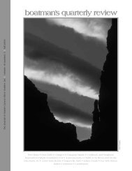
summer 03 / 16:2 - Grand Canyon River Guides
summer 03 / 16:2 - Grand Canyon River Guides
summer 03 / 16:2 - Grand Canyon River Guides
- No tags were found...

Create successful ePaper yourself
Turn your PDF publications into a flip-book with our unique Google optimized e-Paper software.
Sand Bars in <strong>Grand</strong> <strong>Canyon</strong>, April 20<strong>03</strong>;Some Observations on Adaptive Management ActionsBackground on the Experimental Flow Program:What’s the problem? (2001)Long term monitoring of fine sediment and endangeredfish by the <strong>Grand</strong> <strong>Canyon</strong> Monitoring and ResearchCenter (gcmrc) was shown both to be in severe decline.These two ecosystem resources are widely held askeystone elements in the beleaguered post-dam riverecosystem.What did we do? (January 2002)The Adaptive Management Work Group (amwg)requested Interior secretary Gail Norton to design experimentalreleases from Glen <strong>Canyon</strong> dam that would mitigateloss of sediment and endangered fish. To accomplishthis objective, Bureau of Reclamation (bor) followedprocedures of the Adaptive Management Program asmandated by the Glen <strong>Canyon</strong> Dam eis and Record ofDecision (rod). The plan was to satisfy congressionalintent as expressed in the <strong>Grand</strong> <strong>Canyon</strong> Protection Actof 1992 (gcpa): to operate the dam to “preserve, mitigateadverse impacts to, and improve the values for which<strong>Grand</strong> <strong>Canyon</strong> National Park and Glen <strong>Canyon</strong> NationalRecreation Area were created” (sect. 1804, gcpa).How did this happen? (January 2002)We drafted and pushed a motion through amwg toreverse the decline of these important natural resources.The motion was called the “sediment conservationexperiment”. It was intended to mitigate long term sedimentloss, while respecting the need to save the endangeredHumpback chub. An experimental design was thendeveloped by gcmrc with comments taken from all 24stakeholders. It included a plan for flood release(s) fromthe dam to rebuild sand bars when tributary sedimentinput to Marble <strong>Canyon</strong> reached a specified trigger level.One element of the proposed experiment includeshigh daily fluctuations, January to March, over multipleyears. The hypothesis proposes that disrupting spawninghabitat of the competitive/predatory(?) non-native fishesin the Lees Ferry reach would enhance habitat for theendangered native fish downstream.Sediment scientists predicted that the proposed highdaily fluctuations would quadruple sediment transportout of <strong>Grand</strong> <strong>Canyon</strong> to Lake Mead above normal rodflows. Some of us on the amwg raised concerns aboutpredicted erosion of sediment, but these were not incorporatedinto the experimental design by gcmrc and bor,which increasingly changed focus to allocating resourcesto conservation of native fish.page 22Where are we now? (April 20<strong>03</strong>)Last <strong>summer</strong>, an Environmental Assessment wasconducted by bor with public input and then approvedby the secretary with a Finding of NoSignificant Impact (fonsi, December 2002, seehttp://www.uc.usbr.gov/amp/index.html). The experimentbegan on January 1, 20<strong>03</strong>. Due to insufficient sedimentinput, there was no flood flow to store sediment.But high daily fluctuations ensued (5,000–20,000 cfs)and continued seven days a week for three months. Toassess impacts, in April all of the Adopt-a-Beach studysites were re-photographed by volunteers. Late in themonth the gcmrc sediment team ran a trip to monitorthe results. I ran a trip and made the observations below.Some observations of sediment distribution,April 9–25 river trip:Following are recent general observations of the effects ofthe January-March high fluctuating flows to sandbars/camping beaches on the Colorado <strong>River</strong> and LakeMead.1) Sand bars are increasingly stripped of post-dam sand(identified by its lack of silt and clay). This hasexposed increasingly extensive areas of the ‘hard pan’of pre-dam silty sand and/or rocky shorelines that nowarmor the remains of many popular camping areas.Some examples of such camps include: Soap Creek,Hot Na Na Wash, North <strong>Canyon</strong>, Nautiloid <strong>Canyon</strong>,Buck Farm <strong>Canyon</strong>, Saddle <strong>Canyon</strong>, Nankoweapmain and lower camps, Cardenas Creek, the “Cremation”camps, Trinity Creek, Monument Creek, CrystalCreek, Bass camp, across from Deer Creek, upperNational <strong>Canyon</strong>, the Whitmore helicopter pad, 202-mile and Granite Park (measured by the difficulty ofpounding in your sand stake).2) The 20,000 cfs daily maximum flows reworked muchof the higher elevation eddy sand into benches thatare ten to fifty centimeters below the 20,000 cfs stageheight. These same flows stripped additional amountsof fine sediment from the channel margins betweenthe larger eddy systems. Shorelines and landingsbetween eddy complexes are generally rockier. Someof the larger eddies contain large amounts of underwatersand (check out Carbon <strong>Canyon</strong>).3) All reaches of the <strong>Grand</strong> <strong>Canyon</strong> from Lees Ferry toSeparation <strong>Canyon</strong> are similarly affected. Thesepatterns of erosion and redistribution of fine sedimentare not restricted to the Marble <strong>Canyon</strong> reach.4) Many of the newly formed 20,000 cfs sand bars areemergent and available for recreational use during thegrand canyon river guides