River South Esk Special Area of Conservation (SAC) - The Food and ...
River South Esk Special Area of Conservation (SAC) - The Food and ...
River South Esk Special Area of Conservation (SAC) - The Food and ...
- No tags were found...
Create successful ePaper yourself
Turn your PDF publications into a flip-book with our unique Google optimized e-Paper software.
Advice to planning applicantswhen considering newproposals which could affectthe <strong>River</strong> <strong>South</strong> <strong>Esk</strong> <strong>Special</strong><strong>Area</strong> <strong>of</strong> <strong>Conservation</strong>This guidance aims to assist you when you areconsidering submitting a planning application for adevelopment which may affect the <strong>River</strong> <strong>South</strong> <strong>Esk</strong><strong>Special</strong> <strong>Area</strong> <strong>of</strong> <strong>Conservation</strong> (<strong>SAC</strong>).It provides advice on the types <strong>of</strong> appropriateinformation <strong>and</strong> safeguards to provide in support <strong>of</strong>your planning application so that it can be properly<strong>and</strong> timeously assessed, <strong>and</strong> includes:– An explanation <strong>of</strong> planning authorities’ obligations whenevaluating planning applications including permitteddevelopment– Information on the qualifying interests <strong>of</strong> thedesignation which may be affected;– Advice on the nature <strong>of</strong> developments that may affectthe <strong>River</strong> <strong>South</strong> <strong>Esk</strong> <strong>SAC</strong>; <strong>and</strong>– Examples <strong>of</strong> information which you need to submit withyour planning application.Other considerationsThis guidance is specifically for the <strong>River</strong> <strong>South</strong> <strong>Esk</strong><strong>SAC</strong> <strong>and</strong> the ‘qualifying’ interests associated withthis designation. However, there may be other naturalheritage interests such as protected species affectedby development proposals which you will also needto consider. Further information is available in theScottish Planning Policy: http://www.scotl<strong>and</strong>.gov.uk/Publications/2010/02/03132605/0Additional authorisation from SEPA will be required formany development activities adjacent to, <strong>and</strong> in the vicinity<strong>of</strong> watercourses under <strong>The</strong> Water Environment (ControlledActivities) (Scotl<strong>and</strong>) Regulations 2005. A higher level <strong>of</strong>licence protection may be required for activities that mayimpact on the <strong>River</strong> <strong>South</strong> <strong>Esk</strong> <strong>SAC</strong>, such as engineeringworks in inl<strong>and</strong> waters, water abstraction, impoundment<strong>and</strong> diversion, or discharge to l<strong>and</strong> <strong>and</strong> water. Any suchauthorisation will also need to first consider the effectson the <strong>SAC</strong>. Contact with SEPA’s local regulatory teamin the Arbroath <strong>of</strong>fice is advised before an application issubmitted. Details on all these activities are available viathe following links: http://www.sepa.org.uk/water/water_publications.aspxInformation on CAR licence requirements: http://www.sepa.org.uk/customer_information/water.aspxActivities should also ensure compliance with SEPA’sPollution Prevention Guidelines, available at: http://www.sepa.org.uk/water/groundwater/policy,_legislation__guidance/planning.aspxExamples <strong>of</strong> polluting activities are point source pollution(e.g. from private sewerage outlets), diffuse sourcepollution (e.g. water bound roads <strong>and</strong> tracks) <strong>and</strong> surfacewater drainage.2 <strong>River</strong> <strong>South</strong> <strong>Esk</strong> <strong>Special</strong> <strong>Area</strong> <strong>of</strong> <strong>Conservation</strong> (<strong>SAC</strong>) Advice to planning applicants
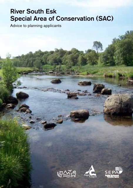
Why is the <strong>River</strong> <strong>South</strong> <strong>Esk</strong> soimportant?<strong>The</strong> <strong>River</strong> <strong>South</strong> <strong>Esk</strong> has the highest wildlife accolade asit is designated as a <strong>SAC</strong> <strong>and</strong> is part <strong>of</strong> the Natura 2000network – a series <strong>of</strong> internationally important wildlifesites throughout the European Union. <strong>The</strong> qualifyinginterests for which the site is designated are Atlanticsalmon <strong>and</strong> freshwater pearl mussel.Planning authorities’ obligations<strong>The</strong> European legislation under which sites are selectedas <strong>SAC</strong>s is the Habitats Directive. This sets outobligations on Member States to take appropriate stepsto avoid “the deterioration <strong>of</strong> natural habitats <strong>and</strong> thehabitats <strong>of</strong> species as well as disturbance <strong>of</strong> the speciesfor which the areas have been designated, in so far assuch disturbance could be significant. <strong>The</strong>se obligationsrelate to ‘Competent Authorities’ such as PlanningAuthorities.Because <strong>of</strong> this, Angus Council as a Planning Authoritycan only agree to development proposals which areunconnected with the nature conservation management<strong>of</strong> the site after having ascertained that they will notadversely affect the integrity <strong>of</strong> the site.Any ‘permitted development’ likely to have an adverseeffect on the <strong>River</strong> <strong>South</strong> <strong>Esk</strong> <strong>SAC</strong> will also need planningpermission.To assist you in the planning process it is useful toconsider the following:Does your proposed development liewithin the river catchment?* Please note that the boundary <strong>of</strong> the <strong>SAC</strong> is not just the<strong>River</strong> <strong>South</strong> <strong>Esk</strong>, but includes its tributaries.If your proposed development lies in the catchment <strong>of</strong> the<strong>River</strong> <strong>South</strong> <strong>Esk</strong> <strong>SAC</strong> as shown in the map, you need toconsider whether it has the potential to affect the <strong>River</strong><strong>South</strong> <strong>Esk</strong> <strong>SAC</strong>’s qualifying interests i.e. Atlantic salmon<strong>and</strong> freshwater pearl mussels. Developments outwiththe actual <strong>SAC</strong> site but within the river catchment (suchas those upstream <strong>of</strong> the <strong>SAC</strong>) need to be consideredbecause by their nature, freshwater sites have thepotential to be affected by management activitiesoccurring outwith their boundary.If this is not the case <strong>and</strong> there are no alternativesolutions, the proposal can only be allowed to proceed ifthere are imperative reasons <strong>of</strong> overriding public interest.www.snh.gov.uk3
<strong>The</strong> ‘qualifying interests’ <strong>of</strong> the <strong>River</strong><strong>South</strong> <strong>Esk</strong> <strong>SAC</strong>Atlantic salmonSalmon are found throughout the <strong>River</strong> <strong>South</strong> <strong>Esk</strong> <strong>SAC</strong>site. Salmon require high quality water, <strong>and</strong> any reductionin water quality as a result <strong>of</strong> a development could besignificant. In the short-term, sediment released into thewatercourse from construction work can be detrimentalto salmon, resulting in the gills being smothered, or theirpassage upstream impeded. Sediment can also smotherthe gravels used by spawning salmon or areas used byjuvenile fish, making them unsuitable. In addition, anydischarge points could raise pollution levels in the river.<strong>The</strong>re is also a possible risk <strong>of</strong> contamination <strong>of</strong> thewatercourses from the fuel <strong>and</strong> chemicals used on site, orin the longer term, pollution from the drainage system.Freshwater pearl mussels<strong>The</strong> freshwater pearl mussel is one <strong>of</strong> Scotl<strong>and</strong>’s mostendangered species. Recent estimates are that Scotl<strong>and</strong>holds some <strong>of</strong> the world’s most significant knownremaining breeding populations, <strong>and</strong> the <strong>South</strong> <strong>Esk</strong> hasone <strong>of</strong> the largest populations <strong>of</strong> freshwater pearl musselsin the world.4 <strong>River</strong> <strong>South</strong> <strong>Esk</strong> <strong>Special</strong> <strong>Area</strong> <strong>of</strong> <strong>Conservation</strong> (<strong>SAC</strong>) Advice to planning applicants
tanks discharges make a significant contribution tophosphorus loadings downstream from Brechin.Freshwater pearl mussels have a tolerance threshold <strong>of</strong>0.03mg/l for soluble reactive phosphorus (SRP). Anyincrease in phosphorus levels can cause large dips inoxygen, which puts the mussels under stress. Recentresults indicate that phosphorus levels in parts <strong>of</strong> thelower reaches <strong>of</strong> the river (i.e. downstream <strong>of</strong> Brechin) arevery close to the 0.03 mg/l tolerance threshold, thereforedevelopment in the catchment can have an adverseeffect downstream which may lead to the threshold beingexceeded.Incidents <strong>of</strong> high levels <strong>of</strong> suspended solids have alsobeen recorded. If large amounts <strong>of</strong> soil are washed intothe river from development site, they can settle over apearl mussel colony. This could smother the pearl musselbeds, causing them to suffocate.Is your development likely to affectthese interests?Angus Council as a Planning Authority will needto establish if your proposal is likely to have asignificant effect on the qualifying interests <strong>of</strong> the<strong>SAC</strong>.<strong>The</strong> following section will help establish this <strong>and</strong>then if so, what supporting information needs to besubmitted with your planning application so that itcan be properly assessed.You should consider the nature <strong>of</strong> the developmentproposed <strong>and</strong> the potential direct <strong>and</strong> indirect impactson the qualifying interests <strong>of</strong> the <strong>River</strong> <strong>South</strong> <strong>Esk</strong> <strong>SAC</strong> inorder to determine the information that will be needed.<strong>The</strong> threshold for impacts from development can be verylow <strong>and</strong> you should take a precautionary approach if youare unsure.Examples <strong>of</strong> proposals likely to have a significanteffect are:– A residential or commercial development that will notlink to the mains sewerage system <strong>and</strong> therefore willincrease direct or diffuse sewerage discharges. Thismay result in an increase in nutrients above acceptablethresholds, particularly (but not necessarily exclusively)where it discharges to water.– Any proposal that will involve diverting the river orits tributaries, or bank regrading work is likely toresult in an increase in sediments downstream <strong>of</strong> thedevelopment <strong>and</strong> may affect the flow rate <strong>of</strong> the river.– Dredging, gravel extraction or the installation <strong>of</strong>temporary or permanent structures within the riverchannel will affect the substrate <strong>of</strong> the river bed <strong>and</strong>may damage or destroy pearl mussels <strong>and</strong> their habitat,or salmon spawning beds.6 <strong>River</strong> <strong>South</strong> <strong>Esk</strong> <strong>Special</strong> <strong>Area</strong> <strong>of</strong> <strong>Conservation</strong> (<strong>SAC</strong>) Advice to planning applicants
Key information normally required1. A Construction Method Statement (CMS) whichshould include:− pollution prevention safeguards, including drainagearrangements <strong>and</strong> the possible use <strong>and</strong> capacity <strong>of</strong>siltation traps, settlement tanks, <strong>and</strong> bunds;− storage <strong>and</strong> disposal <strong>of</strong> materials, including the siting <strong>of</strong>stock piles, use <strong>of</strong> buffer strips <strong>and</strong> disposal methods;− construction site facilities, including extent <strong>and</strong> location<strong>of</strong> construction site huts, vehicle equipment, <strong>and</strong>materials compound;− timing, duration <strong>and</strong> phasing <strong>of</strong> construction, particularlyin relation to salmon migration/spawning an avoidance<strong>of</strong> periods <strong>of</strong> seasonally highest rainfall to sensitiveelements <strong>of</strong> construction.Please see Annex A for detailed information on the CMS.2. Details <strong>of</strong> surface water discharges, for exampleSustainable Urban Drainage Systems.3. Sewage treatment arrangements− Water quality needs to be maintained below 0.03mg/lSRP anywhere in the river. <strong>The</strong> threshold for thisis already close to being breached downstream <strong>of</strong>Brechin, therefore any development upstream in thecatchment can have an adverse effect downstreamwhich may lead to the SRP threshold being exceeded.− If it is not proposed to link the development to themains sewage system, it needs to be demonstratedthat the discharge will not result in the 0.03mg/l SRPthreshold being breached.Further detailsMore information on the <strong>River</strong> <strong>South</strong> <strong>Esk</strong> <strong>SAC</strong> includingits conservation objectives can be found on the SNHwebsite via SiteLink: http://gateway.snh.gov.uk/portal/page?_pageid=53,910305,53_910314&_dad=portal&_schema=PORTAL&PA_CODE=8364&NEW_WINDOW=falseSNH, SEPA <strong>and</strong> Angus Council are working closely toprotect the interests <strong>of</strong> the <strong>River</strong> <strong>South</strong> <strong>Esk</strong> <strong>SAC</strong>, <strong>and</strong>are happy to assist you where required in submitting yourapplication, including pre-application discussion.ContactsAngus Councilwww.angus.gov.ukDevelopment management, County Buildings, MarketStreet, Forfar, Angus DD8 3LGplanning@angus.gov.ukScottish Environment Protection Agencywww.sepa.org.ukSEPA planning service (planning application input)planning.perth@sepa.org.ukSEPA local regulatory team (regarding authorisations)DL-dundee<strong>and</strong>angus@sepa.org.ukScottish Natural Heritagewww.snh.gov.ukWest Lodge, Airlie, by Kirriemuir, Angus DD8 5NPTel: 01575 530333Tayside_Grampian@snh.gov.uk− It should be demonstrated that sediment enteringthe river that could affect freshwater pearl musselpopulations can be avoided.4. Locations <strong>of</strong> any outfalls, details <strong>of</strong> timing <strong>and</strong>the method <strong>of</strong> installation should be provided with theapplication including the relevant Construction MethodStatement (see 1 above).5. For any work within the river channel, it may benecessary to undertake a freshwater pearl musselsurvey. SNH can provide advice on whether a freshwater pearl mussel survey is required <strong>and</strong> has preparedguidance on survey requirements for freshwater pearlmussels:http://www.snh.gov.uk/docs/A372955.pdf6. Further information may need to be provided onother habitats <strong>and</strong> species in the immediate vicinity insupport <strong>of</strong> your application (e.g. water voles, bats <strong>and</strong>otters). <strong>The</strong> planning authority or SNH can advise onfurther surveys required.<strong>The</strong>re may also be a requirement for additional informationdepending on the nature <strong>of</strong> the development.8 <strong>River</strong> <strong>South</strong> <strong>Esk</strong> <strong>Special</strong> <strong>Area</strong> <strong>of</strong> <strong>Conservation</strong> (<strong>SAC</strong>) Advice to planning applicants
Table 2 – Other Measures to be Included Depending on Size/Location <strong>of</strong> WorksSediment Control MeasureWorking Alongside Watercourses – where works entail working alongsidewatercourses, works should be done in parallel to the watercourse,with a buffer strip <strong>of</strong> no works running along the waters edge (see “WatercourseBuffer Strips” below)Watercourse Buffer Strips – water courses should have buffer stripsretained where no works <strong>and</strong> no vehicle movements take place. For smallwatercourses, a buffer strip <strong>of</strong> 5 metres on each side is advised. Forlarger burns/watercourses, a buffer strip <strong>of</strong> 10 metres is advised.Watercourse Crossings – no crossings to take place within 200 metres<strong>of</strong> a freshwater pearl mussel bed or salmon spawning grounds. In otherlocations, watercourses which do not have bridges across them shouldnot be driven through by vehicles. Where crossings are unavoidable <strong>and</strong>where practical, temporary bridges should be created (with no parts inthe watercourse) to keep vehicles out <strong>of</strong> the watercourse. Where this isimpossible, the crossing point(s) should be as few as is practical, shouldbe clearly marked <strong>and</strong> vehicle movements kept to a minimum. Sedimenttraps (see ‘Sediment Trapping’ in Table 1) should be used across smallwatercourses downstream <strong>of</strong> crossing points where it is unavoidable thatthese will be crossed by vehicles.<strong>The</strong> use <strong>of</strong> culverts when constructing any river crossings is generallydiscouraged <strong>and</strong> there is a presumption against culverting for l<strong>and</strong> gain.Vehicle Movements Across Wet <strong>Area</strong>s – where vehicle movements arerequired across wet areas, the ground should be protected by using mattingor other suitable measures (e.g. brash mats, wooden boards, etc) toprevent the ground from being churned up.Vehicle movement should be kept to a minimum <strong>and</strong> limited to one ortwo areas.Roads/Access roads – roads should be brushed regularly (<strong>and</strong> particularlyafter wheel-washing) <strong>and</strong> kept free from dust <strong>and</strong> mud.Wheel Washing – wheel washing <strong>of</strong> vehicles should take place at thefurthest point from the watercourse as is practical. Care must be takenthat run-<strong>of</strong>f from wheel washing does not enter the watercourse.Exposed Embankments/Earth – where possible, stripped turfs shouldbe carefully stored to ensure the vegetation survives, <strong>and</strong> used to surfaceany exposed embankments/earth once works are complete.Topsoil Stripping – in order to minimise the area <strong>of</strong> exposed groundat any one time, a general topsoil stripping <strong>of</strong> the whole area should beavoided. Instead, localised strips should be taken as required.Soil Stockpile – the works should be programmed such that the volume<strong>of</strong> soil stockpiled at any given time is kept to a minimum. All stockpilesshould be located as far away from the watercourse as practical, <strong>and</strong>should be kept covered.Non-native invasive species are present in the <strong>South</strong> <strong>Esk</strong> catchment, <strong>and</strong>measures should be put in place to avoid the spread <strong>of</strong> these throughplant remains or seed.Removal <strong>of</strong> Water From Excavations – if required, a sump should beformed in the corner <strong>of</strong> the excavation <strong>and</strong> water pumped out at a low rateto a temporary settlement basin. Once settlement has occurred, cleanwater from the settlement basin should be allowed to slowly flow overvegetated l<strong>and</strong> into the watercourse.ReasonFor sediment control (to preventdirect run-<strong>of</strong>f into the watercourse),<strong>and</strong> to avoid disturbance to watercourse<strong>and</strong> <strong>SAC</strong> speciesFor sediment control as the bufferswill act as a silt trap reducing theamount reaching the <strong>SAC</strong>, <strong>and</strong> toavoid disturbance to watercourse<strong>and</strong> <strong>SAC</strong> speciesTo reduce disturbance to the ground<strong>and</strong> watercourse, <strong>and</strong> prevent sedimentrelease into the watercourseTo prevent excess ground disturbance<strong>and</strong> sediment release thatusually occurs in wet conditionsTo prevent sediment release into thewatercourseTo prevent sediment release into thewatercourseTo reduce volume <strong>of</strong> sediment exposed(<strong>and</strong> therefore reducing risk <strong>of</strong>sediment reaching watercourse)To reduce volume <strong>of</strong> sediment exposed(<strong>and</strong> therefore reducing risk <strong>of</strong>sediment reaching watercourse)To reduce volume <strong>of</strong> sediment exposed(<strong>and</strong> therefore reducing risk <strong>of</strong>sediment reaching watercourse)To prevent sediment from excavationsreaching the watercourse10 <strong>River</strong> <strong>South</strong> <strong>Esk</strong> <strong>Special</strong> <strong>Area</strong> <strong>of</strong> <strong>Conservation</strong> (<strong>SAC</strong>) Advice to planning applicants
www.snh.gov.ukSNH commitment to customers— We will ask customers for their views— We will put things right if they go wrong— We will give high st<strong>and</strong>ards <strong>of</strong> customer care— We will publish our customer care performancewww.snh.gov.uk© Scottish Natural Heritage 2011Photography: All images © Lorne Gill/SNH,except for those on pages 6 <strong>and</strong> 7 which are © SEPAScottish Natural HeritageBattlebyRedgortonPerth PH1 3EWT: 01738 458530F: 01738 458613E: pubs@snh.gov.uk


