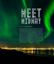
Atlantica No. 4, 2010, July-August - Iceland Review
Atlantica No. 4, 2010, July-August - Iceland Review
Atlantica No. 4, 2010, July-August - Iceland Review
- No tags were found...

You also want an ePaper? Increase the reach of your titles
YUMPU automatically turns print PDFs into web optimized ePapers that Google loves.
a The Hengill Trekmit offers unparalleled views over the wholeregion. To the north you can see the corrugatedridges of the Dyrafjöll hills leadingup to lake Thingvallavatn, and far below theNesjavellir power station. West of the lake, theMosfellsheidi plain stretches out to the Esjamassif, which overlooks Reykjavík, and thecapital itself. From the city, you can then followthe coastline south to the lava fields and Bláfjöllmountains on the Reykjanes peninsula, whichreaches out towards Keflavík. It is an incrediblefeeling, being able to see all this just by turningyour head, and gives you a sense of the lie of theland, drawing together the different places youmay have visited in south-west <strong>Iceland</strong>.So how did I make it down to Innstidalur?Well, I headed for the least alarming lookingscree I could find and scrambled down. Butthis is not something I would recommend, andthere is a more orthodox route, which is in factquite easy to find; you just have to ignore theconstruction site.The route begins at Sleggjubeinsdalur, nearthe Hellisheidi power station, and is a constantdelight, taking you through an ever-changinglandscape with shifting views, first lookingsouth, then west, then opening out to the 360°panorama at the summit. It is easy to follow, asit is clearly marked the whole way with coloredpoles, and though it is steep in places, doesn’trequire any special mountaineering skills orequipment in the summer months, except fora decent pair of boots, of course. Three tofour hours should be sufficient for the returnhike, and because the ground is soft underfootfor much of the route, it’s not too hard on theknees. Even in places where the ground is rocky,the stones sometimes give when you step onthem. Be warned though, on several occasionsmy feet went straight through!One of the unusual features of the walk isthe chance to see at close hand one of <strong>Iceland</strong>’sgeothermal power stations, which generate 20percent of the country’s electricity and heatmost of its homes. This is the Hellisheidi powerstation, whose great billowing clouds of vaporare a familiar sight to anyone traveling eastof Reykjavík along Route 1 in the directionof Hveragerdi and Vík. The power station isthere because the whole area sits on top of theHengill volcanic system, which last erupted2,000 years ago and is responsible for the faultlines that run through the ancient parliamentsite of Thingvellir.The construction site that sent me awry onmy first trip to Hengill is part of an expansionplan for the power station, which should havea capacity of 300 MW when complete. Thelunar pods I had seen are actually the coversfor boreholes, which are sunk as far as 3 kmunderground, and each of these is connectedto a short chimney called a ‘muffler’, which isdesigned to reduce the noise levels of the superheatedsteam. This does not, however, mean thatthey are quiet, just that your hearing shouldn’tbe damaged if you stand too close to one.The roar of the chimneys is quickly leftbehind as the path rises up a steep valley, also agreat place for picking bilberries and crowberriesin late summer. On the way up, there isa hot spring marked by the yellow and whitestains of geothermal deposits, and at the top isa wide pass, which opens up into Innstidalur.From here, you could saunter across Innstidalurtowards another valley with a hot spring, whichrises steeply up towards Vörduskeggi. My preferredroute, however, leads up a ridge to theleft. If you straddle this ridge at its highest point,you find yourself peering down some 200 m toInnstidalur on one side, but when you look overto Mosfellsheidi plain on the other side, it seemsto be at least twice as far down. This creates anexhilarating feeling of the ground level shiftingbeneath you.Further on, the path crosses a pebbly plateau,then up into rocky mountain valleys with dramaticcliffs, possibly some patches of snow, andover a few screes. When I crossed one of thesescrees in mid-May, it was still covered in snowfor about twenty meters. The snow was so hardI couldn’t actually form an edge in it with myboots. Instead I had to climb up to a point wherethe snowfield was narrower, then throw stonesdown to get some grip and use a jagged rockas a makeshift ice-axe. On the way back, I wasfortunately able to cross over a ridge higher up,which avoided the snow, and also provided someexcellent views. The snow should be clear fromlate May through to early September at least,but at any other time a pair of crampons wouldbe advisable for this section.Soon after this, the path reaches a high col,where it is rejoined by the alternative route thatruns across Innstidalur, and from here it is justa short walk up to the summit. The rock formsup here are fascinating. There are black and greyrocks, orange and red; the redder the rock, thecloser the site of its eruption, as a general rule.There are dramatic, rough-hewn shapes, andsmooth slabs eroded into flowing forms withpockets and grooves, all the result of volcanicand glacial activity.Hengill is essentially a móberg mountain,meaning it was formed through sub-glacialeruptions. This produces a lot of palagonitetuff, a kind of composite rock formed by ashand other eruptive materials being compressedand glued together under the pressure of theglacier. Sometimes móberg looks a bit like concrete,but it often has bits of stone and smallrock called breccia lodged in it too, which areprone to crumble. You can see this fragility nearthe top, where there is a small lake and a row ofoverhanging boulders. These could look temptingif you are a climber, but you wouldn’t wantto hang your weight on one. a60 atlantica