Taxes Consolidation Act, 1997. - Houses of the Oireachtas
Taxes Consolidation Act, 1997. - Houses of the Oireachtas
Taxes Consolidation Act, 1997. - Houses of the Oireachtas
Create successful ePaper yourself
Turn your PDF publications into a flip-book with our unique Google optimized e-Paper software.
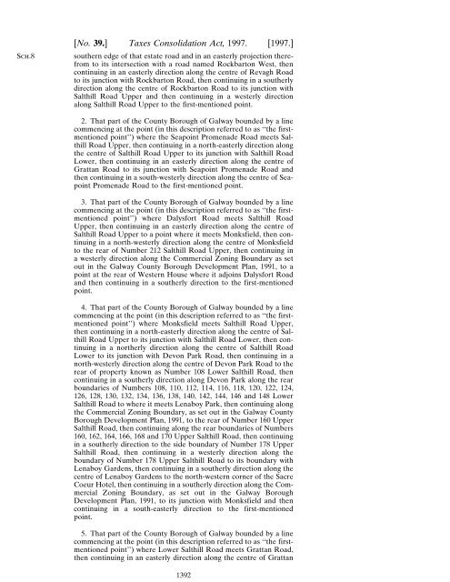
Sch.8[No. 39.] <strong>Taxes</strong> <strong>Consolidation</strong> <strong>Act</strong>, <strong>1997.</strong> [<strong>1997.</strong>]sou<strong>the</strong>rn edge <strong>of</strong> that estate road and in an easterly projection <strong>the</strong>refromto its intersection with a road named Rockbarton West, <strong>the</strong>ncontinuing in an easterly direction along <strong>the</strong> centre <strong>of</strong> Revagh Roadto its junction with Rockbarton Road, <strong>the</strong>n continuing in a sou<strong>the</strong>rlydirection along <strong>the</strong> centre <strong>of</strong> Rockbarton Road to its junction withSalthill Road Upper and <strong>the</strong>n continuing in a westerly directionalong Salthill Road Upper to <strong>the</strong> first-mentioned point.2. That part <strong>of</strong> <strong>the</strong> County Borough <strong>of</strong> Galway bounded by a linecommencing at <strong>the</strong> point (in this description referred to as ‘‘<strong>the</strong> firstmentionedpoint’’) where <strong>the</strong> Seapoint Promenade Road meets SalthillRoad Upper, <strong>the</strong>n continuing in a north-easterly direction along<strong>the</strong> centre <strong>of</strong> Salthill Road Upper to its junction with Salthill RoadLower, <strong>the</strong>n continuing in an easterly direction along <strong>the</strong> centre <strong>of</strong>Grattan Road to its junction with Seapoint Promenade Road and<strong>the</strong>n continuing in a south-westerly direction along <strong>the</strong> centre <strong>of</strong> SeapointPromenade Road to <strong>the</strong> first-mentioned point.3. That part <strong>of</strong> <strong>the</strong> County Borough <strong>of</strong> Galway bounded by a linecommencing at <strong>the</strong> point (in this description referred to as ‘‘<strong>the</strong> firstmentionedpoint’’) where Dalysfort Road meets Salthill RoadUpper, <strong>the</strong>n continuing in an easterly direction along <strong>the</strong> centre <strong>of</strong>Salthill Road Upper to a point where it meets Monksfield, <strong>the</strong>n continuingin a north-westerly direction along <strong>the</strong> centre <strong>of</strong> Monksfieldto <strong>the</strong> rear <strong>of</strong> Number 212 Salthill Road Upper, <strong>the</strong>n continuing ina westerly direction along <strong>the</strong> Commercial Zoning Boundary as setout in <strong>the</strong> Galway County Borough Development Plan, 1991, to apoint at <strong>the</strong> rear <strong>of</strong> Western House where it adjoins Dalysfort Roadand <strong>the</strong>n continuing in a sou<strong>the</strong>rly direction to <strong>the</strong> first-mentionedpoint.4. That part <strong>of</strong> <strong>the</strong> County Borough <strong>of</strong> Galway bounded by a linecommencing at <strong>the</strong> point (in this description referred to as ‘‘<strong>the</strong> firstmentionedpoint’’) where Monksfield meets Salthill Road Upper,<strong>the</strong>n continuing in a north-easterly direction along <strong>the</strong> centre <strong>of</strong> SalthillRoad Upper to its junction with Salthill Road Lower, <strong>the</strong>n continuingin a nor<strong>the</strong>rly direction along <strong>the</strong> centre <strong>of</strong> Salthill RoadLower to its junction with Devon Park Road, <strong>the</strong>n continuing in anorth-westerly direction along <strong>the</strong> centre <strong>of</strong> Devon Park Road to <strong>the</strong>rear <strong>of</strong> property known as Number 108 Lower Salthill Road, <strong>the</strong>ncontinuing in a sou<strong>the</strong>rly direction along Devon Park along <strong>the</strong> rearboundaries <strong>of</strong> Numbers 108, 110, 112, 114, 116, 118, 120, 122, 124,126, 128, 130, 132, 134, 136, 138, 140, 142, 144, 146 and 148 LowerSalthill Road to where it meets Lenaboy Park, <strong>the</strong>n continuing along<strong>the</strong> Commercial Zoning Boundary, as set out in <strong>the</strong> Galway CountyBorough Development Plan, 1991, to <strong>the</strong> rear <strong>of</strong> Number 160 UpperSalthill Road, <strong>the</strong>n continuing along <strong>the</strong> rear boundaries <strong>of</strong> Numbers160, 162, 164, 166, 168 and 170 Upper Salthill Road, <strong>the</strong>n continuingin a sou<strong>the</strong>rly direction to <strong>the</strong> side boundary <strong>of</strong> Number 178 UpperSalthill Road, <strong>the</strong>n continuing in a westerly direction along <strong>the</strong>boundary <strong>of</strong> Number 178 Upper Salthill Road to its boundary withLenaboy Gardens, <strong>the</strong>n continuing in a sou<strong>the</strong>rly direction along <strong>the</strong>centre <strong>of</strong> Lenaboy Gardens to <strong>the</strong> north-western corner <strong>of</strong> <strong>the</strong> SacreCoeur Hotel, <strong>the</strong>n continuing in a sou<strong>the</strong>rly direction along <strong>the</strong> CommercialZoning Boundary, as set out in <strong>the</strong> Galway BoroughDevelopment Plan, 1991, to its junction with Monksfield and <strong>the</strong>ncontinuing in a south-easterly direction to <strong>the</strong> first-mentionedpoint.5. That part <strong>of</strong> <strong>the</strong> County Borough <strong>of</strong> Galway bounded by a linecommencing at <strong>the</strong> point (in this description referred to as ‘‘<strong>the</strong> firstmentionedpoint’’) where Lower Salthill Road meets Grattan Road,<strong>the</strong>n continuing in an easterly direction along <strong>the</strong> centre <strong>of</strong> Grattan1392


