results and discussion
results and discussion
results and discussion
- No tags were found...

Create successful ePaper yourself
Turn your PDF publications into a flip-book with our unique Google optimized e-Paper software.
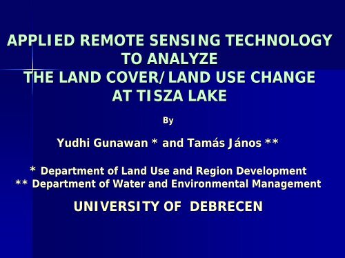
APPLIED REMOTE SENSING TECHNOLOGYTO ANALYZETHE LAND COVER/LAND USE CHANGEAT TISZA LAKEByYudhi Gunawan * <strong>and</strong> Tamás János *** Department of L<strong>and</strong> Use <strong>and</strong> Region Development** Department of Water <strong>and</strong> Environmental ManagementUNIVERSITY OF DEBRECEN
CONTENTS• INTRODUCTION• STUDY AREA• ENVIRONMENTAL ISSUES• MATERIALS AND METHOD• RESULTS AND DISCUSSION• CONCLUSIONS AND SUGGESTIONS
INTRODUCTIONOBJECTIVEto study the l<strong>and</strong> cover change <strong>and</strong>fluctuation of the environmental conditionsat the Tisza Lake <strong>and</strong> surrounding areausing satellite imagery
ENVIRONMENTAL ISSUES• After the collapse of the comm<strong>and</strong> economy<strong>and</strong> industrial structures, because of thechange of energy source to nuclear power,the rising need of natural protection <strong>and</strong> theincreasing purposes of tourism, theobjectives of this lake have grown <strong>and</strong>therefore there are urgent dem<strong>and</strong>s forappropriate strategies to avoid contradictionamong purposes.
MATERIALS AND METHODMATERIALS• L<strong>and</strong>sat TM5, 08-0707-1987• L<strong>and</strong>sat ETM7, 20-0808-2000• Orthophoto• Topography Map• CLC100
METHODOLOGY• Preprocessing- Image rectification <strong>and</strong> co-registration-Making subset• Unsupervised Classification- Using ISODATA method- Applied to 7 LC/LU classes based on CLC100• Classification Comparison- Using accuracy assessment with > 250 points
METHODOLOGY• Change Detection- Multi-date compositeimage method- Image differencingtechnique for modeling• Investigation ofthe ChangesFigure 2. Model maker to perform change detection
RESULTS AND DISCUSSION• Image Rectification <strong>and</strong> Restoration- L<strong>and</strong>sat TM, The RMSE is 13 mFigure 3 : Control pointerrors for L<strong>and</strong>sat TM co-registration- L<strong>and</strong>sat ETM, The RMSE 14 mFigure 4 : Control pointerrors for L<strong>and</strong>sat ETMco-registration
RESULTS AND DISCUSSION• ClassificationFigure 5: Unsupervisedclassification of L<strong>and</strong>sat TM
RESULTS AND DISCUSSIONFigure 6: Unsupervisedclassification of L<strong>and</strong>sat ETM
RESULTS AND DISCUSSION• Classification ComparisonFigure 7: Location of the 256 r<strong>and</strong>om sampling points shown inthe L<strong>and</strong>sat ETM viewer (left) <strong>and</strong> CLC100 viewer (right)
RESULTS AND DISCUSSIONTable 1. Error Matrix Resulting from Classifying Training SetPixels at L<strong>and</strong>sat TM
RESULTS AND DISCUSSIONTable 2. Error Matrix Resulting from Classifying Training SetPixels at L<strong>and</strong>sat ETM
RESULTS AND DISCUSSION• The overall accuracy of TM (26%) <strong>and</strong> ETM(38%) indicates a fairly low agreement withthe reference CLC100 classification;- Paper based interpretation was applied inCLC100, Hungary <strong>and</strong> then it was transformedto digital form by scanning (Maucha(Maucha, , 2004)- Assessing 2 levels of LC/LU categoriesCLC100 was not representative enough- The gap over 3 or 10 years
RESULTS AND DISCUSSION• Table 3. Kappa Index of L<strong>and</strong>sat ETM unsupervisedclassification
RESULTS AND DISCUSSION• Table 4. Kappa Index of L<strong>and</strong>sat TM unsupervisedclassification
RESULTS AND DISCUSSION• Change DetectionTable 5. The summary matrix of the change detection betweenL<strong>and</strong>sat TM 1987 <strong>and</strong> L<strong>and</strong>sat ETM 2000
RESULTS AND DISCUSSIONWetl<strong>and</strong>s- Water-body (15%)relatively big drought duringthe 1990’s <strong>and</strong> then when thenormal precipitation returned,most of the wetl<strong>and</strong>s werecovered back by water- Forested Area (13%)due to the new environmentalprotection policy in Hungary
RESULTS AND DISCUSSIONExcept Water bodyForest (26%), Wetl<strong>and</strong>s (14%)Arable l<strong>and</strong>Since the Hungarian agriculturalproduction exceeds the limits of the EUregulations, the less fertile soils arereannexed to natural conservation or theprocess of forestation has startedSettlements;19%(Recreational Area, Closed Garden)
RESULTS AND DISCUSSIONMisinterpretation on Settlements• Environmental analysisThe mixed pixelsFor the moment it could not be carried out due totime limitation, missing data or difficulties to obtaindata of total suspended solids, heavy metals,sediment quality, etc related to l<strong>and</strong> cover change.
CONCLUSION ANDSUGGESTION• The accuracy assessment was fairly low;- Other classification method should be applied forinstance Supervised Classification• The mixed pixels have to be overcome by applying SpectralMixture Analysis <strong>and</strong> Fuzzy classification• Increase the natural protection area (e.g wetl<strong>and</strong>s, forest)• The CLC100 is not representative enough;- Therefore further study has to be done using CLC50that has been updated to the geographic condition ofHungary• The environmental analysis has not been carried out asplanned but further research is still going on
KÖSZÖNÖM A FIGYELMET !